BLACKERBY RIDGE TRAIL ACCESS PROPOSAL
|
|
|
- Jonah Eaton
- 5 years ago
- Views:
Transcription
1
2 BLACKERBY RIDGE TRAIL ACCESS PROPOSAL CONTENTS Page I INTRODUCTION 1 Alpine Working Group 1 Mission Statement 2 II GOALS AND OBJECTIVES 2 III SCOPE OF WORK 2 Construction Specifications 3 IV COST ESTIMATE 3-5 V SPECIAL COSIDERATIONS 5 Commercial Use 5 Hazards and Risks 5 Terrain 5 Snow Dynamics 6 Mountain Weather 6 Safety Precautions 6-7 Wildlife Habitat Impacts 7-8 Mountain Goats 8-9 Land Use Permits 9-10 Signatory Page 12 Page Appendix A Information Resources Appendix B AWG Meetings Appendix C Public Comments 19 Photos Fold-out Map 22 1
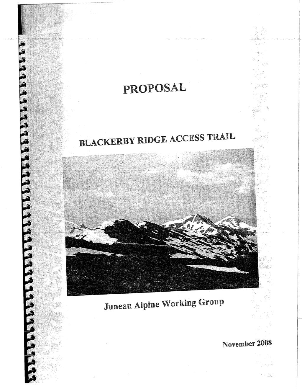
3 PROECT PROPOSAL November 2008 BY THE JUNEAU ALPINE WORKING GROUP FOR A NEW TRAIL TO ACCESS BLACKERBY RIDGE I. INTRODUCTION The Juneau Alpine Working Group formed to find an alternative to the issue of snowmobile use at the Eaglecrest Ski Area and surrounding lands. The issue developed during a public meeting at Centennial Hall on May 1, 2007, when a presentation was made by the Juneau Snowmobile Club for using certain lands to access the higher alpine areas after the ski season ended. Considerable opposition to the proposal was expressed at that meeting by many people, and the Ski Area Board of Directors later denied the Club s application. 1.1 Alpine Working Group (AWG): Soon after the May 1, 2007 public meeting, an ad hoc group of concerned people formed a volunteer Alpine Working Group (AWG). AWG works with back-country and cross-country skiers, snowshoers snowmobilers, and hikers. The group explored possible access to one or more winter recreation areas with terrain diverse enough to allow for different user groups to safely enjoy the country. Participation in the AWG was open to everyone. The AWG investigated a number of possible areas, including the Bessie Creek and Yankee Basin areas, Lemon Creek, Sheep Creek Basin, and areas near Thane. The Lemon Creek area was selected as the best prospect. On January 19, 2008, a proposal was made to Trail Mix, Inc. to construct and develop a new access trail from the Lemon Creek Trailhead, near Home Depot, to Blackerby Ridge. The proposal for Trail Mix Inc. to adopt this project is pending. Executive Director George Schaaf has been authorized to cooperatively work with AWG for the purpose of arranging public meetings and developing this project. The project plan is expected to be a dynamic document, and will be updated as new information becomes available. The 2
4 findings contained here will guide the AWG as it proceeds with the proposed project Mission Statement: The AWG adopted as its mission statement the following on May 31, 2007, To collaboratively identify recreational access to high elevation alpine terrain to benefit as many users as possible. II. GOALS AND OBJECTIVES The primary goal of this project is to construct a new trail up the northwest side of Blackerby Ridge. The proposed new construction begins on CBJ land at the rock quarry saddle Control Point #2. See Map Page 19. It ends on Blackerby Ridge at approximately 2,500 feet elevation (Control Point #4). It would replace the existing Blackerby Ridge Trail, which starts behind Jack s Plumbing Company on Wire Street. That particular trail is very steep and is not suitable for the types of use proposed in this plan. The total length of new construction is approximately 3.1 miles. This includes 0.8 miles of 4WD road from Control Point #2 to a parking lot at Control Point #3, and 2.3 miles of trail from the parking lot to Blackerby Ridge. More details on the 4WD road are found in Section below. The system would be available for year-long use. This project plan attempts to accommodate a variety of user groups, including, but not limited to, the Juneau Snowmobile Club, Juneau Alpine and Nordic Ski Clubs, Juneau Alpine Club, organized hiking groups, and individual outdoor recreation users. III. SCOPE OF WORK Work now underway (spring/summer 2008) consists of field trips and data gathering. Several snow machines were transported by helicopter to the west end of Blackerby Ridge in the spring of Trips were made into the headwaters of Sawmill Creek and Canyon Creek by way of spur ridges heading northeasterly off Blackerby Ridge. A survey report from Ray Howard, president of the Juneau Snowmobile Club, indicates that it is feasible to access the upper alpine areas of Sawmill and Canyon Creek. This determination was based on a field trip conducted on April 24, Access to the Juneau Icefield via Blackerby ridge would be open to independent back-country travelers who have used the area for many years. 3
5 3.1 Construction Specifications: Construct approximately 0.8 miles 4WD road from Control Point #2 to Control Point #3 parking lot at approximately 1,000 feet elevation. Construct a parking lot 300 feet long and 50 feet wide (approximately ¼ acre) to accommodate 30 vehicles with snowmobile trailers. The road will be two-lane 24 feet wide, not to exceed an 8% grade. During winter-time use the Juneau Snowmobile Club will be responsible for snow removal maintenance Construct approximately 2.3 miles of snowmobile corridor from Control Point #3 to Control Point #4 on Blackerby Ridge at approximately 2,500 feet elevation. Aim for a minimum 2-4-feet tread and 12-feet 8-10% grade, with approximately 6 switchbacks. IV. WORK PLAN COST ESTIMATE AND FUNDING STRATEGY (Covering period June 2007 through December 2009) 4.1 Construct approximately 0.8 miles 4WD road described above Table 1 Work Item Hours Volunteer $ Grants $ Organizing and planning Contacts with CBJ officials and other land managers 100 1,750 Engineering and flagging ,750 5, Helicopter trips (6) Clearing brush and timber ,000 3,500 18,200 6 Equipment: (trucks, excavator, dozer/loader 700 3,000 83,535 4
6 with operators. 7 Fuel: 3,168 (18 GPH) 12,672 8 Materials: Rock aggregate, 4 D-1 (3,600 cy) 52,000 9 Materials: Culvert, 100 linear $55/LF 5, % profit by contractor 11 Maintenance-snow removal by JSC 35, ,625 Total 1,952 $16,500 $211,907 Footnotes (1) The monetary value of volunteer work = number of hours x $ The number of volunteer hours = monetary value divided by Construct approximately 2.3 miles of snowmobile corridor described above. Table 2 Work Item Hours Volunteer $ Grants $ Organizing and planning Contacts with CBJ and other land managers Engineering CBJ and Trail Mix Inc 100 1, Contacts for permits Clearing brush and timber (labor) 100 1, ,250 73, Helicopter trips (10 hours of time) 15,000 Materials: Rock aggregate, 4 D-1 (3,600 CY) 52,000 5
7 8 Materials: Culvert, 100 5,500 9 Snow removal by Juneau Snowmobile Club 100 1, Hazards and risks: Implement safety precautions Section ,750 10,000 Total 800 $14,000 $155, PROJECT COST SUMMARY TOTAL COST $367,407 V. SPECIAL CONSIDERATIONS Total hours 2,752 Volunteer hours 1,500 Volunteer dollars $27, Commercial use: Any future applications for commercial use would be considered and acted upon by the appropriate land management agencies in accordance with land ownership policies that exist at that time. 5.2 Hazards and Risks: Natural hazards exist in the areas made accessible by this project. This goes with the territory. With this project we are considering as the primary use area the terrain from the end of Blackerby Ridge over to Canyon Basin. This includes Blackerby Ridge, Sawmill Basin, and Canyon Basin. When users enter this mountainous terrain, risks of danger to lives and/or property may become survival issues. Therefore, users who choose to use the area at any time of the year must recognize and be aware of these inherent dangers. Every effort will be made to educate the public with advisory information relevant to the area. Cautionary signing may be used where needed Terrain: Steep mountain terrain exists in much of the area, as it does in does in many other popular outdoor areas surrounding our 6
8 community. Rock outcroppings, knife-edge ridges, and instable footing and snow conditions are common Snow Dynamics: Once the snowpack starts to develop, complex snow 01dynamics can result under the surface. Metamorphic changes in snow crystals can create instable layers leading to dangerous sliding surfaces and snow avalanches. Cornices on ridges can give way suddenly, with drastic results. Strong winds can transport snow and deposit unstable snow pillows on the lee sides of ridges. Users need to be informed about such hazards before going into the area Mountain Weather: We live in a community surrounded by mountains and water that take their toll on unwary travelers at any time of the year. Among the highest dangers is exposure and hypothermia. Low cloud ceilings fog and strong winds can cause white out conditions that lead to disorientation. People may become confused and even lost. During the winter of field investigation with snow machines will be made in the Sawmill Creek and Canyon Creek watersheds to determine if there are any safe egress routes back to the parking lot if it is not possible to return to the trailhead via going back up to Blackerby Ridge Safety Precautions: One of the most effective ways to deal with the hazards and risks of this project is to emphasis public awareness and education. A detailed map will be generated noting use areas, egress routes and other pertinent user information. We intend to have the map posted at the trailhead, and copies will be sent to all anticipated user groups. The Project Plan also will be provided to each of the land managers. Additionally, the document will be posted on-line, including the Juneau Snowmobile Club web site, and the Juneau Alpine Working Group web site. Local resources are available to inform the public about dangerous conditions that may exist. These are shown in Appendix A Page 11 of this document. Some dangers can be mitigated by effective route marking. Knifeback ridges create avalanche dangers below the ridge as well as on the ridge. We intend to mitigate the ridge top dangers by effective route marking and cautionary signing where needed. By identifying the 7
9 ridge top, we can discourage traversing snow that is not supported by the ridge itself. We propose to mark the knife-back ridge parts of Blackerby with tall pole markers to indicate the ridge top to snow travelers. The pole markers would also be very valuable while traversing the ridge in white out conditions. We also propose to mark secondary egress routes from Sawmill and Canyon Basins. See Map Page 16. Should white out conditions develop, users can avoid traversing Blackerby Ridge by utilizing a secondary emergency routes out. Both Sawmill and Canyon Creek basins may offer options for such situations. Emergency egress may be possible from these areas back to the Lemon Creek Trail. Also refer to Section above for more details on mountain weather. The snow machine scouting this winter ( ) should confirm the possibility. Avalanche hazards are present in the proposed area, as with other mountain terrain around Juneau. We expect all users of the proposed area to be familiar with avalanche avoidance and response. Where possible, we will rely on locally available tools for educating the public. Free avalanche safety and survival workshops are offered in Juneau throughout the year. Additionally, the City will provide avalanche forecasting for affected areas close to town. That information should be helpful to users of the proposed area as well. AWG inquired with the Juneau Mountain Rescue organization as to whether they had sufficient resources to respond to emergencies, in the proposed areas of this Project Plan. Juneau Mountain Rescue reports they do have the training, resources and capability to respond, if called upon. Appendix A of this Project Plan contains a listing of important local resources available to everyone. These resources will help users to make good decisions before going into the back-country described in this proposal Wildlife Habitat Impacts: The Juneau Ranger District manages most all of the habitat utilized by this proposal Once recreationists break out from the tree line of the proposed trail they enter the Tongass National Forest. AWG contacted District Ranger Pete Griffin and Dennis Chester on August 13, Both of these 8
10 people are also wildlife biologists. Dennis Chester noted that the primary document that guides their management of the area is the Tongass Land Management Plan. He also noted that they consider three species for potential impacts. The three species noted are mountain goats, brown bear, and wolverine. Mountain goats: During AWG s outreach efforts we received written comments of concern for mountain goats in the proposed area. We reviewed the following documents to identify the potential impacts of our proposed use on wintering mountain goats: Fox, Joseph L; Smith, Christian A; Schoen, John W Relation Between Mountain Goats and Their Habitat in Southeastern Alaska. Gen. Tech. Rep. PNW-GTR-246. Portland, OR: U.S. Department of Agriculture, Forest Service, Pacific Northwest Research Station.25 p. Wilson, S.F Desired conditions for coastal Mountain Goat winter range. B.C. Minist. Water, Land and Air Protection, Biodiversity Branch, Victoria, BC. Working Report No. WR pp. We also have first hand observations of mountain goat habitat use in the area through visual contact and tracks. In April 2008, a member of AWG flew by helicopter to Camp 17, accompanied by two partners. The group walked/skied from Camp 17, down Ptarmigan Glacier to the headwaters of Canyon Creek. The group then followed Canyon Creek down to the Lemon Creek Trail. At the headwaters of Canyon Creek there was evidence of at least one goat as well as wolf tracks. As the group descended the Canyon Creek gorge, there were several sightings of goats on the ledges overlooking the creek... This information is in agreement with observations by Fox et al. regarding the winter habitat of mountain goats in the area. Goats seek forested areas with easily accessible escape routes from predators that provide both safety and winter forage. Our proposed use utilizes the open bowls on the north side of Blackerby Ridge, above and away from suggested highest use winter goat habitat. Wilson 2005 indicated that most frequent winter goat 9
11 habitat use occurs below areas of heavy snow accumulation (<1600 ft in SE Alaska) on south facing aspects with nearby steeper slopes. The south side of Blackerby Ridge is more likely to provide this habitat. In November 2008, one of our members observed two goats at tree line above Salmon Lake. We do anticipate some ski and snowboard use on this terrain, though believe it will be infrequent. The anticipated direct contact with goats would likely occur only if a snowmobile were to utilize one of the emergency egress paths down to the Lemon Creek valley. Fox et al. note that Winter is a period of severe nutritional deprivations, and goats converge into areas with available forage, often within old-growth forest where relatively low snow depths and litter-fall enhance food availability. The group recognizes the critical importance of minimizing negative interactions for goat survival. Because of the actual extent of interaction is not yet known, we will work with land managers to mitigate any potential impacts of the proposed use Land Use Permits: Land managers will be contacted by user groups or individuals in advance for permitted uses. Involved land managers include the City and Borough of Juneau (CBJ) State of Alaska Department of Natural Resources, and the U.S. Forest Service. The AWG has contacted officials at the Parks and Recreation and Engineering Departments, as well as the Parks and Recreation Advisory Committee. As soon as this Project Plan is adopted by AWG, they will notify the CBJ Planning Commission about the status of the proposal. The Juneau Snowmobile Club will contact involved land managers about the proposal and apply for necessary permits to cover the work and use as described in the plan. Ray Howard, President of the Juneau Snowmobile Club, will continue to represent the Alpine Working Group as coordinator and liaison for all involved land managers and user groups. A key factor with the City and Borough of Juneau will be the use of the road system on CBJ land. This includes their road to the rock quarry and the 4WD road extension to the proposed parking lot. 10
12 Since the project proposal contemplates year-long use by many user groups and individuals, the CBJ road to the rock quarry will require special permitting. During periods when rock hauling trucks are operating, public use will likely be restricted. During the winter season, limited use may be possible all the way from Home Depot to the parking lot. This needs to be checked out with CBJ officials. End of Text 11
13 12
14 APPENDIX A SNOW SAFETY RESOURCE LIST (Refer to Page 6, Section 5.2.4) Some Information Resources for Snow Safety Education And Awareness Highly recommended publications and websites: Snow Sense: A guide to evaluating Snow Avalanche Hazard An informative handbook written by Jill Fredson and Doug Fesler, who founded The Alaskan Mountain Safety Center, a non-profit organization specializing in Avalanche forecasting, Avalanche Hazard evaluation and education. The book is hand size and 114 pages long covering key topics such as: Avalanche hazard evaluation Terrain Weather Proper route selection Secrets of the Snow (Edward LaChappelle) An overview of the easily visible aspects of snow in the alpine mountain landscape. Describing visual snow features and textures arising from climate, wind-drift, layering, solar radiation, and melting. Staying alive in Avalanche Terrain (Tremper) To avoid avalanches, says Tremper, think like an avalanche develop a stress-and-strain feel for how they work. A wealth of information easy to understand and accessible in dozens of scenarios, examples, checklists and flowcharts, plus more than 80 photos and 100 illustrations. A practical guide for all activities and abilities, including special considerations for skiers, climbers, hikers, snowboarders, snowmobilers, and more. 13
15 This fully revised and rewritten edition of the Avalanche Handbook continues as the unrivaled resource for comprehensive information on avalanches and snow safety. An outgrowth of the U.S. Forest Service s Avalanche Handbook (published 1976), it replaces that work as the indispensable authority on every aspect of avalanche formation, effects, and control. The extensive text and illustrations are technical, yet accessible, and include the latest information, techniques, and research on understanding and surviving avalanches. Southeast Alaska Avalanche Center Part of the National Avalanche Center network. Advisories are posted when funded, extensive education resources, information, reports, photos, and research. See website at The Alaska Mountain Safety Center In Anchorage (907) Does not have a website but does avalanche hazard management consulting and custom training of very good quality; carries avalanche gear and textbooks at good prices, and is the bulk source for the text Snow Sense and the clinometers/crystal cards used in many avalanche classes. American Avalanche Association (AAA) The national professional association for avalanche workers in the United States. Publishers of the Avalanche Review and Snow, Weather, and Avalanches: Observational Guidelines for Avalanche Programs in the United States. Westwide Avalanche Resource Network 14
16
17
18
19
Part 1: Introduction to Decision Making
 Part 1: Introduction to Decision Making 1.1 - Anatomy of a Decision ABOUT AIARE Learning Outcomes Identify that backcountry decision making involves five key components: Plan, Observe, Teamwork, Choose
Logo Department Name Agency Organization Organization Address Information 5700 North Sabino Canyon Road
 Logo Department Name Agency Organization Organization Address Information United States Forest Coronado National Forest 5700 North Sabino Canyon Road Department of Service Santa Catalina Ranger District
Non-motorized Trail Plan & Proposal. August 8, 2014
 Town of Star Valley Ranch, Wyoming and the Star Valley Ranch Association in partnership with the USDA Forest Service, Bridger-Teton National Forest, Greys River Ranger District Non-motorized Trail Plan
SYNOPSIS WEATHER AND SNOWPACK
 Peak 6996 Avalanche Fatality Incident Report Glacier National Park, MT Date of Avalanche: 31 March 2010 Date of Investigation: 2 April 2010 Investigation Team: Erich Peitzsch (USGS), Ted Steiner (Chugach
Mountain Goats and Winter Recreation November 17, 2011
 Mountain Goats and Winter Recreation November 17, 2011 Summary Mountain goats need protection from disruption and displacement in their winter feeding areas by motorized and non-motorized recreationists
Excelsior Pass Avalanche Accident January 1, 2008
 Excelsior Pass Avalanche Accident January 1, 2008 Accident Summary Time: 1 January 2008, approximately 13:00 hrs Location: Near Excelsior Pass to east of Church Mt, Northern Washington Cascades WA Activity:
Avalanches and the Mount Whitney Basin
 Avalanches and the Mount Whitney Basin 10 April 2006 by Bob Rockwell Prelude Avalanches are a fact of life in high mountains in winter, and we take courses to find out about them. We learn how to assess
Henderson Mountain Avalanche Accident Two riders caught, one partially buried, one fully buried
 Henderson Mountain Avalanche Accident Two riders caught, one partially buried, one fully buried Custer-Gallatin National Forest 28 November 2014 Synopsis A group of 6 or 7 snowmobilers (part of a larger
Restore and implement protected status that is equivalent, or better than what was lost during the mid-1990 s
 THE ROSSLAND RANGE, OLD GLORY AREA. Executive summary. The Friends of the Rossland Range Society, on behalf of the local outdoor community, seeks to accomplish the following with respect to the Old Glory
Table of Contents. page 3 Long term Goals Project Scope Project History. 4 User Groups Defined Trail Representative Committee. 5 Trail Users Breakdown
 Launched April 27th, 2010 1 Table of Contents page 3 Long term Goals Project Scope Project History 4 User Groups Defined Trail Representative Committee 5 Trail Users Breakdown 13 Trail Users Desires 16
PLANNING COMMISSION AGENDA REPORT May 10, Members of the Planning Commission. Joyce Parker-Bozylinski, Contract Planner
 PLANNING COMMISSION AGENDA REPORT May 10, 2007 TO: FROM: PROPOSAL: APPLICANT: RECOMMENDATION: Members of the Planning Commission Joyce Parker-Bozylinski, Contract Planner Approval of the Calabasas Trails
USDA Trails Strategy WRI: ENGLISH PEAK SURVEY. Theodore Mendoza San Diego State University June 6 th 2016 August 18 th Advisor: Sam Commarto
 WRI: ENGLISH PEAK SURVEY Theodore Mendoza San Diego State University June 6 th 2016 August 18 th 2016 Advisor: Sam Commarto Klamath National Forest Submitted: March 21, 2017 Table of Contents Acknowledgements
GOLDEN EARS PROVINCIAL PARK
 GOLDEN EARS PROVINCIAL PARK Trail Information as of October 10 th 2015 Do not underestimate the mountainous wilderness of Golden Ears Provincial Park. The combination of rugged terrain and rapidly changing
Sawtooth National Forest Fairfield Ranger District
 United States Department of Agriculture Forest Service Sawtooth National Forest Fairfield Ranger District P.O. Box 189 Fairfield, ID. 83327 208-764-3202 Fax: 208-764-3211 File Code: 1950/7700 Date: December
Slot Couloir Accident, Snoqualmie Mt
 Body Page 1 Slot Couloir Accident, Snoqualmie Mt 4-27-14 Date and Time: estimated 12 pm, Sunday 4/27/14 Location: Slot Couloir, Snoqualmie Mt Number in Party: 2 backcountry skiers Number hurt: 1 backcountry
Guide Training Ski TAP APPLICATION PACKAGE. Hello and thank you for your interest in applying to the ACMG Training and Assessment Program (TAP).
.") Hello and thank you for your interest in applying to the ACMG Training and Assessment Program (TAP). As of April 30, 2018, the ACMG will be running the program for an undetermined period. For any courses
Hello and thank you for your interest in applying to the ACMG Training and Assessment Program (TAP). As of April 30, 2018, the ACMG will be running the program for an undetermined period. For any courses
Trail Phasing Plan. Note: Trails in the Clear Creek Canyon area (Segments will be finalized in the future to minimize wildlife impacts
 Note: Trails in the Clear Creek Canyon area (Segments 2 5 and a future JCOS connection) will be finalized in the future to minimize wildlife impacts Trail Phasing Plan P Parking 3 Easy Trail Intermediate
CHAPTER 9. PARKS, RECREATION, TRAILS AND NATURAL AREA RESOURCES
 CHAPTER 9. PARKS, RECREATION, TRAILS AND NATURAL AREA RESOURCES The forms of recreation chosen by residents and visitors in the CBJ are as diverse as the population. Many people choose to recreate in developed
Preferred Recreation Recommendations Stemilt-Squilchuck Recreation Plan March 2018
 Preferred Recreation Recommendations Stemilt-Squilchuck Recreation Plan March 2018 Below are the recommended recreation ideas and strategies that package together the various recreation concepts compiled
APPENDIX 5: JUNEAU NORDIC SKI CLUB MEMO
 APPENDIX 5: JUNEAU NORDIC SKI CLUB MEMO To all participants in the McDowell Eaglecrest nordic long-range planning meeting: It was good to meet with all of you last month and talk about our vision for the
4.0 Context for the Crossing Project
 4.0 Context for the Crossing Project This section provides background information about key features of the North Douglas Crossing project area, and opportunities and constraints. This information is important
Typical avalanche problems
 Typical avalanche problems The European Avalanche Warning Services (EAWS) describes five typical avalanche problems or situations as they occur in avalanche terrain. The Utah Avalanche Center (UAC) has
2.08 AVALANCHE SEARCH AND RESCUE. Q: What is the process to provide feedback on the Interim Policy and Avalanche Safety Plan?
 2.08.1 RELATED DOCUMENTS 2.08 Avalanche Search and Rescue Policy 2.08 AVALANCHE SEARCH AND RESCUE 2.08.2 FREQUENTLY ASKED QUESTIONS AVALANCHE SAFETY PLANNING Q: Are SAR Groups required to develop their
Kit Carson-Challenger Ridge Trail Project
 Kit Carson-Challenger Ridge Trail Project Project Accomplishments Report-USFS December 15, 2015 Photo courtesy of Justin Peterson 815 South 25 th Street, Suite 101 Colorado Springs, CO 80904 Dedicated
Twin Lakes Avalanche Incident 1/31/2016
 Twin Lakes Avalanche Incident 1/31/2016 Location: Place State Published by: Dave Bingaman (PAC), George Halcom (PAC), and Kent May (PAC) Twin Lakes, Salmon River Mountains Idaho Date 01/31/2016 Time Summary
American Avalanche Association Forest Service National Avalanche Center Avalanche Incident Report: Long Form
 American Avalanche Association Forest Service National Avalanche Center Avalanche Incident Report: Long Form Please send to: CAIC; 325 Broadway WS1; Boulder CO 80305; caic@qwest.net; Fax (303) 499-9618
Morning Star Peak Avalanche Accident
 Morning Star Peak Avalanche Accident Saturday, December 4, 2010 Date: 2010-12-13 Submitted by: Oyvind Henningsen Everett Mountain Rescue and Mark Moore NWAC Place: Morning Star Peak, north-central WA Cascades
ROAD AND TRAIL PROJECT APPROVAL
 ROAD AND TRAIL PROJECT APPROVAL www.marincountyparks.org Marin County Parks, 3501 Civic Center Dr, Suite 260, San Rafael, CA 94903 DATE: July 12, 2017 PRESERVE: Gary Giacomini Open Space Preserve PROJECT:
TUPPER DESIGNATED ACCESS ROUTE
 TUPPER DESIGNATED ACCESS ROUTE 1 FOR ACCESS/EGRESS TO CONNAUGHT, LOOKOUT, STONE ARCH, PORTAL PATHS AND TUPPER TRAVERSE EGRESS Length: 2.6km Vertical Gain: +162m / -83m (Values are for access. For egress,
New Motorized Level I Avalanche Class!
 New Motorized Level I Avalanche Class! New guidelines by American Avalanche Association. Fast paced 24 hour class with minimum of 60% of hours on snow. This is a snowmobile/snow bike specific class and
Synopsis of NTSB Alaska DPS Accident Hearing, Including Recommendations
 Synopsis of NTSB Alaska DPS Accident Hearing, Including Recommendations NATIONAL TRANSPORTATION SAFETY BOARD Public Meeting of November 5, 2014 (Information subject to editing) Crash Following Encounter
Resource Typing Template
 Resource Typing Template Resource: Mountain Search and Rescue Categories: Transportation (ESF 1) Communication (ESF 2) Public Works and Engineering (ESF 3) Firefighting (ESF 4) Information & Planning (ESF
In southern Upper Valais a very high avalanche danger will be encountered in some regions Edition: , 08:00 / Next update: 9.1.
 Page 1/6 In southern Upper Valais a very high avalanche danger will be encountered in some regions Edition: 9.1.2018, 08:00 / Next update: 9.1.2018, 17:00 Avalanche danger updated on 9.1.2018, 08:00 region
Jumbo Glacier Resort Master Plan Appendix 2-A
 Jumbo Glacier Resort Master Plan Appendix 2-A Avalanche Studies and Reports prepared by P. Schaerer of Stetham & Associates Pheidias Project Management Corp. Copyright June, 2005 JUMBO
Mott Canyon Hazard Tree Incident
 Mott Canyon Hazard Tree Incident Lake Tahoe Basin Management Unit August 25, 2016 On August 25, 2016 while constructing a trail, John, a member of the Tahoe Rim Trail Association (TRTA) working under a
Avalanche Safety Basics By Sandy K. Ott
 Avalanche Safety Basics By Sandy K. Ott For Mountain Riders, or Those Going Into the Mountains to Ride There is one common theme when the avalanche experts go investigate avy incidents. The responses they
CHAPTER 4 - COMMENTS AND COORDINATION Introduction Comments and Responding to Comments
 Table of Contents SUMMARY...S-1 S.1 Joint CEQA/NEPA Document...S-1 S.2 Overview of Project Area... S-2 S.3 Purpose and Need... S-6 S.4 Proposed Action... S-6 S.5 Project Impacts... S-11 S.6 Coordination
Mt. Hood National Forest
 United States Department of Agriculture Forest Service Mt. Hood National Forest Zigzag Ranger District 70220 E. Highway 26 Zigzag, OR 97049 503-622-3191 Fax: 503-622-5622 File Code: 1950-1 Date: June 29,
THRESHOLD GUIDELINES FOR AVALANCHE SAFETY MEASURES
 BRITISH COLUMBIA MINISTRY OF TRANSPORTATION & INFRASTRUCTURE AVALANCHE & WEATHER PROGRAMS THRESHOLD GUIDELINES FOR AVALANCHE SAFETY MEASURES British Columbia Ministry of Transportation & Infrastructure
Proposed Action. Payette National Forest Over-Snow Grooming in Valley, Adams and Idaho Counties. United States Department of Agriculture
 United States Department of Agriculture Forest Service January 2012 Proposed Action Payette National Forest Over-Snow Grooming in Valley, Adams and Idaho Counties Payette National Forest Valley, Adams
NWAC Blog. Cornices - don't walk the line! Written by Robert Hahn on March 14, Last update on May 15, 2017.
 NWAC Blog Cornices - don't walk the line! Written by Robert Hahn on March 14, 2017. Last update on May 15, 2017. Human-triggered cornice fall avalanche from March 10th, 2017. The crown release exposed
Avalanche Awareness and Leading a Companion Rescue
 Avalanche Awareness and Leading a Companion Rescue Introduction: Traveling in the backcountry is a great way to enjoy the outdoors and friends. It s important that when we travel in the backcountry we
APPENDIX D: SUSTAINABLE TRAIL DESIGN. APPENDICES Town of Chili Parks and Recreation Master Plan Update
 APPENDIX D: SUSTAINABLE TRAIL DESIGN APPENDICES Town of Chili Parks and Recreation Master Plan Update Sustainable Trail Construction Sustainable trails are defined by the US Forest Service as trails having
HIGHWAY 17 WILDLIFE and REGIONAL TRAIL CROSSINGS
 HIGHWAY 17 WILDLIFE and REGIONAL TRAIL CROSSINGS Agenda and Meeting Format 7:00-7:15 Welcome 7:15-8:00 Presentation 8:00-8:30 Open House 8:30 Recap 9:00 Conclusion 2 Meeting Goals: Introduce the project
Finn Creek Park. Management Direction Statement Amendment
 Finn Creek Park Management Direction Statement Amendment November 2013 Management Direction Statement Amendment Approved by: Jeff Leahy Regional Director, Thompson Cariboo BC Parks November 12, 2013 Date
Marchand Provincial Park. Management Plan
 Marchand Provincial Park Management Plan 2 Marchand Provincial Park Table of Contents 1. Introduction... 3 2. Park History... 3 3. Park Attributes... 4 3.1 Natural... 4 3.2 Recreational... 4 3.3 Additional
National Forests and Grasslands in Texas
 United States Department of Agriculture Forest Service National Forests and Grasslands in Texas Sam Houston NF 394 FM 1375 West New Waverly, Texas 77358 Phone 936-344-6205 Dear Friends, File Code: 1950
BACKCOUNTRY SKIING COURSE NEW ZEALAND 2017 COURSE NOTES
 BACKCOUNTRY SKIING COURSE NEW ZEALAND 2017 COURSE NOTES Backcountry Skiing & Snowboarding Course 2017 Course Notes All material Copyright Adventure Consultants Ltd 2016/2017 Welcome to Adventure Consultants
MRA Report on The 68th ICAR Congress Borovets, Bulgaria October 2016 By Oyvind Henningsen MRA Alternate Delegate Avalanche Commission
 MRA Report on The 68th ICAR Congress Borovets, Bulgaria 19-21 October 2016 By Oyvind Henningsen MRA Alternate Delegate Avalanche Commission Thank you very much for letting me represent the MRA as an alternate
ENVIRONMENTAL HAZARDS OF AVALANCHES: PRELIMINARY RESEARCH IN GLACIER NATIONAL PARK
 ENVIRONMENTAL HAZARDS OF AVALANCHES: PRELIMINARY RESEARCH IN GLACIER NATIONAL PARK Site Focus: Balu Pass, Glacier National Park, B.C. Avalanche path near Balu Pass. (Photo Courtesy of: www.leelau.net/2007/rogerspass/day1/1)
Appendix 1: Best Management Practices For Hang Gliding and Paragliding in Jasper National Parks
 Appendix 1: Best Management Practices For Hang Gliding and Paragliding in Jasper National Parks Name of Best Management Practice Best Management Practices for Hang Gliding and Paragliding in Jasper National
GOLDEN BACKCOUNTRY RECREATION ADVISORY COMMITTEE (GBRAC)
") GOLDEN BACKCOUNTRY RECREATION ADVISORY COMMITTEE (GBRAC) MINUTES from November 1, 2006 Meeting Attending: Sector / Stakeholder GBRAC Commercial Aerial Motorized Sector GBRAC Habitat Protection; Sport Fishing
GOLDEN BACKCOUNTRY RECREATION ADVISORY COMMITTEE (GBRAC) MINUTES from November 1, 2006 Meeting Attending: Sector / Stakeholder GBRAC Commercial Aerial Motorized Sector GBRAC Habitat Protection; Sport Fishing
ANAGEMENT P LAN. February, for Elk Lakes and Height of the Rockies Provincial Parks. Ministry of Environment, Lands and Parks BC Parks Division
 M ANAGEMENT P LAN February, 1999 for Elk Lakes and Height of the Rockies Provincial Parks Ministry of Environment, Lands and Parks BC Parks Division Elk Lakes & Height of the Rockies Provincial Parks M
Vermont Cows by Peter Salmon
 Vermont Cows by Peter Salmon SUSTAINABLE FOREST & PROPERTY MANAGEMENT: At current the Dorset Town Forest includes the 30 acre parcel that sits atop Owl s Head peak in Dorset. By acquiring this property
Kit Carson-Challenger Ridge Trail Project Annual Performance Report-2014 October 22, 2014
 1 Kit Carson-Challenger Ridge Trail Project Annual Performance Report-2014 October 22, 2014 Willow Lake and Kit Carson Peak 2 SUMMARY The Rocky Mountain Field Institute began Phase 1 of a multi-phase,
Skiing and Snowshoes on Un-groomed Fernan Saddle Terrain
 Skiing and Snowshoes on Un-groomed Fernan Saddle Terrain Three ski or snowshoe routes are available from the Fernan Saddle Parking Lot which either do not cover routes ordinarily groomed for snow machine
Decision Memo for Desolation Trail: Mill D to Desolation Lake Trail Relocation
 for Salt Lake County, Utah Uinta-Wasatch-Cache National Forest Salt Lake Ranger District 1. Background The present location of the Desolation Trail (#1159) between Mill D and Desolation Lake follows old
BACKCOUNTRY TRAIL FLOOD REHABILITATION PROGRAM
 BACKCOUNTRY TRAIL FLOOD REHABILITATION PROGRAM Backcountry Trail Flood Rehabilitation A June 2013 Flood Recovery Program Summary In June 2013, parts of Southern Alberta were devastated from significant
Chapter 6: POLICY AND PROCEDURE RECOMMENDATIONS
 Chapter 6 POLICY AND PROCEDURE RECOMMENDATIONS FOR SRRA Below are seven policy elements that should be considered for adoption by the Southwest Regional Recreation Authority of Virginia: 1. Develop strategies
NivoTest : a personal assistant for avalanche risk assessment
 NivoTest : a personal assistant for avalanche risk assessment R.Bolognesi METEISK, CP 993, CH-1951 SION. www.meteorisk.com Introduction About avalanche risk Every mountaineer knows that avalanche hazard
Map 1.1 Wenatchee Watershed Land Ownership
 Map 1.1 Wenatchee Watershed Land Ownership Map 1.1 Wenatchee Watershed Land Ownership The Wenatchee watershed lies in the heart of Washington state in Chelan County. Just larger than the state of Rhode
Board/Authority Authorized Course Framework Template
 Board/Authority Authorized Course Framework Template School District/Independent School Authority Name: Okanagan-Skaha School District 67 Developed by: Mike Barron School Name: Penticton Secondary Superintendent
Example of the layout of a Fieldwork Atlas
 Example of the layout of a Fieldwork Atlas Example of a Worksite with multiple facilities and work goals in one area: Map Center 49 3 46 N 117 3 11 W Noname Area with typical travel route marked. Avalanche
PROPOSED ACTION South 3000 East Salt Lake City, UT United States Department of Agriculture
 United States Department of Agriculture Forest Service Uinta-Wasatch-Cache National Forest Salt Lake Ranger District 6944 South 3000 East Salt Lake City, UT 84121 801-733-2660 File Code: 1950/2300 Date:
Mazatzal Wilderness Trail Maintenance and Exploration
 Mazatzal Wilderness Trail Maintenance and Exploration March 15-19 (Wednesday - Sunday) Difficulty: Beginner Camping: Car Camping Mileage: Wednesday ~4 miles Thursday ~4-6 miles Friday ~4-6 miles Saturday
DATE: 23 March, 2011 TO: Communities FROM: BlazeSports America. RE: Accessible Trails Checklist 1
 M E M O R A N D U M DATE: 23 March, 2011 TO: Communities FROM: BlazeSports America RE: Accessible Trails Checklist 1 The purpose of the Accessible Trails Checklist (below) is to help the community review
As outlined in the Tatshenshini-Alsek Park Management Agreement, park management will:
 Management Strategy General Strategy The priority management focus for the park is to ensure that its internationally significant natural, cultural heritage and recreational values are protected and that
Course Information. Required Text: AIARE Student Manual. (Instructor will provide on Day 1 of the course)
") Red Rocks Community College Spring 2017 Outdoor Studies OUT 168 Avalanche Awareness I Course Information Instructor: John MacKinnon, Outdoor Education- Adjunct Faculty Cell # 970 236 6130 Email: john.mackinnon@rrcc.edu
Red Rocks Community College Spring 2017 Outdoor Studies OUT 168 Avalanche Awareness I Course Information Instructor: John MacKinnon, Outdoor Education- Adjunct Faculty Cell # 970 236 6130 Email: john.mackinnon@rrcc.edu
Thank you for the opportunity to comment on the proposed action to add trails and trailheads to the Red Rock District trail system.
 July 14, 2010 Jennifer Burns Red Rock Ranger District PO Box 20429 Sedona, AZ 86341 Flagstaff Biking Organization PO Box 23851 Flagstaff, AZ 86002 Dear Jennifer- Thank you for the opportunity to comment
Rotor vs Rock A Main Rotor Strike During a Live Slinging Operation
 Rotor vs Rock A Main Rotor Strike During a Live Slinging Operation Presentation Goals Share the story & the outcomes Work with peers to find solutions to operational limitations An opportunity for other
Jill Hawk Chief Ranger, Mount Rainier National Park Tahoma Woods, Star Route Ashford, WA 98304
 January 21, 2003 Jill Hawk Chief Ranger, Mount Rainier National Park Tahoma Woods, Star Route Ashford, WA 98304 Re: Analysis of the Mount Rainier Climbing Program; Proposal to Increase Special Fee Dear
GRAPHIC AVALANCHE INFORMATION FOR THE NEW MEDIA. Bruce Tremper and Jim Conway * Utah Avalanche Center
 GRAPHIC AVALANCHE INFORMATION FOR THE NEW MEDIA Bruce Tremper and Jim Conway * Utah Avalanche Center ABSTRACT: As recently as ten years ago, the only way to deliver avalanche information to the public
EAST DON TRAIL ENVIRONMENTAL ASSESSMENT. Community Liaison Committee Meeting #3 July 15, :30 to 8:30 pm Flemingdon Park Library
 EAST DON TRAIL ENVIRONMENTAL ASSESSMENT Community Liaison Committee Meeting #3 July 15, 2013 6:30 to 8:30 pm Flemingdon Park Library Agenda 1. Welcome 2. Housekeeping and Updates a) Housekeeping b) CLC
CHAPTER 1. INTRODUCTION AND BACKGROUND
 SETTING CHAPTER 1. INTRODUCTION AND BACKGROUND The City and Borough of Juneau (CBJ) is located in the central portion of the Alaskan panhandle, approximately 700 miles from Anchorage and 950 miles from
Proceedings, International Snow Science Workshop, Breckenridge, Colorado, 2016 ANALYSIS OF UTAH AVALANCHE FATALITIES IN THE MODERN ERA
 ANALYSIS OF UTAH AVALANCHE FATALITIES IN THE MODERN ERA Drew Hardesty 1 * 1 Utah Avalanche Center ABSTRACT: The Utah Avalanche Center (UAC) has records of Utah avalanche fatalities for the modern era,
Geoscape Toronto The Oak Ridges Moraine Activity 2 - Page 1 of 10 Information Bulletin
 About 13,000 years ago as the Laurentide Ice Sheet melted, glacial meltwater accumulated between the ice sheet and the Niagara Escarpment. This formed a lake basin into which gravel and sand were deposited.
Risk Management Plan
 Risk Management Plan Revised June 14, 2011 by Bela G. Vadasz Technical Director Alpine Skills International 11400 Donner Pass Rd. Truckee, CA 96161 (530) 582-9170 w w w. a l p i n e s k i l l s. c o m
Hermosa Area Preservation The Colorado Trail Foundation 4/11/2008
 Hermosa Area Preservation The Colorado Trail Foundation 4/11/2008 Legend d o Tr ail NPA - National Protection Area ra NCA - National Conservation Area o e C Th The Colorado Trail lo FS inventoried Roadless
Unmanned Aircraft System (Drone) Policy
 Policy") Unmanned Aircraft System (Drone) Policy Responsible Officer: Chief Risk Officer Responsible Office: RK - Risk / EH&S Issuance Date: TBD Effective Date: TBD Last Review Date: New Policy Scope: Includes
Unmanned Aircraft System (Drone) Policy Responsible Officer: Chief Risk Officer Responsible Office: RK - Risk / EH&S Issuance Date: TBD Effective Date: TBD Last Review Date: New Policy Scope: Includes
Proceedings, International Snow Science Workshop, Banff, 2014 THE WISDOM OF CROWDS IN AVALANCHE FORECASTING. Bruce Tremper 1 * and Paul Diegel 1
 THE WISDOM OF CROWDS IN AVALANCHE FORECASTING Bruce Tremper 1 * and Paul Diegel 1 1 Utah Avalanche Center, Salt Lake City, Utah, USA ABSTRACT: Starting at least 28 years ago, the Utah Avalanche Center
Response to Public Comments
 Appendix D Response to Public Comments Comment Letter # Response 1, 2, 3, 4, 5, 7, 8, 9, 10, 11, 12, 13, 14, 15, 16, 17, 18, 19, 20, 22, 23, 24, 25, 26, 27, 29, 30, 31, 32, 33, 34, 35, 36, 37, 38, 39,
School Group Permits for Kananaskis Country Parks and Protected Areas-Memo
 Parks and Protected Areas School Group Permits for Parks and Protected Areas-Memo From: Date: January 4, 2005 Alberta Parks and Protected Areas Telephone: (403) 678-5508 To: All Alberta School Boards and
PURPOSE AND NEED. Introduction
 Public Scoping: Allocation of Recreation Capacity for Commercial Outfitter Guide Services on North Kruzof Island Trails (Kruzof Island Outfitter Guide) PURPOSE AND NEED Introduction The U.S. Department
Route #2) Mt. Massive - Southwest Slopes
 Mt. Massive - Southwest Slopes") Route #2) Mt. Massive - Southwest Slopes Difficulty: Class 2 Ski: Advanced, D6 / R2 / III Exposure: Summit Elevation: Trailhead Elevation: Elevation Gain: Round-trip Length: Trailhead: County Sheriff:
Route #2) Mt. Massive - Southwest Slopes Difficulty: Class 2 Ski: Advanced, D6 / R2 / III Exposure: Summit Elevation: Trailhead Elevation: Elevation Gain: Round-trip Length: Trailhead: County Sheriff:
White Mountain National Forest Saco Ranger District
 United States Department of Agriculture Forest Service White Mountain National Forest 33 Kancamagus Highway Conway, NH 03818 Comm: (603) 447-5448 TTY: (603) 447-3121 File Code: 1950 Date: February 26,
Prior to contacting the Whitecourt Trailblazers Snowmobile Club, applicants must:
 WHITECOURT TRAILBLAZERS Box 607 Whitecourt, AB T7S 1N7 www.whitecourttrailblazers.ca CNT AMENDMENT Restriction Code 710: See Comments Comments All applicants are required to contact: Whitecourt Trailblazers
Understanding user expectations And planning for long term sustainability 1
 Understanding user expectations And planning for long term sustainability 1 What is a natural surface trail? It can be as simple has a mineral soil, mulched or graveled pathway, or as developed as elevated
TELEMARK NORDIC 5 YEAR PLAN OCTOBER, 2014
 Page 1 of 6 TELEMARK NORDIC 5 YEAR PLAN OCTOBER, 2014 VISION At Telemark all individuals will be able to follow their passion of cross country skiing, biathlon and snowshoeing in a first class, stimulating
MUNICIPALITY OF ANCHORAGE
 MUNICIPALITY OF ANCHORAGE ANCHORAGE PARKS & RECREATION Memorandum PRC 08-56 DATE: 5 August 2008 TO: FROM: SUBJECT: Parks & Recreation Commission Holly Spoth-Torres, Park Planner PRC 08-56 Far North Bicentennial
MP : the top of the bottom switchback
 MP 237 238: the top of the bottom switchback For reference this section of U S Highway 40 has been called the top of the bottom switchback on the Grand County side of the Pass. It is here that the proposed
Bear Creek Habitat Improvement Project
 06/10/10 Bear Creek Habitat Improvement Project El Paso County, Colorado Pike National Forest and Colorado Springs Utilities Owned Land Report prepared by: Eric Billmeyer Executive Director Rocky Mountain
Avalanche Accident Report
 Hatcher Pass Avalanche Center POB 1223 Chickaloon, AK 99674 907-746-4566 info@hatcherpassavalanchecenter.org Avalanche Accident Report January 2, 2016 Avalanche Accident in Grubstake Gulch, Talkeetna Mountains,
Avalanche Safety Guidelines
 Introduction Avalanche Safety Guidelines Worldwide, avalanches kill more than 150 people annually and thousands more are partly buried or injured. Although highway motorists and others can be involved
Bradley Brook Relocation Project. Scoping Notice. Saco Ranger District. United States Department of Agriculture Forest Service
 Bradley Brook Relocation Project United States Department of Agriculture Forest Service Scoping Notice White Mountain National Forest February 2011 For Information Contact: Jenny Burnett White Mountain
The Whitefish Trail
 The Trail - 2017 Trail Construction Specifications & Scope of Services The Lower Haskill section of Trail construction will take place on two different land ownerships: City of and Iron Horse. This section
MORGAN CREEK GREENWAY Final Report APPENDICES
 APPENDICES MORGAN CREEK GREENWAY Appendix A Photos of Existing Conditions in Trail Corridor Photos of existing conditions Main trail corridor - February 2009 Photos of existing conditions south bank Morgan
SEVEN SUMMITS TRAINING COURSE NEW ZEALAND 2017 / 2018 COURSE NOTES
 SEVEN SUMMITS TRAINING COURSE NEW ZEALAND 2017 / 2018 COURSE NOTES Seven Summits Training Course 2017/2018 Course Notes All material Copyright Adventure Consultants Ltd 2016-2017 Welcome to Adventure Consultants
Wilderness Process #NP-1810: Your letter ID is NP September 5, 2018
 Wilderness Process #NP-1810: Your letter ID is NP-1810-2602-96 September 5, 2018 RE: GMUG Wilderness Evaluation Revised Evaluation Criteria and Draft Report Forest Revision Planning Team: The Continental
Stein Valley Nlaka pamux Heritage Park
 Stein Valley Nlaka pamux Heritage Park - Trail Information Update and Winter Advisory November 2017 March 2018 Welcome to Stein Valley Nlaka pamux Heritage Park! **This trail update is to inform park users
AGENDA ITEM 5 D WAKULLA ENVIRONMENTAL INSTITUTE (WEI) TRAIL FEASIBILITY STUDY
 TRAIL FEASIBILITY STUDY") March 19, 2018 AGENDA ITEM 5 D WAKULLA ENVIRONMENTAL INSTITUTE (WEI) TRAIL FEASIBILITY STUDY TYPE OF ITEM: Action STATEMENT OF ISSUE The Wakulla Environmental Institute (WEI) Trail is one of several trails
March 19, 2018 AGENDA ITEM 5 D WAKULLA ENVIRONMENTAL INSTITUTE (WEI) TRAIL FEASIBILITY STUDY TYPE OF ITEM: Action STATEMENT OF ISSUE The Wakulla Environmental Institute (WEI) Trail is one of several trails