HIGHWAY 17 WILDLIFE and REGIONAL TRAIL CROSSINGS
|
|
|
- Elizabeth Howard
- 5 years ago
- Views:
Transcription


1 HIGHWAY 17 WILDLIFE and REGIONAL TRAIL CROSSINGS

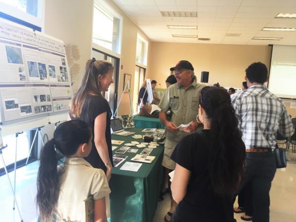
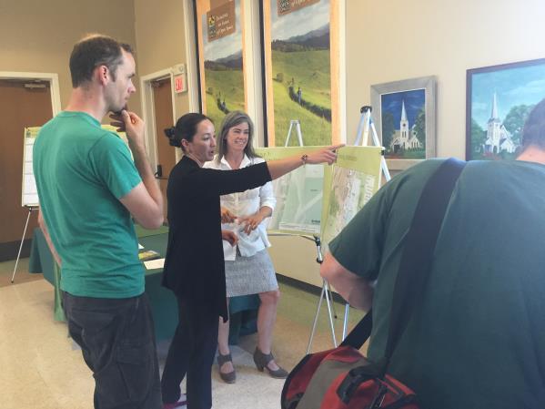
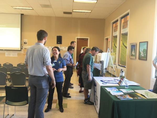
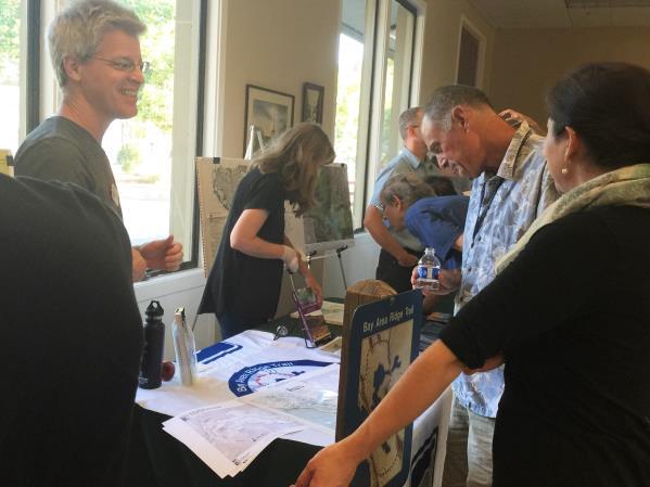
2 Agenda and Meeting Format 7:00-7:15 Welcome 7:15-8:00 Presentation 8:00-8:30 Open House 8:30 Recap 9:00 Conclusion 2
 Project costs Receive public input 3")
3 Meeting Goals: Introduce the project team Project purpose, goals, and need Process and timeline Review alternatives One or two crossings? Present trail connection information (separate parallel project) Project costs Receive public input 3


4 Project Team Consultant Team: Landscape Architects and Planners Structural Engineers Geologists and Geotechnical Engineers Environmental Planners Biologists Midpen Internal Team: Biologists Planners Engineering and Construction Rangers Land and Facilities Data Analysts Public Affairs 4
 Maintain healthy wildlife")

5 Project Purpose and Goals Purpose: Improve motorist safety (reduce vehicle collisions) Maintain healthy wildlife populations through habitat connectivity Goal: Provide wildlife passage and regional trail connections across Highway 17 5


6 Regional and Statewide Wildlife Importance The California Essential Habitat Connectivity Project (2010) and Bay Area Critical Linkages project (2013) identified a critical wildlife corridor within the study area 6


7 Regional Roadkill Hot Spot Based on Pathways for Wildlife and UC Santa Cruz research Numerous crossing attempts and significant road kill This is where animals attempt to cross and will continue to do so in the future 7

8 Multiple Agencies and Projects Infrastructure improvements at multiple locations are being studied to improve wildlife connectivity in the region 8


9 Target Species and Anticipated Recreational Users Mountain Lion Deer Regional Trail Users bicyclists, equestrians, hikers, dog walkers Photo by: Ken Lunders 9
 Los Gatos Creek Trail to Bear Creek Redwoods (North - South) Santa Clara Countywide Trails Master Plan (County General")
10 Regional and National Trail Connections Bay Area Ridge Trail Juan Bautista de Anza National Historic Trail Sierra Azul to El Sereno and Sanborn (East - West) Los Gatos Creek Trail to Bear Creek Redwoods (North - South) Santa Clara Countywide Trails Master Plan (County General Plan) 1 0
11 Transformative Trails Impact Links 30,600 acres of existing and protected open space El Sereno, Sierra Azul, St. Joseph s Hill and Bear Creek Redwoods Open Space Preserves Lexington, Sanborn and Almaden Quicksilver County Parks Provides a connection for a critical gap in the Bay Area Ridge Trail and Juan Bautista de Anza Historic Trail 25 miles to the next gap to the north (Sanborn to Russian Ridge) 21 miles to the next gap to the south (Sierra Azul to Almaden) A new crossing and full trail build out would connect a total of 46 existing Bay Area Ridge Trail miles on either side of Highway
12 Project History Midpen Vision Plan Top 25 Priority Action Wildlife Passage and Bay Area Ridge Trail Improvements Measure AA - $300 million bond Portfolio #20 -$14 million Feasibility Study Public Meeting #1 Four preliminary alternatives at four locations Alternatives revised based on public and stakeholder feedback Eight alternatives at five locations Midpen Board of Directors recommends all eight alternatives be forwarded to Caltrans for review Public Meeting #2 1 2

13 Caltrans Process 1 3

14 Why does it take so long? Midpen does not own the land, multiple landowners Multiple stakeholders, partners, and public Highly developed, lots of infrastructure, busy highway Each alternative requires many evaluations Preferences shift as new information is obtained Lasting legacy projects take patience, persistence, and process All of these are good things, but they take time! 1 4
15 Public Input to Date and Future Opportunities 2014 Vision Plan and Measure AA 2016 Public Meeting Public review of first four preliminary alternatives Public and stakeholder review resulted in four new alternatives 2018 Public Meeting Public review of all eight alternatives/design options Future public meetings during environmental review Ongoing Midpen Committee and Board of Directors meetings Project website: Project mailing list 1 5

16 Project Alternatives- Regional Context 16
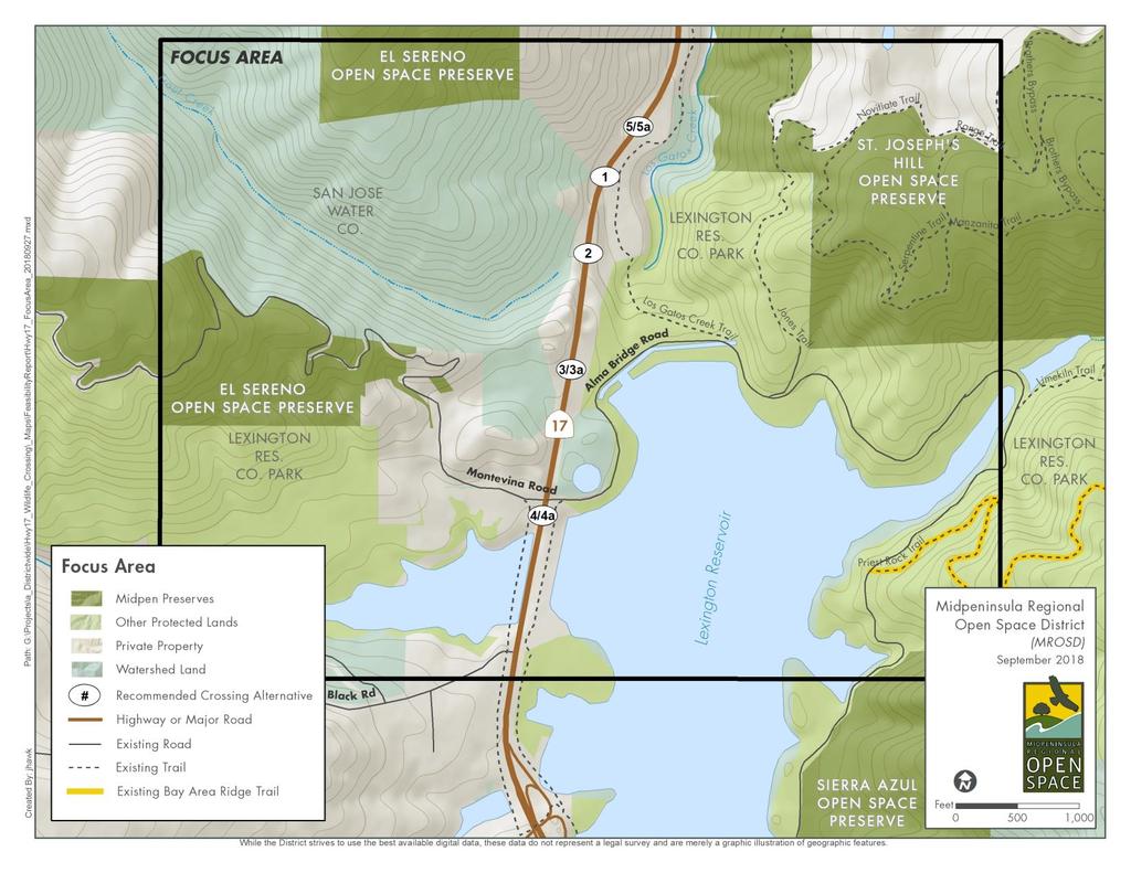
17 Project Alternatives 17
18 Crossings- Five Locations, Three Types: Wildlife Only 1) Ravine Creek Under 2) Trout Creek Under Combined (Wildlife and Trails) 3) Southern Over 4) Montevina Under 5) Northern Over Recreational Trail Only 3a) Southern Over 4a) Montevina Under 5a) Northern Over 1 8

19 One Structure vs. Two? Two separate structures preferred Provides the best separation of wildlife and trail users May be similar in cost to one single combined crossing Feasibility may change during Caltrans review To ensure feasibility, both combined and separate crossings are being studied 1 9


20 Evaluation Criteria Wildlife Close proximity to wildlife corridor Appropriate dimensions Provides habitat connectivity Adequate line of sight Accommodates special status species Trail Accommodate full range of users Direct connections to regional trails Safe and enjoyable Feasible trail connections Accommodate emergency and maintenance vehicles 2 0

21 1) Ravine Creek Undercrossing (Wildlife Only) Criteria 5 of 6 wildlife 0 of 5 trail Pro Wildlife cross near here Con Unstable slopes Estimated Cost $11.4 million (2024 dollars)

22 2) Trout Creek Undercrossing (Wildlife Only) Criteria points 5 of 6 wildlife 0 of 5 trail Pro Topography Center of hotspot Con Proximity to utilities Cost $11.2 million (2024 dollars)

23 3) Southern Overcrossing (Combined) Criteria points 1.5 of 6 Wildlife 2 of 5 Trail Pro Deer prefer large open crossings Con Proximity to utilities Grade differential Cost $20.5 million (2024 dollars)

24 3a) Southern Overcrossing (Trail only) Criteria points 1 of 6 - Wildlife 2 of 5 - Trail Pro Less expensive Con Little to no wildlife use Proximity to utilities Grade differential Cost $8.9 million (2024 dollars)

25 4) Montevina Undercrossing (Combined) Criteria points 2.5 of 6 - Wildlife 3 of 5 - Trail Pro Close to existing frontage trails Con Directs wildlife to frontage road and trail users to busy Alma Bridge Road Cost $12.8 million (2024 dollars)
 Criteria points 2 of 6")


26 4a) Montevina Undercrossing (Trail Only) Criteria points 2 of 6 wildlife 2.5 of 5 trail Pro Close to regional trail connections Con Directs trail users to busy Alma Bridge Road Cost $7.2 million (2024 dollars)


27 5) Northern Overcrossing (Combined) Criteria points 2 of 6 wildlife 3 of 5 trail Pro Close to regional trail connections Con Unstable geology Cost $14.9 million (2024 dollars) 3 3
28 5a) Northern Overcrossing (Trail Only) Criteria points 2 of 6 wildlife 3 of 5 trail Pro Close to regional trail connections Con Unstable geology Cost $9.9 million (2024 dollars) 3 5


29 Wildlife Fencing Directs wildlife to crossings Jump outs provide escape from traffic Full extent (6 mi) vs. phased (1.4 to 3.2 mi) Monitoring and adaptive management Success of the structures depend on success of the fencing 3 7
30 Eliminated Alternatives 3 8

31 Alternative 6 Sidehill Viaduct (Eliminated) Challenging geology Staging impacts to Los Gatos Creek Trail Lack of through view is unappealing for wildlife Difficult to modify existing viaduct safely with vehicle traffic 3 9


32 Alternative 7 Lexington Culvert (Eliminated) Used by small to medium sized wildlife Geometry does not allow for a larger culvert for larger wildlife Primary purpose is flood control for Lexington Reservoir Inaccessible when flooded Due to flooding, not supported as a recreational trail Shelving units could help small to medium wildlife when flooded (stand alone project) 4 0


33 Alternative 8 Bear Creek Overcrossing (Eliminated) Not functional for wildlife Very heavy vehicle traffic, requires crossing multiple lanes of traffic Not a pleasant visitor experience However, could be improved for recreational use (stand alone project) 4 1


34 Alternative 9 Aldercroft Culvert (Eliminated) Far from wildlife hotspot Ponded water at eastern end deters wildlife use No trail connections Difficult construction access Floods in winter Shelving and improving drainage could improve use by wildlife (stand alone project) 4 2
35 Crossing Cost Estimates 2024 Crossing Alternative Cost estimates ($M) 1. Ravine Under (wildlife) $ Trout Creek Under (wildlife) $ Southern Over (combined) $20.5 3a. Southern Over (trail) $ Montevina Under (combined) $12.8 4a. Montevina Under (trail) $ Northern Over (combined) $14.9 5a. Northern Over (trail) $9.9 Total cost to implement (wildlife and trails) crossing (s) vary from $12.8 million to $21.3 million (2024 dollars) Currently $14 million in Measure AA funds for crossing(s) and right of way/trails access Additional funding may be needed depending on preferred alternative(s) selected 4 3
36 Trail Connection Cost Estimates Alternatives: 2024 MinimumTrail Connection cost ($M) 2030 Full Build Trail Connection cost ($M) 1. Ravine Under (wildlife) NA (wildlife only) NA (wildlife only) 2. Trout Creek Under (wildlife) NA (wildlife only) NA (wildlife only) 3. Southern Over (combined) $4.5 $ a. Southern Over (trail) $4.5 $ Montevina Under (combined) $4.2 $ a. Montevina Under (trail) $4.2 $ Northern Over (combined) $1.5 $ a. Northern Over (trail) $1.5 $ Only the minimum is required to connect each alternative to existing trails. This costs varies from: $1.5 to $4.5 million (2024 dollars) Estimates do not include planning or design (typically 20-30%) or trail right of way/access costs (TBD) Additional funding is needed to implement trail connections to each of the crossing alternatives 4 4
37 Crossing(s) and Trail Connections Total Cost Estimates Alternative 2024 Crossing Cost ($M) Total cost (wildlife and trails) combined crossing(s) plus minimum trail connections and fencing varies from $18.4 to $28.0 million (2024 dollars) Total cost for separate wildlife and trail structures falls within this range Includes up to $2 million for wildlife fencing 2024 Minimum Trail Connection Cost ($M) 2024 Total Cost Estimate ($M) 1. Ravine Under (wildlife) $11.4 NA $ Trout Creek Under (wildlife) $11.2 NA $ Southern Over (combined) $20.5 $4.5 $25.0 3a. Southern Over (trail only) $8.9 $4.5 $ Montevina Under (combined) $12.8 $4.2 $17.0 4a. Montevina Under (trail only) $7.2 $4.2 $11.4 5a. Northern Over (combined) $14.9 $1.5 $16.4 5b. Northern Over (trail only) $9.9 $1.5 $11.7 Currently $14 million in Measure AA funds for crossing(s) including right of way/trails access Additional funding will be needed to implement crossing(s) and trails 4 5


38 Potential Funding Opportunities 4 6
39 Next Steps Receive public feedback- tonight s meeting Caltrans Project Study Report (currently underway) Caltrans agreement for next phase Identify preferred alternative(s) and environmental review (CEQA/NEPA- to begin in 2019) Project Permitting Design and Construction Ongoing opportunities for stakeholder and public input, partner development, and funding Future: maintenance, patrol, and monitoring agreements 4 7
40 Project Timeline Feasibility Study* Identify Alternatives* Caltrans Project Study Report* Environmental Review* Preferred Alternative(s) Selected* Right of Way Agreements Plans and Specifications* Design and Permitting* 2024 (or later) Construction (dependent on funding) *Opportunities for public involvement 4 8


41 Stakeholders, Partners, and Potential Partners 49

42 Thank you! 50
Award of Contract for Highway 17 Wildlife Passage Structures and Bay Area Ridge Trail Crossing: Conceptual Design and Feasibility Study
 R-16-18 Meeting 16-04 February 10, 2016 AGENDA ITEM AGENDA ITEM 6 Award of Contract for Highway 17 Wildlife Passage Structures and Bay Area Ridge Trail Crossing: Conceptual Design and Feasibility Study
FEASIBILITY CRITERIA
 This chapter describes the methodology and criteria used to evaluate the feasibility of developing trails throughout the study areas. Land availability, habitat sensitivity, roadway crossings and on-street
MAA 5 Year Approved Projects List FY through FY
 MAA 5 Year Approved Projects List FY 2018 19 through FY 2022 23 AA01 Miramontes Ridge: Gateway to the Coast Public Access, Stream Restoration and Agriculture Enhancement AA01 Miramontes Ridge: Gateway
BACKCOUNTRY TRAIL FLOOD REHABILITATION PROGRAM
 BACKCOUNTRY TRAIL FLOOD REHABILITATION PROGRAM Backcountry Trail Flood Rehabilitation A June 2013 Flood Recovery Program Summary In June 2013, parts of Southern Alberta were devastated from significant
EAST DON TRAIL ENVIRONMENTAL ASSESSMENT. Community Liaison Committee Meeting #3 July 15, :30 to 8:30 pm Flemingdon Park Library
 EAST DON TRAIL ENVIRONMENTAL ASSESSMENT Community Liaison Committee Meeting #3 July 15, 2013 6:30 to 8:30 pm Flemingdon Park Library Agenda 1. Welcome 2. Housekeeping and Updates a) Housekeeping b) CLC
Monterey Coast-Sierra de Salinas Linkage Study. Conducted by The Big Sur Land Trust & Pathways for Wildlife
 Monterey Coast-Sierra de Salinas Linkage Study Conducted by The Big Sur Land Trust & Pathways for Wildlife Objectives & Goals 1) To increase our understanding of wildlife movement throughout the Central
Committee. Presentation Outline
 CW-33-15 11/9/2015 Community and Corporate Services Committee November 10, 2015 1 Presentation Outline Background Vision and Objectives Study Process and Timeline Public and Stakeholder Engagement Organization
COASTAL CONSERVANCY. Staff Recommendation December 2, 2004 COYOTE HELLYER COUNTY PARK BAY AREA RIDGE TRAIL
 COASTAL CONSERVANCY Staff Recommendation December 2, 2004 COYOTE HELLYER COUNTY PARK BAY AREA RIDGE TRAIL File No. 04-057 Project Manager: Amy Hutzel RECOMMENDED ACTION: Authorization to disburse up to
Longmont to Boulder Regional Trail Jay Road Connection DRAFT FINAL REPORT
 Longmont to Boulder Regional Trail Jay Road Connection DRAFT FINAL REPORT December 2018 Project Summary Boulder County, Colorado, in partnership with the City of Boulder, is evaluating options for multi-use
Preferred Recreation Recommendations Stemilt-Squilchuck Recreation Plan March 2018
 Preferred Recreation Recommendations Stemilt-Squilchuck Recreation Plan March 2018 Below are the recommended recreation ideas and strategies that package together the various recreation concepts compiled
Creating a User-Driven Long-Distance OHV Trail Through Partnering
 Joseph Raffaele Outdoor Recreation Planner U.S. Bureau of Land Management Yuma, Arizona Creating a User-Driven Long-Distance OHV Trail Through Partnering BLM is a multiple-use land management agency within
EXECUTIVE SUMMARY PROGRAM DEVELOPMENT REPORT PURPOSE EXISTING SETTING EXPANDING PARKLAND
 EXECUTIVE SUMMARY PROGRAM DEVELOPMENT REPORT PURPOSE As the culmination of the first phase of the master planning process, this Program Development Report creates the framework to develop the Calero County
Finn Creek Park. Management Direction Statement Amendment
 Finn Creek Park Management Direction Statement Amendment November 2013 Management Direction Statement Amendment Approved by: Jeff Leahy Regional Director, Thompson Cariboo BC Parks November 12, 2013 Date
TRINITY RIVER CORRIDOR
 TRINITY RIVER CORRIDOR MODIFIED DALLAS FLOODWAY PROJECT UPDATE May 12, 2015 Jon Loxley Project Manager Dallas Floodway Project Fort Worth District U.S. Army Corps of Engineers US Army Corps of Engineers
Coronado National Forest Santa Catalina Ranger District
 United States Department of Agriculture Forest Service Coronado National Forest Santa Catalina Ranger District File Code: 1950 Date: October 14, 2015 Dear Interested Party: The Santa Catalina Ranger District
S Central Coast Heritage Protection Act APRIL 21, 2016
 STATEMENT OF GLENN CASAMASSA ASSOCIATE DEPUTY CHIEF, NATIONAL FOREST SYSTEM U.S. FOREST SERVICE U.S. DEPARTMENT OF AGRICULTURE BEFORE THE UNITED STATES SENATE COMMITTEE ON ENERGY AND NATURAL RESOURCES
Citrus Heights Creek Corridor Trail Project Trail Advisory Group Field Trip #2 September 11, :00 11:00 am Trellis Hall, Citrus Heights
 September 11, 2013 9:00 11:00 am Trellis Hall, Citrus Heights Project Overview The City of Citrus Heights is studying the feasibility of establishing a multi use trail system within the City s 26 miles
RIVER ACCESS STRATEGY
 RIVER ACCESS STRATEGY The River Access Strategy is a 10-year plan the City of Edmonton is developing to inform future programming, operations and infrastructure improvements that support access to the
RE: Access Fund Comments on Yosemite National Park Wilderness Stewardship Plan, Preliminary Ideas and Concepts
 September 30, 2016 Superintendent Yosemite National Park Attn: Wilderness Stewardship Plan P.O. Box 577 Yosemite, CA 95389 RE: Access Fund Comments on Yosemite National Park Wilderness Stewardship Plan,
Trail # NW Tuesday, June DESIGN. Provide an Review the Provide an. Project Goals: System system. wayfinding
 I. Welcome / Introductions Bethany Creek Trail #2 Segment 3 Neighborhood Meeting #1 Bethany Presbyterian Church 15505 NW Springville Road, Portland, OR 97229 Tuesday, June 26, 2018 @ 6:00PM Meeting Minutes
Planning and Building Department
 Page 1 of Report PB-27/11 CITY OF Burlington Planning and Building Department TO: Chair and Members of the Community Development Committee SUBJECT: Niagara Escarpment Plan Amendment 179 (NEPA 179) Addition
2016 Regional Transportation Alternatives Program (TAP) Grant Application
 Grant Application") 2016 Regional Transportation Alternatives Program (TAP) Grant Application PROJECT TITLE: Yelm-Tenino Trail Extension Feasibility Study TRPC use only GENERAL PROJECT INFORMATION Agency or Organization City
2016 Regional Transportation Alternatives Program (TAP) Grant Application PROJECT TITLE: Yelm-Tenino Trail Extension Feasibility Study TRPC use only GENERAL PROJECT INFORMATION Agency or Organization City
ROAD AND TRAIL PROJECT APPROVAL
 ROAD AND TRAIL PROJECT APPROVAL www.marincountyparks.org Marin County Parks, 3501 Civic Center Dr, Suite 260, San Rafael, CA 94903 DATE: July 12, 2017 PRESERVE: Gary Giacomini Open Space Preserve PROJECT:
SOUTH INTERCHANGE AREA
 Santaquin City General Plan 1 Location and Characteristics The South Interchange Area of Santaquin is located west of Interstate 15 and south of 500 South (Figure 1). It includes properties already annexed
Sibley LUPA. Board Executive Committee Meeting December 7, 2017
 Sibley LUPA Board Executive Committee Meeting December 7, 2017 Project Location & Project Area 1,318-acre Robert Sibley Volcanic Regional Preserve Project Area Purpose Project Purpose & Goals Append the
HLUET TRANSMITTAL RECOMMENDED ACTION
 HLUET TRANSMITTAL TO: Housing, Land Use, Environment & Transportation Committee Prepared by: Elish Ryan, Park Planner FROM: Lisa Killough, Director DATE: November 1, 2002 Reviewed by: Mark Frederick, Planning
Town of Castle Rock Parks and Recreation 1
 Town of Castle Rock Parks and Recreation 1 The 2018-2020 Strategic Plan will focus on the following items: Neighborhood park planning is the focus of this presentation. Other strategic plan priorities
Little River Trail Feasibility Study
 Final April, 2014 Prepared for the State Coastal Conservancy By the Natural Resources Services Division of Redwood Community Action Agency Table of Contents Executive Summary... 1 1. Project Purpose and
Great Wolf Lodge Fact Sheet & Frequently Asked Questions Potential Location in Gilroy, California 8/30/17
 WHAT? Great Wolf Resorts has identified Gilroy, California as a potential location for a new Great Wolf Lodge family resort and has entered into a 60-day period of exclusivity with the City and community
Trail Assessment Report
 Trail Assessment Report Trail Options for the Bear Creek Canyon located in Pikes Peak Ranger District, Pike National Forest and on Colorado Springs Utility Lands Due to the presence of a unique species
A CASE FOR COMPLETING THE JORDAN RIVER PARKWAY: A
 A CASE FOR COMPLETING THE JORDAN RIVER PARKWAY: A safe crossing at 9000 South and 850 West Proposed 9000 South Underpass Parkway Timeline Parkway, Trail, and Tourism Facts Blueprint Jordan River 1971 1973
Lake Windermere Westside Legacy Trail. A multi-use non-motorized paved trail promoting health, wealth and outdoor appreciation
 Lake Windermere Westside Legacy Trail A multi-use non-motorized paved trail promoting health, wealth and outdoor appreciation Jan 26, 2015 Executive Summary The Lake Windermere Westside Legacy Trail will
The Chu property is a 6.57 acre parcel located in the Town of Superior on the west side of McCaslin Boulevard. In 2014, the Town of Superior acquired
 1 The Chu property is a 6.57 acre parcel located in the Town of Superior on the west side of McCaslin Boulevard. In 2014, the Town of Superior acquired the Chu property for open space with a contribution
DATE: 23 March, 2011 TO: Communities FROM: BlazeSports America. RE: Accessible Trails Checklist 1
 M E M O R A N D U M DATE: 23 March, 2011 TO: Communities FROM: BlazeSports America RE: Accessible Trails Checklist 1 The purpose of the Accessible Trails Checklist (below) is to help the community review
Infusion of new ideas and energy to continue funding for trails and greenspace
 2012 Summit County Trail & Greenway Plan: Infusion of new ideas and energy to continue funding for trails and greenspace Summit County Trail & Greenway Plan OHIO GREENWAYS History of Trail & Greenway Plan
Martinez General Plan 2035 White Paper TRAILS
 Martinez General Plan 2035 White Paper TRAILS November 2016 The Issue The draft Martinez General Plan 2035 and Draft Program Environmental Impact Report were released for public review on September 15,
Committee Report. Community Development Committee For the Metropolitan Council meeting of April 13, Business Item No.
 Committee Report Business Item No. 2016-48 Community Development Committee For the Metropolitan Council meeting of April 13, 2016 Subject: Harriet Island-South St. Paul Regional Trail Master Plan, Saint
Planning Wildlife Crossings in Canada's Mountain Parks SESSION: Highway Mitigation: new insights for practitioners
 Planning Wildlife Crossings in Canada's Mountain Parks ID95 SESSION: Highway Mitigation: new insights for practitioners Trevor Kinley, Project Manager Lake Louise Yoho Kootenay Field Unit, Parks Canada
ETOBICOKE CREEK NORTH TRAIL PROJECT. May 18, 2017 at Michael Power High School 105 Eringate Drive, Etobicoke ON M9C 3Z7
 ETOBICOKE CREEK NORTH TRAIL PROJECT May 18, 2017 at Michael Power High School 105 Eringate Drive, Etobicoke ON M9C 3Z7 1 Purpose of Open House The purpose of today s open house is to present the design
To apprise Council of the process and timeline for the preparation of the Final Concept Plan and report; and
 Corporate NO: R243 Report COUNCIL DATE: November 20, 2006 REGULAR COUNCIL TO: Mayor & Council DATE: November 15, 2006 FROM: Acting General Manager, Planning and Development FILE: 0850-20 (CF) SUBJECT:
G Street Undercrossing. City Council Meeting Date: November 3, 2008
 G Street Undercrossing City Council Meeting Date: November 3, 2008 Introduction G Street undercrossing Long-term goal of the City In General Plan since 1997 In City s Public Facilities Financing Plan
Airport Master Plan for. Brown Field Municipal Airport PAC Meeting #3
 Airport Master Plan for Brown Field Municipal Airport PAC Meeting #3 Public Meeting #1 > 8/24/17 from 5:30 to 8:00 pm > 41 attendees signed-in > Comments: > EAA area > Environmental constraints > Focus
Map 1.1 Wenatchee Watershed Land Ownership
 Map 1.1 Wenatchee Watershed Land Ownership Map 1.1 Wenatchee Watershed Land Ownership The Wenatchee watershed lies in the heart of Washington state in Chelan County. Just larger than the state of Rhode
Dogpatch Community Task Force Meetings. April 24, 2017 Meeting #6
 Dogpatch Community Task Force Meetings April 24, 2017 Meeting #6 Agenda I. Welcome and Introductions II. Agenda Overview, Recap of Meeting #5 and Dogpatch Community Task Force Process III. Comments from
PLANNING COMMISSION AGENDA REPORT May 10, Members of the Planning Commission. Joyce Parker-Bozylinski, Contract Planner
 PLANNING COMMISSION AGENDA REPORT May 10, 2007 TO: FROM: PROPOSAL: APPLICANT: RECOMMENDATION: Members of the Planning Commission Joyce Parker-Bozylinski, Contract Planner Approval of the Calabasas Trails
White Mountain National Forest Saco Ranger District
 United States Department of Agriculture Forest Service White Mountain National Forest Saco Ranger District 33 Kancamagus Highway Conway, NH 03818 Comm: (603) 447-5448 TTY: (603) 447-3121 File Code: 1950
The Future of the Road to Revolutions. A Battle Road Scenic Byway Public Forum November 9, 2010
 The Future of the Road to Revolutions A Battle Road Scenic Byway Public Forum November 9, 2010 Who is the Battle Road Scenic Byway? Four Towns: Arlington, Lexington, Lincoln, Concord Minute Man National
COASTAL CONSERVANCY. Staff Recommendation September 22, 2011 BAY AREA RIDGE TRAIL: HOOD MOUNTAIN TO HIGHWAY 12
 COASTAL CONSERVANCY Staff Recommendation September 22, 2011 BAY AREA RIDGE TRAIL: HOOD MOUNTAIN TO HIGHWAY 12 File No. 11-039-001 Project Manager: Betsy Wilson RECOMMENDED ACTION: Authorization to disburse
Department of Environment, Climate Change & Water NSW. Stakeholder feedback
 Department of Environment, Climate Change & Water NSW Stakeholder feedback 1 Stakeholders group Blue Gum High Forest Group Guardians of Lane Cove NP Sydney Metropolitan Wildlife Service Ku-ring-gai Historical
Santa Cruz North Interior
 Santa Cruz North Interior The Santa Cruz North Interior planning area includes the area commonly referred to as the San Lorenzo Valley. The greatest amount of development occurs in the communities of Boulder
2. Goals and Policies. The following are the adopted Parks and Trails Goals for Stillwater Township:
 D. PARKS AND TRAILS 1. Introduction Stillwater Township s population is relatively low, with most residents living on rural residences on large lots. The need for active park space has been minimal in
County of Sonoma Agenda Item Summary Report
 Revision No. 20170501-1 of Sonoma Agenda Item Summary Report Agenda Item Number: 37 (This Section for use by Clerk of the Board Only.) Clerk of the Board 575 Administration Drive Santa Rosa, CA 95403 To:
Daisy Dean Trail 628/619 ATV Trail Construction
 Background and Purpose and Need The Daisy Dean ATV Trail Construction Project is located in the Little Belt Mountains, Musselshell Ranger District, Lewis and Clark National Forest approximately 32 miles
DRAFT - APRIL 13, 2007 ROUTING STUDY FOR TRAIL CONNECTIONS BETWEEN CALAIS AND AYERS JUNCTION
 DRAFT - APRIL 13, 2007 ROUTING STUDY FOR TRAIL CONNECTIONS BETWEEN CALAIS AND AYERS JUNCTION Abstract The vision for the East Coast Greenway is an off-road urban trail system running from Calais, Maine
Welcome KROSNO CREEK DIVERSION PROJECT CLASS ENVIRONMENTAL ASSESSMENT
 Welcome KROSNO CREEK DIVERSION PROJECT PUBLIC INFORMATION CENTRE # 1 Tonight s Presentation Study Overview Background Existing Conditions Alternative Solutions Preliminary Preferred Solution Next Steps
Welcome to the future of Terwillegar Park a Unique Natural Park
 Welcome to the future of Terwillegar Park a Unique Natural Park 1 Introduction The Terwillegar Park Concept Plan study will develop an overall concept plan, management objectives and development guidelines
Multimodal Planning Studies
 Multimodal Planning Studies Commuter Park and Ride Study Steering Committee Meeting June 6, 2013 Agenda 1. Update on Project Schedule 2. Update on Online Interactive Mapping 3. Key Themes from the Open
Sierra Roadwork Schedule Sunday through Saturday, October 1-7, 2017 LONG-TERM PROJECTS
 Date: September 29, 2017 #17-292 District: District 3 - Marysville, www.dot.ca.gov/dist3 Amarjeet S. Benipal, District Director Contact: Liza Whitmore, liza.whitmore@dot.ca.gov Phone: Office: (530) 634-7640
Decision Memo for Desolation Trail: Mill D to Desolation Lake Trail Relocation
 for Salt Lake County, Utah Uinta-Wasatch-Cache National Forest Salt Lake Ranger District 1. Background The present location of the Desolation Trail (#1159) between Mill D and Desolation Lake follows old
Mohawk Hudson Bike Hike Trail Crossroad Connection Study
 Summary Report - April 21, 2003 Mohawk Hudson Bike Hike Trail Crossroad Connection Study Summary Report Introduction The Capital District Transportation Committee (CDTC), in partnership with Albany County,
Chuckanut Ridge Fairhaven Highlands EIS Scoping Concerns
 Chuckanut Ridge Fairhaven Highlands EIS Scoping Concerns Coalition of Southside Neighborhoods CSN Comments for Fairhaven Highlands EIS Scope Hearing, Jan 16, 2008 1 Chuckanut Ridge Hilly Terrain: Potential
Colorado Springs & Pikes Peak Region Destination Master Plan
 Colorado Springs & Pikes Peak Region Destination Master Plan Overview June 19, 2018 DESTINATION MASTER PLAN What is Destination Master Planning? Focus on infrastructure, facilities, services, attractions
Citrus Heights Creek Corridor Trail Project. Trail Advisory Group Meeting #3 July 8, 2013
 Citrus Heights Creek Corridor Trail Project Trail Advisory Group Meeting #3 July 8, 2013 Agenda Introductions Recap: Community Workshop, Survey Findings, and TAG Field Trip Community Concern Discussion:
Bradley Brook Relocation Project. Scoping Notice. Saco Ranger District. United States Department of Agriculture Forest Service
 Bradley Brook Relocation Project United States Department of Agriculture Forest Service Scoping Notice White Mountain National Forest February 2011 For Information Contact: Jenny Burnett White Mountain
Santa Cruz North Interior
 Santa Cruz North Interior The Santa Cruz North Interior planning area includes the area commonly referred to as the San Lorenzo Valley. The greatest amount of development occurs in the communities of Boulder
Mt. Hood National Forest
 United States Department of Agriculture Forest Service Mt. Hood National Forest Zigzag Ranger District 70220 E. Highway 26 Zigzag, OR 97049 503-622-3191 Fax: 503-622-5622 File Code: 1950-1 Date: June 29,
Williamson Rock/Pacific Crest National Scenic Trail (PCT) Project EIS. Notice of intent to prepare an Environmental Impact Statement.
 Project EIS. Notice of intent to prepare an Environmental Impact Statement.") [3411-15-P] DEPARTMENT OF AGRICULTURE Forest Service Angeles National Forest; Los Angeles County, CA Williamson Rock/Pacific Crest National Scenic Trail (PCT) Project EIS AGENCY: ACTION: Forest Service,
[3411-15-P] DEPARTMENT OF AGRICULTURE Forest Service Angeles National Forest; Los Angeles County, CA Williamson Rock/Pacific Crest National Scenic Trail (PCT) Project EIS AGENCY: ACTION: Forest Service,
PROPOSED PARK ALTERNATIVES
 8 Chimne y Rock State Park M a ster Pl an 2011 PROPOSED PARK ALTERNATIVES Introduction Three different park development concepts were prepared and presented to the citizens of North Carolina through a
White Mountain National Forest Saco Ranger District
 United States Department of Agriculture Forest Service White Mountain National Forest 33 Kancamagus Highway Conway, NH 03818 Comm: (603) 447-5448 TTY: (603) 447-3121 File Code: 1950 Date: February 26,
Final Design Approval of the Weather Shelters and Summit Stair for the Mount Umunhum Summit Project
 R-16-26 Meeting 16-06 March 9, 2016 AGENDA ITEM AGENDA ITEM 6 Final Design Approval of the Weather Shelters and Summit Stair for the Mount Umunhum Summit Project GENERAL MANAGER S RECOMMENDATIONS 1. Direct
DATE: January 19, WCA Governing Board. Johnathan Perisho, Project Manager. Mark Stanley, Executive Officer
 Item 14 DATE: January 19, 2017 TO: FROM: THROUGH: SUBJECT: WCA Governing Board Johnathan Perisho, Project Manager Mark Stanley, Executive Officer Item 14: Consideration of a resolution to accept an acquisition
Recreation and Park Commission, Capital Committee
 DATE: March 7, 2018 TO: THRU: FROM: RE: Recreation and Park Commission, Capital Committee Philip A. Ginsburg, General Manager Lisa Bransten, Director of Partnerships New Park at Francisco Reservoir Park
Classifications, Inventory and Level of Service
 Classifications, Inventory and Level of Service Section 3 Kenmore Park, Recreation and Open Space Plan 1 P a g e Classifications and Inventory Park Classifications Kenmore classifies its parks based upon
TRAIL ANNUAL REPORT
 TRAIL ANNUAL REPORT 2016-17 Identify Undeveloped projects identified in the City s Greenprint or trail database 15.90 miles Study Projects that have been or are currently being studied to determine a feasible
China Creek North Park Upgrades and Glen Pump Station. Park Board Committee Meeting Monday, July 10, 2017
 China Creek North Park Upgrades and Glen Pump Station Park Board Committee Meeting Monday, July 10, 2017 Purpose The purpose of this presentation is to: Share the results of the public engagement processes;
A GIS Analysis of Probable High Recreation Use Areas in Three Sisters Wilderness Deschutes and Willamette National Forests
 Lindsey Kiesz Geo 565 Term Project 3/15/2010 A GIS Analysis of Probable High Recreation Use Areas in Three Sisters Wilderness Deschutes and Willamette National Forests Introduction The Three Sisters Wilderness
Creating Connections in Niagara Region
 Creating Connections in Niagara Region GERRY CHAPUT, CHIEF CAPITAL OFFICER - METROLINX ERIN MOROZ, DIRECTOR OF COMMUNICATIONS AND COMMUNITY RELATIONS - METROLINX METROLINX PRESENTATION TO NIAGARA REGION
Blueways: Rivers, lakes, or streams with public access for recreation that includes fishing, nature observation, and opportunities for boating.
 Parks, Open Space and Trails PRINCE WILLIAM COUNTY 2008 COMPREHENSIVE PLAN TRAILS PLAN CONTENTS The components of the trails plan are: Intent Definitions Goals, Policies, and Action Strategies Trails Map
Bear Creek Habitat Improvement Project
 06/10/10 Bear Creek Habitat Improvement Project El Paso County, Colorado Pike National Forest and Colorado Springs Utilities Owned Land Report prepared by: Eric Billmeyer Executive Director Rocky Mountain
Macleod Trail Corridor Study. Welcome. Macleod Trail Corridor Study Open House. Presentation of Proposed Design Concepts
 Macleod Trail Corridor Study Welcome Macleod Trail Corridor Study Open House Presentation of Proposed Design Concepts Study Purpose Develop a corridor plan for Macleod Trail that aligns with The City s:
Chatsworth Branch Library Devonshire Street, Chatsworth, CA Thursday, November 16, :00-8:00 pm
 Chatsworth Branch Library 21052 Devonshire Street, Chatsworth, CA 91311 Thursday, November 16, 2017 6:00-8:00 pm Project Team County of Los Angeles Department of Parks and Recreation Kathline King Chief
Airport Master Plan for Montgomery-Gibbs Executive Airport PAC Meeting #3
 Airport Master Plan for Montgomery-Gibbs Executive Airport PAC Meeting #3 Agenda > Introductions > Public Meetings Overview > Working Paper 3 - Facility Requirements > Working Paper 4 - Environmental Baseline
Wallace Falls State Park Classification and Management Planning Stage 3 Preliminary Recommendations July 18, 2018 Sultan City Hall
 Wallace Falls State Park Classification and Management Planning Stage 3 Preliminary Recommendations July 18, 2018 Sultan City Hall Thanks for coming! This document contains State Parks preliminary recommendations
FEASIBILITY STUDY. holdings SEPTEMBER 13, prepared for: prepared by:
 FEASIBILITY STUDY SEPTEMBER 13, 2013 prepared for: holdings prepared by: Table of Contents Project Feasibility... 3 Project Background... 4 Project and Community Context... 5 Site constraints... 6 Statement
Welcome. Green Line in Your Community
 Welcome Green Line in Your Community Today s session will provide you with information on options The City is exploring for connecting the Green Line in the Beltline to the future Inglewood/Ramsay station.
Proposal to Redevelop Lower Kananaskis River-Barrier Lake. Bow Valley Provincial Park. Frequently Asked Questions
 Proposal to Redevelop Lower Kananaskis River-Barrier Lake Bow Valley Provincial Park Frequently Asked Questions What is being proposed? What are the details of the proposal? Where is the project area located?
Crook County Oregon. Natural Resources Planning Committee Draft Report
 Crook County Oregon Natural Resources Planning Committee Draft Report September 17, 2009 Ochoco Summit OHV Trail Planning field Review September 3, 2009 The Dechutes Provincial Advisory Committee invited
Stevenson Ranch Library The Old Road, Stevenson Ranch, CA Thursday, November 9, :00-8:00 pm
 Stevenson Ranch Library 25950 The Old Road, Stevenson Ranch, CA 91381 Thursday, November 9, 2017 6:00-8:00 pm Project Team County of Los Angeles Department of Parks and Recreation Kathline King Chief of
US 380 FEASIBILITY STUDY
 US 380 FEASIBILITY STUDY Denton County CSJ(s): 0135-10-061, 0135-10-062 Public Meeting(s): January 15 & 22, 2019 WELCOME US 380 Denton County Feasibility Study DALLAS DISTRICT PUBLIC MEETING January 15
Unstable Slope Management Program for FLMAs. Presented by: Douglas A. Anderson, LG, LEG FHWA - WFL - Engineering Geologist
 Unstable Slope Management Program for FLMAs Presented by: Douglas A. Anderson, LG, LEG FHWA - WFL - Engineering Geologist FLMA Stakeholders Project Conducted by: Types of Unstable Slopes Goals of USMP
that the only option proposed for the Christmas Tree Farm
 December 12, 2017 Via E-mail Department of Parks and Recreation 298 Garden Hill Drive Los Gatos, CA 95032 Kimberly Brosseau, Senior Planner Santa Clara County Parks Michael Hettenhausen, Associate Planner
Community Advisory Panel Meeting #
 Community Advisory Panel Meeting # 6 02.13.19.. Agenda Welcome and Introductions Community Conversations City Council Meeting Debrief Review Citywide Tunnel Video (North Portal Only) Churchill Pedestrian
Agenda Report. Spruce Street Outlet Drainage Improvements Tower Road Relief Sewer
 Agenda Report Subject: Prepared By: Spruce Street Outlet Drainage Improvements Tower Road Relief Sewer Steven M. Saunders, Director of Public Works/Village Engineer Date: August 12, 2012 On March 8, 2012
El Dorado County / Tahoe Roadwork Schedule Sunday through Saturday September 9 September 15, 2012
 Today s Date: Friday, September 7, 2012, #12-255 District: District 3 - Marysville, http://www.dot.ca.gov/dist3 Jody Jones, District Director Contact: Deanna Shoopman deanna_shoopman@dot.ca.gov 530. 741.4566
Peter Axelson. Beneficial Designs, Inc. Minden, NV
 Peter Axelson Beneficial Designs, Inc. Minden, NV Arroya Sit Ski Mono Ski Dynamic Seating Spring Assist Cross Country Ski Hand Bike Adaptive Canoe Seating Available from Chosen Valley Canoe Accessories
Why are Corridors Important? Corridors: a possible solution to habitat fragmentation. Carnivores and Habitat Fragmentation
 Identification of Potential Wildlife Corridors Utilized by the North American Badger (Taxidea taxus) in the San Francisco Bay Area & Monterey County Carnivores and Habitat Fragmentation Carnivores are
Georgetown-Lewes Rail/Trail Study. Rail/Trail Study: Cool Spring to Cape Henlopen State Park New Road Extension (House Resolution No.
 Georgetown-Lewes Rail/Trail Study Rail/Trail Study: Cool Spring to Cape Henlopen State Park New Road Extension (House Resolution No. 47) August 22, 2011 Presentation Outline Background Benefits Statewide
Memorandum. Fund Allocation Fund Programming Policy/Legislation Plan/Study Capital Project Oversight/Delivery Budget/Finance Contract/Agreement Other:
 Memorandum Date: March 23, 2018 To: Transportation Authority Board From: Eric Cordoba Deputy Director Capital Projects Subject: 4/10/18 Board Meeting: San Francisco Freeway Corridor Management Study Update
Air Transportation Optimization. Information Sharing for Global Benefits
 Air Transportation Optimization Information Sharing for Global Benefits % of total inefficiencies Executive Summary Is there a better way for the air transport community to resolve system inefficiencies
10/25/2013. What is the SCORP?! 2013 Local Government Survey 2013 Statewide Public Survey Advisory Group Priority Areas Your Suggestions!
 COLORADO OUTDOOR RECREATION TRENDS RESULTS FROM THE SCORP AND STATEWIDE Colorado Outdoor Recreation Resource Partnership September 2013 PRESENTATION What is the SCORP?! 2013 Local Government Survey 2013