Newsletter. Vol. 2016, No. 4 July, 2016
|
|
|
- Ella Hamilton
- 5 years ago
- Views:
Transcription


1 Newsletter Vol. 2016, No. 4 July, 2016
2 Table of Contents From the Editor.4 New Members..5 Message from the Chair...6 Upcoming Programs....9 New Trip Leader Joe Allen
3 Table of Contents Did You Know?...16 Trip Reports...20 Snow Climbing Crampon Workshop...28 Mountain Hiking School 30 Gear Swap 32 Parting Shots.33 3

4 From the Editor: What s in this issue? Scott Farquhar A message from Ward, congratulations to Joe Allen our new trip leader, information on upcoming programs, tips for leaders, information on Indian Peak Wilderness permit requirements, information on upcoming road closures, an Iron Mountain Trip report, an article on a retired missile site nearby, a report on one of the Snow Climbing and Crampon Workshops, a Final Report on the 2016 Mountain Hiking School, and Gear Swap. WOW, are we good or what! Also I would like to welcome the 10 new members that have joined the Fort Collins Group since April (see the next page for a listing). For all of you if you need any help in taking advantage of the resources the club has to offer don t hesitate to contact me or Chris Haugen, our Membership Director. For all of you existing members remember to extend a hearty welcome to any new members you see. See ya on the trail. Scott 4

5 Welcome New Members! May Amanda Cavanagh Linda Henderson Erin Bohler Darcy Owens Aaron Johnson Jun Jack Earley Joanie Kenney Eric DeLano Vanay Syme Edward Taylor 5

6 Message from the Chair: By Ward Whicker In this message, it seemed appropriate to comment on the wide variety of trips & activities led by our remarkable team of active CMC leaders. One moment I find myself registering for a one-hour yoga session in Rolland Moore Park led by Jessica Auman, and next hearing from Team Orion, headed by Tom Chapel, of their successful summit of Denali (Mt. McKinley) in Alaska. Between these extremes in terms of time & effort commitment, our club offers a great diversity of trips and other activities. Let me take just a brief moment of time to give a few examples of this amazing diversity. For example, periodic bicycle trips led by York and Scott Farqhuar have visited Art in Public Places, and a tour of a former Atlas Missile Site in Weld County. These sort of trips are not only good local exercise, but highly educational. Also in the educational category are periodic wildflower hikes led by Eileen Edelman and excursions at various levels of difficulty to remote, off the radar peaks by Steve Martin. Eileen knows the plants of our area extremely well; Steve knows the geography and topography of Larimer County, RMNP, Colorado and much more, probably better than any living person. 6
 In the milder, less intimidating category, Laurie Folladori offers periodic aspen viewing hikes, a Chocolate Snowshoe trip to Montgomery Pass, and an annual Halloween Costume Event involving a bike")
7 Message from the Chair: (cont.) In the milder, less intimidating category, Laurie Folladori offers periodic aspen viewing hikes, a Chocolate Snowshoe trip to Montgomery Pass, and an annual Halloween Costume Event involving a bike ride or stroll. Jessica Auman offers relaxing yoga outings, as well as evening hikes in our local open space areas. Linda Brisbane and Kate Polk occasionally offer very nice bike rides and mellow hikes. But don t get the wrong impression though; all these ladies are very strong hikers and can do much tougher outings when they want to! In winter, John Raich leads AT ski trips almost every week when good powder snow is available. He can be trusted to make good decisions in avalanche terrain, and to give advanced skiers all the challenge most can ask for. In terms of ski touring in milder terrain, Don Carpenter, Eileen Edelman and I offer mellow but very enjoyable cross country tours. Many of our leaders offer snowshoe trips, at virtually all levels of difficulty. Occasional ski tours in moderate terrain well-suited for mid-width skis and telemark technique are offered by Scott Farquhar and myself. Last summer, Kim Cunningham led a hike to the 1943 crash site of a B-17 bomber. Carolyn Hammond led a difficult scramble up the south face of Palisade Mountain in the Big Thompson Canyon. Kevin Willey led a unique, mixed snow & rock scramble from Emerald Lake to Flattop Mtn. Clint Baker led a climb of Longs Peaks and usually offers other 14ers or very remote summits. John Raich is offering a snow climb of Mount of the Holy Cross, directly up the long, steep couloir that provides the name of this 14er. 7
8 Message from the Chair: (cont.) At the extreme level of difficulty and commitment, watch for Tom Chapel s trips. Recent examples include Mummy Mania involving 6 peaks, 18 miles and 5,700 vertical feet, or Denali at over 20,000 in Alaska. Denali is the third most-prominent peak in the world and can require 2-4 weeks on the mountain due to it s sometimes deadly weather. Backpack trips are offered most years by David Wasson to remote parts of Rocky Mountain National Park, and several other leaders will occasionally offer backpacking trips of varying length and difficulty. Formal courses offered in the past year or two include the Mountain Hiking School directed by David Wasson, and the Alpine Scrambling and Snow Climbing courses offered by John Raich. We hope to offer a comprehensive Basic Mountaineering Course in 2017 under the direction of Kevin Willey and Gordan Thibedeau. A backcountry AT ski clinic was offered last year, and workshops designed for beginning cross-country skiers and snowshoers is offered most years by Don Carpenter and Eileen Edelman. A short course on rope skills is currently under consideration by Kevin Willey. I might conclude this short summary of the diversity of trips and courses offered by the Fort Collins Group by noting the diversity of people who participate in these activities. Participants range in age from the 20s to the 70s, they represent a very wide cross-section of geography, skill sets, education, careers, fitness level, etc. This diversity leads to extremely interesting discussions among leaders, instructors and participants and basically, a whole lot of fun and enlightenment. Ward Whicker 8

9 Programs! Bob Dietz Program Director September Program Mountaineering in Colorado Dr. James H. Pickering What: September Program Where: Senior Center When: September 28, 7:00 PM Who: Fort Collins CMC Members AND Public Welcome James H. Pickering became Estes Park s Historian Laureate in He received his undergraduate education at Williams College and his M.A. and Ph.D. degrees from Northwestern University. A professor of English, specializing in American literature and American studies, he has taught at Michigan State University, where he served as Director of The Honors College, and at the University of Houston, where he served as dean, provost, and president. Jim s long adventure with the Estes Valley and its history began in the late 1940s, when he vacationed with his parents and sister in a 1916 log cottage on the lower slopes of the Twin Sisters, high up in the Tahosa Valley. Jim has been a part-time resident in Estes Park since 1992 and has served on the board of directors of the Estes Park Museum Friends & Foundation for nine years. 9
10 Programs! October Program Poudre Canyon Areas: What Do Their Names Mean? Why Are They Here? Carolyn Hammond What: October Program Where: Senior Center When: October 26, 7:00 PM Who: Fort Collins CMC Members AND Public Welcome When hiking or skiing in Poudre Canyon and other areas around Fort Collins, have you ever wondered how some of the lakes, rivers, passes and other landmarks got their names? The region has a rich history featuring the exploits and misadventures of fur trappers, miners, soldiers, Indians, desperadoes and others whose names still remain on our maps today. In this presentation, CMC member Carolyn Hammond will recount a few of the stories from the early days of Poudre Canyon and other colorful places in the region. 10
 in 2015, then participated as a MHS instructor in 2016.")
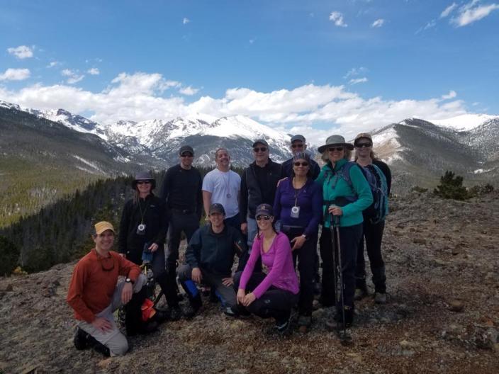
11 New Trip Leader Joe Allen!!! By Scott Farquhar Welcome Joe Allen as the latest official CMC leader in the Fort Collins Group!! Joe is relatively new to CMC, but he has jumped right in by taking the Mountain Hiking School (MHS) in 2015, then participated as a MHS instructor in Joe came to the group already having a wealth of hiking/climbing experience; he is a certified EMT and is member of the Larimer County Dive Rescue Team. Talk about credentials! Joe s Leader-in-Training (LIT) trip was completed June 25, 2016 with a group of 9. The original plan in the state Trip Calendar was to climb to the summit of Ramsey Peak from the northeast, a trip of 8.6 miles with 2,700 ft elevation gain. This was an off trail route discussed in Lisa Foster s book Rocky Mountain National Park, The Complete Hiking Guide. The write up described the climb as Class 2. Joe and I were scheduled to do the scouting trip the Tuesday before the hike, unfortunately (or fortunately for me), Joe had something come up and had to do the scouting trip without me. Apparently this was another case where you cannot always believe everything you Joe Allen New Trip Leader Photo by Lisa Barkley 11


12 Joe Allen LIT Sugarloaf/Ramsey (cont.) read. Joe discovered that the off trail portion of the hike had an exciting creek crossing and was very difficult going due to a large amount of downfall. Additionally, he found approaching the summit from the northeast was a Class 3 climb not Class 2. Joe felt that this was NOT the trip advertized and was concerned that it would not result in an enjoyable trip for all. So both he and I quickly conferred with Fort Collins Group members to see if there was an acceptable alternative. After considering two or three options Joe decided to approach Ramsey Peak from Sugarloaf Mountain. Since this is a much longer route with significantly more elevation gain Joe sent out an to notify all the participants of the change AND he indicated that the new goal of the trip would be Sugarloaf Mountain. He made it clear that we would start early enough to make it to Ramsey Peak, BUT we would only do the extra mileage and elevation gain required IF the weather held out and the participants agreed (all signs of good leader planning). Uphill on trail All the participants were up for the challenge so we met at 5:00 am (not so) bright and early in the morning. Joe handled all the details at the meeting location so we quickly made our way to our starting point at the Stormy Peaks Trailhead near Pingree Park. The day was clear and sunny so we quickly made our way up the trail. We passed through the National Forest, Comanche Peaks Wilderness and finally entered Joe points out his scouting trip route 12 Photos by Brittany Pennington


13 Joe Allen LIT- Sugarloaf/Ramsey (cont.) Rocky Mountain National Park. Along the way Joe pointed out the summits we would attempt. He also showed the Ramsey Peak route he had scouted, and, all agreed that we were glad he had put in so much effort to make our trip more enjoyable (of course we had not yet gotten to the steep climbs ). Across the drainage As we approached tree line we ran into snow drifts but they were easy to circumvent and we didn t have any difficulty following the trail. Joe had indicated this was NOT the case a week earlier. In just one week the snow had melted quite a bit. Once above tree line Joe pulled the group together to discuss route options. The group decided to contour down off trail towards a drainage, cross the drainage then make our way up the steep slope to a ridge that led to Sugarloaf (we decided on this versus going all the way up to the saddle between Stormy Peaks and Sugarloaf). Joe did a great job steering the group through the brush and the marshy sections near the creek finding just the right location to make our journey as easy as possible. The next step was to lead the group up the steep slope around talus and up to the ridge. The group spread out a bit as quicker hikers forged ahead and others took a more moderate pace. However, Joe did a good job of slowing up the rabbits and encouraging the slower hikers in order to keep all within range. Up to the ridge 13 Photos by Brittany Pennington


14 Joe Allen LIT Sugarloaf/Ramsey (cont.) Once on the ridge it was an easy stroll to the 12,101 ft summit of Sugarloaf. After a few photos and a glance at the sky, Joe once again gathered the troops to determine if we should attempt Ramsey Peak. The thumbs up were given so the group started down the over 600 ft drop to the saddle between Sugarloaf and Ramsey. On the way down the clouds started to roll in to the east so the group kept a moderate pace and quickly made our way to Ramsey Peak. After an easy scramble the crew reached the 11,582 ft summit. Since it still looked not too good to the east Joe encouraged us to quickly snap our photos, have a very light snack, and start back up to Sugarloaf. After more than 6 ½ miles the slog back up to Sugarloaf was a challenge for the group. However, all made it at a reasonable pace. After a quick water break near the summit we continued on in order to make our way back towards tree line before the weather turned. Joe once again led us down the steep slope and through the drainage back to the Stormy Peaks trail. On Sugarloaf Mountain Still going up! Photos by Brittany Pennington 14

15 Joe Allen LIT Sugarloaf/Ramsey (cont.) As we neared the trail, the weather once again cleared so we stopped to have lunch. After lunch the temperature continued to rise and we made our way back down the never ending trail to the trailhead. We reached the trailhead after 10 hours; more than 13 miles and close to 4,000 ft elevation gain. The group was tired but savored their accomplishment. All thanked Joe for a great hike, congratulated him on his New Leader status and looked forward to hiking with him again on future trips. Congratulations Joe!! Part of the group takes a selfie on Ramsey Peak Photo by Brittany Pennington 15
16 Did you Know? Denver Safety and Leadership Newsletter Leaders, did you know the Denver Group has a Safety and Leadership Newsletter. It is a great resource for examples of lessons learned by Denver Leaders and for information related to permit requirements. A link to the Safety and Leadership Newsletter Archive is included below: Note the March newsletter includes lessons learned when a show shoe was lost, a discussion on the use of poles to minimize injuries, information on wilderness area group size limitations and a notice on permit requirements for the Indian Peaks Wilderness Area (see next page) 16

17 Did you Know? Indian Peaks Wilderness Permit Requirements Indian Peaks Wilderness (IPW) Permits are needed for day trips with eight or more participants. Trips are limited to 12 participants, including the leader. Call the Boulder Ranger district 303/ Permits are physically mailed to the leader. Thus, about a two-week lead time is necessary but in the summer leaders may want to consider requesting permits a month or more in advance due to the popularity of the area. 17

18 US 34 Closures Planned Did you Know? Starting in July construction in the Big Thompson Canyon on US-34 may cause delays due to rock blasting. From October to June 2017 the road will be closed completely. For details go to the link below. 18
19 Did you Know? Member Information Why it is important! Many folks are a bit wary of providing too much information these days so they often leave out information or put in fake numbers. However, there are a couple of items in your CMC profile that are important to get right. The first item is a working address. This is important so that you can get the weekly s AND because leaders often use the state system to send out detailed information concerning a trip. If your address is incorrect you may not receive information from you trip leader The second bit of information that is important is an emergency contact with a working phone number. This would become very important if something were to happen to you on a trip. It allows the leader to contact someone to let them know what happened and where you are being treated. If you are not sure if your information is correct sign on to the CMC State web page and click on My Membership then click on My Member Info (in the list on the left side of the page). Here you can check to make sure your information is correct. **Note** - When you receive an from the state system the sender is labeled as Do not Reply, recently a couple of folks have tried to send a message back to the leader using a Reply. I am not sure where the message ends up, but I do know the leader does not get it. 19


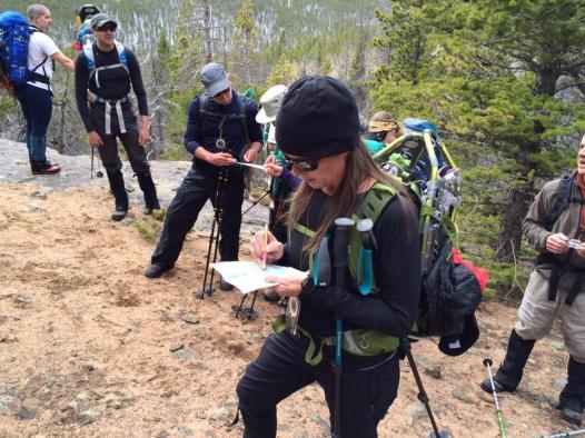
20 Trip Reports Iron Mountain 6/18/16 By Clint Baker Trip Leaders/Mountain Hiking School Instructors Ward Whicker and David Wasson Ward Whicker and David Wasson led our group of ten on a most enjoyable hike up Iron Mountain. This was the final graduation hike for some of the recent Mountain Hiking School students. Billed as a true adventure by Ward, it definitely lived up to his description. The original plan was to drive to the Long Draw Road and drop a car at the trailhead near Trap Lake for our loop descent via Trap Park, an area known for its ideal moose habitat of meadow, willows and small beaver ponds. Should the Long Draw Road still be closed, we would instead drop a car at Zimmerman Lake to complete the loop up to Table Iron, across to Iron Mountain (12,265 ) and finish with a summit climb up Flat Top Mountain (11,355 ) before backtracking to the saddle and dropping into Trap Park. Planning the route Uphill through the woods Photos by Clint Baker 20


21 Trip Reports Iron Mountain (cont.) Most of the group met at 6:00 AM and determined ride shares at Pringles before heading to Ted s Place to connect with the rest of the group. We caravanned up the Poudre Canyon to the planned car drop point. Unfortunately Long Draw Road was still gated for the season so we continued on to the Zimmerman Lake trailhead to leave a car. We then drove to our starting point, Cameron Pass. Diamond Peaks stood to our backs and served as a beacon for our return route throughout the day. Everyone exchanged introductions, posed for the obligatory group photo, prepared their packs and gaiters, and proceeded across the highway to begin the initial steep, forested hillside ascent on the east side of highway 14. Although the mosquitoes were out in force they really weren t biting yet, but definitely made their presence known. The temperature was pleasant and wind was minimal. So far it was shaping up to be a glorious day. Still going uphill After about an hour of bushwhacking up the hillside, we emerged onto the alpine meadows. It was here that we saw our initial destination, Table Iron Mountain which is a sub peak to the still hidden Iron Mountain. We took a short break and then proceeded upwards, with Ward and David assigning leadership responsibilities to the MHS students throughout the day. We were also treated to our first emerging views of Mt. Richthofen, Mount Mahler, Static Peak, Nokhu Crags and the American Lakes basin. 21 Photos by Clint Baker Great Views
 Pointing out the peaks in the area Photos by Clint Baker Ward educated the group on a variety of Rocky Mountain factoids, ranging from alpine vegetation, critters that dig mud tunnels under the")
, to the natural features on the various snow fields that collect pollen and dust from as far away as Arizona, and deposited on the snow to create small, hollowed impressions due to heat collected")
22 Trip Reports Iron Mountain (cont.) Pointing out the peaks in the area Photos by Clint Baker Ward educated the group on a variety of Rocky Mountain factoids, ranging from alpine vegetation, critters that dig mud tunnels under the snow fields, ecological phenomenon such as natural radiation emissions from the rocks on which we traveled, names of distant peaks (were there any that he couldn t identify?), to the natural features on the various snow fields that collect pollen and dust from as far away as Arizona, and deposited on the snow to create small, hollowed impressions due to heat collected by the dust and pollen. One of the most interesting lessons that Ward taught was when he was standing on what looked like solid ground and he started sinking, almost up to his knees. After slogging his way out of the alpine quicksand, with a grin on his face, a twinkle in his eye and boots and legs covered in an orange-brown slime, Ward informed the group, This is called fellfield which comprises the environment of a slope, usually alpine or tundra, where the dynamics of frost and of wind give rise to characteristic plant forms. The fellfields are populated by cushion plants that grow close to the ground and clearly give way when a human stands upon them. We were all sensitized now to the spongy feeling as we proceeded upwards. There were a few close calls, but Ward, with poise and conviction, demonstrated the proper technique to enter and exit a fellfield trap move swiftly and don t linger in one spot too long. 22


23 Trip Reports Iron Mountain (cont.) As we approached Table Iron mountain, Ward said there was a natural arch somewhere along the route and the first person to locate it would win a lollipop. Tony was the winner, however, Ward forgot to bring along a lollipop for a prize so Tony had to settle for a solo photo framed by the natural arch. View of the arch We continued down from Table Iron, and up the steep slope of Iron Mountain. The last section offered presented some spectacular views along the surrounding cliff bands. We reached the summit around noon, making the leisurely one way trek in about 4 hours. After taking summit photos and enjoying lunch for about an hour, we began the journey down. Students honed their leadership skills in navigation and route finding (and avoiding fellfields). Ward quizzed the group to determine what to anticipate in terms of hiking conditions based on what we observed in visible sections of the mountains, and compare to the contours of the map for our hidden decent route. Why are the summits always up? Photos by Clint Baker 23
 It turned out that the expected conditions would be deep snow followed by marshy terrain near the lakes near our loop exit point, so the decision was made to return via our ascent route and not")

24 Trip Reports Iron Mountain (cont.) It turned out that the expected conditions would be deep snow followed by marshy terrain near the lakes near our loop exit point, so the decision was made to return via our ascent route and not complete the planned loop hike. Rather than re-summiting Table Iron, the group contoured around to reconnect with our ascent path. The descent route was pleasant, the weather was warm and not a cloud in the sky. Snow patches were easy to navigate both in the alpine meadows and in the forest, and the wildflowers were spectacular. Our group had the entire mountain to ourselves with no other hikers in sight. Encounters were limited to a single elk and a ptarmigan. We were back to the cars around 4:30 for a total out and back time of about eight and a half hours. Relaxing Many thanks to Ward Wicker and David Wasson for planning and leading this spectacular trip, and congratulations to all of the recent Mountain Hiking School students on a most successful graduation hike. On the summit Photos by Clint Baker 24


25 Trip Reports Missile Site/Poudre River Trail 6/20/16 Trip Leader Scott Farquhar Just like the combinations of Wine and Cheese, Chocolate and Peanut Butter, Astaire and Rogers, mixing a tour of the Missile Silo outside of Windsor with a bike ride on the Poudre River Trail was great! Missile Site Tour By Scott Farquhar On top of the Bunker We made our way to Missile Site Park just before 10:00 to meet our tour guide. We waited patiently for a few minutes while he finished off the tour that had started before ours. Our tour started off with a stroll around the top of the concrete bunker. At this point the tour was interesting, but the best was yet to come as we made our way around to the steel doors that opened up to the underground facility. There we went through tunnels to the command center and all of the other areas required to run the early 1960 s era Atlas ICBM facility. Our tour finished off in the large room that had stored the missile on it s side. Although the silo does not presently have a real missile on site, the mock up missile still provides a good idea of the scale of the Atlas Rocket and the machinery required to pivot it upright for launching. We re going in!!! Photos by Scott Farquhar 25
 Our tour guide was a veteran who had been associated with missile facilities during his tour of duty, although he did not work directly in one of the silos.")
. Presently he is a Weld County employee and is caretaker of the records that are stored in the silo as well as the expert tour guide.")
26 Trip Reports Missile Site/Poudre River Trail (cont.) Missile Site Tour (cont.) Our tour guide was a veteran who had been associated with missile facilities during his tour of duty, although he did not work directly in one of the silos. Due to his experience he was able to present many insights on the people and inside workings of this type of operation (and he promised he would not have to kill us after giving us all this information). Presently he is a Weld County employee and is caretaker of the records that are stored in the silo as well as the expert tour guide. Tunnel to Command Center Poudre River Trail Bike Trip Rocket stored horizontal After completing the tour the group hopped into cars and drove to the Kodak Watchable Wildlife Area Trailhead of the Poudre River Trail. Note I chose to do this rather than ride CO-257, which did not look like much fun. From here the group rode east 5.4 miles to the Poudre Learning Center. Along the way we saw herons, egrets, pelicans, and cormorants. Note: in this section of the trail there is a portion that the river has washed out completely. We were able to walk in the grass to get around the washed out section, but be careful if you ride this trail. 26 Photos by Scott Farquhar


27 Trip Reports Missile Site/Poudre River Trail (cont.) At the Learning Center we ate lunch in the gardens, used the indoor facilities and once again proceeded east. After passing through the Signature Bluff canyon we reached the Barn at the Poudre River Ranch natural Area. Here the water covered the trail so we decided to turn around and retrace our ride. When we arrived back at the cars the decision was made to do a few more miles so we continued to bike to the west on trail. On this section of trail we passed numerous ponds, a giant wooden Pelican, a beautiful community garden before arriving at the Frank State Natural Area. Here we learned how Native Americans had used bluffs in the area to hunt bison. We also observed a Great Blue Heron and a Kingfisher practicing their fishing skills. At this point it was starting to get hot so we biked the 4.7 miles back to the cars and called it a day. Visions of the Cold War mixed with wildlife filled my head that night. A strange combination, but then again people may have thought the same about Rogers and Hammerstein before they became famous. The Missile Silo is located in Missile Silo Park off of US-34 Business, it is a park run by Weld County. Go to the following link for more information on the Weld County Missile Silo Park and for information on how to set up a tour. Giant Pelican Lunch at the Learning Center 27 Photos by Scott Farquhar


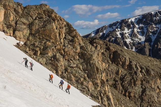
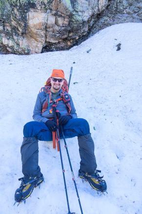
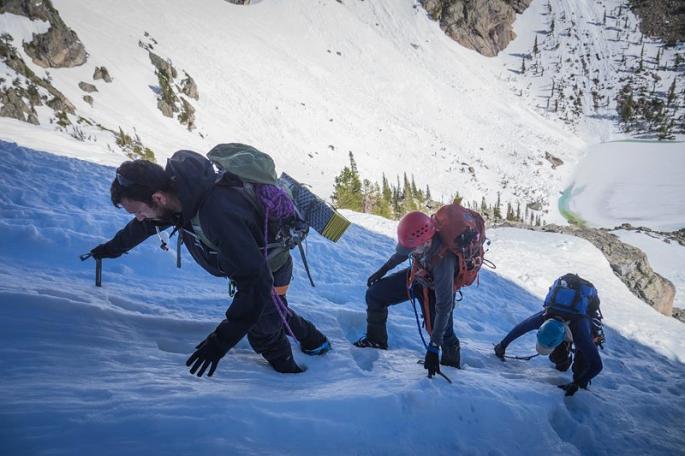
28 Snow Climbing and Crampon Workshop Mt. Mahler Saddle/Couloir - 6/12/16 By Tony Gonzales A good "alpine start", some sunny weather, and a robin's egg blue sky graced the Fort Collins group as made our way up the sometimes snowy trail past the Nohku cabin to Lake Agnes. From the east side of Agnes, we attached crampons, helmets, and axes and began to skirt along the eastern edge heading southward toward our Mount Mahler objective. After some switch backing and layer changes, we had arrived at an apron to begin the ascent of the couloir. A quick 700' of climbing found the group at the Mahler and Richthofen saddle and the group enjoyed a short lunch, as the skies were quickly darkening. Looking back Going around Lake Agnes Going up Photos by John Wullschleger 28
 A sunny climb The group lucked out, however, as the")


29 Mt. Mahler Saddle/Couloir (cont.) A sunny climb The group lucked out, however, as the rain never fell and we enjoyed a cloudy and fun glissading descent back down near Lake Agnes (not too shabby, for a 70% chance of rain) as we made our way back to the trailhead. A big Thank You goes out to the Leadership and other Instructors for a fun and successful Snow Climb trip! Near the saddle We re coming Photos by John Wullschleger 29 Glissading down


30 Mountain Hiking School 2016 By Scott Farquhar Two additional Graduation Hikes were held, a hike to the Summit of Steep Mountain and a hike to the summit of Iron Mountain. All told there were 14 graduates of the Mountain Hiking School this year. a new record!!!!! Congratulations to all the new graduates, I hope to see you on a hike soon. Photos of the Steep Mountain hike follow, a full Trip Report of the Iron Mountain Hike is include in this newsletter. Checking our location Photos by David Wasson 30 A bit breezy near the summit
 Photo by David Wasson On the Summit of")
31 Mountain Hiking School 2016 (cont.) Photo by David Wasson On the Summit of Steep Mountain 31
 or looking for used gear NOT for services or selling new products (since I put together the newsletter I have total control... BawHaaaaaa).")
32 Gear Swap Note this page is ONLY be for Fort Collins Group CMC Members (not stores or personal businesses) AND the intent is for advertising used gear (selling or swap?) or looking for used gear NOT for services or selling new products (since I put together the newsletter I have total control... BawHaaaaaa). If you have something you would like added to the newsletter send the information to fccmcguy@gmail.com. Note I complete the newsletter during the first couple of days every other month (on the odd numbered months) so please send the information before then (i.e. this newsletter was completed on July 2). For Sale Men's MSR Lightning Ascent 30 in. Snowshoes Original price: $289.95Asking: $95.00 Contact: Rich Enenstein renenste@comcast.net 32

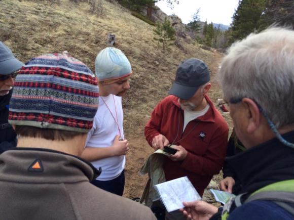
33 Parting Shots Miscellaneous FC Group Photos Misc Snow Climbing Course Photos by John Wullschleger Navigation Day Mountain Hiking School Photos by Brittany Pennington 33
Page 4. Page 2. Page 2. Page 5. Chair's Corner: Volunteers Wanted! 2011 Ski Mountaineering School. BMC Holds Crevasse Rescue
 Ski mountaineering school students Dustin Steffenson and Wendy Phillips (photo by Ward Whicker) Inside Page 2 Page 2 Page 4 Page 5 Chair's Corner: Volunteers Wanted! 2011 Ski Mountaineering School BMC
Grizzly Peak A - East Ridge July 15, 2012
 Grizzly Peak A - East Ridge July 15, 2012 Difficulty: Difficult Class 2/Class 3 Upper Elevation: 13,995 feet Trailhead Elevation: 11,360 feet Elevation Gain: 3,000 feet Round-trip Length: 6.0 miles Trailhead:
Itinerary Overview. Continental Divide Alpine Backpacking 22 days Ages Course Description
 Itinerary Overview Continental Divide Alpine Backpacking 22 days Ages 16-18 Course Description Welcome, you re in for an experience of a lifetime! Imagine hiking through rolling forests, sharing alpine
Mt. Thielsen Trip Report: April 29, 2012
 Mt. Thielsen Trip Report: April 29, 2012 Outing Organizer: Geoff Hance, with Brent McGregor Elevation Gain: 3,800 feet, over warming snow, with an exposed summit block Distance: About 9 miles round trip
The Mountain Ear. April 2018
 The Mountain Ear April 2018 President s Message Greetings! My standard method of writing these monthly newsletters is to compose all the information that follows, then prepare the President s Message last.
Itinerary Overview. Sawatch Range Mountaineering Ages days
 Itinerary Overview Sawatch Range Mountaineering Ages 14-16 22 days Course Description Welcome, you re in for an experience of a lifetime! Imagine hiking through rolling forests, sharing alpine meadows
Itinerary Overview: What you will be doing Maroon Bells Alpine Backpacking 22 days
 Itinerary Overview: What you will be doing Maroon Bells Alpine Backpacking 22 days 0BCourse Description Welcome, you re in for an experience of a lifetime! Imagine hiking through rolling forests, sharing
Itinerary Overview. Sangre de Cristo Alpine Backpacking 22 days Ages Course Description
 Itinerary Overview Sangre de Cristo Alpine Backpacking 22 days Ages 16-18 Course Description Welcome, you re in for an experience of a lifetime! Imagine hiking through rolling forests, sharing alpine meadows
Itinerary Overview. Colorado San Juan Mountaineering 15-days
 Itinerary Overview Colorado San Juan Mountaineering 15-days Course Description Welcome, you re in for an experience of a lifetime! Imagine hiking through rolling forests, sharing alpine meadows with mountain
Itinerary Overview. Maroon Bells Mountaineering 22-days. Course Description
 Itinerary Overview Maroon Bells Mountaineering 22-days Course Description Welcome, you re in for an experience of a lifetime! Imagine hiking through rolling forests, sharing alpine meadows with mountain
The temperature is nice at this time of year, but water is already starting to be scarce.
 In March of 2003, Scott Morrison and I went backpacking in the Grand Canyon. The temperature is nice at this time of year, but water is already starting to be scarce. Another issue with this time of year
Glacier National Park, MT
 Glacier National Park, MT July 28 Aug. 1, 2010 We decided to go to Glacier National Park for our family vacation this year. We had a great time seeing beautiful scenery and a variety of wildlife which
Quandary Peak East Ridge
 Quandary Peak East Ridge Difficulty: Class 1 / 2 June 28,2013 Exposure: Summit Elev.: 14,265 feet Trailhead Elev.: 10,850 feet Elevation Gain: 3,450 feet Roundtrip: 6.75 miles Hikers: Shan Stuart, Rick
Draft II - Trip Report by Kurt Wibbenmeyer
 Draft II - Trip Report by Kurt Wibbenmeyer COLORADO MOUNTAIN CLUB FAIRWEATHER MOUNTAIN EXPEDITION 2010 TEAM Rich McAdams Leader Mike Butyn Wayne Herrick Gerry Roach Bill Blazek Dave Covill Jim Rickard
Mount Daly a Most Prominent Peak via South Ridge
 Mount Daly a Most Prominent Peak via South Ridge Difficulty: Class 3 Exposure: Exposed in places along the ridge Summit Elevation: 13,305 Elevation Gain: 4100 from trailhead; 1800 from Capitol Lake camp
Coast to Crest Trail Corridor Hike
 Coast to Crest Trail Corridor Hike Jim Cunningham, Poway City Council member and Board Chair of the San Dieguito River Park in 2013 has embarked on a project to hike the entire 70-mile San Dieguito River
HB/VS-078 Üssers Barrhorn
 HB/VS-078 Üssers Barrhorn Paul HB9DST, August 23, 2015 Summary: This was a HB9SOTA club project, an activation of the highest summit in Europe you can hike up without ropes or other equipment. The headline
Adventures in the Rockies. 6 Days
 Adventures in the Rockies 6 Days Adventures in the Rockies On this action-filled adventure, experience two different sides to the Rockies on the western side, discover hidden gems that few visitors get
Route #1) Mt. of the Holy Cross - North Ridge
 Mt. of the Holy Cross - North Ridge") Climbing 14ers can be very dangerous, please read the Mountaineering Safety Page and make sure you have a map+compass and can use them effectively, without the help of electronic devices. Route #1) Mt.
Climbing 14ers can be very dangerous, please read the Mountaineering Safety Page and make sure you have a map+compass and can use them effectively, without the help of electronic devices. Route #1) Mt.
Location: Height: Access: Distance: Elevation: Season: Difficulty: Lat/Long: Directions:
 Upper Eagle Falls Upper Eagle Falls (~20 ft.) is a short hike up from the roadside at the Eagle Falls picnic area. It is very difficult to get a parking spot here during the day, so it is recommended to
CMC Member Guide to the CMC Website
 CMC Member Guide to the CMC Website HOW TO: Sign Up or Cancel a Trip/Event/Class Change Your Personal Information PLUS HOW TO FIND: Renew Your Membership Trip classification information Denver Group Classification
Stephens State Park Trails
 TRAILS OF ALLAMUCHY MOUNTAIN & STEPHENS STATE PARKS Allamuchy Mountain and Stephens State Parks contain 28 marked trails providing access to diverse landscapes for walking, hiking, biking, bird-watching,
Hiking Las Vegas.com
 Hike: Mt. Wilson via First Creek Canyon route Trailhead: First Creek marked Distance: 10 miles up and back Elevation gain: 3,400 feet Elevation of Peak: 7,070 feet Time: 7 to 9 hours (up and back) Difficulty:
Mt. Rainier Three-Day Muir Climb
 Mt. Rainier Three-Day Muir Climb Details below provided by AAI Elevation: 14,411 feet Guide Service: Alpine Ascents International (AAI) Fundraising minimum: $5,000.00 USD Muir Three-Day Overview Our three-day
Three Sisters Wilderness Oct. 2009
 Three Sisters Wilderness Oct. 2009 I was in Bend, OR and had the whole day to travel back to Boise so I decided to take a hike to the popular Green Lakes and summit the South Sister in Three Sisters Wilderness.
Trip Report: Backpack to East Boulder Lake in California Trinity Alps, July 7-9, 2016
 Trip Report: Backpack to East Boulder Lake in California Trinity Alps, July 7-9, 2016 Trekkers: Richard Hales, Aleece Townsend, Carol Mockridge, Rosalie Rybka, Elisabeth Zinser Day 1: Richard and Aleece
Friday October 3. Lower Javelina Trail - Level D. about 3 miles, less than 500. Hike Contact: Joel Tormoen
 Friday October 3 Lower Javelina Trail - Level D. about 3 miles, less than 500 Hike Contact: Joel Tormoen joeltormoen@gmail.com Depart WB trailhead 8:00 am - return before 11:00 am This quite easy hike
Non-motorized Trail Plan & Proposal. August 8, 2014
 Town of Star Valley Ranch, Wyoming and the Star Valley Ranch Association in partnership with the USDA Forest Service, Bridger-Teton National Forest, Greys River Ranger District Non-motorized Trail Plan
Route #2) Mt. Massive - Southwest Slopes
 Mt. Massive - Southwest Slopes") Route #2) Mt. Massive - Southwest Slopes Difficulty: Class 2 Ski: Advanced, D6 / R2 / III Exposure: Summit Elevation: Trailhead Elevation: Elevation Gain: Round-trip Length: Trailhead: County Sheriff:
Route #2) Mt. Massive - Southwest Slopes Difficulty: Class 2 Ski: Advanced, D6 / R2 / III Exposure: Summit Elevation: Trailhead Elevation: Elevation Gain: Round-trip Length: Trailhead: County Sheriff:
Guide Training Ski TAP APPLICATION PACKAGE. Hello and thank you for your interest in applying to the ACMG Training and Assessment Program (TAP).
.") Hello and thank you for your interest in applying to the ACMG Training and Assessment Program (TAP). As of April 30, 2018, the ACMG will be running the program for an undetermined period. For any courses
Hello and thank you for your interest in applying to the ACMG Training and Assessment Program (TAP). As of April 30, 2018, the ACMG will be running the program for an undetermined period. For any courses
DENVER CMC PHOTOGRAPHY SECTION NEWSLETTER
 PHOTOGRAPHY SECTION DENVER CMC PHOTOGRAPHY SECTION NEWSLETTER Mark Haugen has two Photo Hikes in July see page 2 for details. Thursday, July 11 through Sunday, July 14 Lake Basin Silverton Car Camping
Alaska Backpacking Journey to Oz
 St. Elias Alpine Guides, LLC Wrangell-St. Elias National Park, Alaska (888) 933-5427 (907) 345-9048 www.steliasguides.com Alaska Backpacking Journey to Oz Traversing some of the most stunning terrain in
KUSHILAND Expeditions & Tour Safaris Ltd
 KILIMANJARO TREK MACHAME ROUTE TOUR CODE KMC 02 7 DAYS MACHAME ROUTE Kilimanjaro s Machame Route, often referred to as the Whiskey route, is more scenic and is longer than Marangu. The minimum duration
Mt. Elbert East Ridge
 Mt. Elbert East Ridge Difficulty: Class 1 Exposure: None Summit Elev.: 14,440 feet Trailhead Elev.: 10,400 feet Elevation Gain: 4,100 feet Roundtrip Length: 8.5 miles Trailhead: South Elbert (near Twin
Photo Credit: Banff Lake Louise Tourism / Paul Zizka Photography MOUNTAIN ADVENTURES
 Photo Credit: Banff Lake Louise Tourism / Paul Zizka Photography MOUNTAIN ADVENTURES MOUNTAIN ADVENTURE PROGRAM Operated by Fairmont Chateau Lake Louise Fairmont Chateau Lake Louise has a long and proud
MP : Blue Hill and the Disney Avalanche Path
 MP 252-253: Blue Hill and the Disney Avalanche Path This section of the Auto Tour includes a portion of the wagon road, one of Colorado s most famous avalanches and the remains of an old dam. Route Mile
GOLDEN EARS PROVINCIAL PARK
 GOLDEN EARS PROVINCIAL PARK Trail Information as of October 10 th 2015 Do not underestimate the mountainous wilderness of Golden Ears Provincial Park. The combination of rugged terrain and rapidly changing
Colorado Life Zone Scavenger Hunt
 Colorado Life Zone Scavenger Hunt Below are worksheets created for all the habitats or life zones. They were designed with the intention of breaking the class up into small groups, and having students
Road and Trail Report 04/02/2015
 U.S.D.A. FOREST SERVICE KETCHUM RANGER DISTRICT 206 SUN VALLEY ROAD P.O. BOX 2356 KETCHUM, ID 83340 (208) 622-5371 Road and Trail Report 04/02/2015 o Dry weather and a dwindling snowpack continue to bring
The 2 Man Trail Crew
 The 2 Man Trail Crew The year was 1972. We had just returned to the mountain town of Field from my work with the Avalanche Research team in Rodgers Pass. Grace and I moved into our small house along side
Route Combo) Mt. Bierstadt - Bierstadt, Sawtooth, Evans
 Mt. Bierstadt - Bierstadt, Sawtooth, Evans") Climbing 14ers can be very dangerous, please read the Mountaineering Safety Page and make sure you have a map+compass and can use them effectively, without the help of electronic devices. Route Combo)
Climbing 14ers can be very dangerous, please read the Mountaineering Safety Page and make sure you have a map+compass and can use them effectively, without the help of electronic devices. Route Combo)
Little Grand Canyon near Pomona, Illinois
 Little Grand Canyon near Pomona, Illinois Below: View of the trail and the terrain created using the Map My Hike app Below: Summary of the hike created using the Map My Hike app Presented by: Jennifer
Guthega to Mt Twynam. 2183m. 1583m. 6 hrs 45 mins 14.8 km Return. Experienced only. 913m
 Guthega to Mt Twynam 6 hrs 45 mins 14.8 km Return Experienced only 5 913m This walk starts from Guthega and makes its way along the Snowy River to the Illawong Lodge, via the Blue Cow Creek flying fox.
Mark Beyer SMOKEJUMPERS. Life Fighting Fires
 Mark Beyer SMOKEJUMPERS Life Fighting Fires Extreme Risk Fighting forest wildfires is a dangerous business. Some wildfires, however, are easier to get to than others. They can begin to burn near roads,
playwinterpark.com Off The Beaten Path Hikes Hiking Recommendations for the Adventurous Hiker
 playwinterpark.com Off The Beaten Path Hikes Hiking Recommendations for the Adventurous Hiker Hike: Devil s Thumb (difficult) Length: 3.93 miles one-way Elevation: Trailhead 9609 Destination 12,236 Trailhead
Kit Carson-Challenger Ridge Trail Project
 Kit Carson-Challenger Ridge Trail Project Project Accomplishments Report-USFS December 15, 2015 Photo courtesy of Justin Peterson 815 South 25 th Street, Suite 101 Colorado Springs, CO 80904 Dedicated
Below is an example of a well laid-out template of a route card used by the Sionnach Team which is a good format to begin with.
 Route Card A route card is used as a navigational aid to hill walkers by setting out a step by step plan for an intended hike. It is good practice to make out a route card before every hike you or your
02-10 June 2015 Round-the-World Trip: Canadian Rockies. Dear Friends,
 Dear Friends, Here is another chapter of our adventures. Few days after my return from California, we went on a 4-day trip to the Canadian Rockies with Louise, Nasser and Leah. After that we continued
FAQ for the Alpine Scrambling Program (Rev: 12/18/2018)
") FAQ for the Alpine Scrambling Program (Rev: 12/18/2018) What if I need to withdraw? Denver Group school refund policy is as follows: Student/participant requests for refunds of tuition/fees must be requested
FAQ for the Alpine Scrambling Program (Rev: 12/18/2018) What if I need to withdraw? Denver Group school refund policy is as follows: Student/participant requests for refunds of tuition/fees must be requested
Page 3. Page 2. Page 2. Page 7. Chair's Corner: Mountain Hiking School. Report on the Annual Potluck. Little Matterhorn. Mountain Leadership Column
 Participants on the third trip of the 2012 alpine backcountry ski tour series contemplate the terrain near Montgomery Pass.(Wullschleger). Inside Page 2 Page 2 Page 3 Page 7 Chair's Corner: Mountain Hiking
SNOW-SHOEING. $485 for one or two people 10:00 am to 3:00 pm, includes packed lunch ($240 for each additional person, Gratuity Included)
") SNOW-SHOEING There is no better way to experience the serene winter beauty of the San Juan Mountains than with a pair of snowshoes strapped to your feet. Frolic in fresh Colorado powder while learning
SNOW-SHOEING There is no better way to experience the serene winter beauty of the San Juan Mountains than with a pair of snowshoes strapped to your feet. Frolic in fresh Colorado powder while learning
KILIMANJARO 2018 RUN & TREK February 28 March 12
 KILIMANJARO 2018 RUN & TREK February 28 March 12 Wednesday 28 Feb Depart USA to Kilimanjaro International Airport, Tanzania, Africa Thursday 01 March Arrive Kilimanjaro. Met upon arrival at the Kilimanjaro
Hike and Backpack with the Mountaineers!
 Hike and Backpack with the Mountaineers! 2017 Mountaineers Hiking Programs 2017 Mountaineers Hiking Programs Free Hikes and Backpacks Are Available Year-round Every season of the year the Mountaineers
LOWER SPRING CANYON - CAPITOL REEF
 LOWER SPRING CANYON - CAPITOL REEF Rating: Moderate Hike Length: 5-7 hours (10-11 miles) Gear: Standard Hiking Gear Maps: Fruita, UT; Twin Rocks, UT; Water: A filterable spring a bit over 1/2 way. Recommend
CATSKILL 3500 CLUB HIKE SCHEDULE SPRING 2019
 CATSKILL 3500 CLUB HIKE SCHEDULE SPRING 2019 Sat. Apr. 6 - NORTH DOME & SHERRILL Distance: 6.5 mi. Ascent: 2700' Elevs: 3610', 3540' Strenuous bushwhack to two remote peaks. Well behaved dogs are welcome.
L U N C H C R E E K T R A I L GLACIER NATIONAL PARK
 D I R T I N M Y S H O E S L U N C H C R E E K T R A I L GLACIER NATIONAL PARK Lunch Creek "Secret" Hike This short hike on the Lunch Creek Trail will knock your socks off! It's the perfect mix of length,
Figure 1 Understanding Map Contours
 Figure 1 Understanding Map Contours The light brown lines overprinted on topographic maps are called contour lines. They indicate the elevation above sea level of land features and thus permit you to view
Important Information for Camping Trips in Ivvavik National Park
 Important Information for Camping Trips in Ivvavik National Park Your adventure begins at the Parks Canada office in Inuvik, NT. Meet your small group for a brief orientation, then board the shuttle to
American Conservation Experience
 ACE Project Report For Tonto National Forest, Arizona Trail Association and Arizona State Parks Title of Project: 4 Peaks Trail Maintenance Award Contract Number: ASP NM11021 Project Partner: Paul Burghard
Serene Lake Trail 512
 1 of 9 9/20/2009 9:19 AM of the Clackamas River Ranger District of the Mount Hood National Forest Editors Only: News Stories Pictures Files Shortcuts Discuss Logoff Help Serene Lake Trail 512 Topic: Serene
Part 1: Introduction to Decision Making
 Part 1: Introduction to Decision Making 1.1 - Anatomy of a Decision ABOUT AIARE Learning Outcomes Identify that backcountry decision making involves five key components: Plan, Observe, Teamwork, Choose
CIEC 9 PEAKS AWARD SUPPLEMENT POSSIBLE ROUTES FOR THE 9 PEAKS AWARD TRIP
 CIEC 9 PEAKS AWARD SUPPLEMENT POSSIBLE ROUTES FOR THE 9 PEAKS AWARD TRIP As you plan your trip, be aware of 3 regulations in this wilderness: 1. Camp only in designated campsites. 2. No campfires allowed.
SYNOPSIS WEATHER AND SNOWPACK
 Peak 6996 Avalanche Fatality Incident Report Glacier National Park, MT Date of Avalanche: 31 March 2010 Date of Investigation: 2 April 2010 Investigation Team: Erich Peitzsch (USGS), Ted Steiner (Chugach
Looking back across Emerald Lake at Wapta Mountain (on the left) and Mount Burgess (on the right):
 and Mount Burgess (on the right):") YOHO LAKE FROM EMERALD LAKE, YOHO NATIONAL PARK, BRITISH COLUMBIA, CANADA We decided to hike to Yoho Lake from Emerald Lake even though the distance is longer than the trail from Takakkaw Falls (about
YOHO LAKE FROM EMERALD LAKE, YOHO NATIONAL PARK, BRITISH COLUMBIA, CANADA We decided to hike to Yoho Lake from Emerald Lake even though the distance is longer than the trail from Takakkaw Falls (about
ARCTIC AURORA TOUR 5-Day Itinerary
 ARCTIC AURORA TOUR 5-Day Itinerary If you are serious about the northern lights, then you ll want to dedicate more than day to it. This trip carries you away from Fairbanks to the historic village of Wiseman
Dates: March 4 th -13 th Location: Bariloche, Patagonia, Argentina. Brief Description:
 [Type text] Page 0 Patagonia Remote Medicine Expedition is an exciting experience offered through the section of Wilderness & Environmental Medicine of the Emergency Department at University of Colorado
Note: Coordinates are provided as Universal Transverse Mercator UTM Zone U21, North American Datum 1983 (NAD 83).
.") Northern Traverse Route Description The Northern Traverse (formerly the North Rim Traverse) is an unmarked and rugged backcountry hiking route. It is known be a demanding hike, because of its terrain and
Northern Traverse Route Description The Northern Traverse (formerly the North Rim Traverse) is an unmarked and rugged backcountry hiking route. It is known be a demanding hike, because of its terrain and
Kitimat. Pacific Inland Coast. Hiking Guide Kitimat, British Columbia, Canada
 Kitimat Pacific Inland Coast Hiking Guide Kitimat, British Columbia, Canada 2010-2011 Sites and Trails Emergency Call 911 Police - Fire - Medical 2 Welcome to Kitimat This information was produced to assist
USDA Trails Strategy WRI: ENGLISH PEAK SURVEY. Theodore Mendoza San Diego State University June 6 th 2016 August 18 th Advisor: Sam Commarto
 WRI: ENGLISH PEAK SURVEY Theodore Mendoza San Diego State University June 6 th 2016 August 18 th 2016 Advisor: Sam Commarto Klamath National Forest Submitted: March 21, 2017 Table of Contents Acknowledgements
HIKING IN THE CANADIAN ROCKIES
 HIKING IN THE CANADIAN ROCKIES Distance Time Elevation y MORAINE LAKE TRAILS THE ROCKPILE 0.8 km (0.5 mi) 20 min 30 m (98 ft) Located adjacent to the Lodge, the short interpretive trail up the Rock Pile
Podcast 31 - The Australian Alps - A Trip to Thredbo
 Podcast 31 - The Australian Alps - A Trip to Thredbo by Rob McCormack - Friday, January 03, 2014 http://slowenglish.info/?p=918 Learn English while learning about daily life in Australia, with Rob McCormack
Newsletter. Vol. 2015, No. 6 November, 2015
 Newsletter Vol. 2015, No. 6 November, 2015 Table of Contents From the Editor.4 New Members..5 Message from the Chair...6 New Trip Leaders!... 10 What s Coming Up (Winter Schools)...14 2 Table of Contents
ANUMC Ski Mountaineering Expedition. Classic Haute Route ANUMC Expedition Fund Application By Andrew Gough
 ANUMC Ski Mountaineering Expedition Classic Haute Route 2010 ANUMC Expedition Fund Application By Andrew Gough Introduction: The Haute route (or High Mountaineers Route ) is one of the worlds most famous
FILE NO WORLD TRADE CENTER TASK FORCE INTERVIEW LIEUTENANT STEPHEN JEZYCKI INTERVIEW DATE OCTOBER TRANSCRIBED BY LAURIE COLLINS
 FILE NO 9110050 WORLD TRADE CENTER TASK FORCE INTERVIEW LIEUTENANT STEPHEN JEZYCKI INTERVIEW DATE OCTOBER 11 2001 TRANSCRIBED BY LAURIE COLLINS MR FELLER TODAYS DATE IS OCTOBER 11TH 2001 THE TIME NOW IS
Date Name Trail Segment Conditions, Hazards and General Notes on Trails
 Trail Reports for Sawtooth NRA ***Unless otherwise reported-expect high creeks, snow levels at 7900 ft. and trees on trails. Due to high winds in the area, if trees were previously reported removed there
Rocky Mountain National Park Hiking Map By Trails Illustrated Maps
 Rocky Mountain National Park Hiking Map By Trails Illustrated Maps 10 Great Hikes for Families with Kids in Estes Park, Colorado - Choose from plenty of great family hikes in Rocky Mountain National park.
Junior Ranger Guide. Recommended for Ages Photo Charlie Johnson
 Junior Ranger Guide Recommended for Ages 7-12 Photo Charlie Johnson 1 Hi! I m Barry the Bear and I m excited to help you become a Larimer County Junior Ranger! Rangers keep parks and open spaces safe for
Trek2Kili P.O. Box 2112 Moshi TZ Whatsapp
 Trek2Kili P.O. Box 2112 Moshi TZ Whatsapp +255 673 360 trek2kili@gmail.com MT. KILIMANJARO MARANGU 6 DAY 5 NIGHT TREK Marangu Route, commonly known as the Coca Cola route is more popular because it can
C E N T R A L C A T S K I L L S
 120 C E N T R A L C A T S K I L L S Central Catskills Once out of the southern parts of the Catskills, the Long Path enters the more well traveled and civilized regions. The trail joins the Devil s Path,
DENVER CMC PHOTOGRAPHY SECTION NEWSLETTER
 PHOTOGRAPHY SECTION DENVER CMC PHOTOGRAPHY SECTION NEWSLETTER Tracks on Trails, page 2 2015 Year of the Mountaineer, page 3 CMC Photo Section s Wilderness Photos page 520 2014 Monthly Meetings 2nd Wednesday
Trails of Troop 48 Doing more before breakfast than most people do all day.
 Trails of Troop 48 Doing more before breakfast than most people do all day. October 2009 White Horse District SNJ Council Troop Election Results for 2009-2010! On September 23, the Scouts of Troop 48 selected
Henderson Mountain Avalanche Accident Two riders caught, one partially buried, one fully buried
 Henderson Mountain Avalanche Accident Two riders caught, one partially buried, one fully buried Custer-Gallatin National Forest 28 November 2014 Synopsis A group of 6 or 7 snowmobilers (part of a larger
Expeditions on The Isle of Mull
 Camas Expeditions on The Isle of Mull The Expedition story The plan; take 6 boys from different schemes in Glasgow on expedition and walk for 1½ days heading from the Glenmore pass car park down the valley
Date Name Trail Segment Conditions, Hazards and General Notes on Trails
 Trail Reports for Sawtooth NRA ***Unless otherwise reported-expect high creeks, snow levels at 7900 ft. and trees on trails. Due to high winds in the area, if trees were previously reported removed there
Dnigi Hut. Dnigi is Dnaina for Moose. Location:
 Dnigi Hut in places. Stay on the main thoroughfare. Continue along the ridge top, going east to a pass above Knob Creek. Just beyond here look for a left turn which descends north-northwest (61,45.578,-148,52.414,2081
Date Name Trail Segment Conditions, Hazards and General Notes on Trails
 Trail Reports for Sawtooth NRA ***Unless otherwise reported-expect high creeks, snow levels at 7900 ft. and trees on trails. Due to high winds in the area, if trees were previously reported removed there
Morning Star Peak Avalanche Accident
 Morning Star Peak Avalanche Accident Saturday, December 4, 2010 Date: 2010-12-13 Submitted by: Oyvind Henningsen Everett Mountain Rescue and Mark Moore NWAC Place: Morning Star Peak, north-central WA Cascades
Covenant Health presents
 Covenant Health presents www.covenanthealth.com 1. 2. 3. 4. 5. 6. 7. 8. 9. 10. 11. Trail Guidelines Wear proper hiking shoes. Please be on time. Make sure that you understand & have signed the waiver.
Avalanches and the Mount Whitney Basin
 Avalanches and the Mount Whitney Basin 10 April 2006 by Bob Rockwell Prelude Avalanches are a fact of life in high mountains in winter, and we take courses to find out about them. We learn how to assess
2012 Squaw Butte Trail Warriors
 2012 Squaw Butte Trail Warriors Between June 1 st and September 30 th 2012 Squaw Butte supported nine trail maintenance projects. These projects covered a large section of south western Idaho, taking place
BRYCE CANYON COUNTRY Boulder Mountain Scenic backways itinerary
 BRYCE CANYON COUNTRY Boulder Mountain Scenic backways itinerary Boulder Mountain Area The high plateaus of the Aquarius Plateau (Boulder Mountain), are heavily forested and covered in countless winding
AVALANCHE TRAINING REQUIREMENTS FOR DENVER TRIP LEADERS Approved June 20, 2011
 AVALANCHE TRAINING REQUIREMENTS FOR DENVER TRIP LEADERS Approved June 20, 2011 The Denver Safety and Leadership Committee adopted a new avalanche training program for Denver trip leaders, effective October
PHILMONT EXPEDITION UNIT REGISTRATION FOR 2020
 PHILMONT EXPEDITION UNIT REGISTRATION FOR 2020 REMINDERS: Your unit representative may enter the system anytime from October 30 thru December 2. Any unit can enter the registration system in consecutive
Trail Phasing Plan. Note: Trails in the Clear Creek Canyon area (Segments will be finalized in the future to minimize wildlife impacts
 Note: Trails in the Clear Creek Canyon area (Segments 2 5 and a future JCOS connection) will be finalized in the future to minimize wildlife impacts Trail Phasing Plan P Parking 3 Easy Trail Intermediate
Get Out And Hike! From Bruce Rieman, scientist and retired fish guy:
 Get Out And Hike! Living between the Swans and Missions and not hiking is like living in Anaheim, California and not visiting Disneyland. To help others and myself enjoy our unique surroundings, I asked
Guide Book Excerpts. Wham Ridge 2006
 Guide Book Excerpts Wham Ridge 2006 Approach: Molus Lake / Elk Park / Vestal Creek Roach and Roach Description Take the Durango & Silverton Narrow Gauge train from either Durango or Silverton and get off
A Long Weekend in Zion. 4 Days
 A Long Weekend in Zion 4 Days A Long Weekend in Zion Spend a long weekend completely immersed in Zion National Park, exploring its massive red walls, enormous sandstone monoliths soaring into brilliant
Southwest Family Adventure. 7 Days
 Southwest Family Adventure 7 Days Southwest Family Adventure See three amazing National Parks Grand Canyon, Bryce, and Zion on this epic camping trip designed with families in mind. Every day offers magnificent
Mt. Massive Southwest Slopes
 Mt. Massive Southwest Slopes Difficulty: Class 2 Exposure: Summit Elevation: 14,421 feet Trailhead Elevation: 10,500 feet Elevation Gain: 4,050 feet Round-trip Length: 8.00 miles Trailhead: N. Halfmoon
Colorado Mountain Club
 Colorado Mountain Club 1912-2014 Mt. Sneffels. Photo by Rod Martinez, The Camera Club of Mesa County. CANYON CALL WEDNESDAY FEBRUARY 5, 2014 CMC Western Slope 7 PM at the Masonic Lodge, 2400 Consistory