BOARD OF COUNTY COMMISSIONERS SARPY COUNTY, NEBRASKA
|
|
|
- Andrea McKenzie
- 5 years ago
- Views:
Transcription
1 ,_ BOARD OF COUNTY COMMISSIONERS SARPY COUNTY, NEBRASKA RESOLUTION AUTHORIZING THE CHAIRMAN TO SIGN THE APPLICATION, LETTER OF SUPPORT, AND OTHER DOCUMENTS RELATING TO THE RECREATIONAL TRAILS PROGRAM GRANT (RTP) WHEREAS, pursuant to Neb. Rev. Stat (6) (Reissue 2007), the County has the power to do all acts in relation to the concerns of the County necessary to the exercise of its corporate powers; and, WHEREAS, pursuant to Neb. Rev. Stat (Reissue 2007), the powers of the County as a body are exercised by the County Board; and, WHEREAS, a Recreational Trails Program Grant is available to Sarpy County through the Nebraska Game and Parks Commission; and, WHEREAS, the Recreational Trails Program Grant is for the development and extension of recreational biking and walking trails; and, WHEREAS, Sarpy County is committed to and supports the Recreational Trails Grant for the development and extension of the Marv Holubar Trail; and, NOW, THEREFORE, BE IT RESOLVED, By the Sarpy County Board of Commissioners that the Chairman is hereby authorized to sign the Recreational Trails Program (RTP) Grant application, letter of support, and other documents relating to the RTP application. Sarpy County Board Chairman
2 Sarpy County Board of Commissioners 1210 GOLDEN GATE DRIVE PAPILLION, NE ADMINISTRATOR Mark Wayne DEPUTY ADMINISTRATOR Scott Bovick FISCAL ADMIN./PURCHASING AGT. Brian Hanson COMMISSIONERS Rusty Hike District 1 Jim Thompson District 2 Tom Richards District 3 Jim Nekuda District 4 Jim Warren District 5 September 20, 2011 Nebraska Game and Parks Commission 2200 N. 33rd Street P.O. Box 3037 Lincoln, NE ATTN: Michelle Stryker Dear Ms. Stryker, Sarpy County is applying for the Recreational Trails Program Grant offered through the Nebraska Game and Parks Commission. Sarpy County is required to provide 20% in matching funds for this project, of which 5% must be a in the form of cash. As the Fiscal Administrator for Sarpy County, I certify that Sarpy County does have the required match on hand and allocated in the Sarpy County Public Works budget for the expansion and development of the Marv Holubar Trail project. Please do not hesitate to contact me if you have any questions or concerns. Sincerely, Brian Hanson Sarpy County Fiscal Administrator Golden Gate Drive Papillion, NE BH/lh cc: Mark Wayne Scott Bovick Dennis Wilson
3 Sarpy County Board of Commissioners 1210 GOLDEN GATE ORIVE PAPILLION, NE ADMINISTRATOR Mark Wayne DEPUTY ADMINISTRATOR Scott Bovick FISCAL ADMIN./PURCHASING AGT. Brian Hanson COMMISSIONERS Rusty Hike District 1 Jim Thompson District 2 Tom Richards District 3 Jim Nekuda District 4 Jim Warren District 5 September 27,2011 Nebraska Game and Parks Commission 2200 N. 33rd Street PO Box 3037 Lincoln, NE Dear Ms. Stryker, Sarpy County requests to waive the maximum funding request for the Recreational Trails Program (RTP) Grant for the development and extension of the Marv Holubar Trail. This request is based on factors that were considered critical to the design and function of the path. The first is the location of the north and south termini. The purpose of this proposed trail is to provide recreational opportunities for the public in the form of bikers, walkers, runners and other users. The northern segment of the trail provides access to both a recreational venue with the Bellevue Soccer Club fields and to the West Papillion Creek Recreational Trail. The south end of the trail ties into a neighborhood trail which connects to other recreational facilities including a park, a lake, and a school playground. Another consideration for this waiver is the additional construction cost necessary to maintain the safety of the trail users. The proposed design runs along a creek underneath the Highway 370 Bridge to avoid an at-grade crossing for the recreational users of the trail. This route does provide a more scenic route for the trail but also increases costs to handle the grading around the piers and the drainage from the bridge structures. Clearing and grubbing will also be more expensive due to the proximity of the bridges and some of the vegetation that will need to be cleared. I appreciate your consideration of this request and would be pleased to answer any questions or provide further information as needed. Sincerely, Tom Richards Chairman, Board of Commissioners
4 NEBRASKA GAME AND PARKS COMMISSION RECREATIONAL TRAILS PROGRAM GRANT APPLICATION FORM (Revised June 2 010) Applicant: Address: Sarpy County Project Contact: I Dennis Wilson 1210 Golden Gate Drive, Zip Code: Papillion, NE I dwilson@sarpy.com Congressional 12 I Cell: Address: District: Business Federal ID No: Telephone: Project Title: Development and extension of the Marv Holubar Trail Project Description: Sarpy County will develop and extend the current Marv Holubar Trail. The trail will be in two segments; extending 3000 feet south and east to Quail Creek and Lakewood Villages and 800 feet north past the Bellevue Soccer Complex to the rocked Papio Creek Trail. The trail will be paved 1 0 feet wide with 6 inches of depth. Legal Description: North Segment; Lying within the 42nct Street ROW, north of Twin Creek Drive to a point approximately 800 feet to the northwest on the easterly side of the road. South Segment; Beginning at Outlot A, Twin Creek Plaza Replat VI, heading south approximately 200 feet to the south property line, continuing south within the Hwy 370 ROW for a distance of300 feet, thence southerly along Outlot 1, 3 70 Pointe for a distance of approximately 1000 feet to the Maass Road ROW, thence northwesterly along the southern ROW ofmaass Road approximately 1500 feet to the end point. Project Cost Data: See Cost Estimate for additional information 1. Development: I $199, Acquisitions: I $o I 3. Engineering I $3o,ooo 4. Total Cost: $229,800 I 5. Federal RTP Share (Maximum: 80% ofthe Total Project Cost): I $183,840 I 6. Percent of 80% I Percent of Match: 120% Request: Local20% Matching Share: (Entire amount must be available at application time-5% in cash) 7. Cash: $45,960 Source: Sarpy County Public Works Budget/City of Bellevue Budget 8. Taxes: $ Source: 9. Donations: $ Source: 10. Other: $ Source: 11. Other: $ Source: 12. Total: $45,960 I
5 ENVIRONMENTAL REVIEW CONCLUSIONS POLITICAL SUBDIVISION: POLITICAL SUBDIVISION CONCLUSION. In the final analysis, we have determined that the project will ~Circle One) significantly impact the natural environment of the project location or general vicinity. (Signature Date: Cf+-=-/ d= / ~_o_l_l I STATE OF NEBRASKA: Conclusion It has been determined by the information above provided to the Nebraska Game and Parks Commission, on behalf of the State ofnebraska, that this project will I will not significantly impact the natural environment of the project location or general vicinity. Signed: Michelle Stryker Acting Trails Grant Administrator Nebraska Game and Parks Commission Date:

6 RECREATIONAL TRAILS PROGRAM GRANT ATTACHMENT Please complete and return with Grant Application 1. Name of Project: I Development and extension of the Marv Holubar Trail 2. Name of Sponsor: I Sarpy County 3. Kind of recipient- from Section 1302 (e) (3): [please check type of political subdivision on the appropriate line] D Municipal D Public Power District ~ County D School District/ College D Natural Resources District D Federal Agency D State D Other (Please list) I D Recognized Indian Tribe 4. Project Location: Municipality [Closest City, Town or I City of Bellevue, Nebraska Village] County: I Sarpy County Congressional District [# and Representative] 2, Rep. Lee Terry NE Legislative District [# and Representative] 3, Sen. Scott Price 5. Classification of Land [please check appropriate classification] Public: I D I Private: 1 1 Combination public and private: Fee Simple Title: D I Easement: ~ I Lease:D ~ I 6. Permissible Use category(s)- Section 1302 (e)(l) Please indicate which categories the project belongs to D Maintenance and restoration of existing trails ~ Development and rehabilitation of trailside and trailhead facilities and trail linkages D Purchase and lease of trail construction and maintenance equipment D Construction of new trails (with restriction for new trails on Federal lands) D Acquisition of easements or property for trails D Assessment of trail conditions for accessibility and maintenance 7. Assured Access Funding category: from section 1302(e)(4)and(5)[please check one] Motorized I D I Non-Motorized I ~ I Diversified trail use I D I Trail uses permitted (list major uses of trail, i.e. pedestrians, equestrians, bicyclists, atv) Pedestrians, bicyclists 8. Estimated date of November 2012 completion: I

7 Recreational Trails Program Grant Narrative Development and Extension of the Marv Holubar Trail Sarpy County, Nebraska and the City of Bellevue, Nebraska 1. Narrative a. Purpose- The purpose of this grant request is the development and extension of the Marv Holubar Trail in Sarpy County and Bellevue, Nebraska. Developing and extending the Marv Holubar trail will help the community by boosting tourism, attracting investment, and safeguarding the environment. The development and extension of this trail will provide recreational opportunities for the public in the form of bikers, walkers and runners. The northern segment of the trail will provide access to both a recreational venue with the Bellevue Soccer Club fields and to the West Papillion Creek Recreational Trail. The south end of the trail will tie into a neighborhood trail which connects to other recreational facilities including a park, a lake, and a school playground. Open space boosts local economies by attracting tourists and supporting outdoor recreation. Parks and opens space create a high quality oflife that attracts tax-paying businesses and residents to communities. Small company owners report that recreation, parks, and opens space are the highest priority in choosing a new location for their business. "Across the U.S., access to parks and trails has become a measure of community wealth and a tool for attracting businesses and residents by guaranteeing quality of life and economic health." (Do Trails Affect Public Safety and Property Values? Trail Effects on Neighborhoods: Home Value, Safety, Quality of Life; Compiled by Suzanne Webel, Boulder Area Trails Coalition, Colorado State Trails News, May 1998). In addition to boosting tourism and attracting investment, the extension and development of the Marv Holubar will also offer families, children, pedestrians, and bicycles a safe path across Hwy 370 to the Twin Creek Shopping development and movie theatres. The extension will offer a continuous trail linking the Quail Creek/Lakewood Villages neighborhood across Hwy 370 directly to the Papillion Creek trail which runs through Bellevue, Papillion, and links to portions of Omaha. b. Linking Trails - The new development will link the existing Marv Holubar trail south and west to the Quail Creek/Lakewood Villages community providing an access route for pedestrians and bikers across Hwy 370. This will allow residents in the community to the south ofhwy 370 safe passage from the Lakewood Village neighborhood north to the Twin Creek Shopping development. The second portion of the development will then link the existing Marv Holubar Trail west toward 42nd Street and the Bellevue Soccer Complex, and north to the existing Papillion Creek
8 Trail. The concept is to ultimately provide access from the neighborhoods south of Hwy 370 to the Twin Creek development, Soccer Complex and ultimately linking to the Papillion Creek Trail. Currently, there is no safe passage for pedestrians and bikers across Hwy 370. This proposed trail will connect the large growing neighborhoods on the north and south ofhwy 370, providing children living on the north side ofhwy 370 a safe route to the elementary school located on the south side ofhwy 370. Additionally, the trail will provide a safe route from the neighborhoods on the south side ofhwy 370 to the existing Marv Holubar trail and access to the Twin Creek Development, movie theatres, and Soccer Complex on the north side of Hwy 370. c. Surface and Size - The type of surface will be concrete pavement. The proposed length is 800 feet north and 3000 feet south. The proposed width is 10 feet wide. d. Users of the Trail- The trail will serve pedestrians -walkers, runners, and bicycles. e. Anticipated start/finish- Project Schedule: The design for the Marv Holubar Recreational Trail will begin after the award of the grant and after a firm is selected. The schedule below shows our anticipated start and end dates for each of the tasks listed. Task Start Date End Date Award Design February 1, 2012 February 1, 2012 February 2012 June 2012 Right of Way (donation) May 2012 July 2012 Construction July 2012 November 2012 f. Special features or unique characteristics- This recreational trail has several elements which make it unique. The existing trail connects a diverse environment. The trail begins next to a tributary of the West Papio Creek and is adjacent to a wooded area for the first half mile. However, the nature of the trail rapidly changes characteristics as it enters a commercial district and terminates along 42nd Street. The new trail will provide a connection that changes the character of the trail to a recreational link for three major subdivisions, the West Papio is a major link to the metro area trails, a soccer complex and the retail and restaurant area of Twin Creek. The trail will provide pedestrians a safe way to cross Hwy 370 via a new passage under the Highway. The south segment of the trail will connect to neighboring trails,

9 a school and a small lake. Additionally, the trail will connect with the existing Marv Holubar trail and provide access to the Bellevue Soccer Complex, the Twin Creek development, and ultimately connecting to the West Papillion Creek Trail to the north of the Soccer Complex. g. Partnerships - Sarpy County will partner with the City of Bellevue for the completion of this project and the maintenance of the trail. Sarpy County will be the Fiscal Agent and an Interlocal Agreement will be drafted and signed by both Sarpy County and the City of Bellevue upon approval of funding. h. Public Controversy - There is no controversy surrounding the development and extension of this trail. All Board meetings are open to the public and documents placed on the internet for public viewing. This grant was up for approval by the Board at the September 27, 2011 Sarpy County Board of Commissioners meeting. A copy of the Board Resolution authorizing approval is available upon request. 1. Signage - The signage for the trail will be directional and informational. It will display the name of the trail, a sponsorship sign indicating participation of the Nebraska Game and Parks Department, and signs indicating the direction/location of adjacent trails and the soccer complex. j. Maintenance Plan for 25 years- (see attachment 1) k. Labor hours if using forced account labor - Sarpy County will use a contractor for completion of the project and will request bids according to the Sarpy County procurement process. I. Describe what a user will see and experience on the trail - From the start of this project at the Twin Creek Shopping Center, users of the Holubar Recreational Trail can experience a leisurely ride, run, or walk along the tranquil Quail Creek to the south, a viable access to the Bellevue Soccer Complex for sport and recreation, a connection to the West Papio Trail for a longer trip, or a connection to the paths that run through Lakewood Village or Quail Creek. The characteristics of the trail vary from the more populated shopping and restaurants of Twin Creek to several wooded areas south of Highway The connection to Lakewood Villages, affords the users with a beautiful view of the lower lake, a quiet trail along the upper lake with wildlife in the form of raccoons and water fowl, or a public playground on the far north end. m. Photos- (see attachment 2 for photo explanation and attachments labeled A-L for photos)
10 2. Site Plan (see attachment 3 and 4) a. Legal boundaries of the trail including section, township and range- (see attachment 5) b. The current trail extends from 36th Street west and south toward Twin Creek Drive along Quail Creek, ending at Twin Creek Drive. The north section of the proposed trail will connect west toward 42nd Street and north to the Bellevue Soccer Complex where area children and teenagers participate in soccer games for various leagues and toward the Papillion Creek Trail. The proposed trail will then extend south under Hwy 370 toward Maass Road and west to the Lakewood Villages Park and neighborhood. c. Trail route within property- pedestrians and bikers enter the trail from the north or the south segments. d. Scale drawing and show scale- (see attachment 3 and 4). e. North arrow (see attachment 3 and 4). f. Surrounding land uses - The surrounding land is used for a combination of residential, commercial and recreational. Currently there are restaurants, retail stores, family homes, two creeks, and a Soccer Complex near the existing and proposed trails. g. Abutting Roads- Twin Creek Drive, 42nd Street, Hwy 370, Maass Road, 45th Street, and 36th Street in Bellevue, Nebraska (see attachment 3 and 4). 3. Itemized Cost Estimate- (see attachment 6) a. Attached Sheet b. Cost for Advertising for bids c. Cost for construction fees d. Land acres to be acquired and estimated cost per acre e. Environmental costs, surveying costs, wetland delineation, wetland planning, permit costs, cultural surveys appraisals f. Total Project Cost 4. Plat Map- (see attachment 7) Section, Township, and Range where project is located (preferred x 11 size) 5. Floor Plan -Not applicable. No buildings are planned for the trail. 6. Environmental Documentation- (see attachment 8) 7. Ownership of Land - All of the trail will run along public right of way except for that portion in Outlot A, Twin Creek Plaza Replat VI and Outlot 1, 370 Point. The first property is owned by the City of Bellevue as noted on the attached legal description and the second property is owned by SID 189 and will contain an easement for the trail which
11 will be donated. As noted in the application, this easement will be obtained in accordance with NDOR's Right-of-Way Acquisition Guide for Local Public Agencies and will be obtained within three months of receiving notice of the grant award. 8. Resolution- (see attachment 9). 9. Land Acquisition-Land currently owned by SID 189 will contain an easement which will be donated. This easement will be obtained in accordance with NDOR's Right-of Way Acquisition Guide for Local Public Agencies. This will be obtained within three months of receiving notice ofthe grant award. 10. Easements/Leases- All of the trail will run along public right of way except for that portion in Outlot A, Twin Creek Plaza Replat VI and Outlot 1, 3 70 Point. The first property is owned by the City of Bellevue as noted on the attached legal description and the second property is owned by SID 189 and will contain an easement for the trail which will be donated. As noted in the application, this easement will be obtained in accordance with NDOR's Right-of-Way Acquisition Guide for Local Public Agencies and will be obtained within three months of receiving notice of the grant award. 11. HistoricaVCultural Resources -Not applicable. There are no cultural or historical resources near the existing or proposed trails. 12. Local Comprehensive Planning- (see attachment 10). 13. Wetlands- The Sarpy County Engineer has determined that a Section 404 and/or a Section 13 permit will be required. Sarpy County will contact the Army Corps of Engineers to review the proposed plan and conduct wetland delineation prior to construction. 14. Fish/Wildlife/Plants- Not Applicable, there are no endangered species near the proposed project. Plants near the proposed trail consist of small volunteer trees, native grasses and weeds. 15. Right-Of-Way Certificate - Right of Way Certificate will be signed upon approval of funding prior to construction assuring proper procedure was followed regarding public Right-of-Way within the community. 16. Debarment and Suspension- Certification regarding Debarment, Suspension, Ineligibility and Voluntary Exclusion form will be signed upon approval of funding prior to construction.
12 17. Trails Dealing with Railroads- Not applicable. There are no railroads present near the existing or proposed trails. 18. Support of the Community- Please see letters of support enclosed with application.
13 ATTACHMENT 1 MAINTENANCE PLAN Marv Holubar Recreational Trail Sarpy County Nebraska Non-Motorized Trail The Marv Holubar Trail will be a 10 feet wide, 6" concrete surface with grass adjacent to each side of the trail. Maintenance activities will be primarily mowing this grass around the trail during the growing season and spraying for noxious weeds as needed, removal of snow and ice during the winter season, trash pick-up along the trail, and any periodic repairs to the surface and signage that may arise throughout the anticipated life expectancy of the trail. Since there are no other facilities associated with the trail such as a trailhead, restrooms, buildings or other facilities, maintenance will be limited to the trail only. Maintenance Activities Trash Removal Snow removal Mowing Trimming trail edges Trailhead/Restroom Inspections Surface repairs Repair/replace signage The maintenance for the proposed Marv Holubar Recreational Trail will be the responsibility of the City of Bellevue for those areas within the jurisdiction of Bellevue, NE and the responsibility of Sarpy County for the segment within Sarpy County Nebraska. The approximate delineation of responsibilities is 900 feet for the City of Bellevue and 3000 feet for Sarpy County. Specifically, the City of Bellevue Parks Maintenance staff will be assigned to maintain Bellevue's portion of the trail and the Sarpy County Public Works Department will be responsible for the maintenance of the Sarpy County portion. Additional support in maintaining the trail may come from volunteers on an as needed basis which can include bicycle and running clubs, non-profit organizations and individuals. The costs of the trail maintenance will be absorbed into the Departments of each agency's annual budget and there are sufficient funds available to do so. The anticipated budget impact should be minimal and is estimated to be approximately $400 per year for Bellevue and $600 per year for Sarpy County.
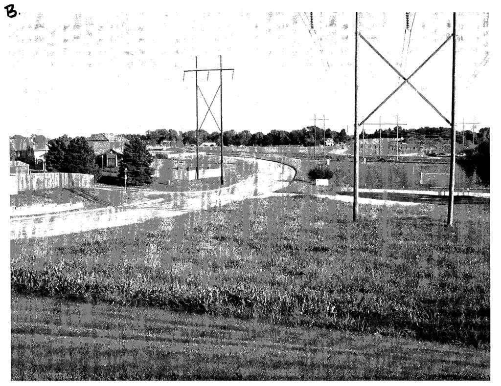
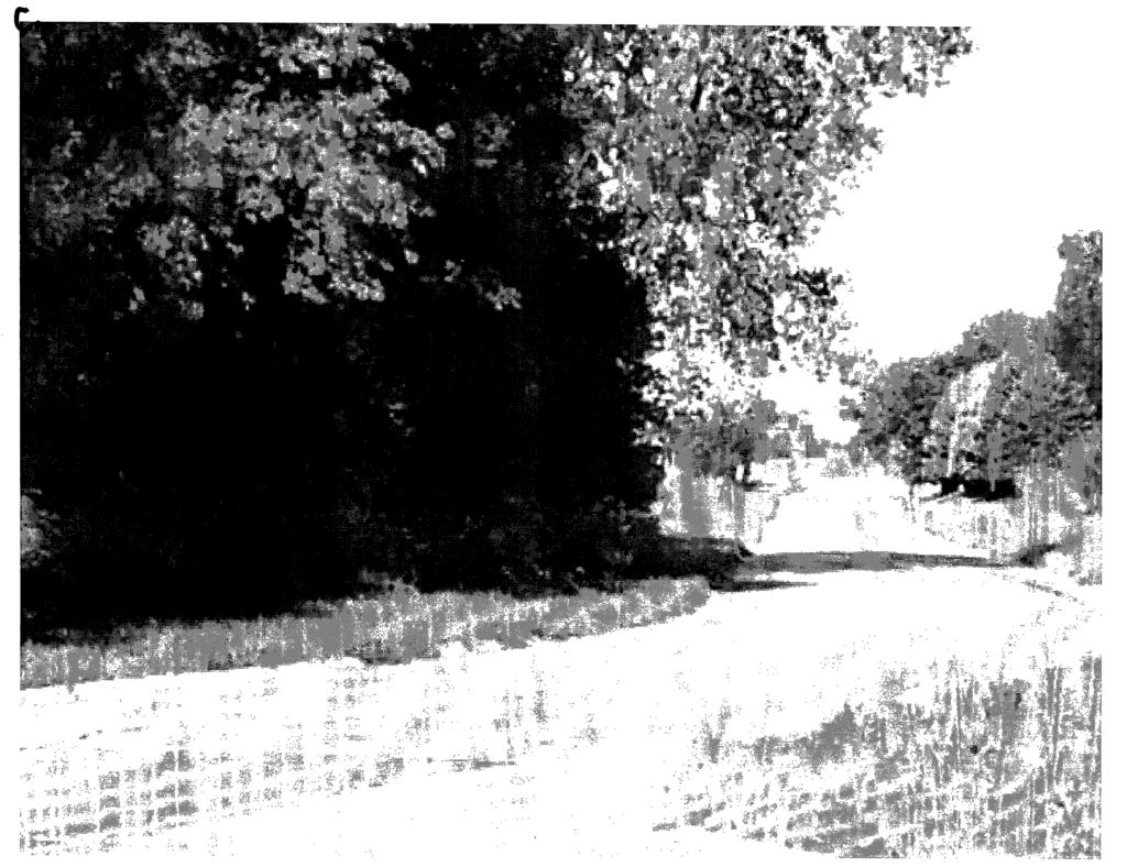
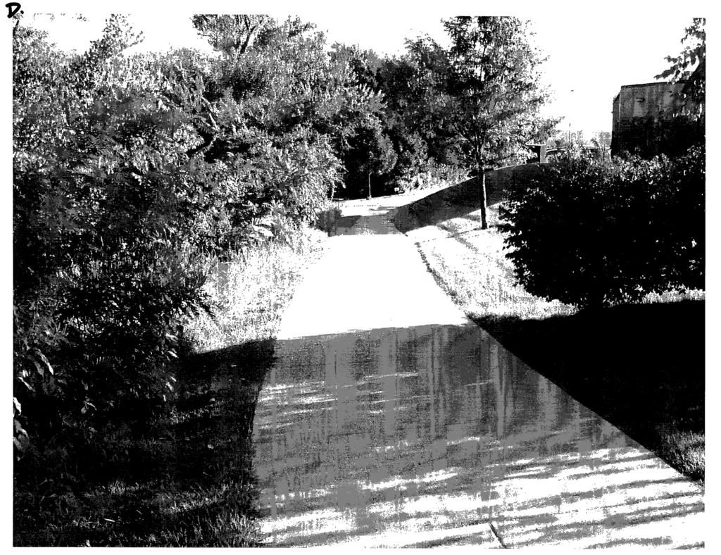
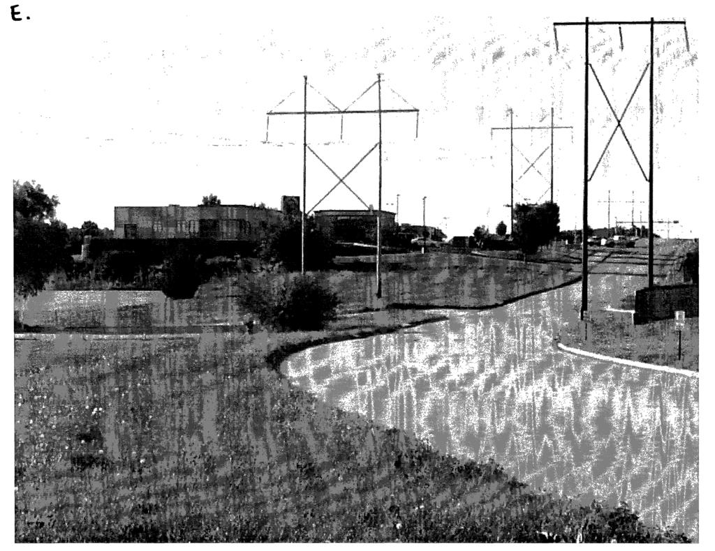
14 Attachment 2 Recreational Trails Program Grant Application Photo Explanations Development and Extension of Marv Holubar Trail Sarpy County and Bellevue, Nebraska A. Existing trail running behind Twin Creek Shopping development. B. Looking north on 42"d Street toward Bellevue Soccer Fields. Proposed north segment of the trail will run past the Soccer Fields shown on the right. C. New south trail path at Maass Road and west toward 42"d Street D. Existing trail behind Twin Creek Shopping development. E. Looking South toward Twin Creek Drive just past the Soccer Fields and the north portion of the proposed trail. F. North access of current trail. G. Start of the current Marv Holubar Trail. H. Looking West on the current trail. Twin Creek shopping development is on the left. I. Looking East on the current trail. Twin Creek shopping development is on the right. J. Current terminis at end of north segment. 42"d Street is on the left, Soccer Field is left. K. Proposed south segment at Quail Creek. Maass Road is on the left and Quail Creek is on the right. L. Proposed north segment. Looking South toward Twin Creek Drive. Bellevue Soccer Fields on the left, 42"d St. is on the right.

15 A.
16
17
18
19
20
21
22
23
24
25
26 Attachment 3 Site Plan (20 Copies)

27 ~ ~- ~-- Bike Trail Site Plar r- J -- 1 _1

28 ~------~~~~- I ~---! ~ ~ =~ ~-~-- Bike Trail Site Plar1 SCALE 1 " = 300' j! I
29 .._ "1 ---1"' Attacrnment~ 4; Site Plan/Location Map,,,.. ' 'f. I....\..;.
30
31 t j l. ~:.,. Attachment 5 Legal Description/Map i~ ' 'i:. -~. -._.'t-
32 NE1/4 SEC 32 T14N R13E 1 inch = 200 feet Tl20 I N I, j Legend ]81. Comers D QuarterSecbons _j Subdivisions r i Rights of Way [~~~Lots Blocks ~ Ra1lroads Street Center1ine This Map Was Printed On: NOTICE 'This map constitutes a reprcsentatton based on infonnauon provided to the Sarpy CoWlty Surveyors Office by other nkhviduals and orgaruzations. Therefore no representation~ regarding the accuracy of the size, dtmcnsions, measurements, condition. plattmg, or location of the within dcscnbed area arc made Should such informahon be rcquucd for construction, zoning, or other purposes, the scrvtccs of a private surveyor and/or title search should be secured.
33 SE1/4 SEC 32 T14N R13E 1 inch = 200 feet Longv<ewSt ~v-~ 161 ~162 ~163~ iru,jo,'"'j' swj J1J]_ - '- - _l86.a_ i ~ OLA ~ ~~ r, 1]5$_ k r _j! ~ p I au~ :!4.92:_ )" 370 " I ' '---.2!JTfJ' -- --~'.S I i ---.J / TL13,~SARPY COUNrr SJ~VEYOR 's OFFice ~( Legend N l81 Comers D QuarterSections I - :_1 Subdivisions,-_- ~ Rights of Way,--Lots Blocks ~Railroads Street Centenine This Map Was Printed On: 6/23/2009 NOTICE Tills map consututcs a representation based on infonnation provided to the Sarpy County Surveyors Office by other individuals and orgaruzations. Therefore no representations regarding the accuracy of the size, dimensions, measurements, condjtwn, platting, or location of the withm descnbed area arc made. ShouJd such infonnation be reqwred for construction, zornng, or other purposes, the services of a pnvatc surveyor and/or title search should be secured.
34 Sarpy Property Page 1 of2 Current as of 9/16/2011 Parcel Number: Location: Owner: C\0: Mail Address: Legal: Active Record CITY OF BELLEVUE C/0 KAY DAMMAST CITY CLERK 210 W MISSION AVE BELLEVUE NE <9UJLOL~ TWI~Q~E_EK i='laza R~!-LA!~~ Map#: I_ Maps/Plats ] Tax District: Date Created 10/21/2003 Last Updated 8/18/2011 THIS IS NOT A PROPERTY RECORD FILE what ctoes th1s mean? Commercial information lor 1 j<muary Roll Year Business Name: Primary Description: Commercial units: Lot Sqft: Total Area: 0 NO SKETCH AVAILABLE. I L Bldg# Building lncormation I Built I Stories I Total Area 1 Ext Wall Sales lnl(mnation (Updated 9/18/2011) No Sales on File I Description I I Improvements Valuation PV =Partial Valuation Land $3,199 $3,199 $3,199 $3,199 $3,199 $3,199 $3,199 $3,199 OutBuildings Total $3,199 $3,199 $3,199 $3,199 $3,199 $3,199 $3,199 $3,199 PV No No No No No No No No Fund# Fund Description COUNTY LEVY PAPILLION SCHOOL SCHL DIST 27 BOND 1 SCHL DIST 27 BOND 2 SCHL DIST 27 BOND 3 SCHL DIST 27 BOND 4 LEARN COMM-GENERAL LEARN COMM-SPEC BLDG LEARN COMM-CAPITAL -PROJECTS ELEM LEARN COM Levy In f(xmalion 20 I 0 Vic\\ Past Levy Information Levy Value1 = /19/2011
35 Sarpy Property Page 2 of BELLEVUE CITY BELLEVUE CITY BOND PAPIO NATURAL RESRCE MUD METRO COMMUNITY COLL AGRICULTURAL SOCIETY ED SERVICE UNIT Total Property Class Mortgage Company # Exemption Code Specials 9000 No Specials Found r Specials I Treasurer lnlonm1lion Foreclosure# Foreclosure Date Exemption Amount TaxSale/Redempetion No DELINQUENT TAX SALE(S) ON FILE. CALL BEFORE MAKING PAYMENT.!_TaxSale lnf~ j Year Statement# District Source Taxes Due Total Due Balance RP REAL RP REAL RP REAL RP REAL RP REAL RP REAL $69.34 $74.34 $ RP REAL $68.90 $73.90 $ /19/2011
36 Sarpy Property Page 1 of2 Parcel Number: Location: Owner: C\0 Mail Address: Legal: Tax District: Map#: BELLEVUE Active SID 182 %JOHN Q BACHMAN REGENCY CIR STE 300 OMAHA NR 'Btm,o:r.ii'ZUJ>DlNl'E_('!:.OJfiC) Click Picture/Sketch for Larger View. Use arrows to view Picture/Sketch. THIS IS NOT A PROPERTY RECORD FILE whatctoesthismean? Business Name: Primary Description: Commercial units:. Lot Sqft: Total Area: 0 Commercial Information for 1 January Roll Year 2011 Improvement Information Bldg# STORIES Ext Wall DESCRIPTION Bldg# Sec# Code Refinements Description Sqft or Quantity Sales Information (Updated 9/18/2011) Sale Date Grantor B&P 6/7/1999 JEJ PARTNERSHIP C/0 HOME REAL ESTATE DAVENPORT ST OMAHA NE Grantee SID 182 % JOHN Q BACHMAN REGENCY CIR STE 200 OMAHA NE Total Sale Price Adjusted Sale Price Valuation Information Roll Year Land Value 2011 $15B 2010 $ $ $ $ $ $ $ $ $158 Valuation PV - Partial Valuation Impr Value Outbuildings Total Value PV $158 NO $158 NO $158 NO $158 NO $158 NO $158 NO $158 NO $158 NO $158 NO $158 NO 9/19/2011
37 Sarpy Property Page 2 of $158 $158 $158 $16,255 $16,255 $12,060 $158 NO $158 NO $158 NO $16,255 NO $16,255 NO $12,060 NO Levy Information Levy Information 2010 View Past Levv Information Fund Description Levy 1 COUNTY LEVY PAPILLION SCHOOL SCHL DIST 27 BOND SCHL DIST 27 BOND SCHL DIST 27 BOND SCHL DIST 27 BOND LEARN COMM-GENERAL LEARN COMM-SPEC BLDG LEARN COMM-CAPITAL,.PROJECTS ELEM LEARN COM PAPILLION RURAL FIRE PAPILLION FIRE BOND PAPIO NATURAL RESRCE S3 701 MUD METRO COMMUNITY COLL AGRICULTURAL SOCIETY ED SERVICE UNIT SID SID 182 BOND Total Levy Treasurer Information Property Class Mortgage Company # Mortgage Company Exemption Code Specials Tax Sales Tax Sale# Redemption # 9000 Forclosure # 0 Foreclosure Date Exemption Amount No Specials Found. DELINQUENT TAX SALE(S) ON FILE. CALL BEFORE MAKING PAYMENT Tax Sale Date 1/1/2001 Redemption Date Tax Information *Click Statement Number to see Treasurer information for oayina vour taxes with a credit card. Year Statement Tax District Source Taxes Due Total Due RP REAL RP REAL RP REAL RP REAL RP REAL RP REAL RP REAL RP REAL RP REAL RP REAL RP REAL RP REAL REAL $ $ REAL $ $ REAL $ $ Balance /19/2011
38 . Attachment 6 Cost Estimate (Stamped by PE),.
39 ATTACHMENT COST ESTIMATE DEVELOPMENT of Marv Holubar Trail CITY OF Bellevue,NEBRASKA Item Unit No. Required Unit Cost Cost Clearing & Grubbing Acre Earth Work (Cut & Fill) Cubic Yard 1800 Trail Surfacing- (10' wide, 6" Square 4200 Concrete surfacing ) Yards Subgrade Preparation Square 4200 Yards Seeding Acre 1.5 Signage (MUTCD only) Each 6 Culverts Linear Foot 24 Bollards Each 4 Bridge (if necessary-include decking, Each n/a railing, length, abutments... etc) Environmental Costs (cultural surveys, Cultural Lump Sum biological survey, soil determination Survey wetland delineation, wetland (NEPA) mitigation... etc) Construction Costs Subtotal Mobilization (1) Lump Sum Total Construction Costs Engineering Costs Design Engineering (Recommend this Lump Sum be used as part of local match) Construction Engineering/Contingency Lump Sum Funding Sign (2-one at each end) Lump Sum Total Project Costs Funding_ Sources Private Funding/Donations Forced Account Funding Cash Match from Sponsor Federal Funding $ $4,000 $10.39 $18,700 $27.00 $113,400 $4.80 $20,100 $733 $1100 $50 $300 $50 $1200 $400 $1600 n/a n/a $15,000 $15,000 $175,400 $4,000 $179,400 $30,000 $20,000 $400 $229,800 0% 0% 20% $45,960 80% $183,840
40 Attachment 7 _, Plat-Map 'r~
41 ' 1 -'). ~-,.-,~~~ (... f. : ~ 1' ~ -c / / RA0. 32S.OO' AR( CH-S85"17'11"E 53.,.3 AND 4 ::::-!ALL HAVE NO :CI':SS TO STATE HIGHWAY STATE HIGHWAY IS IN PARENTHESIS INDICATE. DIMENSIOt-iS :ORNER'3 ARE 90'00'00" OTED E 15.00' STORM SEWER EASEMENT TO THE CI":'Y OF BELLEVUE. E 15.00' STORY SEWER EASEMENT TO THC CITY OF BELLEVUE. APPROVAL OF BELLEVUE PLANNING C!.')MMISSION THIS PLAT OF " TWINCREEI< PLAZA REPLAT VI WAS APPROVED Bf THE BE.LLEVlJE PLANNING COMMISSION THIS _&.~AY OF ~ ,/"-) t/f-.. ( =-
42 :370 High!'!!!L - I I ~I ~I ~~ I I OUTLOT 1 (4.01 Ao.) / 1f
43 Attachment 8 Environmental Review.::-

44 Nebraska Game and Parks Commission Recreational Trails Program (RTP) Name of Sponsor: Sarpy County Project Name: Development and extension of the Marv Holubar Trail ENVIRONMENTAL REVIEW Review Area Estimated Involvement 1 Project on new alignment 0No!ZI Yes 10 Don't Know 2 Additional right-of-way required 0No!ZI Yes 3 Any railroad crossings!zi No DYes 4 Airport within 112 mile!zi No DYes ON/A 5 Public interest likely to be:!zi Low D Moderate 0High 6 NPDES Permit needed 0No!ZI Yes 7 Relocation of persons, businesses, farm ~No DYes Est# 8 Any significant stream crossings ~No DYes 9 Any channel changes required!zi No DYes 10 Section 404 permit required 0No!ZI Possible DYes 11 Floodplain permit required 0No!ZI Possible DYes 12 Any wetland involvement 0No!ZI Possible DYes Review Areas Possible Effect 13 Air Quality!ZI None D Minor D Significant 14 Noise Quality ~None D Minor D Significant 15 Landscaping 0None!ZI Minor D Significant 16 Fish and Wildlife!ZI None D Minor D Significant 17 Water Quality/Impacts!ZI None D Minor D Significant 18 Civil Rights (Minority Involvement)!ZI None D Minor D Significant 19 Neighborhood disruption!zi None 0Minor D Significant 20 Schools, churches, cemeteries or hospitals!zi None D Minor D Significant 21 Public health and safety!zi None D Minor D Significant 22 Economic activity ~None D Minor D Significant 23 6(f) land ~None 0Minor D Significant 24 Historic sites!zi None D Minor D Significant 25 Multiple use of space ~None D Minor D Significant 26 Prime farmland or unique farmland!zi None 0Minor D Significant Remarks This is a trail within ROW and along a creek. Temporary and possibly some permanent easements may be necessary. Disturbing more than 1 acre. Work is being done along bank. Limits will dictate if permit is required. Same as Item 10. Any wetlands will be avoided, minimized or mitigated. Some volunteer trees will be removed to make room for the bike path.
45 ENVIRONMENTAL REVIEW CONCLUSIONS POLITICAL SUBDIVISION: POLITICAL SUBDIVISION CONCLUSION. In the final analysis, we have determined that the project will ~Circle One) significantly impact the natural environment of the project location or general vicinity. (Signature Date: Cf+-=-/ d= / ~_o_l_l I STATE OF NEBRASKA: Conclusion It has been determined by the information above provided to the Nebraska Game and Parks Commission, on behalf of the State ofnebraska, that this project will I will not significantly impact the natural environment of the project location or general vicinity. Signed: Michelle Stryker Acting Trails Grant Administrator Nebraska Game and Parks Commission Date:
46 Attachment 9 PROJECT RESOLUTION 1. Sarpy County, Nebraska is applying for federal assistance from the Recreational Trails Program for the purpose of: Development and extension ofthe Marv Holubar Trail. 2. The Chairman of the Board of Sarpy County, Nebraska is authorized to sign the application for federal assistance, and any other official project documents that are necessary to obtain such assistance, including any agreements, contracts or other documents that are required by the State ofnebraska or the Federal Highway Administration. 3. Sarpy County, Nebraska currently has the written commitment for the 20% local matching share for the project elements that are identifieq on the application form and the supplemental documents and will, as it becomes necessary, allocate the local funds for the project. 4. Sarpy County, Nebraska will commit the necessary financial resources to operate and maintain the completed project in a safe and attractive manner for 25 years (25 for non-motorized, 1 0 for motorized). 5. Sarpy County; Nebraska will not discriminate against any person on the basis ofrace, color, age, religion, disability, sex or nation origin in the use of any property or facility that is acquired or developed pursuant to the project proposal, and shall comply with the terms and intent of Title VI of the Civil Rights Act of 1964, and any of the regulations promulgated pursuant to such Act. 6. Sarpy County, Nebraska will comply with all rules and regulations of the Recreational Trails Program, applicable Executive Orders and all state Jaws that govern the grant applicant during the performance of the project. 7. Sarpy County, Nebraska will comply with the Federal accessibility and use standards where they can be reasonably applied. 8. All paperwork may be signed by the project sponsor, but the Resolution MUST be signed by the Mayor, Board Chairman, School Board Chairman, or Director of the Public Power District. I certify that this resolution is a true copy of the original document that was adopted by Sarpy County, Nebraska at a properly advertised and announced public meeting held thisoz711gy of ~,2011. (SIGNATURE) (Chairman of the Board of Commissioners)
47 1'. Attachmept 10 Comprehensive Planning

48 A NETWORK OF TRANSPORTATION ROUTES A land use framework is built on the access structure of a community or county. The underlying structure of the county's road system is the grid of section line roads. This grid is relatively continuous in the central county, but breaks down in the more topographically rugged areas of the southwest and east. Most pre-existing, low-density development started along these section line roads and moved inward from them. This tends to produce "pods" of development connected to these roads, but not to each other. Extending this pattern to urban densities will result in an exclusive reliance on these arterials for regional, inter-neighborhood, and local traffic circulation. This in turn will cause the capacity and access problems that plague suburban Omaha and other major cities. The neighborhood unit concept establishes a framework that promotes local street connectivity, the most effective way of combating congestion on the arterial system. In Sarpy County, the web of transportation routes includes: A web of trails and pedestrian/bicycle pathways, utilizing streets, creeks and drainageways, and designed green ways to provide continuous, non-motorized access throughout the developing county. Major Cross-County Routes. These are the primary carriers of regional or interregional traffic, and include Highway 370, the proposed Cross County Arterial utilizing the Platteview/ Pflug alignments, the Kennedy Freeway, the 72nd/ 84th Street Corridors, Highway 50, and Highway 6. The grid of section line roads, providing through access across districts of the developing county and serving major mixed-use centers and higherdensity urban development. A network of connected collector streets generally on or near half-section lines, providing connections from one neighborhood unit to another and linking neighborhood parks and schools. These key collectors become the connecting local fabric that provide interneighborhood access and prevent a default reliance on the arterial grid. Some components of this collector system would be incorporated into the Sarpy Parkway concept, a boulevard that connects the county's five cities. Rearage roads along major mixed use corridors to maximize both road utilization and development yields along these corridors. - Sarpy County.:
49 The neighborhood and community park system envisioned by the neighborhood unit concept. Green streets and boulevards, incorporating good landscaping and adjacent pathways. The Sarpy Parkway concept is an important part of this system. Trails and pathways are currently important parts of the Sarpy recreational landscape and should continue to expand. Major regional trails that are either in place or programmed include the Papio Creek system, the Highway 50 trail to Springfield, the Chalco Hills trail connecting to Highway 50 along Giles Road and Highway 370, the MoPac Trail from Springfield to the Platte River, and the Highway 31 Trail to the Lied Platte River Crossing at South Bend. This plan anticipates integrating nonmotorized pathways into land use patterns, giving trails a supplementary transportation function, as well as their traditional recreation and fitness uses. In addition to the existing or currently planned facilities, the Development Structure concept includes the following major trail or pathway corridors: Portions of the Platte River bank, extending the Highway 31 west from the Lied trail bridge to Schram Park and Highway 6, and east from Highway 50 to the creek at 114th Street. The major drainage corridors extending north from the Platte. An east-west north county greenway from Gretna to the Papio system, using a Papio tributary and Giles Road. The Sarpy County Parkway, discussed below. Links to the planned trail systems of Sarpy County's cities. A greenway along the Cross-County Arterial. The local greenways contained within neighborhood units. SARPY PARKWAY The Sarpy Parkway concept provides a green street of parkway or boulevard design that connects all of the county's five incorporated municipalities. The Parkway includes special street landscaping, a parallel trail, and thematic lighting, becoming a unifying amenity and exceptional public space that runs throughout the county. The parkway typically follows collector streets on the halfsection line, in many cases running through or adjacent to parks within neighborhood units. In the plan concept, the parkway would begin in Gretna, continuing east liz mile south and parallel to Highway 370. It would turn southeast, crossing Interstate 80 on the existing 168th Street bridge and continue south between 156th and 168th Streets, turning east into Main Street in Springfield. The Parkway continues north of Springfield between 132nd and 144th Streets, continuing east and north to Schram Road. Schram Road would be designed as a parkway between 168th and 66th Streets, and would be part of this system. The Parkway would then continue south as 66th Street and along Zeibel Creek to the Cross -County Arterial and east into Bellevue along Capehart Road. It would also have trail connections at this end into the West Papio Trail. Alternative routes could be developed within municipal jurisdictions at their discretion. Right-of-way for the parkway would be dedicated incrementally by development, following the model of Omaha's Cleveland Boulevard. This modern incarnation of the historic Horace Cleveland conceived boulevard system was pre-planned, and segments are dedicated and developed by subdivisions along its route. RICHFIELD NEw TowN This development concept raises the potential of a New Urbanist "town" on the original townsite of Richfield, between Fairview and Capehart Roads between 96th and 1 08th Streets. The site has traditions as a community, is convenient to the proposed green system, and is in a central, highly marketable part of the county. New Urbanism suggests using the street patterns, connectivity, and mixed uses of a traditional town, and has been a successful form of development in many national markets. While the Richfield site could also develop in the neighborhood unit pattern, it may be attractive and identifiable as a distinctive thematic community.
50 Legend Existing Trails Programmed Trails Sarpy Parkway Greenway Trails Joint Use Corridors Neighborhood Links Collectors with Shared Use Comprehensive Development Plan Figure 5.2: Trail Development Concept Sarpy County, Nebraskil ~-- NORTH OS 10 20MllL~ 1t:'ptembe1,100)
51 \ letters of Support
52 Sarpy County Board of Commissioners 1210 GOLDEN GATE DRIVE PAPILLION, NE ADMINISTRATOR Mark Wayne DEPUTY ADMINISTRATOR Scott Bovick FISCAL ADMIN./PURCHASING AGT. Brian Hanson COMMISSIONERS Rusty Hike District 1 Jim Thompson District 2 Tom Richards District 3 Jim Nekuda District 4 Jim Warren District 5 September 27, 2011 Nebraska Game and Parks Commission 2200 N. 33'd Street PO Box 3037 Lincoln, NE 68503c0370 ATIN: Michelle Stryker Dear Ms. Stryker, The Sarpy County Board of Commissioners supports the Recreational Trails Program Grant (RTP) offered through the Nebraska Game and Parks Commission for the development and extension of the Marv Holubar Trail. The development and extension of this trail will be an important asset for Sarpy County and the City of Bellevue. This project will connect the existing Marv Holubar trail west and north toward the Papillion Creek trail and the Bellevue Soccer Complex. It will also connect the Lakewood Village neighborhood north under Hwy 370 and toward the Twin Creek Shopping development and theatre. Trails and greenways not only bring job growth but tourism-related opportunities and ecological benefits. Trails and greenways increase quality of life in a community and attract new businesses to the area. Additionally, developing and extending the Marv Holubar Trail will allow children and families living on the south side of Hwy 370 a safe walking and biking route to the Twin Creek Shopping development, movie theatres, and the Bellevue Soccer Complex. The Sarpy County Board of Commissioners fully supports this application and requests positive consideration from the Nebraska Game and Parks Commission. Sincerely, tow\ rz c~ ll~ Tom Richards Chairman Sarpy County Board of Commissioners
53 City of Bellevue 210 West Mission Avenue + Bellevue. Nebraska (-102) September 15, 2011 Nebraska Game and Parks Commission 2200 N. 33'd Street PO Box 3037 Lincoln, NE ATIN: Michelle Stryker Dear Ms. Stryker, I write in full support of the Recreational Trails Program Grant (RTP) with the Nebraska Game and Parks Commission for the development and expansion of the Marv Holubar Trail in Bellevue Nebraska. The development and expansion of this trail will be an important asset for Sarpy County, the City of Bellevue and the many trail users from other places. This important project will connect an existing trail north past the Bellevue Soccer Complex, along the Papio Creek, then south to the Quail Creek/Lakewood Villages neighborhoods and trails. It is a much needed link to connect several well used trails in the heart of our community. The proposed link is especially important to me and area Bellevue residents because it will provide for safe pedestrian crossing under Highway 370. It is a safety issue along with a recreational connection for the existing trails, youth soccer fields and stores used by area children and adults alike. Bellevue is an active community that loves its trails. Our hiking and biking trails provide needed outdoor exercise for many other people. Childhood obesity is at epidemic levels making such fitness a national priority. These outdoor trails and recreational opportunities increase the quality of life in our community. They are a sound investment that pays great dividends. As a Bellevue City Councilman I fully support this application and I request its approval from the Nebraska Game and Parks Commission. We appreciate your support for this valuable project. Respectfully, \J(J-n ~ ~tu\.. Don Preister City Council Ward 5
54 September 8, 2011 Nebraska Game and Parks Commission 2200 N. 33rd Street PO Box 3037 Lincoln, NE ATTN: Michelle Stryker PAPIO-MISSOURI RIVER NATURAL RESOURCES DISTRICT 8901 S. 154th Street Omaha, NE Finding Solutions TodaY For a Secure Tomorrow Dear Ms. Stryker: The Papio-Missouri River NRD supports the application for a Recreational Trails Program Grant (RTP) with the Nebraska Game and Parks Commission for the development and expansion of the Marv Holubar Trail in Bellevue, Nebraska. The development and expansion of this trail will be an important asset for Sarpy County, the City of Bellevue and the NRD. This project will connect an existing trail north past the Bellevue Soccer Complex, and along the Papio Creek and south to the Quail Creek/Lakewood Villages neighborhood. Walking and biking trails not only bring job growth but tourism-related opportunities and ecological benefits. Outdoor trails and recreational opportunities increase perceived quality of life in a community, and attract new businesses to the area. The NRD fully supports this application and requests positive consideration from the Nebraska Game and Parks Commission. Sincerely, ~~ JG:nkler, General Manager JW:GB:pb file 261 Papio-Missouri River Natural Resources District Board of Directors Larry Bradley Fred Conley John Conley Gus Erickson Tim Fowler Scott Japp David Klug Rick Kolowski Dorothy Lanphier Richard Tesar Jim Thompson John Winkler, General Manager
BOARD OF COUNTY COMMISSIONERS SARPY COUNTY, NEBRASKA
 ! 2011-348 BOARD OF COUNTY COMMISSIONERS SARPY COUNTY, NEBRASKA RESOLUTION AUTHORIZING THE BOARD TO RATIFY REVISIONS TO THE APPLICATION AND ATTACHMENTS RELATING TO THE RECREATIONAL TRAILS PROGRAM GRANT
City of Durango 5.8 FUNDING TRAILS DEVELOPMENT
 5.8 FUNDING TRAILS DEVELOPMENT The City has been successful in establishing dedicated local funding sources as well as applying for grants to develop the City s trail system, having received nearly $2.4
BOARD OF EQUALIZATION SARPY COUNTY, NEBRASKA RESOLUTION SETTING LEVY OF TAXES
 201D- 335 BOARD OF EQUALIZATION SARPY COUNTY, NEBRASKA RESOLUTION SETTING 2010-2011 LEVY OF TAXES WHEREAS, by virtue of Neb. Rev. Stat. Sec. 77-1601 (Reissue 2009), the Board is required by law to levy
2. Goals and Policies. The following are the adopted Parks and Trails Goals for Stillwater Township:
 D. PARKS AND TRAILS 1. Introduction Stillwater Township s population is relatively low, with most residents living on rural residences on large lots. The need for active park space has been minimal in
CITY COUNCIL AGENDA MEMORANDUM
 To: Mayor and City Council From: Charles Ozaki, City and County Manager Prepared By: Kevin Standbridge, Deputy City and County Manager Katie Allen, City and County Engineer David Shinneman, Community Development
DRAFT GENERAL IMPLEMENTATION PLAN AND SPECIFIC IMPLEMENTATION PLAN MIDDLETON MUNICIPAL AIRPORT MOREY FIELD. Revised 12/12/03
 DRAFT GENERAL IMPLEMENTATION PLAN AND SPECIFIC IMPLEMENTATION PLAN MIDDLETON MUNICIPAL AIRPORT MOREY FIELD Revised 12/12/03 As recommended for approval by the Plan Commission General Project Description
NATIONAL PARK SERVICE CERTIFICATION OF COMPLETED SEGMENTS OF THE NORTH COUNTRY NATIONAL SCENIC TRAIL
 NATIONAL PARK SERVICE CERTIFICATION OF COMPLETED SEGMENTS OF THE NORTH COUNTRY NATIONAL SCENIC TRAIL Completed trail segments that (1) follow the route identified in the 1982 National Park Service (NPS)
Business Item No XXX. Proposed Action That the Metropolitan Council approve the Coon Creek Regional Trail Master Plan.
 Business Item No. 2015-XXX Metropolitan Parks and Open Space Commission Meeting date: July 7, 2015 For the Community Development Committee meeting of July 20, 2015 For the Metropolitan Council meeting
BE IT ORDAINED by the Mayor and the City Council of the City of Papillion as follows:
 ORDINANCE NO. 1798 AN ORDINANCE TO AMEND CHAPTER 24, SECTION 1 DELINEATING THE VOTING BOUNDARY WARDS FOR THE CITY OF PAPILLION; TO REPEAL THE EXISTING CHAPTER 24, SECTION 1; AND TO PROVIDE FOR AN EFFECTIVE
BOARD OF EQUALIZATION SARPY COUNTY, NEBRASKA RESOLUTION SETTING LEVY OF TAXES
 2017-356 BOARD OF EQUALIZATION SARPY COUNTY, NEBRASKA RESOLUTION SETTING 2017-2018 LEVY OF TAXES WHEREAS, by virtue of Neb. Rev. Stat. ' 77-1601, the Board is required by law to levy the taxes necessary
Waukee Trailhead Public Art and Amenities Project
 Waukee - Trailhead Public Art and Amenities Project Sponsor Waukee Project Title Waukee Trailhead Public Art and Amenities Project Termini Description ( i.e. Park Avenue to 19th Street) NE Intersection
Community Development Committee
 C Community Development Committee For the Metropolitan Council meeting of October 31, 2012 Committee Report Item:2012-316 ADVISORY INFORMATION October 16, 2012 Date Prepared: Subject: Intercity Regional
METROPOLITAN COUNCIL 390 North Robert Street, St. Paul, MN Phone (651) TDD (651)
 TDD (651)") DATE: March 27, 2012 METROPOLITAN COUNCIL 390 North Robert Street, St. Paul, MN 55101 Phone (651) 602-1000 TDD (651) 291-0904 TO: Metropolitan Parks and Open Space Commission FROM: Arne Stefferud, Planning
DATE: March 27, 2012 METROPOLITAN COUNCIL 390 North Robert Street, St. Paul, MN 55101 Phone (651) 602-1000 TDD (651) 291-0904 TO: Metropolitan Parks and Open Space Commission FROM: Arne Stefferud, Planning
Business Item No
 Metropolitan Parks and Open Space Commission Meeting date: February 6, 2018 For the Community Development Committee meeting of February 20, 2018 For the Metropolitan Council meeting of February 28, 2018
FEASIBILITY CRITERIA
 This chapter describes the methodology and criteria used to evaluate the feasibility of developing trails throughout the study areas. Land availability, habitat sensitivity, roadway crossings and on-street
Blueways: Rivers, lakes, or streams with public access for recreation that includes fishing, nature observation, and opportunities for boating.
 Parks, Open Space and Trails PRINCE WILLIAM COUNTY 2008 COMPREHENSIVE PLAN TRAILS PLAN CONTENTS The components of the trails plan are: Intent Definitions Goals, Policies, and Action Strategies Trails Map
MORGAN CREEK GREENWAY Final Report APPENDICES
 APPENDICES MORGAN CREEK GREENWAY Appendix A Photos of Existing Conditions in Trail Corridor Photos of existing conditions Main trail corridor - February 2009 Photos of existing conditions south bank Morgan
Environment and Natural Resources Trust Fund 2019 Request for Proposals (RFP)
") Environment and Natural Resources Trust Fund 2019 Request for Proposals (RFP) Project Title: Glacial Edge Trail and Downtown Pedestrian Bridge Category: G. Land Acquisition for Habitat and Recreation ENRTF
Environment and Natural Resources Trust Fund 2019 Request for Proposals (RFP) Project Title: Glacial Edge Trail and Downtown Pedestrian Bridge Category: G. Land Acquisition for Habitat and Recreation ENRTF
Parker & Lincoln Development, LLC
 Parker & Lincoln Development, LLC 4643 S. Ulster Street, Suite 240 Denver, Colorado 80237 (303) 799-4030 VIA FEDEX OVERNIGHT DELIVERY December 19, 2017 Town of Parker Attn: Ryan McGee 20120 E. Mainstreet
AGENDA ITEM 5 D WAKULLA ENVIRONMENTAL INSTITUTE (WEI) TRAIL FEASIBILITY STUDY
 TRAIL FEASIBILITY STUDY") March 19, 2018 AGENDA ITEM 5 D WAKULLA ENVIRONMENTAL INSTITUTE (WEI) TRAIL FEASIBILITY STUDY TYPE OF ITEM: Action STATEMENT OF ISSUE The Wakulla Environmental Institute (WEI) Trail is one of several trails
March 19, 2018 AGENDA ITEM 5 D WAKULLA ENVIRONMENTAL INSTITUTE (WEI) TRAIL FEASIBILITY STUDY TYPE OF ITEM: Action STATEMENT OF ISSUE The Wakulla Environmental Institute (WEI) Trail is one of several trails
Rural Rustic Road Program
 Virginia Department of Transportation s Rural Rustic Road Program Prepared by the Local Assistance Division Virginia Department of Transportation 1401 East Broad Street Richmond, Virginia 23219 Michael
Committee Report. Community Development Committee For the Metropolitan Council meeting of August 12, Business Item No.
 Committee Report Business Item No. 2015-168 Community Development Committee For the Metropolitan Council meeting of August 12, 2015 Subject: Coon Creek Regional Trail Master Plan, Anoka County Proposed
A CASE FOR COMPLETING THE JORDAN RIVER PARKWAY: A
 A CASE FOR COMPLETING THE JORDAN RIVER PARKWAY: A safe crossing at 9000 South and 850 West Proposed 9000 South Underpass Parkway Timeline Parkway, Trail, and Tourism Facts Blueprint Jordan River 1971 1973
Georgetown-Lewes Rail/Trail Study. Rail/Trail Study: Cool Spring to Cape Henlopen State Park New Road Extension (House Resolution No.
 Georgetown-Lewes Rail/Trail Study Rail/Trail Study: Cool Spring to Cape Henlopen State Park New Road Extension (House Resolution No. 47) August 22, 2011 Presentation Outline Background Benefits Statewide
COASTAL CONSERVANCY. Staff Recommendation September 22, 2011 BAY AREA RIDGE TRAIL: HOOD MOUNTAIN TO HIGHWAY 12
 COASTAL CONSERVANCY Staff Recommendation September 22, 2011 BAY AREA RIDGE TRAIL: HOOD MOUNTAIN TO HIGHWAY 12 File No. 11-039-001 Project Manager: Betsy Wilson RECOMMENDED ACTION: Authorization to disburse
White Mountain National Forest Saco Ranger District
 United States Department of Agriculture Forest Service White Mountain National Forest Saco Ranger District 33 Kancamagus Highway Conway, NH 03818 Comm: (603) 447-5448 TTY: (603) 447-3121 File Code: 1950
City of Madison, Buckeye Road Monona Drive to Stoughton Road County AB Dane County Public Involvement Meeting
 City of Madison, Buckeye Road Monona Drive to Stoughton Road County AB Dane County Public Involvement Meeting Wednesday, May 31, 2017 6:30 to 8 P.M. Frank Allis Elementary School 4201 Buckeye Road Madison,
TRUCKEE TAHOE AIRPORT DISTRICT BOARD OF DIRECTOR STAFF REPORT
 AGENDA ITEM: 11 TRUCKEE TAHOE AIRPORT DISTRICT BOARD OF DIRECTOR STAFF REPORT AGENDA TITLE: MEETING DATE: January 24, 2018 PREPARED BY: NTPUD Agency Partnership Opportunity, Multi-Use Trailhead Access
MONTGOMERY COUNTY PLANNING DEPARTMENT THE MARYLAND-NATIONAL CAPITAL PARK AND PLANNING COMMISSION
 MONTGOMERY COUNTY PLANNING DEPARTMENT THE MARYLAND-NATIONAL CAPITAL PARK AND PLANNING COMMISSION Three Sisters Road: Abandonment No. AB740 MCPB Item No. 11 Date: 5-1-14 Katherine Holt, Senior Planner,
OFFICE OF THE PLANNING COMMISSION City Hall Holland, Michigan
 OFFICE OF THE PLANNING COMMISSION City Hall Holland, Michigan Planning Commission Report Report 4 To: Mayor DeBoer and Members of the Holland City Council Date: May 25, 2016 Subject: 11th Street Rezoning
Blue River Trail Master Plan JSA to Town Hall June 2004
 Blue River Trail Master Plan JSA to Town Hall June 2004 Prepared for: Silverthorne Town Council Silverthorne SPORT Committee Department of Recreation and Culture Silverthorne Public Works Silverthorne
CHAPTER 4 -- THE LAND USE PLAN: DESCRIPTIONS AND POLICIES FOR THIRTEEN PLANNING AREAS
 CHAPTER 4 -- THE LAND USE PLAN: DESCRIPTIONS AND POLICIES FOR THIRTEEN PLANNING AREAS NORTH CENTRAL CAC AREA LITTLE VALLEY ROAD TO JUG HANDLE CREEK PLANNING AREA This planning area includes Cleone, Noyo,
FINAL TESTIMONY 1 COMMITTEE ON RESOURCES UNITED STATES HOUSE OF REPRESENTATIVES. July 13, 2005 CONCERNING. Motorized Recreational Use of Federal Lands
 FINAL TESTIMONY 1 STATEMENT OF DALE BOSWORTH CHIEF Of the FOREST SERVICE UNITED STATES DEPARTMENT OF AGRICULTURE Before the SUBCOMMITTEE ON FORESTS AND FOREST HEALTH And the SUBCOMMITTEE ON NATIONAL PARKS,
Chapter 6: POLICY AND PROCEDURE RECOMMENDATIONS
 Chapter 6 POLICY AND PROCEDURE RECOMMENDATIONS FOR SRRA Below are seven policy elements that should be considered for adoption by the Southwest Regional Recreation Authority of Virginia: 1. Develop strategies
Decision Memo Ice Age Trail Improvement (CRAC 37)
") Decision Memo Ice Age Trail Improvement (CRAC 37) U.S. Forest Service Chequamegon-Nicolet National Forest, Medford-Park Falls Ranger District Taylor County, Wisconsin T32N, R2W, Town of Grover, Section
Decision Memo Ice Age Trail Improvement (CRAC 37) U.S. Forest Service Chequamegon-Nicolet National Forest, Medford-Park Falls Ranger District Taylor County, Wisconsin T32N, R2W, Town of Grover, Section
Parkland County Municipal Development Plan Amendment Acheson Industrial Area Structure Plan
 Parkland County Municipal Development Plan Amendment Acheson Industrial Area Structure Plan New Plan Acheson Industrial Area Structure Plan Amendment Parkland County Municipal Development Plan Board Reference
METROPOLITAN COUNCIL 390 North Robert Street, St. Paul, MN Phone (651) TDD (651)
 TDD (651)") METROPOLITAN COUNCIL 390 North Robert Street, St. Paul, MN 55101 Phone (651) 602 1000 TDD (651) 291 0904 DATE: June 19, 2007 TO: Metropolitan Parks and Open Space Commission FROM: Jan Youngquist, Senior
METROPOLITAN COUNCIL 390 North Robert Street, St. Paul, MN 55101 Phone (651) 602 1000 TDD (651) 291 0904 DATE: June 19, 2007 TO: Metropolitan Parks and Open Space Commission FROM: Jan Youngquist, Senior
Classifications, Inventory and Level of Service
 Classifications, Inventory and Level of Service Section 3 Kenmore Park, Recreation and Open Space Plan 1 P a g e Classifications and Inventory Park Classifications Kenmore classifies its parks based upon
Appendix 3. Greenway Design Standards. The Whitemarsh Township Greenway Plan
 Appendix 3 Greenway Design Standards This chapter discusses two design standards for the greenway types discussed above. First, trail design standards are presented together with trailhead facilities and
Trail Feasibility Study
 VOLUSIA COUNTY MPO CITY OF NEW SMYRNA BEACH FINAL REPORT JUNE 30, 2009 Trail Feasibility Study What s inside? 1 Introduction 2 Project Purpose & Scope 3 Physical Inventory & Assessment of Right-of- Way
Community Development
 Community Development City & Borough of Juneau Community Development 155 S. Seward Street Juneau, AK 99801 (907) 586 0715 Phone (907) 586 4529 Fax DATE: February 11, 2016 TO: FROM: Planning Commission
PULLMAN-MOSCOW REGIONAL AIRPORT Runway Realignment Project
 PULLMAN-MOSCOW REGIONAL AIRPORT Runway Realignment Project GENERAL AIRPORT INFORMATION AIRPORT USERS Airport ownership: Public, owned by the Pullman-Moscow Regional Airport Board Year opened: February
Environment and Natural Resources Trust Fund (ENRTF) M.L ENRTF Work Plan (Main Document)
 M.L ENRTF Work Plan (Main Document)") Environment and Natural Resources Trust Fund (ENRTF) M.L. 2018 ENRTF Work Plan (Main Document) Today s Date: December 8, 2017 Date of Next Status Update Report: January 31, 2019 Date of Work Plan Approval:
Environment and Natural Resources Trust Fund (ENRTF) M.L. 2018 ENRTF Work Plan (Main Document) Today s Date: December 8, 2017 Date of Next Status Update Report: January 31, 2019 Date of Work Plan Approval:
Understanding user expectations And planning for long term sustainability 1
 Understanding user expectations And planning for long term sustainability 1 What is a natural surface trail? It can be as simple has a mineral soil, mulched or graveled pathway, or as developed as elevated
ORDINANCE NO. 510 THEREFORE, BE IT ORDAINED BY THE GOVERNING BODY OF THE CITY OF BEL AIRE, KANSAS:
 (Published in The Ark Valley News on July, 2012.) ORDINANCE NO. 510 S-I-1 GILMORE & BELL, P.C. 07/11/2012 AN ORDINANCE CREATING A COMMUNITY IMPROVEMENT DISTRICT IN THE CITY OF BEL AIRE, KANSAS; AUTHORIZING
Northeast Quadrant Distinctive Features
 NORTHEAST QUADRANT Northeast Quadrant Distinctive Features LAND USE The Northeast Quadrant includes all the area within the planning area that is east of Interstate 5 and to the north of State Route 44.
Action Recommendation: Budget Impact:
 City of Fayetteville Staff Review Form Matt Mihalevich 1/16/2019 DEVELOPMENT SERVICES (620) Submitted By 2019 0050 Legistar File ID February 5th, 2019 City Council Meeting Date Agenda Item Only N/A for
Hiawatha National Forest St. Ignace Ranger District. File Code: 1950 Date: August 5, 2011
 United States Department of Agriculture Forest Service Hiawatha National Forest St. Ignace Ranger District W1900 West US-2 St. Ignace, MI 49781 906-643-7900 File Code: 1950 Date: August 5, 2011 Dear National
ORDINANCE NO. 13,729
 ORDINANCE NO. 13,729 AN ORDINANCE to amend the Municipal Code of Des Moines, 1991, adopted by Ordinance No. 11,651, passed April 15, 1991, and amended by Ordinance No. 13,561, passed January 5, 1998 by
Segment 2: La Crescent to Miller s Corner
 goal of the USFWS refuges is to conserve, protect and enhance fish, wildlife and plants and their habitats for the continuing benefit of the American people. Refuge lands are used largely for fishing,
Logo Department Name Agency Organization Organization Address Information 5700 North Sabino Canyon Road
 Logo Department Name Agency Organization Organization Address Information United States Forest Coronado National Forest 5700 North Sabino Canyon Road Department of Service Santa Catalina Ranger District
ALTA/ACSM LAND TITLE SURVEY Parts of Augusta Heights, First Section (Plat Book 20, Page 5), Augusta Heights, Second Section (Plat Book 19, Page 25),
, Augusta Heights, Second Section (Plat Book 19, Page 25),") ALTA/ACSM LAND TITLE SURVEY Parts of Augusta Heights, First Section (Plat Book 20, Page 5), Augusta Heights, Second Section (Plat Book 19, Page 25), and Augusta Park, 3rd Section (Plat Book 24, Page 132)
ALTA/ACSM LAND TITLE SURVEY Parts of Augusta Heights, First Section (Plat Book 20, Page 5), Augusta Heights, Second Section (Plat Book 19, Page 25), and Augusta Park, 3rd Section (Plat Book 24, Page 132)
SAN RAFAEL CITY COUNCIL AGENDA REPORT
 Agenda Item No: 5.e Meeting Date: October 3, 2016 Department: Public Works SAN RAFAEL CITY COUNCIL AGENDA REPORT Prepared by: Bill Guerin, Director of Public Works TOPIC: QUIET ZONE DESIGNATION City Manager
Daisy Dean Trail 628/619 ATV Trail Construction
 Background and Purpose and Need The Daisy Dean ATV Trail Construction Project is located in the Little Belt Mountains, Musselshell Ranger District, Lewis and Clark National Forest approximately 32 miles
PROPERTY OWNER PETITION FOR CONCURRENT DETACHMENT AND ANNEXATION
 PROPERTY OWNER PETITION FOR CONCURRENT DETACHMENT ANNEXATION IN THE MATTER OF THE PETITION BY ALL OF THE PROPERTY OWNERS FOR THE DETACHMENT OF CERTAIN L FROM THE CITY OF NOWTHEN, MINNESOTA CONCURRENT ANNEXATION
CHAPTER III: TRAIL DESIGN STANDARDS, SPECIFICATIONS & PERMITS
 CHAPTER III Trail Design Standards, Specifications & Permits This chapter discusses trail standards, preferred surface types for different activities, permits, and other requirements one must consider
Update Report - Etobicoke Creek and South Mimico Creek Trails
 REPORT FOR ACTION Update Report - Etobicoke Creek and South Mimico Creek Trails Date: October 23, 2017 To: Etobicoke York Community Council From: General Manager, Parks Forestry and Recreation Wards: Ward
RESOLUTION NO
 RESOLUTION NO. 2015-15 A RESOLUTION OF THE CITY COUNCIL OF THE CITY OF MARINA AUTHORIZING SUBMISSION OF A GRANT APPLICATION TO THE FEDERAL AVIATION ADMINISTRATION (FAA) FOR PARTICIPATION IN THE 2015 MILITARY
June 16, Sarpy County Board of Commissioners Sarpy County Courthouse 1210 Golden Gate Drive Papillion, Nebraska 68046
 SARPY COUNTY Department of Planning & Building Sarpy County Courthouse Annex 1261 Golden Gate Drive, Suite 2E Papillion, Nebraska 68046 Phone (402) 593-2156 - Fax (402) 593-4335 Ken Tex, Planning & Zoning
BACKCOUNTRY TRAIL FLOOD REHABILITATION PROGRAM
 BACKCOUNTRY TRAIL FLOOD REHABILITATION PROGRAM Backcountry Trail Flood Rehabilitation A June 2013 Flood Recovery Program Summary In June 2013, parts of Southern Alberta were devastated from significant
April 10, Mark Stiles San Juan Public Lands Center Manager 15 Burnett Court Durango, CO Dear Mark,
 Mark Stiles San Juan Public Lands Center Manager 15 Burnett Court Durango, CO 81301 Dear Mark, We are pleased to offer the following comments on the draft San Juan Public Lands Center management plans
Crown Lands and Property Agency. Name Client # LAST (Please Print) FIRST MIDDLE (no initials) Mailing Address. Postal Code
 FIRST MIDDLE (no initials) Mailing Address. Postal Code") Manitoba Conservation and Water Stewardship Application for Permit/Lease/Purchase/Easement/Exchange/Licence of Occupation (under The Crown Lands Act c.c340) Please check one ( ) Permit Lease Purchase Easement
Manitoba Conservation and Water Stewardship Application for Permit/Lease/Purchase/Easement/Exchange/Licence of Occupation (under The Crown Lands Act c.c340) Please check one ( ) Permit Lease Purchase Easement
SOUTH INTERCHANGE AREA
 Santaquin City General Plan 1 Location and Characteristics The South Interchange Area of Santaquin is located west of Interstate 15 and south of 500 South (Figure 1). It includes properties already annexed
Project Summary 2009
 Project Summary 2009 SB-2009-MN-55360: Lady Slipper Scenic Byway Pedestrian Walkway State Submission Date not submitted Division Submission Date not submitted State Priority 0 This application must be
Mainelli Wagner & Associates, Inc.
 www.mwaeng.com Mainelli Wagner & Associates, Inc. 6920 Van Dorn Street, Suite A, Lincoln, NE 68506 Phone: (402) 421-1717 Fax: (402) 421-6061 September 14, 2018 The Colfax County Board of Commissioners
RUSHMORE CONNECTOR TRAIL PROPOSAL
 PURPOSE AND NEED Background The U.S. Forest Service, Black Hills National Forest (Forest Service) has received a special use permit application from the State of South Dakota Department of Game, Fish and
Other Principle Arterials Minor Arterial Major Collector Minor Collector Local
 CHAPTER 10 TRANSPORTATION Introduction The system of public roads in East Pikeland Township is decidedly rural in character. Since the 1984, the road network has remained much the same, with the addition
MONTEREY REGIONAL AIRPORT MASTER PLAN TOPICAL QUESTIONS FROM THE PLANNING ADVISORY COMMITTEE AND TOPICAL RESPONSES
 MONTEREY REGIONAL AIRPORT MASTER PLAN TOPICAL QUESTIONS FROM THE PLANNING ADVISORY COMMITTEE AND TOPICAL RESPONSES Recurring topics emerged in some of the comments and questions raised by members of the
The Recreational Trail along Cushing Park road has been a successful addition to the city
 The Recreational Trail along Cushing Park road has been a successful addition to the city Trails TRAILS, PATHS, ROUTES AND CONNECTORS Citizen input pointed to trails, paths, bike routes, and other non-motorized
Community Development Department Council Chambers, 7:30 PM, December 20, 2012
 STAFF REPORT 2012-56P: Alley Vacation Community Development Department Council Chambers, 7:30 PM, December 20, 2012 To: From: Re: Paul Luke, Chairman, Skokie Plan Commission Mike Voitik, Planning Technician
The following criteria shall be applied within the boundaries of the AO District:
 Sec. 419 (a) Purpose AIRPORT OVERLAY DISTRICT (AO) The purpose of the Airport Overlay District is to regulate and restrict the height of structures, objects, or natural growth, regulate the locations of
White Mountain National Forest Saco Ranger District
 United States Department of Agriculture Forest Service White Mountain National Forest 33 Kancamagus Highway Conway, NH 03818 Comm: (603) 447-5448 TTY: (603) 447-3121 File Code: 1950 Date: February 26,
NOTE: YOU MAY COMPLETE THIS SURVEY ONLINE (USING THIS DOCUMENT TO VIEW MAPS AND GRAPHICS) AT:
 AT:") for completing the Town of Beech Mountain Comprehensive Planning Survey. The information you provide in reply to the following questions will be used to help the Town develop a plan that will guide our
for completing the Town of Beech Mountain Comprehensive Planning Survey. The information you provide in reply to the following questions will be used to help the Town develop a plan that will guide our
Airport Planning Area
 PLANNING AREA POLICIES l AIRPORT Airport Planning Area LOCATION AND CONTEXT The Airport Planning Area ( Airport area ) is a key part of Boise s economy and transportation network; it features a multi-purpose
ANCLOTE COASTAL TRAIL ALTERNATIVES ANALYSIS STUDY
 ANCLOTE COASTAL TRAIL ALTERNATIVES ANALYSIS STUDY PASCO COUNTY MPO JULY 2015 PROJECT OVERVIEW... INTRODUCTION EXECUTIVE SUMMARY CONTEXT... TAMPA BAY AREA, PINELLAS, & PASCO COUNTY S MULTI-USE TRAIL PLANS
Chapter 4.0 Alternatives Analysis
 Chapter 4.0 Alternatives Analysis Chapter 1 accumulated the baseline of existing airport data, Chapter 2 presented the outlook for the future in terms of operational activity, Chapter 3 defined the facilities
Mainelli Wagner & Associates, Inc.
 www.mwaeng.com Mainelli Wagner & Associates, Inc. 6920 Van Dorn Street, Suite A, Lincoln, NE 68506 Phone: (402) 421-1717 Fax: (402) 421-6061 December 21, 2018 To whom it may concern: The Colfax County
Final Drainage Letter Pikes Peak Community College Downtown Parking Lot Colorado Springs, Colorado
 Final Drainage Letter Pikes Peak Community College Downtown Parking Lot Colorado Springs, Colorado Prepared for: Pikes Peak Community College 5775 South Academy Boulevard Colorado Springs, CO 80906-5422
NAVAJO COMMUNITY PLAN
 NAVAJO COMMUNITY PLAN Prepared by the NAVAJO COMMUNITY PLANNERS and THE CITY OF SAN DIEGO City of San Diego Planning Department 202 C Street, MS 4A San Diego, CA 92101 Printed on recycled paper. This information,
August 30, Adam Sayre City of Verona Planning & Development 111 Lincoln Street Verona, WI 53593
 August 30, 2018 Adam Sayre City of Verona Planning & Development 111 Lincoln Street Verona, WI 53593 RE: Second Addition to Cathedral Point City of Verona Future Public Works Facility Annexation Description
PETITION TO CONTINUE THE DOWNTOWN DES MOINES SELF-SUPPORTED MUNICIPAL IMPROVEMENT DISTRICT PURSUANT TO CHAPTER 386, CODE OF IOWA
 PETITION TO CONTINUE THE DOWNTOWN DES MOINES SELF-SUPPORTED MUNICIPAL IMPROVEMENT DISTRICT PURSUANT TO CHAPTER 386, CODE OF IOWA We, the undersigned, being at least 25 per cent of all owners of property
Section II. Planning & Public Process Planning for the Baker/Carver Regional Trail began in 2010 as a City of Minnetrista initiative.
 Section II Planning & Public Process Planning for the began in 2010 as a City of initiative. city staff began discussions with the Park District on the possibility of a north/south regional trail connection
PLANNING COMMISSION AGENDA REPORT May 10, Members of the Planning Commission. Joyce Parker-Bozylinski, Contract Planner
 PLANNING COMMISSION AGENDA REPORT May 10, 2007 TO: FROM: PROPOSAL: APPLICANT: RECOMMENDATION: Members of the Planning Commission Joyce Parker-Bozylinski, Contract Planner Approval of the Calabasas Trails
National Forests and Grasslands in Texas
 United States Department of Agriculture Forest Service National Forests and Grasslands in Texas Sam Houston NF 394 FM 1375 West New Waverly, Texas 77358 Phone 936-344-6205 Dear Friends, File Code: 1950
DATE: January 19, WCA Governing Board. Johnathan Perisho, Project Manager. Mark Stanley, Executive Officer
 Item 14 DATE: January 19, 2017 TO: FROM: THROUGH: SUBJECT: WCA Governing Board Johnathan Perisho, Project Manager Mark Stanley, Executive Officer Item 14: Consideration of a resolution to accept an acquisition
A number of goals were identified during the initial work on this Big Lake Transportation Plan.
 C. Transportation General Background Information Big Lake s transportation system includes all the roads, paths and facilities that allow the movement of private vehicles, trains and planes, as well as
S Central Coast Heritage Protection Act APRIL 21, 2016
 STATEMENT OF GLENN CASAMASSA ASSOCIATE DEPUTY CHIEF, NATIONAL FOREST SYSTEM U.S. FOREST SERVICE U.S. DEPARTMENT OF AGRICULTURE BEFORE THE UNITED STATES SENATE COMMITTEE ON ENERGY AND NATURAL RESOURCES
I. COMMUNICATIONS II. RESOLUTIONS, MOTIONS AND NOTICES
 AGENDA Aviation Committee May 23, 2016 7:00 PM I. COMMUNICATIONS II. RESOLUTIONS, MOTIONS AND NOTICES 1. Resolution authorizing agreement with McFarland Johnson on behalf of the Elmira Corning Regional
Planning and Building Department
 Page 1 of Report PB-27/11 CITY OF Burlington Planning and Building Department TO: Chair and Members of the Community Development Committee SUBJECT: Niagara Escarpment Plan Amendment 179 (NEPA 179) Addition
Bradley Brook Relocation Project. Scoping Notice. Saco Ranger District. United States Department of Agriculture Forest Service
 Bradley Brook Relocation Project United States Department of Agriculture Forest Service Scoping Notice White Mountain National Forest February 2011 For Information Contact: Jenny Burnett White Mountain
Public Notice ISSUED: December 10, 2018 EXPIRES: January 9, 2019
 APPLICANT: REFER TO: St. Louis and Lake Counties Regional Rail Authority 2018-01942-ARC Public Notice ISSUED: December 10, 2018 EXPIRES: January 9, 2019 SECTION:404 - Clean Water Act 1. APPLICATION FOR
Chapter 2: Summary of Existing Open Space System
 Chapter 2: Summary of Existing Open Space System In 1976, the Wake County Board of Commissioners established the Wake County Parks and Recreation Department in order to provide park facilities and programs
FILE NO. ANMICALGIC-1
 MUNICIPAL GOVERNMENT BOARD FILE NO. ANMICALGIC-1 IN TEE MATTER OF THE "Municipal Government Act" AND IN THE MATTER OF an application by the City of Calgary, in the Province of Alberta, to annex certain
The Corporation of the City of Kawartha Lakes Council Report
 The Corporation of the City of Kawartha Lakes Council Report Report Number ENG2017-008 Date: September 12, 2017 Time: 2:00 p.m. Place: Council Chambers Ward Community Identifier: All Subject: Author Name
The Chu property is a 6.57 acre parcel located in the Town of Superior on the west side of McCaslin Boulevard. In 2014, the Town of Superior acquired
 1 The Chu property is a 6.57 acre parcel located in the Town of Superior on the west side of McCaslin Boulevard. In 2014, the Town of Superior acquired the Chu property for open space with a contribution
Bear Creek Habitat Improvement Project
 06/10/10 Bear Creek Habitat Improvement Project El Paso County, Colorado Pike National Forest and Colorado Springs Utilities Owned Land Report prepared by: Eric Billmeyer Executive Director Rocky Mountain
4.19 Parks, Recreation, and Conservation Lands
 interchange would have on the Reed Paige Clark Homestead located on the north side of Stonehenge Road. Alternative D would also affect Palmer Homestead, E.F. Adams House, and Knapp Brothers Shoe Manufacturing
Silver Lake Park An Environmental Jewel for the Citizens of Prince William County
 Silver Lake Park An Environmental Jewel for the Citizens of Prince William County The Prince William Park Authority Mission Statement states: The Prince William County Park Authority will create quality
Draft for approval by TCC on 2/3, TAQC on 2/9 and ARC Board on 2/22. Regional Trail Plan. Mike Alexander, Director, Center for Livable Communities
 DATE: February 3, 2017 ISSUE SUMMARY: Regional Trail Plan FROM: Mike Alexander, Director, Center for Livable Communities IMPORTANCE: In May 2016, ARC adopted the active transportation component of the
Continental Divide National Scenic Trail Legislative History and Planning Guidance
 Continental Divide National Scenic Trail Legislative History and Planning Guidance Legislation, Policy, and Direction Regarding National Scenic Trails The National Trails System Act, P.L. 90-543, was passed