Westerton, Bearsden and Milngavie
|
|
|
- Millicent Hodges
- 5 years ago
- Views:
Transcription
1
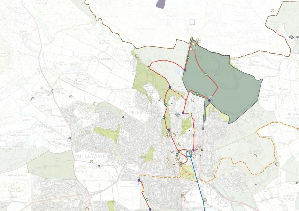
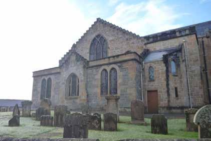
2 Westerton, Bearsden and Milngavie The following maps demonstrate the spatial strategy for the Westerton, Bearsden and Milngavie trails. The heritage and proposed trails are presented on two maps per area: Map 2A - Existing heritage locations Map 2B - Existing heritage locations plus proposed trail routes hubs, lures, interpretation, markers, viewpoints. The heritage that has been mapped is the information which has been uncovered by the Trails and Tales team through the life of the project from desk research, site visits and community consultations. It is not an exhaustive list but a snapshot of heritage which has been communicated as important in the life of the area. Through the process of matching locations and heritage stories, many important sites have been noted on the following maps. Only heritage which has a place or site associated with it has been shown in the list and maps, however the project does have repositories of other heritage information for each area which are for now place-less but may inform the production of artistic responses in other ways. We have been as accurate as possible in defining heritage locations but some discrepancies may remain. 22 Mapped Heritage 01. Westerton Arts & Crafts listed buildings at Maxwell Avenue 02. Westerton Fairlie Parish Church 03. Glacial deposition topography at Switchback. 04. Crimban Cannons (site of old golf clubhouse at Garscube Estate) 05. Canniesburn Hospital 06. St Germain s Loch 07. Sandeman House 08. Bearsden War memorial 09. Roman Road 10. New Kilpatrick Church 11. Roman baths and barracks 12. Boclair House 13. Art deco houses Carseview Drive (Kilmardinny Crescent) 14. Antonine Wall at Cemetery 15. Roman wall 16. Kettle pond Kilmardinny Loch 17. Boathouse remains at Kilmardinny Loch 18. Kilmardinny House 19. Elmwalk Gartconnel Farm House 20. Shaw House 21. St Andrew s College site 22. Former mine shaft 23. Dye works site 24. Burnbrae Works site (Bennie Rail Plane site) 25. Sluice from Allander water (divert water to pools for bleach fields) 26. Gavin s Mill 27. Colpis Ice Cream 28. Milngavie Co-op 29. Black Bull 30. Milngavie Free Church 31. Clober Road Laundry 32. Claremont Gardens 33. Ripley House 34. Hugh Allan - Allander Pottery 35. Lillie Art Gallery 36. Garvies Ginger Hill 37. Elangowan paper mill site 38. Ladies pond 39. Part of Glassfords Estate (Dougalston house was burnt down) 40. Chestnut Lane 41. Craigton Ancient woodland. 42. Site of former Flexible Ducting factory 43. Tannoch Loch 44. Reservoirs and waterworks 45. West highland way 46. Mugdock and Craigend zoo (Ibrahim & Charlie the elephant) 47. The Loan 48. Gas Works Craigton 49. Tambowie Distillery & Alexander Graham N.B not all churches have been listed, only those highlighted through consultation. Trail themes Two prominent themes have emerged from the consultation material and the mapping of the heritage interest, collated through the life of the project to date. These themes are: Items shown in Blue: Water - encompassing water control, storage, treatment, utilisation of water within industry and town planning, geological / hydrological formation. Items shown in Green: Heritage buildings - The trail features a number of heritage buildings or buildings of architectural significance which either remain in their original use, have been demolished or have been repurposed for other uses. These buildings, or the memory of them, appear to be significant for the communities in the area and provide an interesting glimpse of the changes in the nature of the area over the years.
3
4
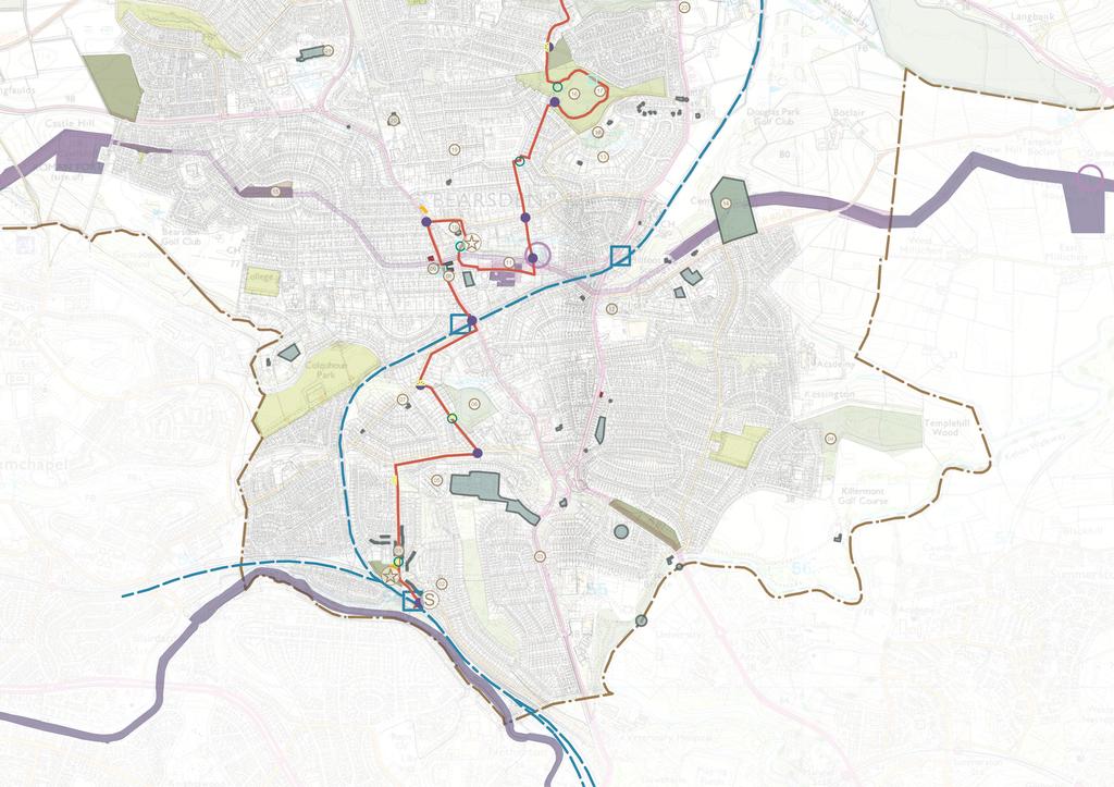
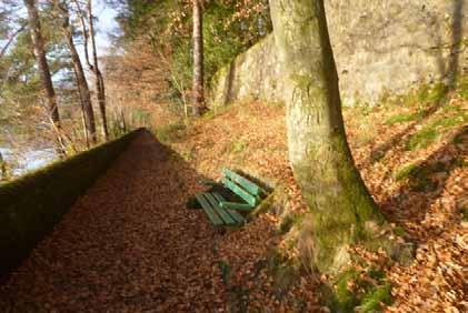
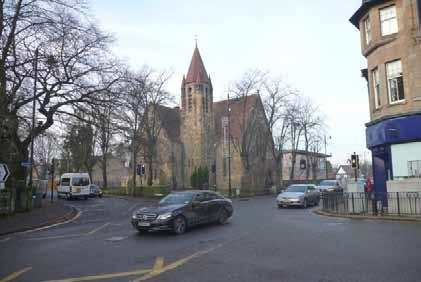
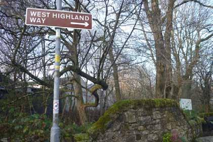
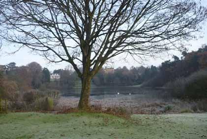
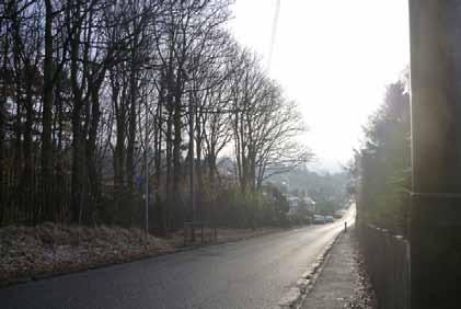
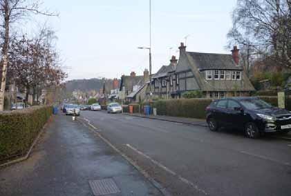
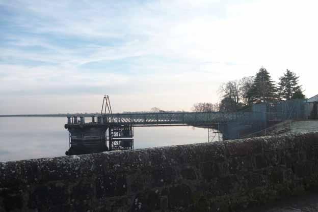
5 Westerton, Bearsden and Milngavie Trail description Route part 1 - Westerton to Bearsden section: Starting in Westerton at the railway station, the trail passes significant listed arts and crafts housing, part of Westerton Garden Suburb. After a short ascent, the route quickly encompasses good views over the city and Clyde valley to the south. The route passes St Germain s Loch which includes an existing seating area with views over the loch. Continuing through the suburban roads, the route arrives at a railway cutting flanked by stone villas on both sides leading to Bearsden Station. This is an interesting area with compositions of interesting views and buildings associated with characters of Bearsden such as Margo Sandeman. Route part 2 - Bearsden to Milngavie section: From Bearsden station the route continues to Bearsden Cross passing the war memorial and the Roman Road, from which an optional diversion could be taken to the roman wall remains. The route passes multiple churches at this point including the New Kilpatrick Church and associated Commonwealth war graves and takes in the village centre where an existing central seating area offers an opportunity for a stopping point with potential artworks locations and trial interpretation points. The route then heads towards the Roman baths (passing the existing heritage interpretation) and uphill again through areas of villas, mature trees and then post war housing towards Kilmardinny Loch. At Kilmardinny the route takes in the kettle loch and then heads through the north of Bearsden towards an open path network through grassland with views to the fields on the west. This is the first point of open landscape experienced on the route. At the end of this path, the Bearsden trail finishes but a connecting route is suggested towards Milngavie. Connecting route - Bearsden to Milngavie and Route part 3 - Milngavie Loop: The connecting route to Milngavie is suggested along South Mains Road as the most direct route to join off-road paths again at Lennox Park and 28 along the Allander Water path towards Gavin s Mill, one of the most prominent heritage sites in Milngavie. The Milngavie trail loop begins here if joined from the connecting route, or from the railway station and Lillie Art Gallery Trail Hub if the trail is walked separately to the Bearsden section. From here the trail goes through Milngavie town centre and joins the West Highland Way passing multiple town centre heritage sites of local amenities. The trail then leads along the Allander water where industrial sites are still in operation albeit in different forms to the previous industrial heritage of this section, which previously housed Garvie s soft drinks production, flexible ducting manufacturing and a paper mill. There are seating areas and clearings along this wooded path which offer opportunities for artworks to potentially respond to the industrial heritage of the area with stopping points incorporating pleasant outlooks over the Allander and towards the activity of the small scale industrial processes. Shortly after this section the route veers sharply uphill and quickly leaves the woodland landscape behind emerging into a moorland with open views towards the west and south for many miles around. The path here is rougher and unsuitable for wheels. There is an information point for Drumclog Moor at which point the path heads back into woodland and emerges at the Drumclog car park. From here the main road to Mugdock is crossed to enter the reservoirs area. The trail route goes left along the west side of Mugdock reservoir and loops around the reservoir dam and inlets at the northern end of the site. This section provides interesting opportunities to engage with the history of the reservoir and the inlets with connections uphill to the surrounding catchment area. The trail continues around the Mugdock reservoir with pleasant views across the water and intermittent seating areas. The route begins to return to Milngavie town via the central section which separates Mugdock and Craigmaddie reserviors and offers opportunities to engage with the heritage of the site s function. The engineering of the site is further highlighted as the route travels down the access road with views towards Tannoch Loch and Milngavie below. At this point the landscape provides interest with the level of the reservoir in start contrast to the loch below. The trail continues downhill towards Mugdock Road and takes a left at Tannoch Drive amongst villas composed in a cosy village arrangement around the loch. The route then continues downhill at Buchanan Street, from where a view of the water tower is evident from the junction with Moor Road. Buchanan Street includes ecclesiastical heritage in the form of Cairns Church of Scotland and St Joseph s Catholic Church. The suggested trail hub of the Lillie Art Gallery is located at the bottom of Buchanan Street on Station Road, next to the Town Hall and from here the trail route can be followed back to the railway station.


6 Route part 3 - Milngavie Route part 1 - Westerton Route part 2 - Bearsden and Kilmardinny 29
Torrance. Mapped Heritage. The following maps demonstrate the spatial strategy for the Torrance trails. Trail themes
 Torrance The following maps demonstrate the spatial strategy for the Torrance trails. The heritage and proposed trails are presented on two maps per area: Map 2A - Existing heritage locations Map 2B -
Lenzie. Mapped Heritage. The following maps demonstrate the spatial strategy for the Lenzie trail. Trail themes
 Lenzie The following maps demonstrate the spatial strategy for the Lenzie trail. The heritage and proposed trails are presented on two maps per area: Map 2A - Existing heritage locations Map 2B - Existing
Milngavie Woodlands House, 133 Mugdock Road.
 Milngavie Woodlands House, 133 Mugdock Road www.corumproperty.co.uk Built circa 1850 this category B listed property, designed by JT Rochead the renowned Glasgow Architect, is undoubtedly one of the finest
12 Beech Avenue, Bearsden.
 12 Beech Avenue, Bearsden www.rettie.co.uk This property was built by John MacDonald in the 1930 s within Bearsden s Burnbrae district, which remains one of the area s most popular to live in, given the
Douglas Gardens, Milngavie. An exclusive choice of magnificent detached villas. Hand-crafted homes for generations
 Douglas Gardens, Milngavie An exclusive choice of magnificent detached villas. Hand-crafted homes for generations Clober Golf Course, Milngavie Clober Golf Course, Milngavie Walled Garden at Mugdock Country
Bearsden 62 Maxwell Avenue.
 Bearsden 62 Maxwell Avenue www.corumproperty.co.uk harming mid terrace property within the Westerton garden suburb with granted planning permission for an imaginative single story extension. Property Description
32 Thomson Drive, Bearsden.
 32 Thomson Drive, Bearsden www.rettie.co.uk A traditional, double fronted, bay windowed detached bungalow located within the Kilmardinny district. A fine looking property, it was designed with accommodation
Milngavie Hub Steering Group
 Milngavie Hub Steering Group 1 Report, August 2017 1 About the group 2 Observations from members, 2015 2017 3 The hub as an opportunity to gain new facilities 4 Next step 1 About the group 1.1 Formation
30 Station Road, Bearsden, Glasgow.
 30 Station Road, Bearsden, Glasgow www.rettie.co.uk A really lovely detached Victorian cottage style villa situated in an elevated position with stunning southerly views over Colquhoun Park, one has the
RAIGLAMONT 44 Heather Avenue, Bearsden
 RAIGLAMONT 44 Heather Avenue, Bearsden With a fabulous position directly overlooking Heather Park and the farmland beyond is this significantly upgraded modern (1960 s) detached house, built originally
Countryside Trails Dunkeld
 R A N G E R S E RV I C E Countryside Trails Dunkeld WELCOME Welcome to this southern end of Atholl Estates. The countryside here is a wonderful blend of lochs, woodland and heather moor. There is a large
The footpaths in Eaves Wood, Mytholm, Hebden Bridge. Dedicating historic paths as rights of way: submission by Hebden Bridge Walkers Action
 The footpaths in Eaves Wood, Mytholm, Hebden Bridge Dedicating historic paths as rights of way: submission by Hebden Bridge Walkers Action Summary This submission to Calderdale MBC proposes that the council
raiglamont 1 Westbourne Drive, Bearsden
 raiglamont 1 Westbourne Drive, Bearsden A substantial sandstone semi-detached Edwardian home, extended above its large tandem garage to provide an additional two apartments and a further bathroom. The
1.1. The purpose of this report is to seek approval for the adoption and publication of the Sports Pitches Strategy for East Dunbartonshire.
 REPORT FOR EDLC BOARD Report Title: EDC Pitches Strategy Update Contact Officer: Mark Grant (0141 777 3146) Date: 30 th March 2016 Agenda Item No: 5 Report No: EDLCT/52/15/MG 1.0 PURPOSE 1.1. The purpose
A DISCUSSION PAPER ON THE DEVELOPMENT OF WALKING ROUTES IN ASSOCIATION WITH MARK HILL WIND FARM. 25 th March Prepared by Force 9 Energy
 A DISCUSSION PAPER ON THE DEVELOPMENT OF WALKING ROUTES IN ASSOCIATION WITH MARK HILL WIND FARM 25 th March 2006 Prepared by Force 9 Energy INTRODUCTION This paper presents an outline of potential leisure/recreational
Loch Lomond Manor Region: Loch Lomond Sleeps: 12
 Loch Lomond Manor Region: Loch Lomond Sleeps: 12 Overview Page 1 Loch Lomond Manor is a unique historic National Monuments house constructed between 1901 and 1902. It was built by a husband and wife team,
CARRICK 14 BOCLAIR ROAD, BEARSDEN
 CARRICK 14 BOCLAIR ROAD, BEARSDEN CARRICK 14 BOCLAIR ROAD, BEARSDEN G61 2AF Carrick, dating from 1925, is one of the fine period detached homes that form Boclair Road. A handsome four bedroomed detached
GRINDLEFORD GALLOP 2018
 GRINDLEFORD GALLOP 2018 Route Information The Grindleford Gallop follows a fixed 21 mile route through the lanes and paths of Derbyshire. All competitors must follow this route. An OS map of the area with
44 Norwood Park, Bearsden.
 44 Norwood Park, Bearsden www.rettie.co.uk Norwood Park is a highly regarded and established development of quality modern apartments set amidst beautiful residents grounds leading down to the very waters
A charming traditional country house set in approx. 50 acres overlooking Carbeth Loch. carbeth house, blanefield, glasgow, G63 9AS
 A charming traditional country house set in approx. 50 acres overlooking Carbeth Loch carbeth house, blanefield, glasgow, G63 9AS A charming traditional country house set in approx 50 acres overlooking
The Mendip Way. Route Directions and Maps Uphill to Wells
 The Mendip Way Route Directions and Maps Uphill to Wells Website: www.mendiphillsaonb.org.uk Email: mendip@mendiphillsaonb.org.uk Facebook & Twitter: @MendipHillsAONB Phone: 01761462338 1 Uphill to Loxton
ANTONINE WALL - DULLATUR
 Property in Care (PIC) ID: PIC172 Designations: Scheduled Monument (SM90017); Taken into State care: 1960 (Guardianship) Last reviewed: 2018 HISTORIC ENVIRONMENT SCOTLAND STATEMENT OF SIGNIFICANCE ANTONINE
Loch Lomond Manor Region: Loch Lomond Sleeps: 12. Overview
 Loch Lomond Manor Region: Loch Lomond Sleeps: 12 Overview Page 1 Loch Lomond Manor is a unique historic National Monuments house constructed between 1901 and 1902. It was built by a husband and wife team,
Black Hill Regional Park, Little Seneca Lake
 Black Hill Regional Park, ittle Seneca ake ittle Seneca ake, in Black Hill Regional Park, is a reservoir created after a previous drought struck the Washington area. The park is under Maryland-National
ROUKEN GLEN: BANDSTAND 2015 DATA STRUCTURE REPORT
 ROUKEN GLEN: BANDSTAND 2015 DATA STRUCTURE REPORT Author (s) Ian Hill Editors Report Date June 2015 Working Partners Funders Phil Richardson East Renfrewshire Council East Renfrewshire Council, Heritage
Reigate Hill and Gatton Park
 point your feet on a new path Reigate Hill and Gatton Park Distance: 11½ km=7 miles easy-to-moderate walking or 2 walks of 6½ km=4 miles and 5½ km=3½ miles Region: Surrey Author: Schwebefuss Refreshments:
Key. Cotswold Water Park
 Existing Key Nature Sites Core Biodiversity Corridor Proposed Canals Biodiversity Scope The development of the CWP will be orientated towards meeting and exceeding biodiversity targets, making the CWP
Tourism and the Cairngorms National Park // Update 2006
 Tourism and the Cairngorms National Park // Update 2006 Tourism and the Cairngorms National Park // Update 2006 One Year on... Since finalising the Sustainable Tourism Strategy last March, the Cairngorms
Chapter 2: Site Analysis Topography (L)
") Chapter 2: Site Analysis Topography (L) Meigle Hill AOD 421m Melrose Gait Gala Hill AOD 100m AOD 252m AOD 75m Eildon Hill AOD 422m Tweedbank is part of a valley conurbation of distinct villages and towns
Chapter 2: Site Analysis Topography (L) Meigle Hill AOD 421m Melrose Gait Gala Hill AOD 100m AOD 252m AOD 75m Eildon Hill AOD 422m Tweedbank is part of a valley conurbation of distinct villages and towns
OAKBANK 18 ROMAN ROAD, BEARSDEN
 Oakbank is a fine four bedroomed Victorian villa built in 1877 and one of Bearsden s oldest homes, following the introduction, some fourteen years earlier, of the railway line to Bearsden. Enjoying a very
To Let. Queens Quay. Clydebank s Business Quarter. Highly Specified Riverside Offices from sqm (265 sqft) to 1,867 sqm (20,100 sqft)
 to 1,867 sqm (20,100 sqft)") To Let Highly Specified Riverside Offices from 24.61 sqm (265 sqft) to 1,867 sqm (20,100 sqft) Queens Quay s Business Quarter www.clydebankproperty.com Queens Quay s Business Quarter Queens Quay is s new
To Let Highly Specified Riverside Offices from 24.61 sqm (265 sqft) to 1,867 sqm (20,100 sqft) Queens Quay s Business Quarter www.clydebankproperty.com Queens Quay s Business Quarter Queens Quay is s new
BURGHCLERE PARISH RIGHTS OF WAY
 BURGHCLERE PARISH RIGHTS OF WAY Full descriptions compiled by Neill & Miggie Bruce All photos Miggie Bruce FP23 on Ridgemoor, looking south, with FP22 crossing by the bush FP1. From C183 Aldern Bridge
Illawarra Escarpment State Conservation Area Walking Tracks
 Illawarra Escarpment State Conservation Area Walking Tracks NPWS Illawarra Area Office Ground Floor, Government Office Block 84 Crown Street Wollongong NSW 2500 02 4223 3000 (Mon-Fri) Royal National Park
Telluride-to-Moab Alternative Singletrack Options
 Telluride-to-Moab Alternative Singletrack Options Day 1 Day 1 Alternate 1: Galloping Goose to Deep Creek. 18.4 miles, ascent 3,530ft, descent 1,388ft. This is fun, flowey, moderate to intermediate singletrack
1.0 PURPOSE 2.0 SERVICE OVERVIEW. 2.1 Libraries Exhibitions
 REPORT FOR EDLC BOARD Report Title: Operational Performance Report Contact Officer: Maeve Kilcoyne (0141 777 3147) Date: 23rd August 2017 Agenda Item No: 8 Report No: EDLCT/67/17/MK 1.0 PURPOSE 1.1.1 The
Kilsyth Rowan Bank, High Barrwood Road.
 Kilsyth Rowan Bank, High Barrwood Road www.corumproperty.co.uk Situation Occupying an enviable position with a delightful rural outlook, this imaginatively extended and improved home offers an immediately
3CANNIESBURN COURT, BEARSDEN
 3CANNIESBURN COURT, BEARSDEN 3 CANNIESBURN COURT BEARSDEN G61 3RX The former Canniesburn Hospital site at Bearsden is a very successful, high quality development by Cala and Miller Homes, offering a mix
Bearsden Plot 4 Boclair Brae.
 Bearsden Plot 4 Boclair Brae www.corumproperty.co.uk Enjoying a prime location within Boclair Brae, this immediately impressive, corner sited five bedroom property offers a simply stunning modern family
2015/16. Council LOGO ATTRACTIVE SEAMLESS RELIABLE IMPROVED CONNECTIVITY ACCESS FOR ALL REDUCED EMISSIONS
 2015/16 Council LOGO 0 ABOUT US Strathclyde Partnership for Transport (SPT) is the Regional Transport Partnership for the west of Scotland and is a partnership of twelve councils. SPT was established by
Geoscape Toronto The Oak Ridges Moraine Activity 2 - Page 1 of 10 Information Bulletin
 About 13,000 years ago as the Laurentide Ice Sheet melted, glacial meltwater accumulated between the ice sheet and the Niagara Escarpment. This formed a lake basin into which gravel and sand were deposited.
DAVA WAY. Notes on multi-use access
 DAVA WAY Notes on multi-use access The Dava Way is a 24 mile (38km) waymarked long distance route based largely on the dismantled Highland Railway Line between Forres, near the Moray Coast in north-east
The Bridestone Rocks from Lydgate
 Print this page Back to results The Bridestone Rocks from Lydgate Ancient tracks and gritstone outcrops, with terrific views of the steepsided Cliviger Valley. Distance 5 miles (8km) Minimum time 2hrs
Cumbrae Heritage Trail Route
 Cumbrae Heritage Trail Route Letters for each location can be found on the map above. If you only want to do the Millport Town Walk get the bus to the Field Studies Council buildings where the Marine Station
Tourism Development Plan for Scotland Questionnaire
 Draft National Tourism Development Plan Public Consultation 2013 Tourism Development Plan for Scotland Questionnaire We would like your views on this Plan and, in particular, your comments on opportunities
Skiing and Snowshoes on Un-groomed Fernan Saddle Terrain
 Skiing and Snowshoes on Un-groomed Fernan Saddle Terrain Three ski or snowshoe routes are available from the Fernan Saddle Parking Lot which either do not cover routes ordinarily groomed for snow machine
Ardingly Lake, Ouse Valley, Borde Hill
 point your feet on a new path Ardingly Lake, Ouse Valley, Borde Hill Distance: 14 km=9 miles or 12½ km=8 miles Region: West Sussex Author: Hautboy Refreshments: Borde Hill Map: Explorer 135 (Ashdown Forest)
Chess & Gade. Chalfont & Latimer Station - Latimer - Chenies - Sarratt - Kings Langley Station. Length: 8 ¾ miles (14.25km)
") 1 Chess & Gade Chalfont & Latimer Station - Latimer - Chenies - Sarratt - Kings Langley Station Length: 8 ¾ miles (14.25km) Underfoot: Well-trodden paths, mainly firm in all weather conditions, though
1 Chess & Gade Chalfont & Latimer Station - Latimer - Chenies - Sarratt - Kings Langley Station Length: 8 ¾ miles (14.25km) Underfoot: Well-trodden paths, mainly firm in all weather conditions, though
Access Statement for Touchstones Rochdale
 Access Statement for Touchstones Rochdale This access statement does not contain personal opinions as to our suitability for those with access needs, but aims to accurately describe the facilities and
Hindhead, Keffolds Copse and Gibbet Hill
 point your feet on a new path, Keffolds Copse and Gibbet Hill Distance: 6 km=4 miles Region: Surrey Author: Schwebefuss Refreshments: Punch Bowl Café moderate walking Date written: 14-apr-2015 Last update:
9 CHAPELTON AVENUE BEARSDEN
 9 CHAPELTON AENUE BEARSDEN 9 CHAPELTON AENUE BEARSDEN G61 2RE Tucked away at the top of this small tree lined avenue and set amidst extensive garden grounds, this magnificent three bedroom semi detached
Woodland Walk If you enjoyed this walk there are two others available in the same area.
 The Woodland Walk 11-12 kilometres (7-8 miles) 4-5 hours Terrain: some easy hills Can be slippery when wet 5 stiles Unsuitable for a pushchair/wheelchair Uses OS map 197 Parking: Pulborough Station and
Mersey Valley Timberland Trail
 Route Pack Page 1 Route Summary A long distance linear walk on roads and country paths linking town and countryside to parks, woodlands and other open spaces. Grade Distance Accessibility Allow Start Map
(/ 12 (/ 18 (/ 18 (/ 12 (/ 51 (/ 14 Æ%106 Æ% 106 Æ% 213 Æ% 104 Æ% 89 Æ% 26 Æ% 73 Æ% 59 Æ% 138 Æ% 92 Æ% 26 Æ% 67 Æ% 11 Æ% 11 Æ% 11. Æÿ H Æÿ Z.
 WAUKESHA Existing Ice Age Trail, subject to change as it evolves toward completion Glacial Drumlin Rail-Trail 94 Ice Age Trail Rock, Walworth and Jefferson Counties Other Trail Unofficial Connecting Route
Beautiful Walks from the Blue Ball Inn
 Walk No. 2 WINSTONS WALK Countisbury, Wind Hill, Watersmeet, Ash Bridge and Winston s path. 5 Miles approx. Walking time- Two and a half hours approx. (Not including Breaks) OS 1:25,000 Sheet 64/74 Lynton
MOORE PARK_ DIRECTIONS nd July, 2015
 MOORE _ DIRECTIONS 2040 2nd July, 2015 HISTORY OF MOORE Active + Green For 150 years, Moore Park has been the epicentre of Sydney s active recreation, sporting and entertainment activities. Grand Parade,
SECTION ONE. Scotland s National Parks and National Nature Reserves Ten Things You Might Not Know
 SECTION ONE Scotland s National Parks and National Nature Reserves Ten Things You Might Not Know 5 Ten Things You Might Not Know... 1. SCOTLAND S NATIONAL PARKS AND NATIONAL NATURE RESERVES ARE BEAUTIFUL,
Borough High Street Low Emission Neighbourhood
 Borough High Street Low Emission Neighbourhood Colourful Crossings Design Brief Better Bankside Business Improvement District Brief for Graphic Consultants December 2017 Page 1 of 10 1. Introduction Borough
Draft Greater Sydney Region Plan
 Draft Greater Sydney Region Plan Submission_id: 31392 Date of Lodgment: 14 Dec 2017 Origin of Submission: Online Organisation name: Greenfields Development Company No. 2 Pty Limited Organisation type:
ROYAL GORGE PARK and RECREATION AREA. A Feat of Natural and Man-Made Engineering
 ROYAL GORGE PARK and RECREATION AREA A Feat of Natural and Man-Made Engineering As Growth Resumed in the 1870 s Town Leaders Began to Envision a Tourist Industry. The Arkansas River Canyon was advertised
Visitor Economy Update Durham Tourism Management Plan (DTMaP) Michelle Gorman, Managing Director
 Michelle Gorman, Managing Director") Visitor Economy Update Durham Tourism Management Plan (DTMaP) 2016-2020 Michelle Gorman, Managing Director Destination performance (STEAM Report 2016) Economic value Economic value 806m per annum up 2%
Visitor Economy Update Durham Tourism Management Plan (DTMaP) 2016-2020 Michelle Gorman, Managing Director Destination performance (STEAM Report 2016) Economic value Economic value 806m per annum up 2%
INFORMATION FOR STANWELL MOOR AND STANWELL COMMUNITIES
 Proposed north west runway Stanwell Moor Stanwell All maps contain OS data Crown copyright and database right 2018 INFORMATION FOR STANWELL MOOR AND STANWELL COMMUNITIES JANUARY 2018 Airport Expansion
THE RIVERSIDE MUSEUM AND GLASGOW GREEN CYCLING ROAD RACE AND TIME TRIAL SPECTATOR GUIDE
 THE RIVERSIDE MUSEUM AND GLASGOW GREEN CYCLING ROAD RACE AND TIME TRIAL SPECTATOR GUIDE THE MOMENT is finally here! Welcome to the 2018 UEC European Cycling Championships. As part of this year s Championships
Afon Adda Refurbishment Bangor
 Afon Adda Refurbishment Bangor Archaeological Assessment Revised Report GAT Project No. 1876 Report No. 628 April 2006 Ymddiriedolaeth Archaeolegol Gwynedd Gwynedd Archaeological Trust Craig Beuno, Ffordd
11 Lavender Drive, Newton Mearns.
 11 Lavender Drive, Newton Mearns www.nicolestateagents.co.uk Situation A hugely popular suburb, Newton Mearns is a welcoming, family friendly town, with a fantastic, lively and inclusive community. If
Aspirations and Ambitions...our development opportunities
 Aspirations and Ambitions...our development opportunities July 2013 Contents 1.0 Introduction 1 2.0 General Guidance 3 3.0 National Park Authorities 8 Cairngorms National Park 8 Loch Lomond & the Trossachs
Ward Boundary Review Ealing Council Submission
 Ward Boundary Review 2018- Ealing Council Submission 1 CONTENTS Overview of Submission... 3 The London Borough of Ealing... 4 Drawing the boundaries for the Council in 2022... 5 in 2024 forecast by new
Black Buoy, Wivenhoe to Spinnaker, Colchester
 Start: Finish: Total Distance: Black Buoy, Wivenhoe Crown, Ardleigh 6.3 miles Black Buoy, Wivenhoe to Spinnaker, Colchester Distance: 2.4 miles Turn right out of the Black Buoy, then left into East Street.
Mullochard Farmhouse, Carrbridge, PH26 3LZ Offers over 90,000
 Mullochard Farmhouse, Carrbridge, PH26 3LZ Offers over 90,000 Contact us on 01479 874800 or visit A unique chance to acquire a fantastic site with derelict farmhouse and paddock enjoying a quiet and private
River Isla B951. Diarmid s Tomb
 3. 4 Spittal of Glenshee to Kirkton of Glenisla Distance 14.6 miles 23.5 km Terrain mainly on rough moorland path with boggy bits and stream crossings, then heading east along at the B951 for 2.5 miles,
A Replacement Tesco for Milngavie Heritage: opportunities and constraints
 A Replacement Tesco for Milngavie Heritage: opportunities and constraints Submission to community consultation by Milngavie Heritage Centre Group. Ensuring that East Dunbartonshire remains and becomes
Trail Phasing Plan. Note: Trails in the Clear Creek Canyon area (Segments will be finalized in the future to minimize wildlife impacts
 Note: Trails in the Clear Creek Canyon area (Segments 2 5 and a future JCOS connection) will be finalized in the future to minimize wildlife impacts Trail Phasing Plan P Parking 3 Easy Trail Intermediate
National Recreation Trail Update Form
 National Recreation Trail Update Form Introduction Thank you for taking the time to complete this form. Your assistance will help ensure that the National Recreation Trail (NRT) database is complete and
1 INFORMATION REQUIREMENTS
 1 INFORMATION REQUIREMENTS 1.1 BACKGROUND 2 1.2 WHAT IS THE DISTRICT PLAN 3 1.3 DISTRICT PLAN STRUCTURE 4 1.4 HOW TO USE THE DISTRICT PLAN 5 1.5 STRATEGIC FRAMEWORK 6 Whanganui District Plan (15 January
Figure San Dimas Bonita at San Dimas Avenue (view looking west)
") The adjoining neighborhood has an eclectic assortment of building types and uses, including: the historically significant but not architecturally or visually noteworthy San Dimas Lemon Association Packing
The adjoining neighborhood has an eclectic assortment of building types and uses, including: the historically significant but not architecturally or visually noteworthy San Dimas Lemon Association Packing
Medway Valley Orchards
 1 Medway Valley Orchards East Farleigh station - Kettle Corner - Farleigh Green - Buston Manor - Yalding - Yalding station Length: 6 ¾ miles (10.9km) Underfoot: Generally, this is a walk on good paths,
DAKOTA CULTURE UPPER SIOUX COMMUNITY: AREA CHARACTER ANALYSIS ALIGNMENT STRATEGY
 UPPER SIOUX COMMUNITY: AREA CHARACTER ANALYSIS ALIGNMENT STRATEGY 51 AREA CHARACTER ANALYSIS: OPPORTUNITIES & CONSTRAINTS RECREATIONAL VEHICLE PARK: A recreational vehicle park will be built to accommodate
SPRING/EASTER HOLIDAY PROGRAMME
 SPRING/EASTER EDLC Spring / Easter Holiday Programme Mon 3 - Thurs 13 April 2017 2 SPRING / EASTER HOLIDAY PROGRAMME Easter Holiday Programme: Monday 3rd - Thursday 13th April This year s Easter Holiday
CARN BAN LONG CAIRN HISTORIC ENVIRONMENT SCOTLAND STATEMENT OF SIGNIFICANCE. Property in Care (PIC) ID: PIC059 Designations:
 ID: PIC059 Designations:") Property in Care (PIC) ID: PIC059 Designations: Scheduled Monument (SM90051) Taken into State care: 1962 (Guardianship) Last reviewed: 2004 HISTORIC ENVIRONMENT SCOTLAND STATEMENT OF SIGNIFICANCE CARN
Property in Care (PIC) ID: PIC059 Designations: Scheduled Monument (SM90051) Taken into State care: 1962 (Guardianship) Last reviewed: 2004 HISTORIC ENVIRONMENT SCOTLAND STATEMENT OF SIGNIFICANCE CARN
Explore the Bay the Green Way
 Explore the Bay the Green Way Botany Bay Trail Pre-Feasibility Study Report Nick Benson Sutherland Shire Environment Centre August 2002 1 Botany Bay Trail Explore the Bay the Green Way Opportunities for
Villa Poggio Region: Chianti & Arezzo Sleeps: 18
 Villa Poggio Region: Chianti & Arezzo Sleeps: 18 Overview Lovers of food, art, and wine will find holiday perfection at this villa in Tuscany. The panoramic views of Chaina Valley - Cortona, Montecchio
November Event Programme 2015
 2015 EVENT GUIDE November Event Programme 2015 Monday 2 nd Botanical Gardens & Kibble Palace Friday 6 th 10 Pin Bowling Saturday 7 th Glengoyne Distillery Monday 9 th The Burrell Friday 13 th David Livingston
REVISED AGENDA. Special Council Meeting. Monday, September 11, 2017 (REVISED TO INCLUDE ON-TABLE ITEMS)
") Mission Statement In carrying out its mandate, Bowen Island Municipality will work towards conducting operations in a way that: Improves the economic, environmental and social well-being for present and
Mission Statement In carrying out its mandate, Bowen Island Municipality will work towards conducting operations in a way that: Improves the economic, environmental and social well-being for present and
Walking Holidays in Britain s most Beautiful Landscapes
 Walking Holidays in Britain s most Beautiful Landscapes West Highland Way Discover the dramatic mountain scenery of the West Highlands on the classic Scottish long distance route. The route begins in Milngavie
PHOENIX PARK INCORPORATING THURNSCOE COMMUNITY WOODLAND
 PHOENIX PARK INCORPORATING THURNSCOE This popular site is known for its sculptures and climbing wall which can be seen as you meander around the park. Walking towards the top of the woodland you will pass
2 7 5 L O O P 2 5 : : E
 275 loop 25 :: Eden Park 125 Eden Park 25 In Brief Eden Park offers an array of activities, including a playhouse, amphitheater, conservatory, art museum, outdoor sculptures, and gardens. Plan to spend
1.1.1 Landscape character This is the upper part of a bowl-shaped landform, extending east from the Rothiemurchus character area, contained by the
 1.1 Glen More 1.1.1 Landscape character This is the upper part of a bowl-shaped landform, extending east from the Rothiemurchus character area, contained by the arc of the high granite pluton of the Cairngorms
CITY RAIL LINK. New Public Transport Stations and Development Opportunities at Karangahape Road, Newton and Aotea Quarter
 134 AC_BEU_CCMP_3_TM5_8_FD.indd 134 20/07/12 12:30 PM 05 CITY RAIL LINK New Public Transport Stations and Development Opportunities at Karangahape Road, Newton and Aotea Quarter 5 MO VE 0 1 2 8 KEY 1 Britomart
East Dunbartonshire Area Profile
 East Dunbartonshire Area Profile May 2014 Contents Executive Summary.. page 3 Introduction.. page 6 Population page 7 Age Structure. page 9 Population Projections page 11 Life Expectancy page 12 Ethnicity.
Acknowledgements. Dave Shillabeer Iain Fairweather Rupert Furze Matthew Hilton Magnus Swanson Directors of NICE who helped with contributions
 Acknowledgements Dave Shillabeer Iain Fairweather Rupert Furze Matthew Hilton Magnus Swanson Directors of NICE who helped with contributions Why do we need a Vision? We feel Nairn does not get its Fair
The. History Walk. WWII Armaments factory
 The History Walk WWII Armaments factory 4.8-6.5 kilometres (3-4 miles) 2.5-3.5 hours Terrain: easy Can be slippery when wet No stiles Unsuitable for a pushchair/wheelchair Uses OS map 197 Parking: Pulborough
C E N T R A L C A T S K I L L S
 120 C E N T R A L C A T S K I L L S Central Catskills Once out of the southern parts of the Catskills, the Long Path enters the more well traveled and civilized regions. The trail joins the Devil s Path,
National Trust Heritage Awards 2018
 National Trust Heritage Awards 2018 National Trust of Australia (Queensland) awards outstanding projects and people that demonstrate excellence in the protection, conservation and celebration of Queensland
Bikes talk to each other like dogs, they wag their wheels and tinkle their bells, the riders let their mounts mingle.
 Bikes talk to each other like dogs, they wag their wheels and tinkle their bells, the riders let their mounts mingle. Daniel Behrman, The Man Who Loved Bicycles W hitmore Lake Loop route: Dexter, the corner
GOLD COAST HOUSING REPORT SNAPSHOT
 GOLD COAST HOUSING REPORT SNAPSHOT Few cities have expanded like the Gold Coast. The once iconic surfing Mecca and holiday destination has grown to become the 6th largest city in Australia with a population
Beautiful Walks from the Blue Ball Inn
 Walk No. 5 RIVER VALLEYS AND MOOR Countisbury, Watersmeet, Hillsford Bridge, Cheriton, Shilstone Hill, Rockford and Chiselcombe. 8.5 MILES APPROX. Walking time four and a half hours approx. OS 1;25,000
2. STAKEHOLDER FEEDBACK // What We Heard
 1. QUARRY ROAD TRAIL // Welcome to the Information Session PROJECT DESCRIPTION WHY WE ARE HERE Quarry Road Trail is a popular commuter trail and recreational area for Calgarians. 1. To report citizen feedback
population date of map cupar %
 population 7427 6766 date of map 1856 1896 cupar In 12th century Cupar was established as the county town of Fife. It prospered in its early days on the back of the wool industry and later grew as a market
Designated Sites. Headlines
 Designated Sites Headlines Over 36% of the Sheffield district is covered by sites with European, national or local designation. These offer valuable habitats to wildlife, with some level of protection,
Castles in and Around Glasgow
 Castles in and Around Glasgow Crookston Castle Crookston Castle is surrounded by a defensive ring-ditch that dates back to the 12th century when Sir Robert de Croc, who also gave his name to the village
West London Economic Assessment
 West London Economic Assessment A baseline analysis of the West London economy An Executive Summary PBA were commissioned in October 2015 to complete an economic assessment of West London to refresh the