Oregon Burial Site Guide Hood River County J I / / / / ODSVM ALNI10)! -7=
|
|
|
- Corey Barnett
- 5 years ago
- Views:
Transcription
1 I J I / / / / / / ALNI10)! -7= ODSVM 361
2 Idlewild Janice M. Healy (2001) Idlewild Janice M. Healy (2001) 362

3 Area: 533 square miles Population (1998): 19,553 County seat: Hood River, Population: 5,110 County established: 23 June 1908 This small county was detached from Wasco County to accommodate the boom in orchards in the Hood River Valley. Reportedly Frankton Cemetery was the first organized public cemetery in the county, however the compiler does not know the date of its establishment. Pine Grove Butte Cemetery (1869) appears to be the next earliest cemetery. V,I,Npka0.1,!ewe Pine Grove Butte Janice M. Healy I I 992) 363
4 364
5 Name of Cemetery and also known as I Number of buriak I Acres I Condition I Date started on earliest known burial I Township I Range I Section CASCADE LOCKS AKA: 1. CASCADES CUSHMAN'S PASTURE FISCHER, JOHN G. C R7E S12 Located north off of U.S. Hwy. 30 at Cascade Locks, on Lakeside Drive. The driveway, on the northeast side of the intersection across from the Texaco gas station, goes to a locked gate. There are 94 known burials (1987). (2 April 1992) (Bonneville Dam 1994 USGS Quad. map.)? 7?? T3N R1OE Located in Section 26 or 27. Reportedly 4 graves dating from 1881 to 1890 were in a fenced enclosure, somewhere along what is now Westcliff Drive westerly out of Hood River. The fence has since been torn down. (Not shown on Hood River 1979 USGS Quad. map.) A T1N R108 S31 Located in the North 1/2 of Southeast 1/4 of Section 31. Go 0.75 of a mile west on Baseline Road from Parkdale and then right (north) onto the Mount Hood Highway for 0.4 of a mile to the front of the old Mclsaac House. The grave had no marker but was enclosed by a white picket fence (1950's information). Mr. Fischer was thrown from his horse. NOTE: This site is on private property. (Not shown on Parkdale 1994 USGS Quad. map.) FRANKTON A 0.3 2? T3N R1OE S27 AKA: 1. BACKUS This was the first white cemetery in the 2. OLD PIONEER county. Located in the Frankton area, on 3. SMITH BURIAL the right bank of Phelps Creek, west of GROUND Frankton Road very near its junction with Country Club Road. There are 27 known burials (1987). The cemetery was badly vandalized in (Hood River 1979 USGS Quad. map.) HOMESTEADER GRAVE A 0.01?? T1N R108 S21 Located in the South 1/2 of Northeast 1/4 of Section 21, 100 feet north and 100 feet west from the junction of OR. Hwy. 35 and Leasure Drive, 1.5 miles north of the community of Mount Hood. Two homesteaders filed land 365
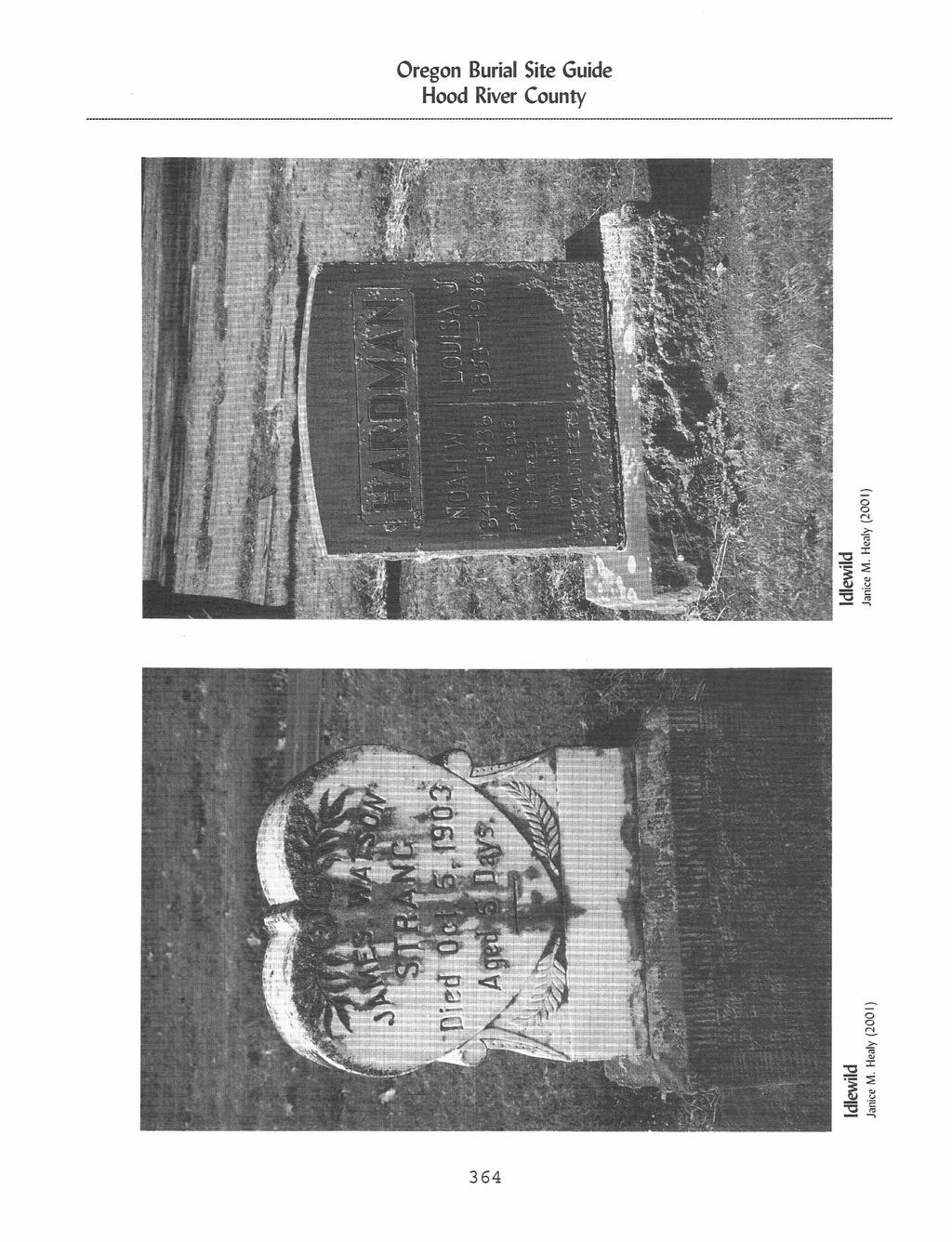
6 Name of Cemetery and also known as I Number of burials I Acres I Donation I Date started or earliest known burial Township I Range I Section claims while "hatching". One died from botulism or ptomaine, from eating poison beans, and his partner sold out to Robert Leasure. (Not shown on Parkdale 1994 USGS Quad. map.) IDLEWILD AKA 1. A.O.U.W. RIVERSIDE #68 [] 2. IDELWILDE 3. IDLEWOOD 4. I.O.O.F IDLEWILDE #107 [] 5. MASONIC, #105 [] D R1OE S2 Located 2 miles south of Hood River, at 980 Tucker Road. Since 1971 this has been controlled by the Masons. There were about 6,500 burials as of Idlewood is a misspelling. It is on the James M. Benson D.L.C. #37. OC #4046. {2 April 1992) (Hood River 1979 USGS Quad. map.) JACKSON FAMILY MASTERSON, FREDDIE McISAAC RANCH MT. HOOD COMMUNITY AKA: 1. FREDENBURG 2. FRIEDENBURG A R11E S30 This cemetery is on the west side of Fir Mountain Road, 0.5 of a mile south of the junction with Wells Drive. There were 11 or 12 graves (1987). {2 April 1992) (White Salmon 1978 USGS Quad. map.) A 0.01? Circa 1878 R7E S12 At Cascade Locks at or near the residence of J. Alfred Masterson and Martha Gay Masterson. Freddie their young son, died and was buried near where he played. No further information was given in the report. See: One Woman's West, Edited by Lois Barton, page 126. (Not shown on Bonneville Dam 1994 USGS Quad. map.) A ? T1N 829 In the late 1950's someone reported 3 old graves near Parkdale, on the Mclsaac Ranch. NOTE: This site is on private property. (NOT shown on Parkdale 1994 USGS Quad. map.) A T1N R1OE S21 Located in the South 1/2 of the Southeast 1/4 of Section 21, it is 0.25 of a mile west on Leasure Drive. Walk south another 0.25 of a 366
7 Name of Cemetery and also known as I Number of Nei* I Acres I Condition I Date started or eeriest known burial I TotensNp I Range I Sad. mile to an irrigation ditch and to the cemetery, which is on the northeast corner of the Avery Friedenburg Homestead (in 1986, was the northeast corner of the Lavern Hatfield Farm). There are 4 known burials. NOTE: This site is on private property. (Not shown on Parkdale 1994 USGS Qua& map.) MOUNTAIN VIEW MEMORIAL AKA: 1. COUNTY 2. KNIGHTS OF PYTHIAS [] OAK GROVE PINE GROVE BUTTE AKA: 1. BUTTE 2. NEAL FAMILY 3. PINE GROVE ST. MARK THE EVANGELIST CHURCH COLUMBARIUM D 'S R1OE S2 Located 2.5 miles southwest of Hood River at 1235 Tucker Road, adjacent to and south of St. Mary's Cemetery. There are 518 burials (1987). (Hood River 1979 USGS Quad. map.)??? N R1OE Located in Section 16 or 1 near the present Oak Grove School. Country Club Road, Portland Drive, Reed Road, and Binns Hill Drive converge here about miles southwest of Hood River. See Wasco ounty death certificate #355 for Tilman H. Smith, a farmer, died 18 February 1906, place of burial Oak Grove Cemetery, Hood River. (The locale is shown but no cem tery on Hood River 1979 USGS Quad. map.) D N R1OE S13 This cemetery straddles tw Ranges in east and west direction: Range 0 East and 11 East. It is also in Secti ns 13 and 18. Go about 6 miles south of ood River on OR. Hwy. 35 to the Pine Grove area, then go 0.3 of a mile east of OR. Hwy. 35 on Van Horn Drive to Paasch Drive; it s at 2651 Paasch Drive. The cemetery is on the edge of the butte and below the main r ad on the right. {3 April 1992) (Hood Rive 1979 USGS Quad. map.) B N R1OE S36 The church is located in H od River on Eugene Street, at the corner of 1 th. A columbarium was established with 48 sp ces of which a 367
8 Name of Cemetery and also known as Number of burials Acres I Condition I Date started or eadiert known burial I Township I Range I Section single space was filled as of February (The church itself is on the Hood River 1979 USGS Quad. map.) ST. MARY.S AKA: 1. CATHOLIC SHELLEY FAMILY C S2 Located just north and adjacent to Mt. View Cemetery on Tucker Road. In 1906 St. Mary's Cemetery was separated from a portion of what was then the Knights of Pythias Cemetery (the present-day Mountain View Memorial). However pre-1906 burials remained with St. Mary's. There were 288 burials (1986). (Hood River 1979 USGS Quad. map.) A S25 Leave OR. Hwy. 35 on Sunday Drive, to the southeast and east for 0.4 of a mile, then turn right on Scott Road, go southwest 0.25 of a mile; the cemetery is on the right. There are 7 known burials plus several unknown infants (1987). NOTE: This site is on private property. (Parkdale 1994 USGS Quad. map.) UPPER VALLEY D /1897 T1N S33 AKA: 1. I.O.O.F. Travel north 0.5 of a mile from Parkdale [PARKDALE] on Allen Road, then east 0.25 of a mile on 2. McKAMEY Parkdale Cemetery Road. There were MT. HOOD known burials as of Feb (Parkdale 4. PARKDALE 1994 USGS Quad. map.) VIENTO WEART, GEORGE W.??? 3 Jul 1906 T3N R9E 834 Viento was a railway stop between Hood River and Wyeth. An unknown man, aged about 25, was found drowned in the Columbia River. He was buried at Viento 3 July See Wasco County death certificate #1187 for (Not shown on Mount. Defiance USGS Quad. map.) A T1N R1OE 88 Located in the Southwest 1/4 of the Northeast 1/4 of Section 8, at the summit of Middle Mountain, on his homestead. Take Gilhouley Road and continue on it beyond the end of 368
9 Nave of Cemetery and also known as I Number of ',trials I Acres I Condition I Date started or earliest known burial I Township I Range I Section county maintenance. This route probably requires a 4-wheel drive vehicle, but continue to a road junctioa and keep left. The vague description of t e region in 1956 is probably not valid in 2)00. Good luck! NOTE: This site is probably on private property. (Not shown on Parkdale 1994 USGS Quad. map.) WOLLAM, HARRY WYETH A 0.01?? From Hood River, drive sou Highway (Tucker Road) to W (Milepost 3.8) turn right Drive towards Rockford. G Barrett Drive, and then to onto Alameda Road. This r then left. At this last t mile from Barrett Drive, i right (east) side of Alame Wollam farm and orchard wa side of the road. You may Alameda Road to Belmont Dr (east) back to Hood River. 2N R1OE 83 h on Hood River ndmaster Corner west) onto Barrett 0.4 of a mile on n right (north) ad turns right and rn, at 0.5 of a a grave on the a Road. The on the opposite continue north on ve and turn right NOTE: This site is on private property. (Not shown on Hood River 1979 USGS Quad. map.)? 0.15?? R8E S2 This cemetery is located on the north side of Wyeth Road, 1 mile west of the Wyeth Interchange with the 1-84 reeway. Leave the freeway at Exit 51 turning right (south), and then turn right again onto Wyeth Road, which parallels the east-bound ( outh) side of the 1-84 Freeway. There are 14 known burials, it was last used in the 1920's. (Carson 1979 USGS Quad. map.) 369
10 Cascade Locks Dean H. Byrd (1995) Jackson Family Janice M. Healy (
11 A.O.U.W. RIVERSIDE #68 [] see IDLEWILD BACKUS see FRANKTON R1OE 52 T3N S27 BENSON D.L.C., JAMES M. see IDLEWILD S2 BUTTE see PINE GROVE BUTTE R1OE S13 CASCADE LOCKS 2N R7E S12 CASCADES see CASCADE LOCKS 2N R7E S12 CATHOLIC see ST. MARY'S 2N R1OE S2 CUSHMAN'S PASTURE 3N R1OE? FISCHER, JOHN G. 1N R1OE 531 FISCHER, MR. see FISCHER, JOHN G. 1N R1OE S31 FRANKTON 3N S27 FREDENBURG see MT. HOOD COMMUNITY 1N R1OE S21 FRIEDENBURG see MT. HOOD COMMUNITY 1N 521 FRIEDENBURG HOMESTEAD, AVERY see MT. HOOD COMMUNIT 1N S21 HATFIELD FARM, LAVERN see MT. HOOD COMMUNITY 1N R1OE S21 HOMESTEADER GRAVE 1N S21 COUNTY see MOUNTAIN VIEW MEMORIAL 52 I.O.O.F. [PARKDALE] see UPPER VALLEY T1N R1OE S33 I.O.O.F. IDLEWILDE #107 [] see IDLEWILD S2 IDELWILDE see IDLEWILD 52 IDLEWILD 52 IDLEWOOD see IDLEWILD 'UN S2 JACKSON FAMILY R11E S30 KNIGHTS OF PYTHIAS [] see MOUNTAIN VIEW MEMORIAL S2 LEASURE, ROBERT see HOMESTEADER GRAVE T1N S21 MASONIC, #105 [] see IDLEWILD R1OE S2 MASTERSON, FREDDIE R7E S12 MASTERSON, J. ALFRED see MASTERSON, FREDDIE R7E S12 MASTERSON, MARTHA GAY see MASTERSON, FREDDIE 2N R7E 512 McISAAC RANCH 1N S29 McKAMEY see UPPER VALLEY 1N R1OE S33 MT. HOOD see UPPER VALLEY 1N R1OE S33 MT. HOOD COMMUNITY T1N R1OE S21 MOUNTAIN VIEW MEMORIAL 2N R1OE S2 NEAL FAMILY see PINE GROVE BUTTE 2N R1OE S13 OAK GROVE 2N 371

12 OLD PIONEER see FRANKTON PARKDALE see UPPER VALLEY PINE GROVE see PINE GROVE BUTTE PINE GROVE BUTTE ST. MARK THE EVANGELIST CHURCH COLUMBARIUM ST. MARY'S SHELLEY FAMILY SMITH BURIAL GROUND see FRANKTON SMITH, TILMAN H. see OAK GROVE UPPER VALLEY VIENTO WEART, GEORGE W. WOLLAM, HARRY WYETH T3N T1N R1OE S27 S33 S13 S13 T3N R1OE R1OE S36 S2 S25 T3N T1N T3N T1N R1OE R9E R8E S27 NIN ROSS,k,/.1 A,. N Idlewild Janice M. Healy (2001) 372 S33 S34 S8 S3 S2
Gorgeous Relay Driving Directions September 16, 2018
 2018 Gorgeous Relay Legs 1-3 Gorgeous Relay Start: Mark O. Hatfield Trailhead, Mosier Take I-84 to Exit 69, Mosier. Follow the brown signs for the Historic Columbia River Hwy State Trail. The Start Line
Trailhead Ambassadors 2018 Starvation Creek: Alternative Hikes
 Trailhead Ambassadors 2018 Starvation Creek: Alternative Hikes Starvation Creek Summary Near the Trailhead: o Starvation Creek Falls. Just a short walk to the east. o Loop trail to Cabin Creek Falls, Hole-in-the-Wall
*** Note: Mileages are based on resetting trip odometer to zero at each turn point AL-5 is Alabama Highway 5 CO-51 is County Road 51, etc.
 Directions to Ham(m) Family Reunion site of Lester Ham s Original Homestead Owned and hosted by Jeff & Renee Hamm Comments & corrections to Marv Hamm: MarvHamm@aol.com Ham(m) Family Reunion annually on
Trailhead Ambassadors 2018 Latourell Falls: Alternative Hikes
 Trailhead Ambassadors 2018 Latourell Falls: Alternative Hikes General Note: The Historic Highway is closed from the Bridal Veil exit to its eastern end near Wyeth i.e., the Waterfall Alley section. The
June 17 th John Kramer Distance miles, Elevation Gain 7500 ft, Very little traffic but there may be more as July recreation picks up.
 Preride Route Notes June 17 th John Kramer Distance 125.5 miles, Elevation Gain 7500 ft, Very little traffic but there may be more as July recreation picks up. Home Valley to Bingen The start time is early,
Race Booklet
 Race Booklet www.gorgeousseries.com GORGEOUS RUNNER REWARDS! 5% off a 2 nd relay in 2018 10% off a 3 rd 20% off a 4 th and 30% off your 5 th relay in 2018! Saturday, May 19 Gorgeous Portland Pub Relay
Alvin Clark. Pioneer of compiled by Stephenie Flora oregonpioneers.com
 Alvin Clark Pioneer of 1852 compiled by Stephenie Flora oregonpioneers.com Alvin Clark [Pioneer of 1852] b. 17 May 1805 New York 25 Aug 1880 Brush Prairie, Clark County, Washington buried Brush Prairie
Anderson Mt. Proposed Wilderness Additions to the Rogue-Umpqua Divide Wilderness-- T30S R3E (mostly) Sections 4 & 9, and T29S R3E Section 33
 Sections 4 & 9, and T29S R3E Section 33") Anderson Mt. Proposed Wilderness Additions to the Rogue-Umpqua Divide Wilderness-- T30S R3E (mostly) Sections 4 & 9, and T29S R3E Section 33 When the 35,701 acre Rogue-Umpqua Divide Wilderness was designated
Anderson Mt. Proposed Wilderness Additions to the Rogue-Umpqua Divide Wilderness-- T30S R3E (mostly) Sections 4 & 9, and T29S R3E Section 33 When the 35,701 acre Rogue-Umpqua Divide Wilderness was designated
IOWA ORNITHOLOGISTS' UNION - Birding Sites in Linn County
 IOWA ORNITHOLOGISTS' UNION - Birding Sites in Linn County Printed on 6/15/2018 Bever Park (ebird Hotspot) GPS Coordinates: 41.9851219,-91.6269125 Restrooms Parking Trails ADA Accessible Trails Boyson Trail
CELEBRATE WEST GREENWICH GEOCACHING THROUGHOUT WEST GREENWICH
 CELEBRATE WEST GREENWICH GEOCACHING THROUGHOUT WEST GREENWICH The West Greenwich Land Trust (WGLT) is sponsoring Celebrate West Greenwich, an event designed to celebrate the beauty and history of scenic
UMASS CROSS-COUNTRY Trails
 UMASS CROSS-COUNTRY Trails 1) EGG (43 min) (A) From Cage proceed to North Pleasant street (by campus pond). Make left and head toward LGRT and pass School of Education. Pass Puffton Apt complex (on left)
Charles Cutting Sr. Pioneer of compiled by Stephenie Flora oregonpioneers.com
 Charles Cutting Sr. Pioneer of 1846 compiled by Stephenie Flora oregonpioneers.com This document was compiled with the help of a Cutting/Mattoon descendant. Contact information is available upon request.
Walking Horace Greeley s Farm A New Castle Historical Society Project
 Walking Horace Greeley s Farm A New Castle Historical Society Project A Brief History of Horace Greeley s Farm Horace Greeley, publisher of the New York Tribune, and later a candidate for President of
Thomas Dickerson Mercer Pioneer of 1852 compiled by Stephenie Flora oregonpioneers.com
 Thomas Dickerson Mercer Pioneer of 1852 compiled by Stephenie Flora oregonpioneers.com Thomas Dickerson Mercer b. 11 Mar 1813 Harrison County, Ohio d. 25 May 1898 Seattle, King County, Washington buried
Springettsbury Township. Road Improvement Projects
 Springettsbury Township Road Improvement Projects 2009 2016 2016 Township Road Improvement Projects Springettsbury Township is divided into the following 4 Sectors: Northwest Sector Sherman Street Route
Additional Economic Development Strategy submissions- Klickitat County
 Klickitat County Transportation Improvement Projects 1 White Salmon to Hood River Bridge Final EIS, design, bridge replacement 2 Klickitat County Rural Arterials Reconstruct to all-weather roads Part of
Central Overland Trail Utah & Nevada Driving Guide, First Edition, 2016
 Central Overland Trail Utah & Nevada Driving Guide, First Edition, 2016 Page 51 In the third paragraph, second sentence, change 0.4 miles to 0.1 miles. In the fourth paragraph, second sentence, change
Historic Overview of Queen Street East, North Side (between the Don River and Broadview Avenue)
") Historic Overview of Queen Street East, North Side (between the Don River and Broadview Avenue) ATTACHMENT NO. 4 The following provides an overview of the three periods of the historic development of the
Historic Overview of Queen Street East, North Side (between the Don River and Broadview Avenue) ATTACHMENT NO. 4 The following provides an overview of the three periods of the historic development of the
Society Member to Supervise the Building of James Monroe s Birthplace House Charles Belfield, a councilor of the War of 1812 Society in the
 Society Member to Supervise the Building of James Monroe s Birthplace House Charles Belfield, a councilor of the War of 1812 Society in the Commonwealth of Virginia has been designated as the supervisor
Trail Beginning Elevation: 7553 ft The Poison Creek Trailhead is located at the end of National Forest Road 646E (NF-646E).
.") West Mountain Trails Poison Creek Trail #134 Length: 2.9 miles (4.7 km) Difficulty Horseback: A good trail for the first time west mountain rider, some steep sections Hiking: Most Difficult USGS Maps:
West Mountain Trails Poison Creek Trail #134 Length: 2.9 miles (4.7 km) Difficulty Horseback: A good trail for the first time west mountain rider, some steep sections Hiking: Most Difficult USGS Maps:
C E N T R A L C A T S K I L L S
 120 C E N T R A L C A T S K I L L S Central Catskills Once out of the southern parts of the Catskills, the Long Path enters the more well traveled and civilized regions. The trail joins the Devil s Path,
Royal Gorge Far Out Trail to Le Point
 Royal Gorge Far Out Trail to Le Point Direction to trailhead: From East Ridge Campground: Drive west from Canon City on US 50 to County Road 3A, the entrance road to the Royal Gorge Park. Turn left onto
Oregon Section G - Page 1
 21 N. 20 N. 19 N. 599000m 600000m 601000m Oregon Section G - Page 1 602000m 603000m 604000m Oregon Section G - 55.2 miles Start - Hwy 35, mile 2091.7 [near Barlow Pass] End - Cascade Locks, mile 2146.9
WASHINGTON STATE PARKS AND RECREATION COMMISSION
 WASHINGTON STATE PARKS AND RECREATION COMMISSION RE: John Wayne Pioneer Trail Recreational Permit (Formerly Milwaukee Road Corridor) Dear Interested Party: Enclosed is our John Wayne Pioneer Trail information
Corridor Management Plan for Virginia Coal Heritage Trail WMTH Corporation, 2011, trailsrus.com
 CHAPTER IV: HIGHLIGHTS Along the The St. Paul loop travels over 80 miles through the counties of Russell, Scott, Lee and Wise before ending back at St. Paul. As noted earlier, St. Paul holds the distinction
League of Michigan Bicyclists Cross State Route LENAWEE COUNTY
 League of Michigan Bicyclists Cross State Route LENAWEE COUNTY History & Geography: Lenawee County got its start when 30 people arrived from Jefferson County, New York and settled along the Raisin River
HISTORICAL PLAQUES IN HAMILTON TOWNSHIP. 1. Located In Gore's Landing in Pioneer Park. Bearing the Ontario Coat of Arms GORE'S LANDING
 HISTORICAL PLAQUES IN HAMILTON TOWNSHIP 1. Located In Gore's Landing in Pioneer Park Bearing the Ontario Coat of Arms GORE'S LANDING Named after Thomas S. Gore, an Irishman who settled in this vicinity
Rogue Gorge (Mt. Stella) Roadless Area-- T30S R3E (primarily in portions of Sections 23, 26, 33, 34 & 35)
 Roadless Area-- T30S R3E (primarily in portions of Sections 23, 26, 33, 34 & 35)") Rogue Gorge (Mt. Stella) Roadless Area-- T30S R3E (primarily in portions of Sections 23, 26, 33, 34 & 35) Rogue River-Siskiyou National Forest--High Cascades Ranger District Upper, higher elevation trail
Rogue Gorge (Mt. Stella) Roadless Area-- T30S R3E (primarily in portions of Sections 23, 26, 33, 34 & 35) Rogue River-Siskiyou National Forest--High Cascades Ranger District Upper, higher elevation trail
West Trails Trek Guide. Chief Pontiac Trail Credential Hikes
 West Trails Trek Guide Kensington Start Edition Chief Pontiac Trail Credential Hikes RDS.WTW.110609 WP# Dist. Accum. Dist. Accum. Feet Miles Meters Meters 1 0 0.0 0 0 2 410 0.1 125 125 3 164 0.1 150 275
Stage 2 - November 2017 Survey and Map Comments (verbatim)
") Stage 2 - November 2017 Survey and Map Comments (verbatim) Identifying information removed to meet Freedom of Information and Protection of Privacy Act (FOIP Act). Comments are recorded exactly as they
Stage 2 - November 2017 Survey and Map Comments (verbatim) Identifying information removed to meet Freedom of Information and Protection of Privacy Act (FOIP Act). Comments are recorded exactly as they
PRESENT: Councillors Collett, Rawlins, Haine, Naish, Smith, Helen Jones and Laura Jones. 8 members of the public.
 Milton-under-Wychwood Parish Council Meeting was held on Wednesday 17 July 2013 in the Village Hall at 7.30pm PRESENT: Councillors Collett, Rawlins, Haine, Naish, Smith, Helen Jones and Laura Jones. 8
DISTRICT COURT, WATER DIV. 6, COLORADO TO ALL PERSONS INTERESTED IN WATER APPLICATIONS IN WATER DIV. 6
 DISTRICT COURT, WATER DIV. 6, COLORADO TO ALL PERSONS INTERESTED IN WATER APPLICATIONS IN WATER DIV. 6 Pursuant to C.R.S. 37-92-302, you are hereby notified that the following pages comprise a resume of
Long Lost & Forgotten Places
 Long Lost & Forgotten Places A map drawn by early surveyor Jeremiah Smith in 1834 shows a number of places with names along the Kankakee River. The names were probably added to the map some years after
SECTION 3 GENERAL DESCRIPTION OF THE RIVER BASIN
 SECTION 3 GENERAL DESCRIPTION OF THE RIVER BASIN SECTION 3 GENERAL DESCRIPTION OF THE RIVER BASIN River basin description. A general description of the river basin or subbasin, as appropriate, in which
A Visit to Cloud Cap Inn
 October 2018 A Visit to Cloud Cap Inn Webfooters Post Card Club PO Box 17240 Portland OR 97217-0240 www.thewebfooters.com A Visit to Cloud Cap Inn Above the Clouds Mountain climbers visit Cloud Cap Inn,
DEVELOPMENT & APPLICATION OF THE STATE COORDINATE SYSTEM
 DEVELOPMENT & APPLICATION OF THE STATE COORDINATE SYSTEM State of North Carolina North Carolina Department of Public Safety Division of Emergency Management North Carolina Geodetic Survey www.ncgs.state.nc.us/
Aurora Hills. Getting There
 Aurora Hills Aurora Hills is neighborhood near Crystal City and Pentagon City. Ball fields, ball courts, a very short trail, and a combination ibrary/fire Station are the central pieces of a recreation
CABARTON RANCH NORTH EXECUTIVE SUMMARY
 EXECUTIVE SUMMARY O ffering breath-taking scenery and serene privacy, the 705 + acre Cabarton Ranch North is nestled at the base of West Mountain in the southwestern-edge of Valley County, near Lake Cascade,
AREA 1 SOUTH CENTRAL DOWNTOWN, INCLUDING HERITAGE TRAIL RIVERWALK Bound by the following streets or roads BORDERS:
 AREA 1 SOUTH CENTRAL DOWNTOWN, INCLUDING HERITAGE TRAIL RIVERWALK Bound by the following streets or roads NORTHEAST - Forsyth St. and Hemlock St. to past 11 th St. NORTHWEST - I-75. SOUTH - Eisenhower
Popular Hike Information 1/21/2008
 Columbia River Gorge Aldrich Butte 7.0 miles 1,500 feet 84 miles no Angels Rest 4.6 miles 1,540 feet 42 miles no Angels Rest-Wahkeena-Devils Rest 10.5 miles 3,100 feet 45 miles no Augspurger Mountain-Cook
AOTA ArtTrek Locations
 AOTA ArtTrek Locations ArtTrek is a summer-long Grand County, CO art adventure. Highlighted by snow-covered mountain vistas and rolling meadows threaded with sparkling streams and rivers, numerous sites
APPENDIX A. Favorite Places in Wiscasset chosen by participants
 APPENDIX A WWWW: What do you Want Where in Wiscasset? sponsored by the 2004 Comprehensive Plan Committee March 6, 2004, Wiscasset High School, Wiscasset, Maine Favorite Places in Wiscasset chosen by participants
Bradshaw Trails Series
 Bradshaw Trails Series Curtis James Troop 7014 Curtis.James@erau.edu My Motto: Never get lost! Hiking Rules Bradshaw Hiking Patch Series Hiking Tools Hiking Rules Hiking Merit Badge* Take five 10-mile
2.6 BUILD ALTERNATIVE OPTIONS
 2.6 BUILD ALTERNATIVE OPTIONS As set forth in a 21 June 2001 Resolution of the CTB, with approved amendments by the CTB on 15 July 2004, the Adopted Location Corridor (ALC) proposed alignment, would extend
ORDINANCE NO. 612, DESCRIPTION ATTACHED
 Insert BOARD OF TRUSTEES, TOWN or PAGOSA SPRINGS STATE OF COLORADO ORDINANCE NO. 612, AMENDING ORDINANCE NO. 561, ESTABLISHING THE TOWN OF PAGOSA SPRINGS SANITATION ENERAL IMPROVEMENT DISTRICT, TO CLARIFY
Land O Lakes, FL Vacant Land for Commercial Development
 FOR SALE Land O Lakes, FL Vacant Land for Commercial Development SR 52 & LAND O LAKES BLVD., LAND O LAKES, FL 34639 Tampa Bay Florida View of SR 52 Traffic westbound, west of US 41 Looking East at westbound
Bristol Twp. Zoning Commission Minutes Third Quarter Meeting July 27, 2016
 1) Chairman Weeks called the meeting to order at 7:00 PM. 2) Roll Call Present Mr. Weeks, Mrs. Marino, Mr. Pleso, Mr. McMonagle, Mrs. Bowlin 3) Pledge of Allegiance led by Chairman Weeks 4) Sign In Sheet
Compiled by John Tamagni THE THOMPSON FAMILY
 Compiled by John Tamagni THE THOMPSON FAMILY William Burdette Thompson 1809-1853 Mary Ann Russell Thompson Cole 1818-1900 Fannie Thompson 1850-1856 1. William B. Thompson arrives at Bridgeport in 1849
Site Location and Setting
 Memorandum Date: To: From: Subject: Kristy Le, Gary Black Steve Orem Santa Teresa County Park Historic Area Traffic and Parking Study Hexagon Transportation Consultants, Inc. has completed a traffic and
OREGON DEPARTMENT OF TRANSPORTATION STATEWIDE ROAD, WEATHER AND INCIDENT CONDITIONS 9/14/ :00:05 PM
 OREGON DEPARTMENT OF TRANSPORTATION STATEWIDE ROAD, WEATHER AND INCIDENT CONDITIONS Incidents/: 9/14/2018 10:00:05 PM ROUTE Hwy100 15 22 7 Mi W of Ainsworth St Park Closure Information Westbound (Right
BIRDING Lake Fayetteville
 BIRDING Lake Fayetteville Lake Fayetteville is an impoundment of Clear Creek, created as a water supply for Fayetteville in 1949. With development of other water supplies, especially Beaver Lake, Lake
BOOGIE WOOGIE AUTO TOUR 1
 BOOGIE WOOGIE AUTO TOUR 1 4 6 3 5 7 1 2 10 9 8 Route # 1 Alternate Return Route 1 Historic Harrison County Courthouse & Museum 2 Texas & Pacific Railway Depot & Museum 3 Antebellum Childhood Home Lady
CADILLAC THE STANDARD OF THE WORLD
 CADILLAC THE STANDARD OF THE WORLD 2020 National Driving Tour August 22 28, 2020 Sponsored by Pacific NW Region CLC Seattle Bob LeCoque - Director Mt. Hood Region CLC Portland Johnny McCauley - Director
t COM^S, SARAH INTERVIEW #7836
 t COM^S, SARAH INTERVIEW #7836 COMES, 3ABAH INTERVIEW. 7835 430 Journalist, Hazel B. Groene, votober 14, 1937, Interview with SaraoCombs, About*three miles west of Hugo. 1/8 Cbo«rtaw«My grandfather, Christopher
Spokane, Portland, and Seattle Railway photographs collection, circa
 Spokane, Portland, and Seattle Railway photographs collection, circa 1920-1979 Overview of the Collection Creator Spokane, Portland, and Seattle Railway Title Spokane, Portland, and Seattle Railway photographs
BIG HORN RIVER. Big Horn Canal Bluff Fritz Highland Hanover Kirby Lower Hanover Lucerne Tillard Upper Hanover
 BIG HORN RIVER Big Horn Canal Bluff Fritz Highland Hanover Kirby Lower Hanover Lucerne Tillard Upper Hanover DESCRIPTION AND OPERATION MEMORANDUM BIG HORN CANAL USGS ID 4418 D1, 4418 C1, 4417 C8, 4418
OREGON DEPARTMENT OF TRANSPORTATION STATEWIDE ROAD, WEATHER AND INCIDENT CONDITIONS 9/5/2018 2:12:06 PM
 OREGON DEPARTMENT OF TRANSPORTATION STATEWIDE ROAD, WEATHER AND INCIDENT CONDITIONS Incidents/: 9/5/2018 2:12:06 PM ROUTE ORE99EB 2 3 @ Salem, Hyacinth/Verda Hwy100 15 22 7 Mi W of Ainsworth St Park Southbound
PUBLIC INFORMATION SESSION #2
 Highway 16, Highway 779 to Kapasiwin Road, Planning Study PUBLIC INFORMATION SESSION #2 Wednesday June 20, 2012 4 to 8 pm HIGHWAY 16 Highway 779 to Kapasiwin Road Functional Planning Study Blueberry Community
San Luis Obispo. Bishop Peak Felsman Loop Eagle Rock Maino Open Space Poly Canyon Poly P Other Areas
 San Luis Obispo Bishop Peak Felsman Loop Eagle Rock Maino Open Space Poly Canyon Poly P Other Areas 1 JCT. ELEV. 72 400 00 0 FELSMAN LOOP GATE LOOP RIDGE 600 FENCE JCT. ELEV. 860 1000 1200 BISHOP PEAK
The Batterson Barn: Then and Now
 The Batterson Barn: Then and Now The Batterson Barn, along what is now the Red Feather Lakes Road, has been a familiar landmark in the Livermore area for more than 100 years. The following account is based
Driving Time: 3 hours (allow extra time for stops)
") Scenic Byways loop This journey takes visitors through the eastern edge of Mt. Rainier National Park and along two of Washington s most beloved scenic byways, the Chinook Byway and the White Pass Scenic
Scenic Byways loop This journey takes visitors through the eastern edge of Mt. Rainier National Park and along two of Washington s most beloved scenic byways, the Chinook Byway and the White Pass Scenic
APPENDIX K: BUILT HERITAGE AND CULTURAL HERITAGE LANDSCAPES
 APPENDIX K: BUILT HERITAGE AND CULTURAL HERITAGE LANDSCAPES TABLE 1: Built Resources (BHR) and Cultural Heritage Landscapes (CHL) Within and Adjacent to the West Whitby Secondary Plan Area Site # 1. CHL
The Early Settlers Revised: September 7, 2013
 The Early Settlers Revised: September 7, 2013 The earliest settlers were farmers. Among the largest farmers in 1860 were: Adams, of which there were several, Phillips, Lynch, Avery, Gere, Garrett and Malloy.
The Holzworth Family. Papa, Marie, Julia, John, Sophie and Mama. Johnnie Holzwarth and Caroline (Pratt) Virginia, Mary Francis and John III
 Virginia, Mary Francis and John III") The Holzworth Family John Gotlieb Holzworth Sophie Lefromm Holzworth Papa, Marie, Julia, John, Sophie and Mama Johnnie Holzwarth and Caroline (Pratt) Virginia, Mary Francis and John III HOLZWORTH TROUT
The Holzworth Family John Gotlieb Holzworth Sophie Lefromm Holzworth Papa, Marie, Julia, John, Sophie and Mama Johnnie Holzwarth and Caroline (Pratt) Virginia, Mary Francis and John III HOLZWORTH TROUT
NNHS NEWS LETTER BRIDGES OF NORTHVILLE AND THE TOWN OF NORTHAMPTON. THE FIRST BRIDGE Was at (Northampton) Fish House 1818
 Fish House 1818") NNHS MUSEUM School House Museum will open this year from Mid- June through August. More information on special dates and tours will be forth coming. NNHS NEWS LETTER Northville Northampton Historical Society
NNHS MUSEUM School House Museum will open this year from Mid- June through August. More information on special dates and tours will be forth coming. NNHS NEWS LETTER Northville Northampton Historical Society
First Generation. Second Generation. 1. Location: in Crab Run area, Highland County, VA in Thomas DOUGLAS 2 was born (date unknown).
.") First Generation 1. Location: in Crab Run area, Highland County, VA in 1781. 1 Thomas DOUGLAS 2 was born (date unknown). Elizabeth Armstrong MORTON 2 died in 1792;. 2 Thomas DOUGLAS and Elizabeth Armstrong
First Generation 1. Location: in Crab Run area, Highland County, VA in 1781. 1 Thomas DOUGLAS 2 was born (date unknown). Elizabeth Armstrong MORTON 2 died in 1792;. 2 Thomas DOUGLAS and Elizabeth Armstrong
This documentary is a production of the University of Oregon s Knight Library Media Services and the School of Journalism and Communication.
 This documentary is a production of the University of Oregon s Knight Library Media Services and the School of Journalism and Communication. Produced & Directed by Denise Matthews Production Team Lynette
- AGENDA - October 25, 2017
 CLARKSVILLE-MONTGOMERY COUNTY REGIONAL PLANNING COMMISSION - AGENDA - October 25, 2017 2:00 P.M. 329 Main Street (Meeting Room - Basement) I. CALL TO ORDER/QUORUM CHECK/PLEDGE TO FLAG II. APPROVAL OF MINUTES
CITY OF SNOHOMISH Snohomish, Washington ORDINANCE 2019 AN ORDINANCE OF THE CITY OF SNOHOMISH, WASHINGTON ESTABLISHING A NEW LAND USE DESIGNATION MAP.
 OF SNOHOMISH Snohomish, Washington ORDINANCE 2019 AN ORDINANCE OF THE OF SNOHOMISH, WASHINGTON EABLISHING A NEW LAND USE DESIGNATION MAP. WHEREAS, the City Council considers long-range planning as embodied
S H A W A N G U N K R I D G E T R A I L
 214 Shawangunk Ridge Trail The Shawangunk Ridge Trail was originally conceived as a relocation of the Long Path from Harriman State Park to Minnewaska State Park. Now part of the Long Path system, the
West Elgin Cemeteries
 Fingal 36244 Fingal Line Fingal, ON N5P 3S5 Frome, South TRNB In the winter of 1888 and early spring of 1889 an outbreak of smallpox occurred. The village was quarantined, and those who died from the disease
James Madison Moore Pioneer of 1847 compiled by Stephenie Flora oregonpioneers.com
 James Madison Moore Pioneer of 1847 compiled by Stephenie Flora oregonpioneers.com James Madison Moore b. 23 Feb 1809 Mercer County, Pennsylvania d. 11 Jun 1884 Oregon City, Clackamas County, Oregon s/o
DIRECTORY OF SERVICES
 DIRECTORY OF SERVICES C L A R K C O U N T Y, W A S H I N G T O N Chicago Title SW WA Downtown Vancouver 1111 Main Street, Ste. 200 Phone (360) 696-0551 Fax (877) 675-5394 Fisher s Landing 1499 SE Tech
Address: Fenton Road Tax Parcel Number: Year Built: 1929
 Site Name: Camp Copneconic 39 Address: 10407 Fenton Road Tax Parcel Number: 12-31-300-001 Year Built: 1929 (date source: Tax records) Architectural Style: American Lodge/Timber Framed Other Buildings/Features:
LOG CABIN (Now at Fiddler s Grove, Lebanon, Tenn.)
") LOG CABIN (Now at Fiddler s Grove, Lebanon, Tenn.) Property and Cabin first owned by Gleaves Family and probably constructed by them John Donelson of the County of Tennessee 640 acres - $600 written 1/11/1796
LOG CABIN (Now at Fiddler s Grove, Lebanon, Tenn.) Property and Cabin first owned by Gleaves Family and probably constructed by them John Donelson of the County of Tennessee 640 acres - $600 written 1/11/1796
Allen Mattoon Family. Pioneers of compiled by Stephenie Flora oregonpioneers.com
 Allen Mattoon Family Pioneers of 1847 compiled by Stephenie Flora oregonpioneers.com Allen Mattoon b. 07 May 1819 Cattaraugus County, New York d. 15 Feb 1899 Looking Glass, Douglas County, Oregon buried
Cemeteries of Limestone County
 1 Cogdell 2 Powell 3 Calina Callina From Coolidge, Texas, take SH 171 south, turning east on FM 27. Turn north on FM 638 and go about 1.2 miles. The cemetery will be on the left. From Coolidge take FM
chapter Profile: Steelmantown Cemetery, Upper Township, N.J. by Thomas A. Parmalee executive editor, Kates-Boylston Publications
 chapter 8 Profile: Steelmantown Cemetery, Upper Township, N.J. by Thomas A. Parmalee executive editor, Kates-Boylston Publications Green Funeral Service Desk Reference 37 Chapter 8 Even with unmarked graves,
FOR SALE SILVER CREEK ESTATES
 FOR SALE SILVER CREEK ESTATES NEC Interstate 80 and Highway 40 Park City Utah Offered at $1,078,000 SILVER CREEK ESTATES Woodside Development 80+ homes Silver Creek Village 1290 single/multi- family homes
GRANBY. 2a. From State Highway at south end of Forge Pond southerly to No. 1 Sessions, near Ludlow town line. See 10, 27, 28, 56, 57.
 Book/Year/Vol./Page 1. Road across the southeasterly corner of the town from Ludlow town Sessions, 1754 5 219 line to Belchertown town line. See 10. 2. From South Hadley town line near Cold Hill to the
Voortrekker Camping Ground (Port Elizabeth)
") Getting to the Voortrekker Camping Ground (Port Elizabeth) The Voortrekker Camping Ground outside Port Elizabeth is located between the famous Van Staadens bridge on the N2 and the equally famous narrow
Getting to the Voortrekker Camping Ground (Port Elizabeth) The Voortrekker Camping Ground outside Port Elizabeth is located between the famous Van Staadens bridge on the N2 and the equally famous narrow
Telluride-to-Moab Alternative Singletrack Options
 Telluride-to-Moab Alternative Singletrack Options Day 1 Day 1 Alternate 1: Galloping Goose to Deep Creek. 18.4 miles, ascent 3,530ft, descent 1,388ft. This is fun, flowey, moderate to intermediate singletrack
MUSCATINE COUNTY BOARD OF SUPERVISORS
 MUSCATINE COUNTY BOARD OF SUPERVISORS Robert Howard, District One Matt Bonebrake, District Two Scott Sauer, District Three Nathan Mather, District Four Jeff Sorensen, District Five AGENDA 9:00 a.m. 1.
Drive and Stop Routes
 Drive and Stop Routes Limantour Road 1 - easy and likely productive. From Bear Valley Visitor Center drive back out and turn left onto Bear Valley Rd. Turn left at Limantour Road (the first road). Drive
Aurora state Airport Outside Metro UGB State owned. Outside Canby and Metro UGB. Lebanon Inside Lebanon UGB State owned
 Airport status Ownership source District 9 Airports Aurora state Airport Outside Metro State owned Lenhardt Outside Metro Public Use/Privately owned? Santiam Junction Dietz Airpark Outside Metro Outside
Year to Date Summary. Average and Median Sale Prices
 A Publication of RMLS, The Source for Real Estate Statistics in Your Community Residential Review: Metro Portland, Oregon December 2015 Reporting Period December Residential Highlights The Portland metro
Mercer County, PA Cemetery Index Page Key
 This table can be used to determine in which cemetery a particular grave listing can be found. For example, if your page is Vol. 3, Page 79, it would most likely be in Pearson Cemetery, Jefferson Twp.
FLORIDA MOUNTAIN 1000 ROUTE INFORMATION AND CHECKPOINTS
 FLORIDA MOUNTAIN 1000 ROUTE INFORMATION AND CHECKPOINTS While planning this route in Streets & Trips and Mapsource, we found that it is difficult to accurately obtain the absolute shortest or quickest
A Bridge to the Past: The Euharlee Covered Bridge Written By Amanda Closs Edited for web application by Judi Irvine
 A Bridge to the Past: The Euharlee Covered Bridge Written By Amanda Closs Edited for web application by Judi Irvine When I first started my research, someone suggested that I get on the Internet and look
Greens Peak Ranch Apache County, Arizona
 Greens Peak Ranch Apache County, Arizona Photo [1] View of the deeded land Listed for sale exclusively by: Traegen Knight Headquarters West Ltd. PO BOX 1980 St. Johns, AZ 85936 Phone: (928) 524-3740, Fax:
List of Interpretive Signs of the John Hunt Morgan Heritage Trail of Ohio
 List of Interpretive Signs of the John Hunt Morgan Heritage Trail of Ohio 23 County Location, Interpretive Sign Number GPS Coordinates (Decimal Format) Longitudinal (W) Latitudinal (N) Nearest Road Intersection
OREGON DEPARTMENT OF TRANSPORTATION STATEWIDE ROAD, WEATHER AND INCIDENT CONDITIONS 10/11/2018 5:24:09 PM
 OREGON DEPARTMENT OF TRANSPORTATION STATEWIDE ROAD, WEATHER AND INCIDENT CONDITIONS Incidents/: 10/11/2018 5:24:09 PM ROUTE Hwy100 15 22 7 Mi W of Ainsworth St Park Closure Information Westbound (Right
Field Rules. Revised January NOTICE: Turbine powered aircraft of any kind are prohibited.
 Field Rules Revised January 2015 NOTICE: Turbine powered aircraft of any kind are prohibited. Use of the field: Flying field and facilities are for use by Members and Member Guests only. Spectators are
July 1, 1892, p 4, col. 1, Enterprise, Evansville, Wisconsin
 MARRIED. Sunday afternoon June 26, 1892, by the Rev. J. Scholfield at his residence, Mr. Geo. Stanley Fisher, of Evansville, and Miss Nellie Mary Nelson of Union. July 1, 1892, p 4, col. 1, Enterprise,
COURSE DESCRIPTION AND DIRECTIONS
 COURSE DESCRIPTION AND DIRECTIONS START TO BOUNTIFUL B (MILE 0 to MILE 17.05) From the start at East Mountain Wilderness Park, go past the green metal gate of East Mountain Wilderness Park and follow the
October 20, 1888, The Tribune, p. 1, col. 5, Evansville, Wisconsin. June 5, 1930, Evansville Review, p. 1, col. 4, Evansville, Wisconsin
 Mr. Christian Olson and Miss Martha C. Thompson were married by Justice W. R. Phillips at his office on Saturday evening last. We are informed that they had been at work at Mr. Clark Richardson, during
THE ALBERTA GAZETTE, SEPTEMBER
 VILLAGE OF CEREAL Order No. 16915 IN THE MATTER OF THE "Municipal Government Act": File No. 241(A)3 AND IN THE MATTER OF an application by the Council of the Village of Cereal, in the Province of Alberta,
TO: ALL PERSONS INTERESTED IN WATER APPLICATIONS IN SAID WATER DIVISION NO. 7
 DISTRICT COURT, WATER DIVISION 7, COLORADO WATER RESUME TO: ALL PERSONS INTERESTED IN WATER APPLICATIONS IN SAID WATER DIVISION NO. 7 Pursuant to C.R.S. 37-92-302, you are notified that the following is
GILBERT & WEST TOWN INTERCOUNTY DRAIN Windsor Township, Eaton County and City of Lansing, Delhi Township, Ingham County, Michigan
 GILBERT & WEST TOWN INTERCOUNTY DRAIN Windsor Township, Eaton County and City of Lansing, Delhi Township, Ingham County, Michigan PRELIMINARY ENGINEERING REPORT Abigail Eaton, Chair Intercounty Drains
SCOH Report. From. Special Committee on U.S. Route Numbering Annual Meeting
 SCOH Report From Special Committee on U.S. Route Numbering Annual Meeting Friday, November 16, 2012 Meeting Minutes The Special Committee on U.S. Route Numbering and U.S. Bicycle Route Systems (USRN) convened