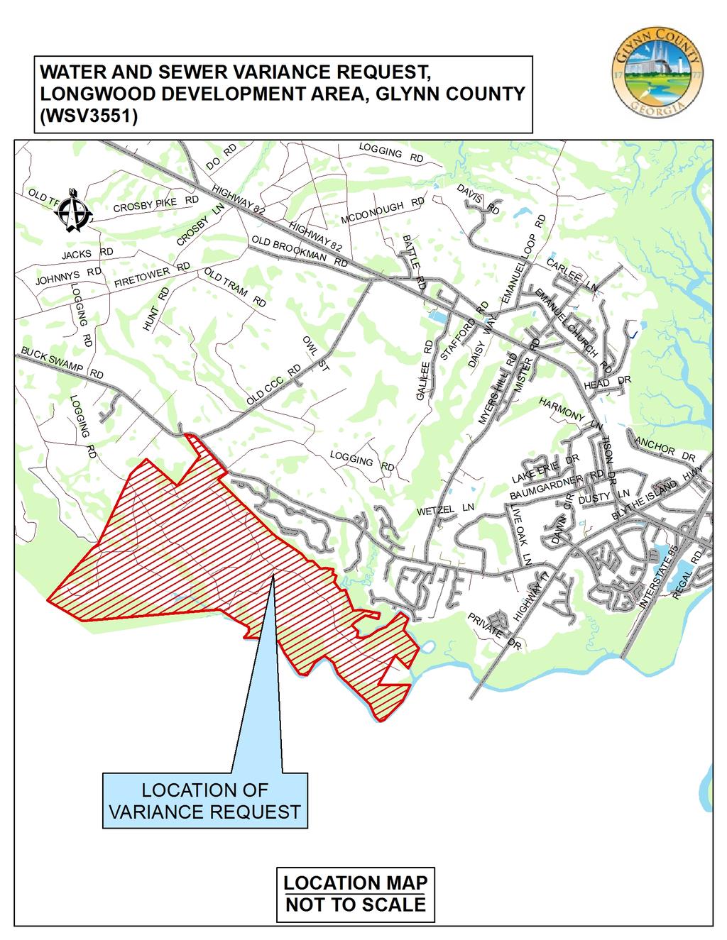
Sewer Variance for Longwood Development (property w/in The Peninsula at Golden Isles PD Text excluding the existing lots in Phase I) (WSV3551)
|
|
|
- Joel Warren
- 5 years ago
- Views:
Transcription
 (WSV3551) DATE: July 12, 2017")
1 COMMUNITY DEVELOPMENT DEPARTMENT 1725 Reynolds Street, Second Floor, Brunswick, GA Phone: 912: /Fax: TO: FROM: RE: Glynn County Board of Commissioners Pamela Thompson, Director Community Development Dept Sewer Variance for Longwood Development (property w/in The Peninsula at Golden Isles PD Text excluding the existing lots in Phase I) (WSV3551) DATE: July 12, 2017 REQUEST: Authorize a Sewer Variance request for the Longwood Development Area STATEMENT OF ISSUE: WSV3551 Longwood is a 1,300-lot area located off of Buck Swamp Road. It is the area within The Peninsula at Golden Isles PD Text excluding the existing lots in Phase I of the Subdivision. The Brunswick-Glynn County Joint Water and Sewer Commission (JWSC) established in a letter from their office dated June 16, 2017 that they provide service to this subdivision, but that their system does not currently have capacity. Therefore the owners as listed on the application have requested that the County vary Section of the Subdivision Regulations relating to public sewer systems and that this variance by applicable to all of the area in the Longwood Development area and that lots created will have to meet the Glynn County Health Department s requirements for considering an onsite sewer management system. This would allow for individual onsite sewerage systems as approved by the Glynn County Health Department. Approval of this item is contingent on changes to the site zoning to allow onsite sewer management systems be approved. This request is being prepared and should be presented to the Board shortly. ALTERNATIVES: 1. Approve the permitting of individual sewer systems for lots in this development area, due to the inability of JWSC to provide service to this site at this time. Subdivision work can continue. 2. Deny the permitting of individual sewer facilities for lots in this development area. Subdivision of the property will have to wait until JWSC can provide service to the area. FUNDING: County funding is not required for this action RECOMMENDATION: Alternative 1
2 RECOMMENDED MOTION FOR BOARD OF COMMISSIONERS: I move to approve application WSV3551 Longwood Development Area: for individual sewer under of the Glynn County Subdivision Regulations due to the inability for JWSC to provide service to this subdivision. Attached: Location Map Letter from JWSC dated June 16, 2017 Application for WSV signed June 22, 2017
3

 Dear Mr. Bishop: The JWSC is the sanitary sewer service provider for this location. At this time, basin capacity issues (Basin 2032) prevents new taps from being permitted.")
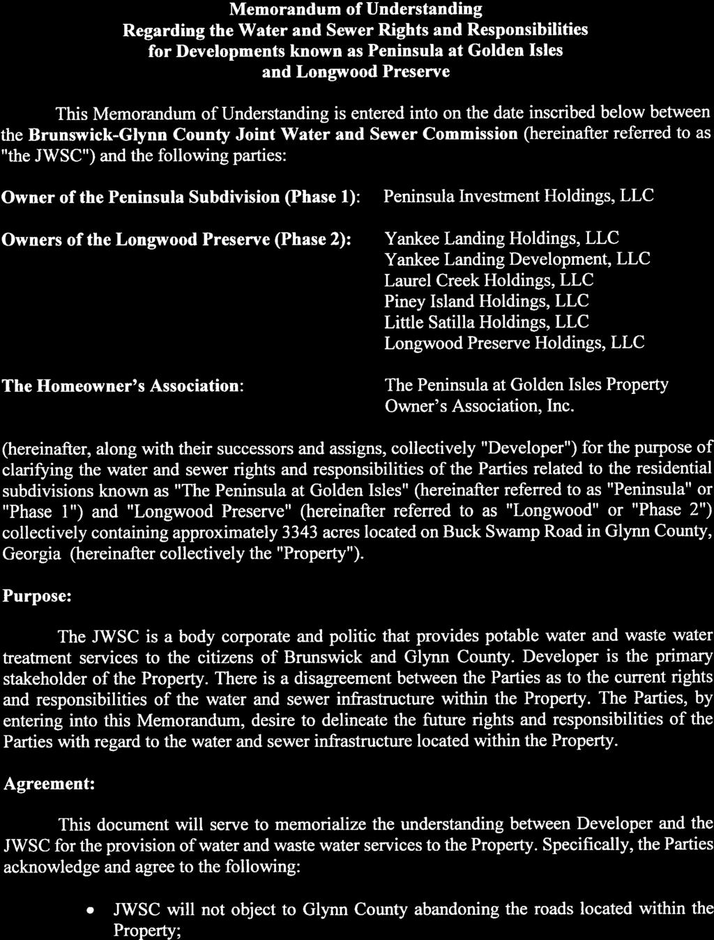
4 Brunswick-Glynn County Joint Water & Sewer Commission 1703 Gloucester Street, Brunswick, GA Phone: (912) Web Site: June 16, 2017 The Bishop Law Firm ATTN: Mr. James A Bishop 777 Gloucester Street, Suite 401 St. Simons Island, GA RE: Sewer Variance Approval (residential); Longwood Development, A Portion of The Peninsula at Golden Isles, PD Text,-Glynn County, GA as more particularly described in Exhibit A ("Longwood") Dear Mr. Bishop: The JWSC is the sanitary sewer service provider for this location. At this time, basin capacity issues (Basin 2032) prevents new taps from being permitted. Therefore, public sewer is not currently available. The Department of Public Health has indicated that parcels, where capacity is not available and that meets onsite septic system requirements, may apply for septic tank permitting., Should you have any questions, please contact the office of Planning and Construction at (912) Sincerely, BRUNSWICK-GLYNN COUNTY JOINT WATER & SEWER COMMISSION qt%f~ Executive Director fc: File


5 ~~- ~~~- -~-~- EXHIBIT A Real Property Description, All that certain tract or parcel of land lying and being in the 27 1 h G.M.D., Glynn County, Georgia, and being shown on a survey entitled "A Plat of the Buck Swamp, Iron Safe and Yankee Landing Tracts" prepared by Thomas & Hutton Engineering Co. dated July 7, 2005, as recorded in the Office of the Clerk of Superior Court of Glynn County, Georgia, in Plat Cabinet 2, Page 289 A-E, and being more particularly described as follows: Commencing at a PK Nail found at the intersection of the centerlines of Old CCC Road (80' dedicated right of way) and Buck Swamp Road (80' dedicated right of way) said point having Georgia State Plane East Zone NAD83 (1994) coordinates of Northing , Easting ; thence proceed along the centerline of said Buck Swamp RoadS 41 56' 04" E, a distance of feet to a PK Nail found, said point also being the POINT OF BEGINNING, said point having Georgia State Plane East Zone NAD83 (1994) coordinates of Northing , Easting ; thence leave said Buck Swamp Road (80' dedicated right of way) and continue along an earth road (apparent 40' prescriptive right of way known,as Buck Swamp Road); thence S 42 43' 11" E, a distance of 2, feet to a %" iron pipe fo1,1nd; thence S 42 15' 47" E, a distance of feet to a%" iron pipe found; thence S 78 46' 47" E, a distance of 1, feet to a%" iron pipe found; thence S 57 03' 47" E, a distance of 2, feet to a%" iron pipe found; thence S 67 58' 47" E, a distance of2, feet to a%" iron pipe found on Buck Swamp Road (80' dedicated right of way); thence S 22 09' 08" W, a distance of feet to a %" iron pipe found on the southerly right of way line of said Buck _ Swamp Road (80' dedicated right of way); thence proceed along said right of way lines 67 50' 52" E, a distance of feet to a %" iron pipe found at the point of curvature of a tangent curve, turning to the left, having a radius of 1, feet, a central angle of 12 41' 07", and a chord length of feet be aring S 74 11' 25" E; thence proceed along the arc of said curve feet to a Union Camp Disk; thence leave said right of way lines 01 51' 14" W, a distance of2, feet to an iron rebar found at the center of Big Branch; thence following the center of Big Branch, a tributary of Laurel Creek for approximately 592 feet to a point; thence S 00 01' 05" E, approximately 537 feet to a point on the northern bank of Laurel Creek; thence continuing along said bank a distance of approximately 23,920 feet to a %" iron pipe; thence continuing along said bank of Laurel Creek and the northern bank of the Little Satilla River approximately 24,800 feet to a Georgia Geodetic Monument, designation 1 OG 1, said point being on the county line between Glynn and Camden counties. Thence proceed along said county line S 85 16' 13" W, a distance Df 4, feet to a point; thence S 85 16' 13" W, a distance of 3, feet to a point; thence; N 56 52' 47" W, a distance of2, feet to a point; thence N 42 02' 21" E, a distance of 1, feet to a concrete monument found; thence N 42 02' 21" E, a distance of 2, feet to a concrete monument found; thence N 50 53' 00" E, a distance of feet to a %" iron pipe found; thence N 24 38' 23" E, a distance of 4, feet to a Union Camp concrete monument found; thence N 44 31' 13" E, a distance of 1, feet to a Union Camp concrete monument found; thence S 47 45' 55" E, a distance of 1, feet to a 3 /4" iron pipe found; thence S 49 00' 55" E, a distance of feet to a %" iron pipe found; thence S 47 08' 55" E, a distance of feet to a%" iron pipe found; thence S 52 45' 55" E, a distance of feet to a Union Camp concrete monument found; thence N 41 26' 16" E,

; thence continue along said right of way line N 83 11' 43\" E, a distance of 79.")
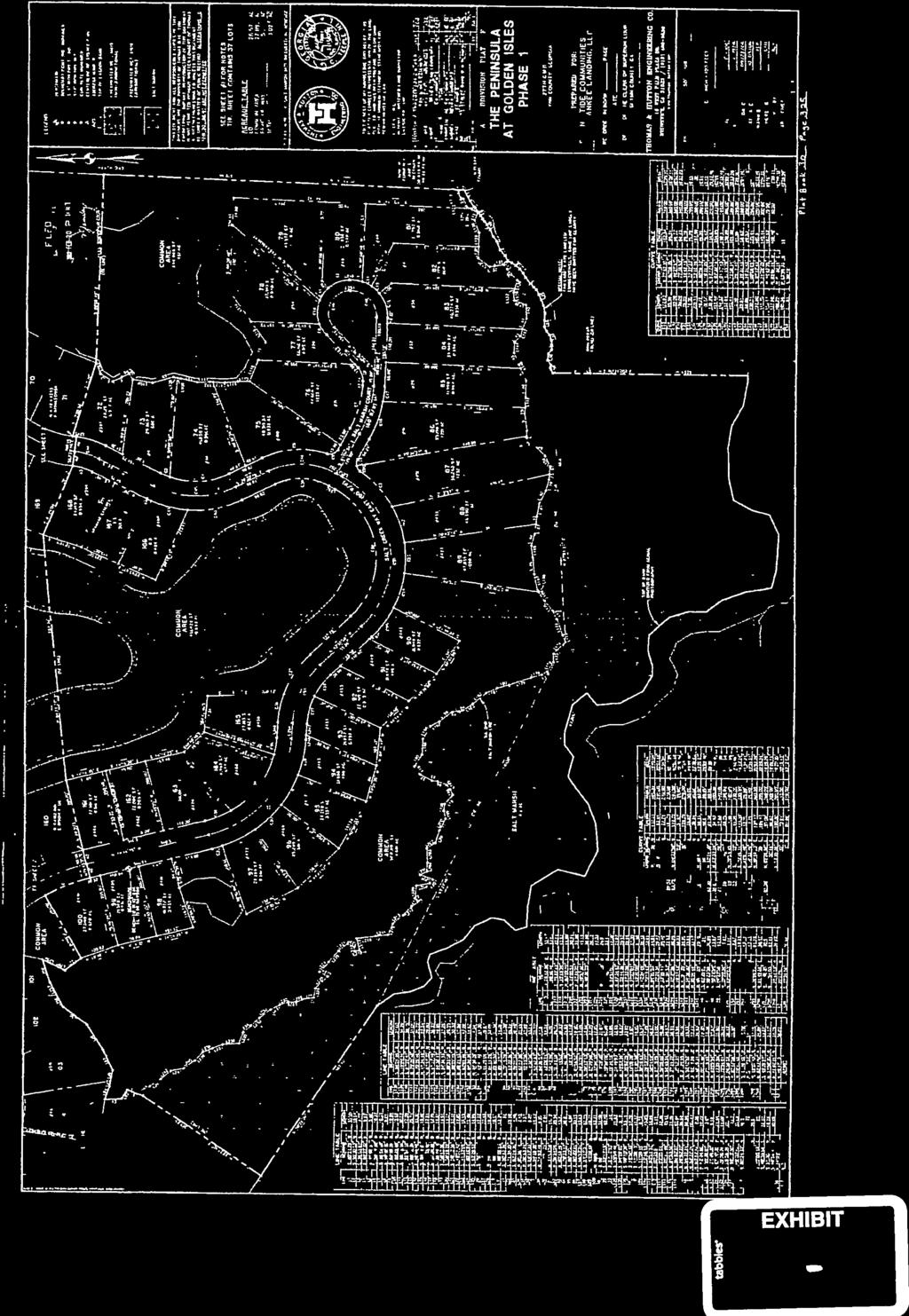
6 a distance of I, I feet to a 3..4" iron pipe found; thence N 42 48' I5" E, a distance of 55I.I 0 feet to a%" iron pipe found; thence N 39 31' 15" E, a distance of feet to a%" iron pipe found; thence N 47 41' 15" E, a distance of feet to a Union Camp concrete monument found; thence N 45 30' 47" W, a distance of feet to a W' iron pipe found; thence N 37 57' 12" W, a distance of feet to an iron rebar found; thence N 36 34' 48" W, a distance of feet to a W' iron pipe found on the southerly right of way line of Buck Swamp Road (80' dedicated right of way); thence continue along said right of way line N 83 11' 43" E, a distance of feet to a %" iron pipe found at the point of curvature of a tangent curve, turning to the right, having a radius of feet, a central angle of 54 17' 49", and a chord length of feet bearings 69 39' 23" E, thence proceed along the arc of said curve feet to a %" iron pipe found; thence S 42 30' 28" E, a distance of feet to a%" iron pipe found; thence N 47 29' 32" E, a distance of feet to the POINT OF BEGINNING; said tract or parcel of land containing 3,343.8 acres more or less. Reference is hereby made to said plat and to the record thereof for all further purposes of description and location. LESS AND EXCEPT: Peninsula at Golden Isles, Phase I All that lot or parcel of land with improvements thereon, situate, lying and being in the 27 1 h G.M. District, State of Georgia~ County of Glynn, containing acres, more or less, as shown on that certain plat of survey entitled "A Plat of The Peninsula at Golden Isles, Phase 1, Formerly St. Andrews Plantation being a portion of Buck Swamp, Iron Safe & Yankee Landing Tracts," prepared by Thomas & Hutton Engineering Co., Boyce L. Young, Georgia Registered Land Surveyor No. 2282, dated March 6, 2007, and recorded in Plat Book 30, at Page 133 and 134, in the Office of the Clerk of Superior Court of said County, said plat being incorporated herein by reference thereto for descriptive and all other purposes. _ AND FURTHER LESS AND EXCEPT THE FOLLOWING: (a) ALL THAT CERTAIN LOT, TRACT OR PARCEL OF LAND situate, lying and being in the 27th G.M.D., Glynn County, Georgia and being a tract of land shown as "FUTURE PUMP STATION, 3,872 S.F., AC" upon that certain plat of survey titled "A Subdivision Plat of The Peninsula At Golden Isles Phase 1," prepared by Thomas & Hutton Engineering Co., certified by Teeple C. Hill, G.R.L.S. No. 3081, last revised on February 13,2008, and recorded in the Office ofthe Clerk of the Superior Court of Glynn County, Georgia, in PLat Drawer 30, as Map No Reference is hereby made to said plat and to the record thereof for all further purposes of description and location. This being the same real property conveyed by that certain Conveyance of Sanitary Sewer Pump. Station Site, dated December 20, 2007, from Spring Tide Communities, LLC to Glynn County, a political subdivision of the State of Georgia, recorded in said Clerk's office in Deed Book 2386, Page 233. (b) ALL OF THOSE CERTAIN TRACTS OR PARCELS OF LAND situate, lying and being in the 27 1 h District, G.M., of Glynn County, Georgia, and shown on that certain plat entitled "A SUBDIVISION PLAT OF THE PENINSULA AT GOLDEN ISLES PHASE

7 I," prepared by Thomas & Hutton Engineering Co., as certified by C. Teeple Hill, G.R.L.S. No. 3081, being dated October 5, 2006, last revised on February 13, 2008, and recorded in the Office of the Clerk of the Superior Court of Glynn County, Georgia in Plat Drawer 30, as Map No. 323~328, as ALL OF SALT CREEK WAY EAST (80' R/W), OYSTER FLATS WYND (80' R/W), SANDBAR PLACE (R/W VARIES), SHOREBIRD WAY (R/W VARIES), SALT MARSH COURT (60' R/W), PENINSULA WYND (80' R/W AND R/W VARIES IN CERTAIN LOCATIONS), WINDMILL PALM (60' R/W), SHELLFISH COURT (R/W VARIES), SALT CREEK WAY WEST (80' R/W), AND SANCTUARY CIRCLE (40' R/W). Reference is hereby made to said plat and to the record thereof for all further purposes of description and location. This being the same real property conveyed by that certain Right~Of-Way Deed, dated December 20, 2007, from Spring Tide Communities, LLC to Glynn County, a political subdivision ofthe State of Georgia, recorded in said Clerk's office in Deed Book 2386, Page 236. (c) All that lot, tract or parcel of property located, lying and being in Georgia Militia District 27 1 h of Glynn County, Georgia further described as follows: To establish the point of beginning start at an iron pipe found, located on the centerline of Buck Swamp Road, said pipe is located at survey centerline station , Buck Swamp Road, said point is located at the northwesterly end of the existing right-of-way of said Buck Swamp Road (80 ft. right~of-way), said point has Georgia State Plane coordinate values east zone of north= 415, and east= 820, (NAD 83); thence running south 22 degrees 09 minutes 08 seconds west for feet to the point of beginning; thence running south 22 degrees 09 minutes 08 seconds west for feet to a concrete monument set; thence running north 67 degrees 50 minutes 52 seconds west for feet to a concrete monument set and point of curve (C-8); thence running northwesterly along the arc of a curve for feet to a concrete monument set and point of tangent, said arc has a radius of feet, a chord bearing of north 68 degrees 02 minutes 57 seconds west and a chord length of feet; thence running north 68 degrees 15 minutes 03 seconds west for feet to a concrete monument set and point of curve (C-7); thence running northwesterly along the arc of a curve for feet to a concrete monument set and point of tangent, said arc has a radius of feet, a chord bearing of.ctorth 62 degrees 58 minutes 47 seconds west and a chord length of feet; thence running north 57 degrees 42 minutes 30 seconds west for feet to a concrete monument set and point of curve (C-6); thence running northwesterly along the arc of a curve for feet to a concrete monument set and point of tangent, said arc has a radius of feet, a chord bearing of north 68 degrees 15 minutes 29 seconds west and a chord length of feet; thence running north 78 degrees 48 minutes 28 seconds west for feet to a concrete monument set and point of curve (C-5); thence running northwesterly along the arc of a curve for feet to a point located on the westerly line of property owned now or formerly by Spring Tide Communities, LLC, said arc has a radius of feet, a chord bearing of north 63


8 degrees 44 minutes 17 seconds west and a chord length of feet; thence running north 50 degrees 36 minutes 16 seconds east for feet to an iron pipe; thence running south 42 degrees 15 minutes 47 seconds east for feet to an iron pipe; thence running south 78 degrees 46 minutes 47 seconds east for feet to an iron pipe found; thence running south 57 degrees 03 minutes 47 seconds east for feet to an iron pipe found; thence running south 67 degrees 58 minutes 47 seconds east for feet back to the point of beginning. Said described tract contains acres and is more particularly depicted on those certain plats dated February 12, 2008, prepared by Thomas & Hutton Engineering Company, certified February 12, 2008 by C. Teeple Hill, Georgia RLS Number Said plats are recorded in Book 30, Pages 340, 341 and 342 in the Office of the Clerk of Superior Court, Glynn County, Georgia and for all purposes made a part of this description. This being the same real property conveyed by that certain Fee Simple Right-Of-Way Deed, dated February 28, 2008, from Spring Tide Communities, LLC to Glynn County Board of Commissioners, recorded in said Clerk's office in Deed Book 2396, Page 382. (d) ALL THOSE CERTAIN LOTS, TRACTS OR PARCELS OF LAND situate, lying and being in the 27th G.M.D., Glynn County, Georgia, as depicted upon that certain pl~t of survey titled "A Subdivision Plat of The Peninsula At Golden Isles Phase 1," prepared by Thomas & Hutton Engineering Co., certified by Teeple C. Hill, G.R.L.S. No. 3081, last revised on February 13, 2008, and recorded in the Office of the Clerk of the Superior Court of Glynn County, Georgia, in Plat Drawer 30, as Map No , as LOTS NUMBERED SEVENTY-FIVE (75), SEVENTY-EIGHT (78), FIFTY-EIGHT (58), _ FIFTY-FOUR (54), FIFTY-NINE (59), SIX (6), FIFTY-THREE (53), SEVENTY THREE (73), SEVENTY-FOUR (74), SEVENTY-ONE (71), AND SEVENTY-NINE (79). Reference is hereby made to said plat and to the record thereof for all further purposes of description and location.

 554-7428.")

9 Glynn County Community Development Department 1725 Reynolds St., Suite 200 Brunswick, GA Application for Subdivision Water/Sewer Variance Review wsv This application must be completed in full and must be submitted with the appropriate completed checklist, fee. and all supplemental application materials, including Agent Authorization Form, if applicable. An incomplete application cannot be accepted for processing. For assistance or information, please contact Glynn County Planning & Zoning at (912) Name of Project, including former name(s) The Peninsula at Golden Isles Desc~iption of Project Future Residential Subdivision(s) Address of Property All property within ThePeninsula at Golden Isles PO Text excl. the 208 existing Lots. Location of Property Off of Buck Swamp Road approximately 3.5 miles from U.S. 17 Parceii.D. # Multiple - see attached list Project type: ~ Residential [] Non-Residential Scan to read the Subdivision Regulations Zoning of site: _P_D Size of tract to be subdivided: Total: apx ac This phase only: Proposed number of lots: Total: 1,300 This phase only: Smallest lot size: 0.5 ac Smallest lot#: Variance to Subdivision Regulations Section 606.2: 0 Water fa Sewer (check both if both apply) Distance to nearest County water service: ;N:.::A:..:; ft. Describe why nearest existing or planned water facility cannot beused Distance to nearest County sewer service:soo ft unavail. ft. Describe why nearest existing or planned sewer facility cannot be used. There is no available capacity in the JWSC system to serve this development. SEE LETTER FROM JWSC ATTACHED. Applicant Name Contact Address Phone: MULTIPLE- SEE ATTACHED James A. Bishop, Esq. 777 Gloucester St., Suite 401 Brunswick, Georgia (912) " s;gnotu e~~:~:::::=::.; ~.:::iv Agent James A. Bishop, Esq. Name Contact Address 777 Gloucester St., Suite 401 Brunswick, Georgia Phone: (912) Date: ~~~lications for Water and Sewer Variances are reviewed by the Finance Committee and by the Board of Commissioners. Form WSV Revised 4/2013
10 Parcel ID #'s: Yankee Landing Holdings, LLC: Laurel Creek Holdings, LLC: Little Satilla Holdings, LLC: Longwood Preserve Holdings, LLC: Piney Island Holdings, LLC: Yankee Landing Devel0pment, LLC:
 State Of Georgia, County Of Glynn County Georgia I, the")

11 Glynn County Community Development Department 1725 Reynolds St., Suite 200 Brunswick, GA AA Ownership Certification Agent Authorization Form (Required if Applicant is other than property owner or is represented by an Agent) State Of Georgia, County Of Glynn County Georgia I, the undersigned, do hereby certify that I am the owner of the property affected by the proposed application to the Glynn County Planning Commission (application file number )by virtue of a deed dated see attached on file in the Office of the Clerk of the Superior Court of Glynn County in Deed Book see at tach Page see attached MULTIPLE - SEE ATTACHED Owner's Name Other Owner's Name SEE ATTACHED Owner's Signature Date Other Owner's Signature Date Agent Authorization 1/We, the undersigned owner(s) of prop~rty involved in this application, do hereby authorize James A. Bishop to act as Agent in submitting and representing the above identified application in my/our behalf. SEE ATTACHED Owner's Signature Other Owner's Signature I accept this authorization to act as Agent on behalf of the above owner(s). James A. Bishop Authorized Agent's Name re Date Form AA revised 3/13
12 FOR AGENT AUTHORIZATION FORM SUBMITTED WITH APPLICATION FOR SUBDIVISION WATER/SEWER VARIANCE REVIEW FOR THE PENINSULA AT GOLDEN ISLES- PD-G (LESS AND EXCEPT THE 208 DEVELOPED LOT SUBDIVISION KNOWN AS "PENINSULA AT GOLDEN ISLES") I, the undersigned, do hereby certify that I am the owner of the property affected by the proposed application to the Glynn County Board of Commissioners for the above-referenced application by virtue of deeds dated [SEE BELOW], on file in the office of the Clerk of the Superior Court of Glynn County, recorded in Deed Book [SEE BELOW] Page [SEE BELOW], and I hereby grant permission for the zoning request to be filed. 1. LWD dated March 28, Deed Book 3290, Page LWD dated December 30, Deed Book 3384, Page LWD dated December 30, Deed Book 3384, Page LWD dated December 30, Deed Book 3384, Page LWD dated Dec~mber 30, Deed Book 3384, Page LWD dated October 30, Deed Book 3508, Page LWD dated October 30, Deed Book 3508, Page LWD dated October 30, Deed Book 3508, Page LWD dated October 30, Deed Book 3508, Page 372


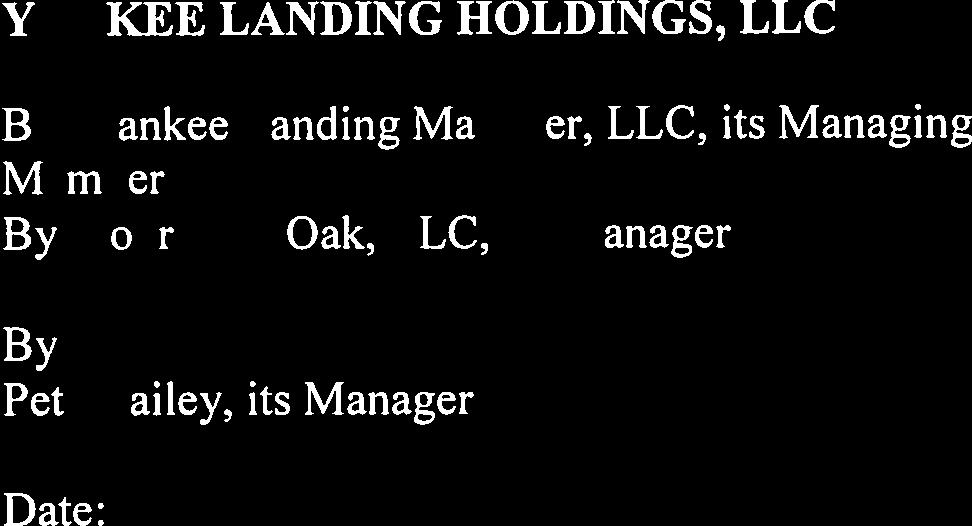
13 SIGNATURE PAGE TO GLYNN COUNTY SEWER VARIANCE APPLICATION FOR LONGWOOD SUBMITTED ON BEHALF OF MULTIPLE OWNERS OF PROPERTY FOR OWNERSHIP CERTIFICATION: YANKEE LANDING HOLDINGS, LLC nkee Landing Manager, L C, its Managing be YANKEE LANDING DEVELOPMENT, LLC, a Georgia limited liability company YANKEE LANDING HOLDINGS, LLC, a Georgia limited liability company, its manager YANKEE LANDING MANAGER, LLC, a Georgia limited liability company, its managing member F li partner LAUREL CREEK HOLDINGS, LLC, a Georgia limited liability company LAUREL 1


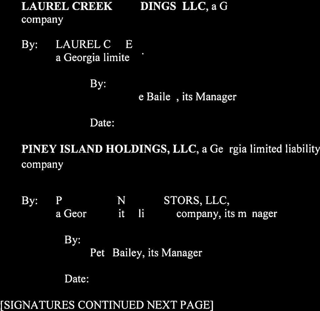
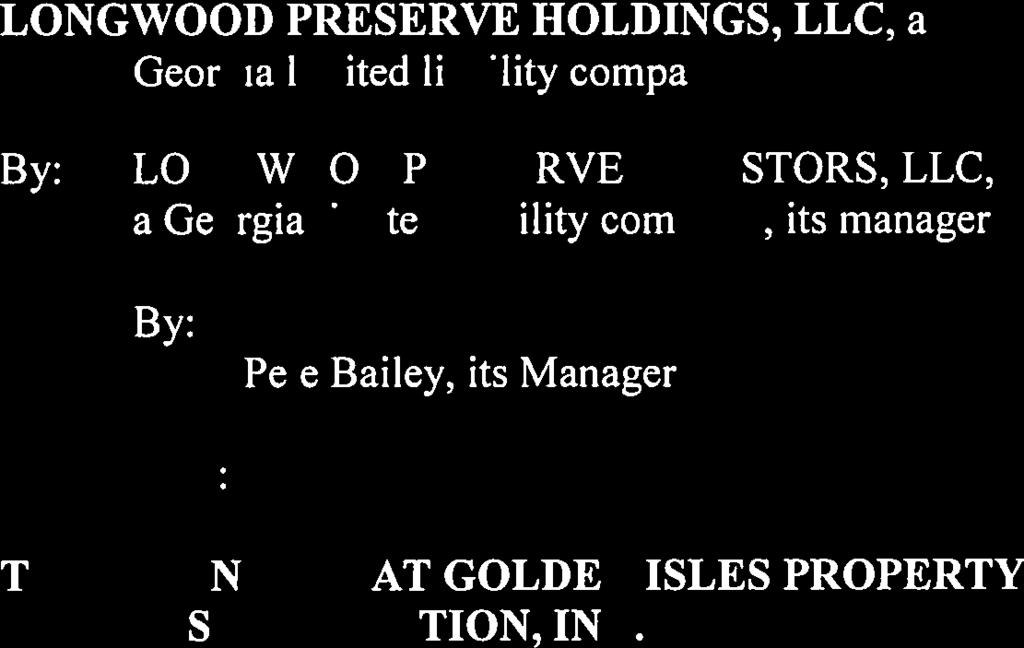
14 PINEY ISLAND HOLDINGS, LLC, a Georgia limited liability company LITTLE SATILLA HOLDINGS, LLC, a Georgia limited LONGWOOD PRESERVE HOLDINGS, Geor ia limited liability company ESTORS, LLC, FOR AGENT AUTHORIZATION: LDINGS,LLC ger, LLC, its Managing 2


15 YANKEE LANDING DEVELOPMENT, LLC, a Georgia limited liability company YANKEE LANDING HOLDINGS, LLC, a Georgia limited liability company, its manager YANKEE LANDING MANAGER, LLC, a Georgia limited liability company, its managing member LAUREL CREEK HOLDINGS, LLC, a Georgia limited liability company LAUREL I te Bailey, its Manager PINEY ISLAND HOLDINGS, LLC, a Georgia limited liability company PIN HOLDINGS, LLC, a Georgia limited B 3


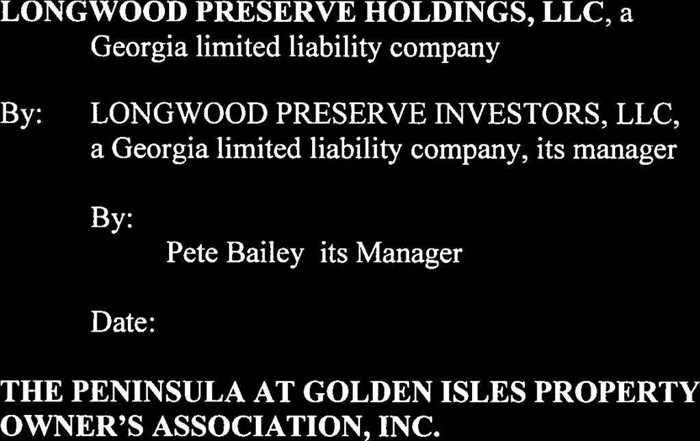
16 LONGWOOD PRESERVE HOLDINGS, LLC, a Geor limited liabilit company company, its manager 4

17
18


19


20


21


22


23


24
25
ORDINANCE NO WHEREAS, Marina District Development, LLC is the fee simple owner of the following described real estate, to wit:
 SPONSOR: Councilman Kalwinski PETITIONED BY: Marina District Development, LLC ORDINANCE NO. 9304 AN ORDINANCE VACATING A 859 FOOT PORTION OF 5 th AVENUE, MORE OR LESS, LYING BETWEEN 112 th STREET INDIANAPOLIS
Brad Wetstone. Girish Balachandran General Manager
 AGENDA ITEM NO: 3.F.1 MEETING DATE: 08/16/2010 ADMINISTRATIVE REPORT NO.: 2011-09 To: Honorable Public Utilities Board Submitted by: /s/ Alan Hanger Sr. Energy Resources Analyst From: Brad Wetstone Sr.
Parker & Lincoln Development, LLC
 Parker & Lincoln Development, LLC 4643 S. Ulster Street, Suite 240 Denver, Colorado 80237 (303) 799-4030 VIA FEDEX OVERNIGHT DELIVERY December 19, 2017 Town of Parker Attn: Ryan McGee 20120 E. Mainstreet
SPECIAL USE PERMIT - SUP Blue Valley Parkway
 NOTICE OF PUBLIC HEARING CITY PLANNING COMMISSION CITY OF OVERLAND PARK, KANSAS Notice is hereby given that the City Planning Commission of Overland Park, Kansas, will hold a public hearing Monday, April
All that part of Lot 11, Sunset Hill, a subdivision in the City of Overland Park, Johnson County, Kansas, more particularly described as follows:
 NOTICE OF PUBLIC HEARING CITY PLANNING COMMISSION CITY OF OVERLAND PARK, KANSAS Notice is hereby given that the City Planning Commission of Overland Park, Kansas, will hold a public hearing Monday, February
SPECIAL USE PERMIT - SUP West 159th Street. SBMS cell site 4459, Lot 1, a subdivision in Overland Park, Johnson County, Kansas.
 NOTICE OF PUBLIC HEARING CITY PLANNING COMMISSION CITY OF OVERLAND PARK, KANSAS Notice is hereby given that the City Planning Commission of Overland Park, Kansas, will hold a public hearing Monday, May
 SURVEYOR'S CERTIFICATE RIVERFRONT MASTER PLANNED MIXED USE DISTRICT PHASE 3 SUBDIVISION PLAT I, SATTAR N. TABRIZ, DO HEREBY CERTIFY THAT I AM A PROFESSIONAL LAND SURVEYOR LICENSED TO PRACTICE IN THE STATE
H 7766 AS AMENDED S T A T E O F R H O D E I S L A N D
 ======= LC0 ======= 0 -- H AS AMENDED S T A T E O F R H O D E I S L A N D IN GENERAL ASSEMBLY JANUARY SESSION, A.D. 0 A N A C T RELATING TO STATE AFFAIRS AND GOVERNMENT -- SOVEREIGNTY AND JURISDICTION
ADMINISTRATIVE ORDER NUMBER SC-16 RESPECTING CLOSURE OF A PORTION OF FOREST HILLS PARKWAY AND HIGHWAY #7 AND PANAVISTA DRIVE
 HALIFAX REGIONAL MUNICIPALITY ADMINISTRATIVE ORDER NUMBER SC-16 RESPECTING CLOSURE OF A PORTION OF FOREST HILLS PARKWAY AND HIGHWAY #7 AND PANAVISTA DRIVE BE IT RESOLVED AS AN ADMINISTRATIVE ORDER of Council
IN THE CHANCERY COURT OF LAMAR COUNTY, MISSISSIPPI CIVIL ACTION NO.: CITY OF HATTIESBURG, MISSISSIPPI
 IN THE CHANCERY COURT OF LAMAR COUNTY, MISSISSIPPI IN THE MATTER OF THE INCORPORATION OF THE CITY OF BELLEVUE, MISSISSIPPI, BELLEVUE INCORPORATORS VS. CITY OF HATTIESBURG, MISSISSIPPI PETITIONERS CIVIL
ALTA/ACSM LAND TITLE SURVEY Parts of Augusta Heights, First Section (Plat Book 20, Page 5), Augusta Heights, Second Section (Plat Book 19, Page 25),
, Augusta Heights, Second Section (Plat Book 19, Page 25),") ALTA/ACSM LAND TITLE SURVEY Parts of Augusta Heights, First Section (Plat Book 20, Page 5), Augusta Heights, Second Section (Plat Book 19, Page 25), and Augusta Park, 3rd Section (Plat Book 24, Page 132)
ALTA/ACSM LAND TITLE SURVEY Parts of Augusta Heights, First Section (Plat Book 20, Page 5), Augusta Heights, Second Section (Plat Book 19, Page 25), and Augusta Park, 3rd Section (Plat Book 24, Page 132)
ORDINANCE NO. 13,729
 ORDINANCE NO. 13,729 AN ORDINANCE to amend the Municipal Code of Des Moines, 1991, adopted by Ordinance No. 11,651, passed April 15, 1991, and amended by Ordinance No. 13,561, passed January 5, 1998 by
PLAINFIELD TOWN COUNCIL RESOLUTION NO
 KOHL S PLAINFIELD TOWN COUNCIL RESOLUTION NO. 2016-33 RESOLUTION PRELIMINARILY DESIGNATING ECONOMIC REVITALIZATION AREA AND QUALIFYING CERTAIN REAL PROPERTY AND IMPROVEMENTS FOR TAX ABATEMENT - CORPORATION
ORDI NANC E NO
 ORDI NANC E NO. 13622 AN ORDINANCE to amend the Official Zoning Map of the City of Des Moines, Iowa, set forth in Section 2A-5 of the Municipal Code of the City of Des Moines, 1991, by rezoning and changing
Notice of Intent of Waiver with Respect to Land; AGENCY: Federal Aviation Administration (FAA), DOT.
, DOT.") This document is scheduled to be published in the Federal Register on 01/24/2018 and available online at https://federalregister.gov/d/2018-01301, and on FDsys.gov [4910-13] DEPARTMENT OF TRANSPORTATION
This document is scheduled to be published in the Federal Register on 01/24/2018 and available online at https://federalregister.gov/d/2018-01301, and on FDsys.gov [4910-13] DEPARTMENT OF TRANSPORTATION
Here Insert Name and Title of the Officer personally appeared Name(s) of Signer(s)
 of Signer(s)") CALIFORNIA ALL-PURPOSE ACKNOWLEDGMENT CIVIL CODE 1189 A notary public or other officer completing this certificate verifies only the identity of the individual who signed the document to which this certificate
CALIFORNIA ALL-PURPOSE ACKNOWLEDGMENT CIVIL CODE 1189 A notary public or other officer completing this certificate verifies only the identity of the individual who signed the document to which this certificate
Notice of Intent of Waiver with Respect to Land; Fort Wayne International Airport, Fort Wayne, IN. AGENCY: Federal Aviation Administration (FAA), DOT.
, DOT.") This document is scheduled to be published in the Federal Register on 03/23/2018 and available online at https://federalregister.gov/d/2018-05888, and on FDsys.gov [4910-13] DEPARTMENT OF TRANSPORTATION
This document is scheduled to be published in the Federal Register on 03/23/2018 and available online at https://federalregister.gov/d/2018-05888, and on FDsys.gov [4910-13] DEPARTMENT OF TRANSPORTATION
ORDER CALLING PUBLIC HEARING TOBE HELD ON MARCH 2, 2016
 A regular meeting of the Town Board of the Town of New Windsor, in the County of Orange, New York, was held at the Town Hall, in said Town, on the 3rd day of February, 2016. PRESENT: George A. Green, Supervisor
ORDINANCE NO. 612, DESCRIPTION ATTACHED
 Insert BOARD OF TRUSTEES, TOWN or PAGOSA SPRINGS STATE OF COLORADO ORDINANCE NO. 612, AMENDING ORDINANCE NO. 561, ESTABLISHING THE TOWN OF PAGOSA SPRINGS SANITATION ENERAL IMPROVEMENT DISTRICT, TO CLARIFY
Boise Municipal Code. Chapter DEFINITIONS
 Chapter 12-03 DEFINITIONS Sections: 12-03-01 ADMINISTRATOR 12-03-02 AIRPORT DESIGNATIONS 12-03-03 AIRPORT HAZARD 12-03-04 AIRPORT HEIGHT LIMITATIONS 12-03-05 AIRPORT REFERENCE POINT 12-03-06 AIRPORT INSTRUMENT
ORDINANCE NO. 510 THEREFORE, BE IT ORDAINED BY THE GOVERNING BODY OF THE CITY OF BEL AIRE, KANSAS:
 (Published in The Ark Valley News on July, 2012.) ORDINANCE NO. 510 S-I-1 GILMORE & BELL, P.C. 07/11/2012 AN ORDINANCE CREATING A COMMUNITY IMPROVEMENT DISTRICT IN THE CITY OF BEL AIRE, KANSAS; AUTHORIZING
Agenda Item # Page # CHAIR AND MEMBERS BOARD OF CONTROL MEETING ON WEDNESDAY, AUGUST 26,2009. PAT McNALLY. P.ENG. ii
 Ii r--... TO: CHAIR AND MEMBERS BOARD OF CONTROL MEETING ON WEDNESDAY, AUGUST 26,2009 I I PAT McNALLY. P.ENG. ii rrwm; GENERAL MANAGER OF ENVIRONMENTAL AND ENGINEERING SERVICES AND CITY ENGINEER SUBJECT
PETITION TO CONTINUE THE DOWNTOWN DES MOINES SELF-SUPPORTED MUNICIPAL IMPROVEMENT DISTRICT PURSUANT TO CHAPTER 386, CODE OF IOWA
 PETITION TO CONTINUE THE DOWNTOWN DES MOINES SELF-SUPPORTED MUNICIPAL IMPROVEMENT DISTRICT PURSUANT TO CHAPTER 386, CODE OF IOWA We, the undersigned, being at least 25 per cent of all owners of property
Crown Lands and Property Agency. Name Client # LAST (Please Print) FIRST MIDDLE (no initials) Mailing Address. Postal Code
 FIRST MIDDLE (no initials) Mailing Address. Postal Code") Manitoba Conservation and Water Stewardship Application for Permit/Lease/Purchase/Easement/Exchange/Licence of Occupation (under The Crown Lands Act c.c340) Please check one ( ) Permit Lease Purchase Easement
Manitoba Conservation and Water Stewardship Application for Permit/Lease/Purchase/Easement/Exchange/Licence of Occupation (under The Crown Lands Act c.c340) Please check one ( ) Permit Lease Purchase Easement
M I N U T E S OKLAHOMA COUNTY PLANNING COMMISSION
 M I N U T E S OKLAHOMA COUNTY PLANNING COMMISSION March 18, 2004 1:30 p.m. The meeting of the Oklahoma County Planning Commission convened and was called to order by Mr. Will Jones, Vice-Chairperson, at
Section XII Miscellaneous
 PROPOSAL CONTENT Each responding consulting firm shall provide (4) copies of their proposal giving detailed information on the following: 1. Firm history, location, capabilities, etc. 2. USGA Form 254
FILED: NEW YORK COUNTY CLERK 04/24/ :39 AM INDEX NO /2015 NYSCEF DOC. NO. 102 RECEIVED NYSCEF: 04/24/2018
 Index No 850126/2015 THROUGH CERTIFICATES SERIES 2007-OA3, SUPREME COURT OF THE STATE OF NEW YORK COUNTY OF NEW YORK HSBC BANK USA, NATIONAL ASSOCIATION, AS TRUSTEEFORTHEHOLDERSOFTHE DEUTSCHE ALT-A SECURITIES,
REQUEST FOR PLANNING COMMISSION ACTION
 REQUEST FOR PLANNING COMMISSION ACTION DATE: 06/03/09 ITEM NO: 5e Department Approval: Agenda Section: PUBLIC HEARINGS Item Description: Request by City of Roseville for the vacation of public right-of-way
Boone County Commission Minutes 27 May Roger B. Wilson Boone County Government Center Commission Chambers
 TERM OF COMMISSION: PLACE OF MEETING: PRESENT WERE: May Session of the May Adjourned Term Roger B. Wilson Boone County Government Center Commission Chambers Presiding Commissioner Keith Schnarre District
MINUTES FROM A REGULAR MEETING OF THE COUNCIL OF MUSCLE SHOALS, ALABAMA, HELD July 2, 2018
 MINUTES FROM A REGULAR MEETING OF THE COUNCIL OF MUSCLE SHOALS, ALABAMA, HELD July 2, 2018 The City Council of Muscle Shoals, Alabama met at the Muscle Shoals City Hall nd auditorium in said City at 6:00
GREENSBORO-JAMESTOWN JOINT ANNEXATION AGREEMENT
 NORTH CAROLINA GUILFORD COUNTY GREENSBORO-JAMESTOWN JOINT ANNEXATION AGREEMENT THIS AGREEMENT, made and entered into this the day of, 2011 by and between the City of Greensboro and the Town of Jamestown.
CLIENT: CITY OF SUN PRAIRIE 300 EAST MAIN STREET SUN PRAIRIE, WI OWNER: MART ENTERPRISES, LLC SOUTH WILDWOOD STREET TOWN BURKE LOT 1
 SOUTH DRIVE SOUTH DRIVE maxwell shot after standing it up straight texted coordinates XXXXXXXXXX XXX PROJECT NO. DRAWN BY: SURVEYOR: FILE NO. SHEET NO. 00036147 B. TISDALE B. TISDALE 00036147 1 1 ARCHITECTURE
MUSCATINE COUNTY BOARD OF SUPERVISORS
 MUSCATINE COUNTY BOARD OF SUPERVISORS Robert Howard, District One Matt Bonebrake, District Two Scott Sauer, District Three Nathan Mather, District Four Jeff Sorensen, District Five AGENDA 9:00 a.m. 1.
16 USC 391. NB: This unofficial compilation of the U.S. Code is current as of Jan. 4, 2012 (see
 TITLE 16 - CONSERVATION CHAPTER 1 - NATIONAL PARKS, MILITARY PARKS, MONUMENTS, AND SEASHORES SUBCHAPTER XLI - HAWAII NATIONAL PARK 391. Establishment; boundaries The tracts of land on the island of Hawaii
PROPERTY OWNER PETITION FOR CONCURRENT DETACHMENT AND ANNEXATION
 PROPERTY OWNER PETITION FOR CONCURRENT DETACHMENT ANNEXATION IN THE MATTER OF THE PETITION BY ALL OF THE PROPERTY OWNERS FOR THE DETACHMENT OF CERTAIN L FROM THE CITY OF NOWTHEN, MINNESOTA CONCURRENT ANNEXATION
RESOLUTION GRANTING A TWO YEAR EXTENSION TO SURE SANITATION SERVICE FOR RESIDENTIAL GARBAGE COLLECTION IN ORANGE counn
 RESOLUTION GRANTING A TWO YEAR EXTENSION TO SURE SANITATION SERVICE FOR RESIDENTIAL GARBAGE COLLECTION IN ORANGE counn WHEREAS, SURE SANITATION SERVICE is currently a licensed franchisee b~ ORANGE COUNTY
FISCHLER PROPERTY COMPANY LLC 1605 HENDRY STREET FORT MYERS, FL
 FISCHLER PROPERTY COMPANY LLC 1605 HENDRY STREET FORT MYERS, FL 33901 WWW.FISCHLERCO.COM FOR SALE 1013 EMBERS PKWY., CAPE CORAL, FL 33993 ENTITLED LAND FOR DEVELOPMENT EMBERS LAKE ESTATES for information
From: Clare Marley, AlCP ( /)7L^
7L^") Planning Department 1500 Hwy 2, Suite 208 Sandpoint, ID 83864 (208) 265-1458 December 16, 2015 Memorandum "Pi To: Board of County Commissioners From: Clare Marley, AlCP ( /)7L^ Re: Resolution vacating
Planning Department 1500 Hwy 2, Suite 208 Sandpoint, ID 83864 (208) 265-1458 December 16, 2015 Memorandum "Pi To: Board of County Commissioners From: Clare Marley, AlCP ( /)7L^ Re: Resolution vacating
MINUTES FROM A REGULAR MEETING OF THE COUNCIL OF MUSCLE SHOALS, ALABAMA, HELD July 17, 2017
 MINUTES FROM A REGULAR MEETING OF THE COUNCIL OF MUSCLE SHOALS, ALABAMA, HELD July 17, 2017 The City Council of Muscle Shoals, Alabama met at the Muscle Shoals City Hall th auditorium in said City at 6:30
The following criteria shall be applied within the boundaries of the AO District:
 Sec. 419 (a) Purpose AIRPORT OVERLAY DISTRICT (AO) The purpose of the Airport Overlay District is to regulate and restrict the height of structures, objects, or natural growth, regulate the locations of
CITY OF GRAND JUNCTION, COLORADO ORDINANCE NO. AN ORDINANCE ANNEXING TERRITORY TO THE CITY OF GRAND JUNCTION, COLORADO SOUTH TWENTY ANNEXATION
 Public Hearing: February 20, 2019 CITY OF GRAND JUNCTION, COLORADO ORDINANCE NO. AN ORDINANCE ANNEXING TERRITORY TO THE CITY OF GRAND JUNCTION, COLORADO SOUTH TWENTY ANNEXATION APPROXIMATELY 20.18 ACRES
City of Grand Island Tuesday, July 11, 2017 Council Session
 City of Grand Island Tuesday, July 11, 2017 Council Session Item G-4 #2017-193 - Approving Final Plat and Subdivision Agreement for Hope Valley Subdivision Staff Contact: Chad Nabity Grand Island Council
ORDINANCE NO WHEREAS, the current owner of the Fontaine Fox house and lands west of A-1-A wishes to amend Ordinance No
 ORDINANCE NO. 43-11 AN ORDINANCE OF THE CITY COMMISSION OF THE CITY OF DELRAY BEACH, FLORIDA, AMENDING ORDINANCE NO. 70-89 THAT PROVIDED FOR THE HISTORIC DESIGNATION OF THE FONTAINE FOX HOUSE AND PROPERTY;
Public Meeting Information Report Development Approval and Planning Policy Department
 Public Meeting: February 16, 2016 at 7:00 pm in Council Chambers, Town Hall Applicant: Gagnon & Law Urban Planners Ltd. on behalf of Flato Palgrave Mansions Inc. File No.: 21T-90034C & RZ 88-07 The Purpose
R RESOLUTION 53RD AVENUE WEST (PROJECT NO. 3168)
") y/^oo RECORDED.' RESOLUTION R-00-23 PAGE NO. -JZoJ hwat NU.. v I..I...Y. MtNUTE BOOK NO.^J A RESOLUTION AUTHORIZING USE OF "QUICK TAKING- CONDEMNATION PROCEEDINGS FOR THE PUBLIC USE AND PUBLIC PURPOSE
y/^oo RECORDED.' RESOLUTION R-00-23 PAGE NO. -JZoJ hwat NU.. v I..I...Y. MtNUTE BOOK NO.^J A RESOLUTION AUTHORIZING USE OF "QUICK TAKING- CONDEMNATION PROCEEDINGS FOR THE PUBLIC USE AND PUBLIC PURPOSE
O R D I N A N C E NO AN ORDINANCE, amending Section Two of Ordinance No. 1864, adopted April 3, 1969 and revising the boundaries of
 O R D I N A N C E NO. 2032 AN ORDINANCE, amending Section Two of Ordinance No. 1864, adopted April 3, 1969 and revising the boundaries of Subdistrict No. 268 (Lin-Ferry - Tesson Ferry) of The Metropolitan
BUFFALO TOWNSHIP PLANNING COMMISSION REGULAR MONTHLY MEETING FEBRUARY 1, 2017
 The Regular Monthly of the Buffalo Township Planning Commission was called to order on Wednesday, February 1, 2017, at 7:30 p.m. in the Buffalo Township Municipal Building by the Chairman Ray Smetana.
SITE STATE ROAD 147 (1600 SOUTH) 1200 SOUTH (PUBLIC) STATE PLANE COORDINATE SYSTEM CURVE TABLE
 1200 SOUTH (PUBLIC) STATE PLANE COORDINATE SYSTEM CURVE TABLE") Breckenridge Plat A 9 Lots 1600 S & 1030 W Developer: Ivory Homes 1200 SOUTH (PUBLIC) STATE ROAD 147 (1600 SOUTH) SITE 1030 WEST (PUBLIC) STATE PLANE COORDINATE SYSTEM 3302 N. Main Street Spanish Fork,
Breckenridge Plat A 9 Lots 1600 S & 1030 W Developer: Ivory Homes 1200 SOUTH (PUBLIC) STATE ROAD 147 (1600 SOUTH) SITE 1030 WEST (PUBLIC) STATE PLANE COORDINATE SYSTEM 3302 N. Main Street Spanish Fork,
COMPLAINT FOR DECLARATORY RELIEF AND DECREE QUIETING TITLE
 DISTRICT COURT, PARK COUNTY, STATE OF COLORADO 300 Fourth St. (P.O. Box 190) Fairplay, Colorado 80440 719-836-2940 Plaintiff: ELKHORN RANCH HOMEOWNERS ASSOCIATION, INC. v. Defendants: INDIAN MOUNTAIN CORP.,
The following Ordinance was submitted for introduction by Brent Callais in regular session convened on March 8, 2005: PROPOSED ORDINANCE
 The following Ordinance was submitted for introduction by Brent Callais in regular session convened on March 8, 2005: PROPOSED ORDINANCE The following Ordinance, having been previously introduced and published,
CITY OF PALMDALE. REPORT to the Mayor and Members of the City Council from the City Manager
 CITY OF PALMDALE REPORT to the Mayor and Members of the City Council from the City Manager DATE: February 4, 2015 SUBJECT: Zone Verification 14-017; 155 acres Located on the North Side of Avenue P at 30th
NOTICE OF PROPOSED RULE. Proof of Ownership and Entitlement to Unclaimed Property
 DEPARTMENT OF FINANCIAL SERVICES Division of Accounting and Auditing NOTICE OF PROPOSED RULE RULE NO.: 69I-20.0021 69I-20.0022 69I-20.030 69I-20.034 69I-20.038 69I-20.040 69I-20.041 RULE TITLE: Procedures
TO: ALL PERSONS INTERESTED IN WATER APPLICATIONS IN SAID WATER DIVISION NO. 7
 DISTRICT COURT, WATER DIVISION 7, COLORADO WATER RESUME TO: ALL PERSONS INTERESTED IN WATER APPLICATIONS IN SAID WATER DIVISION NO. 7 Pursuant to C.R.S. 37-92-302, you are notified that the following is
1) AMENDMENTS TO THE ROCKINGHAM ZONING BYLAW MAPS:
 AMENDMENTS TO THE ROCKINGHAM ZONING BYLAW MAPS:") 143 144 145 1) AMENDMENTS TO THE ROCKINGHAM ZONING BYLAW MAPS: a. Changing the zone of that land located on the east side of Westminster Street, Bellows Falls, and bounded on the north by the south property
143 144 145 1) AMENDMENTS TO THE ROCKINGHAM ZONING BYLAW MAPS: a. Changing the zone of that land located on the east side of Westminster Street, Bellows Falls, and bounded on the north by the south property
PALM BEACH INTERNATIONAL AIRPORT OPERATING PERMIT APPLICATION FORM
 PALM BEACH INTERNATIONAL AIRPORT OPERATING PERMIT APPLICATION FORM Air Transportation Companies requesting to conduct business at the Palm Beach International Airport ( Airport or PBI ) on an on-demand
FILE NO. ANMICALGIC-1
 MUNICIPAL GOVERNMENT BOARD FILE NO. ANMICALGIC-1 IN TEE MATTER OF THE "Municipal Government Act" AND IN THE MATTER OF an application by the City of Calgary, in the Province of Alberta, to annex certain
GLYNN COUNTY COMMUNITY DEVELOPMENT
 GLYNN COUNTY COMMUNTY DEVELOPMENT Engineering Division 1725 Reynolds Street, Suite 200 Brunswick, Georgia 31520 Phone: (912) 554-7492/ Fax: (888) 261-4757 M E M O R A N D U M TO: FROM: Alan Ours, County
phillips creek 20 ACRES OF WATERFRONT PROPERTY IN THE HEART OF MOUNT PLEASANT
 phillips creek 20 ACRES OF WATERFRONT PROPERTY IN THE HEART OF MOUNT PLEASANT Please contact agents for more information or to schedule a private showing: SETH CLARK 843 720 7501 DIRECT seth.clark@colliers.com
Preliminary Plat Extension Agreement (Cortona)
") Preliminary Plat Extension Agreement (Cortona) This Preliminary Plat Extension Agreement (Cortona) ( Agreement ) by and between MARICOPA 240, L.L.C., an Arizona limited liability company and Desert Sunrise,
Preliminary Plat Extension Agreement (Cortona) This Preliminary Plat Extension Agreement (Cortona) ( Agreement ) by and between MARICOPA 240, L.L.C., an Arizona limited liability company and Desert Sunrise,
Public Notice for Waiver of Aeronautical Land-Use Assurance. AGENCY: Federal Aviation Administration (FAA), DOT
, DOT") This document is scheduled to be published in the Federal Register on 09/06/2017 and available online at https://federalregister.gov/d/2017-18845, and on FDsys.gov [4910-13] DEPARTMENT OF TRANSPORTATION
This document is scheduled to be published in the Federal Register on 09/06/2017 and available online at https://federalregister.gov/d/2017-18845, and on FDsys.gov [4910-13] DEPARTMENT OF TRANSPORTATION
THE CORPORATION OF THE CITY OF BRAMPTON BY-LAW
 THE CORPORATION OF THE CITY OF BRAMPTON BY-LAW Number... ', _6.;.;1;;.,-...,;;8..;;;3 --,.. To designate the Od1um-Morelli Home as a property of historical and archi tec'tura1 value and in~ere_st WlIEREASsection
Town of Elba Regular Town Board Meeting April 12, 2018
 Town of Elba Regular Town Board Meeting April 12, 2018 Supervisor Hynes called the meeting to order at 7:00 p.m. Those in attendance included: Supervisor Hynes Councilman Chamberlain Councilman Coughlin
Final Drainage Letter Pikes Peak Community College Downtown Parking Lot Colorado Springs, Colorado
 Final Drainage Letter Pikes Peak Community College Downtown Parking Lot Colorado Springs, Colorado Prepared for: Pikes Peak Community College 5775 South Academy Boulevard Colorado Springs, CO 80906-5422
PLATTE COUNTY PLANNING AND ZONING JANUARY 15, 2014
 PLATTE COUNTY PLANNING AND ZONING JANUARY 15, 2014 Acting Chairman Bob Brockman called the Platte County Planning and Zoning Commission meeting to order at 7:00 P.M. The only Commission member present
FOR SALE $895,000. ±10,836 SQFT Flex Warehouse & Office Space in South Asheville. Prime Location in South Asheville Corridor!
 $895,000 Prime Location in South Asheville Corridor! ±10,836 SQFT Flex Warehouse & Office Space in South Asheville SEE INSIDE FOR MORE INFORMATION! 1276 Hendersonville Road Sisbro Properties, LLC (the
MONTGOMERY COUNTY PLANNING DEPARTMENT THE MARYLAND-NATIONAL CAPITAL PARK AND PLANNING COMMISSION
 MONTGOMERY COUNTY PLANNING DEPARTMENT THE MARYLAND-NATIONAL CAPITAL PARK AND PLANNING COMMISSION Three Sisters Road: Abandonment No. AB740 MCPB Item No. 11 Date: 5-1-14 Katherine Holt, Senior Planner,
OFFICE OF THE PLANNING COMMISSION City Hall Holland, Michigan
 OFFICE OF THE PLANNING COMMISSION City Hall Holland, Michigan Planning Commission Report Report 4 To: Mayor DeBoer and Members of the Holland City Council Date: May 25, 2016 Subject: 11th Street Rezoning
List of Lands Available for Taxes
 List of ****Florida Statute 197.502 Application for obtaining tax deed by holder of tax sale certificate; fees. (7) On county-held or individually held certificates for which there are no bidders at the
ORDINANCE NO.:
 ORDINANCE NO.: 2014-019 Consenting to the Inclusion of Property in a Multi-County Industrial/Business Park (University Residences Columbia, LLC, 0.34 acre W/S Wayne Street, portion of TMS 08915-13-02;
Empire Township Application for Land Use Permit
 Empire Township Application for Land Use Permit Indigo Bluffs RV Park & Resort Park Model Addition Submitted as a Camp Ground a Special Land Use in the Agricultural Conservation District April 2014 4-21-2014
TOWN OF SWANSBORO Planning Board Regular Meeting Community Room AGENDA
 TOWN OF SWANSBORO Planning Board Regular Meeting Community Room April 4, 2016 Monday 6:00 pm Town Hall 601 W. Corbett Ave. AGENDA 1. Call to Order 2. Roll Call and Quorum Verification 3. Approval of Meeting
Folder 7 Folder Title Description (including date) Date Richard C. Proposed Humble & Pan AM Thibodaux meter Dec. 5, 1958
 Date Richard C. Proposed Humble & Pan AM Thibodaux meter Dec. 5, 1958") ACADIA PLANTATION RECORDS (Mss 4906) Appendix B Oversized materials from Series II. Legal Records Subseries 3. Pugh, Lanier, & Pugh Location: Room B6-OS:A Folder 7 Folder Title Description (including date)
ACADIA PLANTATION RECORDS (Mss 4906) Appendix B Oversized materials from Series II. Legal Records Subseries 3. Pugh, Lanier, & Pugh Location: Room B6-OS:A Folder 7 Folder Title Description (including date)
MICHIGAN DEPARTMENT OF NATURAL RESOURCES FOREST RESOURCES DIVISION COMMERCIAL FOREST PROGRAM - HUNTER LIST
 MICHIGAN DEPARTMENT OF NATURAL RESOURCES FOREST RESOURCES DIVISION COMMERCIAL FOREST PROGRAM - HUNTER LIST Lands listed as of 03/18/2019 OTSEGO County Location: CHARLTON-30N-01W-05 154 Acres. Part 512:
DISTRICT COURT, WATER DIV. 6, COLORADO TO ALL PERSONS INTERESTED IN WATER APPLICATIONS IN WATER DIV. 6
 DISTRICT COURT, WATER DIV. 6, COLORADO TO ALL PERSONS INTERESTED IN WATER APPLICATIONS IN WATER DIV. 6 Pursuant to C.R.S. 37-92-302, you are hereby notified that the following pages comprise a resume of
Engineer's Cost Report. Pine Island Community Development District (Lake County, Florida)
") Engineer's Cost Report For Pine Island Community Development District (Lake County, Florida) Date: September 17, 2004 Prepared by: MILLER EINHOUSE RYMER & BOYD, INC. 5323 Millenia Lakes Boulevard; Suite
Engineer's Cost Report For Pine Island Community Development District (Lake County, Florida) Date: September 17, 2004 Prepared by: MILLER EINHOUSE RYMER & BOYD, INC. 5323 Millenia Lakes Boulevard; Suite
DEVELOPMENT PLAN REVIEW PROCESS and APPLICANT GUIDELINES
 DEVELOPMENT PLAN REVIEW PROCESS and APPLICANT GUIDELINES DEVELOPMENT DEPARTMENT 120 Gary Wade Boulevard Sevierville, TN 37862 (865) 453-5504 seviervilletn.org Pamela S. Caskie, Development Director Judith
LAFOURCHE PARISH PLANNING COMMISSION MEETING AGENDA THURSDAY, JUNE 26, :00 P.M. MATHEWS GOVERNMENT COMPLEX MATHEWS, LA
 REGULAR SESSION LAFOURCHE PARISH PLANNING COMMISSION MEETING AGENDA THURSDAY, JUNE 26, 2014 5:00 P.M. MATHEWS GOVERNMENT COMPLEX MATHEWS, LA 1. CALL TO ORDER 2. PLEDGE OF ALLEGIANCE 3. ROLL CALL 4. MINUTES
1 The Cadastral Mapping Fee Order (AR 94/2000) is amended by this Regulation.
 is amended by this Regulation.") Alberta Regulation 21/2005 Surveys Act CADASTRAL MAPPING FEE AMENDMENT ORDER Filed: March 2, 2005 For information only: Made by the Minister of Sustainable Resource Development (M.O. 03/2005) on February
Alberta Regulation 21/2005 Surveys Act CADASTRAL MAPPING FEE AMENDMENT ORDER Filed: March 2, 2005 For information only: Made by the Minister of Sustainable Resource Development (M.O. 03/2005) on February
GILBERT & WEST TOWN INTERCOUNTY DRAIN Windsor Township, Eaton County and City of Lansing, Delhi Township, Ingham County, Michigan
 GILBERT & WEST TOWN INTERCOUNTY DRAIN Windsor Township, Eaton County and City of Lansing, Delhi Township, Ingham County, Michigan PRELIMINARY ENGINEERING REPORT Abigail Eaton, Chair Intercounty Drains
Business License Application ALL LICENSES EXPIRE MARCH 31
 City of SeaTac Finance Department 4800 South 188 th Street SeaTac, WA 98188-8605 Ph: (206) 973-4880 Business License Application ALL LICENSES EXPIRE MARCH 31 Annual License Fees (effective January 1, 2017)
City of Port St. Lucie Planning and Zoning Department ALL DATES ARE TENTATIVE AND SUBJECT TO CHANGE SCHEDULES FOR 2018
 Planning and Zoning Department ALL DATES ARE TENTATIVE AND SUBJECT TO CHANGE SCHEDULES FOR NOTE: DELIVERY DEADLINE ON ALL SUBMITTALS, INCLUDING ONLINE, IS 12:00 NOON ALL DRAWINGS SUBMITTED MUST BE BLACKLINE,
August 30, Adam Sayre City of Verona Planning & Development 111 Lincoln Street Verona, WI 53593
 August 30, 2018 Adam Sayre City of Verona Planning & Development 111 Lincoln Street Verona, WI 53593 RE: Second Addition to Cathedral Point City of Verona Future Public Works Facility Annexation Description
RESCUE SUPPORT SYSTEMS TRIPOD CONVERSION KIT PN
 RESCUE SUPPORT SYSTEMS TRIPOD CONVERSION KIT PN 22-796300 Paratech Incorporated Paratech Europe, Branch of Paratech Inc. P.O. Box 1000, Frankfort, IL 60423 USA P.O. Box 174, 5260 Odense S, Denmark Customer
Financial Policies Unclaimed Check
 Financial Policies Unclaimed Check The purpose of the unclaimed check policy is to provide the proper mechanism to take possession of long standing unclaimed checks in accordance with government statutes
TAX MAP 18 LOT 9 WILLIAM G. ADAMSON, JR. CHRISTY D. ADAMSON 15 GERRY LANE LONDONDERRY, NH BK: 5528 PG: 2591 ZONE AR-I
 28 OLD WILSON DERRY ROAD 1. "SUBDIVISION PLAN, MAP #16 LOT 9, 23 WILSON ROAD, LONDONDERRY, NH PREPARED FOR " LAST REVISED DECEMBER 14, 2015 AND PREPARED BY DUVAL SURVEY, INC. R.C.R.D. PLAN #D-39411. 2.
APPLICATION FORM FOR APPROVAL AS AN IATA PASSENGER SALES AGENT
 APPLICATION FORM FOR APPROVAL AS AN IATA PASSENGER SALES AGENT The information requested below is required by IATA to assist in determining the eligibility of the application for inclusion on the IATA
THE NEWFOUNDLAND AND LABRADOR GAZETTE
 THE NEWFOUNDLAND AND LABRADOR GAZETTE PART I PUBLISHED BY AUTHORITY Vol. 88 ST. JOHN S, FRIDAY, NOVEMBER 8, 2013 No. 45 CORPORATIONS ACT NOTICE Stated for publication on page 97 of Volume 84, Number 10,
ORDINANCE NO. 14,723
 ORDINANCE NO. 14,723 AN ORDINANCE providing that general property taxes levied and collected each year on all property located within the Beaverdale Commercial Area Urban Renewal Area in the City of Des
Notice of Intent of Waiver with Respect to Land; Capital Region International Airport, Lansing, Michigan
 This document is scheduled to be published in the Federal Register on 11/08/2018 and available online at https://federalregister.gov/d/2018-24476, and on govinfo.gov [4910-13] DEPARTMENT OF TRANSPORTATION
LAKE MOUNTAIN PRELIMINARY
 VICINITY MAP VICINITY MAP PREPARED FOR:. THE EXISTENCE AND LOCATION OF ANY UNDERGROUND UTILITY PIPES, CONDUITS OR STRUCTURES SHOWN ON THESE S WERE OBTAINED BY A SEARCH OF THE AVAILABLE RECORDS, TO THE
ISTRIO MUNICIPALITY OF MUSKOK
 ISTRIO MUNICIPALITY OF MUSKOK.- -..-.. -.-... -- PLANNING AND ECONOMIC DEVELOPMENT DEPARTMENT 70 PINE STREET, BRACEBRIDGE, ONTARIO PI L 1 N3 Telephone (705) 645-2231 OR 1-800-461-4210 (705 area code) Fax
INTRODUCTION TO RIFLE AIRPARK AND GARFIELD COUNTY AIRPORT INDUSTRIAL PARK PLANNED UNIT DEVELOPMENTS
 INTRODUCTION TO RIFLE AIRPARK AND GARFIELD COUNTY AIRPORT INDUSTRIAL PARK PLANNED UNIT DEVELOPMENTS MARCH 31, 2016 Offered By: Airport Land Partners Limited, a Colorado Limited Liability Corporation 312
the zoning sought for the tract to be rezoned is I1/FF/FW, Light Industrial District with Floodway Fringe and Floodway Overlay Districts; and
 Bill No. Requested by: Wayne Anthony Sponsored by: John White Ordinance No. AN ORDINANCE AMENDING THE ZONING DISTRICT MAP OF THE COUNTY OF ST. CHARLES, MISSOURI, BY REZONING LAND FROM A/FF/FW, AGRICULTURAL
FOR SALE OR LEASE. St. Croix Meadows Redevelopment LOTS FOR SALE. Hudson, WI
 St. Croix Meadows Redevelopment EXIT RAMP EXISTING OVERPASS VACATE R.O.W. CARMICHAEL RD ON RAMP HIGH-TECH/FLEX SPACE MEDICAL OFFICE - 20K SF EACH RETAIL / ENTERTAINMENT 24-46K SF FULL ACCESS CORPORATE
TOWNSHIP OF FAIRFIELD APPLICATION FORM FOR HOTELS, MOTELS, LODGES AND INNS LICENSE
 TOWNSHIP OF FAIRFIELD APPLICATION FORM FOR HOTELS, MOTELS, LODGES AND INNS LICENSE INSTRUCTIONS: Complete all items. If not applicable, specify with "n/a". Please print or type. 1. Name of Hotel/Motel/Lodge/Inn:
THREE MILE PLAN TOWN OF SUPERIOR COLORADO
 THREE MILE PLAN TOWN OF SUPERIOR COLORADO February 23, 2015 INTRODUCTION This document has been prepared by the Town of Superior, Colorado, to address the existing and proposed land uses within an approximate
State of Florida Division of Unclaimed Property Self-Audit Manual
 State of Florida Division of Unclaimed Property Self-Audit Manual DFS-UP-230 Effective date 04-27-09 Incorporated into Rule 69I-20.050, F.A.C. PROCEDURES FOR MASS MAILING OF COMPLIANCE LETTERS 1) Financial
The News Observer. Publication Name: The News Observer. Publication URL: Publication City and State: Blue Ridge, GA. Publication County: Fannin
 The News Observer Publication Name: The News Observer Publication URL: Publication City and State: Blue Ridge, GA Publication County: Fannin Notice Popular Keyword Category: Notice Keywords: tax commissioner
AGENDA ITEM D4. T:\Board Folders\Board Agenda\Science and Technology\D4 Big Fish Lake Augmentation Agreement
 AGENDA ITEM D4 DATE: December 1, 2015 TO: Matt Jordan, General Manager FROM: Alison Adams, Chief Technical Officer SUBJECT: Lake Augmentation Agreement with the Barthle Brothers Ranch, LLC Approve SUMMARY:
Redtail Ranch Preliminary Plan and Filing No. 1 Final Plat, Review #2 (SP , SF )
") COMMISSINERS: DARRYL GLENN (PRESIDENT) MARK WALLER (PRESIDENT PRO TEMPORE) PEGGY LITTLETON LONGINOS GONZALEZ, JR. STAN VANDERWERF COMMUNITY SERVICES DEPARTMENT PARK OPERATIONS ~ PLANNING ~ CSU EXTENSION
COMMISSINERS: DARRYL GLENN (PRESIDENT) MARK WALLER (PRESIDENT PRO TEMPORE) PEGGY LITTLETON LONGINOS GONZALEZ, JR. STAN VANDERWERF COMMUNITY SERVICES DEPARTMENT PARK OPERATIONS ~ PLANNING ~ CSU EXTENSION