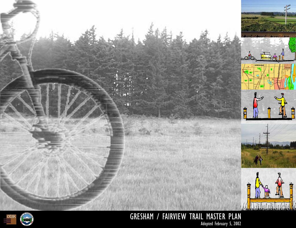
Acknowledgments GRESHAM / FAIRVIEW T RAIL MASTER PLAN
|
|
|
- Damian McDaniel
- 5 years ago
- Views:
Transcription
1
2 Acknowledgments CITY OF GRESHAM MAYOR AND CITY COUNCIL Charles J. Becker, Mayor Vicki Thompson, Council President Jack Horner, Councilor Chris Lassen, Councilor Cathy Butts, Councilor Jack Hanna, Councilor Larry Havercamp, Councilor CITY OF GRESHAM STAFF Bonnie R. Kraft, City Manager Dave Rouse, Department of Environmental Services Director Don Robertson, Parks & Recreation Division Manager David Lewis, Landscape Architect & Project Manager Phil Kidby, Landscape Architect John Dorst, Transportation Division Manager Rebecca Ocken, Senior Transportation Planner COOPERATING PARTICIPANTS Transportation Division Wastewater Services Division Stormwater Division Department of Environmental Services Community and Economic Development Department Police and Fire Departments City of Gresham Metro Greenspaces Planning Staff PLANNING COMMISSION Dick Anderson, Chair Carl Culham, Vice Chair Wes Bell Rob Cook Dick Ehr Dennis Ogan Shannon Schmiitt Pat Speer Mike Whisler Vicki Thompson, Council Contact Ann Pytynia, Staff Liaison PARKS AND RECREATION COUNCIL ADVISORY COMMITTEE Ernest Drapela, Chair Gary Bisbee, Vice Chair Ron Peterson Richard Dwyer David Hamilton Charles Sieveking Sam Murray Cathy Butts, Council Liaison Jack Hanna, Council Liaison Alternate Don Robertson, Staff Liaison PLANNING CONSULTANTS Otak, Incorporated Trail Planners, Landscape Architects, and Civil Engineers Ron Heiden, Project Manager Jerry Offer, Planner Tim Simons, Civil Engineer Don Hanson, Principal-in-Charge DKS Associates, Inc. Traffic Planners/Engineers Randy McCourt, Traffic Engineer Jim Peters, Traffic Engineer The City of Gresham s programs, services, employment opportunities and volunteer positions are open to all persons without regard to race, religion, color, national origin, sex, age, marital status, disability, or political affiliation. TECHNICAL ADVISORY COMMITTEE Dave Rouse, Former Gresham Transportation Division Manager Marianne Zarkin, Landscape Architect Cindy Bee, Park Planner Darlene Maddux, Oregon Department of Transportation John Dorst, Former Multnomah County Transportation Planner Doug Strickler, Multnomah County Transportation Planner Rob Choy, City of Fairview Planner Keyle McKeon, PacifiCorp Alec Johnson, PacificCorp Patt Opdyke, East Multnomah SWCD Catherine Rogers, Portland General Electric Wes Waldron, Portland General Electric Mike Porter, Portland General Electric John Griffiths, Tri-Met Rick Kindig, Tri-Met Gresham Parks and Recreation Staff Gresham Transportation Planning Staff GRESHAM / FAIRVIEW T RAIL MASTER PLAN
3 Mission Statement The City of Gresham, with help through citizen involvement, is developing and operating a very successful parks, recreation, trails, and open space system. This success is built on the philosophy established in the stated Mission of the Gresham Parks and Recreation Division... To offer facilities and programs that invite the public s use. Our efforts shall enhance Gresham s quality of life through the significant benefits provided by recreation. We take an active role in delivering park and recreation services in a cost-effective manner. We strive to offer fully accessible services in partnership with others, encouraging volunteer involvement. GRESHAM / FAIRVIEW T RAIL
4 Table of Contents Mission Statement Executive Summary... 1 Chapter 1: Recommended Trail Route... 2 Gresham/ Fairview Trail Map... 3 Segment A: Springwater Trail to Division Street...4 Segment B: Division Street to Burnside Street...6 Segment C: Burnside Street to Halsey Street...7 Segment D: Halsey Street Along 201st Avenue to Sandy Boulevard...8 Segment E: Sandy Boulevard to Marine Drive...9 Gresham/Fairview Trail Photo Map Chapter 2: Natural Resources and Trail Facilities Along the Gresham/Fairview Trail Johnson Creek Springwater Trail Corridor Linnemann Station Trailhead Southwest Community Park Fairview Creek Grant Butte MAX Trail Salish Ponds Trail I-84 Multi-Use Bike/Pedestrian Path Columbia River Slough Greenway Hiking Trail 40-Mile Loop Metro s Blue Lake Regional Park Chapter 3: Trail Master Plan Development Public Involvement Community Concerns Responses to Community Concerns Meetings Coordination with Other Planning Efforts GRESHAM / FAIRVIEW T RAIL
5 Table of Contents Chapter 4: Trail Improvement Recommendations Recommended Trail Improvements Recommended Trail Corridor Easements/Acquisitions Trail Management & Maintenance Recommendations Signage Overview Chapter 5: Implementation Phasing and Funding Summary Preliminary Trail Construction Estimate, Segment A Preliminary Trail Construction Estimate, Segment B Preliminary Trail Construction Estimate, Segment C Preliminary Trail Construction Estimate, Segment D Preliminary Trail Construction Estimate, Segment E Chapter 6: Trail Development Approval Process Appendices Appendix A: Gresham/Fairview Trail Letters of Comment Appendix B: Gresham/Fairview Trail Natural Resource Documentation and Impact Analysis, Executive Summary, Fishman Environmental Services GRESHAM / FAIRVIEW T RAIL

6 Executive Summary The Gresham/Fairview Trail is a regionally significant project which will provide many benefits to the community. The trail was identified in the 1995 Gresham Parks, Recreation and Open Space Master Plan, the 1996 Gresham Trails Master Plan, as well as the Metropolitan Greenspaces Master Plan and the Regional Bike Plan as a regional multi-use trail. A survey of Gresham residents identified walking for pleasure as the most popular of recreation activities. Bicycling and nature walks were rated third and fourth in this survey. The Gresham/Fairvew Trail will provide improved opportunities for these activities. The Gresham/Fairview Trail will: 1. provide opportunities for rest and relaxation through trail-related recreation; 2. reduce auto dependency and contribute to the environmental health of the community; 3. improve access to parks and recreational areas and link homes, workplaces, neighborhoods, and other community facilities; 4. provide a much-needed place to walk, ride a bike, run, roller skate or skateboard, observe nature, take a hike, or commute; 5. be fully accessible to the disabled and to trail users of all ages. The Gresham/Fairview Trail will link neighborhoods to employment centers, schools, parks, natural areas, and industrial areas. The trail will be within walking distance of bus stops and light rail stations, thus providing a link to transit use. It will connect to natural areas along Johnson Creek, Fairview Creek, Columbia River Slough and the Columbia River. It will also greatly enhance the existing on-street bicycle network. This 5.2 mile long multi-use paved trail, separated from motorized traffic, will provide a safe north/ south alternative route of travel for commuters, recreationalists, bicyclists and pedestrians. The trail will provide safe pedestrian and bicyclist crossings at seven arterial streets (Powell, Division, Burnside, Stark, Glisan, Halsey and Sandy). The trail will also provide a safe crossing of the MAX light rail transit tracks and beneath the Banfield Freeway I-84 and the Union Pacific and Burlington Northern railroad tracks. The Gresham/Fairview Trail will serve as a major north/south connector between two regionally significant and heavily used trails: The Springwater Trail and the 40-Mile Loop at Marine Drive. The trail will provide the missing link between neighborhoods and these two important regional trails. It will also connect with the Columbia River Slough Greenway walking/hiking trail; the I- 84 multi-use bike/pedestrian path; the Salish Ponds Trail; the MAX Trail; and will help connect with Metro s Blue Lake Regional Park. During the trail planning process, several route options were identified and evaluated at various meetings with interested citizens, property owners, city officials and staff, other local agency staff, and the trail planning team. The preferred trail route was determined based on user safety, ease of use, land ownership, cost effectiveness and public involvement. 1


7 Chapter 1: Recommended Trail Route The trail route was determined based on a variety of factors including user safety, ease of use, land ownership, cost effectiveness, and public involvement. The trail route, in general, begins at the Springwater Trail, runs north along the vacated 10 th Street, continues north along an abandoned railway right-of-way adjacent to Fairview Creek, and through Tri-Met s Ruby Junction Light Rail maintenance facility. The trail continues north through an existing PGE power corridor west of Birdsdale Avenue and 201 st Avenue, to Halsey Street. The trail then parallels 201 st Avenue to Sandy Boulevard. At Sandy Boulevard, the trail turns west along the frontage of Gresham s wastewater treatment plant for a short distance. Just west of the treatment plant, the trail turns northward across the railroad tracks and along the east edge of the Catellus Corporation industrial facility to Marine Drive where it connects to the 40-Mile Loop. For purposes of the Master Plan, the trail is divided into segments A through E which are described in more detail on the following pages. 2

8 Gresham/Fairview Trail Map 3


9 Segment A: Springwater Trail to Division Street Segment A begins at the intersection of the Springwater Trail and vacated 10 th Street. A trailhead parking lot will be built in the future at this location when funding is available. The trailhead will have good automobile access from Powell Boulevard. Trail users will be able to access either the Gresham/Fairview Trail or the Springwater Trail from this trailhead. Another trailhead just to the west is also planned as part of the Springwater Trail Master Plan. From the proposed 10th Street trailhead, the trail will travel north along the Old Powell Loop Road towards Powell Boulevard. The City of Gresham owns the approximately 1.1-mile former railroad alignment between the Springwater Trail and Division Street. The trail route would follow Old Powell Loop Road and cross Powell Boulevard to the old railroad bed. A separated over-crossing ramp over Powell Boulevard would be used. The trail would then continue north on the old railroad bed toward Division Street. About half way to Division Street, a boardwalk over wetlands would be built from the trail as a link to the neighborhood and Southwest Community Park. The boardwalk crossing of the wetlands would replace an existing hard-packed, dirt farm road which passes directly through the wetland. The boardwalk would be constructed as part of the trail development. In the Gresham-Fairview Powell Blvd. Crossing Location Segment A Boardwalk 4


10 Trail Natural Resource Documentation and Impact Analysis, Fishman Environmental Services, LLC, found that placement of a boardwalk in this area would provide an excellent opportunity for wetland enhancement and improvement of aquatic quality through removal of the existing culvert and road fill, in addition to providing access between the trail and the neighborhood and planned park to the west. There are wonderful views across the wetlands to the community park and to several buttes of volcanic origin. From the boardwalk north, the trail would continue on the old railroad bed to Division Street. The trail would then cross Division with a full, at-grade, crossing. The anticipated trail user group will include slower and inexperienced users such as beginning cyclists, children, people with disabilities, and families with strollers. Based on the effective use of signalized crossings of the Springwater Trail Corridor and to insure a high degree of safety, a full pedestrian-activated signal, high-visibility ladder stripe cross walk, bollards, center-raised median refuge, landscaping, night lighting, extended curbs, and curb ramped crossing are the preferred trail crossing road improvements. The Gresham to Fairview Trail Crossing Analysis report prepared by DKS Associates recommends similar improvements at the trail s intersections with Powell, Division, and Burnside. The signal should be synchronized with other traffic signals on Division Street. The Gresham to Fairview Trail Crossing Analysis by DKS Associates also considered grade separated overhead and below grade trail crossings at Division Street. The report does not recommend using either of these grade separated crossing options due to the potential for trail users to cross at grade to avoid the inconvenience of grade separated crossings; the safety risks of overhead and below grade crossings; and the additional expense of constructing grade separated crossings. Old Farm Road Grant Butte 10th Street/Powell Blvd. Intersection 5


11 Segment B: Division Street to Burnside Street through Tri-Met s Ruby Junction Light Rail Maintenance Facility After crossing Division Street, the trail will continue along the old railroad bed to Tri-Met s Ruby Junction light rail transit maintenance facility. The trail will go through the maintenance facility grounds. An easement, for access through the east side of the facility, is being obtained from Tri-Met, at no cost to the City. The maintenance facility is in operation 24 hours a day, 7 days a week. It is well lit, as will be the trail due to Tri- Met s lights. The maintenance work on train cars and trolleys at the Ruby Junction facility is fascinating. This is a great opportunity for interpretive signage, which could discuss the regional MAX light rail transit system and the purpose and function of the facility. From Ruby Junction, the trail jogs to the east to Birdsdale Avenue. The trail then crosses the MAX tracks and the proposed MAX Trail at Burnside Road. The proposed MAX Trail will connect to the Ruby Junction MAX Station at S.E. 197th Avenue and to points to the east in downtown Gresham The Gresham/Fairview Trail will continue north across Burnside Street at the existing Birdsdale/ Burnside signal crossing. Recommended crossing treatment at the trail s intersection with Burnside includes a combination of wider sidewalk/pathway, roadway illumination, signing, bicycle loop detectors, pedestrian detectors, wide curb ramps, a high visibility ladder cross walk and a curved path approaching the crossing. Ruby Junction Segment B MAX Rail Crossing 6


12 Segment C: Burnside Street to Halsey Street After crossing Burnside Street, the trail turns west for about half a block to access a 100-foot wide powerline corridor owned by Portland General Electric. The City of Gresham is seeking to acquire, at no cost, an approximately 1.19 mile public access easement to locate the trail within the corridor. The trail, in this segment, may be designed with a larger 14-foot width to not only accommodate pedestrian and bicyclists, but also to accommodate PGE s maintenance vehicles which will occasionally need to access the corridor. Locked, removable bollards will limit access to only authorized motorized vehicles. This segment of the trail will improve connections to and between two schools in this area, Davis Elementary School and Reynolds Middle School. The trail will cross Stark and Glisan Streets with at-grade crossings similar to the crossing at Division Street. Traffic signals will be installed when warrants are met. South of Halsey Street, the Gresham Fairview Trail comes very close to the Salish Ponds Trail. A trail connection could be planned through Reynolds Middle School connecting the two trails and could be constructed by the City of Fairview. The Salish Ponds Trail leads through a natural area and connects to Fairview City Hall and Multnomah County s Fairview Library. At Halsey Street the trail will cross to 201 st Avenue at the existing crossing signal. The Halsey Street crossing will be improved similar to the Burnside Street crossing. PGE Corridor at Glisan Street PGE Corridor Segment C - North of Ruby Junction 201st Avenue and Halsey Street 7


13 Segment D: Halsey Street Along 201 st Avenue to Sandy Boulevard After crossing Halsey Street, the trail will continue north along 201 st Avenue. This section of 201 st is currently very narrow. Additional rightof-way will be acquired to construct either an on-street bike lane with sidewalks or a separated multi-use pathway. The trail also crosses below the railroad at an existing overpass. The railroad overpass is currently very narrow and allows two lanes of traffic with approximately one- to twofoot wide shoulders to the curb. Future plans to improve 201 st Avenue and possible changes to the railroad trestle should include adequate access for the Gresham/Fairview Trail. A temporary 6-foot wide trail could be built, outside the curb, until a permanent trestle solution is available. The trail then continues north beneath Interstate 84 to Sandy Boulevard. The Gresham / Fairview Trail will provide a connection with the I-84 Multi-Use Path. A pedestrian-activated signal and crossing will be required at Sandy Boulevard similar to Burnside and Halsey Streets. 201st Avenue Segment D 201st Avenue Railroad Overpass 8


14 Segment E: Sandy Boulevard to Marine Drive Much of this section of the trail may be developed as part of future commercial development in the area. Eight thousand people will eventually be employed within the Catellus property and many more within adjacent lands yet to be developed. The trail will provide a valuable alternative transportation connection and recreation opportunity. After crossing to the north side of Sandy Boulevard, the trail will turn west along the frontage of Gresham s wastewater treatment facility. This existing 1,000 foot long portion of the trail has the distinction of being the first constructed trail section. At the western property boundary of the treatment plant, the trail will turn northward again along the route of an existing dirt road towards the Columbia Slough. Trail Along Wastewater Treatment Facility Frontage Segment E Dirt Road West of Wastewater Treatment Facility 9


15 The trail will cross Union Pacific Railroad tracks where a below-grade tunnel will be required. The trail will then cross the Columbia Slough where a bridge will be required. The Gresham/ Fairview Trail will connect with the Columbia Slough Trail at this location. The Gresham/Fairview trail will then continue northward along the east edge of the Catellus Corporation industrial facility to Marine Drive. The City of Gresham is currently seeking a public access easement, at no cost, across the Catellus and other properties. The trail will continue northward to a connection with the 40-Mile Loop along Marine Drive. It is expected that the 40-Mile Loop will be relocated to the bottom of the dike on the south side of Marine Drive. To the east, the 40- Mile Loop reaches Metro s Blue Lake Regional Park in less than a quarter mile. Metro s Chinook Landing boat launch facility is one mile to the east. Catellus Property Beyond Railroad Columbia Slough Marine Drive 10

16 11


17 Chapter 2: Natural Resources And Trail Facilities Along the Gresham/Fairview Trail The Gresham/Fairview Trail will be developed within and in close proximity to natural resources and will provide connections to other existing trail systems. The natural resource areas include wetlands and riparian greenways of Fairview Creek and the Columbia Slough. The trail alignment provides views of Grant Butte, Jenne Butte, and other nearby buttes of volcanic origin. The trail also will provide a connection between the Springwater Trail Corridor and the Columbia River portion of the 40-Mile Loop Trail. All of these resources and facilities offer excellent opportunities for interpretive and directional signage along the trail. These resources and facilities are addressed below from south to north. Johnson Creek As one of the region s last free-flowing urban creeks, Johnson Creek is a valuable resource for the community. The Creek is also home to federally listed steelhead, making it one of the few urban waterways in the nation with a listed species. Springwater Trail Corridor The 4.8-mile segment of the Springwater Trail Corridor (STC), within Gresham s city limits, is the most popular existing public trail. Completed in 1996, Gresham s segment of the STC is a 10 to 12-foot wide asphalt-paved multi-use path which parallels Johnson Creek. The STC is part of the region-wide Metro Greenspaces Program aimed at protecting and preserving open space and creating recreational trails. The STC was the first urban rails-to-trails conversion project in Oregon, and is part of the 40-Mile Loop regional trail system, which includes over 140 miles of planned and already developed trails. In 1993, an estimated 376,000 user trips were made on the STC. It is projected that by 2001, more than 1,000,000 user trips will be made annually on the STC. Linnemann Station Trailhead The Linnemann Station trailhead is located at the site of a former railway station at the junction of the Springwater Division rail line and another short line, which extended to the north to the Columbia River. The station was constructed circa The trailhead, currently under design, will primarily serve the Springwater Trail Corridor. Users will also be able to access the Gresham/Fairview Trail from this trailhead. Design and construction is being funded in part through a $532,000 Metro grant. Southwest Community Park The City intends to develop a community park on approximately 18 acres of property west of the wetlands and north of Powell Boulevard. This property is partially wooded and slopes towards the creek. The future park includes two Fairview Creek/Southwest Community Park Springwater Trail Linnemann Station 12


18 tree groves which have recently been designated as Significant Tree Groves by the City of Gresham. These groves include a Douglas fir forest and a western red cedar mixed grove. The proposed Gresham/Fairview Trail will provide an opportunity for access to this future park. Fairview Creek Fairview Creek flows northward to Salish Ponds from the City-owned wetlands and open space existing between Powell Boulevard and Division Street and eventually to Fairview Lake. This open space area provides valuable fish and wildlife habitat, which is being preserved and enhanced as part of the City s open space conservation effort. Grant Butte Grant Butte is one of eight dormant volcanic formations which are natural landmarks within the Gresham area. Grant Butte rises to an elevation of 602 feet and has upland forest vegetation with second growth conifer trees. Dominant species are Douglas fir, red alder, and bigleaf maple. The forest cover provides important wildlife habitat, watershed protection, and aesthetic benefits. The Gresham/Fairview Trail provides scenic views of Grant Butte, as well as views of other buttes in the southern end of the city. MAX Trail The MAX Trail is a proposed off-street multi-use trail connecting Tri-Met s Cleveland station to the Ruby Junction station. Salish Ponds Trail Located between Halsey and Glisan streets and opened in October 1999, the 70-acre Salish Ponds Wetlands Park is Fairview's largest city park. I-84 Multi-Use Bike/Pedestrian Path The I-84 Path parallels the interstate highway from NE 122nd to 207th. The path is 10 to 12- feet wide and is maintained by the state of Oregon. Columbia River Slough Greenway Hiking Trail The Columbia Slough extends 18 miles between Fairview Lake on the east to the Willamette River at Kelley Point Park on the west. A portion of the Columbia Slough crosses through the north end of Gresham. The Columbia Slough Trail is planned to parallel the Slough from Fairview Lake to Kelley Point Park. 40-Mile Loop The 40-Mile Loop along Marine Drive is part of the regional trail system. This existing trail consists of designated bike lanes along both shoulders of Marine Drive. Metro s Blue Lake Regional Park Metro s Blue Lake Regional Park is located along the north shore of a 64-acre natural lake. Blue Lake Park provides opportunities for boating, fishing, swimming, picnics, community events and special programs throughout the year. Grant Butte MAX Light Rail Columbia Slough 13

19 Chapter 3: Trail Master Plan Development Public Involvement During the trail planning process, many route options were identified and evaluated at meetings with interested citizens, property owners, city officials and staff, other local agency staff, and the trail planning team. The preferred trail route was determined based on user safety, ease of use, land ownership, cost effectiveness, and public involvement. Community involvement was an integral part of this trail planning process. Two public meetings were held at Gresham City Hall to gather input from interested citizens. To advertise these public meetings, over 18,000 flyers were mailed to residents living within the surrounding neighborhood associations. Citizens and businesses were contacted within the Hollybrook, Centennial, Northwest, Rockwood, and North Gresham neighborhood associations. In addition, trail planning coordination meetings included two meetings with a subcommittee comprised of citizens interested in the trail, and three meetings with a Technical Advisory Committee (TAC) made up of representatives from Multnomah County, Oregon Department of Transportation, City of Fairview, Portland General Electric, Pacific Power & Light, Tri-Met, and City of Gresham Transportation Engineering and Transportation Planning staff. The Plan was also presented to the Parks & Recreation Council Advisory Committee, the Transportation System Council Advisory Committees, the BIKE-PED Task Force, and the Gresham Planning Commission. Community Concerns Residents who attended the public meetings expressed the following concerns: The trail segment as a multi-use path along the west side of Birdsdale Avenue would pose negative impacts to existing residential and business properties. It was also stated that this trail segment would be dangerous because of the high speeds and heavy volumes of traffic on this street. Neighbors suggested that an off-street route should be considered, such as through Tri-Met s Ruby Junction maintenance yard. The trail could have adverse impacts on the valuable wetlands and wildlife habitat existing along Fairview Creek. Routing the trail through the future Southwest Community Park site would be premature and should be determined as part of the park s master planning process. The trail north of Stark Street should be screened or buffered with landscaping and/or fencing to minimize impacts to adjacent private residential properties. Responses to Community Concerns These concerns were addressed as part of the trail master plan process. It was determined that the trail would be better located through the Ruby Junction facility than along Birdsdale Avenue. An easement through Ruby Junction is being negotiated with Tri-Met. The potential impacts upon wetlands and wildlife habitat have been addressed by Fishman Environmental Services Natural Resource Documentation and Impact Analysis. The trail alignment is not routed through Southwest Community Park. The trail through the PGE Corridor will not be closer than 30 feet from adjacent properties and will be screened with plant material to protect the privacy of the adjacent property owners. Typical Trail Section 14
20 Meetings The following is a summary of meetings which have been held for the Gresham/Fairview Trail Master Plan: September 24, TAC Meeting No. 1. Planning workshop was held. October 6, Trail route options were presented to trails subcommittee. October 20, Public Meeting/Open House No. 1. Trail route options were presented. October 29, Trail presentation to the Bike-Ped Task Force. November 4, TAC Meeting No. 2. Review of options and preferred trail route. November 12, Public Meeting/Open House No. 2. Preferred trail route was presented. November 18, Trail presentation was made to the Gresham Parks and Recreation Council Advisory Committee (PRCAC). December 14, Trail presentation was made to the Gresham Planning Commission. December 16, Pre-application conference was held with City planning and development engineering staff regarding Phase 1 trail construction project. December 23, Gresham Transportation Planning Section memo regarding City staff review comments. January 5, Trail project was discussed with the Columbia Slough Watershed Council. January 7, Trail project was discussed at the Gresham TSCAC meeting. January 19, Meeting with City s trails maintenance staff regarding Phase 1 trail design and construction. January 20, TAC Meeting No. 3. January 26, Council workshop to discuss trail alignment between Powell Boulevard and Division Street. January 28, Trail presentation. Meeting with Centennial Neighborhood Association to discuss trail alignment north of Powell Boulevard. February 9, Second meeting of the trail s subcommittee. February 16, Trail presentation was made to the Gresham City Council. March 3, North Gresham Neighborhood Association Meeting - trail presentation. March 15, Trail presentation to the Neighborhood Coalition. March 16, Master Plan and Phase 1 trail construction project was presented to the Gresham City Council for their approval. Master Plan and Phase I Design tabled pending further public meetings/input. April 29, Meeting with Bike-Ped Task Force to discuss trail alignment north of Powell Boulevard. August 18, PRCAC trail update and review of request for funding for Statewide Enhancement Grant. October 5, City Council review of Statewide Enhancement Grant proposal for funding the trail. October 12, Updated memo sent to Johnson Creek Watershed Council (requested a memo rather than an update at their meeting). October 13, Update memos sent to Bike- Ped Task Force and TSCAC (requested a memo rather than a meeting). November 9, TAC meeting No.4 to discuss new options for the trail alignment. November 17, PRCAC update regarding funding, trail alignment options. December 1, Meeting with Fairview Creek Watershed Council to discuss trail alignment options. 15
21 December 9, Public Workshop No.3 - discussed potential new alignments, outstanding issues, etc. January 10, Neighborhood Coalition - update meeting, discussion of options. January 25, Council policy development meeting to discuss the Springwater Trail to Division Street alignment via Birdsdale Avenue. February 9, Meeting with Gresham Parks and Recreation Committee concerning comments and direction on the trail master plan. March 9, Joint meeting of Centennial and Southwest Neighborhood Associations - update on planning and development of trail. May 3, Joint meeting with Gresham Transportation Council Advisory Committee and Gresham Bicycle Pedestrian Task Force. Review of Powell and Division crossing options and preferred alternatives. May 8, TAC meeting review of Powell and Division crossing options and preferred alternatives. May 16, Meeting with Gresham Park and Recreation Council Advisory Committee concerning Powell and Division crossing options and preferred alternatives. June 18, Meeting with Gresham Parks and Recreation Council Advisory Committee concerning Powell crossing options and natural resource and documentation and impact analysis. June 27, Meeting with Scott Forrester and Reita Hribernick concerning Powell crossing analysis and natural resource documentation and impact analysis. July Centennial Neighborhood Association meeting update presentation concerning trail master plan. August 22, Met with Fairview Creek Watershed Conservation Group to discuss trail alignment north of Powell Boulevard. November 14, Gresham Parks and Recreation Council Advisory Committee. Update on trail master planning and tentative recommendation of approval. November 26, Gresham Planning Commission. Review and discussion of draft trail master plan. January 14, Gresham Neighborhood Coalition. Recommended crossing Powell Blvd. at the railroad bed. January 16, Gresham Parks and Recreation Council Advisory Committee. Recommendation of approval. January 23, Fairview Creek Watershed Council. Recommended crossing Powell Blvd. at the railroad bed. February 5, Gresham City Council. Reviewed and adopted the draft trail master plan. This totals approximately 47 meetings held over a three-year period. 16

 The proposed Gresham/Fairview Trail is consistent with the Goals set forth in the 1996 Gresham Trails Master Plan.")

 Design safety standards for the trail will be consistent and comply with accepted practices and standards.")
 The Gresham/Fairview Trail is consistent with and meets the goals of Metro s Greenspaces Master Plan by interconnecting regional parks,")
 The Gresham/Fairview Trail will link the 40-Mile Loop with several other regionally significant trails.")
22 Coordination With Other Planning Efforts In developing the Master Plan for the Gresham/ Fairview Trail, the following plans, guidelines and handbooks were consulted. Americans with Disabilities Act Accessibility Guidelines The Gresham/Fairview Trail will be made accessible per applicable outdoor recreation standards, best practices and guidelines. Gresham Parks, Recreation & Open Space Master Plan (1995) The Gresham/Fairview Trail will provide access to many other trails, open spaces, parks, and schools. Gresham Trails Master Plan (1996) The proposed Gresham/Fairview Trail is consistent with the Goals set forth in the 1996 Gresham Trails Master Plan. Springwater Trail Corridor Master Plan (1991) The Gresham/Fairview Trail will link the Springwater Corridor Trail with several other regionally significant trails. It will enhance access and add variety to the Springwater Trail. Design standards for the Gresham/Fairview Trail will be similar to the Springwater Trail to provide visual and functional cohesiveness between the two. Oregon Bicycle and Pedestrian Plan (1995) Design safety standards for the trail will be consistent and comply with accepted practices and standards. Metro 2040 Plan (1991) The Gresham/Fairview Trail will provide alternative transportation links consistent with Metro s 2040 Plan. Metro Greenspaces Master Plan (1992) The Gresham/Fairview Trail is consistent with and meets the goals of Metro s Greenspaces Master Plan by interconnecting regional parks, natural areas, trails and greenways for fish, wildlife and people. 40-Mile Loop Master Plan (1983) The Gresham/Fairview Trail will link the 40-Mile Loop with several other regionally significant trails. Access to the 40-Mile Loop will become safer and more convenient. Columbia South Shore Slough Trail Master Plan (1993) The Gresham/Fairview Trail will link the Columbia South Shore Slough Trail with several other regionally significant trails. Tri-Met Planning and Design for Transit Handbook Trail connections to Tri-Met s transit facilities will be provided to allow safe and convenient off-street access. 17

, with 2-foot wide gravel shoulders.")
23 Chapter 4: Trail Improvement Recommendations The following describes the master plan recommendations based on the input received from citizens, City staff, the Technical Advisory Committee, and other public agencies. These recommendations are organized into five general categories: trail improvements, corridor easement/acquisitions, management and maintenance, and signage overview. Recommended Trail Improvements: Trail surfacing material should be concrete or asphaltic concrete pavement over a compacted gravel base. The paved trail width should be a minimum of 10 feet wide to a maximum of 14 feet wide (preferred width), with 2-foot wide gravel shoulders. These improvements are necessary to assure that the trail will accommodate wheel chairs, strollers, maintenance vehicles, and emergency vehicles as well as bicyclists, skaters, and pedestrians Boardwalks are proposed for trail crossings of wetlands to avoid filling the wetlands. Anti-slip surfaces with drain holes may be used to allow light to penetrate below the surface to benefit vegetation and to also reduce the possibility of injury from slipping during wet or icy conditions. The trail will be designed and installed to applicable accessibility standards, best practices, and current guidelines at the time of implementation. Median refuges, high-visibility ladder crosswalks and other striping specific to midblock crossings, trail user-activated pedestrian signals, signage, overhead lighting improvements, wide curb ramps, specialized paving, bollards, and curb extensions are recommended for the trail mid-block crossings of Division, Stark, and Glisan Streets for trail user safety. Signals will be installed as traffic warrants are met. Construction of the trail adjacent to 201 st Avenue between Halsey Street and Sandy Boulevard is recommended to be part of future roadway and sanitary sewer improvement projects. Mid-Block Street Crossing - Section View Mid-Block Street Crossing - Plan View 18


24 A trailhead is recommended at the Gresham/ Fairview Trail s connection to the Springwater Trail. It is anticipated that the City s Linnemann Station along the Springwater Trail and Metro s Blue Lake Park will also serve as trailheads with parking for users of this trail. Trail user improvements are recommended for Burnside, Halsey, and Sandy intersections and may include bollards, pedestrian/bicycle detection systems, roadway illumination, ladder type crosswalks, signing, 10-foot wide curb ramps, and no right turn on red for east bound vehicles. A new box culvert or new tunnel is recommended for the trail crossing under the existing Union Pacific Railroad tracks north of Sandy Boulevard. Toilet facilities (either porta-potties or restrooms) at trailheads should be provided for trail users at both ends of this trail and at a mid-point along the trail. A consistent theme of orientation, regulatory, and interpretive signs should be implemented along the trail route. It is anticipated that equestrians will not use the trail because of the seven arterial boulevards/streets the trail crosses. Due to increasing traffic on Sandy Boulevard, a new automobile and trail user signal is recommended for the intersection at 201st and Sandy Boulevard. Improvements may include bollards, pedestrian/bicycle detection systems, roadway illumination, ladder type cross walk, signing, wide curb ramps, and a curved path approaching the crossing. Boardwalk Adjacent Street Boardwalk over Wetland Proposed Trail Opening at Railroad Overpass 19

25 Recommended Trail Corridor Easements/ Acquisitions: The City will need to acquire property or access easements for the trail corridor. Portions of the corridor are currently owned by Tri-Met, Portland General Electric, and private landowners. The City has acquired land from Tri-Met for this trail to be developed between Powell Boulevard and Division Street. An easement is being obtained for access through Tri-Met s Test Track and Ruby Junction maintenance facility. The City of Gresham is seeking to acquire an approximately 1.19-mile easement, at no cost, to locate the trail within Portland General Electric s 100-foot wide power line corridor. The corridor is located west of 202 nd Avenue between Burnside and Halsey Streets. The trail will be designed to accommodate maintenance vehicles. The trail within the PGE corridor will improve connections to two schools in this area, Reynolds Middle School and Davis Elementary School. South of Halsey Street, the Gresham/ Fairview Trail comes very close to the Salish Ponds Trail. A connection may be possible through Reynolds Middle School to the Salish Ponds Trail. The Salish Ponds Trail leads through the natural area and eventually to Fairview City Hall. Additional right-of-way will be required to construct the trail section along 201 st Avenue, between Halsey Street and Sandy Boulevard. The existing road is narrow and the terrain steep. Current conditions will not allow for a separated multi-use trail or on-street bike lanes. Future plans for redevelopment of 201 st Avenue should include the addition of a multi-use trail. The trail right-of-way will also be coordinated with Gresham Wastewater Services Division as they acquire easements for sanitary sewer lines. Future 201st Avenue The City of Gresham is seeking an easement for the trail along the east edge of Catellus Southshore Corporate Park industrial development south of Marine Drive. Eight thousand people will eventually be employed within the area so this connection will provide excellent alternative transportation to those who will work there. PGE Corridor 20


26 Trail Management & Maintenance Recommendations: The management and maintenance strategy for the Gresham/Fairview Trail is described in detail in Chapter 10 of the 1996 Gresham Trails Master Plan report. Signage Overview Signage will play a crucial role in ensuring the successful use of the Gresham/Fairview Trail. Residents and visitors alike will require orientation, guidance, and information about permissible trail uses. Trail users will also appreciate interpretive information about the many natural, historical, and cultural features found along and in proximity to this trail. Signage guidelines were developed as an integral part of the city-wide Gresham trails planning process. These signage guidelines were summarized in the 1996 Gresham Trails Master Plan document and described in detail in a separate report, the 1997 Gresham Trails Signage Guidelines. Orientation, Directional, Warning Signs 21


27 Chapter 5: Implementation Phasing and Funding Summary The City has $1,517,000 available for construction ($1,076,000 Federal Grants and $441,000 City Funding) for this trail. The City will have to acquire additional funds for trail construction to complete the project. At this time it has not been decided which Segment will be selected as the first phase of implementation and construction. Segment A - Springwater Trail to Division Street...$2,815,426 Segment B - Division Street to Burnside Street... $483,538 Segment C - Burnside Street to Halsey Street...$1,694,761 Blackberries Found Along the Trail Segment D - Halsey Street along 201 st Avenue to Sandy Blvd.... $381,070 Segment E - Sandy Blvd. to Marine Drive... $2,024,438 Preliminary Estimated Total... $7,399,233* * These figures include construction, architecture, engineering, contingency, and administration but do not include land acquisition costs for Segments D and E, Halsey Street along 201 st Avenue to Marine Drive. Trail Provides Opportunities for Nature Study 22

28 Preliminary Trail Construction Estimate, Segment - A Springwater Trail to Division Street Approximate trail length of Segment A = 5,650' Mobilization & Permits... $ 48,670 Site Preparation Work... $ 35,000 Grading Work Trail Surface... $ 35,000 Gravel Base for Trail Surface... $ 98,875 Segment A Asphalt Paving... $ 70,625 Boardwalk at Farm Road... $ 152,460 Separated Over-Crossing Ramp Over Powell Blvd.... $814,500 Erosion Control Seeding... $ 6,900 Wetlands Mitigation Plantings (along trail)... $ 11,500 Trail Facilities (signs, benches, bollards)... $ 10,000 Trailhead... $ 368,000 View to SW Community Park from Existing Farm Road Division Street Mid-Block Crossing with Signal... $ 270,000 Estimated Sub-Total... $ 1,921,530 Architecture and Engineering, 20%... $ 384,306 Contingency, 10%... $ 230,584 Administration, 11%... $ 279,006 23

29 Preliminary Estimated Total with Separated Over-Crossing Ramp... $ 2,815,426 Preliminary Trail Construction Estimate, Segment - B Division Street to Burnside Street Approximate trail length of Segment B = 4,100' Mobilization & Permits... $ 26,365 Demolition... $ 25,000 Site Preparation Work... $ 34,500 Grading Work Trail Surface... $ 20,500 Gravel Base for Trail Surface... $ 71,750 Asphalt Paving... $ 41,000 Segment B Pedestrian Crossing Signal Modifications at Burnside Street... $ 80,000 (crosswalk striping, curb, and pedestrian crossing signals) Erosion Control Seeding... $ 5,900 Trail Facilities (signs, benches, bollards)... $ 25,000 Estimated Sub-Total... $ 330,015 Architecture and Engineering, 20%... $ 66,003 Contingency, 10%... $ 39,602 Tri-Met s Ruby Junction Facility Administration, 11%... $ 47,918 Preliminary Estimated Total... $ 483,538 24

30 Preliminary Trail Construction Estimate, Segment - C Burnside Street to Halsey Street Approximate trail length of Segment C = 6,650' Mobilization & Permits... $ 98,000 Site Preparation Work... $ 50,000 Grading Work Trail Surface... $ 39,900 Gravel Base for Trail Surface... $ 179,550 Segment C Asphalt Paving... $ 139,650 Stark Street Mid-Block Crossing with Signal... $ 270,000 Glisan Street Mid-Block Crossing with Signal... $ 270,000 Erosion Control Seeding... $ 9,576 Trail Facilities (signs, benches, bollards)... $ 20,000 Pedestrian Crossing Signal Modifications at Halsey Street... $ 80,000 Estimated Sub-Total... $ 1,156,676 PGE Corridor Looking North Architecture and Engineering, 20%... $ 231,335 Contingency, 10%... $ 138,801 Administration, 11%... $ 176,949 Preliminary Estimated Total... $ 1,694,761 25

31 Preliminary Trail Construction Estimate, Segment - D Halsey Street along 201 st Avenue to Sandy Blvd. Approximate trail length Segment D = 3,950' Mobilization & Permits... $ 30,100 Site Preparation Work... $ 50,000 Grading Work Trail Surface... $ 37,000 Gravel Base for Trail Surface... $ 69,125 Asphalt Paving... $ 49,375 Erosion Control Seeding... $ 9,480 Trail Facilities (signs, benches, bollards)... $ 15,000 Estimated Sub-Total... $ 260,080 Segment D Architecture and Engineering, 20%... $ 52,016 Contingency, 10%... $ 31,210 Administration, 11%... $ 37,764 Preliminary Estimated Total... $ 381, st Avenue Looking North 26

32 Preliminary Trail Construction Estimate, Segment - E Sandy Blvd. To Marine Drive Approximate trail length of Segment E = 5,650' Mobilization & Permits... $52,900 Demolition... $25,000 Site Preparation Work... $34,500 Grading Work Trail Surface... $22,000 Gravel Base for Trail Surface... $82,250 Asphalt Paving... $58,750 Pedestrian Crossing Signal at Sandy Blvd... $270,000 Erosion Control Seeding... $11,280 Segment E Trail Facilities (signs, benches, bollards)... $25,000 Tunnel under Railroad... $600,000 Clearspan Pedestrian Bridge across Columbia Slough... $200,000 Estimated Sub-Total... $ 1,381,680 Architecture and Engineering, 20%... $276,336 Contingency, 10%... $165,802 Administration, 11%... $200,620 View to Mt. Hood from Catellus Property Preliminary Estimated Total... $2,024,438 The Type III review and approval process for this project will include: Application 27


33 Chapter 6: Trail Development Approval Process Gresham s Community Development Plan defines a multi-use path as a Type III community service use. Approval of the trail as a community service use will require a public hearing and approval by the Planning Commission. The multiuse path will also require site design review as part of the Type III development permit. Portions of the trail will need to be reviewed for compliance with applicable regulations of the natural overlay zoning district, the floodplain overlay zoning district, and the open space overlay zoning district. Portions of the trail corridor are located within each of these overlay zoning districts. The trail development approval process provides many opportunities for public input. The following describes this trail development approval process: Neighborhood meetings Prepare concept trail design Parks and Recreation Council Advisory Committee meeting (public input) Pre-application conference Site survey (if needed) Finalize trail design plan Application for development permit 28
34 Appendix A Gresham/Fairview Trail Letters of Comment
35
36
37
38
39
40
41
42
43
44
45
46 Appendix B Gresham/Fairview Trail Natural Resource Documentation Executive Summary Fishman Environmental Services
47 Note: Option 3 of this document is similar to the Master Plan Route.
48
FEASIBILITY CRITERIA
 This chapter describes the methodology and criteria used to evaluate the feasibility of developing trails throughout the study areas. Land availability, habitat sensitivity, roadway crossings and on-street
Citrus Heights Creek Corridor Trail Project Trail Advisory Group Field Trip #2 September 11, :00 11:00 am Trellis Hall, Citrus Heights
 September 11, 2013 9:00 11:00 am Trellis Hall, Citrus Heights Project Overview The City of Citrus Heights is studying the feasibility of establishing a multi use trail system within the City s 26 miles
Blueways: Rivers, lakes, or streams with public access for recreation that includes fishing, nature observation, and opportunities for boating.
 Parks, Open Space and Trails PRINCE WILLIAM COUNTY 2008 COMPREHENSIVE PLAN TRAILS PLAN CONTENTS The components of the trails plan are: Intent Definitions Goals, Policies, and Action Strategies Trails Map
Appendix 3. Greenway Design Standards. The Whitemarsh Township Greenway Plan
 Appendix 3 Greenway Design Standards This chapter discusses two design standards for the greenway types discussed above. First, trail design standards are presented together with trailhead facilities and
Longmont to Boulder Regional Trail Jay Road Connection DRAFT FINAL REPORT
 Longmont to Boulder Regional Trail Jay Road Connection DRAFT FINAL REPORT December 2018 Project Summary Boulder County, Colorado, in partnership with the City of Boulder, is evaluating options for multi-use
Georgetown-Lewes Rail/Trail Study. Rail/Trail Study: Cool Spring to Cape Henlopen State Park New Road Extension (House Resolution No.
 Georgetown-Lewes Rail/Trail Study Rail/Trail Study: Cool Spring to Cape Henlopen State Park New Road Extension (House Resolution No. 47) August 22, 2011 Presentation Outline Background Benefits Statewide
City of Durango 5.8 FUNDING TRAILS DEVELOPMENT
 5.8 FUNDING TRAILS DEVELOPMENT The City has been successful in establishing dedicated local funding sources as well as applying for grants to develop the City s trail system, having received nearly $2.4
Welcome to the Cross County Trail Public Input Session!
 Welcome to the Cross County Trail Public Input Session! Please sign in on the table below! What are we doing here? Camden County has proposed a bicycle and pedestrian trail spanning across the entire county.
Gardner: overview. Santa Fe, Oregon, and California National Historic Trails UNINCORPORATED JOHNSON COUNTY OLATHE UNINCORPORATED JOHNSON COUNTY
 Santa Fe, Oregon, and California ational Historic Trails : overview 99: p.134 100: p.135 GARDER JUCTIO 102: p.137 56: p.126 EDGERTO Burlington orthern Intermodal and Logistics 98: p.133 101: p.136 S Waverly
A CASE FOR COMPLETING THE JORDAN RIVER PARKWAY: A
 A CASE FOR COMPLETING THE JORDAN RIVER PARKWAY: A safe crossing at 9000 South and 850 West Proposed 9000 South Underpass Parkway Timeline Parkway, Trail, and Tourism Facts Blueprint Jordan River 1971 1973
Business Item No
 Metropolitan Parks and Open Space Commission Meeting date: February 6, 2018 For the Community Development Committee meeting of February 20, 2018 For the Metropolitan Council meeting of February 28, 2018
MASTER PLAN EXECUTIVE SUMMARY
 Biscuit Run State Park Scottsville Road (State Route 20) Charlottesville, VA 22902 Biscuit Run State Park MASTER PLAN EXECUTIVE SUMMARY Department of Conservation and Recreation Division of Planning and
Blue River Trail Master Plan JSA to Town Hall June 2004
 Blue River Trail Master Plan JSA to Town Hall June 2004 Prepared for: Silverthorne Town Council Silverthorne SPORT Committee Department of Recreation and Culture Silverthorne Public Works Silverthorne
Chapter 6: POLICY AND PROCEDURE RECOMMENDATIONS
 Chapter 6 POLICY AND PROCEDURE RECOMMENDATIONS FOR SRRA Below are seven policy elements that should be considered for adoption by the Southwest Regional Recreation Authority of Virginia: 1. Develop strategies
2. Goals and Policies. The following are the adopted Parks and Trails Goals for Stillwater Township:
 D. PARKS AND TRAILS 1. Introduction Stillwater Township s population is relatively low, with most residents living on rural residences on large lots. The need for active park space has been minimal in
Trail # NW Tuesday, June DESIGN. Provide an Review the Provide an. Project Goals: System system. wayfinding
 I. Welcome / Introductions Bethany Creek Trail #2 Segment 3 Neighborhood Meeting #1 Bethany Presbyterian Church 15505 NW Springville Road, Portland, OR 97229 Tuesday, June 26, 2018 @ 6:00PM Meeting Minutes
Auburn Trail / Ontario Pathways Trail Connector Feasibility Study Public Information Meeting Wednesday, August 22, 2012
 Auburn Trail / Ontario Pathways Trail Connector Feasibility Study Public Information Meeting Wednesday, August 22, 2012 Purpose of Feasibility Study Purpose Evaluate the feasibility of constructing a multiuse
Business Item No XXX. Proposed Action That the Metropolitan Council approve the Coon Creek Regional Trail Master Plan.
 Business Item No. 2015-XXX Metropolitan Parks and Open Space Commission Meeting date: July 7, 2015 For the Community Development Committee meeting of July 20, 2015 For the Metropolitan Council meeting
The Baker/Carver Regional Trail is intended to
 Section V Design Guidance The Baker/Carver Regional Trail is intended to safely accommodate 183,000 annual visits, an array of non-motorized uses, a variety of skill levels, and persons with special needs.
DRAFT - APRIL 13, 2007 ROUTING STUDY FOR TRAIL CONNECTIONS BETWEEN CALAIS AND AYERS JUNCTION
 DRAFT - APRIL 13, 2007 ROUTING STUDY FOR TRAIL CONNECTIONS BETWEEN CALAIS AND AYERS JUNCTION Abstract The vision for the East Coast Greenway is an off-road urban trail system running from Calais, Maine
At the time, the portion of the line through Eagle County remains wholly under the ownership of Union Pacific Railroad (UP).
.") Chapter 5 The Railroad Corridor as a Trail Corridor The intent of this chapter is to identify how the rail corridor, if available for lease or purchase in all or part, could be incorporated into the core
Chapter 5 The Railroad Corridor as a Trail Corridor The intent of this chapter is to identify how the rail corridor, if available for lease or purchase in all or part, could be incorporated into the core
Non-Motorized Transportation
 Non-Motorized Transportation Non-motorized facilities are important components to the transportation system. They provide an environmentally-friendly, low-cost mode of travel. Some of the facilities can
Segment 2: La Crescent to Miller s Corner
 goal of the USFWS refuges is to conserve, protect and enhance fish, wildlife and plants and their habitats for the continuing benefit of the American people. Refuge lands are used largely for fishing,
CITY COUNCIL AGENDA MEMORANDUM
 To: Mayor and City Council From: Charles Ozaki, City and County Manager Prepared By: Kevin Standbridge, Deputy City and County Manager Katie Allen, City and County Engineer David Shinneman, Community Development
North Shore Lacamas Lake
 North Shore Lacamas Lake January 27, 2017 A Vision for Conservation and Recreation Acknowledgements Funding Funding for this planning effort was provided by the City of Camas and the Columbia Land rust
Committee Report. Community Development Committee For the Metropolitan Council meeting of August 12, Business Item No.
 Committee Report Business Item No. 2015-168 Community Development Committee For the Metropolitan Council meeting of August 12, 2015 Subject: Coon Creek Regional Trail Master Plan, Anoka County Proposed
MORGAN CREEK GREENWAY Final Report APPENDICES
 APPENDICES MORGAN CREEK GREENWAY Appendix A Photos of Existing Conditions in Trail Corridor Photos of existing conditions Main trail corridor - February 2009 Photos of existing conditions south bank Morgan
METROPOLITAN COUNCIL 390 North Robert Street, St. Paul, MN Phone (651) TDD (651)
 TDD (651)") METROPOLITAN COUNCIL 390 North Robert Street, St. Paul, MN 55101 Phone (651) 602 1000 TDD (651) 291 0904 DATE: June 19, 2007 TO: Metropolitan Parks and Open Space Commission FROM: Jan Youngquist, Senior
METROPOLITAN COUNCIL 390 North Robert Street, St. Paul, MN 55101 Phone (651) 602 1000 TDD (651) 291 0904 DATE: June 19, 2007 TO: Metropolitan Parks and Open Space Commission FROM: Jan Youngquist, Senior
CHAPTER 4 -- THE LAND USE PLAN: DESCRIPTIONS AND POLICIES FOR THIRTEEN PLANNING AREAS
 CHAPTER 4 -- THE LAND USE PLAN: DESCRIPTIONS AND POLICIES FOR THIRTEEN PLANNING AREAS NORTH CENTRAL CAC AREA LITTLE VALLEY ROAD TO JUG HANDLE CREEK PLANNING AREA This planning area includes Cleone, Noyo,
Welcome to the future of Terwillegar Park a Unique Natural Park
 Welcome to the future of Terwillegar Park a Unique Natural Park 1 Introduction The Terwillegar Park Concept Plan study will develop an overall concept plan, management objectives and development guidelines
3. COLTA / HUGA CONNECTIONS - PRELIMINARY
 9 3. COLTA / HUGA CONNECTIONS - PRELIMINARY 3.1 COLTA The Chain of Lakes Trail Association (COLTA) trail, formerly identified as the Chester Spur Line, was completed and opened for use in June 2011. The
Community Development Committee
 C Community Development Committee For the Metropolitan Council meeting of October 31, 2012 Committee Report Item:2012-316 ADVISORY INFORMATION October 16, 2012 Date Prepared: Subject: Intercity Regional
Northeast Quadrant Distinctive Features
 NORTHEAST QUADRANT Northeast Quadrant Distinctive Features LAND USE The Northeast Quadrant includes all the area within the planning area that is east of Interstate 5 and to the north of State Route 44.
University Region Non-Motorized Plan 2015
 Non-Motorized Transportation Non-motorized facilities are important components to the transportation system. They provide an environmentally-friendly, low-cost mode of travel. Some of the facilities can
Site Location and Setting
 Memorandum Date: To: From: Subject: Kristy Le, Gary Black Steve Orem Santa Teresa County Park Historic Area Traffic and Parking Study Hexagon Transportation Consultants, Inc. has completed a traffic and
Section II. Planning & Public Process Planning for the Baker/Carver Regional Trail began in 2010 as a City of Minnetrista initiative.
 Section II Planning & Public Process Planning for the began in 2010 as a City of initiative. city staff began discussions with the Park District on the possibility of a north/south regional trail connection
2016 Regional Transportation Alternatives Program (TAP) Grant Application
 Grant Application") 2016 Regional Transportation Alternatives Program (TAP) Grant Application PROJECT TITLE: Yelm-Tenino Trail Extension Feasibility Study TRPC use only GENERAL PROJECT INFORMATION Agency or Organization City
2016 Regional Transportation Alternatives Program (TAP) Grant Application PROJECT TITLE: Yelm-Tenino Trail Extension Feasibility Study TRPC use only GENERAL PROJECT INFORMATION Agency or Organization City
Committee Report. Community Development Committee For the Metropolitan Council meeting of April 13, Business Item No.
 Committee Report Business Item No. 2016-48 Community Development Committee For the Metropolitan Council meeting of April 13, 2016 Subject: Harriet Island-South St. Paul Regional Trail Master Plan, Saint
Preferred Recreation Recommendations Stemilt-Squilchuck Recreation Plan March 2018
 Preferred Recreation Recommendations Stemilt-Squilchuck Recreation Plan March 2018 Below are the recommended recreation ideas and strategies that package together the various recreation concepts compiled
Section 4(f) and Section 6(f) Technical Analysis
 and Section 6(f) Technical Analysis") WESTSIDE SUBWAY EXTENSION PROJECT Contract No. PS-4350-2000 Section 4(f) and Section 6(f) Technical Analysis Prepared for: Prepared by: WSP USA 851 SW Sixth Avenue, Suite 1600 Portland, Oregon 97204 FEBRUARY
WESTSIDE SUBWAY EXTENSION PROJECT Contract No. PS-4350-2000 Section 4(f) and Section 6(f) Technical Analysis Prepared for: Prepared by: WSP USA 851 SW Sixth Avenue, Suite 1600 Portland, Oregon 97204 FEBRUARY
Hudson Highlands Fjord Trail Draft Master Plan. April 29, 2015
 Hudson Highlands Fjord Trail Draft Master Plan April 29, 2015 Agenda Route Overview Proposed Segment Results of Community Survey on that Segment Next Steps Municipal Endorsement Environmental Review Implementation
EXECUTIVE SUMMARY FALL Introduction. Findings
 EXECUTIVE SUMMARY FALL 2004 Introduction Trails are one of the most popular and highly desirable recreational resources in communities of all sizes throughout the country. In addition to providing a safe
FINCH HYDRO CORRIDOR TRAIL PROJECT
 FINCH HYDRO CORRIDOR TRAIL PROJECT Pharmacy Avenue to Birchmount Road January 29 th, 2018 L Amoreaux Community Centre (2000 McNicoll Avenue) 1 Purpose of Drop In Event The purpose of today s drop-in event
AGENDA ITEM 5 D WAKULLA ENVIRONMENTAL INSTITUTE (WEI) TRAIL FEASIBILITY STUDY
 TRAIL FEASIBILITY STUDY") March 19, 2018 AGENDA ITEM 5 D WAKULLA ENVIRONMENTAL INSTITUTE (WEI) TRAIL FEASIBILITY STUDY TYPE OF ITEM: Action STATEMENT OF ISSUE The Wakulla Environmental Institute (WEI) Trail is one of several trails
March 19, 2018 AGENDA ITEM 5 D WAKULLA ENVIRONMENTAL INSTITUTE (WEI) TRAIL FEASIBILITY STUDY TYPE OF ITEM: Action STATEMENT OF ISSUE The Wakulla Environmental Institute (WEI) Trail is one of several trails
Lake Myra County Park. Wake County, North Carolina Community Forum #2 June 12, 2008
 Lake Myra County Park Wake County, North Carolina Community Forum #2 June 12, 2008 Welcome and Introduction Meeting Agenda Welcome Introductions of Project Team Master Plan Process Community Forum #1 Updates
Non-motorized Trail Plan & Proposal. August 8, 2014
 Town of Star Valley Ranch, Wyoming and the Star Valley Ranch Association in partnership with the USDA Forest Service, Bridger-Teton National Forest, Greys River Ranger District Non-motorized Trail Plan
MPRB: Southwest LRT Community Advisory Committee Issues and Outcomes by Location Current to: 12 November 2010
 MPRB: Southwest LRT Community Advisory Committee Issues and Outcomes by Location Current to: 12 November 2010 This is a compilation of issues and outcomes identified by the CAC. It is a work in progress,
Macleod Trail Corridor Study. Welcome. Macleod Trail Corridor Study Open House. Presentation of Proposed Design Concepts
 Macleod Trail Corridor Study Welcome Macleod Trail Corridor Study Open House Presentation of Proposed Design Concepts Study Purpose Develop a corridor plan for Macleod Trail that aligns with The City s:
COASTAL CONSERVANCY. Staff Recommendation September 22, 2011 BAY AREA RIDGE TRAIL: HOOD MOUNTAIN TO HIGHWAY 12
 COASTAL CONSERVANCY Staff Recommendation September 22, 2011 BAY AREA RIDGE TRAIL: HOOD MOUNTAIN TO HIGHWAY 12 File No. 11-039-001 Project Manager: Betsy Wilson RECOMMENDED ACTION: Authorization to disburse
Port Gamble Shoreline Area Conceptual Trail Proposal
 The North Kitsap Trails Association is pleased to be a partner to the Kitsap Forest and Bay Project and assist Kitsap County, Forterra, Olympic Property Group, Great Peninsula Conservancy and the Port
Stagecoach State Trail Master Plan
 Stagecoach State Trail Master Plan Minnesota Minnesota Department Department of of Natural Natural Resources Resources Parks and and Trails Trails Division Division Parks March March 2012 2012 The Minnesota
Regional Wayfinding Sign Strategy Thurston County Trails 2017
 Regional Wayfinding Sign Strategy Thurston County Trails 2017 Partners: Members and partnering organizations of the Thurston Thrives Community Design Action Team City of Lacey, City of Olympia, City of
FINAL. Bicycle/Pedestrian Feasibility Study City of DeBary Dirksen Drive Trail. Prepared For: Volusia County MPO
 City of DeBary Dirksen Drive Trail FINAL Prepared By: Reynolds, Smith and Hills, Inc. Prepared For: Volusia County MPO September 2007 Table of Contents INTRODUCTION...1 PROJECT PURPOSE AND SCOPE...2 PHYSICAL
Lake Apopka Trail Loop Design Guidelines
 November 2002 Prepared for 14908 Tilden Road Winter Garden, FL 34787 Prepared by 140 North Orlando Avenue Suite 295 Winter Park, FL 32789 November, 2002 I. INTRODUCTION...1 II. DESIGN GUIDELINES FOR TRAILS...3
Clackamas County Development Agency
 Clackamas County Development Agency Development Services Building, 150 Beavercreek Rd., Oregon City, OR 97045 www.clackamas.us/transportation/renewal 503-742-4323 The Clackamas County Board of Commissioners
ONONDAGA CREEKWALK PHASE II. Public Information Meeting Series 1
 ONONDAGA CREEKWALK PHASE II Public Information Meeting Series 1 Andrew Maxwell Director, Syracuse-Onondaga County Planning Agency Owen Kerney Assistant Director for City Planning Russell Houck, PE City
White Mountain National Forest
 White Mountain National Forest United States Department of Agriculture Forest Service Eastern Region Boles Brook Snowmobile Bridge Decision Memo Boles Brook Snowmobile Bridge Project Town of Woodstock
TRAIL ANNUAL REPORT
 TRAIL ANNUAL REPORT 2016-17 Identify Undeveloped projects identified in the City s Greenprint or trail database 15.90 miles Study Projects that have been or are currently being studied to determine a feasible
EAST DON TRAIL ENVIRONMENTAL ASSESSMENT. Community Liaison Committee Meeting #3 July 15, :30 to 8:30 pm Flemingdon Park Library
 EAST DON TRAIL ENVIRONMENTAL ASSESSMENT Community Liaison Committee Meeting #3 July 15, 2013 6:30 to 8:30 pm Flemingdon Park Library Agenda 1. Welcome 2. Housekeeping and Updates a) Housekeeping b) CLC
Wilds. Headwaters. Lakes. Oxbows. Falls
 56 5 4 3 Wilds Headwaters Lakes Oxbows Falls 57 Zones It could be said the on-the-ground essence of this master plan appears within the next 6 pages of this report. As we learned in the preceding Cultural
Dungeness Recreation Area County Park Master Plan
 Dungeness Recreation Area County Park Public Outreach Meeting October 10, 2007 Project Overview USFWS Site Dungeness Recreation Area County Park Meeting Objectives: Re-Introduce project; provide status
Decision Memo Ice Age Trail Improvement (CRAC 37)
") Decision Memo Ice Age Trail Improvement (CRAC 37) U.S. Forest Service Chequamegon-Nicolet National Forest, Medford-Park Falls Ranger District Taylor County, Wisconsin T32N, R2W, Town of Grover, Section
Decision Memo Ice Age Trail Improvement (CRAC 37) U.S. Forest Service Chequamegon-Nicolet National Forest, Medford-Park Falls Ranger District Taylor County, Wisconsin T32N, R2W, Town of Grover, Section
Appendix L Technical Memorandum Aesthetics
 Technical Memorandum Aesthetics 1.0 AESTHETICS This section provides a discussion of the aesthetic resources in the vicinity of ARTIC. Aesthetics pertain to the elements that make a certain view pleasing
National Recreation Trail Application for Designation
 National Recreation Trail Application for Designation Introduction Thank you for your interest in the National Recreation Trail (NRT) program. Completed NRT application packages must be submitted by December
Flow Stand Up Paddle Board Parkway Plan Analysis
 Regional Parks Department Jeffrey R. Leatherman, Director County of Sacramento Divisions Administration Golf Leisure Services Maintenance Rangers Therapeutic Recreation Services Flow Stand Up Paddle Board
NEWBORO AND PORTLAND HARBOUR REDVELOPMENT PLANS
 INTRODUCTION The Municipal docks in both Newboro and Portland were transferred to the Township of Rideau Lakes by Parks Canada in 2002. Little has been done to improve the docks physical condition or role
Glacial Lakes State Trail Master Plan Amendment Trail Extension into Downtown Willmar
 Glacial Lakes State Trail Master Plan Amendment Trail Extension into Downtown Willmar Minnesota Department of Natural Resources Division of Parks and Trails July 2012 Glacial Lakes State Trail Master Plan
Cascade River State Park Management Plan Amendment
 This document is made available electronically by the Minnesota Legislative Reference Library as part of an ongoing digital archiving project. http://www.leg.state.mn.us/lrl/lrl.asp Cascade River State
LONG TERM (OPERATION) IMPACTS AND POTENTIAL MITIGATION
 IMPACTS AND POTENTIAL MITIGATION") 3.6 This chapter provides a project-level analysis of potential impacts to recreation sites in the study area including parks, natural areas, open spaces, trails, and playfields, as well as amenities such
3.6 This chapter provides a project-level analysis of potential impacts to recreation sites in the study area including parks, natural areas, open spaces, trails, and playfields, as well as amenities such
Becker County Trail Routing Feasibility Study
 2016 Becker County Trail Routing Feasibility Study CONNECTING DETROIT MOUNTAIN AND MOUNTAIN VIEW RECREATIONAL AREA TO THE HEARTLAND TRAIL BECKER COUNTY ULTEIG ENGINEERS Contents Acknowledgements...2 INTRODUCTION...3
Madison Metro Transit System
 Madison Metro Transit System 1101 East Washington Avenue Madison, Wisconsin, 53703 Administrative Office: 608 266 4904 Fax: 608 267 8778 TO: FROM: SUBJECT: Plan Commission Timothy Sobota, Transit Planner,
Trail Feasibility Study
 VOLUSIA COUNTY MPO CITY OF NEW SMYRNA BEACH FINAL REPORT JUNE 30, 2009 Trail Feasibility Study What s inside? 1 Introduction 2 Project Purpose & Scope 3 Physical Inventory & Assessment of Right-of- Way
Railroad Safety Trail
 2.1 INTRODUCTION AND PROJECT SETTING 2.1 Introduction & Project Setting Introduction This study is the result of a directed effort on the part of the City of San Luis Obispo to carry out previously established
4.19 Parks, Recreation, and Conservation Lands
 interchange would have on the Reed Paige Clark Homestead located on the north side of Stonehenge Road. Alternative D would also affect Palmer Homestead, E.F. Adams House, and Knapp Brothers Shoe Manufacturing
TRAFALGAR PARK. 78: p.140 W 99th St FLAT ROCK CREEK PARK. W 103rd St OVERLAND PARK. Quivira Rd. College Blvd. Shared use path. Mountain bike trail
 Lenexa: overview TRAFALGAR PARK 78: p.140 As the Westport Route crosses over Lenexa's boundaries with Olathe and Overland Park several times, approximately 2.75 or 3 miles of the historic route of the
1.2 Corridor History and Current Characteristics
 SECTION 1 Description and Background of Study Area 1.1 Introduction This preliminary engineering report was prepared for the Alaska Department of Transportation and Public Facilities (ADOT&PF). It is part
Atlas of a regional transportation network: Oregon Metro's Mobility Corridor Atlas
 Atlas of a regional transportation network: Oregon Metro's Mobility Corridor Atlas Matthew Hampton Oregon Metro February 25 th, 2013 Early experience with transportation Our region Charting a Different
Public Notice ISSUED: December 10, 2018 EXPIRES: January 9, 2019
 APPLICANT: REFER TO: St. Louis and Lake Counties Regional Rail Authority 2018-01942-ARC Public Notice ISSUED: December 10, 2018 EXPIRES: January 9, 2019 SECTION:404 - Clean Water Act 1. APPLICATION FOR
The Chu property is a 6.57 acre parcel located in the Town of Superior on the west side of McCaslin Boulevard. In 2014, the Town of Superior acquired
 1 The Chu property is a 6.57 acre parcel located in the Town of Superior on the west side of McCaslin Boulevard. In 2014, the Town of Superior acquired the Chu property for open space with a contribution
River Parks Trail: Tulsa, Oklahoma
 River Parks Trail: Tulsa, Oklahoma Purpose: The purpose of the River Parks Trail is to maintain, preserve, develop, and promote the Arkansas River for the economic and cultural benefit of the community.
ROAD AND TRAIL PROJECT APPROVAL
 ROAD AND TRAIL PROJECT APPROVAL www.marincountyparks.org Marin County Parks, 3501 Civic Center Dr, Suite 260, San Rafael, CA 94903 DATE: July 12, 2017 PRESERVE: Gary Giacomini Open Space Preserve PROJECT:
CHAPTER III: TRAIL DESIGN STANDARDS, SPECIFICATIONS & PERMITS
 CHAPTER III Trail Design Standards, Specifications & Permits This chapter discusses trail standards, preferred surface types for different activities, permits, and other requirements one must consider
Mt. Hood National Forest
 United States Department of Agriculture Forest Service Mt. Hood National Forest Zigzag Ranger District 70220 E. Highway 26 Zigzag, OR 97049 503-622-3191 Fax: 503-622-5622 File Code: 1950-1 Date: June 29,
MEETING MINUTES District 1 Trail Planning Meeting 1
 MEETING MINUTES District 1 Trail Planning Meeting 1 June 1, 2017 2:00 PM 3:30 PM City of Two Harbors 2:00 Introductions Attendees: Lisa Austin, MnDOT Bryan Anderson, MnDOT Jasna Hadzic-Stanek, MnDOT Justin
Trail Etiquette. Hours of Operation. Trail Accessibility
 Trail Guide The Elmhurst Park District, with 28 parks and over 460 acres of land, offers nearly six miles of paved or asphalt park trails and maintains an additional 3.6 miles of trails within Elmhurst.
Little River Trail Feasibility Study
 Final April, 2014 Prepared for the State Coastal Conservancy By the Natural Resources Services Division of Redwood Community Action Agency Table of Contents Executive Summary... 1 1. Project Purpose and
Hiawatha National Forest St. Ignace Ranger District. File Code: 1950 Date: August 5, 2011
 United States Department of Agriculture Forest Service Hiawatha National Forest St. Ignace Ranger District W1900 West US-2 St. Ignace, MI 49781 906-643-7900 File Code: 1950 Date: August 5, 2011 Dear National
ROBERTS CREEK PROVINCIAL PARK MASTER PLAN. November, 1981
 Ministry of Lands, Parks and Housing Parks and Outdoor Recreation Division Park Operations Branch North Vancouver, B. C. ROBERTS CREEK PROVINCIAL PARK MASTER PLAN November, 1981 Mr. G. Trachuk Director
Memo. Orange City Trail Plan Becky Mendez, AICP Jamie Krzeminski, PE, PTOE Matt Wiesenfeld, PE, AICP. Development of the Existing and Proposed Network
 Memo Date: Friday, December 22, 2017 Project: To: From: Subject: Trail Plan Becky Mendez, AICP Jamie Krzeminski, PE, PTOE Matt Wiesenfeld, PE, AICP Development of the Existing and Proposed Network HDR
Understanding user expectations And planning for long term sustainability 1
 Understanding user expectations And planning for long term sustainability 1 What is a natural surface trail? It can be as simple has a mineral soil, mulched or graveled pathway, or as developed as elevated
ALBANY-HUDSON ELECTRIC TRAIL FEASIBILITY STUDY. Final Report OCTOBER 2011
 ALBANY-HUDSON ELECTRIC TRAIL FEASIBILITY STUDY Final Report OCTOBER 2011 ALBANY-HUDSON ELECTRIC TRAIL FEASIBILITY STUDY Prepared for: Town of East Greenbush 225 Columbia Turnpike Rensselaer, New York 12144
$866,000. $1,400,000 Health Benefits $13,156,000 TOTAL ANNUAL DIRECT BENEFITS. $10,890,000 Economic Benefits
 SINGING RIVER TRAIL Trails Create Value + Generate Economic Activity Trails generate economic returns through improved health, safety, and environmental conditions, raise property values, and attract visitors.
Those with Interest in the City of Cambridge Trail System
 Community Services Department City Hall 50 Dickson Street, P.O. Box 669 Cambridge ON N1R 5W8 Tel: 519-740-4681 July 20, 2010 To: Re: Those with Interest in the City of Cambridge Trail System City of Cambridge
4.0 Context for the Crossing Project
 4.0 Context for the Crossing Project This section provides background information about key features of the North Douglas Crossing project area, and opportunities and constraints. This information is important
Lake Erie Commerce Center Traffic Analysis
 LOCATION: East of NYS Route 5 at Bayview Road Town of Hamburg Erie County, New York PREPARED BY: Wendel Companies 140 John James Audubon Parkway Suite 200 Amherst, New York 14228 January 2012 i ii Table
City of Mahtomedi Park System Plan Public Hearing Draft: September 13, 2006
 Chapter 4: TRAIL SYSTEM PLAN INTRODUCTION Mahtomedi developed in the late 1800s and early 1900s as a summer resort and vacation community. As such, the transportation system included narrow, winding roads
PURPOSE AND NEED (CONCURRENCE POINT 1) NEW CANADA ROAD PROJECT FROM STATE ROUTE 1 (U.S. HIGHWAY 70) TO U.S. INTERSTATE 40
 NEW CANADA ROAD PROJECT FROM STATE ROUTE 1 (U.S. HIGHWAY 70) TO U.S. INTERSTATE 40") PURPOSE AND NEED (CONCURRENCE POINT 1) NEW CANADA ROAD PROJECT FROM STATE ROUTE 1 (U.S. HIGHWAY 70) TO U.S. INTERSTATE 40 Project Description The primary purpose of this project is to improve the major
PURPOSE AND NEED (CONCURRENCE POINT 1) NEW CANADA ROAD PROJECT FROM STATE ROUTE 1 (U.S. HIGHWAY 70) TO U.S. INTERSTATE 40 Project Description The primary purpose of this project is to improve the major
Town of Frisco. Trails Master Plan. Legend. Planning Area 1. i l. 9 Campground. Lake Hill Development. Giberson Property. Frisco Transit Center
 SO-UV I-70 UPPER SALT LICK TOO-PWECH SUNRISE 1 Town of Frisco Planning Area 1 NAH-OON-KARA I-70 Lake Hill Development Legend Existing Trails Existing USFS System Trails 2 A Existing Non-System Trails Bike
COASTAL CONSERVANCY. Staff Recommendation December 2, 2004 COYOTE HELLYER COUNTY PARK BAY AREA RIDGE TRAIL
 COASTAL CONSERVANCY Staff Recommendation December 2, 2004 COYOTE HELLYER COUNTY PARK BAY AREA RIDGE TRAIL File No. 04-057 Project Manager: Amy Hutzel RECOMMENDED ACTION: Authorization to disburse up to
APPENDIX F List of Commitments
 APPENDIX F List of Commitments s Table F.1 Standard Mitigation Measures Mitigation Measure MnDOT Specification Number Status Update Description Status Update Utilities Provide early notice to utility operators