ALBANY-HUDSON ELECTRIC TRAIL FEASIBILITY STUDY. Final Report OCTOBER 2011
|
|
|
- Jean Norton
- 5 years ago
- Views:
Transcription

1 ALBANY-HUDSON ELECTRIC TRAIL FEASIBILITY STUDY Final Report OCTOBER 2011


2 ALBANY-HUDSON ELECTRIC TRAIL FEASIBILITY STUDY Prepared for: Town of East Greenbush 225 Columbia Turnpike Rensselaer, New York In cooperation with: Town of Schodack 265 Schuurman Road Castleton, New York Village of Nassau 40 Malden Street P.O. Box 452 Nassau, New York Town of Nassau 29 Church Street P.O. Box 587 Nassau, New York Prepared by: Greenman-Pedersen, Inc. 80 Wolf Road, Suite 300 Albany, New York 12205
3 TABLE OF CONTENTS EXECUTIVE SUMMARY... ES 1. PROJECT DESCRIPTION History Project Goals Project Limits Trail Ownership EXISTING CONDITIONS Study Area Trail Constraints TRAIL CONCEPT Location of Trail Proposed Trail Use Design Features Trail Concept Description Regional Trail Development Community Benefits COST ESTIMATES AND FUNDING STAGING AND PRIORITIZATION PUBLIC INFORMATION MEETING SUMMARY AND NEXT STEPS LIST OF FIGURES FIGURE PAGE FIGURE 1-1: 2009 RENSSELAER COUNTY TRAIL VISION MAP 3 FIGURE 1-2: TRAIL LOCATION MAP 4 FIGURE 2-1: NYSDEC WETLANDS MAPPING 8 FIGURE 2-2: ARCHEOLOGICALLY AND HISTORICALLY SIGNIFICANT AREAS 9 FIGURE 2-3: MAJOR TRAIL CROSSING LOCATIONS 10 FIGURE 3-1 to FIGURE 3-9: PRPOSED TRAIL ALIGNMENT 12-20
4 EXECUTIVE SUMMARY This Study has been initiated by the Towns of East Greenbush, Schodack, Nassau and the Village of Nassau to study the feasibility of interconnecting the various municipalities with a multi-use recreational trail. The proposed trail would follow an old electric trolley line alignment which is currently owned by National Grid and is used for electric transmission lines. Early in the process of the evaluation the following goals were established for the study: Better define proposed alignment Identify appropriate crossing locations and types Identify constraints and major conflicts Develop a conceptual cost estimate Prioritize implementation Identify potential funding sources The proposed 15 mile recreational trail would begin where Route 203 enters into Rensselaer County and would extend north through the Town and Village of Nassau where it would then begin to head west through the Town of Schodack eventually ending in the Town of East Greenbush near the City of Rensselaer line in close proximity to Routes 9/20. This study has been prepared to provide the trail sponsors and local officials with additional information of the trail specifics and the actions to be completed to advance the project. The following are the studies key findings: The current cost estimate to complete the entire 15 mile trail ranges between $5.5 - $9.4 million dollars. There does not appear to be any significant historical or environmental obstacles to the completion of the trail. The completion of the trail will require 29 minor road crossings, 8 major road crossings and 4 bridges. Building the trail in segments is recommended to allow for phased implementation, funding purposes and to gain public support for the eventual completion of the entire vision. Advancing Segment 2 (from US Route 4 to the Schodack town line) as the first segment is recommended. The next steps towards implementation include seeking funding to advance the design and eventual construction of the first segment. During the design phase more detailed evaluations of the costs and impacts will be examined including alternative alignments to reduce costs by avoiding bridges or major road crossings. Public informational meetings will also be conducted during preliminary design to provide more detail on the specifics and to solicit comments on the design.
5 1. PROJECT DESCRIPTION The Towns of East Greenbush, Schodack and Nassau along with the Village of Nassau located in Rensselaer County, New York, have retained the services of Greenman-Pedersen, Inc. (GPI) to evaluate the feasibility of creating a multi-use recreational trail to interconnect the towns and village along a former trolley rail line. 1.1 HISTORY The proposed 15-mile recreational trail was first identified in the Hudson River Valley Greenway Trail Vision Plan in 2004 and again in the Rensselaer County Trail Vision Plan which consolidated all of the existing and planned trail corridors within the County to a single map. Elected officials from Rensselaer County and the three municipalities identified the former rail line as a unique opportunity to create a recreational trail which would link the three communities and fit within the County s overall Trail Vision Plan. A grant was then secured from the Hudson River Valley Greenway to perform this feasibility study. The proposed trail is in the right-of-way of the former Albany Hudson Electric Trolley line which is currently under sole ownership of National Grid. In some areas it is used informally for recreational purposes and is relatively flat with a gravel surface which is overgrown in some parts. Formalizing and enhancing the recreational use of the trail in certain areas would provide needed safety features for users which are not currently available under the informal use. 1.2 PROJECT GOALS The project team met with representatives from the Town of East Greenbush Planning Department, trail advocates and National Grid during the course of the Study to review the project goals, progress of the evaluation and to help formulate the recommendations. The project goals were identified as follows: Better define proposed alignment Identify appropriate crossing locations and types Identify constraints and major conflicts Develop a conceptual cost estimate Prioritize implementation Identify potential funding sources The representatives provided valuable feedback and guidance for the evaluation of a multi-use recreational trail which will form a connection from Columbia County to The Town of East Greenbush that can be accessed by alternative means of transportation. 1
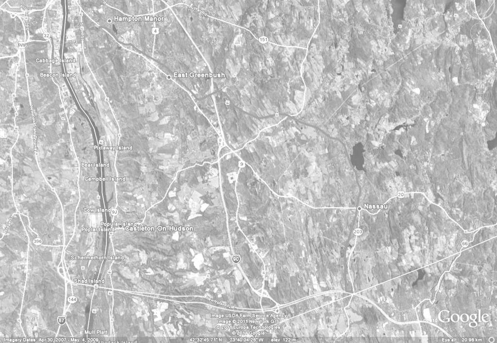
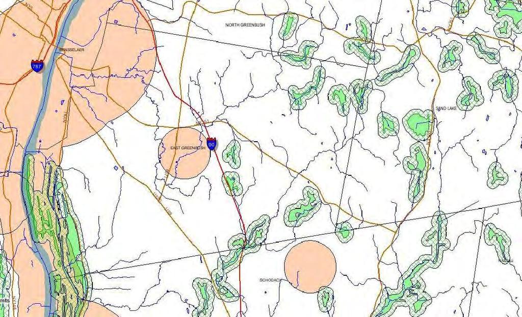
6 1.3 PROJECT LIMITS The trail begins in Rensselaer County in the Town of Nassau near Route 203 and runs north along the Valatie Kill, parallel to Route 203 through the Village of Nassau to Nassau Lake. It then goes west, parallel to Route 20, through the Towns of Schodack and East Greenbush. It ends in East Greenbush near the border with the City of Rensselaer, where it could connect in the future to the Hudson River Greenway Trail. In addition, the proposed 15 mile recreational trail also has the potential to connect with the Harlem Valley Rail Trail to the south in Columbia County. FIGURE 1-1 shows a copy of the 2009 Rensselaer County Trail Vision Map and FIGURE 1-2 shows the Trail Location Map. 1.4 TRAIL OWNERSHIP As stated previously, the proposed trail is in the right-of-way (ROW) of the former Albany Hudson Electric Trolley line which is currently under sole ownership of National Grid. The portion of National Grid ROW which is currently being evaluated was identified as an electric sub-transmission line which runs through Rensselaer and Columbia Counties. The project team met with representatives from National Grid to discuss requirements for implementing a recreational trail along a National Grid ROW. National Grid has a Property Transaction Review (PTR) process for reviewing requests to use its transmission rights-of-way. National Grid considers several factors when evaluating requests for recreational trails including safety, protection of utility structures and facilities, access and environmental impact. The following information is required by National Grid to evaluate a proposed recreational trail: A complete set of engineered plans Complete project details with specifications Scope of work Project Schedule Approved funding commitment for construction, and maintenance Requestor s contact information, provide authorizing documentation Entity to execute agreement Furthermore, a design review fee is required by National Grid to evaluate the information provided above for a proposed recreational trail along its ROW. The project sponsor/municipality will need to acquire either a revocable permit or longer duration permit (which may require Public Service Commission approval) from National Grid and will be responsible for maintenance and enforcement of the recreational trail. 2
7
8 Greenman-Pedersen CONSULTING ENGINEERS GPI 80 Wolf Road Albany, NY 12205
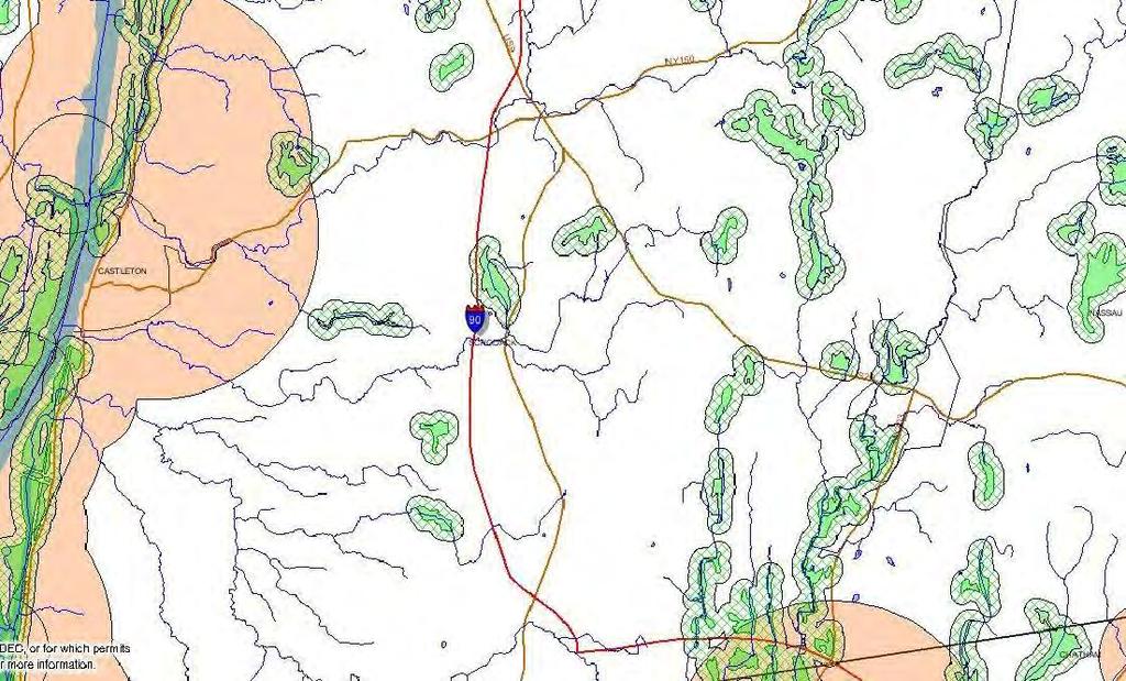
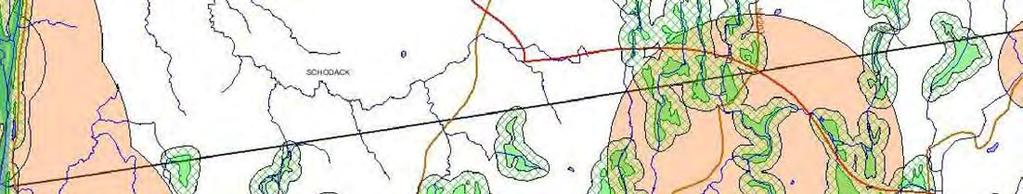
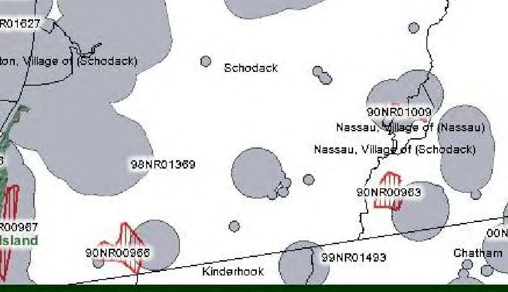
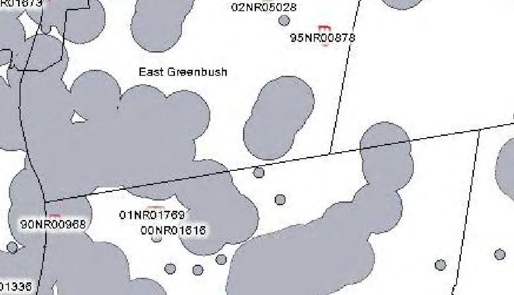
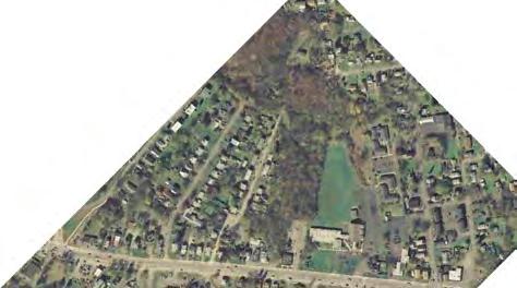
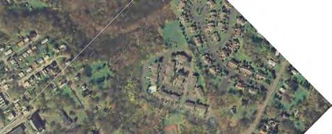
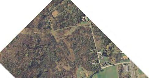
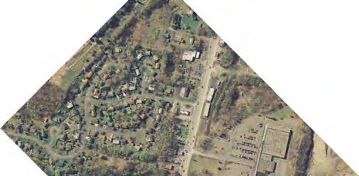
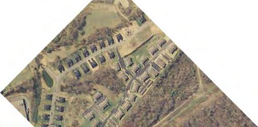
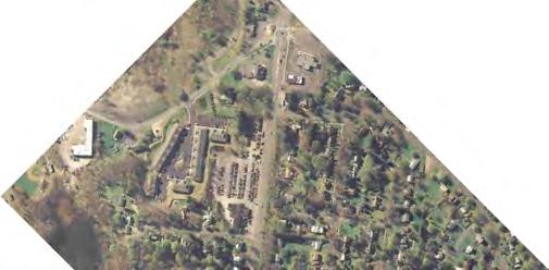
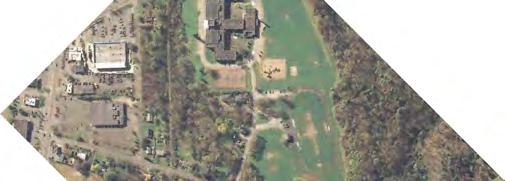
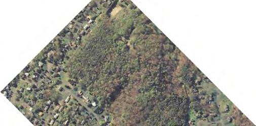
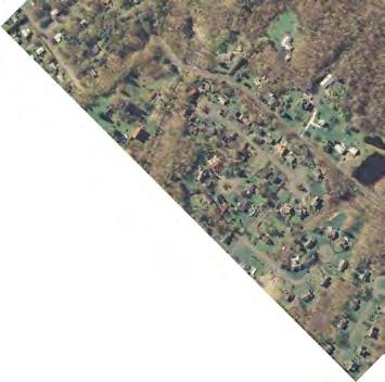
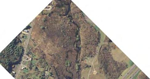
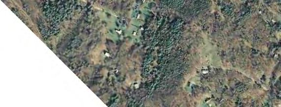
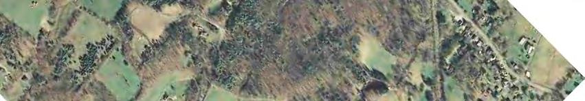
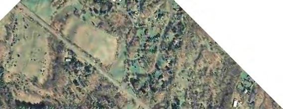
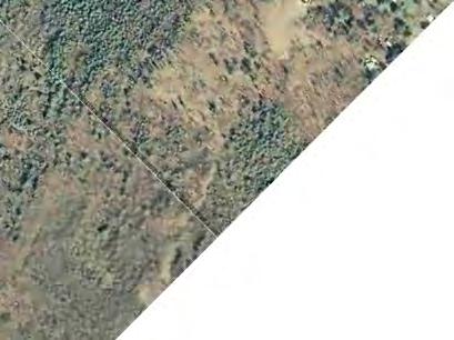
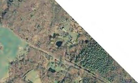
9 2. EXISTING CONDITIONS The following data was compiled through field observation, aerial images, and files acquired from various agencies. This data was used to determine the existing conditions of the proposed trail alignment. The following sections provide a description of those conditions. 2.1 STUDY AREA The study area is located within the Towns of East Greenbush, Schodack, Nassau and the Village of Nassau in Rensselaer County, NY and consists of right-of-way solely owned by National Grid which was formerly the Albany Hudson Electric Trolley line. The proposed trail traverses through primarily residential and commercial land uses within the Town of East Greenbush while traversing through residential and agricultural land uses within the Town of Schodack, Nassau and Village of Nassau. Currently the electric transmission corridor is lined with trees and grass with some locations having informal roads used to access transmission facilities and structures for maintenance activities. In the more densely populated portions of the proposed trail, you can find existing informal trails consisting of an unimproved dirt/stone surface. At certain locations, the proposed alignment is in close proximity to wetlands, streams and ponds and periodically crosses various roadways. 2.2 TRAIL CONSTRAINTS There are several constraints which will pose challenges to the design and construction of the proposed trail including environmental, geometric, major crossings and adjacent development. Environmental A cursory review of available NYSDEC mapping indicated there are several locations where the proposed trail alignment is in close proximity to streams, ponds or wetlands. FIGURE 2-1 displays the proposed trail alignment in relation to the NYSDEC wetlands mapping. Review of the New York State Historic Preservation Office mapping indicated there are locations along proposed trail in close proximity to archeologically sensitive or historically significant areas. FIGURE 2-2 displays the proposed trail alignment in relation to SHPO mapping. Because the proposed trail is expected to follow an existing alignment the environmental impacts associated with the construction of the trail are not expected 5
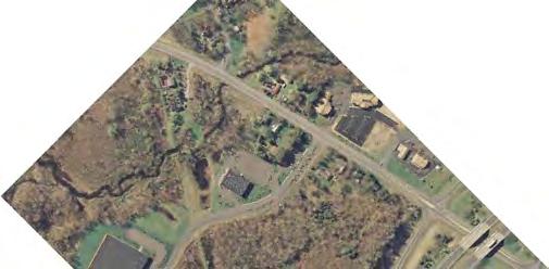
10 to be extensive. However, anticipated review and coordination with the following agencies should be assumed: New York State Office of Historic Preservation (SHPO) Review indicated a portion of the project limits is within an Archaeological Sensitive area and since disturbance of soil is probable, a Phase 1A/1B study may be necessary. Federal Wetlands (ACOE) Review of the National Wetland Inventory mapping (NWI) indicated several wetlands along the project route. Further studies will be necessary to determine the extent of any impact. State Wetlands (NYSDEC) - Review of the NYSDEC Wetlands indicate the project is located within a defined wetland check zone and further studies will be necessary to determine the extent of any impact. Storm water (NYSDEC) this project will disturb over 1 acre of land, However will only be required to address Soil and Erosion Control per the NYSDEC GP General Construction Activity Permit. Endangered or Threatened Species Review of the listing of the federal endangered species indicates that endangered species could be present within the project limits and further studies may be necessary to determine any impact. Review and confirmation of any impacts in these area is typically completed as part of preliminary design. Geometric Geometric constraints may include portions of the trail which may have steep grades or side slopes which may require additional safety features such as safety railings or fencing to protect trail users. Major Crossings There are several locations were the proposed trail is expected to cross a major highway or will require the construction of a bridge structure to cross a waterway. This study considers a these types of crossings as major crossings which means they will require a higher level of investment than crossing a minor residential street with low speeds and less traffic. FIGURE 2-3 outlines the expected major crossings along the proposed recreational trail alignment. 6
 or Route 4 would be examples of major highway crossing. There are expected to be 8 major roadway crossings required to complete the recreational trail.")


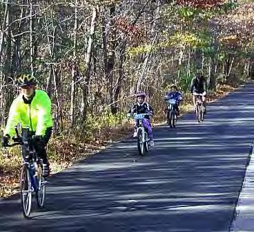
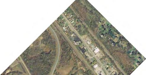
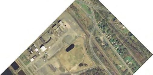
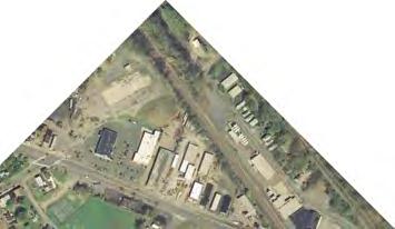
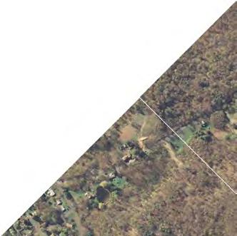
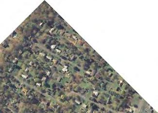
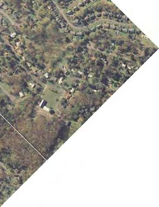
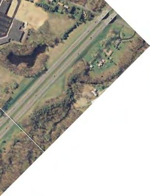
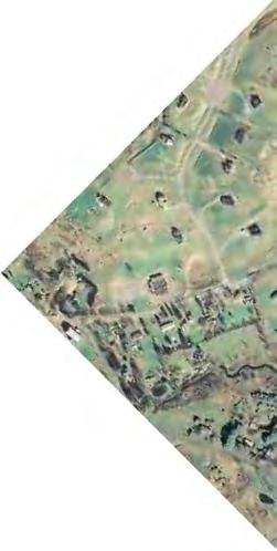
11 A major highway crossing will require a higher level of awareness to notify motorists and trail users of the crossing. Crossing Columbia Turnpike (Routes 9/20) or Route 4 would be examples of major highway crossing. There are expected to be 8 major roadway crossings required to complete the recreational trail. Sample of Major Crossing Required Sample of Bridge Crossing Required There is a considerable level of design effort and construction costs associated with the installation of structures required to cross waterways. There are four locations which have a breach in the continuous alignment which will require a structure to cross waterways. One is required to cross the Moordener Kill and three are required to cross the Valatie Kill at various points. Adjacent Development Even though the proposed trail is expected to be primarily contained within the National Grid ROW, there are going to be concerns raised by abutting property owners regarding the implementation of a recreational trail adjacent to their property. It will be the responsibility of the project development team to adequately address any concerns raised by the property owners. Sample of Adjacent Development 7
12 Greenman-Pedersen CONSULTING ENGINEERS GPI 80 Wolf Road Albany, NY 12205

13 Greenman-Pedersen CONSULTING ENGINEERS GPI 80 Wolf Road Albany, NY 12205

14 Greenman-Pedersen CONSULTING ENGINEERS GPI 80 Wolf Road Albany, NY 12205
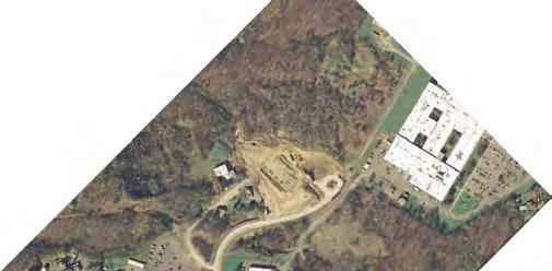
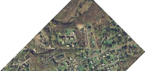
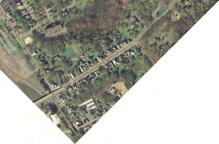
15 3. TRAIL CONCEPT 3.1 LOCATION OF TRAIL The conceptual trail alignment follows the former Albany-Hudson Electric Trolley Line which is currently owned by National Grid and is used for electric transmission lines. FIGURE 3-1 thru FIGURE 3-9 show the conceptual trail alignment including a few locations that provide short alternative alignments which may be considered. The trail begins in Rensselaer County in the Town of Nassau where Route 203 enters Columbia County and runs north along the Valatie Kill, parallel to Route 203 through the Village of Nassau to Nassau Lake. It then goes west, parallel to Route 20, through the Towns of Schodack and East Greenbush. It ends in East Greenbush near the border with the City of Rensselaer, where it could connect in the future to the proposed Hudson River Greenway Trail. In addition, a long term vision is to connect the proposed 15 mile recreational trail with the Harlem Valley Rail Trail to the south in Columbia County. 3.2 PROPOSED TRAIL USE The multi-use recreational trail is intended for non-motorized activities such as walking, bicycling and cross-country skiing and not intended for motorized activities such as snowmobiling or the use of ATV s. This limitation is a general condition of National Grid when allowing use of their ROW for trails. Design measures should be taken to prevent motorized traffic from accessing the proposed trail however, the proposed design should be mindful of the fact that the right-of-way is intended for electric transmission and as such National Grid requires proper access to the transmission facilities and structures. 11

16 FIGURE 3-2 FIGURE 3-3 FIGURE 3-4 FIGURE 3-5 FIGURE 3-6 FIGURE 3-7 FIGURE 3-5 FIGURE 3-5 Greenman-Pedersen CONSULTING ENGINEERS GPI 80 Wolf Road Albany, NY 12205


17 COLUMBIA TURNPIKE - ROUTE 9 HAMPTON MANOR SOUTH ST - ROUTE 9J HUDSON RIVER Greenman-Pedersen CONSULTING ENGINEERS GPI 80 Wolf Road Albany, NY 12205


18 HAMPTON MANOR COLUMBIA TURNPIKE - ROUTE 9 PHILLIPS RD TROY RD - ROUTE 4 Greenman-Pedersen CONSULTING ENGINEERS GPI 80 Wolf Road Albany, NY 12205


19 ELLIOT RD EAST GREENBUSH HAYS RD COLUMBIA TURNPIKE - ROUTE 9 Greenman-Pedersen CONSULTING ENGINEERS GPI 80 Wolf Road Albany, NY 12205


20 COLUMBIA TURNPIKE - ROUTE 9 MILLER RD INTERSTATE 90 INTERSTATE 90 RENO RD Greenman-Pedersen CONSULTING ENGINEERS GPI 80 Wolf Road Albany, NY 12205


21 RENO RD E SCHODACK RD - ROUTE 150 COUNTY ROUTE 7 Greenman-Pedersen CONSULTING ENGINEERS GPI 80 Wolf Road Albany, NY 12205


22 COUNTY ROUTE 7 TROLLEY WAY COUNTY ROUTE 7 COUNTY ROUTE 7 Greenman-Pedersen CONSULTING ENGINEERS GPI 80 Wolf Road Albany, NY 12205

23 COUNTY ROUTE 7 NASSAU AVERILL PARK RD ALBANY AVE - ROUTE 20 NASSAU CHURCH ST - ROUTE 20 CHATHAM ST - ROUTE 203 LONGVIEW AVE Greenman-Pedersen CONSULTING ENGINEERS GPI 80 Wolf Road Albany, NY 12205
24 ROUTE 203 INTERSTATE 90 Greenman-Pedersen CONSULTING ENGINEERS GPI 80 Wolf Road Albany, NY 12205
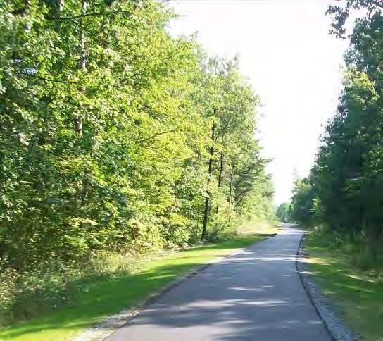
25 3.3 DESIGN FEATURES The design of the multi-use recreational trail will need to follow design criteria and standards established by the New York State Department of Transportation (NYSDOT), American Association of State Highway and Transportation Officials (AASHTO) and National Grid to be eligible to qualify for certain funds. Design Criteria The table below provides design criteria that should be utilized for the design of the proposed recreational trail: Critical Design Elements: Design Element Design Criteria Source Width Minimum 10 feet AASHTO pg. 135 Desirable 11 feet Design Speed 20 mph minimum AASHTO pg. 144 grade >4% use 30 mph Vertical Clearance 8 feet minimum AASHTO pg feet desirable Setback 5 feet from edge of pavement AASHTO pg 137 Shoulder Max 1:6 slope = 2 wide shoulder AASHTO pg. 137 Min 1:3 slope = 5 wide shoulder Desirable = 3 wide Stopping Sight Distance Descending 195 feet Ascending 125 feet AASHTO pg. 149 Radius Min lean angle AASHTO pg. 146 Grade 5% Maximum AASHTO pg. 148 The above AASHTO information is from the Draft AASHTO Guide for the Planning, Design and Operation of Bicycle Facilities, dated February Cross Section The proposed trail will have multiple cross sections due to the variations in topography, land use and the proposed alignment. A typical cross section is illustrated on the next page and provides a 10 foot wide surface to allow for safe two- way operation for walkers, joggers and bicycles. It should be noted that the trail section adjacent to roadways will be a 5 feet wide sidewalk which will not permit bicycle travel. Bicyclists will be required to share the roadway with motorists at these locations which are typically short in length. The two cross sections provided below are representative of the typical proposed trail sections envisioned for the project: 21
")
26 Proposed Trail Cross Section (Photo from Draft AASHTO Bike Guide Feb 2010) Proposed Trail Cross Section Adjacent to Roadway (Photo from NYSDOT HDM Chapter 18 March 2006) 22
27 Trail Heads and Wayfinding Trailheads and user information is important to the success of recreational trail systems. Properly locating trailheads to provide convenient access and trail information to users will generate a more enjoyable and informed experience. Additional features can be provided to restrict access unauthorized to motorized vehicles Crossings The types of crossings that are expected to be included the trail design are minor and major roadway crossings and structure crossings to bridge various waterways. Minor roadway crossings can typically be found at low speed roadways that carry a low volume of traffic whereas a major crossing would be found at a high volumes roadway with higher speeds. There is an estimated 41 crossings that would be required to complete the proposed recreational trail from end to end. There are four locations that would require the construction of structure to cross various bodies of water. Staging and Logical Terminus The funding for the design and construction of a 15 mile trail which includes at least four bridge structures to cross waterways will be difficult to obtain. For this reason, the prioritization of implementation was determined to be critical to the success of the overall vision. Designing and constructing an ideal test bed segment of the recreational trail would demonstrate potential and generate interest and community support for additional trail segments to be completed. Staging the construction of the recreational trail will also enable the trail sponsors to construct portions of the trail as funding becomes available in the future. In order to stage the construction, the trail was divided into segments, each containing a logical terminus. A logical terminus is an ideal beginning or ending point for a given trail segment which should provide convenient access to the trail and be located near a parking area or near facilities that generate non-motorized traffic. 23
28 National Grid Design Requirements Because the proposed recreational trail alignment is contained within the National Grid ROW it will be subject to National Grid design and setback requirements in addition to the AASHTO design requirements listed in Section 3.3. A sample of the requirements and standards for crossing a transmission ROW is provided in the appendix. The contact information for National Grid representatives is also provided. Additional direction from National Grid should be obtained as the planning for the project advances. 3.4 TRAIL CONCEPT DESCRIPTION In reviewing the 15 mile length of the corridor established for the Albany-Hudson Electric Trail it s evident there are varying characteristics and design issues throughout the length of the trail. For the purpose of this study, the trail has been divided into five segments to allow for staged planning, design and construction as funding becomes available. The environmental and social impacts for the entire recreational trail should be detailed during future planning and design efforts. The segments begin and end at rational locations which allow convenient access to that portion of the trail. Segment: From To 1. East Greenbush North Project Limit Route 4 2. East Greenbush Route 4 Schodack Town Line 3. Schodack East Greenbush Town Line Route Schodack Route 150 Nassau Village Line 5. Nassau/Schodack Nassau Village Line South Project Limit The five segments are shown on Figure 1-2. Further refinement of these segments will likely occur during future planning and design. Each trail segment is detailed below with a brief description that summarizes key features. Segment 1: East Greenbush (Project Limit near City of Rensselaer Line to US Route 4) Length: This portion of the trail is approximately 3.0 miles long Adjacent Land use: Both commercial and residential land uses. Cross Section: The trail cross section and roadway cross section will be needed. 24
29 Terrain: The terrain has some slight grades Crossings: Major roadway crossings at Routes 9/20 and Route 4 will be required. Environmental constraints: No major environmental constraints expected. A review of the available mapping indicated this segment of the trail will not be adjacent to any wetlands. Assume agency coordination and review as noted in Section 2.2. Trail Access and Terminus: Potential trailhead, access and/or parking locations have been identified on Figure 3-1 through Figure 3-9. Segment 2: East Greenbush (US Route 4 to Schodack Town Line) Length: This portion of the trail is approximately 1.5 miles long Adjacent Land use: Both commercial and residential land uses. Some ROW infringement is evident. Cross Section: The trail cross section will be needed. Terrain: The terrain is relatively flat. Crossings: No major roadway crossings will be required. Environmental constraints: No major environmental constraints expected. A review of the available mapping indicated this segment of the trail will not be adjacent to any wetlands. Assume agency coordination and review as noted in Section 2.2. Trail Access and Terminus: Potential trailhead, access and/or parking locations have been identified on Figure 3-1 through Figure 3-9. Segment 3: Schodack (East Greenbush Town Line to Route 150) Length: This portion of the trail is approximately 3.5 miles long Adjacent Land use: Commercial, residential and agricultural land uses. Cross Section: The trail cross section and roadway cross section will be needed. 25
30 Terrain: The terrain has some slight grades Crossings: Major roadway crossings at Miller Road and East Schodack Road (Route 150) will be required. Environmental constraints: No major environmental constraints expected. A review of the available mapping indicated this segment of the trail will traverse through defined wetland check areas. Assume agency coordination and review as noted in Section 2.2. Trail Access and Terminus: Potential trailhead, access and/or parking locations have been identified on Figure 3-1 through Figure 3-9. Segment 4: Schodack (Route 150 to Village of Nassau Line) Length: This portion of the trail is approximately 3.5 miles long Adjacent Land use: Residential and agricultural land uses. Cross Section: The trail cross section and roadway cross section will be needed. Terrain: The terrain has some slight grades Crossings: Major crossing at Best Road and structure for the Moordener Kill. Environmental constraints: No major environmental constraints expected. A review of the available mapping indicated this segment of the trail will traverse through defined wetland areas. Because the trail follows an existing defined ROW, wetland impacts are expected to be minimal. Assume agency coordination and review as noted in Section 2.2. Trail Access and Terminus: Potential trailhead, access and/or parking locations have been identified on Figure 3-1 through Figure 3-9. Segment 5: Nassau/Schodack (Village of Nassau Line to Project Limit near Columbia County Line) Length: This portion of the trail is approximately 3.5 miles long Adjacent Land use: Commercial, residential and agricultural land uses. 26
31 Cross Section: The trail cross section and roadway cross section will be needed. Terrain: The terrain has some slight grades Crossings: Major roadway crossings at County Road 7, Route 20 and will require three structures for the Valatie Kill. Environmental constraints: No major environmental constraints expected. A review of the available mapping indicated this segment of the trail will traverse through defined wetland areas. Because the trail follows an existing defined ROW, wetland impacts are expected to be minimal. Assume agency coordination and review as noted in Section 2.2. Trail Access and Terminus: Potential trailhead, access and/or parking locations have been identified on Figure 3-1 through Figure REGIONAL TRAIL DEVELOPMENT As noted in the Trail Vision Plan for Rensselaer County, there are several planning initiatives which are being considered or currently underway. Furthermore, the vision demonstrates the regional network of trails which is possible with proper planning and community support. As an example, the Towns of Kinderhook, Stuyvesant and Stockport produced a feasibility study and held public information meetings to create an inter-municipal recreational trail in Columbia County. This proposed recreational trail will also utilize the former Albany-Hudson Electric Trolley ROW which is currently owned and used by National Grid for electric transmission lines. This project is further along in the process and will serves as a good template for preliminary design and coordination efforts required to implement the recreational trail in Rensselaer County. There will likely be a future opportunity to ultimately link Albany-Hudson Electric Trail project with the proposed recreational trail project in Kinderhook and/or the existing Harlem Valley Rail Trail which could provide a network which could provide a nonmotorized link between Rensselaer, Columbia and Dutchess Counties. 3.6 COMMUNITY BENEFITS In addition to the recreational benefits provided by the construction of a multi-use trail, other benefits including transportation and economic can typically be realized after implementation of a trail system. 27
32 Restaurants, cafes and outdoor outfitter type businesses can be routinely found along established trail systems which benefit from trail users. Community leaders and planners are now realizing that trails can generate economic development and revitalization. It s likely that similar opportunities for trail associated businesses to be created as the trial is constructed. 28
33 4. COST ESTIMATES AND FUNDING Cost Estimates The cost estimate for the proposed trail has been divided into the following categories to provide a clear understanding of the costs associated with the implementation of the recreational trail: Trail Segments Roadway Crossings Bridges At this point in the planning process detailed design drawings have not been developed for the trail. Therefore the budget cost estimates has been developed using historical prices for similar trail projects based on a typical cost per mile of a trail adjusted by the additional costs for major crossings or other typical features such as trail heads, signing etc. The budget costs provided have attempted to include all costs associated with the trail including design, legal services, National Grid review fees and construction costs. However the actual costs could vary significantly from these budget costs provided depending factors such as the surface type, amenities and the number trailheads/parking areas included in the final design. Cost per mile of paved 10 foot wide trail: $500,000 Cost per mile of stone dust 10 foot wide trail: $250,000 Cost of minor road crossing: $5,000 Cost of major road crossing: $10,000 Cost of bridge: $5,000 /lf Cost of new Trail Head: $50,000 Paved Trail This alternative involves the construction of the recreational path to provide a 10-foot trail width that would accommodate bicycles, pedestrians and be constructed with an asphalt pavement surface. There is typically a higher initial cost than a non-paved trail however paved trails typically require less maintenance. Non-Paved Trail building a non paved trail (typically a stone surface) is sometimes considered as part of the planning process for trails. A stone trail has some advantages such as lower initial cost but typically require more maintenance. While a stone trail will provide savings in asphalt, the cost of all other features such as 29
34 bridges and trail heads will still be required. We have provided a budget for a stone trail for each segment to provide a range of costs for the implementation of the trail. Based on these budgeted costs (rounded) the estimates for each segment are as follows: Length (Miles) Paved Non-Paved Segment 1: 3.0 $1,700,000 $ 900,000 Segment 2: 1.5 $ 900,000 $ 500,000 Segment 3: 3.5 $1,900,000 $1,000,000 Segment 4: 3.5 $2,100,000 $1,200,000 Segment 5: 3.5 $2,800,000 $1,900,000 Total: 15.0 $9,400,000 $5,500,000 Potential Funding Sources Historically, there have been a number of potential funding sources that may be available for some of the construction of projects such as the Albany-Hudson Electric Trail. A description of available funding sources that may be available is as follows: 1. Transportation Enhancement Program (TEP): The CDTC is the designated Metropolitan Planning Organization (MPO) in the Capital Region. They are committed to enhancing pedestrian and bicycle mobility in the MPO area, which includes Albany, Schenectady, Rensselaer, and Saratoga Counties. As part of their planning process, they typically allocate funds for pedestrian, bicycle and canal projects. When funds become available under this program, CDTC sends notices to local communities and other potential applicants soliciting projects, which could be partially funded as part of TEP. 2. Transportation Improvement Program (TIP): The CDTC has responsibility under federal law to adopt a multi-year program of proposed transportation improvement projects within the MPO area. Similar to TEP, CDTC with input from NYSDOT and local governments, is the responsible MPO for programming federal transportation funds for state and local highway and transit projects. CDTC typically forwards notices to communities soliciting projects, which could be partially funded as part of the TIP Program. 30
35 3. New York State Multi-Modal Program Funding (MMPF): The Multi-Modal Program legislation requires that all funds be solely utilized for capital project costs for construction, reconstruction, reconditioning, and preserving of facilities and equipment with a service life of ten (10) years or more. However, funds cannot be used for the mandated non-federal matching share of federally funded projects. Historically, The amount of funds available under the Multi-Modal Program is very limited. 4. Transportation and Community and System Preservation Pilot Program (TCSP): The TCSP is a nationwide discretionary program administered by the Federal Highway Administration. Projects, which are eligible for funding, must meet several objectives, which include improving efficiency of the transportation system and reducing environmental impacts of transportation. Similar to the CDBG Program, TCSP funding availability is very limited. 5. Spot Improvement Program: CDTC has historically set aside $100,000 per year for projects that provide low cost pedestrian and bicycle improvements that are too small for other programs such as TIP and TEP. Spot improvement projects typically address problems at specific locations such as intersections and short lengths of roadway. 6. Safe Routes to School: A Federal program administered by NYSDOT that provides funds for projects that include the planning, design and construction of infrastructure that will improve the ability of elementary school students to walk and bicycle within 2 miles to school. The Genet Elementary School and The Holy Spirit Elementary School are both located along Trail Segment 2. Due to current economic conditions the traditional sources for funding of trails has been reduced in recent years. However some funding is still available and advancing the trail in segments may make it easier to begin implementation of the project. 31
36 5. STAGING AND PRIORITIZATION As the implementation of the entire 15 mile length of the Albany-Hudson Electric trail would require significant funding that would be difficult to obtain at one time, it is beneficial to identify a staging plan that could initiate the project. It was determined that Segment 2 located in East Greenbush from US Route 4 to the Town of Schodack line would be the ideal first segment for the recreational trail for the following reasons: This segment of the trail is relatively flat and It would provide a formal non-motorized connection between the residential neighborhoods and Genet Elementary School. This segment of the trail is not expected to encounter major constraints including environmental, geometric or require any major crossings which will help keep costs down. This is the shortest segment and therefore the lowest cost. Two elementary schools are located in this segment which may help qualify for Safe Routes to School Funding. The major constraint expected for this segment will be addressing property owners concerns over having a recreational trail adjacent to their property. This can be addressed through public and individual property owner meetings as the project advances to preliminary design. Implementation of this trail segment will demonstrate the value of non-motorized transportation routes and if successful could generate community support for future segments of overall recreational trail. 32

37 6. PUBLIC INFORMATION MEETING A public information meeting was held on September 14, 2011 at the East Greenbush Town Hall to present the project findings and recommendations of the study. Prior to the formal presentation an open house was conducted to allow for an informal exchange of information. In addition, the meeting served as a platform for discussion between the project team and members of the community. The members of the community where encouraged to provide written comments and feedback regarding the project that would be incorporated into the study. Several written comments were received during and after the meeting. All of the written comments that were submitted as well as an attendance list for the public meeting are included in the appendix of this report. 33
38 7. SUMMARY AND NEXT STEPS The Vision for the Albany- Hudson Electric Trail is to provide a non motorized path along the former Albany Hudson Electric Trolley line for 15 miles connecting the City of Rensselaer to the North to the Village of Nassau to the South. The path of the trail would go through the Towns of East Greenbush, Schodack and Nassau. This study has been prepared to provide the trail sponsors and local officials with additional information of the trail specifics and the actions to be completed to advance the project. The following are the studies key findings: The current cost estimate to complete the entire 15 mile trail ranges between $9.4 million dollars. There does not appear to be any significant historical or environmental obstacles to the completion of the trail. The completion of the trail will require 29 minor road crossings, 8 major road crossings and 4 bridges. The planning and design of the trail must be approved by National Grid as they own the bulk of the ROW where the trail will be located. Building the trail in segments is recommended to allow for phased implementation, funding purposes and to gain public support for the eventual completion of the entire vision. Advancing segment #2 (from US Route 4 to the Schodack town line) as the first segment is recommended. This Feasibility Study is a first step towards the creation of the Albany-Hudson Electric Trail. The next steps towards implementation include the following: 1. Identify Project Leadership: Identify a project champion that would take ownership of the project. 2. Advisory Group: establish a group of interested parties including agencies, advocates, public officials, etc to guide the project development 3. Seek Funding Sources: Examine potential sources for additional planning design and construction. 4. Design Development: Develop detailed designs for the trail starting with the highest priority segment. 5. National Grid review: Initiate the required review of the designs by National Grid and reach necessary agreements for use of their ROW. 6. Environmental Review (SEQRA): Conduct environmental reviews and obtain permit as needed including cultural, historic and natural resources. 7. Construction: Once all design are complete and necessary approvals and funding is obtained 34
39 8. Operation and Maintenance: Arrange for ongoing care, maintenance and repair of the trail. A Friends of the Trail group could assume some of these responsibilities. This Study has helped refine the vision of the Albany-Hudson Electric Trail. Completing a project of this magnitude has many challenges and may it take a long time to achieve the entire vision. However, once completed it could be a valuable resource for the residents of Rensselaer County. 35
40
41
42
43
44
45
46
47
48
49
50
51
52
53
54
55
Longmont to Boulder Regional Trail Jay Road Connection DRAFT FINAL REPORT
 Longmont to Boulder Regional Trail Jay Road Connection DRAFT FINAL REPORT December 2018 Project Summary Boulder County, Colorado, in partnership with the City of Boulder, is evaluating options for multi-use
AGENDA ITEM 5 D WAKULLA ENVIRONMENTAL INSTITUTE (WEI) TRAIL FEASIBILITY STUDY
 TRAIL FEASIBILITY STUDY") March 19, 2018 AGENDA ITEM 5 D WAKULLA ENVIRONMENTAL INSTITUTE (WEI) TRAIL FEASIBILITY STUDY TYPE OF ITEM: Action STATEMENT OF ISSUE The Wakulla Environmental Institute (WEI) Trail is one of several trails
March 19, 2018 AGENDA ITEM 5 D WAKULLA ENVIRONMENTAL INSTITUTE (WEI) TRAIL FEASIBILITY STUDY TYPE OF ITEM: Action STATEMENT OF ISSUE The Wakulla Environmental Institute (WEI) Trail is one of several trails
FEASIBILITY CRITERIA
 This chapter describes the methodology and criteria used to evaluate the feasibility of developing trails throughout the study areas. Land availability, habitat sensitivity, roadway crossings and on-street
Auburn Trail / Ontario Pathways Trail Connector Feasibility Study Public Information Meeting Wednesday, August 22, 2012
 Auburn Trail / Ontario Pathways Trail Connector Feasibility Study Public Information Meeting Wednesday, August 22, 2012 Purpose of Feasibility Study Purpose Evaluate the feasibility of constructing a multiuse
PURPOSE AND NEED (CONCURRENCE POINT 1) NEW CANADA ROAD PROJECT FROM STATE ROUTE 1 (U.S. HIGHWAY 70) TO U.S. INTERSTATE 40
 NEW CANADA ROAD PROJECT FROM STATE ROUTE 1 (U.S. HIGHWAY 70) TO U.S. INTERSTATE 40") PURPOSE AND NEED (CONCURRENCE POINT 1) NEW CANADA ROAD PROJECT FROM STATE ROUTE 1 (U.S. HIGHWAY 70) TO U.S. INTERSTATE 40 Project Description The primary purpose of this project is to improve the major
PURPOSE AND NEED (CONCURRENCE POINT 1) NEW CANADA ROAD PROJECT FROM STATE ROUTE 1 (U.S. HIGHWAY 70) TO U.S. INTERSTATE 40 Project Description The primary purpose of this project is to improve the major
Georgetown-Lewes Rail/Trail Study. Rail/Trail Study: Cool Spring to Cape Henlopen State Park New Road Extension (House Resolution No.
 Georgetown-Lewes Rail/Trail Study Rail/Trail Study: Cool Spring to Cape Henlopen State Park New Road Extension (House Resolution No. 47) August 22, 2011 Presentation Outline Background Benefits Statewide
Rule Governing the Designation and Establishment of All-Terrain Vehicle Use Trails on State Land
 Rule Governing the Designation and Establishment of All-Terrain Vehicle Use Trails on State Land 1.0 Authority 1.1 This rule is promulgated pursuant to 23 V.S.A. 3506. Section 3506 (b)(4) states that an
2. Goals and Policies. The following are the adopted Parks and Trails Goals for Stillwater Township:
 D. PARKS AND TRAILS 1. Introduction Stillwater Township s population is relatively low, with most residents living on rural residences on large lots. The need for active park space has been minimal in
Mohawk Hudson Bike Hike Trail Crossroad Connection Study
 Summary Report - April 21, 2003 Mohawk Hudson Bike Hike Trail Crossroad Connection Study Summary Report Introduction The Capital District Transportation Committee (CDTC), in partnership with Albany County,
Stage 2 ION: Light Rail Transit (LRT) from Kitchener to Cambridge
 from Kitchener to Cambridge") Stage 2 ION: Light Rail Transit (LRT) from Kitchener to Cambridge Public Consultation Centre (PCC) No. 3 Please Sign-in Cambridge City Hall November 21, 2017 2:00 to 8:00pm Preston Memorial Auditorium
Stage 2 ION: Light Rail Transit (LRT) from Kitchener to Cambridge Public Consultation Centre (PCC) No. 3 Please Sign-in Cambridge City Hall November 21, 2017 2:00 to 8:00pm Preston Memorial Auditorium
Blueways: Rivers, lakes, or streams with public access for recreation that includes fishing, nature observation, and opportunities for boating.
 Parks, Open Space and Trails PRINCE WILLIAM COUNTY 2008 COMPREHENSIVE PLAN TRAILS PLAN CONTENTS The components of the trails plan are: Intent Definitions Goals, Policies, and Action Strategies Trails Map
City of Durango 5.8 FUNDING TRAILS DEVELOPMENT
 5.8 FUNDING TRAILS DEVELOPMENT The City has been successful in establishing dedicated local funding sources as well as applying for grants to develop the City s trail system, having received nearly $2.4
Rural Rustic Road Program
 Virginia Department of Transportation s Rural Rustic Road Program Prepared by the Local Assistance Division Virginia Department of Transportation 1401 East Broad Street Richmond, Virginia 23219 Michael
SUMMER VILLAGE OF SILVER SANDS. Municipal Development Plan
 SUMMER VILLAGE OF SILVER SANDS Municipal Development Plan Bylaw 253-2014 Adopted August 22, 2014 Summer Village of Silver Sands Municipal Development Plan Bylaw No. 253-2014 Page 2 1 INTRODUCTION 1.1 SETTING
Other Principle Arterials Minor Arterial Major Collector Minor Collector Local
 CHAPTER 10 TRANSPORTATION Introduction The system of public roads in East Pikeland Township is decidedly rural in character. Since the 1984, the road network has remained much the same, with the addition
3. COLTA / HUGA CONNECTIONS - PRELIMINARY
 9 3. COLTA / HUGA CONNECTIONS - PRELIMINARY 3.1 COLTA The Chain of Lakes Trail Association (COLTA) trail, formerly identified as the Chester Spur Line, was completed and opened for use in June 2011. The
Chapter 6: POLICY AND PROCEDURE RECOMMENDATIONS
 Chapter 6 POLICY AND PROCEDURE RECOMMENDATIONS FOR SRRA Below are seven policy elements that should be considered for adoption by the Southwest Regional Recreation Authority of Virginia: 1. Develop strategies
BACKCOUNTRY TRAIL FLOOD REHABILITATION PROGRAM
 BACKCOUNTRY TRAIL FLOOD REHABILITATION PROGRAM Backcountry Trail Flood Rehabilitation A June 2013 Flood Recovery Program Summary In June 2013, parts of Southern Alberta were devastated from significant
CHAPTER III: TRAIL DESIGN STANDARDS, SPECIFICATIONS & PERMITS
 CHAPTER III Trail Design Standards, Specifications & Permits This chapter discusses trail standards, preferred surface types for different activities, permits, and other requirements one must consider
C. APPROACH FOR IDENTIFYING THE BEST ROUTES FOR THE NEEDED TRANSMISSION SYSTEM IMPROVEMENTS
 C. APPROACH FOR IDENTIFYING THE BEST ROUTES FOR THE NEEDED TRANSMISSION SYSTEM IMPROVEMENTS CL&P s approach for identifying the best routes for the needed transmission system improvements included a determination
DRAFT - APRIL 13, 2007 ROUTING STUDY FOR TRAIL CONNECTIONS BETWEEN CALAIS AND AYERS JUNCTION
 DRAFT - APRIL 13, 2007 ROUTING STUDY FOR TRAIL CONNECTIONS BETWEEN CALAIS AND AYERS JUNCTION Abstract The vision for the East Coast Greenway is an off-road urban trail system running from Calais, Maine
The Chu property is a 6.57 acre parcel located in the Town of Superior on the west side of McCaslin Boulevard. In 2014, the Town of Superior acquired
 1 The Chu property is a 6.57 acre parcel located in the Town of Superior on the west side of McCaslin Boulevard. In 2014, the Town of Superior acquired the Chu property for open space with a contribution
Becker County Trail Routing Feasibility Study
 2016 Becker County Trail Routing Feasibility Study CONNECTING DETROIT MOUNTAIN AND MOUNTAIN VIEW RECREATIONAL AREA TO THE HEARTLAND TRAIL BECKER COUNTY ULTEIG ENGINEERS Contents Acknowledgements...2 INTRODUCTION...3
Trail Feasibility Study
 VOLUSIA COUNTY MPO CITY OF NEW SMYRNA BEACH FINAL REPORT JUNE 30, 2009 Trail Feasibility Study What s inside? 1 Introduction 2 Project Purpose & Scope 3 Physical Inventory & Assessment of Right-of- Way
Appendix 3. Greenway Design Standards. The Whitemarsh Township Greenway Plan
 Appendix 3 Greenway Design Standards This chapter discusses two design standards for the greenway types discussed above. First, trail design standards are presented together with trailhead facilities and
I. INTRODUCTION EAST COAST GREENWAY STUDY PURPOSE
 I. INTRODUCTION STUDY PURPOSE The purpose of this study is to determine the engineering feasibility of developing the Eastern Trail. It was initiated at the request of the and funded by the Maine Department
Welcome to the Cross County Trail Public Input Session!
 Welcome to the Cross County Trail Public Input Session! Please sign in on the table below! What are we doing here? Camden County has proposed a bicycle and pedestrian trail spanning across the entire county.
Header i
 Header i 048285014.10 Header Sub Title Body Text here. Body text here. Body text here. Section 1... 1 Executive Summary... 1 Opportunities and Constraints... 3 Overall Opportunities and Constraints Map
ANCLOTE COASTAL TRAIL ALTERNATIVES ANALYSIS STUDY
 ANCLOTE COASTAL TRAIL ALTERNATIVES ANALYSIS STUDY PASCO COUNTY MPO JULY 2015 PROJECT OVERVIEW... INTRODUCTION EXECUTIVE SUMMARY CONTEXT... TAMPA BAY AREA, PINELLAS, & PASCO COUNTY S MULTI-USE TRAIL PLANS
2016 Regional Transportation Alternatives Program (TAP) Grant Application
 Grant Application") 2016 Regional Transportation Alternatives Program (TAP) Grant Application PROJECT TITLE: Yelm-Tenino Trail Extension Feasibility Study TRPC use only GENERAL PROJECT INFORMATION Agency or Organization City
2016 Regional Transportation Alternatives Program (TAP) Grant Application PROJECT TITLE: Yelm-Tenino Trail Extension Feasibility Study TRPC use only GENERAL PROJECT INFORMATION Agency or Organization City
Port Gamble Shoreline Area Conceptual Trail Proposal
 The North Kitsap Trails Association is pleased to be a partner to the Kitsap Forest and Bay Project and assist Kitsap County, Forterra, Olympic Property Group, Great Peninsula Conservancy and the Port
Section II. Planning & Public Process Planning for the Baker/Carver Regional Trail began in 2010 as a City of Minnetrista initiative.
 Section II Planning & Public Process Planning for the began in 2010 as a City of initiative. city staff began discussions with the Park District on the possibility of a north/south regional trail connection
FINAL. Bicycle/Pedestrian Feasibility Study City of DeBary Dirksen Drive Trail. Prepared For: Volusia County MPO
 City of DeBary Dirksen Drive Trail FINAL Prepared By: Reynolds, Smith and Hills, Inc. Prepared For: Volusia County MPO September 2007 Table of Contents INTRODUCTION...1 PROJECT PURPOSE AND SCOPE...2 PHYSICAL
HAMPTON ROADS CROSSINGS PATRIOTS CROSSING AND HRBT
 HRTPO Board Meeting March 21, 2013 Agenda ITEM #9: HAMPTON ROADS CROSSINGS PATRIOTS CROSSING AND HRBT Congestion at the Hampton Roads Bridge-Tunnel (HRBT) on I-64 has long been identified as a problem
MEETING MINUTES District 1 Trail Planning Meeting 1
 MEETING MINUTES District 1 Trail Planning Meeting 1 June 1, 2017 2:00 PM 3:30 PM City of Two Harbors 2:00 Introductions Attendees: Lisa Austin, MnDOT Bryan Anderson, MnDOT Jasna Hadzic-Stanek, MnDOT Justin
Draft Concept Alternatives Analysis for the Inaugural Airport Program September 2005
 Section 10 Preferred Inaugural Airport Concept 10.0 Introduction The Preferred Inaugural Airport Concept for SSA was developed by adding the preferred support/ancillary facilities selected in Section 9
Non-Motorized Transportation
 Non-Motorized Transportation Non-motorized facilities are important components to the transportation system. They provide an environmentally-friendly, low-cost mode of travel. Some of the facilities can
At the time, the portion of the line through Eagle County remains wholly under the ownership of Union Pacific Railroad (UP).
.") Chapter 5 The Railroad Corridor as a Trail Corridor The intent of this chapter is to identify how the rail corridor, if available for lease or purchase in all or part, could be incorporated into the core
Chapter 5 The Railroad Corridor as a Trail Corridor The intent of this chapter is to identify how the rail corridor, if available for lease or purchase in all or part, could be incorporated into the core
MORGAN CREEK GREENWAY Final Report APPENDICES
 APPENDICES MORGAN CREEK GREENWAY Appendix A Photos of Existing Conditions in Trail Corridor Photos of existing conditions Main trail corridor - February 2009 Photos of existing conditions south bank Morgan
4. Safety Concerns Potential Short and Medium-Term Improvements
 NH Route 104 Access Management Study Page 19 4. Safety Concerns Potential Short and Medium-Term Improvements Potential safety improvement strategies are listed by priority based on field observations by
Mt. Hood National Forest
 United States Department of Agriculture Forest Service Mt. Hood National Forest Zigzag Ranger District 70220 E. Highway 26 Zigzag, OR 97049 503-622-3191 Fax: 503-622-5622 File Code: 1950-1 Date: June 29,
Understanding user expectations And planning for long term sustainability 1
 Understanding user expectations And planning for long term sustainability 1 What is a natural surface trail? It can be as simple has a mineral soil, mulched or graveled pathway, or as developed as elevated
Macleod Trail Corridor Study. Welcome. Macleod Trail Corridor Study Open House. Presentation of Proposed Design Concepts
 Macleod Trail Corridor Study Welcome Macleod Trail Corridor Study Open House Presentation of Proposed Design Concepts Study Purpose Develop a corridor plan for Macleod Trail that aligns with The City s:
Lake Erie Commerce Center Traffic Analysis
 LOCATION: East of NYS Route 5 at Bayview Road Town of Hamburg Erie County, New York PREPARED BY: Wendel Companies 140 John James Audubon Parkway Suite 200 Amherst, New York 14228 January 2012 i ii Table
COMMUNITY MEETING NOVEMBER 1, Wheaton Regional Park Pine Lake Trail
 COMMUNITY MEETING NOVEMBER 1, 2012 MEETING AGENDA I. Introduction of Project Team II. Trail Renovation Process III. Wheaton Regional Park IV. Pine Lake Trail Renovation Project V. Comments and Questions
Committee. Presentation Outline
 CW-33-15 11/9/2015 Community and Corporate Services Committee November 10, 2015 1 Presentation Outline Background Vision and Objectives Study Process and Timeline Public and Stakeholder Engagement Organization
ROAD AND TRAIL PROJECT APPROVAL
 ROAD AND TRAIL PROJECT APPROVAL www.marincountyparks.org Marin County Parks, 3501 Civic Center Dr, Suite 260, San Rafael, CA 94903 DATE: July 12, 2017 PRESERVE: Gary Giacomini Open Space Preserve PROJECT:
Chapter 6. Action Program. Heart of the Lakes Area Recreation Plan
 Heart of the Lakes Area Recreation Plan 1. Design and construct the following trails (please see the following map): a. the Speedway Trail 1) primary pathway the main trail 2) secondary pathway the proposed
University Region Non-Motorized Plan 2015
 Non-Motorized Transportation Non-motorized facilities are important components to the transportation system. They provide an environmentally-friendly, low-cost mode of travel. Some of the facilities can
Continental Divide National Scenic Trail Legislative History and Planning Guidance
 Continental Divide National Scenic Trail Legislative History and Planning Guidance Legislation, Policy, and Direction Regarding National Scenic Trails The National Trails System Act, P.L. 90-543, was passed
Virginia Department of Transportation s Rural Rustic Road Program
 Virginia Department of Transportation s Rural Rustic Road Program Prepared by the Local Assistance Division Virginia Department of Transportation 1401 East Broad Street Richmond, Virginia 23219 Michael
Kelly Motorized Trails Project Proposed Action
 Kelly Motorized Trails Project Proposed Action November 28, 2011 The Flagstaff Ranger District of the Coconino National Forest is seeking public input on the proposed Kelly Motorized Trails Project (formerly
White Mountain National Forest Saco Ranger District
 United States Department of Agriculture Forest Service White Mountain National Forest 33 Kancamagus Highway Conway, NH 03818 Comm: (603) 447-5448 TTY: (603) 447-3121 File Code: 1950 Date: February 26,
Executive Summary. MASTER PLAN UPDATE Fort Collins-Loveland Municipal Airport
 Executive Summary MASTER PLAN UPDATE Fort Collins-Loveland Municipal Airport As a general aviation and commercial service airport, Fort Collins- Loveland Municipal Airport serves as an important niche
ONONDAGA CREEKWALK PHASE II. Public Information Meeting Series 1
 ONONDAGA CREEKWALK PHASE II Public Information Meeting Series 1 Andrew Maxwell Director, Syracuse-Onondaga County Planning Agency Owen Kerney Assistant Director for City Planning Russell Houck, PE City
Project Deliverable 4.1.3d Individual City Report - City of La Verne
 Pomona Valley ITS Project Project Deliverable 4.1.3d Individual City Report - City of La Verne Prepared by: April 19, 2002 099017000.1 Copyright 2002, Kimley-Horn and Associates, Inc TABLE OF CONTENTS
Addendum - Airport Development Alternatives (Chapter 6)
") Bowers Field Addendum - Airport Development Alternatives (Chapter 6) This addendum to the Airport Development Alternatives chapter includes the preferred airside development alternative and the preliminary
Bowers Field Addendum - Airport Development Alternatives (Chapter 6) This addendum to the Airport Development Alternatives chapter includes the preferred airside development alternative and the preliminary
EAST DON TRAIL ENVIRONMENTAL ASSESSMENT. Community Liaison Committee Meeting #3 July 15, :30 to 8:30 pm Flemingdon Park Library
 EAST DON TRAIL ENVIRONMENTAL ASSESSMENT Community Liaison Committee Meeting #3 July 15, 2013 6:30 to 8:30 pm Flemingdon Park Library Agenda 1. Welcome 2. Housekeeping and Updates a) Housekeeping b) CLC
CHAPTER 1: INTRODUCTION
 CHAPTER 1: INTRODUCTION Purpose and Scope The information presented in this report represents the study findings for the 2016 Ronan Airport Master Plan prepared for the City of Ronan and Lake County, the
10.1 INTRODUCTION NORTH PERRY AIRPORT MASTER PLAN UPDATE SECTION 10: CAPITAL IMPROVEMENT PROGRAM
 10.1 INTRODUCTION Based on the findings from the Facility Requirements and the combined plan recommended in the Alternative Analysis, a capital improvement program for North Perry Airport has been developed
HIGHWAY 17 WILDLIFE and REGIONAL TRAIL CROSSINGS
 HIGHWAY 17 WILDLIFE and REGIONAL TRAIL CROSSINGS Agenda and Meeting Format 7:00-7:15 Welcome 7:15-8:00 Presentation 8:00-8:30 Open House 8:30 Recap 9:00 Conclusion 2 Meeting Goals: Introduce the project
Bradley Brook Relocation Project. Scoping Notice. Saco Ranger District. United States Department of Agriculture Forest Service
 Bradley Brook Relocation Project United States Department of Agriculture Forest Service Scoping Notice White Mountain National Forest February 2011 For Information Contact: Jenny Burnett White Mountain
MUNICIPALITY OF ANCHORAGE
 MUNICIPALITY OF ANCHORAGE ANCHORAGE PARKS & RECREATION Memorandum PRC 08-56 DATE: 5 August 2008 TO: FROM: SUBJECT: Parks & Recreation Commission Holly Spoth-Torres, Park Planner PRC 08-56 Far North Bicentennial
PSP 75 Lancefield Road. Northern Jacksons Creek Crossing Supplementary Information
 PSP 75 Lancefield Road Northern Jacksons Creek Crossing Supplementary Information September 2017 The northern crossing of Jacksons Creek proposed within the Lancefield Road PSP is a key part of the ultimate
A CASE FOR COMPLETING THE JORDAN RIVER PARKWAY: A
 A CASE FOR COMPLETING THE JORDAN RIVER PARKWAY: A safe crossing at 9000 South and 850 West Proposed 9000 South Underpass Parkway Timeline Parkway, Trail, and Tourism Facts Blueprint Jordan River 1971 1973
Flying Cloud Airport (FCM) Zoning Process: Informing a Mn/DOT Path Forward
 Zoning Process: Informing a Mn/DOT Path Forward") : Informing a Mn/DOT Path Forward A Review of the Flying Cloud Airport (FCM) Joint Airport Zoning Board (JAZB) Process and the Draft Airport Zoning Ordinance B A RPZ RPZ A B C Zone Chad E. Leqve Director
: Informing a Mn/DOT Path Forward A Review of the Flying Cloud Airport (FCM) Joint Airport Zoning Board (JAZB) Process and the Draft Airport Zoning Ordinance B A RPZ RPZ A B C Zone Chad E. Leqve Director
COASTAL CONSERVANCY. Staff Recommendation December 2, 2004 COYOTE HELLYER COUNTY PARK BAY AREA RIDGE TRAIL
 COASTAL CONSERVANCY Staff Recommendation December 2, 2004 COYOTE HELLYER COUNTY PARK BAY AREA RIDGE TRAIL File No. 04-057 Project Manager: Amy Hutzel RECOMMENDED ACTION: Authorization to disburse up to
Business Item No XXX. Proposed Action That the Metropolitan Council approve the Coon Creek Regional Trail Master Plan.
 Business Item No. 2015-XXX Metropolitan Parks and Open Space Commission Meeting date: July 7, 2015 For the Community Development Committee meeting of July 20, 2015 For the Metropolitan Council meeting
OPEN HOUSE PRESENTATION
 Thank You For Attending Today Capital District Transportation Committee Behan Planning and Design The Chazen Companies Engineering Sidekick Creative C onsultecon, Inc. R obert B engraff Drone Pilot What
US 380 FEASIBILITY STUDY
 US 380 FEASIBILITY STUDY Denton County CSJ(s): 0135-10-061, 0135-10-062 Public Meeting(s): January 15 & 22, 2019 WELCOME US 380 Denton County Feasibility Study DALLAS DISTRICT PUBLIC MEETING January 15
MEETING MINUTES Page 1 of 5
 Page 1 of 5 50178.000 May 26, 2009 PROJECT PROJECT NO. MEETING DATE ISSUE DATE Citizens Advisory Committee Meeting MEETING LOCATION MEETING PURPOSE Amy Eckland ISSUED BY SIGNATURE PARTICIPANT See attached
Trail # NW Tuesday, June DESIGN. Provide an Review the Provide an. Project Goals: System system. wayfinding
 I. Welcome / Introductions Bethany Creek Trail #2 Segment 3 Neighborhood Meeting #1 Bethany Presbyterian Church 15505 NW Springville Road, Portland, OR 97229 Tuesday, June 26, 2018 @ 6:00PM Meeting Minutes
FINAL TESTIMONY 1 COMMITTEE ON RESOURCES UNITED STATES HOUSE OF REPRESENTATIVES. July 13, 2005 CONCERNING. Motorized Recreational Use of Federal Lands
 FINAL TESTIMONY 1 STATEMENT OF DALE BOSWORTH CHIEF Of the FOREST SERVICE UNITED STATES DEPARTMENT OF AGRICULTURE Before the SUBCOMMITTEE ON FORESTS AND FOREST HEALTH And the SUBCOMMITTEE ON NATIONAL PARKS,
11. Recreational Trails and Pathways Needs
 11. Recreational Trails and Pathways Needs Background Walking, biking, hiking, in-line skating, canoeing, and other trail- and pathway-related activities are important to Boiseans. This importance is demonstrated
Business Item No
 Metropolitan Parks and Open Space Commission Meeting date: February 6, 2018 For the Community Development Committee meeting of February 20, 2018 For the Metropolitan Council meeting of February 28, 2018
JOSLIN FIELD, MAGIC VALLEY REGIONAL AIRPORT DECEMBER 2012
 1. Introduction The Federal Aviation Administration (FAA) recommends that airport master plans be updated every 5 years or as necessary to keep them current. The Master Plan for Joslin Field, Magic Valley
Safety, Infrastructure, and Tenant Improvement Project. Public Hearing Informational Brochure February 26, 2013
 New York State Department of Transportation Safety, Infrastructure, and Tenant Improvement Project Public Hearing Informational Brochure February 26, 2013 This DEIS/Draft EA evaluates the potential impacts
Little River Trail Feasibility Study
 Final April, 2014 Prepared for the State Coastal Conservancy By the Natural Resources Services Division of Redwood Community Action Agency Table of Contents Executive Summary... 1 1. Project Purpose and
Lake Windermere Westside Legacy Trail. A multi-use non-motorized paved trail promoting health, wealth and outdoor appreciation
 Lake Windermere Westside Legacy Trail A multi-use non-motorized paved trail promoting health, wealth and outdoor appreciation Jan 26, 2015 Executive Summary The Lake Windermere Westside Legacy Trail will
Draft for approval by TCC on 2/3, TAQC on 2/9 and ARC Board on 2/22. Regional Trail Plan. Mike Alexander, Director, Center for Livable Communities
 DATE: February 3, 2017 ISSUE SUMMARY: Regional Trail Plan FROM: Mike Alexander, Director, Center for Livable Communities IMPORTANCE: In May 2016, ARC adopted the active transportation component of the
EXECUTIVE SUMMARY FALL Introduction. Findings
 EXECUTIVE SUMMARY FALL 2004 Introduction Trails are one of the most popular and highly desirable recreational resources in communities of all sizes throughout the country. In addition to providing a safe
WELCOME to the Iditarod Dog Sledding Historic District (IDSHD) Workshop. January 11, Houston Middle School Houston, Alaska
 Workshop. January 11, Houston Middle School Houston, Alaska") WELCOME to the Iditarod Dog Sledding Historic District (IDSHD) Workshop January 11, 2012 Houston Middle School Houston, Alaska Workshop Purpose: Present/discuss proposed resolutions to comments received
WELCOME to the Iditarod Dog Sledding Historic District (IDSHD) Workshop January 11, 2012 Houston Middle School Houston, Alaska Workshop Purpose: Present/discuss proposed resolutions to comments received
COPPER HERITAGE TRAIL CONCEPTUAL PLAN 2011
 COPPER HERITAGE TRAIL CONCEPTUAL PLAN 2011 A Proposed 40 Mile Non-Motorized Rail Trail Route Connecting The Historic Communities Of the Copper Country Prepared For: Western Upper Peninsula Health Department
United States Department of the Interior National Park Service. Boundary Expansion Listed in National Register January 11, 2017
 NPS Form 10900-a (Rev. 8/2002) OMB No. 10240018 United States Department of the Interior National Park Service Boundary Expansion Listed in National Register January 11, 2017 National Register of Historic
Project Planning, Compliance, and Funding
 Project Planning, Compliance, and Funding The plans above offer high level guidance to ensure that the A.T. is managed effectively as a whole unit in a decentralized management structure. Cooperative management
Public Notice ISSUED: December 10, 2018 EXPIRES: January 9, 2019
 APPLICANT: REFER TO: St. Louis and Lake Counties Regional Rail Authority 2018-01942-ARC Public Notice ISSUED: December 10, 2018 EXPIRES: January 9, 2019 SECTION:404 - Clean Water Act 1. APPLICATION FOR
Blue River Trail Master Plan JSA to Town Hall June 2004
 Blue River Trail Master Plan JSA to Town Hall June 2004 Prepared for: Silverthorne Town Council Silverthorne SPORT Committee Department of Recreation and Culture Silverthorne Public Works Silverthorne
National Forests and Grasslands in Texas
 United States Department of Agriculture Forest Service National Forests and Grasslands in Texas Sam Houston NF 394 FM 1375 West New Waverly, Texas 77358 Phone 936-344-6205 Dear Friends, File Code: 1950
White Mountain National Forest Saco Ranger District
 United States Department of Agriculture Forest Service White Mountain National Forest Saco Ranger District 33 Kancamagus Highway Conway, NH 03818 Comm: (603) 447-5448 TTY: (603) 447-3121 File Code: 1950
Lake Tahoe Airport Master Plan Public Meeting March 16, 2015
 Lake Tahoe Airport Master Plan Public Meeting March 16, 2015 What is an Airport Master Plan? a comprehensive study of an airport [that] usually describes the short, medium, and long term development plans
The following criteria shall be applied within the boundaries of the AO District:
 Sec. 419 (a) Purpose AIRPORT OVERLAY DISTRICT (AO) The purpose of the Airport Overlay District is to regulate and restrict the height of structures, objects, or natural growth, regulate the locations of
Citrus Heights Creek Corridor Trail Project Trail Advisory Group Field Trip #2 September 11, :00 11:00 am Trellis Hall, Citrus Heights
 September 11, 2013 9:00 11:00 am Trellis Hall, Citrus Heights Project Overview The City of Citrus Heights is studying the feasibility of establishing a multi use trail system within the City s 26 miles
Railroad Safety Trail
 2.1 INTRODUCTION AND PROJECT SETTING 2.1 Introduction & Project Setting Introduction This study is the result of a directed effort on the part of the City of San Luis Obispo to carry out previously established
Waukee Trailhead Public Art and Amenities Project
 Waukee - Trailhead Public Art and Amenities Project Sponsor Waukee Project Title Waukee Trailhead Public Art and Amenities Project Termini Description ( i.e. Park Avenue to 19th Street) NE Intersection
Patroon Greenway Project
 Patroon Greenway Project A Community and Transportation Linkage Planning Project October, 2004 Tasks 3 & 4: Refinement of Cost Estimates and Funding Opportunities Prepared for: Capital District Transportation
Northeast Quadrant Distinctive Features
 NORTHEAST QUADRANT Northeast Quadrant Distinctive Features LAND USE The Northeast Quadrant includes all the area within the planning area that is east of Interstate 5 and to the north of State Route 44.
1 PROJECT STATUS UPDATE 2 ND CONCESSION FROM BRISTOL ROAD TO DOANE ROAD TOWNS OF EAST GWILLIMBURY AND NEWMARKET
 Report No. 3 of the Regional Council Meeting of March 28, 2013 1 PROJECT STATUS UPDATE 2 ND CONCESSION FROM BRISTOL ROAD TO DOANE ROAD TOWNS OF EAST GWILLIMBURY AND NEWMARKET The recommends: 1. Receipt
Policies, Guidelines, and Standards for Trails in Alberta Highway Rights-of-way
 Policies, Guidelines, and Standards for Trails in Alberta Highway Rights-of-way Author/Presenter, Sean Willis, P.Eng., Transportation Associate, Stantec Consulting Ltd. Co-Author/Presenter, Steve Otto,
INGHAM COUNTY TRAILS AND PARKS TASK FORCE MEETING 2
 INGHAM COUNTY TRAILS AND PARKS TASK FORCE MEETING 2 October 22, 2015 Mannik and Smith Group Michigan Trails & Greenways Alliance AGENDA FOR TONIGHT 1. Project Approach, Process and Timeframe 2. Public
Proposed Action. Payette National Forest Over-Snow Grooming in Valley, Adams and Idaho Counties. United States Department of Agriculture
 United States Department of Agriculture Forest Service January 2012 Proposed Action Payette National Forest Over-Snow Grooming in Valley, Adams and Idaho Counties Payette National Forest Valley, Adams