Appendices for Fox Glacier Heliport Proposal for Hokitika Airport Limited
|
|
|
- Eugenia Lewis
- 5 years ago
- Views:
Transcription
1 Appendices for Fox Glacier Heliport Proposal for Hokitika Airport Limited 1 Survey Plan SO2474 (overview and close view) 2 DOC Map of the site 3 Site Plans 4 Oblique View 5 Site Photos 6 NZTA Access Upgrade 7 Shelters 8 RD Petroleum 9 CAA Notice of Proposal (Part 157) 10 WDC Resource Consent 11 Noise Assessment Malcolm Hunt & Associates attached as separate pdf 12 Ecological Report OPUS attached as separate pdf

2 APPENDIX 1 Survey Plan - SO2474 Figure 1 - Survey Plan of the Site circled in red (date of survey 1925).
 and green (Stage 2).")
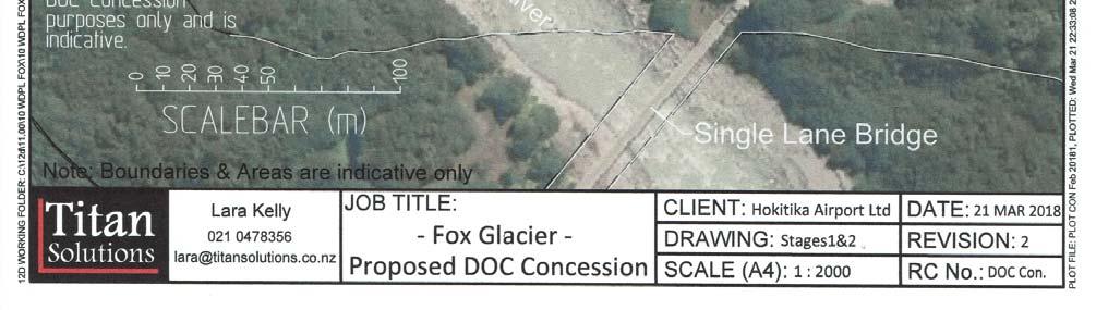
3 APPENDIX 1 Survey Plan - SO2474 close up Figure 2 - Survey Plan (SO2474) close up of the site with approximate boundary of site outlined in yellow (Stage 1) and green (Stage 2). The Plan is from 1925 and the area of the proposal was described as Felled and grassed.

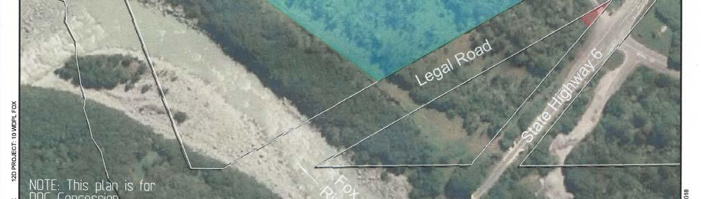
4 APPENDIX 2 DOC Map of the Site Figure 3 - DOC GIS system map showing the approximate boundaries of the proposed site outlined in black. The proposal extends over two separate allotments which are divided by Legal Road. Both allotments are DOC administered and are under the same appellation being Crown Land Survey Office (SO) Plan 2474.


5 APPENDIX 3 - SITE PLANS Figure 4 - Plan of the Concession (Stages 1 & 2)


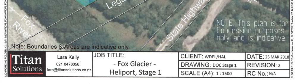
6 Figure 5 - Close up Plan of the Proposal for Stage 1
 by the yellow outlined area (Stage 1) and the green area (Stage 2).")
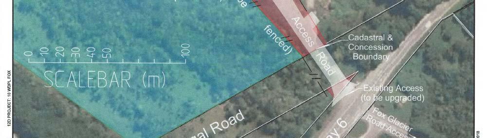
7 APPENDIX 4 OBLIQUE VIEW OF THE SITE Figure 6 - Oblique view of the site. The site is indicated (approximate only) by the yellow outlined area (Stage 1) and the green area (Stage 2). The access from SH6 is indicated in red. (Source: Google Earth)


8 APPENDIX 5 Photos of the Site Figure 7 - Standing near the Fox Glacier access road on SH6, looking north. The Site access is to the left of the photo. Figure 8 - On the east side of SH6 (near the Fox Glacier access road) looking northwest at the existing access to the site.


9 Figure 9 - On the site near the Green Waste Area looking south. Figure 10 - On the Site near the Green Waste Area looking up to the Fox Glacier (looking south).


10 Figure 11 On Site, near the Green Waste Area a Panoramic View looking south. Figure 12 - On site near the access to the Green Waste Area, looking northwest.


11 Figure 13 - Aerial view of the site from a helicopter. The yellow lines are the approximate boundaries of the site Stage 1 and the green outline Stage 2. The photo is taken east of the site (approximately over SH6, the Road is visible) looking southwest. Figure 14 - Aerial View of the site with the approximate existing flight paths (from/to the Fox Glacier) in blue. The approximate proposed flights paths are shown in red. Please note this is indicative only.


12 Figure 15 - Aerial view of the immediate area with the Green Waste Area clearly visible. Figure 16 - Photo from SH6 Bridge over Fox River, looking north over the site. (Source: Google Earth)
")
13 Figure 17 - photo from further along the SH6 Bridge looking north over the site. (Source: Google Earth)

14 APPENDIX 6 NZTA Access Upgrade Figure 18 NZTA Diagram E with site specific modifications of existing Fox Glacier Access Road & 60m widening requirements. Figure 19 - NZTA Diagram E


15 APPENDIX 7 Shelters Figure 20 - Example of what the Shelters (two are proposed) for waiting passengers would look like. Note this is indicative only.
16 APPENDIX 8 RD Petroleum Figure 21 - Letter from RD Petroleum Page 1 of 3
17 Figure 22 - Letter from RD Petroleum Page 2 of 3
18 Figure 23 - Letter from RD Petroleum Page 3 of 3

19 Figure 24 - RD Petroleum specific design requirements for the fuel tank.

20 APPENDIX 9 CAA Notice of Proposal to construct Heliport Figure 25 - CAA Notice of the Proposal (currently being processed by CAA)
21 APPENDIX 10 Granted WDC Resource Consent Figure 26 - Granted WDC Consent Page 1 of 6
22 Figure 27 - Granted WDC Consent Page 2 of 6
23 Figure 28 - Granted WDC Consent Page 3 of 6
24 Figure 29 - Granted WDC Consent Page 4 of 6

25 Figure 30 Granted WDC Consent Page 5 of 6

26 Figure 31 Granted WDC Consent Page 6 of 6
27 APPENDIX 11 Noise Assessment Malcolm Hunt Associates NOTE: attached as a separate pdf document labelled HAL DOC Concession Fox Appendix 11 Noise Assessment.pdf APPENDIX 12 Ecological Assessment OPUS NOTE: attached as a separate pdf document labelled HAL DOC Concession Fox Appendix 12 Ecological Assessment.pdf
Table 1: Santiago Peak Communication Site. Latitude 1 Longitude 1 Elev 2 Address T/R/S 3 APN 4 USGS Quadrangle
 County of Riverside Public Safety Enterprise Communication Project Appendix A: Candidate Site Descriptions Overview The site is located in the Cleveland National Forest (CNF) at an existing communication
2018 Goldwedge Mines Inc. Licence of Occupation Management Plan. Photo: xxxx. Goldwedge Mines Inc.
 2018 2018 Goldwedge Mines Inc. Licence of Occupation Management Plan Photo: xxxx Goldwedge Mines Inc. March 2018 TABLE OF CONTENTS TABLE OF CONTENTS... i Figures... i 1. Background... 2 Project Overview...
DATE: April 19, 2016 REPORT NO. PW Chair and Members Committee of the Whole Operations and Administration
 PUBLIC WORKS COMMISSION DATE: April 19, 2016 REPORT NO. PW2016-034 TO: FROM: Chair and Members Committee of the Whole Operations and Administration E. (Beth) Goodger General Manager, Public Works Commission
Triangle Land Conservancy Conservation Area Monitoring Report Carolina North
 Triangle Land Conservancy Conservation Area Monitoring Report Carolina North Property Name: Crow Branch Conservation Area Date of visit: March 16, 2016 County: Orange Property Type: Restrictive Covenants
NOTICE OF REQUIREMENT: NZ TRANSPORT AGENCY: SH6 TARAMAKAU BRIDGE PROJECT
 1 July 2016 Planning Manager Westland District Council 36 Weld Street HOKITIKA Attn Alex Dunn Dear Alex NOTICE OF REQUIREMENT: NZ TRANSPORT AGENCY: SH6 TARAMAKAU BRIDGE PROJECT On 15 June 2016 you issued
FAA Airports GIS Program
 FAA Airports GIS Program Environmental Feature Classes for Airport Noise Michael T. McNerney, Ph.D., P.E. Office of Airports Airport Safety and Standards Airport Engineering Division Mike.mcnerney@faa.gov
2018 Nelson and Marlborough Airspace Review Initial consultation
 2018 Nelson and Marlborough Airspace Review Civil Aviation Authority Table of Contents 1. 2018 Nelson and Marlborough airspace review... 1 2. Review process... 1 Scope of review... 1 a) Airways Corporation
AERODROME LICENCE APPLICATION PROCESS
 0000180111 Page 2 Why is a Licence Required? An aerodrome licence is required for a site if it is intended to facilitate operations by commercial transport aircraft, other aerial work other than rotorcraft,
Triangle Land Conservancy Conservation Area Monitoring Report Carolina North
 Triangle Land Conservancy Conservation Area Monitoring Report Carolina North Property Name: Bolin Creek West Conservation Area Date of visit: March 16, 2017 County: Orange Property Type: Restrictive Covenants
Park Board Chair and Commissioners
 TO: FROM: Park Board Chair and Commissioners November 23, 2016 General Manager Vancouver Board of Parks and Recreation SUBJECT: Stanley Park Brewing at the Fish House Proposed Design and Lease Agreement
Triangle Land Conservancy Conservation Area Monitoring Report Carolina North
 Triangle Land Conservancy Conservation Area Monitoring Report Carolina North Property Name: Bolin Creek East Conservation Area Date of visit: 4/8/2015 County: Orange Property Type: Restrictive Covenants
Triangle Land Conservancy Conservation Area Monitoring Report Carolina North
 Triangle Land Conservancy Conservation Area Monitoring Report Carolina North Property Name: Bolin Creek East Conservation Area Date of visit: March 16, 2017 County: Orange Property Type: Restrictive Covenants
Regional Bird/Wildlife Strike Prevention Conference Conferencia de Prevención del Peligro Aviario y Fauna
 Regional Bird/Wildlife Strike Prevention Conference Conferencia de Prevención del Peligro Aviario y Fauna ICAO Regulations Land use / Reglamentos de OACI Utilización del terreno Jaime Calderon Regional
Grade Crossing Regulations
 Grade Crossing Regulations An Overview of Municipal Roles and Responsibilities at Federally Legislated Grade Crossings March 21, 2017 presentation to Alberta Municipal Supervisor Association, Edmonton,
General Summer and Winter Views
 ENVIRONMENTAL INFORMATION REPORT VOLUME 4 APPENDIX 11. 2 General Summer and Winter Views Table of Contents Section APPENDIX 11.2 Page 1 General Views... 1-1 Tansy Lane, Portishead... 1-2 Galingale Way,
Rating: 5.0 (scale of 1-10)
") 95 Community Trail System Groundcover: 2-metre paved path, 1- metre grass buffer on either side. Location: Fort St. John Ownership: City of Fort St. John Rating: 5.0 (scale of 1-10) Strategic value: Linear
95 Community Trail System Groundcover: 2-metre paved path, 1- metre grass buffer on either side. Location: Fort St. John Ownership: City of Fort St. John Rating: 5.0 (scale of 1-10) Strategic value: Linear
Triangle Land Conservancy Conservation Area Monitoring Report Carolina North
 Triangle Land Conservancy Conservation Area Monitoring Report Carolina North Property Name: Crow Branch Conservation Area Date of visit: 4/8/2015 County: Orange Property Type: Restrictive Covenants Local
Table 1: Iron Mountain Communication Site. Latitude 1 Longitude 1 Elev 2 Address T/R/S 3 APN 4 USGS Quadrangle
 County of Riverside Public Safety Enterprise Communication Project Appendix A: Candidate Site Descriptions Overview The site is located in San Bernardino County near several communication towers in the
Part 137. Agricultural Aircraft Operations. CAA Consolidation. 10 March Published by the Civil Aviation Authority of New Zealand
 Part 137 CAA Consolidation 10 March 2017 Agricultural Aircraft Operations Published by the Civil Aviation Authority of New Zealand DESCRIPTION Part 137 prescribes rules, that are additional to and exceptions
4KM Purple Zone Maximum Flight Altitude 300 feet (90 metres) amsl (above mean sea level). See attachment for specific restrictions
 amsl (above mean sea level). See attachment for specific restrictions") Risk Based Flight Restriction Zones for Remote Piloted Aircraft Systems (RPAS) and Unmanned Aerial Vehicle (UAV) Flights within a 4km radius of : The risk based flight restriction zones in this document
Risk Based Flight Restriction Zones for Remote Piloted Aircraft Systems (RPAS) and Unmanned Aerial Vehicle (UAV) Flights within a 4km radius of : The risk based flight restriction zones in this document
PROPOSED INVERCARGILL CITY DISTRICT PLAN. Decision No. 28G. Invercargill Airport Ltd Designations
 PROPOSED INVERCARGILL CITY DISTRICT PLAN Decision No. 28G Invercargill Airport Ltd Designations Hearings Committee Councillor Darren Ludlow (Chair) Councillor Neil Boniface Councillor Graham Sycamore Keith
Certification Specifications and Acceptable Means of Compliance for Aircraft Noise CS-36
 European Aviation Safety Agency Certification Specifications and Acceptable Means of Compliance for Aircraft Noise Amendment 3 29 January 2013 CONTENTS (general layout) AIRCRAFT NOISE PREAMBLE BOOK 1 NOISE
STRONGER CHRISTCHURCH INFRASTRUCTURE REBUILD TEAM (SCIRT) REAAA
 REAAA") STRONGER CHRISTCHURCH INFRASTRUCTURE REBUILD TEAM (SCIRT) REAAA 21 st August 2012 Context Legend Areas of observed liquefaction! Port Hills area Approx Scale 1:50,000 0 500 1000 1500 2000 2500 (m) Notes:
STRONGER CHRISTCHURCH INFRASTRUCTURE REBUILD TEAM (SCIRT) REAAA 21 st August 2012 Context Legend Areas of observed liquefaction! Port Hills area Approx Scale 1:50,000 0 500 1000 1500 2000 2500 (m) Notes:
Proposed restricted areas Alexandra, Central Otago airspace user consultation
 Proposed restricted areas Alexandra, Central Otago Civil Aviation Authority Table of Contents Introduction... 1 Proposed restricted area... 2 Possible effect to IFR aircraft... 3 Possible effect to VFR
Guidance material for land use at or near aerodromes
 Guidance material for land use at or near aerodromes Table of Contents Overview... 1 Glossary... 1 Types of Aerodromes... 1 Obstacle Limitation Surfaces... 2 Wildlife Hazard Management... 2 Notice of Intention
Marin County Fire Department. Fire Protection Standard 119. Tents and Awnings
 Page: 1 7 Scope: These standards shall apply to any temporary membrane structure, tent, or canopy, in accordance with the California Code Regulations (CCR) Title 19 and California Fire Code (CFC). Temporary
RECREATIONAL FIRES AND OPEN BURNING REGULATIONS
 RECREATIONAL FIRES AND OPEN BURNING REGULATIONS VILLAGE OF MAHOMET 503 EAST MAIN STREET P.O. BOX 259 MAHOMET, IL 61853 Phone: 217-586-4456 Fax: 217-586-5696 E-mail: villageofmahomet@mahomet-il.gov Website:
2016 Manawatu Airspace Review
 Civil Aviation Authority Table of Contents 1. 2015 Manawatu airspace review... 1 2. Review Process... 1 Scope of review... 1 a) Airways Corporation of New Zealand... 2 b) Aerodrome operators... 2 c) Airline
KSBP HIGH. San Luis County Rgnl Airport San Luis Obispo, California, United States
 Diagram #1: Runway 29 Departure Guide All Aircraft Categories / Runway 29 p. 1 of 8 Diagram #2: Runway 11 Departure Guide All Aircraft Categories / Runway 11 p. 2 of 8 NOISE ABATEMENT PROCEDURES by Whispertrack
IMAV 2015 Micro Aerial Vehicles Competition Security and Safety Regulations
 IMAV 2015 Micro Aerial Vehicles Competition Security and Safety Regulations Changelog: Version Changes 0.1 First draft version 0.2 Increased maximum take-off weight (5 kg), Update flight zones 0.3 Maximum
Topographic Maps. Background Sheet
 Topographic Maps History: Background heet The Articles of Confederation (1777) was ratified when western lands were yielded to the Federal Government. This yielding of land gave the Federal Government
Open Report on behalf of Richard Wills Executive Director for Communities. Planning and Regulation Committee. County Matter Application - S38/0590/13
 Agenda Item 5.10 Report Reference: 5.10 Regulatory and Other Committee Open Report on behalf of Richard Wills Executive Director for Communities Report to: Planning and Regulation Committee Date: 10 June
Aircraft landings in Aoraki/Mount Cook National Park
 Topic Paper: Aircraft landings in Aoraki/Mount Cook National Park 1. Purpose This paper: sets out the context for aircraft landings within Aoraki/Mount Cook National Park (the Park); and identifies specific
Draft Palo Alto Airport Master Plan Report County of Santa Clara, California October 2005
 Draft Palo Alto Airport Master Plan Report County of Santa Clara, California October 2005 County of Santa Clara Board of Supervisors Donald F. Gage Blanca Alvarado Peter A. McHugh James T. Beall, Jr. Liz
Sunshine Coast and Caloundra Airports Aircraft Noise Information Report
 Sunshine Coast and Caloundra Airports Aircraft Noise Information Report Quarter 1 2014 (January to March) 1 Version Control Version Number Detail Prepared by Date 1 - Environment June 2014 2 Updated text
The site is located on federal land managed by the USFS, and is subject to the San Bernardino National Forest Management Plan (SBNFMP).
.") County of Riverside Public Safety Enterprise Communication Project Appendix A: Candidate Site Descriptions Overview The site is located near an existing County communication tower and USFS lookout tower
County of Riverside Public Safety Enterprise Communication Project Appendix A: Candidate Site Descriptions Overview The site is located near an existing County communication tower and USFS lookout tower
Gold Coast Airport Aircraft Noise Information Report
 Gold Coast Airport Aircraft Noise Information Report Quarter 2 2014 (April to June) 1 Version Control Version Number Detail Prepared by Date 1 - Environment September 2014 Airservices Australia. All rights
Energy from Waste and Recycling Facility Trident Park, Cardiff. Planning History. January 2010 SLR Ref: B
 Energy from Waste and Recycling Facility Trident Park, Cardiff Planning History January 2010 Ref: 402-0036-0306B Viridor Ltd. i 402/0036/00306B CONTENTS 1.0 INTRODUCTION... 1 2.0 GENERAL HISTORY... 3
Wanaka Community Board 15 April Report for Agenda Item: 4
 Wanaka Community Board 15 April 2015 Department: Infrastructure Report for Agenda Item: 4 Mt Burke Station Stopping and Vesting of Road Purpose 1 To obtain the Board s support for a stakeholder agreement
Minutes of Committee Meeting 1 May 2016
 Minutes of Committee Meeting 1 May 2016 Minutes of Meeting Meeting Date & Time 1 May 2016, 4pm Title of Meeting: Committee Meeting #1 Meeting Location: Community Hall, Hahei Attendees: HBRPA: Guests: Chair
USE OF 3D GIS IN ANALYSIS OF AIRSPACE OBSTRUCTIONS
 USE OF 3D GIS IN ANALYSIS OF AIRSPACE OBSTRUCTIONS A project by by Samuka D. W. F19/1461/2010 Supervisor; Dr D. N. Siriba 1 Background and Problem Statement The Airports in Kenya are the main link between
Canberra Airport Aircraft Noise Information Report
 Canberra Airport Aircraft Noise Information Report Quarter 4 2015 (October to December) 1 Version Control Version Number Detail Prepared by Date 1 - Environment March 2016 Airservices Australia. All rights
Appendix F Public authorities responses
 Planning Proposal under sec 55 of the EP&A Act LEP Refinements Appendix F Public authorities responses Appendix F Public authorities responses Prior to public exhibition, consultation was made with the
Longmont to Boulder Regional Trail Jay Road Connection DRAFT FINAL REPORT
 Longmont to Boulder Regional Trail Jay Road Connection DRAFT FINAL REPORT December 2018 Project Summary Boulder County, Colorado, in partnership with the City of Boulder, is evaluating options for multi-use
2016 Waikato and Bay of Plenty Airspace Review v1.1
 2016 Waikato and Bay of Plenty Airspace Review v1.1 Civil Aviation Authority Table of Contents 1. 2016 Waikato and Bay of Plenty airspace review... 1 2. Review Process... 1 Scope of review... 1 a) Airways
Why build a third runway, when you can build a longer runway?
 Why build a third runway, when you can build a longer runway? Cheaper. Simpler. Politically Realistic. Cheaper. Simpler. Politically Realistic. We recommend that the Government selects our extended runway
Martin Pastucha, Director of Public Works/Airport Director
 Information Item Date: September 3, 2015 To: From: Subject: Mayor and City Council Martin Pastucha, Director of Public Works/Airport Director City s Response and Airport Commission s Recommendations to
Sunshine Coast and Caloundra Airports Aircraft Noise Information Report
 Sunshine Coast and Caloundra Airports Aircraft Noise Information Report Quarter 1 2015 (January to March) 1 Version Control Version Number Detail Prepared by Date 1 - Environment June 2015 Airservices
Planning Approval Consistency Assessment Form
 Integrated Management System Planning Approval Consistency Assessment Form SM ES-FT-414 Sydney Metro Integrated Management System (IMS) Applicable to: Document Owner: System Owner: Status: Sydney Metro
2016 TOURISM ATTACH SACE REGISTRATION NUMBER LABEL TO THIS BOX
 External Examination 2016 2016 TOURISM FOR OFFICE USE ONLY SUPERVISOR CHECK ATTACH SACE REGISTRATION NUMBER LABEL TO THIS BOX RE-MARKED Wednesday 16 November: 1.30 pm Time: 2 hours Pages: 13 Questions:
Part 26 CAA Consolidation 25 March 2010 Additional Airworthiness Requirements
 Part 26 CAA Consolidation 25 March 2010 Additional Airworthiness Requirements Published by the Civil Aviation Authority of New Zealand DESCRIPTION Part 26 prescribes rules for airworthiness requirements
Hang Gliding Near Camp 9 A Presentation by the Sylmar Hang Gliding Assoc.
 Hang Gliding Near Camp 9 A Presentation by the Sylmar Hang Gliding Assoc. For over 45 years, hang gliders have safely shared the skies above Sylmar with all airspace users and have a long history of cooperation
BRACEVILLE NATURE PRESERVE Introductions History Present Conditions Future Development Plans Implementation Strategies Statistics
 BRACEVILLE NATURE PRESERVE Introductions History Present Conditions Future Development Plans Implementation Strategies Statistics Introduction Braceville Nature Preserve is one of MetroParks largest preserves.
Doncaster Sheffield Airport Airspace Change Proposal for the Introduction of RNAV (GNSS) Departure and Approach Procedures ANNEX B TO PART B
 Departure and Approach Procedures ANNEX B TO PART B") Doncaster Sheffield Airport Airspace Change Proposal for the Introduction of RNAV (GNSS) Departure and Approach Procedures ANNEX B TO PART B ANNEX B TO PART B: Runway 20 Westerly Departure UPTON 2B 2 Contents
Doncaster Sheffield Airport Airspace Change Proposal for the Introduction of RNAV (GNSS) Departure and Approach Procedures ANNEX B TO PART B ANNEX B TO PART B: Runway 20 Westerly Departure UPTON 2B 2 Contents
Grade 5 Geography Term 1
 1 Grade 5 Geography Term 1 Contents Section 1: World map and compass directions... 2 The position of the equator and the North and South Poles on a globe... 2 The seven continents of the world... 3 The
Field Rules. Revised January NOTICE: Turbine powered aircraft of any kind are prohibited.
 Field Rules Revised January 2015 NOTICE: Turbine powered aircraft of any kind are prohibited. Use of the field: Flying field and facilities are for use by Members and Member Guests only. Spectators are
Figure 3.3 Panoramic photograph across the site
 ROYAL PIER WATERFRONT, SOUTHAMPTON Royal Pier Figure 3.3 Panoramic photograph across the site managed by ABP lies between Town Quay and Trafalgar Dock further to the east, and provides 140 berths. 3.14
Finchley and Golders Green Area Committee 27 April 2017
 Finchley and Golders Green Area Committee 27 April 2017 Title Report of Wards Status Urgent Key Enclosures Officer Contact Details Junction of Regents Park Road / Tillingbourne Gardens, N3 Commissioning
Establishing a new Aerodrome/Heliport in the AIPNZ
 Establishing a new Aerodrome/Heliport in the AIPNZ The Aeronautical Information Management (AIM) unit of Airways are responsible for publishing new aerodromes and heliports in the AIPNZ. Applicants are
Rocky Mountain National Park Hiking Map By Trails Illustrated Maps
 Rocky Mountain National Park Hiking Map By Trails Illustrated Maps 10 Great Hikes for Families with Kids in Estes Park, Colorado - Choose from plenty of great family hikes in Rocky Mountain National park.
Sunshine Coast and Caloundra Airports Aircraft Noise Information Report
 Sunshine Coast and Caloundra Airports Aircraft Noise Information Report Quarter 3 2015 (July to September) 1 Version Control Version Number Detail Prepared by Date 1 - Environment December 2015 Airservices
Freedom Camping Policy
 Freedom Camping Policy Adopted Council 17 December 2010 See following page for policy. 2010 Page1 - Page2 f camping - priv follow. areas waur enjoy. Page3 residents.. beaches, rubbish hot-spots. campers
Sunshine Coast Airport Master Plan September 2007
 Sunshine Coast Airport Master Plan September 2007 Contents CONTENTS... I ACKNOWLEDGEMENT... II DISCLAIMER... III 1 EXECUTIVE SUMMARY...IV 1 INTRODUCTION... 1 2 AVIATION DEMAND FORECAST... 5 3 AIRCRAFT
AERONAUTICAL INFORMATION SERVICES-AERONAUTICAL INFORMATION MANAGEMENT STUDY GROUP (AIS-AIMSG)
") AIS-AIMSG/11-SN/6 20/04/2015 AERONAUTICAL INFORMATION SERVICES-AERONAUTICAL INFORMATION MANAGEMENT STUDY GROUP (AIS-AIMSG) Agenda Item 4: Information Distribution 4.1: AIP ELEVENTH MEETING Montreal, April
AIS-AIMSG/11-SN/6 20/04/2015 AERONAUTICAL INFORMATION SERVICES-AERONAUTICAL INFORMATION MANAGEMENT STUDY GROUP (AIS-AIMSG) Agenda Item 4: Information Distribution 4.1: AIP ELEVENTH MEETING Montreal, April
Committee. Presentation Outline
 CW-33-15 11/9/2015 Community and Corporate Services Committee November 10, 2015 1 Presentation Outline Background Vision and Objectives Study Process and Timeline Public and Stakeholder Engagement Organization
APPENDIX. Alberta Land Stewardship Act AMENDMENTS TO THE SOUTH SASKATCHEWAN REGIONAL PLAN
 APPENDIX Alberta Land Stewardship Act AMENDMENTS TO THE SOUTH SASKATCHEWAN REGIONAL PLAN 1 All references to Alberta Environment and Sustainable Resource Development, Environment and Sustainable Resource
Airspace Change Consultation
 Airspace Change Consultation Glasgow Prestwick Airport is undergoing an Airspace Change Process. This is a programme many UK airports are undertaking. It is needed because of the removal of old navigation
CRD NPA 05/ / Theisen Andre-Cargolux Airlines S.A. (No paragraph affected). Header on pages 2, 3, 5, 6 and 7. Text changed.
. Header on pages 2, 3, 5, 6 and 7. Text changed.") CRD NPA 05/2004 Comment Response 001/ Theisen Andre-Cargolux Airlines S.A. (No paragraph affected). Header on pages 2, 3, 5, 6 and 7 Text changed. Change Header on the affected pages to read NPA No 5/2004.
CRD NPA 05/2004 Comment Response 001/ Theisen Andre-Cargolux Airlines S.A. (No paragraph affected). Header on pages 2, 3, 5, 6 and 7 Text changed. Change Header on the affected pages to read NPA No 5/2004.
Dividing Lake Provincial Nature Reserve
 - Do Not Remove i, '" i ' Dividing Lake Provincial Nature Reserve I!.' Interim Management Statement Amendment 2001-001 Park Boundary Amendment Approved: r.in'r entral Zone, Ontario Parks PJ Date 2. ()/
ENTER EXCEPTIONAL RESIDENTIAL DEVELOPMENT OPPORTUNITY
 FOR SALE Aviator Park, Station Road, Addlestone, Surrey KT15 2PG ibrochure - www.cbre-ibrochure.co.uk/addlestone ENTER EXCEPTIONAL RESIDENTIAL DEVELOPMENT OPPORTUNITY LOCATED WITHIN THE HIGHLY DESIRABLE
CHAPTER 6 NOISE EXPOSURE
 CHAPTER 6 NOISE EXPOSURE FAA requires that the NEM submitted for review represent the aircraft noise exposure for the year of submittal (in this case 2008) and for a future year (2013 for OSUA). However,
AWP ACIP DATA SHEET. $100,000 $5,263 $105,263 Access Road Project
 Fiscal Year 2011 Approved P Airport Layout Plan (ALP) Diagram Update 75,000 3,947 78,947 D Design Electrical, and Pavement Improvements 75,000 3,947 78,947 Include Construction Safety Plans E Environmental
Whangarei Airport. Prepared by Carine Andries 10/20173
 Whangarei Airport Prepared by Carine Andries 10/20173 March 2010 TABLE OF CONTENTS 1 2 3 INTRODUCTION... 3 AIRPORT ROLE AND FUNCTION... 3 AIRPORT FEATURES AND CAPACITY... 3 3.1 3.2 3.3 3.4 3.5 3.5.1 3.5.2
NZQA registered unit standard version 2 Page 1 of 8. Demonstrate flying skills for a commercial pilot licence (aeroplane)
") Page 1 of 8 Title Demonstrate flying skills for a commercial pilot licence (aeroplane) Level 5 Credits 10 Purpose People credited with this unit standard are able, for a commercial pilot licence (aeroplane),
Page 1 of 8 Title Demonstrate flying skills for a commercial pilot licence (aeroplane) Level 5 Credits 10 Purpose People credited with this unit standard are able, for a commercial pilot licence (aeroplane),
PERTH AND KINROSS COUNCIL
 PERTH AND KINROSS COUNCIL Fossoway Llp Eko Planning FAO Nicholas Lawrence North Bridge Studios 28 North Bridge Edinurgh EH1 1QG Pullar House 35 Kinnoull Street PERTH PH1 5GD Date 31 May 2012 Town and Country
Table 1: Avocado Flats Communication Site. Latitude 1 Longitude 1 Elev 2 Address T/R/S 3 APN 4 USGS Quadrangle
 County of Riverside Public Safety Enterprise Communication Project Appendix A: Candidate Site Descriptions Overview The candidate area is located in Northern San Diego County, 0.65 mile south of the border
RE: Extreme Avalanche Hazard at New Jumbo Glacier Resort (JGR) Daylodge Building Site
 Daylodge Building Site") To: Ms. Autumn Cousins Manager, Policy and Compliance BC Environmental Assessment Office, via Email to autumn.cousins@gov.bc.ca and eao.compliance@gov.bc.ca PO Box 9426 Stn Prov Govt Victoria, BC V8W 9V1
To: Ms. Autumn Cousins Manager, Policy and Compliance BC Environmental Assessment Office, via Email to autumn.cousins@gov.bc.ca and eao.compliance@gov.bc.ca PO Box 9426 Stn Prov Govt Victoria, BC V8W 9V1
Public Review Draft South County Airport Master Plan Report. County of Santa Clara San Martin, California
 Public Review Draft South County Airport Master Plan Report County of Santa Clara San Martin, California July 2005 County of Santa Clara Board of Supervisors Donald F. Gage Blanca Alvarado Peter A. McHugh
April 10, Mark Stiles San Juan Public Lands Center Manager 15 Burnett Court Durango, CO Dear Mark,
 Mark Stiles San Juan Public Lands Center Manager 15 Burnett Court Durango, CO 81301 Dear Mark, We are pleased to offer the following comments on the draft San Juan Public Lands Center management plans
Perth and Kinross Council Development Control Committee 27 August 2008 Recommendation by Development Quality Manager
 Perth and Kinross Council Development Control Committee 27 August 2008 Recommendation by Development Quality Manager 5(7) 08/414 Erection of kennels and cattery at Baltree Farm, Hatchbank, Kinross, KY13
ARKANSAS POLLUTION CONTROL AND ECOLOGY COMMISSION REGULAR COMMISSION MEETING Friday, April 27, :00 a.m.
 ARKANSAS POLLUTION CONTROL AND ECOLOGY COMMISSION REGULAR COMMISSION MEETING Friday, April 27, 2018 9:00 a.m. ARKANSAS DEPARTMENT OF ENVIRONMENTAL QUALITY 5301 NORTHSHORE DRIVE NORTH LITTLE ROCK, ARKANSAS
Proposed Action Kaibab Campground Capital Improvement Project September 2008
 Background Kaibab Campground Capital Improvement Project September 2008 The Williams Ranger District of the Kaibab National Forest is proposing to improve the Kaibab Lake Campground. Kaibab Lake Campground
2.0 Historical Summary
 2.0 Historical Summary 2.1 Introduction The following historical analysis contributes to the assessment of cultural significance of the site at 753 755 Darling Street Rozelle. The information is drawn
ERIE INTERNATIONAL AIRPORT MASTER PLAN TABLE OF CONTENTS
 EXECUTIVE SUMMARY ERIE INTERNATIONAL AIRPORT MASTER PLAN TABLE OF CONTENTS PAGE NO. CHAPTER 1-INTRODUCTION... 1-1 1.01 General...1-1 1.02 Purpose and Scope of Study...1-1 1.03 The Planning Process...1-2
APPENDIX 18-D 2010 AND 2011 MOUNTAIN GOAT AERIAL SURVEYS, BRUCEJACK PROJECT
 APPENDIX 18-D 2010 AND 2011 MOUNTAIN GOAT AERIAL SURVEYS, BRUCEJACK PROJECT TM 1. Introduction Mountain goat (Oreamnos americanus) surveys were conducted for the Brucejack Project in 2010 and 2011. The
Panoramic Views ~11,800 SF Lodge Office & Barns Borders to Mark Twain National Forest. Contact RE Bid Sales for Property & Auction Info, Terms, Etc.
 ELK MOUNTAIN RANCH: For Immediate Sale 800 ACRES WITH LODGE SHANNON COUNTY, MO BUY NOW: Bidding Open, Sellers May Sell Immediately LIVE AUCTION: Feb. 7, 2014 Panoramic Views ~11,800 SF Lodge Office & Barns
AQ8.1 NOTE that a fire permit is also required for all fires in rural areas (contact the Waimea rural fire authority)
") guide to outdoor burning (rural) AQ8.1 NOTE that a fire permit is also required for all fires in rural areas (contact the Waimea rural fire authority) AQ8.2 Burning of vegetation, cardboard, paper and
guide to outdoor burning (rural) AQ8.1 NOTE that a fire permit is also required for all fires in rural areas (contact the Waimea rural fire authority) AQ8.2 Burning of vegetation, cardboard, paper and
13 November Ken Young using auger from tractor pto, assisted by Gerry Kenney
 13 November 2010. Ken Young using auger from tractor pto, assisted by Gerry Kenney 13 November 2010. Ken Young using a cutting torch to sever gas well pipe into sections suitable for the 6 corner posts
Washington Dulles International Airport (IAD) Aircraft Noise Contour Map Update. 6th Working Group Briefing 1/7/19
 Aircraft Noise Contour Map Update. 6th Working Group Briefing 1/7/19") Washington Dulles International Airport (IAD) Aircraft Noise Contour Map Update 6th Working Group Briefing 1/7/19 Study Purpose Agenda Background Summary of last stakeholder meetings Refresher on DNL,
Washington Dulles International Airport (IAD) Aircraft Noise Contour Map Update 6th Working Group Briefing 1/7/19 Study Purpose Agenda Background Summary of last stakeholder meetings Refresher on DNL,
Air Navigation (Amendment) Order Guidance for small unmanned aircraft users
 Order Guidance for small unmanned aircraft users") July 2018 Air Navigation (Amendment) Order 2018 - Guidance for small unmanned aircraft users Introduction On 30 May 2018, the United Kingdom Government published an amendment to the UK Air Navigation Order
July 2018 Air Navigation (Amendment) Order 2018 - Guidance for small unmanned aircraft users Introduction On 30 May 2018, the United Kingdom Government published an amendment to the UK Air Navigation Order
July 2008 COMPANY INDOCTRINATION TRAINING 1.0 PURPOSE
 ADVISORY CIRCULAR CAA-AC-OPS009A July 2008 COMPANY INDOCTRINATION TRAINING 1.0 PURPOSE This Advisory Circular (AC) specifies the objectives and content of company indoctrination curriculum segments applicable
Updates to Procedures at St. John s International Airport
 October 10, 2017 Updates to Procedures at St. John s International Airport This document provides notice of upcoming changes to instrument procedures being implemented by NAV CANADA at the St. John s International
RED ATLAS PRODUCT BROCHURE. From Nevalee Business Solutions
 RED ATLAS PRODUCT BROCHURE From Nevalee Business Solutions CONTENTS OVERVIEW... 3 FUNCTIONS... 3 BACKGROUND... 3 ATC... 4 OPERATIONS... 5 ACCOUNTS... 6 REPORTING... 7 CONSULTING... 8 2 OVERVIEW Red Atlas
Safety Management 1st edition
 Annex 19 Safety Management 1st edition ISM Integrated Safety Management 10 June 2013 initial version Page 1 Why a new Annex? Page 2 Why a New Annex? The ICAO High-level Safety Conference (HLSC) held in
LANCASTER AIRPORT DRIVER TRAINING PROGRAM
 LANCASTER AIRPORT DRIVER TRAINING PROGRAM INTRODUCTION 1. Airfield Driving Basics 2. Movement / Non-Movement Area 3. Airfield Signs, Markings & Lighting 4. Airfield Communications 5. Aviation Phonetics
Report of the Strategic Director Place to the meeting of Bradford East Area Committee to be held on 11 July 2017.
 Report of the Strategic Director Place to the meeting of Bradford East Area Committee to be held on 11 July 2017. Subject: C PETITION RAGLAN TERRACE Summary statement: This report considers a petition
MODEL AERONAUTICAL ASSOCIATION OF AUSTRALIA
 MODEL AERONAUTICAL ASSOCIATION OF AUSTRALIA GENERAL RULES AND GUIDELINES FOR THE OPERATION OF MODEL AIRCRAFT MOP014 APPROVED: MAAA PRESIDENT Date: 31/10/2017 Paragraph 2.0 Definitions Brief description
Meteor Building, St Mary's Row, Moseley, Birmingham, B13 9EG
 Committee Date: 16/10/2014 Application Number: 2014/01972/PA Accepted: 24/03/2014 Application Type: Variation of Condition Target Date: 23/06/2014 Ward: Moseley and Kings Heath Meteor Building, St Mary's
Kinder Morgan Canada Trans Mountain Pipeline Expansion Project
 Kinder Morgan Canada Trans Mountain Pipeline Expansion Project Lands Taken Up Inventory May 2015 LIMITATION Information collected for this Study is the sole property of the Michel First Nation. The information
DOWNLOAD OR READ : AMSTERDAM CITY STREETS PDF EBOOK EPUB MOBI
 DOWNLOAD OR READ : AMSTERDAM CITY STREETS PDF EBOOK EPUB MOBI Page 1 Page 2 amsterdam city streets amsterdam city streets pdf amsterdam city streets You can use this Amsterdam map to find your favourite