Yale Lake IP Road Trail
|
|
|
- Merryl Lawrence
- 5 years ago
- Views:
Transcription
1 Yale Lake IP Road Trail Implementation Plan Prepared For PacifiCorp 825 NE Multnomah St. Portland, OR Prepared By David Evans and Associates, Inc SW River Parkway Portland, OR Flowing Solutions, LLC 3305 SW 87 th Avenue Portland, OR GRI 9725 SW Beaverton-Hillsdale Highway Suite 140 Beaverton, OR December, 2012
2 Yale Lake IP Road Project Implementation Plan TABLE OF CONTENTS 1. EXECUTIVE SUMMARY PROJECT OVERVIEW ASSESSMENT CONCLUSIONS PROPOSED TRAIL PROJECT AREA EXISTING CONDITIONS Road Slumps North Landslide Rockfall and Small Landslide Slope Erosion IMPLEMENTATION Parking Lot and Trailhead Road Slumps North Landslide Rockfall and Small Landslide Slope Erosion Implementation Schedule APPENDICES... 7 APPENDIX A YALE LAKE IP ROAD TECHNICAL ASSESSMENT REPORT SEPTEMBER, APPENDIX B PROPOSED TRAIL, PARKING LOT AND TRAILHEAD IMPROVEMENTS... APPENDIX C LEWIS RIVER RECREATION COMMITTEE (LRC) COMMENT MATRIX... APPENDIX D LANDOWNER CONSULTATION... LIST OF FIGURES Figure 1: Slumped and Rutted Pavement Areas in Segment Figure 2: North Landslide... 4 Figure 3: Examples of Larger Rockfalls (2 views)... 5 December 2012 Page i


.")


.")


3 Yale Lake IP Road Projectt Implementation Plan 1. EXECUTI IVE SUMMARY 1.1 PROJECT OVERVIEW The Yale Lake IP Road Trail project is a Federal Energyy Regulatory Commission license requirement for the Yale Hydroelectric Project on the Lewis River. On June 26, 2008, the Federal Energy Regulatory Commission issued a new operating license for PacifiCorp Energy s Yale Hydroelectric Project (P-2071). Article 406, Yale/International Paper (IP) Road Trail Plan, of this license directs PacifiCorp to complete a trail technical assessment for approximately ten miles of former logging road on the eastern shore of Yale Lake, by the fourth anniversary of issuance of the new license (Decemberr 26, 2012). Furthermore, on June 28, 2012 PacifiCorp received an order granting an extension of time to submit for Commission approval by March 1, Much of this road has been closed since 2008 due to illicit activities and unsafe road conditions caused by erosion, landslides, and rock fall hazards. Prior to the Implementation Plan, a was completed in September 2011 (Appendix A) in order to provide more detailed locations, identification, and assessment of the hazards identified in the preliminary site reconnaissanc ce conductedd on September 14, 2011, and to assess if the IP Road can be used in its current condition as a new trail on the eastern side of the December 2012 Page 1


, will not allow")


4 Yale Lake IP Road Project Implementationn Plan reservoir. This document describes an implementation plan to construct improvements based upon results of the technical assessment. The construction is limited to improvements upon PacifiCorp property and focusess on improvements necessary to providee a usable trail. The proposed trail is 3.75 miles in length. A trail head will be developed with parking, vault toilet, picnic table and informational kiosk. The trail will allow biking, butt will requiree dismounting at certain stream crossings. Non-motorized access to additional shorelinee area is available but due to land owner concerns, the trail is not developed off of PacifiCorp property. The proposed trail alignment is shown in Appendix B. 1.2 ASSESSMENT The presents the analysis of Yale Lake IP Road in four segments. The Assessment indicates that the road has greatly deteriorated since 2004 due to major storm events which destroyed multiple sections of the road, i.e. road slumps, landslides, rockfall and slope erosion. In addition, adjacent landowners, including Washingtonn Department of Natural Resources and Weyerhaeuser (Appendix D), will not allow PacifiCorp too secure a public access easement for trail improvements across their lands. Segments three and fourr contain far greater portions of destroyed road and adjacent landowner constraints then segments onee and two. Based on the resultss of the, the recommended approach is to provide a 3.75 mile trail (7.5 mile round trip). The major components include repairs to areas impacted by landslides and rockfall as well some minor pavement repairs to the existing roadway to provide a minimum of an 8-foot wide paved trail that will accommodate two-way bicycle traffic. Slope erosion Page 2 December 2012
5 Yale Lake IP Road Project Implementation Plan will not be addressed at this time as those are improvements that are not essential to the trail in the short term but may be necessary in the future. 1.3 CONCLUSIONS PacifiCorp maintains the proposed Yale Lake IP Road Trail is consistent with section of the Lewis River Settlement Agreement which directs PacifiCorp to use best reasonable efforts, at the lowest cost possible, to secure a non-motorized multi-use recreational access on the entire extent of the Yale Lake IP Road. If a continuous trail is not achievable in the near term, the company shall pursue an out-and-back trail. In addition, the proposed trail is consistent with Lewis River Settlement Agreement stakeholders intent to create a designated trail opportunity on the Yale Lake IP Road that will be maintained for the life of the Yale license. The major features of project implementation include: Utilizing the existing roadway prism for the trail alignment minimizes environmental, right-of way, hydrologic and geotechnical impacts. The existing roadway prism will accommodate a trail typical section consisting of, at minimum, an 8-foot wide path with two-foot shoulders for two-way bicycle and pedestrian traffic for the majority of the trail. Constructing a parking lot with 12 parking spots and trailhead with kiosk, toilet and other amenities at the north end of the trail. 2. PROPOSED TRAIL 2.1 PROJECT AREA The project area extends from just south of the Lewis River Bridge to an area approximately 3.75 miles south where the existing roadway has been washed out by a large debris flow that occurred in January The majority of the trail is located on property owned by PacifiCorp but there are portions that are on State and Federal land. All of the major trail improvements and work will be within PacifiCorp property with the exception of a couple of areas where rockfall debris needs to be moved or removed. Actions taken on non-pacificorp properties will only be done with landowner permission. Maps showing the location of required improvements are shown in Appendix B. 2.2 EXISTING CONDITIONS The trail route currently contains a variety of roadway and geotechnical issues that must be addressed in order to establish a multi-use trail Road Slumps Road slumps were observed in several areas of the alignment adjacent to the lake shore in areas with relatively steep hillside cut/fill slopes. The road slumps are typically identified by ground cracks on the downhill side of the road. An approximate 200-foot-long set of ground cracks is located just north of the landslide blocking access to the remainder of the southern portion of the road at Station December 2012 Page 3


 trail through the")


6 Yale Lake IP Road Project Implementationn Plan Figure 1: Slumped and Rutted Pavement Areas in Segment North Landslide This landslide located at approximate Station represents the first location blocking vehicular access past the gate at the north end of the trail. The landslide blocks about 100 to 150 feet of the trail, extends about 60 to 80 feet up from the road, and about 30 to 50 feet down to the lake. The estimated volume of landslide material is 500 cubic yards. Preliminary field observations indicate the landslide removed significant portions of the soil overburden down n to the underlying rock surface. Access to the landslide is currently limited to a narrow (several feet wide) trail through the landslide debris. Figure 2: North Landslide Rockfall and Small Landslide Approximately seven separate rockfall areas are present, including portions of the road owned by others (identified in Appendix B). The rockfall debris consists of cobble- to boulder-size material Page 4 December 2012
 of the road alignment.")


 of slope erosion that")


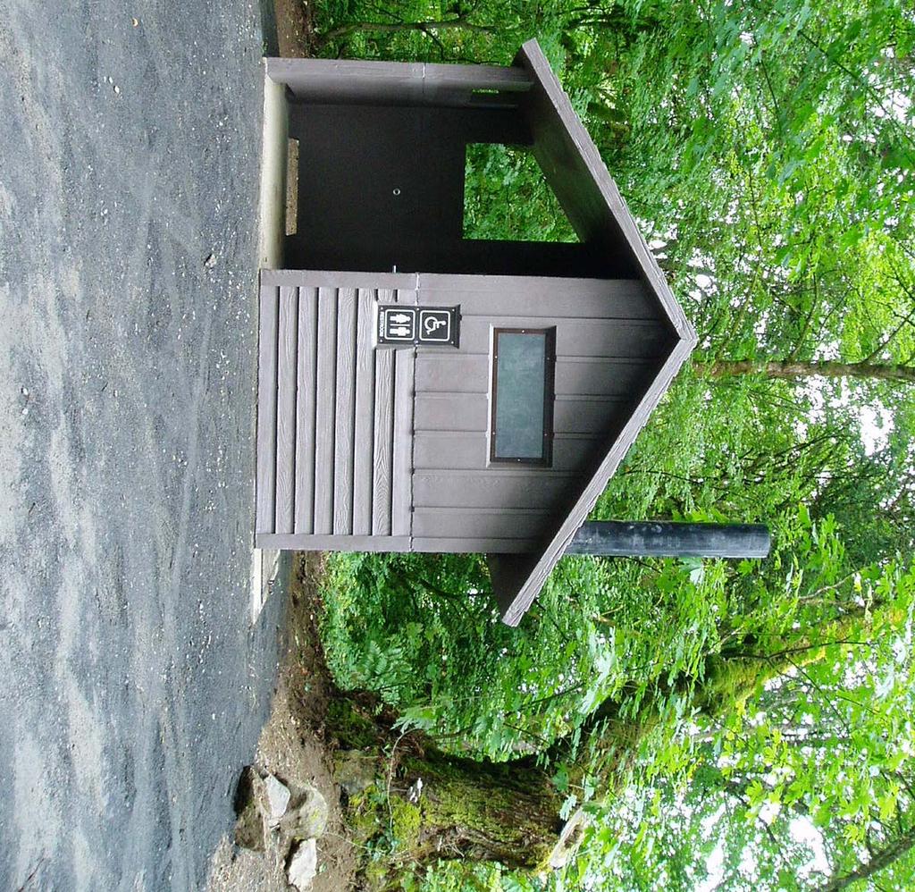
7 Yale Lake IP Road Projectt Implementation Plan originating from the rock slope on the uphill (east side) of the road alignment. Larger rockfall with pieces in excess of 10 cubic yards are present in at least two locations along the segments. In some areas, outcrops that are several hundred feet high are thee source of the rockfall. The estimated amount of rockfall debris on the trail or within the catchment areas is on the order of 500 cubic yards. One small landslide with on the order of 50 cubic yards of debris is also present. Figure 3: Examples of Larger Rockfalls (2 views) Slope Erosion There are approximately 1,300 linear feet (LF) of slope erosion that varies from minor to severe. There are several different remedies that can be considered for repair or improvement of existing conditions. Some remedies should be combined for areas of severee erosion while some areas with minor erosion may require no action. 2.3 IMPLEMENTATION Parking Lot and Trailhead The proposed trail does not connect to any other bike and pedestrian trails and will have no outlet. Therefore, this plan includes a parking lot and trailhead at the north end of the project area. The parking lot will accommodate 12 vehicles and will include an information kiosk at trailhead as well as a vault toilet, as shown in Appendix B. Information provided at the kiosk will include a trail map, general rules and notice to users of natural conditions that may pose a hazard along the trail. Vehicular traffic access beyond the parking lot will be deterred by the use of bollards or by utilizing rockfall to strategically place boulders in the roadway. The same type of treatment is proposed at the terminus of the trail to deter trail user access beyond thee designated area Road Slumps The least expensive and most feasible remediation alternative to increase the stability of these slumps will likely be to remove or replace plugged or damagedd culverts, improve the uphill drainage, and re- is grade the areas of slope movement to reduce the potential for future ground movement. If a culvert removed a creek crossing may be required. December 2012 Page 5
8 Yale Lake IP Road Project Implementation Plan This project will close and re-grade the ground cracks with mechanical effort to improve culvert function and uphill drainage where surface water is observed to pond North Landslide This project will provide an eight-foot paved trail with one-foot shoulders through this portion of the trail. This width is sufficient to allow two pedestrians to walk side by side but would require bicyclists to use caution. Signage will be required to alert bicyclists to the narrow passage. Some selective regrading, mechanical scaling, and rockfall mitigation will also likely be required for the upslope portion of the landslide to improve safety through the landslide area. On the order of 50 to 100 cubic yards of mechanical scaling above the road is anticipated. Down slope material will be left in place. Additional geotechnical field work (test pits and additional mapping) will be completed as needed to better define quantities and establish toe conditions for repair slope. The field work will help evaluate suitability of on-site materials for use as structural fill Rockfall and Small Landslide This project will clear accumulated rockfall and loose landslide debris from ditch areas and reestablish catchment areas. Scaling and installation of rockfall nets or rock bolts may be appropriate for certain areas with higher risk Slope Erosion In areas of severe erosion it is recommended that the trail alignment shift as far away from the shoreline as possible and if necessary narrowed to allow for safe passage Implementation Schedule Upon Commission approval of the IP Road Trail Implementation Plan, PacifiCorp proposes the following schedule: 12/31/13 Complete all required environmental and land use permitting, right-of-way easements, geotechnical exploration and culvert and hydraulic assessments necessary prior to construction. 12/31/14 Receive all necessary federal, state and county permits from regulatory agencies. 12/31/15 Complete construction of the proposed Yale Lake IP Road Trail. Page 6 December 2012
9 Yale Lake IP Road Project Implementation Plan 3. APPENDICES December 2012 Page 7
10 Yale Lake IP Road Project Implementation Plan Appendix A Yale Lake IP Road: September 2011
11 Yale Lake IP Road Prepared For PacifiCor p 825 NE Multnomah St. Portland, OR Prepared By David Evans and Associates, Inc SW River Parkway Portland, OR September, 2011
12 Yale Lake IP Road Project TABLE OF CONTENTS 1. PROJECT OVERVIEW BACKGROUND TECHNICAL ASSESSMENT OVERVIEW Roadway and Shoreline Culvert Assessment Geotechnical Hydrologic and Hydraulic Assessment Environmental Assessment SEGMENT 1 ( IP 0+00 TO IP 40+00) SEGMENT DESCRIPTION LEWIS RIVER BRIDGE TO LANDSLIDE ROADWAY ASSESSMENT CULVERT ASSESSMENT GEOTECHNICAL ASSESSMENT HYDROLOGIC AND HYDRAULIC ASSESSMENT ENVIRONMENTAL ASSESSMENT SEGMENT 2 ( IP TO IP ) SEGMENT DESCRIPTION LANDSLIDE TO CANYON WASHOUT ROADWAY ASSESSMENT CULVERT ASSESSMENT GEOTECHNICAL ASSESSMENT HYDROLOGIC AND HYDRAULIC ASSESSMENT ENVIRONMENTAL ASSESSMENT SEGMENT 3 ( IP TO IP ) SEGMENT DESCRIPTION CANYON WASHOUT TO SIOUXON BRIDGE ROADWAY ASSESSMENT CULVERT ASSESSMENT GEOTECHNICAL ASSESSMENT HYDROLOGIC AND HYDRAULIC ASSESSMENT ENVIRONMENTAL ASSESSMENT SEGMENT 4 ( IP TO IP ) SEGMENT DESCRIPTION - SIOUXON BRIDGE TO TRAIL END ROADWAY ASSESSMENT CULVERT ASSESSMENT GEOTECHNICAL ASSESSMENT HYDROLOGIC AND HYDRAULIC ASSESSMENT ENVIRONMENTAL ASSESSMENT September 2011 Page i
13 YALE LAKE IP ROAD PROJECT 6. BRIDGE ASSESSMENT SIOUXON CREEK BRIDGE Conclusion Recommendations LEWIS RIVER BRIDGE Conclusion Recommendations APPENDICES...35 APPENDIX A - SEGMENT MAP APPENDIX B - GEOTECHNICAL EXHIBITS LIST OF TABLES Table 1: Culvert Assessment... 3 Table 2: Hydrologic and Hydraulic Assessment... 4 Table 3: Environmental Regulations Potentially Affecting Trail Construction... 5 Table 4: Segment 1 Culvert Assessment... 9 Table 5: Segment 1 Hydrologic and Hydraulic Assessment Table 6: Segment 2 Culvert Assessment Table 7: Segment 2 Hydrologic and Hydraulic Assessment Table 8: Segment 3 Culvert Assessment Table 9: Segment 4 Hydrologic and Hydraulic Assessment Table 10: Segment 4 Culvert Assessment Table 11: Segment 4 Hydrologic and Hydraulic Assessment Page ii September 2011
14 Yale Lake IP Road Project LIST OF FIGURES Figure 1: Toe Erosion in Segment Figure 2: Slide Area in Segment Figure 3: Adequate Condition Area in Segment Figure 4: Slump of Downhill Fill Slope Figure 5: Poor Ditch Drainage Due to Blocked Culvert Figure 6: Slope Uphill of Landslide Figure 7: Landslide Debris in Lake Figure 8: Slumped and Retted Pavement Area in Segment Figure 9: Slope Failure Area in Segment Figure 10: Bank Erosion Area in Segment Figure 11: Rock Fall and Other Debris Area in Segment Figure 12: Pavement in Good Condition in Segment Figure 13: Typical Rockfall Debris Figure 14: Example of Larger Rockfall Debris Figure 15: Slope Failure at Approximate Station (2 views) Figure 16: Slope Failure at Approximate Station (2 views) Figure 17: Slope Failure at Approximate Station Figure 18: Slide Area in Segment Figure 19: Mud and Debris Area in Segment 3 (2 views) Figure 20: Washout Looking Along Trail Alignment Figure 21: Upstream Debris Flow Deposits Figure 22: Tree and Landslide Debris in Middle of Road Figure 23: Upslope Headscarp and Landslide Debris Figure 24: Debris in Trail Looking South Figure 25: Debris and Road Undermining, Looking North Figure 26: Small Landslide Debris Figure 27: Debris Over Road Caused by Plugged Culvert Figure 28: Siouxon Bridge at the Beginning of Segment Figure 29: Eroded Cut Bank in Segment Figure 30: Gates and Unpaved Areas on Segment 4 (2 views) Figure 31: Siouxon Creek Bridge Figure 32: Siouxon Creek Bridge Defects (4 views) Figure 33: Lewis River Bridge (4 views) September 2011 Page iii
15 Yale Lake IP Road Project 1. PROJECT OVERVIEW 1.1 BACKGROUND The Yale Lake IP Road project is associated with the relicensing agreements for the Merwin, Swift, and Yale hydroelectric projects on the Lewis River. As part of the Yale Lake relicensing, PacifiCorp has been directed to complete a trail feasibility analysis for approximately ten miles of former logging road on the eastern shore of Yale Lake. Much of this road has been closed since 2008 due to illicit activities and unsafe road conditions caused by erosion, landslides, and rock fall hazards. Yale Lake is located at about elevation 485 feet and was formed in1953 by construction of the Yale and Saddle dams along the Lewis River drainage. IP Road is located on the east side of Yale Lake at the foot of an unnamed upland. The approximate location of the project alignment is shown on the Vicinity Map in Appendix B. Road design typically involved cut slopes excavated on the east side (upslope) and embankment fills constructed on the west side (downslope) of the road alignment. Some areas of the road are constructed away from the lake and are essentially at grade with the adjacent ground surface. 1.2 TECHNICAL ASSESSMENT OVERVIEW On June 9, 2011, Washington licensed engineers from David Evans and Associates, Inc. (DEA), Geotechnical Resources, Inc. (GRI), and Flowing Solutions performed a site reconnaissance that began at the north end of the alignment adjacent to a landslide that currently blocks vehicle access to the road. The remainder of the reconnaissance was completed on mountain bikes proceeding south along the road to Saddle Dam Park. Approximately eight hours were spent on-site assessing geotechnical, hydrological, hydraulic, environmental, and existing roadway conditions. The purpose of the inspection and reconnaissance was to provide a general assessment of IP Road, identify localized areas of failure or significant defect, and make a determination whether IP Road can be used in its current condition as a new trail system on the eastern side of the lake. For this first phase of the proposed trail project, we have limited our documentation of the abovementioned hazards to representative photographs, descriptions, and preliminary mitigation concepts. For discussion purposes, the proposed trail alignment is being presented in four segments, based on the location of structures or significant geologic hazards along the alignment. The proposed trail alignment segments are shown in Appendix A. More detailed locations, identification, and assessment of these hazards should be completed pending the results of the team s preliminary work. September 2011 Page 1
16 YALE LAKE IP ROAD PROJECT Roadway and Shoreline The roadway assessment related to IP Road was prepared based on review of historic air photos, contour mapping, Global Positioning System (GPS) data provided by PacifiCorp, and a site visit by land to review roadway and shoreline conditions and exposure to environmental conditions present in the reservoir. The pool was at feet during the site visit, allowing visual review of the upper shoreline and identification of erosion and areas of instability. The shoreline has a mix of conditions, ranging from generally stable rock and gravel, to overstep eroding fine material. The underlying geology varies along the IP Road alignment, and in some areas significant fill may have been used to create a level road bed. Some areas of erosion are severe and damage to the roadbed is imminent. Pool operations generally vary from 490 feet at high pool to 430 feet for testing and maintenance. Summer recreation levels are generally above 480 feet. Water is drawn down in September, in anticipation of fall high flows, to manage flooding, and the reservoir is refilled before summer (TER_6). Prevailing wind is from the North/West during summer months and East or South during winter months. Because of the terrain and steep gorge configuration, air flow is redirected and channelized along orientation of the linear reservoir. Afternoon winds are also likely created by the mountain/valley heating and cooling pattern, which creates reliable wind and resulting waves. The shoreline erosion is caused primarily by wind waves, although some vessel waves possibly contribute to the shoreline erosion during the short seasonal use period. The fetch varies up to three miles depending on the location on shore. However, significant wave height that is capable of moving large rock occurs frequently. The pool elevation varies regularly based on management and operational constraints. The changing elevation results in concentrated erosion at defined levels based on pool height. If water levels remain at a fixed height during a windy period upslope scour and down slope shoaling may occur, creating an "S" shaped profile. Shoreline erosion is most obvious when a high pool is combined with a strong wind event. Erosion and shoreline adjustments do occur at lower pool elevations, however the fine grain soil has been washed away long ago and thus movement only consists of rock, gravel and sand motion. Review of historical charts indicates that, before the dam was constructed, the thalwag of the Lewis River meandered from shore to shore in the Yale Lake Reservoir. Review of bathymetry also indicates steep underwater slopes near points of erosion in some, but not all, cases. Several factors appear to be contributing to the erosion, including thalwag location, fetch distance, steepness of upper slope, and bank material compositions. It is difficult to determine how much of the slope was material imported for the construction of IP Road and how much was native soil/rock. Where IP Road is near the shore, the slopes are generally steep and upslope cliffs are common. Previous studies have mapped in-water benches and shallow areas exposed by low pool. Areas of erosion observed are located in areas of steep in-water slopes. Page 2 September 2011
17 Yale Lake IP Road Project Culvert Assessment The culvert assessment included a geographic information system (GIS) dataset evaluation and a brief field evaluation for erosion and other deficiencies. The GIS dataset was provided by PacifiCorp, and it is assumed to be the latest data available. A table has been included in the main report that includes pertinent data from the GIS dataset, and a separate field/column for comments. The data fields/columns are defined as follows: Table 1: Culvert Assessment Culvert ID: Material: Diameter: Type: Fish Present: Basin ID: Photo: Comment: Culvert label or identification number. Material of construction for the culvert. Diameter of the culvert in inches. Indicates whether the culvert conveys stream flow or roadside ditch flow. From the GIS database and not field verified, but indicates whether fish can be present in the stream (N = no; Y = yes). Drainage basin identification number corresponding to the basin number (Basin ID) in the Hydrologic and Hydraulic Assessment. Indicates whether a photo or photos for this culvert are contained in the appendix (N = no; Y = yes). Comment field. The GIS database has some significant data gaps that need to be addressed for the Hydrologic and Hydraulic Assessment. These include culvert length, upstream and downstream inverts, roadway overtopping elevation, and entrance and exit coefficients, where applicable. Based on our assessment it is recommended that a detailed field evaluation, including survey, be undertaken to provide the missing data that will be required for future design phases of the project Geotechnical Yale Lake is located on the west side of the Cascade Range. Rock units exposed on the east side of the lake include Tertiary volcanic rocks (basalt/andesite, breccias, and volcanic sandstones) and younger Quaternary volcanic and sedimentary rock units deposited by eruptions from Mt. St. Helens. A geologic map of the project area is provided in Appendix B. The Tertiary volcanic rocks tend to be resistant and form steep mountain uplands, and are typically exposed in cut slopes on the east side of IP Road. The Quaternary units tend to be less resistant, are typically exposed along the lake shore on the west side of IP Road, and are prone to erosion by wave action along the shore of Yale Lake. We understand that heavy precipitation in January 2009 caused numerous rockfalls, landslides, road slumps, and debris flows that affected the road. September 2011 Page 3
18 YALE LAKE IP ROAD PROJECT The predominant geologic hazards identified during the site visit include: (1) landslides, (2) rockfall, (3) debris flows, (4) road slumps, and (5) shoreline erosion that has undermined the road. GRI and PacifiCorp representatives utilized handheld GPS units to record the locations of representative areas of road damage and geologic hazards Hydrologic and Hydraulic Assessment The hydrologic and hydraulic assessment included several steps, but started with building a GIS dataset to determine drainage areas upstream from the culverts. This dataset was built using the 20-foot contour interval coverage provided in the GIS dataset. Each drainage area also has a unique numerical ID assigned to it. Currently these Basin ID numbers are sequential numbers in multiples of ten, but they can be assigned any number or text value during later phases of the project. Regression equations were taken from the publication Magnitude and Frequency of Floods in Washington, U.S. Geological Survey, Water-Resources Investigations Report (1998). The data required by the regression equations included the drainage area in square miles and the mean annual rainfall in inches. According to the geological survey report, the mean annual rainfall in the vicinity of the trail ranges from 90 inches to 120 inches, so an average of 105 inches was used in the calculation. The results of the hydrologic and hydraulic assessment have the flow rates for the 2-year, 10-year, and 50-year return intervals included Table 2. The data fields/columns are defined as follows: Table 2: Hydrologic and Hydraulic Assessment Basin ID: Area: Acres: Culvert ID: Drainage basin identification number. Basin area measured in GIS in square miles. Basin area measured in acres. Culvert identification number corresponding to the culvert number (Culvert ID) in the Culvert Assessment. 2 Yr Flow: The 2-year flow in cubic feet per second (cfs). 10 Yr Flow: The 10-year flow in cubic feet per second (cfs). 50 Yr Flow: The 50-year flow in cubic feet per second (cfs). Comment: Comment field. The culverts were not evaluated for actual hydraulic capacity. While the GIS dataset included culvert type and size, it did not contain invert elevations, culvert length, or roadway elevations for overtopping calculations. This data will need to be collected for a full hydraulic assessment for later phases of the project Environmental Assessment Protected environmental resources including wetlands, fish, and wildlife (including listed threatened and endangered species) may be affected by restoration of IP Road to a trail. If proposed work involves earthwork outside of the existing road prism, wetland fill permits may be required. Page 4 September 2011
19 Yale Lake IP Road Project Washington State fish passage statutes and Hydraulic Project Approval will require passable culverts on streams that support native salmonids. Methods for environmental assessment included a review of PacifiCorp relicensing documents, state and federal environmental regulations, and an on-site inspection. In addition, the PacifiCorp GIS database includes specific notes on whether each stream supports fish. Table 3 summarizes environmental regulations that are likely to require compliance consideration during project design and construction. Table 3: Environmental Regulations Potentially Affecting Trail Construction Regulation Agency Responsible Project Activity Regulated Typical Agency Review Timeframe Notes Clark County Wetland Protection Ordinance (Clark County Code ) Clark County Wetland filling. No statutory timeframe. Typically several months. Will apply only to earthwork beyond existing road prism. Clark County Habitat Conservation Ordinance (CCC ) Clark County Clearing in designated habitat areas. No statutory timeframe. Typically several months. Much of IP Road alignment lies within designated Riparian areas. Clark County Geologic Hazard Area code (CCC ) Clark County Clearing or earthwork within designated geologic hazard areas. No statutory timeframe. Typically several months. Project area includes regulated landslide hazard areas. Washington State Shoreline Management Act (SMA) Clark County All activity along Shorelines of the State including Yale Lake. No statutory timeframe. Typically several months. County reviews proposal to issue substantial development permit. Washington Hydraulic Project Approval (HPA) Washington Department of Fish and Wildlife (WDFW) Culvert replacement or other work in stream channels. 45 days from application. Migratory Bird Treaty Act (MBTA) U.S. Fish and Wildlife Service (USFWS) Vegetation removal; regulates timing to protect active bird nests. Compliance does not require permitting, but clearing season limited to fall and winter. Applies to federal actions including projects requiring federal permits. Clean Water Act Section 404 U.S. Army Corps of Engineers (USACE) Earthwork within streams or wetlands. Six months to one year. Will be required for culvert replacement. September 2011 Page 5
20 YALE LAKE IP ROAD PROJECT Regulation Agency Responsible Project Activity Regulated Typical Agency Review Timeframe Notes Federal Endangered Species Act (ESA) National Marine Fisheries Service (NMFS); US Fish and Wildlife Service (USFWS) Any action potentially affecting listed species. Likely required at least for bull trout on IP trail. 135 days, but may be exceeded. Documentation requirements apply only to federal actions including projects requiring federal permits. Coordination with USACE, NMFS, and USFWS is needed to determine whether IP trail is already covered by overall Federal Energy Regulatory Commission (FERC) relicensing consultation. National Environmental Policy Act (NEPA) Federal Energy Regulatory Commission (FERC) Overall project. N/A IP trail is likely already covered by 2006 Final Environmental Impact Statement for system FERC relicensing. Washington State Environmental Policy Act (SEPA) Clark County or WDFW will likely be designated as lead agency Overall project. Concurrent with state permit (HPA) processing; likely up to six months. Of the regulations summarized above, the wetlands protection regulations will apply only if the project involves earthwork outside of the existing road fill prism. Hydraulic Project Approval (HPA) will be required for culvert removal or replacement, and will require the installation of fish-passable culverts on all streams that would naturally be fish passable, as discussed in the specific segment sections below (Sections 2 through 5). Federal endangered species consultation was conducted for the following species as part of the dam relicensing: bull trout, bald eagle, northern spotted owl, and Lower Columbia River chinook salmon, coho salmon, chum salmon, and steelhead trout. Bald eagles have since been delisted but are still protected under the Bald and Golden Eagle Protection Act. Construction may be restricted near active nests to prevent disturbing bald eagles. The anadromous salmon and steelhead are not yet present in Yale Lake. Therefore, bull trout and northern spotted owl are the listed species of primary concern to the proposed IP trail project. It is likely that consultation for the overall system relicensing is sufficient to cover the specific IP trail project, but coordination between PacifiCorp staff and USFWS is needed to confirm this. Page 6 September 2011
21 Yale Lake IP Road Project A relicensing study showed that Yale Lake bull trout spawn in Cougar Creek, which is not within the project area (Pratt 2003). Other streams discharging to Yale Lake, including all of those in the project area, were considered to be insufficiently cold to allow for bull trout egg incubation and survival. Because there is a possibility that bull trout could be incidentally present in the streams or in lake waters adjoining the trail, agencies will assume that the project may affect bull trout and will require compliance with the existing Biological Opinion or an additional one. The 2006 Lewis River Relicensing Biological Opinion for U.S. Fish and Wildlife Service (USFWS) documented several northern spotted owl home ranges along the eastern shore of Yale Lake in the project area. Therefore, any IP trail development activity will require compliance with the conditions of the relicensing Biological Opinion, and possibly additional documentation. Impacts to this species can be minimized by avoiding the removal of mature trees for trail realignment. A biological assessment may be required to address potential impacts from trail realignment and potential construction noise-related impacts to nesting spotted owls. National Environmental Policy Act (NEPA) requirements have likely already been satisfied by the overall system relicensing compliance. However, the project will need to comply with the Washington State Environmental Policy Act (SEPA). This process is designed to run concurrently with the state permit applications, in this case the HPA, and will likely take up to six months. 2. SEGMENT 1 ( IP 0+00 TO IP 40+00) 2.1 SEGMENT DESCRIPTION LEWIS RIVER BRIDGE TO LANDSLIDE Segment 1 extends from Lewis River Bridge at station 0+00, which for discussion purposes is considered the beginning of the proposed trail, for approximately three-quarters of a mile into an area where a hillside landslide blocks the roadway at approximate station ROADWAY ASSESSMENT Our initial assessment of the paved roadway is based on the assumption that future use of the road will be for non-motorized vehicles and pedestrian traffic only. Overall the roadway in Segment 1 is in adequate condition for restoration as a paved trail. In our estimation, 25 percent of the paved surface of this segment is identified as seriously damaged due to landslides and pavement failure, 60 percent is in adequate condition, and 15 percent is in good condition. A major slide and toe erosion exists near station in Segment 1. This area has less than one mile fetch, and wave erosion is not likely the cause of damage. River currents have possibly scoured away some slide material; however, the extent of woody debris indicates that limited scour has occurred since the slide. September 2011 Page 7


22 YALE LAKE IP ROAD PROJECT Figure 1: Toe Erosion in Segment 1 This area of the roadway will require reconstruction to make it viable for bike and pedestrian traffic. In addition to the slide, there are also several portions of the road that show signs of pavement failure. These areas commonly referred to as slumps, will require regrading and repaving for safe use as a paved trail. Figure 2: Slide Area in Segment 1 In the areas considered to be in adequate condition, there are vegetation growth and other debris on the roadway, which is to be expected on a roadway that has been unused for several years. Cleanup and minor maintenance is needed, but no major issues were noted that would require reconstruction. In areas considered to be in good condition, the roadway would require minor cleanup and reconditioning. Page 8 September 2011

23 Yale Lake IP Road Project Figure 3: Adequate Condition Area in Segment CULVERT ASSESSMENT Table 4: Segment 1 Culvert Assessment Culvert ID Material Diameter Type Fish Present Basin ID Photo 2130C1 METAL 18 DITCH N 30 N Comment According to the database, the culvert drains a roadside ditch. 2.4 GEOTECHNICAL ASSESSMENT Road Slumps. Road slumps were observed throughout the majority of the alignment adjacent to the lake shore in areas with relatively steep hillside cut/fill slopes. The majority of the slumps are visible as circular-shaped surface offsets encroaching into the downhill fill slope or road prism section. The first photograph shown below (Figure 4) was taken just north of the landslide that blocks access to the remainder of the southern portion of the road. At this location, the slope movements have occurred in the vegetated shoulder below the road. In other areas, the slope movements have offset the paved asphaltic concrete (AC) surface several inches. Slump-type slope movements are very common in relatively steep hillside road cut/fill situations, and continued movements should be anticipated in the current, unmitigated condition. A significant portion of the slump movements along the alignment correlates to areas of poor drainage on the uphill/cut side of the road. An example of standing water in a ditch due to a plugged culvert is shown in the second photograph below (Figure 5). Water infiltration increases the hydrostatic pressure within the slope and tends to decrease the overall factor of safety of the road fill prism. September 2011 Page 9


24 YALE LAKE IP ROAD PROJECT Potential options for repairing these roadside slumps include: 1. improve the uphill drainage, 2. regrade with granular fill, 3. regrade and repave, 4. overexcavate and replace, or 5. make a structural repair, such as a retaining wall. The least expensive remediation alternative to increase the stability of these slumps will likely be to repair plugged or damaged culverts, improve the uphill drainage, and regrade the areas of slope movement. Even with improved drainage, some maintenance and additional movement of these slumps and other fill slope movements should be anticipated. In this regard, a paved trail surface will likely be more expensive to maintain than an unpaved trail surface. Structural repairs could include options such as soil-nail or soldier pile walls. The options for structural repairs or overexcavation and replacement will result in significantly less future maintenance, but we anticipate these alternatives will likely be cost-prohibitive for the majority of the slump locations. Figure 4: Slump of Downhill Fill Slope Figure 5: Poor Ditch Drainage Due to Blocked Culvert North Landslide. This landslide represents the first location blocking vehicular access past the gate at the north end of the trail. The photographs below (Figures 6 and 7) show the slope uphill of the landslide and the landslide debris that was carried into the lake. Preliminary field observations indicate that the landslide removed significant portions of the soil overburden down to the underlying rock surface. Access across the landslide is currently limited to a narrow (several feet wide) trail through the landslide debris. Remediation of the landslide to create a full-width trail would require significant earthwork that would likely include a new downslope rock buttress fill or other structural modification. A narrower trail could be established with significantly less downslope earthwork and upslope grading. Some selective regrading, scaling, and rockfill mitigation will also likely be required for the upslope portion of the landslide to improve safety through the landslide area. Additional Page 10 September 2011


25 Yale Lake IP Road Project discussion regarding rockfall mitigation is provided in the Segment 2 discussion of rockfall hazards (see Section 3.4). Figure 6: Slope Uphill of Landslide Figure 7: Landslide Debris in Lake 2.5 HYDROLOGIC AND HYDRAULIC ASSESSMENT Table 5: Segment 1 Hydrologic and Hydraulic Assessment Basin ID Area, mi 2 Acres Culvert ID 2 Yr Flow, cfs 10 Yr Flow, cfs 50 Yr Flow, cfs Comment C GIS database indicates that a stream crosses the road, but no culvert is shown. GIS database indicates that a stream crosses the road, but no culvert is shown. Area appears to drain to a roadside ditch. 2.6 ENVIRONMENTAL ASSESSMENT This section of the road is separated from the shore of Yale Lake by steep slopes, and none of the streams would appear to be naturally passable to fish. Portions of this section may be within northern spotted owl home ranges, which will require consultation and may limit removal of mature trees. September 2011 Page 11

26 YALE LAKE IP ROAD PROJECT 3. SEGMENT 2 ( IP TO IP ) 3.1 SEGMENT DESCRIPTION LANDSLIDE TO CANYON WASHOUT Segment 2 extends from the landslide at approximate station for 3 miles to an area at approximate station , where the existing roadway has been washed out by a debris flow that occurred in January ROADWAY ASSESSMENT Overall the paved surface in Segment 2 is in good condition for use as a trail. In our estimation, 10 percent of the surface in this segment is identified as seriously damaged due to pavement failure, 35 percent is in adequate condition, and 55 percent is in good condition. There are approximately ten portions of the road in Segment 2 that show significant pavement failure that will require repaving, reconstruction, and possibly realignment to provide continued through access on the trail. Figure 8: Slumped and Retted Pavement Area in Segment 2 Limited areas of slope failure caused by wave erosion are present along this segment. These areas are losing material over time, but given the size of the existing trees, the rate appears slow. Page 12 September 2011


27 Yale Lake IP Road Project Figure 9: Slope Failure Area in Segment 2 Some minor bank erosion is also located at several culverts that have been plugged, causing flow over the roadway. The water cascading down the bank has created areas of limited failure. Figure 10: Bank Erosion Area in Segment 2 In areas of adequate condition there is rock fall debris, mud, vegetation growth, and other obstacles that will need to be removed. Cleanup and minor maintenance is needed, but no major issues were visible that would require reconstruction or significant repairs. In areas of good condition the roadway would require minor cleanup and reconditioning. September 2011 Page 13


28 YALE LAKE IP ROAD PROJECT Figure 11: Rock Fall and Other Debris Area in Segment 2 Figure 12: Pavement in Good Condition in Segment 2 Page 14 September 2011
29 Yale Lake IP Road Project 3.3 CULVERT ASSESSMENT Table 6: Segment 2 Culvert Assessment Culvert ID Material Diameter Type Fish Present Basin ID Photo Comment 2130C2 METAL 18 DITCH N 40 N 2130C3 METAL 18 DITCH N 50 N 2130C4 METAL 24 STREAM N 60 Y 2130C5 METAL 24 STREAM N 70 Y 2130C6 METAL 24 STREAM N 80 Y 2130C7 METAL 18 STREAM N 90 Y 2200C1 METAL 60 STREAM Y 140 N 2200C2 METAL 24 STREAM N 150 N 2200C3 METAL 24 DITCH N 160 N 2200C4 METAL 48 STREAM Y 165 Y According to the database, the culvert drains a roadside ditch. While the database indicates the culvert drains a roadside ditch, GIS does show a stream crossing the road approxmently 540 feet to the northeast. According to the database, the culvert conveys runoff from a stream. Photos show damaged exit. According to the database, the culvert conveys runoff from a stream. Photos show damaged entrance and exit. According to the database, the culvert conveys runoff from a stream. Photos show damaged culvert, damaged exit, and roadside washout. According to the database, the culvert conveys runoff from a stream. According to the database, the culvert conveys runoff from a stream. According to the database, the culvert conveys runoff from a stream. According to the database, the culvert conveys runoff from a stream. However, this culvert is only 175 feet north of culvert "2200C4" and appears to drain an insignificant area. According to the database, the culvert conveys runoff from a stream. September 2011 Page 15
30 YALE LAKE IP ROAD PROJECT Culvert ID Material Diameter Type Fish Present Basin ID Photo Comment 2200C5 METAL 24 DITCH N 170 N 2200C6 METAL 72 STREAM Y 180 Y 2200C7 METAL 24 DITCH N 190 N According to the database, the culvert drains a roadside ditch. According to the database, the culvert conveys runoff from a stream. Area and road are completely washed out. According to the database, the culvert drains a roadside ditch. 3.4 GEOTECHNICAL ASSESSMENT Rockfall. Rockfall areas are present along significant portions of Segment 2. An example of typical rockfall debris along the alignment is shown in the first photograph below (Figure 13). The rockfall debris consists of cobble- to boulder-size material originating from the rock slope on the uphill (east side) of the road alignment. Larger rockfall, with pieces in excess of 10 cubic yards (cy), as shown in the second photograph (Figure 14), are present in at least two locations along Segment 2. In some areas, outcrops that are several hundred feet high are the source of the rockfall. Potential options for mitigation of rockfall areas include: 1. clearing and establishment of catchment/drop areas, 2. selective scaling of rock slopes, 3. installation of rockfall nets, 4. installation of rock bolts, or 5. combination of options 1, 2, 3, and 4. The least expensive remediation alternative will likely be to clear accumulated rockfall debris from ditch areas and re-establish catchment areas. Scaling and installation of rockfall nets or rockbolts involve greater costs but may be appropriate for areas with higher future risk. Signage may be appropriate in some areas to reduce the potential for risk to future trail users. It should be anticipated that complete elimination of all rockfall hazards will be cost-prohibitive, and some level of future maintenance (i.e., clearing of future rockfall from catchment areas) will be required. Page 16 September 2011


31 Yale Lake IP Road Project Figure 13: Typical Rockfall Debris Figure 14: Example of Larger Rockfall Debris Road Slumps. Approximately ten locations with varying amounts of road fill movement are present along Segment 2. The majority of slumps that were observed along Segment 2 involve offsets of the paved AC surface and present an uneven traveling surface. The description of road slumps and potential mitigation measures presented in Segment 1 is also applicable to Segment HYDROLOGIC AND HYDRAULIC ASSESSMENT Table 7: Segment 2 Hydrologic and Hydraulic Assessment Basin ID Area, mi 2 Acres Culvert ID 2 Yr Flow, cfs 10 Yr Flow, cfs 50 Yr Flow, cfs C C C C C Comment Area appears to drain to a roadside ditch. GIS database indicates that the area is conveyed by a stream that crosses the road, but no culvert is shown, although a culvert is shown 540 feet to the southwest. GIS database indicates that the area is conveyed by a stream that crosses the road in a culvert. GIS database indicates that the area is conveyed by a stream that crosses the road in a culvert. GIS database indicates that the area is conveyed by a stream that crosses the road in a culvert. September 2011 Page 17
32 YALE LAKE IP ROAD PROJECT Basin ID Area, mi 2 Acres Culvert ID 2 Yr Flow, cfs 10 Yr Flow, cfs 50 Yr Flow, cfs C C C C C C C Comment GIS database indicates that the area is conveyed by a stream that crosses the road in a culvert. GIS database indicates that a stream crosses the road, but no culvert is shown. GIS database indicates that a stream crosses the road, but no culvert is shown. GIS database indicates that a stream crosses the road, but no culvert is shown. GIS database indicates that a stream crosses the road, but no culvert is shown. GIS database indicates that the area is conveyed by a stream that crosses the road in a culvert. GIS database indicates that the area is conveyed by a stream that crosses the road in a culvert. GIS database indicates that the area is conveyed by a stream that crosses the road in a culvert. Area appears to drain to a roadside ditch. GIS database indicates that the area is conveyed by a stream that crosses the road in a culvert. Area appears to drain to a roadside ditch. 3.6 ENVIRONMENTAL ASSESSMENT This road segment generally follows the shoreline closely. Three streams, at culverts 2200C1, 2200C4, and 2200C6, are documented as supporting fish. The 2200C4 culvert discharges directly to Yale Lake at an impassable outlet, and a steep cascade immediately upstream of the road forms a natural impassable barrier to migration. Resident trout and other native fish species may occur upstream of this barrier. The 2200C6 culvert was completely washed out at the time of the inspection, leaving an open channel that forms a gap in IP Road. This stream appears passable for bull trout, salmon, steelhead, and other migratory fish. Portions of this section may be within northern spotted owl home ranges, which will require consultation and may limit removal of mature trees. Page 18 September 2011


33 Yale Lake IP Road Project 4. SEGMENT 3 ( IP TO IP ) 4.1 SEGMENT DESCRIPTION CANYON WASHOUT TO SIOUXON BRIDGE This segment of IP Road extends from the existing Canyon Washout at approximate station to the Siouxon Bridge at approximate station ROADWAY ASSESSMENT Overall the pavement surface in Segment 3 is in poor condition for use as a trail. In our estimation, 40 percent of the surface is identified as seriously damaged due to the roadway being washed away, landslides, bank erosion and debris flow; 35 percent is in adequate condition; and 25 percent is in good condition. A moderate-sized slope failure has occurred over time near station Limited rock exists along the toe, and bank material is fine gravel. With a combination of high pool and waves from the optimal direction, additional erosion is likely. Erosion along the toe will likely cause additional slope failure. Figure 15: Slope Failure at Approximate Station (2 views) A much larger slope failure exists at approximate station This section of bank is much higher, the exposed face is steeper, and the bench at the pool elevation is steep and has limited armor. Erosion has occurred over a very long period of time, and a majority of the trees have fallen and washed away. Limited vegetation exists to control surface water erosion. September 2011 Page 19


34 YALE LAKE IP ROAD PROJECT Figure 16: Slope Failure at Approximate Station (2 views) Because of the size of the reservoir, significant wave growth caused by steady wind is possible. Waves are generated when wind blows for an extended period of time over a length of open water, the distance know as Fetch, varies in restricted water bodies. The mountains, topography and shape of the water body impact the fetch and compass angle of the prevailing seasonal winds. The erosion at observed sites has significant exposed fetch distances that vary from 1.5 to three miles in the direction of likely wind. Shorter fetches are not as likely to have a combination of sustained winds necessary to generate significant waves. A longer Southwest fetch does exist, although a shallow gravel bar may block or limit wave growth at certain pool elevations. The slope is very steep and material appears loose. It appears to have been in this condition for many years, as indicated by large rocks placed along the edge to prevent cars from driving off, when the road was open to vehicles. A small area of erosion is located just upstream from the bridge at approximate station The exposed fetch is one to 1.5 miles; however, a two-mile fetch in the prevailing summer direction exists if wave refraction around the point is factored in. Small waves, combined with erodible soil and limited slope protection, likely were the cause of this erosion. Figure 17: Slope Failure at Approximate Station Page 20 September 2011


35 Yale Lake IP Road Project These areas of erosion damage will require major repairs and possible realignment away from the erosion area. The existing width of pavement will allow for a narrower portion of trail for through access. A portion of the road at approximate station is under a hillside landslide that will likely require reconstruction and rehabilitation to make it usable for bike and pedestrian traffic. Figure 18: Slide Area in Segment 3 In areas considered to be in adequate condition there is mud, vegetation growth, and other debris that will need to be removed. Cleanup and minor maintenance is needed, but no major issues were visible that would require reconstruction or significant repairs. In areas considered to be in good condition the roadway would require minor cleanup and reconditioning. Figure 19: Mud and Debris Area in Segment 3 (2 views) September 2011 Page 21
36 YALE LAKE IP ROAD PROJECT 4.3 CULVERT ASSESSMENT Table 8: Segment 3 Culvert Assessment Culvert ID Material Diameter Type Fish Present Basin ID Photo 2200C8 METAL 96 STREAM Y 200 Y 2200C9 METAL 12 DITCH N 210 Y 2200C10 METAL 36 STREAM Y 230 N 2300C1 METAL 24 STREAM N 270 N Comment According to the database, the culvert conveys runoff from a stream. According to the database, the culvert drains a roadside ditch. Portions of the culvert and road have been washed out. While the database does indicate that this culvert conveys a stream under the road, the GIS does not indicate a stream exists except in the upper reaches of the watershed. According to the database, the culvert conveys runoff from a stream. 4.4 GEOTECHNICAL ASSESSMENT Canyon Washout. As shown in the first photograph below (Figure 20), several hundred feet of the road have been completely removed by a debris flow that occurred during the major January 2009 storm. For this report, this area is termed the Canyon Washout. The second photograph (Figure 21) shows the upstream debris flow deposits that contributed to the failure of the culvert and road section. The road fill and culvert were washed out and transported into Yale Lake. Potential options for mitigation of the Canyon Washout area include: 1. replacing the road fill and install a new culvert, 2. installing a new bridge crossing,or 3. installing a dip crossing. Although it is a relatively low-cost option, a dip crossing will be subject to inundation from streamflow and accumulation of debris on the crossing. The most cost-effective option for repairing the washout will likely be replacing the culvert and road fill. Geotechnical earthwork considerations for this alternative are relatively straightforward. However, it should be acknowledged that this repair will not significantly reduce the risk of a similar, future debris flow during a significant storm event. Page 22 September 2011
 occurred prior to")

 shows the location of the headscarp and additional landslide debris above the alignment.")
37 Yale Lake IP Road Project Figure 20: Washout Looking Along Trail Alignment Figure 21: Upstream Debris Flow Deposits Older Landslide. Based on discussions with PacifiCorp, we understand the landslide shown in the first photograph below (Figure 22) occurred prior to the January 2009 storm event. The landslide has deposited significant amounts of debris into the middle of the road alignment as shown in the first photograph (Figure 22). The second photograph below (Figure 23) shows the location of the headscarp and additional landslide debris above the alignment. Some regrading, drainage improvements, and repair of this upslope debris will likely be necessary to reduce the risk of future trail closures at this location. Figure 22: Tree and Landslide Debris in Middle of Road September 2011 Page 23


38 YALE LAKE IP ROAD PROJECT Figure 23: Upslope Headscarp and Landslide Debris Debris Flow. A moderate-sized debris flow is currently blocking the alignment south of the older landslide described above, as shown in the first photograph below (Figure 24). Remediation efforts at this location will likely involve removal of the accumulated debris and repair/replacement of the culvert. A lesser amount of downslope fill and regrading will also likely be necessary to repair the surface erosion features shown in the second photograph below (Figure 25). Figure 24: Debris in Trail Looking South Figure 25: Debris and Road Undermining, Looking North Page 24 September 2011


39 Yale Lake IP Road Project Bank Erosion/Trail Undermining. Several areas of bank erosion and undermining of the road are present within Segment 3. Some of the areas appear related to variable erosional resistance of Quaternary volcanic and sedimentary rock units from Mt. St. Helens. We understand that Flowing Solutions is providing recommendations for documenting and mitigating these bank erosion areas. As a cost-effective repair consideration, much of the rockfall debris along the alignment appears suitable for reuse as structural fill to repair bank erosion areas. Other Debris. Other areas of rock and soil debris are present over the road at several locations along Segment 3. Common sources for this debris include surficial upslope landslides or small debris flows caused by plugged culverts. Examples of this type of debris are shown in the photographs below (Figures 26 and 27). Figure 26: Small Landslide Debris Figure 27: Debris Over Road Caused by Plugged Culvert Road Slumps. Similar but fewer road slumps were identified along Segment 3 compared to Segment 2. The description of road slumps presented in the discussion of Segment 1 is also applicable to Segment 3. Rockfall. Segment 3 generally contains fewer rockfall hazards than Segment 2; however, rockfall debris is currently blocking the road just north of the Siouxon Bridge. We understand that a portion of this debris may have been intentionally placed to restrict vehicular access. Where rockfall is present, the discussion of potential mitigation techniques discussed in Section 2 is applicable. September 2011 Page 25
40 YALE LAKE IP ROAD PROJECT 4.5 HYDROLOGIC AND HYDRAULIC ASSESSMENT Table 9: Segment 4 Hydrologic and Hydraulic Assessment Basin ID Area, mi 2 Acres Culvert ID 2 Yr Flow, cfs 10 Yr Flow, cfs 50 Yr Flow, cfs Comment C C C C GIS database indicates that the area is conveyed by a stream that crosses the road in a culvert. Area appears to drain to a roadside ditch. GIS database indicates that a stream crosses the road, but no culvert is shown. GIS database indicates that there is a stream in the upper reach of the drainage area, but it does not show it being conveyed to the culvert. GIS database indicates that a stream crosses the road, but no culvert is shown. GIS database indicates that a stream crosses the road, but no culvert is shown. GIS database indicates that a stream crosses the road, but no culvert is shown. GIS database indicates that the area is conveyed by a stream that crosses the road in a culvert. GIS database indicates that a stream crosses the road, but no culvert is shown. GIS database indicates that a stream crosses the road, but no culvert is shown. 4.6 ENVIRONMENTAL ASSESSMENT Culvert 2200C8 conveys a stream that is listed as supporting fish, but the channel and culvert have been partially filled by gravel and debris from upstream, and the stream was not conveying surface flow at the time of the inspection. Flow has been altered by the deposits, and the culvert does not presently appear passable. Little potential fish habitat was visible upstream from IP Road. Culvert 2200C10 is on a stream that is listed in PacifiCorp s database as supporting fish, although the GIS graphics show the culvert several hundred feet south of the stream location. The field inspection shows that a culvert in that vicinity conveys flow converging from several small channels under a Page 26 September 2011
 5.")
41 Yale Lake IP Road Project deep roadway fill. Little potential fish habitat was visible upstream from IP Road, due to the small size and low seasonal flow of the channels. Portions of this section may be within northern spotted owl home ranges, which will require consultation and may limit removal of mature trees. 5. SEGMENT 4 ( IP TO IP ) 5.1 SEGMENT DESCRIPTION - SIOUXON BRIDGE TO TRAIL END This segment of IP Road extends from the Siouxon Bridge at approximate station to the project site end at approximate station ROADWAY ASSESSMENT Overall the path surface in Segment 4 is in good condition for use as a trail. The beginning of the segment is at the Siouxon Bridge, which is in good condition but which will require guardrail and handrails for bicycle and pedestrian safety. However, this segment of the trail contains a large portion of unpaved road. In addition to the condition of the trail, there are several gates that limit access to the entire segment. Figure 28: Siouxon Bridge at the Beginning of Segment 4 In our estimation, five percent of the surface of this segment is identified as seriously damaged and in need of major repair or reconstruction, 50 percent is in adequate condition, and 45 percent is in good condition. The portion of the trail in Segment 4 that is composed of a gravel surface is considered to be in adequate condition for use as a trail but would require a pavement overlay to match the rest of the trail. IP Road leaves the shoreline and is located landward in this segment. One limited area of eroded cut bank was identified that would require major repair. Upslope water may be contributing to the issue because the soil appeared to be well saturated. September 2011 Page 27


42 YALE LAKE IP ROAD PROJECT Figure 29: Eroded Cut Bank in Segment 4 The paved portion of the trail that is in good condition would require minor cleanup and repair, if any. There are several gates in this part of the trail that make it inaccessible to the general public. If this area is to remain closed, an alternative terminus will need to be determined. Figure 30: Gates and Unpaved Areas on Segment 4 (2 views) Page 28 September 2011
43 Yale Lake IP Road Project 5.3 CULVERT ASSESSMENT Table 10: Segment 4 Culvert Assessment Culvert ID Material Diameter Type Fish Present Basin ID Photo Comment 2300C2 METAL 24 STREAM N 310 N 2300C3 METAL 12 DITCH N 320 N 2300C4 METAL 18 DITCH N 330 N 2300C5 METAL 24 STREAM N 340 N 2300C6 METAL 48 STREAM Y 350 N 1150C2 METAL 24 STREAM Y 360 N 1150C1 METAL 18 STREAM Y 370 N According to the database, the culvert conveys runoff from a stream. According to the database, the culvert drains a roadside ditch. According to the database, the culvert drains a roadside ditch. According to the database, the culvert conveys runoff from a stream. According to the database, the culvert conveys runoff from a stream. According to the database, the culvert conveys runoff from a stream. According to the database, the culvert conveys runoff from a stream that is then conveyed to culvert 1150C GEOTECHNICAL ASSESSMENT Road Slumps, Bank Erosion, and Rockfall. A few locations with road slumps, bank erosion, and small rockfall areas exist in Segment 4. The majority of these features are located along the portion of this segment that follows the edge of the lake before the end of the trail. In general, Segment 4 appears to have the least number of geotechnical-related or engineering geology-related hazards of all the segments. Potential mitigation techniques previously presented are appropriate for conditions observed in Segment 4. September 2011 Page 29
44 YALE LAKE IP ROAD PROJECT 5.5 HYDROLOGIC AND HYDRAULIC ASSESSMENT Table 11: Segment 4 Hydrologic and Hydraulic Assessment Basin ID Area, mi 2 Acres Culvert ID 2 Yr Flow, cfs 10 Yr Flow, cfs 50 Yr Flow, cfs Comment C C C C C C C While the area would appear to drain to a roadside ditch, no culvert is shown. GIS database indicates that the area is conveyed by a stream that crosses the road in a culvert. Area appears to drain to a roadside ditch. Area appears to drain to a roadside ditch. GIS database indicates that the area is conveyed by a stream that crosses the road in a culvert. GIS database indicates that the area is conveyed by a stream that crosses the road in a culvert. GIS database indicates that the area is conveyed by a stream that crosses the road in a culvert. GIS database indicates that the area is conveyed by a stream that crosses the road in a culvert. This area is routed through drainage area "#360." 5.6 ENVIRONMENTAL ASSESSMENT The stream conveyed by culverts 2300C6, 2300C1, and 2300C2 are listed as supporting fish. All three culverts appear to be passable, requiring ESA documentation for bull trout. Portions of this section may be within the buffer zone surrounding northern spotted owl home ranges, which will require consultation and may limit removal of mature trees. 6. BRIDGE ASSESSMENT On July 13, 2011, DEA bridge engineers Ling Shang, PE, and Tom Whiteman, PE, performed a walk-through inspection of the Siouxon Bridge and Lewis River Bridge. They spent approximately two hours at each site. The purpose of the inspection was to provide a general assessment of each bridge s structural integrity, identify localized areas of failure or significant defect, and make a determination of whether the bridges are structurally safe to be used, in their current condition, as pedestrian bridges as part of a new trail system on the eastern side of Yale Lake. Page 30 September 2011


45 Yale Lake IP Road Project 6.1 SIOUXON CREEK BRIDGE Built in 1951, this steel girder and steel truss bridge is roughly 645 feet long. The two longest spans are trusses (about 140 feet and 110 feet). The bridge is straight at the north end and follows a well-defined curve at the south end. The trusses lower chord was about five feet below water during this inspection and could not be properly inspected. The bridge deck is concrete. The deck width is 12 feet. There is a 2.5-foot wide sidewalk supported on brackets on the west (lake) side of the bridge. Figure 31: Siouxon Creek Bridge The bridge s general structural condition can be summarized as satisfactory. This means that structurally the bridge s principal components, such as the deck, girders, beams, truss elements, and gusset plates, are sound but contain some minor defects. These defects do not have a measurable effect on the bridge s principal load-carrying capacity. Figure 32: Siouxon Creek Bridge Defects (4 views) September 2011 Page 31
. Some loose rail anchors have come loose. The paint has outlived its useful life. The steel contains areas of minor surface corrosion. The bearings are probably frozen. 6.1.")


46 YALE LAKE IP ROAD PROJECT The defects are summarized as follows: East and west deck overhang rail anchor zones and overhang in general contain concrete spalls with exposed corroded rebar (numerous locations). Some loose rail anchors have come loose. The paint has outlived its useful life. The steel contains areas of minor surface corrosion. The bearings are probably frozen Conclusion We believe that this bridge can adequately be rated to support current AASHTO pedestrian loading of 75 pounds per square foot (psf), given that it has successfully supported logging trucks in the past and there are no significant defects to suggest a measurable loss of strength to any to the major load path components. Furthermore, we believe that it may not be necessary to perform an analysis to verify the bridge s capacity to support current AASHTO pedestrian loading requirements. However, if the client wishes to know exactly what the bridge capacity is and how much reserve capacity is necessary to support code specific pedestrian loads, then a full analysis would be required Recommendations A new standard pedestrian railing per Washington State Department of Transportation (WSDOT) or Oregon Department of Transportation (ODOT) Design Manuals (54 inches high) should be attached for full length of the bridge on both sides. Rail can be attached over the existing girder lines for a clear trail space of 8 feet and to ensure that is being anchored into solid concrete. Also, the existing sidewalk and rail should be removed because of the deterioration noted in the anchor system. The spalled concrete should be patched and No Rust paint should be applied to the exposed and rusty rebar. 6.2 LEWIS RIVER BRIDGE The Lewis River Bridge, which spans Lewis River was built in This bridge is a high level pre-stressed (Bulb-T) concrete bridge with a total length of 325 feet ( ). No defects were noted on the bridge, and all primary load carrying members appear fully structurally sound. The bridge contains a 14-foot-wide roadway and a 3.5-foot-wide sidewalk. Figure 33: Lewis River Bridge (4 views) Page 32 September 2011
47 Yale Lake IP Road Project Conclusion We believe that this bridge can be adequately rated to support current AASHTO pedestrian loading of 75 psf, given that it has successfully supported logging trucks in the past and there are no significant defects to suggest a measurable loss of strength to any to the major load path components. Furthermore, we believe that it may not be necessary to perform an analysis to verify the bridge s capacity to support current AASHTO pedestrian loading requirements. However, if the client wishes to know exactly what the bridge capacity is and how much reserve capacity is necessary to support code specific pedestrian loads, then a full analysis would be required Recommendations New standard pedestrian railing should be attached per WSDOT Design Manual (54 inches high) for full length of the bridge on both sides. Nw rail can replace the existing rail and a similar format should be added on other side of road so both sides have rail. File Name: \\pdxfs1\project\p\pcfc \0600info\0670reports\0671_technical assessment report\final\ xx_technical assessment report - final.docx September 2011 Page 33
48 Yale Lake IP Road Project 7. APPENDICES September 2011 Page 35
49 Yale Lake IP Road Project Appendix A Segment Map September 2011

50 4 Siouxon Bridge EN T SE GM SEGMENT 3 Road Washout Area SEG IP ROAD TRAIL ALIGNMENT & SEGMENTS 2 Landslide Area MEN T SEGMENT 1
51 Yale Lake IP Road Project Appendix B Geotechnical Exhibits September 2011

52 LEGEND North YALE LAKE PROJECT ALIGNMENT FROM: WASHINGTON STATE DEPARTMENT OF NATURAL RESOURCES G R DAVID EVANS AND ASSOCIATES, INC. I YALE LAKE IP ROAD / PACIFICORP GEOLOGIC MAP JULY 2011 JOB NO. W1074 FIG. 3
 2004 North 0 2 4 MILES G R I DAVID EVANS AND ASSOCIATES, INC.")
53 YALE LAKE DELORME 3-D TOPOQUADS, WASHINGTON COUGAR, WASH. (4aa, 4ab, 4ba, 4bd, 4ca, 4cb, & 4cc) 2004 YALE DAM, WASH. (1bb, 1bc, 2ad, 2da, 2db, 2dc, & 2cd) 2004 North MILES G R I DAVID EVANS AND ASSOCIATES, INC. YALE LAKE IP ROAD / PACIFICORP VICINITY MAP JULY 2011 JOB NO. W1074 FIG. 1
54 Yale Lake IP Road Project Implementation Plan Appendix B Proposed Trail, Parking Lot and Trailhead Improvements Page 2 December 2012


55 !5 520 IP ROAD To Swift Reservoir C o w l i t z C o u n t y Swift Number Two Forebay L FS 90 LEWIS RIVER ROAD Parking Lot & Trailhead 540! C l a r k C o u n t y LEWIS RIVER ROAD S k a m a n i a C o u n t y !I 500 C o w l i t z C o u n t y 520 C l a r k C o u n t y !I 920 Yale Lake IP Road Area - Maps Proposed 1 and Trail 2!^] Project Location 5 30! St Helens Columbia R,. C o w l i t z C o u n t y 5!ST503 Lake Merwin!ST503 C l a r k C o u n t y!st503 Cougar!!ST503 Yale Lk! Chelatchie Swift Reservoir S k a m a n i a C o u n t y!st503 Yale L Feet 1 inch = 300 feet IP Road/Private Road Stream Landslide Gage Paved 2500Road Stations Culvert Dirt/Gravel/Unknown Surface R Rockfall!5 Gate Contour (20 ft interval) Wetland DF Trench Debris Flow County Line Bridge SE Slope Erosion 500 Stationing (500 ft intervals) Source Data: Clark County, EDAW, ESRI, USGS, PacifiCorp ( ) County Tax Parcel Pacific Power & Light Co. Clark County State Land BLM DNR Weyerhaeuser Private Path: P:\P\PCFC \0600INFO\GS\ArcMap\Vicinity_Mapbook_Two Panes.mxd Date Saved: 3/19/ :06:15 AM SAST This map was created by David Evans and Associates, Inc. (DEA) for PacifiCorp. Accuracy and currency depend upon the source data at the time it is acquired. DEA makes no representation or warranty as to the correctness of the information depicted on this map. It is intended for limited planning purposes as agreed to between DEA and its client and is not suitable for design, survey, construction, or other uses or for other projects. It is strictly forbidden to modify, sell, distribute or reproduce this map for any reason without the written consent of DEA.


56 IP ROAD L SE L C l a r k C o u n t y C l a r k C o u n t y IP ROAD 920 R SE R R IP ROAD 1060!I Yale Lake !I 8500 Yale Lake IP Road Area - Maps Proposed 3 and Trail 4!^] Project Location 5 30! St Helens Columbia R,. C o w l i t z C o u n t y 5!ST503 Lake Merwin!ST503 C l a r k C o u n t y!st503 Cougar!!ST503 Yale Lk! Chelatchie Swift Reservoir S k a m a n i a C o u n t y!st503 Yale L Feet 1 inch = 300 feet IP Road/Private Road Stream Landslide Gage Paved 2500 Road Stations Culvert Dirt/Gravel/Unknown Surface R Rockfall!5 Gate Contour (20 ft interval) Wetland DF Trench Debris Flow County Line Bridge SE Slope Erosion 500 Stationing (500 ft intervals) Source Data: Clark County, EDAW, ESRI, USGS, PacifiCorp ( ) County Tax Parcel Pacific Power & Light Co. Clark County State Land BLM DNR Weyerhaeuser Private Path: P:\P\PCFC \0600INFO\GS\ArcMap\Vicinity_Mapbook_Two Panes.mxd Date Saved: 3/19/ :22:35 PM SAST This map was created by David Evans and Associates, Inc. (DEA) for PacifiCorp. Accuracy and currency depend upon the source data at the time it is acquired. DEA makes no representation or warranty as to the correctness of the information depicted on this map. It is intended for limited planning purposes as agreed to between DEA and its client and is not suitable for design, survey, construction, or other uses or for other projects. It is strictly forbidden to modify, sell, distribute or reproduce this map for any reason without the written consent of DEA.


![^] Project Location 5 30! St Helens Columbia R,. C o w l i t z C o u n t y 5!ST503 Lake Merwin!ST503 C l a r k C o u n t y!st503 Cougar!!ST503 Yale Lk!](/docs-images/91/106324337/images/57-3.jpg "Chelatchie Swift Reservoir S k a m a n i a C o u n t y!")
 Wetland DF Debris Flow Trench County Line SE Bridge Slope Erosion 500 Stationing (500 ft intervals) Source Data: Clark County, EDAW, ESRI, USGS, PacifiCorp (2001-11)")
57 R R R R DF IP ROAD C l a r k C o u n t y Yale Lake C l a r k C o u n t y SE L SE SE 580!I SE !I Yale Lake IP Road Area - Proposed Maps 5 and Trail 6!^] Project Location 5 30! St Helens Columbia R,. C o w l i t z C o u n t y 5!ST503 Lake Merwin!ST503 C l a r k C o u n t y!st503 Cougar!!ST503 Yale Lk! Chelatchie Swift Reservoir S k a m a n i a C o u n t y!st503 Yale L Feet 1 inch = 300 feet IP Road/Private Road Stream Landslide Gage 2500 Stations Paved Road Culvert Dirt/Gravel/Unknown Surface R Rockfall!5 Gate Contour (20 ft interval) Wetland DF Debris Flow Trench County Line SE Bridge Slope Erosion 500 Stationing (500 ft intervals) Source Data: Clark County, EDAW, ESRI, USGS, PacifiCorp ( ) County Tax Parcel Pacific Power & Light Co. Clark County State Land BLM DNR Weyerhaeuser Private Path: P:\P\PCFC \0600INFO\GS\ArcMap\Vicinity_Mapbook_Two Panes.mxd Date Saved: 3/19/ :22:35 PM SAST This map was created by David Evans and Associates, Inc. (DEA) for PacifiCorp. Accuracy and currency depend upon the source data at the time it is acquired. DEA makes no representation or warranty as to the correctness of the information depicted on this map. It is intended for limited planning purposes as agreed to between DEA and its client and is not suitable for design, survey, construction, or other uses or for other projects. It is strictly forbidden to modify, sell, distribute or reproduce this map for any reason without the written consent of DEA.

![I 24500 540 28500!I Yale Lake IP Road Area - Maps Proposed 7 and Trail 8!^] Project Location 5 30! St Helens Columbia R,. C o w l i t z C o u n t y 5!ST503 Lake Merwin!ST503 C l a r k C o u n t y!](/docs-images/91/106324337/images/58-3.jpg "st503 Cougar!!ST503 Yale Lk! Chelatchie Swift Reservoir S k a m a n i a C o u n t y!")
 Wetland DF Trench Debris Flow County Line Bridge SE Slope Erosion 500 Stationing (500 ft intervals) Source Data: Clark County, EDAW, ESRI, USGS, PacifiCorp (2001-11)")
58 SE Yale Lake R End of Trail DF C l a r k C o u n t y C l a r k C o u n t y PROPOSED PROPOSED !I !I Yale Lake IP Road Area - Maps Proposed 7 and Trail 8!^] Project Location 5 30! St Helens Columbia R,. C o w l i t z C o u n t y 5!ST503 Lake Merwin!ST503 C l a r k C o u n t y!st503 Cougar!!ST503 Yale Lk! Chelatchie Swift Reservoir S k a m a n i a C o u n t y!st503 Yale L Feet 1 inch = 300 feet IP Road/Private Road Stream Landslide Gage Paved 2500 Road Stations Culvert Dirt/Gravel/Unknown Surface R Rockfall!5 Gate Contour (20 ft interval) Wetland DF Trench Debris Flow County Line Bridge SE Slope Erosion 500 Stationing (500 ft intervals) Source Data: Clark County, EDAW, ESRI, USGS, PacifiCorp ( ) County Tax Parcel Pacific Power & Light Co. Clark County State Land BLM DNR Weyerhaeuser Private Path: P:\P\PCFC \0600INFO\GS\ArcMap\Vicinity_Mapbook_Two Panes.mxd Date Saved: 3/19/ :22:35 PM SAST This map was created by David Evans and Associates, Inc. (DEA) for PacifiCorp. Accuracy and currency depend upon the source data at the time it is acquired. DEA makes no representation or warranty as to the correctness of the information depicted on this map. It is intended for limited planning purposes as agreed to between DEA and its client and is not suitable for design, survey, construction, or other uses or for other projects. It is strictly forbidden to modify, sell, distribute or reproduce this map for any reason without the written consent of DEA.
59
60
CHAPTER III: TRAIL DESIGN STANDARDS, SPECIFICATIONS & PERMITS
 CHAPTER III Trail Design Standards, Specifications & Permits This chapter discusses trail standards, preferred surface types for different activities, permits, and other requirements one must consider
APPENDIX D: SUSTAINABLE TRAIL DESIGN. APPENDICES Town of Chili Parks and Recreation Master Plan Update
 APPENDIX D: SUSTAINABLE TRAIL DESIGN APPENDICES Town of Chili Parks and Recreation Master Plan Update Sustainable Trail Construction Sustainable trails are defined by the US Forest Service as trails having
EAST DON TRAIL ENVIRONMENTAL ASSESSMENT. Community Liaison Committee Meeting #3 July 15, :30 to 8:30 pm Flemingdon Park Library
 EAST DON TRAIL ENVIRONMENTAL ASSESSMENT Community Liaison Committee Meeting #3 July 15, 2013 6:30 to 8:30 pm Flemingdon Park Library Agenda 1. Welcome 2. Housekeeping and Updates a) Housekeeping b) CLC
Trail Assessment Report
 Trail Assessment Report Trail Options for the Bear Creek Canyon located in Pikes Peak Ranger District, Pike National Forest and on Colorado Springs Utility Lands Due to the presence of a unique species
City of Durango 5.8 FUNDING TRAILS DEVELOPMENT
 5.8 FUNDING TRAILS DEVELOPMENT The City has been successful in establishing dedicated local funding sources as well as applying for grants to develop the City s trail system, having received nearly $2.4
MORGAN CREEK GREENWAY Final Report APPENDICES
 APPENDICES MORGAN CREEK GREENWAY Appendix A Photos of Existing Conditions in Trail Corridor Photos of existing conditions Main trail corridor - February 2009 Photos of existing conditions south bank Morgan
M.J. Milne & Associates Ltd.
 M.J. Milne & Associates Ltd. March, 29 Tolko Industries Ltd. 6 Yellowhead Highway RR#, Site, C Kamloops, BC V2C K Attention: Mr. Michael Bragg, R.P.F. Dear Sir: Re: Risk Rating Evaluation Non-status Roads
ROAD AND TRAIL PROJECT APPROVAL
 ROAD AND TRAIL PROJECT APPROVAL www.marincountyparks.org Marin County Parks, 3501 Civic Center Dr, Suite 260, San Rafael, CA 94903 DATE: July 12, 2017 PRESERVE: Gary Giacomini Open Space Preserve PROJECT:
Bear Creek Habitat Improvement Project
 06/10/10 Bear Creek Habitat Improvement Project El Paso County, Colorado Pike National Forest and Colorado Springs Utilities Owned Land Report prepared by: Eric Billmeyer Executive Director Rocky Mountain
FEASIBILITY CRITERIA
 This chapter describes the methodology and criteria used to evaluate the feasibility of developing trails throughout the study areas. Land availability, habitat sensitivity, roadway crossings and on-street
Public Notice ISSUED: December 10, 2018 EXPIRES: January 9, 2019
 APPLICANT: REFER TO: St. Louis and Lake Counties Regional Rail Authority 2018-01942-ARC Public Notice ISSUED: December 10, 2018 EXPIRES: January 9, 2019 SECTION:404 - Clean Water Act 1. APPLICATION FOR
Rule Governing the Designation and Establishment of All-Terrain Vehicle Use Trails on State Land
 Rule Governing the Designation and Establishment of All-Terrain Vehicle Use Trails on State Land 1.0 Authority 1.1 This rule is promulgated pursuant to 23 V.S.A. 3506. Section 3506 (b)(4) states that an
Finn Creek Park. Management Direction Statement Amendment
 Finn Creek Park Management Direction Statement Amendment November 2013 Management Direction Statement Amendment Approved by: Jeff Leahy Regional Director, Thompson Cariboo BC Parks November 12, 2013 Date
National Forests and Grasslands in Texas
 United States Department of Agriculture Forest Service National Forests and Grasslands in Texas Sam Houston NF 394 FM 1375 West New Waverly, Texas 77358 Phone 936-344-6205 Dear Friends, File Code: 1950
Blue River Trail Master Plan JSA to Town Hall June 2004
 Blue River Trail Master Plan JSA to Town Hall June 2004 Prepared for: Silverthorne Town Council Silverthorne SPORT Committee Department of Recreation and Culture Silverthorne Public Works Silverthorne
Appendix A Appendix A (Project Specifications) Auk Auk / Black Diamond (Trail 44) Reroute
 Auk Auk / Black Diamond (Trail 44) Reroute") Appendix A (Project Specifications) Auk Auk / Black Diamond (Trail 44) Reroute I. Proposed Action: This project proposes to reroute approximately 1,800 feet of a 50 inch wide trail, off of private property
Appendix A (Project Specifications) Auk Auk / Black Diamond (Trail 44) Reroute I. Proposed Action: This project proposes to reroute approximately 1,800 feet of a 50 inch wide trail, off of private property
DRAFT. Dorabelle Campground Rehabilitation
 DRAFT Dorabelle Campground Rehabilitation September 2012 1.1 REGIONAL SETTING AND PROJECT LOCATION The Dorabelle Campground is located on the western shore of Shaver Lake in Fresno County, California (Section
Ditch flows slowly to the north
 Ditch flows slowly to the north Photo 1. Wetland DE: Looking west across Wetland DE from upslope. Ponded water, mucky mineral soils, and patches of emergent vegetation observed. Wetland DE appears to be
Agenda Report. Spruce Street Outlet Drainage Improvements Tower Road Relief Sewer
 Agenda Report Subject: Prepared By: Spruce Street Outlet Drainage Improvements Tower Road Relief Sewer Steven M. Saunders, Director of Public Works/Village Engineer Date: August 12, 2012 On March 8, 2012
Mount Rainier National Park November 2006 Flood Damage
 On November 6 and 7, 2006, Mount Rainier National Park received 18 inches of rain in 36 hours. This presentation summarizes the extensive flood damage that occurred throughout the park. Updated November
Cultural Resource Management Report Deer Valley 4wd Restoration and Blue Lakes Road Maintenance Project R
 Cultural Resource Management Report R2015-05-03-10005 Undertaking Description: The proposes to perform road maintenance and meadow restoration on the Deer Valley 4wd trail and road maintenance on the Blue
RIO VISTA MUNICIPAL AIRPORT
 DRAINAGE TECHNICAL MEMORANDUM RIO VISTA MUNICIPAL AIRPORT RIO VISTA, CALIFORNIA Prepared for: City of Rio Vista 1 Main Street Rio Vista, CA 94571 (707) 374-5337 Prepared by: August 2012 Copyright 2012
Description of the Proposed Action for the Big Creek / Yellow Pine Travel Plan (Snow-free Season) and Big Creek Ford Project
 and Big Creek Ford Project") Description of the Proposed Action for the Big Creek / Yellow Pine Travel Plan (Snow-free Season) and Big Creek Ford Project Payette National Forest Krassel Ranger District Valley and Idaho Counties, Idaho
Description of the Proposed Action for the Big Creek / Yellow Pine Travel Plan (Snow-free Season) and Big Creek Ford Project Payette National Forest Krassel Ranger District Valley and Idaho Counties, Idaho
Preferred Recreation Recommendations Stemilt-Squilchuck Recreation Plan March 2018
 Preferred Recreation Recommendations Stemilt-Squilchuck Recreation Plan March 2018 Below are the recommended recreation ideas and strategies that package together the various recreation concepts compiled
ETOBICOKE CREEK NORTH TRAIL PROJECT. May 18, 2017 at Michael Power High School 105 Eringate Drive, Etobicoke ON M9C 3Z7
 ETOBICOKE CREEK NORTH TRAIL PROJECT May 18, 2017 at Michael Power High School 105 Eringate Drive, Etobicoke ON M9C 3Z7 1 Purpose of Open House The purpose of today s open house is to present the design
Understanding user expectations And planning for long term sustainability 1
 Understanding user expectations And planning for long term sustainability 1 What is a natural surface trail? It can be as simple has a mineral soil, mulched or graveled pathway, or as developed as elevated
Chapter 4.0 Alternatives Analysis
 Chapter 4.0 Alternatives Analysis Chapter 1 accumulated the baseline of existing airport data, Chapter 2 presented the outlook for the future in terms of operational activity, Chapter 3 defined the facilities
Appalachian Power Company Smith Mountain Hydroelectric Project FERC No Debris Management Plan
 Appalachian Power Company Smith Mountain Hydroelectric Project FERC No. 2210 Debris Management Plan Final July2008 TABLE OF CONTENTS Description Page SUMMARY 1 1.0 Introduction.. 2 1.1 Project Lands and
Outdoor Developed Areas
 The United States Access Board is an independent federal agency that promotes equality for people with disabilities through leadership in accessible design and the development of accessibility guidelines
What s covered. What s not covered. Options for those not covered. ABA Coverage
 The United States Access Board is an independent federal agency that promotes equality for people with disabilities through leadership in accessible design and the development of accessibility guidelines
X. WHATCOM CREEK SMA. X.1 Watershed Analysis. X.1.1 Landscape Setting
 X. WHATCOM CREEK SMA Summary: The entire length of Whatcom Creek is located within the City of Bellingham. SMA jurisdiction associated with this creek is approximately 300 acres. Land use is dominated
Appendix 3. Greenway Design Standards. The Whitemarsh Township Greenway Plan
 Appendix 3 Greenway Design Standards This chapter discusses two design standards for the greenway types discussed above. First, trail design standards are presented together with trailhead facilities and
United States Department of the Interior National Park Service. Boundary Expansion Listed in National Register January 11, 2017
 NPS Form 10900-a (Rev. 8/2002) OMB No. 10240018 United States Department of the Interior National Park Service Boundary Expansion Listed in National Register January 11, 2017 National Register of Historic
Mark West Creek Flow Study Report
 Mark West Creek Flow Study Report Biology and Geology of Mark West Creek The headwaters of Mark West Creek are located in the Mayacamas Mountain range, which border Napa and Sonoma County, where it then
2. STAKEHOLDER FEEDBACK // What We Heard
 1. QUARRY ROAD TRAIL // Welcome to the Information Session PROJECT DESCRIPTION WHY WE ARE HERE Quarry Road Trail is a popular commuter trail and recreational area for Calgarians. 1. To report citizen feedback
Camping (Primitive) Camping (RV) Electrical Potable Water Grill Established Fire Pit Picnic Table
 Camping (RV) Electrical Potable Water Grill Established Fire Pit Picnic Table") Alden - 9th Road River Mile 777 Map: 38.20833, -98.32031 Managing Agency: Kansas Department of Wildlife, Parks & Tourism Nearest Community: Alden, Rice County Kansas Developed Amenities Provided Parking
Alden - 9th Road River Mile 777 Map: 38.20833, -98.32031 Managing Agency: Kansas Department of Wildlife, Parks & Tourism Nearest Community: Alden, Rice County Kansas Developed Amenities Provided Parking
Peace Project Water Use Plan
 Peace Project Water Use Plan Williston Reservoir Trial Tributaries Implementation Year 5 Reference: GMSWORKS-19 6 Mile 2016 Engineering Inspection Report Study Period: 2016 KERR WOOD LEIDAL Site Inspection
Daisy Dean Trail 628/619 ATV Trail Construction
 Background and Purpose and Need The Daisy Dean ATV Trail Construction Project is located in the Little Belt Mountains, Musselshell Ranger District, Lewis and Clark National Forest approximately 32 miles
II. Purpose and Need. 2.1 Background
 II. 2.1 Background The Metropolitan Washington Airports Authority is preparing an Environmental Assessment of potential environmental impacts associated with proposed enhancements to the Runway 4-22 and
Evaluation of Outstanding Remarkable Values for Collawash River March 2011
 Evaluation of Outstanding Remarkable Values for Collawash River March 0 Segment From headwaters of East Fork Collawash River to Buckeye Creek Mileage: miles Free flowing: Yes Scenic:, Substantial River
Rural Rustic Road Program
 Virginia Department of Transportation s Rural Rustic Road Program Prepared by the Local Assistance Division Virginia Department of Transportation 1401 East Broad Street Richmond, Virginia 23219 Michael
Segment 2: La Crescent to Miller s Corner
 goal of the USFWS refuges is to conserve, protect and enhance fish, wildlife and plants and their habitats for the continuing benefit of the American people. Refuge lands are used largely for fishing,
Coronado National Forest Santa Catalina Ranger District
 United States Department of Agriculture Forest Service Coronado National Forest Santa Catalina Ranger District File Code: 1950 Date: October 14, 2015 Dear Interested Party: The Santa Catalina Ranger District
CITY COUNCIL AGENDA MEMORANDUM
 To: Mayor and City Council From: Charles Ozaki, City and County Manager Prepared By: Kevin Standbridge, Deputy City and County Manager Katie Allen, City and County Engineer David Shinneman, Community Development
Community Development
 Community Development City & Borough of Juneau Community Development 155 S. Seward Street Juneau, AK 99801 (907) 586 0715 Phone (907) 586 4529 Fax DATE: February 11, 2016 TO: FROM: Planning Commission
Georgetown-Lewes Rail/Trail Study. Rail/Trail Study: Cool Spring to Cape Henlopen State Park New Road Extension (House Resolution No.
 Georgetown-Lewes Rail/Trail Study Rail/Trail Study: Cool Spring to Cape Henlopen State Park New Road Extension (House Resolution No. 47) August 22, 2011 Presentation Outline Background Benefits Statewide
Proposed Action. Payette National Forest Over-Snow Grooming in Valley, Adams and Idaho Counties. United States Department of Agriculture
 United States Department of Agriculture Forest Service January 2012 Proposed Action Payette National Forest Over-Snow Grooming in Valley, Adams and Idaho Counties Payette National Forest Valley, Adams
SECTION 3 GENERAL DESCRIPTION OF THE RIVER BASIN
 SECTION 3 GENERAL DESCRIPTION OF THE RIVER BASIN SECTION 3 GENERAL DESCRIPTION OF THE RIVER BASIN River basin description. A general description of the river basin or subbasin, as appropriate, in which
Common Ground Drainage Channel Diversion. Design Report
 Common Ground Drainage Channel Diversion Design Report Resource Management International Inc Consulting Engineers May 2017 COMMON GROUND DRAINAGE CHANNEL DIVERSION PREPARED FOR: QUILL LAKES WATERSHED NO.
SH73 Route Security Strategic Study Project Summary
 November 2009 SH73 Route Security Strategic Study Project Summary Managing Route Security from Springfield to Aickens STATE HIGHWAY 73 SPRINGFIELD TO AICKENS ROUTE SECURITY STRATEGY CONSULTATION 1. Introduction
Dungeness Recreation Area County Park Master Plan
 Dungeness Recreation Area County Park Public Outreach Meeting October 10, 2007 Project Overview USFWS Site Dungeness Recreation Area County Park Meeting Objectives: Re-Introduce project; provide status
ATVANS Trail Assessment for Five Bridge Lakes Wilderness Area Report and Recommendation. December 28, Prepared by.
 ATVANS Trail Assessment for Five Bridge Lakes Wilderness Area Report and Recommendation December 28, 2011 Prepared by Peter Bush Background This report documents the results and recommendations of an all-terrain
APPENDIX F List of Commitments
 APPENDIX F List of Commitments s Table F.1 Standard Mitigation Measures Mitigation Measure MnDOT Specification Number Status Update Description Status Update Utilities Provide early notice to utility operators
DAMAGE ASSESSMENT OF SAND FENCING GARDEN CITY, NORTH LITCHFIELD AND LITCHFIELD BEACH GEORGETOWN COUNTY, SC
 OF SAND FENCING GARDEN CITY, NORTH LITCHFIELD AND LITCHFIELD BEACH GEORGETOWN COUNTY, SC June 07, 2017 PREPARED FOR: GEORGETOWN COUNTY DEPARTMENT OF PUBLIC SERVICES PREPARED BY: The EARTHWORKS Group 11655
Final Drainage Letter Pikes Peak Community College Downtown Parking Lot Colorado Springs, Colorado
 Final Drainage Letter Pikes Peak Community College Downtown Parking Lot Colorado Springs, Colorado Prepared for: Pikes Peak Community College 5775 South Academy Boulevard Colorado Springs, CO 80906-5422
Understanding the caring capacity of the visitor experience Provide facilities to support a high level user experience Address visual quality through
 Understanding the caring capacity of the visitor experience Provide facilities to support a high level user experience Address visual quality through recreation ecological restoration opportunities Collaboration
DRAFT FINAL ACCESSIBILITY GUIDELINES FOR OUTDOOR DEVELOPED AREAS
 Date: October 19, 2009 DRAFT FINAL ACCESSIBILITY GUIDELINES FOR OUTDOOR DEVELOPED AREAS Introduction Background Whom Guidelines Apply To How to Submit Comments Contact for Further Information General Issues:
Auburn Trail / Ontario Pathways Trail Connector Feasibility Study Public Information Meeting Wednesday, August 22, 2012
 Auburn Trail / Ontario Pathways Trail Connector Feasibility Study Public Information Meeting Wednesday, August 22, 2012 Purpose of Feasibility Study Purpose Evaluate the feasibility of constructing a multiuse
Decision Memo for Desolation Trail: Mill D to Desolation Lake Trail Relocation
 for Salt Lake County, Utah Uinta-Wasatch-Cache National Forest Salt Lake Ranger District 1. Background The present location of the Desolation Trail (#1159) between Mill D and Desolation Lake follows old
Welcome KROSNO CREEK DIVERSION PROJECT CLASS ENVIRONMENTAL ASSESSMENT
 Welcome KROSNO CREEK DIVERSION PROJECT PUBLIC INFORMATION CENTRE # 1 Tonight s Presentation Study Overview Background Existing Conditions Alternative Solutions Preliminary Preferred Solution Next Steps
Trail # NW Tuesday, June DESIGN. Provide an Review the Provide an. Project Goals: System system. wayfinding
 I. Welcome / Introductions Bethany Creek Trail #2 Segment 3 Neighborhood Meeting #1 Bethany Presbyterian Church 15505 NW Springville Road, Portland, OR 97229 Tuesday, June 26, 2018 @ 6:00PM Meeting Minutes
MONTEREY REGIONAL AIRPORT MASTER PLAN TOPICAL QUESTIONS FROM THE PLANNING ADVISORY COMMITTEE AND TOPICAL RESPONSES
 MONTEREY REGIONAL AIRPORT MASTER PLAN TOPICAL QUESTIONS FROM THE PLANNING ADVISORY COMMITTEE AND TOPICAL RESPONSES Recurring topics emerged in some of the comments and questions raised by members of the
DECISION MEMO. Rawhide Trail #7073 Maintenance and Reconstruction
 Page 1 of 6 Background DECISION MEMO USDA Forest Service Jefferson Ranger District Jefferson County, Montana Rawhide Trail #7073 is located in the Elkhorn Mountain Range approximately 10 miles east of
Hydraulic Report. Trail 5 Snowmobile Trail Over Mulligan Creek. Prepared By: COLEMAN ENGINEERING COMPANY Karisa V. Falls, P.E.
 Prepared for: Prepared by: Marquette County Road Commission Coleman Engineering Company Marquette, Michigan Iron Mountain, MI December 2011 Hydraulic Report Trail 5 Snowmobile Trail Over Mulligan Creek
COMMUNITY MEETING NOVEMBER 1, Wheaton Regional Park Pine Lake Trail
 COMMUNITY MEETING NOVEMBER 1, 2012 MEETING AGENDA I. Introduction of Project Team II. Trail Renovation Process III. Wheaton Regional Park IV. Pine Lake Trail Renovation Project V. Comments and Questions
Tahoe National Forest Over-Snow Vehicle Use Designation
 Tahoe National Forest Over-Snow Vehicle Use Designation USDA Forest Service Tahoe National Forest February 20, 2015 Introduction The Forest Service, U.S. Department of Agriculture will prepare an Environmental
Trail Feasibility Study
 VOLUSIA COUNTY MPO CITY OF NEW SMYRNA BEACH FINAL REPORT JUNE 30, 2009 Trail Feasibility Study What s inside? 1 Introduction 2 Project Purpose & Scope 3 Physical Inventory & Assessment of Right-of- Way
Logo Department Name Agency Organization Organization Address Information 5700 North Sabino Canyon Road
 Logo Department Name Agency Organization Organization Address Information United States Forest Coronado National Forest 5700 North Sabino Canyon Road Department of Service Santa Catalina Ranger District
C. APPROACH FOR IDENTIFYING THE BEST ROUTES FOR THE NEEDED TRANSMISSION SYSTEM IMPROVEMENTS
 C. APPROACH FOR IDENTIFYING THE BEST ROUTES FOR THE NEEDED TRANSMISSION SYSTEM IMPROVEMENTS CL&P s approach for identifying the best routes for the needed transmission system improvements included a determination
Lake Dunstan Trail Project - Geotechnical Review
 11 July 2018 Oli Monthule-Mcintosh Planning Officer Central Otago District Council 1 Dunorling Street PO Box 122 Alexandra WSP Opus Alexandra Office Tarbert Buildings, 69 Tarbert Street PO Box 273, Alexandra
PULLMAN-MOSCOW REGIONAL AIRPORT Runway Realignment Project
 PULLMAN-MOSCOW REGIONAL AIRPORT Runway Realignment Project GENERAL AIRPORT INFORMATION AIRPORT USERS Airport ownership: Public, owned by the Pullman-Moscow Regional Airport Board Year opened: February
2. Goals and Policies. The following are the adopted Parks and Trails Goals for Stillwater Township:
 D. PARKS AND TRAILS 1. Introduction Stillwater Township s population is relatively low, with most residents living on rural residences on large lots. The need for active park space has been minimal in
Virginia Department of Transportation s Rural Rustic Road Program
 Virginia Department of Transportation s Rural Rustic Road Program Prepared by the Local Assistance Division Virginia Department of Transportation 1401 East Broad Street Richmond, Virginia 23219 Michael
AGENDA ITEM 5 D WAKULLA ENVIRONMENTAL INSTITUTE (WEI) TRAIL FEASIBILITY STUDY
 TRAIL FEASIBILITY STUDY") March 19, 2018 AGENDA ITEM 5 D WAKULLA ENVIRONMENTAL INSTITUTE (WEI) TRAIL FEASIBILITY STUDY TYPE OF ITEM: Action STATEMENT OF ISSUE The Wakulla Environmental Institute (WEI) Trail is one of several trails
March 19, 2018 AGENDA ITEM 5 D WAKULLA ENVIRONMENTAL INSTITUTE (WEI) TRAIL FEASIBILITY STUDY TYPE OF ITEM: Action STATEMENT OF ISSUE The Wakulla Environmental Institute (WEI) Trail is one of several trails
4.0 Context for the Crossing Project
 4.0 Context for the Crossing Project This section provides background information about key features of the North Douglas Crossing project area, and opportunities and constraints. This information is important
Interstate 90 and Mercer Island Mobility Study APRIL Commissioned by. Prepared by
 Interstate 90 and Mercer Island Mobility Study APRIL 2017 Commissioned by Prepared by Interstate 90 and Mercer Island Mobility Study Commissioned by: Sound Transit Prepared by: April 2017 Contents Section
METROPOLITAN COUNCIL 390 North Robert Street, St. Paul, MN Phone (651) TDD (651)
 TDD (651)") METROPOLITAN COUNCIL 390 North Robert Street, St. Paul, MN 55101 Phone (651) 602 1000 TDD (651) 291 0904 DATE: June 19, 2007 TO: Metropolitan Parks and Open Space Commission FROM: Jan Youngquist, Senior
METROPOLITAN COUNCIL 390 North Robert Street, St. Paul, MN 55101 Phone (651) 602 1000 TDD (651) 291 0904 DATE: June 19, 2007 TO: Metropolitan Parks and Open Space Commission FROM: Jan Youngquist, Senior
INTRODUCTION. Mailing address: Burke County Community Development Attn: Tim Johnson P. O. Box 219 Morganton, NC
 REQUEST FOR QUALIFICATIONS: PROFESSIONAL, EXPERIENCED TRAIL BUILDERS FOR THE CONSTRUCTION OF THE FONTA FLORA STATE TRAIL LAKE JAMES SECTION BURKE COUNTY COMMUNITY DEVELOPMENT INTRODUCTION Burke County
Business Item No XXX. Proposed Action That the Metropolitan Council approve the Coon Creek Regional Trail Master Plan.
 Business Item No. 2015-XXX Metropolitan Parks and Open Space Commission Meeting date: July 7, 2015 For the Community Development Committee meeting of July 20, 2015 For the Metropolitan Council meeting
2.0 Resource Management Goals of Agencies with Jurisdiction Over the Resource to be Studied
 Study 9.1 PRIMARY PROJECT ROADS AND TRAILS August 2011 1.0 Project Nexus Yuba County Water Agency s (YCWA or Licensee) continued use, operation and maintenance (O&M) of s (Project) Primary Project Roads
Mountain Valley Pipeline, LLC Mountain Valley Pipeline Project Docket No. CP
 16. Prior to construction, Mountain Valley shall file with the Secretary, for review and approval by the Director of OEP, a segment-specific construction and operation access plan for the area between
Cat Island Chain Background & Access Guide
 Cat Chain Background & Access Guide Brown County Port & Resource Recovery Department 2561 S. Broadway, Green Bay, WI 54304 (920) 492-4950 www.portofgreenbay.com January 2018 1 Restoration of the Cat Chain
DRAFT RECREATION RESOURCE MANAGEMENT PLAN
 DRAFT RECREATION RESOURCE MANAGEMENT PLAN FERC Project Nos. 935, 2071 and 2111 Prepared by: EDAW, Inc. Seattle, Washington and PacifiCorp Portland, Oregon April 2004 EXECUTIVE SUMMARY PacifiCorp FERC
Chuckanut Ridge Fairhaven Highlands EIS Scoping Concerns
 Chuckanut Ridge Fairhaven Highlands EIS Scoping Concerns Coalition of Southside Neighborhoods CSN Comments for Fairhaven Highlands EIS Scope Hearing, Jan 16, 2008 1 Chuckanut Ridge Hilly Terrain: Potential
SAN ANTONIO RIVER IMPROVEMENTS PROJECT. April 27, 2009
 SAN ANTONIO RIVER IMPROVEMENTS PROJECT April 27, 2009 1 Project Limits 2 Project Partners City of San Antonio Provides project funding for project amenities (i.e.. Sidewalks, Landscaping, Lighting, etc.)
Longmont to Boulder Regional Trail Jay Road Connection DRAFT FINAL REPORT
 Longmont to Boulder Regional Trail Jay Road Connection DRAFT FINAL REPORT December 2018 Project Summary Boulder County, Colorado, in partnership with the City of Boulder, is evaluating options for multi-use
DRAFT - APRIL 13, 2007 ROUTING STUDY FOR TRAIL CONNECTIONS BETWEEN CALAIS AND AYERS JUNCTION
 DRAFT - APRIL 13, 2007 ROUTING STUDY FOR TRAIL CONNECTIONS BETWEEN CALAIS AND AYERS JUNCTION Abstract The vision for the East Coast Greenway is an off-road urban trail system running from Calais, Maine
DATE: 23 March, 2011 TO: Communities FROM: BlazeSports America. RE: Accessible Trails Checklist 1
 M E M O R A N D U M DATE: 23 March, 2011 TO: Communities FROM: BlazeSports America RE: Accessible Trails Checklist 1 The purpose of the Accessible Trails Checklist (below) is to help the community review
Lena Beach Recreation Area Renovation. Dear National Forest User:
 United States Department of Agriculture Forest Service Alaska Region Tongass National Forest Juneau Ranger District 8510 Mendenhall Loop Juneau, AK 99801 Phone: (907) 586-8800 Fax: (907) 586-8808 File
TRANSMITTAL. Please contact me with any questions. 7 Spruce Road, Freeport, ME T: (207)
") BAKER DESIGN CONSULTANTS Civil, Marine and Structural Engineering To: Alex Jaegerman FAICP Director of Planning & Development Town of Yarmouth 200 Main Street PO Box 907 Yarmouth, ME 04096 From: Barney
BAKER DESIGN CONSULTANTS Civil, Marine and Structural Engineering To: Alex Jaegerman FAICP Director of Planning & Development Town of Yarmouth 200 Main Street PO Box 907 Yarmouth, ME 04096 From: Barney
Specification for Grip blocking using Peat Dams
 Technical Guidance Note 1 Specification for Grip blocking using Peat Dams 1. Introduction Moorland drains (grips) have been dug across much of the Yorkshire upland peatlands. Many of these grips have become
Conservation of Critical Environmental Resources in Chatham Park
 Conservation of Critical Environmental Resources in Chatham Park Elaine Chiosso, Haw Riverkeeper Haw River Assembly Haw River As Seen From Chatham Park "Spreading southwestward from the banks of the Haw
Non-motorized Trail Plan & Proposal. August 8, 2014
 Town of Star Valley Ranch, Wyoming and the Star Valley Ranch Association in partnership with the USDA Forest Service, Bridger-Teton National Forest, Greys River Ranger District Non-motorized Trail Plan
Flow Stand Up Paddle Board Parkway Plan Analysis
 Regional Parks Department Jeffrey R. Leatherman, Director County of Sacramento Divisions Administration Golf Leisure Services Maintenance Rangers Therapeutic Recreation Services Flow Stand Up Paddle Board
Attachment G STREAM IMPACTS. Ridge Road Extension Alternatives Analysis
 Attachment G STREAM IMPACTS for: Ridge Road Extension Alternatives Analysis PREPARED FOR: Pasco County Engineering Services Department PREPARED BY: NV5, INC. 6989 E. FOWLER AVENUE TAMPA, FLORIDA 33617
Sibley LUPA. Board Executive Committee Meeting December 7, 2017
 Sibley LUPA Board Executive Committee Meeting December 7, 2017 Project Location & Project Area 1,318-acre Robert Sibley Volcanic Regional Preserve Project Area Purpose Project Purpose & Goals Append the
Trails Technical Committee
 Trails Technical Committee Winter 2017 Draft Report Alignment Proposals for the Inyo National Forest and the Town of Mammoth Lakes Map ID #S18 February 08, 2017 Map ID #S18 Key Agreements As of February
Northern Rail Extension, Phase One
 General Project and Funding 1. Where does Phase One start? The rail line for Phase One begins roughly at the northern boundary of the former Bradbury property, but also includes work along Tom Bear Trail
DEVIL CANYON PROJECT RELICENSING FERC PROJECT NUMBER TRANSPORTATION SYSTEM MANAGEMENT PLAN November 2018
 DEVIL CANYON PROJECT RELICENSING FERC PROJECT NUMBER 14797 TRANSPORTATION SYSTEM MANAGEMENT PLAN November 2018 State of California California Natural Resources Agency DEPARTMENT OF WATER RESOURCES Hydropower
FINAL. Bicycle/Pedestrian Feasibility Study City of DeBary Dirksen Drive Trail. Prepared For: Volusia County MPO
 City of DeBary Dirksen Drive Trail FINAL Prepared By: Reynolds, Smith and Hills, Inc. Prepared For: Volusia County MPO September 2007 Table of Contents INTRODUCTION...1 PROJECT PURPOSE AND SCOPE...2 PHYSICAL