THE NATIONAL PARKS OF CANADA
|
|
|
- Marjorie Rice
- 6 years ago
- Views:
Transcription

1 THE NATIONAL PARKS OF CANADA
2 The National Parks of Canada A brief description of their Scenic and Recreational Attractions Third Edition DEPARTMENT OF MINES AND RESOURCES HON. T. A. CRERAR. Minister CHARLES CAMSELL. Deputy Minister LANDS. PARKS AND FORESTS BRANCH R. A. GIBSON, Director NATIONAL PARKS. BUREAU F. H. H. WILLIAMSON. Controller OTTAWA. CANADA
3
4 CONTENTS Page THE NATIONAL PARKS OF CANADA Introduction 5 BANFF NATIONAL PARK, Alberta 9 BUFFALO NATIONAL PARK. Alberta 53 CAPE BRETON HIGHLANDS NATIONAL PARK. Nova Scotia 47 ELK ISLAND NATIONAL PARK, Alberta 55 FORT ANNE NATIONAL PARK. Nova Scotia 59 FORT BEAUSÉJOUR NATIONAL PARK. New Brunswick 61 GEORGIAN BAY ISLANDS NATIONAL PARK. Ontario 43 GLACIER NATIONAL PARK, British Columbia 30 JASPER NATIONAL PARK. Alberta 14 KOOTENAY NATIONAL PARK, British Columbia 27 MOUNT REVELSTOKE NATIONAL PARK, British Columbia 32 NEMISKAM NATIONAL PARK, Alberta 57 POINT PELEE NATIONAL PARK, Ontario 42 PRINCE ALBERT NATIONAL PARK, Saskatchewan 34 PRINCE EDWARD ISLAND NATIONAL PARK 51 RIDING MOUNTAIN NATIONAL PARK, Manitoba 38 ST. LAWRENCE ISLANDS NATIONAL PARK, Ontario 45 WATERTON LAKES NATIONAL PARK, Alberta 20 YOHO NATIONAL PARK. British Columbia 24 THE NATIONAL PARKS OF CANADA List of 63 NATIONAL HISTORIC SITES WITH MUSEUMS List of U
5 Mount Edith Cavell from Lac Beauvert Jasper National Park
6 THE NATIONAL PARKS OF CANADA Introduction AMONG Canada's greatest tourist attractions are her National / \ Parks, areas of outstanding scenic beauty or interest which ± A have been set aside by statute for the use and enjoyment of the people. Including a total area of 12,403 square miles, these national reservations differ widely in character and vary in purpose. They conserve the wild life of Canada under natural conditions, preserve sites memorable in the nation's history, and help to maintain the primitive landscape in its original state. Not the least is their value as national recreational areas, for they provide, in contrasting settings, unequalled opportunities for the enjoyment of outdoor life. Canada's first National Park reservation was made more than fifty years ago, for in 1885 the original portion of the present Banff Park in Alberta was set aside for posterity. The discovery of hot mineral springs which bubbled from the side of Sulphur Mountain was instrumental in first attracting attention to this section of the Canadian Rockies. Although probably known to the Indians of the region for many years, these springs were not actually discovered by the white man until 1883, when they were located by men engaged in the construction of the transcontinental line of the Canadian Pacific Railway. Confronted with the option of leasing the sites of the springs or controlling them itself, the Dominion Government decided on the latter course, and on November 25, 1885, an area of ten square miles was set aside by Order in Council to ensure that the surroundings should be in keeping with plans to make the region a first class resort. Shortly afterwards a special party of parliamentarians journeyed over the newly constructed railway line, and so much were they impressed with the beauty of the scenery that the Government was urged to establish a National Park of considerable dimensions in the vicinity so that the public should always have access to this magnificent region. In 1887 the Rocky Mountains (now Banff) Park, containing an area of 260 square miles, was established by Act of Parliament. The year previous, areas in the Selkirk Mountains and in the Yoho district of the Rockies were also reserved for national park purposes. Since that time existing park units have been substantially enlarged and other outstanding regions added to Canada s system of National Parks. Five
7 THE NATIONAL PARKS OF CANADA TYPES OF PARK RESERVATIONS As the term "national park" is used to cover several types of reservations, the National Parks of Canada may be divided, for purposes of comparison, into separate classes. These include the scenic and recreational parks, the so-called wild animal parks, and the national historic parks. The first group includes Banff, Jasper, and Waterton Lakes Parks in Alberta; Kootenay, Yoho, Glacier, and Mount Revelstoke Parks in British Columbia; Prince Albert Park in Saskatchewan, and Riding Mountain Park in Manitoba. In Ontario are Point Pelee, Georgian Bay Islands, and St. Lawrence Islands Parks, recreational areas typical of the region. Recent additions to Canada's National Park system are Cape Breton Highlands Park in Nova Scotia, and Prince Edward Island National Park. The special wild animal parks which exist for the protection of once nearly extinct species such as the buffalo, wapiti or elk, and pronghorned antelope, were established as preserves for these interesting creatures whose former habitat has disappeared with the settlement of the West. Buffalo and Elk Island Parks in Alberta are noted for their herds of buffalo, as well as for large numbers of elk, mule deer, and moose. Nemiskam Park, also in Alberta, was established for the protection of pronghorned antelope. In addition to the maintenance and development of scenic, recreational, and animal reserves, the work of the National Parks Bureau of Canada includes the marking of sites connected with outstanding historical events, and the preservation of some of the ancient buildings on such sites. Fort Anne in Nova Scotia and Fort Beauséjour in New Brunswick are examples of outstanding historic sites which have been designated national historic parks for administrative purposes. RECREATIONAL ADVANTAGES As fields for outdoor recreation, the National Parks can hardly be surpassed. Motoring, riding, fishing, climbing, swimming, hiking, canoeing, golf, and tennis in summer and skiing in winter are among the many sports that may be enjoyed under ideal conditions. Several hundred miles of excellent motor roads have been constructed within the parks and furnish access to many of the best known beauty spots. Another fascinating way of viewing the natural wonders of the parks is on horseback over the numerous and spectacular trails which reach out into the wilderness. Supervised outings conducted by trail-riding and hiking organizations are annual features in the Canadian Rockies. The construction of fine golf courses and tennis courts in many of the parks also provides opportunities for these popular forms of recreation. Excellent fishing may be enjoyed in the National Parks. Many of the lakes and streams of the mountain parks contain fish, and the restocking operations which are carried out each year have been Six

8 INTRODUCTION instrumental in improving conditions greatly, as well as extending the areas in which good sport may be had. Among the best known varieties which are indigenous to or have been introduced into park waters are the cutthroat, rainbow, Kamloops, Dolly Varden, Eastern brook trout, and great lake trout. No licence is required to fish in the National Parks of Canada, although a permit, for which no charge is made, is required for certain waters. One of the greatest attractions of the National Parks is the variety of the wild life found within their boundaries. All scenic parks are wild life sanctuaries, and the rigid protection afforded the creatures of the wild is reflected in their greatly increased numbers during recent years. Within the National Parks will be found representatives of practically all the species of big game native to Canada, as well as numerous examples of other forms of wild mammal and bird life. While the possession of firearms is strictly prohibited, there are no restrictions on the carrying of cameras. There are few more interesting pastimes than "shooting without a gun," and in the National Parks the camera hunter is reasonably sure of remarkable trophies. ACCESSIBILITY AND ACCOMMODATION The accessibility of the National Parks of Canada has been one of the important factors in their increasing popularity and use by the public. With one exception (Glacier National Park in British Columbia) all units of the National Park system may be reached by motor highway, for they are either traversed by or linked up with the main avenues of motor travel. In addition, nearly all the parks are served either directly, or with the assistance of motor road connection. by the Canadian National and Canadian Pacific Railway systems. Excellent accommodation, in keeping with the surroundings, may be secured in practically all the scenic parks, and this accommodation varies in type from the most luxurious hotel to the less pretentious but comfortable bungalow camp. The provision of motor campsites has also made it possible for the motor tourist to visit the parks without great expense. In recent years, the habits of the touring motorist have been influenced by the introduction of the tourist cabin, which dispenses with the carrying of complete camping equipment. To meet the demand for this type of accommodation, well appointed bungalow camps with single or double units have been constructed by private enterprise at strategic points along the motor highways of the parks, as well as in the main tourist centres. In the following pages will be found brief descriptions of the scenic and recreational attractions of Canada's National Parks. Owing to the diversity of conditions prevailing in the various parks, the information provided is necessarily of a general nature. Detailed information concerning any of the National Parks may be obtained from the National Parks Bureau, Lands, Parks and Forests Branch, Department of Mines and Resources, at Ottawa, Canada. Seven
9 The Giant's Steps in Paradise Valley Banff National Park
10 THE SCENIC AND RECREATIONAL PARKS BANFF NATIONAL PARK Alberta Banff National Park in Alberta has the distinction of being the oldest, as well as the second largest of Canada's National Park reservations. Situated on the eastern slope of the Rockies and extending from the foothills on the east to the great continental divide on the west, the park covers an area of 2,585 square miles and contains regions of scenic splendour probably unsurpassed in the world. Among its enormous mountain ranges, and distinct in character from those of the Selkirk and Coast Mountains to the west, are hundreds of lofty peaks, many of them snow-crowned or glacier-hung. Between the ranges lie beautiful valleys, mantled by forest growths and coursed by foaming streams, or studded with lovely lakes, reposing like mirrors in emerald settings. The endless succession of ranges, the countless forms of peaks, and the indescribable variations of colour, are a revelation to the visitor, who, from the moment of entrance, is swept into an enchanted world. The main tourist centres in Banff National Park are Banff and Lake Louise, and although each is charming in its own way, yet they are widely different in atmosphere. Nestled in the green valley of Bow River, the little town of Banff is the local seat of administration for the park, and is also the main outfitting centre for motor, trail, and hiking trips. Walled in by a great circle of peaks, most of which rise more than a mile from the floor of the valley, the town has an ideal setting. As a government townsite, it possesses many advantages not usually found in a settlement of its size, and it is equipped with public utilities generally associated with small cities. Banff's tourist attractions are many and varied. Among the most popular points of interest are its hot sulphur springs and swimming pools, the Government museum, the wild animal paddock, the fish hatchery, Bow River Falls, and a remarkable rock garden area situated to the rear of the Park Administration building. Motor drives in the immediate vicinity are numerous, including those to /Vine
11 THE NATIONAL PARKS OF CANADA Sundance Canyon and Lake Minnewanka. The Tunnel Mountain motor drive and that up the slopes of Stoney Squaw Mountain provide delightful views of Bow Valley and the town of Banff. The Loop drive through the golf course, and a visit to the Hoodoos, strange, eroded pillars of clay and glacial boulders on the north shore of Bow River, are also favoured points of interest to park visitors. Longer motor drives include those to Lake Louise, Moraine Lake, and the Great Divide. The completed section of the Banff-Jasper Highway also provides access to Bow Lake, Bow Pass, and Mistaya River Valley. Of particular interest to visitors are the hot mineral springs on the slopes of Sulphur Mountain. There are five main springs in all, of which two have not yet been developed. The first of these to be discovered are now known as the Cave and Basin Springs. The cave is about forty feet across, the floor of which is occupied by a natural pool fed by hot springs, which bubble from the bottom. Entrance to the cave is provided by an electrically lighted tunnel. Magnificent outdoor swimming pools and bath-houses have been constructed both at the Cave and Basin and the Upper Hot Springs, and are available to the public on payment of a nominal fee. Both bath-houses are reached by fine motor roads from the town of Banff. Many forms of recreation await the visitor to Banff. Swimming, tennis, boating, hiking, climbing, riding, and golf are among the favoured summer sports. The Banff golf course, situated along the banks of Bow River, at the foot of Mount Rundle, has one of the finest settings in the world. Fishing may be enjoyed in many of the lakes and streams of the park, and rainbow, Dolly Varden, cutthroat, and great lake trout are among the most abundant species caught. A veritable network of trails within the park makes possible a series of trips by saddle pony to many of the beauty spots not accessible by motor road. A number of outfitters in Banff are in a position to arrange trail trips into the interior of the park for extended periods. Hiking is also popular, and easy climbs and trails in the vicinity furnish excellent scope for this healthful and diverting exercise. While Banff National Park enjoys a world-wide reputation as a summer holiday paradise, only recently have its attractions as a winter sports resort been recognized. Among the great peaks and valleys of the Canadian Rockies lie hundreds of square miles of ideal skiing territory, equalling, if not surpassing, that of well known European sports centres. Within sight of the town of Banff, the glistening slopes of Mount Norquay provide thrilling sport, while north of Lake Louise are the spectacular Ptarmigan and Skoki Valley regions. In recent years, too, the Sunshine Valley and Mount Assiniboine areas southwest of Banff have attracted skiers of note, who find there conditions that make for almost perfect sport. Ski lodges, providing overnight accommodation, are operated by private enterprise at these points. Many other winter sports are enjoyed in Banff, where a winter carnival is an annual event. Ten
12 BANFF NATIONAL PARK Excellent accommodation is available at Banff, ranging from the luxurious Banff Springs hotel to the modest bungalow or cottage. There are several hotels in Banff, as well as a number of other establishments which cater to the needs of visitors. Government motor campgrounds have been constructed on the slopes of Tunnel Mountain and at Lake Minnewanka, and two auto bungalow camps are operated by private enterprise on the outskirts of Banff. Motor campsites have also been laid out at strategic points along the park highways. The Cave and Basin Pool Forty miles west of Banff is Lake Louise, superb among the beautiful lakes of the Rockies. Cupped in a vast amphitheatre of lofty mountains, this water jewel shimmers in everchanging hues, mirroring the reflections of forest, sky, and peak. Lake Louise was discovered in 1882 by the late Tom Wilson, the famous western guide, and although originally called Emerald Lake was re-named Lake Louise in honour of the Princess Louise, wife of the Marquis of Lome, later Duke of Argyll, then Governor General of Canada. For several years after its discovery a small chalet housed the few guests who visited the lake, but as the fame of its beauty spread, accommodation was extended, culminating in the erection of the Chateau Lake Louise and several other hostels. Lake Louise is a centre for alpine climbing and the splendid peaks of the district provide fine scope for the ambitious mountaineer. Numerous trails } Eleven
13 THE NATIONAL PARKS OF CANADA have been constructed in the immediate vicinity, one of which leads to the Lakes in the Clouds, two tiny bodies of water situated more than a thousand feet above Lake Louise on the slopes of Mount St. Piran. Boating, fishing, riding, and swimming may also be enjoyed by the visitor to Lake Louise. A few miles to the south of Lake Louise is Moraine Lake, wild and beautiful, in the majestic Valley of the Ten Peaks. Along the north shore of the lake stands a huge semi-circle of frowning mountains known as the Ten Peaks, which originally were given the names of the Reflections in Lake Louise ten numerals of the Stoney language. Moraine Lake may be reached by motor road from Lake Louise, a distance of about nine miles, or by trail, and is provided with chalet accommodation. About twenty-five miles southwest of Banff is Mount Assiniboine, the loftiest peak in the park, which rises to a height of I 1,870 feet above sea level, and forms part of the continental divide on the boundary between Alberta and British Columbia. Towering high above the surrounding mountains this great pyramid-shaped mass has aptly been termed the "Matterhorn of the Rockies," for in appearance it greatly resembles the Swiss peak of that name. The Mount Assiniboine region is a favourite objective for trail-riding parties, and may be reached by three separate routes from Banff. There is bungalow camp accommodation in the vicinity. Twelve
14 BANFF NATIONAL PARK The northern section of the park contains a vast area of lakes, forests, mountains, and snowfields, including the great expanse of glacial ice known as the Columbia Icefield, from which issue streams which find their way finally to three oceans. This spectacular region is reached by a natural avenue of travel formed by the great intermountain trench lying just east of the main Rockies, and made up of successive valleys, including those of the Bow, Mistaya, and North Saskatchewan Rivers. For many years a fine trail furnished access for the visitor, but a new and easier mode of approach is being provided by the construction of the Banff- Jasper Highway, which will provide direct connection between Banff Park and the great adjoining playground to the north, Jasper National Park. One of the greatest attractions of Banff Park is its wild life, which includes specimens of nearly all big game indigenous to the Rockies. As a result of the rigid sanctuary conditions provided, numerous species in danger of extinction have been restored, and visitors may see in their native haunts Rocky Mountain (bighorn) sheep and Rocky Mountain goat, mule and whitetailed deer, elk, moose, Riders Near Mount Assiniboine caribou, and black bear, as well as many other varieties of wild animal life. Bighorn sheep are often passed on the motor highways, and from the park trails, deer and elk may be seen feeding on the lower slopes or drinking in the shallows of a mountain stream. Bird life is also plentiful, and different species of the grouse family are common. Banff National Park is accessible from both east and west by motor highway and by rail. The highway crossing the park from east to west connects with Provincial Highway No. 2 from Calgary on the east, and forms a section of the Trans-Canada Highway. From the west the park is accessible from Golden, British Columbia, by the Kicking Horse Trail which passes through Yoho Park into Banff Thirteen
15 THE NATIONAL PARKS OF CANADA Park. The Banff-Windermere Highway, which connects with the British Columbia Provincial Highway System, passes through Kootenay Park into Banff Park and furnishes a direct approach from Western Canada and the United States. Banff Park is also served by the transcontinental line of the Canadian Pacific Railway which crosses the park from east to west. JASPER NATIONAL PARK Alberta Jasper National Park is the largest of all the great reservations which have been set aside in Canada as national playgrounds. It contains 4,200 square miles and includes an immense area of superb mountain grandeur, where peak after peak lifts its majestic head above the clouds, and where remnants of the last great Ice Age still lie in thick fields upon the shoulders of the mountains. It is a region of tremendous distances, of rushing rivers, high waterfalls, and deep canyons; yet a region too, of beautiful valleys and thick forests, of large and exquisite lakes, as varied and brilliant in colour as jewels. Within its boundaries, thousands of wild creatures roam unmolested, learning a new relationship with man. While there are regions in this mountain kingdom into which only comparatively few visitors have penetrated, yet, in the fringe that civilization has conquered, there are to be found practically all the comforts the modern tourist demands excellent accommodation, fine motor highways, and many forms of recreation. Numerous interesting points in the park may be reached by automobile, while beyond, and accessible by saddle-pony trails, are realms of alluring alpine beauty. The park area extends along the eastern slope of the Rockies, adjoining Banff Park on the south, and is made up of a series of almost parallel mountain ranges, running from southeast to northwest. Cutting through this entire region, from the southern to the northeastern boundary of the park, lies the wide central valley of Athabaska River. Known to the Indians as the "Great River of the Woods," this stream becomes one of the most important rivers of Canada's western plains, as it winds northeasterly from its source in the snows and glaciers of the Columbia Icefield. The valley of the Athabaska forms an ideal route from the east for both railway and motor highway, and so wide, level and gentle is its approach to the mountains that one might almost imagine it was designed by Nature for such a purpose. Few sections of the Canadian Rockies are so rich in historical associations. Along the "Athabaska Trail," as the route across the mountains was called, travelled the early explorer, scientist, and furtrader, and for many years the fur brigade or "mountain express" Fourteen

16 JASPER NATIONAL PARK made its annual trip from eastern headquarters across the summit of the Athabaska Pass to Boat Encampment on Columbia River, where it was met by the western brigade which came up the river in canoes from the Pacific. The Athabaska Valley saw also the dramatic struggle between the great rival companies for control of the rich fur traffic within the mountains, which was ended in 1821 by the amalgamation of the North West Company with the Hudson's Bay Company under the name of the latter. The park owes its name to The Valley of the Athabaska River Jasper House, a trading post established about 1813 on Athabaska River by the North West Company, and which at one time was in charge of a clerk called Jasper Hawes. Among the earliest travellers through the park were David Thompson, the great geographer, who crossed the Athabaska Pass in 1811 and opened up a new route across the mountains; Gabriel Franchere and Ross Cox, among the survivors of the ill-fated furtrading post, Astoria, established by John Jacob Astor at the mouth of Columbia River; Father P. J. de Smet, the intrepid Belgian missionary; David Douglas, the Scottish botanist after whom the Douglas fir is named, and Paul Kane, the artist. The town of Jasper, situated at the confluence of Miette River with the Athabaska, forms the park headquarters and is the main starting point for motor, trail, and fishing trips in all directions. Within the townsite are stores, churches, a bank, hospital, and garages. Fifteen
17 THE NATIONAL PARKS OF CANADA as well as a number of transport companies and outfitters. The office of the Park Superintendent is also located in the town of Jasper and serves as a bureau of information for visitors. Jasper Park contains accommodation to suit almost every purse. In the town of Jasper are several good hotels as well as tea rooms, cafés, and boarding houses. Three miles east of the town, in a delightful setting on Lac Beauvert, is the internationally known Jasper Park Lodge, a luxurious bungalowtype hotel, with main building and separate bungalows. A summer camp is operated by the Y.M.C.A. at Lake Edith, about three miles northeast of the Lodge; and a chalet at Medicine Lake, and a chalet and summer camp at Maligne Lake also provide accommodation. A wellequipped auto bungalow camp is situated on the banks of Rocky Mountain Goats Athabaska River near the Government motor campground at Cottonwood Creek. Motor campgrounds operated by the Government have been established at Patricia Lake, about three miles from Jasper, at Cottonwood Creek on the main park highway, and at Miette Hot Springs. Visitors to Jasper Park enjoy a wide choice of recreations, which may be selected to suit the individual taste or temperament. East, west, north, and south are regions of enchanting scenery, and picturesque places may be reached on foot, by saddle pony or by motor. Climbing, hiking, riding, golf, tennis, swimming, and boating also may be enjoyed under ideal conditions. Connected with Jasper Park Lodge is an outdoor swimming pool with heated water, as well as a golf course which ranks, both for setting and for sporty play, with the finest in North America. Many of the lakes and streams of the park contain fish, and during recent years the restocking operations, which have been widely carried out, have greatly improved conditions for sport fishing. Lakes formerly barren of fish of any kind, including the Amethyst Lakes and the Maligne-Medicine Lake system, have been successfully stocked with suitable varieties. Among the indigenous species are the rainbow, cutthroat, Dolly Varden, and great lake trout, while Lock Leven trout, land-locked salmon, Kamloops, and Eastern brook trout have been introduced with success into park waters. Sixteen

18 JASPER NATIONAL PARK Jasper National Park is numbered among the great wild life sanctuaries of North America, and contains thousands of big game animals, including Rocky Mountain sheep and goat, mule and whitetailed deer, caribou, moose, and elk, and black, brown, and grizzly bear. Prior to its establishment as a National Park, there had been a great decrease of wild animal life in the region, but, under the The Ramparts from Tonquin Valley rigid protection since afforded, the various species have greatly increased in number. Deer and elk are particularly tame and are daily visitors to the town of Jasper and to the Lodge. Elk are also observed almost daily in the vicinity of the golf course. Smaller animals including beaver, lynx, and marten are also numerous, as well as the hoary marmot or "whistler" of the mountains. Many miles of first class motor roads make accessible outstanding points of interest, and regular trips are made by public conveyances for the benefit of those who visit the park without their automobiles. One of the most popular of the shorter drives in the park is that to Mount Edith Cavell and Angel Glacier, by way of the new mountain highway linking Jasper and Banff Parks. This magnificent peak was named in honour of the heroic services of the famous British nurse in the cause of the Allies during the Great War. The Angel Glacier, an outstanding feature of Mount Edith Cavell, has two great lateral wings which merge with the main glacier to form a striking likeness to a flying figure Seventeen
19 THE NATIONAL PARKS OF CANADA About twenty miles south of Jasper, also on the route of the Jasper-Banff Highway, are Athabaska Falls, among the finest in the park. Here Athabaska River sweeps around the base of Mount Kerkeslin and drops into a deep canyon where it boils and surges along for nearly a hundred feet, flinging up columns of spray high above the trees overhanging the brink. Sunwapta River Falls, fifteen miles farther south along the route, are also particularly interesting. A few miles north of Jasper Park Lodge and also accessible by motor road is Maligne Canyon, one of the most wonderful pot-hole canyons on the continent, and a splendid example of the carving power of water aided by boulders and gravel. With these simple tools, Maligne River has cut, through the hard limestone, a trench nearly 200 feet deep which in places is narrow enough for a man to leap across. Irregularities in the rock bed of the stream have afforded lodging places in ages past for boulders and gravel, which have been rotated by the rushing waters to cut large potholes, many of which are Mount Kerkeslin and Athabaska Falls now high and dry fifty feet above the present stream. Among its natural wonders, Jasper Park also contains the Miette Hot Springs, which are among the hottest on the continent, the waters reaching a temperature of 126 F. where they issue from the rocks. For years, two rustic bathing pools constructed by early visitors to the region were used by invalids in the treatment of various ailments but a modern bath-house and swimming pool have recently been completed. The springs are accessible by motor road from the main park highway via Pocahontas, near the eastern boundary of the park, and an auto bungalow camp and a motor camp-ground have been constructed in the vicinity. Characteristic of Jasper Park is the variety and beauty of its mountain lakes crystalline jewels which reflect almost every hue, from pale topaz to opal and from sapphire to emerald. The vivid Eighteen
20 JASPER NATIONAL PARK colouring of the water is held to be mainly due to the reflection of the light by the minute particles of glacial matter, such as rock flour, held in suspension. Less than twenty-five miles east of Maligne Canyon is Maligne Lake, situated in one of the most beautiful regions of the park. The largest of all the glacial-fed bodies of water in the Canadian Rockies, Maligne Lake is superb in setting and breathtaking in its beauty. Circling about the lake like an immense wall are a score of glorious peaks, silver-grey, tawny, and snow-crowned. Maligne Lake from the Narrows lifting their massive heads far into the blue of the sky. High on their rocky walls hang great glaciers, dazzling bright as they sweep down to meet thick forests of green. Maligne Lake is reached from Jasper by motor road to Medicine Lake; by motor boat from the west end to the east end of Medicine Lake; and from the east end of Medicine Lake to Maligne Lake by saddle-pony trail. The total distance is approximately thirty-three miles. Other outstanding scenic regions accessible by trail from the town of Jasper include Tonquin Valley, Snake Indian River Valley, Athabaska Pass, and Columbia Icefield, the "mother of rivers," from which issues the great Saskatchewan and Athabaska Glaciers, among the longest in the world. Tonquin Valley is situated about ten miles west of Jasper in the shadow of a great wall of peaks known as "The ) Nineteen
21 THE NATIONAL PARKS OF CANADA Ramparts" and lies almost at timberline. Groves of spruce and balsam dot its floor, which also holds the lovely Amethyst Lakes, opalescent jewels reflecting on their glass-like surfaces the giant arc of peaks that rise almost a mile above the valley itself. Jasper National Park may be reached either by railway or by motor road. The transcontinental line of the Canadian National Railway system traverses the park, approaching on the west from both Vancouver and Prince Rupert, British Columbia, and on the east, from Edmonton, the provincial capital of Alberta. The main park highway from the town of Jasper links up with Provincial Highway No. 16 at the eastern boundary which is located approximately thirtytwo miles from the town of Jasper and 208 miles from Edmonton. WATERTON LAKES NATIONAL PARK Alberta (Canadian Section, Waterton-Glacier International Peace Park) Among the many beautiful reservations which have been set aside as national parks in the Rocky Mountains, is Waterton Lakes Park in Alberta. This charming area of 220 square miles lies on the eastern slope of the Rockies where they approach the International Boundary line, and adjoins the United States Glacier National Park, with which it forms the Waterton-Glacier International Peace Park. Conceived in 1931 as a fitting memorial to the peace and goodwill which has prevailed between the peoples of Canada and the United States for more than one hundred years, the project of an International Peace Park was realized the following year through legislation passed by Parliament and by Congress. For purposes of administration, however, the integral units of the Peace Park retain their individuality and are governed as in the past. The Waterton-Glacier region is outstanding from a scenic point of view. Its splendid peaks, differing in shade from those to the north, gleam in the summer sun in multi-coloured beauty. Some are formed of light grey limestones, with bare and broken upper slopes; others are splashed and banded with bright reds, greens, and yellows. Some are humped and massive, others carved into shapes as fantastic as the towers and turrets of a fairyland castle. Stretching over the invisible International Boundary like a great arm lies Upper Waterton Lake, linking together the two countries, and forming an interesting natural channel of communication between its lovely shores. Gazing southward from the north end of Waterton Lake, one stands lost in admiration of the vista formed by the splendid peaks which rise sheer from the water s edge. In common with other parks of the Canadian Rockies, the topographical features of Waterton Lakes Park were shaped by the great glaciers which flowed through the mountains during the Ice Age. The main valleys have been gouged out by the great masses of ice as they moved down from their higher sources, and the sculptural Twenty

22 WATERTON LAKES NATIONAL PARK power of the ancient glaciers is revealed to-day in a score of places. At the head of many valleys are found great cirques and amphitheatres, many holding rock-rimmed pools and tarns, whose almost vertical walls still bear the marks of the ice-tooth and chisel. The valley of Upper Waterton Lake probably was once a V-shaped trough between two ranges of mountains, but through the erosive action of the great ice masses was ground into the characteristic U-shape it bears to-day. Upper Waterton Lake from Mount Crandell Situated on a wide flat at the base of Mount Crandell and facing the narrows between Upper and Lower Waterton Lakes is the village of Waterton Park, which forms the administrative headquarters of the Park. Here will be found several hotels, boarding houses, restaurants, stores, and garages, as well as outfitters for excursions by water, trail, or highway. In the Park Administration building a tourist information bureau is operated by the Canadian Government. Just south of the townsite on the shore of Upper Waterton Lake is a well equipped motor campground, where many facilities have been provided for the convenience of tourists carrying their own camping equipment. An auto bungalow camp operated by private enterprise adjoins the motor campground, and two-room chalet accommodation is available at one of the hotels in the townsite. The Prince of Wales hotel located on the high promontory north of the townsite also offers excellent accommodation to park visitors. Twenty-one
23 THE NATIONAL PARKS OF CANADA Many forms of recreation are open to the visitor in Waterton Lakes Park. Within the townsite many recreational facilities are at the disposal of holiday seekers, including several tennis courts, maintained in fine condition for public use, and a well equipped children's playground. Bathing may be enjoyed in the waters of Lake Linnet, a charming body of water in the immediate vicinity of the townsite, or in a privately owned swimming pool with heated water which is situated on Cameron Falls Drive. About a mile to the northeast of Waterton Park an excellent 18-hole golf course has been laid out on the rolling slopes at the base of Mount Crandell. Many species of game fish, including rainbow, cutthroat, Dolly Varden, and great lake trout, are found in the lakes and streams in the park, and the restocking operations which have been carried out during the past On the Blakiston Trail few years have improved fishing conditions. Boating is popular, and daily excursions in a large passenger boat may be made on Upper Waterton Lake to Glacier National Park. One of the most satisfactory ways of viewing the scenic wonders of the park is by saddle pony over park trails, which have been constructed to most of the best known beauty spots. Among the most popular outings are excursions to Bertha Lake, and to the Carthew Lakes, which nestle in the shadow of Mount Alderson. The Carthew Lakes are fine examples of the cirque lakes, which have been carved out by the ancient glaciers, and are fed by melting snows which even in midsummer border the shaly banks. Other favoured routes lead up Blakiston Brook to Bauerman Creek and South Kootenay Pass; to Vimy Peak and Sofa Mountain, and up Hellroaring Creek, which derived its fanciful name from the furious manner in which the little stream tears its way through a spectacular gorge. Interesting points are accessible by motor road, including Cameron Falls, one of the finest cascades in the park. From Cameron Falls the Akamina Highway may be followed up the valley of Cameron Twenty-lwo

24 WATERTON LAKES NATIONAL PARK Creek to the Akamina Pass and Cameron Lake, where a motor campground has been constructed for the use of park visitors. Hiking and climbing are popular forms of recreation, and many of the peaks in the immediate vicinity of Waterton Park are not too difficult for even the amateur alpinist. The climb to Bear's Hump, a spur of Mount Crandell, is made by way of an easy trail and affords magnificent views of the lakes and peaks of the region. The Akamina Highway Wild life is abundant in the park, and along the trails one may see and study, in their natural environment, many interesting species of big game. Rocky Mountain sheep and goat, elk, and mule deer are commonly found in the park, and bear are also numerous. Waterton Lakes National Park is not served directly by railway. The nearest points of approach by rail are Cardston and Pincher Station, Alberta, on a line of the Canadian Pacific Railway, each being about thirty-five miles distant from park headquarters. Direct connection between these points and the park is provided by Provincial Highways Nos. 5 and 6, which connect with the park highway about five miles north of the townsite of Waterton Park. The most popular route of approach from the United States is via the new Chief Mountain International Highway, which was opened for travel in This highway directly connects Glacier National Park in Montana with Waterton Lakes National Park, crossing the International Boundary at the customs ports of Chief Mountain. Approach to Waterton Lakes Park may also be made from the United States via Carway and Cardston over Provincial Highways Nos. 1 and 5. Twenty-three
25 YOHO NATIONAL PARK British Columbia Foremost among the scenic mountain regions of British Columbia is that comprising Yoho National Park. Containing an area of 507 square miles, Yoho Park lies on the west slope of the Rockies, adjoining the Banff and Kootenay National Parks to the east, and presents contrasting scenes of rugged alpine grandeur. Its majestic snowcapped peaks rise to tremendous heights, and its lakes, sparkling like jewels in emerald settings, are unbelievably beautiful in colour. Surpassing all, however, is the splendour of its valleys, mantled with evergreens and hung with glaciers, down whose sheer walls foam rushing torrents or tumble high waterfalls. The park is divided roughly in two by the Kicking Horse River, which has its source just west of the continental divide, and flows southwesterly to join Columbia River near the town of Golden. The valley of the Kicking Horse, which owes its name to an accident suffered by the late Sir James Hector, its discoverer, in 1858, provides a unique travel route through the park, and it is utilized by the main line of the Canadian Pacific Railway, which threads its way through the mountains along the tortuous curves of the river. Through the valley also runs a first class motor road known as the Kicking Horse Trail, which forms a link in the western section of the Trans-Canada Highway, and furnishes a means of motor travel from Alberta to British Columbia through one of the most spectacular regions of Western Canada. The park headquarters are located in the little town of Field, which lies at the base of towering Mount Stephen, just west of the confluence of Yoho and Kicking Horse Rivers. From Field radiates a system of motor roads and trails, which lead to the most outstanding points of interest in the park, including the famous Yoho Valley, Emerald Lake, and Lake O'Hara. The Yoho Valley is truly one of the wonder spots of the Rockies. "Yoho" is an Indian exclamation of wonder and delight, and "wonderful ' is the expression of the traveller who sees it for the first time. Into this narrow valley, fourteen miles long and more than a mile Twenty-four

26 YOHO NATIONAL PARK deep, pour dozens of waterfalls, which drop from the serrated skyline to break in clouds of spray on the floor of the valley below. Takakkaw, the most noted of all these glittering cascades, has its source in the great Daly Ice-field 1,500 feet above the valley. After twisting down a narrow chasm this curtain of milky green water falls over the face of the cliff and tumbles in a final cascade into Yoho River. Farther north along the valley the beautiful Twin Falls drop side by side down the steep mountain face. The Yoho Valley may be reached either by trail or by motor road. The Valley road leaves the Kicking Horse Trail near the junction of Yoho and Kicking Horse Rivers, and follows the former to a point just north of the Yoho Valley bungalow camp, located near the foot of Takakkaw Falls. Six miles from Field, the most exciting point in the drive is reached at the "switchback, where the road zig-zags up the face of the mountain in a series of sharp turns, high above the rushing Yoho River. The Highline trail reached from the Yoho Valley camp or from Emerald Lake to the west, and constructed more than 3,000 feet above the floor of the valley, provides magnificent panoramas of the peaks, ice-fields, and glaciers of the region. At Takakkaw Falls in the Yoho Valley the head of Yoho Valley is Yoho Glacier, a gleaming mass of white against the contrasting setting of green forest and slate-grey rock. Emerald Lake owes much of its beauty to the apparently peculiar colour of its waters and the charm of its thickly wooded shores. The water is of a prevailing emerald hue, and it has been said that one may count in its depths twenty shades of green at one time, but never one of blue. High among the trees bordering the lake is a chalet and bungalow camp which forms a centre for hiking, trail-riding, and fishing trips. Among the most interesting of these are excursions to Mounts Burgess and Wapta, and over Yoho Pass to Yoho Valley. Emerald Lake is reached by a good motor road from Field. About two miles from the latter is a lovely stretch lying between tall lines of pines which is known as Snowpeak Avenue. At either end of the vista, whether coming or going, a beautiful snowpeak is seen Twenty-five

27 THE NATIONAL PARKS OF CANADA Emerald Peak on the outward journey and Mount Goodsir on the return to Field. Wapta Lake, a beautiful sheet of water located just west of the Great Divide, forms one of the principal sources of Kicking Horse River, and is skirted on the northern side by the Kicking Horse Trail. Eight miles south of Wapta Lake is Lake O'Hara, reached by trail along Cataract Brook. Although only about three-quarters of a mile long and half a mile wide, Lake O'Hara has been declared by leading artists to rival even Lake Louise in colour and setting. Its waters are of a remarkable blue shade, so intense, yet so transparent, as to suggest a jewel. The motor drive through the park from the summit of the Kicking Horse Pass on the Great Divide is one of the most spectacular in the Rockies. A section of the former roadbed of the Canadian Pacific Railway was utilized in the construction of the highway, and the panoramas afforded in the eleven-mile drive to Field are superb. From Field the road follows Kicking Horse River to Leanchoil near the western boundary of the park, and turning west passes beyond the park boundaries into the lower Kicking Horse Canyon, one of the most thrilling sections on the route. In places the road rises to a great height above the river and the railway Lake O'Hara and Mount Lefroy line, providing splendid views of the canyon below and of the snow-capped Selkirk Mountains to the west. Approaching Golden, the gap through which the Kicking Horse River emerges from the Rockies to join the Columbia is seen, and soon in the valley appears the little town itself. Accommodation in Yoho Park is provided mainly by a number of well-appointed chalets and bungalow camps, operated by private enterprise, which are located at Wapta Lake, at Lake O'Hara, in Yoho Valley near Takakkaw Falls, and at Emerald Lake. In addition to these hostelries, several auto bungalow camps and tea-rooms are operated at various points on the roads and trails of the park. Government motor campgrounds, equipped with camp-stoves, tables, and other facilities, are available for public use at the junction of the Twenty-six

28 YOHO NATIONAL PARK Kicking Horse Trail and the Yoho Valley road, and on the former road at points one mile west of Field and sixteen miles west of Field near Mount Chancellor. In addition to being accessible by motor highway from Banff and Kootenay Parks on the east, Yoho National Park may be reached from the United States and points south by the Columbia Valley road Mount Chancellor from the Kicking Horse Trail via Kingsgate, Cranbrook, and Golden, British Columbia. The park is also served by the transcontinental line of the Canadian Pacific Railway, and pending the completion of the Golden-Revelstoke Highway around the great northern bend of Columbia River, motor tourists from Vancouver and other western points may ship their automobiles from Revelstoke to Golden during the summer season by special baggage cars attached to the regular passenger trains. KOOTENAY NATIONAL PARK British Columbia Kootenay National Park in British Columbia is one of the most interesting of the Canadian Park reservations. It is situated on the western slope of the Rockies, its northeastern and northwestern i\ Twenly-seeen
29 THE NATIONAL PARKS OF CANADA boundaries adjoining those of Banff and Yoho National Parks. Kootenay Park was established primarily as a national highway park, to preserve as a national heritage the beauty of the landscape along the route of the Banff-Windermere Highway, the first motor road to be constructed across the central Canadian Rockies. The eastern section of this road, from Banff to Vermilion Pass, lay within the Banff National Park in Alberta, while the western section, from Vermilion Pass to the Windermere Valley, was in British Columbia, extending through a virgin mountain region, the primal beauty of which had not been disturbed. Accordingly, an area extending approximately five miles on both sides of the highway for a distance of about sixty miles south from Vermilion Pass was set aside for park purposes. Kootenay Park possesses a number of remarkable features, including glaciers, waterfalls, an iceberg lake, numerous canyons, and hot mineral springs. Many species of wild animal life make their home in the park. Rocky Mountain goat may be observed picking their way along some high rocky slope, while bighorn sheep, deer, and moose feed along the highway or in the shady glades. The canyons of the park are particularly fine. Their rocky wa'ls which rise high and sheer, are coloured in places a brilliant red, as if artificially stained by pigments. Marble Canyon, accessible from the Banff-Windermere Highway, is one of the most beautiful of the natural gorges in the park. Its walls, formed of grey limestone through which run strata of Sinclair Canyon white and greyish marble, have been eaten down through the years by the rushing waters of Tokumm Creek. Sinclair Canyon, just inside the western entrance to the park, is one of the most spectacular in the Rockies. At this point the highway passes through a narrow notch in the Rockies, which forms a natural gateway to the park. Sheer walls of reddish rock rise almost perpendicularly above the rushing waters of Sinclair Creek, while the road passes alongside, beneath the crags which in places overhang the right of way. Twenly-eight

30 KOOTENAY NATIONAL PARK Probably the most outstanding point of interest in the park is Radium Hot Springs, situated about two miles east of the park's western boundary. These mineral springs, which are among the hottest in the Rockies, have been known to exist since the earliest exploration of the region, and were frequently visited by Indians and by settlers from Windermere Valley to the west, who had great faith in the curative powers of the waters. A large outdoor swimming pool is operated by the Dominion Government, and the use of a bath-house, containing dressing-rooms, showers, and a waiting room On the Banff-Windermere Highway may be had on payment of a small fee. The temperature of the water where it issues from the rocks in one corner of the pool is about 114 F. The overflow drains into Sinclair Creek which flows along the side of the pool and bath-house. The park headquarters are located at Radium Hot Springs, and the Superintendent's office is contained in the picturesque gateway building which is built in the form of a large arch astride the highway. Nearby are two hotels, a store, garage, and two auto bungalow camps, operated by private enterprise. Campers will find excellent accommodation at the Government campground which is situated about 300 yards from the swimming pool. Auto bungalow camps operated by private enterprise are located at Vermilion Crossing, Kootenay Flats, and at Marble Canyon on the Banff-Windermere Highway, Twenty-nine

31 THE NATIONAL PARKS OF CANADA and motor campsites have also been established by the Government at numerous points along the highway. Kootenay National Park is accessible by motor highway from Banff, Alberta, on the east, and from Golden, Windermere, and Cranbrook, British Columbia, on the west. The nearest railway station is at Radium, situated on the Canadian Pacific Railway line about three miles west of Radium Hot Springs. The approach by the Banff-Windermere Highway from the east forms a delightful motor trip, and takes in many of the main points of interest in the park. Leaving Banff the road follows Bow River Valley to Castle Mountain, turning southwest to cross the continental divide at Vermilion Pass. From that point the road follows Vermilion River and Kootenay River Valleys, climbs to the summit of Sinclair Pass, and descends the valley of Sinclair Creek to Radium Hot Springs and the western boundary of Rocky Mountain Sheep Kootenay Park. From Radium Hot Springs the motorist may follow the Columbia Valley road north to Golden, British Columbia, and from Golden, the Kicking Horse Trail east to Lake Louise and Banff, thereby completing what is known as the Rocky Mountain Circle Tour. The Banff-Windermere Highway also serves as one of the main approaches to the central Canadian Rockies from the south, connecting as it does with highways from Spokane, Washington, and points south and west, via Kingsgate, Cranbrook, Fort Steele, and Windermere, British Columbia. GLACIER NATIONAL PARK British Columbia Of all Canada's lofty mountain ranges, none possesses greater physical attractions than the Selkirk Mountains in British Columbia, which lie within the great northern bend of Columbia River. They Thirty

32 GLACIER NATIONAL PARK are ages older than the Rockies, and have a character so distinct that it can be recognized by the most casual observer. While the average height of the peaks is less than that of the Rockies, the richness of the flora contrasted with the abundance of ice and snow forms a combination that is particularly beautiful. It has been said that "no snows are so white as the Selkirk snows and no clouds so radiant, no forests so darkly, beautifully green." Hanging glaciers adorn the rugged mountain walls, and dense growths of cedar, hemlock, fir, and spruce clothe the deep valleys. The Swiss Peaks and Glacier One of the most interesting features of the park is the Illecillewaet Glacier, one of the most accessible of all the large glaciers of either the Rockies or Selkirks. This great icefall, which has its rise in the Illecillewaet Ice-field, drops for a distance of 3,600 feet into the valley below. While the precipitation in the Selkirks is unusually great yet in common with other glaciers of Western Canada, the Illecillewaet is melting more rapidly than it grows. The foot of the glacier is accessible by trail from Glacier station, a distance of about three miles. Glacier Park is a favourite centre for alpine climbing, and the rugged peaks possess features which make them extremely attractive to mountaineering enthusiasts. Mount Sir Donald, Mount Avalanche, Thirty-one

33 THE NATIONAL PARKS OF CANADA Mount Tupper, and Rogers Peak are among the popular ascents, but many of the peaks have not yet been climbed. The first alpine club in Canada was organized in the summer of 1883 on Rogers Pass, with the late Sir Sandford Fleming as president, and the late Principal G. M. Grant, of Queen's University, Kingston, as secretary. The charm of the valleys in Glacier Park lies in their numerous waterfalls and rich vegetation. Asulkan Valley, perhaps the most beautiful of them all, is almost vocal with the sound of rushing waters. Mountain flowers bloom on the higher slopes and alpine meadows, which in midsummer are carpeted in a riot of colour up to the snow-line. Wild life is abundant in the park, and Rocky Mountain goat, deer, caribou, and bear are among the species which enjoy sanctuary conditions. Mount MacDonald and Rogers Pass There is no tourist accommodation in Glacier Park, but camping permits may be obtained from the Superintendent, whose office is located at Field, British Columbia. MOUNT REVELSTOKE NATIONAL PARK British Columbia Mount Revelstoke Park in British Columbia forms the last link westward in Canada's chain of national park reservations. Containing an area of 100 square miles, the park is situated on the wide plateau that forms the summit of Mount Revelstoke and stretches across to the neighbouring Clachnacuddain Range of the Selkirk Mountains. The general character of the landscape is that of the high alpine meadows found at timber-line gentle rolling uplands, covered in summer by veritable gardens of wild-flowers and scattered groves of alpine fir and spruce. Thirty -two

34 MOUNT REVELSTOKE NATIONAL PARK Near the summit is a great rocky cleft about 100 feet long and more than twenty feet wide which is known as the Ice Box, because even in the height of summer it holds almost twenty feet of snow. Across the plateau from the summit towards the Clachnacuddain Range are three sparkling little lakes of translucent emerald green, Eva, Millar, and Jade, which may be reached by trail. Wild life White Dryas is plentiful in the park, with caribou, bear, both black and grizzly, deer, and grouse predominating. The approach to the park is made from the town of Revelstoke, British Columbia, by means of a picturesque motor road which winds for a distance of nineteen miles up the slopes of Mount Revelstoke to its summit. This is one of the most thrilling drives in either the Rockies or the Selkirks, and provides along the way magnificent views of Columbia River Valley to the south and Illecillewaet Valley to the east. Mount Revelstoke Park is also widely known as a winter sports resort. It possesses one of the finest hills for skijumping in North America, where many world s records have been established, and where recent jumps of 269 feet and 287 feet by local athletes have been reported. While there is no tourist accommodation in the park, camping privileges may be enjoyed in the motor campground at Balsam Lake. Hotel accommodation, however, may be secured in the town of Revelstoke. The park is accessible by the western section of the transcontinental motor highway from Vancouver (Provincial Highways A, S, and B) and also is served by the main line of A "Gelandesprung" or Obstacle Jump the Canadian Pacific Railway. Thirty-three
35 PRINCE ALBERT NATIONAL PARK Saskatchewan Prince Albert National Park in Saskatchewan forms a typical example of the lake country bordering that part of the great interior plain which lies in Western Canada. Situated approximately thirtysix miles north of the city of Prince Albert, the park contains an area of 1,869 square miles set in a vast region of rocks, woods, and waters. Here thousands of crystal lakes, ranging in size from tiny tarns to bodies of water twenty miles long tied one to another by innumerable little rivers provide, with portages, continuous waterways for hundreds of miles. Scores of white sand beaches form the shores of crystal lakes in whose limpid surfaces are reflected the surrounding forests of birch, spruce, and jack pine. Great lake trout, pickerel, and northern pike abound in these waters, and through the forests roam moose, deer, bear, and other interesting species of native mammalian wild life. The region now typified in the area set aside for park purposes once lay on the floor of a warm ancient sea, receiving through countless ages ever deepening deposits of silt, washed down from the once proud mountains to the northeast and east. After long centuries the western part of the continent rose, shaking off the covering waters, only to be submerged again beneath those vast seas of ice which moved southward through successive Ice Ages. The debris carried down by these ancient glaciers, the great masses of boulders which are often so piled together, as to seem an actual wall, form one of the interesting characteristics of the district. They give the landscape some of the ruggedness that belongs to many other parts of Northern Canada, but the peaceful green-walled lakes, the beautiful birches and pines are more like some of the older parts of Canada to the east. Since the great days of the fur trade the water highways of the park have been travelled by the trapper, hunter, and trader from the north country and Hudson Bay, but until comparatively recent Thirty-four
36 PRINCE ALBERT NATIONAL PARK years the remoteness of the region placed it beyond the reach of all but the adventurous. The steady march of settlement, however, has broken through these solitudes, and the construction of motor roads has opened up this paradise to the lover of the great outdoors. The park is less than 700 miles distant from Winnipeg by motor highway, and approximately 450 miles from the International Boundary. The Paddling on Ajawaan Lake main port of entry for visitors from the United States is North Portal, Saskatchewan, although direct connection may be made through other points east and west. From the city of Prince Albert an all-weather highway leads north to the southeast corner of the park, a distance of thirty-six miles. Here it connects with the Government road to Waskesiu, the park townsite and headquarters, located thirty-three miles farther on at the eastern end of Lake Waskesiu, the first of a chain of large lakes in the northern section of the park. Entrance to the park from Shellbrook, Battleford and Saskatoon may be made at the southwest corner, proceeding from the park boundary via the Rabbit-Meridian road to the main park highway and thence to Waskesiu. Rail connections with the park may be made via Prince Albert over the lines of the Canadian Pacific and Canadian National Railway systems. Waskesiu is a popular summer resort, containing a number of stores, restaurants, motor service stations, and boat liveries, and is the main outfitting centre for camping, fishing, and canoe trips through the park. The office of the Park Superintendent is located near Thirty-five
37 THE NATIONAL PARKS OF CANADA the centre of the townsite, where literature and maps may be secured. Accommodation is provided by several summer hotels and an auto bungalow camp operated by private enterprise, which cater to the needs of visitors at moderate rates. Visitors to the park bringing their own camping equipment are accommodated in the large Government motor campground, where the privilege of camping and the Driving Off the Second Tee use of kitchen shelters, tables, campstoves, and running water may be had on payment of a nominal fee. The campground is also equipped with a large community building constructed for the use of visitors. Recreational facilities in the park are numerous and varied in character. The main beach on Lake Waskesiu fronting the townsite for a distance of more than a mile, provides delightful opportunities for swimming and bathing. Two bath-houses are available to the public, and a float with diving tower has been constructed for those desiring this form of sport. Large motor boats make daily trips up Waskesiu Lake, and row boats, canoes, and outboard motors may be rented for varying periods from the boat liveries at Waskesiu. Ten good tennis courts, a recreation field, and children s playground are available for public use. An eighteen-hole golf course, located on the high rolling slopes near the park townsite, assures sporty play in beautiful surroundings. A club-house containing dressing-rooms, lounge, and other facilities is at the disposal of visitors. A nominal green fee is charged for the use of the course. Thirty-six
38 PRINCE ALBERT NATIONAL PARK Fishing is one of the most popular sports in the park, and the large lakes are well stocked with several varieties of fish. Great lake trout, which run to exceptional size and weight, are found in Kingsmere, Crean, and Wassegam Lakes, and pickerel and great northern pike are numerous in Lake Waskesiu. Fishing tackle, boats, and the services of guides, if desired, may be secured at Waskesiu. Two fine motor drives have been provided by the construction of roads along the northern and southern shores of Lake Waskesiu from Waskesiu. The former furnishes access to the portage between Lake Waskesiu and the Hanging Heart Lakes, a distance of seven and a half miles. The new road along the southern shore of Lake Waskesiu extends for a distance of ten miles to the Narrows, and provides delightful views of the lake along the way. The wonderfully connected waterways of the park make of it a canoeist's paradise, and trips of a few hours or several days' duration may be taken as desired. A complete circuit of the northern section of the park may be made with a few portages, passing through nearly a score of lakes, serene and beautiful in their primal state. The trip is best taken from east to west passing in turn through Waskesiu, Kingsmere, Clare, Lily, Bagwa, Ajawaan, Sanctuary, and Lavallee Lakes, returning via Kingsmere, Chipewyan, Crean, and the Hanging Heart Lakes back to Lake Waskesiu. Kingsmere Lake, one of the most beautiful in the park, is about seven miles long and five miles wide. Its high shores, mantled with a rich forest growth that has never known the scarring touch of fire, run out in bold rocky points, between which lie beaches of clean, white sand which form ideal spots for bathing and camping. Crean Lake, the largest lake in the park, has shores indented with lovely little bays which also possess fine sand beaches. Both Kingsmere and Crean Lakes are excellent fishing centres, and their accessibility has been made easier by the construction of light marine railways at portages for the transport of heavy canoes, boats, and motor boats. The beauty of these northern lakes and rivers, and the primeval freshness of the entire region, make Prince Albert National Park a wonderful outdoor playground. To paddle for hours by uninhabited shores, to camp on the shore of a lovely lake, to sleep beneath the stars, is an experience one can never forget. Thirty-seven
39 RIDING MOUNTAIN NATIONAL PARK Manitoba Riding Mountain National Park in Manitoba contains an area of 1,148 square miles, and is located in the west-central portion of the province, within easy reach of the great majority of both urban and rural residents, and also convenient of access to non-residents of Manitoba. In its commanding situation on the high and heavily timbered summit of the Manitoba escarpment, the park occupies a setting that is in sharp contrast to the surrounding prairies, and its many natural attractions offer exceptional opportunities for outdoor life and enjoyment. Riding Mountain itself is pre-glacial in age, and many of the natural features of the park owe their existence to the Ice Age. During the long period when the entire region lay under an immense frozen sheet, the great glaciers forced up along the top of the mountains an interlobate moraine consisting almost entirely of the boulders and debris of the Archaean rocks to the north. These boulders are to-day found throughout the park, and help to give it, especially in the northern section, its picturesque ruggedness. As the ice receded, Riding Mountain must have stood like an island, surrounded on all sides by vast lakes, the shrunken remains of which exist to-day in Lakes Dauphin, Manitoba, Winnipeg, and Winnipegosis. On the east the mountain rose steeply forming an abrupt escarpment, while on the west it sloped gently upwards from the valley of Assiniboine River to the broad, undulating plateau which to-day forms the highest elevation and central portion of the park. The entire park area is a natural home for wild life of many kinds. Moose, deer, and bear inhabit its forests and beaver build their homes along its streams. The herd of wild elk or wapiti inhabit- Thirly-eighi
40 RIDING MOUNTAIN NATIONAL PARK ing the park is one of the largest in Canada to-day. Bands of these graceful animals are often seen browsing in the early morning sun, particularly on the meadows in the vicinity of Lake Audy. Another unusual attraction is a small herd of buffalo, whih has been introduced into the park. These animals were r laced in a spec.al enclosure of 2,000 acres near Lake Audy, an area which is particularly adapted to the requirements of this species. The herd, along with a number of native elk, deer, and moose, may be viewed and photographed by visitors. Many varieties of bird life are common residents of the park, and water-fowl also find rest and shelter on the numerous lakes. Clear Lake from Glen Beag Drive F" The lakes of the park, many of which nestle between ridges in the hollows made by the ancient glaciers, range in size from tiny pools to bodies of water several miles long. The largest and finest of all is Clear Lake, situated near the southern boundary of the park, whose waters possess remarkable clarity. Clear Lake is also noted for its magnificent sunsets, which light up the western sky in a glorious pageant of colour. Situated on the southern shore of Clear Lake, about three miles from its eastern end, is Wasagaming, the park townsite and headquarters. Wasagaming is one of the most popular resorts in Manitoba, and contains the summer homes of many residents of the province. The Government buildings, including the office of the Park Superin- Thiriy-nine
41 THE NATIONAL PARKS OF CANADA tendent, are grouped in a beautifully landscaped central park area facing the lake. Connected with the administration building is a free information bureau, where details concerning accommodation, recreation, and travel may be obtained. The Museum building, located nearby on a slight elevation, contains in addition to the museum, a lecture hall, community lounge, and public writing room. The museum houses a number of agricultural, entomological, and Indian exhibits peculiar to the province, as well as many other features of interest to visitors. The Museum and Community Building Accommodation is provided in Wasagaming by several summer hotels, and an auto bungalow camp containing single and double cabins, all of which are operated by private enterprise. Meals may be obtained at the hotels, bungalow camp, or from the restaurants which are located nearby. The Government motor campground, which has been laid out in a beautiful grove of trees bordering the lake, provides accommodation for park visitors carrying their own camping equipment. Shelters of rustic design, equipped with tables and campstoves, and a plentiful supply of pure water are at the disposal of campers. There are also lockers in community ice-houses for the storage of perishable supplies. Camping supplies, souvenirs, and photographic material are obtainable from the stores, and gasoline and automobile accessories from service stations in the townsite. Forty
42 RIDING MOUNTAIN NATIONAL PARK Recreational facilities are a feature of the park. The broad, sand beach which fronts the townsite for almost two miles, ensures delightful swimming and bathing under ideal conditions, and several bath-houses have been constructed for the use of bathers. Boats and canoes may be hired from the boat liveries at Wasagaming, and excursions up and down the lake in large boats are made at regular intervals from the Government breakwater. A number of fine tennis courts, a tennis pavilion containing dressing-rooms, a children's playground, and a recreation field are also maintained for the use of the public. At the eastern end of Clear Lake, three miles by motor road from Wasagaming, an eighteen-hole golf course has been constructed. Located on high rolling ground, the course commands a fine view of Clear Lake, and affords good opportunities for sporty play. A clubhouse of attractive design, containing lounge, dressing-rooms, and office has been erected, where golfing supplies and light refreshments may be obtained. Clear Lake is fed by numerous springs, and its cold waters contain several varieties of fish. Fishing is free under the park regulations, and fishing tackle may be obtained from the stores in the townsite. The park offers delightful opportunities for riding and hiking, and numerous forest trails lead to different sections of the park. For a short hike or ride there is a fine bridle path commencing at the eastern end of Clear Lake near the golf course, which follows the north shore for a distance of nearly six miles. Riding Mountain National Park is readily accessible by rail and motor highway. All-weather roads from the north, east, and south link the park with the main Provincial Highway system. Several main highways lead from the International Boundary to the park by way of Brandon and Winnipeg. Rail connections may be made with the park via Neepawa, Norgate, Dauphin, Erickson, and Brandon on the lines of the Canadian National Railways, and via Neepawa, Minnedosa, and Brandon on the Canadian Pacific Railway. Forty-one
43 POINT PELEE NATIONAL PARK Ontario The Province of Ontario contains many regions ideally suited to the requirements of the summer vacationist. Its forests, lakes, and streams, its wooded hills and valleys, provide, in varied settings, innumerable beauty spots that will delight the nature lover. One of the most picturesque of these is found in the southwestern section of the province on the shores of Lake Erie. Here the Dominion Government has established Point Pelee National Park, an area of about six square miles which stretches south into the lake like a large triangle, and forms the most southerly extension of mainland in Canada. The shoreline of the park is one of its outstanding features, extending for a total distance of about thirteen miles. Broad beaches of clean white sand shelve gradually into the blue waters of the lake, providing fine opportunities for swimming and bathing. The park area is unique in that it supports vegetation of a semi-tropical nature, including a number of species intruding from the south which are rarely found in such northern latitudes. Wonderful specimens of forest growth also thrive in the park with red cedar, black walnut, sycamore, and oak predominating. The Point Pelee region lies within the main route followed by thousands of wild fowl in their northern and southern migrations, and the park forms one of the outstanding migratory bird sanctuaries of Eastern Canada. The interior of the park contains great areas of marshland, where wild ducks, Canada geese, and swans find shelter and food among the beds of wild rice so plentiful there. Many species of bird life usually found in more southern localities are either common residents or regular migrants to Point Pelee Park. Among the beautiful groves of trees, motor campsites have been laid out, and camping privileges are available to visitors on payment of a nominal fee. Pavilions, shelters, and other camping amenities have been provided for the convenience of visitors. Bath-houses have also been erected for the use of the public. There is no hotel accommodation in the park. Forly-two

44 POINT PELEE NATIONAL PARK Point Pelée National Park is easily accessible by motor highway from the great industrial centres of Detroit and Windsor and is visited each year by many thousands who find there an area admirably suited to a short vacation. The park is approximately eight miles south of the town of Leamington, which is situated on Provincial Highway No. 3. Rail connections may also be made with the park via Leamington. Campsite in Point Pelee Park GEORGIAN BAY ISLANDS NATIONAL PARK Ontario Probably no section of Eastern Canada surpasses the Georgian Bay region of Ontario as an island holiday resort. Its innumerable bays and capes, and its sparkling blue waters combine with an invigorating atmosphere to make it one of the most attractive scenic areas in the province. Georgian Bay in reality is a huge arm of Lake Huron stretching far inland toward the highlands of Ontario. It has a length of approximately 120 miles, an average breadth of fifty miles, and is connected with its parent body of water by two main channels. Its shoreline is broken up into hundreds of deep sheltered bays, and along its eastern side and southern end there is a veritable archipelago consisting of upwards of 30,000 islands. Forty-lhree

45 THE NATIONAL PARKS OF CANADA In this charming region the Government of Canada has established a National Park, consisting of thirty island park units, making possible their use as public recreational areas. Of these islands, Beausoleil, containing an area of 2,712 acres, is the largest, and on it is located the park headquarters. Beausoleil Island possesses Bathers at Beausoleil Island numerous bays with wonderful sand beaches which shelve gradually into the water, affording safe bathing for either adults or children. The forest growth is luxuriant and varied and many unique botanical specimens are found. Deer, fox, mink, and raccoon make their homes on the island, as do also numerous species of bird life. There is no hotel accommodation on the island but campsites have been laid out by the Government, and shelters, campstoves, tables, and benches provided at different points. Docks for the safe landing of motor boats and other watercraft have been built at suitable points, and trails cut across the island. The region is noted for its fine fishing, and black bass, maskinonge, pickerel, and great lake trout are among the species that are caught in adjacent waters. Beausoleil Island is readily accessible to the visitor. The towns of Midland and Penetanguishene provide the southern gateways to the Georgian Bay Islands system, and both constitute excellent outfitting centres for the tourist camper or fisherman. The island is also accessible by boat from Honey Harbor on the east which is served by motor highway. Forty-four

46 GEORGIAN BAY ISLANDS PARK Included in Georgian Bay Islands Park is Flowerpot Island, situated at the extreme northern end of Bruce Peninsula. The island owes its name to two rock pillars, separated from the limestone cliffs by erosion, which stand out boldly like immense flower pots. Small trees and bushes growing in the fissures of the rocks accentuate the resemblance. Some interesting caves are located in the cliffs which rise to a height of 300 feet above the level of the lake. Trails have been cut through the woods, and up the cliffs leading to the best known caves, and shelters equipped with campstoves are constructed at different points. Flowerpot Island is reached by motor boat from Tobermory, which is at the end of the motor road from Wiarton, Ontario. ST. LAWRENCE ISLANDS NATIONAL PARK Ontario One of the most beautiful examples of river landscape in North America is the fifty-mile stretch of St. Lawrence River between Kingston and Brockville, Ontario. Here the waters of the river are studded with upwards of 1,700 picturesque islands which vary in size from a fraction of an acre to several square miles. Rich groves of pine, maple, and oak rise above the bluffs of grey granite or sweep down to the river's edge to cast darker shades of green across the emerald waters. The St. Lawrence River from Grenadier Island Forty-five
47 THE NATIONAL PARKS OF CANADA For more than fifty years, the "Thousand Islands,'' as they are called, have been a mecca for the summer visitor, and nearly all the islands are now privately owned. As early as 1904, however, the Government of Canada set aside a number of these islands as national reservations which, together with a small mainland area, now form the St. Lawrence Islands National Park. Many improvements have been carried out on several of the islands for the convenience of visitors. Pavilions and shelters have been erected, and camping sites laid out. Each island, or group of islands, according to location, is in charge of a caretaker, who is responsible for the observance of park regulations, and the issuing of the necessary camping permits. Several of the islands possess fine bathing beaches, and there is good fishing in adjacent waters. The island parks on which improvements have been made, together with their nearest points of approach follow: Cedar Island, near Kingston; Georgina Island, near Ivy Lea; Gordon, Aubrey, and Beau Rivage Islands, near Gananoque; and Stovin Island, near Brockville. Broder Island, the most easterly of these park units, is just opposite the town of Morrisburg. All the St. Lawrence Islands are accessible by motor boat from Provincial Highway No. 2, which is the direct route from Windsor, Ontario, to Montreal, Quebec. A Corner of Beau Rivage Island Forty-six
48 CAPE BRETON HIGHLANDS NATIONAL PARK Nova Scotia The establishment of Cape Breton Highlands National Park in Nova Scotia during 1936 added a new link to Canada's great chain of national playgrounds. Situated in the northern part of Cape Breton Island, the new park, with its rugged coastline and mountain background, represents the most picturesque type of maritime scenery. It contains an area of 390 square miles, and stretches across Cape Breton Island from the Gulf of St. Lawrence to the Atlantic Ocean. One of the great attractions of Cape Breton Island is the diversified nature of its scenery. From the highways which cross its broad expanses or skirt its shores, the view is one of continual change. High mountains, sheltered valleys, winding rivers, and a varied shoreline broken by lofty headlands form a succession of delightful panoramas against the background of the sea in all its changing moods. Along the western shores, steep, well-timbered hills rise sharply from the Gulf of St. Lawrence to a height of from 1,200 feet to 1,400 feet, and bold headlands jut out to form delightful bays and rockbound coves. From the high plateau which forms the interior of the park, numerous mountain streams tumble down narrow, steepsided valleys through beautiful forests of oak, beech, maple, and birch. In its general outline and solitary grandeur, northern Cape Breton Island greatly resembles the Highlands of Scotland. In the vicinity of the park are a number of small, picturesque fishing villages which form an added attraction to visitors. Many of them are inhabited by families of Highland Scotch ancestry. Cheticamp, five miles south of the park on the west coast, has a thriving population of Acadians. These people for generations have retained their native languages and a rare skill in handicrafts. There are few other places in Canada where the art of rug-hooking and weaving from native wool, carded, and spun on wheels that are heirlooms, has attained to such perfection as in Cape Breton. The region is accessible by a motor highway called the Cabot Trail which girdles the northern part of the park and connects with the Provincial Highway system at the south. The approach from the mainland of Nova Scotia is made by ferry from Mulgrave to Port Forty-seven
49 THE NATIONAL PARKS OF CANADA Hawkesbury, from which point three routes to the park are open to the motorist. The most easterly route, over Highway No. 4, skirts the famous Bras d'or Lakes and leads to the city of Sydney, from which connection with the Cabot Trail may be made by Highway No. 5. The second route, via Highway No. 19, leads to Baddeck, the southern terminus of the Cabot Trail, and the third and most direct route from Port Hawkesbury follows Highway No. 5 up the west coast of Inverness County to join the Cabot Trail at Margaree Forks. Twenty-seven miles north of Margaree Forks the Cabot Trail passes through the village of Cheticamp, and five miles farther on crosses Cheticamp River at the southern entrance to the park. The nineteen-mile stretch from Cheticamp River to the village of Pleasant Bay is considered to be the most spectacular part of the Cabot Trail. For several miles the road skirts the Gulf of St. Lawrence, rising several hundred feet above the Old Scot Rock near Cap Rouge water. It then turns inland, climbs to the summits of French and Mackenzie Mountains and after reaching a height of 1,260 feet above sea level, descends to the coast at Pleasant Bay. From many points along the route magnificent views of the surrounding country and the coastline may be obtained. Leaving Pleasant Bay, the road turns eastward across the park, and following the steep-sided valley of Grand Anse River emerges on a high central plateau. Passing over this height of land, the road then descends the valley of North Aspy River to the settlement of Cape North. The distance from Pleasant Bay to Cape North is nineteen miles. From Cape North the Cabot Trail continues southeastward and emerges on the Atlantic coast at Neil Harbour, one of the most picturesque of all the little fishing villages in the vicinity. From Neil Harbour the road turns southward to North Ingonish, crossing a number of beautiful little streams along the way. Forty-eight
50 CAPE BRETON HIGHLANDS NATIONAL PARK About twenty miles south of Cape North the park boundary turns inland to exclude the settlement of Ingonish. Five miles farther south the boundary again crosses the Cabot Trail to the Atlantic to include within the park area a remarkable promontory known as Middle Head and the adjoining coast extending eastward as far as South Ingonish Harbour. Middle Head is an irregular, narrow peninsula, rising about 100 feet above the sea, which extends nearly two miles beyond the normal coastline. Sword-fishing Boats in South Ingonish Harbour Between Middle Head and the entrance to South Ingonish Harbour there is an excellent bathing beach. In the immediate vicinity it is proposed to locate the administrative headquarters of the park, which are situated temporarily at North Ingonish, and also to provide facilities for camping and recreation, including golf. South Ingonish Harbour, a beautiful sheet of deep water lying under the shadow of Cape Smoky, affords one of the few safe anchorages on the eastern coast. It is frequented by all types of craft from small fishing boats to three-masted schooners of the splendid deep-sea type for which Nova Scotia is so famous. From South Ingonish Harbour the Cabot Trail climbs high over Cape Smoky and goes on to Englishtown Ferry, a distance of twentyseven miles, where the highway may be followed to Baddeck and the Bras d'or Lakes, or a turn made easterly to Sydney, the metropolis of Cape Breton Island. The total distance by the Cabot Trail from Forty-nine
51 THE NATIONAL PARKS OF CANADA Margaree Forks to Baddeck is 152 miles, of which sixty miles are within the park. Tourist accommodation is available in many of the small villages in the vicinity of the park. There is accommodation for a limited number of tourists at Cheticamp, Pleasant Bay, Cape North, Dingwall, Neil Harbour, North Ingonish, and South Ingonish. Opportunities for recreation in the park as yet are limited mainly to fishing, bathing, boating, hiking, and motoring along the existing park roads. Many of the small streams and lakes in the park contain trout, and salmon ascend some of the larger streams. Deep-sea fishing may also be enjoyed on both the eastern and western coasts. The finest sword-fishing grounds in the North Atlantic lie off the east coast of Cape Breton Island, where swordfish caught in a single year for commercial purposes exceeded a million and a quarter pounds. Swordfish are usually harpooned from a "pulpit" located on the bowsprit of the fishing boat, but angling for sword fish is developing rapidly into a popular sport. Recently a new North American record was estab On the Cabot Trail near Pleasant Bay lished for a swordfish caught by rod and line in Nova Scotian waters. Species of big game found in the park include Virginia or whitetailed deer, which may be seen along the Cabot Trail. Black bear, fox, and lynx are also numerous. The region, according to historical records, at one time abounded in caribou and moose, and it is hoped in time to re-establish these species in the park. Bird life embraces ruffed grouse, golden and bald-headed eagles, and several species of waterfowl, including blue heron. The development of Cape Breton Highlands National Park is still in its early stages. However, as time goes on, orderly improvement and extension of highways and trails and restoration of wild life will be carried out, as well as the provision of additional facilities for accommodation and recreation. Fifty
52 PRINCE EDWARD ISLAND NATIONAL PARK The latest addition to Canada's system of national playgrounds is Prince Edward Island National Park, which was established in The new park, a seashore area, extends along the northern coast of Prince Edward Island between New London Harbour and Tracadie Harbour for a distance of about twenty-five miles. It possesses some of the finest sand beaches in Eastern Canada, with a background of rolling sand dunes or picturesque red rocks which the action of the sea has worn into various formations. The area is approximately seven square miles. Prince Edward Island is a region with a great attraction for the tourist. Its gently undulating surface, intensely cultivated, presents a charming pastoral landscape. The basic strata of the island is principally red sandstone and red clay shale overlaid with red sandy loam soil, which gives the roads a colourful appearance. The coastline is very irregular, presenting a succession of bays and projecting headlands. The approach to the park is through a countryside checkered with well-ordered farms, green fields, and groves of trees. Along the north shore, where the park is situated, are miles of broad sand beaches, beaten hard by the constant pounding of the surf. In many places along the beaches, sand dunes rise to a height of twenty feet, and behind the dunes at several points lie small freshwater lakes fed by small inland streams. The main beaches within the park include those located near Cavendish, Brackley, Stanhope, and Grand Tracadie. In the Cavendish region are located Green Gables and the "Lake of Shining Waters" described in the novels of Lucy Maud Montgomery. An extensive landscape development is being carried out in the vicinity, including an eighteen-hole golf course which will surround the lake and incorporate many points of interest associated with the story, "Anne of Green Gables". The building known as Green Gables is being retained in its original design and will be open to visitors. Brackley Beach extends from the mouth of Rustico Bay to Covehead Bay for a distance of approximately three and a half miles and is a very attractive region. East of Covehead Bay is Stanhope Beach, extending from Cape Stanhope eastward towards Tracadie Bay. This is the finest surf-bathing area in the park, and its miles of clean, hard sand beaches offer unrivalled opportunities for enjoyment and recreation. The administrative headquarters of the park are located in a building called Dalvay House, which is situated near Tracadie Harbour, in the Stanhope region, facing the seashore. Fifty-one
53 THE NATIONAL PARKS OF CANADA Surrounding Dalvay House is an area which it is proposed to develop as a community centre. In addition to its magnificent beaches, Prince Edward Island National Park offers other attractions. The climate is ideal during the summer and autumn months. The temperature seldom rises above 80 F., and, tempered by refreshing sea breezes, is always invigorating. Summer sports which may be enjoyed in the vicinity include boating, hiking, and deep-sea fishing. Fishing centres in the vicinity include Rustico Harbour, Covehead Bay, and Tracadie Picnickers at Brackley Beach Harbour, where boats may be secured. Motor trips along roads which skirt the seashore provide attractive seascapes of the Gulf of St. Lawrence. There is no hotel accommodation within the park boundaries, but a number of summer hotels and boarding houses are operated adjacent to the park area. The park is readily accessible by the Provincial Highway system from Charlottetown, the provincial capital. A paved road runs to within a short distance of the Cavendish region, and the Brackley and Stanhope sections are served by provincial roads. Connection between Prince Edward Island and the mainland is made by a carferry service which makes several trips daily between Cape Tormentine, New Brunswick, and Port Borden, Prince Edward Island. There is also a daily ferry service between Charlottetown. Prince Edward Island, and Pictou, Nova Scotia. Prince Edward Island National Park is still in the early stage of development. As facilities for the enjoyment of outdoor life are provided, the new park may be expected to become one of the outstanding seashore recreational areas of Eastern Canada. Fifty-lwo
54 THE NATIONAL WILD ANIMAL PARKS BUFFALO NATIONAL PARK Alberta Buffalo National Park in eastern Alberta forms the home of Canada's national herd of plains buffalo or bison, once the outstanding big game animal of North America. Situated just south of the town of Wainwright, and about 125 miles east of Edmonton, the provincial capital, this area of 1971 square miles is the largest fenced wild animal preserve in Canada, and has served as a site for one of the most interesting experiments in wild life conservation. On the undulating prairie, which is covered in places with light growths of poplar and set with numerous lakes, are thousands of fine specimens of the American bison, which has been termed "the grandest ruminant that ever trod the earth." Dotting the landscape like brown spots on a green plain, or clustered together in small groups, these animals roam practically at will in their native habitat, for here and there, crossing each other or leading down to a waterhole, may be seen the ancient buffalo trails cut during past centuries by the hoofs of the countless herds that once inhabited the western plains. The history of the buffalo in North America has been regarded by naturalists as one of the greatest wild life tragedies of modern times. This magnificent quadruped once ranged over about onethird of the continent. Conservative estimates place its numbers in the millions, but through ruthless slaughter the species was reduced almost to the point of extermination. The commercial demand for robes and leather made the hunting of the buffalo a profitable undertaking, and organized expeditions numbering hundreds of hunters accounted for thousands of these animals. In 1870 buffalo were plentiful, by 1880 they were growing scarce, and by 1890 they were practically gone. In 1900, so far as known, the only wild buffalo Fifty-three
55 THE NATIONAL PARKS OF CANADA left in Canada were a herd of the so-called "woodland" type in the region south of Great Slave Lake and a few animals held in captivity in different parts of the country. In 1906 the Government of Canada was presented with an opportunity of purchasing a number of pure bred buffalo from a Montana rancher named Michael Pablo, who had developed a herd of several hundred animals. For a number of years Pablo had used a portion of the Flathead Indian reservation in Montana as a grazing area for this herd, but the region had been thrown open for settlement, and Pablo was faced with the option of securing a new range or disposing of his buffalo. Early in 1907 the Canadian Government, through one of its agents, arranged for the purchase of from 300 to 400 animals, and later for the entire herd. The round up and shipment of the buffalo, however, proved more difficult than was anticipated, and the task of securing and loading on railway cars 716 animals required all the efforts and ingenuity of the most experienced cowboys of Montana for more than five years. Deliveries began in 1907 and continued until In the meantime steps had been taken to set aside and fence a large area of rolling prairie land suitable for buffalo grazing near Wainwright, Alberta. Pending the completion of the park fence the earlier shipments of buffalo were made to Elk Island Park, Alberta, near Edmonton. By 1914a total of 748 buffalo had been delivered to the new Buffalo National Park. Of these 631 were from those purchased from Pablo, eighty-seven were transferred from an exhibition herd at Banff, Alberta, and the remaining thirty were purchased from the Conrad herd at Kalispell, Montana. In their new surroundings the buffalo increased in astonishing numbers. By 1923 their numerical strength threatened to tax the grazing capacity of the park, and subsequently 6,673 head were shipped by rail to Waterways, Alberta, and thence by scows down Athabaska River to the vicinity of Fitzgerald, Alberta, where they were liberated in an area set aside as Wood Buffalo Park, which was known to contain at that time a considerable herd of the "woodland" buffalo. Other reductions made from time to time by supervised slaughter and by donations to zoological parks and other institutions, have accounted for more than 15,000 head. The park contains about 3,000 buffalo, and the total increase from the original 748 introduced to Buffalo Park has been approximately 27,000. On the main range of the park, buffalo are not the only wild life inhabitants. After the area had been completely fenced, it was found that a number of native elk and deer had been enclosed. Others were added from time to time and, aided by the rigid protection they enjoy, these animals have also shown a remarkable increase. There are now in the park, in addition to the buffalo, herds of mule deer, elk, and moose. A special exhibition herd of animals is maintained near the park entrance from Wainwright, and the remainder range the park in various locations, separated by cross fencing. Fifty-four

56 BUFFALO NATIONAL PARK Buffalo Park contains a number of fine lakes, and one of these, Mott Lake, is reserved as a recreational area where bathing and picnicking are permitted. The park, which is in charge of a resident superintendent, is accessible by motor road from the town of Wainwright on Provincial Highway No. 14, and is also served by the main line of the Canadian National Railways. Hotel accommodation is available in the town of Wainwright. Part of the Buffalo Herd ELK ISLAND NATIONAL PARK Alberta Elk Island National Park, situated about thirty miles east of Edmonton, Alberta, is the second largest of the national fenced wild animal preserves in Canada. This park, which contains an area of fifty-one square miles, has been in existence since 1906, and was originally established by the Government of Canada for the preservation of the wapiti or elk, and the mule deer of the region. These interesting species of mammalian wild life once ranged Western Canada in great numbers, but, like the buffalo, had suffered through the advance of settlement, and were on the verge of extinction. Through the protection afforded them under sanctuary conditions, these animals have increased greatly in numbers, and the splendid Fifty-five
57 THE NATIONAL PARKS OF CANADA herds which now inhabit the park furnish an outstanding example of the value of timely conservation. The park also contains a large herd of plains buffalo. Following the purchase of the Pablo herd by the Dominion Government in 1907, Elk Island Park was utilized as a home for the first shipments from Montana, while the new Buffalo National Park near Wainwright was being prepared for their reception. During that year 410 buffalo were received from Pablo and remained at Elk Island until By this time the fence enclosing the Buffalo Park had been completed. Wapiti or Elk and with the exception of about forty-five head, all the buffalo in Elk Island Park were shipped to the new park at Wainwright. During the twenty-seven years following, the buffalo remaining in Elk Island Park have increased steadily under careful supervision, until their numbers in 1938 exceeded 2,000. The Elk Island buffalo are very fine examples of the species, and their fur is particularly dark and thick. The moose, elk, and deer in the park are also finely developed specimens of their kind. The entire park area is surrounded by a heavy wire fence, and fireguards, sixteen feet in width, are ploughed both inside and outside the fence as a fire protection measure. Elk Island Park also forms a sanctuary for wildfowl of many kinds, which find shelter and excellent breedinggrounds along the shores of the numerous lakes. Blue heron, in particular, are plentiful, and sharp-tailed and ruffed grouse are also common residents of the park. Fifty-six
58 ELK ISLAND NATIONAL PARK Although known chiefly as a wild life sanctuary. Elk Island Park in recent years has become very popular as a summer resort and recreational area, mainly as a result of the extensive development work which has been carried out in the vicinity of Astotin Lake, the largest body of water in the park. On the eastern side of the lake is a fine stretch of white sand, known as Sandy Beach, which is the principal recreational centre of the park. The shallow water provides excellent opportunities for bathing, and three modern bath-houses have been constructed for use by visitors. Picnic grounds, equipped with campstoves, tables, and other conveniences have been laid out, recreational areas developed, and a nine-hole golf course constructed. The park is in charge of a Superintendent, whose residence and office are located on the western side of Astotin Lake. Elk Island National Park is accessible by a motor road which runs through the park from north to south, connecting with Provincial Highways No. 16 on the north and No. 1 5 on the south. The park is also served by the Canadian National Railway system from the towns of Lamont and Ardrossan, Alberta. NEMISKAM NATIONAL PARK Alberta Of all the mammals native to the North American Continent, one of the most interesting is the pronghorned antelope or "pronghorn". Among the fleetest and most graceful of quadrupeds, the antelope once shared with the buffalo a very wide range, which extended from the Provinces of Alberta, Saskatchewan, and Manitoba on the north to Mexico on the south. Like the buffalo, however, the antelope was crowded off its natural habitat by the progress of settlement during the past century, and only scattered herds now exist outside the special areas which have been established for its protection. The antelope is also unique in that it is the sole member of a special family found nowhere else in the world. Its chief claim to scientific distinction lies in the fact that like the cattle tribe it has hollow horns, but unlike them it sheds the outside sheath every year in the same manner in which the moose and deer shed their antlers. With the latter, however, the whole horn is dropped, while in the case of the antelope the outer sheath only is shed. The inner core, situated directly over the eye, remains, and gives rise to a new horn which is pronged, hence the name "pronghorn." Another striking feature of the antelope is a white patch of hair on the rump, which is erectile and serves as a signalling apparatus to other members of the herd particularly in time of danger. About 1914 the rapid decline in the numbers of the antelope in Canada was brought to the attention of the Dominion Government, and the necessary steps to establish areas for their protection were Fifty-seven

59 THE NATIONAL PARKS OF CANADA taken. Previous attempts to breed the antelope in captivity had met with little success, owing to the effects of the shock of capture, and it was believed that only in large areas where they are unaware of their confinement, would the antelope survive in numbers. In 1914 the first sanctuary, consisting of an area of fifty-four square miles in southern Alberta, was set aside, and, in 1915, an additional area in southern Alberta, containing an area of eight and a half square miles, and now known as Nemiskam National Park, was established as an antelope preserve. Pronghorned Antelope The work of conservation is carried on in Nemiskam Park, where the animals are enclosed by a strong wire fence. The original herd in this park, which numbered forty-two head, was secured through the simple method of building the fence around the antelope without disturbing them. Since that time they have thriven under sanctuary conditions, and their numbers now exceed 300. Nemiskam National Park contains no tourist accommodation, but may be reached by motor road from the Provincial Highway system of Alberta. Fifty-eight

60 THE NATIONAL HISTORIC PARKS FORT ANNE NATIONAL PARK Nova Scotia Of all the historic sites on the North American Continent, that of old Fort Anne in Annapolis Royal, Nova Scotia, is undoubtedly one of the most notable. Long before the Pilgrim Fathers landed at Plymouth Rock, a thriving settlement stood on the shores of Annapolis Basin the Port Royal of early Acadian days. Here under the guidance of de Monts, Champlain, and Poutrincourt, the founders of the colony, one of the first vessels to be built on the continent by Europeans unfolded its sails, the first water power was developed, the first grist mill was built, the first cereal crops were sowed and reaped, the first dramatic work was staged, and the first social club was formed. Annapolis Basin from Fort Anne Fifty-nine

61 THE NATIONAL PARKS OF CANADA The original fort, known in history as "Champlain's Habitation," was built in 1605 on the north side of Annapolis River Basin, where Lower Granville is now situated. Later, the present site farther east on the south side of the river was chosen, where the settlement has continued during the intervening three centuries. From the time of its founding, Port Royal was destined to experience a checkered career. During the long and bitter struggle between the French and the English for supremacy in North America, the fort changed hands several times. With its final conquest in 1710 by the New Englanders under Nicholson, and the signing of the Treaty of Utrecht The Fort Anne Museum three years later, the town was brought under permanent British rule. Nicholson's first act was to change its name to Annapolis Royal, in honour of the then reigning sovereign, Queen Anne. Impressed by the great historical importance of the ruins of Fort Anne, the Government of Canada in 1917 set aside the remaining military works and grounds, comprising about thirty-one acres, as a national historic park. The present Fort Anne is the last fortification erected under French occupation. It is a square earthwork with four bastions connected by "curtains," the whole surrounded by a dry ditch. With the exception of two powder magazines, all the original French buildings have disappeared, although the earthworks are remarkably well preserved. The outstanding feature within the grounds is the large building known as the "Officers' Quarters" which contains an excellent museum Sixly
62 FORT ANNE NATIONAL PARK and the office of the Park Superintendent. It is a relic of British military occupation, having been erected in by the Duke of Kent, the late Queen Victoria's father, while Commander-in-chief of the British forces in North America. This building has recently undergone a thorough renovation and contains, in addition to a wealth of interesting and valuable exhibits, a fine historical library. In carrying out the work of restoration great care was exercised to retain, as far as possible, the original appearance of the building. The three tall chimneys, which for years have been among its most striking features, have been rebuilt to identical dimensions, while the wooden exterior of the building has been replaced by a fire-resisting cement plaster which reproduces the effect of the original walls. New entrances have been provided, the entire building strengthened, and where replacements in the interior have been made, the original designs have been faithfully copied. Many of the historic spots on the grounds which are unmarked by ruins are indicated by small sign posts. Monuments of various types have also been erected to the memory of several figures notable in the history of the fort, including Sieur de Monts, Jean Paul Mascarene, Samuel Vetch, and George Vaughan. The town of Annapolis Royal is accessible either by highway or by railway. It is situated on Provincial Highway No. I and is also served by the Dominion Atlantic Railway, a part of the Canadian Pacific Railway system. FORT BEAUSEJOUR NATIONAL PARK New Brunswick Among the notable historic places in New Brunswick is the site of Fort Beauséjour, situated on the long ridge between Aulac and Missaguash Rivers, and overlooking Cumberland Basin, the southern arm of Chignecto Bay. The fort was constructed by the French under de la Jonquière, Governor of Canada, between 1751 and 1755, as a counter defence against the English Fort Lawrence, which stood on a parallel ridge about a mile and a half southeast. Attacked before its actual completion, Fort Beauséjour was taken after a short siege in by the English under Colonel Robert Monckton, who re-named it Fort Cumberland. Following its capture, the defences of the fort were greatly strengthened, including the construction of an outer earthworks and a stone powder magazine. During the American Revolution in I 776 the fort withstood an attack by forces under Colonel Jonathan Eddy. Repairs were made to the fort during the war of , but later the garrison was withdrawn and the place allowed to fall into ruins. In 1926, the site, containing an area of fifty-nine acres, was set aside as a national historic park. Since that time considerable Sixty-one

63 THE NATIONAL PARKS OF CANADA restoration work has been carried out, and important historical facts relating to the fort commemorated by the erection of suitable memorials. The original pentagonal earthworks are still in a good state of preservation, and one of the former bomb-proof shelters has been partially restored. About 400 yards north of the fort is a remarkable arrangement of entrenchments. Until recently this system has been described as "Monckton's Lines," believed to have been used by the British in their attack on the fort in I 755. This recently has been proved to be an error, as a result of the discovery of plans of the engineer Brewse in Windsor Castle library. These plans show that Monckton s lines were situated at considerable distance to the northeast of these works, and were much smaller and simpler. It is, therefore, believed that the elaborate trench system just described was developed by the British as an advanced line of defence for Fort Cumberland. In 1935, a museum was constructed by the Dominion Government near the entrance to the fort. The museum is now open to the public, and contains an interesting series of exhibits relating to the historic Isthmus of Chignecto and surrounding country, especially during the period of conflict between British and French in the mideighteenth century, and during the period of the American Revolutionary War. Fort Beauséjour is easily accessible by motor road, being situated half a mile off Provincial Highway No. 2, which is the direct route from New Brunswick to Nova Scotia. Sixty-two Museum and Restored Wall at Fort Beauséjour
64 THE NATIONAL PARKS OF CANADA (Nineteen in number, with a total area of 12,403 square miles) Banff, Alberta. Mountain playground, typical example of Central Rockies. Massive ranges, ice-fields, and glaciers. Contains famous resorts, Banff and Lake Louise. Winter sports centre. Big game sanctuary. Established 1885; area, 2,585 square miles. Buffalo, Alberta. Fenced enclosure near Wainwright. Home of national buffalo herd numbering 3,000 head; also moose, deer, wapiti, yak, and hybrids. Established 1908; area, square miles. Cape Breton Highlands, Nova Scotia. Typical example of rugged coastline of Cape Breton Island with mountain background. Remarkable seascapes visible from motor road. Established 1936; area, approximately 390 square miles. Elk Island, Alberta. Fenced enclosure; contains 2,000 buffalo, also moose, deer, and wapiti. Recreational area. Established ; area square miles. Fort Anne, Nova Scotia. National Historic Park at Annapolis Royal. Site of early Acadian settlement of Port Royal. Historical Museum. Established 1917; area, 31 acres. Fort Beauséjour, New Brunswick. National Historic Park near Sackville. Site of French fort erected prior to Historical Museum. Established 1926; area, 59 acres. Georgian Bay Islands, Ontario. Thirty islands in Georgian Bay archipelago. Recreational area. Unique limestone formations and caves on Flowerpot Island. Established 1929; area, 5-37 square miles. Glacier, British Columbia. Superb example of Selkirk Mountain region. Snowcapped peaks, glaciers, luxuriant forests, alpine flora, and subterranean caves. Established 1886; area, 521 square miles. Jasper, Alberta. Immense mountain wilderness of majestic peaks, broad valleys and beautiful, coloured lakes on eastern slope of Rockies. Big game sanctuary and alpine playground. Established 1907; area, 4,200 square miles. Kootenay, British Columbia. Mountain park enclosing Vermilion-Sinclair section of Banff-Windermere Highway. Deep canyons, remarkable valleys, hot mineral springs. Established 1920; area, 587 square miles. Mount Revelstoke, British Columbia. Alpine plateau formed by summit of Mount Revelstoke on western slope of Selkirk Mountains. Reached by spectacular motor highway. Established 1914; area, 100 square miles. Nemiskam, Alberta. Fenced enclosure containing more than 300 pronghorned antelope. Established 1922: area, 8-5 square miles. Point Pelee, Ontario. Most southerly mainland point in Canada. Recreational area with remarkable beaches and unique flora. Resting place for migratory birds. Established 1918; area, 6 04 square miles. Prince Albert, Saskatchewan. Forested lakeland of northwestern Canada. Remarkable water highway system. Interesting fauna. Summer resort and recreational area. Established 1927; area, 1,869 square miles. Prince Edward Island. Coastline strip twenty-five miles in length on north shore of Prince Edward Island. Recreational area with fine beaches. Established 1936: area, approximately 7 square miles. Sixly-lhree
65 THE NATIONAL PARKS OF CANADA Concluded Riding Mountain, Manitoba. Rolling woodland, with crystal lakes, on summit of Manitoba escarpment. Big game sanctuary. Summer resort and recreational area. Established 1929; area, 1,148 square miles. St. Lawrence Islands, Ontario. Mainland reservation and thirteen islands among the "Thousand Islands" of St. Lawrence River. Recreational areas. Established 1914; area, acres. Waterton Lakes, Alberta. Canadian section, Waterton-Glacier International Peace Park. Mountain playground of unusual charm on east slope of Rockies. Fine motor drives and trails. Varied flora and fauna. Established 1895; area, 220 square miles. Yoho, British Columbia. Rugged scenery on west slope of Rockies. Famed Yoho Valley with numerous waterfalls. Kicking Horse Valley. Emerald and O'Hara Lakes. Established 1886; area. 507 square miles. NATIONAL HISTORIC SITES WITH MUSEUMS Fortress of Louisburg, Nova Scotia. Situated three mites south of Louisburg, Cape Breton Island. Built by the French between , as strategic military and naval post. Its capture by the British in preceded the transfer of Canada from French to British rule. Picturesque ruins have been partly excavated and a historical museum erected. Site acquired ; area, 328 acres. Fort Lennox, Ile-aux-Noix, Quebec. Situated thirteen miles south of St. Johns in Richelieu River. Formed advance post for protection against attacks from Indians and other invaders. Island fortified by French before Rebuilt by British in Fortifications in fine state of preservation. Contains historical museum. Site acquired 1921; area 150 acres. Fort Chambly, Chambly Canton, Quebec. Situated twenty miles southeast of Montreal. Built of wood by French in 1665 as a defence against Iroquois. Rebuilt of stone in to resist advance of English. Captured by United States forces in 1775 and interior burned in Restored in 1777 and abandoned in Ruins of three walls well preserved. Contains historical museum. Site acquired 1921; area 2\ acres. Fort Wellington, Prescott, Ontario. Constructed in as main post for defence of communication between Kingston and Montreal. Contains large blockhouse and other buildings within palisade and well preserved earthworks; also historical museum. Site acquired 1922; area 8 acres. Reqn Sixty-four
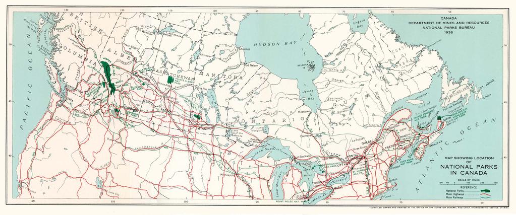
66

67 J. O. PATENAUDE. I.S.O. KING'S PRINTER OTTAWA. CANADA 1938
ELK ISLAND NATIONAL PARK
 ELK ISLAND NATIONAL PARK DEPARTMENT OF THE INTERIOR HON. THOMAS G MURPHY - Minister H. H. ROWATT. C.M.G. - Deputy Minister J. B. HARTTIN Commissioner National Parks of Canada, Ottasna ELK ISLAND NATIONAL
PREPARE TO STOP DIP ROUGH ROAD SPEED ZONE AHEAD DANGER STOP AT PULLOFF ONLY 30 MUXIMUM SLOW TRAFFIC KEEP RIGHT. FOrm SINGLE LINE.
 SPEED ZONE AHEAD PREPARE TO STOP DANGER STOP AT PULLOFF ONLY 30 SLOW TRAFFIC KEEP RIGHT Maple Leaf FOrm SINGLE LINE DIP ROUGH ROAD MUXIMUM 30 (1101) éé 7/1 7/2 7/3 7/4 7/5 7/6 7/7~8 7/9 7/10 Monashe Mountain
Canadian Rockies and Glacier Park 9 Days from $1695
 1 800 422 3727 Canadian Rockies and Glacier Park 9 Days from $1695 Itinerary Day 1 Calgary, Alberta, Canada Your vacation begins in Calgary, where the foothills of the Rocky Mountains meet the Great Plains.
Pocahontas Area Map Jasper INFORMATION CENTRES Lake Louise Field Golden Banff
 Pocahontas Miette Hot Springs Area Map Jasper Maligne JASPER Columbia Icefield Saskatchewan River Crossing INFORMATION CENTRES Banff National Park Louise Kootenay Park Lodge Yoho National Park Columbia
ALBERTA ADVENTURE SUMMER
 N W 200 km 200 mi E S ALBERTA ADVENTURE SUMMER (5 NIGHT),, On this summer adventure, your clients will have exciting Alberta adventures riding in helicopters, glass gondolas, summer bobsleds and motorcycle
Group Travel Masters
 Glacier, Canadian Rockies & The Calgary Stampede Your Group Name Here June 27-July 5, 2020 Group Travel Masters Tour Dates: June 27 July 5, 2020 #4906 Day 1 Arrive Calgary (6/27 Sat) Our neighbors in Canada
discover Genuine Montana The Last Best Place Great Falls Montana
 discover Genuine Montana The Last Best Place Great Falls Montana the grandest sight I ever beheld... 1805 Meriwether Lewis journal entry Resting on the high plains along Montana s Rocky Mountain Front
njt Iow Your personalised ebrochure call Karl and Andrew direct on: created: 22 November 2013
 njt Iow Your personalised ebrochure Yellowstone, Glacier and the Rockies created: 22 November 2013 call Karl and Andrew direct on: 01983716727 13-day Air Holidays Departing June - September 2014 From 1799.00*
ROCKIES FAMILY ADVENTURE
 ROCKIES FAMILY ADVENTURE This trip offers the ultimate Canadian Rockies adventure for families. You will visit world-famous Banff and Jasper National Parks, and enjoy a family heli-hiking adventure from
ROCKIES WINTER WONDERLAND
 ROCKIES WINTER WONDERLAND Sleigh bells ring, are you listening? Experience Winter Wonderland in the picturesque and snowy Rocky Mountains. A self-driving adventure, enjoy luxurious accommodation in Lake
Maxim Tours 3303 S. Semoran Blvd, Suite 300, Orlando, FL Phone: Website:
 Highlights (All entrance included) CITIES NO.OF NIGHTS SIGHTSEEING& ATTRACTIONS Banff 2 Sulphur Mountains - Gondola Ride Lake Louise Columbia Ice Field Glacier Jasper 2 Medicine Lake, The Maligne lake
Adventure & Sightseeing Tours
 Adventure & Sightseeing Tours The National Parks Circle Tour Start & Finish: Vancouver Duration: 14-21 Distance: 2500 km Drive the TransCanada Highway and you will pass through one National Park after
Canadian Rockies Rail Circle
 Canadian Rockies Rail Circle This ten day rail experience takes you to the most sought after places in the Canadian Rockies to experience nature from mountains to moose, gondolas to glaciers up close.
Maxim Tours 3303 S. Semoran Blvd, Suite 300, Orlando, FL Phone: Website:
 Highlights (All entrance included) CITIES NO.OF NIGHTS SIGHTSEEING& ATTRACTIONS Banff 2 Jasper 1 Sulphur Mountains - Gondola Ride Lake Louise Columbia Ice Field Glacier The Maligne lake cruise Mt.Robson
02-10 June 2015 Round-the-World Trip: Canadian Rockies. Dear Friends,
 Dear Friends, Here is another chapter of our adventures. Few days after my return from California, we went on a 4-day trip to the Canadian Rockies with Louise, Nasser and Leah. After that we continued
16 Day Rocky Mountaineer & Alaska Cruise
 Train 16 Day Rocky Mountaineer & Alaska Cruise International airfares All transfers 8 Day Deluxe Alaska cruise 7 Day Rockies highlights including the Rocky Mountaineer with Deluxe SilverLeaf accommodation
TREK THE ROCKIES ABOUT THE CHALLENGE TREK THE ROCKIES FOR HIGHLAND HOSPICE CANADA TREK DEMANDING
 TREK THE ROCKIES CANADA TREK DEMANDING ABOUT THE CHALLENGE The Canadian Rockies are justifiably world-famous for their magnificent scenery: the combination of impressive, jagged mountains, bright turquoise
Alaska and Canada 16 Day Glacier Cruise and Canadian Rocky Mountain Tour International Flights Included
 ITINERARY Alaska and Canada 16 Day Glacier Cruise and Canadian Rocky Mountain Tour International Flights Included Day 1: Fly to Calgary and transfer to Banff Fly to Calgary on a connecting flight via Los
Join the Your Group Name Here on a wonderful Canadian Rockies and Glacier Park Tour May October, 2019
 Join the Your Group Name Here on a wonderful Canadian Rockies and Glacier Park Tour May October, 2019 Dear Vacation Traveler, Welcome to a great Canadian Rockies vacation at an affordable price. Your Canadian
Canada Rocky Mountain Adventure Into the Wild
 Canada Rocky Mountain Adventure Into the Wild Itinerary Canada Rocky Mountain Adventure Into the Wild 15 days / 14 nights Calgary Kananaskis Country Spray Lake Canmore Banff Lake Louise Moraine Lake Jasper
18 day Spectacular Canada and Luxury Alaska Cruise
 18 day Spectacular Canada and Luxury Alaska Cruise International airfares All transfers 8 days touring the Rocky Mountains 8 day 5 star Alaska Cruise All meals on-board your luxury cruise In depth sight
ACCOMMODATION LISTING - MOUNTAIN PARKS
 ACCOMMODATION LISTING - MOUNTAIN PARKS Commercial Accommodation All visitor accommodation in the national parks is inspected by the National Parks Service and maximum daily rates are posted in rooms to
B is for British Columbia. A is For Alberta
 C is for Canada A is For Alberta Alberta is one of the only provinces in Canada with 2 NHL teams. Edmonton, the capital of Alberta is the home of the West Edmonton Mall, which is the largest shopping mall
Best of Banff 3 Nights
 Best of Banff 3 Nights Self Drive Tour of the Canadian Rockies with your Personal GPS Tour Guide GyPSy Your In Car Guide With GyPSy you won t miss a thing on your driving vacation. It automatically triggers
Mountains, Peaks & Glaciers Rocky Mountaineer 05N / 06D
 Mountains, Peaks & Glaciers Rocky 05N / 06D Day 01 Vancouver On arrival, transfer from Vancouver International Airport to hotel. Later, visit FlyOver Canada, a 4D show experiencing a gentle ride. Chairlift-style
BUTCHER CREEK RANCH. Butcher Creek Ranch. Roscoe, Montana. Reduced to $1,650,000.
 BUTCHER CREEK RANCH Butcher Creek Ranch Roscoe, Montana Reduced to $1,650,000. Offered Exclusively By: Sonny Todd Real Estate 301 West First Avenue, PO Box 788 Big Timber, Montana 59011 Office: (406) 932-1031
The World s Most Spectacular Rail Journey
 The World s Most Spectacular Rail Journey Rocky Mountaineer s Coastal Passage itinerary combined with an Alaskan Cruise If you have ever dreamt of combining a romantic sightseeing rail journey through
Uncover the beauty and variety of North America s national parks.
 National Parks Canadian Rockies, Glacier & Yellowstone 11 DAYS: Thursday, May 31-Sunday, June 10, 2018 from $3,459* Thursday, September 6-Sunday, September 16, 2018 from $4,099* *Prices are per person
Road Book Vancouver, BC to Calgary, AB
 Road Book Vancouver, BC to Calgary, AB PREVIEW from Sea to Sky by Tour Guide Canada PREVIEW by Tourguide Canada 2017 Page 1 A ROAD BOOK TO TRAVEL FROM VANCOUVER TO CALGARY, CANADA EXPLORE COSMOPOLITAN
In the 1860s, with a movement to
 Trains Railway crew on hand car, 1888. In the 1860s, with a movement to push for Canadian independence gaining ground, the British government passed legislation establishing the Dominion of Canada. At
World. Drive Holidays. Guided Seattle to Denver 16 Days / 15 Nights. Available Summer, Autumn. Day 1 - Seattle Arrival
 Canada & Yellowstone Guided Motorcycle Tour Guided Seattle to Denver 16 Days / 15 Nights Available Summer, Autumn This once in a lifetime journey takes you from the emerald waters of Seattle, through the
Canadian Rockies & Glacier National Park
 Warther Tours presents: Canadian Rockies & Glacier National Park June 23rd July 1st, 2017 Some Highlights: Red Bus Tour of Going To The Sun Road, Glacier National Park Icefield Parkway with Author & Guide
TAYLOR CANYON RANCH COLORADO - ROUTT COUNTY - STEAMBOAT SPRINGS
 TAYLOR CANYON RANCH COLORADO - ROUTT COUNTY - STEAMBOAT SPRINGS Tucked up against the steep valley shaped by Mt. Pau and rising to the Routt National Forest, Taylor Canyon Ranch is an easily accessible,
Photo Credit: Banff Lake Louise Tourism / Paul Zizka Photography MOUNTAIN ADVENTURES
 Photo Credit: Banff Lake Louise Tourism / Paul Zizka Photography MOUNTAIN ADVENTURES MOUNTAIN ADVENTURE PROGRAM Operated by Fairmont Chateau Lake Louise Fairmont Chateau Lake Louise has a long and proud
Role of the Protected Area
 Role of the Protected Area Provincial and Regional Context Height of the Rockies and Elk Lakes provincial parks lie in southeastern British Columbia in the Rocky Mountains, about 85 km southwest of Calgary,
TO THE WORLD HERITAGE LIST. Convention concerning the Protection of the World Cultural and Natural Heritage
 NOMINATION TO THE WORLD HERITAGE LIST Convention concerning the Protection of the World Cultural and Natural Heritage Name I CANADIAN ROCKIES Identification No, 304 Date received by WH Secretariat, 23.12.83
Grand Canadian Rockies
 Grand Canadian Rockies September 18-27, 2012 Tauck's action-packed western Canada tour features a classic overnight rail journey from Vancouver into the Canadian Rockies, a floatplane excursion over the
njt Iow Your personalised ebrochure call Not Just Travel Isle of Wight direct on: created: 17 February 2015
 njt Iow Your personalised ebrochure created: 17 February 2015 call Not Just Travel Isle of Wight direct on: 01983716727 14 Day Holiday Departing May 2015 through to June 2016 Prices from 1699 pp Explore
Driving Time: 3 hours (allow extra time for stops)
") Scenic Byways loop This journey takes visitors through the eastern edge of Mt. Rainier National Park and along two of Washington s most beloved scenic byways, the Chinook Byway and the White Pass Scenic
Scenic Byways loop This journey takes visitors through the eastern edge of Mt. Rainier National Park and along two of Washington s most beloved scenic byways, the Chinook Byway and the White Pass Scenic
OFFICIAL OPENING FUNDY. taew SBktvnbwtcA. * Iineteen. dfandwdandrj't/ya NATIONAL PARKS AND HISTORIC SITES SERVICE
 FUNDY NATIONAL PARK NEW BRUNSWICK CANADA OF THE OFFICIAL OPENING OF FUNDY NATIONAL PARK taew SBktvnbwtcA * Iineteen. dfandwdandrj't/ya NATIONAL PARKS AND HISTORIC SITES SERVICE Department of Resources
HIKING IN THE CANADIAN ROCKIES
 HIKING IN THE CANADIAN ROCKIES Distance Time Elevation y MORAINE LAKE TRAILS THE ROCKPILE 0.8 km (0.5 mi) 20 min 30 m (98 ft) Located adjacent to the Lodge, the short interpretive trail up the Rock Pile
Canadian Rockies 07 Nights / 08 Days Departure Dates: 18 May, 25 May, 01 June, 08 June
 Canadian Rockies 07 Nights / 08 Days Departure Dates: 18 May, 25 May, 01 June, 08 June DAYWISE TOUR ITINERARY Day 1 CALGARY TO BANFF Arrive Calgary International Airport and after clearing immigration,
(Short Listing) DUPUYER ACREAGE, ROCKY MOUNTAN FRONT
 DUPUYER ACREAGE, ROCKY MOUNTAN FRONT") (Short Listing) DUPUYER ACREAGE, ROCKY MOUNTAN FRONT This unique property is located 8½ miles northwest of Dupuyer, Montana and approximately thirty 30 miles northwest of Choteau, Montana. Great Falls
(Short Listing) DUPUYER ACREAGE, ROCKY MOUNTAN FRONT This unique property is located 8½ miles northwest of Dupuyer, Montana and approximately thirty 30 miles northwest of Choteau, Montana. Great Falls
A Refuge for Wild Creatures and Man
 Canada /^i lia National Parks West Contents A refuge for wild creatures... and man.. 1 Map of Western parks 2 Mount Revelstoke National Park 5 Glacier National Park 7 Yoho National Park 8 Kootenay National
18 day Unforgettable Rocky Mountaineer and Alaska Cruise
 18 day Unforgettable Rocky Mountaineer and Alaska Cruise International airfares Arrival shuttle All station and port transfers 9 days touring the Rocky Mountains Includes 2 days on-board the famous Rocky
15 DAYS. Canadian Contrasts
 From the cosmopolitan city of Toronto and cobblestone streets of Québec City to the towering Rocky Mountains and the coastal city of Vancouver, this tour takes you on a wonderful journey across Canada.
MINERAL HOT SPRINGS IN THE NATIONAL PARKS OF CANADA
 MINERAL HOT SPRINGS IN THE NATIONAL PARKS OF CANADA Miette Hot Springs, Jasper National Park. This pamphlet has been compiled in co-operation with the Geological Survey of Canada, Department of Energy,
Best of the Canadian Rockies
 Best of the A Special Departure July 29 August 5, 2012 for Johns Hopkins Alumni and Friends Best of the Tauck Value Includes: Wild West welcome reception and dinner with rodeo entertainment at an upscale
Ponderosa Pines Ranch
 PONDEROSA PINES RANCH Ponderosa Pines Ranch Shepherd, Montana $3,285,000. Offered Exclusively By: Sonny Todd Real Estate 301 W First, PO Box 788 Big Timber, MT 59011 Office: (406) 932-6668 (406) 932-LAND
HIGHLIGHTS: TOUR INCLUSIONS: +44 (0)
") +44 (0)20 8741 7390 The beauty of Uganda lies not just in its extraordinary and varied wildlife, but also in the breathtaking scenery that unfolds at seemingly every turn. This rich and contrasting itinerary
+44 (0)20 8741 7390 The beauty of Uganda lies not just in its extraordinary and varied wildlife, but also in the breathtaking scenery that unfolds at seemingly every turn. This rich and contrasting itinerary
Clearwater Lake Provincial Park. Draft Management Plan
 Clearwater Lake Provincial Park Draft Management Plan Clearwater Lake Provincial Park Draft Management Plan Table of Contents 1. Introduction... 3 2. Park History... 4 3. Park Attributes... 4 3.1 Location/Access...4
THE REGION LAKE SUPERIOR THE GITCHI-GAMI TRAIL & THE NORTH SHORE
 LAKE SUPERIOR THE GITCHI-GAMI TRAIL & THE NORTH SHORE 7 LAKE SUPERIOR: Water covers 70% of the earth s surface area, but only 3% of it is freshwater. Saltwater makes up 97% of the earth s water supply.
Hiking California's Trinity Alps Wilderness: A Guide To The Area's Greatest Hiking Adventures (Regional Hiking Series) By Dennis Lewon READ ONLINE
 By Dennis Lewon READ ONLINE") Hiking California's Trinity Alps Wilderness: A Guide To The Area's Greatest Hiking Adventures (Regional Hiking Series) By Dennis Lewon READ ONLINE With over 600 miles of trails and 500000 acres of wilderness
Hiking California's Trinity Alps Wilderness: A Guide To The Area's Greatest Hiking Adventures (Regional Hiking Series) By Dennis Lewon READ ONLINE With over 600 miles of trails and 500000 acres of wilderness
Canadian Rockies. St. Mark s United Methodist Church. July 14-21, 2019
 Canadian Rockies St. Mark s United Methodist Church July 14-21, 2019 Dear Friends, St. Mark s United Methodist Church is excited to present a most exceptional Canadian Rockies deluxe tour, incorporating
Washakie Wilderness Ranch
 Washakie Wilderness Ranch Dubois, Wyoming Fly Fishing Hunting Ranching Conservation Washakie Wilderness Ranch Dubois, Wyoming Introduction: A stunning 160-acre parcel located at the base of the Ramshorn
Western. Special Rates
 Western Special Rates The Northern Pacific offers extremely low rates for the tours described in this booklet. Our summer tickets are available from May 15th to September 30th; to Pacific Coast and California
RESEARCH AND PLANNING FORT STEELE HERITAGE TOWN VISITOR STUDY 2007 RESULTS. May 2008
 RESEARCH AND PLANNING FORT STEELE HERITAGE TOWN VISITOR STUDY 2007 RESULTS May 2008 Research and Planning Tourism British Columbia 300-1803 Douglas St. Box 9830 Stn. Prov. Gov t. Victoria, BC V8W 9W5 Web:
Icefield Discovery. 1 review 5 Days / 4 Nights Vancouver to Calgary or Calgary to Vancouver. From USD$1,569 per person
 Icefield Discovery 1 review 5 Days / 4 Nights Vancouver to Calgary or Calgary to Vancouver From USD$1,569 per person Canadian Rockies Rail Tours highlights: Calgary Banff Lake Louise Jasper VIA Rail Vancouver
Rogue Gorge (Mt. Stella) Roadless Area-- T30S R3E (primarily in portions of Sections 23, 26, 33, 34 & 35)
 Roadless Area-- T30S R3E (primarily in portions of Sections 23, 26, 33, 34 & 35)") Rogue Gorge (Mt. Stella) Roadless Area-- T30S R3E (primarily in portions of Sections 23, 26, 33, 34 & 35) Rogue River-Siskiyou National Forest--High Cascades Ranger District Upper, higher elevation trail
Rogue Gorge (Mt. Stella) Roadless Area-- T30S R3E (primarily in portions of Sections 23, 26, 33, 34 & 35) Rogue River-Siskiyou National Forest--High Cascades Ranger District Upper, higher elevation trail
Western Highlights. 1 review 7 Days / 6 Nights Calgary to Vancouver or Vancouver to Calgary. From USD$2,680 per person
 Western Highlights 1 review 7 Days / 6 Nights Calgary to Vancouver or Vancouver to Calgary From USD$2,680 per person Canadian Rockies Train Tours highlights: Calgary Banff Lake Louise Jasper Rocky Mountaineer
Human Geography of Canada
 Human Geography of Canada History and Government of Canada Like the United States, people migrated across Beringia into Canada, these people were the ancestors of the Inuit (Eskimos) 16 th and 17 th centuries,
Maine's Great Coast Resort, Bar Harbor, the Gateway of the Lafayette National Park
 The University of Maine DigitalCommons@UMaine Maine History Documents Special Collections 1919 Maine's Great Coast Resort, Bar Harbor, the Gateway of the Lafayette National Park Bar Harbor Publicity Committee
APPENDIX. Alberta Land Stewardship Act AMENDMENTS TO THE SOUTH SASKATCHEWAN REGIONAL PLAN
 APPENDIX Alberta Land Stewardship Act AMENDMENTS TO THE SOUTH SASKATCHEWAN REGIONAL PLAN 1 All references to Alberta Environment and Sustainable Resource Development, Environment and Sustainable Resource
2.0 PARK VISION AND ROLES
 2.0 PARK VISION AND ROLES 2.1 Significance in the Protected Area System Marble Range and Edge Hills provincial parks protect 6.8% of the Pavillion Ranges Ecosection, which is located in the Southern Interior
RM16,060 per person 10D7N DISCOVER CANADIAN ROCKIES BY ROCKY MOUNTAINEER (ESCORTED GROUP DEPARTURE) SPRING SEASON
 SPRING SEASON") 10D7N DISCOVER CANADIAN ROCKIES BY ROCKY MOUNTAINEER (ESCORTED GROUP DEPARTURE) SPRING SEASON All in from RM16,060 per person Special Departure: 26 April - 04 May 2018 Experience the West! This journey
10D7N DISCOVER CANADIAN ROCKIES BY ROCKY MOUNTAINEER (ESCORTED GROUP DEPARTURE) SPRING SEASON All in from RM16,060 per person Special Departure: 26 April - 04 May 2018 Experience the West! This journey
WATERFALLS AND WILDLIFE
 JUNE - SEPTEMBER WATERFALLS AND WILDLIFE DAY 1 AFTERNOON/EVENING ARRIVE IN YELLOWKNIFE YELLOWKNIFE.CA/VISITORS NORTHERNFRONTIER.COM Set in the wondrous natural surroundings of Great Slave Lake, Yellowknife,
Banff - Egypt Lake By Gem Trek READ ONLINE
 Banff - Egypt Lake By Gem Trek READ ONLINE If searched for a ebook by Gem Trek Banff - Egypt Lake in pdf form, then you have come on to faithful site. We furnish complete option of this book in txt, DjVu,
AOTA ArtTrek Locations
 AOTA ArtTrek Locations ArtTrek is a summer-long Grand County, CO art adventure. Highlighted by snow-covered mountain vistas and rolling meadows threaded with sparkling streams and rivers, numerous sites
B HALL RANCH FISHTAIL, MONTANA
 Brochure Courtesy of: B HALL RANCH FISHTAIL, MONTANA w w w. m c c a s l i n l a n d. c o m Page 1 LOCATION The Hall Ranch is ideally located in the foothills of the Beartooth Mountains, approximately 5
$ 12,998 per person twin share 25 Days Canada & Alaska
 Dream Maker Travel, 39 Highland Cres, Belmont Q. 4153 Ph:-3343 5422 Mobile:- 0414 445 279 Email:-hilary@dreammakertravel.com.au $ 12,998 per person twin share 25 Days Canada & Alaska 21 May - 14 June 2019
Best of the Rockies - Jasper Wilderness 7 Days/6 Nights - Detailed Itinerary
 Published on White Mountain Adventures (https://www.whitemountainadventures.com) Home > Best of the Rockies - Jasper Wilderness 7 Days/6 Nights - Detailed Itinerary Best of the Rockies - Jasper Wilderness
APPENDIX 19-II. Ontario Trail Network Trailheads EAST-WEST TIE TRANSMISSION PROJECT AMENDED ENVIRONMENTAL ASSESSMENT REPORT
 EAST-WEST TIE TRANSMISSION PROJECT AMENDED ENVIRONMENTAL ASSESSMENT REPORT APPENDIX 19-II Ontario Network heads Report. 1536607/2000/2219 Ontario Network heads in the n-commercial Land and Resource Use
Northwest Temples And Canadian Rockies
 Northwest Temples And Canadian Rockies Tour Includes: Airfare from Salt Lake City to Spokane Escorted sightseeing by luxury motor coach Professional, experienced Webb Tours Director throughout Excellent
GOLDEN EARS PROVINCIAL PARK
 GOLDEN EARS PROVINCIAL PARK Trail Information as of October 10 th 2015 Do not underestimate the mountainous wilderness of Golden Ears Provincial Park. The combination of rugged terrain and rapidly changing
Welcome. Pristine wilderness, fascinating wildlife, cosmopolitan cities and breathtaking mountain peaks! Tour Highlights. Your holiday includes
 Pristine wilderness, fascinating wildlife, cosmopolitan cities and breathtaking mountain peaks! Welcome to our Canadian Rockies and Alaskan Cruise Holiday. It s Spring, and the Butchart Gardens and the
20 DAY CANADA & ALASKA INSIDE PASSAGE CRUISE
 20 DAY CANADA & ALASKA INSIDE PASSAGE CRUISE Day 1 Saturday 22 July 2017: Nowra to Sydney To assist with an early departure tomorrow morning we are headed to Sydney this afternoon depart Stuarts Coaches
All of Canada 14N / 15D
 All of Canada 14N / 15D Day 01 Day Plan Arrive Vancouver Meal Plan : Nil On arrival, transfer from Vancouver International Airport to hotel. Later in the afternoon visit. Overnight in Vancouver hotel.
FOREWORD BANFF NATIONAL PARK ALBERTA. Location and Description HOW TO REACH THE PARK
 B/vNTT ^k Xâi. r- FOREWORD The National Parks of Canada are areas of natural beauty and special interest that have been "dedicated to the people of ( 'anada for their benefit, education, and enjoyment
CAMP ROCK RANCH JACK KAVANAUGH RMABROKERS.COM
 CAMP ROCK RANCH JACK KAVANAUGH 303.909.1706 JACK@RMABROKERS.COM RMABROKERS.COM CAMP ROCK RANCH COLORADO - CLEAR CREEK COUNTY - UPPER BEAR CREEK ROAD, EVERGREEN The 162±-acre Camp Rock Ranch is surprisingly
Lake Acreage Mcleese Lake, BC
 Lake Acreage Mcleese Lake, BC Jason Zroback jason@landquest.com 1 (604) 414-5577 Jamie Zroback jamie@landquest.com 1 (604) 483-1605 The Source for Oceanfront, Lakefront, Islands, Ranches, Resorts & Land
The gorges of Mohican Park in Ohio create a hiker's paradise Sunday, May 22, 2011 By Bob Downing, Akron Beacon Journal
 Pittsburgh Post-Gazette The gorges of Mohican Park in Ohio create a hiker's paradise Sunday, May 22, 2011 By Bob Downing, Akron Beacon Journal Bob Downing Big Lyons Falls drops 80 feet into a shady U-shaped
Classic tour of British Columbia and Inside Passage / 16 days N
 Classic tour of British Columbia and Inside Passage / 16 days N 330-015 This itinerary crosses the main and the most beautiful location and sight of the region between Alberta and British Columbia: Vancouver
Alaska Cruise & Canadian Rockies Tour May 28 th to June 11 th, nights 15 days Summary Itinerary
 Alaska Cruise & Canadian Rockies Tour May 28 th to June 11 th, 2017 14 nights 15 days Summary Itinerary Sunday, May 28 th Day 1 Maritimes to Vancouver Meet your fellow travellers at your closest Maritime
13, 201 Tour Includes:
 Canadian Rockies Temple Tour With Glacier, Banff, Waterton & Jasper National Parks! September 4-13, 13, 201 2018 Tour Includes: Escorted sightseeing by luxury motor coach Airfare allowance from Vancouver
Gravel and Rock Extraction Highway Maintenance, Recapitalization and Twinning
 Gravel and Rock Extraction Highway Maintenance, Recapitalization and Twinning Backgrounder: Mountain National Parks A Need for Change Existing supplies of aggregate (sand and gravel) for highway maintenance,
5 Day Rocky Mountaineer Rainforest to Gold Rush Classic Tour
 5 Day Rocky Mountaineer Rainforest to Gold Rush Classic Tour 5 days/4 nights - Rocky Mountaineer This journey into the rugged Canadian wilderness is one you'll never forget. Spend a night in Whistler,
Adventures in the Rockies. 6 Days
 Adventures in the Rockies 6 Days Adventures in the Rockies On this action-filled adventure, experience two different sides to the Rockies on the western side, discover hidden gems that few visitors get
Eastern Canada Explorer Highlights - 16 days, 35 hrs, 3400 nm
 Eastern Canada Explorer Highlights - 16 days, 35 hrs, 3400 nm This tour brings you many Canadian icons: Niagara Falls, the lakes and forests of the Canadian Shield, and the UNESCO site of Old Quebec City,
(Short Listing) SOUTH FORK LOG CABIN, UTICA, MONTANA
 SOUTH FORK LOG CABIN, UTICA, MONTANA") (Short Listing) SOUTH FORK LOG CABIN, UTICA, MONTANA The South Fork Log Cabin is in the heart of thousands of acres of public land of the Lewis & Clark National Forest Service. This Cabin offers unlimited
(Short Listing) SOUTH FORK LOG CABIN, UTICA, MONTANA The South Fork Log Cabin is in the heart of thousands of acres of public land of the Lewis & Clark National Forest Service. This Cabin offers unlimited
RE: Visitor experience and safety improvements Temporary delays and closures in Banff and Kootenay national parks in 2018
 Lake Louise, Yoho & Kootenay Field Unit P.O. Box 213 Lake Louise, AB T0L 1E0 February 22, 2018 RE: Visitor experience and safety improvements Temporary delays and closures in and Kootenay national parks
Trail Beginning Elevation: 7553 ft The Poison Creek Trailhead is located at the end of National Forest Road 646E (NF-646E).
.") West Mountain Trails Poison Creek Trail #134 Length: 2.9 miles (4.7 km) Difficulty Horseback: A good trail for the first time west mountain rider, some steep sections Hiking: Most Difficult USGS Maps:
West Mountain Trails Poison Creek Trail #134 Length: 2.9 miles (4.7 km) Difficulty Horseback: A good trail for the first time west mountain rider, some steep sections Hiking: Most Difficult USGS Maps:
The Absaroka Mountain Lodge
 The Absaroka Mountain Lodge Park County, WY I believe our setting is the most beautiful of any of the lodges up the Northfork Current owner 58 E. Benteen Street Buffalo, WY 82834 Ph 307-684-9556 Toll Free
CANADIAN ROCKIES Calgary, Banff, Jasper, Kamloops, Whistler, Vancouver
 INDO AMERICAN SENIORS ORGANIZATION OF NEW JERSEY (IASONJ) 665, Lincoln Highway (Route 27), Iselin, NJ 08830 PH. (732) 283-1709 / (732) 283-8666 FAX. 1-888-853-6970 E-mail:iasonj@yahoo.com / Website : www.iasonj.org
President Roosevelt and Naturalist John Burroughs at Fort Yellowstone. Ruined Castles of Yellowstone. East Entrance Station
 President Roosevelt and Naturalist John Burroughs at Fort Yellowstone Ruined Castles of Yellowstone East Entrance Station President Roosevelt at Liberty Cap Yellowstone Lake, Mary s Bay Fire Hole River
BANFF NATIONAL PARK, ALBERTA, CANADA LYC ADVENTURE TRIP ITINERARY 2016
 BANFF NATIONAL PARK, ALBERTA, CANADA LYC ADVENTURE TRIP ITINERARY 2016 Tuesday, July 5, 2016 Anytime prior to 5:00pm Staff & Camper Arrival (Airport pick-up Calgary International Airport Calgary, Alberta,
FAIRMONT JASPER PARK LODGE
 FAIRMONT JASPER PARK LODGE 2017-2018 WINTER ACTIVITY GUIDE Photo by Parks Canada / Adam Greenberg AN AUTHENTIC MOUNTAIN TOWN EXPERIENCE Thank you for choosing Fairmont Jasper Park Lodge. We greatly look
Provincial Motto. Armorial Bearings
 Provincial Motto Fortis et Liber, strong and free. The motto is used together with the Coat of Arms on seals, shields and banners. Armorial Bearings Shield of the Arms of Alberta Topped by a red St. George
Friday, Day One. Saturday, Day Two Travel the Inside Passage thru Canada (no Passport required) Sunday, Day Three
 Sunday, Day Three") 2015 : 15 Day Glacier & Wildlife Tour (Easily modified to 12 Days with return by Air) Tour : 1395 Number Travel Arrangements: US$4,100.00 per person, based on two people traveling together. Senior rate
2015 : 15 Day Glacier & Wildlife Tour (Easily modified to 12 Days with return by Air) Tour : 1395 Number Travel Arrangements: US$4,100.00 per person, based on two people traveling together. Senior rate
13 Day Escorted Tour of Canada - Save $500pp!
 13 Day Escorted Tour of Canada - Save $500pp! 13 days/12 nights - MyDiscoveries Explore the best of the West and the Canadian Rockies on this fully-escorted 13 day tour. Journey to Waterton Lakes National
a royal gathering of greater chicago s sheet metal industry June 13-17, 2018 Banff Springs, Alberta accommodations & activities guide
 a royal gathering of greater chicago s sheet metal industry June 13-17, 2018 Banff Springs, Alberta accommodations & activities guide Join us for a luxurious four-night stay at the Fairmont Banff Springs,