Regional Parks Report
|
|
|
- Britton Patrick
- 5 years ago
- Views:
Transcription


1 Regional Parks Report For the year ended 30 June 2007 Quality for Life
2
3 Contents Contents Introduction 2 Map of regional parks, forests and water collection areas 3 Contents Projects The track network 5 Akatarawa Forest 6 Battle Hill Farm Forest Park 8 Belmont Regional Park 10 East Harbour Regional Park 12 Hutt River Trail 14 Kaitoke Regional Park 16 Pakuratahi Forest 18 Queen Elizabeth Park 20 Hutt Water Collection Area 22 Wainuiomata/Orongorongo WCA 24 Wainuiomata Recreation Area 26 Cover Shown here are; (1) photo view from Cannon Point; (2) photo of mountain bikers on Pakuratahi Bridge; (3) photo of walkers on Kaitoke swingbridge; (4) photo of Battle Hill; (5) photo of runner near Silverstream; and (6) photo of Kapiti from dunes. Photos supplied by: (1,3,4,5,6) Jessica Dewsnap. (2) Robin Blake


4 Introduction Introduction Introduction Welcome to the Regional Parks Report , Greater Wellington s first annual report about our network of regional parks. Located up to an hour s drive from downtown Wellington, the regional parks offer a variety of landscapes including some of our region s most significant features. The opportunities and facilities cater to a wide range of people, activities and abilities. Sitting between more developed city parks and the back country wilderness of the DoC estate, the regional parks provide safe and enjoyable access and are managed to protect the high quality natural environment. Lighthouse & Lakes event participants cross Lake Kohangapiripiri boardwalk, East Harbour Regional Park. Thousands of people enjoy a simple walk, bike ride, picnic or other activity in the parks. GW also provides opportunities to stage events such as sporting competitions, school or club camps, cultural or community celebrations or festivals. The parks are becoming significant locations for commercial filming or as an itinerary stop for tourist operators. The regional parks have a designated on-park ranger service, with some staff living at the park. They provide information, educate visitors, look after facilities and ensure compliance with council policies. 2 Western Mobile Ranger Dean Scott.
5 Paraparaumu Mana Island N Porirua S.H. 1 Cornish Takapu Cannons Oakleigh Petone Paekakariki Hill BELMONT REGIONAL Hill Stratton Raumati South QUEEN ELIZABETH Paekakariki BATTLE HILL FARM S.H. 58 Kaitangata Crescent Dry HUTT RIVER TRAIL Wainuiomata Hill Moonshine Lower Hutt Lees Grove MacKays Crossing Maungakotukutuku Valley AKATARAWA Cannon Point Walkway Wainuiomata/Orongorongo Water Collection Area Karapoti Tulsa Park Bridge Upper Hutt Akatarawa Te Marua TUNNEL GULLY Lake Hutt Water Collection Area KAITOKE REGIONAL RIMUTAKA RAIL TRAIL PAKURATAHI Lake Wairarapa Pakuratahi Rimutaka Trig Track Cross Map of regional parks, forests and water collection areas Wellington Eastbourne Kowhai Burdans Gate WAINUIOMATA RECREATION AREA Western EAST HARBOUR REGIONAL Pencarrow Coast Baring Palliser Bay 3
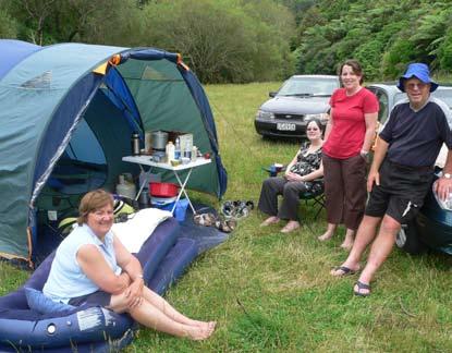
6 Projects Projects Projects The achievements in the following pages show projects in relation to individual parks. Those listed below relate to the parks network: The Regional Outdoors summer programme was completed with 49 events attracting 10,800 people. Attendance at GW-led events increased 12.5% over 2006 to 3,881 participants Greater Wellington Buggy Walks were held each month around the region in conjunction with Sport Wellington Region. Around 80 people attended each event We fostered ongoing relationships with Parks Friends and other community groups. The December and June issues of the community newsletter Green Shoots were published and distributed to 1300 interested individuals and organisations The historic barn was restored and a new toilet block completed at Queen Elizabeth Park. The Orange Hut was rebuilt in the Akatarawa Forest and 7kms of fencing replaced in our parks Monitoring showed an increase in the health of the ecosystems on Council land. Pest control operations were ongoing and planning undertaken for the 1080 control work scheduled for 2007/08 Planning for the governance structures for Whitireia Park and Lake Wairarapa Wetlands progressed. We produced a significant report on recreation activities, values, issues and opportunities in relation to Lake Wairarapa The reviews of our park management plans continued, with the plan for East Harbour Regional Park approved We commenced reviews of our Concessions Policy and related administration and Park Bylaws for controlling user behaviour A telephone survey of regional residents indicated that 51% of the population visited at least one regional park in the past 12 months. 90% were satisfied with their experience How much does it cost? Total Parks operational expenditure : $5.1m. Expenditure attributable to each park is identified in the relevant sections. 4


7 The track network The track network Each of the park profiles below includes an analysis of the track network within each park, excluding publicly accessible roads. From our surveys we know that visitors regard tracks as one of the most important facilities in the parks. Track classes are defined as follows: Walk: A well formed track that is clearly marked. Suitable for all visitors except in some cases narrow bridges, steps, stiles and short steep grades will exclude the less mobile, wheelchairs and mountain buggies. All but the smallest watercourses are bridged. The Track network Pakuratahi River Walk, Kaitoke Regional Park Tramp: The track caters for relatively inexperienced trampers. It is well marked and follows the lie of the land. There may be wet and muddy sections. Grades will be steeper and longer than on Walking grade tracks. A tramping track is generally more arduous. Route: A route is generally unformed or lightly cut, and may not be maintained. It caters for experienced trampers. There is no maximum grade. Markers or poles may not be in place or they may not be visible in some weather conditions. Hawtrey Route, East Harbour Regional Park Ridge Track, Kaitoke Regional Park 5
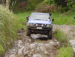
8 Akatarawa Forest Akatarawa Forest Mana Island N Porirua S.H. 1 Wellington Cornish Pencarrow Takapu Baring Cannons Oakleigh Petone Eastbourne Kowhai Burdans Gate Paekakariki Hill Paraparaumu Raumati South QUEEN ELIZABETH Paekakariki BATTLE HILL FARM S.H. 58 Dry BELMONT REGIONALKaitangata Crescent Hill Stratton Wainuiomata Hill EAST HARBOUR REGIONAL Coast HUTT RIVER TRAIL Lees Grove Moonshine Lower Hutt MacKays Crossing WAINUIOMATA RECREATION AREA Maungakotukutuku Valley AKATARAWA Cannon Point Walkway Wainuiomata/Orongorongo Water Collection Area Karapoti A future water collection area, this steep forested hill country contains original lowland podocarp and remnants of montane forest, exotic plantings, regenerating native forest and several wetlands. The bird and insect life is highly diverse with all the region s surviving indigenous bird species found here. The forest forms links and ecological corridors with other public land in Akatarawa, Tararua, Rimutaka and Orongorongo ranges. It is important for mountain biking (featuring the internationally renown Karapoti Classic course), hunting and motorised recreation (4WD and motorcycling). The Cannon Point Walkway is popular for walking and running. Park ranger: Dean Hearfield. (see pic 6) Tulsa Park Bridge Upper Hutt Palliser Bay Park Area: 15,400 hectares Akatarawa Western Te Marua TUNNEL GULLY Lake Hutt Water Collection Area KAITOKE REGIONAL RIMUTAKA RAIL TRAIL PAKURATAHI Lake Wairarapa Pakuratahi Rimutaka Trig Track Cross Track Class Walk Tramp Route 181km Total = 296 kilometres Construction of the second Orange Hut was completed after the first hut was destroyed by fire in Akatarawa Recreation Access Committee (ARAC) volunteers contribution of materials and labour ensured this was delivered under budget (see pic 1, 2) The Karapoti Classic attracted a record 1300 mountain bikers (see pic 3) Aerial survey for introduced pests and fungi completed. Forest looking healthy with no major infestations (see pic 4) Consents to enter the forest issued: 74 for 4WD events; 15 for Army/ Police training; 253 trail bike permits (see pic 5) Conducted aerial survey of boundary issues including condition of fences, unauthorised firewood access or 4WD tracks, any unofficial campsites Preparation for the 1080 possum control operation planned for July 2007 included extensive collaboration with local authorities and communication with the public. A pre-operational possum monitor reported 10.4% Residual Trap Catch (target <5% RTC). A ground-based possum control operation was established in the Cannon Point area to keep the 1080 boundary away from local suburbs (see pic 7) A professional goat control operation culled 113 goats, 7 pigs, 1 deer Pest plant infestations of old man s beard, hydrangea, buddleia, Japanese honeysuckle, cotoneaster, hops, club moss, Montpellier broom, tradescantia, Darwin s barberry, sycamore, and eleagnus were controlled 12km 103km Annual expenditure: $362,000 6


9 1 4 Regional Parks Report
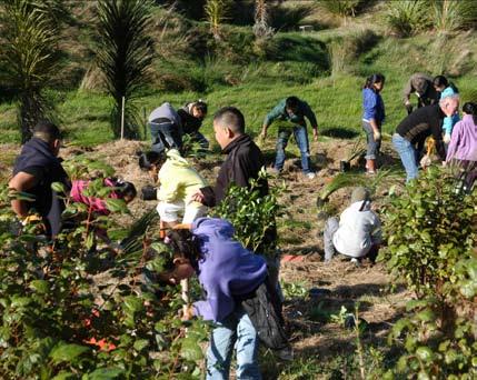
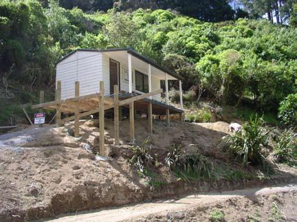
10 Battle Hill Farm Forest Park Belmont Hill Farm Forest Park Mana Island N Porirua S.H. 1 Wellington Cornish Pencarrow Takapu Baring Cannons Oakleigh Petone Eastbourne Kowhai Burdans Gate Paekakariki Hill Paraparaumu Raumati South QUEEN ELIZABETH Paekakariki BATTLE HILL FARM S.H. 58 Dry BELMONT REGIONALKaitangata Crescent Hill Stratton Wainuiomata Hill EAST HARBOUR REGIONAL Coast HUTT RIVER TRAIL Lees Grove Moonshine Lower Hutt MacKays Crossing WAINUIOMATA RECREATION AREA Maungakotukutuku Valley AKATARAWA Cannon Point Walkway Wainuiomata/Orongorongo Water Collection Area Karapoti Tulsa Park Bridge Upper Hutt Palliser Bay Park Area: 502 hectares Akatarawa Western Te Marua TUNNEL GULLY Lake Hutt Water Collection Area KAITOKE REGIONAL RIMUTAKA RAIL TRAIL PAKURATAHI Lake Wairarapa Pakuratahi Rimutaka Trig Track Cross Track Class Walk Tramp Route 8km 4.5km 13km Total = 24.5 kilometres A mix of pasture, plantation forestry, wetlands and a small remnant of native forest, Battle Hill is the site of the last significant confrontation between Maori and early colonial forces in the region. The combination of flat, rolling and steeper hill country make it popular for walking, horse riding, mountain biking, camping and picnicking. Venue for the Pauatahanui Country Festival, the park is popular with schools, community groups and sports clubs. New park ranger: Andy Marriott. (see pic 1) Outstanding in the field agriculture Careers Expo was hosted in partnership with Meat & Wool NZ at the Ken Gray education centre (see pic 2) Major holly control work by pest plant team in the bush remnant (see pic 3) Pupils from Eastern Hutt School particpating in the GW Take Action environmental education programme made weta hotels for the park (pic 4) Regional Outdoors Programme events included 4WD trips; heli-tramps; and horse riding and all were booked out. The park remains a popular base for pony club camps and equestrian events, camping and picnicking (see pic 5) Arbor Day planting in Swampy Gully drew around 150 children from three schools in Porirua City (see pic 6) Rodent and mustelid monitoring was carried out in bush remnant and there was ongoing pest trapping by local volunteers. There are now 190 traps and four bait lines on the property and bird life is improving significantly Draft of the park management plan completed Visitor survey completed to give more robust indications of visitor numbers and assess satisfaction with the park Annual expenditure: $279,000 8


11 1 4 Regional Parks Report
12 Belmont Regional Park Belmont Regional Park Belmont Regional Park Mana Island N Porirua S.H. 1 Wellington Cornish Pencarrow Takapu Baring Cannons Oakleigh Petone Eastbourne Kowhai Burdans Gate Paekakariki Hill Paraparaumu Raumati South QUEEN ELIZABETH Paekakariki BATTLE HILL FARM S.H. 58 Dry BELMONT REGIONALKaitangata Crescent Hill Stratton Wainuiomata Hill EAST HARBOUR REGIONAL Coast HUTT RIVER TRAIL Lees Grove Moonshine Lower Hutt MacKays Crossing WAINUIOMATA RECREATION AREA Maungakotukutuku Valley AKATARAWA Cannon Point Walkway Wainuiomata/Orongorongo Water Collection Area Karapoti Tulsa Park Bridge Upper Hutt Palliser Bay Park Area: 3691 hectares Akatarawa Western Te Marua TUNNEL GULLY Lake Hutt Water Collection Area KAITOKE REGIONAL RIMUTAKA RAIL TRAIL PAKURATAHI Lake Wairarapa Pakuratahi Rimutaka Trig Track Cross Track Class Walk Tramp Route Based on a central plateau that is part of an ancient rolling peneplain, the park offers views over the Hutt Valley, Wellington and Porirua Harbours. Its wide open spaces and hidden valleys make it popular for walking and tramping, running, mountain biking and horse riding. The park features the historic Korokoro Dam, World War II ammunition bunkers and the original coach road from Lower Hutt to Pauatahanui. The 22km Puke Ariki/ Haywards Korokoro Traverse takes in Boulder Hill (442m) and Belmont Trig (457m). New park ranger: Jason Barclay. (see pic 1) The Friends of Belmont Regional Park ran a park open day and hosted two other guided walks as part of the Regional Outdoors Programme. They also secured Historic Places Trust protection for the Old Coach (see pics 2, 5) Constructed a new bridge over Korokoro Stream; relocated ranger office at Stratton St; worked on tracks, structures, signs (see pics 3, 7) Getting to know Waitangirua Farm; including changing relationships with Landcorp; balancing requirements of farming with public use Re-started park management plan; commenced process for determining reserve status of Waitangirua Farm 33 goats culled in Korokoro Valley (see pic 4) Ongoing possum control in Korokoro Valley (post-op monitor = 9.7% RTC) and Speedy s Reserve. Bait station network established at Dry (preop monitor = 13.3% RTC). Friends of Maara Roa maintain bait stations in Cannons Friends of Maara Roa ran fortnightly planting days in Cannons Valley. GW supplied 2,500 plants and hare nets to protect seedlings. The group also ran three events in the Regional Outdoors Programme (see pic 6) Bird numbers showing good increases in Korokoro Bush, including whiteheads and bellbirds Plant pest control in Korokoro Valley, Speedy s Reserve, Dry and Cannons targeted species including old man s beard, German ivy, hops, Japanese honeysuckle, tradescantia and wild ginger 78km 6km 9km Total = 93 kilometres Annual expenditure: $358,000 10


13 1 5 Regional Parks Report
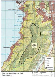
14 East Harbour Regional Park East Harbour Regional Park East Harbour Regional Park Mana Island N Porirua S.H. 1 Wellington Cornish Pencarrow Takapu Baring Cannons Oakleigh Petone Eastbourne Kowhai Burdans Gate Paekakariki Hill Paraparaumu Raumati South QUEEN ELIZABETH Paekakariki BATTLE HILL FARM S.H. 58 Dry BELMONT REGIONALKaitangata Crescent Hill Stratton Wainuiomata Hill EAST HARBOUR REGIONAL Coast HUTT RIVER TRAIL Moonshine MacKays Crossing Park Area: 2,020 hectares in three separate blocks Lees Grove Lower Hutt WAINUIOMATA RECREATION AREA Maungakotukutuku Valley AKATARAWA Cannon Point Walkway Wainuiomata/Orongorongo Water Collection Area Karapoti Tulsa Park Bridge Upper Hutt Palliser Bay Akatarawa Western Te Marua TUNNEL GULLY Lake Hutt Water Collection Area KAITOKE REGIONAL RIMUTAKA RAIL TRAIL PAKURATAHI Lake Wairarapa Pakuratahi Rimutaka Trig Track Cross Track Class Walk Tramp Route 16km 7km Total = 58 kilometres 35km Beech/rata on the hills and lowland podocarp/ broadleaf in the valleys of the Northern Forest provide the eastern backdrop to Wellington harbour and excellent walking, tramping and picnicking opportunities. The Pencarrow block contains the nationally significant freshwater Lakes Kohangapiripiri and Kohangatera, home to a wealth of native plants and wildlife. Park ranger: Gareth Cooper. (see pic 3) Completed restoration plan for Lakes block. Species and planting sites identified to aid indigenous recovery of the area (see pic 1). Intend that ridges were kept clear for recreation 20 goats culled from Lakes Block; 4 pigs from northern forest. Launch of hunting ballot saw 50 applicants and 2 deer shot (see pic 2) Ongoing improvements Dillon St Track; Bus Barn/ Korohiwa Track. Link route opened between Day s Bay and Eastbourne via Mt Hawtrey (see pic 4, 6) Aerial survey for introduced pests and fungi; measured tawa fruitfall plots Monthly bird monitoring in Lakes Block (Ornithological Society); bird, mustelid & rodent monitoring in northern forest (MIRO). Fish research project continuing Two-monthly bait station refilling in 300ha intensive control area of northern forest (MIRO). Possum numbers low (2% RTC); rat numbers slowly falling. MIRO hoping to release robins here in 2009 Park management plan went through consultation and approval; erected mountain bike signage and barriers to regulate usage Events Crazyman; Lighthouse & lakes, Mt Lowry Challenge, Butterfly Night Time Madness (see pic 5) Major control programmes for climbing asparagus & wilding pines continued in Northern Block. Other species targeted: old man s beard, banana passionfruit, wild ginger, Japanese honeysuckle, bomarea, ivy and smaller infestations of seven other species Updated and published park brochure We remained unable to find a publicly accessible site for the ranger s office that was on or near the Northern Forest block Annual expenditure: $296,000 12


15 1 2 Regional Parks Report
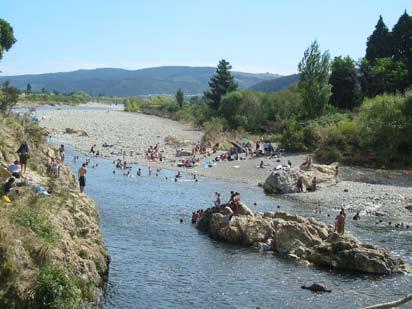
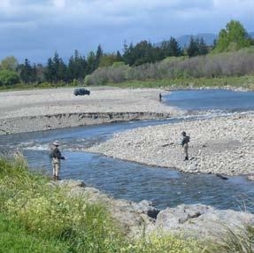
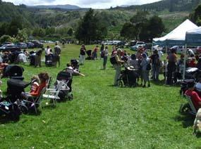
16 Hutt River Trail Hutt River Trail Mana Island N Porirua S.H. 1 Cornish Takapu Cannons Oakleigh Paekakariki Hill Paraparaumu Raumati South QUEEN ELIZABETH Paekakariki BATTLE HILL FARM S.H. 58 Dry BELMONT REGIONALKaitangata Crescent Hill Stratton HUTT RIVER TRAIL Moonshine Lower Hutt MacKays Crossing Maungakotukutuku Valley AKATARAWA Cannon Point Walkway Karapoti Tulsa Park Bridge Upper Hutt Akatarawa Te Marua TUNNEL GULLY Hutt Water Collection Area KAITOKE REGIONAL RIMUTAKA RAIL TRAIL PAKURATAHI Pakuratahi Rimutaka Trig Track Cross Track Class Walk 60km Total = 60 kilometres Petone Wainuiomata Hill Lees Grove Wainuiomata/Orongorongo Water Collection Area Lake Lake Wairarapa Wellington Eastbourne Kowhai Burdans Gate WAINUIOMATA RECREATION AREA Western EAST HARBOUR REGIONAL Pencarrow Coast Baring Palliser Bay Running from Hikoikoi Reserve on the Petone foreshore to Birchville, Upper Hutt, the 29km Hutt River Trail provides easily accessible recreational opportunities to residents of the Hutt Valley. Linking to parks and sportsfields and with tracks often on both sides of the river, this lengthy, flat and scenic terrain is not readily available in the western side of the Wellington region. Off-road links are planned to the Rimutaka Rail Trail and thus to the Wairarapa. Other stakeholders include the Rotary Clubs of the Hutt Valley, the Phoenix Trust, Upper Hutt and Hutt City Councils. River ranger: Thane Walls. (see pic 1) The annual Bike the Trail event attracted over 1000 riders (see pic 2, 7) Swimming and fishing in the river continue to be popular pastimes (see pics 3, 5) The second annual Hutt Gravel Grab was very successful with an estimated 660 people attending. This was also a good opportunity to educate people on the river works and appropriate use of 4WD vehicles (see pic 4) 2,500 native trees were planted by schools at Poets Park, Upper Hutt (see pic 6) Annual expenditure: $56,500 14


17 1 5 Regional Parks Report
18 Kaitoke Regional Park 16 Kaitoke Regional Park Kaitoke Regional Park Mana Island N Porirua S.H. 1 Wellington Cornish Pencarrow Takapu Baring Cannons Oakleigh Petone Eastbourne Kowhai Burdans Gate Paekakariki Hill Paraparaumu Raumati South QUEEN ELIZABETH Paekakariki BATTLE HILL FARM S.H. 58 Dry BELMONT REGIONALKaitangata Crescent Hill Stratton Wainuiomata Hill EAST HARBOUR REGIONAL Coast HUTT RIVER TRAIL Lees Grove Moonshine Lower Hutt MacKays Crossing WAINUIOMATA RECREATION AREA Area: 2,861 hectares Maungakotukutuku Valley AKATARAWA Cannon Point Walkway Wainuiomata/Orongorongo Water Collection Area Karapoti Easily accessible podocarp/ broadleaf and beech forests and a matai/totara remnant near Te Marua contain an abundance of native birds. Fish are plentiful and there are extensive opportunities to swim, picnic and walk near the Hutt and Pakuratahi Rivers. Kayaking through the Hutt River Gorge is both scenic and challenging. There is a large, landscaped camping ground near the main entrance. Kaitoke Regional Park is a significant location for outdoor commercial filming, with the. Lord of the Rings Rivendell site popular with visitors. Nearly half of metropolitan Wellington s water is drawn from the Hutt River and treated within Kaitoke Regional Park Park ranger: Steve Edwards. (see pic 1) Tulsa Park Bridge Upper Hutt Palliser Bay Akatarawa Western Te Marua TUNNEL GULLY Lake Hutt Water Collection Area KAITOKE REGIONAL RIMUTAKA RAIL TRAIL PAKURATAHI Lake Wairarapa Pakuratahi Rimutaka Trig Track Cross Track Class Walk Tramp Route 14km Total = 39 kilometres In addition to the nine Regional Outdoors Programme events, the park also hosted a trolley derby, the Te Marua pony club gymkhana, several corporate and school planting days, and two Greater Wellington buggy walks (see pic 2, 5) There were 5000 overnight campers during the year, a slight increase over last year. Growing numbers of campers has prompted the earlier than scheduled replacement of the septic tank and discharge field. A new concrete pad in the large BBQ building now helps reduce mud tracked into the area, while drainage around the camping area has also been improved (see pic 3, 8) Bird transect surveys were conducted. The annual kereru count near the campground shows a positive trend in the local population (see pic 4) Six rainforest interpretation panels were developed and installed on the Loop Track (see pic 6). The park brochure was updated and reprinted The approaches to the SH2 Kaitoke underpass linking the park with the Pakuratahi forest were sealed. Signage and chicanes identify routes and deter motorbikes from the area (see pic 7) Five tour operators hold concessions to take visitors to the park. TVNZ and NZ Film & TV School conducted filming at various locations there during late February and March (see pic 9) Professional hunters culled 16 goats and 1 pig. Judas goats (which wear transmitters and lead hunters to larger herds) were again successfully deployed An on-park visitor survey helped us identify appropriate calibration factors for the vehicle counters at the park entrances. It also gave more in-depth understanding of visitors to the park and why they value it New fencing sealed off the western side of Te Marua Bush from the road, and planting commenced on land transferred to GW by Transit on the south side of the remnant. Both of these measures help protect the remnant from the impacts of humans, animals and the wind 13km 12km


19 We controlled hawthorn, broom, sycamore, blackberry, jasmine, and Himalayan honeysuckle in the Te Marua bush remnants. Other pest plants were removed from campground and Farm area Annual expenditure: $307, Regional Parks Report
20 Pakuratahi Forest Pakuratahi Forest Mana Island N Porirua S.H. 1 Cornish Takapu Cannons Oakleigh Paekakariki Hill Paraparaumu Raumati South QUEEN ELIZABETH Paekakariki BATTLE HILL FARM S.H. 58 Dry BELMONT REGIONALKaitangata Crescent Hill Stratton HUTT RIVER TRAIL Moonshine Lower Hutt MacKays Crossing Maungakotukutuku Valley AKATARAWA Cannon Point Walkway Karapoti Tulsa Park Bridge Upper Hutt Akatarawa Te Marua TUNNEL GULLY Hutt Water Collection Area KAITOKE REGIONAL RIMUTAKA RAIL TRAIL PAKURATAHI Pakuratahi Rimutaka Trig Track Cross Track Class Walk Tramp Route 64km 18km Total = 103 kilometres 21km Petone Wainuiomata Hill Lees Grove Wainuiomata/Orongorongo Water Collection Area Lake Lake Wairarapa Wellington Eastbourne Kowhai Burdans Gate WAINUIOMATA RECREATION AREA Western EAST HARBOUR REGIONAL Pencarrow Coast Baring Palliser Bay Area: just over 6,888 hectares Managed as a future water collection area, the forest comprises one large, steep river catchment. It forms an ecological link between the Hutt and Wainuiomata water collection areas and Tararua and Rimutaka Ranges. The wetland at Ladle Bend, beech stands in the upper catchment and the only snow tussock in Rimutaka Ranges are all regionally significant. Of national significance is the original railway line formation between Wellington & Wairarapa, now popular for biking, walking and picnicking. The area contains 775ha of exotic plantation forest. Forest ranger: Dean Hearfield. (see pic 4) In addition to the five Regional Outdoors Programme events, there were three MTB/ orienteering events, a horse trail riding day and the Trentham United Harriers Rimutaka Incline Fun Run Walk (see pics 1, 2, 5, 6, 7) Goat control operations culled 128 goats, 1 deer, 8 pigs (see pic 3) Aerial survey for introduced pests and fungi found that the forest was in good health Preparing for Mangaroa/ Kaitoke 1080 operation included volunteers maintaining a trap network in Tunnel Gully and preparation of the recommended dog walking area brochure In-fill native planting and weed removal took place at key sites along the Rimutaka Rail Trail; we expanded the totara grove planting at Summit Pest plant team controlled holly, ivy, Mexican daisy, eleagnus, periwinkle, buddleia, wilding pine and old man s beard Culverts in Tunnel Gully were repaired to ensure future ease of access Annual expenditure: $185,000 18


21 2 Regional Parks Report
22 Queen Elizabeth Park 20 Queen Elizabeth Park Queen Elizabeth Park Mana Island N Porirua S.H. 1 Wellington Cornish Pencarrow Takapu Baring Cannons Oakleigh Petone Eastbourne Kowhai Burdans Gate Paekakariki Hill Paraparaumu Raumati South QUEEN ELIZABETH Paekakariki BATTLE HILL FARM S.H. 58 Dry BELMONT REGIONALKaitangata Crescent Hill Stratton Wainuiomata Hill EAST HARBOUR REGIONAL HUTT RIVER TRAIL Lees Grove Moonshine Lower Hutt MacKays Crossing WAINUIOMATA RECREATION AREA Area: 655 hectares Coast Maungakotukutuku Valley AKATARAWA Cannon Point Walkway Wainuiomata/Orongorongo Water Collection Area Karapoti Tulsa Park Bridge Upper Hutt Palliser Bay Akatarawa Western Te Marua TUNNEL GULLY Lake Hutt Water Collection Area KAITOKE REGIONAL RIMUTAKA RAIL TRAIL PAKURATAHI Lake Wairarapa Pakuratahi Rimutaka Trig Track Cross Track Class Walk Tramp Total = 22 kilometres The last remaining area of relatively unmodified dunes on the Kapiti coastline, Queen Elizabeth Park offers easily accessible opportunities for walking, cycling, horse riding, group picnics, sports events and festivals. During the 19th century there were significant Maori villages at Wainui and Whareroa, and the park is rich in the histories of Tangata Whenua and Europeans alike. During WWII it served as a US Marine encampment and has been a public park since Facilities include the Wellington Tramway Museum, camping at Paekakariki and commercial horse riding. Park ranger: Nikki La Monica. (see pic 1) Remnants of a waka were discovered in the Wainui Stream (see pic 2, 3) A new toilet block was constructed at Paekakariki (see pic 4). With the assistance of Transit NZ mitigation funding, roadway and car parking sealing and landscaping was completed around the MacKay s Crossing entrance area and the ranger s office. A planned shelter building at Paekakariki was not completed as tender prices far outweighed the project budget. This will be planned for in 2008/09 Volunteers and staff planted more spinifex on the foredune between Whareroa Stream mouth and Raumati South entrance (see pic 5). The Coastal Track was re-formed near Raumati South to reduce erosion and cater for increased use Fencing of the Whareroa Stream was completed and there has been more reshaping and planting of the stream banks. A new walking route was established by the stream to provide an off-road circuit Honda trees (and 50 people from Kapiti Honda) boosted progress (see pic 6) Events included the Anything Vintage Festival; Sunday Fundays; Botany of the Dunes, Landforms of the Park, Arbor Days, a GW Buggy Walk and various corporate planting days (see pic 7) Monitoring is showing more birds in the forest remnant and wetlands; fish research project continues; vegetation map completed and digitised on GIS (see pic 8) Thousands of plants went in the 16ha of wetlands and small bush remnant near MacKays Crossing. The Friends of QEP have regular potting & weeding sessions at the nursery. Plants grown from seed sourced in the remnant are used to extend edges of the remnant and to plant surrounding wetlands With funding from GW and support from the Friends of QEP, the old barn at MacKays Crossing was repaired and the building painted Several fences throughout the park were upgraded. Transit NZ installed new boundary fences at Poplar Ave and SH1 4km 18km


23 A visitor survey was conducted in the park to better ascertain visit numbers, views and profiles of visitors. The park brochure was updated and reprinted Night rabbit shooting and possum control in bush and dune remnants continued. Burrow fumigation was trialled to test its effectiveness There was continuing control of pampas, gorse, karo, elderberry, Cape ivy, tradescantia, German ivy across the park. Blackberry, willow and Japanese honeysuckle in the Poplar Ave wetland were addressed The park horse-riding concession was granted to Stables on the Park owner Mandy Robinson Annual expenditure: $499,000 Regional Parks Report
24 Hutt Water Collection Area Hutt Water Collection Area Mana Island N Porirua S.H. 1 Wellington Cornish Pencarrow Takapu Cannons Oakleigh Petone Eastbourne Kowhai Burdans Gate Paekakariki Hill Paraparaumu Raumati South QUEEN ELIZABETH Paekakariki BATTLE HILL FARM S.H. 58 Dry BELMONT REGIONALKaitangata Crescent Hill Stratton Wainuiomata Hill EAST HARBOUR REGIONAL Coast HUTT RIVER TRAIL Lees Grove Moonshine Lower Hutt MacKays Crossing WAINUIOMATA RECREATION AREA Maungakotukutuku Valley AKATARAWA Cannon Point Walkway Wainuiomata/Orongorongo Water Collection Area Karapoti Tulsa Park Bridge Upper Hutt Akatarawa Western Te Marua TUNNEL GULLY Lake Hutt Water Collection Area KAITOKE REGIONAL RIMUTAKA RAIL TRAIL PAKURATAHI Lake Wairarapa Pakuratahi Rimutaka Trig Track Cross Track Class Tramp Route 5.5km Total = 7.5 kilometres 2km Baring Palliser Bay Area: 8,743 hectares Encompassing the headwaters of the Hutt River at the southern end of the Tararua Ranges, the Hutt WCA supplies half the Wellington urban region s drinking water. It contains extensive areas of unmodified silver beech, red beech, and valley floor podocarp forest, alpine tussock lands, alpine wet turf and sub-alpine sphagnum bog. One of the few areas in the region containing southern rata, the forest is home to a great variety of indigenous forest birds, including the rare kaka, kakariki and NZ falcon (karearea). Some hunting and tramping takes place here but the terrain is rugged and mountainous, broken by many streams and narrow, steep-sided ridges. The hilltops are extremely exposed and have a reputation for high winds, fog and sudden weather changes Water Collection Area Ranger: Steve Edwards. (see pic 1) Aerial survey for introduced insects and fungi showed the forest in good health Monitoring included a bird transect survey and hinau fruitfall plots; photopoints were re-photographed and assessed Professional hunters culled 13 goats (using Judas goats), 2 pigs and 6 deer (see pic 2) Permanent re-vegetation plots re-measured (see pic 3) 22


25 1 2 Regional Parks Report
26 Wainuiomata / Orongorongo WCA Wainuiomata / Orongorongo WCA Mana Island N Porirua S.H. 1 Wellington Cornish Pencarrow Takapu Baring Cannons Oakleigh Petone Eastbourne Kowhai Burdans Gate Paekakariki Hill Paraparaumu Raumati South QUEEN ELIZABETH Paekakariki BATTLE HILL FARM S.H. 58 Dry BELMONT REGIONALKaitangata Crescent Hill Stratton Wainuiomata Hill EAST HARBOUR REGIONAL Coast HUTT RIVER TRAIL Lees Grove Moonshine Lower Hutt MacKays Crossing WAINUIOMATA RECREATION AREA Maungakotukutuku Valley AKATARAWA Cannon Point Walkway Wainuiomata/Orongorongo Water Collection Area Karapoti Tulsa Park Bridge Upper Hutt Palliser Bay Akatarawa Western Te Marua TUNNEL GULLY Lake Hutt Water Collection Area KAITOKE REGIONAL RIMUTAKA RAIL TRAIL PAKURATAHI Lake Wairarapa Pakuratahi Rimutaka Trig Track Area: 7012 hectares. Managed access. Cross The lush native forests and clear rivers of the Wainuiomata and Orongorongo catchment areas were recognised early on for their water supply potential. In 1878 an earth dam was constructed and a pipeline laid to Wellington. Today the Wainuiomata Water Treatment Plant supplies about 20% of the water used by the four cities in the region The forests in the Water Collection Area include superb rata podocarp, sub-tropical emergent forest above a canopy of hinau, kamahi, rewa rewa and tree ferns. Some black beech is found on drier sites, and silver beech on the high ridge-tops. WCA ranger Scott Farrell. (see pic 1) Hunting ballot run again 3 deer, 2 goats, 4 pigs culled (see pic 2) Aerial survey for introduced pests and fungi; bird transect survey completed; hinau and tawa fruitfall plots measured; photo points re-photographed and assessed; ungulate browse plots measured Catchment walking tours were included in Regional Outdoors Programme and were mostly booked out Regular maintenance & that following storms was carried out (see pic 4) 39 goats (via Judas goat programme), 3 deer and 11 pigs culled by professional hunters. Ongoing re-infestation in Orongorongo catchment from eastern & southern boundaries (see pic 3) Buddleia has now been removed from the catchment Mainland Island (see pic 3) 2-monthly bait station refill. Monitoring showed 10% rats inside area but 100% outside (in tracking tunnels) 24


27 1 2 3 Regional Parks Report
28 Wainuiomata Recreation Area Wainuiomata Recreation Area Mana Island N Porirua S.H. 1 Wellington Cornish Pencarrow Takapu Baring Cannons Oakleigh Petone Eastbourne Kowhai Burdans Gate Paekakariki Hill Paraparaumu Raumati South QUEEN ELIZABETH Paekakariki BATTLE HILL FARM S.H. 58 Dry BELMONT REGIONALKaitangata Crescent Hill Stratton Wainuiomata Hill EAST HARBOUR REGIONAL HUTT RIVER TRAIL Lees Grove Moonshine Lower Hutt MacKays Crossing WAINUIOMATA RECREATION AREA Area: 338 hectares Coast Maungakotukutuku Valley AKATARAWA Cannon Point Walkway Wainuiomata/Orongorongo Water Collection Area Karapoti Tulsa Park Bridge Upper Hutt Palliser Bay Akatarawa Western Te Marua TUNNEL GULLY Lake Hutt Water Collection Area KAITOKE REGIONAL RIMUTAKA RAIL TRAIL PAKURATAHI Lake Wairarapa Pakuratahi Rimutaka Trig Track Cross Track Class Walk Tramp Route 3.5km 2km Total = 10.5 kilometres 5km A peaceful and sheltered valley east of Wainuiomata, the Recreation Area is a popular spot for family outings, picnics and dog walking. There are numerous swimming holes in the Wainuiomata River and easy walking and mountain biking tracks along the valley floor. Although the Recreation Area itself was once logged and most of the bush is now regenerating, it lies at the foot of one of the largest and most pristine lowland forests in the lower North Island (the Wainuiomata/ Orongorongo Water Collection Area) Recreation Area ranger: Scott Farrell. (see pic 1, previous page) The Tana Umaga Track up side of valley was completed and sign posted (see pic 1) Completed Of Gorse Of Course planting with the NewDowse and members of a local church. Since then the church group has completed more planting days in the Recreation Area Infestations of ivy, holly, buddleia, Japanese honeysuckle, barberry, sycamore and tradescantia were controlled Annual expenditure: $51,500 26

29 2 Regional Parks Report
30 N Paraparaumu WHITIREIA Battle Hill Mana Island (DoC) Bridge Farm Forest Te Marua Titahi Bay Park Tulsa Onepoto Park Porirua Gully Cannons Belmont Dry Regional Upper Hutt COLONIAL KNOB Takapu Park (DoC) Kaitangata Pakuratahi Crescent Forest Wellington Matiu/Somes Island Pencarrow Baring Kapiti Island Lower Hutt Wainuiomata/Orongorongo Water Collection Area Palliser Bay Lake Onoke Hutt Water Collection Area Rimutaka Trig Track Lake Wairarapa AORANGI (DoC) Pirinoa Otaki KEY Regional Park entrances Tracks DoC land Cornish Kowhai Burdans Gate Days Bay Wainuiomata Hill Lees Grove East Harbour Regional Park Catchpool Waikanae TAUANUI (GW) TARARUA (DoC) Featherston HIWINUI (GW) STONEY CREEK (GW) White Rock Cape Palliser Ruamahanga River Stratton Oakleigh Queen Raumati Elizabeth MacKays Park Crossing Paekakariki Hill Wainuiomata Recreational Area Maungakotukutuku Akatarawa Forest Bull Run Ocean Beach Waiotauru Kaitoke Regional Karapoti Park Rimutaka RailTrail Tunnel Wairongomai Barrage Gates Otaki Forks Pakuratahi Marchant Cross Putangirua Pinnacles Lake Domain Parera Waiohine Gorge km Coast RIMUTAKA (DoC) Western Lake WAIRARAPA WETLANDS (DoC) HUTT RIVER TRAIL Moonshine Paekakariki Hill WHAREROA FARM (DoC) DoC land entrances Akatarawa MT BRUCE (DoC) Kiriwhakapapa Mt Holdsworth Masterton Castlepoint Carterton Greytown Riversdale Martinborough Regional parks and forests
31
32 Water, air, earth and energy elements in Greater Wellington s logo combine to create and sustain life. Greater Wellington promotes Quality for Life by ensuring our environment is protected while meeting the economic, cultural and social needs of the community For more information, contact: Greater Wellington 142 Wakefield PO Box Manners Wellington 6142 T F Published October 2007 GW/PF-G-07/281
Concessions and Permits
 Concessions and Permits ot og ers op e rato rs speci roups ri d ers tg se re s ur ph a r ph h ts to st u d e n es church or ike clubs film b m n orie a ai nt ee te n i al event orga ools n i s er sch s
FOR THE YEAR ENDED 30 JUNE Quality for Life
 FOR THE YEAR ENDED 30 JUNE 2010 Quality for Life Contents Introduction 1 Map of regional parks, forests and water collection areas 2 Projects 2009-10 3 Sustainable land use plans 4 Akatarawa Forest 6 Battle
Park-specific management and policies. Akatarawa Forest
 Park-specific management and policies Akatarawa 6 Park-specific management and policies 6.1 Akatarawa 6.1.1 Legal status Title held: Legislative status: Wellington Regional Council Administered under Local
Park-specific management and policies Wainuiomata Recreation Area
 Park-specific management and policies Wainuiomata Recreation Area 6.8 Wainuiomata Recreation Area 6.8.1 Legal status Title held: Legislative status: Wellington Regional Council Administered under Local
your thirst with locally crafted beer from Panhead Custom Ales, Kererū Brewery, Te Aro Brewing or Boneface Brewing.
 1 Grab 2 Take 3 Head a coffee and delicious brunch from one of the many cafés in our city centre. Experience the famous Wellington café culture at its best. Wind down with dinner at one of our gourmet
53 EVENTS 9 PARKS 3 MONTHS
 53 EVENTS 9 PARKS 3 MONTHS GW.GOVT.NZ/SUMMEREVENTS ESCAPE WITH US THIS SUMMER Explore the regional parks and forests on your doorstep with the Regional Council s Greater Wellington Great Outdoors programme.
Park-specific management and policies Belmont Regional Park
 Park-specific management and policies Belmont Regional Park 6.3 Belmont Regional Park 6.3. Legal status Territorial Authority: Hutt City Council, Porirua City Council, Wellington City Council Title Held
Wellington region CITY RIDES URBAN CYCLEWAYS PROGRAMME
 CITY RIDES PROGRAMME Wellington region Since 006, the number of people commuting by bike in the capital has almost doubled. In recognition of the key role that active modes, including cycling, have in
A summary of Draft Makara Peak Mountain Bike Park Master Plan
 A summary of Draft Makara Peak Mountain Bike Park Master Plan OVEMBER 216 Image: Peter Marshall 2 3 Introduction Since it was established in 1998, the Makara Peak Mountain Bike Park (Makara Peak) has grown
East Harbour Regional Park. Management plan 2007
 East Harbour Regional Park Management plan 2007 Contents East Harbour Regional Park overview 3 Park history 5 Plan s framework 7 Regional Parks Network Management Plan 7 Land status 8 Plan outline 8 Vision
Wellington Rivers. Recreation and Tourism Assessment. January 2013 Prepared for: Greater Wellington Regional Council
 Wellington Rivers Recreation and Tourism Assessment January 2013 Prepared for: Greater Wellington Regional Council 5th floor Aviation House 12 Johnston Street P O Box 2515 Wellington 6140 New Zealand P:
Ewen Maddock Dam RECREATION GUIDE
 Ewen Maddock Dam RECREATION GUIDE seqwater.com.au About Ewen Maddock Dam OUR VISION To manage access to recreation opportunities while protecting natural resources and water quality. Ewen Maddock Dam,
Hawke s Bay Regional Parks Network. Pekapeka Regional Park Individual Park Plan
 Hawke s Bay Regional Parks Network Pekapeka Regional Park Individual Park Plan 2015-2024 Hawke s Bay Regional Council 159 Dalton Street Private Bag 6006 Napier 4110 Hawke s Bay New Zealand Telephone: 0800
Hutt Valley Tramping Club Summer Trip Schedule October 2018-March 2019
 Hutt Valley Tramping Club Summer Trip Schedule October 2018-March 2019 Postal address: Web site: E-mail: Clubrooms: Club nights: P.O. Box 30-883, Lower Hutt www.hvtc.org.nz info@hvtc.org.nz Philip Evans
Discover. Sledge Track Essence of Aotearoa
 Discover Sledge Track Essence of Aotearoa Discover Manawatu s timeless walkway adventure. Lying in the heart of the scenic Kahuterawa Valley, Sledge Track brings you face to face with the majesty of New
Watchorn Provincial Park. Management Plan
 Watchorn Provincial Park Management Plan 2 Watchorn Provincial Park Table of Contents 1. Introduction... 3 2. Park History... 3 3. Park Attributes... 3 3.1 Natural... 4 3.2 Recreational... 4 3.3 Additional
Around and about Geraldine
 Around and about Geraldine A guide to recreational opportunities SOUTH CANTERBURY Track classifications Short walk Easy walking for up to an hour Track is well formed, with an even, welldrained surface.
NLTF 2020/21 ($000) Funding Priority NLTF 2018/19 ($000) NLTF 2019/20 ($000)
 Funding Priority NLTF 2018/19 ($000) NLTF 2019/20 ($000)") Funding Priority Wellington - Carterton District Council - Local road improvements Low cost / low risk improvements 2018-21 Local Roads 2 341 HM 53% 1,050 194 149 214 Approved Street Light LED conversion
Funding Priority Wellington - Carterton District Council - Local road improvements Low cost / low risk improvements 2018-21 Local Roads 2 341 HM 53% 1,050 194 149 214 Approved Street Light LED conversion
HVTC Winter Trip Schedule April 2018 September 2017
 HVTC Winter Trip Schedule April 2018 September 2017 APRIL RIDE Paekakariki Pekapeka Ray Hyndman 567-2772 14-15 APR Tararua Forest Park : Holdsworth T1 Atiwhakatu Hut Irene Davies 0210 566 442 D1 Sun Cannon
Trelissick Park is zoned Conservation Site under the District Plan and is classified as Scenic Reserve under the Reserves Act 1977.
 SUBURBAN RESERVES MANAGEMENT PLAN 2015 I 49 3.2 SECTOR 2 Trelissick Park Trelissick Park is located between the Johnsonville railway line and Ngaio Gorge Road. Most of the park lies on the northern side
The Aotea Track offers a range of spectacular landscapes, superb views and rich history.
 Aotea Track Located in Great Barrier Island/Aotea in the Auckland region The Aotea Track offers a range of spectacular landscapes, superb views and rich history. Travel over streams that show off a constant
Lake Manchester RECREATION GUIDE. seqwater.com.au
 Lake Manchester RECREATION GUIDE seqwater.com.au About Lake Manchester OUR VISION To manage access to recreation opportunities while protecting natural resources and water quality. Lake Manchester is located
Wellington $312 $49 $456 OVERVIEW WELLINGTON REGIONAL SUMMARY
 National Land Transport Programme 2015 18 Wellington WELLINGTON REGIONAL SUMMARY OVERVIEW The Wellington region is made up of a number of cities, urban areas and supporting rural hinterland. The city is
Wetlands you can visit in the Wellington Region
 Wetlands you can visit in the Wellington Region The Wellington Region at the base of the North Island lies on an active fault-zone, comprising an extensive valley nestled between two coastal ranges. Its
Preferred Recreation Recommendations Stemilt-Squilchuck Recreation Plan March 2018
 Preferred Recreation Recommendations Stemilt-Squilchuck Recreation Plan March 2018 Below are the recommended recreation ideas and strategies that package together the various recreation concepts compiled
Discover. Ashhurst Domain. Nature s Playground
 Discover Ashhurst Domain Nature s Playground Discover Step back into New Zealand, Aotearoa, of generations long gone. Discover lush natural surrounds echoing with rich birdsong in one of the Manawatu s
Ecology and Landscapes Briefing 26 July 2018
 Ecology and Landscapes Briefing 26 July 2018 Part 1 1. Introductions Part 2 Part 3 Part 4 2. Council Obligations 3. History of Hutt development and native vegetation clearance 4. Significant vegetation
WELLINGTON $422 MILLION $614 MILLION $83 MILLION 22% SPEND $1.9 BILLION
 WELLINGTON WELLINGTON $1.9 BILLION FORECAST TOTAL WELLINGTON INVESTMENT The Wellington region s transport challenges are dominated by the region s concentration of population in the metropolitan cities,
Cooloolabin Dam Recreation Management Discussion Paper. November 2013
 Cooloolabin Dam Recreation Management Discussion Paper November 2013 Contents November 2013... 1 Background... 3 Overview of Cooloolabin Dam... 6 Weed Management... 7 Cultural Heritage... 7 Commercial
Marchand Provincial Park. Management Plan
 Marchand Provincial Park Management Plan 2 Marchand Provincial Park Table of Contents 1. Introduction... 3 2. Park History... 3 3. Park Attributes... 4 3.1 Natural... 4 3.2 Recreational... 4 3.3 Additional
ARAC NEWS The Newsletter of the Akatarawa Recreational Access Committee Inc Issue 11, July 2016
 ARAC NEWS The Newsletter of the Akatarawa Recreational Access Committee Inc Issue 11, July 2016 AGM 2016 It s that time of year when we look to holding the ARAC AGM. This year it will be at our usual venue
RECREATION OPPORTUNITIES REVIEW IN THE WELLINGTON CONSERVANCY. Report prepared for the Wellington Conservancy, Department of Conservation
 RECREATION OPPORTUNITIES REVIEW IN THE WELLINGTON CONSERVANCY - STAGE 1 QUALITATIVE RESEARCH - Report prepared for the Wellington Conservancy, Department of Conservation Dr Ben Reddiex Claudia Hill Tania
Location: 7km west of Invercargill on Dunns Road
 SANDY POINT DOMAIN Sandy Point Domain offers the Invercargill community important environmental and recreational resources providing opportunities for picnicking, play, walking, biking, running and as
Lake Baroon RECREATION GUIDE
 Lake Baroon RECREATION GUIDE seqwater.com.au About Lake Baroon OUR VISION To manage access to recreation opportunities while protecting natural resources and water quality. Lake Baroon, located between
TE IKA-A-MĀUI NORTH ISLAND 2017/2018
 TE IKA-A-MĀUI NORTH ISLAND 07/08 Responsible camping You could get a $00 instant fine by: Freedom camping overnight where there is a no camping sign. Freedom camping overnight where there is a self-contained
Lake Kurwongbah RECREATION GUIDE
 Lake Kurwongbah RECREATION GUIDE seqwater.com.au OUR VISION To manage access to recreation opportunities while protecting natural resources and water quality. About Lake Kurwongbah Lake Kurwongbah is located
Ngaio Walking Tracks map 1
 Skyline Walkway Part of this walkway runs north-south along the ridge between Mt Kaukau and Crofton Downs. It is 4 km long and takes two hours at an easy pace. On a clear day there are spectacular views
Yard Creek Provincial Park. Management Plan
 Yard Creek Provincial Park Management Plan Draft January 2010 Yard Creek Provincial Park Management Plan Approved by: telàlsemkin/siyam/chief Scott Benton Bill Williams Squamish Executive Director ation
50MAX Book of Maps. North Island Wellington Region. November of 20
 50MAX Book of Maps Wellington Region November 2018 1 of 20 50MAX Book of Maps Version: November 2018 6 BSN: 305 Legend 6 State Highway 50MAX Restrictions 6 BSN: 107 6 BSN: 458 6 BSN: 225 For detailed information
CHAPTER 3.6 Regional parks
 124 This section discusses how the ARC will look after the regional parks network, ensure that park users needs are met, plan for the purchase of new parkland, and undertake capital works on regional parks.
Birch Point Provincial Park. Management Plan
 Birch Point Provincial Park Management Plan 2 Birch Point Provincial Park Table of Contents 1. Introduction... 3 2. Park History... 3 3. Park Attributes... 4 3.1 Natural... 4 3.2 Recreational... 4 4. Park
SPECTACLE LAKE PROVINCIAL PARK PURPOSE STATEMENT AND ZONING PLAN
 SPECTACLE LAKE PROVINCIAL PARK PURPOSE STATEMENT AND ZONING PLAN August 2003 1 SPECTACLE LAKE PROVINCIAL PARK Purpose Statement and Zoning Plan Primary Role The primary role of Spectacle Lake Park is to
Together. We Shape The Future
 August 2015 Together. We Shape The Future Mid-Monthly Newsletter of Lions International District 202M Rex s Rhetoric Greetings fellow Lions If we always do what we ve always done Then we ll always get
Charnley Explorer June 24 - July 15, 2018 Bachsten Creek and the Charnley River. Second draft: 14 November 2017
 Charnley Explorer June 24 - July 15, 2018 Bachsten Creek and the Charnley River. Second draft: 14 November 2017 The best part of the original section one is now part of out Gibb Road Gorges trip. The dates
The Kaimais Concept. Improving Outdoor Recreational Opportunities in Kaimai Mamaku Conservation Park From Backwater to Stomping Ground
 The Improving Outdoor Recreational Opportunities in Kaimai Mamaku Conservation Park From Backwater to Stomping Ground Background The Kaimai range is a band of hills providing a dramatic boundary between
Appendix A BC Provincial Parks System Goals
 Appendix A BC Provincial Parks System Goals The British Columbia Provincial Parks System has two mandates: To conserve significant and representative natural and cultural resources To provide a wide variety
Cooloolabin Dam RECREATION GUIDE. seqwater.com.au
 Cooloolabin Dam RECREATION GUIDE seqwater.com.au OUR VISION To manage access to recreation opportunities while protecting natural resources and water quality. About Cooloolabin Dam Cooloolabin Dam is located
National Recreation Trail Application for Designation
 National Recreation Trail Application for Designation Introduction Thank you for your interest in the National Recreation Trail (NRT) program. Completed NRT application packages must be submitted by December
East West route and Leatham Molesworth route (route guide) Molesworth Recreation Reserve
 Molesworth Recreation Reserve") East West route and Leatham Molesworth route (route guide) Molesworth Recreation Reserve 0BIntroduction The East West route links the Clarence (Kahutara River in Ka Whata Tu o Rakihouia) Conservation Park
East West route and Leatham Molesworth route (route guide) Molesworth Recreation Reserve 0BIntroduction The East West route links the Clarence (Kahutara River in Ka Whata Tu o Rakihouia) Conservation Park
Lake Kurwongbah RECREATION GUIDE. seqwater.com.au
 Lake Kurwongbah RECREATION GUIDE seqwater.com.au OUR VISION To manage access to recreation opportunities while protecting natural resources and water quality. About Lake Kurwongbah Lake Kurwongbah is located
SUBSCRIBE: FEBRUARY 2017
 SUBSCRIBE: WWW.THEAUSTRALIANALPS.WORDPRESS.COM FEBRUARY 2017 Even a landscape recovering from fire is beautiful; looking at Lake Mountain under snow it s obvious why this section of national park is now
Lake Somerset RECREATION GUIDE
 Lake Somerset RECREATION GUIDE seqwater.com.au OUR VISION To manage access to recreation opportunities while protecting the natural resources and water quality About Lake Somerset Lake Somerset is located
Kaimai Concept. The Kaimai Concept. Improving Outdoor Recreational Opportunities in Kaimai Mamaku Conservation Park From Backwater to Stomping Ground
 The Kaimai Concept Improving Outdoor Recreational Opportunities in Kaimai Mamaku Conservation Park From Backwater to Stomping Ground Background The Kaimai range is a band of hills providing a dramatic
Discover... Sledge. Track. Essence of Aotearoa. You ll find there s much more than meets the eye!
 Sledge Discover... Track Essence of Aotearoa You ll find there s much more than meets the eye! Discover... Manawatu s timeless walkway adventure. Lying in the heart of the scenic Kahuterawa Valley, Sledge
Walking Track Classification System Parks and Wildlife Service
 Appendix A Walking Track Classification Specifications Walking Track Classification System Parks and Wildlife Service This Walking Track Classification System is the outcome of a review of the track classifications
NARRABEEN LAGOON SUMMIT am Wednesday, 13 April 2005 Warringah Council Chambers, 725 Pittwater Road, Dee Why.
 NARRABEEN LAGOON SUMMIT 9.15 9.30am Wednesday, 13 April 2005 Warringah Council Chambers, 725 Pittwater Road, Dee Why. NSW Minister for the Environment, the Hon. Bob Debus I am very pleased to be here to
Bibbulmun Track. Cape to Cape Track. Two of the world s great long distance walking tracks. 973 km. 135 km km Off-road cycle touring
 Trail revitalising Western Australia Bibbulmun Track 973 km Cape to Cape Track 135 km Two of the world s great long distance walking tracks 1062 km Off-road cycle touring Trail revitalising 1. Framework
Kaimai Backcountry Management Plan
 Kaimai Backcountry Management Plan Kaimai Ridgeway Trust Version 2.4 2 nd June, 2016 www.kaimairidgeway.nz Contents 1 Background... 3 2 Objectives... 4 3 Outcomes... 4 4 Policies... 4 5 The Kaimai Ridgeway
Land Management Summary
 photo credit: ANGAIR Anglesea Heath Land Management Summary The Anglesea Heath (6,501 ha) was incorporated into the Great Otway National Park in January 2018. This provides an opportunity to consider the
ROBERTS CREEK PROVINCIAL PARK MASTER PLAN. November, 1981
 Ministry of Lands, Parks and Housing Parks and Outdoor Recreation Division Park Operations Branch North Vancouver, B. C. ROBERTS CREEK PROVINCIAL PARK MASTER PLAN November, 1981 Mr. G. Trachuk Director
Other Agencies and Organizations
 Daniel Boone National Forest 1700 Bypass Road WInchester, KY 40391 859-745-3100 Location Northern terminus is near Morehead, Kentucky. Southern terminus is located in the Big South Fork NRRA in Tennessee.
MARBLE RIVER PROVINCIAL PARK
 MARBLE RIVER PROVINCIAL PARK PURPOSE STATEMENT AND ZONING PLAN March 2003 MARBLE RIVER PROVINCIAL PARK Purpose Statement and Zoning Plan Primary Role The primary role of Marble River Park is to protect
Greater Wellington Regional Council Parks Network Plan Parangarahu Lakes Area - East Harbour Regional Park Amendment
 Greater Wellington Regional Council Parks Network Plan Parangarahu Lakes Area - East Harbour Regional Park Amendment 6.4 East Harbour Regional Park East Harbour Regional Park is located on the eastern
Queen Elizabeth II Diamond Jubilee Herne Bay Coastal Park Action Plan. Kings Hill slopes, Beacon Hill, The Downs, Bishopstone Glen and Reculver
 Appendix 3 Queen Elizabeth II Diamond Jubilee Coastal Park Action Plan Kings Hill slopes, Beacon Hill, The, Bishopstone Glen and Reculver This area moves from the commercial centre of the Coastal Park
The South Gippsland Koala. For over 60 years, the plantation industry has shared a unique relationship with the Strzelecki Koala. protection.
 The South Gippsland Koala For over 60 years, the plantation industry has shared a unique relationship with the Strzelecki Koala. protection harmony THE CO-EXISTENCE OF THE KOALA WITH THE PLANTATIONS co-existence
APPENDIX 19-II. Ontario Trail Network Trailheads EAST-WEST TIE TRANSMISSION PROJECT AMENDED ENVIRONMENTAL ASSESSMENT REPORT
 EAST-WEST TIE TRANSMISSION PROJECT AMENDED ENVIRONMENTAL ASSESSMENT REPORT APPENDIX 19-II Ontario Network heads Report. 1536607/2000/2219 Ontario Network heads in the n-commercial Land and Resource Use
Recreation Management Plan Lake Baroon and Ewen Maddock Dam
 Lake Baroon and Ewen Maddock Dam December 2013 Contents Overview... 3 The Value of Our Natural Areas... 4 Management Approach... 6 Funding... 7 Recreation Management... 8 Conditions of Access and Use...
MASTER PLAN EXECUTIVE SUMMARY
 Biscuit Run State Park Scottsville Road (State Route 20) Charlottesville, VA 22902 Biscuit Run State Park MASTER PLAN EXECUTIVE SUMMARY Department of Conservation and Recreation Division of Planning and
Conservation Volunteer Activities
 Conservation Volunteer Activities December Nelson -/ January Tasman 2018 Top of the South Welcome to the December - January conservation volunteer activities newsletter for the top of the South Island.
City of Durango 5.8 FUNDING TRAILS DEVELOPMENT
 5.8 FUNDING TRAILS DEVELOPMENT The City has been successful in establishing dedicated local funding sources as well as applying for grants to develop the City s trail system, having received nearly $2.4
STONE MOUNTAIN PROVINCIAL PARK Purpose Statement and Zoning Plan
 1 STONE MOUNTAIN PROVINCIAL PARK Purpose Statement and Zoning Plan Stone Mountain Provincial Park is situated 140 km west of Fort Nelson at Kilometre 595 of the Alaska Highway. The 25 690 ha park is located
Proposal to Redevelop Lower Kananaskis River-Barrier Lake. Bow Valley Provincial Park
 Frequently Asked Questions Proposal to Redevelop Lower Kananaskis River-Barrier Lake Bow Valley Provincial Park Frequently Asked Questions What has been decided? What are the details of the plan? What
Department of Environment, Climate Change & Water NSW. Stakeholder feedback
 Department of Environment, Climate Change & Water NSW Stakeholder feedback 1 Stakeholders group Blue Gum High Forest Group Guardians of Lane Cove NP Sydney Metropolitan Wildlife Service Ku-ring-gai Historical
Clearwater Lake Provincial Park. Draft Management Plan
 Clearwater Lake Provincial Park Draft Management Plan Clearwater Lake Provincial Park Draft Management Plan Table of Contents 1. Introduction... 3 2. Park History... 4 3. Park Attributes... 4 3.1 Location/Access...4
National Recreation Trail Update Form
 National Recreation Trail Update Form Introduction Thank you for taking the time to complete this form. Your assistance will help ensure that the National Recreation Trail (NRT) database is complete and
17.24 Te Muri Regional Park
 17.24 Te Muri Regional Park 17.24.1 Park values 1.1 Land Form Located 46 kilometres from central Auckland on the region s north eastern coast, the 407 hectare park extends three kilometres inland from
Kaimai Backcountry Management Plan
 Kaimai Backcountry Management Plan Kaimai Community Version 2.0 19 th September, 2015 Contents 1 Background... 3 2 Objectives... 4 3 Outcomes... 4 4 The Kaimai Community... 4 5 Kaimai Community - DOC Partnership...
2.0 PARK VISION AND ROLES
 2.0 PARK VISION AND ROLES 2.1 Significance in the Protected Area System Marble Range and Edge Hills provincial parks protect 6.8% of the Pavillion Ranges Ecosection, which is located in the Southern Interior
PLUMPER COVE MARINE PARK MASTER PLAN
 Lower Mainland Region Park Operations Branch Parks and Outdoor Recreation Division Ministry of Lands, Parks and Housing North Vancouver, B.C. PLUMPER COVE MARINE PARK MASTER PLAN DECEMBER, 1980 PLUMPER
Non-motorized Trail Plan & Proposal. August 8, 2014
 Town of Star Valley Ranch, Wyoming and the Star Valley Ranch Association in partnership with the USDA Forest Service, Bridger-Teton National Forest, Greys River Ranger District Non-motorized Trail Plan
Submission on the Tukituki Catchment Proposal: EPA reference numbers; NSP 13/ , NSP 13/ , NSP 13/ , NSP 13/02.
 Hutt Valley Tramping Club PO Box 30 883 LOWER HUTT 5045 Tukituki Catchment Proposal Environmental Protection Agency Private Bag 63 002 WELLINGTON 6140 29 July 2013 Submission on the Tukituki Catchment
Proposed Peninsula Bay Bike Track Development
 Proposed Peninsula Bay Bike Track Development May 2018 BACKGROUND The area of land at the northern extreme of Wanaka's Peninsula Bay development (Lot 923 DP 501325), currently owned by Infinity Investment
18Day Road Tour Christchurch to Christchurch
 18Day Road Tour Christchurch to Christchurch Route: Christchurch Farlie Lake Tekapo Twizel Wanaka Queenstown - Te Anau Milford Sound - Manapouri Queenstown Wanaka Haast Fox Glacier Franz Josef Hokitika
Mt. Hood National Forest
 United States Department of Agriculture Forest Service Mt. Hood National Forest Zigzag Ranger District 70220 E. Highway 26 Zigzag, OR 97049 503-622-3191 Fax: 503-622-5622 File Code: 1950-1 Date: June 29,
First proposed route Purangi Estuary to Hot Water Beach. Stella Evered Reserve. Purangi Estuary
 Great Walks Project First proposed route Purangi Estuary to Hot Water Beach PACIFIC OCEAN Cathedral Cove Hahei Hereheretaura Ngati Hei Pa site Stella Evered Reserve Proposed Carpark Lees Rd Blow Hole site
IOW Ramblers Submission Paper to the Sept 2016 ROW Improvement Plan Consultation.
 IOW Ramblers Submission Paper to the Sept 2016 ROW Improvement Plan Consultation. The current Island Rights of Way Improvement Plan is a comprehensive document and much of its content is still relevant
Stephens State Park Trails
 TRAILS OF ALLAMUCHY MOUNTAIN & STEPHENS STATE PARKS Allamuchy Mountain and Stephens State Parks contain 28 marked trails providing access to diverse landscapes for walking, hiking, biking, bird-watching,
new with purpose PARADISE A Vulnerable white-eye species and the largest tortoise in the world on an ultra-luxe private tropical island
 new PARADISE with purpose 2019 A Vulnerable white-eye species and the largest tortoise in the world on an ultra-luxe private tropical island There is a purpose that drives everything we do a shared passion
Crystal Lake Area Trails
 Lake Area Trails Welcome to the Lake area of the Big Snowy Mountains! This island mountain range in central Montana features peaks reaching to 8,600 feet and long, high ridges from which vistas of the
Kaimai Backcountry Management Plan
 Kaimai Backcountry Management Plan Kaimai Community Version 2.2 11 th November, 2015 Contents 1 Background... 3 2 Objectives... 4 3 Outcomes... 4 4 The Kaimai Community... 4 5 Kaimai Community - DOC Partnership...
SHEEPLEAS. Visitor Guide and Self-guided Trails
 SHEEPLEAS Visitor Guide and Self-guided Trails Sheepleas The Sheepleas is an interesting mix of woodland, scrub and open grassland, situated on the chalk of the North Downs. This diversity of habitats
Insert 3: Upper Hutt. Insert 2: Masterton
 Legend: -4 Injury Crash Sites 5 >5 Injury Crash Sites Napier Castle Wind Farm Hill Site Palmerston North SH50A Hastings SH SH Insert Masterton Insert 3 Havelock North SH Wellington Insert 1: Napier City
Land Management Update
 Tasmanian Aboriginal Centre Inc. Land Management Update Babel, Badger, Big Dog, Hummocky, lungtalanana, Preminghana, trawtha makuminya, piyura kitina/risdon Cove & putalina This is a quick overview of
Dungeness Recreation Area County Park Master Plan
 Dungeness Recreation Area County Park Public Outreach Meeting October 10, 2007 Project Overview USFWS Site Dungeness Recreation Area County Park Meeting Objectives: Re-Introduce project; provide status
MONTAGUE HARBOUR MARINE PROVINCIAL PARK
 MONTAGUE HARBOUR MARINE PROVINCIAL PARK PURPOSE STATEMENT AND ZONING PLAN March 2003 1 MONTAGUE HARBOUR MARINE PROVINCIAL PARK Purpose Statement and Zoning Plan Primary Role The primary role of Montague
FINGER-TATUK PROVINCIAL PARK
 FINGER-TATUK PROVINCIAL PARK PURPOSE STATEMENT AND ZONING PLAN March 2003 FINGER-TATUK PROVINCIAL PARK Purpose Statement and Zoning Plan Finger-Tatuk Provincial Park is 17,151 ha in size. It includes the
Port Bruce. Interim Management Statement
 Port Bruce Interim Management Statement Port Bruce Interim Management Statement August 3, 1999 This Port Bruce Provincial Park Interim Management Statement provides direction for the custodial management
Attendance Presentation
 TO The Community of Saanich FROM District of Saanich DATE January 30, 2017 RE Meeting Notes Haro Woods Jan 28th Community Engagement Goward House, 2495 Arbutus Road, Victoria BC Attendance In total, 18
Segment 2: La Crescent to Miller s Corner
 goal of the USFWS refuges is to conserve, protect and enhance fish, wildlife and plants and their habitats for the continuing benefit of the American people. Refuge lands are used largely for fishing,
Beaver Creek Provincial Park. Management Plan
 Beaver Creek Provincial Park Management Plan 2 Beaver Creek Provincial Park Table of Contents 1. Introduction... 3 2. Park History... 3 3. Park Attributes... 4 3.1 Natural... 4 3.2 Recreational... 4 4.