Kaimai Backcountry Management Plan
|
|
|
- Thomas Lynch
- 5 years ago
- Views:
Transcription

1 Kaimai Backcountry Management Plan Kaimai Community Version th November, 2015
2 Contents 1 Background Objectives Outcomes The Kaimai Community Kaimai Community - DOC Partnership KRCT Management Structure Affiliated Organisations Structure of the High Priority Objective the Kaimai Ridgeway New Huts Day 1 Kaimai Summit to Ngamuwahine Hut Day 2 Ngamuwahine Hut to Kaimai Hut Day 3 Kaimai Hut to Thompsons Hut Day 4 Thompsons Hut to Te Rereatukahia Hut Day 5 Te Rereatukahia Hut to Mangakino Hut or Waitawheta Hut Day 6 / 7 Mangakino Hut or Waitawheta Hut to Karangahake Gorge The Kaimai Range Area Definition Kaimai Backcountry Features Other Features Future Kaimai Hiking Options Day Hike Options Overnight Hike Options Multi Day Hike Options...26 Version 2.2 Page 2 of th November, 2015
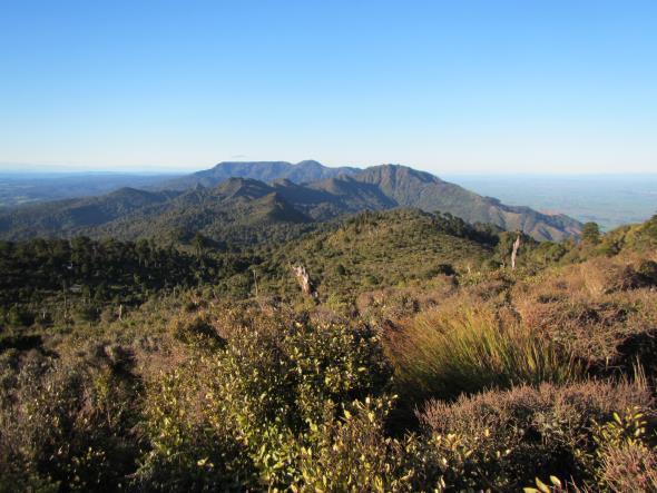
3 1 Background The Kaimai Range is a band of hills providing a dramatic boundary between the Waikato and the northern Bay Of Plenty. The Range provides the spine of the northern section of the Kaimai Mamaku Conservation Park. Conservation Parks are public lands managed by the Department of Conservation (DOC) so that their natural and historic resources are protected and public access and enjoyment facilitated. The Park is of significant historical interest (especially kauri extraction and various mining ventures), and has high ecological values, including varied forest types, a wide variety of vegetation and open ridgetop environments. There is a major amount of rugged bush and ridgetop spaces which are mostly beyond the reach of the casual day walker. But they have the potential to provide an ideal outdoor experience for capable and fit trampers and hunters. The Park lies within 2 hours driving for over half of New Zealand s population, and also a key New Zealand gateway for all the overseas visitors that are attracted by the many special outdoor experiences that our country provides. The backcountry potential of the Kaimai Range is not being realised because of scarce development resources within the DOC annual funding allocations, so the existing backcountry facilities of tracks and huts are patchy, suffering from : Insufficient huts location, size, facilities Intermittently maintained tracks Boggy tracks requiring surface protection Areas of special interest with downgraded access, rather than having suitable facilities to allow visitors to appreciate their significance. In 2014 the Kaimai Concept Plan was presented to DOC and the Outdoor Recreation Consortium to support successful applications for volunteer led funding aimed at : Development of the Kaimai Ridgeway - providing a new multi day trail incorporating spectacular ridgetop tracks that were becoming derelict Volunteer managed track maintenance for tramping tracks The construction of additional huts to provide comfortable shelter for multi day trips During 2015 there have been some significant outcomes from the resulting work, but to fully realise the objectives of the Kaimai Concept Plan, it has now evolved into this Kaimai Backcountry Management Plan, presenting a more comprehensive plan for the complete Kaimai backcountry experience. Version 2.2 Page 3 of th November, 2015
4 2 Objectives To provide well maintained tracks, huts and campsites throughout the Kaimai Range in order to : provide a wide range of options for enjoyable and achievable day and multi day backcountry activities; and provide comfortable places to stay for people undertaking multi day activities; and provide facilities that allow visitors to sensitively appreciate areas of ecological interest; and provide facilities for track maintenance work parties in remote areas; and provide facilities that support pest control activities; and provide facilities that encourage young people to enjoy and appreciate backcountry activities; and provide access to publicly owned conservation land 3 Outcomes Primary outcomes achievable from execution of this plan are : A significant increase in numbers of people engaging in backcountry activities in the Kaimai Range A named trail the Kaimai Ridgeway that attracts visitors from throughout New Zealand and from overseas, and leads to them recommending it to their friends A wider appreciation and enjoyment of all that is special in the Kaimai Range Facilities to support greater conservation protection throughout the Range The realisation of ownership of these outcomes by all participants 4 The Kaimai Community The Kaimai Community is an association of Kaimai Range interested groups, including tramping clubs from the Bay Of Plenty, the Waikato, and Auckland, and Deerstalkers branches from the Bay Of Plenty, Thames Valley, Hamilton and Auckland. This is evolving from an Auckland Tramping Club (ATC) led association into an independent organisation focused solely on the achievement of this plan. The intention by early 2016 is the formation of the Kaimai Ridgeway Charitable Trust (KRCT) to take over the current activities of the ATC DOC Partnership, and to become the organisation responsible for the execution of this Plan. 5 Kaimai Community - DOC Partnership An essential component of this plan is the partnership between the KRCT and DOC. While the KRCT can provide focused work in execution of the plan, it can only succeed via a close working relationship with DOC that acknowledges all the values and objectives that makes DOC such a special organisation for our country. Version 2.2 Page 4 of th November, 2015
5 There are some differing priorities, but with constant dialogue and listening to each other, these differences are resolvable, allowing achievement of mutually desired outcomes that each organisation cannot achieve on its own. 6 KRCT Management Structure The KRCT will consist of : A management committee that represents the major supporting clubs An affiliation from all supporting groups and interested individuals The role of the trust is to provide overall direction, prioritisation, co-ordination, and funding, with this being sustainable over a long period of time. As with the current Partnership agreement, affiliated clubs will take responsibility for execution of specific areas of responsibility within the Plan, be that the maintenance of a section of tracks, maintenance of hut(s), or a combination of the two. Multiple funding sources will be accessed, to ensure progress can be made quickly once Plans are established. 7 Affiliated Organisations The following organisations are affiliated with the KRCT, and share representatives with it : Auckland Deerstalkers Auckland Tramping Club Bay Of Plenty Deerstalkers Cambridge Tramping Club Individuals Kaimai Ramblers Katikati Tramping Club Manukau Tramping Club North Auckland Deerstalkers Tauranga Mid Week Tramping Group Thames Valley Deerstalkers Waikato Deerstalkers Waikato Tramping Club Whakamarama Community 8 Structure of the The remainder of this document elaborates the targets of the plan via : Description of the Kaimai Ridgeway route and facilities Detailing the Kaimai Range facilities and targets o Definition of geographical areas of the Kaimai Range, with maps, to assist in understanding of the detail o Detailing the current and planned Kaimai facilities by area, including targets for the KRCT o Detailing Kaimai facilities that are not in scope for potential inclusion in KRCT activity Providing suggestions for day, overnight, and multi day hike options that this Plan will assist to deliver Version 2.2 Page 5 of th November, 2015
6 9 High Priority Objective the Kaimai Ridgeway The Kaimai Ridgeway will deliver a significantly improved Kaimai backcountry experience leading to : Increased visitor numbers from New Zealand and Overseas for multi day trips Improved access and facilities for hunters Improved access and facilities for conservation work Increased visitor numbers and supporting services in the towns surrounding the Kaimai Range A major local community involvement, sense of ownership and pride in their local Park 9.1 New Huts The achievement of this requires 4 new huts, spaced suitably to support a day s hike for a person of medium fitness. In summary : Area Temporary Hut Name Purpose Priority South Ngamuwahine Hut Kaimai Ridgeway Night 1, hunting, track 1 (High) maintenance Wairere Kaimai Hut Kaimai Ridgeway Night 2, hunting, track 2 (High) maintenance Wairere Thompsons Hut Kaimai Ridgeway Night 3, track 3 (Med) maintenance North Mangakino Hut Kaimai Ridgeway Night 5 (Option 1 as below), track maintenance 4 (Med) Location details are provided later in this plan. Temporary hut names are highlighted in this plan by including the name in double quotes. These will all be of the same design, providing : 12 bunks, in a 2 level bunk platform style Water tank and outdoor sink Logburner with firewood provided Toilet Camping spaces near the hut It is anticipated that these huts will be funded and owned by the KRCT, but made available for public access as per other huts in the DOC hut network. In the spirit of recognising backcountry eventualities, with the ability to allow parties to adapt to changing weather conditions or individual needs, hut bookings will only be mandatory for large groups. This policy will be applied to all huts in the Park, excluding Waitawheta Hut. The following is a description of the planned Kaimai Ridgeway route and facilities for the, travelling from South to North. Version 2.2 Page 6 of th November, 2015

 Wairere Junction Wairere Falls (top) Wairere Track Optional side Wairere Junction Kaimai Hut Kaimai Ridgeway (previously North")
7 9.2 Day 1 Kaimai Summit to Ngamuwahine Hut Area Start End Via Notes South Kaimai Ridgeway Ngamuwahine Hut SH29 end Kaimai Ridgeway (previously North South Track) Hut priority Number 1 SH29 to Hurunui Hut 3 hours Hurunui Hut to Ngamuwahine Hut 3 hours 9.3 Day 2 Ngamuwahine Hut to Kaimai Hut Area Start End Via Notes South Ngamuwahine Hut Wairere Track / Kaimai Ridgeway Northern Junction Kaimai Ridgeway (previously North South Track) Wairere Junction Wairere Falls (top) Wairere Track Optional side Wairere Junction Kaimai Hut Kaimai Ridgeway (previously North South Track) trip Hut Priority Number 2 Version 2.2 Page 7 of th November, 2015


8 Ngamuwahine Hut to Wairere 3 hours Wairere to Kaimai Hut 2 hours 9.4 Day 3 Kaimai Hut to Thompsons Hut Area Wairere Start Kaimai Hut End Thompsons Hut Via Kaimai Ridgeway (previously North South Track) Notes Hut Priority Number 3 Kaimai Hut to Thompsons Hut 5 hours Version 2.2 Page 8 of 26 11th November, 2015

 Te Rereatukahia Hut Track / Wharawhara Tramway / Upper Waitawheta Tracks Option 1 good weather Option 2 less favourable weather This is a suggestion")
9 9.5 Day 4 Thompsons Hut to Te Rereatukahia Hut Area Start End Via Notes Wairere / Central Thompsons Hut Te Rereatukahia Hut Kaimai Ridgeway (previously North South Track) Thompsons Hut to Motutapere Hut Motutapere Hut to Te Rereatukahia Hut 3 hours 3 hours 9.6 Day 5 Te Rereatukahia Hut to Mangakino Hut or Waitawheta Hut Area Start End Via Notes Central / Te Rereatukahia Mangakino Hut North Hut Central / Waiorongomai Te Rereatukahia Hut Waitawheta Hut Kaimai Ridgeway (previously Old North South Track) Te Rereatukahia Hut Track / Wharawhara Tramway / Upper Waitawheta Tracks Option 1 good weather Option 2 less favourable weather This is a suggestion only that requires more careful assessment of options for the Mangakino Hut. The identified location here is potentially too close to Te Aroha and Dalys Clearing Hut, and a location on the NE side of the ridge in the vicinity of Pahiko may provide a better hut spacing, as well as a better location for work parties working on that section of the Kaimai Ridgeway. The current logistics for working up there are challenging, involving either helicopter flights, or a 700m climb with overnight gear and tools to a location where a year round water supply is not guaranteed. Version 2.2 Page 9 of th November, 2015


10 Option 1 Kaimai Ridgeway Te Rereatukahia Hut to Pylon Peak Pylon Peak to Mangakino Hut 4 to 5 hours 2 to 3 hours Option 2 Waitawheta Hut 6 to 7 hours 9.7 Day 6 / 7 Mangakino Hut or Waitawheta Hut to Karangahake Gorge Area Start End Via Notes North Mangakino Hut Karangahake Gorge Kaimai Ridgeway Option 1 (previously Mangakino Pack Track), Dickeys Flat, Waitawheta Pipeline Track North Waitawheta Hut Karangahake Gorge Waitawheta Stream, Dalys Clearing, Mangakino Pack Track, Dickeys Option 2 Version 2.2 Page 10 of th November, 2015

11 Area Start End Via Notes Flat, Waitawheta Pipeline Track North North North Mangakino Pack / Stream Junction Mangakino Hut or Waitawheta Hut Dalys Clearing Hut Karangahake Gorge Mangakino Stream Track, Mt Karangahake Dalys Clearing Hut Various Options ranging from 6 to 9 hours Mangakino pack Track or Waitawheta Stream Extension Option Overnight Option to extend to 7 days Karangahake Gorge Various Options Day 7 completion Version 2.2 Page 11 of th November, 2015

12 10 The Kaimai Range 10.1 Area Definition Area Definition Targets North From Karangahake Gorge south West of the Waitawheta Hut Southern boundary at a line drawn from Waitawheta Hut to the junction of the Mangakino Pack Track and the side track to the Tui Mine site Tramping tracks are potential KRCT maintenance once tracks further south are being managed well New standard Kaimai 12 bunk hut in the general vicinity of the Mangakino Shelter site options not assessed yet Dalys Clearing hut to be adopted by Manukau TC for maintenance from late 2015 Version 2.2 Page 12 of th November, 2015

13 Area Definition Targets North East East of the Waitawheta River From Waitawheta hut to the junction with the Wairoa Shelter Track, and the tracks East from that junction Some tracks are already In the KRCT maintenance schedule Other tracks to be added to KRCT maintenance as resources permit Area Definition Targets Waiorongomai Areas around Mt Te Aroha and the tracks to the West of Waiorongomai Stream Waipapa Track through to Waitawheta Hut Principally an area of DOC maintenance because of higher standard and use Version 2.2 Page 13 of th November, 2015

14 Area Definition Targets Central South of Waipapa Track East of Waiorongomai Stream All tracks and huts south to Thompsons track saddle Kaimai Ridgeway route from Waipapa south along the Old NS track Improvements to Te Rereatukahia Hut to make it a pleasanter place to stay A significant proportion of the tracks are already Eastern Kauri Grove Track requires DOC decisions on kauri protection approach Motutapere Hut maintenance transfers from TV Deerstalkers to KRCT Most tracks in this area are already In the KRCT maintenance schedule Version 2.2 Page 14 of th November, 2015

15 Area Definition Targets Wairere South from Thompsons Track Saddle to Wairere Track New standard Kaimai 12 bunk hut E of Thompsons saddle New standard Kaimai 12 bunk hut E of Thompsons saddle SW of Aongatete Lodge Kauritatahi Hut maintenance transfers from TV Deerstalkers to KRCT Rename the North South Track to Kaimai Ridgeway, extending the named route south from the Central area Commence KRCT maintenance from 2016 Medium term evaluation of reintroducing the tramping route along Te Henga Ridge, having regard to the measures required to protect this ecologically interesting area Version 2.2 Page 15 of th November, 2015

16 Area Definition Targets South All tracks S of the Wairere Track to SH29 New standard Kaimai 12 bunk hut at the site of the old Ngamuwahine shelter Most tracks are already In the KRCT maintenance schedule, or being added by early 2016 Mangamuka Hut maintenance transfers from BOP Deerstalkers to KRCT Hurunui Hut maintenance transfers from BOP Deerstalkers to KRCT Version 2.2 Page 16 of th November, 2015

17 Version 2.2 Page 17 of th November, 2015
18 10.2 Kaimai Backcountry Features These are included as in scope for this plan. Area Feature Targets North All tramping tracks around Mt Karangahake, excluding Waitawheta Pipeline Potential KRCT maintenance once tracks further south are being managed well Option to extend Kaimai Ridgeway to incorporate Mt Karangahake as an alternative to the Waitawheta Pipeline Mangakino Stream Track Medium priority KRCT maintenance and Kaimai Ridgeway extension Dickeys Flat to Mangakino Potential KRCT maintenance Stream Track junction Mangakino Pack Track S to KRCT maintenance junction with side track to Tui (Manukau TC TBC) Mine site Dean Track KRCT maintenance (Manukau TC TBC) Dalys Clearing Track KRCT maintenance (Manukau TC TBC) Dalys Clearing Hut KRCT maintenance (Manukau TC TBC) New hut - Mangakino Hut Assess options for a hut site for a standard Kaimai 12 bunk hut in the general vicinity to the Mangakino Shelter Hut priority (medium) after the 3 new huts further south North East Bluff Stream Track and Bluff Stream Kauri Grove track Waitengaue Track Wairoa Stream Track Lindemanns Loop Track Wairoa Shelter Track On the full south to north Kaimai Ridgeway, this will provide a comfortable backcountry overnight stop for night 5 as an alternative to Waitawheta Hut, which is larger and is a primary easy walking destination for larger groups To be added to KRCT maintenance as resources permit To be added to KRCT maintenance as resources permit To be added to KRCT maintenance as resources permit (Katikati TC) (Katikati TC) Version 2.2 Page 18 of th November, 2015
19 Area Feature Targets Upper Waitawheta Track to Wairoa Shelter Track junction To be added to KRCT maintenance as resources permit Waiorongomai Mangakino Pack Track from Tui Mine side track to Waipapa KRCT maintenance (Auckland TC) Track Tui mine site area Potential KRCT maintenance low Tracks to the W of Waiorongomai Stream priority KRCT to monitor maintenance state, but not expecting to be added into KRCT maintenance Central Pylon Peak Track KRCT construction and maintenance High priority to work with DOC to get completed and officially opened Kaimai Ridgeway (renamed from Old North South) through to Pylon Peak junction Kaimai Ridgeway (renamed from Old North South) from Pylon Peak junction to Te Rereatukahia hut Cashmores Clearing Track Upper Waitawheta Track / Wairoa Shelter Track junction down Wharawhara Tramway Track to the junction with Wharawhara Loop Track Wharawhara Link Track to Wharawhara Rd Te Rereatukahia Hut Track to Wharawhara Link Track junction Te Rereatukahia Hut (Auckland TC) High priority to work with DOC to implement track stabilisation and officially re-open (Auckland TC) Once the first section is open, this will be a high priority to clear, stabilise the surface and officially re-open Medium term priority to assess work required to make this track usable, taking note of the areas that require special protection To be added to KRCT maintenance as resources permit (Waikato TC) (Waikato TC) High priority tasks (KRCT / DOC activities) 1. Installation of sink and veranda extension 2. Installation of logburner, woodshed and establish timber supply process 3. Metalling of toilet track 4. Painting inside and out 5. Complete local track improvements On the full south to north Kaimai Ridgeway, this will provide a comfortable backcountry overnight stop for night 4. Version 2.2 Page 19 of th November, 2015
20 Area Feature Targets Central Te Rereatukahia Hut Track / Wharawhara Link Track junction to Hot Springs Rd (Also known as Kauri Grove Track) DOC to determine and implement kauri protection measures To then be added to KRCT North South Track from Te Rereatukahia Hut to Thompsons Track saddle Tuahu Track Sentinel Rock Track Mt Eliza Track Motutapere Hut maintenance as resources permit Rename to Kaimai Ridgeway High Priority to complete track remediation (metalling, etc) (Waikato TC) (Kaimai Ramblers) (Kaimai Ramblers) To be added to KRCT maintenance as resources permit Thames Valley Deerstalkers maintenance continues under the KRCT umbrella Wairere New hut Thompsons Hut A hut location to the south of Thompsons track far away enough to avoid any historic problems of people coming in from Thompsons track 4x4 Track. The suggestion is an existing small clearing at or about GR The location is just off the new N/S track and N/E about 150 Metres East on a ridge track that comes up from the East end of Thompsons Track Road (not a DOC track) The location offers a sunny warm spot, sheltered, with nice views to the north and west Standard Kaimai 12 bunk hut Hut priority (medium) after the 2 new huts further south Kauritatahi Hut Track Kauritatahi Hut On the full south to north Kaimai Ridgeway, this will provide a comfortable backcountry overnight stop for night 3. (Auckland TC) Maintain to a basic route standard Assessment of remedial track protection measures required Thames Valley Deerstalkers maintenance continues under the KRCT umbrella Version 2.2 Page 20 of th November, 2015
21 Area Feature Targets Wairere North South Track from KRCT maintenance Thompsons Track saddle to Wairere Track Poupou track from Upland Rd to Kaimai Ridgeway To be added to KRCT maintenance as resources permit Track from Wright Rd to Kaimai Ridgeway Section not maintained by Aongatete Lodge to be added to KRCT maintenance as resources permit New hut Kaimai Hut About GR (about 1 hour south of the Aongatete river crossing) being an ideal spot set at about 400 metres above sea level, sheltered for the South and East on what would be described as an inner ridge with views to the north and great views west to the face and top of Te Henga Ridge / Ngatamahinerua Tops. This location is on dry ground with minimal tree clearing required and has the plus of cell phone coverage. Standard Kaimai 12 bunk hut Hut priority (high) after the new Ngamuwahine Hut On the full south to north Kaimai Ridgeway, this will provide a comfortable backcountry overnight stop for the second night. Te Henga Ridge Track This is also located in an area of significant interest to deerstalking groups. Originally part of the North South Track this was closed for ecological protection, including to protect the ridge from significant damage because of areas that can become very boggy This is still accessed by hardy trampers and hunters, with a multitude of marking tapes and some old markers. With an appropriately designed and maintained track this would become a memorable fine weather addition to the Kaimai Ridgeway route options, and an interesting route for those keen to appreciate its ecological values. Version 2.2 Page 21 of th November, 2015
22 Area Feature Targets From the top of the ridge westwards is a Maori owned landblock Maurihoro B consultation required as part of future plans Wairere South South Wairere Track from the top of the Falls eastwards to where the North South Track turns southwards Wairere Track east from where the North South Track turns southwards North South Track from Wairere Track to Te Tuhi Track junction Te Tuhi Track, ending at the North South junction Ngamarama Track North South Track from Te Tuhi Track to Leyland O Brien Track junction Mangamuka Hut Tracks from Te Tuhi Track to the Mangamuka Hut and on to the North South Track Mangamuka Hut New hut Ngamuwahine Hut Leyland O Brien Track from Whakamarama Rd to Ngamuwahine Track junction It is a medium term priority to commence assessment of the options for reopening this route KRCT maintenance To be added to KRCT maintenance as resources permit Including determining where it officially exits / leaves Conservation land on the eastern side Rename to the Kaimai Ridgeway (Cambridge TC TBC) (Cambridge TC TBC) (Auckland TC) Rename to the Kaimai Ridgeway (Auckland TC) To be added to KRCT maintenance as resources permit Monitoring by BOP Deerstalkers BOP Deerstalkers maintenance continues under the KRCT umbrella New standard Kaimai 12 bunk hut at the site of the old Ngamuwahine shelter Highest hut priority detailed design and costing work in progress On the full south to north Kaimai Ridgeway, this will provide a comfortable backcountry overnight stop for the first night. This hut is also located in an area that is popular with the deerstalking groups (Tauranga Mid Week Tramping Group - TMWTG) Version 2.2 Page 22 of th November, 2015
23 Area Feature Targets Ngamuwahine and Ngamuwahine Loop (Bob s) Tracks Leyland O Brien Track from Ngamuwahine Track junction to North South junction North South Track from Leyland O Brien track junction to SH29 Hurunui Hut Henderson Tramway Tracks (North and West) Kaimai Summit Track (TMWTG) (TMWTG) Rename to the Kaimai Ridgeway (TMWTG) BOP Deerstalkers maintenance continues under the KRCT umbrella (TMWTG) (TMWTG) All Toilets at track ends The Kaimai Range has over 20 main public access points from roads around the boundaries of the Park. Not all of these have toilets Work with local authorities for the establishment and maintenance of toilets at the Kaimai public access points that do not already have a toilet Version 2.2 Page 23 of th November, 2015
24 10.3 Other Features These are not included in this plan, principally because they are easily accessible to a wide range of visitor types, and consequently already require and receive a significant amount of DOC maintenance and development resources. Area Feature Notes North Waitawheta Pipeline Track Waitawheta Valley Track from Franklin Rd to Waitawheta hut Waiorongomai Waitawheta Hut Waipapa Track Mt Te Aroha Track Tracks in the Waiorongomai Valley to the west of the Waiorongomai Stream Monitoring to assess any KRCT support applicable Waiorongomai Kauri Grove Track To be closed for kauri protection purposes once the Pylon Peak Track is complete Central Thompsons Track Not a DOC managed track Wairere Tracks maintained by Aongatete Lodge Wairere Track from western carpark to the junction near the top of the Wairere Falls Old alternative side track on the western ascent to the Wairere Falls All All access tracks that are not on Conservation land Version 2.2 Page 24 of th November, 2015
25 11 Future Kaimai Hiking Options This section suggests a number of day, overnight, and multi day hiking options in the Kaimai Range that the increased focus on providing suitable backcocuntry facilities will support Day Hike Options Some existing and planned single day hikes in the Park : Area Route Grade Status North Waitawheta River from Karangake Gorge Easy Existing North Mt Karangahake Waitawheta River circuit Medium - Existing Easy North Franklin Rd end circuit incorporating Dalys Medium Existing Clearing hut North East Waitengaue / Ananui Medium Existing North East Lindemann Loop / Wairoa Shelter Medium - Easy Existing Waiorongomai Wairongomai Pack tracks Easy Existing Central Waiorongomai Kaimai Ridgeway Waipapa Medium - Open 2015 Waiorongomai Pack loop Hard Wairere Thompsons Track E or W to / from Kauritatahi Hut / DC3 crash site Medium Existing - Thompsons Track is a mess Wairere Aongatete Lodge area tracks Easy Existing Wairere Wairere Falls / return Easy Existing Wairere / Wairere Falls / Te Tuhi Medium - Existing South Hard South Te Tuhi / Mangamuka Hut / NS loop Medium Existing South Henderson Tramway tracks / NS Easy Existing 11.2 Overnight Hike Options Some existing and planned overnight hikes in the Park : Area Route Grade Status North Franklin Rd to / from Waitawheta hut Easy Existing North Franklin Rd to / from Dalys Clearing hut Easy Existing North East Woodland Rd or Lindermann Rd to / from Waitawheta hut Medium Existing Waiorongomai Wairongomai valley to / from new Mangakino Medium Planned Hut Waiorongomai Wairongomai valley to / from Waitawheta Hut via existing tracks or incorporating the Pylon Peak Track Waiorongomai / Central Central Waiorongomai Valley Pylon Peak Kaimai Ridgeway - Te Rereatukahia Hut Kaimai Ridgeway Tuahu West Loop involving Te Rereatukahia Hut Kaimai Ridgeway Tuahu E etc from either Medium Existing / Under Construction Hard Existing / Under Construction Medium Existing Version 2.2 Page 25 of th November, 2015
26 Area Route Grade Status Wharawhara or Hot Springs Rd Central A number of road ends to / from Motutapere Medium Existing Hut Central / Wairere Thompsons Track E or W to / from Kauritatahi Hut Medium Existing - Thompsons Track is a mess Wairere Poupou / Aongatete access points Kaimai Medium Planned Ridgeway to / from new Thompsons Hut Wairere Poupou / Aongatete / Wairere Falls access Medium Planned points Kaimai Ridgeway to / from new Kaimai Hut South Te Tuhi to / from Mangamuka Hut Medium Existing South Te Tuhi / Whakamarama / Ngamuwahine Rd / Medium Planned Henderson Tracks / Kaimai Ridgeway to / from new Ngamuwahine Hut South Various road ends to / from Hurunui hut Easy Existing 11.3 Multi Day Hike Options Some existing and planned multi day hikes in the Park : Area Route Grade Status All Kaimai Ridgeway via SH29 Hurunui hut Ngamuwahine Hut Kaimai Hut Thompsons Hut Te Rereatukahia Hut Wharawhara Waitawheta Hut Mangakino track Dickeys Flat Karangahake Gorge 7 days (Medium) 5 days (Hard) Existing / Planned All Wairere / Central / North Kaimai Ridgeway via SH29 Hurunui hut Ngamuwahine Hut Kaimai Hut Te Henga Ridge Kauritatahi Hut / Thompsons Hut Te Rereatukahia Hut Kaimai Ridgeway Mangakino Hut Dickeys Flat Karangahake Gorge OR Mt Karangahake Kaimai Ridgeway via Wairere Falls Thompsons Hut Te Rereatukahia Hut Kaimai Ridgeway Mangakino Hut Mt Karangahake Karangahake Gorge 7 days (Medium) 5 days (Hard) Medium Hard 4 Days All Other Variations supporting 3+ day trips Medium - Hard Existing / Planned / Investigate Planned Existing / Planned / Investigate Version 2.2 Page 26 of th November, 2015
Kaimai Backcountry Management Plan
 Kaimai Backcountry Management Plan Kaimai Community Version 2.0 19 th September, 2015 Contents 1 Background... 3 2 Objectives... 4 3 Outcomes... 4 4 The Kaimai Community... 4 5 Kaimai Community - DOC Partnership...
Kaimai Backcountry Management Plan
 Kaimai Backcountry Management Plan Kaimai Ridgeway Trust Version 2.4 2 nd June, 2016 www.kaimairidgeway.nz Contents 1 Background... 3 2 Objectives... 4 3 Outcomes... 4 4 Policies... 4 5 The Kaimai Ridgeway
The Kaimais Concept. Improving Outdoor Recreational Opportunities in Kaimai Mamaku Conservation Park From Backwater to Stomping Ground
 The Improving Outdoor Recreational Opportunities in Kaimai Mamaku Conservation Park From Backwater to Stomping Ground Background The Kaimai range is a band of hills providing a dramatic boundary between
Kaimai Concept. The Kaimai Concept. Improving Outdoor Recreational Opportunities in Kaimai Mamaku Conservation Park From Backwater to Stomping Ground
 The Kaimai Concept Improving Outdoor Recreational Opportunities in Kaimai Mamaku Conservation Park From Backwater to Stomping Ground Background The Kaimai range is a band of hills providing a dramatic
Kaimai to coast. Walks and tramps. Activity planner KAIMAI-MAMAKU FOREST PARK AND SURROUNDING AREAS. Southern Kaimai and Mamaku Plateau 33
 Kaimai to coast Walks and tramps KAIMAI-MAMAKU FOREST PARK AND SURROUNDING AREAS Key to symbols is on pages 11 and 12. Activity planner Page Karangahake Gorge 13 Waitawheta Valley 17 Te Aroha and Waiorongomai
KKTC Club Trip Attendance & Leaders
 KKTC Club Trip Attendance & Leaders 2017-1977 Incomplete records for some years are due due to missing reports and trip books Date Venue No Leader 2017 1/01/2007 Waitawheta to log bogie and Dalys Hut loop
Submission on the Tukituki Catchment Proposal: EPA reference numbers; NSP 13/ , NSP 13/ , NSP 13/ , NSP 13/02.
 Hutt Valley Tramping Club PO Box 30 883 LOWER HUTT 5045 Tukituki Catchment Proposal Environmental Protection Agency Private Bag 63 002 WELLINGTON 6140 29 July 2013 Submission on the Tukituki Catchment
Karaka Mountain Bike Track Bridge Structures
 Memo Information 1 Karaka Mountain Bike Track Bridge Structures TO FROM Infrastructure Committee Greg Hampton - Area Manager, Thames & Coromandel DATE 4 November 2015 SUBJECT Karaka Mountain Bike Track
A summary of Draft Makara Peak Mountain Bike Park Master Plan
 A summary of Draft Makara Peak Mountain Bike Park Master Plan OVEMBER 216 Image: Peter Marshall 2 3 Introduction Since it was established in 1998, the Makara Peak Mountain Bike Park (Makara Peak) has grown
Quick Start Track 1: Hokianga to Opua/Russell
 Quick Start Track 1: Hokianga to Opua/Russell Kaikohe to Okaihau section PROJECT DESCRIPTION The overall opportunity is to develop a 90-kilometre trail from the Hokianga Harbour on the West coast through
Preferred Recreation Recommendations Stemilt-Squilchuck Recreation Plan March 2018
 Preferred Recreation Recommendations Stemilt-Squilchuck Recreation Plan March 2018 Below are the recommended recreation ideas and strategies that package together the various recreation concepts compiled
RE: Access Fund Comments on Yosemite National Park Wilderness Stewardship Plan, Preliminary Ideas and Concepts
 September 30, 2016 Superintendent Yosemite National Park Attn: Wilderness Stewardship Plan P.O. Box 577 Yosemite, CA 95389 RE: Access Fund Comments on Yosemite National Park Wilderness Stewardship Plan,
The Strategic Commercial and Procurement Manager
 Item 3 To: Procurement Sub Committee On: 8 June 2016 Report by: The Strategic Commercial and Procurement Manager Heading: Renfrewshire Council s Community Benefit Strategy 2016 1. Summary 1.1. The purpose
Waikato Plan. A SUMMARY Building champion communities, together. August 2017
 Waikato Plan A SUMMARY Building champion communities, together August 2017 The mighty Waikato region is a place of powerful possibilities. Forged by a proud history and shared excitement about the future,
Park-specific management and policies Wainuiomata Recreation Area
 Park-specific management and policies Wainuiomata Recreation Area 6.8 Wainuiomata Recreation Area 6.8.1 Legal status Title held: Legislative status: Wellington Regional Council Administered under Local
Illawarra Escarpment State Conservation Area Walking Tracks
 Illawarra Escarpment State Conservation Area Walking Tracks NPWS Illawarra Area Office Ground Floor, Government Office Block 84 Crown Street Wollongong NSW 2500 02 4223 3000 (Mon-Fri) Royal National Park
Around and about Geraldine
 Around and about Geraldine A guide to recreational opportunities SOUTH CANTERBURY Track classifications Short walk Easy walking for up to an hour Track is well formed, with an even, welldrained surface.
Waikato Regional Economic Development Strategy
 Waikato Regional Economic Development Strategy 1 TO FROM Economic Development Committee Ben Dunbar-Smith - Economic Development Programme Manager DATE 6 April 2016 SUBJECT Waikato Regional Economic Development
$244 $45 OVERVIEW National Land Transport Programme Bay of Plenty BAY OF PLENTY REGIONAL SUMMARY
 2015 18 National Land Transport Programme Bay of Plenty BAY OF PLENTY REGIONAL SUMMARY OVERVIEW Transport investment in the Bay of Plenty is targeted to support significant residential growth, new industrial
Land Management Summary
 photo credit: ANGAIR Anglesea Heath Land Management Summary The Anglesea Heath (6,501 ha) was incorporated into the Great Otway National Park in January 2018. This provides an opportunity to consider the
The Aotea Track offers a range of spectacular landscapes, superb views and rich history.
 Aotea Track Located in Great Barrier Island/Aotea in the Auckland region The Aotea Track offers a range of spectacular landscapes, superb views and rich history. Travel over streams that show off a constant
Regional Transport Committee OPEN MINUTES
 Regional Transport Committee OPEN MINUTES Minutes of a meeting of the Regional Transport Committee held in Council Chambers, Waikato Regional Council, 401 Grey Street, Hamilton East on 11 June 2018 at
Discover... Sledge. Track. Essence of Aotearoa. You ll find there s much more than meets the eye!
 Sledge Discover... Track Essence of Aotearoa You ll find there s much more than meets the eye! Discover... Manawatu s timeless walkway adventure. Lying in the heart of the scenic Kahuterawa Valley, Sledge
Kit Carson-Challenger Ridge Trail Project Annual Performance Report-2014 October 22, 2014
 1 Kit Carson-Challenger Ridge Trail Project Annual Performance Report-2014 October 22, 2014 Willow Lake and Kit Carson Peak 2 SUMMARY The Rocky Mountain Field Institute began Phase 1 of a multi-phase,
Proposal to Redevelop Lower Kananaskis River-Barrier Lake. Bow Valley Provincial Park. Frequently Asked Questions
 Proposal to Redevelop Lower Kananaskis River-Barrier Lake Bow Valley Provincial Park Frequently Asked Questions What is being proposed? What are the details of the proposal? Where is the project area located?
Continental Divide National Scenic Trail Legislative History and Planning Guidance
 Continental Divide National Scenic Trail Legislative History and Planning Guidance Legislation, Policy, and Direction Regarding National Scenic Trails The National Trails System Act, P.L. 90-543, was passed
First proposed route Purangi Estuary to Hot Water Beach. Stella Evered Reserve. Purangi Estuary
 Great Walks Project First proposed route Purangi Estuary to Hot Water Beach PACIFIC OCEAN Cathedral Cove Hahei Hereheretaura Ngati Hei Pa site Stella Evered Reserve Proposed Carpark Lees Rd Blow Hole site
Calderdale MBC. Wards Affected: Town. Economy and Investment Panel: 20 October Halifax Station Gateway Masterplan
 Calderdale MBC Wards Affected: Town Economy and Investment Panel: 20 October 2016 Halifax Station Gateway Masterplan Report of the Acting Director, Economy and Environment 1. Purpose of the Report 1.1
Discover. Sledge Track Essence of Aotearoa
 Discover Sledge Track Essence of Aotearoa Discover Manawatu s timeless walkway adventure. Lying in the heart of the scenic Kahuterawa Valley, Sledge Track brings you face to face with the majesty of New
Visitor Management Plan innovative and hospitable
 Visitor Management Plan 2015-2020 innovative and hospitable Outline of policy, objectives, and enabling conditions Drawn up on 19 March 2015 1. Introduction The Visitor Management Plan 2015-2020 outlines
East West route and Leatham Molesworth route (route guide) Molesworth Recreation Reserve
 Molesworth Recreation Reserve") East West route and Leatham Molesworth route (route guide) Molesworth Recreation Reserve 0BIntroduction The East West route links the Clarence (Kahutara River in Ka Whata Tu o Rakihouia) Conservation Park
East West route and Leatham Molesworth route (route guide) Molesworth Recreation Reserve 0BIntroduction The East West route links the Clarence (Kahutara River in Ka Whata Tu o Rakihouia) Conservation Park
Item 1. Leadership Board. On: 1 April Report by: Director of Development and Housing Services. Heading: Update on City Deal. 1.
 Item 1 To: Leadership Board On: 1 April 2015 Report by: Director of Development and Housing Services Heading: Update on City Deal 1. Summary 1.1 This report seeks to update the Board on the work that has
Final Environmental Impact Statement for the Merced Wild and Scenic River. Comprehensive Management Plan, Yosemite National Park, Madera and Mariposa
 This document is scheduled to be published in the Federal Register on 02/26/2014 and available online at http://federalregister.gov/a/2014-04061, and on FDsys.gov DEPARTMENT OF THE INTERIOR 4312-FF NATIONAL
Accommodation Survey: November 2009
 Embargoed until 10:45am 19 January 2010 Accommodation Survey: November 2009 Highlights Compared with November 2008: International guest nights were up 2 percent, while domestic guest nights were down 1
PROPOSED PARK ALTERNATIVES
 8 Chimne y Rock State Park M a ster Pl an 2011 PROPOSED PARK ALTERNATIVES Introduction Three different park development concepts were prepared and presented to the citizens of North Carolina through a
Proposal to Redevelop Lower Kananaskis River-Barrier Lake. Bow Valley Provincial Park
 Frequently Asked Questions Proposal to Redevelop Lower Kananaskis River-Barrier Lake Bow Valley Provincial Park Frequently Asked Questions What has been decided? What are the details of the plan? What
Te Kowhai COMMUNITY PLAN
 1 2011-2021 Te Kowhai COMMUNITY PLAN Vision To realise a lifestyle potential 2 Map of Te Kowhai area 3 4 History of the plan In 2004 the Te Kowhai Community Group Committee and the residents put together
Exemplar for Internal Achievement Standard Geography Level 1. Conduct geographic research, with direction
 Exemplar for internal assessment resource Geography for Achievement Standard 91011 Exemplar for Internal Achievement Standard Geography Level 1 This exemplar supports assessment against: Achievement Standard
Auckland Port and the Unitary Plan Dr Douglas Fairgray
 Auckland Port and the Unitary Plan Dr Douglas Fairgray Source: Auckland 1886 - Sir George Grey Special Collections, Auckland Libraries, NZ Map 374 Scope The interface between the Unitary Plan and the Port
New Zealand Hiking & Kayaking Trip
 TRIP DURATION 7 days, 6 nights GRADE Moderate Hikes - Overnight hikes, some uneven terrain, you need to be reasonably fit and enthusiastic. Suitable for women who walk 2-3 times per week (regular walkers)
Walking tracks & trails of the Western Bay. westernbay.govt.nz
 Walking tracks & trails of the Western Bay westernbay.govt.nz Bowentown Domain 2 Walking tracks & trails of the Western Bay With its diverse environment of coastline, hills, wetlands, forest and grassland,
Logo Department Name Agency Organization Organization Address Information 5700 North Sabino Canyon Road
 Logo Department Name Agency Organization Organization Address Information United States Forest Coronado National Forest 5700 North Sabino Canyon Road Department of Service Santa Catalina Ranger District
Auckland Tramping Club Trips Programme as at June 27 th, 2018
 Auckland Tramping Club Trips Programme as at June 27 th, 2018 2018/2019 Summer Trips Plans A recent meeting bounced around a few ideas for the Christmas and Interim trips this is how it is shaping up at
Regional Economic Development Under-Secretary Fletcher Tabuteau
 EMBARGOED UNTIL 2.30 PM Regional Economic Development Under-Secretary Fletcher Tabuteau Speech to Waikato regional economic development stakeholders meeting hosted by Waikato Regional Economic Development
Trail Phasing Plan. Note: Trails in the Clear Creek Canyon area (Segments will be finalized in the future to minimize wildlife impacts
 Note: Trails in the Clear Creek Canyon area (Segments 2 5 and a future JCOS connection) will be finalized in the future to minimize wildlife impacts Trail Phasing Plan P Parking 3 Easy Trail Intermediate
Motorhome/campervan Permit Terms and Conditions
 Motorhome/campervan Permit Terms and Conditions These conditions apply to the permit holder and any person(s) accompanying them. Any breach of these permit conditions is a contravention of byelaw 11 of
April 10, Mark Stiles San Juan Public Lands Center Manager 15 Burnett Court Durango, CO Dear Mark,
 Mark Stiles San Juan Public Lands Center Manager 15 Burnett Court Durango, CO 81301 Dear Mark, We are pleased to offer the following comments on the draft San Juan Public Lands Center management plans
BACKCOUNTRY TRAIL FLOOD REHABILITATION PROGRAM
 BACKCOUNTRY TRAIL FLOOD REHABILITATION PROGRAM Backcountry Trail Flood Rehabilitation A June 2013 Flood Recovery Program Summary In June 2013, parts of Southern Alberta were devastated from significant
WAIKATO REGION CYCLE TRAILS NETWORK
 GROWING THE ECONOMIC BENEFITS OF INCREASED VISITORS ACROSS THE REGION BY LEVERAGING NEW AND EXISTING CYCLE TRAILS INVESTMENT WAIKATO REGION CYCLE TRAILS NETWORK 1 SO FAR The Waikato region supports and
Proposed Peninsula Bay Bike Track Development
 Proposed Peninsula Bay Bike Track Development May 2018 BACKGROUND The area of land at the northern extreme of Wanaka's Peninsula Bay development (Lot 923 DP 501325), currently owned by Infinity Investment
Queensland Tourism Aviation Blueprint to 2016
 Queensland Tourism Aviation Blueprint to 2016 tq.com.au Blueprint outline The purpose of the Queensland Tourism Aviation Blueprint to 2016 is to develop the strategic framework that will guide aviation
Sky City Entertainment Group Annual Meeting. Managing Director s Address
 Sky City Entertainment Group 2002 Annual Meeting Managing Director s Address Thank you Jon and good morning ladies and gentlemen. 2002 has been another busy and successful year for Sky City. Jon has alluded
Congewai Track Head (East) to Watagan Headquarters
 to Watagan Headquarters") Congewai Track Head (East) to Watagan Headquarters 7 hrs Hard track 17.2 km One way 4 973m This full day walk starts from the Congewai valley trackhead (east) and follows the Great North Walk up into the
Congewai Track Head (East) to Watagan Headquarters 7 hrs Hard track 17.2 km One way 4 973m This full day walk starts from the Congewai valley trackhead (east) and follows the Great North Walk up into the
HOW TO OPERATE A PRODUCT DEVELOPMENT FAMILIARIZATION TOUR MANUAL FINAL REPORT FOR DEPARTMENT OF TOURISM & CULTURE
 HOW TO OPERATE A PRODUCT DEVELOPMENT FAMILIARIZATION TOUR MANUAL FINAL REPORT FOR DEPARTMENT OF TOURISM & CULTURE August 2008 1.0 PROJECTAPPLICANT Kluane Inc. Geordan Clark, General Manager Box 20, Burwash
Working Towards Sustainable Tourism in England s AONBs
 Working Towards Sustainable Tourism in England s AONBs Purpose: this Accord sets out a shared vision for tourism in England s Areas of Outstanding Natural Beauty (AONBs) and outlines the contribution that
CAPE COLVILLE PORT JACKSON. Fantail Bay. Shelly Beach Long Bay COROMANDEL TOWN PASSENGER FERRY. Waikawau. Orere Point.
 CAPE COLVILLE PORT JACKSON Fantail Bay Fletcher Bay COASTAL WALKWAY Stony Bay Sandy Bay MOEHAU RANGE PORT CHARLES Marine Reserve Heritage & Mining Surfing Kauri Heritage TAS M A N S E A WHANGEREI AUCKLAND
Bus Reliability and Punctuality Performance
 Bus Reliability and Punctuality Performance Recommendation(s) That the Board: Board Meeting 26 August 2014 i. Notes the changes to the reporting of bus reliability and punctuality. As at July 2014 the
HOW SAFE ARE OUR ROADS? Tracking the safety performance of New Zealand s state highway network
 WAIKATO AND BAY OF PLENTY Regional results 0 What is KiwiRAP? KiwiRAP analyses the road safety ratings of New Zealand s (0+km/h) rural state highway network. KiwiRAP is part of an international family
Appalachian Trail Community
 Harpers Ferry, West Virginia Appalachian Trail Community A Designation Program of the Appalachian Trail Conservancy The Appalachian Trail Conservancy (ATC) mission is to preserve and manage the Appalachian
Wanderers Tramping Club Bulletin May August Trip Programme
 Trip Programme Trip Date Booking Information May 6 Queen Victoria s Head & Waiorongamai Morva Grades 3 and 1+ 827 7261 Open 23 April May 12-13 Lazy Tramper Overnight stay + dinner Open NOW All grades May
Policy PL Date Issued February 10, 2014
 Subject RENEWABLE ENERGY ON CROWN LAND Compiled by Renewable Energy Program, Biodiversity Branch Replaces Policy Directives Waterpower Site Release Crown Land Onshore Windpower Development - Crown Land
Council Controlled Organisations
 155 annual report 2013 / 2014 Council Controlled Organisations Council Controlled Organisations and Council Organisations provide opportunities for councils to provide services and activities. A Council
WAIKARAKA CYCLEWAY: LESSONS LEARNT. Daniel Newcombe & Ina Stenzel Auckland City Council
 WAIKARAKA CYCLEWAY: LESSONS LEARNT Daniel Newcombe & Ina Stenzel Auckland City Council Introduction Waikaraka cycleway is key link in Auckland regional cycle network Lessons learnt from two sections: Pikes
Report of the Strategic Director of Place to the meeting of Executive to be held on 11 September 2018
 Report of the Strategic Director of Place to the meeting of Executive to be held on 11 September 2018 Subject: M Arrangements for the establishment of a West Yorkshire Urban Traffic Management Control
Non-motorized Trail Plan & Proposal. August 8, 2014
 Town of Star Valley Ranch, Wyoming and the Star Valley Ranch Association in partnership with the USDA Forest Service, Bridger-Teton National Forest, Greys River Ranger District Non-motorized Trail Plan
PROTECTED AREAS ZONE - POLICY
 PROTECTED AREAS ZONE - POLICY.1 Introduction The Protected Areas Zone applies to the land depicted on the Ruapehu District Plan Maps as: Amenity Policy Area. Protected Areas - Conservation. (c) Protected
INVITATION TO PRE-QUALIFICATION FOR PARALLEL PROJECTS. +One
 INVITATION TO PRE-QUALIFICATION FOR PARALLEL PROJECTS +One A HUB IN TOMORROW S GOTHENBURG By 2030, there will be no borders between the Swedish Exhibition & Congress Centre, Gothenburg and the wider world.
Strategic Transport Forum 7 th December 2018
 Strategic Transport Forum 7 th December 2018 Agenda Item 7: East West Rail Recommendation: It is recommended that the Forum: a) Endorse the East West Rail Consortium s position in relation to the draft
National Park Authority Board Meeting
 Paper for decision 1. Introduction 1.1 Preparations for the introduction of four Camping Management Zones (covering less than 4% of the National Park) have progressed significantly since Scottish Ministers
TOWN OF PORT HEDLAND INNOVATE RECONCILIATION ACTION PLAN
 TOWN OF PORT HEDLAND INNOVATE RECONCILIATION ACTION PLAN www.porthedland.wa.gov.au Chief Executive Officer s Message The Town of Port Hedland is committed to reconciliation with its Aboriginal and Torres
Sibley LUPA. Board Executive Committee Meeting December 7, 2017
 Sibley LUPA Board Executive Committee Meeting December 7, 2017 Project Location & Project Area 1,318-acre Robert Sibley Volcanic Regional Preserve Project Area Purpose Project Purpose & Goals Append the
Now Hiring for Summer 2019!
 285 Hungry Hollow Road Chestnut Ridge, NY 10977 camp@thenatureplace.com 845.365.1234 www.thenatureplace.com Now Hiring for Summer 2019! Seeking: Camping Trip Leaders, Day Hiker Leaders, WSI/Lifeguards,
TRANSPORT FOR GREATER MANCHESTER COMMITTEE REPORT FOR RESOLUTION
 TRANSPORT FOR GREATER MANCHESTER COMMITTEE REPORT FOR RESOLUTION DATE: 11 November 2011 SUBJECT: REPORT OF: Proposed making of a Quality Partnership Scheme for the A6 corridor between Manchester and Hazel
Guildford Borough Transport Strategy 2017, Topic Paper: Transport, June 2017 (accompanying Local Plan 2017) Local Plan Transport Strategy 2017
 Local Plan Transport Strategy 2017") Guildford Society Transport Group Position Paper August 2017 Based on submissions in response to the June/July 2017 Local Plan consultation including material presented to Drop-in Session 15 July 2017.
Guildford Society Transport Group Position Paper August 2017 Based on submissions in response to the June/July 2017 Local Plan consultation including material presented to Drop-in Session 15 July 2017.
PERTH AND KINROSS COUNCIL. Enterprise and Infrastructure Committee 4 November 2009
 PERTH AND KINROSS COUNCIL 4 09/494 Enterprise and Infrastructure Committee 4 November 2009 STRATEGIC PRIORITIES FOR TOURISM AND AREA TOURISM PARTNERSHIP ARRANGEMENTS Report by Depute Director (Environment)
South Colony Basin Recreation Fee Proposal
 South Colony Basin Recreation Fee Proposal Purpose and Need for Collecting Fees in South Colony Basin: Forest Service appropriated funds have not been sufficient to maintain current recreational services
Accommodation Survey: February 2013
 Accommodation Survey: February 2013 Embargoed until 10:45am 11 April 2013 Key facts In February 2013, after removing seasonal variation: New Zealand guest nights rose 2.3 percent, following a fall of 4.1
CAIRNGORMS NATIONAL PARK BOUNDARY BILL
 These documents relate to the Cairngorms National Park Boundary Bill (SP Bill 72) as introduced in the Scottish Parliament on 21 September 2006 CAIRNGORMS NATIONAL PARK BOUNDARY BILL EXPLANATORY NOTES
Appendix 7 Local Green Spaces - Detailed Evidence
 Appendix 7 Local Green Spaces - Detailed Evidence Neigh Bridge Country Park, Somerford Keynes General information Neigh Bridge Country Park is situated at the southern entrance to Somerford Keynes village.
Draft Strategic Plans for Coillte s eight Business Area Units ( )
") Draft Strategic Plans for Coillte s eight Business Area Units (2011-2015) Response to Public Consultation from Mountaineering Ireland April 2013 1 Introduction Mountaineering Ireland welcomes this opportunity
Draft Strategic Plans for Coillte s eight Business Area Units (2011-2015) Response to Public Consultation from Mountaineering Ireland April 2013 1 Introduction Mountaineering Ireland welcomes this opportunity
Establishing a National Urban Park in the Rouge Valley
 STAFF REPORT ACTION REQUIRED Establishing a National Urban Park in the Rouge Valley Date: March 29, 2012 To: From: Wards: Reference Number: Executive Committee Deputy City Manager, Cluster B All p:\2012\cluster
Boxley Parish Council Highway Issues Briefing Note M2 junction 3 A229 Local Traffic Infrastructure
 Boxley Parish Council www.boxleyparishcouncil.org.uk Chairman: Bob Hinder Clerk: Pauline Bowdery Assistant Clerk: Melanie Fooks 28 November 2017 Boxley Parish Council Highway Issues Briefing Note M2 junction
Sponsorship & Partnership Opportunities
 Atherton Tablelands About Us Atherton Tablelands Promotion Bureau Limited was established in 1986 under the auspice of the former four Local Government Authorities governing the geographic region of the
Connie Rudd Superintendent, Black Canyon of the Gunnison National Park
 National Park Service U.S. Department of the Interior Black Canyon of the Gunnison National Park and Curecanti National Recreation Area Information Brochure #1 Wilderness and Backcountry Management Plan
Bibbulmun Track. Cape to Cape Track. Two of the world s great long distance walking tracks. 973 km. 135 km km Off-road cycle touring
 Trail revitalising Western Australia Bibbulmun Track 973 km Cape to Cape Track 135 km Two of the world s great long distance walking tracks 1062 km Off-road cycle touring Trail revitalising 1. Framework
Hawke s Bay Regional Parks Network. Pekapeka Regional Park Individual Park Plan
 Hawke s Bay Regional Parks Network Pekapeka Regional Park Individual Park Plan 2015-2024 Hawke s Bay Regional Council 159 Dalton Street Private Bag 6006 Napier 4110 Hawke s Bay New Zealand Telephone: 0800
EAST-WEST STITCH. Connecting the Western Edge of the City to the Centre
 98 AC_BEU_CCMP_2_TM1_4 _FD.indd 98 20/07/12 12:06 PM 02 EAST-WEST STITCH Connecting the Western Edge of the City to the Centre 01 02 Northern Motorway Daldy Street Fanshawe Street Nelson Street Hobson
As outlined in the Tatshenshini-Alsek Park Management Agreement, park management will:
 Management Strategy General Strategy The priority management focus for the park is to ensure that its internationally significant natural, cultural heritage and recreational values are protected and that
KICKING FOR 22. BOPRU Strategy July 2017
 KICKING FOR 22 Strategy July 2017 11.5k Registered players in 2017 Highest number of Maori players in NZ OVERVIEW # 1 The Bay of Plenty Rugby Sevens Strategy was first developed in 2013 in partnership
TOURISM PLAN
 GIPPSLAND accessible TOURISM PLAN 2013-2015 1 GIPPSLAND ACCESSIBLE TOURISM PLAN 2013-2015 Introduction Gippsland recognises the importance and benefits of building the region as an accessible tourism destination.
Living & Working Access and Recreation
 Living & Working Access and Recreation 5.9 Access and Recreation Background 5.9.1 The countryside has increasingly become a popular destination for visitors and an important resource for informal recreation.
Course Description. North Cascades Alpine Backpacking for Veterans
 Course Overview Join other Veterans in the North Cascades Range of Washington for the opportunity to connect outside of the military in one of the most remote and beautiful alpine environments in the lower
Hamilton City Council Transport Strategy
 Hamilton City Council Transport Strategy Where Does Access Hamilton Fit? Strategic Vision Deliver an affordable, integrated, safe, responsive and sustainable transport system. Support economic, social,
GOLDEN EARS PROVINCIAL PARK
 GOLDEN EARS PROVINCIAL PARK Trail Information as of October 10 th 2015 Do not underestimate the mountainous wilderness of Golden Ears Provincial Park. The combination of rugged terrain and rapidly changing
Airports and UAS: Managing UAS Operations in the Airport Vicinity
 ACRP Problem Statement 17-10-09 Recommended Allocation: $350,000 Airports and UAS: Managing UAS Operations in the Airport Vicinity ACRP Staff Comments This is one of four UAS-themed problem statements
Variances to Council s Ten Year Plan for. Lake Water Quality Initiatives. Preparation of Council s next Ten Year Plan
 Annual Plan 2008/2009 9 The following table shows how this capital work will be funded for 2008/09 Funding for Capital Expenditure 2008/09 Ten Yr Description 2007/08 Plan 2008/09 2006/07 Annual 2008/09
CRAZY HORSE TRAIL GUIDE
 CRAZY HORSE TRAIL GUIDE Abridged Version: July 2016 This is a short form of our interpretive trail guide for the Crazy Horse Trail. The full version of the guide has a more detailed description of the
Submission to. Southland District Council on. Draft Stewart Island/Rakiura Visitor Levy Policy and Bylaw
 Submission to Southland District Council on Draft Stewart Island/Rakiura Visitor Levy Policy and Bylaw Date: 9 November 2018 Tourism Industry Aotearoa (TIA) welcomes the opportunity to comment on Southland
TRAMPING Experience camping
 1 of 5 level: 2 credit: 3 planned review date: October 2008 sub-field: purpose: entry information: accreditation option: moderation option: Outdoor Recreation People credited with this unit standard are
CHAPTER 6 NOISE EXPOSURE
 CHAPTER 6 NOISE EXPOSURE FAA requires that the NEM submitted for review represent the aircraft noise exposure for the year of submittal (in this case 2008) and for a future year (2013 for OSUA). However,