CASTLE WAY, CARLISLE CASTLE, CARLISLE, CUMBRIA
|
|
|
- Arabella Lydia Anderson
- 6 years ago
- Views:
Transcription
1 CASTLE WAY, CARLISLE CASTLE, CARLISLE, CUMBRIA Archaeological Watching Brief Oxford Archaeology North July 2008 Balfour Beatty Utilities OA North Job No. L9897 Report Issue No: /709 NGR: NY SM no: 27657
2
3 Castle Way, Carlisle Castle, Carlisle, Cumbria: Archaeological Watching Brief 1 CONTENTS SUMMARY... 2 ACKNOWLEDGEMENTS INTRODUCTION Circumstances of the Project Site Location and Geology Historical and Archaeological Background METHODOLOGY Watching Brief Archive FIELDWORK Introduction Watching Brief Results Finds CONCLUSION Discussion Impact BIBLIOGRAPHY ILLUSTRATIONS List of Figures APPENDIX 1: CONTEXT LIST APPENDIX 2: FINDS LIST... 14
4 Castle Way, Carlisle Castle, Carlisle, Cumbria: Archaeological Watching Brief 2 SUMMARY An archaeological watching brief was undertaken by Oxford Archaeology North (OA North) at Carlisle Castle, Cumbria (NY ), on behalf of Balfour Beatty Utilities during the excavation of location pits preceding the rehabilitation of a water mains. The work was situated on the grassed area adjacent to Castle Way, to the south-east of the Castle entrance, but within the scheduled area of the Castle (SM no ). English Heritage requested a permanent archaeological presence during groundworks under condition 3 (iv) in the Scheduled Monument Consent (SMC). The watching brief was undertaken on 16 th and 17 th of August 2007, and comprised four small pits (Pits 1-4), of which the largest was 1.3m by 0.9m, and 0.9m deep. None of the pits were excavated beyond the made ground adjacent to Castle Way, and thus no features of archaeological interest were revealed.
5 Castle Way, Carlisle Castle, Carlisle, Cumbria: Archaeological Watching Brief 3 ACKNOWLEDGEMENTS Oxford Archaeology North would like to extend its thanks to Keith Milligan of Balfour Beatty Utilities for commissioning the project. The watching brief was carried out by Steve Clarke who also compiled the report. The finds were inspected by Chris Howard-Davis and the CAD drawings produced by Anne Stewardson. Emily Mercer edited the report and managed the project.
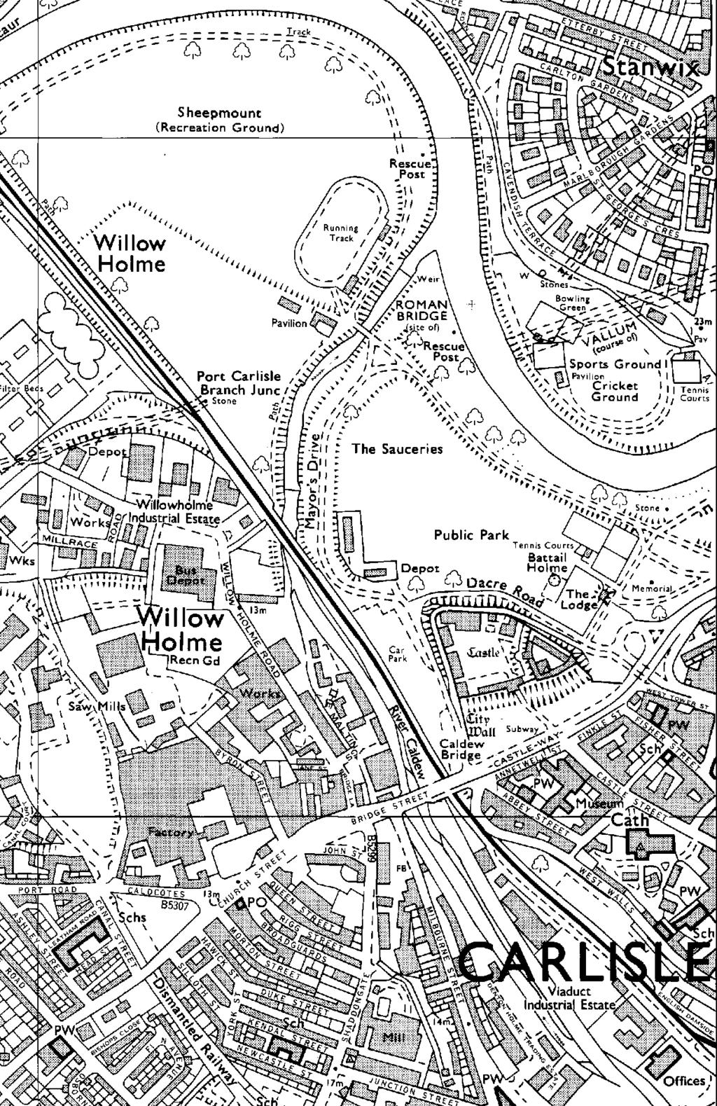
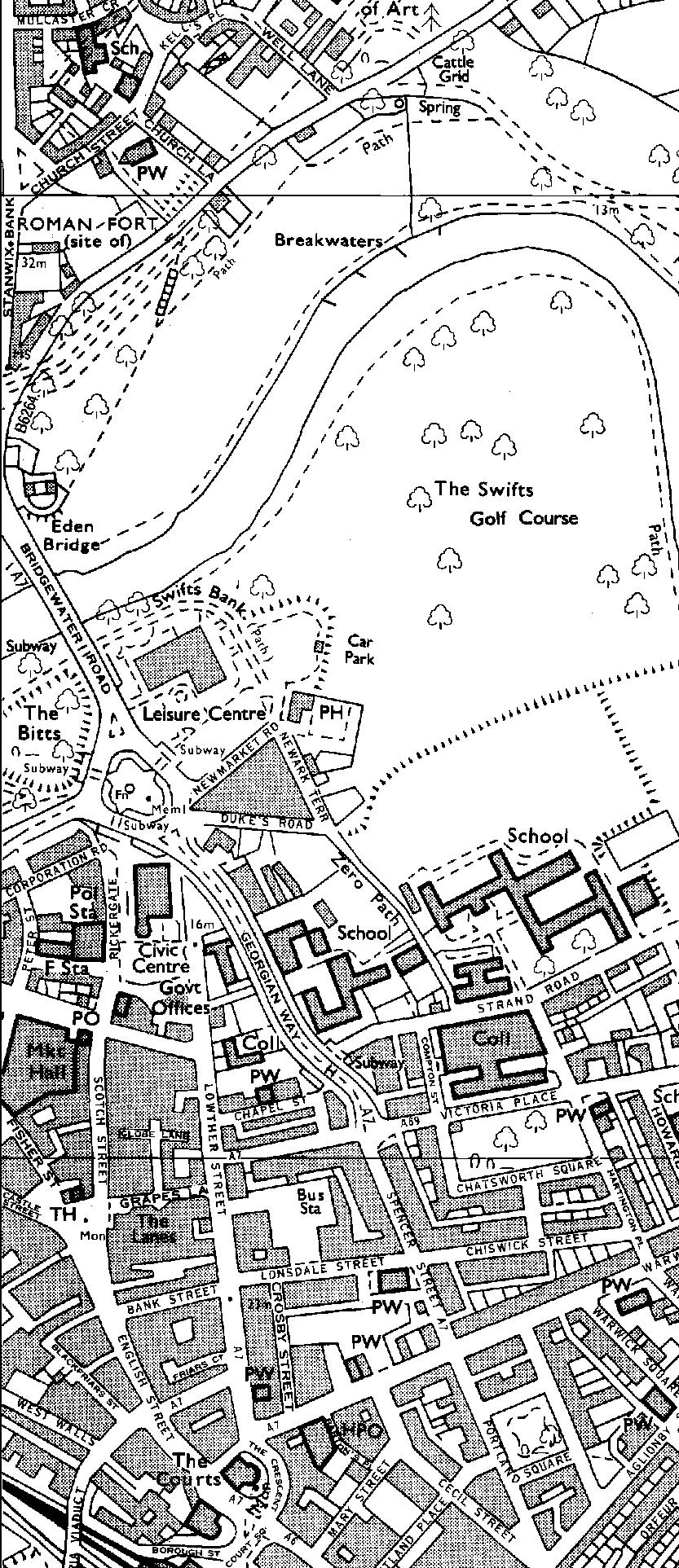
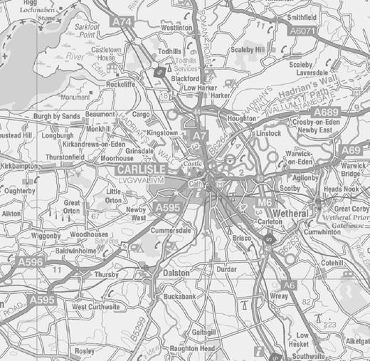
6 Castle Way, Carlisle Castle, Carlisle, Cumbria: Archaeological Watching Brief 4 1. INTRODUCTION 1.1 CIRCUMSTANCES OF THE PROJECT Following a proposal by Balfour Beatty Utilities to rehabilitate a cast iron water main within the grounds of the scheduled monument of Carlisle Castle, Carlisle, Cumbria (NGR centred NY ; SM no ), Oxford Archaeology North (OA North) was commissioned to maintain a permanent presence watching brief during excavation of launch and reception pits. The watching brief was required under condition 3 (iv) in the Scheduled Monument Consent (SMC), specified due to the possibility that archaeological remains, in particular occupation debris, may be present within the proposed area works. The work was undertaken on the 16 th and 17 th of August 2007, following the agreement and approval of English Heritage. Four pits were excavated in total (Pits 1-4), including two location pits, situated in the grounds outside the south wall of the castle. The following report details the results of the archaeological fieldwork. 1.2 SITE LOCATION AND GEOLOGY Carlisle is situated towards the northern edge of the Solway Plain, some eight miles upstream from the Solway Firth and about five miles above the tidal limit (Fig 1). The Scottish border, established finally in the thirteenth century, lies nine miles to the north of Carlisle, whilst the Roman frontier, marked by Hadrian s Wall, traverses the village-suburb of Stanwix, which lies on the opposite bank of the Eden immediately north of the city centre. For nearly two millennia, Carlisle has been a military and administrative centre for what is now known as Cumbria (McCarthy 1990, 1). The site is located immediately to the south of the Castle, adjacent to the north side of Castle Way, within the historic core of the city on the south bank of the river Eden, to the south-east of its confluence with the river Caldew. During the medieval period the city centre was clearly defined by the city walls (Fig 1), and there is evidence to suggest that the core of the Roman settlement was situated under the medieval town (ibid) The underlying geology of the area is composed mainly of mudstones and sandstones of Permo-Triassic age. The most important sandstone formation, the St Bees Sandstone, has been much quarried for use as building stone, and has imparted a distinctive character to much of the area s architecture (Countryside Commission 1998, 20). During the last glaciation, thick icesheets crossed the area, carrying with them vast quantities of rock debris, which was deposited as boulder clay (ibid). 1.3 HISTORICAL AND ARCHAEOLOGICAL BACKGROUND The following historical background presents a basic summary of the known archaeological resource within the vicinity in order to provide a context to the results.
7 Castle Way, Carlisle Castle, Carlisle, Cumbria: Archaeological Watching Brief Prehistoric Period: a limited amount of evidence for prehistoric activity has been found at a number of sites in the Carlisle area, including Annetwell Street (Caruana forthcoming), Blackfriars Street (McCarthy 1990, 13-4), Lowther Street (Flynn 1995), and the Northern Lanes (Zant forthcoming a), but little is known of any prehistoric settlement within the affected area. On the eastern side of the city, prehistoric activities are known from sites at Scotby Road, Botcherby and Garlands Hospital. At Scotby Road, Neolithic and early Bronze Age occupation was followed by two phases of pallisaded enclosure that may be Iron Age in date (McCarthy and Zant 1997a). At Botcherby, a possible roundhouse and other features were associated with Bronze Age pottery (McCarthy and Zant 1997b). At Garlands Hospital, a Bronze Age cremation cemetery was discovered on the hilltop in the nineteenth century, whilst a burnt mound was excavated towards the base of the hill in 1996 (LUAU 1996) Roman Period: in AD 72-3 a fort was established by the Romans on a natural promontory, which later became the site of the later medieval castle. By the end of the first century the fort formed part of the Tyne-Solway isthmus frontier known as the Stanegate; indeed, the presence in Carlisle, known as Luguvalium in the Roman period, of an official known as the centurio regionarius suggests that Carlisle may have been the command centre for this early northern frontier (Shotter 1997, 49). The area continued to be important strategically in the following century, and though the focal point of the emperor Hadrian's new frontier moved to the nearby fort of Stanwix, the recent millennium project excavations (Zant forthcoming b) have shown that the fort at Annetwell Street in Carlisle continued to be occupied into the post- Roman period A large civilian settlement grew up around the fort at Carlisle and by the early third century the town probably formed the civitas capital of the Carvetii, the indigenous tribal unit in the area. The full extent of this extramural settlement is not known but, considered to be large in comparison to other Roman settlements in the North West. It was thought largely to be confined to the approximate area of the later medieval walled city with significant occupation occurring along Botchergate to the south and Rickergate to the north at certain times (McCarthy 1991, 53) Medieval Period: the fate of Carlisle at the end of the Roman occupation is less clearly defined, although scattered traces of late fourth and fifth-century occupation have been identified (McCarthy 1990, 4) and archaeological evidence suggests the presence of an important church below the Cathedral in the tenth century (ibid). Other churches are also suspected to have existed between the seventh and eleventh century, although the supporting evidence is slight (ibid). Indeed, an Anglian monastery is attested to on documentary grounds (Colgrave 1940). The archaeological evidence for this period is largely based on coin-finds, notably a sceatta, stycas, and pennies of Aethelstan, Edgar, and Aethelred II (op cit, 5). Following the arrival of the Normans in 1092, and the construction of the medieval castle and town walls, Carlisle became a major frontier city on the borders of England and Scotland, continuing in this role until the Jacobite rebellion of 1745.
8 Castle Way, Carlisle Castle, Carlisle, Cumbria: Archaeological Watching Brief Post-medieval Period: little work has been carried out on the archaeology of post-medieval Carlisle. Documentary and cartographic sources suggest a recovery of fortunes in the city with a gradual rise in population from the sixteenth century onwards. For most of this period, Carlisle was a small county town whose inhabitants included a significant proportion of merchants, lawyers and gentry. By the end of the eighteenth century the population of the city may have grown to around (McCarthy 1993, 84) By the middle of the nineteenth century census records indicate the population of the city had increased seven or eightfold in little more than 50 years, and the size of the built-up area increased accordingly. Within the former walled area (most of the city walls, together with the gates, were demolished in the early nineteenth century), land to the rear of the street frontages, much of which had been occupied by gardens or other open spaces for centuries, was infilled with new housing, workshops, and light industrial buildings. This also happened in the suburban tenements and the suburbs themselves were greatly enlarged (OA North 2005).
9 Castle Way, Carlisle Castle, Carlisle, Cumbria: Archaeological Watching Brief 7 2. METHODOLOGY 2.1 WATCHING BRIEF A programme of observation was undertaken to record the location, extent, and character of any surviving archaeological features and/or deposits within the excavations in the course of the works. This work comprised the accurate recording of all archaeological features and horizons, and those artefacts identified during observation of works undertaken The recording comprised a full description and preliminary classification of features or structures revealed, on OA North pro-forma sheets, and their accurate location in plan. A photographic record in colour slide and monochrome formats was also compiled. 2.2 ARCHIVE A full archive of the watching brief has been produced to a professional standard in accordance with current English Heritage guidelines (English Heritage 1991). The archive will be deposited in the County Record Office, with a copy of the report given to the Cumbria Historic Environment Record. Copies of the report will also be deposited with English Heritage.

. The largest of these pits measured 1.3m by 1.2m.")
 is provided in Appendix 2.")

10 Castle Way, Carlisle Castle, Carlisle, Cumbria: Archaeological Watching Brief 8 3. FIELDWORK 3.1 INTRODUCTION The watching brief comprised observation of the excavation of four rectangular pits within the grassed area on the south side of the castle, situated to the east of the main entrance drive and north of Castle Way (Fig 2). The largest of these pits measured 1.3m by 1.2m. No archaeological features were revealed during the excavation of the pits, as the maximum depth was limited to within made ground. The details of the contexts are provided in Appendix 1 and a list of finds discussed below (Section 3.3) is provided in Appendix WATCHING BRIEF RESULTS Pit 1: was situated adjacent to the east edge of the entrance road and 9m north of the pavement on Castle Way. The pit measured 1.3m by 0.9m, and 0.9m deep. Beneath the topsoil, 100, was a subsoil, 101, of redeposited compact sandy-clay soil, with 50% inclusions of brick and limestone fragments, and tarmacadam. The cast iron water main was revealed at 0.6m depth. Plate 1: North-facing section of Pit Pit 2: was situated 36.8m east of the entrance road and 11.6m north of the pavement on Castle Way. The pit measured 0.65m by 0.55m, and 0.5m deep. Beneath the topsoil, 200, was a subs oil, 201, of redeposited firm sandy-clay, which was very stony with inclusions of chippings and pea-grit Pit 3: was situated adjacent to the pavement on Castle Way, and 35.3m east of the entrance road. The pit measured 1.5m by 0.5m, and 0.85m deep. Beneath the topsoil, 300, was a subsoil, 301, similar to that in Pit 2. The north-facing section revealed the make-up layers of the adjacent pavement.
11 Castle Way, Carlisle Castle, Carlisle, Cumbria: Archaeological Watching Brief Pit 4: was situated 15.4m east of the entrance road and 10.6m north of the pavement, and measured 1m by 0.8m, and 0.9m deep. Beneath the topsoil, 400, there was a 0.15m deep lens, 401, of sandstone fragments, mortar and stones. The subsoil, 402, was a very stony reddish-brown sandy-clay. 3.3 FINDS In all, 31 fragments were recovered during the investigation. All are of small to medium size, but not abraded. Their distribution is shown below in Table Two joining fragments from the make-up layer in Pit 3, 301, can be identified as amphora, probably of second to third century date. Its presence is not unexpected, albeit redeposited, as the castle stands upon the same site as its Roman forebear The remainder of the pottery can be dated to the late eighteenth and early nineteenth centuries, and is of a domestic nature, with white salt-glazed stoneware dishes and plates, Creamware and pearlware plate fragments, and a fine-walled stoneware tankard amongst the group. There are, in addition, several fragments of brown-glazed slip-decorated redwares. Part of the base of a small porcelain figure was recovered from the make-up layer in Pit 2, A small assemblage of animal bone was also recovered from 301. It has clearly been butchered, and includes a pig jaw with very worn teeth. Context Post-medieval pottery Romano- British pottery Animal bone Totals Totals Table 1: Distribution of finds
12 Castle Way, Carlisle Castle, Carlisle, Cumbria: Archaeological Watching Brief CONCLUSION 4.1 DISCUSSION The excavation of the pits for the purposes of upgrading of the water mains was limited to within the depth of the made ground adjacent to Castle Way, and within the area previously disturbed by the insertion of the former mains pipe. Therefore, the paucity of archaeological features is not surprising. The finds were mainly industrial or modern in date, reflecting the nature of the disturbance in the area. However, there were two sherds of adjoining Roman amphora fragment within the made ground, which had been imported from elsewhere. 4.2 IMPACT Due to the upgrading works being limited to the made ground, there will be no impact on any archaeological remains.
13 Castle Way, Carlisle Castle, Carlisle, Cumbria: Archaeological Watching Brief BIBLIOGRAPHY Caruana, ID, forthcoming The Roman Forts at Carlisle: Excavations at Annetwell Street Colgrave, B 1940 Two lives of St Cuthbert, London Countryside Commission, 1998 Countryside Character, Volume 2: North West, Cheltenham English Heritage, 1991 Management of Archaeological Projects, 2nd edn, London Flynn, PA, 1995 A watching brief at Lowther Street, Carlisle, Trans Cumberland Westmorland Antiq Archaeol Soc, n ser, 95, LUAU, 1996 Garlands Hospital, Carlisle: Evaluation Report, unpubl rep McCarthy, MR, 1990, A Roman, Anglian, and medieval site at Blackfriars Street, Carlisle, Cumberland Westmorland Antiq Archaeol Soc Res ser, 4, Kendal McCarthy, MR, 1991, Roman waterlogged remains at Castle Street, Cumberland Westmorland Antiq Archaeol Soc, Res ser, 5, Kendal McCarthy, MR, 1993 Carlisle, History and Guide, Stroud McCarthy, MR, and Zant, JM, 1997a Scotby Road, Durranhill, Carlisle: Report on an archaeological evaluation, unpubl rep McCarthy, MR, and Zant, JM, 1997b Botcherby Nurseries, Carlisle: An Archaeological evaluation for Carlisle City Council, unpubl rep OA North 2005 The Old Bingo Hall, Warwick Road, Carlisle: Archaeological Deskbase Assessment, unpubl rep Shotter, DCA, 1997, Romans and Britains in North West England, Lancaster Zant, JM, forthcoming a, The Northern Lanes, Carlisle Zant, JM, forthcoming b, Gateway City: Millennium Excavations at Carlisle
14 Castle Way, Carlisle Castle, Carlisle, Cumbria: Archaeological Watching Brief ILLUSTRATIONS LIST OF FIGURES Figure 1: Site Location Figure 2: Location of pits
15
16
17 Castle Way, Carlisle Castle, Carlisle, Cumbria: Archaeological Watching Brief 13 APPENDIX 1: CONTEXT LIST Context Trench Type Depth Description Topsoil 0.2m Greyish-brown friable sandy-clay, occasional small sub-rounded and subangular stone Backfill 0.75m Compact greyish-black soil, 50% inclusions of limestone chippings, small to medium sub-rounded stones and red brick fragments Topsoil 0.2m Greyish-brown friable sandy-clay, occasional small sub-rounded and subangular stone Make-up layer 0.3m Firm blackish-grey sandy-clay, 30% inclusions of chippings and pea-grit Topsoil 0.15m Blackish-brown friable sandy-silty-clay, 10% inclusions of small sub-rounded stones Make-up layer 0.7m Firm blackish-grey sandy-clay, 30% inclusions of small sub-rounded stones, occasional brick and sandstone fragments Topsoil 0.35m Greyish-brown friable sandy-clay, occasional small sub-rounded and subangular stone Make up layer Make up layer 0.15m Medium sandstone fragments, mortar, and small to medium sub-rounded stones. 0.55m Reddish-brown firm sandy-clay, 20% inclusions of small to medium subrounded stones.
18 Castle Way, Carlisle Castle, Carlisle, Cumbria: Archaeological Watching Brief 14 APPENDIX 2: FINDS LIST Context Material Category No Description Date 101 Ceramic Vessel 5 One fragment white salt-glazed stoneware dish; two fragments brown-glazed redware; two fragments slip-decorated ware. 201 Ceramic Vessel 6 Two fragments white salt-glazed stoneware; one fragment blackglazed redware; one fragment whiteglazed earthenware with painted decoration, one fragment white porcelain figurine base. 301 Ceramic Vessel 2 Two joining fragments amphora body. 301 Bone Animal 12 Fragments butchered animal bone, including pig. 401 Ceramic Vessel 6 One large fragment stoneware tankard; one fragment brown-glazed redware with simple slip-decoration; two fragments pearlware, one base, one plate rim; one fragment Creamware base; one fragment small grey stoneware bottle. Late eighteenth century? Late eighteenthnineteenth century Second to third century AD Undatable Late eighteenth to early nineteenth century
Northamptonshire Archaeology
 Northamptonshire Archaeology A programme of archaeological observation, investigation and recording at St Andrews Church, Spratton, Northamptonshire Northamptonshire Archaeology 2 Bolton House Wootton
ROUKEN GLEN: BANDSTAND 2015 DATA STRUCTURE REPORT
 ROUKEN GLEN: BANDSTAND 2015 DATA STRUCTURE REPORT Author (s) Ian Hill Editors Report Date June 2015 Working Partners Funders Phil Richardson East Renfrewshire Council East Renfrewshire Council, Heritage
Wessex Archaeology. Little Stubbings, West Amesbury, Salisbury, Wiltshire. Archaeological Watching Brief. Ref:
 Wessex Archaeology Little Stubbings, West Amesbury, Salisbury, Wiltshire Ref: 63280.02 March 2007 LITTLE STUBBINGS, WEST AMESBURY, NR SALISBURY, WILTSHIRE ARCHAEOLOGICAL WATCHING BRIEF Prepared for: P
Cholesbury New House, Parrots Lane, Cholesbury, Buckinghamshire
 Cholesbury New House, Parrots Lane, Cholesbury, Buckinghamshire An Archaeological Watching Brief For Mr Martin Wood by Sean Wallis Thames Valley Archaeological Services Ltd Site Code PLC 06/135 March 2007
The Coach House, Mill Lane, Cookham, Berkshire
 The Coach House, Mill Lane, Cookham, Berkshire An Archaeological Watching Brief For Ms Sophia Butler by Stephen Hammond Thames Valley Archaeological Services Ltd Site Code CMC 03/104 October 2003 Summary
An archaeological watching brief on land adjacent to 50 Rosebery Avenue, Colchester, Essex May/June 2003
 An archaeological watching brief on land adjacent to 50 Rosebery Avenue, Colchester, Essex May/June 2003 report prepared by C Crossan on behalf of Highfield Homes Ltd NGR: TM 0035 2500 CAT project ref.:
An archaeological excavation at 193 High Street, Kelvedon, Essex September 2009
 An archaeological excavation at 193 High Street, Kelvedon, Essex September 2009 report prepared by Ben Holloway and Howard Brooks on behalf of Marden Homes CAT project ref.: 09/4g NGR: TL 8631 1913 (c)
Archaeological Watching Brief on land at Alpha, Gore Road, Eastry, Kent July 2010
 Archaeological Watching Brief on land at Alpha, Gore Road, Eastry, Kent July 2010 SWAT. Archaeology Swale and Thames Archaeological Survey Company School Farm Oast, Graveney Road Faversham, Kent ME13 8UP
Holyport Manor Special School, Highfield Lane, Cox Green, Maidenhead, Berkshire
 Holyport Manor Special School, Highfield Lane, Cox Green, Maidenhead, Berkshire An Archaeological recording action For CgMs Consulting by Jennifer Lowe Thames Valley Archaeological Services Ltd Site Code
Gorse Stacks, Bus Interchange Excavations Interim Note-01
 Gorse Stacks, Bus Interchange Excavations 2015 Prepared for: Cheshire West & Chester Council Interim Note-01 1 Introduction & Summary Background Since c. 2000 investigations associated with redevelopment
An archaeological fieldwalking evaluation at Tile House Farm, Great Horkesley, Essex July-September 2005
 An archaeological fieldwalking evaluation at Tile House Farm, Great Horkesley, Essex commissioned by ADP Chartered Architects on behalf of The Ingleton Properties Ltd and Mersea Homes CAT project code:
Land off Birdie Way, Rush Green, Hertford, Hertfordshire
 Land off Birdie Way, Rush Green, Hertford, Hertfordshire An Archaeological Evaluation for Bride Hall Development Limited by Sarah Coles Thames Valley Archaeological Services Site Code RGH00/ 01 January
BRONZE AGE FIELD SYSTEM AT SOUTHAMPTON AIRPORT
 Proc. Hampshire Field Club Archaeol. Soc. 65, 2010, 1-6 (Hampshire Studies 2010) BRONZE AGE FIELD SYSTEM AT SOUTHAMPTON AIRPORT By J SULIKOWSKA With contributions by LORRAINE MEPHAM and CHRIS J STEVENS
The Old Shire Horse Centre, Bath Road, Woolley Green, Maidenhead, Berkshire
 The Old Shire Horse Centre, Bath Road, Woolley Green, Maidenhead, Berkshire An Archaeological Watching Brief For Mr Derek Chesterman by Andrew Mundin Thames Valley Archaeological Services Ltd Site Code
Aylesbury Masonic Hall, Ripon Street, Aylesbury, Buckinghamshire
 Aylesbury Masonic Hall, Ripon Street, Aylesbury, Buckinghamshire An Archaeological Recording Action for Wakefield Building Services by Andrew Mundin Thames Valley Archaeological Services Ltd Site Code
Wheatlands House, Fleet Hill, Finchampstead, Berkshire
 Wheatlands House, Fleet Hill, Finchampstead, Berkshire An Archaeological Watching Brief For JCA International by James McNicoll-Norbury Thames Valley Archaeological Services Ltd Site Code WFF 08/26 August
Archaeological Monitoring at Ham Farm, Ham Road, Faversham, Kent
 Archaeological Monitoring at Ham Farm, Ham Road, Faversham, Kent NGR: 601750.0mE 162695.0mN Site Code HAM/WB/12 Report for A.J. Bray SWAT ARCHAEOLOGY Swale and Thames Archaeological Survey Company The
Manor Farm, Wilcot, Pewsey, Wiltshire
 Manor Farm, Wilcot, Pewsey, Wiltshire An Archaeological Evaluation for Mr W. Madiment by Helen Moore Thames Valley Archaeological Services Ltd Site Code MFP02/78 September 2002 Summary Site name: Manor
Archaeological Investigations Project South East Region SOUTHAMPTON 2/842 (C.80.C004) SU
 SU") SOUTHAMPTON City of Southampton 2/842 (C.80.C004) SU 4382 1336 125 BITTERNE ROAD WEST, SOUTHAMPTON Report on the Archaeological Evaluation Excavation at 125 Bitterne Road West, Southampton Russel, A. D
SOUTHAMPTON City of Southampton 2/842 (C.80.C004) SU 4382 1336 125 BITTERNE ROAD WEST, SOUTHAMPTON Report on the Archaeological Evaluation Excavation at 125 Bitterne Road West, Southampton Russel, A. D
HILL-FORTS OF THE INNER TAY ESTUARY PERTH. Phase One PERTH AND KINROSS. Archaeological Survey Report. Oxford Archaeology North.
 HILL-FORTS OF THE INNER TAY ESTUARY PERTH PERTH AND KINROSS Phase One Archaeological Survey Report Oxford Archaeology North September 2012 Issue No: 2012-13/11322 OAN Job No: L10492a NGR: NO 182 153, NO
Following the initial soil strip archaeology is sprayed up prior to planning and excavation
 Barton Quarry & Archaeology Over the past half century quarries have been increasingly highlighted as important sources of information for geologists, palaeontologists and archaeologists, both through
Investigations at Jackdaw Crag Field, Boston Spa, SE , in by Boston Spa Archaeology and Heritage Group
 0 Investigations at Jackdaw Crag Field, Boston Spa, SE 42304632, in 2006-7 by Boston Spa Archaeology and Heritage Group www.bostonspaheritage.co.uk Preface and Summary This report records the results of
Henderson Mess, RAF Halton, Buckinghamshire
 Henderson Mess, RAF Halton, Buckinghamshire An archaeological watching brief for Stepnell Ltd by Stephen Hammond Thames Valley Archaeological Services Ltd Site Code RHA03/85 October 2003 Summary Site name:
An archaeological evaluation at 19 Beverley Road, Colchester, Essex February 2003
 An archaeological evaluation at 19 Beverley Road, Colchester, Essex February 2003 report prepared by Carl Crossan on behalf of Mr G and Mrs H Prince NGR: TL 98655 24844 CAT project ref.: 03/2d Planning
WHINFELL HOLME WASTE WATER TREATMENT WORKS, DESILTING AND SYPHON ACCESS TRACK Brougham, Cumbria
 WHINFELL HOLME WASTE WATER TREATMENT WORKS, DESILTING AND SYPHON ACCESS TRACK Brougham, Cumbria Archaeological Watching Brief Report Oxford Archaeology North February 2012 United Utilities Issue No: 2011/1205
S E R V I C E S. Land to the rear of Ashdown, Basingstoke Road, Spencers Wood, Reading, Berkshire. Archaeological Evaluation.
 T H A M E S V A L L E Y ARCHAEOLOGICAL S E R V I C E S Land to the rear of Ashdown, Basingstoke Road, Spencers Wood, Reading, Berkshire Archaeological Evaluation by Susan Porter Site Code: ASW12/21 (SU
o a London Borough of Barnet Stoney Wood Lake Silk Stream Flood Alleviation Scheme Archaeological Watching Brief Report Oxford Archaeology
 Silk Stream Flood Alleviation Scheme Stoney Wood Lake London Borough of Barnet Archaeological Watching Brief Report o a Oxford Archaeology November 2004 Client: Halcrow on behalf of Environment Agency
The Archaeology of Cheltenham
 The Archaeology of Cheltenham The archaeology collection of The Wilson contains a rich quantity of material relating to the prehistoric and Roman occupation of the North Cotswolds and parts of the Severn
Archaeological Watching Brief Report
 Belvedere Nurseries Fenny Stratford Nr Milton Keynes Buckinghamshire Archaeological Watching Brief o oa a June 2006 Client Name: Goodsons Associates on behalf of Dobbies Garden Centre PLC Issue N o : 1
An archaeological watching brief at the Sixth Form College, North Hill, Colchester, Essex
 An archaeological watching brief at the Sixth Form College, North Hill, Colchester, Essex July 2001 on behalf of Colchester Borough Council CAT project ref.: 01/7B Colchester Museum accession code: 2001.126
Archaeological Watching Brief at the Brick Stables and Wagon Lodge, Abbey Barns, Abbey Road, Faversham, Kent September 2010
 Archaeological Watching Brief at the Brick Stables and Wagon Lodge, Abbey Barns, Abbey Road, Faversham, Kent September 2010 SWAT. Archaeology Swale and Thames Archaeological Survey Company School Farm
Street Sweeper Dump Site, RAF Lakenheath ERL 160
 ARCHAEOLOGICAL MONITORING REPORT Street Sweeper Dump Site, RAF Lakenheath ERL 160 A REPORT ON THE ARCHAEOLOGICAL MONITORING, 2006 (Planning app. no. F/2006/0021/GOV) Jo Caruth Field Team Suffolk C.C. Archaeological
East Midlands Region LEICESTER 3/16 (E.62.A010) SK
 SK") LEICESTER City of Leicester 3/16 (E.62.A010) SK 5853 0433 12 NEW ST., CASTLE WARD, LEICESTER Cottage to the Rear of 12 New St., Castle Ward, Leicester - A Photographic Survey and Archaeological Watching
LEICESTER City of Leicester 3/16 (E.62.A010) SK 5853 0433 12 NEW ST., CASTLE WARD, LEICESTER Cottage to the Rear of 12 New St., Castle Ward, Leicester - A Photographic Survey and Archaeological Watching
SHILLA AND BOG HEAD BASTLES, KIELDER FOREST NORTHUMBERLAND. Fabric Survey Report. Oxford Archaeology North
 SHILLA AND BOG HEAD BASTLES, KIELDER FOREST NORTHUMBERLAND Fabric Survey Report Oxford Archaeology North October 2008 Forestry Commission Issue No: 2008-09/885 OA North Job No: L9830 NGR: NY 7636 9038
CARLUNGIE EARTH HOUSE
 Property in Care (PIC) ID: PIC015 Designations: Scheduled Monument (SM90059) Taken into State care: 1953 (Guardianship) Last reviewed: 2004 HISTORIC ENVIRONMENT SCOTLAND STATEMENT OF SIGNIFICANCE CARLUNGIE
South East WEST SUSSEX 3/1146 (E ) SU
 SU") WEST SUSSEX Arun 3/1146 (E.45.6000) SU 97370032 'GREENFIELDS', MIDDLETON-ON-SEA 'Greenfields', Middleton-on-Sea, West Sussex. Archaeological Excavation Saunders, M J Reading : Thames Valley Archaeological
WEST SUSSEX Arun 3/1146 (E.45.6000) SU 97370032 'GREENFIELDS', MIDDLETON-ON-SEA 'Greenfields', Middleton-on-Sea, West Sussex. Archaeological Excavation Saunders, M J Reading : Thames Valley Archaeological
Report on an archaeological watching brief at Thomas Lord Audley School, Monkwick, Colchester
 Report on an archaeological watching brief at Thomas Lord Audley School, Monkwick, Colchester July 2000 for WS Atkins Property Services Colchester Archaeological Trust 12 Lexden Road, Colchester, Essex
An archaeological evaluation at 1 York Road, Earls Colne, Essex March 2009
 An archaeological evaluation at 1 York Road, Earls Colne, Essex March 2009 report prepared by Ben Holloway and Howard Brooks on behalf of Mr Kurt Manders CAT project ref.: 09/3a NGR: TL 8575 2888 HEM project
Archaeological Evaluation Report
 Holywell House Osney Mead Oxford o a November 2007 Client: Knowles and Son Issue N o : 1 OA Job N o : 3826 Planning Ref N o : 02/01800/FUL NGR: SP 502 055 Client Name: Knowles and Son Client Ref No: Document
CARLISLE WASTEWATER TREATMENT WORKS, WILLOW HOLME INDUSTRIAL ESTATE, CUMBRIA
 CARLISLE WASTEWATER TREATMENT WORKS, WILLOW HOLME INDUSTRIAL ESTATE, CUMBRIA Desk-Based Assessment, Walkover Survey and Evaluation Oxford Archaeology North July 2008 United Utilities Issue No: 2008/09-839
North West CUMBRIA 3/760 (E ) NY
 NY") CUMBRIA 3/759 (E.16.6010) IRONWORKING SITES IN THE LAKE DISTRICT NATIONAL PARK Cumbria 2000: Geophysical Surveys of Ironworking Sites in the Lake District National Park Crew, P Blaenau Ffestiniog : Engineering
CUMBRIA 3/759 (E.16.6010) IRONWORKING SITES IN THE LAKE DISTRICT NATIONAL PARK Cumbria 2000: Geophysical Surveys of Ironworking Sites in the Lake District National Park Crew, P Blaenau Ffestiniog : Engineering
An archaeological excavation and watching brief at the Musket Club, Homefield Road, Colchester, Essex December 2004-February 2005
 An archaeological excavation and watching brief at the Musket Club, Homefield Road, Colchester, Essex December 2004-February 2005 report prepared by Howard Brooks on behalf of RMPA and the MoD CAT project
An archaeological evaluation at 14 Vineyard Street, Colchester, Essex March 2006
 An archaeological evaluation at 14 Vineyard Street, Colchester, Essex March 2006 report prepared by Ben Holloway commissioned by Colchester Borough Council CAT project code: 06/4b Colchester Museums accession
Florence House, High Street, Hurley, Berkshire
 Florence House, High Street, Hurley, Berkshire An Archaeological Watching Brief For Mr Michael Waterhouse by Jo Pine Thames Valley Archaeological Services Ltd Site Code FHH04/52 May 2004 Summary Site name:
IMTO Italian Mission to Oman University of Pisa 2011B PRELIMINARY REPORT (OCTOBER-DECEMBER 2011)
") IMTO Italian Mission to Oman University of Pisa 2011B PRELIMINARY REPORT (OCTOBER-DECEMBER 2011) The 2011B research campaign took place in the area around Salut from October, 19 th, to December, 16 th.
IMTO Italian Mission to Oman University of Pisa 2011B PRELIMINARY REPORT (OCTOBER-DECEMBER 2011) The 2011B research campaign took place in the area around Salut from October, 19 th, to December, 16 th.
Unlocking Our Coastal Heritage Project: Crane Castle Promontory Fort, Illogan, Cornwall
 Unlocking Our Coastal Heritage Project: Crane Castle Promontory Fort, Illogan, Cornwall As part of a wider project funded by the Rural Development Programme for England (RDPE) and administered through
Long Cairn Divis County Antrim
 Survey Report No. 66 Harry Welsh Long Cairn Divis County Antrim 2 Ulster Archaeological Society 2018 Ulster Archaeological Society c/o School of Natural and Built Environment Queen s University Belfast
ARCHAEOLOGICAL S E R V I C E S. Phase 5, Grimsby Road, Cippenham, Slough, Berkshire. Archaeological Recording Action.
 T H A M E S V A L L E Y ARCHAEOLOGICAL S E R V I C E S Phase 5, Grimsby Road, Cippenham, Slough, Berkshire Archaeological Recording Action by Andy Taylor Site Code: GRC13/57 (SU 9493 7977) Phase 5, Eltham
Pottery from Test-pits at Histon and Impington 14/15 May 2016
 Pottery from Test-pits at Histon and Impington 14/15 May 2016 Paul Blinkhorn The following pottery types were noted: BB: Brill/Boarstall Ware, c. AD1200-1600 (Mellor 1994). BD: Bourne D Ware, c. 1450-1637
E&M West Buildings Union Street, Aberdeen, AB10 1GD
 E&M West Buildings 32-38 Union Street, Aberdeen, AB10 1GD 30 November 2011 E&M West Buildings 32-38 Union Street, Aberdeen, AB10 1GD CONTENTS 1 INTRODUCTION 3 2 ARCHAEOLOGICAL BACKGROUND 4 3 THE WATCHING
Cambridge Castle Mound
 Cambridge Castle Mound Archaeological Watching Brief Report August 2013 Client: Cambridgeshire County Council OA East Report No: 1519 OASIS No: oxfordar3-172998 NGR: TL 4457 5919 Archaeological Watching
4. Bronze Age Ballybrowney, County Cork Eamonn Cotter
 4. Bronze Age Ballybrowney, County Cork Eamonn Cotter Illus. 1 Location map of the excavated features at Ballybrowney Lower (Archaeological Consultancy Services Ltd, based on the Ordnance Survey Ireland
Provincial Archaeology Office Annual Review
 2017 Provincial Archaeology Office Annual Review Provincial Archaeology Office Department of Tourism, Culture, Industry and Innovation Government of Newfoundland and Labrador March 2018 Volume 16 A brief
Archaeological Observation at The Bishop s Palace, Alvechurch, Worcestershire
 Warwickshire County Council THE MOAT HOUSE Archaeological Observation at The Bishop s Palace, Alvechurch, Worcestershire Chris Jones and Bryn Gethin Report 1059 December 2010 The Moat House: Archaeological
CARLISLE WASTEWATER TREATMENT WORKS, WILLOW HOLME INDUSTRIAL ESTATE, CUMBRIA
 CARLISLE WASTEWATER TREATMENT WORKS, WILLOW HOLME INDUSTRIAL ESTATE, CUMBRIA Rapid Desk-Based Research and Watching Brief Oxford Archaeology North July 2008 United Utilities Issue No: 2008/09-815 OAN Job
Excavations in a Medieval Market Town: Mountsorrel, Leicestershire,
 Excavations in a Medieval Market Town: Mountsorrel, Leicestershire, by John Lucas Mountsorrel is situated 12 kms north of Leicester and forms a linear settlement straddling the A6, Leicester to Derby road.
BROOKLYN COLLEGE EXCAVATIONS AT THE NEW UTRECHT REFORMED CHURCH
 BROOKLYN COLLEGE EXCAVATIONS AT THE NEW UTRECHT REFORMED CHURCH SUMMER 2002 The New Utrecht Reformed Church is the fourth oldest church in Brooklyn. Founded in 1677, in the heart of the Dutch town of New
Newbold Hall, Rochdale. An Archaeological Excavation
 School of the Built Environment CUBE Building, University of Salford 113-115 Portland Street Manchester M1 6DW Tel: 0161 295 3818 Email: m.d.nevelle@salford.ac.uk Web: www.cfaa.co.uk Newbold Hall, Rochdale.
THE HEUGH LINDISFARNE
 LINDISFARNE COMMUNITY ARCHAEOLOGY THE HEUGH LINDISFARNE Archaeological excavations in June 2017 Invitation to volunteers THE HEUGH, LINDISFARNE, NORTHUMBERLAND: ARCHAEOLOGICAL EXCAVATIONS 2017 INTRODUCTION
ULSTER ARCHAEOLOGICAL SOCIETY
 ULSTER ARCHAEOLOGICAL SOCIETY Survey Report: No. 52 Survey and surface artefact collection at Ballytaylor, County Antrim UAS/14/01 In association with HENRY WELSH, KARA WARD AND MOIRA O ROURKE 2 Ulster
Department of Tourism, Culture and Recreation Provincial Archaeology Office 2012 Archaeology Review February 2013 Volume 11
 Department of Tourism, Culture and Recreation Provincial Archaeology Office 2012 Archaeology Review February 2013 Volume 11 Area 14 of FjCa-14 in Sheshatshiu, portion of feature in southeast corner of
South West Region GLOUCESTERSHIRE 1/405 (B.23.H005) SU
 SU") GLOUCESTERSHIRE Cotswold 1/405 (B.23.H005) SU 16559880 COTSWOLD EASTERN SPINE ROAD STAGE 4 Cotswold Eastern Spine Road Stage 4 and Horcott Road. Watkins, K Gloucester : Gloucestershire County Council Archaeology
GLOUCESTERSHIRE Cotswold 1/405 (B.23.H005) SU 16559880 COTSWOLD EASTERN SPINE ROAD STAGE 4 Cotswold Eastern Spine Road Stage 4 and Horcott Road. Watkins, K Gloucester : Gloucestershire County Council Archaeology
An archaeological watching brief on a new cable trench at the Abbey Field sports pitches, Circular Road North, Colchester, Essex October 2006
 An archaeological watching brief on a new cable trench at the Abbey Field sports pitches, Circular Road North, Colchester, Essex report prepared by Ben Holloway on behalf of Atkins Defence CAT project
FOUNDATIONS OF ARCHAEOLOGY A WALK IN VERNDITCH CHASE
 FOUNDATIONS OF ARCHAEOLOGY A WALK IN VERNDITCH CHASE 1. A Tale of two Long Barrows Long barrows were constructed as earthen or drystone mounds with flanking ditches and acted as funerary monuments during
NORTH YORKSHIRE 2/1340 (C ) SE
 SE") NORTH YORKSHIRE Craven 2/1339 (C.36.6001) SD 97606975 SD 94507750 KILNSEY TO BUCKDEN WATER PIPELINE Kilnsey to Buckden Water Pipeline, North Yorkshire. Geophysical Survey (Report no. 841) Webb, A Leeds
NORTH YORKSHIRE Craven 2/1339 (C.36.6001) SD 97606975 SD 94507750 KILNSEY TO BUCKDEN WATER PIPELINE Kilnsey to Buckden Water Pipeline, North Yorkshire. Geophysical Survey (Report no. 841) Webb, A Leeds
South East Region SOUTHAMPTON 3/1050 (E.80.H006) SU
 SU") SOUTHAMPTON 3/1050 (E.80.H006) SU 43351328 16 HAWKESWOOD ROAD Report on the Archaeological Observations at 16 Hawkeswood Road, Bitterne Manor Russil, A & Smith, M Southampton : Southampton City Council
SOUTHAMPTON 3/1050 (E.80.H006) SU 43351328 16 HAWKESWOOD ROAD Report on the Archaeological Observations at 16 Hawkeswood Road, Bitterne Manor Russil, A & Smith, M Southampton : Southampton City Council
ANTONINE WALL - DULLATUR
 Property in Care (PIC) ID: PIC172 Designations: Scheduled Monument (SM90017); Taken into State care: 1960 (Guardianship) Last reviewed: 2018 HISTORIC ENVIRONMENT SCOTLAND STATEMENT OF SIGNIFICANCE ANTONINE
Chapter 4 Research on Block 13, Lots 3 and 4
 Chapter 4 Research on Block 13, Lots 3 and 4 George Calfas History Block 13, Lots 3 and 4 Oral history and the written record Squire McWorter acquired the deed to Block 13, Lots 3 and 4 in 1854. Squire
The Greek-Swedish-Danish Excavations at Kastelli, Khania 2010 a short report
 The Greek-Swedish-Danish Excavations at Kastelli, Khania 2010 a short report During six weeks from 19 July to 27 August the Greek-Swedish-Danish Excavations continued work in the Ag. Aikaterini Square
An archaeological watching brief at 97 High Street, Colchester, Essex March 2010
 An archaeological watching brief at 97 High Street, Colchester, Essex March 2010 report prepared by Donald Shimmin on behalf of Flying Trade Group plc CAT project ref.: 10/3a Colchester and Ipswich Museums
EXCAVATING THE ROMAN EMPIRE IN BRITAIN
 EXCAVATING THE ROMAN EMPIRE IN BRITAIN 2015 FIELD REPORT Amazon Riverboat Exploration 2012 FIELD REPORT 1 Excavating the Roman Empire in Britain 2015 FIELD REPORT Background Information LEAD PI: Nick Hodgson
UNIVERSITY OF LANCASTER ARCHAEOLOGY FORUM. 3 March 2007
 UNIVERSITY OF LANCASTER CENTRE FOR NORTH-WEST REGIONAL STUDIES ARCHAEOLOGY FORUM 3 March 2007 The Carlisle Millennium Excavations - John Zant From 1998 to 2001 a major programme of archaeological excavation
Report on the excavations on the site Novopokrovskoe II in V. Kol'chenko, F. Rott
 Report on the excavations on the site Novopokrovskoe II in 2016 V. Kol'chenko, F. Rott In 2016 the Novopokrovskiy archeological group of the Institute of History and Heritage of the National Academy of
Document History continued Revision: Date: Prepared by: Checked by: Approved by: Reason for Issue:
 Document History continued Revision: Date: Prepared by: Checked by: Approved by: Reason for Issue: 1.0 29/10/2013 Gary Evans Andy Shelley Richard Brown For Acceptance Fieldwork Report CRL Ltd, 2014 Fieldwork
South East SOUTHAMPTON
 Southampton SOUTHAMPTON 3/1056 (E.80.M010) SU 44181114 SO19 7PE 1 FOREST VIEW, SOUTHAMPTON Report on the Archaeological Watching Brief at 1 Forest View, Southampton, SOU 1232 Leivers, M Southampton : Southampton
New Studies in the City of David The Excavations
 The 2013-2014 Excavations Israel Antiquities Authority The intensive archaeological work on the city of David hill during the period covered in this article has continued in previously excavated areas
Pen-y-gaer Roman Vicus, Cwmdu, Powys: Draft Interim Report
 CPAT Report No 1107 Pen-y-gaer Roman Vicus, Cwmdu, Powys: ARCHAEOLOGICAL EXCAVATION THE CLWYD-POWYS ARCHAEOLOGICAL TRUST CPAT Report No 1107 Pen-y-gaer Roman Vicus, Cwmdu, Powys: ARCHAEOLOGICAL EXCAVATION
S E R V I C E S. Land at Wyeth Pharmaceuticals, Huntercombe Lane South, Taplow, Berkshire. An archaeological recording action.
 T H A M E S V A L L E Y ARCHAEOLOGICAL S E R V I C E S Land at Wyeth Pharmaceuticals, Huntercombe Lane South, Taplow, Berkshire An archaeological recording action By Daniel Bray WLS12/150 (SU 9339 8088)
ARDESTIE EARTH HOUSE HISTORIC ENVIRONMENT SCOTLAND STATEMENT OF SIGNIFICANCE. Property in Care no: 24
 Property in Care no: 24 Designations: Scheduled Monument (SM90021) Taken into State care: 1953 (Guardianship) Last reviewed: 2004 HISTORIC ENVIRONMENT SCOTLAND STATEMENT OF SIGNIFICANCE ARDESTIE EARTH
Land at Briar Rose, Afforsk, Gamrie, Banff, AB45 3ES Trench for erection of wind turbine
 Land at Briar Rose, Afforsk, Gamrie, Banff, AB45 3ES Trench for erection of wind turbine Cameron Archaeology 2 April 2011 Land at Briar Rose, Afforsk, Gamrie, Banff, AB45 3ES Trench for erection of wind
ROUKEN GLEN: MANSION HOUSE 2013 DATA STRUCTURE REPORT
 ROUKEN GLEN: MANSION HOUSE 2013 DATA STRUCTURE REPORT Author (s) Editors Report Date May 2014 Working Partners Funders Paul Murtagh Phil Richardson East Renfrewshire Council East Renfrewshire Council,
Contents. Crossrail Limited RESTRICTED. Summary of LSS85 archive Broadgate Excavations C257-MLA-T1-XTC-C101_WS
 Summary of LSS85 archive Broadgate Excavations Contents 1 Purpose...4 2 Scope...4 3 Definitions...4 4 LSS85 Archive Summary Report...4 5 Summary Data - Burials found in Liverpool Street...5 6 Note from
A FIELDWALKING PROJECT AT HOLLINGBURY, BRIGHTON. by JOHN FUNNELL
 Introduction A FIELDWALKING PROJECT AT HOLLINGBURY, BRIGHTON by JOHN FUNNELL Members of the Brighton and Hove Archaeological Society walked the field at Hollingbury during the months of December 1991 and
FORMER COUNTY OF SOUTH YORKSHIRE
 FORMER COUNTY OF SOUTH YORKSHIRE Barnsley 3/1883 (E.04.6010) SE 36491121 4 CHURCH HILL, ROYSTON 4 Church Hill, Royston, South Yorkshire. Archaeological Watching Brief (Report No. 868) O'Neill, R Leeds
ANNUAL REPORT: ANCIENT METHONE ARCHAEOLOGICAL PROJECT 2014 FIELD SCHOOL
 ANNUAL REPORT: ANCIENT METHONE ARCHAEOLOGICAL PROJECT 2014 FIELD SCHOOL Director(s): Co- Director(s): Professor Sarah Morris, Cotsen Institute of Archaeology, UCLA John K. Papadopoulos, Cotsen Institute
Neale Wade Community. College, March Cambridgeshire. Desktop Assessment. Client: Cambridgeshire County Council. March 2009
 Neale Wade Community Desktop Assessment Desktop Assessment College, March Cambridgeshire March 2009 Client: Cambridgeshire County Council OA East Report No: 1095 OASIS No: Oxfordar3-56453 NGR: TL 417 952
South West DORSET 3/1305 (E ) SY
 SY") DORSET East Dorset 3/1305 (E.19.6510) SY 93008000 COGDEAN ELMS, CORFE MULLEN Archaeological Watching Brief at Cogdean Elms, Corfe Mullen, Dorset (Doc.no.00.28) Manning, P T Exeter : Exeter Archaeology,
DORSET East Dorset 3/1305 (E.19.6510) SY 93008000 COGDEAN ELMS, CORFE MULLEN Archaeological Watching Brief at Cogdean Elms, Corfe Mullen, Dorset (Doc.no.00.28) Manning, P T Exeter : Exeter Archaeology,
Archaeological Investigations Project Eastern Region. Essex 2/197 (C.22.F025) TL
 TL") Essex Braintree 2/197 (C.22.F025) TL 75502284 BLANDFORD HOUSE, 7 LONDON ROAD, BRAINTREE Blandford House, 7 London Road, Braintree, Essex Davis, E Chelmsford : Essex County Council Field Archaeology Unit,
Essex Braintree 2/197 (C.22.F025) TL 75502284 BLANDFORD HOUSE, 7 LONDON ROAD, BRAINTREE Blandford House, 7 London Road, Braintree, Essex Davis, E Chelmsford : Essex County Council Field Archaeology Unit,
89 95 Ladbroke Road, Redhill, Surrey
 89 95 Ladbroke Road, Redhill, Surrey An Archaeological Desk-Based Assessment for Bovis Homes by Jennifer Lowe Thames Valley Archaeological Services Ltd Site Code LRR 03/36 April 2003 Summary Site name:
Montgomery, PowyS: Electricity Supply I
 THE CLWYD-POWYS ARCHAEOLOGICAL TRUST Montgomery, PowyS: Electricity Supply I ARCHAEOLOGICAL EVALUATION CPAT Report No 82 CPAT Report No 82 Montgomery, PowyS: Electricity Supply I ARCHAEOLOGICAL EVALUATION
Archaeological Investigations Project Yorkshire & Humberside Region NORTH YORKSHIRE 2/1113 (C.36.J002) SD
 SD") NORTH YORKSHIRE Craven 2/1113 (C.36.J002) SD 93607800 CRAY BECK, BUCKDEN, UPPER WHARFEDALE Cray Beck, The Archaeological Investigation of a Stone Feature Archetype Wensleydale : ArcheType Archaeological
NORTH YORKSHIRE Craven 2/1113 (C.36.J002) SD 93607800 CRAY BECK, BUCKDEN, UPPER WHARFEDALE Cray Beck, The Archaeological Investigation of a Stone Feature Archetype Wensleydale : ArcheType Archaeological
Beech House, F ordham Road, Exning, Suffolk
 Beech House, F ordham Road, Exning, Suffolk An Archaeological Monitoring of Works. Dave Webb CAMBRIDGE ARCHAEOLOGICAL UNIT UNIVERSITY OF CAMBRIDGE Archaeological Monitoring of works at Beech House, Fordham
OXFORD BEFORE THE UNIVERSITY The Late Saxon and Norman Archaeology of the Thames Crossing, the Defences and the Town
 OXFORD BEFORE THE UNIVERSITY The Late Saxon and Norman Archaeology of the Thames Crossing, the Defences and the Town Edited by Anne Dodd with major contributions by Maureen Mellor, Julian Munby, Mark Robinson
SUNKEN-FEATURED BUILDINGS ON A LATE ROMANO-BRITISH FARMSTEAD, RECTORY LANE, APPLEBY MAGNA, LEICESTERSHIRE
 SUNKEN-FEATURED BUILDINGS ON A LATE ROMANO-BRITISH FARMSTEAD, RECTORY LANE, APPLEBY MAGNA, LEICESTERSHIRE Sophie Clarke This paper presents the evidence for a number of sunken-featured buildings dating
Gorton Monastery: An Archaeological Evalaution Report. Final. Client: The Monastery of St Francis and Gorton Trust. Technical Report: Adam Thompson
 ARCHAEOLOGY Gorton Monastery: An Archaeological Evalaution Report Final Client: The Monastery of St Francis and Gorton Trust Technical Report: Adam Thompson Report No: 21/2015 Salford Archaeology, CfAA:
Jneneh in the Upper Wadi az-zarqa, in North Central Jordan, First Season 2011.
 Jneneh in the Upper Wadi az-zarqa, in North Central Jordan, First Season 2011. Khaled Douglas Jneneh is located in the north-western periphery of the city of Zarqa (grid ref. 250.88E 165.25N), in North
Pen Cerrig-calch prehistoric cairns
 Walk Information: Maps: OS Explorer OL13 Distance: 8 miles / 13 kilometres Duration: Allow at least 6 hours for the circular walk Difficulty: medium. Some narrow paths, occasionally rough underfoot Start
archaeological evaluation of sites to the west of the castle in 1988
 FLNT CASTLE archaeological evaluation of sites to the west of the castle in 1988 -.., - w -... " - Clwyd-Powys Archaeological Trust '.. - Flint Castle, Delyn: evaluation of sites west of the castle in
Prehistoric and Roman remains at Beaulieu Park, Chelmsford.
 Prehistoric and Roman remains at Beaulieu Park, Chelmsford. Archaeological Evaluation Report November 2011 Client: Countryside Zest OA East Report No: 1309 OASIS No: oxfordar3-112010 NGR: TL 73081 10779
Archaeological Investigations Project East Midlands Region NORTHAMPTONSHIRE
 NORTHAMPTONSHIRE 2/92 (C.34.A002) WAKEFIELD LODGE Wakefield Lodge, Northamptonshire. Archaeological Walkover Survey Bashford, D & Croft, A Oxford : Oxford Archaeology, 2001, 15pp, figs, tabs, refs Work