PRIMARY EDITION. Planning, designing and building Sydney Metro Northwest in your classroom
|
|
|
- Archibald Eaton
- 5 years ago
- Views:
Transcription


1 PRIMARY EDITION Planning, designing and building Sydney Metro Northwest in your classroom Sydney Metro s FastTracking the Future Education Program PRIMARY EDITION NOVEMBER Education covers.indd /2016 Printed on environmentally responsible paper manufactured using Elemental Chlorine Free (ECF) pulp sourced from certified, well managed forests. Planning, designing and building Sydney Metro Northwest in your classroom Ready to teach, syllabus-based lessons for K 6 Links to current syllabuses Activities and units of work for K 6 Lessons for Geography, Science, History, English, Mathematics and Creative Arts Teacher reference notes and extension work 10/11/2016 1:31 pm
2 Inside cover: Tunnel boring machine TBM2 Florence breaks through at Cherrybrook, January 2016 Front/back cover: Artist s impression of Sydney s new metro train on the skytrain Education covers.indd 2 10/11/2016 1:31 pm
3 PRIMARY EDITION NOVEMBER 2016 Ready to teach, syllabus-based lessons for K 6 Links to current syllabuses Activities and units of work for K 6 Lessons for Geography, Science, History, English, Mathematics and Creative Arts Teacher reference notes and extension work CONTENTS 4 About Sydney Metro 6 Sydney Metro Northwest Building a railway for the North West region of Sydney 14 Teacher briefing Linking your classroom to Sydney Metro Northwest 20 Topic One: A railway for Sydney s North West region 22 Topic Two: Linking the nation 24 Topic Three: Planning, designing and building a railway 28 Topic One: A railway for Sydney s North West region Lessons about planning for the future 78 Topic Two: Linking the nation Lessons linking the past to the present of Australian transport 196 Topic Three: Planning, designing and building a railway Lessons linking the present to the future of the North West region 250 Glossary A short list of terms used in this book 252 Production and development 256 Appendix SMART Notebook Activity sheets FASTTRACKING THE FUTURE PRIMARY EDITION NOVEMBER
4 Acknowledgments Transport for NSW would like to thank all writers, members of the Sydney Metro Northwest Education Reference Group, principals and teachers who have contributed to this education program. Disclaimer This is a Transport for NSW educational resource publication. It does not necessarily represent the views of, or information endorsed by, the NSW Department of Education and Communities. The information and material in this document is intended for educational purposes only. Transport for NSW is not responsible for and makes no representation or warranty in respect of the contents of this document, including the accuracy, adequacy, suitability or completeness of any information contained in this document. Transport for NSW will not be liable upon any claim (to the extent permitted by law) arising out of or in any way in connection with the provision of, or the purported reliance upon, or use of, this document by any person. Reproduction All rights reserved. No part of the material may be reproduced in Australia or in any other country by any process, electronic or otherwise, in any material form or transmitted to any other person or stored electronically in any form without the prior written permission of the Sydney Metro Northwest delivery office, Transport for NSW, except as permitted by the Copyright Act 1968 (Cth). School students in NSW and teachers in schools in NSW may copy reasonable portions of the material for the purposes of bona fide research or study. FastTracking The Future Primary Edition Summary Third Edition November 2016 Second Edition September 2015 First Edition March 2014 ISBN:

5 Community tours at Cherrybrook construction FASTTRACKING site, January 2016 THE FUTURE PRIMARY EDITION NOVEMBER

6 ABOUT SYDNEY METRO Sydney Metro is Australia s biggest public transport project. A new standalone railway, this 21st century network will deliver 31 metro stations and more than 65 kilometres of new metro rail for Australia s biggest city revolutionising the way Sydney travels. Services start in the first half of 2019 using Sydney s new generation of fully automated metro trains. From Sydney s booming north west region, metro rail will run under Sydney Harbour, through new underground stations in the CBD and beyond to the south west. Customers won t need a timetable when Sydney Metro opens they ll just turn up and go. When Sydney Metro is extended into the CBD and beyond in 2024, there will be ultimate capacity for a metro train every two minutes in each direction under the city a level of service never before seen in Sydney. Cudgegong Road Rouse Hill Kellyville DURAL KEY Sydney Metro Northwest open 2019 Sydney Metro City & Southwest alignment Bella Vista Norwest Showground Castle Hill Cherrybrook Upgrade and conversion to metro rail Sydney Trains surburban network M7 Motorway BLACKTOWN M2 Motorway Epping Macquarie University Macquarie Park North Ryde Chatswood PARRAMATTA M4 Motorway RYDE Crows Nest Victoria Cross LIDCOMBE Barangaroo Martin Place Pitt Street Central Hurlstone Waterloo Dulwich Campsie Park Hill Bankstown Lakemba Canterbury Sydenham Belmore Marrickville Punchbowl Wiley Park Figure 1: Sydney s new 65km long high-frequency metro rail system. 4 SYDNEY METRO PROJECT
7 Sydney s new metro railway will have a target capacity of about 40,000 customers per hour, similar to other metro systems worldwide. Sydney s current suburban system can reliably carry 24,000 people an hour per line. Sydney Metro, together with signalling and infrastructure upgrades across the existing Sydney rail network, will increase the capacity of train services entering the Sydney CBD from about 120 an hour today to up to 200 services beyond That s an increase of up to 60 per cent capacity across the network to meet demand. Sydney Metro project KEY FEATURES More than 65 kilometres of metro rail from Rouse Hill to Bankstown New generation of fast, safe and reliable metro trains No timetable just turn up and go Higher frequency trains during the day and late at night Reduced travel times for customers across the rail network More trains, more often in the peak through the CBD, providing more options for customers and less crowding on trains, stations and platforms Sydney Metro will help reduce crowding on the T1 Western Line and on trains from the south west, by creating extra capacity More trains from Sydney s north west and south west Opal ticketing and fares the same as the rest of Sydney providing a seamless journey for customers, making it even easier to move around Fast and easy to change to trains, buses, ferries and light rail Stand alone line operating independently of the existing rail network, not subject to wider suburban delays Connecting Sydney s economic centres with a boost of activity up to $5 billion per year New choices for jobs, education and recreation Faster transport to employment growth areas. FASTTRACKING THE FUTURE PRIMARY EDITION NOVEMBER

8 SYDNEY METRO NORTHWEST What is the Sydney Metro Northwest project? The $8.3 billion Sydney Metro Northwest project is currently under construction and is on track to open to customers in the first half of Sydney Metro Northwest, formerly the North West Rail Link, is the first stage of Sydney Metro. Sydney Metro is Australia s largest public transport project. Sydney Metro City & Southwest is the second stage. Sydney Metro Northwest will deliver eight new railway stations, 4000 commuter car parks and a train every four minutes in the peak. Customers won t need a timetable, you ll just turn up and go. Sydney Metro Northwest will use Opal ticketing, with fares set like the rest of Sydney. Sydney Metro Northwest will deliver, for the first time, a reliable public transport service to a region which has the highest car ownership levels per household in Australia. Over the coming decades, an extra 200,000 people will move into Sydney s North West, taking its population above 600,000, or twice the size of Canberra. Sydney s new generation of fast, safe and reliable metro trains will be rolled out on Sydney Metro first. They will have the highest level of customer safety including constant CCTV monitoring and platform screen doors to improve safety. The project includes construction of twin 15 kilometre tunnels from Bella Vista to Epping Australia s longest rail tunnels. Four mega tunnel boring machines (TBMs) built the twin tunnels on Sydney Metro Northwest, Stage 1 of Sydney Metro. This was the first time in Australian history four TBMs were used on the one transport infrastructure project. Figure 2: Artist s impression of Norwest Station. 6 SYDNEY METRO NORTHWEST PROJECT
9 Sydney Metro Northwest project Why is Sydney Metro Northwest so important to the North West region? Sydney s population is projected to grow significantly over the coming years to 5.1 million people by 2021 and 6 million by To meet the needs of this growing population, the greater Sydney area will require additional housing, more jobs and critical infrastructure projects to satisfy demand. One of the areas of greatest predicted population growth is Sydney s North West region. More than 200,000 extra people will move into Sydney s North West Growth Centre over the next 40 years taking the region s population above 600,000, or twice the size of Canberra. At present, many residents in the North West region have limited transport options and rely heavily on cars and bus services to get to where they need to go. Many commute long distances for work or education, and depend primarily on private vehicles. As a result, suburbs in this region have the highest private car ownership in Australia, and some of the lowest percentage of journeys to work by public transport. N NORTH WEST GROWTH CENTRE 12K Norwest Castle Hill 13K 30K 31K Penrith Hornsby 12K Rouse Hill Mount Druitt 16K Penrith Education and Health 17K Frenchs Forest Blacktown Macquarie Park 21K Westmead Parramatta 70K Sydney Olympic Park 39K 14K 61K Chatswood 58K Rhodes Prairiewood Dee Why Brookvale 31K St Leonards North Sydney 23K Sydney 13K Fairfield Bondi Junction Green Square 31K SOUTH WEST GROWTH CENTRE Liverpool 20K 454K 14K Burwood 16K 14K Bankstown Randwick Education and Health 17K Sydney Airport Bankstown AirportMilperra 12K 13K 17K Leppington 56K Kogarah 16K Port Botany Hurstville Sutherland 25K Campbelltown Macarthur km Figure 3: Major employment centres, Sydney Source: Sydney s Rail Future, Transport for NSW. ource: Sydney s FASTTRACKING THE FUTURE PRIMARY EDITION NOVEMBER

10 Sydney Metro Northwest at a glance Sydney Metro Northwest is the first stage of Sydney Metro and will be the first fully-automated metro rail system in Australia. Sydney Metro Northwest forms part of Sydney s Rail Future - a plan that aims to modernise and transform Sydney s rail network. Figure 4: Artist s impression of the new landmark cable-stayed bridge over Windsor Road. Sydney Metro Northwest will feature: 36 kilometres of track between Chatswood and Rouse Hill Fast, safe, reliable single-deck trains which carry about 50% more people per hour than double-deck carriages. Each carriage will have three or more doors per side, which will quicken passenger movement in and out of the train. As such, the stop period at each station will be reduced (called dwell time ) 15 kilometres of tunnels between Bella Vista and Epping. These twin tunnels will be the longest rail tunnels built in Australia, almost six times longer than the Sydney Harbour Tunnel. These twin tunnels will be 6 metres in diameter, with crossover tunnels every 240 metres 8 SYDNEY METRO NORTHWEST PROJECT
11 Eight new railway stations. These include Cherrybrook, Castle Hill, Showground, Norwest, Bella Vista, Kellyville, Rouse Hill and Cudgegong Road. Each will be developed with bus shelters, drop-off, wait and pickup areas (called Kiss and ride ), taxi ranks and cycling facilities 4000 commuter car parking spaces. This includes 400 parking spaces at Cherrybrook, 600 at Showground, 800 at Bella Vista, 1200 at Kellyville and 1000 at Cudgegong Road. A train at least every four minutes in the peak travel times No timetable, just turn up and go 16 construction sites A major metro train stabling facility will be established beyond Cudgegong Road Station at Rouse Hill Four kilometres of skytrain viaduct from Bella Vista to Rouse Hill to ensure the rail lines do not physically divide local communities. The skytrain viaduct will run beside the major arterial road that serves the growing North West region, alongside and interacting with a T-way bus transit system. It will include major bridge crossings over Memorial Avenue and Samantha Riley Drive, Windsor Road, Sanctuary Drive, White Hart Drive, Rouse Hill Drive and Second Ponds Creek Four kilometres of bridges and other viaducts and earthworks will be built. These include road bridges over the rail line at Windsor Road, Cudgegong Road and Tallawong Road, and large earthworks between Balmoral Road and Cudgegong Road Station Temporary and permanent traffic and transport management works. People who live in the North West region of Sydney have the highest car ownership level in the country, so facilitating traffic movement during the construction phase is an integral part of the plan. Kiss and ride Figure 5: The team working on the railway station precincts have taken on board community feedback in planning the facilities like Commuter Car Park, Kiss and ride, taxi and bus interchange infrastructure, bicycle racks and a further 1000 commuter car parking spaces. FASTTRACKING THE FUTURE PRIMARY EDITION NOVEMBER
12 Web links Sydney Metro Northwest Sydney Metro Northwest is a priority rail infrastructure project for the NSW Government. NSW Department of Planning and Environment Sydney s Rail Future Sydney s new metro trains infographic Sydney Metro Northwest Project Overview June 2014 (pdf, 5mb) Sydney Metro Northwest Project Overview September 2015 Sydney Metro Northwest Corridor Strategy (pdf, 4.1mb) The Sydney Metro Northwest Corridor Strategy proposes a vision of sustainable, well-connected, liveable communities. Find out the details for each area SYDNEY METRO NORTHWEST PROJECT

13 Sydney Metro Northwest project TBM1 Elizabeth cutter-head retrieval at Cherrybrook, FASTTRACKING January 2016 THE FUTURE PRIMARY EDITION NOVEMBER
14 Sydney Metro Northwest map Vineyard Riverstone 4km viaduct, bridge and earthworks Sydney Metro Trains Facility Schofields Cudgegong Road Rouse Hill Kellyville LEGEND Project Project alignment New railway stations STANHOPE GARDENS Quakers Hill M7 4km skytrain viaduct PARKLEA Bella Vista Showground Norwest Castle Hill Existing railway stations Marayong Commuter car parking facilities Facilities at all new stations Doonside Bus interchange Blacktown LALOR PARK Seven Hills M2 Taxi Cycle WINSTON HILLS Kiss and ride Toongabbie NORTHMEAD Easy access Other Existing railway Strategic road network T-ways 0km M4 Pendle Hill 5km Wentworthville Westmead Parramatta Harris Park 12 SYDNEY METRO NORTHWEST PROJECT
15 Sydney Metro Northwest project Mount Kuring-gai Mount Colah DURAL Asquith Hornsby Waitara Normanhurst Wahroonga Cherrybrook Thornleigh Warrawee Turramurra Pennant Hills WEST PENNANT HILLS Beecroft Cheltenham Pymble Gordon FRENCHS FOREST 15km twin bore new tunnels Epping M2 Macquarie University Killara Lindfield Carlingford Telopea Dundas Rydalmere Eastwood Denistone West Ryde Macquarie Park North Ryde 13km Epping to Chatswood Line upgraded Roseville Chatswood Interchange Artarmon Camellia Meadowbank St Leonards Rosehill Rhodes Wollstonecraft FASTTRACKING THE FUTURE PRIMARY EDITION NOVEMBER
16 TEACHER BRIEFING The resource This book and related online materials are curriculum resources for primary teachers and students produced by Sydney Metro Northwest in consultation with practising teachers and curriculum specialists. Both teachers and specialists are members of the Sydney Metro Northwest Education Reference Group, an advisory body formed under the auspices of the Sydney Metro Northwest Education Program in March The Sydney Metro Northwest Education Reference Group advised on the design and development of this resource and, along with independent reviewers, provided comments on a final draft of this document. Since its release in March 2014, teachers have used FastTracking the Future extensively to support stage-based programming, lesson planning and classroom teaching and learning in schools across the North West Sydney region. Sydney Metro s FastTracking the Future Education Program won the Planning Institute of Australia (NSW) Promotion of Planning Award in November Judges said the education program, is an: innovative and important initiative developed specifically for school aged children to engage directly with Australia s biggest public transport project. It ensures that school children have a unique opportunity to participate in the delivery of a major infrastructure project, which will also change their built environment and impact their lives now and into the future. The judges believe that this is an excellent model for using an idea or project to implant an interest in children s minds about planning and what infrastructure means for a city. Hopefully this will lead to many young people from Sydney s north west considering planning as a career option! This edition offers additional features to assist teachers with the implementation of Board of Studies Teaching & Educational Standards NSW K-10 syllabuses. These features include: The review of outcomes to align with all current NSW K-10 syllabuses The addition of lessons to support teaching and learning about the Indigenous history and geography of Sydney s North West, and to underpin learning across the curriculum: cross-curriculum priorities in the area of Aboriginal and Torres Strait Islander histories and cultures Integration of an archaeological perspective into teaching and learning about the history and geography of Sydney s North West with the addition of Indigenous lessons as noted above and a lesson on the White Hart Inn, Kellyville. Educational aims Think global, teach local The aim of this resource is to provide teachers with classroom-ready materials that will assist students explore the goals of the Sydney Metro Northwest project and its legacy for the people and communities of Sydney s North West region. To achieve this, the resource surveys the unique historical and geographical identity of the North West region, examines the design and construction of Sydney Metro Northwest, and investigates the types of changes this large infrastructure project will bring to the region. The construction of the rail line offers a unique opportunity for students to investigate a locally significant project inside and outside the classroom, and to participate in regional growth and change. 14 TEACHER BRIEFING
17 About this resource This resource consists of three elements: A teaching and learning book containing classroom-ready teaching and learning ideas and activities, unit and lesson plans, source materials and worksheets Book chapters in PDF format Downloadable materials in PDF and MS Word document format including worksheets; images of maps and photographs for use with the interactive whiteboard; and additional teacher support materials to assist with lesson planning and delivery. Teacher briefing Key features This resource employs an inquiry approach to place-based teaching and learning and features: Background information for teachers on the resource topics with web-based support Unit plans and lessons for different subject areas to assist in developing students understanding of their locality and its changing nature as the Sydney Metro Northwest project rolls out Teaching ideas and activities that fit with existing teaching programs and units of work or form the basis for a whole new program, built around local change. As such, the materials contained in this resource, although specifically designed to support the Sydney Metro Northwest Education Program, may be used by teachers elsewhere to examine change in their own locality Colour coded icons to navigate Key Learning Areas Science Mathematics History English Geography Creative Arts Lessons and learning activities that provide clear curriculum connections to the new Board of Studies Teaching & Educational Standards NSW Australian Curriculum-based syllabuses in terms of subject area and learning across the curriculum content. Learning across the curriculum content addressed in this resource includes: cross curriculum priorities (Aboriginal and Torres Strait Islander histories and cultures) and sustainability; general capabilities (critical and creative thinking, ethical understanding, information and communication capability, intercultural understanding, literacy, numeracy, and personal and social capability); and areas identified by the Board of Studies Teaching & Educational Standards NSW as essential to students learning (civics and citizenship, difference and diversity, and work and enterprise) FASTTRACKING THE FUTURE PRIMARY EDITION NOVEMBER
18 Resources in digital form with links throughout the book, identifying where materials can be downloaded Student planned investigations supported by materials and tools, which encourage participation in authentic learning tasks grounded in local events and issues. Research suggests that some of the most powerful learning takes place in environments and around experiences which are personally relevant to learners Lesson writers who are experienced practising teachers. Like all experienced teachers, the writers of this resource have found their own interesting and effective ways of doing things in the classroom. Writers individual approaches have been retained as much as possible. How this resource is organised This resource is organised around three topics which provide teachers and students with materials to investigate strands in the Sydney Metro Northwest story: the geography of the localities through which the rail line will pass; the history and character of the region over time; and the rail line as a technological innovation and its role in accessing social and economic opportunities for people and communities in Sydney s North West region. Each part of the Sydney Metro Northwest narrative is examined in the following topics: Topic One: Topic Two: A railway for Sydney s North West region lessons and a unit of work about planning for the future. Linking the nation lessons and a unit of work linking the past to the present of Australian transport. Topic Three: Planning, designing and building a railway lessons linking the present to the future of Sydney s North West region. How to use this resource This resource is a teachers guide to teaching and learning about the Sydney Metro Northwest project. Teachers are not required to complete all lessons, activities and/or units of work contained in each topic. It is appreciated that school programs and student abilities vary widely. As such, teachers are encouraged to select and adapt topic materials to complement and support their teaching and learning programs, and to suit the needs and interests of students in differing school contexts. 16 TEACHER BRIEFING
19 Modifying the resource for English as an Additional Language or Dialect (EAL/D) and Special Education learners These lessons focus on themes and content that enable teachers to introduce Sydney Metro Northwest into their classrooms at different levels, in different Key Learning Areas and to different groups of learners. Although advice is provided in this resource to demonstrate how materials may be modified, teachers will need to address their own specific classroom circumstances. Many students in Australian schools are learning English as an Additional Language or Dialect (EAL/D). EAL/D learners are students whose first language is a language other than Standard Australian English and who require additional support to assist them to develop English language proficiency. EAL/D learners enter Australian schools at different ages and stages of schooling and at different stages of English language learning. They have diverse talents and capabilities and a range of prior learning experiences and levels of literacy in their first language and in English. Only the teacher can explore ways of modifying the language and concepts in this resource to suit their students needs. For more information go to the Board of Studies Teaching & Educational Standards NSW website. Teacher briefing Teachers will also need to modify the materials for their Special Education and lower ability students. The Board of Studies Teaching & Educational Standards NSW provides advice on how to do this. Refer to the following materials: English K-10: Mathematics K-10: Science K-10: History K-10: Geography K-10: FASTTRACKING THE FUTURE PRIMARY EDITION NOVEMBER
20 Web links It is important to check the syllabus implementation timeline on the Board of Studies Teaching & Educational Standards NSW website. Implementation support at: Programming assistance at: Curriculum Links: Board of Studies Teaching & Educational Standards NSW New South Wales has joined with the Australian Government and all other states and territories to develop an Australian Curriculum. The development is being coordinated by the Australian Curriculum, Assessment and Reporting Authority, and is occurring in three phases. Phase one which includes English, Mathematics, Science and History has been completed. Geography in phase two has also been completed and is currently undergoing implementation in schools for Languages and Creative Arts, also part of phase two, are under development. Agreement has been reached on a timetable for the development of phase three which includes Design and Technology, Health and Physical Education, ICT, Economics, Business and Civics and Citizenship. Over the last five years the Board of Studies Teaching & Educational Standards NSW has developed K-10 syllabuses for English, Mathematics, Science, History and Geography that incorporate National Curriculum content. K 10 and existing K 6 syllabuses are designed to be taught within the Board of Studies Teaching & Educational Standards NSW recommended percentages of time for each Key Learning Area in a typical school week. The materials in this book are designed to make it as easy as possible to build them into new or existing teaching programs. To assist, use the Board of Studies Teaching & Educational Standards NSW Program Builder. Each unit of work and lesson in this resource has an indicative connection to Board of Studies Teaching & Educational Standards NSW K-10 syllabuses incorporating Australian Curriculum content. 18 TEACHER BRIEFING

21 The completed city-bound tunnel at Castle Hill, FASTTRACKING May 2016 THE FUTURE PRIMARY EDITION NOVEMBER Teacher briefing
22 TOPIC ONE: A RAILWAY FOR SYDNEY S NORTH WEST REGION Lessons about planning for the future Key Learning Area Science Geography Title Sydney Metro Northwest: A complete unit of work Main focus question How do we travel by land, sea, air? How has transport changed (speed, safety, cost, number of people)? How does a railway work (tickets, timetables, tracks, networks)? Why does Sydney need Sydney Metro Northwest (where do people live, work, play)? What are other benefits of a railway (employment, shops, car parks, security)? Where will Sydney Metro Northwest go (route, stations, infrastructure, links to other public transport systems)? It is suggested that students participate in an excursion involving train travel as a part of this unit. History The past in the present What aspects of the past can you see in North West Sydney today? What do they tell us? What remains of the past are important to the local community? Geography What are the features of and activities in places in North West Sydney? How can we care for places? How can spaces within a place be used for different purposes? History Creating a time capsule How will the new railway change my local community? Geography Science My rail journey map Why does public transport in the North West region of Sydney need upgrading? What are the main travel benefits? Mathematics Science Creating a railway timetable How is rail travel enhanced by not needing to consult a timetable? 20 TEACHER BRIEFING
23 Key syllabus reference or outcome Science K 10: (ST1-1VA); (ST1-2VA); (ST1-VA3); (ST1-4WS); (ST1-5WT); (ST1-14BE) Most appropriate level Suggested number of lessons Page Stage Teacher briefing Geography K-10: (GE1-1); (GE1-3) History K 10: (HT1-2); (HT1-4) Geography K-10: (GE1-1); (GE1-2) Stage History K 10: (HTe-1); (HTe-2); (HT1-2); (HT1-4); (HT1-3) Geography K-10: (GE-e1); (GE-e2); (GE1-1); (GE1-2); (GE1-3) Early Stage 1 and Stage Science K 10: (ST3 2VA); (ST3-5WT) Stage Mathematics K 10: (MA3 1WM); (MA3-13MG); (MA3-3WM) Science K 10: (ST3-5WT); (ST3-14BE) Stage FASTTRACKING THE FUTURE PRIMARY EDITION NOVEMBER
24 TOPIC TWO: LINKING THE NATION Lessons linking the past to the present of Australian transport Key Learning Area History Geography English Title A changing demography: Investigating changes to public transport in The Hills Shire Main focus question How has the demography of The Hills Shire changed over the past 100 years and what has been the impact on public transport infrastructure? History Geography Who lived here first and how do we know? Who lived in North West Sydney first and how do we know? How do people s perceptions about places influence their views about the protection of places? History First contacts What was life like for the Aboriginal people of North West Sydney before the arrival of Europeans? Geography How does the environment support the lives of people and other living things? Geography History Creative Arts The importance of protecting local Indigenous heritage How is the Sydney Metro Northwest project protecting local Indigenous heritage sites? This learning experience would be enhanced by an excursion to a local Indigenous site such as Bidjdgal Reserve in The Hills Shire. Mathematics History Using and interpreting timetables: Then and now How do we read timetables? What are the significant differences and similarities between the Rogans Hill Parramatta railway timetable and a current Sydney Trains timetable? History Visual literacy: Train safety A picture is worth a thousand words : What is this cartoon telling us? English History Science English Geography Shaping the colony: The impact of rail on Sydney s North West region A complete unit of work Where is the North West region of Sydney and how has it changed? What do we know about the lives of people in Australia s colonial past and how do we know? How did colonial settlement change the environment? How do people and environments influence one another? How do people influence places and the management of spaces within them? How did geographical location influence the lives and experiences of colonial Australians in Sydney s North West? How does the work of historical archaeologists contribute to understanding our colonial past? What effects did Governor Macquarie and the Gold Rush have on expanding the colony of Sydney and NSW? What developments in transport in the 19th Century influenced settlement and society in Sydney and surrounds? What influences did the coming of rail have on society and settlement patterns in Sydney and NSW? What effects will Sydney Metro Northwest have on communities and development in Sydney s North West region? 22 TEACHER BRIEFING
25 Key syllabus reference or outcome Most appropriate level Suggested number of lessons Page History K 10: (HT2-2); (HT2-5) Stage Geography K 10: (GE2-1); (GW2-2); (GE2-4) English K 10: (EN2-2A) History K-10: (HT2-2) Geography K-10: (GE2-1); (GE2-2) Stage Teacher briefing History K-10: (HT2-4); (HT2-5) Geography K-10: (GE2-1); (GE2-2) Stage Geography K 10: (GE2-1); (GE2-3); (GE2-4) Stage History K-10: (HT2-2); (HT2-4); (HT2-5) Creative Arts K 6: (VAS2.1); (VAS3.1); (VAS2.4); (VAS3.4) Mathematics K 10: (MA2-1WM); (MA3-1WM); (MA2-13MG); (MA3-13MG); (MA2-2WM); (MA3-2WM) Stage lessons 114 History K 10: (HT2-2); (HT2-5); (HT3-1); (HT3-5) History K 10: (HT3-2) Stage English K 10: (EN3-1A); (EN3-3A); (EN3-7C); (EN3-8D) History K 10: (HT3-1); (HT3-2); (HT3-3); (HT3-5) Stage 3 A full 10-week term 132 Science K 10: (ST3-2VA); (ST3-14BE) English K 10: (EN3-1A); (EN3-2A); (EN3-3A); (EN3-7C); (EN3-8D) Geography K-10: (GE3-1); (GE3-2); (GE3-3); (GE3-4) FASTTRACKING THE FUTURE PRIMARY EDITION NOVEMBER
26 TOPIC THREE: PLANNING, DESIGNING AND BUILDING A RAILWAY Lessons linking the present and the future of the North West region Key Learning Area English Title My future train adventures on Sydney Metro Northwest Main focus question What will I see, do and find on my future train adventures on Sydney Metro Northwest? Science Design your own train interior layout How will new Sydney Metro Northwest single deck trains improve train travel for passengers? History Creative Arts Mathematics Geography Mapping Sydney Metro Northwest features across the North West region of Sydney landscape How will the infrastructure of Sydney Metro Northwest fit into my community? Geography Mathematics Role-play: Planning engineers pose and solve big number problems How will the innovative approach to train travel used on Sydney Metro Northwest improve public transport conditions for commuters? Science Creating virtual 3D North West region stations What traditional and modern features do the new Sydney Metro Northwest railway stations need? Geography History English Reading railway images How do railway signs assist train passengers? Science Geography Science The benefits of public transport to the environment How will Sydney Metro Northwest work towards an environmentally sustainable future for my community? English 24 TEACHER BRIEFING
27 Key syllabus reference or outcome Most appropriate level Suggested number of lessons English K 10: (EN1-1A); (EN1-2A); (EN1-10C); (EN1-11D) Stage Science K 10: (ST1-14BE); (ST1-5WT) Stage Page Teacher briefing History K-10: (HT1-1); (HT1-3); (HT1-4) Creative Arts K 6: (VAS1.1) Mathematics K 10: (MA2-17MG); (MA3-17MG); (MA2-1WM); (MA3-1WM); (MA2-13MG); (MA3-13MG); (MA2-2WM); (MA3-2WM); (MA2-6NA); (MA-6NA) Stage Geography K-10: (GE2-4); (GE3-4) Geography K-10: (GE3-1); (GE3-2); (GE3-4) Stage Mathematics K 10: (MA2-17MG); (MA3-17MG); (MA2-1WM); (MA3-1WM); (MA2-2WM); (MA3-2WM); (MA2-13MG); (MA3-13MG); (MA2-2WM); (MA3-2WM); (MA2-6NA); (MA-6NA); (MA3-6NA) Science K 10: (ST2-5WT); (ST3-5WT); (ST2-14BE); (ST3-14BE) Stage Geography K-10: (GE3-1); (GE3-2); (GE3-4) History K 10: (HT2-2); (HT2-5); (HT3-2); (HT3-5) English K 10: (EN2-10C); (EN3-7C) Stage Science K-10: (ST2-5WT); (ST3-5WT); (ST2-15I); (ST3-15I) Geography K-10: (GE3-1); (GE3-2); (GE3-3); (GE3-4) Stage Science K 10: (ST2-4WS); (ST3-4WS) English K 10: (EN2-6B); (EN3-1A) FASTTRACKING THE FUTURE PRIMARY EDITION NOVEMBER
28 Web links Useful websites where teachers and students can keep in touch with ongoing developments associated with Sydney Metro Northwest: Sydney Metro Northwest The primary source of news, media statements, documents, maps, animations and images of Sydney Metro Northwest as it develops. NSW Department of Planning and Environment Precincts/Sydney-Metro-Northwest-Priority-Urban-Renewal-Corridor Sydney Metro Northwest Corridor Strategy documents are published here. Transport for NSW All Transport media releases are listed here, as they are distributed Sydney s Rail Future long-term rail plan and other relevant documents can be found here, and new publications will be added as they become available. To find all articles related to Sydney Metro Northwest, use the tags link below TEACHER BRIEFING

29 Photo of Sydney s new generation metro train interior

30 TOPIC ONE: A RAILWAY FOR SYDNEY S NORTH WEST REGION Over the next decade, the new fully-automated metro rail link to the North West region will help relieve the growing congestion on Sydney s road and rail network. The lessons in this section explore some of the challenges of planning for the future in a sustainable manner. Using an inquiry approach, students explore this future and find answers to the question: What will Sydney Metro Northwest mean for me and for my daily life? Figure 6: Free software, Google Earth, is an invaluable tool in the geography classroom for visualising the landscape. Shown here, the view from Castle Hill towards Bella Vista. Teachers are not required to complete all lessons, activities and/or units of work contained in this topic. Teachers are encouraged to select and adapt materials to complement and support their teaching and learning programs, and to suit the needs and interests of students in differing school contexts. 28 TOPIC ONE: A RAILWAY FOR SYDNEY S NORTH WEST REGION
31 The topic at a glance Key Learning Area Unit or lesson title and main focus questions Most appropriate level and suggested number of lessons Pages Science Sydney Metro Northwest: A complete unit of work Stage 1 30 How do we travel by land, sea, air? Geography History Geography How has transport changed (speed, safety, cost, number of people)? How does a railway work (tickets, timetables, tracks, networks)? Why does Sydney need Sydney Metro Northwest (where do people live, work, play)? What are other benefits of a railway (employment, shops, car parks, security)? Where will Sydney Metro Northwest go (route, stations, infrastructure, links to other public transport systems)? The past in the present What aspects of the past can you see in North West Sydney today? What do they tell us? 8 10 lessons It is suggested that students participate in an excursion involving train travel as a part of this unit Stage lessons Topic One: A railway for Sydney s North West region What remains of the past are important to the local community? What are the features of and activities in places in North West Sydney? How can we care for places? How can spaces within a place be used for different purposes? History Creating a time capsule How will the new railway change my local community? Early Stage 1 and Stage 1 58 Geography 2 3 lessons Science My rail journey map Why does public transport in the North West region of Sydney need upgrading? What are the main travel benefits? Stage 3 66 Mathematics 1 2 lessons Science Creating a railway timetable How is rail travel enhanced by not needing to consult a timetable? Stage lessons FASTTRACKING THE FUTURE PRIMARY EDITION NOVEMBER
32 SYDNEY METRO NORTHWEST: A COMPLETE UNIT OF WORK Key Learning Area Science Geography Unit or lesson title and main focus questions Sydney Metro Northwest : A complete unit of work How do we travel by land, sea, air? How has transport changed (speed, safety, cost, number of people)? How does a railway work (tickets, timetables, tracks, networks)? Why does Sydney need Sydney Metro Northwest (where do people live, work, play)? What are other benefits of a railway (employment, shops, car parks, security)? Where will Sydney Metro Northwest go (route, stations, infrastructure, links to other public transport systems)? Most appropriate level and suggested number of lessons Stage lessons Teacher briefing This unit of work meets syllabus outcomes from the Built Environments (ST1-14BE) Strand of the NSW Science K 10 Syllabus. It is designed to be taught over one term. Approximately one hour should be allocated to each lesson. Primary schools also often have a stage or school scope and sequence that spans two years (odd and even), indicating which outcomes are being covered when, and with what units or topics. This unit of work may best be taught in Term 3. SMART Notebook slides and worksheets are included to support teachers in implementing this unit of work. It is suggested that students participate in an excursion involving train travel as a part of this unit. Unit plan Lesson 1 Lesson 2 Lesson 3 Lesson 4 Lesson 5 Lesson 6 & 7 Lesson 8 How do we travel by land, sea, air? How has transport changed (speed, safety, cost, number of people)? How does a railway work (tickets, timetables, tracks, train networks)? Why does Sydney need Sydney Metro Northwest (where do people live, work, play)? What are other benefits of a railway (employment, shops, car parks, security)? Where will Sydney Metro Northwest go (route, stations, infrastructures, links to other public transport systems)? Students plan and design their own railway incorporating features previously discussed. Students construct a 3D model of their railway. This could be a paired, group or whole class activity. Summative Assessment. 30 TOPIC ONE: A RAILWAY FOR SYDNEY S NORTH WEST REGION
33 Syllabus links Science K 10 (ST1 1VA) shows interest in and enthusiasm for science and technology, responding to their curiosity, questions and perceived needs, wants and opportunities (ST1 2VA) demonstrates a willingness to engage responsibly with local, national and global issues relevant to their lives and to shaping sustainable futures (ST1 VA3) develops informed attitudes about the current and future use and influence of science and technology based on reason (ST1 4WS) investigates questions and predictions by collecting and recording data, sharing and reflecting on their experiences and comparing what they and others know (ST1 5WT) uses a structured design process, everyday tools, materials, equipment and techniques to produce solutions that respond to identified needs and wants (ST1 14BE) describes a range of places and spaces in the local environment and how their purposes influence their design. Geography K-10 Stage 1 Features of places & People and places (GE1-1) describes features of places and connections people have with places (GE1-3) communicates geographical information and uses geographical tools. Topic One: A railway for Sydney s North West region Lesson 1 How do we travel by land, sea, air? At the end of the lesson students will be able to: State different methods of transport on land, sea and air. Requirements for this lesson Lesson 1 Notebook (page 38) Lesson 1 worksheet (page 39 40) Lesson 1 Smart Response Unit Quiz. FASTTRACKING THE FUTURE PRIMARY EDITION NOVEMBER
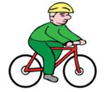
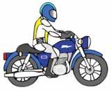
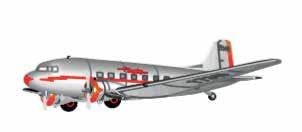
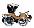
34 Learning experiences Step 1 Class activity Introduce the theme for the term. Ask pupils what transport means. Brainstorm different forms of transport and record on Notebook slide or board. Students examine images on Notebook slide and categorise these images into two or three different groups. Encourage students to classify images according to different qualities, e.g. fast/slow, transport lots of people/transport only a few people. Conclude with sea/land/air. Step 2 Individual activity Students complete worksheet listing or drawing different types of transport they have used, and categorising images into sea, land and air. A student s fine motor skills may influence the number of pictures used. Step 3 Complete Pre-Unit Transport Smart Response Unit Quiz Students answer questions by entering their answers into Smart Response Units, by writing down their answers or by raising their hand. Teacher leads discussion generated from the questions. Step 4 Extension activity Capable students could be encouraged to make sub categories within each group, i.e. land transport for many people, land transport for only a few people. Lesson 2 How has transport changed? At the end of the lesson students will be able to: Describe how transport has changed. Requirements for this lesson Notebook images of transport over time Lesson 2 worksheet (page 41 43). Web links Learning Objects Cobb and Co. interactive website TALE website 32 TOPIC ONE: A RAILWAY FOR SYDNEY S NORTH WEST REGION
35 Learning experiences Step 1 Class activity Review types of transport by land, sea and air from previous lesson. Encourage discussion about safety, comfort, speed and number of people who can be transported. Direct discussion to conclude transport has changed over time. Step 2 Watch interactive video about Cobb and Co. Watch and discuss changes presented. Present pictures of land transport over time and discuss the changes which have occurred. Encourage students to describe improvements and the benefits of these changes. Repeat for sea and air transportation. Step 3 Complete interactive sequencing activity from TALE website or on Notebook slide. Students complete individual sequencing activity for land, sea and air (worksheet 2). Teachers may need to modify the number of images to sequence to suit individual student needs. Students identify the types of transport that are fast, safe, able to transport lots of people, cover long distances. Topic One: A railway for Sydney s North West region Lesson 3 How does a railway work (tickets, timetables, tracks, train networks)? At the end of the lesson students will be able to: Describe how a railway system works. Requirements for this lesson Lesson 3 worksheet (page 44). Learning experiences Step 1 Musical activity Display the Sydney Metro Northwest map on the board and identify the stations it will stop at. Teacher draws a simplified version of the map on the interactive whiteboard, including a couple of stations. Stations familiar to students could be included. Capable students could be shown how this track links to another track. The terms line and network could be introduced here. Step 2 Worksheet activity Students complete worksheet 3. FASTTRACKING THE FUTURE PRIMARY EDITION NOVEMBER
36 Lesson 4 Why do we need Sydney Metro Northwest? At the end of the lesson students will be able to: State reasons why Sydney needs Sydney Metro Northwest and state some of the benefits of the railway to the North West region. Requirements for this lesson Lesson 4 worksheet (page 45). Web links Map showing the Sydney Basin Map showing Sydney s rail network Map showing population of Sydney suburb Learning experiences Step 1 Mapping activity Revise knowledge about different types of land travel (car, bus, train, bike, foot). Show students a map of Sydney on the interactive whiteboard and identify different areas of Sydney, (e.g. North West region, city, beaches, sporting venues). Highlight the roads that lead to the North West region and discuss traffic congestion. Step 2 Class discussion Overlay a map of Sydney Trains network to show there are no train lines in the North West region. Explain this is part of the reason why a rail link to the North West region is being built. Discuss some of the benefits of having a rail link to the North West region, such as better transport opportunities for people, creation of employment, access to shops, car parks and security. Students complete Lesson 4 worksheet. 34 TOPIC ONE: A RAILWAY FOR SYDNEY S NORTH WEST REGION
37 Lesson 5 Where will Sydney Metro Northwest go? At the end of the lesson students will be able to: Show where Sydney Metro Northwest will go and state some infrastructure associated with it, (e.g. car parks, shops, links to other transport systems). Requirements for this lesson Lesson 5 worksheet (page 46). Learning experiences Step 1 Class discussion Review the need for Sydney Metro Northwest from previous lesson (i.e. population and transport requirements of people in the North West region). Step 2 Present the Sydney Metro Northwest map on interactive whiteboard, highlighting where the stations are located. Discuss which stations are closest to school, students houses and other important facilities in their experience. Discuss how the rail link will provide easier access to shops, workplaces, and parks. Discuss the reasons why some parts of the rail link will be below ground, ground level and above ground level (environmental reasons watercourses, safety, costs). Topic One: A railway for Sydney s North West region Step 3 Individual activity Students complete worksheet 5 by drawing their own railway track. Students should include stations, car parks, bus stops, tunnels, bridges and shopping centres. FASTTRACKING THE FUTURE PRIMARY EDITION NOVEMBER
38 Lessons 6 and 7 Students construct a 3D model of their railway. This could be a paired, group or whole class activity. At the end of the lesson students will be able to: Construct a 3D model of a railway using everyday materials. Requirements for this lesson Cardboard boxes of varying sizes, plasticine, Lego, straws, blocks, cellophane, paddle pop sticks, corks, crepe paper, sticky tape, glue, masking tape and other relevant craft materials. Learning experiences Step 1 Group activity Review features of a railway, e.g. stations, car parks, bus stops, bridges, tunnels and the reasons for some of these features including safety, environmental issues and costs. Step 2 Place students in small groups to construct a 3D model of a railway. Each group could make their own railway, or the teacher could allocate aspects of a railway for each group to make, which are then combined to make a whole class network. Students should be able to describe why they are constructing a station/car park/bridge or tunnel in a particular place, e.g. proximity to sporting grounds or shopping centres, to cross rivers, protect animal habitats. Step 3 Students present their railway (or aspect of railway) to the rest of the class describing particular features and the reasons for each feature. Students should also be able to explain reasons for their choice of materials. 36 TOPIC ONE: A RAILWAY FOR SYDNEY S NORTH WEST REGION
39 Lesson 8 Summative assessment Requirements for this lesson Lesson 8 worksheet (page 47 48). Assessment Teachers can assess the work of individual students after each lesson. This assessment task is a summative task intended to show what knowledge students have retained over the course of the unit. Teacher references and worksheets SMART Notebook files and worksheets in Microsoft Word can be downloaded from the Sydney Metro Northwest website. Web links Topic One: A railway for Sydney s North West region SMART Lesson 1 Notebook How do we travel SMART-Lesson-1-How-do-we-travel.docx (Word version) SMART-Lesson-1-How-do-we-travel.notebook (SMART Notebook File) SMART Lesson 1 Quiz SMART-Lesson-1-Quiz.docx (Word version) SMART-Lesson-1-Quiz.notebook (SMART Notebook File) Activity sheet page sheets%201-2%20planning%2cdesigning%20and%20building%20a%20railway.docx Sources and activity sheets pages source%20and%20activity%20sheets%201-5%20linking%20the%20nation.docx Sydney Metro Northwest lesson worksheets sheets%201-8%20a%20railway%20for%20sydneys%20northwest%20region.docx FASTTRACKING THE FUTURE PRIMARY EDITION NOVEMBER


40 NOTEBOOK Name: Date: 38 WORKSHEET TOPIC ONE: A RAILWAY FOR SYDNEY S NORTH WEST REGION
41 LESSON 1 WORKSHEET 1. In the box below, list or draw a picture of different types of transport you have travelled on. 2. Cut out the pictures from the next page and glue them in the correct place. Sea Air Land FASTTRACKING THE FUTURE PRIMARY EDITION NOVEMBER


42 LESSON 1 WORKSHEET 40 WORKSHEET TOPIC ONE: A RAILWAY FOR SYDNEY S NORTH WEST REGION
43 LESSON 2 WORKSHEET How has transport changed? 1. Draw or glue pictures to show how transport has changed. Land Old Modern Sea Old Modern FASTTRACKING THE FUTURE PRIMARY EDITION NOVEMBER


44 LESSON 2 WORKSHEET Air Old Modern 2. Circle the words that describe each type of transport. Safe Safe Safe Comfortable Comfortable Comfortable Fast Fast Fast Can transport many people Can transport many people Can transport many people 42 WORKSHEET TOPIC ONE: A RAILWAY FOR SYDNEY S NORTH WEST REGION


45 LESSON 2 WORKSHEET Examples of images which could be used. FASTTRACKING THE FUTURE PRIMARY EDITION NOVEMBER


46 LESSON 3 WORKSHEET Trace over the train track, then draw a circle around the stations. Hopvale Dinah Beach Metro City Bunnyville Newtown Circle and write what this machine is used for. This machine is for Timetable 9.00 Hopvale 9.30 Bunnyville Metro City Newtown Dinah Beach 1. What time does the train leave Hopvale? 2. Which station does it go to next? 3. What time does the train get to Newtown? 4. How long does it take to get from Hopvale to Metro City? 44 WORKSHEET TOPIC ONE: A RAILWAY FOR SYDNEY S NORTH WEST REGION

47 LESSON 4 WORKSHEET Draw more to show where people live in the Sydney basin. Map of Sydney from website Make a list of some of the benefits of having a railway to the North West region. FASTTRACKING THE FUTURE PRIMARY EDITION NOVEMBER
48 LESSON 5 WORKSHEET In the space below, draw your own map of a railway. You will need to include: some stations, car parks, bus stops, tunnels, bridges, shopping centres, etc. 46 WORKSHEET TOPIC ONE: A RAILWAY FOR SYDNEY S NORTH WEST REGION


49 LESSON 8 WORKSHEET ASSESSMENT TASK On the map below, draw a railway line that will enable people to get to important places. You will need to include at least two stations and some of the other features we have discussed this term. Remember to label your diagram. Sporting Fields Suburban housing City and workplaces Endangered animals FASTTRACKING THE FUTURE PRIMARY EDITION NOVEMBER


50 LESSON 8 WORKSHEET 2. Put a circle around land transport. 3. Number these pictures 1 4 from oldest to newest. 4. List some things you would see on a railway system. 5. Why does Sydney need Sydney Metro Northwest? 6. What are some of the things the Government need to consider when building Sydney Metro Northwest? 48 WORKSHEET TOPIC ONE: A RAILWAY FOR SYDNEY S NORTH WEST REGION

51 ACTIVITY SHEET Artist s impression of the skytrain at Kellyville Station FASTTRACKING THE FUTURE PRIMARY EDITION NOVEMBER
52 THE PAST IN THE PRESENT Key Learning Area History Geography Unit or lesson title and main focus questions The Past in the Present What aspects of the past can you see in the North West today? What do they tell us? What remains of the past are important to the local community? What are the features of and activities in places in North West Sydney? How can we care for places? How can spaces within a place be used for different purposes? Most appropriate level and suggested number of lessons Stage 1 2 lessons Teacher briefing In this lesson students explore places in their local environment through images of memorials, museum exhibits, older houses and other structures that remind us of the past. The focus of the lesson is the Bidjigal Reserve as a significant place in the local community, what it reveals about the past, and how people interact with and care for the place today. Ideally, students would visit the reserve before or after this lesson. Requirements for this lesson Interactive whiteboard and internet connection Printed or digital images of memorials, museum exhibits, older houses and other historic structures in the North West Sydney area Printed or digital images of native and introduced animals in the local area, available online at Printed or digital images of features of the Bidjigal Reserve, available online at Printed or digital images of Aboriginal hand stencils and stencils of objects, such as the axe stencil Plate 9, P.22 of the Sydney Metro Northwest Archaeological Salvage Program Report Paper plates, 2-3 metre length of fabric, tempera paint and spray bottle for stencil activity Printed or digital copies of Activity Sheets 1, 2 and 3. Assessment Any of the individual, pair or group activities in this lesson could be used for formative assessment and feedback on students demonstration of target outcomes A summative assessment activity could be based on the Bidjigal Reserve Trust logo Students identify and explain the images that make up the logo. 50 TOPIC ONE: A RAILWAY FOR SYDNEY S NORTH WEST REGION
53 Key terms and vocabulary Continuity and change, place. Web links Bidjigal Reserve Bidjigal Reserve Gallery Bidjiwong Community Nursery Environment/Bidjiwong-Community-Nursery Bidjigal Reserve Plan of Management Topic One: A railway for Sydney s North West region My Wildlife Journal bushland_of_the_hills_shire.pdf Sydney Metro Northwest Archaeological Salvage Program Western Sections Early Works, Indigenous Heritage Services, prepared for Transport NSW, October 2015 Syllabus links History K-10 Stage 1 - The present in the past (HT1-2) identifies and describes significant people, events, places and sites in the local community (HT1-4) demonstrates skills of historical inquiry and communication. Geography K-10 Stage 1 - Features of places (GE1-1) describes features of places and connections people have with places (GE1-2) identifies ways in which people interact with and care for places GE1-2. FASTTRACKING THE FUTURE PRIMARY EDITION NOVEMBER
54 Background information Bidjigal Reserve Bidjigal Reserve is a bushland Crown Reserve of 186 hectares that reaches into the suburbs of Castle Hill, Baulkham Hills, Northmead, North Rocks, Carlingford and West Pennant Hills. It forms a major part of the catchment of Darling Mills Creek, which flows into the Parramatta River. Bidjigal Reserve was created in an agreement between the NSW Government, Baulkham Hills Shire Council and descendants of the Darug people as part of a Native Title claim. In 2004 Bidjigal Reserve was dedicated to preserve Aboriginal cultural heritage, local flora and fauna and for public recreation. Bidjigal and adjacent reserves together provide a sanctuary for wildlife and a place where people can enjoy picnicking, walking and other recreation activities in a beautiful bushland setting. The reserve is named for the Bidjigal people who lived in the area before Europeans arrived. The Bidjigal were part of the larger Darug nation whose country stretched across the Sydney Basin. The area would have been a good place for the Bidjigal people to live. There was plenty of fresh water, fish and yabbies in the creeks and a variety of plants and animals for food. There was timber and stone for tools and rock shelters for protection. Some of the rock shelters were decorated with charcoal drawings and hand stencils, but much of this art has disappeared. Stone artefacts and shellfish middens in the reserve have been dated to more than 10,000 years ago, making it one of the oldest known occupation sites in the Sydney region. People no longer live in the reserve but it is an important place for the protection of a wide range of native plants and animals, including threatened species such as the powerful owl, the tiny eastern bent wing bat, the grey-headed flying fox and a number of threatened plants. Many native animals live in the reserve, including eastern water dragons (bidjiwong), echidnas, bandicoots, swamp wallabies, sugar gliders, brush tail and ring tail possums and koalas. In the past, platypus used to live in the creeks. Introduced animals such as cats, foxes and rabbits have harmed many native animals, by attacking them or competing with them for food. However they are being controlled and the number of native animals is slowly increasing. Bidjiwong Community Nursery, managed by The Hills Shire Council, is a place where volunteers can learn about the native plants of the area and how to grow them. The nursery produces native plants for its revegetation projects in local parks and reserves. Most of the work in the nursery is carried out by volunteers. Bidjigal Reserve is managed by a trust of six people, including Darug descendants and local residents. The trustees have a plan of management for looking after the reserve. They employ rangers and have a large number of dedicated local volunteers who do important jobs such as helping maintain the walking tracks, pulling out weeds and planting native plants, guiding visitors and many other activities. 52 TOPIC ONE: A RAILWAY FOR SYDNEY S NORTH WEST REGION

55 Lesson 1 Resource Topic One: A railway for Sydney s North West region Figure 7: Loading fruit at Carlingford Railway Station for transportation to market c This station was initially known as Pennant Hills Railway Station. Its name was changed to Carlingford Railway Station in Wikimedia Commons: Lesson steps Step 1 - Class picture study Display the photograph of Carlingford Railway Station. Ask students to look closely at the photograph, then suggest how we know it is from the past. Prompts include the type of train, the appearance of the station, the activities occurring around the station, type of vehicle being used to deliver and load the fruit, and the landscape in which the station is located Display photographs of monuments, museum exhibits and old houses from the local area and explain that these places make us remember the past and think about what it would have been like to live then. Useful photographs for this task are available on The Hills Shire Council website Hills Voices Online Image Gallery: JALbum/index.htm Group picture study. Students work in groups to select and observe one image and discuss how they think life might have been different then, compared to today. Groups report back to the class Who cares for heritage places? Ask students who they think looks after the monuments, museums and old houses and why people would take care of them. Explain the concept of heritage and how important it is for us to know about the past. Explain that some people are paid to look after heritage places but some people volunteer to help. They are all interested in preserving aspects of our past FASTTRACKING THE FUTURE PRIMARY EDITION NOVEMBER
 in the area where the line will be")


56 Looking for Aboriginal heritage. Explain that before work could begin on the Sydney Metro Northwest, archaeologists, working with local Aboriginal people, looked for Aboriginal artefacts (objects) in the area where the line will be built. They found thousands of stone tools and flakes. Among the tools were sharp points that would have been attached to spears, scrapers, and axe heads that would have had a handle attached. These finds help us understand where Aboriginal people lived in North West Sydney, how long they lived here and how they made their tools. Show student photographs of the Aboriginal stone tools below. Ask students what they think happens to Aboriginal objects that are found in excavations. Members of the local Aboriginal community usually make the decision about where artefacts will go. Many of these will go to a museum. Display images of Bidjigal Reserve. Good images are available in the Gallery of the Bidjigal Reserve website at although a Google image search will yield many more. Explain to students that this was how the local area looked when Aboriginal people lived here, before the British came. Have students describe the natural features that they see, such as creek, waterfall, cave or rock shelter. Explain that the people who lived here were called the Bidjigal people and they were part of a much larger group called the Darug. Many places in the local area have names that come from the Darug language, such as Parramatta and Toongabbie. Explain what a reserve is and the particular purposes of Bidjigal Reserve: to preserve Aboriginal cultural heritage and native plants and animals, and to provide for public recreation. See Background notes for Teachers for details. Figure 8: Ground edge axe found at a hill top site within the Sydney Metro Northwest area and an example of Sydney Region Aboriginal rock art with a mythical figure holding an axe. Sydney Metro Northwest Archaeological Salvage Program, Plate 9, page 22. Figure 9: Three views of the axe/hatchet made of hornfels. This axe was constructed from a water worn pebble of hornfels and probably used as both an axe and hammer. Axe grinding grooves have been identified at Caddies Creek, near where the axe was discovered. Sydney Metro Northwest Archaeological Salvage Program, Plate 47, page TOPIC ONE: A RAILWAY FOR SYDNEY S NORTH WEST REGION
57 Step 2 - Native and introduced animals Display images of native animals such as koala, kookaburra, owl, bidjigal (eastern dragon), possum, swamp wallaby, echidna. The Australian Museum has excellent online images of animals of the Sydney region at Have students identify each animal. Explain the difference between native (or indigenous) and introduced or feral animals Students match labels to the native animals. Ask students if they have seen any of these animals around their place? If they have, ask where, if they have not, ask them why not? Explain that these animals were once common in the local area, before people came to clear the bush and build farms and houses Display images of cats, dogs, rabbits and foxes. Explain that these animals are introduced and they have harmed many native animals by attacking them or competing with them for food or habitat. However, in Bidjigal Reserve, the native animals can live in safety. That is why it is so important to keep cats and dogs in the yard and not let them go into the bush. Step 3 - Hand stencils Display images of Aboriginal hand stencils, a Google image search will yield plenty of examples. Explain that Aboriginal people sometimes decorated the rock shelters with this kind of art. Explain how these were done, by spraying a mixture of ochre and water onto the back of the hand placed against the stone Follow the instructions on Activity Sheet 1 (page 56) to create individual hand stencils and/or a class stencil. Topic One: A railway for Sydney s North West region Step 4 - How people use the reserve Display satellite image of Bidjigal Reserve and surrounding area. Explain that in the past, when only Aboriginal people lived there, the bush covered the whole area Students use Activity Sheet 2 (page 57) to colour the reserve area, trace the creeks and three main bushwalks. Students follow instructions to create a key for the map Display the Bidjigal Reserve website to show students the volunteer activities people can become involved in to help care for the reserve. Step 5 - Reflection Display some of the heritage images used at the beginning of the lesson and ask students to discuss why these places from the past are important to people in the present. Extension activities Plan and plant a Bidjiwong Garden in the school grounds. Seek advice and perhaps also a guest speaker from the Bidjiwong Community Nursery Conduct an excursion to Bidjigal Reserve, a range of activities can be found in the publication My Wildlife Journal. FASTTRACKING THE FUTURE PRIMARY EDITION NOVEMBER

58 ACTIVITY SHEET 1 Hand Stencils Equipment Paper plates (optional) 2-3 metre length of paper or fabric Tempera paint diluted 50/50 with water Spray bottle Steps Show students a range of examples of Aboriginal hand stencils so they understand what they are aiming for. Explain how Aboriginal people made the stencils by filling their mouths with a mixture of ochre and water, then spraying it over their hand held against the rock. Explain that for safety reasons they will be using a slightly different method. 1. Students place one of their hands on a sheet of paper, trace around it and cut it out. 2. For individual stencils, students place their hand cut-out on a paper plate. For class stencil, students arrange their hand cut-outs on a length of firm paper or fabric. 3. Add diluted tempera paint to a spray bottle. 4. Squirt lightly around each hand. Let dry thoroughly. 5. Remove the hand cut-outs. Tips Black, white or yellow paint looks good against cream or ochre coloured paper or fabric. Figure 10: Aboriginal hand stencils, Red Hand Cave, Blue Mountains National Park, believed to be between 500 and 1600 years old. National Parks NSW: 56 WORKSHEET TOPIC ONE: A RAILWAY FOR SYDNEY S NORTH WEST REGION
59 ACTIVITY SHEET 2 Bidjigal Reserve Map Castle Hill P P P T Eric Mobbs Reserve P P West Pennant Hills Richard Webb Reserve Baulkham Hills P Bald Hill Bidjigal Reserve & Surrounding Bushland P T Ted Horwood Reserve P Bidjiwong Community Nursery M2 Motorway North Rocks Windsor Road Carlingford Northmead P The Convict Road P Instructions Shade reserve land green and built-up area pink. Create a key showing reserve land and built up area, major roads and three walking tracks, Burraga (yellow); Platypus (blue); Murri-yanna (red); Other tracks (green) include parking, barbeque, picnic facilities, playground and toilet. FASTTRACKING THE FUTURE PRIMARY EDITION NOVEMBER
60 CREATING A TIME CAPSULE Key Learning Area History Geography Unit or lesson title and main focus questions Creating a time capsule How will the new railway change my local community? Most appropriate level and suggested number of lessons Early Stage 1 and Stage lessons Teacher briefing In this lesson sequence, students explore their built environment focusing on public transport, the planned Sydney Metro Northwest and their local community. Students create a Changes diagram and a Sydney Metro Northwest environments diagram, and work as a team to create a time capsule to be opened at the school when Sydney Metro Northwest opens. Requirements for this lesson Interactive whiteboard Internet connection Computers, laptops, ipads, cameras Print out of photos Paper, art mediums, time capsule resources. Key terms and vocabulary Sydney Metro Northwest, change, natural and built environments, community, public transport, infrastructure. Web links Artist s impression videos of Sydney Metro Northwest. Sydney s new train unveiled Photos Mind mapping software: Bubbl.us 58 TOPIC ONE: A RAILWAY FOR SYDNEY S NORTH WEST REGION
61 Suitable map sites. Route map of Sydney Metro Northwest Or through this web link Sydney Metro Northwest Wordle Australian Government site National Archives of Australia : Information on creating time capsules time-capsules.aspx Topic One: A railway for Sydney s North West region Syllabus links Geography K-10 Early Stage 1 - People live in places (GE-e1) identifies places and develops an understanding of the importance of places to people (GE-e2) communicates geographical information and uses geographical tools. Stage 1 - Features of places (GE1-1) describes features of places and connections people have with places (GE1-2) describes the ways people, places and environments interact (GE1-3) communicates geographical information and uses geographical tools. FASTTRACKING THE FUTURE PRIMARY EDITION NOVEMBER
62 History K 10 Early Stage 1 - Personal and family histories (HTe-1) communicates stories of their own family heritage and the heritage of others (HTe-2) demonstrates developing skills of historical inquiry and communication. Stage 1 - The present in the past (HT1-2) identifies and describes significant people, events, places and sites in the local community over time (HT1-3) Describes the effects of changing technology on people s lives over time (HT1-4) demonstrates skills of historical inquiry and communication. Learning experiences Activity 1 View artist s impression videos of Sydney Metro Northwest stations and rail lines (see web links). Ideas: Create a mind map on the interactive whiteboard discussing ideas related to changes in the local environment that the students have witnessed. Relate the changes to meeting community needs, and the needs of students and families. See web links for suitable mind mapping software Discuss the public transport options students and families use Discuss changes that may occur to the built environment due to Sydney Metro Northwest. Display photos of these changes on the interactive whiteboard, ask students to locate them on a map of the local area. See web links for suitable maps Go on a walking excursion. Visit any nearby locations of Sydney Metro Northwest and take photos. Ask students to draw simple diagrams of the changes and infrastructure they see Draw simple diagrams representing the natural and built environments in the local area. Label diagrams using mapping terms, such as hill, road, compass directions, the names of main streets and shops, and bus stops. Add in terms associated with Sydney Metro Northwest and identify their social purposes Teachers can contact the Sydney Metro Northwest project team and make a request for a presentation by one of the team members on a particular aspect. This would be at the teacher s and school s discretion Ask students to discuss changes to the local community with their family and friends. Students can share their stories and narratives As a class, investigate the Sydney Metro Northwest website and discuss the changes the students will start to see in the near future. See website northwest 60 TOPIC ONE: A RAILWAY FOR SYDNEY S NORTH WEST REGION
63 Activity 2 As a class create a Sydney Metro Northwest environments diagram for the wall. Ideas: Add students photographs taken on the walking excursions Alternatively, teacher can take the photos, and as a class discuss the photos and their location Add the diagrams created in Learning Activity 1 Students illustrate and label particular changes to the local infrastructure such as, the local Sydney Metro Northwest train station, areas of new rail line, car parking stations and add these to the diagram Create word clouds using key community, geographical and infrastructure terms on computers. Add these to the diagram Alternatively, students could create their own artist s impression of local Sydney Metro Northwest infrastructure and add these to the diagram. Activity 3 Create a class Change time capsule reflecting change and continuity. Ideas: Create a class time capsule that represents current life, the local community and changes to local public transport View the Australian Government site National Archives of Australia for useful information on creating a time capsule. Topic One: A railway for Sydney s North West region A list of artefacts that could be added to the class Change time capsule include: Photos of the Sydney Metro Northwest environments diagram Photos of students A photo book of changes and Sydney Metro Northwest progress in the local community Current public transport tickets A print out of the local bus route and timetable Artist s impressions of Sydney Metro Northwest Student word clouds Hold a class open day and invite students families to view their work Sydney Metro Northwest environments diagram and hold a mini ceremony closing the capsule and explaining when the capsule will be opened. FASTTRACKING THE FUTURE PRIMARY EDITION NOVEMBER


64 Figure 11: Representing change. As it was in July 2013 the future location of Norwest Station from the corner of Norwest Boulevard and Brookhollow Avenue. Figure 12: As it was in January 2016 showing the Norwest construction site at the intersection of Norwest Boulevard and Brookhollow Avenue. 62 TOPIC ONE: A RAILWAY FOR SYDNEY S NORTH WEST REGION

65 Topic One: A railway for Sydney s North West region Figure 13: Artist s impression of Norwest Station when fully operational. FASTTRACKING THE FUTURE PRIMARY EDITION NOVEMBER
66 Teacher references and extension work Extension activity Students can use their new knowledge and create a five to 10 minute class drama play depicting the future Sydney Metro Northwest opening day. They can use the play to research and describe who might be present at the opening, what might happen on the day, what the celebrations might be like, and who might be on the first Sydney Metro Northwest journey. The teacher may like to tell them the story of the opening of the very first train journey from Sydney to Parramatta. Sydney to Parramatta The scene at the station was exciting. Never was a greater concourse assembled in New South Wales the shrill whistle of the engine was the precursor of the waving of flags, hats and handkerchiefs, the salute of the artillery and the hearty cheers of the assembled thousands said the Sydney Morning Herald. So left the first train for Parramatta from the station at Sydney, in those days called Redfern, very close to the great flyovers used by the electric suburban trains of the 1970s. That was on September 26, 1855, 30 years (less one day) after the opening of the first steam-hauled public railway the Stockton and Darlington railway and some 25 years after the first steam drawn passenger railway which ran between Liverpool and Manchester. The bridges were also crowded with spectators, and the inhabitants along the railway all turned out to look on The Herald continued. The morning was unfortunately wet and gloomy the more disappointing because unexpected; the weather for some days previous having been bright and cheerful. It was a strange repetition of the weather at the turning of the first sod some five years previously. The ceremony of cutting the first sod was performed by the Hon. Mrs Keith Stewart in the presence of his late Excellency Sir Charles Augustus Fitz Roy and a large concourse of people. That had been on July 3, The day was extremely unpropitious, inasmuch as it rained almost without hesitation from morning until evening The Sydney Railway Company was formed in 1849 and received much opposition and little support. 64 TOPIC ONE: A RAILWAY FOR SYDNEY S NORTH WEST REGION
67 At last, by Act of Parliament, the railway was taken over by the Government. The first sod ceremony was held in Cleveland Paddocks not far from the swimming pool and ice skating rink of over a century later. William Wallis had the first contract to build the line but the gold rushes of the 1850s left him short of workmen. However in 1852 William Randle secured a contract to work from the Cleveland Paddocks and was able to carry out construction work during which it was found that neither wooden rails nor iron plated wooden rails would be suitable and iron rails shipped from England were used entirely. The railway line of 14 miles was double track to Newtown with earthworks to Parramatta for double track which was soon found to be necessary to operate the system. The first station after leaving the Redfern terminus was Newtown, at first west of King Street, with two platforms placed one on either side of the newly made Station Street which ran between them on a level crossing. The line then curved away over Petersham Hill, across the Long Cove viaduct to Ashfield station, five miles from Sydney. It had a plain cottage for the stationmaster with a booking office as part of it. Next station was Burwood, at first west of Burwood Road which it crossed on a level crossing, then Homebush where there was a racecourse. After Homebush the next station was Parramatta (now Granville) at the Dog Trap (now Woodville) Road, south of its junction with Parramatta Road. On arrival of the official train the rain came down for some minutes in torrents People sheltered as best they could and the official party went to the luncheon organised by the Commissioners. So began the regular running of trains in New South Wales on the Sydney and Parramatta railway. Topic One: A railway for Sydney s North West region Source: Sydney suburban steam railways, William A. Bayley, Locomotion Productions, 1983 FASTTRACKING THE FUTURE PRIMARY EDITION NOVEMBER
68 MY RAIL JOURNEY MAP Key Learning Area Science Mathematics Unit or lesson title and main focus questions My rail journey map Why does public transport in the North West region of Sydney need upgrading? What are the main travel benefits? Most appropriate level and suggested number of lessons Stage lessons Teacher briefing In this lesson, students use current public transport routes and timetables to discover some of the reasons behind building Sydney Metro Northwest, and seek answers to the focus questions: Why does public transport in the North West region of Sydney need upgrading? What are the main travel benefits? Requirements for the lesson Computers Interactive whiteboard Bookmarked Internet sites (see web links). Assessment Create self-assessment sheets and guide students in assessing their own and their peers contribution to group work. Assess students ability to read and interpret maps, timetables and their My rail journey map. Key terms and vocabulary Map, directions, routes, timetables, journey, public transport, commuters, Sydney Metro Northwest, Central Business District. 66 TOPIC ONE: A RAILWAY FOR SYDNEY S NORTH WEST REGION
69 Web links Map of Sydney s public transport routes Sydney Metro Northwest Syllabus links Topic One: A railway for Sydney s North West region Science K 10 (ST3-2VA) demonstrates a willingness to engage responsibly with local, national and global issues relevant to their lives, and to shaping sustainable futures (ST3-5WT) plans and implements a design process, selecting a range of tools, equipment, materials and techniques to produce solutions that address the design criteria and identified constraints. Mathematics K 10 (MA3-1WM) describes and represents mathematical situations in a variety of ways using mathematical terminology and some conventions (MA3-3WM) gives a valid reason for supporting one possible solution over another real-life situations and constructs timelines (MA3-13MG) uses twenty-four hour time and am and pm notation in real-life. FASTTRACKING THE FUTURE PRIMARY EDITION NOVEMBER
70 Learning experiences Step 1 Class discussion Teacher displays a current rail map for Sydney Trains network on the interactive whiteboard, or as a large print out. Sydney Trains Network A To Central Coast & Newcastle Line A B C To Blue Mountains Line D E F Richmond Schofields North Shore, Northern & Western Line Airport, Inner West & South Line Bankstown Line Eastern Suburbs & Illawarra Line East Richmond Clarendon Windsor Mulgrave Vineyard Riverstone Quakers Hill Emu Plains Penrith Kingswood Marayong Werrington St Marys Leppington Mount Druitt Edmondson Park Cudgegong Road Sydney Metro Northwest under construction Rooty Hill Rouse Hill Doonside Kellyville Blacktown Seven Hills Liverpool Macquarie Fields Ingleburn Minto Leumeah Merrylands Guildford Yennora Fairfield Canley Vale Cabramatta Warwick Farm Casula Glenfield Bella Vista Toongabbie Norwest Pendle Hill Showground Carramar Villawood Castle Hill Carlingford Westmead Wentworthville Parramatta Harris Park Telopea Dundas Rydalmere Camellia Rosehill Leightonfield Holsworthy Cherrybrook Granville Clyde Auburn Lidcombe Berala Regents Park Chester Hill Sefton East Hills Birrong Yagoona Panania Epping Bankstown Denistone West Ryde Meadowbank Olympic Park Hornsby Normanhurst Flemington Thornleigh Pennant Hills Punchbowl Revesby Beecroft Cheltenham Eastwood Homebush Strathfield Wiley Park Padstow Rhodes Concord West North Strathfield Burwood Croydon Lakemba Berowra Mount Kuring-gai Mount Colah Asquith Macquarie University Riverwood Hurlstone Park Canterbury Campsie Belmore Waitara Macquarie Park Ashfield Wahroonga Warrawee Summer Hill Lewisham Narwee Turramurra Pymble North Ryde Petersham Dulwich Hill Turrella Bardwell Park Bexley North Kingsgrove Beverly Hills Gordon Killara Stanmore Newtown Marrickville Lindfield Roseville Macdonaldtown Chatswood Artarmon St Leonards Wynyard Town Hall Central Redfern Erskineville St Peters Sydenham Wollstonecraft Waverton Tempe Wolli Creek Arncliffe Banksia Rockdale Kogarah Carlton Allawah Hurstville Penshurst Mortdale Oatley Como Jannali Sutherland Loftus North Sydney Milsons Point C I T Y Green Square Mascot Circular Quay Martin Place Museum Domestic Airport International Airport Kirrawee Gymea Miranda St James Station Access Fee applies B C Kings Cross Edgecliff Bondi Junction D Station Access Fee applies Caringbah Woolooware Cronulla E F Cumberland Line Carlingford Line Olympic Park Line Campbelltown Macarthur Engadine Heathcote Waterfall G Stop Interchange Interchange End of line To Southern Highlands Line To South Coast Line NORTH G Check timetables and trip planners for train services and connections Copyright 2015 Transport for NSW Figure 14: A map of the Sydney Trains network. 68 TOPIC ONE: A RAILWAY FOR SYDNEY S NORTH WEST REGION
71 Facilitate a class discussion about public transport options in the school s area and other areas in the North West region. Use the following questions as start. Draw up a retrieval chart to record their responses it is useful data for the class that can be used again. What types of transport do students use to travel to school, friends houses, sporting events? What types of transport do families use to travel to and from work? Step 2 Mapping activities Use one of the suggested Internet sites to create a map for a car journey travelling from school to Sydney s Central Business District. Produce a map detailing directions and estimated travelling time by car from the school to another address in Sydney s Central Business District. Select a particular landmark such as Sydney Tower, the Sydney Opera House or an address suited to the students learning context. Discuss the map layout, the route and the language used in writing directions. Ask students: How accurate do you think is the estimated travel time? What is the most appropriate and time efficient route to the Central Business District? Why? How do you know? What could affect these estimated travel times? Topic One: A railway for Sydney s North West region Step 3 Group task In groups of four to six create a public transport My rail journey map travelling from Sydney to an address in Sydney s Central Business District. Each group selects a particular type of public transport either train, ferry or bus Students use the suggested public transport Internet sites to research public transport, and work out the most cost effective and time efficient travel route from school to the selected address Students create the My rail journey map using publishing software (e.g. Microsoft PowerPoint, Publisher or Excel) including visual details, written directions and estimated travel time and a table of costs Students might like to animate their map, add an audio file of sound effects and, if the class has a blog, each My rail journey map could be uploaded. Step 4 Reflection activity Each group presents its My rail journey map to the class. Was one route more efficient? Why? FASTTRACKING THE FUTURE PRIMARY EDITION NOVEMBER
72 Step 5 Students use the Sydney Metro Northwest map and estimated travel times information to ascertain the best travel route and estimated travel time to and from Sydney s Central Business District. Mount Colah Riverstone 4km viaduct, bridge and earthworks DURAL Asquith Sydney Metro Trains Facility Schofields Cudgegong Road Rouse Hill Kellyville Hornsby Waitara LEGEND Project Project alignment New railway stations Existing railway stations Commuter car parking facilities Facilities at all new stations Doonside Bus interchange Taxi Cycle Kiss and ride Easy access Other Existing railway Strategic road network T-ways STANHOPE GARDENS Quakers Hill Marayong 0km M7 Blacktown 4km skytrain viaduct PARKLEA M4 LALOR PARK Seven Hills Bella Vista Toongabbie Pendle Hill 5km Wentworthville Showground Norwest M2 WINSTON HILLS Castle Hill Westmead NORTHMEAD Parramatta Harris Park Cherrybrook Dundas WEST PENNANT HILLS Carlingford Telopea Rydalmere Camellia Rosehill 15km twin bore new tunnels Beecroft Eastwood Normanhurst Denistone Thornleigh Pennant Hills Cheltenham West Ryde Meadowbank Epping Wahroonga Warrawee M2 Turramurra Macquarie Park Pymble Macquarie University Gordon North Ryde 13km Epping to Chatswood Line upgraded Killara Lindfield Roseville St Leonards Artarmon FRENCHS FOREST Chatswood Interchange Rhodes Wollstonecraft Figure 15: The route of Sydney Metro Northwest, from Cudgegong Road Station, to the Chatswood interchange. If the class has a class journal, or a class blog, in which they record significant information, ask students to consider and record: How important is efficient travel time to a community? Why? Who will benefit most from Sydney Metro Northwest? Why? Teacher references and extension work Extension activities: Students read Understanding the Challenges (Project Overview June 2012, page 15). In their own words, they write a short passage explaining three of the challenges commuters currently experience when using public transport. Stage modifications: Stage 2 Modify the group task above by reducing the size of the group and the difficulty of the activity. Students use to produce a map detailing directions and estimated travelling time by car from their home to an address in Sydney s Central Business District. Ask students to: Identify other ways of travelling to Sydney s Central Business District on the Sydney Trains network map Research the estimated travel times of different types of transport travelling from the school to the Central Business District Explore the most direct route of travel using the Sydney Metro Northwest website. 70 TOPIC ONE: A RAILWAY FOR SYDNEY S NORTH WEST REGION

73 Topic One: A railway for Sydney s North West region Castle Hill Station construction site, February 2016 FASTTRACKING THE FUTURE PRIMARY EDITION NOVEMBER
74 CREATING A RAILWAY TIMETABLE Key Learning Area Science Unit or lesson title and main focus questions Creating a railway timetable How is rail travel enhanced by not needing to consult a timetable? Most appropriate level and suggested number of lessons Stage lessons Teacher briefing This ICT activity helps students understand key features of Sydney Metro Northwest. It helps students explore the focus question of the Topic: What will Sydney Metro Northwest mean for me and for my daily life? The information gained from this activity is used to create a timetable for Sydney Metro Northwest using Microsoft Excel software. The activity can be modified to suit various ICT abilities and stages. An understanding of current Sydney Trains timetables is a prerequisite for the lesson. If students are unfamiliar with railway timetables, a lesson is included in Topic 2 called Using and Interpreting Timetables. This could be taught preceding this lesson. Requirements for this lesson ipads Computers or laptops Interactive whiteboard. Assessment This lesson provides multiple opportunities to assess the students comprehension of train timetables and can be used for summative assessment. Key terms and vocabulary Sydney Metro Northwest, train timetables, single deck trains, location, dwell time, improvements. 72 TOPIC ONE: A RAILWAY FOR SYDNEY S NORTH WEST REGION
75 Web links Free ipad mind mapping Apps: Idea Sketch SimpleMind Total Recall Free computer software programs: Concept maps/mind mapping tool Topic One: A railway for Sydney s North West region Syllabus links Science K 10 (ST3-5WT) plans and implements a design process, selecting a range of tools, equipment, materials and techniques to produce solutions that address the design criteria and identified constraints (ST3-14BE) describes systems in built environments and how social and environmental factors influence their design. Learning experiences Step 1 Think Pair Share Teacher displays the Sydney Metro Northwest map on the Interactive White Board (See web links). Using the Think Pair Share strategy, students discuss the location of the eight new Sydney Metro Northwest stations. Use these questions as a guide: Which Sydney Metro Northwest station is closest to our school? Which Sydney Metro Northwest station is closest to your house? Where does the line begin and finish? With what railway lines does Sydney Metro Northwest connect? FASTTRACKING THE FUTURE PRIMARY EDITION NOVEMBER
76 Step 2 Class activity Teacher facilitates a class discussion about the innovative features of Sydney Metro Northwest, and what this means for the service, its timetable and its customers. Teacher note: the following information has been taken from Sydney Metro Northwest Project Overview September 2015, pages 8, pdf%3fext%3d.pdf Key innovative rail features include: Australia s first fully-automated metro rail system Platform screen doors Efficient timetabling Improvements to platform efficiency and design Less time for trains remaining at stations (dwell time) Single deck, automated metro trains 15 trains per hour in peak times Cross platform interchange at Chatswood Major bus interchanges at Rouse Hill and Castle Hill 4000 car parking spaces spread over five railway stations Travel facilities for customers using bus, pedestrian, car and bikes to access stations Sydney Metro Northwest is a rail line that uses ground level, underground and elevated tracks. Step 3 Group task In groups of two to five, students create a concept map that details how Sydney Metro Northwest will positively affect timetabling and the train travel experience for customers. Students create concept maps on ipads using free Apps. (See web links). If ipads are unavailable use computers, laptops or paper. Each group is given a particular key feature of Sydney Metro Northwest to focus on: These could include: What is a single deck metro train? Why would a single deck metro train affect the timetable? 15 trains per hour are planned. How will this affect the Sydney Metro Northwest train timetable? Cross platform interchange. How might this affect train times and the Sydney Metro Northwest timetable? 4000 car parking spaces and facilities for different types of customer access to Sydney Metro Northwest Sydney Metro Northwest is a train line that utilises ground level, underground and elevated tracks. How will these factors affect the Sydney Metro Northwest timetable? What are platform screen doors? How do they help passengers? 74 TOPIC ONE: A RAILWAY FOR SYDNEY S NORTH WEST REGION

77 Step 4 Group task In groups create a concept map listing different ways key features of Sydney Metro Northwest have positively affected the timetable. Each group presents their concept map to the class. The most effective ideas are added to the whole class concept map. What does fully-automated system mean? What other countries have fully-automated systems? Step 5 Group or individual task Create a Sydney Metro Northwest Timetable using Microsoft Excel. Teacher models and discusses specific criteria that could include: Stations Times Frequency Time notations: am, pm, 24 hour clock Signage. Topic One: A railway for Sydney s North West region Step 6 Reflective activity Using ICT students present their Sydney Metro Northwest Timetables to the class. Students present their timetables and ask other students to read/interpret them Teacher discusses different approaches to timetable construction. Does a school timetable use the same principles? The class links the mock timetables with innovative concepts of Sydney Metro Northwest. Figure 16: The Sydney Trains Northern Line timetable (as of May 2016). There are many Rail Timetable sites across the Internet. It is an interesting exercise to compare how different timetables work. FASTTRACKING THE FUTURE PRIMARY EDITION NOVEMBER
78 Teacher references and extension work Extension activities Students create an interactive Sydney Metro Northwest timetable using hyperlinks and promote their timetable using animations advertising key features. For more ideas, see Transport for NSW realtime Apps and Sydney Trains timetables layout and features. Stage modifications: Stage 2 Other countries have high-speed above ground trains. Find out about one such rail network. How does this network s timetable operate? Explain your findings to the class. For example: 76 TOPIC ONE: A RAILWAY FOR SYDNEY S NORTH WEST REGION

79 Topic One: A railway for Sydney s North West region The skytrain construction gantry in operation, May FASTTRACKING 2016 THE FUTURE PRIMARY EDITION NOVEMBER

80 TOPIC TWO: LINKING THE NATION This topic explores the different modes of transport used in the North West region of Sydney over time and their role in promoting community, environment and regional change. Using an inquiry approach, students explore the links between past and present and find answers to the question: How have the people, communities and environment of Sydney and the North West region been influenced by the expansion of the railway? Figure 17: Rogans Hill Railway Station, c.1930 by an unknown photographer. The station, near the intersection of Castle Hill Road and the Old Northern Road, opened on 24 November 1924 and closed on 1 February Teachers are not required to complete all lessons, activities and/or units of work contained in this topic. Teachers are encouraged to select and adapt materials to complement and support their teaching and learning programs, and to suit the needs and interests of students in differing school contexts. 78 TOPIC TWO: LINKING THE NATION
81 The topic at a glance Key Learning Area Unit or lesson title and main focus questions Most appropriate level and suggested number of lessons Pages History A changing demography: Investigating changes to public transport in The Hills Shire Stage 2 80 Geography English How has the demography of The Hills Shire changed over the past 100 years and what has been the effect on public transport infrastructure? 4 6 lessons History Who lived here first and how do we know? Stage 2 88 Who lived in North West Sydney first and how do we know? Geography How do people s perceptions about places influence their views about the protection of places? 2 lessons History First contacts Stage Geography What was life like for the Aboriginal people of North West Sydney before the arrival of Europeans? How does the environment support the lives of people and other living things? 2 lessons Geography The importance of protecting local Indigenous heritage Stage History Creative Arts Mathematics History How is the Sydney Metro Northwest project protecting local Indigenous heritage sites? This learning experience would be enhanced by an excursion to a local Indigenous site such, as Bidjdgal Reserve in The Hills Shire. Using and interpreting timetables: Then and now How do we read timetables? What are the significant differences and similarities between the Rogans Hill Parramatta railway timetable and a current Sydney Trains timetable? 4 6 lessons Stage lessons Topic Two: Linking the nation History Visual literacy: Train safety Stage English A picture is worth a thousand words : What is this cartoon telling us? 2 3 lessons History Science English Geography Shaping the colony: The impact of rail on Sydney s North West region A complete unit of work Where is the North West region of Sydney and how has it changed? What do we know about the lives of people in Australia s colonial past and how do we know? How did colonial settlement change the environment? How do people and environments influence one another? How do people influence places and the management of spaces within them? How did geographical location influence the lives and experiences of colonial Australians in Sydney s North West? How does the work of historical archaeologists contribute to understanding our colonial past? What effects did Governor Macquarie and the Gold Rush have on expanding the colony of Sydney and NSW? What developments in transport in the 19th Century influenced settlement and society in Sydney and surrounds? What influences did the coming of rail have on society and settlement patterns in Sydney and NSW? What effects will Sydney Metro Northwest have on communities and development in Sydney s North West region? Stage A full 10 week term FASTTRACKING THE FUTURE PRIMARY EDITION NOVEMBER
82 A CHANGING DEMOGRAPHY: INVESTIGATING CHANGES TO PUBLIC TRANSPORT IN THE HILLS SHIRE Key Learning Area History Geography English Unit or lesson title and main focus questions A changing demography: Investigating changes to public transport in The Hills Shire How has the demography of The Hills Shire changed over the past 100 years and what has been the effect on public transport infrastructure? Most appropriate level and suggested number of lessons Stage lessons Teacher briefing Students investigate the evolution of public transport in The Hills Shire over the past century. They watch an online video of local historian, Bruce Irwin, discussing changes to the local transport infrastructure from the 1900s. Using the video and maps, students explore local changes. A class ebook of journal entries about travelling on the Sydney Metro Northwest is created. Requirements for these lessons Internet connected interactive whiteboard Computers (or paper and pens) Cardboard strips and markers Hard copies of the images from Bruce Irwin s Trams and Trains in the Hills website Paper, pens and pencils Computers, laptops or ipads Microsoft PowerPoint. Assessment There are opportunities for teachers to observe student participation in class discussion and in small groups. In addition, teachers can assess the depth of analysis and students ability to link concepts such as population increase and land use to the evolving local public transport system. Individual formative assessment can be undertaken on narratives and electronic journal entries. Key terms and vocabulary Community, demography, The Hills Shire, semi rural, urban, population, trams, trains, buses, routes, Sydney Metro Northwest. 80 TOPIC TWO: LINKING THE NATION
83 Background information A steam tramway opened between Parramatta and Baulkham Hills in 1902, and was extended to Castle Hill in 1910, carrying passengers and produce to and from the area. In 1919, the New South Wales Government decided to convert the tramway into a railway to encourage the subdivision of estates for residential use. The new section between Westmead and Northmead was built in 1922, and the line opened traffic to Castle Hill in It was extended to Rogans Hill in The line was single track throughout, and ran alongside Windsor and Old Northern roads between Northmead and Castle Hill. It was closed in Web links Trams and Trains in the Hills Bruce Irwin and Noelene Pullen, 2009 (Online Hills Voices video and transcript of an interview with local train and tram enthusiast and historian Bruce Irwin in costume). Changing-Shire/Bruce-Irwin Links to Hills Voices interviews Other suitable interviews on the same site Changing-Shire/Barry-Gilbert Topic Two: Linking the nation Shire/John-Allen Good quality map of The Hills Shire Other good map sites Hills Bus route maps Sydney Metro Northwest project map FASTTRACKING THE FUTURE PRIMARY EDITION NOVEMBER
 describes ways people, places and environments interact (GE2-4) acquires and communicates geographical information using geographical")
84 Syllabus links Geography K-10 Stage 2 - Places are similar or different the settlement patterns and demographic characteristics of places and the lives of people who live there (GE2-1) examines features and characteristics of places and environments (GE2-2) describes ways people, places and environments interact (GE2-4) acquires and communicates geographical information using geographical tools for inquiry. History K 10 Stage 2 - ONE important example of change and ONE important example of continuity over time in the local community, region or state/territory (HT2-2) describes and explains how significant individuals, groups and events contributed to changes in the local community over time (HT2-5) applies skills of historical inquiry and communication. English K 10 (EN2-2A) plans, composes and reviews a range of texts that are more demanding in terms of topic, audience and language. Learning experiences Step 1 Introduction Students watch the video of Bruce Irwin discussing public transport in The Hills Shire from the 1900s, Trams and Trains in the Hills (see web links). Bruce-Irwin Figure 18: Trams and Trains in the Hills. Bruce Irwin, in period costume 82 TOPIC TWO: LINKING THE NATION
85 Step 2 Group activity (three to four students) Focus question: What are the changes to The Hills Shire public transport? Groups are given the transcript of Trams and Trains in the Hills (see web links) and assigned different areas of inquiry to research and report back to the class. Research strategies will need to be put in place to define some of the language used during the interview such as surplus, patronage, penny, curtailed. Use these questions and ideas as a guide for group inquiry areas. Community/Suburbs List the important suburbs and areas discussed in the interview Explain why these areas are important to changes to the local public transport system. Significant dates List the important dates mentioned in the interview Explain why these dates are significant. (Tip: think about what happened on these dates and how they were important to the development of the tram or tram service). Tram service What or who was the tram built to service in The Hills Shire? What or who did the tram actually service? List the main problems with The Hills Shire trams. Train service What or who was the train built to service in The Hills Shire? What or who did the train actually service? List the main problems with The Hills Shire trains. Using trams and trains Were there tram stations? If so, where were they located? Were there train stations? If so, where were they located? How much did it cost to travel by tram? How much did it cost to travel by train? How many passengers travelled by tram per year? How many passengers travelled by train per year? Community concerns Briefly explain what the tram service meant for the people of The Hills Shire What types of people used the tram? Briefly explain why they used the tramway? What types of people used the train? Briefly explain why they used the railway? Topic Two: Linking the nation FASTTRACKING THE FUTURE PRIMARY EDITION NOVEMBER
86 Step 3 Class activity Students create a class wall Local Transport concept map. Groups take turns presenting their answers and ideas. Using the material presented, they create a wall Local Transport concept map using cardboard strips and hard copies of photos from the interview. Step 4 Group activity (Split class into two groups) Relating historical events to people s lives. Teacher asks students to form two circles. Each circle is given a question to discuss and debate with one another: What did the tramway mean to different groups of people in The Hills Shire at that time? What did the railway mean to different groups of people in The Hills Shire at that time? Class discussion: Group representatives explain the key points their group came up with to the class. Step 5 Individual activity Writing historical personal narratives. Students are asked to assume the role of a person travelling on a tram in the early 1900s and write a narrative about using the tram in The Hills Shire. If time allows, students can explore the Changing Shire link on the Hills Voice website. This provides interviews with other community members including members of the local fruit growing families. (See web links). Ask students to fill out simple narrative worksheets prior to writing their narrative. Use these questions as suggestions: Who is the main character? Why do they use the tram to travel around The Hills Shire? Where do they travel on the tram? What would they be wearing? What does the setting (The Hills Shire) look like? What do they see, smell and hear as they travel on the tram? Students write their narratives using their narrative worksheets. Students can use a wall Local Transport concept map as stimulus for their narratives. Step 6 Group activity (Groups of four to six) Writers conference students take turns reading their narratives to the group. Other students and the teacher ask questions to enhance the narrative. Students publish their stories. These can be displayed in a folder for each student to read, or on the Local Transport wall. Use these analytical questions as a guide: Do you have more than one story in your narrative? Is there more you could add? What is the main character doing in the text? Can you tell us in detail what your character does on the journey? Students edit their narratives. 84 TOPIC TWO: LINKING THE NATION
87 Step 7 Class activity Students map changes to The Hills Shire public transport using a suitable map of The Hills Shire on the interactive whiteboard. (See web links for map suggestions). They: Use the maps on the interview site Trams and Trains in the Hills to plot the tram and train routes Use the Hills Bus site to plot the current bus route Use a map to plot the Sydney Metro Northwest route. Step 8 Class discussion Discuss the similarities and differences between the routes. Use these questions as a guide to stimulate class discussion: Why do people travel on public transport? Why has public transport changed? Consider changes to suburbs, local population increases and workplace location changes. Discuss the reasons behind the Sydney Metro Northwest route. Step 9 Individual activity Imagining the future: Using Sydney Metro Northwest. Using the characters from their historical tram narratives, students imagine their character in the future, travelling on Sydney Metro Northwest. In order to stimulate the students imaginations, ask them to close their eyes and take them on an imaginary train trip on Sydney Metro Northwest. Ask students to fill out another simple narrative worksheet to outline their narrative prior to commencing the next activities. Use these questions as suggestions for the narrative worksheet: Where does their character travel to on Sydney Metro Northwest? What would they be wearing? What does the setting (The Hills Shire) look like now? What do they see, smell and hear as they travel on Sydney Metro Northwest? Topic Two: Linking the nation Individual electronic journal entry activities: Students write a first person journal entry draft about this trip on Sydney Metro Northwest Students use writing workshop strategy discussed above Students illustrate a scene from their journal entry. FASTTRACKING THE FUTURE PRIMARY EDITION NOVEMBER
88 Step 10 Making an ebook Students record each other reading their journal entries using ipads, ipods or laptops. Students scan their drawings and create a PowerPoint slide using the illustrations. Students then insert their recordings into the PowerPoint slide and add animation for effects. Teacher collates the individual journal entries and creates a class ebook. Step 11 Reflection activity Class views the class ebook. Teacher asks students to reflect on the focus question: How has the demography of The Hills Shire changed over the past 100 years and what has been the effect on public transport infrastructure? Teacher facilitates a discussion about how the journal articles describe changes to local public transport as a result of the Sydney Metro Northwest. Teacher references and extension work Explore demographic changes to the suburb in which the school is located using Google Maps and other suitable map Internet sites. Stage modifications: Stage 3 Extend the task by asking students to investigate demographic changes to their own suburb using Census data. Use websites such as: The Hills Shire Council site on Demographic Information Demographics-Resource-Centre Bureau of Transport Statisitics Ask students to research population changes to a suburb in the North West region of Sydney in four increments over the past 100 years (for example, 1920, 1933, 1967 and 1990). 86 TOPIC TWO: LINKING THE NATION

89 Topic Two: Linking the nation Artist s impression of Kellyville Station FASTTRACKING THE FUTURE PRIMARY EDITION NOVEMBER
90 WHO LIVED HERE FIRST AND HOW DO WE KNOW? Key Learning Area Geography History Unit or lesson title and main focus questions Who lived here first and how do we know. Who lived in North West Sydney first and how do we know? How do people s perceptions about places influence their views about the protection of places? Most appropriate level and suggested number of lessons Stage 2 2 lessons Teacher briefing In this lesson students explore the importance of country and place to Aboriginal people, with a focus on the Darug people of the North West Sydney region. Students examine a range of evidence about the Darug to help answer the questions Who lived here first? and How do we know? Requirements for these lessons Interactive whiteboard and internet connection. A Dreaming story that instructs about correct behaviour printed, animated, online. Printed copies of Activity Sheets 1, 2, 3 and 4 Assessment Any of the individual, pair or group activities in this lesson could be used for formative assessment and feedback on students demonstration of target outcomes. A summative assessment activity could ask students to assemble a gallery of images of five different Aboriginal sites in the Sydney region with a brief explanation of what each site tells us about how Aboriginal people lived. Key terms and vocabulary Source and evidence, place. Background information The first five entries of the Web Links provide essential background 88 TOPIC TWO: LINKING THE NATION
91 Web links Aboriginal archaeological sites recorded in the Sydney region up to Aborigines in the Hills District Aboriginal Sites Awareness AITSIS Map of Aboriginal Australia Australian Museum, Indigenous Spirituality Australian Museum, Museum in a Box Living on the Land Dharug Dalang, a website for teaching and learning the Darug language Protection of Aboriginal Cultural heritage Sydney Metro Northwest Archaeological Salvage Program Western Sections Early Works, Indigenous Heritage Services, prepared for Transport NSW, October 2015 The Making of Modern Australia, Education Extras Episode 4: Aunty Beryl Carmichael talks about the Dreaming, ABC TV Topic Two: Linking the nation Syllabus links History K-10 Stage 2 - Community and remembrance (HT2-2) describes and explains how significant individuals, groups and events contributed to change in the local community over time. Geography K-10 Stage 2 - Places are similar and different (GE2-1) examines features and characteristics of places and environments (GE2-2) describes the ways people, places and environments interact. FASTTRACKING THE FUTURE PRIMARY EDITION NOVEMBER
92 Lesson steps Step 1 - Aboriginal Australia Display the AIATSIS map of Aboriginal Australia which can be found at Explain to students that this map shows the hundreds of different Aboriginal nations that existed when the British arrived in Australia. Many of these nations had their own language and customs Explain to students that before the British came, Aboriginal people lived all over Australia, in all kinds of environments: on islands, along the coasts and rivers, in rainforests, woodlands, mountains, deserts and plains. Different groups developed different skills and built a unique body of knowledge based on their particular environment Zoom in to show the language groups of New South Wales, then zoom in further onto the North West Sydney region and explain that this was Darug country Explain that Aboriginal people lived in groups or clans of around 40 to 60 people. Display map showing Aboriginal clans of the Sydney region Explain that each clan was a community of related families who belonged to their country and took care of it. Some towns today are named after Aboriginal clan names. People from one clan did not encroach into another clan s country On a simple map of the Sydney region, students locate and shade places with names derived from Aboriginal clan names. Distribute Activity Sheet 1 Places with Aboriginal names (page 95). Step 2 - Belonging to Country Explain that Aboriginal people identified themselves as belonging to the land, which they called their country, rather than the land belonging to them. Aboriginal people often called the land their mother because it provided everything they needed. They had to take care of their land and the special places within it, especially their sacred sites. This could involve special ceremonies and other activities Explain that in Aboriginal belief, people felt a kinship with the natural world. They believed that all of nature is related: the land, animals, plants and people. Everyone had a plant or animal as a spirit brother or sister, sometimes called a totem. People had an individual totem and a clan totem. People would not hurt their totem. Totems were often shown in art Explain that Dreaming stories tell of the time when the sky, the land and sea and everything in them was created by the Spirit Ancestors. Dreaming stories also explain how people should behave toward the natural world and toward each other. These stories were passed on from generation to generation, in ways that everyone could understand, from the youngest to the oldest Show film clip in which Aunty Beryl Carmichael explains what the Dreaming means to Aboriginal people. Show or read a Dreaming story to students, then discuss the message it provides about correct behaviour. E.g. Tiddalick the Frog which can be found online at 90 TOPIC TWO: LINKING THE NATION
93 Step 3 - How do we know? Groups discuss and report. Ask students to discuss in small groups how we know that Aboriginal people were here when the British came to Australia. Remind them that there were no cameras or recorders then. Groups record their ideas and share with the class. Teacher saves group lists to compare with final activity People. Explain that Aboriginal people living today are one of the main sources of information about what life was like in the past. In Aboriginal families, stories have been passed on from generation to generation. Some of these stories tell what life was like for Aboriginal people and how it changed after the British came Language. Explain that Aboriginal languages are also passed down from generation to generation. And even when the language is not completely remembered and spoken, some of the words are. We use many Aboriginal words in Australian English such as boomerang and kangaroo and the names of places such as Parramatta and Toongabbie Listen to Advance Australia fair sung in the Darug language, follow the words on screen Students complete the Darug crossword Activity Sheet 2 (page 96) Eyewitness accounts. Explain that there are eyewitness accounts of what life was like for Aboriginal people at the time of the First Fleet, from British, French and Russians who were in Sydney at the same time. Some people wrote diaries and letters that described what life was like. Some of them asked Aboriginal people about their language and wrote down the Aboriginal names of things, creating dictionaries of Aboriginal languages. Others made drawings or paintings of what they saw. Topic Two: Linking the nation FASTTRACKING THE FUTURE PRIMARY EDITION NOVEMBER


94 Display on the smartboard the painting View in Port Jackson painted by Richard Clevely in 1789, only one year after the arrival of the First Fleet. image/ Ask students to take their time and look closely. What details can they see about the people, their equipment and the environment Figure 19: View of Port Jackson, Richard Clevely. From Arthur Phillip, The Voyage of Governor Phillip to Botany Bay, State Library of New South Wales. Display on the smartboard convict Joseph Lycett s painting of Two Aboriginal people spearing eels. Obscure the title, have students observe the image closely and report what they see about the environment, the people and their equipment. Explain to students that Parramatta means place where the eels are Issue Activity Sheet 3 which contains eyewitness descriptions of aspects of Darug life. Read each description with students, then have them draw the objects described Aboriginal sites. Explain that different types of sites provide information about Aboriginal life in the past. Rock engravings of animal tracks show which animals were hunted. Grinding grooves on rocks show where stone axe-heads were made and spear points were sharpened. Tools made of stone, bone and shell tell us about the technology that was used. Middens show what food people ate. Images of different types of sites in the Sydney region can be found at Figure 20: Thumbnail scraper and backed blade, hammerstone fragment and retouched chert flake. Sydney Metro Northwest Archaeological Salvage Program, Plate 36, page TOPIC TWO: LINKING THE NATION

95 Archaeology. Ask students if they know what an archaeologist does. Confirm or correct responses. Explain that archaeologists have examined thousands of Aboriginal sites around Australia, including deposits in caves and rock shelters, camp sites and burial sites. They have used scientific methods such as radiocarbon dating to find out how old the sites are. Explain that the Lake Mungo burials in western NSW have been dated to more than 40,000 years ago. In the Blue Mountains are sites dated to more than 20,000 years ago and a site in Bidjigal Reserve in Castle Hill has been dated to more than 10,000 years ago. By comparison, the Great Pyramid in Egypt was built only 4,500 years ago Display on the smart board the map showing Aboriginal sites in the Sydney region which can be found at and explain to students the key which identifies the main type of Aboriginal sites shown. Display Figure 21, a map of the Sydney Metro Northwest Archaeological Salvage Program. This shows recent archaeological sites excavated in North West Sydney Show images of archaeologists at work as part of the Sydney Metro Northwest Archaeological Salvage Program (Figures 22 and 23). Topic Two: Linking the nation Figure 21: Map of Sydney Northwest Archaeological Salvage Program showing recent archaeological sites excavated in North West Sydney, Sydney Metro Northwest. FASTTRACKING THE FUTURE PRIMARY EDITION NOVEMBER
 by linking sources and evidence. Figure 22: Archaeologists at work on the Sydney Metro Northwest Archaeological Salvage Program, Sydney Metro Northwest.")

96 Explain that the objects found by archaeologists and the paintings and descriptions done by early British observers are all sources that provide evidence about how Aboriginal people lived. Students complete Activity Sheet 4 (page 99) by linking sources and evidence. Figure 22: Archaeologists at work on the Sydney Metro Northwest Archaeological Salvage Program, Sydney Metro Northwest. Figure 23: Archaeologist sieving and searching through excavated materials in search of artefacts. Step 4 - To sum up Explain that Aboriginal people lived in Australia for more than 50,000 years before British arrived. They lived all over the country in all kinds of environments. They belonged to their country and took good care of it. They named the places, animals and plants around them and we use some of these names today Have students complete the mix and match Activity Sheet 4 to summarise how we know about the Darug people who were living here when the British arrived. Allow students to compare this with the lists they created at the beginning of the lesson. Step 5 - Reflection Read with students What is Aboriginal cultural heritage? from the NSW Office of Environment and Heritage website, explaining words and phrases as required. Have students explain in writing why Aboriginal cultural heritage should be protected. Extension activities Work in pairs or groups to create a dictionary of 50 words in Darug and English. The words should be arranged in at least four categories, for example animals, insects, body parts, plants, weapons, tools and equipment, greetings Use the Dharug Dalang website for words and their meanings, and use the mouse to hover over words to hear how they are pronounced Plan and conduct an excursion to a museum where students can engage with stories and artefacts relating to how Aboriginal people lived before the arrival of Europeans Borrow from the Australian Museum Museum in a Box Living on the Land which contains a range of facsimile artefacts resources, information and activities. You need to book months in advance. See 94 TOPIC TWO: LINKING THE NATION
97 ACTIVITY SHEET 1 Places with Aboriginal names Instructions On the map, find and shade the following places that have Aboriginal names: Parramatta, Cattai, Dural, Maroota, Toongabbie, Yagoona, Kurrajong, Mulgoa, Cobbity, Colo, Yarramundi. Hawkesbury River Parramatta River FASTTRACKING THE FUTURE PRIMARY EDITION NOVEMBER
98 ACTIVITY SHEET 2 Crossword Puzzle G U N Y A H 13 ACROSS 4 Eastern water dragon 6 Large, burrowing marsupial 8 A gathering of people for a special ceremony 9 Call to attract attention in the bush 10 Emblem flower of NSW 11 Hut or shelter 13 Native dog DOWN 1 A large pigeon 2 Curved wooden throwing implement 3 Tree-dwelling marsupial 5 Throwing stick 6 Smaller cousin of the kangaroo 7 A type of owl 12 Shellfish found in creeks 96 ACTIVITY TOPIC TWO: LINKING THE NATION
99 ACTIVITY SHEET 3 Written accounts Instructions Draw the objects described in each of the sources in the spaces provided below. John Hunter described Darug spears. He was a naval officer who later became Governor of NSW. Draw and label the two spears he described. The spears were well made; one of them had a single barb of wood fixed on it with gum, the other had two large barbs cut out of solid wood, and it was as finely brought to a point as if it had been made with the sharpest instrument. Hunter, J. Historical Journal of the Transactions at Port Jackson and at Norfolk Island Watkin Tench described the shelters the Darug made when they were out hunting. Draw and label the shelter he described. Traces of the natives appeared at every step, sometimes in their hunting huts, which consist of nothing more than a large piece of bark, bent in the middle, and open at both ends, exactly resembling two cards set up to form an acute angle... Tench, W., Sydney s First Four Years FASTTRACKING THE FUTURE PRIMARY EDITION NOVEMBER

100 ACTIVITY SHEET 3 Written accounts Watkin Tench did not think very highly of Darug canoes, but he was impressed with the way they were handled. Draw and label a canoe as Tench described it.... being nothing more than a large piece of bark tied up at both ends with vines. Their dexterous management of them, added to the swiftness with which they paddle and the boldness that leads them several miles in the open sea, are, nevertheless, highly deserving of admiration. A canoe is seldom seen without a fire in it, to dress the fish by as soon as caught. Tench, W., Sydney s First Four Years Figure 24: A family of New South Wales by William Blake (1793) showing various tools, weapons and equipment used Aboriginal people in the early years of the colony. National Gallery of Australia. 98 ACTIVITY TOPIC TWO: LINKING THE NATION
101 ACTIVITY SHEET 4 Mix and Match Instructions Draw a line to match each source in Column 1 with the evidence (information) they provide. Source Evidence (Information) Aboriginal people Observers drew, painted or described what they saw Aboriginal language Can say how long Aboriginal people have lived in a place Eyewitness accounts Pass on stories from generation to generation Rock engravings of animal tracks Show where stone axe heads were made Middens Show us what technology was used Archaeologists dating We use many Aboriginal words today Tools of stone, bone and shell Show us what animals were hunted Grinding grooves on rocks Show us what food was eaten FASTTRACKING THE FUTURE PRIMARY EDITION NOVEMBER
102 FIRST CONTACTS Key Learning Area History Geography Unit or lesson title and main focus questions First Contacts What was life like for the Aborginal people of North West Sydney before the arrival of the Europeans? How does the environment support the lives of people and other living things? Most appropriate level and suggested number of lessons Stage 2 2 lessons Teacher briefing In this lesson students explore what life was like for Aboriginal people before the arrival of Europeans, with a focus on the Sydney region. Students investigate what the natural environment was like and how Aboriginal people made use of the resources around them, managing them sustainably. Requirements for these lessons Interactive whiteboard and internet connection Printed or digital copies of Activity Sheets 1 and 2 Printed or digital images of features of the Bidjigal Reserve, available online at Assessment Any of the individual, pair or group activities in this lesson could be used for assessment and feedback on students demonstration of target outcomes. Key terms and vocabulary Continuity and change, perspectives, environment, sustainability 100 TOPIC TWO: LINKING THE NATION
103 Web links Aborigines in the Hills District More detailed teacher background can be found in Archaeological evidence of Aboriginal Life in Sydney, by Val Attenbrow, in the Dictionary of Sydney, available online at AITSIS Map of Aboriginal Australia Australian Museum, Museum in a Box Bush Tucker Behind the News, Tree day First Australians, Episode 1, Clip 1, Life before contact Lycett Album National Landcare Programme 20 Million Trees Sydney Metro Northwest Archaeological Salvage Program Western Sections Early Works, Indigenous Heritage Services, prepared for Transport for NSW, October 2015 Topic Two: Linking the nation Syllabus links History K-10 Stage 2 - First contacts (HT2-4) describes and explains effects of British colonisation in Australia (HT2-5) applies skills of historical inquiry and communication. Geography K-10 Stage 23 - The earth s environment (GE2-1) examines features and characteristics of places and environments (GE2-2) describes the ways people, places and environments interact. FASTTRACKING THE FUTURE PRIMARY EDITION NOVEMBER
104 Lesson steps Step 1 - Darug Country Revise from the Stage 2 lesson Who lived in North West Sydney first? the idea that Aboriginal people lived all over Australia, in all kinds of environments. Show the map of Aboriginal Australia which can be found at Zoom to the Sydney region and Darug country. Ask students what they think the environment was like in Darug country before the arrival of Europeans and how it would have been different compared to the way it is today. Record their suggestions on the board Show photographs of natural features of the environment from the Bidjigal Reserve website and various online Bidjigal Newsletters and other relevant sites. Allow students to add to their list of suggestions about the environment. Step 2 - What was life like? Ask students what life would have been like for Aboriginal people living in this environment before the arrival of Europeans. Revise from the Stage 1 lesson How do we know? about primary sources, written, pictorial and archaeological sources Have students access the paintings of Aboriginal people by the convict artist Joseph Lycett, from The Lycett Album, available online at The colour plates are toward the end of the album and show Aboriginal people engaged in a range of hunting, fishing and ceremonial activities, many of which would have been common in Darug country. Explain that Lycett added the white clothing on Aboriginal people for modesty Display Plate 1 An Aborigine Climbing a Tree, and show students how to observe closely the steps cut in the trunk, the equipment used, etc. Model how to make notes from the painting, using a frame from Activity sheet 1 (page 104) Students work in small groups to look closely at three of the paintings (each group has a different set of three) and write down what they learn from them about Aboriginal life and the environment, using Activity Sheet 1. Groups share their findings with another group Class jointly writes an information report about what life was like for Aboriginal people, using information from the Lycett paintings. Aspects could include shelter, canoes, tools and weapons, hunting and fishing, cooking etc Review images of archaeologists engaged in the excavation of Aboriginal sites and some of the objects uncovered from Sydney Metro Northwest Archaeological Program viewed in former lesson Who was here first and how do we know? Explain that these excavations have shown that Aboriginal people have lived in the North West Sydney region for at least 4,000 years. The artefacts found in the excavations show the types of stone tools that were made and even how they were made Teacher leads guided reading of the first two sections of the article Aborigines of the Hills District, The Cumberland Plain and Culture and Diet. Explain how archaeologists interpret the things they find to build a picture of what life was like. Remind students that the objects archaeologists find and the paintings and descriptions done by early British observers are sources that provide evidence about how Aboriginal people lived. 102 TOPIC TWO: LINKING THE NATION
105 Step 3 - Sustainability: taking care of country Ask students what they understand of the concept sustainability. Display on smartboard the following definitions of sustainability Definitions of sustainability Sustainability is about taking what we need to live now, without endangering the potential for people in the future to meet their needs. Sustainability is the requirement of our generation to manage resources so that the quality of life we enjoy can be shared by future generations. Sustainability is the quality of not being harmful to the environment or depleting natural resources, thereby supporting long-term ecological balance. Sustainability is the ongoing capacity of the Earth to maintain life, including the needs of the present, without compromising the ability of future generations to meet their needs. Read and discuss definitions with students. Have students choose a definition they understand, or create a class definition Ask students to give examples of practices encouraging sustainability they know of today from home, school or community, for example re-using and recycling; using worm farms or composting; avoiding unnecessary waste such as plastic bottles, planting trees. Explain that these practices help us take care of the Earth s resources, so there will be some left for the future Explain that Aboriginal people believed in taking care of country which included taking care of the land, water, plants and animals so that there would be enough for themselves and for future generations. Students complete Activity Sheet 2 (page 105), by describing the effect of each practice Using information from completed Activity Sheet 2, students write a paragraph about how Aboriginal management practices contributed to the sustainability of their environment Show First Australians, Episode 1, Clip 1, Life before contact and have students discuss the points made about the sustainability of the Aboriginal way of life. Topic Two: Linking the nation Step 4 - Learning from the past Explain to students that today people realise just how important trees are for a healthy environment. View recent Behind the News story on Tree Day to hear students talk about the benefits of trees The Australian Government is planning to restore some of the vegetation that has been lost over the last 200 years by planting 20 million trees. Have students access information about the project, beginning with the website Extension activities Borrow from the Australian Museum Museum in a Box Bush Tucker which contains a range of bush food specimens, resources, information and activities. You need to book months in advance. See for booking details. FASTTRACKING THE FUTURE PRIMARY EDITION NOVEMBER
106 ACTIVITY SHEET 1 Aboriginal Management Practices Instructions Beside each management practice, write the effect it would have on the environment. Management practice Effect on the environment People lived in groups of 20 to 40 who moved from place to place within their country, according to the seasons and the food available. Their diet was varied. It included yams, fruit, berries, seeds, fish, shellfish, honey, insects, birds, mammals and reptiles. There were strict laws against killing the young of any species, and against killing females still raising their young. The take some, leave some principle was practised. Not all food was taken from a nest, yam bed or tree and not all fish, eels or yabbies were taken from a creek or waterhole. Fire was used to burn off old vegetation and encourage new grasses which would attract wallabies and other animals to be hunted for food. Kinship with the natural world meant that some animals were considered spirit brothers and sisters (totems). People did not hunt or harm their totems. 104 ACTIVITY TOPIC TWO: LINKING THE NATION
107 ACTIVITY SHEET 2 Observations Skills Name of painting What does the painting show about Aboriginal life? Name of painting What does the painting show about Aboriginal life? Name of painting What does the painting show about Aboriginal life? FASTTRACKING THE FUTURE PRIMARY EDITION NOVEMBER
108 THE IMPORTANCE OF PROTECTING LOCAL INDIGENOUS HERITAGE Key Learning Area Geography History Creative Arts Unit or lesson title and main focus questions The importance of protecting local Indigenous heritage How is the Sydney Metro Northwest project protecting local Indigenous heritage sites? This learning experience would be enhanced by an excursion to a local Indigenous site such, as Bidjdgal Reserve in The Hills Shire. Most appropriate level and suggested number of lessons Stage lessons Teacher briefing Students research the history of The Hills Shire Darug tribe in the importance of Indigenous sites in the area and Indigenous names associated with the North West region of Sydney. Students gain an understanding of local Indigenous groups connection to North West region communities through individual Indigenous inspired artwork. Students then look at the Sydney Metro Northwest Indigenous Heritage Chapter of the Sydney Metro Northwest Environmental Impact Statement 2, explore the importance of protecting Indigenous heritage and how Sydney Metro Northwest is achieving this. Requirements for these lessons Internet connected interactive whiteboard Laptops, computers or ipads with bookmarked sites Hard copies of articles (see web links) Microsoft PowerPoint Small tiles (squares of thick cardboard or styrofoam) Paints, paint utensils. Assessment This learning experience provides opportunities to use summative assessment on students appreciation and understanding of Indigenous heritage and culture. Formative assessment can be undertaken on students North West region of Sydney Aboriginal collage map, Indigenous heritage tiles and their participation in group speeches. Key terms and vocabulary Sydney Metro Northwest, Indigenous, Aboriginal, culture, The Hills Shire, heritage, Indigenous sites, Sydney Metro Northwest Environmental Impact Statement. 106 TOPIC TWO: LINKING THE NATION
109 Web links The Hills Shire Indigenous History page-documents/library/library-e-resources/traditional_aboriginal_names_ baulkham_hills_shire.pdf Language maps and information about the Aboriginal people of the Sydney Basin also available in Eora: Mapping Aboriginal Sydney 1770, State Library of NSW at A map of Indigenous Nations in Australia Map of the Aboriginal Nations of NSW aboriginal_people/ccap/walgan_tilly/090021_abnations_map_nsw_web.jpg ABC indigenous map A list of suitable sites to bookmark for student research: NSW Government Environment and Heritage website Aboriginal Culture: Places of Significance Topic Two: Linking the nation A site explaining the laws protecting Aboriginal sites, types of sites and the areas where Aboriginal sites are found. Australian Aboriginal History Timeline Link to interview with Darug community member Mr Richard Green Changing-Shire/Richard-Green Board of Studies NSW Aboriginal Education site Indigenous artworks on PowerPoint slides FASTTRACKING THE FUTURE PRIMARY EDITION NOVEMBER
110 Web links Board of Studies NSW Aboriginal Education site Quote by Indigenous artist Brenda L Croft ABC Dust Echoes : animated Dreamtime stories Sydney Metro Northwest Environmental Impact Statement 2, Chapter 12 Indigenous Heritage Syllabus links Geography K-10 Stage 2 - The earth s environment - perceptions of environments and protection of environments (GE2-1) examines features and characteristics of places and environments (GE2-3) examines differing perceptions about the management of places and environments (GE2-4) acquires and communicates geographical information using geographical tools for inquiry. History K-10 Stage 2 - Community and remembrance - the importance of Country and Place to Aboriginal and or/torres Strait Islander people who belong to the local area and /First contact - the diversity and longevity of Australia s first peoples and ways Aboriginal and/or Torres Strait Islander peoples are connected to Country and Place (land, sea, waterways and skies) and the implications for their daily lives (HT2-2) describes and explains how significant individuals, groups and events contributed to changes in the local community over time (HT2-4) describes and explains effects of British colonisation in Australia (HT2-5) applies skills of historical inquiry and communication. 108 TOPIC TWO: LINKING THE NATION
 investigates subject matter in an attempt to represent likenesses of things in the world (VAS2.")
 communicates about the ways in which subject matter is represented in artworks.")
111 Creative Arts K 6 (VAS2.1) represents the qualities of experiences and things that are interesting or beautiful by choosing among aspects of subject matter (VAS3.1) investigates subject matter in an attempt to represent likenesses of things in the world (VAS2.4) identifies connections between subject matter in artworks and what they refer to, and appreciates the use of particular techniques (VAS3.4) communicates about the ways in which subject matter is represented in artworks. Learning experiences An excursion to a local Indigenous site such as Bidjdgal Reserve in The Hills Shire would enhance this unit. A site visit enables students to explore local Indigenous culture and heritage. Step 1 Introduction The class takes a closer look at Indigenous heritage by participating in a guided reading activity using The Hills Shire Council article Aborigines in the Hills, (see web links). Teacher facilitates a class discussion about the article and information is added to the retrieval chart. Use these questions as a guide to stimulate discussion: Why is the land so important to Indigenous people? What are Indigenous sites? Why are they important? Why is it important to protect Indigenous sites? Have you visited any Indigenous sites? Step 2 Indigenous Nations in Australia and Aboriginal Nations of NSW map Topic Two: Linking the nation Teacher displays Indigenous Nations in Australia map and Aboriginal Nations of NSW map on interactive whiteboard. Students interact with the map and identify the abundance of Indigenous tribes, clans and languages in Australia and in their local area. Suitable information is added to the retrieval chart. Figure 25: The NSW Department of Education and Community Curriculum Support interactive map. The ABC interactive map at is also an excellent resource for this lesson. Step 3 Video interview Students watch The Hills Shire Council, The Changing Shire: A Darug perspective interview with local Indigenous man Richard Green from the Boorooberongal clan. (See web links.) Teacher facilitates a discussion about the interview and the local Indigenous heritage and sites mentioned in the interview. Appropriate information from these sources is added to the retrieval chart. Figure 26: Interview on The Hills Shire Council s website, The Changing Shire: A Darug perspective with Richard Green from the Boorooberongal clan, interviewed by Frank Heimans for The Hills Shire Council, 24 October FASTTRACKING THE FUTURE PRIMARY EDITION NOVEMBER

112 Step 4 Group activity (two to three students) Student groups create a North West region of Sydney Aboriginal collage map. Teacher provides groups with a suitable map of the region and a hard copy of The Hills Shire Council article Traditional Aboriginal names for the Shire. Students research local North West region Indigenous heritage and sites (see web links). Groups use computers, Microsoft PowerPoint, their research, the class retrieval chart, Indigenous Nation maps and The Hills Shire Council paper to identify local names and Indigenous sacred sites in the area, in order to create a North West region of Sydney Aboriginal collage map. Teacher provides an example (such as the one below) for students to use as inspiration. Students could also add scanned illustrations and photos they have taken around the school, area or on excursions. Indigenous students in the class may also bring substantial knowledge and resources to this activity. Each group presents their North West region of Sydney Aboriginal collage map to the class. Figure 27: It is a good idea for the teacher to make his/her own map similar to the one above to provide as an example for students. Step 5 Group activity (two to three students) Students interpret the importance of local Indigenous heritage and sites by watching an animated dreamtime story by Dust Echoes (see web links). Teacher provides Brenda Croft s quote below (see web links) to class and asks them to form pairs and spend a few minutes discussing what the quote means for them. In Aboriginal languages, there is no single definition for the term art. Aboriginal art is our expression, our culture, our living. An extension of our identity. Not just an item for a wall or living room. Aboriginal art is painting, sculpture, dance, film making, photography, song writing. Source: Brenda L Croft, Aboriginal artist. Teacher selects pairs of students to report their understandings to the class, and a class mind map is created with the ideas and thoughts. 110 TOPIC TWO: LINKING THE NATION

113 Step 6 Individual activity Students create a tile collage of local Indigenous history. Teacher reads Why I Love Australia by Bronwyn Bancroft to the class, taking the class on a picture walk through the book and asking students to reflect on the way Bancroft has used Indigenous art to represent her connection to different natural and built environments in Australia. Ask students to provide examples of how Aboriginal art could be used to reflect the students connection to their local area/environment. Figure 28: Why I Love Australia, Bronwyn Bancroft, Little Hare Books, 2010 ISBN This book is in most school libraries. Students are provided with small plain tiles or thick squares of cardboard or styrofoam and are asked to use paint to create a tile interpreting the unique local North West region Indigenous heritage. The tiles are collected and the class creates a large collage with the tiles on the floor. Later, the teacher may choose to display the tiles in a collage on the classroom wall. Students form a circle around the tiles, and take turns discussing the ideas behind their individual tiles and the importance of local Indigenous heritage. Step 7 Group activity Students take a close look at how Sydney Metro Northwest will protect local Indigenous sites and heritage by reading and discussing Chapter 12, Indigenous Heritage, of the Sydney Metro Northwest Environmental Impact Statement Students form groups of three to five students. Each group reads the material and creates a list of ways in which Sydney Metro Northwest is putting measures in place to protect local Indigenous heritage sites Using the lists, groups develop a five minute speech explaining why it is important to protect local Indigenous heritage sites and how this can be achieved. This is a formative assessment opportunity. Students should receive assessment criteria prior to beginning this activity to guide their presentation. Topic Two: Linking the nation Step 8 Reflection: Presenting speeches Each group presents a speech to the class. The teacher facilitates discussion reiterating key ideas related to preserving Indigenous heritage for the future using key ideas from the groups speeches. Each speech should be recorded using ipods, ipads or cameras to enable students to reflect on their performance. The speeches can also be presented to the school during an assembly or uploaded onto the school or class website or blog. FASTTRACKING THE FUTURE PRIMARY EDITION NOVEMBER
114 Teacher references and extension work Extension activities Students take a closer look at the changing nature of their community s travel routes by using the Internet and the school library to find out local Indigenous ceremonial routes. They now compare these to the Sydney Metro Northwest route. Using the information provided in the previous lesson in this topic, A changing demography: Investigating changes to public transport in The Hills Shire, students can create a map demonstrating the changes to travel routes in The Hills Shire over the past 200 years. Stage 1 Stage modifications This learning experience can be modified for Stage 1 by simplifying the research activities. Examples of modifications: Teacher provides maps and print outs of Indigenous names for students to attach A class North West Sydney Aboriginal collage map can be created on the interactive whiteboard Teacher can omit reading Chapter 12, Indigenous Heritage and instead explain the measures and practices Sydney Metro Northwest is undertaking to protect local Indigenous sites. Background on the Darkinung and the Darug Aboriginal people lived in the local area for many thousands of years before the British arrived. Two main groups, the Darkinung and the Darug (Dharuk) lived in the area now covered by The Hills Shire, the Darkinung in the northern parts and the Darug in the southern parts. The Darkinung and the Darug people spoke their own languages, which were different from each other and different from the language of the Eora people who lived in inner Sydney. Some Aboriginal place names are still in use today, some slightly altered from the original form, for example Parramatta, Maroota, Cattai, Toongabbie and Yarramundi. Many Aboriginal words from the local area have become part of Australian English, such as koala, wallaby, wombat, boomerang and billabong. The local area contained a rich variety of environments, each with its range of food resources. There were open grasslands with plenty of emu, wallaby and kangaroo. There were woodland areas with possums, gliders, bandicoots and honey from native bees. There were lagoons, creeks and the Hawkesbury-Nepean River, which the Aboriginal people called Derrubin. These waterways provided fish, eels, crayfish, mussels, ducks and other water birds. Goannas, snakes and lizards, and a variety of birds and bird eggs were also eaten. Along the creeks and riverbanks were extensive yam beds, an important food source harvested by women using digging sticks. Aboriginal people ate a variety of fruits, including lilli-pillies, figs and native grapes, nuts, berries, ferns and nectar-bearing flowers. While men hunted larger game, fished and trapped birds, the food gathered by women and children, such as smaller mammals, eggs, shellfish and a variety of plant food, provided the bulk of the diet. 112 TOPIC TWO: LINKING THE NATION
115 In the local area there were rock shelters and caves where Aboriginal people camped and sometimes decorated the walls with artwork. The outline of animals and Dreaming figures were engraved on exposed sandstone platforms. Different types of stone were used to make a range of tools, including river stones for axe heads with ground edges and silcrete and quartzite for sharp points used on spears. Aboriginal people in the local area lived in small communities, also known as bands, of between 20 to 40 people. They moved from campsite to campsite within their territory according to the seasons. Most known campsites are near a creek or river. For ceremonies and special occasions, several communities or bands would gather together. Aboriginal band names in and around the local area include Burramattagal (around Parramatta), Bidjigal (around Castle Hill), Burraberongal (around Richmond), Cannemegal, (Parramatta to Prospect), Kurrajong (north-west of Richmond), Mulgoa (near Penrith) and Cabrogal (around Liverpool). How did Aboriginal people travel? Australia s earliest inhabitants travelled long distances on foot. In some areas the Aboriginal people used well defined paths to cross difficult terrain. At the time of the First Fleet, established pathways were noted around Sydney by Surgeon John White. In the far west, explorers Cunningham, Mitchell and Sturt all found well beaten paths, usually along river banks. The ability of Aboriginal people to traverse the country surprised some early observers. Marine Captain Watkin Tench noted: Their native hardiness of constitution is great. I saw a woman on the day she was brought to bed, carry her new born infant from Botany Bay to Port Jackson, a distance of six miles: and afterwards lit a fire and dressed fish. Topic Two: Linking the nation Quoted: Watkin Tench, A Complete Account of the Settlement at Port Jackson, New South Wales Aboriginal people also used canoes extensively on both coastal and inland waterways. They had been observed by Abel Tasman in 1642 and were a common sight around Port Jackson in the early days of the Colony. The canoes were made of bark and often included saplings used as crossbracing and ribbing. In October 1818, the explorer John Oxley recorded the following encounter: In our route we had disturbed a large party of natives, some of whom were busily employed in preparing bark for a new canoe. There were several canoes on the lake in which they all fled in great confusion; leaving their arms and utensils of every description behind them. One of the canoes were sufficiently large to hold nine men and resembled a boat; of course we left their property untouched. Quoted: John Oxley Journal of Two Expeditions into the Interior of New South Wales, 1820 Source: Going Places A Bicentennial Pictorial History of Transport in NSW, Alan Davies, Warren Wickman, Andrew Wilson, NSW Ministry of Transport, FASTTRACKING THE FUTURE PRIMARY EDITION NOVEMBER
116 USING AND INTERPRETING TIMETABLES: THEN AND NOW Key Learning Area Mathematics History Unit or lesson title and main focus questions Using and interpreting timetables: Then and now How do we read timetables? What are the significant differences and similarities between the Rogans Hill Parramatta railway timetable and a current Sydney Trains timetable? Most appropriate level and suggested number of lessons Stage lessons Teacher briefing Students investigate the similarities and differences between the timetable for the Rogans Hill Parramatta railway line that operated from and a current Sydney Western Line rail timetable to Emu Plains, Richmond or Chatswood. Students draw on a variety of mathematical strategies to read, interpret and represent their understanding of timetables. Requirements for this lesson Internet connected computers Source 1, Rogans Hill Parramatta railway line timetable (page 119) Sydney Trains Timetable website (see web links). Key terms and vocabulary Rail motors, timetables, rail lines, steam trains, time: am, pm, digital, analog. Background information The Rogans Hill Parramatta railway line timetable A steam tramway opened between Parramatta and Baulkham Hills in 1902, and was extended to Castle Hill in 1910, carrying passengers and produce to and from the area. In 1919, the NSW Government decided to convert the tramway into a railway to encourage the subdivision of estates for residential use. The new section between Westmead and Northmead was built in 1922 and the line opened to traffic to Castle Hill in It was extended to Rogans Hill in The line was single track throughout and ran alongside Windsor and Old Northern roads between Northmead and Castle Hill. It was closed in TOPIC TWO: LINKING THE NATION
117 Web links Sydney Trains timetables Australian digitised newspapers: An article on the closing of Rogans Hill train line in Sydney Metro Northwest Project Overview September September-2015_web.pdf%3Fext%3D.pdf Syllabus links Mathematics K 10 (MA2-1WM) uses appropriate terminology to describe, and symbols to represent, mathematical ideas (MA3-1WM) describes and represents mathematical situations in a variety of ways using mathematical terminology and some conventions (MA2-13MG) reads and records time in one-minute intervals and converts between hours, minutes and seconds (MA3-13MG) uses 24-hours time and am and pm notation in real-life situations, and constructs timelines (MA2-2WM) selects and uses appropriate mental and written strategies, or technology to solve problems (MA3-2WM) selects and applies appropriate problem-solving strategies, including the use of digital technologies, in undertaking investigations Topic Two: Linking the nation History K 10 Stage 2 - Community and remembrance (HT2-2) describes and explains how significant individuals, groups and events contributed to changes in the local community over time (HT2-5) applies skills of historical inquiry and communication. Stage 3 - The Australian colonies (HT3-1) describes and explains the significance of people, groups, places and events to the development of Australia (HT3-5) applies a variety of skills of historical inquiry and communication. FASTTRACKING THE FUTURE PRIMARY EDITION NOVEMBER
118 Lesson 1 Historical class activities Step 1 Make a KWIRL chart (What I Know, what I Want to learn, how will I Investigate, how will I Report what I have investigated, what I have Learnt). Focus questions What is a primary source or artefact? What can this timetable tell us about public transport during this period of Australia s history? View Source 1, The Rogans Hill Parramatta railway line timetable. Create a KWIRL chart using A3 cardboard and sticky notes. Use these questions as a guide: Where is the Rogans Hill Parramatta railway line train line located? Is it still in operation? Do we know where any of the rail stations on the timetable were located? How can we find out where they were located? What important historical information does this artefact tell us about early transport in Australia? (Steam hauled trains, rail motor trains, passengers change at Parramatta, Monday to Friday inclusive). A note on UP and DOWN. Trains travelling towards Central Station in Sydney are referred to as up trains and those that travel away from Central Station in Sydney are called down trains. Observant students will also note the page number 138 in the top left, identifying that this timetable page has been copied from a book of timetables. Step 2 Group tasks Students research the web links provided. In small groups (four to six students) use the KWIRL charts to research a particular aspect of the timetable, for example, historical aspects, operation, public use. Create a three to five minute story telling drama. This play will express what was researched and learned about the Rogans Hill train line and is recorded on the KWIRL chart. Each play would use students own ideas. It could include: Who travelled on the train line? What was talked about while on the train? The purpose of the journey Where the stations were located Any problems associated with the journey Commentary around a rail motor or steam hauled train The time taken for the journey in comparison to other modes of transport available at the time. 116 TOPIC TWO: LINKING THE NATION
119 Step 3 Extension activity Students write scripts using their research, create props and perform their plays to the class. They could be filmed on the teacher s or students iphones, digital cameras or ipads and presented using the interactive whiteboard. Step 4 Reflection activity: Discuss the plays Reflect on what was represented and why? Think about the historical importance of having historical artifacts such as the Rogans Hill Parramatta Railway Line timetable. Lesson 2 Mathematical class activities Step 1 Class activity Display Source 1 and the Sydney Trains Timetable website on the interactive whiteboard to distinguish the differences and similarities. Use these concepts to develop student comprehension of reading, navigating and using rail timetables. For example: Time symbols Layout Frequency of trains Navigation (the interactive nature of current Internet based timetables versus non-interactive timetables of the past) Specific areas of information (days, dates, times, stations, up to date information) Why have timetables changed? What are the benefits of the changes? Apply this knowledge to the mathematical questions listed. Topic Two: Linking the nation Step 2 Individual or group tasks (two to three students) Use the Rogans Hill Parramatta railway line timetable to answer the following problems. 1. You need to arrive at Westmead Train Station by 5pm on a Tuesday. What time train would you need to catch if you are departing from Parsonage Lane? 2. You have an appointment at a dentist 11.10am on a Saturday. The dentist is a 15 minute walk from Westmead Train Station. What time train would you need to catch if you were departing from Cross Street? 3. Create some mathematical questions using the Rogans Hill timetable for the class to answer. FASTTRACKING THE FUTURE PRIMARY EDITION NOVEMBER
120 Step 3 Pairs In pairs, find and display a current Sydney Trains Western Line rail timetable on an electronic device. Answer these problems. A printed version of the timetable can be used, however, an electronic device will allow for effective student interaction. 1. You are meeting your cousin at Clyde railway Station at 11:20am on a Friday. What time train would you need to catch travelling from East Richmond train line? 2. You are going to see a movie with a friend at Parramatta at 1pm on a Sunday. What time train would you need to catch if you were departing from Seven Hills? 3. You have been invited to a friend s birthday party after school on a weekday. The party is a 10 minute walk from Town Hall Station in the city. What train would you need to catch if you were departing from Wynyard Station? This newly acquired knowledge can be further developed in the Timetable ICT activity in Topic TOPIC TWO: LINKING THE NATION

121 SOURCE 1 Rogans Hill Parramatta railway line timetable Figure 29: Source 1 Rogans Hill Parramatta railway line timetable. This line operated from 1926 until it closed in Source: NSW Department of Transport. FASTTRACKING THE FUTURE PRIMARY EDITION NOVEMBER
122 VISUAL LITERACY: TRAIN SAFETY Key Learning Area History English Unit or lesson title and main focus questions Visual literacy: Train safety A picture is worth a thousand words : What is this cartoon telling us? Most appropriate level and suggested number of lessons Stage lessons Teacher briefing Students analyse several visual and text sources exploring ideas around train safety past and present. This activity offers a challenging and original way of teaching critical literacy skills, using Freebody and Luke s Four Reader Roles of text analysis: code-breaker, text-participant, text-user and text-analyst. The cartoon (Source 1) can also be used as an individual source study. Requirements for these lessons Sources 1, 2 and 3 (page 126) Activity sheets 1-5 (pages ). Key terms and vocabulary Visual literacy skills: colour, shots, layout, salience, design and framing Text de-coding skills: cartoon, cartoonist, author, text, artefact, source, visual source The Four Reader Roles: code-breaker, text-participant, text-user, text-analyst. Background information Freebody and Luke (1990) identify the roles literate people take on in text reading as: code breaker, text-participant, text-user and text-analyst. For more information on Freebody, 1990 reader roles, see web links. Students practise these four interrelated dimensions of language use in these lessons. Web links What successful readers know and do - My Read Australian Government Department of Education, Science and Training Using the Four Resource Model to Map Out Plans for a Literacy Lessons Free cartoon making ipad App TOPIC TWO: LINKING THE NATION
123 Syllabus links English K 10 (EN3-1A) communicates effectively for a variety of audiences and purposes using increasingly challenging topics, ideas, issues and language forms and features (EN3-3A) uses an integrated range of skills, strategies and knowledge to read, view and comprehend a wide range of texts in different media and technologies (EN3-7C) thinks imaginatively, creatively, interpretively and critically about information and ideas and identifies connections between texts when responding to and composing texts (EN3-8D) identifies and considers how different viewpoints of their world, including aspects of culture are represented in texts. History K 10 (HT3-2) describes and explains different experiences of people living in Australia over time. Lesson 1: Critical literacy Visual code-breaker Learning experiences Focus question What is this cartoon telling us? Step 1 Introduction Teacher displays Source 1, the Sydney Punch cartoon The Steam Fiend by Montagu Scott, 1881 on the interactive whiteboard and facilitates a brief class discussion about the illustration, using these questions as a guide: What is this cartoon depicting? What is the subject matter of this cartoon? What techniques have been used to create the cartoon? What is the cartoon s purpose? What can we find out from this cartoon? Topic Two: Linking the nation Step 2 Group activity (three to four students) Analyse the image. Each group is given a copy of the Sydney Punch cartoon The Steam Fiend by Montagu Scott, 1881, and a Visual Analysis Chart (Activity sheet 1, page 127). Each group brainstorms ideas, discusses the cartoon and reports back to the class. FASTTRACKING THE FUTURE PRIMARY EDITION NOVEMBER
124 The chart questions are: Who created this cartoon? Where did he live? When did he live? Why was this cartoon created? Who was the intended audience? Who or what is the central image in the cartoon? What is the message in the cartoon? What is the cartoonist s point of view? Step 3 Class activity Breaking the image code. Groups report their findings to the class and key points are documented on the interactive whiteboard. Teacher and students add and further develop each group s ideas. Teacher links explicitly the students ideas with visual literacy metalanguage such as, colour, shots, layout, salience, design and framing. Lesson 2: Critical literacy Text code-breaker Focus question What is text telling us that the cartoon could not? Step 1 Introduction activity Teacher displays Source 1, the Sydney Punch cartoon The Steam Fiend by Montagu Scott, 1881 on the interactive whiteboard, with Source 3, text by Harold Finch-Hatton. Teacher selects students to read the text out loud to the class. Teacher facilitates class discussion about the text and its relationship to the cartoon (image). Use these questions as a guide: What is this text about? What are the text s key points? How do we know this? Who is the intended audience? Where was the text printed? 122 TOPIC TWO: LINKING THE NATION
125 Step 2 Group activity (three to four students) Analyse the text. Each group is given one element of The Four Reader Roles text analysis charts (Activity sheets 2-5, pages ): (code-breaker, text-participant, text-user, and text-analyst) and a brief description of the role. Students need to familiarise themselves with these roles prior to undertaking this activity. For more information on Luke and Freebody, 1990 see web links. The Reader Roles and chart activity questions: Code-breaker Decoding the words and sentences in a text What does the title The Steam Fiend mean? Why is some of the language difficult to read? How can difficult words be de-coded? Do we know where the suburbs in the text are located? Text-participant Constructing meaning from the text What is the literal meaning of the text? (What is it specifically talking about?) What is the inferential meaning of the text? (What is the writer hinting about?) How does the illustration and the text combine to create literal and inferential meanings? Text-user Understanding the social purposes of the text What is the social purpose behind this text? How does the text and illustration combine to create the social purpose? Is there a social message? What is it? Text-analyst Deciphering the writer s point of view. Who is the writer? Where did the writer live? Is the writer s message/ point of view the same as the illustrator s? Why/why not? Topic Two: Linking the nation Step 3 Class activity Breaking the text code. Groups report their findings to the class and key points are documented on the interactive whiteboard. Teacher and students add and further develop each group s ideas. Teacher links explicitly the students ideas with the Four Reader Role elements. Step 4 Class activity Linking the visual and text. Teacher facilitates class discussion about the different and similar inferential and literal meanings behind both the cartoon and the text. How do the two elements of the cartoon combine to create a message, the writer s point of view and a meaning for the reader? Teacher reiterates the purpose of the text (for example, social awareness of train safety issues). FASTTRACKING THE FUTURE PRIMARY EDITION NOVEMBER
126 Lesson 3: Train safety in the 1800s and today Learning experiences Focus question So what can two pictures tell us? Step 1 Introduction activity Teacher displays Visual Source 2 Artist s impression of a Sydney Metro Northwest underground train station on the interactive whiteboard for one minute only. Students are given two minutes to write down all the visual elements of the illustration they can remember or were significant to them. Students share their findings with the class. Step 2 Class activity Teacher redisplays Source 2 on the interactive whiteboard and facilitates a discussion about the visual elements of this illustration (for example, visual literacy elements include colour, shots, layout, salience, design and framing). Use these questions as a guide: Who or what is most important in this illustration? Why? What is the role of the other characters? What is happening in this illustration? How do you know this? What is the story behind this illustration? How do you know this? Is there a message in this illustration? What is the message? How do you know this? Teacher explicitly discusses the artist s message of a clean, safe and efficient public transport system and environment. For example: Large open space Clean tiled surfaces Brightly lit station with overhead lights reflecting off the train roof Platform screen doors. 124 TOPIC TWO: LINKING THE NATION
127 Step 3 Group activity Creating a train safety Venn diagram. Groups are given a printout of Source 1 and Source 2 and butcher s paper and pens. Groups create a Venn diagram detailing different and similar train safety issues represented in each source. Groups present Venn diagram to the class, and the teacher and students discuss and extend on each group s ideas. Teacher may need to explain Venn diagrams to the class if they are unfamiliar with them. For example: Different Alike Different Figure 30: A Venn diagram can help the class make lists of differences and similarities. Topic Two: Linking the nation Extension work Individual activity Create your own train safety cartoon. Students design and create a train safety cartoon in one or more frames. Some cartoon ideas: Create a cartoon using technology Produce a cartoon using different mediums and techniques Use illustrations and text Use illustration only Make an animated cartoon using the ipad (see web links). FASTTRACKING THE FUTURE PRIMARY EDITION NOVEMBER


128 SOURCES Visual literacy Train safety Source 1 Source 2 Figure 31: Cartoon: The Steam Fiend, Montagu Scott, Sydney Punch, Figure 32: Artist s impression of a Sydney Metro Northwest underground train station. Source 3 Sydney s steam powered trams Steam powered trams were introduced to Sydney in 1879 to coincide with the International Exhibition. Four Baldwin trams were imported from the United States and ran on tracks laid from Hunter Street along Elizabeth Street to the Devonshire Street Station. The system was cheap, efficient and relatively simple to install because the steam trams each carried their own source of power. During the next few years the service was extended to Woollahra, Waverley, Glebe, Forest Lodge, Camperdown, Leichhardt and Annandale. Apart from noise and dirt, a major disadvantage of the small heavy machines was their inability to stop quickly. This meant they often ran down pedestrians with tragic results. One commentator said that they rush down the most crowded thoroughfares, terrifying horses and killing on an average, about two foot-passengers a week. The same sentiment is expressed in this contemporary cartoon and within a decade the steam trams were referred to by the people of Sydney as the murderers. Quoted: Harold Finch-Hatton, Advance Australia, Source: Going Places A Bicentennial Pictorial History of Transport in NSW, Alan Davies, Warren Wickman, Andrew Wilson, NSW Ministry of Transport, ACTIVITY TOPIC TWO: LINKING THE NATION
129 ACTIVITY SHEET 1 Visual Analysis chart Question Evidence (How do you know this?) Ideas (your thinking / your understanding) Who created this cartoon? Where did he live? When did he live? Why was this cartoon created? Who was the intended audience? Who or what is the central image in the cartoon? What is the message in the cartoon? What is the cartoonist s point of view? FASTTRACKING THE FUTURE PRIMARY EDITION NOVEMBER
130 ACTIVITY SHEET 2 Text Analysis Chart: Code-breaker decoding the words and sentences in a text. Question Evidence (How do you know this?) Ideas (your thinking / your understanding) What does the title The Steam Fiend mean? Why is some of the language difficult to read? How can the difficult words be de-coded? Do we know where the suburbs in the text are located? 128 ACTIVITY TOPIC TWO: LINKING THE NATION
131 ACTIVITY SHEET 3 Text Analysis Chart: Text-participant constructing meaning from the text. Question Evidence (How do you know this?) Ideas (your thinking / your understanding) What is the literal meaning of the text? (What is it specifically talking about?) What is the inferential meaning of the text? (What is the writer hinting about?) How does the illustration and text combine to create literal and inferential meanings? FASTTRACKING THE FUTURE PRIMARY EDITION NOVEMBER
132 ACTIVITY SHEET 4 Text Analysis Chart: Text-user understanding the social purposes of the text. Question Evidence (How do you know this?) Ideas (your thinking / your understanding) What is the social purpose behind this text? How does the text and illustration combine to create the social purpose? Is there a social message? What is it? 130 ACTIVITY TOPIC TWO: LINKING THE NATION
133 ACTIVITY SHEET 5 Text Analysis Chart: Text-analyst deciphering the writer s point of view. Question Evidence (How do you know this?) Ideas (your thinking / your understanding) Who is the writer? Where did the writer live? Does the author have the same point of view as the illustrator? FASTTRACKING THE FUTURE PRIMARY EDITION NOVEMBER
134 SHAPING THE COLONY: THE IMPACT OF RAIL ON SYDNEY S NORTH WEST REGION A COMPLETE UNIT OF WORK Key Learning Area History Science and Technology English Geography Unit or lesson title and main focus questions Shaping the colony: The impact of rail on Sydney s North West region A complete unit of work Where is the North West region of Sydney and how has it changed? What do we know about the lives of people in Australia s colonial past and how do we know? How did colonial settlement change the environment? How do people and environments influence one another? How do people influence places and the management of spaces within them? How did geographical location influence the lives and experiences of colonial Australians in Sydney s North West? How does the work of historical archaeologists contribute to understanding our colonial past? What effects did Governor Macquarie and the Gold Rush have on expanding the colony of Sydney and NSW? What developments in transport in the 19th Century influenced settlement and society in Sydney and surrounds? What influences did the coming of rail have on society and settlement patterns in Sydney and NSW? What effects will Sydney Metro Northwest have on communities and development in Sydney s North West region? Most appropriate level and suggested number of lessons Stage 3 A full 10 week term Teacher briefing This Stage 3 unit of work uses Sydney Metro Northwest to explore the coming of rail and other significant events that influenced the growth of Sydney and its North West region. Web links Individual lessons below contain specific web links. The following are used more widely across the unit. NSW Department of Finance and Services, Land and Property Information Spatial Information Exchange (SIXmaps) Maps of railways and tramways in Sydney and NSW in Mind mapping programs or Apps such as Inspiration, Simple Mind or ithoughtshd, or mind mapping websites such as bubbl.us. These are only suggestions, as most teachers have their own favourites they use for these tasks. Animation Apps such as Explain Everything or Show Me are useful. 132 TOPIC TWO: LINKING THE NATION
135 Macquarie s Five Towns governor/towns.html A summary history of Sydney s transport Syllabus Links Geography K-10 Stage 3 - Factors that shape places - humans shape places (GE3-1) describes the diverse features and characteristics of places and environments (GE3-2) explains interactions and connections between people, places and environments (GE3-3) compares and contrasts influences on the management of places and environments (GE3-4) acquires, processes and communicates geographical information using geographical tools for inquiry. History K 10 Stage 3 - The Australian colonies (HT3-1) describes and explains the significance of people, groups, places and events to the development of Australia (HT3-2) describes and explains different experiences of people living in Australia over time (HT3-3) identifies change and continuity and describes the causes and effects of change on Australian society (HT3-5) applies a variety of skills of historical inquiry and communication. Topic Two: Linking the nation English K 10 (EN3-1A) communicates effectively for a variety of audiences and purposes using increasingly challenging topics, ideas, issues and language forms and features (EN3-2A) composes, edits and presents well-structured and coherent texts (EN3-3A) uses an integrated range of skills, strategies and knowledge to read, view and comprehend a wide range of texts in different media and technologies (EN3-7C) thinks imaginatively, creatively, interpretively and critically about information and ideas and identifies connections between texts when responding to and composing texts (EN3-8D) identifies and considers how different viewpoints of their world, including aspects of culture, are represented in texts. Science K 10 (ST3-2VA) demonstrates a willingness to engage responsibly with local, national and global issues relevant to their lives, and to shaping sustainable futures (ST3-14BE) describes systems in built environments and how social and environmental factors influence their design. FASTTRACKING THE FUTURE PRIMARY EDITION NOVEMBER
136 Suggested term plan and lesson sequence summary Week Learning Sequence Focus questions 1 Learning sequence 1 Our place: Where is it and did it always look like this? 2 Learning sequence 2 Governor Macquarie: Expanding the colony 3 Learning sequence 3 Impact of colonial settlement 4 Learning sequence 4 Colonial society: Case of the White Hart Inn 5 Learning sequence 5 Gold Rush: Population explosion 6 Learning sequence 6 Travel and transport in a growing colony 7, 8 Learning sequence 7 The advent of rail: Changes and consequences 9, 10 Learning sequence 8 Sydney Metro Northwest: Causes and effects What suburbs surround us and how do we use them? When was our area developed and what used to be here? Where is the North West region of Sydney? Who was Governor Macquarie and how did he expand the colony? How did colonial expansion impact Aboriginal people? What do we know about the lives of people in Australia s colonial past and how do we know? How did colonial settlement change the environment? How do people and environments influence one another? How do people influence places and the management of spaces within them? What do we know about the lives of people in Australia s colonial past? How did geographical location influence the lives and experiences of colonial Australians in Sydney s North West? How does the work of historical archaeologists contribute to understanding our colonial past? What effect did the discovery of gold in NSW have on expanding the colony in Sydney and NSW? How did people in Sydney and NSW travel in the period ? What developments in transport in the 19th Century influenced settlement and society in Sydney and surrounds? When, where and why were the first railways in Sydney and NSW built? What were the effects of rail on communities and settlement patterns in Sydney and surrounds? What rail links have served the North West region in the past? Where and why is Sydney Metro Northwest to be built? How will Sydney Metro Northwest change communities and settlement patterns in the North West region? What communication strategies have been used in planning Sydney Metro Northwest? 134 TOPIC TWO: LINKING THE NATION
137 Learning Sequence 1 Our place: Where is it and did it always look like this? Focus questions What suburbs surround us and how do we use them? When was our area developed and what used to be here? Where is the North West region of Sydney? Background information Major development occurred in the North West region of Sydney from the late 1980s. John Purchase Public School at Cherrybrook was opened in 1986 and Cherrybrook High School opened in Expansion continues in the region and it is an identified growth centre for residential, commercial, retail and industrial development with a plan in the future to build 70,000 more homes to accommodate an extra 200,000 people. Further information on the Growth Centres is available at: Learning experiences Step 1 What suburbs surround us and how do we use them? To introduce the unit of work, begin with the students knowledge of the place in which they live. These activities draw on Features of Places; People and places and Factors that shape places undertaken in Stages 1 and 2. Topic Two: Linking the nation Step 2 Using Google Maps or SIX Maps on the interactive whiteboard, show students a satellite image of their school. Zoom out to show the surrounding neighbourhood and identify local sporting fields and shopping centres. Zoom out to display surrounding suburbs and facilities that students may visit such as major shopping malls, movie cinemas and sporting facilities. Discuss transport to these areas. Step 3 When was our area developed and what used to be here? Ask students when the school opened and which suburb was developed. Use SIX Maps to view a current satellite image of the school and surrounding area. Use the transparency lever to move between the corresponding 1943 aerial photo of the area and the current image. Ask students to compare land use in 1943 with land use in the present. FASTTRACKING THE FUTURE PRIMARY EDITION NOVEMBER


138 How to use SIX Maps SIX Maps operates on ipads and tablets, laptops and computers and with most recent browsers. Type in the location in the Search bar at the top left. On the menu at the top right, select Basemaps then Sydney 1943 imagery. Use the lever to move between the current satellite image and 1943 aerial photograph (allowing time for it to stream). To overlay street names, select Map Contents Map Layers Dynamic Labels. Figure 33: Image 1 Current satellite image. Figure 34: Image 2 Combined current image and 1943 overlay showing past and present land use. 136 TOPIC TWO: LINKING THE NATION

139 Figure 35: Image image of same area. Three screen shots of Cherrybrook from SIX Maps with John Purchase Public School and Cherrybook High School in the centre of the image. Image 1. Current satellite image. Image 2. Combined current image and 1943 overlay showing past and present land use. Image image of same area. Topic Two: Linking the nation Image 1 Image 2 Image 3 FASTTRACKING THE FUTURE PRIMARY EDITION NOVEMBER
140 Step 4 Where is the North West region of Sydney? Use SIX Maps, with Dynamic Labels on, to zoom out to show the North West region. (Tip: position Epping at the bottom right corner of the screen and Rouse Hill in the top left hand corner). Identify north, south, east, west, and north west. List the names of the suburbs in the north west strip on the screen and discuss travel within the region, into Parramatta and to Sydney s Central Business District. Step 5 Explain that the North West region of Sydney is a growth area with plans for further expansion. Show the North West Growth Centre map Step 6 Explain that Sydney Metro Northwest is to be built from Chatswood to Rouse Hill. Step 7 Discuss patterns of settlement with the class In the early dispersed settlement of the North West region, the dwellings were scattered and farm houses were very far apart. Linear settlements grew, where the dwellings formed linear settlements along a road, a river or a railway. In nucleated settlements, the dwellings formed clusters, such as villages or small commercial centres at road junctions. The next learning experience, about Macquarie s establishment of nucleated settlements, and the growth of linear settlements along the roads, introduces students to this growth and change in Sydney s North West region. It also establishes an understanding of the influence Sydney Metro Northwest will have on future development in the communities of the North West region. Learning Sequence 2 Governor Macquarie: Expanding the colony Focus questions Who was Governor Macquarie and how did he expand the colony? How did colonial expansion impact Aboriginal people? Background information Governor Macquarie was Governor of NSW from January 1810 to December He undertook a major public works program in Sydney and Parramatta, and expanded the settlement west of Sydney by planning towns at Windsor, Richmond, Pitt Town, Wilberforce and Castlereagh. Macquarie extended the colony west of the Blue Mountains by encouraging exploration across the Blue Mountains. (See web links). Macquarie s biography can be found at: TOPIC TWO: LINKING THE NATION
141 The traditional lands of the Darug people went from Parramatta to the base of the Blue Mountains. This was the area into which the colony was expanding. The impact on Aboriginal people was considerable as traditional hunting grounds were cleared for farms. As a result conflict erupted on the frontier as Aboriginal resistance increased. Further information Incidents between Aboriginal people in NSW and the British colonisers Learning experiences Step 1 Macquarie s building legacy Ask students to recall their knowledge on British colonisation of Sydney and the early governors of NSW: Captain Arthur Phillip, Captain John Hunter, Captain Phillip Gidley King, Captain William Bligh, Colonel Lachlan Macquarie. Step 2 Read this excerpt of Governor Macquarie s farewell speech to the students. When I took Charge of this Government, on the 1st. of January 1810, I found the Colony in a state of rapid deterioration; threatened with a famine; discord and party spirit prevailing to a great degree; all the public buildings in a state of dilapidation and decay; very few roads and bridges, and those few very bad; the inhabitants, generally very poor; and commerce and public credit at the lowest ebb. I now have the happiness to reflect, that I leave it in a very different condition: the face of the Country generally, and agriculture in particular, greatly improved; stock, of all kinds, greatly increased; some useful manufactories established; commerce revived, and public credit restored; a great number of substantial and useful public edifices erected; good roads and bridges of communication constructed throughout the Colony; and the Inhabitants, comparatively, opulent and happy. Topic Two: Linking the nation Source: FASTTRACKING THE FUTURE PRIMARY EDITION NOVEMBER

142 Step 3 Students view the State Library s Macquarie resource, Colonial city panorama: Figure 36: A screen image of the 1822 map showing the five Macquarie towns on the NSW State Library website. Note: Flash Player is needed to use the State Library Governor Macquarie interactive collections and thus not accessible on ipads. Discuss the impacts of Macquarie s building program on the colony. Step 4 The Macquarie towns Show students the 1822 map showing the five Macquarie towns located along the Hawkesbury- Nepean River: Windsor, Richmond, Castlereagh, Pitt Town and Wilberforce. towns.html 140 TOPIC TWO: LINKING THE NATION
143 Step 5 Read the transcript below explaining why he established the five towns. Journal of a Tour of Governor Macquarie s first Inspection of the Interior of the Colony Commencing on Tuesday the 6th. Nov Page 61. Having sufficiently celebrated this auspicious Day of christening the five Towns and Townships, intended to be erected and established for the security and accommodation of the Settlers and others inhabiting the Cultivated Country, on the Banks of the Rivers Hawkesbury and Nepean; I recommended to the Gentlemen present to exert their influence with the Settlers in stimulating them to lose no time in removing their Habitations, Flocks & Herds to these Places of safety and security, and thereby fulfil my intentions and plans in establishing them. journal.html Step 6 Using the jigsaw strategy, allocate one of the five Macquarie towns to individuals or pairs of students. They use the website to view and read about their allocated town. Students then form groups of five to share their information. Step 7 Story map (an assessment task) Students sketch a story map of Macquarie s colonial expansion in Sydney. This could be on paper or drawn and recorded using the Apps, Explain Everything or Show Me to create an animation illustrating Macquarie s influence on settlement of the colony. Topic Two: Linking the nation Additional resources web links Macquarie s achievements. Schedule of public buildings and works erected NSW January 1810 November FASTTRACKING THE FUTURE PRIMARY EDITION NOVEMBER
144 Learning sequence 3 - Impact of colonial settlement. Focus questions What do we know about the lives of people in Australia s colonial past and how do we know? How did colonial settlement change the environment? How do people and environments influence one another? How do people influence places and the management of spaces within them? Background information Teachers need to be aware of a range of print and digital resources, appropriate for the interests and abilities of their students, relevant to the research activities in this lesson. For teacher background on Pemulwuy, see the Australian Dictionary Biography, available online. Lesson steps Step 1 - Changing relations Discuss with students how Aboriginal people s curiosity and friendliness towards the British gave way to mistrust and hostility once it became clear that the British were here to stay. Explain to students that the British did not recognise Aboriginal people s connection to their land. When Captain Cook reached Australia in 1770 he believed the land belonged to no-one (terra nullius). Governor Phillip continued this idea. Ignoring Aboriginal ownership, he claimed all the land for the British king. He established towns and farms, built roads and gave land grants to soldiers, settlers and ex-convicts without compensation or treaty with Aboriginal people and without considering how this would affect them. Step 2 - Resistance to the British Speculate with students about why some Aboriginal people fought back against the British, taking food from farms and attacking convicts and settlers. Guided reading of European Settlement section of Aborigines of the Hills District. Explain that some Darug people co-operated with the British but some fiercely resisted and fought to get rid of them. Pemulwuy was one of these. Distribute Activity Sheet 1 (page ) on Pemulwuy. Read through these primary source extracts with students, explaining any unfamiliar words and phrases. Students arrange the sources into chronological order, then construct a timeline of Pemulwuy s life. Students can find a picture of Pemulwuy at After completing their timelines, students can view a film clip on Pemulwuy from First Australians: TOPIC TWO: LINKING THE NATION
145 Step 3 - Changing the environment Explain that the colonists found Sydney Cove unsuitable for farming. The soil was poor, the seeds they had brought with them were not suited to the extremes of a Sydney summer, and after a poor harvest, the colony was on the verge of starvation. Governor Phillip sent search parties out to find better land for farming and in November 1788 he established a Government Farm at Rose Hill. Convicts worked on the farm and whatever they produced went into Government Stores Then Governor Phillip decided to grant land to free settlers, soldiers and ex-convicts and to provide them with convict workers. The person who received the grant was expected to grow enough to support themselves, their families and their convict workers and perhaps make some profit by selling any extra food they produced. This meant that fewer people had to be supported from the Government Stores Ask students what would be the best land for farming (near a creek or river, good soil, grassland with not too many big trees). Ask students to consider the importance of the same type of areas to Aboriginal people Explain that a number of Government Farms were set up, at Rose Hill (Parramatta) in 1788, Toongabbie in 1791 and Castle Hill in The Castle Hill farm was the largest, with more than 34,000 hectares. 474 convicts were employed to clear the land. It was well away from the main towns and considered a safe place to keep the troublesome Irish convicts, who arrived after a series of uprisings in Ireland. The farm produced wheat and corn, cattle and pigs and had a vineyard. It played an important part in providing food for the colony. However, smaller scale farmers also contributed Observation skills. Display printed or digital copies of early views of Parramatta, Toongabbie and Castle Hill Resource Sheet 1 (page ). Ask students to identify how the landscape has been changed in each picture, then discuss the reasons for the change and the results or impact, for both the colonists and the Darug. Students complete Activity Sheet 2 (page 177) Topic Two: Linking the nation Display the 1824 map of the Cumberland Plain to show how the colony expanded along the Hawkesbury-Nepean (known as Derrubin to the Darug). Map available at: National Library of Australia - Governor Phillip gave land for farms at Windsor, Richmond and the area near Wisemans Ferry. The food produced in these places was vital to the survival of the colony, but it meant further dispossession for the Darug who had to fight for their survival Soldiers were sent to protect the farmers from Darug attacks. Conflict continued for many years. By the time Governor Macquarie arrived in 1810 the European population had increased to more than 11,500 while the Darug population had been reduced by conflict, the effect of introduced diseases and hardship due to the loss of their land. However, there were survivors and many of their descendants still live in Darug country today. Step 4 - Local Pioneers Students work in groups to investigate an early settler in the North West Sydney area, an important area for sheep and cattle, wheat and corn and orchards that produced oranges and other fruit. Using Activity sheet 3 (page 179), Pioneer Research Scaffold, students choose one local pioneer who had been granted land in the early years of the colony, before 1810, from: - Matthew Pearce - George Suttor - Andrew McDougall - William Joyce - John Smith - Sophia Doyle (wife of Andrew Doyle) - Pierre Lalouette de Vernicourt (also known as Baron de Clambe) Class creates a Pioneer Gallery, as a classroom wall display or digital document. FASTTRACKING THE FUTURE PRIMARY EDITION NOVEMBER
146 Step 5 - Acknowledging our history Display the crest of the Hills Shire Council and ask students to identify its features and relate them to the history of the area. A detailed description of the crest can be found at Provide printed or digital images of the crests of the councils covering what once was Darug country: Parramatta, Ryde, Prospect, and Blacktown. Refer to Resource Sheet 2, page 178 Students analyse each crest and discuss which aspects of the people and environment of the past are represented and which aspects are left out. Step 6 - To sum up Display the map Figure 37, Page 145 showing the remnants of Cumberland Plain Woodlands in the Sydney basin. Explain that in 1788 Cumberland Plain Woodlands covered approximately 30 per cent of the Sydney Basin and were crucial in sustaining the livelihood of local Aboriginal people. Over time these important ecological areas have been reduced as settlement spread across the Cumberland Plain Students discuss and suggest possible reasons for the reduction and loss of Cumberland Plain Woodlands areas Explain that the population of the Sydney region has increased from fewer than 5,000 Aboriginal people before Europeans arrived in 1788 to almost 5 million people today. This growth has resulted in extensive changes to the environment, although pockets of bushland remain in reserves and National Parks as a reminder of what it was once like. Extension activities Students design a monument to remember the Darug people who lived here before the arrival of the British. It should include a sketch of an appropriate sculpture, an inscription of 25 words and a suggestion for where the monument might be located. Web links and further information Aborigines in the Hills District Links for paintings used in Changing the landscape Residence of John McArthur Esq near Parramatta New South Wales EFGB_039_2.jpg?itok=SNedhkLx A view of part of Parramatta, J.W.Lewin, George Street Parramatta from the gates of Government House, around Government Farm Castle Hill Pemulwuy from First Australians: TOPIC TWO: LINKING THE NATION

147 Topic Two: Linking the nation Figure 37: Remnants of Cumberland Plain Woodlands in the Sydney Basin. Cumberland Plain Shale Woodlands and Shale Gravel Transition Forest: A guide to identifying and protecting the nationally threatened ecological community. Environmental Protection and Biodiversity Conservation Act 1999, Policy Statement 3.31, p. 7. Australian Government Department of the Environment, Water, Heritage and Arts, FASTTRACKING THE FUTURE PRIMARY EDITION NOVEMBER

148 Learning Sequence 4 Colonial society: Case of the White Hart Inn Focus question What do we know about the lives of people in Australia s colonial past? How did geographical location influence the lives and experiences of colonial Australians in Sydney s North West? How does the work of historical archaeologists contribute to understanding our colonial past? Background information Pre and post contact history Archaeological excavations around the White Hart Inn provide evidence about the lives and activities of Aboriginal people in North West Sydney before European contact. The Bidjigal clan occupied the land around Kellyville and present-day Castle Hill. They spoke a Darug hinterland dialect used by Aboriginal people on the Cumberland Plain from Appin in the south to the Hawkesbury River in the north, west of the Georges River, Parramatta, the Lane Cove River and Berowra River. The dates attributed to excavated sites and artefacts indicate that Aboriginal people occupied and used the Kellyville area from the time before the pyramids were built in Egypt to the historic settlement of Sydney. The White Hart Inn Figure 38: Artist s impression of the White Hart Inn (circa 1840s). Original illustration by I. Golka TOPIC TWO: LINKING THE NATION

149 Remains of the White Hart Inn were discovered a short distance from the junction of Windsor and Old Windsor Roads at Kellyville in December The inn was located and excavated by archaeologists during the Early Works for the Sydney Metro Northwest project. Important archaeological sites, such as this, are protected by NSW law so the site was excavated to make sure that, if the White Hart Inn was there, it was not accidentally destroyed. Figure 39: After the archaeological excavation began, it became clear that one of the piers for the viaduct design for the Skytrain would impact the excavation site and the remains of the inn. The position of the pier was adjusted to conserve the site. Topic Two: Linking the nation Colonial maps and drawings suggest that an inn had existed on the site from at least However, mystery shrouds the White Hart Inn s history. While it is mentioned in historical records, no known contemporary images of the building complex have been located. The last mention of the inn when it was still standing occurs in an auction advertisement published in The Australian, Windsor, Richmond, and Hawkesbury Advertiser, March 1881 (Figure 40). One of the last times it was mentioned was in 1937 when the Sydney Mail reported that two people had found the site of the White Hart Inn site the remains of which comprised convict made bricks a fine old mounting block and an ancient well in perfect preservation with clear water in it. So clear was the water that I photographed my own reflection twelve feet below (Sydney Mail 24 February 1937, p.42). FASTTRACKING THE FUTURE PRIMARY EDITION NOVEMBER

150 Little is known about the colonial inns that once lined the Windsor Road. Many were deserted, left to decay, and later demolished. As such, the White Hart is a significant cultural resource because of its rarity, and potential to provide information about the structure, commercial and domestic functions of inns in the early colony. The Windsor Road The Windsor Road and Old Windsor Roads were lifelines in the early colony linking Parramatta, Windsor and Macquarie s towns beyond. They played a key role in the settlement of the Hawkesbury and development of New South Wales. The Old Windsor Road was laid out in In 1813 the road was realigned to avoid a hilly section of land around present day Seven Hills. Construction of the new Windsor Road began in Built by convict labour and completed in 1812 it was 32 feet wide and the alignment marked by rows of edging stones. A toll system was introduced to pay for its construction and maintenance. In 1824 a regular passenger coach service was established between Parramatta and Windsor, but later suspended. Complaints from landowners and travellers about the poor state of the Old Windsor Road continued through the following decades. The White Hart Inn fronted the Windsor Road and was built on land originally granted to John Moss in In time, the land passed to Hugh Kelly. William Cox purchased it from Kelly in the late 1820s and employed James Gough, an ex-convict, to design and build the inn. Figure 40: Advertisement for the auction of the White Hart Hotel, The Australian, Windsor, Richmond and Hawkesbury Advertiser, 12 March In spite of land grants, the establishment of farms and increased traffic flow along the Windsor and Old Windsor Roads, no towns or villages existed between Castle Hill and Windsor at the time the White Hart Inn was constructed. The road between Kellyville and Windsor was isolated and lonely, and the bush proved an ideal place for convict escapees to hide, and for bushrangers to lie in wait for bullock drays, coaches and foot travellers. 148 TOPIC TWO: LINKING THE NATION

151 Figure 41: Bushranger stealthily robbing a traveller sleeping in the bush, Nicholas Chevalier, Punch Vol.1, p. 21, State Library of Victoria MP00/00/56/2. Colonial Inns and travel Inns have a long history in Australia. The main patrons of these establishments were coach runs transporting passengers and mail. In 1828 the colonial government invited tenders to establish mail carriage services. Initially, the transportation of letters was undertaken by saddle and pack animals where the country was rough, and by locally built wagons and carriages travelling the open road. Vehicles were old. Some were hired. Most were overused and dangerous. By 1863, the transport scene changed with the arrival of Cobb and Co, resulting in the speedier delivery of mail and more comfortable journey for passengers. Road travel in the early colony was an exhausting experience. A journey could take many hours, even days to complete. The expense was prohibitive. Accidents were common and sometimes fatal. While a traveller on horseback might cover 50 kilometres in a day, bullock drays and coaches would cover a mere 5-10 kilometres. At the end of the journey the roadside inn was a welcome sight. Inns followed explorers, farmers, entrepreneurs, judges, administrators and the military as settlement spread and the colony expanded. In addition to providing travellers with food and accommodation, inns also functioned as court houses, venues for colonial inquiries, places to transact business, and gathering points for local residents to socialise. The construction of roadside inns peaked between 1820 and After 1860, railways gained popularity and the demand for coach travel and inns, like the White Hart, declined. Many became private residences after licenses lapsed. Topic Two: Linking the nation FASTTRACKING THE FUTURE PRIMARY EDITION NOVEMBER

152 Residents, guests and locals Inns attracted an interesting cross-section of colonial society. Certainly, this was the case at the White Hart Inn. Its first owner, William Cox, was a free settler, magistrate, road builder and farmer. James Gough was an ex-convict, employee of William Cox and builder of the White Hart Inn. Gough worked for Cox in the Hawkesbury district at Castlereagh, Richmond and Windsor. By then, Gough was a contract builder with assigned convict tradesmen and an apprentice. Sarah Tighe was a publican of the White Hart Inn Prior to this she had been licensee of the Emu Inn also situated on the Windsor Road. A widow, she married John Booth, publican at the Royal Oak Inn in Her story casts light on women s role as innkeepers in the early colony and on their rights to property under the law. Women were unable to own property until the 1870s unless widowed or legally separated from their husband. Figure 42: William Cox, first owner of the White Hart Inn, Frank Walker, 1923, Royal Australian Historical Society. Hugh Kelly was the owner of the Bird-In-Hand Inn, situated in the vicinity of the White Hart Inn. Kelly was an ex-convict pardoned in He died a wealthy man in 1835, leaving 4,010 acres of land including 1,600 acres at Kellyville and over 2,200 acres on the Goulburn Plain. George and Isabella Acres, James Mileham and his daughter Lucy, John Hillas and John Tibbett were free settlers who had been granted land within walking distance of the White Hart. Bold Jack Donohoe was a bushranger, reported to have worked the Windsor Road around 1827 bailing up bullock drays and travellers. Donohoe was shot and killed in a gunfight with mounted police near Campbelltown in He is remembered as one of the last convict bushrangers. Colonial newspapers at the time were rife with reports about crime and mayhem on the roads. The inn also attracted others either passing through, working or living in the vicinity. Convicts were ever present, working as farm hands, land clearers and timber-getters, domestic servants, builders and construction workers. Between the 1820s and 1830s the assignment of convicts to private employers became their main form of employment. Others, still under sentence, worked on road gangs like the No. 12 Road Gang, which maintained the Windsor Road in the 1840s. Convict escapees known as bushmen, on the run from the local constabulary, may have hidden and camped in the surrounding bush and served as a hot topic of conversation among frequenters to the inn. Ex-convicts assumed various positions as servants, cooks and even landowners. It was common for ex-convicts to become prominent people in society for instance, Mary Wade, Francis Greenway and James Gough. Colonial authorities such as magistrates, members of the military, police and mounted troopers would have been regular visitors. 150 TOPIC TWO: LINKING THE NATION

153 Figure 43: Convict gangs were a constant presence on the Windsor Road. Government gaol gang, lithograph by Augustus Earle c. 1830, Frank Walker glass side collection, Royal Australian Historical Society. Topic Two: Linking the nation Further information Hidden Heart: The unfolding mystery of Kellyville s White Hart Inn. Learning experiences Step 1 Archaeology of the White Hart Inn Teacher explores students understanding of archaeology and the role of archaeologists in uncovering the past. Explain that archaeologists study the physical remains of the past using material evidence. Some study the ancient past. Others focus on historical remains. Explain that in New South Wales historical archaeology is the study of the physical remains of the past using historical documentation since European settlement in The purpose of archaeology is to supplement the knowledge that written documents provide. FASTTRACKING THE FUTURE PRIMARY EDITION NOVEMBER

154 Figure 44: Archaeologists excavating the White Hart Inn, Sydney Metro Northwest. Show YouTube clip: White Hart Inn heritage find. Students view and listen to the archaeologists who excavated the White Hart Inn explain why the White Hart Inn was built on the Windsor Road, its construction, and what the site and artiefacts reveal about life and society in the early colony. Students use Activity Sheet 4: Information overview - White Hart Inn, (page 180) to compile and categorise information contained in the You Tube clip. Further information is added as the learning sequence progresses. Step 2 Puzzle of the White Hart Inn In groups, students discuss the following questions and record ideas on a mind map. Groups share responses. How do historical archaeologists know where to dig? What are archaeologists looking for when they dig? Apart from examining the physical remains of a site what other sources might historical archaeologists use to piece together the past? Students complete Activity Sheet 5, White Hart Inn - sources of evidence, page 181 which lists sources, used by White Hart Inn archaeologists to determine the location of the inn, and piece together its story. Teacher discusses the term artefact with students and displays images and an identification list of 12 artefacts found at the White Hart Inn. An artefact is an object produced by human activity. In historical archaeology the term usually refers to small objects contained within occupation deposits. The term may also encompass food or plant remains and ecological features (for example, pollen). Archaeological excavation of 1860s house site Kellyville station Sydney Metro Northwest, 16 October 2015, Glossary of terms. 152 TOPIC TWO: LINKING THE NATION

155 Figure 45: Artefacts uncovered during the excavation of the White Hart Inn, Kellyville. View these artefacts and their identification list at Students observe each artefact and discuss: What is it? What is it made of? Who made it? Where was it made? What was it used for? Who may have used it? Teacher creates a mind map to collate responses. Teacher and class sort artefacts and place each under one of the following categories: diet; drawing and writing; economy; kitchen; personal; transport; hygiene; architectural/building; agricultural/farming; recreation; and clothing. (These categories identify the function or purpose of the artefact and provide information about people s lives and activities). Teacher distributes Activity Sheet 6: Working with artefacts, page 182. In groups, students discuss and respond to questions. Topic Two: Linking the nation Step 3 Location Explain that the Old Windsor Road and Windsor Road were main roads connecting Parramatta and Windsor. Both are of state and national heritage significance. Discuss why. For information on the heritage status of these roads refer to Old Windsor Road and Windsor Road Heritage Precincts. For further information on the history of the Windsor Road and Old Windsor Road refer to: Excavation report: Archaeological excavation of 1860s house site Kellyville station Sydney Metro Northwest, October 2015 pp. B.4-B.6 (PDF) (Refer to web links at the end of this lesson). FASTTRACKING THE FUTURE PRIMARY EDITION NOVEMBER

156 Project a Google satellite image of Windsor Road, Kellyville onto the interactive whiteboard. Locate the intersection of the Old Windsor Road and Windsor Road. Refer to the aerial photo below for assistance. Figure 46: Aerial view of the intersection of Old Windsor and Windsor Road, Kellyville, Sydney Metro North West. Commence the journey. Not far from the intersection on the left of the Windsor Road lie the capped remains of the White Hart Inn. Proceed along the road. Focus on the section of road between Kellyville and Rouse Hill. This is the immediate vicinity of the White Hart Inn. Students observe suburbs, open spaces, land use, road networks and transport. Note buildings and areas of ongoing historic significance and heritage value. In pairs, students share observations, discuss why people work and live along major transport routes today and why the Windsor Road remains important to communities in Sydney s North West. Speculate about how the Windsor Road and its surrounds have changed since settlement. Step 3 From There and Nowhere to Rouse Hill 1840s Explain that Kellyville was probably named after Hugh Kelly, an ex-convict and owner of the Kellyville Estate. Originally the area as known as There and Nowhere. Students examine two historic maps: Bemi s Castle Hill Parish map (1840) created a decade after the construction of the White Hart Inn. The map shows land grants adjacent to the Windsor Road in the vicinity of the White Hart Inn, and tracks the route of the skytrain between Kellyville and Rouse Hill Parish of Castle Hill map circa 1860, on which original grantees and acreages are clearly labelled. The map indicates little change in land ownership between the 1840s and 1860s. 154 TOPIC TWO: LINKING THE NATION

157 Topic Two: Linking the nation Figure 47: Bemi s Castle Hill Parish map, Taken from Archaeological assessment and research design Swann Inn: Old Windsor Road to White Hart Drive, Sydney Metro Northwest, Figure 2.2. FASTTRACKING THE FUTURE PRIMARY EDITION NOVEMBER

158 Figure 48: Castle Hill Parish map subdivision plan of 23 portions of land (Wrights and Barry Roads) showing landowners and acreages in the vicinity of the White Hart Inn, Note the location of Hugh Kelly s Bird-In-Hand Inn. Historical-Subdivision-Plans-of-The-Hills-Shire/Kellyville-Subdivision-Plans In pairs, students observe the appearance of the country between Kellyville and Rouse Hill. They list the names of landowners whose properties were located in the vicinity of the White Hart Inn. Students speculate about why people established farms and inns on the fringes of the Windsor Road. With reference to information gathered in Step 2, they compare past and present reasons for locating homes and businesses along colonial roadways. Students compile a list of advantages that may have influenced individuals to access land adjacent to the Windsor Road. Teacher explains, that despite its attractions, living and travelling along the Windsor Road had drawbacks. Teacher distributes Activity Sheet 7: On the road, (page ) In groups, students discuss the sources and complete. With reference to information gathered during this learning activity, teacher and students discuss how space or location influenced the lives and experiences of individuals living and working on the Windsor Road during this time. 156 TOPIC TWO: LINKING THE NATION
159 Step 4 - White Hart Inn reconstruction On the interactive whiteboard, teacher displays an artist s impression of the White Hart Inn, an archaeological plan, and floor plan of the building. Class discusses the appearance of the inn, its size and construction, functions of rooms and other spaces, activities that may have taken place on the premise and people involved. Resources for this activity available at: Step 5 - People of the White Hart Inn Teacher reads Frank Walker s recreation of colonial inn life: Many of the old-time inns have disappeared, leaving not a trace behind These speak to us across the years, and recall the old times when railways were undreamed of, and all the romance of the age clustered around the old-time coach and post-chaise. The main road carried upon its surface a motley throng, and seldom was the hospitable door of the roadside inn passed. In the life and warmth of a cheerful fire, many interesting groups of individuals have assembled to discuss the latest colonial sensation The old inn, when at its prime was a favourite house of call. Judges on circuit, soldiers, diggers, travellers, on foot or otherwise, convicts and even bushrangers have at one time and another paused in their journey backwards and forwards to partake of the good cheer provided by mine host Quoted: Frank Walker, Sydney Mail, Wednesday 2 November 1921 p.2 and p.6 Teacher uses Walker s recreation to brainstorm a list of individuals and groups who either did or may have frequented the White Hart Inn: publicans, convicts, assigned convicts, soldiers, wealthy landowners and free settlers living in the vicinity, bushrangers, coach drivers, mail men and travelling magistrates. Topic Two: Linking the nation FASTTRACKING THE FUTURE PRIMARY EDITION NOVEMBER

160 Figure 49: From Edward Close s sketchbook depicting life and society in New South Wales in the early days of the colony State Library of New South Wales. Discuss what the list reveals about early colony society: its diversity and difference; range of occupations; wealthy and poor; workers and privileged; law abiders, outlaws and law makers and enforcers; men, women and children; entrepreneurs; free, convicted, imprisoned, under sentence, assigned and pardoned. Students research ONE of following individuals historically linked to the White Hart Inn: William Cox Ann Hollis Bold John Donohoe Hugh Kelly James Mileham Sarah Tighe James Gough Students use Activity Sheet 8: Historical personalities - Sydney s North West, (page 187) to construct a historical profile of their chosen individual. Step 6 Significance of the White Hart Inn Students return to Activity Sheet 1: White Hart overview, and review entries made under the Significance of the site section of the overview. Teacher provides a list of historic themes used by the New South Wales Office of Environment and Heritage to judge the significance or historical importance of a site: Accommodation Commerce Leisure Transport Domestic life Land tenure Persons Agriculture Environment - cultural landscape 158 TOPIC TWO: LINKING THE NATION
 recommending that the White Hart Inn site be included on the State Heritage Register (there is a nomination form for this).")
161 In groups, students: Eliminate themes that do not apply to the White Hart Inn Rank the remaining themes from highly relevant to little relevance Provide reasons and evidence to support the ranking Write a short proposal to the Office of Environment and Heritage (OEH) recommending that the White Hart Inn site be included on the State Heritage Register (there is a nomination form for this). Councils list items of local significance on the Schedule 5 (Environmental Heritage) of the relevant local environmental plan (LEP), which in this case is The Hills Local Environmental Plan 2012 (refer to for information on how to protect heritage in NSW). The State Heritage Register nomination form can be downloaded from here: Extension activity In groups students curate a photographic exhibition of roadside colonial inns. The exhibition features a poster promoting and naming the event, and a catalogue, which provides the viewer with: Background information about the golden age of roadside inns Short history of the selected inns Brief biography of the photographer/s where available Under each of the photographs students identify its provenance: name of the inn, location and date of construction, photographer, and date the image was created. Use Microsoft Word templates to format posters and catalogues. Topic Two: Linking the nation Figure 50: Old Emu Hotel, Windsor Road, Sarah Tighe was publican at this inn before becoming licensee at the White Hart Inn in Frank Walker glass slide collection, Royal Australian Historical Society. Frank Walker was an Australian historian and photographer. During the 1920s he photographed many of the colonial inns of Sydney and rural New South Wales Many have since been demolished. Frank Walker s articles Some Famous Roadside Inns (Sydney Mail, 2 November 1921) and Australian Roadside Inns, and images at: FASTTRACKING THE FUTURE PRIMARY EDITION NOVEMBER
162 Information on inns and innkeeping at: Further images are available State Library of New South Wales at: Web links and further information Archaeological assessment and research design: Swan Inn, Old Windsor Road to White Hart Drive, North West Rail Link, 11 September 2013 (PDF) Research.pdf Convicts Early Australian bushrangers Excavation report: Archaeological excavation of 1860s house site, Kellyville station, Sydney Metro Northwest, 16 October 2015 (PDF) Historical background of Sydney s North West: Transport and settler families (page 9-29): Assessment-and-Researc.pdf%3Fext%3D.pdf Hidden hart: The unfolding mystery of Kellyville s White Hart Inn Lee, R. Chapter 7: Communication by post, telephones and telegraph, Linking a nation: Australia s transport and communications Old Windsor Road and Windsor Road Heritage NSW Office of Environment and Heritage Walker, F. (1921). Some famous roadside inns. Sydney Mail (NSW: ), Wednesday 1921, pp roadside%20inns&searchlimits Walker, F. (1921). Australian roadside inns. Windsor and Richmond Gazette (NSW: ), Friday 4 November Id= TOPIC TWO: LINKING THE NATION

163 Learning Sequence 5 Gold Rush: Population explosion Focus question What effect did the discovery of gold in NSW have on expanding the colony in Sydney and NSW? Background information In 1851, Edward Hargraves discovered gold in the Bathurst area west of the Blue Mountains in NSW. The population in NSW increased from 200,000 in 1851 to 357,000 in There were even greater increases in Melbourne and Victoria. Sydney s population grew rapidly and serviced the huge numbers of immigrant miners arriving in the port before travelling to the goldfields in the west. This resulted in increased economic activity, a building boom and the development of infrastructure such as roads, railways, ports and towns. This resulted in further expansion of the colony into inland areas and further displacement of Aboriginal people. Further information Learning experiences Step 1 Changes and consequences Students make a consequences/effects chart. They research the impact of the Gold Rush on colonial expansion and create a consequences/effects chart using a mind mapping program or App such as Inspiration, Simple Mind or ithoughtshd. See web links for sites to assist students research on the Gold Rush. Topic Two: Linking the nation Figure 51: Sample consequences/effects chart made on an ipad using the Simple Mind App. FASTTRACKING THE FUTURE PRIMARY EDITION NOVEMBER
164 Resources for research The gold boom A nation transformed Eureka the Rush for Gold Learning Sequence 6 Travel and transport in a growing colony Focus questions How did people in Sydney and NSW travel in the period ? What developments in transport in the 19th Century influenced settlement and society in Sydney and surrounds? Background information Prior to the Gold Rush, Sydney s transport was very basic and people travelled mainly by foot, horse and cart, or by river. With the expansion of the colony there were major infrastructure building programs to improve transport. Ports were expanded and roads were improved, enabling expansion of coach services. Tramways were built within Sydney s inner suburbs and railways were built radiating from Sydney to inland NSW. Harbour and river transport continued, and ferry and steamer transport expanded as did coastal shipping. Further information Learning experiences Step 1 In the picture Students examine photographs and images of transport in Sydney between approximately 1850 and The online Dictionary of Sydney contains a good selection of images. Students take note of the modes of transport available in Sydney Step 2 Students examine the photograph of Circular Quay (Activity sheet 9, page 188) and put themselves in the picture. They describe what it looks like around them, what it sounds like, what it smells like and why they are there. Groups of students could create tableaus of themselves in the photo and bring them to life. 162 TOPIC TWO: LINKING THE NATION
165 Step 3 Journal entry (assessment task) In the role of a hopeful immigrant gold miner describe how you travelled to the goldfields and what you saw around you as you travelled west of Sydney before crossing the mountains. Supporting text The Tram to Bondi Beach by Libby Hathorn and Julie Vivas, Angus and Robertson, Learning Sequence 7 The advent of rail: Change and consequences Focus questions When, where and why were the first railways in Sydney and NSW built? How did rail change society and settlement patterns in Sydney and surrounds? What rail links have served the North West region in the past? Background information The first railway line in Australia was laid between Sydney and Parramatta and opened in September The Granville to Liverpool Line opened in 1856 and to Campbelltown in The Parramatta to Blacktown section of the Main Western Line opened in 1860 and the extension to Richmond opened in The Great Northern railway line opened from Strathfield to Hornsby in 1886 and the North Shore Line from Hornsby to St Leonards opened in By 1912 railway lines radiated out from Sydney in all directions across NSW. Railways were initially planned to transport produce from inland areas to the Sydney ports, but they were a key factor in influencing Sydney s settlement patterns, as the advent of rail provided transport to outer areas. Land along railway lines was subdivided and sold for housing. As a result Sydney s population spread along the lines, which provided the skeleton for Sydney s suburban growth. In country NSW, towns developed around train stations, and influenced the development of inland cities and regional economies. Tramlines were originally laid to serve Sydney s inner suburbs while rail was provided to serve outer areas. With electrification, the tramway network was expanded into some of Sydney s newer suburbs. As the population spread, some tramlines were laid in outer areas. A steam tramway opened between Parramatta and Baulkham Hills in 1902 and was extended to Castle Hill in This tramway led to the subdivision of land along the route. The line was replaced by a railway in January 1923 that operated from Westmead to Rogans Hill until February With increasing car ownership after World War II, areas between rail lines were settled, changing the pattern of development across Sydney. Topic Two: Linking the nation Further information Map of railways and tramways in Sydney FASTTRACKING THE FUTURE PRIMARY EDITION NOVEMBER
166 Learning experiences Step 1 Starting the first railway Show students the image of the opening of the first railway in Sydney /view and read them the short extract from the Sydney Morning Herald, 4 July The first Australian railway Yesterday the turning of the first turf of the first Australian railway was accomplished, and the ceremony was performed by the daughter of the Governor of the colony, Honorable Mrs. Keith Stewart in spite of the rain, which certainly interfered much with the programme of ceremonies. He felt it to be a pride and gratification to him, that the first railway in the Southern Hemisphere should be commenced in New South Wales during his administration: for he felt confident, that in-numerable blessings must arise from it, in a social, political, and moral point of view. Source: Sydney Morning Herald, Thursday, 4 July Step 2 Brainstorm what the in-numerable blessings may have included with the advent of rail. Students read the 1850 Sydney Morning Herald article extracts and list the anticipated benefits (Use Activity sheet 10, page 189). Step 3 Great Northern railway land sales. Students view land sale posters for land subdivisions along the Great Northern railway line, available in Trove Maps. (Use Activity sheet 11, page 190). Further information Mount Epping Estate Blackacre brochure Blackacre poster Hornsby Estate Direct student attention to the selling features. Re-enact a land sale auction for one of the estates along the Great Northern railway line using the language of the period. 164 TOPIC TWO: LINKING THE NATION

167 Step 4 Settlement patterns In SIX Maps use the NSW Map view to show students the current railways in Sydney. Point out the Great Northern railway line and the stations along it. Zoom in on the Epping to Pennant Hills section and point out the ribbons of suburban development along the railway line. Identify surrounding land uses. Students shade in the land use on a copy of the 1943 aerial photo, Activity Sheet 12. (page 191). Step 5 Tramway and railway to Castle Hill Students view the maps of railways and tramways in Sydney and NSW in tramway&offset=1&max=2 Point out the tramway from Parramatta to Castle Hill and explain that a steam tram operated on a tramway along Windsor Road and Old Northern Road from 1902, and that it was replaced by rail in 1923, closing in It was known as the Rogans Hill Parramatta Line. Topic Two: Linking the nation Figure 52: Map of railways and tramways in Sydney 1912, showing the Rogans Hill Parramatta railway line. Trove reference: FASTTRACKING THE FUTURE PRIMARY EDITION NOVEMBER
.")

168 Step 6 As a short research task, students, in groups, research the Rogans Hill Parramatta railway line and create a virtual journey along the line. This may be in turn a series of past and present images or a re-telling of the journey from the posing of views of an original passenger. Students use Activity sheet 13 (192). Figure 53: A photo of Baulkham Hills Station just before it closed in January It formed part of the Rogans Hill railway line and was the only station with a double platform. Figure 54: Model Farms Siding Reserve, Folini Ave, Winston Hills and railway cutting at George Sutter Reserve, Baulkham Hills (Hills Bowling Club in the background). 166 TOPIC TWO: LINKING THE NATION
169 Learning Sequence 8 Sydney Metro Northwest: Causes and effects Focus questions Where and why will Sydney Metro Northwest be built? How will Sydney Metro Northwest change communities and settlement patterns inthenorth West region? What communication strategies have been used in planning Sydney Metro Northwest? Background information The $8.3 billion Sydney Metro Northwest is Australia s largest public transport infrastructure project and a priority rail project for the NSW Government. The 36 km rail link to Sydney s growing North West region includes eight new railway stations: Cherrybrook, Castle Hill, Showground, Norwest, Bella Vista, Kellyville, Rouse Hill and Cudgegong Road. The Castle Hill Station will be built beneath the location of the former Castle Hill Station, currently Arthur Whitling Park. Also planned are 4000 commuter car parking spaces. The rail link includes 15 kilometre of tunnels between Bella Vista and Epping. Further information Learning experiences Step 1 Show students the route of Sydney Metro Northwest. Topic Two: Linking the nation Step 2 Students view an interactive journey on Sydney Metro Northwest and the interactive aerial journey. Step 3 Brainstorm potential benefits Sydney Metro Northwest will have on the North West region of Sydney. Step 4 Changes Show students the map of the Sydney Metro Northwest Corridor Strategy. Sydney-Metro-Northwest-Priority-Urban-Renewal-Corridor/~/media/3C7B8E F50BC AC6169FD.ashx FASTTRACKING THE FUTURE PRIMARY EDITION NOVEMBER

170 Step 5 Teacher explains the Sydney Metro Northwest Corridor Strategy and how areas along the rail link will change and grow. Ask students what it will mean to them personally and to the community generally. Legend Study Area Boundary Station Platform Station Precinct Primary Road Secondary Road Low Density Residential Medium Density Residential High Density Residential Commercial Core Business Park Bulky Goods Light Industrial Employment Local Centre Mixed Use Special Use Public Infrastructure * Future Local Centre Open Space Private Recreation Heritage New Link Green Link Figure 55: The map of the Sydney Metro Northwest Corridor Strategy can be downloaded from: Step 6 Students research the potential changes that will result from Sydney Metro Northwest and create a consequences/effects chart using a mind mapping program or App such as Inspiration, Simple Mind or ithoughtshd. Resource links are on Activity sheet 14 (page 193). 168 TOPIC TWO: LINKING THE NATION

171 Step 7 Improvisation Replay the Sydney Metro Northwest interactive aerial journey and ask students to imagine they are travelling on the train as an 18 year old. Students improvise travelling on the Sydney Metro Northwest train as an 18 year old when the train is newly completed. They may be on the station or on the train. Freeze the drama and then students continue their enactment as a 26 year old and then as a 50 year old. The students conversation and actions should reflect the personal benefits of the rail line. Instead of improvised drama, students may prefer to use the Fake Text Messages site at to create dialogue, as shown to the left. Assessment tasks Into the future media release Students write a one page media release on the opening of Sydney Metro Northwest in the year They should include the benefits to the community of the North West region of Sydney. Students could reflect on the 1850 Sydney Morning Herald report on the sod turning for the first railway in Sydney when planning their futuristic media release. Advertising the rail link Working in groups, students create a 30 second radio advertisement or TV commercial promoting Sydney Metro Northwest to the community. Students need to identify their audience and the key points relevant to them and use persuasive language and images. Future assessment tasks Students reflect on their learning over the unit of work and complete the what I have learnt column. Topic Two: Linking the nation FASTTRACKING THE FUTURE PRIMARY EDITION NOVEMBER
172 ACTIVITY SHEET 1 Pemulwuy Instructions Read each source, use a dictionary or ask your teacher about words you don t understand. Put the sources in the correct order, then use some of the information from the sources to make a timeline of Pemulwuy s life. SOURCE A On 25th January 1795 we found that the natives were assembling in numbers for the purpose of performing a ceremony. Several youths well known among us, never having submitted to the operation [circumcision] were now to be made men. Pe-mul-wy, a wood native, and many strangers, came in [to Farm Cove in Sydney]. Source: Collins, D. An Account of the English Colony of New South Wales, Vol 1. SOURCE B The natives... plundered many of the settlers, wantonly murdered four white men and cruelly used some of the convict women... The natives about Sydney and Hawkesbury continued as domesticated as ever, and reprobated [condemned] the conduct of the natives in the neighbourhood of Parramatta and Toongabbee, who were irritated by an active, daring leader named Pemulwuy... I gave orders for every person doing their utmost to bring Pemulwuy in, either dead or alive... Some time after, two settlers, not having the means of securing the persons of Pemulwuy and another native, shot them. Source: Governor King to Lord Hobart, 30th October 1802 SOURCE C Several tribes of the natives still continuing to throw spears at any man they meet unarmed, by which several have been killed or dangerously wounded, the Governor, in order to deter the natives from such practices in the future, has ordered out a party to search for the man who wounded the convict [McEntire] in so dangerous a manner... and to make a severe example of that tribe... A party consisting of 2 captains, 2 subalterns and 40 privates with a proper number of noncommissioned officers from the garrison, with three days provision etc, to be ready to go out tomorrow morning at daylight, in order to bring in six of those natives who reside near the head of Botany Bay, or if that number should be found impracticable, to put that number to death. Source: Governor Phillip s General Orders, 13th December ACTIVITY TOPIC TWO: LINKING THE NATION
173 ACTIVITY SHEET 1 Pemulwuy SOURCE D Pemulwuy, or some of his party, were not idle about Sydney; they even ventured to appear within half a mile of the brickfield huts, and wound a convict who was going to a neighbouring farm on business. May, 1795 Source: Collins, D. An Account of the English Colony of New South Wales, Vol II, March 1797 SOURCE E This detachment [of soldiers] is to prevent the natives from firing the wheat, for which purpose a private will patrol occasionally from daylight till nine o clock at night... They are to fire on [shoot at] any natives they see, and if they can, pursue them with a chance of overtaking them. Every means is to be used to drive them off, either by shooting them or otherwise. It being known that William Knight and Thomas Thrush [outlaws] and the native, Pemulwoy, are the promoters of the outrageous acts that have been lately committed by the natives, whereby two men have been killed, several dangerously wounded, and numbers robbed, the reward* advertised on the 17th inst [this month] will be given to those who will bring the above delinquents in, dead or alive... *The reward included 20 gallons of rum and two suits of clothes to a free man and a pardon for someone serving 14 years or life. Source: Governor King s Government and General Orders, 22nd November 1801 SOURCE F Having proceeded down the river, they stopped at a point near Botany bay, where they met with several parties of natives among whom was Pe-mul-wy, who, having recovered from his wounds, had escaped from the hospital with an iron about his leg. Source: Collins, D. An Account of the English Colony of New South Wales, Vol II, March 1797 FASTTRACKING THE FUTURE PRIMARY EDITION NOVEMBER
174 ACTIVITY SHEET 1 Pemulwuy SOURCE G... they saw two natives, with spears in their hands, creeping towards them, and three others a little farther behind... McEntire said Don t be afraid, I know them, and immediately laying down his gun, stepped forward and spoke to them in their own language... One of them jumped on a fallen tree, and without giving the least warning of his intention, launched his spear at McEntire and lodged it in his left side. The person who committed this wanton act, was described as a young man with a speck, or blemish, on his left eye... In the course of the day, Colbee and several more natives came in... Their behaviour indicated that they had already heard of the accident, as they repeated twice or thrice the name of the murderer, Pim-el-wi, saying that he lived at Botany Bay. Source: December 1790, Tench, W, Sydney s First Four Years SOURCE H From the wanton manner in which a large body of natives resident about Parramatta, George s River and Prospect Hill, have attacked and killed some of the Government sheep, and their violent threat of murdering all white men they meet, which they put into execution by murdering Daniel Conroy, stock-keeper,... and severely wounding Smith, settler: and it is impossible to foresee to what extent their present hostile menaces may be carried, both with respect to the defenceless settlers and the stock, the Governor has directed that this, as well as other bodies of natives in the above district, to be driven back from settlers habitations by firing at them. Source: Governor King s Government and General Orders, 1st May ACTIVITY TOPIC TWO: LINKING THE NATION
175 ACTIVITY SHEET 1 Pemulwuy SOURCE I A strange idea was found to prevail among the natives respecting the savage Pe-mul-wy, which was very likely to prove fatal to him in the end. Both he and they entertained an opinion, that, from his having been frequently wounded, he could not be killed by our fire-arms. Through his fancied security, he was said to be at the head of every party that attacked the maize grounds. Source: Collins, D. An Account of the English Colony of New South Wales, Vol II, March 1797 Pemulwuy SOURCE J... the soldiers entered the town [Parramatta], and in about an hour after were followed by a large body of natives, headed by Pe-mul-wy, a riotous and troublesome savage. These were known by the settlers to be the same who had so frequently annoyed them; and they intended, if possible, to seize upon Pe-mul-wy; who, in a great rage, threatened to spear the first man that dared to approach him, and actually did throw a spear at one of the soldiers. The conflict was now begun; a musket was immediately levelled at the principal [Pemulwuy], which severely wounded him... Pe-mul-wy, who had received seven buck shot in his head and different parts of his body, was taken extremely ill to the hospital. This man was first known in the settlement by the murder of John McIntire in the year 1790; since which time he had been a most active enemy to the settlers, plundering them of their property and endangering their personal safety. Source: Collins, D. An Account of the English Colony of New South Wales, Vol II, March 1797 FASTTRACKING THE FUTURE PRIMARY EDITION NOVEMBER

176 ACTIVITY SHEET 1 Timeline of Pemulwuy s Life Figure 56: Plate 3. Pimbloy 1804, thought to be Pemulwuy, from James Grant, Narrative of a Voyage of Discovery. Image from the National Library of Australia. Dates Events 174 ACTIVITY TOPIC TWO: LINKING THE NATION


177 RESOURCE SHEET 1 - Paintings: Early views of Parramatta and Castle hill Figure 57: George Street Parramatta from the gates of Government House, around Figure 58: Government Farm Castle Hill, FASTTRACKING THE FUTURE PRIMARY EDITION NOVEMBER


178 Figure 59: Residence of John McArthur Esq near Parramatta New South Wales, Figure 60: A view of part of Parramatta, J.W.Lewin, ACTIVITY TOPIC TWO: LINKING THE NATION
179 ACTIVITY SHEET 2 Changing the landscape Instructions Look closely at the four paintings from the early colony, then answer the following questions. List five changes the colonists have made to the landscape. Why do you think these changes were made? What would be the result of the changes for the colonists? Does anything of the pioneer remain and where is it e.g. grave, house, monument? FASTTRACKING THE FUTURE PRIMARY EDITION NOVEMBER


180 RESOURCE SHEET 2 - Council crests A. Blacktown City Council D. Parramatta City Council B. Ryde City Council E. Hawkesbury City Council C. Prospect City Council F. The Hills Shire Council 178 ACTIVITY TOPIC TWO: LINKING THE NATION
181 ACTIVITY SHEET 3 Pioneer research scaffold Instructions Choose one of these pioneers from the North West Sydney region to research. Matthew Pearce Richard and Elizabeth Rouse George Suttor Andrew McDougall William Joyce Lalouette de Vernicourt (also known as Baron de Clambe) John Smith Sophia Doyle (wife of Andrew Doyle) Name of your pioneer: Date and place of birth: Convict or free: When did they arrive in Australia and on which ship? When did they receive their land grant and how big was it (acres or hectares)? What did they produce on the land? What other contribution did they make to the colony? Any other interesting facts: Does anything of the pioneer remain and where is it e.g. grave, house, monument? Provide a relevant image: Provide a quote from a relevant source: Provide a list of the books and websites you used to find your information. FASTTRACKING THE FUTURE PRIMARY EDITION NOVEMBER

182 ACTIVITY SHEET 4 Information overview: White Hart inn Location Construction and appearance Artefacts People Significance of the site 180 ACTIVITY TOPIC TWO: LINKING THE NATION
183 ACTIVITY SHEET 5 White Hart Inn - Sources and evidence Archaeologists consulted a wide range of sources to determine the likely location of the White Hart Inn and its history. What information could the sources listed below provide to archaeologists about the probable location and history of the White Hart Inn. Write your thoughts in the boxes provided. Sources of evidence Evidence provided Historic maps and plans Previous historical or archaeological reports Modern and historical aerial photography Survey field books and plans Land title records General histories of the area (secondary sources) NSW Calendar and Post Office Directory Local historical records including rate books Newspapers of the time Historic photographs FASTTRACKING THE FUTURE PRIMARY EDITION NOVEMBER
184 ACTIVITY SHEET 6 Working with artefacts In groups, select four artefacts from the identification list and images displayed on the whiteboard. Complete the following artefact grid. Use the information and ideas you have already gathered about your chosen artefacts when answering the questions below. 1. Draw and identify each of your chosen artefacts 2. What does this object reveal about the lives and activities of the people who may have used this object? 3. What does this object reveal about the White Hart Inn? 4. What more would you like to know about this object? Where might you find this information? 182 ACTIVITY TOPIC TWO: LINKING THE NATION
185 ACTIVITY SHEET 7 On the road The following visual and written sources tell us something about the experiences and dangers that confronted colonial travellers and residents on the Windsor Road. Discuss and complete this activity in groups. As you examine the following sources highlight words and phrases that are unfamiliar to you or things you need to look up. Source 1 The Roads - A petition was forwarded a few days ago to the Governor, signed by between seventy and eighty persons praying that the road between Parramatta and Windsor may be repaired. It has for some time back been in a most dangerous state, and while heavy sums are expended on the same line from Sydney to Parramatta, the road complained of is almost totally neglected. Source: Sydney Herald, Tuesday 26 April, 1842, p.2 Source 2 Dreadful Accident - On Tuesday evening, as a man named William Adams, a drayman in the employment of Thomas Caddell, Esq., of Windsor, was returning with his teams from Liverpool, and after leaving the White Hart Inn, about half-way between Windsor and Paramatta, his horses from some cause or other ran off, and Adams, after several ineffectual efforts to extricate himself from the dray upon which he was then riding, was at length pitched off, when, with his arms extended on the road, one of the wheels passed over both, producing a compound fracture of the left and a simple fracture of the right arm. As soon as intelligence was received in town Surgeons White and Bell were as soon as possible in attendance, and found it necessary to amputate the left arm. The poor sufferer bore the operation with much fortitude, and is as well under all the circumstances, as can possibly be expected. Source: Hawkesbury Courier and Agricultural and General Advertiser, Windsor NSW, Thursday 27 March 1845, p.2 Source 3 Bushranging - Information was lately received by Mr. Shirley, chief constable here, that a bushranger was seen prowling about Mr. Booth s Inn, on the road between Windsor and Parramatta. No time was lost in dispatching constables to the place, but hitherto they have been unsuccessful in capturing the miscreant. If however, energy and captivity can avail, there is little doubt of both being put into fearless operation to secure the depredator and bring him to justice. If the information be correct, he, in all likelihood, is not single handed. Source: Sydney Morning Herald, Tuesday 27 September 1842, p.2 FASTTRACKING THE FUTURE PRIMARY EDITION NOVEMBER

186 ACTIVITY SHEET 7 On the road Source 4 Figure 61: Bushrangers robbing the mail, George Lacy, 1850, National Library of Australia. Note that the location of this sketch is unknown. Similar coaches travelled the Windsor Road in the 1840s and 1850s. 184 ACTIVITY TOPIC TWO: LINKING THE NATION
187 ACTIVITY SHEET 7 On the road Inquiry questions What type of source is it? (newspaper report, sketch) Evidence (information provided by the source); Thoughts and ideas Who created it? When was it created? Why was it created? (purpose) Who was the audience? What does it say about the dangers and experiences on the Windsor Road? What is the creator s point of view? Can it be trusted? FASTTRACKING THE FUTURE PRIMARY EDITION NOVEMBER
188 ACTIVITY SHEET 7 On the road Colonial newspapers were full of stories about the dangers of road travel and the unnerving experiences of individuals living in isolated places. Use the evidence provided by these sources to write a newspaper report for the colonial Sydney Herald warning travellers and residents about dangers they may encounter on the Windsor Road. 186 ACTIVITY TOPIC TWO: LINKING THE NATION
189 ACTIVITY SHEET 8 Historical personalities Sydney s North West MY PAGE IMAGE OF CHOSEN INDIVIDUAL PUBLIC PROFILE PROFESSIONAL CONNECTIONS AND ACQUAINTANCES DATE/PLACE OF BIRTH AND DEATH OCCUPATION/S AND STATUS OBITUARY TIMELINE OF KEY LIFE EVENT FASTTRACKING THE FUTURE PRIMARY EDITION NOVEMBER

190 ACTIVITY SHEET 9 In the picture Figure 62: Photograph: Circular Quay, Kerry and Co, Sydney, Australia, c (looking east). Take a close look. Can you see evidence of three different forms of transport? Position yourself in the photograph. What can you see around you? What sounds can you hear? What can you smell? Why are you there and how do you feel? More about the photo: ACTIVITY TOPIC TWO: LINKING THE NATION

191 ACTIVITY SHEET 10 Anticipated effects of rail Read the extract from the Sydney Morning Herald article published 4 July Source 1 The First Australian railway Yesterday the turning of the first turf of the first Australian railway was accomplished, and the ceremony was performed by the daughter of the Governor of the colony, Honourable Mrs Keith Stewart in spite of the rain, which certainly interfered much with the programme of ceremonies. He felt it to be a pride and gratification to him, that the first railway in the Southern Hemisphere should be commenced in New South Wales during his administration: for he felt confident, that innumerable blessings must arise from it, in a social, political, and moral point of view. The Governor said that he had now to propose a toast, which he mentioned with the most lively satisfaction. It was The success of the railway. It was a fact not generally known, perhaps, that a portion of land, comprising a radius of 140 miles, including the city of Sydney, was occupied by above half the whole population of the colony. If, then, in this sterile district so much good might be effected, why delay the opportunity of doing it. Once established these railways in the county of Cumberland to Windsor on one side, to the Cowpastures on the other, and the great scheme of internal communication would be commenced. Then for the first time would they have an interior to the colony, worthy of its outports an interior, to the resources of which they could look with confident reliance. He wished not to see the inland districts of the colony remain a wilderness. By the successful completion of this enterprise, they would be enabled to populate the desert to create a civilised community in the wild and unpopulated parts of the colony. Then, too, the interior of the colony might be represented by members from the interior instead of the Sydney representation they possessed at present. They might then come to Sydney to perform their legislative duties, but still have it in their power occasionally to visit their families, and attend to their domestic affairs. It had been said that the colonists were not able to carry this enterprise out. Source: Extracts from The First Australian railway, Sydney Morning Herald, Thursday 4 July List the anticipated benefits of the advent of rail mentioned in the article (Source 1) What does Source 2 tell us about people s reaction to the arrival of the first train at Parramatta from Sydney? What expectations do you think early travellers may have held about the new mode of transport? Source 2 Figure 63: Arrival of the first railway train at Parramatta from Sydney, Walter G Mason, published FASTTRACKING THE FUTURE PRIMARY EDITION NOVEMBER


192 ACTIVITY SHEET 11 Great Northern Line land sales When land was subdivided along the railways what was promoted to Sydney s population? Mount Epping Estate tate&c=map&versionid= Blackacre brochure ure&c=map&versionid= Hornsby Estate TE&c=map&versionId= Figure 65: Mount Epping Estate. Figure 64: Hornsby Estate. Figure 66: Blackacre brochure. Figure 67: Blackacre poster. 190 ACTIVITY TOPIC TWO: LINKING THE NATION

193 ACTIVITY SHEET 12 Suburban patterns Using a different colour for each, show the main land uses on the 1943 aerial photograph of the Great Northern railway line between Epping and Pennant Hills KEY Railway Housing Farmland Bushland FASTTRACKING THE FUTURE PRIMARY EDITION NOVEMBER
194 ACTIVITY SHEET 13 Virtual journey along the Rogans Hill Parramatta railway line Research the Rogans Hill Parramatta railway line. Develop two to three inquiry questions to guide your research. Create a virtual journey along the line. This may be a series of past and present images or a re-telling of the journey from the eyes of an original passenger or tram or train driver. Secondary sources Summary of the line s history Primary sources Oral history by Bruce Irwin Bruce-Irwin Oral history by Enid Davis Suburbs/Northmead-Enid-Davis Land Subdivision Posters Historical-Subdivision-Plans-of-The-Hills-Shire/Castle-Hill-and-Glenhaven-Subdivision-Plans Google Maps ACTIVITY TOPIC TWO: LINKING THE NATION
195 ACTIVITY SHEET 14 Resource links Sydney Metro Northwest resources Resource links Sydney Metro Northwest Sydney Metro Northwest Project Overview September pdf%3fext%3d.pdf Media release (20 June 2012) Sydney Metro Northwest Corridor Strategy Sydney-Metro-Northwest-Priority-Urban-Renewal-Corridor The Growth Centres Daily Telegraph (30 October 2012) FASTTRACKING THE FUTURE PRIMARY EDITION NOVEMBER
196 FUTURE ASSESSMENT TASKS Students reflect on their learning over the unit of work and complete the what I have learnt column. What I know What I want to know What I have learnt 194 ACTIVITY TOPIC TWO: LINKING THE NATION

197 TBM1 Elizabeth from above, just before her launch at Bella Vista, September 2014

198 TOPIC THREE: PLANNING, DESIGNING AND BUILDING A RAILWAY In this topic, students investigate how railways are planned, designed and constructed, and explore developments that are occurring in their local communities. Students design a railway station and the interior of a train. They map the locations of the railway stations, explore the benefits of public transport, role-play the activities of railway engineers, study signs and create an imaginative narrative. They can reflect on how the knowledge and skills they are learning in the classroom have a place and value in the world around them. Figure 68: A rail ticket from Sydney to Parramatta on 4 August 1906 from the new Sydney Station. On a typical weekday in 2012 there were one million people travelling on Sydney s trains, 110,000 in the busiest morning peak hour. Source: Transport for NSW. Teachers are not required to complete all lessons, activities and/or units of work contained in this topic. Teachers are encouraged to select and adapt materials to complement and support their teaching and learning programs, and to suit the needs and interests of students in differing school contexts. 196 TOPIC THREE: PLANNING, DESIGNING AND BUILDING A RAILWAY
199 The topic at a glance Key Learning Area Unit or lesson title and main focus questions Most appropriate level and suggested number of lessons Pages English My future train adventures on the Sydney Metro Northwest What will I see, do and find on my future train adventures on Sydney Metro Northwest? Stage lessons Science Design your own train interior layout Stage History How will new the Sydney Metro Northwest single deck trains improve train travel for passengers? 1 2 lessons Creative Arts Mathematics Mapping Sydney Metro Northwest features across the North West region of Sydney landscape Stage Geography How will the infrastructure of Sydney Metro Northwest fit into my community? 2 3 lessons Geography Role-play: Planning engineers pose and solve big number problems Stage Mathematics How will the innovative approach to train travel used on Sydney Metro Northwest improve public transport conditions for commuters? 1 2 lessons Science Geography History English Creating virtual 3D Sydney Metro Northwest stations What traditional and modern features do the new Sydney Metro Northwest railway stations need? Reading railway images Stage lessons Stage Topic Three: Planning, designing and building a railway How do railway signs assist train passengers? Science 1 2 lessons Geography The benefits of public transport to the environment Stage Science How will Sydney Metro Northwest work towards an environmentally sustainable future for my community? 2 4 lessons English FASTTRACKING THE FUTURE PRIMARY EDITION NOVEMBER

200 MY FUTURE TRAIN ADVENTURES ON SYDNEY METRO NORTHWEST Key Learning Area English Unit or lesson title and main focus questions My future train adventures on Sydney Metro Northwest What will I see, do and find on my future train adventures on Sydney Metro Northwest? Most appropriate level and suggested number of lessons Stage lessons Teacher briefing In this lesson sequence, a picture book and information about the Sydney Metro Northwest stimulates students creativity and imagination, leading them to create a class narrative. Using modeled writing lessons, students create their own narrative entitled My future train adventure on the Sydney Metro Northwest. Figure 69: Oi! Get Off Our Train by John Burningham, ISBN: Red Fox, 1992 is a good introduction to these lessons. This book is about a boy who takes an event filled train ride around the world in his dreams. If it is not available, any storybook depicting a train journey can be used. Requirements for these lessons Book: Oi! Get Off Our Train by John Burningham, or another story book about a train journey Printed pictures of the Sydney Metro Northwest and route map Interactive whiteboard Interactive whiteboard marker and keyboard Pencils and writing books Computers, laptops or ipads. 198 TOPIC THREE: PLANNING, DESIGNING AND BUILDING A RAILWAY
201 Assessment Formative assessment opportunities occur during the modeled writing lesson. Summative assessment can be undertaken on individual narratives. The format of a writing conference also provides opportunities for self or peer assessment in a positive and collaborative learning environment. Key terms and vocabulary Sydney Metro Northwest, single deck trains, train stations, train line, narrative, journey, imagination. Web links Route map of Sydney Metro Northwest Using podcasts in the classroom A quick reference guide on how to access and use the SMART Tools menu if you have a SMART Board interactive whiteboard pdf (332KB) qrnb10smarttools.pdf Free podcast software Apple Garageband is also easy-to-use podcasting software Free blogging sites suitable for teachers: Topic Three: Planning, designing and building a railway FASTTRACKING THE FUTURE PRIMARY EDITION NOVEMBER
202 Syllabus links English K 10 (EN1-1A) communicates with a range of people in informal and guided activities demonstrating interaction skills and considers how own communication is adjusted in different situations (EN1-2A) plans, composes and reviews a small range of simple texts for a variety of purposes on familiar topics for known readers and viewers (EN1-10C) thinks imaginatively and creatively about familiar topics, ideas and texts when responding to and composing texts (EN1-11D) responds to and composes a range of texts about familiar aspects of the world and their own experiences. Learning experiences Step 1 Class discussion Ask students to imagine going on a train journey. Use these questions as a guide: Who has a train set at home? What does it look like? Have you ever imagined taking a pretend journey on the train in your train set? Have you been on a real train? Where did you go? Who was with you? What did you see? Where would you like to go on a train? Who would you take? Who would you visit? Step 2 Class activity Teacher introduces Sydney Metro Northwest by displaying pictures and a route map. (See web links). Teacher locates the eight new stations and discusses them in relation to their proximity to the school. The teacher continues the discussion by outlining key features of the new stations such as single deck trains, a train at least every four minutes in the peak, a train line that travels at three levels including ground, underground and elevated. 200 TOPIC THREE: PLANNING, DESIGNING AND BUILDING A RAILWAY
203 Step 3 Class activity Teacher begins modeling the narrative of an imaginary train journey on Sydney Metro Northwest. This could be initiated by asking questions to stimulate students imaginations. Teacher records students answers on the interactive whiteboard. Use the responses as a story guide and discuss characteristics of a good narrative. For example: Today we are going on a train ride using the new Sydney Metro Northwest. It is going to be an adventure At which train station could we begin our journey? The closest station to our school is the (select the closest Sydney Metro Northwest station to the school). (Setting) How are we going to get to the train station and who is travelling with us? (Plot and characters) When we arrive at the station what do we need to do? (How to get to the train station, fares, safety procedures on platforms and trains, where to sit, how to exit and enter) Who are we going to meet along our journey and where are they going? (Characters). Where are we travelling? On the displayed map of Sydney Metro Northwest discuss the stops along the train ride. For example, we might want to visit a friend who lives near Castle Hill Train Station (Plot). Does anything happen on our train journey? (Climax and resolution). Step 4 Individual activity Students begin to draft their individual narratives for their journey. Step 5 Class activity To introduce reading and editing strategies, select students to read a section of their story. Pause the reading and modify parts of the story that need editing. Teacher discusses various editing strategies, such as reading out loud and questioning. Create a title for the story. Step 6 Group task (four to six students) Writing Conference. Students take turns reading their narratives to the group. Other students and the teacher ask questions to enhance the narrative. Use these analytical writing questions as a guide: Do you have more than one story in your narrative? Is there more you could add? What is each character doing in the story? Can you tell us in detail what happened on your journey? What did you see, smell or hear? Students then individually edit their own work using strategies from the Writing Conference. Topic Three: Planning, designing and building a railway FASTTRACKING THE FUTURE PRIMARY EDITION NOVEMBER
204 Step 7 Recording the podcasts Students create an individual podcast using their narratives. The most effective way of producing a simple podcast is using the record function on the interactive whiteboard. The podcasts can be uploaded as MP3 files onto the class blog. For alternative software, see web links. Step 8 Reflection Students present their My train adventure on Sydney Metro Northwest podcasts to the class. Podcasts also create excellent opportunities for students to find a motivational purpose to their work and for others to view their work outside the school. Teachers ask questions to promote reflection on the students narratives. For example, why did they decide to represent certain characters or visit certain places in the narrative? Reflect on the travel possibilities the Sydney Metro Northwest will open up for the students themselves, their family and the whole community. Teacher reference and extension work Stage modifications: Stage 2 The suggested book in this lesson sequence is about a boy and his dog travelling on a steam train. It provides opportunities to discuss and study different types of trains and the technological development of trains in Australian history. The Powerhouse Museum website provides excellent resources to support learning this content. For example: Other possible activities Create a timeline discussing the different types of trains introduced to Australia (steam, diesel, electric, cable, rail motor) Write a narrative using a particular type of train and discuss its key features Record a description of three key features of the Sydney Metro Northwest. For example: skytrain, underground rail, fast trains, a train at least every four minutes in the peak. Extension activities Students could create a book based on their narrative. This book would include a title page, page numbers, illustrations and text. The book could also be a multimodal text using the narrative, artwork and podcast (see web links for suitable multimodal ipad Apps). 202 TOPIC THREE: PLANNING, DESIGNING AND BUILDING A RAILWAY

205 Looking out of the rail tunnel at the Castle Hill FASTTRACKING station site, February THE FUTURE 2016 PRIMARY EDITION NOVEMBER Topic Three: Planning, designing and building a railway

206 DESIGN YOUR OWN TRAIN INTERIOR LAYOUT Key Learning Area Science History Creative Arts Unit or lesson title and main focus questions Design your own train interior layout How will new Sydney Metro Northwest single deck trains improve train travel for passengers? Most appropriate level and suggested number of lessons Stage lessons Teacher briefing Students compare steam locomotive trains of the past and the future single deck metro trains using the Powerhouse Museum website and Sydney Metro Northwest publications. They use their knowledge of past, present and future trains to design and label an effective interior plan for a Sydney Metro Northwest single deck train. Their illustrations demonstrate an awareness of those features which are improvements compared to passenger trains of the past. Students also appreciate how socioeconomic issues in the past influenced people s relationships with built environments such as the railways. Figure 70: A life-size train model 204 TOPIC THREE: PLANNING, DESIGNING AND BUILDING A RAILWAY
207 Requirements for these lessons Interactive whiteboard Computer with Internet access Paper Suitable art materials such as crayons, coloured pencils, charcoal, lead pencils. Assessment Summative assessment of students ability to work in large and small groups, and to use inquiry based learning strategies to compare and contrast information. Materials covered in this lesson also provide the opportunity for formative assessment on a design task following criteria. Key terms and vocabulary Sydney Metro Northwest, Locomotive No 1, steam trains, single deck metro train, past, future, design, exterior, interior, layout, innovative. Web links A variety of high quality photographs of Australian trains on the Australian Pictorials site Interactive train photographs with relevant Australian information in the Powerhouse Museum Collection Powerhouse Museum Teacher Notes Powerhouse Museum Teacher Notes on the first train in NSW: Locomotive No 1. pdf (1mb) Topic Three: Planning, designing and building a railway Sydney s new train unveiled FASTTRACKING THE FUTURE PRIMARY EDITION NOVEMBER
208 Syllabus links Science K 10 (ST1-14BE) describes a range of places and spaces in the local environment and how their purposes influence their design (ST1-5WT) uses a structural design process, everyday tools, materials, equipment and techniques to produce solutions that respond to identified needs and wants. History Stage 1 - Present and past family life - differences and similarities between students daily lives and life during their parents and grandparents childhoods, including family traditions, leisure time and communications/ and The past in the present - the impact of changing technologies on peoples lives (HT1-1) communicates an understanding of change and continuity in family life using appropriate historical terms (HT1-3) describes the effects of changing technology on people s lives over time (HT1-4) demonstrates skills of historical inquiry and communication. Creative Arts K 6 (VAS1.1) makes artworks in a particular way about experiences of real and imaginary things. Learning experiences Step 1 Class activity Looking at steam trains. Teacher displays and explains the Powerhouse Museum Collection of steam train photos. Teacher provides information about the first Australian train in Sydney including a brief history, steam engine capabilities and design, with first, second and third class carriages and seating arrangements. 206 TOPIC THREE: PLANNING, DESIGNING AND BUILDING A RAILWAY


209 Figure 71: Powerhouse Museum Teacher Notes on the first train in NSW, Locomotive No 1 provides an excellent resource for these lessons. Source: Powerhouse Museum. Figure 72: Image from the Powerhouse Museum Collection: Inside an early train carriage. Source: Powerhouse Museum. Topic Three: Planning, designing and building a railway FASTTRACKING THE FUTURE PRIMARY EDITION NOVEMBER

210 Figure 73: Arrival of the first railway train at Parramatta, 1855, from Sydney. Source: Trove, National Library of Australia. Class develops a past and future train retrieval chart using the question: What do we already know about steam trains? As a class, using the Powerhouse Museum information and photographs, develop a retrieval chart focusing on the design elements and key features of the exterior and interior of a steam train. Use these questions as a guide to stimulate class discussion and create the retrieval chart: What is a steam engine? Are steam engines still used today? Where did people sit in a steam train? Why? Why did steam trains have class carriages? Why were they important? What did the exterior and interior of Locomotive No 1 train look like? What are the key features? Step 2 Class activity Students take a close look at Sydney s new single deck trains unveiled as part of Sydney Metro Northwest. (See web links). Teacher leads discussion about the important planned features of Sydney Metro Northwest trains such as seating, passenger access, and possible aesthetics. Using the video as stimulus, add to past and future train retrieval chart what we now know about Sydney Metro Northwest trains. Focus on the proposed design elements and key features of the exterior and interior of the train. 208 TOPIC THREE: PLANNING, DESIGNING AND BUILDING A RAILWAY
211 Use these questions as a guide to stimulate class discussion and add to retrieval chart: What powers the Sydney Metro Northwest train? What energy powered steam trains? Do people sit in particular areas on trains today? Why or why not? What new features might a Sydney Metro Northwest train have when compared to steam trains? Step 3 Individual activity Students create a picture of an interior of a train using crayon or other suitable drawing materials and label the key features of their illustrations. Teacher may need to demonstrate, illustrating a design plan on butcher s paper, pointing out key features as shown in the video such as improved access with up to three doors, wide corridors and two seat access. Alternatively, students may choose to illustrate a particular part of a train interior, such as doors, seats, windows, safety handles or poles. Step 4 Group activity: (three to five students) Students take turns presenting their artwork and discussing the features they have chosen to illustrate. Groups develop a list of key features to present back to the class. Groups then take turns presenting their lists to the class and the teacher creates a class list on the interactive whiteboard using the students ideas. Teacher asks students to reflect on the focus question How will the new Sydney Metro Northwest single deck metro trains improve train travel for passengers? Step 5 Reflection Class Art Walk and reflection discussion. Each group lays out their artwork on tables and students form a line and walk past all of the designs. Teacher-led discussion about how their designs might improve the train travel experience of passengers. Teacher references and extension activities Stage modifications: Early stage 1 The lesson may be simplified. For example, the teacher might demonstrate a step-by-step illustration of a train interior layout and develop a set of key features with the class. The teacher then distributes the layout plans for the students to label the key features. Topic Three: Planning, designing and building a railway Extension activities Students could convert their train interior plans into physical models using cardboard and recycled materials. Students could then use an ipad or camera to photograph their models, create lesson reports and add both the plans and the models to a class blog. FASTTRACKING THE FUTURE PRIMARY EDITION NOVEMBER
212 MAPPING SYDNEY METRO NORTHWEST FEATURES ACROSS THE NORTH WEST REGION OF SYDNEY LANDSCAPE Key Learning Area Mathematics Geography Unit or lesson title and main focus questions Mapping Sydney Metro Northwest features across the North West region of Sydney landscape How will the infrastructure of the Sydney Metro Northwest fit into my community? Most appropriate level and suggested number of lessons Stage lessons Teacher briefing Students consider and discuss the maps and diagrams of the Sydney Metro Northwest. They map features such as tunnels, the skytrain, train stations, car parks, bus terminals and schools using a scale and a grid. They create an aerial view artwork from this mapping activity, and create an interactive board game using the map coordinates, directions and features. These activities help students answer the focus question: How will the infrastructure of the Sydney Metro Northwest fit into my community? Requirements for these lessons Interactive whiteboard Computers or laptops Internet access Small canvases (one per student) Suitable art media (paint, charcoal, pastels, paint, pencils) Laminated hard copies of modified Sydney Metro Northwest project plan maps Appropriate Mathematics materials (counters, dice). Assessment The interactive Sydney Metro Northwest map board games can be used to assess students ability to meet the Mathematics K-10 and Geography K-10 outcomes. Board game activities also provide opportunities for students to peer assess. Key terms and vocabulary Sydney Metro Northwest, map terminology: aerial map, coordinates, directions North, South, East and West. 210 TOPIC THREE: PLANNING, DESIGNING AND BUILDING A RAILWAY
213 Web links Sydney Metro interactive map North West region Google map A list and explanation of different group discussion strategies Sydney Metro Northwest website construction map Syllabus links Mathematics K 10 (MA2-1WM) uses appropriate terminology to describe, and symbols to represent, mathematical ideas (MA3-1WM) describes and represents mathematical solutions in a variety of ways using mathematical terminology and some conventions (MA2-17MG) uses simple maps and grids to represent position and follow routes, including using compass directions (MA3-17MG) locates and describes location on maps using a grid-reference system. Geography K-10 Stage 2 - Places are similar and different (GE2-4) acquires and communicates geographical information using geographical tools for inquiry. Stage 3 - Factors that shape places (GE3-4) acquires, processes and communicates geographical information using geographical tools for inquiry. Topic Three: Planning, designing and building a railway FASTTRACKING THE FUTURE PRIMARY EDITION NOVEMBER
214 Learning experiences Step 1 Class discussion Displaying the Sydney Metro Northwest Interactive Tour maps on the interactive whiteboard, teacher discusses important aspects of aerial maps. This discussion focuses on how aerial maps assist people to understand location and position. (See web links). Class views both the Interactive map and Aerial Overview interactive maps. Students may use some of the following terms in the discussion to describe various forms and aspects of aerial maps: Bird s eye view (angled at 40 degrees rather than straight down) Overhead view Direct down or straight down maps or satellite images Zooming Fly-through or fly-over animation Helicopter view Relief maps Terms from video game maps: top-down, overhead or over-world views, first person perspective. Use discussion strategies such as, Think Pair Share, Think Pair Share Square and Roundtable as a guide to stimulate class discussion and interact with the maps. (See web links). Use the following questions as a guide: How do aerial maps assist us? Why are they important? How could we locate our school on these maps? What Sydney Metro Northwest station is located closest to our school? How can we find this out? Where are the skytrain and tunnels located on the Sydney Metro Northwest route? How will we find out? How long is the new Sydney Metro Northwest? How can the scale be used to determine this? In what direction does the railway run? How can we describe the location of key Sydney Metro Northwest features? What does the legend on the map tell us? Can this legend be extended? 212 TOPIC THREE: PLANNING, DESIGNING AND BUILDING A RAILWAY
215 Step 2 Class activity Create a grid and determine Sydney Metro Northwest station coordinates. Mount Colah Riverstone Cudgegong Road Sydney Metro Trains Facility Schofields Rouse Hill Kellyville DURAL Asquith F3 Hornsby Waitara Legend Project New railway stations Existing railway stations Commuter car parking facilities Other Rooty Hill Existing railway Strategic road network T-ways Facilities at all new stations Bus interchange Taxi Cycle Kiss and ride Doonside STANHOPE GARDENS Quakers Hill Marayong M7 Blacktown Bella Vista PARKLEA LALOR PARK Seven Hills Toongabbie Showground Norwest M2 WINSTON HILLS Castle Hill Pendle Hill Wentworthville Westmead M4 Parramatta Harris Park WEST PENNANT HILLS NORTHMEAD Cherrybrook Dundas Carlingford Telopea Rydalmere Camellia Rosehill M2 Beecroft Eastwood Normanhurst Denistone Thornleigh Pennant Hills Cheltenham M2 West Ryde Meadowbank Rhodes Epping Turramurra Wahroonga Macquarie Park Warrawee Pymble Macquarie University North Ryde Gordon Killara CHATSWOOD Lindfield Roseville Rail systems on existing Epping to Chatswood railway to be upgraded St Leonards Wollstonecraft FRENCHS FOREST Chatswood Interchange Artarmon Easy access Note: This diagram is indicative only 0 5km Figure 74: Sydney Metro Northwest route map. Step 3 Class activity As a class using the Sydney Metro Northwest route map (see web links) and the interactive whiteboard, create and use a grid to determine the coordinates of each new Sydney Metro Northwest station. There are eight new stations: Cudgegong Road, Rouse Hill, Kellyville, Bella Vista, Norwest, Showground, Castle Hill and Cherrybrook. A simple grid can be created in a Word document by adding a table over the top of the Sydney Metro Northwest route map. Coordinates can be added to the grid by using text boxes. Look at the compass feature on an iphone or ipad and add a compass rose to the map. Discuss and determine the directions to the Sydney Metro Northwest station closest to the school. Introduce the language used to explain directions on the map, such as North, North West, North East. Add arrows to the map representing North, North West region, South and so on. Topic Three: Planning, designing and building a railway Step 4 Group activity (two three students) Plot the school and Sydney Metro Northwest above and below ground rail. Using Google Maps and computers students plot the school onto the Sydney Metro Northwest route map. (See web links). Students can use laptops, computers or hard copies of the class modified Sydney Metro Northwest project map Using the Sydney Metro Northwest construction map, students add to the Sydney Metro Northwest map legend and plot the above and below ground rail. (See web links) Using the scale on the Sydney Metro Northwest route map determine the approximate distance between the school and the closest Sydney Metro Northwest station. FASTTRACKING THE FUTURE PRIMARY EDITION NOVEMBER
216 Step 5 Individual activity Create a Sydney Metro Northwest aerial artwork. Ask students to imagine how the above and below ground Sydney Metro Northwest might look from an aerial perspective Using a variety of media and small canvases, students create an artwork depicting an aerial view of part of the Sydney Metro Northwest Ask students to think about the different aerial viewpoints discussed in the introduction, and the view of the train, the view of the line, the view of stations, car parks, and people. How could they use an aerial perspective in their artwork? Step 6 Group activity (two to four students) Using modified Sydney Metro Northwest route maps, students create games using appropriate directions, coordinates, grid, legend, scale and metalanguage. The games could be created using laminated hardcopies of the modified Sydney Metro Northwest maps and math materials such as counters and dice. Ask students to consider an outcome, for example, what is the purpose of the game? Less imaginative students may be encouraged to model their board games on a classic format such as Snakes and Ladders, using dice to travel forward, and penalty squares sending them back, or requiring the player to do something. Step 7 Group activity (four students) Peer assessment and playing the Sydney Metro Northwest map coordinate games. Groups swap games and play the Sydney Metro Northwest map coordinate games. While playing, students peer assess the games using simple pro formas or peer assessment strategies such as Two Stars and a Wish (Choose two excellent aspects of the board game and one wish that would improve it). Step 8 Reflection Teacher selects students to discuss their Two Stars and a Wish activity with the class, reiterating excellent ideas displayed during the creation of the Sydney Metro Northwest map coordinates games. 214 TOPIC THREE: PLANNING, DESIGNING AND BUILDING A RAILWAY
217 Teacher references and extension activities Stage modifications: Stage 3 The activities listed in the extension activities below can be used to modify this learning experience for Stage 3. Extension activities Zooming in: students could explore the impact of Sydney Metro Northwest infrastructure on their local area by creating detailed aerial maps that show what Sydney Metro Northwest will look like and where it will fit into their community. They could use legends, grids, coordinates and compasses. These can be created using ipads and Apps such as MS PowerPoint or paper and art materials. Environmental Impact Statement 2 documents such as Chapter 16 Visual Impact and Chapter 6 Project Description Operation (in two parts) have very good maps for this purpose, along with representations of each station precinct that can be used as starting points. Topic Three: Planning, designing and building a railway FASTTRACKING THE FUTURE PRIMARY EDITION NOVEMBER
218 ROLE-PLAY: PLANNING ENGINEERS POSE AND SOLVE BIG NUMBER PROBLEMS Key Learning Area Unit or lesson title and main focus questions Most appropriate level and suggested number of lessons Geography Mathematics Role-play: Planning engineers pose and solve big number problems How will the innovative approach to train travel used on Sydney Metro Northwest improve public transport conditions for commuters? Stage lessons Teacher briefing Students role-play planning engineers and learn about the tasks these experts perform in the construction of new railways. They create imaginative big number problems (only a few of which they may be able to solve). Students appreciate how mathematics is used in everyday life, and how Sydney Metro Northwest will improve public transport in their local community. Sample problems Sydney Metro Northwest is 23 kilometre long including 15 kilometre twin tunnels between Bella Vista and Epping. What percentage of the journey is in the tunnel? If the journey time for Sydney Metro Northwest is 37 minutes for a route length of kilometre with trains stopping at 11 intermediate stations for 30 seconds per station (excludes Cudgegong Road and Chatswood), calculate the average train speed. Requirements for these lessons Interactive whiteboard and Internet access Computers, laptops and Microsoft PowerPoint software Hard copies of articles and images or ipads. Assessment Peer assessment activities included. As this is a large group activity, students may also benefit from self-assessment questions. For example: How well did I work in a group? What are three ways in which I contributed to the group project? How could I have contributed better to the way the group worked? Key terms and vocabulary Sydney Metro Northwest, planning engineer, innovative approach, big number problems. 216 TOPIC THREE: PLANNING, DESIGNING AND BUILDING A RAILWAY
219 Web links Description of the role and responsibilities of a planning engineer Courses that equip people to become planning engineers Sydney Metro Northwest website project map Sydney Metro Northwest Environmental Impact Statement 2 Syllabus links Mathematics K 10 (MA2-17MG) uses simple maps and grids to represent position and follow routes, including using compass directions (MA3-17MG) locates and describes position on maps using a grid-reference system (MA2-1WM) uses appropriate terminology to describe, and symbols to represent, mathematical ideas (MA3-1WM) describes and represents mathematical situations in a variety of ways using mathematical terminology and some conventions (MA2-2WM) selects and uses appropriate mental or written strategies, or technology, to solve problems (MA3-2WM) selects and applies appropriate problem-solving strategies, including the use of digital technologies, in undertaking investigations (MA2-13MG) reads and records time in one-minute intervals and converts between hours, minutes and seconds (MA3-13MG) uses 24-hour time and am and pm notation in real-life situations, and constructs timelines (MA2-6NA) uses mental and informal written strategies for multiplication and division (MA3-6NA) selects and applies appropriate strategies for multiplication and division, and applies the order of operations to calculations involving more than one operation. Topic Three: Planning, designing and building a railway FASTTRACKING THE FUTURE PRIMARY EDITION NOVEMBER
220 Geography K-10 Stage 3- Factors that shape places humans shape places (GE3-1) describes the diverse features and characteristics of places and environments (GE3-2) explains interactions and connections between people, places and environment (GE3-4) acquires, processes and communicates geographical information using geographical tools for inquiry. Learning experiences Step 1 Class discussion Teacher introduces the role and responsibilities of a planning engineer using the website My Job Search.com. (See web links). The class discusses the following questions: What is an engineer? What is a planning engineer? What might be some of the roles and responsibilities of Sydney Metro Northwest planning engineers? Why are engineers involved in rail projects? How do planning engineers assist large-scale civil construction work? What could be some of the questions planning engineers might need to solve in their daily work in a project like Sydney Metro Northwest? Teacher poses the focus question to the class How will the innovative approach to train travel used on Sydney Metro Northwest improve public transport conditions for passengers? Teacher led class discussion follows. A mind map of students ideas is created and saved on the interactive whiteboard. Ask students to keep this question in mind as they develop their big number railway problems. 218 TOPIC THREE: PLANNING, DESIGNING AND BUILDING A RAILWAY
221 Step 2 Class activity Teacher displays a Sydney Metro Northwest map, and asks map interpretation and mathematical questions. This is intended to demonstrate how maps can be used to create big number problems and to model problem solving strategies. Mount Colah Riverstone Sydney Metro Trains Facility Schofields 0km Doonside STANHOPE GARDENS Quakers Hill Marayong 4km viaduct, bridge and earthworks Cudgegong Road Blacktown 5km M7 4km skytrain viaduct PARKLEA M4 Rouse Hill LALOR PARK Seven Hills Kellyville Bella Vista Toongabbie Pendle Hill Wentworthville Showground Norwest WINSTON HILLS Westmead Castle Hill M2 NORTHMEAD Parramatta Harris Park Cherrybrook 15km twin bore new tunnels Dundas Carlingford Telopea Rydalmere Camellia Rosehill WEST PENNANT HILLS DURAL Thornleigh 13km Beecroft Cheltenham Asquith Eastwood Epping to Chatswood Line upgraded Denistone West Ryde Meadowbank Hornsby Normanhurst Pennant Hills Epping Waitara Wahroonga Warrawee M2 Turramurra Macquarie Park Pymble Macquarie University Gordon North Ryde Killara Lindfield Other Roseville LEGEND Project Project alignment New railway stations Existing railway stations Commuter car parking facilities Facilities at all new stations Bus interchange Taxi Cycle Kiss and ride Easy access FRENCHS FOREST Existing railway Strategic road network T-ways Chatswood Interchange St Leonards Artarmon Figure 75: Sydney Metro Northwest planning engineers look at the big picture and must solve many big number mathematical problems to ensure that everything will work as the project progresses. Suggestions for map interpretation: What stations already exist? Which are the new stations? How do you know? What is the legend on a map used to identify? What is the scale on a map used to identify? What is the total length of the Sydney Metro Northwest railway line? How could you find out? How would you know if you had the correct answer? This is a suggested mathematical question to explore as a class: If the journey time for Sydney Metro Northwest is 37 minutes for a route length of kilometres with trains stopping at 11 intermediate stations for 30 seconds per station (excludes Cudgegong Road and Chatswood), calculate the average train speed. Working out: Actual travelling time 31.5 minutes (taking out 30 seconds for each stop) Over kilometres this averages out to 1.12 kilometres per minute Multiplied by 60 minutes Topic Three: Planning, designing and building a railway Answer: An average speed of kilometres per hour FASTTRACKING THE FUTURE PRIMARY EDITION NOVEMBER
222 Step 3 Group activity Planning engineers at work! Split the class into two teams. In each team there are small working groups of three to four students. In their role as planning engineers, students work in teams to create a series of big number Sydney Metro Northwest problems for other groups to solve. It is at the discretion of the teacher how many mathematical questions each group creates. Group 1 is given Sydney Metro Northwest Project Overview, September 2015 (pages 8, 10-13). The group is to use statements and quotes such as, no timetable required turn up and go, 15 trains per hour in the peak and their own ideas and questioning strategies to create a series of big number Sydney Metro Northwest mathematical problems. pdf%3fext%3d.pdf The group is to use statements and quotes such as, no timetable required turn up and go, 12 trains per hour in the peak and their own ideas and questioning strategies to create a series of big number Sydney Metro Northwest mathematical problems. Group 2 is given Sydney Metro Northwest Environmental Impact Statement 2 Executive Summary. The group is to use statements and quotes such as 4 km of skytrain between Bella Vista and Rouse Hill and Single deck trains carry approximately 50% more people per hour than double deck carriages and their own ideas and questioning strategies to create a series of big number mathematical problems. The mathematical questions can range widely. Some starter examples the teacher may like to seed the group discussion: Sydney Metro Northwest is 23 kilometres long, including 15 km twin tunnels between Bella Vista and Epping. What percentage of the journey is in the tunnel? From 2006 to 2036, The Hills Shire s population is forecast to increase by 57% over the thirty year period. In 2006 it was 165,000. What will it be in 2036? Step 4 Group activity (working in the same two groups) In their role as planning engineers, groups swap big number problems and work as a team to attempt to solve the problems. Using solved problems, groups work as a team to create a PowerPoint presentation answering the question How will the innovative approach to train travel used in the Sydney Metro Northwest improve public transport conditions for passengers? Step 5 Reflection Set the scene for a Sydney Metro Northwest planning meeting simulation. During the planning meeting, group representatives present their PowerPoint presentations to the class and students peer assess the presentations. Think Pair Share activity students find a partner and have two minutes each to share their opinions of the presentations with one another. The questions: Was the presentation effective? Why or why not? What, if any, points could have been added to the presentations? 220 TOPIC THREE: PLANNING, DESIGNING AND BUILDING A RAILWAY
223 Two Stars and a Wish activity students split back into two groups and decide on two excellent aspects of the presentation they assessed and one wish that would improve the presentation. The questions: What are the best two aspects of the presentation? What is one wish for the presentation? Teacher references and extension work Stage modifications: Stage 1 This learning experience could be used with Stage 1 students by implementing it over several weeks. This would allow students to link mathematical problems to real life situations, develop working mathematical strategies using position and number outcomes, and discuss some of the features of Sydney Metro Northwest. Teacher identifies and labels aspects of the Sydney Metro Northwest project map on the interactive whiteboard before asking basic positioning questions. Teacher demonstrates by posing several basic mathematical questions and solving them using the Sydney Metro Northwest map. Students, with the assistance of the teacher, work in small groups towards posing a mathematical question using simple addition and subtraction operations and/or multiplication and division strategies. For example, if 12 trains stop at Cherrybrook Station every hour, how often would they stop? Extension activities Students work individually to create and then solve a series of big number Sydney Metro Northwest problems using the Strategic Context page of the Sydney Metro Northwest Project Overview June 2012, page 8. Topic Three: Planning, designing and building a railway FASTTRACKING THE FUTURE PRIMARY EDITION NOVEMBER
224 CREATING VIRTUAL 3D SYDNEY METRO NORTHWEST STATIONS Key Learning Area Science Unit or lesson title and main focus questions Creating virtual 3D Sydney Metro Northwest stations What traditional and modern features do the new Sydney Metro Northwest railway stations need? Most appropriate level and suggested number of lessons Stage 2 3 Geography 2 3 lessons History Teacher briefing Students consider and compare the features of a traditional railway station and the Sydney Metro Northwest station design plans. Using stage appropriate design processes and strategies, students then create their own virtual 3D Sydney Metro Northwest railway station showcasing both traditional and contemporary features of train travel using design software such as Minecraft on ipads or computers using Google Sketchup 8 or Lego Digital Designer. Reflecting on key features of past, present and future train stations and the reasons behind design changes over the past 100 years, enables students to identify aesthetic, cultural, safety, sustainability and functionality issues of importance to contemporary passengers. Requirements for these lessons Interactive whiteboard Internet access Flipchart or butcher s paper and markers (or whiteboard and whiteboard markers) Paper, pen Laptops, computers or ipads Selected 3D design software (see web links). Assessment There are opportunities for formative assessment on a design task following appropriate design processes and strategies. Key terms and vocabulary Sydney Metro Northwest, train stations, traditional and modern, old Sydney Railway Station, Central Station. 222 TOPIC THREE: PLANNING, DESIGNING AND BUILDING A RAILWAY
225 Web links To find historical photographs of early Sydney railway stations use PhotoSearch in NSW Government State Records Photo Investigator. Use the search term railway station for example. Some good examples Concourse of North Sydney Station, a00704_ r The old Sydney Railway Station on the corner of Devonshire and George Streets Wynyard Station Erecting Escalators, a00704_ r Wynyard Station, Concourse Floor level, a00704_ r Photos of the first Sydney station and Central station and a short history Artist s impressions of the planned Sydney Metro Northwest railway stations An interactive tour of the Sydney Metro Northwest and the new stations Topic Three: Planning, designing and building a railway Artist s impression photographs Artist s impressions of each of the planned Sydney Metro Northwest stations are also included in the Sydney Metro Northwest Corridor Strategy documents Precincts/Sydney-Metro-Northwest-Priority-Urban-Renewal-Corridor Suitable 3D Design software for this lesson. Google Sketchup 8 (free) FASTTRACKING THE FUTURE PRIMARY EDITION NOVEMBER
226 Web links Minecraft for computers Minecraft lite for ipads (free) Lego Digital Designer virtual building software (free) Syllabus links Science K 10 (ST2-5WT) applies a design process and uses a range of tools, equipment, materials and techniques to produce solutions that address specific design criteria (ST3-5WT) plans and implements a design process, selecting a range of tools, equipment, materials and techniques to produce solutions that address the design criteria and identified constraints (ST2-14BE) describes how people interact within built environments and the factors considered in their design and construction (ST3-14BE) describes systems in built environments and how social and environmental factors influence their design. Geography K-10 Stage 3 - Factors that shape places humans shape places (GE3-1) describes the diverse features and characteristics of places and environments (GE3-2) explains interactions and connections between people, places and environments (GE3-4) acquires, processes and communicates geographical information using geographical tools for inquiry. History K 10 Stage 2 - Community and remembrance (HT2-2) describes and explains how significant individuals, groups and events contributed to changes in the local community over time (HT2-5) applies skills of historical inquiry and communication. Stage 3 - The Australian colonies (HT3-2) describes and explains different experiences of people living in Australia over time (HT3-5) applies a variety of skills of historical inquiry and communication. 224 TOPIC THREE: PLANNING, DESIGNING AND BUILDING A RAILWAY
227 Learning experiences Step 1 Class discussion Teacher displays pictures of past, present and future Sydney railway stations such as the old Sydney Railway Station, Central Station, North Sydney Station and Wynyard Station using NSW Government State Record Photo Investigator and the artist s impression video of the Sydney Metro Northwest and the online interactive. (See web links). Photos can be displayed on the interactive whiteboard, or use hard copy printouts. Step 2 Class activity Create a past and future train station Venn diagram. Using the interactive whiteboard, brainstorm key differences and similarities in railway station features of an early railway station, a current Sydney railway station and a planned Sydney Metro Northwest station. Using the responses, create a Venn diagram to record the differences and similarities. Teacher may need to explain Venn diagrams to the class if students are unfamiliar with them. For example: Different Alike Different Figure 76: A 2-circle Venn. Figure 77: A 3-circle Venn. A Venn diagram can help the class make lists of differences and similarities. A three-circle Venn diagram is harder to fill in, as it takes a lot more careful thought. Topic Three: Planning, designing and building a railway FASTTRACKING THE FUTURE PRIMARY EDITION NOVEMBER
, current railway stations (present) and Sydney Metro Northwest stations (future)?")

228 Use these questions as a guide to assist student note-taking while examining the photographs and watching the video: What can you see in the photographs/video? What are some of the important features of the old Sydney Railway Station (past), current railway stations (present) and Sydney Metro Northwest stations (future)? What are the similarities and differences between the stations? How have the features of railway stations changed? The primary focus should be for students to consider and discuss developing technologies, and different railway practices in the social context. Step 3 Group activity (two to three students) Design and create a Sydney Metro Northwest station using 3D software. Students use laptops or ipads to view and use the Sydney Metro Northwest Interactive Tour of the new line and stations (see web links). In small groups, students design a Sydney Metro Northwest station on paper labelling traditional and modern features important in new railway stations. The design criteria can be negotiated between the teacher and students. Aspects to consider are aesthetic, technology, social and safety features. Using the design sketches, students then use 3D software Minecraft, Google Sketchup 8 or Lego Digital Designer to create virtual 3D Sydney Metro Northwest stations. (See web links for suitable software). Figure 78: Sydney Metro Northwest railway station examples designed in Minecraft. 226 TOPIC THREE: PLANNING, DESIGNING AND BUILDING A RAILWAY


229 Step 4 Reflection Groups present their Sydney Metro Northwest virtual 3D train stations to the class and discuss the features they have included in their design. Groups will need to identify traditional features such as amenities and other modern features such as, Kiss and ride drop off areas. Reflect on the focus question: What traditional and modern features do the Sydney Metro Northwest railway stations need? Tease this out and develop a whole class list of modern and traditional railway station features. Figure 79: Platform signage. Figure 80: Wayfinding signage. Figure 81: Safety zone. Figure 82: Train station location signage. Topic Three: Planning, designing and building a railway Figure 83: Emergency help point. Figure 84: Directional platform signage. These images show Transport for NSW wayfinding signage (August 2015). FASTTRACKING THE FUTURE PRIMARY EDITION NOVEMBER
230 Teacher references and extension work Stage modifications: Early stage 1 and 2 These lessons may be simplified by providing more explicit instruction for each activity, and using teacher demonstration of step-by-step virtual 3D train station construction with student assistance. A class may develop a set of traditional and modern features in teacher led discussion, in place of group work. Alternatively, the activity could be transformed into a Creative Arts lesson focusing on using pencil and paper to sketch a train station followed by students creating a sustainable design using recycled materials. Extension activities Students convert their virtual 3D Sydney Metro Northwest station designs into physical models using cardboard and recycled materials. Students incorporate energy efficient features in their designs focusing on using less energy and natural resources. Individually, or in small groups, design a physical or virtual excursion to a new Sydney Metro Northwest station site suitable for primary school students. The excursion activity could include: Location of the excursion site Mode of transport to and from the excursion Activities while at the site Key features to be noted at the site Safety considerations Follow up activities. Teacher references: Station design The following passages may be helpful when talking about the features of a railway station. Chapter 6 Project Description operation (Part 1 of 2) The stations would be designed to provide: Ease of access for all customers, including those with specific accessibility needs (e.g. wheelchair users, those with restricted mobility, reduced vision and hearing and customers with strollers) A safe environment Emergency access and egress A comfortable environment (e.g. weather protection, ventilation/cooling, daylighting) Customer facilities (e.g. toilets, seating, ticket facilities, coverage for modern telecommunications and bicycle storage) Public areas (i.e. unpaid concourse, paid concourse and platforms) 228 TOPIC THREE: PLANNING, DESIGNING AND BUILDING A RAILWAY
231 Activation opportunities such as retail space Staff facilities Station systems electrical and mechanical services. Design principles for stations and service facilities which aim to create places that: Are memorable, vibrant new focal points for the community where customers feel safe Are protected from the weather Offer an enjoyable and uplifting experience Offer opportunity for customers to easily transfer between different modes of transport or readily access local facilities and services Are informed by local character including natural systems and the surrounding built environment Provide a positive and lasting legacy for future generations. Design principles for stations, associated service buildings and service facilities that meet the following requirements: The built elements of the project must contribute to creating good public spaces by providing a high quality experience for customers, including direct, equitable, safe and convenient connections between transport modes and integration with adjacent land uses The architecture and urban design of the built elements of the project must balance a contextually responsive approach with a consistent project wide design that ensures value for money Intrusive, above ground structures must be minimised as far as practicable; where required, visually prominent structures must be well considered when viewed visually at human scale All of the rail infrastructure elements of the station and service facilities (such as power and fresh air ventilation) must be integrated into the design holistically, while being able to be easily maintained Urban design elements of the project must respond to, or facilitate active uses such as local retailing and services around stations, active and passive public spaces, good quality landscaping and sustainable car parking Material selection and design should provide for robust and easily maintained finishes that consider protection from graffiti, the effects of dust, rain and high usage The built elements of the project must incorporate feasible and reasonable noise mitigation The built elements of the project must incorporate sustainability initiatives (such as water sensitive urban design and energy harvesting), use resources and materials efficiently and have a low carbon footprint, and support the ability of current and future generations to create healthy and liveable communities The urban design elements of the project must consider and respond to safer by design principles. Topic Three: Planning, designing and building a railway FASTTRACKING THE FUTURE PRIMARY EDITION NOVEMBER


232 Images of railway stations, past and future Figure 85: Concourse of North Sydney Station, Figure 86: Artist s impression of Castle Hill station. Figure 87: Old Sydney Station, Devonshire St, Figure 88: Artist s impression of Norwest Station. Figure 89: Wynyard Station erecting the escalators, Figure 90: Artist s impression of an underground metro railway station. 230 TOPIC THREE: PLANNING, DESIGNING AND BUILDING A RAILWAY


233 Figure 91: Wynyard Station Concourse Floor Level, Figure 92: Artist s impression of Kellyville Station. Topic Three: Planning, designing and building a railway Figure 93: Interior of the old Sydney Railway Station, Source: State Records NSW. FASTTRACKING THE FUTURE PRIMARY EDITION NOVEMBER

234 Figure 94: Western side of the old Sydney Railway Station, Source: State Records NSW. a TOPIC THREE: PLANNING, DESIGNING AND BUILDING A RAILWAY

235 The first track laid on Sydney Metro, June 2016FASTTRACKING THE FUTURE PRIMARY EDITION NOVEMBER Topic Three: Planning, designing and building a railway
236 READING RAILWAY IMAGES Key Learning Area English Unit or lesson title and main focus questions Reading railway images How do railway signs assist train passengers? Most appropriate level and suggested number of lessons Stage 2-3 Science 1 2 lessons Teacher briefing Students explore train station signs and icons, and consider the importance of signs. They discuss rail signs appropriate for Sydney Metro Northwest station precincts. Students design and create their own sets of digital railway signs for Sydney Metro Northwest stations or trains using graphic software. Focus questions: How do signs assist train passengers? What are the different purposes of signs? Why do some signs have icons and text, while others only have icons? Requirements for these lessons Interactive whiteboard and Internet access Computers or laptops Graphic software such as Paint.net, Microsoft Word or PowerPoint Hard copy or ipads to read and view signs Activity sheets 1 and 2 (pages ). Assessment Summative assessments can be made during whole class and group activities. Formative assessment opportunities are available as students work on digital Sydney Metro Northwest signs. Teachers can assess their understanding of the purpose of different types of railway visual signs and ability to read visual signs. Key terms and vocabulary Sydney Metro Northwest, signage, icons. 234 TOPIC THREE: PLANNING, DESIGNING AND BUILDING A RAILWAY
237 Web links A complete set of free passenger and travel icons TBM1 Elizabeth assembly and start of tunnelling 914&type=2&theater Artist s impression movie-clip of Sydney Metro Northwest trains Artists impression of the skytrain and Kellyville Station Print techniques in the primary creative arts classroom PSEC04A_Visual_Arts_Curriculum.pdf List and explanation of different group discussion strategies Suitable graphic design software Topic Three: Planning, designing and building a railway FASTTRACKING THE FUTURE PRIMARY EDITION NOVEMBER
238 Syllabus links Science K 10 (ST2-5WT) applies a design process and uses a range of tools, equipment, materials and techniques to produce solutions that address specific design criteria. (ST3-5WT) plans and implements a design process, selecting a range of tools, equipment, materials and techniques to produce solutions that address the design criteria and identified constraints (ST2-15I) describes ways that information solutions are designed and produced, and factors to consider when people use and interact with information sources and technologies (ST3-15I) describes how social influences impact on the design and use of information and communication systems. English K 10 (EN2-10C) thinks imaginatively, creatively and interpretively about information, ideas and texts when responding to and composing texts (EN3-7C) thinks imaginatively, creatively, interpretively and critically about information and ideas and identifies connections between texts when responding to and composing texts. Learning experiences Step 1 Class discussion Teacher displays signs and icons in Activity sheets 1 and 2 on the interactive whiteboard or distributes them as hard copies. See Activity sheets 1 and 2, (pages ). Use the following questions and discussion strategies such as Think Pair Share, Share Square and Roundtable as a guide to stimulate class discussion and interact with the signs and icons. (See web links for an explanation of these techniques). Why are signs important? How can signs assist train travel? In what ways have rail signs assisted your train travel? Display a variety of signs and icons and ask students to brainstorm what they mean. 236 TOPIC THREE: PLANNING, DESIGNING AND BUILDING A RAILWAY
239 Step 2 Group activity (four to six students) Use a drama activity to read, comprehend and critically interpret the visual icons and signs. Figure 95: The International Symbol of Access (ISA) consists of a blue square overlaid in white with a stylised image of a person using a wheelchair. It is an international standard, ISO Further information available at: Teacher displays a sign to the class. Groups have five minutes to create a freeze drama scene depicting people responding to this railway sign. For example, using the sign above, students may create a freeze scene depicting the inside of a train carriage where people are vacating seats for an elderly person, or holding a lift door open for someone in a wheelchair. Teacher selects a particular group and asks other students to interpret the freeze frame. Contrast and reflect on different group representations. Use these questions as a guide: What is the freeze scene telling us? How has the group interpreted the sign? Why is this sign important when using public transport systems? Can the sign be interpreted in different ways? Do signs have a social purpose at railway stations? Step 3 Group activity (two to three students) Analyse and classify signage in and around railway stations. Other transport locations can be included. Teacher poses the focus question to the class: How do signs assist train passengers? Groups view a selection of signs, such as those in Activity sheet 1, and classify the signs any way they choose. They must explain the groupings. Students may group signs according to the type of picture, colour or presentation of the sign, or they could group them according to the social role the sign plays. For example, does the sign give a safety warning, provide information or point out where something is located? Step 4 Class activity Discuss and classify the purposes and roles of rail signage Select students to explain the way each group has classified the signs. Class discusses and reflects on the different groupings and creates a classification matrix on the interactive whiteboard. Display rail signs and classify signs using the matrix. Watch the short films Sydney s new train unveiled as part of Sydney Metro and Sydney Metro Northwest station and rail line. (See web links.) Topic Three: Planning, designing and building a railway FASTTRACKING THE FUTURE PRIMARY EDITION NOVEMBER
240 Step 5 Group activity (two to three students) In groups, students create a digital graphic sign for stations or trains. Activity sheets 1 and 2 may serve as stimuli. Step 6 Reflection Groups present their digital railway signs to the class discussing their purpose and role. The teacher facilitates a discussion using each group s signs and reflects on the focus question, How do signs assist train passengers? Teacher references and extension work Stage modifications: Stage 1 This learning experience could be simplified to meet Stage 1 requirements. The teacher could develop a class railway sign, and discuss and explain its purpose and visual features. Students in small groups can then focus on creating the class sign using graphic software, or work individually to create a graphic railway sign using different print techniques. (See web links). Extension activities Students work individually to create a graphic railway sign using different print techniques. These could include monoprinting, screen-printing and stenciling. (See web links for sites that discuss different print techniques in the primary classroom). 238 TOPIC THREE: PLANNING, DESIGNING AND BUILDING A RAILWAY


.")

241 ACTIVITY SHEET 1 What do these signs mean and how would you classify them? Sign 1 Sign 2 Sign 3 Sign 4 Sign 5 Sign 6 Sign 7 Sign 8 Sign 9 Sign 10 These images show Transport for NSW wayfinding signage (August 2015). FASTTRACKING THE FUTURE PRIMARY EDITION NOVEMBER
242 ACTIVITY SHEET 2 Identify these common sign icons. The complete set of icons below can be found online at Icon 1 Icon 2 Icon 3 Icon 4 Icon 5 Icon 6 Icon 7 Icon 8 Icon ACTIVITY TOPIC THREE: PLANNING, DESIGNING AND BUILDING A RAILWAY
243 ACTIVITY SHEET 2 Identify these common sign icons. The complete set of icons below can be found online at Icon 10 Icon 11 Icon 12 Icon 13 Icon 14 Icon 15 Icon 16 Icon 17 Icon 18 FASTTRACKING THE FUTURE PRIMARY EDITION NOVEMBER
244 THE BENEFITS OF PUBLIC TRANSPORT TO THE ENVIRONMENT Key Learning Area Geography Science English Unit or lesson title and main focus questions The benefits of public transport to the environment How will the Sydney Metro Northwest work towards an environmentally sustainable future for my community? Most appropriate level and suggested number of lessons Stage lessons Teacher briefing Students explore the environmental effects of car transport and highways and examine how these issues are addressed by the Sydney Metro Northwest environmental impact statements. They create environmental scorecards for cars and trains, and devise information podcasts that identify the benefits public transport brings to the environment. Requirements for these lessons Interactive whiteboard Internet connection Laptops, computers, ipads with bookmarked sites Hard copies of articles Digital cameras. Assessment Opportunities for formal or informal assessment include retrieval charts, environmental scorecards and podcasts created either individually or in small groups. Key terms and vocabulary Sydney Metro Northwest, environmental impact statements, sustainability, air quality, ozone layer, ozone depletion, water quality, resources. 242 TOPIC THREE: PLANNING, DESIGNING AND BUILDING A RAILWAY
245 Web links Free podcast recording software Audacity Apple Garageband is also very easy-to-use podcasting software. The links to articles and documentaries on the environmental impact of cars on the environment are only a guide. Teachers should use any suitable material in their library or through their own web research. Sydney Trains Environment page National Geographic Royal Automobile Club Green Vehicle Guide Clean up Australia ABC Behind the News: Ozone Layer ABC Behind the News: Congestion tax Topic Three: Planning, designing and building a railway The Hills Shire Council: Greenhouse Gas Reduction PDF (1.7MB) Greenhouse_Gas_Emissions.pdf%3Fext%3D.pdf FASTTRACKING THE FUTURE PRIMARY EDITION NOVEMBER
246 Syllabus links Geography K-10 Stage 3 - Factors that shape places humans shape places (GE3-1) describes the diverse features and characteristics of places and environments (GE3-2) explains interactions and connections between people, places and environments (GE3-3) compares and contrasts influences on the management of places and environments (GE3-4) acquires, processes and communicates geographical information using geographical tools for inquiry. Science K 10 (ST2-4WS) investigates their questions and predictions by analysing collected data, suggesting explanations for their findings, and communicating and reflecting on the processes undertaken (ST3-4WS) investigates by posing questions, including testable questions, making predictions and gathering data to draw evidence-based conclusions and develop explanations. English K 10 (EN2-6B) identifies the effect of purpose and audience on spoken texts, distinguishes between different forms of English and identifies organisational patterns and features (EN3-1A) communicates effectively for a variety of audiences and purposes using increasingly challenging topics, ideas, issues and language forms and features. 244 TOPIC THREE: PLANNING, DESIGNING AND BUILDING A RAILWAY
247 Learning experiences Step 1 Groups (two to three students) Research the environmental effects of cars and report back to the class. Ideas: Students form small groups and research different key environmental issues from the examples listed: air quality, Greenhouse gases, ozone depletion, and water quality, use of non-renewable resources, fuel costs, and noise issues Provide students with bookmarked websites and articles to research (See web links) Visit the school or local library and find relevant books and information, collect relevant newspaper articles, watch ABC Behind the News reports (See web links) Gather data from the school community. Arrange with other teachers for students to ask other classes and teachers about their ideas on how cars affect the environment. Step 2 Groups (three to five students) Groups use what they have found in their research, and participate in environmental roundtable discussions to organise their information into a retrieval chart. This will be used to present the key issues they have found to the class. Issue Cause Effect on the environment Topic Three: Planning, designing and building a railway FASTTRACKING THE FUTURE PRIMARY EDITION NOVEMBER
248 Each group decides their own way of presenting their information to the class. For example, one group may create a mock version of Behind the News using their retrieval charts, ipads and Apps such as imovie or digital cameras and laptops. Another group may create a short play depicting the key issues they developed in their retrieval chart. Step 3 Class activity Students investigate Sydney Metro Northwest Environmental Impact Statements 1 and 2 and create an Environmental Scorecard for cars and trains. The headings for an Environmental Scorecard might be the following: Key environmental and sustainability issues How can we work to minimise the effects cars and highways have on the environment? How we can work to minimise the effects trains and railways have on the environment? As a class, read and research the Sydney Metro Northwest Environmental Impact Statements 1 and 2 and discuss the ways in which the Sydney Metro Northwest is working towards improving the local environment and global sustainability. Students work in small groups or pairs to create their scorecards. These can be presented to the class. Sydney Metro Northwest Environmental Impact Statement 1 version.pdf%3Fext%3D.pdf Sydney Metro Northwest Environmental Impact Statement TOPIC THREE: PLANNING, DESIGNING AND BUILDING A RAILWAY
249 Background information Environmental Impact Statement 2 is a very large and detailed document. It covers the development of measures to avoid, mitigate and manage a wide range of potential effects. These include soils and groundwater, traffic and transport, noise and vibration, ecology (terrestrial and aquatic), climate change and Greenhouse gas assessment, surface water and flooding, air quality, waste management and cumulative impacts over time. There is too much detail across the whole document for students to research and understand. A good place for students to start is Chapter 4 Sustainability, which lists sustainability objectives and initiatives, and targets to achieve them. Another useful chapter for this exercise is Chapter 10 Noise and Vibration. Stage%202_%20Chapters%2010%20to%2013.pdf 1 train (eight carriages) 15 buses Anywhere from 250 to 1300 cars Topic Three: Planning, designing and building a railway Figure 96: This diagram from Sydney Trains Environment page and the information found there, will help students get started. Source: Sydney Trains website. FASTTRACKING THE FUTURE PRIMARY EDITION NOVEMBER
250 Step 4 Groups (two to three students) Students create short (two to three minute) information podcasts identifying the benefits of public transport. Ideas: A group discussion highlighting a key benefit of public transport to the local area, or to Sydney, New South Wales or the whole of Australia Discussion of an action plan that will lead to improving public transport in the local area. Students record their podcasts using free software such as Audacity on their laptops or computers and upload them to the class blog or website. Teacher references and extension work Extension ICT activities Students can use their new knowledge and create digital posters, urging students and families to use cars less often. The posters could be printed and used around the school, or attached to the school website, class website or blog. Students work as a class to create a visual advertisement that advocates using public transport such as the Sydney Metro Northwest. This filmed advertisement could be presented to the school during assembly or attached to the school s website. 248 TOPIC THREE: PLANNING, DESIGNING AND BUILDING A RAILWAY

251 FASTTRACKING THE FUTURE PRIMARY EDITION NOVEMBER The skytrain was completed over Samantha Riley Drive at Kellyville in May 2016 Topic Three: Planning, designing and building a railway
252 GLOSSARY This glossary is provided to clarify specialised terminology used in this book and other Sydney Metro Northwest publications. Down Railway description of direction for a train travelling away from Central Station. For example, a train travels from Epping in the down direction to Rouse Hill. (See Up ). Dwell time The amount of time a train stands at a station while passengers get on or off. ECRL Epping to Chatswood Rail Link. EIS Environmental Impact Statement. ESD Global Economic Corridor Ecologically Sustainable Development. Using, conserving and enhancing the community s resources so that the ecological processes, on which life depends, are maintained and the total quality of life, now and in the future, can be increased. Macquarie Park Chatswood North Sydney Central Business District Airport. Heavy rail Hills M2 Typical modern rail system for freight or large passenger trains. This includes both the existing Sydney Trains system as well as the new metro system, of which the Sydney Metro Northwest will be the first stage. The Hills Motorway Limited, the company responsible for the operation and maintenance of the M2 Motorway. Hills M2 is a wholly owned subsidiary of Transurban Limited. Kiss and ride A spot where cars can pull up and drop off passengers near a public transport stop. Laydown area An area designated for the temporary storage of equipment and supplies. M2 Motorway M2 Motorway, which extends from the M7 Motorway/Abbott Road to the Lane Cove Tunnel including carriageways, ramps and associated structures and infrastructure. North West Rail Link Park and ride The North West Rail Link became known as Sydney Metro Northwest in June Sydney Metro Northwest is stage 1 of Sydney Metro, Sydney s new stand alone rail network. A car park near a public transport stop for use by commuters. 250 GLOSSARY
253 PAD Potential Archaeological Deposit. PA Public Address System. Precinct Rail customers along the alignment Stations and land in vicinity of the stations, including station design and amenity, integrated transport facilities, pedestrian links and access facilities, traffic and parking, public domain amenities and improvements, retail and commercial development associated with rail, other development, and other matters ancillary to the operation of rail/associated transport. A Transport for New South Wales term for potential users of trains. Running tunnels Substation The portion of tunnel that would house the railway tracks that is where the trains run. Other tunnel types include tunnels for crossovers and turnbacks, cross passages and connections to maintenance facilities. A facility that controls the flow of electricity by switching, changing, or regulating electric voltage. Stabling facility A facility for the stabling of trains. Stub tunnels A short section of tunnel which links to a main tunnel. The new Sydney Metro Northwest tunnels will commence from the existing stub tunnels at Epping. TBM Tunnel Boring Machine. TfNSW Transport for New South Wales. T-way A bus Transitway. Up VMS Railway description of direction for a train travelling toward Central Station. For example, a train travels from Rouse Hill in the up direction to Epping. (See Down ). Variable Message Sign. Glossary FASTTRACKING THE FUTURE PRIMARY EDITION NOVEMBER
254 PRODUCTION AND DEVELOPMENT Lyndon Sharp Development coordinator and reviewer (Sydney Metro Northwest Education Program Resource Development) As Information Services Manager at the Board of Studies Teaching and Educational Standards NSW, Lyndon led the design, development and maintenance of more than 20 educational websites, including New South Wales Schools Online, New South Wales Students Online and the online HSC examination results delivery system. He also managed the publication of the Board s education materials sent to all New South Wales schools. Prior to that, he taught History and English in secondary schools for many years, and was an Executive Member of the New South Wales History Teachers Association. Lyndon developed one of the first Australian CD-ROM multimedia teaching resources, Flashback Australian History and led the development of Australian History websites for the Australian Government Department of Veterans Affairs on the Kokoda Track, Australian Involvement in the Korean War and Hellfire Pass on the Thai-Burma Railway. Past sites, such as those on Gallipoli and Multicultural History won National or State awards for design excellence, as have several educational resource printed publications. Carmel Young Development coordinator and reviewer (Sydney Metro Northwest Education Program Resource Development) Carmel coordinated and lectured in the History Education and Combined Degrees Programs, Faculty of Education and Social Work, University of Sydney. Prior to this she taught History and English in various secondary schools. She has chaired syllabus committees (Years 7 12 History) for the Board of Studies Teaching and Educational Standards NSW, been President of State and National professional History teacher associations, and authored a number of award winning school textbooks. Carmel was joint recipient, New South Wales Premier s History Prize (Children s History Writing) for Unlocking the past: Preliminary studies in the ancient world, (Nelson). A number of her other texts have been shortlisted for the Australian Awards for Excellence in Educational Publishing. Education Reference Group An Education Reference Group monitored the development of this resource to ensure that it aligned with current curriculum requirements, would meet teachers needs and students interests, and model sound pedagogical practice. Membership comprised: Sydney Metro Northwest personnel and consultants involved in managing the Program Teacher representatives drawn from independent, Catholic and Department of Education and Communities schools situated along the North West region alignment. 252 PRODUCTION AND DEVELOPMENT
255 Sydney Metro Northwest Education Reference Group members: Gaye Braiding Epping North Public School and Field of Mars Environmental Education Centre Terry Gainey Castle Hill High School Jon Hinde Crestwood High School Nathan Jones William Clarke College, Kellyville Leanne Nettleton St. Bernadette s Primary School, Castle Hill Margaret O Neill Sydney Metro Northwest Education Program Resource Development Lyndon Sharp Sydney Metro Northwest Education Program Resource Development Carmel Young Sydney Metro Northwest Education Program Resource Development Oliver Young Sydney Metro Northwest Education Program Resource Development Writers Individuals who participated in developing the unit plans, lessons and teaching-learning activities contained in this resource are both experienced practitioners and writers of educational materials for primary school audiences. Listed in alphabetical order: Gaye Braiding Gaye has 30 years teaching experience in museums, zoos and environmental education centres as well as in classrooms. Gaye has also worked in community education at NSW National Parks and Wildlife Service and Rural Fire Service. She currently co-ordinates the education program for schools at the NSW Schoolhouse Museum of Public Education, teaches K 6 drama at Epping North Public School and teaches K 11 at Field of Mars Environmental Education Centre. Gaye has authored and co-authored a range of units of work and resource books including: Be Energy Efficient Stage 3 ; Earth Alive: an Action-based Investigation of Local Biodiversity (National Tree Day 2010), and Closing the Paper Loop Stage 2. She has also advised on museum education program development for several museums in New South Wales. Jane Hunter Jane has previously taught in both secondary and primary schools and in teacher education at the University of Sydney. Her most recent appointment was as a senior officer to a number of large technology projects in the NSW Department of Education and Communities. Her doctoral research was a study of how exemplary teachers in Stages 1 5 conceptualise their knowledge of technology integration in classrooms. She has written many scholarly articles for journals and books, and regularly presents at education conferences both nationally and internationally. FASTTRACKING THE FUTURE PRIMARY EDITION NOVEMBER Production and development
256 Debbie Milligan Debbie began teaching as a targeted graduate in Western New South Wales. During her teaching career she has held the position of Assistant Principal in two Sydney primary schools, and spent 18 months teaching at Larapinta Primary School in Central Australia. Teaching in these locations has given Debbie a broad overview of the needs of students in city, country and coastal areas. She has been a classroom teacher on all grades K-6 and also an ESL and RFF teacher. Her most recent publications include Science and Technology K-6 units of work for the Australian Curriculum in New South Wales for the NSW Department of Education and Communities Curriculum and Learning Innovation Centre. She has strong interests in technology and creative and performing arts, and is currently teaching at Larrakeyah Primary School in Darwin, Northern Territory. Jacqueline Scott Jacqueline Scott finished her Masters of Teaching at the University of Western Sydney in early She was awarded the Australian Oxford University Press Education Innovation award in 2012 for the production of a Stage 2 teaching resource. The resource is a multi modal ebook demonstrating integration of English, Science, and Human Society and Its Environment. It will be used on the publisher s website as an exemplar of innovative and best teaching practices. Kate Cameron Kate Cameron has had extensive experience as a history teacher and teacher educator. Her interest in history teaching is reflected in the professional development programs she provides for primary and secondary teachers of history and the resources she produces. Kate s publications include textbooks on Australian history and ancient history, Discovering History, a resource for primary teachers, and chapters and journal articles on history teaching in a range of publications and websites. Kate s contribution to history teaching has been recognised in a range of awards, among them the Australian College of Educators Award in 2002 for her outstanding contribution to higher education in the area of secondary education, the Premier s Westfield Scholarship for History in 2004, the Annual Citation by the NSW History Council of NSW in 2010, the Professional Teachers Council of NSW Outstanding Professional Service Award, also in 2010, and the Renee Erdos Award from the History Teachers Association of NSW in Although now retired from full time teaching, Kate continues to provide resources and professional development to support teachers of history. 254 PRODUCTION AND DEVELOPMENT

257 Skytrain completed over Memorial Avenue, February 2016


258 APPENDIX SMART Notebook Lesson 1 Quiz sheets. 256 APPENDIX
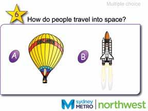
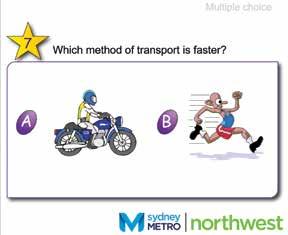
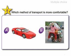

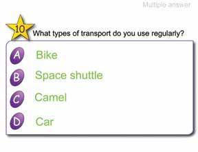
259 FASTTRACKING THE FUTURE PRIMARY EDITION NOVEMBER


260 SMART Notebook Lesson 1 - How do we travel sheets. 258 APPENDIX

261 Showground Station, March 2015 FASTTRACKING THE FUTURE PRIMARY EDITION NOVEMBER
262

263 Inside cover: Tunnel boring machine TBM2 Florence breaks through at Cherrybrook, January 2016 Front/back cover: Artist s impression of Sydney s new metro train on the skytrain Education covers.indd 2 10/11/2016 1:31 pm
Industry briefing NOVEMBER 2017
 Industry briefing NOVEMBER 2017 SYDNEY METRO AUSTRALIA S BIGGEST PUBLIC TRANSPORT PROJECT A new stand-alone railway, this 21st century network will revolutionise the way Sydney travels. Services start
Project Overview June 2014
 Project Overview June 2014 Contents 3 Minister s message 4 Project update 7 Sydney s Rail Future 8 Key project benefits 10 Trains 14 Stations 16 Cudgegong Road 18 Rouse Hill 20 Kellyville 22 Bella Vista
Project overview SEPTEMBER 2015
 Project overview SEPTEMBER 2015 CONTENTS Cover: Sydney s new metro train This page: Artist s impression of the new landmark cable-stayed bridge over Windsor Road 4 Sydney Metro 6 About Sydney Metro Northwest
Sydney Metro West A new railway for Western Sydney
 Sydney Metro West A new railway for Western Sydney PROJECT OVERVIEW, SEPTEMBER 2017 SYDNEY METRO WEST A NEW RAILWAY FOR WESTERN SYDNEY 1 CONTENTS Project snapshot 4 The need for new rail 5 Sydney Metro
FUTURE TRANSPORT STRATEGY AND GREATER SYDNEY SERVICES AND INFRASTRUCTURE PLAN. Western Parkland City
 FUTURE TRANSPORT STRATEGY AND GREATER SYDNEY SERVICES AND INFRASTRUCTURE PLAN Western Parkland City 2 Transport for NSW Future Transport Strategy and Greater Sydney Services and Infrastructure Plan Western
4 Transport projects underway in Western Sydney
 4 Transport projects underway in Western Sydney About this chapter This chapter provides an overview of the Australian and NSW government s significant investments in road, bus and rail infrastructure
Industry briefing April 2018
 Industry briefing April 2018 CONTENTS Premier s message 3 Minister s message 3 Sydney Metro 4 Sydney Metro West 6 Sydney Metro West project development 8 Working with industry and stakeholders 9 Sydney
Project update JANUARY 2017 SYDNEY METRO PROJECT OVERVIEW 1
 Project update JANUARY 2017 SYDNEY METRO PROJECT OVERVIEW 1 Premier s message Minister s message Welcome to Sydney Metro Australia s largest public transport project. We re already more than half way through
Transforming Sydney. Program Overview
 Transforming Sydney Program Overview Australia s biggest public transport project Contents Redefining Sydney s growth 8 Economic benefits 12 Integrated into communities 14 The customer is at the centre
ABOVE + BEYOND PINNACLE OFFICE PARK 4 DRAKE AVENUE, MACQUARIE PARK, NSW
 ABOVE + BEYOND PINNACLE OFFICE PARK 4 DRAKE AVENUE, MACQUARIE PARK, NSW OVERVIEW 2 Opportunity Macquarie Park is a vibrant business district attracting well renowned companies and experiencing continued
Cumberland Line. Explanation of definitions and symbols
 Cumberland Line How to use this timetable This timetable provides a snap shot of service information in 24-hour time (e.g. 5am = 05:00, 5pm = 17:00). Information contained in this timetable is subject
Industry briefing APRIL 2017
 Industry briefing APRIL 2017 CONTENTS 4 Sydney Metro 6 Announcing Sydney Metro West 8 Sydney Metro: transforming Sydney 10 The Sydney Metro experience 12 Sydney Metro City & Southwest 26 Metro precinct
Industry briefing SEPTEMBER 2016
 Industry briefing SEPTEMBER 2016 CONTENTS 4 Sydney Metro 6 Transforming Sydney 8 The Sydney Metro experience 10 About Sydney Metro City & Southwest 12 Sydney Metro City & Southwest Chatswood to Sydenham
Sydney Metro West A new railway for Western Sydney. Project overview, March 2018
 Sydney Metro West A new railway for Western Sydney Project overview, March 2018 1 Contents Project overview 4 A new railway for Western Sydney 6 Servicing key precincts 7 Sydney Metro 8 Growing with the
3 The growth of Western Sydney
 3 The growth of Western Sydney About this chapter This chapter provides an overview of Western Sydney s growing population and economy, and the benefit of the proposed Western Sydney Airport. Population
Kilometres. Blacktown. Penrith. Parramatta. Liverpool Bankstown. Campbelltown
 0 5 10 15 20 Kilometres Penrith Blacktown Parramatta Liverpool Bankstown Campbelltown accessibility outcomes Legend Outcomes targeted in Western Sydney are: public transport that is accessible throughout
5 Rail demand in Western Sydney
 5 Rail demand in Western Sydney About this chapter To better understand where new or enhanced rail services are needed, this chapter presents an overview of the existing and future demand on the rail network
Why the. Building for growth. West Metro. is vital
 Information summary West Building for growth World class public transport solutions for high demand challenges can transform the way a global city like Sydney lives, works and breathes. Sydney s busiest
NSW PRE-BUDGET STATEMENT FUTURE ECONOMY FUTURE JOBS
 2017-18 NSW PRE-BUDGET STATEMENT FUTURE ECONOMY FUTURE JOBS Executive Summary The 2017-18 NSW State Budget presents an opportunity for the NSW Government to future-proof the tourism and transport sectors.
Figure 3: Global Sydney. Draft Metropolitan Strategy for Sydney. North Sydney CBD. Second Harbour Crossing. Walsh Bay Arts Precinct.
 Newtown Glebe Macdonaldtown Pyrmont Ultimo Sydney International Convention, Exhibition & Entertainment Precinct Sydney Education & Health Erskineville Figure 3: Global Sydney Waterloo Second Harbour Crossing
North District Plan OVERVIEW
 OUR GREATER SYDNEY 2056 Revised Draft North District Plan OVERVIEW Hornsby Hunter's Hill Ku-ring-gai Lane Cove Mosman Northern Beaches North Sydney Ryde Willoughby Snapshot of the North District today
Investor Report. Connecting the best of both worlds
 Investor Report Connecting the best of both worlds Executive summary Project & display address 1015 Pacific Highway, Roseville, NSW 2069 Project description Rose is a mixed-use development located within
Why does Sydney need a new fast Metro to the West? A fast Metro to the west is a vital component of this Plan
 Why does Sydney need a new fast Metro to the West? (as shown in 10,000 Friends of Greater Sydney Stage 1 Rail Plan) The Stage 1 Rail Plan was developed to support an integrated transport plan that would
PCAL Case Study Retail Areas: Rouse Hill Town Centre
 PCAL Case Study Retail Areas: Rouse Hill Town Centre Introduction Rouse Hill Town Centre is a new mixed use development on a greenfield site in Sydney s North West. It has been planned to be a major hub
TOWN PLANNING SUBMISSION TO THE GREATER SYDNEY COMMISSION LANDS AT ARTARMON
 TOWN PLANNING SUBMISSION TO THE GREATER SYDNEY COMMISSION LANDS AT ARTARMON March 2017 TABLE OF CONTENTS 1.0 INTRODUCTION 3 2.0 THE SUBJECT SITE 4 3.0 STRATEGIC PLANNING CONTEXT 6 4.0 SUMMARY AND CONCLUSIONS
POSITIVE + OUTLOOK MICROSOFT CAMPUS 1 EPPING ROAD, NORTH RYDE, NSW
 POSITIVE + OUTLOOK MICROSOFT CAMPUS 1 EPPING ROAD, NORTH RYDE, NSW OVERVIEW 2 Opportunity Microsoft Campus offers high quality office space with excellent exposure to Epping Road. The estate is ideally
SEARs strategic context and project need
 3 Strategic context and project need This chapter describes the strategic context of the project within the State and national planning policy framework, and explains the need for the project, across national,
January Productivity Profile. Greater Sydney Productivity Profile
 Greater Sydney Contents 6.2 Strategic and District Centres North District 35 Chatswood Strategic Centre 37 Macquarie Park Strategic Centre 38 01 Overview 3 1.1 Purpose 3 North Sydney Strategic Centre 39
SYDNEY S SECOND AIRPORT
 COLLIERS RADAR SYDNEY S SECOND AIRPORT The Catalytic Effect of Transport Infrastructure By Sass J-Baleh Manager Research sass.jbaleh@colliers.com Summary Industrial land values across the Sydney markets
SYDENHAM TO BANKSTOWN ENVIRONMENTAL IMPACT STATEMENT OVERVIEW
 SYDENHAM TO BANKSTOWN ENVIRONMENTAL IMPACT STATEMENT OVERVIEW September 2017 Marrickville Dulwich Hill Hurlstone Park Canterbury Campsie Belmore Lakemba Wiley Park Punchbowl Bankstown Sydney s new metro
QUALITY + SPACE BINARY CENTRE 3 RICHARDSON PLACE, NORTH RYDE, NSW
 QUALITY + SPACE BINARY CENTRE 3 RICHARDSON PLACE, NORTH RYDE, NSW OVERVIEW 2 A positive outlook Binary Centre offers modern office suites overlooking Lane Cove River and the National Park in North Ryde.
TRANSPORT FOR A CONNECTED CITY
 STRATEGIC DIRECTION C TRANSPORT FOR A CONNECTED CITY Metropolitan Plan for Sydney 2036 PAGE 81 Introduction The rail network caters for almost one million passenger trips a day Sydney in 2010 Sydney s
A TRULY SYDNEY THE PALMS
 RIVERSTONE 1300 tribeca tribeca.com.au @ THE PALMS RIVERSTONE AREA MAP PAGE 2 LOCAL AMENITY PAGE 3 INFRASTRUCTURE PAGE 4 EDUCATION PAGE 5 ESTATE MAP PAGE 6 HOME DESIGN FEATURES PAGE 7 HOME INCLUSIONS PAGE
AUCKLAND $1.2 BILLION $1.9 BILLION $149 MILLION 15% SPEND $5.7 BILLION
 AUCKLAND AUCKLAND $5.7 BILLION FORECAST TOTAL AUCKLAND INVESTMENT The next 10 years are expected to underline Auckland s performance as the fastest growing major city in Australasia. The city is expected
CBD bus network. a new. begins Sunday 4 October 2015
 CBD bus network a new begins Sunday 4 October 2015 CONTENTS A new CBD bus network 2 Northern services Northern Beaches, Mosman and Pittwater 4 Northern Suburbs (Frenchs Forest, St Ives, Turramurra) Cammeray
Northern Beaches Transport Action Plan
 Northern Beaches Transport Action Plan The NSW Government is taking action now to deliver transport improvements for the Northern Beaches, as well as planning for the future growth of the area. $633 million
STAKEHOLDER AND COMMUNITY ENGAGEMENT
 STAKEHOLDER AND COMMUNITY ENGAGEMENT CHAPTER FIVE 5 Stakeholder and community engagement This chapter provides an outline of the consultation carried out on the project, and how this has influenced the
Metropolitan Plan for Sydney 2036
 Metropolitan Plan for Sydney 2036 METROPOLITAN PLAN FOR SYDNEY 2036 December 2010 ISBN 978 0 7313 3477 3 Copies of this publication may be downloaded from metroplansydney.nsw.gov.au Metropolitan Plan for
Shaping Sydney Strategies and Action Plan
 Shaping Sydney 2051 Strategies and Action Plan THE VISION FOR SYDNEY IN 2051 By 2051, an estimated seven million people will be living in Sydney, a vibrant, environmentally sustainable and bustling city
Draft West Central District Plan. Overview. November Local Government Areas: Blacktown Cumberland Parramatta The Hills
 Draft West Central District Plan Overview November 2016 Local Government Areas: Blacktown Cumberland Parramatta The Hills 1 Snapshot of the West Central District Population 2016 2036 That s an estimated
WESTERN SYDNEY PARKLANDS PLAN 2020 CORPORATE
 WESTERN SYDNEY PARKLANDS 2020 CORPORATE PLAN March 2015 Table of Contents Message from the Chairman and Director 1 What is the Western Sydney Parklands? 4 The Western Sydney Parklands Trust 4 The Corporate
IN SUMMARY. Sydney is growing; but the South is not included. A strategic hub?
 IN SUMMARY There is a serious brain drain in southern Sydney. The Commission needs to prioritise Southern Sydney in its development but nothing is being done, thereby missing the opportunity to stop it.
SYDNEY OPERA HOUSE. Artwork: Dreaming Sisters 2011 by Mary Smith. Copyright Mary Smith & Weave Arts Centre
 SYDNEY OPERA HOUSE reconciliation action plan Artwork: Dreaming Sisters 2011 by Mary Smith. Copyright Mary Smith & Weave Arts Centre SYDNEY OPERA HOUSE reconciliation action plan CONTENTS introduction
NORTH WEST GROWTH CENTRE
 OUTLOOK NORTH WEST GROWTH CENTRE A CONTEXT ON BUSINESS, CULTURE, LIFESTYLE AND RESIDENTIAL The North West Growth Centre is an emerging residential market that is expected to benefit from strong infrastructure
Sydney over the next 20 years A Discussion Paper. May 2012
 Sydney over the next 20 years A Discussion Paper May 2012 Sydney over the next 20 years. A Discussion Paper May 2012 Crown Copyright 2012 NSW Government ISBN 978-0-7313-3506-0 DISCLAIMER While every reasonable
SAMPLE. SITTGDE002A Provide arrival and departure assistance. Learner guide. SIT07 Tourism and Hospitality Training Package.
 SIT07 Tourism and Hospitality Training Package SITTGDE002A Provide arrival and departure assistance Learner guide Version 1 Training and Education Support Industry Skills Unit Meadowbank Product Code:
WORKING PAPER ITLS-WP The North West Rail Link: Winners and losers in the locality of the north west area.
 WORKING PAPER ITLS-WP-12-24 The North West Rail Link: Winners and losers in the locality of the north west area. By Geoffrey T. Clifton, Corinne Mulley and David A. Hensher December 2012 ISSN 1832-570X
Central District CENTRAL
 C E N T R A L Central District District Suburbs Strategic Centre District Centre District Boundary Central Local Government Boundary Airport Waterways National Parks and Reserves Suburb name and boundary
7.0 Bus and light rail in Sydney
 7.0 Bus and light rail in Sydney Summary Buses and light rail provide accessible public transport on transit corridors where traffic flows do not support a heavy rail line. The principal issue facing bus
Team London Bridge Response to the Department for Transport Consultation on the combined Thameslink, Southern and Great Northern franchise
 Team London Bridge Response to the Department for Transport Consultation on the combined Thameslink, Southern and Great Northern franchise 23 August 2012 Table of Contents 1. Executive Summary 2. Introduction
BUSINESS PARK. 8 Parkview Drive, Sydney Olympic Park FOR LEASE
 1 2 4 3 BUSINESS PARK 8 Parkview Drive, Sydney Olympic Park OFFICE SPACE available FOR LEASE Imagine a workplace within a world class business park providing an ambiance which promotes greater productivity
JUNE 2007 UPDATE REPORT SYDNEY METROPOLITAN STRATEGY
 JUNE 2007 UPDATE REPORT SYDNEY METROPOLITAN STRATEGY introduction TASKFORCE INTRODUCTION The Metropolitan Strategy, City of Cities A Plan for Sydney s Future was released in December 2005. The Strategy
County of Cumberland Plan Sydney Region Outline Plan
 Sydney has been fortunate in having had two ground breaking Strategic Plans to guide its growth. The first was the County of Cumberland Plan 1948, based on the 1944 London Plan, complete with a green belt.
Sunshine Coast Council Locked Bag 72 Sunshine Coast Mail Centre QLD Submitted via online portal. 2 June 2017.
 Sunshine Coast Council Locked Bag 72 Sunshine Coast Mail Centre QLD 4560 Submitted via online portal 2 June 2017 Dear Sir /Madam, RE: DRAFT ENVIRONMENTAL AND LIVEABILITY STRATEGY The Green Building Council
TALLAWONG STATION PRECINCT SOUTH CONCEPT PROPOSAL STATE SIGNIFICANT DEVELOPMENT APPLICATION
 TALLAWONG STATION PRECINCT SOUTH CONCEPT PROPOSAL STATE SIGNIFICANT DEVELOPMENT APPLICATION ENVIRONMENTAL IMPACT STATEMENT OVERVIEW Through great partnerships, great things can happen. That s why we re
CENTRES AND CORRIDORS STRATEGY FOR SYDNEY
 STRATEGY FOR SYDNEY B introduction 80 THIS PAGE TURNER/ARETS, PREVIOUS PAGE: KARL SCHWERDTFEGER VISION FOR CENTRES Sydney s strategic centres will be attractive places to live, work and invest. They will
STRATA DATA. Residential Strata in NSW A summary analysis. Issue 3, March City Futures Research Centre
 Governing the compact city STRATA DATA Residential Strata in NSW A summary analysis Issue 3, March 2011 City Futures Research Centre Cover photograph: Bruce Judd, 2010 Governing the Compact City Strata
Improve Sydney Public Transport (ISPUT) Improve Sydney and Rural Railways (IMSARR) EXPANSION AND UPGRADE OF THE SYDNEY METROPOLITAN AND
 Improve Sydney and Rural Railways (IMSARR) EXPANSION AND UPGRADE OF THE SYDNEY METROPOLITAN AND") Improve Sydney Public Transport (ISPUT) Improve Sydney and Rural Railways (IMSARR) EXPANSION AND UPGRADE OF THE SYDNEY METROPOLITAN AND REGIONAL AND RURAL NEW SOUTH WALES RAILWAYS CONCISE OVERVIEW 18 January,
Improve Sydney Public Transport (ISPUT) Improve Sydney and Rural Railways (IMSARR) EXPANSION AND UPGRADE OF THE SYDNEY METROPOLITAN AND REGIONAL AND RURAL NEW SOUTH WALES RAILWAYS CONCISE OVERVIEW 18 January,
Measuring the changing face of Global Sydney
 Measuring the changing face of Global Sydney Contents Global Migration Index P.1 Key findings P.2 Trends P.5 Future releases P.8 A Global Sydney Globalisation has brought society more closely together
CUMULATIVE IMPACTS CHAPTER TWENTY-SIX
 CUMULATIVE IMPACTS CHAPTER TWENTY-SIX 26 Cumulative impacts This chapter provides an assessment of the potential cumulative impacts as a result of the project, and identifies mitigation measures to minimise
A Master Plan is one of the most important documents that can be prepared by an Airport.
 The Master Plan A Master Plan is one of the most important documents that can be prepared by an Airport. A Master Plan is a visionary and a strategic document detailing planning initiatives for the Airport
STRATEGIC + LOCATION CAMPUS BUSINESS PARK 350 PARRAMATTA ROAD, HOMEBUSH NSW
 STRATEGIC + LOCATION CAMPUS BUSINESS PARK 350 PARRAMATTA ROAD, HOMEBUSH NSW OVERVIEW 2 Opportunity Campus Business Park is one of the Inner West s premier industrial estates, ideally suited to the corporate
1 Sydney Metro program of works Sydney Metro Northwest Sydney Metro City & Southwest Governance 18
 Sustainability Report 2017 Table of contents 1 Sydney Metro program of works 12 About this report The Sydney Metro Sustainability Report 2017 outlines our sustainability performance by providing a snapshot
Economy. Metropolitan Plan for Sydney 2036 PAGE 127
 STRATEGIC DIRECTION E Growing Sydney s Economy Metropolitan Plan for Sydney 2036 PAGE 127 Introduction A strong economy in Sydney and NSW provides the resources to fund economic, social and cultural infrastructure
https://gsc-public-1.s3-ap-southeast-2.amazonaws.com/s3fs-public/draft-eastern-city-district-plan.pdf
 GSC Sydney East Rev Draft -references Port Botany - 30 https://gsc-public-1.s3-ap-southeast-2.amazonaws.com/s3fs-public/draft-eastern-city-district-plan.pdf Pages 6. The District s freight routes, particularly
PO Box 257 PO Box 257 PARRAMATTA NSW 2124 PARRAMATTA NSW 2124
 31 March 2017 Sean O Toole Sheridan Dudley District Commissioner - West District Commissioner - South West Greater Sydney Commission Greater Sydney Commission PO Box 257 PO Box 257 PARRAMATTA NSW 2124
Waterloo Over Station Development
 Waterloo Over Station Development The Metro Quarter CONCEPT STATE SIGNIFICANT DEVELOPMENT APPLICATION ENVIRONMENTAL IMPACT STATEMENT OVERVIEW NOVEMBER 2018 Artist's impression of the Metro Quarter For
ENVIRONMENT ACTION PLAN
 ENVIRONMENT ACTION PLAN 2015 16 Airservices Australia 2015 This work is copyright. Apart from any use as permitted under the Copyright Act 1968, no part may be reproduced by any process without prior written
Metropolitan Plan for Sydney 2036
 Metropolitan Plan for Sydney 2036 OVERVIEW METROPOLITAN PLAN FOR Sydney 2036 December 2010 ISBN 978 0 7313 3478 0 Copies of this publication may be downloaded from metroplansydney.nsw.gov.au Metropolitan
NSW Budget Highlights
 NSW Budget 2018-19 Highlights Wednesday 20 June 2018 The industry association representing the business interests of consulting firms operating in the built and natural environment Yesterday, NSW Treasurer
Agenda Item 5: Rail East Midlands Rail Franchise Consultation
 Strategic Transport Forum 15 th September 2017 Agenda Item 5: Rail East Midlands Rail Franchise Consultation Recommendation: It is recommended that the Forum agree (subject to any amendments agreed by
Planning Approval Consistency Assessment Form
 Integrated Management System Planning Approval Consistency Assessment Form SM ES-FT-414 Sydney Metro Integrated Management System (IMS) Applicable to: Document Owner: System Owner: Status: Sydney Metro
Newcastle Transport Program Newcastle Light Rail Determination Report
 Newcastle Transport Program Newcastle Light Rail Determination Report Date Author 25 July 2016 TfNSW Ref 5276649 Status Final TfNSW 2014 UNCONTROLLED WHEN PRINTED Page 1 of 19 Table of contents 1 Introduction
Badgery s Creek Airport Presention. Revised from NAN 2015 AGM
 Badgery s Creek Airport Presention Revised from NAN 2015 AGM Contents History Badgery s Creek Objectives Why is another airport required? Badgery s Creek Airport key facts, approval process and timeline
CCN. Central Coast & Newcastle Line. How to use this timetable. Real-time planning. Explanation of definitions and symbols. Accessible services.
 Central Coast & Newcastle Line How to use this timetable This timetable provides a snap shot of service information in 24-hour time (e.g. 5am = 05:00, 5pm = 17:00). Information contained in this timetable
Overview. Draft North District Plan. November Local Government Areas: Hornsby Hunter s Hill Ku-ring-gai. Lane Cove Mosman Northern Beaches
 Draft North District Plan Overview November 2016 Local Government Areas: Hornsby Hunter s Hill Ku-ring-gai Lane Cove Mosman Northern Beaches North Sydney Ryde Willoughby Snapshot of the North District
Overview. Draft Central District Plan. November Local Government Areas: Bayside Burwood Canada Bay. Inner West Randwick Strathfield
 Draft Central District Plan Overview November 2016 Local Government Areas: Bayside Burwood Canada Bay Inner West Randwick Strathfield The City of Sydney Waverley Woollahra 1 Snapshot of the Central District
The Government s Aviation Strategy Transport for the North (TfN) response
 response") The Government s Aviation Strategy Transport for the North (TfN) response Transport for the North Background Good transport links are a crucial part of a strong economy supporting labour markets and delivering
The Government s Aviation Strategy Transport for the North (TfN) response Transport for the North Background Good transport links are a crucial part of a strong economy supporting labour markets and delivering
An Idyllic Community Awaits
 1300 tribeca tribeca.com.au @ ROSS PLACE AREA MAP PAGE 2 LOCAL AMENITY PAGE 3 INFRASTRUCTURE PAGE 4 LIFESTYLE PAGE 5 ESTATE MAP PAGE 6 HOME DESIGN FEATURES PAGE 7 HOME INCLUSIONS PAGE 8 ABOUT TRIBECA PAGE
Executive summary. Project description. Project name. Project address. Apartment mix. Deposit required. Estimated construction commencement date
 Investor Report Executive summary Project name Highline westmead Project address 158 164 Hawkesbury Road,, NSW 2145 Apartment mix Studio, 1, 2 and 3 bedroom apartments Deposit required 10% Deposit (cash
DIGITAL WESTERN PARKLAND CITY
 DIGITAL WESTERN PARKLAND CITY MS LIZ DIBBS Western City District Commissioner Greater Sydney Commission MR GRAHAM DAVIS KING Board Member of the Deerubbin Local Aboriginal Land Council Welcome to Country
ALL ABOARD LABOR S LONG TERM PASSENGER TRANSPORT STRATEGY
 ALL ABOARD LABOR S LONG TERM PASSENGER TRANSPORT STRATEGY Revitalising Passenger Transport Increasing traffic congestion in our cities and a lack of transport services in our regional towns is frustrating
IN FOCUS NSW. Developing Western Sydney
 IN FOCUS NSW Developing Western Sydney DEVELOPING WESTERN SYDNEY Introduction Western Sydney is one of the fastest growing regions in Australia. Traditionally infrastructure expenditure and development
Concord Road Interchange. Standard hours of work
 Artist impression of the Concord Road interchange, Concord - concept only WestConnex s M4 East will extend the M4 Motorway with two new 5.5 kilometre tunnels from Homebush to Haberfield, providing a bypass
OUTLOOK EAST LEPPINGTON
 OUTLOOK EAST LEPPINGTON A CONTEXT ON BUSINESS, CULTURE, LIFESTYLE AND RESIDENTIAL Located within the rapidly expanding South West Growth Centre of Sydney, the East Leppington Precinct is well positioned
2017 July Greater Parramatta
 2017 July Greater Parramatta Interim Land Use and Infrastructure Implementation Plan Background Analysis To view an electronic version in PDF format, visit www.planning.nsw.gov.au Crown Copyright 2017
New free City connector bus service
 The Adelaide City Council invites engagement from the community about New free City connector bus service 99C City Loop and Adelaide Connector free bus services to merge: Project Summary Adelaide City
MARKET OUTLOOK. 01 Walkability & Accessibility 02 Infrastructure & Employment 03 Demographics 04 Residential Analysis 06 Rental Analysis
 MARKET OUTLOOK EAST LEPPINGTON Located within the rapidly expanding South West Growth Centre of Sydney, the East Leppington Precinct is well positioned to benefit from the region s strong infrastructure
The Coalition s Policy
 The Coalition s Policy Key Commitments The Coalition s plan for a strong new economy will provide jobs and growth and secure the future for Australian families through smart investment in infrastructure.
Draft Greater Sydney Region Plan
 Draft Greater Sydney Region Plan Submission_id: 31392 Date of Lodgment: 14 Dec 2017 Origin of Submission: Online Organisation name: Greenfields Development Company No. 2 Pty Limited Organisation type:
TRANSPORT ASSISTANCE - Weekend services are less frequent ALL BUSES after 7 p.m. at Parramatta depart from either A2 or B2.
 TRANSPORT ASSISTANCE - Weekend services are less frequent ALL BUSES after 7 p.m. at Parramatta depart from either or Number Route Metro (M) every 15 minutes Stops atuws or Go to Parramatta and change to
Strategies and Land Release
 North West and South West Growth Centres Bruce Colman Precinct Project Manager 1 Growth Centres: Background Metropolitan Strategy North West & South West Rezone land quickly Planning and infrastructure
The State of Transport in Macquarie Park
 The State of Transport in Macquarie Park 31st August 2015 Overview Macquarie Park is a major economic centre that contributes over $9billion to Australia s economy each year. Providing access to and from
An Idyllic Community Awaits
 1300 tribeca tribeca.com.au @ ROSS PLACE AREA MAP PAGE 2 LOCAL AMENITY PAGE 3 INFRASTRUCTURE PAGE 4 LIFESTYLE PAGE 5 ESTATE MAP PAGE 6 HOME DESIGN FEATURES PAGE 7 HOME INCLUSIONS PAGE 8 ABOUT TRIBECA PAGE
INNOVATION CAMPUS.
 INNOVATION CAMPUS www.innovationcampus.com.au INNOVATION CAMPUS IS A PURPOSE-BUILT RESEARCH AND BUSINESS PRECINCT At the University of Wollongong, we recognise the importance of developing research partnerships
Labor s plan to support art and culture throughout NSW
 MICHAEL DALEY & LABOR Labor s plan to support art and culture throughout NSW www.nswlabor.org.au Michael Daley NSW Labor Leader I believe NSW can become one of the most culturally vibrant societies in
Ireland. Tourism in the economy. Tourism governance and funding
 Ireland Tourism in the economy Tourism is one of Ireland s most important economic sectors and has significant potential to play a further role in Ireland s economic renewal. In 2014, spending by visitors
Sharing the Way with Sustainable Transport Options
 Sharing the Way with Sustainable Transport Options Planning Institute Australia Professional Development Seminar Adelaide, SA Thursday 1 st May 2008 John Devney Sustainable Transport What is Sustainable
HARBOUR EDGE STITCH. Uniting the Waterfront with the City Centre
 78 AC_BEU_CCMP_2_TM1_4 _FD.indd 78 20/07/12 12:04 PM 01 HARBOUR EDGE STITCH Uniting the Waterfront with the City Centre 01 VISION OUR 2032 VISION IS: Quay Street as a high-quality Harbour Edge space that
The North West Growth Precinct
 Where is Greater Sydney s next investment hotspot? Sydney has experienced very strong price growth over the past 6 years. When such strong growth has already occurred, it is important not to get caught