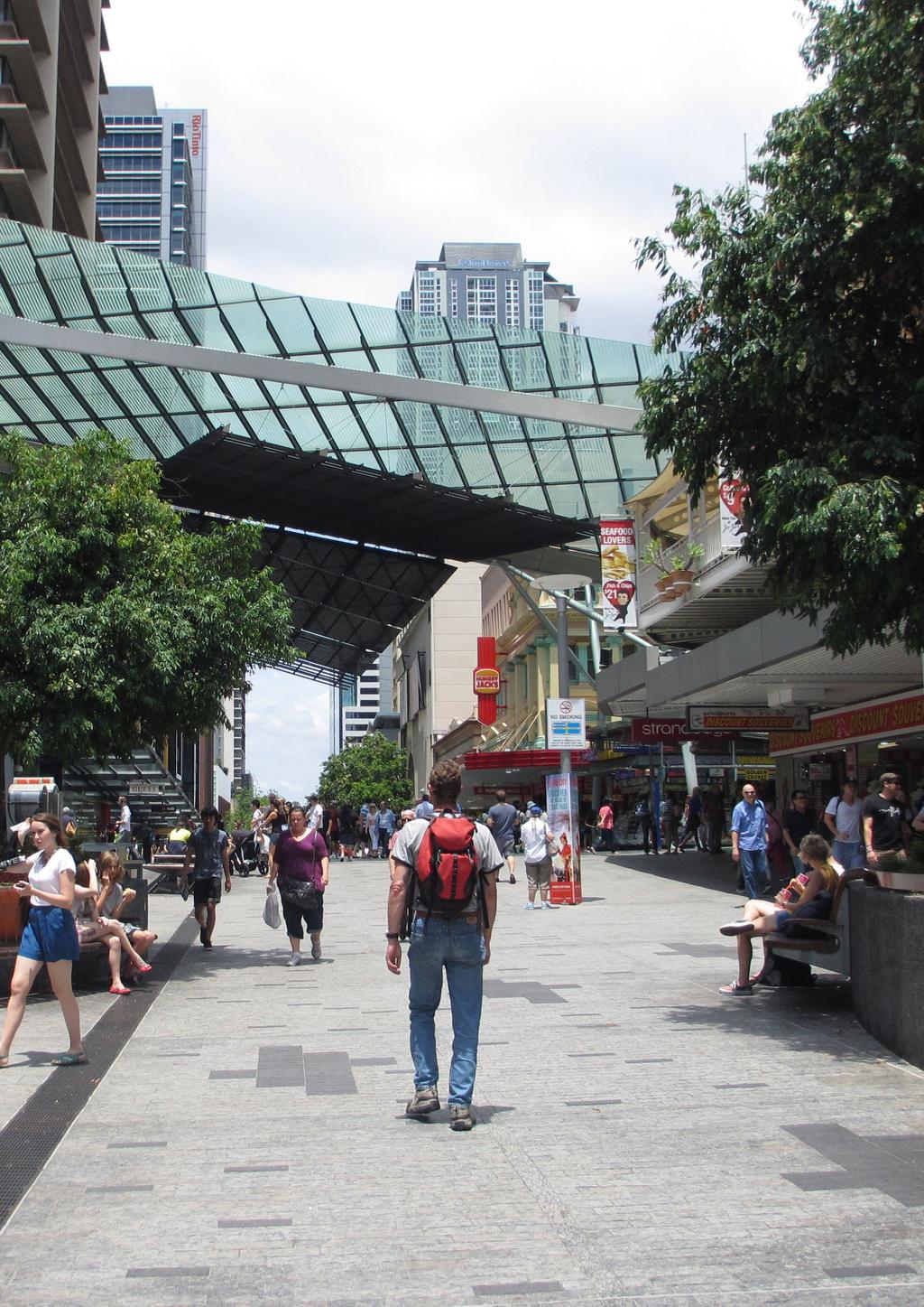
November Creating liveable cities in Australia A scorecard and priority recommendations for Brisbane
|
|
|
- Sandra Lyons
- 5 years ago
- Views:
Transcription


1 November 2018 Creating liveable cities in Australia A scorecard and priority recommendations for Brisbane
2 What makes a liveable city? The term liveability is widely used in Australia and across the world, yet it is rarely defined. We define a liveable community as one that is: safe, attractive, socially cohesive and inclusive, and environmentally sustainable; with affordable and diverse housing linked by convenient public transport, walking and cycling infrastructure to employment, education, public open space, local shops, health and community services, and leisure and cultural opportunities [1]. Liveable, walkable neighbourhoods can improve public health, and can increase environmental, economic and social sustainability [2, 3]. Creating healthy, liveable communities will therefore help cities achieve the United Nations Sustainable Development Goals [4] and United Nations Habitat s New Urban Agenda [5]. We have identified seven domains that help make neighbourhoods liveable: Walkability Public Transport Public Open Space Employment Alcohol Environment Housing Affordability Food Environment Liveable city scorecard In Creating Liveable Cities in Australia (2017) we reviewed state government urban planning policies related to liveability in Sydney, Melbourne, Brisbane and Perth and presented the first baseline measure of liveability in these cities [6]. This scorecard focuses on the results and recommendations for Brisbane, Queensland based on two types of indicators mapped across the metropolitan area: 1) Policy implementation indicators We reviewed each state s policies and identified relevant, measurable standards and targets. We then mapped and assessed how well states were implementing their policies spatially, i.e., how they were delivered on-the-ground. The scorecard shows where Brisbane is currently meeting or exceeding (p), on par ( n ) or falling below (q) its policy targets. 2) National liveability indicators We created a set of spatial liveability indicators which are aligned with urban policy and are also associated with chronic disease risk factors or health outcomes. We mapped these using data available nationally, allowing comparisons between the state capital cities. The Housing Affordability and Employment national liveability indicators have been updated in this scorecard using the newly available 2016 Census data from the Australian Bureau of Statistics. The scorecard shows where Brisbane is currently performing well (p), on par ( n ) or underperforming (q) compared to other cities.

3 Our main findings Making Brisbane liveable is a policy objective of the Queensland state government. In some domains of liveability, Brisbane performs well in comparison to other Australian cities in its policy ambition and performance. However, to achieve its liveability aspirations, greater ambition is required in some of its policy targets. Brisbane is doing well in: creating walkable neighbourhoods in the inner-city setting an urban density target of 30 dwellings per hectare, which is high enough to achieve walkable neighbourhoods achieving its target for access to large parks within the City of Brisbane However, Brisbane is not doing as well in: providing access to public transport and walkable communities in outer suburban areas setting its suburban density target at 15 dwellings per hectare, which is too low to achieve walkable neighbourhoods setting measurable spatial policies for access to destinations, food and alcohol environments and for local employment 61% of residences in Brisbane are within 400 m of a public transport stop, which is below the ambitious 90% policy target. However, the current policy does not include frequency of service. Only 12% of Brisbane residences have access to a nearby stop with a service at least every half hour. This is lower than other capital cities. Residences within the City of Brisbane have good access to larger public open spaces. 99% meet the policy target of being within 2.5 km of a public open space larger than 5 hectares. However, only 65% of residences are within 400 m of a park larger than 0.5 hectares, which is below the 90% target. 37% of lower-income households in Brisbane are experiencing housing affordability stress, which is more than five years ago. To travel to work only 14% of employed people use public transport, and only 5% walk or cycle. With 27% of Brisbane s working population living and working in their broader local area, there is an opportunity for policies that encourage active transport for work commutes. Only 37% of residences in Brisbane are within 1 km of a supermarket.
4 Recommendations We recommend that: integrated evidence-informed transport, land use and infrastructure planning be undertaken to deliver affordable housing, public transport, accessible employment and amenities; and to create walkable neighbourhoods as the foundation of a liveable city. measurable spatial targets be included in all policies, regulations and guidelines for urban planning, transport and infrastructure. ambitious targets be set for all seven urban liveability domains, with specific short-term, medium-term and long-term implementation goals. The state government should: increase and fully implement a minimum housing density target of 25 dwellings per hectare in suburban neighbourhoods, with higher densities around public transport nodes and activity centres fully implement the minimum housing density target of at least 30 dwellings per hectare in urban neighbourhoods, and even explore increasing the target maintain and set targets to fully implement existing policies for street block sizes that create walkable neighbourhoods maintain and fully implement policies that create larger, higher-quality public open spaces set more ambitious policies and targets for public transport access that include both proximity and frequency of service invest in infrastructure that encourages walking and cycling for transport and to work, including in outer suburban areas set policies and targets for improving the food and alcohol environment. This could increase people s access to healthy food, and reduce the health-related and social harms caused by excessive alcohol consumption spatial indicators be adopted to measure and monitor the implementation of state government policies designed to create liveable communities. These should be updated at least every five years, to coincide with the ABS Census, and more frequently where possible. state and local government policies be consistent, based on evidence, and designed to create healthy, liveable communities the state government continue to recognise health promotion as a relevant planning consideration in Queensland planning legislation. This will help local government planners create healthy, liveable communities.

5 Walkability What does the policy say and how well is it being implemented? In Queensland, the Priority Development Area guidelines and practice notes include targets for: Street connectivity sets targets for the length and width of residential street blocks, to create walkable block sizes with a maximum perimeter of 560 m. This is more ambitious than Victoria and Western Australia, which set a maximum perimeter of 720 m. Nevertheless, only: n 43% of residential street blocks in Brisbane meet this target. Density 1 specifies an average net density of at least 30 dwellings per hectare in urban neighbourhoods and 15 dwellings per hectare in suburban neighbourhoods. The urban dwelling density is commendable and higher than other state policies, however: q 13% of suburbs in Brisbane meet the 15 dwellings per hectare target q 2% of suburbs in Brisbane meet the 30 dwellings per hectare target Unlike some other states, we did not find measurable spatial policies in Queensland for access to destinations. How does Brisbane rate on the national liveability indicators? Walkability was measured nationally using a variety of indicators shown to influence walking for transport [7]. Our walkability score combines dwelling density, street connectivity and access to daily living destinations within 1.6 km walking distance of home. Also presented here are indicators of distance to closest activity centre and dwelling density. n Walkability in Brisbane is unequally distributed. It is highest in the inner and middle ring of suburbs and declines steeply towards the outer urban fringe. This pattern of inequity is common in Australian cities, with the exception of Perth, which through well-implemented urban design guidelines has some new walkable areas in outer suburban areas. 1 Queensland has different dwelling density targets for urban and suburban neighbourhoods. However, these areas are not defined. We therefore couldn t measure whether the specific density targets were being met. Instead, we present the percentage of suburbs meeting net density targets.
6 n Averaging 13 dwellings per hectare, Brisbane s density is higher than Perth (12) but lower than Sydney (18) and Melbourne (14). n On average, residences in Brisbane are 1.5 km from their closest activity centre this is similar to Perth (1.5 km) but further than Sydney and Melbourne (1.3 km) Dwelling density (dwellings per hectare) 1482 m 1332 m 1499 m m Average distance in meters to the closest activity centre
7
8 Public Transport What does the policy say and how well is it being implemented? Queensland s Priority Development Area guidelines and practice notes require 90% of residences in Brisbane to be within 400 m of a public transport stop. It does not include a target for frequency of service. This is similar to the 95% target in Melbourne and more ambitious than Perth s 60% target. However, Sydney has the most ambitious and detailed policy, and is the only one to include targets for the frequency of services. q 61% of residences and 13% of suburbs in Brisbane meet this target. How does Brisbane rate on the national liveability indicator? We measured public transport nationally using an indicator combining public transport access with the frequency of service: percentage of residences within 400 m of a public transport stop with a scheduled service at least every 30 minutes between 7 am and 7 pm on a normal weekday. This is a stronger predictor of walking for transport than access alone [10]. q 12% of Brisbane residences meet this national indicator, which is lower than Melbourne (36%), Sydney (35%) and Perth (18%). 12% 36% 18% 35% Percentage of residences within 400 m of a public transport stop with a service at least every 30 mins

9
10 Public Open Space What does the policy say and how well is it being implemented? Queensland s Priority Development Area guidelines and practice notes require 90% of residences to be within 400 m of a neighbourhood public open space larger than 0.5 hectares. q 65% of residences and 8% of suburbs in the City of Brisbane 2 meet this target. The policy also requires 90% of residences to be within 2.5 km of a district public open space larger than 5 hectares in size. p 99% of residences and 55% of suburbs in the City of Brisbane meet this target. How does Brisbane rate on the national liveabilty indicators? We measured public open space nationally using two indicators: access to a public open space within 400 m access to a public open space larger than 1.5 hectares within 400 m. The latter indicator is based on evidence that smaller parks do not necessarily encourage physical activity or improve mental health [9] q 75% of residences in the City of Brisbane are within 400 m of a public open space of any size, less than Sydney and Melbourne (both 82%), and Perth (78%). n 52% of residences in the City of Brisbane are within 400 m of a public open space larger than 1.5 hectares, which is less than Perth (63%), but higher than Melbourne (49%) and Sydney (43%). CITY OF 52% 75% 49% 82% 63 % 78% 43% 82% Top bar: Percentage of residences within 400 m of a public open space Bottom bar: Percentage of residences within 400 m of a public open space larger than 1.5 hectares 2 In Brisbane public open space data was only available for the City of Brisbane.
11 Housing Affordability What does the policy say? At the time of the review, we found no measurable spatial policies about housing affordability in Queensland. 3 How does Brisbane rate on the national liveability indicator? We measured housing affordability nationally using the 30/40 housing affordability stress measure. This identifies households in the bottom 40% of income that spend more than 30% of their total income on housing. The 30/40 measure is a well-known indicator of housing affordability stress [10], and is associated with poorer self-rated health, higher community dissatisfaction, and residents feeling unsafe [11]. q Based on the 2016 Census, 41% of lower-income households in Brisbane are experiencing housing affordability stress. n In Brisbane, like most other cities, housing affordability stress increased between the 2011 and 2016 Census. Suburbs with the highest levels of housing stress are spread across large areas of the city. These residents are at particular risk of housing affordability stress, because they also tend to have poor access to public transport and live in low walkable communities, which increases their reliance on private motor vehicle transportation. 37% 41% 35% 39% 33% 38% 38% 41% Percentage of households in the bottom 40 percent of the income distribution spending more than 30 percent of household income on housing costs Top Bar: 2011; Bottom Bar: The South East Queensland Regional Plan 2017, released in late 2017 after the policy review, does include a measurable policy for housing affordability.
12 Employment What does the policy say? At the time of the review, we found no measurable spatial policies about providing employment in local areas or encouraging public and active transport to work in Queensland. How does Brisbane rate on the national liveability indicators? We measured employment nationally using two indicators: percentage of employed people living in a small local area (Statistical Area 2) working in the broader local area (Statistical Area 3) percentage of employed people using active transport (walking, cycling) or public transport to travel to work. 27% 5% 14% 28% 5% 16% 31% 4% 12% 31% 6% 26% Percentage of employed people living in SA2 and working in the broader SA3 Method of travel to work for employed people aged 15 and over Top bar: Percentage using active transport Bottom bar: Percentage using public transport Based on 2016 census data: q 27% of employed people in Brisbane live and work in their broader local area, which is lower than in Perth and Sydney (31%) and Melbourne (28%). n 14% of employed people in Brisbane use public transport to travel to work, and 5% use active transport. n Given 27% of employed residents live and work in their broader local area, there may be an opportunity to increase active and public transport journeys to work if appropriate infrastructure were provided.
13 Food Environment What does the policy say? At the time of the review, we found no measurable spatial policies about creating a healthy food environment in Queensland. How does Brisbane rate on the national liveability indicators? We measured the food environment nationally using two indicators: access to a supermarket within 1 km the healthy food ratio, measured as the percentage of healthy food outlets within 3.2 km as a proportion of all food outlets. Our previous research has found modest increases in body mass index in people living in areas where the healthy food ratio is less than 75% [8, 12]. 37% 40% 34% 41% Percentage of residences within 1 km of a supermarket n 37% of residences in Brisbane are within 1 km of a supermarket, which is more than Perth (34%) but below Sydney (41%) and Melbourne (40%). n Brisbane has a healthy food ratio of 46%, which is similar to other cities. This means just over half of all food outlets located within 3.2 km of homes are fast food outlets. p In Brisbane, just 11% of suburbs have a healthy food ratio of 75% or more. This means residents in these suburbs have better access to healthy food options relative to fast food outlets. While low, this is more than other cities.
14 Alcohol Environment What does the policy say? At the time of the review, we found no measurable spatial policies about moderating alcohol accessibility in Queensland. How does Brisbane rate on the national liveability indicators? We measured the alcohol environment nationally using two indicators: percentage of residences without access to on-licence outlets (places that serve alcohol on premises, such as pubs, bars and restaurants) within 400 m percentage of residences without access to off-licence outlets (bottle-shops and other places that allow take-away alcohol) within 800 m. Australian research suggests that high densities of alcohol outlets is associated with harmful alcohol consumption [13] and alcoholrelated violence [14]. n 86% of residences in Brisbane are not within 400 m of an on-licence alcohol outlet. This is lower than Perth (90%) but higher than Melbourne (80%) and Sydney (77%). p 88% of Brisbane 4 residences are not within 800 m of an off-licence alcohol outlet. This is much higher than Perth (66%), Melbourne (52%) and Sydney (44%). 52% 80% 86% 88% 66% 90% 44% 77% Top bar: Percentage of residences without access to an on-licence within 400 m Bottom bar: Percentage of residences without access to an off-licence within 800 m 4 Unlike in other states, there is only one liquor licence category for off-license alcohol outlets in Queensland: commercial hotels - which allow for up to three detached shops to be operated away from the main premises. This likely under-represents the number of outlets available, with many of these detached shops missed from the analysis.

15 References 1. Lowe M, Whitzman C, Badland H, Davern M, Hes D, Aye L, et al. Liveable, healthy, sustainable: What are the key indicators for Melbourne neighbourhoods? Melbourne: Place, Health and Liveability Research Program, University of Melbourne, Badland H, Whitzman C, Lowe M, Davern M, Aye L, Butterworth I, et al. Urban liveability: Emerging lessons from Australia for exploring the potential for indicators to measure the social determinants of health. Social Science & Medicine. 2014, 111: World Health Organization, UN Habitat. Global report on urban health: Equitable healthier cities for sustainable development. Italy: WHO, United Nations General Assembly. Resolution adopted by the General Assembly: Transforming our world: The 2030 agenda for sustainable development A/ RES/70/1. New York: United Nations, United Nations. Resolution adopted by the General Assembly on 23 December 2016: New Urban Agenda. New York: United Nations, Arundel J, Lowe M, Hooper P, Roberts R, Rozek J, Higgs C, Giles-Corti B. Creating liveable cities in Australia: Mapping urban policy implementation and evidence-based national liveability indicators. Melbourne: Centre for Urban Research RMIT University, Saelens BE, Handy SL. Built environment correlates of walking: A review. Medicine & Science in Sports & Exercise. 2008, 40: Mavoa S, Badland H, Lernihan V, Boruff B, Pettit C, Astell-Burt T, et al. The Australian national liveability study final report: Development of policy-relevant liveability indicators relating to health and wellbeing and recommendations for dissemination. Melbourne: McCaughey VicHealth Community Wellbeing Unit, Francis, J., Wood, L., Knuiman, M. & Giles-Corti, B. Quality or quantity? Exploring the relationship between public open space attributes and mental health in Perth, Western Australia. Social Science & Medicine. 2012, 74: Yates J, Gabriel M, Australian Housing and Urban Research Institute. Housing affordability in Australia: Collaborative research venture 3: Housing affordability for lower income Australians: Background report Badland H, Foster S, Bentley R, Higgs C, Roberts R, Pettit C, et al. Examining associations between area-level spatial measures of housing with selected health and wellbeing behaviours and outcomes in an urban context. Health & Place. 2017, 43: Feng X, Astell-Burt T, Badland H, Mavoa S, Giles-Corti B. Modest ratios of fast food outlets to supermarkets and green grocers are associated with higher body mass index: Longitudinal analysis of a sample of 15,229 Australians aged 45 years and older in the Australian National Liveability Study. Health & Place. 2018, 49: Foster S, Trapp G, Hooper P, Oddy WH, Wood L, Knuiman M. Liquor landscapes: Does access to alcohol outlets influence alcohol consumption in young adults? Health & Place. 2017, 45: Livingstone M. Alcohol outlet density and harm: Comparing the impacts on violence and chronic harms. Drug & Alcohol Review. 2011, 30: Creating liveable cities in Australia: A scorecard and priority recommendations for Brisbane Lucy Dubrelle Gunn 1, 3 Julianna Rozek 1, 3 Paula Hooper 1, 2 Melanie Lowe 4, 6 3, 5, 6 Jonathan Arundel 3, 5, 6 Carl Higgs 3, 5, 6 Rebecca Roberts Billie Giles-Corti 1, 3 1 NHMRC Centre of Research Excellence in Healthy Liveable Communities 2 Centre for the Built Environment and Health, The University of Western Australia 3 Healthy Liveable Cities Group, Centre for Urban Research, RMIT University 4 Australian Catholic University 5 The Australian Prevention Partnership Centre 6 Clean Air and Urban Landscapes Hub, National Environmental Science Programme The full Creating Liveable Cities in Australia (2017) report can be found at: This research has been funded by the Clean Air and Urban Landscapes Hub of the Australian Government s National Environmental Science Programme, The Australian Prevention Partnership Centre and the NHMRC Centre of Research Excellence in Healthy Liveable Communities. This work is licenced under the Creative Commons Attribution-NonCommercial- NoDerivs 3.0 Australia Licence. To view a copy of this licence, visit: creativecommons.org/licences/by-nc-nd/3.0/au/. Any maps reproduced as part of this project must include attribution and citation. Suggested Citation Gunn LD, Rozek J, Hooper P, Lowe M, Arundel J, Higgs C, Roberts R, Giles-Corti B. Creating liveable cities in Australia: A scorecard and priority recommendations for Brisbane. Melbourne: RMIT University, Centre for Urban Research, Enquiries regarding this report may be directed to: Healthy Liveable Cities Group, RMIT University, City Campus Building 15, Level 3, 124 La Trobe Street Melbourne VIC 3000 E hlc@rmit.edu.au P


16 Centre for Urban Research Building 15, Level 4 RMIT University City campus 124 La Trobe Street Melbourne VIC, 3000 Australia T: E: cur@rmit.edu.au
Sustainable Urban Development. Presentation to WVCC 1 December 2010
 Sustainable Urban Development Presentation to WVCC 1 December 2010 Introduction Paul Carmody Hindmarsh (Consultation Manager) Tony Adams CB Richard Ellis (Planners) Simon Parsons PTW (Architects) Brett
Life expectancy and potentially avoidable deaths in
 Life expectancy and potentially avoidable deaths in Published 30th November 2017 This report presents information on life expectancy at birth and potentially avoidable deaths in nationally and across Primary
TRANSPORT AFFORDABILITY INDEX
 TRANSPORT AFFORDABILITY INDEX Report - December 2016 AAA 1 AAA 2 Table of contents Foreword 4 Section One Overview 6 Section Two Summary of Results 7 Section Three Detailed Results 9 Section Four City
Sunshine Coast Council Locked Bag 72 Sunshine Coast Mail Centre QLD Submitted via online portal. 2 June 2017.
 Sunshine Coast Council Locked Bag 72 Sunshine Coast Mail Centre QLD 4560 Submitted via online portal 2 June 2017 Dear Sir /Madam, RE: DRAFT ENVIRONMENTAL AND LIVEABILITY STRATEGY The Green Building Council
ASCOT SUBURB PROFILE
 ASCOT SUBURB PROFILE CONTENTS SUBURB HIGHLIGHTS 2 3 4 4 5 5 ASCOT & SURROUNDS LOCATION & LIFESTYLE DEMOGRAPHICS EMPLOYMENT FUTURE INFRASTRUCTURE WA MARKET TRENDS ACCESSIBILITY ENTERTAINMENT & RECREATION
MARKET OUTLOOK. 02 Walkability & Accessibility 04 Infrastructure & Employment 05 Population & Demographics 06 Residential Analysis 07 Rental Analysis
 MARKET OUTLOOK ROCHEDALE With easy access to the major arterial roads and public transport links, Rochedale s connectivity has positioned it as a major growth precinct for the future. 02 Walkability &
TRANSPORT AFFORDABILITY INDEX
 TRANSPORT AFFORDABILITY INDEX Report - March 2018 AAA 1 AAA 2 Table of contents Foreword 4 Section One Overview 6 Section Two Summary of Results 8 Section Three Detailed Results 14 Section Four State by
Sarah Curtis Durham University and University of Edinburgh
 Varying mental health in the population across Scotland during the recent recession: what do we know and what are the implications for public health policy? Sarah Curtis Durham University and University
TOWN PLANNING SUBMISSION TO THE GREATER SYDNEY COMMISSION LANDS AT ARTARMON
 TOWN PLANNING SUBMISSION TO THE GREATER SYDNEY COMMISSION LANDS AT ARTARMON March 2017 TABLE OF CONTENTS 1.0 INTRODUCTION 3 2.0 THE SUBJECT SITE 4 3.0 STRATEGIC PLANNING CONTEXT 6 4.0 SUMMARY AND CONCLUSIONS
Review of Government Secondary School Requirements within the Sunbury South Precinct Structure Plan
 Review of Government Secondary School Requirements within the Sunbury South Precinct Structure Plan Expert Witness Statement August 11 th, 2017 Prepared by Robert Panozzo Director, ASR Research Pty Ltd
Context Briefing 3 Changes over time in the provision of amenities and facilities
 Context Briefing 3 Changes over time in the provision of amenities and facilities Anne Ellaway Scott Macdonald Laura Macdonald Natalie Nicholls March 2014 GoWell is a collaborative partnership between
Statistical Picture of Aboriginal and Torres Strait Islander School Students in Australia
 Chapter 2 Statistical Picture of Aboriginal and Torres Strait Islander School Students in Australia Statistical Picture The Australian Bureau of Statistics (ABS) reported that the estimated resident Aboriginal
WHY INVEST IN QUEENSLAND URBIS MARKET OUTLOOK
 WHY INVEST IN QUEENSLAND URBIS MARKET OUTLOOK WHO IS URBIS? PERTH AUSTRALIA ADELAIDE BRISBANE GOLD COAST SYDNEY MELBOURNE Urbis is an integrated multi-disciplinary consulting firm with a unique and comprehensive
5 Rail demand in Western Sydney
 5 Rail demand in Western Sydney About this chapter To better understand where new or enhanced rail services are needed, this chapter presents an overview of the existing and future demand on the rail network
SUBURBPROFILE POPULATION TO DOUBLE OV E RVIE W CITY OF WY ND H AM FORECAST POPULATION WYNDHAM CITY COUNCIL
 TA R NI E T 1 SUBURBPROFILE The suburb is located within the boundaries of the City of Wyndham which is one of the fastest growing municipalities in Victoria and the third fastest in Australia. OV E RVIE
MARKET OUTLOOK. 01 Walkability & Accessibility 02 Infrastructure & Employment 03 Demographics 04 Residential Analysis 06 Rental Analysis
 MARKET OUTLOOK EAST LEPPINGTON Located within the rapidly expanding South West Growth Centre of Sydney, the East Leppington Precinct is well positioned to benefit from the region s strong infrastructure
GRANT THORNTON BANKERS BOOT CAMP
 GRANT THORNTON BANKERS BOOT CAMP Where are we in the cycle? Yield compression slowing, rents growing Yields bottoming but the bottom could last till 2020 The end of yield compression brings income return
Public Transport for Perth in 2031
 South West Group Submission Public Transport for Perth in 2031 October 2011 South West Group Vision and Mission Local Governments in South Metropolitan Perth, through cooperation with industry, community
STONES CORNER SUBURBPROFILE. Situated three kilometres from the Brisbane CBD, Stones Corner is located within one of Brisbane s key growth areas.
 1 SUBURBPROFILE Situated three kilometres from the Brisbane CBD, Stones Corner is located within one of Brisbane s key growth areas. OVERVIEW Situated three kilometres from the Brisbane CBD, Stones Corner
EXPO 88 IMPACT THE IMPACT OF WORLD EXPO 88 ON QUEENSLAND'S TOURISM INDUSTRY QUEENSLAND TOURIST AND TRAVEL CORPORATION GPO BOX 328, BRISBANE, 4001
 EXPO 88 IMPACT THE IMPACT OF WORLD EXPO 88 ON QUEENSLAND'S TOURISM INDUSTRY QUEENSLAND TOURIST AND TRAVEL CORPORATION GPO BOX 328, BRISBANE, 4001 Prepared by The National Centre for Studies in Travel and
Is uneven economic growth dividing Australian society? 14 March 2017
 Is uneven economic growth dividing Australian society? 14 March 2017 Outline Growing national economy hides a concerning spatial distribution. The big cities and mineral production are driving the national
Housing in Hobart: an overview of the data. Richard Eccleston, Lisa Denny, Julia Verdouw & Kathleen Flanagan University of Tasmania May 2018
 Housing in Hobart: an overview of the data Richard Eccleston, Lisa Denny, Julia Verdouw & Kathleen Flanagan University of Tasmania May 2018 Informing the Housing Debate Tasmania is facing significant housing
IRU members and their urban surrounds
 IRU members and their urban surrounds Across Australia IRU members are part of urban renewal whose common feature is to create new urban hubs distinct from the inner city centres of the major Australian
Australia s Cities: Opportunities & Challenges
 DEPARTMENT OF THE PRIME MINISTER AND CABINET Australia s Cities: Opportunities & Challenges Cities Division 1 Australia s 21 Biggest Cities Economic Activity is Concentrated in Cities 2% 8% Sources: Grattan
Brisbane Population Update
 April 28, 2016 Brisbane Population Update When it comes to property, population is important. From a high-level perspective, it is a key market driver. Macquarie Bank sees it as the key driver of housing
OUTLOOK EAST LEPPINGTON
 OUTLOOK EAST LEPPINGTON A CONTEXT ON BUSINESS, CULTURE, LIFESTYLE AND RESIDENTIAL Located within the rapidly expanding South West Growth Centre of Sydney, the East Leppington Precinct is well positioned
market-view Australian housing markets report Residential construction on the rise - higher and higher?
 Australian housing markets report Residential construction on the rise - higher and higher? Dr Andrew Wilson Chief Economist Domain Group October 2016 Copyright 2016 Dr Andrew Wilson all rights reserved
North District Plan OVERVIEW
 OUR GREATER SYDNEY 2056 Revised Draft North District Plan OVERVIEW Hornsby Hunter's Hill Ku-ring-gai Lane Cove Mosman Northern Beaches North Sydney Ryde Willoughby Snapshot of the North District today
The Sunshine Coast is part of the global community and generates wealth through export, high-value industries and new investment.
 3.2 Strategic intent 3.2.1 Shaping growth an overview In 2031, the Sunshine Coast is renowned for its vibrant economy, ecological values, unique character and strong sense of community. It is Australia
Australian Cities Accounts Estimates. December 2011
 Australian Cities Accounts 2010-11 Estimates December 2011 This report has been prepared by: SGS Economics and Planning Pty Ltd ACN 007 437 729 Level 5 171 Latrobe Street MELBOURNE VIC 3000 P: + 61 3 8616
South Australian Centre for Economic Studies June 2016 Economic Briefing Report 28 June, 2016
 Steve Whetton, Executive Director, SA Centre for Economic Studies South Australian Centre for Economic Studies June 216 Economic Briefing Report 28 June, 216 Per cent Global GDP Growth 1 8 Developing Countries
Draft Greater Sydney Region Plan
 Powered by TCPDF (www.tcpdf.org) Draft Greater Sydney Region Plan Submission_id: 31119 Date of Lodgment: 12 Dec 2017 Origin of Submission: Online Organisation name: Serapark Pty Ltd Organisation type:
Economic Contribution of Tourism to NSW
 Economic Contribution of Tourism to NSW 2013-14 Tourism is a significant part of the NSW economy. In 2013-14, tourism contributed $34.9 billion (Tourism Consumption) to the NSW economy and employed 272,000
FUTURE TRANSPORT STRATEGY AND GREATER SYDNEY SERVICES AND INFRASTRUCTURE PLAN. Western Parkland City
 FUTURE TRANSPORT STRATEGY AND GREATER SYDNEY SERVICES AND INFRASTRUCTURE PLAN Western Parkland City 2 Transport for NSW Future Transport Strategy and Greater Sydney Services and Infrastructure Plan Western
State Budget Breakfast
 Welcome to Master Builders SA s State Budget Breakfast July 8, 2016 Ian Markos Chief Executive Officer, Master Builders SA Associate Professor Michael O Neil Executive Director, South Australian Centre
Economic Contribution of Tourism to NSW
 Economic Contribution of Tourism to NSW 2015-16 Tourism is a significant part of the NSW economy. In 2015-16, tourism contributed $38.1 billion (Tourism Consumption) to the NSW economy and employed 261,100
Economic, social, and political geography. John Daley, CEO, Grattan Institute SGS Planning 8 September 2016
 Economic, social, and political geography John Daley, CEO, Grattan Institute SGS Planning 8 September 2016 People are consuming more services Share of total nominal household expenditure 80 60 Goods 40
PERTH CITY SWAN PERTH AIRPORT CURTIN UNIVERSITY WESTFIELD CAROUSEL TANGNEY CITY OF CANNING JANDAKOT AIRPORT SWAN TANGNEY
 THE CITY OF CANNING CITY OF CANNING PERTH CITY SWAN PERTH AIRPORT CURTIN UNIVERSITY WESTFIELD CAROUSEL TANGNEY CITY OF CANNING JANDAKOT AIRPORT SWAN TANGNEY UNTAPPED POTENTIAL The Canning City Centre,
PERTH AND KINROSS COUNCIL. Enterprise and Infrastructure Committee 4 November 2009
 PERTH AND KINROSS COUNCIL 4 09/494 Enterprise and Infrastructure Committee 4 November 2009 STRATEGIC PRIORITIES FOR TOURISM AND AREA TOURISM PARTNERSHIP ARRANGEMENTS Report by Depute Director (Environment)
South Australia Property Report January 2014
 South Australia Property Report National Overview This quarter we look around the nation to identify affordable properties with the potential to deliver healthy long term gains suitable for first home
DOREEN SUBURBPROFILE. Source: Resolution Research - The State of Victoria January 2015
 1 The City of Whittlesea is one of the fastest growing local government areas in Australia, with Doreen identified as one of the principal suburbs to cater for this growth. OVERVIEW Doreen is located approximately
Suburb Profile 200,000 53,000 MARSDEN POPULATION GROWTH LOCATION POPULATION AND DEMOGRAPHICS TRANSPORT AND ACCESSIBILITY MARSDEN
 A DIVISION OF Suburb Profile LOCATION The suburb of Marsden is located approximately 30 minutes from the CBD within the boundaries of the Logan City Council which is one of the largest and fastest growing
Escape to the cities for best quality of life
 MEDIA RELEASE Embargoed until 12:01am Wednesday August 20 2008 Escape to the cities for best quality of life Kingborough in southern Hobart has the best quality of life in Tasmania The lowest quality of
OUTLOOK WATERLOO. Waterloo is a growing residential market, boasting high amenity that is well located to a number of major employment centres.
 OUTLOOK WATERLOO A CONTEXT ON BUSINESS, CULTURE, LIFESTYLE AND RESIDENTIAL Waterloo is a growing residential market, boasting high amenity that is well located to a number of major employment centres.
A TRIBECA AREA FACT FILE
 03 A TRIBECA AREA FACT FILE SOUTH WEST MELBOURNE FOCUS AREA: TARNEIT AREA PROFILE AREA PROFILE: This report encompasses the South West Melbourne growth precinct of Wyndham. Specifically, the demographic
Paul Fletcher Minister for Urban Infrastructure and Cities Launch of Infrastructure Australia Future Cities Paper. Fri 23 February 2018
 Paul Fletcher Minister for Urban Infrastructure and Cities Launch of Infrastructure Australia Future Cities Paper Fri 23 February 2018 Introduction I am pleased to have the opportunity to speak at the
Securing a Sustainable Future: Implementing the 30-Year Plan for Greater Adelaide
 Planning Institute of Australia (SA) State of Renewal Conference Securing a Sustainable Future: Implementing the 30-Year Plan for Greater Adelaide Donna Ferretti - Director Statutory Planning Branch, Planning
Annual overnight visitor numbers to the region
 x TOURISM NT REGIONAL PROFILE Greater Darwin Report Period: Year Ending June 2018 Annual overnight visitor numbers to the region Sunset at Mindil Beach, Darwin Credit: Aude Mayans/Tourism NT REGION DEFINITION
PEAK DOWNTURN UPSWING TROUGH RECOVERY
 MARKET OUTLOOK PROPERTY CYCLE UPSWING PEAK TROUGH DOWNTURN RECOVERY TEN CYCLES SINCE 1880 AVERAGE 8 YEARS 5 YEARS UPSWING @ 11% pa 3 YEARS DOWNTURN @ - 5% pa PAST CYCLES AVG 8.5% PA PROPERTY CYCLE? 1.
Higher Education and Research in regions and for residents of the regions
 Higher Education and Research in regions and for residents of the regions In consideration of the Higher Education and Research Reform Amendment Bill 2014 the impact on the residents of Australia s regions
Draft Planning Controls Planning Scheme Amendment GC81
 Draft Planning Controls Planning Scheme Amendment GC81 Peita Tapper Senior Planner, Planning Services What the planning controls do? The draft planning controls translate the objectives and strategies
Regional Universities Network. Introduction. Regional Universities Network. Economic Impact of the Universities in the Regional Universities Network
 Regional Universities Network Economic Impact of the Universities in the Regional Universities Network Introduction The Regional Universities Network (RUN) is a network of six universities with headquarters
AUSTRALIAN TRAVEL TIME METRIC 2017 EDITION
 AUSTRALIAN TRAVEL TIME METRIC 217 EDITION For more information please contact: Brendan Lyon Chief Executive Officer Infrastructure Partnerships Australia Suite 3.3, Level 3, 9 Pitt Street Sydney NSW 2
Active Travel Strategy for Perth and Kinross
 Appendix 1 Active Travel Strategy for Perth and Kinross 1. Background The Active Travel Strategy for Perth and Kinross has been developed to encourage, enhance and monitor physical active travel modes
1. Introduction. 2. Network analyses
 LIZ MCGREGOR Practise Leader, Transport Advisory Veitch Lister Consulting Liz.mcgregor@veitchlister.com.au AUSTRALIAN CAPITAL CITIES SEPARATED BY SIMILARITIES? Australia is one of the most urbanised countries
A TRULY SYDNEY THE PALMS
 RIVERSTONE 1300 tribeca tribeca.com.au @ THE PALMS RIVERSTONE AREA MAP PAGE 2 LOCAL AMENITY PAGE 3 INFRASTRUCTURE PAGE 4 EDUCATION PAGE 5 ESTATE MAP PAGE 6 HOME DESIGN FEATURES PAGE 7 HOME INCLUSIONS PAGE
KANGAROO POINT SUBURBPROFILE. The geographic attributes of Kangaroo Point offer a range of river and city views unmatched in Brisbane.
 1 SUBURBPROFILE The geographic attributes of Kangaroo Point offer a range of river and city views unmatched in Brisbane. OV E RVIE W persons in 2011. Moving forward, homes comprised of two or fewer Kangaroo
Institute of Transport and Logistics Studies (ITLS) Transport Opinion Survey (TOPS) Quarter 1, March 2017
 Transport Opinion Survey (TOPS) Quarter 1, March 2017") Institute of Transport and Logistics Studies (ITLS) Transport Opinion Survey (TOPS) Quarter 1, March 2017 Highlights Infrastructure remains the same while transport decreases as the highest priority national
Institute of Transport and Logistics Studies (ITLS) Transport Opinion Survey (TOPS) Quarter 1, March 2017 Highlights Infrastructure remains the same while transport decreases as the highest priority national
Professor Carey Curtis Curtin University
 Integrating Land Use with Public Transport: the use of a discursive accessibility tool to inform metropolitan spatial planning Professor Carey Curtis Curtin University Approach... Local Policy Context
Kilometres. Blacktown. Penrith. Parramatta. Liverpool Bankstown. Campbelltown
 0 5 10 15 20 Kilometres Penrith Blacktown Parramatta Liverpool Bankstown Campbelltown accessibility outcomes Legend Outcomes targeted in Western Sydney are: public transport that is accessible throughout
NORTH WEST GROWTH CENTRE
 OUTLOOK NORTH WEST GROWTH CENTRE A CONTEXT ON BUSINESS, CULTURE, LIFESTYLE AND RESIDENTIAL The North West Growth Centre is an emerging residential market that is expected to benefit from strong infrastructure
DIRECTOR, ENVIRONMENT, FLEET, & SOLID WASTE UPDATE: REGIONAL RIDESHARE PROGRAM RECOMMENDATION
 Agenda Item # Page # 1 TO: FROM: SUBJECT: CHAIR AND MEMBERS CIVIC WORKS COMMITTEE MEETING ON APRIL 20, 2015 JAY STANFORD DIRECTOR, ENVIRONMENT, FLEET, & SOLID WASTE UPDATE: REGIONAL RIDESHARE PROGRAM RECOMMENDATION
Analysing the performance of New Zealand universities in the 2010 Academic Ranking of World Universities. Tertiary education occasional paper 2010/07
 Analysing the performance of New Zealand universities in the 2010 Academic Ranking of World Universities Tertiary education occasional paper 2010/07 The Tertiary Education Occasional Papers provide short
2017 Sustainability Report
 Cedar Woods Properties Limited 2017 Sustainability Report ABN 47 009 259 081 CEDAR WOODS PROPERTIES LIMITED Table of Contents About Cedar Woods... 3 Table of Contents Cedar Woods Charter... 5 ESG Reporting...
Scrappage for Equality
 Scrappage for Equality Calls continue to be made for the Government to sponsor a vehicle scrappage scheme to remove the most polluting vehicles from the parc. Previous RAC Foundation research has revealed
PCAL Case Study Retail Areas: Rouse Hill Town Centre
 PCAL Case Study Retail Areas: Rouse Hill Town Centre Introduction Rouse Hill Town Centre is a new mixed use development on a greenfield site in Sydney s North West. It has been planned to be a major hub
La Trobe University s Regional Economic Contribution
 La Trobe University s Regional Economic Contribution REPORT FOR LA TROBE UNIVERSITY JULY 2017 Table of contents Executive Summary... 3 1. Introduction... 6 2. La Trobe University and graduate outcomes...7
A TRANSPORT SYSTEM CONNECTING PEOPLE TO PLACES
 THE MAYOR'S VISION FOR TRANSPORT A TRANSPORT SYSTEM CONNECTING PEOPLE TO PLACES VISION We will build a transport system that works for everyone, connecting people to the places they want to go within the
Mapping and visualizing urban form urban intensification analysis for New Zealand cities
 Mapping and visualizing urban form urban intensification analysis for New Zealand cities Dr Pengjun Zhao Postdoctoral researcher New Zealand Centre for Sustainable Cities The 14 th Public Health Summer
An Idyllic Community Awaits
 1300 tribeca tribeca.com.au @ ROSS PLACE AREA MAP PAGE 2 LOCAL AMENITY PAGE 3 INFRASTRUCTURE PAGE 4 LIFESTYLE PAGE 5 ESTATE MAP PAGE 6 HOME DESIGN FEATURES PAGE 7 HOME INCLUSIONS PAGE 8 ABOUT TRIBECA PAGE
GTO SCENariOS TO 2020
 D 10. The market for apprentices by region 1998 to 2020 92 10.1 The base case projections 92 11. Regional apprentice markets: The risks to growth 101 12. GTO industry scenarios: Constant market share 104
Investor Briefings First-Half FY2016 Financial Results
 Cedar Woods Properties Limited Investor Briefings First-Half FY2016 Financial Results 26 February 2016 Cedar Woods Presentation 2 Snapshot of Achievements in FY2016 Extensive portfolio of residential estates
The Hon Paul Fletcher MP. Minister for Urban Infrastructure and Cities. CEDA 2018 State of the Nation. Tuesday 26 June 2018
 Page 1 of 16 The Hon Paul Fletcher MP Minister for Urban Infrastructure and Cities CEDA 2018 State of the Nation Tuesday 26 June 2018 National Convention Centre, Bradman Theatre, Canberra Introduction
Existing Services, Ridership, and Standards Report. June 2018
 Existing Services, Ridership, and Standards Report June 2018 Prepared for: Prepared by: Contents Overview of Existing Conditions... 1 Fixed Route Service... 1 Mobility Bus... 34 Market Analysis... 41 Identification/Description
Tasmania Property Report April 2015
 Tasmania Property Report National Overview This quarter, we asked Herron Todd White property experts to identify the hidden gems of Australia s residential property market locations that combine affordability
Gold Coast: Modelled Future PIA Queensland Awards for Planning Excellence 2014 Nomination under Cutting Edge Research category
 Gold Coast: Modelled Future PIA Queensland Awards for Planning Excellence 2014 Nomination under Cutting Edge Research category Jointly nominated by SGS Economics and Planning and City of Gold Coast August
AUTUMN 2016 WILLIAMS LANDING NEWS
 AUTUMN 2016 WILLIAMS LANDING NEWS EDITOR S NOTE FEATURE The latest edition of Williams Landing news has landed. We re very pleased to announce that in partnership with Future Kids, a new childcare centre
MARKET OUTLOOK. 01 Walkability & Accessibility 02 Infrastructure & Employment 03 Population & Demographics 04 Residential Market 05 Rental Market
 MARKET OUTLOOK BRAYBROOK Close to the city in Melbourne s growing west, access to jobs, services and relative affordability are attracting new residents to Braybrook and driving price growth. 01 Walkability
Global Canberra? Conference on Centenary Canberra Past, Present and Future August, 2013, University of Canberra
 Conference on Centenary Canberra Past, Present and Future 20 21 August, 2013, University of Canberra Global Canberra? Dr Richard Hu Richard.Hu@Canberra.edu.au Globalisation and Cities Research Program
place for new beginnings.
 place for new beginnings. Aspect by Rawson Communities invites you to discover a vibrant community at the heart of Sydney s South-West growth corridor. Positioned at Fifth Avenue, Austral, this well connected
RIVERLINESTAGEONE ATASMANIANGRENS POLICYINITIATIVE. LaunchedbyNickMcKimMP March2014. AuthorisedbyNickMcKimMP,ParliamentHouse,Hobart
 RIVERLINESTAGEONE ATASMANIANGRENS POLICYINITIATIVE LaunchedbyNickMcKimMP March2014 AuthorisedbyNickMcKimMP,ParliamentHouse,Hobart ` > YOUR TEAM IN STATE PARLIAMENT > WANT MORE INFO? State Parliamentary
MOUNT GRAVATT KEY DRIVER OVERVIEW
 MOUNT GRAVATT KEY DRIVER OVERVIEW PREPARED FOR OPALYN SEPTEMBER 2017 WALKABILITY & ACCESSIBILITY 12 19 11 08 20 07 Macgregor 16 PACIFIC MOTORWAY SOUTH EAST BUSWAY 23 01 21 LOGAN ROAD 22 Brisbane contains
Draft Greater Sydney Region Plan
 Draft Greater Sydney Region Plan Submission_id: 31392 Date of Lodgment: 14 Dec 2017 Origin of Submission: Online Organisation name: Greenfields Development Company No. 2 Pty Limited Organisation type:
Sunshine Coast: Kawana Health Campus. December 2013
 Sunshine Coast: Kawana Health Campus December 2013 Kawana Health Campus Residential development at Birtinya* Overview The Kawana Health Campus will comprise state-of-the-art public and private hospital
GOLD COAST HOUSING REPORT SNAPSHOT
 GOLD COAST HOUSING REPORT SNAPSHOT Few cities have expanded like the Gold Coast. The once iconic surfing Mecca and holiday destination has grown to become the 6th largest city in Australia with a population
STRATA DATA. Residential Strata in NSW A summary analysis. Issue 3, March City Futures Research Centre
 Governing the compact city STRATA DATA Residential Strata in NSW A summary analysis Issue 3, March 2011 City Futures Research Centre Cover photograph: Bruce Judd, 2010 Governing the Compact City Strata
La Trobe University Albury-Wodonga Campus Master Plan, March 2017
 La Trobe University Albury-Wodonga Campus Master Plan, March 2017 Company details MGS Architects Established 1985 10-22 Manton Lane Melbourne Victoria 3000 Australia T 03 9291 9900 mgs@mgsarchitects.com.au
Youth Retention: July Value of post secondary education in regional settings. Prepared for Luminosity Youth Summit.
 Youth Retention: Value of post secondary education in regional settings Prepared for Luminosity Youth Summit July 2013 Prepared by MID NORTH COAST NSW Table of contents Table of contents... 2 Introduction...
Your Transport Levy Your Transport Future. Sunshine Coast Council Transport Levy Annual Report
 Your Transport Levy Your Transport Future Sunshine Coast Council Transport Levy Annual Report 2016-2017 www.sunshinecoast.qld.gov.au T 07 5475 7272 F 07 5475 7277 Locked Bag 72 Sunshine Coast Mail Centre
Attachment 1 PARK & RIDE GUIDELINES
 Attachment 1 PARK & RIDE GUIDELINES The City of Edmonton August 2018 Executive Summary Edmonton will soon be a city of a million people - not within 25 years but within the next five years. This growth
Byron Shire Visitor Profile and Satisfaction Report: Summary and Discussion of Results
 Byron Shire Visitor Profile and Satisfaction Report: Summary and Discussion of Results Introduction The Byron Shire Visitor Profile and Satisfaction (VPS) project was completed as part of the Destination
WRIGHT DENMAN PROSPECT AREA PROFILE MACRO PLAN DIMASO
 WRIGHT DENMAN PROSPECT AREA PROFILE CONTENTS WHY CANBERRA? PG 04 INVEST IN THE MOLONGLO VALLEY PG 06 3 PROPERTY GROUP PG 08 DETAILED INVESTMENT ANALYSIS PG 11 Population Growth Demographics Tenure & Typology
URBAN DESIGN REPORT. Proposed Residential Development, Old Church Road, Caledon East
 Proposed Residential Development, Old Church Road, Caledon East TABLE CONTENTS: 1.0 DEVELOPMENT 1.1 Introduction-Analysis of Guiding Principles and Documents 1.2 Community Design and Architectural Design
A Response to: Belfast On The Move Transport Masterplan for Belfast City Centre, Sustainable Transport Enabling Measures
 West Belfast Partnership 218-226 Falls Road Belfast BT12 6AH T: 02890809202 A Response to: Belfast On The Move Transport Masterplan for Belfast City Centre, Sustainable Transport Enabling Measures Issued
DAVID SHELDON Chair Australian Regional Tourism Network (ARTN inc 2001)
") Collaboration between the Local Government s & the Australian Regional Tourism Network (ARTN) Local Government Spend on Tourism DAVID SHELDON Chair Australian Regional Tourism Network (ARTN inc 2001) The
Collaboration between the Local Government s & the Australian Regional Tourism Network (ARTN) Local Government Spend on Tourism DAVID SHELDON Chair Australian Regional Tourism Network (ARTN inc 2001) The
T A S M A N I A N G A M B L I N G S E I S I S S U E S P A P E R. Background on the Social and Economic Impact Study of Gambling
 T A S M A N I A N G A M B L I N G S E I S I S S U E S P A P E R Overview of this issues paper This document is an issues paper and public submission invitation as part of the 2017 Social and Economic Impact
The Melbourne CBD: What is driving centralisation?
 November 2013 The Melbourne CBD: What is driving centralisation? Key Points Jones Lang LaSalle recorded a notable increase in the number of city Fringe 1 occupiers migrating to the Melbourne CBD over the
Location Report. Coffs Harbour U Retire ( ) Retire with Property
 Retire with Property") Location Report Coffs Harbour Retire with Property 1300 U Retire (873 847) www.superannuationproperty.com Coffs Harbour Location Coffs Harbour is a regional town on the North Coast of New South Wales
Location Report Coffs Harbour Retire with Property 1300 U Retire (873 847) www.superannuationproperty.com Coffs Harbour Location Coffs Harbour is a regional town on the North Coast of New South Wales
Destination Visitor Survey Strategic Regional Research Queensland: Understanding the Queensland Touring Group
 Destination Visitor Survey Strategic Regional Research : Understanding the Touring Group Introduction Tourism is a major industry for (Qld), directly contributing around 124,000 jobs annually. In the year
Rockbank PSP. Activity Centres Review. May Prepared for. Metropolitan Planning Authority. Essential Economics Pty Ltd
 Rockbank PSP Activity Centres Review Prepared for Metropolitan Planning Authority by Essential Economics Pty Ltd May 2 0 1 4 Authorship Report stage Author Date Review Date Draft report Sean Stephens 14