VACATION LAND. The National Forests in Oregon. United States Department of Agriculture :: Forest Service 1919
|
|
|
- Phebe Hampton
- 5 years ago
- Views:
Transcription


1 VACATION LAND The National Forests in Oregon High up in the mountains, where the timber is scarce and stunted and the only means of transportation is by horseback United States Department of Agriculture :: Forest Service 1919


2 WELCOME TO THE ATIONAL PORESTS U.S.DEPARTVENT OFAGRICULTURE FOREST SIEIRVICE


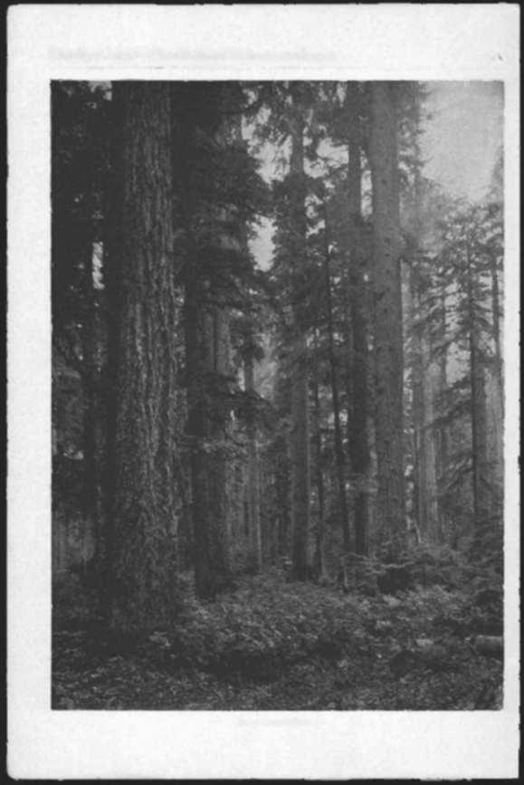
3 UNITED STATES DEPARTMENT OF AGRICULTURE DEPARTMENT CIRCULAR 4 Contribution from the Forest Service HENRY S. GRAVES. Forester DIRECTORY OF NATIONAL FORESTS IN OREGON. George H. Cecil, District Forester. District Office, Post Office Building, Portland, Oreg. NATIONAL FOREST. FOREST SUPERVISOR. HEADQUARTERS. Cascade 2- Crater Deschutes H Fremont... -Maiheur L-Milaam - Ochoco.. Oregon Santiam -Siskiyou... Siuslaw \-Umati1la 13.Umpqua j Wallowa S'Wenaha l,whitman C. R. Seitz H B Rankin N. G. Jacobson Gilbert D. Brown Cy J. Bingham R. M. Evans... V. V. Harpham H. Sherrard... C. C. Hall.. N. F. Macduff R. S. Shelley W. W. Cryder C. Bartrum H. W. Harris J. C. Kulins R. M. Evans... Eugene, Oreg. Medford, Oreg. Bend, Oreg. Lakeview, Oreg. John Day, Oreg. Baker, Oreg. Prineville, Oreg. Portland, Oreg. Albany, Oreg. Grants Pass, Oreg. Eugene, Oreg. Pendleton, Oreg. Roseburg, Oreg. Wallowa, Oreg. Walla Walla, Wash. Baker, Oreg. The view on page s of the cover is a reprodtction from a photograph of Mount Jefferson, Sautiam National Forest, showing forest and snow peak.

4 VACATION 1 AND THE NATIONAL ESTS IN OREGON AN IDEAL VACATION LAND HEN, tired of the daily grind, you say to yourself, "I need a vacation," your first thought is to get away from civilization and its trammels. Your next is to find interesting and health-giving recreation. In the National Forests in Oregon you may find both, and much besides. Within their area of 13,000,000 acres are many regions of unsurpassed scenic beauty. They include all the important mountainous parts of the State and offer to those who seek rest and recreation every opportunity for enjoyment. Camp sites amid surroundings of rare beauty, with water and forage near at hand, can be found in abundance. The mountain streams offer excellent fishing, and game of various sorts is plentiful on most of the Forests. You will encounter no "Keep Out" signs on the Forests. They are not fenced against the public, but invite your presence and use. The only signs you will find are those which point you on your way or ask your cooperation in preserving the beauty and value of these free recreation grounds and their resources. Firearms are not barred, and hunting and fishing are restricted only by the requirements of the State game laws. You are welcome to all the necessary firewood, and to forage for saddle and pack animals; and, so far as is possible, the grazing of commercial stock is regulated in such a way as to save an accessible supply of forage for the camper's use. You may camp where you like and stay as long as you please. The Forest Service asks only that you look to the proper sanitation of the camp and that you be careful with fire.

5 Vacation LandThe National Forests in Oregon Whether you wish to stay only a short time in the Forest, or to make your permanent summer home there, you will find that the Forest Service has made every provision in its power for your convenience. Roads and trails make hunting, fishing, and camping grounds easily accessible. Guideposts are being set up as rapidly as possible. The Forest Service cooperates with the Federal Bureau of Fisheries and the Oregon Fish and Game Commission in stocking National Forest streams and lakes with fish, and waters which a few years ago were practically barren now offer excellent sport. Camping grounds, equipped with stone fireplaces and other conveniences, are laid off in many of the main-traveled portions of the Forests for the use of visitors. The extensive telephone system maintained on the Forests in connection with their protection from fire is at the service of visitors in case of emergency. Registers are kept at local headquarters in which the visitor may write his name and probable route of travel, thus making it possible fcr a Forest officer to find him in the event of the receipt of important messages. Maps and detailed information on any particular National Forest may be had on application to the district forester at Portland or to the supervisor of any Forest. The forest rangers are always ready to direct travelers and to give any other assistance that they can If you wish to build a permanent summer home, you may lease a site for a term of years at a reasonable annual rental. It may be a cabin, cottage, or something more pretentious, as you wish. A permit to occupy such a site may cost as little as $5 a year, and seldom costs more than $25. The only restrictions are that the building must not be unsightly, and that the grounds must be kept in a neat and sanitary condition. The recreational advantages of the National Forests in Oregon are being more and more used as new roads and trails constructed by the Forest Service make them more accessible, and as the public comes to know the opportunities they afford for health, rest, and sport. During '917 about 275,000 people visited them. The presence of visitors naturally increases the danger of fire in the Forestsa constant menace even under the most favorable conditions. Destruction cf the Oregon forests by fire or any other agency would mean an irreparable

6 Fi,,g Vacation LandThe National Forests in Oregon loss to the entire State. Those who wish to go into the National Forests are urgently requested to read the suggestions on page fifty-four in regard to simple ways of preventing forest fires. CONDITIONS IN THE OREGON NATIONAL FORESTS National Forests in Oregon include the State's higher mountain areas. The backbone of the Cascade Range, from Mount Hood south to Cali- and its higher timbered slopes are comprised in six National THEfornia, Forests of about 1,000,000 acres each. In the Coast Range are two other Forests, with a combined area of about 1,500,000 acres, while in the Wallowa and Blue Mountains are eight more, totaling some 5,500,000 acres. All told, Oregon has more than 13,000,000 acres of National Forest land set aside to meet future demands for timber, to protect water resources, and to furnish a place for recreation. It is Oregon's distinction that within her borders is more standing timber than in any other State. It amounts to nearly one-fifth of the country's total supply, and about one-third of it is in the National Forests. On the west slope of the Cascades the climate is mild and the rainfall exceptionally heavy. Here, especially at the lower elevations, are some of the finest stands of timber in the world, made up of such species as Douglas fir, western hemlock, and western cedar. These trees are also characteristic of th two National Forests in the Coast Range, where the vegetation is of almost tropical luxuriance. At the higher elevations the Cascades are in many places exceedingly rough and rugged with a rather sparse growth of inferior timber. On the east slope of the Cascades and in the Wallowa and Blue Mountains the climate is much drier and the summers shorter. In consequence, the timber is more open, and western yellow pine replaces Douglas fir as the chief commercial tree. INDIVIDUAL NATIONAL FORESTS following are brief descriptions of each of the National Forests in Oregon. For their location see map facing page seventy-two. For more specific in- or for larger and more detailed maps, address the forest super- THEformation visor at the address given on page two.

7


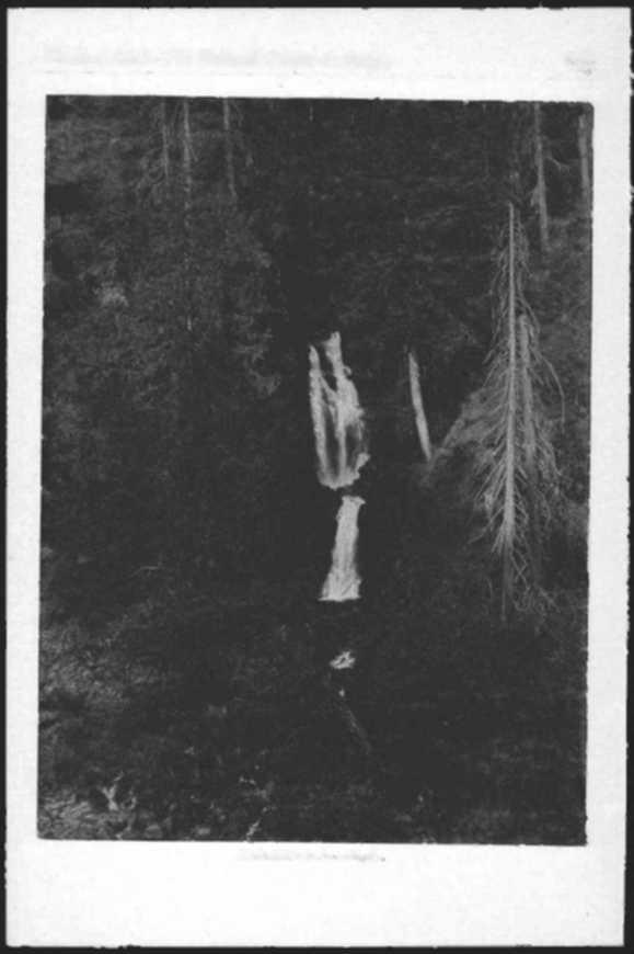
8 Scri Vacation LandThe National Forests in Oregon CASCADE NATIONAL FOREST Cascade National Foresthas an area of i,o16,290 acres, lying whollywithin Lane County. It is bounded on the east by the summit of the Cascade THEMountains, and extends north and south along their west slope fir a distance of o miles. On the south it is bounded by the Calapooya Mountains, which connect the Cascade Range and separate the Umpqua and Willamette watersheds. The area includes the upper drainage basins of the Willamette and McKenzie Rivers. The numerous lakes and streams within the Forest are paradises for the angler and are restocked every season. Many lakes and streams which but a few years ago were practically depleted are now teeming with millions of fish. For those in search of game, there are black-tailed deer and brown bear in abundance. More wary and difficult to find, but present none the less, are wildcats, wolves, and mountain lions. The Cascade Range on the east rises in abrupt elevations to form some of the most noted and beautiful landmarks in the country. Among these are Cow Horn Mountain, 7,666 feet; Diamond Peak, 8,792 feet; Maiden Peak, 7,750 feet; and in the north end of the Forest, the famous Three Sisters. These three well-known peaks rise majestically to a height of more than io,000 feet, and are resplendent the year round in jeweled settings of perpetual snow. The snow which falls in the higher regions each winter gradually melts during the summer and feeds the many scenic waterfalls and cascades from which the Forest derives its name. Most noted among these are, perhaps, Salt Creek Falls, with its perpendicular drop of over 275 feet, and McKenzie Falls, both of which are visited annually by many tourists. The south end of the Forest is tapped by a branch line of the Southern Pacific Railroad, which runs from Eugene to Oakridge, its present terminus. In the summer months Oakridge is also accessible from Eugene by automobile. From Oakridge the old Oregon Central Military Road follows the Middle Fork of the Willamette and crosses over the summit into eastern Oregon at Summit Lake at an elevation of 5,600 feet. Oakridge is the outfitting point for tourists who visit this end of the Forest. Hotel and livery accommodations may be obtained there. All points of interest in this region are less than two days by trail from Oakridge. Waldo Lake, Odell Lake, and the Huckleberry Patch are all favorite camping places. Horse feed is abundant

9 p., Vacation LandThe National Forests in Oregon at Odell Lake, but campers at Waldo Lake should either carry horse feed or arrange to take their stock to the Huckleberry Patch in Taylor Burn, 4 miles north of Waldo Lake. At this place the Forest Service has set aside an area for the use of campers. Many parties from both sides of the Cascades pick huckleberries here during September of each year. Kitson Springs, located 4 miles up Kitson Creek from the Military Road and 12 miles from Oakridge, is accessible by automobile. A summer hotel is conducted here. By turning off the Military Road at Salt Creek, one may reach Winona or Salt Creek Hot Springs about 8 miles from Oakridge. These springs also are accessible by automobile. Here in the beautiful Salt Creek country there are camping facilities and a summer hotel, the last hotel accommodations to be found in the Forest on the trail to Salt Creek Falls. The north end of the Forest is reached by the McKenzie Road. This route is accessible to McKenzie Bridge a larger part of the year by automobile, but during the winter months the McKenzie Pass into eastern Oregon is blocked by snow. The entire route is a good automobile road at present, and passes through a section rich in natural beauty and scenic wonders. McKenzie Bridge, located on the McKenzie River 56 miles from Eugene, is a Mecca for tourists and the outfitting point for campers and hunters in the north end of the Forest. It has a tourist hotel, post office, store, garage, and two livery cowpanies, and is the headquarters of professional guides. On the transmountain automobile road, i mile from McKenzie Bridge post office, or 57 miles from Medford, the Forest Service has set aside a very attractive summer home site tract including 28 building lots, of which the annual rental charge is from $io to $x. per lot. Foley Springs and Belknap Springs, located a short distance from McKenzie Bridge, are both popular summer resorts. The water at both places contains mineral and is said to be medicinal. Good fishing is to be had in Horse Lakes and the many McKeiuie tributaries. Buoy Lake, near the trail from the South Fork of the McKenzie to Indian Ridge, was discovered by forest officers in the summer of i 915 and is fairly alive with fish. Good hunting and abundant horse feed are found in the north end of the Forest, and a day's journey by trail from McKenzie Bridge will reach most points of interest. The Forest is covered with a dense stand of Douglas fir, estimated to contain 20,000,000,000 board feet of merchantable timber. The task of protecting this

10 Vacation LandThe National Forests in Oregon immensely valuable body of timber from fire during the dry season is a large one; and tourists, campers, and other users of the Forest can render great assistance in this undertaking by exercising care in the handling of fire. In the Forest are over 500 miles of Government-built telephone lines, which make it a comparatively easy matter for campers and tourists to notify forest officers in case of fire. The supervisor has headquarters at Eugene; and district rangers are located at McKenzie Bridge, Oakridge, Flat Creek ranger station, and West Boundary ranger station. CRATER NATIONAL FOREST Crater National Forest is in two principal separate tracts, aggregating 798,588 acres. The larger includes the southern slope of the Umpqua THERange and the southern end of the Cascade Range; the other is in the Siskiyou Mountains. Most of the Forest is in Jackson and Klamath Counties, Oreg., but there are small portions in Douglas and Josephine Counties, and the Siskiyou portion extends into Siskiyou County, Calif. The Cascade portion is a broad timbered plateau region, broken by many buttes, peaks, and canyons; the Siskiyou part is still more broken, with steep, narrow ridges, abrupt peaks, and deep canyons. Mount McLoughlin, a symmetrical pyramidal peak over 9,000 feet in elevation, has snow on its northern face the year round. Aspen Butte and Mount Thielsen are over 8,000 feet high, and several others, including Mount Ashland and Wagner Butte, are between 7,000 and 8,000 feet in elevation. The east slope of the Cascade portion is drained by several relatively short and turbulent streams to Klamath Lake and Klamath River; most of the west slope is drained by Rogue River and its tributaries; and the Siskiyou portion corn.- prises the upper watershed of Ashland Creek and Applegate River. Most of the streams flow through narrow canyons. Many on the Cascade Plateau, however, flow through shallow gullies. There are benches, valleys, and broad ridges that can be traveled long distances without any steep grades. The traveler through the Crater Forest will meet five broad forest types: Yellow pine, lodgepole pine, Douglas fir, white fir, and subalpine. Below 5,000 feet on the east side the yellow pine predominates. Douglas fir, white fir, and other species blend with the yellow pine. The lodgepole pine forest lies at high elevations and is an almost impenetrable thicket of poles. Fortunately for the camper and hunter these thickets are not very extensive. In the subalpine forest of fir and

11 S Vacation LandThe National Forests in Oregon hii hemlock there is often no underbrush except blueberry bushes and similar low shrubs. Travel through this type and the open yellow-pine forest is comparatively easy, even off the trails. However, there are areas, sometimes of large extent, on which fire has destroyed or thinned the forest and which now support a dense stand of brush, through which travel is very difficult. Feed for saddle and pack horses is fairly abundant, but scattered. There is a limited amount of wild pea, lupine, and similar forage. Most of the grass is located in natural meadows and glades and small openings in the timber. In the heavy fir forests, at medium elevations, there is no forage early in the season. There is more or less fishing in nearly all the streams. Some of the lakes are locally famous for fishing. Others have recently been stocked, and some are as yet devoid of fish. Deer hunting is fairly good. In the high mountains the natural scenery of peaks, lakes, rivers, and forest is beautiful and sometimes impressively grand. The entire foothill region and part of the higher mountain regions may be reached in a few hours by automobile from Medford, Ashland, or Klamath Falls. A number of wagon roads penetrate every important valley, and these are supplemented by a network of secondary roads and trails, so that every region is accessible at least by pack train, and many by wagon or even automobile. Of the many attractive trips that may be made by touring car, one of the best is to Crater Lake in the Crater Lake National Park. Crater Lake is the deep est body of fresh water in America, and, because of its deep blue color and the grandeur of the encircling cliffs, is one of the most beautiful spots on the continent. While not within National Forest boundaries, it is surrounded by the Forests on three sides and is best reached by a picturesque mountain road which runs for much of its length through the Crater National Forest. On this road is the Natural Bridge of Rogue River. If the starting point is Medford, one can travel via Trail or Eagle Point up the Rogue River, through a region of diversified scenery. The total distance is 8o miles. There are hotels at Eagle Point, 12 miles from Medford; at Trail, 30 miles; and at Prospect, 50 miles. Prospect is the usual halfway point where automobile tourists stop for dinner. Supplies, gasoline, and grain may be purchased also at Union Creek. Here the Forest Service has set apart the Union Creek summer home site tract of five building lots. The trip can be broken, if desired, by camping at a number of convenient camping places in the National


12 Vacation LandThe National Forests in Oregon Crater Lake in the Crater National Park and Crater National Forest. Forest, such as Natural Bridge, Union Creek, Silver Creek, and Whiskey Creek. Horse feed is not abundant at these camp sites, and at some is lacking entirely. It is wise, therefore, to take plenty of grain if the trip is made with horses. One enters the Crater National Forest about 5 miles above Prospect, through a rustic portal, and travels through a dense forest of tall Douglas fir, yellow pine, and sugar pine. Signboards have been placed along the road by the Forest Service, calling attention to a number of natural features of interest. Among these are the Natu ral Bridge of lava rock, under which Rogue River plunges, and the Rogue River Gorge just above Union Creek, where the river roars through a box canyon with perpendicular rock sides. From Crater Lake one may go out on the east side of the Cascades, via Fort Kiamath. north to Bend and The Dalles, or south to Kiamath Falls and California. The road through the National Park and the Crater National Forest follows the course of Anna Creek, which flows through a narrow canyon with precipitous slopes. The road at points approaches so close to the edge of the canyon that one

13 Vacation LandThe National Forests in Oregon call, without dismounting from carriage or car, look down to the river below and get glimpses of the fantastic pinnacles standing straight and tall on the precipitous slopes of the gorge. Traveling southward from Fort Kiamath to Klamath Falls one has a choice of several routes. A road passes on the east side of the Kiamath Lake through the Klamath Indian Reservation, another road passes again through the Crater National Forest, a distance of approximately 30 miles, or one can take the mail launch at any one of a number of points. The route on the west side of the lake through the Crater National Forest is very attractive and there are a number of features of especial interest to the tourist or camper The road has been improved by the county for automobile travel and passes close to the lake and the great marsh in a number of places. Camping sites where grass is plentiful are abundant. The road passes within a few hundred feet of Recreation Creek along its entire course. This well-named creek flows into the north end of Pelican Bay. At this point the Forest Service has set aside two summer home site areas, Pelican Bay with 10 lots and Recreation Creek with 3 lots. All lots have roo feet frontage. Several of these lots are already occupied. Five miles south of Pelican Bay is the Odessa home-site tract of lots. Plenty of camping sites have been reserved at Pelican Bay for the use of transients. At Rocky Point, at the mouth of Recreation Creek, there is a post office called Recreation, with daily mail service, except in the winter. Here one may take the mail launch to Kiamath Falls. There is a hotel at Harriman Lodge, about 2 miles south of Pelican Bay. There is another comfortable hotel at Eagle Ridge, reached by mail launch. These resorts and hotels cater especially to tourists, to sportsmen, and to those seeking rest and recreation. Duck shooting is excellent on the lake and in the marsh in season. Rainbow trout and lake trout weighing io pounds and over are often caught. Mosquitoes are troublesome early in the season, but usually disappear early in August. Another trip of a different character is from Jacksonville up the Applegate River. Though there are sharp turns and sudden, short, steep grades, cars of light weight can travel as far as Copper post office. This road is in good condition during most of the year. The road runs through a narrow valley which supports a farming community

14 Vacation LandThe National Forests in Oregon Several side trips of interest may be taken. A road passable to wagons leads from Copper to the Blue Ledge copper mine near the summit of the Siskiyou Mountains. This mine is not being operated at the present time. Another road takes one to the Sterling gold mine. Here hydraulic mining is being conducted on an extensive scale. When traveling by wagon or pack train, less frequented places can be easily reached. A favorite short trip is from Ashland up Mount Ashland, 7,662 feet in altitude, from which a magnificent view of Rogue River Valley, Shasta Valley, the Cascade Range, and the Siskiyou Mountains is obtainable. The distance is about 12 miles and can be made on horseback. For those who desire a more strenuous mountain climb Mount McLoughlin and Mount Thielsen offer excitement. Both of these mountains are very steep and rocky. Mount Thielsen can be reached from a camp on Diamond Lake. Mount McLoughlin may be climbed from either one of two approaches, from Fish Lake or Fourmile Lake. The Forest Service has built a lookout house on Mount Mc- Loughlin for fire-protection purposes. This is used during the summer months and is connected by telephone with ranger headquarters. From Butte Falls several roads radiate into the Forest, making accessible points of interest to the camper or sportsman. Fishing is good in the South Fork of Rogue River, which is reached by an i8-mile trip by wagon road. It is about the same distance by road to the headwaters of Rancheria Creek, where deer are fairly plentiful and where there are a number of good trout streams. The southern part of the Forest, in the Dead Indian, Soda Creek, and Little Butte Creek watersheds, has a network of roads and trails. There are a number of settlers in this country. Horse feed is plentiful along the streams in open timber and on bunch-grass hillsides. Deer hunting is fair but not so good as in lessfrequented localities. Fishing is good in most of the streams. Many people camp at Soda Springs for the fishing and hunting and the mineral water. The city of Medford obtains its water from Little Butte Creek, which rises in Fish Lake. For the protection of the purity of the drinking water, camping is not permitted near these waters. Dead Indian Soda Springs is reached from Medford over the Brownsboro Road to Lake Creek post office, thence by the way of the new Forest Service automobile road up the South Fork of Little Butte Creek, a total distance of about 30 miles.

15 Vacation LandTlie National Forests in Oregon Close to the Dead Indian Soda Springs there is a summer home site area of 13 lots, which will be rented at $7.50 each per annum. The Dead Indian country is best reached from Ashland by the Dead Indian Road. The Lake of the Woods is a very beautiful little lake and is a popular camping ground, especially when the crop of mountain huckleberries is good. At such times a hundred or more people are sometimes camped on the lake, all busy picking huckleberries. There is good horse feed at both ends of the lake and excellent spring water at the public camp grounds. A community of summer homes is growing up under permit of the Forest Service and this bids fair to become one of the most popular outing places in southern Oregon. There are 39 lots surveyed along the lake shore which, with one exception, have ioo feet frontage and 200 feet depth and rent for $ per annum. Another even more famous huckleberry ground is on Huckleberry Mountain. This is a large flat-topped mountain on which huckleberries are especially plentiful. The camp grounds are reached by trail from the east, via Sevenmile Creek, or from the west via a trail branching off the Rogue River Road. In seasons of plentiful crops of huckleberries the camp grounds may have a shifting population of between i,000 and 2,000 campers. For this reason the camp ground is called "Huckleberry City." There is good water here, and pasturage for grazing is reserved for the free use of campers. One of the most picturesque regions on the Crater Forest is Blue Canyon, north of Mount McLoughlin. This is a box-walled valley with level floor on the summit of the Cascade Range Plateau. It contains a number of small lakes in tall subalpine timber, through which travel is comparatively easy. Fishing and deer hunting are good in Blue Canyon, especially because it is so remote that it is not visited often by sportsmen. It is accessible by trail either from the east or west. The more remote regions, where fewer people have been, naturally have more game and fish; and those who want game or mountain scenery, or the life of the forest far from the conventionalities of civilization, will take a pack traip and strike for the higher divides. Trips along the high summits of the main divides may be made with very little discomfort. There are good trails along most of the summits, the woods are open and easy to get around in, and there is ample forage for horses. One can travel by trail from Lake of the Woods to Fourmile Lake, thence to Long Lake and to Big Meadows, thence along the backbone of the Cas-

16 Fificn Vacation LandThe National Forests in Oregon cade Range to the headwaters of Rock Creek or Cherry Creek, and down one of these creeks to the road which skirts Pelican Marsh. There is a trail along the summit practically the entire distance on the Rogue River-Umpqua River divide, from which beautiful vistas and views of distant landscapes are obtained. Here there are numbers of good camp sites and fairly good deer hunting. Another divide trail extends along the summit of the Siskiyou Mountains on the divide between Applegate and Kiamath Rivers. Trips of several days or several weeks may be made in these high altitudes, according to the fancy of the camper. Automobiles may be hired at Medford, Ashland, and Klamath Falls for trips of any length. Special rates are made for long trips or large parties. Teams and wagons and saddle horses can also be hired in these and other towns, but pack outfits are sometimes hard to rent. Ranchers and stockmen are the likeliest people from whom they may be procured, but such outfits are generally in use in August and September and there are not many who own more than they use themselves. There are stage routesautomobile or wagonwhich take passengers to points within or near the Crater National Forest. A list of these follows, though they may change schedules or even be discontinued without notice: Medford and Crater Lake via Prospect: Automobile stage; three times a week, except Sunday, returning the next day, summer and fall. Eagle Point, Trail, and Persist: Automobile stage; leaves Eagle Point for Trail and Persist Mon day, Wednesday, and Friday, returning Tuesday, Thursday, and Sunday, connecting with Pacific & Eastern train to Medford. In the winter a horse and wagon are used instead of an automobile. Jacksonville, Sterling, Buncom, and Watkins: Automobile stage; leaves Jacksonville Tuesday and Friday, returning Wednesday and Saturday, connecting with trolley to Medford. In the winter a horse and wagon are used instead of an automobile. Derby and Prospect: Horse stage; once daily, except Sunday, each way. Connects with train for Medford. Eagle Point and Lake Creek: One stage daily, except Sunday, each way. Connects with Pacific & Eastern train for Medford. Jacksonville, Ruch, and Applegate: Automobile stage makes round trip daily, except Sunday, between Jacksonville and Applegate post office via Ruch. Connects by trolley with Medford. The above lines carry mail as well as passengers. Medford and Ashland: Automobile; several round trips daily; also Southern Pacific train service. Medford and Central Point: Automobile; several round trips daily; also Southern Pacific train service.
. Also Southern Pacific train service.")
17 Vacation LandThe National Forests in Oregon Medford and Eagle Point: Automobile; one round trip daily, except Sunday. Also Pacific & Eastern Railway train service. Ashland and Kiamath Falls: Automobile stage three times a week, returning the next day (in summer and fall). Also Southern Pacific train service. There is daily passenger, freight, and mail service by gasoline launch between Kianiath Falls and points on Kiamath Lake. The supervisor has headquarters in Medford, and district rangers are located at Butte Falls, Oreg., and at Mill Creek, Big Elk, Star, Odessa, Sevenmile, and Trail ranger stations. DESCHUTES NATIONAL FOREST Deschutes National Forest comprises i,282,293 acres, located on the eastern slopes of the Cascade Range in central Oregon. THE It includes the high mountainous country and the high timbered plateau surrounding the headwaters of the Deschutes River and in a separate block, the Paulina Mountains The Forest is visited by increasing numbers each year for hunting, camping, and fishing. Along the Cascade Range are several high and attractive snowcapped peaks, a large number of mountain lakes, splendid fishing and camping grounds, excellent duck hunting, and many other features of interest. A widely extended system of roads renders many of these places easily accessible by automobile from points in the Deschutes Valley and from the Willamette Valley via the McKenzie Road, which connects Eugene, on the main line of the Southern Pacific Railroad, with Sisters and Bend, towns just outside the Forest east of the Cascade Range. Trails lead from these roads into some of the more inaccessible districts. Signboards along the roads and trails indicate the distance and direction to various points. Hotel accommodations are obtainable at all towns near the Forest. Accommodations for travelers are also to be had at a number of other places, including the Metolius River Valley, East Lake, Crescent Lake, and Odell Lake. Horse feed is plentiful at most of the lakes and at many places along the streams. Among the points of especial interest are the following: Metolius River country, a region created it would seem for the special benefit of the lovers of outdoors, may be reached by excellent automobile road 14 miles from Sisters. Along the river may be found good horse feed, camping grounds, and excellent trout fishing. The Forest Service has set aside the Camp Sherman


18 SeenLeen Vacation Land The National Forests in Oregon A field of wild flowers in one of 0reon's National Forests. group of summer home sites among the pines along the Metolius. As a beginning i lots have been surveyed and posted. Those not already occupied may be leased at from $8 to $i 2 per annum. These sites are i miles from Sisters and 40 miles from Bend by excellent automobile road. The Metolius River has its visible source about 2 miles above the home-site area, and springs full fledged from the earth, coming forth from what underground caverns no one knows. The river is a veritable fisherman's paradise. A huckleberry patch near Cabot Lodge, 7 miles from the river, may be reached by trail which continues to the foot of Mount Jefferson, an unusually symmetrical, snowcapped peak 10,522 feet high located at the extreme northwest corner of the Forest. Suttle Lake, miles from the Metolius Valley or from Sisters, can be reached by automobile, and offers fishing grounds and an excellent bathing beach. Blue Lake, a water-filled volcanic crater of more than usual interest, can be reached by trail in an hour's hike from Suttle Lake

19 Vacation LandThe National Forests in Oregon Ej A fair trail leads 4 miles from Metolius Valley to the summit of Black Butte, a Forest Service lookout station, from which one of the best views in the entire region may be obtained. The McKenzie Road, which crosses the Cascades at an elevation of,5,200 feet, connects Eugene and Sisters and is a fair automobile road. The rough, barren lava fields at the summit, about 2 miles wide, are of unusual interest. Sparks Lake and the surrounding country constitute one of the most interesting high mountain regions in the Forest. The lake may be reached over an automobile road which extends west from Bend i 8 miles to the Tumalo Ranger Station, from which a wagon road, occasionally open to automobile travel, leads s miles to the summit of the Broken Top ridge; thence there is a trail 4 miles to Sparks Lake and good fishing and horse feed. The Three Sisters lie to the north, Broken Top, to the northeast, and Bachelor Butte to the southeast. All of these mountains are high, snowcapped peaks, the Three Sisters having glaciers on some of their slopes Many interesting pack trips can be taken from Sparks Lake. Natural soda springs are located about 2 miles east. Pall River, the main Deschutes River, and the mountain lakes and streams around its head may be reached by automobile as far as Crane Prairie, a wellknown duck-hunting and fishing ground 4 miles from Bend and only 7 miles from the summit. A wagon road, passable for automobiles in midsummer, extends north from Crane Prairie to Lava Lakes and Elk Lake. Good fishing can be had at most places along these streams and at most of the mountain lakes in the region. Horse feed can be secured at Crane Prairie, at the head of Pall River, near the mouth of Davis Creek, at Lava Lake, and other points. Davis Lake, Odell Lake, and Crescent Lake, three beautiful lakes lying near the Cascade summit and all excellent fishing and camping localities, can be reached by good automobile roads, via Crescent. Horse feed can be secured at Davis Lake and at the west end of Crescent Lake. Maiden Peak, a Forest Service lookout station, situated on the Cascade summit, can be reached by trail 6 miles from Davis Lake. Paulina and East Lakes are located x 2 miles east of the Deschutes River in the very summit of the Paulina Mountains, an isolated range east of the Cascades. They can be reached by wagon road, which is usually passable for automobiles as far as Paulina Lake. There are mineral springs at both lakes. An attractive area for summer-home sites has been laid out along the shores of East Lake, and the 22

20 Ninwi Vacation LandThe National Forests in Oregon lots which have been surveyed on the area may be leased at from $Io to I2.5o per annum. Good fishing may be found at both places. This region is of unusual geological interest, the lakes being located in an immense crater, surrounding which is a rim rising in some places nearly 2,000 feet above the lake level. Its highest peak is Paulina Peak, another Forest Service lookout station, 2 miles by trail from Paulina Lake. This peak is about 8,475 feet in elevation. The Paulina Mountain region is in a detached portion of the Deschutes National Forest and is practically all within the Deschutes Game Reservation created by the State of Oregon. Game birds and animals are protected, but the angler is welcome. Bear hunting is good and the bears are not protected. Several ice caves exist on or near the Forest. Among these are the Arnold Ice Cave, r6 miles southeast of Bend, the South Ice Cave, i8 miles north of Fort Rock, and the Edison Ice Cave, 8 miles northwest of the Big River ranger station, all accessible by automobile. In the region are many extinct volcanic craters, one of the most easily accessible and most interesting of which is Lava Butte. This is just outside the Forest, about io miles south of Bend and one-quarter mile from the road. At its summit is a crater having an unbroken rim. The supervisor has headquarters at Bend, and district rangers are located at Sisters, Lapine, and Fort Rock, and at Pine Mountain ranger station. FREMONT NATIONAL FOREST Fremont National Forest (856,369 acres) is located in the counties of Lake and Klamath in south-central Oregon, and furnishes protection to the THEheadwaters of Williamson, Sprague, and Sycan Rivers. The Sycan flowg into the Sprague and the Sprague into the Williamson, which in turn flows into the upper Kiamath Lake. The Fremont Forest and vicinity furnish a variety of game and fish. Mule deer are plentiful, but hard to capture. Antelope still occur in the "desert" east of the Forest, but seldom venture into the timber. Various kinds of ducks and geese are found in abundance on the lakes and streams. This section of Oregon is a veritable duck hunter's paradise. Grouse are plentiful in the timber. Sage hens are found by thousands on the sagebrush plains to the east. They are also found within the Forest but in much smaller numbers. The small streams throughout

21 Vacation LandThe National Forests in Oregon T,nqnly the Forest are well stocked with various kinds of small trout, and the larger streams and lakes furnish the larger varieties of trout and so-called landlocked salmon. The Fremont National Forest and Lakeview may be reached from the north by rail to Bend, Oreg., and thence by automobile stage to Silver Lake, Paisley, and Lakeview; from the south by rail direct to Lakeview over the Nevada-California- Oregon Railway from Reno, Nev., or Doyle, Calif.; and from the west by automobile stage via Bly, Oreg., from Kiamath Falls. Garage service may be obtained at Silver Lake, Paisley, and Lakeview. The cost of gasoline and lubricating oil is greater than in thickly populated districts, owing to the greater distance from the railroad. The roads of Lake County are very good during the summer and fall for automobile travel. The interior of the Forest is reached by team or saddle horse. Horses and rigs may be secured at any of the above-named places at reasonable rates. Many desirable camping places are accessible by automobile. Some which may be reached from Silver Lake are Williamson River, Kiamath Marsh, Silver Creek, ad Buck Creek. The road from Fort Klamath via Sand Creek, Kiamath Marsh, and Antelope Flat to Silver Lake is now open to automobile travel. Traveling south from Silver Lake, one passes the famous Aria River, Summer Lake, and the Chewaucan River and Marsh, all of which furnish most excellent duck shooting in season. From Lakeview one may go to Dog Lake, a beautiful summer camping place iri the midst of fine hunting and fishing territory. Sprague River, Deep Creek and Drew Creek are among the best fishing streams of Lake County, and duck shooting may be found in abundance on Goose Lake, the Warner Lakes, and Lake Abert, all of which may be reached from Lakeview. The supervisor has headquarters at Lakeview, and district rangers are located at Bly and Paisley, and at Dog Lake and Billings (near Silver Lake) ranger stations. MALHEUR NATIONAL FOREST Maiheur National Forest, located in the Blue Mountains of eastern Oregon, has a total area of 1,057,682 acres. It is located in Grant, Harney, Baker, THEand Malheur Counties. It extends approximately 70 miles each way, north and south from the Umatilla County line to the northern edge of Harney Valley and east and west from the Maiheur County line to within i 2 or I 5 miles of

22 Twenty. One Vacation LandThe National Forests in Oregon the Crook County line. For the most part the timber is open and free from underbrush. There are few parts of the Forest that can not be reached by team or wagon. The streams and lakes afford splendid fishing. The mountains contain deer and several species of game birds. Bear, cougar, foxes, marten, beaver, and other fur-bearing animals are found. The most desirable places for camping and recreation are the following: Magoon Lake is located about 12 miles north of the town of John Day, and is accessible by a rough wagon road from John Day, which is passable by automobile to within 7 miles of the lake. The lake is about a mile long, half a mile wide, and up to 300 feet deep. It lies in the bottom of what was at one time a very deep canyon, formed by a landslide, and one of the natural wonders of Oregon. The Forest Service, in cooperation with the State Fish and Game Commission, has planted several varieties of game trout in this lake, and in late years it has become a Mecca for sportsmen from all over eastern Oregon. The hills about the lake are heavily timbered. Strawberry Lake is a beautiful body of water located at the foot of Strawberry Mountain, which is one of the highest peaks in the Blue Mountains The lake is accessible by team from Prairie City, 14 miles to the northeast. It covers about 45 acres and ranges in depth up to i feet. Several varieties of trout have been planted in it. Strawberry Mountain, the summit of which is about 9,000 feet above sea level, is reached by trail from Strawberry Lake. The Forest Service maintains a lookout and telephone station here during the summer months. On a clear day it is possible, with the aid of glasses, to see as far east as the Seven Devils in Idaho and as far west as the Cascade Range. Logan Valley is just to the south of Strawberry iviountain. A good road leads into the valley from Prairie City by way of the Blue Mountain Hot Springs, a summer resort, thence over the summit of the Blue Mountains, across Summit Prairie, down Summit Creek and into the valley. It is an open mountain valley about 6 by 8 miles in size, entirely surrounded by heavily timbered hills and drained by four mountain streams, all of which converge at the lower end, forming the Main Fork of the Malheur River. These streams abound in trout and salmon. At the northern end of the valley, just in the edge of the timber, is the Lake Creek ranger station, where a district ranger is located during the summer months.


23 Vacation LandThe National Forests in Oregon Tree-bordered mountain streams tempt the angler.

24 Twenty- Three Vacation LandThe National Forests in Oregon Bear Creek, a stream which has its source well up in the Blue Mountains and flows through Bear Valley into the Silvies River, is perhaps one of the best trout streams. Along its upper portions are many camp sites. It is accessible from John Day by way of Canyon Creek and Bear Valley or from Prairie City by way of the Blue Mountain Hot Springs and Logan Valley. Murderers Creek is a good trout stream flowing through the Murderers Creek Canyon in a heavily timbered country and draining into the South Fork of the John Day River. Camping places are to be found along its entire length. It is accessible during the summer by automobile through Bear Valley. Along the lower breaks of this creek are some of the best winter deer ranges in Oregon. Hundreds of deer drift into them late in the fall and remain until spring. John Day River is located partially inside the Forest. From Blue Mountain Hot Springs up to the summit of the Blue Mountains may be found many splendid camp sites. The several forks of the John Day River, including the north, middle, and south, furnish magnificent natural scenery. Fishing in all branches of the river is good. Canyon Creek is the deepest gorge through the Blue Mountains and is perhaps the most popular mountain camping area. Canyon City, the county seat of Grant County, is located near the mouth of the canyon. The main road between the John Day and Harney Valleys extends through this canyon for about i x miles, thence winds up over the mountain into Bear Valley. The main stream through the canyon and several of its larger branches furnish good fishing. Along the breaks of the canyon deer are plentiful, and it is a favorite fall hunting grouncl A good automobile road extends the full length of the canyon. The supervisor's headquarters is at John Day, and district rangers are located at Crane Prairie, Lake Creek, Crow Flat, Murderers Creek, Bear Valley, Hyiu, and Raddue ranger stations. MINAM NATIONAL FOREST Minam National Forest lies in the northeastern part of Oregon on the southern and western slopes of the Wallowa Mountains The elevation THEvaries from 1,700 to 9,675 feet, and the area is 430,694 acres. During 1915, 13 lakes in scenic, mountainous regions were stocked with eastern brook, rainbow, and steelhead trout, approximately 46,000 fry being liberated.

25

26 Twenty- Five Vacation LandThe National Forests in Oregon In the parks, meadows, and camp grounds mentioned later are many attractive sites for permanent summer homes. Good water and fuel are abundant. Grass for campers' horses is reserved in the best camping locations. Crater Lake, containing 30 acres, surrounded by Mcturesque, perpendicular walls, is a natural wonder, located at the headwaters of Cliff River, a tributary of the Imnaha. Trolling for eastern brook trout furnishes good sport. This lake can be reached from Pine or Eagle Valley by taking the Union-Cornucopia wagon road westward to the top of Summit Creek ridge, thence by pack trail following the Cliff River stock driveway to destination. The Balm Creek Reservoir is an artificial reservoir, i mile long, one-third mile wide, on the Union-Cornucopia Road, 30 miles northeast of Baker, Oreg., by automobile. Good camping, fishing, and boating facilities are afforded. A daily automobile stage runs from Baker to Cornucopia, about 75 miles. Fizz Springs are soda springs located near the head of Little Eagle Creek on the Union-Cornucopia Road, io miles west of Pine Valley and 4 miles northeast of Baker. Automobiles reach the springs with some difficulty. Every year many people spend weeks at this remote summer resort to rest and drink the spring water. Huckleberry pickers reap a good harvest in the vicinity. Grouse, deer, and other wild game are found near by. Horse feed is found on the benches south of the springs. The Minam River trip is a trip for the fisherman and the hunter. Sixteen miles of travel by pack trail from Cove, over the scenic route to the Minam, will take one to the midst of a good hunting and fishing ground. The best fishing is above Millard ranger station. Fish in large numbers can be caught at the various falls along the stream and in the North Minam River Good camping places are numerous and horse feed is plentiful. Grouse, pheasants, deer, bear, and coyotes make their homes along this stream. For the return trip, the traveler has the choice of several different routes, all affording excellent fishing, hunting, and scenery. The West Eagle trip is a drive to Basin mine by wagon or automobile; thence by pack trail along the telephone line 2 miles to Eagle Forks (a camping place with horse feed one-half mile up the main Eagle Creek); thence up West Eagle Creek miles to large meadows (good camping, good grass, and good fishing); thence 7 miles to Echo and Traverse Lakes, at an altitude of 7,500 feet. These lakes were stocked in i 915 with steelhead trout. A splendid view of meadows, lakes,

27 Vacation LandThe National Forests in Oregon glaciers, and mountains may be had by climbing one of the 9,000-foot peaks near by. The Eagle Forks and Two Color Meadows trip brings one to the center of a fish and game country. It is 45 miles from Baker to Eagle Forks by wagon, going in via the Sanger Mine and Eagle River power-plant. It is 3 miles farther by trail to Two Color Meadows, a good camping place with plenty of horse feed. From here various points of interest can be visited by trail, such as "The Falls," Bemiet Peak, which is in the grouse country and on which a Forest Service fire lookout remains during the dry months of the year, Hummingbird Mountain, and Lookinglass Lake, which was stocked with fish ju A scenic route northerly from Lookinglass Lake leads through a deer country to Eagle Lake, which was also artificially stocked. East Eagle Park is a good fishing and camping ground, which can be reached from' Baker by automobile in four hours. To reach East Eagle, enter the Forest near Sparta, travel 'north to the Union-Cornucopia Road at the Lily White mine, thence east about a mile to the forks of the road. The left-hand road leads to Eagle Creek and East Eagle. From the Eagle Creek Bridge it is 6 miles to the park. Hunters will find deer, bear, pheasants, and grouse. Those wishing huckleberries will find a large patch east of the creek. Along both sides of Jack Creek, a small tributary of Eagle Creek in the midst of the so-called East Eagle Park, a natural park-like area, the Forest Service has set aside a small summer-home site including 8 lots which may be leased by the public at the rate of $io per lot per annum. This is called the Jack Creek summer home site area, and is i miles from Sparta and 46 miles from Baker by automobile road. If a rough trip is desired, a journey can be made to Eagle Cap and Hidden Lake at' the head of the stream. Eagle Cap, about 9,675 feet, is the highest peak on the Miriam Forest. From its summit can be seen hundreds of snowcapped peaks of the Wallowa Mountains. Fish Lake can be reached by wagon or automobile from Halfway over 25 miles of rough road. The trail offers a more desirable route of i8 miles. Hundreds of Eagle and Pine Valley people use this camp ground every summer The red-meat trout is caught from Fish Lake by the thousands, and deer and bear are found in the heavily timbered belts in the vicinity. Grouse, make their homes on Russell

28 Twenty- Seven Vacation LandThe National Forests in Oregon and Sugarloaf Mountains, about 2 miles north. Visitors to Fish Lake should not fail to visit Russell Mountain fire lookout tower. The forest supervisor's headquarters is at Baker, and district rangers are located at Cove, Halfway, and Medical Springs, Oreg. OCHOCO NATIONAL FOREST Ochoco National Forest (716,604 acres) lies almost in the center of Oregon, in the counties of Crook, Wheeler, Harney, and Grant. It is THEreached by way of the two railroads up the Deschutes River to Redmond, thence by automobile stage to Prineville, where the supervisor's office is located. From here stage lines lead out to all parts of the Forest. The Forest may also be reached by way of Condor, Fossil, and Mitchell, via Prairie City, John Day, and Dayville, or via Bums. The Forest is more or less open and the slopes are so gradual that nearly every township can be reached with a mountain wagon. It possesses no natural features of particular interest, such as snowcapped peaks or high mountain lakes. The elevation ranges from 3,000 feet to 7,400 feet, Lookout, Snow, Bald, and Pisgah Mountains being the highest points. There is always sufficient feed for camp horses along the streams until late fall. Probably the most desirable camping place is on Deep Creek, which is a short distance east of Big Summit Prairie. This stream is only 6 miles from the Meadow post office, from which point there is a fairly good wagon road to camping sites on the creek, where horse feed is found in abundance. Emigrant Creek, in the extreme southeastern part of the Forest, is probably the best fishing stream. Deer hunting is also good in this vicinity. This portion of the Forest is more difficult to reach from the outside world, however, since it is about ioo miles from the nearest railroad point. Some attractive camping or summer-home sites are to be found along Canyon Creek, about 30 miles east of Prineville, and along the route of the Prineville- Meadow stage line. While the fishing is not so good in this stream, deer and grouse are fairly abundant and the scenery is very attractive. Good water and horse feed are plentiful in this valley. A new road has just been completed through the Forest, connecting the Ochoco and Taylor Creek Valleys. This road extends for 12 miles through the open, parklike forest, and is passable to automobiles from about May i to November i.

29 Vacation LandThe National Forests in Oregon Twenhj. Eight A road is also being extended up Mill Creek, a branch of Ochoco Creek, and already about 5 miles have been constructed, so that the canyon is now accessible to automobiles and other vehicles for over a mile above the falls. The supervisor's headquarters is at Prineville, and district rangers are located at Maury, Beaver, Ochoco, and Allison ranger stations, and at Paulina, Oreg. OREGON NATIONAL FOREST slopes of the Cascade Range from the Columbia River southward to BOTH the divide between the Clackamas and Santiam River basins are in the Oregon National Forest. Of special recreational interest are the Mount Hood region, Mount Jefferson, the Olallie Lakes along the summit of the Cascades north of Mount Jefferson, the upper waters of the Clackamas River, and the Columbia Gorge Park. The Columbia Gorge Park is on the south bank of the Columbia River, 38 miles from Portland, and is reached by the Columbia River Highway. It is also convenient to the Oregon-Washington Railroad & Navigation Co. and Columbia River steamboat service; and in the outing season has daily automobile stage service from Portland. It is 22 miles long and from i to 4 miles wide, and some of the best view points are near the highway. A complete scheme of development of the park for summer recreation purposes has been undertaken by the Forest Service. At Eagle Creek, 44 miles from Portland, picnic and camping grounds with many conveniences have been established. In 1918 about 20,000 pleasure seekers registered at these grounds, and it is estimated that altogether there were close to 75,000 summer visitors in that year. There are other fine camping sites, and a system of trails is being developed. Excellent trails, from which the views are beautiful, run from the Highway at Multnomah Falls up Multnomah Creek to Larch Mountain, and from Bonneville to Wauna Point, and up Herman Creek to Indian Mountain and Chinidere Mountain. The Forest Service has recently completed a new trail up Eagle Creek to connect at Wahtum Lake with the Herman Creek trail, forming a 27-mile l00. At Wahtum Lake is located the permanent camp of the Portland Boy Scouts. A map of the park, showing the trails and camp grounds, may be secured from the forest officers on the ground.


30 Twenfs- Nine Vacalion LandThe Nalional Forcsls in Oregon At the Eagle Creek camp grounds in the Oregon National Forest. Here firewood and well-equipped camping places are provided by the Forest Service for the convenience of visitors. Eagle Creek is on the Columbia River Highway and is visited by thousands annuslly. A representative of the Forest Service is on hand to direct and otherwise assist the public. Mount Hood, 11,225 feet, is most easily reached from Portland by wagon roads through the Hood River valley. There are many attractive camping places on its slopes. Lost Lake is famous for its great beauty and for the remarkable views of the mountain obtained from its shores. Many Campers and fishermen visit it each year, and the improvement of the road from the town of Dee in the Hood River Valley will make it more accessible. Mount Hood is climbed from the south, starting from Government Camp, which is reached in summer by automobile stage from Portland and from Boring on the electric line of the P. R. L. & P. Co. The Government Camp is also connected with the Deschutes River Valley via Wapinitia by a good road, much traveled in summer by wagons and automobiles. The starting point for making the ascent from the north is Cloud Cap Inn, 31 miles from Hood River.


31 Vacation LandThe National Forests in Oregon Thirfy Mount Hood from a timbered park in the Oregon National Forest. An admirable camp site, commanding five views of Mount Hood from an open meadow, is Elk Meadows on the new Forest Service trail around the east side of Mount Hood. The trail is now the only method of getting to Elk Meadows, but the proposed Mount Hood automobile road, which will connect the roads of the upper Hood River Valley with the Barlow Road south of the mountain, will pass near the camp grounds. The Bull Run division of the Oregon National Forest is the only part of the Lorest which is not open to the public. This part of the Forest contains the watershed from which the city of Portland derives its water supply, and is closed to the public by act of Congress. The upper waters of the Clackamas River consist of eight large branches, each of which has numerous tributaries. A comprehensive trail system covers this entire watershed and makes accessible many fine camp sites. The region is ideal for walking or pack trips. It is heavily timbered mountain country, intersected with picturesque streams, and affords good hunting and fishing. The Austin and

32 Thirty- One Vacation LandThe National Forests in Oregon Bagsby Springs, two medicinal hot springs, may be reached by trail from Estacada. These springs are distant two and three days' travel, respectively, from Portland. A good trail, beginning at Dodge, a post office 9 miles north of Estacada, cxtends along the west boundary of this part of the Oregon National Forest and follows the high divide southward at Elk Lake and North Santiam River. The High Camp, Red House, and Skunk Cabbage Trails, which enter the Forest from towns along the Molalla, lead into this trail from the west. It passes through an area which is very rugged and scenically beautiful. One can go in a week of easy riding from Estacada by the Dodge Trail to Elk Lake and return down the Clackamas River. This trip takes in the high divide between the Clackamas and Molalla Rivers, Bagsby Hot Springs, and Battle Axe Mountain with its wonderful view of the Cascade Range panorama. Those who want to extend the trip and do not mind some rough traveling may branch off at Elk Lake, take the Old Indian Trail over the Scorpion Mountains to the summit of the Cascades, and return to Estacada by way of Clackamas Lake and Squaw Mountain. The peculiar topographic formation and advantageous situation of Lookout Mountain make it especially important as a recreation ground. It is a long, narrow ridge, 4,600 feet high, from which a clear view may be obtained of Mount Hood and the whole Cascade Range to the west and of the plains of central Oregon and the Blue Mountains to the east. High Prairie on the north slope and near the summit, Brooks Meadow lower down and north of the mountain, and Badger Lake on the south, are among the best camp sites. The Summit Trail along the top of the ridge between these points connects with the wagon road from Dufur. Brooks Meadow is reached by wagon road from The Dalles or by trail from the Hood River Valley. Mount Jefferson, one of the finest scenic peaks in Oregon, is described in the section on the Santiam National Forest. From Olallie Butte 30 or more lakes are visible along the summit of the main Cascade Range, extending in a chain northward from Mount Jefferson toward Mount Hood. The climb to Olallie Butte gives a memorable view of the whole summit country. There are good camping sites at all of these lakes, and they may be reached by the main trail system southward from Mount Hood, or from Estacada by the Summit Trail by way of Squaw Mountain and Clackamas Lake, or by the trail up the Clackamas River from Estacada.


33 Vacation LandThe National Forests in Oregon Thirty- Iwo TABLE OF DISTANCES ig MILES y SHOIcrEST ROUTE BETWEEN NEARBY TowNs AND POINTS WITHIN TIlE OREGON NATIONAL FOREST To- From Fartbod. Eta-. Carla. Hood River. Cm-- ergment Camp Wapi. nitia Jeff cison Park. Parkdale Clackamas Lake. Oak Grove cascade Ranger Locks. Station Austin Hot Springs 7' Brooks Meadow. 29 i6 34 Bagsby Hot Springs '9 Cascade Locks so Clackamas Lake '7 Clear Lake Cloud Cap Inn I' 51 Dufur So Elk Lake 94 di 8i 3' 4z 3' Elk Meadow Estacada So Eagle Creek Camps Gresham... ' i Government Camp Hood River 66 I' Jefferson Park Lookout MountaEi Lost Lake... 9' Larch Mountain Mount Hood Summit S 43 do Mount Hood Lodge. 9' Multnomah Falls '4 Molalla Oak Grove Ranger Station Olallie Meadow '3 66 '9 27 Oregon City i Portland Dl Sandy Squaw Mountain. 49 i The Dalles o Tygh Valley ' Wamic 36 II Wapinitia Weiches

34 Thitj- Three Vacation LandThe National Forests in Oregon At the mouth of Still Creek, 35 miles from Portland on the automobile road to Mount Hood, the Forest Service has set apart two areas for summer residence sites. Fifty small lots have been platted, and a number of them have been leased at small annual rentals. Near Still Creek and the Rhododendron Inn is the Zigzag summer home site area of ii 8 lots. These lots, with a frontage of 140 feet on the banks of the beautiful Zigzag River, lie among the soft greens and browns of the vine maple and fir woods, and can be leased for $10 a year. Easy access from Portland by automobile and great natural beauty make this section one of the most attractive mountain regions for summer camping and recreation. The huckleberry patches in the Forest are much frequented by ranchers and their families. They are usually at high elevations. Notable ones are those on the south slope of Mount Hood, at Squaw Mountain east of Estacada, on Huckleberry Mountain south of Weiches, and near Lost Lake. Mountain huckleberries are of large size and fine flavor. The Forest Service excludes sheep from the berry patches which are near popular summer resorts and camp grounds. Most of the trips in the Oregon National Forest are long enough to require saddle and pack horses, which may be obtained at Hood River, a convenient starting point for excursions into the Mount Hood and Olallie Lai:' regions. Another good outfitting point for the Olallie Lakes is Estacada. This is also the starting point for trips into the Clackamas River country. Columbia Gorge Park may be reached by motor from Portland. Horses can be obtained at Cascade Locks. The Oregon National Forest, comprising 1,032,936 acres, has 750 miles of trails and roads, which give easy access to the more important points. The headquarters of the supervisor is at 504 Post-office Building, Portland. Information may be obtained on the ground from the forest rangers at Mount Hood post office, Cascade Locks, Welches, Estacada, Wamic, and Wapinita. SANTIAM NATIONAL FOREST TE Santian National Forest is on the west slope of the Cascade Range, iii Linn and Marion Counties, and occupies the mountainous region from Mount Jefferson and Mount Washington west to the Willamette Valley. This territory is drained principally by the Santiam River and its tributaries. The area is approximately 6o7,o)7 acres. For the most part it is well timbered

35 Vacation LandThe Nalional Forests in Oregon Thing- Four The Forest is most easily accessible from three points: Detroit, Cascadia, and Sisters. Detroit is near the eastern terminus of the Hoover branch of the Southern Pacific Co. lines, 55 miles east of Albany. Trains run from Albany to Detroit daily except Sunday. There is no wagon road into Detroit. The road ends at Niagara, about I 3 miles from Detroit, but there is a good trail the rest of the way. At Detroit pack and saddle horses, guides, and packers are usually obtainable. Hotel accommodations and camping privileges can also be had. From this point as a base, good fishing is to be reached in the North Santiam River, which passes through the town, and in Breitejibush River, Tumble Creek, French Creek, Humbug Creek, and Boulder Creek, all of which are within from 2 to 6 miles of Detroit. From Detroit there are two main routes of travel, one up the Breitenbush River and the other up the North Santiam River. On the Breitenbush route are two good camping sites, Humbug Creek and the 'Breitenbush Hot Springs. Humbug Creek is in the dense timber 6 miles from Detroit by trail. The fishing is splendid. There is plenty of wood and water for camping purposes, but no horse feed. The Breitenbush Hot Springs are i 2 miles by trail from Detroit. These springs have been developed in a crude way. Several rude bathhouses, steam rooms, and bathing tanks have been constructed. Camping and bathing privileges can be had at moderate rates. There is rio hotel, but several old cabins are available, and a tent restaurant is usually conducted during the summer months. On an adjacent area are several more cabins for rent. There is fine fishing and hunting in this locality and ample opportunity for mountain climbing. Campers taking the North Santiam River route usually go to Permelia Lake or Marion Lake, though Jefferson Park, Hunts Cove, and Three Fingered Jack might well be included, particularly by the mountain climber and lover of mountain scenery. Permelia Lake is i 6 miles by trail from Detroit, 9 of which is on the Minto Trail to Marion Lake and eastern Oregon. The lake is about 3,000 feet above sea level and is situated at the base of Mount Jefferson, which makes it a good starting point for the ascent. Mount Jefferson is 10,522 feet in elevation and has several glaciers and other scenic points of interest rivaling' those of any other peak in Oregon. A summer home site tract has been set aside at the lake, The fishing is splendid, and hunting and camping facilities are good.

36 Thirty- FOe Vacation LandThe National Forests in Oregon Jefferson Park, a comparatively level area several thousand acres in extent, is located just north of Mount Jefferson in a tremendous gash across the summit of the Cascades. It is 23 miles by trail from Detroit, 8 of which are along the well-traveled Minto Trail through beautiful stands of timber. The remainder of the way to the park is steep and rugged in places, but passable, and the scenic beauties along the trail and in Jefferson Park should be ample compensation to the lover of mountains. Alpine meadows, bordered with fringes of alpine timber, and numerous little lakes, streams, and waterfalls characterize the landscape. A large glacier on the north side of Mount Jefferson descends almost to the park and can be reached by a few minutes' walk. The drainage from the park flows two waysto the Deschutes River on the east and to the Santiam River on the west. The larger lakes in the park have been stocked with brook trout. The hunting is good. Marion Lake is on the well-traveled Minto Trail, 23 miles from Detroit. It lies at 4,000 feet elevation and is one of the largest lakes in this section of the mountains. The fishing is fine here. There are also other lakes near-by which have been stocked with trout. Three Fingered Jack is a few miles south of the lake, with many scenically interesting bluffs and buttes near by. Camping facilities are excellent. There are telephone connections. Most of the burns in this region, and everywhere in the Forest above 3,500 feet elevation, abound in luscious huckleberries. At Marion Lake the Forest Service has surveyed, and now has ready br lease at from $12 to $i5 a year, two groups of summer-home sitesthe Camp Marion group on the northwest shore and the Jefferson group on the southwest shore in locations which promise to be ideal for hunting, fishing, scenery, or quiet enjoyment. Three Fingered Jack is especially attractive to the lover of mountain scenery. It includes a group of jagged rocky pinnacles on the main "backbone" of the Cascades at an elevation of 7,792 feet. The Minto Trail crosses the summit of the range just north of this mountain at a distance of o miles from Detroit. There is fishing in the lakes and huckleberries are found in the burns. Wood, water, and horse feed are abundant. Hunting is fairly good also. This locality may also be reached readily from the wagon road at Big Lake, a few miles south, which is mentioned later.

37 Vacation LandThe National Forests in Oregon Thirty- Six Big Meadows are large, marshy areas 26 miles from Detroit and about io miles from the Minto Trail. The North Santiam River runs through them, though it is but a medium-sized creek at this point. Fishing and hunting are good. Wood, water, and horse feed are available in plenty. A telephone. is located here also. There is no scenery of particular interest, and the whole region is densely timbered. A branch trail leads to Three Fingered Jack, 7 miles west. The localities known as Sisters and Cascadia are on the east and west parts, respectively, of the Willamette Valley and Cascade Mountain Military Road, built in the pioneer days from the Willamette Valley to eastern Oregon. This road crosses the southern end of the Santiam Forest and is popularly known as the Santiam wagon road, since it follows the South Santiam River more or less closely for about 50 miles. Cascadia is a summer resort on the western portion of the road 30 miles southeast of Lebanon, the terminus of a branch of the Southern Pacific from Albany, 15 miles away. The Santiam wagon road can usually be traveled from June to November by teams and from July to September by automobile, though it is not a good automobile road. Parties wishing to go by this route must furnish their own transportation facilities, as there is no regular stage. Hotel accommodations may be had at Upper Soda, 12 miles from Cascadia, the Mountain House, 15 miles, and Fish Lake, 33 miles. Beyond Fish Lake no accommodations are to be had until Sisters is reached. From Cascadia may be reached splendid fishing grounds along the South Santiam River, Canyon Creek, and other streams. Hunting is not very good, however. Cascadia has a hotel, a store, a camp ground, and a fine soda spring. There is a good camp site on the wagon road at Snow Creek, 24 miles from Cascadia and 9 miles west of Fish Lake. From the top of Sevenmile Hill a trail leads south I 5 miles to Wolf Rock and Carpenter Mountain. The latter is a fire-lookout station and has telephone connections. The scenery from the 6,000-foot summit of the mountain is truly remarkable. Side trails lead to Squaw Moiflitain, Bunchgrass Mountain, and Browder Ridge, from all of which the views are splendid. Fish Lake is about miles from Cascadia and is an important stopping place, with a hotel, feed barn, store, and camp ground. The lake drains dry in summer, and the dry lake bed furnishes ample feed for campers' horses. At Clear Lake, 2 miles to the south of Fish Lake, there is splendid fishing and boats can be rented. On the eastern shore of the lake is a group of summer-home

38 Thirty. Seven Vacation LanclTI.ie National Forests in Oregon sites which may be leaged for from $Io to I5 a year. Five miles below Clear Lake three large waterfalls occur in the McKenzie River. The lava rock in the locality makes travel difficult along the river below the lake. A good trail south from Fish Lake reaches the McKenzie River 6 miles below Clear Lake, then follows the river to the Belknap Hot Springs, about 20 miles from Fish Lake. Fishing is good along the McKenzie. Accommodations may be had at Belknap Springs. Wagon roads from here lead to central Oregon and down the river to Eugene about 6o miles away. There is stage service to Eugene daring the summer. Immediately on leaving Fish Lake the wagon road to the east begins the difficult ascent of Sand Mountain, the last rise to the summit of the Cascades. East of Sand Mountain the country is more nearly level and is very sandy, with a thin stand of stunted alpine timber. Two miles of this brings the traveler to the unusual camp site at Big Lake, a beautiful sheet of water near the summit of the Cascades at an elevation of about 5,000 feet and at the foot of Mount Washington. Mount Washington has an elevation of 7,769 feet. A mile or more to the north is a long, steep-sided, level-topped butte called, from its shape, Hayrick Butte. Beyond Big Lake the precise summit of the Cascades divide is reached within 2 miles and the descent of the east slope is begun through the lodgepole and yellowpine timber. The distance from Big Lake to Sisters is about 20 miles. The supervisor's headquarters is at Albany, and district rangers are located at Detroit and at the Cascadia ranger station. SISKIYOU NATIONAL FOREST Siskiyou National Forest, situated in southwestern Oregon and northwestern California, includes an area of about i,000,000 acres in the Coast THERange. These mountains, known as the Rogue River and Siskiyou Mountains, are of moderate altitude but exceedingly rough. The principal streams are the Coquille, Rogue, Illinois, Smith, Winchuck, Chetco, Pistol, Elk, and Sixes Rivers. The Rogue heads in the Cascade Range northwest of Crater Lake, and after passing through the famous Rogue River Valley, winds its tortuous way in narrow, boxlike canyons through the Coast Range to the sea. This country has long been favorably though not widely known as a happy hunting ground. Large herds of deer are not unusual. Small black and brown bear, cougar, red fox, marten, otter, fisher, and silver gray squirrels are common.


39 Vacation LandThe National Forests in Oregon Thirty- Eight Motoring into mountain land. The distant slopes ate in the Siskiyou National Forest. Mountain and valley quail and partridge abound, andon the coast wild geese and ducks are numerous. Practically all the streams afford fishing for several varieties of trout and salmon. In addition to the well-known Oregon Caves and the beautiful canyon of the Rogue River, inay delightful camp grounds may be reached by automobile in a few hours from Grb.nts Pass. Favorite hunting resorts are: Beat Camp, Squirrel Camp, and vicinity, reached from the railroad at Merlin, Oreg., by kutomobile or stage to Galice, the outfitting point, and then by pack and saddle animals over 25 miles of fair trail; Snow Camp and the head of the Pistol and Chetco Rivers, reached from the railroad at Grants Pass, by 12 hours of stage or automobile travel to Brookings, the outfitting point, and thence by wagon haul of 20 miles and pack saddle journey of x6 miles over a fair trail; Cold Springs, Walkers Prairie, and Ninemile, all reached from railroad at West Fork (Dothan post office), the outfitting point, by pack train, a distance of 12 miles over a good trail; and Coquille River, Eden Ridge, and Squaw Basin,

40 Thirg-. Nine Vacation LandThe National Forests in Oregon reached from the railroad at Powers by pack and saddle animals over 12 miles of good trail. The principal fishing streams are Coquille, Rogue, Smith, Winchuck, Pistol, and Elk Rivers. There are attractive summer camps along the Rogue and Smith Rivers. Many beautiful sites may be found Ofl all the important rivers and their tributaries. On the middle fork of the Smith River, adjacent to Smith Pork ranger station, the Forest Service has set aside the Gasquet group of summer-home sites, which may be leased at $io per annum. This tract is on an automobile road with mail and automobile stage route 18.7 miles to Crescent City, Calif., or 77 miles to Grants Pass, Oreg. The Southern Pacflc Shasta route parallels the eastern boundary of the Forest about io miles distant. The California and Oregon Coast Railroad, now under consttuction, will approximately parallel the oniy wagon road through the Forest. The Southern Pacific from Marshfleld has been extended to Powers, Oreg., a few miles from the northern boundary. The greater part of the trip to the Oregon Caves National Monument is made from Grants Pass by a fair wagon and automobile road, running as far as the Stephens' ranch on upper Williams Creek, a distance of 26 miles. From this point to the caves the journey must be made on horseback or on foot over a very good forest trail, a distance of approximately io miles; arrangements for this should be made before leaving Grants Pass. The caves are located in Cave Mountain, a peak of limestone formation of about 6,000 feet elevation. The main openings are at about 4,000 feet, but the entire mountain side for 5 or 6 miles is probably honeycombed like the portion which has been explored. The caves are more a series of galleries than of roomy caverns, although many beautiful rooms have been discovered. Miles of galleries have been visited. There are thousands of passageways leading in all directions, partly closed by stalactites. Considering the distance and the unexplored openings on the opposite side of the mountain, the magnitude of the Oregon Caves can be truly said to be unknown. One small stream (and possibly others unknown) runs through this labyrinth of beautiful and varied geological formations. During the season the Forest Service stations a guide at the entrance whose duty it is to conduct all visitors through the caves and to open up new passageways.

41 Vacation LandThe National Forests in Oregon PorL, Leaving Stephens' ranch, a further journey of 96 \miles by automobile and stage road takes the traveler through the Illinois Valley, Smith River country, Gasquet summer resort, and Mill Creek redwoods, to Crescent City. From Crescent City an automobile and stage road turns south along the California coast, running to Ret1ua, 25 miles, and to Trinidad, 73 miles. From Crescent City a similar road turns north along the coast to Brookings, 33 miles, Pistol River, 54 miles, and Gold Beach, 72 miles. From Gold Beach a gasoline mail boat goes up Rogue River 32 miles to Agnes, from which place a trail leads to Bear Camp and Snow Camp. An automobile and stage road also leaves Gold Beach, goes north along the coast to Arizona Inn, i6 miles away, and to Middle Elk River and the trail to the hunting and fishing camps on Elk River, 25 miles, Port Orford, 32 miles, and lower Elk River, 34 miles. From Merlin, on the Southern Paäific, an automobile and stage road goes i6 miles to Galice, and from there trails lead to Bear Camp, Briggs Valley, and other hunting and fishing resorts. From Galice a Government trail goes down Rogue River gorge. The Forest Service has constructed 225 miles of good trails, which, with older trails, make even the more remote parts of the Forest accessible to saddle and pack animals without great difficulty. Regular hotels are numerous along stage roads; and, although settlement in the Forest is sparse, the traveler need seldom go more than a day's journey without finding accommodations at the cabin of some settler or prospector Many of the more popular resorts are now reached by Forest Service telephone lines. The supervisor has headquarters at Grants Pass, and district rangers are located at the Rand, McGribble, Shasta Costa, Page Creek, West Moore, and Smith Fork ranger stations. The district ranger at McGribble Station has winter headquarters at Port Orford, Oreg. SIUSLAW NATIONAL FOREST Siuslaw National Forest is located in the counties of Tillamook, Yamhill, Polk, Lincoln, Benton, Lane, Coos, and Douglas. THE It includes the summit of the Coast Range, and borders the coast of the Pacific Ocean for a number of miles. It comprises a net area of Government land of approximately 543,383 acres.


42 oi Vacation LandThe National Forests in Oregon Building a Forest Service trail in a National Forest in Oregon. Iore than o,too miles of such trails have been constructed in the National Forests in the State

43 Vacation LandThe National Forests in Oregon Forty- Two Much use has been made of the Forest and its immediate vicinity In the past by campers, hunters, automobilists, and other tourists. The numerous lakes, rivers, streams, and the ocean with its rocky promontories, its wave-beaten cliffs, its coves, caves, and excellent beach afford recreation and diversion. Boating, fishing, and duck hunting are favorite pastimes on the lakes; the mountains abound with deer, bear, and wildcat; the streams, rivers, and lakes are well supplied with fish. There is trout fishing in the streams, salmon trout fishing and trolling for salmon in the rivers. Trout fishing is best in the spring and early summer, particularly during the months of April, May, and June, before the water gets too low. Trolling for salmon is yearly becoming a more popular sport on all the large rivers, such as the Nestucca, Siletz, Alsea, Siuslaw, Umpqua, and Coos Rivers. September and October are the most favorable months for this kind of fishing. Where the Forest borders the ocean there is an excellent beach and surf bathing The summer camper finds ample diversion in fishing from the rocks and in digging clams and hunting for agates, sea shells, and other curiosities along the beach. For deep-sea fishing at practically any time of the year fishing smacks may be hired at the river harbors. In order to reach the more favorable fishing and hunting grounds that are found on the Forest, it is practically necessary, in almost every case, to pass through some of the principal summer resorts in the immediate vicinity. The Forest can be reached from any of these places in from one to ten hours' time. Nestucca Bay and Devil Lake are popular resorts which do not lie directly. within the Forest but are close to its boundary. Nestucca Bay and the Salmon River country can be reached by wagon or automobile via Willamina and Doiph. Pacific City is the principal resort. Devil Lake affords excellent hunting and fishing; there is also a hotel for summer tourists. Drift Creek, a tributary of Siletz River, affords good fishing. To reach it boat must be taken from Taft, at the mouth of Siletz Bay, for a distance of 8 miles, up the Siletz River, then travel is over a foot trail for about 3 miles. Siletz Bay is reached by wagon via Willamina, or by wagon, automobile, or stage from Toledo. The Table Mountain country offers good hunting opportunities. It is reached by trail from Tidewater, the head of tide on the Alsea River where pack animals can usually be procured. The Alsea River affords good fishing, as does Drift

44 Forty- Three Vacation LandThe National Forests in Oregon Creek, miles above Waldport. Alsca Bay is reached by automobile or wagon via Alsea. Oceanview is a popular and growing resort. Here a first-class free camp and pasture grounds are found, food supplies may be purchased, and pack horses and guides hired to reach hunting grounds within the Forest, especially Klickitat Mountain and the surrounding country. Oceanview is reached by way of Waldport, which is a half day's stage trip south from Newport, the terminus of the Southern Pacific line to Yaquina Bay. Three miles south of Oceanview is Cape Pcrpetua, with its striking scenery and good camping places upon the Forest. Mussels and clams are found in abundance, and there is good deep-sea fishing. Cape Creek affords a limited amount of fresh-water fishing. At Cape Perpetua, overlooking the roughest and most picturesque part of the Oregon coast, the Forest Service has set aside a summer home site tract, on which lots may be leased at the rate of $Io per annum. As a combination of beach and forest recreation the location is ideal. Samaria, at the mouth of Big Creek, and ileceta are two well-known camping places within the Forest. These places are privately owned, but the adjacent Forest land offers good fishing along Big Creek and good hunting on the high ridges in close proximity. The Grassy Mountain State Game Reserve is about 3 miles to the east of the coast line near Heceta. No game birds or animals may be hunted, but predatory animals may be killed and fish may be taken. People from the south can come out by hired team from Florence. From the north Samaria and Heceta can be reached by wagon and, probably, in the near future by auto-. mobile. Siuslaw Bay is reached by rail via Eugene. Its principal towns are Florence, Mapleton, and Glenada. To reach the Forest it is necessary to pass through these places. It is possible to travel by automobile or wagon from Eugene to Mapleton; thence it is necessary to go by scow to Florence and Glenada. A wagon only, and lightly loaded, could go from Florence, over 3 or 4 miles of loose sand roads, to the beach and thence to northern points. Light-draft boats can now reach Florence; the jetty at the mouth of the Siuslaw River is expected to insure a depth of from 24 to 28 feet at all times, so that large vessels will be able to reach Florence in the future.


45 Vacation LandThe National Forests in Oregon Forig. Four The North Fork Smith River country presents fair fishing and hunting opportunities. It is accessible by boat from Mapleton for i mile down the Siuslaw River to Hadsell Creek, and the rest of the way by a poor trail. There are several old cabins along this trail which could be used by campers, but horse feed would have to be packed in. It requires from one to two days' travel to reach this country. Tsiltcoos, Woahink, and Tahkenitch Lakes are from 3 to 15 miles south of Glenada, and are readily reached by railroad. An inland road also gives wagons access to these lakes from Glenada. At Tsiltcoos there are gasdline launches and rowboats for hire. At Tsiltcoos, on Tsiltcoos Creek, a few miles from Ada and Lane on the Southern Pacific Railway and reached by boat from these points on Tsiltcoos Lake, a number of lots have been surveyed for summer-home sites. These lots may be leased at from $7.50 to $io a year. Here as at the Cape Perpetua home-site area there are both beach and forest. Winchester Bay at the mouth of the Umpqua River is reached from Eugene. Scottsburg and Gardiner are located on the Umpqua River, as is Reedsport, through which the railroad passes. Light-draft boats can reach Gardiner from the coast. North and South Tenmile Lakes, with hotel accommodations, are located on the Southern Pacific line from Eugene to Marshfield. They may also be reached by automobile over an inland route from Coos Bay. Gasoline launches and rowboats can be hired on South Tenmile Lake. The Forest lies one-half mile west, and Tenmile Creek affords good fishing possibilities. Coos Bay can be reached by the new railroad from the north. Travel from the south would be principally by wagon or automobile from Roseburg. The main points of interest are North Bend, Marshfield, and Allegany. Large boats from northern and southern points can reach Marshfield and North Bend. The Millicoma country offers fair fishing opportunities in the spring and summer, as well as good hunting. It can be reached from Allegany in from one to two days' travel, and is accessible also from Scottsburg. These places all lie in the vicinity of good fishing and hunting countries. With the completion of the Southern Pacific line from Eugene to Marshfield, and the construction of roads and trails by the Forest Service within the Forest, the country lying within the Siuslaw National Forest will become more readily acces-


46 Foriy- Five Vacation LandThe National Forests in Oregon sible, and its numerous resorts with their excellent fishing and hunting possibilities will make it one of the most popular recreation places in Oregon. The supervisor has headquarters at Eugene and district rangers are located at Waldport, Florence, and Gardiner, and at Hebo ranger station. IJMATILLA NATIONAL FOREST Umatilla National Forest is located on a low spur of the Blue Mountains in eastern Oregon. It comprises portions of five eastern Oregon counties, THEGrant, Morrow, Umatilla, Union, and Wheeler, and has an area of 485,786 acres. The Forest is open, with little or no underbrush. The topography is rolling, with no marked features except along the breaks of.the John Day River and in the northeastern portion, where the canyons are deep and rugged. The elevation is from 3,000 to 7,000 feet. The climate in summer is hot and dry and there is little rain, but the nights are cool and pleasant. The summer season for campers and tourists generally covers the period from July i to August i; after this the nights begin to be cold and stormy weather may occur. The Forest is in two divisions, eastern and western, with Camas Valley intervenirig. The principal tributary points are Pendleton, Heppner, and Pilot Rock. Settlements in the region of the Forest are Spray and Monument in the John Day country, Gurdane and Albee in Camas Valley, and Starkey in the Grande Ronde. This Forest does not offer exceptional attractions to tourists and campers, There are no lakes, and the streams are generally small and can not be classed as good fishing grounds in the generally accepted meaning of the term. Camas and Big Creeks in the eastern division have been stocked and are fished in season. There is some fishing in Potamus and Ditch Creeks in the western division, but these latter streams are apt to go dry in spots throughout their entire length. Lehman Springs, a privately owned hot-springs resort, is a popular camping place, as is Hideaway Springs, the latter being just outside the Forest. At both these resorts accommodations are furnished the camper and tourist. Some hunting cui be had, and deer and grouse are fairly plentiful. There is a good summer automobile road from Pendleton to Lehman and Hideaway Springs via Pilot Rock, and to Ukiah, Albee, and the John Day country.

47 Vacation LandThe National Forests in Oregon Forty- Six Lehman and Hideaway Springs may be reached by automobile from either Ukiah or Aibee, and from Lehman Springs a passable automobile road runs to Starkey in the Grande Ronde Valley and thence to Hilgard, on the Oregon-Washington Railroad. A summer automobile road runs from Heppner via Hardman and Parkers Mill to Monument in the John Day country, and from Heppner via Hardman to Spray on the John Day River. In the eastern division, the road from Lehman Springs to Starkey runs east arid west across the Forest. The western division has an east and west road from Heppner to Ukiah in the Camas Valley, but it is impassq.ble for automobiles. There are no camping places on National Forest lands which can be recommended for those traveling by horse-drawn vehicles. While there are well-grassed meadows scattered throughout the Forest, these are mostly in private ownership, acquired before the creation of the Forest, and are grazed by stock of the owners. The supervisor has headquarters at Pendleton, and district rangers are located at the Dixon, Ditch Creek, Frazier, Ellis, and Williams ranger stations. UMPQUA NATIONAL FOREST THE Umpqua National Forest is bounded on the east by the summit of the Cascade Range, on the north by the Calapooya Mountains, and on the south by the Umpqua-Rogue River divide. The Forest is, therefore, identical with the upper basin of the Umpqua drainage system, except for an additional unit of about four townships on the north, which is included in the Willamette watershed. The area is 1,011,022 acres. Two major drainage lines cross the Forest, the North and South Urnpqua Rivers. These streams and their tributaries have cut deeply and sharply into the long western slope of the Cascade Range, thus forming a labyrinth of steep, dark canyons and narrow, irregular ridges. An exception to this rule is the extreme headwaters of the North Umpqua, where the valleys have been glaciated and later filled in by pumice deposits. In this region many of the streams come to the surface in full volume from their underground channels. The region is generally covered by a heavy forest, with Douglas fir at the lower altitudes and Shasta fir and mountain hemlock as the principal species of the high country.

48 Forty- Seven Vacation LandThe National Forests in Oregon Forage for campers' use is scarce at lower elevations, but there are numerous open parks scattered throughout the higher portions of the Forest where feed, juel, and water are available without limit A day's travel from settlement over any route will bring the camper to the edge of this region, but two or three days are required to reach the most popular localities. Most of the feed areas are grazed over at some time during the season by stock under permit. Suitable camp sites are so generally available in the interior of the Forest that rio special localities need be mentioned. Fishing is good anywhere in the North Umpqua and its tributaries below the Toketee Falls, about 75 miles east of Roseburg, Fish Creek being the last and best of all. Owing to the height of these falls, there are no fish above this point. Diamond Lake has recently been stocked, however, and the upper streams will eventually be supplied from this source. The South Umpqua is not a particularly good fishing stream, although most of its tributaries are fairly well stocked, and Little Fish Lake, near the head of the South Umpqua, is exceptionally good. Game is fairly abundant throughout the Forest, but particularly so in the South Umpqua region. Camp equipment, supplies, and guides can usually he secured at Tiller. At the headwaters of the North Umpqua River the State of Oregon has established a bird and game refuge of about i oo,000 acres for a period of five years begin-. ring November i, The main object of this refuge is to provide a natural deerbreeding ground. The boundaries are rather roughly defined, but the hunter should look out for game refuge posters east of Fish and Boulder Creeks. Special points of interests on the North Ump qua are: Caps Illahe, at one time famous as an Indian rendezvous and race track; Soda Springs, on the river 6 miles above the Illahe; Toketee Falls and gorge, reached by trail from Big Camas via the Fish Creek Desert Junction; the Hot Mineral Springs on the North TJmpqua above Mountain Meadows, Bradley Falls, a few miles below Kelsay Valley; Spring River, a short tributary of the Umpqua, which comes to the surface a full-grown river; Watson Falls, where the waters of Watson Creek drop over a 300-foot cliff; several small but beautiful falls in the Clearwater River; Diamond Lake at the end of the trail; and Black Rock, where, from the concrete and glass ranger lookout station, a good view of nearly the whole Urnpqua Forest may be obtained. Mount Thielson is the highest peak in the Forest, and has an elevation of 9,178 feet.

49 Vacation LandThe National Forests in Oregon The South Umpqua has few points of special scenic interest, although Black Rock and Diamond Lake are accessible by this route as well as by the North Umpqua. The Bohemia country1 best reached from Cottage Grove, is easy of access, furnishes a panorama of strikingly beautiful views, and is an ideal place for the camper who is looking primarily for a place to rest. To summarize: Go to the South Umpqua for hunting; to the Bohemia country for a week-end trip or the rest cure; and for an all-round vacation excursion, take the North Umpqua. Roseburg is the most important railroad and outfitting point. The supervisor's headquarters is at Roseburg, and district rangers are located at Laying Creek, Wolf Creek, and Tiller ranger stations and at Glide, Oreg. Forty- Eight I WALLOWA NATIONAL FOREST TIlE Wallowa National Forest, comprising 957,579 acres, is located in the extreme northeast corner of the State. It is bounded on the east by Snake River, and on the north it nearly touches the Washington State line. Presenting a variety of topographic forms, from the gently rolling prairies to the very characteristic and precipitous "rim rocks" on the Snake and Imnaha Rivers and the grand, bold, granite peak-s of the Wallowa Mountains, the Forest contains some of the finest scenery in Oregon. With this very great range in topographical features, there is a corresponding range in altitude and climate. From Snake River, which is at an elevation of less than i,000 feet, the canyon rises in scenic grandeur and ruggedness over a mile above the stream. The higher mountains, which include Eagle Cap and many other beautiful peaks, rise 9,700 feet in altitude, so that perpetual snow and some minor glaciers are found. The vegetation is the usual alpine variety and includes mountain heaths and hedges; and, if the traveler has keen eyes and will climb the rougher arid more inaccessible places, he will find patches of the rare and very beautiful forget-me-not. At the same time he may get a glimpse of the almost extinct mountain sheep. The Forest, excepting the higher mountains, is a series of timbered plateaus which have been cut by streams and rivers. Along the Snake and Imnaha Rivers the slopes are timbered. A great deal of this region is unsettled and barely accessible, and means of transportation are limited to the pack horse. As in all other mountainous regions, the most beautiful views are obtained after the most arduous climbs.


50 Forty- Nine Vacation LandThe National Forests in Oregon A group ol Oregon wild flowers at close range. Yarrow or wild tansey in the Wallowa National Forest There are excellent sites for summer homes at Minam, Mirror, and Aneroid Lakes. All of these lakes, and many smaller ones, are stocked with game fish. For persons not wishing the hardships of camp life excellent facilities are offered at Wallowa Lake, near Joseph, Oreg., where ample accommodations are provided by an amusement comnany. Fishing, swimmimg, and boating are to be had during the summer There is excellent fishing in the larger rivers and their tributaries. All are readily accessible either by road or trail. On the Minam and Imnaha Rivers fishing is not good until the middle of July. This is due to high water in these streams until that time. In a general way, fishing is good from April to September in the lower canyon and during July and August in all the streams in the higher mountains. Hunting is best in the northern half of the Forest and along the breaks of Snake River. There is a noticeable lack of both deer and game birds in the high mountains. Along the Minam River deer are usually found in abundance, but they are difficult to hunt because of the steep slopes. A few days spent on Powwatka, Kuhn,


51 Vacation LandThe National Forests in Oregon Fifty Returning from a hunt in the Wallowa National Forest. Visitors should provide themselves with a copy of the State game laws, since these apply in the Forests as well as outside. Day, and McAllister ridges, or in the Chesnimnus country will usually net the bag limit of birds. The supervisor's headquarters is at Wallowa, and district rangers are located at Wallowa and Joseph, and at the College Creek, Thorn Creek, Chico, and Sled Springs ranger stations. WENAHA NATIONAL FOREST Weiiaha National Forest, in northeastern Oregon and southeastern Washington, covers approximately 737,000 acres, 425,504 acres of which TIlEare in Oregon. It has no. striking scenerythat is, no beautiful lakes or rugged peaks; but it is practically surrounded by farming country and is a good camping, fishing, and hunting ground. The Forest lies on a plateau from 4,500 to 6,400 feet above sea level. The valleys are canyolilike and about 2,000 feet lower than the plateau. The surrounding country is from i3o0o to 3,000 feet above sea level.

52 Fifty- Oni Vacation LandThe National Forests in Oregon Owing to the warm weather i the surrounding country during the summer months the forest and mountainous region, where the temperature seldom exceeds 85, is much frequented by campers and pleasure seekers. From 6,000 to 8,000 people take advantage of the cool mountain air and pure, cold water each season; some just for an outing, others for fishing and hunting. All streams are fully stocked with fish each season and good catches are frequently made. The Tucannon River, in the northern part of the National Forest, is fished extensively by people from Pomeroy, Dayton, and Walla Walla, Wash. Mill Creek and the Walla Walla River, in the western part of the Forest, afford excellent sport for the Walla Walla, Milton, and Freewater fishermen. The Umatilla River and Meacham Creek, in the southwestern part of the Forest, are usually frequented by residents of Pendleton, Oreg. People who have time to take a two or three weeks fishing trip generally go to the Wenaha River, where the fishing is as good as any on the Forest. It takes from two to three days to reach the river from the surrounding settlements. Grouse hunting is generally good throughout the Forest. Large game is not very plentiful. About 50 black arid brown bear and about io deer are killed each season. Some seasons huckleberries are very plentiful; at other times they are killed by June frosts. While there is no really striking scenery, the rough, rolling hills have a beauty of their own. The ridges are generally narrow, covered partly with timber and brush and partly with open bunch grass, and the canyons are deep and narrow. An excellent view of the Grande Ronde Valley and of La Grande and other small towns in the valley may be obtained from Mount Emily, which is reached by a 9-mile wagon road from La Grande. At Mount Emily the Forest Service has surveyed and set aside several lots for summer-home sites which may be leased for $5 a year. Mineral springs are few. There is one, a warm sulphur spring, known as Wenaha Springs or Binghain Springs, which is visited by thousands each season. A summer resort is located there. This resort is on the Tjmatilla River, which furnishes first-class fishing. The springs are 30 miles east of Pendleton, Oreg. The nearest railroad station is Gibbon, Oreg., 22 miles east of Pendleton. A stage, connecting with all trains, runs during the open season from June to September.

53 Vacation LandThe National Forests in Oregon Fifty- Two The Toll Gate, on the main divide, 30 miles southeast of Walla Walla, is a noted summer resort, with an elevation of nearly 5,000 feet. There is a hotel and adjoining camping grounds. This resort is visited by hundreds of people each summer during July and August. The surrounding country affords good grouse hunting and huckleberry picking. The supervisor's headquarters is at Walla Walla, Wash., and district rangers in Oregon are located at the Duncan, Corporation, Fry Meadows, Bear Creek, and Dry Gulch ranger stations. In Washington the district rangers are located at Dayton, and at the Tucannon and Mount Misery ranger stations. WHITMAN NATIONAL FOREST THE Whitman National Forest comprises an area of 882,496 acres of public land, situated in the heart of the Blue Mountains of eastern Oregon. The Forest contains several regions ideal for summer and fall outings. Perhaps the best known and most popular of these is the Anthony Lake region. The North Powder River and its tributaries originate in a series of lakes near the summit of the main divide of the Blue Mountains. Grande Ronde, Mud, Black, Anthony, Van Patten, and Crawfish Lakes are all within a short distance of each other; in fact, a person could almost make the rounds of them in a day. Fishing is good; and local rod and gun clubs, the State, and the Forest Service are working in cooperation to make it better by planting more fry each year. Crawfish Lake is stocked with.eastern brook and rainbow trout. The lakes are at an elevation of about 7,000 feet. On their shores are beautiful mountain meadows, which furnish excellent horse feed. Attractive camping places with convenient wood and water are being prepared. Back of the lakes, the peaks rise abruptly in picturesque grandeur. On the summit of one of them is a Forest Service fire-lookout station. The view from this station is well worth the effort of the climb, and the lookout man, who is familiar with the country, is always ready to answer questions. The lakes may be reached by pack horse over good Forest Service trails from North Powder or Sumpter. In either case the trip consumes about one day. Pack outfits can usually be obtained at either town by notifying the local liverymen in advance. Recently, a passable road has been opened into this region, but it is not an automobile road and is not recommended to those who are unfamiliar with mountain driving.

54 Fifty- Thrc Vacation LandThe National Forests in Oregon The Trout Meadows region is another popular place for fishing and hunting, and is reached by passable wagon roads from Pendleton, La Grande, and Sumpter. Trout Creek meanders through a series of large meadows, flowing in and out of many deep pools which abound in trout. There is excellent deer hunting in the vicinity in the fall, and occasionally one is rewarded with the sight of a small herd of elk. There are many fine camping places, with good water and convenient horse feed. Baldy Lake and Olive Lake offer excellent fishing and fair bird and deer hunting. Both are high mountain lakes. Baldy Lake may be reached from Sumpter by wagon to Cable Cove, 12 miles, then by pack horse 3 miles. Olive Lake may be reached by wagon from Sumpter, 25 miles, or from Dale, over the new road constructed by the Forest Service, 27 miles. The North Fork of John Day River, Desolation Creek, and the Middle Fork of John Day afford fine camping places and fair fishing and bird and deer hunting in season. All these streams are readily accessible and much visited. These are only a few of the best known camping places on the Forest. Many small streams nearer the towns offer fair fishing and beautiful camping places, and they are much enjoyed by those who can spare neither the time nor expense for longer and more difficult trips. Elkhorn Ridge, which forms the eastern backbone of the Forest, rises to an elevation of over 9,000 feet and is extremely rugged. Many beautiful views may be obtained from its peaks; and small mountain lakes are found in unexpected places, many of them well stocked with fine trout. The supervisor's headquarters is at Baker, and district rangers are located at North Powder, Austin, and Unity, and at the Boundary Creek, Dale, and Susanville ranger stations. HOW CAMPERS CAN HELP PROTECT THE FOREST ACH year campers render a service of inestimable value in extinguishing small fires before they have a chance to spread, in reporting fires which - they have discovered but can not control, and in volunteering to fight the larger fires. They can render a still greater service if each camper will, himself, exercise great caution in the location, building, and extinguishing of camp fires, and if those who smoke will carefully extinguish stubs and matches. At present over one-third of the total number of fires on the National Forests originate from

55 Vacation LandThe National Forests in Oregon our the inexperience or carelessness of campers. Strict observance of the following rules will save to the community annually an asset of over a millidu and a half dollars. BASIC RULES FOR PREVENTING FOREST FIRES i. MATCHES.Be sure your match is out. Put it in your pocket or break it in two before throwing it away. Make this a habit. TOBAccO.ThrOW pipe ashes and cigar or cigarette stubs in the dust of the road, and stamp or pinch out the fire before leaving them. Do not throw them into brush, leaves, or needles. LocATioc OP CAMP.Select a spot as free as possible from inflammable material, sheltered from the wind, and near accessible water.. C..uip PrRES.Ncver build a camp fire against a tree or log, in leaf mold, or in rotten wood. Build all fires away from overhanging branches and on a dirt or rock foundation. Dig out all rotten wood or leaf mold from the fire pit, sail scrape away all inflammable material within a radius of from 3 to feet. Make sure the fire can not spread on or under the ground or up the moss or bark of a tree while you are in camp, and that it is going to be easy to extinguish when to leave. you are ready. LEAVING CAMPNever leave a camp lire, even for a short time, without completely guishing every spark with water extin- or fresh dirt free from moss and leaf mold. Do not throw charred cross logs to one side where a smoldering spark might catch. It is well to soak thoroughly all embers and charred pieces of wood and then cover them with dirt. of the fire pit to make sure Feel around the outer edge no fire is smoldering in charred roots or leaf mold. fires escape each year after (Hundreds of campers have thought they were extinguished.) Th To PUT OUT ANY PIRfi TIIAT You PIND.If you can not put it out, get word to the est Forest officer as quickly as possible near- Every minute saved in reaching the fire is vital importance. of the most HELP ENPORcE THE PIkE LAWS; they were made to protect your interests. OUTFIT AND CLOTHING Suitpreferably of some strong material, such as khaki, whipcord, or overall. Mackinaw or sweater. Underwearmedium weight. Sockstwo pairs medium weight or one pair heavy. Shirtflannel or khaki, light or medium weight. Shoesstout, easy, with heavy soles. Boots. Leggingscanvas or leather if shoes are worn instead of boots. Glovesbuckskin. Bedsair -beds are comfortable where they can be carried, since they can be placed even on bare rocks. Beddingthe most serviceable is a quilt of eiderdown or wool with an extra coveriig of denim. The quilt can be sewed or pinned with blanket pins along the bottom to form a sleeping bag. if blankets are chosen, it should be borne in mind that two light ones are warmer than a single heavy one. A 7 by 7 foot, io-ounce canvas, when folded, will make a ground cloth and an extra cover and is aiso useful as a pack cover.


56 Fifty- Five Vacation LandThe National Forests in Oregon FOOD SUPPLIES The following list prepared in the Forest Service may be used as a guide in purchasing food supplies. The weights listed are for one man for one day. The amounts for a party for any length of time can easily be computed. All weights are net, i. e., weight of contents exclusive of containers: COMBINATION RATION LISTONE MAN ONE DAY. Balanced ration, one man one day. Quantity. Iii poiinrliv. Equivalent substitutes. Qmarm1ity. Weight in pounds. Beef, fresh Cheese. Beans. Flour. Baking powder. Oat meal Potatoes, fresh. oz ' Mutton or pork, fresh, or venison Bacon... Ham... Canned meal Canned jish... Dried fish Eggs. Fowls or game birds, dressed Fresh shi, clelmed... Cheese... Peanuts çwii.h slitlls. Ucat, fresh... lssveet chocolate... J.)rid peas, lentils, etc.. Rice or liomuiy... Baked beans, canned Bread, baker's. PIiIICakC flour... Hard tack or pilot bread Crac ker... Corn meal.. Macaroni, sparhetl.i, etc. Dry yeast for yeast bread) Soda for sour dough)... JCream of wheat, corn meal, etc Grapc nuts, corn IlakiS, etc I)ried 1otato (evaporated) Dried beans, letitils, peas, etc Ree or hoiniiiy daii. cakt 2 OZ... I I B. 50 I o I '7 '7 '5.2.2
 (onions, turnips, beets, cabbage, etc.). Prunes (dried) Coffee (ground) Sugar (if no dried fmit is used, allowance may be reduced to 0.2 pound). 0.45.")

57 Vacation LandThe National Forests in Oregon Ff1y- Six COMBINATION RATION LISTONS MAN ONS DAY-Continued. aalawed ration ral one dn. man Quanuty Weight pounds. Equivalent 5ub5t1011e5. Qtsantity. Weight in pounds. Fresh vegetables (assorted) (onions, turnips, beets, cabbage, etc.). Prunes (dried) Coffee (ground) Sugar (if no dried fmit is used, allowance may be reduced to 0.2 pound) rconned peas or corn Canned tomatoes Dried or desiccated vegetables 1 tpotatoes (added to staple allowance) Dried apples... Raisins or currants, Dried peaches, figs, or apricots Canned fruit Jam Tresh fruit Tea Chocolate or cocoa.. Lemons can. can. scan. oz.. ' dos ' o8 Sirup '.. Milk (evaporated). Butter... Lard.. Salt.. Pepper, black Pickles' Molasses. 112 Pt pt. o8 Honey. o8 Sugar (white or brown). 05 Can, 3'1 Pt. J Fresh milk Condensed niilk pt pt.. Peanut butter Oleomargarine 13 Lard substitutes... I0 I0 Bacon grease (cnn he saved if bacon is substitutod for fresh meat). 10 oz., 04 In,p 004 Red pepper 0z Vinegar i'pt.. 04 fginger Os Spices (cinnamon) 1, Nutmeg Oz oz Cloves OZ IMustard oz Suggestive rather than essential; their use may be governed of trip. largely by individual taste, size of party, and duration
.' 0.03 OZ. 0. 002 Lemon 0.03 OZ. 0. 002 Cornstarch I 0. 2 Tapioca. 02 rbswurst (Carl be substituted for 0.25 fmaggi soups.. pkg. 05 }o. oz.")
58 Fifty- Seicin Vacation LandThe National Forests in Oregon COMBINATION RATION LISTONE MAN ONE DAy--Continued. Balanced ration, one man one clay. Quantity Weight in pound:;. Cquivalent substitutes. Quantity. Weight 10 pounds. Flavoring extract (Vaiiilla).' 0.03 OZ Lemon 0.03 OZ Cornstarch I 0. 2 Tapioca. 02 rbswurst (Carl be substituted for 0.25 fmaggi soups.. pkg. 05 }o. oz. pound fresh vegetables.) Canned soups. Can. 25 Total weight, Suggestive rather than essential; their use may be governed largely by individual taste, size of party, and duration of trip. A much lighter ration can he made tip by substituting the more concentrated foods within each class. As a rule, rations made up entirely of the most conccutratcd feeds should be avoided. Suggested accessories are soap, dish towels, hand towels, matches, candles, paper bags fur lunches, and cloth bags for sugar, rice, beans, etc. The following table has been prepared by the Forest Service anti will serve as a handy reference and guide for campers. The needs of two, four, six, or eight persons are separately provided for: Column A indicates a complete equipment, all that would be considered necessary and convenient for a stay of a month or more; or in case transportation is not restricted as to weight. Column lb indicates an average equipment which will serve the purpose very handily for a week or ro days; and will do for a longer stay. It is suitable fora packhorse trip. Column C indicates a minimum equipment, one that is really insufficient to meet the ordinary needs of a camping party, but which will suffice for a short stay and very simple cooking. It is such an outfit as a party of practical woodsmen might take and get along with, in case the packing facilities were very limited as to weight, such as a man-pack trip.

 xtra fry pan, reflector, Dutch oven, or stove3 loffee pot,4 24 quarts loffee pot,4 3 quarts.")
59 Vacation LandThe National Forests in Oregon Fifty- E'gh1 COOKING AND Mzss EQUIPMENT FOR VARIOUS-SIZED CAMPS UNDER VARYING CONDITIONS. Item. Cot. A. For 2 men. For 4 men For 6 men. For 8 men. Cct. B, Col. C Col. A. Cot B. Col. C. Col. A. Col. H. Col. C. Col. A. Col. B. Col. C. cokixlg pails:1 CoognIG IQ1TWMJtNT 2quart... i i i I I... I... 3quart 4quart 5quart 6qu.art... 7quart Squart I I i... T t i 9quart... Ioquart 1... Ilciulirt... I '4 quart Erying pan' No. 2 (9-inch diameter) ryi1sg pan1 No. (ii-iiich diameter) ngpan'no.6(i-inchdiameter)... is I... I I I r i i loffee pot,4 6 quarts... Frying pan' No. (13-inch diameter) xtra fry pan, reflector, Dutch oven, or stove3 loffee pot,4 24 quarts loffee pot,4 3 quarts. loffee pot,4 5 quarts Butcher knives6. E3aringk'nives5 tirringspooiis tleat fork lanopener5 Dish pan (use milk pans for small parties). i i i i i I 1 It is desirable to have pails of nesting sizes. At least one medium-sized pail o enamel or aluminum ware s Teemended fcr cooking fruits. Stew kettles with bails may be substituted for pails, but usually do not nest as conveniently. 2 Frying pans with detachable handles are more convenient for packing. 2 The choice of an extra fry pan, reflector. Dutch oven, or stove for baking can best be made by the camper. f reflector or stove is to be used, bread pans of proper dimensions must be added to the list. 4 Pails of similar size are frequently a desirable substitute, as they will usually nest better with the rest of the outfit. A jack knife may cover all needs. I I 2 2 i i......, i I I 2 r 1 T 1 I I 1 2 I I S is i 1 1 r I I 1 I...,... 2 j i i I I i i 1 I r.,.. 1 I i 2 I 2 i i I. 1 I i i 2 I 2 t r 5 I 1 I I 2 I I I 1 i 5


60 Fifty- Nine Vacation LandThe National Forests in Oregon COOKING AND Mess F.OpIPMFNT FOR VARiOUS Siz CAMPS UNDeR VARYING CoNorrIossContinued. Por a mn. l.,.r. iiicit F I, nico J"or 8 men. Iteni, Cu'. A. Cul. n. C Ccii, A. CuL 11. CIL C. o1. A. C'jl. 13. Cs I. C. Cril. A. CoL B. Col. C. CooicncG 1QtiPMEgTC(rnti11tled. Wash hasint.,.. I I I I I Muting pan... I I I I I Freud board... I I I I I Rolling pin2... I I I... Egg heater. - Pancake turner I MEss EQUIPMENT. Plates Cups Saucers Bowls ro 8... Knives A pudding pan is a possible substitute and nests better. 2 Canvas tacked onto box siding or shakes makes a fair substitute arid may lave Irons 6 to 8 pounds in weight 3 A pint or quart bottle makes an excellent substitute. 4 Weights figured on basis of using extra fry pan" instead of reflector or stove and using moderately heavy tin I or all containers except one medium-sized pail and from one to three pans in enamel ware. Total weight would be increased abcut one-fourth by using all enamel ware; by using aluminum, it may be decreased about one-third. Accessories which may be added are: Wire, or light chains with hooks for hanging pots; oilcloth for table; r canvas water bucket (weight 3,. to i pound). Miscellaneous camp equipment to be selected according to needs: Shovel, ax or hatchet, assorted nails, lantern, can. teens, 6-inch files, whetstone, rope, twine I I Forks ' Spoons, tea 3 I mo 8 Spoons, dessert to 10 Spoons, table I 3 3 I 4 2 I Pans (serving dishes), 2 quarts I I I 2 I I... Pans (serving dishes), 3 quarts I I Pans (serving dishes), 4 quarts Pitchers, milk... Pitchers, sirup I I Salt and pepper shakers I I... I i Approximate weight,4 pounds I9j

61 Vacation LandThe National Forests in Oregon CAMP COOKERY COOKING FIRE FOR A SMALL CAMP' There are many ways of building the Cooking fire. The essential in each Case, however, is a good permanent draft; but do not build the fire against a log or a tree or in a place where it may spread. The draft may be secured best by the method usually employed in sheep camps. The site is chosen and an excavation is made, the soil being removed to a depth of 12 inches, or approximately the depth of the shovel. The hole thus made should be at least 3 or 4 feet in width. The side exposed to the prevailing wind is then shoveled away, allowing the free entrance of air. This opening is the front of the cooking fire. The air going in passes along the side walls to the rear and thence upward, thus perfecting the draft, Select two green poles of sufficient length to extend over the ends of the hole ( to 6 inches in diameter), one to serve as a back log, the other as a front log. Lay the poles over the hole, spacing them the proper distance to support a camp kettle, frying pan, or coffee pot. Kindle the fire beneath and proceed with the cooking. The poles can be replaced from day to day as they burn away. When cooking frying-pan bread by reflected heat, usually a dry front pole is preferred to a green one, because the drier pole, being somewhat charred, combines with the hot coals beneath to produce a greater amount of reflected heat. Be sure to clear away all dead twigs, leaves, or other combustible material for a distance of 6 feet to the fresh mineral soil. CRANE FOR CAMP KETTLE In constructing a crane for camp kettles the height of the pole should be approximately shoulder high. The kettles should be suspended by pothooks made from small, tough saplings, trimmed to leave a projecting fork to suspend the kettle from the crane, and having at the other end a notch cut or small nail driven in at an angle to hold the kettle 6ail. No. 9 wire is also good for the purpose. The hook may then be grasped at a sufficient height above the fire to prevent burning the hands. By having pothooks of different lengths the desired intensity of heat can be secured by regulating the distance of the pot from the fire. 'A portion of the suggestions on cooking and of the,ecipes is taken from Bulletin 76, Oregon Agricultural College. "Camp Cookery,' ci the


62 'I Sixty- Onc Vacation LandThe National Forests in Oregon DUTCH OVENS In using Dutch ovens, care should be taken that the oven and lid are quite hot enough before the dough is placed in them for baking During the preparations for baking, the oven and lid should be heated over the fire. When a good mass of coals has been obtained, the dough should be placed in the heated oven (the bottom having been greased) and the lid put on. The oven should then be embedded in the coals and the lid covered with coals and hot ashes. Instead of a Dutch oven two pans may be used, one large enough to fit snugly over the other as a cover. Plenty of ashes and earth should be piled on top or the bread will burn. RECIPES C0YPEE.B ring water to boiling point; add coffee, keep in a warm place for five minutes but do not allow to boil. Settle and serve. The coffee may be put in a small muslin bag tied loosely and the bag of grounds removed before serving. SOLUBLE COrEE.Put 3- teaspoon (more or less, according to strength desired) in a cup and add boiling water. ARMY BREAD. s quart flour. r teaspoon salt. tablespoon sugar. 4 teaspoons baking powder. Mix the ingredients thoroughly and stir in enough cold water (about one and one-third pints) to make a thick batter. Mix rapidly with a spoon until smooth and pour out at once into a Dutch oven or baking pan. Bake about 45 minutes, or until no dough adheres to a sliver stuck into the loaf. FRYING-PAN BREAD. r cup flour. i tablespoon sugar. teaspoon salt. 3 teaspoons baking powder. Mix and add enough water to make a thick dough. Pour into well-grease hot pan and set fiat near the fire. In a few minutes it will rise and stiffen. Prop the pan nearly perpendicular before the blaze; when brown on one side, turn over. A clean silver fork stuck through the center of the loaf will come out clean if the bread is sufficiently baked. FRYINGRake a thin layer of coals out in front of the fire; or for a quick meal make the fire of small, dry sticks and fry over the quickly formed coals. If a deep pan and plenty of frying fat are available, it is best to immerse the material completely in boiling grease, as doughnuts are fried. Let the fat heat until

63 Vacation LandThe National Forests in Oregon Stdy- Two little jets of smoke arise (being careful not to burn the grease), then quickly drop in small pieces of the material, one at a time so as not to check the heat, turn them occasionally while cooking. Remove when done and place on a coarse paper that will absorb surplus fat. The above method is an excellent way to cook small fish. When only shallow pans and little grease are available, to fry (or, properly, to sauté) in this manner without getting the article grease-cooked, heat the dry pan very hot and then add just enough grease to keep the meat from sticking (fat meat needs none). The material should be dry when put into the pan or it will absorb grease. Cook quickly and turn frequently. Season when done and serve hot. STEwING.Stewing is a very desirable way of cooking coarse and tough pieces of meat. Put the meat cut into small cubes into a hot frying pan. Let it brown, add a small quantity of sugar, if desired, and sliced onions. Cook until the onions are tender, then pour the contents of the frying pan into the stew pan, and add enough boiling water to cover the theat and let it simmer gently for two or three hours. Flavor with salt, pepper, herbs, or curry powder. This dish may be thickened with browned flour, and vegetables may be addedturnips, carrots, etc., cut into small pieces and browned with the meat. BOILED RIcE.Wash the rice well and sprinkle into a kettle of salted water, boiling hard all the time. After 30 or 40 minutes pour off the water and place the kettle near the fire so that the grains may dry and swell. CANNED Goons.Before using canned goods see that the ends of the cans are sunk in. If the ends are swelled or bulgy it usually means fermented contents and spoiled goods. After a can has been opened pour contents immediately into enamel-ware dish. Never leave food in the original cans. DRIED OR EVAPORATED Fkurr.Wash and pick over the fruit, soak over night in the water (cold) it is to be cooked in, using only endngh water to cover the fruit. Simmer from 2 to 3 hours; sweeten before removing from fire. Do not use an iron vessel, or permit the fruit to boil hard. Keep closely covered. ERBSWURST.TO one tablespoon of the powdered peas, bacon, etc., add one cup of cold water. Cook until a thickened soup is formed. This soup may be had in the foriuof sausage covered with paraffin paper, weighing a quarter of a pound or a half pound. Four kinds are made, so that there is a variety; pea, bean, lentil, and turtle. One brand of soup sausage, weighing 4 ounces, sells for about i o cents and will make from four to six meals. The Army emergency ration costs 35 to 40 cents each.

64 Sixty- Three Vacation LandThe National Forests in Oregon DISPOSAL OF REFUSE Burn all cooking refuse in the camp fire; it will not affect the cooking. Burn everythingcoffee grounds, parings, bones, meat, even old tin cansfor if thrown out anywhere, even buried, they will attract flies. Refuse once burned will not attract flies. If burning is impracticable, dig a hole for the refuse, leaving the earth piled up on the edge, and cover every addition with a layer of dirt. PACKING The pack saddle is firmly cinched; the portions of the outfit are carefully suspended upon it; and the whole is secured by a rope with a single hitch, which is so tied as to bind the load to the animal. The usual pack saddle is of the sawbuck type as shown in the illustrations on page sixty-four. Care should be taken in saddling the animal. Too many blankets are as bad as not enough, for either causes a sore back. The blanket should be rinsed out in cold water and hung up to dry without wringing. If dried in this manner and carefully folded, it can be kept from wrinkling without much difficulty. The horse's withers should be noted after the saddle is cinched; and if the forks of the saddle are not free, more blankets should be used on the side of the horse under the bottom of the saddle. A single-cinch saddle with breeching and breast straps is preferred, although double-cinch saddles are used. The saddle should be kept tightly in place and evenly balanced. In figure io are shown two canvas pads with leather corners, filled with grass, and cross ribs to support the canvas. Figure shows the underside of this pad and the leather-bound holes in the center for placing over the horns of the saddle. Figure 8 shows the outside of this pad with hardwood rib on each side. If a little care is taken in placing fresh hay in these pads from time to time, sore ribs on pack animals may be done away with. The pads make an excellent protection for the horse in packing supplies in boxes, etc. Bear or elk grass is preferred for filling. The rope as shown in figure io is known as the sling rope and is only to be used where alforjas are not available. Figure ii shows the sawbuck pack saddle rigged with these sling ropes without the canvas pads. Figure 12 shows how such a sling should be tied. Two half hitches are taken in the middle of the sling rope and dropped over the front crosstree. The ends are then looped over the rear crosstree to form the slings from which the packs are hung. The sling is adjusted to the


65 a '9 Jppc.J,dd. f 7c' -ws fi5/iiy fe9r*..#- Q'#7' 7/dd 49Z( i 5'd/ 6y //9 Fip.ues iliutratiot pak addie of the sawbuck type. /0 56LCX - - W,rh C,cs,,p'r. 5 bv4'4 &'/r w,-h de7e'/ Q
 ' rr.. loop..p &i,joi.- hor.co rap OF POolt r.4rv.")
a,,d hos/r,,, CIF7 ci' bcfi C,,,c/,, fighfrd,?")
66 Sixty- Five Vacation LandThe National Forests in Oregon ORIQINIqL DIAMOND /-IJTCH II IA. Throw hook - 1- a.d (di Lvn rh.vi.,' 4# I..p (ef) ' rr.. loop..p &i,joi.- hor.co rap OF POolt r.4rv.' /Qft 'I' ThrvoV (o) oi' -' b) O,7d 7dgr (J an - loop a,-vv,d 1ii d"7d(dj undar riq4r ai,c,-ja id rlp,-,ad ic4 'n air (if on lop o/ r,.,r j)a,,d hos/r,,, CIF7 ci' bcfi C,,,c/,, fighfrd,? Gndr' Figures illustrating details of the diamond hitch.

67 Vacation LandThe National Forests in Oregon SIxI,- Six proper position, and when both side packs have been slung the ends of the sling rope are tied together across the center of the saddle. Too much care can not be used in arranging the pack before loading it on the animal. The side packs should be as evenly balanced as possible, either in alforjas or boxes. They should hang well down on the sides and not up on the back of the pack animal. Light stuff, such as bedding, camping utensils, etc., may be placed on top, but be sure that the bulk of the load is well down on the side, as this has a tendency to give the animal more perfect control of the load in making a quick move, such as jumping logs or ravines. If the load is all on top, the animal, no matter how quiet and careful, is bound to hurt its back from the free pivot swing of the saddle and load, The original diamond hitch, as shown in figure 7, on page sixty-five, may be thrown by one or two persons. When loosened and taken from the horse there are no knots or tangles to be taken out of the rope. The load may be tightened in a few seconds when one has had a little practice. Figure x shows the first move to be made with the rope. If one person is packing, he should stand on the off side of the horse to start. If there are two persons, the one on the near side is the one to start the operation. Figure 2 shows the position of the rope after it has been hooked. Figure 3 shows the position of the rope after it is placed under the corner of the alforja or pocket. Figure shows how it looks on both sides. Figure 5 shows the rope as tightened, while figure 6 shows the rope tightened and made fast. FISH AND GAME PROTECTION The heavily timbered areas of Oregon are the natural game sanctuaries of the State. These areas are largely within the National Forests, and are subject to the protection which goes with true forest conservation, which insures to the sportsman and the public in general not only good hunting grounds but a permanent supply of wild game. The fish and game laws applying in the National Forests are those enacted by the Oregon State Legislature. Every hunter and fisherman should familiarize himself with these laws, a copy of which will be furnished by the State game warden at Portland. Game and fish protective work is one of the regular official duties of all forest officers, who are ex-officio State game wardens.

68 Sixty- Se,n Vacation LandThe National Forests in Oregon A new regulation has recently been approved by the Secretary of Agriculture, which provides: "The going or being upon any land of the United States, or in or on the waters thereof, within a National Forest, with intent to hunt, catch, trap, willfully disturb or kill any kind of game animal, game or nongame bird or fish, or to take the eggs of any such bird, in violation of the laws of the State in which such land or waters are situated is hereby prohibited." There is effective cooperation in the administration of the Oregon game laws. An agreement is in effect between the Fish and Game Commission, the Oregon State Board of Forestry, and the Federal Forest Service for the purpose of coordinating these departments in the protection of game, fish, birds, and forests. The Federal Forest Service, by reason of its organization and distribution of officers and men and their familiarity with mountain regions and forest streams throughout the State, has assumed full charge and expense of the distribution of fish from railroad points within territory adjacent to and administered by the Forest Service. Annual reports are to be filed showing the results of such stocking of lakes and streams. Under the terms of this agreement it is the duty of all forest officers of the State and Federal Forest Service to cooperate in game protection, and by personal action and attitude assist in creating public sentiment for enforcement of the laws for the protection of game, and under the new regulation it is now the duty of all forest officers to prosecute vigorously in the Federal courts all game violations which occur on National Forest lands. It is the duty of all officers of the State Fish and Game Department to extinguish any small fires they may discover, both inside and outside the National Forests throughout the State. All fires discovered by them, whether they extinguish them or not, are to be reported at once to the nearest United States Forest officer, if on or contiguous to National Forests, or to the nearest fire warden if outside National Forests. HANDLING KILLED DEER There are several ways of carrying a deer after killing. The following method is one used by a great many experienced hunters: After removing entrails, cut the skin around the legs close to the hoofs below the dewclaws, then split the skin of the leg to above the knee joint. Cut legs off at knee joint and skin out, then tie skin of legs together by tying skin of right foreleg to skin of left hind leg and vice

69 Vacation LandThe National Forests in Oregon Sixty- EigJ,t versa. Then place the deer on a log or upper hillside, run arms through loops formed by tying legs, get them well up on the shoulders and rise. The deer will then hang crosswise on the back. The pack can be regulated for comfort by lengthening or shortening the leg ties. For packing one deer on a horse the following will be found very simple: Take a small rope, place double half hitch over horn of saddle, belly down (and it is best to turn the legs slightly to the rear) and let the weight rest just back of the forelegs. Take a half hitch around flank with hitch underneath, then pass rope through cinch ring. Repeat on opposite side, putting hitch just back of forelegs. Balance the deer in saddle, tighten the ropes, and fasten them. The head and horns can be twisted around and tied to the horn of the saddle. To skin a deer, swing it clear àf the ground by the hind feet and then skin down. By this means the hide can be nearly pulled from the carcass after it has been started with a knife here and there, and the meat kept clean To preserve the hide, stretch it over a log, a tree, or on the side of a building, flesh side out, until it is thoroughly dried, then it will keep and is easily packed. If it is desired to preserve the head for mounting, the following simple method is satisfactory. Never cut the animal's throat if you wish to mount the head. If it is desired to bleed him, stick a knife in the breast at the base of the neck. To remove the skin from the heatl and neck, first slit the skin from one horn to the other and carry the ct around the base of each horn. Then from the middle of the cross cut, carry a cut down the middle line of back of neck. The hide can then be removed from the head. Use common table salt to preserve the scalp. Lay the skin flesh side up and rub plenty cf salt into all parts of it. Be careful to put plenty behind the ear cartilages and around the nose. One of the hardest problems which confront the hunter after killing his deer is taking care of the meat, especially in hot weather when the flies are bad. It is a good idea to take two or three sacks along made from house lining or cheesecloth. These sacks should be made about 6 feet long by 2 feet wide. The hunter can carry one of these bags along when hunting. If a deer is killed, remove the entrails, hang it up so it will drain, and slip the bag over it; fasten it so flies can not get in. A deer can be left hanging in this manner and brought to camp cn a horse later. The same method should be adopted after the deer has been skinned in camp Late in the season when the nights are cool, by keeping flies off in this manner, a deer can be kept fresh for several days, and in some cases for a week cr two.

70 Sixty- Nine Vacation LandThe National Forests in Oregon Nearly every hunter has his own ideas about making "jerky." The meat should be cut into strips from 2 to 3 inches thick and dipped in boiling hot brine. Build a rack with long sticks (wire screen is better), smoke with green maple or other hardwood until the meat is seared over so flies will not bother. After this, it is best to dry it in the sun as much as possible. When smoking, do not allow the fire to blaze or the meat will be cooked instead of jerked. CODE OF LOST AND I)ISTRESS SIGNALS When a man is lost or injured and needs help, a signal by shooting should be given. The lost and injured signal is the firing of a gun thrê times, with an interval of io seconds between, and one single shot 6o seconds later. If no answer is received, this signal should be repeated after an intermission of minutes. The answer to this signal will be one single shot from the rescuing party, followed by a recognition shot from the lost man. Care should be taken to get the time between shots as accurate as possible. In the absence of a watch the time can be very accurately judged by counting 10 between the first and second shots and 6o between the second and third shots. Hunters should keep in mind this signal and, if possible, avoid giving it when shooting at game. The person who is lost should, after hearing an answer to his signal, remain at the place where he gave the signal until the rescuing party arrives; otherwise he may take the opposite direction and not be found at all. To prepare for an emergency, every hunter or fisherman should carry in his pocket a piece of candle and matches in a water-tight match safe, so that, in case he should get lost or injured, he can readily start a camp fire. ACCIDENTS Preliminary treatment is described for the following more common accidents: DR0wNING.Remove clothing from upper pait of body. Lay patient face down and empty lungs of water by lifting the body by the middle. Then place the patient on his back. Put your finger well back in his throat and clear out mud, leaves, etc. Pull and hold tongue forward with dry handkerchief. To induce artificial respiration kneel at the patient's head and grasp arms below the elbow. Alternately raise both arms upward and backward over the head, making the


71 Vacation LandThe National Forests in Oregon elbows almost touch the ground; then bring them down again, pressing them against the sides and front of chest. Repeat about 15 times a minute, and continue for at least an hour and a half. As soon as natural breathing begins, give stimulants and warm drinks by teaspoonfuls. W0UNDS.Reduce the flow of blood by applying cold water, snow, ice, or poultice; also by elevation of the part injured. If an artery is cut so that the blood spurts in jets, stop flow of blood by pressing against bone or muscle. If injury is to limb, tie band tightly around it near the wound and between the wound and the heart. SUNSTROKE.Get patient in shade at once. Lay him on his back and apply cold water to head and neck. Do everything possible to reduce temperature of body and rapidity of pulse. MAD DOG OR SNAKE BrrE.Apply a tourniquet between the wound and heart, loosening it from time to time. Suck wound but be sure you have no open cuts or sores on lips or mouth. In snake bite a heart stimulant should be aciministered. A good treatment consists of hypodermic injections of potassium permanganate near the puncture; also give strychnine hypodermically or in tablets to keep up heart action. PTOMAINE POIs0NING.Ptomaines are a commonsource of poisoning and most frequently occur in canned meats, fish, etc. An effort must be made at once to empty the stomach by vomiting, which may be induced by tickling the throat with feather or finger, or drinking warm water with mustard. Laxatives, such as Epsom or Rochelle salts or castor oil, should be given freely. Stimulants should be given and heat and rubbing applied after the elimination of the poison. ADMINISTRATION OF THE NATIONAL FORESTS Simplicity is the principal characteristic of the Forest Service organization. No red tape is allowed to interfere with the efficiency of the men in the field. Each National Forest is in direct charge of a forest supervisor, with headquarters in a town convenielitly near the Forest, and is divided into ranger districts each in charge of a forest ranger. A large part of the business of the Forest can be carried on with the rangers, and most of the rest with the forest supervisors. The larger questions of policy and administration are referred to the district forester.

72 V Sceenty- One Vacation LandThe National Forests in Oregon The timber that is mature and ready for cutting is offered for sale to the highest bidder. When a sale is made, the trees to be cut are marked by a forest officer, provision being made for the preservation of the young growth and the perpetuation of the Forest. The purchaser of National Forest timber is required to dispose of the logging slash in such a way as to prevent its becoming a fire menace. As the result of great forest fires there are here and there on the National Forests large burns which are completely deforested and which can be reclaimed only by the artificial planting or sowing of small trees. Such areas the Forest Service is reclaiming by planting young trees grown in the Service nurseries. About i,5oo,000 small trees are planted annually in the National Forests of Oregon. On most of the National Forests there are areas suitable for the grazing of sheep or cattle. These are allotted to the sheep and cattle men for a regular fee of so much per head of stock. Settlers who live within or near a Forest are allowed to graze a small number of domestic stock free of charge. Care is taken to see that each settler and stockman gets his fair allotment of range, and that the range is not overgrazed and spoiled for the next grazing season. The greatest menace to the forest is fire, and the Federal Government spends annually on the National Forests of Oregon about $6o,000 for patrol work and from $5,000 to $8o,000 for actual fire fighting. On each of the Forests in Oregon there are one or more lookouts who are stationed on the higher peaks and ridges. Upon these the Forest Service depends for the speedy discovery of fires. It is intended that all parts of every Forest shall be under constant observation during the summer season. The lookout is housed in a small cabin and provided with field glasses and instruments for determining the location of fires. Telephone lines enable him to report the fire to the district ranger. Once a fire is discovered and located, it is the business of the ranger to put it out. Tools are always ready at the ranger stations and in special boxes at strategic points in the Forest. The ranger and his assistants are always ready for prompt action, and the majority of fires are reached and extin. guished inexpensively by a small crew before they spread to large proportions. If the fire is too large for the ranger to handle, the forest supervisor takes charge and by means of plans made in advance is able to secure on short notice experienced crews of fire fighters, transportation, and large supplies of tools and equipment and food for the men who may have to spend a week or more on the fire line. The greatest energies of the Forest Service are directed to the prevention and suppression of fires.


73 Vacation LandThe National Forests in Oregon Scveii(y. Two For the purpose of making the timber more accessible, for facility in getting to fires quickly, and for opening up the Forest to the people, the Forest Service has built, in all the National Forests, a total of 2,795 miles of roads and 24,225 miles of trail. Ten per cent of the receipts from timber sales, grazing fees, etc., is used for building road and trails for the benefit of the public, and another 25 per cent of the receipts is paid to th States by the Federal Government for the benefit of county schools and roads. The recent appropriation by Congress of $io,000,000, to be used at the rate of $x,000,000 a year for the construction of National Forest roads, will make possible the building of roads on a much larger scale than has hitherto been possible. RULES FOR SPORTSMEN Do not build camp fires against trees or logs or in places where they may escape and get beyond control. The forest is the home of wild life, and the destruction of the former means the absence of the latter. Never shoot at moving brush. Be absolutely sure it is not a man or a domestic animal. Do not shoot or kill harmless birds or animals. Wet the hand before removing undersized fish from the hook. 0
 l24 23 I2 0 I 20 STATE OF")

74 (Face p. 72.) l24 23 I2 0 I 20 STATE OF OREGN CCL U/W814 The National Forests in Oregon. '\ E \_ AHA BAKER 17
![it]](/docs-images/85/92933316/images/75-1.jpg)
75 it] WAST-TINGTON: GOVERNIIEXT PRINTING OFFICE: 1919
Outreach Notice. FREMONT-WINEMA NATIONAL FOREST Zone Planning Staff GS Winter Rim Zone Paisley and Silver Lake Ranger Districts
 Outreach Notice FREMONT-WINEMA NATIONAL FOREST Zone Planning Staff GS-0401-11 Winter Rim Zone Paisley and Silver Lake Ranger Districts The Position This position is located on the Winter Rim Zone, Fremont-Winema
B HALL RANCH FISHTAIL, MONTANA
 Brochure Courtesy of: B HALL RANCH FISHTAIL, MONTANA w w w. m c c a s l i n l a n d. c o m Page 1 LOCATION The Hall Ranch is ideally located in the foothills of the Beartooth Mountains, approximately 5
Rogue Gorge (Mt. Stella) Roadless Area-- T30S R3E (primarily in portions of Sections 23, 26, 33, 34 & 35)
 Roadless Area-- T30S R3E (primarily in portions of Sections 23, 26, 33, 34 & 35)") Rogue Gorge (Mt. Stella) Roadless Area-- T30S R3E (primarily in portions of Sections 23, 26, 33, 34 & 35) Rogue River-Siskiyou National Forest--High Cascades Ranger District Upper, higher elevation trail
Rogue Gorge (Mt. Stella) Roadless Area-- T30S R3E (primarily in portions of Sections 23, 26, 33, 34 & 35) Rogue River-Siskiyou National Forest--High Cascades Ranger District Upper, higher elevation trail
Frizzell Creek Ranch Summerville, OR $1,400, ± Acres
 Frizzell Creek Ranch Summerville, OR $1,400,000 165± Acres 1 Introduction The Frizzell Creek Ranch is a beautiful 165± acre ranch located in northeast Oregon at the base of the Wallowa Whitman National
TAYLOR CANYON RANCH COLORADO - ROUTT COUNTY - STEAMBOAT SPRINGS
 TAYLOR CANYON RANCH COLORADO - ROUTT COUNTY - STEAMBOAT SPRINGS Tucked up against the steep valley shaped by Mt. Pau and rising to the Routt National Forest, Taylor Canyon Ranch is an easily accessible,
Outreach Notice. FREMONT-WINEMA NATIONAL FOREST Forestry Technician (Harvest Inspector) GS /07 Chiloquin Ranger District
 GS /07 Chiloquin Ranger District") Outreach Notice The Position FREMONT-WINEMA NATIONAL FOREST Forestry Technician (Harvest Inspector) GS-462-06/07 Chiloquin Ranger District This position serves as a forestry technician with primary responsibilities
Outreach Notice The Position FREMONT-WINEMA NATIONAL FOREST Forestry Technician (Harvest Inspector) GS-462-06/07 Chiloquin Ranger District This position serves as a forestry technician with primary responsibilities
PAUL S PLACE ELK, DEER AND VIEWS FISHTAIL, MONTANA
 McCaslin Land 2010 PAUL S PLACE ELK, DEER AND VIEWS FISHTAIL, MONTANA LOCATION Paul s Place is ideally located in the foothills of the Beartooth Mountains, approximately 5 to 5-1/2 miles west of Fishtail,
Morgan Estates. Lassen County, CA. Proudly Offered By
 Morgan Estates Lassen County, CA Proudly Offered By 707 Merchant Street, Suite 100, Vacaville, Ca 95688 (707) 455-4444 Office (707) 455-0455 Fax info@caoutdoorproperties.com Introduction Looking North
Trail Beginning Elevation: 7553 ft The Poison Creek Trailhead is located at the end of National Forest Road 646E (NF-646E).
.") West Mountain Trails Poison Creek Trail #134 Length: 2.9 miles (4.7 km) Difficulty Horseback: A good trail for the first time west mountain rider, some steep sections Hiking: Most Difficult USGS Maps:
West Mountain Trails Poison Creek Trail #134 Length: 2.9 miles (4.7 km) Difficulty Horseback: A good trail for the first time west mountain rider, some steep sections Hiking: Most Difficult USGS Maps:
LIST OF LOCAL SIGHTS AND RECREATION
 LIST OF LOCAL SIGHTS AND RECREATION Pictures of Klamath Falls - http://members.spree.com/sip/sunnidaze/me/kfalls.html One of the local members of Kingsley Field took some pictures of the local area in
KEYES MOUNTAIN RANCH $2,750,000
 KEYES MOUNTAIN RANCH $2,750,000 PREMIER ELK RANCH MITCHELL, OR 97825 ANDY WILBURN, BROKER 541-421-5300 O 541-421-3290 F 38498 FOX VALLEY RD LONG CREEK, OR 97856 RANCHBROKERAGE@YAHOO.COM WWW.WILBURNRANCHBROKERAGE.NET
The gorges of Mohican Park in Ohio create a hiker's paradise Sunday, May 22, 2011 By Bob Downing, Akron Beacon Journal
 Pittsburgh Post-Gazette The gorges of Mohican Park in Ohio create a hiker's paradise Sunday, May 22, 2011 By Bob Downing, Akron Beacon Journal Bob Downing Big Lyons Falls drops 80 feet into a shady U-shaped
Skiing and Snowshoes on Un-groomed Fernan Saddle Terrain
 Skiing and Snowshoes on Un-groomed Fernan Saddle Terrain Three ski or snowshoe routes are available from the Fernan Saddle Parking Lot which either do not cover routes ordinarily groomed for snow machine
BROCHURE. APPLE HILL WOODS 118 +/- Acres Camino, California. Presented by Jim Copeland
 BROCHURE APPLE HILL WOODS 118 +/- Acres Camino, California Presented by Jim Copeland 1 The Property This 118 acre is a rare gem in the Sierra Nevada foothills. Covered with lush forestland and scattered
Three Sisters Wilderness Oct. 2009
 Three Sisters Wilderness Oct. 2009 I was in Bend, OR and had the whole day to travel back to Boise so I decided to take a hike to the popular Green Lakes and summit the South Sister in Three Sisters Wilderness.
Indian Creek. Plumas County, California. Proudly Offered By
 Indian Creek Plumas County, California Proudly Offered By 707 Merchant Street, Suite 100, Vacaville, Ca 95688 (707) 455-4444 Office (707) 455-0455 Fax info@caoutdoorproperties.com Introduction House looking
F ig u re S y s te m A lte r n a tiv e s. Stanfield. !( Malin L e g e n d
 Stanfield ( ( Malin L e g e n d GTN Mainline Coos Pipeline Ruby Pipeline Williams West Ignacio to Sumas Mainline Camas to Eugene Lateral Eugene to Grants Pass Lateral F ig u re 1 0.3-1 S y s te m A lte
Anderson Mt. Proposed Wilderness Additions to the Rogue-Umpqua Divide Wilderness-- T30S R3E (mostly) Sections 4 & 9, and T29S R3E Section 33
 Sections 4 & 9, and T29S R3E Section 33") Anderson Mt. Proposed Wilderness Additions to the Rogue-Umpqua Divide Wilderness-- T30S R3E (mostly) Sections 4 & 9, and T29S R3E Section 33 When the 35,701 acre Rogue-Umpqua Divide Wilderness was designated
Anderson Mt. Proposed Wilderness Additions to the Rogue-Umpqua Divide Wilderness-- T30S R3E (mostly) Sections 4 & 9, and T29S R3E Section 33 When the 35,701 acre Rogue-Umpqua Divide Wilderness was designated
General Overview: Acreage:
 General Overview: The Beaver Creek Ranch is located on Beaver Creek in Shell Wyoming, at the base of the western slope of the Big Horn Mountains, one of the west s most spectacular back drops. With an
BUTCHER CREEK RANCH. Butcher Creek Ranch. Roscoe, Montana. Reduced to $1,650,000.
 BUTCHER CREEK RANCH Butcher Creek Ranch Roscoe, Montana Reduced to $1,650,000. Offered Exclusively By: Sonny Todd Real Estate 301 West First Avenue, PO Box 788 Big Timber, Montana 59011 Office: (406) 932-1031
Daisy Dean Creek Ranch
 Daisy Dean Creek Ranch MARTINSDALE, MONTANA Hunting Ranching Fly Fishing Conservation Daisy Dean Creek Ranch MARTINSDALE, MONTANA Introduction: Daisy Dean Creek Ranch is comprised of 1,652 acres with a
INTRODUCTION 250,000
 INTRODUCTION The United States of America has over 250,000 rivers, with a total of about 3,500,000 miles of rivers. The main stems of 38 rivers in the United States are at least 500 miles (800 km) long.
«7R. Figure Coos Bay Alternatives
 ± «0 «1 Proposed Route North Route Alternative (Haynes Inlet Avoidance) Modified North Route Alternative Haynes Inlet East Avoidance Alternative Wetland Reserve Survey ««3 2 «7R 0 2,000 4,000 Feet Figure
ELK ISLAND NATIONAL PARK
 ELK ISLAND NATIONAL PARK DEPARTMENT OF THE INTERIOR HON. THOMAS G MURPHY - Minister H. H. ROWATT. C.M.G. - Deputy Minister J. B. HARTTIN Commissioner National Parks of Canada, Ottasna ELK ISLAND NATIONAL
BRYCE CANYON COUNTRY Boulder Mountain Scenic backways itinerary
 BRYCE CANYON COUNTRY Boulder Mountain Scenic backways itinerary Boulder Mountain Area The high plateaus of the Aquarius Plateau (Boulder Mountain), are heavily forested and covered in countless winding
Subject to sale, withdrawal, or error.
 The Crawford L Bar Ranch is located approximately 40 air miles west of Albuquerque, New Mexico. This ranch truly epitomizes the description of New Mexico being the Land of Enchantment. The topography and
CAMP ROCK RANCH JACK KAVANAUGH RMABROKERS.COM
 CAMP ROCK RANCH JACK KAVANAUGH 303.909.1706 JACK@RMABROKERS.COM RMABROKERS.COM CAMP ROCK RANCH COLORADO - CLEAR CREEK COUNTY - UPPER BEAR CREEK ROAD, EVERGREEN The 162±-acre Camp Rock Ranch is surprisingly
Driving Time: 3 hours (allow extra time for stops)
") Scenic Byways loop This journey takes visitors through the eastern edge of Mt. Rainier National Park and along two of Washington s most beloved scenic byways, the Chinook Byway and the White Pass Scenic
Scenic Byways loop This journey takes visitors through the eastern edge of Mt. Rainier National Park and along two of Washington s most beloved scenic byways, the Chinook Byway and the White Pass Scenic
Lava Mountain Trail Distance: Elevation Range: Trail Type: Difficulty: Season: Driving Distance: Driving Time: USGS Maps: Pros Cons
 Lava Mountain Trail Distance: 13.4 miles (including the side trip to North Star Lake) Elevation Range: 5900'-8330' Trail Type: singletrack Difficulty: moderate Season: late June-October Driving Distance:
(Short Listing) DUPUYER ACREAGE, ROCKY MOUNTAN FRONT
 DUPUYER ACREAGE, ROCKY MOUNTAN FRONT") (Short Listing) DUPUYER ACREAGE, ROCKY MOUNTAN FRONT This unique property is located 8½ miles northwest of Dupuyer, Montana and approximately thirty 30 miles northwest of Choteau, Montana. Great Falls
(Short Listing) DUPUYER ACREAGE, ROCKY MOUNTAN FRONT This unique property is located 8½ miles northwest of Dupuyer, Montana and approximately thirty 30 miles northwest of Choteau, Montana. Great Falls
OUTREACH ANNOUNCEMENT Reply by February 21, 2014
 OUTREACH ANNOUNCEMENT Reply by February 21, 2014 Lead Fire Prevention Technician GS-0462-5/6/7 Announcement Number: OCR14-462-PREV-5/6/7DP OCR14-462-PREV-5/6/7G One Position to be filled on the Siskiyou
Weston County, Wyoming
 The Sweet 200-Acre Property Weston County, Wyoming A unique opportunity to own a little piece of the old West, where one can experience unparalleled scenery, adventure and history walk in the footsteps
The Geological Pacific Northwest. Wednesday February 6, 2012 Pacific Northwest History Mr. Rice
 The Geological Pacific Northwest Wednesday February 6, 2012 Pacific Northwest History Mr. Rice 1 Free Response #2 Please do not simply list the items for this response. Full sentences!!! Minimum of 3-5
Region 1 Piney Woods
 Region 1 Piney Woods Piney Woods 1. This ecoregion is found in East Texas. 2. Climate: average annual rainfall of 36 to 50 inches is fairly uniformly distributed throughout the year, and humidity and temperatures
Brinker Creek Ranch. Colorado - Routt County - Yampa
 Located at the base of the Flattops Range in the Steamboat/Vail corridor, Brinker Creek Ranch consists of 1,451 acres ideally suited for high country grazing and native grass hay production. Traditionally
Crystal Lake Area Trails
 Lake Area Trails Welcome to the Lake area of the Big Snowy Mountains! This island mountain range in central Montana features peaks reaching to 8,600 feet and long, high ridges from which vistas of the
Ranch. Creek. Cow. Mountain
 Cow Creek Mountain Ranch Situated along the southwestern hills of the Laramie Mountains and the Medicine Bow-Routt National Forest in northeastern Albany County, Wyoming. 58 E. Benteen Street Buffalo,
47I THE LAS ANIMAS GLACIER.
 THE LAS ANIMAS GLACIER. ONE of the largest of the extinct glaciers of the Rocky Mountains was that which occupied the valley of the Las Animas river. This stream originates in the San Juan mountains in
Photographing Upper Peninsula Waterfalls
 Photographing Upper Peninsula Waterfalls Tod Poirier Freelance Photographer Photography is one of my passions. The following spread showcases several Upper Peninsula waterfalls. At times a single drop
APPENDIX G. The WAP Conservation Landscape and Focal Areas
 APPENDIX G The WAP Conservation Landscape and Focal Areas Focal areas were identified as discrete landscape units using the natural basin and range geography of the Nevada landscape. These units were prioritized
BUCK POINT RANCH. Aspen Associates Realty
 BUCK POINT RANCH Aspen Associates Realty www.aspenassociatesrealty.com 970.544.5800 WELCOME TO Buck Point Ranch is a 960± acre property located in one of the last pristine valleys in close proximity to
Vineyard Cattle Recreation. West Sacramento, CA 95691
 Casey Flat Ranch 5,250± acres in Guinda, California Vineyard Cattle Recreation For Sale $10,500,000 Casey Flat Ranch is one of Northern California s hidden gems located in the mountains along the west
What Is An Ecoregion?
 Ecoregions of Texas What Is An Ecoregion? Ecoregion a major ecosystem with distinctive geography, characteristic plants and animals, and ecosystems that receives uniform solar radiation and moisture Sometimes
NATIONAL ATV / UTV JAMBOREE RIDES
 NATIONAL ATV / UTV JAMBOREE RIDES Note: Rides range from Beginner to Advanced and will last from 2 to 3 hours or an entire day of riding. 1. DESERT RIDE (CLEAR LAKE BIRD REFUGE & LACE CURTAINS/LAVA TUBES)
There are actually six geographic sub-regions, three in both the uplands and the lowlands.
 6 Regions of AR Although Arkansas is most easily divided into two distinct geographical regions, the northwestern uplands and the southeastern lowlands, this description does not accurately portray the
playwinterpark.com Off The Beaten Path Hikes Hiking Recommendations for the Adventurous Hiker
 playwinterpark.com Off The Beaten Path Hikes Hiking Recommendations for the Adventurous Hiker Hike: Devil s Thumb (difficult) Length: 3.93 miles one-way Elevation: Trailhead 9609 Destination 12,236 Trailhead
2.0 PARK VISION AND ROLES
 2.0 PARK VISION AND ROLES 2.1 Significance in the Protected Area System Marble Range and Edge Hills provincial parks protect 6.8% of the Pavillion Ranges Ecosection, which is located in the Southern Interior
1 Permanent Full Time Forester GS /07/09 Kaibab National Forest Duty Station: Williams or Tusayan, AZ
 1 Permanent Full Time Forester GS-460-05/07/09 Kaibab National Forest Duty Station: Williams or Tusayan, AZ Merit Vacancy Announcement: Open Monday January 11 th to Friday January 20 th 2016 and working
Southern Utah University Hike Brochure
 Southern Utah University Hike Brochure Taylor Creek Trail Twenty minutes from Cedar City Red Hollow An hour and a half from Cedar City Fees: Entrance fee to Kolb Canyon Length: 5 miles round trip Length:
FREMONT-WINEMA NATIONAL FOREST
 Outreach Notice FREMONT-WINEMA NATIONAL FOREST Forestry Technician (Prevention) GS-1035-09 Temporary 1039 Lakeview, Oregon THE POSITION This position serves as the Fire Prevention Officer for Fire and
Marilla Reservoir to Chestnut Ridge via Marilla Trails and Bullis Hollow Trail east to west
 USGS topographic maps useful to this hike are the Bradford and Stickney 7.5 minute sectionals. These notes are designed to assist in identifying distance and location using geophysical and man-made characteristics
Other Agencies and Organizations
 Daniel Boone National Forest 1700 Bypass Road WInchester, KY 40391 859-745-3100 Location Northern terminus is near Morehead, Kentucky. Southern terminus is located in the Big South Fork NRRA in Tennessee.
Note: Coordinates are provided as Universal Transverse Mercator UTM Zone U21, North American Datum 1983 (NAD 83).
.") Northern Traverse Route Description The Northern Traverse (formerly the North Rim Traverse) is an unmarked and rugged backcountry hiking route. It is known be a demanding hike, because of its terrain and
Northern Traverse Route Description The Northern Traverse (formerly the North Rim Traverse) is an unmarked and rugged backcountry hiking route. It is known be a demanding hike, because of its terrain and
GIFFORD PINCHOT NATIONAL FOREST
 GIFFORD PINCHOT NATIONAL FOREST 9341 Wright Meadow 93 Spencer Meadow Spencer Butte 4247' 30 30A 19 24 80 31C Lewis River Lower Falls 5 Quartz Creek 90 Taidnapam Falls Upper Falls 31 Spencer Peak 3861'
Aurora state Airport Outside Metro UGB State owned. Outside Canby and Metro UGB. Lebanon Inside Lebanon UGB State owned
 Airport status Ownership source District 9 Airports Aurora state Airport Outside Metro State owned Lenhardt Outside Metro Public Use/Privately owned? Santiam Junction Dietz Airpark Outside Metro Outside
Colorado Life Zone Scavenger Hunt
 Colorado Life Zone Scavenger Hunt Below are worksheets created for all the habitats or life zones. They were designed with the intention of breaking the class up into small groups, and having students
26 Utah s Patchwork Parkway SCENIC BYWAY CORRIDOR MANAGEMENT PLAN (SR 143)
") Natural Natural Quality applies to those features in the visual environment that are in a relatively undisturbed state. These features predate the arrival of human populations and may include geological
Natural Natural Quality applies to those features in the visual environment that are in a relatively undisturbed state. These features predate the arrival of human populations and may include geological
BROCHURE Sierra Foothills Ranch 55 Acres Pilot Hill, California. Presented by Jim Copeland
 BROCHURE Sierra Foothills Ranch 55 Acres Pilot Hill, California Presented by Jim Copeland 1 The Property This 55 acres is located midway between the historic California gold rush towns of Placerville and
Physical Regions of the U.S.
 Physical Regions of the U.S. Quickly use this map to label the map on your paper Pacific Coast The coast from southern California to Alaska The region of the Pacific Northwest has a long history that was
(apr l(x)irrnr. brttctx5~~ (H+H J )TVH~HTH. national Seaside. sjludu rora.
irrnr. brttctx5~~ (H+H J )TVH~HTH. national Seaside. sjludu rora.") r sjludu rora. national Seaside IU Inc/uatitq (H+H J )TVH~HTH brttctx5~~ (apr l(x)irrnr BRAnOfOFPLflnninG-nflTIOIlAL. PARK SERVICE D E PflRT m E n T OF TH E I n T E RIOK. NATIONAL SEASHORE PJSCriiATIOIIAL
r sjludu rora. national Seaside IU Inc/uatitq (H+H J )TVH~HTH brttctx5~~ (apr l(x)irrnr BRAnOfOFPLflnninG-nflTIOIlAL. PARK SERVICE D E PflRT m E n T OF TH E I n T E RIOK. NATIONAL SEASHORE PJSCriiATIOIIAL
Lane Residence. Silverthorne, Colorado. Offered for $3,999,999. Contact Bill George. (970)
") Lane Residence Silverthorne, Colorado Offered for $3,999,999 Contact Bill George (970) 485 1052 bill@ranchland.com Ownership of this 6,450 square foot custom log home at Shadow Creek Ranch gets you access
Lane Residence Silverthorne, Colorado Offered for $3,999,999 Contact Bill George (970) 485 1052 bill@ranchland.com Ownership of this 6,450 square foot custom log home at Shadow Creek Ranch gets you access
Washakie Wilderness Ranch
 Washakie Wilderness Ranch Dubois, Wyoming Fly Fishing Hunting Ranching Conservation Washakie Wilderness Ranch Dubois, Wyoming Introduction: A stunning 160-acre parcel located at the base of the Ramshorn
Central Overland Trail Utah & Nevada Driving Guide, First Edition, 2016
 Central Overland Trail Utah & Nevada Driving Guide, First Edition, 2016 Page 51 In the third paragraph, second sentence, change 0.4 miles to 0.1 miles. In the fourth paragraph, second sentence, change
Beaver Country Trails ATV Jamboree
 Beaver Country Trails ATV Jamboree #1 Lincoln Mine Intermediate (Open to all ATVs/UTVs) 34 Miles Highlights: This ride will highlight the historic Lincoln Mining District, the first lead mine in Utah,
Sunrise Ranch 6890 acres, Jeff Davis County, Texas On the Fort Davis Scenic Loop
 Sunrise Ranch 6890 acres, Jeff Davis County, Texas On the Fort Davis Scenic Loop 432-386-2821 Cell 432-426-2024 Office james@kinglandwater.com King Land & Water LLC P.O. Box 109, 600 State Street, Fort
BROCHURE. Brandy Hill Ranch 300 Acres Placerville, California
 BROCHURE Brandy Hill Ranch 300 Acres Placerville, California Presented by Jim Copeland Shown by appointment 1 The Property This 300-acre ranch is a rare gem in the Sierra Nevada foothills and is located
PRIEST LAKE TRAILS. More information contact: Priest Lake Ranger District
 PRIEST LAKE TRAILS The varying terrain in the Priest Lake area ranges from river bottoms with an elevation of 2,600 to 7,500 ft. Valley bottoms, dense forests, meadows and occasional clearings and barren
Chapter 20. The Physical Geography of Africa South of the Sahara
 Chapter 20 The Physical Geography of Africa South of the Sahara Chapter Objectives Identify the major landforms, water systems, and natural resources of Africa south of the Sahara. Describe the relationship
FOR SALE Willamette Pass Inn & Chalets Crescent Lake, OR
 Located in the High ated in Cascades of Central Oregon FOR SALE Willamette Pass Inn & Chalets Crescent Lake, OR PRICE REDUCED! 19821 HWY 58 Crescent Lake, OR 97733 Combination of 13 rooms in the Inn and
L o s t I n T i m e R a n c h WIBAUX, MONTANA
 L o s t I n T i m e R a n c h WIBAUX, MONTANA Offered by Jacob L. Korell Broker/Owner Member of Landmark of Billings, Inc. 1925 Grand Avenue, Suite 143 Billings, MT 59102 OFFICE: (406) 248-3101 CELL: (406)
GEOGRAPHY AND HISTORY
 GEOGRAPHY AND HISTORY YEAR 1, PART 1 www.vicensvives.es Contents 01 Our planet Earth 02 The representation of the Earth: maps 03 The Earth s relief 04 Rivers and seas 05 Weather and climate 06 Climates
The Tacoma Star of Destiny
 The Tacoma Star of Destiny The Tacoma Star of Destiny is an advertising tool that was developed early in the 20th century touting all the advantages of Tacoma, WA. The following is the list of the manufacturers,
Quarter circle c ranch
 Quarter circle c ranch DELL, MONTANA $2,900,000 I 1,385 +/- ACRES LISTING AGENT: GARY LOVE & MARY ANN NICHOLAS 10 WEST REEDER STREET DILLON, MT 59725 P: 406.683.2234 M:406.660.0176 GLOVE@BEAVERHEADHOMEANDRANCH.COM
Oregon s State Transient Lodging Tax Program Description, Revenue, and Characteristics of Taxpayers
 Oregon s State Transient Lodging Tax Program Description, Revenue, and Characteristics of Taxpayers May 2012 Oregon Dept. of Revenue Research Section 150-604-005 (05-12) Oregon s State Transient Lodging
Lake Acreage Mcleese Lake, BC
 Lake Acreage Mcleese Lake, BC Jason Zroback jason@landquest.com 1 (604) 414-5577 Jamie Zroback jamie@landquest.com 1 (604) 483-1605 The Source for Oceanfront, Lakefront, Islands, Ranches, Resorts & Land
MEEK tart'
 MEEK tart' Post Card Nebraska is one of the nation's leading stock raising areas. It is famous for dairy products. Corn, grain, hay and sugar beets grow in abundance. Industrial activity has rapidly developed.
MANAGEMENT DIRECTION STATEMENT June, 1999
 Thompson River District MANAGEMENT DIRECTION STATEMENT June, 1999 for Clearwater River Corridor (Addition to Wells Gray Park) Ministry of Environment Lands and Parks BC Parks Division ii Table of Contents
Popular Hike Information 1/21/2008
 Columbia River Gorge Aldrich Butte 7.0 miles 1,500 feet 84 miles no Angels Rest 4.6 miles 1,540 feet 42 miles no Angels Rest-Wahkeena-Devils Rest 10.5 miles 3,100 feet 45 miles no Augspurger Mountain-Cook
Hiking California's Trinity Alps Wilderness: A Guide To The Area's Greatest Hiking Adventures (Regional Hiking Series) By Dennis Lewon READ ONLINE
 By Dennis Lewon READ ONLINE") Hiking California's Trinity Alps Wilderness: A Guide To The Area's Greatest Hiking Adventures (Regional Hiking Series) By Dennis Lewon READ ONLINE With over 600 miles of trails and 500000 acres of wilderness
Hiking California's Trinity Alps Wilderness: A Guide To The Area's Greatest Hiking Adventures (Regional Hiking Series) By Dennis Lewon READ ONLINE With over 600 miles of trails and 500000 acres of wilderness
Oregon s State Transient Lodging Tax
 Oregon s State Transient Lodging Tax Program Description, Revenue, and Characteristics of Taxpayers Calendar Years 2004-2013 150-604-005 (Rev. 4-14) Cover Photo Credits: Multnomah Falls lavenderviolettes,
Introduction to Africa
 Introduction to Africa Did you know? Africa has more countries than any other continent. The Sahara is a desert that is the size of the U.S. It s the world's largest desert. Most of the world s gold and
AOTA ArtTrek Locations
 AOTA ArtTrek Locations ArtTrek is a summer-long Grand County, CO art adventure. Highlighted by snow-covered mountain vistas and rolling meadows threaded with sparkling streams and rivers, numerous sites
discover Genuine Montana The Last Best Place Great Falls Montana
 discover Genuine Montana The Last Best Place Great Falls Montana the grandest sight I ever beheld... 1805 Meriwether Lewis journal entry Resting on the high plains along Montana s Rocky Mountain Front
G R E E N R I V E R - W Y O M I N G - S W E E T W A T E R C O U N T Y
 G R E E N R I V E R - W Y O M I N G - S W E E T W A T E R C O U N T Y Minor Ranch All information contained herein is taken from sources considered reliable, but is not guaranteed by either seller nor
Chapter 2: El Dorado County Characteristics and Demographics
 Chapter 2: El Dorado County Characteristics and Demographics 2.1 Geographic Area and Demographics El Dorado County comprises 1,805 square miles with over half of the area in the Eldorado National Forest
SAN MIGUEL CREEK RANCH. q Trinidad, Las Animas County, Colorado q
 SAN MIGUEL CREEK RANCH q Trinidad, Las Animas County, Colorado q 2 s San Miguel Creek Ranch is a scenic well-balanced cattle and trophy hunting ranch that showcases the very best of Southern Colorado.
T Cross Ranch DUBOIS, WYOMING. Fly Fishing Hunting Ranching Conservation
 T Cross Ranch DUBOIS, WYOMING Fly Fishing Hunting Ranching Conservation T Cross Ranch DUBOIS,WYOMING Introduction: Located just north of the western town of Dubois, Wyoming, T Cross Ranch is an historic
NATIONAL ATV / UTV JAMBOREE RIDES
 NATIONAL ATV / UTV JAMBOREE RIDES Note: Rides range from Beginner to Advanced and will last from 2 to 3 hours or an entire day of riding. 1. DESERT RIDE (CLEAR LAKE BIRD REFUGE & LACE CURTAINS/LAVA TUBES)
Swan Valley Farms. 523 acres for sale in Bonneville County, ID JIMMY ROUMANIS. JOHN STARR
 Swan Valley Farms JOHN STARR 208 472 2838 john.starr@colliers.com 523 acres for sale in Bonneville County, ID JIMMY ROUMANIS 208 472 2840 jimmy.roumanis@colliers.com Swan Valley Farms- 523 acres for sale
A GIS Analysis of Probable High Recreation Use Areas in Three Sisters Wilderness Deschutes and Willamette National Forests
 Lindsey Kiesz Geo 565 Term Project 3/15/2010 A GIS Analysis of Probable High Recreation Use Areas in Three Sisters Wilderness Deschutes and Willamette National Forests Introduction The Three Sisters Wilderness
U.S.D.A. FOREST SERVICE KETCHUM RANGER DISTRICT 206 SUN VALLEY ROAD P.O. BOX 2356 KETCHUM, ID (208)
") U.S.D.A. FOREST SERVICE KETCHUM RANGER DISTRICT 206 SUN VALLEY ROAD P.O. BOX 2356 KETCHUM, ID 83340 (208) 622-5371 Road and Trail Report 05/8/2015 More trails opened in Greenhorn this week. Only high elevation
U.S.D.A. FOREST SERVICE KETCHUM RANGER DISTRICT 206 SUN VALLEY ROAD P.O. BOX 2356 KETCHUM, ID 83340 (208) 622-5371 Road and Trail Report 05/8/2015 More trails opened in Greenhorn this week. Only high elevation
Stagecoach Ranch. Colorado - Fremont County - Texas Creek 1
 Stagecoach Ranch Selected for the classic western film Cat Ballou, the Stagecoach Ranch features lush meadows, rock outcroppings, foothills, and 1 1/2 miles of Texas Creek in a picturesue setting with
C E N T R A L C A T S K I L L S
 120 C E N T R A L C A T S K I L L S Central Catskills Once out of the southern parts of the Catskills, the Long Path enters the more well traveled and civilized regions. The trail joins the Devil s Path,
ABOUT THE PARKS NANTAHALA NATIONAL FOREST MOUNTAINS NATIONAL PARK CHEROKEE NATIONAL FOREST PISGAH NATIONAL FOREST GREAT SMOKY HIKING TRAILS
 ABOUT THE PARKS GREAT SMOKY MOUNTAINS NATIONAL PARK NANTAHALA NATIONAL FOREST CHEROKEE NATIONAL FOREST PISGAH NATIONAL FOREST GREAT SMOKY MOUNTAINS NATIONAL PARK Straddling the border between North Carolina
April 10, Mark Stiles San Juan Public Lands Center Manager 15 Burnett Court Durango, CO Dear Mark,
 Mark Stiles San Juan Public Lands Center Manager 15 Burnett Court Durango, CO 81301 Dear Mark, We are pleased to offer the following comments on the draft San Juan Public Lands Center management plans
GLACIER STUDIES OF THE McCALL GLACIER, ALASKA
 GLACIER STUDIES OF THE McCALL GLACIER, ALASKA T John E. Sater* HE McCall Glacier is a long thin body of ice shaped roughly like a crescent. Its overall length is approximately 8 km. and its average width
THE LOWER L-BAR RANCH
 Wild West Properties, LLC 7400 Gila Road, NE Albuquerque, NM 87109 505-980-8019 http://www.wildwestproperties.com/ Randy J. Wood Qualifying Broker E-mail: rjwood5@comcast.net THE LOWER L-BAR RANCH Widely
Maine's Great Coast Resort, Bar Harbor, the Gateway of the Lafayette National Park
 The University of Maine DigitalCommons@UMaine Maine History Documents Special Collections 1919 Maine's Great Coast Resort, Bar Harbor, the Gateway of the Lafayette National Park Bar Harbor Publicity Committee
THE GHOST ROSE RANCH. Randy J. Wood Qualifying Broker Cell:
 Wild West Properties, LLC 7020 Santa Marisa, NE Albuquerque, NM 87113 505-836-4558 http://www.wildwestproperties.com/ Randy J. Wood Qualifying Broker Cell: 505-980-8019 E-mail: rjwood5@comcast.net THE
Ponderosa Pines Ranch
 PONDEROSA PINES RANCH Ponderosa Pines Ranch Shepherd, Montana $3,285,000. Offered Exclusively By: Sonny Todd Real Estate 301 W First, PO Box 788 Big Timber, MT 59011 Office: (406) 932-6668 (406) 932-LAND