Monte Cristo Mining Area CERCLA Removal Action Update
|
|
|
- Bertha Bishop
- 5 years ago
- Views:
Transcription


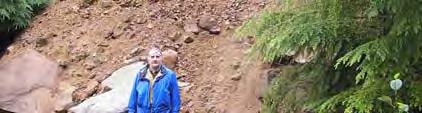
1 Monte Cristo Mining Area CERCLA Removal Action Update Bernard Kronschnabel Cascade Earth Sciences October 28, 2014 Background Abandoned gold mine district/ghost town Mining activity 1890s 1900s 1
2 Project Location Snohomish County Mt. Baker Snoqualmie National Forest Henry M Jackson Wilderness Legacy Scattered mines which fed ore to centralized location (Townsite) Townsite Features Tram terminal and haulage routes Ore Collector Concentrator Assay Shack Rainy Mine 2
3 Legacy continued Remote Mines along Glacier Creek and Seventysix Creek Glacier Creek Mines Justice Golden Cord Mystery Comet Pride of the Woods Pride of the Mountains New Discovery Seventysix Creek Mines Sidney Mine 76 Sheridan Boston American Removal Action Hurdles Access Old county road washed out in mile hike from Mountain Loop Hwy to Townsite Helicopter required for data gap monitoring Power Off grid no electricity or reliable communication Weather Short season: late June mid September Wilderness Some sites located in HMJ wilderness equipment restrictions 3
 Button up Access Route Repair County Road or alternate route?")
4 Removal Action Components Access Route Tailings/waste rock repository Temporary Glacier Creek crossing Removal activities Townsite and Rainy Mine cleanup Remote mine cleanup Adit discharges (Mystery, Justice, and Pride of the Woods) Button up Access Route Repair County Road or alternate route? If the road washed out before, it will wash out again Must permit access for O&M Follow general path of Sauk River Wagon Road Saving most intact portions of the road/bridges Tie into Python logging road (1980s?) Ultimately tie into County Road ~2 miles in Extend to Rainy Mine Temporary GC crossing to Townsite 4


5 Access Route Access route crosses three drainages Log stringer bridges Alaska yellow cedar Permanent leave behind for O&M access Improved public access Additional parking Safe crossing for pedestrians (no more fording of GC on wet log) Car and ATV access for USFS and local property owners Repository Located north of County Road ~1.5 miles from Townsite Inputs Rainy Mine 3,100 bcy Concentrator 8,100 bcy Ore Collector (tram terminal, haulageways, Assay Shack) 3,900 bcy Pride of the Woods 2,000 bcy 5


6 Repository Design Native fill/vegetative cover Gravel drainage 60 mil HDPE Tailings/waste rock Compacted native fill Repository continued Installed 3 monitoring wells this summer Monitor groundwater elevation during high flow Allows collection of background water quality before RA 6


 3")
7 Justice Mine Mean flow rate = 120 gpm 279 g/l As Near neutral ph Adit seep at trail and impacts GC Mystery Mine ph = g/l As Mean flow = 115 gpm Ferrous hydroxide Fe(OH) 3 precipitates classic yellow boy 7


8 Pride of the Woods Mine ph = 4.4 1,000 g/l As Mean flow = 0.5 gpm Adit seep at trail and into GC Challenges Wilderness/Remote Areas Must invoke CERCLA to operate machinery in HMJ Wilderness Roadless need to helicopter equipment in Limits O&M activity Endangered and threatened species Spotted owl Access Route Marbled murrelet Access Route Bull trout Glacier Creek Cultural/Archaeological Concerns Railway alignment Artifacts 8
9 Challenges continued Concerns of local property owners Private and Federal property Property/claim owners Local concerns Disturbance/impact to access Community involvement Monte Cristo Preservation Association Weather Short working season High rainfall (rainforest) Response to Challenges Detailed survey of Townsite Delineate Federal and private land Determine where we can work and where we can t Incorporate public in early stages of process Public review Response to concerns and questions Cultural Survey Archaeologist present at all excavations Document findings/clear work ahead of time 9
10 Response to Challenges continued Access Route Restrictions on size of trees that can be felled Restrictions on number of 30 trees that can be felled Restrictions on working hours and decibel levels Erosion control measures and turbidity monitoring Public input has led to more robust controls and awareness of potential impact Repository Engineering controls Stop work during precipitation Cover repository Looking Ahead 2015 Removal Action Complete Access Route to Rainy Mine Temporary GC crossing Townsite removal action Pride of the Woods removal action and diversion of adit discharge Mystery and Justice adit diversions Close the repository and demob 10


11 Acknowledgments Joe Gibbens USFS Ryan Tobias, Tim Otis, Jay Williams, Kyle Billings, Sara Rodriguez Cascade Earth Sciences Dustin Wasley TriHydro Rod Lentz USFS (retired) Phil Moyle (retired) and Bob Lambeth (CDM) Mining engineers/geologists Geezers GeoEngineers geotech ASM cultural Questions?? 11
MCPA Newsletter - March 2014
 MCPA Newsletter - March 2014 www.mcpa.us Board Members President... Kal Klass klasstwin@gmail.com Vice President... Doug Hammond Treasurer... Bill Rawlins Secretary... Ruth Danielson Corresponding Secretary...
Daisy Dean Trail 628/619 ATV Trail Construction
 Background and Purpose and Need The Daisy Dean ATV Trail Construction Project is located in the Little Belt Mountains, Musselshell Ranger District, Lewis and Clark National Forest approximately 32 miles
Bradley Brook Relocation Project. Scoping Notice. Saco Ranger District. United States Department of Agriculture Forest Service
 Bradley Brook Relocation Project United States Department of Agriculture Forest Service Scoping Notice White Mountain National Forest February 2011 For Information Contact: Jenny Burnett White Mountain
Description of the Proposed Action for the Big Creek / Yellow Pine Travel Plan (Snow-free Season) and Big Creek Ford Project
 and Big Creek Ford Project") Description of the Proposed Action for the Big Creek / Yellow Pine Travel Plan (Snow-free Season) and Big Creek Ford Project Payette National Forest Krassel Ranger District Valley and Idaho Counties, Idaho
Description of the Proposed Action for the Big Creek / Yellow Pine Travel Plan (Snow-free Season) and Big Creek Ford Project Payette National Forest Krassel Ranger District Valley and Idaho Counties, Idaho
ARCHIVES MONTH in Washington!
 ARCHIVES MONTH in Washington! We received an invitation in September from The State Archives to participate in Archives Month : 2014 is the 125th anniversary of Washington reaching statehood. It is a momentous
White Mountain National Forest Saco Ranger District
 United States Department of Agriculture Forest Service White Mountain National Forest 33 Kancamagus Highway Conway, NH 03818 Comm: (603) 447-5448 TTY: (603) 447-3121 File Code: 1950 Date: February 26,
DECISION MEMO. Rawhide Trail #7073 Maintenance and Reconstruction
 Page 1 of 6 Background DECISION MEMO USDA Forest Service Jefferson Ranger District Jefferson County, Montana Rawhide Trail #7073 is located in the Elkhorn Mountain Range approximately 10 miles east of
Lake Acreage Mcleese Lake, BC
 Lake Acreage Mcleese Lake, BC Jason Zroback jason@landquest.com 1 (604) 414-5577 Jamie Zroback jamie@landquest.com 1 (604) 483-1605 The Source for Oceanfront, Lakefront, Islands, Ranches, Resorts & Land
MCPA Newsletter - September 2016
 MCPA Newsletter - September 2016 www.mcpa.us Board Members President... Kal Klass klasstwin@gmail.com Vice President... David Cameron camlind@richpoor.net Treasurer... Bill Rawlins Secretary... Ruth Danielson
Decision Memo Broken Wheel Ranch Equestrian Outfitter Special-Use Permit Proposed Action
 Decision Memo Broken Wheel Ranch Equestrian Outfitter Special-Use Permit USDA Forest Service Mississippi Bluffs Ranger District, Shawnee National Forest Jackson and Union Counties, Illinois Proposed Action
DECISION MEMO North Zone (Legacy Trails) Trail Stabilization Project
 Trail Stabilization Project") DECISION MEMO North Zone (Legacy Trails) Trail Stabilization Project USDA FOREST SERVICE Rocky Mountain Region (R2) Shoshone National Forest Wapiti and Greybull Ranger District Park County, Wyoming Background
DECISION MEMO North Zone (Legacy Trails) Trail Stabilization Project USDA FOREST SERVICE Rocky Mountain Region (R2) Shoshone National Forest Wapiti and Greybull Ranger District Park County, Wyoming Background
ULTIMATE ALASKAN WILDERNESS
 ULTIMATE ALASKAN WILDERNESS Alaska, USA LONDON OFFICE +44 (0)20 7022 6560 NEW YORK OFFICE +1 (212) 370-8468 HONG KONG OFFICE +852 3752 2076 DUBAI OFFICE +971 4 437 6802 SINGAPORE OFFICE +65 6511 1190 INDIA
ETOBICOKE CREEK NORTH TRAIL PROJECT. May 18, 2017 at Michael Power High School 105 Eringate Drive, Etobicoke ON M9C 3Z7
 ETOBICOKE CREEK NORTH TRAIL PROJECT May 18, 2017 at Michael Power High School 105 Eringate Drive, Etobicoke ON M9C 3Z7 1 Purpose of Open House The purpose of today s open house is to present the design
Decision Memo Ice Age Trail Improvement (CRAC 37)
") Decision Memo Ice Age Trail Improvement (CRAC 37) U.S. Forest Service Chequamegon-Nicolet National Forest, Medford-Park Falls Ranger District Taylor County, Wisconsin T32N, R2W, Town of Grover, Section
Decision Memo Ice Age Trail Improvement (CRAC 37) U.S. Forest Service Chequamegon-Nicolet National Forest, Medford-Park Falls Ranger District Taylor County, Wisconsin T32N, R2W, Town of Grover, Section
Kit Carson-Challenger Ridge Trail Project Annual Performance Report-2014 October 22, 2014
 1 Kit Carson-Challenger Ridge Trail Project Annual Performance Report-2014 October 22, 2014 Willow Lake and Kit Carson Peak 2 SUMMARY The Rocky Mountain Field Institute began Phase 1 of a multi-phase,
White Mountain National Forest
 White Mountain National Forest United States Department of Agriculture Forest Service Eastern Region Boles Brook Snowmobile Bridge Decision Memo Boles Brook Snowmobile Bridge Project Town of Woodstock
Hike at Pico Blanco Labor Day Weekend!
 Hike at Pico Blanco Labor Day Weekend! The Pico Blanco Hymn Here among the trees majestic Pleasures you will find On the trails of Pico Blanco With your friends and mine Trail the Eagle ever onward This
BRYCE CANYON COUNTRY Boulder Mountain Scenic backways itinerary
 BRYCE CANYON COUNTRY Boulder Mountain Scenic backways itinerary Boulder Mountain Area The high plateaus of the Aquarius Plateau (Boulder Mountain), are heavily forested and covered in countless winding
Appendix A Appendix A (Project Specifications) Auk Auk / Black Diamond (Trail 44) Reroute
 Auk Auk / Black Diamond (Trail 44) Reroute") Appendix A (Project Specifications) Auk Auk / Black Diamond (Trail 44) Reroute I. Proposed Action: This project proposes to reroute approximately 1,800 feet of a 50 inch wide trail, off of private property
Appendix A (Project Specifications) Auk Auk / Black Diamond (Trail 44) Reroute I. Proposed Action: This project proposes to reroute approximately 1,800 feet of a 50 inch wide trail, off of private property
Evaluation of Outstanding Remarkable Values for Collawash River March 2011
 Evaluation of Outstanding Remarkable Values for Collawash River March 0 Segment From headwaters of East Fork Collawash River to Buckeye Creek Mileage: miles Free flowing: Yes Scenic:, Substantial River
National Forest: Snoqualmie National Forest State: WA Counties: King, Snohomish General Location: Central Washington Cascade Range Acres: 105,561
 Wild Sky Wilderness Air Quality Report National Forest: Snoqualmie National Forest State: WA Counties: King, Snohomish General Location: Central Washington Cascade Range Acres: 105,561 Page 1 of 5 Wilderness
USDA Trails Strategy WRI: ENGLISH PEAK SURVEY. Theodore Mendoza San Diego State University June 6 th 2016 August 18 th Advisor: Sam Commarto
 WRI: ENGLISH PEAK SURVEY Theodore Mendoza San Diego State University June 6 th 2016 August 18 th 2016 Advisor: Sam Commarto Klamath National Forest Submitted: March 21, 2017 Table of Contents Acknowledgements
Ranch. Creek. Cow. Mountain
 Cow Creek Mountain Ranch Situated along the southwestern hills of the Laramie Mountains and the Medicine Bow-Routt National Forest in northeastern Albany County, Wyoming. 58 E. Benteen Street Buffalo,
April 10, Mark Stiles San Juan Public Lands Center Manager 15 Burnett Court Durango, CO Dear Mark,
 Mark Stiles San Juan Public Lands Center Manager 15 Burnett Court Durango, CO 81301 Dear Mark, We are pleased to offer the following comments on the draft San Juan Public Lands Center management plans
Department of Natural Resources Update Southeast Conference
 Department of Natural Resources Update Southeast Conference Presentation by Corri Feige Commissioner Alaska Department of Natural Resources February 12, 2019 1 LAND BASE & OWNERSHIP Southeast 94% of Southeast
Yard Creek Provincial Park. Management Plan
 Yard Creek Provincial Park Management Plan Draft January 2010 Yard Creek Provincial Park Management Plan Approved by: telàlsemkin/siyam/chief Scott Benton Bill Williams Squamish Executive Director ation
Public Notice ISSUED: December 10, 2018 EXPIRES: January 9, 2019
 APPLICANT: REFER TO: St. Louis and Lake Counties Regional Rail Authority 2018-01942-ARC Public Notice ISSUED: December 10, 2018 EXPIRES: January 9, 2019 SECTION:404 - Clean Water Act 1. APPLICATION FOR
2.0 PARK VISION AND ROLES
 2.0 PARK VISION AND ROLES 2.1 Significance in the Protected Area System Marble Range and Edge Hills provincial parks protect 6.8% of the Pavillion Ranges Ecosection, which is located in the Southern Interior
Hermosa Area Preservation The Colorado Trail Foundation 4/11/2008
 Hermosa Area Preservation The Colorado Trail Foundation 4/11/2008 Legend d o Tr ail NPA - National Protection Area ra NCA - National Conservation Area o e C Th The Colorado Trail lo FS inventoried Roadless
The Geological Pacific Northwest. Wednesday February 6, 2012 Pacific Northwest History Mr. Rice
 The Geological Pacific Northwest Wednesday February 6, 2012 Pacific Northwest History Mr. Rice 1 Free Response #2 Please do not simply list the items for this response. Full sentences!!! Minimum of 3-5
Metro District 1500 W. County Road B 2 Roseville, MN Date: July 17, 2018
 Metro District 1500 W. County Road B 2 Roseville, MN 55113 3174 Date: July 17, 2018 Ryan Hixson FHWA, Area Engineer Federal Highway Administration 380 Jackson Street, Suite 500 St. Paul, Minnesota 55101
Wild Pacific Trail Society
 Wild Pacific Trail Society Section H Completion Report January 24, 2014 Project Manager: Tel: Email: Jim Martin 250-726-7565 oysterjim@hotmail.com Project Report: Tel: Email: Heather Grimshire 250-266-2053
Whitefish Range Partnership Tentatively Approved by WRP 11/18/2013!Rec. Wilderness Page 1
 Whitefish Range Partnership Tentatively Approved by WRP 11/18/2013!Rec. Wilderness Page 1 Recommended Wilderness Background The Whitefish Range has a long management and legislative history associated
ROAD AND TRAIL PROJECT APPROVAL
 ROAD AND TRAIL PROJECT APPROVAL www.marincountyparks.org Marin County Parks, 3501 Civic Center Dr, Suite 260, San Rafael, CA 94903 DATE: July 12, 2017 PRESERVE: Gary Giacomini Open Space Preserve PROJECT:
LESSON 9 Recognizing Recreational Benefits of Wilderness
 LESSON 9 Recognizing Recreational Benefits of Wilderness Objectives: Students will: study, analyze, and compare recreation visitor days (RVD s) for Wilderness areas adjacent to their homes or nearest state,
MAIN LAKE PROVINCIAL PARK
 MAIN LAKE PROVINCIAL PARK PURPOSE STATEMENT AND ZONING PLAN March 2003 MAIN LAKE PROVINCIAL PARK Purpose Statement and Zoning Plan Primary Role The primary role of Main Lake Park is to protect a biologically
Overview. Wilderness Act of Statement of Need. What is Wilderness Character. Monitoring Wilderness Character
 Overview Monitoring Wilderness Character What What & Why? How? How? Conceptual Development How? How? Implementation Future? Future? Troy Hall Steve Boutcher USFS Wilderness & Wild and Scenic River Program
Anderson Mt. Proposed Wilderness Additions to the Rogue-Umpqua Divide Wilderness-- T30S R3E (mostly) Sections 4 & 9, and T29S R3E Section 33
 Sections 4 & 9, and T29S R3E Section 33") Anderson Mt. Proposed Wilderness Additions to the Rogue-Umpqua Divide Wilderness-- T30S R3E (mostly) Sections 4 & 9, and T29S R3E Section 33 When the 35,701 acre Rogue-Umpqua Divide Wilderness was designated
Anderson Mt. Proposed Wilderness Additions to the Rogue-Umpqua Divide Wilderness-- T30S R3E (mostly) Sections 4 & 9, and T29S R3E Section 33 When the 35,701 acre Rogue-Umpqua Divide Wilderness was designated
Response to Public Comments
 Appendix D Response to Public Comments Comment Letter # Response 1, 2, 3, 4, 5, 7, 8, 9, 10, 11, 12, 13, 14, 15, 16, 17, 18, 19, 20, 22, 23, 24, 25, 26, 27, 29, 30, 31, 32, 33, 34, 35, 36, 37, 38, 39,
2012 Squaw Butte Trail Warriors
 2012 Squaw Butte Trail Warriors Between June 1 st and September 30 th 2012 Squaw Butte supported nine trail maintenance projects. These projects covered a large section of south western Idaho, taking place
Permeable RECREATIONAL TRAILS
 SMART EARTH SOLUTIONS Permeable RECREATIONAL TRAILS GEOWEB GEOPAVE GEOTERRA Innovative Solutions for Designing & Building Trails. Trail Surface Stabilization The key to planning and building trails into
OUTREACH ANNOUNCEMENT Reply by February 21, 2014
 OUTREACH ANNOUNCEMENT Reply by February 21, 2014 Lead Fire Prevention Technician GS-0462-5/6/7 Announcement Number: OCR14-462-PREV-5/6/7DP OCR14-462-PREV-5/6/7G One Position to be filled on the Siskiyou
TAYLOR CANYON RANCH COLORADO - ROUTT COUNTY - STEAMBOAT SPRINGS
 TAYLOR CANYON RANCH COLORADO - ROUTT COUNTY - STEAMBOAT SPRINGS Tucked up against the steep valley shaped by Mt. Pau and rising to the Routt National Forest, Taylor Canyon Ranch is an easily accessible,
Your Guide to Mountainbiking around Atlin (yes, you can hike these trails as well)
") Your Guide to Mountainbiking around Atlin (yes, you can hike these trails as well) Foreword Thanks to the rich mining history in Atlin, the historic mining roads have become the perfect trails for recreational
Your Guide to Mountainbiking around Atlin (yes, you can hike these trails as well) Foreword Thanks to the rich mining history in Atlin, the historic mining roads have become the perfect trails for recreational
Ecological impacts in mountain protected areas
 Ecological impacts in mountain protected areas International Programme on Research and Training on Sustainable Management of Mountain Areas (IPROMO) July 2010 International Centre for Ecotourism Research,
Leave No Trace. Provide ground rules: Note taking is encouraged Handouts at end of presentation Ask questions when you have them S
 Leave No Trace Provide ground rules: Note taking is encouraged Handouts at end of presentation Ask questions when you have them 1A Learning Objectives To emphasize the importance of using Leave No Trace
Bob Marshall Wilderness Foundation
 About the Bob Marshall Wilderness Complex Considered by many to be the crown jewel of the wilderness preservation system, the Bob Marshall Wilderness Complex located in Northwestern Montana, is the third
Bell s Travel Guides
 Bell s Travel Guides Top of the World Highway Road Log Mile by Mile Description of the Top of the World Highway so you always know what lies ahead. Dawson City, Yukon to Tetlin Junction on the Alaska Highway
National Park Service Wilderness Action Plan
 National Park Service U.S. Department of the Interior National Park Service Wilderness Action Plan National Wilderness Steering Committee National Park Service "The mountains can be reached in all seasons.
DRAFT. Dorabelle Campground Rehabilitation
 DRAFT Dorabelle Campground Rehabilitation September 2012 1.1 REGIONAL SETTING AND PROJECT LOCATION The Dorabelle Campground is located on the western shore of Shaver Lake in Fresno County, California (Section
Exemplar for Internal Achievement Standard Geography Level 1. Conduct geographic research, with direction
 Exemplar for internal assessment resource Geography for Achievement Standard 91011 Exemplar for Internal Achievement Standard Geography Level 1 This exemplar supports assessment against: Achievement Standard
DECISION MEMO Whetstone Ridge Trail #8020 Relocation
 Page 1 of 7 Background DECISION MEMO Whetstone Ridge Trail #8020 Relocation USDA Forest Service Pintler Ranger District Granite County T4N, R16W, Sections 4,9,29 and T4N, R17W, Section 36 Whetstone Ridge
APPENDIX L -4 RECREATIONAL TRAIL CROSSING PLANS
 Atlantic Sunrise Project PA DEP Chapter 105 Joint Permit Application Transcontinental Gas Pipe Line Company, LLC Lancaster County APPENDIX L -4 RECREATIONAL TRAIL CROSSING PLANS Atlantic Sunrise Project
Decision Memo for Desolation Trail: Mill D to Desolation Lake Trail Relocation
 for Salt Lake County, Utah Uinta-Wasatch-Cache National Forest Salt Lake Ranger District 1. Background The present location of the Desolation Trail (#1159) between Mill D and Desolation Lake follows old
History House depressions in area dated as far back as 1600 years ago indicate the area was used by Native people.
 McNeil River 1) Overview history purpose facts- location History House depressions in area dated as far back as 1600 years ago indicate the area was used by Native people. a) Early 1900 s Charles McNeil
Northern Rail Extension, Phase One
 General Project and Funding 1. Where does Phase One start? The rail line for Phase One begins roughly at the northern boundary of the former Bradbury property, but also includes work along Tom Bear Trail
White Mountain National Forest
 White Mountain National Forest United States Department of Agriculture Forest Service Eastern Region Batchelder Brook and Guinea Pond Snowmobile Bridges Decision Memo Batchelder Brook/Guinea Pond Snowmobile
Trail Assessment Report
 Trail Assessment Report Trail Options for the Bear Creek Canyon located in Pikes Peak Ranger District, Pike National Forest and on Colorado Springs Utility Lands Due to the presence of a unique species
Garibaldi Provincial Park Trail Conditions
 Garibaldi Provincial Park s August 2, 2018 Garibaldi Park is located in the coast mountain wilderness and the weather can be severe and unforgiving. Be well prepared, properly equipped and informed before
Date Name Trail Segment Conditions, Hazards and General Notes on Trails
 Trail Reports for Sawtooth NRA ***Unless otherwise reported-expect high creeks, snow levels at 7900 ft. and trees on trails. Due to high winds in the area, if trees were previously reported removed there
Chocolate Bar GOLD Mining Claim Oro Grande, California 92368
 Gold Mining Claim 20 Acres Chocolate Bar GOLD Mining Claim Oro Grande, California 92368 Sale Highlights Formerly: Branch Gold Mine Heavy GOLD & Silver Concentrations: Remaining 300' Horizontal Tunnel with
JULY 7-14, Days / 7 Nights
 JULY 7-14, 2019 8 Days / 7 Nights Day One: Sunday, July 7, 2019. Arrival in Kalispell, Montana for group transfer to Whitefish, Montana. Arrive in Kalispell, Montana, gateway to western Montana and Glacier
WALKER SWAMP INFORMATION DAY Saturday 23 rd June 2018
 WALKER SWAMP INFORMATION DAY Saturday 23 rd June 2018 Introduction to the Upper Wannon River Floodplain wetlands and the new Walker Swamp Restoration Reserve Mark Bachmann and Greg Kerr, Nature Glenelg
LESSON 5 Wilderness Management Case Studies
 LESSON 5 Wilderness Management Case Studies Objectives: Students will: review the key points of the Wilderness Act of 1964. brainstorm solutions for Wilderness management issues. Materials: Í Leave no
Decision Memo Sun Valley Super Enduro & Cross-Country Mountain Bike Race. Recreation Event
 Decision Memo 2015 Sun Valley Super Enduro & Cross-Country Mountain Bike Race Recreation Event USDA Forest Service Ketchum Ranger District, Sawtooth National Forest Blaine County, Idaho Background The
Clearwater Lake Provincial Park. Draft Management Plan
 Clearwater Lake Provincial Park Draft Management Plan Clearwater Lake Provincial Park Draft Management Plan Table of Contents 1. Introduction... 3 2. Park History... 4 3. Park Attributes... 4 3.1 Location/Access...4
Lena Beach Recreation Area Renovation. Dear National Forest User:
 United States Department of Agriculture Forest Service Alaska Region Tongass National Forest Juneau Ranger District 8510 Mendenhall Loop Juneau, AK 99801 Phone: (907) 586-8800 Fax: (907) 586-8808 File
Date Name Trail Segment Conditions, Hazards and General Notes on Trails
 Trail Reports for Sawtooth NRA ***Unless otherwise reported-expect high creeks, snow levels at 7900 ft. and trees on trails. Due to high winds in the area, if trees were previously reported removed there
Area Organization Project Name Project Description Funding Amount Castlegar Castlegar Nordic Ski Club
 BACKGROUNDER RECREATION INFRASTRUCTURE GRANTS 2018 INTAKE: LIST OF PROJECTS APPROVED FOR FUNDING Area Organization Project Name Project Description Funding Amount Castlegar Castlegar Nordic Ski $12,000
Whitemouth Falls Provincial Park. Draft Management Plan
 Whitemouth Falls Provincial Park Draft Management Plan Whitemouth Falls Provincial Park Draft Management Plan Table of Contents 1. Introduction... 3 2. Park History... 3 3. Park Attributes... 4 3.1 Natural...
GOOSENECK SWAMP INFORMATION DAY - Saturday 14 th December 2013
 GOOSENECK SWAMP INFORMATION DAY - Saturday 14 th December 2013 Progress of a restoration trial at Gooseneck Swamp - Grampians National Park, Victoria Gooseneck Swamp is situated at the far south-eastern
Unit 3: Klehini River All subunits 39 users/day (Allowed Use) Use: Rafting, Hiking
 Use: Rafting, Hiking") Haines State Forest Units & Subunits Activities Supplemental LAS 28996 Land Use Permit Application Alaska Mountain Guides & Climbing School Also DBA International Wilderness Leadership School Unit 3: Klehini
Haines State Forest Units & Subunits Activities Supplemental LAS 28996 Land Use Permit Application Alaska Mountain Guides & Climbing School Also DBA International Wilderness Leadership School Unit 3: Klehini
Bibbulmun Track. Cape to Cape Track. Two of the world s great long distance walking tracks. 973 km. 135 km km Off-road cycle touring
 Trail revitalising Western Australia Bibbulmun Track 973 km Cape to Cape Track 135 km Two of the world s great long distance walking tracks 1062 km Off-road cycle touring Trail revitalising 1. Framework
RANGE EXTENSIONS FOR ERYTHRANTHE ARVENSIS AND E. HALLII (PHRYMACEAE)
") Nesom, G.L. 2016. Range extensions for Erythranthe arvensis and E. hallii (Phrymaceae). Phytoneuron 2016-80: 1 5. Published 12 December 2016. ISSN 2153 733X RANGE EXTENSIONS FOR ERYTHRANTHE ARVENSIS AND
Nesom, G.L. 2016. Range extensions for Erythranthe arvensis and E. hallii (Phrymaceae). Phytoneuron 2016-80: 1 5. Published 12 December 2016. ISSN 2153 733X RANGE EXTENSIONS FOR ERYTHRANTHE ARVENSIS AND
Date Name Trail Segment Conditions, Hazards and General Notes on Trails
 Trail Reports for Sawtooth NRA ***Unless otherwise reported-expect high creeks, snow levels at 7900 ft. and trees on trails. Due to high winds in the area, if trees were previously reported removed there
proof Northwest District
 1 Northwest District The Northwest Florida Water Management District is the most rural of all five water management districts. From just east of Tallahassee west to the Florida/Alabama line, and from the
Triangle Land Conservancy Conservation Area Monitoring Report Carolina North
 Triangle Land Conservancy Conservation Area Monitoring Report Carolina North Property Name: Bolin Creek East Conservation Area Date of visit: March 16, 2017 County: Orange Property Type: Restrictive Covenants
Road and Trail Report 05/25/2015
 U.S.D.A. FOREST SERVICE KETCHUM RANGER DISTRICT 206 SUN VALLEY ROAD P.O. BOX 2356 KETCHUM, ID 83340 (208) 622-5371 Road and Trail Report 05/25/2015 Trail and Road conditions remain much the same as last
Alaska Cruisetours: 11-Day Denali Express
 Alaska CruiseTours Alaska Cruisetours: 11-Day Denali Express Alaska Cruisetours Choose from FOUR Cruisetours featuring escorted Motorcoach and Railroad Tours to see the heart of this great land: 11-Day
SUGARBOWL-GRIZZLY DEN PROVINCIAL PARK AND SUGARBOWL-GRIZZLY DEN PROTECTED AREA Purpose Statement and Zoning Plan
 SUGARBOWL-GRIZZLY DEN PROVINCIAL PARK AND SUGARBOWL-GRIZZLY DEN PROTECTED AREA Purpose Statement and Zoning Plan Located one hour east of Prince George on Highway 16, Sugarbowl-Grizzly Den Provincial Park
BLASTING GLACIAL ICE AND SNOW ABSTRACT
 BLASTING GLACIAL ICE AND SNOW HERB BLEUER ABSTRACT This presentation, with the aid of slides, is about methods of blasting large quantities of glacial ice and snow. The project illustrated here involved
NAVAJO COMMUNITY PLAN
 NAVAJO COMMUNITY PLAN Prepared by the NAVAJO COMMUNITY PLANNERS and THE CITY OF SAN DIEGO City of San Diego Planning Department 202 C Street, MS 4A San Diego, CA 92101 Printed on recycled paper. This information,
TETON COUNTY WYOMING PUBLIC LANDS INITIATIVE: TURIANO TEAM PROPOSAL
 TETON COUNTY WYOMING PUBLIC LANDS INITIATIVE: TURIANO TEAM PROPOSAL SUMMARY Protect roadless areas on US Forest Service lands in Teton County, Wyoming using a mix of two designations: National Backcountry
Wilderness Adventures
 Wilderness Adventures S P R I N G / F A L L Equestrian Excursions Legendary Fly-Fishing ATV Tours Go-Karting Climbing and Hiking Pursuits Shooting Sports Adventures in Flight Working Ranch Experiences
Blue River Trail Master Plan JSA to Town Hall June 2004
 Blue River Trail Master Plan JSA to Town Hall June 2004 Prepared for: Silverthorne Town Council Silverthorne SPORT Committee Department of Recreation and Culture Silverthorne Public Works Silverthorne
The Frank Church River of No Return Wilderness
 ALLIANCE FOR WILDERNESS EDUCATION AND STEWARDSHIP PO Box 2667, Bellingham, WA 98227-2667 Tele: 360-927-1804 Fax: 360-527-9679 bradt@wildernessalliance.org www.wildernessalliance.org STEWARDS OF AMERICA
5.0 OUTDOOR RECREATION OPPORTUNITIES AND MANAGEMENT
 5.0 OUTDOOR RECREATION OPPORTUNITIES AND MANAGEMENT 5.1 Introduction This section describes the range of recreational activities that currently take place in Marble Range and Edge Hills Parks, as well
Date Name Trail Segment Conditions, Hazards and General Notes on Trails
 Trail Reports for Sawtooth NRA ***Unless otherwise reported-expect high creeks, snow levels at 7900 ft. and trees on trails. Due to high winds in the area, if trees were previously reported removed there
PEMBERTON VALLEY RECREATIONAL TRAILS MASTER PLAN UPDATE Community Open House. April 2018
 PEMBERTON VALLEY RECREATIONAL TRAILS MASTER PLAN UPDATE Community Open House April 2018 Introductions Introductions Matt Bakker, BHA Project Coordinator Other Team Members: Liz Scroggins, Grey Owl Consulting
Portuguese Language - Fostering National Unity
 Geography Brazil Brazil Portuguese Language - Fostering National Unity 11 dialects of Portuguese Influenced by Amerindian and African languages, creating differences between Portuguese spoken in Brazil
OPPORTUNITIES FOR WILD & SCENIC RIVER DESIGNATION
 OPPORTUNITIES FOR WILD & SCENIC RIVER DESIGNATION IN SOUTHWEST WASHINGTON S VOLCANO COUNTRY Washington's legendary volcanoes - Mount St. Helens, Mount Rainier and Mount Adams - are the source of wild,
A Comparison of the Salar de Atacama and Clayton Valley Lithium Ore Deposits: Groundwater Mining in the some of the Driest Places on Earth
 A Comparison of the Salar de Atacama and Clayton Valley Lithium Ore Deposits: Groundwater Mining in the some of the Driest Places on Earth Melissa Jennings Geologist & Environmental Engineer This presentation
*Latin America spans 7,000 miles, from Mexico to Tierra Del Fuego. *3 Regions: Central America, South America, and the Caribbean.
 Physical Geography Latin America spans 7,000 miles, from Mexico to Tierra Del Fuego *3 Regions: Central America, South America, and the Caribbean. *Intro clip: http://www.youtube.com/watch?v=cffp6rza3
Abandoned Mine Sites Policy
 SUBJECT: Abandoned Mine Sites Policy Policy Number: MRE 006 2004 C. R. File Number: 565 00 0002 Effective Date: September 1, 2004 To Be Reviewed: September 1, 2008 Approval: Original signed by W. David
Pinellas County Environmental Lands
 Pinellas County Environmental Lands In addition to traditional parks and recreation facilities, Pinellas County owns and manages a system of environmental lands that provides specialized resource-based
Below is the section of the Byway discussed in the Wise/Russell County meeting. Primary coal sites are noted on the map.
 APPENDIX H: PUBLIC PARTICIPATION SERIES OF TOWN MEETINGS Virginia Coal Heritage Trail Corridor Management Plan Meeting in St. Paul on the Wise and Russell County portions of the St. Paul Loop September
APPENDIX D: SUSTAINABLE TRAIL DESIGN. APPENDICES Town of Chili Parks and Recreation Master Plan Update
 APPENDIX D: SUSTAINABLE TRAIL DESIGN APPENDICES Town of Chili Parks and Recreation Master Plan Update Sustainable Trail Construction Sustainable trails are defined by the US Forest Service as trails having
Kit Carson-Challenger Ridge Trail Project
 Kit Carson-Challenger Ridge Trail Project Project Accomplishments Report-USFS December 15, 2015 Photo courtesy of Justin Peterson 815 South 25 th Street, Suite 101 Colorado Springs, CO 80904 Dedicated
A GIS Analysis of Probable High Recreation Use Areas in Three Sisters Wilderness Deschutes and Willamette National Forests
 Lindsey Kiesz Geo 565 Term Project 3/15/2010 A GIS Analysis of Probable High Recreation Use Areas in Three Sisters Wilderness Deschutes and Willamette National Forests Introduction The Three Sisters Wilderness
Piedra River Protection Workgroup Meeting #5 Feb. 21, 2012 Ross Aragon Community Center, Pagosa Springs
 Piedra River Protection Workgroup Meeting #5 Feb. 21, 2012 Ross Aragon Community Center, Pagosa Springs What happened at this meeting? - Identified conservation easements - Discussed In-stream Flows -