Approved and Adopted I N G H A M C O U N T Y
|
|
|
- Amberlynn Paul
- 6 years ago
- Views:
Transcription


1 Approved and Adopted I N G H A M C O U N T Y TRAILS March AND 3, 20 PARKS COMPREHENSIVE REPORT Draft January 27,
2


3 A C K N O W L E D G E M E N T S Ingham County Board of Commissioners Brian McGrain, Chairperson Kara Hope, Vice Chairperson Randy Maiville, Vice Chairperson Pro Term Victor Celentino Rebecca Bahar-Cook Sarah Anthony Bryan Crenshaw Todd Tennis Penelope Tsernoglou Carol Koenig Teri Banas Deb Nolan Randy Schafer Robin Case Naeyaert Ingham County Trails and Parks Task Force Teri Banas, Chairperson Penelope Tsernoglou, Vice-Chairperson Sarah Anthony Robin Case Naeyaert Carol Koenig Randy Maiville Deb Nolan Todd Tennis Ingham County Parks and Recreation Commission Commissioner Penelope Tsernoglou Commissioner Carol Koenig Sarah Nicholls, Chair Matthew Bennett, Vice-Chair Ralph Monsma, Secretary John Czarnecki Pat Lindemann Paul Pratt Jonathan Schelke Kevin Duffy Cherry Hamrick Ingham County Staff Jared Cypher, Deputy Controller Tim Morgan, Parks Director Brian Collins, Hawk Island Park Manager Jeff Gehl, Burchfield Park Manager Pat Witte, Lake Lansing Park Manager Nicole Wallace, Executive Assistant Karen Fraser, Financial Coordinator Prepared by: The Mannik and Smith Group In collaboration with The Michigan Trails and Greenways Alliance INGHAM COUNTY Trails and Parks Comprehensive Report Draft January 27, 2016 Page i
4
5 C O N T E N T S E X E C U T I V E S U M M A R Y... vii I N T R O D U C T I O N Purpose... 1 Project Process... 1 Report Organization... 2 P L A N N I N G C O N T E X T Regional Setting... 3 Regional Trails... 4 Clinton-Ionia-Shiawassee (CIS) Trail... 4 Lakelands Trail... 5 Thornapple Trail... 7 The River Trail... 7 Regional Plans... 9 Tri-County Regional Planning... 9 MDOT University Region Non-Motorized Plan Local Trail Planning Efforts City of Williamston Williamstown Township Meridian Township City of East Lansing City of Lansing Delhi Township City of Mason Water Trails Ingham County Regional Trails and Parks Network S T A N D A R D S + B E S T P R A C T I C E S Design Standards Sidewalks On-Street Bicycle Lanes On-Road Paved Shoulders Off-Road Shared-Use Pathways Other Features and Signage Cost Considerations Water Trails Access Sites and Accessibility Site Location Appropriateness Cost Considerations Maintenance A Systemic Approach INGHAM COUNTY Trails and Parks Comprehensive Report Draft January 27, 2016 Page iii
6 E X I S T I N G C O N D I T I O N S + A S S E S S M E N T Land Trail Assessment Pavement Bridges Water Trail Assessment County Parks Bunker Road Canoe Landing Burchfield Park/Riverbend Natural Area/McNamara Landing Hawk Island Park Lake Lansing Boat Launch Lake Lansing Park North Lake Lansing Park South Deferred County Park Projects P U B L I C P A R T I C I P A T I O N Project Website Public Meetings and Online Survey Summary of Public Input Findings Stakeholder Input Stakeholder Meeting Issues & Themes Theme 1: Trail Rehabilitation and Ongoing Trail Improvement Theme 2: New Trail Development Theme 3: Regional Identity and Sense of Place Theme 4: Partnerships and Collaboration Theme 4: Funding Opportunities M I L L A G E A L L O C A T I O N + C R I T E R I A F O R P R O J E C T E V A L U A T I O N Countywide Millage Funding in Michigan Millage Distribution Process Trail Project Prioritization Criteria for Project Evaluation Recommendations Millage Allocation Categories Trail Maintenance Criteria for Project Evaluation Application Process Page iv Draft January 27, 2016 INGHAM COUNTY Trails and Parks Comprehensive Report
7 A P P E N D I X Public Input Additional Comments Maintenance Options Intergovernmental Agreements for Maintenance A Michigan Maintenance Model Example Adopt-A-Trail Program Funding Opportunities MAP-21: Transportation Alternatives Program, Safe Routes to Schools, and Recreation Trails 136 Congestion Mitigation/Air Quality Michigan Transportation Fund (Act 51) Surface Transportation Fund (STP) Fixing America s Surface Transportation Act (FAST Act) Michigan Natural Resources Trust Fund (MNRTF) Land and Water Conservation Fund (LWCF) Recreation Passport Grant Advocacy Advance Rapid Response Grant DALMAC Fund PeopleForBikes Community Grant Program (formerly Bikes Belong) Small Grant Programs Other Sources and Local Support L I S T O F F I G U R E S Figure 1. Regional Location... 3 Figure 2. CIS Rail Trail... 4 Figure 3. The Great Lake-to-Lake Trail... 5 Figure 4. Michigan s Iron Belle Trail... 6 Figure 5. Thornapple Trail... 7 Figure 6. The River Trail... 7 Figure 7. Heart-of-Michigan Trail... 8 Figure 8. Greening Mid-Michigan... 9 Figure 9. Regional Non-Motorized Corridors, MDOT University Region Figure 10. Regional Corridor Connections to Adjacent Counties Figure 11. Regional Corridor Priorities within Ingham County Figure 12. Williamston Proposed Trail Improvements Figure 13. Williamstown Township Planned Trails Figure 14. Meridian Township Pedestrian-Bicycle Pathway Map Figure 15. East Lansing Non-Motorized Priorities Figure 16. City of East Lansing Non-Motorized Plan Figure 17. City of Lansing Non-Motorized Plan Cross-Town Priorities Figure 18. City of Lansing Non-Motorized Plan Figure 19. Delhi Township Non-Motorized Transportation System Figure 20. The Hayhoe Trail Figure 21. Water Trails in Michigan Figure 22. Grand River Water Trail Figure 23. Red Cedar Water Trail Figure 24. Regional Trails and Parks Network Figure 25. Pavement Surface Rating Map Figure 26. Bridge Location INGHAM COUNTY Trails and Parks Comprehensive Report Draft January 27, 2016 Page v
8 Figure 27. Water Trail Access Sites Figure 28. Burchfield Park/Riverbend Nature Area/McNamara Landing Figure 29. Hawk Island Park Figure 30. Lake Lansing North Figure 31. Lake Lansing South Figure 32. New Trail Preferences Map for Public Input Figure 33. Public Input Participants and County Population L I S T O F T A B L E S Table 1. Typical Maintenance Budget Table 2. Volunteers and Maintenance Table 3. Existing Trail Pavement Assessment Table 4. Bridge Rating & Percentage for Replacement Table 5. Bridge Inventory Table 6. Bridge Unit Price Used for Engineer s Conceptual Opinion of Cost Table 7. Bridge Repair, Rehabilitation and Replacement Cost Table 8. Water Trail Inventory Table 9. Bunker Road Canoe Landing Table 10. Burchfield Park/Riverbend Natural Area/McNamara Landing Table 11. Hawk Island Park Table 12. Lake Lansing Boat Launch Table 13. Lake Lansing North Table 14. Lake Lansing South Table 15. Ingham County Parks Deferred Projects Table 16. Preferred Millage Expenditures Table 17. New Trail Preferences Table 18. List of Suggested Projects Table 19. Example Countywide Millage Allocations Table 20. Criteria for Trail Project Prioritization Page vi Draft January 27, 2016 INGHAM COUNTY Trails and Parks Comprehensive Report
9 E X E C U T I V E S U M M A R Y The Ingham County Trails and Parks Comprehensive Report brings together a detailed inventory and assessment of the County s existing trails, identification of planned trails and regional corridors, public and stakeholder preferences for millage expenditures and regional corridors, and recommendations for the new countywide trails and parks millage allocations and funding request evaluation. Planning Context Following initiation of the project, existing information and planning documents for both existing and proposed trails were reviewed. This included a review of regional trails in and around Ingham County, regional non-motorized plans from the Tri-County Planning Commission, the Michigan Department of Transportation (MDOT), and the non-motorized plans of the County s local municipalities. Local plans relevant to this study include the City of Williamston, Williamstown Township, Meridian Township, East Lansing, Lansing and Delhi Township. In addition, water trail plans for the Grand River and the Red Cedar River were examined. This review led to the formulation of a Regional Trails and Parks Network map which identified the priority regional corridors. Trail Standards and Best Practices The Ingham County Regional Trails and Parks Network represents a long-term vision and, while the routes and connections have been conceptually identified, further design and engineering work will be needed to determine the type of bicycle and pedestrian facilities best suited for each corridor. Based on the review of current standards for non-motorized facility development, the facilities most appropriate for Ingham County s regional trail network include: Designated, signed, low-traffic routes as part of a shared road route for bicyclists without any new improvements; On-street bicycle lanes combined with sidewalks for pedestrian use; On-road paved shoulders for bicycle use; and Off-road shared-use pathways for pedestrians and bicyclists. Best policies and practices that are relevant to the County regional trail network include Complete Streets policies, consideration for the different types of users, accepted design standards and costs for both land and water trails. In addition, the study describes best maintenance practices and examines maintenance options which could apply to the County network. Additional case studies and information is provided in the Appendix to this report. Existing Conditions and Assessment A detailed inventory and assessment of the existing trails, bridges, water trails, and County Parks was conducted to establish a base for existing conditions, to gain an understanding of needed infrastructure improvements and to estimate costs for repairs, rehabilitation and reconstruction. The assessment of the trails pavement surface showed the most needed repairs in the low lying areas around Potter Zoo and Crego Park. In addition, some of the older trail segments were identified to be too narrow to meet current accepted American Association of State Highway and Transportation Officials (AASHTO) standards. Based on the pavement surface evaluation of the existing shared-use trails in the County, the total base repair cost, including material and labor and maintaining current width, is estimated at about $385,000. However, if the identified segments are widened to ten feet, the total cost would be INGHAM COUNTY Trails and Parks Comprehensive Report Draft January 27, 2016 Page vii
10 approximately $910,000 (including 12 percent construction contingency and 18 percent for engineering design or construction administration). An extensive number of bridges, 55, were inventoried and evaluated. These bridges are in need of various repairs with a few requiring complete replacement. The older section of the River Trail alone includes about 25 bridge structures. The cursory evaluation of each bridge structure led to a breakdown of costs for repairs or rehabilitation, replacement, and other added miscellaneous cost for approach repairs. The overall total estimated cost for bridge and approach repairs and/or replacement reaches almost $20 million. Follow up in-depth investigations are recommended to determine bridge loading capacities and pinpoint more precisely the extent of the needed repairs. In addition, a bridge inspection report was assembled including all the information inventoried during the course of this study to serve as a baseline for a routine inspection program. Future costs associated with bridge inspection and maintenance are recommended to be factored into an overall maintenance plan. The County s water trail inventory focused on noting the location of the river access points and their conditions and determining opportunities for new access points. This was done for the Red Cedar River, the Grand River, and a portion of Sycamore Creek. A total of 24 existing access sites were inventoried, 19 located on the Grand River and five on the Red Cedar. In addition, four sites were initially identified as opportunities for future access including one on the Grand River, one on the Red Cedar and two on Sycamore Creek. The potential access sites were limited to known public land areas. The existing water trail system include a 7-mile canoe/kayak trip from Bunker Road Landing to Burchfield County Park (about 3 hours); a 23-mile canoe/kayak trip on the Red Cedar River from Williamston to the Grand River confluence at Sweeney s Landing in Lansing (approximately 14 hours); and one fully accessible canoe/kayak launch site at Sweeney s Landing. Potential opportunities include: Installation of accessible canoe/kayak launches or features at most existing sites; Provision for additional access sites along all three rivers as initially identified; Protection and restoration of riparian buffers and erosion control measure along all three rivers; Plans, with the help of volunteers, to remove trees and brush from the waterways; and Promotion of special river-related events and recreation activities A detailed inventory of the County Park facilities is documented in the report. It includes photographs and drawings of each park site and a listing of all the recreation facilities that are currently located in Bunker Road Landing (Eaton County), McNamara/Riverbend/Burchfield Park, Hawk Island Park, Lake Lansing South, Lake Lansing North and the Lake Lansing Boat Launch. This is followed by a list of deferred capital improvement projects and future needed upgrades to the County Parks. Ingham County Parks has had to postpone a large amount of park improvement projects that have been delayed over the years due to decreasing budgets. About $477,000 of capital improvement projects and equipment have been deferred in 2016 and the County Parks Department has identified over $2.3 million of capital improvement projects and equipment needed for the next five years. Public Participation Input was sought at six public meetings taking place around Ingham County to receive suggestions and information from participants. The meetings focused on refining the countywide regional trail network and on determining public preference for millage expenditures. An online survey was also conducted in much the same manner. The Regional Trails and Parks Network map showing the priority regional corridors was used as the basis for public and stakeholder input. The result of the input received from the public Page viii Draft January 27, 2016 INGHAM COUNTY Trails and Parks Comprehensive Report
11 and stakeholders, combined with the information previously considered led to the formulation of primary issues and themes as follows: Trail rehabilitation and ongoing trail improvement: the upgrade of the existing, aging trails is recognized as a priority for the countywide system. New trail development: the continued development of connections and trails to form a regional, countywide, interconnected trails network linking parks, community facilities, schools and neighborhoods is recognized as a priority for the County. Establishing a regional identity and sense of place: enhancing the public s awareness of trails and cultivating a sense of identity is seen as vital to the regional system. Encouraging partnerships and collaborations: continued collaboration between the various public and private recreation providers (state, county, schools, local communities, non-profit and other organizations) in Ingham County is important to maximize the region s trail potential. Maximizing funding opportunities: leveraging millage funds through grant programs or other sources of funding is essential to offset the cost of capital investment. Millage Spending Allocation and Criteria for Project Evaluation The last phase of the study included a review and comparison of countywide millage spending allocation related to parks, recreation and trails in Michigan as well as research of criteria used for trail project evaluation and ranking. Recommendations pertaining to millage allocation, maintenance, and criteria to evaluate projects are offered for the Ingham County Trails and Parks Task Force consideration. A sample application form was then designed for use by local communities and others in applying for the Ingham County Trails and Parks funding (pages ). We recommend the following two options for millage allocation based on the categories selected by the Trails and Parks Task Force: (1) New Construction, (2) Repairs, Rehabilitation, and Long-Term Maintenance, (3) County Parks, and (4) Special Projects, with a strong preference for the first option: 1. Not allocating specific percentages to the allocation categories and use, instead, the criteria to evaluate and select projects and ensure a fair distribution of the millage funds; or 2. Allocating general range of percentages (which could vary from year to year) as follows: 30 to 45 percent for new construction; 30 to 45 percent for repairs, rehabilitation and long-term maintenance; five to 10 percent for County Parks; and 10 to 15 percent for special projects. Subject to Review The recommended criteria to evaluate projects include: 1. Regional Connectivity. Projects should support and relate to the Ingham County regional priority corridors as depicted in Figure 24 either as existing trail reconstruction, new regional trail gap construction or new local trail access to the regional network (including enabling water trail access); improve access to Ingham County Parks; improve access to major regional destinations such as commercial and employment centers as well as community facilities, schools, colleges and universities; expand transportation options as well as provide for recreation; and increase access to sites of natural, scenic or historic interest. 2. Public Demand and Support. Projects should respond to public demand; have been prioritized in adopted plans; have volunteer and/or partner organization support; be community interest projects that support partnerships, shared resources or coincide with other planning and development activities; and have the INGHAM COUNTY Trails and Parks Comprehensive Report Draft January 27, 2016 Page ix
12 support of multiple jurisdictions and/or stakeholders. 3. Design Standards and Best Design Solution. Projects should be physically separated from streets and roadways where possible; provide a variety of experiences that can be enjoyed by a diversity of users, including people of all ages and abilities; demonstrate that design alternatives have been examined to minimize impact on the environment; meet minimum standards for grade, width, vertical clearance, intersection and crossing design; and consider low impact development techniques that protect and enhance significant natural features. 4. Feasible and Ready for Development. Projects should address whether they are under public ownership or are currently accessible for public use; do not require complex or a lengthy acquisition process; do not require a complex or lengthy permitting process; are within an existing corridor such as transmission lines and railroad corridors where it may be feasible to negotiate public access without needing to acquire land; there is an imminent threat to lose the project opportunity; demonstrate cost efficiency, are appropriate and in line with available funds; and provide a realistic maintenance plan along with associated costs. 5. Equitable Opportunities. Projects should increase access and provide low cost transportation and recreation options for low income populations; be located in a high use area; be located in an underserved area; and contribute to an equitable geographical distribution of the millage funds. 6. Potential Available Funds. Projects should have funding available through grants or partner contributions; have funding available through donations or in-kind services; or have funding available through local community match. 7. Other considerations. Other important considerations should also be submitted. The fiscal demands of the overall trail system, considering both new construction as well as the maintenance and rehabilitation needs will exceed the projected millage budget. Therefore an equitable means of allocating funds must be achieved for the preservation and enhancement of the region s trails and parks system. Page x Draft January 27, 2016 INGHAM COUNTY Trails and Parks Comprehensive Report
13 I N T R O D U C T I O N In communities across Michigan and the nation there is a growing need to provide opportunities for people to walk and bike to more places. Non-motorized trails and greenways are linear open spaces which include habitats and trails linking people to places such as parks, neighborhoods, schools, places of employment and businesses for both recreation and commuting purposes. Trails and greenways promote outdoor recreation, catalyze economic development, increase adjacent property values, celebrate historical and cultural assets, promote conservation and environmental education and improve quality of life in a community. They provide an alternative mode of transportation which can also result in environmental and individual health benefits. They connect communities through a green infrastructure for hiking and biking. In November 2014, Ingham County voters approved a new millage to support the development of a countywide regional trails and parks system. The.5 mill levy will raise an estimated $3.5 million per year over the next six years. The first step the County took upon its passage was to lay the groundwork for a method to allocate the funds and projects to invest in to maximize the impact of this new revenue. P U R P O S E The primary goal of this work effort is to assist the Ingham County Trails and Parks Task Force in determining the expenditure of millage dollars for a countywide regional network of trails and parks. The project main tasks consist of: Detailed inventory and assessment of existing non-motorized trails, including both land and water trails, bridges and Ingham County park facilities; Determination of planned and desired trails; Engaging the Task Force, community stakeholders and the public for preferred regional routes, corridor prioritization and millage expenditures; and Recommendations for millage fund spending allocations and project evaluation. Mission Statement The overall goal of the Ingham County Regional Trails and Parks Millage Fund is to create and maintain a countywide system of recreation trails and adjacent parks within Ingham County. P R O J E C T P R O C E S S Following initiation of the project, current information and planning documents for both existing and proposed trails were reviewed. A detailed inventory and assessment of the existing trails, bridges, Ingham County parks and water trails were conducted. The outcome of this first phase was to establish a base for existing conditions and the current planning context. A Regional Trails and Parks Network map was prepared using previously prioritized corridors from regional non-motorized planning efforts, laying a basis for public and stakeholder input. Public input was then sought at six public meetings taking place around Ingham County to receive suggestions and information from participants. The workshops focused on refining the future trail network INGHAM COUNTY Trails and Parks Comprehensive Report Draft January 27, 2016 Page 1
14 and on gauging public preference for millage expenditures. An online survey was also conducted to receive input on the proposed regional trail network and identify opinions on millage expenditures. The last phase included a review and comparison of regional millage spending allocation examples related to parks, recreation and trails in Michigan as well as a comparison of criteria used for trail project evaluation and ranking in the nation. This was followed by recommendations for the Task Force and Board of Commissioners consideration. A comprehensive report document was developed assembling all the information produced to assist the Task Force with the expenditure of millage funds. R E P O R T O R G A N I Z A T I O N The Ingham County Trails and Parks Comprehensive Report contains several sections or chapters. which provide Ingham County s planning context, standards and best practices, existing conditions, the public engagement results, and finally recommendations for millage allocation and project evaluation. The report contains the following chapters: The Planning Context chapter provides a brief overview of the existing regional trails within the County and in neighboring communities as well as the trail planning efforts of the region and local communities within Ingham County. The Trail Standards and Best Practices chapter examines and describes trails policies and best practices that are relevant to the Ingham County regional trails network. This includes land and water trails as well as maintenance considerations. The Existing Conditions and Assessment chapter provides a detailed inventory, evaluation, and findings of existing trail pavement surfaces and bridges with the goal of identifying the needed infrastructure improvements to estimate a cost for repairs, rehabilitation or reconstruction. In addition, water trails are inventoried recording existing river access sites and conditions as well as potential access site opportunities. County Park facilities are also inventoried and deferred park improvement projects documented. The Public Participation chapter provides the information garnered from the public engagement effort and stakeholder outreach. It offers insight about the public s preference for millage expenditures and new trail development as well as stakeholders suggested projects for funding along with their ideas for millage expenditures. The Millage Allocation and Criteria for Evaluation chapter focuses on gaining an understanding of countywide millage allocation in Michigan and determining what criteria should be used for evaluating and selecting projects that are submitted for millage funding requests. The study s recommendations are provided in this chapter along with a sample application form for funding request project submittal. The Appendix incorporates the comments received from the public meetings and the survey and offers additional information that is relevant to the study including maintenance program case studies and funding opportunities. Page 2 Draft January 27, 2016 INGHAM COUNTY Trails and Parks Comprehensive Report


15 P L A N N I N G C O N T E X T Ingham County has the opportunity to establish and enhance connections between many population centers, businesses, recreational facilities and natural areas. A number of planning initiatives related to trails, non-motorized planning, greenways and green infrastructure have taken place in the region. A significant amount of effort was devoted to understanding and documenting the existing and proposed non-motorized facilities within the region. Many local communities have made substantial investments in bicycle and pedestrian infrastructure. This chapter covers this information. R E G I O N A L S E T T I N G Ingham County is centrally located in Michigan's southern Lower Peninsula. The County is home to Lansing, Michigan's capital, as well as East Lansing, the site of Michigan State University. It is adjacent to Clinton and Shiawassee Counties to the north, Eaton County to the west, Jackson County to the south and Livingston and Washtenaw Counties to the east. Figure 1. Regional Location Extensive planning efforts for the development of trails in Michigan and the region have taken place since the early 1980s. INGHAM COUNTY Trails and Parks Comprehensive Report Draft January 27, 2016 Page 3

16 R E G I O N A L T R A I L S The regional trails in and around Ingham County include: The Clinton-Ionia-Shiawassee Trail north of Ingham County; The Lakelands Trail, crossing the southeast corner of the County; The Thornapple Trail, southwest of the County; and The River Trail, following the Grand River, Red Cedar River and Sycamore Creek in Lansing, East Lansing and Delhi Township in the northwest corner of the County. Clinton-Ionia-Shiawassee (CIS) Trail The Fred Meijer Clinton-Ionia-Shiawassee Trail is a 41.3-mile regional trail located north of Ingham County in the counties of Clinton, Ionia and Shiawassee. The trail is owned by the Michigan Department of Transportation (MDOT) and is managed by the Michigan Department of Natural Resources (MDNR) with the Mid-West Michigan Trail Authority. Figure 2 illustrates how the trail connects the communities of Ionia, Muir, Pewamo, Fowler, St. Johns, Ovid and Owosso, utilizing a former railroad corridor. The trail traverses mostly rural areas and farming communities. Figure 2. CIS Rail Trail Source: Friends of the Fred Meijer Clinton-Ionia-Shiawassee Trail - Links for this and each of the report s figures are provided, when applicable, should a better resolution graphic be preferred. The trail will be part of the Midwest Regional Rail-Trail Network joining on the western end with the Fred Meijer Grand River Valley Trail (Ionia to Lowell), the Fred Meijer Flat River Valley Trail (Lowell to Greenville) and the Fred Meijer Heartland Trail (Greenville to Edmore to Alma) for a total of 125 miles of trails. Page 4 Draft January 27, 2016 INGHAM COUNTY Trails and Parks Comprehensive Report


17 Lakelands Trail The Lakelands Trail is a 26-mile regional shared-use trail which runs from Hamburg Township to Stockbridge. It is owned by the MDNR and maintained by the communities which it traverses. Portions of the trail are paved (eight miles from Hamburg Township to Pinckney) and another 12-mile segment (to Stockbridge) is limestone. The trail was opened for public use in 1994 and has seen several stages of improvements since then. A southern branch of the trail is currently under development from Stockbridge to Munith through Ingham County and will eventually connect with the Falling Waters Trail in Jackson. The Lakelands Trail The Lakelands Trail is an important link in the Great Lake-To-Lake Trail, a statewide trail that will eventually provide a continuous shared-use trail from Lake Huron to Lake Michigan stretching 240-miles from South Haven to Port Huron from Lake Michigan to Lake St. Clair. Spearheaded by the Michigan Trails and Greenways Alliance, the Great Lake-to-Lake Trail follows the former Michigan Airline Railway. This trail has 132 miles existing and 108 miles yet to be constructed. The Michigan Department of Natural Resources, Michigan Department of Transportation, Michigan Trails and Greenways Alliance and approximately 30 local jurisdictions are working to make this trail a reality. Figure 3 illustrates the different existing and proposed segments along the trail. Figure 3. The Great Lake-to-Lake Trail Source: Michigan Trails and Greenways Alliance - INGHAM COUNTY Trails and Parks Comprehensive Report Draft January 27, 2016 Page 5


18 A portion of the Great-Lake-to-Lake Trail, including the segment in Ingham County, is also part of the Iron Belle Trail, the new Michigan "Showcase trail, initiated by Governor Snyder in 2013 to further the state's key role in the national network of trails and provide an economic driver for the state's tourism industry. As envisioned, this state trail would connect Ironwood to Belle Isle along both a western and an eastern route through the State of Michigan. The western trail route shows a key segment which includes the Lakelands Trail traversing across the southeastern corner of Ingham County. Figure 4 illustrates the routes with the blue western route representing a trail meant primarily for hikers and the red route, designed for bicyclists. The Iron Belle Trail is on the national radar of the Rails to Trails Conservancy, the National Park Service, North County Trail Association and American Trails. The Michigan Department of Natural Resources (MDNR), Michigan Department of Transportation (MDOT), Michigan Economic Development Corporation (MEDC) and Michigan Department of Agriculture and Rural Development have shown support by identifying contacts and potential program resources aligning funding along their management areas. Figure 4. Michigan Iron Belle Trail Source: A Michigan Showcase Trail "A Signature Pure Michigan Experience," Page 6 Draft January 27, 2016 INGHAM COUNTY Trails and Parks Comprehensive Report


19 Thornapple Trail Figure 5 depicts the Paul Henry Thornapple Trail, a 42-mile shared-use trail being built in phases. The trail will eventually connect Grand Rapids with Hastings, Vermontville and Eaton Rapids. It is planned to eventually continue through Ingham County s southwest corner. Figure 5. Thornapple Trail Source: Michigan Trails Magazine The River Trail The River Trail is a 16-mile regional shareduse paved trail which has been built in several stages. The older portion, built in the late 1980's, runs through downtown Lansing along the Grand River, connecting a number of Lansing City Parks as well as the City's downtown area. A segment of the Trail extends east along the Red Cedar River to Potter Park Zoo and continues northeast through Michigan State University in East Lansing. Another segment, built in 2008, stretches south along Sycamore Creek from Potter Park Zoo south through Hawk Island County Park to Maguire Park in South Lansing. Figure 6. The River Trail From Maguire Park, a trail segment built in 2014 extends west to Waverly Road along a utility corridor (South Lansing Pathway). From the end of that trail, a portion of Waverly Road running south-north includes a side path leading back to the Grand River from Mabel Road to Frances Park making for an almost complete off-the-road trail loop. A recent trail segment in Delhi Township, shown in blue in Figure 6, was completed in 2014 and runs south from Maguire Park to Holt Road (Sycamore Trail). Source: City of Lansing, INGHAM COUNTY Trails and Parks Comprehensive Report Draft January 27, 2016 Page 7

20 The River Trail is envisioned to be a part of a larger future trail known as the Heart-of-Michigan Trail. It is planned as a 23-mile long trail connecting several regional and local parks as shown on Figure 7 below. Regionally, the Heart-of-Michigan Trail would serve as a spine for further trail development with extended segments planned along the Red Cedar from East Lansing to Webberville and south from Holt to Mason and Leslie. This vision is planned to be realized through partnerships with each of the communities it traverses. Figure 7. Heart-of-Michigan Trail Source: Tri-County Regional Planning Commission, 2008 Page 8 Draft January 27, 2016 INGHAM COUNTY Trails and Parks Comprehensive Report

21 R E G I O N A L P L A N S The Ingham County region has been part of visions and planning initiatives through efforts led by the Tri- County Planning Commission and MDOT with its University Region Regional Non-Motorized Plan. These regional plans offer visions for a region-wide trail network that would connect people with places within Ingham County and with neighboring counties. Tri-County Regional Planning In 2010, the Tri-County Regional Planning Commission worked at establishing a region-wide green infrastructure vision for Clinton, Eaton and Ingham counties as illustrated below on Figure 8. This planning initiative identified and analyzed potential conservation areas, mapped hubs and potential links to create a network for protected lands and trails. This green infrastructure plan would result, once implemented, in natural resource conservation in balance with economic development and a healthy environment. Figure 8. Greening Mid-Michigan Source: Tri-County Regional Planning, INGHAM COUNTY Trails and Parks Comprehensive Report Draft January 27, 2016 Page 9

22 MDOT University Region Non-Motorized Plan In 2015, MDOT prepared a non-motorized plan for the University Region, which includes a 10-county area encompassing Ingham County. The Plan was developed through analysis of the existing and planned network, and a series of outreach and stakeholder meetings and input. The regional corridors identified are envisioned to connect communities, counties and the region to another, as well as to serve as the primary arteries that connect to other more local corridors. They include major existing and planned systems such as the River Trail, and serve as the route for state interests such as the Great Lake-To-Lake Trail and the Iron Belle Trail. The yellow highlighted corridors depicted on Figure 9 below, represent the proposed regional corridors. Figure 9. Proposed Regional Non-Motorized Corridors, MDOT University Region Source: MDOT University Region: Regional Non-Motorized Plan, Page 10 Draft January 27, 2016 INGHAM COUNTY Trails and Parks Comprehensive Report
23 As depicted on Figure 10, MDOT's proposed regional non-motorized corridor connections from Ingham County to adjacent counties are as follows: 1. Abbott/Chandler to Round Lake in Clinton County to Shepardsville to Sleepy Hollow State Park; 2. Turner to Dewitt (on-road) or I-127 (off-road) in Clinton County to the CIS Trail; 3. Extension of Lansing's River Trail northwest from Dodge Park to Grand Ledge in Eaton County; 4. Extension of Lansing's River Trail southwest from Moores Park to western City of Lansing and Delta Township in Eaton County; 5. Columbia to Smith to Island (on-road) to Thornapple Trail in Eaton County; 6. Extension to Thornapple Trail to Eaton County; 7. Extension of the Lakelands/Great-Lake-to-Lake/ Iron Belle Trail from Ingham County limits into Jackson County; 8. Extension of the Lakelands/Great-Lake-to-Lake/ Iron Belle Trail east to Pinckney and Hamburg Township in Livingston County; 9. Extension of Grand River (M-43) to Fowlerville, Howell and Brighton in Livingston County; and 10. Extension along M-52 north into Shiawassee County to connect to the CIS Trail. Figure 10. Proposed Regional Corridor Connections to Adjacent Counties Source: MDOT University Region: Regional Non-Motorized Plan, Figure 11, on the other hand, illustrates MDOT's identified regional non-motorized corridor priorities within Ingham County, which include: Figure 11. Regional Corridor Priorities within Ingham County 1. Mason to Delhi connector; 2. A north-south connector across I-96 via Okemos Road; 3. Completion of local non-motorized plans in the Cities of Lansing and East Lansing and the Townships of Meridian and Delhi; 4. Extensions of the northwest and southwest branches of Lansing's River Trail into Delta Township and Eaton County; 5. Extension of an east-west route along Grand River Avenue to connect to Livingston County; 6. Establishment of a north-south corridor along M- 52 to connect the Lakelands Trail and Jackson County to Shiawassee County; and 7. Exploration of additional connections to and from Ingham and Jackson counties Source: MDOT University Region: Regional Non-Motorized Plan, 2015 INGHAM COUNTY Trails and Parks Comprehensive Report Draft January 27, 2016 Page 11

24 L O C A L T R A I L P L A N N I N G E F F O R T S According to the 2015 MDOT's University Region Plan, there are over 74 miles of existing shared-use paths in Ingham County owned and maintained by the local jurisdictions they traverse and almost 138 miles of planned shared-use paths. These planned trails are included in adopted planning documents including community master plans or parks and recreation plans. Most have gone through a planning, design and public involvement process. Within Ingham County there are a number of local plans addressing trails and non-motorized transportation. City of Williamston The 2014 City of Williamston Master Plan has outlined several potential actions to improve non-motorized transportation within the City, a four-lane conversion of Grand River to two lanes and center turning lane with bike lanes and investigating the possibility of a joint bike-share program with Okemos, Webberville and other surrounding communities. Specific projects related to trail and park improvements are depicted on Figure 12 and include: A river trail starting west at a DDA property and going east along the River to Old Mill Park, McCormick Park and an existing pedestrian bridge east of town as well as an additional segment across the river to a nature area; Development of a trailhead with parking at the DDA property and across the River at the subdivision east of town; Removal of the boardwalk at Old Mill Park; Replacement of the Figure 12. Williamston Proposed Trail Improvements pedestrian bridge east of Putnam Street; A future pedestrian bridge across the Red Cedar at McCormick Park along with improvement to the kayak/canoe launch; and Development of a High Street to Grand River Avenue connection. Source: Landscape Architects and Planners, 2015 Page 12 Draft January 27, 2016 INGHAM COUNTY Trails and Parks Comprehensive Report


25 Williamstown Township Williamstown Township 2011 Trails and Greenways Master Plan calls for the development of a network of bike lanes, bike paths and trails throughout the Township. The highlights of the plan are depicted in Figure 13 and include: A primary regional non-motorized network of existing bike lanes along Grand River Avenue and a proposed trail along the Red Cedar River; Shared-use paths which could have regional significance proposed along the overhead power lines running east-west, along the underground pipeline corridor in the northeast area of the Township and from the Figure 13. Williamstown Township Planned Trails Red Cedar River intersection with Zimmer Road to the High/Middle School; Additional secondary shared-use paths proposed within the Township Hall property and in the Community Park; Existing paved shoulders along Meridian, Haslett and North Williamston roads; Proposed bike lanes along N. Branch, Germany, Zimmer, Barton, Beeman, Lounsbury and Barry roads; and A local route consisting of a loop along Grand River Avenue, Meridian, Haslett and North Williamston roads. Source: Williamstown Township Trails and Greenways Master Plan, INGHAM COUNTY Trails and Parks Comprehensive Report Draft January 27, 2016 Page 13


26 Meridian Township Meridian Township has a large amount of existing and proposed trails, side paths, bike lanes and other non-motorized transportation facilities supported in part by a Pedestrian/Bicycle Pathway tax millage which provides funds to develop and maintain paths. The current Pedestrian- Bicycle Pathway map dated October 2015 and shown on Figure 14 includes: About 4.5 miles of existing shared-use paths including the Interurban Trail, a path in Nancy Moore Park and a path connecting residential areas in Section 32; Approximately 18 miles of proposed shared-use paths including: A path from Michigan State University's campus along the Red Cedar River, through Nancy Moore Park and along the railroad corridor to Lake Lansing County Park North, A riverfront trail along the Red Cedar River from Sylva Glen to Meridian Road, and Paths connecting neighborhoods along utility corridors and other areas; Over 70 miles of existing side paths or widened sidewalks along major roadways as well as over 21 miles of proposed side paths; and Almost 34 miles of existing paved shoulders and another 37 miles proposed. The Interurban Trail in Meridian Township Page 14 Draft January 27, 2016 INGHAM COUNTY Trails and Parks Comprehensive Report
.")
27 Figure 14. Meridian Township Pedestrian-Bicycle Pathway Map Source: Meridian Township, INGHAM COUNTY Trails and Parks Comprehensive Report Draft January 27, 2016 Page 15


28 City of East Lansing East Lansing's 2011 Non-motorized Plan identified four priorities for future development. The first priority shown in green on Figure 15 focuses on the most critical connections and routes that need to be completed: Provide an east-west link across the downtown as an alternative route to Grand River Avenue by adding bike lanes and sharrows on Albert Avenue between Abbot Road and Hagadorn Road; Complete a key link between the City of East Lansing and the MSU Campus by adding bike lanes on MAC Avenue, on Collingwood Drive between Albert Avenue and Grand River Avenue; Complete priority routes connecting the Northern Tier Trail to the Downtown and the MSU campus by: Adding bike lanes to Old Hickory Lane and Hitching Post Road through lane narrowing and restriping, and Adding bike lanes to Michigan Avenue between Grand River and Harrison Road through 3 to 2-lane conversion for west-bound traffic and lane narrowing for east-bound traffic. The second priority shown in yellow includes bike lanes and trail extensions that can be implemented in the near term as well as the crossing improvements connecting neighborhoods to a number of parks, schools and city owned properties. The third priority shown in orange focuses on the local road bike route system, enhancing it with a way finding system and realigning stop and yield signs. The fourth priority shown in red includes longterm improvements such as bike lanes and trail extensions requiring major redevelopment or reconstruction. Figure 15. East Lansing Non-Motorized Priorities Source: City of East Lansing Non-Motorized Plan, Page 16 Draft January 27, 2016 INGHAM COUNTY Trails and Parks Comprehensive Report


29 Figure 16. City of East Lansing Non-Motorized Plan Source: City of East Lansing Non-Motorized Plan, INGHAM COUNTY Trails and Parks Comprehensive Report Draft January 27, 2016 Page 17


30 City of Lansing The City of Lansing Non-Motorized Plan includes a vision for establishing a walking and bicycling network that links to a regional nonmotorized system. The Non-Motorized Plan includes objectives, strategies and performance measures and prioritizes routes and facilities based on an extensive public involvement process. The recommendations include 12 priority cross-town routes (routes with black outlines on Figure 17), a number of additional neighborhood connectors that include on-street bike lanes and bike routes, and connection of the City s existing trail network to regional trails. Figure 17. City of Lansing Non-Motorized Plan Cross-Town Priorities Source: Design Lansing, ADOPTED_April_ LowRez/3523 Page 18 Draft January 27, 2016 INGHAM COUNTY Trails and Parks Comprehensive Report

31 The priorities identified by the plan include: 1. Update the River Trail map including new links to the South Lansing Pathway and the Sycamore trail segment; 2. Create off-road biking and hiking trails through Fine, Fulton and Hunters Ridge parks; and 3. Extend the River Trail: To the north to connect to the Delta Township path, From Moores Park to Riverside Park, and From Frances Park to Grand River Park. Figure 18. City of Lansing Non-Motorized Plan Source: City of Lansing Non-Motorized Plan, INGHAM COUNTY Trails and Parks Comprehensive Report Draft January 27, 2016 Page 19
.")

32 Delhi Township The Township prepared a Non-Motorized Transportation Plan in 2007 to create connections to nearby communities, a connected internal network of sidewalks, shared-use paths and bikeways, and provide links to important destinations (see Figure 19). Delhi Township includes the recently built Sycamore Trail, a paved shared-use trail that begins at the southern end of the River trail at McGuire Park and extends under I-96 to Willoughby Road and through Valhalla Park to end at Holt Road. From there, the Sycamore Trail is planned to extend to the City of Mason through another regional connector along Holt, Cedar Street to Howell Road and cross US-127 to reach the existing Hayhoe Trail in the City of Mason. The Sycamore Trail is also planned to extend west along Holt Road and south on Grovenburg Road to Burchfield County Park. The proposed non-motorized facilities to accomplish this regional link will include: A combination of sidewalks and bike lanes through the Holt urbanized area to Eifert Road; The RAM Trail, a shared-use trail, from Eifert Road to Washington Woods Middle School, the 9th grade campus and Holt High School; and A shared-use trail planned south to Burchfield County Park along Grovenburg Road. Other east-west corridors planned for proposed shared-use trails include portions of Willoughby, Keller and McCue roads. The non-motorized plan for the Township also features: Figure 19. Delhi Township Non-Motorized Transportation System North-south corridors for proposed bikeways which include Waverly, Onondaga and Aurelius roads; East-west corridors for proposed bikeways which include Nichols, Harper, Bishop roads and Wilcox Street; and Sidewalks in the urbanized area around Holt. Source: Delhi Township Non-Motorized Transportation Plan, Page 20 Draft January 27, 2016 INGHAM COUNTY Trails and Parks Comprehensive Report

33 City of Mason The City of Mason features the Hayhoe Riverwalk Trail, a shared-use trail that stretches 2 ½ miles from Howell Road to Kipp Road along Sycamore Creek which was built in two phases in 2003 and The trail passes through Lee Austin Park and Maple Grove Cemetery, close to downtown Mason. The trail was donated to the City of Mason by the Hayhoe family as a memorial to the late Richard Hayhoe, who was the founder and owner of Capital Excavating and Paving of Mason and who paved most of Mason s streets throughout his lifetime. While predominantly along the Creek, the trail also wanders through the City of Mason, by way of the City s sidewalk system. A regional trail connection from the Hayhoe Trail to Delhi Township's Sycamore Trail is in the planning phase as discussed previously. Future connections have also been envisioned to link the Hayhoe Trail south to Vevay Township and the City of Leslie. Figure 20. The Hayhoe Riverwalk Hayhoe Riverwalk Source: City of Mason Trail Map and Guide - INGHAM COUNTY Trails and Parks Comprehensive Report Draft January 27, 2016 Page 21

34 W A T E R T R A I L S Ingham County's rivers are a central component of the regional greenway and trail network. The Grand River, the Red Cedar River and Sycamore Creek provide significant habitat and environmental benefits. They are also an important recreation amenity and an economic development asset. There is a great interest concerning water trails in Michigan. There are approximately 2,275 miles of existing water trails in the state, with many more being planned for the future. Some water trails are located along the shores of the Great Lakes and others are located through the state s many inland waterways. In 2013, Michigan s Coastal Zone Management Program funded eight new water trail planning projects around the state. As a result of these projects, Michigan will soon have an official water trail on just about every mile of Great Lakes shoreline bordering the state. In addition, many of these water trails connect to multi-state water trails along the western shoreline of Lake Michigan and the north shore of Lake Superior. Figure 21. Water Trails in Michigan In May 2013, the Michigan Snowmobile and Trail Advisory Council, in partnership with the Michigan Department of Natural Resources, (MDNR) adopted Michigan s first Comprehensive Trail Plan. Among other things, the plan calls for the creation of a formal, state-led water trail program. In May of 2014, the MDNR presented a draft framework for a state-led water trail program to participants at the Great Source: Land Information Access Association, Lakes Coastal Trails Conference. The framework outlines the potential criteria for receiving a Michigan Water Trail designation. Many of these criteria are consistent with requirements set forth by the National Park Service to receive National Water Trail status. Ingham County should continue to monitor the progress of this framework and work toward meeting these criteria. The Grand River and the Red Cedar River offer great potential for recreational boating and fishing and are recognized as potential water trails. Additional opportunities for recreational use of the rivers such as boat launch sites, short-term docking, kayak and canoe put-in/take-out sites and fishing access could enhance their value to residents and create an urban tourism destination. Page 22 Draft January 27, 2016 INGHAM COUNTY Trails and Parks Comprehensive Report
35 The Grand River is envisioned by the MDNR as a potential water trail offering a paddling experience for canoers or kayakers from Jackson to Grand Haven with markers for portage points, local amenities and information on cultural, historic and natural features. The river would go through numerous communities on its 252-mile route to Lake Michigan through Jackson, Ingham (22 miles in Ingham County), Eaton, Clinton, Ionia, Kent and Ottawa counties. The Middle Grand River Heritage Water Trail currently goes through Ingham County from Eaton Rapids to Ionia County. Ingham County Parks offers canoe and kayak trips from Eaton Rapids, Bunker Road or McNamara Landing to Burchfield County Park with trips ranging from 45 minutes to five hours. Burchfield County Park is about seven miles from Bunker Road Landing or a two and a half to three-hour paddle, and an additional three miles from Eaton Rapids or a one-and-a-half-hour paddle. Figure 22. Grand River Water Trail Source: Michigan Department of Natural Resources, The City of Lansing has identified specific opportunities to enhance the water trails within the City limits. These opportunities can be extended to the region. They include: Install universally accessible canoe/kayak launch at Cherry Hill Park; Promote blue ways similar to how trails and greenways are promoted; Identify erosion problems along the Grand River, Red Cedar River and Sycamore Creek- in particular, areas adjacent to the River Trail; Protect and restore riparian buffers along rivers and creeks; Establish plans with the help of volunteers to remove trees and brush from the waterways; Plan special events that promote river related recreation activities; and Provide access to the Baker Donora Center from the nearby River Trail. INGHAM COUNTY Trails and Parks Comprehensive Report Draft January 27, 2016 Page 23

36 The Red Cedar River water trail is about 23 miles or a 14-hour paddle from Williamston s McCormick Park to the Grand River confluence at Sweeney s Landing in Lansing as shown on Figure 23 below. Six access sites are located between the two terminus allowing for easier paddles in between. However, some of these boat launches are in need of improvements. Figure 23. Red Cedar River Water Trail Source: Meridian Township s website A B1%7D/uploads/Red_Cedar_River_Water_Trail_Map.pdf While not in an approved or adopted plan, a dedicated paddling group, Out Your Backdoor LLC, has identified a number of opportunities to improve the Red Cedar River as a water trail by making the river more user-friendly. This group has support from a variety of organizations including the Lansing Oar and Paddle Club, Grand Fish, Power of Water, Friends of the Red Cedar, Middle Grand River Organization of Watersheds, Project FISH, and others. To make the water trail more viable and popular, they envisioned improving existing access sites and developing several new boat launches either made up of white limestone gravel or, where the river bank is more pronounced, a stepped launch. They have identified several sites for improvements including: A new boat launch on the east side of the bridge at McCormick Park in Williamston below the rapids; Possible new boat launches at Zimmer Road, Williamstown Township Park, VanAtta Road and Dobie Road; A new boat launch and access site at the MDOT roadside park located at Grand River Avenue s intersection with the Red Cedar River; Improvement to the boat launch at Ferguson Park, Meridian Township; A new boat launch at MSU; and Improving the former launch site at Potter Park Zoo. Other potential improvements include signage and the establishment of a volunteer program to remove water logjam and fallen trees. Page 24 Draft January 27, 2016 INGHAM COUNTY Trails and Parks Comprehensive Report
37 I N G H A M C O U N T Y R E G I O N A L T R A I L S A N D P A R K S N E T W O R K Establishing a countywide network of trails throughout Ingham County is key to the success of the County Trails and Parks millage. Figure 24, on the next page, depicts the conceptual regional non-motorized network and connections for Ingham County. The regional network includes the corridors identified in the recent MDOT University Region Non-Motorized planning effort as well as those identified in previous studies and initiatives such as the Heart of Michigan Trail and Greening Mid-Michigan. The regional network represents a long-term vision and is intended to serve as a guide for future funding and implementation. It proposes several routes for the establishment of non-motorized facilities. The proposed corridors and routes include land trails along water ways, roadways, and in parks as well as water trails along the Grand River, Red Cedar River and a portion of the Sycamore River. They connect the County s communities as well as the regional parks and destinations. The regional priority corridors for Ingham County are listed below in geographic order from the northeast corner of Ingham County to the northwest, then southwest, southeast and back to the northeast. Webberville west to Meridian Township and west to Livingston County through Grand River Avenue; The Red Cedar Water Trail; The River Trail/MSU to Lake Lansing County Parks; The River Trail in East Lansing, Lansing, and Delhi Township (including the Sycamore Trail and the connection through Hawk Island County Park); The River Trail to the Northern Tier Trail; The River Trail to Clinton County; The River Trail northwest extension; The River Trail southwest extension; The south Lansing Trail; Delhi Township RAM Trail extension east; Delhi Township RAM Trail to Burchfield County Park; The Grand River Water Trail; Delhi Township to Mason s Hayhoe Trail; Hayhoe Trail to Vevay Township Hall and south to Leslie and Jackson County; North-South corridor connection along Onondaga Road; Southwest connector to Eaton and Jackson counties through the Thornapple Trail; Leslie to Onondaga and Eaton County connection through the Bellevue Road corridor; Mason west to Eaton County through the Columbia Road corridor; Mason East to M-52 along the Dansville Road corridor; Stockbridge to Webberville through the M-52 Road corridor; and Webberville to Shiawassee County through the M-52 Road corridor. In addition, the County Parks themselves, recognize the need for developing multi-use trails within each of the Parks, thereby providing a way for users to get to and use the County Parks. This is particular true for Burchfield County Park and Lake Lansing North where multi-use trail loops are planned to be developed within the parks. INGHAM COUNTY Trails and Parks Comprehensive Report Draft January 27, 2016 Page 25
38 Page 26 Draft January 27, 2016 INGHAM COUNTY Trails and Parks Comprehensive Report
39 Lake Lansing Haslett Marsh Hagadorn Collins Williamston Columbia Kipp Clinton I 69 BL East Grand River I 69 BL Abbot Wood Eaton Rapids Lansing Saginaw Oakland Park Lake East Lansing Pine Larch Michigan Burcham Walnut Capitol Grand Kalamazoo St Joe Perry Mount Hope Martin Luther King Jr Homer Coolidge Saint Joseph North Howard Clare Lansing Forest Harrison Farm Harrison Larch Michigan Malcolm X Main Washington Lansing Malcolm X Trowbridge Existing Shared Use Path Moores River Williamston Holmes Meridian Okemos Dunckel Hawk Island County Park Lake Lansing South County Park Lake Lansing North County Park Existing Side Path Existing Bike Lane Existing Paved Shoulder Greater Than 4 Feet Cavanaugh Pleasant Grove Pennsylvania Proposed Shared Use Path Jolly Grand River Putnam Miller Webberville Proposed Side Path Washington I 96 BL Proposed Bike Lane Edgewood Proposed Paved Shoulders Greater Than 4 Feet Eaton Rapids Aurelius Regional Corridors County Parks Protected Farmland & Open Spaces Holt Stockbridge State Parks & Recreation Areas Local Parks Cemeteries Cedar Howell Golf Courses Mason Private Parks Howell Jefferson Schools Ash Dansville Dansville Mason Dansville M 36 Ingham County Regional Trails & Parks Network Feet 0 6,000 12,000 18,000 24,000 Main Onondaga Leslie Stockbridge Morton Map Data Source: MiGDL & MDOT January 2016 Green M 52 M 106 Waverly Burchfield County Park Red Cedar River Dansville State Game Area Figure 24 Grand River Michigan Trails and Greenways Alliance & The Mannik and Smith Group Grand River
40
41 S T A N D A R D S + B EST P R A C T I C E S Before considering new trail development, we should ensure that the existing trail system is working to its full potential and that the new trails will, in fact, contribute to the success of the network. Providing a consistent set of trail management policies, guidelines, procedures and best practices is essential to a successful regional trails and parks network for Ingham County. This chapter examines some of the best policies and practices relevant to the County regional trails network. C O M P L E T E S T R E E T S In 2010, the State of Michigan legislature signed into law the Complete Streets amendments to the State Trunk Line Highway System Act (Act 51 of 1951) and the Planning Enabling Act (Act 33 of 2008). The law provides an approach to transportation planning and design that considers all street users pedestrians as well as motorists and bicyclists of all ages and abilities during the various planning and design stages of a transportation project. It also requires that the Michigan Department of Transportation (MDOT) and local municipalities consider the community s goals and desires for road projects within their boundaries. The Complete Streets law provides a framework for local units of government to address transportation needs of all legal users (including pedestrians and bicyclists) in their community master plans. The law requires Complete Streets policies be sensitive to the local context and consider the functional classification of roadways, cost and the mobility needs of all legal users. The primary purpose of this new law is to encourage the development of Complete Street infrastructures or facilities as appropriate to the context and cost of a project. Examples of complete streets infrastructures or facilities include pathways, curb ramps, well-marked crosswalks, smooth sidewalks and bike lanes that are free of obstacles. The Architectural and Transportation Barriers Compliance Board (Access Board) published new and revised accessibility standards for public rights-of-way in the Federal Register in These new guidelines cover pedestrian access to sidewalks and streets, including crosswalks, curb ramps, street furnishings, pedestrian signals, parking and other components of public rights-of-way. These standards have now been adopted by the U.S. Department of Justice and the U.S. Department of Transportation. What are Complete Streets? Complete Streets provide facilities that allow all users, irrespective of their age or abilities, to use the street as a mode of transportation. A Complete Street allows pedestrians, bicyclists, transit users and those with disabilities to easily and safely use roads in their community. Communities with Complete Streets policies help to ensure that roadways accommodate all users, not just motorists. INGHAM COUNTY Trails and Parks Comprehensive Report Draft January 27, 2016 Page 29
42 T Y P E S O F U S E R S The needs and preferences of trail users vary depending on their skill level and the type of trip the individual wishes to take. Addressing the concerns of casual and inexperienced bicycle riders as well as more experienced riders will encourage more people in Ingham County to bike in their daily lives. Studies have shown that bicycle users and pedestrians share destinations and trip purposes common to other road users and, as a result, use all types of streets. Therefore, it would seem logical to add some bicycle and pedestrian improvements to all roads and streets. Different types of users, however, generally prefer different types of streets. The American Association of State Highway Transportation Officials (AASHTO, 2012) recognizes different types of users which are described in the margin to the right. Casual and less confident riders often prefer quiet neighborhood streets or recreational pathways. On the other hand, serious commuting and experienced riders are generally found on roadways. National studies have shown that on-road bicycle facilities for experienced riders and casual adult riders are generally safer than a sidewalk because they provide greater driver visibility. This is especially true at intersections and driveways, where conflicts with vehicles are most likely to occur. Since bicyclists vary in skill and experience, the emphasis must be on establishing minimum standards which accommodate a full range of users while optimizing safety for all. The selection of non-motorized routes and facility development depend on a combination of several factors including the existing road network as well as purpose of the trip, potential destinations, scenic and recreation amenities. Ingham County s parks, schools, community facilities, employment centers and businesses are the primary destinations which can generate pedestrian and bicycle trips. Examples of regional destinations in Ingham County include County Parks, MSU, Lansing s downtown, the local communities of Mason, Holt, Haslett, and others for their restaurants and retail businesses. Experienced and confident riders generally use their bicycles as they would a car. They ride for convenience and speed and want direct access to destinations with a minimum of detour or delay. They are typically comfortable riding alongside a car; however, they need sufficient operating space on the traveled way or shoulder to eliminate the need for either them or a passing car to shift position. While comfortable on most streets, some prefer on-street bike lanes, paved shoulders, or shared use paths when available. Experienced riders avoid riding on sidewalks, which have speed and sight line limitations. Casual or less confident riders may also use their bicycles for transportation purposes, for example, to get to the store or to visit friends, but prefer to avoid roads with fast and busy car traffic unless there is ample roadway width to allow easy overtaking by faster cars. Thus, casual riders are more comfortable riding on neighborhood streets and shareduse paths and prefer designated facilities such as bike lanes on busier streets. If no on-street facilities are available, they may opt to ride on sidewalks, which can be problematic, particularly in higher-population areas. Page 30 Draft January 27, 2016 INGHAM COUNTY Trails and Parks Comprehensive Report

43 D E S I G N S T A N D A R D S The Ingham County Regional Trails and Parks network represents a longterm vision and while the routes and connections have been conceptually identified, further design and engineering work will be needed to determine the type of bicycle and pedestrian facilities best suited for each route. Based on the review of current standards for non-motorized facility development, the facilities most appropriate for Ingham County s regional trail network include: Designated, signed, low-traffic routes as part of a shared road route for bicyclists without any new improvements; On-street bicycle lanes combined with sidewalks for pedestrian use; On-road paved shoulders for bicycle use; and Off-road shared-use pathways for pedestrians and bicyclists. Each of these facilities has its place in Ingham County as a part of an overall non-motorized regional strategy. A description of each facility follows. Sidewalks Sidewalks are for pedestrians and are located within road rights-of way. They consist of concrete pavement and are separated from the roadway by a landscape strip or buffer area. Ideally, a buffer of 5 to 6 feet is preferred. Any new sidewalk construction must comply with current ADA standards which require a 5-foot minimum width as well as ramps at roadway intersection. Widened sidewalks should be considered depending on the number of pedestrians who are expected to use the sidewalk at a given time. The primary references for establishing the standards for nonmotorized facility development are: Guide for the Planning, Design, and Operation of Pedestrian Facilities (AASHTO, 2010) Guide for the development of Bicycle Facilities (AASHTO, 2012) Michigan Manual on Uniform Traffic Control Devices (MMUTCD) (MDOT, 2005) Selecting Roadway Design Treatments to Accommodate Bicycles (FHWA, 1994) Accessibility Guidelines for Pedestrian Facilities in the Public Right-of-Way (PROWAG) (Architectural and Transportation Barriers Compliance Board, 2011). Urban Bikeway Design Guide (NACTO, 2012) Generally, recommended widths for sidewalks are: 5 feet on local streets; 6 to 8 feet on arterial streets; 8 to 12 feet in downtown; and 8 to 10 feet in parks or schools. On-Street Bicycle Lanes Bicycle lanes are designated lanes on streets that incorporate striping, signing and pavement markings for the preferential or exclusive use of bicyclists. They are one-way and a minimum of five feet wide. A minimum of three feet ridable surface should be provided where the joint between the gutter pan and pavement surface is smooth. If the joint is not smooth, four feet ridable surface should be provided. Similarly, bicycle lanes should be a minimum of four feet wide on streets without curbs. Bike Lane According to the Federal Highway Administration (1994), bicycle lanes are appropriate on urban streets having daily volumes that exceed 10,000 vehicles or car speeds that exceed 30 mph. When the speed is greater than 40 mph, a six-foot lane is preferable. INGHAM COUNTY Trails and Parks Comprehensive Report Draft January 27, 2016 Page 31
. An important consideration in the design of bicycle lanes is the location of bicycle lanes at intersections.")


44 Where parking is permitted, bicycle lanes should always be placed between the parking lane and the motorized vehicle lane. The recommended lane width for this location is five to six feet (AASHTO, 2012). An important consideration in the design of bicycle lanes is the location of bicycle lanes at intersections. Guidance for pavement markings and signs at intersections is contained in the Michigan Manual on Uniform Traffic Control Devices (MMUTCD). Bike Lane with Parking Lane On-Road Paved Shoulders A paved shoulder is the part of the roadway that is adjacent and contiguous to a regular vehicle travel lane. Paved shoulders can be used by bicyclists and can also accommodate stopped vehicles, emergency use and pedestrians. Paved shoulders are appropriate bicycle facilities along roadways that do not have curb and gutter and have open drainage, such as many of Ingham County s rural roads. Paved shoulders intended for bicyclist use should be at least four feet wide and the pavement should be smooth. When motorist speeds exceed 40 mph, a six-foot shoulder is recommended. Adding a two-foot buffer adjacent to a bike lane or paved shoulder is considered a best practice because it provides greater distance between cars and bicyclists thereby increasing safety and appealing to a wider cross-section of users. Paved Shoulder and a Buffered Paved Shoulder Off-Road Shared-Use Pathways Off-road shared-use pathways are physically separated from car traffic. The path may be within the road right-of-way or within a park or easement. Contrary to on-road bike lanes or paved shoulders, shared-use paths are normally two-way facilities. The AASHTO recommended pavement width is 10 feet, but 8 feet may be considered where path usage is low, where space is limited or where pathways are located on both sides of a roadway. Similarly, 12 feet may be considered more suitable where path usage is expected to be high, such as in an urban situation or within a central business district. A minimum of a 2-foot clear zone needs to be maintained along both sides of a pathway, with an 8-foot vertical clearance. Shared-Use Pathway along a Road Page 32 Draft January 27, 2016 INGHAM COUNTY Trails and Parks Comprehensive Report


45 Other Features and Signage Improving the safety of pedestrians and bicyclists crossing at roadway intersections also needs to be built into the regional network. The enhancements and features at each crossing will need to be determined based on various factors including: crossing width, traffic volume, pedestrian and bicycle traffic volumes and sight lines. The enhancements may include pedestrian refuge islands, pedestrian signals and pavement markings. Other features should be considered with the implementation of non-motorized facilities throughout Ingham County. They include pavement markings and signage. The standard pavement marking symbol for bike lanes is a bicycle and a directional arrow (MMUTCD, 2005). They are placed at the beginning and ending points of bike lanes as well as at regular intervals of about 750 feet. Bike lane signs should be placed at about the same location of the pavement markings. Additional signs may be located along designated non-motorized routes. They are four types of signs: Route signs, which identify the non-motorized route; Warning signs, which advise bicyclists and motorists of facilities and crossings; Regulatory signs, which inform bicyclists of specific traffic laws and regulations such as Bike Lane Ends; and Directional and way finding signs, which direct bicyclists to desired places and destinations; they may be placed along the non-motorized routes and at key locations in the County. Examples of the Different Types of Signs Cost Considerations While planning of the County regional trails network is an ongoing effort both at the local and county level, implementation of the network is likely to take several years. A major consideration during the planning phase of the network is costs. Cost can influence the type of non-motorized facilities, its materials and construction, the phasing of the improvements and the potential funding sources. The costs shown to the right are intended to illustrate the magnitude of costs for the purpose of capital expenditure planning. They are a starting point for budget considerations. More detailed engineering design and sitespecific data will need to be collected prior to estimating the total cost of a project. 10-foot paved shared-use trail: $350,000 per mile or $67 per foot; 14-foot boardwalk: $350 per foot; 14-foot bridge: $350 per foot; and Addition of a 4-foot paved shoulder: $70,000 per mile. INGHAM COUNTY Trails and Parks Comprehensive Report Draft January 27, 2016 Page 33
46 W A T E R T R A I L S A water trail is a designated route along a river, lake, canal or bay specifically designed for people using small boats like kayaks, canoes, single sailboats or rowboats. The trails, sometimes called blueways, are the aquatic equivalent of a hiking or bicycle trail. Water trails feature well-developed access and launch points, are near significant historical, environmental or cultural points of interest and often include nearby amenities such as restaurants, hotels and campgrounds. To assist the Ingham County Parks and other regional water trail partners plan and build a high-quality water trail system, best practices for water trail development were examined. In 2014, the River Management Society, in collaboration with the National Park Service Rivers, Trails and Conservation Assistance Program, published Prepare to Launch, a comprehensive set of guidelines for assessing, designing and building access sites for carry-in watercraft. The following section highlights some of the guidelines outlined in the document, which can be found at According to the NPS publication, there are four primary areas to address regarding a launch site: How will access be achieved? Which site location is most appropriate? What are the likely funding sources? Which environmental issues need to be addressed? Access Sites and Accessibility Paddlers of all abilities want to launch and land smoothly without capsizing or damaging their watercraft. In order to do so, paddlers need firm surfaces that support their movement and sufficient space to accommodate the length of their watercraft during put-in and take-out. In addition, paddlers must be able to stabilize their watercraft during transition to and from the water. The recommendations for designing a launch that addresses the need of paddlers with disabilities are: Height Above Water: Between 9 and 2 from the highest expected water level; Width: At least 5 wide, preferably 6 to 12 ; Length: At least 25 to allow paddlers dry access to entire length of their watercrafts; and Slope: Below 8.33 percent, the federal universal trails guideline, whenever possible. In addition to the launch standards outlined above, it is important to consider universal accessibility in the design of the entire access site. For example, parking lots should have unobstructed and accessible parking spaces, the pathway to the water should be level and clear of debris, signs should be at wheelchair level and restrooms should be accessible. Not every access site along the water trail will readily accommodate accessible features. However, in areas where access to the water is being provided at public parks, accessibility should be a goal. Site Location Appropriateness The size, design and features of the launch should be consistent with and appropriate for the surrounding physical and natural characteristics of the access site. The flow and general condition of the water body will also influence the location and design of the launch. Choosing an appropriate site will enable the installation of a launch that is inexpensive, long-lasting and environmentally sensitive. Page 34 Draft January 27, 2016 INGHAM COUNTY Trails and Parks Comprehensive Report


47 The seven site location characteristics for a best suited launch are: 1. Is constructed in accordance with applicable regulations, particularly the accessibility requirements; 2. Provides safe access away from potential hazards at various water levels and minimizes user conflict; 3. Can withstand flow levels, currents and exposure to elements; 4. Is designated with consideration for multiple types of users and the carrying capacity of launch, parking and waterway; 5. Provides a firm surface for launching, despite changes in sedimentation levels; 6. Will not be easily damaged due to climatic or seasonal conditions; and 7. Does not cause damage to riparian habitats or vegetation during construction and is unlikely to cause environmental impacts over time. Cost Considerations The cost of designing and constructing the launch will largely depend on the complexity of the access site. While the launch design should be as simple as possible, the potential for erosion, high use and steep banks are just a few examples of factors that may require a more complex design. Further costs may be incurred to make the entire access site universally accessible. Accessible Launches EZ Dock, a Michigan company, is one of the leading manufacturers of accessible launches in the United States. Manual launches like the one pictured below can be purchased for around $15,000. Larger, automated launches like the one pictured here cost around $30,000. Example of a Manual Accessible Launch Example of an Automated Accessible Launch INGHAM COUNTY Trails and Parks Comprehensive Report Draft January 27, 2016 Page 35
48 M A I N T E N A N C E Trails are, in essence, linear parks and as such, require much of the same maintenance and commitment that any park or roadway requires. A comprehensive trail maintenance system consists of three categories: routine maintenance, long-term or preventive maintenance, and rehabilitation/reconstruction as defined below. Routine Maintenance is the everyday upkeep to keep the trail safe and usable. Typical tasks include mowing, leaf/debris blowing, overhanging or dead tree limb removal, edging, restroom cleaning, emergency surface repair (e.g., crack repair or stabilization of washout areas), vandalism removal, etc. Long-term Maintenance duties are the planned and occasional tasks every few months or annually to preserve a trail to its original construction standards. This would include diseased or dead tree removal, crack sealing of asphalt surfaces, or regrading of crushed limestone surfaces, invasive species removal, bridge inspection and maintenance, parking lot resurfacing, major brush cut-back, bench or other amenity repair, etc. Rehabilitation/reconstruction is total replacement when a trail surface has outlived its useful life. Even with optimal adherence to routine and long-term maintenance practices, asphalt trails will usually need total surface replacement at 17 to 20 years and non-asphalt surfaces will need major overhaul at approximately 9 years. Fortunately, the same federal funding used to develop a trail at the beginning can be used to re-construct a trail as long as the surface is brought up to current federal standards and the project includes a continuous segment with no gaps. Developing and committing to an overall maintenance budget and schedule is a critical aspect of initial trail planning and fundamental to successful trail system management. In a 2015 study about maintenance practices produced by the Rails-to-Trails Conservancy, the average basic annual cost of maintaining a trail is estimated at $1,971 per mile (2014 dollars). The study provided what some of the typical maintenance activities represent in a trail maintenance budget. Table 1 presents this information. Table 1. Typical Maintenance Budget Maintenance Activity Percent of Budget Maintenance of toilets at trailheads 13.0% Mowing 12.0% Vegetation management (leaf clearing, pruning, etc.) 11.2% Keep trail-side land clear of trash and debris 11.5% Surface clearing of trail 10.8% Repair/maintenance of signs 6.3% Whole tree removal 5.4% Clearing of drainage channels and culverts 5.4% Recovery from illegal acts of vandalism/dumping 5.3% Surface maintenance of parking areas 2.7% Litter clean up, trash cans 2.7% Application of herbicides or pesticides 2.3% Maintenance of toilets along the trail 1.2% Trailhead parking snow removal 1.1% Other trail maintenance activities 9.1% Source: Maintenance Practices and Costs of Rail-Trails, 2015 Page 36 Draft January 27, 2016 INGHAM COUNTY Trails and Parks Comprehensive Report
49 A Systemic Approach One of the prerequisites to state and federal grant funding is the grantees commitment to the ongoing upkeep and preservation of the trail. It is usually expected that mowing and other routine tasks can be handled through local government budgets, but long-term preservation tasks can be the first to go when a local government budget is stressed. Maintenance is best handled through a multi-faceted strategy, including a trail maintenance endowment fund, coordination between local governmental jurisdictions and collaborative partnerships with businesses, groups, and individuals. A trail maintenance endowment fund, established up-front of trail development can supplement the capacity of local governments to preserve their trails to original standards. Many trail planners in Michigan today add trail maintenance endowment fundraising into their general trail funding campaign, and then set aside for future trail maintenance needs. A regional trail maintenance endowment fund has been established at a private foundation in several areas across the state and allowed to grow through event revenue, donations, and interest. The establishment of an inter-governmental trails council allows all governmental entities to plan together for the overall maintenance of the entire regional system, and is an excellent way to even out disparities (urban/suburban/rural) between governmental settings, budgets, etc. Cooperation in this way allows for the establishment of consistent trail maintenance standards and practices, efficiencies in contract pricing, regular communication between partners for potential cooperative projects, and a central hub for dispersing maintenance dollars to all partners. Local businesses and community groups can play a pivotal role in the trail maintenance system. Not only can they help to fundraise for the trail maintenance endowment fund while seeking donations for trail development, they can contribute valuable services through an adopt-a-trail program. The public input sessions and online survey revealed a willingness on the part of many citizens and some businesses to contribute their time and effort to such a program. A typical program, such as illustrated in the Appendix, requires willing adopters to agree to maintain a defined trail segment by performing prescribed tasks over a specified period of time. Training, equipment, and materials are usually provided by the organizers of such programs. The table below from the 2014 Rails to Trails Conservancy trail maintenance study illustrates how volunteers may fit into an overall trail maintenance picture. Table 2. Volunteers and Maintenance Volunteers Can Most Likely Volunteers May Not Be Able to Get Help with this Task Keep the trail clear of trash & debris Haul material to a disposal facility Contact your local government or waste hauler Clear brush & trees Dispose of the material Borrow or rent a chipper Plant & maintain trees, shrubs and flowers, do most gardening & landscaping tasks Operate mowers, trimmers & chain saws Operate a tractor, loader or bobcat Make minor repairs to non-asphalt trails Keep drainage structures clear Provide the items to be planted Supply their own tools. Operate specialized heavy equipment like a dozer, grader or roller Lay asphalt or operate a paving machine Dig a trench and install pipes or Get donated or discounted plant materials from a local nursery or home center. Establish an inventory of donated hand tools Establish an inventory of donated power tools Ask your local road crew or hire a paid contractor INGHAM COUNTY Trails and Parks Comprehensive Report Draft January 27, 2016 Page 37
50 Volunteers Can Most Likely Volunteers May Not Be Able to Get Help with this Task culverts Perform surface cleaning of restrooms Install signs, gates, bollards, & fences Build & install picnic tables, benches, kiosks & other wood structures Bridge decking & minor bridge & tunnel maintenance Remove waste from portable toilets and restrooms Manufacture same Provide materials Structural inspection and maintenance of bridges and tunnels Hire a paid contractor Purchase using donated funds, or get donated or discounted materials from a lumber yard or home center Hire a professional engineer and paid contractor Source: Rail-Trail Maintenance & Operation (Rails-to-Trails Conservancy Northeast Regional Office), July 2005, Jim Schneider, Trail Works Aside from actual labor, the watchdog oversight provided by volunteers in an adopt-a-trail program can help to pinpoint hazards and get them corrected before it is an emergency situation. Trail ambassador programs, staffed by volunteers, can monitor operations through interface with trail users. They can positively represent the trail system, provide information to trail users and answer questions, and also provide emergency communications, as well as minor mechanical assistance on bicycles. Additional maintenance options, case studies, and programs are provided in the Appendix to this report. Another piece to the trail maintenance and operations logistics are the trail users themselves. A central online feedback system where trail users can log in issues they have encountered along the trail can help trail managers across the county take care of issues as they arise. Page 38 Draft January 27, 2016 INGHAM COUNTY Trails and Parks Comprehensive Report


51 E X I S T I N G C O N D I T I O N S + A S S E S S M E N T A detailed Ingham County trails inventory and assessment was completed to create an inventory of existing land and water trails, to identify needed infrastructure improvements and to estimate a cost for repairs, rehabilitation or reconstruction. L A N D T R A I L A S S E S S M E N T Pavement Field review was accomplished of each trail documenting existing conditions and making recommendations for repairs. Along with dimensional parameters logged in the field, cost estimates were then projected for each segment of the existing trail network. Field work and suggested repairs were conducted in accordance with the principles of asset management. The process is similar in scope and nature to the assessment of public road segments which comprise the Federal Aid network in Michigan. Asset Management Asset Management is the ongoing process of maintaining, upgrading and operating physical assets cost-effectively, based on a continuous inventory and condition assessment. (P.A. 499 of 2002) The Asset Management process includes: Assessment of current pavement conditions; Creating a Mix of Fixes strategy, development of cost estimates and identifying funding sources; Forecasting of future conditions and development of performance measures and targets; Conducting tradeoff analysis and identify candidate projects; Prioritizing repairs and developing a multi-year maintenance and construction program; and Reporting results. A PASER rating system was used for assessing pavement surfaces along with assessing the condition of the pavement base, drainage capability and shoulder. PASER is an acronym for PAvement Surface Evaluation and Rating system. It was developed by the University of Wisconsin Madison Transportation Information Center and is used in Michigan for assessing pavement surfaces. Trail Segment PASER Rating System Examples PASER = 1 to 4 Poor Rehab/Reconstruction (Resurface, structural overlay, complete reconstruct) PASER = 5 to 7 Fair Preventive Maintenance (crack seal, patching, surface treatment, concrete joint repair) As shown in the photographs to the right, pavement segments are assigned ratings of 1 to 10, with 1 being the lowest rating, or totally failed condition and 10 being the highest rating, or new condition. Pavement segments must be continually reviewed following their initial assessment in order to document changes in conditions, which will also permit the agency to develop life-cycle curves and further analyze the road system s response to various repair methods. PASER = 8 to 10 Good Routine Maintenance (crack seal, minor patching) INGHAM COUNTY Trails and Parks Comprehensive Report Draft January 27, 2016 Page 39

52 The chart below illustrates a typical pavement deterioration curve with pavement condition being shown on the left hand, or y axis and the length in time (in years) across the bottom, or x axis. It demonstrates the benefits of providing lowercost maintenance at critical times within the traditional pavement life cycle. If the right maintenance is provided at the right time, it will significantly delay the need for more intense and costly, rehabilitation activities or the cost of full reconstruction. Typical maintenance activities include crack sealing, sealcoat surfacing (also known as chip seals), microsurfacing, slurry sealing, thin lift overlays, milling and resurfacing and other fixes that preserve the existing pavement and provide a greater life span as well as a better riding surface and public perception. In general, the chart shows that there is approximately a 40 percent drop in pavement quality over a period of 75 percent of the pavement life cycle, which is typically defined (and engineered) in the industry as 20 years. If maintenance activities are not performed either prior to or by this time, there is a significant deterioration in the remaining years, estimated as an additional 40 percent deterioration in only 12 percent of the life cycle. The goal is to delay the eventual need for more significant rehabilitation or reconstruction as long as possible thereby preserving funding dollars and stretching them over a greater segment of the overall system. One of the modifications to the PASER system made by the Mannik and Smith Group was the inclusion of a drainage system evaluation, which is critical to the overall life of a pavement. High water tables, present in many areas of Michigan, contribute significantly to the degradation of the pavement, especially when coupled with flat slopes and many marginal drainage outlets. Lowland areas along the river systems have often been used for existing trails in Ingham County and are subject to seasonal inundation by flood waters. This can also increase the rate of deterioration. Traffic from service vehicles, such as during snow removal or maintenance operations, present much higher and more concentrated loads than are typically experienced by these pavements, particularly in the spring when the frost is coming out of the ground. Spring is the time of year is when road agencies typically enforce periods of reduced loading, or implementation of frost laws, to reduce the damage caused by vehicles with heavy axle loads. Another added factor considered in the pavement evaluation of the trail network was the base condition, or underlying structure, supporting the surfacing materials. The base is analogous to the pavement s foundation and without a structurally sound base, the pavement will deteriorate much more quickly and the repairs will be costlier. Techniques for improvement of the base include base crushing and shaping, full-depth recycling with the addition of asphalt emulsion or cement, base widening and reconstruction. Ingham County has many areas of sandy soils underlying the trail system, which aids in drainage and support of the trail base. Areas of silty or clayey soils, which retain moisture, are particularly susceptible to significant frost heaving, which accelerates pavement failure. Page 40 Draft January 27, 2016 INGHAM COUNTY Trails and Parks Comprehensive Report
53 The remaining factor which was added to the field review included the shoulder condition. A shoulder, from a structural perspective, should be wide enough to support the adjacent pavement. In addition, a shoulder should be graded in such a way that drainage from the pavement surface flows freely to the drainage system along the trail. When shoulders are not maintained, drainage is trapped along the edge of the pavement which further accelerates pavement deterioration. The Mannik and Smith Group has developed a formula which includes evaluation of the abovereferenced factors to determine a priority rating for each segment of the non-motorized trail network. This priority rating number was then used to determine which pavement segment should be addressed sooner than those with lower priority ratings. Of course, other considerations, such as imminent maintenance requirements, connections between isolated or orphaned trail segments and desired completion of trail corridors will ultimately determine the final selection of pavement improvements. Method and Findings As part of the trail network condition survey, photos were taken for each segment of trail, with segments being divided by other physical features. Examples of the dividing points include intersections with roads and other trails, waterways, break points between isolated trail segments and major changes in pavement condition, such as those caused by construction at different times. Each trail segment may have areas which are not represented by the selected photos, but generally, the photo log depicts the condition of the majority of each trail network. The photo log documentation is included in a separate report with each segment clearly labeled for future reference and comparison. Pavement ratings were assessed on the existing trail network. Each trail segment was individually catalogued and rated. Once the pavement condition ratings were complete, the potential list of fixes that could be utilized for each trail segment was reviewed. The mix of fixes, as noted earlier, ranges from minor to major, from crack filling to reconstruction. Along with each type of maintenance fix, an estimated cost was provided based on actual widths of the segments and lengths calculated from base maps. It should be noted that these costs can and will vary from segment to segment depending on other factors, such as pavement markings, permanent signage, available detour routes, drainage issues, culverts and the level of engineering evaluation required for each repair. An asset management plan should be viewed as a guide that can and should, be modified to meet the priorities of the communities in order to suit the needs of recreation, tourism, corridor connections and development. It is a living document and will change as pavement conditions vary through continued deterioration, maintenance improvements, resurfacing and reconstruction, as well as when priorities and funding levels are adjusted. Following are descriptions of the distresses considered when establishing ratings for the trail segments. However, it is important to note that the PASER system has been developed for roadway pavement and not necessarily for non-motorized trails. While the distresses are the same, the speed at which they develop and progress and the intensity of the failures are generally reduced. However, as pedestrians and bicycles comprise the majority of users, any distresses which affect the ride and safety of the pavement surface are much more important to address earlier in the life cycle. Asphalt Pathways For asphalt pavement, the key distresses considered when formulating a PASER rating are as follows: Rutting is when channels, or ruts, form in the wheel paths. These low areas can collect water, INGHAM COUNTY Trails and Parks Comprehensive Report Draft January 27, 2016 Page 41
54 presenting a hazard when it freezes in winter. It is caused by a lack of compaction during installation, a poor asphalt mix design, or displacement of unstable material. Minor rutting can be repaired by microsurfacing or by overlays. Severe rutting requires the surface to be milled or removed before resurfacing. Flushing is the migration of excess asphalt binder to the surface caused by a poor initial asphalt mix, or by paving or sealcoating an already flushed surface. Flushing can be resolved by blotting with sand or by overlaying with an asphalt mix that was designed appropriately for the conditions. Polishing is caused by traffic wearing down the sharp edges of the aggregate at the surface. This causes the pavement to become smooth and slippery, particularly during periods of rain. Polished roads can be rectified by placing a thin-lift overlay. Raveling consists of the pavement surface slowing peeling away from the structure of the trail. It begins with stripping of the bituminous film surrounding the aggregate and progresses into fine aggregate or sand loss, followed by loss of the coarse aggregate. It can be caused by age-related hardening of the asphalt binder, poor compaction during construction, especially during cold weather, or too little asphalt binder in the mix. Transverse cracks are cracks that extend across the shorter axis of the pavement, often regularly spaced. They are caused by the aging of the asphalt binder, rendering it more brittle than when it was installed and by the expansion and contraction caused by thermal changes. They are initially widely spaced, but additional cracking will occur as the pavement ages until they occur at an interval less than the surface width. They begin as hairline cracks, but evolve into wider cracks as they age. Secondary or multiple cracks can occur parallel to the initial cracks. Once near the trail width in spacing, transverse cracking can become block cracking. Transverse cracking is best resolved early in its progression by overband crack filling and at later stages by a surface treatment such as a thin-lift overlay. Longitudinal cracks run in the direction of the trail. Paving joint cracks are caused by inadequate bonding of the hot asphalt mix during placement or by an insufficient bond coat. They can also be caused by underlying pavement cracks reflecting through a new overlay if the surface is placed on a cracked asphalt or concrete surface. Cracks at the outside of the pavement are caused by insufficient shoulder support, poor drainage, or frost action. Block cracking is characterized by interconnected transverse and longitudinal cracks forming large blocks. The blocks begin as the spacing of transverse cracks approaches the trail width, at which point a crack will form in the shortest dimension dividing the piece in half, then half again and so on. Progression of the cracking indicates the asphalt continues shrinking and hardening over time. As the cracking progresses, overlays and reconstruction constitute the most affordable repair methods. Alligator cracking is an indication that a trail has reached its design life, been subjected to more intense service or maintenance vehicle loading than it was designed for, or was not constructed on a stable and firm subgrade. It consists of many small pieces of pavement, ranging from one to six inches, separated by cracks in a random pattern like an alligator skin. It is often prevalent on the outside edges of pavement surfaces which may have been widened to accommodate greater widths. Once a pavement shows such cracking, overlays will only serve to delay the failure of the pavement structure and it will ultimately have to be reconstructed to provide a stable base and subgrade. Concrete Pathways Concrete surfaces were generally limited to decorative, urban areas, such as the River Trail in downtown Lansing. For these trail segments, the key distresses considered when formulating a PASER rating are: Page 42 Draft January 27, 2016 INGHAM COUNTY Trails and Parks Comprehensive Report
55 Wear and polishing, which are caused by wearing off the mortar at the surface of the pavement and exposing the now-polished coarse aggregate in the pavement. This can be exacerbated when softer stone types are used. Slight ruts can form and water can collect, causing slippery conditions in winter. Pavements which are worn or polished can be overlaid with asphalt or ground with diamond blades to restore skid resistance and remove ruts. Map cracking is a pattern of fine cracks at random alignments and intervals, generally superficial and not causing any long-term performance problems. It can be caused by improper curing or overworking during the finishing operation. Depending on severity, the surface may spall or scale off. Should this occur, an asphalt overlay or partial-depth patching may be required. Pop-outs occur when absorbent aggregates are present near the surface and break apart or separate during freeze-thaw conditions. It is often only superficial and does not affect the life of the pavement. It can be mitigated by selecting proper aggregates for the concrete mix. Scaling is a surface deterioration that causes the loss of fine aggregate and mortar at the surface. It most often occurs in concrete that is not adequately air-entrained and is therefore subject to freeze-thaw action. It can also occur over larger areas when poor-quality concrete is incorporated into the project or too much water is utilized when the pavement is being finished, where the entrained air is actually lost from the surface. Asphalt overlays are more common repairs. Shallow reinforcement is not caused by environmental action, but rather the placement of steel reinforcement too close to the pavement surface during construction. Corrosion of the steel reinforcement can create forces that break and dislodge areas of concrete, which can be anticipated by rust stains on the surface before the spalling occurs. Repairs are difficult and extensive due to the nature of the distress and will involve replacement of the steel along with partial- or full-depth concrete repair. Short-term fixes are limited to patching with asphalt. Spalling consists of the loss of pieces of varying size from the surface, or from the edges of cracks or joints. Freeze-thaw processes can break the pieces loose, or they can be caused by poor-quality materials. Spalling can vary from small pieces in isolated areas to deep, extensive loss. Repairs are dependent on the degree of failure, ranging from partial- to full-depth repair. Joints in concrete pavement are generally well-sealed at the time of construction, but can deteriorate based on the level of maintenance applied to them as time goes on. As water penetrates the joint, cracks and spalls occur which can then migrate into the slabs. Once below slabs, the expansion of the water can force slabs without load transfer devices or unreinforced portions of slabs upward, causing faulting. As a result, the most cost-effective maintenance for concrete pavements is maintenance of joint sealants. D-cracks are similar to scaling and pop-outs. Poor quality aggregates absorb moisture, break apart and cause deterioration. However, D-cracks generally start in the bottom of slabs and move upward. This distress manifests itself as many eroding cracks, often located in the corners of slabs. It can be an early indicator of severe slab deterioration without affordable repair options. Meander cracks occur randomly throughout pavement slabs or cross them diagonally. They are generally caused by differential settlement due to unstable soils or drainage problems, or by utility trenches beneath the surface. Frost heave and the freeze-thaw process can also cause or intensify them. They are usually localized and do not present concerns for the durability of the entire pavement. Sealing will help mitigate any future problems, but severe meander cracks should be repaired by replacing the slab. Blowups occur when poorly sealed joints become filled with incompressible materials and the slab is warmed by the environment. Since the materials in the joint cannot accommodate the slab expansion, concrete is crushed and buckled upward. These failures can be prevented by the addition of pressure relief cuts, especially in older pavements with long joint spacing, but joints which have already blown up must be removed and repaired. INGHAM COUNTY Trails and Parks Comprehensive Report Draft January 27, 2016 Page 43

56 Faulting is caused by differential settlement at transverse pavement joints. It is essentially a drop off caused by one slab moving relative to another due to the pumping of subgrade soils and the creation of voids. Based on the distresses observed, we estimate that the total suggested base repair cost, maintaining current width, would be $385,000 for material and labor. This is based on the assumption that each discrete pavement segment experiences that same repair and not isolated areas of more intense repairs and that the work is completed within the next year. However, if certain segments are widened to meet the minimum ten-foot width of AASHTO standards, the total costs would be $910,000. This cost estimate includes 12 percent construction contingency and 18 percent for engineering design or construction administration. A multi-year asset management program could also be assembled, taking into account the use of various repair methods among the pathways. This could begin with lower-cost maintenance in early years, progressing into a mix of lower cost and higher-cost fixes in the middle years, followed by the remaining high-cost fixes in the last years of the program until all repairs have been addressed. It is important to remember that low-cost repairs add additional years of life to the pavement for a far lower annual cost than waiting for that segment to require reconstruction. Figure 25. Pavement Surface Rating Page 44 Draft January 27, 2016 INGHAM COUNTY Trails and Parks Comprehensive Report
57 Table 3. Existing Trail Pavement Assessment ID Trail Name From To Segment Length (mi) Pavement Width (ft) Surface Type PASER Rating (1-10) Base Condition (1-5) Drainage Condition (1-5) Shoulder Condition (1-5) Recommended Surface Treatment and Approximate Cost per Mile (assumes 8' width) No Work Overband Crack Fill (50' Intervals Plus) Overband Crack Fill (25' Intervals Average) Overband Crack Fill (5' Intervals Average) Rout Wide Cracks & Crack Fill Single Course Microsurface 1-1/2" HMA Overlay 3" Mill & Resurface (Reconstruct) Estimated Base Repair Cost Based on Existing Length & Width (Not Including Contingency, Engineering, or Construction Administration) Estimated Base Repair Cost Based on AASHTO Standards (Not Including Contingency, Engineering, or Construction Administration) Estimated Construction Cost 1 Based on AASHTO Standards Including 12% Contingency + 18% Engineering & Construction Administration $0 $500 $1,100 $3,500 $6,000 $15,000 $40,000 $100,000 1 Hayhoe Riverwalk Kipp Road Jefferson Street Asphalt $0 $0 $7,128 $9,266 2 Hayhoe Riverwalk Jefferson Street Elm Street Asphalt $257 $257 $13,546 $17,610 3 Hayhoe Riverwalk Elm Street Ash Street Asphalt $91 $91 $4,823 $6,270 4 Hayhoe Riverwalk Ash Street Maple Street Asphalt $39 $39 $2,033 $2,643 5 Hayhoe Riverwalk Maple Street East Street Concrete $0 $0 $17,609 $22,891 6 Hayhoe Riverwalk East Street 7 Hayhoe Riverwalk Meridian Interurban Pathway Meridian Interurban Pathway Meridian Interurban Pathway Connector to Raby Road Extension 12 Raby Road Extension North End of Cemetery Marsh Road Intersecting Trail to North North End of Cemetery Asphalt $0 $0 $0 $0 Howell Road Asphalt $0 $0 $19,261 $25,040 Intersecting Trail to North Asphalt $316 $316 $316 $411 Okemos Road Asphalt $424 $424 $424 $552 Okemos Road Burcham Drive Asphalt $516 $516 $516 $671 Interurban Pathway Connector to Raby Road Extension Raby Road Extension Asphalt $0 $0 $5,966 $7,756 Raby Road Asphalt $411 $411 $3,099 $4, McCormick Park Trail Beginning Putnam Street Timber $0 $0 $5,850 $7, McCormick Park Trail Putnam Street Cedar Street Asphalt $130 $130 $130 $ Red Cedar River Bridge Off-Road Pathway System Off-Road Pathway System, West Portion Okemos Preserve Private Path Okemos Preserve Private Path South Approach North Approach Timber $0 $0 $2,276 $2,958 Okemos Road West Portion Asphalt $3,365 $3,365 $14,808 $19,250 Hulett Road Sunwind Drive Asphalt $4,208 $4,208 $18,517 $24,072 Off-Road System Pathway Beginning of South Half End of North Half Off-Road Pathway System Asphalt $49 $49 $8,447 $10, Asphalt $5,426 $5,426 $11,720 $15, Hartrick Park Hulett Road End Asphalt $2,429 $2,429 $10,689 $13, Nancy Moore Park Maintenance Yard Central Park South Asphalt $13,893 $13,893 $6,473 $8, Nancy Moore Park South Trail North End Asphalt $1,034 $1,034 $1,034 $1,345 INGHAM COUNTY Trails and Parks Comprehensive Report Draft January 27, 2016 Page 45
58 ID Trail Name From To 23 Nancy Moore Park Loop within Park Continuation to North Segment Length (mi) Pavement Width (ft) Surface Type PASER Rating (1-10) Base Condition (1-5) Drainage Condition (1-5) Shoulder Condition (1-5) Recommended Surface Treatment and Approximate Cost per Mile (assumes 8' width) No Work Overband Crack Fill (50' Intervals Plus) Overband Crack Fill (25' Intervals Average) Overband Crack Fill (5' Intervals Average) Rout Wide Cracks & Crack Fill Single Course Microsurface 1-1/2" HMA Overlay 3" Mill & Resurface (Reconstruct) $0 $500 $1,100 $3,500 $6,000 $15,000 $40,000 $100,000 Estimated Base Repair Cost Based on Existing Length & Width (Not Including Contingency, Engineering, or Construction Administration) Estimated Base Repair Cost Based on AASHTO Standards (Not Including Contingency, Engineering, or Construction Administration) Estimated Construction Cost 1 Based on AASHTO Standards Including 12% Contingency + 18% Engineering & Construction Administration Asphalt $1,093 $1,093 $12,820 $16, MSU Campus Trail Hagadorn Road Bogue Street Asphalt $663 $663 $3,348 $4, MSU Campus Trail Bogue Street Farm Lane Concrete $0 $0 $8,886 $11, MSU Campus Trail Farm Lane Harrison Street Asphalt $0 $0 $0 $0 27 MSU Campus Trail Harrison Street 28 River Trail East Lansing/ Lansing Limits 29 River Trail Kalamazoo Street 30 River Trail 31 River Trail 32 River Trail 33 River Trail Adjacent to Clippert Street Parking Area at Clippert Railroad West of I- 496 Connector to Fidelity Road 34 River Trail Red Cedar River 35 River Trail Pennsylvania Avenue 36 River Trail Cedar Street 37 River Trail Connector to West River Trail East Lansing /Lansing City Limits Asphalt $24,170 $24,170 $24,170 $31,421 Clippert Street Asphalt $424 $424 $424 $551 Parking Area at Clippert Kalamazoo Street Railroad West of I-496 Connector to Fidelity Road Red Cedar River Pennsylvania Avenue Asphalt $290 $290 $290 $ Asphalt $616 $616 $2,066 $2, Asphalt $700 $700 $3,535 $4, Asphalt $53,115 $53,115 $53,115 $69, Asphalt $51,883 $51,883 $51,883 $67, Asphalt $445 $445 $4,944 $6,427 Cedar Street Asphalt $704 $704 $704 $916 Connector to West River Trail Just North of I Asphalt $15,791 $15,791 $4,632 $6, Asphalt $2,028 $2,028 $2,028 $2, River Trail Just North of I-496 REO Town Asphalt $27,155 $27,155 $27,155 $35, River Trail REO Town 40 River Trail Shiawassee Street 41 River Trail Former Bridge 42 River Trail Saginaw Street Railroad 43 River Trail Oakland Avenue Shiawassee Street Former Railroad Bridge Varies Concrete $0 $0 $0 $ Asphalt $1,608 $1,608 $1,608 $2,090 Saginaw Street Asphalt $0 $0 $0 $0 Oakland Avenue Dodge River Drive Asphalt $1,627 $1,627 $1,627 $2, Asphalt $4,165 $4,165 $4,165 $5,415 Page 46 Draft January 27, 2016 INGHAM COUNTY Trails and Parks Comprehensive Report
59 ID Trail Name From To 44 River Trail Dodge River Drive 45 River Trail 46 River Trail North End of Dodge Park North End of Dodge Park 47 River Trail Northern Terminus 48 Connector to Crego Park North End of Dodge Park Segment Length (mi) Pavement Width (ft) Surface Type PASER Rating (1-10) Base Condition (1-5) Drainage Condition (1-5) Shoulder Condition (1-5) Recommended Surface Treatment and Approximate Cost per Mile (assumes 8' width) No Work Overband Crack Fill (50' Intervals Plus) Overband Crack Fill (25' Intervals Average) Overband Crack Fill (5' Intervals Average) Rout Wide Cracks & Crack Fill Single Course Microsurface 1-1/2" HMA Overlay 3" Mill & Resurface (Reconstruct) $0 $500 $1,100 $3,500 $6,000 $15,000 $40,000 $100,000 Estimated Base Repair Cost Based on Existing Length & Width (Not Including Contingency, Engineering, or Construction Administration) Estimated Base Repair Cost Based on AASHTO Standards (Not Including Contingency, Engineering, or Construction Administration) Estimated Construction Cost 1 Based on AASHTO Standards Including 12% Contingency + 18% Engineering & Construction Administration Asphalt $124 $124 $124 $162 North Street Asphalt $7,686 $7,686 $7,686 $9,992 Northern Terminus Grand River Avenue Asphalt $46,450 $46,450 $46,450 $60, Asphalt $15,260 $15,260 $4,029 $5,237 River Trail Fidelity Drive Asphalt $0 $0 $4,900 $6, River Trail Connector Aurelius Road River Trail Asphalt $93 $93 $1,576 $2, River Trail Kruger's Landing 51 River Trail 52 Connector to Ruth Avenue 53 River Trail 54 Connector to Scott Woods 55 River Trail 56 River Trail North of Mt. Hope Road North of Mt. Hope Road Connector to Ruth Avenue Asphalt $698 $698 $3,718 $4, Asphalt $524 $524 $19,537 $25,398 River Trail Ruth Avenue Asphalt $0 $0 $1,911 $2,485 Connector to Ruth Avenue Connector to Scott Woods Asphalt $0 $0 $1,084 $1,409 River Trail Clifton Avenue Asphalt $229 $229 $3,875 $5,037 Connector to Scott Woods North End of Hawk Island Park North End of Hawk Island Park Cavanaugh Road Asphalt $165 $165 $3,865 $5, Asphalt $15,054 $15,054 $15,054 $19, River Trail Cavanaugh Road Jolly Road Asphalt $966 $966 $10,303 $13, South Lansing Pathway 59 Sycamore Trail Aurelius Road Aurelius Road Waverly Road Asphalt $0 $0 $60,234 $78,305 Five Oaks Drive Asphalt $0 $0 $4,719 $6, Sycamore Trail Five Oaks Drive Dunckel Road Concrete $0 $0 $3,270 $4, Sycamore Trail Dunckel Road I Asphalt $0 $0 $8,175 $10, Sycamore Trail I-96 Dell Road Asphalt $0 $0 $3,251 $4, Sycamore Trail Dell Road Willoughby Road Asphalt $0 $0 $7,027 $9, Valhalla Trail Willoughby Road Valhalla Park Asphalt $199 $199 $7,435 $9, Valhalla Trail Valhalla Park Keller Road Asphalt $379 $379 $6,425 $8,353 INGHAM COUNTY Trails and Parks Comprehensive Report Draft January 27, 2016 Page 47
60 ID Trail Name From To Segment Length (mi) Pavement Width (ft) Surface Type PASER Rating (1-10) Base Condition (1-5) Drainage Condition (1-5) Shoulder Condition (1-5) Recommended Surface Treatment and Approximate Cost per Mile (assumes 8' width) No Work Overband Crack Fill (50' Intervals Plus) Overband Crack Fill (25' Intervals Average) Overband Crack Fill (5' Intervals Average) Rout Wide Cracks & Crack Fill Single Course Microsurface 1-1/2" HMA Overlay 3" Mill & Resurface (Reconstruct) Estimated Base Repair Cost Based on Existing Length & Width (Not Including Contingency, Engineering, or Construction Administration) Estimated Base Repair Cost Based on AASHTO Standards (Not Including Contingency, Engineering, or Construction Administration) Estimated Construction Cost 1 Based on AASHTO Standards Including 12% Contingency + 18% Engineering & Construction Administration $0 $500 $1,100 $3,500 $6,000 $15,000 $40,000 $100, Valhalla Trail Keller Road Holt Road Asphalt $275 $275 $14,525 $18, South Lansing Pathway Hawk Island Park East Loop Hawk Island Park East Loop Aurelius Road Cavanaugh Road Cavanaugh Road North Park Limits Asphalt $0 $0 $3,984 $5, Asphalt $12,526 $12,526 $12,526 $16,283 North Park Limits River Trail Asphalt $0 $0 $0 $0 70 River Trail River Point Park Elm Street Asphalt $575 $575 $6,138 $7, River Trail Elm Street Moores Park Asphalt $6,204 $6,204 $2,299 $2, River Trail Moores Park River Trail - West Side Downtown River Trail - West Side Downtown River Trail - West Side Downtown Northern Tier Trail - East Loop Northern Terminus South of Saginaw Street Shiawassee Street Northern Terminus South of Saginaw Street Shiawassee Street Michigan Avenue Asphalt $188 $188 $4,404 $5, Asphalt $0 $0 $1,338 $1, Asphalt $23,614 $23,614 $2,771 $3, Concrete $0 $0 $0 $0 Pebblebrook Lane Main Trail Asphalt $204 $204 $4,889 $6, Northern Tier Trail Pebblebrook Lane Abbot Road Asphalt $5,489 $5,489 $6,819 $8, Northern Tier Trail Abbot Road Abbot Road Concrete $0 $0 $1,162 $1, Northern Tier Trail Abbot Road Lake Lansing Road Asphalt $10,275 $10,275 $8,037 $10, Northern Tier Trail Lake Lansing Road County Line Asphalt $12,471 $12,471 $9,755 $12, Connector to Towar Avenue Connector to Abbey Road Connector to Cricket Lane Northern Tier Trail Towar Avenue Asphalt $5,157 $5,157 $10,085 $13,110 Northern Tier Trail Abbey Road Asphalt $579 $579 $6,179 $8,033 Northern Tier Trail Cricket Lane Asphalt $338 $338 $3,609 $4, Along Cedar Street Dallas Avenue Holbrook Drive Asphalt $282 $282 $14,898 $19,367 1 : Estimated construction costs include a 12% contingency and 18% for engineering and construction administration TOTAL ESTIMATED COST: $385,070 $700,130 $910,169 Page 48 Draft January 27, 2016 INGHAM COUNTY Trails and Parks Comprehensive Report


61 Bridges The trail bridges within the county were inventoried and inspected in accordance with Michigan Department of Transportation (MDOT) and National Highway Institute (NHI) inspection techniques for a routine inspection. It is important to note that the purpose of the inspections performed was to determine the in-service existing condition and use this information to evaluate the general overall condition for each bridge. The inspections were cursory and many bridges identified will require additional attention and in-depth inspections and scoping to assess the extent of the rehabilitation required. The purpose of this initial inspection is to establish a baseline for the repairs needed. The following section summarizes the methodology, findings, conclusions and recommendations for bridge rehabilitation. Methodology Each bridge inspected was completed with a two-person team, biking and kayaking between bridges. An inventory of the existing bridges did not exist and one was created in order to document basic information and critical findings for each bridge. The inspection data were collected and documented on a standardized inspection form used for the project and is based on inspection and inventory data outlined within MDOT s Structure Inventory and Appraisal (SI&A) form as well as the Bridge Safety Inspection Report (BSIR) form. Structure Inventory and Appraisal The Structure Inventory and Appraisal portion of the form identified the following information: 1. GPS location, 2. Bridge identifier number, 3. Structure type, 4. Number of spans, 5. Recommended inspection frequency, 6. Railing height, 7. Walkway width, and 8. Span lengths. Bridge Inspections The bridge inspections were performed to ascertain the type and condition of each of the following twelve items: 1. Surface/decking, 2. Joints and railing/curb, 3. Superstructure, 4. Paint/protection, 5. Bearings, INGHAM COUNTY Trails and Parks Comprehensive Report Draft January 27, 2016 Page 49
.")

62 6. Abutments, 7. Piers, 8. Culvert, 9. Channel, 10. Approaches, 11. Signage, and 12. Other applicable items for each bridge Each item was noted and rated using the NHI prescribed method of rating values (9 new, 7-8 good, 5-6 fair, 3-4 poor, 2 or less critical). It should be noted that many of the structures have elements difficult to inspect without special equipment or spending an extended amount of time to get into position. The cursory inspection noted deficiencies able to be seen mainly from the surface as well as locations where access could be attained from the underside the bridge. Along with completing the inspection forms, photographs for each structure were taken and assembled into a photo log. The photos illustrate the general condition of the bridge as well as the items requiring additional attention. Below is an example of a typical bridge inventory and cursory inspection report. The photo log documentation and separate bridge inspection reports are included in a separate report for future reference and comparison. Page 50 Draft January 27, 2016 INGHAM COUNTY Trails and Parks Comprehensive Report


63 Findings In total, 55 bridges and 23 small culverts were identified during the inventory and inspection field work. The bridges are illustrated on Figure 26 below and presented in Table 5. Small culverts were identified, and their size and location are part of the separate report noted previously. The bridge existing conditions varied from new to a requiring immediate attention. Several of the bridges required closure or partial closure until repairs could be completed. Bridge Ownership There were several deficiencies identified during the course of the bridge inspections such as split timber joists, deteriorated steel members, broken railings, settlement at approach slabs, broken deck boards, etc. While most of the bridges require some repair and/or maintenance work, there were six structures that presented significant deficiencies and were determined to require more urgent repairs. Figure 26. Bridge Location City of East Lansing: 7 Bridges City of Lansing: 32 Bridges City of Mason: 4 Bridges City of Williamston: 1 Bridge Delhi Township: 3 Bridges Meridian Township: 7 Bridges Williamstown Township: 1 Bridge INGHAM COUNTY Trails and Parks Comprehensive Report Draft January 27, 2016 Page 51
64 Conclusions Based on existing conditions, most of the bridges need either repair, rehabilitation or replacement. Additional inspection is required in order to obtain specific information for more detailed scoping. Recommendations Recommendations for repair, rehabilitation or replacement have been provided for each bridge inspected and are based on findings obtained during the bridge inspection effort. The specific recommendations for each bridge can be found on each individual bridge inspection form. There are many older structures in the county along what may be the oldest shared-use regional trail system in the state. Most of the structures have been kept open and in service for use. However, many of the structures are reaching the end of their usable life and will need major rehabilitation or replacement. Some of the bridges were fabricated using weathering steel where site conditions are not ideal for the application. Corrosion levels in some of these bridges were higher than expected, but can be cleaned and coated with a three-coat paint system to reduce future excessive corrosion of the structural steel. Inspections, preventive maintenance and scheduled maintenance may have delayed some of the issues found during this assessment. Therefore, future scheduled routine inspections are strongly recommended for future condition evaluation of each bridge to ensure the integrity and safe load carrying capacity for each bridge. Engineer s Opinion of Costs The Engineer s Opinion of Cost is conceptual and based on the cursory bridge inspection performed on each structure. The cost was based on correlating bridge condition ratings with percentage of needed replacement for each item inspected. Therefore, conceptual costs are directly related to existing conditions and the ratings provided by the engineer. The rating to percentage of replacement system used is shown on Table 4. Items in critical or poor conditions (rating of 1, 2, 3 or 4) would result in that item being completely replaced. Bridge items with ratings of fair or good (rating of 5 through 7) were assigned the percentage of 10 to 40 percent. Bridges with items rated above 8 do not require work at this time. Table 4. Bridge Rating & Percentage for Replacement *Percentage for Rating Replacement 1 100% 2 100% 3 100% 4 100% 5 40% 6 20% 7 10% 8 0% Page 52 Draft January 27, 2016 INGHAM COUNTY Trails and Parks Comprehensive Report
65 Table 5. Bridge Inventory Structure Number Location Trail Over Location Structure Type Deck Num. Spans Span Length(s) (ft) CL-01-SCT-SC City of Lansing Sycamore Creek Trail Sycamore Creek North of I-96 Steel Thru-Truss and App. Spans Timber 34 5x16' x15' 614 Bridge CL-02-PK-SWL City of Lansing Munn Park Swale Munn Park Corrugated Metal Pipe (CMP) NA Culvert CL-03-LTS-SC City of Lansing Lansing River Trail South Sycamore Creek North of Jolly Road Steel Thru Trusses and Approach Spans Timber 45 9x15' x15' Bridge CL-04-LTS-SC City of Lansing Lansing River Trail South Sycamore Creek South of E. Cavanaugh Rd. Steel Thru Trusses and Approach Spans Timber 11 4x15' x15' 240 Bridge CL-05-LTS-SC City of Lansing Lansing River Trail South Sycamore Creek Scott Woods Park Street Steel Thru-Truss, Stringer, Floor beam Timber Bridge CL-06-LTS-SC City of Lansing Lansing River Trail South Sycamore Creek Scott Woods Park Middle Steel Thru Trusses and Approach Spans Timber Bridge CL-07-LTS-SC City of Lansing Lansing River Trail South Sycamore Creek Scott Woods Park Mt. Hope Cemetery Steel Thru-Truss, Stringer, Floor beam Timber Bridge CL-08-LTW-GR City of Lansing Lansing River Trail West Grand River Moores Park Timber Bridge CL-09-LTW-GR City of Lansing Lansing River Trail West Grand River East of Moores Park Steel Thru Trusses and Timber Transition Spans Timber Bridge CL-10-LTW-GR City of Lansing Lansing River Trail West Grand River North of Elm Street Steel Thru Trusses and Approach Spans Timber typical app 378 Bridge CL-11-LTE-RC City of Lansing Lansing River Trail East Red Cedar River East of Scott Park Steel Thru-Truss, Stringer, Floor beam Timber Bridge 4.5 / CL-12-LTE-RC City of Lansing Lansing River Trail East Red Cedar River East Elm Street Timber Multi-Stringer Timber typical 220 Bridge CL-13-LTE-RC City of Lansing Lansing River Trail East Red Cedar River West of RR West of Pennsylvania Timber Multi-Stringer Timber typical 63 Bridge CL-14-LTE-RC City of Lansing Lansing River Trail East Red Cedar River Under CN RR West of Pennsylvania Steel Thru Trusses and Timber Transition Spans Timber Bridge CL-15-LTE-SP City of Lansing Lansing River Trail East South Pennsylvania Potter's Zoo Road Bridge Steel Thru Trusses and Timber Transition Spans Timber Bridge CL-16-LTE-RC City of Lansing Lansing River Trail East Red Cedar River Potter's Zoo Creek Bridge Steel Thru Trusses and Timber Transition Spans Timber Bridge CL-17-LTE-RC City of Lansing Lansing River Trail East Red Cedar River West of Crego Park Access Timber Multi-Stringer Timber Bridge CL-18-LTE-RC City of Lansing Lansing River Trail East Red Cedar River East of Crego Park Access Steel Thru Trusses and Approach Spans Timber Bridge CL-19-PK-WL City of Lansing Crego Park Trail Wetland Crego Park Trail Timber Multi-Stringer Plastic Wood 8 6 typical 48 Bridge CL-20-LTE-RC City of Lansing Lansing River Trail East Red Cedar River Under RR North of Crego Park Steel Thru-Truss, Stringer, Floor beam Timber Bridge CL-21-LTE-RC City of Lansing Lansing River Trail East Red Cedar River South of I-496 Steel Thru Trusses and Approach Spans Timber Bridge CL-22-ELT-RC City of Lansing East Lansing Trail Red Cedar River Along Kalamazoo St. Steel Thru-Truss, Stringer, Floor beam Timber Bridge CL-23-LT-GR City of Lansing Lansing River Trail Grand River Near Spring Street Steel Thru-Truss, Stringer, Floor beam Timber Bridge CL-24-LT-GR City of Lansing Lansing River Trail Grand River Riverwalk Theatre Timber Multi-Stringer Timber typical 288 Bridge CL-25-LT-GR City of Lansing Lansing River Trail Grand River South of Lansing Center East Michigan Ave Timber Multi-Stringer Timber typical 270 Bridge CL-26-LT-GR City of Lansing Lansing River Trail Grand River Lansing Center Girder - Floor Beam System Timber typical 480 Bridge CL-27-LTW-GR City of Lansing Lansing River Trail West Grand River East-Ottawa Street Steel Thru Trusses and Steel Trans Spans Timber Bridge CL-28-LT-GR City of Lansing Lansing River Trail Grand River Adado Riverfront Park Plate Thru Girder Floor Beam Timber Bridge CL-29-LT-GR City of Lansing Lansing River Trail Grand River Oakland Avenue Timber Multi-Stringer Timber each 435 Bridge CL-30-SCT-GR City of Lansing Turner Park Grand River Turner Park Dam & Fish Ladder Curved Concrete Tee Beam Concrete Bridge CL-31-LT-GR City of Lansing Lansing River Trail Grand River Grand River Avenue Steel Thru Trusses and Timber Transition Spans Timber 18 Vary 675 Bridge CL-32-LT-GR City of Lansing Lansing River Trail Grand River North Grand River Ave. Dietrich Park Steel Thru Trusses and Timber Transition Spans Timber Bridge CM-01-HAY-SC City of Mason Hayhoe Riverwalk Sycamore Creek Near West S. Street Concrete CIP Arch NA Bridge CM-02-HAY-SC City of Mason Hayhoe Riverwalk Sycamore Creek North of West Elm Street Concrete CIP Arch NA Bridge CM-03-HAY-SC City of Mason Hayhoe Riverwalk Sycamore Creek Maple Grove Cemetery to Mason Community Gardens Multi-Stringer (Truss Replacement) Timber Bridge CM-04-HAY-SC City of Mason Hayhoe Riverwalk Sycamore Creek Maple Grove Cemetery Steel Thru-Truss, Stringer, Floor beam Timber Bridge CW-01-CW-WL City of Williamston City of Williamston Wetland McCormick Park Timber Multi-Stringer Timber 3 6 typ 18 Bridge DT-01-SCT-SC Delhi Township Sycamore Creek Trail Sycamore Creek North of Dell Road Steel Thru-Truss, Stringer, Floor beam Timber Bridge DT-02-SCT-I96 Delhi Township Sycamore Creek Trail I-96 Drainage South of I-96 Corrugated Metal Pipe (CMP) NA Culvert DT-03-SCT-SC Delhi Township Sycamore Creek Trail Sycamore Creek South of East Jolly Rd. Steel Thru Trusses and Approach Spans Timber ' typical app spans 486 Bridge Bridge Length (ft) Type Rail Height (ft) Rail Width (ft) INGHAM COUNTY Trails and Parks Comprehensive Report Draft January 27, 2016 Page 53
66 Structure Number Location Trail Over Location Structure Type Deck Num. Spans Span Length(s) (ft) EL-01-ELT-RC City of East Lansing East Lansing Trail Red Cedar River Michigan State University Variable Depth Thru-Plate Girder Concrete Bridge EL-02-ELT-RC City of East Lansing East Lansing Trail Red Cedar River Michigan State University Variable Depth Thru-Plate Girder Concrete Bridge EL-03-ELT-RC City of East Lansing East Lansing Trail Red Cedar River Hagadorn Road Continuous Composite 2-beam and Concrete Deck Bridge EL-04-NTT-SWL City of East Lansing Northern Tier Trail Swale Whitehills Park Timber Multi-Stringer Timber Bridge EL-05-NTT-SWL City of East Lansing Northern Tier Trail Swale East of Cricket Lane Steel Thru-Truss, Stringer, Floor beam Timber Bridge EL-06-NTT-SWL City of East Lansing Northern Tier Trail Swale East of Abbey Road Steel Thru-Truss, Stringer, Floor beam Timber Bridge EL-07-NTT-SWL City of East Lansing Northern Tier Trail Swale South County Line, West of Abbot Rd. Corrugated Metal Pipe (CMP) NA Culvert MT-01-PK-SWL Meridian Township Hartrick Park Trail Swale Hartrick Park Timber Multi-Stringer Timber 12 6 typ 72 Bridge MT-02-MP-DR Meridian Township Meridian Pathway Smith Drain West of Okemos Road Steel Thru-Truss, Stringer, Floor beam Timber Bridge / MT-03-PK-DR Meridian Township Central Park South Mud Lake Drain Central Park South Steel Thru-Truss, Stringer, Floor beam Timber Bridge 3.5 / MT-04-PK-DR Meridian Township Nancy L. Moore Park Pine Lake Outlet Drain Nancy L. Moore Community Park Steel Thru Trusses and Approach Spans Timber Bridge MT-05-PK-DR Meridian Township Nancy L. Moore Park Pine Lake Outlet Drain Nancy L. Moore Community Park Trail End Corrugated Metal Pipe (CMP) NA Culvert MT-06-MIP-DR Meridian Township Meridian Interurban Pathway Eberly Drain West of Okemos Road Steel Thru-Truss, Stringer, Floor beam Timber Bridge MT-07-MIP-DR Meridian Township Meridian Interurban Pathway Pine Lake Outlet Drain East of Okemos Road Concrete Flat Slab Concrete Bridge WT-01-WT-RC Williamstown Township Williamstown Township Red Cedar River Near Fraternal Order of the Eagles Steel Thru Trusses and Approach Spans Timber Bridge Bridge Length (ft) Type Rail Height (ft) Rail Width (ft) Page 54 Draft January 27, 2016 INGHAM COUNTY Trails and Parks Comprehensive Report
67 The percentage of replacement was based on the inspection rating for each item of the structure and did not consider actual limits of rehabilitation required. Again, in-depth and scoping inspections are required to determine specifically the limits for rehabilitation required for each structure. Cost estimates can be adjusted following completion of this follow-up effort. Unit prices were then established for each item rated. The unit prices used are outlined in Table 6. Table 6. Bridge Unit Price Used for Engineer s Conceptual Opinion of Cost Item Cost Unit Additional Cost Detailed Inspection $16 Foot of Bridge Length Maintenance $10 Square Foot Deck Area Channel Cleaning $25 Foot of Bridge Length Signage $1,000 Bridge Timber Deck Replacement $31 Square Foot Deck Area Joint Cover Plate Replacement $500 Joint Railing Replacement $30 Per Side / Foot of Bridge Length Timber Joist Replacement $100 Square Foot Deck Area Truss Replacement $285 Square Foot Deck Area Paint Structure $86 Square Foot Deck Area Timber Pile Replacement $50,000 Equipment + $1,000/Pile Approach HMA Replacement $30 Square Foot Deck Area Table 7 presents a detailed breakdown of costs. The first 6 columns are the separate costs for repairs, the seventh column the total repair or rehabilitation costs and the next column the cost for replacement if applicable. The approach, signage and channel costs were then added. The resulting subtotal costs include material, labor and equipment for completion of each item of work. A 12 percent contingency and 18 percent engineering and construction administration fee were also added to the subtotal for a total estimated construction cost. The overall total estimated cost for bridge and approach repairs and replacement is almost $20 million. As mentioned earlier, during the course of conducting the bridge inspections, a number of bridge structures revealed some deficiencies and the local communities in which they were located were notified. Some communities made the needed repairs. The City of Lansing, which had more extensive issues, was forced to close or restrict passage on certain structures and is in the process of finalizing plans for rehabilitation. Future costs associated with bridge inspection and maintenance should be factored into an overall maintenance plan. Bridges should be inspected at least every two to three years and maintained as needed. Routine maintenance tasks include structure power-washing, select board replacement, spot painting, approach hand patching, and more. INGHAM COUNTY Trails and Parks Comprehensive Report Draft January 27, 2016 Page 55
68 Other Considerations Many of the timber structures use a single joist span typical section for construction which may be a concern for load carrying capacity. This is found to be structurally deficient for vehicular loading configuration of snow removal equipment currently being used. In addition, available live load carrying capacity is lower than the current AASHTO recommended values for pedestrian structures (The standard is for an H-10 truck load capacity and 90 pounds per square foot pedestrian load). Another consideration is that a thorough inspection of all the structure joists was not performed during the cursory bridge inspections. The structures should be looked at in-depth and assessed prior to allowing vehicular traffic (snow removal or other) to pass. There are likely more split joists then those already found. It is recommended that a load rating be performed on many of the structures along with the indepth inspections to establish a current load capacity. Lastly, there are a number of fishing piers, railings, walls and other non-bridge structures that were not assessed as part of this study. We noted that some of the walls, railing and fishing piers exhibit major failures, are in poor condition and are in need of attention. Page 56 Draft January 27, 2016 INGHAM COUNTY Trails and Parks Comprehensive Report
69 Table 7. Bridge Repair, Rehabilitation and Replacement Costs Structure Number Deck Costs Joint Costs Railing Costs Repair Rehabilitation Replacement Sub Total Total Construction 1 Superstructure Cost Painting Cost Piles Cost Approach Costs Signage Costs Channel Cleaning (Not Including Contingency, Engineering, or Construction Administration) Including 12% Contingency + 18% Engineering & Construction Administration CL-01-SCT-SC $0 $0 $0 $0 $0 $0 $0 $0 $0 $1,000 $15,350 $16,350 $21,255 CL-02-PK-SWL $0 $0 $0 $0 $0 $0 $0 $0 $0 $1,000 $750 $1,750 $2,275 CL-03-LTS-SC $76,102 $500 $10,020 $245,490 $192,649 $0 $524,761 $0 $0 $1,000 $20,875 $546,636 $710,626 CL-04-LTS-SC $10,937 $0 $0 $0 $0 $0 $10,937 $0 $0 $1,000 $6,000 $17,937 $23,318 CL-05-LTS-SC $6,198 $0 $4,080 $39,984 $11,696 $0 $61,958 $0 $0 $1,000 $1,700 $64,658 $84,055 CL-06-LTS-SC $13,124 $0 $0 $0 $0 $0 $13,124 $0 $0 $1,000 $7,200 $21,324 $27,721 CL-07-LTS-SC $8,203 $0 $540 $0 $0 $0 $8,743 $0 $0 $1,000 $2,250 $11,993 $15,590 CL-08-LTW-GR $17,499 $3,000 $0 $56,448 $131,580 $0 $208,527 $0 $0 $1,000 $4,800 $214,327 $278,625 CL-09-LTW-GR $224,660 $6,500 $29,580 $579,768 $84,796 $60,920 $986,224 $0 $14,010 $1,000 $12,325 $1,013,559 $1,317,627 CL-10-LTW-GR $68,902 $7,000 $9,072 $222,264 $65,016 $0 $372,254 $0 $13,800 $1,000 $9,450 $396,504 $515,455 CL-11-LTE-RC $15,950 $0 $0 $102,900 $30,100 $0 $148,950 $0 $14,010 $1,000 $4,375 $168,335 $218,835 CL-12-LTE-RC $20,051 $0 $2,640 $64,680 $3,784 $115,800 $206,955 $0 $11,610 $1,000 $5,500 $225,065 $292,584 CL-13-LTE-RC $11,484 $0 $3,780 $37,044 $0 $0 $52,308 $0 $0 $1,000 $1,575 $54,883 $71,347 CL-14-LTE-RC $56,871 $6,500 $7,488 $366,912 $53,664 $71,840 $563,275 $0 $11,610 $1,000 $7,800 $583,685 $758,791 CL-15-LTE-SP $75,464 $5,000 $9,936 $486,864 $71,208 $0 $648,472 $0 $11,670 $1,000 $10,350 $671,492 $872,939 CL-16-LTE-RC Total Replacement $1,179,675 $11,700 $1,000 $8,025 $1,200,400 $1,800,600 CL-17-LTE-RC $820 $0 $108 $2,646 $0 $0 $3,574 $0 $12,000 $1,000 $225 $16,799 $21,839 CL-18-LTE-RC Total Replacement $666,131 $11,820 $1,000 $3,975 $682,926 $1,024,388 CL-19-PK-WL $0 $0 $0 $0 $0 $0 $0 $0 $12,210 $1,000 $1,200 $14,410 $18,733 CL-20-LTE-RC Total Replacement $209,475 $11,820 $1,000 $1,250 $223,545 $335,318 CL-21-LTE-RC Total Replacement $1,344,830 $12,000 $1,000 $8,025 $1,365,855 $2,048,782 CL-22-ELT-RC $10,117 $1,000 $1,332 $32,634 $19,092 $0 $64,175 $0 $0 $1,000 $2,775 $67,950 $88,334 CL-23-LT-GR $13,671 $0 $1,800 $176,400 $51,600 $0 $243,471 $0 $0 $1,000 $7,500 $251,971 $327,562 CL-24-LT-GR $26,248 $0 $17,280 $169,344 $0 $0 $212,872 $0 $11,220 $1,000 $7,200 $232,292 $301,980 CL-25-LT-GR $24,608 $0 $16,200 $79,380 $0 $85,280 $205,468 $0 $11,610 $1,000 $6,750 $224,828 $292,276 CL-26-LT-GR $218,736 $0 $5,760 $1,411,200 $82,560 $0 $1,718,256 $0 $16,800 $1,000 $12,000 $1,748,056 $2,272,473 CL-27-LTW-GR $0 $0 $672 $65,856 $0 $0 $66,528 $0 $0 $1,000 $5,600 $73,128 $95,066 CL-28-LT-GR $35,271 $0 $23,220 $113,778 $66,564 $0 $238,833 $0 $0 $1,000 $9,675 $249,508 $324,361 CL-29-LT-GR Total Replacement $0 $1,822,433 $11,610 $1,000 $10,875 $1,845,918 $2,768,876 CL-30-SCT-GR $1,367 $0 $1,800 $17,640 $5,160 $0 $25,967 $0 $11,610 $1,000 $750 $39,327 $51,125 CL-31-LT-GR $61,520 $9,500 $16,200 $793,800 $116,100 $0 $997,120 $0 $12,000 $1,000 $16,875 $1,026,995 $1,335,093 CL-32-LT-GR $29,256 $4,500 $7,704 $94,374 $55,212 $0 $191,046 $0 $0 $1,000 $8,025 $200,071 $260,092 CM-01-HAY-SC Total Replacement $0 $95,760 $0 $1,000 $500 $97,260 $145,890 CM-02-HAY-SC Total Replacement $0 $115,710 $0 $1,000 $500 $117,210 $175,815 CM-03-HAY-SC Total Replacement $0 $113,117 $0 $1,000 $675 $114,792 $172,187 INGHAM COUNTY Trails and Parks Comprehensive Report Draft January 27, 2016 Page 57
70 Structure Number Deck Costs Joint Costs Railing Costs Repair Rehabilitation Replacement Sub Total Total Construction 1 Superstructure Cost Painting Cost Piles Cost Approach Costs Signage Costs Channel Cleaning (Not Including Contingency, Engineering, or Construction Administration) Including 12% Contingency + 18% Engineering & Construction Administration CM-04-HAY-SC $4,238 $0 $0 $27,342 $15,996 $0 $47,576 $0 $0 $1,000 $2,325 $50,901 $66,171 CW-01-CW-WL $1,641 $0 $432 $10,584 $0 $0 $12,657 $0 $0 $1,000 $450 $14,107 $18,338 DT-01-SCT-SC $0 $0 $0 $0 $0 $0 $0 $0 $0 $1,000 $1,475 $2,475 $3,218 DT-02-SCT-I96 $0 $0 $360 $0 $0 $0 $360 $0 $0 $1,000 $750 $2,110 $2,743 DT-03-SCT-SC $0 $0 $0 $0 $0 $0 $0 $0 $1,000 $12,150 $13,150 $17,095 EL-01-ELT-RC $0 $1,000 $0 $0 $18,060 $0 $19,060 $0 $0 $1,000 $2,625 $22,685 $29,491 EL-02-ELT-RC $0 $0 $1,440 $41,580 $41,280 $0 $84,300 $0 $19,800 $1,000 $3,000 $108,100 $140,530 EL-03-ELT-RC $7,656 $0 $1,008 $49,392 $14,448 $0 $72,504 $0 $12,000 $1,000 $4,200 $89,704 $116,615 EL-04-NTT-SWL Total Replacement $150,822 $4,500 $1,000 $900 $157,222 $235,833 EL-05-NTT-SWL $3,646 $0 $2,400 $11,760 $0 $0 $17,806 $0 $12,000 $1,000 $1,000 $31,806 $41,347 EL-06-NTT-SWL $3,646 $0 $2,400 $11,760 $0 $0 $17,806 $0 $12,000 $1,000 $1,000 $31,806 $41,347 EL-07-NTT-SWL Total Replacement $125,685 $12,000 $1,000 $750 $139,435 $209,153 MT-01-PK-SWL $32,810 $0 $4,320 $84,672 $0 $0 $121,802 $0 $9,600 $1,000 $1,800 $134,202 $174,463 MT-02-MP-DR $7,929 $0 $1,044 $25,578 $14,964 $0 $49,515 $0 $9,210 $1,000 $2,175 $61,900 $80,470 MT-03-PK-DR Total Replacement $0 $188,528 $8,910 $1,000 $1,125 $199,563 $299,344 MT-04-PK-DR $5,833 $0 $768 $37,632 $11,008 $0 $55,241 $0 $4,800 $1,000 $1,600 $62,641 $81,433 MT-05-PK-DR $0 $0 $1,800 $8,820 $0 $0 $10,620 $0 $0 $1,000 $750 $12,370 $16,081 MT-06-MIP-DR $0 $0 $0 $0 $0 $0 $0 $0 $0 $1,000 $875 $1,875 $2,438 MT-07-MIP-DR Total Replacement $75,411 $14,400 $1,000 $450 $91,261 $136,892 WT-01-WT-RC $88,862 $0 $11,700 $114,660 $33,540 $0 $248,762 $0 $8,400 $1,000 $4,875 $263,037 $341,947 Total $1,183,316 $44,500 $196,884 $5,583,186 $1,190,077 $333,840 $8,531,803 $6,087,575 $350,730 $55,000 $266,975 $15,292,082 $19,879,707 1 : Total construction costs include 12% contingencies and 18% engineering and construction administration. Page 58 Draft January 27, 2016 INGHAM COUNTY Trails and Parks Comprehensive Report


71 W A T E R T R A I L A S S E S S M E N T The County's rivers are the central component of the regional trail network and green infrastructure. The Grand River and its tributaries, including the Red Cedar River and Sycamore Creek, provide significant habitat and environmental benefits. They are also an important recreation amenity and an economic development asset. The Grand River and the Red Cedar River offer great potential for recreational boating and fishing. Additional opportunities for recreational use of the river for example, boat launch sites, short-term docking, kayak and canoe put-in/take-out sites and fishing access could enhance its value to residents and create an urban tourism destination. A comprehensive inventory of the County s rivers including the Grand River, the Red Cedar River and Sycamore Creek was conducted to inventory the existing access sites, assess their conditions and identify opportunities for improvements. For each access site, the following information and features were recorded: Location of the site (latitude and longitude); The ease of put-in/take-out for existing launches or the potential for a future access site; The type of launch such as wood steps, wood dock, concrete steps, or other and its condition; The launch accessibility in accordance with ADA standards; The presence of parking and other support facilities such as restrooms; Distance from in miles and time to the next access site; and Any other features. Ease of Put-in/Take-out Type of Launch and Condition INGHAM COUNTY Trails and Parks Comprehensive Report Draft January 27, 2016 Page 59


72 The access sites and river segments were inventoried and documented with an inspection sheet and an extensive photo log. This documentation is included in a separate report with each access site clearly labeled and referenced on a map, which is also shown below on Figure 27. Table 8 summarizes the information collected. Figure 27. Water Trail Access Sites A total of 24 existing access sites were inventoried, 19 on the Grand River and five on the Red Cedar River. In addition, four sites were initially identified as opportunities for future access including one on the Grand River, one on the Red Cedar River and two on Sycamore Creek. The potential access sites were limited to known public land areas. Page 60 Draft January 27, 2016 INGHAM COUNTY Trails and Parks Comprehensive Report
73 Table 8. Water Trail Inventory Id River/Lake Location Access Sites 1 Grand Baldwin Park, Existing Wood steps - Parking & Onondaga restrooms Township 2 Grand Gale Road Existing Wood dock & concrete steps 3 Grand Bunker Road Landing 4 Grand McNamara Landing 5 Grand Riverbend Nature Area 6 Grand Burchfield Park 3 Existing Sites Type Distance Facilities Comments 4.4 miles from Baldwin Park Existing Wood steps 4 miles to McNamara Landing, 6 miles to Riverbend Nature Area, 7 miles to Burchfield Park Existing Wood steps 2 miles to Riverbend Nature Area, 3 miles to Burchfield Park Existing Wood steps 1 mile to Burchfield Park 1 sand beach access and 2 wood step access (7 miles from Bunker Road) Parking Parking, portable restrooms, shuttle service from Burchfield Park Parking & portable restrooms Parking & portable restrooms Parking, restrooms, & boat rental 7 Grand Grand River Park Existing Concrete ramp & 2 wood docks 1.3 miles from Moores Park Dam Parking & restrooms 8 Grand Moores Park Existing Wood deck - Parking & portable above Dam restrooms 9 Grand Moores Park Existing Concrete steps 1 mile to Riverpoint Parking & below Dam Park restrooms, & fishing pier 10 Grand River Point Park Existing Wood deck 0.2 mile to Parking 11 Grand Sweeney s Landing 12 Grand Lansing City Market 13 Grand North of Shiawassee St 14 Grand Turner Park above Dam 15 Grand Grand River Ave above Dam Sweeney s Landing Existing Wood deck 0.7 mile to Lansing City Market Existing Sand beach 0.6 mile to Turner Park Existing Wood dock 0.2 mile from Lansing City Market Existing Wood dock 0.6 mile from Lansing City Market Existing Concrete steps & wood ramp & steps 16 Grand Dietrich Park Existing Wood dock & rock launch 0.6 mile to Dietrich Park 0.6 mile from Grand River Ave Access 17 Grand Tecumseh Potential 2.2 miles from Grand River Access Parking Parking & restrooms & canoe/kayak rental (River Trail Adventures) Parking Parking (2-hour limit) Parking Difficult put-in/ take-out Fair condition Great location for and accessible launch Dock in good condition Needs railing Good condition Because of dropoff, great location for an accessible launch Fair condition Good Difficult put-in/ take-out Fair to poor condition Easy launch Because of rental, great opportunity for an accessible launch Fair condition Fair condition Good condition Fair condition Good condition The only existing accessible launch in Ingham County Easy put-in/takeout Great location for an accessible launch Fair to poor condition Deck in good condition posts in poor condition Long portage Good condition Easy put-in/takeout Poor condition Great location for an accessible INGHAM COUNTY Trails and Parks Comprehensive Report Draft January 27, 2016 Page 61
74 Id River/Lake Location Access Sites Type Distance Facilities Comments launch 18 Red Cedar McCormick Park Williamston 18 Red Cedar McCormick Park Williamston Red Cedar Williamstown Township Park 19 Red Cedar MDOT Roadside Park 20 Red Cedar Harris Nature Center Van Atta Road Existing Potential Potential Potential Existing Concrete steps & asphalt ramp and mud path above rapids Below rapids on west side of Park Wood steps and deck 6 miles to MDOT Roadside Park 1.8 miles to Harris Nature Center 4.8 miles to Ferguson Park Parking & restrooms Parking & restrooms Parking & restrooms 21 Red Cedar Ferguson Park Existing Concrete steps 4.8 miles to MSU Parking & restrooms 22 Red Cedar MSU Existing Concrete 3.2 miles to Kruger s Landing at Crego Park 23 Red Cedar Kruger s Landing Existing Concrete steps Crego Park with wood faces 24 Sycamore Hawk Island Park Potential 0.8 Miles from Creek 25 Sycamore Creek 26 Lake Lansing 27 Lake Lansing Maguire Park/ Munn Park Lake Lansing Park South Lake Lansing Park North Potential Potential Potential Maguire/Munn Park 0.8 Miles to Hawk Island Parking Parking Parking & restrooms Parking & restrooms Parking & restrooms Parking & restrooms Good condition Great location for an accessible launch Great location for a launch Needs half-mile access drive Great location for an accessible launch; would need drive and parking access Good condition Fair condition Location too far from River bed Fair condition Warning sign for dam needed Good condition Great location for a launch Great location for a launch Possible shuttle from Lake Lansing North Possible shuttle from Lake Lansing South Features of the water trail system include: 7-mile canoe/kayak trip from Bunker Road Landing to Burchfield County Park (about 3 hours); 23-mile canoe/kayak trip on the Red Cedar River from Williamston to the Grand River confluence at Sweeney s Landing in Lansing (approximately 14 hours); Only one fully accessible canoe/kayak launch site at Sweeney s Landing; and No access sites on Sycamore Creek. Potential opportunities include: Installation of accessible canoe/kayak launches or features at most existing sites; Provision of additional access sites along all three rivers as initially identified; Protection and restoration of riparian buffers and erosion control measure along all three rivers; Plans with the help of volunteers to remove trees and brush from the waterways; and Promotion of special river-related events and recreation activities. Page 62 Draft January 27, 2016 INGHAM COUNTY Trails and Parks Comprehensive Report

75 C O U N T Y P A R K S Ingham County contains several County Parks which allow residents and visitors to engage in various recreational pursuits, such as walking or biking on trails, playing or watching sports, attending community events and enjoying the outdoors. This section describes the recreational resources that provide these recreation experiences. The information was derived from a variety of sources including existing documents as well as field observations. Bunker Road Canoe Landing Address: Bunker Highway, Eaton Rapids, MI Acreage: 5 acres This state-owned property provides the County a canoe and small boat access to the Grand River, via a longterm lease arrangement. The launch is located two hours upstream from Burchfield Park and 1 ½ hours downstream from Eaton Rapids. Launch at Bunker Canoe Landing Table 9. Bunker Road Canoe Landing Facilities Canoe/kayak launch Portable restrooms Access drive Burchfield Park/Riverbend Natural Area/McNamara Landing Address: 881 Grovenburg Road, Holt, MI Acreage: 539 acres Burchfield County Park encompasses three areas: Burchfield Park (north end), Riverbend Natural Area (central area) and McNamara Landing (south end), making the total acreage 539 acres. It is the largest of the Ingham County park system. It is located along the Grand River in the central western edge of the County, south of Lansing. The land is largely wooded with some meadow and grass areas. While the three areas can be accessed separately by car, they are connected by the river and an extensive system of nature and mountain bike trails. Table 10. Burchfield Park/Riverbend Natural Area/McNamara Landing Southridge Shelter (views to open area) Parking Barrier free pathway from parking area Picnic shelter 60 people capacity North Bluff Shelter (along River boardwalk) Parking (shared with Woodsong Shelter) Barrier free pathway from parking area Picnic shelter 240 people capacity Tables and grills Deer Run Shelter (near River in wooded area) Parking Barrier free pathway from parking area Tables and grills Drinking fountain Seating area Fire pit Drinking fountain Picnic shelter - 60 people capacity Tables and grills INGHAM COUNTY Trails and Parks Comprehensive Report Draft January 27, 2016 Page 63
76 Woodsong Shelter Barrier free pathway from parking area Picnic shelter 240 people capacity Picnic grounds Central Wooded Area Boardwalk along Grand River Canoe/kayak launch (2) Playground Central Open Area Softball Diamond Open grass area Sand volleyball court Two-disc golf courses (18 holes) River/Lake Area Bathhouse Swimming beach Canoe & Kayak Rental/Launch Pedal boat rental Warming lodges Sledding hills Pine Knoll Shelter (northeast corner of park) Parking Barrier free pathway from parking area Picnic shelter - 60 people capacity Overlook Shelter (overlooking pond/river) Parking Barrier free pathway from parking area Stairs, access to boardwalk and fishing dock Picnic shelter people capacity Tables and grills Fire pit Other facilities Maintenance Building Trailhead Riverbend Natural Area (from Nichols Road) Canoe/kayak launch Fishing dock Portable restroom McNamara Landing (from Columbia road) Parking Canoe/kayak launch Picnic tables and grills Water source Tables and grills Fire pit Drinking fountain Horseshoe pits Restrooms Nature day camp / Nature center/warming lodge and snack bar Parking area Toboggan run Fishing docks Trout stocked fishing pond Boardwalk/fishing dock along pond Cross-Country skiing Tables and grills Water source Sand volleyball court Drinking fountain Portable restrooms (2) Sand volleyball court Basketball court Open grass area Playground Hiking trails Mountain Bike Trails Trailhead Hiking trails Mountain Bike Trails Portable restroom Trailhead Hiking trails Mountain Bike Trails Page 64 Draft January 27, 2016 INGHAM COUNTY Trails and Parks Comprehensive Report


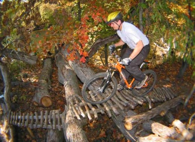
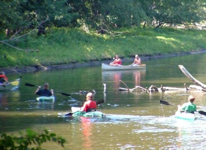
77 Figure 28. Burchfield Park/Riverbend Nature Area/McNamara Landing Source: Ingham County Parks - Burchfield Park Features & Activities INGHAM COUNTY Trails and Parks Comprehensive Report Draft January 27, 2016 Page 65


78 Hawk Island Park Address: 1601 E. Cavanaugh St., Lansing, MI Acreage: 100 acres Hawk Island Park, located in south Lansing, is the most recently developed County park built on a reclaimed gravel pit. It features a lake and natural wooded areas. The River Trail runs along the western edge of the lake and park. Hawk Island is centrally located between Burchfield and Lake Lansing County parks. Table 11. Hawk Island Park General Parking Swimming beach Bath house Splash pad Snack bar/concession stand 3 sand volleyball courts Cabana Shelter Picnic shelter - 50 people capacity Kestrel Shelter Picnic shelter - 60 people capacity Peregrine Shelter Picnic shelter people capacity Red Tail Shelter Picnic shelter people capacity Restrooms Indoor area Other Features Sledding Hill Dog Park Community built playground Pedal boat & rowboat rental Fishing docks Access to Lansing River Trail Fishing boardwalk Asphalt pathways 2 Sand volleyball courts Horseshoe pits Picnic area Maintenance Building Hawk Island Park Features & Activities Page 66 Draft January 27, 2016 INGHAM COUNTY Trails and Parks Comprehensive Report


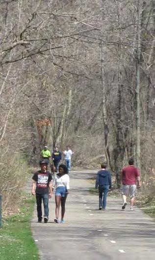
79 Figure 29. Hawk Island Park Source: Ingham County Parks - Hawk Island Park Features & Activities INGHAM COUNTY Trails and Parks Comprehensive Report Draft January 27, 2016 Page 67

80 Lake Lansing Boat Launch Address: 6271 East Lake Drive, Haslett, MI Acreage: 4 acres The Lake Lansing Boat Launch is the only existing public launch access to Lake Lansing. Table 12. Lake Lansing Boat Launch Facilities Parking Concrete boat launch Small dock Restrooms Drinking fountain Power boat washer Picnic area Large paved parking area Lake Lansing Boat Launch Lake Lansing Park North Address: 6260 East Lake Drive, Haslett, MI Acreage: 411 or 530 acres Lake Lansing Park -North includes a variety of ecosystems including mature oak and maple woodlands, marshlands, pine plantations and transitional field areas. Table 13. Lake Lansing North Main Shelter Parking Barrier free pathway from parking area Picnic shelter 120 people capacity Picnic area Tables and grill Drinking fountain Fire pits Oak Knoll Shelter Parking Barrier free pathway from parking area Picnic shelter - 60 people capacity Sand Hill Shelter Parking Barrier free pathway from parking area Picnic shelter - 60 people capacity Picnic area Tables and grills Softball field Other Features Nature trails with interpretive signs Observation deck Restrooms Playground Basketball court Sand volleyball court Cross-country ski rental Winter warming lodge Tables and grill Sand volleyball court Playground Restrooms Drinking fountain Horseshoe pits Sand volleyball court Boardwalks Page 68 Draft January 27, 2016 INGHAM COUNTY Trails and Parks Comprehensive Report


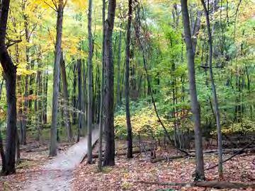
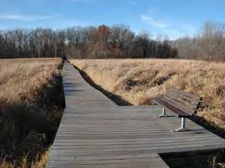
81 Figure 30. Lake Lansing North Source: Ingham County Parks and Recreation Master Plan - Lake Lansing Park North Features & Activities INGHAM COUNTY Trails and Parks Comprehensive Report Draft January 27, 2016 Page 69

82 Lake Lansing Park South Address: 1621 Pike Street, Haslett, MI Acreage: 30 acres Lake Lansing Park -South is located to the west of Lake Lansing in Haslett. The historic park was formerly the site of a popular amusement park. The old carousel building has been preserved and remains on location. The park is very popular during the warm months because of its sandy swimming beach. A community band shell hosts concerts which attract large crowds during summer months. Table 14. Lake Lansing South Large Parking Area Large parking area with overflow parking on grass area Maintenance building Beach Area Swimming beach Bathhouse Concession stand Lakeview Shelter Picnic shelter - 60 people capacity Sand volleyball court Main Shelter Picnic shelter people capacity Picnic area Barrier-free pathway to shelter Other Features Band shell Memorial garden Tricycle track Figure 31. Lake Lansing South Garden beds Pedal boat & rowboat rental Fishing dock Two sand volleyball courts Horseshoe pits Lights Wheel chairs Three sand volleyball courts Playground Inflatable and dunk tank rental Walkways and pedestrian entrance Source: Ingham County Parks - Page 70 Draft January 27, 2016 INGHAM COUNTY Trails and Parks Comprehensive Report


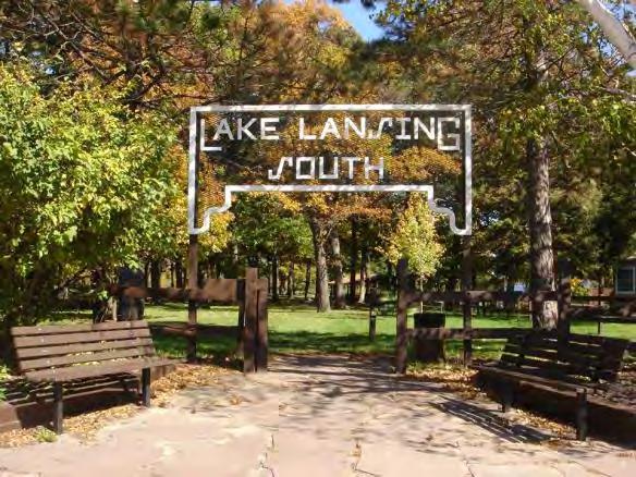
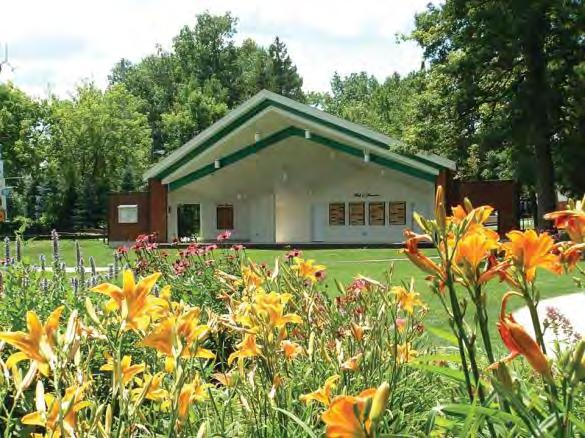
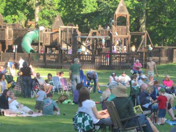
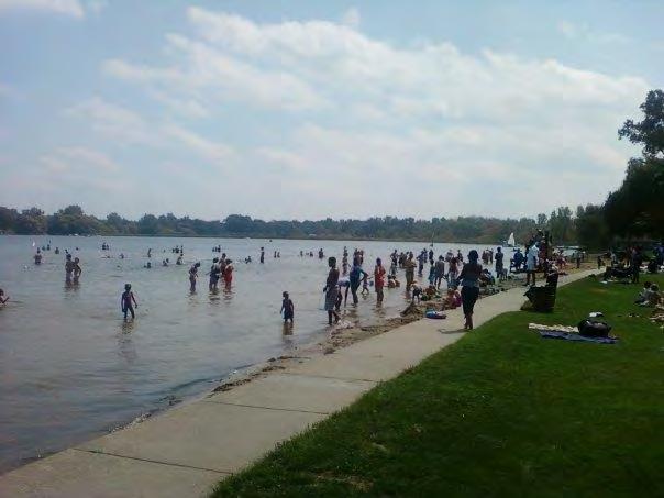
83 Lake Lansing Park South Features & Activities INGHAM COUNTY Trails and Parks Comprehensive Report Draft January 27, 2016 Page 71
84 Deferred County Park Projects The Ingham County Parks aging facilities, shelters, roadways, trails and features are part of a backlog of deferred maintenance and improvement projects that require funding. The Ingham County Parks has had to postpone a large amount of park upgrade projects that have been delayed over the years due to decreasing budget. Table 15 below presents the list of capital improvement projects, maintenance projects and equipment needs that is required to maintain the County Parks to high-quality standards. Table 15. Ingham County Park Deferred Projects Park Item Cost Items not funded in the 2016 Budget Request Capital Improvement Projects New/ Replace Priority Burchfield Table Saw $2,500 Replace High Burchfield Stone Chip Existing Paved Road $10,000 Replace High Lake Lansing South Carousel Building Roof $25,000 High Hawk Island Construct Pump House Building/Snow Hill $25,000 Replace High Hawk Island Red Tail Roof $20,000 Replace High Hawk Island Parking Lot Repair - Crack Seal $50,000 Replace High Hawk Island Boardwalk Sealer $10,000 Replace High Lake Lansing North Sand Hill Shelter Roof (Use funds from 2015) $4,000 Replace High Hawk Island Boardwalk Repairs $10,000 Replace High Hawk Island Bathroom Refurbishments $15,000 Replace High Burchfield Boardwalk Sealer $3,000 Replace High Burchfield Electrical Hand Dryers for Beach $3,500 Replace High Burchfield-McNamara Accessible Canoe/Kayak Launch (added 1/4/16) $100,000 New High All Parks Point of Sale System $150,000 New High Subtotal $428,000 Capital Improvement Equipment Burchfield John Deer Gator $15,000 Replace High Hawk Island Golf Cart $4,300 Replace High Burchfield Canoe Van $30,000 Replace High Subtotal $49,300 TOTAL Items not funded in the 2016 Budget Request $477,300 Items for Project Planning Budget Capital Improvement Projects Burchfield Accessible Loop Trail $150,000 New Medium Lake Lansing Accessible Loop Trail $150,000 New Medium All Parks ADA Beach / Swim Chairs (3) $6,000 New Medium Lake Lansing South Band Shell Roof $20,000 Replace Medium Hawk Island Beach Irrigation $10,000 New Medium Page 72 Draft January 27, 2016 INGHAM COUNTY Trails and Parks Comprehensive Report
85 Park Item Cost New/ Replace Priority Hawk Island Boardwalk Repair $5,000 Replace Medium Hawk Island Boardwalk Replacement $5,000 Replace Medium Burchfield Boat and equipment replacement $2,500 Replace Medium Hawk Island Boat Rental $5,000 Replace Medium Lake Lansing South Boat Rental Roof $4,000 Replace Medium Burchfield Construct ski rental building $26,000 New Medium Lake Lansing Chip & Seal Parking Lots $50,000 New Medium Hawk Island Construct Cabanas (2) $30,000 New Medium Burchfield Disc Golf Master Map $1,500 New Medium Hawk Island Dog Park Bridge $50,000 New Medium Lake Lansing North Dog Park Fence $60,000 New Medium Hawk Island Dog Park Sidewalk $15,000 New Medium Hawk Island Drinking Fountains $15,000 Replace Medium Lake Lansing Drinking Fountains $15,000 Replace Medium Burchfield Drinking Fountains $15,000 Replace Medium Lake Lansing South & $2,000 Medium North Gate House Roof Replace Hawk Island Gatehouse & Snow Lift Roof $2,000 Replace Medium Hawk Island Grills & Tables $6,000 Replace Medium Lake Lansing Grills & Tables $6,000 Replace Medium Burchfield Grills & Tables $6,000 Replace Medium Hawk Island Kayaks $4,000 Replace Medium Burchfield Canoes & Kayaks $6,000 Replace Medium Hawk Island Kestrel Roof $5,000 Replace Medium Burchfield Kiosk Sign at Winter Sports Building $1,000 Replace Medium Lake Lansing Lakefront Boardwalk/Gazebo $75,000 New Medium Lake Lansing South Lakeview Shelter Roof $5,000 Replace Medium Lake Lansing South Land Acquisition Match $60,000 New Medium Hawk Island Magic Carpet $150,000 New Medium Lake Lansing South Maintenance Building Roof $15,000 Replace Medium Burchfield MDOT road signage $2,000 New Medium Lake Lansing North Oak Knoll Shelter Roof $5,000 Replace Medium Hawk Island Path Sealcoat $8,500 Replace Medium Hawk Island Path-Concessions to Trail $10,000 New Medium Hawk Island Pathway Sealcoat $10,000 Replace Medium Burchfield Pave/Chip Seal Parking/Roadway $100,000 New Medium Pedal Boat Dock + Kayak/Canoe Accessible (cost Replace / Lake Lansing South $100,000 Medium increased $45K with kayak/canoe) NEW Lake Lansing Row Boats $3,000 Replace Medium INGHAM COUNTY Trails and Parks Comprehensive Report Draft January 27, 2016 Page 73
86 Park Item Cost New/ Replace Priority Hawk Island Row Boats $3,000 Replace Medium Burchfield Pedal boats (4) $10,000 Replace Medium Hawk Island Pedal Boats (4) $10,000 Replace Medium Lake Lansing Pedal Boats (4) $10,000 Replace Medium Hawk Island Peregrine Roof $10,000 Replace Medium Burchfield Pine Knoll Roof $5,000 Replace Medium Hawk Island Restroom Stall Dividers $20,000 Replace Medium Hawk Island River Overlook Dock $5,000 New Medium Burchfield Road Gravel $10,000 Replace Medium Lake Lansing Road Gravel $10,000 Replace Medium Lake Lansing Snell Restroom Roof $6,000 Replace Medium Hawk Island Snow Tubes $8,000 Replace Medium Burchfield Snow Tubes - 25 $3,000 Replace Medium Burchfield South Ridge Shelter Roof $5,000 Replace Medium Hawk Island Splash Pad - Pump & Features $5,000 Replace Medium Hawk Island Splash Pad Filter & Pump $12,000 Replace Medium Hawk Island Stamped Kiosk Concrete $3,000 Replace Medium Lake Lansing North Trail Boardwalk $50,000 Replace Medium Burchfield Winter Sport Building Roof $20,000 Replace Medium Subtotal $1,421,500 Capital Improvement Equipment All Parks Back Hoe $110,000 New Medium Lake Lansing Blower $7,500 New Medium Lake Lansing Dodge Pick Up #676 $30,000 Replace Medium Hawk Island Dump Truck - Replace w/pick up $45,000 Replace Medium Hawk Island Exmark $16,000 Replace Medium Hawk Island Exmark $16,000 Replace Medium Lake Lansing Exmark #595 $16,000 Replace Medium Burchfield Exmark #696 $16,000 Replace Medium Hawk Island Exmark 798 $16,000 Replace Medium Burchfield GMC Pick Up #670 $30,000 Replace Medium Hawk Island GMC Pick Up #776 $30,000 Replace Medium Lake Lansing GMC Pick Up #571 (Dump) $45,000 Replace Medium Lake Lansing GMC Pick Up #572 $30,000 Replace Medium Burchfield GMC Pick Up Mechanic #673 $30,000 Replace Medium Burchfield Golf Cart $5,000 New Medium Hawk Island Golf Cart (2) $10,000 Replace Medium Page 74 Draft January 27, 2016 INGHAM COUNTY Trails and Parks Comprehensive Report
87 Park Item Cost New/ Replace Priority Burchfield JD 4310 #693 $40,000 Replace Medium Lake Lansing JD 4720 #590 $50,000 Replace Medium Hawk Island JD 4720 w/ bucket $50,000 Replace Medium Hawk Island JD3320 w/broom $40,000 Replace Medium Lake Lansing John Deer Gator #K2 $18,000 Replace Medium Hawk Island Mechanic Truck $35,000 Replace Medium Hawk Island Pick up 773 $24,000 Replace Medium Hawk Island Portable Power Washer $6,200 Replace Medium Burchfield Scag #799 $15,000 Replace Medium Hawk Island Sign Machine $7,000 Replace Medium Lake Lansing Skag #598 $16,000 Replace Medium All Parks Skid Steer + Attachments $85,000 New Medium Hawk Island Snow Brush $4,000 Replace Medium Hawk Island Snow Thrower $4,000 Replace Medium Burchfield Snowmobile $10,000 Replace Medium All Parks Wood Chipper $40,000 New Medium Hawk Island York Rake $1,800 Replace Medium Subtotal $898,500 TOTAL $2,320,000 GRAND TOTAL $2,797,300 High Priority: Projects not funded in 2016 budget Medium Priority: Projects for 2017 to 2021 period as determined by the Parks and Recreation Master Plan. INGHAM COUNTY Trails and Parks Comprehensive Report Draft January 27, 2016 Page 75
88

89 P U B L I C P A R T I C I P A T I O N The project process included multiple forums for community involvement. Public input was received through six public meetings, an online survey, a project website and a stakeholder meeting including local community staff. In addition, four public meetings took place with the Trails and Parks Task Force. A total of more than 550 people participated in the project effort. This level of involvement is outstanding for a County of Ingham s size. P R O J E C T W E B S I T E An Ingham County Regional Trails and Parks web page was established on the Michigan Trails and Greenways Alliance website, with links to it prominently displayed on the Ingham County Parks and Recreation website and social media sites. Details were posted about the public input forums, the online survey, the Ingham County Regional Trails and Parks Task Force meetings, as well as the general scope and timeline of the project. Meeting handouts, meeting minutes, and presentations were posted as well. A sign-up form for information updates was also offered as a link from the site. reminders about the public input forums and the online survey were sent to all who signed up on this list. INGHAM COUNTY Trails and Parks Comprehensive Report Draft January 27, 2016 Page 77

90 P U B L I C M E E T I N G S A N D O N L I N E S U R V E Y The public was invited to attend six public meetings held in October and November Four were held in the densely populated areas of North Lansing, South Lansing/Delhi Township, East Lansing, and Meridian Township, and two were held in the more rural areas of Williamston/Webberville and Mason/Leslie/ Dansville/Stockbridge. Meridian Township Public Meeting Notices were published in the Lansing State Journal, and posted on the MTGA and Ingham County websites and at all the venues where the meetings were held. invitations were sent to the Mid-Michigan Active Transportation Coalition, which includes the members of the Lansing Walk/Bike Task Force and the Tri-County Bicycle Association and others interested in regional bicycle/pedestrian issues. The Tri-County Regional Planning Commission sent the meeting flyer out to all past participants in the Mid-Michigan Program for Sustainability and Greening Mid-Michigan. Over 500 flyers were distributed throughout the County. Ingham County Parks sent the meeting flyer out to their lists, including all public officials, the Heart of Michigan Partnership, citizens interested in parks and trails issues and other community stakeholders. Moreover, meeting flyers were hand-delivered to all meeting venues, the Power of We Consortium and the County Road Department. Press releases about the meetings were sent to all local news media. There was a total of 196 attendees who participated in the meetings. An list of all attendees has been provided to the County for future communication about regional trails and parks issues. The following categories of high quality regional trails and parks systems were used to jumpstart discussion on what comprises a high quality regional trails and parks system: Well Connected, Well Designed, Well Maintained, Easy and Convenient to Use, Safe to Use, and Well Planned and Promoted. Audience feedback over the course of the six meetings resulted in a cumulative list of over 50 characteristics. Participants were asked to select and rank their top ten preferences for millage priority expenditures. The second activity was to vote on their top three new trail projects as part of their review of a draft regional trail system map. The map highlighted potential priority trails from recent regional nonmotorized trails planning efforts and local master plans, but the exercise allowed for selection of any desired trail connection in the County. Key findings from the public meetings are presented in Table 16 and 17 with additional comments or suggestions provided in the Appendix. Between November 19 and December 4, 2015, Ingham County residents were invited to register their input through an online survey made available on the project website. County staff worked diligently in soliciting input from residents and the survey was advertised in the local news media and through Page 78 Draft January 27, 2016 INGHAM COUNTY Trails and Parks Comprehensive Report
91 notification to the same lists mentioned previously. Participants from the public input meetings were also invited by to share the opportunity with others who were not able to attend the meetings. The online survey mirrored the public meetings. More than 339 surveys and comments were received and tabulated. Key findings from the surveys are outlined along with the public meeting responses in Table 16 and 17. A complete tally of the comments or suggestions gathered is attached in the Appendix. Table 16. Preferred Millage Expenditure Suggestions for Millage Expenditures South Lansing/ Delhi Township Meridian Township East Lansing North Lansing Mason/Leslie/ Dansville/Stockbridge Williamston/ Webberville # Times Selected as Top 10 Priority All Meetings Online Survey Total Well Connected Construction of local trail gap priorities to local destinations (including local parks) Construction of regional trail arteries to regional destinations and adjacent counties Connection of trails from county and local parks to existing trail system Construction of trails within existing county and local parks Property acquisition to enable trail development Connection of trails into a looped trail system Integration with on-road non-motorized facilities Well Designed All off-road trails are of consistent design across jurisdictions and in conformance with federal standards (AASHTO, ADA) (Avoid sharp turns) Preservation, interpretation and enhancement of natural settings Year-round seasonal use (e.g., cross-country skiing) Durable & safe design (e.g., pre-construction measures to ensure drainage or removal of invasive species) Provision of a variety of trail types in county parks (e.g., paved, limestone, nature, etc.) Recreation and commuting trail uses linking neighborhoods, public parks and places of employment are considered in trail routing and design Offering areas that are kids welcoming and friendly Capitalize on Place-making/Trail Town opportunities in designing trails INGHAM COUNTY Trails and Parks Comprehensive Report Draft January 27, 2016 Page 79
92 Suggestions for Millage Expenditures South Lansing/ Delhi Township Meridian Township East Lansing North Lansing Mason/Leslie/ Dansville/Stockbridge Williamston/ Webberville # Times Selected as Top 10 Priority All Meetings Online Survey Total Well Maintained Long term trail maintenance (e.g., crack-sealing, surface repair, invasive species and dead tree removal, bridge maintenance, etc.) Rehabilitation of trails where needed (total surface replacement and upgrade of trail segments) Routine trail maintenance (i.e., mowing, trimming, leaf/debris blowing, edging, light replacement, amenity and restroom upkeep etc.) Improvement of water quality of rivers for water trail use Opening of waterways for water trails (clearing log jams, debris, etc.) Helping start up and operate volunteer adopt-atrail programs and/or non-profit organization to coordinate maintenance Addressing maintenance that has been deferred in existing county parks Snowplowing of trails in winter Countywide standards for maintenance, and requirement for maintenance schedule and budget with all trail development budgets Take care of what you have before building new ones Help maintain existing local parks in rural/smaller communities Easy and Convenient to Use Construction of trailhead parking lots and trail user amenities (e.g., benches, bike racks, pet waste bag dispenser, drinking water, map, etc.) Construction of restroom facilities Development of a way finding signage (e.g., 5 miles to MSU, street signs, rules, etc.) Installation of gateways (inviting entry points with plantings, sculpture, signage, etc.) Development of safe and convenient kayak/canoe launch sites (some ADA compliant) Access to transit stations or shuttle service Construction of trailside plazas or places for people interaction (e.g., pocket parks, overlooks) Enable accessibility for trail users of all ages and abilities Page 80 Draft January 27, 2016 INGHAM COUNTY Trails and Parks Comprehensive Report
93 Suggestions for Millage Expenditures South Lansing/ Delhi Township Meridian Township East Lansing North Lansing Mason/Leslie/ Dansville/Stockbridge Williamston/ Webberville # Times Selected as Top 10 Priority All Meetings Development/implementation of a bike share program Provision of places to camp Safe to Use Improvements to trail/road crossings including education of motorists Installation of lighting where needed (consider solar lighting) Installation of emergency call stations Support of visible law enforcement Establishment of consistent rules/policies (addressing user conflicts such as horses & dogs, trail etiquette and hours of opening) Guidance and equipment for emergency responder access Separate users (i.e., bicyclists, walkers, etc.) in high use areas Well Planned and Promoted Online Survey Total Development of online trail maps, navigation and guide, event calendar Development of a report-a-problem online system Support of advocacy, seed money and information resources for trail planning Preparation of promotional materials using traditional media (e.g., brochures, newsletters, etc.) Encouragement of events and programs promoting fun Support of collaborative partnerships with schools, universities, colleges, corporations, small businesses and others Leveraging millage funds with other state, federal and private grant programs or initiatives Assistance for a trail user count study (coordinate with CATA) Establishment of recognition signage/plaque for countywide millage and other fund participation Establishment of a rainy-day fund * Dashes indicate that the topic had not been introduced yet into the discussion. This was a cumulative process through the course of the six public meetings. Red numbers represent the top 3 preferences per column. INGHAM COUNTY Trails and Parks Comprehensive Report Draft January 27, 2016 Page 81
94 Table 17. New Trail Preferences New Trail Preferences Highlighted Corridor* South Lansing/Delhi Township MSU to Lake Lansing Parks M Holt to Mason J Lansing River Trail North Extension P Lansing River Trail South Extension Q Lansing River Trail to Northern Tier Trail N Lansing River Trail to Clinton County O Red Cedar Water Trail R RAM Trail to Burchfield Park H Grand River Water Trail S Hayhoe Trail to Vevay Twp. Hall C Holt RAM Trail Extension East I Meridian Township to Webberville K North-South artery along Onondaga Rd. D Mason west to Eaton County G Southwest connector to Eaton and Jackson counties Meridian Township East Lansing North Lansing Mason/Leslie/Dansville/Stockbridge Williamston/Webberville Total Online Survey Combined Total A Mason East to M-52 F M-52 connection -Stockbridge to Webberville E Bellevue Rd. Connection -Leslie to Eaton County B M-52 connection -Webberville to Shiawassee County * The highlighted corridors are shown on Figure 32. L Page 82 Draft January 27, 2016 INGHAM COUNTY Trails and Parks Comprehensive Report

95 Figure 32. New Trail Preferences Map for Public Input Note: Refer to Table 17 for the highlighted corridor descriptions and preferences INGHAM COUNTY Trails and Parks Comprehensive Report Draft January 27, 2016 Page 83
96 Additional Trail Preferences: 8 votes: Mason to Ingham Conservation District to Dansville Game Area. 7 votes: Utility Easement connection from Meridian Township to Williamston. Fenner Nature Center to Lansing River Trail. 3 votes: Bike Trail along Red Cedar River. Connect Westside Park to Dunneback Park and to bike lane along Saginaw. 2 votes: Complete loop from Hawk Island Park from Jolly to Mt. Hope. Connect Hawk Island Park to Meridian Off-Road Pathway. Connect to Trapper s Cove from trail along Dunckel and Cavanagh. Mason along US 127 to MSU. Meridian Township to Williamston along Railroad. Williamston Loop bike trail. 1 vote: Along Grand River to Hawk Valley Sanctuary. Complete loop along Waverly Rd. from Lansing River Trail to South Lansing Pathway. Northern Tier Trail to Meridian Township. Connect Red Cedar Park development to Amtrak station. Meridian Interurban Parkway connection under Marsh Rd. to shopping center on east. Lansing River Trail gap closure on Moores River Drive to Frances Park. MSU to Northern Tier Trail along Abbot. RAM Trail Connection to South Lansing (Waverly and Jolly). Utility easement connector from Cedar Street to Grovenburg Road. Trail along north side of Red Cedar River in Williamston. Connect Burchfield County Park to Howe Memorial in Eaton County. Trail along Waverly Road from Mt. Hope to Grand River Avenue. Old Oakland Neighborhood Trail along railroad to Westside Park and south to River Trail. Complete Lansing River Trail on both sides of river. Figure 33. Public Input Participants and County Population Public Meetings Online Survey County Population 7% 4% 35% 31% 24% Urban Suburban Rural Staff/Officials Outside County 7% 4% 12% 10% 67% Urban Suburban Rural Skipped Outside County 23% 19% 58% Urban Suburban Rural Urban = Lansing, East Lansing and Lansing Township Suburban = Meridian Township and Delhi Township Rural = Williamston, Webberville, Mason, Dansville, Leslie, Stockbridge and the townships in rural areas Page 84 Draft January 27, 2016 INGHAM COUNTY Trails and Parks Comprehensive Report
97 Summary of Public Input Findings Maintenance The tallies from the public meetings and the online survey results as well as the additional public comments received at both revealed similar top preferences for millage expenditures. People put a top priority on preserving and rehabilitating the existing assets that we have and doing the necessary longterm maintenance to keep them in a safe, usable condition and attractive. Routine maintenance, while scoring relatively high on the overall chart, was expressed frequently, during the discussions, to be the role of the trail owner. Adopt-a-trail programs were mentioned as a way to incorporate partnerships with the public to assist in this ongoing task, thereby lessening the burden on local government budgets while improving the level of upkeep and ongoing vigilance over trail conditions. Integration with the Non-Motorized System An important priority expressed overall was to make the region-wide system as much about transportation as recreation. People emphasized that new trail development as well as connections to the trails via sidewalks or bike-lanes be planned in conjunction with one another so that commuting to school, shopping, work, and other transportation-related destinations can be made safer and easier. Such an emphasis would also encourage more use of the trails for this purpose, which is an important health consideration. Wayfinding and Information Resources Another frequently mentioned item to increase safety, ease and convenience of using the trails for all purposes was the development of a region-wide wayfinding system, including mileage markers, directional signage, and identification of nearby trail user services. Such a system would help to brand all of Ingham County s trails into a consolidated network, and improve prominence of the overall system thereby attracting visitors from outside the County. Of equal importance was the provision of online information in the way of online navigation, and a countywide calendar to draw attention to events happening on the trail system. New Trail Development The input received favored first, the continued development of regional trail arteries, those longer distance trails that cross more than one jurisdiction and form the spine of the region-wide system. Second, along the theme of improving the assets we already have, many were in favor of connecting the County s Parks, including the natural surfaced trails into the paved multi-use trail system. Third, people wanted to see the continued connections in their local trails that would take them to local destinations, such as downtowns, parks, schools and between neighborhoods. The Red Cedar Water Trail ranked quite high in public priorities mentioned, and quite a bit of open discussion at the meetings revolved around this opportunity. It was also mentioned that the Michigan Department of Natural Resources is currently involved in a statewide effort to transform all of the Grand River into an official water trail. Improvements along these two waterways would add exciting new recreational potential to the County. Many participants wanted to see Ingham County develop some official water trails, in much the same way that other communities across Michigan are doing. This would involve the development of additional and improved launch sites for kayak, canoes and other small watercraft, as well as the opening of waterways that are choked with logjams and other debris. It is thought the development of an adopt-a-trail program would help in this regard as well. INGHAM COUNTY Trails and Parks Comprehensive Report Draft January 27, 2016 Page 85
98 S T A K E H O L D E R I N P U T Early in 2015, Ingham County began to receive letters and s outlining possible projects for millage funding from local communities and other community stakeholders. In addition, as part of the current work planning process, a stakeholder meeting was conducted to receive input from local communities, stakeholders and other concerned agencies. This section presents this information. Table 18 describes the suggested projects which were transmitted by and mail to Ingham County Parks prior to March Quantities and costs were included when provided. Table 18. List of Suggested Projects Community/ Location Project McCormick Park: New bridge across river Repair & upgrade to kayak/canoe launch Replace existing boardwalk with paved trail Williamston Tbd Acquire easements and build a trail along the west side of the River Williamston Tbd Repair of bridge leading to School Williamston Tbd Build new trail in Memorial Park Williamston Tbd Provide trail connection at High Street Williamston Tbd Connect north side trail from refuge to pedestrian bridge Williamston Tbd Implement Grand River Avenue road diet Williamston Tbd New trails on the Williamston TIFA property Williamston Tbd New trail to connect Meridian Township with the City of Williamston Williamstown Twp. Tbd Extend shared-use trail from MSU to Lake Lansing North Meridian Twp. Phase 1 - Grand River Ave to Marsh Road including boardwalk in Central park south of Okemos Road Meridian Twp. 10,400 LF $ 1,200,000 Phase 2 - Grand River Ave. to Hagadorn Road along RR ROW and Red Cedar River Meridian Twp. 4,300 LF $ 1,049,000 Phase 3 - End of Namoki Trail along RR ROW to Lake Lansing North County Park Meridian Twp. 10,000 LF $ 3,320,000 Total MSU to Lake Lansing North Park Meridian Twp. $ 5,569,000 New pathway along BL-69 from East Lansing to Bath Township Meridian Twp. 12,700 LF $ 700,000 Provide pedestrian crossing light at the intersection of the Interurban Trail with Okemos Road Meridian Twp. Lump Sum $ 35,000 New pathway along the Smith Drain with connection to Sanctuary development Meridian Twp LF $ 820,000 Meridian Riverfront trail within Sylvan Glen Preserve, Legg Park, Harris Nature Center & East gate Park Meridian Twp. 9,500 LF $ 1,100,000 Red Cedar Water Trail (+ materials from Backdoor LLC) Meridian & Williamstown Twp. $ 30,000 Pavement and bridge repair along Northern Tier Trail East Lansing Tbd Bridge replacement under Oakland Avenue Lansing $ 525,000 Quantity Cost Subtotal Cost Page 86 Draft January 27, 2016 INGHAM COUNTY Trails and Parks Comprehensive Report
99 Project Community/ Location Replace access stairs north & south sides of Michigan Avenue Lansing $ 200,000 Expand Maguire Park parking lot Lansing $ 150,000 Replace bridge under Grand River Avenue Lansing $ 400,000 Pavement and boardwalk repairs in area east of Potter Zoo towards Clippert/Crego Lansing $ 110,000 Replace gabion basket retaining walls in GM Plant area Lansing $ 310,000 Replace planks on bridge over river by Moores Park Lansing Tbd Extend River Trail to Tecumseh Park Lansing $ 550,000 Extend trail for Moores Park to Riverside Park (Not associated with Act 51 funding) Lansing $ 138,000 Replace boardwalks - entire system Lansing $ 125,000 Stairs and retaining wall at Dietrich Park Lansing $ 100,000 Asphalt repairs Lansing $ 200,000 Dietrich parking lot repairs Lansing $ 85,000 Signage along connecting sections of countywide trails network Lansing $ 200,000 Design & cost for Bear Lake Pathway to River Trail (Not associated with Act 51 funding) Lansing $ 115,000 Design & cost for Forest Akers Pathway to River Trail (Not associated with Act 51 funding) Lansing $ 125,000 Link Fenner Nature Center to River Trail at Mount Hope, Aurelius and Crego Park Lansing $ 400,000 Construct Cavanaugh to Spartan Village pathway Lansing 2.25 miles $ 870,000 Tree removal along River Trail Lansing $ 20,000 Annual Maintenance 3 years Lansing $ 425,000 FLRT's gateway projects at entrances to River Trail Lansing Tbd Raise boardwalk to alleviate flooding issues between Aurelius Road and bridge to the west Lansing Tbd Extend multi-purpose trail from end of Sycamore Trail to Mason Trail (cost includes easement acquisition, design/engineering & construction oversight) Delhi Twp. $ 4,200,000 Extend Ram Trail to Burchfield County Park Delhi Twp. $ 1,500,000 Extend Hayhoe Trail to Vevay Township Hall along Road Vevay Twp. Tbd Link to Stockbridge connector Stockbridge Tbd Wayfinding Signs (Tri-County Bicycle Association) - Tbd Quantity Cost Subtotal Cost INGHAM COUNTY Trails and Parks Comprehensive Report Draft January 27, 2016 Page 87
100 Stakeholder Meeting A stakeholder meeting took place on November 18, 2015 to seek input from community stakeholders as well as federal, state, regional and county agencies including MDOT, Ingham County Road Department and Tri-County Planning. Participants were asked the following three questions: Does the countywide regional trails and parks network map accurately depict the preferred regional trail network? Does it depict accurately the local existing and proposed non-motorized facilities? Do you have any thoughts, concerns and suggestions on potential regional projects? Regional Network The following comments related to the regional trails network were made: Invest in this system as a regional asset, an economic tool, sense of place, which connects regional parks and communities. The majority of funding should be devoted to developing a regional network - routine maintenance should be a lower priority. Rehabilitation/renovation and repairs/corrections should be addressed. Develop a mechanism to connect and prioritize how to connect additional segments to the existing network. Connectivity is an important issue. Equitable funding across all communities is very important - clearly, the Lansing River Trail is the backbone, but funding needs to be equitable, so that smaller communities can get funding to meet their needs. We should look at some of the smaller communities that need help with their parks; have options for small communities, create opportunities to obtain funds such as trail planning. A way to benefit the out-county residents is to encourage them to use the trails. Many of these people already use the trails, travel to them right now and benefit from the trails even if they are not directly connected to them. Some townships do benefit from what is being done here and do know they benefit from this. Maybe there is an opportunity to create regional trail hubs with public parking available to attract out-county areas to the trail system. What trail projects are close to being ready? Along 127, near MSU bear lake property, likely 2018 before completed. This stretch is known as the Bear Lake Pathway and Forrest Acres Pathway (south of Forest Akers). To make an immediate impact seems like a reconstruction of an existing structure would be quickest. The connection from the Ram Trail to Burchfield Park is virtually easement free being within the public school property or the road commission right-of-way, with no boardwalks, no wetlands, it is fairly flat. The regional segment from Nancy Moore Park to MSU is very ready and mostly on Township property. Also, the trail along Okemos Rd. near Gaylord C. Court is close to, if not already project ready. The Northwest extension of the Lansing River Trail is not shovel ready. The Red Cedar River as a water trail would be a good project, making it accessible via the Page 88 Draft January 27, 2016 INGHAM COUNTY Trails and Parks Comprehensive Report
101 MDOT rest area at Meridian Road. There are a lot of local residents who take it upon themselves to help with clearing the river. Williamstown Township and the City of Williamston are meeting next week to discuss water and land trails. Money could be used countywide for maps, signage and where/how to access parks already on the system that could have an immediate impact Use millage funds for a bike rental program. Will maintenance be considered with the funding? Maintenance needs should be part of the Ingham County Trail System. Also, does invasive species management along the trails fit in? Funding Information Valuable information regarding funding strategies was also discussed: The Tri-County Regional Planning Commission (TCRPC) is preparing a regional plan and we need to discuss how we combine separate county plans into a regional system the planning Ingham is doing now will be beneficial to our planning. Tri-County has some Transportation Alternative Program (TAP) funds to administer as a Metropolitan Planning Organization (MPO) and MDOT has the other portion of the TAP funding. Any trail corridor the MDOT University Region considers regional is a higher priority for grant funds. The Federal TAP can support 6-8 grants a year in the Tri-County area. Average grant is $340,000 with a percent match. If a community has never received funding, their match requirement is 20 percent. Millage funds can potentially be used for the match. The area self-selects its own projects, but nothing prevents more than one project at a time. The County Road Department is the legal applicant for Townships. MDNR Michigan Department of Natural Resources Trust Fund (MNRTF) and MDOT s TAP funds can be combined and count for match either way. A difference is the design standards. The state uses universal standards and MDOT uses AASHTO design standards. Application schedule: MDOT s TAP: anytime, MPO (Tri-County) s TAP: once a year, MNRTF: once yearly. TAP/MNRTF funded trails in the area include: The Sycamore Trail, the Moores River Drive Trail extended the River Trail west and the South Lansing Pathway. Both of these exceeded $1 million they were the bigger ones. The Trust Fund has a cap of $300,000 for development projects; acquisition projects have no dollar limits. Because of timing you should apply for MDOT first and then to the Trust Fund, who accept grants only once a year. Even with this scenario, you are looking at least at 3 years by the time the grant is awarded, the state legislature okays the appropriation and the project is built. (Sycamore trail started planning in and was completed this year- it was a complicated trail) MDOT s TAP does not pay for engineering design, but the MDNR Natural Resources Trust Fund grant does. TAP is prohibited from maintenance within the design line; however, rehabilitation is acceptable if you can show that the lifetime has been exceeded (15-20 years), via pictures and proof and then it can be considered. If you are talking about rehabilitation, the new construction will have to be brought up to new federal standards and specifications (bridge loading standard is now 10 tons). The point is that INGHAM COUNTY Trails and Parks Comprehensive Report Draft January 27, 2016 Page 89
102 some of your projects would not be eligible. MDOT prioritizes complete streets projects over others. Maybe smaller/rural communities should be asked to adopt complete streets policies/resolutions in order to receive funding. In order to get TAP funding, the trail surface must be paved or limestone. Federal funds are not available for water trails. Wayfinding is eligible under the MDOT program. Emergency responders need access ability and have asked for mileage markers and wayfinding. They have trouble finding people, as GPS doesn t work well when you are not near a road, it can be ¼ to ½ mile off. New projects require signage and we are doing standalone wayfinding projects, but you ll want to do a large-scale project over $50,000. You can sign a shopping district, but not a specific business. Bollards are not disallowed, but not likely funded as they are being discouraged. Bollards cause accidents and the State Police have asked us to remove them. If a trail is coming to a road put a C-shape at the end of the trail; it will slow bicycles and will not appear to be a road (Has to be large enough to allow ambulances in). Counters are not allowed. TAP funds can be used to rehab older trails and remove bollards. Crash data would be helpful to justify need. The County Road Department maintains paved shoulders, not off-the-road side trails. Paved shoulders are eligible for TAP if on the regional trails system Trust Fund would not be eligible. All road funds can be used for paved shoulders, but you have no more dollars, however, shoulders are cheap compared to having to build separate trails. If you are looking for TAP funding and wanting to call it your corridor, a paved shoulder is the correct way, not a separate pathway, but the shoulder is not a static number of feet. The width varies based on speeds and traffic volume. That might be a reason to move from a busier road to a less busy one. Page 90 Draft January 27, 2016 INGHAM COUNTY Trails and Parks Comprehensive Report

103 I S S U E S & T H E M E S The following discussion synthesizes the trails and parks system issues and needs. It brings together all factors considered in the previous sections of this report which include the planning context, existing conditions, best practices, public and stakeholder input. The diagram below illustrates all the factors considered to frame the trails issues and needs. A summary of the trails and parks system themes follow. Existing Conditions + Assessment Best Practices Public Demand Planning Context Regional Trails and Parks System Themes Stakeholder Input Theme 1: Trail Rehabilitation and Ongoing Trail Improvement The upgrade of the existing, aging trails is recognized as a priority for the countywide system to retain its high quality status. This entails ensuring that the existing trail infrastructure such as bridges are safe, functional and meet current standards. This would also include replacing and upgrading aging trail facilities and amenities, removing barriers to universal access, refurbishing trailhead parking and trail surfaces and general trail stewardship. Take care of the existing, aging regional trail infrastructure by investing strategically in its repairs, rehabilitation and reconstruction. This would apply to bridges and pavement. Improve existing trailheads with upgrading trail amenities and providing for parking expansion as needed. Establish seed funding for an endowment for long-term trail maintenance that can be provided annually for trail preservation activities. INGHAM COUNTY Trails and Parks Comprehensive Report Draft January 27, 2016 Page 91


104 Theme 2: New Trail Development The continued development of connections and trails to form a regional, countywide, interconnected trails network linking parks, community facilities, schools and neighborhoods is recognized as a priority for the County. This would include development of new trails to establish the regional network and connect the County s local communities. Focus on establishing a regional network an interconnected regional system of trails to facilitate pedestrian and bicycle transportation throughout the County and provide Sycamore Trail connection to regional parks and other regional destinations. The key trail gaps identified for the Ingham County regional system include: Michigan State University to Lake Lansing Parks, Delhi Township to Mason; and River Trail north and south extensions towards Eaton County. Provide connections to places of employments and commercial areas. Ensure the regional network is connected to the community s non-motorized network allowing connections to the regional system from neighborhoods and other local destinations. Allow for completion of local trail priorities identified within communities' plans. Allow new non-motorized connections in areas of the County currently underserved in terms of non-motorized accommodations. Develop regional water trails along the Red Cedar and Grand rivers. Theme 3: Regional Identity and Sense of Place Enhance the public s awareness of the regional trail system and cultivate a sense of regional identity and place exploring how the trails connect with the natural environment, art, culture, and other aspects to enhance the trail user experience. Encourage projects that bring Mural in Old Town communities together such as the construction of regional hubs or trailheads in Vevay Township, Webberville/Williamston and other locations. Develop a unique wayfinding system for the regional trail system. Foster and encourage Place-making and Trail Town improvements. Promote the installation of trail features celebrating art and culture. Encourage events and programs promoting fun. Establish of recognition signage/plaque for the countywide millage fund. Page 92 Draft January 27, 2016 INGHAM COUNTY Trails and Parks Comprehensive Report
 in Ingham County")
105 Theme 4: Partnerships and Collaboration Trails and parks resources in Ingham County are operated and provided by a variety of public and private entities. Continued collaborations and partnerships with the various public and private recreation providers (state, county, schools, local communities, non-profit and other organizations) in Ingham County will maximize the region s trail potential. Encourage partnerships among local Trail Maintenance by Volunteers municipalities for trail access and projects of a regional significance. Provide start-up seed funding for establishment of a citizen group aimed at trail maintenance, programs, or other special projects. Partner with local, regional and state trail and greenway advocacy groups, such as the Friends of the Lakelands Trail, Friends of the Lansing River Trail and the Iron Belle Trail, the Heart of Michigan Trails Partnership and the Tri-County Bicycle Association to educate the public and promote projects and programs. Partner with interested corporations who want to provide value to the regional trails and parks network, in terms of funding, promotion, programs, maintenance or other. Theme 4: Funding Opportunities A quality trails and parks system is dependent on the prudent use of available millage funds. Leveraging millage funds through grant programs or other sources of funding is essential to offset the cost of capital investment. Leverage dollars through grant programs for new construction as well as re-construction projects. Leverage in-kind materials and labor where acceptable as grant match or to accomplish nongrant funded projects. Investigate unique and atypical opportunities for grants or donations from local, state or national funding sources. Collaborate with local advocacy groups to fundraise for maintenance and for trails and parks development projects. INGHAM COUNTY Trails and Parks Comprehensive Report Draft January 27, 2016 Page 93
106
107 M I L L A G E A L L O C A T I O N + C R I T E R I A F O R Local Community Millages P R O J E C T E V A L U A T I O N Voters spoke volumes when they approved the new millage to support the development of a countywide regional trails and parks system in November The 0.5 mill levy will raise an estimated $3.5 million per year through C O U N T Y W I D E M I L L A G E F U N D I N G I N M I C H I G A N As part of this work effort, research was conducted to gain an understanding of how other regional or county millage funds are spent and distributed as well as the process by which this is accomplished. Since there are no other countywide millages focusing solely on trails in Michigan, countywide millages for parks and recreation were examined. Each of the departments Parks Directors or senior staff members was contacted and interviewed for information. Table 19 details this information. Highlights of the millages include: Of the 12 counties interviewed, funds collected range from $20,000 to $11,567,251. The millage accounts for 45 to 100 percent of the departments yearly budget. Most Michigan countywide parks and recreation millage funds support park and trail land acquisition, development, operations and maintenance of parks and recreation. The majority of the counties (9 out of 12) spend their funds for the county parks and regional trail system they own and operate with no fund distribution to local communities. Decisions about project priorities are set through the five-year parks and recreation planning process or the yearly budgetary process. Charlevoix County, St. Clair County and Wayne County distribute some portion of the millage funds to local communities. Washtenaw County also did in the past with the Connecting Communities program from 2010 through Details of these initiatives and programs are provided on the next page. In Ingham County, both the City of Lansing and Meridian Township have millages for funding parks and recreation or pathways as follows: The City of Lansing has a 1 mill tax levy to support the City's parks and recreation operations (maintenance is accomplished by the Public Works Department). This generates approximately $1,900,000 yearly and represents 22% of the City s Parks and Recreation annual budget ($8,600,000). Projects are selected based on the Parks and Recreation Master Plan. Meridian Township will have a 1 mill parks millage in 2016 to support park land acquisition, development, operations and maintenance. This will generate approximately $1,600,000 and represent 89% of the Township s Parks and Recreation annual budget ($1,800,000). Projects are selected based on the Parks and Recreation Master Plan. Meridian Township also has a mill pathway millage to support easement acquisition, development and maintenance of pedestrian/bicycle pathways. Projects are selected based on staff recommendations and Board approval. INGHAM COUNTY Trails and Parks Comprehensive Report Draft January 27, 2016 Page 95
108 Millage Distribution Process The process and procedures by which millage funds are distributed to local communities in Charlevoix, St. Clair, Wayne and Washtenaw Counties are described below. Charlevoix County Each year, Charlevoix County municipalities are eligible to apply for the Charlevoix County Parks Millage Fund appropriation during the first month of the year. The millage generates about $300,000 annually and a third, or $50,000, is distributed to local municipalities. The park or trail development projects must demonstrate a direct recreational benefit to Charlevoix County residents. Because one of the primary goals of the fund is to distribute the funds throughout the County, preference is given to project requests of $10,000 or less to allow for a greater number of projects (five or more). Project requirements include: Must demonstrate a direct recreational benefit to Charlevoix County residents; Must be available for use by the public; Cannot be allocated for administrative, operational or other similar uses; Must include a plan for future and/or ongoing funding to maintain the project; and Once complete, must display a recognition plaque on site provided by the County. Acting in an advisory capacity to the County Board of Commissioners under the guidance of County staff, a seven-member work group made up from citizens and local officials, reviews and evaluates the submitted applications and makes final recommendations for fund appropriations within the next 60 days. During the following 30 days, the group s recommendations are presented to the County Parks Committee and the County Board of Commissioners and the following 30 days are used to make the final project selection. The application process typically starts on January 1 st and recipients are announced by June 1 st of each year. The process includes the following steps: 1. Application submittal including completed application packet; 2. Work group meets and reviews each application using scoring criteria; 3. County staff tallies and calculates the projects final scores; 4. Work group meets and discuss final scores as well as budgetary considerations and makes final recommendations; 5. Recommendations are sent to Parks Committee which may add comments to recommendations; 6. Work group recommendations and Parks Committee comments are presented to County Board of Commissioners for review and final approval; 7. Recipients are announced and municipalities enter into a legal contract with the County; and 8. Municipalities report physical and financial completion to County. The four-page application form requires applicants to provide: The applicant s information; A project funding description; The location of the project; A one-page overview of the conceptual, beneficial and community related aspects of the project; The detail physical scope of the project; The design and construction information; Future requirements of the project such as maintenance; and The applicant s signature. Page 96 Draft January 27, 2016 INGHAM COUNTY Trails and Parks Comprehensive Report
109 Table 19. Countywide Millage Funding in Michigan County Barry County Parks and Recreation Berrien County Parks and Recreation Millage Mill Annual Revenue from Millage % of Total Budget 0.1 Mill $ 725,000 56% Charlevoix County Parks 0.15 Mill $ 298, % Genesee County Parks and Recreation - Genesee County Parks Replacement Millage 0.75 Mill $ 4,800,000 50% Gratiot County 0.35 Mill $ 445, % Isabella County Parks and Recreation Oakland County Parks and Recreation Ottawa County Parks and Recreation Saginaw County Parks and Recreation St. Clair County Parks and Recreation Washtenaw County Parks and Recreation - Funding of Regional Trail (B2B Trail) Washtenaw County Parks & Recreation - Connecting Communities - EXPIRED Wayne County Parks and Recreation 0.35 Mill $ 560,000 56% Mill $ 11,567,251 51% 0.33 Mill $ 3,150,000 63% Mill Mill $ 1,450, % $ 2,600,000 93% 0.24 Mill $ 3,500,000 45% same as above 0.25 Mill same as above 2012: $ 10,000,000 Total Department Annual Budget Distribution & 70% $ 20,000 same as above 65% 2015: $ 1,300, : $ 150, : $ 8,600, : $ 445, : $ 1,000, : $ 22,860, : $ 5,000, : $1,450, : $ 2,800, : $ 14,000,000 same as above 2012: $ 16,000,000 Spending Spending Allocations Project Selection Process No local community distribution Strictly for Charlton Park No local community distribution 1/3 of the millage is distributed to local communities based on an application process No local community distribution No local community distribution No local community distribution No local community distribution No local community distribution No local community distribution Distributes 25% of millage to local communities based on population - $ 685,697 in 2013 $ 4,000,000 spent for the regional trail in the last 5 years $ 600,000/year local distribution based on an application process A portion is distributed to local communities Supports park land acquisition, development, operations and maintenance (Trail within parks-no regional trails) 2/3 of millage goes to fund County Parks (with app. $50,000 available for local match for grants) Local distribution projects must show direct recreational benefit of Charlevoix County residents and must be for park or trail development Supports parks and recreation land acquisition, development, operations and maintenance Supports parks and recreation capital purchases, operating and programs Supports Parks and Recreation (including the Pere Marquette regional Trail) land acquisition, development, operations and maintenance Supports park and trail land acquisition, development, operations and maintenance Supports Parks and Recreation (including trails) park land acquisition, development, operations and maintenance Supports park and trail land acquisition, development, operations and maintenance including the Saginaw River Rail Trail 75% to support county park land acquisition, development, operations and maintenance (including the regional trail system Bridge to Bay) 25% goes to expansion of local parks and recreation opportunities rather than supplementing existing local funding of recreation facilities and programs Supports park and trail land acquisition, development, operations and maintenance Construction of new trails in partnership with local communities and other organizations (initiated to allocate funds for building local trails) The entire budget is split 50% for operations and maintenance and 50% for park acquisition and development Projects selected by Staff with Board oversight Parks and Recreation Master Plan/Capital Improvement Budget Parks and Recreation Master Plan/CIP for 2/3 millage Yearly Program Application for local 1/3 distribution Parks and Recreation Master Plan/CIP Decisions regarding the financial distribution are made by the Parks Commission based on their budget/capital improvement planning Parks and Recreation Master Plan/CIP Projects selected through a long-range park planning process and are put into our annual budget with oversight by Parks Commission and Board of Commissioners Projects selected through a long-range park planning process and are put into our annual budget with oversight by Parks Commission and Board of Commissioners Parks and Recreation Master Plan/CIP Local Governing Boards must approve the submission of an annual local millage distribution request form outlining how millage funds have been spent Projects selected based on staff recommendation and Board approval Project Distribution Maximum $ Eligibility Criteria Application Review Criteria Preference to projects of $10,000 or less Based on population numbers (not SEV) Connecting Communities Program Application $250,000 Request letters from local municipalities sent to Wayne County describing projects Development Project Expansion of parks and recreation opportunities Important link, locally cost prohibitive, countywide significance Park improvement projects Recreation benefit, location, overall integrity of design and plan, future plans for cost and needs, municipal need, countywide need, economic stimulus, balance of investment vs need, collaborative effort No criteria Project need, quality suitability, special considerations, probability of funding from outside groups No specific criteria INGHAM COUNTY Trails and Parks Comprehensive Report Draft January 27, 2016 Page 97
110 Page 98 Draft January 27, 2016 INGHAM COUNTY Trails and Parks Comprehensive Report

111 In addition to the application form shown on the right, the Charlevoix County Parks Millage Fund application packet requires a cover letter or brief narrative description of the project, a resolution from all parties involved in the application, matching dollar amounts with appropriate resolutions, a rendering showing the design of the project, a project location map, the parcel ownership documentation, other funding documentation if applicable, itemization of all amounts requested and collaboration with multiple resolutions and signatures as applicable. As mentioned previously, scoring of projects is accomplished by the work group. Nine criteria are scored from 0 to 10 with 0 being the least desirable and 10 the most positive response. The project s final score is based on a tally of all the scores, with a possible total score of 90. The criteria are as follows: 1. Direct recreation benefit of project: most favorable scores will be for the strength of pure recreational funding (fishing platform shows direct recreation benefit, whereas upgrading existing scoreboard or purchase of lawnmowers are not a direct benefit). 2. Choice of location within municipality: Does the area seem most appropriate for the project: Is the land suited for this project? How will it affect adjacent properties? 3. Overall integrity of design and plan: Do the plans seem appropriately designed? Are all permitting and construction aspects considered (e.g., structural integrity, permitting, zoning, etc.)? 4. Future plans for cost and needs: Does this investment cover all costs necessary for several years or will there be upkeep that would appear to need funding? Are future additions needed to fully complete this project? Will it require more funds than seems feasible for the future? 5. Municipal need for project: Does the municipality need this type of project or do they already have a similar one? 6. Countywide need for project: Although the municipality may need this type of project, is there other such projects within Charlevoix County? 7. Economic stimulus of project: If the project is approved, will it provide any financial benefit to anyone? 8. Balance of investment versus need: Will a lower cost project benefit Applicant A more strongly than a higher cost project benefit Applicant B? 9. Collaborative effort: Additional points may be awarded to projects that involve multiple jurisdictions of Charlevoix County municipalities (jurisdictions must be eligible County municipalities to be considered collaborative). Successful applicants enter in a contract with the County and the funds are typically released to the recipients upon itemized proof of expenditures directly related to the project in amounts agreed to in the contract. Each contract includes an addendum that was tailored to the municipality and its project. Recipients for the fund appropriation have included the Village of Boyne Falls for the purchase of various items to improve the Village Park, the City of East Jordan for the development of playground equipment at Watson Field, the City of Charlevoix to replace playground equipment at the Lake Michigan beach, the City of Boyne City for the development of the Veterans Park Pavilion and more. INGHAM COUNTY Trails and Parks Comprehensive Report Draft January 27, 2016 Page 99
112 St Clair County Each year, St. Clair County municipalities are eligible to apply for the St. Clair County Parks and Recreation millage fund distribution. The millage generates about $2,600,000 annually and a fourth, or about $680,000, is distributed to local municipalities. Projects must enhance or expand local parks and recreation programs and facilities rather than supplementing existing local funding or recreation facilities and programs. In order to receive these funds, local governing boards must approve the submission of an annual local millage distribution request form shown on the right. This form must demonstrate maintenance of effort to assure the funding is used to expand opportunities rather than to supplement existing local funding. In effect, local units of government must document that they have maintained their local financial support for parks and recreation services at a level equal to, or greater than, the amount they spent prior to receiving the funding. While there are no deadlines for submittal of the form and required paperwork, the Parks Department has been successful in getting the submittals from local communities before December 31 st of each year. County Parks and Recreation staff reviews the draft submittal, present it for final approval to the County Parks and Recreation Commission, and the County Finance Committee is then authorized to release the funds when they determine that all the appropriate paperwork has been submitted. Since 1994, the amount of money distributed to local communities has totaled more than $10 million. The amount of local distribution is based on the number of residents living in each municipality, according to data provided by the U.S. Census Bureau. Each local unit of government determines how its share of the County Parks and Recreation millage funds is spent. Local projects have included: Developing local master recreation plans; Planning and engineering park improvements; Landscaping improvements; Purchase and installation of playground equipment; Construction and improvement of athletic fields; Property purchases; Recreation programs and equipment; and Trail development. Many communities have used their local shares of the County Parks and Recreation millage for the required local match when applying to state and Federal grants. This money is used for development of parks, facilities and trails Page 100 Draft January 27, 2016 INGHAM COUNTY Trails and Parks Comprehensive Report
113 Wayne County The Office of the Wayne County Chief Executive Officer (CEO) may annually allocate funding collected from the Wayne County Parks Millage from each of the 15 commission districts for local partnered projects. Funding is provided for capital improvements to parks and related facilities, and is made by agreement with the local municipalities, the commissioners, the Parks Division, and the CEO s office. The Wayne County Parks Department is assisting its community s recreation needs by using a portion of its millage money to fund improvements at non-wayne County parks and recreation facilities. In addition to setting aside 15 percent of the millage, individual communities can request assistance on specific projects and request their inclusion into the County s Capital Improvement Program. This partnering is particularly beneficial because many communities are suffering due to economic hardships, with money for recreation projects or maintenance being cut. The City of Westland recently received funding from the Wayne County Parks Millage. The approved intergovernmental agreement with Wayne County includes $10,000 for reconstruction of a picnic pavilion in its central City Park and another $10,000 for improvements at Firefighters Park. The $10,000 allocation for the pavilion was added to $50,495 in County Parks money already obtained for the project. Washtenaw County Between 2010 and 2014, Washtenaw County municipalities were eligible to apply for the Connecting Communities program. The Washtenaw County Parks and Recreation Commission made $600,000 from its total budget available to local communities each year for local trail projects. The local trail development projects had to be consistent with the countywide vision and aligned with the Washtenaw County Parks and Recreation Commission goals. Eligible projects were available only for construction, not planning or design development, and grants up to $300,000 were considered. Projects considered eligible included: Important links between communities, parks, or other points of interest; Highway, river, railroad and other barrier crossings (grade separation structures); Trail development within utility corridors; Trails adjacent to waterways; Park trails that connect with the County system; Abandoned railroad corridor preservation and development; On-road bike lanes and shoulder improvements providing important links; Key property acquisitions (easement or title); Major multi-jurisdictional project; and Locally cost prohibitive project of regional or countywide significance. Applications for the Connecting Communities funding were reviewed once a year and due by December 31 st of each year with funding decisions made by the INGHAM COUNTY Trails and Parks Comprehensive Report Draft January 27, 2016 Page 101
114 Washtenaw County Parks and Recreation Commission in March of the following year. The awarded funds were made available to the applicant when a contract for project construction had been executed. County Parks staff reviewed the application submittal and presented the projects to the Greenways Advisory Committee. With input from the Greenways Advisory Committee, staff prioritized the applications and made recommendations to the Washtenaw County Parks and Recreation Commission. Along with a resolution from the local community governing board approving the application submittal, the three-page application form required applicants to provide: The benefits of the project; A description of the efforts made to reduce the environmental impact of the trail project; Information on how the trail, once constructed, would be maintained; The community facilities that were connected by the trail project; The planning documents that made reference to the trail project; A description of the natural and cultural features along the trail; The number of users expected to use the trail annually; A description of the likely objections to the trail project and how these were addressed; A description of the background work already completed and to be completed for the project; and Applicant information and project description. Applicants had to document a compelling need for the project and its value to Washtenaw County residents. Greater value was placed on projects of a countywide significance. Favorable projects were reviewed and selected based on the following criteria: Component of the existing or planned County greenway network; Link or potential to connect significant destinations or existing trails with highest priority given to projects that connect to a Washtenaw County Park or facility; Directly related to the County s important natural features (i.e., Huron River, River Raisin, Saline River with the Huron River Corridor as the highest priority); Involved partnerships of two or more adjacent communities or other entity (such as schools or Washtenaw County Road Commission); Had a high use potential; and Provided a wide range of functions (i.e., recreation, transportation, education/interpretation, conservation, water quality and tourism/economic). Secondary review criteria were then applied to high ranking projects and included: Project quality; Site suitability; Land availability or encumbrances; Probability of funding from outside groups or agencies; and Special considerations (community need, visibility, geographical balance, safety, etc.). By the end of 2014, 15 projects were awarded to 10 different communities. Recipients have included, for example, Pittsfield Township with $300,000 towards the construction of a trail along Lohr and Textile roads linking Ann Arbor to Saline and Ypsilanti Township with $100,000 towards the construction of a trail along Textile Road connecting to the regional County Border-to-Border Trail at Bridge Road and extending west to Lakeside Park. Page 102 Draft January 27, 2016 INGHAM COUNTY Trails and Parks Comprehensive Report
115 T R A I L P R O J E C T P R I O R I T I Z A T I O N A literature review of trail plans at a local, regional and state level was conducted to gain an understanding of how trail projects are identified and selected focusing on the criteria that are considered when prioritizing trail projects. Criteria for Project Evaluation Generally, the initial step in creating a system of trails is to devise a plan. The Plan allows for the articulation of a vision and the formulation of a sequence of action steps to achieve some specific goals. A plan is a road map. When following a plan, you can always see how much you have progressed towards your goals and how far you are from your destination. Knowing where you are is essential for making good decisions on where to go or what to do next. The plans examined varied from statewide plans, to regional or county plans and to local plans, namely city and village plans. While the scale to the trail systems varies, these plans reveal similar considerations in evaluating which projects may be more valuable than others. By taking a close look at these plans, we have determined that they deal with six fundamental issues. First is connectivity: Does this project promote connectivity? Second is support: Is the project based on demand and does it have support? Third is design: Is the trail designed in the best way possible? Fourth is feasibility: Is the project ready to be implemented? Fifth is equity: Are the projects equally distributed within the area? Sixth is funding: Is the project involving multiple sources of funding and partners? Table 20 presents the detail of the criteria found in the twenty plans reviewed. The six fundamental issues along the criteria or considerations used to evaluate trail projects are listed as follows: 1. Connectivity: Regional trail connectivity; Statewide trail system contribution; Connectivity to regional recreation facilities; Improving access/connectivity to community facilities; Improving safety and access; Providing transportation alternative opportunity/connection; Improving local community connectivity/gap closure; Creates access to sites of natural, scenic or historic interest; and Enabling water access. 2. Support: Population served/high use; Popularity/demand; Stakeholder interest and support; Priority in a currently approved plan; Collaborative effort; and Volunteer and/or partner organizations support. INGHAM COUNTY Trails and Parks Comprehensive Report Draft January 27, 2016 Page 103
116 3. Design; Trail design (meets ADA and accepted design standards); Quality of user experience; Nearby unique features /ecological value; Scenic/aesthetic value; Catalyst for economic development; and Separated from streets and roadways where possible. 4. Feasibility: Cost; Need for land/right-of-way acquisition; Public ownership; Ease of maintenance/sustainability; Ease of construction/environmental impact; Project readiness/suitability; Existing use and physical constraints; Project urgency/threat; Minimal or no bridge crossings; and Long-term maintenance/management implications. 5. Equity: Located in underserved area/lack of bicycle/pedestrian network; and Contributing to equity. 6. Funding: Leveraging grant funding/funding availability. Page 104 Draft January 27, 2016 INGHAM COUNTY Trails and Parks Comprehensive Report
117 Table 20. Criteria for Trail Project Prioritization Connectivity Support Design Feasibility Equity Funding Regional Trail Connectivity Statewide Trail System Contribution Connectivity to Regional Recreation Facilities Improving Access/Connectivity to Community Facilities Improving Safety and Access Providing Transportation Alternative Opportunity/Connection Improving Local Community Connectivity/Gap Closure Creates Access to Sites of Natural, Scenic or Historic Interest Enabling Water Access Population Served/High Use Popularity/Demand Prioritization Criteria/Trail Master Plan State Plans Update & Prioritization of the Recreation Trail Opportunity Maps, FL Region Plans Southwest LRT Regional Trail, MN County Plans Chisago County Parks and Trails, MN Fairfax County Trail Development Strategy Plan, VA Howard County Prioritization & Screening the Bikeway Network, MI Linn County Trails, IA Monterey Bay Sanctuary Scenic Trail Network Master Plan, CA Marine County Road and Trail Management Plan, CA Lancaster County Bicycle and Pedestrian Transportation Plan, NE Orange County Trails Master Plan, FL Cook County Trail Master Plan, IL Lake County Trails Master Plan, FL Pierce County Regional Trails Plan, WA Local Plans City of Aberdeen Recreation Trails Master Plan, MD City of Chapel Hill Greenway Master Plan, NC City of Eugene Trail Plan, OR City of Philadelphia Trail Plan, PA City of Clearwater Master Plan, FL City Wide Trail Plan Orlando, FL Village of Corrales, NM Stakeholder Interest and support Priority in a Currently Approved Plan Collaborative Effort Volunteer and/or Partner Organizations Support Trail Design (Meets ADA and Accepted Design Standards) Quality of User Experience Nearby Unique Features /Ecological Value Scenic/Aesthetic Value Catalyst for Economic Development Separated from streets and roadways where Possible Cost Need for Land/Right-of-Way Acquisition Public Ownership Ease of Maintenance/Sustainability Ease of Construction/Environmental Impact Project Readiness/Suitability Existing Use and physical constraints Project Urgency/Threat Minimal or No Bridge Crossings Long-Term Maintenance/Management Implications Located in Underserved Area/Lack of Bicycle/Pedestrian Network Contributing to Equity Leveraging Grant Funding/Funding Availability INGHAM COUNTY Trails and Parks Comprehensive Report Draft January 27, 2016 Page 105
118 Page 106 Draft January 27, 2016 INGHAM COUNTY Trails and Parks Comprehensive Report
119 R E C O M M E N D A T I O N S The development of criteria to identify and rank trail projects was, as asked for in the Request for Proposals, a key component of the current work. In addition, making recommendations for spending allocations as well as for an application process to rank and score projects were also an integral part of the scope of the current work effort. Millage Allocation Categories The Ingham County Trails and Parks Task Force has determined and defined broad project categories eligible for millage fund expenditures. They include and are defined as follows: 1. New Construction This would involve the construction of new trails and trail gaps where none currently exist. 2. Repairs, Rehabilitation, Long-Term Maintenance This would involve the repair, replacement or re-construction of an existing trail infrastructure to bring it up to acceptable safety or design standards. Long-term maintenance is also included in this category and defined as that which extends the life of a trail preserving a trail to optimal standards while excluding activities such as snow and trash removal, and grass mowing. (Task Force Meeting of December 10, 2015). Routine maintenance or the everyday upkeep of a trail which would include tasks such as mowing, trash pick-up, leaf/debris blowing, dead limb removal, herbicide spraying or restroom cleaning are activities that are intentionally excluded from millage expenditures. 3. County Parks This would involve funding for Ingham County Parks facility repairs, upgrades and improvements that have been deferred due to previous years lack of funding. 4. Special Projects This would involve awarding planning grants to rural and/or smaller municipalities or small contributions to help local units of government fund projects. It could also include supporting region-wide projects such as wayfinding, trail user studies, trail town initiatives, adopt-a-trail programs, etc. It is recognized that trail and funding needs vary between local communities and will change over time. It is clear that, at this time, the older existing trails located in the cities of Lansing and East Lansing require repairs and rehabilitation while the adjacent suburban and rural communities are mostly in need of new trail development and connections. As new trails are built and older existing trails are brought to acceptable standards, the focus will shift to long-term maintenance of the regional trail system. For this reason and because the County cannot predict which projects will be submitted, setting allocation percentages between these categories or maximum funding requests may be arbitrary and unnecessary. The Trails and Parks Task Force has, however, decided to set aside and reserve five percent of the millage funds to Ingham County Parks to fund park facility repairs and upgrades that have been deferred. This was decided at the December 10, 2016 Task Force meeting. The Task Force also expressed the desire that priorities for millage expenditures go for repair, reconstruction and new construction, which will likely capture the most expensive projects. In conclusion, we offer the following two options for millage allocation with a strong preference for the first option: Subject to Review 1. Not allocating specific percentages to the allocation categories and use, instead, the criteria to evaluate and select projects and ensure a fair distribution of the millage funds; or 2. Allocating general range of percentages (which could vary from year to year) as follows: 30 to 45 percent for new construction; 30 to 45 percent for repairs, rehabilitation and long-term maintenance; five to 10 percent for County Parks; and 10 to 15 percent for special projects. INGHAM COUNTY Trails and Parks Comprehensive Report Draft January 27, 2016 Page 107
120 Trail Maintenance Trail maintenance is a multi-faceted and costly responsibility. As such, the responsibilities for it can be tackled through a few different systems to ensure the ongoing optimal standards are met for safety, enjoyment, and preservation of the asset. Examples of maintenance options are provided in the Appendix to the report. The County Task Force recommended that only long-term trail maintenance and trail rehabilitation would be eligible for millage funding. Further, it was decided that routine maintenance will be the responsibility of the trail owner. Therefore, evidence of handling routine maintenance should be a prerequisite to obtaining millage money to help with long-term maintenance so the trail meets optimal standards. An intergovernmental trails council with representation from county and local government entities, can be organized according to the Urban Cooperation Act, Public Act 67 of 1967, to provide for an overall cooperative approach to trail maintenance. The council would first work together to establish a countywide set of standards for both routine and long-term trail maintenance. Partners could learn from each other in evaluating their maintenance budget needs and troubleshooting issues. They could take advantage of economy of scale pricing for contractual projects, and strategize to add new partnerships and fundraising mechanisms to the mix. A portion of the millage for long-term trail maintenance could be set-aside by the County and increased as fundraising strategies take effect. More on intergovernmental trails councils can be found in the Appendix to this report. The regional trails and parks system needs intergovernmental cooperation, but the establishment of a robust nonprofit organization could also enhance trail maintenance, as well as raise the profile of the regional trails and parks system overall. As was revealed in the public input process, people are excited and willing to get engaged in the trail system, especially through hands-on trails maintenance. Adopt-atrail programs can generate this type of public engagement and also attract the involvement of local businesses. The County millage, together with other grants and donations could help to seed funding for the establishment of a nonprofit organization that would organize and run an adopt-a-trail program for the regional system. Programs, such as the one established by the Traverse City s TART organization, can provide for maintenance in areas where there is insufficient budget or personnel to operate trails on a daily basis, but also match people to trails where they live or have a special desire to help. A description of TART s approach to trail maintenance is provided in the Appendix. As has been seen around the state, a nonprofit organization established for the regional trails and parks can lay the foundation for all sorts of ideas for events, programs and projects that engage the community, thereby improving the level of maintenance, awareness about and enjoyment of the system, and thus, generating the revenue that enhances the overall trails and parks network. Page 108 Draft January 27, 2016 INGHAM COUNTY Trails and Parks Comprehensive Report
121 Criteria for Project Evaluation Establishing evaluation criteria for trail project development will assist the County and its partners in encouraging and implementing the development of a Countywide interconnected regional trails network. The Ingham County Board of Commissioners, the Ingham County Trails and Parks Task Force, the County Parks Commission and the County Parks Department staff can use criteria to evaluate and select trail projects for development and assist in balancing the needs of the region. The criteria can be used in managing requests by local communities. At the same time, community stakeholders, trail groups and advocates can respond to the criteria as a step in getting a trail project through the funding and development process. The criteria are based on the issues and themes identified in the previous chapter along with the review of the literature discussed previously. We recommend setting trail project priorities based on a customized prioritization process developed for Ingham County. The following criteria are recommended to evaluate and select projects in Ingham County. They may be scored from 0 to 5 with 0 being the least desirable and 5, the most positive response. The project s final score would be based on a tally of all the scores, with possible additional points from other considerations. Criteria to be Scored 1. Improves Regional Connectivity: Projects that improve regional connectivity and access throughout Ingham County should be given a high priority. To determine whether a project improves regional connectivity or access, the project should address the following: Provides, supports and relates to the Ingham County regional priority corridors as depicted on Figure 24 either as existing trail reconstruction, new regional trail gap construction or new local trail access to the regional network (including enabling water trail access); Improves access to Ingham County Parks; Improves access to major regional destinations such as commercial and employment centers as well as community facilities, schools, colleges and universities; Expands transportation options as well as provide for recreation; and Increases access to sites of natural, scenic or historic interest. 2. Responds to Public Demand and Shows Support: Projects that have significant support and meet the needs of the region should be scored and ranked positively. Projects strengthening new or existing partnerships and including the support of volunteers should receive a high priority. To determine whether a project has support, the project should address the following: Is based on public demand; Has been prioritized in adopted plans; Has volunteer and/or partner organization support; Is a community interest project that support partnerships, shared resources or coincide with other planning and development activities; and Has the support of multiple jurisdictions and/or stakeholders. INGHAM COUNTY Trails and Parks Comprehensive Report Draft January 27, 2016 Page 109
122 3. Meets Design Standards and Is the Best Design Solution: Projects should be able to meet minimum design standards and all other design alternatives should be considered. To determine whether a project meets minimum design standards and is the best option, a project should address the following: Is physically separated from streets and roadways where possible; Provides a variety of experiences that can be enjoyed by a diversity of users, including people of all ages and abilities; Design alternatives to the project have been examined to minimize impact on the environment; Meets minimum standards for grade, width, vertical clearance, intersection and crossing design; and Considers low impact development techniques that protect and enhance significant natural features. 4. Is Feasible and Ready for Development: Projects that are feasible and ready to implement should receive high priority. To determine whether a project is ready and feasible, the project should address the following: Is under public ownership or is currently accessible for public use; Does not require complex or lengthy acquisition process; Does not require a complex or lengthy permitting process; Is within an existing corridor such as a transmission lines and railroad corridor where it may be feasible to negotiate public access without needing to acquire land; There is an imminent threat to lose the project opportunity; Demonstrates cost efficiency, is appropriate and in line with available funds; and Provides a realistic maintenance plan along with costs. 5. Supports Equitable Opportunities: Projects that improve equity should be given a high priority. A project that demonstrates equity should address the following: Increases access and provides low cost transportation and recreation options for low income populations; Is located in a high use area; Is located in an underserved area; and Contributes to an equitable geographical distribution of the millage funds. 6. Has Potential Available Funds: Projects that have the potential to be funded through state or federal grants, donations, partner contributions or other funding sources should receive higher priority than projects without other identified funding opportunities. To determine whether a project has leveraged potential available funds, a project should address the following: Has funding available through grants or partner contributions; Has funding available through donations or in-kind services; and Has funding available through local community match. 7. Other Considerations: Other project information not mentioned above may be provided for consideration. Page 110 Draft January 27, 2016 INGHAM COUNTY Trails and Parks Comprehensive Report
123 Application Process We recommend an application process similar to the existing Ingham County Open Space Preservation Program application. Any Ingham County municipalities and trail related non-profit organizations would be eligible to apply for the Ingham County Trails and Parks program by a yearly deadline with the first year set for a 2016 date to be set as soon as possible. The trail development projects would have to demonstrate a direct benefit to Ingham County residents. We suggest the following project requirements: Must demonstrate a direct benefit to Ingham County residents; Must be a project that is in line with the broad categories established by the Trails and Parks Task Force of (1) new construction; (2) repairs, rehabilitation and long-term maintenance; or is a (3) special project; Cannot be allocated for administrative, operational or other similar uses; Must include a plan for future and/or ongoing funding to maintain the project; and Once complete, must display a recognition plaque on site provided by the County. Acting in an advisory capacity to the County Board of Commissioners under the guidance of County Parks staff, the County Parks and Recreation Commission, as was mentioned in the Request for Proposals, would review and evaluate the submitted applications and make a final recommendation to the County Board of Commissioners for millage fund appropriations within a prescribed timeframe. The evaluation process could include the following steps: 1. Application submittal including completed application packet and local municipality resolution approving the application and any local share; 2. County Parks and Recreation Commission meets and reviews each application using the recommended scoring criteria mentioned previously; 3. County Parks staff tallies and calculates the project final scores; 4. Parks and Recreation Commission meets and discuss final scores as well as budgetary considerations and makes final recommendations; 5. Recommendations are presented to County Board of Commissioners for review and final approval; 6. Recipients are announced and municipalities enter into a legal contract with Ingham County; and 7. Municipalities report physical and financial completion to County. We suggest a simple and short application form, as provided on the next page, which would require applicants to provide: The applicant s information (name, contact, address, etc.), A brief paragraph description of the project (location, ownership, proposed improvement, etc.), An overview of the project addressing the criteria and other aspects of the project, The detail physical scope of the project, The design, engineering and construction information, Itemization of the project costs and funding, including amounts requested, Future requirements of the project such as maintenance, and The applicant s signature. In addition to the application form, the Ingham County Parks Millage Fund application packet must include a cover letter, a resolution from all parties involved in the application demonstrating any matching contributions, plans and drawings showing the design of the project, a project location map, the property. INGHAM COUNTY Trails and Parks Comprehensive Report Draft January 27, 2016 Page 111

124 Ingham County Parks and Recreation Commission P.O. Box E. Maple Street, Suite 102 Mason, MI Trails and Parks Program Application In November 2014, Ingham County voters approved a 0.5 mill tax millage to support the development of a countywide regional trails and parks system through The overall goal of the Ingham County Regional Trails and Parks Millage Fund is to create and maintain a countywide system of recreation trails and adjacent parks within Ingham County. These funds must be matched by the local community with their own funds, or in-kind services, or funds obtained from other sources, i.e., state, federal or other allocations. Applications for the County Trails and Parks Program funding must include a resolution (s) of support for the project from the governing body (ies) of the community where the trail project is proposed. Eligible projects must fit the following categories: New Construction; Repair, Rehabilitation, or Long-Term Maintenance; and Special Projects. Project applications must be received by of each year for funding consideration the following year. Projects deemed worthy of funding will be approved at the Ingham County Board of Commissioner meeting. The following information will be used by Ingham County Parks and Recreation Commission in determining and recommending which projects should be funded to the Board of Commissioners. APPLICANT Agency (ies) or Organization(s): Lead Contact Person: Address: City: State: ZIP Code: Phone: Fax: PROJECT SUMMARY Project Title Project Description (50 words) Provide a brief description of your proposed project. Include, as applicable, the type of project (new construction; repairs/rehabilitation/long-term maintenance; special projects), and if applicable, the rights in land to be purchased (fee simple, development rights only, etc.), the acreage to be acquired, the acreage/length of the existing project and the features of the site. Page 112 Draft January 27, 2016 INGHAM COUNTY Trails and Parks Comprehensive Report
125 Project Region-Wide Significance and Benefit to County Residents (50 words) Total Project Costs Amount Requested Other Project Partners and Funders with Amounts PROJECT INFORMATION & DETAILED DESCRIPTION (as applicable) 1. Discuss how the project is improving regional connectivity. Your discussion should address how the project provides, supports and relates to the Ingham County regional priority corridors as depicted on Figure 24 either as existing trail reconstruction, new regional trail gap construction or new local trail access to the regional network (including enabling water trail access); improves access to Ingham County Parks; improves access to major regional destinations such as commercial and employment centers as well as community facilities, schools, colleges and universities; expands transportation options as well as provide for recreation; and increases access to sites of natural, scenic or historic interest; and any other related information.. 2. Describe how the project responds to public demand and has support. (Attach letters of support) Your discussion should address how the project is based on public demand; has been prioritized in adopted plans; has volunteer and/or partner organization support; is a community interest project that support partnerships, shared resources or coincide with other planning and development activities; and has the support of multiple jurisdictions and/or stakeholders; and any other related information. 3. Explain how the project meets acceptable design standards and is it the best design solution. Your description should address how the project is physically separated from streets and roadways where possible; provides a variety of experiences that can be enjoyed by a diversity of users, including people of all ages and abilities; design alternatives to the project have been examined to minimize impact on the environment; meets minimum standards for grade, width, vertical clearance, intersection and crossing design; and considers low impact development techniques that protect and enhance significant natural features; and any other related information. INGHAM COUNTY Trails and Parks Comprehensive Report Draft January 27, 2016 Page 113
126 4. Explain how the project is feasible and ready for development. Your discussion should address whether your project is under public ownership or is currently accessible for public use; does not require complex or lengthy acquisition process; does not require a complex or lengthy permitting process; is within an existing corridor such as a transmission lines and railroad corridor where it may be feasible to negotiate public access without needing to acquire land; there is an imminent threat to lose the project opportunity; demonstrates cost efficiency, is appropriate and in line with available funds; and provides a realistic maintenance plan along with costs. 5. Discuss how the project supports equitable opportunities. Your discussion should address how your project increases access and provides low cost transportation and recreation options for low income populations; is located in a high use area; is located in an underserved area; and contributes to an equitable geographical distribution of the millage funds. 6. Describe any other available funders and partners. Your discussion should address whether your project has funding available through grants or partner contributions; has funding available through donations or in-kind services; and has funding available through local community match. 7. Other considerations. Provide other information you feel may be important considerations. DESIGN/SCOPE OF THE PROJECT Provide a detailed description of the project you are proposing, with reference to specific scope items. Describe the features of the project and all factors that affected your development design or program. Describe how your design was chosen, and why it is appropriate for the proposed site. Use this opportunity to explain why you chose the type and placement of particular scope and design elements. Explain how your project design meets or exceeds standards. Page 114 Draft January 27, 2016 INGHAM COUNTY Trails and Parks Comprehensive Report
127 ESTIMATED COSTS/BUDGET Provide each scope/budget item and how the budgeted amount was calculated, List amounts requested from local sources, state or federal grants as well as amounts from foundations, corporations, and other funding sources (in-kind support or other). EXPENSES Scope Item Quantity Amount Other Fees (i.e., Permit, Engineering) Total Project Expenses REVENUES Local Contribution Grant Contributions In-Kind Support Other AMOUNT REQUESTED If constructed, how will the project be maintained? ATTACHMENTS 1. Project Location Map & Photos. Attach a project location map and site photograph 2. Site Development Plan. The site plan must show the entire site to be developed, and should delineate and label the location and type of all proposed uses. Features such as wooded areas, wetlands, water bodies, overhead utility lines, and all existing uses, including buildings and other development, need to be identified. The placement of all scope items proposed in the application should be depicted on the site plan. Indicate on your site development plan the destinations to which the proposed trail project will connect. Provide a map of the trail network (existing or proposed) to which your project will link. 3. Documentation of Other Funding Sources. You must provide documentation for some of the funding sources you indicated on your application form, as follows: If any portion of the match is to be made up of funds from other grant funding sources, include a copy of the scope of work and budget provided for in the other grant application. If any portion of the match is to be made up of cash, labor, or material donations; include a letter from each donor committing to their donation. If the donor is an adjacent community contributing to the match, include a resolution from their governing body that supports the application and commits to their portion of the match. 4. Letters of Support 5. Certified Resolution. The governing body of the local unit of government must pass a resolution. The resolution should list and commit to the amount of the local match in terms of dollar amount or percentage of total project cost, and all source(s) of match as specified in the application. CERTIFICATION Signature of Applicant: Date: INGHAM COUNTY Trails and Parks Comprehensive Report Draft January 27, 2016 Page 115
128
129 A P P E N D I X INGHAM COUNTY Trails and Parks Comprehensive Report Draft January 27, 2016 Page 117
130
131 P U B L I C I N P U T A D D I T I O N A L C O M M E N T S Public meeting Type of Concern Comments Received at Public Meetings 1 Okemos Haslett?? Delhi Twp. Delhi Twp. Delhi Twp. South Lansing Meridian Twp. Water Trail Repairs Needed Horse Trails Non-motorized Connections South Lansing Trail Condition County Parks/Mtn. Bike Trails County Parks/Mtn. Bike Trails; Burchfield Park South Lansing Trail Needs Red Cedar Water Trail Use Volunteers Priority for Shovel Ready 1. Rock dam upstream from railroad bridge by new student housing development needs urgent repair. As a result, pond upstream is filling in with silt and logs, making it impassable for kayaks and too shallow for fishing. 2. Downed trees across the river at Harris Nature Center make this section of the river impassable 3. Need a clean-up effort to remove bikes, shopping carts, and auto parts from the river Nice sandy horse trails needed so you don't have to travel 3-4 hours up north Would like a trail connecting from Lake Lansing north into Clinton County (there is a lot of land in between Perry Rd. and also to Clinton County) Wants more native landscaping along South Lansing Pathway as opposed to mowing such a wide swath; would help with bees/wildflowers and make trail more interesting. Include maintenance and support of mountain bike trails within county parks Burchfield Park needs support of mountain bike trail system - need signage, expansion, challenge stunts, routine maintenance, QR code signage, drainage assistance. Should be included in trails and parks plan See letter for complete narrative: safety tools, maintenance, bike racks, benches, connectivity to businesses, nature centers, commercial districts, new trail connections, walking clubs for seniors, signage for learning opportunities; signage with trail maps See letter for complete narrative: A Red Cedar Water Trail would have many important benefits Many of "minor" goals can be accomplished by existing organizations & volunteers, plus new groups that will emerge to support the trail system Preference should be given to shovel ready projects years 1 and2 and planning in year 3 I appreciate all types of trails but I believe that the millage should focus on trails that can be used for commuting East Lansing Trails for Commuting Lansing RT East Lansing Maintenance The downtown section of Lansing River Trail has a big maintenance problem. Promote River Trail Work with Greater Lansing Convention Bureau to promote the river trail system; they have System the hotel tax money Shuttle Service Shuttle services should be coordinated from the southeast end of Ingham county so people East Lansing Needed can explore the further reaches of the region Small Towns Should East Lansing Be Trail Towns Promote trail towns idea in Mason, Webberville, and Williamston for local and tourist use Make Connections to Build regional connectors and gateways in Meridian Township to connect to major East Lansing Employers employers (?) Local Connections in East Lansing East Lansing Build local connectors to school and MSU and to large employers (?) Serious consideration should be given to connecting Delta Twp. to connect to the River Trail Delta Twp. Connect to Delta Twp. and these two efforts should be promoted and planned together percent of the money should be used for the huge backlog of maintenance for the county park system. Heavy use has left its mark on existing facilities and the county has taken money (and staff) away from the parks in recent years. The remaining percent should be used to 1) repair & upgrade existing trails; 2) add high impact, low cost elements to the trail system (Fenner Nature Center has over 4.5 miles of trails, a large contingent of volunteers who maintain those trails, and many educational opportunities in the park & at the nature center for both children & adults; 3) make sure the southern part of the county gets connected to the trail system and feels it is part of the county (and not overlooked) 4) build with quality for durability; and 5) leverage resources (between financial, from state, federal, and private sources, and organizational, including nonprofits, "friends" groups, local Millage Allocations businesses and civic organizations. You are faced with the decision of whether trails are "parks" or "transportation". While it may be implicit that different trails and paths will fulfill different needs & users, some trails may Recreation Vs. need to satisfy all. Will trails be "parks" users drive to trails --or ride bicycles from home and Lansing Transportation enter trails directly. Lansing Maintenance Needed I believe that the money available must be directed first and foremost to the maintenance of INGHAM COUNTY Trails and Parks Comprehensive Report Draft January 27, 2016 Page 119
132 Public meeting Type of Concern Comments Received at Public Meetings 1 Lansing Lansing For Additional Public Input Connections Needed Most the existing parks and trails system. Examples of deterioration and neglect are rife, but I'd like to point out several examples. First, at Hawk Island, the splash pad is simply a wonderful amenity for area youth, but last summer fully 1/2 dozens of the various sprinkler devices were out of service. Second, on the Lansing River Trail, there are numerous examples of either asphalt erosion or bridge decking deterioration. The continued suburban expansion of the trail system at the expense of the existing central system is unconscionable. Market to citizens of areas that are densely populated and/or canvass for ideas. For example, who are individuals who can commit to be here on a weekday for 2 hours vs. those who can't but do access the trails. My primary interest is in connecting existing infrastructure -- schools to neighborhoods to parks and trails. It makes the most sense to ensure safe pathways & connections for locations that are close (within 2 miles) but each connection due to lack of curb cuts, crossings, etc. On the east side, Fenner Nature Center could provide an access point to Forestview School & neighborhood as well as connectors from River Trail, Hawk Island & Crego Park. It fulfills public interest in combining natural setting, recreation, and commute value/opportunity and has the potential for placemaking in both Lansing & East Lansing due to its location. Given that county parks, other than Hawk Island, are farther distances from high population areas, it seems that county efforts to connect these parks with parks and trails between them would be a high priority to increase access for existing county assets. Lansing Elm Street Bridge Bridge by Elm Street was closed for repair but the bridges still sunk while running. Lansing Millage Allocation Retain/allocate sufficient tax funds to pay for required maintenance. Possibly split tax money: 50 percent for maintenance of existing and future trails and 50 percent for new trails and improved existing trails Lansing Staircase Repair Re-add staircase to/from Lansing River Trail at Michigan Ave. in downtown Lansing (3 votes on map for this) Lansing Deferred Maintenance Please take care of deferred maintenance projects at Hawk Island County Park Road Crossing Lansing Improvement Improve road crossing on Lansing River Trail at Martin Luther King Blvd. Repairs On Lansing Lansing RT Downtown Please fix boardwalk and lighting on the Lansing River Trail downtown Lansing Lansing RT Downtown Maintenance needed on Lansing River Trail downtown section Lansing Fenner Park County should take over operations of Fenner Park. Williamston/ Clearing Deadfall from Webberville River Would like clarification on any restrictions related to clearing deadfall trees from rivers Williamston/ Webberville Rural Needs for Parks & Rec Provide parks and recreation to county residents that are paying millage but not located near county parks Williamston/ Webberville Thoughts On Millage 1) Contact DNR about how many people use Williamston's kayak park before spending money on water trails 2) Don't spend any money on signs or any amenities because phones & bike computers have GPS Williamston/ Webberville Walkable Town There are many parts of the main north and south arteries (Putnam/Williamston & Grand River throughout Williamston) that have no sidewalks or trails. Would be nice to be able to allow for a walkable community to access the schools, downtown or athletic facilities. Meridian Twp. Thank You Thank you for the presentation and asking for public input. Meridian Twp. Additional Comments 1) More attention given to winter sports 2) Keep trails open 24/7 3) Stop paving the woods 4) Dirt is good. Meridian Twp. Red Cedar Water Trail The Red Cedar River between Van Atta Rd. and Wonch Park could be a great water trail for kayaks and canoes. It is underutilized because much of the area is blocked by tree falls and log jams. Clearing this on a regular basis between launch sites would be a major improvement. Please contact me if you want to hear more about this. Meridian Twp. Thoughts On Millage A very high priority should be the availability of grants and how the millage dollars can be leveraged. Meridian Twp. Fenner Nature Conservancy Connection to Lansing I currently volunteer for the Fenner Nature Conservancy and would like to propose connecting the 184 acres that Fenner owns to the River Trail. Fenner is already close to the River Trail, and if connected, it would add 4.5 miles of natural trail to the River Trail network. Page 120 Draft January 27, 2016 INGHAM COUNTY Trails and Parks Comprehensive Report
133 Public meeting Type of Concern Comments Received at Public Meetings 1 Meridian session Meridian Twp. Meridian Twp. River Trail Boardwalk Along Okemos Rd. Trail by Woodwind Trail Public Input Format Fenner already has an established infrastructure and volunteer network which would leverage the funding for Ingham trails. Volunteers already control invasive species in the park and take care of all the maintenance. I can't think of a better example of low-hanging fruit. I would like to see a high priority given to the proposed boardwalk along Okemos Rd. based on safety concerns. I have concerns with the developing area at the road ending of Woodwind Trail. There is already a trailhead at the end of Wild Ginger. Parking in our neighborhood has increased because the North Park has begun charging park fees. People are finding that they can park in our neighborhood to avoid fees and get into the trails after dark. Myself Woodwind and Mike & Susan Gaily at 1063 Woodwind will strongly discourage opening another trailhead or path at the end of Woodwind. At 1063 they will not be able to back out of their driveway if someone parks across from their driveway. It would be dangerous to encourage pedestrian walking down this road end. Also this is the only area where ALL our neighborhood kids can play. We often cone off the area so many kids can play. Please do not encourage usage of the end of Woodwind Trail. I felt that the monitors were "editing" rather than recording our responses, in some cases, including not writing down several people's suggestions on the flip pages in front of the room. The scoring system is quite odd/confusing. Please join Meridian Township in creating and promoting deer management programs - DNR approval is necessary. This is both a safety issue and an invasive species prevention issue. Excess deer spread garlic mustard, for instance, and they eat plantings meant to enhance natural environments. Meridian Twp. Deer Management Opposition to Mason to South Ingham Leslie Landowners are completely against routing along Sycamore Creek on Mason to Leslie Trail Crossing for Delhi- Crossing on Howell to parking at ISD is economically not feasible since it would require a South Ingham Mason Trail stoplight & installation of electricity Just hope that the City of Lansing doesn't get more than they should. Maybe corridors should be established with what money they generate and spent there? Maybe some South Ingham Millage Allocation money will need to be targeted for more expensive regional projects? South Ingham Millage Allocation Keep money away from Lansing and give to smaller communities South Ingham Millage Allocation keep it simple: build the trail and maintain the trail, so you're not taxing us again South Ingham Sycamore Creek Corridor I'm curious how the Sycamore Creek south of Kipp got highlighted as a priority route. No one talked to me or my fellow landowners that own both sides of the creek. Please advise. Thanks. (Nancy referred this to Lucie and Tim on 12/2/15) South Ingham Posts on Trail Get rid of posts on Sycamore Trail South Ingham Extra Priorities Protect homeowners' privacy, make trails wide South Ingham Maintenance Do not build what cannot be well maintained. South Ingham Maintenance Take care of existing before eligible for new South Ingham Maintenance Take care of what you have and Get rid of posts in the trail South Ingham Posts on Trail Get rid of posts on Sycamore Trail Lansing South Lansing Pathway Would like to see trash cans and a few benches along the South Lansing Pathway and wants to be put on the mailing list for future announcements 1 : Comments are verbatim; only constructive comments are listed. INGHAM COUNTY Trails and Parks Comprehensive Report Draft January 27, 2016 Page 121
134 Additional Comments regarding Millage Priority Expenditures from Online Survey 1 water fountains, wild flowers This a confusing survey. I just want what is in place now maintained. So many of the boards and trails are cracked and causing my husband 's bike tires being punctured. Please fix all of the exiting trails and I will be happy. Redo this survey. It is most confusing. Remember handicap aids to use the trail. Allowing dogs on leash with poop nags Maintain gardens and historical structures. sources of safe drinking water along the trail would be nice :) dog-friendly trails The river trail is a gem. Wish it connected to Clinton County...maybe in the future... Engineer, design and implement trail systems in such a way as to avoid consistent flooding, such as exists under the I96 overpass. That section is useless for a large part of the season and it's surely not the case that no one knew that would happen. Open trails 24 hours a day for commuting and other transportation. If lighting and fences are necessary in spots like the zoo, so be it. Get trail volunteers OUT of motorized vehicles and on foot or bikes! Very hypocritical to say non-motorized vehicles except for trail volunteers. Repair the existing infrastructure before expanding the trail system. There are many areas in need of immediate repair. Love the dedication of land through parks and green space rather than more on-street bike lanes or repurposed sidewalks along street. Keep the trail away from cars! ensure wheelchair accessibility Maintain current County parks please contact me about "living machines" to clean up water, especially at Potter Park Zoo. Repave Lansing river trail from EL to City Market! More trash cans along the trail, and for the cheap ass people that won t buy poop bags for their dogs, doggy bag stations could be added so people might actually pick up after their pooches. improved non-motorized boat launch/access (drift boat, fishing craft too heavy to "carry in") in a continuous series along Grand and Red Cedar rivers Might be covered in one or more items above, but improving water drainage on some sections of trail would be good. Enhance educational opportunities regarding the Grand River (partner with local watershed organizations) Market what we have to find partners; fundraising opportunities; then expand It would be nice if all mapping data were available to the public. Even better, would be to map everything at Open Street Maps ( Wikipedia for maps. This has the added benefit of pre-built "apps" to view/use this data. Also, the public could assist with the maintenance of the maps, as things change. Thanks for the trails and cycle lanes! Recently cycled a second trip from North of Waverly/Jolly to the Dansville State Game Area. The ride was much more enjoyable, than when we went a few years back. To add to item E-10 - List mileage for each section of trail, so walkers/runners/bikers can easily identify how far they've gone or have to go I would most like existing trails to be better maintained including raised boardwalks over the commonly flooded areas. Secondly, I would like to see extensions from the LRT to Meridian Township, Tecumseh Park and Mason. Help develop trail way for the Old Oakland park Keep restrooms open 7 days a week, 365 days a year. Have water available at all of the restrooms. Tree preservation and planting along trail corridors and park areas for my #1 priority: I'd like to see partnership with an Ingham county (pref. MSU, East Lansing or Lansing) golf course to groom cross country ski and skate lanes in winter (See Huron Meadows metropark for an excellent example). Or groom the river trail in winter and build better on-street bike facilities/lanes/separated tracks. Connect west side of Lansing to trail system. There is currently no safe way to bike from west Lansing to any other area of town. Fix the bridge at 96 sycamore trail flooding #1 priority Not sure if it would fall under user amenities, but just trash cans and working drinking fountains. Promote commuting to work and school 1 : Comments are verbatim; only constructive comments are listed. Page 122 Draft January 27, 2016 INGHAM COUNTY Trails and Parks Comprehensive Report
135 Additional Comments regarding Top Three Priority Trail Connections from Online Survey 1 I live and work in Lansing. I want these fixed to be not under way and no cracks and bad boards. Extending Trail from Moores River Drive/West Mount Hope North along Waverly and West toward Woldumar and Looping the South Lansing Path Extension to these Northern arteries. Additional trails should not be developed until 1) a user count system is developed to determine the cost per person of existing trails, 2) a 15-year maintenance estimation is made for the existing trails and money is put in reserve for that and 3) the existing parks are maintained as they were 15 years ago. I can't tell by the map what this is but connecting East Lansing to South Lansing would be my priority. Another connection to MSU campus from Lansing More trails in Meridian Township This long-term vision is great, however, if maintenance on the current trails are not addressed, this long-term vision will not matter. extend trail along grand river south from McNamara landing to Eaton Rapids I can't see a letter connected to it, but the proposed path at Autumn Ridge Apartment complex running along I96 to connect to the River Trail south of Hawk Island. Burchfield County Park to Howe Memorial in Eaton Rapids Lansing River Trail to Delta Twp. Local trails in meridian twp. Something must be done along/near Waverly, between Mount Hope (signed as Moore's River), north to Grand River Ave. This is a death funnel for pedestrians, that find going east to MLK (for little improvement) a hardship. Downtown River Trail on both sides of the River Old Oakland Neighborhood Trail There should be a rail to trail along the old rail line that crosses Saginaw at the west border of Lansing. It should connect to West Side park, and then go south to connect with the river trail by the BWL power plant. What's the policy here? Goals, objectives. Then we can make choices. Will priorities be lined up with choices of trails? What if they are contradictory, then are they thrown out? Trail that connects west Lansing to river trail. Not safe to ride bikes on any of the N-S roads (Waverly, Cryts, Canal, MLK). Mason North to Valhalla park 1 : Comments are verbatim; only constructive comments are listed. INGHAM COUNTY Trails and Parks Comprehensive Report Draft January 27, 2016 Page 123
136 Additional General Comments from Online Survey 1 I wish to hear more and be more active in the dispersal of such monies into the planning process by having County Commissioners attending more Neighborhood Association Meetings to engage public discussion or feedback in this process. Also, I wished that the survey wasn't bogged down with jargon so that people would have a MUCH easier time making choices out of 51 items in consideration. Separate paths away from motorists, especially within urban areas is something I strongly support. Additional links to other cities and regions would be wonderful. I live near jolly rd. and dunkle and have noticed a significant increase in cyclists, runners, and walkers due to the recent trail extension s in my area. Please keep this up! Have events like the Lansing Mayor Walk to promote the trails. I do not believe the average citizen even knows about the trails yet. Perhaps offer something for free if someone will look at all the maps of the trails in a county. Work with local groups that are already formed... I organize a group of 1400 members that enjoy outdoor activities: We need to think big and think future. Make bold connections and we will make the trail system a gem. Fill potholes and we will not make progress. We love the Lansing River Trail and adjacent trails! Use our money wisely and repair the existing trails that are in horrible shape. The regional trails are a gem. Good work. I love and regularly run the South Lansing Pathway Extension and have been so happy to see many Southwest Lansing residents using it recreationally as well as for daily access to public transportation, schools, and shopping centers. However, it has not been well-promoted to those of us living north of Jolly and, with Pleasant Grove serving as a main artery through South Lansing for pedestrians, runners, and bicyclists, it'd be nice to see signage/trail markers from Frances Park and Moores Park and at points near Mt Hope and Holmes that promote its location and provide relevant information (i.e. map, distance between locations). Also interested in msu trail connection to Lake Lansing & more in Holt area. Quarterly updates should be provided to citizens that include progress, current activities, maps, expenditures, timelines, pictures and anything else pertaining to the trails/parks. Citizens need to be kept informed and up to date with the program. I would bet most people do not know about the trails and how extensive they are. It's up to you to keep them informed. I think the most important priorities are making the trails useful and safe simultaneously (connecting trails, adding security measures like visible police, call stations, or report a problem system). Safety should also include maintenance!! I also think it's a great idea to get an estimate of how many people are/would be using this trail system for whatever reason, and how they might use it more (recreation/commuting/both). Thank you! Quit closing the trail for events! The taxpayers paid for the trail...quit taking it away for paid events that require a fee and take away our use!!!!! See if you can get non-profit organizations and businesses to jump on board along with federal and state grants to develop more trails. Sell them on how we can make Lansing a tourist town for people to enjoy all our trails and businesses to get around while enjoying the waterways. Take a look at other successful cities and counties like Grand Rapids, Traverse City, and Grand Haven who have done this and relate it in terms of revenue businesses can build off of to create more business and a nicer place for all of us to enjoy. We need an inside ADA warm water pool in Washington Park for us who can only walk in water. Additional trails should not be developed until 1) a user count system is developed to determine the cost per person of existing trails, 2) a 15- year maintenance estimation is made for the existing trails and money is put in reserve for that, and 3) the existing parks are maintained as they were 15 years ago. (the above is a repetition of my response to question 4.) It appears that many of the proposed trails are along existing roads - is this duplication or would the roads simply be widened to accommodate bikers/runners? In addition, the trails are for those who are avid walkers/runners or bike riders. They provide little benefit for the elderly unless they live very near a trail. Also, the trails are not something the youth can participate in. Money on new construction without knowing the usage and the maintenance costs should not be spent. Constructing bathrooms is not practical as they will be vandalized Thanks for all the great work on the trails. I recently rode from the northeast corner of Ingham County to the Lansing River Trail and then south to Holt to pick up my car at the repair shop - 18 miles! Lovely! Friends visiting from California and Oregon said our trails were the best-used they had ever seen! Good work! Safety needs to be a priority. I've almost been run over by cars who do not seem to realize that the flashing lights mean to stop. Wise Road in Lansing has no flashing lights or any safety features at night to indicate that someone is trying to cross the road. I've never seen any ads, signs, etc. telling drivers what to do when they see the lights flash. These are new walkways across major roads & people are just hoping that drivers will figure out that they need to stop. On Waverly near Jolly, the walkway is in the street. I've seen mothers walking their babies next to cars driving 45 mph down Waverly. There needs to be a sidewalk from Jolly to Miller so that people can access the trail without having to walk in the road to get to it. The trails are great but let s not put people in danger just to get to them. Lansing roads are not suitable for commuting by bike. Make safe biking to downtown for people working and going to school. Safe biking commute for students going to school. We have a WONDERFUL trail system and I look forward to its improvement. Keeping the natural beauty is KEY; why else are we out there? Having a green space that respects our environment makes for a beautiful trail! As a birder and a native plant enthusiast, it's amazing how many 'life birds and life plants' I've found on the River Trail. Consider safety, better lighting (solar), mapping and signage (online and on-trail) Page 124 Draft January 27, 2016 INGHAM COUNTY Trails and Parks Comprehensive Report
137 Additional General Comments from Online Survey 1 also important infrastructure amendments and if chosen carefully, can be sustainable as the trails grow. Many of these items tie in together. Annual maintenance partnerships with local community groups is a good idea to help with the burden of yearly care, additional 'heavy lifting' and repair can be done by the region. Tying the current trails with the main group is a good priority; Mason, Hawk Meadow, Woldumar, Lake Lansing and the Northern Tier would be excellent additions. Thanks for all your hard work! Thank you for offering this online opportunity to participate! Having recently run the Capitol City Half Marathon, the River Trail is in desperate need of repair! There were several sections than were hazardous to run on. Let's make what we already have something that is usable and then expand from there. No need to build new stuff if you can't keep the existing stuff maintained! Connecting the River Trail to other paved trails is of interest for running and biking. Also for visiting other local cities. Which direction to head seems like a toss-up at this point. Perhaps there would be an allocation of $ specific to trail building, and a cost study to help make these kinds of decisions (which I hope you all have already thought about). I am an avid XC skier and feel that the River Trail is a running and biking path. I would never ski on the trail (I like my skis too much!). Other trails are much better suited for XC skiing than the River Trail. Usability of the trail with snow removal is far higher than leaving snow for the XC skiers. Pavement is not the place to ski, in my opinion. With that said, using some of these fund to support XC skiing at the other off-road types of parks is a GREAT idea! Ski rentals at the parks. Toboggans, come back! Trail in west side park connecting dunneback park on north and bike trail on Saginaw highway... The survey was really confusing and I'm not sure if it was done right. Basically, top priority should be to fixing and maintaining the existing trails, then developing interconnecting trails, and then more rest areas. It would be great for the trails to be interconnected with clear signs. It is obvious much thought went into this survey; keep up the good work! Please keep the most diverse natural areas as they are, rather than increase access to them. I hope this isn't the only public input you are getting. This survey was difficult to understand. There are a lot more factors that should go into decision making than cost. With that being said, I think a connected county is a great idea. - Fix it First! - Fix it First! - Fix it First! Do all necessary repairs/replacements before any new trails are paved. - Consider, if possible, creating an endowment fund for long-term maintenance. It would require 6 figures and still not generate much in the early years, but could be a worthy investment 15 to 20 years from now. I love the River Trail system but find this survey design appalling. The effectiveness and participation rate for surveys as with almost everything else is significantly impacted by organization and design. I believe Survey Monkey provides you the tools necessary to see how many people loaded the first page and then turned away when faced with 51 pre-programmed choices. My guess is: a lot. With 15 years in cognitive ergonomics and usability, I'll be happy to help with future survey attempts if you're interested. Dane Robison <dane@timeframephoto.com> I think the scenery of a potential trail route should be taken into consideration as much as the neighborhood it would serve. I would potentially drive 30+ miles for a pleasant trail. Kid-friendly and welcoming should be an absolute priority to encourage a lifetime use of the parks and trails. I use the river trail system and that around hawk island on a regular basis, additional lighting and heightened security between Potter Park and Hawk Island. My husband and I walk an hour a day on Lansing area trails. Most of the time, we walk the river trail, which we love, through Old Town because we can get to it without driving. In the winter, it is harder to get there because the sidewalks along North Grand River aren't cleared. It would be great if the sidewalks along the major streets in Lansing could be cleared in the winter. Thank you for the opportunity to complete this survey. Of course, the new south trail parts often are water-affected. A good system is there for commuters every day, not just recreation on easy days. River trail officers and volunteers should never be in motorized vehicles on the trail Trail landscaping (plant, grass, etc.) should be better maintained down by the City Market. Maybe plant some flowers and/or natural flora. Thank you. Leave Bancroft Park alone: i.e. no intrusion from the golf course! This is the only small section of mostly natural land in this area. Do not pave the woods trail. It is nice to walk on the dirt instead of pavement. Perhaps add a bike walk lane to the existing paved road and do small natural grading, to the dirt trail, prevent erosion. I live in Groesbeck neighborhood and use the trail several times a week. Thank you It would be nice to have a connection to Woldumar Nature Center. There is not even a sidewalk once you get to the intersection of Mt Hope and Waverly. Prefer paved off road trails W of Mason. Aurelius bike lane is too dangerous. Thank you Don't worry about spending the money. Just keep building and maintaining the trails. It would be so nice if you could do something about the water Under 96. It's no fun riding with wet shoes! The Lansing River Trail is a great perk of this community, however safety is a number one priority. Implementing measures to make and keep this trail safe for all ages is imperative in order for the community to be able to take advantage of this resource. Looking forward to being able to ride miles one way! Thanks!!! INGHAM COUNTY Trails and Parks Comprehensive Report Draft January 27, 2016 Page 125
138 Additional General Comments from Online Survey 1 Property tax millage collected from property owners in townships should be used for development of trails & parks in that township or adjacent townships; with grants to township/city parks if not owned by Ingham County. Would love to have a trail system that passes by local businesses so you could ride your bike further destinations. Fix what you have before building more. The river trail is really rough too many tree roots heaving the pavement. Maintenance should have priority I live along the River Trail and use it almost daily in warmer (longer daylight) times of the year, and throughout the winter. My main priority with the River Trail is flooding, and not knowing which areas are flooded. The online message system is rarely up-to-date. Lighting around dusk would be wonderful, as well, as I sometimes get caught rushing home before it gets too dark to see. Thank you so much for your work in improving and maintaining our trails! I am a Lansing transplant and they are, by far, one of my favorite things about this community. would really like to see the Lansing river trail extended from the dodge mansion and continue west along the grand river into Eaton county and the delta township trails. Additional fundraising is key to developing and maintaining the trail system. I would highly advise to the governance and staff at Ingham County to immediately repair segments of the current system which continue to fall into disrepair. The primary high use areas along the current trails between Lansing-East Lansing have many areas which could use the $3.5 million that has already been captured. After the quality is increased on the current trail, then I would suggest connecting the current system to Mason / Williamston, then plan for Eaton / Clinton County connections. For the next county millage, I would increase the ask to $5 million a year for ten years to finish the connections to Mason / Williamson / Eaton / Clinton; then work on a larger county network that would connect to Jackson County and Livingston County. This is a great idea, but maintenance needs to be addressed before a larger vision is put into place. I'll be the first to advocate for Lansing-East Lansing-Meridian-Holt to vote against a renewal of this millage in 6-years and develop an "Urban Trail Network Millage" if the maintenance is not addressed with current millage dollars. Thank you. Please give consideration to promoting the River Trail for commuters. Obtain maintenance-sharing agreements with local government before building a trail in that area. No agreement, no trail. Do not shortchange local governments that have their own trail millage or significant budget line item for trails. We love the River Trail every add on makes it better. We moved to Lansing because of the River Trail. Money needs to be spent on current county parks also. Would not make sense to put a bunch of money into new facilities when the current ones need work. please establish an "eco-park" advisory board, that can help you envision 1,001 ways to make the parks better. Example: human powered air pumps for bike tires and sports balls. Example: human and wind and solar powered kinetic sculpture. Example: living machines for cleaning up water! Integrate with Impression Five new Water exhibit! I prefer a redo of the older existing trails and then added connections. I think a race (kayak/canoe) on the Grand, Red Cedar, or both would be a great way to promote the rivers and the river trail. I've always thought Old Town in Lansing to Grand Ledge would be a great race, for paddlers of all skill levels. Developing the trail system has the potential to be life-enhancing for current residents, and to attract new businesses (with jobs and people) by making our area more livable and attractive, as you all know. At the same time, safety issues are critical for encouraging use, especially by single women like myself. Please encourage/simplify reporting safety-related incidents, and encourage law enforcement agencies to track such incidents, communicate with trail users about areas of concern, and plan for improving trail safety, as part of their public safety mission. Extension of trail to Crandell gravel pit rec area with camping facilities The current trails need some serious restoration. Particularly between Potter Park and MSU. The trail system and layout is nice, just sections are in very poor conditions. Connections to other local trails would be great for cycling. I believe that offering regional connections to the existing trail systems will help with promoting the area for not only residents to use but also bringing in visitors to the area to utilize the trails. Fix existing trails. River trail campus to downtown is too rough for road bikes. After that connect to Meridian Township & Williamston. After that connect to regional / statewide trail systems. Anything to bring more communities to the main trail network in the area. Eaton rapids connects to many quieter country roads through Jackson County that Lansing riders can take advantage of. Also many people here like to ride and run and hike and love to visit the zoo, museums and restaurants in Lansing o. The weekends. Improvement of river access for non-motorized fishing boats (drift boat style) that are too heavy for "carry in" canoe/kayak launches. Launch sites with limited vehicle and trailer parking spots. Work with local businesses to have each site sponsored and maintained by said businesses. There is a large fishing community that would embrace this idea. We have been under represented in the past. We need better access to the rivers. A launch at Crego Park on the Red Cedar. A launch below Brenke Dam. A launch with parking sites at Tecumseh Park. Another launch at Grand Woods Park. A launch below Webster rd. or at Hunters Orchard Park. These are all locations that with a little work and materials we could have better access for a big part of the River Trail using community. Signs that give information of the local fish would be a great investment as well at all these river access. Explaining simply that Smallmouth Page 126 Draft January 27, 2016 INGHAM COUNTY Trails and Parks Comprehensive Report
139 Additional General Comments from Online Survey 1 Bass can take up to 12 years to reach 18 inches in length. Catch and Release is always appreciated, etc. I have some great ideas for the River Trail and its water traveling community. I don t know how I missed all the workshops! I work for the local Fly shop and am avidly on the river from Eaton Rapids all through downtown Lansing and west to Portland. My Name is Travis Allarding It would be nice to have lighting in Hawk Island area with trails north and south of the park to allow for use by runners, skiers, etc. during the fall and winter season. Camping along the rivers is very important to through paddlers. Camping need not be permanent campgrounds. They can be temporary, available only with reservations, and low impact. Most parks within the region are closed at night making camping illegal and unsafe. Reservations would alert law enforcement, thus improving the safety of campers. This kind of a camping system would be very inexpensive to implement and camping fees would help support it. Lights of some sort in the fish ladder area along the river trail and upgrades. The homeless hang out in this area constantly during the summer months. It s very close to old town and would like to see improvements that compliments the history. Has anyone thought...is this why so much crime happens? Just food for thought. Path under Hwy 96 has frequent water. We need to dredge this area to keep trail dry please. The lack of maintenance of the trails year round (including trash bins) and the discontinuity of the trails is the primary reason they have low use. A small connected network for transit year round is better than 50 small trail segments requiring you to jump on and off of main roads. Further, maintenance is expensive and come 10 years all the trails will require rehab; budget for it now not 10 years from now with a Trail Trust fund or similar. Love that this is happening. Would serve on a committee. Would love to see a safe and easy connector from Eaton county into Ingham the core of the trail system in Lansing should take priority. Downtown is home to dozens of fun run and marathons every year and draws people from all over the county. Please start there, show people what is possible. Thank you for seeking the public's input! I love our trails and look forward to the extensions. I'd stress the importance and priority of the City of Lansing/Lansing resident input as 60 percent of the representative electorate. While "share the road" is a good, safe, conservative message, I'd prefer seeing stronger language, such as "Don't kill a bicyclist or a pedestrian today." The easier you can make it for people to use the trail system for their every-day AND their special occasion adventures and to do so right from their house the better. For the many temporary visitors that come in to campus, it would be great to have rental bikes and clearly marked trails to help people explore the region. I live in Mason and work in downtown Lansing. I use the River Trail in Lansing, Holt, Sycamore/RAM, and Hayhoe River Trails frequently. I also use trails at Burchfield and Riverbend a lot. In addition, I kayak the Grand River a lot, but the Red Cedar very infrequently as it has many places that have log jams. As a hiker, biker, and paddler, I would love an integrated system of trails (both land and water). Ideally, I'd love to see the Hayhoe River Trail in Mason connected to the Holt trail system so one could walk/bike from Mason to downtown Lansing/East Lansing and the west side. Thank you! The Grand River is a special feature of Lansing, you should consider giving more recognition to the river and allowing for better access. The river trail system is so nice, it would be great to raise awareness and let others know what we have. This will bring partnership and fundraising opportunities that will make maintenance and upkeep efforts more sustainable. Do this first and then expand! I love the trail, and use it downtown on breaks whenever I get the chance. I would consider biking the 18 miles to work every now and then if there was a trail connection to (or near) Grand Ledge. Keep up the good work. Have businesses that could profit from consumers using the trails near their businesses (bars, restaurants, ice-cream shops, bike repair, kayak rentals etc.) pay for small attractive trail signs. A sponsorship of a section of trailway. I've seen this on other trails in Michigan and it made our trip even more enjoyable because we benefitted from businesses in the area that we were not even aware of. Spur of the moment drinks or sandwiches. Fun. Just like the MDOT adopt-a-highway program. Please look at my other comments, where I call out a deadly section of Waverly, north of the City of Lansing's beautiful trail, and making full use of, or at least contributing to, Open Street Maps ( again. Really love the River Trail. Hope to see it continue to develop and improve. The trail especially downtown and along the Grand River to MSU is in dire need of repair. Thank you. Use the millage to do the "big" things such as property acquisitions. Elements like signage, pocket parks, brochures, etc. are smaller and easier to budget for in other ways. And maintenance, as much as I would love to say, "yes! spend it to rehab what we have!" I just cannot. Once a municipality commutes to installing a trail, maintaining it is the yearly responsibility, and should be budgeted for accordingly. Leveraging federal, state, and private grants is the best way to maximize the county millage funds regardless of the type of projects that are priorities. Care should be taken to understand how much that leverage can really be, rather than using all the funds at a 100% rate, instead of, for example, a 50/50 rate. More Porto-johns along trail in winter and keep plowed. Safest place to run in winter. I'm a senior citizen and I love our River Trail system! My favorite areas are along the water and wooded areas. I'm wondering if the trail can somehow be connected to Woldemar Nature Center? I'm not as fond of the wide open areas that have no tree coverage especially when the sun is hot! I do appreciate the benches for a short rest. We usually carry a bag to pick up trash along our walk. INGHAM COUNTY Trails and Parks Comprehensive Report Draft January 27, 2016 Page 127
140 Additional General Comments from Online Survey 1 I love the trails, and I am so excited that maintenance and expansion is becoming a reality. Can't wait! Safety should be first and foremost. Safety in terms of having proper lighting and making sure there are funds devoted to upkeep. Growing the trail system is a great idea, but not at the expense of safety. Expansion would be nice to be able to have a trail system that go to the airport and connect Lansing to Dewitt as well. Take into account the public input, but please use your professional judgement to strategically guide the best use of the funds balanced by: new development along with fixing some of the old; strategic connections that will create an even more robust trail SYSTEM (and drive economic development along with it); most interesting; most difficult to get funding for otherwise; and use the funds to leverage other dollars so that we stretch what we have. Thank you!! Funds to help develop the Old Oakland Trail - Connecting existing/new parks with trails will strengthen the long-term sustainability of both the trail(s) and park(s) in the face of growing development pressures. - Public safety and trail maintenance (both short-term and long-term) must be the greatest priorities since nothing will erode public support for trails/parks quicker than negative perceptions about these issues. - Bring in large corporate partners (Banks, Insurance Companies, Utilities etc.) to help with this cause. They are often very civic minded and willing to donate volunteers, and $, esp. if they are in close proximity to their service area and if they get good visibility/pr out of it. need to consider basic bicycling safety. 90 degree turns on non-stops, 2 examples on Delhi trail. If you ride these trails you know. pole/guard placement on trail entrances and crossings. consider center lines on trails. Walkers create the greatest hazard and lines on other trails I have ridden appear to make a big difference. Maintenance across the state on many trails is an issue and the county should create a long term plan to address. Fat tire winter riding at Burchfield. There are plenty of interior trails that can be used. The Vasa trail, which is a premier skate and cross country skiing trail encourages fat tire riding as it helps pack the trail. Keep any natural wooded trails unpaved using only woodchips to surface! Choices P and Q might be higher if Eaton County's plans are close to implementation. Choice I is mostly complete with the recently completed construction west of Eifert. One of the frustrating aspects, as a taxpayer, was the conflicting information and confusion regarding whether the recently completed Ram trail was funded with funds prior to the millage or with millage dollars. Does this mean the remaining portion of choice I, east of Eifert, is already 'in the works'? Also, still confused as to whether the millage dollars are earmarked for trails and appurtenances or the entire parks system. The more the trail expands, the more it is used for transportation purposes AND recreation (not just recreation). Because of that, amenities and safety improvements such as lighting, signage, bathrooms and way-finding become more and more important. People are using the trail to commute to work and move through the community, as well as to bike, walk, run and dog walk. Also, improvements to the gateways (signage, parking, maps, etc.) are important because in South Lansing, many of the gateways are very discreet and I'm not sure many residents even know about the new trail and where it goes. Even small improvements would go a long way since many gateways are embedded in neighborhoods (which is great!). I love the trail expansion that's going on and look forward to more. Thanks for the opportunity to comment. I would like to see a trail connection between the Lansing river trail and the Eastwood Town Center. Connecting these two business centers would be economically and recreationally beneficial. Improve existing river trail in Lansing and bring it up to current standards. Create Loop Trails within smaller towns like; Williamston and Mason so those populations have something that they can claim as part of this program. Provide grants to all communities that need planning, design and engineering money, especially those who do not have expertise or staff to do this work which will help them to get their trail systems started or continue to develop their existing trail systems. Lobby MDOT to allow "mid-block crossings" to be allowed on all roadways. I have learned that MDOT is not going to allow mid-block crossings on any MDOT road. We need well planned Mid-Block Crossings in many locations and this would set the trail system back if Mid Blocks are not allowed any longer. I would hope that a good portion of the funds go to areas where the most interest is exhibited or support for the millage occurred. Thank you for providing this survey! I bike quite a bit on the trials now and will continue to do so. Engaging the public and raising awareness about biking and the trail system is always a good idea. All the best. I support any effort to enable more bike commuting year around: maintaining the trails in the winter and additional off-road trails to take people where they need to go. The easier and safer it is to bike, the more people that will do it, and the safer it will be for everyone. Please do not light the trail system. There is already too much light pollution and I use the trail primarily for its natural setting. It would be a waste of money and electricity. I'd also like to see more native landscaping along the trail. Please start spending our dollars on fixing trails and parks and less on consultants. Factor dogs into all this. There are lots of them... Great Parks System, Great Staff, Keep up the Great Work! :) 1 : Comments are verbatim; only constructive comments are listed. Page 128 Draft January 27, 2016 INGHAM COUNTY Trails and Parks Comprehensive Report
141 M A I N T E N A N C E O P T I O N S Intergovernmental Agreements for Maintenance Several trails in Michigan are maintained through an intergovernmental agreement that permits sharing of funds in order to do cooperative work across jurisdictional boundaries. A county, for example, may have an intergovernmental agreement with several of its cities or townships in order to take care of a trail that crosses jurisdictional boundaries. Many use the Urban Cooperation Act, which is Public Act 7 of 1967, but there is also the County and Regional Parks Act, PA 261 of Many Michigan trails are operated and maintained under the Urban Cooperation Act. They include: The Kent County Trails The Non-Motorized Trail of Kent County; The Musketawa Trail Muskegon-Oceana Trailway Management Council; The Fred Meijer Clinton-Ionia-Shiawassee Trail, the Fred Meijer Heartland Trail, and the Fred Meijer River Valley trails - The Midwest Michigan Regional Trail Authority; The Huron Valley Trail Western Oakland County Trailway Management Council; The Southern Links Trail Southern Links Trailway Commission; The Betsie Valley Trail Betsie Valley Trailway Management Council; and The Polly Ann Trail Polly Ann Trailway Management Council. The agreement usually establishes an intergovernmental trailway council, and includes a representative from each of the participating local governments who have been admitted through a resolution approved by their governing body. The council is allowed under the act to purchase and acquire property, build and operate trails, hire employees, and seek and accept funding (including private donations and grants). The act also allows for the sharing of tax revenue to provide for recreation facilities and services. Sometimes the agreements are for a specific partner to provide operation of a trail in exchange for communities paying into the council their respective expenses due (usually determined by length of trail miles or by a carefully crafted formula considering population, SEV, or other factors). Other agreements provide for sharing of revenue in exchange for an agreement of responsibility for a prescribed set of tasks for their sections of trail. Two successful examples of cooperation for trails across jurisdictional boundaries in other states include the York County Rail Trail Authority and the Greene County Greenways agreement in Greene County, Pennsylvania. These two entities have used similar statutes within their states with heralded success in regional cooperation. The York County Authority oversees the award-winning Heritage Rail Trail, one continuous trail, while the Greene County agreement is for an entire network of trails, including the well-known Little Miami Scenic Trail and several others. A Michigan Maintenance Model Example The Traverse Area Recreation and Tart Trails (TART) organization is a 501c3 nonprofit organization dedicating to enriching the Traverse region by providing a network of trails, bikeways and pedestrian ways; and encouraging their use. Their network includes 9 trails with approximately 60 miles, comprising both paved multi-use and packed dirt natural trails. They own the Leelanau Trail outright and assist with building and maintaining the others through a robust program of 300 active volunteers, 8 staff and a 13-member board. The volunteers are known as ambassadors, whose skills and desires are matched with the needs of the trails, whether it be light maintenance, heavier maintenance and construction projects, programming, fundraising or trail promotion. TART spends about 25 percent of their total focus on maintenance issues. They are a central coordinating entity for bringing people and donations to the table to accomplish maintenance. Their Safety, Operations, and Maintenance Committee, comprised of staff along with 12 lead volunteers, sets the policy, project priorities and top maintenance needs, and meets every two months to stay on top of it. While Grand Traverse County and the City of Traverse City provide much of the maintenance that is needed on the trails in their jurisdictions, TART enables INGHAM COUNTY Trails and Parks Comprehensive Report Draft January 27, 2016 Page 129
142 volunteers to monitor for trail hazards and maintenance needs, and assist the local government partners in carrying out tasks ranging from trash pick-up, removal of fallen trees and limbs, landscaping, light surface repair, small construction projects (such as installation of signage, or benches, etc.) and other tasks. This Committee also sets the stage for educating volunteers about best practices, and providing trainings in the use of power equipment. The intermediate school district has even used TART as a place for their career tech students to learn the use of power equipment, and in so doing, contributing valuable work hours towards the maintenance effort. Another important focus for this Committee is the grooming of specific locations for cross-country skiing and snow removal in other areas where transportation is a key use of the trail. Pink groomer badges are sold to the public who want to contribute towards this aspect, and volunteers carry out most of this work. Donations support the operation and maintenance of the equipment that is needed for these tasks. All volunteers are given a clear set of instructions on the jobs to be done and are asked to report their hours and the work that was performed, and TART is able to track the work that has been done, and also monitor places along the trails where work is needed. This coordinating role for the regional trail system helps to provide a central place where businesses can donate towards trail maintenance and even offer their employees a way to participate as volunteers. Many events have been organized by businesses, offering their profits for just one day to contribute towards trail maintenance. Businesses even support volunteer celebration events by providing food and other in-kind donations to help keep the momentum going. Adopt-A-Trail Program An Adopt-a-Trail Program is an all-volunteer program that provides citizens with an opportunity to become involved in maintaining trails. Adopters can participate as an individual, a family, club or an office group. Adopta-Trail groups can tackle many types of maintenance tasks, such as litter pick-up, mowing, trimming brush, removing fallen branches, raking and patching the trail surface, maintaining signs, painting, and landscaping. Volunteers may become involved in trail planning, local trail map development, and environmental such as the Canal Clean Sweep and historic education activities. Examples of Michigan Adopt-a-Trail programs are found with the TART, the Musketawa Trail and the Kalamazoo River Valley Trail. The Canalway Trail Adopt-a-Trail program in New York has a very developed program. Volunteers are encouraged to adopt sections of the trail in their communities. The Canalway Trails Association New York, in cooperation with the NYS Canal Corporation, organizes and guides volunteer work on the Canalway Trail. Individuals, families, and organizations may adopt a mile or more of the trail. Volunteers in the program are accorded Worker's Compensation Insurance protection as provided by law and liability insurance coverage, provided they are acting within the scope of the Adopt-a-Trail program. Adopt-a-Trail signs recognizing the group or individuals will be furnished and erected at each end of the adopted trail segment. Volunteers who adopt a section of trail are able to work on their own schedule. An Adopt-a-Trail Agreement form needs to be filled in. In addition, each volunteer who participates in the Adopt- Trail Program must complete a Volunteer Registration form below. In some locations, an Adopt-a-Trail Permit will be required to perform Adopt-a-Trail activities. These forms are included as examples in the next few pages. Page 130 Draft January 27, 2016 INGHAM COUNTY Trails and Parks Comprehensive Report

143 INGHAM COUNTY Trails and Parks Comprehensive Report Draft January 27, 2016 Page 131
INGHAM COUNTY TRAILS AND PARKS TASK FORCE MEETING 2
 INGHAM COUNTY TRAILS AND PARKS TASK FORCE MEETING 2 October 22, 2015 Mannik and Smith Group Michigan Trails & Greenways Alliance AGENDA FOR TONIGHT 1. Project Approach, Process and Timeframe 2. Public
Non-Motorized Transportation
 Non-Motorized Transportation Non-motorized facilities are important components to the transportation system. They provide an environmentally-friendly, low-cost mode of travel. Some of the facilities can
University Region Non-Motorized Plan 2015
 Non-Motorized Transportation Non-motorized facilities are important components to the transportation system. They provide an environmentally-friendly, low-cost mode of travel. Some of the facilities can
City of Haslett. City of East Lansing. City of East Lansing
 Central Park North (Nancy L. Moore Park) Lake Park North Expansion White Park Expansion #2 White Park Expansion #1 County East East Haslett East East TF87-212 Acquisition $90,000.00 Park. TF08-138 Acquisition
2. Goals and Policies. The following are the adopted Parks and Trails Goals for Stillwater Township:
 D. PARKS AND TRAILS 1. Introduction Stillwater Township s population is relatively low, with most residents living on rural residences on large lots. The need for active park space has been minimal in
The packet is available on-line by going to choosing the Monthly Calendar, and clicking on Monday, March 16, 2015.
 AGENDA Ingham County Parks & Recreation Commission 121 E. Maple Street, P.O. Box 178, Mason, MI 48854 Telephone: 517.676.2233; Fax: 517.244.7190 The packet is available on-line by going to www.ingham.org,
Section II. Planning & Public Process Planning for the Baker/Carver Regional Trail began in 2010 as a City of Minnetrista initiative.
 Section II Planning & Public Process Planning for the began in 2010 as a City of initiative. city staff began discussions with the Park District on the possibility of a north/south regional trail connection
Longmont to Boulder Regional Trail Jay Road Connection DRAFT FINAL REPORT
 Longmont to Boulder Regional Trail Jay Road Connection DRAFT FINAL REPORT December 2018 Project Summary Boulder County, Colorado, in partnership with the City of Boulder, is evaluating options for multi-use
2016 Regional Transportation Alternatives Program (TAP) Grant Application
 Grant Application") 2016 Regional Transportation Alternatives Program (TAP) Grant Application PROJECT TITLE: Yelm-Tenino Trail Extension Feasibility Study TRPC use only GENERAL PROJECT INFORMATION Agency or Organization City
2016 Regional Transportation Alternatives Program (TAP) Grant Application PROJECT TITLE: Yelm-Tenino Trail Extension Feasibility Study TRPC use only GENERAL PROJECT INFORMATION Agency or Organization City
BACKCOUNTRY TRAIL FLOOD REHABILITATION PROGRAM
 BACKCOUNTRY TRAIL FLOOD REHABILITATION PROGRAM Backcountry Trail Flood Rehabilitation A June 2013 Flood Recovery Program Summary In June 2013, parts of Southern Alberta were devastated from significant
Blueways: Rivers, lakes, or streams with public access for recreation that includes fishing, nature observation, and opportunities for boating.
 Parks, Open Space and Trails PRINCE WILLIAM COUNTY 2008 COMPREHENSIVE PLAN TRAILS PLAN CONTENTS The components of the trails plan are: Intent Definitions Goals, Policies, and Action Strategies Trails Map
3.0 LEARNING FROM CHATHAM-KENT S CITIZENS
 3.0 LEARNING FROM CHATHAM-KENT S CITIZENS An important aspect in developing the Chatham-Kent Trails Master Plan was to obtain input from stakeholders and the general public. Throughout the course of the
Other Principle Arterials Minor Arterial Major Collector Minor Collector Local
 CHAPTER 10 TRANSPORTATION Introduction The system of public roads in East Pikeland Township is decidedly rural in character. Since the 1984, the road network has remained much the same, with the addition
Coast to Coast Connector Summit
 Project Partners Welcome to the Coast to Coast Connector Summit Winter Garden, Florida City Hall October 1, 2014 1 Why are we here? Objectives 1. Inform key stakeholders on the current state of the C2C
Chapter 6. Action Program. Heart of the Lakes Area Recreation Plan
 Heart of the Lakes Area Recreation Plan 1. Design and construct the following trails (please see the following map): a. the Speedway Trail 1) primary pathway the main trail 2) secondary pathway the proposed
TransAction Overview. Introduction. Vision. NVTA Jurisdictions
 Introduction Vision NVTA Jurisdictions In the 21 st century, Northern Virginia will develop and sustain a multimodal transportation system that enhances quality of life and supports economic growth. Investments
AGENDA ITEM 5 D WAKULLA ENVIRONMENTAL INSTITUTE (WEI) TRAIL FEASIBILITY STUDY
 TRAIL FEASIBILITY STUDY") March 19, 2018 AGENDA ITEM 5 D WAKULLA ENVIRONMENTAL INSTITUTE (WEI) TRAIL FEASIBILITY STUDY TYPE OF ITEM: Action STATEMENT OF ISSUE The Wakulla Environmental Institute (WEI) Trail is one of several trails
March 19, 2018 AGENDA ITEM 5 D WAKULLA ENVIRONMENTAL INSTITUTE (WEI) TRAIL FEASIBILITY STUDY TYPE OF ITEM: Action STATEMENT OF ISSUE The Wakulla Environmental Institute (WEI) Trail is one of several trails
Monday, May 14, :15pm PARKS & RECREATION COMMISSION MEETING
 AGENDA 121 E. Maple Street, P.O. Box 178, Mason, MI 48854 Telephone: 517.676.2233; Fax: 517.244.7190 Monday, May 14, 2018 5:15pm PARKS & RECREATION COMMISSION MEETING 1. Call to Order 2. Pledge of Allegiance
Executive Summary. MASTER PLAN UPDATE Fort Collins-Loveland Municipal Airport
 Executive Summary MASTER PLAN UPDATE Fort Collins-Loveland Municipal Airport As a general aviation and commercial service airport, Fort Collins- Loveland Municipal Airport serves as an important niche
Aviation, Rail, & Trucking 6-1
 6-1 This chapter describes the services, facilities, and condition of air, rail, and trucking as components of the transportation system. These three intermodal areas have an impact on the factors to be
Community Development Committee
 C Community Development Committee For the Metropolitan Council meeting of October 31, 2012 Committee Report Item:2012-316 ADVISORY INFORMATION October 16, 2012 Date Prepared: Subject: Intercity Regional
Macleod Trail Corridor Study. Welcome. Macleod Trail Corridor Study Open House. Presentation of Proposed Design Concepts
 Macleod Trail Corridor Study Welcome Macleod Trail Corridor Study Open House Presentation of Proposed Design Concepts Study Purpose Develop a corridor plan for Macleod Trail that aligns with The City s:
JOSLIN FIELD, MAGIC VALLEY REGIONAL AIRPORT DECEMBER 2012
 1. Introduction The Federal Aviation Administration (FAA) recommends that airport master plans be updated every 5 years or as necessary to keep them current. The Master Plan for Joslin Field, Magic Valley
City of Durango 5.8 FUNDING TRAILS DEVELOPMENT
 5.8 FUNDING TRAILS DEVELOPMENT The City has been successful in establishing dedicated local funding sources as well as applying for grants to develop the City s trail system, having received nearly $2.4
Lafourche Parish Government REQUEST FOR QUALIFICATIONS. Landscape Architectural Services
 Lafourche Parish Government REQUEST FOR QUALIFICATIONS Landscape Architectural Services Bayou Lafourche Parish Multi-Use Path Feasibility Study Phase 1 And Bayou Lafourche Parish Multi-Use Path Feasibility
Clackamas County Development Agency
 Clackamas County Development Agency Development Services Building, 150 Beavercreek Rd., Oregon City, OR 97045 www.clackamas.us/transportation/renewal 503-742-4323 The Clackamas County Board of Commissioners
$866,000. $1,400,000 Health Benefits $13,156,000 TOTAL ANNUAL DIRECT BENEFITS. $10,890,000 Economic Benefits
 SINGING RIVER TRAIL Trails Create Value + Generate Economic Activity Trails generate economic returns through improved health, safety, and environmental conditions, raise property values, and attract visitors.
FEASIBILITY CRITERIA
 This chapter describes the methodology and criteria used to evaluate the feasibility of developing trails throughout the study areas. Land availability, habitat sensitivity, roadway crossings and on-street
MERIDIAN A \[0~~~~1' AGENDA CHARTER TOWNSHIP OF MERIDIAN MERIDIAN TRANSPORTATION COMMISSION January 18, :00 p.m.
 ~ MERIDIAN A \[0~~~~1' ~ AGENDA CHARTER TOWNSHIP OF MERIDIAN MERIDIAN TRANSPORTATION COMMISSION January 18, 2018 6:00 p.m. 1. CALL MEETING TO ORDER 2. APPROVAL OF AGENDA 3. APPROVAL OF MINUTES A.November16,2017
PURPOSE AND NEED (CONCURRENCE POINT 1) NEW CANADA ROAD PROJECT FROM STATE ROUTE 1 (U.S. HIGHWAY 70) TO U.S. INTERSTATE 40
 NEW CANADA ROAD PROJECT FROM STATE ROUTE 1 (U.S. HIGHWAY 70) TO U.S. INTERSTATE 40") PURPOSE AND NEED (CONCURRENCE POINT 1) NEW CANADA ROAD PROJECT FROM STATE ROUTE 1 (U.S. HIGHWAY 70) TO U.S. INTERSTATE 40 Project Description The primary purpose of this project is to improve the major
PURPOSE AND NEED (CONCURRENCE POINT 1) NEW CANADA ROAD PROJECT FROM STATE ROUTE 1 (U.S. HIGHWAY 70) TO U.S. INTERSTATE 40 Project Description The primary purpose of this project is to improve the major
Establishes a fare structure for Tacoma Link light rail, to be implemented in September 2014.
 RESOLUTION NO. R2013-24 Establish a Fare Structure and Fare Level for Tacoma Link MEETING: DATE: TYPE OF ACTION: STAFF CONTACT: PHONE: Board 09/26/2013 Final Action Ric Ilgenfritz, Executive Director,
Committee. Presentation Outline
 CW-33-15 11/9/2015 Community and Corporate Services Committee November 10, 2015 1 Presentation Outline Background Vision and Objectives Study Process and Timeline Public and Stakeholder Engagement Organization
Ingham County Parks and Recreation Master Plan
 Ingham County Parks and Recreation 2018-2022 Master Plan Ingham County Parks and Recreation 2018-2022 Master Plan A public hearing on the plan was held on January 16, 2017. On February 21, 2017, the Ingham
APPENDIX OFFICIAL MAP ORDINANCE OF HAMILTONBAN TOWNSHIP OFFICIAL MAP NARRATIVE
 APPENDIX A OFFICIAL MAP ORDINANCE OF HAMILTONBAN TOWNSHIP OFFICIAL MAP NARRATIVE INTRODUCTION: The Official Map of Hamiltonban Township has been prepared to identify those lands and features that Hamiltonban
A CASE FOR COMPLETING THE JORDAN RIVER PARKWAY: A
 A CASE FOR COMPLETING THE JORDAN RIVER PARKWAY: A safe crossing at 9000 South and 850 West Proposed 9000 South Underpass Parkway Timeline Parkway, Trail, and Tourism Facts Blueprint Jordan River 1971 1973
4.0 Context for the Crossing Project
 4.0 Context for the Crossing Project This section provides background information about key features of the North Douglas Crossing project area, and opportunities and constraints. This information is important
The packet is available on-line by going to choosing the Monthly Calendar, and clicking on Tuesday, January 19, 2016.
 AGENDA Ingham County Parks & Recreation Commission 121 E. Maple Street, P.O. Box 178, Mason, MI 48854 Telephone: 517.676.2233; Fax: 517.244.7190 The packet is available on-line by going to www.ingham.org,
Proposal to Redevelop Lower Kananaskis River-Barrier Lake. Bow Valley Provincial Park. Frequently Asked Questions
 Proposal to Redevelop Lower Kananaskis River-Barrier Lake Bow Valley Provincial Park Frequently Asked Questions What is being proposed? What are the details of the proposal? Where is the project area located?
Chapter 6: POLICY AND PROCEDURE RECOMMENDATIONS
 Chapter 6 POLICY AND PROCEDURE RECOMMENDATIONS FOR SRRA Below are seven policy elements that should be considered for adoption by the Southwest Regional Recreation Authority of Virginia: 1. Develop strategies
Mohawk Hudson Bike Hike Trail Crossroad Connection Study
 Summary Report - April 21, 2003 Mohawk Hudson Bike Hike Trail Crossroad Connection Study Summary Report Introduction The Capital District Transportation Committee (CDTC), in partnership with Albany County,
MEETING MINUTES District 1 Trail Planning Meeting 1
 MEETING MINUTES District 1 Trail Planning Meeting 1 June 1, 2017 2:00 PM 3:30 PM City of Two Harbors 2:00 Introductions Attendees: Lisa Austin, MnDOT Bryan Anderson, MnDOT Jasna Hadzic-Stanek, MnDOT Justin
Tallahassee-St. Marks Historic Railroad Trail
 Revitalizing a Historic Trail Designated as a National Recreation Trail, the 16-mile Tallahassee-St. Marks Historic Railroad Trail has been enjoyed by countless bicyclists, runners, and outdoor enthusiasts
Trail # NW Tuesday, June DESIGN. Provide an Review the Provide an. Project Goals: System system. wayfinding
 I. Welcome / Introductions Bethany Creek Trail #2 Segment 3 Neighborhood Meeting #1 Bethany Presbyterian Church 15505 NW Springville Road, Portland, OR 97229 Tuesday, June 26, 2018 @ 6:00PM Meeting Minutes
ALBANY-HUDSON ELECTRIC TRAIL FEASIBILITY STUDY. Final Report OCTOBER 2011
 ALBANY-HUDSON ELECTRIC TRAIL FEASIBILITY STUDY Final Report OCTOBER 2011 ALBANY-HUDSON ELECTRIC TRAIL FEASIBILITY STUDY Prepared for: Town of East Greenbush 225 Columbia Turnpike Rensselaer, New York 12144
Auburn Trail / Ontario Pathways Trail Connector Feasibility Study Public Information Meeting Wednesday, August 22, 2012
 Auburn Trail / Ontario Pathways Trail Connector Feasibility Study Public Information Meeting Wednesday, August 22, 2012 Purpose of Feasibility Study Purpose Evaluate the feasibility of constructing a multiuse
COPPER HERITAGE TRAIL CONCEPTUAL PLAN 2011
 COPPER HERITAGE TRAIL CONCEPTUAL PLAN 2011 A Proposed 40 Mile Non-Motorized Rail Trail Route Connecting The Historic Communities Of the Copper Country Prepared For: Western Upper Peninsula Health Department
MAC Meeting. February 2, 2017
 MAC Meeting February 2, 2017 Community Engagement Over 1,000 stakeholders consulted Board and Staff workshops 90 participants 9 Focus Groups (arts & culture, festivals/music, hotels, dining & beer, sports,
RE: Access Fund Comments on Yosemite National Park Wilderness Stewardship Plan, Preliminary Ideas and Concepts
 September 30, 2016 Superintendent Yosemite National Park Attn: Wilderness Stewardship Plan P.O. Box 577 Yosemite, CA 95389 RE: Access Fund Comments on Yosemite National Park Wilderness Stewardship Plan,
1 PROJECT STATUS UPDATE 2 ND CONCESSION FROM BRISTOL ROAD TO DOANE ROAD TOWNS OF EAST GWILLIMBURY AND NEWMARKET
 Report No. 3 of the Regional Council Meeting of March 28, 2013 1 PROJECT STATUS UPDATE 2 ND CONCESSION FROM BRISTOL ROAD TO DOANE ROAD TOWNS OF EAST GWILLIMBURY AND NEWMARKET The recommends: 1. Receipt
CHAPTER 1: INTRODUCTION
 CHAPTER 1: INTRODUCTION Purpose and Scope The information presented in this report represents the study findings for the 2016 Ronan Airport Master Plan prepared for the City of Ronan and Lake County, the
Hudson Highlands Fjord Trail Draft Master Plan. April 29, 2015
 Hudson Highlands Fjord Trail Draft Master Plan April 29, 2015 Agenda Route Overview Proposed Segment Results of Community Survey on that Segment Next Steps Municipal Endorsement Environmental Review Implementation
MARTA & City of Atlanta Sales Tax Referendums. Public Hearings May 25 & 26, 2016 June 1 & 2, 2016
 MARTA & City of Atlanta Sales Tax Referendums 1 MARTA & City of Atlanta Sales Tax Referendums Public Hearings May 25 & 26, 2016 June 1 & 2, 2016 MARTA & City of Atlanta Sales Tax Referendums 2 Guiding
ROAD AND TRAIL PROJECT APPROVAL
 ROAD AND TRAIL PROJECT APPROVAL www.marincountyparks.org Marin County Parks, 3501 Civic Center Dr, Suite 260, San Rafael, CA 94903 DATE: July 12, 2017 PRESERVE: Gary Giacomini Open Space Preserve PROJECT:
Business Item No XXX. Proposed Action That the Metropolitan Council approve the Coon Creek Regional Trail Master Plan.
 Business Item No. 2015-XXX Metropolitan Parks and Open Space Commission Meeting date: July 7, 2015 For the Community Development Committee meeting of July 20, 2015 For the Metropolitan Council meeting
Committee Members: Page 1 of 6
 Auburn Trail/Ontario Pathways Trail Connector Feasibility Study Project Advisory Committee Meeting June 29, 2011 at 6:30 p.m. Canandaigua Town Hall Draft Minutes Committee Members: Ronald L. Brand, Director
Why we re here: For educational purposes only
 Transportation 2050 Why we re here: For educational purposes only Transportation 2050 Bus Elements PUBLIC TRANSIT DEPARTMENT City of Phoenix Citizens Committee on the Future of Phoenix Transportation (CCFPT)
PSP 75 Lancefield Road. Northern Jacksons Creek Crossing Supplementary Information
 PSP 75 Lancefield Road Northern Jacksons Creek Crossing Supplementary Information September 2017 The northern crossing of Jacksons Creek proposed within the Lancefield Road PSP is a key part of the ultimate
Meeting Report. Listening Session for Greenways + Blueways May 27, LaPorte County Solid Waste & Water Conservation Office, 6:00 8:00
 May 27, 2015 LaPorte County Solid Waste & Water Conservation Office, 6:00 8:00 Of the three meeting participants, two filled out the participant survey. The demographic results were as follows: o Caucasian:
County of Peterborough Active Transportation Master Plan
 The TMP developed a conceptual AT/cycling network for Peterborough County that identified both on-road and off-road (trail) AT facilities. This was a coarse network based on the existing trails and off-road
Business Item No
 Metropolitan Parks and Open Space Commission Meeting date: February 6, 2018 For the Community Development Committee meeting of February 20, 2018 For the Metropolitan Council meeting of February 28, 2018
US 380 FEASIBILITY STUDY
 US 380 FEASIBILITY STUDY Denton County CSJ(s): 0135-10-061, 0135-10-062 Public Meeting(s): January 15 & 22, 2019 WELCOME US 380 Denton County Feasibility Study DALLAS DISTRICT PUBLIC MEETING January 15
To Whom It May Concern. Elizabeth Calcutt, Networks Northwest. Date: December 18, Request for Statements of Qualification
 Board Chair: Gary W. Fedus Chief Executive Officer: Matt McCauley To: From: To Whom It May Concern Elizabeth Calcutt, Networks Northwest Date: December 18, 2018 Re: Request for Statements of Qualification
Stage 2 ION: Light Rail Transit (LRT) from Kitchener to Cambridge
 from Kitchener to Cambridge") Stage 2 ION: Light Rail Transit (LRT) from Kitchener to Cambridge Public Consultation Centre (PCC) No. 3 Please Sign-in Cambridge City Hall November 21, 2017 2:00 to 8:00pm Preston Memorial Auditorium
Stage 2 ION: Light Rail Transit (LRT) from Kitchener to Cambridge Public Consultation Centre (PCC) No. 3 Please Sign-in Cambridge City Hall November 21, 2017 2:00 to 8:00pm Preston Memorial Auditorium
Georgetown-Lewes Rail/Trail Study. Rail/Trail Study: Cool Spring to Cape Henlopen State Park New Road Extension (House Resolution No.
 Georgetown-Lewes Rail/Trail Study Rail/Trail Study: Cool Spring to Cape Henlopen State Park New Road Extension (House Resolution No. 47) August 22, 2011 Presentation Outline Background Benefits Statewide
Regional Wayfinding Sign Strategy Thurston County Trails 2017
 Regional Wayfinding Sign Strategy Thurston County Trails 2017 Partners: Members and partnering organizations of the Thurston Thrives Community Design Action Team City of Lacey, City of Olympia, City of
Auburn Trail/Ontario Pathways Trail Connector Feasibility Study Project Advisory Group Meeting August 25, 2011 Farmington Town Hall Approved Minutes
 Auburn Trail/Ontario Pathways Trail Connector Feasibility Study Project Advisory Group Meeting August 25, 2011 Farmington Town Hall Approved Minutes Committee Members Attending: Ronald L. Brand, Director
PROPOSED PARK ALTERNATIVES
 8 Chimne y Rock State Park M a ster Pl an 2011 PROPOSED PARK ALTERNATIVES Introduction Three different park development concepts were prepared and presented to the citizens of North Carolina through a
Airport Planning Area
 PLANNING AREA POLICIES l AIRPORT Airport Planning Area LOCATION AND CONTEXT The Airport Planning Area ( Airport area ) is a key part of Boise s economy and transportation network; it features a multi-purpose
MEDIUM SIZE STADIUM STRATEGY
 MEDIUM SIZE STADIUM STRATEGY Approved by City Council on March 12, 2014 This plan is available online at www.edmonton.ca I. Executive Summary... 4 II. Medium Size Stadium Strategy... 5 1. Background...
MINUTES MACATAWA AREA COORDINATING COUNCIL TRANSPORTATION TECHNICAL COMMITTEE
 Policy Board Howard Baumann, Jr. Joseph Baumann Thomas Bird Nancy DeBoer Ken DeWeerdt Terry Hofmeyer Gerald Hunsburger John Kleinheksel Kevin Klynstra John Lanum Hannes Meyers, Jr. Terry Nienhuis Glenn
12, 14 and 16 York Street - Amendments to Section 16 Agreement and Road Closure Authorization
 REPORT FOR ACTION 12, 14 and 16 York Street - Amendments to Section 16 Agreement and Road Closure Authorization Date: April 27, 2018 To: Toronto and East York Community Council From: Senior Strategic Director,
Vista Field Airport. Master Plan Update. February, Prepared for: Port of Kennewick One Clover Island Kennewick, Washington
 Vista Field Airport February, 2006 Prepared for: Port of Kennewick One Clover Island Kennewick, Washington 99336 Prepared by: J-U-B ENGINEERS, Inc. 2810 W. Clearwater Avenue, Suite 201 Kennewick, Washington
Chapter 2: Summary of Existing Open Space System
 Chapter 2: Summary of Existing Open Space System In 1976, the Wake County Board of Commissioners established the Wake County Parks and Recreation Department in order to provide park facilities and programs
The Chu property is a 6.57 acre parcel located in the Town of Superior on the west side of McCaslin Boulevard. In 2014, the Town of Superior acquired
 1 The Chu property is a 6.57 acre parcel located in the Town of Superior on the west side of McCaslin Boulevard. In 2014, the Town of Superior acquired the Chu property for open space with a contribution
EXECUTIVE SUMMARY FALL Introduction. Findings
 EXECUTIVE SUMMARY FALL 2004 Introduction Trails are one of the most popular and highly desirable recreational resources in communities of all sizes throughout the country. In addition to providing a safe
Monday, March 28, :00pm PARKS & RECREATION COMMISSION MEETING
 AGENDA Ingham County Parks & Recreation Commission 121 E. Maple Street, P.O. Box 178, Mason, MI 48854 Telephone: 517.676.2233; Fax: 517.244.7190 The packet is available on-line by going to www.ingham.org,
DRAFT - APRIL 13, 2007 ROUTING STUDY FOR TRAIL CONNECTIONS BETWEEN CALAIS AND AYERS JUNCTION
 DRAFT - APRIL 13, 2007 ROUTING STUDY FOR TRAIL CONNECTIONS BETWEEN CALAIS AND AYERS JUNCTION Abstract The vision for the East Coast Greenway is an off-road urban trail system running from Calais, Maine
2014 STATEWIDE COMPREHENSIVE OUTDOOR RECREATION PLAN
 2014 STATEWIDE COMPREHENSIVE OUTDOOR RECREATION PLAN SUSTAINING COLORADO S OUTDOOR RECREATION FUTURE SECTION 1: INTRODUCTORY INFORMATION WHAT IS THE SCORP? The SCORP update is required every five years
OPEN HOUSE PRESENTATION
 Thank You For Attending Today Capital District Transportation Committee Behan Planning and Design The Chazen Companies Engineering Sidekick Creative C onsultecon, Inc. R obert B engraff Drone Pilot What
Becker County Trail Routing Feasibility Study
 2016 Becker County Trail Routing Feasibility Study CONNECTING DETROIT MOUNTAIN AND MOUNTAIN VIEW RECREATIONAL AREA TO THE HEARTLAND TRAIL BECKER COUNTY ULTEIG ENGINEERS Contents Acknowledgements...2 INTRODUCTION...3
City Council Workshop July 26, 2010
 Des Moines Trails Connecting a Community City Council Workshop July 26, 2010 1 OVERVIEW Trail Benefits Trails Progress How We Fund Trails What s Next for Trails 2 What is a trail? Paved Trails 10 wide
ONONDAGA CREEKWALK PHASE II. Public Information Meeting Series 1
 ONONDAGA CREEKWALK PHASE II Public Information Meeting Series 1 Andrew Maxwell Director, Syracuse-Onondaga County Planning Agency Owen Kerney Assistant Director for City Planning Russell Houck, PE City
Monday, December 10, :30pm PARKS & RECREATION COMMISSION MEETING
 AGENDA Ingham County Parks & Recreation Commission 121 E. Maple Street, P.O. Box 178, Mason, MI 48854 Telephone: 517.676.2233; Fax: 517.244.7190 The packet is available on-line by going to bc.ingham.org,
COASTAL CONSERVANCY. Staff Recommendation December 2, 2004 COYOTE HELLYER COUNTY PARK BAY AREA RIDGE TRAIL
 COASTAL CONSERVANCY Staff Recommendation December 2, 2004 COYOTE HELLYER COUNTY PARK BAY AREA RIDGE TRAIL File No. 04-057 Project Manager: Amy Hutzel RECOMMENDED ACTION: Authorization to disburse up to
TABLE OF CONTENTS. Washington Aviation System Plan Update July 2017 i
 TABLE OF CONTENTS Chapter 1 Overview... 1-1 1.1 Background... 1-1 1.2 Overview of 2015 WASP... 1-1 1.2.1 Aviation System Performance... 1-2 1.3 Prior WSDOT Aviation Planning Studies... 1-3 1.3.1 2009 Long-Term
MASTER PLAN EXECUTIVE SUMMARY
 Biscuit Run State Park Scottsville Road (State Route 20) Charlottesville, VA 22902 Biscuit Run State Park MASTER PLAN EXECUTIVE SUMMARY Department of Conservation and Recreation Division of Planning and
Memorandum. Fund Allocation Fund Programming Policy/Legislation Plan/Study Capital Project Oversight/Delivery Budget/Finance Contract/Agreement Other:
 Memorandum Date: March 23, 2018 To: Transportation Authority Board From: Eric Cordoba Deputy Director Capital Projects Subject: 4/10/18 Board Meeting: San Francisco Freeway Corridor Management Study Update
A number of goals were identified during the initial work on this Big Lake Transportation Plan.
 C. Transportation General Background Information Big Lake s transportation system includes all the roads, paths and facilities that allow the movement of private vehicles, trains and planes, as well as
Port Gamble Shoreline Area Conceptual Trail Proposal
 The North Kitsap Trails Association is pleased to be a partner to the Kitsap Forest and Bay Project and assist Kitsap County, Forterra, Olympic Property Group, Great Peninsula Conservancy and the Port
Northaven Trail Phase 2 Initial Project Overview
 Northaven Trail Phase 2 Initial Project Overview Partnership Project to extend existing Northaven Trail Improve Bike/Ped Connectivity On Dallas Trail Network Plan City and County Funding Oncor Texas Trails
CHAPTER FOUR: TRANSPORTATION
 CHAPTER FOUR: TRANSPORTATION Barron County Comprehensive Plan: Transportation Page 61 Background Transportation facilities have a significant influence on land use, development and quality of life for
CHAPTER 3 PLANNING GOALS
 CHAPTER 3 PLANNING GOALS AND PUBLIC INPUT INTRODUCTION This portion of the Algonac Master Plan is intended to outline a course for action in achieving the community s vision for the future. Throughout
Bloor Street West Rezoning Application for a Temporary Use By-law Final Report
 STAFF REPORT ACTION REQUIRED 3741 3751 Bloor Street West Rezoning Application for a Temporary Use By-law Final Report Date: June 12, 2007 To: From: Wards: Reference Number: Etobicoke York Community Council
MONTGOMERY COUNTY PLANNING DEPARTMENT THE MARYLAND-NATIONAL CAPITAL PARK AND PLANNING COMMISSION
 MONTGOMERY COUNTY PLANNING DEPARTMENT THE MARYLAND-NATIONAL CAPITAL PARK AND PLANNING COMMISSION Three Sisters Road: Abandonment No. AB740 MCPB Item No. 11 Date: 5-1-14 Katherine Holt, Senior Planner,
Thornton Water Project. Larimer County Route Study and Project Update September 12, 2017
 Thornton Water Project Larimer County Route Study and Project Update September 12, 2017 Purpose of Meeting Provide information on the Thornton Water Project Present the results of the pipeline routing
11. Recreational Trails and Pathways Needs
 11. Recreational Trails and Pathways Needs Background Walking, biking, hiking, in-line skating, canoeing, and other trail- and pathway-related activities are important to Boiseans. This importance is demonstrated
Trails. Lois Jensen Nature Preserve is a 30 acre parcel on the north end of the city. It provides unspoiled wooded paths.
 Trails Lois Jensen Nature Preserve is a 30 acre parcel on the north end of the city. It provides unspoiled wooded paths. TRAIL S, PATHS, ROUTES AND CONNECTORS Citizen input pointed to trails, paths, bike
NORTHEAST CARLTON COUNTY BICYCLE ROUTE PLAN
 NORTHEAST CARLTON COUNTY BICYCLE ROUTE PLAN 5/31/2014 and St. Louis River Trail Plan Update Produced by the Arrowhead Regional Development Commission (ARDC) in Partnership with the State Health Improvement
Update on the I-680 Transit Corridor Improvement Project HOV on/off Ramps Environmental Impact Report Community Engagement Plan
 Update on the I-680 Transit Corridor Improvement Project HOV on/off Ramps Environmental Impact Report Community Engagement Plan Presentation Overview Introductions Susan Miller, Director of Projects, Contra
Strengthening the Ontario Trails Strategy. Report on Consultations and the Environmental Bill of Rights Registry
 Strengthening the Ontario Trails Strategy Report on Consultations and the Environmental Bill of Rights Registry Purpose To report on the feedback and information received through the regional consultations,