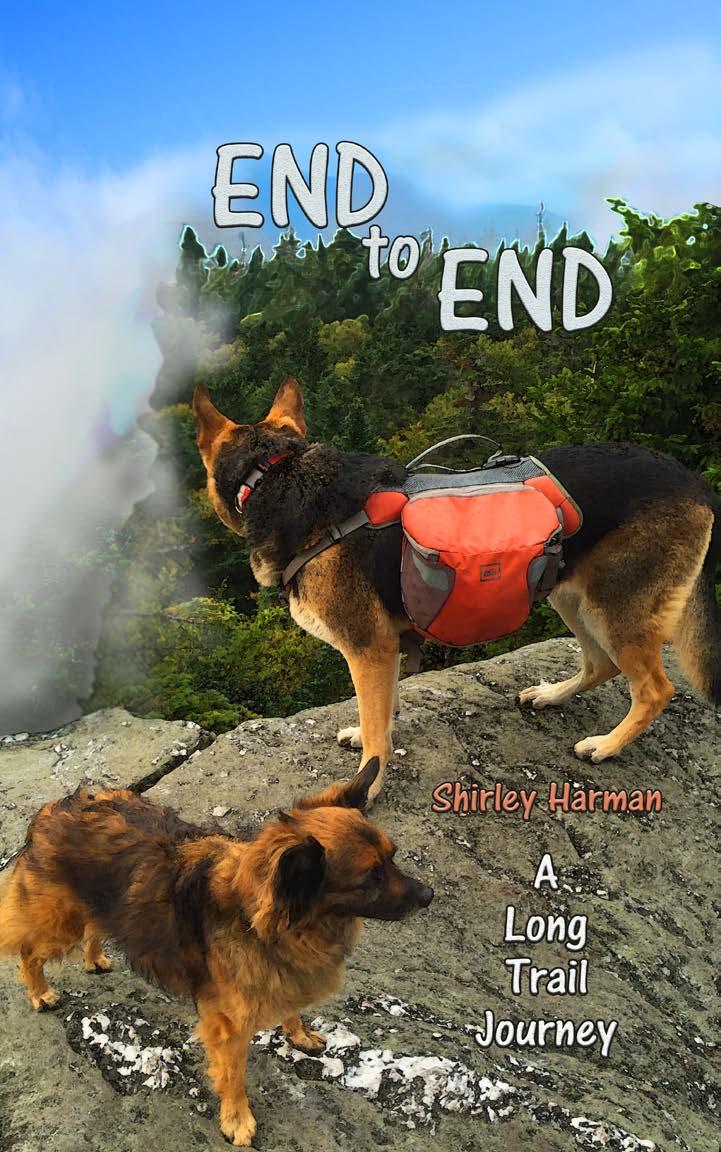
2018 by Shirley Harman
|
|
|
- Lynn Hancock
- 5 years ago
- Views:
Transcription
1
2 2018 by Shirley Harman All rights reserved. No part of this publication may be reproduced or transmitted in any form or by any means, electronic or mechanical, including photocopy, recording, or any information and retrieval systems, without permission from the publisher. ISBN Published by six!dogstudios 2120 Forebay Road Pollock Pines, CA All photos Shirley Harman 2
3 3
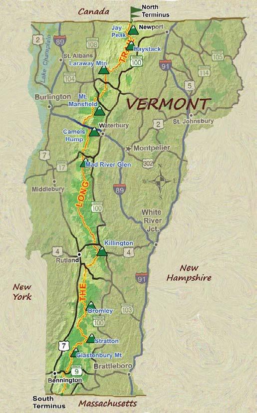
4 Contents Preface Bamforth Ridge, Vermont C e tee Starting e tee» Day 1 Jay Peak e tee» Day 2 Haystack C e tee» Day 3 Devils Gulch e tee» Day 4 Laraway Mountain C e tee» Day 5 Johnson e tee» Day 6 Whiteface, Smuggler s Notch C e tee» Day 7 e t» Day 8 Bolton to Bamforth C e t» Day 9 Storm The Hump
5 » Day 10» Day 11 Monroe Skyline» Day 12 Cooley Glen to Sucker Brook» Day 13 Porcupines» Day 14 Killington» Day 15 Clarendon Gorge» Day 16 White Rock Cairns» Day 17 Bromley» Day 18 Stratton» Day 19 Glastenbury Mountain» Day 21 Massachusetts Afterward
6 Mountain, which is neither burnt, nor very much of a mountain. I thought I might make it to the Shooting Star Shelter, but I am not hiking as fast as I thought I would or the truth of the matter is that in Vermont the miles are longer and the days are shorter than on the west coast! but by 6:30 the gloom was deepening to the point where I would have to turn on a light or risk tripping over something. At the last minute I spotted a patch not too far off the trail. Normally I would have picked a spot well hidden away from possible passers-by, but I took a chance that no one else would be coming along in the dark... my beloved dog/friends in the Green Mountains- it was a miracle that I got any sleep at all. Lyssa barked once at something during the night, but otherwise it was quiet and peaceful. I set my alarm for 5:30, but Lyssa woke me up at 5:15, as is her habit. She is as reliable as your grandfather s clock. By the time it was light enough to see, we were packed up and on the trail again, having left no trace (at least as far as my senses could detect. Lyssa probably could... 16
7 My memory of the early morning climb up Whiteface peak is already blurry and dreamlike. I had camped right at the to spruces. As you ascend in elevation the thick conifers close in around you and the forest darkens. The trail steepens and suddenly becomes serious and intimidating, with are only two to four feet tall, just a tall step. Then they become more like small rock-climbing ascents, where you have to stop and look for toe holds and hand-holds, and plan your route of attack. Eventually I put my pole away so that I can have both hands free for climbing. Several times I take my pack off and toss it up to a ledge overhead. The behind them. I proceed very carefully, focusing on every foothold and handhold, staying safe and uninjured. The summit is a bit of bare rock closed in by spruce trees. If I were 20 feet tall instead of a mere 5 8, the view would probably be stunning. I continue on towards the Whiteface Shelter where I have promised myself a cup of hot coffee and a rest. It s only a half mile down to the shelter, which normally would be a 15 or 20 minute walk, but it took a good 45 minutes of focused and careful down-climbing. 66
8 67


9 Hagerman Overlook, with a view to Mount 68...
10 150
11 151


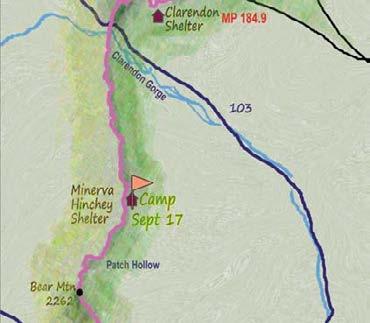

12 Map 11: Clarendon Gorge and Minerva Hinchey Shelter 152

13 The bridge over Clarendon Gorge 153


14 And Tina. I needed her too. We all needed each other. 154 Red Eft...
15 188
2010 Long Trail Unsupported Speed Hike
 2010 Long Trail Unsupported Speed Hike It was September 4, 2010, and I was in Orford, New Hampshire, attending the wedding of Andrew Thompson Appalachian Trail record holder and Bethany Charron. It was
Route Combo) Mt. Bierstadt - Bierstadt, Sawtooth, Evans
 Mt. Bierstadt - Bierstadt, Sawtooth, Evans") Climbing 14ers can be very dangerous, please read the Mountaineering Safety Page and make sure you have a map+compass and can use them effectively, without the help of electronic devices. Route Combo)
Climbing 14ers can be very dangerous, please read the Mountaineering Safety Page and make sure you have a map+compass and can use them effectively, without the help of electronic devices. Route Combo)
C E N T R A L C A T S K I L L S
 120 C E N T R A L C A T S K I L L S Central Catskills Once out of the southern parts of the Catskills, the Long Path enters the more well traveled and civilized regions. The trail joins the Devil s Path,
PAGES SAMPLE. GRIVAS PUBLICATIONS 2004 ll rights reserved
 GRIVAS PUBLICATIONS 2004 ll rights reserved No part of this publication may be reproduced, stored in a retrieval system, or transmitted, in any form or by any means, electronic, mechanical, photocopying,
THE DOGS ALLAN STRATTON
 THE DOGS ALLAN STRATTON HW1033879_Text 29/10/2014 14:35:10 ONE It s 10 p.m. Mom s at the living-room window staring at the car across the street. She s been there for an hour. Our lights are out so no
Hiking Las Vegas.com
 Hike: Mt. Wilson via First Creek Canyon route Trailhead: First Creek marked Distance: 10 miles up and back Elevation gain: 3,400 feet Elevation of Peak: 7,070 feet Time: 7 to 9 hours (up and back) Difficulty:
Henry s Discovery. Chapter 6 Lesson 97: Sounds of EU and EW Lexile Measure: 690L
 Henry s Discovery Chapter 6 Lesson 97: Sounds of EU and EW Lexile Measure: 690L Printed in the United States of America Copyright June 2015 by Reading Horizons No part of this publication may be reproduced,
Royal Gorge Far Out Trail to Le Point
 Royal Gorge Far Out Trail to Le Point Direction to trailhead: From East Ridge Campground: Drive west from Canon City on US 50 to County Road 3A, the entrance road to the Royal Gorge Park. Turn left onto
garfield lafayette v.3.1
 AMC March 28, 2012 garfield lafayette v.3.1 0 4033 ft 2007, Appalachian Mountain Club. All rights reserved. Notes Created by AMC White Mountain Guide Online wmgonline.org 1 Distance Time Elev Change Trail
Land Of The Long White Cloud
 Chapter 1 Sent away! No part of this publication may be reproduced, stored in a retrieval system, or transmitted, in any form or by any means, electronic, mechanical, photocopying, recording, or otherwise,
From Die Laughing (The BIT'N Files Series), by T. L. Wolfe, 2005, Austin, TX: PRO-ED. Copyright 2005 by PRO-ED, Inc. BIT N File One. Thadd L.
, by T. L. Wolfe, 2005, Austin, TX: PRO-ED. Copyright 2005 by PRO-ED, Inc. BIT N File One. Thadd L.") Thadd L. Wolfe Author Thadd L. Wolfe Cover Illustration Larry Knighton The BIT N Files Series was created by Stephen Cosgrove. 2005, 1998 by Stephen Cosgrove. No part of this publication may be reproduced,
Thadd L. Wolfe Author Thadd L. Wolfe Cover Illustration Larry Knighton The BIT N Files Series was created by Stephen Cosgrove. 2005, 1998 by Stephen Cosgrove. No part of this publication may be reproduced,
ì<(sk$m)=bdcecd< +^-Ä-U-Ä-U
=bdcecd< +^-Ä-U-Ä-U") Suggested levels for Guided Reading, DRA, Lexile, and Reading Recovery are provided in the Pearson Scott Foresman Leveling Guide. Earth Science Genre Expository nonfiction Comprehension Skills and Strategy
Suggested levels for Guided Reading, DRA, Lexile, and Reading Recovery are provided in the Pearson Scott Foresman Leveling Guide. Earth Science Genre Expository nonfiction Comprehension Skills and Strategy
Jack Fortune. Sue Purkiss. and the Search for the Hidden Valley ALMA BOOKS
 Jack Fortune and the Search for the Hidden Valley Sue Purkiss ALMA BOOKS Alma books Ltd 3 Castle Yard Richmond Surrey TW10 6TF United Kingdom www.almajunior.com Jack Fortune and the Search for the Hidden
Use It! Don t Lose It! MATH. Daily Skills Practice. Grade 5. by Pat Alvord
 Use It! Don t Lose It! MATH Daily Skills Practice Grade 5 by Pat Alvord Illustrated by Kathleen Bullock Cover by Geoffrey Brittingham Edited by Marjorie Frank and Jill Norris Copy edited by Steve Carlon
6 DAYS MACHAME ROUTES ON KILIMANJARO
 6 DAYS MACHAME ROUTES ON KILIMANJARO Day 1: Moshi Machame camp In the morning, we depart from our base hotel at approximately 8:00 AM for the Machame village where you begin the trek. From the park entrance
Davis Path. AMC May 13, ft. Notes. 2007, Appalachian Mountain Club. All rights reserved.
 AMC May 13, 2014 Davis Path 0 7950 ft 2007, Appalachian Mountain Club. All rights reserved. Notes Created by AMC White Mountain Guide Online wmgonline.org 1 Distance Time Elev Change Trail / Waypoint Latitude
the spider bites Med or a sale
 the spider bites Med or a sale the spider bites Med o r a sale Copyright 2010 Medora Sale All rights reserved. No part of this publication may be reproduced or transmitted in any form or by any means,
Asheville & WNC Hikes
 Asheville & WNC Hikes Amazingly, we have 3,000+ miles of free public hiking trails near Asheville, including 1,600 miles in the Pisgah and Nantahala National Forests, 850 miles in Great Smokey Mountains
Library of Congress Catalog Card Number:
 2017 by J.C. Lafler. All rights reserved. Published by Redemption Press, PO Box 427, Enumclaw, WA 98022 Toll Free (844) 2REDEEM (273-3336) Redemption Press is honored to present this title in partnership
KUSHILAND Expeditions & Tour Safaris Ltd
 KILIMANJARO TREK MACHAME ROUTE TOUR CODE KMC 02 7 DAYS MACHAME ROUTE Kilimanjaro s Machame Route, often referred to as the Whiskey route, is more scenic and is longer than Marangu. The minimum duration
Scarlet Thunder. Sigmund Brouwer. Orca Book Publishers
 Scarlet Thunder Sigmund Brouwer Orca Book Publishers Copyright 2008 Sigmund Brouwer All rights reserved. No part of this publication may be reproduced or transmitted in any form or by any means, electronic
IT S TIME TO MARK YOUR 2019 CALENDARS
 RIDGE LINES GREEN MOUNTAIN CLUB BURLINGTON SECTION Winter 2018-2019 www.gmcburlington.org gmc@gmcburlington.org IT S TIME TO MARK YOUR 2019 CALENDARS 1/19/19 - Conversation, Camaraderie, Shared Stories,
Appalachian Mountain Club
 Appalachian Mountain Club June 3, 2013 Town of Alexandria Board of Selectmen 47 Washburn Road Alexandria, NH 03222 Re: Appalachian Mountain Club s comments on EDP Renewables building permit application
Hiking Waterfalls In New York: A Guide To The State's Best Waterfall Hikes By Randi Minetor
 Hiking Waterfalls In New York: A Guide To The State's Best Waterfall Hikes By Randi Minetor A Guide to the State's Best Waterfall Hikes Randi Minetor Hiking Waterfalls in New York provides driving directions
Mt. Eolus and North Eolus
 Mt. Eolus and North Eolus Difficulty: Class 3 Exposure: Summit Elev.: Mt. Eolus: 14,083 feet N. Eolus: 14,039 feet Camp Elev.: 11,100 feet Elevation Gain: 3,200' starting at Chicago Basin 6,300' starting
Mountains. Erinn Banting
 Mountains Erinn Banting Published by Weigl Publishers Inc. 350 5 th Avenue, Suite 3304, PMB 6G New York, NY 10118-0069 Web site: www.weigl.com Copyright 2007 Weigl Publishers Inc. All rights reserved.
Suggested Day Hikes. Mount Greylock State Reservation 3, 4 1, 2. Take a Hike! Things to remember:
 Suggested Day Hikes Mount Greylock State Reservation Take a Hike! This guide offers suggested day hike routes in two parts: 1) Year-round Hikes and 2) Seasonal Hikes (late-may to Nov.1). Use this guide
7 DAYS RONGAI ROUTE ON KILIMANJARO ROUTE
 7 DAYS RONGAI ROUTE ON KILIMANJARO ROUTE Day 1: Drive to Kilimanjaro National Park Rongai Gate (Nale Moru), Hike to Simba Camp Drive to the attractive wooden village of Nale Moru (about 2 hours including
Franconia Ridge Loop
 AMC July 8, 2015 Franconia Ridge Loop 0 1525 ft 2007, Appalachian Mountain Club. All rights reserved. Notes Created by AMC White Mountain Guide Online wmgonline.org 1 Distance Time Elev Change Trail /
Reader. Scott Foresman Reading Street Labels Photo Captions. Adjectives That Compare. Ranges. Mountain. Animals and Plants Exploring Nature
 Reader Genre Build Background Access Content Extend Language Nonfiction Mountain Ranges Mountain Animals and Plants Exploring Nature Labels Photo Captions Adjectives That Compare Scott Foresman Reading
Rongai 6 Days 5 Nights
 Rongai 6 Days 5 Nights The Rongai Route is one of the easiest routes and the success rate is very high. The route starts on the North side of the mountain just South of the Kenyan border and is one of
Early morning. The day begins. A rock star arrives. Flight delay. Thunderstorm. Loading the plane. A president arrives. Nighttime
 Early morning The day begins A rock star arrives Flight delay Thunderstorm Loading the plane A president arrives Nighttime THIS PAGE INTENTIONALLY LEFT BLANK j Millbrook Press / Minneapolis First American
Route #1) Mt. of the Holy Cross - North Ridge
 Mt. of the Holy Cross - North Ridge") Climbing 14ers can be very dangerous, please read the Mountaineering Safety Page and make sure you have a map+compass and can use them effectively, without the help of electronic devices. Route #1) Mt.
Climbing 14ers can be very dangerous, please read the Mountaineering Safety Page and make sure you have a map+compass and can use them effectively, without the help of electronic devices. Route #1) Mt.
Route #2) Mt. Massive - Southwest Slopes
 Mt. Massive - Southwest Slopes") Route #2) Mt. Massive - Southwest Slopes Difficulty: Class 2 Ski: Advanced, D6 / R2 / III Exposure: Summit Elevation: Trailhead Elevation: Elevation Gain: Round-trip Length: Trailhead: County Sheriff:
Route #2) Mt. Massive - Southwest Slopes Difficulty: Class 2 Ski: Advanced, D6 / R2 / III Exposure: Summit Elevation: Trailhead Elevation: Elevation Gain: Round-trip Length: Trailhead: County Sheriff:
Mt. Kilimanjaro Trek. WanderTours P.O. Box Seattle WA Itinerary dates: January 23 - February 1, 2019 Tour Escort: Beth Whitman
 WanderTours P.O. Box 16102 Seattle WA 98116 Mt. Kilimanjaro Trek Itinerary dates: January 23 - February 1, 2019 Tour Escort: Beth Whitman HIGHLIGHTS The six-day Machame Route to Uhuru Peak, considered
Class of 1965 Second Annual Winter Trip To The 1965 Cabin at Mount Moosilauke February 12-14, 2018
 Class of 1965 Second Annual Winter Trip To The 1965 Cabin at Mount Moosilauke February 12-14, 2018 1965 Classmates Hank Amon, Rich Beams, Dave Beattie, and Mike Gonnerman spent February 12 14 at the Class
Mount Daly a Most Prominent Peak via South Ridge
 Mount Daly a Most Prominent Peak via South Ridge Difficulty: Class 3 Exposure: Exposed in places along the ridge Summit Elevation: 13,305 Elevation Gain: 4100 from trailhead; 1800 from Capitol Lake camp
GOLDEN EARS PROVINCIAL PARK
 GOLDEN EARS PROVINCIAL PARK Trail Information as of October 10 th 2015 Do not underestimate the mountainous wilderness of Golden Ears Provincial Park. The combination of rugged terrain and rapidly changing
Machame 7 Days 6 Nights
 Machame 7 Days 6 Nights If Marangu is the Coca Cola route, then the Machame Route is the Whiskey route. It is the second most popular and one of the most scenic routes on the mountain. All climbers sleep
Anglia ESOL International Examinations. Pre-Intermediate Level (A2+) Paper BBPractice115. For Examiner s Use Only W3 [10]
![Anglia ESOL International Examinations. Pre-Intermediate Level (A2+) Paper BBPractice115. For Examiner s Use Only W3 [10]](/thumbs/81/83444271.jpg "Anglia ESOL International Examinations. Pre-Intermediate Level (A2+) Paper BBPractice115. For Examiner s Use Only W3 [10]") Please stick your candidate label here W R Anglia ESOL International Examinations Pre-Intermediate Level (A2+) W1 [20] Paper BBPractice115 CANDIDATE INSTRUCTIONS: Time allowed TWO hours. Make sure you
Please stick your candidate label here W R Anglia ESOL International Examinations Pre-Intermediate Level (A2+) W1 [20] Paper BBPractice115 CANDIDATE INSTRUCTIONS: Time allowed TWO hours. Make sure you
ì<(sk$m)=beicdd< +^-Ä-U-Ä-U
=beicdd< +^-Ä-U-Ä-U") Fascinating Facts The Nile River in Egypt is the world s longest river, but the Amazon River in Brazil moves the most water. The world s largest freshwater lake is Lake Baikal in Russia. The highest temperature
Fascinating Facts The Nile River in Egypt is the world s longest river, but the Amazon River in Brazil moves the most water. The world s largest freshwater lake is Lake Baikal in Russia. The highest temperature
Grizzly Peak A - East Ridge July 15, 2012
 Grizzly Peak A - East Ridge July 15, 2012 Difficulty: Difficult Class 2/Class 3 Upper Elevation: 13,995 feet Trailhead Elevation: 11,360 feet Elevation Gain: 3,000 feet Round-trip Length: 6.0 miles Trailhead:
Mt. Massive Southwest Slopes
 Mt. Massive Southwest Slopes Difficulty: Class 2 Exposure: Summit Elevation: 14,421 feet Trailhead Elevation: 10,500 feet Elevation Gain: 4,050 feet Round-trip Length: 8.00 miles Trailhead: N. Halfmoon
Mt. Sneffels (from Yankee Boy Basin) - A Cool Fourteener
 - A Cool Fourteener") Mt. Sneffels (from Yankee Boy Basin) - A Cool Fourteener Difficulty: Difficult Class 3 Exposure: Summit Elev.: 14,150 feet Trailhead: Yankee Boy Basin Climbers: Rick Crandall; Shan Stuart; Laura Welch
Mt. Sneffels (from Yankee Boy Basin) - A Cool Fourteener Difficulty: Difficult Class 3 Exposure: Summit Elev.: 14,150 feet Trailhead: Yankee Boy Basin Climbers: Rick Crandall; Shan Stuart; Laura Welch
Kilimanjaro Adventure - December 7-16, 2019
 Kilimanjaro Adventure - December 7-16, 2019 Trip Summary: Arrival/Departure airport(s): Siha District, Tanzania, Kilimanjaro International Airport (JRO) Trip length: 10 days/9 nights (does not include
The Cleo s Bath North Side Hike
 The Cleo s Bath North Side Hike This hike is a cross-country hike from Pinecrest Lake to the north side of Cleo s Bath. It is quieter and much less crowded than the normal route, which goes up the south
Jake arrives at Euston station in London. It is a holiday weekend and it is his first time away from Manchester. Jake is eighteen years old and he
 Annette Keen Jake arrives at Euston station in London. It is a holiday weekend and it is his first time away from Manchester. Jake is eighteen years old and he lives with his family. Now he is in London.
HB/VS-078 Üssers Barrhorn
 HB/VS-078 Üssers Barrhorn Paul HB9DST, August 23, 2015 Summary: This was a HB9SOTA club project, an activation of the highest summit in Europe you can hike up without ropes or other equipment. The headline
RICHMOND READERS. Radio Boy
 RICHMOND READERS Radio Boy The sky is grey and the sea is blue. A girl is walking on the beach. She finds a red bottle. A boy is watching her. What is in the bottle? Radio Boy is an exciting story where
Great Eastern Trail Newsletter
 Great Eastern Trail Newsletter Volume 1, Number 1, January 2011 By Timothy A. Hupp Please feel free to print out or copy and distribute this newsletter Note this is the first newsletter of the Great Eastern
Appalachian Mountain Club
 Appalachian Mountain Club January 30, 2013 Groton Planning Board 754 North Groton Road Groton, NH 03241 Re: Re-opened public hearing regarding a request by EDP Renewables (Lessee), EXPX2/MAXAM (Owner)
Grand Canyon Lapbook L-GCAN. Designed by Cyndi Kinney
 Grand Canyon Lapbook L-GCAN Designed by Cyndi Kinney Grand Canyon Lapbook Copyright 2013 Knowledge Box Central www.knowledgeboxcentral.com ISBN # CD: 978-1-62472-084-0 Printed: 978-1-62472-085-7 Ebook
Maya & Filippo Visit a Glacier. Alinka Rutkowska Illustrated by Konrad Checinski
 Maya & Filippo Visit a Glacier Alinka Rutkowska Illustrated by Konrad Checinski Maya & Filippo Visit a Glacier Alinka Rutkowska Illustrated by Konrad Checinski Maya & Filippo Visit a Glacier Copyright
VERMONT DIRECTIONS Alburg Golf Links 230 Route 129, Alburg, VT (802)
") Alburg Golf Links 230 Route 129, Alburg, VT 05440 (802) 796-4248 Take I-89 to Exit 17; take Route 2 to Champlain Islands North to Alburg; take Route 129 to course. Bakersfield Country Club 201 Old Boston
Alburg Golf Links 230 Route 129, Alburg, VT 05440 (802) 796-4248 Take I-89 to Exit 17; take Route 2 to Champlain Islands North to Alburg; take Route 129 to course. Bakersfield Country Club 201 Old Boston
GUIDE TO ADVENTURE smcvt.edu/wilderness
 GUIDE TO ADVENTURE 2015-2016 smcvt.edu/wilderness GREETINGS, The Wilderness Program welcomes all St. Michael s College new and returning students, faculty, staff, employees, and alumni for this 2015-2016
Mount Kilimanjaro Climbing via Rongai Route 8 day-itinerary
 Mount Kilimanjaro Climbing via Rongai Route 8 day-itinerary Total hiking distance: Approximately 70 kms The Rongai route ascends Kilimanjaro from the north-eastern side of the mountain, along the border
Broken. Order the complete book from the publisher. Booklocker.com
 How do you survive as a pastor if you are bipolar? Broken by Bill McConnell Order the complete book from the publisher Booklocker.com http://www.booklocker.com/p/books/9101.html?s=pdf or from your favorite
The Whistle. By Emily Hoang. The clock rang twice, and Lisa hurried home. She had to get home, and
 The Whistle By Emily Hoang The clock rang twice, and Lisa hurried home. She had to get home, and with no time to waste. Something red caught her eye, by the river. She ran towards it, and it was a whistle,
V1 Adirondack Winter Adventure Information 2013
 Overview The Winter Mountaineering Adventure is an annual snowshoe hike and climb. We will sumit mountains up to 4,000 high in the Adirondacks High Peaks district in New York State. This event is open
Note: Coordinates are provided as Universal Transverse Mercator UTM Zone U21, North American Datum 1983 (NAD 83).
.") Northern Traverse Route Description The Northern Traverse (formerly the North Rim Traverse) is an unmarked and rugged backcountry hiking route. It is known be a demanding hike, because of its terrain and
Northern Traverse Route Description The Northern Traverse (formerly the North Rim Traverse) is an unmarked and rugged backcountry hiking route. It is known be a demanding hike, because of its terrain and
beach. Make the ford and follow the trail out to the junction with Red Creek Tr in an open grassy area.
 Description: This is a moderate to slightly strenuous 22.8 mile backpack (add 2.6 miles if you do the packless out and back to the Lion s Head) that will have you exploring nearly every thing that is The
TROOP FIVE BOY SCOUTS OF AMERICA (
 TROOP FIVE BOY SCOUTS OF AMERICA (http://www.troop5.net) HISTORIC MOUNT WASHINGTON HIKE LOCATION: White Mountain National Forest, New Hampshire DATE: Friday - Monday, June 25-28 th, 2010. TIME: Be at the
Auca on the Cononaco Indians of the Ecuadorian Rain Forest. Text and photographs: Peter Broennimann. Springer Basel AG
 Auca on the Cononaco Indians of the Ecuadorian Rain Forest Text and photographs: Peter Broennimann Springer Basel AG Peter Broennimann amcononaco Indianer im ecuadorianischen Regenwald -'\ \. " \ \ I >
Hiking Trail Descriptions
 Hiking Trail Descriptions For ye shall go out with joy. And be led forth with peace. The mountains and the hills shall break forth before you in singing. And all the trees of the fields shall clap their
Guide Book Excerpts. Wham Ridge 2006
 Guide Book Excerpts Wham Ridge 2006 Approach: Molus Lake / Elk Park / Vestal Creek Roach and Roach Description Take the Durango & Silverton Narrow Gauge train from either Durango or Silverton and get off
Cycle OrEgon Hells Canyon/wallowas
 Cycle OrEgon 215 Hells Canyon/wallowas Live to Ride. Ride to Give. We may be born to be wild, but we live to do good things. From mountain bike trails near Baker City to a renovated city park in Cambridge,
Haslingden High School Geography Department HOMEWORK BOOKLET Year 8 Block A Level 2-4
 Haslingden High School Geography Department HOMEWORK BOOKLET Year 8 Block A Level 2-4 Name: Form: Subject Teacher: Date Given: Date to Hand in: Level: Effort: House Points: Comment: Target: Parent / Guardian
chocorua2 AMC April 25, ft Notes 2007, Appalachian Mountain Club. All rights reserved.
 AMC April 25, 2012 chocorua2 0 2873 ft 2007, Appalachian Mountain Club. All rights reserved. Notes Created by AMC White Mountain Guide Online wmgonline.org 1 starting at Liberty Trailhead, Brook Trailhead
OUR UNFORGETTABLE CRUISE
 Michele's photographs and short stories relive her journeys that will make you feel as though you are right there with her. She translates her personal victory when she climbs an active volcano in Italy,
CIEC 9 PEAKS AWARD SUPPLEMENT POSSIBLE ROUTES FOR THE 9 PEAKS AWARD TRIP
 CIEC 9 PEAKS AWARD SUPPLEMENT POSSIBLE ROUTES FOR THE 9 PEAKS AWARD TRIP As you plan your trip, be aware of 3 regulations in this wilderness: 1. Camp only in designated campsites. 2. No campfires allowed.
Hiking Las Vegas.com
 Hike: Juniper Peak up and back Trailhead: Oak Creek Canyon marked Distance: 5.5 miles round trip Elevation gain: 2,200 feet Elevation peak: 6,109 feet Time: 4 to 5 hours - Up and back Difficulty: 3 Danger
OCEANIC REQUIRED NAVIGATION PERFORMANCE (Including RNP-10 and RNP-4)
") King Schools Online Internet Learning Programs OCEANIC REQUIRED NAVIGATION PERFORMANCE (Including RNP-10 and RNP-4) Flight Crew Certification Course SYLLABUS King Schools, Inc. 3840 Calle Fortunada San
King Schools Online Internet Learning Programs OCEANIC REQUIRED NAVIGATION PERFORMANCE (Including RNP-10 and RNP-4) Flight Crew Certification Course SYLLABUS King Schools, Inc. 3840 Calle Fortunada San
Bradshaw Trails Series
 Bradshaw Trails Series Curtis James Troop 7014 Curtis.James@erau.edu My Motto: Never get lost! Hiking Rules Bradshaw Hiking Patch Series Hiking Tools Hiking Rules Hiking Merit Badge* Take five 10-mile
TriPyramids via Slide Trails
 AMC August 12, 2010 TriPyramids via Slide Trails 0 2999 ft 2007, Appalachian Mountain Club. All rights reserved. Notes Created by AMC White Mountain Guide Online wmgonline.org 1 Distance Time Elev Change
Drawing Conclusions and Making Inferences
 Drawing Conclusions and Making Inferences G TO THE STUDENT In this book, you will learn how to use the reading strategy called Drawing Conclusions and Making Inferences. With your teacher s help, you will
INTERPRETING TOPOGRAPHIC MAPS (MODIFIED FOR ADEED)
") INTERPRETING TOPOGRAPHIC MAPS (MODIFIED FOR ADEED) Science Concept: Topographic maps give information about the forces that shape the features of Earth. Objectives: The student will: identify land features
INTERPRETING TOPOGRAPHIC MAPS (MODIFIED FOR ADEED) Science Concept: Topographic maps give information about the forces that shape the features of Earth. Objectives: The student will: identify land features
Little Grand Canyon near Pomona, Illinois
 Little Grand Canyon near Pomona, Illinois Below: View of the trail and the terrain created using the Map My Hike app Below: Summary of the hike created using the Map My Hike app Presented by: Jennifer
Civil Aviation, Monthly Key Operating Statistics, Major Canadian Air Carriers
 Catalogue no. 51-004-X Vol. 43, no. 1. Aviation Civil Aviation, Monthly Key Operating Statistics, Major Canadian Air Carriers January to December 2010. Highlights For the 12-month period, January to December
Saturday Hike - Hancock Loop & Out
 AMC August 3, 2015 Saturday Hike - Hancock Loop & Out 0 2487 ft 2007, Appalachian Mountain Club. All rights reserved. Notes Created by AMC White Mountain Guide Online wmgonline.org 1 Distance Time Elev
MOUNT VINSON ANTARCTICA S
 MOUNT VINSON ANTARCTICA S HIGHEST PEAK Imagine yourself on the summit of Mount Vinson 16,050 ft (4892 m), the highest peak in Antarctica and one of the coveted Seven Summits. Majestic, snow-covered peaks
Journey to the Centre of the Earth
 Step Two B1.1 Jules Verne Journey to the Centre of the Earth Summary-based Activities 1 Scrambled word cloze Read the summary of Chapter One of Journey to the Centre of the Earth below. Choose one of the
playwinterpark.com Off The Beaten Path Hikes Hiking Recommendations for the Adventurous Hiker
 playwinterpark.com Off The Beaten Path Hikes Hiking Recommendations for the Adventurous Hiker Hike: Devil s Thumb (difficult) Length: 3.93 miles one-way Elevation: Trailhead 9609 Destination 12,236 Trailhead
GOING CAMPING HAL AMES
 GOING CAMPING HAL AMES Robert did not like camping. He liked his house, his bed and his shower. When he was eight years old his father had taken him on their first, and last, camping trip together. It
ì<(sk$m)=becbfg< +^-Ä-U-Ä-U
=becbfg< +^-Ä-U-Ä-U") Reader Thank You, Sir Isaac Newton! Genre Build Background Access Content Extend Language Expository Nonfiction Scientific Discovery Force and Motion Roller Coasters Labels and Captions Definitions Fact
Reader Thank You, Sir Isaac Newton! Genre Build Background Access Content Extend Language Expository Nonfiction Scientific Discovery Force and Motion Roller Coasters Labels and Captions Definitions Fact
TOP OF THE WORLD MA! (WELL EUROPE AT LEAST)
") TOP OF THE WORLD MA! (WELL EUROPE AT LEAST) Well guys here I am safely home in sunny Barrowford and already the memories of the effort of the other week are dimming in my mind Mont Blanc, not so bad. Err
TOP OF THE WORLD MA! (WELL EUROPE AT LEAST) Well guys here I am safely home in sunny Barrowford and already the memories of the effort of the other week are dimming in my mind Mont Blanc, not so bad. Err
Hike from Leoben to Eibiswald along E6 Austria
 Hike from Leoben to Eibiswald along E6 Austria I spent a long time preparing to hike along the E6 Austria from Leoben to Eibiswald and a small part of the E6 Slovenia from Eibiswald to Radlje. I planned
Trail Phasing Plan. Note: Trails in the Clear Creek Canyon area (Segments will be finalized in the future to minimize wildlife impacts
 Note: Trails in the Clear Creek Canyon area (Segments 2 5 and a future JCOS connection) will be finalized in the future to minimize wildlife impacts Trail Phasing Plan P Parking 3 Easy Trail Intermediate
Crystal Lake Area Trails
 Lake Area Trails Welcome to the Lake area of the Big Snowy Mountains! This island mountain range in central Montana features peaks reaching to 8,600 feet and long, high ridges from which vistas of the
Mt. Thielsen Trip Report: April 29, 2012
 Mt. Thielsen Trip Report: April 29, 2012 Outing Organizer: Geoff Hance, with Brent McGregor Elevation Gain: 3,800 feet, over warming snow, with an exposed summit block Distance: About 9 miles round trip
Tiger Mountain State Forest:
 98 60 hikes within 60 miles: SEATTLE 20 Tiger Mountain State Forest: West Tiger Mountain Three Loop i KEY AT-A-GLANCE INFORMATION Length: 5.1 miles round-trip Configuration: Loop Difficulty: Moderate difficult
The Camping Trip. By Marcie Aboff Illustrated by Solana Pagan. Scott Foresman Reading Street 2.4.1
 Suggested levels for Guided Reading, DRA, Lexile, and Reading Recovery are provided in the Pearson Scott Foresman Leveling Guide. The Camping Trip Genre Realistic fiction Comprehension Skills and Strategy
Kakadu Highlights No. 9: September 23 - October 6, 2018
 Kakadu Highlights No. 9: September 23 - October 6, 2018 Section 1: Barramundi Creek: September 23-26 We begin with a four to six hour, 350 kilometre drive from Darwin. The last 45 kilometres is on a 4WD
Trudy Gets Hitched. by Y.D. Davey & T. Ricotta
 Trudy Gets Hitched by Y.D. Davey & T. Ricotta Travels With Trudy Trudy Gets Hitched by Y.D. Davey & T. Ricotta If you were a trailer, you would know how it feels to have blocks in the places you re supposed
Ultimate Recreation Challenge
 The joy of the trail is not the distance covered but in the scenes, adventures, and discoveries along the way. Girl Scout Handbook, 1933 Ultimate Recreation Challenge You re at the peak of your exciting
1. Waterfall Gully Mt Lofty. 5 Of the Best Hikes in Adelaide
 Adelaide is a beautiful city, and one of the most incredible things about Adelaide is the quality of bushwalking available on the suburban fringe. It is surrounded by the Mt Lofty Ranges, and much of the
9 December 2016 Maxwell Wolckenhauer NYS DEC State Highway 10, Suite 1 Stamford, NY Conservation.
 Conservation Education Recreation Since 1922 9 December 2016 Maxwell Wolckenhauer NYS DEC 65561 State Highway 10, Suite 1 Stamford, NY 12167 r4.ump@dec.ny.gov RE: Windham-Blackhead Range Wilderness UMP
by Judith A. Muschla and Gary Robert Muschla
 by Judith A. Muschla and Gary Robert Muschla New York Toronto London Auckland Sydney Mexico City New Delhi Hong Kong Buenos Aires Dedication For Erin Scholastic Inc. grants teachers permission to photocopy
KUSHILAND Expeditions & Tour Safaris Ltd
 KILI CHARITY CLIMB 5 DAYS MARANGU ROUTE TOUR CODE KMR 01/5 5 DAYS MARANGU ROUTE Marangu Route, often referred to as the Coca Cola route, is Kilimanjaro s shortest and easiest route. Because of this, it
Sidekick. ì<(sk$m)=bdcgef< +^-Ä-U-Ä-U. The. by Eve Beck illustrated by Robbie Short. Scott Foresman Reading Street 2.3.1
=bdcgef< +^-Ä-U-Ä-U. The. by Eve Beck illustrated by Robbie Short. Scott Foresman Reading Street 2.3.1") Suggested levels for Guided Reading, DRA, Lexile, and Reading Recovery are provided in the Pearson Scott Foresman Leveling Guide. The Sidekick Genre Fantasy Comprehension Skills and Strategy Author s Purpose
Suggested levels for Guided Reading, DRA, Lexile, and Reading Recovery are provided in the Pearson Scott Foresman Leveling Guide. The Sidekick Genre Fantasy Comprehension Skills and Strategy Author s Purpose
Great Basin Drive, Yosemite to Las Vegas (C18A-3)
") Great Basin Drive, Yosemite to Las Vegas (C18A-3) After finishing up with the California parks, I left Yosemite and entered the Great Basin, which spans a large area east of the Sierra Nevada mountains
Great Basin Drive, Yosemite to Las Vegas (C18A-3) After finishing up with the California parks, I left Yosemite and entered the Great Basin, which spans a large area east of the Sierra Nevada mountains