Nebraska Horse Trails
|
|
|
- Shonda Cummings
- 5 years ago
- Views:
Transcription

1 A GUIDE FOR Nebraska Horse Trails First Edition January 2018 Ride with a Smile, A Light Hand & Gently on the Land Written and compiled by Tammy Vasa on behalf of the Nebraska Horse Trails Committee

2 About this Publication Since the beginning of this millennium, I have been riding, writing about and promoting the horse trails of Nebraska through the Nebraska Horse Trails Committee and my own website, Horsetrailriders.com. More than just a fly-over state, Nebraska is rich in history; the Pony Express, the Oregon and Mormon Trails, the Lewis and Clark expedition and home to many Native American tribes. It is not all amber waves of grain in the 37th largest state. Discover the Sandhills in north-central Nebraska and the Pine Ridge regions in the western part of our state. Climb the bluffs along the Missouri River and view the variegated fall colors. Ride through the country s only man-made forest or you can literally follow the tracks of the covered wagons passing through our state. Get off the interstate and into the saddle to see what Nebraska is really made of! This booklet has been years in the making. While it may seem like an easy project capturing all the trails in Nebraska, the Nebraska Horse Trails Committee wanted to provide more than just the name and location. Every time one of us would delve into the project, it became apparent that more research was necessary and perhaps we should ride the trails first and then report on them! We all agreed riding was much more fun. Trail photos and those taken at NHTC sponsored events are also included in this publication. Our accompanying website, nehorsetrails.com, will have video from some of our favorite places. Our active members and volunteers are what keeps many horse trails open. If you live in Nebraska and enjoy horses or horse trails, I would encourage you to spend some time volunteering at our parks and experience that sense of pride and accomplishment when you have helped preserve, improve and even create horse trails. Over the last seventeen years I have been fortunate to ride many of the places in this book. For those I didn t visit, I either relied on information from others or researched online to include in this publication. Information might change so please apply proper due diligence before traveling. If in question, call before you haul. If you find changes or errors or have Nebraska trails to add, please visit our website at nehorsetrails.com and leave a message with the correction or information. A special thanks to Diane Beckham, Sherry Reeble and Shari Parys for proofreading this booklet and to the many, many folks I called upon for information, clarification and/or pictures. On behalf of the Nebraska Horse Trails Committee, we invite you to Trail Ride Nebraska! Happy Trails, Tammy Vasa 2


3 Trail Ride Nebraska! The Nebraska Horse Trails Committee has compiled this booklet with information on horse trail riding and camping in Nebraska. You will enjoy Nebraska s diverse landscape rich in military, western and Native American history. From the buttes above Fort Robinson to the Salt Valley Lakes of eastern Nebraska, you haven t toured Nebraska until you have seen it from the back of your horse. Recognizing a need for an organized group to work with park managers and develop horse trails on public land, The Nebraska Horse Trails Committee was formed in the year 2000 by avid trail riders. Not just talk, this group is action! Now a 501(c)(3) non-profit organization, the NHTC is responsible for clearing trails, negotiating new trails and improvements on the trail, at trailheads and horse campgrounds. The Horse Trail Riding Expo held each year in March provides educational opportunities for all trail riders and is the group s largest fundraiser. In addition to Expo, donations from individuals and corporations help provide funding for our Nebraska projects. Many hours of sweat and a lot of heart has gone into the trails projects for all horse lovers to enjoy. We invite you to join us on our Mission. OUR MISSION STATEMENT To preserve and maintain horse trails and natural resources in Nebraska to be enjoyed today and for future generations To conserve and promote enjoyment of horse trail use throughout Nebraska's diverse and scenic landscape To create opportunities for the education and cooperation of all trail users and land owners regarding the issues of involving horses in the natural environment Manpower is also needed for many of our projects. If you would like to help clear trails, volunteer for some of our events or just attend our planning meetings, we encourage you to visit our website at nehorsetrails.com and provide your contact information. Many hands make light work and more hands are always welcome! 3
4 Table of Contents Chapter 1 Western Nebraska - West of Valentine & Hwy 83 6 [] Fort Robinson - Crawford 6 7 [] Lake McConaughy - Ogallala 8 [] Outrider Trailhead - Chadron 9 [] The Pine Ridge Trail / Roberts Tract Trailhead - Chadron 10 [] Sam McKelvie National Forest / Steer Creek Campground - Valentine 11 [] Soldier Creek Wilderness Campground - Crawford 12 Chapter 2 Central Nebraska - East of Valentine to Hwy [] Bader Park - Chapman 13 [] Bassway Strip - Gibbon 14 [] Big Canyon Inn - Springview 15 [] The Cowboy Trail - Valentine to Norfolk 16 [] Cottonmill Park - Kearney 17 [] Crystal Lake - Ayr 17 [] Davis Creek - Loup City 18 [] Liberty Cove - Lawrence 18 [] Loup Junction - St. Paul 18 [] Nebraska National Forest - Halsey 19 [] Niobrara River Ranch - Valentine 20 [] Niobrara State Park - Niobrara 21 [] Peckerneck Trail - Alma 22 [] Prairie Lake - Hastings 23 [] Pressey Park - Oconto 23 [] South Shore/Lewis & Clark - Crofton 24 [] Willow Creek - Pierce 25 Chapter 3 Eastern Nebraska - East of Hwy 81 to NE/IA State Line 26 [] NHTC Trail Challenge 26 [] Bluestem Lake - Martell 27 4
![Table of Contents [] Buckskin Hills - Newcastle 27 [] Branched Oak - Raymond 28-29 [] Camp Moses Merrill - Linwood 30 [] Cunningham Lake - Omaha 31 [] Conestoga Lake - Denton 32 [] Czechland Lake -](/docs-images/94/120339496/images/5-0.jpg "Prague 32 [] Danish Alps - Hubbard 33 [] Indian Cave - Shubert 34 [] Dead Timber / Powderhorn - Scribner 35 [] Hormel Park - Fremont 35 [] Maskenthine Lake - Stanton 35 [] MoPac - Lincoln, Eagle,")
5 Table of Contents [] Buckskin Hills - Newcastle 27 [] Branched Oak - Raymond [] Camp Moses Merrill - Linwood 30 [] Cunningham Lake - Omaha 31 [] Conestoga Lake - Denton 32 [] Czechland Lake - Prague 32 [] Danish Alps - Hubbard 33 [] Indian Cave - Shubert 34 [] Dead Timber / Powderhorn - Scribner 35 [] Hormel Park - Fremont 35 [] Maskenthine Lake - Stanton 35 [] MoPac - Lincoln, Eagle, Elmwood, Wabash, Springfield, Louisville 36 [] NP Dodge Park - Omaha 37 [] Oak Glen - Garland 37 [] Oak Creek Trail - Valparaiso, Loma, Brainard 38 [] Pawnee Lake - Lincoln (Emerald) 39 [] Rock Creek Station - Fairbury 40 [] Pioneers Park - Lincoln 41 [] Stagecoach Lake - Hickman 41 [] Standing Bear Lake - Omaha 41 [] Turkey Creek Ranch - Newcastle 42 [] Two Rivers - Waterloo 43 [] Wagon Train - Hickman 44 [] Walnut Creek - Omaha (Papillion) 44 [] Wilderness Park - Lincoln 45 [] Wildwood Lake - Agnew 45 [] Resources / Board of Directors 46 [] The Horse Trail Riding Expo 47 5


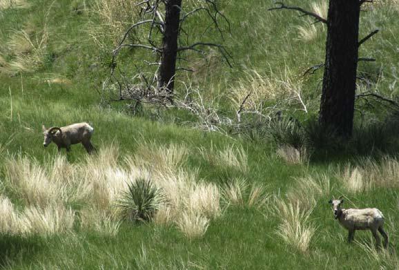
6 CHAPTER 1 Western Nebraska Fort Robinson Crawford If asked where to ride in Nebraska, Fort Robinson is the place most people mention. Located in northwestern Nebraska, it is more than a stopover to the Black Hills it is its own destination. Rich in military history, you will take a step back in time staying right on the outpost and stable your horses in the historic barns where thousands of horses passed through this Army remount depot. Bring your whole family on this horse vacation. Witness the Fort s history from its 1874 role guarding the Red Cloud Agency through the World War II German Prisoner of War Camp. You will find the monument representing the death of the famed Sioux Chief Crazy Horse and visit more than a dozen historic structures and sites such as the blacksmith shop, veterinary hospital, guardhouse and the old post cemetery. Stop in the museum, swim at the indoor pool or go for a jeep or wagon ride. Other activities such as tubing and kayaking are also available. There may even be a rodeo going on or Native American activities. This horse lover's paradise has 22,000 acres and over 100 miles of trails; many declared the best in Nebraska! From the hills and valleys you will catch a glimpse of buffalo, deer and antelope. Climbing up into the buttes will provide a view of the kaleidoscopic landscapes overlooking the Fort. Keep an eye out for those Big Horn Sheep! Modern campgrounds are available in Fort Robinson s Soldier Creek and Red Cloud Campgrounds and can be reserved through the Fort s website. Horses are required to stay in the barn and stalls can be reserved through the same website. Riders can also reserve a spot in the Mare Campground and Barn by calling the Fort at (308) Weed free hay is not required on Fort Robinson proper however if staying at Soldier Creek Wilderness west of Fort Robinson, it will be necessary. Miles of Trail Terrain Barefoot Friendly Camping Sites Water Corrals Amenities & Notes 100 Dirt Grass Rock Hills Some riders will recommend footwear Concrete Yes Stalls in barn 30 & 50 amp electrical sites. Picnic tables & fire rings. Do not stable horses at camp. Restroom with shower. Museums and other activities. Bring your bicycle for easy traveling around the Fort. Reservations required. Dump station. Directions: From Crawford, take Hwy 20 west 4 miles. Check in at the Ft. Robinson Lodge just beyond the Entrance sign. Fees: Nebraska State Park permit required. Additional fees for camping. Reservations recommended. Ft. Robinson State Park / 3200 Hwy 20 / Crawford, NE P: / W: 6


7 7 MAP OF FORT ROBINSON TRAILS


8 Lake McConaughy Ogallala Lake McConaughy State Recreation Area is Nebraska s largest lake boasting white sand beaches perfect for summer fun. With 40,000 acres and over 100 miles of shoreline there are riding opportunities at Big Mac. Currently there are no marked trails or campgrounds and riders are encouraged to check in with park management for an ideal place to park and ride. We hope there will be more riding and camping opportunities in the future. Directions: Located 12 miles north of I-80 / 8 miles north of Ogallala on Hwy 61. Nebraska State Park permit required. Above: Installation of corrals at Natick/Nebraska Nat l Forest Top Right: NHTC Trail Clearing at Branched Oak Bottom Right: NHTC Trail Challenge obstacle 8


9 Outrider Trailhead Chadron Located south of Chadron and north of Chadron State Park, the Outrider Trailhead on Hwy 385 offers a nice retreat on the way to or from the Black Hills. You might enjoy a day ride on Forest Service land high above Chadron State Park and with a view to the north of those Black Hills. The campground at the trailhead, created by horsemen of the area, offers sturdy corrals for your horses and water hydrants (May through October). There is a fully accessible handicap rider ramp. Certified weed free hay required. The entrance to this trailhead is about 3/4 mile north of Chadron State Park s main entrance on the west side of Hwy 385 or 7.4 miles south of Hwy 20 on Hwy 385. It is a bit of a hairpin turn into the campground, so be cautious with really big rigs. From the Outrider Trailhead, you can reach the Black Hills Overlook. Miles of Trail Terrain Barefoot Friendly Camping Sites Water Corrals Amenities & Notes 10 Dirt Rock Grass Hills Yes Grass Yes Yes Primitive camping only. Handicap ramp. No bathroom facilities. Certified weed free hay required. Directions: From Chadron, take Hwy 385 south approx. 7.5 miles Turn west to reach the trailhead. Note the hairpin turn when pulling into the area and use caution with your big rig. If you reach Chadron State Park when coming from the north, you have gone too far. Fees: No fees for overnight use. Office of Forest Supervisor / 125 N Main / Chadron, NE P: / W: 9

10 The Pine Ridge Trail Chadron The 6,600-acre Pine Ridge National Recreation Area features the 20 mile Pine Ridge Trail beginning at the West Ash Trailhead, traveling through East Ash, the southern tip of Roberts Loop, the northern tip of Canyon Loop and ultimately ending at Coffee Mill Trailhead. In this rugged area of Nebraska, you will experience big climbs and long descents. You will need your best navigation skills as it is easy to lose the trail due to fire damaged areas. Contact the Forest Supervisor for current information on trailhead accessibility. Experienced riders and conditioned horses recommended. Certified weed free hay required. Primitive horse camping is available at the Roberts Tract Trailhead with corrals and horse water. Riders should bring their own drinking water. Miles of Trail Terrain Barefoot Friendly Camping Sites Water Corrals Amenities & Notes 34 Dirt Rock Grass Hills Difficult Use caution Dirt Grass Yes Yes Roberts Trailhead provides horse corrals, rider ramp and stock water. Picnic tables, vault toilet & fire ring. No drinking water. Pack out what you bring in. Directions: From intersection of Hwys 20 & 385, go SW on Hwy 20 for 9.4 miles. Turn south on Eleson Road & follow the jog to the west then south 4 miles to Bethel Road. East 1 mile to FS Road 737, 1 mile to Roberts Tract Campground; follow the signs. Forests Supervisor s Office / 125 Main Street / Chadron, NE P: / W: 10


11 Sam McKelvie/Steer Creek Valentine Equines now welcome at Steer Creek Campground! The Nebraska National Forest has opened Steer Creek Campground at Samuel McKelvie National Forest to horse camping. If you like the smell of Ponderosa pine trees, quiet relaxing camping, gazing at a million stars at night and having 116,000 acres to ride this place is for you! No marked trail; open riding. Leave gates as you find them. The Nebraska Horse Trails Committee worked with Forest Service on placement and installation of 8 corrals. The campground has 23 sites, some able to handle large rigs. It is primitive with hand pumped water, two vault toilets, picnic tables, fire rings, manure bunker and lots of shade. Please tie your horse to trailer for saddling and unsaddling only. If corrals are full, there is a grassy area across road from camp where you can put up an electric fence. Certified weed free hay required. More information on this new riding opportunity will be available with the next publication. In the meantime, contact the local Forest Service for maps and information. Miles of Trail Terrain Barefoot Friendly Camping Sites Water Corrals Amenities & Notes Unlimited Dirt Grass Hills Yes Asphalt Yes Yes Primitive camping only. Picnic tables & fire rings. Directions: From Nenzel, (Hwy 20), turn south on NE-16F and drive 18.1 miles south to Steer Creek Campground. From Valentine, head south on Hwy 97 for 26 miles, then turn right onto the Merritt Dam Road. Continue on the Merritt Dam Road (County Road 5) for 15 miles. At the T, turn left onto at State Spur 16F and go 2 miles to the campground. Fees: Camping fees are posted at collection box near campground entrance. Nebraska National Forest / Bessey Ranger District / Halsey, NE P: / W: 11


12 Soldier Creek Wilderness Crawford The Soldier Creek Wilderness Campground is adjacent to the Nebraska National Forests & Grasslands, Soldier Creek Wilderness and Ft. Robinson State Park. The 7,700+ acres was used in conjunction with Fort Robinson Military Reservation as a wood reserve and horse and mule pasture. Now you will find elk, deer, turkeys, bobcats and eagles. Recovering from a fire in 1989, the Ponderosa Pine covered areas give way to grassy fields. Soldier Creek Wilderness is non-motorized and only open to horseback riding and hiking. The Boots and Saddle Trail and the Trooper Trail Loop will give riders almost 18 miles of trail. Trail brochures are available at the Pine Ridge Ranger District Office. Trailhead facilities are located in the campground which hosts primitive campsites, several picnic tables, a hand pump well with potable water, vault toilets, garbage cans and a large 15-paddock corral system. Fire rings only; no grates or grills. Certified weed free hay required. Miles of Trail Terrain Barefoot Friendly Camping Sites Water Corrals Amenities & Notes 18 Dirt Grass Sand Hills Yes Grass Yes Yes Primitive camping only. Hand pump water, vault toilets. Dump station and other amenities at nearby Fort Robinson where a Nebraska Park permit will be needed. Directions: From Ft. Robinson, drive northwest on Soldier Creek Road approximately 6 miles. You will drive into camp. Fees: No fee for day riding. See park for camping fees. Pine Ridge Ranger District / 125 N Main / Chadron, NE P: / W: 12


13 CHAPTER 2 Central Nebraska Bader Park Chapman Bader Memorial Park is located in central Nebraska, just south of Chapman. Tucked in next to the Platte River, this 270-acre park has about 5 miles of horse trails. Great for day riding; equestrians will be delighted to see much wildlife along the trails including jack rabbits, deer, ducks and geese. If the river is up, the water trail which winds through the trees will have you going back for more. Follow the mowed grass trails to the north and meander along the running creek and big cottonwood trees. To the south, you will pick up the trail along the Platte River and enjoy the water fowl on the water and shores. The horse camp is located to the right of the entrance. Portable fencing in designated area will be necessary. Visitors are encouraged to call before hauling as horse camping is limited during peak seasons at Bader Park. Miles of Trail Terrain Barefoot Friendly Camping Sites Water Corrals Amenities & Notes 5 Dirt Grass Flat Yes Grass Yes No 30 & 50 amp electrical sites. Picnic tables. Restroom with shower. Playground, swimming pond. Fishing. Seasonal hunting. Call before you haul. Dump station in the park. Directions: From Hwy 30 in Chapman, turn south on Bader Park Road for approximately 2.5 miles. Entrance on the right. From I-80, take Aurora exit north on Hwy 14 until you come to Marquette Road. Turn left on paved road for approx. 10 miles. Look for Bader Park on your left after you cross the Platte River bridge. Bader Park /898 Bader Park Road, Chapman, NE P: / E: baderpark73@yahoo.com / W: 13


14 Bassway Strip WMA Gibbon Bassway Strip Wildlife Management Area is located just south of the interstate at the Minden exit. There are four ponds and 7 miles of river frontage. Park on the fishing lake or on pull-outs along the access road which will dead end at a small parking area. Ride east along river or interstate. Total riding about 10 miles. If you ride the access road, there is a cattle guard. The horse gate has a padlock; code All riding is on narrow strip between interstate and river. Also enjoy fishing and bird watching. Barefoot friendly. Dispersed camping, first come, first served. Directions: Take I-80 to Exit 279. Turn south on Hwy 10 and Bassway Strip Road will be on your left. Nebraska State Park permit required. NHTC Volunteers circa 2002 NHTC Volunteers 2016 NHTC Trail Challenge 2015 Oak Creek Trail Clearing


15 Big Canyon Inn Springview Big Canyon Inn is located north of Bassett on Hwy 7 near Springview. As the name promises, you will ride down the sandy trails into the canyons which are said to be the deepest in Nebraska. Follow the clear water streams and ride through the Ponderosa pines with remnants of another time lost to the landscape. Climb high on the bluffs on what was once a Nebraska ski slope! Autumn offers beauty among the changing colors of the sumac next to the Niobrara River. The property owners offer rig parking on their ranch with access to a barn with hot showers, bathroom and a kitchenette. A gas grill and conventional stove are available for your use. If you don t feel like roughing it, bed and breakfast accommodations may be available. Your horses will stay in large pens on the ranch. Reservations required. Miles of Trail Terrain Barefoot Friendly Camping Sites Water Corrals Amenities & Notes 10+ Dirt Grass Hills Yes Grass Yes Yes 110 electrical hook-ups. Restroom with shower. Located next to Hwy 7. Seasonal hunting. Directions: From Bassett, drive north 15 miles on Hwy 7. You will go through a deep canyon and destination will follow on your right. From Springview, take US-183 south for 2 miles. Turn left on Hwy 7 for 8 miles. Destination on your left. Fees: Contact Big Canyon Inn for pricing. Big Canyon Inn /44357 State Hwy 7 / Springview, NE P:


16 The Cowboy Trail Valentine to Norfolk The Cowboy Trail is the longest trail in Nebraska running 321 miles across northern Nebraska, following the old Chicago & Northwestern rail route. About 200 miles between Norfolk and Valentine have been developed. This is a part of Nebraska most people never see. Closer to Norfolk you will experience farm country from pastures to amber waves of grain. On the western end of the trail, this picturesque ride will take you through the small welcoming communities with the landscape changing to include forested canyons and streams. The railroad abandoned the line in 1992 and the Rails-to-Trails Conservancy purchased the corridor for the state. Whether hiking, biking or horse trail riding (please stay to the side of the limestone), this trail will give you a glimpse of our state like none other. Make a goal to ride the entire trail, planning overnights along the way or pick a different area each time you ride! There is enough trail for quite an adventure! One paragraph in this booklet does not complete the picture. Google the Cowboy Trail and find more stories about this trail and accompanying pictures. Miles of Trail Terrain Barefoot Friendly Camping Sites Water Corrals Amenities & Notes 200+ Grass next to limestone Surface may allow but distance may dictate proper footwear Contact towns along the way Contact towns along the way No All horseback riders are required to ride on the right-ofway and to stay off the limestone surface. Some communities along the trail provide camping and welcome travelers to use their amenities. Most are located 10 to 15 miles apart. Directions: The trailhead in Norfolk is located at Ta-Ha-Zouka Park in the southwest part of town. It is recommended that perhaps riders pick up the trail in the less populated Battle Creek. Parking in Valentine is east of town. Nebraska Game & Parks / 2200 N. 33rd Street / Lincoln, NE P: / W: 16


17 Cottonmill Park Kearney Originally created in 1886 by filling the Kearney Canal, the 43-acre lake acted as a storage reservoir that generated power for the old Cottonmill factory. In 1998, Cottonmill Lake underwent a complete restoration specifically to create a top quality fishing lake. There are about 5 miles of barefoot-friendly horse trails. It is important riders pay special attention to ensure they do not ride on the Frisbee course or the trails west of Old Father s Prairie. No riding in the swimming hole and manure needs to be kicked off the trails. Clean up around your trailer, putting droppings back into your trailer. For questions, contact Christine Wilson at Directions: From Kearney, head west on Hwy 30 until you reach Cottonmill Avenue on the west side of town. Turn right into the park. Crystal Lake Ayr Crystal Lake Recreational Area is a 33-acre park adjacent to the Little Blue River and includes a 5-acre lake. Dispersed riding. Directions: From Ayr, take Crystal Lake Avenue north 1 mile. Turn west on Pony Express Road and turn right. Top: Trail Clearing on the Oak Creek Trail Right: Trail Clearing at Two Rivers Bottom: Trail Clearing on the MoPac 17


18 Davis Creek Loup City Davis Creek Reservoir and WMA offers hunting, fishing and hiking. Dispersed riding north and west of the campgrounds or to the south and east. There are no marked or mowed trails. Dispersed riding. No designated horse camp. Directions: From Loup City, drive east on 790th Road for 6 miles. Turn north on Ashton Avenue for 9.5 miles. Turn right toward Davis Creek for 1.3 miles to reach your destination. Liberty Cove Lawrence Ride the grasslands around the 36-acre lake. Liberty Cove Recreation Area is a 260-acre park offering about 4 miles of dispersed riding through the tall grass. No marked trails, dispersed riding. Camping available. No horse facilities. Directions: From Lawrence, take Hwy 4 west for 1.7 miles. Turn south onto Road 2400 for 2 miles. Turn right on Road U and the destination is on your right. Managed by Blue River NRD. Loup Junction St. Paul Loup Junction State Wildlife Management Area is located along the North Loup River north of St. Paul. No marked trails. Dispersed riding. Directions: From St. Paul, drive north on Hwy 281 for 2.6 miles. Turn right on Twin Forks Lane for 3 miles. Destination is on your left. Above: Trail Clearing at Two Rivers Left: Riding at Nebraska National Forest 18


19 Nebraska Nat l Forest Halsey Over 90,000 acres in the Sandhills of central Nebraska, the Bessey Ranger District was established in 1902 for recreating forests in treeless areas to use as a national timber reserve. This resulted in the largest man-made forest in the United States supplying over 3 million seedlings yearly. Pick up a map at the park headquarters or load the Avenza app on your smart phone. No marked trails; follow the windmill numbers as you ride the trails, two-tracks or just dispersed riding. Native grasses provide an array of color over the sandy terrain. Riders are welcome to pass through gates, leaving them as they were found. Lots of wildlife; deer, porcupines and livestock as well. There are literally hundreds of miles to meander at this special place in Nebraska. Natick Campground is a lovely shaded area with rock pads. There are wooden corrals by the windmill offering fresh water for the horses. The Nebraska Horse Trails Committee installed a row of metal corrals closer to the campsites. No stabling at the campsites. There is a vault toilet and water pump in the campground. Corrals can also be found at the Whitetail Campground but most find it difficult for big rigs to get access due to the deep sand roads. Whitetail is quite popular with the ATV crowd which are not allowed to ride out of Natick. Note the road to Natick is old and bumpy. Take it slow! Certified weed free hay required. Miles of Trail Terrain Barefoot Friendly Camping Sites Water Corrals Amenities & Notes 100+ Dirt Grass Hills Yes Grass or rock Yes Yes Primitive camping only. Picnic tables & fire rings. Hand pump for human water. Vault toilets. Lots of water from tanks on the trail. Directions: Enter from Hwy 2 just west of Halsey. Follow the road signs to Natick or Whitetail Campgrounds. Bumpy road! Fees: No entry fee or permit necessary. Camping fees apply. Register at headquarters or camp kiosk. Nebraska National Forest / River Loop Road / Halsey, NE P: W: 19


20 Niobrara River Ranch Valentine The Niobrara River Ranch has been in the family for generations and the trails allow private access to the Niobrara River and many secluded waterfalls. Abundant wildlife, even elk, wander these valleys and canyons. The folks at the ranch promise you an adventure with over 25 miles of beautiful trails overlooking the Niobrara River near Nebraska s Smith Falls. An operating beef cattle ranch, the recreational component opened in Besides trail riding, they offer hunting, camping, hiking, canoeing, tubing and kayaking. The ranch offers stalls (indoor and outdoor) and 15 electrical hook-ups for trailers. The ranch also has several cabins on the property. Bring your whole family! Miles of Trail Terrain Barefoot Friendly Camping Sites Water Corrals Amenities & Notes 25 Dirt Rock Grass Hills Yes Grass Yes Yes Indoor and outdoor stalls, water, electrical hookups. Access to other recreational activities on the Niobrara River including kayaking, canoeing, fishing and tubing. Directions: 15 miles east of Valentine on Hwy 12. Go south on county road toward Smith Falls. Fees: Contact Niobrara River Ranch for rates. Niobrara River Ranch / Valentine, NE P: / E: nrranch@gmail.com / W: 20


21 Niobrara State Park Niobrara Located near the Niobrara and Missouri Rivers, the Niobrara State Park offers 120 acres of free-range riding. No horses are allowed on the trails used by park horses. The equestrian campground provides primitive camping with one large corral which will hold several horses. Campground is first come, first served and includes non-modern restroom, picnic table and grill. Water will need to be bucketed to the area. Directions: Drive 2.6 miles west of Niobrara. Park located off Hwys 12 & 14. Nebraska State Park permit required. Additional fees for camping. HELPING with HORSEPOWER NHTC does a major trail repair at Branched Oak Lake, Area 7 HYDRATING the HORSEPOWER After installing new corrals at Natick Campground at Nebraska National Forest, NHTC members enjoy an afternoon ride and some water cooler talk. 21


22 Peckerneck Trail Alma Located on the south side of Harlan County Lake and just seven miles from the Kansas state line, the Peckerneck Trail near Alma is full of hidden surprises. Fourteen miles of trail with many loops along the way will give you spectacular views from high above the lake. Game birds and deer are abundant. Find the fictional Peckerneck Mine and look for the tee pees around the bend. A group of interested horse owners have taken over upkeep of this trail and it is a gem. Mowing equipment for maintaining these trails was recently provided by the Nebraska Horse Trails Committee. There is a horse rest area at the trailhead on Hwy 183. There is a hitching post and hand-pumped water. Haul out what you bring in. Miles of Trail Terrain Barefoot Friendly Camping Sites Water Corrals Amenities & Notes 14 Dirt Grass Hills Yes Rest Area Yes No Primitive camping only. No amenities. Haul out what you bring in. Directions: From Alma, take Hwy 183 south across the bridge and turn east into Alma Vista Picnic Area on the other side of the bridge. Horse parking in the loop to the south. Fees: Nebraska State Park permit required. Peckerneck Trail, Hwy 183, Alma, NE P:


23 Prairie Lake Hastings Prairie Lake Recreation Area has 160 acres of public land which includes 36 acres of water. This rustic area provides excellent wildlife habitat and presents many natural grasses and wildflowers. Enjoy the mowed trails around the lake and through the trees. About 5 miles of trail. Camping is available. No corrals. Directions: Take Hwy 34/US-6 west from Hastings 8 miles. Turn south on S. Adams Central Avenue for 2 miles. Turn west on W. Prairie Lake Road. Parking lot approximately 1.5 miles on your left. Nebraska State Park permit required. Pressey Park Oconto Pressey Park Wildlife Management Area is 1,700 acres which includes hills, canyons and grasslands along the South Loup River. The park offers dispersed riding on two-tracks and cattle trails. There are two hours of good riding on each side of the river bridge. The old mill site has a pond with huge water lilies. Electric fence has easy access gates. Water tanks on the hill. Pay particular attention to hunting seasons on the east side. Camping is available west of the bridge. No corrals. Directions: Take Hwy 21 north from Oconto for 5.5 miles. There is parking on both sides of the highway river bridge. No permit required. THE BEST TOOLS AVAILABLE FOR CLEARING TRAIL 23


24 South Shore/Lewis & Clark Crofton Lewis and Clark State Recreation Area, named after the explorers who camped nearby, is Nebraska s second largest reservoir located on the Nebraska/South Dakota border. There are about 5 miles of trails overlooking the lake s white cliffs providing breathtaking views of the sunrises. There trails run through a wooded area and are used for snowmobiling in the wintertime. A campground has been developed with corrals, water, restrooms and picnic areas. Miles of Trail Terrain Barefoot Friendly Camping Sites Water Corrals Amenities & Notes 5 Dirt Grass Hills Yes Grass Yes Yes Primitive camping. Corrals, water, restrooms, picnic tables and fire ring. Directions: South Shore Campground is located 9 miles north of Crofton, just off Hwy 121. Fees: Nebraska State Park permit required. Camping fees apply. Lewis & Clark SRA / Road / Crofton, NE P: / W: 24


25 Willow Creek Pierce Willow Creek State Recreation Area is a 1,600-acre area that includes a 700-acre lake. Enjoy the horse path that follows near the multi-use trail over the dam and around the lake. Some areas wooded. In the spring, you will find a row of lilac bushes in full bloom. The park does ask that horses stay off the limestone trails. Horse camping offers modern camping pads with electricity. Horses will enjoy the spacious corrals. Vault toilets nearby. Be sure and reserve your spot in advance as these will be sold to non-equestrian RV s if not filled by Thursday of each week. Miles of Trail Terrain Barefoot Friendly Camping Sites Water Corrals Amenities & Notes 10 Grass Flat Yes Concrete Yes Yes 30 and 50 amp electrical. Reservations recommended. Hiking, fishing and paddle boating available. Directions: Just minutes from Pierce, take H & N Blvd. to 549 Avenue. Follow signs to the lake. Fees: Nebraska State Park permit required. Additional fees for camping. Contact park for information. Willow Creek SRA / Road / Pierce, NE P: / W: 25


26 CHAPTER 3 Eastern Nebraska NHTC Trail Challenge Branched Oak It s not all work and no play. The popular NHTC Trail Challenge is a great way to meet other trail riders and the NHTC members. Held each September, this important fundraiser unites about 75 riders and a couple dozen volunteers for an afternoon of riding, challenges, scavenger hunt, food, auction and prizes! Check out our website nehorsetrails.com for the next Trail Challenge and sign up early! 26


27 Bluestem Lake Martell Bluestem State Recreation Area located southwest of Lincoln provides 742 acres for picnicking and outdoor recreation. No marked trails or horse camping. Dispersed riding only. Directions from Lincoln: Take Hwy 77 south and turn west on Hwy 33. Drive 4 miles west and turn south on SW 42nd for 1 mile. Destination is on your right. Nebraska State Park permit required. Buckskin Hills Newcastle Buckskin Hills Wildlife Management Area is located in northeast Nebraska. A small 340-acre area with a 75-acre lake, is open to hunting and fishing. There are no marked trails at Buckskin Hills; dispersed riding around the edge of the area will provide a couple of hours riding. The park requests that a permit be requested if there are more than 3 or 4 riders in your group. Directions from Newcastle: Take Hwy 12 west for 2.4 miles. Turn left on 581 Avenue for 2.8 miles. Turn right on 883 Road and then turn right into Buckskin Hills. Call Managed by Lewis & Clark NRD. Left: Trail Clearing at Two Rivers Above & Right: Trail Clearing at Branched Oak 27


28 Branched Oak Lake Raymond Branched Oak Lake State Recreation Area is located west of Raymond in Lancaster County. The largest lake in eastern Nebraska with about 1,800 acres of water. The lake has two swimming beaches and is a popular recreational area for boating, swimming and fishing. Area 2 horse camping is in the Homestead Campground area near the southwest corner of the lake. Funded in part by a matching grant from the Nebraska Horse Trails Committee, this modern equestrian camp features 14 white rock pads with electrical hookups and hitching posts. One campsite is concrete and handicap accessible. Each campsite comes with one horse stall. Note: Reservations are not available online. Riders must phone to reserve. If the campground is not reserved by Thursday, sites will be given to other RV campers. The primitive camp is northwest of the modern camp and portable fencing is allowed. For day use, riders should park their rigs in the designated area adjacent to the primitive campground. From the campground, follow the signs to the Area 2 trails (shown below) which run through the woods and near the shoreline and continue to the dam at the east end of the lake. With the loops and turns, riders can enjoy about 10 miles of shared trail. Across the Raymond Road blacktop is the wildlife management area which is also open to riders. There are not marked trails and riders should not enter area during hunting seasons. Branched Oak is a favorite for southeast Nebraska and a destination ride for those traveling. Miles of Trail Terrain Barefoot Friendly Camping Sites Water Corrals Amenities & Notes 10+ Dirt Grass Flat Yes Rock Grass Yes Yes 30 & 50 amp electrical sites. Picnic table and fire rings. Vault toilet. Handicap rider ramp. Fishing. Seasonal hunting. Call the park to reserve equestrian camping. Modern bathroom with showers and dump station at Area 1. Directions to Area 2: From Hwy 79 at the Raymond, Nebraska corner, take Raymond Road west 5.5 miles. Turn right into Homestead Campground Area 2 and veer left to the Equestrian campground. Directions to Area 3 & 7. From Hwy 79 at the Raymond, Nebraska corner, take Raymond Road west 6 miles. Turn right onto 140th Road and then turn right onto W. Branched Oak Road Go about 1/2 mile and turn right into Area 3 for parking or primitive camping. For day ride only, continue east to the intersection and turn left into Area 7. Fees: Nebraska State Park permit is required. Additional fees for camping. 28


29 Area 3 and 7 (shown to the right) offers about 7 miles of shared trails. Popular among bike riders, the narrow trails circle around cedar trees near the shoreline and in open fields. To the west of the permanent trails is a wildlife management area which may be open for riding at specific times. Please consult with the park ranger for availability. BRANCHED OAK LAKE Map of Area 3, 7 In Area 7, riders can unload for day rides in the designated parking lots. Primitive camping is available at Area 3 and portable fencing can be used. Vault toilet and water hydrant available. Above: South view of lake from wildlife area Right: Ribbon cutting at Area 2 Campground Below: Area 2 equestrian campground Branched Oak SRA / W Branched Oak Road / Raymond, NE P: W: 29


30 Camp Moses Merrill Linwood Nestled in the rolling hills near Linwood and just south of the Platte River, Camp Moses Merrill is a best kept secret! Sponsored by the Ministry of the American Baptist Churches of Nebraska, this retreat provides a Christ-centered place of discovery. There are lots of family activities including swimming, tennis and basketball and even a zip-line. There are lots of big climbs along these dirt and grass trails; you will want to be riding a fit horse. You will see deer around every corner as you explore this peaceful paradise. Horse camping is allowed on Fremont Hill. The campground is very small with only parallel parking. Be sure and pull ahead to allow ample space for other campers or day riders. There are 7 sites with electricity and water. Portable fencing or tying to the trailer is allowed. You may want to call ahead as other activities may close the horse trails or campground. Reservations recommended. Ride only on designated horse trails. Miles of Trail Terrain Barefoot Friendly Camping Sites Water Corrals Amenities & Notes 10 Dirt Grass Very hilly Yes Grass Yes No 110 and 30 amp electrical. Water hydrants, picnic tables and fire ring. Porta-potty in camp. Bathroom and shower house at visitor center. Pool, hiking, biking, zip line. Dump station. Directions: From Hwy 79 at Morse Bluffs, travel 7 miles west on Linwood Road. Turn south at Camp Moses sign. From Linwood, travel 2 miles east. Turn south at Camp Moses sign. Fees: Self-register upon entry at the Visitor Center by the windmill. Camping and trail fees apply. Camp Moses Merrill / 2849 Road 31 / Linwood, NE P: / E: contact@campmerrill.com / W: 30


31 Cunningham Lake Omaha Glenn Cunningham Lake in northern Omaha is a favorite of local riders. The 7.5 mile shared trail goes completely around the lake with offshoots to extend the ride. More than 1,000 acres of park land surround the lake including 450 acres north of Hwy 36 which is a wildlife area. This grassy trail will provide views of the lake as well as riding through the woods. Don t be surprised to find Frisbee golfers, kiters and other recreational activity on the trail. The trail begins in the parking lot off Hwy 36, Entrance 8 of the lake. Note on the north end of the lake, riders will cross Hwy 36 and ride on the north side to cross the bridge. Although the area is flat and traffic can be clearly seen in both directions, riders should be cautious when crossing the highway. The Nebraska Horse Trails Committee has worked with other user groups to keep the trails cleared and maintained and been responsible for some improvements for all trail users. There is no horse camping at this lake; day use only. Keep horses out of the campground and off the beach. Miles of Trail Terrain Barefoot Friendly Camping Sites Water Corrals Amenities & Notes 8+ Dirt Grass Some hills Yes N/A Yes N/A No camping. Water hydrants can be found at the lake. Bathrooms and picnic tables. Clean up any manure around your trailer before departing. Directions: From I- 680, take the 72nd Street Exit. Drive north 1.4 miles on 72nd Street. Turn west on Hwy 36 (Bennington Road). Drive 1.4 miles west and turn south on park road at the entrance just before the bridge. Fees: No day use fees. Park is managed by City Glenn Cunningham Lake / Hwy 36 & 96th Street / Omaha, NE P: / W: 31


32 Conestoga Lake Denton Conestoga State Recreation Area is a community lake surrounded by 486 acres of grassland. There are hiking/biking trails and fishing. Small area for dispersed riding. Directions from Lincoln: Take O Street/Hwy 6 west to SW 84th St/S55A. Turn south for 6.9 miles. Turn west on Conestoga Lake State Recreation Road and drive to destination. Czechland Lake Prague Czechland Lake Recreation Area is a small lake with about 260 acres of public land. A popular fishing lake, there is a small area to the northwest of the lake with mowed trails to enjoy a short ride. If you take the Rescue County Road over the dam and head northwest, you will reach a dirt road at about 1.5 miles. Follow that shaded road another 4 miles or so and you will reach the old railroad town of Rescue, now a modern day ghost town. It will give you more miles and a quiet ride in the Saunders County countryside. Directions : The lake is located one mile north of Prague on Hwy 79 and managed by the Lower Platte North NRD. 32


33 Danish Alps Hubbard Named after the early Danish settlers, the Danish Alps State Recreation Area s new equestrian camp offers lakeside views and a four mile barefoot friendly, multi-use trail. Concrete planking over a water crossing was provided and installed by the Nebraska Horse Trails Committee to complete the horse trail around the lake. Wander south to the wildlife area and all total, you will ride close to 10 miles showcasing not just the lake but the farm fields of Nebraska. Be cognizant of hunting seasons. Horse campers will enjoy modern conveniences such as electrical hook-ups on rock pads, a bath house and water hydrants. Your horse will be stalled in a nearby corral, some provided by the Nebraska Horse Trails Committee. Primitive camping is located southwest of the modern campground. Other activities include hiking, biking, fishing and paddle boating. Visitors are encouraged to make reservations so spots will not be filled by other RV campers. Miles of Trail Terrain Barefoot Friendly Camping Sites Water Corrals Amenities & Notes 10 Dirt Grass Some hills Yes Rock Yes Yes 30 & 50 amp electrical sites. Picnic tables and fire rings. Restroom with shower. Fishing. Seasonal hunting. Dump station. Directions: Minutes from Hubbard, turn south off Hwy 35 on M Ave. Drive south 1.5 miles and turn east on 203rd Street. Fees: Nebraska State Park permit is required. Additional fees for camping. Danish Alps SRA / Street / Hubbard, NE P: W: 33


34 Indian Cave Shubert Overlooking the Missouri River in southeast Nebraska, Indian Cave State Park offers trail riding deluxe! The trails were developed by a horse trail rider over forty-five years ago and are still enjoyed today. Close to 16 miles of wide, shaded dirt trails winding through the bluffs offer majestic views of the river. Be sure your horse is in shape to tackle the hilly terrain! You will see wildlife along these hardwood-lined trails. Autumn offers spectacular fall foliage and the park s annual Haunted Hallow which includes hayrack rides and other familyfriendly activities. Indian Cave itself cannot be reached by horseback but be sure to visit this site of prehistoric Native American petroglyphs. The primitive horse camp has been recently expanded to offer both grass parking and some permanent pads. There is a large picnic shelter, fire rings and hitching posts in the camping area. The Nebraska Horse Trails Committee donated 12 corrals to this park, available first come, first served. Portable fencing is permitted. Horse water is provided via a water wagon in camp. Riders must bring their own water. Vault toilets at horse camp and shower houses available in the park. Miles of Trail Terrain Barefoot Friendly Camping Sites Water Corrals Amenities & Notes 16 Dirt Grass Very hilly Yes Grass Concrete Yes Yes Primitive camping only. Picnic tables & fire rings. Black powder range, hiking and biking. Old structures from St. Deroin river town. Living history weekends throughout the summer. Dump station. Directions: From I-29, drive west on Hwy 136 for 9.4 miles. Turn left onto Hwy 67 South and go 9.2 miles. Turn left at the Indian Cave sign (Spur 64E). Register to camp at kiosk when at the entrance. Fees: Nebraska State Park permit required. Additional fees for camping. Contact Indian Cave State Park / Road / Shubert, NE P: W: 34


35 The country s longest running Competitive Trail Ride is held each fall at Indian Cave Dead Timber/Powderhorn Scribner Dead Timber State Recreation Area is a 200-acre park near the Elkhorn River. On the west side of Dead Timber is Powderhorn Wildlife Management Area. Shady and lots of wildlife. Be cognizant of hunting seasons if riding in this area. There are no marked trails. Dispersed riding only. Directions: To reach Dead Timber, take Hwy 275 seven miles north of Scribner. Turn east on County Road B for 1.5 miles & then south to the park. Parking for Dead Timber is just off the highway near the bridge. Look for signs. Nebraska State Park permit required. Hormel Park Fremont Hormel Memorial Park is located in southwest Fremont (Inglewood). Turn west at the Windmill Café and park off of Ridge Road. There are no marked horse trails. Follow paths through the park. Directions: Hwy 77 to Inglewood and turn west on Ridgeland Avenue and follow it to S. Ridge Road. Maskenthine Lake Stanton Maskenthine Lake State Recreation Area is located 10 miles east of Norfolk in the rolling hills of Stanton County. There are 740 land acres including a 100-acre lake. Along with boating, fishing and hiking, there is an arboretum established on the east side of the lake. Horses are allowed in the undeveloped areas around the lake. Directions: From Stanton, go north on Ridge Road for 2.4 miles. Turn left on 839th Road and then turn left into the park. Managed by Lower Elkhorn NRD. 35


36 MoPac East Lincoln / Eagle / Elmwood / Wabash The MoPac East provides an equestrian trail beginning at approximately 98th & A Streets in east Lincoln. There is a small parking lot at the trailhead. The trail continues alongside the multi-use trail through the towns of Walton, Eagle and Elmwood. While the improved trail stops in Wabash, there is an undeveloped trail continuing east for a mile or so before ending. The terrain is flat and kept mowed; much of it is a nicely shaded route. Follow the signs and stay on the horse trails. The trail is miles from Lincoln to Wabash. Parking at Eagle is near the swimming pool in the center of town. You may park on the road near the park in Elmwood. Managed by the Nebraska Natural Resource District. For more information, visit MoPac Trail Springfield / Louisville The MoPac Trail offers a 5 mile ride from southern Springfield to the intersection of Hwys 31/50 north of Louisville. The trail follows a limestone hiking and biking trail along Hwy 50. There are a few metal-bottomed bridges along the way. Directions: You will find parking east off of Hwy 50 and Pflug Road on the southern side of Springfield. On the Louisville side, parking is available on the south corner of Hwys 31/50. Right: NHTC Trail Clearing on the MoPac 36


37 NP Dodge Park Omaha N.P. Dodge Park is 445 acres with two "double-wide" park boat ramps located on the Missouri River. There is a nice natural area around the inlet north of the marina for river fishing. A large pavilion and many picnic shelters are available in the park. Much of the park remains a natural, open area. A horse trail is available at the north edge of the park. Bike paths and walking trails are around the south edge of the park. Directions: The park entrance is at John J Pershing Drive in Omaha. Oak Glen Garland Located north of Garland, this 600-acre wildlife area provides open riding in the prairie and among the bur oaks. Follow the two-track or deer trails in the open prairie or down in the trees. Pay particular attention to hunting seasons. Directions: Take 196th Road 1 mile north from Garland. Turn right and there is a small parking lot on the left. You can continue around the curve to the north and find another parking area to the left. Nebraska State Park permit required. 37


38 Oak Creek Trail Valparaiso / Loma / Brainard The Oak Creek Trail with trailheads in Valparaiso, Loma and Brainard is a rails-to-trails project. The Nebraska Horse Trails Committee cleared and created the parallel horse trail in cooperation with Lower Platte South NRD. This multi-use trail follows the former railroad bed, in Saunders and Butler counties, connecting these three communities in the heart of the Bohemian Alps, just north of Lincoln. Traveling northwest is a gradual uphill climb with some small hills, a creek crossing and lots of bridge crossings. You ll find native prairie, red sumac and of course, cropland. The trail from Valparaiso to Brainard is about 13 miles; Loma is at 7.5 miles and riders can go another 5.5 miles to the Brainard trailhead. This is a shared trail so be aware of bikers and joggers. Riders are asked not to ride on the limestone trail except where necessary and scoot any droppings off the bridges. Directions: From Lincoln, go 14 miles north on Hwy 79. At the gas station in Valparaiso, turn west and go two blocks to the grain elevator. Parking lot is on your left. Park near the vault toilet in Loma. There is no parking lot in Brainard; park along the road at the trailhead. The 1995 Patrick Swayze movie To Wong Foo was filmed in Loma. Riders can still see a faded mural depicting the fictional town of Snyderville. W: 38


39 Pawnee Lake Lincoln (Emerald) Pawnee Lake State Recreation Area located northwest of Lincoln (north of Emerald) offers 2,500 acres of water, prairie and wooded areas. Shared use trails circle the lake through the state park and accompanying wildlife area. Beautiful ride to view fall colors. Lots of water fowl on the lake; sunrise and sunset views. The trails wind around the lake, through the trees and tall grass and along the shoreline. This popular lake is frequented by other recreational users so be prepared for picnickers, hikers, fisherman and swimmers. Stay on marked trails and be aware of hunting seasons. Horse camping is available only in the camping area east of NW 126th Street and W. Superior Street. Horses must be kept in furnished corrals (2 available). If full, portable fencing may be set up next to the corrals. Absolutely no horses in the campsites. Miles of Trail Terrain Barefoot Friendly Camping Sites Water Corrals Amenities & Notes 9 Dirt Grass Flat Yes Concrete Yes Yes Primitive camping on concrete pads. Water in campground. Vault toilets. Fire ring and picnic tables. Dump station in park. Directions: From Lincoln, take Hwy 6 west. Turn north on NW 126th Street and drive 3 miles until you get to W Superior Street. Horse camping is in the camping area to the east. Turn west for day use camping. From Hwy 34, turn south on NW 126th Street. Drive 2 miles. Camping on the east side of the road. Turn west on W. Superior Street for day use parking. Pawnee Lake SRA / 4500 NW 126th / Lincoln, NE P: / W: 39


40 Rock Creek Station Fairbury Step back in time at Rock Creek State Historical Park located north of Endicott. A former Stage Coach and Pony Express station rich in cowboy history. Ride over the toll bridge and into the ranch where Wild Bill Hickok took out the McCanles Gang. Enjoy prairie hilltops, timber-studded creek bottoms and rugged ravines. Follow the ruts left by the wagons along the Oregon and California Trails. *From May 7 to October 22, ride the adjoining Rock Glen Wildlife Management Area and experience the red rock canyons. Rock Creek is a can t miss for horse trail riders. Stop in the visitors center and visit the park s museum. Primitive horse camping is available with corrals, water hydrants and dispersed hitching posts, many of which were provided by the Nebraska Horse Trails Committee. First come, first served. Portable fencing is permitted. A new shower house is within walking distance of the horse camp. Miles of Trail Terrain Barefoot Friendly Camping Sites Water Corrals Amenities & Notes 15* Dirt Grass Hills Yes ; some rock in canyons Grass Yes Yes Primitive camping only. Picnic tables & fire rings. Hitching posts, corrals. Vault toilet and nearby shower house. Dump station. Note: GPS will route you on minimum maintenance dirt roads. Follow directions below. Directions: From Hwy 136, turn south in Jansen at the sign. Drive 4+ miles to 710 Road. Turn left (east) and go 1.25 miles. Turn in on your right. From Fairbury, take 711 Rd/PWF 5 miles east. Turn right on 574 Avenue & go 1 mile. Turn left (east) on 710 Rd and go 1.25 miles. Turn in on your right. From Hwy 8, just east of Endicott go north on 573 Avenue about 3 miles. Turn right (east) on 710 Rd and go 1.25 miles. Turn in on your right. Fees: Nebraska State Park permit required. Additional fees for camping. Contact park for information. Rock Creek Station SHP / Road / Fairbury, NE P: / W: 40


41 Left: Competitive Trail Ride at Rock Creek Station Above: Riders on the toll bridge at Rock Creek Station Pioneers Park Lincoln Located off W. Van Dorn Street & S. Coddington Avenue in southwest Lincoln, Pioneers Park offers almost 700 acres of tall grass prairie and woodlands. Over the years, some of the horse trails have been lost to other recreational activities and currently (2018) the Nebraska Horse Trails Committee and other rider groups are working with park officials to restore some of the early trails or add to the trail system. This park is highly-used for all recreation so expect traffic. Contact City of Lincoln Parks & Rec. for information on parking and trails. Day ride only; no camping. No fees. Ph Stagecoach Lake Hickman Stagecoach Lake State Recreation Area has about 600 acres of land for dispersed riding. No marked trails or horse camping. Directions: Stagecoach Lake is in southern Lancaster County, located just 1 mile south of Hickman off S. 68th Street and Panama Road. Standing Bear Lake Omaha Located in northwest Omaha, Standing Bear Lake, named after the Ponca tribe leader Chief Standing Bear, is about 400 acres of parkland. There are about 5 miles of shared trail and riders will encounter dog walkers, joggers, bicycle riders and other recreation along the trails. Directions: Located at 6404 N. 132nd Street and it is recommended that trailers use the 132nd Street entrance to the park. 41


42 Turkey Creek Ranch Newcastle Turkey Creek Ranch offers 16+ miles of groomed trails for you to explore the beauty of northeast Nebraska. Terrain ranges from scenic hilltop views of the Missouri River to peaceful shaded ravines for a quiet ride. The trails lined with hardwood trees are enjoyed in all seasons. Plenty of wildlife along the way. The perfect weekend get away or simply a nice day ride, Turkey Creek Ranch offers some of the most beautiful horse trails available. Also enjoy Turkey Creek s innovative obstacle course. The campground provides electrical hook-ups and primitive camping. A covered picnic shelter is available for all guests to enjoy. Water, porta-potty and single shower house. Cabins are also available. Horses must be stabled in corrals at Turkey Creek. See management for most current map. Reservations recommended. Miles of Trail Terrain Barefoot Friendly Camping Sites Water Corrals Amenities & Notes 16+ Dirt Grass Hills Yes Grass Yes Yes Electrical sites. Picnic tables, fire rings, picnic shelter. Water, bathing area for horses. Obstacle course. Cabins. Note: GPS will not take you to the final destination. Follow directions below. Directions: From Newcastle, go 4.2 miles west to NE Spur 15N. Turn right & go 1.5 miles to 579 Avenue which will be on your left. Take 579 Avenue for 2.7 miles. Turn in on your right. From South Dakota Hwy 50, after you cross Missouri River bridge into Nebraska, go about 1 mile and turn right on 579 Avenue. Take 579 Avenue for 2.7 miles. Turn in on your right. Fees: Camping & day use. Contact Turkey Creek for Turkey Creek Ranch / Road / Newcastle, NE P: / E: info@turkeycreekne.com / W: 42


43 Two Rivers Waterloo Two Rivers State Recreation Area is located west of Omaha along the Platte and near the Elkhorn Rivers. There are many small lakes within this popular wooded park. Many unmarked bridle paths surround the camping areas and from February through August, enjoy the scenic wildlife management area with hidden trails around every turn. The sunsets over the Platte River should not be missed. Horse camping is located west of the cabooses in the Whitetail Campground. Primitive camping with 12 corrals, manure bunker and nearby hydrants were recently provided by the Nebraska Horse Trails Committee. Vault toilet in horse camp. Showers in other areas of the park. Concessions during peak seasons. Swimming beach, volleyball and trout fishing. Miles of Trail Terrain Barefoot Friendly Camping Sites Water Corrals Amenities & Notes 10 Dirt Sand Flat Yes Grass Yes Yes Primitive camping. Swimming beaches, paddle boats and fishing available in park. Water, fire rings, picnic tables and vault toilets. Dump station. Directions: From Omaha, take Hwy 92 west to 264th Street. Turn south and go 1 mile. Turn west on F Street & drive 1 mile to park. From I-80 take Gretna / Hwy 6 exit and go north about 6+ miles. Turn left on Q Street & drive 5.3 miles. Turn left on F Street and drive 1 mile to park. Fees: Nebraska State Park permit required. Additional fees for camping. Contact park for information. Two Rivers SRA / F Street / Waterloo, NE P: / W: 43


44 Wagon Train Hickman Wagon Train Lake State Recreation Area south of Lincoln hosts about 750 acres on a 315-acre lake. Some trails and open riding. No horse camping. Directions: Drive 2 miles east of Hickman on Hickman Road. Nebraska State Park permit required. Walnut Creek Omaha (Papillion) Walnut Creek Lake and Recreation Area near Papillion offers 450 acres of land around a 105-acre lake. Located south of Hwy 370 and west of 96th Street, this urban park offers fishing, biking and nature study. Directions: S. 96th Street, Papillion. For information, call Trail Clearings at Branched Oak 44


45 Wilderness Park Lincoln Wilderness Park is to Lincoln what Central Park is to New York City. This 1,400 acre public conservancy located in southwest Lincoln features a network of walking, biking and horse trails throughout the wooded area. The largest park in Lincoln, it serves as the primary tributary to Salt Creek. There are many bridges to cross as well as going under some highways and streets. The trail is about 8 miles from trailhead to trailhead and is an up there & back ride. Horses are not allowed on the Jamaican Trail so please respect that ordinance. Directions: Take the Homestead Expressway (Hwy 77) south. The 1st Street trailhead is located between Pioneers Blvd. & Old Cheney Road. The 14th Street trailhead is located between Pine Lake Road and Rokeby Road. Day ride only; no camping. No fees. Wildwood Lake Agnew Wildwood Lake offers almost 500 acres to explore, including virgin and native grass prairies. Follow the trail which will take you around the lake. Note at the northwest parking lot, the trail diverts to the gravel road. Ride the road around the corner and get back on the trail at the next parking lot. You will enjoy pretty sunset views and lots of wildflowers. Looking to the southeast, view the beautiful Carmelite Monastery. The trail is mostly mowed and there are some bridges along the route. Several parking lots; do not block in boat trailers. This park is hunted so be sure and respect hunting seasons. Directions: Take Hwy 79 north from Lincoln 11.5 miles. Turn west on W. Ashland Road for 1/2 mile. Turn back south for 1/2 mile. Destination on your right. No fees or park permit. Managed by Lower Platte South NRD. 45


46 Resources & Credits Archives of the Nebraska Horse Trails Committee Horsetrailriders.com Nebraska Game and Parks Nebraska Resource District Discovernwnebraska.com Photos by Tammy Vasa, Kathy Newberg, Mike Anderson, Joni Martin, Joanne Zabawa, Brenda Orr and Jessa Karlberg NHTC Board of Directors Mike Anderson Sharron Ankersen Alice Auer Diane Beckham Pattianne Belitz Dwight Hanson Mary Hanson Gina Kollars Mary Larsen Tanya Lynch Rocky May Sue May Kathy Newberg Richard Newberg John Orr Shari Parys Sherry Reeble Jamie Sich Vickie Sich Arlyce Thompson-Krug Tammy Vasa 46


47 Coming each March For All Recreational Horse Enthusiasts! The Horse Trail Riding Expo This all horse event features trail riding clinics, presentations, educational opportunities, horse camping tips and some extreme trail competition. Shop til you drop at our specially selected vendors who cater to these horse riding activities. Don t miss the equine social event of the season! Clinics & Presentations Exhibits * Vendors * Tack * Horses * Fun * TRAINING TIPS & RIDING OPPORTUNITIES HORSE AND RIDER PACKING AND TACK TRAVELING, CAMPING & SHARING THE TRAILS The Horse Trail Riding Expo The 2nd Weekend each March Chance Ridge Event Center 506 Skyline Road Elkhorn, Nebraska Nehorsetrails.com ALL BREEDS OF TRAIL HORSES Like The Horse Trail Riding Expo on Facebook! 47
Horse Trails of Nebraska
 First Edition January 2018 Horse Trails of Nebraska Ride with a Smile, A Light Hand & Gently on the Land Written and compiled by Tammy Vasa on behalf of the Nebraska Horse Trails Committee About this Publication
Heartland Country Real Estate
 Heartland Country Heartland Real Estate Country Real Estate is a full-service real estate agency based in the heart of s famous Sandhills region. In addition to being the home of top-quality cattle ranches,
AOTA ArtTrek Locations
 AOTA ArtTrek Locations ArtTrek is a summer-long Grand County, CO art adventure. Highlighted by snow-covered mountain vistas and rolling meadows threaded with sparkling streams and rivers, numerous sites
Crystal Lake Area Trails
 Lake Area Trails Welcome to the Lake area of the Big Snowy Mountains! This island mountain range in central Montana features peaks reaching to 8,600 feet and long, high ridges from which vistas of the
VOLUME II APPENDIX F DETAILED PHYSICAL DESCRIPTION OF PROJECT RESERVOIRS AND LANDS
 VOLUME II APPENDIX F DETAILED PHYSICAL DESCRIPTION OF PROJECT RESERVOIRS AND LANDS THE CENTRAL NEBRASKA PUBLIC POWER AND IRRIGATION DISTRICT FERC PROJECT NO. 1417 PHYSICAL DESCRIPTION OF PROJECT LANDS
SAN MIGUEL CREEK RANCH. q Trinidad, Las Animas County, Colorado q
 SAN MIGUEL CREEK RANCH q Trinidad, Las Animas County, Colorado q 2 s San Miguel Creek Ranch is a scenic well-balanced cattle and trophy hunting ranch that showcases the very best of Southern Colorado.
Steer Creek Campground Corral
 Steer Creek Campground Corral Purpose and Need The purpose of this project is to increase the availability of camping experiences and services for equestrians at the Steer Creek Campground in the Samuel
Trail Beginning Elevation: 7553 ft The Poison Creek Trailhead is located at the end of National Forest Road 646E (NF-646E).
.") West Mountain Trails Poison Creek Trail #134 Length: 2.9 miles (4.7 km) Difficulty Horseback: A good trail for the first time west mountain rider, some steep sections Hiking: Most Difficult USGS Maps:
West Mountain Trails Poison Creek Trail #134 Length: 2.9 miles (4.7 km) Difficulty Horseback: A good trail for the first time west mountain rider, some steep sections Hiking: Most Difficult USGS Maps:
2014 Nebraska Attraction Attendance Counts % of Total Attendance from Out of State Visitors
 % of Total Attendance from Out of State Visitors Summer Attendance (Memorial Day- Labor Day) % of Summer Attendance from Out of State Visitors City Name of Attraction Total Attendance Omaha Omaha's Henry
U.S. National Forest Campground Guide
 U.S. National Forest Campground Guide Southwestern Region Arizona, New Mexico, Oklahoma and Texas National Forests and Grasslands in the Southwestern Region NF = National Forest NG = National Grassland
TAYLOR CANYON RANCH COLORADO - ROUTT COUNTY - STEAMBOAT SPRINGS
 TAYLOR CANYON RANCH COLORADO - ROUTT COUNTY - STEAMBOAT SPRINGS Tucked up against the steep valley shaped by Mt. Pau and rising to the Routt National Forest, Taylor Canyon Ranch is an easily accessible,
Summary of Recreation Sites Development Name:
 Development Name: Eau Pleine Site Number: 1 Owner: WVIC Eau Pleine Tailwater Boat Launch Lanes 1 Concrete plank landing, access to Eau Pleine tailwater & Lake DuBay. (45 planks long, 62.5') Picnic Tables
Sunrise Ranch 6890 acres, Jeff Davis County, Texas On the Fort Davis Scenic Loop
 Sunrise Ranch 6890 acres, Jeff Davis County, Texas On the Fort Davis Scenic Loop 432-386-2821 Cell 432-426-2024 Office james@kinglandwater.com King Land & Water LLC P.O. Box 109, 600 State Street, Fort
Lane Residence. Silverthorne, Colorado. Offered for $3,999,999. Contact Bill George. (970)
") Lane Residence Silverthorne, Colorado Offered for $3,999,999 Contact Bill George (970) 485 1052 bill@ranchland.com Ownership of this 6,450 square foot custom log home at Shadow Creek Ranch gets you access
Lane Residence Silverthorne, Colorado Offered for $3,999,999 Contact Bill George (970) 485 1052 bill@ranchland.com Ownership of this 6,450 square foot custom log home at Shadow Creek Ranch gets you access
Weston County, Wyoming
 The Sweet 200-Acre Property Weston County, Wyoming A unique opportunity to own a little piece of the old West, where one can experience unparalleled scenery, adventure and history walk in the footsteps
TENNESSEE MOUNTAIN LIVING
 NOVEMBER 2016 Featuring Jasper Highlands TNLand.com END of the YEAR December 26th to Land Sale December 31st See back cover for more info... TENNESSEE MOUNTAIN LIVING JASPER HIGHLANDS - TENNESSEE'S MOST
Camping (Primitive) Camping (RV) Electrical Potable Water Grill Established Fire Pit Picnic Table
 Camping (RV) Electrical Potable Water Grill Established Fire Pit Picnic Table") Alden - 9th Road River Mile 777 Map: 38.20833, -98.32031 Managing Agency: Kansas Department of Wildlife, Parks & Tourism Nearest Community: Alden, Rice County Kansas Developed Amenities Provided Parking
Alden - 9th Road River Mile 777 Map: 38.20833, -98.32031 Managing Agency: Kansas Department of Wildlife, Parks & Tourism Nearest Community: Alden, Rice County Kansas Developed Amenities Provided Parking
South Dakota RV Parks and Campgrounds
 1 South Dakota RV Parks and Campgrounds Three Flags RV Park and Camp Brief Description: Large pull thru RV sites 30' wide by 80' long. Park offers coin laundry, free cable TV with full hookups, free WiFi,
South Dakota RV Parks and Campgrounds. Three Flags RV Park and Camp. Hills RV Park BROKEN ARROW CAMPGROUND. Amenities
 1 South Dakota RV Parks and Campgrounds Three Flags RV Park and Camp Brief Description: Large pull thru RV sites 30' wide by 80' long. Park offers coin laundry, free cable TV with full hookups, free WiFi,
Silver Lake Park An Environmental Jewel for the Citizens of Prince William County
 Silver Lake Park An Environmental Jewel for the Citizens of Prince William County The Prince William Park Authority Mission Statement states: The Prince William County Park Authority will create quality
1 of 6 9/20/2013 9:32 AM
 1 of 6 9/20/2013 9:32 AM 1 Illinois RV Parks and Campgrounds Hillcrest Golf & Camping Resort Brief Description: Our campgrounds offer a wide selection of spacious, level sites with picnic tables, water
Oklahoma RV Parks and Campgrounds
 1 Oklahoma RV Parks and Campgrounds Rolling Stone Stables and RV Park Brief Description: Rolling Stone Stables and RV park is an 80 acre horse farm and RV park. We are located just 2 miles from I-40 for
CHAPTER VII: ASSETS, AMENITIES AND UNIQUE OFFERINGS
 CHAPTER VII Other Assets, Amenities, and Unique Offerings in the Tri- City Area The Tri- City area of Cumberland, Benham, and Lynch has numerous unique offerings that, in themselves, are major draws to
Brinker Creek Ranch. Colorado - Routt County - Yampa
 Located at the base of the Flattops Range in the Steamboat/Vail corridor, Brinker Creek Ranch consists of 1,451 acres ideally suited for high country grazing and native grass hay production. Traditionally
SDTrucksprings. Arkansas Off-roading/4x4 Guide Copyright 2015 We Specialize In:
 SDTrucksprings Arkansas Off-roading/4x4 Guide Copyright 2015 We Specialize In: Helper Springs Air Bags Leaf Springs Body Lift Kits Coil Springs Timbren Kits Hellwig Springs Lift Blocks And More! Visit
HEADQUARTERS WEST LTD. CATTLE RANCHES HORSE PROPERTIES RURAL REAL ESTATE
 Pastures and Historic Barn Offered for sale exclusively by: Sandy Ruppel Headquarters West, Ltd. PO BOX 542 Sonoita, AZ 85637 Phone (520) 444-1745 sandy@headquarterswest.com www.headquarterswest.com Location
Parks & Recreation Areas Program
 PARKS & RECREATION Parks & Recreation Areas Program As part of its mission to conserve and protect natural resources, the Upper Big Blue Natural Resources District (NRD) has been involved in several large-scale
TENKILLER STATE PARK -An Overview-
 TENKILLER STATE PARK -An Overview- - 0 - TENKILLER STATE PARK Region: Northeast (Green Country) Cherokee & Sequoyah Counties CONTENTS General Information. 2 Addresses Driving Directions Phone Numbers Email
2. Buck s Overnight Lodge - A nice place to stay on 300 acres.
 FENTRESS COUNTY Major Draws to the area: A. The horse back riding trails through the Big South Fork B. Sgt Alvin York C. The Hwy 127 Longest Yard Sale through 5 states. Fentress County started it and hosts
HUNTING PROPERTIES Bearpaw Trail Hand constructed with reclaimed timbers from a historic Stagestop.
 $4,500,000 #139289 428.0 AC $2,500,000 #138964 113.5 AC $24,9500,000 #137591 9,000.0 AC 8855 Bearpaw Trail Includes a 3 acre lake and borders Routt National Forest. 8925 Bearpaw Trail Hand constructed
Definitions and Key Facility and Road Maintenance Costs
 Definitions and Key Facility and Road Maintenance Costs Cost Per Visitor: Total operational costs divided by total number of visitors. Cost Recovery: The percentage of expenses recovered through revenue.
This Passport: Revised October 20, 2017, EAM # Discovering the Trails of Webster, NY
 This Passport: Revised October 20, 2017, EAM #161923 Discovering the Trails of Webster, NY The Town of Webster invites you to explore and experience our diverse outdoor adventures! Here s your opportunity
SDTrucksprings. Indiana Off-roading/4x4 Guide Copyright 2015 We Specialize In:
 SDTrucksprings Indiana Off-roading/4x4 Guide Copyright 2015 We Specialize In: Helper Springs Air Bags Leaf Springs Body Lift Kits Coil Springs Timbren Kits Hellwig Springs Lift Blocks And More! Visit www.sdtrucksprings.com
About Us Join the team! Calendar County Map FPPC Forms SPECIAL ALERTS CONTACT US!
 About Us Join the team! Calendar County Map FPPC Forms SPECIAL ALERTS CONTACT US! Search.. Home Reservations Parks Nature Centers Recreation Historic Sites Trails Lake Cahuilla Home Riverside County Parks
Lewis and Clark Recreation Area
 Lewis and Clark Recreation Area Bicycle/Pedestrian Trail Also part of the Pierson Ranch Recreation Area trail Type of trail: Walking, biking and rollerblading Trail surface: Asphalt Rated: Mostly flat.
Cataloochee. Fishing Species Rainbow Trout and Brook Trout. Recreation
 Cataloochee River Information The Cataloochee River is located in the historic Cataloochee Valley--a relatively remote part of Smoky Mountain National Park. The campground is a secluded setting and offers
Telluride-to-Moab Alternative Singletrack Options
 Telluride-to-Moab Alternative Singletrack Options Day 1 Day 1 Alternate 1: Galloping Goose to Deep Creek. 18.4 miles, ascent 3,530ft, descent 1,388ft. This is fun, flowey, moderate to intermediate singletrack
NEBRASKA RV PARKS & CAMPGROUNDS RECOMMENDED BY THE NRVOA
 2019 NEBRASKA RV PARKS & CAMPGROUNDS RECOMMENDED BY THE NRVOA Nebraska Nebraska rises from the Missouri prairie lands to the Great Plains and foothills of the Rocky Mountains, still echoing from the footsteps
GRAND TETON NATIONAL PARK. GRAND TETON LODGE COMPANY Part of Something Bigger
 GRAND TETON NATIONAL PARK GRAND TETON LODGE COMPANY Part of Something Bigger Where Grand Adventure Begins TURNS OUT EVERYONE SEES the big picture a little differently. GRAND TETON LODGE COMPANY Grand Teton
Maine RV Parks and Campgrounds
 1 Maine RV Parks and Campgrounds Wilderness Edge Campground Brief Description: We are located in the heart of Moose country just minutes from Baxter State Park, Mt. Katahdin, and The Katahdin Woods & Waters
A Publication of Friends of Sleeping Bear Dunes
 A Publication of Friends of Sleeping Bear Dunes 2014, Friends of Sleeping Bear Dunes, P.O. Box 545, Empire, MI 49630 www.friendsofsleepingbear.org info@friendsofsleepingbear.org Learn more about the Friends
L o s t I n T i m e R a n c h WIBAUX, MONTANA
 L o s t I n T i m e R a n c h WIBAUX, MONTANA Offered by Jacob L. Korell Broker/Owner Member of Landmark of Billings, Inc. 1925 Grand Avenue, Suite 143 Billings, MT 59102 OFFICE: (406) 248-3101 CELL: (406)
FRONTIER TRAILS Tour groups cruising through the
 on location: midwest randy mink NEBRASKA S FRONTIER TRAILS Tour groups cruising through the heart of Nebraska don t have to stray far from the superhighway to get a taste of early life on the prairie.
SAXON HARBOR REDEVELOPMENT SURVEY
 SAXON HARBOR REDEVELOPMENT SURVEY SEPTEMBER, 2016 1,173 RESPONSES 1 BACKGROUND 1. WHAT TYPES OF ACTIVITIES DO YOU ENGAGE IN AT SAXON HARBOR Sightseeing Swimming Picnicing Fishing Camping Photography Motorized
PASSPORT. Discovering the Trails of Webster, NY
 PASSPORT to family wellness Discovering the Trails of Webster, NY Join the Friends of Webster Trails, Webster Health and Education Network, The Town of Webster and Wegmans to get moving more and enjoy
Corabelle Park. Inventory. Future Development
 Corabelle Park Size: Approximately 4 acres Site Description: Corabelle Park is a relatively new park within the Murray County Park System. It is located on the south side of Corabelle Lake just off gravel
Topsham Trail Guide.
 Topsham Trail Guide A guide to the walking, hiking, biking, water and ATV trails of Topsham, Maine and surrounding towns $4.95 Developed by the www.greatertopshamtrailalliance.org The Greater Topsham Trail
Panoramic Views ~11,800 SF Lodge Office & Barns Borders to Mark Twain National Forest. Contact RE Bid Sales for Property & Auction Info, Terms, Etc.
 ELK MOUNTAIN RANCH: For Immediate Sale 800 ACRES WITH LODGE SHANNON COUNTY, MO BUY NOW: Bidding Open, Sellers May Sell Immediately LIVE AUCTION: Feb. 7, 2014 Panoramic Views ~11,800 SF Lodge Office & Barns
Stephens State Park Trails
 TRAILS OF ALLAMUCHY MOUNTAIN & STEPHENS STATE PARKS Allamuchy Mountain and Stephens State Parks contain 28 marked trails providing access to diverse landscapes for walking, hiking, biking, bird-watching,
Cycle OrEgon Hells Canyon/wallowas
 Cycle OrEgon 215 Hells Canyon/wallowas Live to Ride. Ride to Give. We may be born to be wild, but we live to do good things. From mountain bike trails near Baker City to a renovated city park in Cambridge,
2. Goals and Policies. The following are the adopted Parks and Trails Goals for Stillwater Township:
 D. PARKS AND TRAILS 1. Introduction Stillwater Township s population is relatively low, with most residents living on rural residences on large lots. The need for active park space has been minimal in
National Recreation Trail Application for Designation
 National Recreation Trail Application for Designation Introduction Thank you for your interest in the National Recreation Trail (NRT) program. Completed NRT application packages must be submitted by December
The View at Bankhead Lake 12 miles off new Interstate Corridor X
 The View at Bankhead Lake 12 miles off new Interstate Corridor X offers the opportunity to the first to view 6 beautiful waterfront lots on Bankhead Lake to be released Saturday August 25th. Appointment
(Short Listing) DUPUYER ACREAGE, ROCKY MOUNTAN FRONT
 DUPUYER ACREAGE, ROCKY MOUNTAN FRONT") (Short Listing) DUPUYER ACREAGE, ROCKY MOUNTAN FRONT This unique property is located 8½ miles northwest of Dupuyer, Montana and approximately thirty 30 miles northwest of Choteau, Montana. Great Falls
(Short Listing) DUPUYER ACREAGE, ROCKY MOUNTAN FRONT This unique property is located 8½ miles northwest of Dupuyer, Montana and approximately thirty 30 miles northwest of Choteau, Montana. Great Falls
Hartsel Springs Ranch 4,637 Acres Park County, Colorado $4,780,000
 Hartsel Springs Ranch 4,637 Acres Park County, Colorado $4,780,000 Presented By: Farm, Ranch & Recreational Real Estate Hartsel Springs Ranch 4,637 Acres Park County, Colorado $4,780,000 Property Description
B HALL RANCH FISHTAIL, MONTANA
 Brochure Courtesy of: B HALL RANCH FISHTAIL, MONTANA w w w. m c c a s l i n l a n d. c o m Page 1 LOCATION The Hall Ranch is ideally located in the foothills of the Beartooth Mountains, approximately 5
THE GHOST ROSE RANCH. Randy J. Wood Qualifying Broker Cell:
 Wild West Properties, LLC 7020 Santa Marisa, NE Albuquerque, NM 87113 505-836-4558 http://www.wildwestproperties.com/ Randy J. Wood Qualifying Broker Cell: 505-980-8019 E-mail: rjwood5@comcast.net THE
Colorado RV Parks and Colorado Campgrounds. Black Bear RV Park- Resort & Campground. Amenities
 1 Colorado RV Parks and Colorado Campgrounds Black Bear RV Park- Resort & Campground Brief Description: Located at the Arkansas River in Howard, Coloroado Black Bear RV Park is an "ALL-IN-ONE" Rv Park
GOLDEN EARS PROVINCIAL PARK
 GOLDEN EARS PROVINCIAL PARK Trail Information as of October 10 th 2015 Do not underestimate the mountainous wilderness of Golden Ears Provincial Park. The combination of rugged terrain and rapidly changing
Bankhead Lake TWO PARCELS AND 1 LOT FOR SALE
 OVERVIEW NORTH PARCEL ACRES: 46 WATERFRONT: 1,227 Front Feet PRICE: $350,000 PER ACRE: $7574 PER FRONT FT. $285 SOUTH PARCEL ACRES: 22 WATERFRONT: 1,381 Front Feet PRICE: $295,000 PER ACRE: $13,170 PER
(Short Listing) SOUTH FORK LOG CABIN, UTICA, MONTANA
 SOUTH FORK LOG CABIN, UTICA, MONTANA") (Short Listing) SOUTH FORK LOG CABIN, UTICA, MONTANA The South Fork Log Cabin is in the heart of thousands of acres of public land of the Lewis & Clark National Forest Service. This Cabin offers unlimited
(Short Listing) SOUTH FORK LOG CABIN, UTICA, MONTANA The South Fork Log Cabin is in the heart of thousands of acres of public land of the Lewis & Clark National Forest Service. This Cabin offers unlimited
MARYLAND RV PARKS & CAMPGROUNDS RECOMMENDED BY THE NRVOA
 2019 MARYLAND RV PARKS & CAMPGROUNDS RECOMMENDED BY THE NRVOA Maryland Maryland, one of the original 13 states of the USA, was founded by Lord Baltimore in 1634. Its Atlantic Plain, divided by Chesapeake
Flying W Guest Ranch. Oklahoma - Beckham County - Elk City
 Flying W Guest Ranch Oklahoma - Beckham County - Elk City 2 Flying W Guest Ranch is a well-known guest ranch in a historic location about 90 miles west of Oklahoma City near Elk City, Oklahoma. Situated
160 Acre Prime Hunting, Private Mountain Recreational Retreat
 Dunckley Peak Peak Retreat Rarely Traded, Private, Secluded Inholding 160 Acre Prime Hunting, Private Mountain Recreational Retreat Adjoins Dunckley Flattops, bordered on 3 sides by National Forest Perfect
Ortiz River Ranch Pagosa Springs, Colorado
 Ortiz River Ranch Pagosa Springs, Colorado This ranch provides an exceptional opportunity to own a property with frontage on the San Juan and Navajo Rivers, lush irrigated pastures, and beautiful rolling
National Recreation Trail Update Form
 National Recreation Trail Update Form Introduction Thank you for taking the time to complete this form. Your assistance will help ensure that the National Recreation Trail (NRT) database is complete and
Subject to sale, withdrawal, or error.
 The Crawford L Bar Ranch is located approximately 40 air miles west of Albuquerque, New Mexico. This ranch truly epitomizes the description of New Mexico being the Land of Enchantment. The topography and
Segment 2: La Crescent to Miller s Corner
 goal of the USFWS refuges is to conserve, protect and enhance fish, wildlife and plants and their habitats for the continuing benefit of the American people. Refuge lands are used largely for fishing,
Daisy Dean Creek Ranch
 Daisy Dean Creek Ranch MARTINSDALE, MONTANA Hunting Ranching Fly Fishing Conservation Daisy Dean Creek Ranch MARTINSDALE, MONTANA Introduction: Daisy Dean Creek Ranch is comprised of 1,652 acres with a
566± acres total - WILL DIVIDE Volusia County, FL
 L IC E N S E D HUNTING P RESERVE ts Q u a i l ahi ul anb l e are av r info! fo CALL TODAY LAKEFRONT PROPERTY PERFECTION This ranch lies on a natural sand ridge in North Volusia County, Florida and has
Driving Time: 3 hours (allow extra time for stops)
") Scenic Byways loop This journey takes visitors through the eastern edge of Mt. Rainier National Park and along two of Washington s most beloved scenic byways, the Chinook Byway and the White Pass Scenic
Scenic Byways loop This journey takes visitors through the eastern edge of Mt. Rainier National Park and along two of Washington s most beloved scenic byways, the Chinook Byway and the White Pass Scenic
Campgrounds Guide. VB Campgrounds Brochure V7.indd 1
 Campgrounds Guide P O C O N O M O U N T A I N S. C O M VB-24887 Campgrounds Brochure V7.indd 1 welcome to the pocono mountains With 2,400 square miles encompassing Pennsylvania s Carbon, Monroe, Pike and
APPENDIX A PARKS AND RECREATION FACILITY INVENTORY
 APPENDIX A PARKS AND RECREATION FACILITY INVENTORY Okanogan County Parks Okanogan County Sa Teak Wa River trail Okanogan County Similkameen Trail River trail Okanogan County Fair Grounds Okanogan County
Ohio RV Parks and Campgrounds. Shadow Lake RV Park. Loveberrys Funny Farm Campgound. Amenities
 1 Ohio RV Parks and Campgrounds Shadow Lake RV Park Brief Description: If you are looking for a park off the beaten path, out in the middle of nowhere then we are it. Settled within the rolling hills of
Yuba Creek Natural Area Acquisition. Acme Township. Acme Township. TF Acquisition $1,576, Grand Traverse
 Yuba Creek Natural Area TF00-162 $1,576,021.00 in fee simple of 403 acres of critical wetls upl habitat with over 5,000 feet of frontage on Yuba Creek, a tributary to the east arm of Bay. 2000 Petobago
Isle Royale Info Section 5: Campgrounds
 Isle Royale Info Section 5: Campgrounds Overview: All of the campgrounds are very well marked and the sites have shelters and or tent pads. Shelters are typically available at campgrounds on Lake Superior,
Section 7: Pick Up Where You Left Off! S-Tree Road over the Todd Road
 2018 TRACE NOTES Helpful information for your adventure on Section 7 of the Hiker Challenge. Start Point S-Tree Rd. End Point Intersection Todd Rd. / Hale Ridge Rd. WEATHER DECISION Weather Alert!!!! Potential
Ponderosa Pines Ranch
 PONDEROSA PINES RANCH Ponderosa Pines Ranch Shepherd, Montana $3,285,000. Offered Exclusively By: Sonny Todd Real Estate 301 W First, PO Box 788 Big Timber, MT 59011 Office: (406) 932-6668 (406) 932-LAND
NATIONAL ATV / UTV JAMBOREE RIDES
 NATIONAL ATV / UTV JAMBOREE RIDES Note: Rides range from Beginner to Advanced and will last from 2 to 3 hours or an entire day of riding. 1. DESERT RIDE (CLEAR LAKE BIRD REFUGE & LACE CURTAINS/LAVA TUBES)
Washakie Wilderness Ranch
 Washakie Wilderness Ranch Dubois, Wyoming Fly Fishing Hunting Ranching Conservation Washakie Wilderness Ranch Dubois, Wyoming Introduction: A stunning 160-acre parcel located at the base of the Ramshorn
River Ridge Campgrounds Cabin and RV sites
 River Ridge Campgrounds Cabin and RV sites Hooray!!! The River Ridge Campground at Sprewell Bluff Park is officially open for overnight guests! There are primitive cabins and RV sites for anyone who would
IOWA ORNITHOLOGISTS' UNION - Birding Sites in Dallas County
 IOWA ORNITHOLOGISTS' UNION - Birding Sites in Dallas County Printed on 7/19/2018 Beaver Bottoms Wetland (restricted) (Important Bird Area) GPS Coordinates:, Ownership: Private (see directions for access)
throu Booth Hill Green Belt
 s k r a p s l l u b m u r T Explore gh Geocaching throu Booth Hill Green Belt This was originally a concept to try and preserve some of the land in our town, without hurting the developers that are creating
Lake Wissota Access Locations within the LaFayette Township. By Chad Martin
 Lake Wissota Access Locations within the LaFayette Township By Chad Martin Anson/ Wissota Access Point # 1 Road: 195 th St. Associated Fire Numbers: 13294 Defining Characteristics: Forested from road
NORTH GEORGIA MOUNTAINS, USA. Knights Mill Farm
 NORTH GEORGIA MOUNTAINS, USA Knights Mill Farm Knights Mill Farm NORTH GEORGIA MOUNTAINS, USA Introduction: This historically significant property is perfect for development into a family compound with
Androscoggin River Trail Access Sites. North Woods. 168 miles from its source at Lake Umbagog to Merrymeeting Bay
 Androscoggin River Trail Access Sites North Woods 168 miles from its source at Lake Umbagog to Merrymeeting Bay Trail Under Construction More than 40 Public Access Sites Available Androscoggin River Watershed
BEAVER LAKE ACCESS AREA SUMMARY 2017 Edition
 BEAVER LAKE ACCESS AREA SUMMARY 2017 Edition DEVELOPED BY THE BEAVER LAKE PROPERTY and SAFETY COMMITTEE 2 October 2017 1 NOTICE: This document supersedes and nullifies all previous versions of Beaver Lake
Black Hill Regional Park, Little Seneca Lake
 Black Hill Regional Park, ittle Seneca ake ittle Seneca ake, in Black Hill Regional Park, is a reservoir created after a previous drought struck the Washington area. The park is under Maryland-National
SIMON CANYON AREA OF CRITICAL ENVIRONMENTAL CONCERN (ACEC)
") SIMON CANYON AREA OF CRITICAL ENVIRONMENTAL CONCERN (ACEC) Activities: Facilities: Season / Hours: Description: Hiking, backpacking, fishing, picnicking, watchable wildlife. A graveled parking area, picnic
SIMON CANYON AREA OF CRITICAL ENVIRONMENTAL CONCERN (ACEC) Activities: Facilities: Season / Hours: Description: Hiking, backpacking, fishing, picnicking, watchable wildlife. A graveled parking area, picnic
Oregon Section B - Page m
 Oregon Section B - Page 1 5 35000m 5 36000m 5 37000m 5 38000m 46 57000m 46 58000m Hwy5B - Interstate Highway 5 - mi 1716.4-4271 ft RD1717 - PCT departs paved Old Highway 99 - mi 1716.8-4357 ft PL1717 -
Assessment Findings & Suggestions. Southwest Alberta Regional Suggestions. June 2007
 Assessment Findings & Suggestions Southwest Alberta Regional Suggestions June 2007 The anchor The Southern Alberta Rockies Waterton Lakes National Park Marketing: The Southern Alberta Rockies The body
This Passport: Revised October 20, 2017, EAM # Discovering the Trails of Penfield, NY
 This Passport: Revised October 20, 2017, EAM #161922 Discovering the Trails of Penfield, NY The Town of Penfield is fortunate to have a wide variety of natural resources which make for many unique and
Lewis River Recreation Sites
 Lewis River Recreation Sites Parking Fees Hours Visitors entering day-use sites with vehicles must pay applicable fees during peak recreation season. * Pass holders, please check in with booth attendant
Wyoming Campground Association
 Wyoming Campground Association Your Resource for Private Campgrounds in Wyoming Directory of Campground Members ALPINE Greys River Cove RV Park 307-880-2267 email: greysrivercove@silverstar.com www.greysrivercove.com
Oregon Equestrian Trails Mt. Hood Chapter
 Oregon Equestrian Trails Mt. Hood Chapter November 17, 2010 To: Michelle Lombardo, Mt. Hood National Forest From: Barb Adams, Oregon Equestrian Trail, Mt. Hood Chapter Re: Barlow and Hood River Ranger
PAUL S PLACE ELK, DEER AND VIEWS FISHTAIL, MONTANA
 McCaslin Land 2010 PAUL S PLACE ELK, DEER AND VIEWS FISHTAIL, MONTANA LOCATION Paul s Place is ideally located in the foothills of the Beartooth Mountains, approximately 5 to 5-1/2 miles west of Fishtail,
Guide to over 600 Corps-managed campgrounds on nearly 200 lakes around the country
 Guide to over 600 Corps-managed campgrounds on nearly 200 lakes around the country Published by: Roundabout Publications PO Box 19235 Lenexa, KS 66285 800-455-2207 www.travelbooksusa.com in Corps of Engineers
APPENDIX 19-II. Ontario Trail Network Trailheads EAST-WEST TIE TRANSMISSION PROJECT AMENDED ENVIRONMENTAL ASSESSMENT REPORT
 EAST-WEST TIE TRANSMISSION PROJECT AMENDED ENVIRONMENTAL ASSESSMENT REPORT APPENDIX 19-II Ontario Network heads Report. 1536607/2000/2219 Ontario Network heads in the n-commercial Land and Resource Use
NATIONAL ATV / UTV JAMBOREE RIDES
 NATIONAL ATV / UTV JAMBOREE RIDES Note: Rides range from Beginner to Advanced and will last from 2 to 3 hours or an entire day of riding. 1. DESERT RIDE (CLEAR LAKE BIRD REFUGE & LACE CURTAINS/LAVA TUBES)
Willow Creek Horse Camp Reconstruction
 Performance Period: 04/15/2017-12/31/2017 The following is a summary of hours and work completed on the Black Hills National Forest and other public lands during the reporting period for 2017 by the Black