Saanich Parks and Recreation Trail Guidelines 2007
|
|
|
- Regina Lynch
- 5 years ago
- Views:
Transcription


1 Saanich Parks and Recreation Trail Guidelines 2007 June 12, 2007

2 Acknowledgements The Trail Guidelines were substantially prepared by Judith Cullington & Associates. The document has been revised through a subsequent collaboration and editing process with staff from Saanich Parks & Recreation Department. Photographs were provided by Judith Cullington and Saanich Parks, unless otherwise noted. Thank you! to the many Saanich residents who participated in the development of the guidelines through meetings, public open houses, surveys and discussions. For all trails, a good trail is one that makes us feel alive. The Saanich Parks Trail Guidelines were presented to the Parks Trails and Recreation Advisory Committee and the Bicycle and Pedestrian Mobility Advisory Committee for endorsement. In October 2007, the Parks Trails and Recreation Committee made the following motion: That the Parks, Trails and Recreation Advisory Committee endorse the trail guidelines as an internal working tool, and that this tool be used by Parks staff when engaging public in determining the appropriate development standards for individual projects. In February 2008, the Bicycle and Pedestrian Mobility Advisory Committee made the following motion: That the Saanich Bicycle and Pedestrian Mobility Advisory Committee endorse the Parks Department s Trail Guidelines 2007 as an internal document for staff to engage in discussions with the community to guide future trail planning, design and development. ii
3 Table of Contents Acknowledgements...ii PART A: GUIDELINES Introduction Goal and Principles Trail Types Regional Trails Community Trails Neighbourhood Trails Rustic Trails Specialty Trails... 8 PART B: BACKGROUND STUDIES Consultation and Research Methodology Overview of Input Bibliography and References Appendix A: Trail Standards in Other Communities Appendix B: Barrier-free Design Appendix C: What User Groups Told Us Appendix D: Results of Saanich Telephone Questionnaire Appendix E: Saanich Trail Survey Appendix F: Results of Saanich Trail Survey Appendix G: Open House Comments Appendix H: Trail Surfacing iii

4 PART A: GUIDELINES 1.0 Introduction The District of Saanich (Saanich) has more than 85 km of trails. These range from regional trails such the Lochside Regional Trail or the Galloping Goose Regional Trail to local trails through neighbourhood parks to narrow tracks such as some of the hiking trails in Mount Douglas Park. The trail system will continue to grow and change over the next years. New initiatives such as the Centennial Trails Project will continue to provide new opportunities throughout the community. There will also be upgrades to existing trails as budgets will allow. New demands will be made on the trail system to reflect the changing needs, technology, and preferences of the population. Changes such as the use of different types of bicycles and the increasing use of trails for commuter cycling will have an effect. To guide future trail planning, design and development, Saanich Parks and Recreation has prepared these Trail Guidelines. 1.1 Purpose The purpose of the Trail Guidelines is to establish a set of trail types for Saanich, with design guidelines for each trail type. These guidelines are intended to establish a set of principles and identify a trail hierarchy in order to guide new trail construction, trail upgrading and regular maintenance in Saanich. 1.2 Scope The trail design guidelines in this document will apply to designated trails which are managed by the Parks and Recreation Department. It does not apply to: Trails on private and other public lands - such as other agencies like CRD Parks or other organizations, for example - the School Districts, the Federal or Provincial Government, BC Hydro, or post-secondary institutions. On-road cycling lanes, sidewalks, and walkways connecting street to street. Saanich will continue to work with these other land managers to promote a seamless system as much as possible. This document proposes a set of trail types and design guidelines. It does not specify which trail type should apply to a particular trail. This will be a subject for ongoing review by Saanich. Amenities which are an important part of trail development, such as benches, landscape, and signs will also be considered later, as part of the detailed design for trails. 1


5 1.3 The Value of Trails Trails in Saanich serve many needs and must respond to a wide range of conditions. Trails are seen to contribute to: 1. A recreational infrastructure for a variety of ages and abilities for the following activities: Hiking/walking Families using Strollers Jogging/running Horse riding Recreational cycling In-line skating & roller-skating Mountain biking Skateboarding People using Mobility Aids Nature appreciation 2. The regional and local transportation network. Trails provide a safer, alternative route for people commuting to work or school or travelling to shops or playgrounds. Saanich is committed to the Regional Transportation Strategy that promotes walking and cycling. 3. The environmental network, including: Green corridors which are used by local wildlife An opportunity for children and adults to appreciate nature and learn about natural values 4. Personal health and fitness. Trails can provide an easy and inexpensive way for people to be outdoors for fresh air and exercise Trails contribute to the re-creation of residents and their physical and psychological health and well being 5. The economic community of Saanich. Local businesses benefit from the sale of a wide range of products and services such as: hiking boots, bikes and bike parts, equestrian gear and other outdoor supplies The local tourism industry benefits from the variety and attractiveness of trails in the region, particularly those in Saanich due to its central location 2


6 2.0 Goal and Principles Based on the research and the input from Saanich residents, Parks and Recreation has identified the following goal and principles to guide the development and management of the trail network in Saanich. 2.1 Goal Saanich will aim to meet the following goal in creating and managing the trail network: To provide a network of interconnected trails that offers a range of opportunities for recreational activities, transportation, and is respectful to the environment. 2.2 Principles Saanich will be guided by these principles when developing and upgrading trails. Inclusiveness. The trail network will be designed to accommodate a variety of needs, activities and ability. Environmental protection. Trails will be designed and built following established best practices for the protection of the natural environment and sensitive ecosystems. Safety. Safety of trail users will be a priority. Enjoyment. The trail network will provide an enjoyable trail experience for a wide range of users. Connectivity. Connections to key destinations and other trails will be an important aspect of the network. Community involvement. The public and community groups will be consulted on significant trail decisions, and involved as partners in the care of the trail network. Fiscal responsibility. The management, development and maintenance of the trail network will consider the lifecycle and operating costs. 3


7 3.0 Trail Types The trail system in Saanich will have five trail types: Regional Trail Community Trail Neighbourhood Trail Rustic Trail Specialty Trail 3.1 Regional Trails Regional Trails are intended to foster trail use over longer distances, usually passing through other municipalities in the region. The Galloping Goose and Lochside Regional Trails are managed by CRD Parks with support from the District of Saanich. Design guidelines for these trails will be determined jointly by the CRD and Saanich, but may be similar to those guidelines for the community trails. 4


 but these may need transition zones, switch-backs, steps and/or have advisory signs.")

8 3.2 Community Trails Intended use Be used by the widest range of trail users for recreation and alternative transportation. Be designed as barrier-free and suitable for trail users with the widest range of physical capabilities. Be used by recreational and commuter cyclists, walkers, joggers/runners, in-line skaters and skateboarders, horse riders and people using mobility aids. Be used for emergency access. Examples: Glendale Trail, Interurban Rail Trail, Blenkinsop Greenway, Royal Oak Trail. Design Guidelines: Community Trails Surfacing: These trails will be asphalt or in some special rural circumstances, compacted gravel. Width: Surfaced width Cleared width 3-5 m 1.0 m minimum each side of trail Vertical Height Clearance: 3.2 m Longitudinal Grade: Grades along the trail should generally be less than 5%. This is best for wheelchair access. Short sections may be steeper (ideally, less than 8%) but these may need transition zones, switch-backs, steps and/or have advisory signs. Cross slope: Grades across the trail should be 3% or less for wheelchair and mobility scooters Other Considerations: Design for bikes travelling at higher speeds with appropriate sightlines and no sharp curves. Barrier-free design providing accessibility for all, including the physically and visually challenged. Trail should be wider in hazard zones (e.g., intersections, viewing areas). Trails may be narrower in short sections (e.g. to accommodate trees, bridge decks, etc.). Where gravel is used, it should be fine aggregate and well compacted. 5


 and could include steps or stairs with")
9 3.3 Neighbourhood Trails Intended Use Be used to connect neighbourhoods and be the neighbourhood link to the Community Trails. Be used by: Walkers, joggers/runners, cyclists, people with mobility aids, horse riders and other trail users where terrain permits. Examples: Trails in Rosedale, Maynard, Lambrick, Layritz, Feltham and Playfair parks Design Guidelines: Neighbourhood Trails Surfacing: Asphalt or compacted, granular surface. Width: Surfaced width m Cleared width 1.0 m minimum each side of trail Vertical Height Clearance: 3.2 m Longitudinal Grade: Generally less than 5%. Short sections may be steeper (ideally, less than 10%) and could include steps or stairs with handrails. Other Considerations: Trails may be narrower in some sections e.g., going between trees or rocks If the trail is frequently used by equestrians or there are other factors, it may include wider sections or pull-outs to allow two trail users to pass Trails are intended to be as barrier free as possible where terrain permits 6

. Pedestrian only trail sections should be at least 2.")

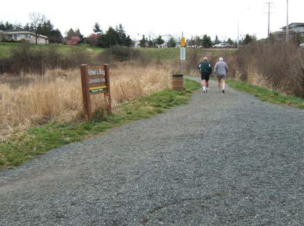
10 3.4 Rustic Trails Intended Use Be used in natural areas having topographic or special environmental features. Use may be limited to some users and in some cases single use only. Be used by hikers, joggers/runners, horse riders. Some trails may have restrictions on users. Examples: Trails in Knockan Hill, Glencoe Cove Kwatsech, Logan, Grant, Boulderwood parks Design Guidelines: Rustic Trails Surfacing: Compacted Gravel, Natural soil/rock surface Width: Surfaced width 1 2 m Cleared width 0.5 m minimum each side of trail Vertical Height Clearance: 3.2 m (high enough for horses and riders). Pedestrian only trail sections should be at least 2.2 m high Longitudinal Grade: This depends on the terrain and it may include steep sections with steps or stairs if the grade exceeds 15% Other Considerations: These trails may have restrictions on the use of the trail to protect the natural environment, or for safety, or other considerations. Trail is to be designed to blend in with natural environment as much as possible. Gravel and rock will be added to the natural surface as needed to improve drainage or to harden the surface to make it more resilient and durable. 7


11 3.5 Specialty Trails Intended Use Be used in areas having topographic or special environmental features. Be used by: walkers, joggers/runners, horse riders, mountain bikers. Some trails may have restrictions on users to protect the natural environment. For example, bikes are not allowed in Mount Douglas Park except on the paved roadways Some trails will be purpose-built for a specific user group, such as equestrian trails in rural Saanich or the hiking-only trails in Mount Douglas Park. Other trails are unique because of their steepness, or because there is a need to protect sensitive environmental features. At some future date, Saanich could have mountain-biking trails or a technical bike training area. Some of these trails may be single-purpose, e.g., hiking/walking only. Others may permit multiple uses. The types of permitted use will depend on the purpose of the trail. Examples: Cedar Hill Golf Course; Mt Douglas Park, Rithet s Bog Conservation Area Design Guidelines for Specialty Trails The design will vary according to the trail purpose. Design guidelines for these trails should be developed in conjunction with the appropriate user groups and the community. 8
12 Table A-1: Trail Guidelines Summary Trail Type Users Surfacing Width Height Grades Comments Regional trail Community trail Neighbourhood trail Rustic trail Standards determined by CRD Parks with input from Saanich. Multi use: commuter and recreational cyclists, in-line skaters, walkers, joggers, wheelchairs, strollers, equestrians, motorized scooters Multi-use: walkers, cyclists, equestrians. Some trails accessible for wheelchairs. Multi-use: walkers/hikers/joggers, equestrians, cyclists. Some trails may restrict access to specified user groups (e.g., no bikes). Asphalt (or compacted granular in certain conditions) Compacted granular or asphalt Gravel added where needed for drainage/ prevention of soil erosion Natural soil/rock Specialty trail Specified uses only Depends on specified use 3-5 m Cleared width 1 m each side of trail. Trail width 2-3 m Cleared width 1m each side of trail Trail width 1 2 m Narrower trails to include pull-outs for passing Cleared width 0.5 m each side of trail Depends on specified use 3.2 m Grades generally <5% Ideally less than 8% Cross slope 3% or less 3.2 m Grades generally <8% Maximum grade 15% over short distances, provide steps or stairs with handrails for steeper sections Cross slope 3% or less 3.2 m or 2.2 m for pedestrian only 3.2 m or 2.2 m for pedestrian only Depends on terrain. May include steps or stairs if grade over 15%. Depends on specified use Barrier free design Centre line painted on paved sections Trail bollards at least 1.5 m apart Barrier free design where possible Mark level of accessibility at trailhead 9
13 PART B: BACKGROUND STUDIES 4 Consultation and Research 4.1 Methodology From the outset, this project was conceived to create trail design guidelines with a made in Saanich approach. It was important to learn from the experiences of other communities, and at the same time to seek input from Saanich s residents and other trail users (who may live outside of Saanich). In addition to researching information from other communities, we sought input through meetings with user groups and other interested parties, conducted community surveys, and held an open house Information from Other Communities The consultant 1 researched trail standards from other communities in British Columbia and beyond. Detailed information was gathered from seven jurisdictions (Calgary, Prince George, Whistler, Langley, Highlands, Langford, and Pitkin County (USA)). These were selected because these communities include a mix of urban and rural environments, and have developed simple trail standards. This provided information on different trail categories, the user groups, trail surfaces, and design elements (height, width, gradients), as well as a variety of useful tips that can be applied in Saanich. The table in Appendix A summarises the design standards (e.g., width, height, gradients) for these various trail systems. Research was also conducted into standards required for barrierfree design for people with disabilities (see Appendix B) Meetings with User Groups The consultant and Parks staff held a series of meetings and discussions with different types of trail users and interested parties. These included: The Saanich Parks, Trails and Recreation Committee The Saanich Bicycle Advisory Committee Cycling interests (commuter cyclists, recreational cyclists and mountain bikers) Walkers, hikers and joggers Equestrians Seniors Youth representatives Representatives from environmental organizations Disabled users (physically and visually disabled) Saanich Community Action Network (SCAN) Cadboro Bay Residents Association The input from these meetings is summarized in Appendix C. 1 Judith Cullington & Associates 10

14 4.1.3 Surveys The District of Saanich arranged for two surveys to be conducted. One was a telephone questionnaire of Saanich residents. This was conducted by R.A. Malatest and Associates Ltd., and represents a statistically valid sample of the population. There were 400 completed surveys. A summary of the responses is included in Appendix D. The other was the Trail and Walkway Survey (Appendix E). Two thousand copies of this a questionnaire were printed and distributed through Recreation Centres, Saanich Municipal Hall, Cedar Hill Golf Course and available on the District Web site. There were approximately 100 responses to this survey. Results of this survey are summarized in Appendix F Open House Draft trail design guidelines were prepared and presented at a public open house/meeting on May 18, Approximately 90 people attended to view the displays, hear presentations and provide comments. Copies of a response form were made available at the meeting and on the District Web site, and 72 response forms were returned. A summary of input from the open house and response forms is provided in Appendix G. 4.2 Overview of Input What We Learned from Other Communities Th e wisdom from other communities can be summarized as follows: Keep to a simple set of trail categories Provide different trail types to meet a variety of recreational uses Provide some barrier free trails for use by wheelchair users and other less abled trail users Be flexible for example, a 2 metre wide trail might be narrower to go round a significant tree Design for enjoyment create interest, viewpoints, curves Connect trails to each other and to key destinations (e.g., playgrounds, schools, commercial areas), so that users can get where they want to go, or do loop routes Design for safety minimize hazards such as blind corners. Where there are hazards, make sure trail users are warned. Make trails wider in hazard zones like intersections Protect the natural environment. Avoid sensitive natural environments or design trails carefully. Use switchbacks or stairs to avoid erosion of steep slopes Think about life-cycle costs including installation and maintenance when selecting trail design and surfacing. Considerations for popular surfaces are: Concrete: expensive to install but durable Asphalt: less expensive than concrete, fairly durable (chip sealing can be used to extend its life) and there may be situations where it will be slippery. Gravel/compacted granular surface: less expensive than asphalt to install, but may require frequent maintenance depending on slope and rainfall Wood fibre (hogfuel): less expensive to install but requires frequent maintenance. Its lifespan may be extended if laid over a gravel base Natural soil: inexpensive, but cannot tolerate high use levels 11

15 4.2.2 Barrier free Design Many communities recognize the importance of having barrier-free (universally accessible) design for at least some of the trails. This means providing trails and associated amenities such as washrooms, viewpoints and parking areas that can be used by everyone, regardless of their ability level. The goal of barrier-free design is to provide access to the widest possible range of trail users, including people with disabilities. The benefit of this approach is that it creates trails that are safer and more welcoming for many types of users. Places that a wheelchair can go are also more accessible for parents pushing a children s stroller. A trail that has a more uniform surface is easier for seniors as well as for visually impaired people. For more detail on barrier-free design, see Appendix B Input from User Groups The input from user groups represented a diverse range of interests, and an equally diverse wish list for Saanich trails. However, all groups were supportive of the trail system in Saanich and keen to see it maintained and expanded. Not all trail users want the same types of trails. Below is a summary of some of the preferences and disli kes raised by various user groups (see Appendix C for more detail): Recreational cyclists: prefer hard surface (asphalt or hard-packed gravel). Widths (including between bollards) should allow for travel trailers on bikes. Commuter cyclists: prefer hard surface (asphalt) trails that are designed for speeds of up to 30 kph, with no sharp bends. Grades should be less than 5% where possible. Loose gravel trails are a hazard, especially on slopes. Centre lines should be marked on trails. Mountain bikers: prefer natural surface trails with obstacles to challenge riders. Steep grades add to the fun! Riders would like to develop purpose-built mountain biking trails in Saanich (other than at Mount Work-Hartland Regional Park). Equestrians: prefer soft surface trails (natural soils or hogfuel). Trails should be cleared to a height that allows for horse and rider (minimum 3 m). Some equestrians do not put shoes on their horses they prefer only soft-surface trails. Most shoe their horses, and will ride gravel trails, provided that the small diameter, rounded gravel is used (so as do not to hurt the horses feet). Asphalt can be slippery for horses and the smooth surface makes it hard to hear bikes coming, which can startle the horse. Some horse riders do use paved trails, however. Walkers: will walk on any surface type, although softer trails are often preferred (natural soil, hogfuel or gravel). Variety is good as individuals may have preferences for harder or softer surfaces. Steps, stairs or ramps should be provided for steeper sections. Hikers: prefer the challenge of natural trails. Moderately steep grades are not a concern. Joggers/runners: most prefer softer surfaces such as natural soil, hogfuel or compacted gravel, while some like paved surfaces. Wheelchair users: prefer uniform, hard surfaces (asphalt, concrete or well-packed gravel). Trail widths should allow for two wheelchairs to pass, and space between trailhead bollards should be at least 1.75 m. The entire trail should be wheelchair accessible, with signs at the trailhead to provide this information. There should be a physical barrier at the edge of steep drop-offs. Allow for mobility scooters on some trails. However, there are also off-road wheelchair users who like more challenging trails. Visually-impaired individuals: prefer a hard surface (asphalt, concrete or hard pack gravel). Ensure that overhanging branches are pruned, and trail edges are well defined. Provide a change of texture at intersections as a warning. Provide edging at the foot of safety rails that canes will detect. Seniors: less-able seniors generally prefer hard surface trails with minimal steep sections. However, there are a wide range of abilities. 12
: prefer asphalt trails. The typical broom-finished concrete is not usually as smooth and makes for a bumpier ride.")
16 Youth: prefer trails wide enough for two or more people to walk and talk. On routes to schools, trails should accommodate bikes and children s strollers. Other wheeled users (in-line skaters, skateboarders, children s strollers): prefer asphalt trails. The typical broom-finished concrete is not usually as smooth and makes for a bumpier ride. Environmental groups: commented that there should be a variety of trails meeting different user needs. Trails should blend with natural surroundings and avoid environmentally sensitive areas and off-trail impacts. Table 1 summarizes user preferences for trail surfaces. Asphalt surfaces provide an easily-travelled surface for all user groups, and are the most multi-use surface (although they are not a preferred surface for some). Photo: Saanich Parks 13
17 Table B-2: User preferences for trail surfaces This information is derived from consultations with user groups, and research from other communities. This is a generalization individual preferences vary. Key: = Preferred surface = Acceptable surface = Less desirable or inappropriate surface User Type Asphalt Concrete Gravel Hogfuel/ wood Natural soil In-line skater Skateboarder Wheelchair user Children s stroller Commuter cyclist Mobility scooter user Recreational cyclist Mobility impaired Visually impaired Walker/dog walker Hiker Runner/jogger Equestrian Mountain biker 14

18 4.2.4 Input from Surveys Telephone Survey There were 400 responses to the random telephone survey (conducted by R.A. Malatest and Associates). Results from the telephone survey are statistically valid, and can be assumed to be representative of the concerns and wishes of Saanich residents in general. The random telephone survey (Appendix D) indicated that: About two-thirds (66%) of residents are somewhat or fairly familiar with the trail system. Another 10% were very familiar with trails. The top three trail systems used by Saanich residents are the Cedar Hill Golf Course, Lochside Trail (south section) and trails in Mount Douglas Park. For most people, their neighbourhood walk is the most commonly used trail. Proximity/convenience was the most commonly given reason for identifying a trail as a favourite. Walking/hiking/jogging for recreational purposes was the most common activity on trails. (Among dog owners, walking the dog on Saanich trails was the most common activity.) Recreational cycling was the next most popular activity. Overall, use of trails for commuting was relatively low. Most respondents (83%) felt that there were no barriers to their using the trail system. Of the remainder, most notable were that one-quarter (25%) of horse owners and about 14% of wheelchair owners felt that there were barriers to recreational use of the trails. When asked what kept them from using the trails more often, respondents identified personal time constraints (38%) or health constraints (10%) as the main issue. Over 21% said there were no constraints to additional trail use. No single improvement or modification to the trail system was cited as likely to increase trail usage. Items cited as being the most effective were more maps (60%), more signs directing people to trails (59%), more restrooms (51%), and more signs on the trail (50%). Build more trails was cited by 43% of respondents. Make trails more accessible for wheelchairs and strollers was considered effective by 35% of respondents. Change the surface of the trails was considered effective by 29% of respondents. Widen existing trails was considered effective by 26% of respondents. When asked for the most effective way to communicate with Saanich residents, respondents chose: Saanich News (67%) Municipal program (58%) Direct mail (56%) Brochures at bike/sporting goods stores (54%) Shopping centre displays (52%) 15
19 Table B-3: Most Frequent Activities Undertaken on Saanich Trails and Walkways The information below is taken from the Malatest household survey. Frequency scores are assigned based on a maximum of 3 the higher the number, the more frequent the activity. Each person s response was assigned a value (0 = never, 1 = rarely, 2 = sometimes, and 3 = often ) and a mean was calculated based on the proportion of responses. Activity Walking, hiking or jogging for recreational purposes Frequency Score 2.39 Comments Cycling for recreational purposes for bicycle owners Walking dog(s) for dog owners Walking for commuting purposes 0.88 Cycling for commuting purposes for bicycle owners Rollerblading for owners of rollerblades Wheelchair or scooter access for recreational purposes for wheelchair/scooter owners Horseback riding for horse owners Wheelchair or scooter access for commuting purposes for wheelchair/scooter owners Of the Saanich households surveyed: 69.0% of households surveyed included bicycle owners; 37.8% of households surveyed included someone owned roller blades; 29.0% of households surveyed had a dog; 5.3% of households surveyed included someone who owned or leased a wheelchair or scooter; and 2.0% of respondents indicated that they or someone in their household owned or leased a horse. From Malatest


20 Handout Survey There were 99 responses to the Trail and Walkway (handout) Survey conducted by Saanich Parks staff (Appendix E). Results from this type of survey are not statistically valid, because they reflect only the views of those who were aware of the survey and chose to respond. This survey does however provide important information on the views of trail users. It is interesting that the handout survey produced some similar results (see Appendix F) to the telephone survey. The handout survey results indicated that: Most respondents use the trail system for exercise, recreation and enjoyment of nature. Most respondents use the trail system year round, more than three times per week. The majority of respondents felt very safe or somewhat safe undertaking their activity on trails, but there were several suggestions on ways to improve trail safety. Walking/hiking for recreation was the most popular activity (65%), followed by recreational cycling (37%). Most (90%) felt that the existing trail system is good, very good or excellent. Features that they liked about the trail system were no cars, accessible, neighbourhood and regional connections, scenery, close to home and well-maintained (all chosen by more than half the respondents). Preferred trail surfaces varied, with asphalt (45%), hard packed gravel (41%) and wood fibre (hogfuel or wood chips) (41%) being the most popular. Walkers generally found existing trail widths about right, while cyclists and in-line skaters were more likely to identify trails as too narrow. Suggested improvements were more trails (51%), more signs (34%) and kiosks (22%), more lighting (19%) and widen trails (19%). Several people asked for more washrooms. Most people claimed to be familiar with trail etiquette. Respondents felt the most effective ways to communicate information would be on the trail itself (maps and other information) and through the local newspaper Input from Open House/Response Forms Draft Trail Design Guidelines were presented at the open house and on the District Web site. People made comments both at the open house and through response forms. As with the handout survey, the results from the response forms and open house comments are not statistically valid, but are very useful in gauging response from trail users. Seventy-two response forms were completed. While many people agreed in general with the proposed trail categories, a number of concerns were expressed (see Appendix G). These included: 17

21 The difference between regional and community trails was confusing. Paved trails are not acceptable to most horse riders. There should be different guidelines for trails in urban versus rural parts of Saanich. Rustic trails should be multi-use (not pedestrian only) Regional/community trails should be dual surface (or have parallel trails) allowing hard surfaces for cyclists and softer surfaces for joggers and equestrians. Trails should only be built in places and in ways that would not damage the natural environment. Some respondents felt trails should be wider; others felt that wider trails would be less safe as this would encourage higher speeds. Some respondents felt that all trails should be paved for greatest accessibility, while others felt there were too many paved trails already. Asphalt was generally preferred over concrete. Better trail etiquette is needed. More signage and amenities (benches, washrooms) are desirable Trail Signs, Amenities and Etiquette During this study, many people spoke about the importance of signage, amenities and trail etiquette. These are all important contributors to the trail experience, which will be addressed in subsequent reports and projects. The input from all of these sources has been used in the development of the Trail Design Guidelines. 18
22 Bibliography and References Access Board Regulatory Negotiation Committee on Accessibility Guidelines for Outdoor Developed Areas Final Report September 30, Architectural and Transportation Barriers Compliance Board (U.S.A.) Available from Alta Planning and Design. (no date). What s under foot? Multi-use trail surfacing options. George Hudson, Alta Planning and Design. Baldwin, Matthew District of Langford Planner, pers. comm. Biegun, Robert Natural Areas Management Supervisor, City of Calgary. pers. comm. B.C. Parks. (no date) Trail Design and Construction Standards Manual. Available from Canadian National Institute for the Blind. Capital Regional District Parks Everyone s parks and trails: a universal access plan for CRD Parks. Report, March City of Calgary Calgary Pathway and Bikeway Plan: Report. Calgary Parks & Recreation and Transportation Departments. City of Calgary Pathways, Trails, Paving Stones. Extract from Standard Specifications for Landscape Construction City of Prince George Prince George City Wide Trail System Master Plan. Prepared by Carson/McCulloch & Associates for the Prince George Leisure Services Department Parks Division, September Corporation of the Township of Langley Discover active living thru community connections: planning document for a municipal trail network. Adopted by Langley Council September District of Langford Trail Master Plan. District of Langford Planning Department. District of Highlands Greenways/Trails Network Master Plan. Prepared by Sibohan District of Saanich Results of the 2003 Citizen Survey. May District of Saanich Engineering Specifications. Schedule H to Bylaw February District of Saanich Rural Saanich Local Area Plan. Draft for public review, February Elk/Beaver Lake Equestrian Society Letter to District of Saanich re surfacing for Centennial Trails and Interurban Rail Trail. Signed by Mark Guarnaschelli, July Friends of Mount Douglas Park Trails: Mount Douglas Park. Background information on the Friends proposed trail standards. Go for Green. Risk Management and Liability for Trails. Trail Monitor 3. Risk Management and Liability for Trails. Available from Go for Green. Trails and the Environment. Trail Monitor 3. Risk Management and Liability for Trails. Available from Iowa Department of Transportation Iowa trails Chapter 4: Trail design guidelines. Chapter 5: Cost analysis Malatest & Associates Ltd Saanich Parks Trails and Walkways Survey. Report of survey prepared by R.A. Malatest & Associates Ltd. for Municipality of Saanich, April Open Space and Trails Program Trails Design and Management Handbook. Pitkin County Open Space and Trails, Colorado, U.S.A. PLAE Inc Universal access to outdoor recreation: a design guide. MIG Communications, Berkley CA. Section 5 deals with accessible recreational trails. 19
23 Province of British Columbia. Building Access Handbook. Available from Resort Municipality of Whistler Whistler Trail Standards: Environmental and Technical Trail Features. 20
24 Appendix A: Trail Standards in Other Communities Calgary The City of Calgary is expanding rapidly. The trail system doubles as an off-road transportation network as well as a recreational facility. Trail categories Calgary has two trail types: pathways and trails. Pathways form a network that link together residential areas, parks, natural areas, riverbanks and public recreational facilities. The pathways are divided into: Regional pathways. These are hard-surfaced (typically asphalt), off-road trails, designed for multiple users. These are linked together as a network that provides an off-road transportation system. Local pathways. These are secondary routes within neighbourhoods that link to the regional pathway system. Pathways are designed for multiple use, meeting the needs of walkers, children s strollers, runners, wheelchair users, cyclists, in-line skaters and skateboarders. Trails are paths in natural areas. They have a granular (gravel) or natural surface and are constructed primarily for pedestrian use. Trails are intended as a secondary system to pathways, and provide a low impact and low cost alternative for access to natural areas and steep slopes where pathways would be inappropriate. Tricks and tips Pathways are designed to connect destinations schools, places of business, shopping, cultural centres, residential areas. Pathways should serve for transportation, recreation and fitness. Where there is a conflict, recreational use is given the higher priority. (Within river valleys and natural areas, protection of the resource takes precedence.) Regional pathways are designed, maintained and retrofitted to accommodate multiple uses. Pathways are built to barrier-free standards. Where high use is expected, pathways should be wider than usual, or twinned. Pathways are snow-ploughed during the winter to allow year round commuter cycling. In twinned sections, only one section of the pathway is ploughed. Asphalt is preferred over concrete. This is smoother for wheeled traffic, less expensive. A yellow centre line is imperative. Developers are keen to build linkages to the pathway system, as this is a selling feature for new subdivisions. The City of Calgary provides developers with their trail standards, and developers pay for the cost of pathway installation. In some cases, they may add some design features (e.g., paving stones to mark the entrance to their subdivision). Saanich Trail Design Guidelines DRAFT 23 February
25 Prince George Prince George developed a trail system master plan in Trail types There are three off-road trail types: City trail: a city wide route linking major destinations, designed to accommodate a wide variety of users on a wide (3 m) asphalt surface. Neighbourhood trail: secondary and loop trails in natural areas and parks, designed to accommodate multiple users on a 2 m wide granular surface. Rustic trail: narrower trails (1 m or less), located in natural settings, with limited facilities. Surfacing depends on local needs and users. Tips and tricks Trails are defined by width, surface, maximum grades and geographic location. Prince George recognizes that there are times when standards will have to be adjusted to respond to local conditions. Trails are built using quality construction, as this minimizes the costs of maintenance. Drainage is critical, or it will erode the subbase and subgrade. Clearing vegetation on the trail sides helps with sightlines. Vegetation clearing should include digging up roots to minimize the rate of grow-back. The trail corridor should be wide enough to allow for passage of construction equipment and emergency vehicles. Each of the trail types has specific maintenance schedules. The plan advocates having specialized trails for mountain bikers. Horses are confined to designated trails to reduce conflicts. Estimated costs are $100/linear metre for asphalt; $60/l.m. for granular and $25/l.m. for unsurfaced trails. Whistler The Resort Municipality of Whistler has developed a set of trail standards to guide the management and expansion of the neighbourhood trail network. This is focused primarily on mountain bike trails. Trail types Type I trails: paved (asphalt), two-way trails for smooth, all-weather use. These trails are 2 3 m wide, found in developed areas and are designed for the highest use levels. They are all technically easy. Type II trails: surfaced (crushed limestone) trail, single track (1 m) or double track (2 3 m). Technical level ranges from easiest to more difficult in developed areas. Type III trails: unsurfaced single track trails, m wide. Technical difficulty ranges from easy to most difficult in developed areas. Type IV and V trails: are highly technical trails in rough terrain. Tips and tricks Trails should avoid hazard and sensitive areas, such as unstable slopes, habitat for fragile plant species, archaeological sites. Whistler sets priorities for frequency of tail inspection and maintenance, with the Type I trails being Saanich Trail Design Guidelines DRAFT 23 February
26 highest priority (inspected twice a year), and Type II trails being medium priority (inspected each spring). Trails are only de-activated after public notice and consultation. Langley The Township of Langley developed plans for a municipal trail network in Trail types Trail types include on-road and off-road trails and are defined by the user groups: Single-use trails: are designed for pedestrians, equestrians, or cyclists (on-road or mountain bikes). Shared-use trails: are designed for two or more user groups. Design specifications vary according to the types of user groups (see Appendix A). Tips and tricks Trails are designed for transportation as well as recreation. Trail planning should incorporate views, cultural features, environmentally sensitive areas and interpretive signage. Design guidelines and maintenance standards should be a reasonable balance between level of service for residents and costs to the Township. Pedestrian routes are asphalt in urban areas, and gravel screenings in rural areas. All trails used by equestrians are gravel screenings rather than asphalt. Highlands The District of Highlands prepared a Greenways/Trails Network Master Plan in Trail standards were included as part of this plan. Trail types Single-use off-road: Trail designed for a single activity (pedestrian, equestrian, leisure cycling or mountain biking). Specifications vary according to activity (see Appendix A). Multi-use off-road: Trail designed for multiple uses ( m wide, natural soil surface, compact gravel added to wet areas). Roadside trails: Trails within road right of way, multiple use ( m wide, natural soil surface, compact gravel added to wet areas). Commuter cycling lanes: within paved surface of road. Tips and tricks CRD regional trails within the Highlands are all designed for multiple use. Highlands recognizes regional trails (part of CRD regional trails network), sub-regional trails (important connectors to regional trails) and neighbourhood trails (small trails connecting to sub- and other regional trails). Trail construction and maintenance should be undertaken with the least amount of vegetation removal. Greenways can combine recreational and wildlife habitat values. Ecological sensitivity should be the primary criteria for trails near streams, wetlands sensitive areas. Separate trails for conflicting user groups are introduced as funds permit. Saanich Trail Design Guidelines DRAFT 23 February
27 Low impact gravel surface parking areas should be provided at trailheads. Langford The District of Langford prepared a Trail Master Plan in 1998, which includes trail construction guidelines. These are guidelines for preliminary planning detailed design standards are developed on an individual trail basis. Trail types Hiking trail: pedestrian use only, single file, natural soil surface. Multi-use trail: multiple simultaneous users (pedestrians and cyclists), longer connector trails, gravel (or asphalt if designed as barrier-free). Pedestrian easements and walkways: pedestrian links between subdivisions, gravel surface. Multi-use easements and walkways: short urban connector trails, barrier-free design for walkers, cyclists and wheelchairs, asphalt surface. Tips and tricks Design criteria include intended mode of use (pedestrian, bicycles, equestrian, mixed use); estimated amount of use; cost of construction; hazards (liability and risk management); amenities; route requirements; and maintenance considerations. Hogfuel is not recommended for use on Langford trails. (This is due in part to cost, and in part as some dog owners have raised concerns that hogfuel harbours fleas.) Pitkin County Pitkin County is in Colorado, U. S.A. The Open Space and Trails Program for the County has prepared an extremely detailed manual (Trails Design and Management Handbook) that is recommended for detailed trail design and construction standards. Trail categories There are three trail categories. Hard Surface Multiple Use Paths are high-use trails designed to accommodate a wide range of nonmotorized use, including wheelchair accessibility. These are surfaced with asphalt or concrete. Crusher Fines Surface Paths are designed for moderate use levels in urban, suburban and easilyaccessed undeveloped areas. They are designed for hiking, running, mountain biking and/or equestrian use, and are barrier-free for disabled users as much as possible. Construction standards very slightly according to user groups (bike paths/pedestrian and wheeled traffic/pedestrian only). Natural Surface Trails are designed for low to moderate use frontcountry and backcountry hiking trails. In some places, they may also be used by mountain bikes and equestrians. Tricks and tips Trails are designed for recreation, and where feasible for transportation as well. Trail types are determined by the level of use. (High use is more than 400 users per day, moderate use is users per day.) Trail widths are determined by levels of use and safety considerations. Extra width is added for hazard zones, such as at viewpoints (where some users are stopped and looking while others are trying to pass). Sightlines are an important aspect of safety. Sightlines for cyclists should be at least 200 ft (61 m), based on travel at 20 mph (30 kph). Saanich Trail Design Guidelines DRAFT 23 February
28 On high use trails, an adjacent and roughly parallel crusher fines trail should be provided for walkers and runners, with a varying width median to separate the two where possible. Trails should be designed to include features of interest such as viewpoints. Trail design can help to avoid conflicts between user groups, e.g., through width and parallel trails. Trail design should respect the natural environment and local wildlife. Trail design is important for safety. Aspects such as sightlines (avoiding blind curves), handrails by drop-offs, and minimizing road crossings are important. Saanich Trail Design Guidelines DRAFT 23 February
29 Table B-3: Comparisons from other communities: width, height, surfacing Agency Trail type Uses Min width Av width Max width Width cleared Height Surfacing Trans Canada Trail Trans Canada Trail (Cowichan River Prov Park) rail to trail walk bike horse 3.5 m 4.0 m 3/8" aggregate crusher fines BC Parks BC Parks type I foot trail short walks, 2 way foot traffic, wheelchairs 2.0 m surfaced BC Parks type II foot trail walking trails 1.25 m may be surfaced BC Parks type III foot trail longer hiking trails, single file 0.75 m BC Parks type I horse trail high use, day use, two - way traffic 2.5 m 3 m crushed stone (unless soils suitable) BC Parks type II horse trail moderate use 0.45 m 1.0 m 2.5 m 3 m Existing soil surface, except in wet or fine soils. Even surface free of rocks or roots. Wood chips or wood shreds/gravel or crushed stone mixed with soils. Whistler Whistler Type I walk bike in-line skate wheelchair 2.0 m 3.0 m 6.2 m 3.0 m asphalt or chip-seal coat Whistler Type II walk bike 2-3 m for 2-way, 1 m for 1-way or mtn bike 5.0 for 2- way, 1.4 for 1-way 2.4 m crushed limestone with fines, well compacted gravel or existing old railbeds Whistler Type III unsurfaced 1-way 0.5 m 0.7 m m 2.4 m native soil
30 Agency Trail type Uses Min width Av width Width Max width Height Surfacing cleared Whistler Type IV unsurfaced 1-way, some rough terrain 0.3 m 0.5 m 2.4 m native soil Prince George Prince George City Trail walking, jogging, cycling, skateboarding, in-line skating, wheelchairs and strollers 2.5 m 3.0 m 5 m preferred, 4.5 minimum asphalt, lain to 75 mm thick Prince George Neighbourhood trail walking, hiking, jogging, cycling, x-co skiing, horse riding 1.5 m 2.0 m 4 m preferred, 2.5 m minimum granular: finely crushed sandstone or limestone with particle size 3/4" minus (19 mm), at least 100 mm (4") thick, well compacted Prince George Rustic Trail hiking, mountain biking, x- co skiing, horse riding 0.8 m 1.0 m 4 m preferred, 2 m minimum packed native soil, with wood chips or gravel if heavy use. Clear all roots, stumps and large rocks Highlands Highlands Roadside trail multi-use 1.5 m 2.5 m 5.0 m m compact native soil, covered with compact gravel in wet areas Highlands Multi-use off road trail 1.5 m 2.5 m m Langley Township of Langley single use: pedestrian only (off-road) pedestrian 1.0 m rural, 1.5 m urban 1.5 m rural, 2.0 m urban 3.0 m 0.5 m either side 2.0 m Gravel on low volume trails. Wood chips or bark mulch softer, easier to install but not in sensitive areas where they could leach into streams.
31 Agency Trail type Uses Min width Av width Width Max width Height Surfacing cleared Township of Langley single use: equestrian horse riding 2.0 m (single file) 3.0 m (twoway) 1 m either side of one-way trail, 0.5 m either side of two-way trail) 3 m hemlock-fir hogfueld over gravel subbase (allows for quiet dry ride with stable, dry footing). Also use 'gyrosand' - a fine dust from rock grinding (but costly) Township of Langley single use: off-road cyclists commuter, recreational biking 1.5 m (one way) 2.5 m (two way) 0.5 m either side 2.5 m Gravel and asphalt. On shared trails, gravel helps to slow bikes and let other users hear them coming. Township of Langley shared use trails pedestrian, equestrian and/or cyclists depends on uses 4.0 m 0.5 m either side 3 m (2.5 m if no horses) Gravel - allows horses to hear other users coming. If horses not permitted, then asphalt or screenings. Calgary Calgary Regional Pathway walkers, dog walkers, cyclist, in-line skaters, skateboarders, disabled (wheelchairs), runners m each side of path 3 m asphalt (a few sections of concrete or interlock brick, asphalt preferred) Calgary Local Pathway walkers, dog walkers, cyclist, in-line skaters, skateboarders, disabled (wheelchairs), runners 2 m 1 m each side of path 3 m asphalt (a few sections of concrete or interlock brick, asphalt preferred) Calgary Trail information coming Langford District of Langford Hiking Trail pedestrian hiking only, single file 0.45 m 0.6 m natural soil, grubbed out but not surfaced District of Langford Multi-use trail longer connector trails, pedestrians and cyclists 2.0 m 3.0 m gravel (not barrier-free), 100 mm of 3/4"- crushed gravel compacted to 95% proctor. Asphalt for sections designated barrier-free
32 Agency Trail type Uses Min width Av width Width Max width Height Surfacing cleared District of Langford Easements and walkways (multiuse) pedestrians, cyclists, wheelchair access 2.0 m 3.0 m Asphalt - 50 mm of hot mix asphalt Pitkin County Pitkin County, Colorado hard surface multiple use cyclists, strollers, walkers, inline skaters, runners, wheelchair users (possibly others) 2.5 m 3.5 m (high use), higher in hazard zones hard surface - concrete or asphalt Pitkin County, Colorado crusher fines surface bikes, pedestrian/bikes, pedestrian only 1.5 m m 3.5 m (high use, especially if used by bikes) 3 m (for bikes and horses) crusher fines - see manual for specifications Pitkin County, Colorado natural surface hikers, runners (possibly others) 0.5 m 1.0 m 2.0 m (high use) natural surface Table B-4: Comparisons from other communities: grade, subsurface Agency Trail type Av. Grade max grade Subsurface Edge Other comment Trans Canada Trail
33 Agency Trail type Av. Grade max grade Subsurface Edge Other comment Trans Canada Trail (Cowichan River Prov Park) rail to trail BC Parks BC Parks type I foot trail 5% 8% may need engineered bridges BC Parks type II foot trail 5-8% 10% BC Parks type III foot trail 15% simple log crossings BC Parks type I horse trail 0-10% 15% Whistler type II horse trail Whistler Type I Whistler Type II Whistler Type III Whistler Type IV Prince George Prince George City Trail Where slopes exceed 4% sign as such for wheelchairs 7% for long runs (up to 200 m), up to 10% for short runs (up to 50 m). Over 10% use stairs or switchbacks. grassed boulevard and shade trees - will need regular grass cutting Needs minimum maintenance (crack patching), life expectancy of years. Frequent use helps maintain pliable surface. Prince George Neighbourhood trail 12% for long runs (200 m+), 15% for short runs (up to 50 m). Over 15% provide stairs or switchbacks. Use geotextile fabric between subgrade and subbase to prevent vegetative growth Native plants and trees, with some low introduced material. Need to keep corridor clear and annual mowing. Will require new stone and regrading after 10 yrs, plus some spot repairs.
34 Agency Trail type Av. Grade max grade Subsurface Edge Other comment Prince George Rustic Trail 20% for long runs (200 m+), 30% for short runs (<50 m). Over this use stairs or switchbacks. Natural. Minimal clearing to keep sightlines clear. Locate trail in well-drained area to minimize damage from water erosion. Removing vegetation growth will be ongoing maintenance item. Wood chips are popular with hikers and horseriders but has poor durability, needs replenished every 2-3 yrs. Wood bark or fines are longer-lasting. Highlands Highlands Roadside trail 5% sustained grade, 8% over short distances minor clearing of brush, low shrubs and ground cover to remain and provide screening from road Highlands Multi-use off road trail 10% sustained grade, 15% over short distances Langley Township of Langley single use: pedestrian only (off-road) 8% for strollers and wheelchairs, or marked if higher grades used Township of Langley single use: equestrian 15-20% Township of Langley single use: offroad cyclists 10% Most are designed for 30 kph (but cyclists may go up to 50 kph). Slower on steep hills. Township of Langley shared use trails % (dep on users) Calgary
35 Agency Trail type Av. Grade max grade Subsurface Edge Other comment Calgary Regional Pathway 8% (where steeper, marked as 'steep hill' Clear shrubs to 1 m height for sightlines (2 m in natural areas) Pathways are important part of transportation network. Designed for bike speeds of 20 kph (max allowed speed), slower in areas e.g., bridges, steep hills, poor sightlines) Calgary Local Pathway 8% (where steeper, marked as 'steep hill' Clear shrubs to 1 m height for sightlines (2 m in natural areas) Role is to connect within communities and to regional pathways. Design standards similar except for width. Calgary Trail Langford District of Langford Hiking Trail 0-5% 10% for long runs, 25% for short distances District of Langford Multi-use trail 0-3% 5% sustained, 8% for short distances (up to 15% for cyclists) Under gravel: mm of pit run gravel compacted, where required place 75 mm clear rock for drainage in low areas Hogfuel not recommended for trail surfaces. District of Langford Easements and walkways (multiuse) 0-3% 5% sustained, 8% for short distances 100 mm of pit run gravel compacted Pitkin County Pitkin County, Colorado hard surface multiple use 0-5% 8%, 10% for short distances. Over 5% is not wheelchair accessible. Concrete can be laid on compacted subgrade, use road base if poor subgrade. Base course under asphalt, thicker over medium soils and wetter conditions Manual provides detailed specifications
36 Agency Trail type Av. Grade max grade Subsurface Edge Other comment Pitkin County, Colorado crusher fines surface 0-3% (for bikes) 5% (8% if asphalt surface used). No max for pedestrian use only if steps used Manual provides detailed specifications. Sightlines of at least 35 m for bikes unless signed.\ Pitkin County, Colorado natural surface up to 10% Manual does not provide detailed specifications Saanich Trail Design Guidelines DRAFT 23 February
37 Appendix B: Barrier-free Design Many communities stress the importance of having barrier-free design for at least some trails. This means providing trails and associated amenities such as washrooms, viewpoints and parking areas that can be used by everyone, regardless of their ability level. The goal of barrier-free design is to provide access to the widest possible range of trail users, including people with disabilities. The benefit of this approach is that it creates trails that are safer and more welcoming for many types of users. Places that a wheelchair can go are also more accessible for parents pushing a children s stroller. A trail with an even surface is easier for many seniors as well as for visually impaired people. Elements of barrier-free design include: Smooth, even, trail surfaces. Where pavers or concrete is used, joints should be flush (less than 6 mm difference in height. 1 ) Trail surface should be at least 1 m wide, and preferably at least 1.5 m 2. Where trails are too narrow for two wheelchairs to pass, wider passing spaces should be provided (especially over boardwalks and other places with restricted widths), preferably every 60 m if possible. 3 Gentle grades (5% is usually considered the maximum grade 4 ), with no steps or stairs. Slopes could be steeper over short distances if rest areas are provided. 5 Opportunities to sit and rest along trail routes. Edging or a surface change along trail edges so that people with a cane can recognize the edge. Any projections (e.g., overhanging branches) have been removed to a height of 2 m. Where projections are unavoidable, provide fencing. Any openings (e.g., grates) should be small enough to prevent a 13 mm sphere going through. Gentle cross-slope (maximum 3%, 5% if needed for drainage 6 ). Protective fencing or edging 7 ) by drop-offs (to prevent wheelchairs from going over). Amenities that are accessible: signs with large print, parking spaces for disabled users, accessible washrooms, drinking fountains and picnic tables that can be accessed by wheelchairs. Signage that indicates which trails are easily or moderately accessible. Since some of these design requirements are suggested for built environments, it may be necessary to make exceptions to accommodate the reality of trail terrain. Where there are more challenging sections of trail, these should be marked at on-site and at the trailhead. 1 BC Building Code 2 Access Board The BC Building Code suggests 1.5 m to allow for a person walking and a wheelchair to pass. 3 Access Board The BC Building Code recommends a gradient of not more than 1 in 20 (5%) % with resting intervals every 15.5 m, 10% with resting intervals every 9 m (Beneficial Designs). 6 Access Board BC Building Code suggests 75 mm minimum to prevent the front wheel of a wheelchair from going over the edge, wherever the drop itself is greater than 75 mm. Fencing provides greater protection where there are higher drop-offs. 14 Saanich Trail Design Guidelines DRAFT 23 February 2006
38 Appendix C: What User Groups Told Us Saanich Parks and Recreation Committee (Meeting held September 30, 2004) Put information on public input in Times-Colonist as well as Saanich News Talk to each community about how well trails in their area have worked Think about how Saanich standards will match with neighbouring communities (e.g. CRD trails) Paving Interurban Trail seems inconsistent with rural nature of this part of Saanich Survey should have examples to show people but then people get site-specific. The tough question will be: which trails types are in which location? Saanich Bicycle Advisory Committee (Meeting held September 29, 2004) Trail based survey will be biased because of the time of year (e.g. fewer rollerbladers and family cyclists) Contact Bike to Work Victoria Note that some trails e.g. Lochside are both long-distance routes, coupled with people doing shorter trips in some sections (potential for conflict) For trail such as Interurban, would prefer asphalt (for broadest possible multi-use) or stable gravel surface, design for speed. Trail from Goose to Interurban Road is too loose, has high accident potential. Prefer a hard rough surface (e.g. textured concrete) Rocks or bollards on trails are barrier if not widely spaced enough Note that pedestrians and cyclists have different needs at road crossings Saanich Community Association Network (SCAN) (Meeting held October 6, 2004) Have some trails for walkers only (narrow, woodchip) Be careful of conflicts between different user types resolve by trail design rather than enforcement Drainage will be an important issue, especially for wheelchairs, strollers Survey should look at where people live, what time of day they use trails Have side trails to get to beautiful spots (with signage) Think about short-distance trail users, and those who drive and then walk Cycling Groups (Meeting held October 27, 2004) Likes Commuter cyclists: Galloping Goose and Lochside are good as they provide accessibility for a wide variety of cycling types (commuting, recreational and family cycling, sightseeing, access to amenities) GG good for commuting and utility trips Saanich Trail Design Guidelines DRAFT 23 February
39 Preference for smooth, paved sections Prefer harder, cleaner surfaces for transportation bike routes Connectivity to other trails/roads important: quick route to work Getting away from traffic is good for user safety Centre line on paved trails helps to reduce conflict (can we put one on gravel trails too?) Mountain bikers Prefer single track trail on natural soil, lots of up and down (note that bikes and horses do cause erosion) Narrow trail with technical features helps to lower the speed Beefs Sandy equestrian trail on Lochside doesn t work Dogs with invisible leashes problem for dog, owner and cyclist Gravel sections that are loose marbling effect is very slippery for bikes Bollards (removable posts) where the handle is perpendicular to the trail potentially painful for cyclists Camouflage bollards that blend with the trail colour Bollards too close to intersections move them back 5 10 m so that you have room to turn Bollards too narrowly spaced should be wide enough to allow trailers on bikes through, and allow tandem bikes to turn between Rattly and slippery bridge surfaces suggestion for surfacing on the wooden deck. Need to identify potential icy areas. Too tight corners on trails (makes you slow down too much) Signs that are not at bike eye-level Surfacing on Goose onto Interurban (loose crushed gravel is hard to navigate, potential for erosion) Hogfuel too spongy On gravel trails, the main bike route gets hard packed, but the outer areas are loose gravel, very hard on bike trailers Road crossings where it takes too long for signals to activate (encourages people to cross illegally) Suggestions Some trails (e.g. GG) are major transportation corridors for commuters and cycling tourists should be paved Other routes (e.g. Colquitz) are more local use so should not be paved Make trails wide enough to reduce conflicts: commuting without being in other people s faces Comfortable width will increase traffic Beware of width cyclists will go faster on a wider trail Should be sliding scale on width 5m wide in urban areas, rural trail connectors only 2m (less where there are physical or environmental constraints) 1 m is minimum comfortable width for cycling Curves are good for interest, but should be good sightlines Saanich Trail Design Guidelines DRAFT 23 February
40 Surfacing should cope with multi-use Asphalt blend surfaces are good for cyclists Use grade reversal to help drainage on slopes Think about crossings Put countdown timers at signal road crossings Try a scramble signal (red lights in all directions allowing pedestrians to cross any way at once), e.g. at Mackenzie and Borden The route with the most traffic should have right of way (i.e. if Goose gets more use than the side road, the cars on side road should have the stop signs, not the bikes) Signage is important Look at Burke-Gilman Trail in Seattle paved with rougher section parallel for joggers Encourage cyclists to use voice or bell as they approach walkers Cyclists should be given a say before approving surfacing on new/upgraded trails Designate a trail for mountain bikers (for beginners/moderate, not the high-end technical trails like most in Hartland). Mount Doug Park has potential for this. Need for bike racks at the start of trails (some people like to ride their bikes to Mount Doug and then walk up) Improve the Colquitz River trail Don t forget rollerbladers Think about the purpose of trails keeping current users happy versus encouraging new trail users Keep sides of trail cleared (better sightlines, increases effective width) Define the purpose of the design guidelines is this to increase the number of trail users or the satisfaction of trail users. Each user type has its own preferences. Paving costs more so more paved trails would mean fewer new trails. Wish list: Lighting on trails good for night riders (avoids conflicts between walkers and cyclists on dark nights), especially on key transportation routes Washrooms Emergency phones Park benches and picnic tables Signs: maps (where are you and where are you going), distances to key destinations Signs on roads directing you to nearby trails Signs on trails directing you to points of interest Accessibility Groups (Meeting held October 28, 2004) Physical disabilities: There are a range of ability levels e.g. some wheelchair users use a trail rider (effectively, an all- challenging trails terrain wheelbarrow) to go on very Disabled cyclists may use a bike trailer or hand cycles (preference for long flat trails for these activities) Saanich Trail Design Guidelines DRAFT 23 February
41 If trail is accessible, facilities should be too (and vice versa) e.g. fishing docks, washrooms Provide an edge on the trail, especially if there is a drop off (good for strollers and cane users as well as wheelchairs) Surface and grade are important Asphalt and concrete are ideal. Basalt good at first but then blows away. Hogfuel and pea gravel are bad. Crushed gravel okay, but can have lots of puddles in winter. Trail should be level (sideslope is bad) If there have to be steeper grades, keep them short At viewpoints, ensure fencing is low enough (in at least one place) to allow people in wheelchairs to get a view Provide pullouts for wheelchairs (so you can sit and rest), provide space for a wheelchair beside benches Provide picnic areas with accessible tables Provide benches at regular intervals Space between bollards should be wide enough for wheelchairs (but narrow enough to stop ATVs). Need for 1.75 m width for power scooters Visual disabilities: Include people with sight as well as physical disabilities Make sure overhanging branches are pruned, as visually impaired people may not see them, also branches sticking out from the trail edges Those with macular degeneration lose central part of their vision mark trail edges well, provide a colour strip along the edges of stairs Concrete pads for benches are often higher than the ground. Avoid this, or mark this by providing a change of texture or painting the edge of the pad If there is a safety rail, have a barrier at the trail edge too for cane users (otherwise cane goes underneath) Avoid hazards such as drinking fountains that project (with nothing for cane to bump into underneath) Provide ridges (or change of texture) on asphalt paths to warn of intersections At crossings, have a broad solid line to mark the edge of the roadway Signage/Maps Provide information at the trailhead is this trail wheelchair accessible throughout its length, are there steep sections or hazards that will have to be navigated (frustrating to get part way along a trail and then have to turn back) Trail maps (paper and at trailhead) mark trails in different colours to show level of difficulty Design signage so that it can be read by visually impaired (good colour contrast, larger print, bold colours). This includes many seniors who can no longer read the fine print Consider Braille signage as well as large print Literature: Saanich Trail Design Guidelines DRAFT 23 February
42 Clearing Our Path (CNIB publication) US Universal Trail Access Project (Web site see CRD Parks publication Go for Green Web site (trail registry) Seniors (Meeting held October 28, 2004) Firm surface preferred easier to walk on and to push a wheelchair Large signs (large enough for those with blurry vision) Range of abilities some prefer gentler trails, others still active hikers Walking/Running Groups (Meeting held November 2, 2004) Prefer woodchip trails for walking and running Pea gravel is okay but paved surfaces promote conflicting uses Like woodchips but realize they are expensive, and wash away in steep sections Need signage to indicate which users are/are not allowed, do dogs have to be leashed, etc. Like doggie bag stations! Like variety of different trails some easy, some more challenging Ensure pedestrian linkages through new developments mark cul-de-sacs as no exit for cars but let pedestrians and cyclists know that they can get through Provide stairs in steep sections (safer than clambering over wet boulders) Put wire on boardwalks and bridges (less slippery) Design trails for walkers with curves and short sightlines that make them less attractive to cyclists Ensure some trails are accessible to all users Encourage cyclists to use bells when approaching pedestrians Some walkers keep to the right, others prefer to be on the left (facing bike traffic) Encourage consideration for all trail users (cyclists need to recognize that it s not a highway) As trails get wider, they get busier Look at blocking road traffic (like Sunday morning closures of Mount Doug road) Wide baby carriages are a concern on narrow corners Youth (Meeting held November 2, 2004) Trails can be unsafe places for youth at night (party places in bushy areas, use of alcohol and drugs, pimps recruiting) Need public water fountains for people and dogs Need more signage maps of loops and linear trails, average time to get to key locations, locations of playgrounds and schools Lighting is both good and bad better visibility but false sense of security? Saanich Trail Design Guidelines DRAFT 23 February
43 Have destinations for trails e.g. tennis courts, skateboard parks Desire for a mountain bike trail in Saanich Suggestion for a fitness trail, also accessible for disabled Want playground equipment for teens! Want trail map geared to youth more (youth) appealing design, add information on youth-oriented facilities, locations of bus stops Let PACs know of trail survey when available Trails within 1.5 km of schools used by youth and parents as route to school. These trails should have hard surface (crush gravel) for bikes and strollers, and wide enough for parent taking several kids Encourage youth to paint the trails (e.g. garbage cans) as graffiti prevention - trails as public art Kids like wider paths, they can spread and chat Vary trail widths to keep them interesting Encourage biking to middle schools, provide bike racks (covered, in full view to reduce theft) Don t like subdivisions that don t have access through (dead-end cul-de-sacs) Distinguish between different types of park (natural vs. playground style) Within parks, recognize different trail types fire roads vs exploratory trails Trail alignment should defer to natural features e.g. go round the tree rather than taking it down Some trails should allow people to walk and talk (two abreast), other trails better suited to single file Environmental Groups (Meeting held November 2, 2004) Include a wide easement for trails allows developers to incorporate this into plans rather than later adjusting to meet community demand. Trails in Mount Doug are categorised as corridor trails or exploratory trails. Corridor trails are wider and support various user groups. Exploratory trails provide access to the park interior, are narrower (1 m or less) and the intent is to maintain their wilderness character. Horse use should be confined to designated trails. Distinguish between different types of parks recognize the need for trail diversity. Have a variety of trails rather than one size fits all. Within parks, there are different types of tails, e.g., fire roads versus exploratory. Trails should defer to natural features. Some trails may be unsuitable for two people walking abreast even if this is what they desire. Reduce impervious pavement, use permeable options (e.g., sidewalk on Wilkinson). Concern for slipperiness of trails with leaf/soil build up on asphalt trails. Retain natural surfaces in natural parks, except where dictated by high use of wet ground (e.g., Rithet s Bog). Create trails that blend into their surroundings. Create a trail experience views, wildlife viewing, meeting others not just a sidewalk in a natural setting. Offer some challenging parts of trails as well as easy walking. Concern for off-trail impacts e.g., dogs in creeks. Create standards, e.g., for setbacks in riparian areas (buffer between stream and trail), perhaps with viewing platform. Don t blast rocks to create desirable grades. Create barriers to avoid shortcutting of trails. 20 Saanich Trail Design Guidelines DRAFT 23 February 2006
44 Provide provision for horses as well as cyclists and walkers. Balance the need for accessibility with diminishing the experience. Trails have value as a tourism draw, also for extension/education, healthy exercise. Provide information at trailheads. Existing trailhead signs are nicely unobtrusive. Manage pedestrian activity at trail junctions to avoid shortcutting and trail widening. Gravel trails overlaid with hogfuel are more durable yet provide pleasant experience of softer trail surface. Connectivity is a key principle for trails. Have main trails and arterials. Raise profile of trails, make them welcoming this may mean making main trails wider. Equestrian Groups (Phone calls with local equestrians and review of written materials from local equestrians) Equestrians are not all alike in their wants (e.g., trail riding versus ring riding). Trail riders some prefer horseshoes, others prefer to go without horseshoes (therefore strongly desire hogfuel or natural soil surface) Some no shoe riders have Old Mac Boots that cover unshod hooves and allow shoeless horses to go on harder surfaces for periods of time. Trails for horses based on three criteria: surface (hardness); slip (asphalt is slippery for horses); noise (gravel is good for shared trails as you can hear bikes coming, horses less likely to be startled). For gravel trails, use a rounded gravel as this avoids bruising of horse s hoof/heel. (3/8 minus is best, preferably rounded. Could use smaller angular gravel.) Grade depends on skid resistance. Short steep sections not usually an issue. Rural Saanich Local Area Plan has lots of good information on equestrian routes. Good trail is the one at the back of Camosun College down to the Hart Centre one side is gravel, the other side is hogfuel over a gravel base (good to have gravel base as promotes drainage as well as firmness also a popular choice with runners). Trails at Horticultural Centre for the Pacific also good. Height should not have to duck under branches. Saanich is usually good at dealing with overhanging branches when reported. On a narrower trail, pull-outs are good (to let cyclists and horses pass each other). Frequency of pullouts depends on use levels on trail. Multi- surface trails a good option. But if there is no buffer between the gravel and hogfuel, the hogfuel will spread across the gravel (not good for gravel users or hogfuel users). A grass buffer in between is good idea. Standards should be based on utilization heavy use trunk trails, lower use mixed user trails. Low use trails could have pull-outs rather than be 3 m everywhere (e.g., 1.5 m with 3 m widenings every 50 m or so). Will help avoid cutting trees to achieve trail width. Loop trails are good. Rural trails should be hogfuel or gravel, in keeping with the rural environment. Hard surface (asphalt) tails are hard on horses, causing shin splints, hoof wear and slipping. It also makes it hard to hear cyclists approaching from behind, which can cause horses to startle (a safety concern). Saanich Trail Design Guidelines DRAFT 23 February
45 Cadboro Bay Residents Association Interested in trail connections should be walkable trails linking centres (perhaps also accessible by motorized scooters). Note that UVic wants to connect into other trail systems. Safety issues. Exposed roots are an issue for seniors. Should be railings where there are steep sections. Water runoff and erosion is concern for trail upkeep. Standards should vary across the municipality. In 10 Mile Point, it is mostly (local) older people walking around the neighbourhood. Trails should be relatively wide (3 m corridor with 2 m surfaced). Wide enough to walk two abreast and chat. Prefer hogfuel surface, some asphalt. Need mix of trails. Some trails are narrow because of trees and rocks should allow these to be defined by local geography. Where machines doing trimming thrash the trails, they can destroy bird habitat could be done by volunteers instead. Encourage friends of groups to do the work, with standards set by Saanich. If trail in Haro Woods, would like hogfuel over gravel base (safer than gravel or asphalt, more durable than just hogfuel. Hogfuel alone can get muddy in wet season. If gravel trail, allow leaves to decompose on top, over time becomes like hogfuel. Section in report should address different trail sections and their pros and cons. Fire hazard dry grasses on trail side usually removed during summer mowing. Have don t smoke on trails signs! Invasive species removal need manual on effective invasive species removal. Have locking posts rather than gates at trail heads more welcoming for users. Saanich Trail Design Guidelines DRAFT 23 February
46 Appendix D: Results of Saanich Telephone Questionnaire The following is taken directly from the Executive Summary from the Saanich Parks Trails and Walkways Survey conducted by R.A. Malatest and Associates, April For a complete copy of the report, contact the Saanich Parks Department. EXECUTIVE SUMMARY Present Trail & Walkway Use Among Saanich Residents The majority of Saanich residents indicated that they were somewhat (35.8%) or fairly (30.0%) familiar with the system of Saanich Trails & Walkways. Survey respondents aged 19 to 30 years were least familiar with the trail & walkway system. The three most frequently used trails were (in order) Cedar Hill Park and Golf Course, South Lochside Trail, and the Christmas Hill and Swan Lake area trails. None of these top three trails are located in large parks. The two trails most frequently cited as being a favourite trail were Mount Douglas Park and South Lochside Trail. The most frequently given reason for why a particular trail was a favourite was the trail s proximity or convenience (cited by 35.1% of respondents). Other important reasons given included a specific characteristic of the trail (21.5%), the fact that the trail was scenic/beautiful (17.1%), and that the trail was suitable for the activity the respondent wished to undertake on it (15.0%). The activity most often undertaken on the trail system was walking, hiking or jogging for recreational purposes. Trail usage was also examined among various respondent subgroups (e.g., those who own a bicycle or those who own a horse). The most striking finding was that almost all Saanich residents who own a dog, exercise their dog on the trails & walkways. Overall, the trails do not seem to be much used for commuting purposes (neither walking, cycling, nor in a wheelchair/scooter). Barriers to the Use of Trails & Walkways For the most part, Saanich residents in general do not feel that there are any barriers to trail & walkway use (83.8% stated that there were no barriers). Among respondent subgroups, however, some perceived barriers did emerge. For example, 25.0% of horse owners felt that they could not ride horses on the trails and 14.3% of wheelchair/scooter owners felt that they could not use the trails for recreational purposes. Approximately two in ten respondents (21.6%) indicted that there was nothing keeping them from using the trails & walkways more often than they presently do. The most frequently cited barrier to increase trail use was personal time constraints (cited by 38.4% of respondents). Future Trail & Walkway Use No single improvement or modification to the trail & walkway system that would be effective in increasing trail usage emerged from the research. There were three improvements/modifications for which the majority of respondents indicated that they would be effective or very effective in increasing their/their household s use of the trails. These were the provision of more map information (60.3%), improved signage directing people to trails (59.1%), and building more restrooms (50.8%). In general, homeowners were slightly less likely to state that a modification would be effective or very effective in increasing their trail use. The data was also examined on the basis of age, animal ownership and equipment ownership. A number of differences emerged, with two age groups (31 to 40 years, and over 65 years), and owners of wheelchairs/scooters expressing opinions that differed most often from the general survey population. Saanich Trail Design Guidelines DRAFT 23 February
47 Communicating with Saanich Residents Survey respondents indicated that the three most effective ways in which the municipality could communicate with them would be (in order) the Saanich News (66.8% effective or very effective), municipal programs (57.5%), and direct mail (55.6%). The three least effective communication vehicles cited by respondents were radio ads, TV ads and the Internet. Saanich Trail Design Guidelines DRAFT 23 February

48 Appendix E: Saanich Trail Survey

49 Saanich Trail Design Guidelines DRAFT 23 February
Appendix 3. Greenway Design Standards. The Whitemarsh Township Greenway Plan
 Appendix 3 Greenway Design Standards This chapter discusses two design standards for the greenway types discussed above. First, trail design standards are presented together with trailhead facilities and
Those with Interest in the City of Cambridge Trail System
 Community Services Department City Hall 50 Dickson Street, P.O. Box 669 Cambridge ON N1R 5W8 Tel: 519-740-4681 July 20, 2010 To: Re: Those with Interest in the City of Cambridge Trail System City of Cambridge
Blueways: Rivers, lakes, or streams with public access for recreation that includes fishing, nature observation, and opportunities for boating.
 Parks, Open Space and Trails PRINCE WILLIAM COUNTY 2008 COMPREHENSIVE PLAN TRAILS PLAN CONTENTS The components of the trails plan are: Intent Definitions Goals, Policies, and Action Strategies Trails Map
City of Durango 5.8 FUNDING TRAILS DEVELOPMENT
 5.8 FUNDING TRAILS DEVELOPMENT The City has been successful in establishing dedicated local funding sources as well as applying for grants to develop the City s trail system, having received nearly $2.4
DATE: 23 March, 2011 TO: Communities FROM: BlazeSports America. RE: Accessible Trails Checklist 1
 M E M O R A N D U M DATE: 23 March, 2011 TO: Communities FROM: BlazeSports America RE: Accessible Trails Checklist 1 The purpose of the Accessible Trails Checklist (below) is to help the community review
3.0 LEARNING FROM CHATHAM-KENT S CITIZENS
 3.0 LEARNING FROM CHATHAM-KENT S CITIZENS An important aspect in developing the Chatham-Kent Trails Master Plan was to obtain input from stakeholders and the general public. Throughout the course of the
APPENDIX D: SUSTAINABLE TRAIL DESIGN. APPENDICES Town of Chili Parks and Recreation Master Plan Update
 APPENDIX D: SUSTAINABLE TRAIL DESIGN APPENDICES Town of Chili Parks and Recreation Master Plan Update Sustainable Trail Construction Sustainable trails are defined by the US Forest Service as trails having
Brampton, Ontario REQ. no.: PLANNING, DESIGN & DEVELOPMENT COMMITTEE
 ftorontoand REGION rv~ Conservation for The Living City May 22,2009 2I22V,5L CFN 42397 CLERK S DEPT. Mr. Peter Fay City Clerk, City of Brampton MAY 2 7 2008 2 Wellington Street West Brampton, Ontario REQ.
Trails Classification Steering Team Alberta Tourism, Parks and Recreation Alberta Sustainable Resource Development Alberta TrailNet Society
 Acknowledgements Alberta Recreation Corridor and Trails Designation Program Alberta Recreation Corridors Coordinating Committee Trails Classification Steering Team Alberta Tourism, Parks and Recreation
FEASIBILITY CRITERIA
 This chapter describes the methodology and criteria used to evaluate the feasibility of developing trails throughout the study areas. Land availability, habitat sensitivity, roadway crossings and on-street
Longmont to Boulder Regional Trail Jay Road Connection DRAFT FINAL REPORT
 Longmont to Boulder Regional Trail Jay Road Connection DRAFT FINAL REPORT December 2018 Project Summary Boulder County, Colorado, in partnership with the City of Boulder, is evaluating options for multi-use
ROAD AND TRAIL PROJECT APPROVAL
 ROAD AND TRAIL PROJECT APPROVAL www.marincountyparks.org Marin County Parks, 3501 Civic Center Dr, Suite 260, San Rafael, CA 94903 DATE: July 12, 2017 PRESERVE: Gary Giacomini Open Space Preserve PROJECT:
Citrus Heights Creek Corridor Trail Project Trail Advisory Group Field Trip #2 September 11, :00 11:00 am Trellis Hall, Citrus Heights
 September 11, 2013 9:00 11:00 am Trellis Hall, Citrus Heights Project Overview The City of Citrus Heights is studying the feasibility of establishing a multi use trail system within the City s 26 miles
Procedure for the Use of Power-Driven Mobility Devices on Mass Audubon Sanctuaries 1 September 17, 2012
 Procedure for the Use of Power-Driven Mobility Devices on Mass Audubon Sanctuaries 1 September 17, 2012 Background As part of Mass Audubon s mission to preserve the nature of Massachusetts for people and
Welcome to the future of Terwillegar Park a Unique Natural Park
 Welcome to the future of Terwillegar Park a Unique Natural Park 1 Introduction The Terwillegar Park Concept Plan study will develop an overall concept plan, management objectives and development guidelines
EXECUTIVE SUMMARY PROGRAM DEVELOPMENT REPORT PURPOSE EXISTING SETTING EXPANDING PARKLAND
 EXECUTIVE SUMMARY PROGRAM DEVELOPMENT REPORT PURPOSE As the culmination of the first phase of the master planning process, this Program Development Report creates the framework to develop the Calero County
2. Goals and Policies. The following are the adopted Parks and Trails Goals for Stillwater Township:
 D. PARKS AND TRAILS 1. Introduction Stillwater Township s population is relatively low, with most residents living on rural residences on large lots. The need for active park space has been minimal in
MORGAN CREEK GREENWAY Final Report APPENDICES
 APPENDICES MORGAN CREEK GREENWAY Appendix A Photos of Existing Conditions in Trail Corridor Photos of existing conditions Main trail corridor - February 2009 Photos of existing conditions south bank Morgan
Walking Track Classification System Parks and Wildlife Service
 Appendix A Walking Track Classification Specifications Walking Track Classification System Parks and Wildlife Service This Walking Track Classification System is the outcome of a review of the track classifications
Chapter 6: POLICY AND PROCEDURE RECOMMENDATIONS
 Chapter 6 POLICY AND PROCEDURE RECOMMENDATIONS FOR SRRA Below are seven policy elements that should be considered for adoption by the Southwest Regional Recreation Authority of Virginia: 1. Develop strategies
Understanding user expectations And planning for long term sustainability 1
 Understanding user expectations And planning for long term sustainability 1 What is a natural surface trail? It can be as simple has a mineral soil, mulched or graveled pathway, or as developed as elevated
Peter Axelson. Beneficial Designs, Inc. Minden, NV
 Peter Axelson Beneficial Designs, Inc. Minden, NV Arroya Sit Ski Mono Ski Dynamic Seating Spring Assist Cross Country Ski Hand Bike Adaptive Canoe Seating Available from Chosen Valley Canoe Accessories
Chorley Park Trail Connection New Design Options. Information Booklet Prepared for June 9, 2014 Public Meeting
 Chorley Park Trail Connection New Design Options Information Booklet Prepared for June 9, 2014 Public Meeting Chorley Park Trail Booklet June 9, 2014 Page 1 of 12 Our Goals for the Chorley Park Trail Connection
Lake Apopka Trail Loop Design Guidelines
 November 2002 Prepared for 14908 Tilden Road Winter Garden, FL 34787 Prepared by 140 North Orlando Avenue Suite 295 Winter Park, FL 32789 November, 2002 I. INTRODUCTION...1 II. DESIGN GUIDELINES FOR TRAILS...3
Provincial Railway Technical Standards
 GENERAL: INDEX: The standards and requirements listed in this document are intended for use on provincially regulated railway public grade crossings. These standards are considered the minimum requirements
Committee. Presentation Outline
 CW-33-15 11/9/2015 Community and Corporate Services Committee November 10, 2015 1 Presentation Outline Background Vision and Objectives Study Process and Timeline Public and Stakeholder Engagement Organization
WASHINGTON STATE PARKS AND RECREATION COMMISSION POLICY/PROCEDURE
 WASHINGTON STATE PARKS AND RECREATION COMMISSION POLICY/PROCEDURE 65-13-1 Use of Other Power-Driven Mobility Devices by Persons with Mobility Disabilities at State Park Facilities See Also: 28 CFR 35 Title
Welcome to the Cross County Trail Public Input Session!
 Welcome to the Cross County Trail Public Input Session! Please sign in on the table below! What are we doing here? Camden County has proposed a bicycle and pedestrian trail spanning across the entire county.
Design Considerations For Accessible Parks & Trails
 Design Considerations For Accessible Parks & Trails Measuring Up: Campbell River 2008 Dave Calver Consulting City of Campbell River Legacies Now: Measuring Up Design Guidelines Design Considerations for
3. COLTA / HUGA CONNECTIONS - PRELIMINARY
 9 3. COLTA / HUGA CONNECTIONS - PRELIMINARY 3.1 COLTA The Chain of Lakes Trail Association (COLTA) trail, formerly identified as the Chester Spur Line, was completed and opened for use in June 2011. The
CHAPTER III: TRAIL DESIGN STANDARDS, SPECIFICATIONS & PERMITS
 CHAPTER III Trail Design Standards, Specifications & Permits This chapter discusses trail standards, preferred surface types for different activities, permits, and other requirements one must consider
RECREATIONAL TRAILS MASTER PLAN
 District of West Kelowna RECREATIONAL TRAILS MASTER PLAN November 2013 This page is intentionally blank to support double-sided printing. Acknowledgements District of West Kelowna Staff Team Mark Roberts,
TOWNSHIP OF WILMOT TRAILS MASTER PLAN Appendix B: Implementation Plan
 TOWNSHIP OF WILMOT TRAILS MASTER PLAN Appendix B: Implementation Plan Final Report January 2015 Prepared for: Prepared by: EXECUTIVE SUMMARY IMPLEMENTATION PLAN The Wilmot Trails Master Plan (WTMP) is
Thank you for this third opportunity to comment on the proposed revisions to the Coconino National Forest Management plan.
 March 19, 2014 Flagstaff Biking Organization PO Box 23851 Flagstaff, AZ 86002 Vern Keller Coconino National Forest Attn: Plan Revision 1824 South Thompson Street Flagstaff, Arizona 86001 coconino_national_forest_plan_revision_team@fs.fed.us
2. STAKEHOLDER FEEDBACK // What We Heard
 1. QUARRY ROAD TRAIL // Welcome to the Information Session PROJECT DESCRIPTION WHY WE ARE HERE Quarry Road Trail is a popular commuter trail and recreational area for Calgarians. 1. To report citizen feedback
Port Gamble Shoreline Area Conceptual Trail Proposal
 The North Kitsap Trails Association is pleased to be a partner to the Kitsap Forest and Bay Project and assist Kitsap County, Forterra, Olympic Property Group, Great Peninsula Conservancy and the Port
Land Management Summary
 photo credit: ANGAIR Anglesea Heath Land Management Summary The Anglesea Heath (6,501 ha) was incorporated into the Great Otway National Park in January 2018. This provides an opportunity to consider the
Logo Department Name Agency Organization Organization Address Information 5700 North Sabino Canyon Road
 Logo Department Name Agency Organization Organization Address Information United States Forest Coronado National Forest 5700 North Sabino Canyon Road Department of Service Santa Catalina Ranger District
Aspen Skiing Company Policy for Use of Other Power-Driven Mobility Devices And Service Animals
 Aspen Skiing Company Policy for Use of Other Power-Driven Mobility Devices And Service Animals Introduction New rules under the Americans with Disabilities Act (ADA), Titles II and III, went into effect
TRAILS MASTER PLAN. For the DISTRICT OF HIGHLANDS. Prepared by: Trails Advisory Committee January 2002
 TRAILS MASTER PLAN For the DISTRICT OF HIGHLANDS ACKNOWLEDGEMENTS Prepared by: Trails Advisory Committee January 2002 Many, many hours of mostly volunteer time went into producing this. The Trails Advisory
Thank you for the opportunity to comment on the proposed action to add trails and trailheads to the Red Rock District trail system.
 July 14, 2010 Jennifer Burns Red Rock Ranger District PO Box 20429 Sedona, AZ 86341 Flagstaff Biking Organization PO Box 23851 Flagstaff, AZ 86002 Dear Jennifer- Thank you for the opportunity to comment
4.0 Context for the Crossing Project
 4.0 Context for the Crossing Project This section provides background information about key features of the North Douglas Crossing project area, and opportunities and constraints. This information is important
Policies, Guidelines, and Standards for Trails in Alberta Highway Rights-of-way
 Policies, Guidelines, and Standards for Trails in Alberta Highway Rights-of-way Author/Presenter, Sean Willis, P.Eng., Transportation Associate, Stantec Consulting Ltd. Co-Author/Presenter, Steve Otto,
COASTAL CONSERVANCY. Staff Recommendation September 22, 2011 BAY AREA RIDGE TRAIL: HOOD MOUNTAIN TO HIGHWAY 12
 COASTAL CONSERVANCY Staff Recommendation September 22, 2011 BAY AREA RIDGE TRAIL: HOOD MOUNTAIN TO HIGHWAY 12 File No. 11-039-001 Project Manager: Betsy Wilson RECOMMENDED ACTION: Authorization to disburse
FINCH HYDRO CORRIDOR TRAIL PROJECT
 FINCH HYDRO CORRIDOR TRAIL PROJECT Pharmacy Avenue to Birchmount Road January 29 th, 2018 L Amoreaux Community Centre (2000 McNicoll Avenue) 1 Purpose of Drop In Event The purpose of today s drop-in event
Georgetown-Lewes Rail/Trail Study. Rail/Trail Study: Cool Spring to Cape Henlopen State Park New Road Extension (House Resolution No.
 Georgetown-Lewes Rail/Trail Study Rail/Trail Study: Cool Spring to Cape Henlopen State Park New Road Extension (House Resolution No. 47) August 22, 2011 Presentation Outline Background Benefits Statewide
5.0 OUTDOOR RECREATION OPPORTUNITIES AND MANAGEMENT
 5.0 OUTDOOR RECREATION OPPORTUNITIES AND MANAGEMENT 5.1 Introduction This section describes the range of recreational activities that currently take place in Marble Range and Edge Hills Parks, as well
Proposal to Redevelop Lower Kananaskis River-Barrier Lake. Bow Valley Provincial Park. Frequently Asked Questions
 Proposal to Redevelop Lower Kananaskis River-Barrier Lake Bow Valley Provincial Park Frequently Asked Questions What is being proposed? What are the details of the proposal? Where is the project area located?
Table of Contents. page 3 Long term Goals Project Scope Project History. 4 User Groups Defined Trail Representative Committee. 5 Trail Users Breakdown
 Launched April 27th, 2010 1 Table of Contents page 3 Long term Goals Project Scope Project History 4 User Groups Defined Trail Representative Committee 5 Trail Users Breakdown 13 Trail Users Desires 16
Attendance Presentation
 TO The Community of Saanich FROM District of Saanich DATE January 30, 2017 RE Meeting Notes Haro Woods Jan 28th Community Engagement Goward House, 2495 Arbutus Road, Victoria BC Attendance In total, 18
METROPOLITAN COUNCIL 390 North Robert Street, St. Paul, MN Phone (651) TDD (651)
 TDD (651)") METROPOLITAN COUNCIL 390 North Robert Street, St. Paul, MN 55101 Phone (651) 602 1000 TDD (651) 291 0904 DATE: June 19, 2007 TO: Metropolitan Parks and Open Space Commission FROM: Jan Youngquist, Senior
METROPOLITAN COUNCIL 390 North Robert Street, St. Paul, MN 55101 Phone (651) 602 1000 TDD (651) 291 0904 DATE: June 19, 2007 TO: Metropolitan Parks and Open Space Commission FROM: Jan Youngquist, Senior
Mt. Hood National Forest
 United States Department of Agriculture Forest Service Mt. Hood National Forest Zigzag Ranger District 70220 E. Highway 26 Zigzag, OR 97049 503-622-3191 Fax: 503-622-5622 File Code: 1950-1 Date: June 29,
Kelly Motorized Trails Project Proposed Action
 Kelly Motorized Trails Project Proposed Action November 28, 2011 The Flagstaff Ranger District of the Coconino National Forest is seeking public input on the proposed Kelly Motorized Trails Project (formerly
Jefferson County Non-Motorized Transportation and Recreational Trails Plan 2010
 Chapter 8: Goals and objectives Plan Update: The following update presents general principles, goals, and objectives related to non-motorized transportation facilities as a component of the overall transportation
PEMBERTON VALLEY RECREATIONAL TRAILS MASTER PLAN UPDATE Community Open House. April 2018
 PEMBERTON VALLEY RECREATIONAL TRAILS MASTER PLAN UPDATE Community Open House April 2018 Introductions Introductions Matt Bakker, BHA Project Coordinator Other Team Members: Liz Scroggins, Grey Owl Consulting
Member-led Review of Cycling Infrastructure
 Member-led Review of Cycling Infrastructure Survey Results: A1 Cambridge to Royston June 17 cambridgeshire.gov.uk Contents 1. Introduction... 3. About you... 3.1 Age... 3. What is your gender?... 3.3 Do
Outdoor Developed Areas
 The United States Access Board is an independent federal agency that promotes equality for people with disabilities through leadership in accessible design and the development of accessibility guidelines
What s covered. What s not covered. Options for those not covered. ABA Coverage
 The United States Access Board is an independent federal agency that promotes equality for people with disabilities through leadership in accessible design and the development of accessibility guidelines
China Creek North Park Upgrades and Glen Pump Station. Park Board Committee Meeting Monday, July 10, 2017
 China Creek North Park Upgrades and Glen Pump Station Park Board Committee Meeting Monday, July 10, 2017 Purpose The purpose of this presentation is to: Share the results of the public engagement processes;
At the time, the portion of the line through Eagle County remains wholly under the ownership of Union Pacific Railroad (UP).
.") Chapter 5 The Railroad Corridor as a Trail Corridor The intent of this chapter is to identify how the rail corridor, if available for lease or purchase in all or part, could be incorporated into the core
Chapter 5 The Railroad Corridor as a Trail Corridor The intent of this chapter is to identify how the rail corridor, if available for lease or purchase in all or part, could be incorporated into the core
Auburn Trail / Ontario Pathways Trail Connector Feasibility Study Public Information Meeting Wednesday, August 22, 2012
 Auburn Trail / Ontario Pathways Trail Connector Feasibility Study Public Information Meeting Wednesday, August 22, 2012 Purpose of Feasibility Study Purpose Evaluate the feasibility of constructing a multiuse
Calgary River Access Strategy Priority Sites and Proposed Funding
 Calgary River Access Strategy Priority Sites and Proposed Funding CPS2017-0103 ATTACHMENT 2 A total of $7,660,000 (Class 5 estimate) is required to implement all sites within the Calgary River Access Strategy;
PICTURE THE FUTURE. of Odell and Killarney Lake Parks! PUBLIC CONSULTATION SUMMARY. July 2017
 PICTURE THE FUTURE of Odell and Killarney Lake Parks! PUBLIC CONSULTATION SUMMARY July 2017 TOP ACTIVITIES RECREATION MOUNTAIN SOCIAL WALKING ACTIVITIES CYCLING SNOWSHOEING BIKING SWIMMING GATHERINGS DOG
INTRODUCTION. Mailing address: Burke County Community Development Attn: Tim Johnson P. O. Box 219 Morganton, NC
 REQUEST FOR QUALIFICATIONS: PROFESSIONAL, EXPERIENCED TRAIL BUILDERS FOR THE CONSTRUCTION OF THE FONTA FLORA STATE TRAIL LAKE JAMES SECTION BURKE COUNTY COMMUNITY DEVELOPMENT INTRODUCTION Burke County
Pillar Park. Management Plan
 Pillar Park Management Plan January 2014 Pillar Park Management Plan Approved by: Jeff Leahy Regional Director Thompson Cariboo Region BC Parks January 9, 2014 Date Brian Bawtinheimer Executive Director
Permeable RECREATIONAL TRAILS
 SMART EARTH SOLUTIONS Permeable RECREATIONAL TRAILS GEOWEB GEOPAVE GEOTERRA Innovative Solutions for Designing & Building Trails. Trail Surface Stabilization The key to planning and building trails into
FINAL TESTIMONY 1 COMMITTEE ON RESOURCES UNITED STATES HOUSE OF REPRESENTATIVES. July 13, 2005 CONCERNING. Motorized Recreational Use of Federal Lands
 FINAL TESTIMONY 1 STATEMENT OF DALE BOSWORTH CHIEF Of the FOREST SERVICE UNITED STATES DEPARTMENT OF AGRICULTURE Before the SUBCOMMITTEE ON FORESTS AND FOREST HEALTH And the SUBCOMMITTEE ON NATIONAL PARKS,
Discussion Paper: Development of a Plan for Trails on Public Land
 Discussion Paper: Development of a Plan for Trails on Public Land APRIL 2017 The purpose of this Discussion Paper is to summarize the status & issues relating to District trails and feedback to date, and
Macleod Trail Corridor Study. Welcome. Macleod Trail Corridor Study Open House. Presentation of Proposed Design Concepts
 Macleod Trail Corridor Study Welcome Macleod Trail Corridor Study Open House Presentation of Proposed Design Concepts Study Purpose Develop a corridor plan for Macleod Trail that aligns with The City s:
EAST DON TRAIL ENVIRONMENTAL ASSESSMENT. Community Liaison Committee Meeting #3 July 15, :30 to 8:30 pm Flemingdon Park Library
 EAST DON TRAIL ENVIRONMENTAL ASSESSMENT Community Liaison Committee Meeting #3 July 15, 2013 6:30 to 8:30 pm Flemingdon Park Library Agenda 1. Welcome 2. Housekeeping and Updates a) Housekeeping b) CLC
Buena Vista Community Trails Plan
 Buena Vista Community Trails Plan Prepared by the Buena Vista Trails Advisory Board For the Buena Vista Board of Trustees May 2008 Table of Contents Acknowledgments 1 Introduction 1 I. Trails and the Town
Nov. 19 th Public Workshop Summary
 On November 19 th, more than 60 community members attended an Open Space Matters workshop at the Linen Building in downtown Boise for over two hours. Participants learned about reserves, discussed the
Lake Myra County Park. Wake County, North Carolina Community Forum #2 June 12, 2008
 Lake Myra County Park Wake County, North Carolina Community Forum #2 June 12, 2008 Welcome and Introduction Meeting Agenda Welcome Introductions of Project Team Master Plan Process Community Forum #1 Updates
AGENDA ITEM 5 D WAKULLA ENVIRONMENTAL INSTITUTE (WEI) TRAIL FEASIBILITY STUDY
 TRAIL FEASIBILITY STUDY") March 19, 2018 AGENDA ITEM 5 D WAKULLA ENVIRONMENTAL INSTITUTE (WEI) TRAIL FEASIBILITY STUDY TYPE OF ITEM: Action STATEMENT OF ISSUE The Wakulla Environmental Institute (WEI) Trail is one of several trails
March 19, 2018 AGENDA ITEM 5 D WAKULLA ENVIRONMENTAL INSTITUTE (WEI) TRAIL FEASIBILITY STUDY TYPE OF ITEM: Action STATEMENT OF ISSUE The Wakulla Environmental Institute (WEI) Trail is one of several trails
[This page has been intentionally left blank]
![[This page has been intentionally left blank]](/thumbs/78/78754521.jpg "[This page has been intentionally left blank]") [This page has been intentionally left blank] Table of Contents Section Page Executive Summary... iii 1.0 Introduction... 1 1.1 Purpose... 1 1.2 Process... 1 1.3 Report Organization... 2 2.0 Existing Context...
[This page has been intentionally left blank] Table of Contents Section Page Executive Summary... iii 1.0 Introduction... 1 1.1 Purpose... 1 1.2 Process... 1 1.3 Report Organization... 2 2.0 Existing Context...
Economic Development and Tourism
 SECTION 4 SECTION 4 Economic Development and Tourism 4. Economic Development and Tourism Tourism plays a very important role in Niagara s economy, providing employment and generating business for support
Engagement Summary Report. Trans-Canada Highway 1 RW Bruhn Bridge Replacement Project. Community Engagement November 15, 2016 to January 15, 2017
 Trans-Canada Highway 1 RW Bruhn Bridge Replacement Project Community Engagement November 15, 2016 to January 15, 2017 Engagement Summary Report February 2017 Prepared by Kirk & Co. Consulting Ltd. Trans-Canada
Trails Design and Management Handbook
 Trails Design and Management Handbook OPEN SPACE PITKIN AND TRAILS COUNTY Open Space and Tr ails Progr am Pitkin County, Color ado Pitkin County Open Space and Trails Program Trails Design and Management
APPENDIX A: Survey Instruments
 Three different surveys were conducted during the research phase of the NCHA Trails Study. One questionnaire was designed for elected officials and user groups (general public). The other two questionnaires
SUMMER VILLAGE OF SILVER SANDS. Municipal Development Plan
 SUMMER VILLAGE OF SILVER SANDS Municipal Development Plan Bylaw 253-2014 Adopted August 22, 2014 Summer Village of Silver Sands Municipal Development Plan Bylaw No. 253-2014 Page 2 1 INTRODUCTION 1.1 SETTING
MUNICIPALITY OF ANCHORAGE
 MUNICIPALITY OF ANCHORAGE ANCHORAGE PARKS & RECREATION Memorandum PRC 08-56 DATE: 5 August 2008 TO: FROM: SUBJECT: Parks & Recreation Commission Holly Spoth-Torres, Park Planner PRC 08-56 Far North Bicentennial
National Recreation Trail Application for Designation
 National Recreation Trail Application for Designation Introduction Thank you for your interest in the National Recreation Trail (NRT) program. Completed NRT application packages must be submitted by December
13.1 REGIONAL TOURISM ISSUES AND SUMMARY OF FINDINGS
 13 REGIONAL TOURISM T he County of Mariposa s recreation needs and facilities fall within two categories: regional tourism and local recreation. This Element focuses on regional tourism issues related
The Baker/Carver Regional Trail is intended to
 Section V Design Guidance The Baker/Carver Regional Trail is intended to safely accommodate 183,000 annual visits, an array of non-motorized uses, a variety of skill levels, and persons with special needs.
Lake Windermere Westside Legacy Trail. A multi-use non-motorized paved trail promoting health, wealth and outdoor appreciation
 Lake Windermere Westside Legacy Trail A multi-use non-motorized paved trail promoting health, wealth and outdoor appreciation Jan 26, 2015 Executive Summary The Lake Windermere Westside Legacy Trail will
BACKCOUNTRY TRAIL FLOOD REHABILITATION PROGRAM
 BACKCOUNTRY TRAIL FLOOD REHABILITATION PROGRAM Backcountry Trail Flood Rehabilitation A June 2013 Flood Recovery Program Summary In June 2013, parts of Southern Alberta were devastated from significant
Madison Metro Transit System
 Madison Metro Transit System 1101 East Washington Avenue Madison, Wisconsin, 53703 Administrative Office: 608 266 4904 Fax: 608 267 8778 TO: FROM: SUBJECT: Plan Commission Timothy Sobota, Transit Planner,
Becker County Trail Routing Feasibility Study
 2016 Becker County Trail Routing Feasibility Study CONNECTING DETROIT MOUNTAIN AND MOUNTAIN VIEW RECREATIONAL AREA TO THE HEARTLAND TRAIL BECKER COUNTY ULTEIG ENGINEERS Contents Acknowledgements...2 INTRODUCTION...3
EXECUTIVE SUMMARY FALL Introduction. Findings
 EXECUTIVE SUMMARY FALL 2004 Introduction Trails are one of the most popular and highly desirable recreational resources in communities of all sizes throughout the country. In addition to providing a safe
DRAFT FINAL ACCESSIBILITY GUIDELINES FOR OUTDOOR DEVELOPED AREAS
 Date: October 19, 2009 DRAFT FINAL ACCESSIBILITY GUIDELINES FOR OUTDOOR DEVELOPED AREAS Introduction Background Whom Guidelines Apply To How to Submit Comments Contact for Further Information General Issues:
National Recreation Trail Update Form
 National Recreation Trail Update Form Introduction Thank you for taking the time to complete this form. Your assistance will help ensure that the National Recreation Trail (NRT) database is complete and
Non-motorized Trail Plan & Proposal. August 8, 2014
 Town of Star Valley Ranch, Wyoming and the Star Valley Ranch Association in partnership with the USDA Forest Service, Bridger-Teton National Forest, Greys River Ranger District Non-motorized Trail Plan
RE: Access Fund Comments on Yosemite National Park Wilderness Stewardship Plan, Preliminary Ideas and Concepts
 September 30, 2016 Superintendent Yosemite National Park Attn: Wilderness Stewardship Plan P.O. Box 577 Yosemite, CA 95389 RE: Access Fund Comments on Yosemite National Park Wilderness Stewardship Plan,
03 Opportunities and Strategies Union Canal Study 17
 03 Opportunities and Strategies 17015 Union Canal Study 17 Introduction This chapter summarises the issues, opportunities for improvement and proposed strategy outcomes of the study of the towpath. The
RECREATION TRAILS MASTER PLAN
 RECREATION TRAILS MASTER PLAN Prepared by: and The Kimberley Advisory Trail Planning Committee April 2003 Table of Contents 1.0 Project Description 4 2.0 Goals 4 3.0 Planning Principles 4 4.0 Master Planning
THAT the Board approve the final proposed concept plan for the Jericho Marginal Wharf site as shown in Figure C-4 of Appendix C.
 Date: January 17, 2012 TO: Board Members Vancouver Park Board FROM: General Manager Parks and Recreation SUBJECT: Jericho Marginal Wharf Phase 2 Concept Plan RECOMMENDATION THAT the Board approve the final
DRAFT - APRIL 13, 2007 ROUTING STUDY FOR TRAIL CONNECTIONS BETWEEN CALAIS AND AYERS JUNCTION
 DRAFT - APRIL 13, 2007 ROUTING STUDY FOR TRAIL CONNECTIONS BETWEEN CALAIS AND AYERS JUNCTION Abstract The vision for the East Coast Greenway is an off-road urban trail system running from Calais, Maine
RESEARCH AND PLANNING FORT STEELE HERITAGE TOWN VISITOR STUDY 2007 RESULTS. May 2008
 RESEARCH AND PLANNING FORT STEELE HERITAGE TOWN VISITOR STUDY 2007 RESULTS May 2008 Research and Planning Tourism British Columbia 300-1803 Douglas St. Box 9830 Stn. Prov. Gov t. Victoria, BC V8W 9W5 Web:
clearance on either side of the trail tread should be 2 feet, creating a trail corridor ranging from 6 to 9 feet.
 This section focuses on the different specifications for different types of backcountry trails, such as biking, equestrian and multiple use. The standards and construction methods described in Basic Construction
FILE: /PERM EFFECTIVE DATE: May 16, 2014 AMENDMENT:
 APPROVED AMENDMENTS: Effective Date Briefing Note /Approval Summary of Changes: FILE: 11000-00/PERM EFFECTIVE DATE: May 16, 2014 AMENDMENT: Table of Contents 1. POLICY APPLICATION... 1 2. PRINCIPLES AND