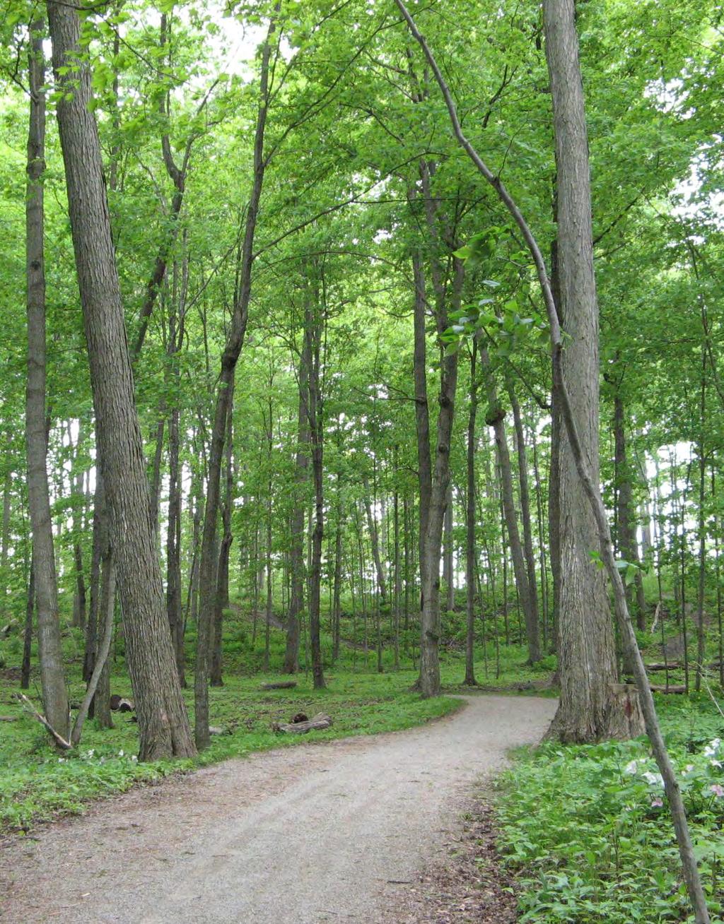
Those with Interest in the City of Cambridge Trail System
|
|
|
- Augustus Bates
- 5 years ago
- Views:
Transcription


1

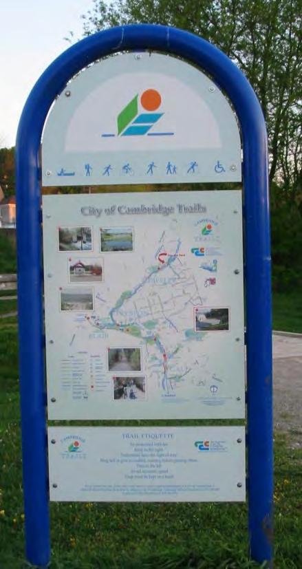
2 Community Services Department City Hall 50 Dickson Street, P.O. Box 669 Cambridge ON N1R 5W8 Tel: July 20, 2010 To: Re: Those with Interest in the City of Cambridge Trail System City of Cambridge Council Approval City of Cambridge Trails Master Plan June 2010 The City of Cambridge review and update of its Council approved 1996 Cambridge City-Wide Multi-Use Trail Study was completed by MHBC Planning Ltd., and MTE Ltd., from March to June of 2010, under direction of a Council/Staff/Cambridge Trails Advisory Committee Steering Committee. The review and update resulted in the City of Cambridge 2010 Trails Master Plan which was reviewed by the City s Master Plan for Leisure and Recreational Services Steering Committee, prior to consideration by Cambridge City Council. On Monday July 5, 2010 the General Committee of Council received and approved the June 2010 Trails Master Plan as follows; which was subsequently approved by Council on Monday July 12, COMMUNITY SERVICES DEPARTMENT 1. CITY OF CAMBRIDGE TRAILS MASTER PLAN Moved by Councillor Tucci Seconded by Mayor Craig THAT Council receive the City of Cambridge Trails Master Plan as outlined in Report CSD/10-56, as information. AND THAT Council direct staff to review the recommendations and present priorities and timelines for the implementation of the trails master plan on an ongoing basis commencing with the 2011 Cambridge Trails Advisory Committee planning process. CARRIED DIRECTION: Staff for the Cambridge Trails Master Plan was directed to include a recommendation that future plan updates include consultation with the Cambridge Environmental Advisory Committee and that a map depicting the Environmentally Sensitive Areas be included as an appendix to the Plan.

3 CONTENTS EXECUTIVE SUMMARY... i-iv 1.0 INTRODUCTION Purpose of the Trails Master Plan Goals of Tralis Master Plan Purpose and Process of the Trails Master Plan Study BACKGROUND City of Cambridge City-Wide Multi-Use Trail Study Bikeway Network Master Plan Official Plan Inventory of Existing Conditions MULTI-USE TRAIL NETWORK ANALYSIS Are the Existing Multi-Use Trail Study Principles Sound? Non-Motorized Use Contraints and Opportunities Community Input Recommendations PROPOSED TRAIL NETWORK AND PRIORITIES Analysis of Trails Network and Priorities Findings of the Trails Network Analysis Multi-Use Trail Network Short Term Priority (0-5 Years) Medium Term Priority (5-10 Years) Long Term Piroirty (More than 10 Years) MULTI-USE TRAIL DESIGN GUIDELINES Accessibility Trail Width... 19
4 5.3 Trail Surface Trail Grades Signs and Wayfinding TRAIL MAINTENANCE Operational Maintenance Capital Infrastructure Maintenance Trails Redevelopment Safety COMMUNITCATION AND PROMOTION OF TRAILS CAMBRIDGE TRAILS ADVISORY COMMITTEE (CTAC) MAPS 1.0 EXISTING TRAILS NETWORK... After Section MAJOR CONSTRAINTS & BARRIERS... After Section DESTINATIONS AND OPPORTUNITIES... After Section RECOMMENDED TRAIL NETWORK... After Section SIGNIFICANT NATURAL AREAS...After Section 8.0 APPENDICES 1.0 TRAIL DESIGN GUIDELINES... Tab SURVEY RESULTS SUMMARY... Tab 2


5 Purpose of the Trails Master Plan


6 Goals of the Trails Master Plan Sustainable Community Involvement Accessible Connected Safe
7 Summary of Recommendations
8
9
10 SHORT TERM (0 TO 5 YEARS) MEDIUM TERM (5 TO 10 YEARS) LONG TERM (BEYOND 10 YEARS)


11 Purpose of the Trails Master Plan Goals of the Trails Master Plan Sustainable Community Involvement Accessible Connected Safe


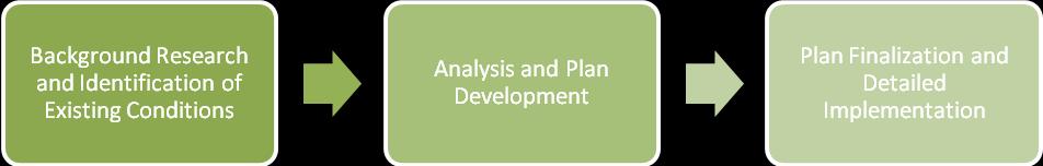
12 Purpose and Process of the Trails Master Plan Study Background Research and Identification of Existing Conditions Analysis and Plan Development Plan Finalization and Detailed Implementation
13


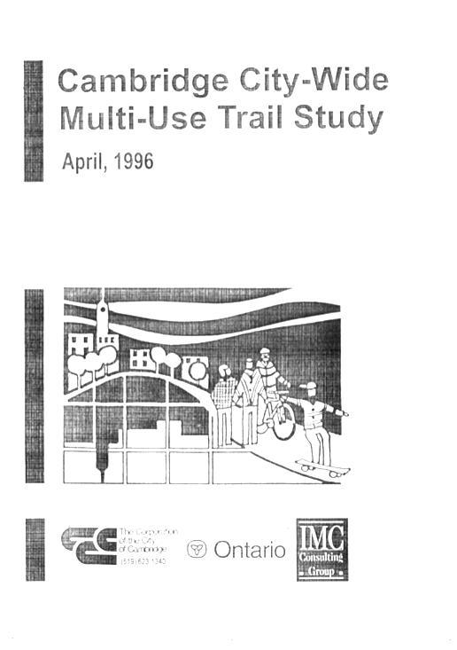
14 1996 City of Cambridge City-Wide Multi-Use Trail Study


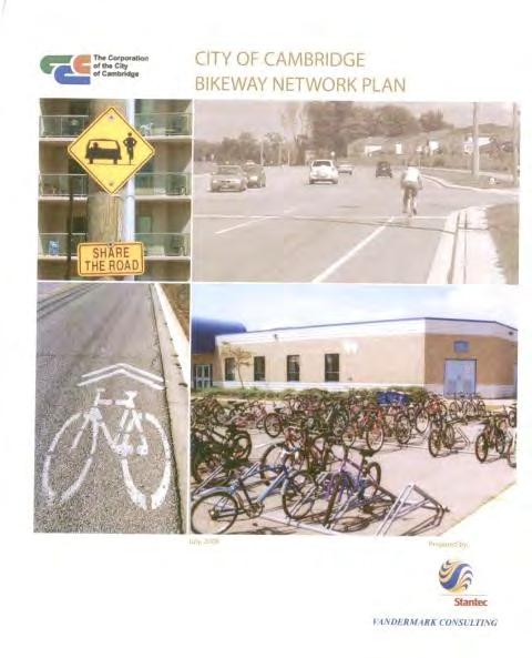
15 Bikeway Network Master Plan Official Plan
16 Inventory of Existing Conditions
17 Are the Existing Multi-Use Trail Study Principles Sound?
18 Non-Motorized Use Constraints and Opportunities
19


20 Community Input 4% 7% 1% 12% 37% 39% Cycling Walking Jogging Rollerblading Cross country skiing Other Recommendations


21
22 Analysis of Trails Network and Priorities Findings of the Trail Network Analysis
23
24 Multi-Use Trail Network
25 Short Term Priority (0-5 years)
26 Medium Term Priority (5-10 years)
27 Long Term Priority (More than 10 years)
28 5.0 MULTI-USE TRAIL DESIGN GUIDELINES The purpose of this section is to review the existing trail design guidelines and provide recommendations for updates or changes. The analysis of the trail design guidelines included: review of the existing trail design guidelines contained in the City-Wide Multi-Use Trail Study (1996); review of accessibility guidelines and legislation; analysis of the community input received, including input from the Cambridge Trails Advisory Committee, the Cambridge Environmental Advisory Committee, and the Accessibility Advisory Committee; and review of trail design standards used by other municipalities. The City-Wide Multi-Use Trail Study (1996) provides guidelines to address a number of trail design issues including trail types, signs and trail markings, grading, trailhead design and access points, and road and rail crossings and others. The 1996 City-Wide Multi-Use Trail Study also included guidelines for on-road cycling facilities. However, since on-road cycling routes and design guidelines are now addressed in the City s Bikeway Network Master Plan, on-road cycling design guidelines are not included in the Trails Master Plan. In general, the existing trail design standards in the 1996 City-Wide Multi-Use Trail Study are consistent with best practices. Review of the existing trail design guidelines indicates that most of the guidelines are still relevant and are consistent with current standards. Therefore, many of the existing trail design guidelines have been carried forward and are included in this report. Key issues that were identified during the trail design guideline review process are discussed below. Complete Trail Design Guidelines are included as Appendix Accessibility A key part of the review of the trail design guidelines was the assessment of accessibility standards and what changes are required to the existing guidelines. The analysis consisted of: review of the City s current accessibility standards and guidelines; City of Cambridge P a g e 18 Trails Master Plan June 23, 2010
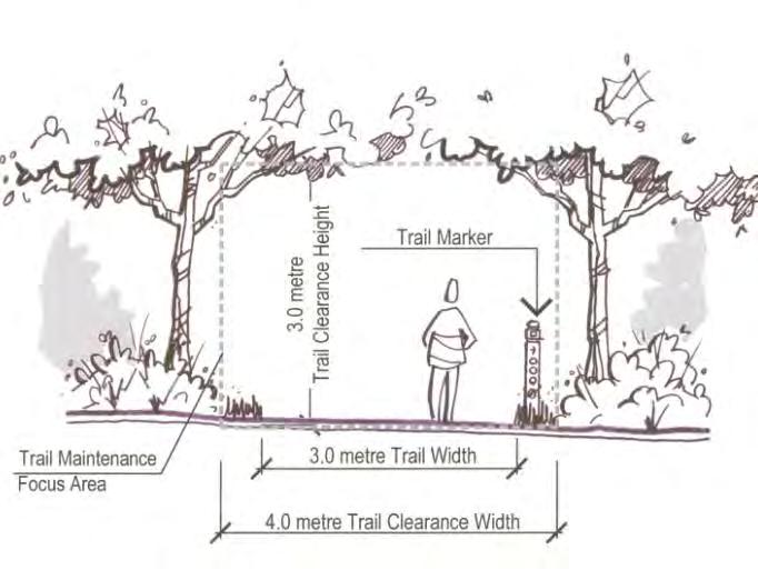
29 Trail Width
30 Trail Surface
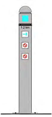
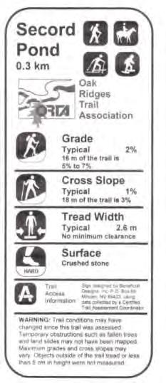
31 Trail Grades Signs and Wayfinding


32


33
34


35 Are the trails adequately maintained? 9% 40% 51% Well maintained Adequately maintained Poorly maintained
36 Operational Maintenance Capital Infrastructure Maintenance
37 Trail Redevelopment Safety


38
39
40


41 46% 54% Yes
42
43
44
45
46
47
48
49
50 APPENDIX 1

51 CITY OF CAMBRIDGE TRAILS MASTER PLAN Trail Clearance Width And Trail Maintenance Areas Will Be Required To Be Wider At All Intersections, Sharp Turns, And Other Areas Requiring Clear Sight Lines. City of Cambridge JUNE 2010 Trail Master Plan
52 CITY OF CAMBRIDGE TRAILS MASTER PLAN City of Cambridge JUNE 2010 Trail Master Plan
53 CITY OF CAMBRIDGE TRAILS MASTER PLAN City of Cambridge JUNE 2010 Trail Master Plan

54 CITY OF CAMBRIDGE TRAILS MASTER PLAN City of Cambridge JUNE 2010 Trail Master Plan
55 APPENDIX 2
56 City of Cambridge City-Wide Multi-Use Trails Study Update Summary of Survey Results: Based on 68 completed surveys Q1. How often do you use the trails in Cambridge? Answer Options Response (%) Regularly (a few times a week) 59.7 Occasionally (a few times a month) 29.9 Seldom (a few times a year) 10.4 Never 0.0 Q2. When you use the trails what type(s) of activity do you do? Check all that apply Answer Options Response (%) Cycling 75.0 Walking (including wheelchair or other mobility device) 77.9 Jogging 25.0 Rollerblading 7.4 Cross country skiing 13.2 Other 2.9 Q3. Rank the trail surface that you prefer in order of preference with 1 being the most preferred: Answer Options Rating Average Beaten earth or woodchip narrow hiking trail Stone dust (compacted fine gravel screenings) Asphalt Other Q4. What class or distance of trail do you use most often or prefer to use? Check all which apply and rank in order of preference with 1 being highest use /most preferred: Rating Answer Options Average Neighbourhood trail loop/link (generally under 1km in length) Longer community trails linking several neighbourhoods (1-5km in length) City wide trails (i.e. riverbank and main tributary trails) (over 5km in length) Intercity Trails (trails that connect to other adjacent Cities or towns) Q5. Why do you or members of your household typically use trails? Answer Options Response (%) For relaxation, enjoying nature, 73.5 Walking the dog 25.0 Exercise 85.3 To access neighbourhood schools, parks or recreation facilities 29.4 To commute to shopping or employment areas 27.9 Other 7.4
57 Q6. What changes or improvements to the trail system would encourage you to use the trail system more often? Better Links: Preston to Galt; Linear trail to Riverside Park; Crossing over the 401; Better signs: At trail links; directions to next off road section of trail; More trails closer to where I live More off-road trails/bike lanes: CanAmera Boulevard trail More asphalt trails: to allow rollerblading; Other: More garbage cans; lease free trail(s); more information on trails Q7. Where would you like to see new trails or new trail connections? List your top three. A trail connecting Linear trail to Galt (via a bridge or along the east side of the river) Better connection of Riverside park entrance to Linear trail and to Blair/TransCanada trail Extend Devil s Creek trail south North-South route from Hespeler over the 401 Q8. Are the trails and trail infrastructure (such as trail surfaces, bridges, signs etc.) adequately maintained? Answer Options Response (%) Well maintained 40.0 Adequately maintained 50.8 Poorly maintained 9.2 Q9. Do you think that there is sufficient trails system information available to the public? Answer Options Response (%) Yes 52.3 No 44.6 Q10. What is the best way to provide information to the public on trails (e.g on the City s website, newspaper advertisements, radio advertisements, an annual or bi-annual public trail user meeting forum/workshop, provision of more trailhead signs at key locations along trails) Website (30) Newspaper (24) Trailhead signs (29) Radio (9) Annual Event (16) Other (7): Phonebook, Flyers, Circulate through the schools; Q11. OTHER COMMENTS: (please provide other comments, ideas or suggestions to the Questions. A sample: Keep up the good work; Cambridge trails are great!; Tour-de-Cambridge, it's worth the drive to Cambridge;
58 Clean the bike lanes; All motorized vehicles (gas or battery powered) should not be allowed on the trails; Install curb cuts where trails intersect with roads. Road bikes are not meant to hop curbs - e.g. Greenway park trail at Glamis Road. Patrol the trails with those Community Bike Patrol Auxiliary Officers I feel unsafe by myself on the trails. Cambridge has a great trail system, it just isn't well known.


59
Committee. Presentation Outline
 CW-33-15 11/9/2015 Community and Corporate Services Committee November 10, 2015 1 Presentation Outline Background Vision and Objectives Study Process and Timeline Public and Stakeholder Engagement Organization
Brampton, Ontario REQ. no.: PLANNING, DESIGN & DEVELOPMENT COMMITTEE
 ftorontoand REGION rv~ Conservation for The Living City May 22,2009 2I22V,5L CFN 42397 CLERK S DEPT. Mr. Peter Fay City Clerk, City of Brampton MAY 2 7 2008 2 Wellington Street West Brampton, Ontario REQ.
Georgetown-Lewes Rail/Trail Study. Rail/Trail Study: Cool Spring to Cape Henlopen State Park New Road Extension (House Resolution No.
 Georgetown-Lewes Rail/Trail Study Rail/Trail Study: Cool Spring to Cape Henlopen State Park New Road Extension (House Resolution No. 47) August 22, 2011 Presentation Outline Background Benefits Statewide
PEMBERTON VALLEY RECREATIONAL TRAILS MASTER PLAN UPDATE Community Open House. April 2018
 PEMBERTON VALLEY RECREATIONAL TRAILS MASTER PLAN UPDATE Community Open House April 2018 Introductions Introductions Matt Bakker, BHA Project Coordinator Other Team Members: Liz Scroggins, Grey Owl Consulting
Longmont to Boulder Regional Trail Jay Road Connection DRAFT FINAL REPORT
 Longmont to Boulder Regional Trail Jay Road Connection DRAFT FINAL REPORT December 2018 Project Summary Boulder County, Colorado, in partnership with the City of Boulder, is evaluating options for multi-use
FINCH HYDRO CORRIDOR TRAIL PROJECT
 FINCH HYDRO CORRIDOR TRAIL PROJECT Pharmacy Avenue to Birchmount Road January 29 th, 2018 L Amoreaux Community Centre (2000 McNicoll Avenue) 1 Purpose of Drop In Event The purpose of today s drop-in event
Member-led Review of Cycling Infrastructure
 Member-led Review of Cycling Infrastructure Survey Results: A1 Cambridge to Royston June 17 cambridgeshire.gov.uk Contents 1. Introduction... 3. About you... 3.1 Age... 3. What is your gender?... 3.3 Do
Proposed Bicycle Lanes on Yonge Street from Queens Quay to Front Street
 STAFF REPORT ACTION REQUIRED Proposed Bicycle Lanes on Yonge Street from Queens Quay to Front Street Date: March 12, 2007 To: From: Toronto and East York Community Council Director, Transportation Infrastructure
BACKCOUNTRY TRAIL FLOOD REHABILITATION PROGRAM
 BACKCOUNTRY TRAIL FLOOD REHABILITATION PROGRAM Backcountry Trail Flood Rehabilitation A June 2013 Flood Recovery Program Summary In June 2013, parts of Southern Alberta were devastated from significant
APPENDIX A: Survey Instruments
 Three different surveys were conducted during the research phase of the NCHA Trails Study. One questionnaire was designed for elected officials and user groups (general public). The other two questionnaires
Member-led Review of Cycling Infrastructure
 Member-led Review of Cycling Infrastructure Survey Results: Hills Road, Cambridge June 2017 0 cambridgeshire.gov.uk Contents 1. Introduction... 3 2. About you... 3 2.1 Age... 3 2.2 What is your gender?...
Multimodal Planning Studies
 Multimodal Planning Studies Commuter Park and Ride Study Steering Committee Meeting June 6, 2013 Agenda 1. Update on Project Schedule 2. Update on Online Interactive Mapping 3. Key Themes from the Open
MINUTES. Cambridge Trails Advisory Committee Meeting of February 8, :00p.m. Erb Room A&B 3rd Floor City Hall 50 Dickson Street
 MINUTES Cambridge Trails Advisory Committee Meeting of February 8, 2018 7:00p.m. Erb Room A&B 3rd Floor City Hall 50 Dickson Street Committee Members In Attendance: Chris Smith, Ron Dorombozi, Councillor
Our Focus: Your Future AWARD OF TENDER FOR ROAD RESURFACING HOT MIX ASPHALT CONTRACT IS.07RSRF (H)
") Town of Fort Erie Infrastructure Services Our Focus: Your Future Prepared for Council-in-Committee Report No. IS-25-07 Agenda Date May 22, 2007 File No. 230803-126 Subject AWARD OF TENDER FOR ROAD RESURFACING
Town of Fort Erie Infrastructure Services Our Focus: Your Future Prepared for Council-in-Committee Report No. IS-25-07 Agenda Date May 22, 2007 File No. 230803-126 Subject AWARD OF TENDER FOR ROAD RESURFACING
FEASIBILITY CRITERIA
 This chapter describes the methodology and criteria used to evaluate the feasibility of developing trails throughout the study areas. Land availability, habitat sensitivity, roadway crossings and on-street
St. John s Park Redevelopment Master Plan Public Engagement Report
 St. John s Park Redevelopment Master Plan Public Engagement Report Prepared by HTFC Planning & Design October 2017 TABLE OF CONTENTS 1.0 Introduction........ 1 2.0 Stakeholder and Public Notification......
Blueways: Rivers, lakes, or streams with public access for recreation that includes fishing, nature observation, and opportunities for boating.
 Parks, Open Space and Trails PRINCE WILLIAM COUNTY 2008 COMPREHENSIVE PLAN TRAILS PLAN CONTENTS The components of the trails plan are: Intent Definitions Goals, Policies, and Action Strategies Trails Map
CHAPTER 5. Chapter 5 Recreation Element
 CHAPTER 5 Recreation Element Chapter 5 Recreation Element The Recreation Element of the Meyers Area Plan is a supplement to the Recreation Element of the TRPA Regional Plan and the El Dorado County General
Town of Markham Yonge and Steeles Corridor Study and City of Vaughan Yonge Street Area Study
 STAFF REPORT ACTION REQUIRED Town of Markham Yonge and Steeles Corridor Study and City of Vaughan Yonge Street Area Study Date: August 14, 2009 To: From: Wards: Reference Number: North York Community Council
A Master Plan is one of the most important documents that can be prepared by an Airport.
 The Master Plan A Master Plan is one of the most important documents that can be prepared by an Airport. A Master Plan is a visionary and a strategic document detailing planning initiatives for the Airport
Trail # NW Tuesday, June DESIGN. Provide an Review the Provide an. Project Goals: System system. wayfinding
 I. Welcome / Introductions Bethany Creek Trail #2 Segment 3 Neighborhood Meeting #1 Bethany Presbyterian Church 15505 NW Springville Road, Portland, OR 97229 Tuesday, June 26, 2018 @ 6:00PM Meeting Minutes
SR 934 Project Development And Environment (PD&E) Study
 Study") SR 934 Project Development And Environment (PD&E) Study Project Advisory Group Meeting March 1, 2018 State Road 934/NE/NW 79th Street from west of I-95 (NW 13th CT) to N. Bayshore Drive PD&E STUDY SR 934/NE/NW
SR 934 Project Development And Environment (PD&E) Study Project Advisory Group Meeting March 1, 2018 State Road 934/NE/NW 79th Street from west of I-95 (NW 13th CT) to N. Bayshore Drive PD&E STUDY SR 934/NE/NW
3.0 LEARNING FROM CHATHAM-KENT S CITIZENS
 3.0 LEARNING FROM CHATHAM-KENT S CITIZENS An important aspect in developing the Chatham-Kent Trails Master Plan was to obtain input from stakeholders and the general public. Throughout the course of the
Saanich Parks and Recreation Trail Guidelines 2007
 Saanich Parks and Recreation Trail Guidelines 2007 June 12, 2007 Acknowledgements The Trail Guidelines were substantially prepared by Judith Cullington & Associates. The document has been revised through
Report to: Greater Cambridge Partnership Joint Assembly 18 January A10 Foxton level crossing bypass and travel hub
 Report to: Greater Cambridge Partnership Joint Assembly 18 January 2018 Lead officer: Chris Tunstall GCP Director of Transport A10 Foxton level crossing bypass and travel hub 1. Purpose 1.1 The list of
NOTE: YOU MAY COMPLETE THIS SURVEY ONLINE (USING THIS DOCUMENT TO VIEW MAPS AND GRAPHICS) AT:
 AT:") for completing the Town of Beech Mountain Comprehensive Planning Survey. The information you provide in reply to the following questions will be used to help the Town develop a plan that will guide our
for completing the Town of Beech Mountain Comprehensive Planning Survey. The information you provide in reply to the following questions will be used to help the Town develop a plan that will guide our
1 PROJECT STATUS UPDATE 2 ND CONCESSION FROM BRISTOL ROAD TO DOANE ROAD TOWNS OF EAST GWILLIMBURY AND NEWMARKET
 Report No. 3 of the Regional Council Meeting of March 28, 2013 1 PROJECT STATUS UPDATE 2 ND CONCESSION FROM BRISTOL ROAD TO DOANE ROAD TOWNS OF EAST GWILLIMBURY AND NEWMARKET The recommends: 1. Receipt
Macleod Trail Corridor Study. Welcome. Macleod Trail Corridor Study Open House. Presentation of Proposed Design Concepts
 Macleod Trail Corridor Study Welcome Macleod Trail Corridor Study Open House Presentation of Proposed Design Concepts Study Purpose Develop a corridor plan for Macleod Trail that aligns with The City s:
FY Transit Needs Assessment. Ventura County Transportation Commission
 FY 18-19 Transit Needs Assessment Ventura County Transportation Commission Contents List of Figures and Appendices.. 2 Appendices... 1 Chapter 1: Introduction What is the Ventura County Transportation
MUNICIPALITY OF ANCHORAGE
 MUNICIPALITY OF ANCHORAGE ANCHORAGE PARKS & RECREATION Memorandum PRC 08-56 DATE: 5 August 2008 TO: FROM: SUBJECT: Parks & Recreation Commission Holly Spoth-Torres, Park Planner PRC 08-56 Far North Bicentennial
City of Durango 5.8 FUNDING TRAILS DEVELOPMENT
 5.8 FUNDING TRAILS DEVELOPMENT The City has been successful in establishing dedicated local funding sources as well as applying for grants to develop the City s trail system, having received nearly $2.4
DIRECTOR, ENVIRONMENT, FLEET, & SOLID WASTE UPDATE: REGIONAL RIDESHARE PROGRAM RECOMMENDATION
 Agenda Item # Page # 1 TO: FROM: SUBJECT: CHAIR AND MEMBERS CIVIC WORKS COMMITTEE MEETING ON APRIL 20, 2015 JAY STANFORD DIRECTOR, ENVIRONMENT, FLEET, & SOLID WASTE UPDATE: REGIONAL RIDESHARE PROGRAM RECOMMENDATION
Sam Imperati Facilitator
 Sam Imperati Facilitator 1 Introductions 1) Facilitator Introduction a) Name b) Occupation c) Role 2) Chair and Member Introductions: a) Name b) Affiliations c) Occupation 3) Project Team Introductions:
Becker County Trail Routing Feasibility Study
 2016 Becker County Trail Routing Feasibility Study CONNECTING DETROIT MOUNTAIN AND MOUNTAIN VIEW RECREATIONAL AREA TO THE HEARTLAND TRAIL BECKER COUNTY ULTEIG ENGINEERS Contents Acknowledgements...2 INTRODUCTION...3
Dover Park Master Plan. Community Design Event Tuesday, May 22, 5 7 pm
 Dover Park Master Plan Community Design Event Tuesday, May 22, 5 7 pm Agenda I. Introduction / Overview 20 minutes II. Small Group Design Activity 60 minutes III. Small Group Report Out IV. Conclusion
Lake Windermere Westside Legacy Trail. A multi-use non-motorized paved trail promoting health, wealth and outdoor appreciation
 Lake Windermere Westside Legacy Trail A multi-use non-motorized paved trail promoting health, wealth and outdoor appreciation Jan 26, 2015 Executive Summary The Lake Windermere Westside Legacy Trail will
Section II. Planning & Public Process Planning for the Baker/Carver Regional Trail began in 2010 as a City of Minnetrista initiative.
 Section II Planning & Public Process Planning for the began in 2010 as a City of initiative. city staff began discussions with the Park District on the possibility of a north/south regional trail connection
Haworth Tr T avel Plan r 10th February 2006
 Haworth Travel Plan 10th February 2006 Haworth Travel Plan has been prepared for: Contents 1 Why have Haworth Travel Plan?... 3 2 Who will benefit from Haworth Travel Plan?... 4 3 What actions will be
DATE: 23 March, 2011 TO: Communities FROM: BlazeSports America. RE: Accessible Trails Checklist 1
 M E M O R A N D U M DATE: 23 March, 2011 TO: Communities FROM: BlazeSports America RE: Accessible Trails Checklist 1 The purpose of the Accessible Trails Checklist (below) is to help the community review
Changing Lanes. Click to edit Master title style. Toronto and East York Community Council. Second level Third level. Fourth level.
 Changing Lanes Toronto s Click to Laneway edit Master Suites text Strategy styles Toronto and East York Community Council May 2, 2018 2,433 Total number of Laneways in the City of Toronto 295 km Of Laneways
Southsea Flooding and Coastal Erosion Risk Management Scheme
 Southsea Flooding and Coastal Erosion Risk Management Scheme Public Consultation Report 3 rd November 29th December 2014 TABLE OF CONTENTS 1 INTRODUCTION... ERROR! BOOKMARK NOT DEFINED. 1.1 Purpose of
Toronto 2015 Pan Am/Parapan Am Games Temporary Traffic By-law Amendments for High Occupancy Vehicle Lanes (Supplementary Report)
") STAFF REPORT ACTION REQUIRED Toronto 2015 Pan Am/Parapan Am Games Temporary Traffic By-law Amendments for High Occupancy Vehicle Lanes (Supplementary Report) Date: March 25, 2015 To: From: Wards: Reference
STAFF REPORT ACTION REQUIRED Toronto 2015 Pan Am/Parapan Am Games Temporary Traffic By-law Amendments for High Occupancy Vehicle Lanes (Supplementary Report) Date: March 25, 2015 To: From: Wards: Reference
The Baker/Carver Regional Trail is intended to
 Section V Design Guidance The Baker/Carver Regional Trail is intended to safely accommodate 183,000 annual visits, an array of non-motorized uses, a variety of skill levels, and persons with special needs.
To apprise Council of the process and timeline for the preparation of the Final Concept Plan and report; and
 Corporate NO: R243 Report COUNCIL DATE: November 20, 2006 REGULAR COUNCIL TO: Mayor & Council DATE: November 15, 2006 FROM: Acting General Manager, Planning and Development FILE: 0850-20 (CF) SUBJECT:
INGHAM COUNTY TRAILS AND PARKS TASK FORCE MEETING 2
 INGHAM COUNTY TRAILS AND PARKS TASK FORCE MEETING 2 October 22, 2015 Mannik and Smith Group Michigan Trails & Greenways Alliance AGENDA FOR TONIGHT 1. Project Approach, Process and Timeframe 2. Public
POLICY DCS-04: Tourism Directional Sign Policy. Development and Cultural Services
 DCS-04 Page 1 of 8 POLICY DCS-04: Tourism Directional Sign Policy Development and Cultural Services Approval Date: March 11, 2008 Approval Authority: Council, Resolution No. 7 Effective Date: March 11,
Riverbank Precinct Footbridge
 The Adelaide City Council invites feedback from the community about the Riverbank Precinct Footbridge Project Summary The Riverbank Precinct Footbridge is a State Government initiated project involving
Transport Delivery Committee
 Agenda Item No. 11 Transport Delivery Committee Date 6 th March 2016 Report title Accountable Director Accountable Employee Virgin Trains Partnership Agreement Update Pete Bond, Director of Transport Services
Ted Stevens Anchorage International Airport
 Ted Stevens Anchorage International Airport 2014 MASTER PLAN UPDATE APPENDIX B - COMMUNICATIONS PLAN JUNE 2014 IN ASSOCIATION WITH: HDR DOWL HKM RIM Architects ATAC CT Argue Aviation Photo credit: Sokol
Welcome to the Cross County Trail Public Input Session!
 Welcome to the Cross County Trail Public Input Session! Please sign in on the table below! What are we doing here? Camden County has proposed a bicycle and pedestrian trail spanning across the entire county.
Land Management Summary
 photo credit: ANGAIR Anglesea Heath Land Management Summary The Anglesea Heath (6,501 ha) was incorporated into the Great Otway National Park in January 2018. This provides an opportunity to consider the
Bloor Street West Rezoning Application for a Temporary Use By-law Final Report
 STAFF REPORT ACTION REQUIRED 3741 3751 Bloor Street West Rezoning Application for a Temporary Use By-law Final Report Date: June 12, 2007 To: From: Wards: Reference Number: Etobicoke York Community Council
Member-led Review of Cycling Infrastructure
 Member-led Review of Cycling Infrastructure Survey Results: Huntingdon Road, Cambridge June 217 cambridgeshire.gov.uk Contents 1. Introduction... 3 2. About you... 3 2.1 Age... 3 2.2 What is your gender?...
MONTEREY REGIONAL AIRPORT MASTER PLAN TOPICAL QUESTIONS FROM THE PLANNING ADVISORY COMMITTEE AND TOPICAL RESPONSES
 MONTEREY REGIONAL AIRPORT MASTER PLAN TOPICAL QUESTIONS FROM THE PLANNING ADVISORY COMMITTEE AND TOPICAL RESPONSES Recurring topics emerged in some of the comments and questions raised by members of the
ARLINGTON COUNTY, VIRGINIA
 ARLINGTON COUNTY, VIRGINIA County Board Agenda Item Meeting of April 16, 2005 DATE: March 28, 2005 SUBJECTS: A. Adoption of the Fort Myer Heights North Plan. B. GP-300-04-1 Adoption of the following General
Regional Wayfinding Sign Strategy Thurston County Trails 2017
 Regional Wayfinding Sign Strategy Thurston County Trails 2017 Partners: Members and partnering organizations of the Thurston Thrives Community Design Action Team City of Lacey, City of Olympia, City of
Trails Classification Steering Team Alberta Tourism, Parks and Recreation Alberta Sustainable Resource Development Alberta TrailNet Society
 Acknowledgements Alberta Recreation Corridor and Trails Designation Program Alberta Recreation Corridors Coordinating Committee Trails Classification Steering Team Alberta Tourism, Parks and Recreation
Appendix 3. Greenway Design Standards. The Whitemarsh Township Greenway Plan
 Appendix 3 Greenway Design Standards This chapter discusses two design standards for the greenway types discussed above. First, trail design standards are presented together with trailhead facilities and
Citrus Heights Creek Corridor Trail Project. Trail Advisory Group Meeting #3 July 8, 2013
 Citrus Heights Creek Corridor Trail Project Trail Advisory Group Meeting #3 July 8, 2013 Agenda Introductions Recap: Community Workshop, Survey Findings, and TAG Field Trip Community Concern Discussion:
At the time, the portion of the line through Eagle County remains wholly under the ownership of Union Pacific Railroad (UP).
.") Chapter 5 The Railroad Corridor as a Trail Corridor The intent of this chapter is to identify how the rail corridor, if available for lease or purchase in all or part, could be incorporated into the core
Chapter 5 The Railroad Corridor as a Trail Corridor The intent of this chapter is to identify how the rail corridor, if available for lease or purchase in all or part, could be incorporated into the core
G Street Undercrossing. City Council Meeting Date: November 3, 2008
 G Street Undercrossing City Council Meeting Date: November 3, 2008 Introduction G Street undercrossing Long-term goal of the City In General Plan since 1997 In City s Public Facilities Financing Plan
St. Dennis Drive Conversion of Traffic Lanes to On- Street Parking and Bicycle Lanes
 STAFF REPORT ACTION REQUIRED St. Dennis Drive Conversion of Traffic s to On- Street Parking and Bicycle s Date: April 22, 2014 To: From: Wards: Reference Number: Public Works and Infrastructure Committee
RECREATIONAL TRAILS MASTER PLAN
 District of West Kelowna RECREATIONAL TRAILS MASTER PLAN November 2013 This page is intentionally blank to support double-sided printing. Acknowledgements District of West Kelowna Staff Team Mark Roberts,
A Quality Partnership Scheme is a statutory agreement between parties to provide improved bus infrastructure and services.
 BRIEFING NOTE FOR BUS OPERATORS Inverclyde statutory Quality Partnership Scheme - 2015 What is an sqps? A Quality Partnership Scheme is a statutory agreement between parties to provide improved bus infrastructure
Memo. Orange City Trail Plan Becky Mendez, AICP Jamie Krzeminski, PE, PTOE Matt Wiesenfeld, PE, AICP. Development of the Existing and Proposed Network
 Memo Date: Friday, December 22, 2017 Project: To: From: Subject: Trail Plan Becky Mendez, AICP Jamie Krzeminski, PE, PTOE Matt Wiesenfeld, PE, AICP Development of the Existing and Proposed Network HDR
Lafourche Parish Government REQUEST FOR QUALIFICATIONS. Landscape Architectural Services
 Lafourche Parish Government REQUEST FOR QUALIFICATIONS Landscape Architectural Services Bayou Lafourche Parish Multi-Use Path Feasibility Study Phase 1 And Bayou Lafourche Parish Multi-Use Path Feasibility
Region of Waterloo Planning, Development and Legislative Services Region of Waterloo International Airport Office of Economic Development
 Region of Waterloo Planning, Development and Legislative Services Region of Waterloo International Airport Office of Economic Development To: Chair Tom Galloway and Members of the Planning and Works Committee
SOUTHEASTERN BOX ELDER COUNTY 2017 ACTIVE TRANSPORTATION CONCEPT PLAN DRAFT
 SOUTHEASTERN BOX ELDER COUNTY 2017 ACTIVE TRANSPORTATION CONCEPT PLAN SIGNATURE PAGE The following communities have participated in this trail planning process and approve the Southeastern Box Elder County
APPENDIX A SUMMARY OF PUBLIC ENGAGEMENT ACTIVITIES. Figure 40: Public Information Centre #1 at the Hamilton Environmental Summit
 Figure 40: Public Information Centre #1 at the Hamilton Environmental Summit APPENDIX A SUMMARY OF PUBLIC ENGAGEMENT ACTIVITIES Hamilton Recreational Trails Master Plan May 2016 Page 91 Extensive public
East Street Farnham. Statement of Community Involvement Update. Crest Nicholson Regeneration Ltd and Sainsbury s Supermarket Limited
 East Street Farnham Statement of Community Involvement Update Crest Nicholson Regeneration Ltd and Sainsbury s Supermarket Limited Contents 1. EXECUTIVE SUMMARY 2 2. PUBLIC CONSULTATION 3 3. FEEDBACK &
Re: Item 7- PR13.{)35 - Region of York Municipal Parbtership Grant Application and Approval of Two Grade-Separated Underpasses
35 - Region of York Municipal Parbtership Grant Application and Approval of Two Grade-Separated Underpasses") Office of the Clerk John D. Leach Director of Customer and Legislative Servicesffown Clerk 905-727-3123 ext. 4771 jleach@aurora.ca Town of Aurora 100 John West Way, Box 1000 Aurora, ON L4G 6J1 August 14,
Office of the Clerk John D. Leach Director of Customer and Legislative Servicesffown Clerk 905-727-3123 ext. 4771 jleach@aurora.ca Town of Aurora 100 John West Way, Box 1000 Aurora, ON L4G 6J1 August 14,
PERTH AND KINROSS COUNCIL. 22 June 2016 DEVELOPING THE CULTURAL OFFER IN PERTH AND KINROSS UPDATE AND NEXT STEPS
 PERTH AND KINROSS COUNCIL 8 16/278 22 June 2016 DEVELOPING THE CULTURAL OFFER IN PERTH AND KINROSS UPDATE AND NEXT STEPS Report by Senior Depute Chief Executive (Equality, Community Planning & Public Service
Business Item No
 Metropolitan Parks and Open Space Commission Meeting date: February 6, 2018 For the Community Development Committee meeting of February 20, 2018 For the Metropolitan Council meeting of February 28, 2018
TOWNSHIP OF WILMOT TRAILS MASTER PLAN Appendix B: Implementation Plan
 TOWNSHIP OF WILMOT TRAILS MASTER PLAN Appendix B: Implementation Plan Final Report January 2015 Prepared for: Prepared by: EXECUTIVE SUMMARY IMPLEMENTATION PLAN The Wilmot Trails Master Plan (WTMP) is
Trail Feasibility Study
 VOLUSIA COUNTY MPO CITY OF NEW SMYRNA BEACH FINAL REPORT JUNE 30, 2009 Trail Feasibility Study What s inside? 1 Introduction 2 Project Purpose & Scope 3 Physical Inventory & Assessment of Right-of- Way
Recreation Management Plan Lake Baroon and Ewen Maddock Dam
 Lake Baroon and Ewen Maddock Dam December 2013 Contents Overview... 3 The Value of Our Natural Areas... 4 Management Approach... 6 Funding... 7 Recreation Management... 8 Conditions of Access and Use...
Citrus Heights Creek Corridor Trail Project Trail Advisory Group Field Trip #2 September 11, :00 11:00 am Trellis Hall, Citrus Heights
 September 11, 2013 9:00 11:00 am Trellis Hall, Citrus Heights Project Overview The City of Citrus Heights is studying the feasibility of establishing a multi use trail system within the City s 26 miles
CORNWALL WATERFRONT PLAN 2007
 CANAL LANDS CANAL LANDS Page 58 Introduction This chapter details areas of possible development or redevelopment, and lands to be protected from any form of development in the Canal Lands area. As outlined
Appendix 6 Fulbourn Greenway Review
 Appendix 6 Fulbourn Greenway Review Nigel Brigham & Associates A report for 1 Introduction This report is based on fieldwork carried out in 2016 to review the Greenway network around Cambridge as shown
Spadina Avenue Built Form Study Preliminary Report
 STAFF REPORT ACTION REQUIRED Spadina Avenue Built Form Study Preliminary Report Date: July 9, 2014 To: From: Wards: Reference Number: Toronto and East York Community Council Director, Community Planning,
METROPOLITAN COUNCIL 390 North Robert Street, St. Paul, MN Phone (651) TDD (651)
 TDD (651)") METROPOLITAN COUNCIL 390 North Robert Street, St. Paul, MN 55101 Phone (651) 602 1000 TDD (651) 291 0904 DATE: June 19, 2007 TO: Metropolitan Parks and Open Space Commission FROM: Jan Youngquist, Senior
METROPOLITAN COUNCIL 390 North Robert Street, St. Paul, MN 55101 Phone (651) 602 1000 TDD (651) 291 0904 DATE: June 19, 2007 TO: Metropolitan Parks and Open Space Commission FROM: Jan Youngquist, Senior
Proposal for gypsy and traveller accommodation on land at Lower Hollow Copse (Pot Common), Copthorne. Statement of Community Involvement
, Copthorne. Statement of Community Involvement") Proposal for gypsy and traveller accommodation on land at Lower Hollow Copse (Pot Common), Copthorne Statement of Community Involvement Prepared by WYG Environment Planning Transport Ltd on behalf of the
Proposal for gypsy and traveller accommodation on land at Lower Hollow Copse (Pot Common), Copthorne Statement of Community Involvement Prepared by WYG Environment Planning Transport Ltd on behalf of the
JOSLIN FIELD, MAGIC VALLEY REGIONAL AIRPORT DECEMBER 2012
 1. Introduction The Federal Aviation Administration (FAA) recommends that airport master plans be updated every 5 years or as necessary to keep them current. The Master Plan for Joslin Field, Magic Valley
What do they mean to you?
 CANADA S NEW GRADE CROSSING REGULATIONS What do they mean to you? May 2, 2015 Floris van Weelderen, P.Eng., PTOE Becky Lai, EIT THE ACCIDENTAL GRADE CROSSING Gare Montparnasse, Paris October 22, 1895 2
Planning Future Directions. For BC Parks: BC Residents' Views
 Planning Future Directions For BC Parks: BC Residents' Views Summary Report Ministry of Water, Land and Air Protection Province of British Columbia April, 2002 National Library of Canada Cataloguing in
4.0 Context for the Crossing Project
 4.0 Context for the Crossing Project This section provides background information about key features of the North Douglas Crossing project area, and opportunities and constraints. This information is important
Thaidene Nëné Proposed National Park Reserve. Public Consultation in Yellowknife, NWT June 2016 Protected Areas Establishment Branch Parks Canada 1
 Thaidene Nëné Proposed National Park Reserve Public Consultation in Yellowknife, NWT June 2016 Protected Areas Establishment Branch Parks Canada 1 Consultations for Thaidene Nëné Purpose Parks Canada is
2.2 For these reasons the provision of tourist signing will only be considered:
 TOURIST SIGNING POLICY 2015 1. DEFINITION 1.1 A tourist destination is defined as a permanently established attraction which attracts or is used by visitors to an area and is open to the public without
Provincial Railway Guides Section:
 This guide deals with the maintenance roles and responsibilities of provincial railways and road authorities regarding public grade crossing maintenance; development of public grade crossing maintenance
Stage 2 ION: Light Rail Transit (LRT) from Kitchener to Cambridge
 from Kitchener to Cambridge") Stage 2 ION: Light Rail Transit (LRT) from Kitchener to Cambridge Public Consultation Centre (PCC) No. 3 Please Sign-in Cambridge City Hall November 21, 2017 2:00 to 8:00pm Preston Memorial Auditorium
Stage 2 ION: Light Rail Transit (LRT) from Kitchener to Cambridge Public Consultation Centre (PCC) No. 3 Please Sign-in Cambridge City Hall November 21, 2017 2:00 to 8:00pm Preston Memorial Auditorium
ANC Airport Community Outreach Plan
 ANC Airport Community Outreach Plan September 2018 1 Table of Contents SECTION 1 INTRODUCTION... 4 SECTION 2 AIRPORT CONTACT INFORMATION... 6 SECTION 3 ANC AIRPORT community OUTREACH PLAN... 7 3.1 AIRPORT
2. RESOLUTION TO CLOSE MEETING
 THE CORPORATION OF THE CITY OF VERNON A G E N D A To deliver effective and efficient local government services that benefit our citizens, our businesses, our environment and our future REGULAR OPEN MEETING
ROAD AND TRAIL PROJECT APPROVAL
 ROAD AND TRAIL PROJECT APPROVAL www.marincountyparks.org Marin County Parks, 3501 Civic Center Dr, Suite 260, San Rafael, CA 94903 DATE: July 12, 2017 PRESERVE: Gary Giacomini Open Space Preserve PROJECT:
Chair and Members of Harbour East - Marine Drive Community Council. Brad Anguish, Director, Parks and Recreation
 P.O. Box 1749 Halifax, Nova Scotia B3J 3A5 Canada Item No. 15.1.1 Harbour East-Marine Drive Community Council December 3, 2015 TO: SUBMITTED BY: Chair and Members of Harbour East - Marine Drive Community
WELCOME to the Iditarod Dog Sledding Historic District (IDSHD) Workshop. January 11, Houston Middle School Houston, Alaska
 Workshop. January 11, Houston Middle School Houston, Alaska") WELCOME to the Iditarod Dog Sledding Historic District (IDSHD) Workshop January 11, 2012 Houston Middle School Houston, Alaska Workshop Purpose: Present/discuss proposed resolutions to comments received
WELCOME to the Iditarod Dog Sledding Historic District (IDSHD) Workshop January 11, 2012 Houston Middle School Houston, Alaska Workshop Purpose: Present/discuss proposed resolutions to comments received
Dunsmuir Community Park
 Dunsmuir Community Park Master Plan September 2016 ENGAGEMENT SUMMARY #2 Introduction Public engagement is integral to the development of the Dunsmuir Community Park Master Plan. Two park open houses were
Engagement Summary Report. Trans-Canada Highway 1 RW Bruhn Bridge Replacement Project. Community Engagement November 15, 2016 to January 15, 2017
 Trans-Canada Highway 1 RW Bruhn Bridge Replacement Project Community Engagement November 15, 2016 to January 15, 2017 Engagement Summary Report February 2017 Prepared by Kirk & Co. Consulting Ltd. Trans-Canada
China Creek North Park Upgrades and Glen Pump Station. Park Board Committee Meeting Monday, July 10, 2017
 China Creek North Park Upgrades and Glen Pump Station Park Board Committee Meeting Monday, July 10, 2017 Purpose The purpose of this presentation is to: Share the results of the public engagement processes;
EAST DON TRAIL ENVIRONMENTAL ASSESSMENT. Community Liaison Committee Meeting #3 July 15, :30 to 8:30 pm Flemingdon Park Library
 EAST DON TRAIL ENVIRONMENTAL ASSESSMENT Community Liaison Committee Meeting #3 July 15, 2013 6:30 to 8:30 pm Flemingdon Park Library Agenda 1. Welcome 2. Housekeeping and Updates a) Housekeeping b) CLC
Daisy Dean Trail 628/619 ATV Trail Construction
 Background and Purpose and Need The Daisy Dean ATV Trail Construction Project is located in the Little Belt Mountains, Musselshell Ranger District, Lewis and Clark National Forest approximately 32 miles