Coastal Structures in Kagoshima Coastline, Japan Ejria Binti Saleh Universiti Malaysia Sabah, Sabah, Malaysia
|
|
|
- Erick Leonard
- 5 years ago
- Views:
Transcription
1 Coastal Structures in Kagoshima Coastline, Japan Ejria Binti Saleh Universiti Malaysia Sabah, Sabah, Malaysia Report for International Training Program to improve the study ability in biodiversity 1

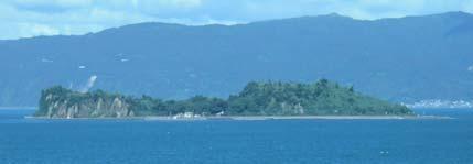
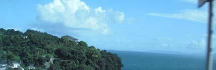
2 1.0 INTRODUCTION Kagoshima is located at the southwestern tip of the Kyushu Island, Japan (Figure 1). It is home of population. Kagoshima total area is estimated about km² form of 2,643km long of picturesque coastline. Generally this area is experience hot climate and its famous land mark is the impressive straovolcano, Sakurajima. Figure 1: Location of the study area Recently scientists predicted that the number and intensity of natural disasters has increased in many places in the world. Numbers of natural disasters were affected Kagoshima in the past. Kagoshima prefecture is surrounding by many active volcanoes such as Sakurajima which contribute to air pollution within these area (Iino, et al. 2006). Kagoshima has experienced on typhoon (Takata et al, 2004), heavy rainfall (Takahashi, 1996) and landslide and flood (Moriwaki, et. al. 1995). Other potential natural disasters are severe storms and tsunami from earthquake or landslide. Severe storm could contribute to shoreline erosion. Natural disasters contributed to the lost of life and properties, damage of public properties and ecosystems which affect to economy. The main purpose of this study is to identify how Kagoshima protects their coastline from natural disasters. The coastal assessments were conducted through the following activities; 2
3 1. Determine development a long the coastline 2. Identify coastal protection 3. Evaluate existing coastal adaptation 2.0 METHODOLOGY Site visits were conducted from 17 July 2010 to 12 August 2010 (Table 1). During the visit, coastal development were determined based on the types of public facilities, historical places and housings a long the coastline. Existing coastal protection were also identified. Evaluate of existing coastal adaptation were carried out based on the published information (secondary data) such as evacuation areas, shelters scheme, effective warning and precaution, and hazards mitigating system. Table 1: Program schedule between 12 July 2010 to 12 August 2010 No Activities Date (8/7-12/8/ Literature reviews 8-16 July 2. Field surveys a. Shibushi Bay b. Sakurajima c. Kagoshima city d. Ibusuki/Nagasakibana e. Miyazaki bay August 17 July 19 July 25 July 10 August 12 August 3. Data analysis July 4. Results and discussion 2-12 August 3
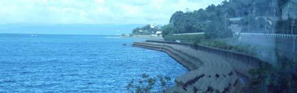
4 3.0 RESULTS Site Visit I: Shibushi Bay, Kagoshima Prefecture- 17 July Introduction Shibushi Bay is located at eastern part of Kagoshima Prefecture. It takes about 2.5 hour from Kagoshima City (Figure 1). The bay formed sandy beach of about 14.2km of Kashiwabara coast. Southern part of the area is located the artificial island (approximately 22.5 km 2 ). Detail information of the coastal processes related to the artificial island has been explained by Nishi et al. (1998). There are numbers of important structures along the shoreline. Southern part of the Bay located a fishermen port and estuary of Kimotsuki River. This area is shaded by the artificial island and is the most affected by sedimentation processes. Littoral drift from the north accumulated the sediment in the southern part. Beautiful pine trees planted behind the sandy beach is important as natural habitats and as protection of inland area from strong wind. Shibushi bay is experiencing strong wind directly from the Pacific Ocean. The objective of this site visit was to observe the shoreline protections and investigate environment condition in that area (Figure 2). 2.0 Shoreline protection Development of an artificial island in 1985 with size of 1.5km long to 1.5 km wide has changed the marine environment in Shibushi Bay. The size of the bay is about 16.8km long where 14.2km is a sandy beach. Some are is developed for small industries (dry fish industry) and public facilities (e.g ports and hospital). Northern part of the bay is Shibushi Port which is importance for the sea transportation in Shibushi city. The Littoral drift from north to south of the bay has accumulated the sediment sheltered area created by the artificial island and other human activities (e.g development of ports and reduced of sediment supply from river. To solve this problem, number of shoreline protections has been set up along the bay as following; 4
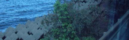
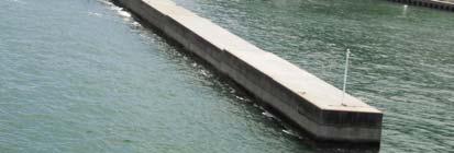
5 1. 1 T shape groin Groin has been developed to reduce the longshore sediment transport into sheltered area in the southwest. The groin block would prevent additional coastal erosion along the non sheltered beach. The groin has control about 60% of the sediment transport to the south of the area. Another groin is built near the estuary of Tabaru River located at northeast side of the bay. The groin is build to protect sediment accumulated in the river mouth especially strong waves. Sediment may prevent the water from river flow to the sea and create flood in the hinterland. During the site visit, small amount of sediment accumulated near the river mouth. 2. Submerge breakwaters There were 4 submerge breakwaters installed in Shibushi Bay. The breakwater is important to reduce the wave energy to reach the shoreline. The wave energy will be slowed down in front of the breakwater and accumulation of sediment occurred in that shade area. Sandy beach is important as recreational area for local communities. Therefore submerge breakwaters were built to preserve the nature beauty of the area. 3. Beach nourishment Beach nourishment in Shibushi Bay was the biggest in Japan. The sediment accumulated at sheltered area was transferred to erosion area in the north. The beach nourishment was conducted before the groins built to slow down the sediment transport to the south. Groin has reduced the littoral drift in Kashiwabara coast and reducing sedimentation processes in the south. 4. Revetments Strong erosion is occurred almost along the sandy beach of Kashiwabara Coast. The local authorities did the best the can do to reduce the lost of sediment in that area such as built a beach revetment near the fish industry. Revetment consists of small rocks and nicely arranged inside the gabions. The revetment is arranged into 3 different layers to respond the different wave energy attacked the area. Soil planted by 5
6 grass is field up behind the gabion to form natural dune. The gabions are designed to protect the dry fish industry. During the site visit toe scouring is occurred at southern part of the gabion. Therefore, another stone structures is pleased in that area to prevent continuously the sediment loss in that area. Revetments were placed along the Tabaru river bank. The shoreline protections are built in such way to defence the variable wave energy throughout the year. Wave energy is higher during the typhoons of the peak of summer (June- August) compared to winter. In the that time, wave direction is slightly southward direction with seaward wind direction. This area experience high waves from open sea. Tidal range is about 2.5m. 5. Coastal Trees Re-plantation Re-plantation of trees is made in some areas of Shibushi bay. The small and new trees (mainly casuarinas trees) are protected with fences. The trees are essential to reduce strong wind from open sea of Pacific Ocean. Vegetated area is important to hold sediment of along the beach and reduce coastal erosion. The beach of Kashiwabara coast is continuously maintained from natural disasters. No coastal development is observed immediately to the coastline except the Dry Fish Industry and the ports. The coastline is protected by man made structures from the sea (breakers), or built along the shoreline (revetment). Agriculture activities are separated with forested dune formed parallel to the beach. 6
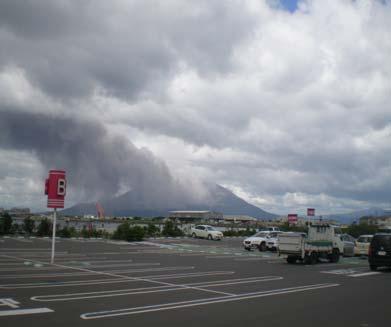
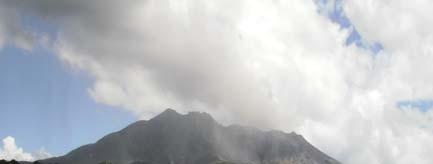
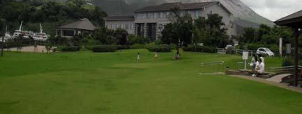
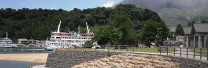
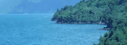
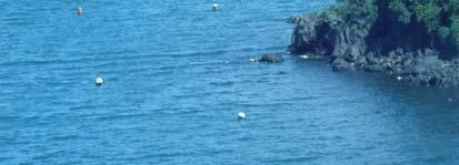
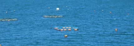
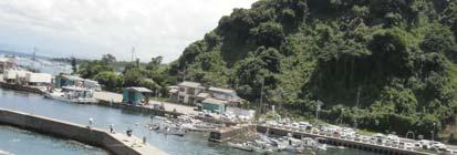
7 Site Visit II: Sakurajima, Kagoshima Prefecture - 19 July 2010 Introduction Sakurajima also literally means Cherry Blossom Island is symbol of Kagoshima Prefecture in Kyushu, Japan (Figure 3). It take about 15 minutes by ferry from Kagoshima ferry terminal (Kagoshima side) to Sakurajima port. Sakurajima was a small island with a circumference of 52 km in Kagoshima Bay. In 1914 eruption of Sakurajima was the most powerful in twentieth-century Japan. The lava gushed out from the volcano for about a month and connected the island about 400m wide with Osumi Peninsula. This year, the volcanic fumes rising from Sakurajima can be seen almost everyday. Shoreline protection in Sakurajima During the Sakurajima eruption 1914, lave was accumulated in the shoreline. Volcanic sediment and ash descends to the beach. Shoreline protection in Sakurajima has specially designed both to minimize wave action from sea and future eruptions. West side of the island is well protected by revetments. Sheltered area (embayment) are developed for ports facilities. Aquaculture activities such floating cages can be seen along the beach. Seawall was built at soft beach (e.g sandy beach), road or developed areas (e.g port and recreational area) and toe protection sometime place near the seawalls to protect scouring processes. Coastal Development a long the coastline Most of the Sakurajima shoreline consists of cliffs and narrow rocky shores. Development of fishing port and aquaculture activities conducted at sheltered area such as small bay. Most development is located near the Sakurajima Port to Kagoshima. The plan areas were mainly developed to support the tourist s activities such as hotels, schools and tourist information centre. Most agriculture and publics facilities are located in this area. People reside in Sakurajima has responded and adapt to a major hazard from volcano eruption. Disaster prevention activities such as regular evacuation drills and Training of school children to use mask and bright hat for self protection has been introduce to the local community. Strong shelters are built along the main road or villages for people to take refuge 7
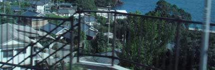
8 from falling volcanic debris. Precaution measures such as monitoring and prediction of Sakurajima large eruption are conducted as part of precaution program for the tourist visiting this area and for 680,000 residents of Kagoshima just a few kilometers from the volcano area. Some time the streets in Kagoshima city is covered with a thin layer of ash. The distribution of the volcanic ash is depending on the direction of the wind. Site Visit III: Kagoshima City, Kagoshima Prefecture- 25 July 2010 Kagoshima is southern Kyushu s major city facing the Kagoshima bay. It is about 4 km separated from Sakurajiama (Figure 4). Good economic development need more space to support the increasing coastal population. Therefore, most of the Kagoshima coastline was extended into Kagoshima bay. The reclamation was carried out a few decades ago to build public facilities such as parks, transportation and ports. Most of the existing coastline now is protected by hard structures such as seawalls or revetments. Many of the original residence areas built near the foot of the hill or in the heart of the city. All river (e.g Kotsuki River and Inari River) and drainages banks within the Kagoshima city are also protected by revetment. Most of the man made structures along the river and shoreline are well maintained by local authorities. Site Visit IV: Coastal area of Ibusuki- 8 August 2010 Ibusuki is located at entrance of Kagoshima Bay. The Ibusuki hot spring is famous tourists destination situated along the 5km coast on the southern eastern tip of the Satsuma Peninsula (Figure 5). That area is received windier and strong waves compared to Kagoshima city. Nagasakibana is a cape at the southernmost end of the Satsuma Peninsular in the southern part of Kagoshima Prefecture. The shoreline from Kagoshima down to Nagasakibana is mainly protected by hard structures. Various shapes of revetments and breakwaters are found along the journey. The shoreline protections are built to protect the roads and some houses which are build along the narrow plan areas. During the strong wind and high waves, the water from sea flesh into the road or damaged the existing hard structures supporting the road. Therefore, wave breakers are built along the beach to reduce 8
9 wave energy reach the shoreline. Fisherman ports and other facilities were also protected by breakwaters. Nagasakibana located at the most southern part of Kagoshima Prefecture. Lighthouse is built at the tip of the Nagasakibana to guide the ships to Kagoshima city. Beautiful beach is located in the right side. Rocky beach and cliff found facing the Kagoshima bay in the left. The beach is protected by submerge breakwaters. During the site visit, the existing revetment is built on the beach were coved by sediment. Site Visit V: Miyazaki Beaches-12 August 2010 Miyazaki bay is located at Miyazaki Prefectures (Figure 6). It is located on the eastern coast of the island of Kyushu. The beach area is facing directly to the Pacific Ocean. Therefore, typhoon, waves and tsunami are some of the natural disaster affects this area. However, coastal construction such as port and dam are also contributing to the beach erosion. Many types of coastal protections have been built along the shoreline such as groin, beach nourishment and underwater breaker has been place on the beach to protect the beach from erosion. The beach protection structures were designed based on the interest of both local communities and coastal engineers. The mild slope revetments were built in the recreational area so that the utilities of the beach can easily asses the area. The are numbers of groin placed perpendicular to the beach to reduce the littoral drift and transportation of the sediment to the south. The submerge breakwater are placed on the beach to reduce beach erosion and lost of sediment in between the two groins. Furthermore the is surfing activities would not affected by the submerge breakwater. Special designs of revetments are located in the certain part to support the turtle nesting area. The northern part of the bay is Miyazaki port while the southern part is protected by Aoshima Island. It is about 1.5km circumference and play an important role to protect the Aoshima beach. Marine sports such as swimming, surfing, sailing and yachting are popular in this area especially in summer time. 9
10 Conclusion Generally Kagoshima City and Sakurajima shoreline is located inside the Kagoshima bay and well protected by Osumi and Satsuma peninsulars. However, coastal reclamation were conducted in the Kagoshima city to support the demand of increasing development in this area. Therefore most of the shoreline is protected by seawalls. In the eastern part of the city is Iso swimming beach. It is beach nourishment to support the beach recreation areas. Some areas are protected by revetment to asses the waterline. All estuaries of the rivers are also protected by the stone revetment. Groins and breakwaters are built a long the beach to Nagasakibana to protect the roads, housing and fishing port. Shibushi and Miyazaki bays are located at the western side of the Kagoshima Prefecture. These areas affected directly by the waves and wind from Pacific Ocean. The main problem of the beach in this area is coastal erosion but it is well maintained by the local government through beach protections. Acknowledgments This program is supported by the Japanese Society for The Promotion of Science (JSPS) under International Training Program to improve the study ability in biodiversity at Kagoshima University. Special thanks to Prof. Ryuichiro Nishi for his help and guidance during my stay in Kagoshima. Also, all of the members of Physical Oceanography Laboratory (Lusia Manu, Tommy Jensen and Arthur Thambas), Faculty of Fisheries, Kagoshima University for their accompany and help during fieldtrip to various places in Kagoshima Prefecture. References Matchell, J. K Natural hazard predictions and responses in very large cities In J. Nemec et al. (et al). Predictions and perceptions of Natural Hazards. Kluwer Academic Publisher. Nishi, R., Uda, T., Sato, M., Wakita, M. Ohtani, Y. and Horiguchi, T., Coastal erosion caused by construction of an artificial island and performance of beach nourishment. Coastal engineering Takata, H., Nakamaura, H. and Hachio, T On prediction of electric power damage by thpoons in each districts in Kagoshima prefecture Via A Second-order polynomial model and NN. Takahashi, K., Abiru, S. and Mieno K, A study on revision of local plan for disaster preventions and countermeasures of voluntary organization for Disaster prevention in Kagoshima City after the Disaster in Kagishima due to Heavy Rainfall on August 6, Japan Society for Natural Disaster Science. (J.JSNDS (1996). 10
11 Moriwaki, et. al Report on the landslide and flood disasters caused by the heavy rainfall in August, 1993, Kagoshima, Japan. The national Research Institute for earth science and disaster prevention science and technology agency, Japan. Iino, N. Kinoshita, K. and Kakagaki, C Satellite images of air pollution and land cover for environmental education and Disaster prevention. International archives of the photogrmmetry, remote sensing and spatial information science, Vol XXXVI (6):

12 Figure 3: Sakurajima Eruption of Sakurajima Some of tourists facilities in Sakurajima Beautiful shoreline protection Seawall toe protection Rocky shore at certain part of Sakurajima Aquaculture activities near at sheltered area Shoreline protection near the port Housing area in Sakurajima 12


13 Figure 4: Kagoshima Kagoshima city from Sakurajima Kagoshima from Shyroyama observation centre Popular beach nourishment area in Iso beach Shoreline protection at southern part of Kagoshima City Rocky beach next to seawall Shoreline protection of reclaimed Kagoshima area Formation of tombolo behind the wave breaker Beautiful design of protection 13

14 Figure 5: Ibusuki Underwater breaker Sedimentation on revertment Breaking wave on underwater breaker Seawall at southern part of Kagoshima Lighthouse at the tip of Nagasakibana Cliff and rocky shore at entrance of Kagoshima bay. Shoreline at entrance of Kagoshima Bay Agriculture activities at low land area of Southernpart of Kagoshima 14


15 Figure 2: Shibushi bay Groin at southern part of Shibushi Bay Shoreline at Shibushi bay Fence protected the young vegetation from strong wind Artificial Island Revetment to protect the dry fish industry River banks protection Revetments in front the dry fish building Shoreline protection at Shibushi port 15
16 Figure 6: Miyazaki bay Aoshima Island Aoshima Beach Submerge breakwater on beach Beach revetment Groin in Miyazaki beach High waves important of surfing Mild slope revetment to asses the beach Coastal villages protected by shoreline structures 16
17 17
Marine Debris Distribution, Variation and Pattern/Seasonal Changes along the Coast and on Sea Surface of the Kagoshima Bay
 Marine Debris Distribution, Variation and Pattern/Seasonal Changes along the Coast and on Sea Surface of the Kagoshima Bay Benjamin Dotto MAJANGA 1, Shigeru FUJIEDA 2, Ryuichiro NISHI 3 and Kazunori HOSOTANI
Satoquo SEINO (Graduate School of Engineering, Kyushu University, Japan)
") A reconsideration of horseshoe crab conservation methodology in Japan over the last 100 years and prospects for a marine protected area network in Asian seas Satoquo SEINO (Graduate School of Engineering,
A reconsideration of horseshoe crab conservation methodology in Japan over the last 100 years and prospects for a marine protected area network in Asian seas Satoquo SEINO (Graduate School of Engineering,
KNOWLEDGE NOTE 1-3. Hydro-meteorological Disasters Associated with Tsunamis and Earthquakes. CLUSTER 1: Structural Measures
 Public Disclosure Authorized Public Disclosure Authorized Public Disclosure Authorized Public Disclosure Authorized KNOWLEDGE NOTE 1-3 CLUSTER 1: Structural Measures Hydro-meteorological Disasters Associated
Japan Academic Network for Disaster Reduction (JANET-DR) and interdisciplinary collaboration. Science Council of Japan
 and interdisciplinary collaboration. Science Council of Japan") Japan Academic Network for Disaster Reduction (JANET-DR) and interdisciplinary collaboration Members of SCJ and 56 academic societies proceed JANET-DR which covers social sciences, life sciences, natural
Japan Academic Network for Disaster Reduction (JANET-DR) and interdisciplinary collaboration Members of SCJ and 56 academic societies proceed JANET-DR which covers social sciences, life sciences, natural
REPORT OF STUDY TRIP (TOHOKU)
") INTERNATIONAL INSTITUTE OF SEISMOLOGY AND EARTHQUAKE ENGINEERING (IISEE) REPORT OF STUDY TRIP (TOHOKU) 10-14 JULY 2011 PREPARED BY: MAZNI BINTI AZIS MALAYSIA SUBMISSION DATE: JULY 29, 2011 TSUNAMI DISASTER
INTERNATIONAL INSTITUTE OF SEISMOLOGY AND EARTHQUAKE ENGINEERING (IISEE) REPORT OF STUDY TRIP (TOHOKU) 10-14 JULY 2011 PREPARED BY: MAZNI BINTI AZIS MALAYSIA SUBMISSION DATE: JULY 29, 2011 TSUNAMI DISASTER
Chapter 10. Damage to Ports and Coastal Facilities
 Chapter 10 Damage to Ports and Coastal Facilities 10.1 Area Investigated Tsunami induced heavy damage to ports and coastal facilities along the west and north coast of Sumatra Island. Figure 10.1 shows
EFFECT OF THE COASTAL CONSERVATION DUE TO BEACH NOURISHMENT OF TOTORI SAND DUNE COAST
 Proceedings of the 7 th International Conference on Asian and Pacific Coasts (APAC 203) Bali, Indonesia, September 2-26, 203 EFFECT OF THE COASTAL CONSERVATION DUE TO BEACH NOURISHMENT OF TOTORI SAND DUNE
Status of Mangroves in Belize
 Status of Mangroves in Belize State of the Coastal zone Summit June 7 th 2012 Nadia Bood*, Emil Cherrington and Tim Smith Outline Introduction to mangroves Importance of mangrove to Belize National status
REPORT OF STUDY TRIP (TOHOKU)
") INTERNATIONAL INSTITUTE OF SEISMOLOGY AND EARTHQUAKE ENGINEERING (IISEE) REPORT OF STUDY TRIP (TOHOKU) 14 18 November 2011 Prepared by: Nur Intan Irzwanee Nurashid T course (Malaysia) 5/12/2011 Day 1:
INTERNATIONAL INSTITUTE OF SEISMOLOGY AND EARTHQUAKE ENGINEERING (IISEE) REPORT OF STUDY TRIP (TOHOKU) 14 18 November 2011 Prepared by: Nur Intan Irzwanee Nurashid T course (Malaysia) 5/12/2011 Day 1:
THE DESIGN AND IMPLEMENTATION OF A PRACTICAL TSUNAMI EVACUATION DRILL
 THE DESIGN AND IMPLEMENTATION OF A PRACTICAL TSUNAMI EVACUATION DRILL K. TERUMOTO Wakayama University, Japan SUMMARY: Tsunami evacuation measures are now an urgent issue in Japanese coastal area. One of
The reasons why coastal management is needed in Minehead:
 1. Resource 1: Why did Minehead need new sea defences? Coastal management in Minehead In pairs, read the following resource and highlight the reasons why coastal management was needed in Minehead. The
Multi Purpose Personal Safety System
 Multi Purpose Personal Safety System People deserve a Choice Survival Capsule LLC is comprised of Aerospace Engineers and a Doctor of Oceanography and Tsunami research (Former member of NOAA). Julian Sharpe
Investigation on Development of Agricultural Monitoring System Using Satellite Data
 Investigation on Development of Agricultural Monitoring System Using Satellite Data Genya SAITO (1), Daisuke KUNII (1), Naoki ISHITSUKA (2) (1) Tohoku University, 1-1,Tsutsumidori Amamiya-machi Aoba-ku,
Case Study: 1. The Clarence River Catchment
 Case Study: 1. The Clarence River Catchment The NSW coastline is a great natural asset, making an enormous contribution to the economy. The resources of coastal catchments such as the Clarence River Catchment,
Defending the coast at Dawlish Warren
 508 546 Sólheimajökull: Defending the coast a retreating Dawlish Icelandic Warrenglacier By By Simon Hilary Edge Sampson Today, ice covers around 10% of the A case study about world s surface. But, for
CHAPTER 241. SAND BYPASSING TO "PLAYA DE CASTILLA" (HUELVA SPAIN) Jose Fernandez (1) Gregorio Gomez Pina (2) Angel Mufloz (3)
 Jose Fernandez (1) Gregorio Gomez Pina (2) Angel Mufloz (3)") CHAPTER 241 SAND BYPASSING TO "PLAYA DE CASTILLA" (HUELVA SPAIN) Jose Fernandez (1) Gregorio Gomez Pina (2) Angel Mufloz (3) Abstract The "Sand bypassing to Playa de Castilla" project consists of a sand
CHAPTER 241 SAND BYPASSING TO "PLAYA DE CASTILLA" (HUELVA SPAIN) Jose Fernandez (1) Gregorio Gomez Pina (2) Angel Mufloz (3) Abstract The "Sand bypassing to Playa de Castilla" project consists of a sand
Coverage of Mangrove Ecosystem along Three Coastal Zones of Puerto Rico using IKONOS Sensor
 Coverage of Mangrove Ecosystem along Three Coastal Zones of Puerto Rico using IKONOS Sensor Jennifer Toledo Rivera Geology Department, University of Puerto Rico, Mayagüez Campus P.O. Box 9017 Mayagüez,
Public Safety Management
 Chapter 6: Public Safety Management Disaster Prevention Building a more disaster resistant nation Protecting the lives and property of the people from natural disasters is of the utmost importance. On
3rd GRADE MINIMUM CONTENTS UDI 1: LANDSCAPES (5)
") 3rd GRADE MINIMUM CONTENTS UDI 1: LANDSCAPES (5) DIFFERENT LANDSCAPES A landscape is all the things that we see in a place. There are different types of landscapes. Mountain landscapes have mountains and
3rd GRADE MINIMUM CONTENTS UDI 1: LANDSCAPES (5) DIFFERENT LANDSCAPES A landscape is all the things that we see in a place. There are different types of landscapes. Mountain landscapes have mountains and
Paper Reference. Paper Reference(s) 1312/4H Edexcel GCSE Geography A Higher Tier. Wednesday 15 June 2005 Afternoon Time: 1 hour 15 minutes
 1312/4H Edexcel GCSE Geography A Higher Tier. Wednesday 15 June 2005 Afternoon Time: 1 hour 15 minutes") Centre No. Candidate No. Paper Reference 1 3 1 2 4 H Surname Paper Reference(s) 1312/4H Edexcel GCSE Geography A Higher Tier Paper 4H Wednesday 15 June 2005 Afternoon Time: 1 hour 15 minutes Signature
Centre No. Candidate No. Paper Reference 1 3 1 2 4 H Surname Paper Reference(s) 1312/4H Edexcel GCSE Geography A Higher Tier Paper 4H Wednesday 15 June 2005 Afternoon Time: 1 hour 15 minutes Signature
The Geological Pacific Northwest. Wednesday February 6, 2012 Pacific Northwest History Mr. Rice
 The Geological Pacific Northwest Wednesday February 6, 2012 Pacific Northwest History Mr. Rice 1 Free Response #2 Please do not simply list the items for this response. Full sentences!!! Minimum of 3-5
Using Managed Retreat to Address Coastal Erosion in Brewster
 Using Managed Retreat to Address Coastal Erosion in Brewster Chris Miller, Director, Brewster Department of Natural Resources CMiller@brewster-ma.gov Brewster, Massachusetts Almost 1/3 of town preserved
GREAT EARTHQUAKE DISASTER NILIM, JAPAN
 EAST- JAPAN GREAT EARTHQUAKE DISASTER 11 MARCH in 2011 NILIM, JAPAN CONTENTS 1. Outline of the EARTHQUAKE DISASTER 2. History of EARTHQUAKE/TSUNAMI occurred in Japan 3. Disaster Prevention Policy and Strategy
The Use of Low Cost Breakwaters for Mangrove Restoration in Muddy Foreshores
 The Use of Low Cost Breakwaters for Mangrove Restoration in Muddy Foreshores Douglas A. Gaffney, P.E. Ranata Robertson October 23, 2012 The Use of Low Cost Breakwaters for Mangrove Restoration in Muddy
Communicating the Economic and Social Importance of Coral Reefs for South East Asian countries
 Communicating the Economic and Social Importance of Coral Reefs for South East Asian countries This fact sheet will provide you with information extracted from economic studies BASICS Coral reefs are among
NO INTERNET OR PHONE POWER WATER WHAT WOULD YOU DO? CAN'T GET HOME STUCK AT HOME HAVE TO EVACUATE
 NO WATER NO POWER NO INTERNET OR PHONE CAN'T GET HOME WHAT WOULD YOU DO? HAVE TO EVACUATE STUCK AT HOME In New Zealand emergencies can happen any time, anywhere, and often without warning. Floods, storms,
Roles of Protected Areas for Recovery from Natural Disaster
 Roles of Protected Areas for Recovery from Natural Disaster Topics Outline of Natural Park System in Japan Key Concept of Sanriku Fukko (Reconstruction) National Park Outline of Natural Park System in
The Galveston Seawall
 Coastal and Ocean Engineering ENGI.8751 Undergraduate Student Forum Faculty of Engineering and Applied Science, Memorial University, St. John s, NL, Canada. March, 2013 The Galveston Seawall Mark Harvey
Lidar Imagery Reveals Maine's Land Surface in Unprecedented Detail
 Maine Geologic Facts and Localities December, 2011 Lidar Imagery Reveals Maine's Land Surface in Unprecedented Detail Text by Woodrow Thompson, Department of Agriculture, Conservation & Forestry 1 Introduction
Challenges in Disaster Risk Reduction around Marine Parks in Aceh-Indonesia
 Challenges in Disaster Risk Reduction around Marine Parks in Aceh-Indonesia S Y A M S I D I K V I C E D I R E C T O R O F T S U N A M I A N D D I S A S T E R M I T I G A T I O N R E S E A R C H C E N T
Jamaica Member Report
 National Environment and Jamaica Member Report International Coral Reef Initiative 28 th General Meeting October 14-17, 2013 Belize City, Belize Loúreene Jones Coastal and Marine Resources Beaches Wetlands
IMPACTS OF THE RECENT TSUNAMI ON THE BUNDALA NATIONAL PARK THE FIRST RAMSAR WETLAND IN SRI LANKA
 IMPACTS OF THE RECENT TSUNAMI ON THE BUNDALA NATIONAL PARK THE FIRST RAMSAR WETLAND IN SRI LANKA by C.N.B. Bambaradeniya, IUCN The World Conservation Union, Sri Lanka Country Office (Email: cnb@iucnsl.org)
Redesigning The Waterfront
 San Francisco Maritime National Park Service U.S. Department of the Interior National Historical Park California Redesigning The Waterfront A Self-Guided Walking Tour Then & Black Point Cove, ca. 1910.
Potential Application of. Shore-Stabilizing Structures along an Open-Coast Shoreline. Christopher G. Creed, P.E. 23 rd Annual National Conference on
 23 rd Annual National Conference on Potential Application of Beach Preservation Technology February 3-5, 2010 Indialantic, FL Shore-Stabilizing Structures along an Open-Coast Shoreline Christopher G. Creed,
ICRI Monaco January 2010
 Economic Valuation of Coral Reefs in the Caribbean ICRI Monaco January 2010 Lauretta Burke World Resources Institute (WRI) Beautiful Valuable Valuable Valuable Valuable Valuable Photos: Krishna Desai Valuable
TSUNAMI DAMAGE IN PORTS BY THE 2011 OFF PACIFIC COAST OF TOHOKU EARTHQUAKE
 Proceedings of the International Symposium on Engineering Lessons Learned from the 2011 Great East Japan Earthquake, March 1-4, 2012, Tokyo, Japan TSUNAMI DAMAGE IN PORTS BY THE 2011 OFF PACIFIC COAST
Diversity of Coastal Ecosystems of Maharashtra - Ecologically Sensitive Coastal Areas of Ratnagiri and Sindhudurga
 Diversity of Coastal Ecosystems of Maharashtra - Ecologically Sensitive Coastal Areas of Ratnagiri and Sindhudurga Abstract: Approximately 20% of the world s coral reefs were lost and an additional 20%
the high fatalities inflicted by the earthquake
 2011.10.25 The 2011 off the Pacific Coast of Tohoku earthquake Interviewing insights regarding the high fatalities inflicted by the earthquake Masataka Ando 1, Mizuho Ishida 2, Yoshinari Hayashi 3 and
THE WORLD BANK. Climate Change Adaptation and Natural Disasters Preparedness in the Coastal Cities of North Africa
 THE WORLD BANK Climate Change Adaptation and Natural Disasters Preparedness in the Coastal Cities of North Africa Phase 1 : Risk Assessment for the Present Situation and Horizon 2030 Alexandria Area National
Tsunami Impacting Eastern Japan and Preparedness for Extraordinary Natural Disaster. Takehiko Fujita
 May 25, 2011 Tsunami Impacting Eastern Japan and Preparedness for Extraordinary Natural Disaster Takehiko Fujita Acting President Port and Airport Research Institute, Japan Contents 1. Outline of the earthquake
REPORT OF STUDY TRIP (TOHOKU)
") INTERNATIONAL INSTITUTE OF SEISMOLOGY AND EARTHQUAKE ENGINEERING (IISEE) REPORT OF STUDY TRIP (TOHOKU) 14 18 November 2011 Prepared by: Dwi Hartanto T course (Indonesia) 0 DAY 1: NOVEMBER 14, 2011 On March
INTERNATIONAL INSTITUTE OF SEISMOLOGY AND EARTHQUAKE ENGINEERING (IISEE) REPORT OF STUDY TRIP (TOHOKU) 14 18 November 2011 Prepared by: Dwi Hartanto T course (Indonesia) 0 DAY 1: NOVEMBER 14, 2011 On March
Wednesday, April 4, 2018
 Wednesday, April 4, 2018 Physical Geography of Japan Objective: Outline the countries and territories that are included in East Asia. Describe the main physical features and climate types of each country.
Title/Name of the area: Chwaka Bay, Zanzibar
 Title/Name of the area: Chwaka Bay, Zanzibar Presented by: Dr. Charles Lugomela, Ag. Head, Department of Aquatic Sciences and Fisheries, University of Dar es Salaam, P.O. Box 35064 Dar es Salaam, Tanzania
Coastal Dune Locations of Ontario
 Coastal Dune Protection along Ontario s Great Lakes Coast Great Lakes Dune Conference, Traverse City, Michigan Oct 3 4, 2006 J. Childs, WLU Dunes in Ontario Coastal very small % of coastline Located: At
Post tsunami Recovery of Port and Harbor areas in Japan from the 2011 Great East Japan Earthquake Tsunami
 Date : 18 Nov., 2015 Venue : Furama Ballroom 1 SESSION 1 : A Decade of Partnerships in Sustainable Development of the Seas of East Asia: Synergies and Achievements WORKSHOP 1.1 : Managing Risks in Climate
Public Safety Management
 Chapter 6: Public Safety Management Disaster prevention Building a more disaster resistant nation Protecting the lives and property of the people from natural disaster is of utmost importance. On the other
Japan Earthquake and Tsunami: a view from satellite data
 Università degli studi di Roma Tor Vergata Corso di Telerilevamento e Cartografia Anno accademico 2012/2013 Japan Earthquake and Tsunami: a view from satellite data Dr. Matteo Picchiani picchiani@disp.uniroma2.it
RURAL LAND RESOURCES Case study area 1- the erosional features of the Dorset Coast.
 Case study area 1- the erosional features of the Dorset Coast. Scene setting;- This area lies on the far south coast of England, between the settlements of Lyme Regis and Bournemouth, in the county of
Field Guide for the participants of the International Symposium on Earthquake & Tsunami Disaster Reduction. 16 March 2012
 Field Guide for the participants of the International Symposium on Earthquake & Tsunami Disaster Reduction Ishinomaki Onagawa Sendai Natori 16 March 2012 Tsunami struck Sendai Plain after one hour Tsunami
Coastal protection and development of Alexandria
 Coastal protection and development of Alexandria R,M. Hassan* Coastal and Port Development Division, Water Engineering Dept,, IHE De~t, The Netherlands, Abstract Alexandria City is the main beach resort
Reduction of Wave Runup on a Revetment by Addition of a Berm
 REMR Technical Note CO-RR-1.3 (Supersedes CO-RR-1.3 1986) Reduction of Wave Runup on a Revetment by Addition of a Berm Purpose To provide design guidance for reducing wave runup on a riprap revetment by
Kirkcaldy Sea Wall Improvements. Non-technical Summary. For illustration purposes only to give an indicative representation of the scheme.
 ENVIRONMENTAL STATEMENT Non-technical Summary For illustration purposes only to give an indicative representation of the scheme. Kirkcaldy Sea Wall Improvements Introduction A concrete sea wall fronts
Elkhorn Slough Tidal Wetland Project
 Elkhorn Slough Tidal Wetland Project Joint Meeting Strategic Planning Team and Science Panel September 23, 2009 Funding National Oceanic and Atmospheric Admin. David and Lucille Packard Foundation Resources
Guide to Siting of Seawalls January 13, 2014 by Michael Walther, P.E., D.CE, President - Coastal Tech
 January 13, 2014 by Michael Walther, P.E., D.CE, President - Coastal Tech mwalther@coastaltechcorp.com Prepared for the Sea Turtle Conservancy http://www.conserveturtles.org/ Introduction Overview: This
Human-induced stresses on mangrove swamps along the Kenyan Coast
 University of Wollongong Research Online Faculty of Science - Papers (Archive) Faculty of Science, Medicine and Health 2001 Human-induced stresses on mangrove swamps along the Kenyan Coast P. A. O. Abuodha
Palau National Marine Sanctuary Building Palau s future and honoring its past
 A fact sheet from Sept 2015 Palau National Marine Sanctuary Building Palau s future and honoring its past Caring for the environment has long been an important part of Palau s culture. For centuries, traditional
Tsunami Propagation Information for Increasing Small Islands Community Preparedness around the Sumatra Island
 Tsunami Propagation Information for Increasing Small Islands Community Preparedness around the Sumatra Island S YA M S ID IK F IR D A U S TEU K U M. R A S YIF TS U N A M I A N D D IS A S TER M ITIG A T
MARCH 2011, TSUNAMI DISASTER IN JAPAN
 MARCH 2011, TSUNAMI DISASTER IN JAPAN Dr. Neelima Satyam D 1 and Dr. D V Reddy 2 1 Assistant Professor Earthquake Engineering Research Centre International Institute of Information Technology Hyderabad
VERP Assignment for Ft. Fisher State Recreation Area
 Case Background VERP Assignment for Ft. Fisher State Recreation Area Fort Fisher State Recreation Area is a jewel of the southeastern coast of North Carolina. Comprised of a wide variety of maritime ecosystems,
Great East Japan Earthquake Kimiaki Nagashima
 Great East Japan Earthquake Kimiaki Nagashima Japan Water Works Association 12.05.2011 Great East Japan earthquake 1 earthquake 2 Tsunamis 3Floods 4fires 5Nuclear disasters From the daily yomiuri Mar 12,2011
Tremendously heavy rainfall 復旧へ has occurred, twice as much as at any previously recorded time.
 Tremendously heavy rainfall 復旧へ has occurred, twice as much as at any previously recorded time. Emergency warning was issued, 1,000 mm in 24 hours in Asakura, and 600mm in Hita city and then, after rainfall.
EO Contribution to Recovery Activities - A case study on the experience of the Great East Japan Earthquake -
 EO Contribution to Recovery Activities - A case study on the experience of the Great East Japan Earthquake - Michio Ito (Mr.) ito.michio@jaxa.jp Space Applications and Operation Center JAXA Purpose of
Engineering With Nature Geographic Project Mapping Tool (EWN ProMap)
") Engineering With Nature Geographic Project Mapping Tool (EWN ProMap) Cynthia Banks Program Manager Burton Suedel, PhD Research Biologist Michelle Bourne Research Biologist U.S. Army ERDC 23 June 2015 Dredging
Engineering With Nature Geographic Project Mapping Tool (EWN ProMap) Cynthia Banks Program Manager Burton Suedel, PhD Research Biologist Michelle Bourne Research Biologist U.S. Army ERDC 23 June 2015 Dredging
Research Briefing Flood and Coastal Erosion Risk Management in Wales
 Research Briefing Flood and Coastal Erosion Risk Management in Wales Author: Wendy Dodds Date: September 2017 National Assembly for Wales Research Service The National Assembly for Wales is the democratically
THE STUDY FOR COASTAL EROSION AND FLOOD CONTROL MANAGEMENT IN THE REPUBLIC OF SEYCHELLES FINAL REPORT
 MINISTRY OF ENVIRONMENT AND ENERGY REPUBLIC OF SEYCHELLES THE STUDY FOR COASTAL EROSION AND FLOOD CONTROL MANAGEMENT IN THE REPUBLIC OF SEYCHELLES FINAL REPORT MARCH 2014 JAPAN INTERNATIONAL COOPERATION
Table Major analysis products provided by JAXA
 Report on JAXA s Response to the Great East Japan Earthquake - Assistance using earth observation satellites and communication satellites - 2.1.5 Product provision and utilization by users for disaster
The major parties key coastal policy initiatives
 NEWSLETTER July 2016 EDITORIAL: Coastal policies of major parties inadequate By Barry Sammels Chair, Australian Coastal Councils Association and Mayor, City of Rockingham With the result of the 2016 Federal
2011/EPWG/WKSP2/003 Earthquake and Tsunami Disaster in Japan Experience and Lessons
 2011/EPWG/WKSP2/003 Earthquake and Tsunami Disaster in Japan Experience and Lessons Submitted by: Asian Disaster Reduction Center (ADRC) Workshop on Facing Abnormal Flood Disaster: New Vision for APEC
Typhoon Isewan and Its Lessons
 Typhoon Isewan and Its Lessons March 21, 2006 Kenji SUZUKI Japan Water Forum In 1959, Typhoon Isewan hit Central Japan and caused the worst damage, due to high tides and floods. Nagoya Typhoon Isewan courses
Proposal of constructing new tsunami shelter buildings at Mimase in Kochi City
 Proposal of constructing new tsunami shelter buildings at Mimase in Kochi City Hiroyuki KITAMOTO Mimasaka University, Tsuyama, Japan Michio MIYANO Osaka City University, Osaka, Japan Sayumi HAGINO Miyajidenki
MESOAMERICAN REEF (MAR) ECOREGION, CENTRAL AMERICA
 ECOREGION, CENTRAL AMERICA") MESOAMERICAN REEF (MAR) ECOREGION, CENTRAL AMERICA Community Level Climate Change Vulnerability A CASE STUDY Assessment NADIA D. BOOD 2008 3 OVERVIEW World Wildlife Fund (WWF) embarked on a mission to
MESOAMERICAN REEF (MAR) ECOREGION, CENTRAL AMERICA Community Level Climate Change Vulnerability A CASE STUDY Assessment NADIA D. BOOD 2008 3 OVERVIEW World Wildlife Fund (WWF) embarked on a mission to
REPORT OF STUDY TRIP (Niigata & Miyagi Prefectures)
") INTERNATIONAL INSTITUTE OF SEISMOLOGY AND EARTHQUAKE ENGINEERING (IISEE) REPORT OF STUDY TRIP (Niigata & Miyagi Prefectures) 14 17 November 2011 Prepared by: Biana Rahayu Wulandari S course (Indonesia)
INTERNATIONAL INSTITUTE OF SEISMOLOGY AND EARTHQUAKE ENGINEERING (IISEE) REPORT OF STUDY TRIP (Niigata & Miyagi Prefectures) 14 17 November 2011 Prepared by: Biana Rahayu Wulandari S course (Indonesia)
Presentation By. My duties and responsibilities in my country Collection and compilation of disaster related data from different Parts of the kingdom.
 Presentation By POKHAREL Lekh Nath Ministry of Home Affairs,His Majesty's Government of Nepal. Disaster Relief Section Kathmandu NEPAL Now as a visiting Researcher at ADRC. My duties and responsibilities
TOWARDS SUSTAINABLE MANAGEMENT OF MARINE AND COASTAL HABITATS ASIA- PACIFIC DAY FOR THE OCEAN
 TOWARDS SUSTAINABLE MANAGEMENT OF MARINE AND COASTAL HABITATS WANNAKIAT THUBTHIMSANG PHUKET MARINE BIOLOGICAL CENTER, DMCR, THAILAND ASIA- PACIFIC DAY FOR THE OCEAN 20 NOVEMBER 2018, CONFERENCE ROOM 4,
HUMAN INTERVENTION ON MANGROVE AREA IN AMBONG BAY, KOTA BELUD, SABAH
 BORNEO SCIENCE 28: MARCH 2011 HUMAN INTERVENTION ON MANGROVE AREA IN AMBONG BAY, KOTA BELUD, SABAH Ejria Saleh 1, Andy R. Mojiol 2 & Nurul Waheeda Abd Halim 1 1 Borneo Marine Research Institute, Universiti
Kermadec. Ocean Sanctuary
 Kermadec Ocean Sanctuary Kermadec Ocean Sanctuary, New Zealand Pacific Remote Islands National Marine Monument, United States Coral Sea Marine Reserve, Australia Proposed Pitcairn Marine Reserve, United
WHENUAPAI AIRBASE IMPACTS OF CLOSURE ON CIVIL DEFENCE EMERGENCY MANAGEMENT IN THE AUCKLAND REGION
 WHENUAPAI AIRBASE IMPACTS OF CLOSURE ON CIVIL DEFENCE EMERGENCY MANAGEMENT IN THE AUCKLAND REGION INTRODUCTION The New Zealand Defence Force has made a decision to relocate military operations away from
Indian Ocean Small Island States: Indicators of Dangerous Anthropogenic Influences of Climate Change?
 Indian Ocean Small Island States: Indicators of Dangerous Anthropogenic Influences of Climate Change? Prepared for: AGU Fall Meeting San Francisco CA December 5, 2005 Prepared by: Bill Mills Chih-Fang
Report on Field Survey of Solomon Islands Earthquake Tsunami in April 2007
 Report on Field Survey of Solomon Islands Earthquake Tsunami in April 2007 by Takashi Tomita 1, Taro Arikawa 2, Daisuke Tatsumi 3, Kazuhiko Honda 3, Hiroshi Higashino 4 Kazuya Watabnabe 4, and Shigeo Takahashi
CHAPTER 4 -- THE LAND USE PLAN: DESCRIPTIONS AND POLICIES FOR THIRTEEN PLANNING AREAS
 CHAPTER 4 -- THE LAND USE PLAN: DESCRIPTIONS AND POLICIES FOR THIRTEEN PLANNING AREAS NORTH CENTRAL CAC PLANNING AREA 4.4 FORT BRAGG CITY LIMIT TO HARE CREEK PLANNING AREA (Includes Noyo) The Noyo community
Provincial Development and Physical Framework Plan Province of Capiz
 3.2.3 Protection Areas Protection areas (Map 11) which include areas under the categories of NIPAS, Non-NIPAS, environmentally constrained and the military reservations are described as follows: a) NIPAS
Executive Summary of Urgent Field Survey of Earthquake and Tsunami Disasters by the 2011 off the Pacific coast of Tohoku Earthquake
 March 25, 2011 Executive Summary of Urgent Field Survey of Earthquake and Tsunami Disasters by the 2011 off the Pacific coast of Tohoku Earthquake Port and Airport Research Institute (PARI) has accomplished
KKC can provide the total solution from Data capturing to Consulting
 Crowdsource Mapping Response to the Great East Japan Earthquake Kunihiro ISHII kunihiro_ishii@kk-grp.jp Business Fields of KOKUSAI KOGYO(KKC) KKC can provide the total solution from Data capturing to Consulting
Coral reefs facing to global and regional environmental changes
 Coral reefs facing to global and regional environmental changes Hiroya Yamano (National Institute for Environmental Studies) Importance of coral reefs Photo: H. Kan Photo: H. Kayanne Biodiversity Fisheries
Rosguill Gaeltacht LCA 22
 Rosguill Gaeltacht LCA 22 Rosguill Gaeltacht LCA is a distinctive rural peninsula that projects north into the Atlantic Ocean between Sheephaven Bay to the west and Mulroy Bay to the East, and is characterized
Community vulnerability in tropical coastal zones: tsunamis and cyclone storm surges. David King Centre for Disaster Studies James Cook University
 Community vulnerability in tropical coastal zones: tsunamis and cyclone storm surges David King Centre for Disaster Studies James Cook University Tsunami risk -- low probability. Storm surges -- high probability
CHAPTER 186. Shore Protection Plan for the Nile Delta Coastline. A.L. Kadib, Member, ASCE^, A.T. Shak, A. Member, ASCE< 2 ), A.A.
, A.A.") CHAPTER 186 Shore Protection Plan for the Nile Delta Coastline A.L. Kadib, Member, ASCE^, A.T. Shak, A. Member, ASCE< 2 ), A.A. Mazen^3), and M.K. Nadar< 4 ) A Shore Protection Master Plan (SPMP) for the
CHAPTER 186 Shore Protection Plan for the Nile Delta Coastline A.L. Kadib, Member, ASCE^, A.T. Shak, A. Member, ASCE< 2 ), A.A. Mazen^3), and M.K. Nadar< 4 ) A Shore Protection Master Plan (SPMP) for the
GLOFs from moraine-dammed lakes: their causes and mechanisms V. Vilímek, A. Emmer
 GLOFs from moraine-dammed lakes: their causes and mechanisms V. Vilímek, A. Emmer Department of Physical Geography and Geoecology, Faculty of Science, Charles University, Prague, Czech Republic vilimek@natur.cuni.cz
REPORT OF STUDY TRIP (Niigata & Miyagi Prefectures)
") INTERNATIONAL INSTITUTE OF SEISMOLOGY AND EARTHQUAKE ENGINEERING (IISEE) REPORT OF STUDY TRIP (Niigata & Miyagi Prefectures) 14 17 November 2011 Prepared by: D.Mungunsuren S course (Mongolia) INTRODUCTION
INTERNATIONAL INSTITUTE OF SEISMOLOGY AND EARTHQUAKE ENGINEERING (IISEE) REPORT OF STUDY TRIP (Niigata & Miyagi Prefectures) 14 17 November 2011 Prepared by: D.Mungunsuren S course (Mongolia) INTRODUCTION
MONTAGUE HARBOUR MARINE PROVINCIAL PARK
 MONTAGUE HARBOUR MARINE PROVINCIAL PARK PURPOSE STATEMENT AND ZONING PLAN March 2003 1 MONTAGUE HARBOUR MARINE PROVINCIAL PARK Purpose Statement and Zoning Plan Primary Role The primary role of Montague
Establishment of APEC Emergency Preparedness. Working Group and its recent development
 Sistema Económico Latinoamericano y del Caribe Latin American and Caribbean Economic System Sistema Econômico Latino-Americano e do Caribe Système Economique Latinoaméricain et Caribéen Establishment of
Japan opts for massive, costly sea wall to fend off tsunamis 22 March 2015, byelaine Kurtenbach
 Japan opts for massive, costly sea wall to fend off tsunamis 22 March 2015, byelaine Kurtenbach "The reality is that it looks like the wall of a jail," said Musashi, 46, who lived on the seaside before
Kagoshima Prefecture consists of about 600
 Kawai, K., Terada, R. and Kuwahara, S. (eds): The Islands of Kagoshima Kagoshima University Research Center for the Pacific Islands, 15 March 213 Chapter 16 Sugarcane Cultivation in the Islands of Kagoshima
FOR SALE INDIAN OCEAN BEACHFRONT- HEADLAND PLOT
 June 2017 FOR SALE INDIAN OCEAN BEACHFRONT- HEADLAND PLOT Rasini, Kimbiji, Kizito Huonjwa, Temeke, Dar es Salaam, Tanzania A UNIQUE opportunity to acquire 9 hectares/22 acres of natural cliff and beachfront
Sardar Patel National Highways Modern Dharmshala
 () (A Pilot Project for Coastal Districts in India) Presented by: Coastal India Development Council (CIDC India) About CIDC India: Coastal India Development Council (CIDC) is a society to develop the core
Date & Time Location Program Notes. Opening ceremony. UN-HABITAT Fukuoka HQ greeting. Keynote speech
 APCS (Asian-Pacific City Summit) Press 2011 July VOL-12 Pre Kagoshima Working-level Conference Special Edition Asian Pacific City Summit(APCS)is an international city network proposed by Fukuoka City and
Unit 2: Coastal landforms in Spain. Social Science
 Unit 2: Coastal landforms in Spain Social Science Spanish coastline Spain has 7,880km of coastline between all its territories. It is surrounded by the Atlantic Ocean, Cantabrian Sea and Mediterranean
Japan & JICA s experiences, Risk Governance and/for Resilience and Risk Reduction =The 2nd Arab Conference on DRR=
 Japan & JICA s experiences, Risk Governance and/for Resilience and Risk Reduction =The 2nd Arab Conference on DRR= TAKEYA Kimio Senior Advisor, JICA takeya.kimio@jica.go.jp Japanese Experiences 1 Why Japan
The Great East Japan Earthquake Study Tour. 27. Feb.2018
 The Great East Japan Earthquake Study Tour 27. Feb.2018 Overview of the Great East Japan earthquake Kamaishi The Great East Japan earthquake occured: 2011.3.11 14:46 M9.0 dead: 19,575 missing: 2,577 injured:
Presenter : Dodin/Jean-Paul, Jeremie
 Presenter : Dodin/Jean-Paul, Jeremie Seychelles National Meteorological Services Seychelles International Airport Ministry of Environment & Energy Environment Department P.O Box 1145 Victoria Mahe Tel: