USGS Efforts to Consolidate Geospatial Data in the Federal Government
|
|
|
- Christian Hunter
- 5 years ago
- Views:
Transcription


1 ++ 1 USGS Efforts to Consolidate Geospatial Data in the Federal Government An overview of USGS trails collaborations and updates. Date 5/31/2017 Greg Matthews


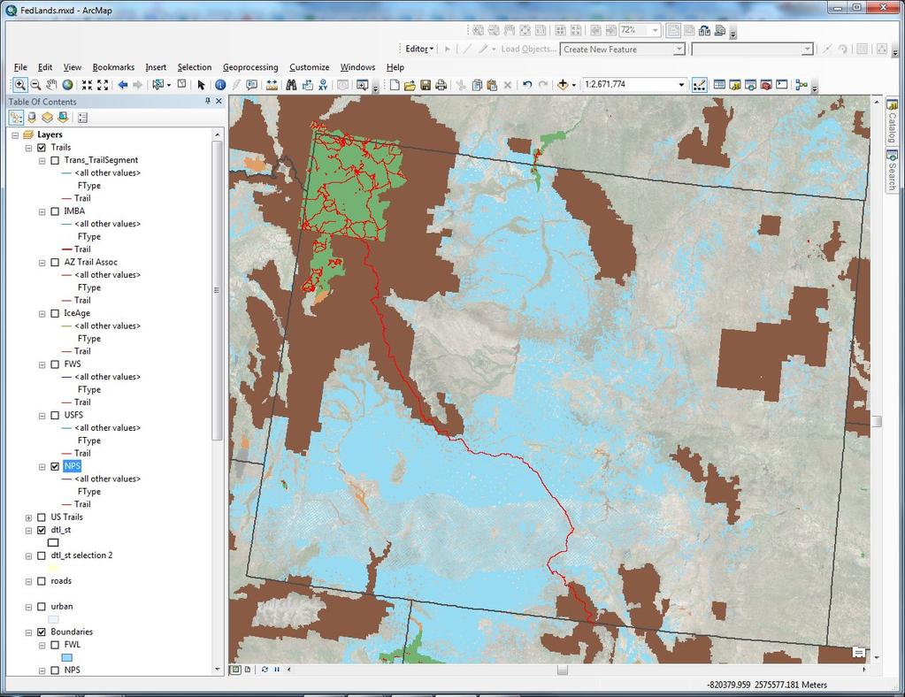
2 + Introduction USGS The following slides provide an update on the U.S. Geological Survey Trails and Recreational Data activities. Both the amount of data coming from partners and the number of partners are increasing. The USGS is interested in continuing the trend of aggregating national trails and recreational data. 2

3 Land Management Agency Distribution Land Management Agency Distribution 3

4 International Mountain Bike Association and REI -IMBA/REI 15,171 mi. 4


5 + International Mountain Bike Association and REI IMBA 15,171 mi IMBA 15,171 mi 5

6 National Scenic Trail System 6

7 Arizona National Scenic Trail Arizona Trail Association 785 mi. 7
8 Ice Age National Scenic Trail Ice Age Trail Alliance 668 mi. 8

9 Pacific Northwest Scenic Trail USFS Region mi. 9

10 + An Overview of Trail Collaboration Efforts Pacific Crest National Scenic Trail USFS 2570 mi. 10
11 Appalachian National Scenic Trail NPS 2,125 mi. 11

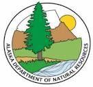
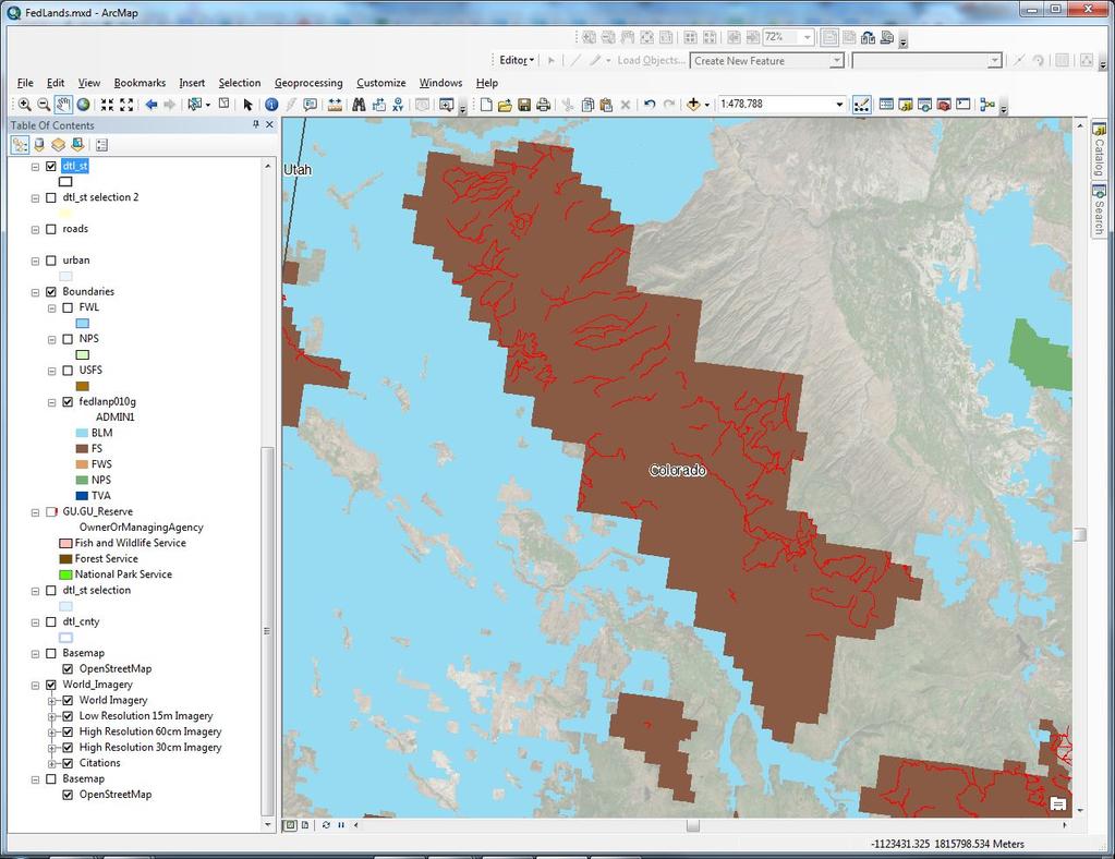
12 North Country National Scenic Trail NPS 2,223 mi 12

13 + An Overview of Trail Collaboration Efforts Continental Divide National Scenic Trail Continental Divide Trail Coalition 2,170 mi. 13

14 + An Overview of Trail Collaboration Efforts New England National Scenic Trail Appalachian Mountain Club 226 mi 14

15 + An Overview of Trail Collaboration Efforts Florida National Scenic Trail USFS 1130 mi. 15
16 Alaska Alaska Department of Natural Resources 716 mi. 16

17 West Virginia West Virginia GIS Technical Center 2,491 mi. Alaska DNR 716 mi 17

18 Michigan Michigan Department of Natural Resources 9,027 mi. 18

19 Colorado Colorado Department of Natural Resources 621 mi. 19
20 Fish and Wildlife Service FWS 4,567 mi 20

21 Bureau of Land Management BLM 479 mi 21

22 Bureau of Land Management 22

23 Fish and Wildlife Service FWS 1,858 mi. 23

24 + Tamarac National Wildlife Refuge 24

25 U.S. Forest Service USFS 77,548 mi 25
26 +Uncompahgre National Forest 26
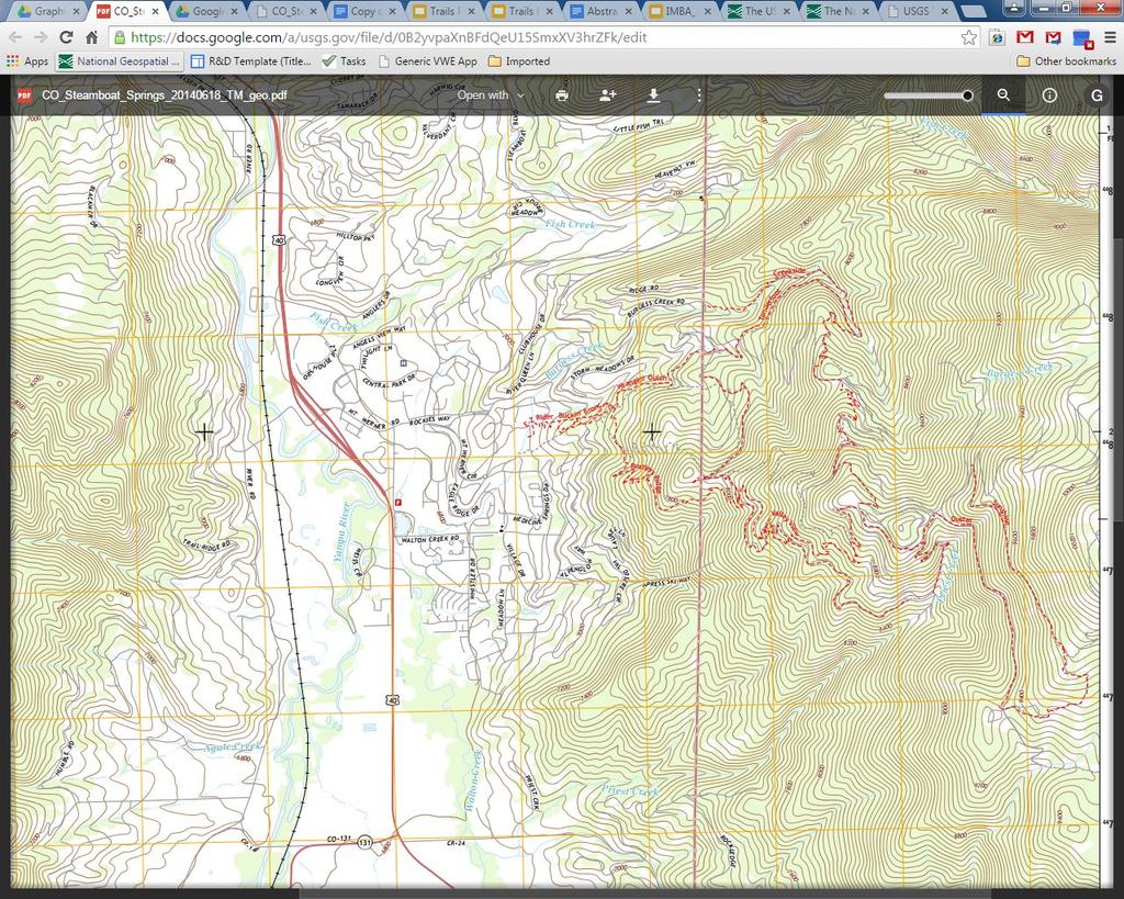
27 National Park Service NPS 14,923 mi 27
28 + Yellowstone National Park 28
29 Combined Trail Sources Combined mi Combined 127,455 73,488 mi 29
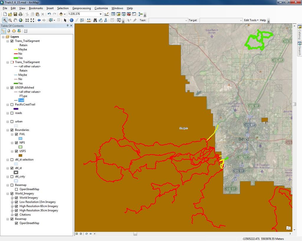
 Is the line segment spatially accurate? Yes Count 126 125 126 125 126 126 No Count 0 1 0 1 0 0 Percentage Yes 100.00% 99.21% 100.")
30 + Assessment Reports 30 NPS Trails Is Trail Name Is this a filled out trail? correctly? Is the Use Type filled out correctly? Free From Data Free Errors (dupes, From overshoot, Spikes undershoot) Is the line segment spatially accurate? Yes Count No Count Percentage Yes % 99.21% % 99.21% % % Percentage No 0.00% 0.00% 0.79% 0.00% 0.79% 0.00%
31 + 31

32 + USGS Products Products 32


33 + USGS Products 33 Products US Topo Map


34 + USGS Products Products In the following comparison, you can see the addition of six trailhead symbols, two picnic areas, several new trail systems, and the Little River Gorge Road. The map looks much more complete thanks to the addition of the new National Park Service features. 34


35 + USGS Products Products In the following comparison, you can see the addition of four recreational symbols, including a picnic area, campground, trailhead and observation tower. The Great Smoky Mountain National Park boundary is now bounding the Foothills Parkway road. 35


36 + USGS Products Products In the following comparison, you can see the addition of a campground along the newly acquired Cane Creek Trail. Also, the park boundary is now present along with the new title of Great Smoky Mountains National Park. 36

37 + The End 37 Questions / Comments / Ideas Greg Matthews GDMatthews@USGS.GOV
PAD-US 1.1 (CBI Edition) Management Designations. National Parks (NPS) and National Park
 Management Designations. National Parks (NPS) and National Park") Noise Sensitive Areas Avoidance Criteria & Source PAD-US 1.1 (CBI Edition) Management Designations Falcon View "DESGINATE" Field Terminology Falcon View Display Category Boundary Waters Canoe Wilderness
Noise Sensitive Areas Avoidance Criteria & Source PAD-US 1.1 (CBI Edition) Management Designations Falcon View "DESGINATE" Field Terminology Falcon View Display Category Boundary Waters Canoe Wilderness
Pacific Northwest National Scenic Trail. USDA-Forest Service Pacific Northwest and Northern Regions April 2014
 Pacific Northwest National Scenic Trail USDA-Forest Service Pacific Northwest and Northern Regions April 2014 Today s trip 1. What is a National Scenic Trail 2. About the Pacific Northwest Trail 3. Planning
Political Event Recreational Event Federal Holiday ~ January 2012 ~ Sun Mon Tue Wed Thu Fri Sat 1 2 New Year s Day (Federal Holiday) 5 -Progressive
 5 -Progressive") Political Event Recreational Event Federal Holiday ~ January 2012 ~ 1 2 New Year s Day (Federal Holiday) 8 -Progressive Insurance New York Boat Show. New York City, NY Partners Outdoors 2012, Williamsburg,
Political Event Recreational Event Federal Holiday ~ January 2012 ~ 1 2 New Year s Day (Federal Holiday) 8 -Progressive Insurance New York Boat Show. New York City, NY Partners Outdoors 2012, Williamsburg,
Creating a User-Driven Long-Distance OHV Trail Through Partnering
 Joseph Raffaele Outdoor Recreation Planner U.S. Bureau of Land Management Yuma, Arizona Creating a User-Driven Long-Distance OHV Trail Through Partnering BLM is a multiple-use land management agency within
BACKSTORY & MMBA RECOMMENDATIONS
 URGENT!! COMMENT PERIOD ENDS MONDAY, MARCH 5 TH, 5PM!! MONTANA MOUNTAIN BICYCLE ALLIANCE RECOMMENDED COMMENTS ON CUSTER GALLATIN FOREST PLAN REVISION, Proposed Actions WINTER 2018 The CGNF Forest Plan
BACKSTORY & MMBA RECOMMENDATIONS
 URGENT!! COMMENT PERIOD ENDS MONDAY, MARCH 5 TH, 5PM!! MONTANA MOUNTAIN BICYCLE ALLIANCE RECOMMENDED COMMENTS ON CUSTER GALLATIN FOREST PLAN REVISION, Proposed Actions WINTER 2018 The CGNF Forest Plan
System Group Meeting #1. March 2014
 System Group Meeting #1 March 2014 Meeting #1 Outcomes 1. Understand Your Role 2. List of Revisions to Existing Conditions 3. Information Sources Study Area The Purpose of Mountain Accord is to Preserve
ECONOMIC PROFILE. Tourism
 ECONOMIC PROFILE Tourism Park City & Summit County Utah Prepared by Park City Chamber of Commerce Convention & Visitors Bureau P.O. Box 1630 ~ Park City, UT 84060-1630 800.453.1360 ~ 435.649.6100 ~ fax
March 14, SUBJECT: Public input to the Bureau of Land Management, Gunnison Field Office, Travel Management Plan
 March 14, 2019 Delivered via email to ewaters@blm.gov Elijah Waters Field Manager BLM Gunnison Field Office Gunnison, CO 81230 SUBJECT: Public input to the Bureau of Land Management, Gunnison Field Office,
DOWNLOAD OR READ : WINTER CAMPING PLANNER PDF EBOOK EPUB MOBI
 DOWNLOAD OR READ : WINTER CAMPING PLANNER PDF EBOOK EPUB MOBI Page 1 Page 2 winter camping planner winter camping planner pdf winter camping planner Winter is a wonderful time to experience Grand Teton
Partners: Michigan California Timber Company Shasta-Trinity National Forest Pacific Crest Trail Association The Trust for Public Land
 Partners: Michigan California Timber Company Shasta-Trinity National Forest Pacific Crest Trail Association The Trust for Public Land Describe the project location, size, opportunities, and timing. Provide
Webinar Series for Comprehensive Plan Updates. Making Your Plan a Walk in the Park
 Webinar Series for Comprehensive Plan Updates Making Your Plan a Walk in the Park Presented by Jan Youngquist and Michael Peterka September 15, 2016 Today s Presentation Importance of Parks and Trails
$850,000 Awarded to 20 Organizations
 $850,000 Awarded to 20 Organizations The Conservation Alliance is pleased to fund the following organizations to support their efforts to protect wild lands and waterways for their habitat and recreation
GATEWAY PHASE 2. U.S. Forest Service and the Mount Shasta Trails Association
 GATEWAY PHASE 2 U.S. Forest Service and the Mount Shasta Trails Association PROJECT DEVELOPMENT Brief history - Gateway Phase 1 - IMBA conceptual plan - BikeShasta: concert series - USFS & MSTA partnered
September 14, Comments of the Colorado Trail Foundation On the USFS Scoping Notice of August 13, 2010 RE: the relocation of the CDNST/CT Page 1
 THE COLORADO TRAIL FOUNDATION Comments on the U.S. Forest Service Scoping Notice of August 13, 2010 Regarding the Relocation of THE COLORADO TRAIL AND CONTINENTAL DIVIDE NATIONAL SCENIC TRAIL From La Garita
Arizona National Scenic Trail
 1 The Arizona National Scenic Trail is an 800 mile recreation trail from Mexico to Utah that connects mountain ranges, canyons, deserts, forests, wilderness areas, historic sites, trail systems, points
DOWNLOAD OR READ : UTAH NATIONAL PARKS MAP PACK BUNDLE ADVENTURE MAP PDF EBOOK EPUB MOBI
 DOWNLOAD OR READ : UTAH NATIONAL PARKS MAP PACK BUNDLE ADVENTURE MAP PDF EBOOK EPUB MOBI Page 1 Page 2 utah national parks map pack bundle adventure map utah national parks map pdf utah national parks
Teton County Wyoming WPLI Proposal-Palisades and Shoal Creek Special Management Areas
 Teton County Wyoming WPLI Proposal-Palisades and Shoal Creek Special Management Areas Proposal Alliance The following Alliance of local and regional stakeholders have a common and unified interest to maintain
2014 STATEWIDE COMPREHENSIVE OUTDOOR RECREATION PLAN
 2014 STATEWIDE COMPREHENSIVE OUTDOOR RECREATION PLAN SUSTAINING COLORADO S OUTDOOR RECREATION FUTURE SECTION 1: INTRODUCTORY INFORMATION WHAT IS THE SCORP? The SCORP update is required every five years
Federal Land and Resource Management: A Primer 1
 Federal Land and Resource Management: A Primer 1 RS20002 Coordinated by Ross W. Gorte Natural Resource Economist and Policy Specialist Environment and Natural Resources Policy Division December 22, 1998
Course Description. Oregon Pacific Crest Trail Backpacking for Adults
 Overview This backpacking course is designed to prepare and train you to tackle the Pacific Crest Trail (PCT) and other long distance hiking trails on your own. It is also designed so that if you desire,
Nez Perce National Historic Trail. Land and Water Conservation Fund FY2014 Request
 FY2014 Request National Trails System FY2014 Total LWCF Request: $2,840,000 Project Name Agency District # Tracts Acres Total Cost Cow Island and Cow Creek BLM MT-1 2 779 $1,600,000 (in conjunction with
Greater Minnesota Regional Parks and Trails Commission Designation Application
 Greater Minnesota Regional Parks and Trails Commission Designation Application General Section Designation Application #: 15-050D Date Submitted: 06/30/2015 Park or Trail Name: Perham to Pelican Rapids
This section of the Plan provides a general overview of the Smoky Mountain Region. It consists of the following four subsections:
 SECTION 3 COMMUNITY PROFILE This section of the Plan provides a general overview of the Smoky Mountain Region. It consists of the following four subsections: 3.1 Geography and the Environment 3.2 Population
Lewis and Clark National Historic Trail
 National Trails System Land and Water Conservation Fund FY2014 Lewis and Clark National Historic Trail Total LWCF Request: $ 3,130,000 Project Name Agency District # Tracts Acres Total Cost Columbia River
Key Findings from a Nationwide Voter Survey Conducted August 29 September 8,
 Key Findings from a Nationwide Voter Survey Conducted August 29 September 8, 2016 220-4634 Methodology 800 telephone interviews with likely voters nationwide Conducted August 29 September 8, 2016 via landline
Colorado s Instream Flow Program at 40. ICWP Annual Conference October 16, 2013 Denver, Colorado
 Colorado s Instream Flow Program at 40 ICWP Annual Conference October 16, 2013 Denver, Colorado ISF Program established in 1973 by Senate Bill 97 Recognized the need to correlate the activities of mankind
FY19 Colorado Tourism Office Marketing Matching Grant Recipients
 $25,000 Colorado Campground and Lodging Owners Association A marketing plan centered on the Camp Colorado Guide, and expanding the use of digital marketing and social media channels in order to inspire
10/25/2013. What is the SCORP?! 2013 Local Government Survey 2013 Statewide Public Survey Advisory Group Priority Areas Your Suggestions!
 COLORADO OUTDOOR RECREATION TRENDS RESULTS FROM THE SCORP AND STATEWIDE Colorado Outdoor Recreation Resource Partnership September 2013 PRESENTATION What is the SCORP?! 2013 Local Government Survey 2013
TRAIL USER PERMIT FEE NATURAL RESOURCES, AGRICULTURE AND ENVIRONMENT INTERIM COMMITTEE
 TRAIL USER PERMIT FEE NATURAL RESOURCES, AGRICULTURE AND ENVIRONMENT INTERIM COMMITTEE Chris Haller Off-highway Vehicle Program Manager and Recreation Why? Motorized (Off-highway Vehicle-OHV) community
To: Cam Hooley From: Trails 2000 Date: September 30, 2016 Re: Hermosa Comments. Dear Cam:
 ! To: Cam Hooley From: Trails 2000 Date: September 30, 2016 Re: Hermosa Comments Dear Cam: Trails 2000 is commenting on the Forest Service Management Plan for the Hermosa Creek Watershed Management Plan
APPENDIX B: NPP Trends
 APPENDIX B: NPP Trends Appalachians / Cumberland Plateau.2 Big South Forth Great Smoky Mountains Atlantic Neotropical...5 Big Cypress Biscayne Everglades Desert Southwest...7 Big Bend Death Valley Saguaro
APPENDIX L. Wilderness Fact Sheets
 APPENDIX L Wilderness Fact Sheets These Fact Sheets were developed by Ralph Swain on the San Juan National Forest. You may want to consider recommending that attendees to your Wilderness Awareness Training
Lakes Landscape Travel Management
 Decision Notice & Finding of No Significant Impact Lakes Landscape Travel Management USDA Forest Service Columbine Ranger District, San Juan National Forest Archuleta, Hinsdale, and La Plata Counties,
Youth Corps Project Report BUREAU OF LAND MANAGEMENT COLORADO STATE OFFICE
 Youth Corps Project Report BUREAU OF LAND MANAGEMENT COLORADO STATE OFFICE FISCAL YEAR 2013 Colorado Youth Corps Association www.cyca.org 1 Table of Contents Program Summary 3 Individual Project Summaries
S. 37, Forest Jobs and Recreation Act (FJRA)
") Testimony of Jeremy Fancher, International Mountain Bicycling Association Before the U.S. Senate Committee on Energy and Natural Resources Subcommittee on Public Lands, Forests, and Mining Hearing on Misc.
Testimony of Jeremy Fancher, International Mountain Bicycling Association Before the U.S. Senate Committee on Energy and Natural Resources Subcommittee on Public Lands, Forests, and Mining Hearing on Misc.
White Mountain Wilderness Trails
 The area in which these hikes are located is rugged high mountain country along the Mogollon Rim. This famous eastwest escarpment separates Arizona's high plateau from the basin and range below. These
Welcome and thank you for being here! Kick-Off Public Workshop November 19, 2014
 Welcome and thank you for being here! Kick-Off Public Workshop November 19, 2014 OPEN SPACE MATTERS: Boise s First Reserve Master Plan Julia Grant Foothills and Open Space Manager City of Boise Ellen Campfield
Global RV Original Equipment Manufacturer (RV OEM) Market: Trends & Opportunities ( ) February 2016
 Market: Trends & Opportunities ( ) February 2016") Global RV Original Equipment Manufacturer (RV OEM) Market: Trends & Opportunities (2015-2020) February 2016 Global RV Original Equipment Manufacturer (OEM) Market Report Scope of the Report This report
Global RV Original Equipment Manufacturer (RV OEM) Market: Trends & Opportunities (2015-2020) February 2016 Global RV Original Equipment Manufacturer (OEM) Market Report Scope of the Report This report
Thank you for the opportunity to comment on the proposed action to add trails and trailheads to the Red Rock District trail system.
 July 14, 2010 Jennifer Burns Red Rock Ranger District PO Box 20429 Sedona, AZ 86341 Flagstaff Biking Organization PO Box 23851 Flagstaff, AZ 86002 Dear Jennifer- Thank you for the opportunity to comment
Introduction to the New York-New Jersey Trail Conference. Peter Dolan New Jersey Program Coordinator
 Introduction to the New York-New Jersey Trail Conference Peter Dolan New Jersey Program Coordinator New York-New Jersey Trail Conference Volunteer-directed public service organization committed to: Developing,
Rocky Mountain National Park Hiking Map By Trails Illustrated Maps
 Rocky Mountain National Park Hiking Map By Trails Illustrated Maps 10 Great Hikes for Families with Kids in Estes Park, Colorado - Choose from plenty of great family hikes in Rocky Mountain National park.
2016 Trails Maintenance and Operating Costs
 2016 Trails Maintenance and Operating Costs Motorized Trails Maintenance for motorized trails comes from vehicle registration fees and a portion of the federal Recreation Trails Program (RTP) funds. The
MT. H O O D & T H E G O R G E T O U R I S M L I S T E N I N G S E S S I O N O V E R V I E W
 Oregon Tourism Listening Session Summary June 2018 T O U R I S M L I S T E N I N G S E S S I O N O V E R V I E W Travel Oregon, in partnership with the Mt. Hood Territory, hosted an Oregon Tourism Listening
Shelf Road Recreation Area 2015 BLM Annual Report of Rocky Mountain Field Institute Stewardship Under BLM Agreement L12AC20483 November 19, 2015
 Summary Shelf Road Recreation Area 2015 BLM Annual Report of Rocky Mountain Field Institute Stewardship Under BLM Agreement L12AC20483 November 19, 2015 Managed by the BLM Royal Gorge Field Office, Shelf
26 Utah s Patchwork Parkway SCENIC BYWAY CORRIDOR MANAGEMENT PLAN (SR 143)
") Natural Natural Quality applies to those features in the visual environment that are in a relatively undisturbed state. These features predate the arrival of human populations and may include geological
Natural Natural Quality applies to those features in the visual environment that are in a relatively undisturbed state. These features predate the arrival of human populations and may include geological
Featuring North America s Leading Travel Destinations. Great American Roads
 Featuring North America s Leading Travel Destinations Great American Roads The Alaska Highway, U.S. 395 in California, Colorado s Million Dollar Highway, The Natchez Trace, Parkersburg-Staunton Turnpike,
Hiking In Jordan: Trails In And Around Petra, Wadi Rum And The Dead Sea Area - With GPS E-trails, Tracks And Waypoints, Videos, Planning Tools And
 Hiking In Jordan: Trails In And Around Petra, Wadi Rum And The Dead Sea Area - With GPS E-trails, Tracks And Waypoints, Videos, Planning Tools And Hiking Maps [Kindle Edition] By Chris Grant;Gregory Maassen
TETON COUNTY WYOMING PUBLIC LANDS INITIATIVE: TURIANO TEAM PROPOSAL
 TETON COUNTY WYOMING PUBLIC LANDS INITIATIVE: TURIANO TEAM PROPOSAL SUMMARY Protect roadless areas on US Forest Service lands in Teton County, Wyoming using a mix of two designations: National Backcountry
The Black Mountains (Cassini Old Series Historical Map) READ ONLINE
 READ ONLINE") The Black Mountains (Cassini Old Series Historical Map) READ ONLINE If searching for the ebook The Black Mountains (Cassini Old Series Historical Map) in pdf form, in that case you come on to the correct
The Black Mountains (Cassini Old Series Historical Map) READ ONLINE If searching for the ebook The Black Mountains (Cassini Old Series Historical Map) in pdf form, in that case you come on to the correct
4.0 Context for the Crossing Project
 4.0 Context for the Crossing Project This section provides background information about key features of the North Douglas Crossing project area, and opportunities and constraints. This information is important
A. SHAPING RECREATION DESTINATIONS
 A. SHAPING RECREATION DESTINATIONS Shaping SLV Communities into Recreation Destinations Great trails and recreation opportunities don t just satisfy local athletes, they can also attract tourists, boost
RED MOUNTAIN HISTORIC DISTRICT ENHANCEMENT Grand Mesa, Uncompahgre, Gunnison National Forests Ouray Ranger District
 RED MOUNTAIN HISTORIC DISTRICT ENHANCEMENT Grand Mesa, Uncompahgre, Gunnison National Forests Ouray Ranger District Project Summary The Red Mountain President s Initiative Project proposes a comprehensive
WILDLIFE BIOLOGY. Monday 20 Feb 2017
 WILDLIFE BIOLOGY Monday 20 Feb 2017 President s Day Holiday. No School WILDLIFE BIOLOGY Tuesday 21 Feb 2017 Entry Task What are the two government departments in charge of only one wildlife agency? Department
America s Great Outdoors: Feasibility Study for Connecting Urban Refuges to the Rocky Mountain Greenway Trail Network
 Case 1:18-cv-01017-PAB Document 7-17 Filed 05/31/18 USDC Colorado Page 1 of 42 America s Great Outdoors: for Connecting Urban Refuges to the Rocky Mountain Greenway Trail Network Rocky Flats and Two Ponds
A GIS Assessment of Erosion Vulnerability for Unofficial Trails in the Columbia River Gorge
 A GIS Assessment of Erosion Vulnerability for Unofficial Trails in the Columbia River Gorge Sachi Arakawa Geog 593 Digital Terrain Analysis Fall 2017 Abstract The city of North Bonneville, located along
Digital Terrain Analysis of Archer Mountain
 Digital Terrain Analysis of Archer Mountain Identifying a potential new recreational trail Photo: Justin Bush GEOG 593 - Duh Marcus Tobey Justin Bush Project Overview Background Project Area Overview Questions
Published Counts TrafficMetrix
 Published Counts TrafficMetrix Contents Introduction... 1 TrafficMetrix Features... 1 TrafficMetrix Benefits... 1 TrafficMetrix Data... 1 File Descriptions... 2 State Abbreviations... 3 Count Type Glossary...
GREATER VICTORIA HARBOUR AUTHORITY. Cruise Passenger Survey Results 2015
 GREATER VICTORIA HARBOUR AUTHORITY Cruise Passenger Survey Results 2015 GREATER VICTORIA HARBOUR AUTHORITY CRUISE PASSENGER SURVEY RESULTS 2015 The Greater Victoria Harbour Authority contracted Consumerscan
Vail Valley Mountain Bike Association (VVMBA) is pleased to announce that their Adopt a Trail (AAT) program has expanded! Starting last spring, Adopt
 is pleased to announce that their Adopt a Trail (AAT) program has expanded! Starting last spring, Adopt") Vail Valley Mountain Bike Association (VVMBA) is pleased to announce that their Adopt a Trail (AAT) program has expanded! Starting last spring, Adopt a Trail added a new program called the Trail Ambassadors!
Vail Valley Mountain Bike Association (VVMBA) is pleased to announce that their Adopt a Trail (AAT) program has expanded! Starting last spring, Adopt a Trail added a new program called the Trail Ambassadors!
Paul S. Sarbanes Transit in Parks Project Descriptions
 Paul S. Sarbanes Transit in Parks Project Descriptions ALASKA Denali National Park and Preserve Grant Amount: $246,000 The Denali National Park will test hybrid buses of various designs in order to determine
DOWNLOAD OR READ : OHIO STATE PARKS GUIDEBOOK STATE PARK GUIDEBOOKS PDF EBOOK EPUB MOBI
 DOWNLOAD OR READ : OHIO STATE PARKS GUIDEBOOK STATE PARK GUIDEBOOKS PDF EBOOK EPUB MOBI Page 1 Page 2 ohio state parks guidebook state park guidebooks ohio state parks guidebook pdf ohio state parks guidebook
Fred Milch Project Review Manager East Central Florida Regional Planning Council
 RESHAPING THE ROLE OF PARKS, RECREATIONAL AREAS, AND GREEN SPACE TO ENHANCE LIVABILITY Fred Milch Project Review Manager East Central Florida Regional Planning Council St. Johns River to Sea Loop Webinar
Wallowa Falls Hydroelectric Project FERC Project No. P-308 Proposed Study Plans - Recreation August 2011
 Wallowa Falls Hydroelectric Project FERC Project No. P-308 August 2011 Prepared by: PacifiCorp Energy Hydro Resources 825 NE Multnomah, Suite 1500 Portland, OR 97232 For Public Review Wallowa Falls Hydroelectric
Massanutten Mountain Cluster
 Massanutten Mountain Cluster Signal Knob Catback Mountain Southern Massanutten Mountain Five areas of almost 49,000 acres on the Lee Ranger District compose the Massanutten Mountain Cluster of Mountain
Greater Minnesota Regional Parks and Trails Commission Designation Application
 Greater Minnesota Regional Parks and Trails Commission Designation Application General Section Designation Application #: 15-059D Date Submitted: 06/16/2015 Park or Trail Name: Mesabi Trail District #:
Census 2010 Map Book Genoa Township
 Census Map Book Sources: Esri, DeLorme, NAVTEQ, TomTom, Intermap, AND, USGS, NRCAN, Kadaster NL, IGN, and the GIS User Community. About this map book SEMCOG Community Map Books provide easy to understand,
Piedra River Protection Workgroup Meeting #5 Feb. 21, 2012 Ross Aragon Community Center, Pagosa Springs
 Piedra River Protection Workgroup Meeting #5 Feb. 21, 2012 Ross Aragon Community Center, Pagosa Springs What happened at this meeting? - Identified conservation easements - Discussed In-stream Flows -
KEY FINDINGS JANUARY 2018 THE 2018 SURVEY OF THE ATTITUDES OF VOTERS IN EIGHT WESTERN STATES
 KEY FINDINGS THE 2018 SURVEY OF THE ATTITUDES OF VOTERS IN EIGHT WESTERN STATES JANUARY 2018 CONDUCTED BY: LORI WEIGEL / PUBLIC OPINION STRATEGIES DAVE METZ / FAIRBANK, MASLIN, MAULLIN, METZ & ASSOCIATES
NEPOSS. 131 Parks 11/8/2010. The Niagara Escarpment Parks and Open Space System Ken Whitbread, Manager, Niagara Escarpment Commission
 The Niagara Escarpment Parks and Open Space System Ken Whitbread, Manager, Niagara Escarpment Commission NEP approved in 1985 Reviewed in 1994 & 2005 Plan has land use designations and identifies Public
2014 LEGISLATIVE AGENDA
 2014 LEGISLATIVE AGENDA BONDING SESSION Working to acquire, protect and enhance critical land for the public s use and benefit. 2014 LEGISLATIVE AGENDA In preparation for each session of the Minnesota
A Brief History of the National Wilderness Preservation System
 Issue No. 66 January 22, 2016 A Brief History of the National Wilderness Preservation System There are any number of books, booklets, and articles about Wilderness Areas in the United States, but little
Grand Mesa, Uncompahgre and Gunnison National Forests Attn: Plan Revision Team 2250 South Main Street Delta, CO 81416
 August 30th, 2017 Grand Mesa, Uncompahgre and Gunnison National Forests Attn: Plan Revision Team 2250 South Main Street Delta, CO 81416 Re: GMUG Forest Plan Revision Assessment Comments Dear Plan Revision
RUSHMORE CONNECTOR TRAIL PROPOSAL
 PURPOSE AND NEED Background The U.S. Forest Service, Black Hills National Forest (Forest Service) has received a special use permit application from the State of South Dakota Department of Game, Fish and
Classification and Management Planning (CAMP) Washington State Parks and Recreation Commission
 Washington State Parks and Recreation Commission") Classification and Management Planning (CAMP) Tonight s agenda Welcome, sign-in, handouts Staff introductions Planning area and park overview Description of planning process Get your input Next steps Adjourn
Classification and Management Planning (CAMP) Tonight s agenda Welcome, sign-in, handouts Staff introductions Planning area and park overview Description of planning process Get your input Next steps Adjourn
THE USA. The capital of USA is Washington D.C., in the District of Columbia.
 THE USA The United States of America is the richest and one of the biggest countries in the world. It has a population of about 295 million people. It is divided into 50 states; two of them, Alaska and
Juneau Creek Alternative
 WELCOME Juneau Creek Alternative Introducing the Preferred Alternative for the Sterling Highway MP 45-60 Final EIS Final EIS Released Final Environmental Impact Statement And Final Section 4(f) Evaluation
Mt. Hood [Map Pack Bundle] (National Geographic Trails Illustrated Map) By National Geographic Maps - Trails Illustrated READ ONLINE
![Mt. Hood [Map Pack Bundle] (National Geographic Trails Illustrated Map) By National Geographic Maps - Trails Illustrated READ ONLINE](/thumbs/85/92056945.jpg "Mt. Hood [Map Pack Bundle] (National Geographic Trails Illustrated Map) By National Geographic Maps - Trails Illustrated READ ONLINE") Mt. Hood [Map Pack Bundle] (National Geographic Trails Illustrated Map) By National Geographic Maps - Trails Illustrated READ ONLINE If you are looking for a book by National Geographic Maps - Trails Illustrated
Mt. Hood [Map Pack Bundle] (National Geographic Trails Illustrated Map) By National Geographic Maps - Trails Illustrated READ ONLINE If you are looking for a book by National Geographic Maps - Trails Illustrated
Colorado s Instream Flow Program at 40. Celebrating 40 Years of Success and Challenges January 15, 2014 Denver, Colorado
 Colorado s Instream Flow Program at 40 Celebrating 40 Years of Success and Challenges January 15, 2014 Denver, Colorado ISF Program established in 1973 by Senate Bill 97 Recognized the need to correlate
Financial and Economic Indicators for the Air Transport Industry. NASAO Legislative Conference Washington DC February 2016
 Financial and Economic Indicators for the Air Transport Industry NASAO Legislative Conference Washington DC February 2016 General Aviation Metrics Number of Active General Aviation Aircraft and On-Demand
Economic Impact, Significance, and Values of Delaware Water Gap National Recreation Area
 Canoing on the Delaware River, NPS photo Economic Impact, Significance, and Values of Delaware Water Gap National Recreation Area Technical Report April 2015 Prepared by The Harbinger Consulting Group
Campsite Guide SWITZERLAND (with GPS Data And DETAILED MAPS) By m lab
 By m lab") Campsite Guide SWITZERLAND (with GPS Data And DETAILED MAPS) By m lab If you are searching for the book Campsite Guide SWITZERLAND (with GPS Data and DETAILED MAPS) by m lab in pdf form, then you have
Campsite Guide SWITZERLAND (with GPS Data And DETAILED MAPS) By m lab If you are searching for the book Campsite Guide SWITZERLAND (with GPS Data and DETAILED MAPS) by m lab in pdf form, then you have
Florida National Scenic Trail 5-Year Strategic Plan. Barbara Bowen
 Florida National Scenic Trail 5-Year Strategic Plan 2012 Barbara Bowen Florida National Scenic Trail M. Timothy O Keefe M. Timothy O Keefe Mike Knox 20-mile Planning Corridor Florida National Scenic Trail
Appalachian National Scenic Trail. Land and Water Conservation Fund FY2014 Request
 Land and Water Conservation Fund FY2014 Request National Trails System Land and Water Conservation Fund FY2014 Total LWCF Request: $13,450,000 Project Name Agency District # Tracts Acres Total Cost Newton
AIR SERVICE & ECONOMIC DEVELOPMENT
 2017 Mead & Hunt, Inc. AIR SERVICE & ECONOMIC DEVELOPMENT CALED Conference March 23, 2017 San Diego, CA 2 TOPICS Airline industry update Air service development overview Purpose Approach Community partnerships/economic
Grand Canyon National Park Map & Guide By Leo Larson
 Grand Canyon National Park Map & Guide By Leo Larson If you are looking for the book Grand Canyon National Park Map & Guide by Leo Larson in pdf form, in that case you come on to the right website. We
GRANTEE REPORTS. THE CONSERVATION ALLIANCE Grantee Update THE CONSERVATION ALLIANCE OCTOBER 2017 GRANTEE REPORT. Photo: Aaron Theisen
 GRANTEE REPORTS Photo: Aaron Theisen THE CONSERVATION ALLIANCE Grantee Update In October 2016, The Conservation Alliance invested $820,000 in grassroots conservation organizations. Each grant went to a
Social Science Program National Park Service U.S. Department of the Interior. Visitor Services Project
 Social Science Program National Park Service U.S. Department of the Interior Visitor Services Project Serving the Visitor 2004 A Report on Visitors to the National Park System National Park Service Visitor
I. PREFACE II. THE PARTNERSHIP
 I. PREFACE This document is the "local" plan for the management of the Appalachian Trail in Maine from Maine Highway 26 in Grafton Notch to the summit of Katahdin. It is a part (the other being the Appalachian
Appalachian Trail Guide To North Carolina-Georgia By Don O'Neal READ ONLINE
 Appalachian Trail Guide To North Carolina-Georgia By Don O'Neal READ ONLINE If searching for the ebook by Don O'Neal Appalachian Trail Guide to North Carolina-Georgia in pdf form, then you have come on
Options for a Governance Structure To Guide the Construction and Operation of the Salmonberry Trail
 Options for a Governance Structure To Guide the Construction and Operation of the Salmonberry Trail By the National Policy Consensus Center Oregon Solutions Program Hatfield School of Government, Portland
U.S. Forest Service National Minimum Protocol for Monitoring Outstanding Opportunities for Solitude
 U.S. Forest Service National Minimum Protocol for Monitoring Outstanding Opportunities for Solitude Element 5 of the 10-Year Wilderness Stewardship Challenge May 15, 2014 1 Solitude Minimum Protocol Version
Yosemite NE: Tuolumne Meadows And Hoover Wilderness (National Geographic Trails Illustrated Map) By National Geographic Maps - Trails Illustrated
 By National Geographic Maps - Trails Illustrated") Yosemite NE: Tuolumne Meadows And Hoover Wilderness (National Geographic Trails Illustrated Map) By National Geographic Maps - Trails Illustrated READ ONLINE The Nat'l Geographic topo series called "Trails
Yosemite NE: Tuolumne Meadows And Hoover Wilderness (National Geographic Trails Illustrated Map) By National Geographic Maps - Trails Illustrated READ ONLINE The Nat'l Geographic topo series called "Trails
Secret-Lamoille Trail Project
 Secret-Lamoille Trail Project Historical Background Over the years, the US Forest Service and a variety of Forest users have routed and constructed trails in the Ruby Mountains. Many of those trails have
Land Use. Grasslands and Rangelands National Parks and Reserves. Thursday, October 9, 14
 Land Use Grasslands and Rangelands National Parks and Reserves MANAGING AND SUSTAINING GRASSLANDS Almost half of the world s livestock graze on natural grasslands (rangelands) and managed grasslands (pastures).
WESTERN SLOPE NO-FEE COALITION P.O. Box 135, Durango, CO /
 P.O. Box 135, Durango, CO 81302 970/259-4616 www.westernslopenofee.org wsnofee@gmail.com I. Fee Demo (1996-2004) II. Federal Lands Recreation Enhancement Act III. Land Agencies Are Ignoring Or Bypassing
TOGETHER, MAKING BOATING THE PREFERRED CHOICE IN RECREATION RECREATIONAL BOATING ECONOMIC STUDY $ $
 2012 TOGETHER, MAKING BOATING THE PREFERRED CHOICE IN RECREATION RECREATIONAL BOATING ECONOMIC STUDY In 2013 NMMA s Center of Knowledge contracted with the Recreational Marine Research Center at Michigan
National Forests and Grasslands in Texas
 United States Department of Agriculture Forest Service National Forests and Grasslands in Texas Sam Houston NF 394 FM 1375 West New Waverly, Texas 77358 Phone 936-344-6205 Dear Friends, File Code: 1950
Wilderness Process #NP-1810: Your letter ID is NP September 5, 2018
 Wilderness Process #NP-1810: Your letter ID is NP-1810-2602-96 September 5, 2018 RE: GMUG Wilderness Evaluation Revised Evaluation Criteria and Draft Report Forest Revision Planning Team: The Continental
EVEN A SHORT SHUTDOWN HAS LASTING ADVERSE CONSEQUENCES FOR AMERICANS
 EVEN A SHORT SHUTDOWN HAS LASTING ADVERSE CONSEQUENCES FOR AMERICANS The Honorable Barack Obama President The White House 1600 Pennsylvania Avenue NW Washington, DC 20500 Dear Mr. President: September