Florida National Scenic Trail 5-Year Strategic Plan. Barbara Bowen
|
|
|
- Lee Harmon
- 5 years ago
- Views:
Transcription


1 Florida National Scenic Trail 5-Year Strategic Plan 2012 Barbara Bowen


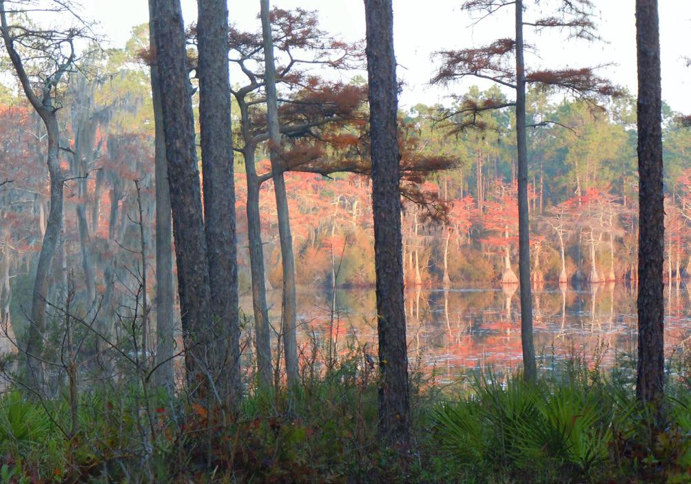
2 Florida National Scenic Trail M. Timothy O Keefe M. Timothy O Keefe Mike Knox 20-mile Planning Corridor Florida National Scenic Trail Side Trail Planning Corridor Blackwater River Side Trail 2

3 This is a landmark document for the Florida National Scenic Trail. For the first time since the original Comprehensive Plan of 1986 we have sat as a team of landowners to thoughtfully, and deliberately, set goals for the Trail. These goals provide an overall strategic direction by which we can focus collaborative efforts and allocate resources to achieve specific results that benefit both the Trail and trail user. This document is also significant in that it represents a new partnership model which more fully engages a diverse group of land managers who are connected to the Trail. With this Plan, we build a vision of the Florida National Scenic Trail that is much greater than the sum of its parts and that more fully appreciates the Trail for its distinct and unique scenic, historic, natural and cultural values. Started in the 1960s by a group of dedicated hikers, the Florida National Scenic Trail is nearly 1,000 miles long, allowing an exploration of semi-tropical ecosystems unique to this region of the United States. As a whole, the Trail encompasses everything from the most remote wilderness of Florida to its most popular urban areas. The Trail is used by an estimated 350,000 recreationists per year. We are committed to ensuring a safe, accessible, and high quality recreation experience, while protecting the scenic, historic, natural, and cultural values of the trail corridor. By legislation, the Florida National Scenic Trail is administered by the United States Forest Service (USFS), specifically, the National Forests in Florida. The Trail, however, is in large part the public asset it is today due to the enthusiasm, dedication, and hard work of the Florida Trail Association s staff and volunteers. We look forward to their continued support and participation as we expand our partnerships through the Florida National Scenic Trail Coalition of land managers and stakeholders. Few realize that the Florida National Scenic Trail is one of eleven congressionally designated Scenic Trails in the Country, and of those, one of only three that are contained in a single state. The Florida National Scenic Trail is both a State and a National treasure. With this Plan, the USFS and our partners commit to protecting and enhancing that treasure for our residents and visitors, for daily recreationists and avid trail users, and for today s and future generations. Susan Jeheber-Matthews Forest Supervisor, National Forests in Florida COALITION MEMBERS Florida Forest Service Florida Department of Environmental Protection, Division of Recreation and Parks Florida Department of Environmental Protection, Division of Recreation and Parks, Office of Greenways and Trails Florida Fish and Wildlife Conservation Commission Florida Trail Association, Inc. Northwest Florida Water Management District Plum Creek Timber Company Seminole County, Greenways and Natural Lands Division University of Florida, School of Forest Resources and Conservation United States Air Force, Eglin Air Force Base United States Forest Service, National Forests in Florida National Park Service, Big Cypress National Preserve USDI Fish and Wildlife Service, St. Marks National Wildlife Refuge 3
. The Coalition is composed primarily of agency, district or company leaders who own or manage the land through which the FNST passes.")

4 Overview The Florida National Scenic Trail Coalition was formed at the invitation of the Forest Supervisor of the National Forests in Florida who has administrative responsibility for the Florida National Scenic Trail (FNST). The Coalition is composed primarily of agency, district or company leaders who own or manage the land through which the FNST passes. The concept for the Coalition emerged from an analysis of the existing partnership between the United States Forest Service (USFS) and the Florida Trail Association (FTA). The intent of the new model is to coalesce a broader, more representative group of partners to guide the management of the Trail and serve a broader base of recreationists. In addition, the FNST Coalition strives to reach a new generation who will enjoy, appreciate, and steward this natural resource and the Nation s natural heritage. Role The FNST Coalition is dedicated to ensuring the development, maintenance, and promotion of the FNST to ensure an optimum recreation experience. The Coalition brings a diversity of perspectives, interests, and expertise and thus ensures that the Trail is a truly public asset that is accessible and enjoyed by diverse constituents. The Coalition serves primarily in a support role to the USFS. Collectively, the FNST Coalition will inform better decisions, attract greater resources, and create Trail champions across the State. Specifically, the Coalition agrees to: Complete the FNST Strategic Plan, oversee implementation of the plan, and work together to ensure accountability to goals and outcomes; Oversee adherence to trail standards for access, safety, signage, and interpretation to achieve the optimum recreation experience; Serve as Trail supporters and advocates and assist in attracting financial and human resources for Trail development, maintenance, and promotion; Foster coordination among various interests, networks, and stakeholders throughout the State. Rachael Augspurg The National Trails System Act, Section 3, 16 USC 1241, National Scenic Trails.will be extended trails so located as to provide for maximum outdoor recreation potential and for the conservation and enjoyment of the nationally significant scenic, historic, natural, or cultural qualities of the areas through which such trails may pass. Tom Regan 4

5 Planning Process This Florida National Scenic Trail strategic planning process began in April 2010 with a meeting between the United States Forest Service and the Florida Trail Association, long standing partners in building, protecting, and maintaining the FNST since its designation as a national public resource in At that meeting it was determined that a new partnership model, one that more fully engaged the dozens of FNST land managers in the decisions most affecting the Trail, would be critical to managing the FNST now and in to the future. The FNST Coalition of land managers and stakeholders was formed in the following months, each individual member contributing valuable expertise, insight and on-the-ground perspective in the development of the Florida National Scenic Trail 5-Year Strategic Plan which aims to guide the statewide development, maintenance and promotion of the FNST. This Plan serves to unify disparate activities for a more comprehensive and coordinated approach which focuses and prioritizes resources to achieve standards and desired outcomes. This Plan also tells the living story of the Florida National Scenic Trail: what the value of the resource is, what will be accomplished, and how public and private resources will be utilized for the greatest benefit to the public and the lands through which the Trail crosses. The natural and cultural resource data, maps, market research, recreational data, and expert analysis which contribute to this Plan are available for review at The Plan was developed and approved by the FNST Coalition working with the USFS and the planning consultant. The Plan will ultimately address strategic issues affecting the Trail, define implementation priorities, and outline parameters to: Create the optimum recreation experience while protecting and enhancing the nationally significant scenic, historic, natural, and cultural qualities of the areas through which the Trail crosses; and promote the Florida National Scenic Trail identity and brand. FTA Historical Archives The Florida National Scenic Trail was designated by Congress in 1983 as part of the National Trail System which is host to 11 National Scenic Trails and 19 National Historic Trails across America. Congress delegated the protection and management of the FNST to the USFS, specifically, the National Forests in Florida. Long before its designation, the Florida Trail Association and its founder, Jim Kern, had championed the cause for a connected hiking trail the length of Florida. Nearly 1,000 miles and 45 years later, the USFS and FTA are still working in partnership to build, protect, and maintain the FNST, now with the support of the FNST Coalition and the guidance of this Strategic Plan. 5
6 6


7 Vision The natural and cultural resources of the Trail corridor are protected and conserved to afford a unique scenic trail experience. A complete Florida National Scenic Trail provides a seamless, optimum recreation experience enjoyed and appreciated by diverse audiences. The FNST has broad community and citizen support and engagement. Description The FNST is a federally-designated, non-motorized, recreation trail that represents the diverse scenic, historic, natural, and cultural character of the Trail corridor. It is Florida s only congressionally-designated trail and is the only National Scenic Trail that explores a semitropical ecosystem. Optimum Recreation Experience As a National Scenic Trail, the FNST provides readily available, safe, educational, and memorable opportunities across a spectrum of challenges; recreationists can expect signage, maintenance, accessibility, and interpretation to be standardized and to meet best trail management practices; and recreationists recognize and identify their experience as part of the larger, distinct National Scenic Trail experience. Robert Coveney Robert Coveney 7 Ed Selby


8 Overview The FNST Coalition has deliberately set core goals designed to define specific outcomes for the next five years. These goals create a more focused approach to the completion, protection, management, and promotion of the Florida National Scenic Trail. Priorities for projects, tasks, and resources will be defined to best achieve each goal. This is not a land management plan or a routing plan. The goals do not provide management prescriptions for individual miles or segments. More detailed action plans and guidelines will be developed over time and made available at Winnie Lo Approach The FNST Coalition Members are dedicated to: Coordination among all partners A cooperative relationship with landowners built on voluntary participation Using best current and available data from which to base decisions A shared vision and aspirations for the success of the FNST Goals Complete the Trail: Add 100 new scenic and designated miles of FNST towards completion of a high quality trail Standards: 100% of existing designated FNST meets the recreation, information, and interpretive trail standards within its resource classification category of 1-5 George Meek Partnerships: Each of the FNST land managers proactively contribute to Trail development, maintenance and promotion of their segment as part of the larger whole Promotion: 100% of Trail recreationists know they are on the Florida National Scenic Trail, know the significance of the Trail, and know how their experience is part of the larger whole. 8 Janette Davis

9 GOAL: Complete the Trail Add 100 new scenic and designated miles of FNST towards completion of a high quality trail Description Completion of the Trail will require a final and formally designated route. Current estimates show a need for approximately 300 miles of Trail to be built or designated to complete the FNST from end to end with the remaining miles encompassing a diverse array of landowners. As we move towards completing the Trail, it will be necessary to ensure continued enhancement of those features that make the FNST unique. Strategies Define routing of a complete Florida National Scenic Trail, based on current and accurate data that defines on the ground conditions. Prioritize Trail segments to fill gaps; an ongoing and iterative process. Negotiate easements or formal agreements as options for Trail completion. Acquire segments as necessary for Trail completion. Transfer outlying parcels to neighboring Trail partners for more effective management. Enhance partnerships with nongovernmental organizations for long term protection of the Trail corridor to protect the integrity of scenic, ecological, and cultural values of the surrounding landscape. 9


10 GOAL: Standards 100% of existing designated FNST meets the recreation, information, and interpretive Trail standards within its resource classification category of 1-5 David Robinson Description Recreationists enjoying the FNST are afforded experiences ranging from wilderness hiking far from a built environment to a multi-use trail with access and amenities for people of all ages and skill sets. However, within each of the resource classes, the Trail experience will be standardized so that the recreationist can anticipate the same level of access, amenities, and need for preparedness within each class. Bringing the FNST to standard will create a more consistent experience on the Trail and will promote an appreciation for the diversity of the resource. Strategies Build and maintain an accurate data base of Trail miles by class. Develop, manage to, and evaluate standards in a consistent manner across the Trail. Create and produce signs, electronic media, and print materials for visual identity and education. Lenny Chew M. Timothy O Keefe 10 Sharon Dudley

11 GOAL: Partnerships Each of the FNST land managers proactively contribute to Trail development, maintenance and promotion of their segment as part of a larger whole Description The FNST traverses land owned or managed by 27 different entities covering 37 counties and 76 land management units in Florida. Federal agencies manage 44% of the land with the USFS as the single largest manager with 175 miles of FNST. State agencies currently manage 30% and State Water Management Districts 18% of the total mileage. The remaining lands are managed by both public and private interests throughout the State. Collectively, these landowners and managers work as partners to ensure readily available, safe, educational, and memorable recreational experiences. Strategies Continue to work with the FNST Coalition to refine the partnership model. Work with land management partners to include FNST standards in their management plans and to ensure better coordination of land management practices on a regular basis. Complete and periodically review customized agreements between USFS and land management partners to define partner participation in FNST. Increase volunteer capacity to develop and maintain FNST that is highly coordinated with partnership agreements, plans, and FNST standards. Manage projects and allocate financial and human resources in a coordinated and systematic effort based on agreements and standards. Establish a coordinated and ongoing monitoring and evaluation program for assessing Trail standards. 11 Kristen Johns


12 GOAL: Promotion 100% of Trail recreationists know they are on the Florida National Scenic Trail, know the significance of the Trail, and know how their experience is part of the larger whole Kristen Johns Description Promotion and outreach strategies focus on branding the FNST for a fuller appreciation of the diversity and uniqueness of the Trail by a greater audience. These efforts are intended to foster pride in the FNST as one of only eleven National Scenic Trails in the country. Recreational amenities, educational materials, and interpretive displays will enhance the FNST experience. Strategies FNST officially designated route to be publicized and promoted, along with information to help people understand how to access the FNST and its connector trails. Create and define the FNST brand, branding standards, and communication protocols. Create a message, maps, and materials to distribute through a variety of media and to constituency groups that represent diverse recreation users. Implement a public relations campaign. Gretchen Dewey Robert Coveney 12 Bart Smith
13 The Florida National Scenic Trail It is the variety of recreational experiences, from wilderness to urban areas, that makes the FNST unique. Our challenge is to manage this diversity while creating a distinct brand for the entire trail. A careful analysis of the Trail determined that it can be classified into five distinct classes to better facilitate trail planning. Each class is defined by natural resource condition and the desired recreation experience we wish to provide. The USFS and its partners will continue to assess the Trail relative to these classifications and standards. As more standardized data becomes available, it will be posted online at Jack Hailman Class Description Recreation Experience Sandra Friend 1 Natural, unmodified setting with low to no human impact on the environment. Example: designated wilderness areas. 2 Natural appearing environment, essentially unmodified setting with minimal site controls or landscape alterations. Example: typical managed forest. Requires advanced planning and a great degree of self sufficiency. High likelihood of wildlife encounter and native ecosystems. Natural characteristics and recreation experience similar to Class 1 but more moderately challenging. Barbara Bowen 3 Semi-natural environment with visible human impacts or manipulated landscapes. Example: wildlife refuges managed for a specific habitat or for recreation. Requires some preparation and self sufficiency. Users may find directional signing and interpretation of key focal spots. Good wildlife and natural landscape viewing opportunities with a greater chance of encountering other users. 4 Semi-natural environment which is culturally modified yet attractive. Example: agricultural lands or county parks. Natural characteristics and recreation experience similar to Class 3 but with more developed infrastructure and access to services. Jim Schmid 5 Highly modified, potentially urban environments where vegetation is often planted and maintained. Example: rail trails or paved trails that traverse communities. Requires little to no self sufficiency. Users can expect a high level of infrastructure and multiple uses. Less of a natural environment, although aesthetically pleasing and accessible. Very likely that you will encounter other users. 13

14 Florida National Scenic Trail Land Managers 14 Land Management Agency Estimated Miles Alachua County School Board 1 City of Blountstown 2 City of Inverness 1 Florida Department of Environmental Protection FDEP Rail Trails 36 FDEP State Parks 96 Florida Department of Military Affairs 4 Florida Department of Transportation 5 Florida Fish and Wildlife Conservation Commission 66 Florida Forest Service 140 Forever Florida 6 Hernando County 2 Keystone Airpark 2 MC Davis Conservation Easement 9 National Park Service 60 Northwest Florida Water Management District 29 Plum Creek Timber Company 23 Santa Rosa County 4 Santa Rosa Island Authority 3 Seminole County 31 South Florida Water Management District 100 St. Johns River Water Management District 11 Suwannee River Water Management District 25 University of West Florida 1 US Air Force 62 US Army Corps of Engineers 101 US Fish and Wildlife 48 USDA Forest Service 175 Florida National Scenic Trail 1,043 Morena Cameron

15 For More Information About the Florida National Scenic Trail To find out how you can volunteer visit The Florida Trail Association s website at For appendices or more Trail information visit the National Forests in Florida website at Appendices National Scenic Trails Act Land Managers and Website Links FNST Strategic Plan Annual Work Plans and Reports Resource Class Definitions and Standards 2012 Priority Projects GIS layers, maps of natural, cultural and historic resources, additional data Historic Planning Documents: 1980 Environmental Analysis, 1986 Comprehensive Plan 15
16 Mike Knox
Continental Divide National Scenic Trail Legislative History and Planning Guidance
 Continental Divide National Scenic Trail Legislative History and Planning Guidance Legislation, Policy, and Direction Regarding National Scenic Trails The National Trails System Act, P.L. 90-543, was passed
The Vision for the San Juan Islands Scenic Byway
 The Vision for the San Juan Islands Scenic Byway 2 Judd Cove, Orcas Island, Courtesy of Kurt Thorson (kurtthorson.com) and San Juan County Land Bank Vision for the San Juan Islands Scenic Byway The San
THE FLORIDA TRAIL ASSOCIATION. Congressional Report. Trail Operations Report
 THE FLORIDA TRAIL ASSOCIATION Congressional Report 2017 Trail Operations Report 1 Like on Facebook: facebook.com/floridatrailassociation Follow on Twitter: twitter.com/floridatrail See on Instagram: instagram.com/floridatrail
Rogue River Access and Management Plan Draft Alternatives
 Rogue River Access and Management Plan Draft Alternatives The Rogue River Access and Management Plan was initiated in December, 2011 and is being led by Jackson County Parks (JCP) and Oregon Department
UNITED STATES DEPARTMENT OF THE INTERIOR BUREAU OF LAND MANAGEMENT MANUAL TRANSMITTAL SHEET
 Form 1221-2 (June 1969) UNITED STATES DEPARTMENT OF THE INTERIOR BUREAU OF LAND MANAGEMENT MANUAL TRANSMITTAL SHEET Release 8-83 Date Subject 8353 Trail Management Areas Secretarially Designated (Public)
PROUDLY BRINGING YOU CANADA AT ITS BEST. Management Planning Program NEWSLETTER #1 OCTOBER, 2000
 PROUDLY BRINGING YOU CANADA AT ITS BEST VUNTUT NATIONAL PARK Management Planning Program NEWSLETTER #1 OCTOBER, 2000 INTRODUCTION This newsletter launches the development of the first management plan for
TURTLE SURVIVAL ALLIANCE EXECUTIVE DIRECTOR
 Transforming passion for turtles into effective conservation action through a global network of living collections and recovery programs. TURTLE SURVIVAL ALLIANCE BACKGROUND TURTLE SURVIVAL ALLIANCE EXECUTIVE
Whitefish Range Partnership Tentatively Approved by WRP 11/18/2013!Rec. Wilderness Page 1
 Whitefish Range Partnership Tentatively Approved by WRP 11/18/2013!Rec. Wilderness Page 1 Recommended Wilderness Background The Whitefish Range has a long management and legislative history associated
Bridge District Board of Directors Meeting
 Partnership with the Golden Gate Bridge District National Park Service, and Golden Gate National Parks Conservancy presented at the Bridge District Board of Directors Meeting March 11, 2011 THE GOLDEN
Committee. Presentation Outline
 CW-33-15 11/9/2015 Community and Corporate Services Committee November 10, 2015 1 Presentation Outline Background Vision and Objectives Study Process and Timeline Public and Stakeholder Engagement Organization
Coast to Coast Connector Summit
 Project Partners Welcome to the Coast to Coast Connector Summit Winter Garden, Florida City Hall October 1, 2014 1 Why are we here? Objectives 1. Inform key stakeholders on the current state of the C2C
RE: Access Fund Comments on Yosemite National Park Wilderness Stewardship Plan, Preliminary Ideas and Concepts
 September 30, 2016 Superintendent Yosemite National Park Attn: Wilderness Stewardship Plan P.O. Box 577 Yosemite, CA 95389 RE: Access Fund Comments on Yosemite National Park Wilderness Stewardship Plan,
SENATE, No STATE OF NEW JERSEY. 217th LEGISLATURE INTRODUCED FEBRUARY 8, 2016
 SENATE, No. STATE OF NEW JERSEY th LEGISLATURE INTRODUCED FEBRUARY, 0 Sponsored by: Senator ROBERT W. SINGER District 0 (Monmouth and Ocean) Senator JOSEPH F. VITALE District (Middlesex) SYNOPSIS Establishes
Sawtooth National Forest Fairfield Ranger District
 United States Department of Agriculture Forest Service Sawtooth National Forest Fairfield Ranger District P.O. Box 189 Fairfield, ID. 83327 208-764-3202 Fax: 208-764-3211 File Code: 1950/7700 Date: December
City of Durango 5.8 FUNDING TRAILS DEVELOPMENT
 5.8 FUNDING TRAILS DEVELOPMENT The City has been successful in establishing dedicated local funding sources as well as applying for grants to develop the City s trail system, having received nearly $2.4
Chapter 6: POLICY AND PROCEDURE RECOMMENDATIONS
 Chapter 6 POLICY AND PROCEDURE RECOMMENDATIONS FOR SRRA Below are seven policy elements that should be considered for adoption by the Southwest Regional Recreation Authority of Virginia: 1. Develop strategies
Blueways: Rivers, lakes, or streams with public access for recreation that includes fishing, nature observation, and opportunities for boating.
 Parks, Open Space and Trails PRINCE WILLIAM COUNTY 2008 COMPREHENSIVE PLAN TRAILS PLAN CONTENTS The components of the trails plan are: Intent Definitions Goals, Policies, and Action Strategies Trails Map
Recreation Opportunity Spectrum for River Management v
 Recreation Opportunity Spectrum for Management v. 120803 Introduction The following Recreation Opportunity Spectrum (ROS) characterizations and matrices mirror the presentation in the ROS Primer and Field
30 th January Local Government s critical role in driving the tourism economy. January 2016 de Waal
 30 th January 2016 Local Government s critical role in driving the tourism economy January 2016 de Waal Contents Local Government can make or break tourism in their jurisdiction... 3 TNQ Tourism Vision...
April 10, Mark Stiles San Juan Public Lands Center Manager 15 Burnett Court Durango, CO Dear Mark,
 Mark Stiles San Juan Public Lands Center Manager 15 Burnett Court Durango, CO 81301 Dear Mark, We are pleased to offer the following comments on the draft San Juan Public Lands Center management plans
STUDY OVERVIEW MASTER PLAN GOALS AND OBJECTIVES
 INTRODUCTION An Airport Master Plan provides an evalua on of the airport s avia on demand and an overview of the systema c airport development that will best meet those demands. The Master Plan establishes
WILDERNESS PLANNING. Wilderness. Interagency Regional Wilderness Stewardship Training. Alamosa, Colorado - March 26-29, 2007
 WILDERNESS PLANNING Interagency Regional Wilderness Stewardship Training Alamosa, Colorado - March 26-29, 2007 Suzanne Stutzman Lead Planner/Wilderness Coordinator National Park Service, Intermountain
Creating a User-Driven Long-Distance OHV Trail Through Partnering
 Joseph Raffaele Outdoor Recreation Planner U.S. Bureau of Land Management Yuma, Arizona Creating a User-Driven Long-Distance OHV Trail Through Partnering BLM is a multiple-use land management agency within
National Strategy for a Sustainable Trail System
 National Strategy for a Sustainable Trail System Forest Service December 30, 2016 Message from the Chief The Forest Service manages the largest trail system in the country, with unparalleled opportunities
MUNICIPALITY OF ANCHORAGE
 MUNICIPALITY OF ANCHORAGE ANCHORAGE PARKS & RECREATION Memorandum PRC 08-56 DATE: 5 August 2008 TO: FROM: SUBJECT: Parks & Recreation Commission Holly Spoth-Torres, Park Planner PRC 08-56 Far North Bicentennial
The Future of the Road to Revolutions. A Battle Road Scenic Byway Public Forum November 9, 2010
 The Future of the Road to Revolutions A Battle Road Scenic Byway Public Forum November 9, 2010 Who is the Battle Road Scenic Byway? Four Towns: Arlington, Lexington, Lincoln, Concord Minute Man National
Strengthening the Ontario Trails Strategy. Report on Consultations and the Environmental Bill of Rights Registry
 Strengthening the Ontario Trails Strategy Report on Consultations and the Environmental Bill of Rights Registry Purpose To report on the feedback and information received through the regional consultations,
National Wilderness Steering Committee
 National Wilderness Steering Committee Guidance White Paper Number 1 Issue: Cultural Resources and Wilderness Date: November 30, 2002 Introduction to the Issue Two of the purposes of the National Wilderness
A CASE FOR COMPLETING THE JORDAN RIVER PARKWAY: A
 A CASE FOR COMPLETING THE JORDAN RIVER PARKWAY: A safe crossing at 9000 South and 850 West Proposed 9000 South Underpass Parkway Timeline Parkway, Trail, and Tourism Facts Blueprint Jordan River 1971 1973
13.1 REGIONAL TOURISM ISSUES AND SUMMARY OF FINDINGS
 13 REGIONAL TOURISM T he County of Mariposa s recreation needs and facilities fall within two categories: regional tourism and local recreation. This Element focuses on regional tourism issues related
Trails. Lois Jensen Nature Preserve is a 30 acre parcel on the north end of the city. It provides unspoiled wooded paths.
 Trails Lois Jensen Nature Preserve is a 30 acre parcel on the north end of the city. It provides unspoiled wooded paths. TRAIL S, PATHS, ROUTES AND CONNECTORS Citizen input pointed to trails, paths, bike
The Chu property is a 6.57 acre parcel located in the Town of Superior on the west side of McCaslin Boulevard. In 2014, the Town of Superior acquired
 1 The Chu property is a 6.57 acre parcel located in the Town of Superior on the west side of McCaslin Boulevard. In 2014, the Town of Superior acquired the Chu property for open space with a contribution
S Central Coast Heritage Protection Act APRIL 21, 2016
 STATEMENT OF GLENN CASAMASSA ASSOCIATE DEPUTY CHIEF, NATIONAL FOREST SYSTEM U.S. FOREST SERVICE U.S. DEPARTMENT OF AGRICULTURE BEFORE THE UNITED STATES SENATE COMMITTEE ON ENERGY AND NATURAL RESOURCES
This Executive Summary highlights the results of a multi-year planning process and includes recommendations of the New Jersey Trails Plan.
 Purpose and Scope The New Jersey Trails Plan presents a renewed vision, goals and strategic actions to help guide the efforts of all those who plan, build, operate and maintain New Jersey s trails. Building
Preferred Recreation Recommendations Stemilt-Squilchuck Recreation Plan March 2018
 Preferred Recreation Recommendations Stemilt-Squilchuck Recreation Plan March 2018 Below are the recommended recreation ideas and strategies that package together the various recreation concepts compiled
Flow Stand Up Paddle Board Parkway Plan Analysis
 Regional Parks Department Jeffrey R. Leatherman, Director County of Sacramento Divisions Administration Golf Leisure Services Maintenance Rangers Therapeutic Recreation Services Flow Stand Up Paddle Board
Economic Development and Tourism
 SECTION 4 SECTION 4 Economic Development and Tourism 4. Economic Development and Tourism Tourism plays a very important role in Niagara s economy, providing employment and generating business for support
Logo Department Name Agency Organization Organization Address Information 5700 North Sabino Canyon Road
 Logo Department Name Agency Organization Organization Address Information United States Forest Coronado National Forest 5700 North Sabino Canyon Road Department of Service Santa Catalina Ranger District
Chapter 6. Trail Design. Trail Design
 Chapter 6 Trail Design Trail Design The trail winds through a region rich in scenic beauty, cultural, and natural history. Volunteer landscape architects working with the Core and Planning Teams, have
COUNTY COMPREHENSIVE PLAN
 50 : Policy Statement Lewis County has a unique and attractive rural character, which makes it a wonderful place to visit and explore. The region abounds with recreation opportunities that attract visitors
Rule Governing the Designation and Establishment of All-Terrain Vehicle Use Trails on State Land
 Rule Governing the Designation and Establishment of All-Terrain Vehicle Use Trails on State Land 1.0 Authority 1.1 This rule is promulgated pursuant to 23 V.S.A. 3506. Section 3506 (b)(4) states that an
2014 STATEWIDE COMPREHENSIVE OUTDOOR RECREATION PLAN
 2014 STATEWIDE COMPREHENSIVE OUTDOOR RECREATION PLAN SUSTAINING COLORADO S OUTDOOR RECREATION FUTURE SECTION 1: INTRODUCTORY INFORMATION WHAT IS THE SCORP? The SCORP update is required every five years
Longmont to Boulder Regional Trail Jay Road Connection DRAFT FINAL REPORT
 Longmont to Boulder Regional Trail Jay Road Connection DRAFT FINAL REPORT December 2018 Project Summary Boulder County, Colorado, in partnership with the City of Boulder, is evaluating options for multi-use
June 29 th 2015 SOS LEMURS SPECIAL INITIATIVE
 June 29 th 2015 SOS LEMURS SPECIAL INITIATIVE 1 SUMMARY FOREWORD...3 SOS LEMURS HELP US SAVE MADAGASCAR S ICONS...3 EMERGENCY ACTION PLAN...4 WHY PROTECT LEMURS?... 4 THE IUCN ACTION PLAN!... 5 GENERAL
Implementation Strategy for the Lethbridge Destination Management Organization (LDMO)
") Implementation Strategy for the Lethbridge Destination Management Organization (LDMO) IMPLEMENTATION AND TRANSITION STRATEGY LDMO MANDATE: To establish a destination management organization that provides
Implementation Strategy for the Lethbridge Destination Management Organization (LDMO) IMPLEMENTATION AND TRANSITION STRATEGY LDMO MANDATE: To establish a destination management organization that provides
MINNESOTA S PARKS & TRAILS LEGACY PROGRAM: ACCOMPLISHMENTS & PROSPECTS
 MINNESOTA S PARKS & TRAILS LEGACY PROGRAM: ACCOMPLISHMENTS & PROSPECTS PAU L P U R M A N M I N N E S OTA D E PA R T M E N T O F N AT U R A L R E S O U R C E S, PA R K S & T R A I L S L EG 5/15/2016 1 A
WORKSHEET 1 Wilderness Qualities or Attributes Evaluating the Effects of Project Activities on Wilderness Attributes
 WORKSHEET 1 Wilderness Qualities or Attributes Evaluating the Effects of Project Activities on Wilderness Attributes Date: 3/7/2017 Roadless Area: Ruby South Description of Project Activity or Impact to
BACKCOUNTRY TRAIL FLOOD REHABILITATION PROGRAM
 BACKCOUNTRY TRAIL FLOOD REHABILITATION PROGRAM Backcountry Trail Flood Rehabilitation A June 2013 Flood Recovery Program Summary In June 2013, parts of Southern Alberta were devastated from significant
FAQ: HR 799 & S. 403: North Country National Scenic Trail Route Adjustment Act
 FAQ: HR 799 & S. 403: North Country National Scenic Trail Route Adjustment Act Exactly what does HR 799/S. 403 call for? These bills simply amend the National Trails System Act (16 U.S.C. 1244(a)(8)) by:
PEMBERTON VALLEY RECREATIONAL TRAILS MASTER PLAN UPDATE Community Open House. April 2018
 PEMBERTON VALLEY RECREATIONAL TRAILS MASTER PLAN UPDATE Community Open House April 2018 Introductions Introductions Matt Bakker, BHA Project Coordinator Other Team Members: Liz Scroggins, Grey Owl Consulting
Working Towards Sustainable Tourism in England s AONBs
 Working Towards Sustainable Tourism in England s AONBs Purpose: this Accord sets out a shared vision for tourism in England s Areas of Outstanding Natural Beauty (AONBs) and outlines the contribution that
Dogpatch Community Task Force Meetings. April 24, 2017 Meeting #6
 Dogpatch Community Task Force Meetings April 24, 2017 Meeting #6 Agenda I. Welcome and Introductions II. Agenda Overview, Recap of Meeting #5 and Dogpatch Community Task Force Process III. Comments from
Tracy Ridge Shared Use Trails and Plan Amendment Project
 Tracy Ridge Shared Use Trails and Plan Amendment Project Scoping Document Forest Service Allegheny National Forest Bradford Ranger District McKean, County, Pennsylvania In accordance with Federal civil
APPENDIX OFFICIAL MAP ORDINANCE OF HAMILTONBAN TOWNSHIP OFFICIAL MAP NARRATIVE
 APPENDIX A OFFICIAL MAP ORDINANCE OF HAMILTONBAN TOWNSHIP OFFICIAL MAP NARRATIVE INTRODUCTION: The Official Map of Hamiltonban Township has been prepared to identify those lands and features that Hamiltonban
White Mountain National Forest Saco Ranger District
 United States Department of Agriculture Forest Service White Mountain National Forest Saco Ranger District 33 Kancamagus Highway Conway, NH 03818 Comm: (603) 447-5448 TTY: (603) 447-3121 File Code: 1950
Worksheet: Resolving Trail Use(r) Conflict March 27, 2010
 Conflict March 27, 2010") RI Land & Water Summit Worksheet: Resolving Trail Use(r) Conflict March 27, 2010 John Monroe National Park Service, Rivers & Trails Program 617 223 5049 John_Monroe@nps.gov www.nps.gov/rtca In one sentence,
RI Land & Water Summit Worksheet: Resolving Trail Use(r) Conflict March 27, 2010 John Monroe National Park Service, Rivers & Trails Program 617 223 5049 John_Monroe@nps.gov www.nps.gov/rtca In one sentence,
Interview with Mr. Aaron Mahr, superintendent of the National Park Service s (NPS) National Trails, U.S.A. Route 66
 National Trails, U.S.A. Route 66") Interview with Mr. Aaron Mahr, superintendent of the National Park Service s (NPS) National Trails, U.S.A Route 66 1. Please introduce yourself, your role, your organization and the historic route you
Interview with Mr. Aaron Mahr, superintendent of the National Park Service s (NPS) National Trails, U.S.A Route 66 1. Please introduce yourself, your role, your organization and the historic route you
FINAL TESTIMONY 1 COMMITTEE ON RESOURCES UNITED STATES HOUSE OF REPRESENTATIVES. July 13, 2005 CONCERNING. Motorized Recreational Use of Federal Lands
 FINAL TESTIMONY 1 STATEMENT OF DALE BOSWORTH CHIEF Of the FOREST SERVICE UNITED STATES DEPARTMENT OF AGRICULTURE Before the SUBCOMMITTEE ON FORESTS AND FOREST HEALTH And the SUBCOMMITTEE ON NATIONAL PARKS,
COASTAL CONSERVANCY. Staff Recommendation December 2, 2004 COYOTE HELLYER COUNTY PARK BAY AREA RIDGE TRAIL
 COASTAL CONSERVANCY Staff Recommendation December 2, 2004 COYOTE HELLYER COUNTY PARK BAY AREA RIDGE TRAIL File No. 04-057 Project Manager: Amy Hutzel RECOMMENDED ACTION: Authorization to disburse up to
Business Item No
 Metropolitan Parks and Open Space Commission Meeting date: February 6, 2018 For the Community Development Committee meeting of February 20, 2018 For the Metropolitan Council meeting of February 28, 2018
Wilderness Character and Wilderness Characteristics. What s the difference? Why does it matter?
 Introduction Wilderness Character and Wilderness Characteristics What s the difference? Why does it matter? The terms wilderness character and wilderness characteristics are sometimes used interchangeably
WEKIVA WILD AND SCENIC RIVER ACT OF 2000
 PUBLIC LAW 106 299 OCT. 13, 2000 WEKIVA WILD AND SCENIC RIVER ACT OF 2000 VerDate 11-MAY-2000 01:59 Oct 20, 2000 Jkt 069139 PO 00000 Frm 00001 Fmt 6579 Sfmt 6579 E:\PUBLAW\PUBL299.106 APPS27 PsN: PUBL299
Establishing a National Urban Park in the Rouge Valley
 STAFF REPORT ACTION REQUIRED Establishing a National Urban Park in the Rouge Valley Date: March 29, 2012 To: From: Wards: Reference Number: Executive Committee Deputy City Manager, Cluster B All p:\2012\cluster
Crown Corporation Business Plans. Trade Centre Limited
 Crown Corporation Business Plans Trade Centre Limited Contents Message from the CEO and the Chair... 5 Mandate... 7 Alignment with Government s Priorities... 7 Core Responsibilities... 9 Budget Context...
PELICAN ISLAND COMMUNITY PARTNERSHIP SCHOOL. Bylaws
 PELICAN ISLAND COMMUNITY PARTNERSHIP SCHOOL Bylaws Article I. Name A. The name of this organization shall be Pelican Island Elementary, A Community Partnership School. B. The designated service area shall
Strategic Objectives, Initiatives and Actions
 Strategic Objectives, Initiatives and Actions The following Strategic Objectives and the associated Initiatives and Actions for each have been developed to meet the challenges associated with trail development
Item No Halifax Regional Council April 10, 2018
 P.O. Box 1749 Halifax, Nova Scotia B3J 3A5 Canada Item No. 14.3.2 Halifax Regional Council April 10, 2018 TO: SUBMITTED BY: Mayor Savage and Members of Halifax Regional Council Original Signed Councillor
The American Legacy of Wilderness
 National Wilderness Conference Albuquerque, New Mexico October 15 19, 2014 The American Legacy of Wilderness Honoring 50 Years of Preservation, Use, and Enjoyment 1 www.wilderness50th.org For a Half-Century
TONGASS NATIONAL FOREST
 TONGASS NATIONAL FOREST UNITED STATES DEPARTMENT OF AGRICULTURE-FOREST SERVICE Contact: Dennis Neill Phone: 907-228-6201 Release Date: May 17, 2002 SEIS Questions and Answers Q. Why did you prepare this
JOSLIN FIELD, MAGIC VALLEY REGIONAL AIRPORT DECEMBER 2012
 1. Introduction The Federal Aviation Administration (FAA) recommends that airport master plans be updated every 5 years or as necessary to keep them current. The Master Plan for Joslin Field, Magic Valley
Wilderness Process #NP-1810: Your letter ID is NP September 5, 2018
 Wilderness Process #NP-1810: Your letter ID is NP-1810-2602-96 September 5, 2018 RE: GMUG Wilderness Evaluation Revised Evaluation Criteria and Draft Report Forest Revision Planning Team: The Continental
Welcome to the future of Terwillegar Park a Unique Natural Park
 Welcome to the future of Terwillegar Park a Unique Natural Park 1 Introduction The Terwillegar Park Concept Plan study will develop an overall concept plan, management objectives and development guidelines
Arthur Carhart National Wilderness Training Center s Wilderness Investigations High School
 Arthur Carhart National Training Center s Investigations High School 101/Lesson 2 (OPTION 2B) Introducing the Act Goal: Students will understand the difference between wild spaces and federally designated
OREGON TOURISM LISTENING SESSION SUM M ARY
 OREGON TOURISM LISTENING SESSION SUM M ARY June 2018 T O U R I S M L I S T E N I N G S E S S I O N O V E R V I E W Travel Oregon, in partnership with the Central Oregon Visitors Association, hosted an
The Frank Church River of No Return Wilderness
 ALLIANCE FOR WILDERNESS EDUCATION AND STEWARDSHIP PO Box 2667, Bellingham, WA 98227-2667 Tele: 360-927-1804 Fax: 360-527-9679 bradt@wildernessalliance.org www.wildernessalliance.org STEWARDS OF AMERICA
Aitkin County Comprehensive Recrea5on Trail Plan. May 2010
 Aitkin County Comprehensive Recrea5on Trail Plan May 2010 Overview and Goals of the Plan Why do a plan? Who is responsible for the plan How the plan has been developed What is in the plan Ac#on Steps &
THE PANTHER S ROAR PO BOX 51 CASHIERS, NC (828) 269-HIKE
 269-HIKE") Friends of Panthertown The Panther s Roar Panthertown Valley WNC THE PANTHER S ROAR PO BOX 51 CASHIERS, NC 28717 WWW.PANTHERTOWN.ORG (828) 269-HIKE Friends of Panthertown News Celebrating our 12th year
Friends of Panthertown The Panther s Roar Panthertown Valley WNC THE PANTHER S ROAR PO BOX 51 CASHIERS, NC 28717 WWW.PANTHERTOWN.ORG (828) 269-HIKE Friends of Panthertown News Celebrating our 12th year
Pacific Northwest National Scenic Trail. USDA-Forest Service Pacific Northwest and Northern Regions April 2014
 Pacific Northwest National Scenic Trail USDA-Forest Service Pacific Northwest and Northern Regions April 2014 Today s trip 1. What is a National Scenic Trail 2. About the Pacific Northwest Trail 3. Planning
The Recreational Trail along Cushing Park road has been a successful addition to the city
 The Recreational Trail along Cushing Park road has been a successful addition to the city Trails TRAILS, PATHS, ROUTES AND CONNECTORS Citizen input pointed to trails, paths, bike routes, and other non-motorized
Table 3-7: Recreation opportunity spectrum class range by prescription. Recreation Opportunity Spectrum (ROS) Classes
 Classes") Appendix F Table -7: Recreation opportunity spectrum class range by prescription. Recreation Opportunity Spectrum (ROS) Classes Prescription Primitive Primitive II Roaded Modified Rural Urban 111 - Primitive
Appendix F Table -7: Recreation opportunity spectrum class range by prescription. Recreation Opportunity Spectrum (ROS) Classes Prescription Primitive Primitive II Roaded Modified Rural Urban 111 - Primitive
10/25/2013. What is the SCORP?! 2013 Local Government Survey 2013 Statewide Public Survey Advisory Group Priority Areas Your Suggestions!
 COLORADO OUTDOOR RECREATION TRENDS RESULTS FROM THE SCORP AND STATEWIDE Colorado Outdoor Recreation Resource Partnership September 2013 PRESENTATION What is the SCORP?! 2013 Local Government Survey 2013
Proposed Action. Payette National Forest Over-Snow Grooming in Valley, Adams and Idaho Counties. United States Department of Agriculture
 United States Department of Agriculture Forest Service January 2012 Proposed Action Payette National Forest Over-Snow Grooming in Valley, Adams and Idaho Counties Payette National Forest Valley, Adams
FEASIBILITY CRITERIA
 This chapter describes the methodology and criteria used to evaluate the feasibility of developing trails throughout the study areas. Land availability, habitat sensitivity, roadway crossings and on-street
PROPOSED PROCESS FOR WRITING THE MASTER PLAN FOR THE BIG SUR PORTION OF THE CALIFORNIA COASTAL TRAIL
 PROPOSED PROCESS FOR WRITING THE MASTER PLAN FOR THE BIG SUR PORTION OF THE CALIFORNIA COASTAL TRAIL PURPOSE The purpose of this process is to agree on the Master Plan for the portion of the California
CHAPTER 5. Chapter 5 Recreation Element
 CHAPTER 5 Recreation Element Chapter 5 Recreation Element The Recreation Element of the Meyers Area Plan is a supplement to the Recreation Element of the TRPA Regional Plan and the El Dorado County General
TERMS OF REFERENCE. Drone Advisory Committee (DAC) Role Name or Title Organization. Director, UAS Integration Office. Director, UAS Integration Office
 Role Name or Title Organization. Director, UAS Integration Office. Director, UAS Integration Office") TERMS OF REFERENCE Drone Advisory Committee (DAC) Committee Leadership Role Name or Title Organization Chairman Lead Designated Federal Officer Subcommittee Oversight Oversight Brian Krzanich Administrator
TERMS OF REFERENCE Drone Advisory Committee (DAC) Committee Leadership Role Name or Title Organization Chairman Lead Designated Federal Officer Subcommittee Oversight Oversight Brian Krzanich Administrator
Draft Executive Summary
 Draft Executive Summary The Juneau Tourism Plan development process was undertaken by Egret Communications and ARA Consulting in April 2001, under contract with the City and Borough of Juneau, Alaska.
Overview. Wilderness Act of Statement of Need. What is Wilderness Character. Monitoring Wilderness Character
 Overview Monitoring Wilderness Character What What & Why? How? How? Conceptual Development How? How? Implementation Future? Future? Troy Hall Steve Boutcher USFS Wilderness & Wild and Scenic River Program
STRATEGIC PLANNING FOR SUSTAINABLE TOURISM DEVELOPMENT
 STRATEGIC PLANNING FOR SUSTAINABLE TOURISM DEVELOPMENT Long Point World Biosphere Reserve and Norfolk County Workshop Presented by: January 12, 2010 1 Overview What is Strategic Planning? Understanding
Alternative 3 Prohibit Road Construction, Reconstruction, and Timber Harvest Except for Stewardship Purposes B Within Inventoried Roadless Areas
 Roadless Area Conservation FEIS Summary Table S-1. Comparison of Key Characteristics and Effects by Prohibition Alternative. The effects summarized in this table A would occur in inventoried roadless areas
Trail Information. New Maps in Multiple Formats. In 2017, the Pacific Northwest Trail Association developed an entirely new mapset for
 2017 Trail Information New Maps in Multiple Formats In 2017, the Pacific Northwest Trail Association developed an entirely new mapset for the PNNST. The centerline data was revised to reflect the latest
Land Management Summary
 photo credit: ANGAIR Anglesea Heath Land Management Summary The Anglesea Heath (6,501 ha) was incorporated into the Great Otway National Park in January 2018. This provides an opportunity to consider the
LOCAL PLAN FOR THE MANAGEMENT OF THE APPALACHIAN TRAIL IN MAINE. (GRAFTON NOTCH TO KATAHDIN) 1 January 2013 (Revised 5 February 2014)
 1 January 2013 (Revised 5 February 2014)") LOCAL PLAN FOR THE MANAGEMENT OF THE APPALACHIAN TRAIL IN MAINE (GRAFTON NOTCH TO KATAHDIN) 1 January 2013 (Revised 5 February 2014) The Appalachian Trail is a way, continuous from Katahdin in Maine to
LOCAL PLAN FOR THE MANAGEMENT OF THE APPALACHIAN TRAIL IN MAINE (GRAFTON NOTCH TO KATAHDIN) 1 January 2013 (Revised 5 February 2014) The Appalachian Trail is a way, continuous from Katahdin in Maine to
Tourism Development of the RA Vision Strategy Action plan 2017
 Tourism Development of the RA Vision Strategy Action plan 2017 State Committee for Tourism of the Ministry of Economic Development and Investment of Armenia AGENDA Statistics State policy goals, objectives
January 14, Orange County Transportation Authority Attn: M2 NCCP/HCP 550 South Main Street P.O. Box Orange, CA
 Equestrian Trails, Inc. Corral 357 P.O. Box 1026 Trabuco Canyon, CA 92678 http://saddlebackcanyonriders.com/ President: James Iacono... 714-612-1789 January 14, 2016 Orange County Transportation Authority
CHAPTER ONE LITERATURE REVIEW
 CHAPTER ONE LITERATURE REVIEW LITERATURE REVIEW This chapter summarizes the most recently published community impact studies and articles that relate to multiuse trails. The review focuses on publications
National Scenic Byways Program US Department of Transportation
 1 2 National Scenic Byways Program US Department of Transportation Abstract The Cowlitz-Wahkiakum Council of Governments in partnership with Cowlitz, Skamania and Lewis Counties and the U.S. Forest Service,
A SMARTER HOTEL INVESTMENT
 A SMARTER HOTEL INVESTMENT MICROTEL 1 LETTER FROM THE MASTERBUILT TEAM 2 THE MICROTEL INN & SUITES BY WYNDHAM STORY 3 MASTERBUILT HOTELS AND WYNDHAM HOTEL GROUP 4 MICROTEL INN & SUITES BY WYNDHAM: A SMARTER
LEAVE NO TRACE CENTER FOR OUTDOOR ETHICS CONSULTING SERVICES
 LEAVE NO TRACE CENTER FOR OUTDOOR ETHICS CONSULTING SERVICES LEAVE NO TRACE PURPOSE Americans love the outdoors. Today, more than 300 million people visit America s national parks and another 150 million
Regional Wayfinding Sign Strategy Thurston County Trails 2017
 Regional Wayfinding Sign Strategy Thurston County Trails 2017 Partners: Members and partnering organizations of the Thurston Thrives Community Design Action Team City of Lacey, City of Olympia, City of