western sydney parklands OF management 2020
|
|
|
- Ethel Henry
- 5 years ago
- Views:
Transcription

1 western sydney parklands PLAN OF management 2020 SUPPLEMENT March 2014

2 Contents 1. Purpose of Supplement: 4 A Sustainable Future 2. Achievements since Parklands Development 10 and Management 3.1 Creating a Sustainable Revenue Base 10 to Achieve the Vision 3.2 Community and Stakeholder Input in 10 Defining Revenue Opportunities 3.3 Economic Contribution of Business 10 and Tourism s in Western 3.4 Principles in Identifying Potential Land 11 Uses and Locating s 3.5 Land Use Framework Updated Precinct Management Guidelines Updated 14 s: Context and Location 15 Blacktown LGA s 16 Fairfield LGA s 18 Liverpool LGA s Partnering to Create Other Revenue 22 Opportunities Tourism s 22 Commercial Billboards 22 Commercial al Activities 22 Funding the Environment 23 Next Steps 25 Figures 1 Parklands Land Use Framework Plan 13 2 Blacktown LGA s 17 3 Fairfield LGA s 19 4 Liverpool LGA s 21 The Plan of Management Supplement for the Western Parklands is an amendment to the Plan of Management 2020 adopted by the Minister for Western on 25 January The Supplement was adopted by the Minister for Environment, Minister for Heritage on 2 March Prepared by the Western Parklands Trust Crown copyright 2014 Western Parklands Trust, Level 7, 10 Valentine Ave, Parramatta NSW 2150 Printed June 2014 ISBN Disclaimer While every reasonable effort has been made to ensure that this document is correct at the time of printing, the Western Parklands Trust, its agents and its employees, disclaim any and all liability to any persons in respect of anything or the consequences of anything done or omitted to be done in reliance upon the whole or any part of this document. Printed on PEFC certified paper using vegetable-based inks. Paper manufactured in Australia by an ISO certified mill using renewable energy sources and elemental chlorine-free bleached pulp sourced from sustainably managed forests. 3

3 1. Purpose of the Supplement: A Sustainable Future The Western Parklands Act of 2006 established the Trust as a self-funded agency and the Plan of Management 2020 sets out the principle that the Parklands be managed in a sustainable and viable manner in partnership with stakeholders and the broader community. The Plan was formally adopted by the Minister for Western on 25 January 2011 and referred to the steps necessary for the Trust to generate an income. Here we are able to set out in greater detail the ways in which better use of the Parklands assets and innovative thinking will enable the Trust to achieve the $20 million per annum required to manage and develop the Parklands in the long term. The resident population surrounding the Parklands is expected to reach three million people by 2036, making it Australia s third largest metropolitan area. In this supplement we will show how the 5,280 hectares of Parklands stretching 27 kilometres between s North West and South West Growth Centres and straddling Australia s largest industrial region, has the capacity to contribute to the expected economic development and employment in the region whilst maintaining the recreational and environmental values thousands of siders have come to enjoy. The proposed business hubs are estimated to contribute about $2.2 billion to the Western economy over 20 years, as well as providing positive social outcomes of having more employment opportunities closer to Western residents. As set out in the Plan of Management 2020, following close consultation with communities and government agencies two percent of the Parklands, with low ecological value has been selected to become nine business hubs servicing local and regional communities. These hubs are generally located on the Parklands margins, adjacent to motorways, major arterial roads and regional employment areas in each of the region s three local government areas: Liverpool, Fairfield and Blacktown. This document locates each of the proposed business hubs, identifying their potential land uses and the physical, environmental and other considerations that will be taken into account in their development. Care has been taken to link this supplement to the Plan of Management 2020 and to the Strategic Directions outlined in the Plan. In particular the material in this supplement responds to the third objective defined as part of the Parklands Development and Management strategic direction: Develop new business opportunities to support the management and further development of the Parklands. 4 5
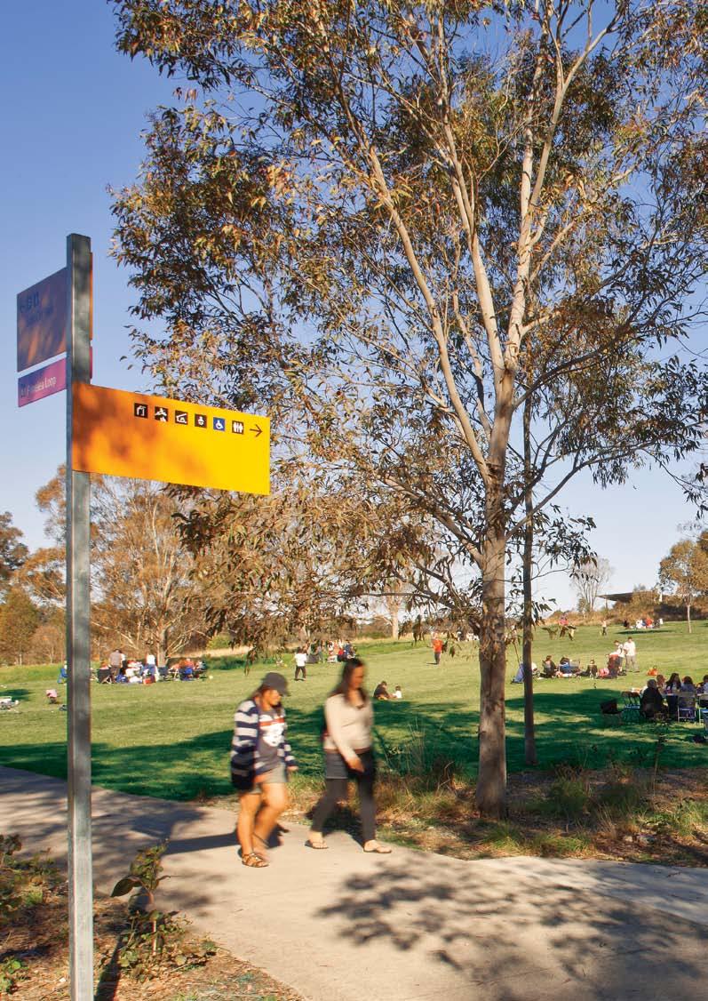
4 2. Achievements since 2010 and Parklands infrastructure Environment and conservation Total expenditure in recreation and Parklands infrastructure $17.5M Total expenditure in environment and conservation $2.5 M Growth in bushland corridor Increase is bushland area from 1,056 ha in 2010 to 1,117 ha in % growth in bushland in the Parklands since UP 6 % Vision Western Parklands is a place for people of all backgrounds to meet, celebrate, learn, play and appreciate the environment. The Parklands will be a venue for communities to create and manage a new sustainable future on the Cumberland Plain. Improved recreational areas Lizard Log A $9 million upgrade to Lizard Log Doubled in size from 10 ha to 20 ha and increased capacity of area of the park from 1,000 to 3,000 people/visitors for picnic and play Provision of new BBQs and picnic facilities, toilets, nature based playground, and car parking New 7,500 sqm event space built to accommodate 5,000 visitors. Nurragingy A $2 million upgrade to Nurragingy Provision of new playground and upgrade to four playgrounds Upgrade to BBQs and picnic facilities, and power and sewer services. Plough and Harrow A $1.5 million upgrade to Plough and Harrow Sealed parking capacity increased by 30% New and expanded intergenerational playground based around technology play 50% increase in size from previous playground. Bungarribee $1.5 million spent on Stage 1 of new recreational area 9 ha walking tracks, dog off leash area, seating and car parking Commenced master planning for new super park. New and improved Parklands track $3.5 million on Parklands Tracks Including new signage and seating along the whole track. Sealed track in the north 5KM New track constructed in the north 7KM New track linking Lizard Log to The Diary 2KM More sporting venues Blacktown Soccer Fields, Bungarribee Lease with Blacktown City Council for regional competition grade synthetic soccer field and training field in the Eastern Road Sports Precinct. The venue has been increased from 8 ha to 11 ha and will expand to 3 additional soccer fields in the future. Junior Motorcycle Training Facility, Horsley Park 9 ha of land in Horsley Park leased to Motorcycling NSW for junior motorcycle training. About 2,400 children use the facility per annum. 180,000 plants About 180,000 plants added to the Parklands 127,363 plants 16 ha of direct seeding by bush regeneration professionals 42,600 plants Planted by 8,120 school children 9,280 plants Planted by 285 volunteers Restored Cumberland Plain Woodlands 1,000 ha of bush regeneration (control of weeds) undertaken by the Trust. 423 biobank credits created and 293 credits (25 ha of bushland) sold to mange the environment. 6 7
5 2. Achievements since 2010 continued Urban farming Culture and participation Parklands development and management 159HA Established new urban farming land Identified 159 ha of land in the Horsley Park Precinct for future urban farming. Created new leases for urban farming Leased 5 ha of land for farming in the Horsley Park Precinct. 104 ha of land leased for farming, education and tourism at Calmsley Hill City Farm, Abbotsbury. Over 75,000 visitors per annum. 18 % growth in visitation since Increased visitation to the Parklands including venues managed by tenants, events and program 66 % Increase in visitors to the Parklands from 2009/10 to 2012/13 Increased visitation to recreational areas 44 % Increase in number of visitors to recreational areas from 2009/10 to 2012/13 Increased number of people cycling in the Parklands 15 % Increase in number of cyclist using the Parklands from 2009/10 to 2012/13 Introduced shelter bookings in bookings taken for shelters at Plough and Harrow and Lizard Log since 2011 Increased recreational community based events held at the Parklands 367 % Increase in number of people coming to the Parklands for recreational community based events from 2009/10 to 2012/13. This includes cross countries, school events, orienteering, cycle and walking clubs, and Warrior Run event. Increased number of people visiting main venues (managed by others) in the Parklands 79 % Increase in number of people visiting key venues managed by others in the Parklands from 2009/10 to 2012/13. This includes Calmsley Hill City Farm, Motorsport Park, Western Dragway, Shooting Centre, Equestrian Centre, Blacktown Sportspark, Nurragingy, Junior Motorcycle Training Facility, and Treetop Adventure Park. New events delivered by the Trust Woof-fest a dog festival commenced in 2012 Increase attendance of 50% attendees from Fresh from the West a food festival which commenced in ,000 people. Expansion of online community Expanded online presence with upgraded Parklands website and increased use of social media. Increased income sources to manage the Parklands and provide new facilities 167 % increase in income generated to manage the Parklands from leases since 2010 This includes commercial billboards, Treetop Adventure Park, Wet n Wild, Junior Motorcycle Training Facility and Calmsley Hill City Farm. Commenced planning for s Developed strategy in consultation with Western Councils and business community. Horsley Park planning approval obtained and commercial arrangement for 21 ha industrial development on The Horsley Drive in place. Eastern Creek planning assessment underway for 17 ha development on Rooty Hill Road South. Continued to manage the parks and tracks Maintained parks, tracks and asset protection zones $1 million spent per annum on maintaining, cleaning and mowing 106 ha of recreational areas, tracks and asset protection zones. Waste Collection 210 tonnes of litter collected from the Parklands recreational areas per annum. 50 tonnes of dumped waste collected from the Parklands per annum. 210 TONNES Increased public ownership of the Parklands 4,966 ha in the Parklands now in public ownership. 94% Under public ownership Since 2009, 176 ha of private land has been transferred to the Parklands into public ownership. 8 9


6 3 Parklands Development and Management 3.1 Sustainable Revenue Base Creating a Sustainable Revenue Base to Achieve the Vision To foster the best use and care of one of the world s largest urban parks in a financially sustainable way, the Plan of Management 2020 called for the Trust to create new business opportunities and specified the development of business hubs within the Parklands as one such opportunity. As set out in the Plan of Management 2020, the Trust proposes two percent of the Parklands for business hubs to generate income to develop and manage the remainder of the Parklands. Working with local Councils, nine business hubs have been identified since 2010 and these hubs will provide areas for business activity within the Parklands ranging from large format retail to industrial. The business hubs will be equally spread between Blacktown, Fairfield and Liverpool areas of the Parklands. According to the criteria for their land use, this activity will cater for local and regional needs and complement other businesses in the region. The proposed business hubs are subject to the planning assessment process and require approval from the relevant consent authority before development can commence. After extensive consultation, the planning for the first two business hubs at Eastern Creek and Horsley Park have been progressed. A commercial agreement for the development of the Horsley Park has been reached and the Eastern Creek development is at the planning assessment stage. It is anticipated that by 2020 the longterm lease income from the business hubs will be the single most significant contributor to the Trust s funds. In addition, three proposed tourism hubs (one percent of the Parklands) as identified in the Plan of Management 2020 in Prospect, Bungarribee and Bringelly Road, as well as other recreational revenue sources will also make a contribution to funding the Parklands recreational development and operations. 3.2 Consultation Community and Stakeholder Input in Defining Revenue Opportunities Stakeholder and community consultation is a priority during all stages of business hub selection and development. In this way, the Trust has engaged with residents, business and civic groups, as well as the three local councils and the broader community. As stated in the Plan of Management 2020, to take the business hubs forward the Trust established Consultative Committees with Liverpool, Fairfield and Blacktown City Councils in 2011 to explore locations and land uses for the business hubs. The result of these consultations can be seen in the following sections which define the nine sites. Further community input has also been sought as part of the prioritised development of the Eastern Creek and Horsley Park s. This has included meetings with relevant industry and business groups, local heritage and environmental groups, and local schools, letterbox drops for residents in the immediate vicinity, local media briefings, and Have a Say Day public events. The Trust has also liaised with the relevant State Government agencies and utilities in identifying the business hubs. 3.3 Economic Contribution Economic Contribution of Business and Tourism s to Western In addition to providing a sustainable revenue base to fund the Parklands recreational, environmental and community programs, the proposed business and tourism hubs also contribute to the business and social outcomes of Western. It is estimated that the business and tourism hubs will provide about 8,800 local jobs in addition to current growth projections, (of which 2,000 are additional), whilst the value of additional economic activity (gross regional product) is estimated to be about $2.2 billion to 2031 in Western. The tourism hubs will add an estimated 50,000 per annum international tourism visitor nights contributing to the tourism-related businesses in the metropolitan region. At a broader scale, the additional employment located in the business and tourism hubs has been estimated to reduce the average commuter travel time (travelling to and from place of work) by over half an hour per day, a total of 1.1 million commuter hours per year, improving the efficiency of commuter travel time across Western. 8,800 Estimated number of jobs the business and tourism hubs will provide in addition to current growth projections (of which 2,000 are additional) $2.2B Estimated additional economic activity (GRP) to 2031 in Western the business and tourism hubs will provide 50,000 Estimated additional per annum international tourism visitor nights added by tourism hubs 3.4 Business Locations and Potential Land Uses Principles in identifying Potential Land Uses and Locating s The business hub sites are compelling choices with low ecological value, close proximity to major road infrastructure (M7 and M4 Motorways, Great Western Highway and arterial roads) compatible land uses and with capacity to provide opportunities for local jobs and well located business environments. The principles guiding their selection from more than 30 sites considered in consultation were specified in the Plan of Management 2020 Land Use Framework: 1. Land uses should generate an appropriate commercial return and also add to the amenity of adjacent communities. 2. Land uses must generate additional employment and training opportunities for local and regional communities. 3. Development must be undertaken in a manner that will minimise the environmental impact of such development. 4. The development of business hubs will only be permitted to occur on sites with low environmental and recreational values. In addition, two further principles have been added through the consultation process: 5. Business hubs are to be located to take advantage of existing and new infrastructure investments and assets, such as the metropolitan road network (eg. motorways) and existing and new utility services (eg. Bungarribee lead-in sewer). 6. Business hubs are to be located to complement existing and proposed centres and employment areas in Western. In line with this criteria, the highest value occupants of the business hubs will be businesses not only providing a good return to the Trust, but which also maximise local job creation opportunities and economic activity to the region


7 3.5 Land Use Framework Updated Figure 1 Parklands Land Use Framework Plan The Parklands land use framework plan (Figure 1) identifies the various activity hubs, linkages, environmental conservation and infrastructure to This plan has been updated from the original in the Plan of Management 2020 to reflect the identification of the nine business hubs within the Parklands, which together will comprise a maximum of two percent of the land available. Great Western Hwy eastern creek Blacktown Sportspark MT DRUITT Anne Aquilina The Rooty Hill Morreau Sporting and Amphitheatre Motorsport Park Western Dragway Eastern Creek Waste Management Centre Austral Bricks HORSLEY PARK glendenning M7 M4 woodcroft Nurragingy Kareela doonside Charlie Bali Bungarribee huntingwood M4 wetherill PARK Key BLACKTOWN Prospect Nature Prospect Reservoir Shooting Centre Equestrian Centre CECIL PARK M7 Lizard Log The Dairy ABBOTSBURY Calmsley Hill City Farm Plough and Harrow Sport and Active Community and Passive Tourism Bushland Corridor Kemps Creek Nature CECIL hills Gazetted Conservation Area M7 Existing Parklands Track austral Future Indicative Parklands Track Shale Hills WEST HOXTON Creek Water Supply Canal and Pipelines Infrastructure Not to Scale leppington Rail 12 13
8 3.6 Precinct Management Guidelines Updated he Plan of Management 2020 identified 16 Precincts within the Parklands each with its own character and land uses. The precinct management guidelines have been updated from the Plan of Management 2020 to reflect the identification of the nine business hubs, outlining the location of the hub, the site characteristics, potential land uses and discussion on why the site is suitable for a business hub. Although land uses for the business hubs have been proposed, further planning and market viability analysis and consultation will be required to confirm the most suitable land uses for the sites. Business hubs are estimated to contribute about $2.2 billion to the Western economy over 20 years, as well as providing positive social outcomes of having more local employment opportunities. s: Context and Location As indicated previously nine business hubs have been identified as a result of investigations and consultations with local councils, communities and state government agencies since early The recently finalised locations of these sites are provided in the following pages, along with information relevant to their selection regarding appropriateness of site for a business hub, environmental impact and employment opportunities as specified in the Plan of Management For the purposes of this supplement, the Parklands business hubs have been grouped according to their local government areas: Blacktown LGA: Eastern Creek, Bungarribee, Light Horse Interchange Fairfield LGA: Horsley Park, Horsley West, Wallgrove Road Liverpool LGA: Elizabeth Drive, Fifteenth Avenue, Bringelly Road However, there are a number of broad management guidelines and constraints that will cover all business hub sites defined in this supplement, including; The need to work closely with local councils and state government agencies on issues such as public transport, utility services, water management, safety, access and signage, pedestrian paths and cycle ways, and economic development; The need to work closely with infrastructure and utility providers to manage existing and new infrastructure services, in terms of access, security, public safety and other operational requirements; The requirement for the Trust to manage and maintain the lands in the Parklands as defined by the Western Parklands Act. Properties within these business hubs will be made available under long-term commercial leases or similar arrangements in accordance with the Parklands Development and Management objectives; That the total area of the defined business hubs comprise two percent of the Parklands total area, while tourism hubs one percent of the Parklands; The nine business hubs sites will be established between now and 2020 to contribute to generating $10 million per annum by 2020 growing to $20 million per annum over the long term, to service the environmental, recreational facilities and activities of the Parklands. The business hub sites will be of varying sizes, with differing environmental characteristics, infrastructure and potential land uses. As with the management approach to the Parklands different precincts, the variations mean management guidelines and land uses have been tailored to cater for each site individually. The requirement that any Parklands business hub developments will complement and respond to the surrounding land uses, both existing and proposed; The intended business activity will need to meet existing and projected future market demand in Western ; and Prior to proceeding with the implementation of a business hub, a detailed planning assessment, economic and market analysis and consultation with local Councils, relevant State Government agencies and the community will be undertaken

9 Blacktown LGA s Eastern Creek, Bungarribee, Light Horse Interchange Figure 2 Blacktown LGA s deans park Westlink M7 QUAKERS HILL The northern reaches of the Western Parklands lie within the Blacktown Local Government Area and border the North West Growth Centre and the Western Employment Area. Three business hubs have been identified in this region: Eastern Creek, Bungarribee and Light Horse Interchange. Each of these sites benefit from proximity to infrastructure and roads. In the case of Eastern Creek and the Light Horse Interchange, the appeal of sites is enhanced by high visibility of the sites from the motorways. Bungarribee has good visual and vehicular access from the Great Western Highway. A detailed planning assessment and economic/market analysis will confirm the land uses and scale of each business hub discussed in this section. Eastern Creek (Precinct 3) Location: Rooty Hill Road South, Rooty Hill. Adjacent to M7 Motorway and Great Western Highway. Site Characteristics: A largely flat site separated from the rest of the Parklands by the M7 Motorway, it is situated halfway between the Regional Cities of Penrith and Parramatta. The site is located adjacent to residential and is bound by the M7 Motorway and Great Western Highway providing good regional access to the site. Potential Land Uses: Large format retail, bulky goods premises, retail premises, business premises, tourist and visitor accommodation. Addressing Principles: Eastern Creek is one of two priority business hub sites identified for its strong potential for commercial development and low environmental and recreational value relative to other areas in the Parklands. The large flat nature of the site makes it suitable to accommodate large format buildings. The site is well located to take advantage of passing traffic on the arterial road network, as well as accommodate heavy vehicle movements. The site will generate a diversity of employment opportunities. Bungarribee (Precinct 4) Location: The junction of the Great Western Highway and Doonside Road, Bungarribee. Site Characteristics: The site is a wide open landscape located adjacent to the proposed Bungarribee Community and al and Tourism which is currently being developed by the Trust. The site has good visual exposure from the Great Western Highway and Doonside Road, as well as excellent vehicular access from the Great Western Highway (new intersection) and the broader arterial road network. Potential Land Uses: Tourist and hospitality related retail premises, tourist and visitor accommodation, warehouse, storage and distribution premises, transport related services. Addressing Principles: Bungarribee has been identified as an ideal site in the Parklands for a business hub. The proposed land uses will complement the recreational and tourism development being planned for the site and provide for the existing and new communities in the region. It has very good vehicle access from both the Great Western Highway and Doonside Road and a pleasant outlook over the Parklands. A newly built intersection on the Great Western Highway providing access to the site, as well as the construction of a lead-in sewer by Water will accommodate the needs of this business hub. Along with the tourism and recreational hubs in Bungarribee, the proposed business hub will provide significant and diverse employment opportunities to the local community. Light Horse Interchange (Precinct 6) Location: Corner of M4 and M7 Motorways, Eastern Creek. Site Characteristics: A large flat site located along the M7 and M4 Motorways and at the Light Horse Interchange. The site is adjacent to Eastern and Reedy Creeks making parts of the site flood affected. The site is located adjacent to the Eastern Creek Motor Sports precinct as well as the Eastern Creek Waste Management Centre to the south. The Western Employment Area and the former Eastern Creek Quarantine Animal Facility is located to the west and northwest of the site respectively. Potential Land Uses: Industrial, infrastructure. Addressing Principles: Although this business hub is located adjacent to the M7 and M4 Motorways the site is landlocked and requires a significant investment to capitalise on the site s full potential. The site does not have significant ecological value. There is the potential for an innovative industrial facility to be located on this site to complement the proposed development in the Western Employment Area, the former Eastern Creek Quarantine Animal Facility being developed for industrial and the Eastern Creek Waste Management Centre. Community & Passive Blacktown Sportspark Sport & Active Eastern Road The Rooty Hill Eastern Creek Community & Passive Light Horse Interchange Light Horse Intercharge Eastern Creek Waste Management Centre Western Dragway Austral Bricks glendenning Horsley park Westlink M7 Knox Road DOONSIDE woodcroft Ferrers Road Richmond Road Nurragingy Kareela Charlie Bali Anne Aquilina Morreau Sporting and Amphitheatre Bungarribee Tourism Bungarribee Motorsports Park Sport & Active al HUNTINGWOOD Great Western Highway Western Motorway M4 Prospect Reservoir Figure 2 Blacktown LGA s Blacktown Precincts 1-8 Bushland Corridor Gazetted Conservation Area LGA Boundary Gas Infrastructure Electricity Infrastructure Creek Rail Cricketers Arms Hotel Blacktown Drive-In Cinema Tourism Prospect Nature Walder Park Not to Scale wetherill park 16 17

10 Fairfield LGA s Horsley Park, Horsley West, Wallgrove Road Figure 3 Fairfield LGA s Eastern Creek Waste Management Centre Austral Bricks Ferrers Road The central swathe of the Western Parklands lies within the Fairfield Local Government Area. It comprises significant urban farming, tourism, environmental, and recreational facilities. The three business hub sites identified after extensive consultation in this region have been designated for uses such as industrial and transport related services (eg. transport rest stops, service stations, truck stops, ancillary food outlets), which will complement existing local businesses whilst generating funds for future Parklands growth and maintenance. A detailed planning assessment and economic/market analysis will confirm the land uses and scale of each business hub discussed in this section. Horsley Park (Precinct 9) Location: Corner of The Horsley Drive and Cowpasture Road, Wetherill Park. Site Characteristics: Corner site located adjacent to regional arterial roads (The Horsley Drive and Cowpasture Road) and the Wetherill Park industrial area. The site slopes to the east and is bordered by the Upper Canal. The site is located adjacent to the Horsley Park Urban Farming Precinct being progressed by the Trust which will see over 159 ha of land for commercial farming in the Parklands. Potential Land Uses: Industrial, warehouse, storage and distribution premises, transport related services. Addressing Principles: The second of the two hubs to be given priority for development, Horsley Park, has limited conservation value and sits adjacent to the Wetherill Park industrial area. The hub will complement the existing industrial development at Wetherill Park. The site has good access to infrastructure, meaning the costs of development will be relatively low. The site also has good road exposure. Horsley West (Precinct 9) Wallgrove Road (Precinct 11) Location: Corner of Wallgrove and Cecil Roads, Cecil Park. Site Characteristics: The relatively flat site provides excellent exposure for business, lying adjacent to Wallgrove Road, which is parallel to the M7 Motorway. It is 600 metres north of Elizabeth Drive, at the boundary between the Liverpool and Fairfield local government areas. Potential Land Uses: Warehouse, storage and distribution premises, transport related services. Addressing Principles: The hub is located close to the regional arterial road network, therefore providing good vehicular access to and from the site and providing excellent exposure for businesses from passing traffic. The site also provides for good access for heavy vehicles. The site has low environmental and recreational value relative to other areas in the Parklands and is cut off from the core Parklands corridor by the M7 Motorway, Wallgrove Road and Elizabeth Drive. CECIL PARK HORSLEY PARK Horsley West Sport & Active The Horsley Drive Equestrian Centre Saxony Road Wallgrove Road Westlink M7 Border Road Redmayne Road Cowpasture Road Prospect Reservoir Horsley Park Horsley Community Drive Business & Passive Lizard Log Location: Redmayne Road, Horsley Park. Site Characteristics: The site is rectangular in shape, bounded by M7 Motorway to the east and The Horsley Drive to the south. It is located two kilometres west of the Wetherill Park industrial area. The site presents with a moderate slope and is located adjacent to the Horsley Park Urban Farming Precinct in the Parklands. Potential Land Uses: Warehouse, storage and distribution premises, transport related services. Addressing Principles: This hub sits immediately east of the M7 Motorway providing good visual exposure, and is two kilometres to the west of the Wetherill Park industrial area. The site is well serviced by The Horsley Drive to the south of the site and the M7 Motorway to the west. Wallgrove Road Cotswold Road Calmsley Hill City Farm Abbotsbury Community & Passive Moonrise Lookout The Dairy Sugarloaf Ridge Fairfield Precincts 9-11 Bushland Corridor Gazetted Conservation Area LGA Boundary cecil HILLs Elizabeth Drive Plough and Harrow Gas Infrastructure Electricity Infrastructure Not to Scale Creek 18 19

11 Liverpool LGA s Elizabeth Drive, Fifteenth Avenue, Bringelly Road The Parklands southern section is part of the Liverpool Local Government Area. It will accomodate three business hubs at Elizabeth Drive, Fifteenth Avenue and Bringelly Road. In the case of the Elizabeth Drive and Bringelly Road s they will form part of a broader sports and active recreation hub in the Parklands. Fifteenth and Bringelly Roads Business s are located on key roads to the South West Growth Centre (300,000 new residents) and therefore will be become major gateway sites to the Austral and Leppington North areas expected to deliver 17,000 new homes and a population of 54,000. A detailed planning assessment and economic/market analysis will confirm the land uses and scale of each business hub discussed in this section. Elizabeth Drive (Precinct 14) Location: Elizabeth Drive, Cecil Park. Site Characteristics: On the southern and northern side of Elizabeth Drive, the Elizabeth Drive is a hilly site, which forms the northern boundary of the Fairfield and Liverpool local government areas. The site is located on Elizabeth Drive, a major east-west arterial road. The site has visual exposure from Elizabeth Drive and is well located to take advantage of passing traffic. The site is the northern most boundary of the South West Growth Centre. The surrounding area has seen significant residential development on greenfield sites and will continue with the proposed future development at Austral and Leppington North. Potential Land Uses: Warehouse, storage and distribution premises, transport related services, tourist and visitor accommodation, business premises, office premises. Addressing Principles: The location and proximity to the South West Growth Centre and the proposed Sport and Active in the Parklands is likely to ensure it generates a good commercial return at the same time as meeting growing local demand for transport related services. The development of this hub will occur in line with the future development of the surrounding area. Fifteenth Avenue (Precinct 15) Location: Fifteenth Avenue, West Hoxton. Site Characteristics: This softly sloping site has good road access, visual exposure and infrastructure. The site is north of an established small neighbourhood retail area and residential areas and strategically positioned between the residential development growth in the east at Middleton Grange and West Hoxton and the proposed residential growth of Austral to the east and North Leppington to the south west. The site is located adjacent to Kirkpatrick and Boyland Park. Potential Land Uses: Retail premises, office premises, business premises, tourist and visitor accommodation, small scale health service facilities (eg. medical centre, community health service facilities), childcare. Addressing Principles: This proposed hub is a significant gateway site, positioned between two significant residential growth areas. The proposed land uses will service the local market needs and build on the existing neighbourhood shops located opposite on Fifteenth Avenue and may function as a park and ride for commuters. The hub will propose land uses that are compatible with the proposed neighbourhood centres in Austral. Bringelly Road (Precinct 16) Location: Bringelly Road, Leppington. Site Characteristics: The Bringelly Road site is relatively flat and has excellent business exposure to high levels of regional and local traffic and good vehicular access from Bringelly and Cowpasture Roads. It forms the southern boundary of the Parklands and is bordered by the Carnes Hill and Horningsea Park residential areas. The site is located one kilometre to the east of the proposed Leppington rail station and Leppington Major Centre and adjacent to the proposed Sport and Active and Tourism in the Parklands. Bringelly Road is also being upgraded to service the regional traffic of this area. Potential Land Uses: Large format retail, bulky good premises, warehouse, storage and distribution premises. Addressing Principles: This proposed hub is a gateway site situated on a major arterial road network on Bringelly Road. The topography, large lot size, visual exposure and excellent position on the regional road network make it a suitable location for large format retail, bulky goods and warehouse/distribution with the potential to provide a variety of local jobs in close proximity to future residential. The proposed land use will complement the activities proposed for the Leppington Major Centre. Figure 4 Liverpool LGA s Not to Scale Gurner Avenue Fifteenth Avenue LEPPINGTON cecil PARK Kemps Creek Nature Bringelly Road Fourth Avenue Tenth Avenue Shooting Centre AUSTRAL Fifteenth Avenue Sport & Active Tourism mt vernon Sport & Active Elizabeth Drive Cecil Road CARNES HILL Camden Valley Way McIver Avenue Shale hills Bringelly Road Westlink M7 Elizabeth Drive WEST HOXTON Community & Passive cecil HILLs Residential Area Westlink M7 Liverpool Precincts Bushland Corridor Gazetted Conservation Area LGA Boundary Gas Infrastructure Electricity Infrastructure Creek Plough and Harrow 20 21


12 3.7 Partnering to Create Other Revenue Opportunities The Trust is working to partner with tourism and recreational operators to provide a diversity of high quality recreational activities across the Parklands to meet the needs of the growing regional population. Pictured above Wet n Wild Pictured opposite Tree Top Adventure Park The Trust has already begun generating revenue for Parklands development and management through leasing opportunities for tourism operators and other facilities within the Parklands. These short and long-term leases are increasing the recreational activities available for visitors as well as contributing towards the ongoing sustainability of the Parkland s operation. The Trust is working to partner with tourism and recreational operators to provide a diversity of high quality recreational activities across the Parklands to meet the needs of the growing regional population. In keeping with the Plan of Management s Parkland Development and Management objectives for 2020, these arrangements: deliver sustainable management of the Parklands Trust s assets; maximise the use and community benefits of existing and new leased assets in the Parklands; develop new business opportunities to support the management and further development of the Parklands; and allow for new infrastructure/utilities and achieving a balance between the recreation and aesthetic values of the Parklands and the infrastructure needs of external agencies. Tourism s As detailed in the Plan of Management 2020, one percent of the Parklands has been identified as future tourism hubs providing for a range of recreation, leisure, entertainment, education and nature based opportunities. These are located at Prospect, Bungarribee and Bringelly Road. The first development to occur as part of the Prospect Tourism is the development of the 25 hectare Wet n Wild theme park on Reservoir Road, Prospect. It is expected that this $115 million investment by Village Roadshow Ltd will create 300 full time jobs and attract nearly one million visitors to the Parklands annually. In doing so, it will provide an economic boost for Western and be a major tourism attractor for the region. The 50-year lease is part of the one percent of the Parklands allocated for tourism use according to the long-term Land Use Framework. Planning for the Bungarribee Tourism has commenced, whilst work on the Bringelly Road Tourism will commence in the coming years in line with the development at Austral and Leppington North. Commercial Billboards The Trust has identified ten locations throughout the Parklands for commercial billboards sites. The billboards are located on the edge of the Parklands adjacent to major arterial roads. The locations of these billboards are of low environmental and scenic landscape value and in areas which do not detract from the recreational values and facilities of the Parklands. Commercial al Activities Supporting Parklands Community and Passive s The Trust will continue to partner with commercial operators to support its key recreational areas and to provide for an increase recreational experience. This includes: Tree Top Adventure Park Located at Plough and Harrow The Tree Top Adventure Park opened in the Parklands Plough and Harrow East in The facility operated by Ecoline High Ropes and among other attractions has the longest flying fox in NSW strung through a patch of Cumberland Plain Woodland. Plough and Harrow Cafe at Plough and Harrow Close to the Tree Top Adventure Park, the lease for the Plough and Harrow Café is managed by a commercial operator. The café/restaurant opened its doors at the site in late 2012 and complements the picnic facilities at the very popular park. The Trust has recently completed an upgrade to the park of over $1 million, providing additional car parking, new landscape works and an upgraded playground. Third Party Commercial and Community Events Hosting events arranged by a third party is another contribution to park activation and revenue generation. These events also attract new visitors to the Parklands and provide for another recreational activity. In 2013 the Parklands hosted its first 5-kilometre Warrior Dash, organised by Warrior Dash Australia, which drew thousands of spectators and participants to The Dairy. In addition, the Trust has begun hiring a purpose built pavilion and amphitheatre which accommodates 5,000 people at Lizard Log to corporates, community groups and residents. Shelter and Venue Hire For a fee, Parklands visitors can reserve a shelter at Plough and Harrow West, Plough and Harrow East and Lizard Log picnic grounds. This guarantees visitors facilities to the very popular picnic areas, as well as provides operating revenue to the Trust. Funding the Environment Biobanking In the Trust entered into an agreement with the Minister for the Environment to sell its first biobanking credits on 23 ha at Cecil Park and 17 ha at Horsley Park as part of an ongoing involvement in the NSW Government s Biobanking scheme. The Trust has created 423 credits and sold 293 credits to date. Biobanking credits have been sold to the private sector and the Transport Construction Authority (TCA) as part of the South- West Rail Link. The first year s credits generated substantial funds to go towards the Parklands environmental works at the Cecil Hill and Horsley Park sites. The Trust sees this mechanism as an important source of long term funds in addition to funds from other revenue sources (such as income from the business hubs) to ensure the achievement of the Environment and Conversation outcomes in the Plan of Management

13 Next Steps 1. Continue to secure the long term income stream to fund the development and operation of the Parklands Progress planning for the proposed nine business hubs and continue to engage with the community, business and stakeholders in the successful delivery of these hubs. In the short term, establish the Horsley Park and Eastern Creek s. Prior to proceeding with the remaining business hubs, a detailed planning assessment, economic impact analysis on existing centres and market analysis on each business hub will be completed, along with continued consultation on the proposal. 2. Deliver the Tourism Strategy Progress the Bungarribee Tourism. Commence planning for the Prospect and Bringelly Road Tourism s. 3. Partner with other Parklands operators Continue to work in partnership with existing operators in the Parklands such as those operating in the Eastern Road (motorsports) Precinct and Shooting and Equestrian Centres to increase visitation and make greater use of existing government assets. 4. Grow minor commercial activities to support recreational hubs, environmental initiatives and visitor programs Continue to expand minor business development opportunities around recreational, environment, visitor programs and events such as shelter and venue bookings and bike hire. 5. Continue to increase visitation to the Parklands Continue to increase visitation by a minimum of ten percent a year including event audiences attending Trust organised events (eg. Woof-fest), volunteering and third party run events. 6. Deliver the Parkland s Five Year Activation Plan Deliver the Trust s $30 million, five year recreational capital works program to activate an additional five percent (250 ha) of the Parklands for passive recreation. This includes: improvements to the existing track network and landscape treatment in the north and south of the Parklands, including trail heads, car parking and signage, complete a walking and cycling network in Abbotsbury linking Plough and Harrow, The Diary and Lizard Log, a new 12 kilometre mountain bike track and associated infrastructure in Cecil Park, develop the first stages of the Bungarribee super park, including 20 ha of regional picnic and play facilities, a new walking and cycling loop, car parking and a new entry and intersection on Doonside Road. 7. Deliver the Parklands urban farming initiative in Horsley Park Progress the Horsley Park Precinct Urban Farming master plan by securing commercial farming leases in the Precinct to deliver about 150 ha of farming land. Pictured opposite 24 Bungarribee 25

14 Designed by Frost* Printed by Seed Print Group
15
WESTERN SYDNEY PARKLANDS PLAN 2020 CORPORATE
 WESTERN SYDNEY PARKLANDS 2020 CORPORATE PLAN March 2015 Table of Contents Message from the Chairman and Director 1 What is the Western Sydney Parklands? 4 The Western Sydney Parklands Trust 4 The Corporate
1.1 Parklands for Western Sydney
 BACKGROUND 1.1 Parklands for Western Sydney Pictured Learning about the plants in the Parklands at Greenway Views Family Day. The Western Sydney Parklands, located in the heart of Western Sydney, comprise
Kilometres. Blacktown. Penrith. Parramatta. Liverpool Bankstown. Campbelltown
 0 5 10 15 20 Kilometres Penrith Blacktown Parramatta Liverpool Bankstown Campbelltown accessibility outcomes Legend Outcomes targeted in Western Sydney are: public transport that is accessible throughout
4 Transport projects underway in Western Sydney
 4 Transport projects underway in Western Sydney About this chapter This chapter provides an overview of the Australian and NSW government s significant investments in road, bus and rail infrastructure
TOWN PLANNING SUBMISSION TO THE GREATER SYDNEY COMMISSION LANDS AT ARTARMON
 TOWN PLANNING SUBMISSION TO THE GREATER SYDNEY COMMISSION LANDS AT ARTARMON March 2017 TABLE OF CONTENTS 1.0 INTRODUCTION 3 2.0 THE SUBJECT SITE 4 3.0 STRATEGIC PLANNING CONTEXT 6 4.0 SUMMARY AND CONCLUSIONS
PCAL Case Study Retail Areas: Rouse Hill Town Centre
 PCAL Case Study Retail Areas: Rouse Hill Town Centre Introduction Rouse Hill Town Centre is a new mixed use development on a greenfield site in Sydney s North West. It has been planned to be a major hub
SYDNEY S SECOND AIRPORT
 COLLIERS RADAR SYDNEY S SECOND AIRPORT The Catalytic Effect of Transport Infrastructure By Sass J-Baleh Manager Research sass.jbaleh@colliers.com Summary Industrial land values across the Sydney markets
CAIRNS RECTANGULAR PITCH STADIUM NEEDS STUDY PART 1 CAIRNS REGIONAL COUNCIL DRAFT REPORT SEPTEMBER 2011
 CAIRNS RECTANGULAR PITCH STADIUM NEEDS STUDY PART 1 CAIRNS REGIONAL COUNCIL DRAFT REPORT SEPTEMBER 2011 CAIRNS RECTANGULAR PITCH STADIUM NEEDS STUDY PART 1 Cairns Regional Council September 2011 Coffey
Strategies and Land Release
 North West and South West Growth Centres Bruce Colman Precinct Project Manager 1 Growth Centres: Background Metropolitan Strategy North West & South West Rezone land quickly Planning and infrastructure
3 The growth of Western Sydney
 3 The growth of Western Sydney About this chapter This chapter provides an overview of Western Sydney s growing population and economy, and the benefit of the proposed Western Sydney Airport. Population
FUTURE TRANSPORT STRATEGY AND GREATER SYDNEY SERVICES AND INFRASTRUCTURE PLAN. Western Parkland City
 FUTURE TRANSPORT STRATEGY AND GREATER SYDNEY SERVICES AND INFRASTRUCTURE PLAN Western Parkland City 2 Transport for NSW Future Transport Strategy and Greater Sydney Services and Infrastructure Plan Western
This is a submission to Council s Delivery Plan and Operational Plan
 Goulburn Mulwaree Council Locked Bag 22 Goulburn NSW 2580 Emailed: strategy@goulburn.nsw.gov.au and council@goulburn.nsw.gov.au Marulan/Tallong Community Network C/O 843 Marulan South Road Marulan NSW,
PSP 75 Lancefield Road. Northern Jacksons Creek Crossing Supplementary Information
 PSP 75 Lancefield Road Northern Jacksons Creek Crossing Supplementary Information September 2017 The northern crossing of Jacksons Creek proposed within the Lancefield Road PSP is a key part of the ultimate
ABOVE+ BEYOND OAKDALE SOUTH INDUSTRIAL ESTATE MILLNER AVENUE, KEMPS CREEK, NSW
 ABOVE+ BEYOND OAKDALE SOUTH INDUSTRIAL ESTATE MILLNER AVENUE, KEMPS CREEK, NSW OVERVIEW 2 Opportunity Part of the larger Oakdale Industrial Estate, Oakdale South is a newly released precinct offering 70
IN FOCUS NSW. Developing Western Sydney
 IN FOCUS NSW Developing Western Sydney DEVELOPING WESTERN SYDNEY Introduction Western Sydney is one of the fastest growing regions in Australia. Traditionally infrastructure expenditure and development
Figure 3: Global Sydney. Draft Metropolitan Strategy for Sydney. North Sydney CBD. Second Harbour Crossing. Walsh Bay Arts Precinct.
 Newtown Glebe Macdonaldtown Pyrmont Ultimo Sydney International Convention, Exhibition & Entertainment Precinct Sydney Education & Health Erskineville Figure 3: Global Sydney Waterloo Second Harbour Crossing
Draft Greater Sydney Region Plan
 Powered by TCPDF (www.tcpdf.org) Draft Greater Sydney Region Plan Submission_id: 31382 Date of Lodgment: 14 Dec 2017 Origin of Submission: Online Organisation name: Greenfields Development Company & Ingham
PLANNING THE SUNBURY GROWTH CORRIDOR
 SUNBURY GROWTH CORRIDOR NOVEMBER 2016 PLANNING THE SUNBURY GROWTH CORRIDOR Sunbury Planning Background The Victorian Planning Authority, in consultation with Hume City Council, is undertaking a number
PO Box 257 PO Box 257 PARRAMATTA NSW 2124 PARRAMATTA NSW 2124
 31 March 2017 Sean O Toole Sheridan Dudley District Commissioner - West District Commissioner - South West Greater Sydney Commission Greater Sydney Commission PO Box 257 PO Box 257 PARRAMATTA NSW 2124
place for new beginnings.
 place for new beginnings. Aspect by Rawson Communities invites you to discover a vibrant community at the heart of Sydney s South-West growth corridor. Positioned at Fifth Avenue, Austral, this well connected
Draft Greater Sydney Region Plan
 Powered by TCPDF (www.tcpdf.org) Draft Greater Sydney Region Plan Submission_id: 31119 Date of Lodgment: 12 Dec 2017 Origin of Submission: Online Organisation name: Serapark Pty Ltd Organisation type:
Draft Greater Sydney Region Plan
 Draft Greater Sydney Region Plan Submission_id: 31392 Date of Lodgment: 14 Dec 2017 Origin of Submission: Online Organisation name: Greenfields Development Company No. 2 Pty Limited Organisation type:
NSW PRE-BUDGET STATEMENT FUTURE ECONOMY FUTURE JOBS
 2017-18 NSW PRE-BUDGET STATEMENT FUTURE ECONOMY FUTURE JOBS Executive Summary The 2017-18 NSW State Budget presents an opportunity for the NSW Government to future-proof the tourism and transport sectors.
@ENERGETICA_UK ENERGETICA.UK.COM BUSINESS PARKS
 @ENERGETICA_UK ENERGETICA.UK.COM BUSINESS PARKS LIVE VISIT WORK INVEST CONTENTS ENERGETICA SCOTLAND S ENERGY CORRIDOR 5 ABERDEEN INTERNATIONAL BUSINESS PARK 6 ABZ BUSINESS PARK 7 D2 BUSINESS PARK 8 ABERDEEN
PERTH AND KINROSS COUNCIL. 22 June 2016 DEVELOPING THE CULTURAL OFFER IN PERTH AND KINROSS UPDATE AND NEXT STEPS
 PERTH AND KINROSS COUNCIL 8 16/278 22 June 2016 DEVELOPING THE CULTURAL OFFER IN PERTH AND KINROSS UPDATE AND NEXT STEPS Report by Senior Depute Chief Executive (Equality, Community Planning & Public Service
Co-ordinated and Orderly Growth A Suite of Infrastructure and Public Assets for the Future... 1
 Co-ordinated and Orderly Growth... 1 A Suite of Infrastructure and Public Assets for the Future... 1 Funding Sources, Revenues and Prioritising Expenditure... 2 Stage 1 Short Term Growth Sunbury to 50,000...
THE SYDNEY AIRPORT BUSINESS DISTRICT PROPERTY DEVELOPMENT OPPORTUNITIES
 > THE SYDNEY AIRPORT BUSINESS DISTRICT PROPERTY DEVELOPMENT OPPORTUNITIES Sydney Airport Corporation Limited (SACL) invites you to share the development vision we have for Australia s gateway to the world
CORPORATE ACCOMMODATION SOLUTIONS
 CORPORATE ACCOMMODATION SOLUTIONS TABLE OF CONTENTS EXECUTIVE SUMMARY 3 THE LOCATION 4 KEY FEATURES 5 MASTERPLAN 8 TRANSPORT & PARKING 9 EAST VILLAGE 10 INDICATIVE SCHEME 11 ABOUT THE DEVELOPER 14 2 EXECUTIVE
Sunshine Coast Council Locked Bag 72 Sunshine Coast Mail Centre QLD Submitted via online portal. 2 June 2017.
 Sunshine Coast Council Locked Bag 72 Sunshine Coast Mail Centre QLD 4560 Submitted via online portal 2 June 2017 Dear Sir /Madam, RE: DRAFT ENVIRONMENTAL AND LIVEABILITY STRATEGY The Green Building Council
JUNE 2007 UPDATE REPORT SYDNEY METROPOLITAN STRATEGY
 JUNE 2007 UPDATE REPORT SYDNEY METROPOLITAN STRATEGY introduction TASKFORCE INTRODUCTION The Metropolitan Strategy, City of Cities A Plan for Sydney s Future was released in December 2005. The Strategy
JOINT CORE STRATEGY FOR BROADLAND, NORWICH AND SOUTH NORFOLK EXAMINATION MATTER 3C EASTON/COSTESSEY
 Matter 3C Easton/Costessey Representor No. 8826 JOINT CORE STRATEGY FOR BROADLAND, NORWICH AND SOUTH NORFOLK EXAMINATION MATTER 3C EASTON/COSTESSEY SUBMISSION ON BEHALF OF TAYLOR WIMPEY DEVELOPMENTS AND
Key Insights to Sydney Western Suburbs
 Disclaimer In preparation of this booklet, Crystal Blue Homes researches and gathers information from a varied range of sources and third parties. This information collates and considers market opinions
West of England. Priority Places Requiring Public Investment
 West of England Priority Places Requiring Public Investment Development Urban Regeneration & Suburban Intensification Bristol Central Area Bristol Central Area; Stokes Croft, Temple Meads & St Philips
Roads and Maritime Services Presentation to Local Government NSW Annual Conference October 2014
 Roads and Maritime Services Presentation to Local Government NSW Annual Conference October 2014-1 - About Roads and Maritime Services Deliver customerfocused services and infrastructure to the value of
SPACE+ LOCATION OAKDALE SOUTH INDUSTRIAL ESTATE SITE 1A, 1 ARISTIDA CLOSE, KEMPS CREEK, NSW
 SPACE+ LOCATION OAKDALE SOUTH INDUSTRIAL ESTATE SITE 1A, 1 ARISTIDA CLOSE, KEMPS CREEK, NSW OVERVIEW 2 Opportunity Part of the larger Oakdale Industrial Estate, Oakdale South is a newly released precinct
OUTLOOK EAST LEPPINGTON
 OUTLOOK EAST LEPPINGTON A CONTEXT ON BUSINESS, CULTURE, LIFESTYLE AND RESIDENTIAL Located within the rapidly expanding South West Growth Centre of Sydney, the East Leppington Precinct is well positioned
NEWCASTLE. Australia / PRIME PORTSIDE OPPORTUNITY / / 43 & 45 GREENLEAF ROAD, KOORAGANG NSW
 NEWCASTLE Australia / PRIME PORTSIDE OPPORTUNITY / / 43 & 45 GREENLEAF ROAD, KOORAGANG NSW CONTENTS 03 A Unique Opportunity 06 Executive Summary 07 Exceptional Location 08 Why Invest in Newcastle? 09 Property
A Master Plan is one of the most important documents that can be prepared by an Airport.
 The Master Plan A Master Plan is one of the most important documents that can be prepared by an Airport. A Master Plan is a visionary and a strategic document detailing planning initiatives for the Airport
MARKET OUTLOOK. 01 Walkability & Accessibility 02 Infrastructure & Employment 03 Demographics 04 Residential Analysis 06 Rental Analysis
 MARKET OUTLOOK EAST LEPPINGTON Located within the rapidly expanding South West Growth Centre of Sydney, the East Leppington Precinct is well positioned to benefit from the region s strong infrastructure
Green Fields Leppington
 Green Fields Leppington CONNTENTS 1.0 URBAN GROWTH - SYDNEY 2.0 MACRO CONTEXT 3.0 LOCAL ENVIRONMENTAL PLAN - LEPPINGTON 4.0 CONCEPT 5.0 GREEN ROOFS 6.0 APARTMENT REALISATION SCHEDULE 7.0 INFRASTRUCTURE
CHRISTCHURCH MOTORWAYS. Project Summary Statement February 2010
 CHRISTCHURCH MOTORWAYS Project Summary Statement February 2010 Table of Contents 1. Purpose of Document 2. Strategic Context 3. Benefits 4. Project Scope and Economics 5. Implementation Plan 1 ROADS OF
Committee. Presentation Outline
 CW-33-15 11/9/2015 Community and Corporate Services Committee November 10, 2015 1 Presentation Outline Background Vision and Objectives Study Process and Timeline Public and Stakeholder Engagement Organization
Wagga Wagga Local Environmental Plan 2010 (Amendment No 14)
") New South Wales Wagga Wagga Local Environmental Plan 2010 (Amendment No 14) under the Environmental Planning and Assessment Act 1979 I, the Minister for Planning, make the following local environmental
New South Wales Wagga Wagga Local Environmental Plan 2010 (Amendment No 14) under the Environmental Planning and Assessment Act 1979 I, the Minister for Planning, make the following local environmental
The Sunshine Coast is part of the global community and generates wealth through export, high-value industries and new investment.
 3.2 Strategic intent 3.2.1 Shaping growth an overview In 2031, the Sunshine Coast is renowned for its vibrant economy, ecological values, unique character and strong sense of community. It is Australia
2.2 For these reasons the provision of tourist signing will only be considered:
 TOURIST SIGNING POLICY 2015 1. DEFINITION 1.1 A tourist destination is defined as a permanently established attraction which attracts or is used by visitors to an area and is open to the public without
Draft Western District Plan
 Powered by TCPDF (www.tcpdf.org) Draft Western District Plan Submission_id: 31732 Date of Lodgment: 15 Dec 2017 Origin of Submission: Online Organisation name: APP Corporation Pty Ltd Organisation type:
Tourism Development Framework for Scotland. Executive Summary- Development Framework to 2020 for the Visitor Economy (Refresh 2016)
") Tourism Development Framework for Scotland Executive Summary- Development Framework to 2020 for the Visitor Economy (Refresh 2016) Introduction The Tourism Development Framework for Scotland refresh 2016:
Tourism Development Framework for Scotland Executive Summary- Development Framework to 2020 for the Visitor Economy (Refresh 2016) Introduction The Tourism Development Framework for Scotland refresh 2016:
Part 005 Implementation Strategy _
 Part 0 Implementation Strategy www. landlab.co.nz Queenstown Town Centre Masterplan Version 7 14 June 28 Section 0 Page 4 5.1 Implementation Plan The projects and initiatives contained within the Queenstown
Caloundra South overview Ben Allen, General Manager Sustainable Communities
 CONTENT Caloundra South overview Ben Allen, General Manager Sustainable Communities Planning and Approvals status update Marc Wilkinson, QLD Planning and Approvals Manager Masterplanning and delivery Ben
LYNDHURST NEW URBAN DEVELOPMENT AREA STRUCTURE PLAN. Lyndhurst New Urban Development Area Structure Plan OUTCOMES AND PERFORMANCE STANDARDS
 APPENDIX 15.1-3 LYNDHURST NEW URBAN DEVELOPMENT AREA STRUCTURE PLAN Purpose of the Structure Plan Lyndhurst New Urban Development Area Structure Plan OUTCOMES AND PERFORMANCE STANDARDS LSP-P1 The District
DEXUS Property Group (ASX: DXS) ASX release
 ASX release") 6 May 2013 DEXUS and DWPF to acquire strategic office investment in Perth DEXUS Property Group (DEXUS or DXS) and DEXUS Wholesale Property Fund (DWPF) today announced the joint acquisition of a strategic
6 May 2013 DEXUS and DWPF to acquire strategic office investment in Perth DEXUS Property Group (DEXUS or DXS) and DEXUS Wholesale Property Fund (DWPF) today announced the joint acquisition of a strategic
Land Management Summary
 photo credit: ANGAIR Anglesea Heath Land Management Summary The Anglesea Heath (6,501 ha) was incorporated into the Great Otway National Park in January 2018. This provides an opportunity to consider the
THE GATEWAY TO THE SOUTH WEST.
 LIFE S A BREEZE. Live in the heart of a living, breathing community where everything you need is already in abundance. Experience a master planned neighbourhood with a real sense of place a stone s throw
CANNING CITY CENTRE. the new energy of the southeast
 CANNING CITY CENTRE the new energy of the southeast 2 INTRODUCTION From early beginnings as an important cultural and recreation place for the Beeloo Nyoongar people, to being a trading post connecting
China Creek North Park Upgrades and Glen Pump Station. Park Board Committee Meeting Monday, July 10, 2017
 China Creek North Park Upgrades and Glen Pump Station Park Board Committee Meeting Monday, July 10, 2017 Purpose The purpose of this presentation is to: Share the results of the public engagement processes;
Spadina Avenue Built Form Study Preliminary Report
 STAFF REPORT ACTION REQUIRED Spadina Avenue Built Form Study Preliminary Report Date: July 9, 2014 To: From: Wards: Reference Number: Toronto and East York Community Council Director, Community Planning,
Draft South West District Plan. Overview. November Local Government Areas: Camden Campbelltown Fairfield. Liverpool Wollondilly
 Draft South West District Plan Overview November 2016 Local Government Areas: Camden Campbelltown Fairfield Liverpool Wollondilly 1 Snapshot of the South West District Population 2016 2036 That s an estimated
Llandudno Junction. Regeneration Proposals for the Future. December 2009
 Llandudno Junction Regeneration Proposals for the Future December 2009 Llandudno Junction - Vision Statement 1 Purpose 1.1 The purpose of this document is to describe key priorities to support the regeneration
Western Sydney Australia's development site
 2018 Real Estate Outlook Market and investment Western Sydney Australia's development site The surge in infrastructure development and real estate construction projects to accommodate Sydney s growing
Sport Capital Improvement Plan. Paul Borci Manager, Campus Planning Property & Campus Services
 Sport Capital Improvement Plan Paul Borci Manager, Campus Planning Property & Campus Services What is SCIP? Property and Campus Services (PCS) in collaboration with Melbourne University Sport (MU Sport)
21.07 ECONOMIC DEVELOPMENT AND EMPLOYMENT 19/03/2015 C323 Proposed C Key issues and influences. Economic Role and Function
 21.07 ECONOMIC DEVELOPMENT AND EMPLOYMENT 19/03/2015 C323 Proposed C347 21.07-1 Key issues and influences 14/10/2010 C168 Economic Role and Function Geelong is the largest regional city in Victoria and
Pre-application submission for Committee: Phase 4 development at West Hendon
 Pre-application submission for Committee: Phase 4 development at West Hendon 1. Development Details Phase 4 of the West Hendon Estate Regeneration. 2. Background The redevelopment of the West Hendon Estate
Tasmanian Budget
 2016-17 Tasmanian Budget Thursday, 26 May 2016 TTF S TASMANIAN BUDGET AGENDA In the lead up to the Tasmanian Budget, TTF released a comprehensive submission outlining key budgetary and policy recommendations
Schedule of Planning Applications Committee Date: 23 May Reference: 06/18/0064/F Great Yarmouth Officer: Mr J Beck Expiry Date:
 Schedule of Planning Applications Committee Date: 23 May 2018 Reference: 06/18/0064/F Great Yarmouth Officer: Mr J Beck Expiry Date: 24-04-2018 Applicant: Proposal: Site: Mr Mavroudis Clear weather hoardings
Memorandum of Understanding with ACT Government
 MEDIA RELEASE 8 April 2015 Memorandum of Understanding with ACT Government The ACT Government and Canberra Airport today entered into a new Memorandum of Understanding (MoU) on key areas of common interest
Response to the London Heathrow Airport Expansion Public Consultation
 Response to the London Heathrow Airport Expansion Public Consultation Summary This report sets out the response to the Heathrow Airport s consultation on airport expansion and airspace change. The consultation
MAPLEWOOD VILLAGE CENTRE AND INNOVATION DISTRICT IMPLEMENTATION PLAN & DESIGN GUIDELINES. November 6, 2017 Regular Meeting of Council
 MAPLEWOOD VILLAGE CENTRE AND INNOVATION DISTRICT IMPLEMENTATION PLAN & DESIGN GUIDELINES November 6, 2017 Regular Meeting of Council Recommendation THAT Council: Approve the Maplewood Village Centre and
EAST-WEST STITCH. Connecting the Western Edge of the City to the Centre
 98 AC_BEU_CCMP_2_TM1_4 _FD.indd 98 20/07/12 12:06 PM 02 EAST-WEST STITCH Connecting the Western Edge of the City to the Centre 01 02 Northern Motorway Daldy Street Fanshawe Street Nelson Street Hobson
Public Realm & Landscape
 Town Centre Context Public Realm & Landscape 1. Public realm in the Town Centre varies significantly in quality. Areas of particularly good quality public realm are located around the Minster and outside
A summary report on what the community told us
 DECEMBER 2015 A summary report on what the community told us During August and September 2015, UrbanGrowth NSW in partnership with Newcastle City Council ran the Revitalising Newcastle community engagement
ULDA Update Yarrabilba Project The Developers Perspective Tanya Martin Project Planner Communities Lend Lease June 2011
 ULDA Update Yarrabilba Project The Developers Perspective Tanya Martin Project Planner Communities Lend Lease June 2011 Development Context & Approvals Background The Region Strategic Location Single Ownership
INLAND RAIL. Connecting Australia. 5 June 2018 National Infrastructure Summit inlandrail.com.au
 INLAND RAIL Connecting Australia RICHARD WANKMULLER - CHIEF EXECUTIVE OFFICER INLAND RAIL 5 June 2018 National Infrastructure Summit 2018 inlandrail.com.au The Australian Government is delivering Inland
A summary of Draft Makara Peak Mountain Bike Park Master Plan
 A summary of Draft Makara Peak Mountain Bike Park Master Plan OVEMBER 216 Image: Peter Marshall 2 3 Introduction Since it was established in 1998, the Makara Peak Mountain Bike Park (Makara Peak) has grown
https://gsc-public-1.s3-ap-southeast-2.amazonaws.com/s3fs-public/draft-eastern-city-district-plan.pdf
 GSC Sydney East Rev Draft -references Port Botany - 30 https://gsc-public-1.s3-ap-southeast-2.amazonaws.com/s3fs-public/draft-eastern-city-district-plan.pdf Pages 6. The District s freight routes, particularly
County of Cumberland Plan Sydney Region Outline Plan
 Sydney has been fortunate in having had two ground breaking Strategic Plans to guide its growth. The first was the County of Cumberland Plan 1948, based on the 1944 London Plan, complete with a green belt.
The implementation of this Master Plan will be undertaken in logical stages to meet passenger and workforce demands.
 The implementation of this Master Plan will be undertaken in logical stages to meet passenger and workforce demands. Connecting People Building Opportunities 198 Brisbane Airport Corporation CHAPTER 10
5 Rail demand in Western Sydney
 5 Rail demand in Western Sydney About this chapter To better understand where new or enhanced rail services are needed, this chapter presents an overview of the existing and future demand on the rail network
RE: Victoria Road upgrade (RTA December 2007). Thank you for the briefing from your department and the invitation to comment on the above.
. Thank you for the briefing from your department and the invitation to comment on the above.") Iain Macleod Project Manager Victoria Road upgrade Roads and Traffic Authority PO Box 743 Drummoyne NSW 1470 e : Victoria_Road_Info@rta.nsw.gov.au 21 February 2008 RE: Victoria Road upgrade (RTA December
Iain Macleod Project Manager Victoria Road upgrade Roads and Traffic Authority PO Box 743 Drummoyne NSW 1470 e : Victoria_Road_Info@rta.nsw.gov.au 21 February 2008 RE: Victoria Road upgrade (RTA December
CHAPTER FIVE PROSPECTS FOR FUTURE ECONOMIC DEVELOPMENT
 CHAPTER FIVE PROSPECTS FOR FUTURE ECONOMIC DEVELOPMENT 5.1 GENERAL The recommended type and location of future land uses in Alpine should, in part, consider potential opportunities for future economic
9.1 INTRODUCTION 9.2 EXISTING DEVELOPMENT. Southern Cross University
 Property Strategy The property strategy delivers improved legibility, responds to the locational attributes of the site, and facilitates essential operational efficiencies. 9.1 INTRODUCTION Non-aviation
TASMANIAN GOVERNMENT EVENTS STRATEGY
 TASMANIAN GOVERNMENT EVENTS STRATEGY 2015 2020 sustainable boutique spring engagement sponsors social visitors fun support winter summer business volunteers conference community balanced hospitality jobs
Committee for Melbourne Briefing Note Victorian State Budget Overview of Key Announcements
 Committee for Melbourne Briefing Note 2013-14 Victorian State Budget Overview of Key Announcements Strong and secure finances In 2013-14, the Coalition Government will deliver an estimated operating surplus
Draft Western District Plan
 Powered by TCPDF (www.tcpdf.org) Draft Western District Plan Submission_id: 31725 Date of Lodgment: 15 Dec 2017 Origin of Submission: Online Organisation name: APP Corporation Pty Ltd Organisation type:
FOR SALE Land at Mill Lane, Taplow, Buckinghamshire, SL6
 FOR SALE Land at Mill Lane, Taplow, Buckinghamshire, SL6 On the instructions of Malcolm Cohen and Shay Bannon of BDO LLP, Joint Administrators of Watchword Limited In Administration ( the Company ). The
Recreation Management Plan Lake Baroon and Ewen Maddock Dam
 Lake Baroon and Ewen Maddock Dam December 2013 Contents Overview... 3 The Value of Our Natural Areas... 4 Management Approach... 6 Funding... 7 Recreation Management... 8 Conditions of Access and Use...
LIVERPOOL BUSINESS CENTRES AND CORRIDORS STRATEGY
 LIVERPOOL BUSINESS CENTRES AND CORRIDORS STRATEGY Introduction This strategy responds to the findings of a retail hierarchy study prepared by Leshon Consulting for the Liverpool Local Government Area (LGA).
Part four. In this part you will find: The next steps to deliver the master plan
 Part four NEXT STEPS In this part you will find: The next steps to deliver the master plan 6. How COULD the Master Plan be delivered? There are a number of steps required to take the proposals in the master
LEASING OPPORTUNITIES AUSTRALIAFAIR.COM.AU
 YOUR OPPORTUNITY IS NOW LEASING OPPORTUNITIES AUSTRALIAFAIR.COM.AU AUSTRALIA FAIR EVOLUTION With the evolution of the official Southport CBD and an associated boost in local economic indicators, Australia
Bloor Street West Rezoning Application for a Temporary Use By-law Final Report
 STAFF REPORT ACTION REQUIRED 3741 3751 Bloor Street West Rezoning Application for a Temporary Use By-law Final Report Date: June 12, 2007 To: From: Wards: Reference Number: Etobicoke York Community Council
317a & 400 Hoe Street, Walthamstow, E17 9AA
 North East London Residential Led Development Opportunity 317a & 400 Hoe Street, Walthamstow, E17 9AA Red line boundary for indicative purposes only Summary Residential-led two-site development opportunity
ASHTON GATE SPORTS & CONVENTION CENTRE. A New Home For Bristol Flyers
 ASHTON GATE SPORTS & CONVENTION CENTRE A New Home For Bristol Flyers THE VISION I n 2016 Ashton Gate/ Bristol Sport delivered the 45m redevelopment of the home of Bristol City FC and Bristol Bears Rugby.
NORTH WEST GROWTH CENTRE
 OUTLOOK NORTH WEST GROWTH CENTRE A CONTEXT ON BUSINESS, CULTURE, LIFESTYLE AND RESIDENTIAL The North West Growth Centre is an emerging residential market that is expected to benefit from strong infrastructure
CITY RAIL LINK. New Public Transport Stations and Development Opportunities at Karangahape Road, Newton and Aotea Quarter
 134 AC_BEU_CCMP_3_TM5_8_FD.indd 134 20/07/12 12:30 PM 05 CITY RAIL LINK New Public Transport Stations and Development Opportunities at Karangahape Road, Newton and Aotea Quarter 5 MO VE 0 1 2 8 KEY 1 Britomart
Perth and Kinross Council Development Management Committee 20 February 2013 Report of Handling by Development Quality Manager
 Perth and Kinross Council Development Management Committee 20 February 2013 Report of Handling by Development Quality Manager 4(4)(ii) 13/80 Replacement and re-positioning of street furniture, The Birks,
SIT BACK AND WATCH THE WORLD GO BY. FROM A CORNER THAT S ALL YOUR OWN.
 SIT BACK AND WATCH THE WORLD GO BY. FROM A CORNER THAT S ALL YOUR OWN. Welcome to Luminous Garden A new kind of residence in Edmondson Park The only address to call home Blue Mountains National Park Prospect
information memorandum Business and Technology Precinct Westlink Green Darra
 information memorandum Business and Technology Precinct Westlink Green Darra contents about... 1 heritage precinct... 1 key features... 1 location... 2 access... 2 amenities... 2 public transport... 2
Calderdale MBC. Wards Affected: Town. Economy and Investment Panel: 20 October Halifax Station Gateway Masterplan
 Calderdale MBC Wards Affected: Town Economy and Investment Panel: 20 October 2016 Halifax Station Gateway Masterplan Report of the Acting Director, Economy and Environment 1. Purpose of the Report 1.1
Infrastructure for Growth
 A passion to deliver a prosperous future Connecting North Cambridgeshire Infrastructure for Growth Infrastructure for growth Wisbech is the largest settlement in Fenland. The town and its hinterland has
Executive summary. Project description. Project name. Project address. Apartment mix. Deposit required. Estimated construction commencement date
 Investor Report Executive summary Project name Highline westmead Project address 158 164 Hawkesbury Road,, NSW 2145 Apartment mix Studio, 1, 2 and 3 bedroom apartments Deposit required 10% Deposit (cash
SOUTH INTERCHANGE AREA
 Santaquin City General Plan 1 Location and Characteristics The South Interchange Area of Santaquin is located west of Interstate 15 and south of 500 South (Figure 1). It includes properties already annexed