Advanced Scheduling Part 91
|
|
|
- Neil Nelson
- 6 years ago
- Views:
Transcription

1 Advanced Scheduling Part 91 Wednesday, February 4 th 2015 I PRESENTED BY: Tracy Burdacki - Mass Mutual Patrick O Neill - Southern Company Schedulers & Dispatchers Conference San Jose, CA February 3 6, 2015
2 What is Advanced Scheduling? Each flight department is different Today s Discussion: Working a trip from Roanoke, VA to Toronto, ON, Canada Airports/Facilites Aircraft Performance Routing Weather NOTAMS Fuel Planning Crew Scheduling Keeping track of options: Plan B, C, D! 2
3 Who should be familiar Scheduler/Coordinator who has more responsibility Scheduler/Coordinator filling in for the lead or manager Flight crews have operational control and file their own flight plans Scheduler/Coordinator assists crews in planning Scheduler/Coordinator may/may not be a licensed dispatcher 3
 to Toronto, ON,")


4 The Trip: Roanoke, VA (KROA) to Toronto, ON, Canada 381 nm King Air passengers Closest Airport to destination? 4


5 Airport / Facilities Distance from Airport to passenger meeting location - Meeting Location: Ivey Tangerine Leadership Centre 130 King Street West Toronto, Ontario, Canada 26 KM vs 2.8 KM Rental Cars Available Hours of Operation Any other Limitation

6 Airport / Facilities - KROA Aircraft / Airport Restrictions: Runway Length - Rwy 6/ x 150 Runway Weight Limit - Single wheel Double wheel- 200 Special departure procedures - Excessive required climb rate due to terrain KROA RWY 6/24 Dimensions: 6800 x 150 ft. / 2073 x 46 m Surface: asphalt/grooved, in good condition Weight bearing capacity: Single wheel: Double wheel: Double tandem: Runway edge high intensity lights: RUNWAY 6 RUNWAY 24 Latitude: N N Longitude: W W Elevation: ft ft. Traffic pattern: left left Runway heading: 057 magnetic, 049 true 237 magnetic, 229 true Displaced no 790 ft. threshold: Declared distances: TORA:6800 TODA:6800 ASDA:6800 LDA:6800 TORA:6800 TODA:6800 ASDA:6800 LDA:6010 Markings: nonprecision, in good condition nonprecision, in good condition Visual slope indicator: 4-box VASI on left (3.00 degrees glide path) Approach lights: MALSR: 1,400 foot medium intensity approach lighting system with runway alignment indicator lights Runway end identifier lights: yes yes Touchdown point: yes, no lights yes, no lights Instrument approach: LDA/DME ForeFlight 6

7 Airport / Facilities - CYTZ Aircraft / Airport Restrictions: Runway Length - RWY 8/ x 150 Runway Weight Limit - None reported Special considerations - Taxiway B & C require discretionary oversteering for aircraft with wingspan of 90 ft or greater - Noise sensitive areas Fuel Available - 100LL, JA-1 Customs Availability - yes ForeFlight 7


8 Arrival / Departure Transportation Options Ground Transportation Options Car Services Rental Cars Public Transportation: Buses/ Cabs Other Modes of Transportation Helicopters Trains Water Ferries Miscellaneous pictures from the web 8

9 Aircraft Performance Type of Aircraft - Turbo-Prop Length of Trip nm Passenger Comfort - Length of trip Approximately 1.5 hours
10 Aircraft Performance Aircraft Restrictions - MAX Weight - 15,000 lbs Weight for this trip: - BOW - 10,400 lbs - PAX lbs ea = 1,400 lbs - Fuel ( lb/ gal) = 1,675 lbs (4.1 hrs of cruise fuel burn rate) (Cruise Fuel Burn - weight 14,000 lbs + 10 C, Cruise Altitude 29,000 ft, = 412 lb/ hr for both engines) - Baggage lbs - Total Weight = 13,975 lbs ForeFlight Hawker Beechcraft Corporation Super King Air POH/AFM 10

11 Aircraft Performance Landing Performance/ Restrictions POH/AFM» Can max weight w/ flaps down 14 CFR Part 91 FOM/ GOM (60% Rule / 80% Rule) Take Off Performance/ Restrictions POH/ AFM» Can max weight w/ 0 of flaps Single Engine» Will not be able to make obstacle clearance numbers out of KROA» Will need modified departure procedure Icing/ IFR/ VFR Hawker Beechcraft Corporation Super King Air POH/AFM Aircraft Performance Group, Inc 11

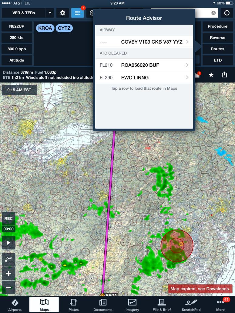
12 Routing FltPln.com ForeFlight 12


13 Routing FltPln.com 13
14 Weather - METAR METAR - Aviation Routine Weather Report Observed Weather Issues in U.S. every hour Covers airport & 5 miles around the airport SPECI Special METAR 14

15 Weather - TAF TAF Terminal Aerodrome Forecast Forecasted Weather Scheduled four (4) times daily 0000Z 0600Z 1200Z 1800Z Valid for 24 hours Basic Format Wind Visibility Weather Sky Condition 15
16 CYTZ METAR 16

17 CYTZ - TAF 17

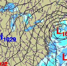
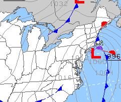
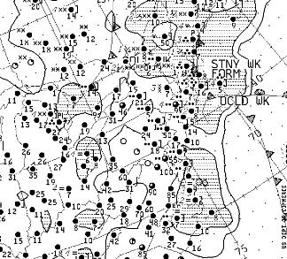
18 Weather Charts 18


19 More Weather Reports FltPln.com 19
20 Types of NOTAMS Class I Distributed by Telecommunication Class II Distributed any way other than Telecommunication International NOTAMS distributed to more than one country. FSS does NOT have access to ALL International NOTAMS Domestic Civil Primarily distributed in the US and sometimes available in Canada Any NOTAM that is not considered Military Military Any NOTAM that is part of the Military NOTAM system Primarily NOTAMS on Military Airports and Airspace 20
21 Types of NOTAMS Published FDC Flight Data Center NOTAMS Regulator in nature Includes TFRs and changes to IAPs Center Area NOTAMS that affect ARTCCs NOTAM (D)S including (U) and (O) (D) NOTAMS beyond the area of responsibility for the FSS being contacted (U) Unverified for airports where management has not confirmed the NOTAM Only allowed at airports where airport management has authorized it by Letter of Agreement (O) Other information which does not meet NOTAM criteria but may be beneficial to aircraft operations. NOTAM (L)S or LOCAL Only used in the military system Previously used in the civil system but now all of the civil L NOTAMS are D NOTAMS 21
22 NOTAMS - Where to find? FSS notams.faa.gov tfr.faa.gov Fltpln.com ForeFlight 22
23 NOTAMS 23


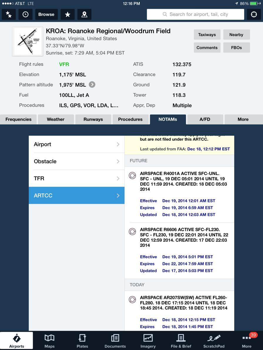
24 NOTAMS FltPln.com ForeFlight 24

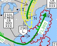
25 NOTAMS - Temporary Flight Restrictions (TFRs) Beware of what the route goes over or is near!!! ForeFlight 25


26 NOTAMS - Temporary Flight Restrictions (TFRs) tfr.faa.gov 26
 tfr.faa.")
27 NOTAMS - Temporary Flight Restrictions (TFRs) tfr.faa.gov 27
28 Crew Scheduling 14 CFR Requirements/ Restrictions FOM/ GOM Requirements/ Restrictions Length of day Circadian Rhythm Legal vs Safe 14 CFR Part 91 MassMutual FOM Flight Safety Foundation/ NBAA: Duty/ Rest Guidelines for Business Aviation (April 2014) 28

29 Keep Track of Options: Plan B, C, D! Alternate Airports Fuel Stops Customs Stops/ Overflight Permit Airport Delays fly.faa.gov 29

30
ADVISORY CIRCULAR ON CALCULATION OF DECLARED DISTANCES
 Page 1 of 6 1. PURPOSE This Advisory circular (AC) provides guidance to operators to calculated declared distances at aerodrome for safe use of runway and promulgation of aeronautical data to the aeronautical
EGWN AD 2.1 LOCATION INDICATOR AND NAME EGWN - HALTON EGWN AD AERODROME GEOGRAPHICAL AND ADMINISTRATIVE DATA. 3 5nm SE of Aylesbury
 UK MIL AIP AD 2 - EGWN - 1-1 04 AUG 05 EGWN AD 2.1 LOCATION INDICATOR AND NAME EGWN - EGWN AD 2.2 - AERODROME GEOGRAPHICAL AND ADMINISTRATIVE DATA 1 ARP Co-ordinates and site at AD: 2 Direction and distance
EGSL ANDREWSFIELD EGSL AD 2.1 AERODROME LOCATION INDICATOR AND NAME EGSL AD 2.2 AERODROME GEOGRAPHICAL AND ADMINISTRATIVE DATA
 UNITED KINGDOM AIP AD 2.EGSL-1 26 May 2016 EGSL ANDREWSFIELD EGSL AD 2.1 AERODROME LOCATION INDICATOR AND NAME EGSL ANDREWSFIELD EGSL AD 2.2 AERODROME GEOGRAPHICAL AND ADMINISTRATIVE DATA 1 ARP coordinates
IRELAND AERONAUTICAL INFORMATION SERVICE IRISH AVIATION AUTHORITY BALLYCASEY CROSS SHANNON CO. CLARE Tel Fax
 IRELAND AERONAUTICAL INFORMATION SERVICE IRISH AVIATION AUTHORITY BALLYCASEY CROSS SHANNON CO. CLARE Tel +353 61 703750 Fax +353 61 366245 DUBLIN AIRPORT (EIDW) RUNWAY 10/28 UPGRADE PHASE 1 AND PHASE 2
YOUR TAKEWING FLIGHT REVIEW Remember this is NOT a TEST. We want you to learn or improve on your abilities and Have Fun!
 YOUR TAKEWING FLIGHT REVIEW Remember this is NOT a TEST. We want you to learn or improve on your abilities and Have Fun! Schedule your appointment: Plan on a 2 1/2 to 31/2 hour session with your instructor.
AIRPORT BRIEFING. ICAO code: LENE-CIUDAD REAL LA CAMINERA Airport Elevation 2513 / 766m
 AIRPORT BRIEFING ICAO code: LENE-CIUDAD REAL LA CAMINERA Airport Elevation 2513 / 766m La Caminera is a private, restrictive and visual airport owned by the company SAGEMAR S.A. and located inside the
AD 2. AERODROMES VOAT AD 2.2 AERODROME GEOGRAPHICAL AND ADMINISTRATIVE DATA
 AD 2-1 AD 2. AERODROMES AD 2.1 AERODROME LOCATION INDICATOR AND NAME - AGATTI / DOMESTIC AD 2.2 AERODROME GEOGRAPHICAL AND ADMINISTRATIVE DATA 1 Aerodrome reference point coordinates and its site 2 Direction
 IFR 91.157 Must be instrument rated to fly special VFR at Night (civil twilight to civil twilight, sun 6 degrees below horizon) 91.159 Unless in a holding pattern of 2 minutes or less, VFR cruising altitude
AD 2. AERODROMES VAKS AD 2.2 AERODROME GEOGRAPHICAL AND ADMINISTRATIVE DATA
 AD 2-1 AD 2. AERODROMES AD 2.1 AERODROME LOCATION INDICATOR AND NAME - KESHOD / DOMESTIC AD 2.2 AERODROME GEOGRAPHICAL AND ADMINISTRATIVE DATA 1 Aerodrome reference point coordinates and its site 2 Direction
Flight Review Written Exam
 Flight Review Written Exam To help prepare, visit http://www.faa.gov/pilots/training/media/flight_review.pdf and complete as much as possible of that document and this exam prior to arriving for your appointment.
AD 2. AERODROMES VIBR AD 2.2 AERODROME GEOGRAPHICAL AND ADMINISTRATIVE DATA
 AD 2-1 AD 2. AERODROMES AD 2.1 AERODROME LOCATION INDICATOR AND NAME - KULLU MANALI / DOMESTIC AD 2.2 AERODROME GEOGRAPHICAL AND ADMINISTRATIVE DATA 1 Aerodrome reference point coordinates and its site
FACILITY REQUIREMENTS SUMMARY OF KEY ISSUES OVERVIEW
 FACILITY REQUIREMENTS SUMMARY OF KEY ISSUES OVERVIEW This summary is intended to provide a brief overview of the key issues associated with conformance to FAA standards at Methow Valley State Airport.
PREDANNACK AD LOCATION INDICATOR AND NAME PREDANNACK PREDANNACK AD AERODROME GEOGRAPHICAL AND ADMINISTRATIVE DATA. 2nm SE of Mullion.
 AD 2 - - 1-1 AD 2.1 - LOCATION INDICATOR AND NAME AD 2.2 - AERODROME GEOGRAPHICAL AND ADMINISTRATIVE DATA 1 ARP Co-ordinates and site at AD: 2 Direction and distance from City: 3 Elevation/Reference Temperature:
Aerodrome Geographical and Administration Data
 AIP New Zealand NZDN AD 2 - NZDN AD 2 NZDN AD 2. DUNEDIN NZDN DUNEDIN NZDN AD 2.2 Aerodrome Geographical and Administration Data 2 4 5 6 ARP coordinates and site at AD Direction and distance from (city)
TVSC CANOUAN/Canouan Is. (ST. VINCENT AND THE GRENADINES)
") AIP AD 2. AERODROMES AD 2.921 17 MAY 01 TVSC AD 2.1 AERODROME LOCATION INDICATOR AND NAME TVSC CANOUAN/Canouan Is. (ST. VINCENT AND THE GRENADINES) TVSC AD 2.2 AERODROME GEOGRAPHICAL AND ADMINISTRATIVE
AIP AD 2. AERODROMES AD 2.921 17 MAY 01 TVSC AD 2.1 AERODROME LOCATION INDICATOR AND NAME TVSC CANOUAN/Canouan Is. (ST. VINCENT AND THE GRENADINES) TVSC AD 2.2 AERODROME GEOGRAPHICAL AND ADMINISTRATIVE
CE 563 Airport Design
 CE 563 Airport Design Prevent aircraft collisions Prevent aircraft collisions with obstructions Expedite and maintain an orderly flow of air traffic Air traffic control system command center Herndon, VA
Diamond Star DA40 Pre-Solo Written Exam
 Diamond Star DA40 Pre-Solo Written Exam Name: Date: Answer the following questions in the space provided, using the POH, Aircraft Checklist, FARs, AIM, and A/FD. If referencing any of these documents,
Aerodrome Obstacle Survey Information Checks
 United Kingdom Overseas Territories Aviation Circular OTAC 139-20 Aerodrome Obstacle Survey Information Checks Issue 2.00 26 May 2017 Effective on issue GENERAL Overseas Territories Aviation Circulars
AD 2. AERODROMES VOPN AD 2.2 AERODROME GEOGRAPHICAL AND ADMINISTRATIVE DATA
 AD 2-1 AD 2. AERODROMES AD 2.1 AERODROME LOCATION INDICATOR AND NAME - SRI SATHYA SAI / DOMESTIC AD 2.2 AERODROME GEOGRAPHICAL AND ADMINISTRATIVE DATA 1 Aerodrome reference point coordinates and its site
LFKC / Calvi Sainte-Catherine / CLY
 This page is intended to draw commercial and private pilots attention to the aeronautical context and main threats related to an aerodrome. They have been identified in a collaborative way by the main
105 SKY KING TAXI-WAY - SPICEWOOD, TEXAS
 S P I C E W O O D A I R P O R T 8 8 R H A N G A R F O R L E A S E 105 SKY KING TAXI-WAY - SPICEWOOD, TEXAS Available for immediate lease 7,200 SF (90 x 80 ) Class A Aircraft Hangar W / Climate Controlled
AD 2. AERODROMES VEBI AD 2.2 AERODROME GEOGRAPHICAL AND ADMINISTRATIVE DATA
 AD 2-1 AD 2. AERODROMES AD 2.1 AERODROME LOCATION INDICATOR AND NAME - BARAPANI / DOMESTIC AD 2.2 AERODROME GEOGRAPHICAL AND ADMINISTRATIVE DATA 1 Aerodrome reference point coordinates and its site 2 Direction
Annecy Airport IFR briefing For indication only
 1 DISCLAIMER The pieces of information provided are published only for indication, and are not exhaustive. We make our best effort to keep them updated. They are a valuable complement for flight preparation
2) The maximum gross weight for your airplane is Ib. 3) The maximum takeoff weight for your airplane is Ib
 The maximum gross weight for your airplane is Ib. 3) The maximum takeoff weight for your airplane is Ib") 1) List the airspeeds and their definitions for your airplane Vso Vs1 Vr Vx Vy Vfe Va Vno Vne 2) The maximum gross weight for your airplane is Ib 3) The maximum takeoff weight for your airplane is Ib 4)
1) List the airspeeds and their definitions for your airplane Vso Vs1 Vr Vx Vy Vfe Va Vno Vne 2) The maximum gross weight for your airplane is Ib 3) The maximum takeoff weight for your airplane is Ib 4)
KTRK HIGH. Truckee Tahoe Airport Truckee, California, United States
 Diagram #1: Abatement Arrival Procedures All Aircraft Categories / All Runways p. 1 of 9 Diagram #2: Abatement Departure Procedures All Aircraft Categories / All Runways p. 2 of 9 NOISE ABATEMENT PROCEDURES
Annecy Airport IFR briefing For indication only
 1 DISCLAIMER The pieces of information provided are published only for indication, and are not exhaustive. We make our best effort to keep them updated. They are a valuable complement for flight preparation
INSTRUMENT RATING STUDENT RECORD
 INSTRUMENT RATING STUDENT RECORD CHECK-IN AND ORIENTATION REQUIRED BEFORE FIRST FLIGHT!! TSA Documentation: Must keep photocopies of ALL in student s folder for 5 years. Student Name: US Citizen: Unexpired
TVSB BEQUIA IS./J.F. Mitchell (ST. VINCENT AND THE GRENADINES)
") AIP AD 2. AERODROMES AD 2.911 TVSB AD 2.1 AERODROME LOCATION INDICATOR AND NAME TVSB BEQUIA IS./J.F. Mitchell (ST. VINCENT AND THE GRENADINES) TVSB AD 2.2 AERODROME GEOGRAPHICAL AND ADMINISTRATIVE DATA
AIP AD 2. AERODROMES AD 2.911 TVSB AD 2.1 AERODROME LOCATION INDICATOR AND NAME TVSB BEQUIA IS./J.F. Mitchell (ST. VINCENT AND THE GRENADINES) TVSB AD 2.2 AERODROME GEOGRAPHICAL AND ADMINISTRATIVE DATA
KPAO HIGH. Palo Alto Arpt Of Santa Clara Co Airport Palo Alto, California, United States Diagram #1: Noise Abatement Procedures All Runways
 NOISE ABATEMENT PROCEDURES by Whispertrack Diagram #1: Abatement Procedures All Runways p. 1 of 6 Diagram #2: Abatement Procedures All Runways p. 2 of 6 OVERVIEW Palo Alto (airport) is located within one-half
The Noise & Environmental office reviews airline schedules and night-time performance of the airlines operating at the Airport.
 OVERVIEW Addressing the impact of aircraft noise has been an ever present and high priority at since the Airport Authority purchased the Airport from Lockheed in 1978. To further compliance with the state
3) There have some basic terminology of a flight plan and it is the fuel calculations
 There have some basic terminology of a flight plan and it is the fuel calculations") QUESTION BANK FLIGHT PLANNING (CHAPTER 1) Introduction to Flight Planning 1) It is a duty of flight operation officer (FOO) to do a flight plan before the aircraft want to fly. a) i. Give the definition
QUESTION BANK FLIGHT PLANNING (CHAPTER 1) Introduction to Flight Planning 1) It is a duty of flight operation officer (FOO) to do a flight plan before the aircraft want to fly. a) i. Give the definition
ARP N W m. Rwy 21 Thr Elev N W. (GUND Elevation 172) 153 M. 853m x 27m.
 153 M. 853m x 27m.") 09 27 UK AIP (28 Jul 11) AD 2-EGPT-2-1 AERODROME CHART - ICAO ARP 562628N 0032226W AD ELEV 397FT PERTH/SCONE EGPT GUND (Geoid Undulation) = The height of the Geoid (MSL) above the Reference Elipsoid (WGS
09 27 UK AIP (28 Jul 11) AD 2-EGPT-2-1 AERODROME CHART - ICAO ARP 562628N 0032226W AD ELEV 397FT PERTH/SCONE EGPT GUND (Geoid Undulation) = The height of the Geoid (MSL) above the Reference Elipsoid (WGS
THE VILLAGES AVIATION CLUB. SAFETY BRIEF November 2016
 THE VILLAGES AVIATION CLUB SAFETY BRIEF November 2016 Welcome Back Snowbirds When are you going home? If you see a man wearing a hat like this, go over and say Welcome Home. You ll make his day. Sure,
Gstaad Airport Pilots Briefing
 Gstaad Airport Pilots Briefing General Gstaad-Airport (LSGK) is situated in a mountainous region near Gstaad / Saanen in Switzerland. As the approach into LSGK can be very challenging (e.g. mountains,
AD 2. AERODROMES. For the ICAO location indicators used for Canadian aerodromes, refer to the following publications:
 AIP CANADA (ICAO) PART 3 AERODROMES (AD) AD 2. AERODROMES AD 2.1 Aerodrome Location Indicator and Name For the ICAO location indicators used for Canadian aerodromes, refer to the following publications:
National Transportation Safety Board Aviation Accident Final Report
 National Transportation Safety Board Aviation Accident Final Report Location: POINT LAY, AK Accident Number: Date & Time: 10/08/1993, 1735 AKD Registration: N811E Aircraft: DOUGLAS C-54GDC Aircraft Damage:
Chippewa-Eau Claire Metropolitan Planning Area Long Range Transportation Plan
 1.2.7 2010 Eau Claire County Comprehensive Plan According to Eau Claire County s most recent comprehensive plan, the County will limit land use development adjacent to EAU in order to preserve the ability
Lopez Island Airport Master Plan Update. Public Meeting June 15, 2017
 Lopez Island Airport Master Plan Update Public Meeting June 15, 2017 Master Plan Update Team Reid Middleton/Everett, WA Shannon Kinsella, Project Manager Melania Haagsma, Project Engineer Mead & Hunt/Tulsa,
THE VILLAGES AVIATION CLUB. November 2014 SAFETY BRIEF
 THE VILLAGES AVIATION CLUB November 2014 SAFETY BRIEF IT WAS DARK, VERY DARK SO LETS GO FLYING SURE, YOU GET AN EXTRA HOURS SLEEP, BUT WHEN DO YOU GO FLYING? REVIEW OF NIGHT FLYING REGS AND TIPS Night
Teaching the National Airspace System. Soaring Safety Foundation FIRC Presentation
 Teaching the National Airspace System Soaring Safety Foundation FIRC Presentation US Airspace Training Aids http://www.airnav.com Details of any airport http://www.skyvector.com On-line copies of sectional
CHAPTER 1 INTRODUCTION AND BACKGROUND
 CHAPTER 1 INTRODUCTION AND BACKGROUND An Environmental Assessment (EA) evaluates the effects of a proposed Federal action on the surrounding environment and is prepared in compliance with the National
TVSU UNION ISLAND/Union Is. (ST. VINCENT AND THE GRENADINES)
") AIP AD 2.951 AD 2. AERODROMES TVSU AD 2.1 AERODROME LOCATION INDICATOR AND NAME TVSU UNION ISLAND/Union Is. (ST. VINCENT AND THE GRENADINES) TVSU AD 2.2 AERODROME GEOGRAPHICAL AND ADMINISTRATIVE DATA 1
AIP AD 2.951 AD 2. AERODROMES TVSU AD 2.1 AERODROME LOCATION INDICATOR AND NAME TVSU UNION ISLAND/Union Is. (ST. VINCENT AND THE GRENADINES) TVSU AD 2.2 AERODROME GEOGRAPHICAL AND ADMINISTRATIVE DATA 1
PRIVATE PILOT STUDENT RECORD
 PRIVATE PILOT STUDENT RECORD CHECK-IN AND ORIENTATION REQUIRED BEFORE FIRST FLIGHT!! TSA Documentation: Must keep photocopies of ALL in student s folder for 5 years. Student Name: US Citizen: Unexpired
KOAK HIGH. Metropolitan Oakland Intl Airport Oakland, California, United States
 NOISE ABATEMENT PROCEDURES by Whispertrack Diagram #1: North Field Abatement Procedures All Aircraft Categories / Runways: 10L, 10R, 28L, 28R & 33 p. 1 of 9 NOISE ABATEMENT PROCEDURES by Whispertrack Diagram
CHAPTER 5 SEPARATION METHODS AND MINIMA
 CHAPTER 5 SEPARATION METHODS AND MINIMA 5.1 Provision for the separation of controlled traffic 5.1.1 Vertical or horizontal separation shall be provided: a) between IFR flights in Class D and E airspaces
FAR and Military Requirements
 FAR and Military Requirements W. H. Mason Advanced Conceps from NASA TM-1998-207644 slide 1 2/19/03 FAR and MIL STD Requirements Gov t requirements dictate some of the design requirements interest is safety,
TERMINAL PROCEDURES PUBLICATION SYMBOLS
 TERMINAL PROCEDURES PUBLICATION SYMBOLS 54 AERONAUTICAL INFORMATION STANDARD TERMINAL ARRIVAL (STAR) CHARTS................. 55 DEPARTURE PROCEDURE (DP) CHARTS....................... 55 APPROACH LIGHTING
BAe-146 Next Generation Airtanker Frequently Asked Questions. Q. Why do you have to download on retardant at some airtanker bases?
 BAe-146 Next Generation Airtanker Frequently Asked Questions Q. Why do you have to download on retardant at some airtanker bases? Density Altitudes affect all aircraft. During the fire season, it is not
Navigation - Runways. Chap 2, Nolan
 Navigation - Runways Chap 2, Nolan 1 Runways Runways numbered to correspond to magnetic bearing Runway 27 has magnetic bearing 270 degrees Active Runway selected for headwind greater than 5 knots When
The Most Respected Name in Pilot Certification. IFR Flight Planning. Training Supplement. Revised
 The Most Respected Name in Pilot Certification IFR Flight Planning Training Supplement Revised 2014-12-23 800-255-2877 904-273-3018 Revised 2014-12-23 Copyright 2012 Airline Transport Professionals. No
St. Paul Downtown Airport (STP)
") Reliever Airports: NOISE ABATEMENT PLAN St. Paul Downtown Airport (STP) 1 INTRODUCTION The noise abatement plan for the St. Paul Downtown Airport (STP) was prepared in recognition of the need to make the
Reliever Airports: NOISE ABATEMENT PLAN St. Paul Downtown Airport (STP) 1 INTRODUCTION The noise abatement plan for the St. Paul Downtown Airport (STP) was prepared in recognition of the need to make the
FLYING IN THE WASHINGTON, DC. SFRA/FRZ Open Sky Aviation, LLC
 FLYING IN THE WASHINGTON, DC. SFRA/FRZ 2014 Open Sky Aviation, LLC SFRA What Is It? Pronounced sifra or S-F-R-A Defined by 14 CFR Part 93 Subpart V Washington, DC Metropolitan Area Special Flight Rules
Consideration will be given to other methods of compliance which may be presented to the Authority.
 Advisory Circular AC 139-9 Notification of aerodrome data and information Revision 2 27 April 2007 General Civil Aviation Authority advisory circulars (AC) contain information about standards, practices
IFR FLIGHT BRIEFING. This IFR flight briefing presentation has been made concise and simple in order to easily handle the IFR flight preparation.
 IFR FLIGHT BRIEFING 1. Introduction This IFR flight briefing presentation has been made concise and simple in order to easily handle the IFR flight preparation. As IVAO, in a simulated area, is different
USE OF RADAR IN THE APPROACH CONTROL SERVICE
 USE OF RADAR IN THE APPROACH CONTROL SERVICE 1. Introduction The indications presented on the ATS surveillance system named radar may be used to perform the aerodrome, approach and en-route control service:
RFC Dallas, Inc. AIRCRAFT QUESTIONNAIRE
 RFC Dallas, Inc. AIRCRAFT QUESTIONNAIRE Version 1.3 8/15/09 Name: Date: Aircraft: Cherokee 180 Model: PA-28-180 Registration Number: N4746L Answer the following questions by using the information contained
LATVIAN AIP DATA SET
 LATVIAN AIP DATA SET Interregional EUR/MID PANS AIM Workshop (Paris, France, 10-12 July 2018) Dr. Vadim Tumarkin Head of AIS Latvijas Gaisa Satiksme vadims.tumarkins@lgs.lv GENERAL PROVISION FOR DIGITAL
RNP In Daily Operations
 RNP In Daily Operations Article 2 Paul Malott WestJet It was a dark and stormy night in the mountainous terrain of Kelowna, British Columbia. Suddenly, the noise of a jet airplane on final pierced the
PRE-SOLO WRITTEN EXAM. Student Name:
 PRE-SOLO WRITTEN EXAM Student Name: Date: Instructor Name: INTRODUCTION As specified in FAR 61.87, you must demonstrate satisfactory knowledge of appropriate portions of FAR Parts 61 and 91 to an authorized
Gleim Private Pilot Syllabus Fifth Edition, 3rd Printing Updates March 2016
 Page of Gleim Private Pilot Syllabus Fifth Edition, rd Printing Updates March 0 NOTE: Text that should be deleted is displayed with a line through it. New text is shown with a blue background. If you see
Airport Obstruction Standards
 Airport Obstruction Standards Dr. Antonio Trani Department of Civil and Environmental Engineering Virginia Tech Outline of this Presentation Obstructions to navigation around airports Discussion of Federal
AD 2-OERY-1 7 JAN 16 OERY AD 2.1 AERODROME LOCATION INDICATOR AND NAME. OERY - RIYADH/ King Salman Air Base
 AD 2-OERY-1 OERY AD 2.1 AERODROME LOCATION INDICATOR AND NAME OERY - RIYADH/ King Salman Air Base OERY AD 2.2 AERODROME GEOGRAPHICAL AND ADMINISTRATIVE DATA 1 ARP coordinates and site at AD 244319N 0464329E/
KSMO HIGH. Santa Monica Muni Airport Santa Monica, California, United States
 Diagram #1: Airport Diagram with Monitors and Turbine Aircraft Hold Areas Aircraft Categories: A, B, C, D & E / Runways: 03 & 21 p. 1 of 7 NOISE ABATEMENT PROCEDURES by Whispertrack Diagram #2: Monitors
Teterboro Airport Overview
 Teterboro Airport Overview Teterboro Airport consists of two intersecting runways. Runway 6-24 is 6,013 ft long and 150 ft wide, and is equipped with High Intensity Runway Edge Lights (HIRL) and Runway
KPGD HIGH. Punta Gorda Airport Punta Gorda, Florida, United States. Diagram #1: KPGD Departures. NOISE ABATEMENT PROCEDURES by Whispertrack
 Diagram #1: Departures http://whispertrack.com/airports/ p. 1 of 6 Diagram #2: Arrivials http://whispertrack.com/airports/ p. 2 of 6 OVERVIEW Welcome to PGD. Abatement Procedures for all Aircraft. abatement
OJAI AD 2.3 JORDAN 01 AUG 2009
 AIP AD 2.1 JORDAN 01 AUG 2009 OJAI AD 2.1 AERODROME LOCATION INDICATOR AND NAME OJAI - Queen Alia International OJAI AD 2.2 AERODROME GEOGRAPHICAL AND ADMINISTRATIVE DATA 1 ARP coordinates and site at
Intercepted! (Or almost everything you wish you had known about Temporary Flight Restrictions!) Cliff Chetwin, Gold Seal/Master CFI; Lead FAAST Rep
 Cliff Chetwin, Gold Seal/Master CFI; Lead FAAST Rep") Intercepted! (Or almost everything you wish you had known about Temporary Flight Restrictions!) Cliff Chetwin, Gold Seal/Master CFI; Lead FAAST Rep How Lucky DO YOU FEEL? Dirty Harry Unauthorized TFR Participants
Intercepted! (Or almost everything you wish you had known about Temporary Flight Restrictions!) Cliff Chetwin, Gold Seal/Master CFI; Lead FAAST Rep How Lucky DO YOU FEEL? Dirty Harry Unauthorized TFR Participants
FUEL MANAGEMENT FOR COMMERCIAL TRANSPORT
 FUEL MANAGEMENT FOR COMMERCIAL TRANSPORT 1. Introduction An aeroplane shall carry a sufficient amount of usable fuel to complete the planned flight safely and to allow for deviation from the planned operation.
BOTTLANG AIRFIELD MANUAL
 Airway Manual Services & Flight Information Jeppesen GmbH BOTTLANG AIRFIELD MANUAL P.O. Box 1535 Tel.: +49 6102 5070 63235 Neu-Isenburg Fax: +49 6102 507547 GERMANY e-mail: fra-services@jeppesen.com Dear
LELYSTAD AIRPORT PILOT S INFORMATION
 LELYSTAD AIRPORT PILOT S INFORMATION This information bulletin contains a summary of the most relevant operational information for pilot s. Always check the AIP, the AIP SUP and NOTAM s for the latest
CESSNA CITATION IIB PW JT15D-4 INTRODUCTION. Runway Analysis provides the means to determine maximum allowable takeoff and landing weights based upon:
 CESSNA CITATION IIB PW JT15D-4 INTRODUCTION Runway Analysis provides the means to determine maximum allowable takeoff and landing weights based upon: Airport characteristics consisting of airport elevation,
EVTA AD 2.1 AERODROME LOCATION INDICATOR AND NAME EVTA AD 2.2 AERODROME GEOGRAPHICAL AND ADMINISTRATIVE DATA
 18 NOV 2010 AIP LATVIA EVTA AD 2-1 18 NOV 2010 Note: The following sections in this chapter are intentionally left blank: AD-2.11, AD-2.14, AD-2.15, AD-2.16, AD- 2.19, AD-2.20, AD-2.21, AD-2.23 EVTA AD
LFMN / Nice Côte-d Azur / NCE
 This page is intended to draw commercial and private pilots attention to the aeronautical context and main threats related to an aerodrome. They have been identified in a collaborative way by the main
DA Aircraft Specifications and Limitations
 DA40-180 Aircraft Specifications and Limitations Pilot s Name: _ Instructor: Date: Answer all of the following questions as completely and thoroughly as possible in preparation for your checkout flight.
Buttonville Flying Club
 Buttonville Flying Club 2833 16th Ave. Markham, ON L3R 0P8 Date: February 6, 2019 Subject: Mandatory Frequency Area at TORONTO Buttonville Municipal Airport (CYKZ) Procedures Executive Summary FOR VFR
DRAFT MASTER PLAN UPDATE
 DRAFT MASTER PLAN UPDATE CHAPTER VI: AIRPORT LAYOUT PLAN NARRATIVE DRAFT REPORT APRIL 2017 PREPARED BY: Table of Contents WESTCHESTER COUNTY AIRPORT 6 AIRPORT LAYOUT PLAN NARRATIVE REPORT... 6-1 6.1 AGIS
APPENDIX D MSP Airfield Simulation Analysis
 APPENDIX D MSP Airfield Simulation Analysis This page is left intentionally blank. MSP Airfield Simulation Analysis Technical Report Prepared by: HNTB November 2011 2020 Improvements Environmental Assessment/
OPERATIONS MANUAL TABLE OF CONTENTS
 1 of 8 CHAPTER 8: TABLE OF CONTENTS 8.1 8.2 INTRODUCTION ENROUTE NAVIGATION CHARTS 3 4 8.3 JEPPESEN INSTRUMENT APPROACH PROCEDURE (IAC) 5 8. 4 AMENDMENTS 6 8.4.1 General 6 8.4.1.1 NOTAM 6 8.4.2 Distribution
SITE ELEVATION AMSL...Ground Elevation in feet AMSL STRUCTURE HEIGHT...Height Above Ground Level OVERALL HEIGHT AMSL...Total Overall Height AMSL
 ******************************************** * Federal Airways & Airspace * * Summary Report * ******************************************** File: User Assigned File Name Latitude: NAD83 Coordinate Longitude:
GACE 2017 GROUND TEST NAME DATE SCORE CHECKED BY: DATE CFI# Circle the correct answer or write in where applicable. Test will be corrected to 100%
 GACE 2017 GROUND TEST NAME DATE SCORE CHECKED BY: DATE CFI# Circle the correct answer or write in where applicable. Test will be corrected to 100% 1. Which medical certificate are YOU required to possess?
IFR SEPARATION USING RADAR
 IFR SEPARATION USING RADAR 1. Introduction When flying IFR inside controlled airspace, air traffic controllers either providing a service to an aircraft under their control or to another controller s traffic,
DO NOT BEGIN THIS WORK UNTIL YOU HAVE COMPLETED ALL REQUIRED ASSIGNED READING AND EXERCISES.
 DO NOT BEGIN THIS WORK UNTIL YOU HAVE COMPLETED ALL REQUIRED ASSIGNED READING AND EXERCISES. Gardner Textbook Review Questions to prepare for Class #12 Answer these on notebook paper (or a text file) then
FAA Requirements for Engine-out Procedures and Obstacle Clearance
 FAA Requirements for Engine-out Procedures and Obstacle Clearance Presentation to: CAAC Engine-out Procedures Seminar Name: Chuck Friesenhahn Date: 11/29/2005 Flight Standards Senior Advisor, Advanced
Denver ARTCC Colorado Springs ATCT & TRACON STANDARD OPERATING PROCEDURES
 Denver ARTCC Colorado Springs ATCT & TRACON STANDARD OPERATING PROCEDURES OCTOBER 7, 2018 Definition of Airspace Colorado Springs Class C airspace is defined as show in Appendix 1. Definition of Positions
Burlington ATCT Standard Operating Procedures
 This air traffic control procedural document is provided for virtual air traffic control in the ZBW ARTCC of the VATSIM network only. It is not for real-world ATC use. These procedures are approved for
East Coast Aero Club Renter Quiz
 East Coast Aero Club Renter Quiz Marc Nathanson 8 November 2018 Date of completed check out: Name of Pilot: Instructor s Name: Aircraft Type Aircraft Aircraft N Aircraft Checkout Quiz. Thank you for choosing
PRE-SOLO KNOWLEDGE TEST Diamond Eclipse DA20-C1
 PRE-SOLO KNOWLEDGE TEST Diamond Eclipse DA20-C1 Name Date 1 List the airspeeds and their definitions for your airplane. Visual Indication on the Definition Indicator (color) V SO V S1 V R V X T/O V X CRUISE
RV10 Weight and Balance
 RV10 Weight and Balance Author: Greg Hale -------- ghale5224@aol.com Rev. Date: 4/15/2008 11:43:34 AM The RV10 weight and balance program was designed for the Van's RV10 aircraft. The program includes
NOISE ABATEMENT PROCEDURES
 1. Introduction NOISE ABATEMENT PROCEDURES Many airports today impose restrictions on aircraft movements. These include: Curfew time Maximum permitted noise levels Noise surcharges Engine run up restrictions
LELYSTAD AIRPORT PILOT S INFORMATION
 LELYSTAD AIRPORT PILOT S INFORMATION This information bulletin contains a summary of the most relevant operational information for pilot s. Always check the AIP, the AIP SUP and NOTAM s for the latest
Airport 20 to 1 Approach Surface
 Airport 20 to 1 Approach Surface 2014 South Carolina Aviation Association Annual Conference Jon Walker Eastern Flight Procedures Team Feb 13, 2014 20 to 1 Surface Area Criteria 14 CFR Part 77; AC 150/5300-13A;
Standard Operational Procedures
 Standard Operational Procedures Aerodrome Praha Ruzyně VERSION 4.0 CHANGES AND UPDATES Effective Version Change - 3.8 Intentionally left blank. 09 JUN 11 3.9 General text revision. New design issued. 15
AERODROME LIGHTING SYSTEM
 AERODROME LIGHTING SYSTEM 1. Introduction This chapter will show the wide variety of approach lighting systems before the runway threshold and systems present on runways. 2. Runway approach ramps 2.1.
COMPANY POLICY Flight Safety & Operating Regulations
 1. FLIGHT PREPARATION a) Weather Briefing i) all pilots shall conduct a weather briefing before each flight to ensure they are aware of the current and forecast weather affecting the training area or route
Falcon 2000S & Challenger 350 Analysis
 Falcon 2000S & Challenger 350 Analysis Aviation's Most Real World Operating Cost Application. Annual & Hourly Cost Detail Dassault Falcon 2000S Min Crew / Max Passengers 2 / 10 Seats Full Range (NM / SM)
KBLI MEDIUM. Bellingham Intl Airport Bellingham, Washington, United States. Diagram #1: All Runways. NOISE ABATEMENT PROCEDURES by Whispertrack
 Diagram #1: p. 1 of 5 Diagram #2: p. 2 of 5 OVERVIEW Bellingham International Airport (BLI) is a full service commercial airport located in Whatcom County, approximately 3 miles N.W. of the city limits
GENERAL REVIEW & PREFLIGHT TEST
 GENERAL REVIEW & PREFLIGHT TEST GUIDE TO MARKING The following logical sequence of steps is provided to assist instructors in the marking process when conducting preflight evaluations for Private and Commercial
Billy Bishop Toronto City Airport; Porter Airlines Proposal Review; Interim Results/Findings, Airbiz, 26 June 2013
 Billy Bishop Toronto City Airport - Outstanding Questions for Transport Canada EXECUTIVE SUMMARY Transport Action has reviewed the reports published by Airbiz and LPS Avia Consulting and found that they
CHAPTER 3 PREFLIGHT ACTION TABLE OF CONTENTS
 CHAPTER 3 PREFLIGHT ACTION TABLE OF CONTENTS Cessna 172 Flight Standards Manual GENERAL...2 Preflight Action Philosophy...2 Flight Crew Preflight Procedures...2 Blank TOLD Card (both sides)...3 Blank Flight/Weather
Pre-solo Written Exam
 Pre-solo Written Exam Name: Date: Airplane Make/Model: Answer the following questions in the space provided, using the FARs, AIM, AFD, and POH. If you reference one of these sources for an answer, be sure