OSAGE PRAIRIE TRAIL PLANS SKIATOOK TO PAWHUSKA
|
|
|
- Jessie Grant
- 5 years ago
- Views:
Transcription


1 OSAGE PRAIRIE TRAIL PLANS SKIATOOK TO PAWHUSKA U.S. Department of Transportation BUILD Transportation Discretionary Grant Program FY 2018 DUNS: Rural Planning Grant Application Submitted by: The Osage Nation Project Link
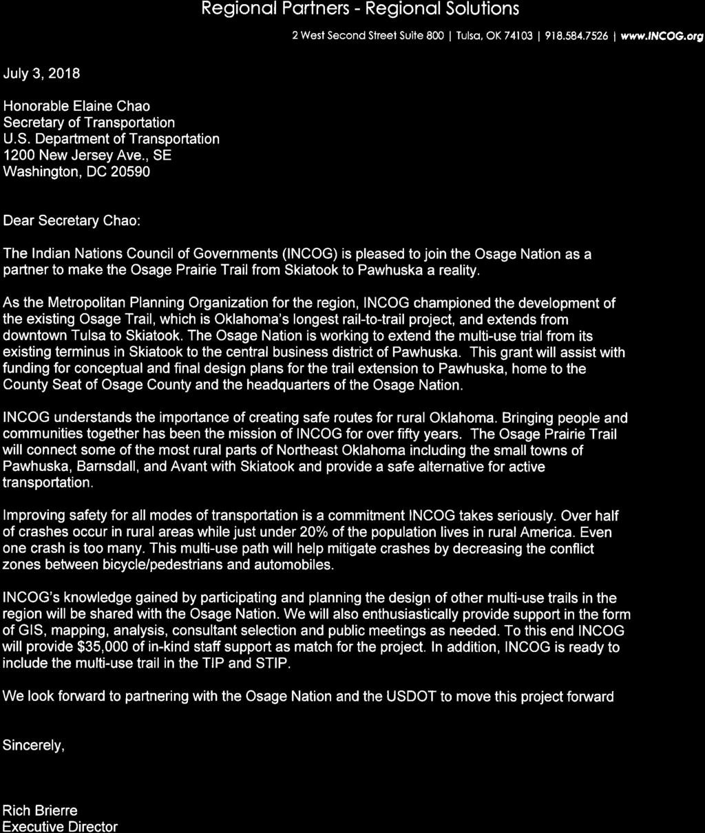
2 Project Name Rural Planning Grant Application Information Osage Prairie Trail Plans - Skiatook to Pawhuska Lead Applicant Contact Information Project Type Project Description Osage Nation Mr. Christopher Standing Bear Grant Administrator Osage Nation clstandingbear@osagenation-nsn.gov Rural Planning Grant The Osage Nation is seeking funding for a planning project that will help complete a trail corridor plan that specifies the location, ownership of land, feasibility, conduit feasibility for fiber connectivity and provide renderings for a multi-use Osage Prairie Trail. The trail will connect rural communities located within the Osage Nation and Osage County to several rural town centers. A safe alternative route for pedestrians and people on bikes to get from residential subdivisions to the town centers is a service gap that currently exists in Osage County. Project Cost $1,000,000 BUILD 2018 Funds Requested $865,000 Local Match Source(s) & Amounts Osage Nation: $100,000 INCOG: $35,000 NEPA Status Project Schedule Project Benefits The planning process for the multi-use trail will inform subsequent NEPA reviews, approvals and permits needed for construction. Planning project will be completed in 22 months after grant award. Plans for a multi-use trail will assist the Osage Nation with future construction of the trail, which will create a complete transportation network to include safe options for all mode users. It will encourage active transportation and fitness, which will bring health improvement outcomes, and favor economic growth by supporting bicycle and ecotourism. The project will also consider planning for buried fiber optic cables for broadband and other innovative transportation safety features as well as conduit for future uses. Benefit-Cost Analysis Results 7% discount rate 0.98; 3% discount rate: 1.20 Innovative Elements Planning for the implementation of below ground fiber optics for broadband, signal implementation for MUTCD approved Hawk Beacons or Rapid Flash Beacons at trail crossings and other innovative transportation safety features. The Osage Nation would also like to plan for additional conduit for future uses, to install at the same time as the fiber optic conduit. 2 Osage Nation OKLAHOMA
3
4 Table of Contents 1 Project Description Challenge History Previously Completed Components... 2 Project Location Geographic Description of the Project Project Location and Connections to Existing Transportation Infrastructure... 3 Grant Funds, Sources and Uses of Project Funds Project Cost Non-federal Funds Budget... 4 Merit Criteria Safety State of Good Repair Economic Competitiveness Quality of Life Environmental Protection Innovation Partnership... 5 Project Readiness Project Schedule Required Approvals... 6 Benefits Cost Analysis Appendix Letters of Support 4 Osage Nation OKLAHOMA


5 1 Project Description The Osage Nation is seeking funding for a planning project that will help complete a trail corridor plan that specifies the location, ownership of land, feasibility, conduit feasibility for fiber connectivity and provide renderings for a multi-use Osage Prairie Trail. The trail will connect rural communities located within the Osage Nation and Osage County to several rural town centers. A safe alternative route for pedestrians and people on bikes to get from residential subdivisions to the town centers is a service gap that currently exists in Osage County. Plans for this trail is one step closer to filling the gap. 1.1 Challenge The transportation challenge this project will address is the lack of safe alternative transportation connections for rural residents to the town centers within the Osage Nation. The tribal members and the rural county residents do not have any viable active transportation options. In rural America, services such as grocery stores, banks, medical clinics, schools and jobs are located within a small central area surrounded by a low-density population. The same goes for Osage County; the cities of Pawhuska (headquarters of the Osage Nation), Barnsdall, Avant and Skiatook are often the only locations for vital services within the southeast section of the county. A network of multi-use trails would provide safe access to these key destinations and limits users exposure to fast moving vehicles. A complete transportation network includes facilities that support riding a bicycle and walking in addition to roads for automobile use. Figure 1. Shared Use Path, River Parks, Tulsa, OK Figure 2. Sidepath on Peoria Avenue, Tulsa, OK Osage Nation OKLAHOMA 5

6 1.2 History Osage Nation Like many American Indian tribes, the Osage moved great distances over centuries. They originated from the plains and east of the Mississippi River before ultimately returning to America s midlands by the time Europeans came to the continent. In the treaties forced by the federal government in 1818 and 1825, the Osages gave up their Indian Territory holdings for land in southern Kansas. After the Civil War, homesteaders wanted the fertile farmland the Osage Nation held, and so the Osage were forced to sell their Kansas lands in 1870 to the government and bought nearly 1.5 million acres west of the Cherokee Nation in what was then known as Indian Territory and set up Pawhuska as the tribal headquarters. When the Dawes Act passed, the Five Civilized Tribes and the Osage Nation submitted to an allotment plan in which parcels were allotted to individual tribal members. Today, Osage County is the largest county in Oklahoma with an area of 2,251 square miles and a rural population of 47,887. Focusing on the main census tracts that encompass the future Osage Prairie Trail, there are 15,024 residents and 632 jobs within 388 sq. miles. This area is home to the Pioneer Woman s Mercantile, ranches and the Nature Conservancy s Tallgrass Prairie Preserve, a significant bison reserve that is a focus of ecotourism. The Osage Nation is expending $1.5 million of federal Reservation Roads Map 1. Osage Ancestral Territory Source: money on a new Eco Park which borders the planned Osage Trail at Pawhuska s eastern edge. Railroad The proposed location of the multi-use trail will follow the alignment of the old Midland Valley Railroad which was sometimes referred to as the Arkansas River Route. The railroad was first built in 1903 before Oklahoma became a state, to transport coal in western Arkansas and eastern Oklahoma to Indian Territory. Eventually the line extended all the way to Muskogee, Tulsa and into Arkansas City, Kansas. For six decades, this railroad served as transportation for oil, cattle and passengers before service ended and the rail right-of-way (ROW) succumbed to nature. 6 Osage Nation OKLAHOMA


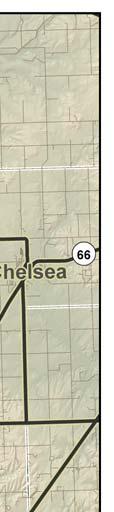
7 1.3 Previously Completed Components The previously completed section of Osage Prairie Trail is from Oklahoma State University-Tulsa in downtown Tulsa to just north of Skiatook. Approximately 16.3 miles of the trail is through a mostly urbanized region and does not benefit Pawhuska nor the rural communities between Pawhuska and Skiatook. The existing trail is an ADA (Americans with Disabilities Act) compliant trail, 10 in width, hard surface and constructed on the old railroad ballast. The constructed trail accommodates horses, bicycles and pedestrians comfortably in this low-density area. Figure 3. Osage Prairie Trail Sign, Skiatook, OK. Figure 4. Osage Prairie Trail Terminus, Skiatook, OK. Figure 5. Wayfinding Sign to Library, Skiatook, OK. Figure 6. Crushed Gravel Path from Osage Prairie Trail to Library, Skiatook, OK. Osage Nation OKLAHOMA 7

8 Highlights / Purpose of the Project Multi-use trails will provide facility for active transportation (bicycle, pedestrian) in a safe environment. Ecotourism project to stimulate rural and tribal economy. Improves health and well-being of the community and residents. Improves cultural respect, strengthens ties and sustenance of the community. Impacts land and wildlife in the most sustainable way to enjoy for the long run. Recreational, transportation, environmental, health, economic, social-cultural, and educational benefits are not always entirely quantifiable but the history of trails in America suggests that these benefits are nearly endless. Figure 7. Osage Prairie Trail Conceptual Plan, covering from Tulsa to Skiatook, From the conceptual project to realize the benefits for the long-run in the future: Conduct a detailed survey for alignment, design and engineering plans for the multi-use trail. Conduct legal research to assess any issues in the rail abandonment section and Land Legacy s rail-banked part of the trail. Provide renderings and suggested crossings of the stream at three locations for the most economical way to connect. 8 Osage Nation OKLAHOMA


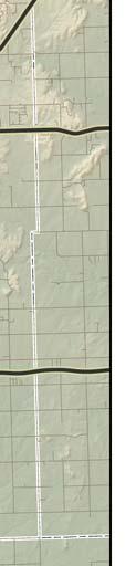
9 2 Project Location 2.1 Geographic Description of the Project The following map shows the proposed trail extension, which will connect Pawhuska to Tulsa and the rural towns and cities in between. Map 2. Osage Nation OKLAHOMA 9


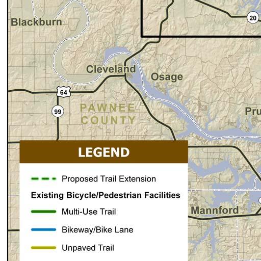
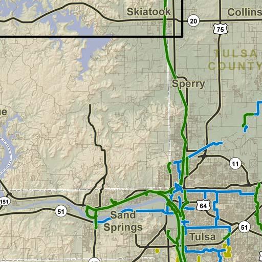
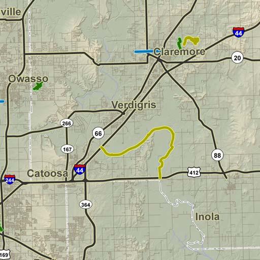

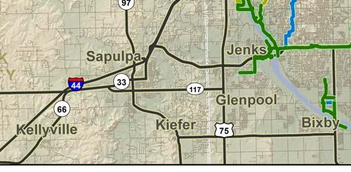
10 2 Project Location 2.2 Project Location and Connections to Existing Transportation Infrastructure The following map shows the Project Area, and how it would connect to the existing bicycle and pedestrian facilities in the Tulsa Region. Map Osage Nation OKLAHOMA
11 3 Grant Funds, Sources and Uses of Project Funds 3.1 Project Cost Source of Funds Amount BUILD Grant 2018 $865, Osage Nation $100, Indian Nations Council of Governments (INCOG) $35, TOTAL $1,000, Table Non-federal Funds Entity and Form of Support Cash In-Kind TOTAL Osage Nation. Staff will provide support for legal research, history, design concept, integrating into the Eco Park $50, $50, $100, INCOG. Staff will provide support for GIS, mapping, analysis, public meetings as needed, consultant selection - $35, $35, TOTAL $50, $85, $135, Table 2. Osage Nation OKLAHOMA 11
12 3 Grant Funds, Sources and Uses of Project Funds 3.3 Budget Major Activity Non-Federal* BUILD Other Federal TOTAL % of Total Phase I Planning Conception & Alignment Survey & Environment Documentation $32, $100, $132, % $10, $75, $85, % Legal Research $75, $100, $175, % Phase II Planning Final Design $17, $580, $597, % Communications Engineer Fiber Optic Plans - $10, $10, % TOTAL $135, $865, $1,000, % *Non-federal support includes $35,000 in-kind support from INCOG; $50,000 in-kind and $50,000 cash support from Osage Nation. Table Osage Nation OKLAHOMA


13 4 Merit Criteria 4.1 Safety Rural areas make up 81% of the United States and are home to only 19% of the nation s population 1, however, 49% of all traffic fatalities occur on rural roads 2. Nationwide, pedestrians and bicyclists represent 12% of trips made, but disproportionately make up 17% of all roadway fatalities 3. In Osage County, from , there were 855 crashes within proximity of the future Osage Prairie Trail. Of the 855 crashes, 20 were fatalities and 171 were injuries; the injury crashes include 7 bicycles and 6 pedestrian crashes 4. Current transportation options in this rural area consist mostly of two-lane roads, some with shoulders that have rumble strips (not conducive for bikes) and many others with no shoulders. On the roads that have shoulders, the rumble strips are placed in such a way that a person on a bike must either ride a bicycle near the edge of the road where debris collects or next to the white line of the road close to cars. None of the roads have sidewalks or sidepaths. The posted speed limit on these rural roads is between 45 mph and 65 mph. Due to these factors, the roads are unsuitable for safe active transportation options. Crash data and current conditions enforce the reason why the Osage Nation needs alternative safe transportation to improve the resiliency and safety of the population. Figure 8. Two-lane rural road with no shoulders, Osage County, OK. Figure 9. Unsuitable conditions for bicycles and pedestrians, Osage County, OK. 1 Federal Highway Administration, Small Town & Rural Multi-modal Networks, (2016). 2 U.S. Department of Transportation, Notice of Funding Opportunity for the Department of Transportation s National Infrastructure Investments Under the Consolidated Appropriations Act, (2018). 3 League of American Bicyclists, Member Newsletter, Summer Oklahoma State Department of Transportation, SAFE-T Collision Database, Collision Table; generated by Chase Phillips; (July 2018). Osage Nation OKLAHOMA 13

14 A plan for a multi-use trail will assist the Osage Nation with construction of the trail, which will create a complete transportation network to include safe options for vehicles, pedestrians and people on bikes. By definition a multi-use trail fully separates users from vehicles and is located along a separate alignment from the street s or highway s ROW. Map 2 shows the alignment of the trail, which follows the old Midland Valley Railroad line generally adjacent to the alignment of State Highways (SH-11 and SH-99). This is the safest form of a bicycle/pedestrian facility as the exposure to fast traveling vehicles is greatly reduced. There are two factors when quantifying harm done to a bicyclist or pedestrian by a motor vehicle, a convergence point and speed. In order to quantifiably decrease fatalities and injuries, these two factors need to be reduced. The current conflict zones for active transportation users from Skiatook to Pawhuska is 35 miles. With the implementation of a multi-use trail, this nearly eliminates all vehicular conflict to a minimal few feet of shared roadway that are required to cross a 2-lane highway. The three remaining conflict zones can be mitigated by using the Manual on Uniform Traffic Control Devices (MUTCD) approved Hawk Beacons in tandem with signage and crosswalk reflective paint. In addition, rumble strips can be used as a slowing mechanism for vehicles. Also, by cutting back vegetation at these crossings, Figure 10. Hawk Beacon Crossing at Hwy 20 & Osage Prairie Trail, Skiatook, OK. motorists have an increased visibility of trail users and can decrease their speed accordingly. Another safety aspect of creating a multi-use trail is the positive correlation that built bicycle and pedestrian infrastructure will encourage more active transportation. From 2007 to 2013 the Federal Highway Administration (FHWA) conducted a study of four communities and researched the effects an increase of bicycle/pedestrian infrastructure had on the population. The highlights of the study show that combined, walking mode share increased by 15.8%, bicycle mode share increased by 44% and 85.1 vehicle miles traveled (VMT) were averted by nonmotorized trips 5. The more VMTs are averted, the less motorized vehicles on the road which in turn decreases the overall crash rate. This project has the potential to be a pilot for similar circumstances in all rural and tribal regions, with the possibility for increased use along with safety and positive health outcomes. 5 Federal Highway Administration, Nonmotorized Transportation Pilot Program, Continued Progress in Developing Walking and Bicycling Networks, (2014). 14 Osage Nation OKLAHOMA


15 4.2 State of Good Repair A total of 217 acres of the old Midland Valley Railroad ROW has been acquired by Land Legacy, a nonprofit conservation organization whose mission is to conserve, enhance and restore urban and rural lands. Land Legacy works with farmers and ranchers to acquire conservation easements through donation or purchase to preserve open spaces while still allowing for agricultural production. All conservation easements are voluntary yet legally binding. Land Legacy has preserved the Midland Valley ROW for the specific purpose of connecting the Osage Prairie Trail from Skiatook to Pawhuska. Osage Trail 35 Linear Miles, Osage & Tulsa Co., OK Barnsdall Legend Cities Unfinished Osage Trail Easement Area Completed Portion of Osage Trail Avant County Line Highway 99 ± Skiatook 0 12,500 25,000 Feet Sperry Highway 99 Turley Tulsa Map 4. Owned rail ROW by Land Legacy. Source:Land Legacy Osage Nation OKLAHOMA 15


 by three different jurisdictions, City of Tulsa, Tulsa County and City of Skiatook.")
16 In addition to the ROW already owned by Land Legacy, the Osage Nation has already purchased 4.77 acres of the abandoned rail line just outside of Pawhuska. Another state of good repair fact is the future path used to be a functioning railroad for six decades, which means there will be less excavation through the land as the railroad company completed this when it was built. Figure 11. Railroad Right-of-Way near Barnsdall, OK. Overall the lifecycle cost of a path is less than that of a road. In comparison to rural road projects, which can cost between $2 million to $3 million per mile to construct6, a multiuse paved path s average cost is $481,140 per mile7. For maintenance of both types of facilities, the difference in cost is similar. The completed portion of the Osage Prairie Trail is cooperatively maintained (capital and financial) by three different jurisdictions, City of Tulsa, Tulsa County and City of Skiatook. Part of the planning process is to communicate with local jurisdictions and assign responsibility of maintenance for the trail once constructed. Figure 12. Osage Prairie Trail Terminus in north Skiatook, OK. The foreground shows the old railroad bed is still in good condition. Figure 13. Former railroad bridge over Bird Creek, Avant, OK. American Road & Transportation Builders Association, How much does it cost to build a mile of road? artba.org/about/faq/. 7 University of North Carolina Hwy Safety Research Center, Costs for Pedestrian and Bicyclist Infrastructure and Improvements Osage Nation OKLAHOMA
17 4.3 Economic Competitiveness Census tracts that include the current and future Osage Prairie Trail show the average percentage of total housing units without a vehicle is 4.8% 8. This population is the most vulnerable as they would be the ones most likely to walk or ride a bicycle on the two-lane roads to access jobs, doctor appointments and grocery stores. Also, rural households earn 32% less than their urban counterparts.in Osage County, the per capita income is $23,416, this is 15% less than the Tulsa MSA per capita income of $27,621 and 21.5% less than the national average of $28,829. In Osage County, the average annual cost a household spends on auto and transportation in the three Osage County census tracts this trail will go through is $10, Providing safe alternative access to business districts benefits the households in Osage County that do not own a car and/or are lowincome households. The Osage Nation would like to take the opportunity to use this planning grant to help their economy by supporting bicycle and ecotourism, a growing industry in the United States 10. According to the Outdoor Recreation Economy, bicycle tourists spend $83 billion on trip-related sales and generate $97 billion in retail spending per year. This spending contributes to the creation of 848,000 jobs in the United States. A 2012 economic case study of Missouri s Katy Trail (a 237 mile trail that traverses rural Missouri) reports that of 400,000 visitors, 1 in 5 stopped in a small town on their bicycle trip, which contributed $8 million to the local economy of rural Missouri. These eco-tourists also supported 367 jobs 11. The Osage Nation has reclaimed acres of the original Midland Valley depot property in Pawhuska, and purchased a historic 4-story bank building directly across the street from the Pioneer Woman s Mercantile and restaurant. The reclaimed depot property, the terminus of the planned Osage Trail, extends to within a few hundred feet of that bank building, and represents outstanding development potential along the south edge of Pawhuska s Main Street, where thousands of new visitors travel and shop. The property lies within the Pawhuska city limits and is in close proximity to the Pioneer Woman s Mercantile. The Pioneer Woman is a Food Network 8 U.S. Census Bureau, American Community Survey, 5- year estimate, Table B25044; generated by Barbara Gibson; using American FactFinder; (June 2018). 9 Experian Marketing Solutions, Inc., Consumer Expenditure Automotive Transportation Detail Summary, generated by Barbara Gibson; using DemographicsNow; (June 2018). 10 Adventure Cycling Association, Economic Impact James Pona Associates, Pragmatic Research, Inc., Synergy Group, Katy Trail Economic Impact Report: Visitors and MGM2 Economic Impact Analysis. Report_Final.pdf. (July 30, 2012). Osage Nation OKLAHOMA 17


18 celebrity and food blogger who has followers all over the world. Her mercantile attracts up to 15,000 visitors a day and has helped put life back into downtown Pawhuska. The Osage Nation would like to take advantage of the economic drive the Pioneer Woman has created by routing the Osage Prairie Trail to the old train depot, which is near The Mercantile and where tourists on bicycles can stop and enjoy a refreshment and purchase items from local stores. The Osage Nation also owns a 77-acre tract adjoining the planned Osage Trail, with a 27-acre Eco Park at the ground-breaking stage. These tracts lie just east of the 31-acre Midland Valley depot property. In addition, the proximity of Pawhuska to the Nature Conservancy s Tallgrass Prairie Preserve complements those looking for an extra adventure. The Tallgrass Prairie Preserve is the largest tallgrass prairie in the United States and is home to 2,500 free-ranging bison. The south entrance of the park is just north of Pawhuska. Figure 14. Line outside the Pioneer Woman s Mercantile, Pawhuska, OK. In 2017 there were a total of 21,200 visitors to the preserve. These visitors could use the Osage Prairie Trail as a means to safely ride a bicycle to the communities of Barnsdall, Avant and all the way to Tulsa, spending money in towns and cities along the way. Figure 15 Gateway to the Tallgrass Prairie Preserve, Pawhuska, OK. 18 Osage Nation OKLAHOMA

19 Map 5. Source:Bird Creek Farms Map 6. Source:Tallgrass Prairie Preserve Another economic benefit of a multi-use path is that research shows the addition of bicycle infrastructure increases property values. The 2016 Alliance for Biking and Walking report analyzed recent U.S. Complete Streets projects, and their findings show transportation corridors that changed from car-centric to multimodal have seen an increase in property value and increased investment from the private sector 12. When small town America property values have seen a decline over the years and town centers have emptied out, the potential for increased investment to add life back into downtown and create a safe transportation corridor for bicycles and pedestrians is a win-win situation. 12 Alliance for Biking & Walking, Bicycling & Walking in the United States: Benchmarking Report. org/content/dam/aarp/livable-communities/documents-2016/2016-walkingbicyclingbenchmarkingreport.pdf. (2016). Osage Nation OKLAHOMA 19

20 4.4 Quality of Life An added benefit of having a plan to implement a multi-use trail for the rural communities of Pawhuska, Barnsdall, Avant and Skiatook is the increased availability for using the trail for fitness. Health statistics from the Oklahoma State Department of Health show a high level of obesity among adults, and diseases associated with inactivity and obesity such as diabetes and heart disease are leading causes of death. In Osage County, a person who is obese has $2,741 higher medical expenses than a person who is not obese 13. Research also shows that increased access to a multi-use trail increases physical activity, which increases the health of a community. 30 minutes a day of moderate exercise reduces the chances of diabetes, high blood pressure and increases overall wellness 14. As previously mentioned, long-term quality of life benefits of this project for the Osage Nation are safer connectivity to central business districts in Pawhuska, Barnsdall, Avant and Skiatook, improved public health, decrease of bicycle and pedestrian crashes and a decrease in overall crashes due to a decrease in VMT. An additional quality of life benefit is the Osage Nation s intention to use this opportunity to include planning for buried fiber optic cables for broadband. To decrease the disparity of educational attainment and wealth between rural and urban populations, the implementation of broadband is necessary. Broadband access increases annual median business revenue by $300,000, students save up to $600 annually by using material from the internet instead of purchasing hard copies, 79% of Americans search for jobs online and home values increase by 3.1% 15. Figure 16. Downtown Pawhuska, OK. 13 Oklahoma State Department of Health, Health on the Horizon: Osage County. (Spring 2014). 14 Walljasper, Jay, 10 Ways Bicycle Friendly Streets are Good for People Who Don t Ride Bikes. AARP Livable Communities, (September 2016) Bates, Katherine. Leveraging Federal Opportunities to Increase Rural Broadband Access. Keynote Speaker at National Association of Regional Councils, Orlando, FL, June 4, Osage Nation OKLAHOMA


21 4.5 Environmental Protection The planning project for the Osage Prairie Trail will consider storm water runoff for the portions of the trail that will be near houses. For example, the plan will study the existing culverts that run underneath the abandoned railroad alongside private property. Also, steps will be built into the plan to mitigate any adverse impacts at creek crossings. In the long-term, a multi-use trail for the rural communities of Osage County will add a low energy form of transportation to the existing network of roads. This can be quantified by evaluating the American Community Survey s data collection on mode share. If the mode share of bicycle and walking increases (as a percentage of the total population), then energy consumption of oil and gas has decreased because the mode share for automobiles has decreased. The current percentage of mode share in Osage County for the census tracts that follow the old Midland Valley Railroad line is as follows: automobile 98%, walking- 1.9%, bicycle-.01%. Figure 17. The Osage Nation s natural landscapes, Avant, OK. Figure 18. Former railroad bridge over Bird Creek, Avant, OK. 4.6 Innovation Planning for the implementation of below ground fiber optics for broadband was already mentioned in the Quality of Life section above. Beyond broadband, fiber optics can be used for a variety of other innovative uses such as signal implementation for MUTCD approved Hawk Beacons or Rapid Flash Beacons at trail crossings. In addition, the Osage Nation would like to plan for extra conduit for future uses. It would represent great savings to install the extra conduit while at the same time as the fiber optic conduit rather than deciding to install additional conduit at a later date. Osage Nation OKLAHOMA 21
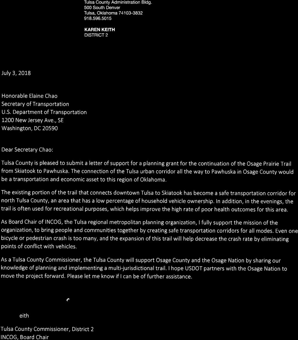
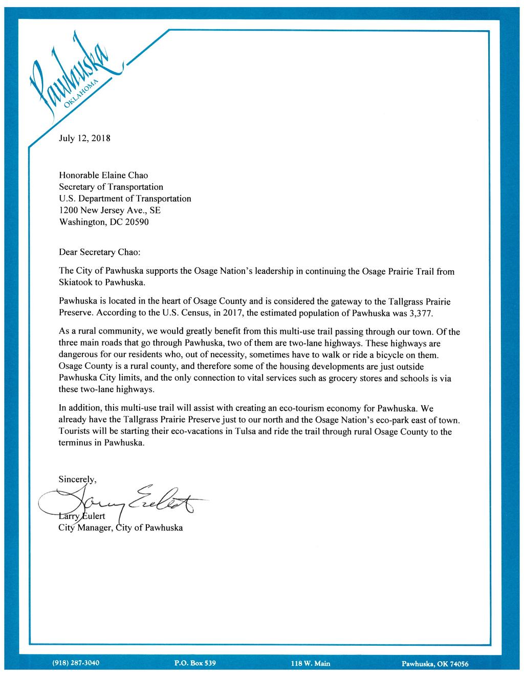
22 An innovative safety feature that can be included in the plans are GPS mile markers. The mile markers will increase response time in the event of an incident along the 32.6 miles of planned trail. For improved project delivery date, the Request for Proposal (RFP) will request the project be designed in Civil 3D for improved accuracy and more accurate construction bid documents. The RFP will also request that a LiDAR system be used when surveying the Midland Valley ROW. LiDAR stands for Light Detection and Ranging and is a remote sensing method that uses light in the form of a pulsed laser to measure distances. A LiDAR system reduces the overall project delivery time by 2-3 months. In addition, due to the nature of this project, there wouldn t be extraordinary permitting or approval needs as the project would qualify for a nationwide 404 permit and environmental categorical exclusion (Cat Ex). 4.7 Partnership Entity Osage Nation Form of Support Support for legal research, history, design concept, integrating into the Eco Park. INCOG Support for GIS, mapping, analysis, public meetings as needed, consultant selection. Osage County City of Pawhuska City of Barnsdall Town of Avant Land Legacy Knowledge of land records, ROW. Assist with public meetings, citizen participation and notification. Knowledge of ROW from Skiatook to Barnsdall. Tulsa County Provide support for planning for a multi-jurisdictional trail and knowledge of maintenance. Table Osage Nation OKLAHOMA
23 5 Project Readiness Once awarded, the tribe will reach out to INCOG, the Metropolitan Planning Organization that the Osage Nation is a member of, as evidenced by their attached support letter, to include the multi-use trail in the Transportation Improvement Program (TIP), State Transportation Improvement Program (STIP) and the Tribal Transportation Plan (TTP). Once this is complete and when construction funds become available, the tribe will be ready to let the project. 5.1 Project Schedule Entity Form of Support Deliverables Month INCOG Osage Nation Osage Nation Add Osage Prairie Trail Plans Project in the TIP and STIP. Add Osage Prairie Trail Plans Project in the TTP Release Request for Design Proposal. - Month Month 2-3 Develop scope of work and advertise RFP, present recommendations to Osage Nation Congress. Month 3 Osage Nation Award Trail Design Contract. - Month 5 Design Consultant Design Consultant Design Consultant Prepare engineering designs for review. Prepare engineering designs for review, conduct community meeting. Prepare engineering designs for review. 30% Plans Completion Month 13 60% Plans Completion Month % Plans Completion Month Design Consultant Schedule Completion. 100% Plans Completion Month Table 5. Osage Nation OKLAHOMA 23


24 5.2 Required Approvals The planning process for the multi-use trail will inform any NEPA reviews, approvals and permits needed for construction. 6 Benefit Cost Analysis The Benefit Cost Ratio for the planning grant lists the three benefits as the preservation of the ROW for a multi-use trail, creation of jobs and ecotourism. Currently, the existing abandoned rail ROW is land not available for public use. Railroad ROW measures 100 feet wide, and the planned multi-use trail extension is for 32.6 miles. 18% of the cost benefit of the Osage Prairie Trail Planning Project is to conduct legal research and survey the existing ROW for public use for a safe transportation option. As mentioned under the Safety Merit Criteria, from there were a total of 855 (this includes bicycle and pedestrian data) crashes along the planned corridor of the Osage Prairie Trail. This application is requesting funds for a planning grant, which is the first step towards making this trail a realization. Once the Osage Nation and partners have secured funding for the construction of the multi-use trail, the number of pedestrian and bicycle crashes will decrease as the conflict points with automobiles will decrease. According to the National Cooperative Highway Research Program s Report 552, on average respondents [of the survey] are willing to travel about 22 additional minutes if an Figure 19. Multi-Use Trail, Sperry, OK. 24 Osage Nation OKLAHOMA


25 off-road bike path is available if the alternative is to bike in traffic. 16 It is estimated that 35% of the planning grant s cost benefit will add salaries for three planner jobs, the estimated number of people it will take to complete the planning of the multi-use facility. In a rural region, this is an important positive economic impact. The legal research and planning of the trail also shows an economic opportunity by focusing on the potential for ecotourism. A trail count in Skiatook at the existing Osage Prairie Trail showed 47 pedestrians per hour on weekends. Even if only 20% of all Osage Prairie Trail users used the trail for ecotourism, a conservative estimate of 1,000 users would be passing through the rural communities of Osage County, spending dollars and adding to local economies. If 20% of visitors (21,200 in 2017) to the Tallgrass Prairie Preserve Figure 20. Natives Helping Natives Butterfly Program. Source: were added into the equation 4,240 additional eco-tourists would also be visiting rural Osage County. The benefit cost analysis shows 47% of the project would benefit tourism; however, this has the potential to greatly increase because as the trail improves, it is expected that there would be an increase in visitors from the Tulsa MSA. As stated above, a result of this grant is the Osage Nation will have plans for 32.6 miles of abandoned rail ROW where they can promote cultural development. The Osage Nation has already purchased land adjacent to the Midland Valley railroad ROW and has begun implementing amenities for their Bird Creek Farms Eco Park which includes a community garden and the Euchee Butterfly Farm. To conclude, as the BCA shows, the planning of the Osage Prairie Trail from Skiatook to Pawhuska falls in line with the Nation s 25-year strategic plan which includes health, economic and cultural development. 16 Transportation Research Board, National Cooperative Highway Research Program, Report 552, (2006). Osage Nation OKLAHOMA 25
26 Benefit Cost Analysis OSAGE PRAIRIE TRAIL PLANS FROM SKIATOOK TO PAWHUSKA Costs Benefits Preliminary Planning Legal Research Detailed Design & Specs Total Cost Preservation of ROW 3 FTE Planner Jobs for Multi use Trail (Employment) Promotional Value of Eco Tourism of the preserved ROW for trail Total Benefits Benefit/Cost Ratio Net Present 7% Disc Rate $221, $43, $547, $813, $168, $337, $293, $800, Net Present 3% Disc Rate $237, $47, $603, $887, $185, $371, $503, $1,060, $ 100, ,000 $ 50,000 $ 300,000 $ 100,000 $ 200,000 $ $ 50,000 0 $ 350,000 $ 100,000 $ 200, $ 30, $ 30, $ 30, $ 30, $ 30, $ 30, $ 30, $ 30, $ 30, $ 30, $ 30, $ 30, $ 30, $ 30, $ 30, $ 30, $ 30, $ 30, $ 30, $ 30, $ 30, $ 30, $ 30, $ 30, $ 30, $ 30, $ 30,000 $ 250,000 $ 50,000 $ 650,000
27 Appendix
28
29
30

31
32
33
34
35
36
37
Longmont to Boulder Regional Trail Jay Road Connection DRAFT FINAL REPORT
 Longmont to Boulder Regional Trail Jay Road Connection DRAFT FINAL REPORT December 2018 Project Summary Boulder County, Colorado, in partnership with the City of Boulder, is evaluating options for multi-use
Blueways: Rivers, lakes, or streams with public access for recreation that includes fishing, nature observation, and opportunities for boating.
 Parks, Open Space and Trails PRINCE WILLIAM COUNTY 2008 COMPREHENSIVE PLAN TRAILS PLAN CONTENTS The components of the trails plan are: Intent Definitions Goals, Policies, and Action Strategies Trails Map
2016 Regional Transportation Alternatives Program (TAP) Grant Application
 Grant Application") 2016 Regional Transportation Alternatives Program (TAP) Grant Application PROJECT TITLE: Yelm-Tenino Trail Extension Feasibility Study TRPC use only GENERAL PROJECT INFORMATION Agency or Organization City
2016 Regional Transportation Alternatives Program (TAP) Grant Application PROJECT TITLE: Yelm-Tenino Trail Extension Feasibility Study TRPC use only GENERAL PROJECT INFORMATION Agency or Organization City
Non-Motorized Transportation
 Non-Motorized Transportation Non-motorized facilities are important components to the transportation system. They provide an environmentally-friendly, low-cost mode of travel. Some of the facilities can
FEASIBILITY CRITERIA
 This chapter describes the methodology and criteria used to evaluate the feasibility of developing trails throughout the study areas. Land availability, habitat sensitivity, roadway crossings and on-street
AGENDA ITEM 5 D WAKULLA ENVIRONMENTAL INSTITUTE (WEI) TRAIL FEASIBILITY STUDY
 TRAIL FEASIBILITY STUDY") March 19, 2018 AGENDA ITEM 5 D WAKULLA ENVIRONMENTAL INSTITUTE (WEI) TRAIL FEASIBILITY STUDY TYPE OF ITEM: Action STATEMENT OF ISSUE The Wakulla Environmental Institute (WEI) Trail is one of several trails
March 19, 2018 AGENDA ITEM 5 D WAKULLA ENVIRONMENTAL INSTITUTE (WEI) TRAIL FEASIBILITY STUDY TYPE OF ITEM: Action STATEMENT OF ISSUE The Wakulla Environmental Institute (WEI) Trail is one of several trails
University Region Non-Motorized Plan 2015
 Non-Motorized Transportation Non-motorized facilities are important components to the transportation system. They provide an environmentally-friendly, low-cost mode of travel. Some of the facilities can
$866,000. $1,400,000 Health Benefits $13,156,000 TOTAL ANNUAL DIRECT BENEFITS. $10,890,000 Economic Benefits
 SINGING RIVER TRAIL Trails Create Value + Generate Economic Activity Trails generate economic returns through improved health, safety, and environmental conditions, raise property values, and attract visitors.
2. Goals and Policies. The following are the adopted Parks and Trails Goals for Stillwater Township:
 D. PARKS AND TRAILS 1. Introduction Stillwater Township s population is relatively low, with most residents living on rural residences on large lots. The need for active park space has been minimal in
City Council Workshop July 26, 2010
 Des Moines Trails Connecting a Community City Council Workshop July 26, 2010 1 OVERVIEW Trail Benefits Trails Progress How We Fund Trails What s Next for Trails 2 What is a trail? Paved Trails 10 wide
FINAL. Bicycle/Pedestrian Feasibility Study City of DeBary Dirksen Drive Trail. Prepared For: Volusia County MPO
 City of DeBary Dirksen Drive Trail FINAL Prepared By: Reynolds, Smith and Hills, Inc. Prepared For: Volusia County MPO September 2007 Table of Contents INTRODUCTION...1 PROJECT PURPOSE AND SCOPE...2 PHYSICAL
Georgetown-Lewes Rail/Trail Study. Rail/Trail Study: Cool Spring to Cape Henlopen State Park New Road Extension (House Resolution No.
 Georgetown-Lewes Rail/Trail Study Rail/Trail Study: Cool Spring to Cape Henlopen State Park New Road Extension (House Resolution No. 47) August 22, 2011 Presentation Outline Background Benefits Statewide
City of Durango 5.8 FUNDING TRAILS DEVELOPMENT
 5.8 FUNDING TRAILS DEVELOPMENT The City has been successful in establishing dedicated local funding sources as well as applying for grants to develop the City s trail system, having received nearly $2.4
ANCLOTE COASTAL TRAIL ALTERNATIVES ANALYSIS STUDY
 ANCLOTE COASTAL TRAIL ALTERNATIVES ANALYSIS STUDY PASCO COUNTY MPO JULY 2015 PROJECT OVERVIEW... INTRODUCTION EXECUTIVE SUMMARY CONTEXT... TAMPA BAY AREA, PINELLAS, & PASCO COUNTY S MULTI-USE TRAIL PLANS
PURPOSE AND NEED (CONCURRENCE POINT 1) NEW CANADA ROAD PROJECT FROM STATE ROUTE 1 (U.S. HIGHWAY 70) TO U.S. INTERSTATE 40
 NEW CANADA ROAD PROJECT FROM STATE ROUTE 1 (U.S. HIGHWAY 70) TO U.S. INTERSTATE 40") PURPOSE AND NEED (CONCURRENCE POINT 1) NEW CANADA ROAD PROJECT FROM STATE ROUTE 1 (U.S. HIGHWAY 70) TO U.S. INTERSTATE 40 Project Description The primary purpose of this project is to improve the major
PURPOSE AND NEED (CONCURRENCE POINT 1) NEW CANADA ROAD PROJECT FROM STATE ROUTE 1 (U.S. HIGHWAY 70) TO U.S. INTERSTATE 40 Project Description The primary purpose of this project is to improve the major
Lafourche Parish Government REQUEST FOR QUALIFICATIONS. Landscape Architectural Services
 Lafourche Parish Government REQUEST FOR QUALIFICATIONS Landscape Architectural Services Bayou Lafourche Parish Multi-Use Path Feasibility Study Phase 1 And Bayou Lafourche Parish Multi-Use Path Feasibility
Chapter 6: POLICY AND PROCEDURE RECOMMENDATIONS
 Chapter 6 POLICY AND PROCEDURE RECOMMENDATIONS FOR SRRA Below are seven policy elements that should be considered for adoption by the Southwest Regional Recreation Authority of Virginia: 1. Develop strategies
Environmental Assessment and Final Section 4(f)
") Environmental Assessment and Final Section 4(f) South Pleasant View Road, City of Madison County Highway M Reconstruction Cross Country Road to Prairie Hill Road Project ID 5992-09-81 September 16, 2016
Environmental Assessment and Final Section 4(f) South Pleasant View Road, City of Madison County Highway M Reconstruction Cross Country Road to Prairie Hill Road Project ID 5992-09-81 September 16, 2016
Trail Feasibility Study
 VOLUSIA COUNTY MPO CITY OF NEW SMYRNA BEACH FINAL REPORT JUNE 30, 2009 Trail Feasibility Study What s inside? 1 Introduction 2 Project Purpose & Scope 3 Physical Inventory & Assessment of Right-of- Way
Establishes a fare structure for Tacoma Link light rail, to be implemented in September 2014.
 RESOLUTION NO. R2013-24 Establish a Fare Structure and Fare Level for Tacoma Link MEETING: DATE: TYPE OF ACTION: STAFF CONTACT: PHONE: Board 09/26/2013 Final Action Ric Ilgenfritz, Executive Director,
Waukee Trailhead Public Art and Amenities Project
 Waukee - Trailhead Public Art and Amenities Project Sponsor Waukee Project Title Waukee Trailhead Public Art and Amenities Project Termini Description ( i.e. Park Avenue to 19th Street) NE Intersection
Auburn Trail / Ontario Pathways Trail Connector Feasibility Study Public Information Meeting Wednesday, August 22, 2012
 Auburn Trail / Ontario Pathways Trail Connector Feasibility Study Public Information Meeting Wednesday, August 22, 2012 Purpose of Feasibility Study Purpose Evaluate the feasibility of constructing a multiuse
CHAPTER 4 -- THE LAND USE PLAN: DESCRIPTIONS AND POLICIES FOR THIRTEEN PLANNING AREAS
 CHAPTER 4 -- THE LAND USE PLAN: DESCRIPTIONS AND POLICIES FOR THIRTEEN PLANNING AREAS NORTH CENTRAL CAC AREA LITTLE VALLEY ROAD TO JUG HANDLE CREEK PLANNING AREA This planning area includes Cleone, Noyo,
APPENDIX OFFICIAL MAP ORDINANCE OF HAMILTONBAN TOWNSHIP OFFICIAL MAP NARRATIVE
 APPENDIX A OFFICIAL MAP ORDINANCE OF HAMILTONBAN TOWNSHIP OFFICIAL MAP NARRATIVE INTRODUCTION: The Official Map of Hamiltonban Township has been prepared to identify those lands and features that Hamiltonban
CHAPTER ONE LITERATURE REVIEW
 CHAPTER ONE LITERATURE REVIEW LITERATURE REVIEW This chapter summarizes the most recently published community impact studies and articles that relate to multiuse trails. The review focuses on publications
Trail Use in the N.C. Museum of Art Park:
 Trail Use in the N.C. Museum of Art Park: New Connections, New Visitors Jacqueline MacDonald Gibson, PhD Daniel Rodriguez, PhD Taylor Dennerlein, MSEE, MCRP, EIT Jill Mead, MPH Evan Comen University of
Environment and Natural Resources Trust Fund 2019 Request for Proposals (RFP)
") Environment and Natural Resources Trust Fund 2019 Request for Proposals (RFP) Project Title: Glacial Edge Trail and Downtown Pedestrian Bridge Category: G. Land Acquisition for Habitat and Recreation ENRTF
Environment and Natural Resources Trust Fund 2019 Request for Proposals (RFP) Project Title: Glacial Edge Trail and Downtown Pedestrian Bridge Category: G. Land Acquisition for Habitat and Recreation ENRTF
People. Product. Promotion. Tourism Industry Priorities for Election 2018
 People. Product. Promotion. Tourism Industry Priorities for Election 2018 Introduction Tourism in Ontario Tourism is a growth market, projected to generate more than $31 billion in visitor spending in
Becker County Trail Routing Feasibility Study
 2016 Becker County Trail Routing Feasibility Study CONNECTING DETROIT MOUNTAIN AND MOUNTAIN VIEW RECREATIONAL AREA TO THE HEARTLAND TRAIL BECKER COUNTY ULTEIG ENGINEERS Contents Acknowledgements...2 INTRODUCTION...3
11. Recreational Trails and Pathways Needs
 11. Recreational Trails and Pathways Needs Background Walking, biking, hiking, in-line skating, canoeing, and other trail- and pathway-related activities are important to Boiseans. This importance is demonstrated
Environment and Natural Resources Trust Fund (ENRTF) M.L ENRTF Work Plan (Main Document)
 M.L ENRTF Work Plan (Main Document)") Environment and Natural Resources Trust Fund (ENRTF) M.L. 2018 ENRTF Work Plan (Main Document) Today s Date: December 8, 2017 Date of Next Status Update Report: January 31, 2019 Date of Work Plan Approval:
Environment and Natural Resources Trust Fund (ENRTF) M.L. 2018 ENRTF Work Plan (Main Document) Today s Date: December 8, 2017 Date of Next Status Update Report: January 31, 2019 Date of Work Plan Approval:
Leasing Brochure. Park Plaza Shopping Center 1150 N. Federal Highway, Pompano Beach, Florida Under Construction - Coming Very Soon
 Park Plaza Shopping Center 1150 N. Federal Highway, Pompano Beach, Florida 33062 Leasing Brochure Under Construction - Coming Very Soon Exclusive Leasing Broker 2048 East Sample Road, Lighthouse Point,
Airport Planning Area
 PLANNING AREA POLICIES l AIRPORT Airport Planning Area LOCATION AND CONTEXT The Airport Planning Area ( Airport area ) is a key part of Boise s economy and transportation network; it features a multi-purpose
MINNESOTA S PARKS & TRAILS LEGACY PROGRAM: ACCOMPLISHMENTS & PROSPECTS
 MINNESOTA S PARKS & TRAILS LEGACY PROGRAM: ACCOMPLISHMENTS & PROSPECTS PAU L P U R M A N M I N N E S OTA D E PA R T M E N T O F N AT U R A L R E S O U R C E S, PA R K S & T R A I L S L EG 5/15/2016 1 A
CHAPTER FOUR: TRANSPORTATION
 CHAPTER FOUR: TRANSPORTATION Barron County Comprehensive Plan: Transportation Page 61 Background Transportation facilities have a significant influence on land use, development and quality of life for
Section II. Planning & Public Process Planning for the Baker/Carver Regional Trail began in 2010 as a City of Minnetrista initiative.
 Section II Planning & Public Process Planning for the began in 2010 as a City of initiative. city staff began discussions with the Park District on the possibility of a north/south regional trail connection
4.19 Parks, Recreation, and Conservation Lands
 interchange would have on the Reed Paige Clark Homestead located on the north side of Stonehenge Road. Alternative D would also affect Palmer Homestead, E.F. Adams House, and Knapp Brothers Shoe Manufacturing
SOUTH INTERCHANGE AREA
 Santaquin City General Plan 1 Location and Characteristics The South Interchange Area of Santaquin is located west of Interstate 15 and south of 500 South (Figure 1). It includes properties already annexed
WELLINGTON $422 MILLION $614 MILLION $83 MILLION 22% SPEND $1.9 BILLION
 WELLINGTON WELLINGTON $1.9 BILLION FORECAST TOTAL WELLINGTON INVESTMENT The Wellington region s transport challenges are dominated by the region s concentration of population in the metropolitan cities,
Northeast Quadrant Distinctive Features
 NORTHEAST QUADRANT Northeast Quadrant Distinctive Features LAND USE The Northeast Quadrant includes all the area within the planning area that is east of Interstate 5 and to the north of State Route 44.
Port Gamble Shoreline Area Conceptual Trail Proposal
 The North Kitsap Trails Association is pleased to be a partner to the Kitsap Forest and Bay Project and assist Kitsap County, Forterra, Olympic Property Group, Great Peninsula Conservancy and the Port
Aviation, Rail, & Trucking 6-1
 6-1 This chapter describes the services, facilities, and condition of air, rail, and trucking as components of the transportation system. These three intermodal areas have an impact on the factors to be
Department of Legislative Services Maryland General Assembly 2009 Session
 Department of Legislative Services Maryland General Assembly 2009 Session SB 650 FISCAL AND POLICY NOTE Senate Bill 650 (Senators Pipkin and Astle) Finance and Budget and Taxation Medevac Helicopter Improvement
MEETING MINUTES District 1 Trail Planning Meeting 1
 MEETING MINUTES District 1 Trail Planning Meeting 1 June 1, 2017 2:00 PM 3:30 PM City of Two Harbors 2:00 Introductions Attendees: Lisa Austin, MnDOT Bryan Anderson, MnDOT Jasna Hadzic-Stanek, MnDOT Justin
SAMTRANS TITLE VI STANDARDS AND POLICIES
 SAMTRANS TITLE VI STANDARDS AND POLICIES Adopted March 13, 2013 Federal Title VI requirements of the Civil Rights Act of 1964 were recently updated by the Federal Transit Administration (FTA) and now require
Logo Department Name Agency Organization Organization Address Information 5700 North Sabino Canyon Road
 Logo Department Name Agency Organization Organization Address Information United States Forest Coronado National Forest 5700 North Sabino Canyon Road Department of Service Santa Catalina Ranger District
SANTA CRUZ PROPERTY FOR SALE
 SANTA CRUZ PROPERTY FOR SALE 1911-1919 Soquel Avenue and 108 Eastgate Avenue Santa Cruz, CA 95062 Price: $5,387,000 Building Size: 15,447sf Land Size: 50,962sf 100% Leased to Longtime Tenants The information
Coast to Coast Connector Summit
 Project Partners Welcome to the Coast to Coast Connector Summit Winter Garden, Florida City Hall October 1, 2014 1 Why are we here? Objectives 1. Inform key stakeholders on the current state of the C2C
Stronger Economies Together
 Stronger Economies Together Doing Better Together Tourism Rachael Carter, Mississippi State University Chance McDavid, Southern Rural Development Center, Mississippi State University : FINALIZING THE PLAN
Creating a User-Driven Long-Distance OHV Trail Through Partnering
 Joseph Raffaele Outdoor Recreation Planner U.S. Bureau of Land Management Yuma, Arizona Creating a User-Driven Long-Distance OHV Trail Through Partnering BLM is a multiple-use land management agency within
Business Item No
 Metropolitan Parks and Open Space Commission Meeting date: February 6, 2018 For the Community Development Committee meeting of February 20, 2018 For the Metropolitan Council meeting of February 28, 2018
GrandWalk Trail. Planning & Development Study Kent County, MI
 Urban & Regional Planning Program Michigan State University UP 494/894 Planning Practicum GrandWalk Trail Planning & Development Study Kent County, MI Nicole Carson, Bianca Cobarzan, Andrea Dewey, Lisa
COASTAL CONSERVANCY. Staff Recommendation December 2, 2004 COYOTE HELLYER COUNTY PARK BAY AREA RIDGE TRAIL
 COASTAL CONSERVANCY Staff Recommendation December 2, 2004 COYOTE HELLYER COUNTY PARK BAY AREA RIDGE TRAIL File No. 04-057 Project Manager: Amy Hutzel RECOMMENDED ACTION: Authorization to disburse up to
Estimating Tourism Expenditures for the Burlington Waterfront Path and the Island Line Trail
 A report by the University of Vermont Transportation Research Center Estimating Tourism Expenditures for the Burlington Waterfront Path and the Island Line Trail Report # 10-003 February 2010 Estimating
Hudson Highlands Fjord Trail Draft Master Plan. April 29, 2015
 Hudson Highlands Fjord Trail Draft Master Plan April 29, 2015 Agenda Route Overview Proposed Segment Results of Community Survey on that Segment Next Steps Municipal Endorsement Environmental Review Implementation
ALBANY-HUDSON ELECTRIC TRAIL FEASIBILITY STUDY. Final Report OCTOBER 2011
 ALBANY-HUDSON ELECTRIC TRAIL FEASIBILITY STUDY Final Report OCTOBER 2011 ALBANY-HUDSON ELECTRIC TRAIL FEASIBILITY STUDY Prepared for: Town of East Greenbush 225 Columbia Turnpike Rensselaer, New York 12144
Thornton Water Project. Larimer County Route Study and Project Update September 12, 2017
 Thornton Water Project Larimer County Route Study and Project Update September 12, 2017 Purpose of Meeting Provide information on the Thornton Water Project Present the results of the pipeline routing
Segment 2: La Crescent to Miller s Corner
 goal of the USFWS refuges is to conserve, protect and enhance fish, wildlife and plants and their habitats for the continuing benefit of the American people. Refuge lands are used largely for fishing,
COMMENT PERIOD INTRODUCTION
 To: Interested Persons From: Tom Buford File: Del Rio Trail Project Date: June 8, 2018 Community Development Department Reference: NOTICE OF PREPARATION OF AN ENVIRONMENTAL IMPACT REPORT FOR THE DEL RIO
Economic Impacts of Campgrounds in New York State
 Economic Impacts of Campgrounds in New York State June 2017 Report Submitted to: Executive Summary Executive Summary New York State is home to approximately 350 privately owned campgrounds with 30,000
A CASE FOR COMPLETING THE JORDAN RIVER PARKWAY: A
 A CASE FOR COMPLETING THE JORDAN RIVER PARKWAY: A safe crossing at 9000 South and 850 West Proposed 9000 South Underpass Parkway Timeline Parkway, Trail, and Tourism Facts Blueprint Jordan River 1971 1973
Business Item No XXX. Proposed Action That the Metropolitan Council approve the Coon Creek Regional Trail Master Plan.
 Business Item No. 2015-XXX Metropolitan Parks and Open Space Commission Meeting date: July 7, 2015 For the Community Development Committee meeting of July 20, 2015 For the Metropolitan Council meeting
Clackamas County Development Agency
 Clackamas County Development Agency Development Services Building, 150 Beavercreek Rd., Oregon City, OR 97045 www.clackamas.us/transportation/renewal 503-742-4323 The Clackamas County Board of Commissioners
PROPOSED PARK ALTERNATIVES
 8 Chimne y Rock State Park M a ster Pl an 2011 PROPOSED PARK ALTERNATIVES Introduction Three different park development concepts were prepared and presented to the citizens of North Carolina through a
RECREATION ACCESS AND COMMUNITY ENRICHMENT PLAN
 Template for facilitating Siskiyou County, the City of Yreka and the State of Jefferson in a RECREATION ACCESS AND COMMUNITY ENRICHMENT PLAN Access to the Mountains CREATING ACCESS TO PUBLIC AND PRIVATE
Committee. Presentation Outline
 CW-33-15 11/9/2015 Community and Corporate Services Committee November 10, 2015 1 Presentation Outline Background Vision and Objectives Study Process and Timeline Public and Stakeholder Engagement Organization
2009 Muskoka Airport Economic Impact Study
 2009 Muskoka Airport Economic Impact Study November 4, 2009 Prepared by The District of Muskoka Planning and Economic Development Department BACKGROUND The Muskoka Airport is situated at the north end
White Mountain National Forest Saco Ranger District
 United States Department of Agriculture Forest Service White Mountain National Forest Saco Ranger District 33 Kancamagus Highway Conway, NH 03818 Comm: (603) 447-5448 TTY: (603) 447-3121 File Code: 1950
What do they mean to you?
 CANADA S NEW GRADE CROSSING REGULATIONS What do they mean to you? May 2, 2015 Floris van Weelderen, P.Eng., PTOE Becky Lai, EIT THE ACCIDENTAL GRADE CROSSING Gare Montparnasse, Paris October 22, 1895 2
CHAPTER 1. INTRODUCTION. Vision Statement
 CHAPTER 1. INTRODUCTION Vision Statement The designated Iowa portion of the Mississippi River Trail (MRT) will consist of a world-class, continuous multi-use, non-motorized, on-road and off-road route
CAUSE FOR CELEBRATION!
 CAUSE FOR CELEBRATION! A LONG TIME COMING.. Council votes to keep rails-to-trails on track Opponents of trail take case to County Council Indiana Farm Bureau leads criticism of rail-to-trail land deals
4.0 Context for the Crossing Project
 4.0 Context for the Crossing Project This section provides background information about key features of the North Douglas Crossing project area, and opportunities and constraints. This information is important
Great Wolf Lodge Fact Sheet & Frequently Asked Questions Potential Location in Gilroy, California 8/30/17
 WHAT? Great Wolf Resorts has identified Gilroy, California as a potential location for a new Great Wolf Lodge family resort and has entered into a 60-day period of exclusivity with the City and community
A COMPARISON OF THE MILWAUKEE METROPOLITAN AREA TO ITS PEERS
 KRY/WJS/EDL #222377 (PDF: #223479) 1/30/15 PRELIMINARY DRAFT Memorandum Report A COMPARISON OF THE MILWAUKEE METROPOLITAN AREA TO ITS PEERS EXECUTIVE SUMMARY This memorandum report provides a statistical
Sevierville, TN. Technical Appendices
 Sevierville, TN Technical Appendices 2017 2955 Valmont Road Suite 300 777 North Capitol Street NE Suite 500 Boulder, Colorado 80301 Washington, DC 20002 n-r-c.com 303-444-7863 icma.org 800-745-8780 Contents
Predictive Economic Impact Study for the Mount Dora to Seminole Wekiva Trail
 Predictive Economic Impact Study for the Mount Dora to Seminole Wekiva Trail Prepared By: Valerie Seidel vseidel@balmoralgroup.us 341 N. Maitland Ave., Suite 100 Maitland, FL 32751 Phone (407) 629-2185
The Travel and Tourism Industry in Vermont. A Benchmark Study of the Economic Impact of Visitor Expenditures on the Vermont Economy 2005
 The Travel and Tourism Industry in Vermont A Benchmark Study of the Economic Impact of Visitor Expenditures on the Vermont Economy 2005 INTRODUCTION GENERAL November, 2006 This 2005 update of the original
Welcome to the Illinois High-Speed Rail Chicago to St. Louis Construction Update Meeting. Today s meeting will provide an overview of the Program,
 Welcome to the Illinois High-Speed Rail Chicago to St. Louis Construction Update Meeting. Today s meeting will provide an overview of the Program, updates on construction to be held in this area, and how
Coronado National Forest Santa Catalina Ranger District
 United States Department of Agriculture Forest Service Coronado National Forest Santa Catalina Ranger District File Code: 1950 Date: October 14, 2015 Dear Interested Party: The Santa Catalina Ranger District
Madison Metro Transit System
 Madison Metro Transit System 1101 East Washington Avenue Madison, Wisconsin, 53703 Administrative Office: 608 266 4904 Fax: 608 267 8778 TO: FROM: SUBJECT: Plan Commission Timothy Sobota, Transit Planner,
TRUCKEE TAHOE AIRPORT DISTRICT BOARD OF DIRECTOR STAFF REPORT
 AGENDA ITEM: 11 TRUCKEE TAHOE AIRPORT DISTRICT BOARD OF DIRECTOR STAFF REPORT AGENDA TITLE: MEETING DATE: January 24, 2018 PREPARED BY: NTPUD Agency Partnership Opportunity, Multi-Use Trailhead Access
Welcome to the Cross County Trail Public Input Session!
 Welcome to the Cross County Trail Public Input Session! Please sign in on the table below! What are we doing here? Camden County has proposed a bicycle and pedestrian trail spanning across the entire county.
Considering an Agritourism Enterprise?
 Considering an Agritourism Enterprise? Part of a How-To Guide for Successful Agritourism Enterprises Prepared for The University of Georgia s Center for Agribusiness and Economic Development and North
The Chu property is a 6.57 acre parcel located in the Town of Superior on the west side of McCaslin Boulevard. In 2014, the Town of Superior acquired
 1 The Chu property is a 6.57 acre parcel located in the Town of Superior on the west side of McCaslin Boulevard. In 2014, the Town of Superior acquired the Chu property for open space with a contribution
Oakland A s Gondola Economic Impact
 January 2019 Oakland A s Gondola Economic Impact KEY FINDING: The proposed gondola system, which will connect the A s planned stadium to downtown Oakland, will generate $685 million in total economic benefit
4. Safety Concerns Potential Short and Medium-Term Improvements
 NH Route 104 Access Management Study Page 19 4. Safety Concerns Potential Short and Medium-Term Improvements Potential safety improvement strategies are listed by priority based on field observations by
The Vision for the San Juan Islands Scenic Byway
 The Vision for the San Juan Islands Scenic Byway 2 Judd Cove, Orcas Island, Courtesy of Kurt Thorson (kurtthorson.com) and San Juan County Land Bank Vision for the San Juan Islands Scenic Byway The San
METROPOLITAN COUNCIL 390 North Robert Street, St. Paul, MN Phone (651) TDD (651)
 TDD (651)") METROPOLITAN COUNCIL 390 North Robert Street, St. Paul, MN 55101 Phone (651) 602 1000 TDD (651) 291 0904 DATE: June 19, 2007 TO: Metropolitan Parks and Open Space Commission FROM: Jan Youngquist, Senior
METROPOLITAN COUNCIL 390 North Robert Street, St. Paul, MN 55101 Phone (651) 602 1000 TDD (651) 291 0904 DATE: June 19, 2007 TO: Metropolitan Parks and Open Space Commission FROM: Jan Youngquist, Senior
NAPAIMUTE TRIBAL SAFETY PLAN Tribal Transportation Program
 Adopted and Approved April 30, 2015 Amended August 2016 NAPAIMUTE TRIBAL SAFETY PLAN Tribal Transportation Program Native Village of Napaimute Napaimute Traditional Council INTRODUCTION The Native Village
Australia s Northern Territory
 Australia s Northern Territory Australia s Northern Territory is a strategic market for tourism investment, with a long established reputation as an iconic tourism destination and its geographic location,
North Denver Cornerstone Collaborative. Six Projects One Vision
 North Denver Cornerstone Collaborative Six Projects One Vision Creating the NDCC: An Initiative of Mayor Michael B. Hancock Founded by Mayor Hancock in January 203. Appointed Kelly Leid as Executive Director
Establishing a National Urban Park in the Rouge Valley
 STAFF REPORT ACTION REQUIRED Establishing a National Urban Park in the Rouge Valley Date: March 29, 2012 To: From: Wards: Reference Number: Executive Committee Deputy City Manager, Cluster B All p:\2012\cluster
CHAPTER III: TRAIL DESIGN STANDARDS, SPECIFICATIONS & PERMITS
 CHAPTER III Trail Design Standards, Specifications & Permits This chapter discusses trail standards, preferred surface types for different activities, permits, and other requirements one must consider
ORANGE COUNTY TRANSPORTATION AUTHORITY. Go Local Fixed-Guideway Program History and Project Update. PowerPoint 3
 ORANGE COUNTY TRANSPORTATION AUTHORITY Go Local Fixed-Guideway Program History and Project Update PowerPoint 3 Santa Ana-Garden Grove Fixed Guideway Project OCTA Board of Directors September 26, 2011 Project
The Sunshine Coast is part of the global community and generates wealth through export, high-value industries and new investment.
 3.2 Strategic intent 3.2.1 Shaping growth an overview In 2031, the Sunshine Coast is renowned for its vibrant economy, ecological values, unique character and strong sense of community. It is Australia
River Parks Trail: Tulsa, Oklahoma
 River Parks Trail: Tulsa, Oklahoma Purpose: The purpose of the River Parks Trail is to maintain, preserve, develop, and promote the Arkansas River for the economic and cultural benefit of the community.
Update on Top 10 Issues Facing South Niagara
 Update on Top 10 Issues Facing South Niagara Presented by Mayor Dave Augustyn, Pelham Mayor Vance Badawey, Port Colborne Mayor Damian Goulbourne, Welland Mayor Barb Henderson, Wainfleet Mayor Doug Martin,
Aloha Stadium Conceptual Redevelopment Report. April 5, 2017
 Aloha Stadium Conceptual Redevelopment Report April 5, 2017 THE HISTORY OF ALOHA STADIUM A Hawaii landmark since 1975 Aloha Stadium has stood for over 40 years and effectively achieved its mission as a
HIGHWAY RAIL GRADE CROSSING CONSOLIDATION PROGRAM
 HIGHWAY RAIL GRADE CROSSING CONSOLIDATION PROGRAM To decrease unnecessary train traffic exposure to life and property, promote public safety, and improve traffic conditions, the Texas Department of Transportation
Committee Report. Community Development Committee For the Metropolitan Council meeting of April 13, Business Item No.
 Committee Report Business Item No. 2016-48 Community Development Committee For the Metropolitan Council meeting of April 13, 2016 Subject: Harriet Island-South St. Paul Regional Trail Master Plan, Saint