Applicability of the Oak Ridges Moraine Conservation Plan and the Greenbelt Plan to the Preparation and Implementation of the Northumberland County
|
|
|
- Blanche Kennedy
- 5 years ago
- Views:
Transcription
1
2

3 Applicability of the Oak Ridges Moraine Conservation Plan and the Greenbelt Plan to the Preparation and Implementation of the Northumberland County Forest Master Plan October 25, 2007 V3

4 NOTE: This report analyzes the applicability of provincial plans to the Northumberland County Forest Master Planning Process. Some relevant provisions of legislation and provincial plans have been summarized and paraphrased to enhance readability. In implementing the recommendations of this report, specific reference should be made to the actual policies and statutory sections cited herein.


5 Contents Statement of the Issue Background Relevant Legislation Analysis and Discussion of Issues A. Applicable Requirements of the ORMCP 1 Permitted Uses in the Natural Core Area Designation 2 Decision on Continuance of Legally Existing Uses Not Permitted in the Natural Core Area Designation 3 Supporting and Enhancing Ecological Connectivity within the County Forest 4 Protection and Enhancement of Key Natural Heritage Features 5 Protection and Enhancement of Hydrologically Sensitive Features 6 Protection of Water Resources and Watersheds in General 7 Other Water Resource Management Requirements 8 Landform Conservation 9 Establishment, Design and Maintenance of Low-intensity Recreation Activities on the Moraine 10 Establishment and Maintenance of a Moraine Trail System 11 Provision of Transportation, Infrastructure and Utilities 12 Stormwater Management Works B. Applicable Requirements of the Greenbelt Plan C. Legal Obligations Vs. Meeting Intent of the ORMCP D. Motorized Trail Use (MTU) Permitted or Prohibited Use Existing Trails Suggested Approach Designed by Ogilvie, Ogilvie & Company 3
 and associated policies will affect their deliberations")


6 Statement of the Issue The Northumberland County Forest Advisory Committee (FAC) has raised a number of issues with respect to how the Oak Ridges Moraine Conservation Plan (ORMCP) and associated policies will affect their deliberations on the preparation of a Master Plan for the Northumberland County Forest (the Master Plan). Three key questions are: How are the Northumberland County Forest and Northumberland County impacted by the ORMCP and other provincial legislation? Does the ORMCP, as some stakeholder groups suggest, compel Northumberland County to prohibit motorized trail use? What needs to be done in order for the County to demonstrate it has met provincial tests where appropriate? 4 THE MASTER PLAN
 and the Greenbelt Plan (GBP).")

7 Background The Province has established two major plans to preserve and enhance the unique rural and environmental character of the Oak Ridges Moraine (the Moraine) and portions of the Golden Horseshoe Area: the Oak Ridges Moraine Conservation Plan (ORMCP) and the Greenbelt Plan (GBP). The majority of the Northumberland County Forest is located in a portion of south-central Ontario that is included in these two provincial plans. The plans introduce broad and sweeping planning policies, and provide directions that affect the manner in which the affected lands can be planned, managed and used. The County Forest is located almost entirely within lands subject to the Oak Ridges Moraine Conservation Plan (see Note below). Furthermore all these lands are within the Oak Ridges Moraine s Natural Core Area designation where highest priority is given to the long-term protection and, where possible, enhancement of the natural environment. This includes natural heritage, hydrological and landform features, functions and associated processes. The GBP, which sets out and protects greenbelt areas from urbanization in the Golden Horseshoe Area, includes the Oak Ridges Moraine lands located in Northumberland County. This report provides an analysis of how these two plans specifically affect the development and implementation of the Northumberland County Forest Master Plan (the Master Plan) and recommends a suggested approach to complying with these plans. NOTE: The only portions of the County Forest not located in the Natural Core Area designation are small northern portions of compartments 1, 2, 3 and 4. Since these areas are located outside the ORMCP, they are not subject to its requirements. Designed by Ogilvie, Ogilvie & Company 5

8 6 THE MASTER PLAN

 and the Greenbelt Act (GBA).")
9 Relevant Legislation The first step in this analysis is to determine whether Northumberland County and Committees appointed by the County are required to comply with the ORMCP or any other provincial legislation. All municipalities located within the Oak Ridges Moraine are compelled to meet the policies of the ORMCP and the GBP through the statutory requirements of the Oak Ridges Moraine Conservation Act (ORMCA) and the Greenbelt Act (GBA). Section 7(1) of both statutes requires that any decision made under the Planning Act or Condominium Act by a Council must comply with the requirements of the ORMCP and the GBP. The development and implementation of a Master Plan for the County Forest will not likely require the adoption of planning or development measures such as official plan or zoning bylaw amendments prescribed under either the Planning Act or the Condominium Act. Therefore, it is not likely that the provisions of Section 7(1) will apply. Much more pertinent to the development of a Master Plan is the requirements of Section 7(2) of both the ORMCA and Section 7(3) of the GBA. Section 7(2) of the Oak Ridges Moraine Conservation Act states: Despite any other Act, no municipality or municipal planning authority shall, within the area to which the ORMCP applies, (a) Undertake any public work, improvement of a structural nature or other undertaking that conflicts with the ORMCP; or (b) Pass a by-law for any purpose that conflicts with the Plan. 2001, c. 31, s. 7 (2). Section 7(3) of the Greenbelt Act states: Despite any other Act, no municipality or municipal planning authority shall, within the areas to which the Greenbelt Plan applies, (a) Undertake any public work, improvement of a structural nature or other undertaking that conflicts with the Greenbelt Plan; or (b) Pass a by-law for any purpose that conflicts with the Greenbelt Plan. 2005, c. 1, s. 7 (3). Under these subsections the two acts clearly require that any plan, project, activity or by-law undertaken or enacted by the County Council or its agents should follow the applicable provisions of the two provincial plans: the ORMCP and the GBP. As discussed in a later section of this report, the ORMCP contains a number of provisions that directly apply to the preparation of the Master Plan as well as a number of other provisions where the County will likely be expected to meet the intent under the broad obligations of section 7(2) of the ORMCP. The GBP is also applicable since it includes all areas within the ORMCP. The GBP largely defaults to the policies of the ORMCP but includes are a few additional provisions that the County and FAC need to be aware of. Designed by Ogilvie, Ogilvie & Company 7
10 Analysis & Discussion of Issues A. Applicable Requirements of the ORMCP In developing a Master Plan for the Northumberland County Forest, the County will need to address a number of provisions of the ORMCP. The most relevant provisions with respect to the development of a Master Plan are discussed below. 1 Permitted Uses in the Natural Core Area Designation The entire portion of the Northumberland County Forest located in the Oak Ridges Moraine Conservation Plan is within the Natural Core Area designation of the ORMCP. The purpose of Natural Core Areas is to maintain and where possible improve or restore the ecological integrity of the Plan Area, by, (a) maintaining, and where possible improving or restoring, the health, diversity, size, and connectivity of key natural heritage features, hydrologically sensitive features and the related ecological functions; (b) maintaining or restoring natural self-sustaining vegetation and wildlife habitat; (c) maintaining the quantity and quality of groundwater and surface water; (d) maintaining groundwater recharge; (e) maintaining natural stream form and flow characteristics; and (f) protecting landform features. Natural Core Areas also have the objectives of, (a) accommodating a trail system through the Plan Area and trail connections to it; and (b) providing for limited compatible economic development. The following uses are permitted with respect to land in Natural Core Areas, subject to conditions: 1. Fish, wildlife and forest management. 2. Conservation projects and flood and erosion c ontrol projects. 3. Agricultural uses. 4. Transportation, infrastructure, and utilities as described in section 41, but only if the need for the project has been demonstrated and there is no reasonable alternative. 5. Home businesses. 6. Home industries. 7. Bed and breakfast establishments. 8. Farm vacation homes. 9. Low-intensity recreational uses as described in section Unserviced parks. 11. Uses accessory to the uses set out in paragraphs 1 to 10. Impact The County will need to identify and confirm that the range of uses being considered in the County Forest on the Oak Ridges Moraine are permitted and consistent with the stated purpose and objectives of the Natural Core Designation. Please note that, the making or establishing of mineral extraction operations, including wayside permits, is a natural resource use that is specifically prohibited in the Natural Core Area designation. Also, the establishment of new or major expansions of highintensity recreational uses such as serviced campgrounds, serviced playing fields, golf courses and downhill ski facilities is prohibited. 8 THE MASTER PLAN


11 2 Decision on Continuance of Legally Existing Uses Not Permitted in the Natural Core Area Designation Under Section 6 of the ORMCP, the County can continue with existing uses, buildings and structures that existed or had permission to take place or exist on the County Forest as of November 15, This section also provides for minor expansion or modification to buildings and structures provided they minimize their impacts on the ecological integrity of the Moraine. They may also consider expansions to or changes in uses, buildings and structures where it will bring that activity into closer conformity with the Plan and does not adversely affect the ecological integrity. 3 Supporting and Enhancing Ecological Connectivity within the County Forest Section 20 of the ORMCP states: Every application for development or site alteration shall identify planning, design and construction practices that ensure that no buildings or other site alterations impede the movement of plants and animals among key natural heritage features, hydrologically sensitive features and adjacent lands within Natural Core Areas and Natural Linkage Areas. Impact Although such requirements apply to development or site alteration applications and not County Forest master plan development, it could be argued that the tests in this section should be applied in master plans in meeting the broad compliance intent of section 7(2) of the ORMA and the purpose and objectives of Section 11 of the ORMCP. Impact Notwithstanding Section 6, the County as the landowner has ultimate authority as the landowner to determine if a use can or cannot continue. Given the broad objectives of the ORMCP, the County should undertake a close examination of such uses and determine if their continuation is in the best interests of the public. This review should consider the long-term objectives of the ORMCP, especially relating to the role of the Natural Core Area in providing long-term protection and enhancement of the natural environment. In meeting the intent of this section, the County would need to ensure that any construction or other activity in the County Forest not impede or disrupt wildlife movement. This would be especially relevant with respect to the ability of wildlife to move generally east/west across the Moraine and north / south into and through large stream valley systems. If it is determined that the existing use may continue, some minor modification or expansion to the existing use can be considered under Section 7(7) of the plan if it can be done in a way that maintains or preferably brings the activity into closer conformity with the ORMCP and doesn t adversely affect ecological integrity. Designed by Ogilvie, Ogilvie & Company 9
 and their associated Vegetation Protection Zones.")
12 4 Protection and Enhancement of Key Natural Heritage Features Sections 21 to 23 of the ORMCP prohibit site alteration and development within portions of the County Forest identified as Key Natural Heritage Features (KNHFs) and their associated Vegetation Protection Zones. This includes: Wetlands Significant portions of the habitat of endangered, rare and threatened species Fish habitat Areas of natural and scientific interest (life science) Significant valleylands Significant woodlands Significant wildlife habitat Sand, savannahs and tallgrass prairies Exceptions to these prohibitions are provided in the case of low-intensity uses such as forest, fish and wildlife management; conservation and flood or erosion control projects; transportation, infrastructure and utilities, and low-intensity recreation. However, most of these uses are conditional on establishing need and/or demonstrating minimization of impacts. Key Natural Heritage Features are to be protected and maintained from development and site alteration. Over 50% of the land base within the County Forest area that has natural core designation contains key natural heritage features. Impact It is likely that many of the uses being considered in the County Forest will fall into one of the above-noted exceptions. However, the Master Plan should, as a very minimum, demonstrate that it has identified and protected the KNHFs. It should also provide for planning, design and construction practices for these excepted uses that keep negative impacts on KNHFs to an absolute minimum and, wherever possible, provide some ecological and hydrological improvements. Where non-excepted development or site alterations are being contemplated next to a KNHF, the County or its agents may be required to carry out an environmental impact assessment that demonstrates no adverse effect on the KNHF or the related ecological functions. NOTE: The Province has recently issued a technical paper series for the ORMCP to assist municipalities in identifying both key natural heritage features and hydrologically sensitive features. 10 THE MASTER PLAN
 and associated Vegetation Protection Zones. These include: Permanent and intermittent streams Wetlands Kettle lakes Seepage areas and springs.")
13 Analysis and Discussion of Issues 5 Protection and Enhancement of Hydrologically Sensitive Features Sections 26 of the ORMCP prohibits the development or site alteration of Hydrological Sensitive Features (HSFs) and associated Vegetation Protection Zones. These include: Permanent and intermittent streams Wetlands Kettle lakes Seepage areas and springs. Exceptions are provided for uses such as forest, fish and wildlife management; conservation and flood or erosion control projects; transportation, infrastructure and utilities, and low-intensity recreation. Although these uses are permitted, most are conditional on establishing needs and/or the demonstration of minimization of impacts. Impact It is likely that the majority of uses being considered in the County Forest will fall into one of the abovenoted exceptions. However, the County should, as a very minimum, demonstrate that it has identified the HSFs and included planning, design and construction practices for the excepted uses that keep negative impacts of these features and functions to an absolute minimum and, where possible, provide hydrological improvements. Where non-excepted development or site alterations are being contemplated next to a HSF, the County may be required to carry out an environmental impact evaluation that demonstrates no adverse effects on the HSF or related hydrological function. Hydrologically Sensitive Features Designed by Ogilvie, Ogilvie & Company 11
14 Analysis and Discussion of Issues 7 Other Water Resource Management Requirements Sections 27 of the ORMCP specifies that: any land use must not cause more than 10% of the area in any subwatershed to have impervious surfaces, and at least 30% of the subwatershed must be maintained in or restored to a self-sustaining vegetative state. 6 Protection of Water Resources and Watersheds in General Sections 24 and 25 of the ORMCP require that municipalities develop and implement watershed plans, water budgets and water conservation plans for the portion of the Moraine falling within their jurisdictions. Sections 28 and 29 of the ORMCP prohibit the storage, generation or use of a large number of deleterious substances and potential contaminants in the wellhead protection area and Areas of High Aquifer Vulnerability. This prohibits uses such as: storage of petroleum products, pesticides, herbicides, fungicides, construction equipment, road salt and construction equipment, waste disposal sites, and generation and storage of hazardous waste or liquid industrial waste. Impact Impact Although the ORMCP contains no clear provisions explaining how the requirements of Section 24 and 25 should be addressed in the development of a Master Plan, the County should evaluate the requirements and applicability of the relevant water management objectives and measures in watershed plans, water budgets and water conservation plans developed pursuant to the requirements of the ORMCP. The County will need to demonstrate how it has met the requirements of these sections of the ORMCP. Given the low-intensity nature of uses probably being contemplated in the County Forest, it is likely that the Master Plan will be able to easily meet the provisions of these sections of the ORMCP. 12 THE MASTER PLAN

15 8 Landform Conservation Large portions of the County Forest lands are within Category 1 and 2 Landform Conservation Areas. Under the requirements of Section 30 of the ORMCP, a proponent of a development or site alteration application is required to apply planning, design and construction practices that keep disturbance to landform character to a minimum in these areas. More specifically: All significant landforms such as steep slopes, kames, ravines and ridges must be maintained Developable areas are limited to not more than 25% in Category 1 and 50% in Category 2 Impervious surfaces are to be limited to not more than 15% in Category 1 and not more than 20% in Category 2. Impact Although there no provisions in the Plan that specifically require the County to comply to Section 30 of the ORMP, under the broad obligations of Section 7(2) of the ORMA and Section 11 f the ORMCP the County needs to demonstrate how it will protect landform and Earth Science ANSIs in accordance with the intent of this Section 30. Given the low-intensity nature of uses probably being contemplated in the County Forest, it is anticipated that the Master Plan will be able to easily meet the intent of this section of the ORMCP. In addition, under Section 30(12) of the ORMCP, a development or site alteration applications which will alter landform within an Area of Natural and Scientific Interest (Earth Science) must demonstrate through an earth science heritage evaluation that any planning, design or construction works will protect the geological or geomorphological attribute for which the feature was identified. Hummocky Terrain and distinctive landform features need to be maintained within the ORMCP Designed by Ogilvie, Ogilvie & Company 13

16 Analysis and Discussion of Issues Landform Conservation classes in the NCF. 14 THE MASTER PLAN


17 9 Establishment, Design and Maintenance of Low-intensity Recreation Activities on the Moraine As stated earlier, Section 11 of the ORMCP permits a full range of low-intensity recreation uses in the Natural Core Area designation. These are generally described in Section 37: (1) Low-intensity recreational uses are recreational uses that have minimal impact on the natural environment, and require very little terrain or vegetation modification and few, if any, buildings or structures, including but not limited to the following: 1. Non-motorized trail uses. 2. Natural heritage appreciation. 3. Unserviced camping on public and institutional land. 4. Accessory uses. (2) Small-scale structures accessory to low-intensity recreational uses, such as trails, boardwalks, foot bridges, fences, docks and picnic facilities, are permitted only if the applicant demonstrates that the adverse effects on the ecological integrity of the Plan Area will be kept to a minimum by, (a) Keeping disturbed areas to a minimum; and (b) Avoiding the most sensitive portions of the site, such as steep slopes, organic soils and significant portions of the habitat of endangered, rare or threatened species. Low-intensity recreation uses do not include: Major recreational uses as defined in Section 38 of the ORMCP including golf courses, serviced playing fields, serviced campgrounds and ski hills Any activity requiring the construction of large-scale buildings and structures such as lodges and amusement park rides. Impact In considering the major expansion or establishment of any new low-intensity recreational uses, the County must be able to demonstrate that planning, design, construction and operation of recreational uses proposed within the County forest meet the requirements of Section 37. Designed by Ogilvie, Ogilvie & Company 15

18 Analysis and Discussion of Issues 10 Establishment and Maintenance of a Moraine Trail System Section 39 of the ORMCP addresses the need to develop a recreational trail system that provides continuous access and travel along the entire Moraine. More specifically, this Section states: (1) A recreational trail system shall be established to provide continuous access and travel along the entire Plan Area, accessible to all including persons with disabilities. (2) The trail system shall, (a) be designed to maintain and, where possible, improve or restore the ecological integrity of the Plan Area; (b) be located in the Natural Core Areas and Natural Linkage Areas as much as possible; (c) be located away from unopened road allowances as much as possible. (3) Despite anything else in this Plan, the following uses, buildings and structures are permitted on the trail system: 1. Non-motorized trail uses. 2. Parking, signage, washrooms and interpretive facilities to support access to the trail system. 3. Fencing to define and protect the trails. 4. Works to improve access to the trail system and remove barriers to its use, for the benefit of all including persons with disabilities. 5. Works to protect ecologically sensitive portions of the trail system. 6. Conservation and erosion control to protect or restore key natural heritage features and hydrologically sensitive features and the related ecological functions along the trail system. (4) Paragraph 1 of subsection (3) does not prohibit the use of motorized wheelchairs by persons who need them for mobility. Impact The Northumberland County Forest, with its large acreage located strategically on the crest of the Moraine, will no doubt be requested to make specific provisions for the accommodation of this cross-moraine trail system, including handicapped accessibility on at least a portion of the trail. 16 THE MASTER PLAN
19 The Optimum Trail Corridor for the Oak Ridges Moraine Trail. Designed by Ogilvie, Ogilvie & Company 17

20 11 Provision of Transportation, Infrastructure and Utilities Under Section 41 of the ORMCP, a municipality is allowed to consider expansion or establishment of new roads and other utilities through the Moraine portion of the County Forest if it can establish and demonstrate need, if no reasonable alternative is available and measures are taken to minimize impacts. 12 Stormwater Management Works Under Section 47 of the ORMCP, the County would not be permitted to use rapid infiltration basins and columns as a stormwater management measures in the County Forest. However, in so doing the municipality would be subject to the Environmental Assessment Act and probably approvals under a Schedule B or C Class EA or an Individual Environmental Assessment. The assessment would require demonstration that the requirements of Section 41 have been fully met. NOTE: Under Section 41(4), an unopened road allowance is not considered existing infrastructure for the purposes of the ORMCP, and any opening of such a road would be considered the establishment of a new road that is subject to the environmental assessment process and the requirements of Section 41. Impact If the County or local municipality is contemplating the opening of unopened road allowances for municipal road purposes, they will be required to undertake detailed environmental studies to demonstrate need for the project as well as meeting very high environmental standards set out in Section 41 of the ORMCP. 18 THE MASTER PLAN

21 Analysis and Discussion of Issues B. Applicable Requirements of the Greenbelt Plan The Moraine is included in the Greenbelt Plan (GBP). Under Section 2.1 of the GBP, the requirements of the ORMCP (Ont. Reg. 140/02), made under the Oak Ridges Moraine Conservation Act continue to apply and the Protected Countryside policies of the GBA do not apply, with the exception of Section 3.3. Impact An examination of Section 3.3 reveals that only the introduction and subsection apply specifically to the Moraine. These provisions suggest little in the way of specific planning, design or construction requirements. Rather, they identify broad principles such as: The need to maintain and expand publicly accessible parkland, open space and trails The need for public agencies to plan for park use and activities in a way that maximizes public input and contributions The Province intends to work in partnership with other agencies including municipalities. C. Legal Obligations Vs. Meeting the Intent of the ORMCP There are some sections of the ORMCP (e.g. Sections 20, 22(3), 26(3) and 30) where it can be argued that the County has no responsibilities because the policies apply to circumstances where development or site alteration applications are required. Most of the activities and new uses contemplated by the County for the Northumberland County Forest Master Plan will not likely require that such applications be filed because of the Counties status as an upper tier municipality. In strict legal terms it could be argued that the County therefore need not comply to these section. However it could be equally argued that the County should comply to these sections in meeting its broader compliance requirements under the Section 7(2) of the ORMA and section 11 of the ORMCP. Furthermore in meeting the broader objectives of the Plan such as maintaining and where possible improving ecological and hydrological integrity, and maintaining connectivity, the County would have to address the requirements of these sections in some manner in order to satisfy such objectives. The writer of this report believes that the County in meeting its obligations under Section 7(2) should subject itself to these higher tests regardless of whether it is legally bound to do so or not to demonstrate its strong commitment to the objectives and principles of the ORMCP. Designed by Ogilvie, Ogilvie & Company 19
22 D. Motorized Trail Use (MTU) Without doubt, the most controversial aspect of addressing compliance with the ORMCP will be how motorized trail use is addressed. Does the ORMCP, as some stakeholder groups suggest, compel Northumberland County to prohibit motorized trail use? Permitted or Prohibited Use While the ORMCP does not specifically prohibit MTU, it does restrict permitted recreation uses to low-intensity recreational uses as defined in Section 37 of the ORMCP. Section 37 identifies examples of the kinds of permitted uses intended under the term low-intensity recreation and specifies siting requirements. Since these permitted uses cite non-motorized trail uses as permitted and are silent on motorized trial uses, some have interpreted this as a prohibition of MTU. Some legal opinions have been submitted that argue for the total prohibition of MTU based on the fact that it is not identified as a permitted use in the Natural Core Area designation in accordance with Section 11 of the ORMCP. (See April 19, 2006 letter to the Ministry of Municipal Affairs from the Sierra Legal Defense Fund.) The County s solicitor believes that the policy does not discount the possibility of considering MTU as a low-intensity recreation use provided it can meet the design tests in Section 37 of the ORMCP. (See October 16, 2007 letter to the County of Northumberland from Paul Peterson.) Impact Even if MTU is an accepted use under the low-intensity use definition, under Section 37(2) the establishment or expansion of an MTU trail will need to demonstrate that adverse effects on the ecological integrity of the Plan Area will be kept to a minimum. Existing Trails Notwithstanding the differing opinions with respect to establishing new MTU trails, Section 6 of the ORMCP clearly provides for continuance of existing MTU trails if the County wishes to provide for it. Section 6 of the ORMCP states: 6 (1) Nothing in this Plan applies to prevent, (a) the use of any land, building or structure for a purpose prohibited by this Plan, if the land, building or structure was lawfully used for that purpose on November 15, 2001 and continues to be used for that purpose; or (b) the erection or use for a purpose prohibited by this Plan of a building or structure for which a permit has been issued under subsection 8 (2) of the Building Code Act, 1992 on or before November 15, 2001 if, (i) the permit has not been revoked under subsection 8 (10) of the Building Code Act, 1992, and (ii) the building or structure when erected is used and continues to be used for the purpose for which it was erected. (2) Nothing in this Plan applies to prevent the expansion of an existing building or structure on the same lot, if the applicant demonstrates that, (a) there will be no change in use; and (b) the expansion will not adversely affect the ecological integrity of the Plan Area. (3) Despite subsection (2), an existing mineral aggregate operation or an existing wayside pit within a Natural Core Area may not be expanded beyond the boundary of the area under licence or permit. (4) Nothing in this Plan applies to prevent the expansion of an existing institutional use, if the applicant demonstrates that, (a) there will be no change in use; and (b) the expansion will not adversely affect the ecological integrity of the Plan Area. (5) Nothing in this Plan applies to prevent the reconstruction, within the same location and dimensions, of an existing building or structure that is damaged or destroyed by causes beyond the owner s control, and the reconstructed building or structure shall be deemed to be an existing building or structure if there is no change in use and no intensification of the use. (6) Nothing in this Plan applies to prevent the conversion of an existing use to a similar use, if the applicant demonstrates that the conversion, (a) will bring the use into closer conformity with this Plan; and (b) will not adversely affect the ecological integrity of the Plan Area. (7) If an existing use has adverse effects on the ecological integrity of the Plan Area, any application to expand the building, structure or use or to convert the existing use to a similar use shall be considered with the objective of bringing the use into closer conformity with this Plan. 20 THE MASTER PLAN

23 Analysis and Discussion of Issues Impact Based on the above, it appears that at the very least the County has the ability to consider the continuance of existing MTU with minor expansions as provided for in Section 6 of the ORMCP. The question of whether or not the MTU legally existed on November 15, 2001 is another issue that has apparently been challenged by some stakeholders. (See letter dated June 27, 2007 from Gilbert s LLP to the Township of Alnwick/Haldimand.) As the landowner of the County Forest, the County certainly has the ability to prohibit or restrict MTU regardless of its status as an existing or permitted use. In this regard, it can be argued that the County has an obligation under the broader objectives of the ORMCP to carefully consider the future of MTU. Conclusion In considering the future of existing MTU, the County needs to ensure: Any existing or potential future impairment of ecological, hydrological and landform features caused by existing MTU are identified and minimized, Opportunities to improve ecological, hydrological and landform integrity through modification to existing MTU are addressed where practical to bring the Master Plan into closer conformity to the ORMCP, Opportunities to reduce conflicts between MTU and other uses are pursued, and Separation between MTU and the hiking trail mandated in Section 39 of the ORMCP is achieved. Designed by Ogilvie, Ogilvie & Company 21

24 Suggested Approach Based on the analysis contained in this report, we recommend that the County carry out the following steps in developing and implementing a Master Plan for the Northumberland County Forest, in order to ensure and demonstrate that it has met the relevant requirements of the ORMCP and the GBP: 1. Formally recognize its obligation to comply with the requirements of Section 7(2) of the ORMA and Section 7(3) the GBA when developing and implementing the Master Plan. 2. Identify and document how it has met the requirements of the ORMCP and the GBP as part of the public record. 3. In carrying out Step 2 above, document how relevant elements of the ORMCP and GBP have been met through specific steps that include: a) Confirmation that all potential new uses and activities being considered for the new Master Plan are permitted uses under Section 11 of the ORMCP b) Identification and review of all existing uses and activities not permitted under Section 11 of the ORMCP but currently underway in the County Forest to: Confirm whether the continuation of these uses is legal in the context and meaning of Section 6 of the ORMCP Confirm whether the continuation of these uses under the provisions of Section 7 of the ORMCP is in the public interest or will promote further degradation to the ecological integrity of the Moraine Confirm whether modifications to the location, design or operation of the existing use or activity can result in improvements to ecological health of the Moraine and/or reduce conflicts with other uses on the Moraine Describe whether and under what conditions these existing uses will be permitted to continue. c) Confirmation that the planning, design and operation of land uses and activities identified in the Master plan. have provided for maintenance or improvement for wildlife movement across the Moraine in accordance with the provisions of Section 20 of the ORMCP. 22 THE MASTER PLAN

 Incorporation of any applicable provisions of watershed plans, water budgets and water conservation plans existing or in development in the County Forest to ensure that relevant provisions of")
 Ensuring that the upper limits of impervious cover and minimum levels of selfsustaining vegetation are met on a subwatershed basis in accordance with Section 27 of the ORMCP.")
25 d) Confirmation that all key natural heritage features and hydrologically sensitive features and functions and associated vegetation protection zones on the Moraine are protected and appropriate planning, design, construction and operation practices are adopted in the Master Plan to ensure their long-term protection and, where possible, improvement in accordance with Sections 21, 22, 23 and 26 of the ORMCP. e) Incorporation of any applicable provisions of watershed plans, water budgets and water conservation plans existing or in development in the County Forest to ensure that relevant provisions of these plans are addressed through appropriate planning, design, construction and operation conditions being incorporated into the Master Plan in accordance with Sections 24 and 25 of the ORMCP. f) Ensuring that the upper limits of impervious cover and minimum levels of selfsustaining vegetation are met on a subwatershed basis in accordance with Section 27 of the ORMCP. g) Ensuring that no storage, generation or use of substances identified in Sections 28 and 29 of the ORMCP are permitted in the County Forest. h) Protection of the Landform Conservation Areas located on the Moraine and incorporation of relevant planning, design, construction and operation provisions into the Master Plan to ensure that the landform character of the Moraine is protected in accordance with the intent of Section 30 of the ORMCP. i) Protection of Earth Science ANSIs in accordance with the intent of Section 30 of the ORMCP. j) Incorporation of relevant planning, design, construction and operation provisions in the Master Plan to ensure that low-intensity recreation uses are provided for in accordance with Section 37 of the ORMCP. k) Establishment of a hiking trail that can be integrated as part of a cross Oak Ridges Moraine Trail within the Master Plan in accordance with Section 39 of the ORMCP. l) Ensuring that any plans to create or expand transportation, utilities or other infrastructure are carried out in accordance with Section 41 of the ORMCP. m) Ensuring that no stormwater management plans existing or proposed within the County Forest include rapid infiltration basins or columns as directed in Section 47 of the ORMCP. n) Ensuring that the Master Plan incorporate the intent of Section 3.3 of the GBP with respect to developing and encouraging co-ordinated interagency approaches and public consultation in the development and provision of recreation and open space opportunities. Designed by Ogilvie, Ogilvie & Company 23
26
27 TRAILS, TRAIL USERS AND THEIR MANAGEMENT IN NORTHUMBERLAND COUNTY FOREST ONTARIO DRAFT REPORT (3) for The County of Northumberland by John Marsh and Al MacPherson Trail Studies Unit Trent University Peterborough, Ontario January 2008
28 TRAILS, TRAIL USERS AND THEIR MANAGEMENT IN NORTHUMBERLAND COUNTY FOREST ONTARIO DRAFT REPORT For The County of Northumberland By John Marsh and Al MacPherson Trail Studies Unit, Trent University, Peterborough, Ontario January 2008 SUMMARY This study was undertaken to produce a comprehensive map of the trails in the Forest, to investigate and reduce the environmental impacts of trail use, to investigate and resolve conflicts between users, and to reduce risks and County liability. The study methods included extensive field inspections from June-December, measurements of trail conditions (282 sites), surveys of trail users (147), hunters (28) and adjacent residents (21), interviews with 13 members of the Forest Advisory Committee and others, photography, and a literature review. The results were used in combination with the following 13 factors to make the recommendations. 1. The Vision of the Forest as stated in the Draft Management Plan, 2003: 2. The Goals of the Forest as stated in the Draft Management Plan, 2003: 3. The Laws Pertaining to the Forest 4. The Environmental Characteristics of the Forest. 5. Past Conditions, Activities and Practices in the Forest. 6. Use of Lands Adjacent to the Forest 7. The Characteristics of Present Users, their Activities, Concerns and Expectations. 8. Risk, Safety, Liability and Insurance Concerns 9. Financial, Staffing and Practical Constraints and Opportunities. 10. Information on Management Issues and Solutions in Comparable Places. 11. Environmental, Recreational, Social and Economic Trends. 12. Wish for Tourism and Economic Development 13. The Ongoing Preparation of the Forest Master Plan
29 The recommendations, grouped thematically, but not prioritized, are: Zoning 1. Designate the Beagle Club Road trail area as a non-motorised and no-hunting zone with the exception of an east-west motorised route and emergency/fire access. 2. Designate Lookout Mountain as a non-motorised, no hunting zone. 3. Designate the Fire Ponds as non-motorised zones. 4. Investigate the future use of trails outside these 3 recommended non motorized zones. Specific Routes 5. The County and Alnwick-Haldimand Township should discuss and decide the future of road allowances in the Forest 6. Provide a non-motorised Oak Ridges Trail from west to east through the Forest. 7. Provide at least one trail accessible to the physically disabled 8. Provide at least three interpretive trails Reducing Trail Degradation 9. Install and maintain barriers to restrict motorized access to non-motorised zones 10. Restore the most degraded trails and adjacent areas 11. Develop trail standards 12. Implement a trail maintenance program in cooperation with user groups. 13. Develop and implement an ongoing monitoring and research program Facility Development 14. Implement and maintain a comprehensive signage system. 15. Identify and construct at least three trailheads 16. Use the former ski hill area/facilities for non-motorised activities and a forest center Safety, Risk Assessment and Liability 17. Develop a risk management programme that would include assessment of trails and hunting in the Forest
30 Event Management 18. Develop, implement and communicate a policy and permit system for events in the Forest Law Enforcement 19. Increase policing and trained volunteer patrolling of the Forest. Information, Education and Training 20. Improve information and education about the Forest and its uses. 21. Arrange training programs related to trails and other aspects of the Forest Tourism 22. Determine the role of the Forest in tourism in Northumberland County Financing, Staffing and Decision-Making 23. Do not implement a permit and trail user pays system at this time. 24. Explore new sources of revenue 25. Hire a fulltime professional employee to manage the Forest and its trails. 26. Continue to seek the advice of the FAC Reporting and Planning 27. Prepare an Annual Report on the State of the Forest and its trails 28. Incorporate the trail management plan into the Forest Master Plan. 29. Integrate the Forest Trail Plan and system with County and Provincial trail plans and systems. The study also contains a list of references and websites, appendices of survey instruments and record sheets, the latest version of the new trail map, other maps and photographs. The distribution of this draft report to the County and Forest Advisory Committee (FAC), another FAC workshop and a public open house in January 2008 will provide opportunities to relay concerns and suggestions regarding the recommendations. Some further research on winter trail users, standards and signage will be undertaken in February and March and a final report will be submitted in April 2008.
31 CONTENTS Page List of Appendices Acknowledgements 1. Introduction 1 2. Study Methods 3 3. Results 6 4. Factors Considered in Making Recommendations Recommendations Further Work References Websites Appendices Maps Photographs on CD LIST OF APPENDICES 1. Survey Questionnaires 2. Comments from Questionnaires 3. Northumberland Forest Trail Monitoring Form 4. Example of Trail Impact Monitoring Form 5. Examples of Trail Standards 6. Form for Developing Trail Standards for the Northumberland Forest 7. Codes of Ethics for Trail Users 8. Trails and Tourism 9. Northumberland County Forest Nature Interpretation Trail
32 ACKNOWLEDGEMENTS County staff, especially Mia Frankl, Judy Snider, Bill Pyatt Trent University student research assistants: Evelyn Runions, Trista Bassett, Peter Kowalski, Clark Richards Forest Advisory Committee Robb Ogilvie and his facilitation team Fenella Community Center Respondents to public surveys Scenery Drive Restaurant, CR 45, waitresses help with hunter survey Ontario Ministry of Natural Resources, especially Natural Heritage Information Centre The Alderville First Nation Nature Conservancy of Canada Cobourg Star and The Independent for coverage of the study Library and Archives, Cobourg Trent University for office support Trent University Geography Department, for GPS units and other equipment, as well as the technical expertise of Miles Ecclestone and Helen Thompson
33 1. INTRODUCTION The Northumberland Forest has a long history of largely unmanaged recreational use with associated degradation of the environment, conflicts between users, and hazardous behavior. The County has now recognized the need to study these issues as part of preparing a Forest Master Plan, and to resolve them. Therefore, in June 2007, the County contracted the Trail Studies Unit at Trent University, directed by Dr. John Marsh, to undertake a trail study. The aims of the study were to: - Map the trails in the Forest using GPS and GIS technology, - Investigate and recommend means to reduce the environmental impacts of trail use, - Investigate and recommend means to resolve conflicts between users, and to - Recommend means to reduce risks and County liability. At the outset we suggested that three key questions needed answering: - What trails are needed where? - For which uses, when? - Maintained to what standards? A chronology of the study so far is provided below: June 16, 2007 The consultant participated in a Forest Advisory Committee (FAC) Field Tour involving hikes to the Hogsback and Lookout Mountain. A lot of good discussion occurred among members relating to recreational issues, erosion, prairie restoration and ecological significance of the forest (Northumberland, 2007). June Surveying of trail users began. July 16, GPS mapping of trails in the Forest began. August 7, Progress Report #2 submitted. September 27, 2007 Progress report on the study presented at FAC Workshop 2. October 25, 2007 consultant attended FAC Workshop 3: Understanding the implications of the Oak Ridges Moraine Conservation Plan for the Northumberland County Forest. November 11, 24, 2007 Surveying of adjacent residents undertaken. November 21, 2007 Progress report #3 submitted. November, 2007 Surveying of hunters. November 29, 2007 John Marsh and Al MacPherson presented some study results and tentative recommendations to FAC Workshop 4. December 19, 2007 draft study report #1 submitted to County staff. January 2, 2008 draft study report #2 submitted to County staff. The work to be undertaken in 2008 is outlined in a later section on Further Work
34 For the purpose of this study, trails are defined as any route in the Forest intended or used primarily for recreational travel. Other common and legal definitions of trails can be found at the website of the Trail Studies Unit, Trent University. Such routes in the Forest vary from road allowances, to forest access tracks, signed trails, unsigned trails and single track trails. The means of travel used on such trails include hiking, running, orienteering, horseback riding, cycling, skiing, snowshoeing, snowmobiling, dirt-biking, ATVing, 4x4ing, and car/truck driving
35 2. STUDY METHODS 2.1.Mapping of trails, GPS, computer storage of data, printing of maps The trails (ranging from unpaved roads, to official trails and unofficial singe track trails) in the Forest were mapped with Garmin etrex vista GPS units. Their accuracy ranged from 3-20 metres, and averaged c.8 metres. The accuracy was better on clear days, in open areas and in the Fall when there was less of a leaf canopy. Initially the trails were covered on foot, then, to speed the process, by mountain bike and car. The GPS data were downloaded into a computer in the County office. Then maps were produced at various scales, with a variety of background information, especially contours and roads. The latest version of the trail map is included in the map section of this report. About 10% of the known trails remain to be mapped, improved printed maps produced, and field checking of the final map undertaken in Measuring environmental conditions of trails A set of measurements of environmental conditions were made at a sample of points on a sample of trails in the Forest. The measurements comprised: the width of bare earth, the maximum depth of erosion below the normal land level, and the slope along the trail. In a few places, where erosion of the trail was severe, several measurements of the depth of erosion along a transect across the trail were made, as well as measurements of the slope of the sides of the trail. A metre stick, Abney level and 30 metre tape were used for these measurements. Whether roots and rocks were exposed, and water ponded along a section of trail was also noted. A 30 metre tape and pedometer were used to measure distances along the trail between sample points. Most of the trails studied were measured every 100 metres, with a few measured every 10 metres. The sample of trails comprised: all the ski trails, the Lookout Mountain trail, a single track trail, and at some locations along trails on road allowances and forest access routes. The data were recorded on a standard sheet (Appendix 4). The data were then tabulated for each trail to produce average and maximum values of bare width, erosion depth and slope (See Results section). 2.3.Survey of summer and fall users of trails A questionnaire survey of individual trail users was begun on 30 June 2007 and concluded at the end of November. A draft questionnaire was tested on some trail users then revised to make it clearer. Initially trail users were interviewed primarily in the Beagle Club parking lot and in the CR 45/Dunbar parking area. The form used to record interviewee responses is included as Appendix 1. After a kiosk had been installed in the Beagle Club parking lot, a slightly revised questionnaire (Appendix 1) was placed on the windshields of vehicles parked in this parking lot and at the kiosk requesting trail users to - 3 -
36 complete and deposit it at the kiosk. A few questionnaires were given to forest users who requested them elsewhere, and a few were sent in by mail. The questionnaires were collected, analysed and tabulated, to indicate the number of responses to each question, and the number and percentage of respondents answering each reply option to each question. The comments on the questionnaires have also been summarized and included in Appendix Survey of hunters A questionnaire survey was conducted of people hunting in the Forest during the main hunting season from November 5-18, A draft questionnaire was tested with a few hunters then revised to make it clearer (Appendix 1). Hunters were interviewed at the CR 45/Dunbar parking area and in the Scenery Drive Restaurant south of the Forest on CR 45. Copies of the survey were also left on the windshields of vehicles in the Beagle Club parking lot, to be completed and deposited in the kiosk. The waitresses at the Scenery Drive Restaurant also gave the questionnaire to hunters in the restaurant and collected those completed. The questionnaires were collected, analysed and tabulated to indicate the number of responses to each question, and the number and percentage of respondents answering each reply option to each question. The comments on the questionnaires have also been summarized in Appendix Survey of adjacent residents A questionnaire was prepared to survey people residing on property adjoining the Forest regarding their uses of the Forest and their attitudes towards its use and management (Appendix 1). A sample of such residents on various sides of the Forest was interviewed using the questionnaire on the weekends of 11 and 24, November The questionnaires were collected, analysed and tabulated, to indicate the number of responses to each question, and the number and percentage of respondents answering each reply option to each question. The comments on the questionnaires have also been summarized in Appendix Interviews with the FAC From October to December, individual face-to-face interviews were conducted with as many member of the Forest Advisory Committee as possible. A basic set of topics (see Appendix 1) was used to guide the interviews, most of which lasted at least one hour. Further interviews are intended with members of the FAC not yet interviewed
37 2.7.Other interviews Informal discussions were conducted with various other people using or familiar with the Forest, including the manager of an equestrian center, restaurant waitresses, an archivist, and a bakery owner. 2.8.Photography Digital photographs were taken throughout the study period to record the landscape of the Forest, the environmental conditions of trails, the signage in the Forest, various users, garbage and other features relevant to the study. Additional photographs have been taken of the environmental conditions of trails, trail signage, and users in other comparable protected areas, notably the Ganaraska Forest Observations of vehicles in parking areas in Forest Observations were made on various occasions (morning, afternoon, weekday, weekend), from July to December 2007 of the number of vehicles in various parking lots and locations in the Forest. This was done to gain some idea of the volume of recreational use of the Forest, as well as the temporal and spatial patterns of use Participation in relevant events The lead author participated in a field trip in the Forest in June with some members of the FAC. This revealed the variety of interests and concerns. Participation in a celebration of the protection of the Oak Savanna at Alderville, and in a meeting of the Northumberland Land Trust was also useful. Involvement in the meetings of the Ontario government s Trails Coordinating Committee yielded information on issues and solutions relating to liability issues, ATVs, and provided a chance to make members aware of the Northumberland Forest. Participation in the Ontario Trails Council sponsored meeting on December 14, 2007 yielded information on issues and solutions relating to various aspects of non-motorised trails Monitoring It was intended that representative sites on the trails in the Forest would be selected, identified on the ground with stakes, measured and photographed for monitoring in the future. However, the early snowfall precluded this work, which will have to be done in the Spring Review and feedback by FAC Throughout the study the responses of the FAC (individually and collectively) to the presentations on the study have been valuable in gaining information, identifying conflicts, discovering solutions, and in testing recommendations
38 3. RESULTS 3.1. Maps of trails, GPS, computer storage of data, printing of maps It is estimated that about 80% of the trails in the Forest have been mapped with GPS units. The remaining trails will be mapped in the winter and spring, and then the map will be independently tested for completeness, accuracy and public acceptability. Thanks to the growing expertise of Mia Frankl, a variety of ever-more comprehensive maps of the trails in the Forest have been printed. They have been produced at different scales and with various types of background information, such as contours and roads. Further GPS work and more refined printing will result in a comprehensive and accurate map of the trails being available in 2008 for both planning and public information. It will be more useful for planning when it can be downloaded into whatever GIS the County uses for producing the Master Plan. It should be possible to download a version of it to the County Forest website, from where the public could print it, and eventually download to their GPS units. The most recent version of the map is included in the Map section of this report. In future it will be useful to categorise and produce maps of trails according to their characteristics, the standards for them, and their intended uses Environmental Conditions of Trails The following Tables present the results of measuring the environmental conditions at a sample of points along a selection of trails used by various types of user in the Forest. Orange Trail Measurements: 22 Interval: 100 metres Average width of bare earth: 131 cm Maximum width of bare earth: 390 cm Average depth: 8.4 cm Maximum depth: 42 cm Average slope along trail: 4.4 degrees Maximum slope along trail: 12 degrees Red Trail Measurements: 35 Interval: 100 metres Average width of bare earth: 75 cm Maximum width of bare earth: 270 cm Average depth: 5.5 cm Maximum depth: 12 cm Average slope along trail: 3.3 degrees Maximum slope along trail: 9.5 degrees - 6 -
39 Blue Trail Measurements: 27 Interval: 100 metres Average width of bare earth: 130 cm Maximum width of bare earth: 362 cm Average depth: 9.4 cm Maximum depth: 60 cm Average slope along trail: 3.7 degrees Maximum slope along trail: 12 degrees Green B Trail, south section via Hogsback Measurements: 68 Interval: 100 metres Average width of bare earth: 145 cm Maximum width of bare earth: 357 cm Average depth: 120 cm Maximum depth: 390 cm Average slope along trail: 3.5 degrees Maximum slope along trail: 21 degrees Green B Trail, north section, crossing Dunbar Measurements: 46 Interval: 100 metres Average width of bare earth: 81.3 cm Maximum width of bare earth: 183 cm Average depth: 118 cm Maximum depth: 350 cm Average slope along trail: 3 degrees Maximum slope along trail: 12.5 degrees Lookout Mountain Trail Measurements: 35 Interval: 100 metres Average width of bare earth: 75 cm Maximum width of bare earth: 270 cm Average depth: 5.5 cm Maximum depth: 12 cm Average slope along trail: 3.3 degrees Maximum slope along trail: 9.5 degrees - 7 -
40 Dunbar CR 45 Beagle Road, south side Measurements: 7 Interval: 100 metres Average width of bare earth: 240 cm Maximum width of bare earth: 420 cm Average depth: 21.4 cm Maximum depth: 160 cm Average slope along trail: 4.7 degrees Maximum slope along trail: 11 degrees Dunbar CR 45 Beagle Road, north side Measurements: 8 Interval: 100 metres Average width of bare earth: 308 cm Maximum width of bare earth: 465 cm Average depth: 10.2 cm Maximum depth: 34.5 cm Average slope along trail: 4.5 degrees Maximum slope along trail: 7 degrees Trail north of Dunbar, just east of Beagle Club Road, returning to Dunbar Measurements: 14 Interval: 100 metres Average width of bare earth: 81.5 cm Maximum width of bare earth: 144 cm Average depth: 9.9 cm Maximum depth: 19 cm Average slope along trail: 3.4 degrees Maximum slope along trail: 10 degrees Trail south of Dunbar, just east of Beagle Club Road Measurements: 8 Interval: 100 metres Average width of bare earth: 253 cm Maximum width of bare earth: 400 cm Trail loop from Dunbar past Mudhole Measurements 11 Interval: 100 metres Average width of bare earth: 266 cm Maximum width of bare earth: 820 cm Average depth: 11.2 cm Maximum depth: 215 cm Average slope along trail: 2.5 degrees Maximum slope along trail: 24 degrees - 8 -
41 3.3. Survey of Summer and Fall Users of Trails The survey of trail users yielded responses for 147 people over the age of 11 years. Not every respondent replied to all questions, and some questions allowed for multiple answers, so the number of responses to each question varies from 147 as indicated. Percentages have been rounded so they may not always add up to 100%. The responses to each question are given below in the order in which they were asked. 1. Sex: - Responses Males - 58% - Females - 42% 2. Age: - Responses: % % % % % % % 3. Place of residence: - Responses Cobourg - 45% - Baltimore - 10% - Port Hope - 7% - Hamilton Township - 4% - Rest of Northumberland County - 16% - Other, incl. Toronto, Oakville, St.Catharines, Niagara, U.K.-18% 4. Are you a member of any trail user or environmental group? - Responses Yes - 20% - No - 80% If yes, which group(s)? - To be added 5. How many times have you visited the Forest in the last 12 months? - Responses % % % % % % % - 9 -
42 % % % % % % 6. How long were you/will you be in the Forest this time? - Responses < 1 hour - 12% % % Under 3 hours - 88% % % % % Over 3 hours - 12% 7. How are you traveling in the Forest? - Responses Foot - 60% - Bicycle - 28% - Motor bike - 8% - ATV - 3% - Horse - 1% - 4X4-1% - Car - 1% - Other - 0% 8. Which trails have you used/will you use on this visit? - Responses Green - 35% - Blue - 23% - Red - 19% - Orange - 5% - Others - 18% 9. How would you rate the condition of the trail you used? - Responses Good - 71% - OK - 21% - Poor - 8% If poor explain:
43 10. How would you rate the signage on the trails in the Forest? - Responses Good - 54% - OK - 35% - Poor - 11% If poor explain: 11. How would you rate the cleanliness of the Forest, garbage etc? - Responses Good - 82% - OK - 16% - Poor - 1% If poor explain: 11a. Did anything detract from your recreational experience in the Forest? - Responses Yes - 33% - No - 67% If yes explain 12. Suggest anything that would improve your recreational experience in the Forest: - Responses How would you rate the information available on the Forest? - Responses Good - 35% - OK - 51% - Poor - 14% If poor explain: 14. Would you like to be able to obtain a map of the Forest trails? - Responses Yes - 86% - No - 14% If yes, would you like: a printed map / a map available from a website? 15. Would you be willing to pay to use the trails in the Forest? - Responses Yes - 53% - No - 47%
44 If yes, how much per visit? Or, per year? Per visit- $ Responses Average - $6 - $ % - $10-5% - $20-18% Per year- $ Responses Average- $44 - $ % - $ % - $ % If no, why not? 16. Have you any other comments? - Responses: The comments are included in the Appendix Survey of Hunters The survey of hunters yielded responses for 28 people over the age of 11 years. Not every respondent replied to all questions, and some questions allowed for multiple answers, so the number of responses to each question varies from 28 as indicated. Percentages have been rounded so they may not always add up to 100%. The responses to each question are given below in the order in which they were asked. 1. Sex: Responses - 27 Male - 96% Female - 4% 2. Age: Responses % % % % % % %
45 3. Place of residence: Responses - 24 Baltimore - 21% Cobourg - 21% Rest of Northumberland County - 41% Other counties - 17% Furthest location St. Catharines 4. Are you a member of any hunting organisation? Responses- 26 Yes - 39% No - 61% If yes, which organisation(s)? Mostly OFAH 5. How many times have you visited the Forest to hunt in the last 12 months? Responses- 27 Average Minimum - 0 Maximum How long were you/will you be in the Forest this time? Responses- 18 Average - 5 hours Minimum hour Maximum - 12 hours 7. What species are you hunting for? Responses- 25 Deer - 100% Turkey - 12% Grouse - 8% Partridge - 4% Bear - 4% 8. Are you hunting with a rifle / shotgun / crossbow / bow? Responses - 25 Rifle - 0% Shotgun - 100% Crossbow - 28% Bow - 4%
46 9. How are you traveling in the Forest? Responses - 27 Foot - 59% 4X4-44% ATV - 19% Truck - 4% 10. Which trails/areas of the forest have you used/will you use while hunting today? Responses - 16 No trails, all trails, off trails, with specific mention of: Dunbar, Beaver Meadow Road, E108, Morris Road, Centreton to CR Did you encounter any other people on the trails today? Responses- 24 Yes - 67% No - 33% If yes, were they hunters? Yes - 80% No - 20% 9. How would you rate the condition of the trails you used? Responses - 23 Good - 30% OK - 65% Poor - 5% If poor explain: Not kept up or repaired. 10. How would you rate the signage on the trails in the Forest? Responses - 24 Good - 42% OK - 54% Poor - 4% If poor explain Not marked. 11. Did anything detract from your hunting experience in the Forest? Responses- 23 Yes - 13% No - 87% If yes explain: didn t get a deer, dirt bike, motor bikes, ATVs, less 4 wheelers and dirt bikers during hunting season
47 12. Suggest anything that would improve your hunting experience in the Forest: Responses - 14 More animals, more deer, more deer and keep the Indians out, longer shotgun season, Sunday hunting, everyone where orange, even dog walkers, need pedestrians out during hunting season or wear orange, keep four wheelers and dirt bikes out, the use of motor vehicles. 13. Would you be willing to pay to use the trails in the Forest for hunting? Responses - 25 Yes - 12% No - 84% Maybe - 4% If yes, how much? Responses - 1 Per visit? - $5 Per year? - $25 If no, why not? I pay taxes, already pay taxes, pay government enough and taxes, I pay taxes in County, pay enough already, pay enough in taxes, pay taxes and fees, fee for licenses would not be used for conservation, used all life township people shouldn t pay, trails are multi-use others don t pay, all users should pay, this is Crown land, its Crown land, its Crown land for everyone, shouldn t pay to use Crown land, its public land, might pay if trails maintained, trails not maintained in summer, deer and grouse are renewable resources, 0 animals over-hunted already, would move to private land, would have to use private land, do not use trails. 14. Have you any other comments? Responses - 4 Confusion over what is public and private land, trespassing on private land, hunters going on private land, need signs, mark Forest property, leave a little for the white man to enjoy
48 3.5. Survey of Adjacent Residents The survey of adjacent residents yielded responses for 21 people over the age of 18 years. Not every respondent replied to all questions, and some questions allowed for multiple answers, so the number of responses to each question varies from 21 as indicated. Percentages have been rounded so they may not always add up to 100%. The responses to each question are given below in the order in which they were asked. 1. How many years have you lived at this address? Responses - 21 Average - 9 years Maximum - 39 Minimum - <1 2. How many live at this address? Responses - 21 Adults (18 and over) - av. 2.1 Households with children - 38%, average number of children How many of you have used the trails in the Forest in: Responses - 21 Used trails in last week - 38% Average number of times used trails in last week Do you access the trails directly from your property? Responses - 21 Yes - 76% No - 24% 5. How do you travel on trails in the Forest? Responses X4/truck - 5% ATV - 29% Dirt Bike - 9% Walk - 66% Mountain Bike- 9% Horse - 9% Skis - 5% Snowmobile - 14%
49 6. What do you use the Forest trails for? Responses - 19 Exercise - 71% Dog walking - 33% Hunting - 19% Birdwatching - 0% Photography - 0% Other - 43%, e.g. recreating using above means of travel. 7. Does anything detract from your experience on the Forest trails? Responses - 19 Yes - 53% No - 47% If Yes, please specify: garbage 5, noise of ORVs 3, ORVs 3, emissions/dust 1 8. Do users of Forest trails near your property cause any problems for you? Responses - 21 Yes - 29% No - 71% If Yes, please specify: noise 4, reckless ORVs 3, garbage 1, trail damage 1 9. Would you like the Forest trail nearest your property: Responses - 19 Closed? Yes - 5% No - 95% Closed to certain uses? Yes - 25% No - 75% If Yes, which uses? ORVs 4, hunting 1 Located further away? Yes - 20% No - 80% 10. Do you permit trail users to cross your property? Responses - 21 Yes - 24% No - 76% 11. Have you posted any of the following signs along the boundary between your property and the Forest? Responses - 21 Private property: Yes - 5% No - 95% No trespassing: Yes - 5% No - 95% No hunting: Yes - 5% No - 95% Other, please specify:
50 12. Have you any comments? Responses - The comments are included in Appendix Interviews with FAC Interviews have so far been conducted with 13 members of the FAC. It is anticipated that interviews with the remaining members of the FAC will be conducted early in Photography Over 200 digital photographs were taken throughout the study period to record the landscape of the Forest, the environmental conditions of trails, the signage in the Forest, garbage, various users and other features relevant to the study. Additional photographs have been taken of the environmental conditions of trails, trail signage, and users in other comparable protected areas, notably the Ganaraska Forest. The photographs will be available on a CD Observations of Vehicles in Parking Areas in Forest The random observations made of the number of vehicles in various parking lots in the Forest are summarized below. Beagle Club Road Parking Lot 11 August a.m. 4 cars, including 3 repeat users 28 August p.m. 4 cars 3 September - 11 a.m. 9 vehicles, and 1 horse trailer 3 September - 12 noon 10 vehicles, and 2 horse trailers 3 September p.m. 2 cars, 1 truck with trailer September p.m. 3 vehicles, 1 horse trailer 16 September a.m. 0 vehicles 16 September a.m. 2 cars, 1 SUV 16 September p.m. 5 cars 16 September p.m. 2 motor bikes went through the lot 16 September p.m. 2 trucks with dirt bikes c.3 October a.m. 1 car, 1 truck 5 October p.m. 3 cars, 1 truck 9 October - 12 noon no vehicles 9 October p.m. no vehicles 13 October - 2 p.m. 4 vehicles 21 October a.m. 1 truck 30 October p.m. 1 van 30 October p.m. no vehicles 5 November a.m. 1 car 5 November p.m. no vehicles 8 November - 10 a.m. 1 van
51 8 November p.m. no vehicles 13 November a.m. 2 trucks 14 November a.m. 2 trucks (same ones as 13 November) Dunbar and CR 45: 3 September car, 4 trucks 16 September noon 4 vehicles with trailers 13 October - 11 a.m. no vehicles 13 October - 1 p.m. no vehicles 21 October a.m. no vehicles 5 November - 11 a.m. 4 trucks 8 November a.m. 1 van, 2 pickups 8 November p.m. no vehicles 13 November a.m. 1 truck In the Beagle Club Road parking lot, at the times of observation, there were rarely more than 10 vehicles. Vehicles with bike racks were commonly observed. Occasionally there was up to 3 horse trailers. Few other vehicles had trailers, and few ATVs or dirt bikes were observed parked there. Many vehicles were observed repeatedly, some almost daily. There tended to be more vehicles in the morning than afternoon, and on weekends. There were fewer vehicles on colder, wetter days, and very few during the two weeks of the gun hunting deer season in November. The two parking areas off Dunbar Road just east of CR 45 get about equal use, but much less than at the Beagle Club Road parking lot. Trucks with trailers, usually for ATVs or dirt bikes were commonly observed there. No vehicles with bike racks or horse trailers were observed there. There were fewer vehicles on colder, wetter days but more than average during the two weeks of the gun hunting deer season in November. Other locations in or near the Forest where 1 or 2 parked vehicles were also observed quite frequently were: on the east side of CR 45 opposite Morris Road, at various locations along Dunbar Road, and in the hydro transmission corridor
52 4. FACTORS CONSIDERED IN MAKING RECOMMENDATIONS 1. The Vision of the Forest as stated in the Draft Management Plan, 2003: Conserve and enhance the ecology and functions of the forest, including ground and surface water, soils, vegetation, and wildlife, while providing opportunities for recreation, and other social and economic benefits. 2. The Goals of the Forest as stated in the Draft Management Plan, 2003: 1. Forest stewardship 2. Conserve natural heritage ecology and functions 3. Provide opportunities for recreation and tourism where compatible with objectives for conserving natural heritage ecology and functions 4. Sustainable forest management 3. The Laws Pertaining to the Forest Numerous laws, by-laws and regulations apply to the Forest, including the following. In June 2001, the Ontario Ministry of Natural Resources transferred management of the Northumberland Forest to Northumberland County. In November 2001, the Ontario Ministry of Municipal Affairs and Housing introduced the Oak Ridges Moraine Conservation Plan. The Oak Ridges Moraine Conservation Plan applies to the Forest and designates virtually all of it as a Natural Core Area. Such Areas are to protect those lands with the greatest concentrations of key natural heritage features which are critical to maintaining the integrity of the Moraine as a whole. Only existing uses and very restricted new resource management, agricultural, low intensity recreational, home businesses, transportation and utility uses are allowed in these areas. Minor (passive) recreation permitted in the Natural Core Areas is exemplified by nature parks, hiking trails, and footbridges. Major (active) recreation permitted in Countryside Areas is exemplified by golf courses, ski hills, and playing fields (Ontario, 2001). It is noteworthy that it is land uses rather than activities that are exemplified for each type of area. There is no specific reference to many of the trail activities currently occurring in the Forest or their acceptability or unacceptability in the Natural Core Areas. The Moraine is included in The Green Belt Plan (GBP). Under Section 2.1 of the GBP, the requirements of the ORMCP made under the Oak Ridges Moraine Conservation Act continue to apply and the Protected Countryside policies of the GBA do not apply,, with the exception of Section 3.3. (Ogilvie, 2007). These identify broad principles, such as: - The need to maintain and expand publicly accessible parkland, open space and trails;
53 - The need for public agencies to plan for park use and activities in a way that maximizes public input and contributions. The Township of Alnwick/Haldimand has special policies in place, both in their Official Plan and Comprehensive Zoning By-law to address lands that are within the Oak Ridges Moraine. Any future official plan or zoning by-law amendments or the introduction of a County Official Plan will have to conform to the Oak Ridges Moraine legislation. The Green Belt Act, 2005 The Greenbelt Act and the Greenbelt Plan set out numerous objectives, including: - establishing a network of countryside and open space areas that supports the Oak Ridges Moraine and the Niagara Escarpment; - providing protection to the land base needed to maintain, restore and improve ecological and hydrological functions; and - providing open space and recreational, tourism and cultural heritage opportunities (Environmental Commissioner of Ontario, 2007, 16). According to publicity for the Green Belt, The Greenbelt needs stewards, people like you who can support efforts to keep it secure and true to its original vision. Politicians on the municipal, regional and provincial levels alike need to honour the Greenbelt s boundaries and respect its intent, and the legislation needs to be enforced. (More information to be added here). 4. The Environmental Characteristics of the Forest. The Northumberland Forest comprises several sections totaling 2164 hectares (see Map). It lies on the Oak Ridges Moraine, with a depth of up to 1000 metres of sand, gravel, clay and rocks. The sand deposits may serve as a locally important groundwater recharge zone (Brownell and Blaney, 1996), but it is unlikely that trails and their use will impair this function. Unlike many areas, the Forest has few streams or wetlands that would be vulnerable to the impact of trails and their use. The soils of the Forest are a Pontypool sand soil type, though there are loamier and wetter soils on lower slopes and valley floors. The sandy soils, being drier, are relatively resistant to erosion, except when exposed on steep slopes or in large windy areas. The loamier soils, being wetter, are more vulnerable to degradation from trails and their use, especially on steep slopes, where run-off may accelerate erosion. The topography of the Forest ranges from c.250 metres to a maximum of 358 metres. The surface is rolling with slopes up to 30% in a few places. Slopes over 15% are often considered especially vulnerable to the impacts of trails and their use. The Forest is highly vegetated with approximately 372 taxa of vascular plants, including 282 native species and 90 non-native species. The woodland has at least 21 tree species but is dominated by conifer plantations (65%), red oak (15%) and aspen (14%) (Silv- Econ and Domtar, 2003, 14). The more-natural mixed forest is probably more appealing
54 to trail users, less subject to disruptive logging, and of greater ecological value, but as such is an environment where the impacts of trails and their use are of greater concern. Conversely, the plantation forest is probably less appealing to trail users, more subject to disruptive logging and of less ecological value, so the impacts of trails and their use are of lesser concern. A substantial part of the Forest has been classified by Brownell and Blaney (1996) as of special natural value. They classified some 783 hectares of the central portion of the Forest as a Significant Natural Area due to the number of rare plants, vegetation communities and fauna that were found. An additional 300 hectares of the Forest located in the Burnley-Carmel Headwater were also classified as a Significant Natural Area. A small section of the south-west corner of the Forest, along with a much larger section outside the Forest, has been designated as a Provincial Area of Natural and Scientific Interest (See Map). Three vegetation communities have been detected in the Forest that are provincially rare: namely: dry sand barrens (Forest Compartments 35 and 47), tall grass prairie remnants (Compartment 24), and oak dominated woodlands (Compartments 1,2,6,7, 22-24, 41, 44-46, 66) (See map of Forest Compartments). Five of the plant species detected in the Forest are considered provincially rare. These have been detected in the tall grass prairie areas in Forest Compartment 24. To determine if these rare communities and species are being detrimentally impacted by trails and trail use requires further research. At least 160 species of birds, of which 106 are probably breeding species have been recorded in the area bounded by County Roads 9 and 29 on the north, County Road 22 on the south, Jakobi Road on the east and County Road 15 on the west, which includes most of the Forest and some adjacent areas. Species include the provincially rare Redshouldered hawk, and several regionally rare species. Some species are known to be area sensitive and forest interior species. The impact of roads, access tracks, and trails in fragmenting the Forest, the impact of activities along these routes, and the impact of logging, on these species and others is unclear, complex, probably detrimental and deserving of further research. The Forest has a variety of habitats for various mammals, notably the White-tailed deer. A female bear and cubs were observed repeatedly in the Forest during the summer of Smaller mammals, such as squirrels, typical of southern Ontario forests are common. Parts of the Forest, such as the shrub habitat near Lookout Mountain, are frequented by the Eastern hognosed snake. It is listed as threatened by the Committee on the Status of Endangered Wildlife in Canada, and vulnerable by the Ontario Ministry of Natural Resources. The impacts of trails and their use on wildlife in the Forest are less obvious than those on soil and vegetation, harder to study, and complicated by hunting, so are not well known, but could be problematic and deserving of study. The 8 fire ponds and adjacent wet areas in the Forest, while not natural, have probably developed interesting ecological characteristics, and become important for species beyond their borders, for example as water sources. Accordingly, their distinct
55 characteristics and sensitivity need to be considered when planning, developing and using trails near them. Some comments by the Metropolitan Toronto Region Conservation Authority regarding nature protection and trails on part of the Oak Ridges Moraine are worth noting. Natural heritage conservation often closely parallels trail planning not only because trails are a relatively non-consumptive use but also because trails are often the conduit through which we experience our natural heritage. The natural heritage study was used to provide mapping of forest resources, ANSIs, ESAs, wetlands, water bodies, drainage patterns, fisheries, and topography. These resources vary with respect to their compatibility with trails. For example, forestry is a highly significant resource because it provides enclosure and protection from wind. In contrast, resources such as rare, threatened, vulnerable or endangered species are generally considered constraints for routing trails. Because each resource is unique with respect to its significance for trails, one of the first steps in evaluating the natural heritage data is to classify the resources as opportunities or constraints. Site specific inventories of areas will be required to confirm the degree and type of constraint or opportunity for specific resources Except for locations of rare/threatened/endangered species or species of conservation interest, natural areas are all potential destinations for trails (MTRCA, 1994, 7-8). Unfortunately the MTRCA study did not cover the Oak Ridges Moraine east of the Ganaraska Forest and the site specific inventories suggested have yet to be completed or made available in adequate detail for precise trail planning purposes. 5. Past Conditions, Activities and Practices in the Forest. During the last 200 years most of the Forest has been modified by logging, cleared for settlement and agriculture, degraded by soil erosion, allowed to revert to bush, reforested, and protected. During the pioneering era, many board feet of white pine came from the area, cut down with little thought of the future or of what came to be known as sustained growth. With the removal of the first growth, the region, much too hilly and rocky for farming, became a waste land (United Counties, 1967, 29) At some date in the 19 th century, yet to be determined, Dunbar Road was created as an alternative to the less secure route near the shore of Lake Ontario. It persists as a heritage feature in the Forest. According to a history of Northumberland County, large tracts of land were purchased by the government to replant forests and control soil erosion. The County of Northumberland Forest is a testament to the reforestation effort required to benefit present and future generations (County, 2000, 268). The reforestation of the Northumberland County Forest Reserve Reserve involved scientific planting and fire protection. Within 40 years of the inaugural steps in 1924, the Northumberland Forest
56 began producing an annual harvest of pulpwood from thinning operations, and poles for various uses (United Counties, 1967, 29). In 1954, it was agreed that the Department of Lands and Forests (later MNR) would continue to manage the County Forests for a period of 20 years. In 1965, the agreement was renegotiated for a 20 year period, then again in 1986 for another 20 year period. In 1981, a Management Plan for the Northumberland County Agreement Forest was prepared to guide the Ministry Lindsay District in managing the Forest for the period The Province s objectives in managing the County Forest were to provide and maintain a high quality, useful and impressive multiple use forest. It was also to produce a sustained yield of high quality wood products, prevent soil erosion, maintain water quality and quantity, provide opportunities for recreation and outdoor education, and to produce suitable wildlife habitat (MNR 1986). The management plan also discouraged or prohibited the recreational use of motorized vehicles, and management practices including indiscriminant clearcutting and high grading operations in logging that could damage or destroy the ecology and productive capacity of the forest (Silv- Econ and Domtar, 2003, 5). In 1994, the MNR began to negotiate the termination of the formal agreement with the County, and in 2002 responsibility for managing the Forest was transferred to Northumberland County. In 2003, a Draft Forest Management Plan was prepared by Silv- Econ and Domtar to guide Northumberland County in managing the Forest from During the last ten years there has been logging, fire supression, prescribed burning, spraying of invasive plants, nature protection, trail development, recreation use, hunting, education and interpretation use, and research in the Forest. 6. Use of Lands Adjacent to the Forest The effective conservation of a protected area, and the provision of optimum opportunities for recreation depend to some extent on the use of land around it. This has resulted in planning great park ecosystems, the implementation of buffer zones, and committees involving representatives of the protected area and adjacent land owners and users, as in the case of UNESCO Biosphere Reserves. Consideration of the use of land adjacent to the Northumberland Forest is especially crucial because of the enclaves of private land in the Forest, the potential for the use of adjacent land to aid or abet the conservation of species within the Forest, and the existence of trails on adjacent land leading to trails within the Forest. Peter s Woods Provincial Park to the north-east of the Forest has long complemented the conservation objectives of the Forest and provided additional trails for non-motorised users. The recent expansion of this park into land between separate parts of the Forest will aid in achieving the conservation and recreation objectives, including the provision of trails, in the Park and the Forest. However, the prohibition of hunting and motorized
57 vehicles on trails in the additional park area between sections of the Forest may disrupt some of the present trails between these sections of the Forest. This would necessitate the provision of good public information, signage, and careful trail management. Parts of the Forest in the south and adjacent private lands are traversed by a major hydrotransmission corridor where vegetation is severely controlled, but in many places access is not. The corridor has numerous trails, some across non-forest land providing access to the Forest or linking trails in the Forest. The trails are used mainly by motorised users. Many are eroded, circuits for racing exist, and garbage is being dumped. However, this corridor, having been cleared, sprayed, built upon and rendered unattractive is of limited natural value and might be regarded as a sacrifice area. There are several active or disused aggregate pits adjacent to the Forest. Some of these have trails besides or through them. Such trails are generally not scenically attractive but do provide access, whether desirable or not, to the Forest. There are several major enclaves or strips of private land within the Forest. Some are farmed, many left wild, and some have buildings on them. Many are not signed as private or fenced. Hence trails have been developed, with or without permission, through them. Some such trails provide access to the Forest or link trails within the Forest. However, there may be problems associated with these trails on private land. 7. The Characteristics of Present Users, their Activities, Concerns and Expectations. The characteristics of present users, their activities, concerns and expectations were revealed in the series of surveys and their results described previously. 8. Risk, Safety, Liability and Insurance Concerns Risk, safety, liability and insurance relating to the use of trails in the Forest have been persistent and growing concerns to the County, as well as groups and individuals maintaining and using trails in the Forest. The use of off-road vehicles and hunting in the Forest heighten these concerns. As many of these concerns have been raised by trail managers, groups and users throughout Ontario, the Ontario Ministry of Health Promotion and the Ontario Trails Council are investigating them and hoping to find means to alleviate them. 9. Financial, Staffing and Practical Constraints and Opportunities. Most public agencies state that they need more money and staff to fulfill their mandates or be more effective. This has long been the case with agencies responsible for managing natural resources, protected areas and trails. The Environmental Commissioner of Ontario recently stated that it will be extremely difficult for MNR to adequately administer and enforce the Provincial Parks and Conservation Reserves Act, 2006 unless there are significant increases to its budget (2006, 106)
58 Most NGOs, such as trail groups, also lack the funds, staff or volunteers to do all that they would like. Increasing concern for the environment, climate change, public health, recreation and tourism may lead to bigger budgets and more staff for agencies responsible for protected areas, such as the Forest, but there will always be many competing demands on budgets and staff, so invariably there will be constraints on what both the public sector and private sector can do to manage areas such as the Forest. The money available to manage this Forest and its trails will also depend on the revenue to be obtained from logging operations. It should be emphasized that ultimately it will be elected politicians, especially County Councilors, that will decide whether funding for protected areas, such as the Northumberland Forest and recreation facilities, such as trails, will have a high priority and be adequate or not. 10. Information on Management Issues and Solutions in Comparable Places. There are many community forests, parks and protected areas in southern Ontario and elsewhere that have similar objectives to the Northumberland County Forest, have trails, face similar problems and have tried various solutions. So much can be learned from them to aid in managing the Forest and its trails. The experiences of the Ganaraska Forest, and the Simcoe County Forests seem especially relevant. Similarly the management of trails such as the Ganaraska Trail and the Kawartha Nordic Ski Trail, and trails in provincial parks, such as Silent Lake, Algonquin, and Kawartha Highlands merits ongoing attention. 11. Environmental, Recreational, Social and Economic Trends. Southern Ontario is one of the fastest growing regions in North America. The area is already home to 94 per cent of the province s population and the government projects that, by 2031, an additional four million people will settle in the Greater Golden Horseshoe..extending roughly from Niagara Falls to Georgian Bay to Peterborough. This rate of growth is unprecedented in Ontario (Environmental Commissioner of Ontario, 2007, 15). The (Oak Ridges) Moraine is near the city of Toronto, one of the fastest growing urban areas in North America. More than 100,000 people move to this part of Ontario every year. This migration puts intense pressure on the Oak Ridges Moraine There will be substantial population growth east of the GTA, especially when Highway 407 is extended to Highway 115. Cobourg and Port Hope will continue growing. Rural areas in Northumberland County will undergo suburbanisation, second home development, and resort development, for e.g. besides Rice Lake. The public will have growing concerns about water, pollution, climate change and loss of nature while at the same time wanting to visit, for an hour, for a get-away weekend or for vacations, parks and recreation areas like the Forest. However recreation is likely to change. Climate change will probably reduce opportunities for snowmobiling and skiing, but may increase the opportunities for ATVing, dirtbiking and non-mechanised
59 travel on trails. An ageing population may want more easy trails or to use electric bicycles that are increasingly available and affordable. Concerns about obesity and fitness may increase demand to use trails for exercise. The Ontario government, recognizing the need to increase the fitness of Ontarians and reduce health costs, is advocating the development and use of trails (OMHP, 2005). Tourists from ever more crowded and urbanised countries, such as those in Europe, may look more to Canada for trail recreation. The contention that if you build it, they will come, especially if you build it well, price it right and promote it, is likely to apply to trails in the Forest. 12. Wish for Tourism and Economic Development The Government of Ontario, most counties and many municipalities have long expressed a desire to increase tourism, especially ecotourism, as a means for economic development and job creation. The County of Northumberland is no exception. Furthermore it has indicated in its publicity a particular interest in increasing tourism based on the natural environment. 13. The Ongoing Preparation of the Forest Master Plan The current lack of an approved Master Plan for the Forest to which reference can be made when planning and managing trails and recreation is problematic. This will be resolved when a new Forest Master Plan currently in preparation is completed. However, the aims, priorities and specific recommendations of the new Plan may necessitate revisions to the recommendations of this trail study
60 5. RECOMMENDATIONS Each recommendation is stated simply initially. Then there is a rationale for the recommendation and details regarding it. The recommendations are grouped thematically and not in order of priority. Priorisation requires further consideration, and will depend on various factors including the capital and operating costs of implementation. Zoning 5.1.Designate the Beagle Club Road trail area as a non-motorised and no-hunting zone with the exception of an east-west motorized route and emergency/fire access. This is intended to reduce conflicts between non-motorised and motorised users, between hunters and non-hunters, and to reduce impacts on the trails used frequently and primarily for hiking, mountain biking and skiing. An east-west trail for motorized users, preferably not bisecting the zone, would facilitate motorized travel between areas east and west of this area, and from the snowmobile clubhouse. The potential use of all the ski trails, forest access tracks and road allowances in this zone should be examined with a view to increasing the number of trail options and possibly to separate equestrians from mountain bikers, and skiers from hikers. Many motorised trail users and hunters are already avoiding the trails in this zone, except for travel on Dunbar Road, Morris Road and some of the forest access tracks. The present road allowances and some forest access tracks will have to maintained for emergency, fire and logging access but should be gated to restrict unauthorized motorised access. 5.2.Designate Lookout Mountain as a non-motorised, no hunting zone. Lookout Mountain is an area with steep slopes, significant woodland, and possibly provincially rare plant and animal species, making it especially vulnerable to the impacts of motorized and horse users. The main access trail is one of the most eroded in the Forest and requires remediation and possibly rerouting to reduce its grade. Fortunately, gates, barriers and signs have already deterred motorised use of most of the trails in the zone. There is the potential for connecting several existing trails in the area to make one or more non-motorised loop trails. The area, especially the top of the mountain, offers great potential for nature interpretation Designate the Fire Ponds as non-motorized zones The Forest has about 10 fire ponds. These were constructed, usually by excavating or damming a small valley, in order to provide water when needed for fire suppression. They may still be needed for this purpose, and, while not natural, they have likely developed distinctive ecological characteristics, possibly serving as important water sources for wildlife. Given the lack of surface water in the Forest, they are also scenically attractive and interesting to Forest visitors. Trails lead to most of them. Unfortunately, the ponds themselves and adjacent areas that are wet are very vulnerable to the impacts of trail users, especially motorized ones. The appropriately named Mudhole, just south of
61 Dunbar Road and west of the former ski area, and accessible from at least four trails, shows the devastation that can result from access, off-trail travel, and intense use particularly by vehicles, to pond areas (see photos). Accordingly, these fire ponds and their immediate surroundings should be designated as non-motorised zones. Even access for non-motorised trail users should be somewhat restricted, probably by fencing and signs, according to the particular ecological value and vulnerability of each pond. Pond environments that have been damaged, as at the Mudhole, should be restored, and some trails rerouted away from vulnerable terrain, or carried over boardwalks. Some of the ponds, such as the Mudhole, have great potential for nature interpretation Investigate the future use of trails outside these 3 recommended non motorized zones. The future use of trails outside the 3 recommended non motorized zones needs further investigation. Some sections of trails that are severely eroded or unsafe should be closed or rerouted. Likewise, trails found to be having a detrimental impact on rare species of flora and fauna should be closed or rerouted. An east to west route through the multi-use trail zones should be found for The Oak Ridges Trail and be designated for nonmotorised use only. Further consideration should be given to having separate trails in this zone for different types of off-road vehicle users. Trucks, 4x4s and cars, given their need for wide trails and potential to cause serious environmental damage, should be excluded from all trails outside the 3 recommended non motorised zones, with the possible exception of road allowances, the status and future use of which remains to be decided. Some road allowances and forest access tracks in this zone will have to maintained for emergency, fire and logging access but should be gated to restrict unauthorised motorised access. Specific Routes 5.5 The County and Alnwick-Haldimand Township should discuss and decide the future of road allowances in the Forest Road allowances in the Forest, such as Dunbar and Morris roads, are owned by the Township of Alnwick-Haldimand and so not technically part of the Forest. However, they are used as trails, connect with many trails or bisect trails in the Forest. It is difficult to plan a system of trails for the Forest and designate non-motorised zones if the future potential use of these road allowances is unclear Provide a non-motorised Oak Ridges Trail from west to east through the Forest. The Oak Ridges Moraine Conservation Plan states that a recreational trail system shall be established to provide a continuous recreational trail system across the full 160 kilometre length of the Moraine. In October 2005 the County entered into an agreement with the Oak Ridges Trail Association to extend the trail through the County Forest. A suitable route needs to be located, preferably using existing trails, but possibly with some
62 new trail. A route over the Hogsback, the former ski hill and Lookout Mountain would be especially attractive Provide at least one trail accessible to the physically disabled To date there has been no special provision of facilities for people with disabilities wishing to recreate in the forest. This should be rectified, given also that The Oak Ridges Moraine Conservation Plan states that a recreational trail system shall be established to provide continuous access and travel along the entire Plan Area, accessible to all including persons with disabilities (Ontario, MMAH, 2002, section 39). People with disabilities first want to know whether, given their specific disability, they will be able to travel in the forest. Accordingly, a study should be undertaken using an available manual to assess the suitability of some trails in the forest for use by people with disabilities, especially those in wheelchairs. It should be followed by the upgrading of at least one trail to the standards specified for wheelchair access. One of the flatter trails in the Beagle Club Road trail area or the former ski hill area might be suitable. A substantial amount of information is now available on evaluating the suitability of trails for people with disabilities and the means for improving accessibility (Longmuir and Axelson,1998) Provide at least three interpretive trails Despite the ecological significance of the Forest, its appeal for recreation, good accessibility and numerous trails, relatively little has been done to interpret the natural and cultural history of the Forest. Exceptions are signs indicating when various sections of forest were planted, some activities at the Scout Camp, and occasional guided hikes in the Forest. However, much more could and should be done for several reasons. Interpretation can enhance the appeal of the Forest. It can contribute to the education of school children. It can raise the public s concern for the environment in general and the Forest in particular. It can explain and gain support for various, perhaps controversial, management activities, such as restricting access, prescribed burning, controlling exotic species etc. Our initial appraisal of the Forest suggests three locations where interpretive trails might be developed. First, the Orange Trail, Kiddie Loop, in the Beagle Club Road trail area, has a variety of biological, geological and historical features that could be interpreted. It begins in a readily accessible parking lot, is a relatively flat and easy trail and would take most visitors less than an hour to hike. About 10 numbered posts and an inexpensive brochure indicating what to observe at each, available at the trailhead kiosk, could be the main means of interpretation, perhaps with occasional guided hikes along the route. A draft interpretive brochure for this trail is included in Appendix 8. Secondly the existing one way, or a new looptrail, up Lookout Mountain could be used for interpretation. Again numbered posts and a related brochure could be used, but an exhibit on a deck at the top interpreting the panoramic view might also be provided. Thirdly, there is great potential
63 for interpretation using one or more of the existing trails in the former ski hill area. An interpretive trail up the hill, which offers the best view in the whole Forest, and down to the Mudhole, with an alternate return route, would be especially appealing. It would enable interpretation not only of various natural features but also of the historic features, such as the old ski tows and fire tower base. It would be particularly well used if the area were developed as a focus for the Forest with a visitor center, and facilities for education and research. All three of these suggested interpretive trails also provide opportunities to inform the public about management issues and solutions, such as the vulnerability of the forest to recreation impacts, the control of invasive species, the preservation of rare species and fire management. Such initiatives would best be incorporated into an overall strategy and program for interpretation and education in the Forest. Many interpretation activities, such as those on trails, could be undertaken, as exemplified in various parks and conservation areas, through partnerships with environmental NGOs, educational agencies, and expert volunteers Reducing Trail Degradation 5.9.Install and maintain barriers to restrict motorised access to non-motorised zones The proposed non-motorised zones will be entered by a small proportion of less responsible off-road vehicle users unless barriers are installed at obvious entry points. The barriers can include gates, fences and boulders but they must be strong and properly installed to resist vandalism. Signs should be erected explaining why access has to be restricted. Planting and piling of brush should be undertaken to hide former access points. Barriers and signs that have been vandalized or removed should be replaced as soon as possible. Experienced has been gained in the partially successful restriction of motorised access to Lookout Mountain Restore the most degraded areas Some sections of trail and adjacent areas in the Forest have been seriously eroded by motorised activities (see photos and trail measurements). The most problematic areas are the Mudhole, Dirtbike Hill, flooded sections of access roads, some sand barrens and short sections of the ski trails. A map and details of these sites will be provided in the final report. These sites need to be restored by various methods including: - restricting access by installing barriers and signs - rerouting the trail away from steep slopes and wet areas - installing culverts, ditches and drainage bars - dumping fill and leveling - planting Earth-moving machinery will be needed to restore some sites, while at others restoration could be undertaken by hand using supervised volunteers. Considerable experience in trail restoration has been gained by trail managers in many protected areas, and there is
64 an abundant literature on this subject. Trail restoration work should be documented and photographed, and its effectiveness monitored, so as to improve future restoration Develop trail standards Trail standards should be developed based on requirements for each activity, environmental protection, safety and aesthetics. Examples of standards for trails for various uses are provided in Appendix 5. However, it is recommended that standards specific to the Northumberland Forest, its distinctive environment and use be developed in cooperation with the various trail user groups. A generic form for this purpose is included in Appendix 6. Standards for all types of trail should include the maximum width of bare earth and depth of erosion acceptable Implement a trail maintenance program in cooperation with user groups. Even well-designed and properly built trails require regular maintenance. Trails should be monitored, conditions compared with standards, and maintenance undertaken as soon as needed. All users of trails should recognize that they have impacts on them and accept some responsibility for ensuring there is monitoring and maintenance. The County will have to undertake major maintenance, or maintenance involving potentially dangerous equipment such as chain saws. However, much maintenance can be undertaken by trail users organized by the groups to which they belong. Various trail users and groups, such as those involved with snowmobiling and skiing, have for years shown a willingness and capability to maintain trails in the Forest. This help needs to be sustained, recognized and coordinated. Maintenance should only be undertaken by trail users given approval and supervision by the County. Throughout Ontario there are trail organizations, trail user groups and protected area managers that have considerable experience with trail maintenance that can be drawn upon, and there is an abundant literature on this topic Develop and implement an ongoing monitoring and research program Effective management of the Forest and its trails will depend on updated and new information, and this will require research and monitoring. The County should develop a research and monitoring plan for various aspects of the Forest, including trails. An agenda of specific research needs relating to trails should be created, maintained and publicized. For example, the number, characteristics, behavior and satisfaction of trail users should be monitored, as well as the impacts of trail use on the environment. The trail user surveys and trail condition measuring undertaken for this study serve as the basis for future monitoring. High priority should be given to research on the specific location of endangered species and their vulnerability to trails and trail use so as to determine the need for more non-motorized, no-trail, or no access zones in the Forest. Arrangements should be made with trail user groups, local educational institutions, and colleges and universities to undertake, where appropriate, some of the monitoring and research. Indeed, a requirement to participate in such work might be one condition for having agreements with the County regarding trails, their use, and events
65 Many examples exist of the effective use of such groups and institutions to undertake monitoring and research. Parks Canada and the Ontario Ministry of Natural Resources have both developed policies and procedures for securing and administering outside help with research and monitoring. A forthcoming report by the authors will provide guidance in securing help with trail research from colleges and universities (Marsh and MacPherson, 2008). The availability of bunkhouse accommodation and basic research facilities, for example at the former ski area facility, would encourage such research. There are examples of such facilities for researchers in Presquile and Algonquin Provincial Parks, Ontario. Facility Development Implement and maintain a comprehensive signage system. It is generally acknowledged that signage about the Forest and its trails is inadequate. This likely contributes to: - a lack of visitors, especially tourists - trail users getting lost, - inappropriate use of trails - conflicts between trail users - detrimental impacts on the environment - low education benefits A hierarchy of signs from highway to trailhead to trail is needed. These are required to: - guide people to the Forest and trailheads, - inform visitors of laws and regulations, - warn visitors about hazards, - encourage appropriate behavior on trails, - inform visitors about the trails available, - enable visitors to follow trails from start to finish in all seasons - enable trail users in emergencies to say where they are located - inform trail users about the natural and historical features of the Forest and their vulnerability - indicate who owns and manages the forest and trails and how they can be contacted Therefore, the County needs to: - direct and coordinate the provision of signage, - develop and maintain a computerized inventory of signs - require County approval for all signage - consider using international, national and provincially recognised trail sign symbols - develop some styles, logos, colours for Forest and trail signage - investigate which sign materials are most durable, attractive and cost effective - monitor at least annually the existence and condition of all trail signs
66 - replace missing and vandalised signs as quickly as possible. - Remove all old, inaccurate and inappropriate signs in the Forest - Have a policy on the use of trail signs bearing company names and logos - Require the posting and removal of signs for special events on trails. - Partner with trail user groups to provide, maintain and monitor signage Some Forest trail user groups, such as those involved with snowmobiling and skiing, have already provided some trail signage and are willing to continue to do so Identify and construct at least three trailheads While the Beagle Club Road parking lot is a recognised trailhead, it needs to be improved and several others provided elsewhere in the Forest. Potential locations include two sites currently used for parking on Dunbar Road just east of CR 45, at the former ski hill facility on CR 45, and next to a paved road at the east end of the Forest. Each trailhead needs an access road, parking lot sufficient for vehicles with trailers, signage, a portable toilet, and obvious access to trails. These trailheads should be of high quality and well maintained year round. Information on the Forest and trails should clearly identify these trailheads. Consideration should be given to closing some undesirable trail access points and to improving others, particularly with signage Use the former ski hill area/facilities for non-motorised activities and a Forest Center At this County owned location on the east side of CR 45 just south of Dunbar Road, there was a downhill ski facility with a tow, several runs, various buildings and trails. The facility has been leased by the County to the Boy Scouts until the end of December It is recommended that the County take over management of this facility in 2009, for while Scout use is worthwhile, the location, buildings, trails and surrounding area make it ideal for a much needed Forest Center that would make greater, more varied and public use of the facility. It could comprise an office, maintenance yard, visitor center, research base, education and interpretation facility, and trail head. The surrounding area already has trails suitable as non-motorised, wheelchair and interpretation trails. The trail and hilltop east of the facility provide the best panoramic views in the Forest and have interesting historical artifacts, such as the ski tow and fire tower foundation. There are also trails from here to the Mudhole firepond and Lookout Mountain. This route could be part of the Oak Ridges Trail. Some facilities and areas could probably still be made available for camps by the Scouts or other groups, and thereby generate income
67 Safety, Risk Assessment and Liability Develop a risk management programme that would include assessment of trails, and hunting in the Forest A risk assessment and management programme is needed to: - increase visitor safety and recreation quality; - reduce liability, so making insurance feasible and cheaper; and - identify maintenance needs. This may involve: - eliminating unsafe trails; - increasing the safety of trails by improved location, design and maintenance; - rating the difficulty of trails; - signage and information regarding risks; and - education and training to reduce risks The County should investigate exposure to legal liability from allowing hunting in multiuse zones. Some people feel reluctantly obliged to avoid the Forest during the two week November deer gun-hunting season. There was a noticeable reduction in the number of cars in the Beagle Club Road parking lot at this time and some trail users informed us that they avoided the Forest at this time. However, others are unaware of this hunting season or believe some parts of the forest, such as the Beagle Club trail area, are closed to hunting. Or, they are willing to take risks, so they go on the trails in the forest, especially the Beagle Club Road area trails, where there appears to be less hunting. This situation poses undesirable risks for both hunters and non-hunters, and may expose the County to legal liability. So, it needs to be investigated and action taken to reduce risks and liability. The Ontario Federation of Anglers and Hunters has expertise on this matter that it is willing to share. One of the criteria used by Simcoe County to judge the acceptability of a recreation activity in its County Forests is that the activity must not pose significant liability concerns to the County (County of Simcoe, 2006, 4). Therefore, Simcoe County requires trail user groups to sign a General Use and Indemnity Agreement with the County. Northumberland County could require trail groups using the Forest to sign such an agreement to reduce liability and clarify liability and insurance matters, Event Management Develop, implement and communicate a policy and permit system for events in the Forest Events that use trails, especially if involving numerous participants and motorized uses can have a substantial negative impact on the environment and the experience of other trail users. They may also raise safety and liability concerns. While the County has in place a procedure for approving events, this has not always been followed, particularly
68 when groups were unaware of it, or left their application until the last minute. This was the case with Meg s Ride, a worthwhile charity event in September It is likely that there will be applications to hold many more events on the trails in the Forest, as is the case with the Ganaraska Forest. Therefore, the County should review its policy on events, the procedure for approving them, and the means for making the public and user groups aware of the policy, and the nature, date and location of the event. Simcoe County requires any organization wishing to hold an event in a County Forest to complete a Use Agreement with the County. An event is defined as any activity which is advertised or if participants are charged an entry fee, but does not include organized hikes or nature walks (Simcoe County, 2006, 9). Such a use agreement is required to protect the County which includes proof of insurance. In considering an application to hold an event, the County considers the environmental impacts associated with the event, the impact on other forest users and compatibility or conflict with forestry operations. Law Enforcement Increase policing and trained volunteer patrolling of the Forest. The reduction of conflicts between trail users, impacts on the environment and accidents in the Forest will depend, as elsewhere, not only on planning and management but on law enforcement. The regular police force should be encouraged to patrol the Forest, its roads and trails and enforce the laws applicable to the Forest and trail users. As such patrolling may be infrequent, and known to be so, the present practice of paying for additional policing should be continued and if possible increased. More patrolling at night and on weekends seems necessary. The official policing of the Forest and trails needs to be supplemented by voluntary patrolling by trail users trained and qualified to enforce some regulations, or at least to report law breakers to the police and County staff. Such training and qualification of voluntary trail wardens has been done, for example, through the Ontario Federation of Snowmobile Clubs STOP programme, and by a course for voluntary wardens in the Ganaraska Forest offered by staff. Information, Education and Training Improve information and education about the Forest and its uses. There is presently a lack of information and education materials on the Forest and its trails. For example, the Northumberland County Map produced by Millhouse Maps in May 2006, mentions Peter s Woods Provincial Nature Reserve, but does not identify Northumberland Forest. Local tourism offices, restaurants, gas stations and other businesses have no brochure specifically on the Forest and its trails to offer the public. The County should make the County website a major source of information and educational materials on the Forest and its trails for a wide range of people of all ages
69 The new trail map when finalized should be on the County Forest website, so it can be downloaded for printing by the public, or to GPS units. It should also be printed, perhaps by a private partner, and made widely available, especially at Forest trailheads. The County should consider preparing a guidebook to the Forest, its natural and historical values, trails and recreation and education opportunities. If the proposed interpretation trails are developed, educational pamphlets should be prepared to promote and describe them. Visitors to the Forest should be informed of the Ontario Trail User Code of Ethics or a locally appropriate version of this (see Appendix 7). The Simcoe County Forests Recreation Policy (2006,12) suggests the following methods to inform and educate users of the County Forests: - The County website - Direct contact with all members of the public who commented on the policy - A news release - A public open house - Publication of a new Simcoe Country Forests pamphlet - Completion of the Simcoe County Forests map book - Effective and consistent signage - Displays at events throughout the County (fall fairs) Arrange training programs related to trails and other aspects of the Forest Presently, many people involved with trails in the Forest have received little or no training on the various aspects of trail management. Improved training of those involved with trails should result in better trails, reduced impacts, fewer conflicts, fewer accidents, cost savings and personal satisfaction. Many groups involved with trails internationally, nationally and provincially can provide training that could be offered in the Forest. For example: - The International Mountain Bicycling Association offers courses on mountain bike trail construction - Hike Ontario offers a course to train hike leaders - members of the Trail Studies Unit at Trent University have offered courses or practical workshops on trail construction, trail signage, and monitoring of environmental impacts. Tourism 5.22 Determine the potential role of the Forest and trails in tourism in Northumberland County Tourists can be defined as people traveling overnight to a destination for recreation. Our trail user surveys show that very few such tourists visit the Forest. There seems to be ambivalence, that is probably justified, about the role of the Forest and trails in tourism in Northumberland. The County s prime publication for tourists, The Northumberland Experience, features equestrian trail users on the cover and has two
70 pages devoted to trail recreation. It urges people to Take a hike! but also states that some of Northumberland s hiking trails also welcome cyclists, horseback riders and snowmobilers, while others are home to some of the many geocaching sites located throughout the county. It notes that Northumberland is home to nearly two dozen trails in a variety of natural settings, including the area s three provincial parks and three conservation areas, and identifies some trails individually. However, it does not specifically refer to the Northumberland Forest and its trails (Northumberland Tourism, 2007). If the County intends to promote trail tourism in the Northumberland Forest, such omissions should be rectified. First, however, the County, relevant partners and the public need to determine the potential role of the Forest and trails in tourism in Northumberland. This means answering questions such as: Should the Forest become a prime destination for tourists? Should the Forest trails be only a secondary attraction for tourists coming to Northumberland primarily for other attractions? Should the Forest and its trails be reserved primarily for local and County residents? Has the Forest and even an improved trail system the potential to attract tourists given there are many other parks and trails in southern Ontario? A checklist for developing a strategy for trails tourism is provided in the Appendix 8. If the Forest is to become a prime destination for tourists, the trails, facilities, services and marketing will have to be improved considerably by the County and private and NGO partners. Presently, it would be irresponsible and ineffective to market the Forest trails as a tourist attraction. Indeed, the County should consider developing on a partnership basis a whole strategy to encourage trail tourism in the county, and develop the facilities and services for it. Government grants can probably be secured for developing such a strategy. The approach to Trails and Tours in Haliburton County, though not always successful, should be investigated. Financing, Staffing and Decision-Making Do not implement a permit and trail user pays system at this time. It is tempting to introduce permits and fees for use of Forest trails for the following reasons: - to generate revenue to help manage the Forest and trails - about half of the trail users interviewed indicated a willingness to pay something to use the trails - people who pay for something are said to value it more. However, we believe the introduction of a permit and pay system at this time would be, problematic, ineffective and premature for the following reasons: - there are currently so many access points to the Forest that controlling entry is impossible - there is very limited capability at present due to lack of staff and policing to check for permits and payments
71 - the cost of administering a permit and pay system would reduce, perhaps exceed the revenue - half of the trail users surveyed oppose having to pay to use the trails - given the lack of an office and staff in the Forest, people would have to pay elsewhere which would inconvenience and discourage many - people who pay for facilities and services generally expect more than those that do not. The following statement confirms our concern about the cost effectiveness of charging to use Forest trails at this time. The cost of collecting user fees is an important factor in establishing a pricing policy. Costs associated with the implementation and administration of a user-pays system are called transaction costs. There is no point in charging user fees if the transaction costs are such that they substantially offset the revenue collected. For a protected area with many entrances, the transaction costs associated with establishing numerous fee collection stations would be high. For a protected area with low annual use, the revenue generated would be low (Lockwood et al, 2006, 345-6). If a trail user fee were to be introduced, the following collection methods and their advantages (A) and disadvantages (D) could be considered: - Payment through the mail: A. Administrative convenience, information can be sent. D. Delay for clients. - Credit card payment by phone: A. Speed, administrative convenience. D. Credit card security, staffing telephone or maintaining automated system. - Payment over counter at park office: A. Face-to-face staff contact, client briefing and high compliance. D. Costs of office, staff, security of cash transactions. - Roving rangers: A. Staff contact and compliance. D. Auditing problems, security, time consuming, staff costs. - Park entry stations: A. Staff contact. D. Costs of construction and staffing, security. - Self-registration stations: A. Cheap to operate. D. Compliance and enforcement, less staff contact, vandalism. - Fixed-location automatic payment machines: A. Computerized records, low labour cost, and security. D. As for self-registration stations, plus costs of installation and power supply. Information on the administration and effectiveness of permit and user-pays trail systems at other parks and recreation areas, for example the Ganaraska Forest and Simcoe County Forests, would be helpful in making a decision on this Explore new sources of revenue Given that better management of the Forest and its trails will require more money, the County needs a capital and operating budget, business plan, and fund raising strategy for
72 the Forest and its trails. Examples of business plans for trails include those for the Eastern Ontario Trails Alliance and the Kawartha Lakes section of the Trans Canada Trail. The financial sustainability of a protected area has been defined as the ability to secure sufficient, stable and long-term financial resources, and to allocate them in a timely manner and in an appropriate form, to cover the full costs of protected areas and to ensure that they are managed effectively and efficiently with respect to conservation and other objectives (Emerton et al, 2006). Obstacles that reduce the flow of funding to protected areas include: - insufficient priority allocated to the conservation of nature and associated cultural values against competing budget programmes; - revenues from tourist income and environmental services provided by protected areas not being earmarked for protected area management; - inappropriate management structures that fail to channel funding to protected area management; - lack of mechanisms to encourage donor organizations to participate in supporting protected areas; and limited use of business planning for specific protected areas (Lockwood et al, 2006, 328-9). - A stable funding base typically includes: - government funding; - private sector funding as payment of access to, and use of, the protected area; - local communities in-kind contributions; - grants from NGOs; - endowments and/or trusts; and - business enterprises (Lockwood et al, 2006, 330). Revenue to manage the Forest and its trails comes from taxes and sales of forest products, and come from trail use fees. However, revenue can also be increased by donations, grants, and make-work projects and voluntary help that reduce costs. Some of the trail users interviewed in the Forest indicated their willingness to donate to the Forest, especially if the money was used for trails. Donation boxes and signs have been used effectively and securely at trailheads in Algonquin Provincial Park and at the Wildlife Sanctuary, Trent University and could be installed in the Beagle Club parking lot and other trailheads when they are developed. Sources of funds for trail projects elsewhere in the province have included: - Ontario Ministry of Health Promotion Communities in Action Fund - Ontario Ministry of Health Promotion Trails for Life grants - Trillium Foundation - Community Economic Development grants - Mountain Equipment Co-op - The Shimano company
73 5.25. Hire a fulltime professional employee and seasonal workers to manage the Forest and its trails. No property the size of this Forest, with the stated objectives, legal obligations and acknowledged conservation and trail management issues can be managed effectively without staff able to devote all their time to dealing with, and being in the Forest. The need for a fulltime professional staff person was the prime recommendation made by the consultant in similar studies to deal with nature protection and recreation issues in the Ganaraska Forest and the Nature Areas at Trent University. Even with such a person, there will be a need for seasonal workers and volunteers to deal with trails. In most years government grants are available to hire students to work on trails in the summer. An application should be made to secure such a grant and student workers to undertake urgent trail maintenance work during the summer of Continue to seek the advice of the FAC Because difficulty was experienced in making the Forest Users Committee effective, in March 2007, the County Council approved a staff recommendation to form a new 20 member Forest Advisory Committee (FAC), which first met on May 16, This more broadly representative FAC seems to have the potential, commitment and willingness to cooperate, perhaps especially when meetings are facilitated, to be a useful source of advice regarding the Forest. Its advice should be sought in the ongoing planning and management of trails. A smaller sub-committee of the FAC representing trail user groups might prove useful to deal with more specific and detailed trail matters. The Simcoe County Forests Recreation Policy implementation strategy states that uses, activities, and potential conflicts will continue to evolve over time. Maintaining an advisory group to provide recommendations to resolve issues as required will be an important ongoing requirement (2006, 12). Reporting and Planning Prepare an Annual Report on the State of the Forest Since the 1960s, there has been an increase in the practice of preparing annual reports on individual protected areas and their uses, such as trail recreation. Such reports should measure progress against stated, preferably quantified objectives, recognize management challenges and suggest actions to resolve them. Such reports should deal with trails, their condition, use and adequacy. The FAC and forest stakeholders could be involved in their preparation. The report should be available to the public and posted on the County website Incorporate the trail management plan into the Forest Master Plan. In January 2007, Northumberland County Council received presentations on the Forest Master Plan process. The process includes the mapping of trails and planning for their
74 management. It will be important to integrate the trail planning with that for other aspects of the Forest. For example, the planning and practice of timber harvesting should be integrated with the planning, use and management of trails. The Simcoe County Forests Recreation Policy states explicitly that forest health, management and associated operations take precedence over recreation activities and that any recreation activity must be compatible with forestry operations (2006, 3) Integrate the Forest Trail Plan and system with County and Provincial trail plans and systems For several decades the Ontario Trails Council has been advocating and planning a trail system for Ontario. Currently it is planning a Trillium Trail Network. Such a system would extend throughout the province and through areas such as the Northumberland Forest. The Ontario Ministry of Health Promotion, through its Ontario Trails Strategy is encouraging the establishment of such a system. Many long distance trails for various uses exist or are planned in Ontario. In particular there is a provincial network of snowmobile trails, and many long hiking trails, such as the partially completed Oak Ridges Trail. At various times there have been proposals for long distance trails for equestrians and for use by ATVs. Plans for the Lake Ontario Waterfront Trail, that passes through Northumberland County, called for it to be linked by trails going north with trails along the Oak Ridges Moraine. The County should work to ensure that the planning, location and operation of trails within the Forest is integrated with similar endeavours around the Forest, throughout the County and the Province. The development of a County Trail Plan, participation in the recently created trail committee for this region, and communication with the Ontario Trails Council would aid this
75 6. FURTHER WORK In November 2007, the County requested some additional work that was outlined in an Addendum to the original contract. This further work in 2008 will comprise: January-March Surveys of winter trail users, especially skiers and snowmobilers, - completion of interviews with FAC, - research on signage and trail standards. - Testing and revision of trails map. January 12, 2008 Participation in a meeting of the FAC to discuss the draft study report. January 24, 2008 Participation in an open house and public forum to present the trail study and invite public discussion of it. February 2008 Staff presentation to County Council on progress with the Forest Master Plan and Trail Study. April 2008 Installation of stakes and photography at trail monitoring sites April 30, 2008 Submission of revised and expanded final Trail Study Report
76 7. REFERENCES Armitage D., et.al. Climate Change and National Parks in Ontario: A Screening Level Assessment. In: Pollock-Ellwand, N., Van Osch, K., Nelosn, J.G., Beechey, T., Stephenson, W., and Marsh, J. Parks and Protected Areas Research in Ontario, Parks Research Forum of Ontario, Waterloo, 2000, Barnett, P.J., Sharpe, D.R., Russell, H.A.J., Brennand, T.A., Gorrell, G., Kenny, F. and Pugin, A. On the Origin of the Oak Ridges Moraine. Canadian Journal of Earth Sciences, 35, 1998, Brdar, C., Grigg, S., and Peets, J. Research Strategy for South Eastern Zone of Ontario Parks. In: Porter, J., Nelson, J.G., Bazely, D., Beechey, T., Marsh, J., Nudds, T. and Stephenson, W. (Eds.) Ecological Integrity and Protected Areas. Parks Research Forum of Ontario, Waterloo, 2001, Brownell and Blaney, (Cited in Silv-Econ and Domtar, 2003) Caring for the Moraine Project. Caring for the Moraine Ganaraska Hills Project Area, Brochure, Clute and Associates. Reducing the Conflicts Associated with Recreational Use of Off- Road Vehicles. Report for the Ontario Trails Coordinating Committee, Toronto, County of Northumberland. Rolling Hills of Northumberland A County History. Cobourg, County of Simcoe. Simcoe County Forests Recreation Policy. The Corporation of the County of Simcoe, Dunkin, J. The Environmental History of the Forests of Northumberland County. Unpublished paper, Trent University, Peterborough, Emerton, L., Bishop, J. and Thomas, L. Sustainable Financing of Protected Areas: A Global Review of Challenges and Options. IUCN, Gland, Environmental Commissioner of Ontario. Reconciling our Priorities Annual Report Toronto, Fox, M., Jones, R. and Marsh, J.S. The Stewardship Plan for Trent University Nature Areas. Trent University, Peterborough, Hendee. J.C., Stankey, G.H. and Lucas, R.C. Wilderness Management. North American Press, Golden, Colorado,
77 Henson, D. Ontario Ministry of Natural Resources Weekly Release: 50 Years of Reforestation Northumberland and Durham County Forests. Ministry of Natural Resources, Toronto, January 7, Ladley, J. and Chilman, K. Turkey Bay Off-Road Vehicle Area, Kentucky. Department of Forestry, Southern Illinois University, Carbondale, Lockwood, M., Worboys, G.L. and Kothari, A. Managing Protected Areas: A Global Guide. Earthscan, London, Longmuir, P. E., and Axelson, P.W. Enhancing Trail Access for People with Disabilities. In: Nelson, J.G., Van Osch, K., Beechey, T.J., Stephenson, W.R. and Marsh, J. (Eds.) Parks and Protected Areas Research in Ontario, Parks Research Forum of Ontario, Waterloo, 1998, MacPherson, A., Marsh, J.S. and Challice, D. A Survey of Users of the Victoria Rail Trail, City of Kawartha Lakes. Trail Studies Unit, Trent University, Peterborough, Manning. R.E. Parks and Carrying Capacity Commons without Tragedy. Island Press, Washington, Manore, J.L. and Miner, D.G. The Culture of Hunting in Canada. UBC Press, Vancouver, Marsh, J.S., McKenna-Neumann, C., Risley, C. and Fisher, J. Impacts of Off-Road Vehicles on the Ganaraska Forest. Trent University, Peterborough, Marsh, J.S. and Bernstein, M. The Potential Economic Benefits of Rail-Trails in the Region of Peterborough, Ontario. Kawartha Rail-Trail, Peterborough, Marsh, J.S., Helleiner, S., Dukart, C., Knowles, J., Kushniruk, I. and Mather, C. Kawartha Rail-Trail Environmental Inventory. Kawartha Rail-Trail, Peterborough, Marsh, J.S. Information on Trails, and the Trent-Fleming Trail Studies Unit. In: Marsh, J.S. (Ed.) Rails to Greenways. Frost Centre, Trent University, Peterborough, 1994, Marsh, J.S. and Bengert, B. Trail Development and Tourism. Ontario Trails Council and Trail Studies Unit, Trent University, Peterborough, Marsh, J.S. The Ganaraska Forest Trails Project: Final Report. Trent University, Peterborough, Marsh, J.S. View from Trent: Leader of the Pack in Trail Research. Peterborough Examiner, September
78 Marsh, J.S. (Edited with others). Parks and Protected Areas Research in Ontario: Parks Research Forum of Ontario, Waterloo, Marsh, J.S. and Schutt, A. Marketing Recreational Trails. Proceedings of the Sixth Annual Ecotourism and Adventure Tourism Conference, Fleming College, Haliburton, Marsh, J.S. Trails and Tourism. Proceedings of the Ontario Trails Council Annual Conference, Peterborough, Ontario Trails Council, Sharbot Lake, Marsh, J.S. Training for Trails: Opportunities, Needs and the Role of the Ontario Trails Council. Proceedings of the Annual Meeting of the Ontario Trails Council, Haliburton, Ontario Trails Council Sharbot Lake, Marsh, J.S. Heritage Trails. The Heritage Gazette of the Trent Valley, 11 (1), Marsh, J.S., MacPherson, A. and Murray, C.D. The Ontario Trail User Code of Ethics. Research report for the Ontario Ministry of Health Promotion. Trail Studies Unit, Trent University, Peterborough, Merriam, G. Ecological Integrity in Parks. In: Porter, J., Nelson, J.G., Bazely, D., Beechey, T., Marsh, J., Nudds, T. and Stephenson, W. (Eds.) Ecological Integrity and Protected Areas. Parks Research Forum of Ontario, Waterloo, 2001, Millhouse Maps. The Northumberland County Map Milne, R.J., Ramsay, D., and Braid, A.M. Building on the ONE Monitoring Programs in Protected Areas on the Central Niagara Escarpment. In: Pollock-Ellwand, N., Van Osch, K., Nelosn, J.G., Beechey, T., Stephenson, W., and Marsh, J. Parks and Protected Areas Research in Ontario, Parks Research Forum of Ontario, Waterloo, 2000, Mosedale, J. Mountain Biking in the Canadian Rocky Mountains: A Situational Analysis. In: Porter, J., Nelson, J.G., Bazely, D., Beechey, T., Marsh, J., Nudds, T. and Stephenson, W. (Eds.) Ecological Integrity and Protected Areas. Parks Research Forum of Ontario, Waterloo, 2001, Murphy, J. and Marsh, J. Trail System Planning, with Specific Reference to Provincial Parks in Ontario. In: Pollock-Ellwand, N., Van Osch, K., Nelosn, J.G., Beechey, T., Stephenson, W., and Marsh, J. Parks and Protected Areas Research in Ontario, Parks Research Forum of Ontario, Waterloo, 2000, Natural Heritage Information Centre. Provincial status of plants, wildlife and vegetation communities database. Peterborough,
79 Nentwig, K. and Rodger, L. Ontario Tallgrass Prairie and Savanna Association. In: Lemieux, C.J., Nelson, J.G. and Beechey, T. Parks and Protected Areas Research in Ontario, Parks Research Forum of Ontario, Waterloo, 2003, Northumberland County. County Forest News. Cobourg, 2007 Northumberland Tourism. Northumberland Experience. Northumberland County, Cobourg, Ogilvie, Ogilvie and Company. Northumberland County Forest Advisory Committee, Facilitator s Summary, September 27, Ogilvie, Ogilvie and Company. Applicability of the Oak Ridges Moraine Conservation Plan and the Greenbelt Plan to the Preparation and Implementation of the Northumberland County Forest Master Plan Ontario Federation of Trail Riders. Recreation Trail Creation Proposal. Presented to the Northumberland Forest Users Committee. Cobourg, Ontario Federation of Trail Riders. So, you ve just bought a dirt bike! Gooderham,Volume 3, Ontario, Government of. Accessibility for Ontarians with Disabilities Act, Toronto, Ontario, Government of. The Oak Ridges Moraine Conservation Act. Toronto, Ontario, Government of. The Oak Ridges Moraine Conservation Act Planting the seeds of a legacy for the future. Brochure, Toronto, Ontario, Government of. The Greenbelt Act. Toronto, Ontario Ministry of Health Promotion. Ontario Trails Strategy. Toronto, Ontario Ministry of Municipal Affairs and Housing. Oak Ridges Moraine Conservation Plan. Toronto, Ontario Ministry of Natural Resources. Forest Management Plan for Northumberland County Agreement Forest, Lindsay, Ontario Ministry of Natural Resources. Our Sustainable Future. Toronto, Ontario Ministry of Natural Resources. Request for Quotation for the Ontario Trails Inventory. Peterborough, Ontario Ministry of Natural Resources Hunting Regulations Summary. Peterborough,
80 Ontario Parks. Peter s Woods Preliminary Park Management Plan. Peterborough, Parent, C., and Weatherhead, P.J. The Effects of Human Disturbance on Eastern Massasauga Rattlesnakes (Sistrurus catenatus catenatus) in Killbear Provincial Park, Ontario. In: Nelson, J.G., Van Osch, K., Beechey, T.J., Stephenson, W.R. and Marsh, J. (Eds.) Parks and Protected Areas Research in Ontario, Parks Research Forum of Ontario, Waterloo, 1998, Payne, R.J. and Graham, R. Visitor Planning and Management in Parks and Protected Areas. In: Dearden, P. and Rollins, R. (Eds.) Parks and Protected Areas in Canada Planning and Management. Oxford, 1993, Porter, J., Nelson, J.G., Bazely, D., Beechey, T., Marsh, J., Nudds, T. and Stephenson, W. (Eds.) Ecological Integrity and Protected Areas. Parks Research Forum of Ontario, Waterloo, Rasor, R. Five State Approaches to Trailbike Recreation Facilities and their Management. American Motorcyclist Association, Westerville, Ohio, Silv-Econ Ltd. and Domtar Forest Resources. Northumberland County Draft Forest Management Plan, Trenton, Stankey, G.H., Cole, D.N., Lucas, R.C., Petersen, M.E. and Frissell, S.S. The Limits of Acceptable Change (LAC) System for Wilderness Planning. U.S. Forest Service, Ogden, Suffling, R., and Nelson, J. The Questico Foundation Summer Research Program. In: Pollock-Ellwand, N., Van Osch, K., Nelosn, J.G., Beechey, T., Stephenson, W., and Marsh, J. Parks and Protected Areas Research in Ontario, Parks Research Forum of Ontario, Waterloo, 2000, The Bruce Trail Association. Guide for Trail Workers. Hamilton, 2 nd edition, 1991 The Corporation of the County of Simcoe. Simcoe County Forests Recreation Policy The Metropolitan Toronto and Region Conservation Authority. Oak Ridges Moraine Trail Study: Phase 1 Inventory Mapping. Oak Ridges Moraine Technical Working Committee, Maple, Thurston, E., and Reader, R.J. Impacts of Experimental Hiking and Mountain Biking in Deciduous Forest. In: Pollock-Ellwand, N., Van Osch, K., Nelosn, J.G., Beechey, T., Stephenson, W., and Marsh, J. Parks and Protected Areas Research in Ontario, Parks Research Forum of Ontario, Waterloo, 2000,
81 United Counties Centennial Book Committee. Two Centuries of Change United Counties of Northumberland and Durham, Cobourg, Wernex, J. Off Highway Motorcycle & ATV Trails Guidelines for Design, Construction, Maintenance and User Satisfaction. American Motorcyclist Association, Pickerington, Ohio, second edition,1993. Wiersma, Y.F. and Nudds, T.D. Footprints in parks: using GIS to measure human impacts in two of Ontario s national parks. In: Porter, J., Nelson, J.G., Bazely, D., Beechey, T., Marsh, J., Nudds, T. and Stephenson, W. (Eds.) Ecological Integrity and Protected Areas. Parks Research Forum of Ontario, Waterloo, 2001, Zammit, A.E. Amphibian and Reptile Conservation in Ontario: Guidelines for Parks and Protected Areas at Long Point, Rondeau and Point Pelee. In: Nelson, J.G., Van Osch, K., Beechey, T.J., Stephenson, W.R. and Marsh, J. (Eds.) Parks and Protected Areas Research in Ontario, Parks Research Forum of Ontario, Waterloo, 1998, th Annual Meg s Ride. The Independent, September 12,
82 8. WEBSITES Active Living Resource Centre for Ontarians with a Disability: Alderville Black Oak Savanna: Canadian All-Terrain Vehicle Distributor s Council: Caring for the Moraine Project Northumberland County: Northumberland Trail Riders: Ontario Federation of Trail Riders: Ontario laws: Ontario Ministry of Municipal Affairs and Housing: Ontario Ministry of Natural Resources: Ontario Ministry of Tourism: Ontario Ministry of Transportation: Ontario Trails Council: The Ontario Greenbelt Alliance: Trail Studies Unit, Trent University: Tread Lightly! Inc APPENDICES 1. Survey Questionnaires 2. Comments from Questionnaires 3. Northumberland Forest Trail Monitoring Form 4. Example of Trail Impact Monitoring Form 5. Examples of Trail Standards 6. Form for Developing Trail Standards for the Northumberland Forest 7. Proposed Ontario Trail User Code of Ethics 8. Trails and Tourism 9. Northumberland County Forest Nature Interpretation Trail
83 APPENDIX 1. NORTHUMBERLAND COUNTY FOREST TRAIL USER SURVEY Interview location: Date: Time: Interviewer: Weather: Introduction: Hi, I am working on the Trail Management Plan for the Forest. Would you please answer a few questions anonymously to help us with this? Who? 1. Sex: male / female (circle) With dog(s)? Yes / No (circle) 2. Age: / / / / / / / 80+ (circle) 3. Place of residence: (town/province/country) 4. Are you a member of any trail user or environmental group? Yes / No If yes, which group(s) Behavior 5. How many times have you visited the Forest in the last 12 months? 6. How long were you/will you be in the Forest this time? Hours/minutes: 7. How are you traveling in the Forest? Foot / Bicycle / Horse / Motor bike / ATV 4X4 / Car / Other: (circle) 8. Which trails have you used/will you use on this visit? Attitudes 9. How would you rate the condition of the trail you used? Good / OK / Poor If poor explain: 10. How would you rate the signage on the trails in the Forest? Good / OK / Poor If poor explain: 11. How would you rate the cleanliness of the Forest, garbage etc? Good / OK / Poor If poor explain:
84 11a. Did anything detract from your recreational experience in the Forest? Yes / No If yes explain: 12. Suggest anything that would improve your recreational experience in the Forest: 13. How would you rate the information available on the Forest? Good / OK / Poor If poor explain: 14. Would you like to be able to obtain a map of the Forest trails? Yes / No If yes, would you like: a printed map / a map available from a website? 15. Would you be willing to pay to use the trails in the Forest? Yes / No If yes, how much per visit? $ Or, per year? $ If no, why not? 16. Have you any other comments? THANK YOU For more information on the Forest and management plan, please see the County website Trail Studies Unit, Trent University, Peterborough, jmarsh@trentu.ca,
85 NORTHUMBERLAND COUNTY FOREST TRAIL USER SURVEY To help prepare a Trail Management Plan for the Forest, we are conducting a survey of trail users. We would appreciate it if you would answer a few questions anonymously and put your survey in the slot in the kiosk in this parking lot. Who are you? 1. Sex: male / female (circle) With dog(s)? Yes / No (circle) 2. Age: / / / / / / / 81+ (circle) 3. Place of residence: (town/province/country) 4. Are you a member of any trail user or environmental group? Yes / No (circle) If yes, which group(s) Your Trail Use 5. How many times have you visited the Forest in the last 12 months? 6. How long were you/will you be in the Forest this time? Hours/minutes: 7. How are you traveling in the Forest? Foot / Bicycle / Horse / Motor bike / ATV 4X4 / Car / Other: (circle) 8. Which trails have you used/will you use on this visit? Your Views 9. How would you rate the condition of the trail you used? Good / OK / Poor (circle) If poor explain: 10. How would you rate the signage on the trails in the Forest? Good / OK / Poor If poor explain: 11. How would you rate the cleanliness of the Forest, garbage etc? Good / OK / Poor If poor explain: 11a. Did anything detract from your recreational experience in the Forest? Yes / No If yes explain: PLEASE TURN OVER
86 12. Suggest anything that would improve your recreational experience in the Forest: 13. How would you rate the information available on the Forest? Good / OK / Poor If poor please explain: 14. Would you like to be able to obtain a map of the Forest trails? Yes / No (circle) If yes, would you like: a printed map / a map available from a website? (circle either or both) 15. Would you be willing to pay to use the trails in the Forest? Yes / No (circle) If yes, how much? Per visit? $ Or, per year? $ If no, why not? 16. Have you any other comments? THANK YOU Prof. John Marsh, Trail Studies Unit, Trent University, Peterborough, jmarsh@trentu.ca, ext.7419 For more information on the Forest and management plan, please see the Northumberland County website
87 NORTHUMBERLAND COUNTY FOREST HUNTER SURVEY To help prepare a Trail and Master Plan for the Forest, we are conducting a survey of hunters. We would appreciate it if you would answer a few questions anonymously and put your survey in the box below, or mail to the address at the end of the survey. Who are you? 1. Sex: male / female (circle) 2. Age: / / / / / / / 81+ (circle) 3. Place of residence: (town/province/country) 4. Are you a member of any hunting organisation? Yes / No (circle) If yes, which organisation(s) Your hunting in the Forest 5. How many times have you visited the Forest to hunt in the last 12 months? 6. How long were you/will you be in the Forest this time? Hours/minutes: 7. What species are you hunting for? 8. Are you hunting with a rifle / shotgun / crossbow / bow? (circle) 9. How are you traveling in the Forest? Foot / Bicycle / Horse / Motor bike / ATV 4X4 / Car / Other: (circle) 10. Which trails/areas of the forest have you used/will you use while hunting today? 11. Did you encounter any other people on the trails today? Yes / No (circle) If yes, were they hunters? Yes / No (circle) Your Views 9. How would you rate the condition of the trails you used? Good / OK / Poor (circle) If poor explain: 10. How would you rate the signage on the trails in the Forest? Good / OK / Poor If poor explain: PLEASE TURN PAGE
88 11. Did anything detract from your hunting experience in the Forest? Yes / No If yes explain: 12. Suggest anything that would improve your hunting experience in the Forest: 13. Would you be willing to pay to use the trails in the Forest for hunting? Yes / No If yes, how much? Per visit? $ Or, per year? $ If no, why not? 14. Have you any other comments? THANK YOU Prof. John Marsh, Trail Studies Unit, Trent University, Peterborough, Ontario, K9J 7B8 jmarsh@trentu.ca, ext.7419 For more information on the Forest and management plan, please see the Northumberland County website
89 NORTHUMBERLAND COUNTY FOREST ADJACENT RESIDENT SURVEY To assist Northumberland County in preparing a Trail Management Plan for the Forest, the Trail Studies Unit at Trent University is conducting a survey of adjacent residents. We wish to determine the impact of trails and trail users on adjacent residents, and their use of the Forest. Would you please help by answering anonymously a few questions? Interviewer Date Adjacent Resident s address 1. How many years have you lived at this address? 2. How many live at this address? Adults (18 and over) Children 3. How many of you have used the trails in the Forest in: The last 12 months? The last month? The last week? 4. Do you access the trails directly from your property? Yes / No (circle) 5. How do you travel on trails in the Forest? (circle any) 4X4-Truck / ATV / Dirt Bike / Walking / Mountain Biking / Horse Skis / Snowmobile 6. What do you use the Forest trails for? (circle any) Exercise / Dog walking / Hunting / Birdwatching / Photography Other (please specify) 7. Does anything detract from your experience on the Forest trails? Yes / No If Yes, please specify 8. Do users of Forest trails near your property cause any problems for you? Yes / No If Yes, please specify 9. Would you like the Forest trail nearest your property: Closed? Yes / No Closed to certain uses? Yes / No If Yes, which uses? Located further away? Yes / No 10. Do you permit trail users to cross your property? Yes / No
90 11. Have you posted any of the following signs along the boundary between your property and the Forest? Private property: Yes / No No trespassing: Yes / No No hunting: Yes / No Other, please specify 12. Have you any comments? THANK YOU John Marsh, Emeritus Professor Trail Studies Unit, Trent University, Peterborough, Ontario, K9J 7B8 jmarsh@trentu.ca , ext For more information on the Forest and planning for it, please see the Northumberland County website:
91 NORTHUMBERLAND COUNTY FOREST SKIER SURVEY, 2008 (DRAFT) Survey location: Date: Time: Interviewer: Weather: Introduction: Hi, I am working on the Trail Management Plan for the Forest. Would you please answer anonymously a few questions to help us with this? You 1. Sex: male / female (circle) 2. Age: / / / / / / / 80+ (circle) 3. Place of residence: (town/province/country) 4. Are you a member of any trail user or environmental group? Yes / No (circle) If yes, which group(s) Your activity 5. Did you ski here last year? Yes / No (circle) If yes, on how many days? 6. How long were you/will you be skiing in the Forest today? Hours Minutes 7. Which trails have you skied/will you ski on this visit? Orange / Red / Green / Blue (circle any) Other (specify) 8. While on the ski trails did you meet any of the following?: Hiker / dog walker / snowshoer / snowmobiler / ATVer / Other (circle any) Your evaluations 9. How would you rate the condition of the trail(s) you used? Good / OK / Poor (circle) If poor explain: 10. How would you rate the signage on the ski trails? Good / OK / Poor (circle) If poor explain: 11. How would you rate the cleanliness of the Forest, garbage etc? Good / OK / Poor If poor explain: Please turn over
92 12. Did anything detract from your skiing experience in the Forest? Yes / No (circle) If yes explain: 13. Suggest anything that would improve your skiing experience in the Forest: 14. Would you be willing to pay to ski on the trails in the Forest? Yes / No (circle) If yes, how much per day? $ Or, per year? $ If no, why not? 15. Have you any other comments? THANK YOU John Marsh, Director, Trail Studies Unit, Trent University, Peterborough, jmarsh@trentu.ca, For more information on the Forest and management plan, please see the County website
93 NORTHUMBERLAND COUNTY FOREST SNOWMOBILER SURVEY, 2008 (Draft to be tested/revised) Survey location: Date: Time: Interviewer: Weather: Introduction: Hi, I am working on the Trail Management Plan for the Forest. Would you please answer anonymously a few questions to help us with this? You 1. Sex: male / female (circle) 2. Age: / / / / / / / 80+ (circle) 3. Place of residence: (town/province/country) 4. Are you a member of any trail user or environmental group? Yes / No (circle) If yes, which group(s) Your activity 5. Did you snowmobile in the Northumberland Forest last year? Yes / No (circle) If yes, on how many days? 6. How long were you/will you be snowmobiling in the Forest today? Hours Minutes 7. Where did you enter the Forest? 8. Which Forest trails have you snowmobiled during this visit? 9. While on the trails in the Forest did you meet any of the following?: skier / snowshoer / ATVer / hiker / Other: (circle any) Your evaluations 10. How would you rate the condition of the trail(s) you used? Good / OK / Poor If poor explain: 11. How would you rate the signage on the trails? Good / OK / Poor If poor explain: 12. How would you rate the cleanliness of the Forest, garbage etc? Good / OK / Poor If poor explain: Please turn over
94 13. Did anything detract from your snowmobiling in the Forest? Yes / No (circle) If yes explain: 14. Suggest anything that would improve your snowmobiling in the Forest: 15. Would you be willing to pay to snowmobile on the trails in the Forest? Yes / No If yes, how much per day? $ Or, per year? $ If no, why not? 16. Have you any other comments? THANK YOU John Marsh, Director, Trail Studies Unit, Trent University, Peterborough, jmarsh@trentu.ca, For more information on the Forest and management plan, please see the County website
95 FOREST ADVISORY COMMITTEE INTERVIEW FORM Date: Place: Person: Group: 1. Should there be a non-motorized area in the NCF? 2. Should road allowances, access roads and hydro rights of way be part of the trail system? 3. To what standards should which trails be maintained for year round recreational activities? 4. What role should NCF and trails have in eco-tourism? 5. How can trail use regulations be enforced? 6. Should there be fees to use NCF trails? 7. How/by whom can trails be maintained to the agreed standards? 8. Where and what kinds of staging areas should be provided to access the trails? Concerns and suggestions:
96 APPENDIX 2. COMMENTS FROM QUESTIONNAIRES TRAIL USER SURVEY - People park on the grass at the Beagle parking lot. - Might widen bike trails so people can travel side by side or pass - Don t allow ATVS here, they churn up mud and make trail uneven - There needs to be areas for different groups, i.e. area for hunting, area for motors, area for non-motors, etc. More to be added. HUNTER SURVEY - Mark what is forest property. I feel some people are confused as to what is private and what is not. - Adjoining private land is being entered by hunters using the forest. Signage should be placed on forest borders to keep people off private land where they do not have permission. - Too many people use the public forest to trespass onto private property. There are no property lines and people just think everything near the forest is public. If the County is going to charge people to access the property, it should be there responsibility to keep them off the private property bordering the forest. - Longer shotgun season. ADJACENT RESIDENTS - Designate trails, many users. - Age of users, motorized vehicles, wild riders. - Equal access to all users, coordinate different activities. - Continue to be maintained, equal opportunities for all users, 4x4 trucks leave ruts in Spring. - Generally most motorized users stop for horses, some do not. Some trails (Dunbar Rd.) are heavily rutted in sections. - Desired to purchase adjacent land to create a buffer. County would not allow this. - User permits similar to Ganaraska. - Hunting prohibited. Conflict amongst user groups. SNOWMOBILERS - Years of snowmobile usage and hardly any erosion or damage (due to the nature of it being frozen) until 4x4ing and ATVS became popular. I have witnessed this over 35 years. - No motorized vehicles except snowmobiles from December 1 to May 1. - Twenty years ago the North Forest was a dump. The snowmobile club has been the main force behind its cleanup. Its never received any credit for this
97 APPENDIX 3: NORTHUMBERLAND FOREST TRAIL STUDY MONITORING FORM John Marsh, Trail Studies Unit, Trent University, 2007 Recorder: Date: Time: Trail: Weather: Evidence of: Walking Mtn Biking Horses Motor Biking ATVs 4WD/Car Location Bare Width Max. Erosion Depth Slope Other
98 APPENDIX 4. TRAIL IMPACT MONITORING FORM (John Marsh, Trail Studies Unit, Trent University) Time: Date: Observer s name: Weather: Trail name: Managing agency: Transect # Location: Length of transect: 1. Slope along transect: 2. Slope along trail: 3. Trail on: rock gravel sand soil other (specify) 4. Width of bare earth: 5. Width of trampled vegetation: 6. Maximum depth of erosion: 7. Compaction in middle of trail: 8. Compaction at both edges of bare earth: 9. Compaction at both ends of transect: 10. Water on trail: YES / NO 11. Evidence of water erosion: YES / NO 12. Loose stones on trail: YES / NO 13. Roots exposed on trail: YES / NO 14. Wheel ruts along trail: YES / NO 15. Horseshoes marks on trail: YES / NO 16. Breaking of branches, carving/debarking of trees besides trail: YES / NO 17. Inorganic garbage on/besides trail: YES / NO 18. Organic garbage on/besides trail: YES / NO 19. Other types of recreation impact (specify) 20. Evidence of trail maintenance/management:
99 APPENDIX 5. EXAMPLES OF TRAIL STANDARDS HIKING TRAILS Reference Tread width Cleared width Cleared height Grade Metres Metres Metres % Parks Canada as needed for desirable safe, unimpaired 20 maximum movement MTRCA minimum 2.5 minimum 1-10 desirable 20 maximum Bruce Trail desirable 20 maximum Flink et al 3.0 no measure 2.4 no measure NRPA maximum BIKING Reference Tread width Cleared width Cleared height Grade Parks Canada 2.5 desirable % desirable 1.2 minimum 10% maximum MTRCA rural minimum % desirable 10% maximum Flink et al, rural % desirable 8% maximum NRPA 2.4 desirable % maximum 1.5 minimum
100 EQUESTRIAN Reference Tread width Cleared width Cleared height Grade Parks Canada % desirable 20% maximum MTRCA minimum 3.5 min. 0-10% desirable 15% maximum Flink et al % desirable 10% maximum NRPA % maximum SNOWMOBILE Reference Tread width Cleared width Cleared height Grade B.C, Parks % maximum above snow sustained Bombardier - 3 minimum 2.4 <50% Fink et al 2.4 one way % desirable 3.0 two way % maximum CROSS-COUNTRY SKI Reference Tread width Cleared width Cleared height Grade Parks Canada one way % general 4 min. two way % expert MTRCA minimum 3.5 min. 0-10% desirable 15% maximum Fink et.al % desirable 10% maximum References: B.C. Parks. Park Facility Standards. Victoria, Bombardier Ltd. Guide to the Development and Maintenance of Good Snowmobile Trails. Valcourt, Quebec, Fogg, G.E. Park Planning Guidelines, National Society for Park Resources, National Recreation and Park Association, USA, Flink, C. et al. Trails for the Twenty-First Century Planning, Design and Management Manual for Multi-Use Trails. Island Press, USA,
101 Metropolitan Toronto Region Conservation Authority. Trail Planning and Layout. Toronto, Parks Canada. Trail Manual. Indian and Northern Affairs, Ottawa, Note: The Parks Canada Trail Manual is being revised and will be available shortly. Other, more recent standards are being investigated
102 APPENDIX 6. FORM FOR DEVELOPING TRAIL STANDARDS FOR THE NORTHUMBERLAND FOREST PROPOSED TRAIL STANDARDS FOR THE NORTHUMBERLAND FOREST Contact person Trail user organisation Address Date Trail activity/means of travel Tread width (cms) Cleared width (cms) Cleared height (cms) Maximum gradient along trail (degrees) Maximum gradient across trail (degrees) Maximum curvature (degrees over metres) Maximum depth of erosion tolerable (cms) Regulation signs needed Warning signs needed Information signs needed Other specifications References to trail standards for this activity
103 APPENDIX 7. CODES OF ETHICS FOR TRAIL USERS PROPOSED ONTARIO TRAIL USER CODE OF ETHICS - Expect and respect other users - Know and obey rules and laws - Stay on the trail - Do not disturb plants or animals - Do not litter - Respect private property and local residents - Be prepared, to ensure your safety and the safety of others - Stay on the right, pass on the left - Slow when approaching other travelers, and yield to the faster traveler - Be courteous and communicate with other trail users This code may be supplemented to meet specific local purposes. (Marsh, J.S., MacPherson, A. and Murray, C. 2006, 2) CODE OF CONDUCT FOR SIMCOE COUNTY FOREST USERS General Rules of Etiquette: - Expect and respect other trail users - Keep to the right to allow other users to pass on your left. When stopping for a break, move to the side to allow others room to pass - Stay on the trail; don t create new trails - Respect neighboring landowners by staying off private property, and avoid excessive noise - Leave the trail as you found it; whatever you pack in, pack out. Leave the wildflowers and wildlife for others to enjoy - Maintain control of your pets. Carry a leash for your dog and be prepared to use it. Stoop & flick when waste is on the trail path - Use trails only according to the permitted uses indicated on the signage. Some trails are user specific i.e. hiking or snowmobile only trails - Some trails may close seasonally or during forestry operations. Obey trail closure signs. - Most trails experience problems in the spring. Check the trail conditions. If you are leaving tracks over ½ inch deep, don t use the trail. If there are no signs posted, but weather conditions have been bad, do not use the trail. More specific rules and advice are provided for walkers and hikers, equestrians, cyclists, X-country skiing and snowmobile and ORMV operators. (Simcoe County, 2006, Appendix C)
104 APPENDIX 8. TRAILS AND TOURISM John Marsh Trail Studies Unit, Trent University, Peterborough, CONTENTS Definitions Examples of trail tourism Impacts of trail tourism Evaluating the potential for trail tourism Questions for discussion TRAIL A narrow linear route primarily intended for recreational travel by walking, backpacking, portaging, running, cycling, horseback riding, wheelchairing, skiing, snowshoeing, snowmobiling, dirt-biking, ATVing TOURISM The phenomena associated with people travelling for pleasure away from home for more than one day SUPPLY and DEMAND Trail tourism depends on developing and matching supply and demand The 4 As of Tourism Supply: Attraction, Access, Accommodation, Advertising The Demand: People wishing and able to use trails Evaluating the Attraction: - Is the area spectacular, scenic, historic, culturally interesting? - Does the area already attract tourists? - Is the weather attractive? - Is the trail easy, challenging? - What uses are appropriate on the trail? - Is the trail well designed and built? - Is the trail well maintained? - Is the trail safe? - Is the trail patrolled and are rules enforced? - Are there supporting facilities: signs, benches, parking, toilets, garbage containers, etc.? - Is the trail interpreted? - Are events held on the trail? - Is the trail as attractive as others?
105 Evaluating Access: - Is the trail near major cities? - Is the trail near major highways? - Do paved/gravel roads lead to various points on the trail? - Can the trail be reached in winter? - Is the trail wheelchair accessible? - Is there public transport to the trail? - Is there a fee to use the trail? - Is it easy to obtain a permit or pay a fee to use the trail? - Are there businesses arranging trips on the trail? - Is the trail more or less accessible than other trails Evaluating Accommodation: - Are there cafes/restaurants near the trail? - Are there grocery stores nearby? - Are there toilets nearby? - Are there hotels, B.&Bs nearby? - Are hotels providing facilities and services especially for trail users? - Are there campgrounds at the trailheads or along the trail? - Are there cabins along the trail? - Are the facilities as good as those on other trails? Evaluating Advertising: - Is there a detailed map of the trail for users to take with them? - Is there a guidebook describing the trail? - Is the trail described on a website? - Is the trail described in local, regional and national tourism print and media advertising? - Is the trail being promoted in articles in newspapers/magazines? - Have potential user groups been made aware of the trail? - Are there signs on highways near the trail directing people to it? - Are there signs at the trail naming the trail, indicating uses, rules, destinations, distances, manager? - Is the trail as well advertised as others? Evaluating tourist demand for trails: - What trail activities are increasing/decreasing in popularity locally, nationally, internationally? - What statistics are available on trail use, and trends in use? - Do tourists already visit the area? - Where are tourists from, nearby cities, other provinces, USA, overseas? - Conduct surveys in potential markets - Conduct surveys of trail user groups - Conduct surveys on the trail - Determine user preferences, concerns, willingness to pay
106 APPENDIX 9 NORTHUMBERLAND COUNTY FOREST NATURE INTERPRETATION TRAIL (Draft 1: John Marsh and Evelyn Runions, September 2007) Welcome to the Northumberland County Forest and the Nature Interpretation Trail By following this route along the Orange Trail, you can discover some of the ecological historical and geological features of this forest. You will also appreciate some of the challenges in managing the forest to protect it yet allow appropriate uses. Stop at the numbered posts along the route and read the information below. The complete circuit, which is relatively flat and approximately? kilometers, usually takes people from minutes. You are welcome to keep this brochure or leave it for others to use. From the trailhead proceed west along the Orange Trail. 1. Poison Ivy and Dog Strangling Vine: - How to recognize each - Avoid poison ivy, can cause an itchy rash - DSV is an exotic species, i.e. not found in the forest until recently. It is threatening the native vegetation. Steps are being taken to eradicate it, though this may prove impossible. - Are you aware of any other exotic and problematic species in the Forest? Be sure to turn left where the Orange Trail diverges from the? trail. You will soon (? metres) come to Location Marker and Map #2. Turn right here and continue to follow the Orange Trail. 2. Red Pine Plantation: - The conifer trees around you are mostly red pine. The fact that they are all in rows and about the same size indicates they were planted, approximately? years ago. This was done to ensure protection of the fragile soils and provide logs and revenue from the forest. There are also some deciduous Black Cherry trees, but this part of the Forest is not as varied as some other parts. - Can you identify any other trees around you? 3. Old Stone Fence: - Here you cross a low stone fence, built when the land was cleared of forest, to enable agriculture and delimit field boundaries
107 - The first European settlers came to this area in the early 1800s. But many abandoned their lands when they realized the difficulties of clearing and farming them. - As you progress along the trail you will see to the left and right of you piles of rocks and boulders that also had to be removed to create fields. 4. Big, old maple: - This large, old, tree is a (type?) maple. It is probably about? years old but is now dieing. As it decays it will be a source of grubs for birds, such as the? woodpecker. - Eventually a few of the small seedlings around it will replace it and another cycle of succession will have been completed. Shortly after you re-enter the pine plantation you will come to a fork in the trail. Follow the trail to the right marked in Orange Kiddy Loop. 5. Big, old pine: - Before you is a very large old white? Pine. The number of growth rings from its bark to its core have been counted, and they indicated it is? years old. - Two hundred years ago there would have been many more such trees, but most were cut and exported to Britain. It is unlikely newly planted pines will ever be allowed to reach this size. Soon you will reach a much wider track, where you should turn right and follow it. 6. Sandy soils: - The exposed sandy soils here underlie much of this forest. - These soils are very permeable which accounts for the lack of surface water in the forest. 7. Opening in the forest: - At the edge of this open area is a tree with delicate foliage that has been decapitated, probably by a lightning strike. - The tree is a Larch, and although it is a conifer, its needles turn yellow in the Fall, and drop like those of deciduous trees. - The open area has been vegetated especially by raspberries which colonise quickly when an area has been opened up and the soil disturbed 8. Erratic Boulder: - To the left of the trail is a large round boulder, known as an erratic because it is composed of a type of rock different from the underlying bedrock. - This rock was carried here, along with other material, by an ice sheet that advanced from the north. - When the ice sheet melted around 10,000 years ago, such rocks, gravel and sand were deposited, thereby creating the Oak Ridges Moraine
108 - The Moraine extends from the Niagara Escarpment to just east of here, and gives Northumberland County its attractive, rolling terrain. - How do you think climate change will affect the Forest environment in future? A little further along the trail you regain the trail you started out on, and should soon find yourself back at the trailhead. Five birds that are commonly seen along this trail are: Butterflies often seen along the trail include: Other tree species that you can see from the trail include: We hope you enjoyed your trip along the interpretive trail and learned a little about the ecology, history and geology of the Northumberland County Forest. For more information on the Forest please check the County website
109 MAPS 1. Forest Compartments 2. Trails, non-motorised zones and natural areas (Other maps will be added in final report) PHOTOGRAPHS (on CD) Natural and cultural features of Forest Variety of trails and conditions Most degraded locations Various trail uses Trail garbage Present signage Trails in other protected areas Signage in other areas, especially Ganaraska Illustrations of research methods
110
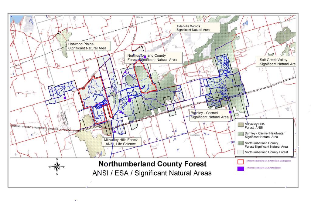
111
112 Meeting Summary-Oak Ridges Trail Association December 4 th 2008 Attendance: Tim Lawley, Northumberland ORTA Chapter Chair, Bill Pyatt, Mia Frankl, John Marsh Introduction/General Discussion: - We are here to discuss where the ORTA trail will go, acceptability of the land use agreement, acceptable uses on the ORTA trail, other hiking options and trail standards and maintenance Some of the route proposed would replace current use by snowmobiles ORTA would be concerned with how this change would be implemented as ORTA doesn t provide enforcement of ORTA trail The County would facilitate the period of adjustment then for other users who are used to certain routes once the ORTA trail is finalized (signage, advertisements, outreach via GPRSA-local snowmobile club on FAC) - We have kept the route off road allowances as much as possible but would like to know if hikers could access from a multi use parking lot? Yes. Generally ORTA doesn t provide much in terms of amenities, enforcement and maintenance, prefer a narrower trail so if start on a wide road would hope to see it be regenerated to a narrow hiking trail. Further we do not receive funding unless specifically applied for. - Have planned the route in sync with the preferred options of Ontario Parks/NCC but if that fails will have to re-route in that area so somewhat of an uncertainty at this time. - A lot of the ORTA is on roads (in other areas) because of necessity, just don t have access off road but whenever opportunity presents itself we try to move off the road - The Ganaraska Hiking Trail may become abandoned as there are landowner issues, other preferred routes being used and rarely do the pine Ridge Hikers use their own trails - We would like to create year round hiking trails, so even if not an ORTA member can use the trail? Yes - ORTA uses trail identifier signs - Insurance covers organized, advertised hikes that are scheduled (and advertised for) but if you are not a member (on these) you are not covered - The Bruce Trail was sued and settled out of court in an instance where someone was injured on their trail - Al MacPherson has found a way for all volunteers to be insured regardless of membership or not - The County, as the landowner, would provide all the tools and insurance in exchange for volunteer trail work Discussion on Signage: So you have a standard but could we add the NCF logo at entrance points? Yes There is some administrative re-structuring going on among the ORTA, ORMF, ORM Land Trust and STORM, this may have some effect on current ORTA standards and practices The County would like to develop our own brand of signage which would be uniform (but flexible to insurance and user group requirements) Discussion on Maintenance: The density of population here is low so expect few volunteers and low maintenance needs Recreation is to be enjoyable, not work The Northumberland County Chapter of ORTA consists of 7-8 members, not much to get work done with but keep in mind the maintenance for the hiking trail is minimal ORTA aims for: assigning trail captains to trail sections to maintain them, we try to get out a minimum of 2 times per year and provide a report to the trail director
113 But volunteers are hard to come by The Bruce Trail has trail maintenance tasks teams who could go out for days at a time and do maintenance, kind of like a weekend excursion Discussion on Agreements: We would have to use the standard ORTA one but could add an amendment specific to roles and responsibilities in the NCF The County would like to see the in kind time recorded Closing comments: - We are happy with the route that best fits for the NCF - We like the more southerly option though - Understand this route will be somewhat flexible until all the user types are routed - ORTA is a single use trail but we have said bring your snow shoes in case and we don t advertise to other user types - I am not sure if horses are allowed anywhere on the ORTA but yes have seen them on it, but not sure if considered a permitted use anywhere.the legislation says non motorized but doesn t get more specific beyond that - And different users have different standards! - We don t expect washrooms etc, just a know entrance/access point Provided the 2-3 route options to take back to the board. Follow up: None.
114 Meeting Summary: County Staff and Dalton McDonald from The Township of Alnwick-Haldimand December 8 th 2008 Attendance: Bill Pyatt, Mia Frankl Dalton McDonald, Deputy Mayor of Alnwick Haldimand Township Introduction: - Dalton brought and aerial of his property in, he lives within 0.5 km of the NCF and has lived near it his whole life and his property borders the NCF - The NCF has a lot of neighbours of course, largely in Alnwick Haldimand (AH) and Dalt has an intimate knowledge of the property and the changes that have occurred over the last 40+ years - Really all lands need to be protected, not just one over another but social values also need to protected - Folks in AH are limited by the Oak Ridges Moraine Conservation Act and Plan (ORMCP) and those who live on the ORM are impacted the greatest so do not think highly of it or plans relating to it because of the restrictions it imposes on them and their lands, those who do not live on the ORM don t get this - If the plan benefits society as a whole then perhaps there should be some compensation for those who are the most impacted (i.e. landowners on the moraine) which is not the case with the moraine - One can ask the question are we (people living on the ORM) bad for what we have done in the past and now that there is legislation to stop us? - As a Township we are trying to keep the books balanced and now we have less opportunity as 55% of our Township s lands so how can we continue to grow? We can t have balanced growth. - In the case of the NCF Alnwick-Haldimand is key and has the most at stake - Great intro, thank you, we wanted to discuss with you the principles of the trail plan and the ecological protection objective and how we will be approaching the trail user groups on the Forest Advisory Committee (FAC) - We also wanted to talk about the township s road allowances and discuss our preliminary position to propose a motorized through route which would maintain the regional trail linkages Discussion: - Snowmobile use has evolved, it used to be localized but now with better machines people can go further in one trip - ATV s are also localized but now are getting more destination based as well, dirt bikes are different all together, also the age demographic is not the same, ATV-ers tend to be older folks and dirt bikers tend to be younger guys - So we need to balance the ecological sensitivities of the Forest with an enjoyable recreational experience, we realize there is potential for lawsuits so how about if we were to suggest preserving linkages on an east west basis and keeping motorized routes out of the center of the Forest (e.g. Dunbar Rd)? - Are we going to fix the damaged areas? What s the plan for this? Will need to implement a prioritized restoration schedule spread out over 4-5 years that fits in the budget, might look at dropping trees versus infilling/grading for example, try to regenerate eroded areas as naturally as possible (e.g. cheaply) - Mother Nature causes a lot of the erosion from rain, the user creates the scar but she does the damage - The County has done very little in regards to management out there, there has been little money but action is needed regardless - The Township has done very little as well, only minor touch ups over the years
115 - Trails grow in very quickly, I showed John one such example where the trail grew back in - Non motorized users don t want to mix with motorized users but the motorized guys are the ones who keep trails open simply by riding on them so less motorized users means more maintenance on trails for hikers etc - The County s response is low cost low tech and will be looking to close many trails (less to maintain) - So how will you deal with self propelled user trail maintenance? By entering into an agreement which states the expected maintenance from the user group and is supported by the County, for example the Cobourg Conservation Area/Cockburn Park holds an annual one day maintenance event - I agree that a user maintained approach can work, the OFSC is an ideal model of this - So what do you think about this idea of maintaining the regional linkages on an east-west corridor and having fewer running through the interior of the Forest? Providing trails for motorized users for touring? - We are under the gun to supply such trails, they are Canada wide, to shut them down is bigger than us, than the Forest - I agree that we need to maintain regional linkages and the more we can keep them off the main roads the better, we need to get them through the Forest - The green party folks are noisy but they are not the heart and soul of the Alnwick Haldimand Township. Not saying no to a conservationist approach but we have to be realistic - Alnwick Haldimand was told that what was there before can continue (referring to the ORMCP) so if anyone wants to take it to court it would be a private matter, the government will not pay the battle but will go and defend, so if a lawsuit were to arise the taxpayer would be paying out of pocket to sue the township or County, our opinion is strong and we will stand behind it - Then there are councilors who aren t even close to the situation and want to avoid the possibility of a lawsuit and do an outright ban - We say lets guide the ATV s to the OFSC model - If we can provide and get compliance with a through route I think some of the councilors (with concerns) would buy in - For a private citizen to sue the county is unreasonable, even if backed by the Sierra Legal Defense. - The County Forest is central but the 7 townships are widespread so some are further away from the issue - Such motions should come from the councilors closest to the issue - How many kilometers of road exist in the NCF? the draft plan by Silv-Econ/Domtar dated 2003 states a total of = km. A calculation done on the extent of trails by Lower Trent CA this year indicates over 200 km of trails. - Further there are impacts which go beyond the trail (noise, dust, vibrations, etc) - I disagree that the trail system is all that much more than it was 5-6 years ago, maybe the dirt bike trails are expanding all it takes is one year without use and they regenerate - We have pictures showing increased erosion and exposed roots and rocks year to year where the trails continue to be used. - Ok we would like to propose some routes but first want to talk about dirt bikes - They seem to be only interested in thrills and spills and come from outside the county - The bikes are fast and can be dangerous, loud, cause dust and speeding - We are considering some options like banning them or offering a sacrificial parcel, they are really not interested in touring routes like the ATV s and snowmobiles, their goal is clear-tight, narrow and windy trails into the more remote areas of the Forest, away from other users, is this an experience we need/want to provide?! - Centerton has a track for dirt bikes, they seem pretty organized there
116 - There is a generation gap there for me, I can t speak for that demographic but I know they like to race, are a younger crowd and am surprised by how many women also partake in this style of recreation. Everyone has rights even the noisiest and fastest - What about a pay system? Why would we only charge some user groups and not others? - One option would be for the user groups to buy their own lands on which they can their activities - The dirt bikes are like the other groups, they should be licensed for the road and not all are - The NCF was like no mans land, you could go there and do whatever you wanted, there has been a huge lack of presence which has created a lack of respect and etiquette - This year with an increased police presence we are starting to see fewer infractions/bad apples - So what if we were to offer the dirt bike riders a 200 acre (give or take) parcel where they could develop a track style trail system to suit their desired experience, it would be easy to maintain and regulate/direct this use to that area. - There are examples of this out there but where in the NCF would this fit? And in 10 years how would we justify the impacts? - If we condense trail use do we increase impacts? - Can we do so incrementally? Not too much at once, for example start with Lookout Mountain, have peer enforcement/pressure, at the same time provide a place of belonging (i.e. designated trails) allow for a period of grace to adjust and then implement another area and so on - Compliance with dirt bikes is very difficult because they are fast and can go anywhere, off trail in a heart beat - We would really need to focus on getting the message out there through our user groups and a county/enforcement presence in the forest - So rather than a full out non motorized approach we would allow but only on designated routes and then we can emphasize where they can and cannot go, it has to be clear and simple to enforce, easily identifiable for the user and the enforcement officers - I find the OPP look for excuses not to charge folks so need to keep the by law/regulations simple so its easy to charge folks-this was the approach we took with the ATV by law-simple and easy to understand for enforcement officers and the public - And keep links open to area businesses (via township roads is up to your council) - In regards to Dunbar Road, it is viewed as a pride to the township - We are looking to route to the north and south of Dunbar - It is the most recognized road in the NCF and likely thought to be the only one, we would need to see how you would route around - John (Marsh) would consider keeping it open but it s the compliance of ensuring people stay on it and don t stray - We can work on the outer routes and keep the links to area businesses from the north and south route - Leave Dunbar in its state but close to motorized use? You could try it and see how the compliance is, or could aim for Dunbar, Morris/Huckleberry. - Dunbar can be regulated at its access points or perhaps route around for the Forest section between CR 45 and McDonald Road at least. - We cannot close Dunbar at this stage, there is now way that would fly but could phase it out over time and start setting up perimeters to do that now - Don t forget Dunbar is the best known road so cant go after it first, it could be a deal breaker - Our long term vision is to manage motorized use to a minimum.
117 Meeting Summary-Great Pine Ridge Snowmobile Association December 11 th at the County Administrative Offices, PM Attendance: Bill Pyatt, Mia Frankl and John Marsh on behalf of Northumberland County Barb Linton from the GPRSA Introduction: - We recognize that there are some ecological restrictions (identified in the atlas about motorized use) on the east side of CR 45 but also recognize that there are regional trail linkage values which need some assurances - We propose to allow for these regional linkages to continue through the candidate ANSI s with E- W and N-S passages including continued access to area businesses - We would like to see shared trails and reduce overall amount of trails - We would allow for through routes along the perimeters of the NCF, with consideration to traffic volume/user quantity (e.g. 2-3 routes) - We prefer to see ATV s use the snowmobile routes in the off season and propose shared trails in opposite seasons - GPRSA: we really only need the trails from December to Mid March and feel they should not be used by anyone during April and May - The GPRSA does have members who snowmobile and ATV for sure but not sure how many and there are no links between insurance and permits for the 2 uses - The dirt bikes prefer an enduro style of riding, being on a track not a wide trail - We would like to see no after market work done to the machines, recognize there are responsible riders - If Dirt Bikes were to share trails with ATV s based on this regional linkages/touring objective we would work with them to develop means for monitoring, policing, agreements etc - Barb says she did see/hear of dirt bikes on the trails last winter but agrees usually they do not ride in the winter - The OFSC licenses folks as young as 12 years of age - The GPRSA riders already know to expect other users such as horses and dog sledders but out of area folks not as aware - There is developing provincial legislation coming on ATV s Discussion on Proposed Routes, Agreements and Signage: - Here is what we are proposing-showed map - GPRSA says the local riders like to spend the day riding the loops in the NCF as it is what they can afford and is nearby, familiar - It is a family activity so the E-W may not work to well for some - GPRSA does groom west of CR 45 but not sure that it is done where the trails run parallel to Beagle Club and CR 45 - There is frequent/high traffic use, the loggers reported 60 snowmobiles in one day last winter - A lot of the GPRSA riders like to do the loops in the NCF in one day - We are trying to be fair and streamline the trails, we also need to ensure environmental protection and keep motors out of the ANSI as much as possible - The time frame for this would be next year, need to go to council before would take effect - Mia will provide you with maps of the proposed route so you can take it back to your group/post in the clubhouse for their review and comment as it is the season to chat with them on this - The agreement would be the standard OFSC one but we may want to add an amendment to it to clearly define the roles and responsibilities of each party (County and trail group), we understand the OFSC MOU cannot be changed
118 - OFSC received funding from tourism ministry ($50, 000 for signs in this district) and were able to locally install 5 new signs were around the County Forest with a map of the trail network - How much in kind does your group contribute to this effort in one year? Estimated, about 2000 hours a year plus meetings, paperwork, and now FAC, district meetings and local club meetings. I do the membership for our local club which is ~150 plus others totaling 450. we conduct the full health and safety for volunteers, have chainsaw licensed folks - It could be useful to track your in kind time, if possible, to keep track of all the work the trail groups do - Any non members riding in the NCF? they may be non GPRSA but will be OFSC - We do have patrols and check for permits or get kicked off the trail/asked to leave - We don t really report much to the OPP though - The STOP team comes down sometimes with the OPP, they can enforce the trespass act but nothing under the criminal code - Trail Wardens are upgraded every 3 years, GPRSA hosts the workshops, it is generally one day - What about enforcement presence beyond this (trail warden)? The OFSC and OPP deliver but don t have a STOP team for this area, we have to wait for the OFSC to identify the need, we cant request it, it is location dependant - In the past the Peterborough OPP would come down and do patrols overnight, like 10 PM to 2 or 3 AM, or 7 AM to noon to use the element of surprise and catch the ones who would be in violation - In terms of signage we do put up and take down seasonally, if do shared trails though may need to consider how this will work (don t want OFSC when its an ATV trail.) - In opposite seasons it should be fine - The GRPSA is about 120 members with riders and permits in upwards of Barb: I will want time to get the message out to the club members, it will take time to educate and changes and enforce - Barb: We are thinking about hiring a groomer to do the grooming, setting up a payroll with the WSIB and everything - We do get hunters on the trail when we are grooming (Archers) - The Bowmanton & Elder roads routes are popular, could we keep these? They are heavily used. - Dog sledders-in some years we see them and others not at all, I think they tend to train where they competitions are - Most sledders expect the dog sleds but some don t know (outsiders) Conclusion: - Thanks for your time, I will tidy up the routes and deliver several copies for you to put up at the clubhouse.
119 NCF User Groups Consultation Sessions Meeting of December 17, 2008 with The Northumberland Trail Riders Association -The Facilitator s Summary (January 8, 2008) I attended a meeting on December 17,2008 with Bill Pyatt and Mia Frankl of Northumberland County, Ken Hoeverman and Jeff Banks of the Ontario Trail Riders Association(OFTR) and 4 members of the Northumberland Trail Riders Association (NTR) to discuss use of the Northumberland County Forest (the Forest) by dirt bike users. Al MacPherson also attended the meeting from Trent University on behalf of the Trail Study Consultation team. The purpose of the meeting was to confirm the aspirations of the NTR and to explore options for its continued presence in the Forest. Bill Pyatt stated at the outset that a key objective of the County was to reduce the number and length of trails to provide a higher level of protection for the natural values of the Forest. In this regard all Forest users are being asked to re-evaluate their planned use of the Forest to reduce their impact on the environment. Bill also went on to say that the County is prepared to support a few motorized trail routes that provide for east /west and north/south crossing of the Forest to maintain regional trail linkages, provided these vehicles are licensed and constructed in accordance with environmental and safety standards. The position of the OFTR/NTR was elucidated (mainly by Ken Hoeverman). The following is a general description of NTR s main points followed by comments offered by all parties: 1. The NTR has a long history of responsible trail use and maintenance in the Forest and have, with the permission of the County (from 1997), developed an extensive system of trails of about 45 km length that have been recognized by many as among the best designed and managed in Ontario. To put NTR out of the Forest now would negate the investment made by the NTR. County staff acknowledged the NTR accomplishments but said that everyone in this process needs to recognize that things are changing and that all stakeholders are being asked to make concessions and adjustments in the interest of the overall welfare of the Forest. 2. Trail bike riders are not interested in wide through trails but rather need to get into the forest on small single track trails that involve twists and landscape variation to challenge the riders off road maneuvering skills. The observation was made by the County that this user preference (by its nature) puts the dirt bike right into the forest in some cases in areas identified in the Facilitator s Atlas as having high environmental sensitivity. OFTR/NTR countered that reduced speeds in these areas ensure that impact on the environment is minimal. They felt that the Atlas was highly biased towards protection wildlife habitat, recharge and discharge features. It was discussed that the Facilitator s Atlas actually represents only an ecological view and Ogilvie, Ogilvie & Company Page 1
120 NCF User Groups Consultation Sessions that it would be renamed as such. They also felt there was a lack of scientific data /studies to prove impacts of dirt biking on the environment. 3. Actual usage by the NTR is not intensive. The association has approximately 30 members (not all with bikes) who use the forest 2 to 3 times a month each. County staff don t question that the NTR is well intentioned but NTR is a relatively small group that doesn t represent or control the actions of a much larger fraternity of dirt bike users. In fact no one seemed to have a handle on the total number of motorized bike users are in the forest. Mia however indicated the use must be significant based on some of the trail damage already existing in the Forest. The NTR believed that better control of dirt bike use could be achieved through partnership with them and land management (stewardship) agreements, which the County hasn t done very well in the past. 4. NTR contends that when properly done, trail bike use is not damaging to the Forest Ecosystem and does not entail driving at excessive speeds and does not create significant conflicts with other users. (Ken was prepared to provide research that supports this claim) At no time did the OFTR/NTR accept that there were areas in the Forest where outright prohibition of trail use was appropriate. They felt that proper trail design criteria could be used to address issues of environmental sensitivity everywhere. Several NTR members said they did not accept the findings or conclusions of the Facilitators Atlas. Similarly they did not seem to accept the premise that it was appropriate to set aside natural areas where trail uses would be prohibited. Ken in fact made the observation that part of a high quality experience for their membership is to get down into areas such as wetlands to see nature at work. An NTR member also observed that it made no sense to ban dirt bikes when they are still going to allow tree harvesting which is much more harmful. Bill made the observation that the County is supportive of the Environment First Approach and is very comfortable with the overall direction in the Atlas. I added that the the environmental policies in the Oak Ridges Moraine Conservation Plan and public sentiment in general make it very difficult for the County to do otherwise. The OFTR/NTR s apparent denial that the dirt bike trail causes any significant damage was questioned by the County and its consultants. Any damage or concerns cited by the County were said by NTR to be the fault of the renegade users or the forces of nature. The statement was made that the gullying was caused by the rainfall not them in essence denying any cause and affect relationship with exposure of soil by trail use, which in turns increases, the ability of rainfall to cause gullying. They also contended that environmental damage was there not because inappropriate trail use but because of inadequate signage and site management by the County, one instance in particular which they deemed absurd. Ogilvie, Ogilvie & Company Page 2
121 NCF User Groups Consultation Sessions In a subsequent commentary on these minutes the NTR stated We are experts in off road motorcycling and there has been no case made that single track motorcycle use is the problem by anyone. Blaming off road motorcycles for the problems in this forest often are inferred but never substantiated. The Marsh study of Northumberland and the Ganaraska Trail Study conclude that our impact is not problematic. 5. NTR said there are many successful models of trail bike use in natural areas in other parts of Ontario and these experiences should be looked at by County staff in helping develop a successful partnership model here. County thanked Ken for this advice. Mia said that she was well aware of the other models out there and in actual fact is in close contact with other community forest managers on a regular basis. 6. The NTR does not condone trail use that results in extensive damage that has occurred in places like the Mudhole. They support getting this kind of bike user out of the Forest through more effective policing and education Northumberland County expressed concern that all the trail users are not members of the NTR that we have been advised by staff at the Ganaraska that this demographic is not club oriented and there is concern about how to control this element of the user group who the NTR had no control over. NTR suggested this could be done through partnership with NTR, land management (stewardship) agreements and better public education and signage. 7. NTR contends that an outright ban of dirt bike use would exacerbate not resolve the problem of renegade trail use since such users would continue to access the trail and there would be no organized trail association available to help the County patrol the trail. Ken said that where municipalities tried to ban dirt bike use things actually got worse. One NTR member stated that he would continue to use the Forest even if a ban were put in place. 8. Ken stated that dirt bike trail use is one of the most physically demanding outdoor activities; even more so than jogging, and it is totally in tune with the Provincial direction on using trails to improve the health of Ontarians. He further stated that this type of activity motivates young people to get outdoors and exercise and the County should be leveraging the physical benefits of this activity against environmental protection. 9. NTR does not support the idea of concentrating trail bike use in small, confined areas of the Forest. They felt it is not a practical option since it would provide a reduced Ogilvie, Ogilvie & Company Page 3
122 NCF User Groups Consultation Sessions quality experience and would put greater pressure on the Forest since it would entail increased per km. use and increased impacts on the reduced amount of trails that would be available. They stated that, if anything, Northumberland County should be looking to expand areas for trail riding as this use is increasing. Further if the Forest closes to dirt bikes it will cause an increase in density of use in other areas. The County asked about the possibility of having the dirt bikes confined to one area of say 250 acres and having properly designed and maintained trails. The response was that it would not work. The rational given by NTR was that as time went on and as rider ship increases they would need more and more trails. The trails are subjected to turning, acceleration and braking by the bikes and to keep the trail in acceptable condition the number of trails will have to be increased. They don t believe concentrating their trails in a small confined area requiring continual maintenance is the answer. NTR believe they need a trail system of about 100 km to provide a high quality trail experience for a full day. They do not want to do multiple laps of a shorter trail system as it would cause too much damage to those trails and they don t want to ride a trail section or section of a trail more than once a day. 10. NTR avoids extensive use of trails West of Beagle Club Road because they were asked to do so by the County some years ago. I raised the issue about whether or not the association would be willing to move trail usage out of the areas identified as having high environmental sensitivity in the Atlas and focus on other areas. Ken said they would look at it but didn t think that would allow them enough room to play. The Association alluded to the need for as much as 100 km of trail to fulfill the demand or need for dirt bike trail use. They also reiterated that they did not feel that the areas identified as sensitive in the Facilitator s Atlas were so sensitive that they could not accommodate a properly designed trail bike system. When asked about how we could balance this use among the others NTR stated that their trails could be used as multi use trails but are designed with the trail bikes in mind. They stated that in many forests the dirt bike group contributes the most to trail maintenance, education and stewardship and that this user group gets along the best with equestrians, so don t assume they cannot share the trails. Further they said if hikers preferred a quiet experience there were plenty of other places they could go. 11. NTR doesn t think they represent a conflict with hikers for a number of reasons. First proper design and maintenance of dirt bike engines keeps them much quieter than they used to be. Hikers have many areas where they can go away from the noise. Dirt bike activity occurs in areas of the Forest where hikers hardly ever go. Also hikers have the option of going to many other places outside the Forest if they don t like the noise. A large amount of the discussion at this meeting focused on NTR/OFTR s contention that a lot of the problems and concerns relate to the way the County manages the Forest. The NTR seemed to want to get a whole bunch of things off their chests on what they perceived Ogilvie, Ogilvie & Company Page 4
123 NCF User Groups Consultation Sessions as failures on the part of the County to properly manage the Forest in the past. Whether such observations were factual or not was in the facilitator s view irrelevant to the topic at hand and only served to thwart the ability to focus on potential compromises. At some points in the meeting the County staff seemed under sustained attack for not doing their jobs. Continued criticism of the very County staff that NTR/OFTR will need to work with in the future does not seem conducive to forging long-term partnerships NTR provided the following comment in its review of this section of the draft minutes: Stating the County has not managed the forest well is why we are here. NTR/OFTR has been at NFAC since inception. We pointed out that while NTR members have always expressed their intentions openly the county has not. Refer to April 2006 attempt to ban motorized event without consultation. We had a slide for that. The NTR seems to want to get a whole bunch of thing off their chests absolutely. That is why we were there and we weren t given an opportunity to make our presentation. This is an opinionated statement that appears to belittle our cause. Rest assured we are passionate about this. We challenged the factual arguments as perceived since there was no proof that our activity causes concerns. We had valid counter points to the points made. Had we been given the opportunity to present our case, without interruption, you may have seen that. The staff took our facts as irrelevant and Mr. Pyatt dismissed our fitness research by talking about skiing. Our research is based on real science, a peer review and a recognized research facility. Submissions to the Journals of Medicine are due this year. We absolutely accused the county of mismanagement of the Northumberland Forest and disagree with the position presented by Mr. Pyatt and Ms Frankl. As staff, they represent the county. We have no personal issues with staff, we feel these two, and your firm, have become stakeholders and are emotionally involved in this public policy. When that happens, staff and probably facilitators need to step aside and find impartial replacements. OFTR/NTR also was disappointed that they were not given an opportunity to present the extensive presentation they had put together for this meeting. They felt that many of the points they wanted to make could have been more effectively communicated through the presentation. As a general summation, it appeared that the NTR wants to continue to extensively use all Forest lands to the east and west of County Road 45 subject to proper planning, design and maintenance of such trails. The Association showed little willingness to compromise from its position of We need everything we have now and more. There was agreement that a follow up meeting was needed. Prepared by: Frederick Johnson, Ogilvie, Ogilvie and Company. Ogilvie, Ogilvie & Company Page 5
124 Northumberland & District ATV Riders Meeting December 30 th 2008 Attendance from NDATV: Mike Ainsworth, Mike Tarrington, Mike Lalonde and Cheryl Turk Attendance from County: Bill Pyatt, Mia Frankl, Fred Johnson, John Marsh and Al MacPherson Introduction: - The County has met with ORTA, AH Township, GPRSA and NTR so far - Who we are and our roles (Bill, Fred, Mia, John and Al), studies completed (Trail Study, Atlas) - In the club try to have a rep for each township so currently have 7 chairs, Mike Lalonde is one of them, Mike A is president, Cheryl is the secretary/treasurer and Mike T is a chapter chair - Stage of Master Plan-assessed recreation and ecology now reconcile and move forward with ecologically sensitive trail systems - Meet with all trail user groups and then take results to whole FAC followed by Public Forum - News article-yes was untrue, cannot respond to al incorrect media, would take up too much staff time (which is already limited), you did the right thing by contacting us directly, it s a fact of life in our work that the media will report information incorrectly, the council concern on Nov 19 th was more on damage by 4X4 trucks and trying to at least ban them until the master plan comes to completion - Concepts for motorized and non motorized zones have been brought up and discussed but not sure will work out exactly that way especially given need for links in the portion east of 45, are proposing a regional linkages objective for motorized uses, east-west passage, outside sensitive areas of Forest, enough routes to account for volume of traffic, 2 way system - Still have some loops but general principle is access through not in - Have heard from NDATV throughout process that are more interested in touring routes, destinations not loops - Prefer to make multi use trails, in opposite seasons, shared maintenance and signage or seasonal signage - ATV Season would be, for example, something like June 1 to October 31 (Snowmobile is Nov 1 to April 1) - To be a member or not to be, more likely necessary to be a member with motorized groups - NDATV (& GPRSA) have said are looking more for a touring experience, County proposes at least 2 east-west routes - Have met with Dalton McDonald at AH Township, he was favourable in the routes we showed, same as have here today - These routes would be used by the snowmobile club in the winter months and by the ATV club in the summer months only - It would unrealistic to try and close off the Forest east of 45 entirely to motorized use but this access would be a trial run for a period of X years and see if compliance is working, try to monitor trail impacts annually to get better understanding - Also have to understand the need to manage the volume of traffic of users Comments from John Marsh - The County is taking an ecological protection approach to the Master Plan and recreational use and therefore looking to restrict motorized use - We need to consider species at risk habitats, slopes and legal obligations, we now have more information on the ecology of the Forest, helping us identify levels of protection for the various parts of the Forest
125 - The ORMCP could be interpreted to exclude motorized use, as we do not know the impacts of motorized use in the NCF we must be careful in allowing recreation and identify what the impacts are then we can increase or decrease uses based on that information - For example one seminar I went to discussed the impacts of roads on wildlife, one example given was on frogs-frogs were impacted by a road up to 2 kms away so when considering impacts we cannot just look at the trail - We should be looking to use existing roads (township, access), and the county needs to address the issues surrounding the township owned roads - The county should be looking to combine uses, for example the ATV s and snowmobiles - There are many examples of this shared use in opposite seasons with a closed to all period for April and May - Signs on the shared trail-could share or change seasonally - Looking to provide trails to get through the Forest but not loop around inside it - Do get loops anyways due to nature of proposed trail network and roads around Forest - Looking to 2-3 (east-west) routes max Comments from NDATV - NDATV uses fire roads and access roads, we don t see people going off these and we tend to stay off the steep slopes too - GPRSA has some slopes on their routes currently and Haddlesey s Hill is a concern because so steep but most of us stay away from that too, tend to only see folks venture off trail when there is a block (e.g. fallen tree) - We have sent some of our GPS data to the County - Question/point of clarification-the ORMCP states uses documented before 2001 as an existing use, so does that mean would be allowed to continue? Fred replies: 2 things, one-as a legal and established use, two-whether new use permitted or not, specifies low intensity uses and motorized is not listed So motorized is not excluded or included The use has to pass the test of low intensity For example the East Cross Forest experience high intensity use and banned motorized use entirely An existing use could be allowed to continue but for example new trails could result in a court decision or current use if impacts show to worsen So the County needs to show due diligence in preventing any use from getting worse or having a greater impact So we need to set parameters from which we can measure and monitor these impacts Standards and Maintenance NDATV Comments: - Be a member of the NDATV, we want the County to make it member based with insurance, code of ethics etc, for all groups - We don t want to have to clean up after the bad guys who would still get to ride but not do any work - Permits and membership requirements are becoming more and more common elsewhere - As for equipment-we would need some County support in terms of grading but we would like to build our capital to include equipment to do this kind of work, we currently have about 300 km of trail in the County and would like to expand that to about 1000km, we want links across all the townships - We don t have an overall master trail plan but we have collected GPS data on a lot of what we are using and we do have a wider network of trails in the region of the NCF
126 General Discussion: - County (forest) road maintenance-we would be willing to provide support if trails can be shared, the county could look after grading 1-2 times per year if feasible for our roads department, also if your group keeps track of the in kind time we can really show how much work is being matched/put into the effort - Council will prefer low tech and low costs operations, no user fees - In terms of a user agreement: NDATV suggest should be a 3 party agreement between the NDATV, GPRSA and the County, demonstrating that there is mutual respect for each user and the landowner, willing/agree to work together - NDATV and GPRSA have already collaborated on trail maintenance and cost sharing - Would be better if trail maintenance could be self resolving and the county would not have to play a major role in facilitation/resolution of issues - NDATV is more reputable now, going into our third year, bigger membership and better know in County, we have helped other ATV groups get started and set a good example for others - Would the route be acceptable as a two way system? Yes. - NDATV asks-so member or not? Response: Council would consider this, would need to see the benefits and assess associated costs, would get complaints from some folks if member based but likely that Council would see this as desirable - The county would be written in as third party insured on the agreement - Membership makes sense for motorized users, harder for non motorized users, would need to give Council the information and options on this - Maintenance issues, insurance or not, groups can be insured and have an agreement with the County but if you are a trail user and NOT a member then you would not be insured (noted more for non motorized users) - NDATV says seems like the non motorized groups don t help out, had a hard time drawing in to an NDATV event this summer.. - Perhaps, but they don t realize that there is a need for use and participation to be a 2 way street, not used to it (and don t under credit the skiers, they have done tons of work but as of late are concerned over insurance matters as County is taking a more active role) - NDATV is frustrated with the lack of action from the folks who talk a lot about the Forest but don t come out and help maintain trails or pick up garbage - Perhaps a solution would be to host a multi group event so that its not just one group, the agreement could stipulate that each user groups must participate in 1-2 clean up/trail maintenance multi group events per year - Question from NDATV-will the FAC continue to exist after FMP approved? Yes in one form or another, may not be as large but user groups, townships would be considered ongoing representatives for example General Discussion: Enforcement - For NDATV it would be user group supplied and stated in the agreement - We would take the license plate number, go to OPP - We have an ATV warden manual from the OFATV but have not trained any of our NDATV members on it yet, we are waiting on getting trails established, we would like to have some routes finalized for May or June this year - It is a good idea to perhaps mix groups when wardening (eg hikers and ATV-ers go together using both means of travel for part of the wardening) - It was suggested that the county should have a general outline to guide wardening for the user groups to outline the hows (reporting, approaching people) and responsibilities as there will be differences based on user type - There is power in peer pressure - A collective policy of who does what and how would be useful
127 - An understanding of rules, regulations, by laws etc is needed - NDATV asks-would you make one of us a by law officer? Response-well that gets complicated with WSIB etc but could do by laws which OPP could enforce - There will be a meeting with OPP to discuss some of these issues - The OFSC is a great example to look towards in regards to enforcement General Discussion: Signage - There is a major lack of signage out there right now, there aren t even signs on trails - Perhaps having UTM s on the signs would be useful for emergency responders, Ganaraska does this, or post a number because data formats are variable (mmm.ddd.hhh or lat and long etc) - A lot of these issues are touched on in the draft trail study report - It would be wise to plan this in conjunction with the capabilities of the emergency responders - County question: do you have signage standards or examples? For snowmobile and ATV? - We would like to see a common brand, uniform signage in the NCF - Also we must consider the insurance aspects of signs and what the insurers requirements may be - The OFSC sign regulation guy is a member of the GPRSA, he would be a huge resource on this issue (NDATV to see if can find contact info for him) Other comments: - OFATV signed a contract with ATV Ontario and Haliburton has joined so one there is one pass for all trails and a signing with Quebec also passed so inter-provincial trails, pass is $140 - OTC (Ontario Trails Council) is governing, working on developing some cross country trails too (Canada-USA) - So becoming more regional and less intensive in one area Discussion on Maps: - Looking at the road connections - Concern about route along elder (closer to beagle club) because is badly washed out - Is there to be a parking lot at McDonald road? Likely yes. - Could we possibly have a link up to Dunbar road in 7-B? this avoids using the road and we would help repair the water pool on Dunbar at this area - Hydro corridor would be available for use pending Hydro One (they have easements or leases for these lands so need to discuss with them) - Can still get to Doug s Small Engines, the restaurant, Reid s Arctic Cat and Centerton Store - Need to see about getting thru 5-A, perhaps route along hydro here too? - Would have use from June to October so no winter use..ndatv says can use roads or route around, no biggie. - Dunbar E 108 would have to be taken up with OFSC and Township at this stage - Could we perhaps keep some of the loops in 6? There is more flexibility here. - FAC and County have said put forest first so yes less loops for recreation but still access and maintain regional connections, all user groups will experience a change in use to some extent. Follow ups from NDATV to County: - GPS track (completed) - Info on shared signage - Contact for OFSC sign guy
128 Meeting Summary-Northumberland Cross Country Skiers January 8 th 2009, PM, 555 Courthouse Road Attendance: Bill Pyatt, Mia Frankl, John Marsh from the County Alasdair Gillespie, Marg Ryerson, John Geale, Greg Hancock, Judy Harris, Haigh Glenhill from the Skiers Introduction: - At this stage of the master plan we are meeting with the trail user groups to discuss operational aspects of recreational use given the context of the trail study and environmental sensitivities atlas - We have a comprehensive environmental significance atlas which shows the ecological patterns of the Forest, it indicates that West of CR 45 is a more robust/resilient ecosystem versus the east of CR 45 - This could be taken as an indication of reversing uses from where they currently exist (e.g. self propelled east of 45 and motorized to the west) - Skier comment: I agree for the most part but would identify this most true north of Dunbar-where it is more generic than the rest of this area - This being said we are looking to restrict, not prohibit, motorized use east of 45, we do not have real or rather definitive data on impacts on the Forest but we do have a great deal of information and would like to work towards an acceptable solution for all users - We have met with Dalton McDonald from the Township of Alnwick-Haldimand-an active partner with regards to road allowances and ATV use (they passed the by law to allow ATV s on township roads which include several in the Forest), want them onside with our proposals - We have met with ORTA (oak ridges trail association) and provided 2-3 trail options (which currently match with proposals for the Peter s Woods park additions) - We have met with the local snowmobile club (Great Pine Ridge Snowmobile Association, GPRSA), our position-at staff level not County Council, is that it would be a step too far to ban motorized use entirely from the Forest on the east of CR 45 so instead we are putting a preliminary position on the table to allow through routes to maintain regional trail linkages - We have heard from the ATV and snowmobile groups that they are looking for low speed touring and would like to preserve connectivity of the regional trails - So we propose reducing the amount and extent of motorized trails on the east of CR 45, provide routes which skirt the boundary of the Forest as much as possible and provide east-west connections to regional trails (and area businesses). The proposed routes skirt the north and south boundary of the Forest, creating larger non motorized areas - We also talked with the ATV s and snowmobiles about having shared trail systems in opposite seasons which they were both agreeable to, with the exception of no access for either during April and May as is done in the Ganaraska and other places when the ground is thawing and sensitive - Skier question/comment: And what about in the fall? We have not considered a closure in the fall but intend on routing on the wider access roads which could be maintained to a set standard to avoid rutting etc - The GPRSA is very happy with the proposed route so far (showed group the DRAFT map) - The ATV group was also happy to share trails in opposite seasons and have through route access, they did however request that all trail users be required to have a membership to use the trails as they are concerned with maintaining trails for all which could be ruined by the bad apples or renegade users, the ATV club (Northumberland and District ATV Riders, NDATV) would like to see a club based approach so that all users are invested (responsible for) trail maintenance We feel this would be more applicable to/beneficial in managing motorized users
129 - We are trying to work towards building larger sections of the Forest which are less interrupted by trails to protect interior forest birds, species at risk and keep noise and dust down, creating large natural sections - We talked about wardening/enforcement with the ATV group as well and (one of) the provincial ATV bodies, Ontario Federation of ATV Riders (OFATV) offers a warden course which NDATV will be training members in soon - Skier comment: Can also look to the Victoria Rail Trail example in City of Kawartha Lakes - And we have met with the dirt bike group- the Northumberland Trail Riders (NTR) and the Ontario Federation of Trail Riders (OFTR) however this meeting did not go as well as the others, the proposed motorized objective of east-west routes does not match with their desired experience and existing trails-which are based on a very technical dirt bike riding style, windy and narrow, across a variety of terrain, honestly is was a rather unpleasant meeting.. - They have a resolution from County Council from 1997 in which they are granted permission to sign trails for future trail motorcycle events in the Forest - While this was during the term of the MNR (Ministry of Natural Resources) management period it is stated in the MNR management plans that it is not the prerogative of the MNR to invite the public to enter and make use of the lands for recreational or other purposes unless the owners give their approval. - This resolution predates 2001 (when oak Ridges Moraine Conservation Act and Conservation Plan took effect) however today Council can still pass a further resolution that uses must meet specified standards to be allowed to continue - Currently there is only one landowner/user group agreement and that is with the local snowmobile club-gprsa, no other groups - We are not sure as staff we can make the recommendation per the dirt bike group s request, although they state that their trails are multi functional for a variety of user types such as sharing with horseback riders, hikers. We have yet to meet with these groups and ask them for their perspective on this type of shared trail - As the meeting progressed the representatives from NTR and OFTR stated that Bill Pyatt, Mia Frankl and Fred Johnson should be asked to leave/be removed from this project as they are becoming emotionally involved and acting as stakeholders rather than unbiased staff. We proposed some different options for use for technical dirt bike riding such as a parcel with a trail system in which this could technical riding could be the only use but they stated that would not be sustainable in the long term as volume of riding on the same trail would degrade the trails quickly versus a longer trail to ride less loops on - Skier: so do they want our trails? They would prefer to keep the trail system they have east of 45 and stated that local club riders avoided the beagle club trails anyways due to the amount of non motorized users - Skier: The problem with the ski trails is erosion not noise or dust, the skiers have helped with/participated in trail maintenance for many years and did some trail condition measurements finding 60 cm/1 m in depth of erosion on some of the trails which can be caused in the summer. When winter comes regardless of snowfall these areas still pose a safety issue, we are concerned about liability of the erosion issue (e.g. are we liable because we did the trail work?) - The ski trails were originally laid out in the 1980 s, a lot of thought was put into their layout, at first the skiers though the trails were a bit of a hidden secret but now people have found them and they get a lot of use from a variety of users and erosion is getting bad (now we find that the mountain bikers are not very problematic nor contributing to erosion) but where rocks are exposed is a real problem that we cant keep infilling each year - Now if the motorized riders stay on the motorized corridor that would be great but there is still the issue of compliance and liability
130 - In my 40 years of cross country skiing I would say that the NCF ski trails are the worst I have ever seen anywhere - Ok, thank you for your comments but we are getting a little ahead of ourselves. Just a few comments on how the implementation would occur. OPP presence would increase due to the changes on motorized use, signage would be installed, designated areas/trails would be established, if a user group is not being compliant than their use could be revoked, there will be trail user agreements in place with the user groups to ensure insurance, standards, signage and maintenance are addressed and this would all be prepared prior to actual changes in the Forest. - Minutes from each of these meetings will be provided to the Forest Advisory Committee and public once they have all been held. - So we are here today to talk about issues, trail design, what works and what doesn t. - Also we want to see non motorized use expanded on the east of CR 45, establish more hike and ski trails for year round use, there is a need for hassle free trails for non motorized users (e.g. in the winter hikers and snow shoers) - Skier: I think it s a great idea to have year round multi use and single use trails - We want a greater presence of self propelled users on the east of CR 45 - Skier question: so wait, if you are to encourage/establish more non motorized trails east of CR 45 does that mean more motorized use to the west of CR 45?? No. Then why not stay where we are? (Keep the existing ski trails). We do not object to more trails but want to keep what we have now. - Reply: we understand that but we also have to think about things like tourism opportunities. For example the Ganaraska offers a variety of trails but most of that forest is pine plantation and very generic to look at. With a push for healthy living and outdoor activity we want more non motorized trails. - We are committed to monitoring the impacts of the recreation on the Forest and its ecosystems, e.g. damage like erosion or vibration on amphibians. We also have a moral and legal obligation to take on a more (environmentally) protective management approach. - We are trying to work towards May-June to have designated areas identified, address signage requirements and specifications and outline enforcement needs. The trail user meetings will conclude over the next 3 weeks and then we will present to the Forest Advisory Committee. - I would now like to pass it over to Dr Marsh to talk about standards and so forth. But first please introduce yourselves and say a few words if you would like. Skiers: - My name is Haigh Glenhill, I used to take students cross country skiing in the NCF in the winter and orienteering in the summer. - I am Greg Hancock, I moved here 10 years ago and am now retired. - Marg Ryerson, I have been a cross country skier for many years and also own a piece of property off Huckleberry Line. - Alasdair Gillespie, FAC rep and avid skier, president of the Northumberland Cross Country Skiers. - John Geale, long time resident and skier, I too would bring students up to the Forest for skiing (also Hamilton rep on the FAC). - Judy Harris, I have been skiing in Northumberland for 8 years, Thank you, so now to the subject matter! Let s talk about shared use trails, standards, issues etc. Dr. Marsh Introduction/questions for discussion: - Thank you all for coming and for your past and continuing cooperation. - I think we have a good sense of what you are looking for, what you want. We completed over 200 user surveys from the Beagle Club parking lot over the summer and ski season. Generally
131 I find that the trail system is pretty good, well utilized, and few problems, not as bad as others I have seen in terms of conflicts. - Overall the Forest is lightly used and impacted compared to others. So we are working from a good situation. - On that note I would like to confirm the following things with you all: 1. The color coded trails: are they what you want? As Bill said we are here to start drawing lines on the map and we want to ensure the color coded trails are what you want. Within this system there are likely a few areas of concern, e.g. slopes, but I would you to sit down together and look at the map and identify exactly which trails you would like for your use (Mia to provide a higher scale map to Alasdair for this exercise) 2. I would like to confirm what type of skiers you consider yourselves and who you want to cater to. For example the Ganaraska has a few different ski trails and Kawartha Nordic caters to a whole slew of skier types. Do you want to cater to a few different types of skiing or keep as is? Also the signage and trail standard will vary based on this so its an important factor to decide on early in. 3. What do you consider compatible activities on your trails for use in the summer? For example horses? Mountain bikers? What impacts of other users could lead to erosion (or other) problems for winter skiing? Can you tolerate other uses on your trails? 4. What about other uses on same trails in the winter? A lot of people bring their dogs to the ski trails in the winter, either to just walk or ski with them, also get a lot of snow shoers, there is a need for trails for these people in the winter either among the Beagle Club trail network and/or east of CR 45. Where they can be placed depends on which trails you keep 5. What would you like to see in the agreement? Both the County and skiers would be named for insurance, for example the County would support some expenses and the skiers would design, maintain and patrol the trails under the agreement. There will be an overall general agreement for all trail groups and then more specific ones based on the trail user type. 6. Signage-even if the trails are exclusive to skiers in the winter they will be used by other user types during the rest of the year so we need to think about the type of signs-what signs could stay up all year? Should some be interchanged as the seasons change? What is permanent and what is temporary? For example in Trent Hills one trail section is signed as a hazard in the winter and removed for the summer. If the user groups can work together the County can provide support, for example with grading. And the color coding currently used-does it reflect a skill level? Should it? What international standards can we refer to for signs and skill level? Discussion: 1& 2 Color coded trails: keep them as is? Change? Is there a standard designation here for signs? Let s come back to that. We are happy with the small triangle colored arrows. They are two fold-safety and design, also differentiate levels of trail based on color. Our trails are specific, not meant for multi style skiing. Some of our members criticize the trails for not being more flexible to different ski styles/sophisticated but there are other places with better infrastructure. Our signs are old and dying and need to be replaced. The mile markers are few and far between and they act as much more than just a distance marker-they help with maintenance issues and if you are lost on a trail. - Ok, so on the color coded trails there are folks who do skate style skiing on the access roads, we have skiers aged 7 to 87, the older folks want easier trails and like the option of straight roads. There is one trail missing from the map and is the inside passage which runs parallel to Dunbar on the south side. This is needed for both directions. The inside passage also saves us from using the bad road from the parking lot up to Dunbar. So then which roads might you want to continue to use? Are the colored trails enough?/good? There is Busch road (named after a park superintendent) North Fire, Isaac, we would like to ask you to identify routes on a map of what is the desired trail network for skiing in the
132 winter. It is likely the result will be, within the beagle trails, two trail systems-one for skiing only in the winter and another multi use system surrounding it. There will need to be skier crossing signs and the green B needs some re-design. In terms of signage I think it would be efficient to have one rep from each trail user group sit down with the County and design signs which will meet insurance requirements, what they should say, look like etc. The County will install welcome signs at the parking areas which state permitted and prohibited activities, code of conduct/trail etiquette, contact information, etc - Based on the nature of the NCF and the type of skiing which we do up there I think the classic style is the best fit as it can be done on narrower trails versus the wider trail required for skate style skiing. And what kind of skiing does the youth like to do? Who else might we need to cater to? Not just now but in the years to come (10, 20 + etc). Will the favoured ski style change? Youth like downhill skiing, the downhill thrill has greater appeal. I think youth tend to come to cross country as an adult and prefer the competition of skate style in their early years. Most who skate use the roads even if it s not ideal it gives them a place to do it and they are happy with that. The snowmobilers accept that there are other users on the trail (road) and vice versa. Further we have never demanded exclusive use of the fire roads, Dunbar is accepted as a snowmobile only route, in some places the single track is not as adequate as it could be, Dunbar is busier on weekends/more multi use on it but can hear the snowmobiles coming and move off to the side before they get to you. If Dunbar is to stay as a major snowmobile route then we need to designate and map skier crossing points, especially if promoting tourism, all the more reason to ensure you are providing a safe experience. - Does the OFSC object to sharing trails with skiers? We don t know, we did not ask them that. - I was once accosted by a snowmobiler, I swear he came right at me and drove me off the trail but other than that they are pleasant and respectful of us. I think you really need to assume Dunbar will not be a part of the ski trails. Rather look to upgrade trails, signs and enforcement. Ok, thank you I have a much better sense of the ski style and just ask that you identify on a map which trails you would like exactly. (Mia to provide as noted above). 3: Other uses: What do you consider compatible summer uses on the ski trails? Anything that doesn t move soil? - I ride my mountain bike in October-November to check the trails for dead fall. So a mountain bike would be acceptable if used sensibly? Also though how many-laws of physics, 10 mountain bikers is OK but if get into 1000 s that s different, same for events. Are there studies on impacts of mountain biking? Yes on slopes but for the most part the use at Beagle Club is light, there are maybe 20 guys who come out 2-3 times per week. What about horses? They use the roads but like the single track too, I am concerned over a section where the blue and green merge, there is an escarpment there which is very sensitive, misuse it once and you are done for. There are few horse back riders, maybe about 6, they like the fire roads but in 10 years how many will there be? Fire roads only would be good. We would monitor the conditions and change as appropriate. Keep a set standard. - For skiing need about 5 feet wide to allow for the poles. And when need to herringbone need a bit wider, so width depends on terrain but overall narrower is better. - And compatible winter uses? Nothing else on ski trails, hikers wreck trails, make it dangerous/unpleasant to ski. Show shoers generally don t like the ski trail because too narrow, dogs? No. We still need to accommodate other users in the winter, as it is right now they are very displaced, this is why John is asking about dedicated ski trails so we can identify trails for others around them. We have a sense of right to the color trails anyways,
133 but yes ok could see others using the roads and other non color trails. But what about compliance? By establishing a sense of place for everyone, either in the Beagle trails or across CR 45, we would work with the other user groups to get the message out there as well as sign and hold an education campaign on all the changes. - Lets talk about numbers for a minute, people likely bring their dog because never see anyone else on the trail so with a dog have company/safety. Also poison ivy is a concern in the summer, so much of it! True but in the summer it seems like the trails are not as popular as the Spring, Fall and Winter. While we don t particularly care for trails east of 45 we agree there is a need for it (but not a demand). - East of McDonald Road could also be a nice place for low impact (hike/ski) trails. 4: Agreements: So Mia has written up a draft outline of what the agreement would/could contain. It seems like all are agreeable to seasonal maintenance and this would be defined in the agreement. Insurance would be driven from the County s side of things, Al MacPherson (with the Trent U Trail Studies Unit) is a whiz with this stuff and worked out a garbage clean up event where all the volunteers were covered. Standards would be identified in the agreement, keep the brush down, clearing trees-all this would be formalized. We have worked with other user groups to clear trails in the past and would definitely do it again. Great, if we can all support each other we can get a lot done! And keep in mind the County could provide some heavier equipment for grading etc. Anything else you think the County might be able to provide? Toilets, as have, plowing of parking lot? (who does now?) - Hunting? We would post temporary signage to identify the hunting season and permitted areas, can make it a varied season, only allow certain species, lots of flexibility there as the landowner. We don t mind if it goes on just tell us when and where, keep us informed, we are willing to keep away if know when and where. Generally, based on the surveys we did with the hunters, they avoid the beagle trails due to the volume of user traffic and conditions are more favourable on the east of Map boards-we have about 12, might we need more? They also serve as emergency locations, naming the roads and tracts would also help create sense of where in the Forest and also leave maps at the parking lot as there are none now. (there will be an emergency response signage system of some sort, similar to Ganaraska). - We need to identify priority repair areas/road and trail sections, have a policy for hazard trees, standard reporting/monitoring form, insurance policies, of course no one wants to be held liable if someone does get injured, member or not so we will be looking at getting coverage with the user groups, and really its quite cheap-for example in the City of Kawartha Lakes they have insurance coverage for all kinds of stuff and at a low price of less than $2000 per year. We prefer to have the County insure us and not us insure you. Follow ups: - Map of trails at a better scale for skiers to identify which trails they want exactly (from Mia) - Set of standards (from skiers) - Any other items skiers might want to consider. Final comments: - And do you anticipate having any skier events? There will be an overall event policy but do you think there will be ski events? Not other than skiing and having a hot cocoa after. Ok, and keep in mind that even with a trail agreement forest management takes precedence and your group would still need to follow the event policy if you wanted to host something. (and an event would be defined in the policy)
134 Meeting Summary Cobourg Cycling Club January 8 th Courthouse Road, PM Attendance: Bill Pyatt, John Marsh, Mia Frankl from Northumberland County Peter Hennessy, Robert Lemoire, Kim Linton from the Cobourg Cycling Club Introduction: - I would like to start with a bit of an update of where are (and have been) in regards to the development of the Forest Master Plan and general forest management process - We have been meeting with a 21 stakeholder Forest Advisory Committee for almost two years now and discussing environmental protection and trail use. Two studies have been completed a draft Trail Study prepared by John Marsh and Al MacPherson and an environmental sensitivities atlas prepared by the Ogilvie, Ogilvie and Co group who also provide facilitation services - So at this point we are meeting with all the trail user groups to discuss which trails you may want for your use, who you can share trails with, and what kind of standard, signage, user agreement and enforcement/education you could do in partnership with the County and other user groups - So the atlas takes you through 4 themes soil and geology, water, ecology and land use/human use, at the end of each theme the characteristics of each individual map are compiled to produce an overall sensitivity map of that theme and then at the end of the atlas these are compiled again to provide a sort of land use classification system from which we can start to plan what uses are compatible in which forest areas - The result is Map F and you can see the darker green is the more sensitivities, or significant, ecosystem and the map indicates that motorized use should actually be on the west of CR 45 as the east is more sensitive/diverse in terms of ecosystems and species found there whereas the west is more robust and generic in nature - The staff position is that it would be a step too far to implement an outright ban on motorized vehicles to the east of CR 45 because of the regional trail linkages which run through the forest and are far reaching (e.g. OFSC E 108 is a provincial trail). Further the premise of this use would be low speed, touring, destination to destination as the snowmobile and ATV club have expressed to be their desired experience. - So we are proposing to allow for two east west routes which would maintain the regional trail linkages, are intended for low speed, touring riding, allow for passage through the Forest and be routed away from the sensitive areas as much as possible, further we are looking to consolidate trails and have multi use trails to further reduce the overall amount of trails in the Forest - We have met with several groups already, starting with ORTA (Oak Ridges Trail Assoc) which is a legislative requirement under the Oak Ridges Moraine Conservation Plan (to provide a trail), followed by a meeting with Dalton McDonald from the Township of Alnwick Haldimand, which owns several road allowances within the Forest boundary. He was very supportive of maintaining regional linkages and agreed that 2 routes would be necessary to manage the volume of motorized use. - So will motorized use be on the fire roads? It will be a more specific route than that, generally following the current snowmobile trails which skirt the North and South boundaries of the Forest - We have met with the snowmobile and ATV club and they quite pleased with the proposed route, which is more streamlined than the current, they also agreed that they could share trails in opposite seasons and work together to maintain the set standard. Of course these trails would be closed to all in April due to the spring thaw. - Also the ATV requested that the County require (all) users to be members of the club who has an agreement with the County to ensure the users are committed to maintaining a safe and
135 happy trail, they emphasized this request for motorized users but stated they would like to see this for all user groups - We have also met with the dirt bike club, in fact the Northumberland Trail Riders (NTR) and the Ontario Federation of Trail Riders (OFTR) were present. This was a fairly controversial meeting, also very confrontational. They were not supportive of the motorized objective at all, in fact very strongly opposed. Minutes from the meetings are first sent to those in attendance for proofing and then will be available online and sent to FAC members prior to our next workshop. If anyone would like a hardcopy (for proofing or the whole package of minutes from all the meetings) just let Mia know. - So the dirt bike riders explained that their desired experience and riding style is of a technical nature, narrow and windy trails that cross a varied landscape. They said that they would want more trails if anything, not less and state that damaged areas are not a result of their club riders. We could not come to any form of a mutually satisfying outcome with them at that meeting so we will be having another one. - We met with the skiers and they said they would be happy to share the trail ski trail system in opposite seasons but they had some concerns about horses on the single track trails and on some of the slopes (horse and cyclists for slopes), overall they were very pleased with the process and appreciative of the opportunity to meet and further identify a trails plan. - The skiers express that they did not want to share ski trails in the winter due to pot holing if you will, of the track and so we discussed the possibility of establishing, on existing trails, another area where folks could ski with their dog, snow shoe and just hike during the winter months and suggested this would be located on the east side of CR 45, they thought this was a great idea and supportive of working with a hiking club to maintain those trails - And they prefer to cater to the classic ski style as skate style requires a wider trail - So we still have several more meetings to go with the remaining groups, as well as with the OPP, the hunters and we would like to meet with the Township again after to update on progress and results of the meetings. - We are working towards agreements with the trail user clubs and project that membership will be a requirement for motorized users but will need to explore options for non motorized users as some folks only come to the Forest once or twice a year - We are here to share ideas, get your feedback and input and so forth. Also the next FAC is set for Feb 26 here at 555 courthouse and a public forum (to take the results of these meetings & the FAC workshop and put forth the trail map which respects the ecological sensitivities) to the public on March 26, hopefully at the Alderville Community Center - We would like to now give you a chance to say a few words and then I will turn it to John to take you through his panel of questions. Cobourg Cycling Club: - We used to be affiliated with the Ontario Triatheletes Association but they didn t offer insurance for off road cycling so we did not go riding in the Northumberland County Forest (NCF) during our time with them, which was the last 3 years. We are now with the Ontario Cycling Association. - It is my belief that the cycling club or any other group should not be promoting use of the NCF for events due to a huge lack of supporting infrastructure, signs, maps etc, I used to sit on the old user committee (Northumberland forest users committee) and we always tried to work towards keeping uses and conflicts to a minimum - A bit of background on the Cobourg Cycling Club (CCC), we have been in operation for 34 consecutive years and most members do on road riding (timed runs)
136 - We find that our biggest problem is to organize and maintain a sustainable off road riding demographic - Plus without the off road riding insurance we haven t been in there and so go more as an individual on our own time - Do you want an off road riding group/use or are you satisfied with the road riding? We have tried to organize mountain biking groups but its hard to get folks to stay committed and then it gets frustrating and we just spin our tires, also there can be a lack of interest/willingness to help with trail maintenance - We would like to build up our membership and draw people in, do some advertising and get them motivated but at this time we don t really use the NCF, we hoped more folks would come to this meeting tonight but I guess they had other things to do, so be it. - One comment about the area east of CR 45 for ski trails and that, if intend to use existing trails they are much more technical and steep then the ski trails at beagle club, might want to think about creating new or re designing them for ski/hike etc - Ourselves we would rather use the existing trails, we really ride throughout the whole forest - Eight years ago I learned on the ski trails but now I use them as a warm up and go across 45 for the real ride, the trails there are more technical and give a better experience - Regardless of the caliber of riders, mountain bike or dirt bike its about the same effect, we go for the same kind of trail - The ski trails are a safe and easy place to ride but for us are more of a warm up - At least the ski/beagle club trails are signed and mapped, this is a great safety feature for new riders - Usually across 45 we go to Map F s 4 A (north of Dunbar east of 45), years ago I remember riding in the area east of McDonald Road. Great, thanks guys. Now I would like to give John some time to run through his panel of questions for discussion. John - I have taken my bicycle into the NCF, seen many cyclists and talked to many, I feel I have a good sense of what you want and what we can offer - The NCF has a low use compared to other places, the environmental impacts are mostly at the trail but need to assess what other impacts there may be, conflicts appear to be at a minimum but we would like to reduce them for people and the environment - At this point we are drawing lines on the map so can you speak to what you consider as a key trail system? I am presuming ski trails and fire roads are the core.yes. - Of course, so then the next question is where else might you want trails? Among the beagle club trails, Dunbar road will be for ATV/snowmobile, we also have to accommodate hikers in this area - Other things I would like to ask are: what other user types would you consider as acceptable on the same trails as you? What kind of standards would you want the trails kept to/do you require? What kind of signage would you use? And could it be multi use based? And lastly is the user agreement, there will be a general 1 2 pages for all groups and then 1 2 pages more specific to your user type/group, it will outline the relationship between the County and the user group, list the expectations/roles and responsibilities, - When we talked to the skiers we asked them to take the map and highlight the desired trails and where they could share, over the long term trails east of 45 will be implemented but treated differently due to the ecological values (e.g. ANSI, area of natural and scientific interest), slopes,
137 species at risk, we are not expecting nor planning to keep all the trails that currently exist over there and the tract east of McDonald road will be even further restricted - Some folks who live in Castleton use that area to ride because its closest - Area 4 A (North of Dunbar, east of 45), when I was out there in the spring I noticed more trails where there hadn t been before, I see more and more trails being made all the time and they beckon me to ride them.i don t know who is breaking ground or why but I must admit I am drawn to them, mountain biking tends to gravitate to the same kind of trail as dirt bike riding - From a more competitive side/perspective, the ski trails are a good place to learn and warm up, but in one day we like to do about 40 km, on average, and having access to the fire roads is great, I figure the total length of the ski trails is about 22 km, and there is a great system of trails for mountain biking between CR 45 and Beagle Club rd (Map F s 4 B and 2 B, the triangle ), but I should say that those trails would not be for everyone s level, they are more experienced - So what if there two trail systems one that was mapped and signed and one that is available but not advertised? Would you want the triangle mapped? Yes. Would you prefer non motorized? Yes. - OK, here is where we are planning to run the motorized routes (map), the ATV s and snowmobilers are onside but the dirt bike group is strongly opposed - Well they have created a large network and prefer to stay off straight stretches for safety and keeping to a slower speed - Right. OK, the triangle is mostly identified as a lesser ecologically sensitive area - So why keep motorized use out of that area? Motorized use has a greater impact so there are fewer areas that are suitable for that type of use and the fewer places to experience greater impact the better. - Further the triangle is also the Carstairs memorial forest, donated lands for preservation so the County needs to honour that contribution - We can assume mountain bikes have a lower impact but all users have to adhere to and maintain to a set standard, which the county can support in maintaining through the grading of the road system for example, once or twice a year, and work together to ensure the trails don t become U shaped (or also known as the smile factor when becomes concave) - OK so the triangle and the beagle club trails are favourable with some un advertised trails across CR 45 - Skiers were concerned with the depth of erosion but were willing to share trails in opposite seasons, do you have any comment on the depth of erosion at some of the locations in the ski trails? Well general thought to be due to motorized use but some studies show when a mountain bike employs the skidding style it can cause localized impacts, so the trail might then need to be re routed or closed - The skiers have the right to be concerned about erosion but it really is quite localized - Yes, I can identify with certain places on the green trail where rocks have become heavily exposed - My thorn on this issue is the following though back in the day of the Forest Users Committee the beagle trails were the central place to play in the NCF for all user types, but no other group had permission to work on the trail system, the skiers ruled them and guarded them closely so I mean I think the skiers to some extent designed the trails inappropriately from the get go (they may have been fine for the winter time use but in the summer they weren t so much and the skiers denied any other group to work on them) - The County wants to support the trail system and help with maintenance but we would like to see the user groups sharing trails to reduce everyone s workload, this would also keep costs lower (signs, enforcement etc)
138 - We would be favourably inclined to recommend this to Council if the groups can work together and cooperate - Well the 3 of us who are here are more than willing to help out and contribute to promoting that and trying to build up more people who would come and help out - Great, with the county s support and volunteer base it could be a really good maintenance system - One comment about standards a wider trail means more users will find their way onto it so prefer to see trails stay narrower, for example the ATV s come in minimum width of 48 inches now so narrower means can t access and wont go on - As mountain bikers we crave 2 feet in width - Right, at the Ganaraska Forest in order to host a mountain bike event they had to forge all new trails because the existing ones were deemed too wide - Right, and we feel this would be one reason why not to promote events in the NCF - Sure, there are lots of opportunities elsewhere, we can only offer what we have as it stands and provide a higher quality experience rather than just an experience - So what about sharing trails? People and dogs? Well its never really an issue to us, but one time I was coming up to a hiker and called out to them from about 30 feet away and no reaction, as I got closer and tried to warn still nothing so I slowed/stopped, turns out they had an ipod in their ears so that was a bit of a concern but at least I was able to stop and touch their shoulder. You know overall we show respect, for example with horses, we stop, get off and walk by but horses don t like bicycles (too quiet), they don t care about ATV s but something about a bike Shared trails are a great idea but people need to be educated on how to behave on them, how to approach/pass other users, what to do when you encounter a horse or ATV or hiker for example, also trails need to designed with multi use in mind (sight lines for example), also need to consider things like water flow what would be ok for one user type would not for another in terms of water flow (banking on a corner etc) - So training users on how to share a trail is great, also on how to design and maintain trails, Al MacPherson does a lot of these types of workshops, in fact we could go so far as to say that the NCF could become a center for hosting these kinds of workshops, there is no real facility for this kind of thing, a more professional approach would be very beneficial to area properties and beyond! - We intend to route the horse back riders on the fire access roads more so but off the motorized routes and discourage single track use by them because of the impact/soil displacement - We find that the number of horse use is less than has been in the past, and some trails were made with just the one use in mind, not really suitable for other uses so we need to identify a good multi use standard - Would you prefer to not share trails with horses? Yes. As a personal preference yes, they chop up trails for our riding needs, I mean even just one horse never mind a group of them, the Ganaraska is pretty bad on some trails, anyways on a gravel road it would be OK but on the narrow trails its no good, it gets too deep - And as is the horses can get to trails from Beagle club parking lot but for example the green trail, I have seen it become widened almost five fold over the last 20 years, now when we have come up behind a horse we just slow down and wait until we hit an intersection and then usually end up goes in different directions anyways so we could share trails here and there but overall I think best to keep us two separate, of course it is easier to control a bike than a horse! - So what about sharing trails with dirt bike riders? Yes, absolutely. We hear them coming and can just step aside to let them by, we have an identical riding style.
139 - Great, thank you, now let s talk about signage. Would you be happy with a multi use sign or do you need a mountain bike specific sign? Perhaps IMBA has a sign manual? (International Mountain Bike Association) - Keep in mind there will be a 911 sign system similar to the Ganaraska s, do you know how other places sign for mountain bikes? - Durham has color codes and every so often allocator sign but the color is not based on the level of skill of the trail, for example the ski trails are color coded to level of skill/difficulty and length - I find that the orange trail is near impossible to find/stay on and the red is much harder to ride, but I really like the red trail for mountain biking, its great for the less experienced or families as it is a short, contained loop without much opportunity to get lost - So the green, red and the triangle would be a nice system for us - OK, and so in terms of signs then would like to have them on the trail? Well even if not on the trail at least a map at the parking lot would be good so have general idea of where going/supposed to be going - Think in terms of disabled trails let them know what they are getting into before they hit the trails and they can make the judgment call for themselves if they feel it would be an appropriate trail for them or not - Its up to the user to judge if the trail would suit them or not and judge the riskiness based on a description of the characteristics of the trail, set the expectation and let the user decide for themselves if they want to try it out - A description of the trail at the trail head would be good and then can just color code/mark the trail - It is important though to show the distance markers so you know how far you ve gone/where you are at and be able to judge your limits, and works nicely for emergency response too - I suggest having a code of conduct at the parking lot too, set the expectation, not so much rules but suggested behaviour - Directional trails are very important to us, one way, don t want to accidentally come head on with someone, have an entrance point and exit point, colored arrow showing the direction and direction also has an impact on design up hill has better effect based on the direction, what works one way doesn t necessarily work the other way - Great, ok and last is to talk about agreements - So agreements for motorized users and non motorized users are different in scope - What would you like in an agreement? - Well if I could speak as an ATV er for a moment, plated and insured for sure - There is small liability with a mountain biker but we would want to be protected from other users - Now that we are back with the Ontario Cycling Association we do have off road insurance but not really for all members, it covers an organized event at 2 million, so no event no coverage - Honestly I am unsure of what to say, having a hard time getting my head around the idea of an agreement and what should be in there, can you give some suggestions? - Sure I will send some info with the minutes, think about it and get back to us - And lastly myself, I have a lot of trail maintenance equipment as I maintain trails on my own property and I would be quite willing to provide access to this equipment for trail work and not just for mountain bike trail work. - Great, thank you, thanks for your time and great discussion! Follow ups: - Provide minutes for review - Provide more information about trail agreements
140 Meeting Summary-Pine Ridge Hikers January 13 th 2009, 555 Courthouse Road Attendance: Bill Pyatt, Mia Frankl, John Marsh David Beevis - President John Kurowski - Vice President, Bob Short -Trail Maintenance Director, George Atto - Liaison with FAC Introduction by Pine Ridge Hiking Club (PRHC) - We are a member club of the Ganaraska Hiking Trail Association. - We run organized hikes in fall, spring and winter, not in summer due to summer absences (vacations etc). - We check the trail before going for the hike, usually go in groups of 15 to 30 (for the hike) - The hikes themselves go from 8-24 km, normally km. - We run them as circuits, so back to where start, Oak Ridges Trail is more linear. - We do hike in the NCF but less in recent years due to the other traffic. Bob is the most experienced in knowledge of the NCF. We stick to the Beagle Club trails because of signage and map, and sometimes have snowshoe and cross country ski events in the Beagle Club area. - We do use trails to the east of CR 45. We like to hike north of Centerton but find other areas are confusing due to lack of signage, lack of experience and concern about vehicular users. - To avoid the busy days we tend to hold events on Wednesdays or earlier in the morning. - The Ganaraska Hiking Trail Association aims for minimum impact and the least amount of work for trail maintenance, so we can use any existing trail but find some difficult and even dangerous due to their current condition - The hike leader checks trails ahead of the event. Because of this we have 3 simple requirements: 1) separate uses, 2) maps and signage, 3) clear info about hunting (currently, go to the NCF website, then sent to the MNR website, have to identify which wildlife management unit (WMU) you are in and then identify which species are currently in season and what the season is; it would be better to have this info explicit on the county website instead of digging around ourselves, say what s in season and where hunting is permitted. - We will discuss this later on in this meeting, it our intention to improve information about the trails and hunting etc, we will definitely have signage. - Further we would ask to be given 6 months notice of hunting activities so we can set our schedule 2 months in advance of any season and put it in our newsletter. - So that s a bit about our club but we feel we are here to represent the wider hiking demographic, and interest of hikers and walkers who have further requirements. Hike Ontario s Guide for Best Practices says that there is a need for a diversity of trails (different lengths and landscapes), they need to be safe and accessible, well signed on the trail and from the parking lot, amenities (parking, washroom), trails to connect to other trails, communities, centers of activity - The overall requirements of walkers and hikers vary, some like to go for an hour, some like to go alone or in groups. Those would require a variety of trails in a series of loops, for example 4, 8, 12 and 16 km and each signed separately (e.g. named-dogwood trail) and be easy to find the way back to the parking area, returning must be easy. In terms of loop length, they could be linked to the ORTA trail. - Hike Ontario has 3 difficulty ratings: level 1, level 2 and level 3 from easiest to hardest. We don t expect a demand for level 3 in the NCF. - Trails routed through interesting scenery, ski trails are essentially plantation, it would be nice to see a variety of forest types, while avoiding sensitive area. The design of the trail affects the amount of maintenance required, so build/route where easy to maintain and avoid wet areas etc. - With regard to safety, the design feature is to separate different user types in particular motorized and non-motorized.
141 - We recommend that whatever trail system is set up it would ideally connect with the ORTA trail and not be shared with motorized users. - As for conflicts with hunters, again better information would help reduce this. - Other safety concerns include poison ivy (county wide not just in NCF). If the trail is not used then the poison ivy grows up, it propagates readily along corridors and trails and will over take them. There have been instances where we have had to redesign a hike due to the poison ivy. - Another safety aspect is if the trail is allowed to deteriorate it becomes unsafe to use, if you turn an ankle at 10 km it is hard to get back out. - We listed some references for trail design in the handout we brought, along with construction and maintenance and I am sure John has this info as well. - Signage is definitely required at the access points and on the way back to the access point, those members who do hike on their own in the forest say good signage is a must. There is hardly any signage in the NCF right now, and this inhibits our ability to use the Forest. We have a map showing some trails made by someone very familiar but still without a guide it can get very confusing. The ski trails are well signed, not sure who did that but it is good. - The other aspect is maps, we need/want maps at the access points and online. - The trail system right now is confusing and would likely benefit from some pruning, i.e. decrease the amount of trails. - Yes we plan to. - We have not found there to be issues with car parking, and no one has said they don t use the NCF because there are no toilets but we should presume that as use grows you will need to be concerned with such amenities - Lastly, in the Hike Ontario recommendations is connections; fortunately the extension of the ORTA connects to Castleton, Warkworth, and long distance trails like the Ganaraska and Bruce Trails. The ORTA is a major asset to hiking in the County and we would very much like to see loops attached to it. Thank you, that s was a very helpful intro, we would now like to provide you with an update on who we are and what we have been up and what our next steps are. - We have been meeting (with the FAC) for a little over 1.5 years now and completed two key studies - the draft Trail Study and more recently the Environmental Sensitivities Atlas. - The atlas goes through 4 themes (soil, slope and geology, hydrology, natural heritage features and land use) and compiles the sensitivities of each. These sensitive characteristics of each theme are then compiled to produce Map F which proposes a land use classification system. PRHC: Is this what was presented in October? - Yes and it is being given the last revisions in time for the FAC workshop at the end of February. - So it shows the headwaters, recharge areas, the whole 9 yards. It determines the sensitive areas and the more robust/tolerant areas and guides us to where we should be directing uses. - The darker green color is the more sensitive habitat/forest types and as you can see if we really wanted to play it safe we would not have any motorized use to the east of CR 45. As you mentioned the ski area is mostly pine, is more robust and the east has species at risk, more slopes, and a wider variety of forest types and tall grass prairie/savannah remnants. - So by using this atlas as a guide to direct uses, we do want to separate incompatible recreation, reduce the overall number of trails and so we have been meeting with the trail groups over the last 2-3 weeks and still have several more to go including the hunters (Ontario Federation of Anglers and Hunters, OFAH) which will include a conservation officer from the MNR. - We have met with ORTA, Dalton McDonald from the township of Alnwick-Haldimand to discuss the road allowances which the township owns in the Forest, they are a critical player as such and need to be in sync with our proposals for successful management. It was a good meeting.
142 - In terms of the motorized use, John, Mia and myself feel it would be a step too far to impose an outright ban on them to the east of CR 45 and are taking a preliminary position of allowing motorized use to the east on 2 east-west corridors - So we are trying to preserve regional trail connections as the ATV and snowmobile groups have expressed that they like touring, low speed destination based trails and not so much loops in the Forest. Further we asked if they would be willing to share trails in opposite seasons and they were agreeable to that. Of course the trails would be closed to all motorized uses during the spring thaw. - We would allow for connections to area businesses and of course the snowmobile clubhouse. - We are looking to enter into user agreements with all trail users which would identify responsibilities of the County and group in trail maintenance, education/enforcement, signage etc. - The meetings with the snowmobiles and ATV s went very well, they agreed they can share trails, have the same trail needs, requested that motorized users be members of the local club, willing and able to work with the OPP etc. - The meeting with ORTA was good, we provided 2-3 options which will need to be finalized once we know more about where the Peter s Woods park addition route will be, the meeting with the skiers was great, they are willing to share trails in opposite seasons and work with other groups on trail maintenance, and we have also met with the dirt bike group-northumberland Trail Riders and the Ontario Federation of Trail Riders (NTR & OFTR). That one was not such a good meeting. They do not agree with the regional trail proposal and are not interested in the low speed touring style of motorized use. PRHC: A point of clarity please-when you say east-west do you mean along Dunbar? - Dunbar is a township road and available for motorized use but we are attempting to provide corridors to the north and south boundaries of the NCF. - We are keeping minutes of each meeting and will provide the ones from your meeting to you prior to sending out to the FAC and public at large. They will also be available online. PRHC: And what about the dog sledders? - Yes we will meet with them to review what we are proposing. - So overall the user groups are willing to share trails for example skiers and cyclists in opposite seasons, there are a few exceptions but overall willing to cooperate and the most difficult group was the dirt bike riders who want unlimited access and more use and more trails, one of their comments was that dirt bike riders get along the best with horses and hikers, so we would like to get some feedback from you on that. - But the purpose of our meeting is to look for trail links and what can or can t be shared. - In terms of the skiers, they are primarily interested in the trail system at Beagle Club road but as some folks like to take their dogs skiing or just go for a hike or snowshoe and the skiers prefer to have dedicated ski trails due to pot holing. We discussed the possibility of establishing some multi use winter trails to the east of CR 45 to decrease the displacement on those who have other interests in the winter. - There is more variety here (East of 45) it is more beautiful and diverse. This would allow those who can tolerate shared trails a place to play in the winter. - So essentially we would keep the existing ski trail network and expand it slightly for more users. And there are great opportunities to the east, especially with the ORTA running through there. PRHC: So is there a sense of where the ORTA route will be? - Yes there is a route proposed but I have just received a recent update stating that there may be some private land opportunities east of McDonald road so we are waiting on ORTA for more info as to where we need to offer the route. - Here is what we gave them and they liked the southern route better and we have provided two side trails to the top of the old ski hill behind the Cobourg Scout Reserve and up through the savanna near Dunbar and Pratt road. PRHC: Will you be consulting with the Willow Beach Field Naturalists?
143 - We don t consider them a trail user so much but all this information will be going to the FAC as a whole next (which they sit on). - The skiers and mountain bikers have said they prefer one way directional trails only, distance markers, similar signage. John has a panel of questions on this matter to take you through next. - With the exception of the dirt bike group with whom we may not come to agreement, the user groups have been very happy with what we are proposing, willing to work together, share trails and enter into agreements, there have been no major issues and the meetings have gone very positively. - Keep in mind the ski trails were designed with direction in mind so should keep to the same direction. Erosion and other design standards also behave differently when coming from a different direction. - The motorized trails would be two way on the north and south, the routes we plan to use for this are already pretty wide, wide enough for a vehicle. - This will be supported with signage and maps etc, but haven t done anything yet because want to do right and do it once, and we need a plan from which to follow. - So this is where are at now in the Master Plan. The next FAC will be on February 26 th, from 6-9 PM at the County Building followed by an Open House on March 26 th at the Alderville Community Center. - We would like to get the trails finalized and agreements ready to take to Council for May so we can start implementing prohibitions, creating trail heads and so forth. We will be meeting with the OPP to review our proposals of course. - OK and so David and George will be the contacts for the PRHC. PRHC: OK and a bit of clarity on the sequence of events then.the Forest Master Plan is the end goal, is this what will go to the FAC in February? - No we will just be dealing with the trails and atlas, the Master Plan itself will come later. For example we still have more components to go like fire, restoration, facilities etc. which will come later. - So for now we are focusing on trail use, hunting and protection of the ecology. PRHC: So the trail system will be the future and ongoing network? - Yes. There are so many spontaneous trails so will try to keep what get but don t hold us to it of course. - So on hunting, we have not met with them yet but will with the Ontario Federation of Anglers and Hunters and a conservation officer from the MNR. But we are considering restricting hunting somehow for user safety, perhaps a scaling back and just having the deer shotgun season for example. But again we have to meet with them and discuss. And of course Council will make the final decision. - We will want to be able to advertise the season, protect against liability, ensure user safety. Keep the advertisement simple, keep the signage simple. - Hunters are sympathetic to a no hunting zone, they mostly avoid the Beagle Club trails due to the volume of use, further the habitat is better across CR 45 so they prefer the east for hunting anyways. They too want better information on where they can hunt and what and when. - Considering that 45% of accidents on the County are with wildlife it is important to ensure that some hunting is allowed, also the farmers fields and we don t want overgrazing in the Forest either. According to the Oasis Network something like 1 million accidents occur annually between this area and the USA so we do need some sort of control/management on deer. - OK and I would like to now give John an opportunity to take you through his panel of question. John: - So we have talked about sharing trails, groups you might have conflicts with like the mountain bikers, we understand about separating motorized and non motorized uses of course, somewhat obvious, but what other user types would or would not provide conflict?
144 - When we talked to folks who use the Forest (surveys) conflicts were identified but not in the sense of death or injury, but more like I was taken by surprise and had to move to the side of the trail PRHC: Will there be horse/horse racing events as opposed to leisure rides? - Not likely. PRHC: One time in the Ganaraska we came upon a horse race and it was problematic. - For me they have been polite, know some are avoiding because of motor users, but only 10 users of 200 were horse and same ones likely so very few and are tolerant of others but not motor. PRHC: I don t think it s a problem, just move aside, except have to watch out for poison ivy, it is an issue when you have to stand to the one side, try to pick the side with less poison ivy - Depending on the width of the trail; sometimes I have seen equestrians on wider trails and I did not need to step off trail but I have encountered them on a single track and had to step into the side. Perhaps they prefer wider trails anyways so they can ride side by side - There are reported conflicts between mountain bikers and hikers in other areas, like a report from the USA Forestry Service, I don t feel able to speak to that in terms of it being a problem, the occasional mountain bike comes along, sometimes they are going very fast, as fast as they can and if there is a blind corner it can be a bit dangerous but this is rare.* Footnote. - Yes we heard very few complaints in the surveys about this/their presence - Generally they are concerned about their own safety, but not all of them PRHC: What about a rally through the Forest? - There will be an event policy and there will be set trails so depending on the event type the trail system may or may not suit the needs of the event, County Council has approved events for Storm the Trent, the requests go to Council, the routes are mapped out and insurance is provided, further we post online at the Forest Events Calendar and will also post at trail heads once established - And if folks can t use the ski trails then can you use the access roads? PRHC: We do, but as the snowmobilers like to use them too we try to go out early in the morning before they start their day - If there is snow on the ground we offer ski trips lead by a leader and snowshoe trips, we keep in sight of the trails so we know where we are and can run circuits - Sometimes use map and compass to go around; don t want to suggest we need snowshoe trails to the east of 45, snowshoers prefer virgin snow so go alongside the ski trails to keep bearings and avoid ruining the ski track - And we will hike in March as an alternate to snow shoeing and/or skiing - ORTA is not intended as a ski trail and there will be loops so will have nice hiking opportunities - Presumably will be using existing trails which are likely currently used by motorized users but will change that with signage, education etc - Insurance? Does PRHC have? Personally I find everyone gets insurance, not prohibitive, if anything over insured, the County wants to know what insurance to consider, what yours is, we are talking to all the groups about insurance PRHC: As a member of the Ganaraska Hiking Trail Association we are insured through them with Ontario Nature in the event of someone deciding to sue the club or one of its agents; individuals are not insured in terms of injury; Landowners are covered by the Occupiers Liability Act as we do use private lands as well - And what if doing volunteer work and a tree falls on you? Some groups have volunteer maintenance insurance, do you? PRHC: Have not been involved since Ontario Nature became the insurance group but as a Willow Beach Field Naturalist I am, as they provide for volunteers who assist with Peter s Woods; not sure how Ontario Nature handles it - Are hike leaders insured? Like if they lose someone along the hike?
145 PRHC: All hikers sign a waiver before we begin the hike, our emphasis is on protection from suits, not personal insurance; in one instance someone tried to sue all kinds of people/organizations for hurting themselves riding a bike. - The real issue is to have representation in court (lawyer), that s where the costs are. - So what is the story with the County Forest? If I am just walking on there and a tree falls on me? Is it different throughout the County and in the Forest, or the same? - Not sure, need to clarify, hazard trees are one thing which would be addressed separately, need a policy on this, ensure things are looked after, USDA has addressed this but not sure of situation in Canada PRHC: NCF is a managed forest; do you post the harvest schedule online? - Yes and we want to increase the use of the website for information about the Forest, we are short staffed so not always the best info on there but excuses aside we are working towards that. - And lets talk standards now: - Multi use versus single use, we want to monitor per a set standard, there would be a cooperative between the county and user group for support e.g. chainsaw work, road grading and we would ask the groups to commit to something like 2 annual multi user group garbage clean ups PRHC: If there were loops off the ORTA then we could perhaps borrow the ORTA standards or at least try and match those with those of the Ganaraska - There are 2 ways of dealing with maintenance - one is to organize a blitz and the other is to split the trail into sections and make individuals responsible for sections which get done when they can, e.g. we are responsible for the first 63 km of the Ganaraska hiking trail which is multi use, private property etc. Most of the work is remarking the blazes, there are some folks with dedicated jobs and occasionally have work teams for bigger maintenance jobs like replacing a boardwalk - Do you find your volunteer base is stretched to keep up with maintenance? PRHC: Not presently, we have good participation, its fairly regular stuff, not hard and we have regular work parties, this year we actually had 2 which is unusual, usually only need one, and in fact we get folks coming down from Toronto to lend a hand - ORTA does blitzes and gets folks from near and far to help out along the trail, if loop becomes part of the side trails then ORTA would organize 2 work groups - Thinking of the idea of a multi user garbage event, less work for the county (than each group doing their own) and brings the groups together as stewards of the property and cant criticize each other for different levels/amounts of participation PRHC: We have cleaned up about 7 km of litter for the past few years on the Wednesday closest to April 22; now it falls in pitch in week so there are other events drawing us away from that date but we can plan around it. We just need to set dates ahead of time - Any questions? PRHC: No, I think we are OK with what s been said. We are pleased to hear that things are moving ahead and even though it took some time better to go slow and do it right then rush. Final comments: PRHC: John at what point do you think a final trails map will be available for hike leaders? - By the summertime, overall the planning is there and just need to fine tune and dedicate the trails to the use, once this is done the map will be pretty much ready (then just need to install infrastructure support) PRHC: One thing that has been a big issue is that hardly anyone is familiar with the area east of 45 so a guide or reference would be a big help on that. - Signage will take a bit longer to go up but trail heads, maps, direction sign, 911 etc (per Ganaraska style) but need to get the administration stuff worked out and signed (agreements, standards, insurance etc). PRHC: I presume a map will be similar to this atlas map? Can we get a copy?
146 - Copies will be available for the FAC workshop and Open House. We would like to provide a written response to all this. - Sure, great, yes you will be sent copies for your comments. - We gave the GPRSA (snowmobiles) copies of the draft proposed route for motorized use for their feedback over this winter (for distribution via the clubhouse). - We will keep you on the cc list of the FAC, we will end up with an overall trail system map. - Are you comfortable with the County providing suggested routes? We know where we would like to keep and close trails etc, this is the approach we have been taking with the other groups as well. The consolidated map won t be ready for a while yet but we can send you some options. - There are many groups and it takes time to get through meeting with them all. Its funny how we hardly run into folks on the trails but then they show up in huge numbers at an event like the public forum! - There will be an ongoing form of the FAC, likely smaller but for trail issues and other management items (the user groups will definitely remain), meeting maybe only 4 times per year PRHC: You mentioned the ATV s and snowmobiles sharing trails, I recall this idea in the Ganaraska resulted in war as the ATV s went year round and the OFSC had to re-groom, how were the reactions of the groups on this? - Mike Ainsworth was at the meeting along with some of his chapter chairs and were very clear about staying off in the winter (which would be in the agreement), and as an incentive we offered to provide assistance with grading once or twice a year, it is in our interest to have shared motorized trails and they realized they needed to cooperate and were quite willing to do so (and in fact have already collaborated on grooming) PRHC: And is the county involved/aware of the Trails for Life/Health Promotion Committee? - Mia sits on the trails promotion committee with the health unit. PRHC: The health unit provided a letter about the use of ATV s 2 years ago drawing evidence on conflicts with ATVs and snowmobiles because of shared trails, it was directed to the county. - Well the 2 groups have been very open to the idea and did not express such concerns, willing to work together and ensure members are compliant, likely are concerned that if don t they could lose out entirely, they did say they were committed to monitoring for compliance, it will start with a 2 or 3 year trial period and if unacceptable we may make the recommendation to close to their use, they appear to be motivated to stay on the designated trails and cooperate, they are firm on having agreements with us PRHC: And the time span of the agreements? years, didn t really zero in on anything but at least 2 years PRHC: You mentioned wanting us to sign a user agreement? By when? - Well with the non motorized groups I think it is less pressing/time crunch, the motorized agreements are key, we view our agreement with you as more simple, straightforward PRHC: We have a variety of opinions in our association so we would like to provide the time for them to review and comment on the agreement, might take 2 months to get it signed. We have negotiated one with Simcoe; as long as not more onerous than Simcoe s should be pretty straight forward. - Agreement would basically be come out X times per year for example and an accompanying map. - Also obliges county to do, We will do, not you or me. PRHC: We are not sure how much time it might take to obtain approval from the Association as the trail director just resigned and needs to be replaced. - We would like to start developing the infrastructure this summer but it we will have to spread out the infrastructure over 4-5 years overall and proceed incrementally each year. - If it takes 4 months to get the agreement with your group signed that is fine. - And some areas are more critical than others, for example protecting Lookout Mountain, need to identify this as a no go zone with the motorized groups.
147 - Hopefully the majority of the trail users will support the recommendations at Council, I know they won t have patience for bickering and nit picking, but they are anxious to see some protection measures implemented like Lookout Mountain and your support helps the process along. - We hope this will be ready for Council before June so we can start the new motorized routes this summer, we have the money and just need the policies, have increased the OPP budget and they have been very supportive as well (and we will be meeting with them). - And the motorized groups also want to help with education and patrols as it is in their best interest to ensure folks are behaving out there or they risk renewal of the agreement so there will (likely) be an increased presence of peer pressure and self policing. Follow ups: - Insurance, agreement templates, Mia to provide maps - David Beevis: mdbeevis@sympatico.ca *Footnote: Since the meeting PRHC has been advised by another hiking club that the best way of sharing trails with mountain bikers is for the cyclists to go one way round and the hikers to go the opposite direction so that they can see approaching bikes.
148 Meeting Summary-Ontario Competitive Trail Riding Association and Ontario Trail Riding Association January 13 th 5-7 PM, 555 Courthouse Road, Cobourg Ontario Attendance: Mia Frankl, Bill Pyatt and John Marsh from County Helen Mason, Marvin Hallady, Sheila MacDonald, Gwenn Boyles, Anne Vavra, Introduction - Thank you for coming, at this stage of the Forest Master Plan we are meeting with all the trail user groups, taking minutes (which will be sent to you for review prior to being distributed to FAC members and posted online), we are keeping an open public record as we have been all along, being open and transparent in our process - I will just provide a brief introduction to where we are in the process-the Forest Advisory Committee (FAC) has been meeting for about 1.5 years now, we are currently on a bit of a break with the FAC but staff have been working very hard to meet with the user groups and discuss trails and the atlas. The atlas was prepared over the last 5 months and contains all existing ecological information on the County Forest (compiled from the MNR and conservation authority GIS database). The atlas addresses 4 themes: soil and slope, hydrology, natural heritage features and land use. At the end of each theme the sensitivities are compiled and provide a sense of location of significant features. At the end of the atlas all the themes are compiled to show the overall sensitive characteristics and provide a sort of land use classification system by which we can better match uses with ecology while aiming to protect natural heritage features. Overall the atlas helps identify areas which are more robust and the ones which are more sensitive. An online version of this atlas will be available soon, and hardcopies will be available for the FAC workshop and Public Forum. - So Map F is the land use schema map, the darker green areas are the most sensitive and the lighter yellow-green color shows the more robust areas. We are taking the position of taking this map at face value and erring on the side of (ecological) caution, as such the map would indicate that motorized use should be banned/prohibited from the east side of CR 45 and that horseback riding should also be somewhat restricted, per recommendations from our planner (who worked on the atlas). - When Bill, Mia and John discussed this, and as the staff who makes the recommendations to County Council, we felt it would be a step too far to set and outright ban on motorized use as we recognize there are very significant regional trail linkages for ATV and snowmobile use (e.g. E- 108 a provincial trail running along Dunbar Rd). So we have taken a draft position that motorized use should be restricted to two east-west through routes/corridors which skirt the Forest boundary and avoid sensitive areas. This position is open to feedback by all groups and the FAC as a whole but so far very well received by the ATV and snowmobile club. So the corridor runs basically along Morris-Huckleberry on the south and along parts of the Great Pine Ridge Snowmobile Assoc (GPRSA) routes 1 & 3 in the north. - Along Morris oh right, yes that road is very hard in spots, it runs close to the Mill Valley ANSI, is a township road.makes sense. - We put this to motorized groups, as a streamlined route to be considered on a trial basis as a low speed touring route to maintain the regional trail connections, as they have expressed is their desired experience. The ATV group (Northumberland & District ATV Riders, NDATV) has said they are looking for destination routes so they can from Peterborough to Castleton and back or something like that and just would like access thru the Forest but not so much a loop system or high intensity use on numerous trails. They were supportive of the low speed touring style
149 particularly where there are sensitive species like birds and plants, the hog nosed snake (and have said prefer to NOT be in these areas anyways). - We have met with both the GPRSA and the NDATV and they were agreeable to these proposed routes and willing to share in opposite seasons. - We have met with the Oak Ridge Trail Association (ORTA) and proposed a few route options (this is a legislated requirement per the Oak Ridges Moraine Conservation Plan) which they were satisfied with and just needs to be fine tuned to a final version, we have met with the skiers, the Township of Alnwick-Haldimand, key player as they own several road allowances which run in the Forest (and Dalton, FAC rep, was pleased with the proposed motorized routes), we met with the cyclists, hikers, and also with the dirt bike riders-the Northumberland Trail Riders (NTR) and the Ontario Federation of Trail Riders (OFTR). This meeting was very adversarial and has been the most difficult meeting so far. They were highly opposed to the low speed touring proposal and what to keep the trails they have and create more, essentially it seemed like they wanted unrestricted use of the Forest and were not offering nay flexibility on this position. We even proposed a parcel which we would lease to them for their exclusive use but they were not interested. We recognize they have invested years of trail development so we are scheduling another meeting with them to try and come up with some solutions which provide an enjoyable dirt bike experience within the constraints of the ecological sensitivities. - They were like that back in the day of the users committee as well, unwilling to budge and tried to get rid of those who didn t agree with them. - But overall we are thrilled with the amount of cooperation the user groups are expressing and their willingness to work together. We have talked about agreements, maintenance, signage etc and all groups are willing to give and take and share trails be it opposite seasons or multi use. - The County is willing to contribute efforts to maintenance if groups can work together and we will aim to provide services such as 1-2 times per road grading via our roads department, signage and parking areas, etc. - In terms of groups that can share trails and groups that encounter conflicts, the mountain bikers recognize that horses do not respond well to bicycles at all and they asked for one way directional trails so they don t come head on with another user. They said they could intersect trails with horses and do respect horses on the trail by slowing down/stopping, speaking and letting the horse go by, they realize they don t share the trail for long as often come to an intersection and head in different directions. So again they have been very positive meetings. - So today we would like to talk about where you would like to be? And where are you now? What kind of trail design issues might you have? Signage issues? And of course we would like to talk about Trail Agreements. The next steps on this are to finish the series of meetings with the user groups (including hunters), bring a final proposal to the FAC on Feb 26 and then go to Public Forum on March 26. We will ask if the FAC would like to endorse what we are putting forward even though they are a sounding board as it helps us show the support and agreement even if the trails are not 100% agreed upon. Also it would be wise to show the power of numbers by the trail groups as we suspect the dirt bike riders will be coming in high (and opposed) numbers. - One thing the dirt group did share was that horses were one of the groups they got along with the best on shared trails, how do you feel about this? Sharing trails with dirt bikers? - Well most of our riders are in the Ganaraska but horses tend to be generally more accepting of things that make noise because they can hear them coming and so expect them and it gives us time to get out of the way. Ideally though we would prefer separate trails especially from dirt bike riders as they get up to high speeds and by the time they stop they are very close to you, so yes prefer not to share if possible. - Ok, thank you. We are not looking at shared trails among motorized and non motorized users either, we would like to match up compatible trail users as much as possible, so what might be some other acceptable/compatible users you could share trails with.
150 - Just another comment on the dirt bikes, there are two things with them and that is speed and sight lines. Us riders (here tonight) have all shared trails with dirt bike riders and if they are compliant with the designated speed its OK. But sight lines are important too for them as they need to see us and in the NCF this is not always the case. Sometimes the sound echoes and we are not sure where they are/coming from. Let s be flexible and see what comes from the next dirt bike meeting. - We do work in cooperation with them in the Ganaraska, the east and west tracts are motorized and we can recreate in the non motorized central tract and we are informed this is the case so we can better pick/choose where we ride. - The rider knows if their horse (and themselves) are comfortable or not in meeting a motorized user so choose where you go, designated area is fantastic, then can have option of going elsewhere but definitely need a safe spot - I had an experience once on horseback where a cyclist (a 2 wheel bicycle not a trail bike) came straight at me and my horse because they didn t like the idea of shared trails. My wife was on her horse saying STOP, STOP but the cyclist didn t and came straight at her and spooked the horse. So it s a real matter of education here, knowing how to respect each other and how to behave when encounter each other on the trail. Any user can share a trail with another as long as expect and respect, if cyclist comes up behind and speaks or rings bell ok but if come on top of with no notice it s a problem - Yes, I would like to see a requirement for the mountain bikers to have noise makers on their bikes so they can warn us when coming up behind. - As horseback riders we prefer motorized users because we can hear them, they are less of a bother than mountain bikes. I find it s about for mountain bikers who make noise to warn and those who don t. Those who don t are annoyed to see you there even with the expectation set they are still annoyed. - So not to take away from dirt bike riders but we tend to have less issues with them then we do with mountain bikers. - The dirt bike riders in the Ganaraska have had a lot of education in the last 12 years from the Ganaraska Forest horse Club and also with ATV riders, on how to pass safely, stop and remove helmet, speak etc and now 99% of the riders know what to do because the club passes the info along, like when you join the dirt bike you are educated on how to behave on the trail and how to behave when encountering other users. - So if properly educated, have a code of conduct to follow then behave accordingly - Durham forest had a brilliant idea and event, which was to have mountain bikers join in on a trail ride with equestrians. They called it the beast and bike ride, they paired us up with mountain biker and did a ribbon contest, we each started together and then went onto our own trails but were educated on how to react to each other when we came across each other on the trail. I find Durham Forest is very progressive about training their users on how to behave/act and respect each other. - So you get hikers, cyclists, equestrians etc all together and the word gets around on how to belong together on the trails. - In the NCF I find the dirt bike riders very polite, 90% of the time they see me, they stop and remove their helmet or veer away and of course the occasional time they come towards me but then another fellow dirt bike rider will yell at him/her to stop, slow down and remove helmet - I think it s the young kids who need the special attention as they tend to run wild - Once when I was riding and came across some ATV-ers, one ATV-er came up fast etc and the other rider almost yanked him off the machine for not behaving accordingly so seems like peer pressure is working - The Ganaraska has huge fines if you are caught misbehaving - How will enforcement be addressed in the NCF? Well we are not looking at user fees per John s recommendation in the draft trail study report, we just have low numbers and the cost of running a permit/fee system would far outweigh any revenues which may be generated. But we do have money in the budget for an increased OPP presence, clear rules/code of conduct, signage, maps,
151 welcome kiosks/map boards, will have designated areas and designated trails, the ATV and GPRSA have warden programs. The equestrians also have a warden program. But we are not looking at user fees, at least not for the next few years. - One suggestion to the FAC from an insurance perspective is to be a member with the local club to be covered; we don t want to be a burden if there is a problem so let s all carry liability insurance. With horses we are all OEF members (Ontario Equestrian Federation) for this reason. - One thing about the OPP-perhaps they need a bit of training on how to approach a horse back rider because this summer the two OPP officers on ATV were the worst ones to approach me! I think they may need some special training for approaching horses. I do know that the Northumberland OPP have 16 officers trained in ATV safety but we can mention this to them when we meet with them. - And what about volunteer patrols? Yes we would like to see that implemented, the Ganaraska has training regimes for this, also important to outline who is responsible for what and how they should enforce and who to report to etc, a similar model would be developed for the NCF - When in the NCF I have encountered bikers asking for directions and provided, you know we all need to help each other, let others know what to watch out for, how to behave with other users, perhaps we could carry brochures with us and help spread the message/educate - Back to insurance here.the NDATV asked that the County require all trail users to be club members, this would assist volunteer patrols as could ask for proof of insurance, with the OTRA and Ganaraska Forest Horse Club you have to prove you have insurance and we are now adding that the proof of insurance be on your card, always have the proof on you when on the trails - It s the rogue riders of any nature who come in and don t belong to any local clubs who are the problem so this way we can discourage them from entering our trails - For example I currently don t carry my insurance because it is not required but it were (required) I would (carry it on my person when riding), this would also help the OPP do their job and ensure are enforcing to those who require it (e.g. can identify legitimate user and rogue user) - Right, so on the card ( user card ) it has to prove that you are registered and insured user, this ensures coverage, the liability (for injury to someone else) kicks in where personal insurance ends, so I have my house insurance and if I get in an accident above my home insurance then my OEF insurance kicks in, OCTRA has the same set up and when you come to an organized ride with us you have to prove your OEF membership/coverage. It is up to 2 million. And is becoming a pretty standard request on trail users. - There are not really too many rogue riders in the NCF, they mostly have to trailer in, some riders go from High Pointe Equestrian Center and ride around for about 4-5 hours - I have only ever ridden from the Beagle Club Parking lot, are there other venues from which to access the trails? Where? Dunbar and 45 (less panic city paintball), Woodland, Morris on the east of 45, McDonald at Huckleberry - We intend to develop proper infrastructure (e.g. parking areas) to support access for different user types. - In the draft trail study there is an assumption that you would be largely in the beagle trails with some through routes, and on shared trails with compatible users, there has been some concern expressed with horses on the single track trails and associated impacts on the trail surface and slopes which could get more eroded and expose rocks etc creating hazards for skiing - We think of you using the fore roads, not to say you could not be on some of the single track but generally on the wider roads/trails, this keeps you a bit more separate and reduces overall/combined impacts on the narrower trails. - Could the green trail be considered an exception? Most of it is not sloped, it s wider, particularly north of Dunbar, on the south I understand as there is the ridge and a lot of impaction which is killing trees on both sides of the trail so I agree with protection there, but Green B & C would make a nice loop for equestrians. But be sure to advise that Dunbar on the east of 45 is at the paintball place which will spook the horses.
152 - And what about crossing highway 45? Oh we don t mind. Actually I tend to prefer to ride on the east of 45 because the trails are wider and strictly sand so I can trot and canter more freely. I can make my way right thru to Warkworth on a network of trails I know - Speaking of this, we had tourists come thru and ride up to Oak Heights, is this something you think we should maintain? Some equestrians have said would like to ride from B&B to B&B etc. - Well Ganaraska Riders want about a 2 hour ride, which is a minimum of 12 km to 30 km in loops and spirals, we don t care so much to go distance/destination but in ties to tourism there is a system where you ride along and have someone drive the trailer ahead to the end for overnight trips etc, its quite a support system. - With the Ganaraska loop system we make people dizzy, they don t realize we have looped around the same trail but it is an enjoyable ride. - Signage is important so we don t get lost of course and can find our way to the trailer, this is key. - So let s have a look at the Forest map here, between CR 45 and McDonald road, we have a motorized corridor to the north and south and on Dunbar but do you see an area where you would like to have trails? Why not share the motor route with the ATV-ers? If to stay out of the core Lookout Mountain area (per John s draft trail map in draft report) then wouldn t it be easier to ride the same route as the ATV s? The ANSI between 45 and McDonald is sensitive and so the motor route goes around, so we could too. - If we can park at woodland then we can access all those trails from there, would like the option of link down to Dunbar without going all around.. - Horse trailers of course need greater space/room than motorized vehicle trailers - Ok so if were to use same as ATV/snowmobile route then have option for loops, ride to Dunbar, can stay on and keep going out to Pratt Rd even, ok sounds good. We will check with the ATV and snowmobile about sharing at the FAC workshop. - We are concerned about parking though, this is a major need for us, don t want to share parking with motorized users because they start their engines etc and is loud and could spook the horse how many trailers do you think would need to be accommodated at one time? We go out in about 3-5, trying to carpool as much as we can. Ok well woodland would be good, Morris could be made bigger/leveled better but would have to turn around/maneuver a bit, that s fine. - For events would need space for about 30 trailers I don t think we would look at large events like that, just wouldn t have the infrastructure to support. - But wherever the parking lot is it needs to be connected to the trails. - We could have designated parking lots based on user type where necessary (e.g. separate horse and motor). At Ganaraska we donated hitching posts to make it recognized that this was the horse parking area, over the next 5-6 years we would like to get water service installed to make a permanent horse facility, the hitching rails help indicate it is a horse specific facility. - And the tract east of McDonald Rd.intended for hiking, snow shoeing, cross country skiing perhaps, no real good area for a horse trailer, no we would focus along somewhere off CR 45 - It seems the woodland spot is used a lot by dirt bikers, ATV etc, sometimes they go so far as to bring trailers and set up camp. Do you allow camping? No. - I find though if they are returning to the parking area and see me they hang back or go for another tour and by the time they return I am gone. So I am not totally opposed to sharing but the preference would be not to, for safety s sake. - Ok so sounds like we can accommodate you with satisfaction on the fire access roads, and some ski trails provide some loops and access to Dunbar, you don t mind crossing highway 45 and truly need the parking lots to be connected to the trail system, makes sense. - Yes get us there and then we will go where you want us to, further we like to be able to return to the parking area/trailer for breaks, food and water so we generally prefer not to ride too far away from our trailer. - Ok and now come to think of it I have not been on the trails east of McDonald, but rather those which are south of Lookout Mountain and Dunbar to the west of McDonald.
153 - The trail immediately east of McDonald (Map F section 7 B) is nice and gives for another loop so could ride to that and loop back, or go further at your discretion. - Keep the parking central to the riding area. - And for the tourist draw/oak height strip etc, more of an organized event/trip and not really our demographic - There are trails on private property which connect up nicely towards Warkworth etc, and give nice loops but they are on neighbours property and have to ask to use. Ok I don t think it would be the County s place to maintain those connections. - If folks want to ride on Dunbar that should be fine. - I have spent 6 hours in the ski trails alone, myself was 3.5, 4 hours is a plenty! - Do you think you have any need to be in the area east of McDonald rd? No, except will try to check with folks who live out that way. - Dunbar is an unmaintained opened road allowance and could be made available for use to get from the east end to the horse trails if need be, to keep out of the east tract - One concern is using Morris road because it is such hard ground, I moved away from the Canadian Shield to get away from that ground type so I would prefer to avoid using that stretch. - I would accept using it to get across but prefer not to. - Are you OK with us providing you a map of proposed routes? - Great and then we can get input from the folks who live in the eastern area and see where they like to go to get more feedback - Personally I am just happy with anything designated as horse accessible!! Also I am happy to share anything I can in terms of user education and training on how to interact. The Durham event was great and could be replicated here, I was unsure about going because my horse was a little spooky but I am glad I did go. - Algonquin has run similar programs and they have all been very positive. - There are actually few mountain bikes in the NCF compared to the Ganaraska so its not likely that you would encounter all that many anyways but yes such training/education events are invaluable. - Funny though how infrequently you run into another user isn t it? There is something about the NCF that keeps folks well spaced and away from each other. - Yes sometimes I have gone in groups of 6 and not come across anything/one else. - And we would like to keep the spring thaw month closed to all, your thoughts? Oh yeah, common practice, Ganaraska does it, no problem. - Here is a yield to the horse article from Whoa! Magazine about trail etiquette. - Ok and let s talk signage: - When we start at the parking lot we like an overall map showing routes for horses, labeled by length is better than by time because each horse is a slightly different speed. Color coded length is even better, e.g. 10 km blue, 20 km red, 35 km green and so on. Then on the trail have a small colored decal (with horse on it) about every 100 m or whatever so we know we are on the right trail route. Also need good signage at the intersections. - Knowing the length of trail helps know how long we will be out for and how far we have gone based on the time since we left. - What about mile markers? Well that is additional information, Ganaraska has it in the Central Forest at about ½ way, it is nice to know where we can hook up to a trail to go back if don t want to finish the loop (e.g. a short cut back via another trail). It helps riders gauge time to complete based on the speed of individual s horse (hence why we prefer distance not time because we know how far we go in how long). So yes do like mile markers. - How much signs do you want? At intersections. And at multi use trails all other silhouettes? Yes we like to know who else to expect and would sign per uses allowed on that trail - Also expected to have 911 signs so know where are, GPS reference, can call for help and give more exact location
154 - At intersections need signs, also at steep hills-warning of that coming and other possible hazards or obstacles. - Do you currently make use of the fire ponds? In the NCF? probably shouldn t use, are part of the habitat, sensitive, don t know what the bottom is like..we are used to seeing places signed keep away so if you don t us there just sign it and we will stay away. Besides Ganaraska doesn t have water or ponds so used to not having water on trails. I prefer not to go to the fire pond because I don t know what to expect. - We are trying to get a hydrant installed at Ganaraska because there is no water on the trails, this would also be good for emergencies if the horse gets dehydrated or over heated, its nice to have a back up and know there is access to water. Usually when we ride further we bring our own water but if riding locally might not think of it. - I think you really should advertise that people need to bring their own water, there is no safe place to drink water out in the NCF - At the Ganaraska we would like to get one (a frost free hydrant) installed actually in among the trail system not just at the parking lot, like a frost free hydrant. Wouldn t you need a water line? Sounds expensive. Well a well drilled hand pump would do the trick, most forests are near housing developments too so should not be too much to run a line, but still should be encouraging folks to bring their own water. - I don t think it s necessary to allow horses access to water, at least not standing water, in New York they have a beautiful river and lake which we can get to but in the forest tends to be marshy and not as desirable. - Sometimes I bring a scoop and so I can go to the water and scoop it and water my horse without having to get him/her close to the edge - The NCF and Ganaraska actually both do not have water and as long as we know that going in we can plan for it. - When we have events I bring my 200 gallon tank, fill it and leave it at the parking area for folks - Is there a trail map available for the NCF? Well given the stage we are at there is no real sense in having one because it s all going to change by summer. But we will have a trail map soon and it will be widely distributed. - Ok, and in terms of what to show on the map I think it would be better to show all the trails not the just per user because when come to intersections need to know what the reference point is and if there s an emergency I want to be able to pick the shortest way back, regardless of whose trail it is. Sure, ok. - Maps will be widely available once complete. - A weather proof trail head box works nicely for keeping maps on site. - And will snow shoers and hikers share trails? Yes in some areas. - Are hikers allowed on all trails but also have designated trails? Hikers will have use of access roads, ski trails (not in the winter though) and use of the ORTA trail (Oak Ridges Trail Assoc) and its side loops. - And will snow shoers be allowed on ski trails? No, and in fact the snow shoers prefer virgin snow where they can break fresh powder so would prefer not to use the ski trails anyways (and often walk parallel to them not on them). - There will be some multi use trails for winter use by snow shoe, hike, dog, ski with dog etc - What about horse use in the winter? ATV s will not have access to Forest trails in the winter. Equestrians tend to prefer the spring thru fall seasons, once the ice hits the trails we stop riding but this varies year top year, usually around late October, early November. - A lot of people ride in the Ganaraska throughout the winter, I use the OFSC trails myself, during the hunt season I wear orange, some folks ride into December, myself I ride all winter but that s because I live so close to the Ganny, if I didn t live where I do I wouldn t ride all winter. - We have heard some comments about conflicts with horses in the winter, particularly with skiers. You will have access to fire roads which will not be open for motorized use.
155 - Will there be hunting? We have not met with the hunting group yet (Ontario Federation of Anglers and Hunters, OFAH), not sure what council will approve in regards to hunting, we are considering the possibility of allowing just the 2 week deer shot gun season. What about turkey hunters? We need to meet with the OFAH and discuss. And bow hunters? Well this is more precise from what I understand. So we will be sure to provide minutes from the OFAH meeting, where we are also inviting a conservation officer from the MNR. - We can pick and choose, if you will, what species we want to allow and what seasons, at least in the NCF. - In the draft trail study John proposed the Beagle Club area as no hunting and it is likely we will have at least one no hunting zone among the NCF. Besides the hunter survey indicated that few folks wanted to be in there anyways due to the volume of use. And the habitat is much better across 45 anyways. We have to remember that 45% of accidents in the county are with wildlife and that 45 runs thru the forest is a major factor, also the farm fields all around, need to consider over grazing and accidents. - What s the rule for dogs? Well the township by law states they must be leashed or under control at all times. - Do you have issues with dogs in the NCF? I find the dogs are usually well behaved, no real problems no but once in the Ganaraska a rider fell and the horse got spooked and ran away and was missing for 48 hours due to a loose dog. Also I have dogs take a pack mentality and try to come after a horse/spook a horse. - Dogs are an issue for some hikers who don t like dogs and can be a liability to other users because they dart in and out of the bush/on and off the trail so quickly and unpredictably. - So yes prefer no dogs on trails with horses, would be better to have them leashed or leash up as approach an equestrian. - And lastly is there is no hunting then riders may ride later into the season. - In most cases winter riding is not ideal because the snow gets deep but because the OFSC trails are groomed they do make for a nice ride. I ride all winter but because of where I live, I wouldn t be out as much I lived further from the Ganaraska. - Yes, most winter riders go an arena. - Ok great and lastly we need to talk a bit about agreements: - So an agreement would define the county s obligations/roles and responsibilities as well as the user group s. Things like trail maintenance, signage, standards. There will be an overall general one and then more specific based on the user type. - In the Ganaraska we give money instead of an agreement and they put it to use as they see fit. We also provide volunteer time if they request it and have put money into the parking lot, we help build what is required and will help when asked, so for us in the NCF volunteer time would be better because our money is tied in Ganaraska. - What groups can the agreements be between though? We have OTRA, OCTRA and the Ganaraska Forest Horse Club (GFHC), is there no Northumberland group? Timber Trail Riders and Mill Creek Riders, the name is Heffenan for Timber Trail but they are really hard to get a hold of, I have a contact for Mill Creek. The GFHC is all about reaching out to other equestrians in trying to get organized. - There is a hunt club as well which occasionally uses the NCF (Bethany Beagle Club Hunters? Beavermeadow Hunt Club?), there are several groups of horse organizations which are affiliated to use trails, there will not be just one organization in the NCF, there are so many different interests. The OEF is the overall umbrella but there are so many associations underneath it and tend to get more individuals not groups going out for a ride. - The same can be said about mountain bikers, they are also mostly road riders and there is just a small sector who go off road so the Cobourg Cycling Club said the same thing about being unsure of being a good representation of the cyclists
156 - Sounds like we might need an umbrella group to capture folks under, but what about the membership part? Require to be an OEF member? As most associations are OEF but the OEF itself would not be interested in being the signing party. - OK we can look to the best practices of other forests/trail on this. - Perhaps best would be OCTRA and OTRA, OTRA is very well known for trail riding and these two are the two biggest groups, there is overlap so end up in a lot of same places. - I agree that OTRA and OCTRA would be good to act as the signing parties with the County, while I am not a member of either as an individual my club is, actually I am am member of 4 clubs which link up to either and so forth. - As the FAC rep I have been consistently consulting with OTRA as well to capture the greater demographic. - Ok and here are the names for the trail groups-kerry Kerber for Mill Creek and Wendy Heffenan for Timber Trails, Sheila and Helen will contact. - Any which way it would be useful to ensure folks are OEF members, if all else fails! Great thanks gang, what a great meeting!! Follow ups: - Map with proposed trails for horse (send jpeg and hardcopies) - OCTRA to contact local riding clubs - Look to best practices of other forests and horse clubs
157 Meeting Summary-OFAH and MNR CO January 20 th AM, 555 Courthouse Road, Cobourg, Ontario Attendance: Mia Frankl and Bill Pyatt from the County, Rob Pineo from the Ontario Federation of Anglers and Hunters (OFAH) and Kent Hodgin, Conservation Officer for our region with the MNR Introduction: - Is this map showing all the trails or just the motorized (referring to the draft map of proposed motorized corridors) - Some trails as shown will remain and other will be closed - So how did you come to these trails? - The information in the atlas identifies the sensitive characteristics of the forest, this information shows that the properties east of 45 are more sensitive, marshes, swamps, trees have a more diverse ecosystem, if followed the draft land use schema in the atlas (Map F) we would/could look to ban all motor use east of 45 but we feel that is a step too far because what we have heard from the local ATV and snowmobile clubs is that they want to preserve longer regional trails, for 8-10 hour rides and touring, so we are trying to preserve regional linkages and at the same time reduce motor use in these 2 areas (east of 45) because of the sensitivities - The nature of snowmobiling is to go from A to B rather than as a facilitation method for our guys (hunters) for other purposes, they are using motor vehicles for access not just going through on a tour - We met with both groups (ATV and snowmobile) and they seemed pleased and expressed support for a trail system like this - Again what we are doing is meeting with each individual trail user group and throwing out ideas, what we are proposing is simply that, a proposal, not necessarily an end result. At this stage we are looking at everything, good and bad, concerns, but we need to start with something so this is what we are proposing - So is this what the policy would look like? Should this become the motorized use map would there be no off trail use of motor vehicles in the Forest? It is fair to yes to that. - For conservation areas, pseudo parks, under the new provincial parks and conservation act the policies have gone a little astray from that (no motor use off trail), the policy for trails in conservation reserves is appropriate here too, motor use only on trails but allow use off trails only for big game retrieval. I think you might want to consider that here - Agree, do see a lot of that in other (park/property) plans - Yes, it is pretty standard, even in parts of Algonquin where hunting is allowed has the same thing, and actually in some places doesn t permit any ATV use except for game retrieval - The situation here is a bit different but this (game retrieval) would be consistent with other areas in Southern Ontario - Also when we met with the ATV club they very strongly advocated for ATV riders in the Forest to be local club members or provincial club members and for the County to prohibit non members as a means of ensuring responsible riders. They were very committed to wardening and self policing, their concern was that they didn t want to lose access to the Forest because of the bad apples, those who cause all the damage/disturbance, they made the comment that if you can afford to pay $9000 for an ATV what s another $150 for a pass to belong to a club who will look after the Forest and work with the other trail user groups - The big issue is enforcement, if there is going to be rule requiring a user to be a club member then the volunteers will have a lot of work, the conservation officer (CO) and OPP can only be in there at specific times of the year and further signage would need to be very clear for enforcement officers, easy to know if in violation or not, maybe this means doing something similar to the Ganaraska Forest, closed sections and well marked
158 - We are looking at a 4-5 year implementation schedule to formalize trail heads, parking lots, control access points, we have talked with the user groups about signage and as the Forest budget permits we will focus on prioritized areas, one at a time, and implement enforcement and make it clear - Sounds good - For example we met with the ATV and snowmobile clubs (separately) and they agreed to share the same trail system in opposite seasons, the ATV club said they would stay off it in the winter and only use it in the summer (with the exception of the spring thaw) and the snowmobiles were agreeable to this as well - These corridors would be 2 way trails with (possibly seasonal) signage - When we met with the skiers and the mountain bikers/cyclists they also said they would be willing to share trails in opposite seasons, they have similar signage needs and requested one way trails (for example would not want come head on with someone going up or down a hill!) - And the other user groups are willing to compromise so far - One concern that we discussed when we met with Kent last time (Dec 3 rd 2008) was simplifying the hunting seasons, there are concerns about liability, we are not proposing no hunting as we have many values to protect (farm fields, motor vehicle accidents-45% in Northumberland County are with wildlife, the Forest s vegetation etc) but we do have a lot of pressure for having an easy to understand and to regulate hunting opportunity - Please excuse me as I am not a hunter and I have no idea about how the seasons work or how one would sign seasonal hunting, I would just want to know when the hunting season is by an understandable description so I could avoid the Forest at that time, further we need to think about the increasing population/growth of the GTA and plan for the future (expect higher use) not just today. - So these are some of our goals in regards to hunting. - You mention liability a number of times, we (OFAH) have explored liability with the MNR (and I have mentioned this at the FAC many times before) that people keep bringing up liability as a concern to park plans so we (OFAH) sat down with the MNR and asked for their take on this issue-they have pursued limited liability legislation similar to others, legal services said that legal liability was covered (for landowners) under the Occupier s Liability Act and the Public Lands Act. Under the Occupiers Liability Act it says that unless the landowner creates a hazard then liability is largely covered. This was recently amended with respect to recreational use on properties in the last years. The problem is communication of what liability really is, some conservation authorities are talking to their insurers and who are stressing their liability because, perhaps, they are self serving lawyers and the insurance companies are benefitting. So we really need to be very careful when talking about liability and the issue of hunting comes up. - Everyone says safety first and I want to state from the get go that in my opinion safety is not an issue around hunting. I can provide statistics on the fatalities and injuries of hunting and the reality of it is that if safety is the concern then there are about 5-6 other activities which need to be addressed before hunting, like cycling likely has higher incidences of accidents than hunting. - I am sure that in terms of numbers you are correct; I guess it s the nature of the injury with hunting, the concern is fatality. - There is probably more fatality in cross country skiing than in hunting. In Ontario over the last 10 years there have been less than 10 deaths related to hunting across the province. If you are driving to the Forest you are likely (statistically) in a lot more danger then if in the Forest while hunting is in season. It s a perception that people walking with guns are inherently dangerous and as a perception it is not valid. - The biggest issue is conflicting users, for example if a dog walker comes upon a hunter they may or may not agree with what s going on and say things like we saw a hunter! or we saw men go in there with guns! and the reality of it is yeah you did see that but they are not going out to shoot people, they are after grouse or rabbit, or deer etc
159 - I don t think council would react strongly to that, we understand the damage deer can do (public safety, car accidents as mentioned before), but think back 15 years ago when cars were being marketed and there hardly any that carried air bags, now airbags come standard and in upwards of 18 for example, with 4 wheel drive, ABS etc. So the point is the public concern over public safety is growing, think back about the changes to drunk driving and now smoking in cars, talking on cell phones etc, there are whole new concerns around people feeling vulnerable whether it s driving on the 401 or walking. Overall public safety looks a lot different than it did 15 years ago - I can agree with you on that - There is concern to make things more clear, so if we can why not do it? We still want to protect the interest of the hunter, and of the ecology and of the recreational user, so if we can keep the (conflicting) user types separate then why no do it? Let s compromise and come up with something. As an individual if I knew hunting season was on I would not go for a walk in the (permitted) hunting area. - We talked about this last time I (Kent) was here, having certain (defined) sections where hunting is permitted and having others where it is prohibited allows folks to recreate and not be exposed to hunters, as a hunter myself I do not go to areas where I know people will be. Besides hunters like to be off trail, in the swamp and thick cover, there are different types of hunters as well, but if you give a hunter a swamp he/she will be happy right? - Yes, and also look at the timing of the hunting seasons, the regulations which direct the hunting seasons, overall it may appear to be long but its really only about 3-4 weeks of the year and the primary is the 2 week deer hunt, so maybe no hiking then but really its only 2 weeks of the year and then there s the turkey opening in the Spring which might bring out some individuals but the other seasons by and large are experienced in all regions, same influx of pressure at the same time and while (when) the seasons are open I don t think the same level of concern is there in regards to archery, I would be surprised if at the beginning of October there was conflict with folks seeing archers. - Archery is a different type of hunting, when we have talked about this style it doesn t appear that the public is greatly concerned about it, the maximum range is 40 yards and archers are very careful, need a very clear shot, the shot placement on the animal is crucial. This is a very solitary style of hunting, there are hardly any accidents associated with archery, short of falling out of the tree stand, and something you could include with a hunting policy is no permanent structures and ensuring they are built right. Yes as we have logging and the machines can become damaged by leftover nails. It common practice to request no permanent tree stands. - I would support the request for temporary tree stands, they offer a blend of benefits, for example when the hunter is in the tree stand they are not moving around (i.e. walking with their gun) and secondly they are shooting downward so the aim is much more precise. Further hunters invest a lot of money in their equipment so they won t want to leave it behind, let them use it for the season. - We need something clear cut for example for tourism promotion, it needs to be easily implemented, perhaps allowing the deer hunt in the fall and the turkey hunt in the spring and no other seasons, and perhaps exclude the heavily used area (Beagle Club Trails) where its all pine plantation anyways and not desirable for game species. But keep this off limits and just have 2 seasons. - And what about the archery season? We have not had concerns with that; again we are throwing ideas out for discussion. - Pardon my limited understanding but I am not clear about the deer and turkey seasons. The deer season is 2 weeks right? - Right. - And turkey?
160 - Turkey runs April 25 to May 1 so it is longer than 2 weeks and actually there is a new fall turkey season but not in this Wildlife Management Unit (WMU). This WMU is not meeting the harvest criteria and doesn t look like it will anytime soon. - Ok, if I could just back track a bit, we need a compromise that Council will accept, there are some councilors who want a total ban on hunting and we think that would be a mistake for reasons cited earlier but if we can come up with something to further explain the issue of liability, for example if a worker gets hurt I personally get sued and the corporation gets sued, if there is an accident on the 401 we get sued even though it s a provincial highway, so there is a lot more personal liability and so even if Council and the corporation will defend you if someone gets hurt whether industrial or otherwise we get also get sued personally, council gets sued personally and so on. I know this is a bit repetitive but if we can achieve 90% of what folks want then let s aim for that and rather than a total ban, let s find a compromise. - We don t want it (allowing hunting) to come across as risky and don t want council to see it as a big liability. - So how could we overcome this? Maybe addressing Council on this, explaining that its not unique to county forests, much less to the NCF, perhaps sit down or provide a delegation from the MNR Legal Services department about true liabilities, look at other models. For example Simcoe County Forest is being overly cautious in requiring that hunters be members of the OFAH, even though it s primarily for liability insurance I would not recommend this myself. - When talking about Designated Use Areas (DUA), I have been in 2-A and it is a monoculture pine plantation and no hunter in their right mind would want to hunt there anyways. - Right, this is why we proposed it as a no hunting area. - When I first started hunting in the NCF I was under the perception that west of CR 45 was a no hunting zone anyways. - Well there was a draft by law prepared around 2000 which requested that the Beagle Club trails be designated as non motorized & no hunting through the old Forest Users Committee and when we get calls from hunters we do recommend/suggest they go east of 45 because of better opportunities and more so because there are less recreational users. - The hunters like the areas near the hydro lines, 5-A, the Lookout Mountain area, the Dunbar corridor seems to be quite popular, I did not spend a lot of time in the Beagle Club trails but from when I was over there I did not see many vehicles. - Where the Nature Conservancy of Canada s (NCC) property abuts the NCF needs to be made very clear though, here we have a shared boundary with two conflicting permitted uses, folks see the park boundary sign but don t know where it applies to, the right or left side, they were asking me (Kent) and I did the best I could with the maps I had, I was able to say I think this is the Forest and this is the park, this was around the time of our first meeting. - Has NCC considered a consistent policy across that? - As a nature class reserve no hunting is permitted (per Ontario Parks policies and classifications) - If it s a reserve that s fine just as long as it s well signed & identifiable. - We have been in touch with the Park s superintendent, Curt Morris, about north-south signage there, we definitely don t want sign pollution but if better boundary definition is needed then lets talk about how we can do that - I submitted a letter to the County on this matter when it was being proposed, about how this policy would mean two conflicting uses abutting one another (no hunting and hunting) and the response was thanks but no thanks. - That public process has now closed and we can t interfere with what they are doing but we can work together with them to better the situation. - NCC purchased those lands with the Legacy 2000 fund and bought a bunch of land across Southern Ontario and didn t turn them all into nature reserves, it s a shame they did that here. - We (OFAH) tried to work with Ontario Parks and NCC on this but we didn t get there. - It is unfortunate that there are conflicting land uses and hence enforcement issues there.
161 - Well if we sign it clearly and define the boundary and properties then we can ensure that we have taken the steps to manage the situation and communicate the boundary. - If there is no signage then I cannot enforce it, to be able to hold in court there needs to be infrastructure to state what is or isn t allowed. - Back to the County Forest where there is control and use my suggestion, if council has a gun concern and would allow the 2 week deer season, turkey is a month long season but as the property owner you can choose what to allow. Just whatever you choose to do has to be enforceable by someone and if you want to restrict say the first week of the turkey hunt it gets tricky for me (Kent) because when the province is open for a month I can t charge out of season and would have to do it under trespass to property act for example. - How big is turkey hunting? - There are 30, 000 turkey hunters across Ontario, 10, 400 turkeys were harvested last year, this was on the high end, this generated 10 million for the economy. - This is significant considering turkeys were not present in Ontario prior to The NCF is not a mature forest so there are not many turkeys in there, the NCF is good for roosting but having great roost spots is not where you hunt. The shooting usually takes place in someone s field so even if the turkey hunt is open I don t know that you would get as many hunters out as you do for deer. Deer is a prime game in the NCF, it s basically the only bush where they can go/are. But Rob what you do think about turkeys out in the NCF? - I have better turkey spots and would not likely hunt turkey in the NCF but it is free public land to use. - It is my mandate to enforce the provincial hunting regulations so I will ensure that you have a Conservation Officer looking around. - The turkey hunt occurs early in the day and is usually done by 9 or 10 AM and so you rarely see a recreational user at that time. - By and large the timing of the hunt season and the nature of hunting really restricts a lot of the perceived conflicts between hunters and other users. Don t really see an issue here. - I agree but we have to convince/show council that it the nature of it. - If there is not a lot going on, going back to the comment about liability and informing council, things are really evolving and changing and will continue to evolve, we know now that with regard to workplace safety one could be looking at jail time, the province is directing staff, there is a bit of a quota to meet and so you don t only get fined but could also be looking at jail time. - So what we are doing here, signage etc, is expensive and will take time, so 5 years from now what will the courts make of the work we have done? - If there is any hunting related accident in Ontario the (provincial) law says a Conservation Officer must investigate it. It is mandatory. So the worst case scenario is someone gets shot and then I have to investigate it, the investigation includes the OPP, the majority of the fault would be found with someone and is usually the hunter s error in cases where someone is injured. They did something they should not have and that someone gets charged for unsafe use of a firearm or hunting and they have to retake their exams (hunter safety, gun license etc). - Now I am not a lawyer but if someone is engaged in an activity unlawfully and they do take a shot and hurt someone else the liability falls on the person not on the land where it happened. But yes lawyers can use anyone for anything, we are taking to people to court for breaking the law, if someone is engaged in an activity and does something illegal, for example get in a car accident and the OPP ran the stop sign and hit you, you would not be liable. - So you (the County) are not liable just for having an open hunting season. - The reality for us is no matter how simple it is, when we look at it as staff, lawyers and people (public) will sue us first so if we promote hunting and walking on the same property at the same time and someone gets killed we will be sued even if it is the hunter s error and he/she is also sued.
162 - As for due diligence, having signs posted which read active hunting notifies the walker etc and they should understand that there may be hunters out and they should wear blaze orange and stick to the trails during this time and/or only recreate in the no hunting zone, for example if you go bird watching in camouflage during the hunting season you are not following the property s guidelines/policies. I understand and your concern is valid. - Insurance costs go up 15% a year because courts do entertain these lawsuits whether or not there are convictions at the end of the day. - The 2 week deer season is very popular and if the turkey season is restricted, I will be out enforcing and monitoring anyways but the OFAH will not be happy with no turkey season. - No we would not support any restriction on any season, I would like to mention perhaps 2-A might support as a no hunting zone but not Lookout Mountain, I was there and there is no reason to post it as no hunting. - A high use area like the Beagle Trails is probably of little value to any hunter and would certainly reduce conflict. - The tricky part is enforcement and signage if you restrict by area (e.g. only 2-A); it has to be clear and concise, easy to understand. Don t want it to get tricky. There are a number of options under the provincial laws such as the Trespass to Property Act which allows you and your staff, not that I would encourage it, but could be reported to a CO or ask them to leave due to a trespass issue as the County is the landowner. - Ok, we would not look to just have 2-A as a no hunting zone but rather all lands west of CR I referred to just 2-A, would need an on the ground discussion as some doesn t look as trailed as it is shown to be, I have been to the Beagle Club parking lot. - We need to consider the ease of signage, the number of signs etc, the border of 2-A is problematic, further access would be from the same parking lot. It would be much easier to sign and enforce no hunting west of CR 45 (a third of the NCF, basically pine anyways). This would be very clear and easy to enforce. - I would need to discuss with my other members about this, where 2-B is might be good for turkey and doesn t look like there are a lot of trails there and I don t know about (area) 1, I would need further discussion. - We can say that the info on the trails will be better at the FAC workshop and will see what trails stay and which don t which will help with these questions. - The hunter survey (from the Trail Study) did about 30 hunters and overall if I recall correctly the main interest was deer with some turkey and folks were mostly not OFAH members. - The motorized user groups are adamant about self policing and membership as a requirement in order to best protect (and regulate) their use and self policing would address this - Hunters rely on policing via the conservation officer and no one else (not OPP or self policing) - Good point, all hunters have to pass the Canadian Fire Arms course and the Hunter Safety course so those are both good indicators of being safe and should be able to hunt where they want in Ontario, if this property is available then keep it that way. - So what if my neighbour says hey I am going hunting, do you want to come with me? I could go with him, grab a gun and hunt with them and be shooting but wouldn t necessarily, if not signed, would I know I need to have the courses to be legally allowed to hunt? - If you went hunting without the course you could be looking at criminal charges and/or jail time, you need to go through some loops before you can legally go hunting. - You could be facing thousands of dollars in fines if you go hunting without a hunting license. - So would we state that on our signage? That you need a valid hunter s license to hunt on this property? - Yes. - In Darlington they allow waterfowl hunting and in the brochure it lists what licenses and certificates are required in order to hunt. - So do folks carry this on them all the time?
163 - Yes, you can be charged if you don t have them on you and if you try to run you will get chased. - At the Ganaraska Forest s trail head the sign shows all the trails on a map, permitted uses are listed, and the sign also addresses hunting and lists what the provincial requirements are e.g. valid license. We pound this information into their heads and we still catch illegal hunting but much, much less now than in the 1940 s and 1950 s. There used to be a $100 fine, you would lose your deer, now looking at criminal charges, fines and jail time. It s a pretty serious offense. - Can we talk a bit about enforcement, like a day on the job for the CO. Do you ask everybody for their license? - Say I run into a recreationist, I ask if they have seen any hunters and follow leads. During the 2 week shotgun deer season I stop everyone, all vehicles, set up a roadblock, like at Pratt and Dunbar, look for fire arms, alcohol etc. This year (2008) I didn t find many infractions. I did charge some young guys along the hydro lines for not wearing blaze orange, they were out without their licenses and seal at home so I ensured they provided proof of to me, educated them about the importance of keeping their license on them at all times when hunting. It is pretty standard to have about 90-95% compliance, most are legal and if they are doing something illegal/outside the regulations it is usually very minor like I just described. Some hunters are better than others. - Generally the provincial compliance rate is 90% and I am finding that applies here, locally, too. In 100 people maybe about 5-10 are caught but again for minor things, not really breaking the law, like not wearing orange. To gather specific data about this area specifically would be very demanding on staff time because we compile all data into one set, most hunters follow the rules, look to the provincial representation of 90% compliance for reference. - There is a lot of archery in this area which we would like to see continued. - We don t necessarily see a user agreement with the hunting group, at least not in the same capacity as with the trail users, even with the equestrians there is an umbrella association but cant imagine the same with hunters, we can t really address trail standards and maintenance with hunters whereas we can with trail users. - Just to throw this out there, maybe a local hunting club might want to help with such things, be it signage or whatever, but if you don t ask you won t know. - The County would provide signs and they may help install them, I think this is what council is looking for, we don t want to get into user fees (too many administrative costs to operate, plus liability changes when charging for a service), we are trying to stay low tech, low cost and have a stewardship approach, groups that compromise and support each other and are supported by the County as well. - Obviously there is a lot of ground work to do here especially when get talking about restoring trails and native vegetation, grasslands. Our clubs (OFAH) are all over that stuff and do a lot of conservation work across the province; we can be involved in that capacity and have a lot of human resources which do this work regularly including stream rehabilitation. - From the MNR perhaps there is opportunity for things like joint OPP signs in key places, I don t hold the purse strings but this type of partnership has been done before, could be in part sponsored by the County and in part by the MNR and in part by the OFAH. This shows a great partnership initiative, and pro active enforcement, working together to install signs and inform folks of the rules and uses of the Forest. A lot of people don t know who to call so they end up calling the OFAH when it should be the MNR or OPP for example. - Are there any signage regulations per hunting regulations which need to be followed? - No, it can be what you want, I know private landowners have stated issues with their signs being torn down so the red trespass circle works well and could be supported by descriptive signs, but the red circle (paint) is a cheap and effective way of signing a boundary, every hunter knows red means stop. This can save a lot of money and holds up in court, it is legally defined as a sign under the Trespass to Property Act and it s pretty hard to remove from a tree. - Sounds like a good way to help with the Ontario Parks/NCC property issue.
164 - We have dealt with the NCC in other areas and hunters knew what the boundaries were, but its up to them to do it, you don t need to worry about this too much from your end but if you do it just let them know. - I did talk with one guy about Peter s Woods and want to talk to Curt (park superintendant), the Ontario Parks signs created confusion during the deer hunt in Thank you!
165 Meeting Summary: Pine Ridge Orienteers January , 555 Courthouse Road, PM Attendance: Bill Pyatt, Mia Frankl From the Orienteer Groups: Roman Manlanczjy, Pine Ridge Orienteers, Tom and Heather Sheppard, Toronto Orienteers Group, Eugene Mlynczyk-Ukrainian Orienteers Group Introduction from the orienteers: - Pine Ridge Orienteers is the eastern chapter of the Ukrainian Orienteering Club, which started about 40 years ago in the Toronto area, they were last affiliated with the Scout Group in the Grafton area - I live in Port Hope and my son had an interest so I formed the Pine Ridge group for a local presence - Eugene lives in Brantford but he is the president of the Ukraine Orienteer Club - The Toronto Club and the Ukrainian Club collaborate each year on the turkey trot event - Orienteering Ontario is the umbrella group which we all fall under, it feeds into the Canadian Orienteering Club which feeds into the international umbrella - So we have had international visitors out to the NCF for an orienteering meet - Quantico sends crews, West Point sends officers and students - North American Orienteering is not as advanced or big as in Europe though - Tom and Heather live North of Elizabethville so familiar with the area - Tom sits on the Ganaraska Forest Users Committee Introduction from County: - Thank you for coming, I would like to review with you our steps to date since the last FAC work shop and the trail meetings progression. - We have met with the Oak Ridges Trail Association, the FAC rep from the township of Alnwick Haldimand, the OPP, all the motorized users, the equestrians, mountain bikers, hikers (Pine Ridge Hiking Club), the Ontario Federation of Anglers and Hunters and a conservation officer, the cross country skiers. - Of course there are additional FAC members and all this information will brought forth at the next FAC work shop. - We have kept the focus on the trail user groups to find out more about trails, where they use trails, if they can share trails with other users, about the design, signage, agreements, what is or is not appropriate for the group - We expect all of this to have less impact on your group, we started with the information in the atlas and looked at the NCF in terms of its ecological characteristics, made derivative maps of the sensitivities and the result if Map F, land use schema/classification system - You can see from this map that to the east and west of County Road 45 are two distinctive ecosystems. The west is largely pine plantation and to the east is where the species at risk sightings are, tall grass remnants, mixed deciduous forests etc.
166 - Also the east is where the MNR has identified the candidate ANSI s (Areas of Natural and Scientific Interest). To the east is where the motorized use exists right now though, there is fewer use by hikers, equestrians and so forth that motorized users have pretty open access and can go fast, speed around, churn up in the sandy areas - So the atlas recommends no motorized use in the dark green, it is backwards to how the Forest is used currently. - However we feel that it would be a step too far to ban all motorized use, there are many regional trails which are far reaching (e.g. E 108 provincial snowmobile trail), which link Brighton to Peterborough for example. So we are proposing 2 east to west motorized corridors for low speed touring styles of (motorized) riding. This would appeal to the families and folks who like to go out for the whole day, ride place to place, have lunch etc. - We are trying to encourage the closure of trails in sensitive areas, share trails among compatible users as much as possible, we are required by the provincial legislation to ensure no environmental degradation as a Natural Core Area under the Oak Ridges Moraine Conservation Plan. - If we can get designated use systems in certain places, get trail use agreements with the groups, for example have the ATV and snowmobiles use the same route in opposite seasons, we can work towards the common goal. - When we met with those groups they said they would be willing to share trails, they would respect the opposite seasons and maintain those regional trail connections. - The cross country skiers and mountain bikers said they would be willing to also share the same trail network in opposite seasons. - There have only been issues with one group and that being the dirt bikers, t they want to maintain what they have and if anything expand their trail system but we are meeting with them again to see if what compromises we can come up with. - All the groups so far have been very positive and willing to cooperate, they recognize/respect each other and are putting the NCF first - Orienteers are a different user from my perspective, it is not an intensive use, is low impact, walking off trail, there are a few exceptions for us but not much, we do have some concerns (seasonal for example) - We met with the mountain bikers and the cross country skiers and they agreed/requested one way directional trails for safety and design - We will be implementing 911 signs similar to the Ganaraska Forest - Ganaraska has one way trails, people must be accustomed to that, makes sense that the mountain bikes agree to a joint trail maintenance, County Council wants low tech, low cost, no big infrastructure and we don t have the same usage numbers as the Ganaraska so user fees wont work for us here, it would be too much cost up front, until volumes of use increase we wont be looking at user fees - We are prepared to finalize the system of trails, implement infrastructure over the next 5 years or so, trail heads, parking, signage, welcome signs, brochures, maps, code of conduct, some washroom facilities-at least portable kind if not more - So we are meeting with all the recreation/trail user groups on the FAC to share ideas, get a better sense of what each group wants, is capable of contributing, staff is listening to info from the consultants, here is what we are proposing, what do you
167 think? Do you agree or disagree, what is right or wrong etc. Typically John Marsh has been as well to talk about signs, standards etc but not tonight because we didn t think there would too much to talk about with orienteering. We agree, we don t use trails and prefer areas without them. - So the next step is to finalize a set of proposals for where the trails will be and for which types e.g. motorized and non motorized - February 26 th is the next FAC work shop and an open house will follow about a month later so the FAC gets first kick at the proposals and then we go to an open house for further public input. - We want a package ready for County Council by June which says what uses are allowed and where and get the by laws and resolutions passed so we can start restoring some of the badly degraded areas - We will have copies of this materials available in the Spring for the public - For example the motorized trail corridors will be marked and signed and access to trails etc off the corridor will be locked/signed to let the trail regenerate on its own however some areas will need more attention and resources - All the groups on the FAC have bought into the atlas and agree to put the Forest first. - So we are here to understand what your needs might be from start to finish on usage Discussion: - We require detailed maps for our sport so anytime there is a change to the map (land) we need to know about it so we can update our maps - (brought a map) Here, the different colors on the map represent the different types of vegetation, the dark green means thick so harder to pass through, the light green is easier and the white means can easily walk through and the yellow is the grassland areas - So the green changes a lot when there is logging - Logging tends to drop branches and impedes our use of that area and slows us down - We have worked with the forestry group who identifies the harvest schedule and so this could be provided to you, but the revenues are crucial for the operation and maintenance of the Forest and its trails - It would be nice to balance the harvest with neat and tidy logging - It is a safety hazard as well as when come across a site that was logged years ago the vegetation has grown over and can create a hazard when try to cross over the area - The Ganaraska Forest takes out the logs but leaves the smaller debris, but not in big chunks - Tom, comment? Logging is better in leaving trails clear but all else is as she falls - In terms of good silvicultural practices and fire safety the harvests we have had in the NCF are of excellent quality (per our fire plan consultant) - If the style (of the harvest) is flexible we prefer, as a request, less a intrusive or invasive style - Leaving it where its cut hurts/impedes orienteering but if it could be moved that would be much better, or chipping would be the best. We received a lot of phone calls about the small area Hydro One cleared under their power lines, which was mulched up and the leftover materials is important to he Forest floor cycle of life returning nutrients, providing food and shelter for wildlife and insects.
168 - How much money is invested in your orienteer maps? - About $2000 at one place, each version of these maps is about $2000 and we expect to update them about once every two years - If bikes are not creating new (spontaneous) trails it helps keep the maps more accurate for longer - We will have to see what Council approves - The off road motorcycle group and provincial organization in the Ganaraska has permission to cut trails, restrictions around their use never seems to be a problem - The Ganaraska is twice as big and largely pine plantation, it is not the same as what we have here and the NCF is about 40% natural 60% re-forested - We are trying to reduce overall amount of trails and erosion and they are saying we want we have and more not less, they want the status quo and more - In the Ganaraska Forest I think it s the mountain bikers who cut new trails, it would depend on which tract because they have designated zones - The Ganaraska also has a restriction on uses for April due to the thaw to preserve the ground trails. We did propose this to the motorized groups and they agreed. - We might be able to help with the mapping needs of your group as well, we are getting more info in our system about the Forest and building our mapping database, if you can provide some info we can see what we can do from our end - We exchanged map data in lieu of user fees with the Ganaraska - We will need field work for vegetation updates, smaller trails will be on our maps, in Dundas Valley they used our maps instead of their own because of the level of detail - We like the atlas base map and would maybe use that to build ours on top, we are willing to share our maps as well - And what of the creation of new trails? This will impact our maps - We are showing existing trails on Map F and looking to use existing trails as much as possible, if anything we would be looking to close trails which are currently shown - We will need to close some trails for regeneration, we talked with the hikers about some year round trails, particularly for the winter months (dog walkers, snow shoe, ski with dog etc), the cross country skiers want to preserve the classic style ski trail they have now so looking to expand some trails for those uses. - Are the ski trails track set? No and they are very narrow trails anyways so couldn t really change them anyways - As for trails which are closed and their impact on us, the motor trails can be a problem and we need a map for that, but in Long Sault they closed trails and we set our course to avoid those areas and further avoid attracting people to use them so we can set our course to avoid areas - We don t see a problem with hikers or orienteers on closed motorcycle trails - We agree that orienteering is low intensity/impact but when we have our big meets every 3-4 years not all folks use the same path - Now at the same time we don t want to use the NCF too often because we don t want to get familiar with it, the challenge is not knowing where you are going and having to follow the land, the navigation element, so we host meets all over to avoid becoming too knowledgeable about a property, we might use it for training but not (frequently) for organized events - And what time of year do you go out?
169 - We like the fall because the poison ivy has usually subsided by then, so around the end of September to early November. We are planning for a meet in the NCF in And then there s hunting, we are nervous about that because we don t want to be mistaken for a deer - We have met with the Ontario Federation of Anglers and Hunters (OFAH) and the Conservation Officer for our area and we proposed the 2 week shotgun deer season only - We orienteer in good weather (try to) and when we do we don t go west of CR 45 because of the amount of traffic (and trails) there - We proposed to keep the deer season because of the amount of accidents in the County, 45% of car accidents are wildlife related, almost everyone knows someone who has been in a bad deer accident, we have on overpopulation of deer and so that could have a negative impact on the vegetation (and farmers fields) as well. - Warden Thompson doesn t support hunting at all but she has a woodlot which has been sterilized by the overgrazing of deer, they eat all the undergrowth so need to support the deer season, for example we are all familiar with the Presqu Ile example. - And what about archery? - This we would allow when in season for the whole season, it has a much closer target range, there is much less risk for human life - This year at the Ontario Wilcox meet on one day there was bow hunting on at the same time as us, we called Steve at the Ganaraska Office to express concern because how they do they choose to shoot their target? Orienteering is largely a weekend sport and archers don t tend to go out on weekends because of the recreational use, so we had 150 people go out and 150 come back - Hunters have to be certified, go through training and pay fees to be able to hunt, they have to be sure of their hit or they have to track the animal and might lose it etc, if we allow the 2 week shot gun season for deer we can easily sign this and advertise on the web, radio, at trail heads etc that the season is on, staff will make the proposals to Council and they will make the final decision. - In our history we have never had a meet in the first two weeks of November (the shotgun season). - There is a winter series (of orienteering) in urban forests but not out this far, we might do a ski one but don t think the hunting season would interfere - One time we were having a world cup meet at the Ganaraska and it was postponed so the hunting season could finish, if we know ahead of time we can secure our courses etc - The OFAH rep was not happy with the proposal so we will likely hear an objection for more seasons, the hunting seasons are year round and vary from wildlife management unit to wildlife management unit and per game/species so it can be hard to understand what s allowed, when and where, but we would propose that there is no hunting at all to the west of County Road 45, its not good habitat anyways - We (orienteers) have everything mapped from the Lookout Mountain area to the parcel by Beavermeadow road. We don t have anything mapped east of McDonald road and have not used that area - Ok, this will be the lowest intensity parcel/tract, so we wondered about your interest or lack of in that area
170 - We would like to do a Rogaine event, which is a hour event which becomes like a hike, but it is a high intensity experience and is hours and hours of orienteering - The Oak Ridges Trail Association will likely be developing a new map for this are as well (securing the final stretch of trail across the Moraine-Warkworth and Castleton) - For the Rogaine event, without a proper orienteering map we would defer to a topographical map, we use a scale of about and that is less detail for the Rogaine, but more detail is always better - Some places like the Toronto Region Conservation Authority occasionally ask to see our course maps so they know we are avoiding sensitive areas, of course we are not asking for more regulations but you will do as you prefer - We also don t use some places during certain times of the year, for example Dundas is like that, if we are out of bounds it is easy to tell, we can make it clear to understand where the permitted area is, if it is not identifiable from the field then there is the chance that someone could end up out of bounds but if can t tell where supposed to be and where not usually OK (but of course sometimes people do get out of bounds by accident) - We don t normally put controls (markers) on wetlands, but there aren t any here anyways, more features help with finding the way, a lot of contours are good - Our group has an environmental policy which we issued and subscribed ourselves to, its being re-done and feeds down form the international and national groups, down to the provincial body to us - When I was president of the club I looked at leave no trace, and want to encourage people to leave no trace and other environmental issues exists in every area and they all have different requirements, so its no more problem no matter where you are - By leave no trace you should not even be able to tell we were there, never leave garbage, if anything its cleaner after we pass through from picking up litter as we orienteer - Thanks, right, we didn t really have any significant concerns about this group, we would ask though for event requests (per the policy), notice of the event especially if going to be +150 people, for example we asked the ATV and snowmobilers to share trails (in opposite seasons) and said the County would support this with annual road grading for example, we will help each other if we can all work together, we would ask that the groups track their in kind time so we can track the cost savings and County input, provides leverage at County Council - We don t really see much to address in an agreement with this group, short of seasonal use and course maps, event notice per policy, just a short agreement to say respect others, provide notice, that kind of thing - We provide the Ganaraska with an event request ahead of time, and insurance, a course map, where the controls are being placed, a description of what they look like - Even when we do hold a meet others can recreate around us, one time during the Ontario s there was motor vehicles around us - When we have a major event facilities can make a difference, we did put up signs for the event to let others know it was on, that people would be popping on and off trails for their awareness
171 - We could do notes on mailboxes and county roads, it doesn t ever seem to be a problem though - As for permits and permissions, we are a non profit and charitable organization so if user fees were to be high that would prevent us from orienteering because we don t generate a lot of revenue - We are not interested in user fees, we would have to increase our budget to get it started and support it due to the administration costs and our user volumes are too small to validate the need for fees (at this time), so at least for the next 5 years we wont be implementing any, the amount of the fee has to be balanced with the cost it generates and more management means more cost - Again with the Ganaraska we trade in kind maps for use, we would be happy to do the same here if something comes up be in contact with us and lets see if it works for both we can partner - We want to able to demonstrate that we are monitoring and documenting existing Forest conditions and the environment is being maintained, we will need reference points for that with GPS, probably have volunteer groups come and help us, set up the reference point from which to continue and evaluate impacts - We have 6 guiding principles and groups on polarized ends-some wanting no motorized and others wanting gravel pits as an extreme, we want to ensure protection of the property for the future - The Nature Conservancy of Canada is a great resource for funds - As orienteers we love the forest and want wild land protected, the Forest is our arena and we need more of them - There is a bit of a culture clash here with less motorized use and long term residents and politicians who are used to the past so we need to find the balance - It is achievable but it can be very emotional for sure - The skiers expressed support for the motorized corridor objective - If the users don t come together the bottom line is nothing for anyone - This could be a hard sell on Council because of the disagreements but as said we have to and here we are - The other option if it doesn t work out if sell off the NCF, get out of the business of bickering of users, but instead we taking the approach to monitor for compliance and impact and if it doesn t work out then remove the problem users but we have to start with something rather than just an outright ban - So the snowmobile and ATV legislation is very different but hopefully the ATVs head toward a similar path as the snowmobiles, same for dirt bikes, but if allow dirt bikes on a regional route, if its not defined under the Highway Traffic Act (HTA) then we cant enforce license and insurance so there are still some tough issues there to sort out Final Comments: - How do they do it in the Ganaraska? Permit versus license? Will have to ask Steve there, the OPP said cannot enact HTA provisions if its not on a HTA road/land - Also user fees mean a greater onus to provide a certain level of service and amenities - We have talked to conservation authorities about managing the property for the County and they were talking hundreds of thousands of dollars
172 - We finally saw, for the first time, a ski patrol in the Ganaraska this winter, it is time for more controls - We want to protect the property and the folks who use it - So the next FAC workshop is February 26 th and the Open House is March 26 th - As for the Scouts, Council did approve a seven year lease renewal. The orienteers did rent the facility once for a meet, it s nice to have access to such facilities for large meets. - And if we work together on maps it helps with things like tourism too - Orienteering is going in all kinds of directions, on a bike, eco challenge, running and so on, there are a lot of angles to it and people are willing to travel for it, there is a lot of potential for visitors from the USA and they currently do come here - Having a place for them to do it is the attraction. Thank you for your time, great meeting. Follow ups: Check with Steve at GRCA about motorized use and permits etc
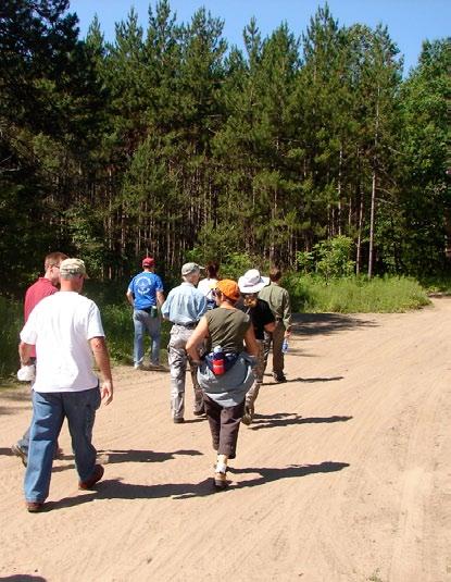
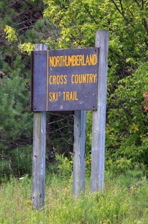
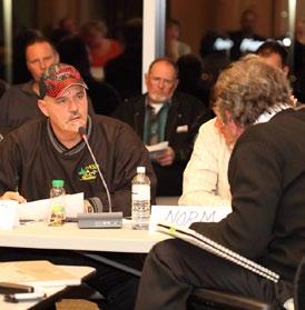
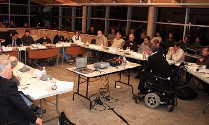
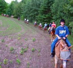
173 Northumberland County Forest Advisory Committee Facilitator s Summary Workshop No. 9 V2

174 Contents 3 Introductory Remarks 4 Facilitator s Overview 7 County Presentation 19 Open Discussion 44 Next Steps 45 Supplementary Comments Northumberland County Forest Advisory Committee Workshop No. 9 February 26th, 2009 Northumberland County Council Chambers 555 Courthouse Road Cobourg, Ontario 2 P r e p a r e d b y O g i lv i e, O g i lv i e & C o m p a n y
 and it s my job, to report back to County Council on the deliberations that, we ve been going through over the past several months.")
175 Introductory Remarks Hello everyone, my name is Peter Delanty and I am a County Councilor. I m chair of the Forest Advisory Committee (FAC) and it s my job, to report back to County Council on the deliberations that, we ve been going through over the past several months. I want to welcome Forest Advisory Committee members as well as our guests who are at the back. This is the last FAC workshop before the public open house, which will take place on March the 26th. I m really pleased that the staff at the County have been able to meet with all the user groups over the last several weeks, We have come to a consensus with nearly every group. I think a lot of credit goes to those people who were willing to can give a little bit here as long as someone else was giving a little bit there. I m really pleased and we almost have a 95% consensus. I d like to introduce some new folks that are around the table. Now, if I could start over here to my left and if they could just stand; Doug Wharton the detachment commander from the OPP and Ed Chong also from the OPP. And as an alternate to the Ganaraska Conservation Authority we have George Alger. Al McPherson sends his regrets. I think this will be a great meeting this evening and as I said it s our last FAC workshop before the public open house. I m going to turn it over to Robb and then Mia and Fred are also going to be involved with the presentation tonight, but first Robb; glad to see you again Robb. 3 W o r k s h o p N o. 9 F e b r u a r y 2 6 t h, S u m m a r y

176 V6 Facilitator s Overview Northumberland County Forest Advisory Committee FACILITATOR S ATLAS Towards the Sustainable Use of Northumberland County Forest 2nd Forest Advisory Planning Committee Workshop Meeting Thursday, February 26, 2009 Saturday, 6 p.m. to 9 October p.m. 18, a.m. - 3 p.m. County Building, Building, 55 Courthouse 55 Courthouse Road Road Cobourg, Ontario 1 Good evening everyone, thank you very much; we re glad you were able to come out and I thank the public for also joining us tonight. As you from the public know you re welcome although you re not involved in the discussions. Let me start off with a couple of slides and then we ll quickly get to Mia s presentation, which I know is what you want to see. My role is the Independent Public Facilitator for these discussions and that means I have to ensure that it s fair for everyone; that you re treated with respect; and that your opinions are given a fair hearing. It s transparent because as you know we produce copious summaries that try to track and be true to the discussions that occur. Balance means no one will be allowed to dominate or hog the discussion and inform means the process will be based on the facts as opposed to rumor or innuendo. The purpose of tonight s meeting is to do three things; provide an update on the results of the meetings with the recreational stakeholder groups and Mia will be doing that presentation. After her presentation we ll have a round table discussion of those results and findings. Our final item for tonight is to get advice on the upcoming open house on March 25th. We ve created a new set of discussion The Independent Public Facilitator My role is to make sure the discussions are fair, transparent, balanced and informed. Fair means everyone will be treated with respect, their opinions given a fair hearing. Transparent means summaries of these sessions will be published. Balanced means no one will be allowed to dominate or hog the discussion. Informed means the process will be based on facts. 2 Purpose of the Meeting To provide an up-date on the results of the meetings with the Recreational Stakeholder Groups Roundtable discussion of those results To get advice on the up-coming Open House on March 26, 2009 Discussion Ground Rules Defend the other person s right to say what they want even if you disagree with them Encourage openness, transparency and fairness in how we deal with each other Challenge self-serving statements that do not consider the larger public good Engage the people you don t like or understand in a last ditch effort to find some good in them Never kill an idea too fast once it s gone, it will seldom poke it head up again Tell the other person what you liked about their idea before you tell what aspects gave you heartburn DECENT, eh? P r e p a r e d b y O g i lv i e, O g i lv i e & C o m p a n y


177 ground rules that we re starting to test out. We call them, Canadian discussion ground rules, and it s a notion that comes from an article by a woman who said Canadians are if nothing else decent. So we took the word decent and said, okay, could we create a set of ground rules around the letters of the word decent? So the first one is D for defend the other person s right to say what they want even if you disagree. That s a typical Canadian thing like we can disagree, but you have the right to your opinion. E for Encourage openness, transparency and fairness in how we deal with each other. C is for Challenge self serving statements that do not consider the larger public good. E is for Engage the people you don t like or don t understand in a last ditch effort to find some good in them. Doesn t that sound kind of typical of Canadians? We also give the benefit of the doubt. N is for Never kill an idea too fast; once it s gone it will seldom poke up its head again. And the final one is T which is to Tell the other person what you liked about their idea before you dump on them. So, it s kind of a new version, what do you think and are they okay to use? The agenda; I m going to get through this as quickly as I can so that we can get to the County staff progress report on the results of the discussions with the recreational stakeholder groups which Mia will do. Then we ll do the comment and discussion from the members and then next steps. We ve handed out two paper assistants, you re used to using them; I don t need to drag it out. Also just wanted to mention we ve overhauled the website to give it a new look and feel so if you haven t been on it for a while you might find it kind of interesting. So we try to make sure it s totally up to date and that the public have that latest information on the ongoing approach that s been used. And so now we can move on to the next presentations which I thought the photograph would be appropriate Ben, in terms of what we re trying to protect and do. So with that here s Mia. Forest Advisory Committee Thursday, February 26, p.m. to 9 p.m. AGENDA 6:00 p.m. to 6:30 p.m. A Hot meal will be Served 6:30 p.m. to 6:45 p.m. Introduction and Purpose of Meeting Robb Ogilvie, Independent Public Facilitator 6:45 p.m. to 7:15 p.m. County Staff Progress Report Results of Discussions with Recreational Stakeholder Groups Mia Frankl 7:15 p.m. to 8:45 p.m. Comments and Discussion with the Members of FAC 8:45 p.m. to 9:00 p.m. Next Steps Preparations for Open House-March 26/09 Prescribed Burn Meeting- March 24/09 Update on Facilitator s Atlas Two Paper Assistants New Look and Feel to the Website W o r k s h o p N o. 9 F e b r u a r y 2 6 t h, S u m m a r y
178 County Presentation Good evening everyone I m Mia Frankl the County s Forestry Management Officer, one of many of the staff behind the scenes doing all of the work including tonight s presentation. Thank you to all of our FAC members for your ongoing commitment and dedication and to the work of our consultants and support staff. There are, supplementary materials at the front of the room. FAC Work Shop # 9 February 26 th Courthouse Road 6 9 PM This is the 9th Forest Advisory Committee Workshop. We ve got quite a big presentation to go through tonight. I d like to first take you through all of the slides and ask you to hold discussion, write your questions down; make notes on the handouts that I ve given you. Robb will then take you through a facilitated discussion. Goals for tonight s meeting are pretty straight forward; we re going to present the trail network proposals and hunting proposals 1 and then turn it over to you for what I am sure will be a lively discussion as they always are. Goals for Tonight s Meeting 1. Present Trail Network Proposals and Hunting Proposals 2. Discuss and receive feedback before going to Open House Presentation Outline to 2009 Meetings 2. Basis for County Staff Approach to Decisions 3. Review of User Group Meetings 4. Trail Network Proposals 5. Hunting Proposals 6. Enforcement 7. Open House Arrangements - March Schedule through to Council Decisions We ll review where we ve left off when we last met and the steps that County staff has been working on. We ll go over the objectives and guiding factors for the conclusions that you ll see here tonight in 2 3 terms of review of user group meetings (who and when). Then we ll go through each of the user group meetings, present a summary of discussions and the resulting staff trail network proposal. We ll talk about hunting; what, where, when. We ll talk about enforcement issues and I think at that point we may need a little bit of a break, 5 minutes and then we ll come back. Robb will take you through the facilitated discussion and as he mentioned we ll wrap up with some discussion on open house and next steps. We last met in October We were reviewing the environmental sensitivities atlas; the staff has been doing a lot of work behind the scenes, since then. You guys will recall map F from the atlas; the land use map. This map shows basically two different forest ecosystems conveniently divided by highway 45; East of 45 being the more sensitive ecosystem of the forest. Recap: Where FAC left off Atlas findings on the sensitivities of the various areas of the Forest and the implications for motorized and non motorized uses were presented County staff committed to meet with all trail groups to develop: Proposed trail system Discuss terms of user agreements Report back at next FAC Work Shop for feedback Page 65 of Atlas, Map F 4 6 P r e p a r e d b y O g i lv i e, O g i lv i e & C o m p a n y

179 Between our last workshop and now we have been meeting with our trail user groups on the advisory committee, the hunting group and the Ontario Federation of Anglers and Hunters. We also met with the MNR s conservation officer Kent Hodgsen. He was unable to join us tonight, but he should make it to the open house so everyone will have an opportunity to meet him then. A lot of members from each trail group came out to these meetings. We had a lot of positive discussion and I ll go into that later in the presentation. So the factors which guided the drafting of our proposals. Point one; we want to implement management, under the spirit and intent of the Oak Ridges Moraine Conservation Plan with consideration for things like the Endangered Species Act, areas of natural and scientific interest and a legislative requirements to provide a trail for the Oak Ridges Trail Association. 5 We want to reduce the impact of trails to protect the ecosystem; and when I say we I mean the County, the FAC and the public at large; protecting the forest s ecosystems is first and foremost. This is something we ve been hearing a lot of at our workshops. We d like to provide larger areas with minimal disturbance for interior species; some birds prefer interior. This includes wildlife as well as vegetation restoration; again taking a conservation approach to management on this property. We want to consider sharing trails to reduce the overall number of trails. This also combines our volunteer resources so we can get more than one user group working together and try to foster community stewardship among the user groups rather than as individual groups. We also talked about sharing trails in opposite s seasons since obviously not everybody is compatible year round. Steps taken by County Met with all trail groups, hunting rep, MNR Conservation Officer, O.P.P. & Alnwick Haldimand Twp. rep. Discussed current use, compromises, desired trail experience & network County staff developed trail network proposals for the groups based on: Meeting discussions Atlas Trail Study 6 Factors which Guided Drafting of Our Proposals 1. Must adhere to provincial legislative requirements 2. Reduce number of trails & restore significantly degraded sites 3. Shared trails for compatible users a) Work together to maintain a trail system b) Share trails in opposite seasons More guiding factors: In terms of maintaining regional trail linkages County staff felt that it would be a step too far to place an outright ban on motorized use to the east of County Road 45. There are some regional trails that run through our area that provide value and as we ve heard from most of our motorized groups that the desired experience is a touring route; a destination based route that gets you from point A to point B over the course of a day. In terms of point five; there was a desire for more year round multi-use trails. In the winter time the Beagle Club trails are quite taxed with the skiing so let s have some other year round opportunities in other parts of the forest. And point six we want to work with our user groups on trail maintenance and issue resolution. For example create safer access, provide up to date information for emergency responders and OPP, establish some 911 signage 7 7 W o r k s h o p N o. 9 F e b r u a r y 2 6 t h, S u m m a r y
180 out there. We tried to stay away from user fees as much as possible; let s use our volunteers instead of our tax dollars. And of course all of this has to be something that s easy to sign and enforce. It has to be clear and concise to understand both for the public and for those who would be enforcing it. We want to have an enjoyable experience out there with rules that are easy to understand and be able to know where you re supposed to be and where you re not supposed to be. Trail Meeting Schedule Date Trail Group Dec 4 Oak Ridges Trail Association Dec 8 Dalton McDonald, Twp of A-H Dec 11 Snowmobilers Dec 17 Motorcycle Trail riders Dec 30 ATV Riders Jan 8 Cross country skiers Jan 8 Mountain bikers Date Jan 13 Jan 20 Jan 22 Jan 22 Feb 4 Feb 23 Trail Group Horse back riders Anglers & Hunters, Conservation Officer Northumberland O.P.P. Orienteers Motorcycle Trail Riders (2 nd meeting) Northumberland O.P.P (2 nd meeting) - 14 meetings in total - Jan 13 Hikers (Pine Ridge Hiking Club) Guiding factors continued Maintain motorized regional trail linkages & connectivity 5. Minimize potential for conflicts among users 6. Minimize taxpayers operating costs & legal liability exposure 7. Clear, understandable & enforceable designated use areas & rules You can see that we ve had a lot of meetings with a variety of groups. One thing to point out here is, the Pine Ridge Hiking Club. As I just mentioned we want to establish some more year round hiking trails so we met with the Pine Ridge Hiking Club and other local hiking club in addition to the Oak Ridges Trail Association that has a very specific mandate. 8 At these meetings; the panel was County staff and our consultants. We had two meetings with the motorcycle trail riders. We did that second meeting with the OPP because there s just a whole pile of legislation to understand on how to best enforce trail use. We had fourteen meetings in total with our user groups that helped forge the recommendations you re going to see here tonight. By in large most of the groups had very positive discussions with the County and consultants. Most were very willing to compromise, work together, put the forest first, reduce trails, and pair up on trails. We also talked about compatible user types; who can you share trails with each other; Can you do it year round? What seasons might you need to be opposite in? Talked about maintenance and each group s ability or willingness to contribute to trail maintenance. This discussion was positive and there is a lot of, human volunteer resource out there and of course the County would support that in any ways we could in terms of infrastructure and perhaps some annual grading of the road, forest access roads and so forth. We talked about insurance and how that could be provided between the County and the trail group who would maintain the trail. Folks who want to come out and use the trail will be covered under things like the Occupiers Liability Act. This is to verify the protection of the volunteers working on the trail as well as the County providing that trail for public use. We talked about the signage; what are the shared signage needs? What kind of things would we need to have on welcome signs? Of course we need location signs and 911 signs. Similar signage needs among different groups and other refers to things like having a multi-user garbage cleanup event where 8 P r e p a r e d b y O g i lv i e, O g i lv i e & C o m p a n y

181 Trail User Group Discussions Key points of discussion: About your group E.g. Type of experience, trail desired Membership numbers Compatible user types Maintenance In kind work and County support Multi group clean up events Insurance Signage Other Trail Network Proposals 1. Oak Ridges Trail Association & Hiking 2. Cross Country Skiing & Mountain Biking 3. Horse Back Riding 4. ATV and Snowmobiling 5. Orienteering 6. Motorcycle Trail Riding 7. Hunting the snowmobiler s, the equestrians, the mountain bikers, the skiers; everybody gets out together and participates in doing this combining our efforts again. Another neat example of what others have done came up in the equestrian meeting on something that was done in Durham forest where they hosted the beast and bike ride and invited equestrians and mountain bikers to come out to get to know each other and agree on how to behave when they encounter each other on the trail. These are the groups that we ve met with over those fourteen meetings and now I m going to take you through a quick summary of each meeting and show you the maps. You should have the map handouts to follow along. Starting with the Oak Ridges Trail Association; this is pretty straightforward since it s a legislative requirement. They ve been quite pleased with the proposed route and you may notice a couple of differences with that route on the first map versus Oak Ridges Trail Association Trail Needs: Integral part of Provincial trail Single use trail Prefer single track Can use same parking lots as others Maintenance: One to two annual maintenance work parties Willing to participate in multi user garbage clean up Agreement: Standard template for whole Trail, can flex some content locally 13 the compiled map at the end of that handout. I am waiting on some updates, regarding private landowners to the east of McDonald Road. So, there is a proposed trail in place, Whether or not it stays exactly where it is we ll find out in time through discussions with the ORTA. So this is what that would look like and here is where, with your blessing and discussion, the ORTA trail could be. We also met with the Alnwick/Haldimand Township through Dalton McDonald who sits on our committee. As you are aware there are many Township owned road allowances that run through the forest. Alnwick/ Haldimand has passed the ATV by-law to allow, off-road vehicles on their municipal roads. So what we re hoping to achieve here is having at least two east/west routes, for the passage of these vehicles to maintain those regional trail linkages and to 9 W o r k s h o p N o. 9 F e b r u a r y 2 6 t h, S u m m a r y
182 spread out the flow of traffic. And just a refresher these are all township roads, Dunbar Road being the main road through the forest. Alnwick-Haldimand Township Utilize unopened road allowances for motorized use as much as possible Maintain regional motorized trail systems Do not concentrate too many vehicles on one trail, spread traffic where possible Minimize cost to manage Forest and enforce regulations Moving right into snowmobiling and again in terms of motorized use, we felt it would be a step too far to outright ban snowmobile use so let s have these east to west corridors. Barb with the snowmobile clubs was positive about that. We also talked about maintenance. They already have a memorandum of understanding MOU in place in accordance with the County standards across the province. These guys do a lot of work. They have equipment for all the grading and in fact I ve seen folks out there throughout the winter doing grading all hours of the day. They also do a lot of training, they run a lot of courses, and they do all the permit issuing. Locally the great Pine Ridge Snowmobile Association has about 150 members, but issues upwards of 400 passes for this area, each season. They were willing to change the routes as we proposed, but definitely want time to make sure they can communicate that with their members and take the time to plan and prepare for a change like that. Signage is seasonally posted and removed as part of their risk management. We talked about whether or not there could be some sign sharing with the ATV signs so they could stay up year round. That is something to be explored a little bit further and they are absolutely willing to work with the ATV club and in fact they ve already collaborated on some grading. So, this is the proposed motorized route. As you can see we ve routed along Dunbar, along the perimeter of the forest through the central track and then out across the east. There are a lot of similarities Snowmobiling Desired experience: Destination based riding with some local touring (e.g. with family) Willing to compromise on fewer east-west trails Compatibility: Willing to share with ATV s in opposite seasons Agreement: Standard MOU across Ontario, can add amendment for Forest in particular between the ATV meeting and the snowmobile meeting. We talked about when the season should start; for example Ganaraska Forest starts in May and ends in November. Correct me if I m wrong Barb; but the memorandum of understanding P r e p a r e d b y O g i lv i e, O g i lv i e & C o m p a n y

183 with your club is from November 1st to the end of April. So a little bit of juggling with the dates will be required. Again, we discussed sharing trails and working together on grading. Mike tells me that the NDATV would like to build up their equipment capital and get their own graders. Right now their ATV Riding Desired experience: Touring, low speed, destination based and linkages across County Already permitted on twp roads, provides loop connections Maintenance: Work with snowmobiles on grooming etc User education and ATV safety Agreement: Seasonal use (e.g. start May or June to end of October) Educate to compliance of designated trail Requested membership as a requirement (needs more study) County requests standard MOU 19 members are donating their private equipment in kind which is very generous of them. So, the ATV map is the same as the snowmobile one. The cross-country skiing group told us that they had a lot of volunteer resources that they could contribute. They are very willing to work with other groups. They definitely want to cater to the classic style of cross-country skiing, which is single track. The existing trails that they have (i.e. the colour coded trails in the Beagle Club) are quite satisfactory. Opposite seasons with mountain bikers, would suit their needs. They have similar signage needs as other groups and they are willing to sign a memorandum of understanding, with the County. In terms of hunting; what we heard from them is they would just want to know when and where hunting would be permitted. On the cross-country ski map, you might recognize these outlines here as the existing colour coded ski trails. These could become the designated ski trails with other activities on some of the other trails that exist in there. There is also the possibility of doing a little bit more in this triangle here. With respect to mountain biking there are many similarities with the skiers. One way directional routing was quite important, similar signage needs. Opposite seasons with skiers is a possibility. One thing that came out of the mountain bike meeting was and we ve all heard it before via Helen who s ill and I told her to stay home and get healthy rather than come here; is that mountain bikes and horseback riders aren t necessarily compatible. Mountain bikes can be quite quiet and may come up on horses unexpectedly. It doesn t sound like there have been too many actual incidences through our user surveys and chats with the two groups. What we ve Cross Country Skiing 20 Desired Experience: Single track, one way directional Dedicated cross country ski trails Existing trails satisfactory Compatibility: Opposite seasons with hikers and mountain bikers Agreement: Sign an MOU for insurance and maintenance W o r k s h o p N o. 9 F e b r u a r y 2 6 t h, S u m m a r y


184 done and you ll see the compiled map at the end is routed them around so there will be intersections, but they won t be sharing trails. And so the mountain bike is the same as the ski map. With respect to the Pine Ridge hikers there will be more hiking opportunities east of 45 via the Oak Ridges trail and side loops, but we wanted to establish something a little bit more for them. We do have a lot of beautiful forest, that offers a lot of opportunity and we definitely have some good areas that could accommodate some parking. So here is where we would propose a few hiking loops in this area. We could have a parking area right here. This would match with the Oak Ridges trailside loop and then you could have a couple of other options if you like to go for a bit of a longer walk. Hiking Desired experience: Year round hiking Snowshoeing, dog walking, skiing with a dog Linear and loop systems Maintenance: Minimal needs, can provide work parties as required Insurance: Standard MOU for insurance and trail maintenance 25 With respect to horseback riding, the equestrians told us that they weren t particularly interested in winter riding. Of course April would be closed to most uses. They also said that they could stay off the single tracks. Some of the equestrians do like to go on the narrower trails, but based on the conflict in terms of the trail s surface from the horse hooves and the needs of skiers/mountain bikers; they re willing to stay off of those. The kind of experience that they re looking for is basically to go out for an hour or two and come back to their trailer. Because the forest doesn t have a lot of water source they re very accustomed to returning to their trailer. It s sort of their daypack that they keep going back to. So they re looking for 2 to 4 hours for a days ride; go out, do a loop and come back. Some of the things that they were a little more concerned about were, parking lots; there are some, specific parking lot 26 Horse Back Riding Desired Experience: Loops to and from trailer parking Trailer parking lot specifications Like single and double track trails Maintenance: Willing to work with other groups to maintain No road grading equipment Agreement: Can provide insurance Can sign MOU via provincial umbrella needs for a horse trailer unloading and so on. So this is what we re proposing. It might be kind of hard to overlay it in your mind right now. You could look ahead to the map in your map handout, but basically on the forest access roads in the Beagle club area and then on existing forest access roads P r e p a r e d b y O g i lv i e, O g i lv i e & C o m p a n y

185 east of 45 you re probably noticing some overlap with the motorized route and this was something that Helen mentioned at the equestrian meeting and I ll welcome you to bring it up for discussion as to how you feel about sharing motorized with equestrians, during part of the season. The equestrians did say obviously that they do prefer to share trails with noisy users. So an ATV or a motorcycle you can hear coming up. Cycling, hiking we didn t really talk so much about, but those guys are much quieter and can spook the horse perhaps more readily. There is no map to accompany Orienteering. These guys tend to avoid our Forest year to year because they don t want to get too familiar with the property. The whole idea of orienteering is to navigate on a map and feel lost and find your way around. So they tend to be more event based. Once every few years, the time of year that they do that is early spring or late fall. It doesn t fall into winter and it doesn t overlap with hunting, and it doesn t overlap with sensitive times of year for our species at risk; these are plants and animals that come out later in spring. Of course less trail the better. Something that was kind of neat about this group is that they feed into a provincial group, which feeds into a national group, which feeds into an international group. So orienteering is really quite large and in fact Roman was telling us that sometimes they get international visitors to their meets. So it s kind of an exciting opportunity for the County. They keep very excellent maps detailed right down to, each boulder or different trees. That brings us to the, Final Trail Network Map Version 1. This is what all those trials look like together. You re probably noticing that the hiking trails aren t being shown here. That s because the GIS tech and I couldn t match up our lines perfectly, but I don t want you to think that they are not being considered. We ll have that corrected for the summary that goes with this. So now I d like to address motorcycle trail riding. This is where I ll start referring to the memo that you received yesterday. Thank you to everyone for accepting it the way that you did and to Ken for turning around comments as quickly as you did as well as other NTR members. Unfortunately we re not able to come to a mutually satisfactory compromise here. We had two meetings with the Northumberland Trail Riders and the Ontario Federation of Trail Riders. The reason that we use NTR up here in this presentation is they re the local club and so we ve had Ken sit in at those meetings and provide support for them, but this is dealing with our local group. Definitely several members Orienteering General: Concerns with harvest, need to be kept up to date on locations Seasonal-early Spring, Fall, never in winter Off trail, less trails the better Feed into international association Do provide insurance for events Motorcycle Trail Riding County staff s goal to work out compromise solutions with all groups to present to County Council Significant efforts put forward Not able to arrive at mutually satisfactory solution which meets guiding factors W o r k s h o p N o. 9 F e b r u a r y 2 6 t h, S u m m a r y
186 Discussions with NTR Motorcycle Trail Riding continued Role of Forest Many areas of philosophical disagreement Two meetings to attempt to reach an agreement In the end, no agreement Not looking for same touring experience as other motorized groups Seeking technically challenging trails at speeds of km/hr on narrow and winding Forest trails Would like 100 km of trails Can abrade soils and cause rutting County Staff #1) Forest ecosystems must be preserved and protected #2) Recreational uses allowed but must not degrade environment NTR #1) Recreational opportunities for all taxpayers #2) County guiding principles and Environmental Atlas deeply flawed from the Northumberland trail riders attended the meetings; Staff and consultants were also there. We discussed the Atlas. We discussed the guiding principles. We discussed the existing trails that they have established as well as what future trails they would like to establish. This group has very different goals and objectives than our other two motorized groups on the committee. They prefer the windier and narrow trails in the interior forest and use the roads as a break. They ll do their technical trail riding on these closed loop circuits and go into the challenging terrain. When they come out to a road, that s when they like to take a break, maybe take their helmet off and stretch for a bit and then, slowly make their way along the road, to catch their wind until they hit another single track trail that takes them back into interior forest. What we are doing in these slides is presenting the position of the County and the position of the Northumberland Trail Riders. This is outlined in the handout memo. So, from the beginning the County has presented a very conservation based approach. We ve had a lot of buy-in since we started from the FAC and a lot of support from the public as well on this. The Northumberland trail riders like many of the other trail groups are concerned about recreation and how they could be impacted by management changes to the property, and they do disagree with the findings in the atlas. The forests lands east of County road 45 are crisscrossed in trails of all kinds as you can see on some of those maps. The County is looking to reduce the overall number of trails not just motorized; trails in general. What we want here is a low cost low-tech trail plan. We want to reduce user conflict, we want to increase user safety and we want to preserve the natural core areas. Our Tables and comparisons are based on what we were told by the Northumberland Trail riders and OFTR Ontario Federation of Trail Riders. The Northumberland trail riders are about 30 members and so we were asking if that would be enough for volunteer maintenance and patrol and this kind of thing. We anticipate that as a land use agreement comes into place when trails are established membership will grow, as was the case in Simcoe County forest. The NTR said that to ensure impact is mitigated on a forest ecosystem, it needs to be spread out over more trails rather then condense it to one area in particular or one trails in particular. 14 P r e p a r e d b y O g i lv i e, O g i lv i e & C o m p a n y
187 Forest Lands East of County Road 45 County Staff Environmentally very significant & vulnerable Existing damage in violation of ORM Act and Conservation Plan Too many trails now Need to reduce # of motorized trails overall NTR Ecosystems have withstood and adapted satisfactorily Existing trails are legally permitted As ridership increases the # of motorcycle trails needs to be increased Trail restrictions will lead to excessive erosion 35 County Staff N ld Cty Medical Officer of Health concerns re. existing accidents and injuries Concern re. exhaust emissions York study very limited Health Benefits NTR Motorcycle riding a benefit to health York study concluded better than jogging Trail riding supports M.O.H.P. health objectives 36 No Other Recreational Options County Staff Motorcycle trails require frequent maintenance GRCA trails closely available Other options- CKL, Haliburton County, Limerick Forest Intensive uses should be on single use facilities and users should pay NTR Other groups (e.g. hikers) have other options, they have none Public lands should be open to all taxpayers at no cost to them 37 We also talked about health benefits with the trail riders and had some good discussions there. The Ministry of Health Promotion (MOHP) in this area does have a very active promotion on right now for all trail user types; motorized, non-motorized. Everybody needs to get out and exercise and get healthy. A recent letter from Dr. Lyn Noseworthy, the Northumberland County Medical Officer talks about health concerns related to ATV s related injuries. However there are studies for and against the health benefits of Trail bike use as well as around all kinds of different uses. The health units provided us with many different health studies and if you guys would like to read some of those just let me know. We talked about other recreational options and what s possible around. We ve got Ganaraska forest. It s within 50 kilometers of the County forest. They do have motorcycle trails available there; the OFTR clubs established those. Other options include the City of Kawartha Lakes; CKL, Haliburton County and Limerick Forest. There are pay and play facilities. The trail bike rider s position is that other groups such as hikers, cyclists do have other trail options in the County and public land should be available to all taxpayers by all means. One thing about these other options for trail bike riding; is that they are far away. They are, City of Kawartha Lakes; not too bad, Haliburton, Limerick you re talking 2 or 3 hours from here. So these kinds of facilities tend to be further away. So that does make a bit of an unfortunate situation for folks who like to ride in their home grounds. We talked about the historical motorcycle approval. We ve heard Ken bring up the 1997 council resolution and you ve seen that in the memo. The approval does state permission for future events. There were no terms and conditions. There was no renewal period. It s very vague and the fact of the matter is that the County is not bound to it. The Oak Ridges Moraine Conservation Plan has come in 2001 and an expansion of trails would certainly have to meet the criteria in that legislation. We do recognize absolutely that there is an investment by the Northumberland trail riders in the trails here. It s unfortunate that council resolution was as vague as it was and we have to plan for the future and the present. County staff conclusions from this are; the Northumberland trail riders themselves right now are a small group granted with potential to grow. It s not the local group that s the problem, that s not what we re concerned about. We re concerned about the larger demographic. A lot of places in the greater Toronto area have closed areas to motorcycle trail riding and other off-road vehicle use. 15 W o r k s h o p N o. 9 F e b r u a r y 2 6 t h, S u m m a r y
188 Historical Motorcycle Approval Historical Motorcycle Approval County Staff A trail was approved for a fundraising ride NOT extensive trails throughout the Forest ORMCP legislation supersedes all County is not bound forever by 1997 approval and must meet ORMCP NTR 1997 Council approval for motorcycle trails in Forest Significant NTR investment in time and effort to establish trails Not fair to take away 38 County Staff A trail was approved for a fundraising ride NOT extensive trails throughout the Forest ORMCP legislation supersedes all County is not bound forever by 1997 approval and must meet ORMCP NTR 1997 Council approval for motorcycle trails in Forest Significant NTR investment in time and effort to establish trails Not fair to take away If we establish official trails here and if we welcome more trail use we may see sizable increases. In one example that Ken gave and I mentioned earlier; Simcoe County Forest had under 50 members; established trails and then grew to over 400 members. You need to think if that s something that we can accommodate here with all of our other users and our environmental sensitivities. So the County recommendation is to offer them the same motorized recreational opportunity that we ve offered the ATV s and the snowmobiles and for them to share those trails although not ideal to that riding style. This is what we re proposing and so again we show, the same motorized map that we saw for the other motorized folks. As we move into the hunting proposal, I think we all know somebody who s been in a car accident with a deer. Perhaps injured with lasting effects. Recommendations 1. That motorcycle trail riders be offered the same Forest touring experience as the other motorized groups 2. That motorcycle trail riders be restricted to the same trails as the snowmobiles & ATV s 40 Over 40% of our traffic accidents in the County are wildlife related. There are also farmer s field and the vegetation of our County forest, which need to be protected from deer over population. We ve met with the Ontario Federation of Anglers and Hunters and the MNR s conservation officer. As a result we proposed the following; no hunting year round of any game species to the west of County Road 45 and to allow deer hunting to the east of County Road 45 during the shotgun and archery season. We didn t include muzzle loading because our hunter surveys showed it was not pursued in high numbers. The shotgun season is November 3rd to November 16th. Muzzle loading is December 1 to 7. We wanted to keep things simple instead of having the season s pop in and out. Archery is there and shotgun use tends to be the one that 16 P r e p a r e d b y O g i lv i e, O g i lv i e & C o m p a n y

189 most folks are concerned about. While I m on this slide I want to mention we talked about ATV game retrieval and we re going to give that a little bit further study. There are certainly other places that allow ATV game retrieval. We do have motorized routes and whether or not you could go off of those Hunting Proposals Hunting Proposals continued 2 Temporary signage at all trail heads & parking lots during deer season Ads in the paper and on the radio before and after season begins & ends OFAH has concerns with loss of turkey season All agree that deer over-population is an issue Damage to Forest and farm land Motor vehicle accidents Presently County is exposed to significant legal liability with year round hunting Hunting Proposals continued Recommendations supported by MNR Conservation Officer West of County Road 45: No hunting year round East of County Road 45: Permitted deer seasons only Shot gun Nov 1 to Nov 15 Archery Oct 1 to Dec 31 Muzzle loading not permitted trails to retrieve your deer will be given further study. To communicate this with the public, we would do temporary signage and that means installing it the week before the hunting season and removing it after. It s something new that would really stand out perhaps even be separate from the usual welcome display. We would have ads in the paper and on the radio before and after; really do a big advertising blitz. We would post it on the website, communicate it through our trail groups. The Ontario Federation of Anglers and Hunters (OFAH) have some concerns with any restrictions on hunting especially the loss of the turkey season. However the conservation officer mentioned that the County Forest provides habitat for the turkey s to breed and live in, but the likelihood of shooting them in the forest versus in a farmer s field is somewhat negligible and your likelihood of 44 success is probably better outside. I m sure that will come up in the discussion. It should be pretty clear to understand what side of the County road you re on when you re out there, making it something easy to sign and enforce. This leads us into County forest enforcement. This slide show you the complexity and all the different legislation that we need to ensure that we apply appropriately. I m pointing out that the Highway Traffic Act does not apply to the County forest off of the township roads. Off of the township road it s essentially treated as private property owned by the public yes but treated as private property under the law in terms of how we can enforce uses. As I mentioned we ve been meeting with the OPP and we ll continue to meet with them and you ll see in our next steps that we have some things on W o r k s h o p N o. 9 F e b r u a r y 2 6 t h, S u m m a r y
190 County Forest Enforcement Enforcement Provisions 1 Enforcement Provisions 2 Applicable legislation: Trespass to Property Act Off Road Vehicles Act Occupiers Liability Act County can pass by laws to: Exclude certain types of vehicles e.g. ATV s, off road motorcycles To restrict all motorized vehicles to well signed trail corridors Highway Traffic Act does not apply to Forest County cannot apply HTA restrictions e.g. license, insurance, noise 46 Goals: Designated Use Areas and Trail restrictions are easy for the public to understand Sufficient signage and clear rules so O.P.P. s job is facilitated 47 Next Steps: Prior to Open House meet with Alnwick Haldimand and Hamilton Twps. and O.P.P. to discuss enforcement issues Develop a staged plan to implement signage over 3-4 years Priority areas for 2009: Lookout Mountain Mud Holes Areas East of CR the agenda to address that. We can pass by-laws on unauthorized use such as illegal dumping, camping and so forth. We have some pretty clear enforcement goals here. Clear and simple; you ll keep hearing this through the presentation. We want the public to be able to understand it so they can go out and enjoy their experience without having to worry about whether or not they re in the right area. We also want to make sure that if we have by-law officers and OPP out there enforcing the rules that they can do it well and do it properly. The last thing we d want to see is a charge to get laid and then have it turned around and cancelled out because signage or something like that was unclear. Prior to our open house in a month from today we would like to meet with the Townships of Alnwick/Haldimand and Hamilton, and bring the OPP along to talk about how we can deal with those road allowances and property that is not a part of the forest. Of course we ll have a staged plan that will take a few years to implement and we ve highlighted some priority areas of course for The next slide here is the open house slide and as Robb mentioned I d like to leave that for the end. That will serve better as a wrap up. 18 P r e p a r e d b y O g i lv i e, O g i lv i e & C o m p a n y

191 Open Discussion Robb: To start the discussion I want to get a sense of what you liked in terms of the presentation and what you didn t like. Comment: I have nothing to say but a commendation for the work that has been done by the County staff and everybody else involved. The compromise that has taken place is phenomenal. I m really proud of the presentation and the work that has gone into it. Nothing more than it really shows a great deal of sharing. Comment: I still have some questions about certain areas, but I d like to come back to that later on after I hear some other comments. Q: With respect to the question about ATV s being used to bring out their game in the hunting season; do we know how many deer get shot in the forest each year? We don t eh? And I guess there s no way to track that? Does the MNR keep tracks of the tags where they come from? A: The MNR keeps track in terms of the wildlife management unit, but not for specific areas the way their database is set up it doesn t get that specific. Q: I just wondered if we could relate that to how much use (i.e. ATV use) it would be during that hunting season? A: Well, because you re going to be in an area where motorized use is disallowed, right. Depending on how much they d be in their getting their game out or whether they re using it to move from stand to stand, sight to sight. Comment: Yes, and how repetitive it would be throughout that month because you re talking archery season; archery season goes from October to December the 30th, right. Q: Do they have some kind of anecdotal sense of what kind of usage we are talking about? Comment: I liked a lot of the presentation. I think everybody here got his or her eyes open about what s going on and, compromise is the key word, in making this all work. A couple of other things that, we touched on; a south end trail and an east/west trail for the motorized groups and a couple other little north/south accesses to connect those two and one to connect into the hydro line. We need some clarification maybe we can get into that later. Q: Could you put the map up and show us--? Comment: Show us what Mike s referring to so we all know what you know. A: Thanks Mike, for bringing that back up. I said I d touch on it and I forgot. So, going to our motorized route, when we met we had looked at a route that 19 W o r k s h o p N o. 9 F e b r u a r y 2 6 t h, S u m m a r y

192 would run along the bottom here and actually more along here. Now, the reason that we ve taken that off and routed it along the north is because that it goes off and on of County forest property and we can t approve something that s not on our property. So if an agreement comes back with Hydro One that says those routes can be used, then we can put a southerly link along the bottom. Otherwise it would be sort of here and there and wouldn t really go anywhere. So that s why its not shown. Comment: That would be up to the trail groups to see if they can get a land use agreement in place for those sections of trail that would be needed for conductivity to the County forest. Q: Can I ask Barb what the snowmobile club does? A: We are within the forest because the 10 trail is within the forest. But that is not Hydro owned property. Q: The hydro lines there? A: No, there are several private landowners through there. They re all land locked pieces of land. Q: And what do you do to groom them? A: We don t groom that much down in there. Q: You don t groom the hydro line? A: No. We come through it to go south. Question: Okay, so what s going to happen, you re going to explore- further? Comment: The other thing that I thought we talked about was a trail in the forest that goes to the number 10 trail that runs north and south from Gleason s Corners. Comment: Yes, I think it comes off Morris Road from the hydro road there and crosses County Road 45 into that little parking lot just below Beagle Club Road. And it whips up and comes down through and then back out to the hydro line and then back in. And then from McDonald parking lot east again off everything to the south. We talked about that. A: We deliberated over the results of all of our meetings and so this is what we re offering as the motorized route. If you d like further discussion please have that tonight and we can continue to work and see if there are other options. Comment: Yes, because once you come back off the hydro line at Centreton then you d only have that one route that comes from the parking lot east. Comment: And it will just take you to the 10 which runs south and then you re right back out. 20 P r e p a r e d b y O g i lv i e, O g i lv i e & C o m p a n y

193 Comment: It is to the south of the forest and it actually runs in that smaller area to the east end there and it s probably not a lot of area. I think we sent you the GPS it was on that one map, but anyway you can look at that. With the Northumberland trail riders; did you talk about the areas over in Haddlesey s Hills? No, sorry Minnifie s property that just comes in off Turk Road. That whole big chunk of land there; they could make some good routes and a track out there and you could hold some events there. I don t know if it s big enough for them. Q: I believe you re referring to this area somewhere around here is that right? A: Yes. Q: Turk Road somewhere around here? A: Is that where Turk Road comes in to the bottom right there? A: Yes, down around here. Comment: Yes. I don t know, every time I go out for a ride, there s always ATV s or dirt bikes in there running around that little course and up along the hills and stuff in there. A: That didn t come up during our meetings, but it s on the floor now. Comment: Well, since we re talking about Ken s area let s wait until we get around the table and come back in on that topic. Comment: Staff was able to come up with workable solutions for almost every group here except the trail riders and that s unfortunate. It would be nice if they had a spot where they could play just as we all have a spot where we could do our sport. But other than that I think it s a marvelous job they did. Comment: I always felt right from the very beginning that there was room for everybody and that a lot of compromises could be made where everybody gets a little piece. I still hope that can be accommodated for the trail riders. I don t see timber harvest here anywhere Mia, but I m sure you have that in your back pocket. As you know, we want to maintain that it s very important to maintain that forest cover and proper forest management. Q: There s a lot to digest here. The first one I got on my list and I do have a list is we represented by the hunters here tonight? Do we have a hunter? A: Yes, the OFAH is here. Comment: Alright, so they can speak to it, that s fine. Because the turkey thing kind of threw me for a loop. Comment: I think that s for us that live out there in that area; I think that (i.e. the turkeys) is as big an issue now as the deer. It s going to get worse. We can just see it getting compounded and doubling every year. I ve got turkeys running on my back step. So, I mean, we need some sort of control of that and hunting is kind of a balance. It seems that the only predator that a turkey has is hunting. So we need that and I think that has to be readdressed. Comment: Yes, no time limit? Comment: I see in the plan that the County wants to talk with the two Townships before the public meeting and it s too bad that we didn t have some of those discussions before this meeting because it kind of leaves me in a conundrum here. I don t know 21 W o r k s h o p N o. 9 F e b r u a r y 2 6 t h, S u m m a r y

194 what we re going to discuss or what your plan is or whether you re just going to show us what you ve just shown us here and say do you want that or do you not want that? I m not sure how you re going to approach that. And to have public meeting a final public meeting and not having sat down with the township yet. I think Alnwick/Haldimand kind of thinks of themselves as the host municipality; 95% of that forest is in our municipality. We re responsible. Our people live around there. We instigated the policing in the forest. We instigated fire protection in a better mode than we had in the past. We re the principal fire responders for the Township. I remember when we instigated the parking lot for where the skiers are; we had trouble on Beagle Club Road you couldn t drive down the Beagle Club Road on Sunday because there were so many cars between the snowmobiles and the skiers. So we made a deal with the County and said, if you upgrade that parking lot we ll plow it free of charge so that we can get these people off the road and keep our road clear and safer. So, we ve always been involved with the County and the forest and we feel it s rightly part of our lifestyle. There s no taxes paid for the County forest. There s no income that way for us, but there s certainly lots of costs. I m sure if you sat down with an analysis you could figure out how many costs that the Township has with that forest just because it s there but we have to live with and we do and that s fine. We never wrote a letter to anybody to complain about that, but we also think that we should be entitled to have some say on what we re going to do out there in the future. We think that s very important. And so far we think that we ve been basically somewhat limited to that. We don t think that our Township has been involved as deep as it should be. A: Yes, certainly and we definitely want to work more closely with the Townships in particular with the road allowances and if there s other items that you would like to work more closely with us on we re open to that. Comment: Well, we haven t been totally left out of the loop, but I don t think we ve been involved as deeply as Alnwick/Haldimand should be up to this point and we re starting to think that it s not going to happen. We keep thinking we re going to have some meetings; we re going to have some round table discussions, but really we haven t. We haven t had any discussions of any serious consequence on this whole issue and I think that s not right. Comment: The taxpayers out there they think that s their forest and they d like to have a little input on it and I can t blame them. So yes, that s an issue, and I don t know whether we can solve that by March 26th for your public meeting or not, but I think something should occur before that. A: We can do that. Comment: Our issues may be solved, but I am concerned that the motorcycle group was kind of banned from the forest. I m a politician and we have taxpayers out in all Alnwick/Haldimand. You may be banning the motorcycle group from Oshawa or something from that forest, but you re also banning the motorcyclists that live out in the backyard of Northumberland forest right there. That s a big step for us and to say that everybody was in agreement;i don t think I ve ever agreed to that. I m not going to say you can t convince me of it, but I certainly up to this point have not stood up and said that I don t want any motorcycles in the forest. I don t want it inferred that Alnwick/Haldimand or myself have done that. Politically that s not a very good statement. 22 P r e p a r e d b y O g i lv i e, O g i lv i e & C o m p a n y
195 Comment: At least there s good will to solve that problem. Comment: We know there are issues and we know they have to be dealt with. We don t always agree on how we re going to attack that situation and I think that s where we have to come to some compromise. Comment: As everyone has mentioned earlier I m an alternate tonight for the Ganaraska Conservation Authority. I really like the fact that we have moved the meeting along quite quickly. A lot of information here; a lot to absorb. Believe it or not I think I ve absorbed most of it I guess that comes with the 30 years experience with the authority. I have some concerns I have a few questions. I don t necessarily have to have them all answered now I m sure I ll have equal opportunity later. A couple quick ones maybe. I assume there s logging in the east side of 45 highway; is it fair to say that the whole area is open for logging or is there an area that s going to be kept and not logged? A: We do have a new silviculture consultant on board; James Rogers who s actually with us tonight. We have had those conversations and what they tell me is there s a lot of red pine that needs some attention right now. Our red pine plantations are more to the west of 45. They do have a 5 year plan for harvest in the County forest and so we re discussing with them exactly those kinds of things. Q: For this discussion, I was more interested in that eastern section east of 45 which I m told is quite a sensitive area and I have a lot of respect of course for the sensitive areas. A couple of notes to put forward on your presentation earlier, the Ganaraska forest did host a world-class orienteering event years ago. It went over really well. People came from all over the world. Orienteering is a great thing to have in the forest. Most times you won t see them of course. The only problem that we did have is if you ever do hold a world class event in the forest is the fact that they don t want to bump into anybody because if I m out there orienteering and I bump into a mountain bike or a hiker I m going to use the excuse that they slowed me down and so we basically had to keep the forest only for their use and had other user groups monitor it for us and police it for us so they weren t interfered with, but an excellent event. I noticed in some of the reading before I came to the meeting tonight there s a few references there to the authority which I d like to talk to later, nothing major just a couple of things I personally don t agree with. Definitely will go on record to say that any relationships the authorities had over the years many years with the motorized organizations, is they ve been a great partner to the authority. When we completed our professional audit report it should be noted to the committee that all the funding for that entire report came totally from all the members of the user groups. No money was spent from the authority for professor Marsh s report. The authority of course has always taken the position that the forest is there it s a multi-use forest; 11,000 acres roughly available for all user groups. I support what they ve done and I ve seen it happen over the years. So there s no doubt in my mind that all the user groups can work together and the concerns I ve heard tonight some of the minor ones; horseback riders and mountain bikers I m quite familiar with all their concerns. They do all work together and that beast and bike thing was an excellent thing that took place in Durham Region. They wondered how it would turn out, but it was great. They basically had two routes where they all met in the morning; the mountain bike people, the horseback people; they talked about each other s concerns and then there was a trail for the horseback riders to go on and a trail for the mountain bikers to go on. They crisscrossed in a few locations and at the end of the day it was just a plus/plus. Everybody had a great day and it was a real eye opener for some of the concerns that they each had with each other. I think I ll leave it at that for now and I ll have plenty of opportunity I m sure to talk later, thanks. Comment: It s a great step on moving things forward and it s amazing to see the amount of compromise that s happened so far, great. 23 W o r k s h o p N o. 9 F e b r u a r y 2 6 t h, S u m m a r y

196 Comment: I won t take up a lot of time then. I just have a couple concerns, again, the amount of work that s being done on this is pretty impressive for all the user groups they got together on this. With the meeting we had with the with Mia we had some questions about the trails that are in the 4B and the 2B areas; they re in that little triangle of land. Comment: Yes, those are an area that we had some concerns about for the more advanced cyclists who are out there who are looking to stay away from trails that may have some hikers or younger people out there. We asked for an area out there that would be kind of out of the way and I don t see that any sort of trails on or anything being allowed in that area or recommended in that area and I d just like to have some clarification as whether those trails or ones that are going to disappear or not. A: Sure Peter, that was a quick presentation so maybe it wasn t clear. I did speak to that and said that there could be opportunity to explore some more trails between Beagle Club and County road 45 granted they haven t been mapped yet. Q: You ve got the maps broken down as to certain users using a certain area and my concern with that is over where the hiking is allowed way over in the east end; does that mean that nobody can hike in the ski trails now? Is that the message that I m getting? Is that going to be the only area for hiking? Is that going to be the only area for mountain biking? Same for the horses or anything else? A: What we re developing here is some designated trails for some user types. The Beagle Club area definitely has a larger concentration of activity and if you look at your map compilation you can see that there are a lot of trails there, but essentially the idea is to designate set trails for set uses. In terms of hiking there will be hiking opportunities throughout the property amongst some of the Beagle trails along the Oak Ridges trail as well as in 5A. Q: Is that s the direction that we re heading in. A: In terms of the ski trails specifically Peter, the cross-country skiers did state that they did not want other uses in the winter on those trails. So those would become designated cross-country ski trails, but that s not to say that the Beagle Club area and other trails for example; the horse trails won t be used for things like snow shoeing, dog walking that kind of thing. Comment: According to your guidelines I m to be permitted to express any opinion so I really need to get off my chest the fact that I think, ATV s, snowmobiles and so on are brilliantly engineered machines which are admirably suited for doing certain jobs and I think from a societal point of view it s really unfortunate that so many people feel compelled to use them as toys and I think we ought to be using motorized vehicles to get where we need to go or to do what we need to do and to engage in recreational pursuits. It s unfortunate that we can t use human power. So that s my rant. However; I also need to say that I think Mia and the County staff have done an amazing job of working with all the people and groups and I think they are really to be commended. I do feel some concern about whether these proposed plans will meet with all provincial legislative requirements particularly with respect to the Oak Ridges Moraine Conservation Plan. I think there may be some battle brewing to do with motorized use in this sensitive land however, we ll have to see how that works 24 P r e p a r e d b y O g i lv i e, O g i lv i e & C o m p a n y

197 out. I think the proposed ATV, snowmobile useare proposing more or less straight fairly level, relatively slow speed routes. I wonder about that use as opposed to what I ve often encountered both in this forest and in the Ganaraska. Many times when I ve been walking or skiing, an ATV or a snowmobiler slow down, wave, say hello, have a chat and we both move on, but there are those who, come by way too close way too fast and it s pretty scary. Maybe these are the people who aren t members of the clubs and, I don t know how all that is going to be policed and I wonder how it s going to be possible to effectively police all the use in all this land because there s a lot of land where according to these maps, should have no use which I think is as it should be, but, I think of the potential difficulties policing all that. And I have a question for the snowmobilers in particular; do the snowmobilers object to skiers using their trails? A: We encounter lots of skiers out on the trail especially to the east side of the 45 because there s no ski trails in that area. Lots of times we ll encounter skiers, but it s not fun when they re coming up the middle of the trail because sometimes you don t see them and we can t hear them coming whereas normally you can hear the snowmobiler coming. Comment: We ve been out there and come over the top of a hill and there s a skier down in the middle of the trail. So, that can be an issue yes. Comment: In my experience it is mostly very benign. You wave and pass by and carry on. But the odd problem does occur. Comment: Some have tried to run us off the trail and it s pretty scary. But if you want to skate, you need to get onto the snowmobile trails because there is no skating snowmobile or skating ski trail in the forest and so it s you know it s good to know that at least most snowmobilers are quite happy with this. Thank you. Comment: One thing giving me a lot less heartburn is the maps compared to the maps we started with at the beginning, so I think that s quite nice to see. The one thing that kind of upsets me is that at the last meeting or the meeting before that we had, we were told that there wouldn t be any more of those, trail committee meetings and I guess that s not really what you did. But the Field Naturalist Club weren t talked to. We were left out. We use the trails, we re in the forest and we also have a pretty good knowledge of what s in the forest. It was a bit of a slap in the face that we were left out. Hopefully we can get that dealt with. I guess everyone knows our opinion. We d rather not see motorized use of the forest, but at the same rate if it s going to happen, we have to mitigate the impacts as best as we can. I ve heard, the idea of spreading out to do less damage. It s going to damage wildlife a lot more if you spread out. If you make more trails to try to spread the use out because the use is going to actually disturb wildlife throughout the entire forest and, I know I haven t sent these along to you Mia because I m just getting the first chapter of my thesis written, but I have, you know, some pretty good results here from Northumberland County Forest on the birds showing that all of the trails; single track, double track and roads have impact on birds compared to off-trail areas. Obviously with the wider trails there s more impact double tracks and roads have the most significant impact, but there s also a significant impact difference between motorized and non-motorized trails and that s really hard because that s even using the Beagle Club area as a non-motorized area which we all know it s not really a non-motorized area.when you actually use a non-motorized area from the Ganaraska forest 25 W o r k s h o p N o. 9 F e b r u a r y 2 6 t h, S u m m a r y

198 you can really see the difference between motorized and non-motorized trails. I think we d see the same if the Beagle Club was actually off limits too. Comment: I m sitting here with results that show there are negative, consequences to wildlife especially forest breeding birds. Robins are doing fine, but Robins are doing fine in subdivisions, southern birds and things like that that are actually in decline. They decline as soon as you get on to a trail so it s nice to see we re reducing the number of trails because that leaves more areas for them. The way I figure it is if I use a 50 meter buffer on either side of the trail which is what the birds were counted at for, every kilometer of trail that s basically you re losing about 10 hectares of forest for a forest breeding bird. So it s actually a substantial amount that you re losing and you just keep knocking it off. Comment: If you re going to consider more trails for any motorized use I d say you have to get rid of that trail that goes up through 4A; the one that goes right up through the north of the forest. Where that trail meets at Dunbar road and there s the gate there that was so unbelievably eroded this summer and fall you would be hard pressed to get an ATV up there; the erosion was so bad. Comment: In the Ganaraska forest they get along pretty well. Obviously the dirt bike erosion can be pretty bad, but maybe that s something to consider because that 4B area is, somewhat a disturbed forest same with same with 3. And then if you were to take away that trail that goes up around 4A and like Mike was saying wanting that trail along the lower area kind of the Morris Road area or something like that you re going through a little bit more of just plantation forest down there. But I think if you were to keep them out from north of Dunbar you could, substitute that for south of Dunbar pretty easily and it would have a really beneficial, impact I think. Comment: And it s too bad that John Marsh only spent half of a meeting with us and he kept saying he was going to get back together and he never did so. I think we only filled out half of the survey that John had. Comment: We can definitely schedule a follow up Ben. We felt that the Willow Beach could, provide their input at the FAC workshop, but if you feel the need to have a one on one, we can get something arranged. Comment: We re breaking comments into two parts where you want to talk about the presentation first and then go through my letter and memos regarding this issue. Robb: Well, I would think that if we started that the other people probably wouldn t finish. Is it that lengthy? Comment: No, what I m saying is that if anybody s taken the time to read our letter and our adjustments to the comments then I believe that discussion is going to take some time, but I can do that now, but I m concerned about the rest of the participants. I have comments only. Robb: Okay. Comment: I have comments on the presentation from Mia and the comments that we ve heard up until now. I noticed that the, trail maps for the mountain bikers and the hikers, were interesting, because they were the trails that were developed by the Northumberland trail riders (NTR), and what we question is that it s basically an asset of that club although not listed as an asset. It s the trails 26 P r e p a r e d b y O g i lv i e, O g i lv i e & C o m p a n y
 investment was in the trails that they re claiming for use because as far as we know we (NTR) designed and built them. So that s my first comment.")
199 that they build and we re wondering why or how those uses no longer support the shared uses that we ve enjoyed so far? We re also wondering what their (the hikers) investment was in the trails that they re claiming for use because as far as we know we (NTR) designed and built them. So that s my first comment. Q: You re referring specifically to the trails in the Beagle Club area? A: I m referring to the trails I saw on the map for hiking and mountain biking. Comment: Well, let s go to that trail map. Comment: And I discovered this through consultation with the people that I have here so I m not one 100% familiar with the actual trail so if you ll let me refer to the person who built them who is here, and bring them to discuss it that s up to you. Q: Are you referring to these ones or are you referring to what was shown in this area? Comment: From what I know, the cross-country ski trails they did not develop, but used up until 97. The agreement to build other alternative trails was because they wanted to make that a crosscountry ski trail area. So everything other than the cross country ski trail area the single track marked for the hikers and the mountain bikers are trails that were developed with permission of the County by the Northumberland trail riders. So we re wondering what investment those organizations put into those trails and we re wondering why that since they ve been shared use up until whether they still are officially today; why they feel the need to claim them as non-shared use when typically we don t see much traffic on them we don t see that conflict of use. A: Yes, it s my understanding and I m going to call on Alistair to clarify that these trails were established through the Northumberland cross-country skiers. Comment: I said beside the cross-country ski trails. Comment: Beside, okay, so things over this way. Comment: Yes. Comment: So your group developed them we ve had discussions to try and see where we could accommodate, your use within them. Comment: The point we re making is that the choice you made for hikers are trails that were developed and invested in by the Northumberland trail riders and I think it s important that the committee knows that you re in effect taking over an asset and trying to tell the Northumberland Trail Riders that you no longer have those trails that you built under permission. So I think it s important that the committee is aware that, you re claiming the assets of an organization that you re trying to change their experience, which we ll get to in a minute. A: The County has proposed, the motorized route option; the same as for the other motorized groups to the Northumberland trail riders and as such, those trails you identified can be closed or used otherwise. Comment: That wasn t an answer to the question. The question was what investment did those organizations make into the trails that they re claiming to use? 27 W o r k s h o p N o. 9 F e b r u a r y 2 6 t h, S u m m a r y

200 A: Those hiking trails were not asked for by the hiking club they were recommended by staff. Comment: So staff decided to take the trails developed by the Northumberland trail riders and assign them to hikers? If the answer is yes just say yes. A: Yes. Comment: Thank you. Comment: I apologize for appearing adversary and we don t intend to appear that way. We do want to appear defensive because we do feel we re losing something. Robb: Okay. Comment: Mia gave us a great segue whereby the experience was important to the County, for each user group. We clearly illustrated to the county that our experience involves the trails and not the areas of an ATV or a snowmobile. So really what this proposal from the County does is say that we want you to modify your experience, to suit our needs. For example Mike s suggestion of saying, well, I ve seen ATV s and snowmobiles over there you can have a little track and some trails. Well, that s like telling the hikers, well, I saw a track over behind the high school; if you really just want to walk why don t you do it there? The notion is, that we enjoy the forest for the same reasons as other people that enjoy single-track trails. So we really feel that the experience that we enjoy is still not being considered. Back to the presentation; the common thing we ve seen a new topics arise as statements of fact that have yet to be discussed. Particularly during Mia s presentation, she mentioned that there has been several trail closures of this type in the Metropolitan area of Toronto and the GTA. The truth is, that has not occurred. We have not lost a motorcycle trail in this Province. So to state that it s a matter of fact, something that occurs often and we re not doing something new is a misstatement of a fact. So we certainly resent not being consulted when new topics arise and that comes up in my letter later. Comment: I was referring to; natural areas within York, Durham and so on that do not offer off-road trail use. Comment: But never did. So saying they were closed is a misstatement. Comment: I can agree with that. Comment: And a misdirection of this committee. Comment: Yes, I correct myself on that. Comment: During Mia s presentation we talked about the resolve of each user group, but I felt that Mia s presentation was a reaffirmation of the County s position when I thought that that was the second part of this meeting. As to that gentleman s comment regarding motorized transport and toys, which is a very good comment; what we had presented to the County was that off-road motorcycling and not ATV and snowmobiling has been studied and is a valid physical activity that exceeds the metabolic benefits of jogging. The County questioned the research and I refuted that and the point that I wanted to make to that gentleman was that, children aren t necessarily motivated or young people aren t motivated by walking or hiking as much as they used to be. So what we re finding is that we use these activities to motivate young people. Our organization has grown four fold in 28 P r e p a r e d b y O g i lv i e, O g i lv i e & C o m p a n y
201 children in the last 5 years. So that s maybe just an explanation. Someone else brought up the Oak Ridges Moraine Conservation Plan, I think we seem to keep forgetting that we have a legal opinion from Paul Peterson that says any trail that existed from November 2001 or at that time is a valid trail and does not fall under the confines or protection of the Oak Ridges Moraine Conservation Plan. It can be decided and negotiated, but that there s an exception. So I think that s important to note and we seem to be forgetting that because it was an expensive legal opinion. Comment: It s really not clear, but stating it as a fact saying that we can t do this under the Oak Ridges Moraine Plan is again a misstatement. So we re getting a lot of misstatements. Comment: Ken is quite right when he talks about the issue of existing trails; I think I made that point in my presentation about the Oak Ridges Moraine Conservation Plan and Paul Peterson the lawyer made his interpretation. There was I recall a lot of disagreement around what Ken said in terms of a legal interpretation, but I gave the interpretation specifically to section 7, which related to the preexisting uses and I don t think my statements were ever contested. I would say that Ken is right; if there is an existing trail through the forest, the county is within the rights to continue that trail; that it is not a breech of the Oak Ridges Moraine Conservation Plan. They also have the right under section 7 to look at modifications provided they could demonstrate it s an improvement or it doesn t worsen the situation. Where I would disagree with Ken it doesn t provide the trail user or the trail owner with any particular rights. Its County property the County can keep it or the County can eliminate it. It s County property. Comment: We fully acknowledge you can close the trails, we just don t acknowledge that you can close them based on the Oak Ridges Moraine Conservation Plan. So if that s the foundation that s presented to council to say, well, the reason we re doing this is because it is against the Oak Ridges Moraine Conservation Plan when the by-law is drafted, I believe they re going to believe you and I don t want your council to think that they re telling the truth. Comment: Because it is constantly repeated and again in Mr. Pyatt s memo that if we were to call in the Province they would shut us down and that s totally misstatement and it s in his memo you all have a copy. Comment: Exactly and we acknowledge that. Comment: Thank you. Comment: So I believe as far as the presentation is concerned I think we re done, but I do absolutely have to insist that if we do not get through this correspondence between Mr. Pyatt and myself that we will have to have another meeting. Robb: I m not saying you have to agree, but I have to say that this has to be considered. If there s a chance or not, I ll continue. Comment: Absolutely and I Promise to be as fast as possible if the clock is getting late. Comment: Thanks. I d like to start by saying I think the presentation and the work that s been done since the last meeting is a really good. It s a first attempt at consolidating trails and trail use and trying to eliminate some trails. Maybe I didn t notice and this comes as a question is that the trails right now are marked, approximately, where they are currently and a question that I have is, what is the timetable, for getting down to the micro level for looking at how does a location of the trails or parts of these trails impact some of the natural features and functions they ve identified? So at what time are you going to be looking at re-routes, remediation efforts and so on, moving forward? A: What we have here is a starting place. As we all know there is some lack of data on impacts year to year. We have photographic evidence, sight 29 W o r k s h o p N o. 9 F e b r u a r y 2 6 t h, S u m m a r y

202 visits and so on. Some sites speak for themselves. So what we d like to do here Chris is get our trail networks established, get it approved and while we re doing that is continue to set up monitoring plots from which we can gauge impacts and correct them as results of that become quantifiable. Comment: Right, just a suggestion on that and looking at some of the maps and the atlas and perhaps you can look at some of those of potentially vulnerable areas as a starting point and where they exist in proximity to what you ve presented here. I also wanted to acknowledge it looks like, from what I can see on a cursory glance, you have made some effort in avoiding some of the impacts on residential users based on the trail location which is again a good start. One area of concern or question and perhaps that will be answered in your upcoming meetings with Alnwick/Haldimand is, all of the other areas that won t be official trail heads; we all know there s still a ton of unopened road allowances and roads that are entering the forest all over the place and there are still a lot of hot spots that need to be dealt with it. So that s something that, I still don t fully understand how you re going to deal with. So again, perhaps that s part of the discussion with Alnwick/Haldimand and the OPP and other groups and, actually I d also like to offer my input to that discussion as a citizen rep from Alnwick/Haldimand; someone who has done presentations to the police services and board and the township on these issues. I would like to have some involvement if that s possible and I would invite others who have similar concerns and may be able to provide some other input to that. Comment: Just one final point and I wish Mike hadn t mentioned the old Minnifie s Ranch property. It is on private land, it doesn t meet the minimum requirements for dirt bike track. I know they had races there illegally for a while and they weren t in compliance with their own by-law. Unfortunately that still continues to be a real magnet for a lot of what we re calling road riders who exit Dunbar onto public roads, illegally and, tear down the road, race around there for a while and then come back. So it s not a good location. It was shut down by the township for a number of reasons and it is something that I think will make enforcement and compliance a challenge. It sets a bad image for that type of sport and activity and it will deal a nastier blow for trying to come up with resolutions. It s probably not a good area. Comment: Thank you. Mia can go to slide 42 please? While you re putting that up first I d like to say that OFAH never agreed nor were asked as key trail users about the adequacy of the trail maps that, we ve seen today. We were simply shown the county trails maps as they are right now and Ben I hear you, we had to beg for a meeting with them too. We found out about it after they had already started. Comment: We were never asked if we concur with the maps as presented. I heard at the start of this meeting that 95% of the group except for one all agreed with the trail maps and nobody ever asked us whether or not we thought they were adequate or not. I m actually going to need a few minutes here because, hunting has actually been on the agenda for a minimum of three times that I can recall and it s been deferred until now. I m from Head Office; I m a professional wildlife biologist and forester out of Head Office in Peterborough with 83,000 member [OFH] and I ve actually, we ve held back on addressing this one for a while until we found out what devils were in the details and I guess we found out tonight what those details were. Looking at this slide, it s presented that the County is 30 P r e p a r e d b y O g i lv i e, O g i lv i e & C o m p a n y
203 exposed to significant legal liability with year round hunting. I ve talked about this at previous meetings. I ve asked, the County to distribute the Occupiers Liability Act, which, I don t believe, ever happened. I strongly disagree with this statement. I talked about it when we had a meeting with the County staff. The conservation officer that was present; Kent, also reassured staff that, liability for simply permitting hunting on a property is negligible and the liability largely rests with the hunters themselves. So, I have a serious concern with that, bullet point and can we go to the next slide. Comment: There s a perceived liability and we argue about what that perception really is on the ground with respect to public concerns. A: We did have a lengthy discussion about liability. But at the same time if there is hunting and recreation and as it is right now it s unorganized we could be facing liability. If we re saying you can go out and hunt and you can go out and recreate at the same time and we re not communicating where that s occurring very clearly there is a liability. Comment: Well, I would again refer to the Occupiers Liability Act. You can talk to your enforcement professionals; Kent, provided his opinion and I m sure, some of the OPP gentleman here would, also be able to weigh in on that one a little bit. Comment Can you check with legal counsel and find out what their opinion is? We could likewise get some, opinion if you so need it. Comment: I believe I mentioned in previous meetings that we ve actually had this face-to-face discussion with the Ministry of Natural Resources and, provided the County with the response from that meeting. The next slide, the first bullet point on slide 43 there is recommendations supported by MNR conservation officer; this one gives me the greatest heartache. It s, completely and unequivocally untrue. It s too bad that Kent can t be here today. I had a lengthy discussion with him after our meeting and unless you guys went to him after the meeting he did not support no hunting year-round west of County 45 nor, permitted deer seasons only which actually I m only seeing in black and white here today. So perhaps some clarification on that and, if not maybe we should contact Kent and have something ASAP. Comment: We had discussions about how the County could address hunting and Kent said that we could basically do what we want with it. If we want to only allow the shotgun, if we only want to allow archery so on and so forth. So what this is saying here is, from that discussion that we had he was supportive that we could flex the hunting to what we felt would be a more manageable and easy, to communicate means of permitting hunting. In terms of you seeing this for the first time; we did have this discussion, during our meeting granted the specific recommendations were not proposed at the time, but what s occurred with all of the meetings is that we ve reviewed that data, reviewed our guiding principals and pulled together recommendations based on that. Comment: What I read when I first saw that was that the recommendations from the conservation officer was that he supported west of county 45 no hunting year- round or no, only deer seasons. That s what that reads to me and I m just saying perhaps it is a misrepresentation. Comment: Definitely. With respect to the, no hunting year-round west of County Road 45, I m surprised to see this, in the slide. There was somewhat of a discussion; I believe I initiated it to say that, west of the Beagle Club Road not west of 45; west of the Beagle Club Road, was relatively lower hunting value than the rest of the Northumberland County Forest largely due to the nature of the forest and pine row plantations, heavily, trailed area and I had said that perhaps we could look at options to minimize conflict in that particular area and how it led to no hunting west of County 45 I am not clear on, and also with the bullet point after that permitted deer seasons only; there was 31 W o r k s h o p N o. 9 F e b r u a r y 2 6 t h, S u m m a r y

204 no indication of that, recommendation after our meeting was concluded with the County. Comment: With respect to OFAH concerns with loss of turkey seasons. There are multiple concerns seeing this the first time in the recommendations. Our recommendation was actually, status quo that hunting be regulated as it has under the Fish and Wildlife Conservation Act, which provides regulations for the area. With respect to, big game retrieval, which was mentioned earlier I had proposed similar direction for big game retrieval as, is for provincial conservation reserves, which are governed under the new Provincial Parks, and Conservations Reserves Acts. Conservations reserves are, part of the protected area system in Ontario and the direction under conservation reserves is that it s on-trail use for motorized vehicles only and off-trail use only for the direct retrieval of big game and that s where that option came from was the direction from conservation reserves. So what I don t really understand was why these restrictions are proposed in the first place. When I sat down with the County, the first thing I had mentioned was that safety is not a concern and the County said, yes, we agree with you. If we look at the statistics around hunting and if we look at the statistics around other activities, not to throw anybody else under the bus, there are a whole lot of activities that need to be addressed before hunting. If safety is the stickler on this one, I would suggest that nobody drive home if they re concerned about hunting safety in the County forest. In addition if we look at snowmobiling there were 47 deaths in 1997 and in the first 3 months of last year there were 17. If we want to get into 17 deaths from hunting we have to add up every year all the way back to 1993 and we only get 16 across the province. So hunting is by far a safer activity and a lot of things that have been proposed in here, if we re talking about serious injury then we need to take a serious look at, horseback riding. Horseback riding has a higher, serious injury rate than motorcycling actually. You ll be happy to hear that Ken; 1 every 7,000 hours for motorcycling and 1 every 350 hours for, horseback riding, so what I m trying to get at is I don t understand why the restrictions are proposed throughout this exercise. I ve been through a lot of these sessions across the province as a key land use guy and, dealt with a lot of parks and protected areas and what I seen with this exercise is a lot of proposed restrictions, but not a whole lot of rationale solid rationale behind why and what the need for the restrictions are and that s what I always ask when I get into these exercises. Like I said this is the first time seeing these proposals. I guess if, we re looking for input at the open house we re going to get it now. Dalton is going to be sure to get some phone calls along with the MPP and the County is going to get some calls because, it s definitely not in line with, what we thought was most appropriate for this area, so thank you. Robb: We ve heard about all the things hunters don t like about the presentation; what do they want? What is appropriate for this area? Well, let s look at it from both sides. Comment: Status quo, what s the issue? Comment: I really appreciate all the work that s gone into this. I m a little disappointed that, the proposals that were presented at our meeting are totally different than what we are seeing on this map. People don t seem to understand that when they think that snowmobilers go from east to west and that s all they do is ride through and that s not the case. We ve lost all our snow outside the forest 32 P r e p a r e d b y O g i lv i e, O g i lv i e & C o m p a n y

205 for the last 3 weeks, but yet we ve been able to do fundraising events within the forest because of the trail system that s there. My husband and I were out riding for 5½ hours last Sunday; we never left the forest and we didn t ride the same trail twice except the short little piece that took us to our house. It s just the experience of riding in the trails. You don t need to have any place to go it s just going for a ride seeing the wildlife and the beauty of the forest and I hate to see our trails being as restricted, as they are, especially the lower trail. We have two snowmobile dealers that we ll have no access to by eliminating that lower trail. So that s a discussion I would really like to have. Comment: Thank you Barb for your comments. If another meeting is felt to be necessary then we can follow up with you on that, okay? Comment: Thanks Mia. Comment: First of all, Mia, you did a wonderful presentation. It was well put together and even though you did speak fast everything was clear. I have a few questions and a lot of them have been answered. First of all I d like to know what numbers of trails have been reduced to the stage we re at now. A: The length of trails, let me just do some quick math here Isobel. Comment: While Mia is doing that, I d also like to thank all the members of the user groups who are here. I think you ve been able to come to a meeting of the minds and that s, very important for such a big issue that we re looking at here. This forest is a very important piece of livelihood not only to the animals, but to everybody that drinks water because we all know that the aquifer runs under this forest and it s very important to us. I believe that the forest should be protected. Every forest is important and really we probably shouldn t have any activity on the forest other than soft service activities. However; I think we re intelligent enough that we can realize the importance of what is there and we can educate all of the users as to what we should be doing to look after this forest. A lot of users have been using it to date and there has been destruction to it, for the number of years that it s been just willy-nilly everybody coming and going it s still in pretty good shape. One concern I have is the parking lot on Beagle Club Road. We did discuss that there was quite an aquifer under this parking lot and it was brought up that perhaps that parking lot should be moved and I haven t heard anything further on that and further perhaps there should be a bit bigger parking lot because when you come down Beagle Club Road sometimes there s cars parked all over the road and to me that s a safety issue to any municipality. A: Well, I can give you a rough estimate and I would like to, explore it a little bit further, but with some quick calculations that the GIS Tech at Lower Trent Conservation provided me, the existing trail system is well over 200 kilometers, and what this map shows is under 150 kilometers of trail. Comment: I m wondering when we re looking at these trails there s been no consideration given to those who live in the vicinity that have the dogsleds and I know they ll be using the trails at night so they have told us. So I don t know whether that s a group that should maybe have a little bit of say somewhere, but, that s up to the committee to decide that. 33 W o r k s h o p N o. 9 F e b r u a r y 2 6 t h, S u m m a r y

206 A: That s a great point Isobel and, we have been in communications with Jim Cunningham. We do have a meeting scheduled once he returns from an event that he s going to and he ll bring along some of his fellow dogsledder s. Comment: Thank you. I m assuming there s going to be a probation period for these trails to see how they work out. Also regulations for the use of trails as well policies, procedures put in place so that if something goes wrong, the County will step in and Mia you ll be watching that closely. And then if there is abuse on one of the trails and the trail has to be shut down will you have alternate trails to look at for whichever user group is using that trail? Comment: That s another good question I d like to report back to you Isobel as a follow up from this meeting. Comment: I m just wondering if the residents that live on Turk Road and Beaver Meadow Road; were polled to see how they feel about, motorized vehicles on their roads? I know that if this goes through, there will be more use on these trails I m 100% sure of it because it s going to be regulated there s going to be more people coming and I do have concern for the residents of that part of the township. A: I know John Marsh did do some more landowner contact. I can get the locations of where that was and report back to you on that. I m not sure exactly where they were. Comment: Okay, thanks Mia. Comment: Northumberland Forest skiers are pleased to be able to keep their trails. Skiers have very minimal impact on the environment and we can only use the trails in the wintertime because of our activity. I guess the concern we have is that the plan doesn t respect the spirit of the Oak Ridges Moraine Conservation Act and Plan. I think for the most part we re concerned that it should respect the environment and this will, help us with rehabilitation of our trails, which we are looking forward to doing. With regard to skiers on the snowmobile trails, that wouldn t be me. I don t think it could be a member of our club because our club members are all lawabiding trail following individuals and they would never do anything like that. Comment: I would like some names please if you can get their license plate number. We also do the trail maintenance in November, which would be a reason for not having hunting there. Not everybody is aware of when all the hunting times are and I think it discourages hikers and trail maintenance. Nobody wants to go near there at those times. I know it may be, a very safe activity, but the perception is that if somebody has a gun and I know the bullets only go a certain distance, but nobody wants to get hit with one, so that would be our concern. Comment: From the Oak Ridges Trail view thank you very much for the trail which we discussed and has been completed and we have additional loop trails which are very nice, so thank you so much for that. However; in regard to the hiking map these additional trails within the 5A area; I would like to see more access to them. I don t believe Dunbar Road would be an acceptable route for hikers to get into that area. I don t know whether we could have a little spur trail down to the southern border of that particular area and I believe that would connect us to municipal roads, which would be better for 34 P r e p a r e d b y O g i lv i e, O g i lv i e & C o m p a n y

207 hiking access basically. So that would be one extra request I would ask Mia to have another look at it. Alistair just mentioned the hunting situation. That area has designated within the hunting area. I know the conversation maybe still needs to be completed in that area, but from a hiking point of view it will definitely detract from the use of that area and I would suggest that hikers within this time frame of the hunting season would be more inclined to go back to the cross country ski trails in the Beagle Club area. I think that will be a big distraction from that particular area because it is or would be a designated hunting area. Unless you go out with your orange gear on and hope nobody hits you. I respect that we have some statistics here that say people don t get hit, but there are instances of people being hurt from hunting. So I would ask that that be considered. I don t know how it could be covered under the terms of this particular presentation to be honest with you, but as I said I feel that would be a big distraction from that particular hiking loop. Comment: One important point I failed to mention is that, we are happy to see a hiking area that could be used for people who wish to walk their dogs in the wintertime and people who wish to ski with their dogs, rather than skiing on the trails which destroys them and make them a little bit dangerous. Comment: Well, having listened to everyone this evening I want to compliment everyone for in fact saying we re going to use the forest and that we have to have compromises, We have to realize that other people using the forest and we have to have compromises. I m really pleased with what s going this evening what s been going on for the last 6 or 8 weeks This has been a long process. But I remember when the, provincial government downloaded the forest and ownership and responsibility of the forest onto Northumberland County and they said you own it; you re responsible for it. We said what are we going to do? It s been through this whole process, but particularly in the last 6 weeks that I feel we re really starting to reach a goal. I must compliment everyone because I think we re reaching the goal because we re prepared to compromise. I see that through nearly everyone s presentation. They re not sort of saying I have my own agenda and I m sticking to it. So I compliment you on that. The County has to look at the forest and the forest use because they realize it s an urban forest from a perspective of not only how do we make sure everyone has a use for it, but we also have to say we have six guiding principles and the one is to protect the ecology of the forest and that s one of the driving forces that has been a key as we try and develop a compromise for everyone to be able to use the forest, but also preserve the ecology. All of us who have been out in that forest know that it s been badly damaged in many places. Now, some of us say, well, it looks pretty pristine to me in most parts, but it is being damaged and we are the custodians of that forest. I think it s our duty to make sure that we keep the damage to a minimum. That we in fact recognize the ecological responsibility we have. So I m really delighted that we are prepared to compromise and I see it in nearly everyone s presentation tonight. They still have some axes to grind and some particulars that we want to bring forward and that s good. That s what it s all about, but we re well on the road to a compromised solution which all of us can live with and I feel comfortable taking this back to the county councilors and saying I endorse this proposal that s being put forward. So I thank everyone I thank 35 W o r k s h o p N o. 9 F e b r u a r y 2 6 t h, S u m m a r y

208 staff and I thank the user groups who are present and maybe we missed some who said okay, let s get down to the task of making this work. I think its great thanks very much. Comment: It s fair to say we ve had a number of suggestions tonight that we re going to look at okay. I think there may be some changes, and we certainly will look at them. We don t have a closed mind on it. One I m particularly interested in is certainly having a dialogue with Alnwick/Haldimand Township. I think that s fair, it s in their Township, it belongs to the County it has Township roads allowances going through it. I was hoping that they felt that they have been fully, brought into the situation, but if they haven t I m certainly prepared to say on a political level we can go back and address those issues. But I m really happy with where we re going I think we re moving and we re getting close to the goal line, thanks. Comment: Robb, just before you go to the next step here, we need to read into the record a written comment from a member who couldn t be here tonight; it s from Peter Cleary Northumberland County Youth Advisory Committee. I ll just read it. It s a response to Mia in terms of the information letter that she sent out and it reads; Thank you for sending the information for tonight s meeting. As per our discussion on the phone I will not be unable to attend this evening nor will the NCYAC s General Manager. I would like to through writing for the committee vocalize my support for the County and their decision to move forward in presenting the recommended trail maps based on the information I ve received in the County memo regarding Northumberland Trail Riders and the letter provided to the members of the committee offered by the Northumberland Trail Riders. Considering banned off-road vehicles should be viewed as a viable option for the committee to recommend to counsel. This is of course if off-road motorcycles are not in agreement to being confined to the same trails as ATV s and snowmobiles. From the beginning of this process I ve committed myself, as has the organization I represent to the 6 guiding principals of the committee and formulate in a reasonable forest management plan. These principals have been in the public domain since the beginning of the process and it s important to continue to support these principals as we move forward through some of the most important steps of the process. Regards, Peter Cleary And that I m assuming we ll go into the minutes. Thank you. Comment: A number of us here who weren t part of the trail user group discussions are seeing this information for the very first time tonight and I was certainly left with the impression and I m sure some others were that, this is our opportunity to be heard and that our comments should be taken as more than just comments and more than just sort of the last kick at the cat. Because, again we haven t been involved in the in-depth discussions. I know things are in deadlines or seem to be in deadlines to get things wrapped up before the snow melts, but I m a little concerned that perhaps some of the finer details are being rushed a little bit too much. And again we have input from the public yet to come and potentially some other meetings. So I think maybe 36 P r e p a r e d b y O g i lv i e, O g i lv i e & C o m p a n y

209 it s just the sense I m getting that we re rushing to get things done and wrapped up tonight which I don t think is the case is that correct? Comment: Are we trying to finalize things, from an FAC prospective tonight or are we going to have another meeting to try and go over the public input and things we have not discussed tonight as well? A: That s a really great segway into the next three slides of the presentation. In response Chris what we ve done tonight is presented; the current staff recommendations on trail use. We ve heard from all of you guys, and we re going to have a little bit more work to do before we go to open house and then we ll be coming back to the FAC before going to County council. So by all means we haven t been in a rush any way along this. We want to take our time and ensure that everybody s concerns are voiced, recorded and addressed as best that we can. As we ve seen, you know, we can t please everybody all at the same time to 110%, but we ve all compromised. You guys have all worked fantastically together and we are getting there and we re going to continue along that path and if it takes a little bit longer then it takes a little bit longer. Comment: Well said, thank you. Comment: I don t think this committee wants to go through the issues item by item so I think what I can do in about probably 4 to 5 minutes I believe make point that I think I want to make. I also have to defer to a couple of the other committee members that I ve discussed this concern with. But I don t think we want to be here until midnight and, because I ve just been assured that nothing will be going to counsel until after the open house and another [NCFAC] meeting at least and that is an assurance of the County that we re hearing now that we will not see a proposed by-law or any changes to these rules until those two situations at least occur. Comment: Confirmed that Ken. Comment: Initially the point I want to make and I will be going through some of the points because I think they re important, but I don t think we need to go through every single detail. One of the things that we re trying to infer in our letter is that we found this process to be flawed. We have directly attacked I think now pretty plainly the facilitators atlas and its credibility yet no one has responded. I just checked the most revised version and it still has Graham Davis and John Marsh who both deny they actually participated in the process. John Marsh has reserved and said I did not comment on that atlas and still need to do so when he was in the audience. I called Graham Davis and I said what were you thinking and he said I have no input in that document. So I ve brought that up at the last two [NFAC] meetings yet the document still gets republished with those people s credits. Secondly; we were informed at our December 17th meeting that it s no longer called the Facilitators Atlas, however you re still publishing it as such. It was referred to as the New Ecological Atlas and was to be re-titled. Thirdly on the atlas, your words in the notes of October 8th state that this is a working document and that the comments of [NFAC] will change the recommendations on the pages. I just reviewed the last section and I know that my comments or some of the resolutions made by this committee are not reflected in that document. 37 W o r k s h o p N o. 9 F e b r u a r y 2 6 t h, S u m m a r y
210 Facilitator s Clarification: The following clarification was provided in response to comments made concerning the accuracy of the Facilitator s Atlas and the Changes the County Agreed to make to it: With respect to citations for contributions made by individuals, Fred Johnson confirmed that the citations at the back of the Atlas were made to recognize information provided by individuals such as John Marsh and Graeme Davis early in the preparation of the Atlas. This citation was in no way intended to infer peer review or support of the individuals cited. All individuals cited did receive a complimentary copy of the draft Atlas. There is intent to change the title of the Atlas to Ecological Sensitivity and Land Use Atlas so that it can be used in the future as a reference work. The Atlas will be finalized under this new title in the near future. In completing our obligations to the Facilitator s Advisory Committee we did re-issue an interim revised report in February 2009, which still bears the title of Facilitator s Atlas. This was circulated as a CD to members of the FAC to demonstrate that we had made the edits they identified as well as including a section at the back of the Atlas called the Facilitator s Cache that included comments they had made about the Atlas and providing additional information requested at FAC meetings in October We regret if our approach caused any confusion. And the only reason we re questioning it is because we re the one standing to lose everything we ve invested; we now have to challenge the process because we seem to not be able to reason with the County. And that is our opinion and we are entitled to that. Thirdly or secondly one of the biggest problems we re having and I mentioned this earlier is that as we respond to what we feel are the County s concerns, the County introduces new issues without consultation. So in my letter to Mr. Pyatt, his original memo refers to the health concerns of the safety officer of the county. Well, that was never discussed at our meeting so in effect it s stating to the committee here that the OTR is aware of those concerns because it s listed on their side of the paper, but it s the first we ve heard of the concern. It s also the first we ve heard of the omissions. And then to get to what I think is one of the stronger points and the reason I ll defer this is that, in the general recommendations of the County, the County got very personal with us and stated that, we do not join clubs and that we are the greatest expense for trail maintenance in the Ganaraska Conservation Authority and that the Conservation Authority staff are the ones that told them so. So in fairness to Mr. Pyatt I offered this letter in confidence to say you need to change that because that s an outright lie. That is absolutely not true because I m aware of our relationship with the GRCA. So as I did with Mr. Davis and as I did with Mr. Marsh I picked up a telephone because I do that when I question things; and I called the Ganaraska Conservation Authority and I spoke with one gentleman... I tried to get a hold of Steve McMullen who wouldn t say or in my opinion would not say what was said and I spoke with another gentleman and I found out that George was coming to the meeting this evening. And so I think it s important because if I was an [NFAC] member who read this memo or this apparent report of what occurred at our meeting; which if you read my comments is absolutely 90% untrue and not what happened at our meeting. I believe this committee needs to know that this is not what occurred at our meeting. We were sort 38 P r e p a r e d b y O g i lv i e, O g i lv i e & C o m p a n y

211 of infumed and we gave the County fair chance although they only gave us 24 hours notice after 3 weeks of lapse, they gave us 24 hours to respond to their memo. We did so on time by 3:30 the next day. The County still chose to release the original memo which has so many outright challenges in it that we don t think that they read our comments at all. So with that I would like this committee or the chair to ask George from the GRCA to at least make comment on the comments from the County who is reporting what is supposed to be the truth and impartially and who is supposedly not supposed to have a side, to determine whether or not what the County is stating is actually a fact. Comment: Is someone going to ask for a response you re the facilitator, but--. Robb: I don t want a response I want you to ask him to respond to this memo. Comment: Mr. Pyatt s is not here this evening. There s been some pretty strong statements made about the meeting. He s not here to defend himself on that. I don t mind discussing the comments made, accusing him of certain things, but I think it would be only fair that Mr. Pyatt be able to respond to them himself. I mean, there have been some pretty serious allegations that, Mr. Pyatt is almost at the verge of lying and I resent that, but I do think it s up to him He ll be back, he s away right now, but when he comes back he ll have the opportunity to confront those statements that have been made, so that s where I m going to leave that. Comment: And in the meantime I would like you to ask George Alger from the Ganaraska Conservation Authority who is essentially quoted in this document as saying that we are bad people, don t join the clubs and are the biggest cost within his forest because I think as an [NCFAC] member I would believe that because they re the neighboring forest that has expertise in off-road motorcycles. I was an [NCFAC] member unaware of the nature of off-road motorcyclists I would take that as a fairly strong statement. So this memo, which was released yesterday, has now changed the opinion of off-road motorcyclists without warning to the OFTR, and in affect we feel to be almost a strategy. So I need to at least have that statement, which is the general comments by the County within his memo, not my copy, but his and to have Mr. Alger comment on that. Is that fair? Comment: I disagree because, Mr. Alger offered the comment, earlier during his statement and said that he would be given the opportunity to state these statements, during his time to talk. He graciously gave it up on the premise that he would be given time to come back and if you read the notes you gave him that time. Secondly, while this is in our opinion falsehood shared within the [NFAC] committee members, without rebuttal it would tend to fester. So I really want to see this nipped in the bud at least this one document. By the way I am surprised that Mr. Pyatt is not here, because he was aware of tonight s meeting. Comment: Thank you. Okay, but anyways I think Mr. Alger was promised the opportunity to address this. It was referred to in his discussion. I believe he needs to at least go to the two comments on here that he was asked to comment on by me this evening. Comment: Yes. Comment: He s a member of this committee sitting in for Mr. McMullen. He s an alternate, but the reason I asked him was because yesterday when I got this memo I saw this to be a mistruth. I picked 39 W o r k s h o p N o. 9 F e b r u a r y 2 6 t h, S u m m a r y
![up the phone and I said are you in agreement with this statement? And he said absolutely not and I said well, will you be stating that at the [NFAC] meeting on Thursday? And he said Yes I will.](/docs-images/90/104489650/images/212-0.jpg "So it s not a preclusion he s a member of the committee standing in for Steve McMullen he represents the GRCA and he had the opportunity to speak and deferred on the notion that we d come back to")
212 up the phone and I said are you in agreement with this statement? And he said absolutely not and I said well, will you be stating that at the [NFAC] meeting on Thursday? And he said Yes I will. So it s not a preclusion he s a member of the committee standing in for Steve McMullen he represents the GRCA and he had the opportunity to speak and deferred on the notion that we d come back to this. Comment: Absolutely. Comment: Ken called the authotity office and asked for Steve. I think he talked to Bob Penwell first and Bob said that I was planning on attending the meeting in Steve s place. Then I spoke to Ken on the phone, Bob transferred the call over to me and, he asked me if I, agreed with that statement and I said that, I didn t say that statement. I said I don t think Steve would have said it in that context, but again I can t say what someone else could have said. So my point was I m willing to talk to that in my opinion, my thoughts of it and that s not a problem, so I ll continue on that basis that if that s alright with the committee. First of all I should read it again. In comparing the off-road motorcycle club to snowmobile and ATV clubs as far as memberships joining people joining and being members of those clubs; my experience over the years has been that it s a matter of education, it s a matter of timing and as we all know if you re lucky enough to look back as far as I m lucky enough to look back for the snowmobile clubs went through all this process, followed by the motorcycle clubs followed by the mountain bike people followed by the ATV people. In my opinion the ATV people have just reached the plateau in the last 6 months or so whereas ATV people are willing to join in ATV club. Why I say that is because for the last 3 or 4 years I ve been to lots of meetings and different things with conservation Ontario or whatever else and the problem ATV s had in organizing themselves to have a club is the fact that you have to be able to offer them something. So when you come to a person and say you re going to start up an ATV club in Northumberland County and I ve had them approach us with the authority of course for different reasons; the first thing a person is going to say is, well, what have you got to offer? Well, we re not quite organized yet. We don t quite have a trail system that we can offer. We don t quite have any insurance policies like a group policy that we can offer you, but we want you to give us $50 dollars or $65 dollars and become a member because then eventually we re going to have a club and we re going to have more clout and we re going to be able to be better organized and we re going to move forward like all those other organizations did. So I would never make that statement because in my view the ATV club recently are the ones that have had trouble getting membership for those reasons. Snowmobile club you ve seen them progress. I mean, snowmobile clubs, snowmobile federation is a wonderful organization, well run, well mandated. Off the top of my head right now I m just going to mention that in all honesty some of the problem for the ATV club in my mind for not being able to form as fast as the snowmobilers did is because the provincial government dropped the ball. When the provincial government created the snowmobile federation they came out with regulations for the snowmobile regulation just like an off-road vehicle act. There s nothing for ATV s. So the provincial police have had a heck of a time trying to deal with ATV s.in the Ganaraska Forest we ve had similar problem dealing with mountain bikes because they ve all come about recently. There weren t mountain bikes 15, 20 years ago. There weren t problems with ATV s 15, 20 years ago. So I couldn t personally agree to that statement from the GRCA standpoint because I don t feel it s true. I 40 P r e p a r e d b y O g i lv i e, O g i lv i e & C o m p a n y

213 can t speak on what someone else said. Was there a second part to that? Comment: The second part is that because it specifically mentions your organization is that it generally infers that you support this opinion, and by the way I don t believe that you made the point that the motorcycles have always been organized in Ganaraska--. Comment: I m going to say as I did earlier that if the GRCA s had a great working relationship with motorcycle clubs that are organized, and our user s committee was set up with that in mind because our feeling was it was a lot better to have people around the table to deal with these issues. The users committee of course makes recommendations to the full authority board which is similar to here where we re making recommendations to the County and, the system works and in my opinion it s a lot better to have people at the table and to have the different organizations policing themselves not in the method of, of course policing themselves, but in peer pressure saying this is the right thing to do this is the wrong thing to do. We ve spent years and years to get it to this point, so we re allowed sharing the forest with all these other user groups whether it s a snowmobile club or a cross country ski club, so don t ruin it for everyone else. I can probably tell a story about every user around this table where there s 2 or 5% of the population who just won t obey the rules or ruins it for others. And that s the concern I have personally about the motorcycle club is the fact that and I m still having problems in the forest with this and that. The club members aren t the problem is what I ve heard other people here today say and that s true. There are a few people that race motorbikes and they want to come out to the Ganaraska Forest or they want to come out to the Northumberland Forest and they want to go as fast as they can. That s not what the club supports. That s not what the landowner wants of course and that s a liability concern. I personally think I m going to have an easier time in the Ganaraska Forest dealing with those issues than the County if they can t get a handle on those 2 to 5% or have as much support as possible to control that. And as I mentioned earlier we do a lot of pay duty patrols and that makes a major difference. We also have forest volunteers who are trained, and again not to get into any confrontation, but just to say here s the rules here s what you should be doing. You should have a day pass here s where you go if you have any questions. You can buy a yearly membership you can go there no you can t go in the passive use area. Okay, so working together as the Chair has said is the way to go. Everybody s got to work together everybody s got to give and cooperate. Second part of that question I m not sure--. Comment: Well, the other thing that I asked you was on the bottom of page 7 on the County s copies of the meeting that infers that because of off-road motorcycling causes erosion resources must be in place by the GRCA, to rebuild this and the complaint is that the Northumberland County doesn t have these funds. So I m very much aware of the money we ve invested in Ganaraska Conservation Authority in regards to trail redevelopment and I also confirmed that the Ganaraska does not have a budget or spend money fixing the damage from off-road motorcycles. So this document infers to the [NCFAC] members that if you let these guys in here you re going to need twice the budget because the 41 W o r k s h o p N o. 9 F e b r u a r y 2 6 t h, S u m m a r y

214 motorcycle is going to ruin everything and this is not true and that the Ganaraska Conservation Authority does not according to your staff from invest heavily in repairing off-road motorcycle damage. Comment: Yes, when I read that statement I remember thinking that it was unfair in my opinion to comment on just the one organized group. I mean, there s no doubt in my mind that, Mia and I had a conversation earlier at break time about the fact that the two forests can be compared, but they can only be compared so far and then they re both different; different user groups and different soil types, different uses and so on. In the Ganaraska Forest which I m most familiar with I spend roughly ten thousand dollars a year on roads. In no way is it any one group. There s damage from equestrians. First of all let me step back; that s a multi-use trail system so we haven t said that group gets this trail or this group gets that trail. Seasonally we have to, of course for skiing or for snowmobiling, but all the different user groups are on certain trails other than in the passive areas. So we see equestrian damage, we see mountain bike damage, we see 4x4 trucks, and we see hunting damage from 4x4 trucks. People touring through just looking around with vehicles too early in the spring which is why we moved to the policy of closed from the 15th of November to the 1st of May for the forest to dry up to motorized vehicles. So basically the users in there are still snowmobiler's or skiers from the winter or hikers and that s it until May 1st and they ve got a yearly membership of course. I can t go and see one spot where it s been one group. And the number one thing is the weather. In rain one of the problems with Ganaraska Forest is a lot of the roads are in the bottoms of ravines and of course the problem is the water wants to go from east to west and west to east; it wants to keep crossing the road and that s where a lot of the erosion occurs. So, I mean, there s a lot of erosion problems just from weather alone and the actual soil and the fact that the forest is the way it is. Q: Sorry, George I have one question I don t want to put you too much on the spot, but you just said that it s not one group, but what about like the two major areas that are going to cost the Ganaraska the most money like a lot of money to restore, the Garscadden Road, Hardwood Hills on Garscadden Road and Lookout Mountain. Like, Lookout Hill. Q: The original Lookout Hill, which is just north of the other spot you re talking about? A: Yes, north/east of that spot and to me those two areas are clear-cut motorcycle trails and ATV trails and no other users really use them. Q: Expense wise those are--. I just didn t want the committee to think that it was--. Comment: Sure, yes. Comment: Actually its a level playing field financially. These are two areas that need attention and are just too much money. Comment: The authority has only owned the property a short time in my mind compared to all the other property we ve owned. The other spot that Ben s talking about is a badly damaged spot, which I don t think, was either. Comment: I don t want to point fingers or blame, but the conservation authority, has always owned the property, but it was managed by the Ministry of Natural Resources and then transferred to the Conversation Authority responsibility. The County has been handed the County Forest that the Ministry 42 P r e p a r e d b y O g i lv i e, O g i lv i e & C o m p a n y
215 of Natural Resources used to supposedly manage, but really didn t do too much with regard to the recreational component and that s the same with the Ganaraska Forest. So we ve both inherited some problems from the past that we now have to deal with which are major problems; major damage. I want to also say that in both those projects and other rehabilitation projects, we ve had the support of the motorcycle organizations; both clubs funding wise, labour wise and, they ve helped us reroute some of the trails and sign some of the areas so that the public would leave those spots alone. And they are policing it for us, suggesting that people stay off that area we are going to rehabilitate. You see the signs there leave it alone until its rehabilitated there is other trails. Comment: So in response to your concerns for Lookout Hill these are addressed by off-road motorcyclists. In the minutes of November 2/06 the Ganaraska Conservation Authority refers to where our organization was asked to put up barriers and did so and reroute the trails and govern them to help. What I wanted to pledge to NCFAC was that with your Lookout Hill; we have no interest in it, we are willing to help you direct riders away from there. If you have an area of concern you need to simply ask if it s with the motorcycles; and by saying you need to help us fix this. If you do not offer the trails to the Northumberland trail riders they simply walk away and you ll have a problem that you can t fix. Q: Can I ask George just a question of clarification. In the, Ganaraska Forest all the users, did they pay a fee to use the trails? A: Yes, the only exception would be the Federation of Snowmobilers. We have an agreement with them because years ago we used to groom the snowmobile trails and then after that gave them some funding towards grooming the trails, and at this point we recognized the federation pass in the Ganaraska Forest. And again that s because the federal government passed a ruling where you had to be an OFAC member to be on any part of the groomed snowmobile trails. Up until then the Ganaraska Forest allowed all people the odd person who wants to come out once a year with their family could buy our pass to snowmobile just in the forest without buying the federation pass. Q: So, what you re saying George, is when you say there s no cost to the Ganaraska it is because you re collecting fees that covers the cost of maintaining the trails? A: Sorry, I didn t mean to say there was no cost for anything. There s a cost for everything. The cost, for roadwork I mentioned was $10,000 a year, I just said that it wasn t from one particular user. It s from multi-use. There s always a cost. The only thing I did say about no cost was the Professor Marsh report. All the different organizations paid for the Professor Marsh report and the authority didn t have to pay any money for that. Comment: Yes, we permit multi use but it depends on the use, depends on the soil, depends on environmental sensitivity; a lot of different characteristics, but you re sharing. The Ganaraska Forest is an 11,000 acre forest. The advantages we have over the County are we have one area that s passive use and that makes a big difference. So I d have to rethink multi-use trails without a passive use area. But with our plan where we have a passive use area for some users and then multi-use everywhere else. That s not to say that that passive use area isn t multi-use; it s multi-use for everything except motorized. So seasonally we do have, what was the trail? We do have, designated trails because of course you can only ski on the trail in the wintertime. You can only snowmobile on the snowmobile trail in the wintertime. Comment: Yes, I m willing to provide more feedback on that, but should it not be Steve because he s the rep like we could both come, I guess, if it was important. Robb: You were asked by Ken. Comment: Okay. 43 W o r k s h o p N o. 9 F e b r u a r y 2 6 t h, S u m m a r y
216 Next Steps As you guys head out the door I just want to let you know we re having our prescribed burn open house on March 24th details to follow. Thanks a lot everybody. Open House-March Format Drop in center Staff and consultants available to answer questions Attendees can leave written comments/feedback Display Content: Tonight s presentation & Maps Tonight s discussions Info provided Public Information Package Web Site Package 49 Date Time Location Open House continued March PM Baltimore Recreation Center 50 Next Steps Open House March April/May final FAC Work Shop June 2009 recommendations to County Council for approval 5 year implementation plan Start with priority areas (e.g. Lookout Mountain, Fish Pond/Mud Hole, Haddesley's Hill) Recreation Policy & Event Policy Submit agreements to groups for signing On ongoing basis reconstitute FAC P r e p a r e d b y O g i lv i e, O g i lv i e & C o m p a n y
217 Supplementary Comments The following Comments were provided by members of the FAC subsequent to the Meeting. In the I Didn t get a chance to Say Form, an FAC member wrote: While I think that trail riders should be assigned an area where they can practice their sport. I do not think they should be permitted to expand venues. In response to GRCA comments on orienteers wanting exclusive use during an orienteering meet, this may be true during a world class event (which are few and far between), a normal orienteering event would not preclude other users groups from practicing their sport during an o meet. In the I Didn t get a chance to Say Form, an FAC member provided the following statistics: Hunting is one of the safest recreational sports in Canada. Hunting is one of the few recreational activities that require proof of competency through both a hunter education course and a Canadian Firearm Safety Course. There is also the Hunter Apprenticeship Safety Program (H.A.S.P.), which is designed to enhance the existing Hunter Education program (H.E.P.) by allowing individuals the opportunity to safely develop their hunting skills while under the direct ad immediate supervision of a qualified mentor. If we use some currently available statistics (U.S. National Safety Council, 1991) compare hunting to other recreation activities we see the following. Recreational # Injuries per Activity 100,000 participants Bicycle Riding Horseback Riding Skating Golf Hunting 8.0 Accident Mortality rate Cause per 100,000 people Automobile 18.6 Home accidents 8.6 Falls 5.0 Insect stings 0.02 Lightning 0.04 Hunting (non participant) Swimming, cycling, driving and boating are far more dangerous than hunting, if safety is truly the concern then hunting would be very low on this list of activities that need to be addressed. Conflicting Uses Conflict between non-hunting users should be minimal. The majority of non-hunting users of the site will be using the area primarily in the summer, as is the typical use pattern for all areas in Southern Ontario. The peak use by hunters will occur during the gun season for deer typically goes from the beginning of October to the end of December but fewer hunters tend to participate and bowhunting creates less noise and hunters are less visible than during the gun season, thus the potential conflict during this time is diminished. The temporal separation of activities should in itself be sufficient to minimize perceived conflicting uses. Car/deer collision #s On average, there is a motor vehicle/wild animal collision every 39 minutes Highway 401 has the distinction of being North America s busiest freeway One out of every 17 motor vehicle collisions involves a wild animal Motor vehicle/wild animal collisions are increasing annually. In 2004, 13,592 collisions were reported. Many more go unreported. Deer are involved in 90% of the fatal wildlife collisions. Hunting keeps Ontario Roads safe; wildlife agencies estimate that deer related road hazards and costs would increase more than 200% if deer populations were not managed by hunters. 45 W o r k s h o p N o. 9 F e b r u a r y 2 6 t h, S u m m a r y
218 Comment from Helen Mason, an FAC member who was unable to attend the February 26, 2008 Workshop Sunday, March 15, 2009 Comment on Materials for FAC Workshop #9, February I apologize for not being able to make that workshop. I know, however, that several horseback riders in attendance provided feedback. Here aremy comments: 1. I am impressed by the willingness of the Northumberland County Staff to listen to all users and to balance the demands of so many users with the needs of the environment. Congratulations to Bill Pyatt and Mia Frankl for their patience and perseverance in this area. 2. I support the atlas produced for and discussed by the FAC. This Atlas allowed us to consider the Northumberland County Forest in a more responsible way. I believe that it has helped us develop better trails that will better balance the environment and our desire to use the forest. This is what I see on the trail network map provided. 3. The horse trails I see on the proposed map reflect what we discussed at our meeting with staff. I understand that horseback riders can use the ATV/ Snowmobile Trails. 4. The horseback riders I have talked to are supportive of the county efforts and willing to work within them. They are willing to assist other groups with trail maintenance. 5. The current plans do not include a large horse parking lot. We do recommend such an area in the Woodland Road area. Horseback riders need a lot large enough for them to turn their trailers around. The Beagle Club Road parking lot is too small for a number of horses trailers, especially when other people are using the parking lot. The parking area near Panic City is also unsuitable because, if anyone started shooting paint balls while a horse was loading, unloading, being mounted, or tied, we would all get a new meaning of Panic City. 6. I have read the letter and revised Bill Pyatt report from the OFTR, as well as the original report from Bill Pyatt. I have not personally had problems with any motorcycle riders in the forest. They have been invariably polite and cooperative. As a result, I am not against their use of the forest, as long as their trails agree with what the majority of the FAC has suggested. I believe that the OFTR needs to work with the FAC rather than against it. It seems to me that the OFTR has come in with a planned stance and is not willing to shift, despite discussions with other trail users and despite concerns about the environment. 46 P r e p a r e d b y O g i lv i e, O g i lv i e & C o m p a n y
219 I support the County stand about protecting the environment. I do not believe that the County needs to maintain an agreement made in 1997 (note that the agreement says "events" not fulltime use). The purpose of this planning process is to look at all of these agreements and to decide which ones best suit the needs of forest users. Having said that, if the OFTR is willing to modify its position, I think it might be feasible to maintain a certain number of trails in the forest parallel to and close to the wider ATV/snowmobile trails. if that can be arranged without adversely affecting the environment. If some agreement could be made along those lines, I would support it. But my experience of the forest and understanding of what I hear from OFTR members at the FAC is that they believe that there are not enough off-road motorcycle trails in the forest and that they should be able to put any trails wherever they wish at any time. This is definitely contrary to what the other members of the FAC appear to believe and contrary to what I think is okay. I also question the supposedly scientific studies that the OFTR refer to. None of these studies have been fully reported or provided to us. Instead the OFTR makes global comments about their findings, such as that they support the use of offroad motorcycles. On the other hand, the OFTR appears to completely discount the scientific study made by one of our members and reported to FAC. If I remember correctly, this study suggested that bird-nesting success was reduced in areas close to motorized trails. The fact that the OFTR discounts this study which was fully reported to us and appeared scientifically sound but throws the supposed results of others at us, without a full explanation of the scientific background, makes me question their claims. Helen Mason Horseback Riding Representative Ontario Competitive Riders Association 47 W o r k s h o p N o. 9 F e b r u a r y 2 6 t h, S u m m a r y
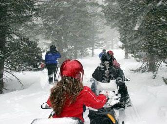
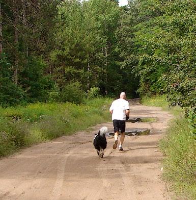
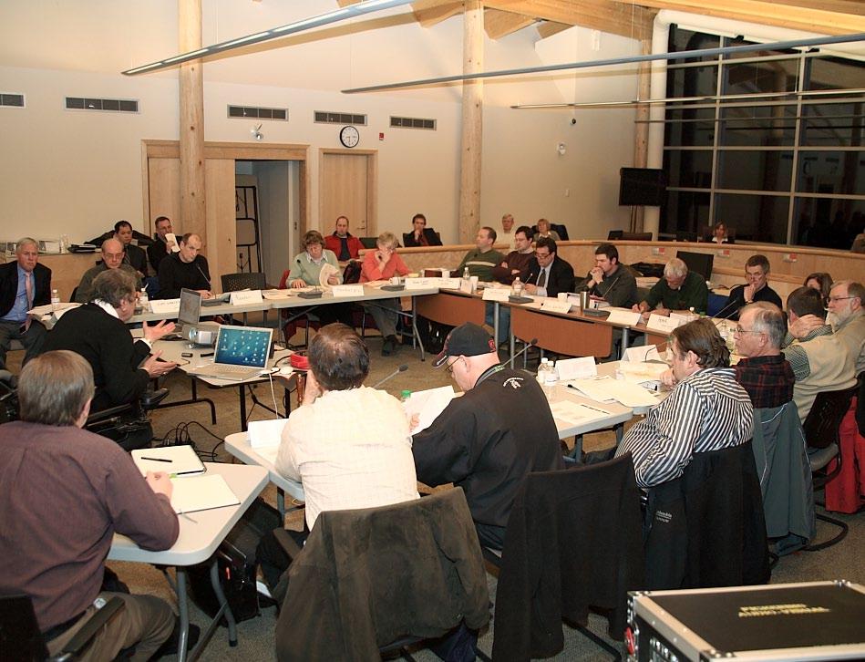
220


221 Forest Master Plan Update Regarding Trail Network & Hunting Proposals Northumberland County Forest Advisory Committee Facilitator s Summary Workshop No. 10 V1

222 Contents 3 Introduction 13 Discussion 39 Other Study Elements 43 Appendix A 55 Appendix B 58 Appendix C Northumberland County Forest Advisory Committee 80 Appendix D Workshop No.10 June 11, PREPARED BY OGILVIE, OGILVIE & COMPANY

223 Introduction Peter Delanty: Good evening everyone. Thanks very much for coming here this evening. This has been a long journey for all of us, about 18 months, but a very positive one and a useful one I think because we are dealing with a very precious commodity, a commodity that cannot be replaced, and that is our Northumberland Forest. Each one of us, I know, has grappled with trying to resolve differences through compromise and through presenting their position on uses of the forest. I think as we complete our work, the forest is going to be the better for it all. It is going to be better because it is going to be in a position where it can regenerate and can be refreshed, but it will also allow 21 plus different users and people vitally interested in the forest to be able to use it in a more positive and creative way. So, I am really pleased that we have reached this point. I never believed or thought we would get up into the teens in meetings and I am sure all of you did not either. But I really do think it is paying off. I want to just take a moment, if you do not mind, and introduce to you two key people: Fred Johnson and Robb Ogilvie. These people have been at the table for the whole time. They have been invaluable, incredibly useful people to guide us through the process. I also want to take a moment tonight, also, because the County Council has been kept abreast through numerous reports, to introduce our Warden, Linda Thompson. Linda, has all through her term as Warden, been constantly asking for updates and constantly taking a leadership role at County Council meetings as we discuss the forest. I thank you Linda for coming here tonight and showing your interest. Of course, we have Nancy MacDonald from our staff. Paul Peterson, who, many of you may recall, gave us a legal opinion on some of the subjects as we went through. Of course, our Chief Administrative Officer (CAO) Bill Pyatt, who has just done a fantastic amount of labour in this; he is almost living and dying the forest. I say that literally, living and dying, because of the many slings and arrows and he has handled most of them well, he has a few scars. And finally, Mia Frankl, who is not only a prime mover in this whole set of sessions that we have gone through, but is truly in love with the forest. If you have talked to Mia, she almost knows every step and is on guard for anything that could go wrong in the forest and always promoting it. I thank all of those people because they are critical to the success, as all of you are. To start the meeting tonight, I am going to ask Bill to come forward. We are going to deal with it tonight and feel that we have almost reached the end; we are at the 98.5% goal of getting to 100%. In July, next month, we will be presenting the report to County Council for their stamp of approval. I just wanted to remind you of that. 3 WORKSHOP NO. 10 JUNE 11, 2009 FACILITATOR S SUMMARY


224 Bill Pyatt: Good evening everyone. I should introduce as well, Dr. John Marsh, who is the head of the Trails Study Unit at Trent University and of course provided invaluable guidance for us in this study as well. Welcome to our Tenth Forest Advisory Committee (FAC) workshop. It is going to be a two-part presentation. I am going to do the first part, then, I will turn things over to Mia Frankl to do the final part. There are a number of objectives for tonight s meeting. First and foremost, the main reason that we are here, is to present County Staff s finalized recommendations for the trail networks that will go to the July 22nd County Council meeting for consideration. We want to get your final feedback and see if there are things that we should be incorporating into our recommendations. We also want to provide you with some updates on some other elements of the study that are just as important, the hunting proposals, for example, and how we have separated these. There is some work that we have been doing with the Nature Conservancy of Canada (NCC), as far as, perhaps ensuring that we can solidify some of the motorized trails and secure those. We will go through some of the other study elements. Then finally, there will be questions, will the FAC continue to meet after this. We want to just very briefly go through what we were thinking would happen there. I want to go through a bit of background, again, we do have some new members but it is important just to go back and refresh some of the people s memories, as far as why we are here, what we are doing. I am going to try to do that very, very briefly. I want to talk a little bit about the decision making process that may impact on the comments that are here tonight and just how will this work going forward to County Council. I want to talk a little bit about some misconceptions around public lands and review the consultation process leading to the decision-making. Then I am going to turn things over to Mia. She is going to describe the Open House feedback and go through the recommended trail networks. At that point, Robb is going to facilitate a discussion with the entire Advisory Committee on their views on the proposals that they hear. Depending on our time, and how people feel, we might want to take a short break of 5 or 10 minutes and then go and finish the other elements of the study and talk about next steps. 4 PREPARED BY OGILVIE, OGILVIE & COMPANY

 and the requirements that ensue to all")

225 Again, I think we are very familiar with why we are looking at a trail plan. Particularly over the last 4 or 5 years. There has been increasing damage due to increasing use in the forest. We have had conflicts between different users and user groups and some landowner complaints. We are concerned at the County level about due diligence, even with our auditors around legal exposure and legal liability to County Council and County taxpayers. Very, very importantly is the provincial legislation that has been put in place over the last 5 years, the Oak Ridges Moraine Conservation Plan (ORMCP) and the requirements that ensue to all municipalities, related to that. And of course the trends, we know that there is increasing use of both motorized use and pedestrian activities such as, orienteering, hiking, skiing. The need is past due actually, for a system of defined trails to go by. Throughout the Master Plan process, we have heard some comments that the forest is public land and should be open, and available for use to all taxpayers. We think this is a misconception. This is municipal land; municipalities own park lands, we have playing fields, open spaces around city halls, we have arenas, maintenance yards, social housing, I could go on and on, on these things. What happens is municipalities decide which uses are permitted on which lands, what hours of operation, fees, whatever. I live in the Cobourg area, so there is a park I am familiar with, where Cobourg put in place regulations that only baseball is allowed. I cannot go and practice my golf swing; I will get in trouble if I do that. I cannot play soccer there. They also have a park that is designated for dog walking and you are not to play active sports there. This is something municipalities routinely do. The question is, should the forest be a place where anything goes. Just to be very clear, the forest is not Crown land; it is municipal land. We do have important legal obligations, such as I mentioned in the ORMCP, and we have a social responsibility, to protect sensitive environments. So, to-date, as an example, we really have not had any objection to a couple a prohibitions that we have been talking about. Number one, a camping prohibition and we will go into some details later with campfires. I think we all recognize this is just not a place where you want campfires with the dry nature of the soil. Also, there has not been any objections really when we have talked about banning 4-wheel drive, what we call mud trucks. Again, they are taxpayers, and should they have access there. The question is, should there be further bans or restrictions on usage. Our goal, as County staff, and I know County Council, is try to take a balanced approach, which is what we 5 WORKSHOP NO. 10 JUNE 11, 2009 FACILITATOR S SUMMARY


226 have tried to do, be very balanced. We have taken the viewpoint that no one recreational use should prevail at the expense of the enjoyment of others or the protection of the forest. Just a bit of background, on how we have looked at this in developing our recommendations. It is important to understand where staff and other people are coming from. As Councillor Delanty mentioned we have had a lot of meetings. We have been going since September formal meetings tonight of this committee, 2 Open Houses, including 1 public forum. We have been to Alnwick/Haldimand Council 5 times. We have had 12 updates to County Council and 15+ user group meetings, 3 with the Northumberland Trail Riders. I want to be very clear. You are going to see some information here tonight, some proposals, some additional trails for one of the groups that was not proposed at the last advisory committee, and in fact, was not presented at the Open House. So, this is something brand new, it is additional and Mia will be going through that. This new information, again, is to try to reach compromise positions with one of the important users of the forest. A lot of you will not be familiar with how Council makes decisions, but number one, staff and our consultants really, really appreciate and stress the critical role, the dedication, the input, the work, the attendance of the FAC. Every single seat is, again, full tonight. You have helped us identify issues, you have problem solved, helped us develop solutions. We really appreciate it. Again, what we have said from the start is County staff will craft a final report and recommendations that will go to Council. It has never been our intent to try to force a consensus decision, in other words, something that every single member would buy into and sign. That has never been our intent. We realized from the start that it would be impossible. We also mentioned at the start that we would not be taking a majority vote. Usually a committee makes a decision based on a vote and we made that clear at the start that we would not vote. Because, quite frankly, I think if this committee voted, with its present membership, it might actually prohibit certain uses that are around this table right now. We made that clear at the start and I know some people have not been comfortable with that, but we have tried to be upfront about that. The report that will go to Council will point out where people are in agreement and where they are in disagreement. We know there are people, or groups, that are in disagreement and we will try to objectively point out their concerns, and, as well as some of the public concerns, any of the public concerns that are there. In addition, anyone in the 6 PREPARED BY OGILVIE, OGILVIE & COMPANY


227 public can address County Council on the final decision day as a delegation, so you can make yourself heard. We will try to present a balanced viewpoint of what we heard and people will have an opportunity to address this. County Council will be the group that makes the final decision; that is the 7 members of County Council will vote and make the final decision on this. They can agree, they are free to amend; they could send it back for more study. That is the way things will proceed. With that introduction, I will turn things over to Mia and she is going to go through the recommendations for you. Mia Frankl: Good evening everyone. Thank you for coming. Thank you Bill and Peter for your introductions. I will just hop into then, a quick review of what was the outcomes of the Open House. It certainly was a very large turn-out, far greater than what we saw in January 2008, up in Alderville. 222 submitted comment sheets; a little bit of press coverage also. Just to take you through, quickly, a synopsis of what the comments looked like and there is a couple of copies on the table at the side that actually show the written out comments. But you can see here that a large percent of the people that came were from within the County and a nice range of all the different kinds of users that are represented at the table, as well as out in the woods. 27% came from out of the County. To get into a little bit more meat about the comments, the majority of the non-motorized users in support, the majority of motorized and hunters opposed to the proposals, in our County. Out of the County, we had a lot of trail rider presence. The Ontario Federation of Anglers and Hunters (OFAH) did submit a survey, which I brought a copy of which is available. Alnwick/Haldimand certainly expressed some concerns to the County before and during the Open House. So staff, Bill Pyatt, myself and Chair Delanty did attend a Council session for Alnwick/ Haldimand at the end of May, where we did a very comprehensive presentation on topics similar to those here tonight, as well as some of the issues that they had specifically. 7 WORKSHOP NO. 10 JUNE 11, 2009 FACILITATOR S SUMMARY


228 Let us move into the recommendations then. A lot of this will be very familiar from the Open House, but as Bill mentioned, there is a bit of new information in here. Revisiting our Guiding Principles for the trail networks; these should be pretty much like second nature to us now. We need to adhere to provincial legislative requirements, that being the ORMCP, of course, parts of the Greenbelt, Highway Traffic Act, etc. Reduce number of trails and restore significantly degraded areas. Shared trails and compatible users, again that is where the user group discussions were really helpful, great compromise. Maintaining regional trail linkages and trying to balance motorized use with the need for environmental protection of the forest. Minimize potential for conflict, of course, addressing our liability issues. Keep costs low, of course. And finally make all of this clear and easy to understand from an administration side and also from a user side. We do not want a complicated system where you come to the woods and you do not know what you can or cannot do or where you can do it. I just want to take a moment to review the nature of the discussions at the user group meetings. Again, I applaud the efforts and the compromises, the cooperation, the growth, all of that amazing work that you have done as part of the process to help us get to where we are today and are going to in years to come. So, starting with the Oak Ridges Trail, as you can see here, it still goes across the property; there is still a side loop option in the northeast, taking in some of the nice features, viewpoints of the hill behind the Scout Camp, which we visited last summer. 8 PREPARED BY OGILVIE, OGILVIE & COMPANY


229 Cross county skiing and mountain biking along the shared trails; the same kind of thing that we saw at the Open House. One new thing to point out here is this multi-use non-motorized loop that is now in what I refer to as the central forest. So, that would be available for hiking, cycling, horseback riding, that kind of thing, to have a little bit of access into that part of the forest. Hiking is very similar to what was presented at the Open House, access on the biking trails in the non-winter seasons. The discussions at those user groups meetings did talk about having hikers perhaps go in an opposite direction, so that you would be aware of cyclists and that kind of thing. And then, of course, Oak Ridges Trail and in the eastern section, some additional hiking trails. Equestrian use shown here, a designated area for use in the Beagle Club area, access to the multiuse and access to the road allowances, as well, Dunbar Road runs about 10 km, Huckleberry Lane runs along, so there is mobility throughout most of the property for equestrians. The motorized trail here. One thing that you may notice is, certainly, the southern route was the preferred route, as presented at the Open House. One thing that has changed is this looping up through the forest as opposed to running along the bottom, and that will be addressed under potential property boundary revisions. There is sort of a land block issue going on along the south, so this route is presented with a provision to move it to the south if we can acquire access along the bottom. This brings us to a more specific type of motorized group, the motorcycle trail riders, represented by the Northumberland Trail Riders (NTR). As Bill mentioned, we have had another user group 9 WORKSHOP NO. 10 JUNE 11, 2009 FACILITATOR S SUMMARY


230 meeting with the NTR, following the last workshop, and the Open House. We met with the President and Vice-President. We discussed the ongoing concerns, trying to find a balance between the desired trail experience and the need to balance the protection of the forest, trying to accommodate this use under the same guiding principles that we have applied to all of the other user groups, reviewing components of the Atlas, of the Trail Study, of the 1997 Resolution, discussion on stewardship agreements, concerns, so forth. So, here is this 394-acre parcel that has been offered for motorcycle trail riding, which would include access to the motorized route that we just saw. I will show you a map of this in just a couple of slides. But just to give you the heads up or sneak peek, the area that has been proposed is Area 4B and 6, that you can recognize on your Atlas map so that is sort of Beagle Club Road, Dunbar Road, County Road 45, and then on the east of County Road 45, south of Morris Road. And you can flip ahead in your map book if you like or the slides, but I will show you that in a moment. So, just again, revisiting the Council Resolution, permission was granted to identify a trail for events with signage. This was the map that was provided by the NTR. It came with the memo that was sent out in February. We have just reformatted it a little bit to replace the pink highlighter and to show the trails a little more clearly the use in the eastern section throughout the central area across the property. I just want to point out my mistake, it does say single track motorcycle trails, some of what is shown here, some of you will recognize, as double track, as well, so I will be sure to correct that. In summary of the discussions that we had, the County is trying to find a way to balance the desired trail experience, apply the same guiding factors that we have for all of our other trail groups. We certainly know that there are many impacts from motorized use. We need to reduce motorized activity in more sensitive parts of the forest. We certainly have been able to achieve that with other motorized groups. But we still do want to provide recreation, certainly, for as much as we can for all of our different users. The response from the NTR is they did take our 10 PREPARED BY OGILVIE, OGILVIE & COMPANY

 and snowmobile trails, we could encounter")

231 proposal back to their group. I am sure they had an interesting discussion about it. They have come back with some offers to stay out of certain areas, really identify an appropriate motorcycle trail for people, feel that they have a lot of interaction with wildlife, and certainly have expressed concerns over what could happen to the condition of the trail if they stay confined to certain parcels. This slide brings us where staff rationale comes from, certainly if we restrict or confine motorcycle trail riding to the all-terrain vehicles (ATVs) and snowmobile trails, we could encounter speeding, renegade behaviour, head-on interactions with other users and this kind of thing. We heard a lot from the NTR, they are looking for a single track, but they also use doublewide tracks as connectors, or a bit of a break. With the parcel, we can offer them a little bit of both. This is what that map looks like; it shows access to the motorized routes across the property, and then these 2 parcels here, equaling 394 acres that could be used where they could develop a single track trail network. I know there is some existing trail in there and what they could fit in there would be suitable. To summarize what all of those lines actually mean in terms of length, we have pulled this chart together for you; I am sure it is something that people have been awaiting. The Oak Ridges Trail is 19 km, combined with access to other hiking trails, almost 50 km of hiking. Same with hiking here, it is noted as pedestrian use and that is just sort of to clarify use in the eastern most part of the forest, past McDonald Road, we are talking about cross country skiing, snow shoeing, walking, bird watching, that kind of thing, not horseback riding or cycling. Equestrian is here, designated trail of 6 km, combined with other trails that brings it up to 21.5 km. Ski/mountain bike, 25/26 km. Snowmobiles and ATVs, 34.5 km. That little detour loop, that takes them into the forest, is actually about 3.5 km, so it could decrease a little bit there. Motorcycle trail riding, this number here, 20 km, comes from a calculation done on part of the forest where they have trail network, obviously, in the northeast corner, near Dunbar and Pratt Roads, we had a prescribed burn that year, Lots 10 and 11, Concession 7, I believe. So, what I did was calculate the length the trail that they have in there, that is 248 acres, knowing that, multiplying that by the 400 parcel, gives us about 20 km, combined with access to the motorized routes, gives them 11 WORKSHOP NO. 10 JUNE 11, 2009 FACILITATOR S SUMMARY


232 54.5 km. There is probably a give or take of 5 km there, to play safe and try to keep these numbers a little conservative. That brings our total overall trail system, not including Dunbar Road to 110 km for the variety of uses throughout the property. That is about a 35% trail reduction in what is out there right now. We are over 180 km between the roads, the single track, the double track, everything like that. So, that enables us to protect about 500 acres, north of Dunbar Road, north of that Lookout Mountain area as wildlife habitat and refuge, plant habitat, as well as reducing trail density in the eastern part of the forest, past McDonald Road by about 10 km. That is really helping us achieve our conservation objectives that we set out to do, which I think is really fantastic and thank you all for. This is what it looks like all pulled together. We show red as motorized, the purple colour is the Oak Ridges Trail, brown is hiking, yellow is multi-use/ non-motorized, orange is ski/mountain bike, some hiking seasonally, green is equestrian and then the dirt bike parcel is shown there as well. What happens next then, is we will have some discussion tonight; recommendations will go to County Council on July 22. County Council session got bumped back, both in July and August by a week, so that is the change from the 15th to the 22nd. Due to some new request for consultation by the Northumberland Métis Council, we are going to give some time to have some consultation with them, and then we will address hunting in the fall. So, the July report will be strictly on what I just went through, the trails and the trail maps. So, I will hand it over to Robb and he will go around the table with you. Bill, myself and Fred Johnson and John Marsh, are all here for questions as well. 12 PREPARED BY OGILVIE, OGILVIE & COMPANY

233 Discussion Robb Ogilvie: When you said you will hand it over to me, what I thought was, we do a roundtable discussion, I would go to each person and give you a chance to say, can you go back to Slide 27, what did this mean, any questions or any comments, but I need Mia to stay at the microphone. FAC Member: I would just like some clarification on the hunting. The information that we got tonight is just for information right now, it is not for discussion? M. Frankl: That is correct. We have not presented it yet. FAC Member: I would like to know how Rob Pineo feels about that. Rob Pineo: That is fine. R. Ogilvie: So, the conclusion is, the hunting issue is going to be discussed at another occasion. M. Frankl: Correct. R. Ogilvie: So, it is not being ignored. FAC Member: So, that means we will not be included in that discussion. B. Pyatt: There will be another FAC meeting to address it. M. Frankl: And we certainly would not turn down any questions that you may have after seeing that material of course R. Ogilvie: Staff s concern tonight is to show the revised trail alignment. FAC Member: So, the hunting is out for tonight. The new proposal for the areas that the motorcycles, I see in the letter they are refusing that proposal, but I am sure it is like at the back of my farm. I am fine, I have 170 acres between the motorcycles, all of them and me but I have neighbours back there that are building houses. If you take those motorcycles, take them out of 5,500 acres and put them into 300 acres, there are going to be issues. I do not know if anyone thought of that or not. And it is certainly not going to be very good for terrain. But I think, the motorcycles, I read there, kind of answers the question the same way, saying that if they were downgraded into 300 acres, they would probably destroy it because of the concentrations. I guess that is a new proposal, but I find that, for Alnwick/Haldimand is totally crazy. I do not want to go off the rails here too much, but we wrote a letter to the Mayors of County Council a couple of months ago and we brought up a few points that we felt were concerns for us. I did not bring any of that documentation because it really does not matter. But anyway, it was just a small, short letter to the Mayors and I got a letter back from Mr. Pyatt, 5 pages, explaining to me that I was wrong on all of the points, that I was not right on any of them. I do not know where to go with this group because obviously our input is not really taken too seriously. Alnwick/Haldimand does have issues. I do not think we have met 5 times with the County Council to discuss, unless I missed a couple of them; I do not know which ones you are counting. But anyway, we do have issues and because we live here. People in Alnwick/Haldimand live around this forest completely, other than a little bit on each end. And for certain, anything we do here is going to affect them way more than any one else in this County and I tried to portray that, and that we need some understanding and maybe a little input. And we do not seem to be getting it, so I do not know. They are always talking about a partnership, but we are not doing very well in our partnership. I said that the last time and I am saying it again, they are not listening to us at all. When we do have these meetings with the County, they come and they give 13 WORKSHOP NO. 10 JUNE 11, 2009 FACILITATOR S SUMMARY

234 us proposals; they show us what they have done, and then answer 2 questions and they are off. It is a one-sided affair, I am sorry. We have this rural forest that Peter calls an urban forest and the only thing that I can understand from that is the urban people are running the rural forest. Sorry, Peter, but that is the way it looks. It has always been noted that it is not very good when people get out of their domain to try to do things that they are not used to, so, I will just use that as an example. But, I will sit around here, and you can go around the table here and you can do your concerns of whatever. But maybe I could come back afterwards and discuss it some more because we do have concerns and I do not know when we are going to get to discuss them because the final plan is going in July, so it is going whether we are here or not. I do not know what to say. It is just totally unbelievable. But anyway, go around the table and maybe it can come back for a comment after at the end, if we have time. R. Ogilvie: We have time. Do you want to go through the areas of concern; I do not want to lose your train of thought? FAC Member: I think we have already lost, but anyway, but for instance, I asked them the other night, horses are big in our area, in Alnwick/ Haldimand. There are all kinds of people that have bought property out in Alnwick/Haldimand because they have 10 acres, they have 3 horses, they want to get on those horses and just take a route out in the backyard, go for a ride. According to the set-up that I see in this, some of those people are literally going to have to put their horse on a trailer and take it around somewhere to do that. And they bought these properties for that because it is there. Now I understand that it is not a right for them to maybe go into the forest, but that is what they did, they bought them because it was there; that is their backyard. I think they should have a couple more rights than the person that lives in Trenton or the other side of Port Hope or something. They are there, they are taxpayers, it is part of their deal and I think they should have some rights to do that. Another one that was brought up is costs. We discussed that Alnwick/ Haldimand has more costs for the Northumberland Forest than any other Township because of where it is. Policing, for instance, we pay $80,000 a month to police our Township. The forest is in the middle of that Township and that is part of our policing, we expect our police to police that. So, yes, we have costs. We look after some parking lots as part of a handshake agreement, it keeps users off our roads and in the parking lots. That is a good thing for us, so we trade this for that and that is fine. You cannot avoid these costs, they are all part of our process and we live there. So, I got a letter back from Northumberland County, saying, well, if you have any costs, just tell us what they are and we will mail you the cheque. That is not what we wanted. We do not want money, we just want it understood that we live in that Township and we know there are costs there and we pay them. B. Pyatt: We have written; we had a presentation with Councillor Delanty, spent about 2 hours with you about 3 weeks ago. We have written 2 letters saying if there are costs that you are incurring that we are not recompensing you for, we would like to know about it so that we can reimburse, if you have any out of pocket costs. We have had no reply to any of our letters. We do pay you to do the fire protection, you do it but we pay you to do it. We pay you to put up the fire signs, we pay you to maintain them, we pay for the police protection that is there. So, yes, costs are incurred and we believe that County taxpayers should be paying for those and 14 PREPARED BY OGILVIE, OGILVIE & COMPANY
235 Alnwick/Haldimand taxpayers should not be out of pocket. And we would love to know if there are any of these that we are not paying, we believe we are paying them now, but we have written to you repeatedly and we have never gotten a reply. So, if there are costs, we would like to know about it, we will take it to Council. But again, we were there and had about a 2-hour dialogue with Alnwick/ Haldimand Council about 3 weeks, about a number of these issues. I do not know what more we can do, we have been there, staff has been there a total of 5 times. Councillor Delanty has not been there 5 times, but certainly, staff has been there and we have tried to work with you on this, but there are a number of issues that you have mentioned. R. Ogilvie: I did not hear the FAC Member say they wanted compensation or they wanted the County to pay. What I heard them saying is, we carry a number of those costs and we do that willingly because it is part of our area. We are hoping you would include us more as a partner, as opposed to FAC Member: An outsider, I guess would be the other word. And there was one 1 letter sent to us about these costs and that came from the letter that we sent to them, and I mentioned that we have these costs. But we did not ask for money for those costs, we understand that the area creates costs; we did not ask for a nickel and that is why we did not send a letter back. B. Pyatt: We can provide the Alnwick/Haldimand Council resolution, but it asked to be paid back for out of pocket expenses, and we did send 2 letters to you within 2 weeks. FAC Member: Could we see that? B. Pyatt: I cannot put them up instantaneously, but we can go down and get them out of the file. It would take a half an hour or so. FAC Member: I appreciate that; we can wait. R. Ogilvie: We can include it with the summary. B. Pyatt: Sure. R. Ogilvie: What else is on your list? FAC Member: Just carry on for now; I think you are getting the gist of the list. The concerns for our Township are immense, and I do not think the County is hearing these concerns; I really do not. We will see how the rest of the people here feel, because some of these people are from my Township and we will see how they feel, how they are going and we will come back. FAC Member: I just have a question, in Area 4a, part of the central forest, there is currently an access road from Highway 45, I think it is opposite Woodland Road. Are you planning to eliminate that? M. Frankl: Woodland Road? FAC Member: Yes. M. Frankl: Yes. FAC Member: That is too bad; it is a nice flat parking area. I have no other comments. I am glad you accommodated the motorized trail riders, it is a small area, I know it is a difficult issue, but at least there is something there for them. FAC Member: A couple of specific questions, you just mentioned potentially closing off one access route. One thing I have commented on in the past and noticed that we still do not see access points or trail heads on the maps. I just wanted to know what the timelines were for those because like the proposed motorcycle trail area, these are areas of very high concentration of activity, they can be and the impacts on residents and other things can be quite severe. That is something I would like to see sooner rather than later and make comment on, so that is one question in terms of timelines for that. The other comment I had, this is on Slide 27, the east-west motorized corridor, I noticed that parts of it are outside of the forest and it looks like a lot of it is running on municipal road and specifically for trail bikes. A vast majority of the trail bikes I see are not plated and not road worthy, so I am just wondering how they can use that as a connecting route if they are not legally allowed on those roads with unplated vehicles. 15 WORKSHOP NO. 10 JUNE 11, 2009 FACILITATOR S SUMMARY
236 M. Frankl: In response to your first question about the trailheads and so forth, that is the next stage of implementing this and we will be working with Al MacPherson out of the Trail Study unit to develop a business plan. But there is a 4-year implementation plan that will be fine-tuned and address those components. With regards to motorcycle trail riding on the road allowances, in the other study elements, there is some information to be presented in regards to a meeting that we had with our insurers that does address how to deal with motorized users, as well as other kinds of users, stewardship agreements, membership or non-membership and that kind of thing. One of their recommendations was to have a membership at either the local or provincial level for motorized and hunters, for those groups. FAC Member: Just to follow-up to that, I guess it is not clear from the map if these lines are road allowances or roads because insurance aside, I think there is actually a legal issue with them, actually not even being allowed on roads, if they are not plated. That is one thing that is not clear to me. And finally, I guess, moving forward with a 5-year plan for addressing things like access points, trailheads and so on. I have commented in the past that I think that there needs to be more surveys done for people who are living adjacent to, or in close proximity to the County forest, to get a better handle on how they are being impacted currently, and moving forward. And more specifically, identifying some of the more heavily impacted areas and addressing that. And perhaps giving us an idea of what sort of mitigation strategy you are looking to put forth to address these issues moving forward. M. Frankl: I can defer to Doug Borton in terms of insurance and motorcycle trails and then I will ask Dr. Marsh to speak to the landowner surveys because he did expand his originally landowner consultation. Doug Borton: For those people that do not know me, I am Inspector Doug Borton, I am the Detachment Commander for the Ontario Provincial Police (OPP) for Northumberland County. I have had a couple of meetings with the County and looking at the enforcement side and also the education part of it, I think the first part of becoming involved in the policing side of it is looking at once it has been finalized, is how we are going to first of all educate everyone in the uses and the proper use of it. And then looking down the road, as to the enforcement. One of the things that you brought up is the unopened road allowances and road allowances in all areas. First of all, I think one of the things that we have to look at is identifying the road allowances and then being able to mark those road allowances so that enforcement can take place. By way of identifying them, marking them, and then if they are under the Highway Traffic Act, then they do belong to Alnwick/Haldimand because they are road allowances, then enforcement would take place under the Highway Traffic Act. FAC Member: I would like to speak on that and the fact that those road allowances do belong to Alnwick/Haldimand. I think, Doug, have we not, as long as you have been in service in the OPP in our area, have we not pushed that everything out there be legal, everyone be licenced, insured, sober, behaving, have we not done that as long as you have been here? Have we not pushed that in Alnwick/Haldimand through in the Police Services Board? D. Borton: Yes, through the Police Services Board we have been working for the road allowances. The difficulty from a policing standpoint is the road allowances are not readily identifiable through the County forest. And in fact, we had some discussions with Alnwick/Haldimand legal people in reference to that, as to how in fact we would mark that. That is something, I think, once we identify the trail uses, is we have to then look at identifying some of the trails and some of the roadways and marking some of those. I also think there is a secondary part to that because of the things from a police, fire and even ambulance, all of the emergency services. If we had some way of marking the areas, or even the trails so that those trails would be similar to Highway 401 where we have mile markers where you could identify you are close to a mile marker, 16 PREPARED BY OGILVIE, OGILVIE & COMPANY

237 close to an area. I think there is a lot of safety that can be added to the County forest as well. That is something that once the trail decisions are made as to what the network is; part of that will be what we require for the enforcement and the policing side. FAC Member: I think that has been the motive of our Township, since you have been there. D. Borton: Yes, and we have had some discussions on that. FAC Member: I am thinking we have had a lot of discussions about it. The reason you have those 2 ATVs is because of the push of Alnwick/Haldimand over the last 5 years to get something so that you could go into the forest and do some enforcement. Is that not also true? D. Borton: Absolutely. FAC Member: Is Alnwick/Haldimand responsible, would you think that this County has 2 ATVs, no one else pushed for that any more than we did, I am sure. D. Borton: Absolutely. FAC Member: And at no charge to the County; it was free, we just threw that in. John Marsh: We have done two surveys of people that live on properties that are immediately abutting the forest and a second one of people who have properties near the forest. In the first case, we simply identified people in houses that were on these properties shown on the map as abutting the forest. In the second case, I was given a list by Mia of people who were normally contacted because they do live near the forest. We already reported on the response from the people who had property immediately adjoining the forest. And relatively few had concerns; there was a majority of people who were reasonably satisfied with the situation. When we went out to look at people who had properties nearby, but not adjoining the forest, we put a survey with a stamp-addressed envelope in the mailboxes of people on the roads around the forest. If they did not have mailbox, we mailed out the survey with a stamp-addressed envelope. 36 people on the areas around the forest were contacted in those ways. A couple were returned because the addressee was not known. So, we ended up with 20 people who lived on properties near the forest, but not abutting the forest. Responding as follows to the 2 key questions. The first question was do you experience problems because of forest users on your property. The number who said yes was 20%; the number that said no was 80%. Those that did say they had some problems because of forest users being on their property mentioned trespassing, litter and noise. The other question was do you have problems from forest users on roads adjacent to your property. In that case, it was nearly a 50/50 split between those who said they did have problems and those who said that they did not. Of those that said they did have problems, the main things mentioned were speed, irresponsible driving of ATVs and dirt bikes, noise, doing donuts that cut into the road surface, making it less attractive for them to be driving down those roads. In summary, I think, there are problems, perhaps not as serious as has been perceived. There are ways of dealing with them and I think we have tried to reach a lot of people to get this sort of feedback and some people wrote quite extensive comments to help us. FAC Member: I would like to suggest that the John has collected some valuable information and that we actually use that to address specific issues. I do not think the survey should be used as a vote from the residents of Alnwick/Haldimand; it should be used as an information-gathering tool 17 WORKSHOP NO. 10 JUNE 11, 2009 FACILITATOR S SUMMARY

238 that we can use to help to mitigate and plan better for moving forward. FAC Member: Thank you Mia for all the work you have done in assessing these trails. I know it has been quite a task for you. Just off the top, I would like to say that the Oak Ridges Trail, as laid out, seems to be quite acceptable and I am happy with it. Unfortunately, when you put the motorized trail map on top of that one, combine the two, I see a difficult focal point at County Road 45 and Morris Road. Because, as people have previously mentioned about trailheads, in my estimation that would be a convenient trailhead for the motorized vehicles, having access from County Road 45. And I see that interface between hikers and motorized vehicles of whatever nature they are as being quite difficult. I wonder if there is any leeway in where that trail goes through that area. I realize Morris Road is the only one access point across there. I wondered if we could consider something a little north of that, I have no idea. But I wonder what options there are in terms of slight variations to these proposed trails. I realize you want to move forward with it right now, but as I said, I see that as a possible difficult point. Secondly, at the moment, as you are aware, we have land, the NCC s properties, the two between Caradoc Road. I know Fred is working on access through there, I am not too sure where that stands at the moment. My concern is that if we do not get access across those NCC lands, we may be forced to use Dunbar Road, which I am not in favour of using for a hiking trail. And again, I wonder if there are any further options to go to really take a more northerly trail. To be honest with you, I have been out in the field looking at possible other routes and have found some extension routes off Jewel Road. I know that there are possible landowner issues there, but there would be another access through to that far end of the forest along that road there. So, really what I am saying to you is, how fixed in stone are these routes and if we go out and by usage find them not to be acceptable can we come back to you, is there a process by which we can come to you to review these trail routings? M. Frankl: We do have a field hike scheduled between staff and yourself, as you are aware, and for others information, on June 18, at which point we will have a look at some of the issues that you have raised. We have tried to accommodate and route the Oak Ridges Trail based on adjoining the other property gaps. Certainly, you have access as shown here, if it has to move a curve or something like that, but going on to County Council, we will want to ensure that we can finalize that, field check it, and if you are talking about some access more north, that should not be an issue. FAC Member: I realize it is not a forest issue, I was just thinking more that there is what you call a multi-use non-motorized area in 4a section and if we could get onto that trail that is already a predetermined trail and we could possibly work our way out of the forest in other direction. I am only really asking what options do I have, other than accepting what is drawn and given to me; is there any route to go back on that? B. Pyatt: It would be very important for us to accommodate the Oak Ridges Trail and if you run into some glitches off our property, we would be very pleased to sit down with you and work out an alternate route because for tourism dollars and everything, the Oak Ridges Trail is an important feature for the County, so, no problem coming back if you have developed some issues. FAC Member: I just had a couple of questions about the motorized use areas and motorized use in general. One thing I was going to ask is, is the 18 PREPARED BY OGILVIE, OGILVIE & COMPANY
239 County considering on developing agreements with specific clubs and organizations whereby it would only be their membership that would be allowed to use, they would have to be members of the Federation of Trail Riders or whatever in order to use County trails. You were referring to that a little earlier that that is one thing that you would be looking at. M. Frankl: That is right. We did meet with our insurers and based on the nature of this, they certainly were strongly in favour and quite pleased to hear that we were looking at stewardship agreements with all the users. And when it came to the issue of motorized and hunters, they very strongly recommended that they be members, as you said, of either the local or provincial group and we will get into that a bit further. The reasons being for that, is for example, when you are out there now, as a hunter or hiker or anything like that, you are covered under the Occupiers Liability Act. If you injury yourself or someone else, then you are covered by your home and auto, and/or if you carry personal liability insurance. In terms of motorized use and hunting, they basically compared it to the driving system, driving your vehicle, insurance is a requirement and to drive without insurance is not diligent or legal, but there is a little bit less legal ties in terms of trail use. So, stewardship agreements for all; we will have the slide on the insurers, recommended membership for motorized and hunters. The stewardship agreements will then provide insurance and maintenance and diligence on reporting signage standards, etc., to show a relationship is being done. But as a hiker, you would not necessarily have to be a member to use the trail. FAC Member: These 2 new areas that you have designated for off-road motorcycle riding, the 400 acres, is that going to be strictly limited to off-road motorcycles or will ATVs be able to ride doubletrack trails, trails that they can be accommodated on in those areas, or is it strictly off-road bikes that are in there? M. Frankl: That is a great question and I am glad you raised that. As you will notice, behind the area here, the red lines are still there, so that would continue to be available to ATVs and snowmobiles to maintain those regional connections. But the trail riders could develop their own single-track trail system amongst that. FAC Member: So, the only trails ATVs would be on are the main red lines that you see in behind, so no other trails. M. Frankl: But single-track are too narrow to accommodate. FAC Member: You do not want them on singletrack. But I was just wondering if there was going to be a little more riding for ATVers in those areas, but they are still restricted to the red line trails that you have now. The main comment that I would make is that I think enforcement is definitely going to be your biggest challenge in the future. It is one of the biggest challenges, if not the biggest challenge that I deal with in the Ganaraska Forest. And you have a fairly complex system here, to a certain extent. That is going to be your big challenge with motorized corridors going through the forest, but they are only allowed in certain areas, those sorts of issues are going to make it a little more complicated for you. I think that is going to be your biggest challenge to face in the future. FAC Member: One of my first concerns has already been addressed with the 2 motorcycle areas that are new, in regards to parking, a trailhead would have to be established, obviously, everyone has to trailer the bike there to ride or whatever. Some of the concerns that I have, we have 8 different users listed up there for trail designations. There are 21 user groups on here. So, where do the other users that are not listed on there, where are their restrictions? Are there any restrictions for orienteering, that goes from point A to point B, as an example, no disrespect, but I am just trying to clarify, you have 8 targeted recreations up there, trails for those, and I do not see any restrictions on the other user groups that are represented here. 19 WORKSHOP NO. 10 JUNE 11, 2009 FACILITATOR S SUMMARY
240 M. Frankl: It is a clumping. Certainly there are 21 stakeholders at the table, not necessarily every stakeholder is an actual trail user. Conservation Authority comes from a technical side of things. So, certainly, we have these 8 are identified as the established groups onto which we can enter into stewardship agreements to maintain a trail system. The hiking one, with (pedestrian use), really is where we get some clumping in terms of snowshoeing, dog walking, bird watching and those kinds of activities. I am glad you mentioned the orienteers. The conversations that we had during that group meeting was that they are seasonal use; they are not trail users, much like hunters, so they would be off of the trail network in the fall or early spring, outside of the sensitive periods for the flora and fauna on the property. So that is where these sorts of colours and names come from, but certainly, motorized, for example, is clearly identified, as 3 groups and not 4x4 trucks or even personal vehicles, but hiking is where you get some more clumping. FAC Member: A little bit further into the issue with the road allowances, where we were discussing motorcycles or ATVs on road allowances, where does cycling fit in, if I wanted to cycle down Dunbar Road, it is a road allowance. M. Frankl: Dalton might be the appropriate one to answer that. The Township roads from what you have expressed to us is that you want them to remain open to all uses. Do you care to comment on that Dalton? Dalton McDonald: We do not differentiate. If you are going to ride your bicycle down a Township road, feel free. FAC Member: I just see restrictions that we have in the ski trials and in other areas, yet it is left open D. McDonald: On the Township road allowances and roads, yes, it is quite an interesting theory is it not? It is one of those things that has never really been discussed. FAC Member: I asked this question before, can I cycle my bike down Dunbar Road; I never got an answer. D. McDonald: Well, I can tell you from my side of it, you can. M. Frankl: It has been difficult for the County to comment on property that is outside of our jurisdictions. Perhaps what I could do is reflect the road allowances in a different colour to differentiate from forest property and Township property. Would that be useful? FAC Member: I am just looking for a clarification on that. R. Ogilvie: Which you got. Thank you Dalton. FAC Member: The only other issue I have, you see quite a few articles in the newspaper that makes reference to, people writing in letters to the editor, blaming the FAC, the FAC is doing this and the FAC is doing that. I would just like to be convinced that the FAC is just making recommendations, that it is the Council that is actually making the recommendations to move forward. The FAC is basically making suggestions, is that correct? M. Frankl: The County has been pretty clear, as far as we can control in our messaging, that the Advisory Committee is our sounding board to provide us with input and feedback, as well as to test ideas from. Certainly, you are also invested stakeholders that we want to have a good partnership with so that we can make all of this work and we can work together and combine our resources. It is unfortunate that sometimes the facts do get mixed up in the press. Certainly, letters to the editor, as of recent, I have not received a phone call to review information with, I am not sure if other staff has. The information is out there and all we can do is continue to reiterate it and make sure that we are clear on it, how people perceive it or interpret or use it can cause those kinds of things, so I appreciate where you are coming from. FAC Member: I think it seems like a reasonable balance here and great job getting that done. It is nice to see the trails minimized in the most sensitive area. One thing I want to say is, maybe to back 20 PREPARED BY OGILVIE, OGILVIE & COMPANY

241 up an earlier point, monitoring is going to be key here. First of all, is it being implemented and are the trails being used how they should be and it is also achieving the desired impact on the forest. Time will tell if the right trails are in the right places and a good monitoring plan will be key. FAC Member: I think everyone knows that I am here under duress, but I am here. A number of things; a number of slides. I guess we could go to Slide 20 to start with, Bowmanton Road, Norris Road; you have made that a motorcycle route. It cannot be a motorcycle route, along the top, that is a County road and motorcycles with green plates are not allowed on there. It does not comply with the Off-Road Vehicle Act, Bowmanton Road; you are showing Bowmanton Road as a motorized route. It cannot be used. You cannot legally ride a plated off-road motorcycle on that road. Correct? M. Frankl: The trail does runs, I believe, on forest property; perhaps the scale is just a little bit off here. FAC Member: No, if it were on the north side of the road, you would be taking them across the cemetery, if it was the south side of the road, you would be taking them across private property. Anyway, we will let that go. R. Ogilvie: It is not being let go, what you are saying is there is a difference of opinion about whether that can be used for that purpose. FAC Member: It cannot be. It cannot legally be. R. Ogilvie: So I think you need to note that. D. Borton: I can comment on that. One of the things and one of the discussions we had with the County from a policing standpoint is once we look and once the trails have been decided, then there may be some areas along the County roads, including County Road 45 because a highway is fence line to fence line, so there may be some locations there that there has to be a bylaw passed under the Highway Traffic Act to allow off-road vehicles with ATVs. R. Ogilvie: So your point is, currently, you cannot. D. Borton: Currently you cannot. But the County could pass a bylaw under the Highway Traffic Act; it would be ATVs. FAC Member: It should be looked into. R. Ogilvie: Agreed. B. Pyatt: We have a situation identical to that with an ATV route up in Trent Hills and we are doing exactly as the Detachment Commander is suggesting, passing a bylaw to allow ATVs to drive on the shoulder for about 500 m. R. Ogilvie: The point tonight is one should acknowledge that that is a future intention, but here is the current situation. FAC Member: In response to what Bill said, there was legislation passed for ATVs, 316 something, not for motorcycles. Does that make a difference? D. Borton: Yes. FAC Member: So what Bill says, they were working on something for ATVs. There is Ontario legislation to cover that. There is not Ontario legislation to cover the same situation for motorcycles. D. Borton: Yes, you are correct. FAC Member: Our organization has been portrayed as being unwilling to negotiate, unwilling to compromise, not willing to give up. I want to point out that it is pretty tough to compromise when you lose 100% of what you have, right off the bat. And we lost 100% of our single-track trail before we even got started. We had nothing to compromise 21 WORKSHOP NO. 10 JUNE 11, 2009 FACILITATOR S SUMMARY

242 on after that. The other thing is, the latest, greatest offer, from staff, it really does not work. It takes away all of our single-track trail and it puts into an area of 394 acres. So, John Marsh commented that people living nearby the forest did not really have too much of a problem when all the motorcycle use was spread out over 5,000 acres. So, now if we think we are going to concentrate it down into 394 acres within earshot of 21 houses, it is not going to work. This particular property, of all the single-track trail that we have made, which is 54 km over the years, that is how much we are talking about, that little bit of trail to the south, shown in the orange lines is probably the most sensitive of any of the single-track we have built. In fact, it is delicate, I cannot think of a better word, enough, and it is eroded, that for 3 years running, we have not been able to use it for our trail riding. That is an absolute recipe for failure to think that we could go in there and concentrate all of the motorcycle use in that area. Our club does not support that. If there is no chance of success, then there is no sense in us getting into an agreement. In that area, there is only about 8 km of trail. Now, Mia is suggesting that we can make more trails. The Oak Ridges Moraine (ORM) is not going to let us, so what is the point of all of this? The 394 acres, I call it the sacrificial parcel. Care to ask me why I call it that? December 8th meeting, in the divide and conquer meetings. They said there was some offers, there was some options for dealing with the motorcycles. One was a complete ban and the other one was let us just offer them a sacrificial parcel. It is in print. So, the sacrificial parcel of 394 acres, it does not cut it with us, so we cannot support that. Now the other thing is, our club has published a position paper and it will be in everyone s inbox tomorrow morning, everyone that we have an for. The other thing is, Slide 27, the numbers do not add up. Where does the dedicated lengths, 20 km, where does that come from? M. Frankl: The 20 km comes from a calculation done on 240 acres, where you have trails near Dunbar and Pratt Roads. There is approximately 11 km, so you multiply that by about 1.64; you come in around 20. FAC Member: But we only have 8 km there. How do we turn that into 20 km? M. Frankl: That is based on what you have in an existing parcel, comparable size, so it is a calculation done as a placeholder to what you could possibly be able to accommodate in that area. FAC Member: What about the ORM Act? M. Frankl: That is a good question that you bring up when you raise that. If we are removing trail densities for more sensitive parts of the forest, and providing a place where is more suitable for that kind of use, we are actually bringing recreational use into closer conformity with the ORMCP by in terms of removing it from a more sensitive area into a more resilient area. I do not know, Paul if you want to add or comment on that as well. Paul Peterson: I liked the comment earlier about the monitoring and yes, there would be an obligation to monitor what impact that activity had on that parcel, I hope we never can call it the sacrificial parcel. It would be important to monitor what impact it had and make adjustments or close sections of the trail and open new sections as things damage and erode. Fred Johnson: I concur with Paul. Section 7 of the ORM definitely provides for changes in existing uses, provided you can demonstrate that the net effect is the same or less severe. I think the County 22 PREPARED BY OGILVIE, OGILVIE & COMPANY
243 is suggesting that can be done. I would go back to Paul s comments, way back when, where I think he said that as far as he was concerned, his interpretation is that if the County chose to, they could actually accept trail bike use as a permitted use in terms of the wording of the ORMCP. I know that is not an opinion shared by everyone, but I know that is Paul s opinion. D. Borton: Just in reference to the earlier comment that was brought up in reference to the County road, one of the things I think, and it was mentioned that the Alnwick/Haldimand road allowances should be put on this in a different colour, and I would strongly suggest that. Because currently your green plated motorcycle is breaking the law on all Alnwick/Haldimand road allowances. You do not have permission to drive on paths. FAC Member: I concur. I guess the other thing I wanted to comment on was the Open House. Your figures do not quite agree with mine, but I am not going to argue about that. I am wondering that we would not pay any attention to the out of County people. I have my own set of comment sheets. I have 92 here from motorcycle people. The one at the very top, I should point this one out, from a lady from Perth. Her comment is, For 3 years I have driven 2 hours to participate in Meg s Ride, which is put on by the NTR. This event has raised over $35,000 for the cancer/chemo clinic Northumberland Hills hospital. Now is that the type of person that we do not want to consider their comments. We have a portion of this County, which spends big money to attract tourist here. And to take this 61 people and disregard them because, oh I see why we are disregarding them, 55 of them were motorcycle trail riders. The only other thing I am going to comment is another thing we did at the Open House, we were led to believe that motorcyclists were unlikely to join organizations. And we did not really agree with that, so, I just put together this little questionnaire and we handed this out at the Open House. I had no idea so many people were going to show up, I only made about 85 of these. We had 82 handed in and 77 of the 82 said, yes, they would join NTR if it were a condition of riding in Northumberland Forest. 2 said no, and 3 said maybe. 11 of these people, which is 14%, did not belong to any club at all, but consequently would, if they had to. So, motorcyclists will join organizations. FAC Member: I am going to speak on 2 things: equestrian and trail bikes. I actually listened to a lot of people at the Open House and I also went on the forest tour that the bikers had. One of the things that I found very useful at the Open House is that yes, there is a lot of bikers who are willing to work with the County and try to find some kind of way. One of the comments that several bikers made to me that day was, you know, if you outlaw us in the forest, we will stop coming, so, who will you be left with? You will be left with all the people who do not care and that concerns me a lot. As a forest user, I have actually found all motorized users in the Northumberland County Forest have been extremely courteous. Now, I am very vulnerable because I am on a horse and you could kill me really fast by doing something stupid in the forest. I have never been in a dangerous situation because of motorized vehicles in this forest, and I have spoken out against motorized vehicles, but I am just letting you know that. One of the things that happened 2 weeks ago, actually, I was up in the forest, a friend of mine, two us went up, we had our trailers, we had our horses out, they were beside the trailers and 2 bikers came in. They were in trucks with bikes behind. Basically, they came in and they said to my friend, can we unload and she said yes. And I went over and said, you know, I would really appreciate it if you waited until we had our horses saddled and were out of here before you unloaded. And they looked at me and said, of course, we want to get along, we will go down to the other area and we will unload because we realize that we might cause lack of safety for you. So, they went down to another parking lot, completely away from us and we got on our horses, had a ride. An hour later, we found them on the trails and we were actually on parallel trails, and they came revving up and as soon as they saw us, they stopped, waved and then went off on 23 WORKSHOP NO. 10 JUNE 11, 2009 FACILITATOR S SUMMARY
244 other trail. Now I have invariably had that kind of reaction from people on the trails down here. I was actually surprised when I first moved down here from the Parry Sound area, when I saw bikers and they actually stopped, took off their helmets, turned off their machines and waited for me. In one case, actually, I was not in the forest yet, I was on a road outside the forest, some bikers approached me, saw that my horse, she was young, was a little bit upset, stopped, they stopped, did what I just said. They waited for me to pass. When I got about 20 m past, someone started their engine and my horse jumped, and the engine immediately turned off. I am really concerned that we have people that are providing that kind of cooperation in the forest, if we are not finding a way for them. I know I have said to people and I have said in that I would really like to see the trials that they currently have, discussed with Fred Johnson here, and I would like to actually have them looked at and say which of these really are not a problem. Because if a trail is not in a vulnerable area, it makes sense to me that we might allow it. The other thing I am looking at, is that we have motorized trails throughout the forest, are there not places where there could be a parallel trail that would allow them their single-track in an area that is maybe already a little bit degraded. So, if they are going to be closing a certain number of trails, maybe we can find them areas where they are not going to be the issue. What Warren says is really valid, and I thinking in the Kananaskis where people allowed a motorized area of a certain size and people I know in the Kananaskis said it looked like it was the moon, a landscape from moon in a couple of years. And I am assuming that you are afraid of the same thing, that if we put them in a small place, we cannot complain if they damage it. But I think they have a point, that they are setting them up for failure. So, I have two concerns, I have concern with not sitting down with them again and finding a way. I request that they actually, and I guess this would take County money, that we actually have Fred Johnson sit down and look at the map and compare their requests. And also, I thank the motorcycle group, the trail biking group, they gave me this before the meeting, so I had a chance to read it. I have said to them, are you still on the same page as you were last fall several times. And when I look at what they are saying here, they clearly are not, so they are recognizing that there are some areas where they should not be. They have listened; that was not always clear from some of the s and some of the things that I heard, but what I am seeing from this proposal is that they have listened; they are trying to consider. And when we said we expect you to listen, we want you to consider and they show that they have, I think that we need to take another step, we need to take another look. So, that is trail bikers. B. Pyatt: Fred Johnson spent days, weeks, months looking at the forest in great detail and the result of that was the Environmental Atlas. And as you will recall, this major area here, is a candidate Area of Natural and Scientific Interest (ANSI), has all sorts of special unique considerations in here, as does this area. Fred has spent an awful lot of time looking at the forest, and our recommendations are based not only on Fred s work, but also our Trail Study, as well, Dr. John Marsh s work. I acknowledge that you will see some motorcycle trails that in themselves, there may not be a lot of erosion, but certainly what Fred and his research found is that noise is a far, far bigger problem and intrusion in disturbing nesting patterns and all of those things. But these major areas were identified as very sensitive and where there is actually been quantified research done that demonstrates that there has been a loss of species in those areas and Ben Walters, very reputable work is done there. So, that takes some fairly large areas our to the equation, but I believe Fred has done his homework. FAC Member: Actually, I am aware of Ben s research and that is part of the reason why I have always been vociferous about not keeping the full trials the way they are. But I still question whether Fred has actually, but we have never asked Fred to say look at the ground, are there places where we can find some compromise here. 24 PREPARED BY OGILVIE, OGILVIE & COMPANY

245 B. Pyatt: I can guarantee you we have. Fred has sat in on our planning meetings. If you would like to comment Fred. F. Johnson: I am in a bit of a difficult position here because I think what Helen is asking here is whether we took a really close, focused look at some of the areas in the forest. Although we have looked at the whole forest and we have defined sensitive areas, I think it is fair to say that we have not tracked every trail and compared it to the sensitivities. I do not want anyone to think that I have done that. I think too, what we also said when we initially talked with the dirt bikers is that we certainly were prepared to look at options, generally speaking, in those areas that show up as the yellow and the orange on the map. But that we were pretty comfortable with the fact that those green areas were areas where the County wanted to take a really, fairly strident approach in terms of environment first. That is about as far as I would go in terms of what the results said. R. Ogilvie: I think what Helen is saying is that she thinks she has seen a bit of an attitude change and that when you have an attitude change and you are trying to develop relationships, that maybe one could take an additional look to see if there are some other tweaks or things that can be done. I think that is what Helen is suggesting. It will be in the summary. FAC Member: Can we look at the equestrian map please? If I could just review what my group asked for, my group actually asked for loop trails. They were concerned about a trailhead that was down near the place where we have the paint ball and we also recognized that the Beagle Club parking lot was too small. So, we asked to go in at Woodland Road, which is above our trails now, because we realized that that was the safest place for us and would also get us away from other users, motorbike users could then be south of us and people who had dogs, etc, could be on Beagle Club Road. Frankly, the Beagle Club parking lot is not big enough for us to move our trailers in. If there is anyone parked in there, we are in their way. And we asked for loop trails. So, basically, and I do not know whether I just did not understand what I saw on the map the first time, but we now have trails, we are now being told that the area that is the only safe place for us to park is going to be closed and the trails are south of that area. I am concerned when I look at this for a couple of reasons. Now we asked for loop trails and I am just not sure when I get to the end of that area, if I am supposed to airlift my horse back to the next part of the loop? I am not sure about the 2 loops, I mean we like those loops, the ski trails but they are not connected. So, it seems to me that we need to show some kind of connections here. I understand, actually, that you are saying that they are Township roads, but I do not think they are Township roads completely connecting that loop. M. Frankl: Dunbar Road in this section here does run across and down and over, so that would connect. FAC Member: Okay, so how do I get from there across to the other loops? M. Frankl: You can use the Township road or the firebreak. FAC Member: I know that you are suggesting we put them in another colour, but I am wondering if they should not be included as part of the trail network. Because when you say that equestrians now have 21 km of trails, you know I can do that in 2 hours. It is not like a real trail anymore. By the way Mia, I apologize, I am disagreeing with you here, you 25 WORKSHOP NO. 10 JUNE 11, 2009 FACILITATOR S SUMMARY

246 are in the hot seat, I would really be uncomfortable being up there, and I know it is difficult, the job that you are doing, but part of the job of a map is to be communicate. If I am someone who has not been involved in this process, and I look at this, I am thinking, how do I get to the horse trail? I have had people call me and say, how am I going to get in there, I live down in Centreton, I have always come into the trail, I have always come into the forest and ridden, how am I going to get there, how am I going to get to the trails. And I have said, you can come in on the Township roads that that is fine. But that map does not tell us that. So, instead of having a map that communicates information, we are having a map that makes the information incorrect and is confusing. I think if you then added the Township roads and recognized them as being multi-use that that would make the horse trails look longer than 21 km. That, as I said, is a 2-hour ride and people that are coming to the forest, they want something a little bit longer and they want the circle trails. So I see that they are there, the map just does not show it. M. Frankl: Acknowledged. Thank you. FAC Member: I have already mentioned about the parking lot concern. M. Frankl: Just on the parking lots, your group has provided parking lot information that we will look at implementing as part of the infrastructure plan. FAC Member: When I first looked at the slide that shows all the trails, my first impression was there is nothing left untouched, but really, that big untouched area in 4a I think is an excellent thing. But really, when you take away all of the non-motorized uses from map, and you get back to the one that shows only the motorized trails, it is a huge difference. Given the unfortunate, if I can display my bias, tendency for motorized recreation, I think, really, this is pretty good. As long as these motorized trails do in fact conform with, for instance, with the ORM requirements then I cannot see doing any better. One concern I would have is if one group on 394 acres, that is a pretty good size chunk of land, and if a group of people is going to destroy that, almost by definition, by using it, I think that is a problem. Although, I admit, I was at your demonstration, Open House, out there and I was really favourable impressed by the trails I saw. If these 400 acres got that sort of intensity, although you say the intensity would increase, I have trouble picturing why it is necessary that the use would increase that much on that big of area that it cause such problems. The other thing, I am not concerned about the users that you speak of, or that Mike Ainsworth who is not here, speaks about, who drive sensibly and within the rules, and in the right place and all that. It is the other people who are the ones that I have encountered and I think that is going to be a big policing problem. I do not know whether the County can reasonably be expected to have the resources to cover it all because it is not on these trails that the problems are going to happen; it is in that big 4a area where no one is supposed to be. And I think there will be a lot activity in areas where there should not be activity. Those are my concerns and I do not know whether you can reasonably address them here or not. M. Frankl: Certainly we have heard a lot tonight, concerns about enforcement and so forth. Doug Borton has attended several of our latest functions and is very much on broad with making this happen. The other thing is, everyone has some responsibility in doing this together, with stewardship agreements, user education and presence out there. Certainly, the no camping signs that went up are early signs 26 PREPARED BY OGILVIE, OGILVIE & COMPANY
247 of a more strong management presence coming. We are all going to have to work together and it is certainly not going to happen overnight. But it will be an adjustment period. We are talking about changing years of unregulated use into an organized system and that is certainly going to be met with some resistance and rebellion. FAC Member: As far as us destroying the 394 acres, it is not going to happen. We are not going to. The 8 km that are there now, represents 15 minute riding and Helen is concerned because she only has a couple of hours, so if people want to get 2 or 3 hours riding on a piece of trail 8 km long FAC Member: I think when we were out at the trails, you said you had about 75 km of trails right now, is that approximately right? FAC Member: I took a weekend and I measured it precisely. We have 54 km of single-track trail. We did have. FAC Member: On 394 acres, given the way they sort of twist around and double back, how much do you think could be put in there? FAC Member: No more than the 8 km we have now because it is the most delicate of any of the trail we have out there. We would not consciously build any more trail there. In fact, I would like to close that trail. FAC Member: I guess from a hunting perspective, the trails proposal that I have seen here is adequate. Hunters use trails for access and then like you said, off trails, so it is just an access point. I believe that we need to discuss the game retrieval issue, but that would be in conjunction with the hunting issue in the future, I would assume. I did need some clarification on the motorized trails system and authorized users. Are hikers, equestrians, and cyclists allowed to use this motorized trail network? That answer was unclear to me earlier. B. Pyatt: The unopened Township roads, they can use those, just like the bicyclists, whatever, yes, they can use it. FAC Member: I am talking about the entire network. Is it a yes or no? B. Pyatt: Yes, they can use, walk along Dunbar Road, yes, and the other areas where there are motorized trails, but they will not be encouraged or signed that way. FAC Member: The only other point that I wanted to bring up was that I also went to the NTR s trail demonstration. I was actually surprised by the trails that I saw. From a wildlife impact, being a wildlife biologist, I cannot see what the impacts of those trails would be, outside of them actually physically being used at that point in time. I think we approached the trails problem probably from the wrong direction. We move them all and then say, here are the ones that we are going to put back in, rather than say, here are the problem trails; this trail is creating access that we do not want, this trail is creating erosion. We will get rid of these trails and then starting taking them away, rather than adding trails at the end. And if it is not causing a problem, then we do not need a solution kind of thing, similar to what Helen was saying. The issue of breeding bird concerns was brought in relation to singletrack trails and I do not think everyone has a copy of this yet, Warren handed it out but at the NTR demonstration, Warren was talking about temporal solutions for trails. One of the proposals here is no bike trail use for 6 months of the year. I thought that was a huge step. So if there is a concern around a specific breeding bird in a specific area, the breeding season is temporal in nature, there is no need to close down the track for the entire year. I think there is a whole bunch of these kinds of solutions that we really had not taken a good look at before we got to the end, if we are at the end. FAC Member: I think that we are hearing interesting discussion, as we always do. If I were to go at from the perspective of what my gripes would be and we are not getting what we asked for, it is not fair, then I would say, I want to see no motorized use. I will just back it right back up to the start where I was a year ago, if that is what we are looking at doing here. And to be quite honest, I had suggested quite a bit of this, moving those 27 WORKSHOP NO. 10 JUNE 11, 2009 FACILITATOR S SUMMARY
248 dirt bikes trails into that area in order to get a core area up in 4a. We know that there are sensitive species, so using Rob s idea that Pratt Road area has the sensitive species, we know they are there, we have got to get those out, so we are doing that type of management anyway. I guess the thing is, is I will take the flack of people telling me that I have done a bad job by suggesting a motorized area because I have. People have told me that was a bad move, why did you do that; you should not have given anything up. But I am not willing to do that to tell you the truth. There has to be compromise and if I am going to make a criticism, I have to make some type of suggestion at the same time. I guess that is one thing I am not hearing tonight from two people in particular. Dalton, you have given us a compliant, we recognize it and so I guess if you are saying Alnwick/Haldimand is not being heard, what is it that you want to be heard on in specific? That is, I guess, my question. And the same with the dirt bike club, okay, you do not want these areas, what do you want? How many more acres do you need? If you are saying 400 is not enough, is 800 going to be enough? And if that is not enough, is 1,200 going to be enough? And at what point does it end, I guess, is the question. Where does it end? If concentration is an issue, if we double that, there is still going to be concentration. And now we are going to get, let us say we had 20 people riding in that area, we split it up into 2 groups of 10, are we now going to have just 2 landowners complaining because a group of 10 can be very loud. At what point is it going to be suitable? So that begs the question, is this a suitable area? It is a very narrow forest, is there somewhere where you are not going to affect a landowner? Find the suitable area then, I guess, is the thing. We are not hearing a lot of the, this is what we need to do. I could not make that day, I was holding my own event that day that they went out on the trails, but I guess that they showed trails that were not too damaged, but then you are saying, this area is too damaged and we want to close it down. They obviously did not see those trails and there are more of those trails out there, because I have walked most of these trails in the forest. So, what areas are suitable, if that is not suitable? We know this area is not suitable. We are trying to keep a core area, which is just a necessity of wildlife management. It would be very archaic to not have core areas for species. I would really like to hear some ideas on where those should go, or what are the problems. Just because you add more trails does not mean you spread out the use; people ride in groups one way or another, I guess that is the other thing that I just think of. I can go in some areas of the forest where trails obviously never get used and it is because people concentrate on trails and there are certain areas that get concentrated use, one way or another. People do not spread out; in fact, people tend to cluster. I would just like to hear a lot more of constructive criticism versus just criticism I guess is the thing. R. Ogilvie: So, what you are saying is, you are getting caught between the swamp rat and the hunter, your own members are beating you up for suggesting and other people are beating you up for suggesting too little. FAC Member: I am trying to make a compromise. And what is enough? Is there ever enough? And if there is never enough, is it the right place? If we could hear R. Ogilvie: What I was hoping to do was finish, I promised to come back to Dalton, I was going to use that as an excuse to also get back to Warren. FAC Member: I am very happy with this whole process and what has come out. I think there is some really good people sitting around the table here, a lot of good ideas, and not only with the FAC, but with the County people. I have to say, I am happy with it. But there are a couple of points, one was mentioned previously, we do definitely need an appeal process for things that do not work; we have to have that built in. Signage is going to be really important and I think that is already recognized. The other thing is we did agree to put off the Forest Management Plan process, sort of separate from this. But do not forget those people are going to need access; they are going to need landing areas 28 PREPARED BY OGILVIE, OGILVIE & COMPANY

249 and there is going to be seasonal interruptions there, although not frequent, those have to be taken into account and I have not seen that in any of this so far. I do not want people to think it is not going to interfere with them because at some point in time, it will have a short interference. FAC Member: Just a couple of things, number one, I hear people here saying, if you meet someone on the trail, you are out skiing or walking or whatever, a motorized vehicle, do you yell at them, or do you try to talk to them. Because I find if someone yells at me, I am immediately, I hate them. If they stop and try to talk to me, then I will be a little more complacent. FAC Member: Most of them wave. FAC Member: Because most people, as Helen said, they understand your sport, then they are much nicer. Because I know the road I live on, we have ATVs, dirt bikes and snowmobiles, and we go out there as owners, we stop them and ask them to slow down. And it works. It really works. They putt up the road now; we do not have an issue. Because we have a lot of kids, dogs on the road. We just stood out there one morning or one afternoon and stopped them. And it does work; if you talk to them, not yell at them. I see where Dalton is coming from as a Township person, the Township people are yelling at the Township, not the County in this whole issue. And I think the County has to be fully involved in all that is going on. Other than that, I am happy with the trails. We have lost some and some of our functions, yes, will be hurt by it, but we are happy to see that bottom trail until we can get a compromise. R. Ogilvie: Now, when you said the Township is yelling at the Township? FAC Member: The Township people, the people that live in the Township, over this whole issue. I know a lot of people are upset over the forest issue. And I think the bulk of it is because of the media and what they are hearing. I think once everything is finalized and they see the plan, I think things will settle down. FAC Member: First thing, I have not seen anything for the dog sledders. I wonder if they have been taken out. M. Frankl: No, we certainly have had meetings with dog sled enthusiast representative, Jim, who is here tonight and based on those meetings, this motorized route would work for him. His only concern is the camping because they do camp as part of their training in the wintertime and we do have an item to follow up with him on that issue. FAC Member: Dr. Marsh s comments, he said 50% have concerns and 50% of the people do not have concerns. I am wondering what is the follow up with the 50% of the concerns. Is there something going to be done about that or is that just going to be left to slide? B. Pyatt: John, I believe the 50% was issues related to traffic on Township roads, was it? J. Marsh: Yes, the question was asked, do you have problems with the way forest users use the road adjacent to your property. B. Pyatt: So, I would think that is really a joint problem for both us as the County as the owner of the forest and the Township that we need to get together and see what we can do. FAC Member: So that becomes a policing problem then. My next question would be, what is the expected increasing on policing? How many 29 WORKSHOP NO. 10 JUNE 11, 2009 FACILITATOR S SUMMARY

250 more people are we going to have to hire for policing on this? Because that will impact both municipalities and it will also impact the County. M. Frankl: We have increased our policing budget under the forest budget, in recent years, to allow for more policing. Other things that we are looking at is getting some bylaw officer presence out there, that will be County staff to assist and have some Monday to Friday presence. FAC Member: A question for Inspector Borton, is this going to create increased policing for Hamilton Township? D. Borton: For Hamilton Township, no, I do not believe it is any increased policing. FAC Member: And for Alnwick/Haldimand? D. Borton: I do not believe there will be any increase in policing for Alnwick/Haldimand. There is, currently, an agreement with the County for additional policing that does go on out there. We are currently doing that now. I think from a policing standpoint, having a trail network and a trail system, will simplify the policing needs and response because what it is, is we will have clear guidelines and clear enforcement, that the education is a huge part of it. Right now it is very unclear, a lot of the different areas, as to whether you are on the Alnwick/Haldimand roadways or whether you are in the County forest. I think that is one of the things that really has to be done and it has been mentioned here a few times, but looking at the roadways, the Alnwick/Haldimand roadways, they will be open to all users. And by being open to all users, I mean all users that follow the Highway Traffic Act and follow the rules of the road. Right now, some of that is even unclear. And it is a problem with enforcement in the County forest right now in determining whether you are in the County forest, or whether you are on the roadway. And that is one of the things that has to be cleaned up. I think by doing this and providing a network, by determining where the roadways are exactly, the policing for the first couple of years, for introduction, may have to be some strong enforcement, but I believe in the long-term, this will actually make it a lot simpler. FAC Member: Looking at these as proposed trails, is there going to be a trial period with these? What happens if a trail become so degraded or is abused, is there some kind of review board, or come to the County or what are they going to do about this? Is a user group told you are destroying the trails, you are going to have to get out or is there some kind of maintenance program? What are you doing with that? M. Frankl: I am very glad that you raised, certainly something that we have heard expressed through some members. Monitoring will certainly be implemented on the trails. Stewardship agreements will cover maintenance, schedules, reporting inspections, so there will be some record keeping. We will likely have a trail maintenance workshop so that all the volunteers are knowledgeable consistently as to what we are looking for and how to do it. And certainly, environmentally monitoring of condition of trails, off-trail impacts, grids away from trails that are looking at how species are doing, will be part of the implementation. FAC Member: And so, at some point, could there ever be a group told that I am sorry you are going to have to leave the forest? M. Frankl: That will depend on the results of the monitoring. 30 PREPARED BY OGILVIE, OGILVIE & COMPANY
251 FAC Member: Then I come to user fees, I am not sure if I have heard anything about user fees. I have heard about having clubs in the forest. Are there going to be user fees? M. Frankl: We are not considering user fees at this time. Membership would be for motorized and hunting users. FAC Member: And how long would it be before you would consider user fees? M. Frankl: That is hard to project. John, do you want to comment on that? That is one of your recommendations out of the trail study. J. Marsh: I think there is a budget issue of running and managing a forest. We do need more revenue to do a good job in this place. My initial recommendation was not to have user fees, primarily on the grounds that we are not in a position to implement a fee collection system in any cost effective way at the moment. There are so many places you can enter the forest, there is no staff permanently in the forest. It is not like you have one trail entrance or a Ganaraska Forest Centre, which simplifies this. Perhaps in the long run, particularly if the money is needed, you might want to go to a seasonal pass or other ways of having fees, but many park agencies have found that it cost more to collect fees than the revenue you get back from it. FAC Member: The reason I enquire about this is because it is an expense to the municipalities; Dalton has already expressed this. The County, we have just been told, has bumped its policing up, we are going to have garbage, maintenance of trails, signage, all of this is going to put more costs onto the taxpayers back. And for Dalton just to send his bill to the County, that is fine and wonderful, however, that bill eventually works its way back to the people because it is the people that pay the County taxes. So, that is a big concern that I have. Mr. Thaxter, you have told us that these trails that you are looking at, that they have proposed for you, you would like to see them closed or you would close them. Are you proposing to close your own trails, I am just wondering if that is what you are talking about here? FAC Member: The particular single-track down near the bottom there, yes, we are going to close part of that. We are suggesting closing it; it is too problematic. FAC Member: And just for your knowledge, at one time I used to think dirt bikes were terrible, noisy things. And I found out that these bike groups brought their families in, a very family oriented group. I watched them tell the children go pick up that piece of garbage up, address that person as Mr. so and so or Mrs. so and so, they are taught to respect each other, respect each other s equipment, and I have a different opinion of the majority of people who ride bikes. As far as land being torn up, I do not like to see land torn up. But you also stated that you had a piece of property that you were riding on and the land got to be, I am not quite sure what the word was you used, but you had to leave that piece of property and go to another trail. I am just curious, when you left the trail, is there any restoration done with the trail when you leave them? FAC Member: We did do some restoration work on that trail this spring. It was eroded and we filled it in by hand, with shovels and rakes. FAC Member: Also, for the County then, when a trail is degraded, then the County will see that it is restored to some level? M. Frankl: Essentially yes. The stewardship agreements will have standards identified and the County will support the user groups in trying to maintain those standards. FAC Member: My last question is in regards to the ORM Act. In the ORM, it speaks about the directors being responsible; the directors can be fined. I want to know, who is considered a director? Are the people of this advisory committee considered directors? Is Dalton and myself considered a director because we are in a municipal council? Is Dave Mowat also considered a director, although I believe he would probably be exempt from that? Or are Bill Pyatt and County Council considered the directors? 31 WORKSHOP NO. 10 JUNE 11, 2009 FACILITATOR S SUMMARY
252 M. Frankl: I would turn to Fred and/or Paul on that question. P. Peterson: I might ask you to show me, I am not sure what directors you mean, off the top of my head, I do not know what directors you are referring to. F. Johnson: I think she is referring to the section in the act itself where it binds council and government agencies to comply with the plan. FAC Member: It clearly states directors can be fined. R. Ogilvie: Paul will look into it and get back to you. FAC Member: I would like to say that I am pleased to see that there is an attempt to establish rules in this area and pleased to see that hopefully the spirit and the intent of ORM will be followed. I liked your analogy to start with that this municipally owned and is not public land. I think we need to keep that in mind. I have a question about the ski trails, I guess it is in 2b, there are some trails listed there, are they currently established trails? M. Frankl: There is some existing trail in there that has a slightly different nature in terms of a line than is shown here. FAC Member: I have never been there. M. Frankl: It is lovely. FAC Member: And looking at the equestrian routes in our ski area, on they on fire roads? M. Frankl: Yes. FAC Member: That is it. I just look forward to seeing the repair and restoration of our trails and hopefully we will be able to assist or direct at some point in the future. I look forward to seeing signage where we have no dogs walking on the trails. Have you established a trail walking area in the wintertime for people who want to snow shoe? M. Frankl: Yes, we have the multi-use loop in the central part and some hiking in the eastern section, the Oak Ridges Trail. FAC Member: And then when we get a trailhead that will be even better; when you have a trailhead for that that will be great too. And I think too, hopefully, we will be able to use those fire roads as ski trails in the wintertime to increase our availability of trails. There are a lot of seniors who ski and they do not like skiing up the Hog s Back, which is a lot of fun, they prefer the flat roads, so ski trails are a little flatter on the fire roads. FAC Member: I have not been around the table for a while, Dave Mowat, Alderville First Nation. One thing that really stands out, we are seeing years of unregulated use, which is now going to be regulated, as such, and Alderville First Nation being a taxpayer, as well as an organization, to the Township, what is the cost of regulating this forest? What is the bottom line on regulation of this forest? That is a huge, huge, piece of work that has been here; I commend everyone for all the work, but it is sort of a general question. B. Pyatt: I probably need some help from you in defining the cost of regulating the forest. What we have been spending over the last couple of years in developing these proposals and doing some work, whether it is prescribed burns or maintenance in the forest, our bottom line is about $250,000 per year for the forest in the County budget. When you talk about the cost to regulate, there is going to be some upfront costs to put in trailheads that are needed, there is going to be some initial investment there in signage, supporting signage, those sorts of things. It is roughly about $250,000 a year going forward for the next 4 years. We are looking at 4 years to really try and implement the signage, trailheads, those sorts of things. And then we are looking at the cost decreasing on an annual basis. We really have not got that far ahead yet. FAC Member: Thank you. Just for everyone s information, we are in Williams Treaty territory. The Williams Treaty was signed in 1923, after actually there was any such thing known as consultation. I think the forest came about in The initiative started around 1910 to reforestrate. Just as a point of history, the Williams Treaty was signed in 1923, 32 PREPARED BY OGILVIE, OGILVIE & COMPANY

253 Alderville First Nation is one of seven signatories to the Williams Treaty. Under the Delgamuukw decision that went to the Supreme Court in 1997, the Crown has an obligation to consult with First Nations when anything impacts a First Nations traditional territory. So, we appreciate being consulted, thank you very much. I just wanted to make that note, we appreciate being consulted and we appreciate having a seat at this table. Other than that, in Alderville First Nation, we have 119 acres of unregulated, pristine Black Oak Savannah. Just a comment on regulation, we have to bend over backwards and do somersaults and pull our hair out and plead and try to find out how we can even regulate something on a First Nation. The Indian Act does not speak too much when it comes to things like enacting bylaws and enforcing bylaws. That is a huge task that we are actually trying to deal with right now. But I just want to say that we are not doing too bad of a job on an unregulated piece of First Nation property. I want to commend Janine McLeod for doing a wonderful job in Alderville. We do face trail encroachment, trail erosion, nothing that compares to this issue here, but as a comparison, we cannot enact a bylaw with any ease, with any ease at all in Alderville First Nation. We cannot enact a bylaw; we cannot sit down and enact a bylaw because no one knows how to enforce it. With that, we do a pretty good job with no bylaws; we do a pretty good job in an unregulated situation. It has been 9 years, I have been involved in the Black Oak Savannah for 9 years and it has been really education. It has been educating our people, inundating our people with education about our own site. That has been the only thing that we have been able to really rely on, is education because we cannot, like I say, enact bylaws with any ease. I just wanted to make those comments. I do thank you, I do thank the County for having us around the table and I commend Mia for doing a find job. R. Ogilvie: There was a nice expression there, we should probably save for what we are going to get in the future, you said, inundating them with education. It seemed to me, that saturation, it is not just 2 little brochures and a little sign. FAC Member: We turned a corner when the young children now, my own son, 14 years old, it is just beautiful Dad, he will say, it is just beautiful where we live. I was talking to a young 20-year old person today in the community and I was talking about our Black Oak Savannah, as really, it is our last frontier. It is our last frontier in Alderville. We are 3,000 acres, small reserve, and it is our last frontier. I have fought tooth and nail for 9 years. That has been the key, I think, is now our young children, it has become a part of their vernacular; it has become a part of their language, is the Black Oak Savannah. Now they know what it means. I think we have rounded a really important corner with our young people. Because our young people have to take this and move forward with it. And a 3,000-acre reserve, we have housing issues, like everyone else, we have encroachment issues like everyone else. We have had to fight off certain people in the community who have wanted to drive a road up through the Black Oak Savannah and build housing and it has taken a lot to fight that back, but that has been the key, is education and getting to the young kids. FAC Member: Dave, you talked about, you really appreciate the opportunity to be involved in this consultation process. Could you just enlighten us a little bit more, as to what your expectations might be, as far as your involvement in an exercise like this? And I guess I am really getting back to what your Williams Treaty rights are for this particular forest. 33 WORKSHOP NO. 10 JUNE 11, 2009 FACILITATOR S SUMMARY

254 FAC Member: Well, the Williams Treaty is what I call the crime of the century. If you want to read about it, you can read about it a recent publication last year, it is called Lament for a First Nation: The Williams Treaties of Southern Ontario. It is not an easy read. It was published in 2008 by Peggy J. Blair and it is a very, very fascinating read. It is one of the most difficult things I have ever read in a long time. My only concern with this is species at risk, water heads if there are any water regeneration points. That is my concern, is the same concern as we have dealt with in Alderville, is protecting the environment. That is the key everywhere and anywhere, anywhere and everywhere that we can do that that is my concern. When in comes to Williams Treaty rights, probably we will not go there tonight. But that is my concern, environment, species at risk, the same things that we deal with in Alderville, the very same things. R. Ogilvie: Now I promised Ben, there was a question for Dalton, which I was circling back to because you said, here are a couple of my concerns, go on and come back at the end. Ben was looking for a little more a catalogue of concerns. And the second thing is, is to go to Warren because you said, okay Warren, I am getting beaten up for even suggesting these things that you called the sacrificial parcel. Now, let me go to Dalton, what do you want to say to Ben, his legitimate was tell me more, what is the burr under your saddle? FAC Member: It is not actually to me Dalton; I think everyone here is R. Ogilvie: No, I am using you as the thwarter, that is all. FAC Member: Because I do not disagree with him, I just want to hear what he has to say. FAC Member: When we started this process, it was made very clear to me that this was a Countyrun operation and we were just part of advisory group to that event. I think we all heard that. Before I go too much further, I would just like to say, it has been a privilege to meet most of you people here and I think everyone here is dedicated to it. And Helen, I think has done absolutely a real turn around and I think that is great. I think that she has. Because I have a lot of horse friend people, Helen, and I realize that horses and motorized vehicles do not go together, but I agree with your philosophy that with education, as Dave was talking about from the young people, because a lot of people do not know what a horse is anymore. And that is what I tell my friends, we have to educate the people on the motorized that the horses are nervous and that will happen, we can do that. But anyway, Ben, back to your theory, I was told that it was an event and we would all be discussed and what have you. Alnwick/ Haldimand s participation in the discussions, I think, is at best, weak. Now I am sure there will be people on the other side of the table here that does not agree with that. But our side is we feel that we have not had the input, we have not had the discussions and we were not involved. And we are involved and we are a stakeholder in this process and we do not seem to be involved in it as deeply as one would think one should be. And I do not know how else to tell you that. We are all environmentalists; I like birds as much as anyone else. And I am not against any of these groups. I think they are all great. But my job as a Councillor, I guess, for Alnwick/Haldimand and representing, I like to say, 6,500 people, is to try and keep them all pleased, somewhat. I know we cannot please them all, but the County does not seem to have near the direction to please Alnwick/ Haldimand s people as I do, I guess, to simplify. 34 PREPARED BY OGILVIE, OGILVIE & COMPANY
255 FAC Member: That is just what I think we all want to hear, what is it that Alnwick/Haldimand wants? What are these, exactly, that are going to please your people because we do not know that. You say you are concerned about, but we do not know what that is. FAC Member: I think you have to look at as landowners, property around the thing and how you would feel if your backyard was on the Northumberland Forest and if you got locked out of your property and got on your horse or your motorcycle or your ATV or your bicycle or whatever you can think of, and used that forest. And now with all these trails that we are having here and the way that they are all designed, all we are trying to say is, we realize that some of these areas are special and have to be looked after, more than others. But we still have to protect our taxpayers, those people that bought property out there and use that forest. I think they deserve that second look, I guess would be, more so than someone that lived elsewhere. FAC Member: But if were to just go to the trail networks, which of the landowners, other than around this area, cannot access the trail from their backyard? FAC Member: I do not know. I am not sure, but I will find out. When this is all said and done and it is stamped, the ones that cannot, will be at my door, I can tell you that right now. To me, when look at this, sometimes it is like a maze. And I am thinking, who in the real world is going to understand this, but maybe it can be signed, maybe it can be laid out in a way, I do not know, but I am not seeing it yet. Because they do not lay out everything on the map, like the hydro right-of-way going through the bottom, it does not exist on this map, it is never shown, but it is part of our layout and our property there, that is the way it is, it is integrated. We did not want it when it came, but we did not have any choice, they put it in, it is there, so we have to live with it forever now. But it is not even on this map. So, then the start rolling these other ones around here, where they can go, sometimes they are on our road allowances, and then sometimes they are not on our road allowances. I am not understanding. They are talking about up in the top end there, coming in from the parking lot, Woodland Road, it is a road allowance, it is like they have banned that road allowance. R. Ogilvie: You and Helen are talking the same story, in terms of how do we interpret the map, is it clear, do people really understand this map. FAC Member: It is going to be difficult. R. Ogilvie: That is going to be worked on, is my understanding. These are at the stage of here is the broad cut. But I am wondering, you said at the start, that you had sent a letter with the concerns that you had. And it was a short letter and the County sent you back a 5-page letter, which is a long letter. Why do we not include that with the summary because I think that would give Ben a bit of an illustration in terms of what you asked and what the answer was? If you can flip that to us, we will include that in the summary. FAC Member: I would think the County would have those documents. M. Frankl: I can look after that. R. Ogilvie: I was just getting your permission to put your letter in and then I would ask Bill s permission to put the County s response to it in. B. Pyatt: Absolutely. R. Ogilvie: I think that might help a bit. So, back to Warren. Ben is feeling that his people, his membership is dumping all over him for having supported a space. You look at the thing and say, you people are smoking something illegal. Can you talk to Ben because he said, what do you want, 800, 900, 10,000. FAC Member: 52 km of trail and if take out our 6 that is problematic, it is even less, which is 2/1,000th of this 6,000-acre forest. Is that too much to ask for? We do not think so. FAC Member: So, you are okay with the 46 km, is what you are saying? 35 WORKSHOP NO. 10 JUNE 11, 2009 FACILITATOR S SUMMARY
256 FAC Member: Yes, but we lost it, it is gone, supposedly, according to this proposal. We have lost 100% of our single-track trail, or very close to 100%. FAC Member: You only will ride there? FAC Member: That is all we want to ride. Now, we have the same problem as Helen, we have to get from single-track to single-track, we do not have helicopters, so we have to use the road allowances to get from single-track to single-track. FAC Member: Now, knowing sort of the idea of the forest, knowing that there are species at risk here, knowing, whether you agree with it or not, that you do affect them, where do you want to go? That is what I am asking. FAC Member: We want to keep the trail that we created. We do not mind giving up 4a; we have little in there. But the trail over in north of Pratt Road, south of Pratt Road, and the area of number 27/28, that is where we created trails. There is a whole bunch of people really happy with this here because they have gained a whole bunch of trail that we created and now cannot use, so of course people around this table are going to happy. With no investment, they have gained a bunch of new trail. FAC Member: So, what you are saying is you do not want to give up any of your trails. FAC Member: We do not want to give up any of our single-track trail. We will give up the stuff in 4b if you can convince us that that is really a fragile spot. FAC Member: So, then you really have not changed your perspective from the start of the process. R. Ogilvie: Could I ask the question a little differently? If Ben could show you that a trail is causing some problems, would you look at solutions to that? FAC Member: Of course we would. We have never refused to. R. Ogilvie: Agreed. You never gave that impression in the kinds of things that you are listing here. If a person can demonstrate there is a concern, I think you have a set of ears and a receptive response from Warren. FAC Member: I thought that was in the Atlas. R. Ogilvie: Maybe it has to be trail by trail, more of the micro level as opposed to generic. Thanks for answering Ben s question. Did you want to add anything to it? FAC Member: I do not think so. R. Ogilvie: Are you all right in terms of getting answers, it does not mean you have to agree. I need to come back to Paul, in terms of Isobel s question; she is worried about being liable. P. Peterson: The short answer is that you will not be not be fined for being a member of FAC, no matter what you recommend, but I will give you the longer interpretation. FAC Member: But as a member of municipal council, both Dalton and I, are considered directors. Correct? P. Peterson: I do not actually think so. I think what you are referring to are the enforcement and offence provisions of the ORM Act and they are in Section 24 and they say every person or every corporation that contravenes a prohibition in the ORM Plan could be liable to a fine. But the prohibitions are things like you shall not undertake development, or site alterations in a key natural feature area. And that is the actual action of the landowner or the contractor or someone who is up there draining a swamp, or cutting down a forest or doing something like that on the land. When you are acting at municipal council, you are acting in a legislative capacity or a policymaking capacity in the public interest; I would not say you would be liable to those types of fines. FAC Member: Also in the ORM Act, and do not ask me to quote where I read it, it says something in regards to motorized vehicles on the ORM prior to 2001, I think it is 2001, if they have been there, if they are an established group, they are allowed to 36 PREPARED BY OGILVIE, OGILVIE & COMPANY

257 stay. If they are not, they cannot be there and that is another concern. We are setting something up here for motorized vehicles, ATVs, dirt bikes, and we are coming up with something that we feel is appropriate use and then there is that little section in the ORM Act that I am wondering, are we going to be able to get around that. I am really curious. Someone is going to challenge that, I am sure. P. Peterson: I might actually ask, Fred, is that actually a section of the Plan, she is referring to? F. Johnson: No, the section you are referring to is probably related to the language around legally non-conforming uses. I think Paul gave you an opinion, way back when, that he was of the opinion that motorized use was not necessarily an illegal use. He talked about that quite a bit, that as his legal opinion. Now, to be fair, and Paul would admit this too, there is other legal opinion to the contrary. Notwithstanding that, let us go back to Section 7, let us assume it is a legal non-conforming use, let us assume the worst. Even in that Section 7, it allows you to look at changes or modifications to a legally non-conforming use, if you can establish that you have not made the ecological situation any worse or preferably, have even made it better. So, if we do a shift of trails, like bike rider trails to another side of the forest, we could argue that by doing that shift, we have actually improved the ecological situation if we have moved them out of a more sensitive areas into less sensitive areas. I am pretty confident we can make that case, that we would not get challenged on it if we did that. FAC Member: My concern for the committee members is that I want our committee not to run into a problem. I want to see our committee be successful at what we are doing here. So, it is not that I am challenging to be picky; I am doing it out of concern. P. Peterson: If I could just come back to that, the actual section, it is Section 6 of ORM Plan and it talks about recognizing uses that were legally established before the Plan came into effect in And I gave the opinion that, at least on the County forest lands, much of the motorized use was not illegal in any event, so it might be allowed to continue. So, there is that little technical point, but the bigger picture is, in every case, the whole thrust of the ORM Act and the Plan are to try and improve the ecological condition of the plan area. There is a provision to accommodate various recreational uses, I will not go back into that in detail but I have been very struck by the debate here tonight. And if anyone challenges did this committee and the County carefully consider whether they could balance recreational use and ecological integrity, we only have to replay some of this meeting and the case will disappear. I think you are doing a brilliant job and you are trying to balance it, so I would not be concerned about that. M. Frankl: Peter would like to take the microphone for a moment. P. Delanty: Thanks Mia. My job is really just to listen and report back to Council, but also to take information back to staff. As we have seen tonight, as I started out I said this is an 18-month process and here we are tonight, we are so agreeable on most things and see how successful we are, there is hardly a difference of opinion. I am just wondering if anyone wants to buy the forest after listening tonight. Just a joke! At the very beginning, I mentioned that, and I have mentioned it often, it is an urban forest. It is not like a forest up north or some place where people do not have access or it is not used. It is an urban forest and when we look around here, 21 people representing 21 different groups are using it as an urban forest. People go and use the forest; it is a reality. And I really appreciate what every 37 WORKSHOP NO. 10 JUNE 11, 2009 FACILITATOR S SUMMARY
258 person has tried to do and say, and recognize that it is an urban forest, a Northumberland County forest, and try to say how can we use best to the of our ability. So, there are compromises and every time we have a compromise, someone does not get everything they want. One thing, I have been sitting here, but I have listened to it about 3 times, and actually, Dalton, I guess I am just disappointed, because you seem to be leaving the impression that you did not get consulted, but just 3 weeks ago, we were at Roseneath at the Alnwick/Haldimand Council meeting. I think it was about 2 ½ or 3 hours. We made a presentation, staff answered all the questions from Councillors and every Councillor asked a question, in fact, they asked several questions. And then, on top of that, it was opened up to all the people who were attending that night. There were a number of people in the audience and they asked questions, which we answered, as many as we could. Other occasion was about a year and a half ago, a year ago or so, when we actually attended Alnwick/Haldimand, I was there too, in the afternoon, in Grafton, when we presented and tried to answer the questions. And Dalton, I am sure you remember, I certainly do, I went out to your garage, you said hop in my car. I thought we were just going to drive down the road and then Dalton turned right up and drove right across the farmers fields. I am an urban person, so that seemed kind of unusual, but we went through along the whole perimeter of the forest and Dalton explained his concerns to me. I said Dalton, if you let me get out of this car, I definitely will take those messages back to the staff and explain them. But the nature of this game has always been compromise. We do not get everything we want. Northumberland County Council is going to be faced with listening to the report and all of the concerns have been expressed tonight again, and we are going to try to make the best decision for the forest. I really appreciate just listening tonight. It was interesting going around. I think in the heart of everyone, I think nearly everyone that came forward tonight, the forest was precious to them. They have their own unique sort of specific goals that they want to retain, but the forest is special to them and I think I kept hearing that and I appreciate that. And so, when we go to County Council, that is going to be uppermost in my mind, how do we serve your interests, all the users and also preserve the forest and its integrity. I really have enjoyed the dialogue tonight, it has been excellent, all sorts of things from legal opinions to John Marsh to Fred. Thank you very much. 38 PREPARED BY OGILVIE, OGILVIE & COMPANY


259 Other Study Elements M. Frankl: Thanks everyone. There are just a handful of slides left here. Some of the other study elements that have been mentioned. We still, obviously, have the hunting issue, we have been approached by the Northumberland Métis Council, as you have been informed, a no camping and actually, a no alcohol prohibition bylaw has been put in place. I alluded to a potential forest boundary revision, I will talk about that and certainly, I think, we have discussed the insurers meeting, but we will go through that quickly also. So, just revisiting some of the information on the hunting, part of the trail study did include a hunter survey, which was done in the fall, was advertised in the paper. Copies of the survey were left at the restaurant at County Roads 45 and 22, which changes names all the time, but we are familiar with what that is. And so, these are just some of the statistics of the results. 100% of the people hunted deer, 100% of the people used shotgun. Turkey was, in this instance, a much less favoured species. And very few members belong to a hunting organization. (32) We have had a follow up meeting with the Ministry of Natural Resources (MNR); I think it was May 15th. We discussed this issue a bit further. The proposal essentially stays the same, deer season only, shot gun and archery, what changes here is west of County Road 45, as per a suggestion of MNR staff, is having the archery season continue only. Archery is a much more solitude sport, a very accurate aim R. Ogilvie: Sorry, I need to jump in. We said hunting was not going to be discussed until later. M. Frankl: We do have some slides. R. Ogilvie: Okay, but what you are now doing is going to do a presentation, which gives your side of the case the advantage and I am not going to be able to allow a discussion tonight. So, my suggestion is, switch to the next topic because you told people we are not discussing it tonight. Seeing words on a slide will trigger people, with desire and fairness to make comments. So, I can get you to skip over those slides and go to the next topic. Because you said it is later, let us not get into it. Thank you. 39 WORKSHOP NO. 10 JUNE 11, 2009 FACILITATOR S SUMMARY


260 M. Frankl: An update then from the Open House, the Northumberland Métis Council approached staff, expressing some issues around the harvest, the hunting proposals, access, as well as a duty to consult. There has been a meeting with them since the Open House. We provided information to them as to what we are working on right now on the Forest Master Plan and the trails. We have received a reply from them, just recently this week and looking to schedule another meeting with them. As was mentioned at the beginning of the presentation, deferring hunting to allow for further consultation. So, just quickly, the camping prohibition, as the information was provided to you, there was some observations with a huge tented site, many people having alcoholic beverages, campfires, behaving freely out in the open, so we definitely had some concerns for the risk of forest fires. Took some immediate action on that, went to County Council, had a resolution passed, returned to get the bylaw passed. Signs have gone up and now with the bylaw in place, we will be adding that to the signs. FAC Member: Who is enforcing that? M. Frankl: The OPP, in the interim. They have a copy of the bylaw and they are fully aware. This is new information, the potential forest boundary revisions. As we have identified in our conversations tonight and looking at the motorized route, there are some trail continuity problems along the south of the property boundary. What we are exploring right now is seeing if it is possible for these lands to be acquired in exchange for lands over in this area with the NCC. So, they own these blue blocks that abut the eastern tract of the forest and have some nice tall grass prairie savannah communities in this area, as part of their objective to acquire lands that have such qualities. We are hoping to be invited to the board of directors meeting in the fall to discuss this possibility. This would allow us to move motorized use out of the more interior parts of the forest, put it out on the side, have more clearly defined boundaries and protect sensitive habitat. FAC Member: Can you tell me, is this going to be a complete swap, no cash involved or is this going to cost more money? B. Pyatt: Our goal is that there is no impact at all on the County budget, so there would be zero impact on County taxpayers. We have not got down to the details. They were very interested in exploring it because it can make that Black Oak Savannah much more substantial. FAC Member: Which ones are NCC lands? 40 PREPARED BY OGILVIE, OGILVIE & COMPANY


261 M. Frankl: The blue parcels are NCC lands. What we are hoping to acquire or what we would like to acquire is in the black circles and what we could offer in exchange is in this area here, where they have lands. Some of the potential benefits then, for that is, as Isobel has asked and Bill has just addressed, is to achieve a no cost in this. It enables NCC to acquire more lands to create better tall grass communities. As I mentioned, simplified signage and policing takes the motorized out of the core areas. M. Frankl: And certainly, Tim would have the same concern with the Oak Ridges Trail and we are certainly mentioning that to them that we want assurances for the continuity of those two trails. This is in very early stages, so our next steps are to correspond with NCC and attend their board meeting in the fall; they meet quarterly. M. Frankl: NCC has entered into an agreement with Ontario Parks to manage this block of land here and this block of land here under the Ontario Parks planning policies. So, NCC owns it and essentially leases it to Ontario Parks to be managed. FAC Member: How are those lands in relation to Peter s Woods? M. Frankl: Peter s Woods is located right about there, so they are not all connected, but they are managed across the landscape together. FAC Member: They are under the same management plan. M. Frankl: So, that is some information on the boundary revision. The legal liability, I think I have gone through this enough for the sake of time. You will have it in your package. FAC Member: As long as it does not loose trails in the other. M. Frankl: Right. FAC Member: If it gives us that section of trail there, and lose it down in the section they are going to take, then FAC Member: Is there another option where they could just purchase those lands without any trades? M. Frankl: It is very preliminary discussion, so I would not be comfortable answering that with a firm yes or not at this stage. FAC Member: How are these lands in relation to Peter s Woods and did the Ministry not recently acquire some extra land near there? 41 WORKSHOP NO. 10 JUNE 11, 2009 FACILITATOR S SUMMARY


262 This question has been brought up a lot tonight, certainly. The next steps then are to review the nature of the discussions that we have had. We certainly have some follow up items. Work towards July 22nd with our trail report for County Council. A trail user subcommittee will be one of the products of this process for stewardship agreements. We would like to get to work on the Oak Ridges Trail and the motorized routes this year. As has been said quite frequently tonight, hunting in the fall. And further work, part of beginning the trail implementation, of course, will include the recommendations from John s trail study. Some of the concerns that have been brought up by the Township, as we have heard tonight, are economic impacts on area businesses and costs on taxpayers, this kind of thing, we will be looking at doing an economic impact literature review. And then moving forward, into 2010, start phasing in our 4-year implementation plan, keeping under the forest budget without increasing it. I think what will really summarize this up then, is the future of FAC. Certainly, continue to have the 21-stakeholder group, at least for a few more workshops to address the hunting. We would like to have you come back together once the draft plan is written, which will take us into 2010, and subcommittees. And then beyond that, we will have to access our needs for each other. R. Ogilvie: Thank you very much for coming tonight. We will have a summary out in about a week or so. 42 PREPARED BY OGILVIE, OGILVIE & COMPANY
263 Appendix A 43 WORKSHOP NO. 10 JUNE 11, 2009 FACILITATOR S SUMMARY
264 44 PREPARED BY OGILVIE, OGILVIE & COMPANY

265 45 WORKSHOP NO. 10 JUNE 11, 2009 FACILITATOR S SUMMARY
266 REPORT To: County Council From: Bill Pyatt, CAO Re: Resolution from the Council of the Township of Alnwick/Haldimand, dated March 12, 2009 Date: April 8, 2009 Attached is a copy of the resolution from the Council of the Township of Alnwick/Haldimand dated March 12, Purpose of Report On Thursday, March 12, 2009 the Council of Alnwick/Haldimand passed a resolution in support of the attached document. The purpose of this report is to respond to the statements contained within. Background Since 2006 the County has intensively worked on the development of a Forest Master Plan for Northumberland County Forest. As part of the Master Plan process, a comprehensive trail study was imperative. This study was conducted by Dr. John Marsh and his team at the Trent University Trail Studies Unit (TSU). The TSU has extensive experience in trail work including public consultation, mapping, setting trail standards and signage and studying the impact of different types of recreational use on a variety of trail types. These are some of the components that were incorporated into the Northumberland Forest Trail Study. The Facilitator s Environmental Atlas was commissioned to provide detailed information regarding the sustainable use of Forest lands. Sustainability is the management of environmental and resource systems so that their ability to support future generations is not diminished. To achieve a sustainable County Forest, it must be managed in such a way so that the various recreation uses and the patterns of activity of its various user group are not in conflict with the inherent ability of nature to maintain life. The following information is provided to directly address each of the nine comments made in the Alnwick/Haldimand document Alnwick/Haldimand Township is the host township with 95% of the land base, but only 10% of the say. To date, there have been numerous meetings and public open houses, including: 4 presentations to Alnwick/Haldimand Council since December, Forest Advisory Committee meetings 4 Open Houses and Forest tours 12 presentations to County Council The County has gone to great lengths to ensure that all interested stakeholders have had numerous opportunities to provide input and have their say. Over the next two months, County staff will have 21 meetings with FAC members, an Open House and a special meeting with Alnwick/Haldimand Council has been set for May 20 th, The final decisions regarding the Northumberland County Forest will be made by County Council, not the Forest Advisory Committee. The Forest is owned and managed by the County, and funded from taxpayers throughout all seven municipalities which make up Northumberland County. County Council regularly has to make decisions on issues in their local municipalities such as the Brighton Landfill Cell Expansions, the Campbellford Bridge, the Roseneath Ambulance Base, the widening of Elgin Street (Cobourg), as do all upper tier Councils. 2. The majority of the user groups, i.e. snowmobile club, Northumberland County riders, skiers, ATV club, hikers and horse riders live in our township and pay taxes here. We cannot confirm or comment on the validity of this statement as no County staff are stationed throughout the Forest to interview users as they enter the Forest, and there is no hard data to support this claim. One of our goals is to provide a variety of quality recreational experiences (motorized and non-motorized) so that the Forest will generate more tourism visits from outside Alnwick/Haldimand which then supports local businesses. These tourism visits benefit the local Township businesses and taxpayers. 3. We have been the main proponent in the Forest fire protection, policing and the most recent initiative was the fire rating signs which were just installed last year. We snow plough two parking lots one for skiers and one for snowmobilers. We supply the services, but there is NO tax money generated from the 5,500 acres occupied by the Forest. No tax money has ever been generated by the Forest. The County also financially supports the property; in 2008 the County spent approximately $243,000. on its Forest budget. In 2009 the projected net expenditure will be $284, PREPARED BY OGILVIE, OGILVIE & COMPANY
267 The five year plan, reviewed during the 2008 budget process, shows a decreasing sub-total over 2009 to 2011 based on some offset from the forest reserve, specifically: 2009: $ $163,000., 2010: $124,000., 2011: $126,000. In 2008 the County tripled its budget for policing and purchased fire signs. $160,000 is spent annually on the harvest consultation, invasive species treatment, consultants, trail infrastructure (new in 2009 signs, maps, map boards, parking, etc.), gates and barriers, policing, fire, restoration/conservation, advertising. 4. On the up side, the Forest is our back yard and a great number of our township populace as well as people from other areas such as Cobourg enjoy the recreational and diversified uses provided by the Forest. Agreed 5. Businesses have developed around the Forest due to activities that take place in the Forest Businesses develop because of recreational activities. If, for example, boating was banned on Rice Lake, marinas would be out of business Please see the response in # 3. The County has no plans to ban motorized use in the Forest. In fact, although there may be sound environmental reasons to completely ban all motorized uses, the County believes that this is not prudent nor would this course of action be an appropriate compromise. So, motorized uses such as ATV s, snowmobiles, motorcycles, etc. are being recommended throughout all three major sectors of the Forest. In order to preserve and rehabilitate sensitive environmental areas, it is being recommended that some existing trails be modified or closed, but many avenues remain for motorized recreational uses. The County actively works with the Township to promote tourism visits associated with what the Forest offers. The County will invest significantly to develop the Forest infrastructure. It proposes to spend $150,000 - $200,000 annually over the next five years to develop the Forest infrastructure gravel parking lots, trailhead signage and maps, trail signage, etc. so that it will be seen as a quality tourism destination. 6. Alnwick/Haldimand has the same vision for the Northumberland Forest as we do for Rice Lake The County supports the development of tourism opportunities for Rice Lake. The County is actively involved in several key projects, designed to enhance tourism in the County and find out what is required to bring more tourists here, including the Premier Ranked Tourism Destination Project. 7. The environment seems to be the key word in the Forest issue. The County, being Mia Frankl and Bill Pyatt, the Oak Ridges Moraine and the Nature Conservancy of Canada has a philosophy of NO motorized activity in the Forest. They are using the environment as justification in shutting down the Forest Yes, the environment is a key word in the Forest issue, as it must be. Not only is the County legally bound to ensure that the Forest environment is protected, nurtured and sustained, but it has a moral responsibility to do this. It is inaccurate to say that Northumberland County is Mia Frankl and Bill Pyatt. County staff do not have any authority to make final decisions. The County is made up of duly elected representatives, namely the Mayors of the seven member municipalities and they form County Council. The Forest trails and uses, and ultimately, the Forest Master Plan, will be voted upon by County Council. County staff have conducted exhaustive research and obtained input from all of the Forest Advisory Committee user groups, the public and expert consultants, and it is based on these criteria that staff put forward recommendations to Council. It is completely inaccurate to state that County staff have a philosophy of NO motorized activity in the Forest. County staff have never made any such statements. In fact, it has been the opposite. Staff actually support motorized uses in the Forest, and the trail recommendations to date clearly show this. The environmental consultants recommend in their Environmental Atlas that there be no motorized uses permitted east of County Road 45 due to the highly sensitive nature of these lands and the variety of rare and endangered species (flora and fauna) present. County staff believed that this would be a step too far and instead have proposed two major motorized trail corridors east of Cty. Rd. 45 and several others west of Cty. Rd 45. All the major regional motorized trail linkages have been maintained in the proposals which have been developed. The County has legal and societal responsibilities to ensure that the natural environment in the Forest is not degraded. Significant damage has been caused in the Forest over the past five years which must be addressed and reversed. The recommendations put forward by County staff provide a lengthy system of motorized trails for all three motorized groups snowmobiles, ATV s and motorcycles and as noted, maintain every one of the regional trail linkages. Each of the three motorized groups will have the opportunity to try to address irresponsible motorized users. The County cannot speak for the Oak Ridges Moraine Foundation or the Nature Conservancy of Canada. They are independent organizations with their own mandates. They are not represented on the Forest Advisory Committee and have not played any role whatsoever in the Forest Master Plan process and trail studies. No one is suggesting that the County Forest be shut down. In fact, eighteen of the twentyone user groups represented on the Forest Advisory Committee agree that there must be compromise in order to move forward, and create a sustainable Master Plan that everyone can live with. The Forest will be open and available for the public and continue to be used by a wide variety of recreation enthusiasts WORKSHOP NO. 10 JUNE 11, 2009 FACILITATOR S SUMMARY
268 8. Alnwick/Haldimand s vision of the environment mirrors that of the user groups teach, protect and respect. County staff and its consultants recognize the successes which have been realized by the Ontario Snowmobile Association and locally by the Great Pine Ridge Snowmobile Club (Northumberland) in addressing irresponsible and destructive behaviours over the past twenty to twenty-five years. Ideally, this stewardship model would work with the other two motorized groups. With respect to ATV s, the Provincial and Northumberland District ATV clubs (NDATV) have made significant progress in addressing renegade ATV riders, however, many ATV riders do not join clubs and the Provincial legislation which has helped address snowmobile issues does not exist for ATV s or motorcycles. We believe that the NDATV would acknowledge that they are not where they would like to be with respect to diminishing the numbers of renegade ATV riders and they are committed to being as successful as the snowmobile associations have been, with education, peer pressure, stewardship, etc. With respect to motorcycle trail riders we have been advised that the local Northumberland Trail Riders (NTR) club has approximately twenty to twenty-five riders (numbers provided by the County). From people in the recreation business, we understand that the percentage of motorcycle riders who join clubs is less than the percentages for ATV riders and much less than the percentages for snowmobilers. This makes it all the more challenging for a comparatively small club (20-25 members) to have an impact on the actions of the nonmember renegade riders. It is proposed that Stewardship Agreements be signed with all three motorized user groups which place responsibilities on them to reduce the environmental damage that has occurred in the Forest and outlines consequences if they are not successful. 9. Of the two visions presented to the Mayors, there would be NO significant difference in cost. This is NOT a budget issue. In fact, this is definitely a budget issue. The Ganaraska Region Conservation Authority has had to put into place a very significant infrastructure to maintain and manage their trail systems. County staff have strived to develop a trail system and regulations and by-laws that will be inexpensive to maintain and manage, provide recreational opportunities for all user groups, and ensure that we meet our legal responsibilities to protect the environment. It is inevitable, however, that as our local population increases and as outdoor recreational activities increase, that the County will have to consider a permit system and the staff to manage it. 5 Presentations and/or meetings between Alnwick Haldimand and County staff 1.December : County staff met with Alnwick Haldimand council to discuss Forest Master Plan 2.March 3rd 2007: Presentation to Alnwick-Haldimand Council on Prescribed Burns 3.March 25th 2008: presentation to Alnwick-Haldimand Council regarding roads 4.December 8th 2008: Meeting with County staff and Deputy Mayor McDonald 5.May 20th 2009: Forest Master Plan: Trails and Hunting Recommendations Update County Council Forest Master Plan presentations & reports: 1. January 16th January 24th March 21st May 30th 2007 (Report regarding Trail Study commencement) 5. June 13th 2007 (prescribed burn presentation) 6. November 7th February 6th February 20th 2008 (Budget) 9. November 19th December 10th 2008 (Fire Services agreement) 11. February 18th 2009 (Budget) 12. March 18th PREPARED BY OGILVIE, OGILVIE & COMPANY


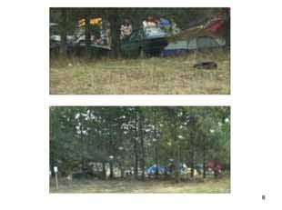
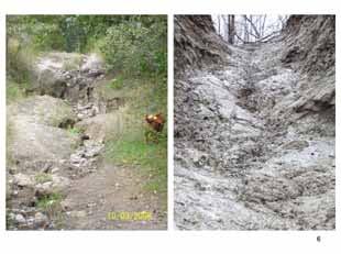
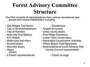
269 49 WORKSHOP NO. 10 JUNE 11, 2009 FACILITATOR S SUMMARY


270 50 PREPARED BY OGILVIE, OGILVIE & COMPANY


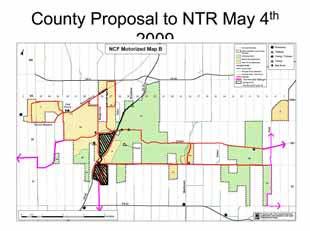
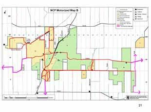
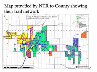
271 51 WORKSHOP NO. 10 JUNE 11, 2009 FACILITATOR S SUMMARY


272 52 PREPARED BY OGILVIE, OGILVIE & COMPANY


273 53 WORKSHOP NO. 10 JUNE 11, 2009 FACILITATOR S SUMMARY
274 Hello Terry, In follow up to my to you dated April 22, 2009 on behalf of Bill Pyatt (see copy below), we would appreciate receiving a written response from you, prior to the scheduled meeting on May 20th with Alnwick/Haldimand Council, so that this item may be addressed, along with other Forest issues. Thank you. Nancy MacDonald April 22, 2009 Hello Terry, I am sending this to you on behalf of Northumberland County C.A.O. Bill Pyatt. In follow up to Alnwick/Haldimand s recent communications to us regarding Northumberland County Forest, I wish to clarify and obtain further information about the direct costs incurred by your municipality related to the Forest, including fire protection, policing, signage and maintenance. We want to be aware of any net Forest management costs that Alnwick/Haldimand is incurring that should be the County s responsibility. In his memo dated March 12, 2009, Deputy Mayor McDonald cites these specific issues, stating that we supply the services, but there is no tax money generated Please provide the following information so that we may better understand your budget costs vis a vis the County Forest: and 2007 forest fire protection budget expenses incurred by Alnwick/Haldimand? and 2007 policing budget expenses incurred by Alnwick/ Haldimand? : fire rating and warning signage expenses incurred by Alnwick/ Haldimand? and 2007 budget for snow clearing services of two parking lots expenses incurred by Alnwick/Haldimand? - any other incidental monies that Alnwick/Haldimand pays towards Forest maintenance/services? Thank you for your assistance and I look forward to hearing from you. Regards. Nancy MacDonald Executive Assistant to CAO Northumberland County phone: or , x macdonaldn@northumberlandcounty.ca 54 PREPARED BY OGILVIE, OGILVIE & COMPANY
275 Appendix B Northumberland Trail Riders P.O. Box 5 Port Hope, Ontario L1A 3V9 June 11, 2009 By Open Letter Northumberland County Forest Advisory Committee Northumberland County 555 courthouse road Cobourg, Ontario K9A 5J6 Attention: Mr. Bill Pyatt, Chief Administrative Officer Dear Sirs: Re: Northumberland County Forest Master Plan As the consultation process of the Forest Advisory Committee (the FAC ) is now finalizing, we wish to summarize our position and make a proposal for progress in developing a Forest Master Plan that works for all. We believe the FAC process has been seriously flawed, and has compromised, rather than enhanced, the participation of important community groups in ongoing use of the Forest. However, we want to move forward with constructive proposals, which are set out here, including a paradigm for forest management that has been successfully applied elsewhere and which we feel should be adopted here. Northumberland Trail Riders The Northumberland Trail Riders (the NTR ) is an association of off-road motorcyclists, with some 66 current members, who have been riding in the Northumberland County Forest for many years. In that time, our members have constructed a system of off-road trails, usable by motorcyclists as well as hikers, bicyclists and equestrians, that are almost wholly single track and thus not usable by, or designed for, ATVs, snowmobiles or other larger vehicles. They are tight and twisty trails that dodge and dart through the forest, with minimal impact on an actual footprint, over the entire Forest, of only 0.2%. The NTR has sponsored and managed annual trail rides in the Forest under strict controls on noise, riding practices and sensitive areas to be avoided for many years, and has lobbied non-member riders using the Forest to follow responsible riding practices. The NTR thus has an established record as an effective steward of Forest use by off-road motorcyclists and others. Forest Advisory Committee - A Flawed Process Since 2007, the NTR has been working with other participants on a Forest Advisory Committee, convened and managed by Northumberland County staff, to assist in developing a Forest Master Plan that can guide future use of the Forest. Unfortunately, our members, and many other interested users of the Forest (snowmobilers, native groups, hunters and anglers, and mountain bicyclists) have been disappointed to discover that the FAC process has been managed, massaged and, frankly, staged to reach a foregone conclusion - that the NTR s single track trail system is to be prohibited from use by those who built and maintain it, and that many other existing uses are to be prohibited or restricted thus penalizing specific groups in our community who have used the forest actively for many years. We are concerned and disappointed by events such as these: 1 The Facilitator s Atlas prepared for the FAC is a biased collage of material with spotty scientific support, and flawed analysis, with no particular supporting expertise. 55 WORKSHOP NO. 10 JUNE 11, 2009 FACILITATOR S SUMMARY
276 2 Both the Silv-Econ NCF Study and the Marsh study did not recommend restricting trail or motorized use, but have been disregarded or ignored. 3 The FAC Open Houses and website comments generated very substantial support for maintaining our single-track trails, but were ignored or removed from view. 4 County staff inspected our single track trails and accepted that they cause minimal damage, but now allege unspecified harm to foliage and wildlife. 5 County staff have insisted that NTR change our representative, Ken Hoeverman, for unsupported reasons, when he has been highly effective in presenting our case and raising questions about the FAC process. 6 NTR, its members and its designated representative have been criticized for effective presentation of our position, and our position has been seriously misrepresented in summaries of the individual meetings of the Forest Advisory Committee. We believe these events have seriously compromised the effectiveness of the FAC process, such that it may well be fatally flawed. Its recommendations should be scrutinized very carefully and cautiously before acceptance by our elected representatives as appropriate for management of the Forest. An Inclusive and Effective Forest Master Plan Failing to develop an inclusive and effective Forest Master Plan would be unfortunate for all users of the Forest and for our community. The Forest is a resource that should be available for use by all existing and future users in accordance with practices and policies that can preserve it and manage those uses in a responsible way. Excluding, ignoring or demonizing users is not the way to go, as our elected representatives have repeatedly noted in discussions and public statements. NTR s Proposal The NTR has explored some specific rules and restrictions on off-road single-track trail use, as set out in Bill Batten s to Mr. Pyatt and Ms. Frankl of May 14. Those specific proposals address particular riding areas that we can identify as sensitive, and to be excluded from single-track access. Those proposals are summarized again as an attachment. County Staff have proposed restricting off-road motorcycle use to a specific area of 400 acres, but that is not a workable proposal: 7 It will lead to very intensive use in, and greater likelihood of damage to, that restricted area. 8 Many club members expressed concern regarding over usage of the 2 parcels of land and the proximity of that particular land base to residents of 21 houses within earshot. 9 Using rough numbers, the 400 acres represent about a 93% loss of forest land previously available for use for single-track trails. If we concentrate motorcycle use to very limited areas, trail traffic will increase about 13 times, and trail damage will almost surely increase. 10 It removes the NTR s historical, constructed single-track trail system. The NTR can not in good conscience enter into a user agreement/stewardship arrangement that appears guaranteed to fail. If we are to be held accountable, there has to be some chance of success. Our proposals, as attached and below, are reasonable, and should be adopted going forward or used as a basis for future management. There is a further proposal, however, which we feel is the optimum method for regulating Forest use by off-road motorcyclists but also other user groups, and should be emphasized. The controlled multi user forests in Simcoe, Ganaraska and Larose all allow off-road motorcycle use of existing singletrack trails in conjunction with regulation, on behalf of the Forest, and by agreement with it, by local off-road motorcycle groups or clubs, who assist forest management with trail repair, monitoring and policing of use by their particular user group, 56 PREPARED BY OGILVIE, OGILVIE & COMPANY
277 within the framework of an fee-for-access licensing system. That system works extremely well in those locations, and should be adopted here too. The NTR is fully prepared to take on that role for the Forest, in a working stewardship agreement with the County, provided we are allowed to maintain our existing use of single-track trails built by us in the Forest (adjusted as per attached proposal going forward) Sincerely, NORTHUMBERLAND TRAIL RIDERS By: Bill Batten NTR President. NTR Area Restriction Proposals for Northumberland County Forest The NTR proposes the following specific restrictions on single track/motorized vehicle use in the Forest: 1 Up until now we have had an unofficial gentleman s agreement to not ride the ski trails west of Beagle Club Road. We are willing to sign a formal agreement to not use that area and provide appropriate signage. 2 We also recognize that there is erosion and degradation to Hadlesseys Hill and agree to not use that as part of our system and provide appropriate signage. 3 The trail north from Hadlesseys Hill is another area with erosion which we will agree not to use and provide appropriate signage. 4 NTR will also agree that the much cited Mud Hole should be avoided and provide appropriate signage. 5 We will also agree to avoid use of the sand hill beyond the pond, east of the Boy Scout area and provide appropriate signage. 6 We acknowledge that Look Out Hill should be a no ride area and provide appropriate signage. 7 Single Track trail riding in the Forest should be prohibited from December 1 through May 1, we will advise of this on our website. 8 All single track trail, which we created, should be shared with any other group or users consistent with their character, such as bicycles, horses, skiers and hikers. 9 The NTR will continue to do volunteer trail maintenance work on our single track trails. 10 We will respond to and seek to repair environmental damage pin pointed in the single track trails we use. 11 We will make a concerted effort to educate other riders to avoid prohibited areas and make them aware of environmental concerns. 57 WORKSHOP NO. 10 JUNE 11, 2009 FACILITATOR S SUMMARY
278 Appendix C March Open House Comments *some comments have been paraphrased due to their length as noted with quotations, all original submissions are on file In County, 161 total Hiking, skiing, equestrian and mountain biking *separation based on what entered under area of interest Total (all): 27 Comments 1.Support use by multiple users, very limited hunting, joint plan for care and maintenance so groups with various interests can work compatibly to ensure the forest for future generations 2.I think there is good balance of areas for the various activities possible in the forest, the plan seems to be very sympathetic with potential environmental issues. I think this is a fair and equitable plan for all. 3.Whatever we can do as responsible citizens who care about the health of our forest must be done. We need to respectfully enter the forest and then when leaving it, leave no evidence of our being there. 4.For the most part I have found all aspects of the forest trails and its participants to be harmonious. Extra care should be made by the hike, snowmobile and ATV group leaders to assure safe and enjoyable activities 5.Fully support your proposals especially the restriction of trails and no hunting area, I hope it works. 6.Motorized use causes the greatest degradation and most obtrusive of other uses (exception for snowmobiles as they have a lesser effect on forest integrity), of the 2 motor options option B appears to be the lesser of the 2 as far as negative impact, great work by the committee 7.From the all hiking map I would be entirely satisfied with the trail provisions for hikers, there is a satisfactory and logical separation of passive from mechanized trail uses which hopefully will also permit adequate protection of the natural ecology of the NCF, looking forward to successful implementation 8.Applaud your efforts in developing a plan which targets needs of specific groups and limits efforts of motor vehicles and loud guns, keep the environment as clear and clean as possible. 9.I basically support the proposals as presented from a hiking perspective I hike the trails in area 4A however form a naturalists point of view maybe this area should be rehabilitated and left unused. 10.Leave the forest to be a forest with minimal impact form humans, there is no place for motorized vehicles, leave it to soft use, hiking, cross country skiing. 58 PREPARED BY OGILVIE, OGILVIE & COMPANY
279 11.I suspect the county will be under a great deal of pressure to allow MORE motor use and hunting, considering the desired uses for the forest I think the current recommendations represent considerable compromise and are very reasonable, in particular if it is really desired to protect and enhance the ecological integrity of the forest and to only allow uses that do not harm the ecosystem. I like the fact that many of the motorized trails use Dunbar, other roads and the forest boundary. With respect to the NTR, their desire for 100km of trails and increasing use is not reasonable, nor is their argument that the forest should be freely available to everyone when their desired activity will destroy the ecological integrity of the forest, the county s position seems reasonable. 12.I am in support of the proposed plan, please ensure that as many trails as possible are protected from motorized vehicles and our peace and tranquility is preserved against the noise of hunters 13.Would like to see snow/atv use strictly limited to the most non vulnerable lands to keep erosion and other damage to a minimum, we need to maintain the beauty and quiet of our forests so all may enjoy nature in its natural state for solitude, painting, photography, reflection. 14.If ORV s are allowed in the forest they should be restricted to a small area for them only, the forest should be almost exclusively for hikers, nature, birds, animals etc, flora and fauna 15.We appreciate the work of the committee and agree with the report, I think that where hunting takes place needs to be posted, we hiked here a number of years before we knew hunting was happening, re hikingwhat will be done to keep poison ivy away from the narrow trails? Limiting access and limited motorized access is integral to preserving the ecology of the forest. No motorized use should always be paramount; it would be good to see hunting eventually eliminated entirely. 16.No motorized use west of 45, limit use to no wheels west of 45, no hunting, horse, hike and ski trails wets of 45, motorized and wheels on trails and roads eats of 45 and limited hunting 17.Think the county has developed some good plans with compromises to suit most forest users. I hope the proposals get approved. 18.I would like all motorized vehicles out of the forest, it is time we realized that motor use of the forest is unsustainable in maintaining near pristine a flora and fauna environment 19.I was pleased to see that display, also that the committee is willing to look at all aspects of conservation 20. No comment 21. No comment 59 WORKSHOP NO. 10 JUNE 11, 2009 FACILITATOR S SUMMARY
280 Mountain Biking 3 1. Cyclist advocating for multi use forest, citizens sharing the same trail network not the system of segregation that is being proposed, the Ganaraska forest is a fine example of different uses enjoying nature in harmony 2. Could the hikers, mountain bikers, skiers share the same trails for more variety? 3. Disappointed with ban to east of Cty Rd 45, impacts from mountain biking is minimal, 20 km on the west side is not enough for me and my 2 children Equestrian 3 1. Good work, keep your stand about protecting the environment and try to find motorbikers who will negotiate 2. Want to be able to continue to have access form North Burns road, I support your initiatives, the erosion of the forest grounds is terrible, far worse than most of your pictures reveal 3. The boards are very well distributed making it easy for someone like me who doesn t use the trails very often to understand the landscape and its intended uses Multi use as listed in the area of interest section Mountain bike, motorcycle, snowshoe, cross country ski, hike, paint, photography, peace and tranquility, hiking, all activities, ATV, snow, hunting, equestrian, 8 1. Sorely disappointed with the current proposal for trail use, I have been excluded from a trail I helped create, does the Ganaraska not have a multi use system that works? Why not follow that pattern? I m against the exclusion and segregation; wouldn t it better to educate all users on proper etiquette so we can all get along? 2. As much as possible providing areas for hiking, solitude, flora and fauna appreciation without breathing in diesel fumes and being deafened by motor vehicles. Separating the 2 basic groups as best as possible respecting the beauty and integrity of our irreplaceable forests, would like snow/atv restricted to the most non vulnerable lands to reduce erosion and other damage 3. The decisions made were based on personal prejudices rather than facts, the solutions are merely diplomatic partisanship rather than a plan which respects the greater community, the forest should remain multi use 4. Keep trails open and have warning signs for possible walkers, keep maintenance on trails and keep riding! 5. Allow everyone access to the forest, allow hunting activities and restrict other uses during hunting season as this activity is already using a limited time line 6. You need to do more for recreational use 60 PREPARED BY OGILVIE, OGILVIE & COMPANY
281 7. Please stick to your guns in controlling use of the forest by dirt bike riders, please do not have horses and dirt bikes share trails this is dangerous and scary, ensure noise is controlled, good signage for shared use is essential, motorized and bicycle users must be educated with respect to yielding and behaviour around horses, educate, educate, educate. 8. As a land owner adjoining the forest I am disappointed there is even any question on restricting forest use, a practical look at the erosion would be less expensive than the surveys and meetings that have already taken place. Undefined use in the area of interest section Protection of natural resources, shelter valley to beagle club, 45 highway area, preservation of forest in natural state, preservation, expansion, WBFN, responsible use of trails by all, entire forest, maps of trails and forest uses, all of Northumberland forest, preservation of forest/ moraine no disturbance, property on Dunbar and future residence, Bowmanton area, Please continue with the proposals to protect the forest including limiting hunting and motorized use 2. Like to see all trails left open to all, locals and neighbours are upset with proposals, have lived here for years and years 3. All local neighbours are getting rough end of deal, they pay taxes and enjoy the way it is, people from the city and out of town are ruining the neighborhood, go back to the city 4. We all pay taxes, been using for over 30 years, hate to see it wrecked by groups to tell us what we do and we pay to use it 5. Let things be 6. As a business owner in the area employing 3 full time employees I find this open house very singled sided towards the county 7. My great grandfather helped plant the forest for his ancestors to use, leave things well enough alone, go home to the city 8. Forest for all, need trail 9. No motorized vehicles in any part of the forest, they do too much damage to soil and vegetation 10. The NCF is not just another woodlot to be exploited, it is an ecological oasis that must be protected and allowed to be in its natural state, because it is there it does not the public any rights to it, it is not a public park, it is not a dirt bike proving ground, it is not an automobile test facility, it is not an ATV race track, it is a conservation preserve, it is a one of a kind gem, let us not degrade it 11.We are opposed to off road ATV s and dirt bikes as a form of recreation in the NCF. ORV s damage the natural environment, they emit and cause increased erosion, dust and noxious substances, wildlife is seriously affected and waterways are damaged 12.I think the work being done by the NCF is necessary in the preservation of the environment. The information provided is clear for everyone and equally reflects the views of all parties involved. Change to how the forest is used us required to ensure it is a sustainable community resource. 61 WORKSHOP NO. 10 JUNE 11, 2009 FACILITATOR S SUMMARY
282 13. use of gravel trucks from AH pit on Dunbar-expediency versus preserving the core area 14.Leave well enough alone, everyone get along, have fun and get along together, all complaint have stirred the bee s nest 15.The forest should be utilized by all people of the community, NOT just people without motorized vehicles. All local people pay taxes, recreation is not only hiking and horseback riding. 16.Very informative, displays were in plain language and easy to understand, it is obvious that all present users have been considered and worked into the plan, it will be difficult to balance present uses with the overall future health and ecological integrity of the forest, overall great presentation. 17.List of 14 points, paraphrased: limited horse access, agreeable to them? Motorized seem to be perceived ad dirty guys, what to do to change this? gravel truck haul route on Dunbar should be shown, dirt bike track east of Centerton-councilor declares conflict of interest at those delegations, perhaps not aware of information presented, work with motorized users to rectify areas of heavy erosion, all groups should be allowed to work together, separating motorized to 2 areas seems very restrictive, responsible exceptions should be rewarded with trial periods to expand permitted areas, Ganaraska fee system could be implemented gradually to allow expanded budget for maintenance, why no hunting west of CR 45? Municipal road allowances should not be closed to any users without the agreement of the municipality who owns them 18.What is going on and why do we have to lose all our trails that we have maintained and developed for everyone s uses 19.Hunting and ATV use in our forest, especially private property, is invasive. Most/many of those hunting and ATV-ing in our jurisdiction are from outside of the community and do not adhere to the regional boundaries/ laws. My concern is how will those unaware of the boundaries abide by these limitations? 20.Leave everybody alone to use for their own sport 21.The forest should be open to all from one end to the other 22.Bottlenecking all motorized to Dunbar will result in a great increase of these vehicles going past residences at the east entrance. Property values will plummet and dangerous traffic patterns will result. Compensation to residences will be a requirement (tax deferrals). 23.I think it is a good idea to maintain trails to prevent erosion and have some areas for passive use 24.I have ridden off road motorcycles for 35 years, I am very opposed to the ban on motorcycles and ATV s in the forest, I feel there is room for everyone in the NCF. 62 PREPARED BY OGILVIE, OGILVIE & COMPANY
283 Snowmobile/ATV Have lived in Baltimore for 65 years, recreation for last 40 years, in forest dune buggy, snowmobile and ATV-ing, it is relaxing to go onside the trails with ATV, did it not erode when it was fire guards, upgrade trails that is eroding with grading and material and have a permit fee for use 2. The forest should be open to everyone and their activities, the AVT club used to maintain the trails whose going to do it now? 3. Used trails for 30 years with brother and father, I would like to keep trails as is to enjoy with my daughter, active quad user and biker 4. Hunters, snow machines and ATV people help maintain the trails, who will maintain now? The hikers? Not likely! 5. The OFSC maintains thousands of trails across Ontario, the money from trail permits keeps the trails repaired, ask any person that grooms the trails how much work they do, the forest is for everyone work together,. 6. As a member of the community and as a taxpayer I strongly disagree with the proposed ATV trails for the NCF. I understand concerns about sustaining the forest however I don t feel that all options have been investigated enough. I am quite disappointed with the way in which items were presented at this open house and the material on display was quite one sided. I would like to see the trails available in the future as they are now. 7. As a member of the community and a homeowner/taxpayer this is one of the only recreational activities I participate in the county, I would not be ooposed to paying a small fee to help maintain trails, I am opposed to closing or limiting trail use. The ATV community is already limited to where we can ride. If you stop the legal trail use some people will ride on road and places they shouldn t be, please keep trail riding a family activity 8. Snowmobile option b preferred, have enjoyed snowmobiling for 35 years, NCF provides good afternoon of riding without leaving forest, critical that trails remain open to protect groomed trails form the sun, extending the season by one month, the scenery makes for entertaining day, loss of trails will reduce funding for kilometers for local club, could result in club closing, if forced to travel roads yr olds will not be allowed to use, as resident and taxpayer feel that my usage of the forest is as important as all other residents. Less kilometers means increased traffic in less area. Ganaraska has a good system, has this been reviewed for ideas? 9. Most of damage was done years ago, we ATV-ers have been cleaning up after people and clearing dead fall for years, haven t seen a guy on a horse or bike with a saw or shovel in years 10.I would like to see the ATV trails stay open, if people play by the rules and respect the other forest users I think there is plenty of space for us all. 63 WORKSHOP NO. 10 JUNE 11, 2009 FACILITATOR S SUMMARY
284 11.A bad apple are giving all of use a bad name, we are not out there to destroy the forest, you are going to close down local businesses like all the small engine dealers, most hunters don t hunt out of season, there is no natural wildlife because it is a reforestation, it was not there 40 years ago. 12.The forest is for all to use, educate don t legislate, don t give us any more bullshit laws, freedom is a rarity even here 13.What are we hurting by snowmobiling on it, nothing. Trails will wash out in spring anyways 14.Keep trails open and great info on all trails, skiing, biking, trail walking are great for the community and should be kept open, thanks 15.As a taxpayer I believe you cannot limit any one group from using this or any government land 16.Close the reforestation down you hurt all local business, this is public land to all in hard times your tourism away, if the tree huggers wanna walk, walk, how can they police such a vast area this will just cause a riot. 17.This study is a waste of money, who is going to police this? how are you going to police this? who is going to keep the fire breaks open for our houses? 18.Use plan B and no burning in the forest 19.The ATV and snowmobile clubs have to be responsible for up keep on all trails, picking up garbage all through volunteers, the hikers, skiers have all had the privilege of using these groomed trails, horse back riders have not done anything to keep trails passable or clean garbage from the forest. 20.Proposal B for motorized access in all seasons is the best option for sled dog teams, proposal A still does not provide access to the trails for teams. 21.The ATV trails must remain accessible to all responsible riders, we care about our forest and the beauty is provides for all of us 22.I ride an ATV and sled, please open plan B and no burn in the forest 23.Although your pictures show bike tracks in most cases they are old roads and heavy rain washes them out, are we going to ban storms as well? 24.I ride horse, skidoos and ATV and I see no problem with the hunters, they use the forest and keep the overpopulation down, I have rode skidoos for 25 years and they leave little impact, I ride my ATV respectfully of others and my surroundings, there is a lot of background administrative of the snowmobile club you may not have considered in your changes, e.g. signage, insurance and cost of running groomers. 25.Leave things the way they are, if you closed the forest recreation vehicles are going to use main road and side road, this is going to create accidents 64 PREPARED BY OGILVIE, OGILVIE & COMPANY
285 Hunting (walking, ATV) 39 Petition from OFAH-128 In county: 4 26.All trails should be more police, trail wardens should be out more after checking trails, signage should be more visible on trails, even ski trails should have better signage, signs should be posted for garbage fines, maybe spend more time policing! 27.Why are you restricting us to such a small area? As we feel being am ember of the snowmobile club we don t feel we do a lot of damage to the environment, why can t we have more trails as we pay to ride the trails and there is less traffic in the winter. 28.In my opinion snowmobilers have made and kept most of these trails open for everyone s use and I don o think we should lose any trails. 29. Not happy with the proposals to ban all ATV, motorcycles from the existing trails 30. I am opposed to proposal for off road vehicles, still lots of unanswered questions 1. I think the decision regarding motorized vehicles was made long before the open house, NTR illegible, keep hunting as is 2. we ve used this area since I was a kid for hunting and ATV-ing, this is a disgrace to this off to particular groups there is a lot of traditions being broke with this act 3. as available (crown) hunting areas decrease it seems instances of trespassing increase, better education and communication concerning hunting seasons for all land users in the NCF is important, to ban something like hunting that has been with generations of families to appease a group of people with more time, money and a willingness to yell louder than anyone else is a shame 4. even though I am not out in the NCF as much as I would like to be it is still a great place to go out for a nice walk, trying to stir up some grouse or pheasant, I ve spent countless hours out there on my four wheeler with my buddies and would love to continue doing that so I am against the NTR membership being mandatory to ride in the Forest 5. my family has lived around forest for generations, my great grandfather, grandfather, father and now me and my kids hunt there. Hunting in all of forest should continue, all hunting-turkey, rabbit, partridge and deer should continue, give the hikers and cross country skiers land west of beagle club road, leave rest of forest for hunting, snowmobile and 4 wheelers. People are upset that tree huggers from outside area are trying to take over part of our heritage, go back to Toronto or wherever they came from and leave us the forest. The money spent on this stupid program would have paid for maintenance on trails for the next ten years. The reason the forest is there is because it is crap land no good for farming. Over 5000 acres of forest and they show maybe 2 acres that are damaged, the rest is fine, grade the trails every year and leave things the way they are now 65 WORKSHOP NO. 10 JUNE 11, 2009 FACILITATOR S SUMMARY
286 6. oppose suggested changes, believe forest should be available fro all including hunting and motorized. Keep all hunting seasons 7. spend quality time with my children hunting and find new policy very unfair, I also cross country ski and resent tree huggers taking their dogs to aggravate other users and leaving their dog shit and footprints on the ski trails, all hunting should be allowed 8. leave things the way they are or let it grow in and you fight the fires 9. everyone should have the right to use the forest, have respect for season of everyone, this meeting should have been held with oral question periods not after the proposals have been made up 10. strongly opposed to limiting hunting, this will crowd remaining zones to satisfy an extreme minority group, is public land and all should have open access to be able to use this with respect to all hobbyists, possible to post signs so all are aware of hunting seasons, no practical reason to restrict muzzle loading, have hunted there for years and seldom come across hikers, hikers etc should have to wear blaze orange during hunt season 11.do not agree with proposal to do away with hunting on west side of Hwy 45 or doing away with muzzle loading hunting, everyone should have the right to use public forest with due respect to law and regulations 12.crown land is for the use of anyone undertaking legal activities, as a hunter I disagree with the no hunting on west side of hwy 45, I am upset that small game and turkey is not permitted anymore on east or west, we can all use the woods as we have in the past 13.don t agree with proposal of not hunting on west side of hwy 45, all of forest should be accessible to be hunted in season, no division of forest should be made for hunters or for any other reason, leave NCF as is 14.Limited use of trail is ridiculous, who will pay to maintain trails when motorized vehicles are kicked out by taxpayers? Weeds and poison ivy will be so thick within months nobody will use trails and county to pay to spray, as for hunting why change anything its 2 weeks a year and I cant remember the last time someone was injured 15.I don t think any area such as this should be closed to any public hunting or recreation 16.would like hunting to stay open in the forest 17.I do not wish to see any part of our forest closed to hunting period, this is the only recreation I have and use this forest for, over population of wildlife will happen if the forestry is a no hunting area, farmers will have more crop damage from wildlife 18.I don t like the hunting being restricted to deer only I think hunters are being robbed of a lot of small game opportunities 66 PREPARED BY OGILVIE, OGILVIE & COMPANY
287 19.should allow hunting during all legal hunting seasons especially turkey and deer, hunting is a safe sport, most non hunters have very little or no knowledge of guns hunting or regulation, example a shot gun loaded with a turkey shot is not long range, let us hunters or OFAH educate you 20.mapping informative, answers not always there, cant understand why no small game, upland game bird hunting, there is only a small area for deer hunting, with no muzzle hunting at all, access by ATV to retrieve game that are harvested was not answered maybe should have had literature explaining proposals on hunting 21. no comment 22.riding ATV in forest and hunting, we would be willing to help volunteer policing in the forest 23.this is the 3rd round of dealing with this issue, I was a NFUC committee member and the last correspondence I have is dated April 2003, from Judy Collar, as the designated rep for hunters I am appalled that this has not been finalized, I am a taxpayer in Haldimand township and I pay for this land, I should be able to enjoy it to my liking 24.I really don t want to have to drag out a deer I have shot, I am only 5 foot tall and 100 lbs, and my husband is disabled, and all the work is on me 25.it is the belief that all Northumberland taxpayers be entitled to use the forest for whatever reason, restrictive hunting and riding 4 wheelers is wrong, the hunters and off road riders seem to be the only ones required to make concessions 26.I have to wonder why muzzle loading is to be excluded when it has a minimal impact on the environment and offers little impediments to other activities being permitted in the forest at that time (early Dec.), is it just because there are fewer hunters who use muzzle loaders? 27.Hunting east of 45 is OK, think muzzle loading should be kept open, why is it proposed to be closed? 28.should be open to everyone equally, the people who want the forest to themselves just want a place for their dogs to shit and they don t have to clean it up, if I cant hunt there I want a refund on my taxes, I will hunt until I receive it 29.keep hunting open in the NCF 30.I think that if this happens the impact on the environment with the over population of wildlife will be more of a problem than it is now, hunting in these areas help the farmers from their crops being destroyed, deer turkey, this hunting area is a big part of lone time with my son bonding 31.I ve been hunting for 45 years in the reforestry, to close down any portion is a real crime and discriminating to hunting, leave well enough alone, finding places to hunt around the county is becoming scarcer all the time, let s have something for our future hunters to use 67 WORKSHOP NO. 10 JUNE 11, 2009 FACILITATOR S SUMMARY
288 32.I really do not agree to any of your info on the hunting, I do agree on some of the idea for ATV and motor bikes that do damage to the roads and trails, the hunt part is you are stopping me from enjoying the forest that I have for years 33.I am 16 years old and I am a hunter and a trail rider, I have no where else to go, please do not restrict my hunting and 4 wheeling 34.I am a hunter and handicap, I am also of first nation, I have a right to hunt in the forest and use an ATV to retrieve my game 35.I am opposed to the closing of hunting opportunities anywhere in the province, closing part of the NCF will displace hunters and put extra pressure on remaining areas, this could lead to additional problems resulting in future closures to hunters 36.As a hunter and ATV user in the forest I never encounter any problems if used properly, hunting is one of the safest things in the woods, to shut out these activities for local people to please people for walking and hiking and hikers don t pay taxes for the use 37. hunting should remain over the entire area respect for the rural heritage and culture, access by both aboriginal and non, environmental footprint is small, policing i.e. visually to help indicate forest isn t vacant, everything east of 45 would be better boundary and because of plant species 38. I enjoy NCF almost all year round, it would be a mistake to take these rights from the people, there have been no deaths hunting in the woods but 5 or more for snowmobiling in the last 5 years so maybe that is what we should be banning 39.Hunting is to control animal population, by closing you are killing tradition, we have to take hunting courses to be able to hunt there for we are educated outdoorsman, ATV deaths in 5 years? Snowmobile deaths in 5 years? Horseback riding deaths in 5 years? Hunting deaths in 5 years? 0! 68 PREPARED BY OGILVIE, OGILVIE & COMPANY
289 Motorcycle Trail Riding not all bikers are the same, properly muffled machines that are responsibly ridden cause very little environmental impact, the forest should be open to the riders who respect their riding areas, we are not the same as ATV s and snowmobiles 2. off road dirt bikes and motorized vehicles should be allowed to enjoy the NCF as equal use as non motorized user groupsm NTR have put 100 s of hours into a trail system and should be allowed to use the trail system they built, I strongly oppose a ban on motorized use in the forest that my tax money pays for 3. I m disappointed to see the lack of riding area, it appears to be all roads, a very short ride and would be dangerous for my kids 4. this is my forest, my grandmother helped plant this forest, this is my forest 5. keep it open to dirt bikes 6. no comment 7. keep dirt biking going 8. opportunity for quality family time, gives youth somewhere to focus time and energy rather than drugs, drinking stealing etc, riding is the most invigorating feeling, no partying, drugs women etc can replace the feeling of riding an off road motorcycle, taking this away from us riders who follow the rules will greatly harm our livelihood, we aren t hurting anyone 9. we should all be able to use the forest, we all have to pay taxes 10.I am against the idea of NTR membership being mandatory to ride in the NCF 11.all trails should remain as they are now, should be able to ride up the NCF as is, all families should be able to use the NCF, council should not discriminate against motorcycle riders 12.my family and myself have been enjoying this beautiful natural resource for years on snowmobiles and dirt bikes, we have respected it and loved it, what you are proposing (banning us) is just terrible and I think it looks like you made this decision before we re even able to share our case, i.e. the 11th hour last night no OFTR display at NFAC open house 13.forest is open for all of us, local riders built the trails years ago with permission it is not right 14.discrimination against one group, does not solve the problem, if you want to close trails to certain groups do it for all activities I don t agree with the council decision 15.I am very disappointed to see the outcome of all the meetings that have been held, I do not agree with the maps as presented, all this will do is cause conflict, I cant understand why we cannot reach a suitable compromise, there are lots of trails for all to share, this will have a negative economic impact for many businesses, tourism dollars! 69 WORKSHOP NO. 10 JUNE 11, 2009 FACILITATOR S SUMMARY
290 16.I am a responsible off road rider and also a mountain biker and hiker, I am very frustrated with the misinformation that has been presented regarding off road motorcycle use, I believe there is room for all users in the forest, there is no more supposed damage caused by motorcycles ridden responsibility than other forest uses, I believe we deserve to have a forest for all users like the Ganaraska, it is hugely hypocritical of their committee to log the forest and then keep out motorcycle riders. 17.I would like to see the forest remain as it is at present, riding clubs maintain trails in spring and fall, cleaning out deadfall etc, how would this happen if motorized vehicles aren t allowed on trails? Walking with chainsaw to clean up forest would be difficult. 18. have lived in this area for 43 years, my parents introduced me to dirt bike riding in the forest, I think I deserve the right to share this with my 2 daughters, I currently live in Centerton, bought 20 acres adjacent to this forest so we could enjoy it not get kicked out, currently I pay $4, 600 a year in taxes, I am not impressed at all 19.I feel the proposed potential ban on motorized vehicles within the forest is ludicrous, the single track trails are the best kept in the forest according to Dr Marsh s study. Very little erosion ahs been observed, they are narrow and not infringing on the surrounding vegetation, in addition to riding, I am also an avid hiker in the forest and have had a great opportunity to see elements of the forest due to the trails created by motorcycle trail riders, areas I could not have walked through without the small trail being available, in my mind a dirt bike trail could never do the damage a single area of logging does, the members of the trail riders work very hard to maintain the forest and would be very willing to work with the other groups to maintain the areas we all enjoy. 20.this is a lesson of history, when I started to ride dirt bikes I was 16 years old, I m now 52, the MNR had a 65hp Massey Ferguson and a 4 furrow plow that kept the trails broke up as fire breaks, in the late 70 s/early 80 s they stopped, reason being there was enough motorized traffic to keep the trails open as firebreaks, I would like to know if this council members have budgeted the cost of a tractor and plow and operator to keep trails open as firebreaks, I don t think you have as most of you were either not in the area or using the trails 21.the forest is a great place for family and fun and a place to see the abundant wildlife we have in this county, we as taxpayers should be allowed to enjoy the forest, my daughter learn about many different forms of trees and wildlife, the forest has many different family activities year round, let us keep it 22.I believe the forest should be available to all people for all types of recreation, especially dirt bike riding, people who use the forest are responsible people that respect the forest, it is not fair to shut out the dirt bike riders when there is no evidence that dirt bike riders are destroying the forest, I disagree with the county to close the forest to the dirt bikers. 70 PREPARED BY OGILVIE, OGILVIE & COMPANY
291 23.I disagree with the proposal of banning the motorcycles from the existing trails 24. my family rides ORV s in the forest and enjoy our time there, we spend considerable amounts of money on this hobby, I would like council to allow OFTR members to help maintain the forest trails 25.I think it better for girls and boys to spend time in the forest and for them to spend their money on riding bikes or four wheelers then hang around down town doing drugs or drinking, I have been riding bikes and four wheelers for 32 years now and my son and daughter are now doing it, so if you close me down what about my kids and their kids? 26.I also cross country ski and snowmobile, our trails have very little damage and are shared by us and mountain bikes primarily, the trails are open to all users, m a taxpayer and think I have a right to be in the forest, I ve personally called the police on people dumping garbage, we also have garbage clean up days, I also have two daughters who ride in Meg s ride for cancer. 27.I think everyone should be allowed to use the forest 28.I have strong concerns regarding closing trails to the NTR who over the years have created and maintained the forest, there seems to be a strong prejudice against them from a paid political opposition while the club runs on mainly dedicated volunteers. 29.NTR has worked cooperatively with Northumberland County to establish a trail network, this trail network should be maintained and kept accessible for motorcycles, we are not doing damage to the forest, please reconsider your position 30.From the outset it appears that county staff (?) had an agenda that was not made public. Decisions and recommendations are being made that I don t believe are reasonable or based on the facts. The county ahs continually misrepresented the facts and have made comments that are misleading. I believe that people should be allowed to trail ride in the NCF, this requires the use of single track trail that for the most part has been built and maintained by the NTR. The NTR and OFTR are willing to provide stewardship in the forest but those offers have been ignored. Single track trails make up a small area of the forest in total, (narrow trails) and have minimal impact. I believe the forest should be open to all users and managed properly for what it is. As a taxpayer I believe it is our right. I hope county council is more open minded than the staff appear to be. 31.Trail bikes cab work within the forest, the single track trails are the best trails in the forest according to Dr Marsh, in the best shape. The NTR and OFTR will work to improve the forest, the forest can be used by people and maintain its health as well 32.for many years I have enjoyed the forest for trail riding and hiking with my wife and dogs, the locking up of the forest for certain users only and not others is not fair to the trail riders who have maintained and kept the forest in good shape for years. 71 WORKSHOP NO. 10 JUNE 11, 2009 FACILITATOR S SUMMARY
292 Out of County: 61 responses Comments Multi use: Hunting, snowmobile, hiking, wildlife sanctuary, cross country skiing, horse back riding 6 1. maintain status quo with regards to hunting for all species, maintain motorized trail use for hunting purposes and game retrieval 2. god gave us this land to hunt, fish and enjoy not to be ruled by anti tree huggers, amen 3. I think the county staff have done an excellent job in creating an organized trail system open to all user groups while also keeping impacts to the forest to a minimum, maintaining the ecological integrity of the forest is the most important factor to consider in this process, as otherwise we will soon not have a functioning forest ecosystem to enjoy, the county obviously recognizes this as a key element in their planning process, of the 2 motorized options presented I think the option where they are removed form the northern option is better as this is amore sensitive area. I think that it is very fair to offer only a portion of the forest for hunting, while leaving part of it off limits to this activity. Many people are not comfortable with hunting; this allows both groups to be satisfied and safe use year round. Keeping it to deer season only is a good option for safety of users and keeping the forest as a safe haven to wildlife as well. 4. my opinion on this matter is simple, open it for everyone or close it for everyone, while not a dirt bike rider I firmly believe this is a shared forest, there is plenty of room for everyone to get along. No one group has any more right to it than others, if ecology is the 31 concern close it to everyone and let nature take its course, but if it is to be used by some common sense dictates you have to let it be used by all, I see that major department stores are selling dirt bikes so one has to assume these people need a place to do their thing. 5. support proposal by the NCR, trails for horse riding look good, provisions for off road riding has been provided and also trails for walkers, orienteers, cross country skiing etc. horse parking area should be large enough to accommodate large horse trailers. 6. I think the proposed motorize area will lead to more accidents and high speed. As a dirt/trail rider I prefer tighter off road trails which are safer and more pleasurable, I have no problem donating time to help patrol areas to ensure county guidelines are met. I currently volunteer approx. 400 hours annually to other riding areas, please consider other trails for our options. 72 PREPARED BY OGILVIE, OGILVIE & COMPANY
293 Motorcycle Trail Riding I strongly disagree with the proposed trail sue, the motorcyclists have spent 100 s of hours making a trail system that is sustainable and in accordance with the environment issues of the erosion, sound etc, now it is going to be taken away by the same people who told us to build it, the only damage pictured here was done at locations no where near where our trail system is, proposed trails are not trails, they are dirt roads and a dangerous place to ride. If the forest was smart they would award stewardship to the responsible user groups, any other solution is asking for trouble. 2. I disagree with the proposal to close trails to trail riders; I believe we can work cooperatively with all users to keep these trails open. 3. I am against any such closing I have shared the forest with family and friends over the past 15 years don t take that away it s a great place4. The best option is to give the NTR/OFTR the opportunity to show that their stewardship of existing trails will show they will protect the integrity of the forest and ensure good management for the future. [Please allow continued use of the existing trails. 5. Please, please, please reconsider your thoughts on closure of motorcycle trails that have been in this forest for years, I enjoy my sport and will work to make the forest a better place for all users. 6. There are many benefits to keeping the trails open to dirt bike riders, from tourism income to local businesses and municipalities. Bring in a yearly membership fee to help cover the costs like policing the forest. The ones who are causing the problems are going to continue to do so once the trails are closed or not. A membership fee will allow the responsible users to help with enforcement and keep the forest open to everyone. 7. hope something can be worked out to try and save these trails 8. The presentations were well laid out however there appears to be some under lying bias that stands out. I would seriously hope that you be open minded to compromise, nature should be enjoyed by responsible persons, always the few spoil it for many. Multi use can encompass many uses, old natural forests should restricted and preserved however plantation land should be open for multi use. Thank you for your consideration. 9. Why is that we are having the door slammed in our face? Draconism is dead, arbitral decision making is not a democratic process, we have valid points, are responsible law abiding and helping to support the community/county. The OFTR has supplied the NFAC with acceptable examples of stewardism in other forests, it works, and management of those areas are happy. Why will you not work with us? We are quite possibly the best allies you will ever have. We are being proactive however it seems like someone or some people are trying to protect their salaries? Work with us! 10. keep trails open 73 WORKSHOP NO. 10 JUNE 11, 2009 FACILITATOR S SUMMARY
294 11.the single track trails maintained and created by the OFTR should remain open to motorcycle use, this beautiful forest is enjoyed and respected by the vast majority of riders, closing this experience to them would an awful shame. 12.I think that all if not most of the trails should be multi use, this works in other areas with the help of user groups, a well built trail should have little impact on the forest, with all users maybe some restriction and should bring many visitors to your area and support the tax base. If you only have walkers on the single track they will get overgrown and no one will be able to use them or you will need to spend a lot of money on maintenance and only a handful of users. 13.I found the display very leading to one conclusion, especially the motorcycle display which lead you to believe there was no possible solution. Also there was a county staff person in front of the motorized display speaking out against motorized use to anyone who attempted to read the display. There are several successful examples of Ontario forests with motorized agreements with stewardship for volunteer, e.g. Simcoe and Ganaraska. These examples should be followed in Northumberland. 14.I worked many hours on these trails and believed that my kids and me could enjoy them for many years to come, I enjoy trail riding with my motorcycle. 15. for 3 years participate don Meg s Ride, has raised $35 K in 5 years, who will maintain trails if take away from us? It is my belief that forest should be for everyone, putting Orv on road with cars and trucks will surely lead to accidents, if NTR/OFTR were to take over trails ORV s could be educated as to proper use. My understanding that there is written permission for NTR to use trails dating back many years, should not be taken form them. Understand study on the condition of trails found them to be in good condition, so why restrict motorized? Do not believe that motorized should taken off existing trails 16.Would help provide good income for local businesses and municipalities. Implement a fee system to help cover costs of policing, the point is closing down the trails Is not going to stop the problem users, let the respectful users help. Closing trails will reduce users and we will not be able to help, future generations will not be able to enjoy the forest if we are not allowed. 17.I ve been riding this forest for 10 years and I will disapprove of closing these trails not just for me for my kids and family as well 18.My understanding is that motorized use will be severely restricted if the proposed legislation goes through. I am opposed tot his. Outdoor sports are a necessity for health and well being and motor sports should not be discriminated against. I can only hope that people don t let their fear of the unknown cloud their judgment. The Northumberland Forest is a county owned land that should be offered to multi use format without discrimination. After all it is really a tree farm to generate monies for the county and should be open for all public use however the hardwood natural forest I feel should be preserved and protected from all use. Level heads should prevail, thank you for reading my opinion. 74 PREPARED BY OGILVIE, OGILVIE & COMPANY
295 19.most of the single track trails were built and are maintained by motorcycle trail riders, all organized trail rides have a sound test to pass 20.would like to see a trial 1 year land use agreement similar to what is in place in Simcoe, look forward to prove that responsible use by all groups can work in harmony 21.I have attended organized rides in the NCF. My observations of trail riding in this area compares with other areas in that little damage occurs with motorcycle use compared to damage caused by 4 wheeled vehicles. Illegible. Trails cannot be found in the spring due to the overgrown effect, I have not seen any damage where single track exists even through sensitive areas. Stewardship is essential in maintaining the integrity of all lands used by the public, Simcoe County is a prime example of how user groups can work together with the county. Volunteers can provide the man power necessary to repair, maintain and patrol trails effectively. 22.The usage of forests seem to be quite bias against motorcycles, I have enjoyed the single track trails and hope to do so in the future. Also I have spent many day in trail clean up and maintenance efforts which helps the trails of all the user groups I have belonged to over the years, I have found dirt bikes (organized) are some of the helpful towards the forest, limiting forest usage to wide trails becomes very unattractive, motorcycles enjoy very similar trails to mountain bikes and I enjoy both, and see no reason why they cannot co-exist on the same trails, if the work is needed on trails please let NTR/OFTR know and we can arrange many people to help out an dput in hours/days of labour. 23.My two kids, aged 12 and 14 as well as myself enjoy riding the forest trails. We are respective of the environment and other forest users, as a taxpayer I am very disappointed with the decision to ban off road motorcycles from the forest as everyone should have a right to forest use, our motorcycles do less damage to the forest than a horse using the same trail. 24. Been riding for over 20 years, dirt bike, ATV, dog walk and enjoy every moment. Upset to hear want to close trails, one sided to say we are destroying the forest, trails have not change din over 20 years, is a man made forest designed for logging if really cared logging would stop, that causes more damage than ORV s. studies show we are not as destructive as people claim but is ignored, this is a free country and should be able to get along, extremely disappointed with open house, one sided show, Ken Reid Park, Emily Park, Durham forest, Algonquin, trails look same as ours and more garbage there and just as much damage. Environmentally friendly people make the worst mess of all, forest should be shared with everyone 75 WORKSHOP NO. 10 JUNE 11, 2009 FACILITATOR S SUMMARY
296 25.I would like to comment on the one sidedness of the committee planning to eliminate motorcycle trails in the forest. The one sidedness I am talking about is a group looking after one set of interests without taking all user groups into consideration. Are we in a communist country? If a group is to be evicted than everyone should be, motorcycles and ATV are often misconstrued as being disruptive while hiking is ok, this is pure BS, people don t realize the benefits of our sport-giving children and youth, adults something to do and look forward to instead of hanging around street corners involving themselves in drugs and crime, ask a kid how much fun they have riding a dirt bike or ATV, but no, narrow minded off the wall activist are trying to shut down every place to ride, lets turn the tables and mow down the forest and take nature away and see how they would like it? Lets get along and work together 26.All users should be allowed to enjoy the forest, the elitism and bullying of other users is not appropriate. 27.Nicely organized presentation of materials. Very good turnout, based on my time at the open house, hopefully more through the day, excellent way to inform community and collect feedback from all concerned groups, look forward to hearing more as Master Plan evolves. 28.I have been a guest trail rider in this area for several years and have enjoyed myself immensely. I would like to see the trails left open for me and others to enjoy. I don t believe that nay harm has been done that wouldn t be done in a rain storm and that studies generally always have a political direction that in 10 years means nothing. 29.There are many economic benefits to the county in the way of tourism dollars, why is the findings of the Dr Marsh study being ignored? 30.The forest is for everyone to enjoy 31. forest is for everyone, all taxpayers 32.keep up the good work, we need a strong voice to get people to see who the average rider is, kids, families etc, we are not all bad bikers 33.This forest has been used by my grandfather and by my father and myself and my wife and 2 sons, shutting down the forest to us and taking our trails that have been built and maintained by us is silly/ ridiculous. We may only bring a couple of thousand of dollars a year in the community but that will stop altogether if we are forced to take our legal activities elsewhere. 34.I personally have helped to create some of the single track trails in the forest in cooperation with the NTR. These trails were made by us and maintained by us in advance of the annual organized trail ride. The trail ride is part of a trail ride series across Ontario and is enjoyed by responsible families i.e. children and mature adults. Surely there is a way to retain some of these single track trails for the enjoyment by these families. The majority of motorcycle people are responsible, caring folks that are concerned about the environment and stability of the forest. We can coexist. 76 PREPARED BY OGILVIE, OGILVIE & COMPANY
297 35.I know that there a lot of people who disagree with off road vehicles. I have been riding motorcycles since I was 4 years old, I love trail riding and motocross. I think that everyone that rides respects the forest, I usually make a nice day out of it and I ll clean trails if trees or branches have come down over the winter, I make sure everything is clear and then ride all day. I think it brings more people to the community and keeps myself and others out of trouble. I disagree with taking that away from myself and fellow riders. If you take riding away you are taking my only thing I have away. 36.This is wonderful part of Ontario and a great natural recreational resource. There are many good hobbies, sports, uses for people in the forest, we organize into groups based on our passion for the use of the forest and love our chosen recreation. I fully expect equal and fair representation of the users of the forest to continue our shared enjoyment. 37. I understand environmental concerns but believe if proper rules, restrictions are in place to help prevent idiots off road riding is a valuable asset to the growth of our region. It s a family oriented sport and a great ay to get kids and everyone outside being active. Motorcycle sales are needed to support economy, especially during this tough economic time, riding off road has taught me respect towards our land and has helped develop my confidence in life in general. To really enjoy off road riding we need a variety of trails, not just straight forward sled trails or access roads. Benefits of maintaining off road: promotes active lifestyles, stimulates economy, develops respect for land and our privileges to ride on it, family oriented sport-please don t treat everyone like the minority who disobeys the laws, whether it is legal or not to ride they are going to anyways, will only lead to more problems and illegal activity, develop better police system to ensure riders are licensed and following rules, do we want our kids stuck behind computers/cell phones all day? 38.I disapprove of Council s position in banning ORM s on forest trails, all this decision will accomplish is to keep lawful, respectful trail riders out and leave it free for all the other users who already ride illegally in other areas (e.g. Raglan). I think the county should adopt a similar strategy as what is used in Ganaraska where this type of usage has been proven to be sustainable. 39.The NCF is one of few locations where one can legally ride an off road motorcycle, there are many conservation areas in the area where motorcycling is not permitted, I believe Northumberland should model itself after the Ganaraska with a multi use mandate. 77 WORKSHOP NO. 10 JUNE 11, 2009 FACILITATOR S SUMMARY
298 40.Don t close trails to dirt bike riders, I feel that all groups should get along and learn form each others experience. I don t believe that any one group is more important than the other, every group has some impact on the environment, ATV s do far more damage-they are off road bulldozers, most serious dirt bike riders are respectful to all other user groups with regard to noise and sharing trails. People who have not experienced the thrill of enjoying the environment on motorized vehicles have a very one dimensional opinion. Many people who do enjoy motorized vehicles also enjoy non motorized activities like hiking, skiing, biking and can be more respectful of others. 41.I do not like the way the off road motorcycling community is being treated by the county. The county seems to have a grudge against the NTR, the forest is certainly large enough to accommodate limited motorcycle use on single track trails. The Ganaraska forest certainly isn t large enough o accommodate all of Southern Ontario s motorcycle riders. It will get closed down due to overuse. 42.Through SCORRA Wayne Rickets has successfully navigated the formerly unchartered waters of motorcycle trail stewardship. Any questions or concerns regarding multi use, safety, etiquette, erosion etc will be answered by examining the templates and blue prints currently implemented and established by the SCORRA example, why would Northumberland be any less successful? We trail riders endeavor to share trails and benefit all user groups. 43.we are willing to work together to repair trail or move trails that are damaged 44.I make the drive form Burlington to Northumberland at least 5 times per year, riding my bike in the NCF is an amazing experience that I wish to share with my children when they are old enough to ride a legally blue plated motorcycle. I am a husband and father, I am a professional who works hard and plays hard, I do not harm the NCF. 45.Would like to know why the county is limiting the use of the forest for motorcycles, motorcycles bring a lot of revenue to this area, food, gas, motorcycle stores. It seems that certain user groups are going to have greater uses of the forest then others; we seem to hear the same topic-soil erosion is a concern. Definitely but when we drive our great highways in the county that are paved it doesn t seem to be a problem 46.We have enjoyed motorcycling in the NCF since All my children and wife have been conscious users of the forest, we have legal and insured bikes and we care about the environment, we cannot understand why we may be disallowed to use the forest in the future. 47.As a respectful, mature responsible off road rider I feel it to be very necessary to share and respect everybody s rights to share and use the woods and trails, let us be fair and responsible. 78 PREPARED BY OGILVIE, OGILVIE & COMPANY
299 48.I find it hard to believe our trails, trails we made at no cost to the public, are being seized for another use. I have always supported multi use trail use, we all have to deal with things in day to day life we don t like but we can t just ban things. This has been a one sided close minded affair from the start. 49.The NTR are like other clubs in Ontario working to organize riders and educate others to resolve issues related to off road riding. We support sound reduction and responsible riding practices; we need information from the committee on where we can ride so we can stay away from environmentally sensitive areas. Everyone needs to compromise; consideration and tolerance can allow all concerned to have access to the forest. 50.have enjoyed the forest for many years on dirt bike and walking, I have met many people who share the same views on the forest as myself which is a great place to go for exercise and to spend time with family and friends. 51.Have been enjoying the family benefits of single track riding for 6 years and feel that everyone can enjoy the forest responsibly, I feel that persons who ride off road are being unfairly singled out and have the same rights as everyone else in respect to access to forest. 52.There is a much better solution to the issues in the NCF than the current proposal. Many of the best stewards of the forest are the off road motorcyclists, funneling all motorized traffic to one road is unreasonable and potentially dangerous. The current proposal is a very narrow, personal agenda being forced o a large and responsible group. Off road motorcycle riding on single track trails should be allowed to continue within this forest. 53.I have a great concern after riding my motorcycle ion this region for 33 years, as a responsible illegible trained rider who pays taxes, license, insurance etc. that one group should be objected to, the forest should be available to all responsible users; I feel a discrimination on this matter. I object! 54.things seem to run pretty good for the Ganaraska Forest system, the annual fee is no problem there, perhaps more enforcement for the abusers of the forest (noise level etc) 55.I enjoy riding my dirt bike on trails through the forest. My bike is rather quiet and insured; I enjoy this hobby of mine greatly and would love to be able to continue doing so in Northumberland. I spend money around this area on gas food and even motels sometimes (all related to me riding here). Taking away this forest from me would means to me that the county does not care about young individuals like me to have a healthy hobby that they enjoy. I hope the county would realize we can all enjoy the outdoors together. 79 WORKSHOP NO. 10 JUNE 11, 2009 FACILITATOR S SUMMARY

300 Appendix D 80 PREPARED BY OGILVIE, OGILVIE & COMPANY

301 81 WORKSHOP NO. 10 JUNE 11, 2009 FACILITATOR S SUMMARY
302 82 PREPARED BY OGILVIE, OGILVIE & COMPANY

303 83 WORKSHOP NO. 10 JUNE 11, 2009 FACILITATOR S SUMMARY


304 84 PREPARED BY OGILVIE, OGILVIE & COMPANY


305 85 WORKSHOP NO. 10 JUNE 11, 2009 FACILITATOR S SUMMARY
306 86 PREPARED BY OGILVIE, OGILVIE & COMPANY

307 To: Forest Advisory Committee From: Bill Pyatt, CAO c.c. Mia Frankl, Forest Management Officer Re: Northumberland County Forest / Northumberland Trail Riders Date: February 24, 2009 MEMO Purpose Through the series of meetings with each of the trail user groups over the past three to four months, County staff were able to compose draft recommendations which were supported by all of the trail user groups except one, covering the following key areas: number and location of trails design standards for maintenance and signage co-location or sharing of trails with another appropriate user group, e.g. ATV s and snowmobiles sharing the same trail basic elements of an agreement between the user group and the County Unfortunately, County staff were not able reach a mutually acceptable agreement with the Northumberland Trail Riders (NTR). The purpose of this paper is to describe the discussions to date and to outline the salient points. Background NTR is comprised of approximately local members who ride off road motorcycles (aka dirt bikes) for sport and recreation. As they described their sport, it appears to be a very different experience from that sought by the other two major motorized users ATV s and snowmobiles, whose members are seeking a long-distance touring-type experience on wider and straighter trails. NTR riders are looking for a closed loop circuit of trails that provide a technical riding experience on narrow, single-track trails which are serpentine in nature, with many sharp turns and grade changes and they are attempting to go as quickly as possible over the circuit but speeds typically don t exceed km/h because of the number of bends and grade changes. County staff and their consultants have met with NTR representatives and members and OFTR on two occasions over the past three months with the goal to develop a trail system which could meet the needs of all parties. During these two meetings both sides explained their positions and proposals but there were many basic, philosophical disagreements. At the conclusion of the second meeting, County staff asked the NTR officials to outline on a Forest map what they consider to be their most important trail in the lands east of County Road 45. County staff committed to consider this trail within the context of all the study factors to see if it could be supported to the FAC and ultimately, County Council. 1
308 Upon consideration, County staff cannot support the NTR s proposed trail. The following is a summary of the areas of agreement and disagreement between the parties and concludes with the County s recommendations. General County Staff Concerns Over the past three to four years, there has been a significant increase in the number of narrow single track trails in the County Forest. Particularly in the Lookout Mountain area, these new trails have caused significant erosion, safety hazards and loss of plant life. If the Provincial government were to be called in, there is little question that the County would be in violation of its legal responsibilities under the Oak Ridges Moraine Conservation Plan legislation. County staff pointed out that while there is no doubt that the damage was caused by off road motorcycles, we did not believe that NTR members had caused the damage. There are other types of motorcycle riders in the Forest. Some use race-modified bikes to go as fast as possible on all types of trails. Other motorcyclists look for jumps, near-vertical ascents/descents and high-risk experiences. It is these particular riders who show little or no regard for other forest users and the environment. Staff indicated that they had received information from Ganaraska Region Conservation Authority staff that as a sport, off road motorcycle riders are much less likely to join clubs than other motorized groups such as snowmobilers or ATV riders. Snowmobilers have a significantly higher percentage of established clubs and there is Provincial legislation which enables self-enforcement to specified regulations. ATV riders must be given permission to use roads by a local by law and could be charged if no such by law exists for that area/municipality. There is no similar legislation for off-road motorcycle usage, save for the Highway Traffic Act which applies only to roads and highways as defined by the Act. Recently, some other municipalities and Conservation Authorities have restricted or outright prohibited motorcycles and some other motorized users in their forests. As motorcycle riders are forced out of these forests, the county will almost certainly experience increased ridership and damage and conflicts within our Forest. 2
309 Issue Role of the County Forest County Position Environmental The Forest provides habitat for a range of plants and animals, some of which are provincially or regionally rare or threatened (and protected via provincial legislation). The Forest is a significant groundwater recharge area providing the headwaters for 7 cold water creeks, which in turn provide for a diverse array of cold water fish. The Forest has been assessed for two candidate ANSI (Area of Natural & Scientific Interest) areas by the Ministry of Natural Resources and we expect this designation will be formalized/announced as official at some point in the future. The permitted recreational uses should not significantly interfere with or damage the environment. The County must monitor the Forest on an ongoing basis to ensure it meets its obligations. NTRA Position Recreational Their Members enjoy nature and scenery View the Forest as a recreational arena to be enjoyed by all user types including motorized. Recreation is important to maintaining public health. The plant and animal life in the Forest is hardy and has accommodated motorized uses well. They disagree with the 6 guiding principles developed by County staff and their consultants. They do not support the environmental atlas or its land use recommendations. 3
310 Issue Trail Types and Numbers Issue County Position Combine Motorized Trail Use to Lessen Environmental Impact and Rehabilitate Damaged Areas In the Forest lands to the west of Cty Rd 45 the number of trails in the pine plantation forest is not particularly problematic. The Forest lands to the east of Cty Rd 45 are much more sensitive to motorized use and contain many threatened and rare plant and animal species and habitat types. To compound the problem, there are a large number of motorized trails throughout this area. The number of trails east of Cty Rd 45 needs to be significantly reduced. Certain trails should be closed and returned to nature. The core Forest area east of Cty Rd 45 should be preserved as much as possible without motorized trails bisecting it. Motorized use should be limited to trails located as close to the perimeter of the forest as possible. The other motorized groups (ATV s and snowmobiles) agreed to this principle and agreed to share trails in opposite seasons. Their trails will be regional touring-type trails accommodating two vehicles to pass each other. Staff proposed that off road motorcycles be designated to these same trails and that all other motorized trails be closed east of Cty Rd 45, and be allowed to rehabilitate themselves. County Position NTRA Position Allow Single-Use Trails and Create New Trails They do not share the same desire/ recreational goal as snowmobiles and ATV s in touring, low speed, destination based trails, instead they prefer an intensive experience which offers changes in topography and is open to all interior parts of the Forest. OFTR/NTR state that restricting the amount and extent of trails for off road motorcycles will result in greater intensive use in a concentrated area and recommend to keep the existing trails and if anything expand them to mitigate excessive erosion. OFTR/NTR have said that to restrict off road motorcycles to the ATV/snowmobile trails would increase safety issues such as speeding, dust and conflict with other users. NTRA Position Trail Construction and Investment Combine compatible user types and enter into agreements with groups for maintenance The County seeks to place compatible user types on shared trails to reduce signage and other costs, and to increase the volunteer base that will maintain Maintain existing network at current standard In 1997 County Council approved a special event request for developing trails for off road motorcycle use. The NTR/OFTR interprets this approval to 4
311 designated trail systems. County staff have reviewed the 1997 report which went to County Council. The report was very brief and referred to support for a trail to be used for a charity ride. It did not identify details as to how a charity ride would be classified a low speed touring experience or a competitive challenge, or otherwise. It did not discuss whether the trail could be used on an everyday basis, how long it would be or its location. Nor did it discuss the period of agreement, renewals, etc. Notwithstanding this approval for a trail in the Forest, County staff take the position that the legislation enacted by the Provincial government since 1997 takes precedence and that County Council has the option to alter or cancel the approval. The motorcycle trail riders have the option of using the proposed extensive ATV/snowmobile trail system for charity events, or for general recreation. grant them permission to develop trails throughout the County Forest. The NTR/OFTR state they are able to provide a large volunteer base and funds to maintain the trails. The NTR/OFTR wishes to continue to maintain the existing extent of trails and expand upon them as demand for motorcycle trail riding increases. The NTR/OFTR is willing to share trails with other user groups such as hikers and equestrians. 5
312 Issue User Groups- Enforcement of Members County Position Trespass to Private Property Act makes it difficult to protect the Forest environment To ensure that sound, enforceable trail arrangements can be developed and implemented, County staff met on two occasions with the OPP Northumberland Detachment Commander. Enforcement within the County Forest would be governed by the Trespass To Private Property Act. The County can pass bylaws which would require motorized vehicles to stay on designated trails provided the trail boundaries are clearly marked. The County could not, however, discriminate between licensed and unlicensed motorcycles and insist, for example, that Highway Traffic Act regulations regarding exhaust system noise levels be enforced. The OPP Detachment Commander advised County staff to not grant the OFTR/NTR or NDATV associations the authority to police their own users with the County Forest, because of conflicts which have developed in other parts of the Province. There is existing legislation which governs snowmobiles including enforcement but there is no similar legislation for ATV s and motorcycles. The Simcoe County Forest is 5-6 times larger than our County Forest and is largely made up of generic reforested pine-type plantations which generate annual logging revenues in the hundreds of thousands of dollars. Unlike our Forest, the Simcoe County Forest is by and large pine plantation and is therefore considerably less sensitive to potential damage from motorized vehicles and is comprised of over 40 separate tracts of lands. The Simcoe County Forest does not have the elevated environmental priorities like those which have been adopted for the NCF. NTRA Position The OFTR/NTR can effectively influence other motorcycle users regarding their illegal activities through volunteer stewardship patrols OFTR/NTR state that OFTR affiliated clubs have been very effective in stewarding other Municipal Forests (e.g. Simcoe County Forest) and that the NTR would perform the same role in the NCF, educating users on issues such as excessive speed, inadequate exhaust systems (excessive noise) and trespass in sensitive areas such as Lookout Mountain. The OFTR/NTR would like the County to require all motorcycle trail riders in the Forest to be OFTR members and to have an OFTR/NTR or other recognized association permit to be able to access the County Forest. They would charge a fee which would help cover their costs. This has been very effective in the Simcoe Forest and Simcoe County staff are pleased with how this has worked out. 6
313 Issue Health Issues ISSUE Options to Participate in their Sport County Position Support Ministry of Health Promotion (MHP) Active 2010 by providing outdoor recreational opportunities County staff have concerns with the negative effects associated with exhaust emissions and noise from off road motorcycles and the increasing number of accidents associated with off road motorized vehicle use. Some users travel at excessive speeds, putting themselves and other Forest users at risk of injury. The County s Medical Officer of Health is on record as having serious concerns with the escalating number of accidents and injuries associated with off road motorized vehicles. The York University study was narrow and only considered oxygen intake. County Position Municipalities own a range of properties and routinely designate and/or restrict certain uses i.e. golf not permitted on soccer fields. Municipalities do not attempt to provide for certain recreational activities i.e. auto racing, downhill skiing, etc. For some activities like golf, they may operate a facility but charge marketplace user fees. The Ganaraska Forest is less than 50 km from the County Forest and the GRCA has invested considerable funds to establish and maintain a system of motorized trails which are available to motorcycle riders for an annual or day fee. The GRCA trail system is expensive to operate and police and Northumberland County does not have the financial resources to operate a similar recreational facility. Because off road motorcycling causes erosion, resources must be in place to re-grade NTRA Position York University study establishes health benefits of trail riding Health benefits exist in all forms of recreation. OFTR commissioned a study by York University which demonstrated that motorcycle trail riding had greater health benefits than jogging. Motorcycle trail riding gets young people involved in strenuous outdoor activity and provides health benefits related to fighting obesity and heart disease and other Ministry of Health Promotion (M.o.H.P.) priorities. NTRA Position NTR members state that unlike hikers, for example, who have other options within the County, they have no other places to ride. If hikers do not want to hear internal combustion engines while they walk, they have other places to go than the Forest. The NTR state that they have invested considerable time and effort in developing their trails and they do not want to lose them, or be excluded from the Forest which they see as open to all taxpayers and their recreational uses. 7
314 and rebuild trails on a regular basis. Certain recreational uses are intensive and as usage increases they require dedicated facilities supported by a fee structure and infrastructure to maintain and operate them. There are other designated facilities, such as the GRCA Forest, within Northumberland County and two much larger designated areas the County of Haliburton and the Limerick Forest. County Staff Recommendation That off road motorcycles be confined to the same trails as the ATV s and snowmobiles. If it is found that motorcycle trail riders do not respect the defined limits of the designated motorized trails and subsequently cause environmental damage, then County Council should consider banning motorcycle trail riding from the County Forest. OFTR/NTR Recommendation Enter into a one year use agreement between the County and the OFTR based on the Simcoe County Forest Recreation Policy and based on the map (attached) we have provided to the County of the existing trails developed by the NTR. The County may then identify specific areas of concern on these trails and offer the NTR opportunity to address these issues. 8
315


316 County Council Minutes, September 17, 1997 Page :09:97 CC MOVED BY Councillor Rod McLean SECONDED BY CouncillorJ. Floyd WHEREAS correspondence has been received from Haldimand Township requesting approval for the Ontario Federation of Trail Riders to identify with signage/ribbons. etc. the Trail which is required for future trail motorcycle events in Northumberland Forest, NOW THEREFORE BE IT RESOLVED that County Council grant permission to the Ontario Federation of Trail Riders to identify the trail with signage/ribbons. etc. they wish to use for future trail motorcycle events in Northumberland Forest. CARRIED 19. QUESTION TIME 20. UNFINISHED BUSINESS 21. BY-LAWS: A By-law to install a stop sign 564:09:97 CC MOVED BY Councillor Rod McLean SECONDED BY CouncillorJ. Floyd THAT By-law No be introduced and be deemed to be read a first, second and third time, be passed and be properly signed and sealed. CARRIED A By-law to install a four way stop sign 565:09:97 CC MOVED BY Councillor Brenda Weese SECONDED BY Councillor Charles A. Ward THAT By-law No be introduced and be deemed to be read a first, second and third time, be passed and be properly signed and sealed CARRIED
317 THE ONTARIO FEDERATION OF TRAIL RIDERS...The Voice of Off Road Motorcyclists in Ontario... February 24, 2009 Pill Pyatt Chief Administrative Officer Northumberland County 555 Courthouse Road Cobourg, Ontario K9A 5J6 Dear Mr. Pyatt: Thank you for the opportunity to provide input into your memo to NFAC scheduled for release today at 4:30pm. We are disappointed the county cannot appreciate our concerns and has chosen not to recommend the trail stewardship proposal we presented at our second meeting. We are not sure why the county does not wish to allow us to prove that the notion of stewardship will address the county s concerns in regards to Off Road Motorcycle (ORM) use of the forest. Considering our 30-year history and our response to the county s claims that motorcycles cause all the damage as stated in your memo, we cannot understand why the county is not willing to enter into a year to year agreement where the county would be able to prove their case. It is unfair to the responsible ORM enthusiasts to close the trails they have created through an open and transparent relationship with the county. Does the county prohibit all motorists when they discover speeding or street racing within its borders? Does the county want to penalize NTR/OFTR members due to some societal concerns that have more to do with the operator rather than the vehicle? Your memo to the NFAC committee introduces new concerns such as emissions and safety that were not discussed at our meetings. Had you asked, we would have gladly provided documentation that refutes these absurd claims. As to safety, an MTO consultation into the safe operation of OHVs in Ontario clearly indicated that there is an increase in problems for ATVs and that ORM were safer than all OHVs. As to emissions we have documentation and a newspaper article to address this issue. Your memo infers that ORMs try to go as quickly as possible which we never stated. We did state that 20-25kms is the fastest possible speed. Your inference that Lookout Mountain was damaged exclusively by motorcyclists is farfetched and we indicated that we had no interest in that area for use. We did offer to help the county resolve the issue by posting better signage to direct riders to designated trails. Your mention of the ORMCP contravenes the legal opinion submitted to the county from Paul Peterson and your referral to calling on the Province was addressed by Minister Watson s letter and your references to Haliburton and Limerick Forests are incorrect Contau Lake Road, PO Box 257, Gooderham, Ontario K0M 1R0 (705)
318 THE ONTARIO FEDERATION OF TRAIL RIDERS...The Voice of Off Road Motorcyclists in Ontario... In regards to the environmental issues, OFTR/NTR trails have no effect on recharge/discharge and we are willing to relocate or repair any trails that can be shown to do so. Dr. Marsh and his team found no irreparable damage on our trails, and it appears they were able to locate the majority of them. While ANSI consideration has no bearing on recreational use and would have no jurisdiction for banning ORMs, it would be an opportunity to study the effects of our use should the area be designated as ANSI. Significantly interfering with or damaging the environment on the trail proposed for ORMs has not been proven. We do not support the atlas, regardless of what name is used, in view of the fact that we verified two names on the credits that denied they were involved. The atlas was introduced as an experiment of the facilitator and the recommendations were supposed to be changed to reflect the two NFAC meetings last fall. We have not received a revised copy updated with NFAC comments nor any changes to the recommendations. Documents submitted by the OFTR to assist NFAC members to better understand stewardship agreements and trails engineering were not distributed to NFAC members. Your statements in regards to the OFTR/NRT providing enforcement are false. We never offered to enforce the law. OFTR members participate in volunteer education and information patrols that create a presence of stewardship. These stewards advise other forest users of our code of conduct and of any local by-laws in place that the user may be breaking. They also inspect the trails and ensure signage and staging areas are in good shape. When offenders are noticed they immediately contact the appropriate enforcement agency. We are very clear on this policy. While we are essentially powerless and have no authority, we do find that a motorcyclist will listen to another motorcyclist and our success in modifying poor behaviors via education has been extremely successful. As for the members of NTR, current users in Northumberland Forest have had no reason to get involved with the local club. In 2005, there were about 50 members of the Simcoe County Off Road Riders (SCORRA). Since the Recreation policy was adopted they have grown to over 400 members with 130 children. The same situation will occur in Northumberland Forest provided the County enters into an agreement similar to Simcoe County with the OFTR/NTR. The OFTR is currently hosting an on-line petition and there are 1254 signatures indicating interest in Northumberland Forest. There are many comments appealing to the county to enter into a use agreement with the OFTR. I called the GRCA today to substantiate your claims and found they are either false or out of context. The OFTR has invested a great deal of funds, materials and labor into the GRCA and continue to do so. The OFTR created and still maintains the single track trails in the GRCA and has addressed several trail concerns when called upon by the GRCA staff. We have always had a good relationship with the GRCA. I confirmed that they are attending the meeting on Thursday so perhaps you can restate your claims to them for clarification Contau Lake Road, PO Box 257, Gooderham, Ontario K0M 1R0 (705)

319 THE ONTARIO FEDERATION OF TRAIL RIDERS...The Voice of Off Road Motorcyclists in Ontario... Please find attached a revised copy of your memo to NFAC with corrections to our claims and clarification as to our discussions. I have provided a Microsoft Word version and used the track changes option so you may see our comments and changes. We did as much as possible considering the timeframe allotted by you and the lack of fair warning considering our last meeting was almost three weeks ago. We are committed to this process so I will make myself available until 6pm this evening should you want to re-revise any changes I have made. Sincerely, Ken Hoeverman Executive Director CC: NTR 2783 Contau Lake Road, PO Box 257, Gooderham, Ontario K0M 1R0 (705)
320
321
322
323
324
325
326
327
328
329 March Open House Comments *some comments have been paraphrased due to their length as noted with quotations, all original submissions are on file In County, 161 total Hiking, skiing, equestrian and mountain biking *separation based on what entered under area of interest Total (all): 27 Comments Hiking/Skiing Support use by multiple users, very limited hunting, joint plan for care and maintenance so groups with various interests can work compatibly to ensure the forest for future generations 2. I think there is good balance of areas for the various activities possible in the forest, the plan seems to be very sympathetic with potential environmental issues. I think this is a fair and equitable plan for all. 3. Whatever we can do as responsible citizens who care about the health of our forest must be done. We need to respectfully enter the forest and then when leaving it, leave no evidence of our being there. 4. For the most part I have found all aspects of the forest trails and its participants to be harmonious. Extra care should be made by the hike, snowmobile and ATV group leaders to assure safe and enjoyable activities 5. Fully support your proposals especially the restriction of trails and no hunting area, I hope it works. 6. Motorized use causes the greatest degradation and most obtrusive of other uses (exception for snowmobiles as they have a lesser effect on forest integrity), of the 2 motor options option B appears to be the lesser of the 2 as far as negative impact, great work by the committee 7. From the all hiking map I would be entirely satisfied with the trail provisions for hikers, there is a satisfactory and logical separation of passive from mechanized trail uses which hopefully will also permit adequate protection of the natural ecology of the NCF, looking forward to successful implementation 8. Applaud your efforts in developing a plan which targets needs of specific groups and limits efforts of motor vehicles and loud guns, keep the environment as clear and clean as possible. 9. I basically support the proposals as presented from a hiking perspective I hike the trails in area 4A however form a naturalists point of view maybe this area should be rehabilitated and left unused. 10. Leave the forest to be a forest with minimal impact from humans, there is no place for motorized vehicles, leave it to soft use, hiking, cross country skiing. 11. I suspect the county will be under a great deal of pressure to allow MORE motor use and hunting, considering the desired uses for the forest I think the current recommendations represent considerable compromise and are very reasonable, in particular if it is really desired to protect and enhance the ecological integrity of the forest and to only allow uses that do not harm the ecosystem. I like the fact that many of the motorized trails use Dunbar, other roads and the forest boundary. With respect to the NTR, their desire for 100km of trails and increasing use is not reasonable, nor is their argument that the forest should be freely available to everyone when their desired activity will destroy the ecological integrity of the forest, the county s position seems reasonable. 12. I am in support of the proposed plan, please ensure that as many trails as possible are protected from motorized vehicles and our peace and tranquility is preserved against the noise of hunters 13. Would like to see snow/atv use strictly limited to the most non vulnerable lands to keep erosion and other damage to a minimum, we need to maintain the beauty and quiet of our forests so all may enjoy nature in its natural state for solitude, painting, photography, reflection. 14. If ORV s are allowed in the forest they should be restricted to a small area for them only, the forest should be almost exclusively for hikers, nature, birds, animals etc, flora and fauna 15. We appreciate the work of the committee and agree with the report, I think that where hunting takes place needs to be posted, we hiked here a number of years before we knew hunting was happening, re hiking-what will be done to keep poison ivy away from the narrow trails? Limiting access and limited motorized access is integral to preserving the ecology of the forest. No motorized use should always be paramount; it would be good to see hunting eventually eliminated entirely. 16. No motorized use west of 45, limit use to no wheels west of 45, no hunting, horse, hike and ski trails wets of 45, motorized and wheels on trails and roads eats of 45 and limited hunting 17. Think the county has developed some good plans with compromises to suit most forest users. I hope the proposals get approved. 18. I would like all motorized vehicles out of the forest, it is time we realized that motor use of the forest is unsustainable in maintaining near pristine a flora and fauna environment 19. I was pleased to see that display, also that the committee is willing to look at all aspects of conservation
330 20. No comment 21. No comment Mountain Biking 3 1. Cyclist advocating for multi use forest, citizens sharing the same trail network not the system of segregation that is being proposed, the Ganaraska forest is a fine example of different uses enjoying nature in harmony 2. Could the hikers, mountain bikers, skiers share the same trails for more variety? 3. Disappointed with ban to east of Cty Rd 45, impacts from mountain biking is minimal, 20 km on the west side is not enough for me and my 2 children Equestrian 3 1. Good work, keep your stand about protecting the environment and try to find motorbikers who will negotiate 2. Want to be able to continue to have access from North Burns road, I support your initiatives, the erosion of the forest grounds is terrible, far worse than most of your pictures reveal 3. The boards are very well distributed making it easy for someone like me who doesn t use the trails very often to understand the landscape and its intended uses Multi use as listed in the area of interest section Mountain bike, motorcycle, snowshoe, cross country ski, hike, paint, photography, peace and tranquility, hiking, all activities, ATV, snow, hunting, equestrian, Undefined use in the area of interest section Protection of natural resources, shelter valley to beagle club, 45 highway area, preservation of forest in natural state, preservation, expansion, WBFN, responsible use of trails by all, entire forest, maps of trails and forest uses, all of Northumberland forest, preservation of forest/moraine no disturbance, property on Dunbar and future residence, Bowmanton area, 8 1. Sorely disappointed with the current proposal for trail use, I have been excluded from a trail I helped create, does the Ganaraska not have a multi use system that works? Why not follow that pattern? I m against the exclusion and segregation; wouldn t it better to educate all users on proper etiquette so we can all get along? 2. As much as possible providing areas for hiking, solitude, flora and fauna appreciation without breathing in diesel fumes and being deafened by motor vehicles. Separating the 2 basic groups as best as possible respecting the beauty and integrity of our irreplaceable forests, would like snow/atv restricted to the most non vulnerable lands to reduce erosion and other damage 3. The decisions made were based on personal prejudices rather than facts, the solutions are merely diplomatic partisanship rather than a plan which respects the greater community, the forest should remain multi use 4. Keep trails open and have warning signs for possible walkers, keep maintenance on trails and keep riding! 5. Allow everyone access to the forest, allow hunting activities and restrict other uses during hunting season as this activity is already using a limited time line 6. You need to do more for recreational use 7. Please stick to your guns in controlling use of the forest by dirt bike riders, please do not have horses and dirt bikes share trails this is dangerous and scary, ensure noise is controlled, good signage for shared use is essential, motorized and bicycle users must be educated with respect to yielding and behaviour around horses, educate, educate, educate. 8. As a land owner adjoining the forest I am disappointed there is even any question on restricting forest use, a practical look at the erosion would be less expensive than the surveys and meetings that have already taken place Please continue with the proposals to protect the forest including limiting hunting and motorized use 2. Like to see all trails left open to all, locals and neighbours are upset with proposals, have lived here for years and years 3. All local neighbours are getting rough end of deal, they pay taxes and enjoy the way it is, people from the city and out of town are ruining the neighborhood, go back to the city 4. We all pay taxes, been using for over 30 years, hate to see it wrecked by groups to tell us what we do and we pay to use it 5. Let things be 6. As a business owner in the area employing 3 full time employees I find this open house very singled sided towards the county 7. My great grandfather helped plant the forest for his ancestors to use, leave things well enough alone, go home to the city 8. Forest for all, need trail 9. No motorized vehicles in any part of the forest, they do too much damage to soil and vegetation 10. The NCF is not just another woodlot to be exploited, it is an ecological oasis that must be protected and allowed to be in its natural state, because it is there it does not the public any rights to it, it is not a public park, it is not a dirt bike proving ground, it is not an automobile test facility, it is not an ATV race track, it is a conservation preserve, it is a one of a kind gem, let us not degrade it 11. We are opposed to off road ATV s and dirt bikes as a form of recreation in the NCF. ORV s damage the natural environment, they emit and cause increased erosion, dust and noxious substances, wildlife is seriously affected and waterways are damaged 12. I think the work being done by the NCF is necessary in the preservation of the environment. The information provided is clear for everyone and equally reflects the views of all parties involved. Change to how the forest is used us required to ensure it is a sustainable community resource. 13. use of gravel trucks from AH pit on Dunbar-expediency versus preserving the core area 14. Leave well enough alone, everyone get along, have fun and get along together, all complaint have stirred the bee s nest 15. The forest should be utilized by all people of the community, NOT just people without motorized vehicles. All local people pay taxes, recreation is not only hiking and horseback riding.
331 16. Very informative, displays were in plain language and easy to understand, it is obvious that all present users have been considered and worked into the plan, it will be difficult to balance present uses with the overall future health and ecological integrity of the forest, overall great presentation. 17. List of 14 points, paraphrased: limited horse access, agreeable to them? Motorized seem to be perceived as dirty guys, what to do to change this? gravel truck haul route on Dunbar should be shown, dirt bike track east of Centerton-councilor declares conflict of interest at those delegations, perhaps not aware of information presented, work with motorized users to rectify areas of heavy erosion, all groups should be allowed to work together, separating motorized to 2 areas seems very restrictive, responsible exceptions should be rewarded with trial periods to expand permitted areas, Ganaraska fee system could be implemented gradually to allow expanded budget for maintenance, why no hunting west of CR 45? Municipal road allowances should not be closed to any users without the agreement of the municipality who owns them 18. What is going on and why do we have to lose all our trails that we have maintained and developed for everyone s uses 19. Hunting and ATV use in our forest, especially private property, is invasive. Most/many of those hunting and ATV-ing in our jurisdiction are from outside of the community and do not adhere to the regional boundaries/laws. My concern is how will those unaware of the boundaries abide by these limitations? 20. Leave everybody alone to use for their own sport 21. The forest should be open to all from one end to the other 22. Bottlenecking all motorized to Dunbar will result in a great increase of these vehicles going past residences at the east entrance. Property values will plummet and dangerous traffic patterns will result. Compensation to residences will be a requirement (tax deferrals). 23. I think it is a good idea to maintain trails to prevent erosion and have some areas for passive use 24. I have ridden off road motorcycles for 35 years, I am very opposed to the ban on motorcycles and ATV s in the forest, I feel there is room for everyone in the NCF. Snowmobile/ATV Have lived in Baltimore for 65 years, recreation for last 40 years, in forest dune buggy, snowmobile and ATV-ing, it is relaxing to go onside the trails with ATV, did it not erode when it was fire guards, upgrade trails that is eroding with grading and material and have a permit fee for use 2. The forest should be open to everyone and their activities, the AVT club used to maintain the trails whose going to do it now? 3. Used trails for 30 years with brother and father, I would like to keep trails as is to enjoy with my daughter, active quad user and biker 4. Hunters, snow machines and ATV people help maintain the trails, who will maintain now? The hikers? Not likely! 5. The OFSC maintains thousands of trails across Ontario, the money from trail permits keeps the trails repaired, ask any person that grooms the trails how much work they do, the forest is for everyone work together,. 6. As a member of the community and as a taxpayer I strongly disagree with the proposed ATV trails for the NCF. I understand concerns about sustaining the forest however I don t feel that all options have been investigated enough. I am quite disappointed with the way in which items were presented at this open house and the material on display was quite one sided. I would like to see the trails available in the future as they are now. 7. As a member of the community and a homeowner/taxpayer this is one of the only recreational activities I participate in the county, I would not be ooposed to paying a small fee to help maintain trails, I am opposed to closing or limiting trail use. The ATV community is already limited to where we can ride. If you stop the legal trail use some people will ride on road and places they shouldn t be, please keep trail riding a family activity 8. Snowmobile option b preferred, have enjoyed snowmobiling for 35 years, NCF provides good afternoon of riding without leaving forest, critical that trails remain open to protect groomed trails form the sun, extending the season by one month, the scenery makes for entertaining day, loss of trails will reduce funding for kilometers for local club, could result in club closing, if forced to travel roads yr olds will not be allowed to use, as resident and taxpayer feel that my usage of the forest is as important as all other residents. Less kilometers means increased traffic in less area. Ganaraska has a good system, has this been reviewed for ideas? 9. Most of damage was done years ago, we ATV-ers have been cleaning up after people and clearing dead fall for years, haven t seen a guy on a horse or bike with a saw or shovel in years 10. I would like to see the ATV trails stay open, if people play by the rules and respect the other forest users I think there is plenty of space for us all. 11. A bad apple are giving all of use a bad name, we are not out there to destroy the forest, you are going to close down local businesses like all the small engine dealers, most hunters don t hunt out of season, there is no natural wildlife because it is a reforestation, it was not there 40 years ago. 12. The forest is for all to use, educate don t legislate, don t give us any more bullshit laws, freedom is a rarity even here 13. What are we hurting by snowmobiling on it, nothing. Trails will wash out in spring anyways 14. Keep trails open and great info on all trails, skiing, biking, trail walking are great for the community and should be kept open, thanks 15. As a taxpayer I believe you cannot limit any one group from using this or any government land 16. Close the reforestation down you hurt all local business, this is public land to all in hard times your tourism away, if the tree huggers wanna walk, walk, how can they police such a vast area this will just cause a riot. 17. This study is a waste of money, who is going to police this? how are you going to police this? who is going to keep the fire breaks open for our houses?
332 Hunting (walking, ATV) 39 Petition from OFAH-128 In county: Use plan B and no burning in the forest 19. The ATV and snowmobile clubs have to be responsible for up keep on all trails, picking up garbage all through volunteers, the hikers, skiers have all had the privilege of using these groomed trails, horse back riders have not done anything to keep trails passable or clean garbage from the forest. 20. Proposal B for motorized access in all seasons is the best option for sled dog teams, proposal A still does not provide access to the trails for teams. 21. The ATV trails must remain accessible to all responsible riders, we care about our forest and the beauty is provides for all of us 22. I ride an ATV and sled, please open plan B and no burn in the forest 23. Although your pictures show bike tracks in most cases they are old roads and heavy rain washes them out, are we going to ban storms as well? 24. I ride horse, skidoos and ATV and I see no problem with the hunters, they use the forest and keep the overpopulation down, I have rode skidoos for 25 years and they leave little impact, I ride my ATV respectfully of others and my surroundings, there is a lot of background administrative of the snowmobile club you may not have considered in your changes, e.g. signage, insurance and cost of running groomers. 25. Leave things the way they are, if you closed the forest recreation vehicles are going to use main road and side road, this is going to create accidents 26. All trails should be more police, trail wardens should be out more after checking trails, signage should be more visible on trails, even ski trails should have better signage, signs should be posted for garbage fines, maybe spend more time policing! 27. Why are you restricting us to such a small area? As we feel being am ember of the snowmobile club we don t feel we do a lot of damage to the environment, why can t we have more trails as we pay to ride the trails and there is less traffic in the winter. 28. In my opinion snowmobilers have made and kept most of these trails open for everyone s use and I don o think we should lose any trails. 29. Not happy with the proposals to ban all ATV, motorcycles from the existing trails 30. I am opposed to proposal for off road vehicles, still lots of unanswered questions 1. I think the decision regarding motorized vehicles was made long before the open house, NTR illegible, keep hunting as is 2. we ve used this area since I was a kid for hunting and ATV-ing, this is a disgrace to this off to particular groups there is a lot of traditions being broke with this act 3. as available (crown) hunting areas decrease it seems instances of trespassing increase, better education and communication concerning hunting seasons for all land users in the NCF is important, to ban something like hunting that has been with generations of families to appease a group of people with more time, money and a willingness to yell louder than anyone else is a shame 4. even though I am not out in the NCF as much as I would like to be it is still a great place to go out for a nice walk, trying to stir up some grouse or pheasant, I ve spent countless hours out there on my four wheeler with my buddies and would love to continue doing that so I am against the NTR membership being mandatory to ride in the Forest 5. my family has lived around forest for generations, my great grandfather, grandfather, father and now me and my kids hunt there. Hunting in all of forest should continue, all hunting-turkey, rabbit, partridge and deer should continue, give the hikers and cross country skiers land west of beagle club road, leave rest of forest for hunting, snowmobile and 4 wheelers. People are upset that tree huggers from outside area are trying to take over part of our heritage, go back to Toronto or wherever they came from and leave us the forest. The money spent on this stupid program would have paid for maintenance on trails for the next ten years. The reason the forest is there is because it is crap land no good for farming. Over 5000 acres of forest and they show maybe 2 acres that are damaged, the rest is fine, grade the trails every year and leave things the way they are now 6. oppose suggested changes, believe forest should be available fro all including hunting and motorized. Keep all hunting seasons 7. spend quality time with my children hunting and find new policy very unfair, I also cross country ski and resent tree huggers taking their dogs to aggravate other users and leaving their dog shit and footprints on the ski trails, all hunting should be allowed 8. leave things the way they are or let it grow in and you fight the fires 9. everyone should have the right to use the forest, have respect for season of everyone, this meeting should have been held with oral question periods not after the proposals have been made up 10. strongly opposed to limiting hunting, this will crowd remaining zones to satisfy an extreme minority group, is public land and all should have open access to be able to use this with respect to all hobbyists, possible to post signs so all are aware of hunting seasons, no practical reason to restrict muzzle loading, have hunted there for years and seldom come across hikers, hikers etc should have to wear blaze orange during hunt season 11. do not agree with proposal to do away with hunting on west side of Hwy 45 or doing away with muzzle loading hunting, everyone should have the right to use public forest with due respect to law and regulations 12. crown land is for the use of anyone undertaking legal activities, as a hunter I disagree with the no hunting on west side of hwy 45, I am upset that small game and turkey is not permitted anymore on east or west, we can all use the woods as we have in the past 13. don t agree with proposal of not hunting on west side of hwy 45, all of forest should be accessible to be hunted in season, no division of forest should be made for hunters or for any other reason, leave NCF as is
333 14. Limited use of trail is ridiculous, who will pay to maintain trails when motorized vehicles are kicked out by taxpayers? Weeds and poison ivy will be so thick within months nobody will use trails and county to pay to spray, as for hunting why change anything its 2 weeks a year and I cant remember the last time someone was injured 15. I don t think any area such as this should be closed to any public hunting or recreation 16. would like hunting to stay open in the forest 17. I do not wish to see any part of our forest closed to hunting period, this is the only recreation I have and use this forest for, over population of wildlife will happen if the forestry is a no hunting area, farmers will have more crop damage from wildlife 18. I don t like the hunting being restricted to deer only I think hunters are being robbed of a lot of small game opportunities 19. should allow hunting during all legal hunting seasons especially turkey and deer, hunting is a safe sport, most non hunters have very little or no knowledge of guns hunting or regulation, example a shot gun loaded with a turkey shot is not long range, let us hunters or OFAH educate you 20. mapping informative, answers not always there, cant understand why no small game, upland game bird hunting, there is only a small area for deer hunting, with no muzzle hunting at all, access by ATV to retrieve game that are harvested was not answered maybe should have had literature explaining proposals on hunting 21. no comment 22. riding ATV in forest and hunting, we would be willing to help volunteer policing in the forest 23. this is the 3 rd round of dealing with this issue, I was a NFUC committee member and the last correspondence I have is dated April 2003, from Judy Collar, as the designated rep for hunters I am appalled that this has not been finalized, I am a taxpayer in Haldimand township and I pay for this land, I should be able to enjoy it to my liking 24. I really don t want to have to drag out a deer I have shot, I am only 5 foot tall and 100 lbs, and my husband is disabled, and all the work is on me 25. it is the belief that all Northumberland taxpayers be entitled to use the forest for whatever reason, restrictive hunting and riding 4 wheelers is wrong, the hunters and off road riders seem to be the only ones required to make concessions 26. I have to wonder why muzzle loading is to be excluded when it has a minimal impact on the environment and offers little impediments to other activities being permitted in the forest at that time (early Dec.), is it just because there are fewer hunters who use muzzle loaders? 27. Hunting east of 45 is OK, think muzzle loading should be kept open, why is it proposed to be closed? 28. should be open to everyone equally, the people who want the forest to themselves just want a place for their dogs to shit and they don t have to clean it up, if I cant hunt there I want a refund on my taxes, I will hunt until I receive it 29. keep hunting open in the NCF 30. I think that if this happens the impact on the environment with the over population of wildlife will be more of a problem than it is now, hunting in these areas help the farmers from their crops being destroyed, deer turkey, this hunting area is a big part of lone time with my son bonding 31. I ve been hunting for 45 years in the reforestry, to close down any portion is a real crime and discriminating to hunting, leave well enough alone, finding places to hunt around the county is becoming scarcer all the time, let s have something for our future hunters to use 32. I really do not agree to any of your info on the hunting, I do agree on some of the idea for ATV and motor bikes that do damage to the roads and trails, the hunt part is you are stopping me from enjoying the forest that I have for years 33. I am 16 years old and I am a hunter and a trail rider, I have no where else to go, please do not restrict my hunting and 4 wheeling 34. I am a hunter and handicap, I am also of first nation, I have a right to hunt in the forest and use an ATV to retrieve my game 35. I am opposed to the closing of hunting opportunities anywhere in the province, closing part of the NCF will displace hunters and put extra pressure on remaining areas, this could lead to additional problems resulting in future closures to hunters 36. As a hunter and ATV user in the forest I never encounter any problems if used properly, hunting is one of the safest things in the woods, to shut out these activities for local people to please people for walking and hiking and hikers don t pay taxes for the use 37. hunting should remain over the entire area respect for the rural heritage and culture, access by both aboriginal and non, environmental footprint is small, policing i.e. visually to help indicate forest isn t vacant, everything east of 45 would be better boundary and because of plant species 38. I enjoy NCF almost all year round, it would be a mistake to take these rights from the people, there have been no deaths hunting in the woods but 5 or more for snowmobiling in the last 5 years so maybe that is what we should be banning 39. Hunting is to control animal population, by closing you are killing tradition, we have to take hunting courses to be able to hunt there for we are educated outdoorsman, ATV deaths in 5 years? Snowmobile deaths in 5 years? Horseback riding deaths in 5 years? Hunting deaths in 5 years? 0!
334 Motorcycle Trail Riding not all bikers are the same, properly muffled machines that are responsibly ridden cause very little environmental impact, the forest should be open to the riders who respect their riding areas, we are not the same as ATV s and snowmobiles 2. off road dirt bikes and motorized vehicles should be allowed to enjoy the NCF as equal use as non motorized user groupsm NTR have put 100 s of hours into a trail system and should be allowed to use the trail system they built, I strongly oppose a ban on motorized use in the forest that my tax money pays for 3. I m disappointed to see the lack of riding area, it appears to be all roads, a very short ride and would be dangerous for my kids 4. this is my forest, my grandmother helped plant this forest, this is my forest 5. keep it open to dirt bikes 6. no comment 7. keep dirt biking going 8. opportunity for quality family time, gives youth somewhere to focus time and energy rather than drugs, drinking stealing etc, riding is the most invigorating feeling, no partying, drugs women etc can replace the feeling of riding an off road motorcycle, taking this away from us riders who follow the rules will greatly harm our livelihood, we aren t hurting anyone 9. we should all be able to use the forest, we all have to pay taxes 10. I am against the idea of NTR membership being mandatory to ride in the NCF 11. all trails should remain as they are now, should be able to ride up the NCF as is, all families should be able to use the NCF, council should not discriminate against motorcycle riders 12. my family and myself have been enjoying this beautiful natural resource for years on snowmobiles and dirt bikes, we have respected it and loved it, what you are proposing (banning us) is just terrible and I think it looks like you made this decision before we re even able to share our case, i.e. the 11 th hour last night no OFTR display at NFAC open house 13. forest is open for all of us, local riders built the trails years ago with permission it is not right 14. discrimination against one group, does not solve the problem, if you want to close trails to certain groups do it for all activities I don t agree with the council decision 15. I am very disappointed to see the outcome of all the meetings that have been held, I do not agree with the maps as presented, all this will do is cause conflict, I cant understand why we cannot reach a suitable compromise, there are lots of trails for all to share, this will have a negative economic impact for many businesses, tourism dollars! 16. I am a responsible off road rider and also a mountain biker and hiker, I am very frustrated with the mis-information that has been presented regarding off road motorcycle use, I believe there is room for all users in the forest, there is no more supposed damage caused by motorcycles ridden responsibility than other forest uses, I believe we deserve to have a forest for all users like the Ganaraska, it is hugely hypocritical of their committee to log the forest and then keep out motorcycle riders. 17. I would like to see the forest remain as it is at present, riding clubs maintain trails in spring and fall, cleaning out deadfall etc, how would this happen if motorized vehicles aren t allowed on trails? Walking with chainsaw to clean up forest would be difficult. 18. have lived in this area for 43 years, my parents introduced me to dirt bike riding in the forest, I think I deserve the right to share this with my 2 daughters, I currently live in Centerton, bought 20 acres adjacent to this forest so we could enjoy it not get kicked out, currently I pay $4, 600 a year in taxes, I am not impressed at all 19. I feel the proposed potential ban on motorized vehicles within the forest is ludicrous, the single track trails are the best kept in the forest according to Dr Marsh s study. Very little erosion ahs been observed, they are narrow and not infringing on the surrounding vegetation, in addition to riding, I am also an avid hiker in the forest and have had a great opportunity to see elements of the forest due to the trails created by motorcycle trail riders, areas I could not have walked through without the small trail being available, in my mind a dirt bike trail could never do the damage a single area of logging does, the members of the trail riders work very hard to maintain the forest and would be very willing to work with the other groups to maintain the areas we all enjoy. 20. this is a lesson of history, when I started to ride dirt bikes I was 16 years old, I m now 52, the MNR had a 65hp Massey Ferguson and a 4 furrow plow that kept the trails broke up as fire breaks, in the late 70 s/early 80 s they stopped, reason being there was enough motorized traffic to keep the trails open as firebreaks, I would like to know if this council members have budgeted the cost of a tractor and plow and operator to keep trails open as firebreaks, I don t think you have as most of you were either not in the area or using the trails 21. the forest is a great place for family and fun and a place to see the abundant wildlife we have in this county, we as taxpayers should be allowed to enjoy the forest, my daughter learn about many different forms of trees and wildlife, the forest has many different family activities year round, let us keep it 22. I believe the forest should be available to all people for all types of recreation, especially dirt bike riding, people who use the forest are responsible people that respect the forest, it is not fair to shut out the dirt bike riders when there is no evidence that dirt bike riders are destroying the forest, I disagree with the county to close the forest to the dirt bikers.
335 23. I disagree with the proposal of banning the motorcycles from the existing trails 24. my family rides ORV s in the forest and enjoy our time there, we spend considerable amounts of money on this hobby, I would like council to allow OFTR members to help maintain the forest trails 25. I think it better for girls and boys to spend time in the forest and for them to spend their money on riding bikes or four wheelers then hang around down town doing drugs or drinking, I have been riding bikes and four wheelers for 32 years now and my son and daughter are now doing it, so if you close me down what about my kids and their kids? 26. I also cross country ski and snowmobile, our trails have very little damage and are shared by us and mountain bikes primarily, the trails are open to all users, m a taxpayer and think I have a right to be in the forest, I ve personally called the police on people dumping garbage, we also have garbage clean up days, I also have two daughters who ride in Meg s ride for cancer. 27. I think everyone should be allowed to use the forest 28. I have strong concerns regarding closing trails to the NTR who over the years have created and maintained the forest, there seems to be a strong prejudice against them from a paid political opposition while the club runs on mainly dedicated volunteers. 29. NTR has worked cooperatively with Northumberland County to establish a trail network, this trail network should be maintained and kept accessible for motorcycles, we are not doing damage to the forest, please reconsider your position 30. From the outset it appears that county staff (?) had an agenda that was not made public. Decisions and recommendations are being made that I don t believe are reasonable or based on the facts. The county ahs continually misrepresented the facts and have made comments that are misleading. I believe that people should be allowed to trail ride in the NCF, this requires the use of single track trail that for the most part has been built and maintained by the NTR. The NTR and OFTR are willing to provide stewardship in the forest but those offers have been ignored. Single track trails make up a small area of the forest in total, (narrow trails) and have minimal impact. I believe the forest should be open to all users and managed properly for what it is. As a taxpayer I believe it is our right. I hope county council is more open minded than the staff appear to be. 31. Trail bikes cab work within the forest, the single track trails are the best trails in the forest according to Dr Marsh, in the best shape. The NTR and OFTR will work to improve the forest, the forest can be used by people and maintain its health as well 32. for many years I have enjoyed the forest for trail riding and hiking with my wife and dogs, the locking up of the forest for certain users only and not others is not fair to the trail riders who have maintained and kept the forest in good shape for years.
336 Out of County: 61 responses Multi use: Hunting, snowmobile, hiking, wildlife sanctuary, cross country skiing, horse back riding, Comments 6 1. maintain status quo with regards to hunting for all species, maintain motorized trail use for hunting purposes and game retrieval 2. god gave us this land to hunt, fish and enjoy not to be ruled by anti tree huggers, amen 3. I think the county staff have done an excellent job in creating an organized trail system open to all user groups while also keeping impacts to the forest to a minimum, maintaining the ecological integrity of the forest is the most important factor to consider in this process, as otherwise we will soon not have a functioning forest ecosystem to enjoy, the county obviously recognizes this as a key element in their planning process, of the 2 motorized options presented I think the option where they are removed form the northern option is better as this is amore sensitive area. I think that it is very fair to offer only a portion of the forest for hunting, while leaving part of it off limits to this activity. Many people are not comfortable with hunting; this allows both groups to be satisfied and safe use year round. Keeping it to deer season only is a good option for safety of users and keeping the forest as a safe haven to wildlife as well. 4. my opinion on this matter is simple, open it for everyone or close it for everyone, while not a dirt bike rider I firmly believe this is a shared forest, there is plenty of room for everyone to get along. No one group has any more right to it than others, if ecology is the 31 concern close it to everyone and let nature take its course, but if it is to be used by some common sense dictates you have to let it be used by all, I see that major department stores are selling dirt bikes so one has to assume these people need a place to do their thing. 5. support proposal by the NCR, trails for horse riding look good, provisions for off road riding has been provided and also trails for walkers, orienteers, cross country skiing etc. horse parking area should be large enough to accommodate large horse trailers. 6. I think the proposed motorize area will lead to more accidents and high speed. As a dirt/trail rider I prefer tighter off road trails which are safer and more pleasurable, I have no problem donating time to help patrol areas to ensure county guidelines are met. I currently volunteer approx. 400 hours annually to other riding areas, please consider other trails for our options. Motorcycle Trail Riding I strongly disagree with the proposed trail sue, the motorcyclists have spent 100 s of hours making a trail system that is sustainable and in accordance with the environment issues of the erosion, sound etc, now it is going to be taken away by the same people who told us to build it, the only damage pictured here was done at locations no where near where our trail system is, proposed trails are not trails, they are dirt roads and a dangerous place to ride. If the forest was smart they would award stewardship to the responsible user groups, any other solution is asking for trouble. 2. I disagree with the proposal to close trails to trail riders; I believe we can work cooperatively with all users to keep these trails open. 3. I am against any such closing I have shared the forest with family and friends over the past 15 years don t take that away it s a great place 4. The best option is to give the NTR/OFTR the opportunity to show that their stewardship of existing trails will show they will protect the integrity of the forest and ensure good management for the future. [Please allow continued use of the existing trails. 5. Please, please, please reconsider your thoughts on closure of motorcycle trails that have been in this forest for years, I enjoy my sport and will work to make the forest a better place for all users. 6. There are many benefits to keeping the trails open to dirt bike riders, from tourism income to local businesses and municipalities. Bring in a yearly membership fee to help cover the costs like policing the forest. The ones who are causing the problems are going to continue to do so once the trails are closed or not. A membership fee will allow the responsible users to help with enforcement and keep the forest open to everyone. 7. hope something can be worked out to try and save these trails 8. The presentations were well laid out however there appears to be some under lying bias that stands out. I would seriously hope that you be open minded to compromise, nature should be enjoyed by responsible persons, always the few spoil it for many. Multi use can encompass many uses, old natural forests should restricted and preserved however plantation land should be open for multi use. Thank you for your consideration. 9. Why is that we are having the door slammed in our face? Draconism is dead, arbitral decision making is not a democratic process, we have valid points, are responsible law abiding and helping to support the community/county. The OFTR has supplied the NFAC with acceptable examples of stewardism in other forests, it works, and management of those areas are happy. Why will you not work with us? We are quite possibly the best allies you will ever have. We are being proactive however it seems like someone or some people are trying to protect their salaries? Work with us! 10. keep trails open 11. the single track trails maintained and created by the OFTR should remain open to motorcycle use, this beautiful forest is enjoyed and respected by the vast majority of riders, closing this experience to them would an awful shame. 12. I think that all if not most of the trails should be multi use, this works in other areas with the help of user groups, a well built trail should have little impact on the forest, with all users maybe some restriction and should bring many visitors to your area and support the tax base. If you only have walkers on the single track they will get overgrown and no one will be able to use them or you will need to spend a lot of money on maintenance and only a handful of users. 13. I found the display very leading to one conclusion, especially the motorcycle display which lead you to believe there was no possible solution. Also there was a county staff person in front of the motorized display speaking out against motorized use to anyone who attempted to read the display. There are several successful examples of
337 Ontario forests with motorized agreements with stewardship for volunteer, e.g. Simcoe and Ganaraska. These examples should be followed in Northumberland. 14. I worked many hours on these trails and believed that my kids and me could enjoy them for many years to come, I enjoy trail riding with my motorcycle. 15. for 3 years participate don Meg s Ride, has raised $35 K in 5 years, who will maintain trails if take away from us? It is my belief that forest should be for everyone, putting Orv on road with cars and trucks will surely lead to accidents, if NTR/OFTR were to take over trails ORV s could be educated as to proper use. My understanding that there is written permission for NTR to use trails dating back many years, should not be taken form them. Understand study on the condition of trails found them to be in good condition, so why restrict motorized? Do not believe that motorized should taken off existing trails 16. Would help provide good income for local businesses and municipalities. Implement a fee system to help cover costs of policing, the point is closing down the trails Is not going to stop the problem users, let the respectful users help. Closing trails will reduce users and we will not be able to help, future generations will not be able to enjoy the forest if we are not allowed. 17. I ve been riding this forest for 10 years and I will disapprove of closing these trails not just for me for my kids and family as well 18. My understanding is that motorized use will be severely restricted if the proposed legislation goes through. I am opposed tot his. Outdoor sports are a necessity for health and well being and motor sports should not be discriminated against. I can only hope that people don t let their fear of the unknown cloud their judgment. The Northumberland Forest is a county owned land that should be offered to multi use format without discrimination. After all it is really a tree farm to generate monies for the county and should be open for all public use however the hardwood natural forest I feel should be preserved and protected from all use. Level heads should prevail, thank you for reading my opinion. 19. most of the single track trails were built and are maintained by motorcycle trail riders, all organized trail rides have a sound test to pass 20. would like to see a trial 1 year land use agreement similar to what is in place in Simcoe, look forward to prove that responsible use by all groups can work in harmony 21. I have attended organized rides in the NCF. My observations of trail riding in this area compares with other areas in that little damage occurs with motorcycle use compared to damage caused by 4 wheeled vehicles. Illegible. Trails cannot be found in the spring due to the overgrown effect, I have not seen any damage where single track exists even through sensitive areas. Stewardship is essential in maintaining the integrity of all lands used by the public, Simcoe County is a prime example of how user groups can work together with the county. Volunteers can provide the man power necessary to repair, maintain and patrol trails effectively. 22. The usage of forests seem to be quite bias against motorcycles, I have enjoyed the single track trails and hope to do so in the future. Also I have spent many day in trail clean up and maintenance efforts which helps the trails of all the user groups I have belonged to over the years, I have found dirt bikes (organized) are some of the helpful towards the forest, limiting forest usage to wide trails becomes very unattractive, motorcycles enjoy very similar trails to mountain bikes and I enjoy both, and see no reason why they cannot co-exist on the same trails, if the work is needed on trails please let NTR/OFTR know and we can arrange many people to help out an dput in hours/days of labour. 23. My two kids, aged 12 and 14 as well as myself enjoy riding the forest trails. We are respective of the environment and other forest users, as a taxpayer I am very disappointed with the decision to ban off road motorcycles from the forest as everyone should have a right to forest use, our motorcycles do less damage to the forest than a horse using the same trail. 24. Been riding for over 20 years, dirt bike, ATV, dog walk and enjoy every moment. Upset to hear want to close trails, one sided to say we are destroying the forest, trails have not change din over 20 years, is a man made forest designed for logging if really cared logging would stop, that causes more damage than ORV s. studies show we are not as destructive as people claim but is ignored, this is a free country and should be able to get along, extremely disappointed with open house, one sided show, Ken Reid Park, Emily Park, Durham forest, Algonquin, trails look same as ours and more garbage there and just as much damage. Environmentally friendly people make the worst mess of all, forest should be shared with everyone 25. I would like to comment on the one sidedness of the committee planning to eliminate motorcycle trails in the forest. The one sidedness I am talking about is a group looking after one set of interests without taking all user groups into consideration. Are we in a communist country? If a group is to be evicted than everyone should be, motorcycles and ATV are often misconstrued as being disruptive while hiking is ok, this is pure BS, people don t realize the benefits of our sport-giving children and youth, adults something to do and look forward to instead of hanging around street corners involving themselves in drugs and crime, ask a kid how much fun they have riding a dirt bike or ATV, but no, narrow minded off the wall activist are trying to shut down every place to ride, lets turn the tables and mow down the forest and take nature away and see how they would like it? Lets get along and work together 26. All users should be allowed to enjoy the forest, the elitism and bullying of other users is not appropriate. 27. Nicely organized presentation of materials. Very good turnout, based on my time at the open house, hopefully more through the day, excellent way to inform community and collect feedback from all concerned groups, look forward to hearing more as Master Plan evolves. 28. I have been a guest trail rider in this area for several years and have enjoyed myself immensely. I would like to see the trails left open for me and others to enjoy. I don t believe that nay harm has been done that wouldn t be done in a rain storm and that studies generally always have a political direction that in 10 years means nothing. 29. There are many economic benefits to the county in the way of tourism dollars, why is the findings of the Dr Marsh study being ignored? 30. The forest is for everyone to enjoy 31. forest is for everyone, all taxpayers
338 32. keep up the good work, we need a strong voice to get people to see who the average rider is, kids, families etc, we are not all bad bikers 33. This forest has been used by my grandfather and by my father and myself and my wife and 2 sons, shutting down the forest to us and taking our trails that have been built and maintained by us is silly/ridiculous. We may only bring a couple of thousand of dollars a year in the community but that will stop altogether if we are forced to take our legal activities elsewhere. 34. I personally have helped to create some of the single track trails in the forest in cooperation with the NTR. These trails were made by us and maintained by us in advance of the annual organized trail ride. The trail ride is part of a trail ride series across Ontario and is enjoyed by responsible families i.e. children and mature adults. Surely there is a way to retain some of these single track trails for the enjoyment by these families. The majority of motorcycle people are responsible, caring folks that are concerned about the environment and stability of the forest. We can coexist. 35. I know that there a lot of people who disagree with off road vehicles. I have been riding motorcycles since I was 4 years old, I love trail riding and motocross. I think that everyone that rides respects the forest, I usually make a nice day out of it and I ll clean trails if trees or branches have come down over the winter, I make sure everything is clear and then ride all day. I think it brings more people to the community and keeps myself and others out of trouble. I disagree with taking that away from myself and fellow riders. If you take riding away you are taking my only thing I have away. 36. This is wonderful part of Ontario and a great natural recreational resource. There are many good hobbies, sports, uses for people in the forest, we organize into groups based on our passion for the use of the forest and love our chosen recreation. I fully expect equal and fair representation of the users of the forest to continue our shared enjoyment. 37. I understand environmental concerns but believe if proper rules, restrictions are in place to help prevent idiots off road riding is a valuable asset to the growth of our region. It s a family oriented sport and a great ay to get kids and everyone outside being active. Motorcycle sales are needed to support economy, especially during this tough economic time, riding off road has taught me respect towards our land and has helped develop my confidence in life in general. To really enjoy off road riding we need a variety of trails, not just straight forward sled trails or access roads. Benefits of maintaining off road: promotes active lifestyles, stimulates economy, develops respect for land and our privileges to ride on it, family oriented sport-please don t treat everyone like the minority who disobeys the laws, whether it is legal or not to ride they are going to anyways, will only lead to more problems and illegal activity, develop better police system to ensure riders are licensed and following rules, do we want our kids stuck behind computers/cell phones all day? 38. I disapprove of Council s position in banning ORM s on forest trails, all this decision will accomplish is to keep lawful, respectful trail riders out and leave it free for all the other users who already ride illegally in other areas (e.g. Raglan). I think the county should adopt a similar strategy as what is used in Ganaraska where this type of usage has been proven to be sustainable. 39. The NCF is one of few locations where one can legally ride an off road motorcycle, there are many conservation areas in the area where motorcycling is not permitted, I believe Northumberland should model itself after the Ganaraska with a multi use mandate. 40. Don t close trails to dirt bike riders, I feel that all groups should get along and learn form each others experience. I don t believe that any one group is more important than the other, every group has some impact on the environment, ATV s do far more damage-they are off road bulldozers, most serious dirt bike riders are respectful to all other user groups with regard to noise and sharing trails. People who have not experienced the thrill of enjoying the environment on motorized vehicles have a very one dimensional opinion. Many people who do enjoy motorized vehicles also enjoy non motorized activities like hiking, skiing, biking and can be more respectful of others. 41. I do not like the way the off road motorcycling community is being treated by the county. The county seems to have a grudge against the NTR, the forest is certainly large enough to accommodate limited motorcycle use on single track trails. The Ganaraska forest certainly isn t large enough o accommodate all of Southern Ontario s motorcycle riders. It will get closed down due to overuse. 42. Through SCORRA Wayne Rickets has successfully navigated the formerly unchartered waters of motorcycle trail stewardship. Any questions or concerns regarding multi use, safety, etiquette, erosion etc will be answered by examining the templates and blue prints currently implemented and established by the SCORRA example, why would Northumberland be any less successful? We trail riders endeavor to share trails and benefit all user groups. 43. we are willing to work together to repair trail or move trails that are damaged 44. I make the drive form Burlington to Northumberland at least 5 times per year, riding my bike in the NCF is an amazing experience that I wish to share with my children when they are old enough to ride a legally blue plated motorcycle. I am a husband and father, I am a professional who works hard and plays hard, I do not harm the NCF. 45. Would like to know why the county is limiting the use of the forest for motorcycles, motorcycles bring a lot of revenue to this area, food, gas, motorcycle stores. It seems that certain user groups are going to have greater uses of the forest then others; we seem to hear the same topic-soil erosion is a concern. Definitely but when we drive our great highways in the county that are paved it doesn t seem to be a problem 46. We have enjoyed motorcycling in the NCF since All my children and wife have been conscious users of the forest, we have legal and insured bikes and we care about the environment, we cannot understand why we may be disallowed to use the forest in the future. 47. As a respectful, mature responsible off road rider I feel it to be very necessary to share and respect everybody s rights to share and use the woods and trails, let us be fair and responsible.
339 48. I find it hard to believe our trails, trails we made at no cost to the public, are being seized for another use. I have always supported multi use trail use, we all have to deal with things in day to day life we don t like but we can t just ban things. This has been a one sided close minded affair from the start. 49. The NTR are like other clubs in Ontario working to organize riders and educate others to resolve issues related to off road riding. We support sound reduction and responsible riding practices; we need information from the committee on where we can ride so we can stay away from environmentally sensitive areas. Everyone needs to compromise; consideration and tolerance can allow all concerned to have access to the forest. 50. have enjoyed the forest for many years on dirt bike and walking, I have met many people who share the same views on the forest as myself which is a great place to go for exercise and to spend time with family and friends. 51. Have been enjoying the family benefits of single track riding for 6 years and feel that everyone can enjoy the forest responsibly, I feel that persons who ride off road are being unfairly singled out and have the same rights as everyone else in respect to access to forest. 52. There is a much better solution to the issues in the NCF than the current proposal. Many of the best stewards of the forest are the off road motorcyclists, funneling all motorized traffic to one road is unreasonable and potentially dangerous. The current proposal is a very narrow, personal agenda being forced o a large and responsible group. Off road motorcycle riding on single track trails should be allowed to continue within this forest. 53. I have a great concern after riding my motorcycle ion this region for 33 years, as a responsible illegible trained rider who pays taxes, license, insurance etc. that one group should be objected to, the forest should be available to all responsible users; I feel a discrimination on this matter. I object! 54. things seem to run pretty good for the Ganaraska Forest system, the annual fee is no problem there, perhaps more enforcement for the abusers of the forest (noise level etc) 55. I enjoy riding my dirt bike on trails through the forest. My bike is rather quiet and insured; I enjoy this hobby of mine greatly and would love to be able to continue doing so in Northumberland. I spend money around this area on gas food and even motels sometimes (all related to me riding here). Taking away this forest from me would means to me that the county does not care about young individuals like me to have a healthy hobby that they enjoy. I hope the county would realize we can all enjoy the outdoors together.
340
341 Northumberland Trail Riders P.O. Box 5 Port Hope, Ontario L1A 3V9 June 11, 2009 By Open Letter Northumberland County Forest Advisory Committee Northumberland County 555 courthouse road Cobourg, Ontario K9A 5J6 Attention: Mr. Bill Pyatt, Chief Administrative Officer Dear Sirs: Re: Northumberland County Forest Master Plan As the consultation process of the Forest Advisory Committee (the FAC ) is now finalizing, we wish to summarize our position and make a proposal for progress in developing a Forest Master Plan that works for all. We believe the FAC process has been seriously flawed, and has compromised, rather than enhanced, the participation of important community groups in ongoing use of the Forest. However, we want to move forward with constructive proposals, which are set out here, including a paradigm for forest management that has been successfully applied elsewhere and which we feel should be adopted here. Northumberland Trail Riders The Northumberland Trail Riders (the NTR ) is an association
342 of off-road motorcyclists, with some 66 current members, who have been riding in the Northumberland County Forest for many years. In that time, our members have constructed a system of off-road trails, usable by motorcyclists as well as hikers, bicyclists and equestrians, that are almost wholly single track and thus not usable by, or designed for, ATVs, snowmobiles or other larger vehicles. They are tight and twisty trails that dodge and dart through the forest, with minimal impact on an actual footprint, over the entire Forest, of only 0.2%. The NTR has sponsored and managed annual trail rides in the Forest under strict controls on noise, riding practices and sensitive areas to be avoided for many years, and has lobbied non-member riders using the Forest to follow responsible riding practices. The NTR thus has an established record as an effective steward of Forest use by off-road motorcyclists and others. Forest Advisory Committee - A Flawed Process Since 2007, the NTR has been working with other participants on a Forest Advisory Committee, convened and managed by Northumberland County staff, to assist in developing a Forest Master Plan that can guide future use of the Forest. Unfortunately, our members, and many other interested users of the Forest (snowmobilers, native groups, hunters and anglers, and mountain bicyclists) have been disappointed to discover that the FAC process has been managed, massaged and, frankly, staged to reach a foregone conclusion - that the NTR s single track trail system is to be prohibited from use by those who built and maintain it, and that many other existing uses are to be prohibited or restricted thus penalizing specific groups in our community who have used the forest actively for many years. We are concerned and disappointed by events such as these: 1 The Facilitator s Atlas prepared for the FAC is a biased collage of material with spotty scientific support, and flawed
343 analysis, with no particular supporting expertise. 2 Both the Silv-Econ NCF Study and the Marsh study did not recommend restricting trail or motorized use, but have been disregarded or ignored. 3 The FAC Open Houses and website comments generated very substantial support for maintaining our single-track trails, but were ignored or removed from view. 4 County staff inspected our single track trails and accepted that they cause minimal damage, but now allege unspecified harm to foliage and wildlife. 5 County staff have insisted that NTR change our representative, Ken Hoeverman, for unsupported reasons, when he has been highly effective in presenting our case and raising questions about the FAC process. 6 NTR, its members and its designated representative have been criticized for effective presentation of our position, and our position has been seriously misrepresented in summaries of the individual meetings of the Forest Advisory Committee. We believe these events have seriously compromised the effectiveness of the FAC process, such that it may well be fatally flawed. Its recommendations should be scrutinized very carefully and cautiously before acceptance by our elected representatives as appropriate for management of the Forest. An Inclusive and Effective Forest Master Plan Failing to develop an inclusive and effective Forest Master Plan would be unfortunate for all users of the Forest and for our community. The Forest is a resource that should be available for use by all existing and future users in accordance with practices and policies that can preserve it and manage those uses in a responsible way. Excluding, ignoring or demonizing users is not the way to go, as our elected representatives have repeatedly noted in discussions and public statements.
344 NTR s Proposal The NTR has explored some specific rules and restrictions on off-road single-track trail use, as set out in Bill Batten s to Mr. Pyatt and Ms. Frankl of May 14. Those specific proposals address particular riding areas that we can identify as sensitive, and to be excluded from single-track access. Those proposals are summarized again as an attachment. County Staff have proposed restricting off-road motorcycle use to a specific area of 400 acres, but that is not a workable proposal: 7 It will lead to very intensive use in, and greater likelihood of damage to, that restricted area. 8 Many club members expressed concern regarding over usage of the 2 parcels of land and the proximity of that particular land base to residents of 21 houses within earshot. 9 Using rough numbers, the 400 acres represent about a 93% loss of forest land previously available for use for singletrack trails. If we concentrate motorcycle use to very limited areas, trail traffic will increase about 13 times, and trail damage will almost surely increase. 10 It removes the NTR s historical, constructed single-track trail system. The NTR can not in good conscience enter into a user agreement/stewardship arrangement that appears guaranteed to fail. If we are to be held accountable, there has to be some chance of success. Our proposals, as attached and below, are reasonable, and should be adopted going forward or used as a basis for future management. There is a further proposal, however, which we feel is the
345 optimum method for regulating Forest use by off-road motorcyclists but also other user groups, and should be emphasized. The controlled multi user forests in Simcoe, Ganaraska and Larose all allow off-road motorcycle use of existing single-track trails in conjunction with regulation, on behalf of the Forest, and by agreement with it, by local off-road motorcycle groups or clubs, who assist forest management with trail repair, monitoring and policing of use by their particular user group, within the framework of an fee-foraccess licensing system. That system works extremely well in those locations, and should be adopted here too. The NTR is fully prepared to take on that role for the Forest, in a working stewardship agreement with the County, provided we are allowed to maintain our existing use of single-track trails built by us in the Forest (adjusted as per attached proposal going forward) Sincerely, NORTHUMBERLAND TRAIL RIDERS By: Bill Batten NTR President.
346 NTR Area Restriction Proposals for Northumberland County Forest The NTR proposes the following specific restrictions on single track/motorized vehicle use in the Forest: 1 Up until now we have had an unofficial gentleman's agreement to not ride the ski trails west of Beagle Club Road. We are willing to sign a formal agreement to not use that area and provide appropriate signage. 2 We also recognize that there is erosion and degradation to Hadlesseys Hill and agree to not use that as part of our system and provide appropriate signage. 3 The trail north from Hadlesseys Hill is another area with erosion which we will agree not to use and provide appropriate signage. 4 NTR will also agree that the much cited 'Mud Hole' should be avoided and provide appropriate signage. 5 We will also agree to avoid use of the sand hill beyond the pond, east of the Boy Scout area and provide appropriate signage. 6 We acknowledge that Look Out Hill should be a no ride area' and provide appropriate signage. 7 Single Track trail riding in the Forest should be prohibited from December 1 through May 1, we will advise of this on our website. 8 All single track trail, which we created, should be shared with any other group or users consistent with their character, such as bicycles, horses, skiers and hikers. 9 The NTR will continue to do volunteer trail maintenance work on our single track trails. 10 We will respond to and seek to repair environmental damage pin pointed in the single track trails we use.
347 11 We will make a concerted effort to educate other riders to avoid prohibited areas and make them aware of environmental concerns.
348
349

350 Mr. Jim Cunningham 646 McDonald Road Box 60 RR 1, Grafton, Ontario K0K 2G0 April 23, 2009 Dear Mr. Cunningham, I would like to thank you for your time on March 17, 2009 to meet with County staff to discuss the proposed trail networks and potential for impacts on area dog sled enthusiasts. Staff found it very interesting to hear more about the nature of dog sledding and of the local demographic. We are very pleased that during our discussion we were able to address and receive assurance from you, as the dog sled enthusiasts appointed representative, that the proposed Motor Route B option would satisfy the needs of the County s dog sled enthusiasts. The County acknowledges and appreciates the involvement of all user types and private citizens who participate in ensuring the Forest is stewarded and looked after. A budget has been allocated for the management of the property and the County would like to solidify its relationship with trail users and citizens in ensuring that risks and illegal activities are monitored and regulated; as such the County is able to provide assistance with efforts such as garbage clean ups, patrols, signage and trail maintenance. By combining our resources with that of the public we can act together as a strong stewardship force ensuring the Forest receive the management it needs. Please continue to keep a correspondence with County staff as we will do with you. Thank you Mia Frankl Forestry Management Officer/Weed Inspector Northumberland County ext ext 2303 franklm@northumberlandcounty.ca cc Township of Alnwick-Haldimand Council Hamilton Township Council Peter Delanty, (Mayor of Cobourg, County Councilor), Chairperson, Forest Advisory Committee 555 Courthouse Road, Cobourg Ontario K9A 5J6
AMENDMENT NO. 03 TO THE OFFICIAL PLAN FOR THE TOWNSHIP OF ADJALA-TOSORONTIO OAK RIDGES MORAINE CONSERVATION PLAN
 AMENDMENT NO. 03 TO THE OFFICIAL PLAN FOR THE TOWNSHIP OF ADJALA-TOSORONTIO OAK RIDGES MORAINE CONSERVATION PLAN Adopted by Council July 19 th, 2004 Approved with modifications by the Province of Ontario
Amendment 41 to the Official Plan for the Regional Municipality of York
 Attachment 3 Council Report Attachment Amendment 41 to the Official Plan for the Regional Municipality of York As approved by the Minister of Municipal Affairs and Housing October 21, 2004 Deferred policies
Proposed Official Plan Amendment 41 to the Region of York Official Plan
 COMMITTEE OF THE WHOLE NOVEMBER 18, 2002 REGION OF YORK OFFICIAL PLAN AMENDMENT 41 THE OAK RIDGES MORAINE CONSERVATION PLAN Recommendation The Commissioner of Planning recommends: 1. That the City of Vaughan
AMENDMENT #230 TO THE OFFICIAL PLAN OF THE TOWNSHIP OF KING PLANNING AREA
 AMENDMENT #230 TO THE OFFICIAL PLAN OF THE TOWNSHIP OF KING PLANNING AREA Oak Ridges Moraine Conservation Plan Amendment to Township of King Official Plan Amendment #23 (Hamlet Secondary Plan) October
(1) GENERAL POLICIES (2) EXISTING USES
 GENERAL POLICIES (2) EXISTING USES") (1) GENERAL POLICIES (d) (e) The policies of Section 20 shall apply to all lands located within the area shown on Schedule A - Land Use and Roads Plan as Oak Ridges Moraine. Schedule E-1 - Oak Ridges Moraine
(1) GENERAL POLICIES (d) (e) The policies of Section 20 shall apply to all lands located within the area shown on Schedule A - Land Use and Roads Plan as Oak Ridges Moraine. Schedule E-1 - Oak Ridges Moraine
OFFICIAL PLAN AMENDMENT 604 TO THE VAUGHAN PLANNING AREA
 OFFICIAL PLAN AMENDMENT 604 TO THE VAUGHAN PLANNING AREA AMENDING OFFICIAL PLAN AMENDMENTS 332, 350 AND 600 TO BRING THEM INTO CONFORMITY WITH THE OAK RIDGES MORAINE CONSERVATION PLAN, ONTARIO REGULATION
SUSTAINING OUR ENVIRONMENT, PLANNING FOR OUR FUTURE
 SUSTAINING OUR ENVIRONMENT, PLANNING FOR OUR FUTURE Key Recommendations to Inform the 2015 Provincial Review of the Oak Ridges Moraine Conservation Plan APRIL 2015 KEY RECOMMENDATIONS TO INFORM THE 2015
Oak Ridges Moraine Conservation Plan Amendment to Township of King Official Plan
 Oak Ridges Moraine Conservation Plan Amendment to Township of King Official Plan FINAL FORMAL AMENDMENT DOCUMENT OFFICIAL PLAN AMENDMENT #1970 October 22, 2003 PART I: THE PREAMBLE 1. Amendment Structure
Rule Governing the Designation and Establishment of All-Terrain Vehicle Use Trails on State Land
 Rule Governing the Designation and Establishment of All-Terrain Vehicle Use Trails on State Land 1.0 Authority 1.1 This rule is promulgated pursuant to 23 V.S.A. 3506. Section 3506 (b)(4) states that an
Ontario Municipal Board Commission des affaires municipales de l Ontario
 Ontario Municipal Board Commission des affaires municipales de l Ontario ISSUE DATE: February 27, 2015 CASE NO(S).: PL140972 PROCEEDING COMMENCED UNDER subsection 34(19) of the Planning Act, R.S.O. 1990,
October 31, OAK RIDGES MORAINE FOUNDATION 120 BAYVIEW PARKWAY, NEWMARKET, ON L3Y 3W
 October 31, 2016 Land Use Planning Review Ministry of Municipal Affairs and Housing Ontario Growth Secretariat 777 Bay Street, Suite 425 (4th Floor) Toronto, ON M5G 2E5 RE: Oak Ridges Moraine Foundation
Ontario Municipal Board Commission des affaires municipales de l Ontario
 Commission des affaires municipales de l Ontario ISSUE DATE: July 25, 2014 CASE NO: PL130788 PROCEEDING COMMENCED UNDER subsection 17(36) of the Planning Act, R.S.O. 1990, c. P.13, as amended Subject:
Marchand Provincial Park. Management Plan
 Marchand Provincial Park Management Plan 2 Marchand Provincial Park Table of Contents 1. Introduction... 3 2. Park History... 3 3. Park Attributes... 4 3.1 Natural... 4 3.2 Recreational... 4 3.3 Additional
Request for a Review of the Oak Ridges Moraine Conservation Plan and Related Initiatives
 Request for a Review of the Oak Ridges Moraine Conservation Plan and Related Initiatives Purpose: The Applicant requests a review of existing policies, legislation, regulation and/or technical guidance
Planning & Building Department
 Page 1 of Report Planning & Building Department To: Subject: Community Development Committee Protecting Escarpment Rural Land (PERL) Proposed Niagara Escarpment Plan Amendment Niagara Escarpment Commission
Parkland County Municipal Development Plan Amendment Acheson Industrial Area Structure Plan
 Parkland County Municipal Development Plan Amendment Acheson Industrial Area Structure Plan New Plan Acheson Industrial Area Structure Plan Amendment Parkland County Municipal Development Plan Board Reference
6 Agricultural. and Rural Areas. Chapter. In this chapter:
 Chapter 6 Agricultural and Rural Areas In this chapter: 6.1 The Greenbelt Plan 6.2 The Oak Ridges Moraine Conservation Plan 6.3 Agricultural and Holland Marsh Specialty Crop Areas 6.4 Rural Area 6.5 Mineral
MANAGEMENT DIRECTION STATEMENT June, 1999
 Thompson River District MANAGEMENT DIRECTION STATEMENT June, 1999 for Roche Lake Provincial Park Ministry of Environment Lands and Parks BC Parks Division Table of Contents I. Introduction A. Setting
Establishing a National Urban Park in the Rouge Valley
 STAFF REPORT ACTION REQUIRED Establishing a National Urban Park in the Rouge Valley Date: March 29, 2012 To: From: Wards: Reference Number: Executive Committee Deputy City Manager, Cluster B All p:\2012\cluster
Ontario Municipal Board Commission des affaires municipales de l Ontario
 ISSUE DATE: January 27, 2014 PL130137 Ontario Municipal Board Commission des affaires municipales de l Ontario Peter Eliopoulos has appealed to the Ontario Municipal Board under subsection 22(7) of the
Procedure for the Use of Power-Driven Mobility Devices on Mass Audubon Sanctuaries 1 September 17, 2012
 Procedure for the Use of Power-Driven Mobility Devices on Mass Audubon Sanctuaries 1 September 17, 2012 Background As part of Mass Audubon s mission to preserve the nature of Massachusetts for people and
Proposed Action. Payette National Forest Over-Snow Grooming in Valley, Adams and Idaho Counties. United States Department of Agriculture
 United States Department of Agriculture Forest Service January 2012 Proposed Action Payette National Forest Over-Snow Grooming in Valley, Adams and Idaho Counties Payette National Forest Valley, Adams
FILE: /PERM EFFECTIVE DATE: May 16, 2014 AMENDMENT:
 APPROVED AMENDMENTS: Effective Date Briefing Note /Approval Summary of Changes: FILE: 11000-00/PERM EFFECTIVE DATE: May 16, 2014 AMENDMENT: Table of Contents 1. POLICY APPLICATION... 1 2. PRINCIPLES AND
APPENDIX. Alberta Land Stewardship Act AMENDMENTS TO THE SOUTH SASKATCHEWAN REGIONAL PLAN
 APPENDIX Alberta Land Stewardship Act AMENDMENTS TO THE SOUTH SASKATCHEWAN REGIONAL PLAN 1 All references to Alberta Environment and Sustainable Resource Development, Environment and Sustainable Resource
Continental Divide National Scenic Trail Legislative History and Planning Guidance
 Continental Divide National Scenic Trail Legislative History and Planning Guidance Legislation, Policy, and Direction Regarding National Scenic Trails The National Trails System Act, P.L. 90-543, was passed
National Wilderness Steering Committee
 National Wilderness Steering Committee Guidance White Paper Number 1 Issue: Cultural Resources and Wilderness Date: November 30, 2002 Introduction to the Issue Two of the purposes of the National Wilderness
Preferred Recreation Recommendations Stemilt-Squilchuck Recreation Plan March 2018
 Preferred Recreation Recommendations Stemilt-Squilchuck Recreation Plan March 2018 Below are the recommended recreation ideas and strategies that package together the various recreation concepts compiled
Conservation Area Management Statement
 Conservation Area Management Statement Miller Creek Wildlife Area Resolution #: Approval: Issue Date: Date of Last Revision: Table of Contents 1. Purpose....... 1 2. Property Description...... 1 2.1. Legal
As outlined in the Tatshenshini-Alsek Park Management Agreement, park management will:
 Management Strategy General Strategy The priority management focus for the park is to ensure that its internationally significant natural, cultural heritage and recreational values are protected and that
Restore and implement protected status that is equivalent, or better than what was lost during the mid-1990 s
 THE ROSSLAND RANGE, OLD GLORY AREA. Executive summary. The Friends of the Rossland Range Society, on behalf of the local outdoor community, seeks to accomplish the following with respect to the Old Glory
Watchorn Provincial Park. Management Plan
 Watchorn Provincial Park Management Plan 2 Watchorn Provincial Park Table of Contents 1. Introduction... 3 2. Park History... 3 3. Park Attributes... 3 3.1 Natural... 4 3.2 Recreational... 4 3.3 Additional
Land, Water and Community: Preparing for a Successful 2015 Review
 Land, Water and Community: Preparing for a Successful 2015 Review Outline ORM Partnership for 2015 Preparing for 2015: Three Plans versus Four Plans Our Areas of Focus Governance & the 2015 Process Our
Numaykoos Lake Provincial Park. Management Plan
 Numaykoos Lake Provincial Park Management Plan 2 Numaykoos Lake Provincial Park Table of Contents 1. Introduction... 3 2. Background... 3 3. Park Purpose... 5 4. Park Management Guidelines... 6 Appendix...
Geoscape Toronto The Oak Ridges Moraine Activity 2 - Page 1 of 10 Information Bulletin
 About 13,000 years ago as the Laurentide Ice Sheet melted, glacial meltwater accumulated between the ice sheet and the Niagara Escarpment. This formed a lake basin into which gravel and sand were deposited.
SUMMER VILLAGE OF SILVER SANDS. Municipal Development Plan
 SUMMER VILLAGE OF SILVER SANDS Municipal Development Plan Bylaw 253-2014 Adopted August 22, 2014 Summer Village of Silver Sands Municipal Development Plan Bylaw No. 253-2014 Page 2 1 INTRODUCTION 1.1 SETTING
PROUDLY BRINGING YOU CANADA AT ITS BEST. Management Planning Program NEWSLETTER #1 OCTOBER, 2000
 PROUDLY BRINGING YOU CANADA AT ITS BEST VUNTUT NATIONAL PARK Management Planning Program NEWSLETTER #1 OCTOBER, 2000 INTRODUCTION This newsletter launches the development of the first management plan for
Criddle/Vane Homestead Provincial Park. Management Plan
 Criddle/Vane Homestead Provincial Park Management Plan 2 Criddle/Vane Homestead Provincial Park Table of Contents 1. Introduction... 3 2. Park History.... 3 3. Park Attributes.... 4 3.1 Natural.... 4 3.2
BACKCOUNTRY TRAIL FLOOD REHABILITATION PROGRAM
 BACKCOUNTRY TRAIL FLOOD REHABILITATION PROGRAM Backcountry Trail Flood Rehabilitation A June 2013 Flood Recovery Program Summary In June 2013, parts of Southern Alberta were devastated from significant
Item No Halifax Regional Council April 10, 2018
 P.O. Box 1749 Halifax, Nova Scotia B3J 3A5 Canada Item No. 14.3.2 Halifax Regional Council April 10, 2018 TO: SUBMITTED BY: Mayor Savage and Members of Halifax Regional Council Original Signed Councillor
Niagara Escarpment Plan (2017)
") Niagara Escarpment Plan (2017) NIAGARA ESCARPMENT PLAN (2017) Approved by the Lieutenant Governor in Council, Order in Council No., as an amendment to the Niagara Escarpment Plan effective June 1, 2017.
Niagara Escarpment Plan (2017) NIAGARA ESCARPMENT PLAN (2017) Approved by the Lieutenant Governor in Council, Order in Council No., as an amendment to the Niagara Escarpment Plan effective June 1, 2017.
Ouimet Canyon Provincial Nature Reserve. Management Plan
 Ouimet Canyon Provincial Nature Reserve Management Plan NOTE: This document has been scanned and formatted, and therefore is slightly different from the original version. -March 2002 Additional copies
A GUIDE TO MANITOBA PROTECTED AREAS & LANDS PROTECTION
 A GUIDE TO MANITOBA PROTECTED AREAS & LANDS PROTECTION Manitoba Wildands December 2008 Discussions about the establishment of protected lands need to be clear about the definition of protection. We will
Committee. Presentation Outline
 CW-33-15 11/9/2015 Community and Corporate Services Committee November 10, 2015 1 Presentation Outline Background Vision and Objectives Study Process and Timeline Public and Stakeholder Engagement Organization
MONTEREY REGIONAL AIRPORT MASTER PLAN TOPICAL QUESTIONS FROM THE PLANNING ADVISORY COMMITTEE AND TOPICAL RESPONSES
 MONTEREY REGIONAL AIRPORT MASTER PLAN TOPICAL QUESTIONS FROM THE PLANNING ADVISORY COMMITTEE AND TOPICAL RESPONSES Recurring topics emerged in some of the comments and questions raised by members of the
Cascade River State Park Management Plan Amendment
 This document is made available electronically by the Minnesota Legislative Reference Library as part of an ongoing digital archiving project. http://www.leg.state.mn.us/lrl/lrl.asp Cascade River State
ROAD AND TRAIL PROJECT APPROVAL
 ROAD AND TRAIL PROJECT APPROVAL www.marincountyparks.org Marin County Parks, 3501 Civic Center Dr, Suite 260, San Rafael, CA 94903 DATE: July 12, 2017 PRESERVE: Gary Giacomini Open Space Preserve PROJECT:
Flying Cloud Airport (FCM) Zoning Process: Informing a Mn/DOT Path Forward
 Zoning Process: Informing a Mn/DOT Path Forward") : Informing a Mn/DOT Path Forward A Review of the Flying Cloud Airport (FCM) Joint Airport Zoning Board (JAZB) Process and the Draft Airport Zoning Ordinance B A RPZ RPZ A B C Zone Chad E. Leqve Director
: Informing a Mn/DOT Path Forward A Review of the Flying Cloud Airport (FCM) Joint Airport Zoning Board (JAZB) Process and the Draft Airport Zoning Ordinance B A RPZ RPZ A B C Zone Chad E. Leqve Director
PERFORMANCE INDICATORS
 PERFORMANCE INDICATORS for the greenbelt plan Part 1, 2015 Ontario.ca/mah PERFORMANCE INDICATORS for the greenbelt plan Part 1, 2015 TABLE OF CONTENTS Page Welcome to Greenbelt Plan Performance Indicators
Pillar Park. Management Plan
 Pillar Park Management Plan January 2014 Pillar Park Management Plan Approved by: Jeff Leahy Regional Director Thompson Cariboo Region BC Parks January 9, 2014 Date Brian Bawtinheimer Executive Director
DECISION MEMO. Rawhide Trail #7073 Maintenance and Reconstruction
 Page 1 of 6 Background DECISION MEMO USDA Forest Service Jefferson Ranger District Jefferson County, Montana Rawhide Trail #7073 is located in the Elkhorn Mountain Range approximately 10 miles east of
August 29, Concerned Citizens of King Township. Oak Ridges Moraine Conservation Plan/Greenbelt Plan 2015 Policy Review
 August 29, 2014 Concerned Citizens of King Township Oak Ridges Moraine Conservation Plan/Greenbelt Plan 2015 Policy Review Table of Contents Page 1.0 Executive Summary 3 2.0 Background 4 3.0 Implementation
3.0 LEARNING FROM CHATHAM-KENT S CITIZENS
 3.0 LEARNING FROM CHATHAM-KENT S CITIZENS An important aspect in developing the Chatham-Kent Trails Master Plan was to obtain input from stakeholders and the general public. Throughout the course of the
JOSLIN FIELD, MAGIC VALLEY REGIONAL AIRPORT DECEMBER 2012
 1. Introduction The Federal Aviation Administration (FAA) recommends that airport master plans be updated every 5 years or as necessary to keep them current. The Master Plan for Joslin Field, Magic Valley
Tahoe National Forest Over-Snow Vehicle Use Designation
 Tahoe National Forest Over-Snow Vehicle Use Designation USDA Forest Service Tahoe National Forest February 20, 2015 Introduction The Forest Service, U.S. Department of Agriculture will prepare an Environmental
Wilderness Areas Designated by the White Pine County bill
 Wilderness Areas Designated by the White Pine County bill SEC. 321. SHORT TITLE. This subtitle may be cited as the `Pam White Wilderness Act of 2006'. SEC. 322. FINDINGS. Congress finds that-- The White
TOURISM & PUBLIC SERVICES RURAL SIGNAGE POLICY
 Policy and Procedures Subject Title: Tourism and Public Services Rural Signage Policy Corporate Policy (Approved by Council): X Policy Ref. No.: ROADS-01-07 Administrative Policy (Approved by CAO): By-Law
Bayview Escarpment. Interim Management Statement
 Bayview Escarpment Interim Management Statement Bayview Escarpment Provincial Nature Reserve Interim Management Statement January 15, 1995 REGIONAL DIRECTOR'S APPROVAL STATEMENT This Interim Management
Pembina Valley Provincial Park. Draft Management Plan
 Pembina Valley Provincial Park Draft Management Plan 2 Pembina Valley Provincial Park Table of Contents 1. Introduction... 3 2. Park History... 3 3. Park Attributes... 3 3.1 Natural... 3 3.2 Recreational...
Policy PL Date Issued February 10, 2014
 Subject RENEWABLE ENERGY ON CROWN LAND Compiled by Renewable Energy Program, Biodiversity Branch Replaces Policy Directives Waterpower Site Release Crown Land Onshore Windpower Development - Crown Land
Bloor Street West Rezoning Application for a Temporary Use By-law Final Report
 STAFF REPORT ACTION REQUIRED 3741 3751 Bloor Street West Rezoning Application for a Temporary Use By-law Final Report Date: June 12, 2007 To: From: Wards: Reference Number: Etobicoke York Community Council
Yard Creek Provincial Park. Management Plan
 Yard Creek Provincial Park Management Plan Draft January 2010 Yard Creek Provincial Park Management Plan Approved by: telàlsemkin/siyam/chief Scott Benton Bill Williams Squamish Executive Director ation
Appendix A BC Provincial Parks System Goals
 Appendix A BC Provincial Parks System Goals The British Columbia Provincial Parks System has two mandates: To conserve significant and representative natural and cultural resources To provide a wide variety
A Master Plan is one of the most important documents that can be prepared by an Airport.
 The Master Plan A Master Plan is one of the most important documents that can be prepared by an Airport. A Master Plan is a visionary and a strategic document detailing planning initiatives for the Airport
 March 25, 1994 To: Re: MEMO TO FILE MINOR AMENDMENT - PINERY PROVINCIAL PARK MANAGEMENT PLAN The following paragraph from page 5 of the Pinery Provincial Park Management Plan (ISBN 0-7729-0290-9) lnsects
Land Management Summary
 photo credit: ANGAIR Anglesea Heath Land Management Summary The Anglesea Heath (6,501 ha) was incorporated into the Great Otway National Park in January 2018. This provides an opportunity to consider the
Chapter 9: National Parks and Protected Areas
 Part 9.1 Torngat Mountains National Park Reserve 9.1.1 The area set out in the Map Atlas (shown for illustrative purposes only in schedule 9-A) and described in appendix D-2 shall become a National Park
Decision Memo Broken Wheel Ranch Equestrian Outfitter Special-Use Permit Proposed Action
 Decision Memo Broken Wheel Ranch Equestrian Outfitter Special-Use Permit USDA Forest Service Mississippi Bluffs Ranger District, Shawnee National Forest Jackson and Union Counties, Illinois Proposed Action
Oak Ridges Moraine: Southern Ontario's Sponge
 Oak Ridges Moraine: Southern Ontario's Sponge Lesson Overview Students will examine the location and the importance of the Oak Ridges Moraine and investigate ongoing conflicts concerning its development.
5.0 OUTDOOR RECREATION OPPORTUNITIES AND MANAGEMENT
 5.0 OUTDOOR RECREATION OPPORTUNITIES AND MANAGEMENT 5.1 Introduction This section describes the range of recreational activities that currently take place in Marble Range and Edge Hills Parks, as well
KAWATHA TRANS CANADA TRAIL ADJACENT PRIVATE LAND OWNERSHIP SURVEY
 KAWATHA TRANS CANADA TRAIL ADJACENT PRIVATE LAND OWNERSHIP SURVEY Al MacPherson, President KTCTA Dr. John Marsh, Trail Studies Unit, Trent University October 2015 KAWATHA TRANS CANADA TRAIL ADJACENT PRIVATE
Wallace Lake Provincial Park. Management Plan
 Wallace Lake Provincial Park Management Plan 2 Wallace Lake Provincial Park Table of Contents 1. Introduction... 3 2. Park History... 3 3. Park Attributes... 4 3.1 Natural... 4 3.2 Recreational... 4 4.
National Park Service Wilderness Action Plan
 National Park Service U.S. Department of the Interior National Park Service Wilderness Action Plan National Wilderness Steering Committee National Park Service "The mountains can be reached in all seasons.
COASTAL CONSERVANCY. Staff Recommendation December 2, 2004 COYOTE HELLYER COUNTY PARK BAY AREA RIDGE TRAIL
 COASTAL CONSERVANCY Staff Recommendation December 2, 2004 COYOTE HELLYER COUNTY PARK BAY AREA RIDGE TRAIL File No. 04-057 Project Manager: Amy Hutzel RECOMMENDED ACTION: Authorization to disburse up to
Daisy Dean Trail 628/619 ATV Trail Construction
 Background and Purpose and Need The Daisy Dean ATV Trail Construction Project is located in the Little Belt Mountains, Musselshell Ranger District, Lewis and Clark National Forest approximately 32 miles
CHAPTER III: TRAIL DESIGN STANDARDS, SPECIFICATIONS & PERMITS
 CHAPTER III Trail Design Standards, Specifications & Permits This chapter discusses trail standards, preferred surface types for different activities, permits, and other requirements one must consider
Economic Development and Tourism
 SECTION 4 SECTION 4 Economic Development and Tourism 4. Economic Development and Tourism Tourism plays a very important role in Niagara s economy, providing employment and generating business for support
Criddle/Vane Homestead Provincial Park. Draft Management Plan
 Criddle/Vane Homestead Provincial Park Draft Management Plan 2 Criddle/Vane Homestead Provincial Park Table of Contents 1. Introduction... 3 2. Park History.... 3 3. Park Attributes.... 3 3.1 Natural....
Nakina Moraine Provincial Park. Interim Management Statement. Ontario. Ministry of Natural Resources
 Nakina Moraine Provincial Park Interim Management Statement Ontario Ministry of Natural Resources 1999, Queen's Printer for Ontario Printed in Ontario, Canada Additional copies of this publication can
Clearwater Lake Provincial Park. Draft Management Plan
 Clearwater Lake Provincial Park Draft Management Plan Clearwater Lake Provincial Park Draft Management Plan Table of Contents 1. Introduction... 3 2. Park History... 4 3. Park Attributes... 4 3.1 Location/Access...4
PROVINCE OF BRITISH COLUMBIA ORDER OF THE LIEUTENANT GOVERNOR IN COUNCIL. Pres
 PROVINCE OF BRITISH COLUMBIA ORDER OF THE LIEUTENANT GOVERNOR IN COUNCIL Order in Council Al;-:, Approved and Ordered juti 0 ZOCA Executive Council Chambers, Victoria Lieutenant Governor On the recommendation
Official Journal of the European Union L 337/43
 22.12.2005 Official Journal of the European Union L 337/43 PROTOCOL on the implementation of the Alpine Convention of 1991 in the field of tourism Tourism Protocol Preamble THE FEDERAL REPUBLIC OF GERMANY,
Sand Lakes Provincial Park. Draft Management Plan
 Sand Lakes Provincial Park Draft Management Plan 2 Sand Lakes Provincial Park Table of Contents 1. Introduction... 3 2. Background... 3 3. Park Purpose... 5 4. Park Management Guidelines... 6 Appendix...
Proposal to Redevelop Lower Kananaskis River-Barrier Lake. Bow Valley Provincial Park. Frequently Asked Questions
 Proposal to Redevelop Lower Kananaskis River-Barrier Lake Bow Valley Provincial Park Frequently Asked Questions What is being proposed? What are the details of the proposal? Where is the project area located?
Whitemouth Falls Provincial Park. Draft Management Plan
 Whitemouth Falls Provincial Park Draft Management Plan Whitemouth Falls Provincial Park Draft Management Plan Table of Contents 1. Introduction... 3 2. Park History... 3 3. Park Attributes... 4 3.1 Natural...
MANAGEMENT DIRECTION STATEMENT
 Lower Mainland District MAAGEMET DIRECTIO STATEMET January 2001 for Liumchen Ecological Reserve Ministry of Environment Lands and Parks BC Parks Division Table of Contents Page Introduction... 1 Purpose
URBAN DESIGN REPORT. Proposed Residential Development, Old Church Road, Caledon East
 Proposed Residential Development, Old Church Road, Caledon East TABLE CONTENTS: 1.0 DEVELOPMENT 1.1 Introduction-Analysis of Guiding Principles and Documents 1.2 Community Design and Architectural Design
Dividing Lake Provincial Nature Reserve
 - Do Not Remove i, '" i ' Dividing Lake Provincial Nature Reserve I!.' Interim Management Statement Amendment 2001-001 Park Boundary Amendment Approved: r.in'r entral Zone, Ontario Parks PJ Date 2. ()/
Logo Department Name Agency Organization Organization Address Information 5700 North Sabino Canyon Road
 Logo Department Name Agency Organization Organization Address Information United States Forest Coronado National Forest 5700 North Sabino Canyon Road Department of Service Santa Catalina Ranger District
SAULT COLLEGE SAULT STE. MARIE, ONTARIO COURSE OUTLINE
 SAULT COLLEGE SAULT STE. MARIE, ONTARIO COURSE OUTLINE COURSE TITLE: Trail Construction and Facility Maintenance CODE NO. : NRT 260 SEMESTER: 3 PROGRAM: AUTHOR: Adventure Recreation and Parks Brian Anstess
Trappist Monastery Provincial Park. Management Plan
 Trappist Monastery Provincial Park Management Plan 2 Trappist Monastery Provincial Park Table of Contents 1. Introduction... 3 2. Park History... 3 3. Park Attributes... 4 3.1 Natural... 4 3.2 Recreational...
The Corporation of the Township of Wollaston By-law Being a by-law to licence recreational vehicles and tents in the Township of Wollaston
 By-law 38-17 Being a by-law to licence recreational vehicles and tents in the Township of Wollaston WHEREAS Section 164 of the Municipal Act, 2001 as amended, authorizes the municipality to prohibit or
FINAL TESTIMONY 1 COMMITTEE ON RESOURCES UNITED STATES HOUSE OF REPRESENTATIVES. July 13, 2005 CONCERNING. Motorized Recreational Use of Federal Lands
 FINAL TESTIMONY 1 STATEMENT OF DALE BOSWORTH CHIEF Of the FOREST SERVICE UNITED STATES DEPARTMENT OF AGRICULTURE Before the SUBCOMMITTEE ON FORESTS AND FOREST HEALTH And the SUBCOMMITTEE ON NATIONAL PARKS,
Finn Creek Park. Management Direction Statement Amendment
 Finn Creek Park Management Direction Statement Amendment November 2013 Management Direction Statement Amendment Approved by: Jeff Leahy Regional Director, Thompson Cariboo BC Parks November 12, 2013 Date
communication tower means a tower or structure built to support equipment used to transmit communication signals;
 Ontario Ministry of Natural Resources Subject Communication Tower Sites on Crown Land Compiled by - Branch Lands & Waters Section Land Management Policy PL 4.10.02 Replaces Directive Title Communication
Local Development Scheme
 Local Development Scheme August 2014 Local Development Scheme (August 2014) / Page 2 Contents Section 1: Introduction Great Yarmouth s Development Plan 4 Section 2: Plan Making Process Public participation
Flow Stand Up Paddle Board Parkway Plan Analysis
 Regional Parks Department Jeffrey R. Leatherman, Director County of Sacramento Divisions Administration Golf Leisure Services Maintenance Rangers Therapeutic Recreation Services Flow Stand Up Paddle Board
Decision Memo Ice Age Trail Improvement (CRAC 37)
") Decision Memo Ice Age Trail Improvement (CRAC 37) U.S. Forest Service Chequamegon-Nicolet National Forest, Medford-Park Falls Ranger District Taylor County, Wisconsin T32N, R2W, Town of Grover, Section
Decision Memo Ice Age Trail Improvement (CRAC 37) U.S. Forest Service Chequamegon-Nicolet National Forest, Medford-Park Falls Ranger District Taylor County, Wisconsin T32N, R2W, Town of Grover, Section
Lake Myra County Park. Wake County, North Carolina Community Forum #2 June 12, 2008
 Lake Myra County Park Wake County, North Carolina Community Forum #2 June 12, 2008 Welcome and Introduction Meeting Agenda Welcome Introductions of Project Team Master Plan Process Community Forum #1 Updates
Final Environmental Impact Statement for the Merced Wild and Scenic River. Comprehensive Management Plan, Yosemite National Park, Madera and Mariposa
 This document is scheduled to be published in the Federal Register on 02/26/2014 and available online at http://federalregister.gov/a/2014-04061, and on FDsys.gov DEPARTMENT OF THE INTERIOR 4312-FF NATIONAL
Aspen Skiing Company Policy for Use of Other Power-Driven Mobility Devices And Service Animals
 Aspen Skiing Company Policy for Use of Other Power-Driven Mobility Devices And Service Animals Introduction New rules under the Americans with Disabilities Act (ADA), Titles II and III, went into effect