ity of Molalla Parks, Recreation and Trails Master Plan Draft Report
|
|
|
- Austin Jones
- 5 years ago
- Views:
Transcription

1 ity of Molalla Parks, Recreation and Trails Master Plan 11 Draft Report July 27, 2007
2 Acknowledgements City of Molalla Park, Recreation and Trails Master Plan July 2007 City of Molalla John Atkins, City Manager Mike Clarke, Interim City Manager Shane Potter, Planning Director Project Advisory Committee Gary Barth Glen Boreth Steve Courtain Wayne Dettwyler Paul Ericksen Danna Jacober Ronda Jones Wayne Kostur Steve Loutzenheser Richard Miller Maureen Phillips Jim Taylor Robert Trexler Randy Williams Consultants Cogan Owens Cogan, LLC Matt Hastie Ellie Fiore Alta Planning + Design George Hudson Jessica Roberts A special thanks to the citizens of Molalla who participated in this project by providing their time and support for the community, including those who took part in our public meetings. City of Molalla Parks, Recreation and Trails Master Plan 2007
3 Table of Contents Executive Summary Existing Conditions Future Conditions and Priorities Proposed Park, Recreation and Trail Standards Planning Alternatives Recommended Approach Costs and Funding Sources Strategic Planning Elements Appendices: The following appendices are available in a separate document. List of Appendices: A. B. C. D. E. F. G. PAC Meeting Summaries Public Meeting Summaries Meeting Flyers Media Releases Questionnaire Questionnaire Summary Trail Design Standards H. Tables: On-street, off-street trails I. List of Funding Sources J. Trail Maintenance Guidelines K. Implementation Report City of Molalla Parks, Recreation and Trails Master Plan 2007
4 City of Molalla Parks, Recreation and Trails Master Plan 2007

5 Executive Summary City of Molalla Parks, Recreation and Trails Master Plan Draft Report July 27, 2007 Planning Process This plan is a guide for future decisions and activities concerning how the City of Molalla will acquire, develop, operate and maintain land, facilities and programs related to parks, recreation and trails over a 20-year period. It should be updated approximately every five to ten years to ensure that goals, objectives and recommended actions continue to reflect the changing needs of City residents. The plan is intended to meet the needs and reflect the desires of Molalla residents. Molalla is a fast-growing rural community located in the southwest section of Clackamas County. The City has a wealth of recreation opportunities available to its citizens and visitors. The City plans to promote the theme of a recreational community as it grows, ensuring adequate recreational opportunities to people who live and visit there. 1 This plan was developed through a participatory process that involved community members through the following activities: Meetings of a Project Advisory Committee (PAC) that met four times to provide guidance on plan goals, priorities and approaches to meeting future needs. This group reviewed and commented on all draft work products and assisted in informing other Molalla residents about the process. Two public meetings to review draft approaches, priorities, goals and strategies for meeting park, recreation and trail needs. Community survey distributed in the City s water bill to solicit opinions about priorities for different types of parks, recreation programs and facilities, and trail locations. Information about the project on the City s Web site and via notices and news articles in the Molalla Pioneer. Public work sessions and hearings with the City s Planning Commission and City Council. City of Molalla Parks, Recreation and Trails Master Plan July 2007

6 2 Overall Goals This Plan includes the following overall goals for meeting future park, recreation and trail needs: Provide neighborhood and community parks to serve all residents of Molalla. Develop and maintain a city-wide system of trails to provide recreational opportunities such as walking, bicycling, jogging and horseback riding and to encourage safe alternative modes of transportation consistent with community priorities identified in this plan. Provide sports and recreation facilities and programs for city residents of all ages and abilities. Preserve open space throughout the city. Provide adequate funds to develop, improve, maintain and operate park and recreation facilities consistent with City goals, policies and standards. Chapter 7 of the Plan includes detailed strategies recommended to implement each goal. Summary of Needs To achieve the goals summarized above and provide park, recreation and trail facilities to the standards identified by city residents, the City has identified the following overall needs: Acquire and develop approximately 33 acres of neighborhood parks and 26 acres of community parks within existing and new portions of the City over the next twenty years. Neighborhood park needs are concentrated in the western portions of the City, particularly the northwestern area and in potential future urban growth boundary expansion areas. Create approximately 20 additional playing fields (soccer, softball/baseball and football/rugby/ lacrosse), 22 basketball courts and eight tennis courts. Create a strong trail system that links parks, other community facilities and destinations throughout the City and ultimately provides opportunities for connections to recreation areas outside the city. Priority trails include the Molalla Rail Trail, Bear Creek Corridor and on-street trail connections along Highways 211 and 214 and Toliver Road. Build a new community recreation center. The City will explore the feasibility of building a new multipurpose, multi-generational community center. It could include a variety of facilities to meet community meeting and recreational needs. It could be built on a new site or possibly as an expansion of the Molalla Aquatic Center. Improve existing facilities at Fox, Clark and Ivor Davies Parks, as well as the Molalla Aquatic Center. Expand recreational programming, with an emphasis on health and wellness programs, and activities for youth and seniors. Use a variety of funding sources and tools to acquire land and develop facilities; establish adequate on-going funding for regular maintenance and operation of facilities as well as large-scale capital improvements. City of Molalla Parks, Recreation and Trails Master Plan July 2007
7 Overall Recommended Approach to Meeting Needs The following approaches are recommended to meet specific needs: Acquire land adjacent to existing housing developments for new neighborhood parks whenever possible, including upon bringing additional land into the city limits. Identify and pursue acquisition of park sites well before development occurs, including during the annexation process. Consider joint development and maintenance of play equipment and picnic areas at one of the school sites on the west side of town to create a neighborhood park facility on an existing site. Develop one new 10 to 15-acre community park inside the city limits in the western part of town, perhaps in conjunction with Timbertown Master Plan. Develop one new acre community park outside the current city limits when additional land is brought into the urban area. Develop playing fields in conjunction with development of new neighborhood and community parks, and as part of one or more playing fields complexes, if needed. Partner with local sports groups to develop and maintain these facilities. Consider the need for, and economic feasibility of, constructing a new community center based on a more specific assessment of community recreation needs and the cost-effectiveness and financial feasibility of building and operating the facility. Consider constructing the center adjacent to the Molalla Aquatic Center. Update the City s system development charge methodology, rate and fees to reflect the needs identified in this Plan. Assess the ability of grants, land dedications, voluntary donations and SDCs to cover the cost of needed facilities. If more funds are needed, consider use of bond measures or other funding tools to cover any identified funding shortfalls. Conduct an analysis of needed operation and maintenance funding. Regularly update these assessments and adjust plans and standards as needed to ensure consistency between identified needs and available funding. 3 City of Molalla Parks, Recreation and Trails Master Plan July 2007

8 1. Existing Conditions 4 The City of Molalla is a fast-growing rural community located in the southwest section of Clackamas County. Molalla is approximately 14 miles south of Oregon City via State Highway 213, approximately 25 miles northeast of Salem, and approximately 27 miles south of Portland. Molalla is generally surrounded by farmland and other agricultural land uses. Molalla has always had a wealth of recreation opportunities available to its citizens and visitors. The City plans to promote the theme of a recreational community as it grows, ensuring adequate recreational opportunities to people who live and visit there. The City of Molalla s Park, Recreation and Trails Master Plan is a guide for future decisions about how the City acquires, develops, maintains and operates parks, facilities and trails over a 20-year period. This plan identifies service standards, park acreage, trails priorities and other recreational facilities needed to meet the city s need over the planning period. It also outlines goals and strategies for meeting the needs and standards identified in the plan. This plan establishes the planning framework for the city s park, recreation and trails system for the next 20 years. However, this is a living document that should be updated regularly. The City should continue to revisit this plan as the community grows and periodically survey residents about their preferences and priorities for parks and recreation facilities and programs. Park and Recreation Facilities The City of Molalla currently owns a variety of park facilities. Some are used primarily for active recreation (e.g., neighborhood and community parks, playing fields), while others are designed more for passive uses (open spaces and natural areas such as Ivor Davies Park). The City currently owns about 75 acres of park space, over half of which is in undeveloped parks or open space. In addition, about 37 acres of playing fields owned by the Molalla River School District are available for community use when not in use by the school district. Park conditions vary greatly by park and within parks. The condition of park facilities is closely related to age. Only about half of all public facilities are ADA accessible. Generally, playing fields are heavily used and many are reportedly in poor condition, including both tracks. City of Molalla Parks, Recreation and Trails Master Plan July 2007
9 Tables 1 and 2 briefly describe different types of parks and recreation facilities and, where relevant, indicates the number of facilities and total acreage that the City currently owns. In addition to the facilities listed in Tables 1 and 2 that fall into typical categories, the City owns a Skate Park, playing fields at Sheets Field and undeveloped property at Bohlander Field. The school district owns playing fields at its elementary school, middle school, high school, Heckart Field and tennis courts at 5th and Swiegle, all of which are used in part for community use. More specific information on each facility can be found in Table 3. The city-owned Adult Center provides a range of recreational activities for Molalla area seniors including a lending library and group activities such as quilting. Meals are served at the senior center four days a week and are delivered from the center. Public meetings and events are also held in the cafeteria of the adult center in the evenings. The Police Activities League (PAL) operates youth recreational programs at the city-owned Molalla Youth Center. A wide variety of programs are available to youth ages 8 to 14 after school during the school year and during the workday in summer. Activities include arts and music, games, science curriculum, sports and homework assistance. Students from four area middle schools and home-schooled students participate in the PAL programs. About 90 children are enrolled in the 2007 summer program. Molalla Youth Services, funded in part by city grants, user fees and donations, provides youth sports opportunities for youth from kindergarten through eighth grade. The school district s community education program also provides recreational Table 1. City of Molalla Existing Facilities Type of Facility Number Total Existing Acreage Neighborhood Park Community Park Aquatic Center Natural Areas/Open Space Other Parks and Facilities 4 18 Total Acreage 77.5 programs for both youth and adults and coordinates the use of school district facilities. Most of the existing city-owned park and recreation facilities in the city are concentrated on the east side of town, while the west side of town is served primarily by school-district properties (see Map 1). Long Park and Fox Park are the two facilities that serve as neighborhood parks; both of these are located near downtown towards the east side of town (see Map 2). The northwestern part of the city, particularly where new, relatively dense housing development has occurred, is most in need of park land. Major roads and other physical features act as barriers to some park facilities. For example, Oregon Highway 211 is an obstacle to people walking from areas to the south of the highway to city-owned parks north of the highway where most are located. Other roads that act as barriers to some degree include N. Molalla Avenue and N. Cole Street. In addition to city-owned and school district facilities, recreational 5 City of Molalla Parks, Recreation and Trails Master Plan July 2007
10 Table 2. Parks and Recreation Facility Descriptions Type of Facility and Examples Description Sample Facilities Neighborhood Park Long Park Parks that meet the recreational needs of the surrounding residential neighborhood including informal play areas, green open space and opportunities for informal recreation. Typically 2-5 acres in size. Children s play areas; picnic areas; trails, open grass areas; outdoor basketball courts; pet areas; multi-use sports fields. Community Park Clark Park Larger parks that provide active and passive recreation opportunities. Accommodates large group activities including facilities for organized recreation and programs. Sports fields; group picnic areas; informal lay areas; walking paths; community gardens; skate or BMX facilities; pet areas; rest rooms and associated parking. Aquatic Center Molalla Aquatic Center Indoor and/or outdoor swimming pools and associated facilities that provide opportunities for swimming and other aquatics classes, leisure pool activities, competitive swimming events and other water-related activities. Swimming pools and associated facilities (e.g., restrooms, changing rooms) and instructional programs. 6 Community Center None Linear Park/Trails Trails in Ivor Davies Park Facilities that provide year-round, community social, cultural and recreational activities, including services and programs for children, adults, teens, seniors and families. Land following corridors such as abandoned railroad rights-ofway or power line corridors. Preserve open space and provide public access to trail-oriented activities such as walking, biking, hiking, etc. Community meeting rooms; gymnasium; multi-purpose classrooms; fitness room; performance spaces; parking and play areas. Paved bikeways and walkways, directions and control signage; multi-purpose paved trails; soft-surface trails; boardwalks; gates; benches; overlooks; interpretive facilities; connections to the City sidewalk and street system. Natural Areas/Open Space Ivor Davies Park Bear Creek Annex North Aquatic Center open space Relatively undeveloped areas that may incorporate wetlands or other water areas or be predominantly characterized by tree/forest cover. Greenways are relatively undeveloped lands that may follow stream corridors or other natural features and may provide trails. Trails; signage; interpretive features and natural areas areas outside the city provide opportunities for city residents. Future trails within and outside the city ultimately could provide connections and access to these areas. They include Molalla River State Park in Canby, a multi-use natural area at the confluence of the Molalla, Willamette and Pudding Rivers as well as Hardy Creek mountain biking trails a popular destination for mountain bikers from throughout the region. Project staff analyzed the existing street network and land uses to identify areas of greatest need and potential for trails. Improvements that connect to significant environmental features, schools, public facilities, local neighborhoods and business districts in Molalla and throughout the region are recommended. Population and Demographics City of Molalla Parks, Recreation and Trails Master Plan July 2007

11 The population of Molalla was estimated to be 6,830 in July of According to the most recent decennial census (2000), the population is 90% white. Eight percent of the population was Hispanic in Molalla s population increased 54% between 1990 and 2000, and grew about 2% per year between 2001 and More recently, population estimates suggest that the city has been growing 7-8% annually. The non-white population increased from 6% in 1990 to 10% of the city in In 2000, over half (56%) of households included a married couple, and thirty percent (31.8%) of the population of Molalla consisted of children under the age of 17, with approximately one-third (31.6%) of those being under the age of 5. An additional 10.6% of the population was people of age 65 or older. Population Molalla, Oregon Census Year Current funding During the last three years, the City has budgeted an average of $325,000 per year for park and recreation costs, including about $145,000 for materials and services and $177,000 for personnel costs. The bulk of this funding covers operation of the 1-person male household 1-person female household City of Molalla, Oregon Family household: married: with children under 18 years Family household: married: with no children under 18 years Family household: other: male householder, no wife present: with children under 18 years Family household: other: male householder, no wife present: no children under 18 years Family household: other: female householder, no husband present: with children under 18 years Family household: other: female householder, no husband present: no children under 18 years Nonfamily household: male householder Nonfamily household: female householder City s Aquatic Center. The Aquatic Center also is funded in part through user fees. The City and school district partner to maintain some school district and city facilities. Examples of this informal partnership include reduced city water fees for watering school playing fields. The two also shared resources to reline some playing fields the city provided paint and the school district donated labor. There is no formal agreement between the school district and the city at this time. 7 City of Molalla Parks, Recreation and Trails Master Plan July 2007
12 Table 3. Inventory of Parks, Open Spaces and Recreational Facilities Name Size (acres) Features Accessibility Condition Other Comments 8 Long Park 1 Playground, shelter, restrooms Skatepark 0.25 Fox Park 2.3 Basketball, restrooms, playground, splash pad Clark Park Multiple playing fields, concession stand, restrooms Sheets Field 3.4 BMX track, playing fields, concession stand, restrooms Oddfellows Pocket Park Not compliant Newer playground structure. Facilities are in mixed condition Fully compliant New/Very Good Not compliant 0.25 Picnic area Fully compliant No sidewalks through park Facilities in mixed condition Schools use playing fields Not compliant Poor condition BMX track attracts hundreds of people during state wide meets Ivor Davies Park 38 Picnic area, open space, trails Fully compliant Needs 2nd and 3rd phases finished to complete trail system loop Bohlander Field 11.5 Fully compliant Mixed condition Will be added to natural area. Added restroom and parking are planned Bear Creek North Annex Molalla Aquatic Center Park Molalla Elementary School 3 Will be added to natural area. Added restroom and parking are planned 3.5 Fully compliant New/nearly new condition 9.75 Playground, track, playing fields, playground Molalla Middle School 9 Playground, baseball field, playground, shelter, splash pad Tennis Courts 0.14 Heckard Field Multiple playing fields, concession stand, restrooms Track in poor condition Track in poor condition Fields used by Molalla Youth soccer about 25% of time Soccer and Baseball fields used by Molalla Youth Sports about 60% of the Time. Fields used by M.Youth Football about 25% Fields used by M.Youth Football about 25% Molalla Aquatic Center 1.2 Swimming pool, restrooms Owned by school district with long-term lease City of Molalla Parks, Recreation and Trails Master Plan July 2007
13 During the last three years, the City has budgeted an average of $9,000 per year for major capital improvements to park and recreational facilities. The City also uses land dedication requirements and system development charges to help acquire and develop new park land and facilities. 9 City of Molalla Parks, Recreation and Trails Master Plan July 2007
14 2. Future Conditions and Priorities priorities 10 Future Population and Growth The City of Molalla has experienced significant growth in recent years, including a significant amount of new housing development. According to population estimates, the city population grew 20% between 2001 and 2006 (from 5,690 to 6,830). These trends are projected to continue; the population estimate for 2027 is approximately 12,100. The draft updated comprehensive plan for the City of Molalla includes a vision of the City as a complete recreation community with adequate recreational facilities for Molalla residents and outdoor attractions for regional visitors. The City hopes to exceed typical city recreation standards and establish Molalla as a recreation center for the region. Public Involvement and Community Priorities Public participation was a key element of the master planning process and consisted of three approaches. A project advisory committee (PAC) consisting of City employees, City Council members and representatives of Clackamas The City hopes to exceed typical city recreation standards and establish Molalla as a recreation center for the region. County, Molalla River School District, Molalla Youth Sports, Molalla Buckeroo, Molalla Area Chamber of Commerce and TEAM MolallaFirst provided guidance throughout the planning process. The PAC met four times during the course of the planning process to advise city and consulting staff on priority park, recreation and trails needs, level of service standards, plan alternatives and to review the draft master plan. Two public meetings hosted by the city were open to all interested community members and provided a variety of mechanisms for feedback. The meetings were held to solicit community input on park and recreation needs, plan alternatives and strategies. Both meetings included brief presentations from staff and consultants, a question and answer session and opportunities for written input through voting exercises and comment forms. The city distributed a community questionnaire to all residents of Molalla in their water bills in March, The questionnaire (see Appendix B) asked residents to identify the greatest needs for parks, recreational programs and trails and to identify specific areas they would like to see the city focus on. Public input from all three sources was fairly consistent and community members indicated very similar levels of support for most types of recreational facilities. City of Molalla Parks, Recreation and Trails Master Plan July 2007


15 Figure 1: Molalla Parks and School Facilities FACILITY TYPE VICK HWY 213 VAUGHAN LEGEND Schools Sheets Field Molalla Elementary School Molalla River Middle School LEROY HWY 211 / MAIN DRESSLER TOLIVER RIDINGS SHAVER Long Park Youth Center Odd Fellows Pocket Park Fox Park 5TH SHIRLEY Heckard Field Molalla High School Molalla Acquatic Center Clark Park COLE Bohlander Field 11 Parks Bikes Lanes & Sidewalks Shared Use Paths Nature Trails Shared Roadway & Sidewalks Bike Lanes & Pathway MOLALLA FOREST Ivor Davies Park Miles City of Molalla Parks, Recreation and Trails Master Plan July 2007


16 Figure 2: Molalla Neighborhood Parks Molalla Parks and Trails Plan: NeighborhoodText Parks Service Areas 12 Long Park Fox Park Legend 1/4 Mile Neighborhood Parks Buffer 1/3 Mile Neighborhood Parks Buffer 1/2 Mile Neighborhood Parks Buffer Urban Growth Boundary Property boundaries (taxlots) Neighborhood Parks Miles City of Molalla Parks, Recreation and Trails Master Plan 2007

17 Park Facilities Overall, community members expressed strongest support for: walking, hiking and biking trails; community parks and neighborhood parks in that order. The PAC recommended that more emphasis be placed on providing neighborhood parks than community parks, in contrast to the questionnaire responses. Priorities for neighborhood parks were not as high among public meeting participants. Improvement of existing facilities is a higher priority for most respondents (61%), in comparison to acquisition or development of new recreational facilities. Clark Park was most often cited by questionnaire respondents as needing improvements and/or additional facilities. PAC members and questionnaire respondents note that the area most in need of additional park space and facilities is in the northwest part of the City, specifically in and near Big Meadows, Lexington Estates and other new housing developments. Some questionnaire respondents also indicate a need for more neighborhood parks on the east end of town and to the south. Recreational Programs The most popular recreational needs identified are before- and after-school programs for youth and senior programs. Public meeting participants also indicate strong support for health and wellness programs. Trails Trails are a key element of Molalla s desired recreation vision. The Molalla Transportation System Plan (TSP) provides a framework for transportation improvements in the future. It recognizes the importance of multi-modal travel options and strives to improve the bicycle and pedestrian environment over time. Improvement of existing facilities is a higher priority for most respondents (61%). Trails offer numerous aesthetic and recreational opportunities, as well as commuter options for traveling to and from destinations in Molalla. Residents who want to bicycle or walk to work, go for a family bicycle ride to the park, library, or aquatic center, or experience an undeveloped natural area will benefit from safe, connecting trails. Trails often help raise property values, provide common space for social interactions, improve overall community safety and encourage healthy lifestyles. They can also improve over-use conditions in sensitive environmental areas when designed properly. Molalla residents rate trails as one of the community amenities they desire most. A high-quality trail system is a marker of a community that is truly great to live, work and play in. This plan uses the term trail to describe shared use paths, multi-use trails, sidewalks and pedestrian accessways designed for non-motorized usage. Sidewalks or paths directly adjacent to roadways are included when they provide a link 13 City of Molalla Parks, Recreation and Trails Master Plan July 2007
18 14 between trails or between a trail and a destination. Trail users may include but are not limited to: bicyclists, non-motorized scooters, in-line skaters, users of other wheeled devices, roller skaters, wheelchair users, walkers, runners, and, in some cases, equestrians. Molalla has numerous opportunities to develop a quality trail system. The region is relatively flat, and several linear corridors present significant trails opportunities (rail corridor and Bear Creek). Many streets in newer developments and the older historic core have sidewalks. The growing city is in the process of extensive planning for future growth. As the urban growth boundary expands, the City has a unique opportunity to integrate trails into future development and connect newer parts of the city to the historic core. As part of the development of the Plan, project staff analyzed the existing street network and land uses to identify areas of greatest need and potential for trails. The Plan recommends improvements that connect to significant environmental features, schools, public facilities, local neighborhoods and business districts in Molalla and throughout the region. There is strong community support for walking, hiking and biking trails throughout the City, both for recreation and pedestrian safety. The railroad corridor and Molalla Forest Road trail corridor are the top two trail priorities of questionnaire respondents while PAC members also favor a Bear Creek trail. The Safeway shopping center was frequently cited as a desirable trail destination by questionnaire respondents, many of whom also support trails or pedestrian/bike paths along Highway 211 and Toliver Road and routes from Big Meadows. Public meeting participants also favor trails along Highways 211 and 213 as well as Vick Road. City of Molalla Parks, Recreation and Trails Master Plan July 2007
 recommends standards for several types of parks, playing fields and other facilities.")
19 3. Proposed Park, Recreation and Trail Standards Level of service standards are used by communities to evaluate current conditions and determine future park and recreation needs. The National Recreation and Park Association (NRPA) recommends standards for several types of parks, playing fields and other facilities. Recently, the NRPA has moved away from recommending specific standards at the national level towards suggesting general guidelines that allow greater flexibility at the local community level. Following is a summary of proposed level of service standards for the City of Molalla. These standards are based on an analysis of existing conditions and on input from the PAC. Overall Standard The City of Molalla s Comprehensive Plan recommends an overall standard of 12.5 acres of parks and open space per 1,000 people, including approximately 10 acres of developed park land and 2.5 acres of open space. This Plan assumes this overall standard for all planning alternatives. Parks and Playing Fields The proposed standard for neighborhood parks is towards the higher end of the scale suggested by the National Park and Recreation Association (NPRA). This relatively high standard is consistent with community and PAC input that places a relatively high priority on neighborhood parks and on locating parks within relatively close proximity to residents (approximately ¼ mile). Implementing this standard would require the creation of several more neighborhood parks, particularly on the west side of the City. City staff and PAC members also have recommended relatively high standards for playing fields which exceed NPRA guidelines. Preliminary proposed city standards are 25% to 50% higher than NPRA guidelines. While public meeting participants suggested even higher standard for baseball and softball fields, those increased measures are not recommended in this Plan at this time, given the resulting cost and significant differential between existing and future standards. The City may choose to increase standards for those facilities at a later time, depending on its progress in implementing the recommendations in this Plan. Open Space The City currently has a significant amount of passive open space and exceeds recommended standards for natural areas based on the current supply. Community members have expressed support for preserving these spaces and acquiring additional open space throughout the City as new development occurs. Trails Standards A typical standard for trails is that each household should be within one half-mile of a walking, hiking or biking trail. The 15 City of Molalla Parks, Recreation and Trails Master Plan July 2007

20 16 City of Molalla has many opportunities for trail development, as described in the following section of the Plan. One goal of this plan is to create an integrated system of trail loops. The backbone of this integrated loop system is formed by two off-street multi-use paths: a north-south trail connected to an east-west trail. A large primary ring trail connects to the trail backbone, allowing users to form loops of differing lengths. Local micropaths to the trail allow residents to access the trail system from their homes, and help them to connect to destinations throughout the city. Finally, radial connections are planned to connect the trail system to other communities. This integrated system of trails explained in more detail in the Design Guidelines and Recommendations sections gives community members a wide variety of trail options throughout the city. Other Facilities Other facilities may include the following: Skateparks and skatespots Aquatic Centers Senior Centers Youth Centers Community Centers Skateparks are becoming increasingly popular with park and recreation departments and districts throughout Oregon and the country. Skatespots are smaller facilities for youth that can be incorporated into neighborhood parks and which may provide recreational opportunities for younger children. The City of Molalla has a popular skatepark and may wish to consider incorporating skatespots into new or existing neighborhood or community parks in the future. One goal of this plan is to create an integrated system of trail loops. Molalla also has a well-used aquatic facility, as well as senior and youth centers. No additional stand-alone facilities of these types are recommended to be built during the planning period. With one of each of these facilities, the City will continue to meet general guidelines for these types of facilities. In addition, most communities are moving towards building more multi-purpose, multi-generational community or recreational centers rather than stand-alone facilities. Community centers are large facilities that provide recreational spaces such as gymnasiums, sports fields or fitness centers as well as classroom and meeting space for public use and recreational programs. There is strong support for a new community center in Molalla. Table 4 summarizes proposed City standards in comparison to NPRA guidelines. City of Molalla Parks, Recreation and Trails Master Plan July 2007


21 Figure 3 - Trail System Concepts 1 TRAIL CONCEPT MAP 16 VICK HWY 213 VAUGHAN 10 LEGEND Schools Parks 7 Sheets Field 12 Molalla Elementary School Molalla River Middle School 8 LEROY HWY 211 / MAIN DRESSLER 21 TOLIVER RIDINGS SHAVER 14 Long Park Youth Center Odd Fellows Pocket Park Fox Park 5TH SHIRLEY 22 Heckard Field Molalla High School Molalla Aquatic Center COLE 11 Clark Park 3 Bohlander Field 4 17 # Existing Trails Planned Trails Conditions Table Reference Potential Trailhead / Access Point MOLALLA FOREST Ivor Davies Park Miles City of Molalla Parks, Recreation and Trails Master Plan July 2007
22 Table 4. Inventory of Parks, Open Spaces and Recreational Facilities Type of Amenity Size NPRA Guideline (acres per 1,000 residents) Proposed Molalla Standard Neighborhood Parks 2-5 acres acres/1,000 residents; within ¼ to ½ mile of all city households Community Parks acres acres/1,000 residents; within 1 to 1 ½ mile of all city households Natural/Open Space NA NA 4 acres/1,000 residents Other Facilities (e.g., community center, aquatic center, etc.) NA NA 2.5 acres/1,000 residents Trails NA NA Within ½ mile of all residents Baseball/Softball Fields NA 1 per 2,000 1 per 1,500 residents 18 Soccer Fields NA 1 per 1,500 1 per 1,000 residents Football/Rugby/Lacrosse Fields NA 1 per 5,000 1 per 4,000 residents Basketball Courts NA 1 per per 500 residents Tennis Courts NA 1 per 2,000 1 per 1,500 residents Recreational Programs Currently, the Molalla Adult Center provides a range of activities and recreational options for local seniors. As the population of the City ages and many new families move into the City, there is expected to be a need for continuing this type of programming as well as adding programs for youth including before- and after-school programs. Community survey and open house respondents strongly supported these two types of programs, among others. City of Molalla Parks, Recreation and Trails Master Plan July 2007

23 4. Planning Alternatives Two alternative scenarios were created with input from the PAC and were presented at the second public meeting. Alternative A assumes that the City s parks and recreation department will meet community needs independent of facilities owned by the school district. Currently, school and community members jointly use school playing fields. Community users (including Molalla Youth Sports and other organizations) use school district facilities approximately 40% of the time. Alternative B assumes that joint use of these facilities will continue and the school district will help meet some of the overall community recreation needs. This alternative assumes community use of school district facilities 30% of the time. This somewhat lower figure reflects school district growth and associated demand on these facilities. This alternative also assumes that the City and school district would enter into a more formal shared use agreement that would incorporate cost-sharing of maintenance and operation responsibilities and potential joint development of new facilities in the future. The following tables identify the proposed level of service standards, resulting acreage and numbers of parks and fields needed to meet these standards over the next 20 years. Both alternatives will require development of several new neighborhood parks, which is consistent with community priorities. These parks should be located throughout the City to reach the proposed distance standard of ¼ to ½ mile. There is currently a shortage of parks in the western and northwestern part of the City, particularly near the newer housing developments. Without the use of school facilities which are located west of Molalla Ave, the entire western half of Molalla would be severely under-served by parks space. Overall, the most acute need is for additional neighborhood parks in this area. Alternative A also would entail the development of one or two new community parks. This type of park is also needed on the west side of town. Without relying on the use of school district facilities, the number of sports fields and resulting acreage are greater than under Alternative B. Both alternatives allow for the development of a community center, playing field complexes or other facilities under other parks and facilities. There is no generally accepted acreage standard for trails in a community. Instead, a distance standard of ½ mile from City households is often employed. 19 City of Molalla Parks, Recreation and Trails Master Plan July 2007
24 Table 5. Alternative A: City-owned Facilities Only, Future Land and Facility Needs Parks Proposed Level of Service (Acres per 100 residents) Acres Needed by 2027 New Parks Neighborhood Parks (2-5 acres) Community Park (10-15 acres) Natural Areas/Open Space 4 4 Open spaces throughout city Other Parks and Facilities Community center and associated open spaces and/or playing fields complexes Fields Fields per number of residents Facilities Needed by 2027 New Fields or Courts Baseball/Softball 1 per 1, Soccer 1 per 1, Football/Rugby/Lacrosse 1 per 4, Tennis Courts 1 per 1, Basketball 1 per Table 6. Alternative B: Community Use of School District Properties Facilities (30%) Parks Proposed Level of Service (Acres per 100 residents) Acres Needed by 2027 New Parks Neighborhood Parks (2-5 acres) Community Park (10-15 acres) Natural Areas/Open Space 4 4 Throughout city Other Parks and Facilities Community center and associated open spaces and/or playing fields complexes Fields Fields per number of residents Facilities Needed by 2027 New Fields or Courts Baseball/ Softball 1 per 1, Soccer 1 per 1, Football/Rugby/Lacrosse 1 per 4, Tennis Courts 1 per 1, Basketball 1 per City of Molalla Parks, Recreation and Trails Master Plan July 2007
25 The level of service standard for sports facilities is the same as under Alternative A. However, relying in part on school district lands results in fewer acres needed under Alternative B, particularly for other parks and facilities, as well as needed playing fields. In this scenario, the school district and city would likely enter into an intergovernmental agreement outlining some form of compensation to the district for public use of their facilities. 21 City of Molalla Parks, Recreation and Trails Master Plan July 2007
26 5. Recommended Approach 22 Based on input from the PAC and the community, this plan generally recommends Alternative A as the preferred alternative for the City. In this alternative, the City meets its overall park, recreation and trail needs on its own, without relying on schooldistrict owned properties to help meet its long-term needs for playing fields. However, given the aggressive standards for playing fields and the expense associated with acquiring and operating those and other facilities, it is recommended that the City continue or pursue its relationship with the school district for joint use of some school district-owned facilities where there are opportunities to do so. Following is a suggested approach for meeting park, recreation and trail needs in Molalla. Additional recommended goals and strategies are incorporated in the Strategic Planning Element in the following section of the Plan. Parks Neighborhood Parks An acreage standard of three to five acres is recommended for new neighborhood parks. Size of neighborhood parks will be determined in part by the availability of land. As such, new parks outside the existing city limits may be somewhat larger than those within the city limits. This is likely to result in 18 acres in five new parks within the 2007 city boundaries 15 acres in three to four new parks outside the current city limits The most significant need for neighborhood parks is in the northwest part of the city. The most significant need for neighborhood parks is in the northwest part of the city. However, this area is relatively densely developed, restricting the potential to develop new parks. Strategies to overcome this shortage include: Develop and jointly maintain play equipment and picnic areas at one of the school sites on the west side of town Acquire land adjacent to existing housing developments for new neighborhood parks whenever possible, including upon bringing additional land into the city limits Identify and pursue acquisition of park sites well before development occurs, including during the annexation process. This will help the city reduce land costs and improve the chances of identifying and acquiring sites before they are programmed for development. City of Molalla Parks, Recreation and Trails Master Plan July 2007


27 Figure 4: Neighborhood Park Site Opportunity aareas NEIGHBORHOOD PARK SERVICE AREAS VICK HWY 213 VAUGHAN TOLIVER LEROY HWY 211 / MAIN RIDINGS Long Park SHIRLEY Bohlander Field 23 LEGEND DRESSLER SHAVER Fox Park COLE Existing Parks 5TH Existing Park 1/4 Mile Service Area MOLALLA FOREST Future Park Proposed Park 1/4 Mile Service Area Urban Growth Boundary Miles City of Molalla Parks, Recreation and Trails Master Plan July 2007


28 Figure 5: Community Park Site Opportunity aareas COMMUNITY PARK SERVICE AREAS VICK HWY 213 VAUGHAN 24 LEROY HWY 211 / MAIN RIDINGS TOLIVER SHIRLEY Clark Park COLE DRESSLER SHAVER LEGEND Existing Community Park 5TH Existing Park 1 Mile Service Area Proposed Park 1 Mile Service Area Urban Growth Boundary MOLALLA FOREST Miles City of Molalla Parks, Recreation and Trails Master Plan July 2007
29 Other new neighborhood parks should be distributed throughout the city to best meet the 1/2- to 1/3-acre distance standard, including within the new Timbertown Master Plan area and towards the southern and eastern city boundaries. Community Parks The recommended approach calls for one to two new community parks during the planning period, including: One new 10-acre community park inside the city limits in the western part of town, perhaps in conjunction with Timbertown Master Plan One community park outside the current city limits when additional land is brought into the urban area. Community parks may include playing fields, group event areas and other amenities according to community preferences. Similar to neighborhood parks, identification and acquisition of community park sites well in advance of development is very important, particularly given the relatively large needed site size and limited availability of such sites. The City should begin to identify sites as part of UGB amendment and annexation processes for new community parks that may be located outside the current city boundaries. Recreational Facilities Playing Fields The city will continue to develop new playing fields to meet current needs and growing demand. New playing fields will be located in neighborhood and community parks. The city may also develop a playing field complex in which many types of facilities are co-located along with basic amenities such as restrooms and concession stands. While this Plan calls for the City to create its own system of playing fields and recreation facilities (independent of school-district owned facilities), it is recommended that the City continue to partner with the city in the short term regarding joint use and maintenance of school playing fields where possible. This will help meet immediate and short-term needs for these facilities. Additional strategies to meet current and future needs for playing fields are the foundation of the following chapter of this Plan. Completing planned improvements to Bohlander field also will help meet a significant portion of the City s current need for more playing fields. Improvements there include the following: Three softball fields with fences Bathrooms, concession stand and a viewing booth between the 3 fields Batting cage Two football fields, three soccer fields and six basketball courts Eight sand volleyball pits (tentative plans only) Softball fields, bathrooms and a concession stand are expected to be completed within the next two years through a cooperative grant program with the Army National Guard. This work also may include grading for the football and soccer fields. Remaining improvements will be completed over time and funds are available. Community Center The feasibility of developing a new community center will be 25 City of Molalla Parks, Recreation and Trails Master Plan July 2007

30 26 explored as one of the steps in implementing this plan. A multipurpose community center of approximately 30,000 60,000 square feet could include a variety of amenities including: Indoor sports fields and courts Group fitness rooms Party/community meeting rooms Weight and cardiovascular equipment After-school and other recreational programs A variety of issues should be considered in the design of a new community center, including the following: The components of the facility and the overall design should reflect the needs and demands of the community. A public process should be utilized to guide center development. The facility must meet the capital and operational requirements of the project. The facility should emphasize flexible use spaces and have a strong multi-purpose orientation. Both local and national recreation trends should be reviewed to determine future facility needs and expectations. Spaces dedicated to a single use or purpose should be minimized. The facility should be designed for a realistic, consistent level of use and not specifically for a unique special event or activity. Partnerships with the school district, library and other organizations should be considered for the development of a recreation center. The building should have an open design concept with a minimal number of hallways. This will enhance the marketability of the center as well as contribute to easier building supervision. As much natural light as possible should be introduced into the building. The center should be constructed of materials that have a strong lifecycle costs. A budget item should be developed that allows for capital replacement on an ongoing basis. The facility should be constructed using green building methods and a commitment to energy efficiency. The building should be designed for the expansion of the center in the future. Components in the building must be arranged by active use (pay for use amenities) and passive use areas (open use). The building should also be laid out with appropriate adjacencies between amenities that are compatible. Ideally the facility should be constructed with key elements surrounding a central access point. The facility should have one public entrance and exit that directs the user to the front control desk. This allows for control of who is coming and going in the center. The facility should incorporate the latest technology for its management, operation and ultimately services for the public. All lighting systems should have the flexibility to adjust to the demand for different levels of light. A comprehensive marketing plan should be developed and put into operation before the center opens. One strategy for building a community center would be to City of Molalla Parks, Recreation and Trails Master Plan July 2007
31 construct it on the same site as the Molalla Aquatic Center to create a combined aquatic/community center. This would be consistent with trends in many communities and recreation districts which tend toward construction of multi-purpose, multigenerational facilities, including combined recreation and aquatic centers. Open Space Ivor Davies Park contributes to most of the existing open space in the City. To meet city standards for open space, it is recommended that the city maintain and potentially expand Ivor Davies Park. In addition, the City should incorporate the following types of areas in establishing a city-wide open space system: Continue to require dedication of a specific percentage of open space as part of the subdivision and residential development review processes. Combine designation of open space with protection of environmentally sensitive or natural areas. In targeting specific areas for open space acquisition, dedication or protection, prioritize natural area and open space protection and management to maximize natural resource values. Identify, acquire and conserve key open space areas adjacent to proposed trail corridors or linear parks, including the Bear Creek corridor. Use these to enhance the trail system and provide for well-connected pockets of open space throughout the community. Trails In order to determine the appropriate location for trails, existing opportunities and constraints to trail development were analyzed. Specific information is presented in the following tables. Trails Concept Different trail types can be used throughout the trail network to respond to the environment and urban context and meet the trail plan s major goals of trail connectivity, access, community linkages and trail loops. Trail types recommended in the Molalla Trails Plan include: Off-Street facilities Shared Use Paths Natural Trails Accessways On-Street Facilities Sidewalks/Pathways Bicycle Lanes Shared Roadways City Trails Accessways Backbone Trails Molalla s backbone trails form the heart of the trail network. One north-south trail and one east-west trail provide residents with corridors with outstanding scenic value and outstanding community connectivity. Both trails have the potential for future expansion as the city grows and/or opportunities arise. Both are off-street shared use paths. There are two planned backbone trails in Molalla: Molalla Rail Trail: this is a north-south rail-to-trail project along the historic rail alignment that runs through the heart of Molalla. 27 City of Molalla Parks, Recreation and Trails Master Plan July 2007
32 Bear Creek Greenway: this is an east-west trail following Bear Creek, which runs along the south edge of Molalla. These two backbone trails should have their own right-of-way and minimize conflict between users and automobile traffic. These trails should be designed to meet the Americans with Disabilities Act (ADA) standards, American Association of State Highway and Transportation Officials (AASHTO) and the Manual on Uniform Traffic Control Devices (MUTCD) standards, Oregon Department of Transportation (ODOT) standards and other State and Federal guidelines. These backbone trails serve bicyclists, pedestrians, wheelchair users, skaters and others. Primary Ring Trail Network Molalla s two backbone trails are connected with a primary ring trail network, creating a large loop around the city. This trail network is made up of several different trail types (covered in the design guidelines section). The ring network provides community linkages to schools and parks, as well as providing opportunities for user-defined trail loops. 28 Table 7. Site Specific Opportunities # Location Description of Issue Opportunities 1 Abandoned Rail corridor Former rail corridor runs north-south through the center of Molalla, providing an excellent rail-to-trail conversion opportunity. The corridor is already well used as an informal trail. 2 Molalla River State Park Eventual opportunity may exist to connect to Molalla River State Park in Canby. 3 Long Park, Adult Center, Skate Park Potential destinations of trail users and residents of all ages. Adult Center may have trailhead potential. 4 Toliver Road A recent project provided bike lanes on both sides and a continuous south-side sidewalk on Toliver Road, making this route a good onstreet connector between trails. Toliver is used by both elementary and high school students as a primary school access route for walking and biking. 5 Heintz Street path Informal, well-used pathway already exists between Ridings Ave. and the rail corridor. 6 Molalla Elementary School Major attractor and generator for trail users: about 400 children. Toliver Rd. right-of-way can provide access to the trail. 7 Sheets Field Connection to well-used sports fields and BMX park. 8 Public lands Public land may facilitate trail planning and construction. 9 Existing trail Existing substandard trail from Highway 213 to elementary school 10 Highway 213 Existing bike lanes and sidewalks provide on-street connection to potential trails. City of Molalla Parks, Recreation and Trails Master Plan July 2007
33 Table 7. Site Specific Opportunities (continued) # Location Description of Issue Opportunities 11 Highway 211 ODOT is currently developing a plan for OR 211 that will upgrade most of the corridor to bike lanes and sidewalks, significantly improving this route for pedestrians and cyclists. 12 Downtown Molalla A major destination for many residents and visitors. Provides parking, shopping, and dining opportunities in addition to numerous services. 13 Existing trail near Buckeroo Grounds Existing substandard trail across from Molalla Buckaroo Grounds. 14 Molalla High School, school fields, Clark Park, Bohlander Fields, Molalla Buckeroo Grounds Major hub of potential destinations for trail users. Trail would serve high school students biking and walking to school as well. 15 Playing fields Connection to well-used playing field. 16 Fifth Street A recent project upgraded Fifth Street bicycle and pedestrian facilities, providing bike lanes and sidewalks. Good on-street connection. 17 Bear Creek wetlands Wetlands provide a possible trail interpretive site. 18 Ivor Davies Park and Trail Connection to park facility and on-site trails. 19 Hardy Creek mountain biking trails Possible eventual on-street connection to trails at Hardy Creek, approximately 10 miles southeast of Molalla at the Molalla River. Trails are open to both mountain bike and equestrian uses. 20 Molalla Forest Road Currently closed to auto access. Potential trail corridor. Alternately, if community desire to convert to a truck bypass route is realized, there is an opportunity to locate a trail paralleling the roadway. 21 Molalla River Middle School, Fox park On-street connection from potential rail-trail to middle school (with approximately 700 students) and well-used community park. 22 Timbertown Community Planning Area Likely site of future master-planned residential / mixed-use development, which provides an opportunity to integrate trail segments, access and trailhead(s) into new residential area. 23 Bear Creek Stream corridor may be good candidate for trail development, which provides an opportunity to improve the stream conditions. 24 Bear Creek Wetlands Wetlands provide a possible trail interpretive site Potential Trailheads Potential trailhead locations at Vick Rd (25)., Heintz Rd (26)., Main St./OR 211 (27), South Molalla Ave. (28) Potential Trail Access Points Possible access to rail trail at Creamery Creek Ln. (29) and Toliver Rd. (30) 29 City of Molalla Parks, Recreation and Trails Master Plan July 2007
34 Table 8. Site Specific Constraints 30 # Location Description of Issue Constraints 1 Heintz Street wetlands Wetlands may limit where trails may be placed and/or require special construction techniques (such as boardwalks). 2 Wetlands near rail corridor Wetlands may limit where trails may be placed and/or require special construction techniques (such as boardwalks). 3 S. Vick Road No pedestrian facilities on S. Vick Rd. 4 Rail line in active use Rail corridor is in active use north of South Molalla Rd., potentially limiting northward expansion of rail-trail. 5 Bear Creek wetlands Wetlands may limit where trails may be placed and/or require special construction techniques (such as boardwalks). 6 Wetlands near S. Hezzie Lane and Highway 211 Wetlands may limit where trails may be placed and/or require special construction techniques (such as boardwalks). 7 Highway 211 Pedestrian and bicycling conditions are poor on Highway 211, with many segments lacking sidewalks or served only by a substandard sidepath. No bike lanes are present on Hwy Highway 211 trail crossing Potential rail-trail alignment will have to cross Hwy 211 at this unsignalized location. Traffic speeds and volumes will make an untreated crossing difficult. 9 Existing industrial use Former rail alignment is in active industrial use. Easement or acquisition may be challenging. 10 Main Street (Hwy 211) Main St. through historic downtown has extremely limited rightof-way, which may result in poor connections for bicyclists and pedestrians. 11 Highway 211 crossing Trail or on-street connection at N. Cole Ave. must to cross Hwy 211 at this unsignalized location. Traffic speeds and volumes will make an untreated crossing difficult Bear Creek wetlands Wetlands may limit where trails may be placed and/or require special construction techniques (such as boardwalks). 14 S. Molalla Avenue trail crossings Any trails at Bear Creek or Molalla Forest Rd. must to cross S. Molalla Ave at an unsignalized location. Traffic speeds and volumes may make an untreated crossing difficult. 15 Ivor Davies Park and Trail No parking or trailhead facilities limit use of this facility. 16 Residential development Completed residential development in northwest area of city limits corridors available for trail development City of Molalla Parks, Recreation and Trails Master Plan July 2007
35 Most trails in the primary ring trail network are either off-street shared use paths or separate facilities (i.e., a sidewalk or pathway for pedestrians and on-street bike lanes for bicyclists) that meet State and Federal standards. Safety for bicyclists and pedestrians on these routes is paramount, especially as they parallel Highway 213, a busy roadway. However, some primary ring network trails follow neighborhood streets, in which case pedestrians are accommodated with a sidewalk or shared use path and bicyclists share the roadway with vehicles. Primary ring network trails on arterial and collector streets will be implemented when the roadway is widened or improved. Local Micropaths Local micropaths primarily serve pedestrians with safe and direct connections to and within local features, such as schools, parks, natural areas, waterways, and community centers. Some micropaths may also be appropriate for bicycling, skating and equestrians. Micropaths may either be off-street (shared use paths or nature trails) or on-street (Accessways). City Trails City trails are typically paved or made of a smooth surface to accommodate most trail users. These trails are typically found in developed parks and recreational areas, like Fox Park and Clark Park. Some city trails may not be able to maintain a 5% grade to accommodate disabled users due to topographical constraints (steep grades, constrained widths, etc.). At least one trail in the park should be constructed to ADA standards to provide for all trail users. Natural Trails Natural trails are soft-surface trails typically found in undeveloped parks and natural areas and aim to provide a natural outdoor experience. These trails are usually for pedestrians only, but some trails could be open to mountain bikes and/or equestrians. Trails in Ivor Davies Park are natural trails and future trails through defined wetlands may be natural trails as well. Accessways Accessways are any off-street path or way which is intended for the primary use of pedestrians and bicyclists. Accessways provide direct routes between residential areas, retail and office areas, institutional facilities, industrial parks, transit streets and neighborhood activity centers, where such routes are not otherwise provided by the street system. These routes are intended to provide safe, direct and convenient connections to reduce out-of-direction travel and make walking and bicycling easier. Accessways can also be sidewalks or pedestrian alleys (as well as less common facilities such as stairs, an elevator, bridge, or passage connecting gardens, courtyards, or other urban spaces.) Molalla has a number of opportunities to create new accessways, particularly in the historic downtown area. Recommended Strategy The recommended trail network provides a comprehensive network of trails that connect to schools, parks, community centers, the downtown business district and natural areas. It sets the stage for future trail connections to Canby and other parts of Clackamas County. It serves multiple users, multiple interests, 31 City of Molalla Parks, Recreation and Trails Master Plan July 2007
36 32 and improves access for residents of varying physical capabilities, ages and skill levels. The following details of the network should be noted: The Conceptual Trails Plan Map shows all proposed trails, including all trail design types detailed in the design guidelines in Appendix L. Many trail projects call for improvements to existing but substandard facilities. Accessways those providing a direct connection from cul-de-sacs and other disconnected developments will be determined through development review and permitting processes. Since accessway locations cannot be known until the development applicant provides a site plan, accessways are not shown on the map. The trails shown are largely conceptual. Most need to be further studied and designed. The location of the trail may change as a result. Some sidewalks are shown as local trails because they fulfill the needs of local pedestrian circulation and connections. Trailheads and Trail Access Good access to the trail system is a key element to its future success. Trailheads (formalized parking areas) serve the local and regional population arriving to the pathway and trail system by car. Neighborhood trail access points do not require a parking lot, and primarily serve residents who live near the trail. As seen on the Conceptual Trails Map, this Plan identifies several potential trailhead and/or trail access locations. Trailheads provide essential access to the trail system and provide amenities like parking, restrooms, and signage for trail users. Additional trailhead siting will occur with further planning processes for individual projects. Development Many of the trails shown on the Conceptual Trails Map, particularly local trails located along roadways or intended as accessways, will be developed over time by Molalla property owners and new development, much like the sidewalk system has been developed. In some cases, the City will be able to require the property owner to construct the trail as part of the development review process. In other cases, the City will work with the property owner to ensure the City can develop the trail itself in the future. Goals and Objectives This Plan aims to develop a comprehensive network of multipurpose trails that link important pedestrian generators, environmental features, historic landmarks, public facilities, Town Centers and businesses districts. The following goals were derived from existing plans and input from Project Advisory Committee members, public workshop participants, city staff and elected officials, and citizens of Molalla. Goal 1: Trail Connectivity Provide a trail system within Molalla that, when fully implemented, will permit residents to travel around the community entirely using the trail network. Ensure that new development and subdivisions connect to this system. Establish future potential trails connections to the adjacent City of Molalla Parks, Recreation and Trails Master Plan July 2007
37 communities of Canby, unincorporated Clackamas County and the greater Portland metropolitan region, as well as providing a nonmotorized connection to the natural areas southeast of the city. Goal 2: Access Develop a trail system for people of all abilities, pedestrians, bicyclists, equestrians and other non-motorized trail users. Connect to a complementary system of on-road bicycle routes and pedestrian facilities. Goal 3: Community Linkages Link trails to residential neighborhoods, community facilities such as the library and city hall, parks, schools, the aquatic center, downtown, as well as other commercial and retail activity centers in Molalla. Support and enhance existing and future parks and recreation facilities. Goal 4: Trail Loops Provide a trail system that creates integrated loops of various distances to provide residents with opportunities to travel different distances and experience varied scenery. Project Priorities and Phasing The projects in each category were ranked based on a consideration of feasibility and community priorities, and the priorities were vetted with the Project Advisory Committee and at Public Meeting #2. As a result, the projects have been grouped by trail type (on-street and off-street) into Tier 1 and Tier 2 project priorities (Tables 9 and 10). Tier 1 projects are the top priority trail projects for short-term project implementation and are targeted for completion in the next five to fifteen years. Tier 2 projects are long-term projects recommended for implementation between the next 15 and 50 years from Plan adoption. The near and long-term schedule may change according to available funds, changing priorities, new roadway projects, new development and redevelopment opportunities, or other factors. It should be noted that the purpose of this exercise is to understand the relative priority of the projects so that the City may apportion available funding to the highest priority projects. Long-term projects also are important, and may be implemented at any point in time as part of a development or public works project. The ranked lists should be considered a living document and should be frequently reviewed to ensure they reflect current Molalla priorities. Table 9: Molalla Trail Priorities: Off-Street Facilities Tier 1: 5-15 years Tier 2: years Molalla Rail Trail Buckeroo to Land Lab Bear Creek Greenway Buckeroo Equestrian Trail Land Lab Trail Bear Creek West Trail Cole Avenue Trail Water Treatment Trails Rail to High School Connector OR 211 to Toliver Connector 33 City of Molalla Parks, Recreation and Trails Master Plan July 2007
38 34 Table 10: Molalla Trail Priorities: On-Street Facilities Tier 1: 5-15 years Cole Avenue Molalla Forest Road: OR 211 to Bear Creek Connector Toliver Road Fifth Street Shirley Street Tier 2: years OR 213 Vick Road Molalla Rd. (Vick to Vaughan) Connector Vaughan Road Molalla Forest Road OR 211 Leroy Avenue Trail Safety Trail safety is a major concern of both trail users and those whose property is adjacent to the trail. Creating a safe trail environment goes beyond design and law enforcement and should involve the entire community. The most effective and most visible deterrent to illegal activity on Molalla trails will be the presence of legitimate trail users. Getting as many eyes on the corridor as possible is a key deterrent to undesirable activity on area trails. There are several components to accomplishing this: Provide good access to the trail Access ranges from providing conveniently located trailheads along the trail, to encouraging the construction of sidewalks to accommodate access from private developments adjacent to the trail. Access points should be inviting and signed so as to welcome the public onto the trail. Good visibility from adjacent neighbors Neighbors adjacent to the trail can potentially provide 24-hour surveillance of the trail and can become an ally to the cities police departments. Though some screening and setback of the trail may be needed for privacy of adjacent neighbors, complete blocking out of the trail from neighborhood view should be discouraged. This eliminates the potential of neighbors eyes on the trail, and could result in a tunnel effect on the trail. High level of maintenance A well-maintained trail sends a message that the community cares about the public space. This message alone will discourage undesirable activity along the trail. Programmed events Community events along Molalla trails will help increase public awareness and thereby attract more people to use the trail. Various civic organizations can help organize public events along the trail, which will increase support for the trail. Events might include a trail clean-up day or a series of short interpretive walks led by long-time residents, a local historian, or a naturalist. Community projects The support generated by trails in Molalla could be further capitalized by involving neighbors and friends trails in a community project. Ideas for community projects include volunteer planting events, art projects, interpretive research projects, or even bridge building events. These community projects are the strongest means of creating a sense of ownership along the trail that is perhaps the strongest single deterrent to undesirable activity along the trail. Adopt-a-Trail Program Nearby businesses, community institutions, and residential City of Molalla Parks, Recreation and Trails Master Plan July 2007

39 Figure 6: Molalla Trails Planning Priorities TRAILS PRIORITIES VICK HWY 213 VAUGHAN Sheets Field Molalla Elementary School Molalla River Middle School DRESSLER LEROY HWY 211 / MAIN TOLIVER RIDINGS SHAVER Long Park Youth Center Odd Fellows Pocket Park Fox Park 5TH SHIRLEY Heckard Field Molalla High School Molalla Aquatic Center COLE Clark Park Bohlander Field 35 LEGEND Schools MOLALLA FOREST Parks Tier 1 Trails Tier 2 Trails Ivor Davies Park Miles City of Molalla Parks, Recreation and Trails Master Plan July 2007
40 36 neighbors often see the benefit of their involvement in the trail development and maintenance. Businesses and developers may view the trail as an integral piece of their site planning and be willing to take on some level of responsibility for the trail. Creation of an adopt-a-trail program should be explored to capitalize on this opportunity and foster civic pride. Trail Watch Program A trail watch program would provide an opportunity for local residents to become actively involved in crime prevention along the trail. Similar to Neighborhood Watch programs, residents are brought together to get to know their neighbors, and are educated on how to recognize and report suspicious activity. Additional information on how specific design elements address common safety concerns is included in Appendix H. Intergovernmental and Other Community Partnerships and Agreements The City expects to work formally and informally with a variety of groups to help meet future park, recreation and trail needs. Strategies and criteria to consider in developing formal and informal agreements include the following: Where possible, memorialize agreements in writing. While informal arrangements have been and continue to be successful, more formal agreements will help avoid any potential problems caused by changes in personnel, elected officials or institutional memory. Seek to establish agreements that are mutually beneficial and build on the strengths and resources of each party. Look for opportunities to exchange in-kind services or resources. For example, the current practice of exchanging city water for use of school district maintenance personnel is cost-effective and mutually beneficial to both organizations. Exchange technical assistance and knowledge in ways that expand the benefits of unique knowledge or resources. Jointly pursue grants or funding sources that may benefit multiple parties but for which only one party may apply. Ensure that both parties may benefit from the grant. Negotiate agreements in good faith with an eye towards the following: Be solution-oriented; look for answers not obstacles. Achieve common goals with multiple benefits. Meet both agency-specific and community-wide goals, with a focus on broad goals and objectives. Make efficient use of scarce resources. City of Molalla Parks, Recreation and Trails Master Plan July 2007

41 6. Cost and Funding Sources The cost of implementing the recommended approach alternative will include both capital costs for new facilities (land acquisition and facility development), capital improvements to existing facilities and annual maintenance and operation costs. These costs are summarized in Table 11. Capital improvements described in Table 12 are those identified in the City s Park System Development Charge methodology prepared in That document also identifies a community center and the railroad right-of-way linear park which are included as new capital facilities in Table 11. These costs are based on the following assumptions: Facility development, operation and maintenance costs are based on unit costs (per acre) from other park and recreation service providers. Land costs are based on local current local land prices per acre. Costs should be considered for planning purposes only and viewed in total. Costs for individual facilities may vary significantly. Costs for playing fields assume construction of grass fields. The cost for synthetic fields would be significantly higher. However, the capacity of synthetic fields is also higher and annual average maintenance costs are much lower. At the same time, replacement costs are also higher. Costs for baseball and soccer fields have been reduced somewhat to reflect the fact that most fields are expected to be multi-purpose fields (i.e., used for different sports during different times of the year). A 20% shared-use reduction has been applied to these costs. Funding Sources Acquisition and Development The City expects to use the following funding sources to help pay for the acquisition and development of future park and recreation land and facilities: System development charges Land dedication State, federal and local grants Voluntary land donations or fundraising Bond measures Each of these sources and their relative ability to help meet the need for new and expanded facilities is described below. System Development Charges (SDCs) This tool can be used to pay for acquisition, development and improvement of land and facilities needed to serve new growth. This can include land or facilities in newly developing areas and/ or improvements to existing facilities required to serve new residents. The City of Molalla currently assesses a parks SDC 37 City of Molalla Parks, Recreation and Trails Master Plan July 2007
42 Table 11. Projected Future Costs Land Acquisition and New Capital Facilities Facility Type Capital Improvement and Land Acquisition Costs Annual Maintenance and Operations Costs Community Park $7,920,000 $154,094 Neighborhood Park $5,491,500 $154,094 Open Space $702,000 $121,000 Other Facilities $3,530,500 $105,875 TrailS $1,075,000 $26,875 Baseball\softball field $1,334,666 $36,300 Soccer field $3,774,000 $54,450 Football/rugby/lacrosse field $1,512,500 $13,613 Tennis Court $1,160, Multi-purpose court $403,333 $9,898 Total $26,903,667 $676,197 Table 12. Projected Capital Improvement Costs for Existing Facilities Capital Improvement Cost Description Fox Park improvements $350,227 Water feature, restroom, basketball court, playground equipment, sidewalk Linear park with Ivor Davies Park $237,713 Multi-use trail, elevated boardwalk, benches Ivor Davies Park improvements $189,410 Parking areas, driveways, restrooms, playground equipment Clark Park improvements $474,778 R.V. spaces, play equipment, paths, lighting, pavilion improvement, parking and sidewalks Aquatic Center improvements $1,820,000 Water slide, wave machine and outdoor play area Total $3,072,128 City of Molalla Parks, Recreation and Trails Master Plan July 2007
43 of just under $1,000. Typically SDC rates are based on plans to provide a certain level of service, either for a community as a whole and/or for specific types of facilities. SDCs also are based on the projected costs to meet these levels-of-service as described in a capital improvements plan. A local jurisdiction may charge the full SDC rate calculated or a smaller portion of the rate. The portion of the rate assessed is called the fee. SDCs may be assessed on residential and/or commercial development. Differential rates must be calculated for these different types of land uses. The City of Molalla s current SDC rate is based on a list of proposed capital improvements to existing facilities, as well as a new community center proposed for Molalla. The SDC assumes that a certain percentage of use of these existing and new facilities will be by new residents. The existing SDC rate is based on these assumptions. The current SDC rate of approximately $1,000 per household will be adequate to cover only a portion of the capital improvements costs identified in this plan. In today s dollars, the City s existing SDCs would cover approximately $2 million dollars of acquisition and improvement costs or a little less than 10% of the total. In order to cover a larger portion of these costs, the City will need to update its SDC methodology, rate and fee to more accurately incorporate future acquisition and facility costs. If the City does this and is able to assess the full rate allowed under the new methodology, SDCs could be expected to cover a larger share of the cost (20-40%) but still not the entire portion. This is due in part to the fact that use of some new and/or existing facilities that require development or improvement will be used by the city s existing residents. Land Dedication The city currently requires developers to dedicate a certain percentage of land for use as future parks, recreation facilities or open space. Continued use of this tool will help reduce the land costs identified in Table 11. Currently, the city requires dedication of 1.25 acres per 100 people. Over the 20-year planning period, this theoretically could meet nearly 100% of the land acquisition portion of the costs identified in Table 11. For conservative purposes we have assumed it will cover 65% of land costs or 30% of total costs. State, federal and local grants The city has used grants in the past for construction of other park and recreational facilities, including the Molalla Aquatic Center, the new planned baseball/softball complex at Bohlander Field, and other facilities. Grants are a viable source of funding for trails projects. Grants also may be used to fund planning processes for new facilities. Between 2004 and 2007, grants were used to cover approximately 10% of capital improvements costs for park and recreation facilities in Molalla. Assuming that grants are available and obtained to cover a similar percentage of costs over the next 20 years, they would pay for approximately $3 million in capital improvement costs. A list of state, federal and local grant programs is included in Appendix J. Voluntary Donations The City may be able to obtain land or monetary donations from local residents, business owners or other organizations. The City 39 City of Molalla Parks, Recreation and Trails Master Plan July 2007
44 Table 13. Projected Funding Sources Funding Source System development charges Land dedications Grants Voluntary donations Other sources/unallocated Percent Cost 30% 30% 10% 10% 20% Estimated Cost $8,992,688 $8,992,688 $2,997,563 $2,997,563 $5,995,126 also may be able to use city or other publiclyowned land, acquired at a reduce cost to develop selected facilities. For example, Ivor Davies Park is on land donated to the City by Ivor Davies. Donations such as this could significantly reduce future capital costs, particularly land acquisition costs. It is very difficult to estimate the possible extent of such donations. However, for planning purposes, we project that donations could cover approximately 10% of total capital costs. 40 Bond Measures or Other Financing Tools If the funding sources described above are not adequate to cover long-term capital costs, the City may consider the following options to address any funding shortfalls: Seek public approval of one or more bond measures to fund capital improvements. Many local governments and park and recreation districts use this approach to pay for needed park and recreation facilities. While not all such initiatives are successful, if the public supports and values the improvements proposed and believes the city will faithfully and efficiently implement them, bond measures for park and recreation facilities often are approved. Create a separate park and recreation district. Creation of a new district would allow for a separate, dedicated tax rate to fund long-term maintenance and operation of park and recreation facilities. A portion of the rate also could be used to fund acquisition, development and major improvements. A local district could structure the rate to assess the full amount only until the capital improvements are paid off. Establish one or more local improvement districts to pay for facilities in specific areas. Local improvement districts can be used to pay for facilities that benefit residents of specific areas and must be approved by a majority of property owners in the subject area. This tool could potentially be used to pay for neighborhood park or local trail facilities. The following table summarizes the portion of land acquisition and capital improvement costs estimated to be covered by the funding sources described above, with the exception of bond measures, LIDs and/or a separate district. That portion of total costs are included within an other/unallocated cost item. Maintenance and Operation Relatively fewer sources of revenue are available to pay for operation and maintenance of facilities in comparison to capital costs. The two main sources are general fund revenues and user fees. Community partnerships and donations also may be used to help pay for these costs. In addition, communities sometimes form special districts to establish a dedicated source of revenue to finance operation and maintenance, particularly when existing local tax rates are not adequate to meet community needs. Currently, the City dedicates an average of approximately $300,000 to operations and annual maintenance out of a total city budget of approximately $20 million. In addition, the City City of Molalla Parks, Recreation and Trails Master Plan July 2007

45 partners with the school district on some maintenance activities and expenses. The City also collects fees from local sports organizations to help pay for maintenance of playing fields. In total, funds available for operation and maintenance of park and recreation in 2006 were approximately $60,000, excluding Aquatic Center costs. This is a relatively small percentage of the costs calculated for maintenance of future facilities at the end of the 20-year planning period when a much more robust system of facilities would be in place. Allocating adequate funds for annual maintenance and operation of facilities will be a challenge. Following are several recommended approaches to meet these needs. Increase the annual city budget for maintenance and operations and the percentage of the city s general funds allocated for this purpose. This will involve hard choices and tradeoffs between allocating funding for parks and other services. The City will need to consider the relative importance and priority of parks and recreation services and its overall goal of creating a recreation-themed community as it makes these decisions. Increase revenues from user fees. Some types of facilities better lend themselves to this funding mechanism than others, with the cost recovery percentage varying significantly for different types of programs and facilities. In making decisions about how to set user fees to best capture costs through them, the city should consider the following general approach: Set relatively low cost-recovery goals for basic facilities and services, including those that are problematic in terms of assessing user fees (e.g., use of play equipment, walking trails, etc.). Set higher cost recovery targets for more value-added facilities and programs such as the aquatic center, organizational use of playing fields and recreation classes and program. Establish the highest goals for services or facilities which are also available from the private sector (e.g., facility rentals for wedding and parties). Actively explore opportunities for joint use and maintenance agreements with local sports and community groups. The City should seek to recover costs for field use to the greatest extent reasonable and/or establish cooperative agreements with local sports groups to maintain fields in exchange for their use. The city could explore similar agreements with other community groups, including homeowner associations. Continue to partner with the school district in a targeted manner for joint use and maintenance of selected facilities. Where there are clear advantages for shared use and maintenance of city or school district facilities, the city should seek out these opportunities to reduce its costs and maximize efficiencies even if it generally seeks to establish its own park and recreation system. Consider establishing a separate park and recreation district. The passage of property tax measures 5, 47 and 50 in Oregon in the last two decades have limited local jurisdictions abilities to increase tax rates even if citizens request and are willing to financially support a higher level of service. Local permanent tax rates cannot be increased and local 41 City of Molalla Parks, Recreation and Trails Master Plan July 2007
46 42 governments have a tax rate cap of $10 per $1,000 of assessed property. As a result, creating a new taxing district is one of the few options available to cover ongoing costs for increased levels of service. If the City finds itself unable to cover the annual costs needed to achieve this Plan and citizens support the levels of service within the Plan, the city should explore opportunities to create a special district to allow for collection of increased revenues to cover needed costs. Annexation to an existing Park and Recreation District. Annexing to an established district could provide a stable funding source for operation and maintenance funds as well as additional staff resources and experience. Trail Funding Sources Public Funding for Trails There are a variety of potential funding sources including local, State, regional, and Federal funding programs that can be used to construct or augment the proposed trail improvements. Most of these are competitive, and involve the completion of extensive applications with clear documentation of the project need, costs and benefits. Local funding for these projects would typically come from Molalla and/or potential future bonds or other local revenues. Table 1 in Appendix K summarizes public funding sources for Molalla trails. Other Funding Opportunities Residents and other community members are excellent resources for garnering support and enthusiasm for a trail and the City should work with volunteers to substantially reduce trail implementation and maintenance costs. Local schools, community groups, or a group of dedicated neighbors may use the project as a project for the year, possibly working with a local designer or engineer. Work parties can be formed to help clear the right-of-way where needed. A local construction company can donate or discount services. Other opportunities for implementation will appear over time, such as grants and private funds. The City should look to its residents for additional funding ideas to expedite the completion of the trail system. City of Molalla Parks, Recreation and Trails Master Plan July 2007


47 7. Strategic Planning elements The following goals, objectives and actions are intended to help the city meet park, recreation and trails needs over the next 20 years as identified in this plan. Goal: Provide neighborhood and community parks to serve all residents of Molalla. Provide neighborhood parks at a standards of 3 acres/1000 and within ¼ to ½ mile of all city households Provide community parks at a standard of 3 acres/1,000 residents and within 1 to 1 ½ mile of all city households. In planning for new parks, consider the impact of arterial roads and state highways as barriers to nearby parks and locate parks to minimize and or take into account such barriers. Provide other parks and facilities (such as community center, skatespots and others) consistent with this plan. Work with neighboring residents to design parks and park amenities to meet local community needs. Regularly maintain neighborhood and community parks and amenities within them. Work with local community groups and neighboring residents to develop partnerships for maintaining neighborhood parks. Make targeted improvements to existing parks and recreational facilities, consistent with community priorities. Goal: Develop and maintain a city-wide system of trails to provide recreational opportunities such as walking, bicycling, jogging and horseback riding and to encourage safe alternative modes of transportation, consistent with community priorities identified in this plan. Attempt to make some trails fully accessible to people of all abilities. Link trails to community destinations such as parks, schools and shopping areas. Furnish trails with amenities such as interpretive and directional signage, benches, parking and other services. Link trails to on-road bicycle lanes and sidewalks/pedestrian routes; use on-street facilities to provide links between offstreet trails. Designate selected trails for equestrian uses. Establish easements for trails in developing areas as part of the development approval process, consistent with proposed trail corridors identified in this plan. Goal: Provide sports and recreation facilities and programs for city residents of all ages and abilities. Offer recreational options to meet a range of community needs including continuing to offer programs for seniors at the Adult Center and create before- and after-school programs for city youth. 43 City of Molalla Parks, Recreation and Trails Master Plan July 2007
48 44 Regularly assess the programming needs and priorities of residents in establishing and refining program offerings. Improve ADA accessibility for city parks and facilities. Explore the possibility of developing a community center. Increase the number of sports fields of all types throughout the city, consistent with level-of-service standards identified in this plan. Explore partnerships with the school district, Molalla Buckeroo or other entities for joint development, use, maintenance and operation of facilities; formalize such partnerships in intergovernmental agreements (IGAs). Ensure the safety of park users and provide adequate policing of parks and trails; explore opportunities to co-locate park or trail facilities near public safety offices (e.g., police or emergency service offices). Complete phase one improvements to Bohlander field, including softball/baseball fields and associated facilities; address and mitigate impacts of Bohlander Field improvements on use of Buckeroo facility. Goal: Preserve open space throughout the city Continue to maintain and improve Ivor Davies Park as the city s primary community open space facility. Explore opportunities to expand the park, and/or facilities within it, to better utilize it as open space. Acquire open spaces to serve as buffers between developed areas. Require dedication of open spaces/parks in housing developments, consistent with zoning and subdivision ordinance requirements. Goal: Provide adequate funds to develop, improve, maintain and operate park and recreation facilities, consistent with city goals, policies and standards. Use a variety of funding sources and tools to acquire land in order to develop park and recreational facilities, including system development charges (SDCs), grants, bond measures, private donations and other mechanisms. Consider increasing the SDC methodology and rate to aid in funding the park improvements identified in this plan; incorporate information from this plan related to levels of service and capital improvement needs in the update process. Establish adequate on-going funding for regular maintenance and operation of facilities as well as large-scale capital improvements. Options may include dedication of general funds, use of a special district, community partnerships and other means. Establish user fees, where appropriate to recover costs for use of recreational facilities to the greatest extent reasonably possible. Investigate a partnership with the North Clackamas Park and Recreation District to provide future funding and associated maintenance, operations and improvements. Prioritize maintenance and improvement of existing facilities over construction of new facilities. Implementation Priorities The following priorities should be used to help guide and City of Molalla Parks, Recreation and Trails Master Plan July 2007
49 prioritize use of resources, particularly in the short term. Other actions also may be identified as priorities, depending on specific opportunity areas, funding sources or other factors. Determine whether the City has adequate funding within its projected and/or anticipated general, grant, user fee and land dedication projections to meet capital and long-term operation and maintenance needs for existing and new facilities. If not, explore one or more of the additional options identified, particularly for meeting maintenance and operation needs. Refine and implement the City s Capital Improvement Plan for existing park, recreation and trail facilities, including identifying specific funding sources and a schedule for making needed improvements. Identify future urban growth areas and identify appropriate sites within these areas for acquisition and improvement for park, recreation and/or playing facilities. Develop a short-term implementation plan for acquiring the right-of-way or an easement for the rail corridor trail and establish a schedule and approach for implementation. Review and update the City s methodology, rates and fees for system development charges consistent with the needs and levels of service identified in this plan. Identify potential grant programs that may be used to meet specific park, trail or other facility needs and identify an approach and schedule for pursuing the most viable opportunities. Work with the North Clackamas Park District to assess the potential feasibility of annexing into or otherwise partnering with the District to help meet future park, recreation and trail needs. Complete planned improvements to Bohlander field to help meet playing field needs. Identify priority opportunities for and an approach to collaboration with the Molalla School District, Molalla Youth Sports, the Molalla Buckeroo and other community groups to meet specific goals, objectives or strategies in this plan. 45 City of Molalla Parks, Recreation and Trails Master Plan July 2007


50 City of Molalla Parks, Recreation and Trails Master Plan July 2007 a-1 Appendix A
51 Appendix A City of Molalla Parks, Recreation and Trails Master Plan PROJECT ADVISORY COMMITTEE (PAC) MEETING #1 February 5, 2007, 7-9 p.m. In Attendance: Committee Members Glen Boreth Mike Clarke Paul Ericksen Danna Jacober Wayne Koster Richard Miller Maureen Phillips Jim Taylor Robert Trexler Randy Williams Staff and Consultants Mike Clarke, City of Molalla Ellie Fiore, Cogan Owens Cogan Matt Hastie, Cogan Owens Cogan Eldon Lampson, City of Molalla Shane Potter, City of Molalla Community Members Wayne Dettwyler Steve Courtrain Welcome and Introductions Shane welcomed the group and thanked them for agreeing to serve on the committee. Next, meeting attendees introduced themselves and Matt provided an overview on the agenda. City of Molalla Parks, Recreation and Trails Master Plan July 2007 a-2
52 Meeting Schedules The group agreed to continue to meet on Mondays from 7-9. There is a public meeting scheduled for March 1 st. The next PAC meeting will be on Monday, March 12 th. Project Background, Overview and Schedule One of the first steps for this project was to develop a public involvement plan, which outlines how we will inform Molalla residents about the project and get their input. The PAC is one of these tools. We also will post flyers, use the city Web site for meeting notices, coordinate with the Molalla Pioneer and send questionnaires out through city-wide mailings (with the city water bill). We also have been collecting and reviewing materials from the city on parks and recreation. Level of Service Standards Communities use these standards to evaluate the function or performance of their parks and recreation facilities. They typically assess the number of acres, parks, types or facilities in a community in comparison to the number of people who live there or in proximity to residents. Public input, evaluations of existing facilities, national guidelines and other communities standards generally are used to develop level of service standards. The standards are tailored to the local community. Establishing level of service standards is an early step in the master planning process. It helps to identify both strengths and shortcomings in existing park and recreation facilities and to identify community needs. The master plan will identify strategies to meet these needs, set priorities and identify funding options. Each of these elements will be combined into the draft master plan. This plan will be reviewed with the public and then ultimately sent to the planning commission and city council for review and adoption. Committee Roles and Responsibilities The biggest expectation of committee members is that they regularly attend PAC meetings and comment on draft work products. We will hold three meetings over the course of the project which are important opportunities to get PAC member input. Another important function of the PAC is to help get the word out about this process and encourage public participation. City of Molalla Parks, Recreation and Trails Master Plan July 2007 a-3
53 During the next two meetings, we will review the preliminary needs assessment, trails planning recommendations, cost estimates, a strategic plan, and the draft master plan. Comments will be solicited throughout the process. The PAC is encouraged to attend the public meetings and presentations to council and planning commission. Priority Needs Matt reviewed input heard at the kick-off meeting with the city s Planning Commission and staff. The PAC discussed and added to these items. Trails Matt identified the following priorities. Incorporate equestrian use Good organizing element for the park and recreation system as a whole Potential loop trail around/outside of town Use of rail corridor as a trail Bear Creek trail Trail connection to Elk Park Committee members noted the following comments and questions. Will the trail system connect our existing parks? This is an important feature of a potential trails system. Linking to large, new subdivisions is important. There is an existing problem with insufficient parks in the city. Large subdivisions are making the problem worse because they are far from existing parks and do not always incorporate parks within them. Providing parks in subdivisions with links between them would be desirable. Equestrian use is important because of how many horses the community has. Molalla Forest Road is a good use to that. Shane noted that Molalla Forest Road may likely become a highway if plans for a bypass project go forward. We need to take this into account and plan to incorporate and/or find a parallel trail for the future. A Bear Creek linkage would be good as well. Enabling trail users to access parks relatively easily will facilitate the use of those parks. City of Molalla Parks, Recreation and Trails Master Plan July 2007 a-4
54 The safety of trails is important, especially with many children in subdivisions. This also may argue for locating neighborhood parks relatively close to homes on average. Trails should accommodate pedestrians, bikes and equestrians. Neighborhood and Community Parks Staff and Planning Commissioners have noted a significant need for neighborhood parks, including within subdivisions. One of our tasks will be to identify appropriate standards for neighborhood parks in terms of average size, amenities and proximity to residents. We also will create maps that illustrate where parks currently are lacking. Neighborhood parks typically have some sort of play structure, picnic facilities, basic playing fields, paths and sometimes shelters. Community parks have multiple playing fields and larger gathering areas. They are larger and draw visitors from a broader geographic area. Some communities create mini-parks which include benches, a small green space and a play structure. Mini-parks are more expensive to maintain per acre and can make it more difficult to provide other types of amenities. Matt asked PAC members to think about what types of amenities should be included in neighborhood parks and if there should be more emphasis on neighborhood parks (2-5 acres) or larger community facilities. Committee members noted the following comments and questions (responses from staff and consultants are shown in italics). Neighborhood parks should include restrooms and playgrounds. There are financial challenges to creating numerous neighborhood parks. Half a mile seems quite far to walk to a neighborhood park, especially for children. We should get input from contractors or builders. If school facilities, playing fields and open spaces are counted, the city may be pretty close to meeting its current acreage standard for parks. There is a lot of existing open space right now. The northern section of the city is lacking in parks. The city may be meeting standards regarding acreage, but there is a lack of facilities. Will you provide a cost analysis for the size of parks, including maintenance and acquisition. City of Molalla Parks, Recreation and Trails Master Plan July 2007 a-5
55 We can provide some basic information on this. We ll look at what Molalla is doing now, and compare it to costs in other communities. Consider using homeowners associations to maintain parks as well. The city has some nice existing parks and city has done a pretty good job of creating and maintaining them. However, existing parks are small, and recreational facilities within them are limited. Schools are a good resource and there are other opportunities for sports as well. However, there are not enough parks in the northwest corner of the city along and north of Toliver Road. Future growth and UGB expansions are likely to take place in that area. There is a need for a larger recreational facility there as well. The abandoned railroad is an ideal link from the southern to northern areas of the city. Through this master planning process, we can begin to identify tools or strategies to acquire land. Identifying opportunity sites and funding mechanisms is also part of the process. With a growing community, parks should be spread out so that families don t have to travel far to reach them. School Facilities At the kick-off meeting, it was noted that playing fields are usually associated with school districts. The school district allows for some community use of these facilities, although schools have the first preference for them. Committee members noted the following comments and questions (responses from staff and consultants are shown in italics). There is a general shortage of playing fields. (agreement among committee members) School fields are usually available for community use when not reserved for school use. There is no inter-governmenal agreement (IGA) or formal contract for community use of school field. The school district currently charges for use of the football field. There is constant demand for grass fields which don t hold up well under heavy levels of use. Community use of these facilities worsens conditions for high school use. The school district can t afford to maintain quality of grass fields and spaces with current cost of water. It is an issue of finances and capacity. The school district is open to continued community use of its fields but will need to develop some type of cost or maintenance-sharing agreement to continue to do that. City of Molalla Parks, Recreation and Trails Master Plan July 2007 a-6
56 Other Facilities and Topics Matt asked the group what else is missing from the list of important issues and needs. Committee members noted the following comments and questions (responses from staff and consultants are shown in italics). More skatepark elements around the city, including in neighborhood parks. Eldon added that more education around skateparks is needed. It makes sense to move away from skate parks towards smaller skate facilities that cater to younger riders. Splash parks (like Clark Park) are popular. They can provide clean water and a good environment and can be relatively modest in size. Small recreational amenities at neighborhood parks. Open dog parks and off-leash areas for dogs should be considered or discussed. The group should look at different aspects of recreation. The city is recommending an aggressive standard of acreage per resident. There is need for a community center that offers indoor recreational opportunities, meeting spaces and other amenities. (general agreement by the group) We need to mandate system development charges (SDC s). The plan needs to be affordable and the group should be realistic about what is proposed. It is important to create a plan that can be implemented with existing and expected city resources. The city should not overwhelm any one facility, including schools and the Buckaroo stadium. It is critical not to impede the ongoing function of the Buckaroo. The stadium needs all of its parking available to reach its full market potential for specific events and times of the year. This is a common concern in many communities in which we have worked. Shared or joint use is often problematic. On the other hand, park and recreation facilities are expensive to build and maintain, particularly if a city expects to have a stand-along system without sharing use of facilities owned by other community groups or agencies. Arrangements for sharing are common and beneficial. Formal agreements can help clarify parameters for shared use and cost or maintenance sharing practices. City of Molalla Parks, Recreation and Trails Master Plan July 2007 a-7
57 The city is committed to working with Buckaroo representatives regarding possible proposals for shared use of that facility. Level of Service Standards Proposed city standards (in the city s draft updated Comprehensive Plan) are 12.5 acres or parks and open space per 1,000 residents, including 10 acres of programmed recreational or park space and 2.5 acres of passive open space. The consulting team will prepare a map that shows existing parks with distance standards. We will bring this map to the public meeting and next PAC meeting. Committee members noted the following comments and questions (responses from staff and consultants are shown in italics). Reaching that standard may be more than we can afford in the shortterm. Are we meeting that standard now? The city may actually be above this standard, particularly if we include Ivor-Davies Park. The city doesn t want to take care of all parks and probably can t afford to. We should encourage or require home owner associations to maintain some neighborhood parks. That may be one alternative approach to consider, along with other community partnerships. The city is currently charging the maximum SDC s allowed under current state law. SDCs are based on current levels of service. They can be adjusted periodically to respond to growth, construction costs, and other factors. SDCs can only fund acquisition and development of new facilities, along with planning for them. What can subdivision developers be required to do? The city has all the possible tools in place to require parks to be provided in growing areas either through land dedication or assessment of SDCs. What we are missing is the plan to guide where those parks and facilities should be located and what they should include. The plan will help us use the fees we collect to meet our needs in a more logical and desirable way. The City has made great strides in the last few years. These kinds of plans are important. City of Molalla Parks, Recreation and Trails Master Plan July 2007 a-8
58 Public Meeting #1 The public meeting is scheduled for March 1 st. It will be a joint meeting with the planning process for downtown/highway 211 plan. Please help us get the word out! Encourage people to come to the Adult Center from 7-9 on Thursday, March 1 st. We will be producing meeting fliers, putting notice in the newspaper, and on the city s Web site. Other means of communication were suggested, including The school building administrator, Chamber newsletter, Rotary/Kiwanis/Chamber lunches/announcements. Next Steps We will next be preparing for the public meeting, doing some initial mapping, evaluating level of service standards and identifying priority needs. City of Molalla Parks, Recreation and Trails Master Plan July 2007 a-9
59 In Attendance: Committee Members Glen Boreth Steve Courtain Paul Eriksen Danna Jacober Steve Loutzenheser Dick Miller Maureen Phillips Jim Taylor Robert Trexler Randy Williams Staff and Consultants City of Molalla Parks, Recreation and Trails Master Plan Mike Clarke, City of Mollala Ellie Fiore, Cogan Owens Cogan Matt Hastie, Cogan Owens Cogan Eldon Lampson, City of Molalla Shane Potter, City of Molalla PROJECT ADVISORY COMMITTEE (PAC) MEETING #2 March 12, 2007, 7-9 p.m. Welcome and Project Update Matt opened the meeting by thanking everyone for coming and thanking those that attended the open house on March 1 st. He briefly reviewed the agenda and added that he would like to establish priorities for trails during the meeting. We do not yet have a summary of questionnaire responses since they went out later than anticipated. The response rate so far seems to be better than average. Questionnaires returned by mail aren t typically statistically reflective of the community because the responses aren t random, although a good response rate increases reliability. A high return rate lends more validity to the results. Before our next meeting, we will send out a summary of the questionnaire responses with other materials. City of Molalla Parks, Recreation and Trails Master Plan July 2007 a-10
60 Public Meeting Summary On March 1 st, the city held a joint public meeting with the Downtown/OR 211 planning project team. We presented a brief overview of our project and had a station with maps for comments. Meeting attendees also participated in an exercise to express their priorities for different types of parks and facilities and for recreational programs. Generally, meeting attendees expressed the most support for: Community center Sports fields Trails Community parks Health and wellness programs Senior programs Before- and after-school programs Residents also expressed support for maintaining existing parks and facilities. Existing Conditions We identified a variety of conditions for each park and/or recreation facility in the community, including city-owned and other facilities. They have been classified based on size, function and amenities. Committee members noted the following comments and questions (responses from staff and consultants are shown in italics). Does the questionnaire measure how strongly people feel about their response? How is this measured or analyzed? Responses will be analyzed in the aggregate. Beyond priority scoring, it is difficult to assess the tone of a given response, although this can sometimes be captured in comment area through transcription. The results will be most useful in assessing collective priorities and support for specific types of facilities and programs. People may not have understood the difference between a neighborhood and community park. This could have been better explained. City of Molalla Parks, Recreation and Trails Master Plan July 2007 a-11
61 Matt explained that the purpose of documenting existing conditions is two-fold. First, it describes what the city has in terms of parks and amenities; second, it provides a baseline from which to estimate future needs. Mapping the existing facilities helps us consider the location of existing and future needed parks. We have updated the park service area map based on feedback we received at the public meeting. Most park districts tend to have a larger radius for community parks, because these parks serve more people and a wider area. Community parks service areas don t assume that everyone can walk to these parks. Currently, city-owned parks are concentrated on the east side of town, while the west side has more schools and playing fields, which aren t equivalent to neighborhood parks. The west side is underserved whether or not school facilities are included in the inventory. How do the service areas affect recommendations, since they overlap? The intent is to identify where there are gaps in service where people live but are not within the designated service area of a park. Why is the Big Meadows park not included in the inventory? It is a pocket park, based on its size and amenities. It is privately owned and not necessarily available for general public use. Including it won t entirely alleviate the need for parks in that area. Color coding the schools differently than city-owned properties will better show the underserved areas on the maps. Is 1/3 of a mile too far for people to be from neighborhood parks? It depends. We need to evaluate the distance standards based on the resulting impacts, including cost. Many other cities or park districts use a standard of ½ mile but some use ¼ mile. It may help to look at overlapping service districts by outlining the buffers with a dotted line. Make the problems more clear visually. The current problems will become greater with growth. Some new residents are beginning to ask for parks, and the city has new tools. The promotion of a recreationally-themed community by the chamber and TEAM needs to be backed up by a strong park and recreation system. Do you consider hindrances to travel? Yes. There are barriers within the areas shown. Access can be impeded even within the designated service area. Major roads are an example of barriers within a service area. City of Molalla Parks, Recreation and Trails Master Plan July 2007 a-12
62 Please add sidewalk systems shown as trail connectors. Not too many people expressed interest in skate spots at the public meeting, but places for kids are important. Recreation is one of the most aggressive elements of the new comprehensive plan, so let s include a ¼ mile service area for neighborhood parks as an option. Can we state whether trails will be ADA accessible? Yes. Developing trails and facilities in stages would be good, for example, starting with soft surface trails that can be upgraded. Allow partial development so trails aren t prohibitively expensive. Level of Service Standards and Needs Analysis Matt reviewed the information provided to the PAC. He noted that the National Park and Recreation Association (NRPA) guidelines are considered flexible guides rather than strict standards. Two scenarios were considered one without any use of school facilities and one assuming 50% community use of school facilities. Existing level of services don t reflect condition of parks or facilities, only acreage. The use of playing fields will affect overall need. We need to verify the schools facility numbers to confirm what we heard from the PAC, i.e., that the city is short on playing fields. The city s new comprehensive plan sets a total of 12.5 acres/1,000 residents as an overall level of service. We have prepared a range of options for meeting this goal. Standards for neighborhood parks typically range from 2 to 5 acres depending on community preference and conditions, and impacts on overall need and cost. We didn t propose varied fields standards. Committee members noted the following comments and questions (responses from staff and consultants are shown in italics). Do the NRPA standards change often? No. The NRPA is moving away from standards towards more guidelines. They do respond to research and trends (especially for sports) that are incorporated but there is not too much change in standards for broad categories of facilities (e.g., neighborhood and community parks). Parks and facilities in the city serve a broader population, not just the city population. The large open spaces make it look like the shortage of parks is not that serious. Be careful with public perception. City of Molalla Parks, Recreation and Trails Master Plan July 2007 a-13
63 Matt explained that the preliminary needs analysis shows the acres/numbers of parks and facilities needed to meet the standard. Low and high figures for 2007 and for 2027 are presented. By counting schools facilities, the city appears to have met its overall standards today, but with some gaps for particular types of parks. Without schools, it is pretty close to meeting the 12.5 acre/1,000 standard, but still short in certain areas. To meet the overall standards, we varied the acres of other types of parks which includes the aquatic center, playing fields, etc. In order to meet the aggressive overall standards (12.5), the city should aim high for neighborhood and community parks. More community parks and playing fields are needed in any scenario. Funds will be generated by growth levy. The city can t rely on the public schools for use of its parks and facilities. They aren t under the jurisdiction of city council. These issues can be addressed in the implementation/strategic plan. If you want to rely on schools, you will need to develop a formal agreement with them and partner in funding development and maintenance of the facilities that are available for some community use. An IGA can provide some certainty for both parties. The school district serves a broad service area. The existing availability of school district properties is very limited, and will only get worse as the district grows. The school district may also require maintenance fees. School administration changes regularly and is a political body. Can change quickly. Typically, both parties are required to overturn an IGA. Matt recommended presenting both alternatives to the public along with the associated costs. Two of the major cost components acquisition and development can be the responsibility of the development community. The costs of maintenance and improvement are a major challenge, and this is where most park and recreation districts or departments run into problems. The group agreed to keep the use of schools properties as an alternative to bring to the public and for further discussion with the school district, and to present the costs and challenges associated with each scenario. We will ask the school district for a more realistic number related to the percentage of time facilities would be available for general City of Molalla Parks, Recreation and Trails Master Plan July 2007 a-14
64 community use. We also will ask them to consider how that may change in the future, and list the pros and cons for each scenario. Be more specific about the use of natural space and open space. Ivor Davies Park skews the figures a lot by making it look like there is no need for additional open space, but there is a need for open space buffers throughout the city. A major problem is that the overall needs are higher than the school district facilities can offer in combination with the city. We don t want to rely on them if they don t have the capacity (in terms of available space or time) for more general community use. The plan should reflect what the city needs. Although there has been a good historical alliance between the schools and the city, we may not be able to maintain that if the district sees mounting pressure for district use of its facilities. Matt asked the group whether they wanted the city to be at the low end, middle or high end of the overall level-of-service standard. The city would like to keep the overall standard of 12.5 acres/1,000 residents. Maintenance costs are currently about $60k per year, but performed fairly cooperatively. The parks department has no line item for maintenance; it is run out of the public works department. Fox Park is funded by a private foundation. The city already cooperates with other entities for some maintenance. At Sheets Field, for example, the high school uses the field for JV softball in exchange for some field care. It also is used by Molalla Youth Sports (MYS). Natural areas and open space will be gained automatically through dedications in subdivisions of un-developable wetlands, etc. Matt asked the group whether neighborhood parks or community parks should be more highly prioritized in refining recommended level of service standards. The group expressed general support for more neighborhood parks and fewer community parks. A bigger problem than overall acreage is the location of parks. There will always be a deficit in the northwest area of the city where development has already occurred. Specify areas where parks are needed. It was agreed to keep an average standard for open space. City of Molalla Parks, Recreation and Trails Master Plan July 2007 a-15
65 Specify need for small open spaces as buffers between developed areas. We will refine these standards and look at what falls into the other category and also look at costs and maintenance costs. The city needs need more baseball and softball fields to realize its vision of being a recreational center. It may be necessary to double the NRPA standards for these fields, and adding more multipurpose fields for soccer and football. The basketball standards seem fine, but the standard for tennis courts also could be doubled. The existing tennis courts are in terrible condition. Tennis and the aquatic center are important recreation amenities, particularly for all ages and individualized recreational activities. How does the PAC communicate to the community so they can make informed decisions? What is recommended to get info out to as many people as possible? We will work with the newspaper to get information on his project published, and use the water bill and city website to distribute information. The public meeting is a key opportunity to get public input, and we could potentially do a second survey if resources allow. Tying this process to the comprehensive plan update process may also garner support, since there was a lot of support for the recreational community concept in that process. Costs Matt presented rough estimates for the cost of some parks and trails. Acquiring and developing an acre of park is about $300,000. A multi-use trail costs about $100,000 per mile to develop. We will refine these figures and provide information about alternatives and their costs as well as long-term maintenance implications. SDC s and state grants are funding options for development of new facilities and for some types of improvements. State funds don t need to be used for the existing population. With a $140,000 grant from the state, we can leverage 140K of SDCs. These combined funds can be used to accommodate both growth and existing development. Trails Priorities Each PAC and staff member stated their two highest trails priorities. The railroad corridor and Bear Creek received the most support. There was City of Molalla Parks, Recreation and Trails Master Plan July 2007 a-16
66 also a good deal of support for creating a loop of trail and/or safe pedestrian routes and sidewalks around the city. Next Steps We will refine and provide more detail on the scenarios we discussed today. We will expand on the trails plan and update the maps. For our next meeting, we will prepare more cost information and start on strategic/action plan elements that will go into the draft master plan. The group agreed that another PAC meeting and a public meeting should be held should be held to review alternatives (before the draft master plan is produced) and that the PAC would meet a fourth time (after the public meeting) if resources allow. City of Molalla Parks, Recreation and Trails Master Plan July 2007 a-17
67 City of Molalla Parks, Recreation and Trails Master Plan PROJECT ADVISORY COMMITTEE (PAC) MEETING #3 April 23, 2007, 7-9 p.m. In Attendance: Committee Members: Steve Courtain Wayne Dettwyler Paul Ericksen Wayne Kostur Richard Trexler Randy Williams Staff and Consultants: Ellie Fiore Matt Hastie Eldon Lampson Shane Potter Jessica Roberts Welcome and Project Update Matt opened the meeting by thanking everyone for attending and introducing Jessica Roberts from Alta Planning. After reviewing the agenda, Matt updated the group on project progress. Since the group last met, COC and Alta have updated and refined the two alternatives, analyzed the results of the community questionnaire, refined preliminary cost analyses, and created some draft strategies to meet future park, recreation and trail needs. Draft Trails Plan Jessica explained that following the public meeting, Alta Planning identified opportunities and constraints in the City of Molalla that may affect the ability to create or improve potential future trial segments. City of Molalla Parks, Recreation and Trails Master Plan July 2007 a-18
68 She discussed some highlights of this analysis. Schools and parks are typically important destinations for trails. In Molalla, Long Park, the Adult Center and the skatepark are great opportunities to connect to the trail system. The Downtown/Oregon 211 project will call for some facility upgrades, including upgrades to the pedestrian network that will also provide good connections to the future trail system. Potential trail destinations outside Molalla may include the Hardy Creek mountain biking trail area and Molalla River State Park. The property owner developing the Timber Town community is interested in having trails on that site as well. Jessica noted that there are wetlands, especially around Bear Creek, which could present challenges for the development of trails in this area. Other constraints are trail crossings of major streets, such as at Main Street. These are common challenges for communities. Land availability is also a challenge for Molalla, especially in the northwest where land has been built out or wetlands prevented construction in those areas. Committee members noted the following comments and questions (responses from staff and consultants are shown in italics). How is the trails plan related to city boundaries? Most of the proposed trails are within the City and/or UGB. Some destinations are shown outside the UGB. The city is looking at a potential UGB expansion, which could present further opportunities for trail development. The City also could partner with the County or others to help construct trail extensions outside the city. What is the status of the industrial land south of Main Street on the rail corridor? Part of downtown/timbertown master planning process will reroute the trail, which will go where Shaver is today. There is a large truck repair facility in that location now, but the city is in discussions about relocating that use. There is also a rib shack off the highway on the rail alignment. It is a permitted use, and there is still 25 feet of right of way available. Next, Jessica reviewed the trails priorities map, which builds off public input and the opportunities and constraints analysis. The first tier priority trails are mostly connected to parks and schools and create a basic functional trail system in the town. Bear Creek Road also is a great opportunity. City of Molalla Parks, Recreation and Trails Master Plan July 2007 a-19
69 Second-tier priority trails sections connect to and enhance the first group. Community connections to the northwest and along 211are listed as a secondary opportunity but depend on ODOT funding and implementation. Comments from CAC members included the following. Responses from consultants are shown in italics. Where are people likely to connect to the trail system? We may want to show high-priority routes and intersections, such as 5th, Toliver & Shirley. A crossover planned for Shirley will be fully ADA accessible. Shirley also goes out to 211 past the Buckaroo grounds on the east side of town. Between Boulander Field and the Buckaroo grounds, there is an off-street asphalt path. Trails should be shown along property lines instead of across them. Security and safety issue could be a concern going along school grounds. There will be an upgraded facility near the Middle School. Jessica asked about linking to Molalla Forest Road. There is a project to run a lighted path from the north to south parking lots in Clark Park in the City s SDC plan, which also would connect the high school to Shirley. Why is the link between Buckaroo Stadium and Vaughn a medium priority? We heard at the initial project meeting and public meeting that there is the desire to make trail loops. That trail section would help complete a trail loop. What about an opportunity to link the high school, land lab and Buckeroo Stadium? Questionnaire Results Over 200 surveys have been returned to the city and analyzed. This is a great turnout rate for a community the size of Molalla. The questionnaire asked people about their priorities in a couple different ways. Overall, community preferences for facilities are quite similar, as indicated by very close scores on the questionnaire. Hiking, biking and walking trails and neighborhood and community parks were rated highest. The close scoring does not provide a strong basis for setting priorities for different types of facilities, but does indicate that the community prefers a balanced system including a variety of facilities. City of Molalla Parks, Recreation and Trails Master Plan July 2007 a-20
70 There were clearer preferences expressed for recreational programs. Programs for subsets of the population (e.g., skateparks) typically rank lower. Before- and after-school programs and senior programs rated highest on the questionnaire. Health and wellness programs were ranked highly by open house participants. Question #2 also asked about priorities. Scores were very similar to the results of the first question. A majority of respondents (61%) favored maintenance and improvements of existing facilities relative to expanding the system through acquisition and development. The questionnaire also asked residents to rank trail priorities and suggest destinations. These responses were similar to those from other sources. Molalla Forest Road and the railroad corridor were the most popular trail segments. Clark Park was the city facility most frequently cited as needing improvements. Preliminary Draft Report The Preliminary Draft Report includes updates and narrative of what we talked about at the last advisory committee meeting, including a description of existing conditions. The report also includes an updated set of proposed level of standards. At the last meeting, the group discussed a range of standards. The updated document includes proposed standards based on input from the public and the PAC. These include slightly higher standards for open space and for neighborhood parks. This will enable the city to meet its goal of providing neighborhood parks near all residences and preserving open space throughout the community. COC also developed proximity standards for neighborhood and community parks, which reflect community preferences. Proposed playing field standards are somewhat higher than those proposed by the National Recreation and Parks Association (NRPA). This is in response to discussion at the last meeting about developing a recreation theme for the city. The proposed standards are 20 to 35% higher than NRPA guidelines, based on the type of field. Comments from City of Molalla Parks, Recreation and Trails Master Plan July 2007 a-21
71 CAC members included the following. Responses from consultants are shown in italics. Baseball/softball and football/rugby/lacrosse standards may still not be high enough. What about moving to standards of 1/1,000 residents for baseball/softball and 1/3,000 for football/rugby/lacrosse. These would be very high standards. The draft report includes two alternatives. Alternative A assumes the city meets its projected needs independently (i.e., it does not assume that city residents will have regular access to school district properties). This affects the need for playing fields and land associated with these and other recreational facilities that the school district could help provide. Alternative B assumes that school district facilities would be used by the community approximately 30% of the time and there would be some form of financial partnership between the school district and city to develop, operate and maintain schools with joint use. Generally, school districtowned facilities don t meet the same recreational needs as neighborhood and community parks, although it could be possible to improve or expand some school district facilities to help serve this function. In both cases, we assume that Ivor Davies continues to meet a significant portion of the city s open space needs and that other open spaces will be dedicated throughout the city as development occurs. Comments from CAC members included the following. Responses from consultants are shown in italics. The figures for tennis/basketball courts are flipped in the tables. Clark Park serves some neighborhood park functions; it could be on the neighborhood services map. It should be noted in the report that some of this land need will be met with land that is currently outside the existing city limits/ugb, assuming the UGB will be expanded over the next 20 years to accommodate the growing population. Additional land also will be needed to maintain the proximity standard as Molalla grows Cost Estimates The costs in the preliminary draft report are very rough estimates. Costs to develop and maintain facilities can vary significantly for different types of City of Molalla Parks, Recreation and Trails Master Plan July 2007 a-22
72 facilities and in different locations. The figures in the draft report are based on estimates from other park districts or departments. Development and maintenance costs will vary depending on what amenities the city provides. Land acquisition costs are more uniform and are based on local estimates of average costs per acre of land. Overall costs are somewhat lower under Alternative B because in this scenario, some existing school district land and facilities help meet overall needs. This alternative also assumes that the city spends some money for operations and maintenance on school district properties, but benefits from some economies of scale due to shared use, resulting in a lower per acre maintenance cost (about 90% of the cost per acre assumed in Alternative A). Comments from CAC members included the following. Responses from consultants are shown in italics. It should be noted that city code requires subdivision developers to donate or provide their share of park land and improvements. Some capital costs will be assumed by development. One of the next steps will be to look at how much of the projected costs will be absorbed by dedication of land, fees in lieu of dedication and SDC s. State law requires that SDC s be based on continuing to provide the City s current level of service, rather than a future proposed level of service. Other funding sources like grants and community partnerships also are possible funding source. How are operations and maintenance costs estimated? Generally, they are estimated on a per field per year basis, assuming average costs provided by other communities or park and recreation districts. We multiplied these per year costs by the number of field called for. We also assumed that fields would be grass fields, rather than synthetic fields. Building artificial turf fields saves money on life cycle and maintenance costs and provides more overall capacity because those fields don t need to be rested in the same way that grass fields do. However, they are much more expensive to build and replace than grass fields. Multi-use fields can help reduce development and maintenance costs, but create other challenges such as not enough rest and user conflicts. Our calculations of need assume the use of dedicated fields. The number of needed fields could be reduced if we assume that fields would be used for multiple purposes during the year (e.g., soccer in one season and softball in another). There was some confusion around the cost estimates, particularly the difference between the two. Partnering with the school district is a potential way to reduce costs. City of Molalla Parks, Recreation and Trails Master Plan July 2007 a-23
73 Public Open House Preparations We will present an updated plan and other materials to the public at the meeting on May 14 th. We will solicit feedback on the two alternatives and answer any questions from meeting attendees. The group agreed that for the format for the May 14 th public meeting will be a brief presentation followed by a question/answer period and an open house. The first two questions on the questionnaires would be good to ask at the public meeting. We may want to explain that the school district and city have different service areas and this why there is somewhat of an issue with sharing facilities. We should have a good handle on alternative cost figures by the next meeting, including field turf vs. grass. Molalla Youth Sports has their fields lined in partnership with the school district they buy the paint and the school district provides the labor. This type of creative partnership is needed to continue to provide facilities in a cost-effective way. There are presently disputes over the use and scheduling of softball, baseball and soccer games. Many of the city and school district fields are essentially multi-use fields now. Specific cost information may help community members choose a preferred alternative. Molalla is a fiscally conservative community. Matt and Shane will discuss city financing. This plan will help make the case for funding of facilities at the levels of service recommended by the community. Draft Strategic Planning Element The strategic planning element includes plan goals and policies to meet these goals. It addresses all aspects of the recreational community. The goals address meeting the standards we ve discussed and guide the process of identifying amenities for those parks. One of the goals is to explore developing a community center, based on public input. Another policy recommendation is to regularly check in with the public on recreational programming needs and preferences. What about implementing a two-tiered user fee based on city residency? City of Molalla Parks, Recreation and Trails Master Plan July 2007 a-24
74 This is an option, though this shouldn t be applied to school district facilities. Some facilities don t lend themselves to user fees. Fees and the percentage of costs captured by fees will vary by type of facility. Some facilities may have no fees. Fees for other facilities may capture a portion of the cost to operate them. In other cases (e.g., wedding reception or other event facilities), fees may exceed operating costs and be used to subsidize other facility costs. We can provide more guidance on fees in subsequent drafts of the Park and Recreation Plan. What about SDCs for commercial development? We ll need to check scope of commercial SDCs. This document is the starting point for goals and strategies. Next Steps We will refine information based on PAC input and gather more cost information in preparation for the open house/public meeting. At our next public meeting, we will review the draft plan with the committee. The next (and last) CAC meeting is scheduled for Monday, July 9 at 7:00 p.m. City of Molalla Parks, Recreation and Trails Master Plan July 2007 a-25
75 Molalla Parks and Recreation Master Plan PAC Meeting #4 In Attendance: Committee Members: Robert Trexler Steve Clark Paul Ericksen Wayne Kostur Danna Jacober Glen Boreth Dick Miller Staff and Consultants: Matt Hastie Ellie Fiore Shane Potter Mary Robertson John Atkins Welcome and Project Update Matt welcomed everyone, thanked them for attending the final PAC meeting and provided a project update. A second open house was held in May to gather information on the two plan alternatives. A summary of that meeting is available and was provided to PAC members separately. Since the last PAC meeting, we have expanded on the preliminary draft plan, adding information on approach, costs and funding strategies. There are some placeholders in the draft plan right now where we need to develop additional information related to costs. Some maps also need to be added. Public Meeting Summary Ellie discussed the feedback the team received at the second public meeting. There was general support for the overall approach and for the number of neighborhood and community parks recommended. There was slightly more support for Alternative A, in which the city meets its park and recreation needs independent of the school district. Meeting attendees supported developing more baseball/softball fields than were projected in the draft alternatives. They tended to feel that the estimated numbers of soccer, and football/rugby/lacrosse fields were about right, and that fewer tennis/basketball courts were needed. City of Molalla Parks, Recreation and Trails Master Plan July 2007 a-26
76 There was support for each of the trail priorities except the rail corridor to high school connector, high school to land lab connector, and the Buckaroo stadium to S. Vaughn Road link. Meeting participants agreed with most priorities, but there was some disagreement about equestrian use on trails and maintenance agreements with community groups. Draft Plan Next, Matt reviewed key elements of the draft plan. This draft includes a lot of information on trails, as they are a major component of the proposed system. The level of service standards we discussed as a group are included as well as playing field standards that are higher than the national standards. Two approaches to meeting the established needs were evaluated with and without school district facilities. Although alternative A (independent of the school district) was preferred, we recommend exploring partnerships with the school district, particularly in targeted parts of town (e.g., west of Molalla Avenue) to meet neighborhood park needs. There also may be some efficiency to be gained from continued joint operation and maintenance and/or other partnerships associated with selected facilities. The idea of a community center was supported in public meetings and among PAC members. Given the population of Molalla, a community center would be more modest than others in the region. The draft plan contains guidance for the city to evaluate the feasibility of a community center and design it to meet a variety of community needs. We also recommend considering locating the community center on the aquatic center property. More trails material standards and guidelines will be included as appendices to the plan. The report will also include an appendix with implementation strategies specific to the rail corridor trail. Cost and Funding Sources Matt explained that we have modified some cost figures assuming some mixeduse fields and based on recent capital improvement plans prepared by the city. Maintenance figures for tennis courts are missing from this draft. We also estimated what percentage of future funding would come from various sources. The table on page 37 had a misprint. Land dedication should account for 30% of all overall costs. The system development charge figures assume substantial increases in SDCs. We recommend that they city revisit how SDCs are calculated, given the costs associated with this plan. Donations and grant estimates are based on recent fundraising trends. Operations and maintenance costs are more difficult to estimate. The city needs to determine how much it can provide from general funds and other sources. It City of Molalla Parks, Recreation and Trails Master Plan July 2007 a-27
77 should consider user fees and other funding options. One option may be to establish a separate parks and recreation district, or have the North Clackamas Park and Recreation District annex the Molalla parks area. Committee members noted the following comments and questions (responses from staff and consultants are shown in italics). Chapter 6 should be referenced in the executive summary. Make the plan easier to read in black and white. The city code requires land dedication and improvements. This could result in the need for SDC credits. Would it be more logical to increase the proportion of land dedication and reduce the share of SDCs contributing to the overall funds? The draft plan currently supports SDC increases. SDCs need to be based on existing level of service and on planned capital improvements. Right now, Molalla s rate is lower than what it could be. There is also a cap on what residents are willing to pay. Some cities and districts don t charge the full rate because they have judged that higher fees will not be tolerated. All of these issues will need to be considered in updating the City s SDC rates and determining the most appropriate mix of funding sources, including land dedication requirements. IGAs can be very difficult to develop and keep functional. The city has worked on IGAs between jurisdictions and has had mixed experience. It is generally best to agree on the terms of the agreement and rely on legal input later in the process. We suggested considering an IGA particularly for Alternative B, but the city may still want to formalize relationships and agree on terms for the preferred alternative. The city and school district have both formal and informal agreements. There are formal agreements regarding the aquatic center, but a looser agreement for Fox Park where the city provides water for the grounds and the school mows the grass. So far there has been a good partnership between city and school district. We can add some material on the character of MOUs and IGAs and the process for establishing them. The water bill questionnaire didn t reach non-residents. A lot of people outside the city limits do business here or use the aquatic center and other community resources. The school district also draws from wider area. Danna distributed the questionnaire through Molalla Youth Sports and some public meeting attendees also came from outside the city. The city potentially could get fliers widely distributed through Thriftway, Safeway, the senior center and the library. These are good ideas to announce the planning commission and city council hearings. We will also get the draft document on the city s website and post the link on other materials. This is a living document. The plan is a guide that the city should revisit and update periodically. Although the planning period is 20 years, the city shouldn t wait that long to update the plan. City of Molalla Parks, Recreation and Trails Master Plan July 2007 a-28
78 We will reiterate this in the plan. Given the uncertainties with the pool and potential annexation, is it worthwhile to prioritize the elements of the plan? We can recommend some priorities while preserving flexibility. We will look at the priorities from the public input. This is a good, thorough comprehensive plan. Schedule Shane estimated the planning commission meeting would be held at the end of August or mid-september based on noticing requirements. Since there has been good participation by city council and planning commission members, more than 1-2 meetings probably will not be needed. It should be about a two month process. Next Steps We will make changes to the plan based on this discussion with the PAC, add missing information, include information on priorities and work with the city to provide notice to city residents and other interested parties using a variety of methods. City of Molalla Parks, Recreation and Trails Master Plan July 2007 a-29
79 Appendix B City of Molalla Parks, Recreation and Trails Master Plan SUMMARY OF PUBLIC MEETING #1 On March 1 st, city staff and consultants held a joint public meeting with the Downtown Molalla/OR 211 planning team. Matt Hastie of Cogan Owens Cogan gave a brief presentation that provided an overview of the planning process for the park, recreation and trails master plan. He discussed the project s objectives, schedule, main elements and preliminary findings. Approximately 45 people attended the meeting. Meeting attendees provided the planning team with feedback on park locations and amenities and reviewed the initial trails concepts. Participants suggested additional trail/pedestrian routes in the following locations: Along Main Street/Hwy 211 west of downtown to Hwy 213 Along Hwy 213 from Main to Vick St On Vick Street between Hwy 213 and Molalla Ave On 5 th Avenue between Lowe and Mathias Along Shirley Street to Bohlander Field and north to Vaughn Between Hwys 211 and 213 southwest of the elementary school (along wooded corridor). A map of these locations will be provided to project advisory committee members at their second meeting. Participants also were asked to identify priorities for parks and facilities and recreational programming. The following were identified as high priority needs: Community center Sports fields Trails Community parks City of Molalla Parks, Recreation and Trails Master Plan July 2007 a-30
80 Health and wellness programs Senior programs Before- and after-school programs Residents also expressed support for maintaining existing parks and facilities. City of Molalla Parks, Recreation and Trails Master Plan July 2007 a-31
81 City of Molalla Park, Recreation and Trails Master Plan PUBLIC MEETING #2 May 14, 2007, 7-9 p.m. MEETING SUMMARY Welcome Shane opened the meeting by thanking the attendees for coming and explained that this is the second of two public meetings for the Park, Recreation and Trails Master Plan. The goal of the meeting was to get feedback on the two alternatives in the draft master plan and to express other community preferences related to parks, recreation and trail facilities and issues. Presentation Next, Matt Hastie presented information on the parks and recreation master plan including project objectives, timeline and existing conditions for parks and recreation in Mollala. He also described the proposed level of service standards for the city and compared them to national guidelines. He then presented the two alternative plans and their associated facility needs and estimated costs and explained that we would like feedback on the alternatives. Jessica Roberts presented trail priorities that were developed with public input and highlighted key opportunities and constraints for the proposed trail system. Matt also highlighted some potential funding tools and strategies and presented the draft plan goals that we would like comments on. Question and Answer Period Meeting attendees noted the following comments and questions (responses from staff and consultants are shown in italics). What input did you get from the public on recreation? Senior programs and before- and after-school programs for youth received the most overall support. Health and wellness programs were highly ranked at the public meeting. City of Molalla Parks, Recreation and Trails Master Plan July 2007 a-32
82 The off-road trails will be too narrow for vehicles. What does this mean for policing? Are the trails going to create opportunities for crime? This is a common concern in other communities in which we have worked. There are a lot of strategies for ensuring trail security, including lighting and community partnerships for monitoring the trails. Alta Planning will prepare a security memo as part of their work on this project. Many towns find that active use of trails actually helps curtail unwanted activities through more active use. Safety also will be an issue for homes located next to trails. Do the system development charges (SDCs) listed include schools? Schools cannot assess SDCs under current law. SDCs are used to pay for facilities necessitated by new growth, including improvements to existing facilities, new facilities and planning costs. It seems like a lot of the financing tools are dependent on development. If our plan is aggressive, will this discourage development here due to higher associated costs? Also, are people likely to vote for funding for parks when they have not voted for school funding? Most communities in Oregon use SDCs, which are based on the current level of service. It is difficult to predict what people will vote for. Generally, public safety, schools and park and recreation garner the most public support. Another funding strategy used by some communities are separate park and recreation districts which levy their own taxes. Open House Meeting attendees were encouraged to visit different stations, ask questions of staff and consultants and to record their preferences on the comment forms and posters. The results of these exercises are presented below. Parks and Open Space: Alternative A received 2 votes, while Alternative B received 1. Playing Fields: Alternative A received 4 votes; Alternative B did not receive any votes. Playing Fields: Meeting attendees tended to support developing more baseball/softball fields than were projected in the draft alternatives. They tended to feel that the estimated numbers of soccer, and football/rugby/lacrosse fields were about right, and City of Molalla Parks, Recreation and Trails Master Plan July 2007 a-33
83 that the tennis courts/basketball court needs were overestimated. City of Molalla Parks, Recreation and Trails Master Plan July 2007 a-34
84 Trail Priorities: There was support for each of the trail priorities except the rail corridor to high school connector, high school to land lab connector, and the Buckaroo stadium to S. Vaughn Road link. Strategies and Policies: Public meeting participants supported most of the draft goals and policies. Items on which there was disagreement included the following: o Work with local community groups and neighboring residents to develop partnerships for maintaining neighborhood parks. o Designate selected trails for equestrian use. o Increase the number of sports fields of all types throughout the city, consistent with level-of-service standards identified in this plan. (Note: This was somewhat contradictory to the result of the sport fields question above.) City of Molalla Parks, Recreation and Trails Master Plan July 2007 a-35
85 Compilation of Public Meeting Results Parks and Open Space: Which alternative do you prefer? Alternative A: City-Owned Facilities Only, Future Land and Facility Needs Alternative B: Community Use of School District Properties/Facilities 2 1 Playing Fields: Which alternative do you prefer? Alternative A: City-Owned Facilities Only, Future Land and Facility Needs Alternative B: Community Use of School District Properties/Facilities 4 Do you think estimated fields needs are about right, more than necessary or less than necessary? Field Type About Right More than necessary Less than necessary Baseball/Softball Fields 1 3 Soccer Fields 2 1 Football/Rugby/Lacrosse 2 1 Fields Tennis Courts Basketball Courts City of Molalla Parks, Recreation and Trails Master Plan July 2007 a-36
86 Trails: Do you agree or disagree with each of the trail priorities listed in the table below? Highest Priority: These trail segments represent the best opportunities to develop trails and to create a functional city-wide trail/pedestrian system Trail Segments Agree Disagree North-south rail corridor 4 Bear Creek corridor 4 Cole Avenue 1 Rail Corridor to High School connector 1 High School to Land Lab connector 1 Medium Priority: Medium priority trails will add important connections, safe pedestrian routes and link the trail network to popular destinations S. Vick Road 3 Highway 213 between Vick and Highway Molalla Forest Road 3 Buckaroo Grounds to S. Vaughn Road 2 Community Connectors: These are on-street connections with sidewalks and bike lanes that link to trails network Shirley Street 1 Toliver Road 1 Leroy Avenue 1 Ridings Avenue 1 E. 5th Street 1 City of Molalla Parks, Recreation and Trails Master Plan July 2007 a-37
87 Draft Strategies: Do you agree or disagree with each of the trail priorities listed in the table below? Goal: Provide neighborhood and community parks to serve all residents of Molalla. Priorities Agree Disagree 5 2 Provide neighborhood parks at a standard of 3 acres/1000 and within ¼ to ½ mile of all city households. Provide community parks at a standard of 3 acres/1,000 residents and within 1 to 1 ½ mile of all city households. In planning for new parks, consider the impact of arterial roads and state highways as barriers to nearby parks and locate parks to minimize and or take into account such barriers. Provide other parks and facilities (such as community center, skatespots and others) consistent with this plan. Work with neighboring residents to design parks and park amenities to meet local community needs. Regularly maintain neighborhood and community parks and amenities within them. Work with local community groups and neighboring residents to develop partnerships for maintaining neighborhood parks. Make targeted improvements to existing parks and recreational facilities consistent with community priorities City of Molalla Parks, Recreation and Trails Master Plan July 2007 a-38
88 Goal: Develop and maintain a city-wide system of trails to provide recreational opportunities such as walking, bicycling, jogging and horseback riding and to encourage safe alternative modes of transportation, consistent with community priorities identified in this plan. Priorities Agree Disagree 4 1 Attempt to make some trails fully accessible to people of all abilities. Link trails to community destinations such as parks, schools, and shopping areas. Furnish trails with amenities such as interpretive and directional signage, benches, parking and other services. Link trails to on-road bicycle lanes and sidewalks/pedestrian routes; use on-street facilities to provide links between off-street trails Designate selected trails for equestrian use. Establish easements for trails in developing areas as part of the development approval process, consistent with proposed trail corridors identified in this plan. 3 City of Molalla Parks, Recreation and Trails Master Plan July 2007 a-39
89 Goal: Provide sports and recreation facilities and programs for city residents of all ages and abilities. Priorities Agree Disagree Offer recreational programs and activities to meet a range of community needs, including continuing to offer programs for seniors at the Adult Center and creating before- and after-school programs for city youth. Regularly assess the programming needs and priorities of residents in establishing and refining program offerings. Improve ADA accessibility for city parks and facilities Explore the possibility of developing a community center. 5 Increase the number of sports fields of all types throughout the city, consistent with level-of-service standards identified in this plan. Explore partnerships with the school district, Molalla Buckeroo or other entities for joint development, use, maintenance and operation of facilities; formalize such partnerships in intergovernmental agreements (IGAs). Ensure the safety of park users and provide adequate policing of parks and trails; explore opportunities to colocate park or trail facilities near public safety offices (e.g., police or emergency service offices) City of Molalla Parks, Recreation and Trails Master Plan July 2007 a-40
90 Goal: Preserve open space throughout the city Priorities Agree Disagree 4 Continue to maintain and improve Ivor Davies Park as the city s primary community open space facility. Explore opportunities for expanding the park and/or facilities within it to better utilize it as open space. Acquire open spaces to serve as buffers between developed areas. 3 1 Require dedication of open spaces/parks in housing developments, consistent with zoning and subdivision ordinance requirements. 3 1 Goal: Provide adequate funds to develop, improve, maintain and operate park and recreation facilities, consistent with city goals, policies and standards. Priorities Agree Disagree Use a variety of funding sources and tools to acquire 3 land for and develop park and recreational facilities, including system development charges (SDCs), grants, bond measures, private donations and other mechanisms. Establish adequate on-going funding for regular maintenance and operation of facilities as well as largescale capital improvements. Options may include dedication of general funds, use of a special district, community partnerships and other means. Establish user fees, where appropriate to recover costs for use of recreational facilities to the greatest extent reasonably possible. Prioritize maintenance and improvement of existing facilities over construction of new facilities City of Molalla Parks, Recreation and Trails Master Plan July 2007 a-41
91 City of Molalla Appendix C Park, Recreation and Trails Master Plan Public Meeting: Park, Recreation and Trails Master Plan Help decide the future of our park and recreation system! Tell us about your priorities for trails, parks and recreation facilities. Thursday March 1 st, to 9 p.m. Molalla Adult Center 315 Kennel Avenue, Molalla This meeting is also an opportunity to comment on preferred land use and transportation concepts for the downtown area and for OR 211 and designs for the Main Street and Molalla Ave. intersection. Refreshments provided. For more information, please contact Shane Potter at the City of Molalla (503) , or see the City s Web site We hope to see you there! City of Molalla Parks, Recreation and Trails Master Plan July 2007 a-42
92 City of Molalla Park, Recreation and Trails Master Plan Public Meeting: Park, Recreation and Trails Master Plan Help decide the future of our park and recreation system! Give us your input on alternatives for the master plan and elements of the proposed trails system. Monday May 14 th, to 9 p.m. Molalla Adult Center 315 Kennel Avenue, Molalla Refreshments provided. For more information, please contact Shane Potter at the City of Molalla (503) , or see the City s Web site We hope to see you there! City of Molalla Parks, Recreation and Trails Master Plan July 2007 a-43
93 Appendix D M E D I A R E L E A S E FOR IMMEDIATE RELEASE Public Meeting on Molalla Park, Recreation and Trails Master Plan May 14, 2007 Public Meeting on How to Meet Future Park, Recreation and Trail Needs and Priorities Molalla, OR The City of Molalla is developing a Park, Recreation and Trails Master Plan. A public meeting will be held on May 14 th at 7 p.m. with city staff, consultants and project advisory committee members to evaluate plan alternatives and proposed priorities for the trail system. The meeting will be held at the Adult Center, 315 Kennel Street, and consist of an informational presentation at 7 p.m., followed by an open house with staffed displays on plan elements. The Park, Recreation and Trails Master Plan process will include an overall vision for the recreational community as well as proposed facility standards, a long-term needs assessment and key opportunity sites for parks, recreation facilities, trails and open spaces. The plan will include policies and goals that are consistent with the City s overall goals and results of this and related planning efforts, and implementation strategies that help ensure the proposed park, recreation and trail system facilities can be developed and operated successfully. The trails planning element of the document will identify priority trail corridors and on-street connections between them, opportunities and constraints to implementation of trail projects, and a variety of tools to help pay for them. All residents, park users and other community members with an interest in the future of the city park and recreation system are encouraged to participate. Additional information can be found on the city s website at or by contacting Shane Potter, City of Molalla, at or planner@molalla.net or Ellie Fiore with Cogan Owens Cogan at or ellie.fiore@coganowens.com. City of Molalla Parks, Recreation and Trails Master Plan July 2007 a-44

94 Appdendix E City of Molalla Parks, Recreation and Trails Master Plan July 2007 a-45
95 City of Molalla Parks, Recreation and Trails Master Plan July 2007 a-46
96 Appendix F City of Molalla Parks, Recreation and Trails Master Plan Summary of Questionnaire Responses This document presents an overview of the parks and recreation master plan questionnaire responses. A total of 206 completed questionnaires were received and summarized. Questions are listed below in bold type followed by graphic and/or narrative summary of the responses. Key findings from this effort include the following: Respondents indicate very similar levels of support for most types of recreational facilities, although hiking, biking and walking trails (average score of 3.74 out of 5), neighborhood parks (average score of 3.54) and community parks (average score of 3.52) rank highest, in that order. After-school and senior programs program rank highest in terms of different types of recreational programs with scores of 3.44 and 3.19 out of five, respectively. In prioritizing facilities, trails and community parks rate highest, while a new senior center ranks lowest in comparison to other facilities. Improvement of existing facilities is a higher priority for most respondents (61%), comparison to acquisition or development of new recreational facilities. The railroad corridor and Molalla Forest Road trail corridor are the top two trail priorities for respondents. In identifying other park and recreational issues and priorities, respondents most often said that additional parks and facilities are needed in or near Big Meadows, Lexington Estates and new housing developments in the northwest part of the city. Some respondents also noted the need for additional parks on the east end of the city. Clark Park was cited most often as an existing park in need of improvements. City of Molalla Parks, Recreation and Trails Master Plan July 2007 a-47
97 1. Using a scale of 1 to 5, where 1 means a very low priority for the city and 5 means a very high priority, please rate the relative importance of each of following types of facilities and programs. Priorities: Parks, Facilities and Programs Neighborhood parks Swimming Pools and aquatic programs Community parks Open space and natural areas Community center Hiking, biking and walking trails Equestrian trails 2.02 Senior programs Sports fields Skate parks 2.03 Early childhood development classes 2.46 Before and after school programs 3.44 Arts and crafts programs 2.17 Health and wellness programs Nature and outdoor education programs Other City of Molalla Parks, Recreation and Trails Master Plan July 2007 a-48
98 2. Please rank the following types of facilities from 1 to 7 in priority in terms of the need for each in the City of Molalla, where 1 means that there is the greatest need, and 7 means that there is the least relative need for that type of facility. Note: Several respondents expressed confusion with this item or scored the item incorrectly. The following graphic shows the relative scoring of the items according to the completed questionnaires. Greatest Need Trails 3.57 Community Parks 3.76 Swimming Pool 3.81 Community Center 3.82 Neighborhood Parks 3.87 Sports Fields 4.17 Least Need Senior Center Do you feel that improvements to existing parks and facilities or acquisition and development of new parks and facilities should be a higher priority? Highest Priority Improvements 39% Acquisition 61% City of Molalla Parks, Recreation and Trails Master Plan July 2007 a-49
99 4. The city is interested in establishing a strong system of trails that provide recreational opportunities for biking, hiking, jogging and equestrian uses and that links parks, recreation and other community facilities. The following roads and destinations have been identified as potential elements of the trail system. Please identify the relative priority for each one on a scale of 1 to 5, where 1 means a very low priority for the city and 5 means a very high priority. Priorities: Trails Molalla Forest Road 3.77 Vaughn Road 2.57 Molalla Avenue 2.87 Railroad Tracks 3.96 Elk Farm Please note any additional suggestions for important trail suggestions. Proposed Trail Segments: S.Molalla Ave to Molalla Forest Road Toliver to 213 to Safeway to 211 to Leroy Toliver to Dryland Along Molalla Road, Bear Creek and Vick Road Big Meadow to Safeway Bear Creek Big Meadows to 213 and 211 Vick Road Mathias Road to South Claim Road to Adams Cemetery Road 211 to 213 Onaway City of Molalla Parks, Recreation and Trails Master Plan July 2007 a-50
100 Safeway Shopping Center Freyer Park Table Rock Wilderness trailhead Joyce Lake trailhead Peacock Lookout trailhead Aquatic Center American Wildlife Foundation Adams Cemetery Road Proposed Destinations: 5. Are there particular areas of the city that need additional park and recreation facilities, or existing parks and facilities that need improvement? The most common response to this question was that additional parks and facilities are needed in or near Big Meadows, Lexington Estates and new housing developments in the northwest part of the city. Some respondents also noted the need for additional parks on the east end of the city. Clark Park was most frequently cited as needing improvements, including: Playground equipment Safety and lighting improvements More benches More parking Upgraded sports fields and facilities, including new softball dugouts A few respondents suggested upgrades to Fox Park, including improving the water feature (particularly drainage) and play equipment. Others suggested expanding or adding to the aquatic center, and some residents noted that the restrooms downtown need upgrades. There also was support for additional sports parks and improvements to existing sports fields. Clean up the river corridor Community arts center Off-leash dog areas Basketball courts Other suggestions included: Several respondents also expressed the opinion that the city should maintain and improve its existing facilities before acquiring new properties (see question #3). Please use the remaining space to make any additional comments about park, recreation and trail needs in the city that you would like staff to consider during the master planning process. City of Molalla Parks, Recreation and Trails Master Plan July 2007 a-51
101 Responses to this open-ended question tended to fall into one of several categories. These are listed below, with the number of responses for that category shown in parentheses. Provide safe trails/sidewalks for walking and biking, especially into town (12) Ensure that basic services like street repair are provided before spending more money on parks (8) Preserve open space as development of new homes occurs (5) Ensure safety of park users/adequate policing of parks and trails (5) Don t spend more money on parks and recreations (4) Maintain existing faculties rather than acquire and develop new parks (4) Provide programs and facilities for youth and families with children (4) Maintain restrooms (2) Need for a community center/sports complex with meeting space (2) Focus on larger parks (2) Address ATV use (2) Need for more sports fields (2) Other ideas reported include: Equestrian trails near town ADA accessible trails Summer day camp Skating rink Rock climbing wall Mini golf Covered meeting areas City of Molalla Parks, Recreation and Trails Master Plan July 2007 a-52
102 Facility Type Appendix G Trail Design Types The following table provides a quick reference chart for the various types of trails and the accepted standards. Off-Street Trails Shared Use Path Shared use path Natural Trail Soft surface trail Accessway Shared use path Sidewalk/pathway Adjacent to roadway On-Street Trails Bicycle Shared Lane Roadway Within roadway Within roadway Users bicyclists bicyclists** bicyclists bicyclists bicyclists bicyclists pedestrians pedestrians pedestrians pedestrians pedestrians pedestrians wheelchairs wheelchairs*** wheelchairs wheelchairs wheelchairs baby strollers baby strollers baby strollers baby strollers baby strollers equestrians equestrians equestrians skaters skaters skaters skaters skaters Width 6' - 12' 7' Surface 2' soft shoulders Paved or other smooth-rolling surface to accommodate all trail users 2' - 12' Earth, gravel, wood shavers, or other soft surface material 4' shoulders 5' in greenways Concrete Gravel in greenways 5' - 12' 5' - 6' Depends on street width Concrete Asphalt Asphalt Accessway Stairs, elevator, incline, bridge, alley, etc. depends on facility type depends on facility type depends on facility type Trail Designs The following cross sections illustrate standard treatments for the primary trail design opportunities in Molalla. This section should be supplemented with other trail design documents, including ODOT s Bicycle and Pedestrian Master Plan, Metro s Green Trails: Guidelines for Building Environmentally Friendly Trails, AASHTO, and the MUTCD. City of Molalla Parks, Recreation and Trails Master Plan July 2007 a-53

103 Figure 1. Shared Use Path Shared Use Path Figure 3 illustrates a typical shared use path design that is appropriate for Molalla s backbone trails, some primary ring trails, and radial connectors. This trail is designed to accommodate two-way bicycle and pedestrian traffic, typically has its own right-of-way, and can accommodate maintenance and emergency vehicles. This type of trail is typically paved (asphalt or concrete) but can also be a surface that provides a smooth surface, as long as it meets ADA requirements. Wider soft shoulders should be provided for equestrians and runner/joggers if space allows. City of Molalla Parks, Recreation and Trails Master Plan July 2007 a-54


104 Shared Use Paths Paralleling High Volume/Speed Roadways On roadways with 3,000 or more vehicles a day, bicycle lanes should be used to improve bicyclist safety and comfort. A buffer or curb must separate the shared use path or sidewalk from the roadway for pedestrian safety. The width of the bicycle lane, buffer, and sidewalk or path should appropriately reflect the volume and speed of the vehicles using the roadway. Roadways with higher traffic volumes and speeds should have wider bicycle and pedestrian facilities or greater separation. Figure 2. Shared Use Path on a High-Volume, High-Speed Roadway Figure 4 illustrates typical bicycle and pedestrian trail accommodation in urbanized areas. The width of the sidewalk should depend on anticipated use; more users warrant a wider walkway. Sidewalks should be a minimum of 6 with a 4 minimum planter or 6 minimum tree well. Bicycle lanes should be 5 to 6 ; 4 minimum is allowed under certain circumstances. Figure 3. Shared Use Path Option 1 with Bike Lanes on a High-Volume, High- Speed Roadway Some arterials and major collectors can accommodate a shared use path on one side of the roadway and on-street bicycle lanes for commuter bicyclists (Figure 5). The shared use path provides a comfortable walking space for pedestrians and enables children and recreational bicyclists to ride without the discomfort of riding in a busy street. This City of Molalla Parks, Recreation and Trails Master Plan July 2007 a-55
105 configuration works best along roadways with limited driveway crossings and with services primarily located on one side of the roadway. Sometimes a shared use path can provide trail accommodation on high-volume, high speed roadways (Figure 6). This type of trail works best in corridors where there are limited driveway/intersection crossings and few desirable destinations on the side of the roadway without the trail, like along Highway 213 or along local roadways with access management and minimal driveway use. The trail should be at least 8 wide (preferable 12 ) with a 6 or greater vegetated buffer. Note: This treatment should be used only after a detailed analysis of the corridor has been conducted by a registered engineer. Driveway/uncontrolled intersection crossings should not exceed 4 for each quarter-mile. Figure 4. Shared Use Path Option 2 on a High-Volume, High Speed Roadway On-Street Facilities: Moderate Volume Roadways Some urban roadways can accommodate bicyclists with a wide outside travel lane if there is no shoulder or insufficient space for a bicycle lane. The lane should be wider on roadways with steep grades where bicyclists need more maneuvering space. If space is constrained, the wider lane should be provided on the uphill side of the roadway. Figure 5. On-Street Facility (wide outside lanes) and a Sidewalk City of Molalla Parks, Recreation and Trails Master Plan July 2007 a-56


106 On-Street Facilities: Low Volume Roadways On a low volume, low speed roadway (i.e., residential or neighborhood streets), many bicyclists can safely share the road with vehicles. Pedestrians should be separated from the roadway with a buffer or a curb. A curb must be present if there is insufficient space for a buffer. The width of the sidewalk or trail should depend on the traffic volume and speeds of the adjacent roadway. Figure 6. On-Street Facility on a Low Volume, Low Speed Roadway Micropaths: City Trails City trails provide access for most, if not all, trail users within neighborhoods, parks, greenspaces, and other recreational areas. They are similar to regional trails in that they typically have their own right-of-way and serve only non-motorized users. These trails should be at least 6 wide and at least 8 wide if bicycle use is anticipated. All efforts should be made so that at least one ADA accessible trail is available and serves the most desirable parts of the area (i.e., picnic areas, viewpoints, playground equipment, etc.) Figure 7. Paved City Trail City of Molalla Parks, Recreation and Trails Master Plan July 2007 a-57


 should have a complimentary accessible route that meets or exceeds ADA standards in addition to the natural trails.")
107 Micropaths: Natural Trails Figure 8. Natural Trail Natural trails are usually considered when a trail is desired next to a natural resource. Trail width will vary depending on the existing topographic and environmental conditions. Natural trails should take into account issues like drainage, erosion, compaction/impaction from anticipated use, presence of waterways and sensitive riparian areas, habitat areas, environmental guidelines, such as Green Trails Guidelines for Environmentally Friendly Trails by Metro, and regulations. Trail width will depend on intended users. For example, narrower widths should be used in environmentally constrained areas with only hiking uses intended. Wider widths are desirable for shared bicycle and/or equestrian use. Areas with natural trails (i.e., natural parks and greenspaces) should have a complimentary accessible route that meets or exceeds ADA standards in addition to the natural trails. City of Molalla Parks, Recreation and Trails Master Plan July 2007 a-58

. Figure 9.")
108 Micropaths: Accessways Accessways provide direct connections for trail users to schools, parks, community centers, retail areas, neighborhoods, and other trails. They are intended to be short, direct connections to reduce unnecessary out-of-direction travel for bicyclists and pedestrians. The accessway should not exceed 5% slope to accommodate all users. Accessways in parks, greenways, or other natural resource areas may have a 5 wide gravel path with wooden, brick or concrete edgings. Accessways may have more innovative materials such as a boardwalk (which may be more appropriate in a natural area). Figure 9. Bicycle and Pedestrian Accessway Boardwalk bridge Trail-Roadway Crossings Like most trails in built urban areas, Molalla s trails must cross roadways at certain points. These roadway crossings may be designed at-, below-, or above-grade. At-grade crossings create a potentially high level of conflict between trail users and motorists. However, well-designed crossings have not historically posed a safety problem, as evidenced by the thousands of successful trails around the United States with at-grade crossings. Designing safe grade crossings is a key to safe implementation of this Plan. Trail-roadway crossings should comply with the AASHTO (American Association of State Highway and Transportation Officials), ODOT (Oregon Department of Transportation), and MUTCD (Manual on Uniform Traffic Control Devices) standards. City of Molalla Parks, Recreation and Trails Master Plan July 2007 a-59
109 In some cases, a required trail crossing may be so dangerous or expensive (e.g., to build an undercrossing or overcrossing) as to affect the feasibility of the entire alignment. However, in most cases, trail crossings can be properly designed at-grade to a reasonable degree of safety and to meet existing traffic and safety standards. No grade-separated crossings are anticipated in this Molalla Trails Plan. Evaluation of trail crossings involves analysis of vehicular and trail user traffic pattern, including speeds, street width, traffic volumes (average daily traffic, peak hour traffic), line of sight, and trail user profile (age distribution, destinations). This plan identifies the most appropriate crossing options given available information, which must be verified and/or refined through the actual engineering and construction document stage. Basic Crossing Prototypes The proposed intersection approach in this plan is based on established standards, published technical reports, and the experiences from existing facilities. Virtually all crossings fit into one of four basic categories: Type 1: Unprotected/Marked Unprotected/marked crossings include trail crossings of residential, collector, and sometimes major arterial streets or railroad tracks. Type 2: Route Users to Existing Intersection Trails that emerge near existing intersections may be routed to these locations, provided that sufficient protection is provided at the existing intersection. Type 3: Signalized/Controlled Trail crossings that require signals or other control measures due to traffic volumes, speeds, and trail usage. Type 1: Unprotected/Marked Crossings An unprotected crossing (Type 1) consists of a crosswalk, signing and often no other devices to slow or stop traffic. The approach to designing crossings at mid-block locations depends on an evaluation of vehicular traffic, line of sight, trail traffic, use patterns, vehicle speed, road type and width and other safety issues such as the proximity of schools. The following thresholds outlined recommend where unprotected crossings may be acceptable: Install crosswalks at all trail-roadway crossings Maximum traffic volumes: ο 9,000-15,000 ADT ο up to 15,000 ADT on two-lane roads, preferably with a median. ο up to 12,000 ADT on four-lane roads with median. Maximum travel speed ο 35 mi/h City of Molalla Parks, Recreation and Trails Master Plan July 2007 a-60
 should be provided to warn motorists, stop signs and slowing techniques (bollards/geometry) should be used on the trail approach.")

110 Minimum line of sight: ο 25 mi/h zone: 155 feet ο 35 mi/h zone: 250 feet ο 45 mi/h zone: 360 feet On two lane residential and collector roads below 15,000 ADT with average vehicle speeds of 35 mi/h or less, crosswalks and warning signs ( Bike Xing ) should be provided to warn motorists, stop signs and slowing techniques (bollards/geometry) should be used on the trail approach. Care should be taken to keep vegetation and other obstacles out of the sight Raised Crosswalk line for motorists and trail users. Engineering studies should be done to determine the appropriate level of traffic control and design.on roadways with low to moderate volumes of traffic (< 12,000 ADT) and a need to control traffic speeds, a raised crosswalk may be the most appropriate crossing design to improve pedestrian visibility and safety. The crosswalks are raised 150 mm above the roadway pavement, similar to speed humps, to an elevation that matches the adjacent sidewalk. The top of the crosswalk is flat and typically made of asphalt, patterned concrete, or brick pavers. Brick or unit pavers should be discouraged because of potential problems related to pedestrians, bicycles and ADA requirements for a continuous, smooth, vibration-free surface. Tactile treatments are needed at the sidewalk/street boundary so that visually impaired pedestrians can identify the edge of the street. Costs can range from $5,000 to $20,000 per crosswalk, depending on the width of the street, the drainage improvements affected, and the materials used for construction. A flashing yellow beacon costing between $15,000 and $30,000, may be used, preferably one that is activated by the trail user rather than operating continuously. Some jurisdictions have successfully used a flashing beacon activated by motion detectors on the trail, triggering the beacon as trail users approach the intersection. This equipment, while slightly more expensive, helps keep motorists alert. Crossings of higher volume arterials over 15,000 ADT may be Type 1 Crossing unprotected in some circumstances for example, if they have 85 th percentile speeds of 30 mi/h or less and have only two lanes of traffic. Such crossings City of Molalla Parks, Recreation and Trails Master Plan July 2007 a-61


111 would not be appropriate, however, if a significant number of school children used the trail. Type 2: Route Users to Existing Intersection Crossings within 250 feet of an existing signalized intersection with pedestrian crosswalks are typically diverted to the signalized intersection for safety purposes. For this option to be effective, barriers and signing may be needed to direct trail users to the signalized crossings. In most cases, signal modifications would be made to add pedestrian detection and to comply with the ADA. In many cases, such as on most community trails parallel to roadways, crossings are simply part of the existing intersection and are not a significant problem for trail users. Figure 10. Type 2 Roadway Crossing Schematic Type 3: Signalized/Controlled Crossings New signalized crossings are recommended for crossings more than 250 feet from an existing signalized intersection and where 85th percentile travel speeds are 40 mi/h and above and/or ADT exceeds 15,000 vehicles. Each crossing, regardless of traffic speed or volume, requires additional review by a registered engineer to identify sight lines, potential impacts on traffic progression, timing with adjacent signals, capacity and safety. Trail signals are normally activated by push buttons, but also may be triggered by motion detectors. The maximum delay for activation of the signal should be two minutes, with minimum crossing times determined by the width of the street. The signals may rest on City of Molalla Parks, Recreation and Trails Master Plan July 2007 a-62
112 flashing yellow or green for motorists when not activated, and should be supplemented by standard advanced warning signs. Typical costs for a signalized crossing range from $150,000 to $250,000. Signing and Striping Crossing features for all roadways include warning signs both for vehicles and trail users. The type, location, and other criteria are identified in the Manual for Uniform Traffic Control Devices (MUTCD). Adequate warning distance is based on vehicle speeds and line of sight. Signage should be highly visible; catching the attention of motorists accustomed to roadway signs may require additional alerting devices such as a flashing light, roadway striping or changes in pavement texture. Signing for trail users must include a standard stop sign and pavement marking, sometimes combined with other features such as bollards or a kink in the trail to slow bicyclists. Care must be taken not to place too many signs at crossings lest they overwhelm the user and lose their impact. Directional signing may be useful for trail users and motorists alike. For motorists, a sign reading Bicycle Trail Xing along with a Molalla trail emblem or logo helps both warn and promote use of the trail itself. For trail users, directional signs and street names at crossings help direct people to their destinations. The directional signing should impart a unique theme so trail users know which trail they are following and where it goes. The theme can be conveyed in a variety of ways: engraved stone, medallions, bollards, and mile markers. A central information installation at trailheads and major crossroads also helps users find their way and acknowledge the rules of the trail. They are also useful for interpretive education about plant and animal life, ecosystems, and local history. A number of striping patterns have emerged over the years to delineate trail crossings. A median stripe on the trail approach will help to organize and warn trail users. The actual crosswalk striping is a matter of local and State preference, and may be accompanied by pavement treatments to help warn and slow motorists. The effectiveness of crosswalk striping is highly related to local customs and regulations. In communities where motorists do not typically yield to pedestrians in crosswalks, additional measures may be required. Figure 11. Trailhead information installation examples City of Molalla Parks, Recreation and Trails Master Plan July 2007 a-63
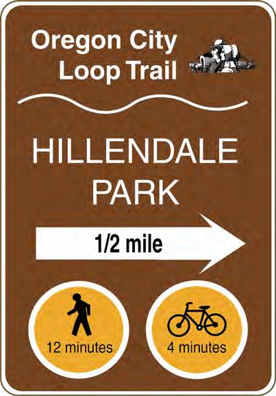


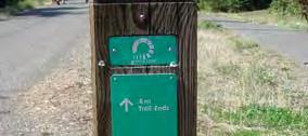
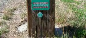
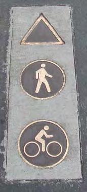
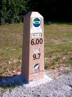
113 Sample informational and directional signage Wooden bollard with directional information Inlaid medallions Stone mileage marker City of Molalla Parks, Recreation and Trails Master Plan July 2007 a-64

 and bicycle racks allow trail users to safely park their bikes if they wish to")

 or more ornate (e.")

114 Trail Features There are a number of amenities that make a trail inviting to the user. Below are some common items that make trail systems stand out. Interpretive Installations Interpretive installations and signs can enhance the trail experience by providing information about the history of Molalla. Installations can also discuss local ecology, environmental concerns, and other educational information. Water Fountains and Bicycle Parking Water fountains provide water for people (and pets, in some cases) and bicycle racks allow trail users to safely park their bikes if they wish to stop along the way, particularly at parks and other desirable destinations. Pedestrian-Scale Lighting and Furniture Pedestrian-scale lighting improves safety and enables the trail to be used year-round. It also enhances the aesthetic of the trail. Lighting fixtures should be consistent with other light fixtures in the city, possibly emulating a historic theme. Providing benches at key rest areas and viewpoints encourages people of all ages to use the trail by ensuring that they have a place to rest along the way. Benches can be simple (e.g., wood slates) or more ornate (e.g., stone, wrought iron, concrete). Maps and Signage A comprehensive signing system makes a trail system stand out. Informational kiosks with maps at trailheads and other pedestrian generators can provide enough information for someone to use the trail system with little introduction perfect for areas with high out-of-area visitation rates as well as the local citizens. Art Installations Local artists can be commissioned to provide art for the trail system, making it uniquely distinct. Many trail art installations are functional as well as aesthetic, as they may provide places to sit and play on. City of Molalla Parks, Recreation and Trails Master Plan July 2007 a-65
2. Goals and Policies. The following are the adopted Parks and Trails Goals for Stillwater Township:
 D. PARKS AND TRAILS 1. Introduction Stillwater Township s population is relatively low, with most residents living on rural residences on large lots. The need for active park space has been minimal in
Chapter 6. Action Program. Heart of the Lakes Area Recreation Plan
 Heart of the Lakes Area Recreation Plan 1. Design and construct the following trails (please see the following map): a. the Speedway Trail 1) primary pathway the main trail 2) secondary pathway the proposed
Blueways: Rivers, lakes, or streams with public access for recreation that includes fishing, nature observation, and opportunities for boating.
 Parks, Open Space and Trails PRINCE WILLIAM COUNTY 2008 COMPREHENSIVE PLAN TRAILS PLAN CONTENTS The components of the trails plan are: Intent Definitions Goals, Policies, and Action Strategies Trails Map
Northeast Quadrant Distinctive Features
 NORTHEAST QUADRANT Northeast Quadrant Distinctive Features LAND USE The Northeast Quadrant includes all the area within the planning area that is east of Interstate 5 and to the north of State Route 44.
Chapter eight. Parks and Recreation. Introduction. Crystal Lake Park District
 Chapter eight Parks and Recreation Introduction One of the indicators of quality of life in a city is the parks and recreation system. The City of Crystal Lake is fortunate to have an excellent parks and
Park Design and Location Criteria
 Park Design and Location Criteria This section is presented in the interest of assisting park and recreation agencies in the development of a system of parks and recreation areas. A recreation system is
J. Recreation Plan of Conservation and Development. The Town of Hebron. Section 2. Preservation of Unique Assets. 1 P a g e
 The Town of Hebron Section 2 2014 Plan of Conservation and Development Preservation of Unique Assets J. Recreation Open spaces, parks, sports fields, and recreational programs are considered essential
The City of Durango Community Interest and Opinion Survey Executive Summary
 The City of Durango Community Interest and Opinion Survey Executive Summary Overview ETC Institute administered a community interest and opinion survey for the City of Durango between January and March
4MRV Parks Master Plan: Site Analysis
 4MRV Parks Master Plan: Site Analysis Lardner/Klein Landscape Architects in association with: RK&K Grimm + Parker Kittelson & Associates Partners for Economic Solutions RIB U.S.Cost Civil Engineering Architecture
Southwest Quadrant Distinctive Features
 SOUTHWEST QUADRANT Southwest Quadrant Distinctive Features LAND USE The 31.17 square mile Southwest Quadrant includes all the area within the planning area west of I-5 and south of the Sacramento River.
Georgetown-Lewes Rail/Trail Study. Rail/Trail Study: Cool Spring to Cape Henlopen State Park New Road Extension (House Resolution No.
 Georgetown-Lewes Rail/Trail Study Rail/Trail Study: Cool Spring to Cape Henlopen State Park New Road Extension (House Resolution No. 47) August 22, 2011 Presentation Outline Background Benefits Statewide
Lake Myra County Park. Wake County, North Carolina Community Forum #2 June 12, 2008
 Lake Myra County Park Wake County, North Carolina Community Forum #2 June 12, 2008 Welcome and Introduction Meeting Agenda Welcome Introductions of Project Team Master Plan Process Community Forum #1 Updates
Silver Lake Park An Environmental Jewel for the Citizens of Prince William County
 Silver Lake Park An Environmental Jewel for the Citizens of Prince William County The Prince William Park Authority Mission Statement states: The Prince William County Park Authority will create quality
Longmont to Boulder Regional Trail Jay Road Connection DRAFT FINAL REPORT
 Longmont to Boulder Regional Trail Jay Road Connection DRAFT FINAL REPORT December 2018 Project Summary Boulder County, Colorado, in partnership with the City of Boulder, is evaluating options for multi-use
Dover Park Master Plan. Community Design Event Tuesday, May 22, 5 7 pm
 Dover Park Master Plan Community Design Event Tuesday, May 22, 5 7 pm Agenda I. Introduction / Overview 20 minutes II. Small Group Design Activity 60 minutes III. Small Group Report Out IV. Conclusion
Committee. Presentation Outline
 CW-33-15 11/9/2015 Community and Corporate Services Committee November 10, 2015 1 Presentation Outline Background Vision and Objectives Study Process and Timeline Public and Stakeholder Engagement Organization
City of Durango 5.8 FUNDING TRAILS DEVELOPMENT
 5.8 FUNDING TRAILS DEVELOPMENT The City has been successful in establishing dedicated local funding sources as well as applying for grants to develop the City s trail system, having received nearly $2.4
Chapter 6: POLICY AND PROCEDURE RECOMMENDATIONS
 Chapter 6 POLICY AND PROCEDURE RECOMMENDATIONS FOR SRRA Below are seven policy elements that should be considered for adoption by the Southwest Regional Recreation Authority of Virginia: 1. Develop strategies
AGENDA ITEM 5 D WAKULLA ENVIRONMENTAL INSTITUTE (WEI) TRAIL FEASIBILITY STUDY
 TRAIL FEASIBILITY STUDY") March 19, 2018 AGENDA ITEM 5 D WAKULLA ENVIRONMENTAL INSTITUTE (WEI) TRAIL FEASIBILITY STUDY TYPE OF ITEM: Action STATEMENT OF ISSUE The Wakulla Environmental Institute (WEI) Trail is one of several trails
March 19, 2018 AGENDA ITEM 5 D WAKULLA ENVIRONMENTAL INSTITUTE (WEI) TRAIL FEASIBILITY STUDY TYPE OF ITEM: Action STATEMENT OF ISSUE The Wakulla Environmental Institute (WEI) Trail is one of several trails
BASSETTS CREEK SECTION CONTENTS: BASSETTS CREEK BRYN MAWR LUCE LINE
 BASSETTS CREEK SECTION CONTENTS: BASSETTS CREEK BRYN MAWR LUCE LINE GLENWOOD AVE MULTI-USE DIAMONDS VINCENT AVE N MORGAN AVE N PENN AVE N DOG PARK MULTI-USE FIELDS PLAYGROUND AK E RD S CHESTNUT AVE DA
APPENDIX E: SUMMARY OF PUBLIC MEETING QUESTIONNAIRE RESULTS
 Appendices Gwinnett County 2004 Comprehensive Parks and Recreation Master Plan APPENDIX E: SUMMARY OF PUBLIC MEETING QUESTIONNAIRE RESULTS March 2004 Monteith Brown Planning Consultants & The Jaeger Company
O REGON TRAILS SUMMIT. Oregon Trails Summit. Rogue River National Forest
 O REGON TRAILS SUMMIT Oregon Trails Summit 2014 Rogue River National Forest OREGON TRAILS 2015: A VISION FOR THE FUTURE The 2015-2024 Oregon Statewide Trails Plan Why do a trails plan? 2005-2014 Oregon
Dungeness Recreation Area County Park Master Plan
 Dungeness Recreation Area County Park Public Outreach Meeting October 10, 2007 Project Overview USFWS Site Dungeness Recreation Area County Park Meeting Objectives: Re-Introduce project; provide status
Airport Planning Area
 PLANNING AREA POLICIES l AIRPORT Airport Planning Area LOCATION AND CONTEXT The Airport Planning Area ( Airport area ) is a key part of Boise s economy and transportation network; it features a multi-purpose
SOAR ATHLETIC COMMITTEE
 PASCAGOULA RECREATION COMMISSION MEETING MAY 15, 2017 Mike McElhaney opened the meeting at 6:00 pm. Mike welcomed Bo Cole as a guest. A special meeting was called to review the recommendation being made
NORTHWEST SECTION CONTENTS: CLEVELAND PARK FOLWELL PARK RYAN LAKE PARK VICTORY PRAIRIE DOG PARK VICTORY PARK
 NORTHWEST SECTION CONTENTS: CLEVELAND PARK FOLWELL PARK RYAN LAKE PARK VICTORY PRAIRIE DOG PARK VICTORY PARK LUCY LANEY COMMUNITY SCHOOL N 33RD AVE N 33RD AVE SINGLE-FAMILY RESIDENTIAL MULTI-USE DIAMOND
Parks, Recreation and Cultural Needs Assessment and Facilities Plan. November 21, 2016 City Council Worksession
 Parks, Recreation and Cultural Needs Assessment and Facilities Plan November 21, 2016 City Council Worksession History and Process FY16/17 Budget Appropriation for Needs Assessment, Dean and Stonewall
CLEVELAND PARK LOCATION AND HISTORY EXISTING CONDITIONS AND CHARACTER LOCATION
 CLEVELAND PARK LOCATION LOCATION AND HISTORY Attempts to create a neighborhood park and playground in the Cleveland neighborhood began in 1926, when the park board designated for acquisition the block
Blue River Trail Master Plan JSA to Town Hall June 2004
 Blue River Trail Master Plan JSA to Town Hall June 2004 Prepared for: Silverthorne Town Council Silverthorne SPORT Committee Department of Recreation and Culture Silverthorne Public Works Silverthorne
TRUCKEE TAHOE AIRPORT DISTRICT BOARD OF DIRECTOR STAFF REPORT
 AGENDA ITEM: 11 TRUCKEE TAHOE AIRPORT DISTRICT BOARD OF DIRECTOR STAFF REPORT AGENDA TITLE: MEETING DATE: January 24, 2018 PREPARED BY: NTPUD Agency Partnership Opportunity, Multi-Use Trailhead Access
Section II. Planning & Public Process Planning for the Baker/Carver Regional Trail began in 2010 as a City of Minnetrista initiative.
 Section II Planning & Public Process Planning for the began in 2010 as a City of initiative. city staff began discussions with the Park District on the possibility of a north/south regional trail connection
Trail Etiquette. Hours of Operation. Trail Accessibility
 Trail Guide The Elmhurst Park District, with 28 parks and over 460 acres of land, offers nearly six miles of paved or asphalt park trails and maintains an additional 3.6 miles of trails within Elmhurst.
and plant some trees, but that was only accomplished through state and federal work-relief programs.
 PEAVEY LOCATION AND HISTORY Peavey Park sits in the Phillips Community on a large block bounded by major streets: Franklin Avenue, Chicago Avenue, and Park Avenue. The southern continue through to Chicago
Chapter 2: Summary of Existing Open Space System
 Chapter 2: Summary of Existing Open Space System In 1976, the Wake County Board of Commissioners established the Wake County Parks and Recreation Department in order to provide park facilities and programs
WEST JORDAN PARKS, RECREATION AND TRAILS MASTER PLAN Advisory Committee Meeting #2
 WEST JORDAN PARKS, RECREATION AND TRAILS MASTER PLAN Advisory Committee Meeting #2 MONDAY, NOVEMBER 5, 2018, 6:00 P.M.; PARKS DEPT. CONFERENCE ROOM ATTENDEES: Lisa Dean Larry Gardner Duane Harding David
NORTH OF BROADWAY SECTION CONTENTS: COTTAGE PARK FARVIEW PARK GLEN GALE PARK IRVING TRIANGLE JORDAN PARK NEWTON PARK PERKINS HILL PARK
 NORTH OF BROADWAY SECTION CONTENTS: COTTAGE PARK FARVIEW PARK GLEN GALE PARK IRVING TRIANGLE JORDAN PARK NEWTON PARK PERKINS HILL PARK N ILIO NA VE N JAM ES AV E PLAYGROUND PAR K PRO PER TY B OUN DAR Y
Villages at Buffalo Run East
 Villages at Buffalo Run East Neighborhood Park Subhead to title page goes here. Public Design Meeting April 9, 2015 Capital Improvement Program Commerce City s $137 million CIP is the result of a 2013
Community Advisory Committee Meeting #3 April 21, 2015
 Community Advisory Committee Meeting #3 April 21, 2015 Purpose (charge) of the CAC: Be Knowledgeable, Be an Engaged Representative, Develop Master Plan, & Prioritize Plan 1 Welcome/ Introductions Review
City of Haslett. City of East Lansing. City of East Lansing
 Central Park North (Nancy L. Moore Park) Lake Park North Expansion White Park Expansion #2 White Park Expansion #1 County East East Haslett East East TF87-212 Acquisition $90,000.00 Park. TF08-138 Acquisition
Parks, Recreation, Trails and Open Space Master Plan Survey Results. October 2018
 Parks, Recreation, Trails and Open Space Master Plan Survey Results October 2018 Conducted by Qualtrics subconsultant 300 completed responses Random attempt to get a balanced response from all four Council
CHAPTER 5. Chapter 5 Recreation Element
 CHAPTER 5 Recreation Element Chapter 5 Recreation Element The Recreation Element of the Meyers Area Plan is a supplement to the Recreation Element of the TRPA Regional Plan and the El Dorado County General
EXECUTIVE SUMMARY PROGRAM DEVELOPMENT REPORT PURPOSE EXISTING SETTING EXPANDING PARKLAND
 EXECUTIVE SUMMARY PROGRAM DEVELOPMENT REPORT PURPOSE As the culmination of the first phase of the master planning process, this Program Development Report creates the framework to develop the Calero County
Waukee Trailhead Public Art and Amenities Project
 Waukee - Trailhead Public Art and Amenities Project Sponsor Waukee Project Title Waukee Trailhead Public Art and Amenities Project Termini Description ( i.e. Park Avenue to 19th Street) NE Intersection
Gold Coast. Rapid Transit. Chapter twelve Social impact. Chapter content
 Gold Coast Rapid Transit Chapter twelve Social impact Chapter content Social impact assessment process...235 Existing community profile...237 Consultation...238 Social impacts and mitigation strategies...239
PIONEER PARK. City of Des Peres Parks Master Plan. SWT Design 46 INTRODUCTION
 PIONEER PARK INTRODUCTION Pioneer Park is a 7 acre neighborhood park located east of Interstate 270 and south of Manchester Road along Tallie Road. The park is situated in a residential neighborhood with
MASTER PLAN EXECUTIVE SUMMARY
 Biscuit Run State Park Scottsville Road (State Route 20) Charlottesville, VA 22902 Biscuit Run State Park MASTER PLAN EXECUTIVE SUMMARY Department of Conservation and Recreation Division of Planning and
Appendix 3. Greenway Design Standards. The Whitemarsh Township Greenway Plan
 Appendix 3 Greenway Design Standards This chapter discusses two design standards for the greenway types discussed above. First, trail design standards are presented together with trailhead facilities and
Wilds. Headwaters. Lakes. Oxbows. Falls
 56 5 4 3 Wilds Headwaters Lakes Oxbows Falls 57 Zones It could be said the on-the-ground essence of this master plan appears within the next 6 pages of this report. As we learned in the preceding Cultural
IL 390 Station. Wood Dale Open House Summary 5/18/17
 Wood Dale Open House Summary 5/18/17 The first public open house for the Wood Dale Comprehensive Plan took place on May 18 th, 2017. The program was conducted as a fun community event and there were 216
The Recreational Trail along Cushing Park road has been a successful addition to the city
 The Recreational Trail along Cushing Park road has been a successful addition to the city Trails TRAILS, PATHS, ROUTES AND CONNECTORS Citizen input pointed to trails, paths, bike routes, and other non-motorized
MUNICIPALITY OF ANCHORAGE
 MUNICIPALITY OF ANCHORAGE ANCHORAGE PARKS & RECREATION Memorandum PRC 08-56 DATE: 5 August 2008 TO: FROM: SUBJECT: Parks & Recreation Commission Holly Spoth-Torres, Park Planner PRC 08-56 Far North Bicentennial
SOUTH INTERCHANGE AREA
 Santaquin City General Plan 1 Location and Characteristics The South Interchange Area of Santaquin is located west of Interstate 15 and south of 500 South (Figure 1). It includes properties already annexed
Classifications, Inventory and Level of Service
 Classifications, Inventory and Level of Service Section 3 Kenmore Park, Recreation and Open Space Plan 1 P a g e Classifications and Inventory Park Classifications Kenmore classifies its parks based upon
Welcome to the Cross County Trail Public Input Session!
 Welcome to the Cross County Trail Public Input Session! Please sign in on the table below! What are we doing here? Camden County has proposed a bicycle and pedestrian trail spanning across the entire county.
Citrus Heights Creek Corridor Trail Project Trail Advisory Group Field Trip #2 September 11, :00 11:00 am Trellis Hall, Citrus Heights
 September 11, 2013 9:00 11:00 am Trellis Hall, Citrus Heights Project Overview The City of Citrus Heights is studying the feasibility of establishing a multi use trail system within the City s 26 miles
Those with Interest in the City of Cambridge Trail System
 Community Services Department City Hall 50 Dickson Street, P.O. Box 669 Cambridge ON N1R 5W8 Tel: 519-740-4681 July 20, 2010 To: Re: Those with Interest in the City of Cambridge Trail System City of Cambridge
10/25/2013. What is the SCORP?! 2013 Local Government Survey 2013 Statewide Public Survey Advisory Group Priority Areas Your Suggestions!
 COLORADO OUTDOOR RECREATION TRENDS RESULTS FROM THE SCORP AND STATEWIDE Colorado Outdoor Recreation Resource Partnership September 2013 PRESENTATION What is the SCORP?! 2013 Local Government Survey 2013
PROPOSED PARK ALTERNATIVES
 8 Chimne y Rock State Park M a ster Pl an 2011 PROPOSED PARK ALTERNATIVES Introduction Three different park development concepts were prepared and presented to the citizens of North Carolina through a
JOSLIN FIELD, MAGIC VALLEY REGIONAL AIRPORT DECEMBER 2012
 1. Introduction The Federal Aviation Administration (FAA) recommends that airport master plans be updated every 5 years or as necessary to keep them current. The Master Plan for Joslin Field, Magic Valley
TOWN OF CANANDAIGUA PARKS AND RECREATION MASTER PLAN PUBLIC OPINION QUESTIONNAIRE
 TOWN OF CANANDAIGUA PARKS AND RECREATION MASTER PLAN PUBLIC OPINION QUESTIONNAIRE The Town of Canandaigua is updating its Parks and Recreation Master Plan. As part of our effort to plan for your future
POLICY & STRATEGIES The Vancouver Park Board approves major changes in Vancouver parks, including the design and development of parks.
 September 8, 2017 TO: Park Board Chair and Commissioners FROM: General Manager Vancouver Board of Parks and Recreation SUBJECT: Brewers Park and Clinton Park Renewal Concept Plans RECOMMENDATION THAT the
Establishes a fare structure for Tacoma Link light rail, to be implemented in September 2014.
 RESOLUTION NO. R2013-24 Establish a Fare Structure and Fare Level for Tacoma Link MEETING: DATE: TYPE OF ACTION: STAFF CONTACT: PHONE: Board 09/26/2013 Final Action Ric Ilgenfritz, Executive Director,
APPENDIX OFFICIAL MAP ORDINANCE OF HAMILTONBAN TOWNSHIP OFFICIAL MAP NARRATIVE
 APPENDIX A OFFICIAL MAP ORDINANCE OF HAMILTONBAN TOWNSHIP OFFICIAL MAP NARRATIVE INTRODUCTION: The Official Map of Hamiltonban Township has been prepared to identify those lands and features that Hamiltonban
PEMBERTON VALLEY RECREATIONAL TRAILS MASTER PLAN UPDATE Community Open House. April 2018
 PEMBERTON VALLEY RECREATIONAL TRAILS MASTER PLAN UPDATE Community Open House April 2018 Introductions Introductions Matt Bakker, BHA Project Coordinator Other Team Members: Liz Scroggins, Grey Owl Consulting
City of Chelan Shoreline Public Access Plan
 City of Shoreline Public Access Plan This City of Shoreline Public Access Plan documents how the City has planned for parks and recreation in the community, particularly along Lake and the River. This
FEASIBILITY CRITERIA
 This chapter describes the methodology and criteria used to evaluate the feasibility of developing trails throughout the study areas. Land availability, habitat sensitivity, roadway crossings and on-street
COMMUNITY LOS PRIORITIES
 Part 5. Community Priority Meetings Purpose: The purpose of holding Community Priority Meetings was two-part; (1) to gather input from community members and decision makers on specific park and trail infrastructure
Rogue River Access and Management Plan Draft Alternatives
 Rogue River Access and Management Plan Draft Alternatives The Rogue River Access and Management Plan was initiated in December, 2011 and is being led by Jackson County Parks (JCP) and Oregon Department
Parks and Recreation Master Plan
 Emerging Themes Parks and Recreation Master Plan City of Mount Dora, Florida September 17, 2018- Revised October 1, 2018 Agenda Welcome & duction Master Plan The Inventory & Existing Community Overview
Welcome and thank you for being here! Kick-Off Public Workshop November 19, 2014
 Welcome and thank you for being here! Kick-Off Public Workshop November 19, 2014 OPEN SPACE MATTERS: Boise s First Reserve Master Plan Julia Grant Foothills and Open Space Manager City of Boise Ellen Campfield
Non-Motorized Transportation
 Non-Motorized Transportation Non-motorized facilities are important components to the transportation system. They provide an environmentally-friendly, low-cost mode of travel. Some of the facilities can
Regional Wayfinding Sign Strategy Thurston County Trails 2017
 Regional Wayfinding Sign Strategy Thurston County Trails 2017 Partners: Members and partnering organizations of the Thurston Thrives Community Design Action Team City of Lacey, City of Olympia, City of
City of Keller Parks and Facilities Inventory
 City of Keller Parks and Facilities Inventory April 2013 1. BEAR CREEK PARK 44 ACRES 1 Basketball Court with 2 goals 4 Drinking Fountains 1 Large Pavilion with 4 picnic tables, electricity and fireplace
Welcome to the future of Terwillegar Park a Unique Natural Park
 Welcome to the future of Terwillegar Park a Unique Natural Park 1 Introduction The Terwillegar Park Concept Plan study will develop an overall concept plan, management objectives and development guidelines
NEW MEADOWS PARK PROPOSED MASTER PLAN
 NEW MEADOWS PARK PROPOSED MASTER PLAN A vision for your neighborhood park, the draft master plan is ready for your review. Tuesday September 12 th, 2017 5:30-7:00 PM Hellgate School District #4 middle
Washington Township MASTER PLAN. Addendum: Washington Township Master Plan
 Washington Township MASTER PLAN Addendum: Washington Township Master Plan CHAPTER XI RECREATION CORE DISTRICT Introduction The Recreation Core District generally encompasses the areas north of 30 Mile
Multimodal Planning Studies
 Multimodal Planning Studies Commuter Park and Ride Study Steering Committee Meeting June 6, 2013 Agenda 1. Update on Project Schedule 2. Update on Online Interactive Mapping 3. Key Themes from the Open
ANCLOTE COASTAL TRAIL ALTERNATIVES ANALYSIS STUDY
 ANCLOTE COASTAL TRAIL ALTERNATIVES ANALYSIS STUDY PASCO COUNTY MPO JULY 2015 PROJECT OVERVIEW... INTRODUCTION EXECUTIVE SUMMARY CONTEXT... TAMPA BAY AREA, PINELLAS, & PASCO COUNTY S MULTI-USE TRAIL PLANS
ONONDAGA CREEKWALK PHASE II. Public Information Meeting Series 1
 ONONDAGA CREEKWALK PHASE II Public Information Meeting Series 1 Andrew Maxwell Director, Syracuse-Onondaga County Planning Agency Owen Kerney Assistant Director for City Planning Russell Houck, PE City
City of Galion Park Satisfaction Survey Results
 City of Galion Park Satisfaction Survey Results Dec. 5, 2016 Goal: To get feedback from the community on: 1. General satisfaction of city-owned parks 2. How to improve park facilities and recreation opportunities
Macleod Trail Corridor Study. Welcome. Macleod Trail Corridor Study Open House. Presentation of Proposed Design Concepts
 Macleod Trail Corridor Study Welcome Macleod Trail Corridor Study Open House Presentation of Proposed Design Concepts Study Purpose Develop a corridor plan for Macleod Trail that aligns with The City s:
University Region Non-Motorized Plan 2015
 Non-Motorized Transportation Non-motorized facilities are important components to the transportation system. They provide an environmentally-friendly, low-cost mode of travel. Some of the facilities can
CHAPTER 2 COUNTY PROFILE
 COUNTY PROFILE CHAPTER 2: COUNTY PROFILE This chapter provides a profile of Amador County, California, in the planning context of parks and recreation services. This profile includes a description of the
2016 Regional Transportation Alternatives Program (TAP) Grant Application
 Grant Application") 2016 Regional Transportation Alternatives Program (TAP) Grant Application PROJECT TITLE: Yelm-Tenino Trail Extension Feasibility Study TRPC use only GENERAL PROJECT INFORMATION Agency or Organization City
2016 Regional Transportation Alternatives Program (TAP) Grant Application PROJECT TITLE: Yelm-Tenino Trail Extension Feasibility Study TRPC use only GENERAL PROJECT INFORMATION Agency or Organization City
Public Park System. Township of Derry. Providing natural open space for the recreational use of our residents and guests.
 Township of Derry Public Park System Providing natural open space for the recreational use of our residents and guests. Directory of Recreational Amenities Hershey s Commitment to Recreation Famous candy
Chapter 9 Recreation
 Chapter 9 Chapter 9 1.0 INTRODUCTION The Town of Littleton is within one of New England s most important recreation areas. More than three million people live within 100 miles of the area. Local residents
CHAPTER FIVE PROSPECTS FOR FUTURE ECONOMIC DEVELOPMENT
 CHAPTER FIVE PROSPECTS FOR FUTURE ECONOMIC DEVELOPMENT 5.1 GENERAL The recommended type and location of future land uses in Alpine should, in part, consider potential opportunities for future economic
Trails. Lois Jensen Nature Preserve is a 30 acre parcel on the north end of the city. It provides unspoiled wooded paths.
 Trails Lois Jensen Nature Preserve is a 30 acre parcel on the north end of the city. It provides unspoiled wooded paths. TRAIL S, PATHS, ROUTES AND CONNECTORS Citizen input pointed to trails, paths, bike
RUSHMORE CONNECTOR TRAIL PROPOSAL
 PURPOSE AND NEED Background The U.S. Forest Service, Black Hills National Forest (Forest Service) has received a special use permit application from the State of South Dakota Department of Game, Fish and
Trail Use in the N.C. Museum of Art Park:
 Trail Use in the N.C. Museum of Art Park: New Connections, New Visitors Jacqueline MacDonald Gibson, PhD Daniel Rodriguez, PhD Taylor Dennerlein, MSEE, MCRP, EIT Jill Mead, MPH Evan Comen University of
At the time, the portion of the line through Eagle County remains wholly under the ownership of Union Pacific Railroad (UP).
.") Chapter 5 The Railroad Corridor as a Trail Corridor The intent of this chapter is to identify how the rail corridor, if available for lease or purchase in all or part, could be incorporated into the core
Chapter 5 The Railroad Corridor as a Trail Corridor The intent of this chapter is to identify how the rail corridor, if available for lease or purchase in all or part, could be incorporated into the core
6/28/11 TELEPHONE (n=400, RDD) AND ON-LINE (n=6,294) SURVEY RESULTS
 AND ON-LINE (n=6,294) SURVEY RESULTS") 6/28/11 TELEPHONE (n=0, RDD) AND ON-LINE (n=6,294) SURVEY RESULTS Update Surveys An Institute for Consensus Building www.sri-consulting.org MASTER PLAN UPDATE 6/28/11 Quantifying the responses from the
6/28/11 TELEPHONE (n=0, RDD) AND ON-LINE (n=6,294) SURVEY RESULTS Update Surveys An Institute for Consensus Building www.sri-consulting.org MASTER PLAN UPDATE 6/28/11 Quantifying the responses from the
Appendix B - Undeveloped Parks and Existing Parks with Remaining Development Programming
 Appendix B - Undeveloped Parks and Existing Parks with Remaining Development Programming Table of Contents Appendix B - Undeveloped Parks and Existing Parks with Remaining Development Programming Table
Mechanized River Valley Access Public Engagement Report. April 2015
 Mechanized River Valley Access Public Engagement Report April 2015 Table of Contents Background... 1 Stakeholder Consultation... 3 What We Heard... 4 Conclusion... 7 Background The North Saskatchewan River
Trail Feasibility Study
 VOLUSIA COUNTY MPO CITY OF NEW SMYRNA BEACH FINAL REPORT JUNE 30, 2009 Trail Feasibility Study What s inside? 1 Introduction 2 Project Purpose & Scope 3 Physical Inventory & Assessment of Right-of- Way
City of San Dimas / Unincorporated San Dimas STUDY AREA PROFILE
 City of San Dimas / Unincorporated San Dimas STUDY AREA PROFILE STUDY AREA ID #156 BASE MAP PARK METRICS WHERE ARE PARKS MOST NEEDED AMENITY QUANTITIES AND CONDITIONS PARK NEEDS FRAMEWORK PROJECT COST
Lafourche Parish Government REQUEST FOR QUALIFICATIONS. Landscape Architectural Services
 Lafourche Parish Government REQUEST FOR QUALIFICATIONS Landscape Architectural Services Bayou Lafourche Parish Multi-Use Path Feasibility Study Phase 1 And Bayou Lafourche Parish Multi-Use Path Feasibility
State Park Visitor Survey
 State Park Visitor Survey Methods, Findings and Conclusions State s Department of Recreation, Park and Tourism Management surveyed state park visitor and trip characteristics, and collected evaluations
China Creek North Park Upgrades and Glen Pump Station. Park Board Committee Meeting Monday, July 10, 2017
 China Creek North Park Upgrades and Glen Pump Station Park Board Committee Meeting Monday, July 10, 2017 Purpose The purpose of this presentation is to: Share the results of the public engagement processes;
4.0 FACILITIES INVENTORY
 4.0 FACILITIES INVENTORY 4.1 PARK LEVEL OF SERVICE STANDARDS (LOS) Based on current City of Longview Parks and Recreation Level of Service (LOS) Standards (Figure G), the City currently has a deficiency