Transportation. November 4, 2015 Adopted by Planning Board
|
|
|
- Joan Hawkins
- 6 years ago
- Views:
Transcription
1 Transportation November 4, 2015 Adopted by Planning Board 0
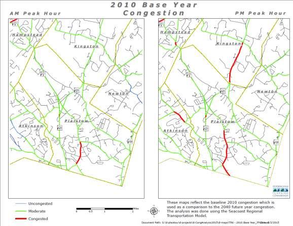
2 1. Introduction The purpose of the Transportation Chapter is to identify transportation issues of concern to Plaistow officials and residents and to recommend proposed actions. Transportation planning is a local, regional and state responsibility and much of the long range transportation planning occurs at the regional and state levels based on input from local officials. Although Plaistow is not one of the largest communities in the region in terms of population, its proximity to the Massachusetts border and the presence of NH Route 125 have combined to give the town an urban aspect often found in larger communities. In addition, many local residents commute to northern Massachusetts for employment. This situation presents the town with both opportunities and challenges with respect to transportation issues. This higher level of urbanization is accompanied by concerns such as traffic congestion and loss of rural character. However, there is also increased opportunity for public transportation and infrastructure improvements such as sidewalks and bike paths. Finding an appropriate balance between these opportunities and challenges is one of the goals of this master plan and a long-term goal for Plaistow. Demographics in New Hampshire and Massachusetts are changing and key populations will increasingly drive less and rely on public transit more. Importantly, the region s senior population is growing. Along with members of the Millennial Generation, people born between 1982 and the early 2000s, seniors drive significantly less than other cohorts. 1 The continued maintenance and expansion of the local road network, parking, sidewalks, pedestrian amenities, and public transportation services play an important role in Plaistow s effort to maintain a quality of life and to plan for future growth. Maintaining an efficient road network is critical to the Town s economy which relies heavily its relationship with Massachusetts and plays a critical role in Plaistow s commercial development, as well as residents commuting south for employment. This Chapter provides a focus and direction regarding these concerns and issues. 2.0 Existing Conditions 2.1 Existing Roadway System Highway access in the region is provided through Interstates 93, 95, and 495, U.S. Route 3, and a variety of other local and state roads, including Route 125. Interstates in metropolitan Boston and southern New Hampshire have peak-period congestion and capacity issues. I-93 in Massachusetts, in particular, has unstable traffic flow that is at or beyond capacity in key areas, making it among the most congested roadways in the nation. (See congestion maps below). The automobile commute from Plaistow to downtown Boston typically exceeds 100 minutes during peak hours, more than 2.5 times longer than a non-congested journey. Due to environmental concerns, cost, and community resistance, it is unlikely that significant roadway capacity will be added in the region in the near future, particularly in eastern Massachusetts. Therefore, congestion relief in the region will necessarily have to result from non-highway improvements. The Town of Plaistow is served by three local major highways: NH Route 125, running roughly north to south through the central section of town; NH Route 121-A, also known as Main Street, 1 Plaistow Commuter Rail Extension Study Alternative Analysis Report, March 2015 HDR, Inc. 1
3 running roughly diagonally from the northwest corner of town to the south central area of the community; and NH Route 108, which runs north to south along the very eastern boundary of the town. A small section of NH Route 121 also serves the southern area at the Atkinson border. Routes 108, 121, and 125 all intersect Plaistow s southern border with Haverhill, Massachusetts. NH Route 125 This roadway is the key transportation corridor in the community, used as both a major commuter and commercial roadway linking the regional economies of New Hampshire and Massachusetts. Interstate 495 is located 1.5 miles to the south in Haverhill drawing many commuters from New Hampshire. Reviewing NHDOT hourly traffic figure from 2005 and 2015, a significant change in peak morning traffic volume was not found. In 2005, an average of 850 southbound cars were counted between 5 9 am, while in 2014 there was an average of 819 vehicles was noted. Early morning commuters, between 5 6 am decreased from an average 802/hour in 2005 to 753 in This roadway also links Massachusetts residents to Plaistow s retail corridor, drawing those who wish to avoid a sales tax; a major contributing factor in this retail corridor s success. Maintaining an adequate level of service along this corridor is critical to ensure the continued growth of the retail sector and the safety of the commuting public. During peak travel periods traffic congestion in the southern portions of this roadway can be severe. NH Route 121 With only a ½ mile long portion of NH121 located in Plaistow, this roadway is bordered primarily by residential land uses and carries commuter traffic from towns lying to the northwest, along with shoppers heading towards NH Route 125. Traffic levels have not changed over the last ten years and is used by area residents to avoid some of the traffic congestion seen along NH 125. NH Route 108 Although primary residential, a number on non-residential uses lie along this roadway which feed communities to the northeast of Plaistow. Although this roadway has seen an increase in traffic, it does not connect to an interchange with I-495 but does provide another means to access Massachusetts and can be used to avoid the congestion of NH 125. NH Route 121A (Main Street) As the main spine of the community, this route attracts traffic from the majority of the community, along with connecting to communities lying to the northwest. This street is predominately residential, but many non-residential uses either front on the roadway or have access to it. Given the length of this roadway, traffic volumes vary considerably depending on the location. As outlined in Table T-4 below, traffic ranges from 11,000 vehicles per day at the Hampstead town line to 2,700 at the Massachusetts border. In addition to these state roads, NHDOT also maintains an additional 5.4 miles of local roads. Plaistow has a road network of miles of town-maintained roads. 2

4 3
5 2.1.1 Roadway Classifications The New Hampshire Department of Transportation (NHDOT) divides all roads in the state into certain classifications. There are two methods of classification commonly used to identify roadways. The Administrative Classification System, also referred to as Systems Class, determines which governmental agency is responsible for maintenance of each road. (See the Systems Classification Map) The Functional Classification System identifies the intended function of the roadway. Both classification systems are useful for town planning purposes. Careful review of this information with traffic volume data can indicate which roads may need reclassifying and/or upgrading to ensure that the system can accommodate future volumes Administrative Classification There are 57.6 miles of roads in Plaistow, most of which are in two classes of roads. Over 63% or miles are classified as Class V Rural Highways and 28.8% or miles are classified as Class II State Aid Highways. These include Route 121A and Route 125. Table T-1 provides a list of each administrative class and the number of miles of each for Plaistow. These roads are also outlined on Map T-1. Table T-1 Plaistow Road Classifications Administrative Class Administrative Class Class Definition Miles Percent Class 0 Private Roadways Class I Trunk Line Highways All existing or proposed highways that are part of the primary state highway system. The NHDOT is responsible for the maintenance and construction costs of these highways except for those portions that lie within compact sections of towns and cities. 0 0 Class II State Aid Highways Class II Recreational Roads Class IV Town and City Streets Class V Rural Highways Class VI Unmaintained Highways Scenic Roads All existing or proposed highways that are part of the secondary state highway system. Maintenance and construction costs are controlled by the NHDOT. All roads leading to and within state reservations designated by the legislature. All highways located within state designated compact sections of cities and towns. Town and cities control maintenance and construction costs of these highways. All other traveled highways, which the town has the duty to maintain regularly, and shall be known as town roads. All other existing public ways, and shall include all highways discontinued as open highways and made subject to bars and gates, and also highways that have not been suitably maintained for travel for five years or more. Except for Class I or II highways, roads are designated as scenic roads by a town or city. Maintenance and construction of roads is strictly regulated Total Source: RPC Roads GIS Data Layer, Functional Classification The Functional Classification System defines the expected role that each road plays in overall traffic flow and land access. Of the 57.7 miles of roads in Plaistow, miles (49.35 %t) are considered locals, 14.1 miles (24.43 %) are considered collectors, and miles (18.14 %) are considered arterials. Table T-2 is a list of each functional class and the number of miles of each for Plaistow. See Transportation Map of Plaistow below. 4
6 Table T-2 Plaistow Road Classifications Functional Class Functional Class Class Definition Miles Percent Arterials Roadway systems that provide intercity and interstate traffic service. Traffic speeds typically are relatively high and there is a minimal amount of interference to through traffic. The arterials in Plaistow are Route 125, Main Street, and Newton Road (Route 108). Connectors Roads that connect arterials with minimal interference. 0 Collectors Locals Special Purpose Roads Roads that provide traffic service between arterials and local roads. Collectors in Plaistow tend to be the major east-west roadways that connect the major north-south arterials such as Old County Road, Forrest Street, Kingston Road, and East Road Access roads from local destination points to collector roads. Typically these roads provide direct access to land, but little or no connection between locations. Examples of local roads in Plaistow are Cottonwood Road, Pollard Road, Harriman Road, and Witch Lane. Roads that service recreational areas or some other area of public need. There are no such roads in Plaistow Non-Public Roads Total Source: RPC GIS Roads Data Layer,2012 5

7 6
8 Scenic Roads Although Plaistow has not designated any roads as scenic, the following information describes the procedure to designate a scenic road. Roads may be designated within a town as scenic roads, as specified by RSA 231:157. In order to designate any road in a town as scenic, other than a Class I or Class II highway, ten persons owning land abutting the proposed road can petition the town to do so. In turn, the town votes on it at any regular or special town meeting. Voters can also rescind the designation of a scenic road at a regular meeting upon petition. There are two potential benefits for the town in designating scenic roads. First, it establishes a town procedure for protecting the rural landscape within a public right-of-way. Secondly, it can demonstrate the public's interest to preserve the rural and historic qualities of a road. Both can help preserve the scenic quality of the road in the event that changes to the road are proposed (i.e. widening, removal of walls and trees, etc.). The effects of designating a road scenic are detailed in RSA 231:158. Included are restrictions for the repair, maintenance, reconstruction, or paving work. Two important facets of the designation are that it does not affect the eligibility of the town to receive construction, maintenance, or reconstruction funds, or affect the rights of any landowner Traffic Volumes Traffic volume data is one of the major components in evaluating traffic characteristics within Plaistow. This information is an important part of the process of establishing priorities for future roadway improvements. Design and safety standards for roadways typically incorporate traffic count data. The generally accepted standard for capacity for a two-lane road to maintain a relatively high level of service is approximately 10,000 vehicles per day. Once this figure is exceeded, there is also deterioration in a road's capacity for handling traffic efficiently. The NHDOT s Bureau of Transportation Planning monitors traffic throughout the state and publishes monthly reports. The volume of traffic on the major roads of Plaistow has remained level or declined the past five years ( ) as indicated by the NHDOT/Rockingham Planning Commission traffic volume counts presented in Table T-3; Table T-4 outlines the percentage decline in traffic (over a variety of timelines) on some of these key roadways.. This trend is mostly likely the result of the Great Recession that significantly altered the job market in the area and thereby has changed commuting patterns. In the area of the Main Street intersection with Route 125 has been closed which may have also altered traffic patterns. It should be noted that Route 125, south of Wentworth Ave. did show in increase in traffic between 2010 & 2011, which conflicts with other trends in the community. The most recent comprehensive counts were taken in The Traffic Counts Map depicts traffic volume on key streets within the community. See Traffic Volumes Map below. Table T-3 7
9 Roadway Traffic Volumes Location * * * * * * NH 125 SOUTH OF OLD RD (SB-NB) * * 5000 * * 4600 * NH 108 (NEWTON RD) NORTH OF FORREST ST * * * * * NH 125 AT KINGSTON TL (SB-NB) * 2500 * * 3000 * * 2300 KINGSTON RD NORTH OF CRANE CROSSING RD 4700 * * 5400 * * 4800 NH 108 (NEWTON RD AT NEWTON TL * * 4700 * * 6000 * NH 108 (NEWTON RD) AT MASS SL (SB-NB) * * * 9600 * 9100 NORTH AVE AT MASS SL (SB-NB) * * * * NH 121 (ATKINSON DEPOT RD) AT ATKINSON TL 4900 * * 4500 * * 5100 EAST RD AT ATKINSON TL 2700 * * 2200 * * 2200 GREENOUGH RD AT ATKINSON TL * * * * * NH 121A (MAIN ST) AT HAMPSTEAD TL * * * * * NH 125 AT LITTLE RIVER * * * * 9300 NH 121A (MAIN ST) SOUTH OF DAVIS PARK RD * 6200 * * 8100 * * 7700 DANVILLE RD NORTH OF GREENOUGH RD * * * * NH 125 SOUTH OF NH 121A * * 6600 * * 5100 * NH 121A (MAIN ST) E. OF DANVILLE RD (EB-WB) 3700 * * 3700 * * 4300 KINGSTON RD SOUTH OF OLD COUNTY RD * * 6700 * * 6600 * NH 121A (MAIN ST) S. OF DUSTON AVE (SB-NB) 6000 * * 5800 * * 5600 ELM ST SOUTH OF PALMER AVE 1600 * * 1600 * * 950 FORREST ST EAST OF NH 121A 3000 * * 2700 * * 2700 POLLARD RD EAST OF CONGRESSIONAL AVENUE 3600 * * 3500 * * 3500 SWEET HILL RD WEST OF NH * * 8800 * * 8800 NH 121 (ATKINSON DEPOT RD) AT MASS SL * 4100 * * 2800 * * 2700 NH 121A AT MASS SL * * * * * NH 125 AT MASS SL (SB-NB) 5400 * * 4700 * * 5300 WENTWORTH AVE WEST OF NH 125 * * * * * NH 125 SOUTH OF WENTWORTH AVE 2800 * * 2200 * * 2200 CHANDLER AVENUE WEST OF NH 121A 2100 * * 1800 * * 1600 WEST PINE ST WEST OF NH 121A * 1500 * * * 1700 * 1600 FORREST ST EAST OF JOHNSON DR (EB-WB) * 1200 * * 1300 * * 1100 CRANE CROSSING RD EAST OF KINGSTON RD * 1100 * * * 1100 SMITH CORNER RD AT NEWTON TL (EB-WB) * * * * * NH 125 SOUTH OF OLD COUNTY RD 3700 * * 3600 * * 4100 WESTVILLE RD OVER LITTLE RIVER (EB-WB) * * 990 * * 1700 * OLD RD EAST OF NH 125 (EB-WB) 1700 * * 1900 * * 2000 OLD COUNTY RD WEST OF NH 125 * 2300 * * 1500 * * 2000 GARDEN RD OVER LITTLE RIVER Table T-4 8

10 Traffic Volume Decline Location Start Year End Year Volume Volume % Decline NH 125 SOUTH OF OLD ROAD , ,000 - NH 125 AT LITTLE RIVER , ,000 - NH 125 SOUTH OF NH 121A , , % NH 125 AT MASS STATE LINE , , % NH 125 SOUTH OF OLD COUNTY ROAD , ,000 - NH 121A MASS STATE LINE , , % 9
11 2.1.3 Commuting Patterns Table T-5 details the commuting patterns of Plaistow residents derived from American Community Survey data. In May of 2015 the Planning Board conducted a community survey. The results of the commuter questions are outlined in Table T-6. Table T-5 Place of Work for Residents of Plaistow, NH Work Place in New Hampshire # of Plaistow Residents % of total Work Place in Massachusetts # of Plaistow Residents % of total Salem % Haverhill % Plaistow % Andover % Manchester % Lawrence % Londonderry % Other Essex County % Other Rockingham County % Middlesex County % Other Hillsborough County % Suffolk County % Strafford Co % Other Massachusetts % Other NH % Other States % Total Total Source: American Community Survey 4 Year estimates. The sample size on these estimates is very small for New Hampshire and leads to significant margins of error (MoE). Travel Category Table T-6 Town of Plaistow Master Plan Survey Results Total Number of Commuters Identified Percentage of Plaistow Resident Commuters Work outside of Plaistow, travel 0 to % miles to work Work outside of Plaistow, travel 6 to % miles to work Work outside of Plaistow, travel 11 to % 20 miles to work Work outside of Plaistow, travel more % than 20 miles to work Total 1,
12 2.1.4 Accidents One of the key items in determining a roadway s sufficiency rating is its safety. In an effort to assess roadway safety, it is useful to gather and analyze accident data. Accident data is collected by local and state police and then provided to the NHDOT. At present, the NHDOT maintains the database and uses the information in its roadway planning projects. However, the data is not analyzed on a more general basis for local planning purposes to determine high accident areas. A portion of roadway becomes a safety concern if there are a high number of accidents over a given period of time. The majority of traffic accidents in Plaistow have occurred on Plaistow Road/Route 125 in the southern portion of town near the Massachusetts state border. See Accident Inventory Map below ( ). At the intersection of Chandler Avenue and Plaistow Road/Route 125 a major decrease in accidents has occurred as the result of roadway improvements at that intersection. The intersections with the most accidents are Plaistow & Walmart: 223 and Plaistow & Market Basket: 169. In addition, Danville Road also had a high rate of accidents, 128, over the ten year time line and may be related to the proximity to both the Middle and High School. These two intersections and roadway should be monitored to assess the causes of these accidents and determine if improvements are necessary. Table T-7 lists accident locations and the number of accidents that have occurred for each year between 2007 and 2014, and Table T-7a lists accident severity for the same study period. The majority of accidents occurring between 2007 and 2014 resulted in property damage only with no injuries. Table T-7 Accident Locations* Location Total DANVILLE RD & GREENOUGH RD DANVILLE RD GREENOUGH RD & COTTONWOOD RD GREENOUGH RD JESSE GEORGE RD & PLAISTOW RD NORTH AVE & MAIN ST NORTH AVE WENTWORTH AVE WESTVILLE RD & WHITON RD WESTVILLE RD NEWTON RD & SWEET HILL RD ATKINSON DEPOT RD & WENTWORTH AVE PLAISTOW RD & CHANDLER AVE PLAISTOW RD & DANVILLE RD PLAISTOW RD & EAST RD PLAISTOW RD & GARDEN RD PLAISTOW RD & GREAT ELM PLAZA PLAISTOW RD & HASELTINE ST
13 PLAISTOW RD & JESSE GEORGE RD PLAISTOW RD & JOANNE DR PLAISTOW RD & KINGSTON RD PLAISTOW RD & MAIN ST PLAISTOW RD & MARKET BASKET PLAZA PLAISTOW RD & OLD COUNTY RD PLAISTOW RD & OLD RD PLAISTOW RD & ROSE AVE PLAISTOW RD & WALMART PLAZA PLAISTOW RD & WALTON RD PLAISTOW RD & WENTWORTH AVE PLAISTOW RD & WESTVILLE RD MAIN ST & CHANDLER AVE MAIN ST & CULVER ST MAIN ST & DANVILLE RD MAIN ST & DEER HOLLOW RD MAIN ST & ELM ST MAIN ST & HASELTINE ST MAIN ST & NORTH AVE MAIN ST & OLD COUNTY RD MAIN ST & POLLARD RD MAIN ST & WALTON RD MAIN ST & WEST PINE ST MAIN ST & WESTVILLE RD * Only the intersections that had three or more accidents in any given year were included in this table. Plaistow Rd. & Main Street figures note all accidents that occurred on those roadways that did not occur at an intersection. Table T-7a Accident Severity Severity Total Fatality Incapacitating/Severe Injury Non-Incapacitating Injury Possible/Minor Injury Unknown if Injured No Injury/Property Damage Only ,888 12

14 13
15 2.1.5 Road Surface Management System (RSMS)2 The Plaistow Highway Department manages the maintenance and reconstruction of the roadway system that is under local jurisdiction. In 1998, the Department worked with the University of New Hampshire Technology Transfer Center (UNHT 2 ) to conduct a road condition survey and used the Road Surface Management System (RSMS) to categorize the communities 35.7 miles of roadway based upon pavement condition and drainage. Each street was then rated on pavement condition, drainage, traffic volume, and importance. The Highway Department updated this information in Reports, based on road conditions and costs of road maintenance have been generated and linked to the Geographic Information System (GIS). This comprehensive road analysis allows the community to direct finite road improvement resources to where they are needed most to ensure a consistent level of road maintenance is achieved. The Pavement Management Program Roadway Surface Rating, along with the Pavement Management Program Map below outlines proposed improvements to the town s roadways. The community budgets $225,000 a year to address these needed improvements. The rating system consists of a range of values scaled from and is broken down into five specific categories: Components of the RSMS Program The RSMS contains five components: Rating Description 1-50 Reclamation Shim/Overlay Pavement Preservation Crack Seal No Improvements Needed Road Inventory: The inventory contains essential information for the RSMS management process. Managers of this system divide the road network into sections based on surface condition and changes in geometry. Information is gathered through historical data analysis and a windshield study. Road Surface Condition Survey: RSMS measures road condition in terms of the extent of surface distress and drainage characteristics. The default surface types and distresses were developed for local New England road networks. Priority Analysis: Based on surface condition, the RSMS program categorizes each road section and determines a strategy for its repair. It then calculates a priority value for each road section. Repair Selection: The RSMS program contains information on many specific road repairs. Users can also customize the program to utilize repair strategies that are favored in a particular municipality. RSMS provides a short list of repairs appropriate for each road section. When users select a specific repair, RSMS calculates the cost for that section and the total cost for the network. 2 Asset Management Program, Final Report July 2013, BETA 14
16 Planning & Budget Preparation: Users can plan repairs in single or multiple years by selecting different repairs and analyzing the effect on the total cost. This allows municipalities to create both short and long term budgetary plans which are useful in the development of municipal capital improvement programs. The RSMS software also includes work orders to document completed work and its associated costs. The Town of Plaistow includes the Road Surface Management System (RSMS) expenses within its Capital Improvement Program Park and Ride Lots Plaistow is served by one NHDOT maintained park and ride lot. Located just off NH Route 125 on Westville Road, the lot serves predominantly as a connection between private automobiles and carpools. The lot has a capacity of 275 parking spaces and attendant amenities now include lights and a shelter. Park and Ride lots facilitate multi-modal transportation where people can easily transfer from one mode to another Main Street Intersections - Level of Service The Main Street Traffic Calming Study 3 included a Level of Service (LOS) analysis for several Main Street intersections. See Section 3.4 for more details about the traffic calming study. Traffic engineers use a rating system referred to as Level of Service (LOS) to determine the functional capabilities of intersections. This ranking system is a quantitative measure of the effect of a number of factors including roadway geometrics, travel speed, travel delay, freedom to maneuver, and safety. The possible levels are ranked from A through F with an LOS of A indicating free flowing traffic, no safety concerns, and proper roadway geometry and with an LOS of F being characterized as having severe time delays, or poor roadway geometry. Included in the Traffic Calming Study was a PM peak analysis of eight key intersections along Main Street as shown in Table T-8. Except for Forest and West Pine Streets, six of the intersections demonstrate significant operational delays. Addition analysis will be required to justify the need for the installation of signals, but this information provides significant insight into dangerous intersections. The Delay figures noted for both Chandler and North Avenue demonstrate that these two intersections are the most problematic. Table T-8 Level of Service for Main Street Intersections Street Name LOS Delay 95% Queue Length Elm Street F Westville Road E Pollard Road E Forest Street C East Pine Street F West Pine Street C Chandler Avenue* F North Avenue** F Main Street Traffic Calming Report, April 2011, NHDOT & Rockingham Planning Commission. 15

17 16 16
18 2.2 Bridges The NHDOT and the Plaistow s Highway Department are responsible for bridge maintenance and construction. There are nine bridges in Plaistow. Two of the bridges are under the jurisdiction of the town and the remaining seven are under the jurisdiction of the NHDOT. Table T-9 lists all of the bridges in the Town of Plaistow along with the year built, their location, last inspection date, sufficiency rating, and condition. The NHDOT has a statewide bridge inspection program that is based on the National Bridge Inspection Standards System. All bridges are inspected every two to three years and depending upon location, use, and condition they may be inspected on a less formal basis more frequently. Bridge condition is rated on a numerical system from where the higher number rating the better the condition of the bridge. From this inspection-rating program, priorities are established for maintenance, repair, and replacement of bridges. Structurally Deficient (SD) are those bridges that due to aging and deterioration no longer meet the road standard for which it serves; Functionally Obsolete (FO) are those bridges that due to the changing nature of the roadway and the service it provides no longer meets road standards; Red List (RL) are those bridges that due to their current conditions require inspection twice a year. If a bridge is red listed, it receives the highest priority for repair and/or replacement. Currently there are no red listed bridges in the community. Table T-9 Bridge Inventory Bridge Year Last Sufficiency Route Over Owner ID Built Inspection Rating Condition Plaistow BMRR, Little 2006 NH /030 River, Road NHDOT 3/ Not Deficient 106/ Pet Shop Drive Little River NHDOT 3/ Not Deficient Plaistow 111/ NH 125 BMRR NHDOT 3/ Not Deficient Plaistow Not 1900 NH 121A Little River NHDOT 3/ /106 Applicable Plaistow Not 1954 NH 125 Little River NHDOT 3/ /051 Applicable Plaistow 118/ Garden Road Little River Municipality 9/ Not Deficient Plaistow Not 1940 Westville Road Little River Municipality 9/ /072 Applicable Plaistow Not 1930 Kingston Road Little River NHDOT 4/ /133 Applicable Plaistow 137/ Kingston Road BMRR NHDOT 4/ Not Deficient Source: NHDOT, Not Applicable: Based on Federal Highway definitions, these crossings are not considered bridges. 17
19 2.4 Public Transportation Plaistow has limited access to public transportation; with bus service sporadic and a passenger rail station located in Haverhill. Investment in public transportation expands service and improves access and mobility, and if sustained over time can potentially affect the economy by providing: Travel and vehicle ownership cost savings for public transportation passengers and those switching from automobiles, leading to shifts in consumer spending; Further direct travel cost savings for businesses and households; Business operating cost savings associated with worker wage and reliability effects of reduced congestion; Business productivity gained from access to broader labor markets with more diverse skills, enabled by expanded public transit service areas and reduced congestion; Additional regional business growth enabled by indirect impacts of business growth on suppliers and induced impacts on spending of worker wages Bus Service Currently, the Merrimack Valley Regional Transit Authority (MVRTA) Number 13 bus connects Plaistow (at the State Line Plaza) to rail transit and express bus service in downtown Haverhill. However, MVRTA buses and other schedules are not always coordinated, leaving passengers with unpredictable transfers and wait times. In addition, MVRTA buses only operate to Plaistow s southern border, leaving most residents with long walks, cab rides, or finding other means of reaching the limited public transit service Rail Services Plaistow is not served by passenger rail service. MBTA and Amtrak rail service is provided in downtown Haverhill, Massachusetts. A large park-and-ride lot is located approximately 750 from the signalized intersection at Route 125. Amtrak and MBTA service from the Haverhill Station operates frequently and a journey to Boston takes 50 to 71 minutes; the disparity in rail times reflects the impact of express and local service and other schedule service adjustments. Additionally, commuters can opt for rapid transit service by driving to Malden (Malden Center Station), Massachusetts for the MBTA s Orange Line into downtown Boston. All options are significantly more cost effective than driving and paying for garage parking in downtown Boston; however, reaching each mode requires a connecting bus journey or car ride, causing delays and inconvenience for travelers, particularly during rush hour. Additionally, according to the Transportation Research Board, transit passengers are willing to accept longer journey times to avoid transfers Elderly and Para-transport Services Currently these services are provided by volunteer and non-profit organizations such as Salem Care Givers and Lamprey Health Care. There is no centralized listing or dispatching for these disparate services. 4 Economic Impact of Public Transportation Investment, 2014 Update, American Public Transportation Association. 5 Plaistow Commuter Rail Extension Study Alternative Analysis Report, March 2015 HDR, Inc. 18
20 2.4.4 Cooperative Alliance for Regional Transportation (CART) CART is a non-profit agency that provides both fixed-route and on-demand transportation services. CART provides rides for all members of the public, but is used primarily by the elderly and disabled populations. Federal funding is obtained from the Federal Transit Agency (FTA) and local funding by assessing participating communities a fee based on population. CART does not service Plaistow but should be considered periodically to see if the service makes sense for Plaistow. 2.5 Pedestrian Facilities The Town of Plaistow has taken a very proactive approach over the last several years to create a network of sidewalks in the central part of town. Successfully leveraging town funds with federal transportation enhancement grants, the town has established a multi-year program of linking important town facilities with sidewalk infrastructure. Slowing traffic speeds and reducing accidents on Main Street is a high priority in the community; with improving pedestrian safety highlighted as a major concern at the August 2013 Land Use Summit. Building upon and expanding the existing sidewalk network in the community will increase pedestrian safety and encourage walking. Prioritizing connecting these existing sidewalks should be a priority for future funding and adopting a strategic sidewalk plan, noting locations of existing infrastructure and denoting where new sidewalks should be constructed. See Existing Sidewalk Map below. 19

21 20
22 2.6 Bicycle Travel The town has limited facilities for bicycle transportation. There are many benefits of using a bicycle as a means of transportation. Bicycles are a non-polluting transportation mode with the potential of alleviating traffic congestion while at the same time improving air quality. It is also an alternative to the automobile. The State has categorized all state roads into one of three groups for the purposes of discussing bicycle transportation. The categories are as follows: Roadways with four foot shoulders or greater; Roadways with shoulders less than four feet; and Roadways lacking shoulders altogether. The northern section of Route 125 in Plaistow has shoulders four feet in width or greater and although these shoulders are large, the speeds associated with this section of road increases safety concerns for bicyclists. Along NH 121 and NH 121A there are significant sections of roadway with no shoulders at all making these routes less than preferred for bicycle traffic. The safest travel ways in town are the local roads. Although the shoulder widths are often narrow, the lower speeds pose a reduced threat of auto-bicycle conflict. 3.0 Key Issues and Challenges Plaistow serves as a gateway to NH and as such traffic on NH Route 125 far exceeds the levels that would be expected for a town of 7,700 residents. The rapid population growth experienced in the 1980s and 1990s has subsided and has slightly decreased in the last four to five years. The same slowing of the population growth has also occurred in the neighboring communities. However, as the nation comes out of the recession and the state and local economy improves there will be even more stress on the transportation network and Plaistow needs to be prepared to meet this challenge. Improvements to the road network can be made by updating the physical infrastructure or by updating various policies and regulations. Transportation infrastructure has a significant impact on the economy of regions, with infrastructure facilitating job access and employer s access to larger employee talent pools. Connectivity between job centers and specialized employment clusters is a key consideration for New Hampshire residents. Currently, residents must rely on expensive and congested auto-journeys or inconvenient transit services to major employment centers. Inconvenient access to jobs places Plaistow and the surrounding communities in a disadvantageous position compared with peer areas in southern New Hampshire and eastern Massachusetts. Access to jobs is especially important in New England, where unemployment rates vary considerably between metropolitan regions. Despite years of recovery after the Recession, the unemployment rate varies across the region depending on city, town, and county. This is especially true in Plaistow, where the unemployment rate is 5.1 percent (July 2015), two percent above the New Hampshire state average of 3.7%. Transportation improvements could help stabilize employment 21
23 rates by better connecting people to jobs available in other parts of the region, most notably the Boston region. The Boston regional core which includes downtown Boston, Cambridge, and Somerville contains approximately 445,000 jobs. These jobs are easily accessed via commuter rail and MBTA rapid transit; however, due to high parking costs and roadway congestion, jobs in the regional core are not easily accessible by private automobile. Creating a direct connection to the Boston regional core job market will provide residents with vastly increased employment opportunities. Currently, Plaistow residents have relatively easy access to jobs in New Hampshire (645,400 in total) and the northern I- 495 belt (252,000 in total) via private automobile; providing a direct transit connection to the Boston regional core will improve Plaistow residents access to this significant labor market through a direct transportation link Policy and Regulations NH Route 125 and Access Management NH Route 125 is the most prominent piece of transportation infrastructure in the Town of Plaistow. Consequently, Route 125 has a strong influence on transportation patterns for the entire town. Arbitrary, unchecked development along this corridor will result in increased travel times. One of the objectives of this plan is to ensure that the existing levels of service along the NH Route 125 corridor are improved and to keep the corridor from relying solely on traffic signals to control traffic volume. The tools provided below will allow for the proactive management needed to ensure safe, convenient access to and from NH Route 125. Over the past decade, access management has emerged as an appropriate technique to address the conflicts between through traffic and traffic generated from development. It is a major element of any transportation plan. Access management is the local oversight of all means of vehicular access onto major transportation corridors in order to maintain the safety and efficiency of the throughway. For the Town of Plaistow, the access management tools are best suited for NH Route 125, though the effectiveness of access management extends beyond busy transportation corridors. The goal of access management is to limit the number of conflict points (at driveways, medians, and intersections) along a transportation corridor. Such techniques as controlling setbacks, frontages, curb cut distances, requiring cross access between sites and shared driveways represent ways to better manage access on major thoroughfares. Plaistow adopted an Access Management ordinance in 2002 and has a corresponding Memorandum of Understanding with the NH Department of Transportation (NHDOT) that commits both the NHDOT and Plaistow to abide by the terms of the Access Management ordinance whenever possible. Although the Access Management ordinance applies specifically to Route 125, the Planning Board has applied the techniques described in the ordinance to other sites regardless of the road where the site has frontage. 6 Plaistow Commuter Rail Extension Study Alternative Analysis Report, March 2015 HDR, Inc 22
24 3.1.2 Regulatory Aspects of Development Along Major Thoroughfares No state agency has the authority to regulate development along state roadways, or to prohibit access to land abutting state highways. The NHDOT has jurisdiction over access to state highways, but it is limited. NHRSA 236 regulates driveways and other accesses to state highways including the permitting process, sight distance, numbers of permitted driveways, drainage, and maximum geometric standards for commercial driveways. Specifically, NHRSA 236:13 provides towns and cities full control over how private roads or driveways are connected to highways. Furthermore, driveway permits issued by the NHDOT do not override local regulatory requirements. Without state regulation of such development, only local government can control and development along state highways. Additionally, through Zoning, Subdivision and Site Plan Review Regulations, local governments can manage development and enact access management controls to regulate the placement and design of driveways Main Street Traffic Calming Study Policy Recommendations 1. Take Ownership of Main Street from NH DOT: Transferring ownership of Main Street from NHDOT to the Town of Plaistow would allow the community to immediately restrict truck usage and would allow the implementation of many of the improvements discussed in this document without having to wait for NHDOT design approval. 2. Allow for additional mixed use development. 3. Enforcement: Increased or more visible law enforcement can work in a few ways to improve the village. 4. Education: Public education on travel speeds can be an effective tool to help change the attitude and behavior of drivers. 5. Utilize a Complete Streets Philosophy for Improving the Village District: Complete Streets is a philosophy of ensuring that the roadway right-of-way is designed, engineered and operated to enable safe access for all users. Improvements that should be considered are: Curb bulbs: In combination with on-street parking these support pedestrian activity at corners, shorten crossing distances and slow speeds for turning vehicles. They also help to clearly delineate locations where parking is not allowed. On-street parking: Utilize parallel parking on both sides of Main Street and formalize with striping and curb bulbs to eliminate parking too close to corners and driveways. Sidewalks: Wide sidewalks on both sides of Main Street in the Village district would provide space for pedestrians to move and should be at least 5 feet wide in residential areas and 6 feet wide in commercial areas. In areas where outdoor displays, café seating for restaurants, and other active uses of the public space are occurring even wider spaces are required. 23
25 Visible Crosswalks: Crosswalks should be highly visible and across all intersection approaches. A midblock crossing is recommended at the Pollard School and could be a raised crosswalk, a unique surface, or otherwise well marked to stand out from the surrounding roadway. Buffer zones: Green space between sidewalks and curbing that is wide for landscaping. Providing a buffer between the road and the sidewalk promotes the use of the sidewalk as pedestrians feel safer and more relaxed which generates more use. Buffers can also be comprised of designated parking spaces for motor vehicles. Lighting: Street lighting should be pedestrian scale and the design should fit the character of the village. Priorities for lighting should be at crossing locations, where there are safety concerns, and where adjacent land uses support pedestrian activity. Street furniture: Benches, shelters, bicycle parking, signs/maps, and even artwork all support pedestrian use and should be encouraged within the streetscape. Driveways: The number of driveways should be minimized to reduce pedestrian hazards, provide for longer stretches of continuous sidewalk, and allow for smoother traffic flow along the roadway. Driveway designs should incorporate handicapped accessible crossings and width should be minimized to limit crossing distances. 6. Lower Speed Limit to 25 through village area: Combined with changes to the physical lay-out of the roadway, lowering the speed limit will have positive benefits for safety and reduce noise in the village area. 7. Install Shoulders: Ensure that Main Street has at least 4 foot wide shoulders, especially in areas without a curbed sidewalk. This will provide a more safe and friendly location for pedestrians to walk as well as provide space for bicycles on the corridor. 8. Narrow travel lane widths: Reducing the travel lane width to 11 feet will help to slow traffic. This is especially critical in the Village Center District. 3.2 Infrastructure Improvement Methodologies Policy and regulation changes cannot fix all the shortcomings in the transportation network. The infrastructure improvement costs are too high for the town to make all the improvements by itself and must rely of regional, state, and federal funds Transportation Financing Options State/Federal State Aid Construction Funds provide for improvement of uncompleted sections of state secondary, Class II highways. The ratio of state to town matching funds is based on the assessed valuation of the municipality and varies from a 2 to 1 ratio in small towns to a 1 to 1 ratio in the large municipalities. Application must be made to the Administrator, Bureau of Municipal Highways by May 1 st of each year, but preliminary discussions about such projects should begin well in advance of this date 24
26 (NHRSA 235). State Aid Reconstruction Funds are available for improvement of completed sections of state secondary, Class II highways when the town or city wishes to advance the priority of construction for special types of work such as improved drainage, riding surface or elimination of sharp curves. The matching ratio is the same as for State Aid Construction Funds and application is made in the same manner (NHRSA 235). Highway Block Grant Aid Funds are apportioned to all cities and towns on a yearly basis for the construction, reconstruction, and maintenance of Class IV and V highways on the following basis: Apportionment A: These funds are allocated from an annual apportionment of not less than twelve percent of the total highway revenues collected the preceding fiscal year. The amount distributed is based on one-half mileage and one-half population as the city/town factors bear to the state total. Apportionment B: These funds are allocated from an annual apportionment of $400,000; the amount available to towns is based on a formula using equalized valuation and Class V mileage designed to give the greatest benefit to the low valuation towns with high road mileage. Block Grant Aid payments are made as follows: 30 percent in July; 30 percent in October; 20 percent in January; and 20 percent in April. Unused balances may be carried over to the following municipal fiscal year (NHRSA 235.) The current balance for the Town of Plaistow s Highway Block Grant Aid Fund is $148,214. Federal Aid Bridge Replacement Funds are available for replacement or rehabilitation of town bridges over 20 feet in length. Bridge Aid funds may be used for matching these funds. Application is made to the Administrator, Bureau of Municipal Highways in the same manner as aid under the Bridge Aid Program. Congestion Mitigation Air Quality (CMAQ) Transportation Alternatives Program (TAP) Highway Safety Improvement Program (HSIP) Local Road Impact Fees are another funding source used by Plaistow for road improvements is road impact fees. These are fees collected from the developer to pay for part of the cost of infrastructure, in particular roads. The recent trend of shifting the burden to the private sector can be attributed to not only reduced federal assistance but also to the realization by municipal officials that new development is not paying its way, resulting in the burden being placed upon the residents of a community instead. The General Fund may provide funds within the Town's operating budget for routine maintenance of the transportation system. Major capital transportation-related expenses should be allocated in the capital budget. 25
27 The Capital Improvement Plan is used to classify projects according to the urgency and need for realization. A time sequence for their implementation is included as part of the plan. Plaistow s current CIP is for the years 2016 to The CIP is based on information submitted by departments and agencies of the municipalities and takes into account public facility needs. In 2014 the CIP committee recommended establishment of a Transportation Capital Reserve Account to help fund transportation infrastructure projects either by funding small projects entirely or by the capital reserve funds serving as a source of local matching funds for the state and federal programs Accessing State and Federal Funding Programs In order to receive state or federal transportation funds, all transportation infrastructure projects must be included as part of the NHDOT s Ten-Year Plan (TYP). The first step in that process usually consists of submitting a proposal for the regional Long Range Transportation plan that typically has a twenty to twenty five year planning horizon Long Range Transportation Plaistow is part of the Rockingham Metropolitan Planning Organization (MPO) that encompasses all of the Rockingham Planning Commission s member communities from Salem to the west and Portsmouth to the east. Twenty-six of the Commission s twenty seven member communities are located in Rockingham County. There are eleven municipalities in Rockingham County that are not part of the Rockingham Planning Commission or the MPO. The MPO was established through a joint agreement the NH Department of Transportation (DOT), the NH Office of Energy and Planning (NHOEP) and the Rockingham Planning Commission. The MPO prepares regional long range transportation plans on a biennial basis that guides development of the transportation system for 20 to 25 years. The most recent plan was completed in October In addition to the long-range plan, a four-year Transportation Improvement Plan (TIP) was also completed in October This plan identifies specific projects for implementation in each of the MPO communities from 2015 through The first 4 years of the TYP make up the regional TIP and the State TIP (STIP). The STIP is a composite of all the regional TIPs. The Long Range Plan and TIP are prepared in compliance with a federal transportation reauthorization act and the Clean Air Act Amendments of 1990 (CAAA). The current federal reauthorization plan is referred to as Moving Ahead for Progress in the 21 st Century or MAP-21. The projects in the TIP and Long Rang Plan were adopted through a cooperative process between the NH DOT, the regional planning commissions and the local communities. The local communities have representation on a Transportation Advisory Committee (TAC) and a Policy Advisory Committee. The plan must address specific issues that are defined in a federal reauthorization act that include: supporting the economic vitality of the region, increasing safety and security, increasing access and mobility options, protecting and enhancing the environment, integrating transportation modes, and emphasizing the maintenance of the existing transportation system. The plan also includes regional transportation goals and strategies for implementation. The Metropolitan Planning Organization (MPO) has compiled a list of TIP projects and Long Range Transportation projects that are included on the TYP. Projects for Plaistow are identified in Table T-9. In order for transportation recommendations to become programmed projects in the TIP, the Town of Plaistow must submit project proposals to the MPO for inclusion in the Long Range Transportation Plan or the Regional Transportation Improvement Program (TIP). The MPO evaluates and ranks all project proposals in the region and forwards the highest-ranking projects to the NHDOT for inclusion 26
Longmont to Boulder Regional Trail Jay Road Connection DRAFT FINAL REPORT
 Longmont to Boulder Regional Trail Jay Road Connection DRAFT FINAL REPORT December 2018 Project Summary Boulder County, Colorado, in partnership with the City of Boulder, is evaluating options for multi-use
Non-Motorized Transportation
 Non-Motorized Transportation Non-motorized facilities are important components to the transportation system. They provide an environmentally-friendly, low-cost mode of travel. Some of the facilities can
PURPOSE AND NEED (CONCURRENCE POINT 1) NEW CANADA ROAD PROJECT FROM STATE ROUTE 1 (U.S. HIGHWAY 70) TO U.S. INTERSTATE 40
 NEW CANADA ROAD PROJECT FROM STATE ROUTE 1 (U.S. HIGHWAY 70) TO U.S. INTERSTATE 40") PURPOSE AND NEED (CONCURRENCE POINT 1) NEW CANADA ROAD PROJECT FROM STATE ROUTE 1 (U.S. HIGHWAY 70) TO U.S. INTERSTATE 40 Project Description The primary purpose of this project is to improve the major
PURPOSE AND NEED (CONCURRENCE POINT 1) NEW CANADA ROAD PROJECT FROM STATE ROUTE 1 (U.S. HIGHWAY 70) TO U.S. INTERSTATE 40 Project Description The primary purpose of this project is to improve the major
SAMTRANS TITLE VI STANDARDS AND POLICIES
 SAMTRANS TITLE VI STANDARDS AND POLICIES Adopted March 13, 2013 Federal Title VI requirements of the Civil Rights Act of 1964 were recently updated by the Federal Transit Administration (FTA) and now require
University Region Non-Motorized Plan 2015
 Non-Motorized Transportation Non-motorized facilities are important components to the transportation system. They provide an environmentally-friendly, low-cost mode of travel. Some of the facilities can
Provincial Railway Technical Standards
 GENERAL: INDEX: The standards and requirements listed in this document are intended for use on provincially regulated railway public grade crossings. These standards are considered the minimum requirements
US Route 3 Corridor Study: Phase I. Town of Boscawen & City of Franklin, New Hampshire
 US Route 3 Corridor Study: Phase I Town of Boscawen & City of Franklin, New Hampshire January 27, 2004 US Route 3 Corridor Study: Phase I, NH City of Franklin Franklin Plantation For the Town of Boscawen
CHAPTER FOUR: TRANSPORTATION
 CHAPTER FOUR: TRANSPORTATION Barron County Comprehensive Plan: Transportation Page 61 Background Transportation facilities have a significant influence on land use, development and quality of life for
City of Durango 5.8 FUNDING TRAILS DEVELOPMENT
 5.8 FUNDING TRAILS DEVELOPMENT The City has been successful in establishing dedicated local funding sources as well as applying for grants to develop the City s trail system, having received nearly $2.4
Madison Metro Transit System
 Madison Metro Transit System 1101 East Washington Avenue Madison, Wisconsin, 53703 Administrative Office: 608 266 4904 Fax: 608 267 8778 TO: FROM: SUBJECT: Plan Commission Timothy Sobota, Transit Planner,
5 Rail demand in Western Sydney
 5 Rail demand in Western Sydney About this chapter To better understand where new or enhanced rail services are needed, this chapter presents an overview of the existing and future demand on the rail network
4. Safety Concerns Potential Short and Medium-Term Improvements
 NH Route 104 Access Management Study Page 19 4. Safety Concerns Potential Short and Medium-Term Improvements Potential safety improvement strategies are listed by priority based on field observations by
2008 DEKALB COUNTY TRANSPORTATION PLAN (UPDATE)
") 2008 DEKALB COUNTY TRANSPORTATION PLAN (UPDATE) TABLE OF CONTENTS Introduction 1 Transportation Planning Activities 2 Identification of Problem Areas and Recommended Solutions 7 DeKalb County Projects
2008 DEKALB COUNTY TRANSPORTATION PLAN (UPDATE) TABLE OF CONTENTS Introduction 1 Transportation Planning Activities 2 Identification of Problem Areas and Recommended Solutions 7 DeKalb County Projects
Airport Planning Area
 PLANNING AREA POLICIES l AIRPORT Airport Planning Area LOCATION AND CONTEXT The Airport Planning Area ( Airport area ) is a key part of Boise s economy and transportation network; it features a multi-purpose
Other Principle Arterials Minor Arterial Major Collector Minor Collector Local
 CHAPTER 10 TRANSPORTATION Introduction The system of public roads in East Pikeland Township is decidedly rural in character. Since the 1984, the road network has remained much the same, with the addition
Memorandum. Roger Millar, Secretary of Transportation. Date: April 5, Interstate 90 Operations and Mercer Island Mobility
 Memorandum To: From: The Honorable Dow Constantine, King County Executive; The Honorable Ed Murray, City of Seattle Mayor; The Honorable Bruce Bassett, City of Mercer Island Mayor; The Honorable John Stokes,
Grade Crossing Regulations
 Grade Crossing Regulations An Overview of Municipal Roles and Responsibilities at Federally Legislated Grade Crossings March 21, 2017 presentation to Alberta Municipal Supervisor Association, Edmonton,
Section 106 Update Memo #1 Attachment D. Traffic Diversion & APE Expansion Methodology & Maps
 Section 106 Update Memo #1 Attachment D Traffic Diversion & APE Expansion Methodology & Maps I-65/I-70 North Split Interchange Reconstruction Project (Des. Nos. 1592385 & 1600808) Traffic Diversion and
Blueways: Rivers, lakes, or streams with public access for recreation that includes fishing, nature observation, and opportunities for boating.
 Parks, Open Space and Trails PRINCE WILLIAM COUNTY 2008 COMPREHENSIVE PLAN TRAILS PLAN CONTENTS The components of the trails plan are: Intent Definitions Goals, Policies, and Action Strategies Trails Map
A number of goals were identified during the initial work on this Big Lake Transportation Plan.
 C. Transportation General Background Information Big Lake s transportation system includes all the roads, paths and facilities that allow the movement of private vehicles, trains and planes, as well as
Nashua Regional Planning Commission
 Nashua Regional Planning Commission Congestion Management Program Corridor Overview NH 111 is a major east-west arterial roadway that passes through 3 municipalities in the Nashua region. It enters the
8 CROSS-BOUNDARY AGREEMENT WITH BRAMPTON TRANSIT
 8 CROSS-BOUNDARY AGREEMENT WITH BRAMPTON TRANSIT The Transportation Services Committee recommends the adoption of the recommendations contained in the following report dated May 27, 2010, from the Commissioner
Executive Summary. MASTER PLAN UPDATE Fort Collins-Loveland Municipal Airport
 Executive Summary MASTER PLAN UPDATE Fort Collins-Loveland Municipal Airport As a general aviation and commercial service airport, Fort Collins- Loveland Municipal Airport serves as an important niche
Frequently Asked Questions on the Route 29 Solutions Improvements Projects
 Frequently Asked Questions on the Route 29 Solutions Improvements Projects Background What are the Route 29 Solutions improvement projects? These projects include the Route 29/250 Interchange ( Best Buy
METROBUS SERVICE GUIDELINES
 METROBUS SERVICE GUIDELINES In the late 1990's when stabilization of bus service was accomplished between WMATA and the local jurisdictional bus systems, the need for service planning processes and procedures
Att. A, AI 46, 11/9/17
 Total s San Diego Metropolitan Transit System POLICY 42 PERFORMANCE MONITORING REPORT Page 1 of 6 Date: 11/8/17 OBJECTIVE Develop a Customer-Focused and Competitive System The following measures of productivity
Tulsa Airports Improvement Trust Strategic Plan Update
 Tulsa Airports Improvement Trust Strategic Plan Update 2016-2026 TABLE OF CONTENTS I. Background II. III. IV. Existing Conditions and Future Requirements Mission, Vision, & Goals Strengths, Weakness, Opportunities
5.1 Traffic and Transportation
 5.1 When it opens in 2009, the Bellevue Nickel Improvement Project will increase the number of vehicles able to travel through the study area, improve travel speeds, and improve safety by reducing the
Business Growth (as of mid 2002)
") Page 1 of 6 Planning FHWA > HEP > Planning > Econ Dev < Previous Contents Next > Business Growth (as of mid 2002) Data from two business directories was used to analyze the change in the number of businesses
Page 1 of 6 Planning FHWA > HEP > Planning > Econ Dev < Previous Contents Next > Business Growth (as of mid 2002) Data from two business directories was used to analyze the change in the number of businesses
A. CONCLUSIONS OF THE FGEIS
 Chapter 11: Traffic and Parking A. CONCLUSIONS OF THE FGEIS The FGEIS found that the Approved Plan will generate a substantial volume of vehicular and pedestrian activity, including an estimated 1,300
Federal Subsidies to Passenger Transportation December 2004
 U.S. Department of Transportation Bureau of Transportation Statistics Federal Subsidies to Passenger Transportation December 2004 Federal Subsidies to Passenger Transportation Executive Summary Recent
Peer Performance Measurement February 2019 Prepared by the Division of Planning & Market Development
 2017 Regional Peer Review Peer Performance Measurement February 2019 Prepared by the Division of Planning & Market Development CONTENTS EXECUTIVE SUMMARY... 3 SNAPSHOT... 5 PEER SELECTION... 6 NOTES/METHODOLOGY...
Construction underway. STATUS: 229 5,190 5,419 5,305 STIP REFERENCE #FR /01/2013
 FREDERICK COUNTY STATE HIGHWAY ADMINISTRATION -- Frederick County -- Line 1 PROJECT: I-7, Baltimore National Pike INTERSTATE CONSTRUCTION PROGRAM DESCRIPTION: Widen I-7 east of MD 355 to east of MD 144
Date: 11/6/15. Total Passengers
 Total San Diego Metropolitan Transit System POLICY 42 PERFORMANCE MONITORING REPORT Page 1 of 6 OBJECTIVE Develop a Customer-Focused and Competitive System The following measures of productivity and service
SRTA Year End Fixed Route Ridership Analysis: FY 2018
 SRTA Year End Fixed Route Ridership Analysis: FY 2018 2018 Contents Introduction... 1 A. Key Terms Used in this Report... 1 Key Findings... 2 A. Ridership... 2 B. Fare Payment... 4 Performance Analysis
Rule Governing the Designation and Establishment of All-Terrain Vehicle Use Trails on State Land
 Rule Governing the Designation and Establishment of All-Terrain Vehicle Use Trails on State Land 1.0 Authority 1.1 This rule is promulgated pursuant to 23 V.S.A. 3506. Section 3506 (b)(4) states that an
Waukee Trailhead Public Art and Amenities Project
 Waukee - Trailhead Public Art and Amenities Project Sponsor Waukee Project Title Waukee Trailhead Public Art and Amenities Project Termini Description ( i.e. Park Avenue to 19th Street) NE Intersection
According to FAA Advisory Circular 150/5060-5, Airport Capacity and Delay, the elements that affect airfield capacity include:
 4.1 INTRODUCTION The previous chapters have described the existing facilities and provided planning guidelines as well as a forecast of demand for aviation activity at North Perry Airport. The demand/capacity
PREFACE. Service frequency; Hours of service; Service coverage; Passenger loading; Reliability, and Transit vs. auto travel time.
 PREFACE The Florida Department of Transportation (FDOT) has embarked upon a statewide evaluation of transit system performance. The outcome of this evaluation is a benchmark of transit performance that
Eleven things you should know about the carpool lanes in Los Angeles County.
 Eleven things you should know about the carpool lanes in Los Angeles County. Los Angeles County Metropolitan Transportation Authority One Gateway Plaza Los Angeles, CA 912 COMPANY NAME Street Address City,
Business Item No XXX. Proposed Action That the Metropolitan Council approve the Coon Creek Regional Trail Master Plan.
 Business Item No. 2015-XXX Metropolitan Parks and Open Space Commission Meeting date: July 7, 2015 For the Community Development Committee meeting of July 20, 2015 For the Metropolitan Council meeting
FHWA P/N Guidelines. Corridor Relationship. Highway 22 Segment 1 - US 169 to CSAH 2 Relevance / Documentation of Need
 Highway 22 Segment 1 - US 169 to CSAH 2 Vehicle Mobility Congestion Intersection Congestion Existing Conditions - Based on Highway Capacity Manual methodology, corridor level of service is currently LOS
HIGHWAY RAIL GRADE CROSSING CONSOLIDATION PROGRAM
 HIGHWAY RAIL GRADE CROSSING CONSOLIDATION PROGRAM To decrease unnecessary train traffic exposure to life and property, promote public safety, and improve traffic conditions, the Texas Department of Transportation
Community Development Committee
 C Community Development Committee For the Metropolitan Council meeting of October 31, 2012 Committee Report Item:2012-316 ADVISORY INFORMATION October 16, 2012 Date Prepared: Subject: Intercity Regional
Interstate 90 and Mercer Island Mobility Study APRIL Commissioned by. Prepared by
 Interstate 90 and Mercer Island Mobility Study APRIL 2017 Commissioned by Prepared by Interstate 90 and Mercer Island Mobility Study Commissioned by: Sound Transit Prepared by: April 2017 Contents Section
Macleod Trail Corridor Study. Welcome. Macleod Trail Corridor Study Open House. Presentation of Proposed Design Concepts
 Macleod Trail Corridor Study Welcome Macleod Trail Corridor Study Open House Presentation of Proposed Design Concepts Study Purpose Develop a corridor plan for Macleod Trail that aligns with The City s:
Westover Metropolitan Airport Master Plan Update
 Westover Metropolitan Airport Master Plan Update June 2008 INTRODUCTION Westover Metropolitan Airport (CEF) comprises the civilian portion of a joint-use facility located in Chicopee, Massachusetts. The
Georgetown-Lewes Rail/Trail Study. Rail/Trail Study: Cool Spring to Cape Henlopen State Park New Road Extension (House Resolution No.
 Georgetown-Lewes Rail/Trail Study Rail/Trail Study: Cool Spring to Cape Henlopen State Park New Road Extension (House Resolution No. 47) August 22, 2011 Presentation Outline Background Benefits Statewide
PUBLIC TRANSIT IN KENOSHA, RACINE, AND MILWAUKEE COUNTIES
 PUBLIC TRANSIT IN KENOSHA, RACINE, AND MILWAUKEE COUNTIES #118404v1 Regional Transit Authority June 19, 2006 1 Presentation Overview Existing Public Transit Transit System Peer Comparison Recent Transit
Site Location and Setting
 Memorandum Date: To: From: Subject: Kristy Le, Gary Black Steve Orem Santa Teresa County Park Historic Area Traffic and Parking Study Hexagon Transportation Consultants, Inc. has completed a traffic and
Aviation, Rail, & Trucking 6-1
 6-1 This chapter describes the services, facilities, and condition of air, rail, and trucking as components of the transportation system. These three intermodal areas have an impact on the factors to be
TRANSPORTATION ELEMENT
 Transportation TRANSPORTATION ELEMENT Data, Inventory, and Analysis Prepared by Contents 1.0 INTRODUCTION... 1 2.0 EXISTING CONDITIONS... 1 2.1 Roadways... 1 2.1.1 Jurisdiction... 1 2.1.2 Functional Classification...
2006 WEEKDAY TRAFFIC PROFILE. June 15, 2007
 June 15, 2007 Mr. Gary Stobb, P.E. Director of Planning/Operations Harris County Toll Road Authority 330 Meadowfern, Suite 200 Houston, TX 77067 Re: Westpark Tollway Value Pricing Analysis Dear Mr. Stobb:
Agenda: SASP SAC Meeting 3
 Agenda: SASP SAC Meeting 3 Date: 04/12/18 Public Involvement Plan Update Defining the System Recommended Classifications Discussion Break Review current system Outreach what we heard Proposed changes Classification
Project Deliverable 4.1.3d Individual City Report - City of La Verne
 Pomona Valley ITS Project Project Deliverable 4.1.3d Individual City Report - City of La Verne Prepared by: April 19, 2002 099017000.1 Copyright 2002, Kimley-Horn and Associates, Inc TABLE OF CONTENTS
CHAPTER FIVE PROSPECTS FOR FUTURE ECONOMIC DEVELOPMENT
 CHAPTER FIVE PROSPECTS FOR FUTURE ECONOMIC DEVELOPMENT 5.1 GENERAL The recommended type and location of future land uses in Alpine should, in part, consider potential opportunities for future economic
FY Transit Needs Assessment. Ventura County Transportation Commission
 FY 18-19 Transit Needs Assessment Ventura County Transportation Commission Contents List of Figures and Appendices.. 2 Appendices... 1 Chapter 1: Introduction What is the Ventura County Transportation
WELLINGTON $422 MILLION $614 MILLION $83 MILLION 22% SPEND $1.9 BILLION
 WELLINGTON WELLINGTON $1.9 BILLION FORECAST TOTAL WELLINGTON INVESTMENT The Wellington region s transport challenges are dominated by the region s concentration of population in the metropolitan cities,
Chapter 3. Burke & Company
 Chapter 3 Burke & Company 3. WRTA RIDERSHIP AND RIDERSHIP TRENDS 3.1 Service Overview The Worcester Regional Transit Authority (WRTA) provides transit service to over half a million people. The service
Mount Pleasant (42, 43) and Connecticut Avenue (L1, L2) Lines Service Evaluation Study Open House Welcome! wmata.com/bus
 and Connecticut Avenue (L1, L2) Lines Service Evaluation Study Open House Welcome! wmata.com/bus") Mount Pleasant (42, 43) and Connecticut Avenue (L1, L2) Lines Service Evaluation Study Open House Welcome! Study Overview and Timeline Phase 1: Collect and Analyze Data Project Kickoff, September 2017
Mount Pleasant (42, 43) and Connecticut Avenue (L1, L2) Lines Service Evaluation Study Open House Welcome! Study Overview and Timeline Phase 1: Collect and Analyze Data Project Kickoff, September 2017
WESTERN EL DORADO COUNTY SHORT AND LONG-RANGE TRANSIT PLAN Executive Summary
 WESTERN EL DORADO COUNTY SHORT AND LONG-RANGE TRANSIT PLAN Executive Summary Prepared for the El Dorado County Transportation Commission Prepared by The El Dorado County Transportation Commission (EDCTC)
Gold Coast. Rapid Transit. Chapter twelve Social impact. Chapter content
 Gold Coast Rapid Transit Chapter twelve Social impact Chapter content Social impact assessment process...235 Existing community profile...237 Consultation...238 Social impacts and mitigation strategies...239
IL 390 Station. Wood Dale Open House Summary 5/18/17
 Wood Dale Open House Summary 5/18/17 The first public open house for the Wood Dale Comprehensive Plan took place on May 18 th, 2017. The program was conducted as a fun community event and there were 216
MORGAN CREEK GREENWAY Final Report APPENDICES
 APPENDICES MORGAN CREEK GREENWAY Appendix A Photos of Existing Conditions in Trail Corridor Photos of existing conditions Main trail corridor - February 2009 Photos of existing conditions south bank Morgan
Treasure Island Supplemental Information Report Addendum
 1 1 1 1 0 1 0 1 0 1 Treasure Island Supplemental Information Report Addendum Introduction Purpose The purpose of this Supplemental Information Report (SIR) Addendum is to determine if the current land
Performance Clackamas Clackamas County Strategic Plan
 June 2017 update Performance Clackamas Clackamas County Strategic Plan Strategic Goals and Milestones This is the June 2017 update to Performance Clackamas, the Clackamas County Strategic Plan. The plan
DISTRICT EXPRESS LANES ANNUAL REPORT FISCAL YEAR 2017 JULY 1, 2016 JUNE 30, FloridaExpressLanes.com
 DISTRICT EXPRESS LANES ANNUAL REPORT FISCAL YEAR 2017 JULY 1, 2016 JUNE 30, 2017 FloridaExpressLanes.com This page intentionally left blank. TABLE OF CONTENTS List of Figures... ii List of Tables.... ii
Ground Transportation Strategy. Victoria Airport Authority
 Ground Transportation Strategy Victoria Airport Authority VAA Ground Transportation Strategy We live on an Island in the Pacific, but we are not isolated. A 15 minute flight from the Victoria International
Assessment of Travel Trends
 I - 2 0 E A S T T R A N S I T I N I T I A T I V E Assessment of Travel Trends Prepared for: Metropolitan Atlanta Rapid Transit Authority Prepared by: AECOM/JJG Joint Venture Atlanta, GA October 2011 General
SUMMER VILLAGE OF SILVER SANDS. Municipal Development Plan
 SUMMER VILLAGE OF SILVER SANDS Municipal Development Plan Bylaw 253-2014 Adopted August 22, 2014 Summer Village of Silver Sands Municipal Development Plan Bylaw No. 253-2014 Page 2 1 INTRODUCTION 1.1 SETTING
TransAction Overview. Introduction. Vision. NVTA Jurisdictions
 Introduction Vision NVTA Jurisdictions In the 21 st century, Northern Virginia will develop and sustain a multimodal transportation system that enhances quality of life and supports economic growth. Investments
MEMORANDUM. for HOV Monitoring on I-93 North and the Southeast Expressway, Boston Region MPO, November, 2011.
 MEMORANDUM Date: January 12, 2012 To: Congestion Management Process Files From: Seth Asante, Ryan Hicks, and Efi Pagitsas MPO Staff Re: Historical Trends: Travel Times and Vehicle Occupancy Levels for
MONTEREY REGIONAL AIRPORT MASTER PLAN TOPICAL QUESTIONS FROM THE PLANNING ADVISORY COMMITTEE AND TOPICAL RESPONSES
 MONTEREY REGIONAL AIRPORT MASTER PLAN TOPICAL QUESTIONS FROM THE PLANNING ADVISORY COMMITTEE AND TOPICAL RESPONSES Recurring topics emerged in some of the comments and questions raised by members of the
HOUSEHOLD TRAVEL SURVEY
 HOUSEHOLD TRAVEL SURVEY Household Travel Survey i TABLE OF CONTENTS Page 1.0 INTRODUCTION... 1 2.0 SUMMARY OF TRAVEL... 2 2.1 All-Day Travel Patterns... 2 2.1.1 Automobile Availability... 2 2.1.2 Trip
Committee Report. Community Development Committee For the Metropolitan Council meeting of August 12, Business Item No.
 Committee Report Business Item No. 2015-168 Community Development Committee For the Metropolitan Council meeting of August 12, 2015 Subject: Coon Creek Regional Trail Master Plan, Anoka County Proposed
2009 Muskoka Airport Economic Impact Study
 2009 Muskoka Airport Economic Impact Study November 4, 2009 Prepared by The District of Muskoka Planning and Economic Development Department BACKGROUND The Muskoka Airport is situated at the north end
Arlington County Board Meeting Project Briefing. October 20, 2015
 Arlington County Board Meeting Project Briefing October 20, 2015 Project Map 2 Project Context Only Interstate in the Country limited to HOV only traffic during rush hours Stoplight at the end of I-66
Clackamas County Development Agency
 Clackamas County Development Agency Development Services Building, 150 Beavercreek Rd., Oregon City, OR 97045 www.clackamas.us/transportation/renewal 503-742-4323 The Clackamas County Board of Commissioners
Guide for Permits Development adjacent to Provincial Highways
 Guide for Permits Development adjacent to Provincial Highways Engineering & Operations Division Highway Planning and Design Branch January 2019 TABLE OF CONTENTS 1 Introduction... 1 1.1 The Traffic and
2015 Independence Day Travel Overview U.S. Intercity Bus Industry
 2015 Independence Day Travel Overview U.S. Intercity Bus Industry Chaddick Institute for Metropolitan Development, DePaul University June 25, 2015 This Intercity Bus Briefing summarizes the Chaddick Institute
2 YORK REGION TRANSIT MOBILITY PLUS 2004 SYSTEM PERFORMANCE REVIEW
 2 YORK REGION TRANSIT MOBILITY PLUS 2004 SYSTEM PERFORMANCE REVIEW The Joint Transit Committee and Rapid Transit Public/Private Partnership Steering Committee recommends the adoption of the recommendation
The purpose of this Demand/Capacity. The airfield configuration for SPG. Methods for determining airport AIRPORT DEMAND CAPACITY. Runway Configuration
 Chapter 4 Page 65 AIRPORT DEMAND CAPACITY The purpose of this Demand/Capacity Analysis is to examine the capability of the Albert Whitted Airport (SPG) to meet the needs of its users. In doing so, this
2016 Regional Transportation Alternatives Program (TAP) Grant Application
 Grant Application") 2016 Regional Transportation Alternatives Program (TAP) Grant Application PROJECT TITLE: Yelm-Tenino Trail Extension Feasibility Study TRPC use only GENERAL PROJECT INFORMATION Agency or Organization City
2016 Regional Transportation Alternatives Program (TAP) Grant Application PROJECT TITLE: Yelm-Tenino Trail Extension Feasibility Study TRPC use only GENERAL PROJECT INFORMATION Agency or Organization City
Chapter 6: POLICY AND PROCEDURE RECOMMENDATIONS
 Chapter 6 POLICY AND PROCEDURE RECOMMENDATIONS FOR SRRA Below are seven policy elements that should be considered for adoption by the Southwest Regional Recreation Authority of Virginia: 1. Develop strategies
SAN FRANCISCO MUNICIPAL TRANSPORTATION AGENCY
 THIS PRINT COVERS CALENDAR ITEM NO. : 10.4 DIVISION: Sustainable Streets BRIEF DESCRIPTION: SAN FRANCISCO MUNICIPAL TRANSPORTATION AGENCY Approving various parking and traffic modifications associated
AGENDA ITEM 5 D WAKULLA ENVIRONMENTAL INSTITUTE (WEI) TRAIL FEASIBILITY STUDY
 TRAIL FEASIBILITY STUDY") March 19, 2018 AGENDA ITEM 5 D WAKULLA ENVIRONMENTAL INSTITUTE (WEI) TRAIL FEASIBILITY STUDY TYPE OF ITEM: Action STATEMENT OF ISSUE The Wakulla Environmental Institute (WEI) Trail is one of several trails
March 19, 2018 AGENDA ITEM 5 D WAKULLA ENVIRONMENTAL INSTITUTE (WEI) TRAIL FEASIBILITY STUDY TYPE OF ITEM: Action STATEMENT OF ISSUE The Wakulla Environmental Institute (WEI) Trail is one of several trails
Lake Erie Commerce Center Traffic Analysis
 LOCATION: East of NYS Route 5 at Bayview Road Town of Hamburg Erie County, New York PREPARED BY: Wendel Companies 140 John James Audubon Parkway Suite 200 Amherst, New York 14228 January 2012 i ii Table
HOV LANE PERFORMANCE MONITORING: 2000 REPORT EXECUTIVE SUMMARY
 Final Report Research Project Agreement No. T1803, Task 4 HOV Monitoring V HOV LANE PERFORMANCE MONITORING: 2000 REPORT EXECUTIVE SUMMARY by Jennifer Nee TRAC Research Engineer John Ishimaru TRAC Senior
MEMORANDUM. Lynn Hayes LSA Associates, Inc.
 MEMORANDUM To: Lynn Hayes LSA Associates, Inc. Date: May 5, 217 From: Zawwar Saiyed, P.E., Senior Transportation Engineer Justin Tucker, Transportation Engineer I Linscott, Law & Greenspan, Engineers LLG
DRAFT Service Implementation Plan
 2017 Service Implementation Plan October 2016 SECTION NAME 2017 Service Implementation Plan October 2016 2017 SERVICE IMPLEMENTATION PLAN TABLE OF CONTENTS Table of Contents... I List of Tables... III
Establishes a fare structure for Tacoma Link light rail, to be implemented in September 2014.
 RESOLUTION NO. R2013-24 Establish a Fare Structure and Fare Level for Tacoma Link MEETING: DATE: TYPE OF ACTION: STAFF CONTACT: PHONE: Board 09/26/2013 Final Action Ric Ilgenfritz, Executive Director,
Parkland County Municipal Development Plan Amendment Acheson Industrial Area Structure Plan
 Parkland County Municipal Development Plan Amendment Acheson Industrial Area Structure Plan New Plan Acheson Industrial Area Structure Plan Amendment Parkland County Municipal Development Plan Board Reference
ECONOMIC PROFILE PARK CITY & SUMMIT COUNTY, UTAH
 ECONOMIC PROFILE PARK CITY & SUMMIT COUNTY, UTAH Prepared by the Park City Chamber of Commerce & Visitors Bureau PO Box 1630, Park City, UT 84060 1.800.453.1360 Economic Profile Packet Sections 1. Introduction
N4 Carrick-on-Shannon to Dromod Road Project. 2.1 Introduction
 Chapter 2 Need for the Scheme 2.1 Introduction The National Primary Route N4, Dublin to Sligo is a strategic corridor from Dublin to the northwest and border counties (See RCSR 101 in Volume 2). The National
REVIEW OF THE STATE EXECUTIVE AIRCRAFT POOL
 STATE OF FLORIDA Report No. 95-05 James L. Carpenter Interim Director Office of Program Policy Analysis And Government Accountability September 14, 1995 REVIEW OF THE STATE EXECUTIVE AIRCRAFT POOL PURPOSE
1 SUBWAY EXTENSION TO VAUGHAN CORPORATE CENTRE - OPERATING AGREEMENT UPDATE
 1 Report No. 1 of the Chief Administrative Officer Regional Council Meeting of June 21, 2007 THE REGIONAL MUNICIPALITY OF YORK REPORT NO. 1 OF THE REGIONAL CHIEF ADMINISTRATIVE OFFICER For Consideration
FORECASTING FUTURE ACTIVITY
 EXECUTIVE SUMMARY The Eagle County Regional Airport (EGE) is known as a gateway into the heart of the Colorado Rocky Mountains, providing access to some of the nation s top ski resort towns (Vail, Beaver
Current Amendment or Modification. Prior Amendment or Modification. All other Amendments and Modifications
 Individual HIGHWAYS Bridge - On State System SR46598 P-4 Region 4 Bridge - On System Pool CDOT Region 4 Bridge Federal National Highway Performance Program - - 956 483 719 719 2,877 State State Highway
2. Goals and Policies. The following are the adopted Parks and Trails Goals for Stillwater Township:
 D. PARKS AND TRAILS 1. Introduction Stillwater Township s population is relatively low, with most residents living on rural residences on large lots. The need for active park space has been minimal in
NORTH FRASER PERIMETER ROAD WEST CORRIDOR DEFINITION STUDY
 NORTH FRASER PERIMETER ROAD WEST CORRIDOR DEFINITION STUDY MAY 2011 SW1132SWD NORTH FRASER PERIMETER ROAD WEST CORRIDOR DEFINITION STUDY TABLE OF CONTENTS 1.0 INTRODUCTION... 1 2.0 CURRENT TRAVEL PATTERNS