VENTANA WILD RIVERS PROPOSAL
|
|
|
- Alannah Parks
- 5 years ago
- Views:
Transcription


1 VENTANA WILD RIVERS PROPOSAL October 25, 2006 Revised Edition
2
3 VENTANA WILD RIVERS PROPOSAL I. Introduction II. Overview Map Contents III. Proposed Wild & Scenic Rivers a. Arroyo Seco River & Tributaries i. Tassajara Creek & Church Creek b. Big Creek c. Carmel River & Miller Fork d. Little Sur River e. Nacimiento River f. San Antonio River & Tributaries g. San Carpoforo Creek h. Willow Creek IV. Appendices a. Overview: Federal Wild & Scenic Designation and its Classifications b. Statistical Summary Proposed Wild & Scenic Rivers Tracing rivers to their fountains makes the most charming of travels. As the lifeblood of the landscapes, the best of the wilderness comes to their banks, and not one dull passage is found in all their eventful histories. John Muir, Steep Trails

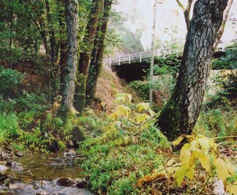
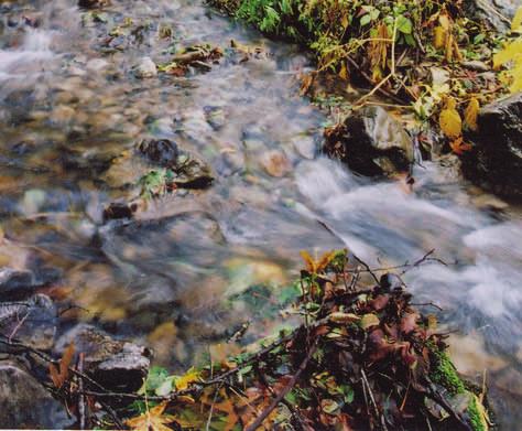
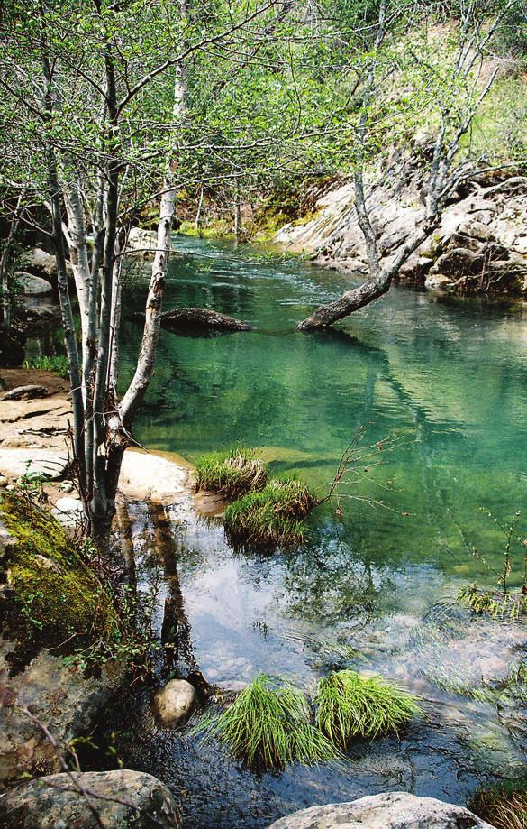
4 VENTANA WILD RIVERS PROPOSAL Introduction Carved by six rivers and many creeks and streams, the Santa Lucia Range is best described by its waterways. It is where land and water overlap that life is the richest and most complex. And that, too, is where a river s greatest value often lies. Because their upper watersheds are largely undisturbed, these rivers and streams are an important source of clean water for Monterey County residents, farmers, and industries. Their highly productive ecology includes rich riparian habitat, the state s southernmost redwood forests, and the rare Santa Lucia fir. They provide opportunities for popular outdoor recreation, and they are rich in historic and pre-historic culture. They also provide the best remaining habitat for a number of threatened and endangered species, including the Central Coast steelhead trout, California condor, foothill yellow-legged frog, Dudley s lousewort (a rare native wildflower), and many others. Although much of the Santa Lucia Range is protected as Wilderness, the rivers deserve the additional protection provided by the National Wild & Scenic Rivers System. The Wilderness system prohibits roads, motorized use, and logging, but the Wild & Scenic system helps even more. It requires federal managers to actively preserve the free flowing nature of the rivers and their unique qualities. It specifically protects the rivers for future generations. A good first step was taken toward this important goal in 1992, when the upper portions of the Big Sur River were added to the National Wild & Scenic Rivers System. When Congress protected the Big Sur River, it directed the U.S. Forest Service to study additional rivers for possible protection. In that 2005 study, the Forest Service said parts of the Arroyo Seco River, North Fork Little Sur River, and the San Antonio River in the Los Padres National Forest were eligible for Wild & Scenic protection. Yet it recommended that Congress protect only the Arroyo Seco. Friends of the River, the Ventana Wilderness Alliance, and other conservationists who were heavily involved in this process were disappointed by the scant protection proposed. We are convinced that the following rivers and streams draining the Santa Lucia Mountains are eligible for federal protection because they are free flowing and possess outstanding values: the Arroyo Seco River and its tributaries, Tassajara Creek and Church Creek, Big Creek, Carmel River and Miller Fork, the North and South Forks Little Sur River, Nacimiento River, San Antonio River and its tributaries, San Carpoforo Creek, and Willow Creek.
5 Rivers of the Santa Lucia Mountains Proposed Wild & Scenic River Segments Palo Corona Ranch Soledad Ventana Wild Rivers Campaign Proposed Designation: Wild Scenic Recreational S. F Andrew Molera State Park N. Fork rk o L L ittl Pfeiffer Big Sur State Park ittle Sur River e Sur River B Los Carm ig Sur River Miller Fo el Rive r rk Carmel River Church Creek Tassajara Cr Hastings Natural History Reserve Ventana M o n t e r e y C o u n t y Greenfield Existing Designation: Wild Land Ownership: Julia Pfeiffer Burns State Park Padres Arroyo Se c o R. Wilderness United States Forest Service U.S. Department of Defense Big Creek Bureau of Land Management State Local Landels-Hill Big Creek Reserve S a n Antonio River Boundaries Private Conservation Forest Service Administrative Area Limekiln State Park Nacim iento R National Fort Hunter Liggett i ver Forest Service Wilderness Area P a c i f i State Marine Reserve or Conservation Area ek Willo w Cre County City c O c e a n Silver Peak Wilderness Forest Sa n Carp oforo Creek S a n L u i s O b i s p o C o u n t y Map created by GreenInfo Network Note: River corridor boundaries are provisional and are finalized after designation in a comprehensive river management plan. Miles 0 1 2
6

7 10/26/200610/26/2006 VENTANA WILD RIVERS PROPOSAL Arroyo Seco River The Arroyo Seco River is the only major tributary of the Salinas River that remains undammed. The river flows east from the crest of the Santa Lucia Mountains, then north along a major fault line, and then east again into the Salinas Valley near the town of Greenfield in Monterey County. Approximately 19 miles of the river are located on public lands in the Los Padres National Forest. The Forest Service completed a Wild & Scenic study of the Arroyo Seco River in The agency concluded that the river was eligible for federal protection and recommended that Congress designate more than 19 miles of the river from its source to the Los Padres National Forest boundary. Outstanding Values: Scenery & Recreation The river flows through a series of deep rocky gorges that provide a rugged and scenic setting for a variety of outdoor recreation pursuits, including camping, hiking, backpacking, swimming, and whitewater kayaking. About 70% of the 50,000 people who visit the Arroyo Seco River every year are Monterey County residents. Fish The Arroyo Seco River supports the most persistent remnants of the threatened Central Coast steelhead that spawn in the Salinas River watershed. It is also an important middle link for salmon migrating from the Salinas River to Tassajara Creek and other tributaries. Wildlife The river s riparian habitat provides foraging and nesting sites for the California spotted owl, and its pools are home to the Southwestern pond turtle (both are listed sensitive species). Geology The river cuts through a complex geological cross section of the Coast Range ideal for research into important tectonic and seismic processes. Ventana Wild Rivers Campaign Hannah Schoenthal-Muse, Organizer Friends of the River 99 Pacific St., Suite 555A, Monterey, CA / hannah@friendsoftheriver.org

8 VENTANA WILD RIVERS PROPOSAL Comments: Most of the Arroyo Seco River flows through public lands and the Ventana Wilderness. There are two small private inholdings that will be unaffected by designation. The river s proposed Recreational segments accommodate the Monterey County Sportsman s Club on the upper river, as well as lower river campgrounds, picnic areas, and trailhead facilities. The Scenic segments are adjacent to the closed but still existing Indians Road and would not affect its potential re-opening. This proposal differs from the Forest Service s in that includes more of the river near its source and it applies Wild classification to the segment of the river downstream of Escondido Campground clearly within the existing Ventana Wilderness, and it applies Scenic classification to a short section of the river between the Tassajara Creek confluence and Rocky Creek confluence, where the existing Indians Road is significantly vertically separated from the river. Virtually all of the water in the Arroyo Seco River is used for agricultural and municipal purposes downstream. Designation would not affect this use. Segmentation/Classification: Segment 1 Source to Ventana Wilderness boundary 3.68 Wild miles Segment 2 Ventana Wilderness boundary to the confluence with.5 miles Recreational Roosevelt Creek Segment 3 Roosevelt Creek confluence to confluence with unnamed 1.69 Scenic tributary in Sec. 1, T20S, R5E miles Segment 4 Unnamed tributary to the Ventana Wilderness boundary 8.68 Wild upstream of the Tassajara Creek confluence miles Segment 5 Ventana Wilderness boundary upstream of the Tassajara 2.13 Scenic Creek confluence to the Rocky Creek confluence miles Segment 6 Rocky Creek confluence to the Los Padres National Forest boundary 2.53 miles Recreational TOTAL MILES
9 Map created by GreenInfo Network Arroyo Seco River, Tassajara and Church Creeks Proposed Wild & Scenic River Segments
10

11 10/26/200610/26/2006 VENTANA WILD RIVERS PROPOSAL Tassajara Creek & Church Creek Tributaries of the Arroyo Seco Tassajara Creek is the largest tributary of the Arroyo Seco River. The creek flows southeast from the slopes of South Ventana Cone past Tassajara Hot Springs and into the Arroyo Seco River. Most of the creek s 10.4 miles are located on public lands in the Ventana Wilderness. Church Creek is Tassajara Creek s largest tributary. It flows southwest from the Church Creek divide that separates Church Creek from Pine Valley and the Carmel River watershed into Tassajara Creek, about 2.5 miles upstream of Tassajara Hot Springs. Most of Church Creek is located on public lands and the Ventana Wilderness. The Forest Service completed a Wild & Scenic study of Tassajara Creek in The agency concluded that the creek was free flowing but did not possess any outstanding values. Conservationists believe that all 10.4 miles of the creek possess outstanding fish, wildlife, cultural, and recreational values. The Forest Service did not assess Church Creek for eligibility. Outstanding Values: Fish & Wildlife Threatened central coast steelhead migrate all the way from the Pacific Ocean up the Salinas and Arroyo Seco Rivers to spawn in Tassajara Creek s high quality habitat. The creek also supports one of the few Central Coast populations of the sensitive foothill yellow-legged frog. Cultural Tassajara Creek and its mineral rich hot springs have been a destination for human use for thousands of years, first as a sacred cultural site of the Esselen Indians, later as a historic resort site, and now the locale of the Tassajara Zen Mountain Center, which carries on the 1,000 year-old tradition of monastic zen training. Ventana Wild Rivers Campaign Hannah Schoenthal-Muse, Organizer Friends of the River 99 Pacific St., Suite 555A, Monterey, CA / hannah@friendsoftheriver.org
12 VENTANA WILD RIVERS PROPOSAL Church Creek also has outstanding Native American cultural values. Archeological studies of rock shelters along the creek show that the area was a refuge for the Esselen Tribe following the arrival of Spanish Missionaries. Church Creek s incredible sandstone formations remnants of a seafloor formed millions of years ago create large overhangs, many of which were used by the Tribe as shelters. Most notably, a cave overlooking Church Creek has hand rock paintings estimated to be hundreds of years old. The cave and its rock paintings were celebrated in Robinson Jeffer s poem, Hands. Recreation Both creeks provides popular loop trail connections to routes leading to the Big Sur and Carmel Rivers. Comments: Hands Inside a cave in a narrow canyon near Tassajara The vault of rock is painted with hands, A multitude of hands in the twilight, a cloud of men s palms, no more, No other picture. There s no one to say Whether the brown shy quiet people who are dead intended Religion or magic, or made their tracings In the idleness of art; but over the division of years these careful Signs-manual are now like a sealed message Saying: "Look: we also were human; we had hands, not paws. All hail You people with cleverer hands, our supplanters In the beautiful country: enjoy her a season, her beauty, and come down And be supplanted; for you also are human." Robinson Jeffers ( ) Most of Tassajara Creek flows through public lands. There is one small private inholding encompassing the Tassajara Zen Center. Designation would not affect access to or use of the Zen Center. Church Creek has one private inholding that consists of the Bruce Church Ranch. Designation would not affect access to the ranch or its operations. Segmentation/Classification: Tassajara Creek Segment 1 Source in the Ventana Wilderness to Tassajara Hot 6.5 miles Wild Springs boundary Segment 2 Creek segment within the Tassajara Hot Springs private 1 mile Recreational property boundary Segment 3 Tassajara Hot Springs boundary to the Arroyo Seco River confluence 3.5 miles Wild Church Creek Segment 1 Source to the confluence with the unnamed tributary 1.2 miles Wild flowing in from the north in sec. 13, T19S, R3E Segment 2 Unnamed tributary confluence in sec. 13 to the 1 mile Recreational confluence of the unnamed tributary flowing in from the east in sec. 24, T19S, R3E Segment 3 Unnamed tributary confluence in sec. 24 to the 2.36 miles Wild confluence with Tassajara Creek TOTAL 15.56

13 10/26/200610/26/2006 VENTANA WILD RIVERS PROPOSAL Big Creek Big Creek is the only watershed on the Central California Coast dedicated to natural resources research. The upper segments of Big Creek and Devils Canyon are pristine and located on public lands in the Ventana Wilderness. The lower segments of Big Creek and Devils Canyon flow through the 4,000-acre University of California s Big Creek Reserve. Downstream of the UC Reserve, the creek flows into the Big Creek State Marine Reserve in the Pacific Ocean, which was recently expanded from 1,200 acres to square miles. Big Creek was not studied by the Forest Service, however, conservationists believe that it is free flowing and possesses outstanding values. Native American use of Big Creek goes back at least 6,500 years. Shell middens along the creek can be as much as 14 feet deep, indicating a long history of use. In addition, the remains of historic homestead sites still exist, like those of Gamboa and Boronda. Outstanding Value(s): Scientific - The Ventana Wilderness, UC Big Creek Reserve, and Big Creek Marine Reserve together provide unique opportunities for natural resources research from the Coast Range crest to the coast and offshore habitats in the Pacific Ocean. The Big Creek watershed offers diverse vegetation types and habitat, including redwood forest, ponderosa pine/mixed hardwood forest, canyon live oak/fir forest, coastal scrub, manzanita and chamise chaparral, and sycamore/riparian forest that support numerous wildlife and plant species. One survey of Big Creek revealed 344 species of plants representing 42 percent of all California plant families. Reserve research identified four newly discovered species of moths and one new walking stick (insect) species. The creek supports a healthy run of threatened Central Coast steelhead and is fed by more than 23 named springs. Ventana Wild Rivers Campaign Hannah Schoenthal-Muse, Organizer Friends of the River 99 Pacific St., Suite 555A, Monterey, CA / hannah@friendsoftheriver.org

14 VENTANA WILD RIVERS PROPOSAL Comments: Federal designation is entirely consistent with the research mission and goals, and conservation purposes of both the UC Big Creek Reserve and the Big Creek State Marine Reserve. Recreational segments accommodate existing reserve facilities and access roads. The Scenic segment accommodates a closed road that formerly provided access to Big Creek Hot Springs. A private inholding is located on Devils Canyon Creek. Designation will not affect this property. Central Coast Steelhead Segmentation/Classification: Segment 1 Segment 2 Segment 3 Segment 4 Segment 5 Segment 6 Segment 7 Segment 8 TOTAL Big Creek main stem from its source to.10 miles upstream of hot springs Big Creek main stem from.10 miles upstream of hot springs to the Devils Canyon confluence Big Creek main stem from the Devils Canyon confluence to Pacific Ocean North Fork Big Creek from its source to the Big Creek confluence North Fork Devils Canyon from its source to the private property boundary in Sec. 30, T21S, R3E North Fork Devils Canyon from the private property boundary in Sec. 30, T21S, R3E to the Big Creek confluence Middle Fork Devils Canyon from its source to North Fork confluence South Fork Devils Canyon from its source to the Middle Fork confluence 4.9 miles.87 miles.71 miles 3.89 miles 2.89 miles 1.56 miles Wild Scenic Recreational Wild Wild Recreational 4.82 Wild miles 3.99 Wild miles MILES
15 Big Creek Proposed Wild & Scenic River Segments Los Ventana Wild Rivers Campaign Ventana Wilderness Proposed Designation: Wild Padres Scenic Recreational Land Ownership: Boundaries United States Forest Service U.S. Department of Defense Bureau of Land Management State Local Private Conservation Forest Service Administrative Area Big Creek State Marine Conservation Area Big Creek State Marine Reserve Landels-Hill N. Fo rk B ig C reek B ig Cre N. Fo Big Creek Reserve ek r k De vils Canyon S M. Fo National. Fork Devil r k Devils Canyo n s C anyo n Forest Service Wilderness Area State Marine Reserve or Conservation Area County M o n t e r e y C o u n t y Forest City P a c i f i c Limekiln State Park O c e a n Map created by GreenInfo Network Note: River corridor boundaries are provisional and are finalized after designation in a comprehensive river management plan. Miles
16

17 10/26/200610/26/2006 VENTANA WILD RIVERS PROPOSAL The Carmel River is one of the most popular trail routes into the Ventana Wilderness. The river flows northwest out of the Los Padres National Forest and eventually to the Pacific Ocean. The portion of the Carmel River and much of the Miller Fork considered for Wild & Scenic status are located entirely within the Ventana Wilderness. The Forest Service did not find the Carmel River and the Miller Fork to be eligible for federal protection, due to supposed lack of outstanding values. However, the agency s own study confirms outstanding values. Carmel River & Miller Fork Outstanding Values: Scenery & Recreation Distinctive sandstone formations along the river, spectacular tributary waterfalls, house-size boulders, deep rocky gorges, and lush riparian habitat and woodlands, complete with six foot tall ferns, all contribute to the river s outstanding scenery and diverse recreational opportunities. The rivers offer one of the most popular trail routes into the Ventana Wilderness. According to the Forest Service, the river is unique to Southern California, due to its diverse recreation uses, including backpacking, horsepacking, fishing, bird watching, scenery viewing, camping, swimming, nature study, and photography. Wildlife The Carmel River and its riparian habitat supports nesting spotted owls, endangered California red-legged frogs, a remnant population of threatened steelhead, and sensitive Southwestern pond turtles. Cultural Esselen Indian archeological sites along the upper Carmel River provide unique evidence of their conflict with Spanish missionaries and the armed Spanish garrison, late in the contact period and just prior to the demise of the Esselen people. Ventana Wild Rivers Campaign Hannah Schoenthal-Muse, Organizer Friends of the River 99 Pacific St., Suite 555A, Monterey, CA / hannah@friendsoftheriver.org

18 VENTANA WILD RIVERS PROPOSAL Comments: The Carmel River flows entirely through public lands. The upper segment of the Miller Fork flows through two private inholdings. The Recreational segment accommodates these inholdings and access roads. Designation would not affect access to or use of the properties. Segmentation/Classification: Segment 1 Segment 2 Segment 3 TOTAL Carmel River from it source in Pine Valley to the National Forest boundary The Miller Fork from its source to the western boundary of the private inholding (Tanoak Property) in Sec. 1, T19S, R3E The Miller Fork from the western boundary of the private inholding in Sec. 1 to its confluence with the Carmel River 10.9 Wild miles 1 mile Recreational 6.16 Wild miles MILES
19 Carmel River and Miller Fork Carmel River Proposed Wild & Scenic River Segments Ventana Wild Rivers Campaign M o n t e r e y C o u n t y Bloomquist Open Space Proposed Designation: Wild Scenic Recreational Land Ownership: Hastings Natural History Reserve United States Forest Service U.S. Department of Defense Bureau of Land Management M iller Fo r k Car m State Local e l R i ve r Private Conservation C a rmel R i v e Boundaries Forest Service Administrative Area r Forest Service Wilderness Area State Marine Reserve or Conservation Area County City Los Padres National Forest Ventana Wilderness Map created by GreenInfo Network Note: River corridor boundaries are provisional and are finalized after designation in a comprehensive river management plan. Miles
20


21 10/26/200610/26/2006 VENTANA WILD RIVERS PROPOSAL Little Sur River The Little Sur River is considered by the California Deparment of Fish and Game to be the most important steelhead spawning stream on the Central Coast. The North and South Forks of the Little Sur River flow northwest from the slopes of Ventana Double Cone and are divided by the limestone buttresses of Pico Blanco, which is visible from Highway 1. Dudley s Lousewort The Forest Service found 8.1 miles of the North Fork to be eligible for Wild & Scenic status due to its outstanding botanical values. In addition, conservationists believe that both forks of the Little Sur within the Los Padres Forest boundary possess outstanding ecological, fish, wildlife, and scenic values. Outstanding Values: Fish The Little Sur River is considered by the California Department of Fish and Game to be the most important spawning stream for threatened steelhead on the Central Coast. This is due to the pristine nature of the Little Sur in comparison to other Central Coast watersheds. Ecological The entire drainage was identified by the Forest Service as an area of high ecological significance due to its pristine habitat for a diversity of fish and wildlife species and few non-native species. Botanical The North Fork supports the largest known aggregation of Dudley s lousewort on public lands. Dudley s lousewort is a rare plant endemic to redwood forests with fewer than 10 known populations. Wildlife Sensitive, threatened, and endangered species that live in and along the Little Sur include the spotted owl, California red-legged frog, Pacific salamander, and giant salamander. Scenery Both forks of the Little Sur flow through deep canyons shrouded in redwood forests, and offer attractive and popular routes into the Ventana Wilderness, complete with numerous cascades and deep pools. Ventana Wild Rivers Campaign Hannah Schoenthal-Muse, Organizer Friends of the River 99 Pacific St., Suite 555A, Monterey, CA / hannah@friendsoftheriver.org
22 VENTANA WILD RIVERS PROPOSAL Comments: The upper segments of both forks are publicly owned. There are private inholdings on both forks within the Forest boundary. None of these properties would be affected by designation. Recreational designation of the lower segment of the North Fork accommodates the Pico Blanco Boyscout Camp access road and would allow continued seasonal impoundment of the North Fork by the Camp, as long as the impoundment did not continue to harm the outstanding steelhead fishery. A portion of the Wild segment of the South Fork flows through an undeveloped area of Andrew Molera State Park. Wild designation of this segment is consistent with the state s management of this portion of the Park. Segmentation/Classification: Segment 1 Source of the North Fork to Ventana Wilderness boundary 4.6 Wild miles Segment 2 Ventana Wilderness boundary to National Forest boundary 3 miles Recreational Segment 3 Source of the South Fork to the northwestern boundary of 7.2 Wild Andrew Molera State Park miles Segment 4 Stake Park boundary to National Forest boundary in Section miles Scenic TOTAL MILES
23 North Fork and South Fork Little Sur River Proposed Wild & Scenic River Segments Palo Corona Ranch Santa Lucia Preserve Ventana Wild Rivers Campaign Proposed Designation: Glen Deven Ranch Los Wild Scenic Recreational Mill Creek Redwood Preserve Land Ownership: United States Forest Service Brazil Ranch North Fork Litt Padres U.S. Department of Defense Bureau of Land Management State M o n t e r e y C o u n t y l e Su r Riv er Boundaries Local Private Conservation Forest Service Administrative Area South F Andrew o r k Litt le S u r Ventana Wilderness R iver National Forest Service Wilderness Area State Marine Reserve or Conservation Area Molera State Park County City Pfeiffer Big Sur State Park Forest P a c i f i c O c e a n Map created by GreenInfo Network Note: River corridor boundaries are provisional and are finalized after designation in a comprehensive river management plan. Miles
24


25 10/26/200610/26/2006 VENTANA WILD RIVERS PROPOSAL Nacimiento River The Nacimiento River flows east from the Santa Lucia Range crest into Fort Hunter Liggett. It is one of the few rivers in the range easily accessible by road. Arroyo Toad The Forest Service did not study the Nacimiento River. Conservationists believe the river is free flowing and possesses outstanding values. Outstanding Values: Recreation The Nacimiento Fergusson Road makes the Nacimiento River one of the few streams in the mountain range easily accessible for recreation, including scenic driving, hiking, swimming, angling, and camping. Two roadside Forest Service campgrounds provide good opportunities to explore the river. Wildlife The Forest Service identified the Nacimiento River as supporting a highly significant population of endangered arroyo toad. Botanical The Nacimiento supports some of the southern-most stands of rare and endemic Santa Lucia Fir in the mountain range. Ventana Wild Rivers Campaign Hannah Schoenthal-Muse, Organizer Friends of the River 99 Pacific St., Suite 555A, Monterey, CA / hannah@friendsoftheriver.org

26 VENTANA WILD RIVERS PROPOSAL Comments: The Recreational segment accommodates the Nacimiento Road and the two adjacent campgrounds. Although it flows into Fort Hunter Liggett, none of the segments of the Nacimiento River proposed for designation are located on the military reservation. The river corridor can and should be established by the Forest Service after designation to avoid overlap with the military reservation on the northeast side of the river and Nacimiento Road. Designation will not affect military water rights to the river. Virtually all of the water in the Nacimiento River is captured by the Nacimiento Dam and Reservoir for agricultural and municipal use. Designation of upstream segments on the National Forest will not affect the dam, reservoir, or water uses. Santa Lucia Fir Segmentation/Classification: Segment 1 Source to Ventana Wilderness boundary 3 miles Wild Segment 2 Ventana Wilderness boundary to National Forest boundary 6 miles Recreational TOTAL 9 MILES
27 Map created by GreenInfo Network Nacimiento River Proposed Wild & Scenic River Segments
28


29 10/26/200610/26/2006 VENTANA WILD RIVERS PROPOSAL San Antonio River and tributaries The San Antonio River flows east from the Santa Lucia Range crest into Fort Hunter Liggett. The upper portion of the river, its North Fork, and several small tributaries flow through an area on the Los Padres National Forest unusually rich in Native American heritage. The Forest Service identified 8.6 miles of the main stem of the San Antonio River from its source to the National Forest boundary to be eligible for federal protection, but the agency did not recommend its designation. Instead, the Los Padres Forest Plan established the 9,933 acre Milpitas Special Interest Area encompassing both the main stem and North Fork and several tributaries. SIA designation provides inferior protection of the river s cultural values in comparison to Wild & Scenic status. Conservationists believe that the main stem, its North Fork, Carrizo Creek, Santa Lucia Creek, lower Rattlesnake Creek, and several other unnamed tributaries all collectively contribute to this area s outstanding cultural values and are therefore eligible for protection. Outstanding Values: Cultural The river flows through an area with unusually dense and varied concentration of historic and pre-historic cultural values, probably spanning thousands of years, and offering a unique interpretive potential. The river and tributaries record the ancient uses of the native Salinan people as well as the earliest contact between the Salinan and the Missionera explorers. It also offers insights into the postsecular history of the Indians who withdrew to the upper river and its tributaries to live after the closure of the Mission San Antonio de Padua downstream. Low rock walls along Santa Lucia Creek outline the Salinan s milpitas or small gardens. First established by the Salinans, the Carrizo Trail along Carrizo Creek was used by early homesteaders to transport supplies to and from the coast. The entire watershed is dominated by the peak sacred to the Salinans that is known today as Junipero Serra. Later expanded into a hunting resort, the historic Indians adobe, vineyard, and family cemetery provide a glimpse of rustic life in the backcountry. Ventana Wild Rivers Campaign Hannah Schoenthal-Muse, Organizer Friends of the River 99 Pacific St., Suite 555A, Monterey, CA / hannah@friendsoftheriver.org


30 VENTANA WILD RIVERS PROPOSAL Historic Indians Adobe Scenery The North Fork originates from and flows through a spectacular setting of oak savannah and massive sandstone rock outcrops formed under an ancient sea. Wildlife The upper river supports nesting spotted owls, a sensitive species. The lower river in Fort Hunter Liggett supports the northern most population of endangered arroyo toad in California. Ecological The valley oaks along the banks of the river and its tributaries are the only valley oaks in the National Forest system and have been proposed as a Research Natural Area. Wagon Cave

31 10/26/200610/26/2006 VENTANA WILD RIVERS PROPOSAL Comments: There are a few private inholdings adjacent to the main stem, North Fork and Santa Lucia Creek. These private parcels will not be affected by designation. Although the San Antonio River flows into Fort Hunter Liggett, none of the river or tributary segments proposed for designation are located on the military reservation. Designation will not affect military water rights to the river. Virtually all of the water in the San Antonio River is captured by the San Antonio Dam and Reservoir for agricultural and municipal use. Designation of upstream segments on the National Forest will not affect the dam, reservoir, or water uses. Ventana Wild Rivers Campaign Hannah Schoenthal-Muse, Organizer Friends of the River 99 Pacific St., Suite 555A, Monterey, CA / hannah@friendsoftheriver.org

32 VENTANA WILD RIVERS PROPOSAL Segmentation/Classification: San Antonio River Segment 1 Source to Wilderness boundary 7.6 miles Wild Segment 2 Wilderness boundary to National Forest boundary 1 mile Scenic North Fork San Antonio River Segment 1 Source to Wilderness boundary 1.15 miles Wild Segment 2 From the Wilderness boundary west of the Indians Road 1.32 miles Recreational to where the North Fork leaves the Indians Road Segment 3 Indians Road to the main stem confluence 4.26 miles Scenic Carrizo Creek Segment 1 Source to the North Fork confluence 2.55 miles Wild Rattlesnake Creek Segment 1 From the Fort Hunter Liggett boundary to the confluence with the North Fork.31 miles Scenic Santa Lucia Creek Segment 1 Source to the Wilderness boundary.75 miles Wild Segment 2 Wilderness boundary to confluence with the North Fork San Antonio River 2.88 miles Recreational Unnamed creek near Indians Ranch Segment 1 Pond dam to the North Fork confluence 1.25 miles Recreational Unnamed creek flowing from Junipero Serra Peak Segment 1 Source south of Junipero Serra Peak in Sec. 34, T20S, 2.96 miles Wild R5E to confluence with unnamed western tributary in Sec. 17, T21S, R5E Segment 2 Source west of Junipero Serra Peak in Sec. 33, T20S, 1.38 miles Wild R5E to confluence with unnamed eastern tributary in Sec. 17, T21S, R5E Segment 3 From the confluence of unnamed creeks in Sec. 17,.89 miles Scenic T21S, R5E to the confluence with the North Fork San Antonio River Segment 4 Source of unnamed tributary in Sec. 4, T21S, R5E to the confluence with unnamed creek in Sec. 17, T21S, R5E 2.39 miles Scenic TOTAL MILES
33 San Antonio River and Tributaries Proposed Wild & Scenic River Segments Map created by GreenInfo Network
34

35 10/26/200610/26/2006 VENTANA WILD RIVERS PROPOSAL San Carporforo Creek San Carpoforo Creek flows south out of the Santa Lucia Range in the northern Los Padres National Forest, onto lands owned by the Hearst Corporation and then to the Pacific Ocean. The creek was the route of the historic Portola Expedition and it was identified as an area of high ecological significance by the Forest Service. San Carpoforo Creek was not studied by the Forest Service. Conservationists believe that it is free flowing and possesses outstanding values. Outstanding Values: Cultural San Carpoforo Creek was the route of the historic Portola Expedition of 1769, which led to the establishment of the California Missions and ultimately the European colonization of northern California. According to journal entries by Portola members, contact between Portola and native people took place on the banks of the San Carpoforo and therefore, the area is considered to be one of the last primal remnants of the original encounter between indigenous and European consciousness anywhere on the Pacific coast. In addition, a venerable grove of olive trees near the confluence of San Carpoforo and Dutra Creeks marks the location where an outpost of the Mission San Antonio de Padua once stood. Wildlife The creek supports one of the few remaining populations of sensitive foothill yellowlegged frogs on the Central Coast, as well as endangered California red-legged frogs. Fish The California Department of Fish and Game considers the creek to be one of two of the most important spawning streams for threatened steelhead in San Luis Obispo County (the upper section of the creek on National Forest lands is in Monterey County). Ecological The creek was identified as an area of high ecological significance by the Forest Service due to the presence of sensitive and rare frogs and the threatened steelhead. Ventana Wild Rivers Campaign Hannah Schoenthal-Muse, Organizer Friends of the River 99 Pacific St., Suite 555A, Monterey, CA / hannah@friendsoftheriver.org

36 VENTANA WILD RIVERS PROPOSAL Comments: There is a private inholding on the lower segment encompassing the Baldwin Ranch and its access road. The Recreational segment accommodates the ranch and its access road. Designation would not affect access to the property or ranch operations. The lower portion of the creek downstream of the forest boundary is not proposed for designation. The lower creek flows through Hearst lands protected by conservation easements. California Red-legged Frog Segmentation/Classification: Segment 1 Source to Silver Peak Wilderness boundary 2.75 miles Wild Segment 2 Silver Peak Wilderness boundary to the National Forest 1.54 miles Recreational boundary TOTAL 4.29 MILES
37 k San Carpoforo Creek Proposed Wild & Scenic River Segments Ventana Wild Rivers Campaign Proposed Designation: Wild Scenic Fort Hunter Liggett Recreational Land Ownership: United States Forest Service U.S. Department of Defense Boundaries Bureau of Land Management State Local Private Conservation Los Padres National Forest Silver Peak Wilderness r S an Carpoforo C e e M o n t e r e y C o u n t y Forest Service Administrative Area Forest Service Wilderness Area State Marine Reserve or Conservation Area County P a c i f S a n L u i s O b i s p o C o u n t y City i c O c e a n Map created by GreenInfo Network Note: River corridor boundaries are provisional and are finalized after designation in a comprehensive river management plan. Miles
38

39 10/26/200610/26/2006 VENTANA WILD RIVERS PROPOSAL Willow Creek Willow Creek flows west from the Santa Lucia Range crest to the Pacific Ocean. It represents one of the few opportunities on the Central Coast to protect a stream from its source to the ocean as a Wild & Scenic River. It is located entirely on public lands and mostly within the Silver Peak Wilderness. Willow Creek was not studied by the Forest Service for its Wild & Scenic River attributes. Conservationists believe that the creek is free flowing and possesses outstanding values. Outstanding Values: Hydrological Willow Creek represents one of the few opportunities to protect an entire Central Coast stream from its source to the Pacific Ocean in the National Wild & Scenic Rivers System. Fish The California Department of Fish and Game considers Willow Creek to be one of the most productive spawning streams for threatened steelhead in southern Monterey County. Botanical Lower Willow Creek supports the only know occurrence of the La Graciosa thistle on National Forest land. The plant is proposed for federal listing as endangered. It is found in serpentine seeps surrounded by chaparral that receives exposure to coastal fog near Willow Creek. The upper Willow Creek drainage supports the largest of the most southerly know coastal stands of Douglas fir. Wildlife Willow Creek supports one of the few populations of sensitive foothill yellow-legged frog in the Santa Lucia Range of the Los Padres Forest. Cultural Historic remnants of 1880s gold mining occur along Willow Creek including an extensive dry laid stone retaining wall believed to have been built by a crew of Chinese miners over one hundred years ago. Ventana Wild Rivers Campaign Hannah Schoenthal-Muse, Organizer Friends of the River 99 Pacific St., Suite 555A, Monterey, CA / hannah@friendsoftheriver.org

40 VENTANA WILD RIVERS PROPOSAL Comments: There are no private inholdings on Willow Creek or its North Fork. The Recreational segment accommodates the lower portion of the creek flowing under the Highway 1 bridge and the adjacent day use area. A cherry-stemmed road in the Silver Peak Wilderness approaches the proposed Wild River corridor in sec. 28, T23S, R5E, but does not reach the creek. This is permissible for Wild Rivers under federal guidelines. Segmentation/Classification: Segment 1 Source of the main stem to the Silver Peak Wilderness 5.1 Wild boundary miles Segment 2 Silver Peak Wilderness boundary to the Pacific Ocean.5 miles Recreational Segment 3 The North Fork from its source to its confluence with the main stem 4 miles Wild TOTAL 9.6 MILES


41 Willow Creek Proposed Wild & Scenic River Segments Los Ventana Ventana Wild Rivers Campaign Wilderness Proposed Designation: Wild Scenic Recreational Padres M o n t e r e y C o u n t y Land Ownership: United States Forest Service Fort Hunter Liggett U.S. Department of Defense Bureau of Land Management State Local Private Conservation National F ork Nort h Silver Peak Willow Creek Boundaries Wilderness Forest Service Administrative Area Forest Service Wilderness Area State Marine Reserve or Conservation Area Forest County P a c City i f i c Silver Peak Wilderness O c e a n Map created by GreenInfo Network Note: River corridor boundaries are provisional and are finalized after designation in a comprehensive river management plan. Miles
42
43 VENTANA WILD RIVERS PROPOSAL Overview: Federal Wild & Scenic Designation and its Classifications The National Wild & Scenic Rivers Act was passed by Congress in 1968 specifically to complement our existing national policy of developing rivers for their water and power resources, with a new federal policy to protect the free flowing conditions, water quality, and outstanding scenic, recreational, geologic, fish and wildlife, historic, and cultural values. The intent of Congress was to protect certain selected rivers and their immediate environments to fulfill vital national conservation purposes. Federal protection ensures that no new dams or large diversions will be constructed on designated rivers, which are to be protected in perpetuity for future generations. In addition, the federal public lands through which designated rivers flow are managed to protect the river s free flowing character and outstanding values. Federal permits required for water resource projects (defined as any project that touches the water, such as bridges, bank protection, etc) must ensure that such projects do not have a direct and adverse effect on the values of Wild Rivers are vestiges of primitive America, where access is primarily by trail and is nonmotorized. Scenic Rivers have largely undeveloped shorelines, but may have occasional road or bridge crossings and structures adjacent to but unseen from the shoreline. Access may be motorized or nonmotorized. Recreational Rivers may have parallel roads and adjacent structures and other development visible from the shoreline. Access is primarily motorized. designated rivers. Water resource projects upstream or downstream of protected rivers may not invade or unreasonably diminish the river s outstanding values. Upon designation, a protected river corridor averaging 320 acres per mile (approximately ¼ mile on each side of the river) is established. The river corridor is classified as Wild, Scenic, or Recreational based on the level of existing development at the time of designation. Wild Rivers are vestiges of primitive America, where access is primarily by trail and is non-motorized. Scenic Rivers have largely undeveloped shorelines, but may have occasional road or bridge crossings and structures adjacent to but unseen from the shoreline. Access may be motorized or non-motorized. Recreational Rivers may have parallel roads and adjacent structures and other development visible from the shoreline. Access is primarily motorized. A comprehensive river management plan is developed and adopted by the appropriate federal management agency within three years after designation by Congress. The final river corridor boundaries, classifications, specific management standards to ensure protection of outstanding river values, and determination of the river s recreational use carrying capacity are all key components of
44 VENTANA WILD RIVERS PROPOSAL the management plan. The process for developing comprehensive river management plans includes extensive public input. Many protected rivers have private lands or inholdings within their corridors. Federal designation confers no additional authority over private lands or local land use, except to prohibit or limit federal permits or support for dams, diversions, and other water resource projects. Local zoning and land use regulations still apply to all private lands on protected rivers. Local governments may but are not required to adopt zoning and land use regulations that are complementary to the purposes of federal designation. Federal agencies may pay fair market value to acquire private property from willing sellers along designated rivers. No private lands have ever been condemned on a Wild & Scenic River in California. Federal condemnation authority on designated rivers is actually limited in comparison to pre-designation authority. Fee title condemnation is prohibited if 50 percent or more of the designated river corridor is already public land. Scenic easements may be condemned to prevent inappropriate development along protected rivers. All of the rivers proposed for designation in the Ventana Wild Rivers Campaign are more than 50 percent public. But as a practical matter, the use of condemnation is limited because it is politically unpopular and most federal agencies do not have funding to condemn private property.
45 VENTANA WILD RIVERS PROPOSAL Statistical Summary Wild Scenic Recreational Total Miles Arroyo Seco River Tributaries: Tassajara & Church Creeks Big Creek Carmel River & Miller Fork Little Sur River Nacimiento River San Antonio River & Tributaries San Carpoforo Creek Willow Creek Total Miles
$850,000 Awarded to 20 Organizations
 $850,000 Awarded to 20 Organizations The Conservation Alliance is pleased to fund the following organizations to support their efforts to protect wild lands and waterways for their habitat and recreation
April 10, Mark Stiles San Juan Public Lands Center Manager 15 Burnett Court Durango, CO Dear Mark,
 Mark Stiles San Juan Public Lands Center Manager 15 Burnett Court Durango, CO 81301 Dear Mark, We are pleased to offer the following comments on the draft San Juan Public Lands Center management plans
Evaluation of Outstanding Remarkable Values for Collawash River March 2011
 Evaluation of Outstanding Remarkable Values for Collawash River March 0 Segment From headwaters of East Fork Collawash River to Buckeye Creek Mileage: miles Free flowing: Yes Scenic:, Substantial River
DOYLE SPRINGS PLANNING UNIT Kern-Tule River Watershed
 Existing Conditions & Uses Overview Consists of a mostly forested parcel with small hydropower developments and part of a private recreation cabin development, along with two small transmission line corridor
2.0 PARK VISION AND ROLES
 2.0 PARK VISION AND ROLES 2.1 Significance in the Protected Area System Marble Range and Edge Hills provincial parks protect 6.8% of the Pavillion Ranges Ecosection, which is located in the Southern Interior
Piedra River Protection Workgroup Meeting #5 Feb. 21, 2012 Ross Aragon Community Center, Pagosa Springs
 Piedra River Protection Workgroup Meeting #5 Feb. 21, 2012 Ross Aragon Community Center, Pagosa Springs What happened at this meeting? - Identified conservation easements - Discussed In-stream Flows -
Rogue Gorge (Mt. Stella) Roadless Area-- T30S R3E (primarily in portions of Sections 23, 26, 33, 34 & 35)
 Roadless Area-- T30S R3E (primarily in portions of Sections 23, 26, 33, 34 & 35)") Rogue Gorge (Mt. Stella) Roadless Area-- T30S R3E (primarily in portions of Sections 23, 26, 33, 34 & 35) Rogue River-Siskiyou National Forest--High Cascades Ranger District Upper, higher elevation trail
Rogue Gorge (Mt. Stella) Roadless Area-- T30S R3E (primarily in portions of Sections 23, 26, 33, 34 & 35) Rogue River-Siskiyou National Forest--High Cascades Ranger District Upper, higher elevation trail
MARBLE RIVER PROVINCIAL PARK
 MARBLE RIVER PROVINCIAL PARK PURPOSE STATEMENT AND ZONING PLAN March 2003 MARBLE RIVER PROVINCIAL PARK Purpose Statement and Zoning Plan Primary Role The primary role of Marble River Park is to protect
Hike at Pico Blanco Labor Day Weekend!
 Hike at Pico Blanco Labor Day Weekend! The Pico Blanco Hymn Here among the trees majestic Pleasures you will find On the trails of Pico Blanco With your friends and mine Trail the Eagle ever onward This
TAYLOR CANYON RANCH COLORADO - ROUTT COUNTY - STEAMBOAT SPRINGS
 TAYLOR CANYON RANCH COLORADO - ROUTT COUNTY - STEAMBOAT SPRINGS Tucked up against the steep valley shaped by Mt. Pau and rising to the Routt National Forest, Taylor Canyon Ranch is an easily accessible,
ROAD AND TRAIL PROJECT APPROVAL
 ROAD AND TRAIL PROJECT APPROVAL www.marincountyparks.org Marin County Parks, 3501 Civic Center Dr, Suite 260, San Rafael, CA 94903 DATE: July 12, 2017 PRESERVE: Gary Giacomini Open Space Preserve PROJECT:
Continental Divide National Scenic Trail Legislative History and Planning Guidance
 Continental Divide National Scenic Trail Legislative History and Planning Guidance Legislation, Policy, and Direction Regarding National Scenic Trails The National Trails System Act, P.L. 90-543, was passed
Segment 2: La Crescent to Miller s Corner
 goal of the USFWS refuges is to conserve, protect and enhance fish, wildlife and plants and their habitats for the continuing benefit of the American people. Refuge lands are used largely for fishing,
Whitemouth Falls Provincial Park. Draft Management Plan
 Whitemouth Falls Provincial Park Draft Management Plan Whitemouth Falls Provincial Park Draft Management Plan Table of Contents 1. Introduction... 3 2. Park History... 3 3. Park Attributes... 4 3.1 Natural...
Pinellas County Environmental Lands
 Pinellas County Environmental Lands In addition to traditional parks and recreation facilities, Pinellas County owns and manages a system of environmental lands that provides specialized resource-based
OPPORTUNITIES FOR WILD & SCENIC RIVER DESIGNATION
 OPPORTUNITIES FOR WILD & SCENIC RIVER DESIGNATION IN SOUTHWEST WASHINGTON S VOLCANO COUNTRY Washington's legendary volcanoes - Mount St. Helens, Mount Rainier and Mount Adams - are the source of wild,
Driving Time: 3 hours (allow extra time for stops)
") Scenic Byways loop This journey takes visitors through the eastern edge of Mt. Rainier National Park and along two of Washington s most beloved scenic byways, the Chinook Byway and the White Pass Scenic
Scenic Byways loop This journey takes visitors through the eastern edge of Mt. Rainier National Park and along two of Washington s most beloved scenic byways, the Chinook Byway and the White Pass Scenic
2.0 Physical Characteristics
 _ 2.0 Physical Characteristics 2.1 Existing Land Use for the Project The site is comprised of approximately 114 acres bounded by Highway 101 to the north, the existing town of Los Alamos to the east, State
UNITED STATES DISTRICT COURT FOR THE CENTRAL DISTRICT OF CALIFORNIA WESTERN DIVISION ) ) ) ) ) ) ) ) ) INTRODUCTION
 ) ) ) ) ) ) ) ) INTRODUCTION") Case :-cv-0 Document Filed 0// Page of Page ID #: 0 LISA T. BELENKY (CA Bar No. 0 JUSTIN AUGUSTINE (CA Bar No. CENTER FOR BIOLOGICAL DIVERSITY Broadway Street, Suite 00 Oakland, CA T: ( -0 F: ( -0 E: lbelenky@biologicaldiversity.org
Case :-cv-0 Document Filed 0// Page of Page ID #: 0 LISA T. BELENKY (CA Bar No. 0 JUSTIN AUGUSTINE (CA Bar No. CENTER FOR BIOLOGICAL DIVERSITY Broadway Street, Suite 00 Oakland, CA T: ( -0 F: ( -0 E: lbelenky@biologicaldiversity.org
MAIN LAKE PROVINCIAL PARK
 MAIN LAKE PROVINCIAL PARK PURPOSE STATEMENT AND ZONING PLAN March 2003 MAIN LAKE PROVINCIAL PARK Purpose Statement and Zoning Plan Primary Role The primary role of Main Lake Park is to protect a biologically
MANAGEMENT DIRECTION STATEMENT June, 1999
 Thompson River District MANAGEMENT DIRECTION STATEMENT June, 1999 for Clearwater River Corridor (Addition to Wells Gray Park) Ministry of Environment Lands and Parks BC Parks Division ii Table of Contents
H. R IN THE HOUSE OF REPRESENTATIVES
 I 113TH CONGRESS 1ST SESSION H. R. 1776 To establish the Clear Creek National Recreation Area in San Benito and Fresno Counties, to designate the Joaquin Rocks Wilderness in such counties, to designate
(Short Listing) DUPUYER ACREAGE, ROCKY MOUNTAN FRONT
 DUPUYER ACREAGE, ROCKY MOUNTAN FRONT") (Short Listing) DUPUYER ACREAGE, ROCKY MOUNTAN FRONT This unique property is located 8½ miles northwest of Dupuyer, Montana and approximately thirty 30 miles northwest of Choteau, Montana. Great Falls
(Short Listing) DUPUYER ACREAGE, ROCKY MOUNTAN FRONT This unique property is located 8½ miles northwest of Dupuyer, Montana and approximately thirty 30 miles northwest of Choteau, Montana. Great Falls
Land Protection Accomplishments
 2017 Land Protection Accomplishments Conserving Open Space and Recreational Access On the Pacific Crest National Scenic Trail View from the Pacific Crest Trail of Donomore Meadows near the California/Oregon
OPEN SPACE. The Open Space Element describes the County s goals and policies with respect to open space areas and addresses the following topics:
 PURPOSE This element addresses open spaces for: the managed production of resources, outdoor recreation, public health and safety, and the preservation of natural resources. Amador County s open space
Connie Rudd Superintendent, Black Canyon of the Gunnison National Park
 National Park Service U.S. Department of the Interior Black Canyon of the Gunnison National Park and Curecanti National Recreation Area Information Brochure #1 Wilderness and Backcountry Management Plan
NAVAJO COMMUNITY PLAN
 NAVAJO COMMUNITY PLAN Prepared by the NAVAJO COMMUNITY PLANNERS and THE CITY OF SAN DIEGO City of San Diego Planning Department 202 C Street, MS 4A San Diego, CA 92101 Printed on recycled paper. This information,
STORNETTA BROTHERS COASTAL RANCH
 STORNETTA BROTHERS COASTAL RANCH Location: Surrounding Point Arena Lighthouse and immediately south of Manchester State Park Mendocino Co., CA Acres: 1,860 Resources: Over two miles of Pacific Ocean coastline
White Mountain National Forest Saco Ranger District
 United States Department of Agriculture Forest Service White Mountain National Forest Saco Ranger District 33 Kancamagus Highway Conway, NH 03818 Comm: (603) 447-5448 TTY: (603) 447-3121 File Code: 1950
FEASIBILITY CRITERIA
 This chapter describes the methodology and criteria used to evaluate the feasibility of developing trails throughout the study areas. Land availability, habitat sensitivity, roadway crossings and on-street
Bureau of Land Management Public Lands Guide Northwest District
 Bureau of Land Management Public Lands Guide Northwest District NORTHWEST Fee Site Restrooms Picnic Sites Developed Campgrounds Farmington Field Office (505) 564-7600 Alien Run Mountain Bike Trail Angel
EMERY COUNTY PUBLIC LAND MANAGEMENT ACT OF 2018 S. 2809/H.R. 5727
 EMERY COUNTY PUBLIC LAND MANAGEMENT ACT OF 2018 S. 2809/H.R. 5727 September 25, 2018 OVERVIEW The Emery County Public Land Management Act of 2018 is a significant step backwards for wilderness and conservation
13.1 REGIONAL TOURISM ISSUES AND SUMMARY OF FINDINGS
 13 REGIONAL TOURISM T he County of Mariposa s recreation needs and facilities fall within two categories: regional tourism and local recreation. This Element focuses on regional tourism issues related
Chapter 2: El Dorado County Characteristics and Demographics
 Chapter 2: El Dorado County Characteristics and Demographics 2.1 Geographic Area and Demographics El Dorado County comprises 1,805 square miles with over half of the area in the Eldorado National Forest
Anderson Mt. Proposed Wilderness Additions to the Rogue-Umpqua Divide Wilderness-- T30S R3E (mostly) Sections 4 & 9, and T29S R3E Section 33
 Sections 4 & 9, and T29S R3E Section 33") Anderson Mt. Proposed Wilderness Additions to the Rogue-Umpqua Divide Wilderness-- T30S R3E (mostly) Sections 4 & 9, and T29S R3E Section 33 When the 35,701 acre Rogue-Umpqua Divide Wilderness was designated
Anderson Mt. Proposed Wilderness Additions to the Rogue-Umpqua Divide Wilderness-- T30S R3E (mostly) Sections 4 & 9, and T29S R3E Section 33 When the 35,701 acre Rogue-Umpqua Divide Wilderness was designated
Map 1.1 Wenatchee Watershed Land Ownership
 Map 1.1 Wenatchee Watershed Land Ownership Map 1.1 Wenatchee Watershed Land Ownership The Wenatchee watershed lies in the heart of Washington state in Chelan County. Just larger than the state of Rhode
The Entrance to Phillips Arm Cardero Channel
 The Entrance to Phillips Arm Cardero Channel Jason Zroback jason@landquest.com 1 (604) 414-5577 Jamie Zroback jamie@landquest.com 1 (604) 483-1605 The Source for Oceanfront, Lakefront, Islands, Ranches,
Mark West Creek Flow Study Report
 Mark West Creek Flow Study Report Biology and Geology of Mark West Creek The headwaters of Mark West Creek are located in the Mayacamas Mountain range, which border Napa and Sonoma County, where it then
Frizzell Creek Ranch Summerville, OR $1,400, ± Acres
 Frizzell Creek Ranch Summerville, OR $1,400,000 165± Acres 1 Introduction The Frizzell Creek Ranch is a beautiful 165± acre ranch located in northeast Oregon at the base of the Wallowa Whitman National
IOWA ORNITHOLOGISTS' UNION - Birding Sites in Dallas County
 IOWA ORNITHOLOGISTS' UNION - Birding Sites in Dallas County Printed on 7/19/2018 Beaver Bottoms Wetland (restricted) (Important Bird Area) GPS Coordinates:, Ownership: Private (see directions for access)
Bear Creek Habitat Improvement Project
 06/10/10 Bear Creek Habitat Improvement Project El Paso County, Colorado Pike National Forest and Colorado Springs Utilities Owned Land Report prepared by: Eric Billmeyer Executive Director Rocky Mountain
EXECUTIVE SUMMARY PROGRAM DEVELOPMENT REPORT PURPOSE EXISTING SETTING EXPANDING PARKLAND
 EXECUTIVE SUMMARY PROGRAM DEVELOPMENT REPORT PURPOSE As the culmination of the first phase of the master planning process, this Program Development Report creates the framework to develop the Calero County
Clearwater Lake Provincial Park. Draft Management Plan
 Clearwater Lake Provincial Park Draft Management Plan Clearwater Lake Provincial Park Draft Management Plan Table of Contents 1. Introduction... 3 2. Park History... 4 3. Park Attributes... 4 3.1 Location/Access...4
NECHAKO CANYON PROTECTED AREA
 NECHAKO CANYON PROTECTED AREA PURPOSE STATEMENT AND ZONING PLAN March 2003 1 Nechako Canyon Protected Area Purpose Statement and Zoning Plan The Nechako Canyon Protected Area (1,246 hectares) is located
Proposed Scotchman Peaks Wilderness Act 2016 (S.3531)
") 1 Proposed Scotchman Peaks Wilderness Act 2016 (S.3531) Frequently Asked Questions PLACE Where is the area that would be designated as Wilderness? The lands outlined in S.3531 lie within Idaho along its
1 Proposed Scotchman Peaks Wilderness Act 2016 (S.3531) Frequently Asked Questions PLACE Where is the area that would be designated as Wilderness? The lands outlined in S.3531 lie within Idaho along its
Ouimet Canyon Provincial Nature Reserve. Management Plan
 Ouimet Canyon Provincial Nature Reserve Management Plan NOTE: This document has been scanned and formatted, and therefore is slightly different from the original version. -March 2002 Additional copies
PALO CORONA REGIONAL PARK MPRPD BOARD MEETING AUGUST 8, 2018
 PALO CORONA REGIONAL PARK MPRPD BOARD MEETING AUGUST 8, 2018 ACKNOWLEDGEMENTS AGENCIES AND ORGANIZATIONS The Trust for Public Land Big Sur Land Trust Santa Lucia Conservancy California State Parks Point
NOTICE OF INTENT MAPS WITH DESCRIPTIONS
 NOTICE OF INTENT MAPS WITH DESCRIPTIONS Location Map(s) to Accompany Notice of Intent The small corner map embedded in the lower left corner of the large map above shows the location of the three national
Ventana Wilderness Watch Volume 4, Number 1 Spring 2003 Newsletter of The Ventana Wilderness Alliance
 Ventana Wilderness Watch Volume 4, Number 1 Spring 2003 Newsletter of The In this Edition of the VWW: Wilderness Bill Victory Celebration Condor Reward Fund Established Annual VWA Gathering Wild Rivers
Appendix I. Wilderness Review
 Appendix I. Wilderness Review This appendix contains the wilderness inventory conducted for the Ash Meadows, Moapa Valley, and Pahranagat National Wildlife Refuges (NWRs) as part of the Comprehensive Conservation
Wilderness Areas Designated by the White Pine County bill
 Wilderness Areas Designated by the White Pine County bill SEC. 321. SHORT TITLE. This subtitle may be cited as the `Pam White Wilderness Act of 2006'. SEC. 322. FINDINGS. Congress finds that-- The White
David Magney Environmental Consulting
 David Magney Environmental Consulting DELINEATION OF JURISDICTIONAL WATERS AND RIPARIAN HABITATS FOR LYONS CANYON RANCH, NEWHALL, CALIFORNIA Prepared for: UNITED STATES ARMY CORPS OF ENGINEERS and CALIFORNIA
Massanutten Mountain Cluster
 Massanutten Mountain Cluster Signal Knob Catback Mountain Southern Massanutten Mountain Five areas of almost 49,000 acres on the Lee Ranger District compose the Massanutten Mountain Cluster of Mountain
PROPOSED PROCESS FOR WRITING THE MASTER PLAN FOR THE BIG SUR PORTION OF THE CALIFORNIA COASTAL TRAIL
 PROPOSED PROCESS FOR WRITING THE MASTER PLAN FOR THE BIG SUR PORTION OF THE CALIFORNIA COASTAL TRAIL PURPOSE The purpose of this process is to agree on the Master Plan for the portion of the California
Special Recreation Management Areas Extensive Recreation Management Areas Public Lands Not Designated as Recreation Management Areas
 From the Proposed RMP: Special Recreation Management Areas SRMAs are an administrative unit where the existing or proposed recreation opportunities and recreation setting characteristics are recognized
Appendix A BC Provincial Parks System Goals
 Appendix A BC Provincial Parks System Goals The British Columbia Provincial Parks System has two mandates: To conserve significant and representative natural and cultural resources To provide a wide variety
Existing Resource Information
 Botanical and Wildlife Vegetation alliances/wildlife habitats Grasslands annual/perennial Chaparral mixed/montane/chamise-redshank Riparian montane/valley foothill riparian Sierran mixed conifer Montane
TESTIMONY OF DR. THOMAS C. O KEEFE, AMERICAN WHITEWATER
 TESTIMONY OF DR. THOMAS C. O KEEFE, AMERICAN WHITEWATER UNITED STATES HOUSE OF REPRESENTATIVES SUBCOMMITTEE ON NATIONAL PARKS, FORESTS AND PUBLIC LANDS OF THE COMMITTEE ON NATURAL RESOURCES HEARING ON
RECREATION. Seven issues were identified that pertain to the effects of travel management on outdoor recreation within portions of the project area.
 RECREATION Seven issues were identified that pertain to the effects of travel management on outdoor recreation within portions of the project area. OPPORTUNITIES FOR SOLITUDE / QUIET TRAILS. One attraction
Whychus-Deschutes Wilderness Proposal
 Whychus-Deschutes Wilderness Proposal Imagine a place where two pristine waterways meet in a deep, rugged canyon. Where cool, clear water rushes from ancient springs to provide the lifeblood for wildlife
Morgan Estates. Lassen County, CA. Proudly Offered By
 Morgan Estates Lassen County, CA Proudly Offered By 707 Merchant Street, Suite 100, Vacaville, Ca 95688 (707) 455-4444 Office (707) 455-0455 Fax info@caoutdoorproperties.com Introduction Looking North
Yard Creek Provincial Park. Management Plan
 Yard Creek Provincial Park Management Plan Draft January 2010 Yard Creek Provincial Park Management Plan Approved by: telàlsemkin/siyam/chief Scott Benton Bill Williams Squamish Executive Director ation
The gorges of Mohican Park in Ohio create a hiker's paradise Sunday, May 22, 2011 By Bob Downing, Akron Beacon Journal
 Pittsburgh Post-Gazette The gorges of Mohican Park in Ohio create a hiker's paradise Sunday, May 22, 2011 By Bob Downing, Akron Beacon Journal Bob Downing Big Lyons Falls drops 80 feet into a shady U-shaped
BROCHURE. APPLE HILL WOODS 118 +/- Acres Camino, California. Presented by Jim Copeland
 BROCHURE APPLE HILL WOODS 118 +/- Acres Camino, California Presented by Jim Copeland 1 The Property This 118 acre is a rare gem in the Sierra Nevada foothills. Covered with lush forestland and scattered
SANTA-BOCA PROVINCIAL PARK
 SANTA-BOCA PROVINCIAL PARK PURPOSE STATEMENT AND ZONING PLAN March 2003 SANTA-BOCA PROVINCIAL PARK Purpose Statement and Zoning Plan Primary Role The primary role of Santa-Boca Park is to provide marine-based
Watchorn Provincial Park. Management Plan
 Watchorn Provincial Park Management Plan 2 Watchorn Provincial Park Table of Contents 1. Introduction... 3 2. Park History... 3 3. Park Attributes... 3 3.1 Natural... 4 3.2 Recreational... 4 3.3 Additional
Non-motorized Trail Plan & Proposal. August 8, 2014
 Town of Star Valley Ranch, Wyoming and the Star Valley Ranch Association in partnership with the USDA Forest Service, Bridger-Teton National Forest, Greys River Ranger District Non-motorized Trail Plan
Dan Dallas, Supervisor July 3, 2017 Rio Grande National Forest 1803 W. Highway 160 Monte Vista, CO 81144
 Dan Dallas, Supervisor July 3, 2017 Rio Grande National Forest 1803 W. Highway 160 Monte Vista, CO 81144 Dear Supervisor Dallas: I am writing today on behalf of the Colorado Native Plant Society to express
Brinker Creek Ranch. Colorado - Routt County - Yampa
 Located at the base of the Flattops Range in the Steamboat/Vail corridor, Brinker Creek Ranch consists of 1,451 acres ideally suited for high country grazing and native grass hay production. Traditionally
Logo Department Name Agency Organization Organization Address Information 5700 North Sabino Canyon Road
 Logo Department Name Agency Organization Organization Address Information United States Forest Coronado National Forest 5700 North Sabino Canyon Road Department of Service Santa Catalina Ranger District
FINGER-TATUK PROVINCIAL PARK
 FINGER-TATUK PROVINCIAL PARK PURPOSE STATEMENT AND ZONING PLAN March 2003 FINGER-TATUK PROVINCIAL PARK Purpose Statement and Zoning Plan Finger-Tatuk Provincial Park is 17,151 ha in size. It includes the
CHAPTER 4 -- THE LAND USE PLAN: DESCRIPTIONS AND POLICIES FOR THIRTEEN PLANNING AREAS
 CHAPTER 4 -- THE LAND USE PLAN: DESCRIPTIONS AND POLICIES FOR THIRTEEN PLANNING AREAS SOUTH COAST CAC PLANNING AREA 4.10 NAVARRO RIVER TO MALLO PASS CREEK PLANNING AREA (Includes Greenwood/Elk) This planning
Decision Memo for Desolation Trail: Mill D to Desolation Lake Trail Relocation
 for Salt Lake County, Utah Uinta-Wasatch-Cache National Forest Salt Lake Ranger District 1. Background The present location of the Desolation Trail (#1159) between Mill D and Desolation Lake follows old
National Forests and Grasslands in Texas
 United States Department of Agriculture Forest Service National Forests and Grasslands in Texas Sam Houston NF 394 FM 1375 West New Waverly, Texas 77358 Phone 936-344-6205 Dear Friends, File Code: 1950
Recreation Opportunity Spectrum for River Management v
 Recreation Opportunity Spectrum for Management v. 120803 Introduction The following Recreation Opportunity Spectrum (ROS) characterizations and matrices mirror the presentation in the ROS Primer and Field
Wild and Scenic Rivers
 Wild and Scenic Rivers The National Wild & Scenic Rivers Act (Public Law 90-542; 16 U.S.C. 1271-1287) is the nation s primary river conservation law. Enacted in 1968, the Act was specifically intended
Crystal Lake Area Trails
 Lake Area Trails Welcome to the Lake area of the Big Snowy Mountains! This island mountain range in central Montana features peaks reaching to 8,600 feet and long, high ridges from which vistas of the
CHAPTER 4 -- THE LAND USE PLAN: DESCRIPTIONS AND POLICIES FOR THIRTEEN PLANNING AREAS
 CHAPTER 4 -- THE LAND USE PLAN: DESCRIPTIONS AND POLICIES FOR THIRTEEN PLANNING AREAS NORTH CENTRAL CAC AREA LITTLE VALLEY ROAD TO JUG HANDLE CREEK PLANNING AREA This planning area includes Cleone, Noyo,
VOLUME II APPENDIX F DETAILED PHYSICAL DESCRIPTION OF PROJECT RESERVOIRS AND LANDS
 VOLUME II APPENDIX F DETAILED PHYSICAL DESCRIPTION OF PROJECT RESERVOIRS AND LANDS THE CENTRAL NEBRASKA PUBLIC POWER AND IRRIGATION DISTRICT FERC PROJECT NO. 1417 PHYSICAL DESCRIPTION OF PROJECT LANDS
ANGEL PEAK SCENIC AREA
 Activities: Facilities: ANGEL PEAK SCENIC AREA Hiking, photography, watchable wildlife, camping, picnicking. Note: While formal hiking trails in the area are limited, dispersed hiking opportunities abound
ANAGEMENT. LAN November, 1996
 M ANAGEMENT P LAN November, 1996 for Paul Lake Provincial Park Ministry of Environment, Lands and Parks BC Parks Department Paul Lake Provincial Park M ANAGEMENT P LAN Prepared by BC Parks Kamloops Area
Proposed Backcountry Area Definition and Guidelines
 Proposed Backcountry Area Definition and Guidelines Proposed Backcountry Area Definition and Guidelines A Backcountry Area is proposed as a section of state land where the size and quality of the landscape
112th CONGRESS. 1st Session H. R. 113 IN THE HOUSE OF REPRESENTATIVES
 HR 113 IH 112th CONGRESS 1st Session H. R. 113 To provide for additions to the Cucamonga and Sheep Mountain Wilderness Areas in the Angeles and San Bernardino National Forests and the protection of existing
Washakie Wilderness Ranch
 Washakie Wilderness Ranch Dubois, Wyoming Fly Fishing Hunting Ranching Conservation Washakie Wilderness Ranch Dubois, Wyoming Introduction: A stunning 160-acre parcel located at the base of the Ramshorn
BUCK POINT RANCH. Aspen Associates Realty
 BUCK POINT RANCH Aspen Associates Realty www.aspenassociatesrealty.com 970.544.5800 WELCOME TO Buck Point Ranch is a 960± acre property located in one of the last pristine valleys in close proximity to
BACK COUNTRY UNIT PREFERRED ALTERNATIVE
 BACK COUNTRY UNIT PREFERRED ALTERNATIVE San Francisco (118 mi) Carmel-By-The-Sea Carmel River Carmel Valley Road State Beach Private Property Point Lobos State Reserve Point Lobos Ranch RUSTIC CAMPING
Tahoe National Forest Over-Snow Vehicle Use Designation
 Tahoe National Forest Over-Snow Vehicle Use Designation USDA Forest Service Tahoe National Forest February 20, 2015 Introduction The Forest Service, U.S. Department of Agriculture will prepare an Environmental
Welcome to Natural Bridge
 Welcome to Natural Bridge Richard R. Randolph IV www.r4capital.com Www.r4land.com 205-879-5517 Work 205-413-8805 Fax 6 Carla Circle Birmingham, AL 35213 rich@r4capital.com Introduction NATURAL BRIDGE 160
S Central Coast Heritage Protection Act APRIL 21, 2016
 STATEMENT OF GLENN CASAMASSA ASSOCIATE DEPUTY CHIEF, NATIONAL FOREST SYSTEM U.S. FOREST SERVICE U.S. DEPARTMENT OF AGRICULTURE BEFORE THE UNITED STATES SENATE COMMITTEE ON ENERGY AND NATURAL RESOURCES
The Partnership Wild & Scenic Rivers Program
 BUDGET REQUEST FISCAL YEAR 2017 Proven, cost-effective protection for 770 miles of rivers and thousands of acres of riparian land Westfield River, MA (L) and Farmington River, CT (R) Partnership Wild &
Sibley LUPA. Board Executive Committee Meeting December 7, 2017
 Sibley LUPA Board Executive Committee Meeting December 7, 2017 Project Location & Project Area 1,318-acre Robert Sibley Volcanic Regional Preserve Project Area Purpose Project Purpose & Goals Append the
Children's Discovery Trail Guide - Lost Creek
 Children's Discovery Trail Guide - Lost Creek Thank you for spending time learning and observing some of the secrets of Red Rock Canyon Conservation Area has to offer. Feel free to talk to a ranger if
COASTAL CONSERVANCY. Staff Recommendation December 2, 2004 COYOTE HELLYER COUNTY PARK BAY AREA RIDGE TRAIL
 COASTAL CONSERVANCY Staff Recommendation December 2, 2004 COYOTE HELLYER COUNTY PARK BAY AREA RIDGE TRAIL File No. 04-057 Project Manager: Amy Hutzel RECOMMENDED ACTION: Authorization to disburse up to
2/7/2012. Mission Mountains Wilderness Contracting as a management alternative Climb the mountains and get their good tidings John Muir
 Wilderness Contracting as a management alternative Climb the mountains and get their good tidings John Muir Kari Gunderson Wilderness Education and Management Specialist Swan Valley, Montana In memory
Williamson Rock/Pacific Crest National Scenic Trail (PCT) Project EIS. Notice of intent to prepare an Environmental Impact Statement.
 Project EIS. Notice of intent to prepare an Environmental Impact Statement.") [3411-15-P] DEPARTMENT OF AGRICULTURE Forest Service Angeles National Forest; Los Angeles County, CA Williamson Rock/Pacific Crest National Scenic Trail (PCT) Project EIS AGENCY: ACTION: Forest Service,
[3411-15-P] DEPARTMENT OF AGRICULTURE Forest Service Angeles National Forest; Los Angeles County, CA Williamson Rock/Pacific Crest National Scenic Trail (PCT) Project EIS AGENCY: ACTION: Forest Service,
Silver Lake Park An Environmental Jewel for the Citizens of Prince William County
 Silver Lake Park An Environmental Jewel for the Citizens of Prince William County The Prince William Park Authority Mission Statement states: The Prince William County Park Authority will create quality
Sand Lakes Provincial Park. Draft Management Plan
 Sand Lakes Provincial Park Draft Management Plan 2 Sand Lakes Provincial Park Table of Contents 1. Introduction... 3 2. Background... 3 3. Park Purpose... 5 4. Park Management Guidelines... 6 Appendix...
LAS VARAS RANCH CA COASTAL TRAIL PROPOSED ALIGNMENT
 LAS VARAS RANCH CA COASTAL TRAIL PROPOSED ALIGNMENT Santa Barbara Trails Council * Prepared by Ray Ford February 1,2012 The following notes accompany the Santa Barbara Trails Council map for the Las Varas
Description of the Proposed Action for the Big Creek / Yellow Pine Travel Plan (Snow-free Season) and Big Creek Ford Project
 and Big Creek Ford Project") Description of the Proposed Action for the Big Creek / Yellow Pine Travel Plan (Snow-free Season) and Big Creek Ford Project Payette National Forest Krassel Ranger District Valley and Idaho Counties, Idaho
Description of the Proposed Action for the Big Creek / Yellow Pine Travel Plan (Snow-free Season) and Big Creek Ford Project Payette National Forest Krassel Ranger District Valley and Idaho Counties, Idaho
MANAGEMENT DIRECTION STATEMENT
 Lower Mainland District MAAGEMET DIRECTIO STATEMET January 2001 for Liumchen Ecological Reserve Ministry of Environment Lands and Parks BC Parks Division Table of Contents Page Introduction... 1 Purpose