Grundy Lake. Provincial Park. Management Plan
|
|
|
- Hollie Burns
- 5 years ago
- Views:
Transcription
1
2 Grundy Lake Provincial Park Management Plan
3 , Queen s Printer for Ontario Printed in Ontario, Canada Limited copies of this publication are obtainable from: Ministry of Natural Resources Parry Sound District Office 4 Miller Street Parry Sound, Ontario P2A 1S8 Telephone (705)
4 APPROVAL STATEMENT Grundy Lake Provincial Park was established in 1959 to provide outstanding outdoor recreation opportunities in the popular Georgian Bay tourist area. The park designation has protected the natural values of glacial terrain, dotted with innumerable lakes, ponds and bogs while retaining its tranquility and solitude. The park offers both recreational campers and canoeists a relatively unspoiled environment together with easy access and modem facilities. Grundy Lake supports locally life science values, forming a valuable component in the provincial park system. We are pleased to approve the Grundy Lake Provincial Park Management Plan, as official policy for the management and development of this park. The plan reflects this Ministry s intent to protect natural and cultural features of Grundy Lake and maintain and develop low-intensity opportunities for outdoor recreation and heritage appreciation for both residents and visitors to the Province. Regional Director Algonquin Region Director, Parks and Recreational Areas Branch i
5 TABLE OF CONTENTS APPROVAL STATEMENT 1.0 INTRODUCTION SUMMARY OF SIGNIFICANT 1 ISSUES 3.0 CLASSIFICATION PARK GOAL ZONING Development Zones Natural Environment Zone 5 i 6.3 Nature Reserve Zones IMPLEMENTATION PRIORITIES 13 NR-1: Swan Lake SUMMARY OF PUBLIC NR-2: Gut Lake Wetland 5 CONSULTATION 13 NR-3: Beaver Dams REFERENCES 14 NR-4: Beaver Lake Bogs 5 NR-5: Pakeshkag Hardwoods 7 NR-6: Pakeshkag Bog 7 LIST OF FIGURES NR-7: Pakeshkag River Wetlands Access Zone RESOURCE MANAGEMENT POLICIES Vegetation Management Development Zone Natural Environment Zones Nature Reserve Zones Wildlife Trapping Hunting Fisheries Aggregate Resources Fires Insects and Disease OPERATIONS POLICIES Visitor Services Interpretation Recreation Research PARK OBJECTIVES Marketing Protection Objective Recreation Objective DEVELOPMENT POLICIES Heritage Appreciation Objective Tourism Objective Campgrounds Recreation Facilities Visitor Centre 11 9A Service Systems Vegetation Management Strategy 13 Figure 1 Regional Context 2 2 Existing Development 3 3 Zoning 6 4 Designated Hunting Area 9 5 Future Development 12 2
6
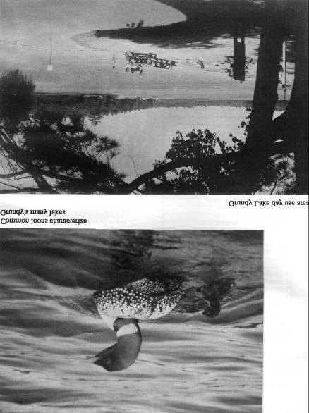
7 1.0 INTRODUCTION Grundy Lake Provincial Park is situated in the Township of Mowat in the Territorial District of Parry Sound, 13 km east of Georgian Bay on Highway 69 and 80 km from both Parry Sound and Sudbury (Figure 1). This Natural Environment class park is approximately 2,554 hectares in size, incorporating seven lakes and the southern portion of Bucke Lake. For summer camping visitors, the park offers 520 developed campsites for both tents and trailers in nine individual camping areas (Figure 2). A group campground is situated west of Grundy Lake. No campsites are equipped with electrical service. The main campgrounds encompassed by Grundy, Gurd and Gut Lakes contain two centralized comfort stations and a number of vault toilets. Other campgrounds include toilets only. As well, the park maintains an 8 hectare day use area located between Grundy and Gut Lakes. The primary recreation beaches are located at both Gut and Grundy. Collectively, Grundy Lake Park includes 9 man-made beaches totaling 1,249 metres in length. Grundy s visitor services program utilizes a 350 seat amphitheatre and three marked interpretive trails. The entrance to the park is one km east of Highway 69 on Highway 522. Gate staff at the park office direct visitors to the day use area or assign and register individual campsites to campers. The park office also operates a communication and information centre. A firewood yard and trailer dumping station are located on the west side of the entrance road south of the park office. Grundy Lake Park is represented by both Middle and Late Precamb rian rocks. The topographic expression of the park is that of a moderately rolling glacially scoured wave-washed Precambrian peneplain. There are no significant surficial geological features in the park, although representative features such as crescentic gouges, lunate fractures and potholes are common. Ecologically, Grundy Lake Park is situated in the Great Lakes-St Lawrence Mixed Forest Zone. Nature Reserve zones contained within the park represent a variety of vegetative communities, including wetlands, upland forests, rocklands and aquatic environments. They also protect a number of rare and unusual species of flora and fauna, such as Blanding s turtle Emydoidea blandingi, least bittern Ixobrychus exilis, and boreal chickadee Parus hudsonicus, golden-winged warbler Vermivora chrysoptera and arethusa orchid Arethusa bulbosa. Grundy Lake lies within a moist continental climatic region characterized by short warm summers and long cold winters. Being within 13 km of Georgian Bay, Grundy Lake s climate is in fluenced in that summers are cooler and winters warmer than regions further inland. 2.0 SUMMARY OF SIGNIFICANT ISSUES Grundy Lake has developed into a park, which satisfies special needs of its visitors for camping and day use. However, the distinctively different campground areas contain some maintenance and/or design problems. Some campsites are showing signs of deterioration due to intense campsite densities and heavy use. Trampling of the soil and damage to floor cover and tree roots is causing slow deterioration of the area tree stands as well as erosion problems on campsites. In many instances natural buffers between campsites are lacking or are of poor quality. Development of beach and picnic sites in the day use area on Gut Lake is needed to remove the pressure of day users and campers sharing the existing beach facilities on Grundy Lake. Sport hunting and registered trapping as defined under the Game and Fish Act have traditionally been permitted in Grundy Lake. No set boundaries or regulations pertaining to these park uses have legitimately been established. 3.0 CLASSIFICATION Grundy Lake is classified as a Natural Environment park in recognition of its regionally significant landforms and associated plant communities, as well as its capability to provide a diversity of outdoor recreational activities in an attractive natural setting. Natural Environment parks are attractive and diverse units of land and water emphasizing particular recreational, historical and natural interest. While these parks may include developed recreation areas, their rich and varied environments are the principal reason for establishment. Recreation based on interaction with the natural environment and appreciation of natural and cultural values is dominant 4.0 PARK GOAL The goal of Grundy Lake is to maintain and manage the park s outstanding recreational landscapes, representative natural features and provide high quality recreational and educational experiences. 1

8 2

9 3
10 5.0 PARK OBJECTIVES 5.1 Protection Objective To protect the natural environment of Grundy Lake Provincial Park incorporating natural and cultural features. Grundy Lake represents the transition zone between the boreal and deciduous forests, and offers opportunities for high quality low-intensity recreation. By way of development and management strategies, these values such as giant white pines, bogs and wetlands and their representative flora and fauna will be protected by appropriate zoning and direction, and will be emphasizer in the visitor services program. 5.2 Recreation Objective To provide day use opportunities in areas of outstanding recreational potential associated with the natural environment of the park. To provide facility-based camping opportunities in the natural environment of the park associated with areas of outstanding recreational potential. Grundy Lake offers a diverse range of day use and camping opportunities. Facilities include bathing beaches two nature trails, one hiking trail, picnic, area and campgrounds, and offering a v ariety of camping experiences. Grundy will offer an annual total of 12,000 swimming opportunities, 11,000 picnicking opportunities and 113,000 camping opportunities, contributing to the achievement of provincial park targets in Parry Sound District. 5.3 Heritage Appreciation Objective To provide opportunities for unstructured individual exploration and appreciation of the natural environment heritage of Grundy Lake. To provide opportunities for the exploration and appreciation of Grundy Lake s natural and cultural environments through interpretation and education based on the character of the park. Grundy Lake Park offers three self-guiding interpretive trails, providing unstructured opportunities for visitors to learn about the significant natural and cultural features of the park. The visitor services program will supply information on significant features of the park to visitors by means of conducted hikes, audio-visual presentations, leaflets and other means. 5.4 Tourism Objective To provide Ontario residents and out-ofprovince visitors with opportunities to discover and experience the distinctive region of the park and its environs. Grundy Lake will provide day use and camping opportunities to travelers in Ontario and destination camping opportunities to travelers attracted from considerable distances and nearby major urban centres such as Sudbury and North Bay. 6.0 ZONING Zoning is essential for the orderly development and effective management of a park. Zoning designations are allocated on the basis of the significance of the land for protection and its potential for recreation within the context of the park s classification. The parks in each class combine zones in a particular way to provide protection and recreation opportunities distinctive to that class. Natural environment Parks always include Natural Environment and Development zones, and may also include Wilderness, Nature Reserve, Historical and Access zones. Grundy Lake is comprised of Nature Reserve, Natural Environment, Development and Access zones (Figure 3). 6.1 Development Zones (117 ha) Grundy Lakes development zone provides the main access to the park s facilities and services including the extent of day use and camping activities. Day use and camping facilities will be developed to standards, which will encourage natural environment based activities and provide for uncrowded conditions and relative freedom from intrusion of fellow recreationists. This zone includes ten existing campgrounds (Poplar, Hemlock, White Spruce, White Birch, Jack Pine, White Pine, Red Maple, Balsam, Trailer Area and group camping area), day use areas and administration facilities. All intensive facility development will be confined to this zone. 4
11 6.2 Natural Environment Zone (2,152 ha) Natural Environment zones include aesthetic landscapes supporting low-intensity recreational activities and minimum development. This zone, constituting 84 percent of the park, will provide a sufficient land base for extensive recreational activities and a buffer between the Development and Nature Reserve zones. The zone also protects representative earth science features of the Canadian Shield s Grenville Province. One significant feature within the Natural Environment zone is the northeast tip of Gurd Lake where four g iant white pines Pinus strobus occur (Figure 3). These huge pines are of interpretive value to the park, as well as historically being remnants of the white pine logging era. 6.3 Nature Reserve Zones (261 ha) Nature Reserve zones include any significant earth and life science features requiring management distinct from that in adjacent zones. Development is limited to trails, necessary signs, minimal interpretive facilities and temporary conveniences for research and management Portages and signs necessary for hiking trails are permitted. All Nature Reserve zones will be allowed to proceed through natural succession. Natural processes such as fires, insect and disease outbreaks and erosion, may be controlled in order to perpetuate natural features and conditions, as well as protecting the remaining park area and adjoining Crown lands and French River Indian Reserve. Seven Nature Reserve zones within the park have been designated to protect natural life science features for their intrinsic values, interpretation and scientific study. The earth science features within the park are of local significance only. These include representative bedrock outcrops and glacial formations. The significant and representative life science features of the Nature Reserve zo nes portray features typical of the park, as well as this area of Site Region 5E of Parry Sound District. The zones include a variety of vegetative communities, including wetlands, upland forests, rocklands and aquatic environments. NR-1: Swan Lake (48 ha) The Swan Lake zone contains a variety of wetland and rockland communities characteristic of Georgian Bay s eastern shoreline. Bogs, marshes, and ponds are common here. The jack pine stands located on the rock ridges of the shoreline are the only major jack pine stands in the region protected in a Nature Reserve outside of Algonquin Park (Figure 3). The area also contains the rare Blanding s turtle, which is approaching the northern limit of its range, and the rare grass pink orchid Calopogon pulchellus. The zone is also of high interpretive value with a well used nature trail circling the northern portion. The abundant wetlands attract a variety of wildlife, creating good viewing opportunities. Glacial features are also found throughout the area. NR-2: Gut Lake Wetland (9 ha) This large area encompassing a small, central lake exemplifies a typical glacial wetland. The site originated as a shallow post-glacial lake slowly filled by vegetation and gradually forming an acidic sphagnum bog. This has allowed cattails Typha latjfolia and other species typical of more neutral conditions to invade the area. Features of glacial erosion are present in the bedrock outcrops at the edge of the wetland. The zone is also of high interpretive value as it is a major stop along the Gut Lake Nature Trail. NR-3: Beaver Dams (49 ha) This zone contains a variety of wetland and upland forest communities of high representative value. The area is also notable for its fauna. A colony of great blue herons Ardea herodias nest in a small pond north of Grundy Lake (Figure 3). A least bittern nest was found in one of the wetlands. This small nocturnal heron is uncommon regionally and is approaching the northern limit of its range. Otters Contra canadensis have been observed in Bucke La ke, while beaver Castor canadensis are evident throughout the zone. The area is also of high interpretive value as the Beaver Dams Trail loops through the zone. NR-4: Beaver Lake Bogs (6 ha) This zone, located at the south end of Beaver Lake, consists of bedrock ridges alternating with low wetlands. Both environments contain a number of vegetative communities of high representative value. Rock ridges support sparse stands of pine, whereas troughs contain ponds, bogs, thickets add a large chain fern stand. Chain fern Woodwardia virginica is an uncommon species approaching the northern limit of its range. This Atlantic coastal plain genus of fern occurs in Ontario almost exclusively along Georgian Bay. This is one of two nature reserves along Georgian Bay protecting this unusual species. The other is located in French River Provincial Park. 5

12 6
13 NR-5: Pakeshkag Hardwoods (32 ha) This portion of Grundy Lake Park has been extensively burned and logged in the past, destroying the majority of the original hardwood stands. The sugar maple forest near Pakeshkag Lake is one of the few remaining stands in this area. The forest also supports unusual southern flora, including wild leek Allium ricoccum and blue cohosh Caulophyllum thalictroides. The zone also contains an extensive cattail marsh, a black ash swamp with a number of uncommon orchids, a cedar swamp and a rocky island. Stands of a rare aquatic species, sweetflag Acorus calamus occur along the shoreline. NR-6: Pakeshkag Bog (21 ha) The Pakeshkag Bog stretches along the southern shore of Pakeshkag Lake. This site is of high representative value, being an excellent example of a bog community. Pitcher-plant Sarracenia purpurea, sundew Drosera rotundjfolia, cranberry Vaccinium spp. and other typical bog species occur here. The bog also includes a number of rare species, the most notable being arethusa, a rare orchid. An unusual bird, the boreal chickadee has nested in the bog. This species is at the southern limit of its breeding range on Georgian Bay and reflects the northern character of the bog. No hiking, canoeing or development of any kind will be allowed on this fragile site. The bog will be posted to advise canoeists of the nature and importance of the area. NR-7: Pakesbkag River Wetlands (96 ha) The Pakeshkag River Wetlands is an extensive area of marsh, bog and swamp located in the eastern portion of the park. The wetlands contain a wide diversity of vegetative communities of high representative value. A number of unusual species also occur here, including sweetflag and bur oak Quercus macrocarpa (approaching the northern limit of its range). An excellent stand of bur oak occurs along the west bank of the river. This extensive wetland system provides excellent habitat for a variety of wildlife including the rare golden-winged warbler. The zone is also of high interpretive value as the river provides visual access via canoe. 6.4 Access Zone (24 ha) Access zones are staging areas supporting minimum facilities in Nature Reserve and Wilderness zones, and less developed Natural Environment and Historical zones. At Grundy Lake, the Access zone includes an access road and parking lot for Pakeshkag Lake. This lake provides access to the Pickerel River Canoe Route, which follows the Pickerel River west to Georgian Bay, then south to Key River and finally cast to Grundy Lake Provincial Park. 7.0 RESOURCE MANAGEMENT POLICIES The park s natural resources will be managed in accordance with the general planning and management policies for Natural Environment class parks. Specific direction, where needed to meet the special requirement of Grundy Lake is presented below under a series of headings, each representing one component of the resource base. Although the policies are presented in separate categories, all subsequent planning and management will recognize the need to integrate these components since they are interrelated. 7.1 Vegetation Management Certain management techniques will be applied to maintain a particular kind and quality of vegetation in a given area of the park. Zones with vegetation progressing through natural succession will have different management techniques from zones where vegetation is maintained at its present stage of natural succession. Commercial forestry operations will not be permitted in Grundy Park. Non-native plant species will not be deliberately introduced. Where non-native plant species are already established in Nature Reserve zones and threaten the values for which these zones have been established, an eradication program may be developed. Only native species may be re-established if biologically feasible and acceptable, usually to rehabilitate the quality of areas suffering past or present recreational use or development impacts. The Park Superintendent will supervise all tree cutting operations in the event standing trees are to be cut during development or vegetation management. All cut wood where possible, will be used for park purposes such as firewood, posts and saw logs. Such may lead to savings in park operating costs, but it should be remembered the main purpose of management prescriptions will be to maintain or create a particular quality of vegetation and not generate revenue. A vegetation management strategy will be written to meet the diverse management needs specified above and provide direction to park staff. The plan may be prepared by the Park Superintendent in conjunction with other Ministry staff and/or outside experts as required, and in consideration of the following prescriptions for the following zones 7
14 7.1.1 Development Zone In the day use area north of the main park road, the vegetation will be managed in order to perpetuate a protective overstory and a relatively sparse understory so as to maintain a visual connection among the picnic and beach areas. South of the main park road, the existing vegetative quality will be maintained, with the exception of thinning of the understory to establish a visual connection between the picnic shelter and Gut Lake. Vegetation quality will be maintained in the existing camping areas. Ground and understory vegetation will be managed to provide and maintain the existing visual buffer for privacy between campsites. In the entrance corridor the visual barrier will be maintained in the midst of the park road, sewage disposal area, woodlot, trailer dumping station, and the maintenance and staff area. The buffer zone dividing the entrance road and the tree line will be restored to have a more natural appearance Natural Environment Zones In the Natural Environment zones, natural succession will progress unimpeded. Where safety hazards along trails exist, potentially dangerous trees will be removed in association with brushing operations and routine trail maintenance Nature Reserve Zones Natural succession will be allowed to progress unimpeded in Nature Reserve zones. 7.2 Wildlife A Wildlife Management Strategy will be prepared for the park to guide resource management activities Trapping There is one registered trapline and a portion of another located within the boundary of the park. These will be cancelled according to Provincial Park Policy. The strategy will be written to provide direction in the control of beaver and raccoon populations and in effect, maintain existing water levels, protect vegetation in Development zones and reduce wildlife nuisance problems in specific campgrounds. An Interim Management Strategy is presently in effect. A trapper has been assigned under the direction and audit of the Park Superintendent to trap nuisance animals for management purposes only. This is the only trapping currently undertaken in Grundy Hunting Low intensity sport hunting will be permitted exclusively in the southeast corner of the park as identified on Figure 4, and only in the Natural Environment zone. Traditional hunting camps outside the park have demonstrated a need for hunting opportunities in this zone. Two of these camps have hunted the area for over 75 years. The Park Superintendent will determine the area and boundary for hunting and when the sport can be effectively separated in time and space from other recreational activities in the zone. The Superintendent will inform local hunt camps of any changes in the hunting regulations for the park. The areas open to hunting may be closed to hunters temporarily or permanently for wildlife research or management purposes. All hunting and trapping regulations will be in conformance with the Game and Fish Act. 7.3 Fisheries Sport fishing is encouraged in Natural Environment parks. A Fisheries Management Strategy will be written for Grundy Lake to determine the capabilities of the park lakes for fish production and improving the fishery for greater enjoyment of park visitors. This strategy may include special seasons, size limits, restrictions of catch and stocking programs for put and delayed take sport fishing in Natural Environment and Development Zones. Fish stocking programs will avoid action, which may affect endemic fish populations protected in Grundy lake Park s Nature Reserve zones. Fishing is not permitted in Nature Reserve zones and will be posted. The use or possession of bait fish will also be prohibited. Certain waterbodies may be closed to fishing temporarily or permanently for fisheries research or management purposes. 7.4 Aggregate Resources Commercial mineral exploration and extraction will not be permitted. Aggregate required for maintenance and capital improvements will be brought in from an external source. 7.5 Fires Fires in all zones will be suppressed through the use of standard methods. Chemical controls will not be employed. 8
15 9
16 7.6 Insects and Disease Measures to control insects and disease will be permitted in all zones where aesthetic or natural values of the park are threatened. Where suppression is desirable and feasible, the controlling agent will be directed as narrowly as possible to the specific threat to minimize impact on other elements of the park environment. If required, control measures will be prescribed in the vegetation management plan. 8.0 OPERATIONS POLICIES 8.1 Visitor Services Grundy Lake Provincial Park will offer a seasonal activity level of visitor services programming including the three components of visitor services: information, interpretation and outdoor recreation. The park will be managed in accordance with the current operating plan. Information concerning park resources, (i.e. glacial features, South Shield, transition forest zone, wetlands) management, facilities and programs, and nearby points of interest will be available at key points throughout the park. Information will consist of a park leaflet, newsletter and special publications when required. The park staff will continually strive to make a visitor s stay as enjoyable as possible. This involves ongoing orientation and educatio n of all park staff to relevant and current information concerning Grundy Lake, its surroundings, and ways to enhance visitor satisfaction and understanding. The visitor services program will provide day users and campers an opportunity to gain an understanding and awareness, and an appreciation for Grundy Lake Park, its objectives, policies and its cultural resources. 8.2 Interpretation Visitors will gain an opportunity to discover the character and history of the park and the numerous earth and life science features and cultural resources of the surrounding park area. Interpretive programs in Grundy and its environs will utilize self-use facilities such as trails with trail guides. Displays and special exhibits will provide an entertaining and informative look at Grundy Lake and its history. School and university groups from Parry Sound, Sudbury and other local communities will be welcomed to Grundy Lake. They will be encouraged to take advantage of the park environment; facilities and programs for research and educational purposes, providing their activities are compatible with park values. 8.3 Recreation Grundy Lake is situated on landscape that offers excellent potential for canoeing. The lakes within the park offer short day trips in protected waters as well as starting points for canoe tripping. The nearby French, Pickerel and Key Rivers offer challenging excursions, camping, and access to Georgian Bay. The bordering French River Candidate Provincial Park alone offers 11,500 back country camping opportunities for canoeists and small craft boaters. Grundy will emphasize its canoeing attractions by offering support programs such as skills and safety demonstrations. Grundy s proximity to Killarney Provincial Park s excellent canoe routes also adds an extra dimension to its canoeing programs. 8.4 Research Scientific research relating directly to Grundy Lake Provincial Park s natural and cultural history, and to environmental and recreational management of natural landscapes, will be encouraged. All research programs will require the approval of the District office in Parry Sound and must also meet all requirements under applicable Provincial and Federal legislation. The Ministry may approve the removal of fauna, flora, soils and geological samples and archaeological and historical artifacts by qualified researchers. Any such materials removed will remain the property of the Ministry. Approved research activities and facilities will be compatible with protection objectives and recreational uses in the park and will be subject to development and management policies for Natural Environment parks unless special permission is given. Sites altered by research activities will be rehabilitated to their previous condition. 8.5 Marketing A marketing strategy to attract more visitors to Grundy Lake Park throughout its operating season will be prepared with the following objectives: to keep present clientele longer (average length of stay 3.3 days in 1986); to have previous visitors return (only half of day users returned during the previous year and campers have dropped 26%); to attract day users staying at local commercial establishments or using local services; to attract more day users and campers from local urban centres (i.e. Sudbury and Parry Sound); to attract campers and day users during low use periods in the mid -week (July-August occupancy rate 67.5%) and shoulder seasons; 10
17 increase involvement with the commercial sector by encouraging park users to take advantage of local tourist services and attractions, and generally stimulate interaction between the park and the private 9.0 DEVELOPMENT POLICIES Development will proceed in accordance with Figure 5 and the following guidelines. In all instances, detailed site plans will be completed and approved in advance of rehabilitation of existing facilities or the development of new facilities. Development projects will be phased according to the Implementation Priorities Section (10.0) and the park operating strategy as needed and funding permits. The requirements of the Environmental Assessment Act will be adhered to. A park operating strategy will be prepared to provide specific guidelines or the operational aspects of the various park programs. 9.1 Campgrounds Grundy Park will continue to offer 520 developed campsites distributed among nine campgrounds and one group camping area. No major changes are proposed in the developed campgrounds. A second group campground will be established at the present site of the amphitheatre near Grundy Lake. This area will have adequate space to accommodate two groups of 10 to 14 campers. The campground will be built when the amphitheatre is removed and incorporated into the future visitor centre. Each year selected campsites or campgrounds will continue to be naturally rehabilitated by remaining dormant throughout the operating season. During peak periods, the campsites will be utilized to accommodate campers and returned to the rehabilitation program when the sites are no longer needed. A Campsite Maintenance! Upgrading Strategy will be prepared to provide specific guidelines on the rehabilitation program. This strategy will ensure restoration of heavily used sites, regular inspection and upgrading of sites and even distribution of use of campgrounds and campsites. 9.2 Recreation Facilities The beaches at the north end of Gut Lake and parallel to White Pine campground on Grundy Lake will continue to be the main day use areas of the park. Sand will be added when needed and where necessary to maintain sand sufficient for dry beach activities. The beach area adjacent to White Pine campground receives most of the day use in the park. This area is also popular with the campers from White Pine and White Birch campgrounds. tourist, and commercial sector in the vicinity. The plan will be reviewed and updated when the need arises. Development of the day use area on Gut Lake will alleviate the pressure on White Pine s beach. The Gut Lake site has great potential to be an attractive day use area as well as a focal point for visitor services. It is central to all campgrounds and easily accessible from the main park road. Two short sections of road located on the sites of the proposed beach area and the site of the visitor services building will be closed. The trail extending from the vehicle bridge along the east side of the river to the Gut Lake beach area and the entrance to the Gut Lake Trail will be upgraded. A separate trail will be established linking the day use area with the park office, thus eliminating pedestrian traffic utilizing the main access road. A creative, safe playground will be constructed of natural materials such as wood, logs and hemp rope. The play area will be designated in a linked configuration containing a series of climbing devices, balance beam, obstacles, unconventional swings and slides, which will activate the communicative, emotional and physical attributes of a child. 9.3 Visitor Centre A seasonal visitor centre will be built in the day use area north of Gut Lake. The centre will act as an information and interpretive centre. The centre will also incorporate the outdoor amphitheatre (Figure 5), outdoor stage, rear screen projection room and a small alcove to house audio and visual equipment. The exterior will be designated to blend with the natural surroundings. Large windows, where appropriate, will allow as much natural light as possible to enter the building. Washrooms incorporated inside the building will provide facilities required for the centre. 9.4 Service Systems A third comfort station with showers will be built near Jack Pine campground to accommodate campers from Balsam, Jack Pine, White Birch and the group camping area. The station will also lessen demand on the existing comfort stations and tile beds. Electrical hookups will be installed to service trailer sites in the Trailer campground. The power supply will be upgraded accordingly and will be attained via the hydro line situated at the campground office site. The supply line extending to the Trailer area will be buried, thus eliminating unsightly 11

18 12
19 overhanging powerlines. The location of hydro lines within the park will be re-examined and possibly relocated and/or buried underground. 9.5 Vegetation Management Strategy Vegetation management in the various zones of Grundy Lake Park is listed in Section 7.1 of Resource Management. The following improvements pertain to the campgrounds only. The campgrounds will not be substantially altered but will be modified to attain the quality associated with Natural Environment parks. A buffer will be established among many of the sites and campground roads. Native species will be planted and natural objects such as logs or rocks may be used to define the entrance to the campsite. Parking areas on the campsites will be well defined. Selective thinning of underbrush will ensure campsites on lakes have a view and access to water. Where necessary, sites will be resurfaced and seeded, fill added, and/or erosion control measures implemented. Campsites exposed to excessive vehicular or pedestrian traffic such as those close to main roads or privies will have an upgraded buffer zone or will be closed IMPLEMENTATION PRIORITIES This management plan will be reviewed after 10 years following its approval or as the need arises. Data collection and environmental monitoring will be conducted regularly. The following is a list of projects that have been previously described in this plan. The list appears in chronological order according to individual project priority. The number of projects to be completed or partially completed will be based upon the availability and allocation of each year s capital funding. Priority Project Description Rating 1 Park Marketing Strategy 2 Add vanities to all vault toilets 3 Build comfort station with showers at Jack Pine campground. 4 Vegetation Management Strategy a) continue campsite rehabilitation b) follow prescription for each of the park s zones. 5 Wildlife Management Strategy 6 Park Operating Strategy 7 Fisheries Management Strategy 8 Campsite Maintenance/Upgrading Strategy 9 Develop Gut Lake day use area a) develop wet and dry beach b) eliminate two short sections of road. c) upgrade present trails leading to day use area. d) establish separate trail linking day use and park offices e) develop playground 10 Build Visitor Centre at Gut Lake day use area a) building including amphitheatre b) hydro, water and sewage d) equipment and display e) landscape 1) removal of old amphitheatre 11 Establish group campground for two groups of 10 to 14 campers on former amphitheatre site 12 Install electrical hookups in Trailer area a) upgrade power supply SUMMARY OF PUBLIC CONSULTATION A tabloid was written in 1984 summarizing the Preliminary Management Plan. These tabloids were distributed to park visitors and sent to local municipalities and adjacent landowners. Copies of the detailed plan were made available at the District and Park offices for those people interested in obtaining more information. The future of hunting and trapping in Grundy were the only two concerns expressed during the review. The local Trappers Association was concerned that trappers would lose some of their area if the Ministry was to prohibit trapping in Grundy Provincial Park. With present Provincial Park Policy stating that existing traplines in regulated provincial parks should be phased out, the solution of this concern was to withdraw those portions of traplines lying within the park s boundaries and assign one trapper with the right to trap nuisance animals. This management practice would be strictly supervised by the superintendent. The hunting question was raised by hunt camps located adjacent to Grundy who have traditionally hunted parts of the park. The decision passed supported traditional hunting but only in Natural Environment zone adjacent to the hunt camps affected. All other aspects of the plan were well received. 13
20 12.0 REFERENCES Environment Canada. The Tourism and Outdoor Recreation Climate of Ontario, Atmospheric Environment Service, Department of the Environment, Ottawa, Ontario Ministry of Natural Resources. Earth Science Reports for Grundy Lake Provincial Park. Unpublished Report, Parks Planning Section, Queen s Park, Ontario Ministry of Natural Resources. French River Provincial Park Management Plan, Parks Planning Section, Queen s Park, Ontario Ministry of Natural Resources. Life Science Reports for Grundy Lake Provincial Park. Unpublished Report, Parks Planning Section, Queen s Park, Ontario Ministry of Natural Resources. North Bay District Land Use Guidelines, Regional Lands Office, Ontario Ministry of Natural Resources. Ontario Provincial Parks Policy, Queen s Park, Ontario Ministry of Natural Resources. Parry Sound District Land Use Guidelines, Regional Lands Office, Ontario Ministry of Natural Resources, Provincial Parks Statistics. Parks Planning Section, Queen s Park, Ontario Ministry of Natural Resources. Sudbury District Land Use Guidelines, Regional Lands Office, Simpson, H. Nature Reserve Grundy Lake Provincial Park. Ontario Ministry of Natural Section, Algonquin Region,
PARK MANAGEMENT PLANNING SERIES STURGEON BAY PROVINCIAL PARK MANAGEMENT PLAN
 PARK MANAGEMENT PLANNING SERIES STURGEON BAY PROVINCIAL PARK MANAGEMENT PLAN MNR 3477 ISBN 0 7729 1018 9 1986 Government of Ontario Limited copies of this publication are obtainable at the Ministry of
Ouimet Canyon Provincial Nature Reserve. Management Plan
 Ouimet Canyon Provincial Nature Reserve Management Plan NOTE: This document has been scanned and formatted, and therefore is slightly different from the original version. -March 2002 Additional copies
Approval Statement. Brian Pfrimmer, Central Zone Manager Ontario Parks
 Approval Statement I am pleased to approve this Interim Management Statement for Dividing Lake Provincial Nature Reserve. This Nature Reserve contains biological features of provincial significance and
Watchorn Provincial Park. Management Plan
 Watchorn Provincial Park Management Plan 2 Watchorn Provincial Park Table of Contents 1. Introduction... 3 2. Park History... 3 3. Park Attributes... 3 3.1 Natural... 4 3.2 Recreational... 4 3.3 Additional
Beaver Creek Provincial Park. Management Plan
 Beaver Creek Provincial Park Management Plan 2 Beaver Creek Provincial Park Table of Contents 1. Introduction... 3 2. Park History... 3 3. Park Attributes... 4 3.1 Natural... 4 3.2 Recreational... 4 4.
Nakina Moraine Provincial Park. Interim Management Statement. Ontario. Ministry of Natural Resources
 Nakina Moraine Provincial Park Interim Management Statement Ontario Ministry of Natural Resources 1999, Queen's Printer for Ontario Printed in Ontario, Canada Additional copies of this publication can
Whitemouth Falls Provincial Park. Draft Management Plan
 Whitemouth Falls Provincial Park Draft Management Plan Whitemouth Falls Provincial Park Draft Management Plan Table of Contents 1. Introduction... 3 2. Park History... 3 3. Park Attributes... 4 3.1 Natural...
ISBN c 1988 Government of Ontario Printed in Ontario, Canada
 Single copies of this publication are available for $2.00 from the Ontario Ministry of Natural Resources, Espanola District Office, P.O. Box 1340, 148 Fleming Street, Espanola, Ontario, POP 1CO, telephone:
We are pleased to approve the Craigleith Provincial Park Management Plan, as official policy for the management and development of this park.
 We are pleased to approve the Craigleith Provincial Park Management Plan, as official policy for the management and development of this park. The plan reflects this Ministry s intent to protect natural
Wallace Lake Provincial Park. Management Plan
 Wallace Lake Provincial Park Management Plan 2 Wallace Lake Provincial Park Table of Contents 1. Introduction... 3 2. Park History... 3 3. Park Attributes... 4 3.1 Natural... 4 3.2 Recreational... 4 4.
Marchand Provincial Park. Management Plan
 Marchand Provincial Park Management Plan 2 Marchand Provincial Park Table of Contents 1. Introduction... 3 2. Park History... 3 3. Park Attributes... 4 3.1 Natural... 4 3.2 Recreational... 4 3.3 Additional
Oxtongue River- Ragged Falls Provincial Park. Management Plan
 Oxtongue River- Ragged Falls Provincial Park Management Plan 4279 0-7729-4782-1 1990, Queens Printer for Ontario Printed in Ontario, Canada Limited copies of this publication are obtainable from: Ministry
Pembina Valley Provincial Park. Draft Management Plan
 Pembina Valley Provincial Park Draft Management Plan 2 Pembina Valley Provincial Park Table of Contents 1. Introduction... 3 2. Park History... 3 3. Park Attributes... 3 3.1 Natural... 3 3.2 Recreational...
Samuel de Champlain Provincial Park Management Plan
 Samuel de Champlain Provincial Park Management Plan Ontario Ministry of Natural Resources Cover Photo: Tracking the Rapids c. 1891 (detail) Francis Anne Hopkins (1838-1919) Sigmund Samuel Collection, Royal
Birch Point Provincial Park. Management Plan
 Birch Point Provincial Park Management Plan 2 Birch Point Provincial Park Table of Contents 1. Introduction... 3 2. Park History... 3 3. Park Attributes... 4 3.1 Natural... 4 3.2 Recreational... 4 4. Park
NOV UPPER MADAWASKA RIVER PROVINCIAL PARK INTERIM MANAGEMENT STATEMENT. Ontario
 NOV 1 3 2001 UPPER MADAWASKA RIVER PROVINCIAL PARK INTERIM MANAGEMENT STATEMENT Ontario . BACKGROUND INFORMATION NAME: Upper Madawaska River REGIONAL SETTING MAP PROPOSED CLASS: U.N.R. DISTRICT: U.N.R.
Sand Lakes Provincial Park. Draft Management Plan
 Sand Lakes Provincial Park Draft Management Plan 2 Sand Lakes Provincial Park Table of Contents 1. Introduction... 3 2. Background... 3 3. Park Purpose... 5 4. Park Management Guidelines... 6 Appendix...
Wallace Lake Provincial Park. Draft Management Plan
 Wallace Lake Provincial Park Draft Management Plan Wallace Lake Provincial Park Draft Management Plan Table of Contents 1. Introduction... 3 2. Park History... 3 3. Park Attributes... 4 3.1 Natural...
Clearwater Lake Provincial Park. Draft Management Plan
 Clearwater Lake Provincial Park Draft Management Plan Clearwater Lake Provincial Park Draft Management Plan Table of Contents 1. Introduction... 3 2. Park History... 4 3. Park Attributes... 4 3.1 Location/Access...4
Ontario s Approach to Wilderness: A Policy May 1997 (Version 1.0)
") Ontario s Approach to Wilderness: A Policy May 1997 (Version 1.0) 1.0. Introduction Wilderness is important to Ontarians, important to the sustained, healthy functioning of Ontario s ecosystems. The Ministry
Ontario s Approach to Wilderness: A Policy May 1997 (Version 1.0) 1.0. Introduction Wilderness is important to Ontarians, important to the sustained, healthy functioning of Ontario s ecosystems. The Ministry
CRAZY HORSE TRAIL GUIDE
 CRAZY HORSE TRAIL GUIDE Abridged Version: July 2016 This is a short form of our interpretive trail guide for the Crazy Horse Trail. The full version of the guide has a more detailed description of the
MANAGEMENT DIRECTION STATEMENT June, 1999
 Thompson River District MANAGEMENT DIRECTION STATEMENT June, 1999 for Roche Lake Provincial Park Ministry of Environment Lands and Parks BC Parks Division Table of Contents I. Introduction A. Setting
Dividing Lake Provincial Nature Reserve
 - Do Not Remove i, '" i ' Dividing Lake Provincial Nature Reserve I!.' Interim Management Statement Amendment 2001-001 Park Boundary Amendment Approved: r.in'r entral Zone, Ontario Parks PJ Date 2. ()/
Ontario. Tide Lake Provincial Nature Reserve. Interim Management Statement. Ministry of Natural Resources
 Ontario Tide Lake Provincial Nature Reserve nterim Management Statement Ministry of Natural Resources Tide Lake Provincial Nature Reserve nterim Management Statement Ontario Ministry of Natural Resources
White Lake Peatlands. Interim Management Statement
 White Lake Peatlands Interim Management Statement 2007 APPROVAL STATEMENT I am pleased to approve this Interim Management Statement for White Lake Peatlands Provincial Park. This park was regulated under
Yard Creek Provincial Park. Management Plan
 Yard Creek Provincial Park Management Plan Draft January 2010 Yard Creek Provincial Park Management Plan Approved by: telàlsemkin/siyam/chief Scott Benton Bill Williams Squamish Executive Director ation
Numaykoos Lake Provincial Park. Management Plan
 Numaykoos Lake Provincial Park Management Plan 2 Numaykoos Lake Provincial Park Table of Contents 1. Introduction... 3 2. Background... 3 3. Park Purpose... 5 4. Park Management Guidelines... 6 Appendix...
ANAGEMENT. LAN November, 1996
 M ANAGEMENT P LAN November, 1996 for Paul Lake Provincial Park Ministry of Environment, Lands and Parks BC Parks Department Paul Lake Provincial Park M ANAGEMENT P LAN Prepared by BC Parks Kamloops Area
Hardy Lake Provincial Park Management Plan
 Hardy Lake Provincial Park Management Plan Hon. Vincent G. Kerrio Minister Mary Mogford Deputy Minister 3646 0 7729 1484 2 1986, Queen s Printer for Ontario Printed in Ontario, Canada Limited copies of
Ojibway Provincial Park. Management Plan
 Ojibway Provincial Park Management Plan ISBN O-7729-9448-X 1992, Queen s Printer for Ontario Printed in Ontario, Canada Single copies of this publication are available at no charge from the address noted
Pinawa Provincial Park. Draft Management Plan
 Pinawa Provincial Park Draft Management Plan Pinawa Provincial Park Draft Management Plan Table of Contents 1. Introduction... 3 2. Park History... 3 3. Park Attributes... 4 3.1 Natural... 4 3.2 Recreational...
TRAILS WHERE TO FIND TRAILS IN NOVA SCOTIA
 TRAILs SIGNAGE Know the Signs............................ 44 WHERE YOU CAN RIDE Roads and Highways........................ 46 Designated Trails........................... 47 Established Trails...........................
South Atikaki Provincial Park. Draft Management Plan
 South Atikaki Provincial Park Draft Management Plan South Atikaki Provincial Park Draft Management Plan Table of Contents 1. Introduction... 3 2. Park History... 3 3. Park Attributes... 3 3.1 Natural...
Criddle/Vane Homestead Provincial Park. Draft Management Plan
 Criddle/Vane Homestead Provincial Park Draft Management Plan 2 Criddle/Vane Homestead Provincial Park Table of Contents 1. Introduction... 3 2. Park History.... 3 3. Park Attributes.... 3 3.1 Natural....
Criddle/Vane Homestead Provincial Park. Management Plan
 Criddle/Vane Homestead Provincial Park Management Plan 2 Criddle/Vane Homestead Provincial Park Table of Contents 1. Introduction... 3 2. Park History.... 3 3. Park Attributes.... 4 3.1 Natural.... 4 3.2
2.0 PARK VISION AND ROLES
 2.0 PARK VISION AND ROLES 2.1 Significance in the Protected Area System Marble Range and Edge Hills provincial parks protect 6.8% of the Pavillion Ranges Ecosection, which is located in the Southern Interior
MacMurchy Township End Moraine. Interim Management Statement
 MacMurchy Township End Moraine Interim Management Statement 2006 Approval Statement I am pleased to approve this Interim Management Statement for MacMurchy Township End Moraine Provincial Park (P1591).
Mackinnon Esker Ecological Reserve Draft - Management Plan
 Mackinnon Esker Ecological Reserve Draft - Management Plan May 2011 Photo Credit: This document replaces the direction provided in the Carp Lake Provincial Park and Protected Area and Mackinnon Esker Ecological
ROBERTS CREEK PROVINCIAL PARK MASTER PLAN. November, 1981
 Ministry of Lands, Parks and Housing Parks and Outdoor Recreation Division Park Operations Branch North Vancouver, B. C. ROBERTS CREEK PROVINCIAL PARK MASTER PLAN November, 1981 Mr. G. Trachuk Director
Sasagiu Rapids Provincial Park. Draft Management Plan
 Sasagiu Rapids Provincial Park Draft Management Plan 2 Sasagiu Rapids Provincial Park Table of Contents 1. Introduction... 3 2. Background and Park Attributes... 3 2.1 Park History.... 3 2.2 Natural Features...
Bayview Escarpment. Interim Management Statement
 Bayview Escarpment Interim Management Statement Bayview Escarpment Provincial Nature Reserve Interim Management Statement January 15, 1995 REGIONAL DIRECTOR'S APPROVAL STATEMENT This Interim Management
Appendix A BC Provincial Parks System Goals
 Appendix A BC Provincial Parks System Goals The British Columbia Provincial Parks System has two mandates: To conserve significant and representative natural and cultural resources To provide a wide variety
MANAGEMENT DIRECTION STATEMENT June, 1999
 Thompson River District MANAGEMENT DIRECTION STATEMENT June, 1999 for Clearwater River Corridor (Addition to Wells Gray Park) Ministry of Environment Lands and Parks BC Parks Division ii Table of Contents
Theme: Predominately natural/natural appearing; rustic improvements to protect resources. Size*: 2,500 + acres Infrastructure**:
 Recreation Opportunity Spectrum (ROS) Classes The Recreation Opportunity Spectrum (ROS) provides a way to describe the variations in the degree of isolation from the sounds and influences of people, and
 March 25, 1994 To: Re: MEMO TO FILE MINOR AMENDMENT - PINERY PROVINCIAL PARK MANAGEMENT PLAN The following paragraph from page 5 of the Pinery Provincial Park Management Plan (ISBN 0-7729-0290-9) lnsects
Port Bruce. Interim Management Statement
 Port Bruce Interim Management Statement Port Bruce Interim Management Statement August 3, 1999 This Port Bruce Provincial Park Interim Management Statement provides direction for the custodial management
Norris Lake Provincial Park. Draft Management Plan
 Norris Lake Provincial Park Draft Management Plan 2 Norris Lake Provincial Park Table of Contents 1. Introduction... 3 2. Park History... 3 3. Park Attributes... 4 3.1 Natural... 4 3.2 Recreational...
482 :fi6 D34 --' v.i9 ~
 '- SB 482 :fi6 D34 --' v.i9 ~ This document is made available electronically by the Minnesota Legislative Reference Library as part of an ongoing digital archiving project. http://www.leg.state.mn.us/lrl/lrl.asp
Little Limestone Lake Provincial Park. Draft Management Plan
 Little Limestone Lake Provincial Park Draft Management Plan Little Limestone Lake Provincial Park Draft Management Plan Table of Contents 1. Introduction... 3 2. Background... 3 3. Planning context...
VARGAS ISLAND PROVINCIAL PARK
 VARGAS ISLAND PROVINCIAL PARK PURPOSE STATEMENT AND ZONING PLAN February 2003 VARGAS ISLAND PROVINCIAL PARK Purpose Statement and Zoning Plan Primary Role The primary role of Vargas Island Park is to protect
Trappist Monastery Provincial Park. Management Plan
 Trappist Monastery Provincial Park Management Plan 2 Trappist Monastery Provincial Park Table of Contents 1. Introduction... 3 2. Park History... 3 3. Park Attributes... 4 3.1 Natural... 4 3.2 Recreational...
SUMMER VILLAGE OF SILVER SANDS. Municipal Development Plan
 SUMMER VILLAGE OF SILVER SANDS Municipal Development Plan Bylaw 253-2014 Adopted August 22, 2014 Summer Village of Silver Sands Municipal Development Plan Bylaw No. 253-2014 Page 2 1 INTRODUCTION 1.1 SETTING
Limestone Islands. Park Management Plan
 Limestone Islands Park Management Plan MNR 51643-1 ISBN 0-7794-3580-X 2002 Queen s Printer of Ontario Printed in Ontario, Canada Cover Photo: Henry Kujala Additional copies of this publication can be obtained
Longlac North Conservation Reserve (C2207) Statement of Conservation Interest
 Statement of Conservation Interest") Longlac North Conservation Reserve (C2207) Statement of Conservation Interest April 2003 Prepared for the Ontario Ministry of Natural Resources, Northwest Region by Rebecca Zeran and Natalie Kolody OLL
Longlac North Conservation Reserve (C2207) Statement of Conservation Interest April 2003 Prepared for the Ontario Ministry of Natural Resources, Northwest Region by Rebecca Zeran and Natalie Kolody OLL
Jan Lake Representative Area -- Concept Management Plan --
 Jan Lake Representative Area -- Concept Management Plan -- Saskatchewan Environment and Resource Management December, 1999 Saskatchewan s Representative Areas Network Program The government of Saskatchewan,
MAIN LAKE PROVINCIAL PARK
 MAIN LAKE PROVINCIAL PARK PURPOSE STATEMENT AND ZONING PLAN March 2003 MAIN LAKE PROVINCIAL PARK Purpose Statement and Zoning Plan Primary Role The primary role of Main Lake Park is to protect a biologically
Cavern Lake Provincial Nature Reserve. Management Plan
 Cavern Lake Provincial Nature Reserve Management Plan NOTE: This document has been scanned and formatted, and therefore is slightly different from the original version. - March 2002 Additional copies of
FINGER-TATUK PROVINCIAL PARK
 FINGER-TATUK PROVINCIAL PARK PURPOSE STATEMENT AND ZONING PLAN March 2003 FINGER-TATUK PROVINCIAL PARK Purpose Statement and Zoning Plan Finger-Tatuk Provincial Park is 17,151 ha in size. It includes the
MANAGEMENT DIRECTION STATEMENT March 2003
 Skeena Region MAAGEMET DIRECTIO STATEMET March 2003 for Meziadin Lake Provincial Park Ministry of Water, Land and Air Protection Environmental Stewardsh Division This page left blank on purpose ii Table
Seager Wheeler Lake. Representative Area. -- Concept Management Plan --
 Seager Wheeler Lake Representative Area -- Concept Management Plan -- Saskatchewan Environment and Resource Management January, 1999 Saskatchewan s Representative Areas Network Program The Government of
MANAGEMENT DIRECTION STATEMENT
 Lower Mainland District MAAGEMET DIRECTIO STATEMET January 2001 for Liumchen Ecological Reserve Ministry of Environment Lands and Parks BC Parks Division Table of Contents Page Introduction... 1 Purpose
Connie Rudd Superintendent, Black Canyon of the Gunnison National Park
 National Park Service U.S. Department of the Interior Black Canyon of the Gunnison National Park and Curecanti National Recreation Area Information Brochure #1 Wilderness and Backcountry Management Plan
INFORMATION NOTICE 15-2 Limited & Excluded Lands
 INFORMATION NOTICE 15-2 Limited & Excluded Lands Schedule 1 (Land Description) of onshore petroleum Agreements issued by the Department of Energy details the total hectares calculated. Total hectares are
Neso Lake. Classification: Landscape Description: Park Purpose: Recreation Park
 Neso Lake Classification: Recreation Park Landscape Description: This small recreation park provides access to Neso Lake and the Mistik Creek canoe route. It is located in the Churchill River Upland portion
A GUIDE TO MANITOBA PROTECTED AREAS & LANDS PROTECTION
 A GUIDE TO MANITOBA PROTECTED AREAS & LANDS PROTECTION Manitoba Wildands December 2008 Discussions about the establishment of protected lands need to be clear about the definition of protection. We will
CHAPTER III: TRAIL DESIGN STANDARDS, SPECIFICATIONS & PERMITS
 CHAPTER III Trail Design Standards, Specifications & Permits This chapter discusses trail standards, preferred surface types for different activities, permits, and other requirements one must consider
Continental Divide National Scenic Trail Legislative History and Planning Guidance
 Continental Divide National Scenic Trail Legislative History and Planning Guidance Legislation, Policy, and Direction Regarding National Scenic Trails The National Trails System Act, P.L. 90-543, was passed
Trappist Monastery Provincial Park. Draft Management Plan
 Trappist Monastery Provincial Park Draft Management Plan 2 Trappist Monastery Provincial Park Table of Contents 1. Introduction... 3 2. Park History... 3 3. Park Attributes... 3 3.1 Natural... 3 3.2 Recreational...
Rocky Lake Provincial Park. Draft Management Plan
 Rocky Lake Provincial Park Draft Management Plan Rocky Lake Provincial Park Draft Management Plan Table of Contents 1. Introduction... 3 2. Park History... 3 3. Park Attributes... 4 3.1 Location/Access...4
As outlined in the Tatshenshini-Alsek Park Management Agreement, park management will:
 Management Strategy General Strategy The priority management focus for the park is to ensure that its internationally significant natural, cultural heritage and recreational values are protected and that
Winnipeg Beach Provincial Park. Draft Management Plan
 Winnipeg Beach Provincial Park Draft Management Plan 2 Winnipeg Beach Provincial Park Table of Contents 1. Introduction... 3 2. Park History... 3 3. Park Attributes... 4 3.1 Natural...4 3.2 Recreational...4
SPECTACLE LAKE PROVINCIAL PARK PURPOSE STATEMENT AND ZONING PLAN
 SPECTACLE LAKE PROVINCIAL PARK PURPOSE STATEMENT AND ZONING PLAN August 2003 1 SPECTACLE LAKE PROVINCIAL PARK Purpose Statement and Zoning Plan Primary Role The primary role of Spectacle Lake Park is to
5.0 OUTDOOR RECREATION OPPORTUNITIES AND MANAGEMENT
 5.0 OUTDOOR RECREATION OPPORTUNITIES AND MANAGEMENT 5.1 Introduction This section describes the range of recreational activities that currently take place in Marble Range and Edge Hills Parks, as well
Steel River Provincial Park. Interim Management Statement. Ministry of Natural Resources. Ontario. Ministry of Natural Resources.
 Steel River Provincial Park Interim Management Statement Ontario Ministry of Natural Resources (j) Ontario Ministry of Natural Resources Additional copies of this publication are obtainable only from:
PLUMPER COVE MARINE PARK MASTER PLAN
 Lower Mainland Region Park Operations Branch Parks and Outdoor Recreation Division Ministry of Lands, Parks and Housing North Vancouver, B.C. PLUMPER COVE MARINE PARK MASTER PLAN DECEMBER, 1980 PLUMPER
Serpent Mounds Provincial Park Management Plan
 Serpent Mounds Provincial Park Management Plan ~ Ministry of...v ~ Natural Resources - Ontario I Additional copies of this publication are obtainable from: Ministry of Natural Resources 10670 Yonge street
~,t;b i D34 Vs33 SB 482
 ., SB 482 ~,t;b i D34 Vs33 This document is made available electronically by the Minnesota Legislative Reference Library as part of an ongoing digital archiving project. http://www.leg.state.mn.us/lrl/lrl.asp
WASHINGTON STATE PARKS LAND CLASSIFICATION SYSTEM
 WASHINGTON STATE PARKS LAND CLASSIFICATION SYSTEM Administrative Code Establishing Land Classification System WAC 352-16-020 Land classification system. State park areas are of statewide natural, cultural,
Lion s Head. Interim Management Statement
 Lion s Head Interim Management Statement Lion's Head Provincial Nature Reserve Interim Management Statement July 14, 1997 APPROVAL STATEMENT This Interim Management Statement will provide interim direction
Terrestrial Protected Area Nomination: Central Mangrove Wetland South-West, Grand Cayman
 Terrestrial Protected Area Nomination: Central Mangrove Wetland South-West, Grand Cayman The attached nomination, proposing that a parcel of land in the Central Mangrove Wetland be made a Protected Area
Segment 2: La Crescent to Miller s Corner
 goal of the USFWS refuges is to conserve, protect and enhance fish, wildlife and plants and their habitats for the continuing benefit of the American people. Refuge lands are used largely for fishing,
FLORIDA DEPARTMENT OF ENVIRONMENTAL PROTECTION DIVISION OF RECREATION AND PARKS RECREATIONAL CARRYING CAPACITY GUIDELINES
 FLORIDA DEPARTMENT OF ENVIRONMENTAL PROTECTION DIVISION OF RECREATION AND PARKS RECREATIONAL CARRYING CAPACITY GUIDELINES THE SELECTION AND CAPACITY DETERMINATION OF USE SITES Introduction The Division
THE ISLANDS PROVINCIAL PARK
 THE ISLANDS PROVINCIAL PARK Situated at the mouth of the Roseway River on Nova Scotia s scenic South Shore, The Islands is located across the harbour from the historic town of Shelburne. The park s picturesque
MANAGEMENT DIRECTION STATEMENT
 Skeena District MAAGEMET DIRECTIO STATEMET July, 2000 for Driftwood Canyon Provincial Park Ministry of Environment Lands and Parks BC Parks Division i Table of Contents Driftwood Canyon Park Approvals
White Mountain National Forest Saco Ranger District
 United States Department of Agriculture Forest Service White Mountain National Forest Saco Ranger District 33 Kancamagus Highway Conway, NH 03818 Comm: (603) 447-5448 TTY: (603) 447-3121 File Code: 1950
Clam Harbour Provincial Park
 Clam Harbour Provincial Park Public Engagement Session Thursday, September 14 th, 2017 5:30pm 7:30pm Webbers Store 11470 Nova Scotia Trunk 7 Lake Charlotte, NS Agenda Overview of the Provincial Parks System
INTRODUCTORY LETTER. Dear Friend:
 INTRODUCTORY LETTER Dear Friend: I am pleased to provide you with a copy of the Rondeau Proyincial Park Management Plan. This plan is the culmination of an intensive planning process for Rondeau that most
Pillar Park. Management Plan
 Pillar Park Management Plan January 2014 Pillar Park Management Plan Approved by: Jeff Leahy Regional Director Thompson Cariboo Region BC Parks January 9, 2014 Date Brian Bawtinheimer Executive Director
Mackinnon Esker Ecological Reserve. Management Plan
 Mackinnon Esker Ecological Reserve Management Plan March 2017 Cover Page Photo Credit: Rob Bell This document replaces the direction provided in the Carp Lake Provincial Park and Protected Area and Mackinnon
Section 61 Recreational Vehicle Park / Campground (Bylaw No. 2012/10)
") Part 7 General Regulations Section 61 Recreational Vehicle Park / Campground (Bylaw No. 2012/10) 61.1 A comprehensive site plan shall be provided to the satisfaction of the Development Authority that shows
Part 7 General Regulations Section 61 Recreational Vehicle Park / Campground (Bylaw No. 2012/10) 61.1 A comprehensive site plan shall be provided to the satisfaction of the Development Authority that shows
BROUGHTON ARCHIPELAGO PROVINCIAL PARK
 BROUGHTON ARCHIPELAGO PROVINCIAL PARK PURPOSE STATEMENT AND ZONING PLAN March 2003 BROUGHTON ARCHIPELAGO PROVINCIAL PARK Purpose Statement and Zoning Plan Primary Role The primary role is to contribute
Is Your Campfire Safe?
 Aviation and Forest Fire Management Is Your Campfire Safe? Main Menu The Threat of Fire Forest fires cost the people of Ontario millions of dollars. On average, about 200,000 hectares of forest lands are
Decision Memo Broken Wheel Ranch Equestrian Outfitter Special-Use Permit Proposed Action
 Decision Memo Broken Wheel Ranch Equestrian Outfitter Special-Use Permit USDA Forest Service Mississippi Bluffs Ranger District, Shawnee National Forest Jackson and Union Counties, Illinois Proposed Action
ANAGEMENT P LAN. July for Chilliwack Lake Park & Chilliwack River Ecological Reserve. Ministry of Environment, Lands and Parks BC Parks Division
 M ANAGEMENT P LAN July 2000 for Chilliwack Lake Park & Chilliwack River Ecological Reserve Ministry of Environment, Lands and Parks BC Parks Division Chilliwack Lake Provincial Park & Chilliwack River
Noganosh Lake. Interim Management Statement
 Noganosh Interim Management Statement March 1, 2004 The Noganosh Provincial Park Interim Management Statement provides direction for the custodial management of Noganosh Provincial Park until such time
MARBLE RIVER PROVINCIAL PARK
 MARBLE RIVER PROVINCIAL PARK PURPOSE STATEMENT AND ZONING PLAN March 2003 MARBLE RIVER PROVINCIAL PARK Purpose Statement and Zoning Plan Primary Role The primary role of Marble River Park is to protect
RE: Access Fund Comments on Yosemite National Park Wilderness Stewardship Plan, Preliminary Ideas and Concepts
 September 30, 2016 Superintendent Yosemite National Park Attn: Wilderness Stewardship Plan P.O. Box 577 Yosemite, CA 95389 RE: Access Fund Comments on Yosemite National Park Wilderness Stewardship Plan,
Recreation Opportunity Spectrum for River Management v
 Recreation Opportunity Spectrum for Management v. 120803 Introduction The following Recreation Opportunity Spectrum (ROS) characterizations and matrices mirror the presentation in the ROS Primer and Field
Rule Governing the Designation and Establishment of All-Terrain Vehicle Use Trails on State Land
 Rule Governing the Designation and Establishment of All-Terrain Vehicle Use Trails on State Land 1.0 Authority 1.1 This rule is promulgated pursuant to 23 V.S.A. 3506. Section 3506 (b)(4) states that an
How should the proposed protected area be administered and managed?
 SPERRGEBIET CONSERVATION PLANNING Questionnaire In big words the main objectives of this questionnaire are to contribute to: 1. finding approaches and mechanism for implementing a multi-use protected area