'1776 BICENTENNIAL 1976 APPLEGATE TRAIL II KLAMATH ECHOES. Sanctioned by. Kiamath County Historical Society. Number 14
|
|
|
- Sherman Parks
- 6 years ago
- Views:
Transcription

1 '1776 BICENTENNIAL 1976 APPLEGATE TRAIL II KLAMATH ECHOES Sanctioned by Kiamath County Historical Society Number 14

2 e A covered wagon along the Oregon Trail in Western Nebraska near the South Platte River emigrant crossing. (Photo by Helen Heifrich) FORGOTTEN TRAILS Strange, is it not? that of the myriads who Before us pass'd the door of Darkness through Not one returns to tell us of the Trail, Which to discover we must travel too. Apologies to Omar Khayyam.

3 Hannah Ann (Davis) Hendricks (Courtesy Fred Evin Inlow) DEDICATION We respectfully dedicate this, the fourteenth issue of Kiamath Echoes, to Hanna Ann Davis, 14 years of age in She came west across the plains with her father, three brothers and four sisters, her mother having died enroute. Traveling the Oregon- California and Applegate Trails, they arrived at Fandango Valley, east of Goose Lake in extreme Northeastern California on September 29, While Hanna Ann was preparing the evening meal, three arrows were fired into the camp by Indians hiding in the nearby brush. Two of the arrows struck Hanna Ann. One passed through the calf of her leg and the other through her arm and into her side. She fell into the fire and was severely burned. According to Lester G. Hulin, the 1847 diarist, three days later Hanna Ann was still unable to ride in a wagon and "had to be carried by a stage [stretcher?]. Only recently have we learned (from information furnished by Fred Elvin Inlow, Medford, Oregon, a distant relative) that Hanna Ann survived, later married, and raised a family of ten children. "FACING WEST" Within her eyes, a calm like waters deep, Revealed the strength of soul, the faith that shone Serene and steadfastthrough the storm and dark Upon that far-off goal she viewed, and won. - Pearle R. Casey [I

4 Klamath Echoes Staff DEVERE HELFRICH HELEN HELFRICH Managing Editor Assistant Editor OFFICERS Kiamath County Historical Society NORMA UERLING OSCAR ANDERSON JIM PETERS LETTA GOEHRING WILLIAM G. KRAL, LEONA ANGEL, JIM COLEMAN and JERRY CARL President Vice President Secretary-Treasurer Program Chairman Directors Address all communications to: KLAMATH ECHOES P. 0. BOX 1552 KLAMATH FALLS, OREGON THE COVER: Our cover was drawn by Deborah Runnels, Art Teacher at Klamath Union High School. III

5 This book, the history of that portion of the Applegate Trail "West of the Cascades," is being published with a threefold purpose. As Part II of the history of the Applegate Trail to finish that begun in Part I, Klamath Echoes No. 9, published in As a Bicentennial Issue for Kiamath Echoes as best suited for our contribution to Oregon History. As a culmination of more than 30 years intermittant and concentrated research, both "armchair" and on location. In Part I, Klamath Echoes No. 9, 1971 we gave the history of when, where, why, who and how the Applegate Trail was first laid out and used for many years as the southern emigrant entry into Oregon. Turning from the California Trail on the Humboldt River in Northwestern Nevada it led to a junction with the older Oregon- California Trail, used by fur traders, trappers and explorers some five miles south of Ashland, Oregon. Although out of the boundaries of Klamath Country history, we have gathered so much material and retraced too much of the old trail to leave it dangling at the head (south end) of Rogue River Valley. Otherwise unrecorded history of great interest to future historians might be lost forever. We find that the repetition by many historians in the past of certain inaccuracies have created almost unquestioned beliefs. In fact, they have become accepted as the truth. One of the purposes of this book is to correct these accepted "facts" in so far as we are able by the use of contemporary records left by the emigrants and those closely connected with them. Our findings are based on long overlooked and hitherto unknown manuscripts by those who knew or participated in these events. We have found that stories handed down by second and third generations for the most part vary so much in the telling as to become almost worthless. Furthermore, no two reminiscences of the actual participants correspond, making it very difficult to ascertain the true story. We can only hope that we have not perpet- EDITOR'S PAGE IV uated new and even worse errors. Further, this volume tells the story of those first emigrants (1846 and 1847) in great detail, how the trails appeared to the bewildered and fatigued emigrants, what remains today, and how it may be found in a few places and its approximate location in others. In the past there has been a great deal of misunderstanding as to exactly where the Applegate Trail actually ran in the beginning. Several historians have written of the trail but failed to pursue any "on the spot" research, taking the word of others as to its location. Many errors in location have crept into their writings. Now, new information; old information that has been unavailable, or unknown to many in the past; several diaries and reminiscences that seem never to have been consulted; and early General Land Office survey maps (the actual field notes could probably further pin-point locations more accurately) that may also have been unknown to most, all more or less locate the old trail and its successors as near as can now be approximated, owing to cities, farming operations, and present day lines of transportation. But one section remains questionable to this writerthat from Yoncalla Valley to Pass Creek near Anlauf. Two known routes here confront the trail historian. One follows the new Interstate 5 Highway through Drain and up Pass Creek. This writer favors the Interstate 5 route as being the original trail for reasons that will be given in Chapter VIII. It is this writer's belief that the Applegate Trail should be marked in entirety, and it is our sincere hope this history may be of some benefit to those interested. There is no better time for those organizations situated along the old trail to commence their activities than now, our nation's Bicentennial Year. We understand that the Jackson County Historical Society plans on marking the Applegate Trail through their county during the coming year. Beginning in October, 1969 Trails West, Inc., a dedicated organization headquartered in Reno, Nevada, has been placing
 have turned over to Trails West, Inc. some 67 markers that they placed during 1968-1972.")
6 historical markers along the various old emigrant trails. This writer and his wife are charter members and have been instrumental in locating the sites for many of the markers. In addition, the Nevada Trail Marking Committee, Inc., of Reno (now disbanded) have turned over to Trails West, Inc. some 67 markers that they placed during of these markers were placed along the California Trail down the Humboldt River, beginning at Callahan Bridge near Imlay and ending on the Humboldt Sink south of Lovelock. 24 were placed along the Truckee Route from Humboldt Sink to the Summit of the Sierras, approximated by Interstate were placed along the Carson Route from the Humboldt Sink to the Summit of the Sierras, approximated by U.S. Highway 50. Trails West, Inc. has marked the Applegate Trail from its separation point from the California Trail on the Humboldt River near Imlay, to Pot Hole Springs in Modoc County, California, southeast of Clear Lake. These markers range from about five miles apart to some 15 or 20 miles apart. It is planned to fill in the lengthier gaps with at least one or two markers at some future time. In addition, Trails West, Inc. has marked Nobles' Trail which branched from the Applegate Trail near Rabbit Hole Springs to Susanville, California. Also marked is that portion of Lassen's Trail which turned from the Applegate Trail in Fandango Valley east of Goose Lake to a point on Pitt River midway between Canby and Lookout. During August, 1974 ten markers were placed in extreme northeastern Nevada, beginning on Goose Creek near the Utah line and ending at the mouth of Bishop Creek Canyon near Wells. In June, 1975 ten more markers were placed along the Humboldt River between Deeth and Callahan Bridge near Imlay. Trails West, Inc., during the coming season, June, 1976, will place some 15 markers on the Nobles' Trail between Susanville and Old Shasta west of Redding. Later, in August, 1976, they will place a like number along the Lassen Trail between Big Valley on Pitt River to the Lake Almanor vicinity southwest of Westwood. In addition, the Klamath County Historical Society on August 17, 1974 placed 10 markers along the Applegate Trail between Keno, Oregon and Jenny Creek. Next, during May of 1975, they placed four markers along pioneer roads in Christmas Valley, Lake County, Oregon, "Reub Long Country." In winding up our research of the Applegate Trail in the Willamette Valley we were hindered to a great extent by the fall rains that had begun in all their intensity. We were unable to pursue any research that led away from the pavements. On the other hand, we encountered the same conditions as those met by the 1846 emigration. If not witnessed it is practically impossible to visualize the difficulties met and overcome by those emigrants in trying to convey their wagons through the quagmire of rain, mud and high waters of the roadless route they were compelled to travel. To their credit, be it said, they traveled where present day vehicles could not possibly proceed except a few feet. William D. Davis, the youngest brother of Hannah Ann Davis. 'Uncle Bill" was born in 1846 in Iowa, and died in Jackson County, Oregon in 1925, (Courtesy Fred Elvin Inlow) V

7 TABLE OF CONTENTS Editor's Page IV I Before the Applegate Trail 1 II Through the Rogue, Umpqua and Willamette Valleys 5 III Travelers West of the Cascades 10 IV Emigrant Reservoir (Klamath Junction) to Gold Hill 16 V Gold Hill to Azalea 23 VT Azalea to North Roseburg 36 VII North Roseburg to Scott's Valley 59 VIII Scott's Valley to North Eugene 71 IX North Eugene to South of Corvallis 79 X South of Corvallis to Salt Creek, Rickreall, Salem 84 XI Relief Parties 96 VI

8 DaI1s 'rria ii len, a-.

9 THE APPLEGATE TRAIL Part II, West of the Cascades CHAPTER I BEFORE THE APPLEGATE TRAIL The history of the Applegate Trail is being published in two parts by Kiatnath Echoes. Part I, that portion of the 1846 emigrant trail from the Humboldt River in Nevada to a point a few miles south of Ashland, Oregon was published in the 1971, or No. 9 Issue of Kiamath Echoes. Now, five years later, Part II will continue the Applegate Trail through the Rogue, Umpqua and Willamette Valleys to an approximate point on La Creole or Rickreall River near present day Dallas, Oregon. It is hoped the following evolutionary history will clear up some of the past false impressions as to the location of the Applegate Trail "West of the Cascades." Actually, location of this second portion of the Applegate Trail had been thoroughly known and understood for years when the settlers of the Willamette Valley set out on their exploring expedition. It but remained for a route suitable for wagon travel to be located. The Applegate Trail "West of the Cascades" differed from the first portion (covered by Kiamath Echoes No. 9) in that its route was more or less known in advance, while the eastern portion from the Rogue River Valley to the California Trail on the Humboldt River in Nevada was almost strictly an unknown and unexplored wilderness. The evolution of the Applegate Trail should probably begin with what might be termed the first American expansion into the Pacific Northwest. On May 17, 1792 Captain Robert Gray in the ship Columbia discovered and entered the mouth of the Columbia River which he named for his ship. Next Lewis and Clark in their westward advance across the newly acquired Louisiana Purchase of North America, arrived at the mouth of the Columbia River on November 7, By Christmas Day they were quartered in their newly constructed cabins a few miles inland on the south bank of the Columbia a short dis- tance southwest of present day Astoria, Oregon. Fort Clatsop was completed by January 1, On April 12, 1811 the Pacific Fur Company, owned by the Astors, selected a site in present Astoria, twelve miles inland, upon which they at once commenced construction of their "Fort Astoria." By December 11, 1811 a party under Robert Stuart set out from Astoria to examine the Willamette River, and determine if a trading post should be opened somewhere on its banks, the natives having reported many beaver there. The vicinity proved to be a veritable garden, replete with all the beauties of nature, and well stocked with animals, birds and fish. Then on January 8, 1812 Donald McKenzie with twelve companions arrived overland from the United States, to be followed on February 15th, by Wilson Price Hunt's party of thirty-four men. In a journey during the spring of 1812, Donald McKenzie and party explored the country southward from the Columbia River some hundred miles or more, ascending the Willamette to the country of the Calapooyas (near the present day Eugene-Springfield area) and discovered the stream which bears his name to this day Ḋuring January, 1813 men were sent to the Willamette to spend the remainder of the winter where game was plentiful. They penetrated the country as far south as the headwaters of the Umpqua. Later that year, 1813, McKenzie made frequent trips up the Columbia and Willamette rivers for dried salmon. On October 16, 1813 Astoria was turned over to Great Britain and the North West Fur Company. The fort was re-christened "Fort George" by them on December 1st. Moving farther south we find that the Umpqua River was discovered and its mouth entered by a Captain Baker in the ship Jenny during the summer of 1791.

10 Some 27 years then elapsed before a party of North West Fur Company trappers penetrated overland southward from the Columbia River into the Umpqua country in The party consisted of 60 men led by two half-breed Canadian clerks. Clashes followed between the whites and Indians. Thomas McKay is supposed to have been south of the Wilamette Valley as early as It is possible that he established a fur depot, or meeting place for trappers at "Old Establishment," "Mc- Kay's Fort," or "Umpqua Old Fort" at that time. The fur depot location is supposed to have been on the Umpqua River at the mouth of Calapooya Creek, but may have been at the mouth of Hubbard Creek. Louis Pichette and Louis Kanota, the Hawaiian, later Hudson's Bay Company employees, are said to have crossed the Sierra-Cascade Mountains south of Pitt River in Northern California into the Sacramento Valley in 1821, but what route they traveled to reach this crossing is unknown. That same year, 1821, the ownership of Fort George was transferred to the Hudson's Bay Company. Then, in the spring of 1825, Dr. John McLoughlin removed the fort from Astoria to a new site at Vancouver, Washington, on the north bank of the Columbia River opposite the mouth of the Willamette River. Next, during the spring, summer and fall of 1826, Alexander Roderic McLeod led two different Hudson's Bay Company trapping expeditions south. The first was along the coast as far south as the Siuslaw River. The second expedition penetrated as far south on the coast as Rogue River, then returned inland where they arrived at "Depaty's camp" (Jean Baptiste Desportes the freeman) near present Roseburg, Oregon on December 17, Desportes as well as McLeod has also been given credit for establishing "Umpqua Old Fort" heretofore mentioned. During the winter of , Peter Skene Ogden and his Hudson's Bay Company Fur Brigade passed through the Sierra-Cascade Mountains following down the Klamath River. They seem to have reached the Applegate and Rogue Rivers in their search for beaver. Somewhere in that general neighborhood, Ogden left Joseph Gervais to trap the forks of the Rogue, then later to head north and open a route to Fort Vancouver, thus becoming the first known white man to travel the route part of which was later to become the Applegate Trail "West of the Cascades." Then, early in 1827 McLeod led another trapping expedition into the Umpqua country, returning to Fort Vancouver in March. Later, after other assignments he again left for the Umpqua country on November 17, This trip was unsuccessful due to a severe winter, and he again returned to Fort Vancouver in March, It was on one of these two trips that McLod is supposed to have established a fur station, "Umpqua Old Fort." In September of 1828 McLeod was sent to explore the Buenaventura (Sacramento) River, and also to assist in the recovery of the goods of Jedediah Smith, taken by Indians on July 14, 1828 near the mouth of the Umpqua, when 15 members of Smiths party of 19 men were killed. McLeod, assisted by Thomas McKay and accompanied by Smith, left Vancouver on September 6th. Two days later he met Michel La Framboise, who had been sent ahead to scout out the situation. The massacre site was reached October 21st, and most of Smith's horses and furs recovered. McLeod's base camp on the Umpqua River was reached on November 22nd. On December 1st, McLeod, instead of continuing on to California, began a return trip to Vancouver where he arrived December 14th. He was severely censured by McLoughlin for this unscheduled return. Again and for the last time McLeod and his party headed southward toward California in January, Some claim he traveled down the coast on a route approximating Jedediah Smith's north-

11 ward trek (History of Siskiyou County, California). Further, he is supposed to have traveled to a point south of present Stockton, California. McLeods return northward is the route with which this history is vitally concerned, since it is our first documented record of use of the California-Oregon Trail through the Rogue and Umpqua River Valleys which in part became the later Applegate Trail "West of the Cascades." McLeod probably left the Sacramento Valley by a route, previously mentioned, south of Pitt River. Turning northward in Fall River Valley, he passed east of Mt. Shasta, via the Military Pass of later years. While near the headwaters of present McCloud River in December, 1829 he lost his horses in a fierce snowstorm and was forced to cache his furs and equipment. He eventually arrived at Vancouver on February 13, 1830 by a route that later was approximated by the Pacific Highway, Old 99, or present Interstate 5. The original Hudson's Bay Company Trail led southward from Thomas McKay's farm near present day Scapoose on the Columbia River below Portland. It crossed over a range of hills to enter the Tualatin Plains in the Forest Grove-Hillsboro vicinity. The Yamhill River was crossed near Dayton and the Rickreall River near Dallas-Rickreall. Then keeping west of the Willamette River, the trail led past Monmouth, Corvallis and Monroe. Following up the west bank of the Long Tom River it reached Fern Ridge Reservoir to cross over and follow south up Coyote Creek which lies some ten miles west of Eugene. The Siuslaw River was reached near Lorane and its headwaters followed to reach the Umpqua drainage near Curtin at the junction of Pheasant and Pass Creeks. This route approximately became the Territorial Road of later years. Continuing southward the trail passed the present towns of Oakland and Sutherun to possibly reach the Umpqua River at the mouth of Calapooya Creek, the supposed site of McLeod's "Umpqua Old Fort." From this point south, the fur trail to California varies but little from the Pacific Highway, Old 99, or new Interstate 5. This trail, with slight variations, continued in use by Hudson's Bay Company parties until 1843 when Michel La Framboise led the last expedition over it. At some unknown date, but before 1837 a trail was located which led down the Sacramento River Canyon between present day Mount Shasta City and Redding, California. It, however, is out of the territory of our story. McLeod's ill-fated journey northward during the winter of thus becomes our first known documented use of the Applegate Trail as described in our Parts I and II, Applegate Trail History. Furthermore, McLeod's journal of this trip is supposed to rest in the archives of the Hudson's Bay Company files, but are unavailable to this writer. At about this same time the French Prairie area of the lower Willamette Valley (wherein lies Champoeg, north of Salem) received its first settlers, retired members of the Hudson's Bay Company, in During the same year, Dr. McLoughlin filed on a mill site on the Willamette River at present day Oregon City witnessed two Hudson's Bay Company Fur Brigades leaving Vancouver headed south for California by different routes. One, under Michel La Framboise, traveled the McLeod route of the previous year. The other, under John Work, traveled up the Columbia River to Fort Nez Perce, then southward to the Harney Basin, Warner Valley, Goose Lake and Pitt River, crossing over the Sierra-Cascades by the usual route south of Pitt River Canyon. Both parties joined and trapped in the Bay area during the winter of They separated at Bodega with La Framboise returning to Vancouver in early July, 1833 by the McLeod route. Work also returned to Vancouver over the same route but not until in September. Work while in the Siskiyou Mountain vicinity, recorded seeing the sign of an American party traveling southward on the McLeod route. ln 1834, from May 22nd to July 10th,

12 John Work and 12 men, following the ficers and men, a number of settlers, and original Hudson's Bay Company Trail a few newly arrived emigrants from the down the western Willamette Valley foothills, reached "Umpqua Old Fort" at the horses. They also followed the by now year before, thirty-nine in all, with 76 mouth of Calapooya Creek west of Oakland. Work returned by a different route, the Willamette and across the Umpqua, well established Oregon-California trail up the first recorded use of this route, one Rogue and Klamath Rivers and Mountains. that was eventually to become the Applegate Trail from a point near Drain, of fifty-three started overland to Calif- In 1843 the Lansford W. Hastings party through Cottage Grove and Eugene, joining their outbound trail north of Monroe. River" they met the Leese-McClure party ornia. "Several days travel below Rogue As late as the latter part of September, enroute from California to Oregon. About 1834 when the Methodist missionaries one-third of the Hastings party turned under Jason Lee arrived, there were but back to Oregon with the other party. about a dozen families living in the Willamette valley, all at French Prairie. The tion" from the Missouri River, via the 1843 also witnessed the "Big Migra- first mission was soon established some Oregon Trail to the settlements of the ten miles north of present Salem. Willamette Valley. The three Applegate During this same summer a party of brothers; Charles, Lindsay and Jessee, sixteen Americans under the leadership of with their families, were members of this Hall J. Kelley and Ewing Young traveled migration. overland from California. They had in The Applegate families wintered at the their possession nearly one hundred horses old Methodist Mission at the south end of and mules. French Prairie. Jesse was employed in Somewhere in the California-Oregon surveying at both Salem and Oregon City. mountains Kelley was stricken with fever In the spring of 1844 the three brothers and was nursed back to life by Michel La settled on farms on Salt Creek north of Framboise of a Hudson's Bay Company present day Dalles, situated on the Rickreall River. party. The American party also had some difficulties with Indians along Rogue 1844 witnessed the arrival across the River, but arrived at Vancouver by October 27th. was to play a major part in the history of plains of another man, Levi Scott, who During the summer of 1835 a party of the latter Applegate Trail. Scott perhaps eight men traveled overland from California. They too were attacked by Indians cerning this route, and only recently have became the best authority for events con- on Rogue River and four of their number his reminiscences come to light historically. killed. Three of the survivors were Bailey, Gay and Turner. In 1845 a number of the 1844 Oregon Next, in the summer of 1837, the emigrants went to California overland Willamette Cattle Company, which had under the leadership of James Clyman. been organized the fall before with the This party rendezvoused at La Creole assistance of William Slacum, also traveled (Rickreall) to start on their southern overland from California. Ewing Young journey June 8th. The company consisted with ten others delivered 630 cattle with of thirty-nine men, one woman and three a loss of approximately 200. children. They arrived at Sutter's Fort on In 1840 Jason Lee and party traveled July 12th. as far south as Fort Umpqua seeking a Thus it will be seen that by the spring location for a mission among the Umpquas. overland must have been well known and of 1846 the Oregon to California Trail Late in August, 1841 a company was used by many. Furthermore, it must be organized by Lt. Emmons of the Wilkes' understood that the trips above recorded expedition to travel overland from Oregon by no means enumerate all that actually to California. It consisted of eighteen of- transpired between Oregon and California

13 during the period. Rather it is a record of those of whom some knowledge of their travels has become available to this writer. Literally hundreds traveled this route of whom there is no record It will be remembered that the Applegate Trail was laid out from West to East, but first traveled by emigrant wagons from East to West. The better to understand the second section of the trail, we will repeat the first page of Applegate Trail, Part I at this time. "The Applegate Trail was explored, laid out and first used in the year 1846, as a southern emigrant route into the Willamette Valley, then the principle settlement in the Oregon Country. "The trail itself branched from the parent California Trail on the Humboldt River at what later became known as Lassen's Meadow, now Rye Patch Reservoir, near Imlay, Nevada. It led in a northwesterly direction across the Black Rock Desert, through High Rock and Forty Nine Canyons, in Northwestern Nevada, to enter California near its extreme northeastern corner, 29 miles south of the Oregon-California State Line. "It crossed the Warner Mountains at Fandango Pass, skirted the southern end of Goose Lake, this section varying from year to year depending on the shore line of the lake, and keeping a slightly north of west course, passed north of Clear Lake to reach the Tule Lake Basin a few miles south of present Malin, Oregon. "The trail crossed Lost River at the Stone Bridge, some two miles southeast of Merrill, Oregon to once more dip into California and pass south of "Little" or Lower Klamath Lake. "Continuing northwesterly, the Klamath River was forded near Keno the first year, and some four or five miles farther downstream in later years. Then following a westward course, the Cascade Mountains were crossed on a route closely approxiwhatsoever. Occasionally, however, as in the case of the Levi Scott reminiscences, new, or rather old recordings do come to light in some forgotten trunk or other depository. CHAPTER II THROUGH THE ROGUE, UMPUUA, AND WILLAMETTE VALLEYS mating the present Greensprings Highway, State Route 66, to enter the Rogue River Valley a few miles southeast of Ashland, Oregon. "From this point to Eugene, Oregon near the head, or southern end, of the Willamette Valley, the Applegate Trail is closely approximated by present Interstate 5, or Old Pacific Highway 99. "There were several reasons why such a route was deemed necessary: War with Great Britain over the location of the boundary between Canada and the United States was a definite p05- sitiity, and, if such a situation came to pass, Great Britain controlled, by means of a string of Hudson's Bay Company posts at Fort Vancouver, Fort Nez Perce and Fort Hall, the only road into or out of the Oregon Country by which troops or supplies could be moved, or, for that matter, settlers make a retreat out of the territory south of the Columbia River. There was the difficulty of the Oregon Trail down the Snake and Columbia Rivers to The Dalles where the wagon road then ended. On this route the emigrants of 1843, '44 and '45 experienced much loss of property and even life. In addition, grass and water were scarce over much of the way, and the hardships almost unbearable. From The Dalles only crude Indian trails crossed the Cascade Mountains, over which wagons could not be transported. These sorely needed vehicles in the new settlements must be abandoned at The Dalles, or be taken apart and floated down the Columbia River, a difficult and dangerous trip on hastily constructed rafts. "Thus by the early summer of 1846,

14 several fruitless attempts to find a new route into the Willamette Valley had all failed. The Barlow Trail, south of Mount Hood, had stopped short of the Cascade Summit, nor was it then known whether it could be extended into the settlements in time for the 1846 emigration." Since the Applegate Trail had its ground-work set up in the Willamette Valley near Rickreall, at the home of the Applegate Brothers at that time, we will begin there. One member of the 1846 exploring expedition (not a member of the Applegate family) in his reminiscences of many years later, recalled that a Provisional Government had been organized during the summer of 1843, to oppose the Hudson's Bay Company which was endeavoring to claim and hold the country as a possession of the British Crown. The Hon. George Abernathy had been elected governor of Oregon in 1845, and had done everything in his power to carry out the objects of the new, and ambitious, little government. He encouraged the settlement of the country by "brave and hardy Americans," to the utmost of his ability, and to the extent of the limited means under his control. With the passage of years this Provisional Government looked a great deal larger than it really was. It had next to no revenues, nor any means to do anything towards making roads across the mountains, and the settlers, although "possessed of incomparable pluck and energy," had little to contribute towards such an undertaking. During the spring of 1846 there was a concerted call for volunteers to view and locate an emigrant road across the mountains. A company of fifteen men was raised. Each must furnish his own horses and all supplies, take any risks he might encounter with the Indians, spend the time, and endure the hardships of such an expedition in a wild, mountainous, and unexplored country, "for the considerations of pure patriotism, and the gratification of adventurous curiosity." Accordingly, this group of fifteen Polk County citizens started their exploring trip on May 15th, The members were: Gen. Cornelius Gilliam, Solomon Tetherow, Wm. G. Parker, Bennett Osborn, Levi Scott, John M. Scott, Moses "Black" Harris, Jack Jones, Robert Smith, B.F. Burch, S.H. Goodhue, David Goff, William Sportsman, --- Wilson, and one unnamed man, if there were actually fifteen in the party. They did not elect a leader, regardless of what has been recorded in the past, and they had no guide. Traveling southward along the western foothills of the Willamette Valley, they passed the later sites of Corvallis, Monroe and Cheshire, keeping along the western side of Long Tom River. In the neighborhood of present Fern Ridge Reservoir they crossed to the east side and headed for a high butte in the south end of the valley, a short distance south of later Eugene City. According to a member of the party, this butte was named Spencer's Butte by General Giliam for an old friend, and from its summit they could trace the course of each of the three forks of the Willamette River and decided the Middle Fork gave the most promising appearance for a practicable pass across the Cascade Mountains. Resuming their journey southeasterly the party crossed the South, or Coast Fork of the Willamette about three miles above its junction with the Middle Fork up which they continued past later Pleasant Hill to the narrows above present Lookout Point Reservoir where they could find no suitable passage for a road. A portion of the 1853 emigration did use this pass but with great difficulty. Returning downstream the party again reached the Coast Fork, followed up its eastern bank to a point somewhere between present Creswell and Cottage Grove. Later, after crossing to the western side they struck an Indian trail which led across the Calapooya Mountains into the Umpqua Valley. At this camp, General Gilliam left the party and returned home alone. As told later it now became apparent to the party they had neglected to follow a few basic rules; they failed to have an organized plan with a leader and a guide. Continuing southward on the Indian

15 trail the party reached and crossed Elk Creek, after which they became divided in their opinions as to whether the stream was a tributary of the Umpqua or Willamette Rivers. That noon three more members of the party, Tetherow, Wilson and Smith, turned back, leaving but ten or eleven men at the most to continue the explorations. "Black" Harris then assumed the leadership of the reduced party which continued its southward journey two more days, to Calapooya Creek, in the Umpqua Vatley just above the later town of Oakland. There it was decided the remaining members would also turn back with very little accomplished toward finding a pass through the Cascade Mountains. Plans for a new emigrant road, however, did not die. Another company was soon formed for the same purpose, but this time under the leadership of Jesse Applegate. Fifteen men also constituted this second group, eleven of them having been in the first exploring party. The second company's membership included Jesse Applegate as Captain, with Levi Scott and David Goff appointed Lieutenants later when near Tule Lake in Northern California. Others were: John M. Scott, John Jones, Robert Smith, John Owen, Wm. Sportsman, Samuel H. Goodhue, Lindsay Applegate, Moses "Black" Harris, Wm. G. Parker, Benj. (or Bennett) Osborne, Benj. F. Birch (or Burch) and Henry Boygus (Boggs, or Bogus). The second company came better prepared, knowledgeably at least, than the first: They obtained all the information possible from Hudson's Bay Company employees and others. "Black" Harris, on of their number, had been a mountain man and may have had some first hand knowledge. Furthermore, eleven of them had just returned from the Umpqua Valley and knew the route that far. Jesse Applegate had in his possession a map drawn by Peter Skene Ogden which proved to be quite accurate whenever the party was in territory over which Ogden had traveled. It was probably from his map that they learned the Klamath River cut the Cascades in a low pass suitable for their purposes. Jesse Applegate had consulted "Mitchell's Map" and learned that a straight line between a point slightly south of the head of Rogue River Valley (near the summit of the Siskiyou Mountains) and a point on Bear River in extreme southwestern Wyoming (near present Cokeville. where Sublette's Cut-off intersected the Oregon Trail), approximated the 42nd parallel. This line is now the southern boundary of the States of Oregon and Idaho. The original intention of the road hunters was to intercept the 1846 emigrants on the Oregon Trail at this point. However, due to their late start, the emigrants began to be encountered near the junction of Raft and Snake Rivers, the bulk of the migration having already passed that point. Jesse Applegate evidently had recently read one of Capt. John C. Fremont's reports of his exploration through Oregon and Nevada. He knew that Fremont crossed the 42nd parallel on December 27, 1843 but thought he was crossing the "Siera Nevada" Mountains at the time. He further thought the "Siera Nevada" Mountains (the Warner Range) to be a continuation of the Blue Mountains of Northeastern Oregon. Jesse Applegate, who had been and still was a professional engineer, owned a "Burt's Solar Compass" but whether he had it with him on the trip is unknown Ṫwo separate parties of California and Oregon bound travelers were encountered, who gave the Applegate company pertinent information concerning their proposed route of travel to lay out a new emigrant road. From the above mentioned maps, reports and information gathered, the road-hunters knew the general location of the Humboldt River, and that the California Emigrant Trail led down it and across the Truckee Route into the Central California Valley. Their plan was to strike the Humboldt as near the 42nd parallel as possible and follow up the emigrant road
, or 22nd (as reported by Jesse")
16 as far eastward as practicable. "Actually, the road-hunters succeeded in finding a route, more or less as planned, except where mountain ranges and other physical features forced them to make detours." The Applegate company of 15 men on horseback, with each man leading a pack horse, left Rickreall on June 20th (as claimed by Lindsay Applegate many years later), or 22nd (as reported by Jesse Applegate about three weeks later), and followed nearly the same route southward as that by which the first party had returned until the Umpqua Valley was reached. The trail to California was struck after crossing the Calapooya Mountains and followed thereafter, crossing the North Umpqua about two miles below the later Winchester ferry, or about the same distance below the present Interstate 5, and Old Pacific Highway 99 crossings. Following up the South Umpqua to its junction with Canyon Creek (at present Canyonville) the company there met a group of eight or ten emigrants coming from California. This party included a Mr. Hess and his family, and John Chamberlin, a son-in-law. They had some cattle with them and a number of Mexican horses. The Hess party informed the Applegate company that it was some ten or more miles across the next range of mountains (Cow Creek Mountains) and impassable for wagons, the trail being extremely rough and difficult. Further, Indians had killed one of their cows at the creek just across these mountains. It is told that from this happening Cow Creek derived its name. Also, while crossing the mountain Indians had wounded one of their number with an arrow and driven off several of their horses. The Applegate company then resumed their journey, following up Canyon Creek about two miles, then detouring up a ridge on the west or right and having been forewarned, crossed the mountains without incident. After reaching Cow Creek the company lay by while Captain Jesse Applegate, W.G. Parker, B.F. Burch and Levi Scott returned to scout out the canyon to its junction with the South Umpqua at the mouth of the canyon. They found that with some work a road could be hewed out by which emigrants could pass through. Passing on the next day from Cow Creek, several streams and two ranges of hills were crossed after which Rogue River was reached somewhere about four miles west of present day Grants Pass, or some three miles south of Merlin, at what later became Vannoy Ferry. From this crossing the exploring company traveled up the south side of Rogue River, past the present towns of Rogue River and Gold Hill. When opposite the latter place they left the river and passing Willow Springs, reached Bear Creek, a tributary of Rogue River, just below present day Phoenix. Later while traveling up Bear Creek they overtook a party of nearly eighty people; Canadians (French and halfbreeds) on their way to California. From this party they received information concerning where to separate from the trail leading south to California. The next day, turning eastward up a creek (Emigrant Creek), they crossed over the summit of a range of mountains to the eastward (Greensprings Summit) on June 30th, or July 2nd, depending on whose starting date, Lindsay or Jesse Applegate's, is accepted. 35 days later and some 750 to 800 miles farther, Jesse Applegate walked, alone and on foot, into Fort Hall. The other members of his company, with the exception of one, were back along the trail, probably scattered over a distance of from 80 to 100 miles. One member, Henry Boygus, had left his companions at Thousand Springs Valley to go on alone to Fort Hall. He was never heard of again and his fate remains unknown to this day. At Fort Hall and along the trail, Jesse Applegate and three of his lead companions succeeded in turning from 90 to 100 wagons into the new route to the Willamette Valley. This meant, at five people to the wagon, some 450 to 500 souls took the new Applegate Trail route. Upon Jesse Applegate's return to his

17 companions and the wagons gathered at Thousand Springs Valley, a new company of road workers was formed. The remaining members of the outbound exploring company, with the exception of Levi Scott and David Goff who remained to guide the wagons, plus a few young and unattached men from the various trains made up this new company. Lindsay Applegate many years later set the number of the company as 20 or 21 men exclusive of Scott and Goff, but the British botanist Joseph Burke, who was one of them and wrote a letter from Walla Walla on October 17, 1846 stated that "We numbered 24," which seems to be by far the more accurate. This road-working party turned into the Applegate Trail on September 26th. On that same date, the lead wagons that would also take that route were slowly winding down the Humboldt River somewhere east of present Battle Mountain while the last wagons (Thornton) were about midway between Elko and Wells, near Deeth. After consulting the several reminiscences and histories that have appeared over the years, we can compile a more or less accurate list of exactly who constituted the road working company. They appear to be: Jesse Applegate, Lindsay Applegate, John M. Scott, William Kuirquendall, J.M. Weir, Thomas Powers, Burges, ---- Shaw, Carnahan, Alfred Stewart, ---- Miller, Joseph Burke, John Owen, B.F. Burch, Wm. G. Parker, "Black" Harris, Charles Putnam, Bennett Osborn, ---- Sevy, and a Bannock Indian who had joined on at Fort Hall. It will be noted that this company actually numbered 24 members. However, seven of them dropped out for various reasons along the way, leaving but 17 men to bear the brunt of locating, clearing and building such sections as they could with their limited means. The seven who dropped out can be accounted for thusly: 1. John Owen stayed with the first wagons, probably to accompany his mother. We know he was in the Indian fight near present Winnemucca, coming back from the lead wagons. The Bannock Indian, when the party was some miles past Antelope Springs, returned alone to retrieve a lost knife, and was never seen again, supposedly the victim of local Indians. B.F. Burch, who became sick in the Fandango Pass area of the Warner Mountains and was compelled to lay over. 4 & 5. Wm. G. Parker and Charles Putnam, who stayed behind with Burch to assist him. The first wagons picked them up in Fandango Valley on the Goose Lake side of Fandango Pass. - Sevy, who lagged behind and became lost in the Devil's Garden area west of Goose Lake. He nearly starved to death before the first wagons arrived. Bennett Osborn, who may have been with the wagons the entire time from Thousand Springs Valley. At least he is reported to have killed a deer just prior to Sevy's rescue, and furnished the latter with some of the meat. The remainder of the road-working party, upon leaving the Klamath Basin, entered the timbered Cascade Mountains near Spencer Creek. Here they separated; Jesse Applegate with at least two companions, Joseph Burke and John Jones, going ahead. Realizing the scarcity of supplies and lateness of the season, they intended to and did secure at least limited supplies for the following famished emigrants. Of the remaining 14 or less road workers, probably now under the command of Lindsay Applegate, little should have been expected of that few men in regard to building or preparing a roadway. They too were weary, worn out and running extremely low on supplies. Joseph Burke recorded that the first segment of road viewers arrived at Jesse Applegate's home near the Rickreall River on September 26th. Lindsay Applegate recorded that he, Lindsay, arrived home on October 3rd (possibly the 5th). Evidently little time was lost in sending relief back to the beleagured emigrants. John Jones and a Tom Smith from Oregon City, driving a few head of beef cattle, met the first emigrants on Cow Creek somewhere between October 21st

18 and 25th. Later still, Jones met the last emigrants (Thornton) near Grants Pass on what Thornton recorded as October 18th. However, Thornton's dates were seemingly as inaccurate as some of his other recordings, so the date can only be approximated, but should be at least two and probably three days later thh Jones' meeting with the lead emigrants orr Cow Creek. The foilwing chapter is devoted to documented historical records of travel "West of the Cascades" for 1846 and later years over the original Oregon-California Trail and the Applegate Trail which succeeded it. The year 1846 witnessed the opening of the trail as a southern emigrant wagon road into the Willamette Valley, at that time the principal settlement in the Oregon Country. The Applegate Trail "West of the Cascades" was laid out from north (near Dallas) to south (near Ashland) by the road-hunting party of fifteen men heretofore described. Then in late September it was traveled by the returning road-working party, but this time divided into two groups, the first of at least three men and the second of 14 or less men, followed at intervals by some 90 to 100 wagons (a few of which may have been abandoned prior to entry into the Rogue River Valley), or 450 to 500 persons, which made up this year's migration. From reminiscences of two of the road-hunters, we further know that at least two other parties traveled the Oregon-California Trail that year. One, the Hess party emigrating from California and met by the outgoing road-hunters near present Canyonville, the other a California bound party of French Canadians overtaken near Bear Creek in the present Medford-Ashland vicinity. If other travelers used the trail this year, and they well may have, it seems to be unrecorded. The following year, 1847, Levi Scott, accompanied by B.F. Burch, "Black" Harris and "a party of about thirty young men going back to the states," made their way south and eastward over the Apple- 10 One other trail blazer and road worker, Moses "Black" Harris, returned with supplies for the emigrants. Also several other separate parties traveled southward with supplies and probably saved many lives. Their story will come later, as we progress with the now suffering emigrants slowly pushing northward toward the Willamette Valley. CHAPTER III TRAVELERS WEST OF THE CASCADES gate Trail. That year's emigration was met at Smith's Fork on Bear River. Only one of the party of young men, B.F. Burch, returned to Oregon over the old trail with Scott. Bancroft's History of Oregon states there were 45 wagons that took the Applegate Trail this year, which meant that about three trains of approximately 15 wagons each followed the route this year. One of the trains included Lester G. Hulin (a later resident of the Eugene area) our only diarist for He turned into the trail from the Humboldt River on September 17th. Another, the Thomas Smith train of 11 wagons, and 15 men and boys "from 15 years old and upward" arrived in the Willamette Valley on October 24th, a week ahead of the Hulin train. The William Wiggins train of 17 wagons, originally California bound, seems to have been the first train by a week to turn into the Applegate Trail. Sidetracked somewhere in the Goose Lake-Pitt River country, they became the last train to enter Oregon in Whether this train was included in Bancroft's 45 total or not is unknown. Late in the season, on December 8th, the Whitman Massacre took place near present Walla Walla, Washington. The entire populace of the Pacific Northwest was thrown into near panic, fearing a concentrated Indian uprising. Governor Abernathy of Oregon asked Jesse Applegate to lead a party to California seeking their cooperation and help against the Indians. Applegate, however, declined but recommended Levi Scott for the task, at the same time agreeing to accompany the party. Sixteen men therefore left the set-

19 tiements early in January, They were Levi Scott, Jesse Applegate, James A. Robinson, William J.J. Scott, John M. Scott, Elzy C. Dice, George Hibler, James Lemon, William Gilliam, Joseph Waldo, James Campbell, Walter Monteith, Thomas Monteith, James Field, Solomon Tetherow and John Minto. The group reached the summit of the Siskiyou Mountains where snow over five feet in depth was encountered. The party divided, half under Applegate attempted to push ahead on hastily constructed snow shoes, the others to return home with the livestock. Those going ahead were: Jesse Applegate, Robinson, Lemon, W. Monteith, T. Monteith, Fields, Tetherow, and Minto. Some of them, however, gave out and they too were forced to return, the entire party reuniting at Canyonville. The party was absent from their homes about 30 days. Levi Scott moved to the Umpqua later in the spring of 1848, taking up a land claim on a small creek in the Yoncalla Valley. He did not improve his claim much, but spent most of his time with his two sons, John and William, who had taken up claims nearby on Elk Creek, a few miles from their father's place, and near the southern base of the Calapooya mountains. Levi Scott's place was then the farthest habitation south in Oregon, and was supposed to be 14 days travel on horseback from the first place in California, the P.B. Reading Rancho near present day Cottonwood, California. At about the same time, the Isaac Pettijohn saddle and pack horse party of 23 men made their way south and along the Applegate Trail, returning to the states during the latter half of May. The news of the discovery of gold in California did not reach Oregon until around July 31st, when the little schooner Honolulu arrived in Portland. It was confirmed August 9th by the arrival of another ship, and a few days later by the tidings brought overland from California by men on horseback seeking provisions. It is said that "two thirds," or "about 2,000 persons" left Oregon for the gold mines. Further that only three old men were left in Salem and only a few women and children at Oregon City. Pack trains via the old Oregon-California Trail were mainly used at first, but later a group of 150 men with 46 wagons under the leadership of Peter H. Burnett and guided by Thomas McKay back-tracked the Applegate Trail to Tule Lake, where they turned south to find the new Lassen Trail in the process of being opened into the Sacramento Valley. Following this train by a few days was one of about 20 wagons and 25 men from the Puget Sound country in Washington. This latter train reached the Sacramento Valley with the stragglers of the Oregon train, that train having been delayed by assisting Peter Lassen in opening up the last portion of what was to become known as the Lassen Trail. There was no emigration from the states to Oregon in 1848 over the Applegate Trail witnessed the greatest use in any year of the eastern half of the Applegate Trail from the Humboldt River to Goose Lake. That portion "West of the Cascades" undoubtedly saw a large amount of traffic, by packers at least, both north and south as indicated by innumerable references by diarists and pioneer reminiscences. There was, however, one known party with wagons that traveled south from the Willamette Valley in late May. This party consisted of some 30 men with supplies for the Mounted Riflemen under Col. Loring from Missouri, headed for the Oregon Country. The party was under the command of a Lt. Hawkins, guided by Joel Palmer, with Levi Scott as scout. It consisted of 14 wagons, 7 soldiers as escort, and 60 head of beef cattle with about six drovers or extra men who seem to have included Billy Martin, Rogers, Suttle and Garrison. Events of the journey included the desertion of five of the soldiers who headed for the gold fields of California and the loss of six head of the beef cattle in the Umpqua canyon. At about this same time Jesse Applegate, his brother Charles, Rev. Glen 0. Burnett (This man may have been George William, brother of Peter H.), and several 11

20 others formed a joint stock company with the intention of building a fort for their protection, taking up lands for farms, raising stock and digging gold in the Rogue River Valley. Having secured men of as many mechanical trades as possible, they loaded up their wagons and set out to carry their project into execution. Levi Scott was then living directly on the route they must travel so they sent him a letter outlining their plans, and urging him to join them, and take part in the enterprise. They traveled slowly and were delayed in reaching his place until some time after they had expected to arrive. A short time after reaching the place of their destination they disagreed, broke up their organization, and came back, some of them settling in the Umpqua Valley, and some returning to the Willamette. Other sources have recorded that an Applegate party penetrated as far south in 1849 as Strawberry Valley, northwest of Mount Shasta City at a place ever since known as Wagon Valley. However, this is questionable. Here they were supposed to have left four wagons and returned to Oregon with two. It is a known fact, however, that Jesse, Charles and probably Lindsay Applegate settled in the Yoncalla Valley that same season, during the summer of Again we have no records of any emigrant trains from the states entering Oregon over the Applegate Trail for the second straight year. Early in the spring of 1850 a road was opened from the Yoncalla Country, down the Umpqua River to the head of tidewater and the townsite of Scottsburg laid out. The first steamer entered the Umpqua River on August 3, 1850 and a new freight route was soon opened to pack trains headed for the Northern California mining districts. During this year one small party of unknown number with saddle and pack horses traveled to the states from the Willamette Valley over the Applegate Trail. Two of its members were Cornelius Joel Hills, who returned westward over the same route in 1851, and Isaac Con- 12 stant who returned in 1852 to settle near Central Point. Hills first came west over this route in 1847 as a member of the Lester G. Hulin train. Governor Joseph Lane of Oregon is reported (History of Siskiyou County) to have taken one wagon southward over the Applegate Trail in 1850, eventually abandoning it somewhere near present Weed or Mount Shasta City (Wagon Valley?). No other record to confirm the presence of a wagon in this party of prospectors has been found. Also, for the third straight year, there is no record of any emigrant train traveling from the states into Oregon over the Applegate Trail in It will now be seen that the Applegate Trail "West of the Cascades" was used in 1848 principally as a one-way route, south to the newly discovered gold fields of California. By 1849 this southward rush began to expand northwestward beyond Old Shasta City into Northwestern California. It now became a two-way route between Oregon and California over which hundreds and later thousands of people traveled up to the present time. By 1850 this new expansion had reached and followed along the Trinity, Salmon and Klamath Rivers to the mouth of Scott River. This expansion created a need for provisions and supplies which at first was partially supplied by pack trains from the Willamette Valley farms and the City of Portland. Later, after the founding of Scottsburg, a new pack-trail was constructed in 1851 up the Umpqua River to the Winchester community where the Oregon-California (Applegate) Trail was intersected, thus transforming Scottsburg into the main port of entry for all freight to the extreme Northern California mines. Gold was discovered in March, 1851 at Yreka by an Oregonian, Abraham Thompson, to set off another frenzied gold rush. It was not until December, however, that two Scottsburg packers discovered gold at Rich Gulch in the Rogue River Valley, which resulted in the founding of Jacksonville. In passing, it is interesting to note that Bancroft's History of Oregon II states that: "In February, 1852 one Sykes
 found gold on Jackson Creek about on the west line of the present town of Jacksonville, and soon after two Packers, Cluggage and")
21 who worked on the place of A.A. Skinner (about midway between present Central Point and Medford) found gold on Jackson Creek about on the west line of the present town of Jacksonville, and soon after two Packers, Cluggage and Poole*** discovered Rich Gulch, half a mile north (south?) of Sykes' discovery." Further, Levi Scott claims that in April, 1852 gold was discovered by James Poole, James Cluggage, and James Skinner (plus James Wilson, which lineup of names suggested that the place be called "Jim-town") in the head of a ravine running into Jackson Creek. Late May and early June witnessed Major Phil Kearny traveling south along the Applegate Trail, moving the remnants, about 200 men, of the Mounted Riflemen from Oregon to California. He wished to establish a new route from Canyonville to Table Rock in the Rogue River Valley which would by-pass the difficult Canyon Creek route. No practical route could be found so he abandoned his wagons and crossed the South Umpqua fifteen miles upstream from Canyonville with 100 m&n, to eventually arrive at Rogue River some 14 miles above Table Rock. The remaining 100 men with the baggage on packhorses continued southward along the Applegate Trail. Kearny had several encounters with the Indians, in one of which Captain James Stuart was killed. The Governor Joseph Lane party coming from Oregon, having earlier returned from their gold prospecting junket to California, was met along Rogue River and the two groups combined for a short time. Major Kearny, after quelling the Indians for the time being at least, continued on with his forces into California. Emigrant-wise we have the record of but one known train entering Oregon from the states that traveled the Applegate Trail in It was the Hills-Riddle train of twelve wagons, which arrived at present Canyonvifie on September 20th. Some, including the Riddle family at least, settled near there, while the Hills and Briggs families continued on into the head of the Willamette Valley, settling near Eugene-Springfield. A history of the many changes and re- locations of the Applegate Trail should probably begin with 1851 when Major Phil Kearny traveled slowly southward from Vancouver, examining the country for military station sites, and the best route for a military road which should avoid the Umpqua Canyon. On arriving at Yoncalla, Kearny consulted with Jesse Applegate, who agreed to assist him only in case of a better route than the canyon road being discovered, that Kearny would have his men put it in condition to be traveled by the emigration that year. Kearny consented, and a detachment of 28 men, under Lt. Williamson, accompanied by Levi Scott and Jesse Applegate, began the reconnaissance about June 10th. It is reported that it was with almost satisfaction that Scott and Applegate found that no better route than the one they opened in 1846 could be discovered, since it removed the reproach of their enemies that they were to blame for not finding a better one at that time. No other has been found, even down to the present time, Interstate 5 following the same route. It must be reported that Applegate himself expected at the time, when with Kearny, to be able to get a road saving 40 miles of travel. By 1852 emigrants arriving from the states in the Rogue River Valley found it unnecessary to proceed farther, fertile farm lands, and nearby rich mining districts offered everything desired. In fact no records have been located to date of any emigrants from across the plains traveling farther north to settle in the Umpqua and Willamette Valleys after this date. There are, however, numerous records of emigrants arriving in the Rogue River Valley, both north and south via the Applegate Trail, to settle there permanently in 1852 and succeeding years. Perhaps the History of Jackson County, published in 1884, best explained the situation when they recorded " ***it was in this year (1852) that the tide of humanity, previously setting out for the Wifiamette Valley and mines of California, was in some nasure diverted to Rogue River Valley, whereby many settlers were added to those who came from other portions of the Pacific slope." 13

22 Early in 1853 the town of Crescent City, California was founded to soon become the chief supply point for the gold camps of Southern Oregon and Northern California. New pack trails were established eastward to the Trinity and Salmon River mines. The Klamath River and Yreka mines were reached over the old Kelsey Trail, with the Jacksonville and Waldo mines served over the Cold Springs Pack Trail. Scottsburg, once the metropolis of Southern Oregon, declined steadily after Crescent City was founded and ceased to exist in 1861 when flood waters washed away the main part of town. The total emigration from the states to enter the Rogue River Valley over the Applegate Trail was 159 wagons, 400 men, 120 women, 170 children, 2,600 loose cattle, 1,300 sheep, 140 loose horses and 40 mules. Road alignments and changes continued in 1852 and The founding of Jacksonville in 1852 saw the road bend to the westward to pass through that place as a trading center instead of following down Bear Creek to the Medford-Central Point vicinity. The establishment of Fort Lane on September 28, 1853 brought new roads into existence, especially one connecting the fort with Jacksonville and the main freight road leading from a point opposite Gold Hill to the fort itself. Another change, or rather a new cutoff was established at some unknown date, but before the fall of Its northern terminus branched from the Applegate Trail near present Hugo to pass north of Grants much the same as does present Interstate 5, to cross Rogue River "three miles west of the mouth of Evans Creek." The Major Alvord survey of 1853 made by Jesse Applegate shows this crossing but the Ives and Hyde General Land Office survey of shows the ferry but one mile below the mouth of Evans Creek. Commencing with the first legislature of Oregon Territory, requests had been made to the United States Congress for Federal aid to improve transportation routes. Finally, after Delegate Ex-Governor Joseph Lane asked approval by the 32nd Congress of appropriations for Oregon roads, one of which was the road from Camp Stuart to Myrtle Creek, $20,000 was secured, the act finally being signed by President Fillmore on January 7, $5,000 of this amount was spent on the Alvord-Applegate survey made during the fall of The primary purpose was to find a passage avoiding the Umpqua Canyon. Failing in this, Alvord decided to spend the remainder of the appropriation in improving the road through the canyon and the nearby Grave Creek hills. Construction contracts were made with the Applegate brothers, Jesse and Lindsay, and with Jesse Roberts, all local residents. The 33rd Congress approved an additional $20,000 to extend the first road from Myrtle Creek to Scottsburg. The survey was made by a Lieutenant Withers and the road completed by the early summer of It was then reported suitable for transportation of government supplies by wagon to Forts Lane and Jones, via Scottsburg. Due to delays in Congress, additional funds were not made available for Southern Oregon roads until 1858 to be under the supervision of Colonel Joseph Hooker with the labor to be done under hired help, and the contracts to civilians for bridge building. There were from 20 to 40 workers employed on Umpqua Canyon, 11 miles in length. "The road through this canyon, the artery of travel between the Pacific Northwest and California, had remained through the years impracticable for wagons and unfavorable for horsemen. Much of the route was relocated; vertical walls were blasted away to make a roadbed at places where the banks of the stream had previously served. After the removal of large mud deposits that had accumulated during the rainy season, permanent improvement of the drainage of the lower canyon was provided by culverts." The Southern Oregon road as completed by Hooker was reported to be 16' wide with the timber cleared from 30 to 60 feet in width (However, this statement seems to be exaggeratededitor). It was further reported practicable for a six mule team. Early in June, 1854 a series of twelve contracts to separate individuals were let 14

23 by the Postmaster General for carrying mail between Sacramento and Portland, some by boat, some by horse coaches, but mostly by horseback. Late in June, 1854 stage coaches were placed in service between Jacksonville and Yreka. To get these coaches on the line, they were shipped north from San Francisco to Portland by boat, then conveyed southward approximately 300 miles overland to Jacksonville. The first daily mail was taken over the Siskiyous on horseback about July 1, 1854 by Williamson Lycona Smith, who carried the mail between Yreka and Canyonvile. Although somewhat removed from the Applegate Trail, the first freight by wagons delivered from the Sacramento Valley to Yreka took place in the years 1855 and The road led from Red Bluff, the head of steamboat traffic on the Sacramento River, over the Sierras near Mt. Lassen, via the Lockhart road through Fall River Valley to Yreka. By September 30, 1857 the Cold Springs Pack Trail from Crescent City was replaced by a pioneer wagon road over which most of the freight to the Rogue River Valley was hauled thereafter. Tnweekly stages were soon placed on the run between Crescent City and Jacksonville. After much shifting about and route changes the first through stages between Sacramento and Portland began running over the Trinity route about September 15, Freight, however, was still being hauled over the Pit River Road through Fall River Valley. After a great deal of legal difficulties, we know the Sacramento River road was in use by June 17, 1870, at least. Stages and all freight were transferred to this route by June 1, Neither the Pitt or Trinity roads were ever used again as through routes north and south. By the first of September, 1872 stages were connecting with the Oregon railroad (building south from Portland) at Roseburg in the north, and with the California railroad (building north from Lincoln) at Redding in the south. Thereafter, for the next ten years the two railroads remained stationary and the California-Oregon stag- es ran daily between these two points. Then after ten years of negotiations and reorganizations, the Oregon railroad in 1882 commenced building southward again, and on August 3 1st, the last stage departed from Roseburg. Progressively the stage changed its terminal with the railroad as the latter progressed southward until Ashland was reached April 19, Here the railroad remained for over three years before connecting with the Californit. railroad building in from the south. The latter railroad did not complete its first leg of 38'/2 miles up the Sacramento River Canyon above Redding to Delta until August 30, 1884, which then became the new terminus. Finally on December 17, 1887 the "Last Spike Ceremony" was held at Ashland and the California and Oregon Stages ceased to run Ȧgitation for a hard surface Pacific Highway through Oregon began in 1911 by the Pacific Highway Association. Legislative action followed in 1917 and 1919 with state funds supplemented by county funds in a program of localized point-to point construction. Washington and California instituted similar programs. Existing wagon roads were abandoned in many areas, and a relocated through route established. Many portions were completed by 1922, but not until October 26, 1923 was completion celebrated in Olympia, Washington. At completion the Pacific Highway traversed three countries, the United States and parts of Canada and Mexico, and was the longest paved highway in the world. 15 Yet when completed this through route still followed down Canyon Creek, the infamous Umpqua Canyon of emigrant days and many other sections of the original Applegate Trail. Later still, the completed Interstate Highway 5 utilized the same route, only much modernized. Following a construction program of several years, a Westside Willamette Valley Pacific Highway from Portland through Newberg, Lafayette, McMinnville and Corvallis to Junction City was completed and opened to traffic in October, Thus the last portion of the Applegate Trail was replaced by a paved highway leading from Mexico to Canada. This lat-

24 ter route included both existing county roads and new sections of the original survey. [EDITOR'S NOTE: As in Part I, each of the chapters following in Part II will begin with continuing extracts from the diaries of Virgil K. Pringle, 1846 and Lester G. Hulin, They are supplemented by the Journal of Thomas Holt and many reminiscences. The Pringle and Hulin diaries are divided into seven chapters, with a map accompanying each, covering identical distances from a point a few miles south of Ashland to Eugene, from which point we have only the extracts from the Pringle diary to La Creole (Rickreall) near present Dallas, Oregon. This has been done the better to present the history of the trail with maps and pictures. Hereafter, all notes made by this writer, clarifying documents used, and correlating them with present day place names, will be enclosed in brackets Editor.] CHAPTER IV EMIGRANT RESERVOIR (KLAMATH JUNCTION) TO GOLD HILL In preparing the text for the latter chapters of Part I, Applegate Trail, this writer quoted the diaries of Virgil K. Pringle, 1846, and Lester G. Hulin, Quotations from the John Beeson and Velina A. Williams diaries were also used, the latter being supplemented by the rather extensive reminiscences of Orson A. Stearns. In addition to the above mentioned sources we have several reminiscences of others who traveled the Applegate Trail in 1846 and later. One of these, the unpublished reminiscences of Levi Scott, this writer regards as being on a par with any day to day diary or journal recording. Scott made five trips over the Applegate Trail during emigrant days; settled alongside it; and ranged cattle from the Yoncalla Country as far south as the Rogue River Valley. He also had the advantage of returning over that portion "West of the Cascades" after some settlement had been made, and also more modern day names had been applied to the various localities and physical features. Scott remembered the great toil and suffering of the emigrants after crossing Klamath River, many being sick and unable to leave their wagons. In places it took two or three, and sometimes more persons with ropes attached to the upper sides of the wagons to keep them from upsetting. This probably occurred at the Jenny and Keene Creek wagon slides and 16 the upper reaches of Emigrant along Creek, the latter probably referred to by Pringle on October 19th, when but three miles were traveled. There is another 1846 trail diary, the journal of J. Quinn Thornton, published in New York in 1849 under the title of "Oregon and California." According to it, Thornton and his wife left Independence, Missouri on May 12, 1846 (Virgil K. Pringle left Independence five days earlier in the afternoon of May 7th). Thornton traveled much of the way in close proximity to the Donner-Reed party, separating from them to take Sublette's Cut-off and the Oregon Trail while they turned into Hasting's Cut-off across the Great Salt Lake Desert and thence over the Truckee Route of the California Trail. Near Fort Hall, Thornton met Jesse Applegate and decided to take the newly located trail to Oregon, turning from the main Oregon Trail at Raft River in present Southern Idaho. Thornton kept a day to day journal, consisting of three volumes, the second ending at Thousand Springs Valley in present Northeastern Nevada on August 2 1st. To this point his dates and itinerary probably were correct. But his third volume, supposedly begun at this place, was later lost in the Umpqua Mountains, stolen he claimed by a "white savage." The first two volumes were later recovered, but he was compelled to rewrite the third from memory at some

25 later unknown date after his arrival in the Wilamette Valley. Therefore this third volume, the one we most need, becomes a story of inaccurate dates, misplaced locations and events, and a diatribe against the Willamette Valley road-hunters and Jesse Applegate in particular. With Thornton's education and literary ability it could have become an invaluable contribution to Applegate Trail history. Bancroft's History of Oregon I, page 562 states: "There is a great effort apparent in this portion of Thornton's narrative to. make it appear that his misfortunes, and the sufferings of the other belated travellers, were owing to the misrepresentations of the explorers, when he classes them with the 'outlaws and banditti who during many years infested the Florida reefs, where they often contrived so as to mislead vessels as to wreck them, when without scruple or ceremony, they, under various pretences, could commence their work of pillage.' As this was written after he had been a year in Oregon and learned the high character of the men who composed the expedition besides seeing a consideraile immigration arrive in the Willamette Valley by the southern route the year following his passage over it, in the month of September, in good health and condition, the vituperative censure indulged in by Mr. Thornton is, to say the least, in bad taste. * * * Mrs. Mathew P. (Lucy Henderson) Deady, 11 years of age in 1846 when she traveled the Applegate Trail with her parents, has the following to say regarding J. Quinn Thornton: "Mr. Thornton was a lawyer, a sort of dreamer, not very well, very irritable and peevish. I lived with them later, when I was going to school at Oregon City, so I learned what a peculiar man he was. He was the type of man that always blames someone else for misfortunes he himself has caused. * * * Disregarding for now any inaccuracies of Thornton's itinerary, there yet remains much of value in his reminiscent journal and parts will be given from time to time hereafter. Somewhere in crossing the Cascade Mountains, probably between Parker Mountain and the Green Springs Summit, Thornton lost two of his oxen and was compelled to leave his wagon near the latter place. Camp was reached somewhere on the headwaters of Emigrant Creek at about 10 o'clock the night of October 11th, but possibly a few days later. The next day (October 12th, still according to Thornton's memory) he borrowed enough oxen so that added to his own, he was able to bring his wagon into camp, thus becoming the last wagon to enter Rogue River Valley. Death of a third oxen at this time forced him to abandon most of his outfit. Thornton later wrote: "October 12, Sabbath. * * * the company, in a very obliging manner, proposed to remain in camp during the day, for the purpose of enabling me to make some arrangements for having my little store of food and clothing taken forward. Mr. Hail agreed to carry my provisions for two-fifths of my bread stuff, and some articles of clothing. Josiah Morin contracted to carry the remainder of my clothing in one of his wagons, in consideration of my giving him the exclusive ownership of John and Nig, and their yoke and chain, and the use, into the settlements, of all the other oxen that still survived, and were fit for service. I gave to Major Goff, a medicine chest, a set of cut-glass bottles filled with medicine for the journey, a cast-steel spade which I had carried up to this time for the purpose of working the road where necessary [Thornton was always near the rear, so it is wondered how much he ever used the spade when others had opened the way], and a number of other articles, as a compensation for returning with me to the place where I had left the wagon. Having been one of the instruments used by Applegate in misleading the emigrants, it was his duty to have rendered me assistance without compensation. [It may be wondered what Gaff was to gain by donating his time and efforts in opening the Southern Routej. But the conduct of some of these roadhunters has given them an infamous notoriety." 17
 Ey If C 4- PlO")
26 /e9 l,j1 Q 4 4 r P9LJ 74 \1) Ey If C 4- PlO LJJPLl,PM Pr

27 A present day stile located alongside the Applegate Trail, beyond the oak tree, on the upper watershed of Emigrant Creek. The first oak timber encountered by the emigrants was in this vicinity. (Photo by Heen Heifrich) 19

28 On October 13, Thornton in part wrote: " * * * We resumed our journey, but so rapidly did my strength forsake me during the day, that ere its close I found it would be impossible for me to drive my team, even should it not be taken from me by some new misfortune. My wagon, my large oiled tent, cooking utensils, even a small rocking chair, which I had retained up to this time, for the comfort and convenience of my wife, in addition to much else, had been left in the morning. * * * With everyone now in the Rogue River Valley, we will again take up the travels of the emigrants as they continue along the Applegate Trail "West of the Cascades" by diaries, reminiscences and other recordings: VIRGIL K. PRINGLE, 1846 Monday, October 12Travel 15 miles of very pretty mountain country and camp in a fine prairie without water [Approximately two miles west of Central Point, Oregon near the junction of Taylor and Old Stage Roads]. 15 miles. Tuesday, October 13Move about one mile to a spring [Willow Springs on present Old Stage Road] and spend the day to explore ahead, the road not being marked. 1 mile. Wednesday, October 14 - Travel 12 miles of good road and camp on Rogue River [Probably northwest of Foots' Creek and near the Fort Birdseye Wayside, southeast of the town of Rogue River], a beautiful, pure stream about fifty yards wide, but shut in by mountains. 12 miles. LESTER G. HULIN, 1847 [September] S. 15th. The roads today were excellent, and the face of nature appeared fully as interesting as yesterday. Followed down the Rogue river about 12 miles and camped [Somewhere in the Phoenix-Medford area]. Sun. 16th. Our cattle have good grass, but do not appear to eat early while the frost and dew is on, so we concluded to travel while the dew was on and stop about 9 o'clock, but not finding a convenient place, we were obliged to travel until 11 A.M.; then we took breakfast [Somewhere in the general area of Gold Hill]. [This days recordings will be continued in the next chaptereditor.] JESSE APPLEGATE'S WAYBILL, 1848 The Oregon Spectator, April 6, 1848: Headwaters of Rogue river [To School House Creek from Round Prairie]... 8 miles. Down South Fork [Bear Creek] 20 miles. Rogue river [Near Gold Hill] 15 miles. After entering Rogue River Valley Levi Scott at the head of the emigration found "plenty of water and grass, most of the time." Continuing down Emigrant and Bear Creeks some distance they at last turned across a "broad valley and camped at Willow Springs." The next day they reached Rogue River 'lust above Point of Rocks." In 1847 Scott was employed by some of the Willamette Valley settlers to meet that year's emigration and lead them into Oregon via the Applegate Trail. Outbound he was accompanied by about 30 young men going back to the states. This party had no difficulties until they reached Bear Creek near present Phoenix. There they were attacked by Indians who continued their harassment all day. During the night some of the horses and mules were shot with arrows, but were saved by extraction of the arrows. After breakfast tile next morning they 20
 Looking east at Old Highway 99 Bridge over Rogue River west of Gold Hill.")
29 Looking east toward Rock Point on Rogue River opposite Gold Hill. Part of the mountain was excavated for the passage of present Interstate 5 Highway. (Photo by Helen Heifrich) Looking east at Old Highway 99 Bridge over Rogue River west of Gold Hill. The Applegate Trail has been replaced by the present paved Lampman Road shown beneath Old Highway 99. This was an extremely difficult stretch of trail, due to Indian attacks and the rocky terrain. (Photo by Helen Heifrich) 21

30 started on but after traveling a short distance sent five men back to their last night's camp to see if any Indians had appeared. Several were already there, one on horseback. The men charged and fired upon the Indians who immediately fled into the bushes. The one on horseback fled to the creek, but unable to cross, abandoned the horse and fled into the woods. The horse proved to be one stolen the year before farther down Rogue River from -- Miller, one of the Willamette Valley road-working party, and was now a member of Scott's party headed eastward. Needless to say, Miller was glad to recover his horse. Thornton in turn made no recordings of any kind for October 14th, through the 17th (His dates), except "we continued our traveling over a generally rough, barren, and inhospitable country, having in it a great many hostile savages, until * * * Some at least, or all of this "inhospitable country" was the main Rogue River Valley, situated in which are the present prosperous cities of Ashland, Talent, Phoenix, Medford, Central Point, Gold Hill, Rogue River and Grants Pass. RETRACING THE APPLEGATE TRAIL "WEST OF THE CASCADES" IN 1975 The basing point for the start of retracing the second portion of the Applegate Trail is the Junction of Highway 66 and Old Pacific Highway 99 located approximately 7.5 miles south of the city center of Ashland. A site formerly called Klamath Junction and located approximately a little less than a mile north of the present junction is at times covered by the Emigrant Reservoir waters. On the hillside southeast of Old Klamath Junction can still be seen the remains of Old Highway 66 and the older yet Southern Oregon Wagon Road. The original Applegate Trail probably closely approximated the latter. Continuing northward from the Old Kiamath Junction, we next arrive in slightly over one-fourth mile at the Hill Cemetery. Here are located the graves of members of several old time families, the Hills, Barrons, Gibbs and Dunns. The oldest grave located was that of "Nancy Hill, wife, September 19, 1852." The cemetery site seems to have been originally given by Isaac and Elizabeth Hill as a free burial site for 1853 Indian War Veterans, seven graves still being in evidence but there may have been more. The emigrant trail itself was probably down the bottoms of Hill Creek under present Emigrant Reservoir waters, leaving the reservoir site to pass beneath the highwater dam across Old Pacific Highway 99. According to the General Land Office survey of Ives and Hyde dated August 18, 1854 the trail led north on the east side of Neil Creek to near the southeast corner of Oak Knoll Golf Course where it crossed Neil Creek to the west side in approximately the same location as does the present highway. Continuing north along the highway the old trail stayed beneath the table land to follow what is now East Main Street to cross Ashland Creek near the intersection of B and Water Streets near the "Olde Mill" on the corner of the California Pacific Utilities Company property and pass near the area of the Newberry Orchards building. From the crossing of Ashland Creek the trail kept northwestward on higher ground, passing just to the north of Old Highway 99 railroad underpass. From there it passed to the south, or back of Jackson Hot Springs and on to the rock point one-fourth mile or so westward. Here the 1854 survey maps show the trail crossing Bear Creek, then called Stewart's Creek, to the north side, to avoid the rock ledge and immediately re-crossing back after passing the rock point. Thereafter the Applegate Trail followed a route much the same as Old Highway 99 through Talent, Phoenix and Medford (on Riverside Avenue) to, or very near the junction of present Interstate 5 and Crater Lake Highway 62. Continuing northwestward the trail approximated Table Rock Road to its junction with Mirriman where it headed more to the 22

31 westward, passing near the present Howard School and the junction of Beau Road and present U.S. 99, near the Boise-Cascade Lumber Company office. For the next two miles we must improvise. The 1854 survey shows the existing road or trail leading due west but slightly south of Beall Road. This, however, seems to have been caused by two land claims of early settlers, which caused the road to diverge from its original line leading straight across the valley from Howard School to Willow Springs. Continuing onward, the original Applegate Trail closely approximated the "Old Stage Road" that runs between Jacksonville and Gold Hill, if not actually coinciding with it at times, from the west end of Taylor Road north to Interstate 5 on the south or left bank of Rogue River opposite Gold Hill. It will be noted that the original Applegate Trail followed down the left bank of Bear Creek to a point in present north Medford at the Crater Lake and Interstate 5 junction. Then it headed straight across the valley toward a notch in the hills at Willow Springs. This route was possible because the emigrant trains always arrived in that neighborhood during the fall of the year when streams were at their lowest, and the boggy condition of the valley was practically non-existant. Later, with the discovery of gold in California, and later still at Jacksonville, traffic took place throughout the year. Therefore the route moved to higher and drier ground and through the supply center of Jacksonville, to later become the "Old Stage Road" of today. VIRGIL K. PRINGLE, 1846 Thursday, October 15Move down the river 10 miles and camp [About one-half mile west of So. 6th Street, in Grants Pass, near the Fairgrounds]. Plenty of Indians about, but none came near. Lose some cattle by them. 10 miles. Friday, October 16Cross Rogue River about 4 miles from last camp. Ford good. Camp on the right bank [At site of later Fort Vannoy, approximately four and one-half miles west, or downstream from Central Grants Pass]. Saturday, October 17Travel 8 miles, road good and a good camp which is not common, the country being mostly burnt [Camp approximately two miles north of Merlin on Jump Off Joe Creek near Russell Road bridge]. 8-2,218 miles [From Independence]. Sunday, October 18Have some bad road that takes till after dark to go 6 miles [Up and over Sexton Mountain. Camp near junction of Rat and Grave Creeks]. 6 miles. Monday, October 19Move one mile to a camp, having none last night, and spent the day burying Mr. Crowley's CHAPTER V GOLD HILL TO AZALEA daughter, who died yesterday evening, age about 14 years. [Camp near the covered bridge over Grave Creek in Sunny Valley on Old Highway 99]. 1 mile. Tuesday, October 20Our route continues over spurs of mountains, with steep pulls and thick timber and underbrush [Camp was probably on Cow Creek near Glendale Junction of the present highway system, some two miles east of the town of Glendale. Pringle's mileage seems to be slightly in error] 23 October 21The time Wednesday, from this to Monday, 25th we were occupied in making 5 miles to the foot of Umpqua Mountain and working the road through the pass, which is nearly impassable * * * [Continued to next chapter. Camp was probably at or near the present Azalea Off-Ramp, exit 88, of Interstate 5 at the mouth of the canyon leading up to the summit of Canyon Creek Pass]. LESTER G. HULIN, 1847 * * * and moved on again about 1 P.M. on the river bank, with plenty of Indians
32 24 give,- ue Yitliey,,1- ¼ PI4 C.. C. I.. t Vu,Ifey ye cjr.0 y "y I vv I" 1l1tp,., t0 Sex
![who brought us fish to trade. Distance today about 15 miles. [Camp in the general Foots Creek area [September] M. 18th.](/docs-images/75/71753926/images/33-1.jpg "Followed down the river (with some of our too neighborly Indians) about 12 miles and camped. [Camp approximately one mile east or upstream from So. 7th Street across Rogue River in Grants Pass]. T.")
33 who brought us fish to trade. Distance today about 15 miles. [Camp in the general Foots Creek area [September] M. 18th. Followed down the river (with some of our too neighborly Indians) about 12 miles and camped. [Camp approximately one mile east or upstream from So. 7th Street across Rogue River in Grants Pass]. T. 18th. In about 1 mile we crossed the river and left it after following it about 5 miles in all; passed among the bluffs and camped after a distance of about 10 miles. Some of the Indians are yet following us. Their room is better than their company. [It thus appears that the 1847 ford was very near but east of present Grants Pass. It is known for sure that by 1853 there was a ford or ferry in use about one mile above Grants Pass as indicated by old surveys. More on this later. Camp was probably near present Merlin]. W. 19th. Upon leaving camp soon came to a fine creek [Jump Off Joe Creek], then bad roads entered (rough, hilly and sidling), but by night we were in a valley with good camping ground at hand [On Grave Creek in Sunny Valley]; distance 8 miles. Thurs. 20th. Today we had bad roads and reached a good camping place at dark [On Cow Creek, some two miles east of Glendale] : distance 9 miles. F. 21. We today made about 8 miles farther and camped at the entrance of the Umpqua Mts [Near present Azalea at the mouth of the canyon leading north from Cow Creek Valley]. During the day we followed a creek and passed several fine pieces of grass. JESSE APPLEGATE'S WAYBILL, 1848 Umpqua Mountain [From Gold Hill] 35 miles. First 14 miles, good road, next 14, very hilly, last 7 up the valley of a creek, good road [These directions also seem to indicate the ford of Rogue River east of Grants Pass]. As the lead wagons made their way down Rogue River one of their camp sites seems to have been in the Foots Creek area. Here, while eating breakfast, Medders Vanderpool lost a fine band of sheep he had driven safely across the plains, mountains and deserts. According to Levi Scott the herd numbered "about fifty head." Rogue River Indians drove them into a nearby canyon and the emigrants were compelled to go on without them. In the same general vicinity, after camp was broken, a cow was reported missing, probably the property of Virgil K. Pringle. Several men went back to search for the missing cow and found the Indians butchering her. They made their escape, but the emigrants were compelled to return to the train empty-handed. According to Levi Scott the ford where the emigrants crossed Rogue River was "deep and rough," and there were not many places where it could be forded safely even at its lowest stage. Reporting the same event, Tolbert Carter some 52 years later wrote: "A Mr. Vanderpool, a former mountaineer, had brought 25 head of sheep safely across the plains. These sheep were entrusted to the care of one of his sons, but the old gentleman arose early that morning and turned the sheep out to graze until breakfast. The herd being near camp, he thought it would be safe to let them graze till he could eat breakfast. After breakfast he went to bring the sheep, but, to his surprise and disappointment, they had disappeared in a canyon near at hand [Probably Foots Creek Canyon], with moccasin tracks following. He hurried back to camp and quickly reported. Your scribe quickly volunteered to follow and bring back the herd. Several other simpletons also offered their services, but, fortunately for us, he was a man of sense and experience with Indians, and would not allow us to enter the canyon on any such foolhardy expedition. * * * we forded the river, a swift, ugly stream with the water in the wagon beds in some places, but all got safely over * * Mrs. E.B. (Currier) Foster also remembered the incident: "A Vanderpool boy drove a band of sheep through to Goose 25


34 FORD FORT VANNOY CROSS ROGUE RIYER.I/4 MILE SOUTH OF THIS POINT. WAS USED BY HUOSONS RAY COMPANY TRAPPERS AS EARLY As BY THE U.S. NAVY WILKES LXPEDITION, BY PIONEERs ON APPLE- GATE TRAIL. ML tonc BUILT FIRST PERMANENT NON-INDIAN DWELLING IN THE ROGUE VALLEY NEAR THE FORD IN AND STARTED FERRY SERVICE. JAMES YANNOY AND JAMES TUFFS BOUGHT FERRY IN VANNOY TOOK UP DONATION LAND CLAIM IN $853. IN FOUR INDIANS ACCUSD or KILLING SEVEN MINERS ON GALICE CREEK WERE TRIED. CON- VICTED AND HANGED WITHIN 30 MINUTES. IN A CRUDE FORT WAS BUILT SERVING AS HO FOR DURING INDIAN WAR. OREGON VOLUNTEERS HISTORICAL SOCIETY JOSEPHINE COUNTY CO3PtRA'II' WITH OREGflN STATE HIGHW P1 ' A The Fort Vannoy marker is approximately four and one-half miles west of Grants Pass on Lower River Road running parallel to Rogue River on the north side. It is self explanatory. (Photo by Helen Heifrich) 26
 NITO*tCL UUU IDMIITIPI VIUI TP( iarnci FIULY 'dtpl.ypiipi!")
35 This sawmill located northeast of Merlin across the Southern Pacific Railroad tracks, sits astraddle the Applegate Trail which circles behind the point of timber beyond the sawmill. (Photo by Helen Helfrich) NITO*tCL UUU IDMIITIPI VIUI TP( iarnci FIULY 'dtpl.ypiipi!ll, MI Nalpip VII YIIYII PSYPICIIS IYY CAIUP PIT t11 hull TY *401 0*1115 illi 4 1* *4c 141(0 (IPIIVI, 1*110 IILI.I* III Uphill 10VI PITY TilL (1 01*1 0(1LIPYTT. 401*11(41 P TOIl 0001IILI 11(111 11*4111*1( ? TIMIS 0 Tilt ( ? CM '(*111 TOilGIC 0*? 04*00(1 0 III 0I(PP*1 *00*?? *7* The Haines Family marker is located on the county road north across the Southern Pacific Railroad from Merlin. The apple trees behind the marker still produce apples annually. (Photo by Helen Helfrich) 27
![Lake [Actually to Rogue River at Foots Creek west of Gold Hill], when he went to dinner there was not an Indian in sight. While he was eating the Indians drove every sheep away.](/docs-images/75/71753926/images/36-1.jpg "Never found one of them. * * * J.")
36 Lake [Actually to Rogue River at Foots Creek west of Gold Hill], when he went to dinner there was not an Indian in sight. While he was eating the Indians drove every sheep away. Never found one of them. * * * J. Quinn Thornton, after a silence of three days by his own recording, but more correctly about seven, began his recollections again by writing on October 18th: "Sabbath. We met Messrs. Brown, Allen and Jones, and some two or three other persons. The first two had come out to the wilderness for the purpose of meeting their friends in the company of Messrs. Brown and Allen [Seniors], who have already been mentioned as having retreated back, in haste, to Ogden's [Humboldt] River, when they at length became convinced of Applegate's want of veracity respecti,ng the road. These persons, it will be remembered, finally proceeded into California, where they arrived safely and in season. The first two named gentlemen who met us were the sons of these emigrants. The last mentioned gentleman, Mr. John Jones, brought two large fat cattle, for the relief of the almost starving emigrants. These he killed and sold to the emigrants, after driving them several hundred miles through the wilderness, at a price that did not exceed that which he had paid for them in the settlements. * * * "Mr. Jones, knowing that the emigrants would be in great danger of perishing for want of food, had gone forward into the settlements for beef-cattle, with which to meet them. He had left some with the forward company, and had now brought two to us." [Editor's Notes on Thornton's dates follow]: It will be remembered that on October 2 1st, Virgil Pringle recorded: "The time from this to Monday, 25th we were occupied in making 5 miles to the foot of Umpqua Mountain and working the road through the pass [Five miles up Cow Creek to the vicinity of Azalea Exit 88 of Interstate 5, then working up Pass Creek to the pass itself] * * Next, as remembered by Levi Scott, by 28 the time the emigrants reached Cow Creek, the men were pretty well exhausted. The next day they moved slowly up the creek. Then on the following morning Jack Jones and Tom Smith of Oregon City came into their camp. Both Pringle and Scott were at or near the head of the 1846 emigration at all times, therefore their recordings place the Jones-Smith party as arriving at Upper Cow Creek about October 22nd or 23rd. From this point it would have taken the Jones-Smith party and the others [Brown and Allen] at least two days to arrive at the south bank of Rogue River where Thornton was camped [Probably three or four miles west of Grants Pass on the south bank of Rogue River]. The date therefore should more correctly be October 24th, instead of the 18th as recorded by Thornton, when the party arrived with the two beef cattle for relief of the tag-end emigrant wagons. It will be remembered that Jones was one of the original Applegate road-hunting party who had returned to the Willamette Valley with Jesse Applegate in the first detachment of road-builders. There is more recorded evidence that indicates further that Thornton's dates were incorrect. Virgil Pringle wrote in part (See ahead): "Started through [Canyon Creek Canyon] on Monday [October 26th] * * 'I The wet sçason commenced the second day [October 27th] after we started through the mountains." This storm seems to have been quite general over the entire Pacific Coast. Far to the south, the Donner party, with whom Thornton had traveled in close proximity for a time, fearing a storm approaching, had left the present Reno vicinity on October 23rd, and were near Donner Lake in the Sierras by the 28th. There was by then six inches of snow on the ground and from two to five feet at Donner Summit. In passing it may be of interest to relate that the original Donner party which left the Missouri River frontier consisted of 90 persons. Of these, six died along the way before reaching Truckee River; 22 died of starvation at the several snowed in camps near Donner Lake; and 14 died

37 while trying to make their way to the settlements in the Sacramento Valley. Cannibalism was resorted to by some of the 48 survivors. Edwin Bryant, an 1846 diarist who traveled the California Trail, reported that the rains began at Sutter's Fort, in Sacramento, on the night of October 28th. Far to the north, at Oregon City on the Willamette, on October 28th, George Gary wrote: " * * * it commenced raining as though winter is about to set in." These various contemporary reports tend to disprove Thornton's date of October 21st (See ahead) when he claimed * * * the long dreaded rainy season commenced." Correlating the above information, it therefore appears that Thornton among the rear emigrants, crossed Rogue River (At Vannoy Ferry) on October 25th, laid over on the 26th, and continued onward October 27th, when the rains probably hit him near present Merlin. He was then some 30 very difficult miles behind the lead wagons. [End of Editor's Notes on Thornton's Dates.] The lead emigrants crossed Rogue River at what later became Vannoy Ferry, some four and one-half miles west, or downstream from Grants Pass on October 16, while those in the rear probably crossed on October 25th as previously noted. After crossing Rogue River, the emigrants came to a stretch of country before reaching Louse Creek, where the roadworkers had done nothing so were brought to a halt. The horse trail being too rough for wagons, Levi Scott went ahead and eventually found a place that by cutting through thick brush for about 200 yards they could pass with the wagons. The same situation also faced the emigrants upon reaching Jump Off Joe Creek and after passing over Sexton Mountain to descend to Rat Creek. As the train reached Grave Creek a Miss Leland Crowley died. The wagon in which she lay stopped and those behind could not pass, and those ahead kept traveling, not knowing what had happened. Thus a breach occurred in the train which may have been responsible for the Indians approaching closely to the creeping train. Hidden by thick brush and timber, they sent a shower of arrows at both animals and humans. An oxe in Pringle's team was shot and later died. Arrows whizzed past the beleagured emigrants but no one was injured. Three dogs of the train were "hissed" on the concealed Indians and a fierce struggle ensued which could be distinctly heard by the emigrants. The Indians were dispersed and one of the dogs severely but not mortally wounded. After the Crowley girl's death the train again joined and camped for the night. The next morning they moved on about one mile, crossed the main creek [Grave Creek] and stopped to bury the dead girl, Mrs. Tabitha Brown giving the upper side-boards of her wagon for a coffin. The sod, which had been carefully removed, was replaced over the dirt filled grave, and as an added measure, the wagons which had been corralled, and all the stock driven over it, but to no avail. The Indians found it, dug up the corpse, robbed it of all its burial clothing and left the body prey to wild animals. Travelers later found the opened grave with bones and hair scattered about, gathered them up and reburied them. Ever since the little stream has been known as Grave Creek. Talbot Carter also wrote: "Soon a wagon appeared, with weeping and lamentation among its occupants. It was soon learned that an estimable young lady by the name of Crowley, who had been afflicted with typhoid fever, had died * * * When morning came we found we were a few hundred yards from a small stream * * * Two years afterward I passed that way, enroute to the California gold mines and, sorrowful to relate, the Indians had exhumed the body * * * [Later] the mother came to where I was stopping, * * to inquire if the reports were true. ' * * I told her it was true, * * * Rev. A.E. Garrison, many years later, recalled: "Drove the Indians back at ford of Rogue river, later near a pretty branch, 29
 Covered bridge across Grave Creek on Old Highway 99. The Applegate Trail crossed at approximately this same location.")
38 The Applegate Trail descended the north slopes of Sexton Mountain down Rat Creek (to left of 1-5 in foreground) to Grave Creek in Sunny Valley (center distance). (Photo by Helen Heifrich) Covered bridge across Grave Creek on Old Highway 99. The Applegate Trail crossed at approximately this same location. Martha Leland Crowley was buried beyond the bridge near the telephone pole visible through the bridge opening. (Photo by Helen Heifrich)

39 - - ' --.- HISTORICAL-i 'IMAR ONEOFOREGO WS FEW R E$AINiNtCOE RE) UIIGES. R54IU- IUSJORTH Of THE 'RIBGE.COVERD BY THE PRESERT ROADWAY IS THE CRAVE OF 14 YEAR OLD MARINA LELA$O CR0 WLEYSA MEMBER OF THE FIRST WAGON IRAI ru ii,ier OR[CUIY THE APPLEGATE TRAIL III THIS TRAGIC INCIDENT CAVE THE CREEK ITS $E. FIVE 1MDIAS. KILLED HERE IN WERE BURIED IN THE SAME GRAVE. NORTH VES1' OF THE BRIDGE ARE THE UNMARKED CRAVES OF SOLDIERS KILLED IN THE AM VAR RATTLE OF HUNGRY HILL. FORT LELAND. SOUTH OF THESE GRAVE.IS MARkED ONçYJY THE WELL VHICISEWVED THISSTOCADE. NORTIfEA Sf OF THE BRlQlStH!!HARKNESS AND TWOCQOD STAGE touse BUILT IN185tT1E 1880 GUt$T IEGIS1bER INCLUDED THE lames Of PRESIDENT RUTHERFORD B. Ill YES AID GENERAL WN. 1. SHERMAN. JOSEPHINE COUNTY HISTORICAL SOCIETY This marker is at the south approach to the covered bridge and to the left (west) side of Old Highway 99. (Photo by Helen Helfrich)

40 my old friend John D. Woods stepped down to a branch a little after dark to get a pail of water but quickly returned pretty badly frightened, stating as he went to dip his water zip-zip went some arrows by his head * * * we now have two trains and we moved on in this way until we came to the Canon, camping each night close together * * Mrs. Mathew P. Deady, as told to Fred Lockley, also remembered: "One of the emigrants in our party was named Crowley. He had lost several members of his family by death while crossing the plains, and at one of our camps another member of the family, a daughter, Martha Leland Crowley, died. Theodore Prater and Mrs. Rachel Challiner and some others from our wagon train helped bury her. They buried her beneath a big pine tree on the banks of a small stream which they christened Grave Creek, and which still bears that name. The oxen were corralled over her grave so the Indians would not dig her up to get her clothing. Colonel Nesmith saw the grave in 1848 and said it had been opened and that a number of human bones were scattered about. The bones were reinterred and the grave again filled in. Mrs. Crowley, the girl's mother, later married a Mr. Fulkerson of Polk County. My husband, Judge Deady, used often to stop at the Bates Stage Station, on Grave Creek, near where Miss Crowley was buried. It was called the Bates House, but was later renamed the Grave Creek Tavern. In the territorial legislature changed the name of the Grave Creek to Leland Creek and the hotel's name was changed to the Leland House." Upon leaving Grave Creek, according to Levi Scott, it took three days of "hard labor" for the lead wagons to reach and travel eight miles up Cow Creek. Camp was established there to give the cattle a chance to graze and the men a little rest. The next morning, probably October 22nd or 23rd, the John Jones-Tom Smith party was met. Jones, as we know, had been a member of the road-hunters and Jesse Applegate returning party. He was now returning with aid for the struggling emigrants. Tom Smith had business in- terests in Oregon City and was opposed to any new emigrant route into Oregon that might divert trade or business from that place. He informed the eager emigrants that they could go but six miles farther (to the upper end of Canyon Creek) with their wagons. The emigrants became quite despondent and could only be persuaded to travel but two to three miles for the next two or three days. At that time they arrived at the dreaded beginning of "Umpqua Canyon" where they could go no farther without first making some effort to build a road of sorts through the gorge. J. Quinn Thornton next takes up the travels of the rear-most emigrants: "October 19 [Probably October 25th as previously explained]. Messrs. Brown and Allen succeeded in inducing some of our party to return upon our back trail for the purpose of meeting their friends and relatives. It will be remembered that at that time we did not know anything certainly of them." Returning on Thornton's back trail we find that somewhere around September 20th, while encamped at Black Rock in Northwestern Nevada he wrote: "The reader will remember that when we were about to leave Ogden's [The Humboldtj River, we saw a large cloud of dust in the distance, which we believed at the time had been made by either a company of pursuing Indians, or by the emigrant company of Messrs. [Elam] Brown and [David] Allen. I have since been in California, where I saw Mr. Brown, who informed me that they entered upon this cut-off, and sent forward one of their company forty five miles, on horseback, and that they were met by him after the wagons had traveled thirty miles, without finding water, as they had been told. Their messenger stated, upon meeting them, that he had been fifteen miles farther forward, without finding water. It was finally deemed hazardous to rely any longer upon the word of this untrustworthy guide [Jesse Applegate]. They therefore turned about, and made a hasty retreat to Ogden's River, where they remained for a brief period to re- 32
 1-5 off-ramp (right) No.")
41 Wolf Creek Tavern, still standing, as it appeared in Octobe, It is across Wolf Creek to the left off 1-5. The tavern was a famous stopping place during Stage Coach days. We understand this is to become an Oregon State Historical Landmark. (Photo by Helen Helfrich) 1-5 off-ramp (right) No. 88, leading to Azalea at the mouth of the canyon from Cow Creek Valley to the dreaded Canyon Creek Canyon. Emigrants camped here before' embarking into the dreaded pass. (Photo by Helen Heifrich) 33

42 cruit their cattle, after which they proceeded to California. [The mileage and facts seem to be quite inaccurate, since if the messenger traveled the distance claimed, why did he not overtake the slow moving Thornton party?]." We now continue Thornton's recollections, commencing on the south bank of Rogue River, at later Vannoy Ferry: "We resumed our journey toward the settlements, accompanied by Labin Morin, and a son of Goff's [Would these two men have been members of the Jones-Smith relief party? Also, from later information, it appears that Jones and probably Smith were nearby, or had continued on with Brown and Allen in case more needy emigrants were encountered.] In the forenoon we crossed Rogue River, which we found to be a bold and clear stream, three feet deep, about five hundred feet wide, and flowing rapidly over a bottom covered with large boulders. * * * "October 20 [Probably October 26 as previously explained]. We remained in camp, only changing [Campsites?] * * * "October 21 [Probably October 27th as previously explained]. We resumed our journey over a wooden and broken country. * * * soon after the long dreaded rainy season commenced. This brought with it a new and, if possible, more bitter denunciation of Applegate. We continued our painful and exhausting journey, half starved, wet and cold. [This day's travel, camp, etc., and the 22nd to 25th inclusive have all been left out by Thornton. No further attempt will be made to correct Thornton's dates. Instead we will record his notes with his own dates, whether right or wrong.] "October 26. This day Messrs. Brown and Allen and party returned to us, informing us that they had proceeded as far as the Siskia [Green Springs] mountains, without learning anything of the fate of their friends. I succeeded in hiring Mr. Allen to carry into the settlements a traveling bag filled with clothing, which would probably otherwise have fallen into the possession of one who hung about the camp, and seemed to hold himself in readiness to appropriate any property he could lay his hands on. 34 "October 27. The cold rains having driven Mrs. Thornton and myself from our bed of blankets upon the ground under the open sky; and Messrs. Brown, Allen and Jones from theirs [What had become of Thomas Smith we do not know. However, John Jones seems to be headed for the Willamette Valley where by December 4th it was generally understood he had again started out on his second relief trip with 1500 pounds of flour and some beef cattle. It still remains unknown whether he actually did start or not]. * * * Early in the morning we resumed our journey, and traveled through a dense forest of pines and firs, afid down a hillside * * 'i'. Late in the afternoon we encamped on a little prairie, near a small stream of water. "October 28. We resumed our journey, and after traveling all day through the rain and mud, and over a broken country of alternate prairie and timber lands, encamped near the foot of the upper or rather Umpqua mountains." RETRACING THE APPLEGATE TRAIL "WEST OF THE CASCADES" IN 1975 Start at the Old Stage Road overpass on Interstate 5, southeast of Gold Hill. Turn onto the north, or outer highway (Lampman Road) between Interstate 5 and Rogue River, headed west. Approximately the first one and one-half miles both the Freeway and Lampman Road have erased all traces of the original Applegate Trail. Then for approximately one mile, Lampman Road probably lies atop the exact route of the emigrant trail as well as the later California-Oregon Stage Road, especially in passing beneath the Old Highway 99 Bridge west of Gold Hill and around Rock Point. From Rock Point to that portion of Grants Pass (Fruitdale) south of Rogue River, Old 99 very closely approximates the original trail. In between these two points are a number of historical sites: first, Foots Creek, a probable emigrant campsite; second, Old Fort Birdseye Way-

43 side Park where settlers congregated during the Indian War of 1855; third, the Coyote Evans Wayside Park immediately east of the bridge across Rogue River to the town of Rogue River, where an early day saddle and pack-horse ford was located; fourth, approximately one mile below the mouth of Evans Creek there was a ferry in operation at least as early as 1855; fifth, by 1851 the Joel Perkins ferry was in operation one mile or so east of Grants Pass; and sixth, the 1847 emigration, as reported by Lester G. Hulin, forded Rogue River in the same neighborhood, or north of the Fruitdale School. From eastern Grants Pass the trail very closely approximates South East Park Street bordering Riverside Park, to continue parallel to the river and north of the Josephine County Fairgrounds. Still continuing parallel with the south bank of Rogue River, the trail approximates a route closely following present South River Road nearly to the Ed Fritsch Ranch (R.R. Box 4914). The first emigrant ford seems to have been almost due north of the Fritsch ranch buildings. No roads lead to the ford and later ferry site; it now being on private land. Return to Grants Pass and cross Rogue River, then turn west onto Lower River Road. Approximately four and one half miles west of South Seventh Street in Grants Pass you will arrive at the Fort Vannoy marker. See photo for inscription. The 1846 emigration crossed here, while the 1847 emigration, as previously stated, seems to have crossed one mile east of Grants Pass, then continued down the north bank to the 1846 ford site on a route close to Lower River Road. Which route was used during gold rush days to California is unknown, but probably both. Ferries appear to have been established at both locations by 1850 and 1851 respectively. The Vannoy Ferry saw extensive use after the discovery of gold at Sailor Diggings (Waldo) and neighboring localities. The Perkins Ferry or one farther east is indicated by the Major B. Alford map, surveyed and drawn by Jesse Applegate in the fall of This Military Road led from Myrtle Creek to Camp Stuart near Phoenix. Leading from the north it turned from the Applegate Trail in Pleasant Valley to follow a route much the same as Interstate 5 now does in by-passing Grants Pass, crossing Rogue River somewhere upstream. From the Vannoy Ferry site, the Applegate Trail headed almost due north along the west side of Vannoy Creek to a point on Louse Creek one mile east of Merlin. Then following down Louse Creek to near its junction with Jump Off Joe Creek, the trail turned up the latter. New roads have been and are being built to new subdivisions so that it is impossible in this limited space to say which to travel to anywhere closely follow the trail. However, near the Vannoy school, turn into Azalea Road and after numerous intersections with new roads Merlin can be reached. There, cross the Southern Pacific Railroad to pass just west of a large sawmill. Here also is a large historical marker (See photo for inscription). Continue northeasterly, up Jump Off Joe Creek to Russell Road which crosses the creek at approximately the same location as did the emigrant trail. The latter followed up a left branch of Jump Off Joe Creek paralleling but east of Russell Road. Continue northeasterly to a junction with Old 99, then follow it through Pleasant Valley to the Hugo turn-off and continue along that road through a pass in some low hills In this pass you can occasionally see signs of the old trail. Once over this summit the trail followed up Bummer Creek to the pass on Sexton Mountain, later traveled by the California-Oregon Stage Road, Old 99 and present Interstate 5. Passing over the summit, the trail then led down Rat Creek, west of Interstate 5, to a junction with Grave Creek. From there, the trail turned up Grave Creek about one mile to a point now occupied by a covered bridge, one of but a few still in existance, on Old 99. Here the emigrants forded and here the Crowley girl was buried. A historical marker has been placed at the southern end of the bridge (See photo). After leaving Grave Creek the trail and Old 99 continued north up Salmon Creek. 35

44 Old 99 kept to the eastern foothills and the trail kept up the bottom between present Interstate 5 and Old 99. A pass in the hills south of Smith Hill was crossed in the same location as have all past and present roads. The trail then led to the west of Interstate 5 until Smith Hill Summit is reached, where all roads again coincide. From this summit the trail kept down the bottom of a draw west of Interstate 5 to Wolf Creek at the location of later Wolf Creek Tavern. About one mile east of this point the trail turned to the left (north), through the hairpin curve of the Southern Pacific Railroad and through a gap to the north of a round butte west of the mouth of Stage Road Gulch. Interstate 5 follows up this gulch and is rejoined by the trail within a mile and one- half, to continue through Stage Road Pass and down to Cow Creek near Glendale Junction. Turn into the Glendale Junction road which becomes Old 99 and follow that for the next seven or eight miles to Azalea Overpass, or exit 88. According to the 1855 General Land Office Survey, the road then in existance corresponds closely to old 99, both following up the north side of Cow Creek. Where the original trail lay, on the south side, the north side, or both, of Cow Creek, we cannot say definitely. Probably that 1855 survey, and Old 99 is the closest we can ever approximate the original Applegate Trail for this eight miles. Extensive farming, highways, and creek channel changes caused by high waters have all contributed to its disappearance. CHAPTER VI AZALEA TO NORTH ROSEBURG VIRGIL K. PRINGLE, 1846 * * * Started through [Canyon Creek Canyon] on Monday morning [October 26th] and reached the opposite plain [At the present town of Canyonville] on Friday night [October 29th] after a series of hardships, break-downs and being constantly wet and laboring hard and very little to eat, the provisions being exhausted in the whole company. We ate our last the evening we got through. The wet season commenced the second day [October 27th] after we started through the mountains and continued until the first of November, which was a partially fair day. The distance through: 16 miles. There is great loss of property and suffering, no bread, live altogether on beef. Leave one wagon [This seems to have belonged to Mrs. Tabitha Brown, the mother of Mrs. [Pherne] Pringle, wife of Virgil K.]. Sunday, November 1Moved 3 miles [To the first ford of the South Umpqua River where the Riddle road turns left from Interstate 5]. Find our oxen very stiff and sore from scrambling over rocks with wagons. 3 miles. Monday, November 2No rain today but partially cloudy. Make 5 miles [To a site probably a short distance south of Myrtle Creek]. Tuesday, November 3Clear in the morning. Rains hard from ten in the morning to midnight. Make 7 miles [To Round Prairie]. Octavius goes ahead for provisions to the other side of the Callipoa Mountains, forty miles distance. 7 miles. [Octavius was Virgil K. Pringle's youngest son, age 14 years. He probably went ahead with the John Jones, Tom Smith, Brown and Allen party heretofore mentioned. He undoubtedly followed the Hudson's Bay Company fur trail to Fort Umpqua situated near present Elkton at the Junction of Elk Creek and the Umpqua River. He left Round Prairie on November 3rd, and rejoined his parents again on November 9th (see ahead) at a point on Sutherlin Creek near Wilbur. His absence of only six days and Fort Umpqua the only place available where in such a short time supplies of any kind could be secured should verify this statementi. 36
45 F,rr.ft Crc.elr Myrtle Creelr In1py.tIv1Pc% j4 anycn /ri1er-sfatc-5, 0/I 9q Fqt 7?,,1 coi',dde a,,j dow1 Ca.,y,,, -e4. C4n70v7
 Looking north down 1-5 to off-ramp No. 95 at the mouth of the West Fork of Canyon Creek (left beyond the approaching mobile home) three miles south of Canyonville.")
46 Looking northerly down Canyon Creek Canyon. Practically all traces of the original creek bed, Applegate Trail and Old Highway 99 have been destroyed by the construction of present 1-5. (Photo by Helen Helfrich) Looking north down 1-5 to off-ramp No. 95 at the mouth of the West Fork of Canyon Creek (left beyond the approaching mobile home) three miles south of Canyonville. (Photo by Helen Helfrich) 38

47 S : OREGMONHSTGRY- CNYON CREEK LST'IHITETRAVtttRS FNTHIS. t:'rlr' L1 T) A PANY TRAPPEPS GOING TO CALl- ORNIAD4Z& RAIL, B1R6F ONPfi VISIOUAt GVERN- MEICT FtLLOWED THIS tfile FOR MI.IRCT ROUTE UPRER I k - FROM FYR'r: HAJ4 IDABO,IN 1&6. IMMRMNTS USEDTHJS PASSI DECADE FQLLOW- ING. 'AC1S FEM SCtTTSBUR 'CAR*IEOS4J1?PLIES SOUTHWARD R MINLRS A SETTLtRS. TH1 WAS THE: MAIN ROAOFSTAQ&SAj!P FFI431T WAGO A13RM CALI:FORNIA Thr TiL WAS1 TOAD QF =r This marker is located to the right (east) side of 1-5 near off-ramp No. 95. (Photo by Helen Helfrich) 39
![Wednesday, November 4Make 4 miles and cross a steep hill [Roberts Mountain]. Oxen very weak. The new grass is no support. Very rainy.](/docs-images/75/71753926/images/48-1.jpg "4 miles [To a point in the foothills east of the drive-in theatre south of Roseburg]. Thursday, November 5-3 miles today. Rains all day.")
48 Wednesday, November 4Make 4 miles and cross a steep hill [Roberts Mountain]. Oxen very weak. The new grass is no support. Very rainy. 4 miles [To a point in the foothills east of the drive-in theatre south of Roseburg]. Thursday, November 5-3 miles today. Rains all day. Pherne and the girls obliged to walk the oxen so weak [Camp at Roseburgin the Deer Creek-Newton Creek vicinity. For the past three days Pringle seems to have been underestimating his mileage]. 3-2,274 miles [From Independence, Missouri] LESTER G. HULIN, 1847 [September] S. 22. Today we entered the worst roads [Canyon Creek Canyon] we ever traveled and made only 6 miles by dark. Sun. 23. Continued over these horrible roads and dark found some or most of the company in the timber. Only 5 wagons got through; the rest had to keep their animals over another night without feed. Distance today, 5 miles. M. 24. This morning after 1% miles toiling over these horrible roads they all reached the valley after upsets, breakdowns and losses of various kinds; 2½ miles today [To north city limits of Canyonville]. T. 25th. This morning we moved about 2 miles down the creek (or one branch of the Umpqua river) and camped for the day to wait for those who were back after lost cattle, broken wagons &c. [Camped before crossing the first ford of the South Umpqua]. (Last night was rainy, but today is clear.) W. 26th. Last night was another showery night, but today is clear; the rainy season appears to have commenced [One month earlier than in 1846]. Today we made about 14 miles down the river [To Round Prairie perhaps, as Hulin seems to be over estimating his mileage for this and the next day's travel]. T. 27th. Continued down the Umpqua valley * * * [To be continued in next chapter]. JESSE APPLEGATE'S WAYBILL, 1848 Down South fork to crossing of Umpqua river [From Azalea to one mile above the forks of the North and South Umpqua Rivers] 30 miles. The better to understand the difficulties of the lead wagons (perhaps considerably less than half of the entire train), who opened the road through the "Umpqua Mountains" we must combine two men's recordings: Pringle's contemporary diary for the correct dates and locations; and Levi Scott's reminiscences for the description of the route as traveled by the few lead wagons. Referring back to Pringle's recordings we find that from October 21st through the 25th, they made some five miles of wagon travel up Cow Creek, and worked at opening a road, three miles in length, from present Azalea to the summit of Canyon Creek Pass. Further, according to Pringle, they started through on October 25th, with the first wagons reaching the mouth of Canyon Creek, at Canyonville, probably on the night of the 29th, total distance 16 miles. Levi Scott, following the meeting with the John Jones-Tom Smith party, accompanied by four men made a reconnaissance through "Umpqua Canyon." After a careful examination of the pass they decided that with a few days work by all available men the canyon could be put into condition so that wagons could be taken through. Next, every ablebodied man that could be spared went to work. Fairly well rested they kept doggedly to the task and worked through the canyon in four days. There was a swift, rocky creek that much of the way had to be followed in the stream bed. High perpendicular walls of rock left little room if any to avoid the channel of the creek. So steep were the banks and the channel of the stream that in many places the wagons had to be let down by ropes. In places logs, brush, stones and earth were thrown in to bridge over boulders and holes. 40

49 At first there was but little water in the upper reaches of the creek but after the rainy season began those emigrants in the rear suffered greatly from high waters in the torrent-like, boulder blocked stream. The wagons were compelled to stop continually while bad spots were repaired or fixed. An average of perhaps three miles per day at the most was made by the lead wagons and some in the rear were as much as a week getting through that terrible ten mile stretch. Look at it today as you travel Interstate 5 which has completely replaced the original stream bed and you cannot imagine the conditions once encountered. As soon as the wagons started into the canyon, the company, as a company, seemed to fall apart. It appeared that everyone thought it was every man for himself. The lead teams in a few places found a little browse, while some of the men took their teams out to grass in the evening, and returned to their wagons in the morning. If a wagon stopped, all those behind were compelled to stop, since it was impossible to pass. A young man, the son of Alonzo Wood, died and was buried in the canyon. However, not before the wagon carrying the corpse upset in a deep hole of water. A hive of bees, belonging to the father and carried on the rear of the wagon, was submerged, and all the bees drowned. At another place someone set fire to a dead fir tree which dropped firebrands upon following wagons. A burning coal dropped unnoticed on the neck of a sick child of Isaac Zumwalt. Too weak to remove the fire, the little boy was severely burned and badly scarred for life. Levi Scott left the canyon with about ten wagons and continued down the South Umpqua. Others acted like a broken army, going forward in groups of three or four wagons, occasionally one wagon traveling alone. Some had broken their wagons in the canyon, leaving them behind. Some lost so much of their teams they were compelled to abandon their wagons. Some packed possessions on horses, on mules, on oxen, on cows, and some went forward on foot with packs on their backs. The John Newton family lost their wagon and most of their team in the canyon going forward as best they could, the wife riding a saddle mare. The others, Newton, his brother Thomas, and an orphan boy, Sutton Caldwell (or Burns) walked, packing their tent, bedding and scanty provisions on their remaining oxen. By the time Deer Creek, in present Roseburg, was reached Newton was sick and the provisions were exhausted. Thomas went back to find some friends and see if he could secure provisions and medicine for his brother. In the meantime two Indians came to Newton lying sick in his tent, and upon promises to secure fresh meat were given a loaded gun, soon thereafter disappearing in the woods. After dark they returned, shot Newton with his own gun, struck him with an axe, nearly severing a leg, and then taking the gun and the mare, disappeared. Morning at last arrived and Newton died of his wounds. The boy ran back along the trail some five miles to seek aid from following emigrants while Mrs. Newton, terrified that the Indians might return, remained with her dead husband. Newton's mare and gun were recovered from the Indians the next summer, the chief of the tribe giving them up on demand. However, he claimed the murderers were renegades of the Umpqua Indians and had fled to the Klamath Indians. From this event Newton Creek, immediately west of the Veterans Hospital in Roseburg, received its name. Talbot Carter, driving a wagon carrying a widow and two small children, wrote of this section of the trail: "We encountered nothing of special note until we reached the entrance of the Umpqua Canyon. Before starting into that seemingly impassable barrier it was decided to lay over a day and give our lean, jaded oxen a rest, * * * "The first day we made the ascent, and camped with the oxen chained to trees. * * * Next day we crossed a plateau of some length, and from that we passed down the steepest hill, or rather bank, that wagons were ever known to pass. Bear in mind that we were in a jungle of 41
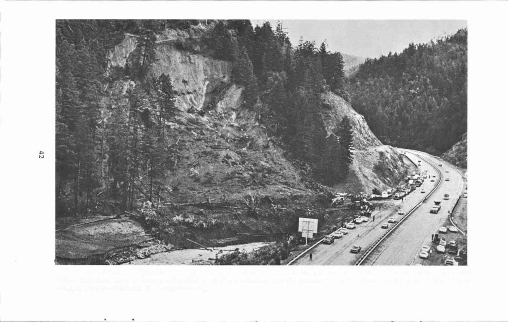
50 42
 trees and bushes, and could only see a short distance in front or behind, so that if you had to stop for hours you could have no knowledge as to the cause of detention.")

51 Approaching Canyonville down 1-5 from the south. At this point the emigrant trail issued from the Canyon Creek passage into open country at the mouth or north end of Canyon Creek Canyon. (Photo by Helen Helfrich) trees and bushes, and could only see a short distance in front or behind, so that if you had to stop for hours you could have no knowledge as to the cause of detention. My team was about the middle of the train of 50 wagons, so when this bank was encountered it took a long time to get down. As each wagon would pass down, those behind would move forward the length of a team and wagon. Finally I came to the jump-down, * * * The wagon in front of me had in it a man who had been sick 20 days with typhoid fever, without medicine to relieve his suffering; in fact he seemed at death's door, as he could not raise his hand to his head, and could not speak above a whisper. * * * We 43 rough-locked all the wagon wheels, and to make sure, a man got on each hind wheel. Half way down this precipice a ledge of rock projected just perceivable to the first that passed down, but so many wagons and so much stock had passed, forcing the dirt below from the rock, there was at the time this wagon reached it a perpendicular fall of almost two feet. With all precautions arranged, and the men on the hind wheels, we made the start, and got along all right until we encountered the rock, when from some unaccountable cause, the front wheels rose up and went off the rock and the hind wheels rose up and went crashing down the bank. Of course, the men on the

52 wheels let go. The wagon struck bottom side up, smashed the wagon bows with such a crash that no one could suppose anything could live underneath. * * * We all rushed down and removed the wagon box and bedding, and strange to say, we found our fellow-traveler still alive. * * * The man recovered and lived. * * * Much of the route was in the creek. When night came on we bivouacked in this lonely, dismal canyon, the poor oxen chained to trees, this making the third night without food of any kind. * * But on we go, pell mell down this creek, shut in on each side with precipitous mountains, the sides of which were covered with dense timber, with a dense growth of underbrush along the creek, and a narrow, winding path cut out, following the tortuous meanderings of the stream. But fortunately about 3 o'clock the third day we emerged from the mountain prison. * * * the party that had preceeded us to open up the way and make it passable, had nothing at this same place [to eat], only what they killed in the shape of game, so there was nothing to be had in that line. * * * "The last day's march out of the canyon was the worst for the destruction of property. In fact, everything that could possibly be dispensed with was thrown away. The route was strewn with articles, all valuable to the owners, if they could have been preserved. Extra wagons, various kinds of tools, farm implements, were abandoned, the owners being glad to escape with their lives. One Mr. Wood had brought a hive of bees safely this far, but the wagon conveying them upset in the creek, broke the hive to pieces, and the bees all drowned. His hive of bees cost him a great deal of trouble, as he had them to feed and water during the long journey. Had he got them through he had an offer of $500 for them. "Another company that came through the canyon, a day later than our company, fared worse, if possible, than we did, for the rain had swollen the stream to almost a swimming stage. One of their number, Judge J.Q. Thornton, * * * [During] our last night in the canyon, * * * a lady gave birth to a child, but the condition of the road was so terrible that in a few hours the infant died. The mother soon followed, owing to the treatment she necessarily had to undergo. * * * "After laying over two or three days preparations were made to resume our journey, and, being out of all danger of savage Indians, our large caravan broke into small caravans for the sake of convenience. The little party that I was in consisted of eight wagons, and as before stated, but little provisions remained in our party, and no prospective opportunity for procuring any." Following are parts extracted from the "Life and Labour of Reverend A.E. Garrison," privately printed in 1943: " * * we now have two trains and we moved on in this way until we came to the Canon, coming each night close together * * * We now enter the great canon, the evening before however my brother Joseph met me, he and Enoch [Garrison] came to Oregon in He brought to my relief provisions, a yoke of fresh fat cattle and a number of pack horses. I pray Almighty God that I may never forget the kindness of this brother, when morning came all hands at an early hour were ready for the Canon, my brother attached his fresh oxen to one of my wagons but said it was impossible for the wagons to go through the canon. I put two yoke of my weak oxen to the other wagon and after sending the loose cattle all in advance we started. The canon was not more than twenty miles through and we were five days in it so you may judge the amount of trouble we had. Oh! how many cattle died by starvation and many wagons were broken all to pieces, much of the way we had ropes fastened on the wagon and men holding by the ropes, * * * All hands now out of the canon and by the way the Indians were now friendly so we could travel as we pleased, by this time the health of my wife had improved so she could ride on horseback. My brother having brought out pack-horses took my family except two boys and bid me goodby, and for her my heart ached. I thought possibly I should never see my wife again 44

53 as she could scarcely walk alone but then we must do the best we could and bidding her good-by they went on and I remained a few days to let my oxen rest, * * * I learned there was a young man by the name of Garrison in camp and that he was from the valley * * * I made search and found him and who should he be but my nephew * * * Told by Mrs. E.B. Foster in 1914: * * * We laid by sixteen days in the Calapooia Mountains waiting for the road to be cut out. "I had to ride horseback and help drive the cattle after Mr. Applegate took all the men that could be spared. The people behind us had a terrible time getting through." "My sister, Mrs. Humphrey, and myself were the first white women through Cow Creek Canyon, and my brother, Manley Currier, drove the first wagon through the canyon. The night after we got through, it just poured down. Manley caught cold and had fever after that. "In the Umpqua Valley the daughter of a Mr. Stewart died. There were just five wagons of us then. They dug her grave with wooden shovels and cut down saplings and split them for the coffin." Mrs. Mathew P. Deady also remembered the terrible trip through the canyon: "In corning north from the Rogue River country we followed the bed of Cow Creek [Canyon Creek]. It took us five days to make nine miles. I have never, before or since, seen such rough going. The cattle could hardly keep their feet, on account of the smooth waterworn boulders in the bed of the stream, and the wagons would occasionally tip over. It was getting so late that at a meeting of the men of the wagon train it was decided to throw away every bit of surplus weight so that better speed could be made, and so that the others should not have to wait for some one overladen wagon. One man had brought two hives of bees clear across the plains and hated to give them up, but the men of the train decided he could get along without them; so they were left. A man named Smith had a wooden rolling pin that it was de- cided was useless and must be abandoned. I shall never forget how that big man stood there with tears streaming down his face as he said, 'Do I have to throw this away? It was my mother's. I remember she always used it.' And they christened him 'Rolling Pin' Smith, a name he carried to the day of his death." Portions of J. Quinn Thornton's reminiscences follow: "October 29. * * * We were now about to leave our encampment, and enter a pass * * * and, after immense toil to man and beast, encamped on the mountain at sunset, only three miles from our last camp [From present Azalea to the summit of Canyon Creek Pass]. The whole company were extremely exhausted, as well as the cattle. Mr. Hall did not get his team into camp until after dark. "November 1. Josiah Morin, whom I had hired to carry some of my clothing, was compelled to leave all his large wagons, and go forward with a small twohorse wagon, having little else in it than the bed clothing of the family. This left Mrs. Thornton and myself in an almost helpless condition. I had, indeed, paid Mr. Morin for conveying my clothing as I have already stated; but he seemed to feel that his first duties were, nevertheless, due to his own family, and the preservation of his own property. * * * "November 4. * * * I had little remaining, save our buffalo robes, blankets, arms, ammunition, watch, and the most valuable part of our wardrobe; and fearing that we would yet lose the most of this, Mrs. Thornton selected the more expensive articles of clothing, and I packed them into two sacks. I succeeded in hiring a man to carry these upon his horse. We finally determined that, on the morning of this day, we would make an effort to pass the mountain. * * * There was a close canon, some few miles ahead of us, down which we would have to wade three miles in cold mountain snow-water, frequently above the middle. * * * Mrs. Thornton, myself and Prince Darco [the dog], started [on foot] early on the morning of this day, I carrying my rifle, revolver, large knife, some ammunition, 45

54 and a morsel of food in my shot-pouch. We passed the only wagon that Josiah Morin had attempted to take through from the encampment of October 29th. * * * We passed household and kitchen furniture, beds and bedding, books, carpets, cooking utensils, dead cattle, broken wagons, and wagons not broken, but nevertheless abandoned. In short, the whole road presented the appearance of a defeated and retreating army having passed over it, instead of one over which had passed a body of cheerful and happy emigrants, filled with high hopes, and brilliant expectations, and about to enter a land of promise. " * * * we came to where many most miserable, forlorn, haggard, and destitutelooking emigrants were encamped. * * * One of them, a Mr. Smith, had lost everything, and he appeared to be overwhelmed. His wife had on a coarse and battered calico dress. She was thinly clad, and the covering for her head was an old sun bonnet. Her child was not in a better condition, while that of her husband was, perhaps, even more pitiable. They had not a cent of money; though had it been otherwise, it would not have purchased food, for there was none to be sold. * * * He took up his child, and about a pound of food, and desired his afflicted and almost helpless companion to follow him. "A relative of his of the same name had been standing at that place a few days before, counseling with some of the party as to the means of escaping their present danger. As he was thus anxiously deliberating, death summoned him away, and he fell dead in a moment, leaving a poor widow with seven helpless and almost starving children. I was informed they had nothing for food but the flesh of the cattle that had just perished. * * * "A Mr. Brisbane had also died here, and I was informed that a child had died at this place; * * * " * * A short distance from the place where we left the narrow gorge, we came to the tent of Rev. Mr. Cornwall. He had already passed the canon, but such was the toil endured by the oxen, * * * and such was the chilling effect of the water, that the oxen nearly all died the following night. He was therefore now in a totally helpless condition. * * * "There were several men about the fire, among them was Mr. Smith, whom I had persuaded to attempt the passage. He got through, with his wife and child, and although almost exhausted, still he was now far more happy than persons generally are under circumstances much more favorable to happiness and comfort. * * "November 5. We resumed our journey and after wading Canon Creek thirty nine [At another time, Thornton wrote they crossed the creek 48 times] times, we were enabled to avoid it by clambering along the side of the mountain. We at length emerged fully into the open plain, and about noon arrived at the place of general encampment, on the left bank of the Umpqua River [Canyonville]. * * * Some of the emigrants had lost their wagons; some their teams; some half they possessed; and some everything. Here were men who had a wagon, but wanted a team; there, others who had a team, but no wagon. Mr. Humphrey was the only man, who, so far as I have since been able to learn, got to this point with a whole wagon and complete team. * * * * * * I found Josiah Morin, who had left two wagons * * * Mr. Hall, two; Mr. Lovelin, one; Mr. Boone, one or two. There may have been others. * * * "On the following morning, both being very weak and hungry, Mrs. Thornton and myself strolled along down the river bank, with the hope of seeing something that I might shoot for food. * * * I suddenly saw persons approaching from the direction of the settlements. * * * I recognized Mr. [William] Kirquendall [Who had previously gone ahead with the Applegate road-working party], who, together with some others had come with flour and fat beeves. They came to camp, where the animals were slaughtered, on Friday, November 14, when I obtained eighteen pounds of flour, twenty pounds of beef, and one pound of tallow, at a price which, although very high, would not cause a starving man to pause. * * * "On the afternoon of Friday, Novem- 46

55 ber 14, I hired of Wm. Kirquendall a horse for Mrs. Thornton and myself to ride alternately, on our way into the settlements. It would have been impossible for either of us to walk all the way, so I applied to one Asa Williams, whom Applegate had sent out, for the use of one of his horses for the purpose of carrying two packets of clothing. * * * * * * we sat out for the settlement, with a party led by Wm. Kirquendall. While we were upon the top of a mountain [Roberts Mountain], which commanded a view of a large extent of country [Including Round Prairie to the south and Roberts Creek Valley to the north], distant about four miles from our late encampment, I saw persons upon the plain below, approaching from the direction of the camp. Upon inquiring of Mr. Kirquendall who they were, he informed me that they were Mr. and Mrs. Newton and Sutton Burns [or Caidwell],who were probably endeavoring to come up with us, * * * "We resumed our journey on the following morning; and Mr. Newton resumed his. It was upon this day, I believe, he was met late in the afternoon by three Umpqua Indians, one of whom spoke English, and informed him that he would do well to encamp at the place at which he then was, there not being water and grass as they affirmed at a convenient distance ahead. They asked for food, and it was given to them. After which they asked for three loads of powder and ball, and stated that they would bring in a deer. It was given to them, and all by them put into one gun as one load. Mr. Newton finally suspected that harm was designed, desired them to go away; but this they refused to do. He sat near the door of the tent to watch them, but being at length overcome with sleep, he was shot. He immediately rose, and sprang into his tent for his gun, when one of the savages, seizing an ax, inflicted a blow which nearly severed one of his legs. The tent was then robbed, and the articles placed upon an American mare, owned by Mr. Newton, after which they fled." The following excerpts are from a letter written in 1854 by Mrs. Tabitha Brown, and printed in the Oregon Historical Quarterly of June, Tabitha Brown, the widow of Rev. Clark Brown, crossed the plains to Oregon in 1846 when 66 years of age. She traveled with her son, Orus Brown, and daughter, Mrs. Virgil (Pherne) Pringle, and their families. Also a Captain John Brown, brother of her deceased husband, accompanied them. Orus Brown several days in advance of the others, took the established Oregon Trail, while the mother, Tabitha, and the Pringles turned into the newly located Applegate Trail. Tabitha Brown in part wrote: "We were carried hundreds of miles south of Oregon into Utah Territory and California; fell in with the Clamotte [Klamath] and Rogue River Indians, lost nearly all our cattle, passed the Umpqua Mountains, 12 miles through. I rode through in three days at the risk of my life, on horseback, having lost my wagon and all that I had but the horse I was on. Our families were the first that started through the canyon, so that we got through the mud and rocks much better than those that followed. Out of hundreds of wagons [Less than 100], only one came through without breaking. The canyon was strewn with dead cattle, broken wagons, beds, clothing, and everything but provisions, of which latter we were nearly all destitute. Some people were in the canyon two or three weeks before they could get through. Some died without any warning, from fatigue and starvation. Others ate the flesh of cattle that were lying dead by the wayside. "After struggling through mud and water up to our horses' sides much of the way in crossing this 12-mile mountain, we opened into the beautiful Umpqua Valley, inhabited only by Indians and wild beasts. We had still another mountain to cross, the Calipose, besides many miles to travel through mud, snow, hail and rain. "Winter had set in. We were yet a long distance from any white settlement. The word was, 'fly, everyone that can, from starvation; except those who are compelled to stay by the cattle to recruit them for further travel.' Mr. Pringle and Pherne 47

56 insisted on my going ahead with Uncle John to try and save our own lives. They were obliged to stay back a few days to recruit their cattle. They divided the last bit of bacon, of which I had three slices; I had also a cup full of tea; no bread. We saddled our horses and set off, not knowing that we should ever see each other again. Captain Brown was too old and feeble to render any assistance to me. I was obliged to ride ahead as a pilot, hoping to overtake four or five wagons that left camp the day before. Near sunset we came up with the families that had left that morning. They had nothing to eat, and their cattle had given out. We all camped in an oak grove for the night, and in the morning I divided my last morsel with them and left them to take care of themselves. I hurried Captain Brown so as to overtake the three wagons ahead. We passed beautiful mountains and valleys, saw but two Indians in the distance during the day. In the afternoon Captain Brown complained of sickness, and could only walk his horse at a distance behind. He had a swimming in his head and a pain in his stomach. In two or three hours he became delirious and fell from his horse. I was afraid to jump down from my horse to assist him, as it was one that a woman had never ridden before. He tried to rise up on his feet, but could not. I rode close to him and set the end of his cane, which I had in my hand, hard in the ground to help him up. I then urged him to walk a little. He tottered along a few yards and then gave out. I then saw a little sunken spot a few steps ahead and led his horse to it, and with much difficulty got him raised to the saddle. I then told him to hold fast to the horse's mane and I would lead by the bridle. Two miles ahead was another mountain to climb over. As we reached the foot of it he was able to take the bridle in his own hand and we passed over safely into a large valley, a wide, solitary place, but no wagons in sight. "The sun was now setting, the wind was blowing, and the rain was drifting upon the sides of the distant mountain. Poor me! I crossed the plain to where three mountain spurs met. Here the shades of night were gathering fast, and I could see the wagon tracks no further. Alighting from my horse, I flung off saddle and saddlepack and tied the horse fast to a tree with a lasso rope. The Captain asked me what I was going to do. My answer was, 'I am going to camp for the night.' He gave a groan and fell to the ground. I gathered my wagon sheet, which I had put under my saddle, flung it over a projecting limb of a tree, and made me a fine tent. I then stripped the Captain's horse and tied him; placed saddle, blankets and bridles under the tent, then helped up the bewildered old gentleman and introduced him to his new lodging upon the bare ground. His senses were gone. Covering him as well as I could with blankets, I seated myself upon my feet behind him, expecting he would be a corpse before morning. "Pause for a moment and consider the situation. Worse than alone, in a savage wilderness, without food, without fire, cold and shivering, wolves fighting and howling all around me. Dark clouds hid the stars. All as solitary as death. But that same king Providence that I had always known was watching over me still. I committed all to Him and felt no fear. As soon as light dawned, I pulled down my tent, saddled my horse, found the Captain able to stand on his feet. Just at this moment one of the emigrants whom I was trying to overtake came up. He was in search of venison. Half a mile ahead were the wagons I hoped to overtake, and we were soon there and ate plentifully of fresh meat. Within eight feet of where my tent had been set fresh tracks of two Indians were to be seen, but I did not know they were there. They killed and robbed Mr. Newton, only a short distance off, but would not kill his wife because she was a woman. They killed another man on our cut-off [At Lower Klamath Lake], but the rest of the emigrants escaped with their lives. We traveled on for a few days and came to the foot of the Calipose Mountain." Walter Meacham, executive secretary, Oregon Council, American Pioneer Trails Association, in 1947, in part wrote: 48

57 "There were a number of Smiths in the Applegate party, the best-known being William Smith, who was captain of a number of wagons, and was highly regarded. The Smith family had a hard day November 15, in forcing its way down Canyon Creek. Fallen trees, driftwood and boulders blocked the way, requiring great exertion to overcome. Finding a wide spot in the canyon, Smith called a halt and camp was made. Around a blazing log fire, the emigrants took inventory of their losses and discussed plans for the future. The majority were of the opinion that it was impossible to continue with their wagons, but Captain Smith was of fighting blood and chided the men for giving up so easily, declaring that he was going to take his light spring wagon through to the Willamette Valley to transport his sixteen year old daughter Louisa and the little children. "While Smith was exhorting the men, he sank to his knees, looked up and exclaimed: 'Lord have mercy upon me,' then fell forward dead. His sudden death cast gloom over the company, for he was its counseler and guide. Smith left his wife Ellen and nine children without his protective care. Instead of the spring wagon being used as he intended, it was torn apart and the box was used to make a coffin for its owner. He was buried near the spot where he fell, like a soldier who dies in battle. "The Smith party stayed in camp for a number of days to recuperate its strength, while two of the young men set out for the Willamette Valley for help. Henry Smith, no relative of the late captain, was chosen as the new leader. Under his orders, the wagons were abandoned, and some of the personal belongings were packed on oxen. Louisa Smith, who was ill, was mounted on a side-saddle on old Darby, a reliable ox. Sharing Darby's back were Marion, the baby, one year old, and Thaddeus, a cripple, three years old. Louisa died near the present Roseburg. Knowing that her end was near, she requested that her grave be dug deep, and that large rocks be placed upon it so the wolves could not reach her. "One of the outstanding acts of un- selfishness was that enacted by an elderly emigrant, James Curtendall, affectionately referred to as "Uncle Jim." He was stricken with fever and was too ill to travel, so was, at his own request, left behind. He had, he declared, but a short time to live, and there was no reason to jeopardize the safety of the entire company because of one old man. His only request was that a cup of water be left behind to cool his parched throat. His wife had died far back on the trail, leaving a son in his "twenties" and a daughter in her "teens" in his care. "When they rebelled at leaving him alone, he told them that his life was about spent, that theirs had just begun, and insisted that they could best honor him and their mother by pushing on to the goal of their ambitions, the Willamette Valley. After a tearful farewell, the two bereaved youngsters joined the emigrant band on its toilsome march through the canyon. They made five miles that day. The son and another young man went back to see how Uncle Jim was faring, and arrived in time to see him breathing his last. Out of a deserted wagon-box they made a crude coffin and buried the kindly old man in the Canyon of Sorrows." George W. Riddle, a boy of 11 years in 1951 when he traveled a portion of the Applegate Trail, recalled in part in 1915: "We met several pack trains as we continued our journey through the beautiful Rogue River Valley. * * * "At the time we passed through the Rogue River Valley there were no settlements and we met no prospectors. * * "We forded the Rogue River somewhere above Grants Pass * * * "Our train made fair progress until we arrived at a point where the south end of the Hildebrand grade connects with the old road [Approximately two miles north of the summit of Canyon Creek Mountain]. There we passed over a ridge on the north side of the creek, then down a steep hill in the bed of the creek. At this hill ropes were attached to wagons, with men holding, to prevent the wagons running onto teams or overturning. On reaching the creek bed our route lay right in the bed for one and a half miles, the slope 49
 Third emigrant ford of the South Umpqua River, one mile west of the first ford.")
58 Site of first emigrant ford of the South Umpqua River, northwest of Canyonville approximately three miles. 1-5 in the background. (Photo by Helen Helfrich) Third emigrant ford of the South Umpqua River, one mile west of the first ford. (Photo by Helen Heifrich) 50

59 Applegate Trail and later Stage Road west of Myrtle Creek, off the west end of Dole Street. Some of the best remains of the Applegate Trail yet found. (Photo by Helen Heifrich)

60 of the mountains coming right down to the water on both sides. * * * it was covered with boulders from the size of a pumpkin to a haystack. I recall the lead teams, on being let down into the creek, moved right on without reference to those behind. "It was about 4 o'clock in the afternoon that our teams left the creek bed. We had then made about five miles. At that point we met some men who had come up from 'Knott's station,' near Canyonville, to help us through the canyon. At this point I was sent ahead with the loose stock, arriving at the north end of the canyon after dark. A part of the train had come through and were camped just across the bridge south from Canyonville. By noon of the second day our teams had arrived at camp after passing the worst ten miles of road between the Mississippi River and civilization in Oregon, for here we found the first house in Oregon. We arrived at Canyonville September 20. * * * At this point we parted company with the other families and young men that we had traveled with for five months, * * * "The Hill and Briggs families and in fact all our friends hurried on to the Willamette Valley. Mr. Hill settled on the McKenzie east of Eugene * * * The Briggs family returned early the next year and located in Orchard Valley * * * Charles W. Beckwith also returned * * * "North of Canyonville we forded the Umpqua River three times within one mile. * * * On rounding the hill [at present Tn-City grade school] we came upon a little log house occupied by William Weaver. * * * The next house was that of John and Henry Adams who were bachelors at the time, * * * "Our next day's drive we passed over Roberts Mountain, the road then laying up the small creek as you approach the foot of the mountain from the south, passing over near the residence of the late Plinn Cooper, to Roberts Creek. Here we found the fourth settler in Oregon Jesse Roberts. "Mr. Roberts persuaded my father to abandon his plans of going to the Willa- mette Valley for the winter, but to leave the family in camp near his place and go on with the ox teams for supplies, which he did, and on returning, we returned to what was afterward our home at Glenbrook farmthe first donation claim located in Cow Creek Valley." RETRACING THE APPLEGATE TRAIL "WEST OF THE CASCADES" IN 1975 Between Azalea (near I-S Exit 88) where the emigrants laid over while the road ahead was being opened, and Canyon Creek Pass, a distance of two and one half miles, all traces of the Applegate Trail have been destroyed. First, old freight and stage roads, then Old Highway 99, and finally present Interstate 5 have replaced any trace of the original trail. From the summit of Canyon Creek Pass to Canyonville, seven and one half miles, I-S has also wiped out all preceeding trails, roads and highways except in a few locations where Old 99 can be seen clinging to the left hillside, and in the bottom to the right for the last two or three miles before reaching Canyonville. In addition, the Canyon Creek stream bed has been moved to new locations except in two or three places upstream, and near the canyon mouth. Moreover, all down timber and brush have been removed. As you travel down this modern four lane freeway on a uniform grade, it becomes extremely difficult to imagine the hardships and sufferings that once occurred in this "Canyon Passage." But should one become too complacent, remember this terrible canyon of emigrant days has not yet been completely conquered. As late as mid-january, 1974 severe storms raked the Pacific Northwest for several days. As a result the towering hillsides bordering Canyon Creek became so water soaked that sometime on the morning of January 16th a mud slide occurred on the east slope. It cut a Pacific Northwest Bell coaxial cable connecting Portland and Sacramento at a 52

61 point one and a half miles upstream (south) from Canyonville near a repeater station hut. Construction crews from Pacific Northwest Bell and Sage Pipeline, Inc. were rushed to the scene to begin restoration. Some 40 or more men worked in the area during the daylight hours replacing the break with a new temporary cable. By late afternoon with splicing operations underway at both ends of the new cable, half the crew were released. Around 6:30 P.M. there were ten men working in, or very near, the repeater hut. Eleven more were at a splicing pit 1200 feet upstream. At 6:36 a giant second slide occurred which killed nine men, injured a tenth, destroyed six trucks and cars and demolished the concrete hut which had stood for 27 years. Shortly afterward a third slide completely covered the damage done by the second one. The mass of mud, rocks and trees measured some 350 feet from the base of the mountain to where its foot rested in Canyon Creek. A nine day search followed in which the bodies of William L. Centers, Medford; William E. Combs, Medford; Robert M. Miller, Medford; Robert A. Keller, Lake Oswego; Edward A. Waldron, Jacksonville (found eight miles downstream in the Umpqua River); Gilbert W. Maret, Wilbur; Roy L. James, Roseburg (found one mile downstream); all Pacific Northwest Bell employees; and Mark Garoutte, Roseburg (found one mile downstream), a Sage Pipeline employee, were recovered. One body, that of Raymond Bell, Myrtle Creek, a Sage Pipeline employee, was never found. A tenth man, R.F. "Bob" Cook, Medford, walking midway between the hut and the shoulder of 1-5, was hit by debris and thrown some 30 feet but managed to survive. In retracing the emigrant trail, if preferred, about three miles before reaching Canyonville, take the off-ramp to the right which most of the way to Canyonvile is Old 99 and you will get a better idea of the original route than by staying on 1-5. In Canyonville, Main Street approximates the emigrant trail and later roads until you must return to I-S to continue onward. Follow I-S to the crossing of the South Umpqua where the site of the emigrant ford can be observed immediately below the present bridge. A ferry once operated at approximately the site of the bridge. One of the peculiarities of this trail's history is the fact that no diary, and but one reminiscence mentions fording the river. Only George W. Riddle, 11 years of age in 1851, and who lived in the vicinity the remainder of his life mentions the three fords within one mile necessary to be traveled in order to continue down river. The 1854 General Land Office survey, however, shows only the first ford, but some road work had been done by that time. Since all roads leading to the Roseburg area followed down the right bank of the river, it therefore follows they were compelled to cross at least once since they were on the left bank after passing out of Canyon Creek Canyon. Continuing northward from the third crossing of the South Umpqua, the Applegate Trail kept along the foothills to the east, approximating Old 99, past Tn City, with present I-S passing to the west. Old 99 continues to approximate the trail to the town of Myrtle Creek, crossing the stream of the same name below (west of) the present bridge. It then passed through town below Main Street to cross it near its western end where Dole Street branches uphill to the right. Here traces of the trail and later stage and freight roads are still in evidence. Dole Street and its continuation, a rather primitive road which leads past the city dump ground are the old trail. The original trail and later stage and freight roads have been for the most part replaced by the Southern Pacific railroad for the next 6½ miles, or to a point north of the Mary Moore bridge near the station of Round Prairie. For anyone retracing the trail it is best perhaps to regain I-S west across the bridge from Myrtle Creek, and follow it to the Mary Moore-Round Prairie off-ramp. 53
 Round Prairie, foreground; Roberts Mountain, background.")
62 South Umpqua River Canyon bypassed by the Dole Street extension of the Applegate Trail. The trail came down a shelf on the hillside in the strip of timber visible right to center. (Photo by Helen Heifrich) Round Prairie, foreground; Roberts Mountain, background. The Applegate Trail crossed Roberts Mountain to the right out of the picture at approximately the same location as present 1-5. (Photo by Helen Heifrich) 54

63 O5(%LL ROAD BUILT BYCOLJO[HOFB 57 FIR CA:Q&. STAGE PASSOOYf Jur; I8O (ftstjjo$j PSS AI2 sr frer TJ* BURE1T Old marker at the south base of Roberts Mountain where the Applegate Trail follows up gulch in background. Gordon Burnett, left, on whose ranch the marker is located. Devere Heifrich, right, editor Kiamath Echoes. (Photo by Helen Helfrich) Scars of the Applegate Trail still visible at the summit of Roberts Mountain. Gordon Burnett, left; Devere Helfrich, right. (Photo by Helen Heifrich) 55
 The present day county road lying below and to the west of 1-5 as the latter commences the climb to the summit of Roberts Mountain, reaches what is called locally \"Hulburt")
 the Applegate Trail and its 1853 replacement (laid out by Major Benjamin Alford and Jesse Applegate) both continue up the gulch.")
64 Ia Devere Helfrich standing on hillside where Applegate Trail scars once showed, before grass seeding operations. South approach to Roberts Mountain summit. (Photo by Helen Heifrich) The present day county road lying below and to the west of 1-5 as the latter commences the climb to the summit of Roberts Mountain, reaches what is called locally "Hulburt Gulch" coming down from the northeast on the Gordon Burnett ranch. At this point (near the Burnett barn) the Applegate Trail and its 1853 replacement (laid out by Major Benjamin Alford and Jesse Applegate) both continue up the gulch. The emigrant trail may have crossed Robetts Mountain in three different locations, one the same as 1-5, and the other two about 200 yards to the west (remains can still be seen there). The present county road continues farther west over Roberts Mountain to cross at the same location as did the 1859 Hooker road used by the stages and freighters General Land Office surveys indicate that from the summit of Roberts Mountain, two roads led north to the 56 Roseburg area. The eastern branch, undoubtedly the emigrant trail, led down the north slope of the mountain to the right of a small round butte ("Cooper Butte") lying east and below 1-5, to cross Roberts Creek near the old Roberts place, less than a mile upstream from 1-5. The trail continued northerly through three low passes (the middle one being one half mile east of the drive-in theatre) in the foothills of "Boone" or Burg Mountain. Once over these passes, the trail followed down the South Fork of Parrot Creek and entered Roseburg on or near Booth Street. The western branch (probably the 1853 Alford Road) dropped down from Roberts Mountain west of "Cooper Butte;" crossed Roberts Creek about one fourth mile east of 1-5, to parallel the latter to the Old 99 off-ramp into Roseburg. This road closely followed the South Umpqua before entering town from the

65 A The Applegate Trail crossed Roberts Creek Valley which lies between Roberts Mountain and the hills southeast of Roseburg. The crossing is approximately one mile east of present 1-5. (Photo by Helen Helfrich)
 The original Applegate Trail entered Roseburg near Booth Street from the southwest down Parrot Creek.")
66 Looking south up the south branch of Parrot Creek. The original Applegate Trail came down this draw to enter Roseburg. (Photo by Helen Helfrch) The original Applegate Trail entered Roseburg near Booth Street from the southwest down Parrot Creek. It then more or less approximated Main Street to the Aaron Rose Cabin near the present court house. (Photo by Helen Heifrich) 58

67 south. Both branches passed through present Roseburg, probably somewhere near Main Street, to cross Deer Creek west of the Douglas County Courthouse. It was near this point that Aaron Rose settled on September 23, 1851 after having purch- ased the claim from its locators "for a horse and a poor one at that." From the site of this cabin, the trail turned westerly, following the curve of the river to pass very near the present Veterans' Hospital and on to Newton Creek about where Garden Valley Road now crosses. CHAPTER VII NORTH ROSEBURG TO SCOTT'S VALLEY VIRGIL K. PRINGLE, 1846: Friday, November 6Go to the Umpqua River, 6 miles to the upper ford [This ford was near the mouth of Sutherlin Creek, two miles below the Interstate 5 and Old 99 bridges at Winchester. In other words, immediately north of the turnaround at the north end of Fisher Road]. Find no chance to cross, the river too high. Saturday, November 7Go to the lower ford and commence crossing in canoe, get all over but the wagons [This, the lower ford, was "one mile above" the forks of the North and South Umpqua 3/4 Rivers, or of a mile below Brown's Bridge on the Garden Valley Road. Pringle's estimated distance of 5 miles between the two fords in 1846 seems to be correct for the route followed]. No rain. 5 miles. Sunday, November 8Cross the wagons, and go 1 mile [Camp northeasterly from Brown's Bridge]. Had nothing to eat yesterday for supper. A beef killed in camp and we got the paunch and upper part of the head, which did us till Monday for breakfast. Rains all day. 1 mile. Monday, November 9Ate the last of our tripe. Start with heavy hearts. Meet some Indians and get six venison hams, a great relief to our minds. Go one mile further and meet Octavius with half a bushel of peas and forty pounds of flour, which gives us joy [Met Octavius, who had been ahead to Fort Umpqua for supplies, near the present Hestner's Landing boat launching park slightly over one mile above Brown's Bridge. See Pringle's entry for November 3rd]. No rain today. The happiest day to us for many. 4-2,284 miles [Camp was near but probably northeast of Wilbur]. Tuesday, November 10Travel 5 miles and cross Elk Creek and camp in first-rate feed [Pringle's Elk Creek is present day Calapooya Creek. Camp was probably made about one mile downstream from Oakland]. A rainy, cold day. 5 miles. Wednesday, Thursday and Friday, November 11, 12, 13Lay by to repair shoes and lay in a stock of meat; got 3 deer and a salmon from the Indians and our teams much improved and ourselves rested. Saturday, November 14A fine day but cool. Travel 6 miles of hilly road and camp on the head of a branch [Camp was near Rice Hill and could have been on the headwaters of either Cabin Creek or on Yoncalla Creek at the southwest extremity of Pleasant Valley I. Bury Mrs. Bounds, who died the day before, wife of J.B. Bounds. 6 miles. Sunday, November 15Travel 4 miles, find a good camp and stay 1 day for the benefit of the teams [Probably still in Pleasant Valley on one of the forks of Cowan Creek I. Road muddy and heavy. 4 miles. Tuesday, November 17Make four miles to the foot of Callipoa Mountains [Perhaps near the junction of Curtis and Lees Creeks, which joining Cox Creek, all flow into Elk Creek just north of Scotts Valley]. 4 miles. LESTER G. HULIN,

68 Elk cre fr desfe App/eePe '#/ $dtt-s V. F e:.4,7 Creek COrQW4!l S,'e Oi*kl4nJ 117 I-i;,1 a.i_ in J.n I Brow,pJ I e 60 8-JI
![[Entry for September 27th continued from Chapter VI]. * * * to the crossing of the N.W. fork of the river [North Umpqua]; about one mile above the forks, camped here; distance 18 miles. F. 28th.](/docs-images/75/71753926/images/69-1.jpg "Spent the whole day in crossing the river, which was done by means of the assistance of Indians and canoes [3% of a mile below Brown's Bridge, on Garden Valley Road northwest of Roseburg]. S. 29th.")
69 [Entry for September 27th continued from Chapter VI]. * * * to the crossing of the N.W. fork of the river [North Umpqua]; about one mile above the forks, camped here; distance 18 miles. F. 28th. Spent the whole day in crossing the river, which was done by means of the assistance of Indians and canoes [3% of a mile below Brown's Bridge, on Garden Valley Road northwest of Roseburg]. S. 29th. Left the river and made the Calipooyah river in 10 miles; then on about 4 miles and camped, 14 miles in all [Four miles north of Oakland on Cabin Creek or about the same distance south of Rice Hill, near the Goodrich Road turnoff]. S. 30. Passed on about 10 miles and camped; good camping anywhere, but it has rained for the last 4 days [Perhaps in the northwest corner of Scotts Valley] JESSE APPLEGATE'S WAYBILL, 1848 Scott's Farm [In Scotts Valley, northeast of Yoncalla] 20 miles. Calapooia Mountain 5 miles. When the small group of emigrants, including Virgil Pringle, in advance of all others, and led by Levi Scott, reached the North Umpqua some two miles below present Winchester, they found the stream too high from the recent rains to ford. Accordingly they retraced their route some four or more miles to a point [3% of a mile below Brown's Bridge on the Garden Valley Road] to where Scott had forded the stream with the trail-blazers the preceeding June. Here the stream was deep and rocky. They hired a canoe from the Indians camped along the stream and ferried the women, children and baggage over. They then proceeded to ford the teams and empty wagons across. Fairly open country lay ahead to the foot of the Calapooya Mountains with reasonably good roads. Even then their progress was slow and tortuous due to jaded teams. Reaching the foot of the mountains, they found their way blocked by timber and brush through which no road had been blazed. Enroute the wife of John B. Bounds died and was buried on the north side of Calapooya Creek about one half mile from present Oakland. In addition, the wagon of Richard Linville upset in crossing a rain swollen creek [Wilson or Cowan Creek] near present Yoncalla and before reaching the foot of the mountains. His wife, quite an elderly lady, was drowned before she could be rescued from beneath the overturned wagon and its contents. Talbot Carter next continues his recollections: " * * * but several rainy days and muddy roads brought us to the crossing of North Umpqua River. The Indians furnished canoes to cross the wagons in. By lifting the wagons in and out of the canoes and swimming the stock, we managed to cross. This was severe on the poor oxen, the water being very cold. Our ferriage was very expensive, as the Indians saw they had us at their mercy, and, acting as one of our white brothers will act, made the best of it. * * * until we approached the Calapooia Mountains * * * Some time previous to this our distress had become known to friends in the settlement, who met their friends with fresh teams and provisions, but unfortunately for our little party we had no such good luck." Mrs. Mathew P. Deady continues her story: "After great hardships and discomfort we finally made our way through Cow Creek Canyon [Canyon Creek Canyon]. We came on northward, having very hard going, as it was late in the year and the winter rains had started. We had been eight months on the road, instead of five, so we were out of food and our cattle were nearly worn out. We crossed the river near the present site of Roseburg by tying two canoes together and putting the wagons on them and ferrying them over. We had obtained some fresh meat from some trappers, and a day later my mother's brother, Mr. John Holman, met us. He had heard of our plight, so he came with food and horses to get us. We left 61

70 The first emigrant wagons in 1846 attempted to cross the North Umpqua at this point, two miles below present 1-5 and opposite the mouth of Sutherlin Creek. Failing here due to high waters, they moved downstream below Brown's Bridge and succeeded in crossing with the aid of Indian canoes. (Photo by Helen Helfrich) This barn with its famous sign stood alongside Old Highway 99 for years. It was torn down in the fall of The Applegate Trail used approximately the same route. (Photo by Helen Helfrich) 62

71 North Umpqua above Brown's Bridge, site of the first ferry established in (Photo by Helen Heifrich) North Umpqua after the fall rains. This approach on the north bank of the river is one mile below Brown's Bridge and could possibly be the site of the emigrant ford. (Photo by Helen Heifrich) 63
![the wagons, and with mother on one horse holding her 6-weeks-old baby [Born at High Rock Canyon in Nevada], and with one of the little children sitting behind her, and with the rest of us riding](/docs-images/75/71753926/images/72-1.jpg "behind the different men, we started north. I rode behind my uncle, Mr. Holman. Two of the children rode with our cousin, one in front of his saddle and one behind it.")
72 the wagons, and with mother on one horse holding her 6-weeks-old baby [Born at High Rock Canyon in Nevada], and with one of the little children sitting behind her, and with the rest of us riding behind the different men, we started north. I rode behind my uncle, Mr. Holman. Two of the children rode with our cousin, one in front of his saddle and one behind it." Walter Meacham writing for the Oregon Pioneer Trails Association in 1947 continues: "Of the brave array of wagons which left the Old Oregon Trail to follow a supposedly shorter and better route, but half reached their goal. One of these belonged to Rev. J.A. Cornwall. His oxen had perished in crossing the Umpqua Range, though his wagon remained intact. Cornwall's cherished possession was his library, which he carried in his wagon. Rather than abandon it, he decided to winter in the mountains. A pleasant spot was selected by the side of a small stream, now known as Cabin Creek, near the present Oakland, Oregon. There a comfortable cabin was built of fir logs. During the long, rainy winter evenings, the precious library brought the family much comfort and joy as its members read by the light of flaring pine knots. The family cow had survived the trek so there was plenty of milk; their rifles supplied wild meat; old clothes and cooking utensils were traded to the Indians for camas, a palatable, bulbous root gathered by the Indian women. On April 9, 1847, friends from the Willamette Valley arrived at the cabin, bringing provisions and two yoke of oxen to pull the Cornwall wagon." In 1900, Joseph H. Cornwall wrote a Historical Sketch of the J.A. [Josephus Adamson] Cornwall family in which the missing history of the Cornwall family in the Umpqua Country is related. Extracts follow: " * * * Father, forty-eight years old, Mother [Nancy Hardin], thirty five, sister Elisabeth, sixteen, myself thirteen, Narcissa nine, George seven, and Laura nearly two years old; and three young men whose names were Lorenzo Byrd, Richard Chrisman and a Mr. Jones [The latter traveled to Independence only]. At the latter place they were joined by 64 'Cousin Israel Stoley.' With Thornton, they joined the Rice Dunbar train west of the Big Blue in Kansas. " * * about the first week in October we reached the famous Umpqua Canyon. The teams were poor and jaded with the long, weary travel. "After a day's rest we entered the canyon with our wagons and teams. The rest of the company decided to stay in camp another day. We started but on that miserable road we made little progress. When camping time came we estimated our day's travel at three miles. * * * Next morning we attempted to advance, but our road soon entered and followed directly in the channel of the creek which drained the canyon. That cold mountain water soon chilled our poor oxen and several of them fell down and died. We found it necessary as soon as we reached a little opening in the canyon to camp there. There we remained several days, during which time we lost a good American horse and all of our oxen, except three head. One yoke of oxen disappeared in the yoke and we never got a trace of them. * * * We remained at our camp until most of our company had passed by us on the march; * * * Having cashed two trunks full of books and sent forward our tent and some bedding by Mr. Byrd and Mr. Chrisman, we prepared to join the forlorn procession moving on toward the Willamette. Mother, yet weak from her mountain fever, was placed on Jude, our fine saddle mule, with little sister Laura, the babe, in her lap. As we had to cross the cold mountain stream Father often led Sister Narcissa and Brother George. Sister Elisabeth and I were old enough and strong enough to keep step in the march on foot. And in that plight we passed through the canyon. * * * While we were there [At the mouth of the canyon] Father made arrangements with Mr. Campbell and by joining teams, they brought his two ox wagons out of the canyon. And he gave one of them for help to haul the other, as by that arrangement he was able to save his library and transport the rest of our baggage. He also brought out the family

73 carriage with his mules. "After resting a few days, Mr. Campbell's family anl ours and some others, as best they could, went on leisurely, until we reached the vicinity of Oakland in the Umpqua valley. There we met some men [The Thomas Holt party] with a small supply of provisions from the Willamette and some of us decided to winter there. * * * Cousin Israel Stoley rejoined us and decided to remain with us for the winter. * * * Father was anxious to save his wagons and a fine library which he brought with him. Therefore, he considered it absolutely necessary to wait for better weather and better roads before resuming our journey. * * * Our only supply of flour was eighty pounds sent by a friend from the Willamette. * * * The supply of flour and bacon with which we left Missouri was exhausted when we were at the canyon; * * * Father purchased a fine beef driven from the Willamette and slaughtered it at camp. We also milked two or three cows, and the above mentioned flour, beef and milk were our only known supply of provisions for the winter, except the venison, which our hunters might secure and a little camas, a wild tuber, which we could purchase, at times, from the Indians. Fortunately wild deer were then abundant in the Umpqua hills, and our hunters kept us well supplied with venison while we stayed there. "During the winter Stoley and two others from our camp visited the Hudson Bay fort [near present Elkton], far down the Umpqua River, where each was supplied with a bushel of wheat or peas, according to choice; and a few handfuls of salt, nothing more being obtainable from there. * * * Father having brought a crosscut saw and a frow with him and there being excellent cedar timber near our camp, we went to work in early winter to build a cabin. About Christmas it was completed, with excellent cedar shakes for the roof, and excellent cedar puncheons for the floor and a comfortable chimney. "Father had sent word by some of our company [In the Thomas Holt party I the previous fall that we would need aid to reach the settlements * * * and three men (Joseph Hess, Josiah Nelson, and Clark Rogers), * * * came to us and brought us to the settlements in Chehalem Valley, Yamhill County, * * * "We left our camp in Umpqua Valley on the tenth of April, 1847; * * * The above letter sent to the settlements and delivered there by Thomas Holt was dated Umpqua Valley, December 27, It was printed in the Oregon Spectator under date of March 4, The letter in part stated: " * * * in behalf of a small company of emigrants * * * Myself and a large family [eight members I among them * * * "We are in number about 25 or 30 souls [Included in this group were the Cornwall, Rice Dunbar and James Campbell families. For further information on these families, see the Thomas Holt Journal given in Chapter XI ahead. James Campbell had previously gone to the settlements for help and returned with Holt to rescue his family] * * * "Signed: J.A. Cornwall." RETRACING THE APPLEGATE TRAIL "WEST OF THE CASCADES" IN 1975 Between the Veteran's Hospital in Roseburg and Brown's Bridge across the North Umpqua, the Applegate Trail is closely followed by the present Garden Valley Road. Once the North Umpqua is reached there are several locations where the river had been crossed by fords or ferries prior to the first bridges. There seems to have been at least two crossings used prior to the arrival of the first emigrant wagons in the fall of The lower crossing was about one mile above the junction of the North and South Umpquas, or about three fourths of a mile below present Brown's Bridge. The upper crossing was about three miles upstream from the same bridge. Both were probably used for years by trappers and traders, and for centuries before that by Indians, and both seem to have been known to Levi Scott guiding the lead wagons in

74 ';'- ' - -r LiE ictea!q thflcmolb'& RACORrWALL4ND rmlly); TtWtLtThE. TIPST IMMIORANT CAQ1N 4w r ti Y udouquw. J.... TI IFS Slit FSJ4C..fl N4*1. CAM: C*t{c j4 WE FAMILi' 'MITho IB.46 WZPE SMbFRØTh W4kS knw4um1ql,$ * ttql 1DJ4N5 WSE MENIWY
 Scott's Valley on Elk Creek. The original Applegate Trail passed from right to left somewhere in the field in the foreground.")
75 The Southern Pacific Railroad across Calapooya Creek at its junction with Cabin Creek (to the left this side of bridge). (Photo by Helen Helfrich) Scott's Valley on Elk Creek. The original Applegate Trail passed from right to left somewhere in the field in the foreground. (Photo by Helen Helfrich) -J
76 4' PIONE.ER, STATESMAN. PHILOSOPHER. LEADR OM1GRATON TO OREGON IN LEADER OF PROVISIONAL GOVERNMENT OF ORtON IN g. FIRST SUR\EYOIIGENERAL IN TRAIL BLAZER, FORT HALL1 idaho. TO WILLAMITTE VALLEY, IN 1&4, MEMBER Of OREGON flrr1iory LEGISLATURE IN MEMBER OF CONSTTUTIONAL CONVENTION FOR STATE Of OREGON IN täm.settled HERE IN 1849, ONE-HALF MILE WEST k Of THIS SRQT. HIS HOUSE WAS SCENE F! Of FIRST COURT Of PROVISiONAL QVtRNMENT, SOUTHERN DISTRICT

77 The common headstone at the graves of Jess and Cynthia Applegate. Jesse's name is on the south face and Cynthia's on the north face. The original headstone of native stone deteriorated to such an extent that it was replaced by the present marker. Located one half mile west of the Jesse Applegate marker on Old Highway 99. (Photo by Helen Heifrich)

78 These wagons (see the Pringle diary) using a route to the east but corresponding to Fisher Road, were turned back by high waters at the upper ford, so retracing their route in part, they managed to cross at the lower ford by using Indian canoes to ferry their wagons across the river. It is presumed the rest of the 1846 emigration used the same ford. So also did the 1847 emigration (see the Hulin diary) use this lower ford. Where the Gold-rushers of 1848, heading toward California, crossed is unknown, but it is quite possible they used one or the other of these two fords. Then in 1849 a Daniel Hasty established a ferry at one of three possible locations, near Brown's Bridge; or a site three miles upstream near the mouth of Sutherlin Creek; or two miles farther upstream, near the present dam at Winchester. All three locations are shown as crossing (ford or ferry not stated) by the 1853 Elder & Gile General Land Office survey. Also shown by this survey is "Brown's field" on the downstream side of the north end of Brown's Bridge. Thomas Cowan seems to have run the ferry for a short time. Then Thomas Smith and John Aiken traded for the ferry in late May and ran it during the remainder of High waters swept this ferry away during March, John Aiken, a member of the Umpqua Land Company, together with Herman Winchester and Jesse Applegate, probably started the Winchester ferry early in Continuing northeasterly from present Brown's Bridge, via paved county roads, the original emigrant trail and the present day trail retracer rejoin 1-5 at Wilbur. Follow 1-5 to a point one mile north of Deady where the 1853 G L 0 survey indicates two routes, the western corresponding to 1-5, and the eastern to Old 99 through Sutherlin. Which branch is the original is unknown. These two routes rejoin at Union Gap on Old 99 to cross Calapooya Creek about one mile downstream (west) from Oakland. Passing just to the west of the cemetery, Calapooya Creek is again reached north of Oakland near its junction with Cabin Creek. This spot is near the location of the cabin where the J.A. Cornwall family lived during the winter of A granite marker commemorating the event stands nearby on the eastern side of Old 99. From this site the Applegate Trail ran northerly through a low pass midway between the Old 99 and present I-S location, paralleling the original Goodrich Road one half mile farther east. The trail again rejoins Cabin Creek near the present Goodrich Road off-ram one and one half miles south of Turkey Hill. Again the emigrant trail circles to the east, passing immediately north of Evans Butte and using the same pass as Goodrich Road one mile east of Turkey Hill. The trail then ran northwesterly into Rice Valley to rejoin Old 99 and I-S south of Rice Hill and correspond with them down Yoncalla Creek to a point where the two present highways separate, two miles south of the town of Yoncalla. Here we come to the most difficult decision yet encountered. What route north did the original Applegate Trail actually follow? This writer chooses the right hand, or eastern line of the 1853 G L 0 survey. To substantiate this decision the following proof is offered: 1. John B. Preston, Surveyor General of Oregon shows this the route as of October 21, 1852 on his Map of Western Oregon. 2. The General Land Office surveys of 1853 and 1856 indicate this was the route. 3. McCormack and Pownell's Map of Oregon, 1859, also indicates this route. 4. Levi Scott, living in or near Scott Valley in 1848 and 1849, stated, "My place was then on the route they [the Gold-rushers of '491 must travel." This appears to state that a later road may have led elsewhere. Where did Levi Scott then reside? 5. Jesse Applegate's Waybill of 1848 states: "Scott's farm...20 miles," [from the North Umpqua Crossing]. However, he does not indicate from which crossing. We know Levi Scott's sons located on Elk Creek, in Scott's Valley, but where was Levi Scott's own place. Further research may pin-point the exact location. 6. F.C. Frear, County Engineer, Douglas County, once traced this eastern route on a U.S.F.S. map as that followed by the original Applegate 70

79 Trail. 7. Dale Morgan in his well documented two volume "Overland in 1846," definitely states this was the original trail traveled. 8. The difficult route, brush, timber and steep hills described by Pringle, Scott and Hulin seem to accurately describe this route. And further, present 1-5 utilizes this route as the most direct and superior to that followed by the stages, freighters and Old 99 through Drain, all of which were located to best serve the settlers. This writer believes that the trail approximating Old 99 through Drain probably came into use during the summer of 1849 following the arrival of the three Applegate Brothers who settled in the Yoncalla and Halo Creek Valleys. According to the 1853 and 1858 G L 0 surveys, this western branch of the trail ran almost pa llel to Old 99 but slightly west of it through the town of Yoncalla. It crossed to the east or north side of Yoncalla Creek about one and a Wednesday, November 18Go over one ridge of the mountains and make 2 miles. - 2 miles. Thursday, November 19Climb another ridge with double teams and make 3 miles headway and camp with little feed. 3-2,308 miles. Friday, November 20Move forward to the top of the mountain on gently rising ground and camp with the foremost wagons 4 miles from last camp. One steer dies at this camp. 4 miles. [From Pringle's camp of November 18th, supposedly near the junction of Curtis and Lees Creeks, north of Scotts Valley, the Applegate Trail followed up the latter creek to cross over the summit between Lees and Buck Creeks to then follow down the latter to present Anlauf. This stretch of trail needs further research to pin-point its location between the two creeks. From Anlauf the trail followed up Pass Creek to the Calapooya Mountains Summit near Difourth miles north of town. It then followed down Yoncalla Creek, crossing Elk Creek just above the junction of the two streams, then up Elk Creek one half mile north to Wise Creek and up the latter, passing Drain Hill to the north, to enter present East Drain. A branch road from the Jesse Applegate ranch crossed Yoncalla Creek below its junction with Elk Creek and there joined the above trail. A later road was built directly south from Drain to pass along the northeast slopes of Mount Yoncalla above Old 99. It passed back of Boswell Mineral Springs and can still be seen clinging to the hillsides until the Jesse Applegate ranch was reached. This was the route of the California-Oregon Stage line. It may be of interest to some to know that the Applegate Brothers; Charles, Jesse and Lindsay, settled in 1849 on Donation Land Claims 37 and 38 (Township 22 South, Range 5 West), and 42 (T. 23 S., R. 5 W.) respectively. VIRGIL K. PRINGLE, 1846 CHAPTER VIII SCOTT'S VALLEY TO NORTH EUGENE 71 vide.] Saturday, November 21 Make 2 miles headway and camp. Rains yesterday and today. 2 miles. [Probably reached the present Divide Overpass which crosses the Southern Pacific Railroad.] Sunday, November 22Help finish the road and complete the pass of the mountains and camp 2 miles from the foot in the Willamette Valley. My wagons and one other the first that entered the valley. All in good health and well pleased with the appearance of the country. Headway, 5 miles-5. [This campsite was probably on the Coast Fork of the Willamette River near Latham.] Monday and Tuesday, November 23 and 24Rest and feed our teams and move one mile and make arrangements for a small supply of provisions. About seventy miles from settlement. 1-2,318 miles. [This campsite was probably near Silk Creek in western Cottage Grove. Pringle seems to indicate that a relief party was met here from whom they re-
80 Crew I, Cre,wieJ/ 9rn'r,41pp/.,P.l,fe T '.1 Ci4pocycv Coiti1 c,-.v& rk Old qq q4;i,-i 4$I J)(1e "P &5 Creek ce', 72

81 ceived a small "supply of provisions," and in addition learned that it was 70 miles to the settlements. This may have been the wagon train mentioned by both Levi Scott and Tolbert Carter in their reminiscences.] Wednesday, November 25Traveled down the valley 6 miles and passed over some spurs of the mountains and camped on the Willamette River, the handsomest valley I ever beheld. All charmed with the prospects and think they will be well paid for their sufferings. 6 miles. [On the Coast Fork of the Willamette about 2½ miles due south of Creswell. The "spurs passed over" perhaps were the foothills north of Cottage Grove and west of the Southern Pacific Railroad and Old Highway 99.] Thursday, November 26A very cold, rainy day. Went 3 miles and camped this day and the next. Lost 2 steers by the cold. 3 miles. [Camp was near but probably northeast of Creswell on Hill Creek.] Saturday, November 28Traveled 6 miles-6. [Camp was probably midway between Goshen and Coryell Pass very close to Old Highway 99.] Sunday, November 29Traveled 4 miles and made a halt near Where I intend to make a location. [Camp was made probably near Skinner's cabin slightly southeast of Skinner's Butte in present Eugene. Skinner's cabin, erected in the summer of 1846, is not mentioned by Pringle. Moreover, Pringle did not settle near Eugene but in Marion County, first near Stayton but later only a few miles south of Salem.] LESTER G. HULIN, 1847 M. [October] 31st. In about 3 miles we commenced ascending the Calipooyah Mts.; passed up one or two hills and camped about 2 o'clock P.M. on a large hill with good grass; distance today about 7 miles. [From northwestern Scotts Valley where we left Hulin on October 30th, seven miles would place him on the summit at the head of Buck Creek.] Nov[ember] 1st, Tues. Continued a- cross the Mts., where we camped in the Walamett valley at sunset; distance 7 miles. Last two days rainy. [This time, seven miles would locate Hulin near present Divide or Veatch.] 2nd. Passed down the valley about 10 miles and camped on the Wallamette river; cloudy in the morning, but little rain for the day. [The campsite was on the Coast Fork of the Willamette River, about 2½ or 3 miles due south of Creswell. Very near the location where Pringle had camped November 25th, one year earlier.] 3rd. Continued down the valley, crossing the river once or twice [What this statement means is unknown],and at sunset we arrived at Mr. Skinner's, the first settlers of the valley; distance 18 miles; no rain. [Hulin had reached Skinner's ranch in present Eugene.] 4th. Laid in camp near Skinner's all day; very rainy. 5th. Moved down about 4 miles and camped; day rainy [In the south Santa Clara area on River Road between Eugene and Junction City]. Thus passes the journey of lifeday after day glides swiftly on, and life is but a span. [Here we say good-bye to Lester G. Hulin and his diary.] A portion of the reminiscence of an 1847 emigrant, Thomas Smith, will be given at this time. Mr. Smith, writing for the Oregon Pioneer Association Transactions of I 890 stated that he and a brother, each traveling in his own wagon, left the Missouri River at St. Joseph on May 27th. They met [Black] Harris on Bear River in Idaho, Who recommended that they travel the Applegate Trail. Accordingly Mr. Smith turned into the California Trail on August 23rd. "I had two reasons for taking the southern route. One was a kind of spirit of adventure, desiring to see what caused such mishaps to the immigration of 1846; and another was, I was expecting my parents to follow us the next spring, and by one of us taking each route and comparing notes on our arrival, we would be better prepared to give our parents advice 73

82 about the best way to come. Our company [consisting of 11 wagons and 1 5 men and boys, from fifteen years old and upwards] got into the extreme head of the Wilamette Valley Sunday evening, October 24th, 1847 [Lester G. Hulin arrived at the same place on November 1st], on as lovely a day as the sun ever shone upon. Although arriving at the extreme south end of the valley I never halted until I reached Butteville [Some twenty odd miles north of Salem on the east bank of the Willamette River], and there I concluded I was far enough north. JESSE APPLEGATE'S WAYBILL, 1848 Over the mountains to Wilamette valley - 10 miles. From the Sierra Nevada, to Willamette valley, there is no scarcity of grass or watercamps may be had every few miles except as before noted. As the Emigrants may be days without seeing an Indian, the indolent and incautious may think there is no necessity to keep a strict watch over their animals. And the humane may think it wrong to refuse a poor Indian a piece of bread. To the first I would remark that it is better to spend a few hours every second or third night in guarding their cattle than to be left in the desert without a team, or arrive in Willamette without a cow to give them milk, the people here are poor and hard hearted. The humane I would remind that gratitude is a sensation unknown to a savage. The beings you would tame by kindness will take the life of the living, or disinter the dead for the sake of the clothes that cover their bodies. And as they give only to those they fear they ascribe your charity to the same motive. Fear in you encourages aggression in them. In 1846 Mr. Newton gave to a poor Umpqua some powder and balls to kill a deer; the Indian returned the same night and murdered him with his own ammunition. When you see the bodies of your deceased friends torn out of their graves and stripped by these goules, you will 74 not consider the sentence a harsh one which keeps them at a distance. [The End.] [Signed] Jesse Applegate The section of trail leading through the Calapooya Mountains was familiar to Levi Scott who had traveled over it in June when on the way east. Now, however, on approaching it with wagons he was met with a route where not a stick had been cut nor a blaze made. First he sent ahead a small party, by the Indian trail, to secure provisions and assistance in the settlements. However, Enoch Garrison and Levi Scott were the only men other than the emigrants who worked on the road between Umpqua Canyon and the Wilamette Valley. Scott would go forward alone for some distance, to view and blaze a route, then return to the emigrant working party and help cutting out a crude roadway. By doubling teams at the steep places they managed to get neafly al1 through that had by then reached the mountain. When the Willamette Valley was reached the emigrants were met by "a few wagons from the settlements" ("a few" according to Levi Scott, but "one" according to Talbert Carter), loaded with provisions. In addition these wagons had left tracks that could now be followed to the settlements. Therefore Scott felt his task was completed and he accordingly went forward with a few of the lead wagons. The winter rains had raised all the streams, rendering many impossible to ford. These the emigrants must ferry in rude and hastily constructed rafts, but their route was marked and had been traveled by a considerable number of them seeking provisions with which they returned to aid those behind. A few families, as we have seen, remained on Cabin Creek near Oakland. A few others, according to Scott, wintered at the head of the Willamette Valley. Who, if any, they were we do not know. One man, Herman Buckingham, whose
 Present Interstate 5 north of Cottage Grove at the Saginaw overpass. The Applegate Trail ran beyond the Coast Fork of the Willamette (behind the trees at left).")
83 Lees Creek (center of picture from Interstate 5) up which the Applegate Trail led from Scott's Valley on Elk Creek. The trail then crossed over to Buck Creek and down it to Pass Creek at Anlauf. (Photo by Helen Helfrich) Present Interstate 5 north of Cottage Grove at the Saginaw overpass. The Applegate Trail ran beyond the Coast Fork of the Willamette (behind the trees at left). A camp site used yearly by the emigrants lay to the left of the extension of Cougar Mountain at right. (Photo by Helen Helfrich) 75
 to Springfield beyond the high bluff (center).")

84 -. Coryell Pass below the junction of the Middle and Coast Forks of the Willamette River. The Applegate Trail ran in the same location as the present off-ramp (far left) to Springfield beyond the high bluff (center). (Photo by Helen Heifrich) team had failed him, built a raft near the of the mountain a man named Durbin, junction of the Middle and Coast Forks with some provisions on pack horses. At of the Wilamette. Loading his family the place of meeting there was an abundance of wild berries [salal berries]. * * * aboard he attempted to reach the settlement by water. After proceeding about but our hungry companions, not knowing ten miles his raft upset and everything but they might be poisonous, were afraid was lost, the family barely escaping with to eat them, as they made their distress their lives. They suffered extreme privation before reaching the settlements. souri, a large, portly young man, and a known to Mr. Durbin. * * * Tool, of Mis- Tolbert Carter next continues his reminiscences: "In the meantime a wagon way, a Methodist. Dan Tool devoured a very agreeable gentleman, and, by the load of provisions had been brought to quarter of an acre, vines, berries and all. the opposite side of the mountain. A man * * * [Cross summit of Calapoias]. having a brother and large family in our "After resting a day or two we prepared to resume our journey. In starting party left our party at the river to cross the mountain for the purpose of bringing we had to cross a swollen, narrow creek, a packload of provisions. the water being even with the top of the * * * About this time three men left banks. A notch was dug on each side so us, all on foot, with blankets on their the wagons could get in and out, and the backs, to press on to the settlements, as father of Willard Linville made the first they could travel on foot so much faster attempt, having in his wagon his family than the wagons could proceed through and his mother, an aged lady. The driver the soft, muddy road. These men left partly missed the notch, only two wheels without taking with them a scrap of provisions of any kind. * * * till the third raging water. Before all could be gotten entering it, and the wagon upset in the day. On that day they met on the summit out, the aged grandmother had drowned. 76
![[Crowley, mentioned before, suffering from typhoid, was the son-in-law of the aged Linnville (husband of the drowned lady)].](/docs-images/75/71753926/images/85-1.jpg "* * * [After leaving the canyon] the company had divided into small parties, the one I was in, consisting of seven or eight wagons.")
85 [Crowley, mentioned before, suffering from typhoid, was the son-in-law of the aged Linnville (husband of the drowned lady)]. * * * [After leaving the canyon] the company had divided into small parties, the one I was in, consisting of seven or eight wagons. * * * About the fourth day from our mountain camp [Divide], Thomas Crowley, the sick man, died. He was the fourth one of the Crowley family that died in our train. "[At Eugene] A small pole cabin was builtthe first sign of civilization we had seen in traveling 2,000 miles. The little cabin, without door or window, looked homelike, indeed. Here several families, whose teams had become exhausted, were going to abandon their wagons and were making canoes to make the rest of the journey by water. Had I not been situated as I was, I would have joined that party." Rev. A. E. Garrison further adds: "Thomas Crowley died at the foot of the Calapooia Mountain. * * * "[At] Calapooia mountain, there being no wagon road across the mountain and falling in with several other wagons we left them at the foot of the mountain and all hands went to work to cut the road across, our old friend Mr. Scott the pilot yet remaining and working like a good fellow. It was several days before we got to the summit but when we got the road opened up to it we returned and got our wagons and brought them to the summit, then took our cattle down into the Willamette valley * * * we returned to the wagons taking up flour with us which we purchased at the high price of Applegate, Here my brother Enoch met me to assist me * * and Jeptha as his father had come to my assistance returned home, taking with him my son David, and now my brother takes hold to help cut the road down the mountain and it did appear to me he was able to do as much work as three of us, * * * now I hear my old friend Lancefield was camped at the foot of the mountain * * * here a man came up with a pack of flour taking out to sell to emigrants so I returned and put my flour in my wagons and went down to the foot of the mountain with the packer and the first camp I came to was Lancefields who bought what flour he wanted, he had failed in getting his oxen to pack so he spliced teams with Isaac Lebo and worked his way along until he got to the foot of the mountain. I rendered him all the assistance I could in getting up the mountain and this was the last I saw of him until I saw him at the Methodist Mission farm on the Willamette." Mrs. E.B. Foster remembered: "We saw no houses from the time we crossed the Missouri river till we got to Eugene this was Eugene Skinner's house, and the next house we saw was in Corvallis near where Mr. Avery now lives." Mrs. Tabitha Brown also remembered: "We traveled on for a few days and came to the foot of the Calipos Mountain. Here my children and my grand-children came up with us, a joyful meeting. They had been near starving. Mr. Pringle tried to shoot a wolf, but he was too weak and trembling to hold the rifle steady. They all cried because they had nothing to eat; but just at this time their son [Octavius] came to them with a supply, and all cried again. Winter had now set in. We were many days crossing the Calipose Mountain, able to go ahead only a mile or two each day. The road had to be cut and opened for us, and the mountain was covered with snow." Walter Meacham, writing in 1947, continues in part his story: "The emigrants had no matches, so building a fire was difficult. Dry twigs, moss and grass were piled in a heap and a shot-gun fired into it, the discharge igniting the kindling. The children were always hungry, and would smoke wood-mice out of hollow logs and roast them over the coals of the fires. They would also boil wild rosebuds and various leaves with the poor, stringy beef to flavor it, for they had no salt. * * * "The Calapooya Range was much kinder to the emigrants than the Umpqua had been. There was snow on the ground when the Smith party camped on the afternoon of December 1. As the packs 77

86 were being removed from the animals, and kindling and wood being rustled, the party was startled by wild, unearthly yells. Thoughts of an Indian attack flashed through the minds of the men as they sprang for their guns. The cause of the racket was soon found to be Captain Henry Smith, who was standing on a fallen tree, swinging his hat and yelling like a wild Indian. The reason for his outburst was the arrival of a pack-train loaded with provisions. The two young men who had left the camp in the canyon for aid had reached the Willamette Valley and spread the news of the emigrants' plight. "The effect on the party was varied: some cried, some laughed, some danced, some shouted to express their joy and gratitude. The rations were dealt out sparingly at first that none might become ill from overeating after so long a fast. Strengthened and encouraged by this timely aid, the party continued its trek." RETRACING THE APPLEGATE TRAIL "WEST OF THE CASCADES" IN 1975 The original Applegate Trail, Interstate 5 and Elk Creek all pass out of Scott's Valley at the same location, the extreme northwest corner. Elk Creek is then followed for about one half mile after which Cox Creek is crossed, the trail and freeway continuing up Curtis Creek for one mile, to then follow up Lees Creek. I-S and the trail separate after one half mile with the latter continuing up Lees Creek. The emigrant trail crossed over wooded ridges to reach Buck Creek and follow down that stream to again join 1-5, Old 99 and the west branch trail at Anlauf. This short section of trail between Lees Creek and Buck Creek has not been followed out, due to weather and lack of time, but should be done in the near future. We now return to the west (but later, 1849) branch of the Applegate Trail at Drain. The town of Drain began as the Warren Godell Donation Land Claim No. 40 (T. 22 S., R. 5 W.) probably taken up in following the Applegate Brothers settling in Yoncalla Valley. The claim was later sold to Jesse Applegate, who about 1850 sold to Charles Drain. At this location a road was opened early in 1850, and shown on the 1854 G L 0 survey, branching to the west down Elk Creek to eventually wind up at Scottsburg on the Umpqua. Levi Scott founded the town in 1850, which became the metropolis of Southern Oregon, being the freight center for all Southern Oregon and some of Northern California until Crescent City, California superseded it. The two branches of the Applegate Trail, after rejoining at Anlauf, followed up narrow and brush clogged Pass Creek Canyon, as have all later routes of transportation. These include stage and freight lines, the Oregon-California Railroad (now the Southern Pacific), Old 99 Highway and present Interstate 5. At Divide, the summit (elevation 625) of the Calapooya Mountains is reached and crossed. To the south lies the watershed of the Umpqua River. To the north lies the watershed of the Willamette River and its fertile valleys, goal of the emigrants. Between Divide and Cottage Grove the trail followed a course now replaced by the S.P. Railroad, Old 99 and 1-5, and can best be approximated by traveling Old 99 from Divide, keeping west of the Coast Fork of the Willamette River at all times. Through Cottage Grove, Saginaw and Walker, the trail continued to closely parallel the river to a point one mile south of Creswell Butte where it divided. The west branch kept with the present Southern Pacific Railroad and Old 99 through Creswell. The east branch, probably a camp road, continued to follow the west bank of the Coast Fork to rejoin the west branch one half mile northeast of Creswell, after which both circled to the east, running midway between Old 99 and the river, to by-pass Camas Swale. On nearing Short Butte, northeast of Camas Swale, the trail passed west of the butte in the same location as have the railroad, old and new highways. There- 78

87 after Goshen is passed on the east, as also was the little butte north of the Goshen interchanges. From this butte northward through Coryell Pass the trail seems to have corresponded to a route now occupied by the Southern Pacific Railroad to the north end of Willamette Street in Eugene at the southern base of Skinner Butte. Location of the trail between Divide and Franklin Boulevard west across the Willamette from Springfield is taken from the 1854 G L 0 surveys. The next stretch of trail extending northwesterly into and through Eugene is from the 1853 G L 0 survey. This survey further indicates that the Eugene Skinner cabin (the first habitation encountered by the 1846 emigration) was located in the SE'A of the NE1% of Section 31, T. 17 S., R. E W., or roughly southeasterly from the present courthouse grounds. CHAPTER IX NORTH EUGENE TO SOUTH CORVALLIS VIRGIL K. PRINGLE, 1846 Monday, November 30Commenced making a canoe for the purpose of going to the settlement for supplies in company with Robert Lancefield and Isaac Leabo, and continue our work until Thursday, December 3 [Probably north of Eugene a few miles]. I then start ahead for beef, on horseback, leaving the others to finish the canoe, and go down the river for flour, etc. I arrived at Long Tom Bath [Long Tom River crossing, approximately three miles north of Monroe which in turn is 25 miles northwest of Eugene] on the 4th, found it swimming, was detained until Sunday 6th in making a canoe and crossing in the evening met Orus Brown [Son of Tabitha Brown and brother of Mrs. Pringle] in company with some others coming back with pack horses to bring in those behind. I returned with them * * * [To be concluded in the next chapter]. Mrs. Tabitha Brown now continues her reminiscences: " * * * Provisions gave out and Mr. Pringle set off on horseback to the settlements for relief, not knowing how long he would be away, nor whether he would ever get through. In a week or so our scanty provisions were all gone and we were again in a state of starvation. Many tears were shed through the day, by all save one. She had passed through many trials sufficient to convince her that tears would avail nothing in our extremities. Through all of my sufferings in crossing the plains, I not once sought relief by the shedding of tears, nor thought we should not live to reach the settlements. The same faith that I ever had in the blessings of King Providence strengthened in proportion to the trials I had to endure. As the only alternative, as last resort for the present time, Mr. Pringle's oldest son, Clark, shot down one of his father's best working oxen and dressed it. It had not a particle of fat on it, but we had something to eatpoor bones to pick without bread or salt. "Orus Brown's party was six days ahead of ours in starting; he had gone down the old emigrant route and reached the settlements in September. Soon after he heard of the suffering emigrants at the south and set off in haste with four pack horses and provisions for our relief. He met Mr. Pringle [who I turned about. In a few days these were at our camp. We had all retired to rest in our tents, hoping to forget our misery until daylight should remind us again of our sad fate. In the stillness of the night the footsteps of horses were heard rushing toward our tents. Directly a halloo. It was the wellknown voice of Orus Brown and Virgil Pringle. Orus, by his persuasive insistence, encouraged us to more effort to reach the settlements. Five miles from where we had encamped we fell into the company of half-breed French and Indians with 79

88 I Lon7. S ' I I M 80
![pack horses [The Brown-Pringle party was probably one of two met by the Thomas Holt relief party on December 8th and 9th]. We hired six of them and pushed on ahead again.](/docs-images/75/71753926/images/89-1.jpg "Our provisions were becoming short and we were once more on an allowance until reaching the first settlers.")
89 pack horses [The Brown-Pringle party was probably one of two met by the Thomas Holt relief party on December 8th and 9th]. We hired six of them and pushed on ahead again. Our provisions were becoming short and we were once more on an allowance until reaching the first settlers." By the time Levi Scott and the lead wagons reached the Long Tom River they found the stream very much swollen by the recent rains. Also in many places its broad low bottoms were overflowed. The river was impossible to ford. The emigrants were compelled to dig out a canoe in which they ferried the women, children and baggage across. After compelling the stock to swim across, they took the wagons apart, floated the beds across, and then balancing the running gear of each wagon upon the canoe, with the wheels in the water on either side, succeeded in getting everything safely over. Tolbert Carter next continues his reminiscences: " * * * Long Tom * * * It had to be ferried, and a ferry was constructed by procuring two small Indian canoes, a little larger than the wagons, with a pine log made fast between. The contents of the wagons had to be taken out and placed on, not in, this frail boat and taken out of the way for the next, and so on till all were over. * * ' I was a boy, driving the team of a widow lady, * * '. She was taken sick the night before the crossing, and a baby girl was born to her. After receiving what attention it was in their power to give her, they all crossed the river and left the sick woman and child in my charge. * * * Then with the help of the others, returned and took the bed on which they were lying by the four corners, crossed and placed them in the tent I had prepared for them. A woman and child had died the night before under the same circumstances. She was another member of the unfortunate Crowley family. But the woman and child I speak of both lived. [Mrs. John Simpson, of Corvallis, was one of her daughters]." Rev. A.E. Garrison now continues: * * * he [Lancefield] and Mr. Lebo as soon as they struck the Willamette dug out a large canoe and leaving their wagon and cattle descended the river with their families, * * * first of December * * * making my way as best I could down the valley with my wagon in the mud sometimes almost to the hubs. The first stream was Long Tom * * * there was a large fir tree which stood near the bank which by plumming with our axe handles we thought it would fall across the river, so while the balance of the family went to look for a tree to make a canoe my brother and I went chopping on the tree but the canoemen weakened and came and helped us. Finally the tree fell across the river but it broke within about twenty feet of the other shore. There being a drift nearby he and I crossed on it and felled trees on our fir log and soon had a fine bridge but then we had to unload our wagons and take them all apart and take over a wheel at a time and so on until it was over, * * * " Mrs. Mathew P. Deady also remembered: "One family of our party had thrown away almost everything and had finally reduced their treasured possessions to one trunk. This trunk came off the horse while fording a river and was swept from sight and never recovered. I think it was lost in crossing the Long Tom, though it might have been lost in the river near the present site of Corvallis." RETRACING THE APPLEGATE TRAIL "WEST OF THE CASCADES" IN 1975 After passing the southern base of Skinner's Butte the Applegate Trail, according to the 1853 G L 0 survey, ran about midway between the railroad and the Willamette River for the first one and one half miles, connecting with River Road near River Road School. After following that course for less than a mile the trail seems to have turned more easterly again, paralleling River Road about midway between it and the river. The 1852 G L 0 survey, however, indicates an early road corresponding to River Road. Both trails again join some four miles farther north, or about one 81

90 River Road north of Eugene and east of Junction City. The Applegate Trail lay between the car and power line pole, but kept straight ahead instead of turning sharply to the left as does the present paved highway. (Photo by Helen Helfrich) Long Tom River from the Irish Bend Bridge north of Monroe and east of Highway 99W. It was in this vicinity that the Applegate Trail crossed. (Photo by Helen Helfrich) 82
91

92 mile south of the old Day school. River Road is approximated for the next five and one half miles, or to the sharp turn in the road leading directly west one mile to Junction City. At the above mentioned bend in River Road, the trail continued straight ahead on the Love Lake, or old Dane Lane Road. Highway 99 East to Albany and Portland was reached and crossed about one fourth mile south of Lancaster. Heading slightly north of west, Highway 99 West was joined at its present junction with Lingo Lane. 99 West is then closely approximated to a point slightly west of Washburn Wayside where the trail turned almost due north, joining Noraton Road due west of the northern bend of Ingram Slough. Noraton Road was followed for perhaps one mile when the trail bends northwesterly to cross Long Tom River at the Irish Bend Road bridge. The 1852 G L 0 survey, however, does not seem to give an entirely clear picture of the several crossings of the Long Tom River made by the different straggling bands of 1846 emigrants. It was more or less a case of every group for itself, traveling the best route available at the time, due to high waters, rain and mud. According to the descriptions and distances given by different diarists, there may have been crossings made in several different localities between a point a few miles south of Monroe and the Irish Bend Bridge. Once across the Long Tom River the road shown on the various 1852 G L 0 surveys was called "Marysville (Corvallis) road to the Gold Mines," these being located in Southern Oregon and Northern California. It is assumed this road corresponded closely to the 1846 Applegate Trail. This road either traveled the same location, or one slightly east of the present 99W to Old Booneville four and one half miles south of Marys River at Corvallis. Between these two places the trail ran to the west of 99W, or approximately on the location of the Southern Pacific Railroad. On the stretch of trail between Monroe and Corvallis, one location in particular should, probably during the Centennial Year of 1976, be commemorated by a historical marker. This location is the pass between the two low hills called Winkle Butte for a Pioneer family who settled there at an early date. It served as a camp site for some of the 1846 emigrants, being above the flooded lowlands as well as having some wood available. The Thomas Holt relief party camped there and Holt called it "Scott bute," undoubtedly in honor of Levi Scott. CHAPTER X SOUTH CORVALLIS TO SALT CREEK, RICKREALL, AND SALEM In following the Applegate Trail "West of the Cascades" we have made extensive use of the diaries of Virgil K. Pringle, Lester G. Hulin, J. Quinn Thornton and Jesse Applegate's Waybill. In addition, excerpts from the reminiscences and/or articles by George W. Riddle, Tolbert Carter, Rev. A.E. Garrison, Mrs. Mathew P. Deady, Mrs. Tabitha Brown, Mrs. E.B. Foster, Joseph H. Cornwall, Levi Scott and Walter Meacham were used to carry our emigrant families along the difficult and dangerous trail. The reminiscences of George W. Riddle halted along the South Umpqua River 84 south of Roseburg. The diary of Lester G. Hulin ended near Eugene. Now, in this chapter, the stories of the remaining recorders of the 1846 emigration also come to an end. We here bid each a fond farewell because we feel that we have come to know each personally and are extremely thankful they "made it through" after overcoming such difficult and trying situations. And, we must say, these were met at practically every turn of the trail. To all, we say a final, fond farewell.
 CarAb Ada;,- Na")
93 isa /0 prp _- I/a-' M. 4alh q Jc dpn1e1'e 1 I ) CarAb Ada;,- Na plrar Ccrya II 1% iver 85
![VIRGIL K. PRINGLE, 1846 * * * and was from this to the twentyfifth of the month [December] getting my family to Salem, the weather all the time rainy and swailqs of water every day.](/docs-images/75/71753926/images/94-1.jpg "Left my wagon and cattle at the forks of the river [Probably a short distance north of Eugene at a now unknown site].")
94 VIRGIL K. PRINGLE, 1846 * * * and was from this to the twentyfifth of the month [December] getting my family to Salem, the weather all the time rainy and swailqs of water every day. Left my wagon and cattle at the forks of the river [Probably a short distance north of Eugene at a now unknown site]. I would conclude this journal by saying that I was well pleased with the society and location of Salem; was kindly received and besides much indulgence granted me as I needed, but our living is poor. Can obtain nothing but bread and meat, vegetables being very scarce and we nothing but labor to give. Tabitha Brown: "There [Salem] our hardest struggles were ended. On Christmas day, at 2 P.M. I entered the house of a Methodist minister, the first house I had set my feet in for nine months. For two or three weeks of my journey down the Willamette I had felt something in the end of my glove finger which I supposed to be a button; on examination at my new home in Salem, I found it to be a 6¼ cent piece. This was the whole of my cash capital to commence business with in Oregon. With it I purchased three needles. I traded off some of my old clothes to the squaws for buckskin, worked them into gloves for the Oregon ladies and gentlemen, which cleared me upwards of $30, * * * According to Levi Scott, as late as May, there was but one settler living south of the Rickreall River, General Cornelius Gilliam on the south bank at the present site of Dallas. However, it was not until June, 1846 after the first road-hunting party returned from their unsuccessful mission that Scott took up a claim seven or eight miles north of Corvallis and at that time some twenty five miles south of the nearest habitation to the north. Scott was working on improving his claim when the second roadhunting party under Jesse Applegate arrived there and asked him to accompany them. This he did with the results we 86 have been relating. Upon his return at the head of the emigration, Scott found that civilization had begun to creep south. A man named Lloyd had settled during the summer near the head of Muddy Creek, a tributary of Mary's River. This site was some 10 or 12 miles west of the Long Tom River crossing of the emigrants. Farther north J.C. Avery had settled during that same summer of 1846 at the mouth of Mary's River, the beginning of Corvallis. Arriving at his land claim, Scott found that a "Tom Reed" had jumped it in his absence. A compromise settlement was finally made and Scott received twenty dollars for his improvements. Reed kept a sort of wayside inn at the location for many years and became quite wealthy. This place was near the present Peavey Arboretum north of Corvallis on the Westside Highway 99. Scott continued on to Jesse Applegate's place near the head of Salt Creek some four or five miles north of Dallas. Here during the winter of he helped construct a sawmill for Jesse Applegate. Tolbert Carter: " * * * Crossed Mary's River, * * * near where the grist mill now stands, it being at that place about 50 feet across. * * * Here [on the north side] was found another pole cabin, more attractive to us than a gorgeous palace would be now. * * * inhabited by a lonely civilized 'white' man, whose name was J.C. Avery. "We left Mary's River, our company from there consisting of only two wagons. One of these belonged to a cousin of mine, the other was the team I was driving. My brother, younger than myself, drove the loose stock all the way across. My cousin, being a man 35 years of age, and all his life a pioneer, of course he became manager of our little caravan. * * * the first night from Mary's River we camped at the foothills, a sparsely settled country, near the residence of H.C. Lewis [approximately three miles north of Corvallis]. His dwelling was another of these soul-cheering cabins. Next we came to the residence of Thomas Reed, * * * [who] told of an unoccupied cabin [possibly that which formerly belonged to

95 Levi Scott I a short distance from his place, * * * we were two days, and part of the third, making the journey from Mary's River to this place, which is about eight miles. "[In the late spring of 1847] * * * The widow and my brother were keeping house together; for the use of her team and wagon other parties were furnishing necessaries. The person I was most anxious to see was the little stranger who came to our camp at Long Tom. * * * Now these letters will have to come to a close, leaving my trip to California, as I went soon after harvest [ I was in the first party from Oregon to the mines, remained there two years, and returned to occupy my former selected home. One year afterwards I married [Mrs. Martha Angeline Belieu, on August 13, 1852]. Rev. A.E. Garrison: " * * * the next stream was Mary's River. This was also full; here we took our wagons to pieces and ferried over on the smallest canoe I ever saw. The next stream was the Luckimute. Here again we took our wagons to pieces and ferried on a canoe. It was late in the evening when we got over. The next morning quite a snow was on the ground. Next stream was LaCreole [Rickreall]. This we forded * * * The first night after leaving La Creole we put up at Mr. Applegates * * * Mrs. E.B. Foster: "There were only three wagons of the train got across Mary's river when we did. They had to raft the wagons across. We crossed in canoes. "After we went on from Corvallis, we camped on the Luckiamute, till Mr. Humphrey found a place for us to stay all winteras we wintered on the Rickreall. "About hardshipsif you consider driving cattle all day, and milking at night when it was so cold you had to warm your hands in the cow's flanks a hardship, that was one we had all the time." Mrs. Mathew P. Deady: "At Avery's place, now called Corvallis, we stayed all night in a log cabin. Mother and we children slept on the floor, as also did some men who were staying in the cabin. I shall never forget that night. Some Indians were camped nearby, and they had lost one of their number, so they moaned and groaned and chanted all night, mourning for their dead. "We went with my uncle to what is now called Broadmead, where we stayed with an uncle who had come here the year before, in We reached his cabin December 17, 1846, and stayed there two weeks. Father, who had come on with the wagon, did not get there until Christmas day. After a week or so we moved into a cabin owned by Henry Hyde. His wife was my mother's sister. We spent the winter there. There was no floor in the cabinjust earth. There was a big chest and mother filled this nearly full of clothing, and Betty and I slept in that. There were five of us children, so father fixed up some shake-downs for beds. We lived on boiled wheat and boiled peas that winter. My mother got sick, so my Aunt Susan came to live with us and take care of her. When mother got well Aunt Susan went to visit the Humphreys at Dallas. I begged to go along, so she took me. * * * J. Quinn Thornton: "November 18. * * * we entered the head of the Willamette Valley. On Tuesday, the 25th of the same month, we arrived at the house of Mr. Lewis [approximately three miles north of Corvallis], where a little milk and butter having been added to our now rapidly increasing luxuries, we regarded ourselves as having renewed cause to be grateful. "November 29. Sabbath. We arrived at Forest Grove, which is the name bestowed by me upon a 'claim' in Polk County,. * * * RETRACING THE APPLEGATE TRAIL "WEST OF THE CASCADES" IN 1975 Near th Southern Pacific Railroad siding of Avery, the Applegate Trail angled northeasterly for one and one half miles to cross Mary's River (Corvallis) midway between northbound 99W and the Willamette River. Near this crossing the emigrants encountered their second habitation in Oregon, the log cabin of 87
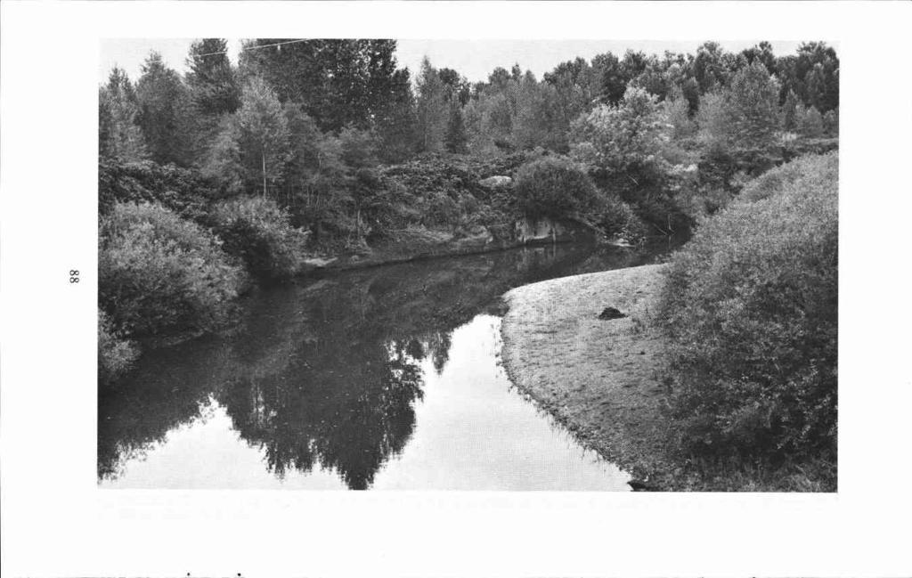
96 8g
 and 910th (L) TA Ons. Attachsd to Fifth Army. Italian Th.at.c from Roms throuqhout noithsrn Italy 4 ida). Gun. Wm. 0. Uv.say, Convnsndinq O.n.ral.")
97 Camp Adair S&te of the cantoitmlnt whvre these divisions trained duriq world war II 91st NANTRY DIVISION POWDER RIVER DIVISION R..ctivat.datcampWhltt 361st. 302nd. 303rd lid. ft.qts. S46th347tt34bth lid) and 910th (L) TA Ons. Attachsd to Fifth Army. Italian Th.at.c from Roms throuqhout noithsrn Italy 4 ida). Gun. Wm. 0. Uv.say, Convnsndinq O.n.ral. 96th INFANTRY OMSION DEADEYE DIVISION 361st. 302nd and 363rd ml. R.qts 363rd (H). 301st. S2nd and 921st TA Ins. Attach.d to T.nth Army...syts and Okinawa Invasions. N.'. Gun. Jam.s L. eradl.y, Commanding 0.n.raL
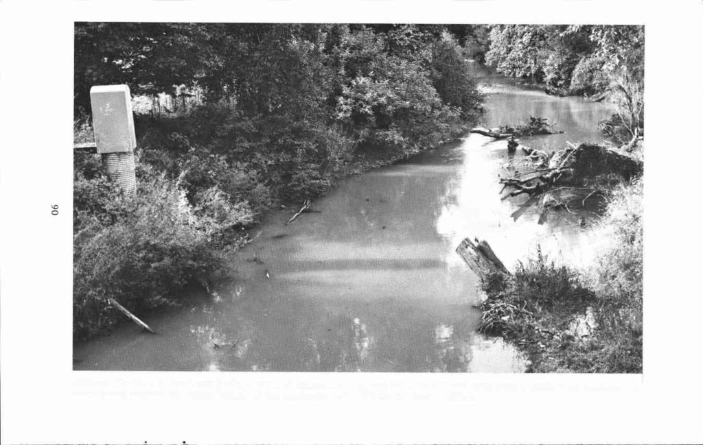
98 06

99 J.C. Avery.. Through and northward from Corvallis the route of the trail seems to have been much the same as present day 99W and the Southern Pacific Railroad for the first eight miles. In this distance two newly located ranches were passed by the emigrants of The first was that of Hamen C. Lewis, pioneer of 1845, three miles north of Mary's River according to the 1852 G L 0 survey. The second ranch was that of Thomas Reed, formerly claimed by Levi Scott, but appropriated by Reed in Scott's absence, seven miles north of Mary's River. At the above mentioned point eight miles north of Mary's River, we arrive at probably the first division of the Applegate Trail and for that matter, probably also the Hudson's Bay Company fur trails, used by Indians, trappers and traders alike. To the right branched the lowland route, due north past the present Camp Adair Marker and through the towns of Monmouth and Rickreall, also followed by present 99W. This route in turn seems to have divided somewhere near the Lukiamute River east of Helmick State Park, the right hand branch leading to Salem. Returning to the point eight miles north of Mary's River, the left hand branch of both old and present day roads seems to have been the one most preferred and traveled by emigrants and pioneers. It kept around the foothills on higher ground, avoiding the flooded and muddy lowlands. That it was probably the main traveled route of the 1846 emigrant wagons and even much later ones, is indicated by its name on the U.S. Geological Maps, "Old Portland and Umpqua Valley Road." It was also known as the Territorial Road. This route led northwesterly from the eight mile junction to cross Soap Creek about one and one half miles due west of the Camp Adair Marker. Near here, David D. Davis ( ), an emigrant of 1847 who traveled the Applegate Trail with his family, settled on Soap Creek. By June 30, 1850 he filed on Donation Land Claim No. 4518, consisting of acres. He was the first post- master, November 4, 1854, of the post office of Soap Creek, later called Tampico. His first wife is said to have died somewhere on the plains enroute to Oregon in Hanna Ann Davis, born January 12, 1833, was his oldest child. She was wounded by Indian arrows in Fandango Valley, east of Goose Lake near the California-Oregon State Line, on September 29, Falling face forward into the camp fire, she was severely burned and scarred for life. It is said she always turned the right side of her face away from the camera when being photographed in later years. David D. Davis and three daughters were buried near the Camp Adair marker. Their bodies were moved across the road when that camp was activated at the start of World War II. Later still they were moved to the New English Cemetery at Monmouth. David D. was the father of ten children, eight by his first wife and two by the second. Hannah Ann Davis married Caswell Hendricks in 1850 or They lived up the McKenzie River, at Thurston, at Pleasant Hill near the Willamette and other places. Hannah Ann was the mother of ten children. She died September 2, 1904 and is buried in the Mt. Vernon Cemetery at Thurston, Lane County, Oregon. From Soap Creek to Airlee, according to the 1852 G L 0 survey, the old Territorial Road closely followed the original Applegate Trail for the first three miles. Thereafter it closely paralleled the trail for the next four miles but seems to have run about one half mile to the northeast. At a midway point near the present Polk-Benton County line, or one mile southeast of the Suver Road junction with the Territorial Road, there was a northerly branch road leading to two different fords of the Lukiamute River below its junction with the Little Lukiamute. One crossed about one half mile below their junction (southwest of the old Elkins school) while the other crossed near present Helmick park, west of 99W. These two crossings may have been the ones used by the 1846 emigrants who passed J.W. Nesmith's farm enroute to 91

100 Rickreall, or those headed more northeasterly to Salem. The Lukiamute River was crossed by the Applegate Trail and Territorial Road near Maple Grove. Thereafter for the next two and one half miles to Lewisville both roads coincide to the crossing site of the Little Lukiamute immediately to the north. According to the 1852 G L 0 survey, the road or trail divided in less than a mile after crossing the Little Lukiamute. The left hand fork turned northwesterly upstream to join present State Highway 223 and approximate its route into Dallas. The right hand fork led due north up Cooper Hollow to also join present 223 about three miles south of Dallas Which of these two routes was the original Applegate Trail is unknown. State Highway 223 in 1942 ran slightly east of north from Dallas to Salt Creek, the home of the Applegate Brothers in the period, thence northeasterly to Amity and beyond, corresponding to the old Territorial Road and early trails northward. There is not enough available information to take any definite stand on which route was the most traveled in Weather and road conditions probably dictated the route to be followed. It would seem the territorial Road route might have been the one most traveled by wagons, if any actually passed beyond Dallas or Rickreall River that first year. The Rickreall and Salem routes probably saw but little wagon traffic, if any, as during the late fall and winter the country was a sea of mud, almost impassable to the jaded teams. With the return of the road-hunters to the Willamette Valley it became known that a new route into Oregon had been discovered and emigrants were actually making their slow and tortuous way over its unbroken path. Further, the returned road-hunters, realizing the difficulties to be encountered by the emigrants, were instrumental in sending out the first relief party. This party, led by John Jones, traveled as far south as Rogue River where they met the last party of emigrants enroute to the settlements. As time passed and further word began to reach the settlements by those sent ahead to secure what aid they could for the beleagured emigrants, the settlers of the Willamette became aroused. Several groups, some settlers, some relatives, and some those who had traveled ahead to secure provisions, were now traveling southward to meet the struggling emigrants. Thomas Holt, an emigrant of 1844, was one of the settlers whose sympathies became so aroused that he organized a relief party on his own to go to the aid of the incoming needy and suffering emigrants. He became one of the few who CHAPTER XI RELIEF PARTIES 92 without friends or relatives among the distressed emigrants, nevertheless had the courage and energy to go to their rescue. The Oregon Spectator of March 14, 1847 now takes up the story of the 1846 emigration and carries it through to the Willamette Valley: Thomas Holt, in company with five half breeds and one Frenchman, started on the 3rd of last December to assist the immigration then coming in on the southern route. They had a band of 34 horses. The following is a memoranda of travel kept by Mr. Holt. THE THOMAS HOLT JOURNAL, Dec. 4th. We crossed the Rickreall and traveled 15 miles and camped on the north fork of the Luckemute [It is assumed that Holt started from the Applegate settlement near the head of Salt Creek, north of Dallas, therefore this camp site would have been about three miles west of the junction of Little Lukiamute and Lukiamute Rivers, and on the
![former]. Some of the men started with the expectation that I had provisions for all hands, and did not bring any.](/docs-images/75/71753926/images/101-1.jpg "I did not take any more than I wanted for my own use, as it was generally understood that Mr.")
101 former]. Some of the men started with the expectation that I had provisions for all hands, and did not bring any. I did not take any more than I wanted for my own use, as it was generally understood that Mr. [John] Jones had started out [On his second relief trip] with fifteen hundred weight of flour, and some beef cattle. I found out here that Mr. Jones had not started at all. I had two hundred weight of flour, and Rev. J.B. Baldroach, 100 cwt. flour and one bacon ham, which he sent to be given to the needy. I found it necessary to get some more: I bought twenty-seven pounds of salt pork from Mr. J. Taylor. Dec. 5th. Crossed the north and south forks of the Luckemute [The Little Lukiamute, or north fork, was forded, according to the General Land Office Survey of 1852, about one half mile northeast of the old Lewisville School. The Lukiamute, or south fork, was forded about one fourth mile southeast of the junction of the present Airlie and Peedee paved roads.] swimming and bad crossing traveled ten miles and camped on muddy creek [On Soap Creek, slightly over one mile west of the present Camp Adair Marker on Westside Highway 99]. We met the first wagons here: Mr. Goff is here he is bringing Mrs. Newton in. Mr. Newton, her husband, was killed in the most barbarous manner. Three Indians came to Mr. Newton and gave him to understand that he had better camp where he was; if he went any further, he would not get as good a place, and accordingly he camped. The Indians begged something to eat, and some ammunition, with the promise to fetch in a deer; one of the Indians could speak a little English. He gave them three balls and some powder. The Indian that could speak English loaded his gun with the three balls, and remained about the camp. Mr. Newton suspected that all was not right, and wanted them to go away, but they would not go. He thought he would watch them, but he happened to drop asleep, and one of the Indians shot three balls into him: he was laying outside of the tenthe jumped inside of the tent to get his gun, and one of the Indians got an axe and cut his leg very nearly off. He died the next day of his wounds. The Indians robbed the tent of some articles and took an American mare and packed her off. Dec. 6th. Crossed Mary's river [at Corvallis] : there is a small canoe here that we cross our packs in, and swim our horses. Traveled nine miles [from Soap Creek] and camped on the south bank [of Mary's River] ; there are five families with their wagons here, and one family packing, camped here. Dec. 7th. Traveled 18 miles and camped on the north [west] bank of the Lungtum river [By the present Westside Highway 99 it is 16 miles from Corvallis to Monroe]. Dec. 8th. Crossed our pack over the river in a canoe, and swam our horses. We overtook Capt. Campbell, Mr. Goodman, Mr. Jenkins, and Mr. [Blacki Harris, with 25 horses and some provisions. [According to the 1852 General Land Office Survey, the main emigrant ford seems to have been three miles north of Monroe at the Irish Bend Road crossing of the Long Tom River.] They all tell us that they are going to the canyon [South of Canyonville]. We have more help than Capt. Campbell, and we travel fasterhe started three days before us. We met three families packing, and one family with a wagon. They tell us they have had nothing to eat todaythe children are crying for bread: we let them have fifty pounds of flour. Traveled 4 miles through a mirey prairie, and camped on a slough [Near Washbourne Wayside, between Monroe and Junction City on Westside Highway 99] Ḋec. 9th. We met 8 wagons and as many families, all out of provisions: we gave 10 pounds of flour to each family. Traveled 5 miles and camped on the Wilamette. [Of the groups of emigrants met on the 8th and 9th, one must have included the Virgil Pringle-Tabitha Brown party.1 We waited here for Capt. Campbell to go ahead with the provisions, as we have no more to spare. Dec. 10th. Traveled 14 miles and camped on Goose Creek [Somewhere in the general vicinity of Skinner's cabin in present Eugene]. There are a number of 93

102 families encamped here waiting for assistance: their teams have given out. Mr. Owens, Mr. Patten, Mr. Duskins, Mr. Hutchins, Mr. Howell, and Mr. Burrows overtook us today with 24 horses. Dec. 11th. The Frenchman and three half breeds turn back this morning: they are afraid if they go over the mountain [Calapooya], they will not get back this winter. I told [Jean] Baptiste [Gardipie] that Mr. Beers [At the Methodist Mission at Salem] expected that he would go with me to the canyon, and if he turned back, I could not go any further. He said that he did not think that the people back had any money to pay for being brought in. I told him that if he would go, that he should be paidif the people was not able to pay him, that Mr. Beers would raise a subscription and pay him. He said that he owed Mr. Beers sixty dollars that if I would see that paid, he would risk the rest; I told him I would see that paid. [Q. (Quinton) Delore was the other half-breed who did not turn back]. We came across four or five families encamped about noon, at a bute in the prairie [Creswell Butte]. These families could not get any further without assistance. Mr. Goodman, Mr. Hutchins, and Mr. Howell stopped here to assist them in. We traveled 23 miles and camped at the foot of the mountain [Probably near Latham or Veatch, south of Cottage Grove]. There are three families here that are in a very bad situation; their teams have given out, and they have no provisions. Mr. Campbell let them have some flour. I feel for them; it is hard for me to pass them, but when I know there are other helpless families among hostile Indians; I am bound to go and assist them. Crossed the Callapoia mountains [at Divide] ; saw the carcasses of a good many dead animals todaymet two families on the south side of the mountain, just ready to take the mountain; they were almost afraid to try to crosstheir cattle were nearly given out, and their provisions all gone. Mr. Campbell let them have some flour. Traveled 12 miles and camped [nooned, somewhere on Pass Creek near Comstock or Anlauf] on a small creek [Pass Creek] in the Umpqua valley. Tray- eled 9 miles and camped on Deer [Elk] creek. This is a very pretty valley [Apparently Scotts Valley], but is small and scarce of timber. There is white and black oak, and some ash, but very little fir timber nearer than the mountain. Dec. 14th. [Entries for the 12th and 13th were omitted but included in the 11th]. Traveled 15 miles and camped on the north fork of Elk river [On Cabin Creek, one mile north of Oakland] ; there are five families here. Mr. Kennedy, Mr. Hall, Mr. Croizen, and Mr. Lovelen [and Mr. Cornwall]; they have neither flour, meat, nor salt, and game is very scarce. Baptiste killed two deer, and divided the meat among them. I gave them 50 pounds of flour. Dec. 15th. Crossed the north and south forks of Elk river [Cabin Creek and Calapooya Creek respectively], both swimmingwe carried our packs across on logs. Mr. Campbell met his family here, and two others, Mr. Cornwall and Mr. Dunbar. Mr. Harris and Mr. Jenkins stopped here to help these families: there were not horses enough to take Mr. Cornwall's; he moved to the other family. Mr. Campbell left nearly all his property with him. We traveled 6 miles and camped on a spring branch [Sutherlin Creek]. Dec. 16th. Traveled 9 miles and camped on the creek [Newton Creek] where Mr. Newton was killed by the Indians. We saw a camp of Indians on a small creek; when they saw us, they run. Baptiste told them to stophe went up to themthey told him that the Indians that killed the Boston man [white man] was on the south fork of the Umpqua river, and the mare that they stole was there also. We crossed the north fork of the Umpqua river in canoes [Approximately one mile above the forks of the North and South Umpqua]; the Indians made us give them a blanket for the use of the canoe; we swam our horses across. Dec. 17th. Traveled up the south fork of the Umpqua 10 miles and camped on a spring branch [In Round Prairie near the southern base of Roberts Mountain at the Gordon Burnett ranch]. We met the last company of immigrants here, consisting of five families. They rejoiced very 94

103 much when they saw us. Dec. 18th. All hands busy making pack-saddles. Dec. 19th. The Indians stole a horse belonging to Baptiste. Today we took the back-track. Mr. Owens took Mr. Crump's family, Mr. Patten and Mrs. Duskins took Mr. [David] Butterfield's family and the widow Butterfield, Baptiste took Mr. James Townsend's family, Delore took Mr. David Townsend's family. Thomas Holt took Mr. [John] Baker's family. These families had been out of bread for more than two months. Their teams have all about given outthey are taking their empty wagons along until they get to the river; there they wifi leave them. We traveled nine miles and camped on Rock creek [Possibly Parrott Creek]. Dec. 20th. The Indians stole 3 horses and 1 mule belonging to Mr. Owens, Mr. Patten, and Mr. Duskins. We pursued the Indians so close that we got the mule. We traveled 6 miles and camped on a spring branch [Possibly Newton Creek on the Garden Valley Road]. Dec. 21st. Crossed the north fork of the Umpqua river [One mile above the junction with the South Fork]. The Indians were very saucy: they told us that they would not let us have a canoe to crosstold us to go and hunt a ford; they knew the river was very high, and it could not be forded. We had to give a gun, valued at eight dollars, belonging to Delore, before we could get a canoe. We traveled nine miles and camped on the north bank. [Holt's mileage here becomes confusing unless they had tried the Fisher Road north from the Roseburg Country Club as had the first emigrants earlier.] Dec. 22d. Traveled 5 miles and camped on a spring branch [Sutherlin Creek]. Snowed all day. Dec. 23rd. Traveled 10 miles and camped on the south fork of Elk [Calapooya Creek] river. We leave the wagons here. Dec. 24th. It took us all day to cross the river. It is out of its banks. Drowned two oxen. Camped on the north bank [One mile below, or west of Oakland]. Dec. 25th. Lay by today [Christmas Day] - It snowed all night. The snow is a foot deep. Dec. 26th. Traveled a mile and a half and camped on the north fork of Elk [Cabin Creek] river. We find these families have had nothing to eat for four days, but a little tallow boiled in water. Mr. Baker has three oxen that were driven from the settlement; he paid 75 dollars a yoke for them. I proposed to him to let these families have them. He said that he had lost nearly all his property in the canyon, and these oxen were all he had to depend on. These people are not able to pay him for themi thought it rather a hard case that he should lose them, and thought that under such circumstances, the people in the settlements would pay him by subscription. I told him that if he would leave them, I would insure his pay, whatever they cost him. He left them, and we divided them out, one to Mr. Kennedy's family, one to Mr. Hall's, and one to Mr. Croizen's family, and three quarters of one to Mr. Cornwall's family. I gâe 50 pounds of beef to two men that are encamped here, for an axe, and sold them 10 pounds of tallow for one dollar. I gave the axe to Mr. Townsend, it being very cold weather, and he having no axe to cut firewood with. Mr. Owens leaves us today to go ahead. Mr. Duskins goes with himas he has lost his horses, he can be of no more service to Mr. Butterfield. I let Mr. Townsend and Mr. Baker have 80 pounds each, of beef. I omitted to state that Mr. Burrows returned on the 15th, and packed Mr. Lovelen's family in. Dec. 26th [27th]. We lay by today to dry our clothes. This is the first clear day we have had since we left the settlements. Dec. 28th. Traveled 6 miles and camped on a spring branch [Headwaters of Cabin Creek near Rice Hill]. This is very slow getting along in consequence of having to pack oxen. I let the widow Butterfield have a horse to ride, the Indians having stolen her horses. [Recordings for the next three days were omitted by Holt.] Jan. 1st [1847]. Crossed the mountain [Calapooyas at Divide] the snow three feet deep in places. I cached some flour in the mountam going out. I opened the cache todayour mouths water for 95


104 Present day Rickreall on the central route of the Applegate Trail. Used mostly as a I0 THE WORLD!! summer or dry weather route, it was the shortest line of travel between Portland and the California mines. (Photo by Helen Helfrich) J, Quinn Thornton, I-laying resorted to low, cowardly and idiiiorahlc nu'ans, for the purpose of injuring my character amid stantliug. and having refused honorable satisfaction. which I have (lemmianded; I avail myself of this opport unity of publishing hiiiii to the world as H reclaiinless liar, an infamous scoundrel, a black hi(,arted villain. an arrant coward, a worthless vagabond and an imported miscreant1 a disgrace to the professioii and a dishiollur to his Country JAMES W. NESMITJI. OREGON CITY, JUNF. 7, 14 After arriving in the Oregon settlements, J. Quinn Thornton launched a tirade of abuse on the founders of the Applegate Trail, especially Jesse Applegate. As a result of his attacks, James W. Nesmith, son-in-law of David Goff, one of the founders, challenged Thornton to a duel. This Thornton ignored with the result that the above handbills were broadcast throughout the Oregon Territory. 96


105 RO.8cRT'..'W' fi OAfl BWF'tOL?JQf i-iootwj Wi? E4 Ii5T C' Utfr.5TACE PMMD Ii' 1YEE, 5TCT[Ph7JES, - ;¼'.P45 FOOVftUG ,;" V.. Vandalism down through the years has caused the destruction of many historical landmarks. This marker, still standing, is located on the north slopes of Roberts Mountain on the old Oregon-California Stage Road. Built under the supervision of Cot. Joe Hooker in this road served for years as the main north-south stage and freight road between the Willamette and Sacramento Valleys. (Photo by Helen Heifrich) 97
![some bread, as we have been out some time. Traveled 10 miles and camped at the foot of the mountain [Possibly near Veatch or Latham, south of Cottage Grove]. Jan. 5th.](/docs-images/75/71753926/images/106-1.jpg "Today and the last three days traveled 25 miles and camped at the Skinner house [in Eugene]. We met Mr. Powers here, with three horses to assist Mr. Butterfield. Jan. 6th. Mr. Butterfield gave a dollar and a half towards paying for Delore's gun; he lies by today.")
106 some bread, as we have been out some time. Traveled 10 miles and camped at the foot of the mountain [Possibly near Veatch or Latham, south of Cottage Grove]. Jan. 5th. Today and the last three days traveled 25 miles and camped at the Skinner house [in Eugene]. We met Mr. Powers here, with three horses to assist Mr. Butterfield. Jan. 6th. Mr. Butterfield gave a dollar and a half towards paying for Delore's gun; he lies by today. We traveled 6 miles and camped on the Willamette [In the Santa Clara vicinity north of Eugene on River Road]. Jan. 8th. Very cold and frosty; swam two creeksthe women and children got wet and came very near freezing. We had to camptraveled 14 miles yesterday and today. [In the vicinity of Washbourne Wayside between Monroe and Junction City]. Jan. 9th. Crossed Lungtum [Long Tom] river, swimmingtraveled 10 miles and camped at Scott's bute [Winkle Butte, midway between Monroe and Corvallis]. Mr. Butterfield overtook us again today. Jan. 10th. Crossed Mary's river [at Corvallis], swimming. Traveled 10 miles and camped on the north bank of the [Mary's] river. Jan. 11th. Traveled 12 miles and camped on muddy [Soap] creek. Mr. Butterfield was taken sick and stopped here. Jan. 12th. Traveled 5 miles and remained with Mr. Williams on the Luckemute [North of the Camp Adair Marker]. Very stormy and cold. [Holt seems to be circling along the base of the foothills to avoid the flooded bottom lands.] Jan. 17th. After lying by four days in consequence of storms and severe weather, traveled 7 miles and stopped with Mr. [Black] Harris [Somewhere near the forks of the Lukiamutes]. Crossed the Luckemute below the forks, swimming. Very stormy. Baptiste traveled on the 14th and crossed the Luckernute, and drowned one of his horses. He left the two Townsend families at the forks of 98 the Luckemute. Jan. 18th. Traveled 8 miles and stayed at Judge Nesmith's. Very cold and stormytwo horses gave out today. [According to Levi Scott, Nesmith was then living on a claim on "Monmouh Prairie." He later moved north to the Rickreall River where he purchased a large tract of land. In 1846 he married Pauline Goff, daughter of David Goff, a member of the Applegate Trail road-hunting party. The eight miles traveled by Holt between the forks of the Lukiamute and Nesmith's also indicates he was keeping to the higher foothill land to avoid the flooded bottoms.] Jan. 19th. The horses are so stiff today that they cannot travel. I leave Mr. Baker's family here, I took the best horse that I have, to ride to Mr. Beer's house [in Salem?]. I got as far as the Rickreall, and he gave out. Jan. 20th. I took it afoot this morning, as far as Mr. Keyser's. I got a horse from Mr. Keyser, and stayed all night. Jan. 21st. Went to Mr. Beers' today. One horse died this day. On this day, Jan. 21st, 1847, I arrived at home, after having been gone fifty days, undergoing many privations and hardships, but I feel that I have done no more than my duty. The public doubtless is aware of the humane object of our trip. It was to relieve our fellow beings who were suffering almost beyond description. As the painful news of the sufferings was not to be heard without prompting some of us to endeavor to relieve them as far as we could. We succeeded in relieving many who must have perished. Our party agreed to charge nothing for the use of our horses; and as yet we have not received anything. And I feel it will be too great a loss on us as individuals, to be at the whole of the expense of the trip. Therefore, I appeal to the public to know if they will not bear a hand in defraying the expenses of the trip. It will not be felt by the many, but to be wholly defrayed by persons in as indigent circumstances as we are in, will be felt considerably. I therefore subjoin a bill of expenses: To provisions taken from home $ For ferriage 19.25

107 To pork bought on the trip 3.12 To Baptiste Gardipie's services To horse stolen To Q. Delore's services To three beeves bought and To sundry expenses distributed (cash) Total $ To horse drowned Thomas Holt To horse died End. Combined California, Applegate and Lassen Emigrant Trail rut south of Little Goose Creek in extreme Northeastern Nevada. (Photo by Helen Heifrich) 99
 Parting of the Ways, in western Wyoming.")
108 Devil's Gate on the Oregon-California Trail in Central Wyoming on the Sweetwater River southwest of Casper. Compare this photo to one taken in High Rock Canyon, Nevada and published in Klamath Echoes No. 9, 1971, page 41. (Photo by Devere Heifrich) Parting of the Ways, in western Wyoming. Left, to Fort Bridger and Salt Lake City. Right, Sublette's Cut-Off to Oregon and California, via Fort Hall. (Photo by Devere Heifrich) 100
 Trough of the combined California, Applegate and Lassen Trails in Thousand Springs Valley, Northeastern Nevada.")
109 Trails West, Inc. caravan traveling in modern day covered wagons, placing a marker along the old California-Applegate-Lassen Trail in Northeastern Nevada, during August, Originally opened by ox-drawn covered wagons in (Photo by Helen Heifrich) Trough of the combined California, Applegate and Lassen Trails in Thousand Springs Valley, Northeastern Nevada. Miles in length, this channel was eroded by wind and water in the powdery soil through which the trail ran. (Photo by Devere Helfrich) 101
 Applegate Trail marker on Emigrant Creek at the foot of Greensprings Mountain southeast of Ashland, Oregon.")
110 A Trails West, Inc. marker being placed along the California Trail near the Humboldt River in Nevada during August, Dr. Robert Griffin, 1975 President, Trails West, Inc., center. (Photo by Helen Helfrich) Applegate Trail marker on Emigrant Creek at the foot of Greensprings Mountain southeast of Ashland, Oregon. This marker was installed by the American Pioneer Trails Association sometime during the 1940's, but has long since disappeared. (Photo by Devere Heifrich) 102
DISCOVERER OF THE OREGON TRAIL: ROBERT STUART ( ) by Gary Dielman
 by Gary Dielman") DISCOVERER OF THE OREGON TRAIL: ROBERT STUART (1785-1848) by Gary Dielman The Oregon Trail played a huge role in the settlement of the West. With 65 miles of the Oregon Trail in Baker County, it is also
DISCOVERER OF THE OREGON TRAIL: ROBERT STUART (1785-1848) by Gary Dielman The Oregon Trail played a huge role in the settlement of the West. With 65 miles of the Oregon Trail in Baker County, it is also
Maggie s Weekly Activity Pack!
 Maggie s Weekly Activity Pack! Name Date Remembering A Great Adventure The Journey of Lewis and Clark It has been two hundred years since Lewis and Clark started their journey across America. In February
Central Overland Trail Utah & Nevada Driving Guide, First Edition, 2016
 Central Overland Trail Utah & Nevada Driving Guide, First Edition, 2016 Page 51 In the third paragraph, second sentence, change 0.4 miles to 0.1 miles. In the fourth paragraph, second sentence, change
TOWERBUTTE. Lewis and Clark s. >> By Jerry Penry, LS
 4.95 Lewis and Clark s TOWERBUTTE >> By Jerry Penry, LS Have you ever felt like you are standing on hallowed ground, knowing that some very important surveyors had previously occupied that same location?
Maggie s Activity Pack!
 Maggie s Activity Pack! Name Date Remembering A Great Adventure The Journey of Lewis and Clark Two hundred years ago, in February 1803, President Thomas Jefferson got approval from the United States Congress
Undaunted Courage: Great Falls to the Pacific Coast. Tour: June 25 - July 6, Optional Camping & Canoeing June 22-25, 2018
 Lewis & Clark's Trek to the NorthWest Great Falls to the Pacific Coast Tour: June 25 - July 6, 2018 Optional Camping & Canoeing Stephen Ambrose Historical Tours Presents: Lewis & Clark's Trek to the NorthWest
Utah Studies DOMINGUEZ AND ESCALANTE
 Utah Studies THE WORLD IN THE 1400 S In the 1400 s merchants in Europe wanted to buy and sell goods with people in faraway places. Some of the reasons for this desire to trade with the world were: the
Section 1: Vocabulary. Be able to determine if the word in bold is used correctly in a sentence.
 Section 1: Vocabulary. Be able to determine if the word in bold is used correctly in a sentence. Hardships: difficult conditions or situations that cause discomfort and/or suffering Pioneers: the people
The Battle of Quebec: 1759
 The Battle of Quebec: 1759 In the spring of 1759, the inhabitants of Quebec watched the river with worried eyes. They waited anxiously to see whether the ships of the French, or those of the British fleet,
Yankee Hill Dispatch
 Yankee Hill Dispatch Vol 2 No 3 Dec 2008 Published by the Yankee Hill Historical Society www.yankeehillhistory.com P.O.Box 4031, Yankee Hill, Ca 95965 Wishing You Happy Holidays And A Prosperous 2009 Our
Academic All State Qualifying Football Teams
 Academic All State Qualifying Football Teams 6A Summit 3.5 Jesuit 3.39 Sherwood 3.39 Lake Oswego 3.34 Lincoln 3.32 Central Catholic 3.32 Tigard 3.24 West Linn 3.24 Grant 3.22 Barlow 3.18 McMinnville 3.18
Lewis & Clark Return Home
 Lewis & Clark Return Home On March 23, 1806, Meriwether Lewis, William Clark, and their team started for home. At first they took the same path. But after they crossed the Rocky Mountains, the group split
RETURN TO THE LOST ADAMS DIGGINGS
 RETURN TO THE LOST ADAMS DIGGINGS My name is Richard U. French, friends call me Dick. I want to tell you a story; it is a story about gold. In the closing months of the American Civil War, in 1864, an
Sebastian Vizcaiňo
 Sebastian Vizcaiňo 1548-1629 Sebastian Vizcaiňo was a California explorer who was more famous for what he named, or rather renamed, than for what he found. In truth, he didn t discover anything that Cabrillo
California Explorer Series
 California Explorer Series Sebastian Vizcaino 1548-1629 Sebastian Vizcaino was a California explorer who was more famous for what he named, or rather renamed, than for what he found. In truth, he didn
Mike Hiler, "A history of Naches Pass," Signpost for Northwest Trails, (July, 1989), p
, p") NACHES PASS TRAIL HILER ACCT. Mike Hiler, "A history of Naches Pass," Signpost for Northwest Trails, (July, 1989), p. 34-37. Washington State is covered with historic trails. Most were inherited from natives
NACHES PASS TRAIL HILER ACCT. Mike Hiler, "A history of Naches Pass," Signpost for Northwest Trails, (July, 1989), p. 34-37. Washington State is covered with historic trails. Most were inherited from natives
An Investigation of a Slave Woman's Role in the Defense of Elkton during the War of 1812
 Prepared for the Historic Elk Landing Foundation An Investigation of a Slave Woman's Role in the Defense of Elkton during the War of 1812 Michael L. Dixon, M.S., M.A. Historian June 12, 2011 Project
Trail Beginning Elevation: 7553 ft The Poison Creek Trailhead is located at the end of National Forest Road 646E (NF-646E).
.") West Mountain Trails Poison Creek Trail #134 Length: 2.9 miles (4.7 km) Difficulty Horseback: A good trail for the first time west mountain rider, some steep sections Hiking: Most Difficult USGS Maps:
West Mountain Trails Poison Creek Trail #134 Length: 2.9 miles (4.7 km) Difficulty Horseback: A good trail for the first time west mountain rider, some steep sections Hiking: Most Difficult USGS Maps:
Doty Meets Coyote Contents & Audio Playlist
 Thomas Doty Doty Meets Coyote Page 1 of 9 Doty Meets Coyote Contents & Audio Playlist Ancestors and Elders (Book: Page 9) (CD: Disc 1, Track 1) (Download: Track 2) (4:22) Description: Doty thanks those
OREGON DEPARTMENT OF FISH AND WILDLIFE 2017 Sport Fishing Catch - Fall Chinook Expanded numbers by month 'Preliminary' Version #1
 OREGON DEPARTMENT OF FISH AND WILDLIFE 2017 Sport Fishing Catch - Fall Chinook Expanded numbers by month 'Preliminary' Version #1 Based upon Run Year Coastal River Systems 21 ALSEA R & BAY 7 - - - - -
Aurora state Airport Outside Metro UGB State owned. Outside Canby and Metro UGB. Lebanon Inside Lebanon UGB State owned
 Airport status Ownership source District 9 Airports Aurora state Airport Outside Metro State owned Lenhardt Outside Metro Public Use/Privately owned? Santiam Junction Dietz Airpark Outside Metro Outside
Eastern Warner Mountain Ranch Modoc County, California
 Eastern Warner Mountain Ranch Modoc County, California Proudly Offered By 707 Merchant Street, Suite 100, Vacaville, Ca 95688 (707) 455-4444 Office (707) 455-0455 Fax info@caoutdoorproperties.com www.californiaoutdoorproperties.com
BRADDOCK'S WAR SUPPLIES AND DUNBAR'S CAMP 1
 I934 braddock's war supplies 49 BRADDOCK'S WAR SUPPLIES AND DUNBAR'S CAMP 1 /-\u25a0-a he following is the story of how the war supplies of General JL Braddock, which he discarded in his hasty retreat
Overland Stagecoach Service through Tucson If it weren t for stagecoaches, Tucson wouldn t have developed to be the town we see today!
 Ring s Reflections by Bob Ring Overland Stagecoach Service through Tucson 1857-1880 If it weren t for stagecoaches, Tucson wouldn t have developed to be the town we see today! Let s set the stage (sorry).
OREGON DEPARTMENT OF FISH AND WILDLIFE 2017 Sport Fishing Catch - Spring Chinook Expanded numbers by month 'Preliminary' Version #1
 OREGON DEPARTMENT OF FISH AND WILDLIFE 2017 Sport Fishing Catch - Spring Chinook Expanded numbers by month 'Preliminary' Version #1 Based upon Run Year Code Location Name Jan Feb Mar Apr May Jun Jul Aug
OREGON DEPARTMENT OF FISH AND WILDLIFE 2016 Sport Fishing Catch - Spring Chinook Expanded numbers by month 'Final' Version
 OREGON DEPARTMENT OF FISH AND WILDLIFE 2016 Sport Fishing Catch - Spring Chinook Expanded numbers by month 'Final' Version Based upon Run Year Code Location Name Jan Feb Mar Apr May Jun Jul Aug Sep Oct
THE MANIFEST January 2015
 THE MANIFEST January 2015 The new year has begun and work continues on the track-laying project at the Park. It is hard to believe we only have two more months before we open again! I for one am looking
The Highlights of Homeschooling History Literature Unit Study. Oregon Trail. Sample file. Created by Teresa Ives Lilly Sold by
 The Highlights of Homeschooling History Literature Unit Study Oregon Trail Created by Teresa Ives Lilly Sold by www.hshighlights.com INTRODUCTION This history/literature study guide is created to use in
The National Historic Trail System
 The National Historic Trail System Frank Norris, Historian, National Park Service, National Trails Office, P.O. Box 728, Santa Fe, NM 87504; frank_norris@nps.gov Mike Taylor, Cultural Resource Specialist,
CK Ranch Sublette County, Wyoming
 CK Ranch Sublette County, Wyoming 1 Since originally homesteaded in the late me of the finest recreational hunting and e ribbon trout fishing, bordering 5 miles of on request. 2 The CK Ranch is located
INTRODUCTION 250,000
 INTRODUCTION The United States of America has over 250,000 rivers, with a total of about 3,500,000 miles of rivers. The main stems of 38 rivers in the United States are at least 500 miles (800 km) long.
A BGES Historic Commemorative Program: Destiny at the Little Big Horn: The 140th Anniversary Study
 A BGES Historic Commemorative Program: Destiny at the Little Big Horn: The 140th Anniversary Study They died with their boots on! For as long as I can remember Custer was that mythical man whose image
Rediscovering the Butterfield Trail Through Satellite Imagery Interpretation: Fort Chadbourne to the Pecos River
 Rediscovering the Butterfield Trail Through Satellite Imagery Interpretation: Fort Chadbourne to the Pecos River Tom Ashmore Abstract Although the Butterfield Trail s route through West Texas is generally
Oregon Department of Education Office of School Finance August 5, Report: Edu Jobs Estimated Impact on State School Fund and District Detail
 Oregon Department of Education Office of School Finance August 5, 2010 Report: Edu Jobs Estimated Impact on State School Fund and District Detail Assumptions: Edu Jobs award: $116,770,000 School district
Communication in the West and the Transcontinental Railroad!!!
 Communication in the West and the Transcontinental Railroad!!! What was communication like during Westward Expansion? If people wanted to get letters from the West back to the East, the fastest way was
BOONE'S TRACE THROUGH LAUREL COUNTY By NEAL 0. HAMMON Louisville, Kentucky Published in the Filson Club Quarterly, April 1968.
 BOONE'S TRACE THROUGH LAUREL COUNTY By NEAL 0. HAMMON Louisville, Kentucky Published in the Filson Club Quarterly, April 1968. For several years I have been doing research on the subject of the original
Jed Smith California the Hard Way
 MOUNTAIN MEN Jed Smith California the Hard Way STEVE BOGA High Noon Books Novato, California Contents 1. A Young Man s Dreams...1 2. The Desert...5 3. The Mountain...15 4. Will Lies Down...21 5. Will Revives...28
Spanish Land Grant History of Santa Teresa and Sunland Park Abridged by Dr. Paul Maxwell Taken from the NM Office of the State Historian
 Spanish Land Grant History of Santa Teresa and Sunland Park Abridged by Dr. Paul Maxwell Taken from the NM Office of the State Historian Introduction: Ownership of what now encompasses the Sunland Park
Oregon School Activities Association SW Parkway Avenue, Suite 1 Wilsonville, OR fax:
 Academic All State Qualifying Boys Basketball Teams 6A Lincoln 3.77 Tigard 3.72 McNary 3.65 Barlow 3.65 West Salem 3.62 Bend 3.62 Summit 3.6 Grants Pass 3.6 Tualatin 3.57 Newberg 3.54 Wilson 3.54 Canby
Arizona Gilbert, Ariz. United Food Bank
 Listed below, in alphabetical order by state and city, are local organizations that Dutch Bros is supporting in 2017 on Dutch Luv Day. Arizona Gilbert, Ariz. Goodyear, Ariz. Flagstaff, Ariz. Flagstaff
OREGON DEPARTMENT OF TRANSPORTATION STATEWIDE ROAD, WEATHER AND INCIDENT CONDITIONS 9/5/2018 2:12:06 PM
 OREGON DEPARTMENT OF TRANSPORTATION STATEWIDE ROAD, WEATHER AND INCIDENT CONDITIONS Incidents/: 9/5/2018 2:12:06 PM ROUTE ORE99EB 2 3 @ Salem, Hyacinth/Verda Hwy100 15 22 7 Mi W of Ainsworth St Park Southbound
The Oregon Community Foundation Small Arts & Culture Grants Fall 2017
 The Oregon Community Foundation Small Arts & Culture Grants Fall 2017 Central Oregon Arts and Culture Alliance of Central Oregon Bend $5,000 Central Oregon Youth Orchestra Bend $1,400 Fossil Museum Fossil
Historic Trails Research. Lewis and Clark Landmark Document
 Historic Trails Research Lewis and Clark Landmark Document Lewis and Party Crossing the Clearwater Tributary of the Big Blackfoot River 1806-07-05(1)L (Clearwater Crossing) May 29, 2015 Revised: May 31,
F ig u re S y s te m A lte r n a tiv e s. Stanfield. !( Malin L e g e n d
 Stanfield ( ( Malin L e g e n d GTN Mainline Coos Pipeline Ruby Pipeline Williams West Ignacio to Sumas Mainline Camas to Eugene Lateral Eugene to Grants Pass Lateral F ig u re 1 0.3-1 S y s te m A lte
Trail Boss: Rich Bugarin Home # Cell#
 Henness Pass Road Hi-Landers October 2013 Club Run Trail Boss: Rich Bugarin Home # 916-771-3359 Cell# 916-300-3192 E-Mail: rbugarin@hi-landers.com Meet at the Grass Valley Lumber Jack Restraint at 9:00am
1957 Class A-1 Football Schedules District 1 & 2 PIL
 1957 Class A-1 Football Schedules District 1 & 2 PIL Benson Cleveland Franklin Grant Jefferson Lincoln Madison Roosevelt Washington Wilson Friday, September 13 Friday, October 11 Friday, November 1 No
Fort Carillon/Ticonderoga
 Fort Carillon/Ticonderoga A P H O T O G R A P H I C H I S T O R Y B E H I N D T H E S T R A T E G I C K E Y T O B O T H B R I T I S H A N D A M E R I C A N V I C T O R I E S I N T H E N O R T H. S E V
April 10, Mark Stiles San Juan Public Lands Center Manager 15 Burnett Court Durango, CO Dear Mark,
 Mark Stiles San Juan Public Lands Center Manager 15 Burnett Court Durango, CO 81301 Dear Mark, We are pleased to offer the following comments on the draft San Juan Public Lands Center management plans
To the Public: President The Atchison, Topeka & Santa Fe Railway Co. V I
 V I To the Public: On October 25, 1960, the Santa Fe Railway Co. filed an application with the Interstate Commerce Commission for permission to acquire control of the Western Pacific Railroad. Because
N the northeastern shoulder of the ()
") xii: THE OIJIANAS N the northeastern shoulder of the () continent lies a huge block of territory as large as France and Spain combined. It is in reality an island, since it is bounded on the north and
xii: THE OIJIANAS N the northeastern shoulder of the () continent lies a huge block of territory as large as France and Spain combined. It is in reality an island, since it is bounded on the north and
«7R. Figure Coos Bay Alternatives
 ± «0 «1 Proposed Route North Route Alternative (Haynes Inlet Avoidance) Modified North Route Alternative Haynes Inlet East Avoidance Alternative Wetland Reserve Survey ««3 2 «7R 0 2,000 4,000 Feet Figure
Uncle James Howver The Gold Rush and a Lost Claim
 Uncle James Howver The Gold Rush and a Lost Claim There s Gold in Them Thar Hills! Susan McNelley Some men seek riches. Some men seek adventure. Some men yearn for both. Their stories often stir the imagination.
Lost Colony of Roanoke
 Lost Colony of Roanoke Lesson Number: 3 Title: The Lost Colony of Roanoke Grade Level: 5 th Time: 50-60 minutes Materials: Per Student: Roanoke: The Lost Colony short story Roanoke Theories worksheet Evidence
Chapter 6 The Spanish Colonial Period
 Chapter 6 The Spanish Colonial Period The Spanish had lost interest in Texas after the failed expeditions of the 1500 s. They did build colonies in New Mexico along the upper Rio Grande (remember that
From Die Laughing (The BIT'N Files Series), by T. L. Wolfe, 2005, Austin, TX: PRO-ED. Copyright 2005 by PRO-ED, Inc. BIT N File One. Thadd L.
, by T. L. Wolfe, 2005, Austin, TX: PRO-ED. Copyright 2005 by PRO-ED, Inc. BIT N File One. Thadd L.") Thadd L. Wolfe Author Thadd L. Wolfe Cover Illustration Larry Knighton The BIT N Files Series was created by Stephen Cosgrove. 2005, 1998 by Stephen Cosgrove. No part of this publication may be reproduced,
Thadd L. Wolfe Author Thadd L. Wolfe Cover Illustration Larry Knighton The BIT N Files Series was created by Stephen Cosgrove. 2005, 1998 by Stephen Cosgrove. No part of this publication may be reproduced,
Rogue Gorge (Mt. Stella) Roadless Area-- T30S R3E (primarily in portions of Sections 23, 26, 33, 34 & 35)
 Roadless Area-- T30S R3E (primarily in portions of Sections 23, 26, 33, 34 & 35)") Rogue Gorge (Mt. Stella) Roadless Area-- T30S R3E (primarily in portions of Sections 23, 26, 33, 34 & 35) Rogue River-Siskiyou National Forest--High Cascades Ranger District Upper, higher elevation trail
Rogue Gorge (Mt. Stella) Roadless Area-- T30S R3E (primarily in portions of Sections 23, 26, 33, 34 & 35) Rogue River-Siskiyou National Forest--High Cascades Ranger District Upper, higher elevation trail
September 24, :43 PM THEMED SCHOOL FIELD TRIPS PIONEER INDIANA
 September 24, 2015 2:43 PM THEMED SCHOOL FIELD TRIPS PIONEER INDIANA Gallery PIONEER INDIANA Using the galleries and public spaces of the Indiana State Museum, answer the following questions. Q: If pioneer
Wilkins, Nevada A 20 th Century Ghost Town
 Howard Hickson s Histories Wilkins, Nevada A 20 th Century Ghost Town Wilkins looks like a war zone today. There is nothing there except burned ruins in the sagebrush. It is a far cry from the vital days
Preparing for Writing Performance Tasks: Readying Students for Success in Writing and State Tests
 Preparing for Writing Performance Tasks: Readying Students for Success in Writing and State Tests "If students are to make knowledge their own, they must struggle with the details, wrestle with the facts,
ELK ISLAND NATIONAL PARK
 ELK ISLAND NATIONAL PARK DEPARTMENT OF THE INTERIOR HON. THOMAS G MURPHY - Minister H. H. ROWATT. C.M.G. - Deputy Minister J. B. HARTTIN Commissioner National Parks of Canada, Ottasna ELK ISLAND NATIONAL
Please DO NOT start here without completing the other four stations...
 Please DO NOT start here without completing the other four stations... Exit Station: Pioneers & The Oregon Trail Once pioneers...began immigrating [on the Oregon Trail], it was almost inevitable that the
Panning for History Michael Stahl
 Panning for History Michael Stahl The Young Scout troop went on a camping trip one weekend. The 12 boys and their patrol leader went into the woods close to their home city of Sacramento, located in the
1. Title slide: Great Wagon Roads
 1. Title slide: Great Wagon Roads a. Going to discuss how our ancestors may have come to South Carolina b. Of course could have come aboard ship to Charleston c. Many came overland from the more northern
This Is the. W e s t
 This Is the W e s t This Is the W e s t Copyright by Harcourt, Inc. All rights reserved. No part of this publication may be reproduced or transmitted in any form or by any means, electronic or mechanical,
NNHS NEWS LETTER BRIDGES OF NORTHVILLE AND THE TOWN OF NORTHAMPTON. THE FIRST BRIDGE Was at (Northampton) Fish House 1818
 Fish House 1818") NNHS MUSEUM School House Museum will open this year from Mid- June through August. More information on special dates and tours will be forth coming. NNHS NEWS LETTER Northville Northampton Historical Society
NNHS MUSEUM School House Museum will open this year from Mid- June through August. More information on special dates and tours will be forth coming. NNHS NEWS LETTER Northville Northampton Historical Society
Physical Regions of the U.S.
 Physical Regions of the U.S. Quickly use this map to label the map on your paper Pacific Coast The coast from southern California to Alaska The region of the Pacific Northwest has a long history that was
LIST OF LOCAL SIGHTS AND RECREATION
 LIST OF LOCAL SIGHTS AND RECREATION Pictures of Klamath Falls - http://members.spree.com/sip/sunnidaze/me/kfalls.html One of the local members of Kingsley Field took some pictures of the local area in
December 2017 Oregon City First Capital City in The West
 December 2017 Oregon City First Capital City in The West A History of Oregon City see page 2. Webfooters Post Card Club PO Box 17240 Portland OR 97217-0240 www.thewebfooters.com Oregon City: The First
Arizona Gilbert, Ariz. $23,000 - United Food Bank
 Listed below are the donation totals, in alphabetical order by state and city, local organizations that Dutch Bros is supporting in 2017 on Dutch Luv Day. ***Some donation amounts may be duplicated based
Three Sisters Wilderness Oct. 2009
 Three Sisters Wilderness Oct. 2009 I was in Bend, OR and had the whole day to travel back to Boise so I decided to take a hike to the popular Green Lakes and summit the South Sister in Three Sisters Wilderness.
The Panama Canal An Engineering Wonder
 The Panama Canal An Engineering Wonder By Priyanka Ann Saini, Sea News - November 28, 2017 The Panama Canal is a modern day engineering wonder. It is approximately 80 kilometers long between the Atlantic
Text 3: The Battles of Lexington and Concord. Topic 3: The Revolutionary Era Lesson 3: Taking Up Arms
 Text 3: The Battles of Lexington and Concord Topic 3: The Revolutionary Era Lesson 3: Taking Up Arms OBJECTIVES Describe the situation that led to the fighting that broke out in Lexington and Concord Explain
Saturday, June 17 to Sunday June 25, Stampede to Cody
 Saturday, June 17 to Sunday June 25, 2017 Stampede to Cody Wind River Canyon Wind River Canyon is a scenic Wyoming canyon carved out by the Wind River. It is located between the cities of Shoshoni and
The voyage of the 'Mimosa', By Culturenet Cymru
 www.casgliadywerincymru.co.uk www.peoplescollectionwales.co.uk Learning Activity Key Stage 3 This resource provides learning activities for your students using People's Collection Wales. It is one of a
Bell Ringer Which was NOT an area of discontent (being unhappy) in the Georgia Colony?
 in the Georgia Colony?") Bell Ringer 11-4-13 Which was NOT an area of discontent (being unhappy) in the Georgia Colony? A.Slavery B.Voting Rights C.The sale of rum and liquor D.Ownership of land Which was NOT an area of discontent
Bell Ringer 11-4-13 Which was NOT an area of discontent (being unhappy) in the Georgia Colony? A.Slavery B.Voting Rights C.The sale of rum and liquor D.Ownership of land Which was NOT an area of discontent
Anderson Mt. Proposed Wilderness Additions to the Rogue-Umpqua Divide Wilderness-- T30S R3E (mostly) Sections 4 & 9, and T29S R3E Section 33
 Sections 4 & 9, and T29S R3E Section 33") Anderson Mt. Proposed Wilderness Additions to the Rogue-Umpqua Divide Wilderness-- T30S R3E (mostly) Sections 4 & 9, and T29S R3E Section 33 When the 35,701 acre Rogue-Umpqua Divide Wilderness was designated
Anderson Mt. Proposed Wilderness Additions to the Rogue-Umpqua Divide Wilderness-- T30S R3E (mostly) Sections 4 & 9, and T29S R3E Section 33 When the 35,701 acre Rogue-Umpqua Divide Wilderness was designated
47I THE LAS ANIMAS GLACIER.
 THE LAS ANIMAS GLACIER. ONE of the largest of the extinct glaciers of the Rocky Mountains was that which occupied the valley of the Las Animas river. This stream originates in the San Juan mountains in
Spanish Missions History and Purpose
 Spanish Missions History and Purpose Columbus's voyage of discovery opened a new world of possibilities for the Spanish. In the Americas, Spain soon began to use its soldiers to increase the size of its
SPARTA Finding treasures off the beaten path just got a lot easier.
 FIND TREASURES OFF THE BEATEN PATH IN WHITE CO., TN By Amy Davis, Herald Citizen Staff Herald Citizen, Cookeville, TN Thursday, 23 February 2012, pg. A 9 SPARTA Finding treasures off the beaten path just
District Court, N. D. California
 Case No. 16,181a. [1 Cal. Law J. 358.] UNITED STATES V. RODRIGUEZ. District Court, N. D. California. 1862. MEXICAN LAND GRANTS LOCATION OF BOUNDARIES OBJECTIONS TO SURVEY. Official survey of rancho Butano,
Skiing and Snowshoes on Un-groomed Fernan Saddle Terrain
 Skiing and Snowshoes on Un-groomed Fernan Saddle Terrain Three ski or snowshoe routes are available from the Fernan Saddle Parking Lot which either do not cover routes ordinarily groomed for snow machine
NOTICE OF INTENT MAPS WITH DESCRIPTIONS
 NOTICE OF INTENT MAPS WITH DESCRIPTIONS Location Map(s) to Accompany Notice of Intent The small corner map embedded in the lower left corner of the large map above shows the location of the three national
Hannibal crosses the Alps
 Hannibal crosses the Alps 247-182 BC Early years Hannibal Barca was born in Carthage, North Africa, (now a suburb of Tunis, Tunisia) in 247 BC. At that time this once prosperous seaport was losing a long
t COM^S, SARAH INTERVIEW #7836
 t COM^S, SARAH INTERVIEW #7836 COMES, 3ABAH INTERVIEW. 7835 430 Journalist, Hazel B. Groene, votober 14, 1937, Interview with SaraoCombs, About*three miles west of Hugo. 1/8 Cbo«rtaw«My grandfather, Christopher
Society Member to Supervise the Building of James Monroe s Birthplace House Charles Belfield, a councilor of the War of 1812 Society in the
 Society Member to Supervise the Building of James Monroe s Birthplace House Charles Belfield, a councilor of the War of 1812 Society in the Commonwealth of Virginia has been designated as the supervisor
PIONEER OF Sketch of Hardships Endured by Those Who Crossed. The Plains in '46
 PIONEER OF 1846 Sketch of Hardships Endured by Those Who Crossed The Plains in '46 Written for the Review by David Campbell of Porterville, Cal. [Note: Reprinted in the August 11, 12, and 13th. issues
Samuel Treat ( /17)
") Samuel Treat (1648 1716/17) Samuel Treat graduated from Harvard College in 1669. He was the eldest son of Robert Treat who became governor of Connecticut. He was the husband of Elizabeth Mayo who was the
Samuel Treat (1648 1716/17) Samuel Treat graduated from Harvard College in 1669. He was the eldest son of Robert Treat who became governor of Connecticut. He was the husband of Elizabeth Mayo who was the
Chapter 12 Manifest Destiny ( ) Section 3 War With Mexico
 Section 3 War With Mexico") Assess your agreement with the following statement: The United States government acted morally in its acquisition of the land of the present-day continental United States. A. Strongly agree B. Somewhat
Assess your agreement with the following statement: The United States government acted morally in its acquisition of the land of the present-day continental United States. A. Strongly agree B. Somewhat
In September, 1966, an
 ANNE S. ROBERTSON, D LITT THE ROMAN CAMP(S) ON HILLSIDE FARM, DUNBLANE, PERTHSHIRE This paper is published with the aid of a grantfrom H.M.Treasury In September, 1966, an emergency excavation was begun,
CITY PROPERTY TAX DATA
 LEAGUE OF OREGON CITIES CITY PROPERTY TAX DATA SUMMARY DATA AND TABLES SUMMER 2014 Published by the League of Oregon Cities CONTENTS Notes on the Data... 2 Introduction and Summary Tables... 3 Table 6:
Avalanches and the Mount Whitney Basin
 Avalanches and the Mount Whitney Basin 10 April 2006 by Bob Rockwell Prelude Avalanches are a fact of life in high mountains in winter, and we take courses to find out about them. We learn how to assess
Morrill Act. frontier. transcontinental railroad. boomtowns reservations. sodbusters. Homestead Act deflation. cattle drive
 Vocabulary 17: End of the Frontier Cut out each picture and paste into the notebook on the left side of the page. Next to each picture, define the term in seven words or less. Words followed by an asterisk
and led Jimmy to the prison office. There Jimmy was given an important He had been sent to prison to stay for four years.
 O. H e n r y p IN THE PRISON SHOE-SHOP, JIMMY VALENTINE was busily at work making shoes. A prison officer came into the shop, and led Jimmy to the prison office. There Jimmy was given an important paper.
In the 1860s, with a movement to
 Trains Railway crew on hand car, 1888. In the 1860s, with a movement to push for Canadian independence gaining ground, the British government passed legislation establishing the Dominion of Canada. At
The temperature is nice at this time of year, but water is already starting to be scarce.
 In March of 2003, Scott Morrison and I went backpacking in the Grand Canyon. The temperature is nice at this time of year, but water is already starting to be scarce. Another issue with this time of year
In 1850, Congress passed a law donating two and one half million acres to the State of Illinois for the use of the Illinois Central Rail Road.
 Merna The town of Merna was founded by primarily Irish and German farmers. Their faith and families were an integral part of who they were. There was and still is today a strong sense of community. Most
REGULATIONS FOR DECLARATION AND DISPOSAL OF UNCLAIMED ITEMS OF THE PIRAEUS CONTAINER TERMINAL S.A. IN THE PIRAEUS FREE ZONE
 REGULATIONS FOR DECLARATION AND DISPOSAL OF UNCLAIMED ITEMS OF THE PIRAEUS CONTAINER TERMINAL S.A. IN THE PIRAEUS FREE ZONE Article 1 Goods declared unclaimed deadlines Goods unloaded and received by the
National Parks Called America s Best Idea
 National Parks Called America s Best Idea Welcome to This Is America in VOA Learning English. I'm Jim Tedder. And I'm Kelly Jean Kelly. This week on our program, we talk about national parks in the United
*** Note: Mileages are based on resetting trip odometer to zero at each turn point AL-5 is Alabama Highway 5 CO-51 is County Road 51, etc.
 Directions to Ham(m) Family Reunion site of Lester Ham s Original Homestead Owned and hosted by Jeff & Renee Hamm Comments & corrections to Marv Hamm: MarvHamm@aol.com Ham(m) Family Reunion annually on
GRAVE OF EVA AMELIA HEWITT MUNROE
 GRAVE OF EVA AMELIA HEWITT MUNROE Adjacent to 2875 Me FARLANE ROAD october 6, 2009 Historic and Environmental Preservation Board City of Miami GRAVE OF EVA EMELliA HEVV~TT MUNROE ADJACENT TO 2875 MCFARLANE