Outcome 3: Deliver housing close to jobs and services
|
|
|
- Derrick Rice
- 5 years ago
- Views:
Transcription
1 Outcome 3: Deliver housing close to jobs and services Greater Newcastle has established from the independent development of original towns like Maitland, Wallsend, Newcastle, Raymond Terrace, Cessnock and Toronto. This has allowed a vibrant mix of land uses and opportunities, but with a limited focus on outcomes that benefit the entire metropolitan area. Over time, new development areas have become increasingly spread out. This has led to greater use of private vehicles and numerous development fronts competing for infrastructure funding. New development fronts have affected housing delivery and provided unclear market signals about new housing. Together, these factors have limited the ability to achieve a cost-efficient and affordable pipeline of new housing, along with increasing dependency on private vehicles. Greater Newcastle Population Projections ,000 residents 20% 116,000 population increase 692,000 residents Growth needs to be planned and managed in a way that maintains the city's liveability. This Plan provides a metropolitan approach that will make best use of resources, create the scale and critical mass to coordinate and link places and ideas. This will make best use of resources, improve planning for transport networks, follow a clear and logical expansion from a strong urban core, and better integrate investment Demographic household changes are also creating the need for a more diverse mix of homes to meet a wide range of lifestyle needs and budgets, including young families, older people and singles. This means a range of housing types, tenures and price points are required to make it easier for people to own their own home. The provision of rental housing for lower income households, and affordable and social housing for the most vulnerable is equally important. Greater Newcastle Dwelling Projections Dwellings needed over next 20 years 60,450 Ensuring a planned approach to the location of new homes, making sure there is a diversity of homes (including single dwellings, secondary dwellings, low-rise density, and apartments) and connecting these to infrastructure and open space is fundamental. To create capacity for a diverse range of new homes in the right locations, local plans will align with the direction and vision of the Hunter Regional Plan 2056 and this Plan. 255,700 dwellings 316,150 dwellings View of Charlestown Square, courtesy of Lake Macquarie City Council


2 Figure 7: Urban renewal corridors 2018 Sandgate Urban Renewal Corridor Stage 1 Urban Renewal Corridor Stage 2 Priority Multimodal Corridor Corridor Investigation Newcastle Port Education Railway Station UNIVERSITY OF NEWCASTLE Warabrook Railway Light Rail Station Light Rail Frequent Bus Routes Ferry Terminal Proposed Ferry Terminal Newcastle Interchange State and Regional Roads Environmental and Open Space Waterway JOHN HUNTER HOSPITAL 800m Radius Walking Catchment Cockle Creek Cardiff Kotara CHARLESTOWN 40 Greater Newcastle Metropolitan Plan 2036 TO BELMONT
3 NEWCASTLE PORT Waratah Newcastle Cruise Terminal Hamilton Broadmeadow NEWCASTLE CITY CENTRE Adamstown 41

4 Branxton Greta Rutherford CENTRAL MAITLAND RAYMOND TERRACE EAST MAITLAND Thornton NEWCASTLE AIRPORT Beresfield Tomago KURRI KURRI CESSNOCK NEWCASTLE PORT CALLAGHAN JOHN HUNTER HOSPITAL BROADMEADOW NEWCASTLE CITY CENTRE CARDIFF-GLENDALE KOTARA Warners Bay CHARLESTOWN Toronto Belmont Swansea MORISSET Figure 8: Housing opportunities 2018 Metro Frame Strategic Centre Waterway Housing Release Area Centre Regional Road Existing Urban Area with Infill Housing Opportunities Environmental and Open Space State Road Other Existing Urban Area 42 Greater Newcastle Metropolitan Plan 2036
5 Strategy 16 Prioritise the delivery of infill housing opportunities within existing urban areas There is enough land zoned for housing in Greater Newcastle to cater for a metropolitan population of at least 1.2 million people. 8 In Newcastle City Centre and the metro core, it is anticipated that ongoing demand will drive urban renewal to provide a range of housing types close to open space and parks that have good access to public transport. The focus of housing delivery in existing urban areas will be within strategic centres and along urban renewal corridors in the metro core (Figure 7 and 8). These locations will play an important role in accommodating future housing and employment growth. Planning for these areas will be coordinated by State agencies and local councils to deliver infrastructure, such as schools, parks, community facilities, public transport and road upgrades to support community needs. They will become a network of connected places, linking to each other and their surrounding communities and developing as mixed-use neighbourhoods that offer a range and choice of housing as well as other services. This Plan identifies two stages of urban renewal corridors which will develop into high amenity areas with frequent and accessible transport, with the potential to be home to more people if planned well. These corridors have the highest development feasibility and potential to be supported by public transport improvements in the shorter term. Actions 16.1 Greater Newcastle councils will focus new housing in existing urban areas, particularly within strategic centres and along urban renewal corridors For the Stage 1 urban renewal corridors, Newcastle City Council with assistance from the the Department of Planning and Environment will: amend local plans based on feasibility testing of housing types, built form, and infrastructure capacity achieve urban densities of jobs and people per hectare leading to improved viability of major public transport upgrades such as rapid bus or light rail extensions For the Stage 2 urban renewal corridors, Newcastle City Council and Lake Macquarie City Council will undertake an investigation of renewal potential and ensure proposals do not prevent future redevelopment opportunities. Strategy 17 Unlock housing supply through infrastructure coordination and delivery Coordinating infrastructure, streamlining assessment processes and monitoring the take up of housing and roll out of infrastructure and services will create ongoing and sustainable housing opportunities both within the existing urban footprint and on land that is zoned but undeveloped. This Plan identifies housing release areas that will be supported by infrastructure planning and delivery, including the Hunter Special Infrastructure Contribution Plan. The prioritisation of these areas will be reviewed each year through the Urban Development Program, in consultation with industry, councils and infrastructure providers. One of the key challenges with delivering greenfield housing in Greater Newcastle is ensuring biodiversity outcomes are also achieved in a timely and cost-effective manner. Resolution of biodiversity impacts on a site by site basis is not the best approach to delivering quality biodiversity conservation outcomes. The Department of Planning and Environment will lead an application under the Biodiversity Conservation Act 2016 for biodiversity certification for housing release areas in Greater Newcastle. This will identify areas of high conservation significance at a landscape scale, meaning future planning applications that are shown to be able to improve or maintain biodiversity values will not require any further assessment of biodiversity impacts. Actions 17.1 The Department of Planning and Environment, through the Urban Development Program, will coordinate the delivery of state infrastructure to support development in housing release areas, urban renewal corridors and strategic centres Greater Newcastle councils, through the Urban Development Program, will align plans for local infrastructure to support the development in housing release areas and strategic centres The Department of Planning and Environment, industry groups and Greater Newcastle councils, through the Urban Development Program, will: identify priority housing release areas annually align infrastructure delivery review the need for future growth areas as required to meet 15-year development pipeline The Department of Planning and Environment will pursue biodiversity certification of housing release areas in Greater Newcastle. 43
6 New Housing Delivery by Location Infill housing 50% 50% Increase housing diversity and choice Providing housing diversity and choice will improve affordability, help meet the needs of an ageing population and support the reduction of household size. To support the changing population and dwelling needs, this Plan sets a 60 per cent target for new dwellings in the existing urban area by This may be achieved with a variety of housing types, including secondary dwellings, apartments, townhouses and villas Target Infill housing 60% Greenfield housing Greenfield housing 40% There is also a need to increase housing diversity in urban areas. This Plan sets a target of 25% small lot and multi-dwelling housing by This may include a mix of apartments, dual occupancies, townhouses, villas and homes on lots less than 400 square metres, by This Plan also recommends urban densities of between 50 to 75 people per hectare for the catalyst areas and urban renewal corridors. This will influence housing affordability and diversity, focus new housing in areas close to jobs and green spaces, support efficient transport and reduce urban sprawl. Local strategies should be used to consider local housing needs based on household and demographic changes including housing for Aboriginal people. These strategies should plan for a range of housing choices, including retirement villages, nursing homes and opportunities to modify existing dwellings to enable occupants to age in place. Strategies should identify the infrastructure necessary to support local communities and provide access to transport and community services and facilities. The strategic direction established through local strategies will then be implemented through local planning controls to provide housing choice and diversity, and liveable homes that are responsive to the changing needs of households. Dwelling Projections for Greater Newcastle Local Government Area Total New Dwellings to * Greenfield Proportion Infill Proportion Cessnock City 6,350 Lake Macquarie City 13,700 Maitland City 12,550 40% 60% Newcastle City 16,800 Port Stephens* 11,050 Total 60,450 24,200 36,250 *Note: Dwelling projections are for entire Port Stephens local government area (including areas outside of Greater Newcastle). 44 Greater Newcastle Metropolitan Plan 2036
7 Hunter Special Infrastructure Contribution The Hunter Special Infrastructure Contribution (SIC) will help fund the regional infrastructure that supports different communities across Greater Newcastle and the wider Hunter. Infrastructure funded by the Hunter SIC will help support the development of housing release areas. Strategy 18 Deliver well-planned rural residential housing areas Making efficient use of land for housing will protect the conservation and economic value of coastal, rural and natural environments. It will also enable the delivery of more affordable housing and better use of infrastructure. If not planned well, large lot and rural residential development has the potential to conflict with valuable agricultural or environmental land. Rural residential housing includes large lot residential, primary production small lots, environmental living zones or minimum residential lots sizes greater than 2000m 2. This Plan provides a consistent approach to manage rural residential development to minimise potential conflicts with productive rural areas and environmental assets, and to ensure it does not increase pressures on infrastructure. Actions 18.1 Greater Newcastle councils will enable rural residential housing when the need is demonstrated through a local planning strategy endorsed by the Department of Planning and Environment, and it is in locations where: the land is unlikely to be required for more intensive urban purposes in the future due to physical constraints such as slope, environmental characteristics or natural hazards less intensive development will result in better management of the land the delivery of infrastructure required to service the development is physically and economically feasible Lake Macquarie City Council will review land zoned as primary production small lots to focus these uses to locations where the need for primary industries is demonstrated through a local planning strategy endorsed by the Department of Planning and Environment. Strategy 19 Prepare local strategies to deliver housing Local strategies will be prepared by councils to enable communities to assess the broader implications and consequences of identifying new locations for housing. Local strategies will be prepared in accordance with the Metropolitan Plan and endorsed by the Department of Planning and Environment. This will streamline the preparation of a local plan to zone land for residential and rural residential uses. Comprehensive consideration of all residential release areas and urban renewal potential will be undertaken prior to identifying new release areas. New urban areas located away from established areas will be supported where it is demonstrated that infrastructure will be delivered and development will not undermine the approach to growth identified in this Plan and the relevant local strategy. In setting housing needs in local strategies, it is important to understand the difference between housing supply and housing capacity. Capacity creates the flexibility required by the market to supply housing over time in a variety of locations. Translating capacity into supply will create downward pressure on prices and will improve affordability. Actions 19.1 Greater Newcastle councils will prepare a local strategy within two years that: reflects the priority to deliver infill housing opportunities within the existing urban areas identifies new residential release areas if there is less than 15-year supply of land to meet dwelling projections achieves a minimum residential density of 15 dwellings per hectare in housing release areas, with 25% of lots capable of providing small lot or multi-dwelling housing types identifies individual councils greenfield and infill housing targets that deliver the overall 40% greenfield and 60% infill housing split across Greater Newcastle by 2036 is prepared in consultation with State agencies, industry and the community ensures social and affordable housing requirements for Aboriginal people, and low and very low-income households are met (in consultation with Department of Family and Community Services) The Department of Planning and Environment will endorse local strategies if prepared in accordance with the Metropolitan Plan. 45

8 Newcastle Interchange, courtesy of Transport for NSW 46 Greater Newcastle Metropolitan Plan 2036
9 Outcome 4: Improve connections to jobs, services and recreation For Greater Newcastle to remain a great place to live and work, fast, efficient and reliable transport options are required for passengers and freight. Key transport elements for Greater Newcastle are its connections with the broader Hunter Region, efficiently operating Newcastle Port, expanding Newcastle Airport and the accessibility of major health and education facilities. It is also serving as the Global Gateway for Northern NSW, meaning Greater Newcastle becomes a hub servicing key regional cities and centres of Port Macquarie, Tamworth, Armidale, Dubbo and Gunnedah. The links between the two hubs of Greater Newcastle and Sydney are equally important. The Hunter Regional Plan 2036 set a target of 95% of people living within 30 minutes of a strategic centre. This plan will help to achieve that target by providing a planned approach to development of catalyst areas and renewal corridors, along with improvements to transport connections linking strategic centres. Greater Newcastle is characterised by dispersed strategic centres, some of which are specialised or destination centres for work, services and recreation. For example, a resident from Maitland may travel to Charlestown to work, via a gym session at Callaghan and then to Newcastle City Centre for dinner with friends before returning home. Local government area boundaries have little consequence in the context of daily transport requirements. Options for different transport modes cars, trains, buses, cycling, walking are available in most strategic centres. This presents an opportunity to integrate land use policies for a more efficient and equitable transport system that encourages walking, cycling and public transport. Strategic centres within Greater Newcastle are connected to inter-regional road and rail corridors and depend on these transport links to access services and opportunities in capital cities. Strong road and rail connections between Greater Newcastle and Sydney and air connections to other capital cities in Australia and the Asia Pacific are essential. Likewise, the Hunter Valley Coal Chain connects the coal mines of the Hunter and beyond, to the Newcastle Port via rail. Increased freight volumes, as a result of population growth and increasing freight diversification at Newcastle Port, will need to move across Greater Newcastle s road and rail network. Greater Newcastle has potential for a transport system that costs less to use, requires less space, improves physical health, and imposes less risk and pollution than cardominated travel. This is increasingly important as Greater Newcastle attracts students and visitors from around the world. Emerging technologies will transform the way people connect to jobs, services and recreation. The Future Transport 2056 and the Regional NSW Services and Infrastructure Plan set a 40-year vision for future transport servicing in regional NSW to support liveable communities and productive economies. As a contained area, Greater Newcastle is a suitable location to trial automated buses, shared connected and automated vehicles, e-bikes and mobility-service platforms. Freight and logistics areas in the trading hubs at Beresfield Black Hill, the Newcastle Port and Newcastle Airport are also suitable as early adopters of technology-enabled solutions for faster deliveries, improved safety and increased productivity. 47
10 Strategy 20 Integrate land use and transport planning Transport infrastructure can expand labour markets, connect disconnected areas, shape patterns of development and unlock new land. The Newcastle Interchange and Light Rail from Wickham to Pacific Park, plus the establishment of Newcastle Transport as the operator of an integrated public transport system, provides the basis for future transport improvements. Bus rapid transit and Newcastle Light Rail extensions need to be supported by intensification of land use and increases in housing and employment in the metro core. The Tudor Street, Brunker Road and Maitland Road corridors have the greatest potential to support transport improvements through land use changes. The location of bus and light rail stops along these corridors will need clusters of activity so that businesses and households can benefit from the demand for homes with public transport access. Cessnock, Kurri Kurri and Raymond Terrace are not serviced by rapid transit options, and this restricts the accessibility of these communities to the full range of services and activities in Greater Newcastle. Improvements to the intra-regional bus services, including frequent, faster and more direct routes, park and ride facilities, protection of the South Maitland Corridor, and ability to connect to other transport modes are required. Passenger trips and jobs at Newcastle Airport and the RAAF Base will grow significantly. Most metropolitan airports are serviced by frequent transport, and planning needs to continue to identify and secure a corridor that connects Newcastle Airport to the Newcastle Interchange, and from there to employment, residential and tourist destinations. Actions 20.1 Transport for NSW, working with Greater Newcastle councils, will: improve public transport services between Newcastle City Centre, Broadmeadow, John Hunter Hospital, Callaghan, Cardiff, Charlestown and Kotara increase the frequency, improve the customer experience and enable easier modal changes on the passenger rail and intra-regional buses from Morisset, Maitland, East Maitland, Raymond Terrace, Cessnock and Kurri Kurri to other strategic centres implement travel demand management policies and tools to respond to growth in transport demand provide early and effective public transport services and active transport infrastructure in priority housing release areas that is wellconnected to key destinations and public open space investigate re-prioritising road space for higher occupancy vehicles as a response to increased demand from population and economic growth manage the supply of new car parking in strategic centres to avoid road congestion identify improvements to active transport networks, and provide unobstructed wellconnected pedestrian paths and a network of off-road separated cycleways to key destinations, including schools, employment hubs, shops and services The Department of Planning and Environment, working with Transport for NSW, will develop guidance for redevelopment near specific train stations and other transport nodes throughout Greater Newcastle. Greater Newcastle Future Transport Plan Coordinating land use and transport is critical to the success of Greater Newcastle. This Plan aligns with Transport for NSW s Future Transport Strategy 2056 and the Greater Newcastle Future Transport Plan. The Greater Newcastle Future Transport Plan provides the overarching strategic transport vision and network that will guide future transport planning for Greater Newcastle. Key initiatives identified in the Greater Newcastle Future Transport Plan include the proposed faster rail connections between Sydney and Newcastle, the development of an integrated public transport network hierarchy, investigating extensions to the light rail, and further development of active transport networks. 48 Greater Newcastle Metropolitan Plan 2036
11 Strategy 21 Prepare for technology enhanced mobility changes that improve connectivity Transport is shaped by changing technology and innovation in technology like drones, automated vehicles and real-time service information, which will provide new opportunities and more flexible travel choices. Value in the transport system can be unlocked through new technology that will better utilise existing transport investments to connect communities, transform service delivery and enhance the customer experience. Automated vehicles have the potential to connect the low density, highly dispersed population to transit hubs where customers interchange to mass transit to strategic centres. This would help with the goal of a 30-minute city, especially in the metro frame, including Cessnock and Lake Macquarie where there are a number of smaller villages and communities. Greater Newcastle should be an early adopter of a Mobility as a Service (MaaS) trial, which is the ability to fully integrate all modes of transport (including automated vehicles) in a seamless way for customers through technology. This would provide benefits like personalised and flexible transport services, and support the strategy for integrated land use and transport. With the rise of online shopping both locally and internationally, there will be increasing demand for faster delivery of goods to homes and workplaces. Automated vehicles and drone technology will transform the way these goods are delivered, and significantly change logistics supply chains in the coming years. While the full extent of these implications are unknown, automated vehicle and drone technology could result in reduced heavy vehicle movements, particularly in strategic centres. Actions 21.1 Transport for NSW and the Department of Planning and Environment will prepare a Technology-enhanced Mobility Implementation Strategy for Greater Newcastle which addresses: the strategies and actions in the NSW Future Transport Technology Roadmap strategies for increasing the sustainability, environmental performance and customer benefits of public and personal transport, including provision for electric vehicle charging and assessing the feasibility of introducing electric buses the steps required to prepare for connected, automated and electric vehicles, including the public transit system, active transport, parking, and the high-tech manufacturing and technology sectors for automated vehicles how data will be managed and improved to enable on-demand transport services, shared-use and accessible timetabling information systems opportunities to improve the lifestyle for Greater Newcastle residents by using more public, active and shared transport for more trips how technology can increase mobility and reduce the need to travel in Greater Newcastle. Making better use of Greater Newcastle s train stations The existing passenger rail service throughout Greater Newcastle is highly under-utilised for commuting. This is despite 30 railway stations located within the Greater Newcastle metropolitan area. Initiatives are required to make use of this infrastructure network through a coordinated approach to land use and transport planning that prioritises redevelopment opportunities near stations. Development opportunities near train stations in the short term include Newcastle Interchange, Cardiff, Cockle Creek, and Broadmeadow in the metro core, and East Maitland, Metford, Maitland, Thornton and Morisset. The Department of Planning and Environment will work with Transport for NSW to identify additional stations with redevelopment opportunities and provide guidance for these. Identified areas will require a precinct-wide approach that integrates land development with stations. Stations should include better walking, cycling and bus route connections and commuter parking for some stations if identified as appropriate by Transport for NSW. The proposed Lower Hunter Freight Corridor will also improve amenity around additional rail stations (by diverting rail freight), supporting further revitalisation of employment and new housing.

12 Strategy 22 Create higher speed connections to Sydney to encourage new employment opportunities The express train from Newcastle to Sydney takes approximately 2.5 hours. By comparison, the rail connection between Bendigo and Melbourne is equivalent in distance, and travel time is on average less than two hours. Improvements on the Newcastle to Sydney journey, like charging stations, onboard amenities and reduced travel times, will come with the new inter-city fleet in Higher speed connections between Greater Newcastle and Greater Sydney can support economic growth within the broader corridor via the Central Coast. National and international case studies indicate benefits such as closer economic and social integration, lifestyle improvements from a shorter commute time and a lower cost of living from doing business outside of capital cities. 12 Improved rail times to Sydney and Newcastle through faster rail (infrastructure improvements such as track straightening and higher speed connections) will improve the connection with Greater Sydney. The Australian Government has allocated $20 million in funding to develop faster rail business cases. The NSW Government has committed $6 million in addition to this towards investigating faster rail from Newcastle to Sydney, one of three successful proposals that will receive a funding contribution from the Australian Government. Travel times between Sydney and Newcastle could be reduced to 2 hours, providing improved travel time reliability, increased capacity, comfort and amenity and improved connectivity to the surrounding region through integrating public transport services with the improved rail services. The Greater Newcastle Metropolitan Plan will respond to the outcomes of the business case and the identified risks and opportunities associated from improved connections including: raising productivity from increased agglomeration benefits opportunities for collaboration along the corridor and opportunities for combined regions (Newcastle, Central Coast and Sydney) to encourage new employment opportunities. Actions 22.1 Transport for NSW will work with the Australian Government, Greater Newcastle councils and the Department of Planning and Environment to investigate a range of potential initiatives to reduce journey times in the Sydney to Newcastle corridor, noting that any significant reduction in travel time will require infrastructure upgrades which will come at an immense cost The Department of Planning and Environment will respond to the result of the investigations by protecting the strategic corridor. The Sydney to Newcastle business case will investigate works including reducing track curvature, deviations and realignments, removal of level crossings, junction rearrangement and better segregation of passenger and freight services. New Intercity Fleet, courtesy of Transport for NSW
13 Strategy 23 Protect major freight corridors Freight volumes in NSW are predicted to double in the Greater Sydney area and grow by a quarter in Regional NSW over the next 40 years. 13 The increase will come through servicing a larger population, increased global trade and a shift to online and direct delivery to customers. Greater Newcastle can capitalise on the opportunities through its two global gateways at Newcastle Airport and the Newcastle Port, and national road and rail connections. This reinforces Greater Newcastle as the global gateway and service centre for North-Western NSW. This is important because these freight corridors are one of the few existing east-west crossings of the Great Dividing Range in NSW. Trends in technology are impacting freight infrastructure and provide both opportunities and challenges. Over the coming decades, factors influencing freight movement will include: digital connectivity (to other vehicles and road-side infrastructure) electric vehicles (or other non-petroleum fuels) automated, unmanned cars, trucks, trains, ships and planes. Digital technology, such as barcoding and SMS messaging for deliveries, has the potential to transform every aspect of moving freight through a supply chain. New and retrofitted technology such as 3D printing and the use of unmanned aerial vehicles (drones) could radically change the way freight is moved, optimising operations and increasing productivity while partially offsetting the need for ever-increasing infrastructure investment. These trends have the potential to be truly transformative, including for freight transport, and present a range of legal, economic, safety and security issues. Safe and efficient transport corridors and last mile delivery options and restrictions will influence competitiveness and contribute to the State and national freight task. It is critical that freight infrastructure and employment lands are protected from the impact of urban encroachment, particularly around ports and airports, and in inner-urban areas that are experiencing population growth. Continued protection of the Hunter Valley Coal Chain, the Hunter Expressway, New England Highway, Pacific Highway, Newcastle Port and the new Lower Hunter Freight Corridor will enable trade and allow exports to adapt to changing global demands. $16.3 million has been allocated to continue upgrading the intersection of the M1 Pacific Motorway with John Renshaw Drive and Weakleys Drive. This will support the developing cluster of freight and logistics industries around Beresfield Black Hill which will continue to grow in response to changing freight demand and new freight tasks. Further trade diversification for the Port and Airport will require land and port precincts to facilitate increased freight improvements, including development around shipping channels and enhancement to and protection of corridors. Improved connections between the Port and Airport will be enhanced by the NSW Government commitment for $8.3 million towards a $70 million upgrade of Nelson Bay Road. Actions 23.1 Greater Newcastle councils will align local plans to: ensure ongoing protection of existing rail corridors from incompatible development protect future freight corridors between the Port, Airport, Beresfield Black Hill and interchanges on the National Road Freight Network ensure that incompatible uses do not encroach on the proposed Lower Hunter Freight Corridor require development adjoining nationally significant roads to demonstrate that access can be provided through existing interchanges ensure rezoning of land within the Hunter Expressway corridor is consistent with the Hunter Expressway Corridor Principles and proposed Hunter Expressway land use strategy Greater Newcastle councils will work with Transport for NSW to develop a plan to optimise last mile freight delivery Transport for NSW, working with the Port of Newcastle, will protect heavy vehicle and freight rail access and infrastructure to Newcastle Port. Hunter Expressway Principles 1. Maximise accessibility through the existing interchanges to maintain connectivity and productivity across Greater Newcastle. 2. Protect high value land adjacent to each interchange for industrial and freight and logistics uses. 3. Protect the operation of the Hunter Expressway by limiting the encroachment of sensitive residential uses. 51
14 Catalyst areas for Newcastle A planned approach to growth and sustainability This Plan identifies several Catalyst Areas, which are places of metropolitan significance that need a collaborative approach to the delivery of new jobs and homes. This approach will start a broader pipeline of transformation across the Greater Newcastle area in the short-medium term. Each catalyst area has a specific approach to achieving the desired future land uses and targets for new jobs and homes. As the future unfolds, additional catalyst areas may be identified, and the planned approach to their growth and development will be defined at that time. This plan identifies catalyst areas in the strategic centres of Broadmeadow, Callaghan, East Maitland, John Hunter Hospital, Kotara, Newcastle City Centre, Glendale and Cardiff, the global gateways of Newcastle Airport at Williamtown and Newcastle Port, as well as the major employment precincts and trading hubs at Beresfield Black Hill and Tomago. They are also located close to existing or planned transport connections that enable the desired future land uses to occur. Catalyst Areas Newcastle City Centre Beresfield Black Hill Broadmeadow North West Lake Macquarie Callaghan East Maitland John Hunter Hospital Kotara Newcastle Port Tomago Williamtown These locations will underpin new job opportunities for Greater Newcastle, including in the health, defence and education industries. Some locations will also provide for new homes and help to meet the expected demand for diverse housing options close to jobs and services. A planned approach for catalyst areas Catalyst areas will be delivered through a collaborative planning approach with a focus on providing integrated land use and transport, priority infrastructure, open space and high quality urban design. This Plan recognises that good access to transport services is critical for new employment and housing opportunities to be realised, and in achieving the target of 95% of people living within 30 minutes of a strategic centre. Establishment of a project collaboration team is the first step in realising the desired outcomes for each catalyst area. The team will comprise representatives from relevant councils and State Government agencies, including Transport for NSW. The team will have responsibility for the preparation of local plans that implement the outcomes for each catalyst area, including the preparation of: studies to support land use and development control changes business development plans to attract new and expanding firms business cases for government investment for new open space and infrastructure requirements. The project collaboration team will also have the ability to consider minor variations to precinct boundaries in catalyst areas to enable the flexibility to respond to new opportunities if they arise. The project collaboration team will also develop refined job and dwelling targets that consider the floor space requirements of different industries, site capacity and emerging economic opportunites. The job and dwelling targets in this Plan are preliminary and represent an estimate based on existing forecasts and advice from stakeholders. Community feedback about the desired future character and services for the catalyst areas is critical. Early engagement with the community to listen and learn will be a feature of the planned approach for catalyst areas. 52 Greater Newcastle Metropolitan Plan 2036
15 Figure 9: Job targets for catalyst areas ( ) 14 + Minimum additional jobs to 2036 Number of jobs in 2016 Minimum job targets to 2036 East Maitland +2,400 3,600 6, Beresfield- Black Hill ,250 6,050 Tomago ,800 8,500 Williamtown +3,000 5,300 8, MAITLAND CESSNOCK PORT STEPHENS North West Lake Macquarie +1,800 15,400 17,200 Callaghan +1,200 4, , Newcastle Port , , NEWCASTLE Newcastle City Centre +7,750 LAKE MACQUARIE John Hunter Hospital +1,700 Kotara ,550 6,350 Broadmeadow , , , , ,650 8,
16 Newcastle City Centre Targets 2036 (Additional) 7,750 4,000 Jobs Dwellings Desired role in Greater Newcastle Business district, with significant commercial floor space Metropolitan civic, recreation and cultural facilities, and major events Education and innovation precinct Urban renewal precinct, meeting demand for medium and high-density housing that contributes to the heritage character of the city. Outcomes Wickham Precinct Newcastle City Council will align local plans to: facilitate the long-term expansion of the city centre towards Wickham increase opportunities for transit-oriented development around Newcastle Interchange respond to development constraints including mine subsidence and flooding provide floorspace for emerging new economy industries and businesses. West End Precinct Newcastle City Council will align local plans to increase commercial and accommodation floorspace surrounding the Newcastle Interchange. Hunter Development Corporation will promote the West End as a location for professional, finance and office employment. Transport for NSW will investigate an extension to the ferry network, including a new ferry wharf with pedestrian access to the Newcastle Interchange. Civic Precinct Hunter Development Corporation and Newcastle City Council will: promote the Civic Precinct as an education and research hub leveraging from the University of Newcastle NeW Space campus encourage additional civic and cultural activities that reinforce the cultural axis from Civic Park to the waterfront. East End Precinct Hunter Development Corporation and Newcastle City Council will: transform spaces for public open space, new shops and residential opportunities, and connecting the city to the waterfront retain and repurpose heritage buildings that contribute to character and history of the city centre continue to revitalise Hunter Street Mall. Newcastle East Precinct Newcastle City Council will: plan for additional tourists by enabling new and revitalised accommodation and tourism options work with Destination NSW to stage major events and promote Newcastle East, including the Harbour, headland and beaches, to support the growth of tourism. 54 Greater Newcastle Metropolitan Plan 2036
17 TO NEWCASTLE PORT TO CALLAGHAN Wickham Precinct Newcastle Stockton Wharf Cruise Terminal Newcastle East Precinct Civic Precinct East End Precinct Queens Wharf West End Precinct TO JOHN HUNTER HOSPITAL Figure 10: Catalyst Area Newcastle City Centre 2018 Newcastle Cruise Terminal Passenger and Supplier Connections Light Rail Waterway Priority Multimodal Corridor Light Rail Station Education Railway Ferry Terminal State Road Frequent Bus Routes Proposed Ferry Terminal Local Road Newcastle Interchange Environmental and Open Space 800m Radius Walking Catchment 55
18 Beresfield Black Hill Targets 2036 (Additional) 800 N/A Jobs Dwellings Desired role in Greater Newcastle Freight and logistics hub, with complementary manufacturing and light industrial activity Potential for growth and expansion of industries. Outcomes Beresfield Precinct Newcastle City Council will align local plans to: promote freight and logistics, manufacturing and other light industrial uses protect the freight transport corridor and integrate new freight and logistics related technologies to improve efficiency. Newcastle City Council will consider environmental suitability, connection to the transport network and location of existing and proposed transport corridors as part of the proposals for southward expansion to the Beresfield Precinct. Emerging Black Hill Precinct Cessnock City and Newcastle City Council will work with Transport for NSW to prepare a master plan for the emerging Black Hill Precinct that considers freight and logistics uses, the adjoining mine site and includes an internal road network and access points to John Renshaw Drive. Thornton Precinct Maitland City Council will align local plans to: expand business and light industrial uses promote business and light industrial uses to service the surrounding residential community which complements services offered at the nearby Thornton local centre. 56 Greater Newcastle Metropolitan Plan 2036
19 Metford TO EAST MAITLAND Thornton Precinct Thornton Beresfield Precinct Beresfield Tarro Emerging Black Hill Precinct Potential Beresfield Expansion Precinct TO CITY CENTRE TO SYDNEY Figure 11: Catalyst Area Beresfield Black Hill 2018 National Land Transport Network (Road and Rail) Waterway State Road Railway Station Education 800m Radius Walking Catchment Railway Environmental and Open Space Local Road M1, Hexham, Raymond Terrace Road Upgrades 57
20 Broadmeadow Targets 2036 (Additional) 550 1,500 Jobs Dwellings Desired role in Greater Newcastle Nationally significant sport and entertainment precinct Providing a mix of uses that facilitates growth and change in surrounding centres and residential areas. Outcomes Hunter Sports and Entertainment Precinct Hunter Development Corporation will: adopt and implement Venues NSW Hunter Sports and Entertainment Precinct Concept Plan, which sets a vision for the precinct as A first choice sporting, leisure and entertainment destination that is diverse, vibrant, sustainable and commercially viable work with Venues NSW to develop an elite sports area and provide a variety of places for organised and casual sports and recreation activities in accordance with the Concept Plan work with Newcastle City Council and Transport for NSW to improve pedestrian and cycle access and connections within the Precinct, and to Broadmeadow Station and other public transport stops work with Newcastle City Council and the NSW Department of Planning and Environment to align local plans to facilitate higher density housing where it complements the sport, leisure and entertainment functions provide adaptable and flexible event spaces that can host major events like the Commonwealth Games, when required. Nineways Precinct Newcastle City Council will: align local plans to facilitate office, retail and medium density housing improve the public domain and increase pedestrian amenity along Lambton Road work with Transport for NSW to identify and protect corridors for major future public transport improvements such as rapid bus or light rail extensions, including potentially along Priority Multimodal Corridors. Lambton Road Precinct Newcastle City Council will: align local plans to promote light industrial and business uses to support the growth of surrounding areas investigate the potential for a mix of uses, including medium density housing. Broadmeadow Station Precinct Newcastle City Council will review local plans to facilitate increased feasibility of medium to higher density housing that transitions to surrounding residential areas. Transport for NSW will improve the integration of public transport services at Broadmeadow Station, and work with Newcastle City Council to improve the street layout to increase pedestrian access between Broadmeadow Station and surrounding residential and employment areas. Broadmeadow Road Precinct Newcastle City Council will: align local plans to protect light industrial uses and facilitate commercial and medium density housing promote a walkable, small activity centre with shop frontages to Broadmeadow Road that is wellconnected to active transport infrastructure. Locomotive Depot Precinct Hunter Development Corporation and Newcastle City Council will investigate potential for medium density housing and business uses which do not impact on heritage values and respond to flooding risk. Former Gasworks Precinct Newcastle City Council will: respond to opportunities for re-use of the site and buildings, through alignment of local plans that allow a mixture of uses including business, light industrial and other uses that provide for economic renewal ensure land remediation, flooding, and transport corridor needs are addressed as part of the redevelopment of the Precinct. 58 Greater Newcastle Metropolitan Plan 2036
21 TO CALLAGHAN Former Gasworks Precinct Broadmeadow Road Precinct Hunter Sports and Entertainment Precinct TO JOHN HUNTER HOSPITAL Broadmeadow Station Precinct Broadmeadow Lambton Road Precinct TO CITY CENTRE Locomotive Depot Precinct Nineways Precinct Adamstown TO CHARLESTOWN Figure 12: Catalyst Area Broadmeadow 2018 Priority Multimodal Corridor Environmental and Open Space Local Road Railway Station Waterway State Road Railway Education 800m Radius Walking Catchment Frequent Bus Routes 59
22 Callaghan Targets 2036 (Additional) 1, Jobs Dwellings Desired role in Greater Newcastle Tertiary education, research and innovation cluster based around the University of Newcastle Emerging mixed use centre that utilises Warabrook Station and bus routes, and acts as a catalyst for renewal of surrounding areas and centres. Outcomes Callaghan Campus Precinct The University of Newcastle, will: work with Newcastle City Council to align local plans to grow an education cluster within and surrounding the Callaghan Campus, including student accommodation, research and business promote the research capabilities of the campus, including the Newcastle Institute for Energy and Resources, and facilitate the development of other research institutions improve internal pedestrian and cycling infrastructure to enhance connectivity and accessibility. Warabrook Station Precinct Newcastle City Council, working with the University of Newcastle and Hunter Development Corporation, will: align local plans to facilitate accommodation, residential and business uses that do not impact the viability of business in surrounding centres enhance connectivity and accessibility to Warabrook and surrounding residential and employment areas by improving pedestrian and street networks. Student Accommodation Precinct The University of Newcastle will work with the Newcastle City Council to align local plans to facilitate residential and student accommodation, and complementary uses to the University, including research and business. Waratah West Public Utility Precinct Newcastle City Council, working with TransGrid, will align local plans to protect existing public utility facilities, including electricity infrastructure, and facilitate complementary uses that do not impact the operation of utilities. Jesmond, Warabrook & Waratah Centres Newcastle City Council will align local plans to: facilitate business uses and the development of innovation hubs and start-up businesses capitalising on proximity to the University concentrate services and facilities that support student population in supporting centres increase the feasibility of medium density housing within and surrounding the centres. Warabrook Business Park Precinct Newcastle City Council will align local plans to promote business uses that grow engineering, research and high-tech manufacturing jobs. 60 Greater Newcastle Metropolitan Plan 2036
23 Sandgate Warabrook Business Park Precinct Warabrook Station Precinct Callaghan Campus Precinct Warabrook Warabrook Centre TO CITY CENTRE University of Newcastle Waratah West Public Utility Precinct Student Accommodation Precinct Calvary Mater Hospital Waratah Centre Jesmond Centre Waratah TO JOHN HUNTER HOSPITAL TO UPPER HUNTER AND SYDNEY Figure 13: Catalyst Area Callaghan 2018 Priority Multimodal Corridor Hospital Local Road Railway Station Environmental and Open Space State Road Railway Waterway 800m Radius Walking Catchment Frequent Bus Routes Education 61
24 East Maitland Targets 2036 (Additional) 2, Jobs Dwellings Desired role in Greater Newcastle Emerging health precinct around the new Maitland Hospital and Greenhills shopping centre Providing a range of complementary health services and housing types in surrounding areas. Outcomes New Maitland Hospital Precinct Hunter New England Health will: work with Maitland City Council and Transport for NSW to develop a master plan for the new Maitland Hospital and align local plans to promote a diverse health precinct providing pedestrian, cycling, road and public transport connectivity and accessibility for workers and visitors remediate the Precinct and protect environmental values facilitate the development of community services and small-scale retail that supports the needs of hospital workers and visitors to the Precinct. Greenhills Precinct Maitland City Council will: align local plans to facilitate residential and aged care uses within and surrounding the Greenhills shopping centre and establish a main street character along Mitchell Drive work with land owners and Transport for NSW to improve internal pedestrian, cycle and bus connectivity within the Precinct and external connections to surrounding residential areas encourage complementary health services to grow and connect to the new Maitland Hospital and the wider health network. Metford Business Development Precinct Maitland City Council will align local plans to intensify business and light industrial uses to service the needs of surrounding communities at East Maitland, Ashtonfield, Metford and Tenambit. Metford Residential Precinct Maitland City Council will align local plans to: increase the potential for medium density housing, including seniors housing facilitate the development of complementary public and private health service facilities that support the Maitland Private Hospital and the new Maitland Hospital, and are compatible with surrounding residential areas. Maitland City Council and Transport for NSW will improve public transport services and corridors to residential areas. 62 Greater Newcastle Metropolitan Plan 2036
25 TO CENTRAL MAITLAND East Maitland Metford Business Development Precinct Victoria Street Electrification of Rail Greenhills Precinct New Maitland Hospital Precinct Metford Maitland Private Hospital Metford Residential Precinct TO CITY CENTRE Figure 14: Catalyst Area East Maitland 2018 Railway Station Environmental and Open Space Local Road Railway Waterway State Road Hospital Education 800m Radius Walking Catchment 63
26 John Hunter Hospital Targets 2036 (Additional) 1,700 N/A Jobs Dwellings Desired role in Greater Newcastle Health cluster centred around the John Hunter Hospital, providing tertiary level medical services, and a diverse range of complementary health services Emerging medical research, innovation and education hub. Outcomes John Hunter Hospital Precinct Hunter New England Health, working with Newcastle City Council, will: align local plans to intensify the medical research, education and ancillary health uses within the precinct and in nearby centres of Jesmond, Lambton and New Lambton. align local plans to increase the potential for retail, commercial and short-stay accommodation within and surrounding the Precinct to support the needs of workers, students and visitors. Transport for NSW will: complete the interchange with the Inner-City Bypass and working with Hunter New England Health investigate feasibility of a priority bus and ambulance access road through the site improve public transport connectivity and accessibility to the Precinct. Hunter New England Health, working with Transport for NSW will: develop a travel demand management plan for John Hunter Hospital enhance the provision of bus stops and shelters, and technology-enabled public transport service information. 64 Greater Newcastle Metropolitan Plan 2036
27 TO MAITLAND TO NORTH COAST John Hunter Hospital Precinct Hunter Medical Research Institute John Hunter Hospital Newcastle Private Hospital TO CITY CENTRE TO CHARLESTOWN Figure 15: Catalyst Area John Hunter Hospital 2018 Priority Multimodal Corridor Hospital Education Newcastle Inner City Bypass Environmental and Open Space Local Road Frequent Bus Routes Waterway State Road Kotara! 65
28 Kotara Targets 2036 (Additional) Jobs Dwellings Desired role in Greater Newcastle Diverse employment centre with mixed-use and high density residential connected to frequent public transport services. Outcomes New Kotara Town Centre Precinct Newcastle City Council will: align local plans to ensure redevelopment opportunities facilitate transformation of the Precinct from large format retail to a mixed-use town centre with diverse uses, including office and shop top housing improve pedestrian amenity and connections to New Lambton centres, and Adamstown and Kotara Stations manage flooding and drainage constraints and apply the Green Infrastructure Outcomes align local plans to support improved provision of public transport by providing a population density that supports transit-oriented development (approximately people and jobs per hectare) work with Transport for NSW and the Department of Planning and Environment to improve access to Kotara Railway Station, and better integration into the broader transport network to reflect its role as an important activity hub. Kotara Shopping Centre Precinct Newcastle City Council, working with Transport for NSW, will align local plans to better integrate the centre with the broader transport network including consolidating and rationalising vehicle access from Park Avenue, and improving amenity at street level. Newcastle City Council will align local plans to: diversify the mix of land uses including housing improve integration and transition to the adjoining residential areas at Kotara and Adamstown. Park Avenue Employment Precinct Newcastle City Council will align local plans to retain existing business development and industrial land uses to service the surrounding communities of Adamstown and New Lambton. Kotara Residential Precinct Newcastle City Council will align local plans to increase the potential for medium density housing with local services, and improve pedestrian and cycle connectivity to surrounding precincts within Kotara and the Fernleigh Track. Searle Street Employment Precinct Newcastle City Council will align local plans to intensify light industrial and office uses, and improve internal street layout and integration with surrounding residential and commercial areas and Kotara Railway Station. 66 Greater Newcastle Metropolitan Plan 2036
29 TO CITY CENTRE New Kotara Town Centre Precinct Adamstown Searle Street Employment Precinct TO CARDIFF- GLENDALE TO CITY CENTRE Kotara Park Avenue Employment Precinct Kotara Residential Precinct Kotara Shopping Centre Precinct TO CHARLESTOWN Figure 16: Catalyst Area Kotara 2018 Priority Multimodal Corridor Environmental and Open Space Local Road Railway Station Waterway State Road Railway Education 800m Radius Walking Catchment Frequent Bus Routes 67
30 Newcastle Port Targets 2036 (Additional) 550 Jobs 1,500 Dwellings Desired role in Greater Newcastle Global gateway, providing international freight connections servicing Greater Newcastle and the Hunter Region Emerging tourism gateway centred around the Newcastle Cruise Terminal Capacity to generate port-associated industry and regional and local employment while planning for land use compatibility, acknowledging the high demands on land and infrastructure affecting surrounding lands and requiring a separation from adjoining land uses to sustain their success. Outcomes Carrington Precinct The Department of Planning and Environment working with the Port of Newcastle, will align planning instruments to enable existing port- related activities and investigate options for land uses in this Precinct that support further growth and diversification of trade whilst working with operators and industry to minimise impacts on residential communities. Dyke Point Precinct The Department of Industry will coordinate the upgrade of Carrington Shipyard slipway, to reactivate Port of Newcastle and the Hunter as a major ship repair and maintenance destination. The Port of Newcastle will support the establishment and operation of the Newcastle Cruise Ship Terminal to enhance visitor experience. Transport for NSW, working with the Port of Newcastle will investigate improved transport connections, including the use of ferries, between Newcastle City Centre and the Newcastle Cruise Terminal. The Department of Planning and Environment will work with operators and industry to minimise impacts on residential communities. Kooragang Coal Export Precinct The Port of Newcastle and the Department of Planning and Environment will align planning instruments to protect the operation of coal exports. Mayfield Port Precinct The Port of Newcastle, working with the Department of Planning and Environment, will: support the growth and diversification of port import and export operations, including bulk liquids, containers, project cargo and other cargo protect freight rail access and allow for expansion of connections and facilities to meet export and import requirements. The Department of Planning and Environment will work with operators and industry to minimise impacts on residential communities Walsh Point Precinct The Department of Planning and Environment will: align planning instruments to enable heavy industry land uses, including chemical and mining manufacturing work with operators and industry to minimise impacts on residential communities. Mayfield North Industrial Precinct The Department of Planning and Environment will align planning instruments to: protect existing industrial land uses investigate the potential diversification and growth of industrial land uses maintain prohibition of retail, bulky goods and residential uses work with operators and industry to minimise impacts on residential communities. Mayfield Freight and Logistics Precinct The Department of Planning and Environment will: work with Hunter Development Corporation to finalise remediation work with Port of Newcastle to align planning instruments for the development of freight and logistics, intermodal and warehousing to complement the port s export role maintain prohibition of retail, bulky goods retailing and residential uses. Steel River Precinct Newcastle City Council will align local plans to facilitate engineering, research and high-tech manufacturing uses. Throsby Precinct Newcastle City Council will align local plans to: accommodate light industrial and new economy uses to enable a transition from port-related uses to reduce potential impacts on surrounding residential areas, and restrict sensitive land uses from locating adjacent to the port leverage the developing tourism role associated with the establishment of the Newcastle Cruise Terminal in the Carrington Precinct, and support the development of further tourism opportunities in the surrounding communities of Stockton, Carrington and Tighes Hill plan for relocation of bulk fuels to the Mayfield Port Precinct and investigate renewal opportunities including creative industries and potential medium density housing in the former woolsheds and surrounding sites protect and expand the recreational reserve along the Throsby Creek foreshore work with operators and industry to minimise impacts on residential communities.
31 Kooragang Coal Export Precinct TO WILLIAMTOWN Steel River Precinct Mayfield North Industrial Precinct Walsh Point Precinct Warabrook TO MAITLAND AND HUNTER Mayfield Port Precinct Mayfield Freight and Logistics Precinct Carrington Precinct Waratah TO SYDNEY VIA M1 Throsby Precinct Dyke Point Precinct Broadmeadow Hamilton Newcastle Cruise Terminal TO CHARLESTOWN Figure 17: Catalyst Area Newcastle Port 2018 National Land Transport Network (Road and Rail) Light Rail Station Education Railway Ferry Terminal Local Road Frequent Bus Routes Environmental and Open Space State Road Newcastle Interchange Waterway 800m Radius Walking Catchment Light Rail 69
32 North West Lake Macquarie Targets 2036 (Additional) 1,800 3,700 Jobs Dwellings Desired role in Greater Newcastle Large format retail, advanced manufacturing, office-based jobs and open space with regionally significant catchment Strategic gateway to Greater Newcastle Urban renewal precinct, meeting demand for affordable medium-density housing and enhanced lifestyle amenities. Outcomes Teralba Precinct Lake Macquarie City Council, Department of Planning and Environment and Transport for NSW will: identify infrastructure required to increase opportunities for manufacturing, light industry and emerging new economy industries to support the transition from mining activities develop plans for transport connectivity and appropriate recreational facilities. Lake Macquarie City Council will align local plans to support commercial and industrial development that leverages existing rail infrastructure. The Department of Planning and Environment and Lake Macquarie City Council will investigate suitable economic reuse of mining land. Boolaroo Speers Point Precinct Lake Macquarie City Council will: protect and expand the recreational and environmental amenity of the Cockle Creek and Speers Point foreshores to support the regionally significant Speers Point Park promote a walkable, boutique retail centre and increased housing density work with Destination NSW to stage major events to support the growth of tourism. Munibung Precinct Lake Macquarie City Council will: align local plans to facilitate urban renewal through increased housing density and mixed-use including large format retail and office uses explore options to improve pedestrian connections to Cockle Creek Train Station with Transport for NSW. 70 Greater Newcastle Metropolitan Plan 2036 Cardiff Advanced Industry Precinct Lake Macquarie City Council will: expand business and light industrial uses through implementation of the Cardiff M1 opportunity study strengthen the capacity of co-working and maker spaces to support innovation in the manufacturing sector, and facilitate by reviewing planning controls. Cardiff Mixed-Use Precinct Lake Macquarie City Council will: align local plans to increase opportunities for walkable, mixed-use communities centered around public transport infrastructure work with Department of Planning and Environment to adjust planning controls to encourage more mediumdensity housing. Glendale Retail and Sport Precinct Lake Macquarie City Council will: support the expansion of the Stockland retail centre enable diversification of employment opportunities seek support for enhanced elite sports area and casual sports and recreation facilities at the Hunter Sports Centre work to improve utilisation of surplus public lands improve pedestrian and cycle access. Hunter Development Corporation, Transport for NSW and Lake Macquarie City Council will work to investigate medium-density and mixed-use development. Glendale Argenton Renewal Precinct Hunter Development Corporation and Lake Macquarie City Council will: work to investigate medium-density and mixed-use development work with Transport for NSW to deliver improved public transport infrastructure, and prepare an infrastructure plan to be actioned. Lake Macquarie City Council will align local plans to facilitate a hub around Glendale TAFE.
33 Glendale Argenton Renewal Precinct Glendale Retail and Sport Precinct Teralba Precinct TO KOTARA Cardiff Cockle Creek Munibung Precinct Cardiff Advanced Industry Precinct Cardiff Mixed-Use Precinct Teralba Boolaroo Speers Point Precinct Booragul TO SYDNEY rn Figure 18: Catalyst Area North West Lake Macquarie 2018 Railway Station Environmental and Open Space Local Road Railway Waterway State Road Frequent Bus Routes Education 800m Radius Walking Catchment 71
34 Tomago Targets 2036 (Additional) 700 N/A Jobs Dwellings Desired role in Greater Newcastle Metropolitan significant advanced manufacturing and industrial area. Outcomes Tomago Industrial Precinct The Department of Planning and Environment, in collaboration with Port Stephens Council, will align planning instruments to: protect and promote the ongoing use of the site for aluminum manufacturing promote the staged delivery of industrial lands and supporting infrastructure protect surrounding Ramsar-listed wetlands and regional biodiversity corridors enable the efficient movement of goods by protecting freight routes connecting Tomago to Newcastle Airport at Williamtown (via Tomago Road) and to Newcastle Port (via Pacific Highway and Industrial Drive). Tomago Shipbuilding Precinct The Department of Planning and Environment, in collaboration with Port Stephens Council, will align planning instruments to promote the development of shipbuilding industries that maximise opportunities to secure defence contracts. 72 Greater Newcastle Metropolitan Plan 2036
35 TO NORTH COAST Tomago Industrial Precinct Tarro TO WILLIAMTOWN Hexham Tomago Ship Building Precinct TO NEWCASTLE PORT Figure 19: Catalyst Area Tomago 2018 National Land Transport Network (Road and Rail) Warrabrook Waterway State Road Railway Station Education 800m Radius Walking Catchment Railway Environmental and Open Space Ramsar Wetlands Waratah Local Road M1, Hexham, Raymond Terrace Road Upgrades 73
36 Williamtown Targets 2036 (Additional) 3,000 N/A Jobs Dwellings Desired role in Greater Newcastle Global gateway providing domestic and international connectivity RAAF Base and civilian airport Emerging defence and aerospace hub. Outcomes Airport Precinct Port Stephens City Council will align local plans to avoid or minimise the development of new residential areas in locations currently or potentially affected by aircraft noise that will restrict domestic and defence airport operations, and future international airport operations. Aerospace and Defence Precinct Port Stephens Council, in consultation with the RAAF and Newcastle Airport Corporation, will align local plans to: provide for high-tech land uses, defence and aerospace related industries in the Defence and Aerospace Related Employment Zone (DAREZ), including the maintenance and further development of the Joint Strike Fighter fleet manage environmental constraints and plan for the staged release of land to facilitate the future expansion of DAREZ within the Precinct. 74 Greater Newcastle Metropolitan Plan 2036
37 Airport Precinct RAAF Base Williamtown Newcastle Airport TO TOMAGO Defence and Aerospace Related Employment Zone Aerospace and Defence Precinct TO CITY CENTRE Figure 20: Catalyst Area Williamtown 2018 Improve Connections to National Land Transport Network Improve Connections to Newcastle City Centre Environmental and Open Space Waterway Local Road State Road 75
38 Local Government Area Narratives Local Government Area narratives for each of the councils in Greater Newcastle set out the key components from the Hunter Regional Plan 2036 and this Greater Newcastle Metropolitan Plan 2036 for each area. This will enable stakeholders and communities to understand opportunities, priorities and actions that will be carried out in each local government area. Hunter Regional Plan 2036 Cessnock The Cessnock Local Government Area is the focal point for the region s wine industry and a significant tourism and entertainment destination. Opportunities exist to increase its appeal as a major wine and food tourist destination with a national and international reputation. The recent completion of the Hunter Expressway has improved connectivity to the Greater Newcastle and Upper Hunter area, increasing its attraction for housing and employment. Investigation of infill opportunities and new housing is required in the longer term. Greater Newcastle Metropolitan Plan 2036 Includes the lifestyle centres of Cessnock, Kurri Kurri, Branxton and Greta, where identity, rural setting and heritage values must be protected. Land around the Hunter Expressway should be protected for uses that generate employment growth and become part of Greater Newcastle's network of trading hubs, together with the emergence of Black Hill and re-establishment of employment at the Hydro site. Pokolbin, Wollombi Valley and National Parks are tourism destinations for entertainment and tourism activity. Employment growth opportunities include intensive agriculture, manufacturing and freight and logistics industries that can benefit from access to national freight networks. Recreation opportunities such as the Great North Walk, Richmond Vale Rail Trail, Baddeley Park sports fields and lookouts in the Watagan and Yengo National Parks are important assets for residents and tourists, and form part of the Blue and Green Grid. Cessnock City Council will work with Maitland City Council and infrastructure providers to coordinate housing and infrastructure development occurring between Maitland and Kurri Kurri, including the upgrade of Cessnock Road to support growth in Cessnock and Kurri Kurri. A rapid transport connection from Cessnock and Kurri Kurri to Maitland and the metro core will become more important, as will improved connectivity to the Airport and Sydney to cater for tourism growth. Locations for potential park and ride facilities will be investigated in centres and near the Hunter Expressway to reinforce and develop the 30-minute city catchment. Long term opportunities at Cessnock Airport provide other access options. 76 Greater Newcastle Metropolitan Plan 2036
39 Hunter Regional Plan 2036 Lake Macquarie The Lake Macquarie Local Government Area includes the southern portion of the Greater Newcastle metropolitan area. It is the largest city in the Lower Hunter by population. The area s picturesque landscape is focused around Lake Macquarie and the coast, and convenient connections to other parts of the Hunter, Central Coast and Sydney attract both residents and visitors to the area. There is a broad mix of employment areas and centres, including Charlestown, Glendale and Morisset, and housing opportunities in scenic locations. Lake Macquarie will continue to attract new residents and employment because of these attributes. Greater Newcastle Metropolitan Plan 2036 The metro core captures the northern part of Lake Macquarie including Charlestown, Cardiff Glendale and Belmont, with the southern and western lifestyle centres, including Morisset, Wyee, Toronto and Awaba. Lake Macquarie is a crucial part of the identity of Greater Newcastle. Local employment opportunities in the new economy include innovation ecosystems capitalising on fast technology infrastructure which will reverse the flow of people who work outside of Lake Macquarie. Lake Macquarie and the coastline provide important recreation opportunities and complement other Blue and Green Grid assets such as the Fernleigh Track, Speers Point Park, Glendale Regional Athletic Centre and marinas at Toronto, Belmont, Swansea and Wangi Wangi. Charlestown, Warners Bay and Belmont all have significant redevelopment opportunities with mediumterm opportunities at Boolaroo Cardiff and longer-term opportunities at Glendale. Future housing growth will be through infill development and new housing areas in the Greenfield Newcastle Lake Macquarie Western Growth Area, and in areas that can better access train stations and proximity to the Central Coast and Sydney. Public transport services will be improved along the Pacific Highway to Charlestown and Belmont and other areas and support longer term renewal corridors. Hunter Regional Plan 2036 Maitland The Maitland Local Government Area contains a high-growth metropolitan area that includes strategic centres servicing the hinterland and rural areas of Dungog and the Upper Hunter area. It includes a number of urban release areas that are contributing to significant greenfield housing supply for the region, as well as centres undergoing revitalisation, and historic rural villages. Maitland will continue to supply housing, connect its settlements and offer civic, health and educational services. Greater Newcastle Metropolitan Plan 2036 Maitland, including Central Maitland and East Maitland, and historic villages such as Morpeth and Lorn, are part of Greater Newcastle's tourism network. Cultural assets such as Maitland Regional Art Gallery along with an increasing number of events and the river walk are increasing Maitland s attraction to residents and visitors. Employment precincts at Thornton connect to trading hubs, as well as places along the New England Highway, Hunter Expressway and the northern rail corridors. Planning for the new Maitland Hospital will grow health-related jobs and become a stronger part of the network of health services and infrastructure in Greater Newcastle. Maitland is a regional destination for education, with the benefit of student transport by road and rail to schools and tertiary education centres. Open spaces for leisure and sport along the Hunter River and at Maitland Park add to the Blue and Green Grid. A significant proportion of Greater Newcastle s greenfield development will continue to occur in Maitland, focused on the two priority housing release areas of Thornton Lochinvar and Maitland Kurri Kurri. Longer-term renewal will also occur in proximity to train stations, with the benefit of electrification of the Hunter rail line to Telarah improving the 30-minute city connectivity. The Black Hill and Beresfield precinct and East Maitland precinct are catalyst areas for the short-term focus of employment and investment. There are opportunities to provide for better integration with existing train stations at Victoria Street, Metford and Thornton, and the Greenhills and Thornton shopping centres. 77
40 Hunter Regional Plan 2036 Newcastle This is the city at the centre of Greater Newcastle, the largest regional centre in NSW and the economic, service and administrative centre for the region. Newcastle provides the most diverse mix of specialised services in the Hunter region, and significant employment and residential development and associated infrastructure. Greater Newcastle Metropolitan Plan 2036 Newcastle Port is the largest exporter of coal in the world and requires increased diversity of exports to grow trade, and together with the surrounding port lands at Kooragang Island and Mayfield and the Beresfield Black Hill catalyst area part of the trading hubs. Tourism destinations such as Newcastle City Centre will be the focus for increased tourism as well as the prime location for professional and office employment, and opportunities associated with University of Newcastle. The area is home to anchor institutions including John Hunter Hospital and the University of Newcastle that support employment growth in the health and education sectors. Student numbers will grow with new tertiary education services in these areas and Newcastle City Centre. Inner city industrial areas in Mayfield, Broadmeadow and Throsby Basin will transform as larger sites occupied by manufacturing and heavy industry move outside the built-up area. This will offer potential to attract employment associated with the new economy, combined with local services and renewal opportunities. The Blue and Green Grid in Newcastle is diverse, including beaches, wetlands, the Harbour, city lookouts, coastal walks, cycling routes and bushland. Places like Blackbutt Nature Reserve, Blue Gum Hills Regional Park, Broadmeadow Sports and Entertainment Precinct and Newcastle Foreshore Park are recreation and leisure destinations. Significant amounts of sensitive and feasible infill development will occur in the short term, in urban renewal corridors including Newcastle City Centre, Kotara and Broadmeadow. There are opportunities for smaller-scale redevelopment that maintains the liveability and place character of The Junction, Waratah, Jesmond and Wallsend, Lambton and New Lambton. Longer-term renewal will also occur around train stations and brownfield sites, as they become available. Improved connectivity to global, national, regional and metropolitan destinations are focused around the rail, road, port and airport networks. This must be supported by priority bus corridors, improved road planning, growing public transport mode share to reduce road congestion, and new rail corridor infrastructure investment. The urban renewal corridors are the potential focus for future transit improvements with immediate bus routes improvements and the introduction of frequent services supporting increases in connectivity between strategic centres. Catalyst areas as the short-term focus for housing, employment and infrastructure investment are Newcastle City Centre, Beresfield Black Hill, Broadmeadow, Callaghan, John Hunter Hospital, Kotara and Newcastle Port. 78 Greater Newcastle Metropolitan Plan 2036
41 Port Stephens Hunter Regional Plan 2036 The Port Stephens Local Government Area contains a mix of rural land, towns, villages and coastal areas largely focused along the Tomaree Peninsula that are a major recreational, tourist and retirement destination. Newcastle Airport provides capacity to grow defence and aerospace-related industries. Greater Newcastle Metropolitan Plan 2036 Part of Port Stephens include Raymond Terrace and Medowie, which are part of the metro frame. Williamtown RAAF Base, Newcastle Airport and Tomago employment precinct are trading hubs whose links to the national freight and transport networks will be maintained and strengthened. This includes Nelson Bay Road, Tomago Road and the Pacific Highway. Newcastle Airport has capacity for increased domestic and international flights and supports tourism within Greater Newcastle. The potential defence and aerospace hub at the airport is a major opportunity for economic growth, as is the manufacturing and industrial cluster around Tomago, which has strong links to the Port. Growth at Medowie needs to be managed to protect drinking water supplies. The Blue and Green Grid includes areas that support the coastal koala population, Stockton Beach, Heatherbrae Botanic Gardens and the Hunter River. As renewal occurs, the identity, rural setting and values of the historic river port city of Raymond Terrace will be protected. New housing will be built over the longer-term at Medowie and in the short-medium term in Raymond Terrace as it grows northwards. Port Stephens Council will work with Newcastle City Council to coordinate housing and infrastructure development between Stockton and Fern Bay to maximize opportunities while protecting transport connections between the Newcastle Airport and Newcastle Port. Williamtown and Tomago are catalyst areas and an immediate focus for employment and infrastructure investment. 79
42 Appendix A Considerations for Planning Proposals The objectives of the Ministerial Directions listed on the right, were considered in the preparation of the Greater Newcastle Metropolitan Plan A Planning Proposal may be inconsistent with the terms of these Ministerial Directions if it is in accordance with the actions in this Plan. Considerations 1.1 Business and Industrial Zones 1.2 Rural Zones 1.5 Rural Lands 2.1 Environmental Protection Zones 3.1 Residential Zones 3.2 Caravan Parks and Manufactured Home Estates 3.4 Integrating Land Use and Transport 5.1 Implementation of Regional Strategies 80 Greater Newcastle Metropolitan Plan 2036
43 Glossary Affordable housing Housing for very low and low-income households where rent or mortgage payments are below 30% of gross household income or the household is eligible to occupy rental accommodation under the National Rental Affordability Scheme. Arc of lifestyle centres Cities, towns and villages in Greater Newcastle that are generally located to the west of the Pacific Motorway. This includes communities at Morisset, Medowie, Cessnock, Branxton, Maitland and Raymond Terrace. Biodiversity Biodiversity or biological diversity describes the variety of life on Earth the life forms, the different plants, animals and microorganisms, the genes they contain and the ecosystems they form. It is usually considered at three levels: genetic diversity, species diversity and ecosystem diversity. Blue and Green Grid The network of open space and waterways throughout Greater Newcastle, including recreation areas, bushland, farms, drinking water catchments, rivers, lakes, other waterways, and beaches. Although large amounts of the Blue and Green Grid are zoned E1, E2, E3, RE1, RE2, W1 and W2, there are other areas that form part of the network. Catalyst areas Catalyst areas are places of metropolitan significance where a planned approach will drive the transformation of Greater Newcastle as a metropolitan city. Metro frame The outer boundary of the Greater Newcastle Metropolitan Area which contains an arc of lifestyle centres and iconic tourism destinations which frames the metro core and metro heart (Newcastle City Centre). Climate change A change in the state of climate that can be identified by changes in the mean and/or the variability of its properties, and that persists for an extended period, typically decades or longer (Garnaut Review, 2008). Metro core The metro core comprises the urban area to the east of the Pacific Motorway, south of the Hunter River, and north of the northern shore of Lake Macquarie. This area includes the strategic centres of Newcastle City Centre, Charlestown, Cardiff-Glendale, Kotara, John Hunter Hospital, and Callaghan. Employment lands Land zoned for industrial or similar purposes in planning instruments, and generally lower density employment areas containing concentrations of businesses involved in manufacturing, transport and warehousing, service and repair trades and industries, integrated enterprises with a mix of administration, production, warehousing, research and development, and urban services and utilities. Greater Newcastle The area covering Cessnock, Lake Macquarie, Maitland, Newcastle and Port Stephens Local Government Areas. Greenfield housing A new housing development area that has not been previously developed or used for other urban purposes. Global gateways The Port of Newcastle and Newcastle Airport. Housing choice The types of housing available to meet the current or future needs of the community. Housing choice is driven by factors such as the make-up of the population, affordability and lifestyle trends. Housing continuum The housing continuum refers to all types of dwellings, apartments, terraces and villages. It refers to different tenures including dwellings that are owned outright, mortgaged or rented, and it also refers to homes occupied by single people, families and groups, as well as households living in housing stress through to people with high incomes. Housing density One of several measures that describe how intensively an urban area is developed. It is normally measured as the number of dwellings in a given area. Housing types Forms of housing, such as single dwellings, boarding houses, dual occupancies, group homes, hostels, multi-dwelling housing, residential flat buildings, secondary dwellings, semi-detached dwellings, seniors housing and shop top housing. Hunter Region The Local Government Areas (LGAs) of Cessnock, Dungog, Lake Macquarie, Maitland, Mid Coast, Muswellbrook, Newcastle, Port Stephens, Singleton and the Upper Hunter. 81
44 Glossary Hunter Special Infrastructure Contributions Set out the state infrastructure and development contributions to support the growth and development of Greater Newcastle and the wider Hunter Region Infill development Development in areas already used for urban purposes. Specifically, the re-use of a site within the existing urban footprint for new housing, businesses or other urban development. Local centres Centres of local importance within the Greater Newcastle area (as identified in the Local government area narratives of the Hunter Regional Plan 2036, or a local planning strategy endorsed by the NSW Department of Planning and Environment. Local Plans (Local Environmental Plans or Development Control Plans) Statutory and non-statutory plans prepared by a council for a local government area to guide planning decisions by local councils. Through the use of land zoning and other development controls, a local plan is typically the main mechanism for determining the type and amount of development which can occur on each parcel of land in NSW. Local plans are the main planning tool that shapes the future of communities and ensures local development is appropriate. Major health facilities Major health facilities include hospitals and other health facilities which provide medical or other services (relating to the maintenance or improvement of the health, or the restoration to health, of persons or the prevention of disease in or treatment of injury to person) to a significant catchment of the population. Mixed-use area Areas that facilitate a mixture of commercial, retail, residential and other land uses based on market demand and investment confidence rather than single land use zone boundaries. New economy Characterised by strong focus on service based and population serving sectors, and implies a transition from a manufacturing -based economy. Opportunity sites The Hunter Development Corporation will identify opportunity sites within or adjoining Catalyst Areas to support and facilitate their growth and development. Social Housing Rental housing provided by not-for-profit, non-government or government organisations to assist people who are unable to access suitable accommodation in the private rental market. Social housing includes public and community housing, as well as other services and products. Strategic centres Centres of strategic importance within the Greater Newcastle area (as identified in the Hunter Regional Plan 2036). Transit-oriented development Creation of compact, walkable, pedestrian-oriented, mixed-use communities centered around high quality public transport systems, with reduced dependence on cars for mobility. Transport interchange An interchange between different modes of transport or a place connecting different modes of transport. Newcastle Interchange at Wickham is an example of a transport interchange in Greater Newcastle. Urban Density Urban density is calculated using the combined number of residents and workers within an area. Compared to dwelling density it provides a better measurement of activity throughout the day, and supports the establishment of vibrant mixed-use communities. Newcastle City Centre The strategic centre of Newcastle, stretching from Wickham in the west to Newcastle East in the east. Newcastle city centre is also referred to as the metro heart of Greater Newcastle. 82 Greater Newcastle Metropolitan Plan 2036
45 Endnotes 1. NSW Government, 2017, Revitalising Newcastle, 2. Moonen, T. and Clarke, G., 2017, Metropolitan Strategic Planning: Case Studies Report for Greater Newcastle, NSW, Reports/greater-newcastle-metropolitan-strategicplanning-case-studies-report ashx 3. MacroPlan Dimasi 2017, Greater Newcastle Metropolitan Strategy: Economic prospects to 2036, Reports/greater-newcastle-metropolitan-strategyeconomic-prospects-to ashx 4. Royal Australian Airforce, 2017, RAAF Base Williamtown, 5. Port Authority of NSW, 2016, Trade Statistics for Newcastle Port, Documents/Trade-Report Version-1---low-res.pdf 6. Australian Government Department of Sustainability, Environment, Water, Population and Communities, 2013, Proximity of Residential Blocks to Open Space in the Lower Hunter Region, March NSW Climate Change Policy Framework media/93abfc41b0aa4b079af1ac adb. ashx 8. NSW Department of Planning and Environment, 2017, Infill and Greenfield Housing Analysis and Urban Feasibility Model, Greater Newcastle Metropolitan Area. 9. NSW Department of Planning and Environment, 2017, Housing delivery analysis informing the development of the Greater Newcastle Urban Development Program. 10. Figures are from the Department of Planning and Environment 2016 NSW population and household projections (which are updated every two to three years). 11. Transport for NSW, new Inter City Fleet, Moonen, T. and Clarke, G., 2017, Metropolitan Strategic Planning: Case Studies Report for Greater Newcastle, NSW, Reports/greater-newcastle-metropolitan-strategicplanning-case-studies-report ashx 13. Transport for NSW, NSW Freights and Ports Strategy, 2013, media/documents/2017/nsw_freight_and_ports_ Strategy-Full_Strategy-High_Resolution_0.pdf 14. NSW Department of Planning and Environment, 2017, Greater Newcastle Metropolitan Profiles Jobs and Employment, Plans-for-your-area/Greater-Newcastle-metropolitanplanning/Resources 83
46 Fig Tree Point in Toronto, photo courtesy of Fivespice Creative
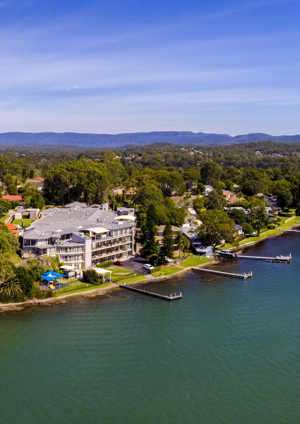
47

48 For more information about the Greater Newcastle Metropolitan Plan 2036 visit planning.nsw.gov.au
Intergovernmental Partnerships Project. Partnering for prosperity: a collaborative governance approach for Greater Newcastle and the Hunter
 Intergovernmental Partnerships Project Partnering for prosperity: a collaborative governance approach for Greater Newcastle and the Hunter nt 0 reater lose benefits rea unter care One per Port Region City
TOWN PLANNING SUBMISSION TO THE GREATER SYDNEY COMMISSION LANDS AT ARTARMON
 TOWN PLANNING SUBMISSION TO THE GREATER SYDNEY COMMISSION LANDS AT ARTARMON March 2017 TABLE OF CONTENTS 1.0 INTRODUCTION 3 2.0 THE SUBJECT SITE 4 3.0 STRATEGIC PLANNING CONTEXT 6 4.0 SUMMARY AND CONCLUSIONS
TERMINAL DEVELOPMENT PLAN
 5.0 TERMINAL DEVELOPMENT PLAN 5.0 TERMINAL DEVELOPMENT PLAN Key points The development plan in the Master Plan includes the expansion of terminal infrastructure, creating integrated terminals for international,
5 Rail demand in Western Sydney
 5 Rail demand in Western Sydney About this chapter To better understand where new or enhanced rail services are needed, this chapter presents an overview of the existing and future demand on the rail network
NSW PRE-BUDGET STATEMENT FUTURE ECONOMY FUTURE JOBS
 2017-18 NSW PRE-BUDGET STATEMENT FUTURE ECONOMY FUTURE JOBS Executive Summary The 2017-18 NSW State Budget presents an opportunity for the NSW Government to future-proof the tourism and transport sectors.
FUTURE TRANSPORT STRATEGY AND GREATER SYDNEY SERVICES AND INFRASTRUCTURE PLAN. Western Parkland City
 FUTURE TRANSPORT STRATEGY AND GREATER SYDNEY SERVICES AND INFRASTRUCTURE PLAN Western Parkland City 2 Transport for NSW Future Transport Strategy and Greater Sydney Services and Infrastructure Plan Western
NEWCASTLE. Australia / PRIME PORTSIDE OPPORTUNITY / / 43 & 45 GREENLEAF ROAD, KOORAGANG NSW
 NEWCASTLE Australia / PRIME PORTSIDE OPPORTUNITY / / 43 & 45 GREENLEAF ROAD, KOORAGANG NSW CONTENTS 03 A Unique Opportunity 06 Executive Summary 07 Exceptional Location 08 Why Invest in Newcastle? 09 Property
Kilometres. Blacktown. Penrith. Parramatta. Liverpool Bankstown. Campbelltown
 0 5 10 15 20 Kilometres Penrith Blacktown Parramatta Liverpool Bankstown Campbelltown accessibility outcomes Legend Outcomes targeted in Western Sydney are: public transport that is accessible throughout
https://gsc-public-1.s3-ap-southeast-2.amazonaws.com/s3fs-public/draft-eastern-city-district-plan.pdf
 GSC Sydney East Rev Draft -references Port Botany - 30 https://gsc-public-1.s3-ap-southeast-2.amazonaws.com/s3fs-public/draft-eastern-city-district-plan.pdf Pages 6. The District s freight routes, particularly
Figure 3: Global Sydney. Draft Metropolitan Strategy for Sydney. North Sydney CBD. Second Harbour Crossing. Walsh Bay Arts Precinct.
 Newtown Glebe Macdonaldtown Pyrmont Ultimo Sydney International Convention, Exhibition & Entertainment Precinct Sydney Education & Health Erskineville Figure 3: Global Sydney Waterloo Second Harbour Crossing
PO Box 257 PO Box 257 PARRAMATTA NSW 2124 PARRAMATTA NSW 2124
 31 March 2017 Sean O Toole Sheridan Dudley District Commissioner - West District Commissioner - South West Greater Sydney Commission Greater Sydney Commission PO Box 257 PO Box 257 PARRAMATTA NSW 2124
ILLAWARRASHOALHAVEN ECONOMIC OUTLOOK
 360 SHOALHAVEN ECONOMIC OUTLOOK Foreword The Illawarra-Shoalhaven is a fantastic region. Home to a skilled and agile workforce, pristine natural environment, world-class university and thriving manufacturing
A summary report on what the community told us
 DECEMBER 2015 A summary report on what the community told us During August and September 2015, UrbanGrowth NSW in partnership with Newcastle City Council ran the Revitalising Newcastle community engagement
WELLINGTON $422 MILLION $614 MILLION $83 MILLION 22% SPEND $1.9 BILLION
 WELLINGTON WELLINGTON $1.9 BILLION FORECAST TOTAL WELLINGTON INVESTMENT The Wellington region s transport challenges are dominated by the region s concentration of population in the metropolitan cities,
Draft City Centre Transport Proposals
 Draft City Centre Transport Proposals Introduction This draft position paper provides an overview of the current City Centre transport issues, including concepts of the possible future City Centre transport
Newcastle Transport Program Newcastle Light Rail Determination Report
 Newcastle Transport Program Newcastle Light Rail Determination Report Date Author 25 July 2016 TfNSW Ref 5276649 Status Final TfNSW 2014 UNCONTROLLED WHEN PRINTED Page 1 of 19 Table of contents 1 Introduction
EAST WEST RAIL EASTERN SECTION. prospectus for growth
 EAST WEST RAIL EASTERN SECTION prospectus for growth September 2018 executive summary The East West Rail Consortium, a partnership of local authorities, rail operators and Network Rail, continues to promote
Wellington $312 $49 $456 OVERVIEW WELLINGTON REGIONAL SUMMARY
 National Land Transport Programme 2015 18 Wellington WELLINGTON REGIONAL SUMMARY OVERVIEW The Wellington region is made up of a number of cities, urban areas and supporting rural hinterland. The city is
PLANNING THE SUNBURY GROWTH CORRIDOR
 SUNBURY GROWTH CORRIDOR NOVEMBER 2016 PLANNING THE SUNBURY GROWTH CORRIDOR Sunbury Planning Background The Victorian Planning Authority, in consultation with Hume City Council, is undertaking a number
The Coalition s Policy
 The Coalition s Policy Key Commitments Townsville is a city with immense potential. With a population of around 170,000, some 16,000 regional businesses, and regional product of over $11 billion, Townsville
AUCKLAND $1.2 BILLION $1.9 BILLION $149 MILLION 15% SPEND $5.7 BILLION
 AUCKLAND AUCKLAND $5.7 BILLION FORECAST TOTAL AUCKLAND INVESTMENT The next 10 years are expected to underline Auckland s performance as the fastest growing major city in Australasia. The city is expected
Smart Cities Plan. Lake Macquarie City Council Submission
 Smart Cities Plan Lake Macquarie City Council Submission 1. Summary Lake Macquarie City Council supports the intent of the Australian Government s Smart Cities Plan to create liveable cities through improved
Draft Western District Plan
 Powered by TCPDF (www.tcpdf.org) Draft Western District Plan Submission_id: 31732 Date of Lodgment: 15 Dec 2017 Origin of Submission: Online Organisation name: APP Corporation Pty Ltd Organisation type:
The Sunshine Coast is part of the global community and generates wealth through export, high-value industries and new investment.
 3.2 Strategic intent 3.2.1 Shaping growth an overview In 2031, the Sunshine Coast is renowned for its vibrant economy, ecological values, unique character and strong sense of community. It is Australia
4 Transport projects underway in Western Sydney
 4 Transport projects underway in Western Sydney About this chapter This chapter provides an overview of the Australian and NSW government s significant investments in road, bus and rail infrastructure
Smart Cities Plan IMPLEMENTATION. Townsville City Deal. April 2017
 Smart Cities Plan IMPLEMENTATION Townsville City Deal April 2017 ACKNOWLEDGEMENTS The Commonwealth Government, Queensland Government and the Townsville City Council would like to thank the Townsville community
Sunshine Coast Council Locked Bag 72 Sunshine Coast Mail Centre QLD Submitted via online portal. 2 June 2017.
 Sunshine Coast Council Locked Bag 72 Sunshine Coast Mail Centre QLD 4560 Submitted via online portal 2 June 2017 Dear Sir /Madam, RE: DRAFT ENVIRONMENTAL AND LIVEABILITY STRATEGY The Green Building Council
The Government s Aviation Strategy Transport for the North (TfN) response
 response") The Government s Aviation Strategy Transport for the North (TfN) response Transport for the North Background Good transport links are a crucial part of a strong economy supporting labour markets and delivering
The Government s Aviation Strategy Transport for the North (TfN) response Transport for the North Background Good transport links are a crucial part of a strong economy supporting labour markets and delivering
North District Plan OVERVIEW
 OUR GREATER SYDNEY 2056 Revised Draft North District Plan OVERVIEW Hornsby Hunter's Hill Ku-ring-gai Lane Cove Mosman Northern Beaches North Sydney Ryde Willoughby Snapshot of the North District today
Airport Planning Area
 PLANNING AREA POLICIES l AIRPORT Airport Planning Area LOCATION AND CONTEXT The Airport Planning Area ( Airport area ) is a key part of Boise s economy and transportation network; it features a multi-purpose
ENVIRONMENT ACTION PLAN
 ENVIRONMENT ACTION PLAN 2015 16 Airservices Australia 2015 This work is copyright. Apart from any use as permitted under the Copyright Act 1968, no part may be reproduced by any process without prior written
Memorandum of Understanding with ACT Government
 MEDIA RELEASE 8 April 2015 Memorandum of Understanding with ACT Government The ACT Government and Canberra Airport today entered into a new Memorandum of Understanding (MoU) on key areas of common interest
Gold Coast. Rapid Transit. Chapter content. Chapter four Route selection and staging
 Chapter four Route selection and staging Gold Coast Rapid Transit Chapter four Route selection and staging Chapter content Route selection...73 Section one: Helensvale to Griffith University...74 Section
Northern Beaches Transport Action Plan
 Northern Beaches Transport Action Plan The NSW Government is taking action now to deliver transport improvements for the Northern Beaches, as well as planning for the future growth of the area. $633 million
Draft Greater Sydney Region Plan
 Draft Greater Sydney Region Plan Submission_id: 31392 Date of Lodgment: 14 Dec 2017 Origin of Submission: Online Organisation name: Greenfields Development Company No. 2 Pty Limited Organisation type:
Growing Regional Victoria 2018 Victorian Election Priorities GROWING REGIONAL VICTORIA 2018 VICTORIAN ELECTION PRIORITIES
 GROWING REGIONAL VICTORIA 2018 VICTORIAN ELECTION PRIORITIES Message from the Chair, Cr Margaret O Rourke Regional Cities Victoria Growing Regional Victoria Regional Cities Victoria (RCV) is uniquely positioned
Directions. for a Greater Sydney
 Directions for a Greater Sydney 2017-2056 Directions for a Greater Sydney is the approach produced by the Greater Sydney Commission to better integrate land use and infrastructure to deliver a more productive,
FEDERATION SQUARE MELBOURNE, AUSTRALIA CORPORATE PLAN
 FEDERATION SQUARE MELBOURNE, AUSTRALIA CORPORATE PLAN 201619 MELBOURNE S INSPIRATIONAL PUBLIC PLACE Federation Square is Melbourne s heartbeat, an inspirational precinct which concentrates community, cultural
9.1 INTRODUCTION 9.2 EXISTING DEVELOPMENT. Southern Cross University
 Property Strategy The property strategy delivers improved legibility, responds to the locational attributes of the site, and facilitates essential operational efficiencies. 9.1 INTRODUCTION Non-aviation
Reimagining Central Station Precinct
 Reimagining Central Station Precinct Submission by BusNSW 1. Introduction BusNSW members provide bus and coach transport services throughout NSW under various contractual and regulatory environments. This
The implementation of this Master Plan will be undertaken in logical stages to meet passenger and workforce demands.
 The implementation of this Master Plan will be undertaken in logical stages to meet passenger and workforce demands. Connecting People Building Opportunities 198 Brisbane Airport Corporation CHAPTER 10
A TRANSPORT SYSTEM CONNECTING PEOPLE TO PLACES
 THE MAYOR'S VISION FOR TRANSPORT A TRANSPORT SYSTEM CONNECTING PEOPLE TO PLACES VISION We will build a transport system that works for everyone, connecting people to the places they want to go within the
CHRISTCHURCH MOTORWAYS. Project Summary Statement February 2010
 CHRISTCHURCH MOTORWAYS Project Summary Statement February 2010 Table of Contents 1. Purpose of Document 2. Strategic Context 3. Benefits 4. Project Scope and Economics 5. Implementation Plan 1 ROADS OF
MDP -- District Plan Webform Submissions
 MDP -- District Plan Webform Submissions Submission Details Withhold Name Completed Time Represented By Who Title Age Bracket First Name Last Name Email Organisation Position in organisation 03/30/2017-17:13
M6 CORRIDOR. Strategic Infrastructure Prospectus
 CORRIDOR Strategic Infrastructure Prospectus May 2017 IntRODuCtIOn cumbria has real potential. We have a strong economy with major capability in energy, advanced manufacturing, logistics, agri-food and
Llandudno Junction. Regeneration Proposals for the Future. December 2009
 Llandudno Junction Regeneration Proposals for the Future December 2009 Llandudno Junction - Vision Statement 1 Purpose 1.1 The purpose of this document is to describe key priorities to support the regeneration
REGION OF WATERLOO INTERNATIONAL AIRPORT AIRPORT MASTER PLAN EXECUTIVE SUMMARY MARCH 2017
 REGION OF WATERLOO INTERNATIONAL AIRPORT AIRPORT MASTER PLAN EXECUTIVE SUMMARY MARCH 2017 Contact: Chris Wood, Airport General Manager cwood@regionofwaterloo.ca (519) 648-2256 ext. 8502 Airport Master
Part 005 Implementation Strategy _
 Part 0 Implementation Strategy www. landlab.co.nz Queenstown Town Centre Masterplan Version 7 14 June 28 Section 0 Page 4 5.1 Implementation Plan The projects and initiatives contained within the Queenstown
PSP 75 Lancefield Road. Northern Jacksons Creek Crossing Supplementary Information
 PSP 75 Lancefield Road Northern Jacksons Creek Crossing Supplementary Information September 2017 The northern crossing of Jacksons Creek proposed within the Lancefield Road PSP is a key part of the ultimate
Draft Greater Sydney Region Plan
 Powered by TCPDF (www.tcpdf.org) Draft Greater Sydney Region Plan Submission_id: 31119 Date of Lodgment: 12 Dec 2017 Origin of Submission: Online Organisation name: Serapark Pty Ltd Organisation type:
21.07 ECONOMIC DEVELOPMENT AND EMPLOYMENT 19/03/2015 C323 Proposed C Key issues and influences. Economic Role and Function
 21.07 ECONOMIC DEVELOPMENT AND EMPLOYMENT 19/03/2015 C323 Proposed C347 21.07-1 Key issues and influences 14/10/2010 C168 Economic Role and Function Geelong is the largest regional city in Victoria and
Gold Coast. Rapid Transit. Chapter twelve Social impact. Chapter content
 Gold Coast Rapid Transit Chapter twelve Social impact Chapter content Social impact assessment process...235 Existing community profile...237 Consultation...238 Social impacts and mitigation strategies...239
Parkland County Municipal Development Plan Amendment Acheson Industrial Area Structure Plan
 Parkland County Municipal Development Plan Amendment Acheson Industrial Area Structure Plan New Plan Acheson Industrial Area Structure Plan Amendment Parkland County Municipal Development Plan Board Reference
PCAL Case Study Retail Areas: Rouse Hill Town Centre
 PCAL Case Study Retail Areas: Rouse Hill Town Centre Introduction Rouse Hill Town Centre is a new mixed use development on a greenfield site in Sydney s North West. It has been planned to be a major hub
Strategic Plan. Regional Opportunity. Strong For Generations
 2017-2018 Strategic Plan Regional Opportunity Strong For Generations Greater Whitsunday Alliance Greater Whitsunday Alliance is an independent regional economic development body that is an advocate for
Rail Delivery Group. Consultation on the future of the East Midlands rail franchise
 Rail Delivery Group Response to: Department for Transport Consultation on the future of the East Midlands rail franchise Date: 11 October 2017 Rail Delivery Group Limited Registered Office, 2nd Floor,
Response to the London Heathrow Airport Expansion Public Consultation
 Response to the London Heathrow Airport Expansion Public Consultation Summary This report sets out the response to the Heathrow Airport s consultation on airport expansion and airspace change. The consultation
HARBOUR EDGE STITCH. Uniting the Waterfront with the City Centre
 78 AC_BEU_CCMP_2_TM1_4 _FD.indd 78 20/07/12 12:04 PM 01 HARBOUR EDGE STITCH Uniting the Waterfront with the City Centre 01 VISION OUR 2032 VISION IS: Quay Street as a high-quality Harbour Edge space that
TRANSPORT CANBERRA. LIGHT RAIL NETWORK Delivering a modern transport system for a growing city
 TRANSPORT CANBERRA LIGHT RAIL NETWORK Delivering a modern transport system for a growing city LIGHT RAIL NETWORK A modern transport system for a growing city INTRODUCTION Minister Mick Gentleman The ACT
Strategic Transport Forum
 Strategic Transport Forum Friday 16 th March 2018 www.englandseconomicheartland.com Item 3: Innovation www.englandseconomicheartland.com Innovation work stream - EEH 1. Policy modelling 2. MaaS 3. EEH
Report to: Greater Cambridge Partnership Joint Assembly 18 January A10 Foxton level crossing bypass and travel hub
 Report to: Greater Cambridge Partnership Joint Assembly 18 January 2018 Lead officer: Chris Tunstall GCP Director of Transport A10 Foxton level crossing bypass and travel hub 1. Purpose 1.1 The list of
CITY RAIL LINK. New Public Transport Stations and Development Opportunities at Karangahape Road, Newton and Aotea Quarter
 134 AC_BEU_CCMP_3_TM5_8_FD.indd 134 20/07/12 12:30 PM 05 CITY RAIL LINK New Public Transport Stations and Development Opportunities at Karangahape Road, Newton and Aotea Quarter 5 MO VE 0 1 2 8 KEY 1 Britomart
ALL ABOARD LABOR S LONG TERM PASSENGER TRANSPORT STRATEGY
 ALL ABOARD LABOR S LONG TERM PASSENGER TRANSPORT STRATEGY Revitalising Passenger Transport Increasing traffic congestion in our cities and a lack of transport services in our regional towns is frustrating
$244 $45 OVERVIEW National Land Transport Programme Bay of Plenty BAY OF PLENTY REGIONAL SUMMARY
 2015 18 National Land Transport Programme Bay of Plenty BAY OF PLENTY REGIONAL SUMMARY OVERVIEW Transport investment in the Bay of Plenty is targeted to support significant residential growth, new industrial
West of England. Priority Places Requiring Public Investment
 West of England Priority Places Requiring Public Investment Development Urban Regeneration & Suburban Intensification Bristol Central Area Bristol Central Area; Stokes Croft, Temple Meads & St Philips
Overview. Draft North District Plan. November Local Government Areas: Hornsby Hunter s Hill Ku-ring-gai. Lane Cove Mosman Northern Beaches
 Draft North District Plan Overview November 2016 Local Government Areas: Hornsby Hunter s Hill Ku-ring-gai Lane Cove Mosman Northern Beaches North Sydney Ryde Willoughby Snapshot of the North District
The Coalition s Policy
 The Coalition s Policy Key Commitments The Coalition s plan for a strong new economy will provide jobs and growth and secure the future for Australian families through smart investment in infrastructure.
Gold Coast: Modelled Future PIA Queensland Awards for Planning Excellence 2014 Nomination under Cutting Edge Research category
 Gold Coast: Modelled Future PIA Queensland Awards for Planning Excellence 2014 Nomination under Cutting Edge Research category Jointly nominated by SGS Economics and Planning and City of Gold Coast August
Strategic Transport Forum 21 st September 2018
 Strategic Transport Forum 21 st September 2018 Agenda Item 4: Heathrow Airport Expansion: Surface Access Strategy Update Recommendation: It is recommended that the Forum consider the update provided by
Co-ordinated and Orderly Growth A Suite of Infrastructure and Public Assets for the Future... 1
 Co-ordinated and Orderly Growth... 1 A Suite of Infrastructure and Public Assets for the Future... 1 Funding Sources, Revenues and Prioritising Expenditure... 2 Stage 1 Short Term Growth Sunbury to 50,000...
Mackay Region. Destination Tourism Strategy
 Mackay Region Destination Tourism Strategy 2012 2016 Mackay Region The Mackay region offers an abundance of natural attractions including national parks, gorges, the Great Barrier Reef, numerous islands
The Coalition s Policy to Build the Swan Valley Bypass and Perth Gateway
 1 Our Plan Real Solutions for all Australians The direction, values and policy priorities of the next Coalition Government. The Coalition s Policy to Build the Swan Valley Bypass and Perth Gateway August
AUCKLAND WATERFRONT VISION 2040
 AUCKLAND WATERFRONT VISION 2040 HARBOUR BRIDGE WESTHAVEN MARINA WYNYARD POINT WESTERN RECLAMATION VIADUCT HARBOUR FANSHAWE STREET VICTORIA PARK PRINCES WHARF QUEENS WHARF PORT CAPTAIN COOK WHARF QUAY STREET
Draft Greater Sydney Region Plan
 Powered by TCPDF (www.tcpdf.org) Draft Greater Sydney Region Plan Submission_id: 31382 Date of Lodgment: 14 Dec 2017 Origin of Submission: Online Organisation name: Greenfields Development Company & Ingham
ASCOT SUBURB PROFILE
 ASCOT SUBURB PROFILE CONTENTS SUBURB HIGHLIGHTS 2 3 4 4 5 5 ASCOT & SURROUNDS LOCATION & LIFESTYLE DEMOGRAPHICS EMPLOYMENT FUTURE INFRASTRUCTURE WA MARKET TRENDS ACCESSIBILITY ENTERTAINMENT & RECREATION
WHY INVEST IN QUEENSLAND URBIS MARKET OUTLOOK
 WHY INVEST IN QUEENSLAND URBIS MARKET OUTLOOK WHO IS URBIS? PERTH AUSTRALIA ADELAIDE BRISBANE GOLD COAST SYDNEY MELBOURNE Urbis is an integrated multi-disciplinary consulting firm with a unique and comprehensive
Draft Western District Plan
 Powered by TCPDF (www.tcpdf.org) Draft Western District Plan Submission_id: 31304 Date of Lodgment: 14 Dec 2017 Origin of Submission: Online Organisation name: LeaMac Property Group Organisation type:
GUNGAHLIN TOWN CENTRE
 GUNGAHLIN TOWN CENTRE PLANNING REFRESH SNAPSHOT NOVEMBER 2018 CONTENTS INTRODUCTION....1 Australian Capital Territory, Canberra 2018 This work is copyright. Apart from any use as permitted under the Copyright
Overview. Draft Central District Plan. November Local Government Areas: Bayside Burwood Canada Bay. Inner West Randwick Strathfield
 Draft Central District Plan Overview November 2016 Local Government Areas: Bayside Burwood Canada Bay Inner West Randwick Strathfield The City of Sydney Waverley Woollahra 1 Snapshot of the Central District
NATIONAL AIRSPACE POLICY OF NEW ZEALAND
 NATIONAL AIRSPACE POLICY OF NEW ZEALAND APRIL 2012 FOREWORD TO NATIONAL AIRSPACE POLICY STATEMENT When the government issued Connecting New Zealand, its policy direction for transport in August 2011, one
WESTERN SYDNEY PARKLANDS PLAN 2020 CORPORATE
 WESTERN SYDNEY PARKLANDS 2020 CORPORATE PLAN March 2015 Table of Contents Message from the Chairman and Director 1 What is the Western Sydney Parklands? 4 The Western Sydney Parklands Trust 4 The Corporate
Magnetic Heart of Queensland
 Shaping Townsville s Destiny to be the... Magnetic Heart of Queensland A design for future Townsville by Vee Design : 9point9 Architects : Milford Planning : Meter : Szczepan Urbanowicz shaping Townsville
Auckland Port and the Unitary Plan Dr Douglas Fairgray
 Auckland Port and the Unitary Plan Dr Douglas Fairgray Source: Auckland 1886 - Sir George Grey Special Collections, Auckland Libraries, NZ Map 374 Scope The interface between the Unitary Plan and the Port
Salisbury. A place to invest.
 Salisbury. A place to invest. Salisbury is a progressive, proactive and pro-business city. Already home to a host of international firms and flourishing entrepreneurs, Salisbury is a great place to position
A140 study and Major Road Network
 A140 study and Major Road Network Executive Summary The Government s new Transport Investment Strategy sets out a new long-term approach for government infrastructure spending. Funding will be targeted
SYDNEY S SECOND AIRPORT
 COLLIERS RADAR SYDNEY S SECOND AIRPORT The Catalytic Effect of Transport Infrastructure By Sass J-Baleh Manager Research sass.jbaleh@colliers.com Summary Industrial land values across the Sydney markets
CANNING CITY CENTRE. the new energy of the southeast
 CANNING CITY CENTRE the new energy of the southeast 2 INTRODUCTION From early beginnings as an important cultural and recreation place for the Beeloo Nyoongar people, to being a trading post connecting
South East Traffic Solution
 South East Traffic Solution A MAJORITY LIBERAL GOVERNMENT WILL: Complete the Hobart Airport Interchange project Fix the Tasman Highway near Tasmania Golf Club Replace the Midway Point Roundabout with additional
EAST-WEST STITCH. Connecting the Western Edge of the City to the Centre
 98 AC_BEU_CCMP_2_TM1_4 _FD.indd 98 20/07/12 12:06 PM 02 EAST-WEST STITCH Connecting the Western Edge of the City to the Centre 01 02 Northern Motorway Daldy Street Fanshawe Street Nelson Street Hobson
Guide to Cessnock City
 Business Investment Guide to Cessnock City Business Investment Attraction Why Cessnock City? 2 Welcome to Cessnock City As Mayor of Cessnock City, I am enormously proud of our welcoming and friendly people,
A Master Plan is one of the most important documents that can be prepared by an Airport.
 The Master Plan A Master Plan is one of the most important documents that can be prepared by an Airport. A Master Plan is a visionary and a strategic document detailing planning initiatives for the Airport
Part four. In this part you will find: The next steps to deliver the master plan
 Part four NEXT STEPS In this part you will find: The next steps to deliver the master plan 6. How COULD the Master Plan be delivered? There are a number of steps required to take the proposals in the master
STONES CORNER SUBURBPROFILE. Situated three kilometres from the Brisbane CBD, Stones Corner is located within one of Brisbane s key growth areas.
 1 SUBURBPROFILE Situated three kilometres from the Brisbane CBD, Stones Corner is located within one of Brisbane s key growth areas. OVERVIEW Situated three kilometres from the Brisbane CBD, Stones Corner
Public Transport for Perth in 2031
 South West Group Submission Public Transport for Perth in 2031 October 2011 South West Group Vision and Mission Local Governments in South Metropolitan Perth, through cooperation with industry, community
Connecting Sydney Olympic Park and GPOP with Greater Sydney. Final Summary Report 29 May 2017
 Connecting Sydney Olympic Park and GPOP with Greater Sydney Final Summary Report 29 May 2017 GPOP sits at the core of the emerging Central City. East Sydney is at the centre of the established Eastern
CAIRNS RECTANGULAR PITCH STADIUM NEEDS STUDY PART 1 CAIRNS REGIONAL COUNCIL DRAFT REPORT SEPTEMBER 2011
 CAIRNS RECTANGULAR PITCH STADIUM NEEDS STUDY PART 1 CAIRNS REGIONAL COUNCIL DRAFT REPORT SEPTEMBER 2011 CAIRNS RECTANGULAR PITCH STADIUM NEEDS STUDY PART 1 Cairns Regional Council September 2011 Coffey
East Lancashire Highways and Transport Masterplan East Lancashire Rail Connectivity Study Conditional Output Statement (Appendix 'A' refers)
") Report to the Cabinet Member for Highways and Transport Report submitted by: Director of Corporate Commissioning Date: 1 June 2015 Part I Electoral Divisions affected: All East Lancashire Highways and
Report to the Cabinet Member for Highways and Transport Report submitted by: Director of Corporate Commissioning Date: 1 June 2015 Part I Electoral Divisions affected: All East Lancashire Highways and
PERTH CITY SWAN PERTH AIRPORT CURTIN UNIVERSITY WESTFIELD CAROUSEL TANGNEY CITY OF CANNING JANDAKOT AIRPORT SWAN TANGNEY
 THE CITY OF CANNING CITY OF CANNING PERTH CITY SWAN PERTH AIRPORT CURTIN UNIVERSITY WESTFIELD CAROUSEL TANGNEY CITY OF CANNING JANDAKOT AIRPORT SWAN TANGNEY UNTAPPED POTENTIAL The Canning City Centre,
Committee for Melbourne 2018 Election Priorities
 Committee for Melbourne 2018 Election Priorities Vote for the future The Committee for Melbourne calls on the next Victorian Government to commit to bold, visionary policies to help sustain Melbourne s
David Tickle, Principal, Urban Design, Hassell
 David Tickle, Principal, Urban Design, Hassell August 2015 NEWCASTLE URBAN TRANSFORMATION & TRANSPORT PROGRAM REVITALISATION POTENTIAL Establishing a Vision and Objectives VISION: RE-ESTABLISH NEWCASTLE