John Day River: Clarno to Cottonwood Bridge, OR
|
|
|
- Heather Montgomery
- 6 years ago
- Views:
Transcription


: Spring PUT-IN LOCATION (LAT, LONG COORDINATES): Clarno RECOMMENDED")
 Between Clarno and Cottonwood there are 92 campsites shown on the John Day Recreation Guide published by the BLM.")


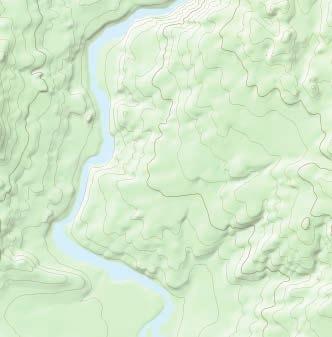
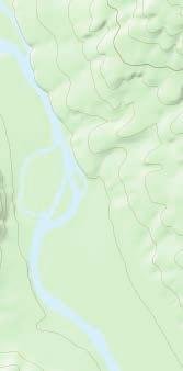
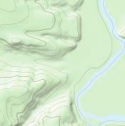
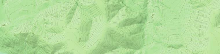
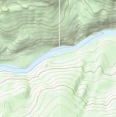
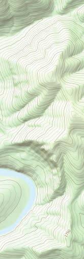
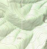
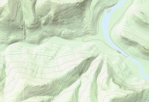
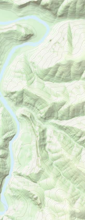
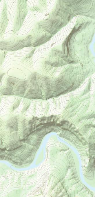
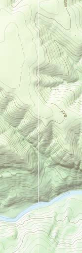
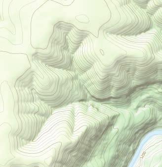
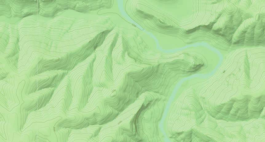
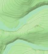
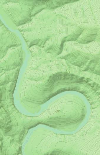
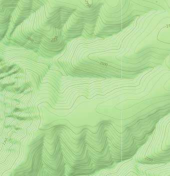
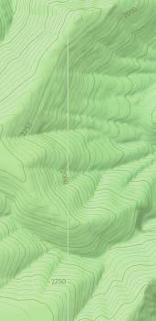
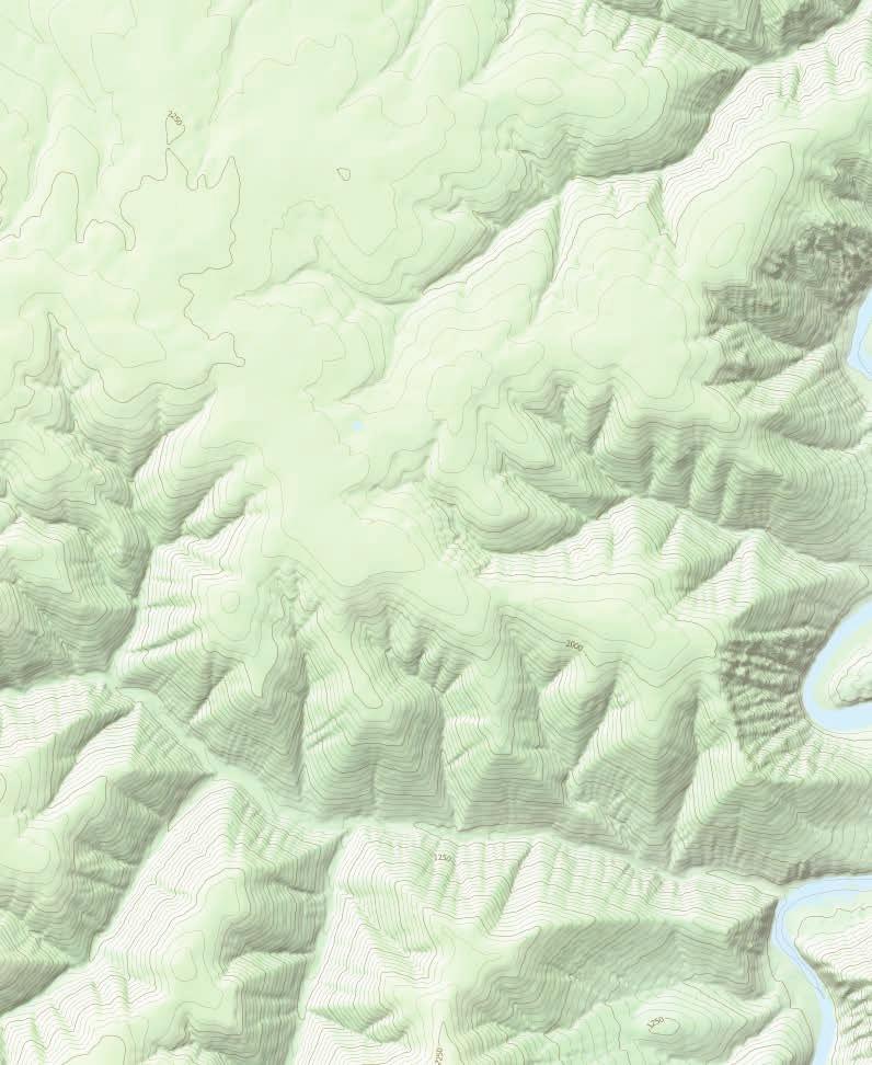
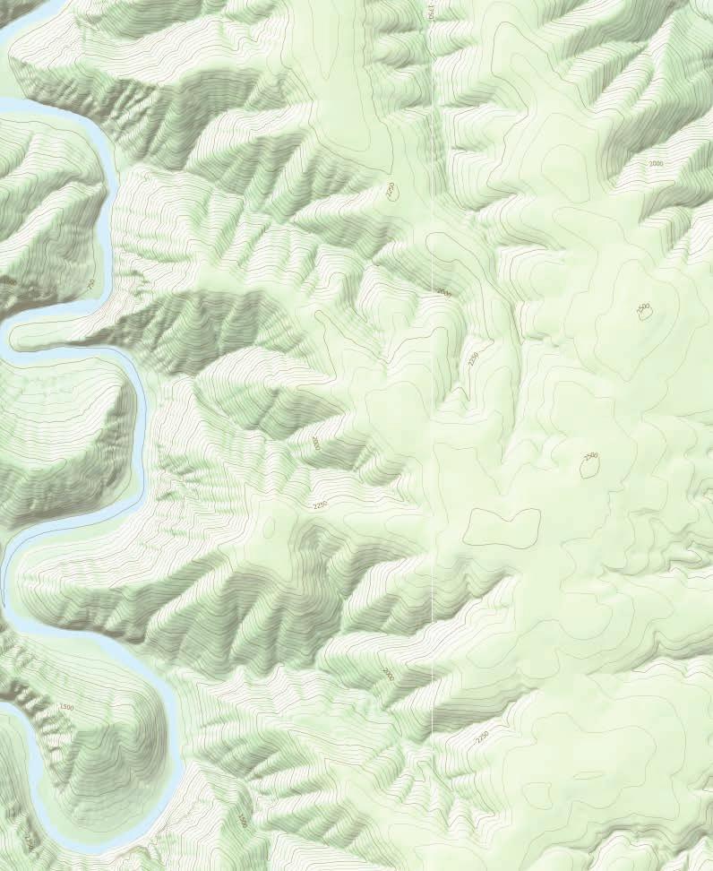
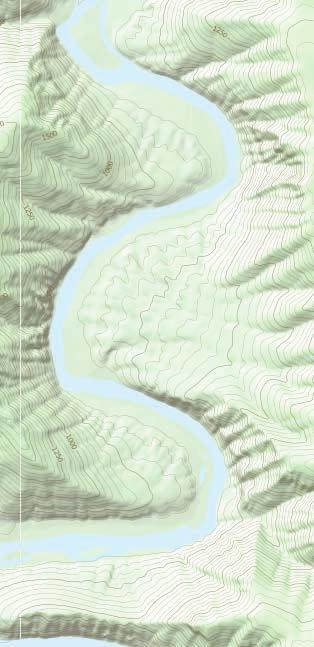
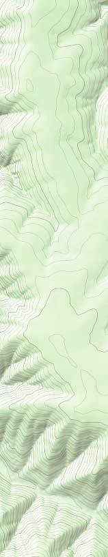
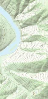
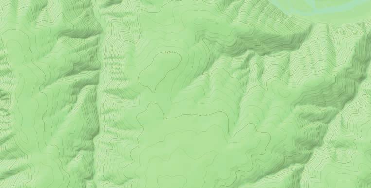
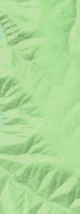
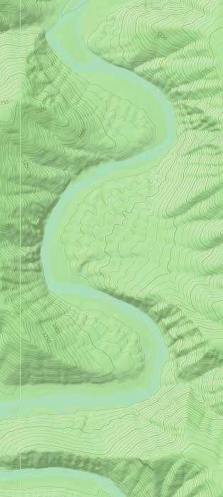
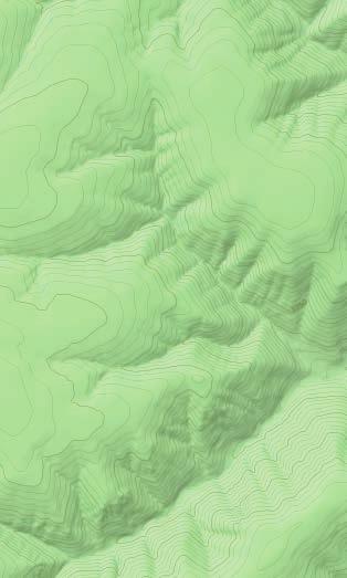
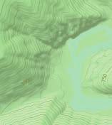
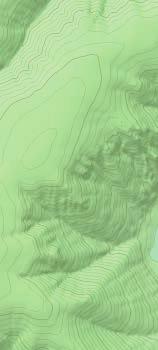
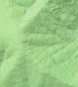
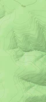
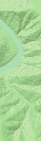
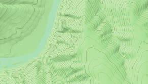
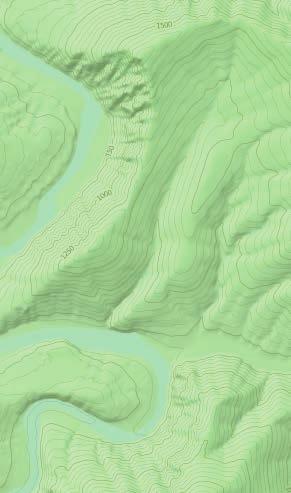
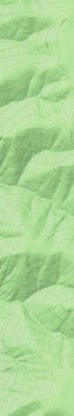
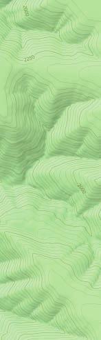
1 : Clarno to Cottonwood Bridge, OR Adventure Description by Halvor Tweto The is the longest undammed river in Oregon and one of the longest in the United States. From its headwaters to its convergence with the Columbia River just east of the John Day Dam, this river stretches for 281 miles through Central Oregon s arid environment, and 147 miles of the river are protected as Wild and Scenic. Much of the John Day s flow originates at the 9,-foot level, where Strawberry Mountain snowmelt forms the headwaters of the river. Flows diminish significantly by mid-summer after the primary melt and once regional irrigation demands begin in earnest. Low flows can limit floating possibilities to all but the smallest watercraft. May and June are thus the most popular months to float the. Though the flows were just fine for our trip at the end of May, at 1,9 cfs the water was already down to levels more consistent with mid-june floats. Halvor Tweto Highlights ROUTE CHARACTERISTICS: CHARACTER: Gorge GAUGE URL: OVERALL DIFFICULTY: III PARKING PASS: Not Required PREFERABLE SEASON(S): Spring PUT-IN LOCATION (LAT, LONG COORDINATES): Clarno RECOMMENDED MINIMUM FLOW: 4. cfs (11.33 m3/s) SUITABLE FOR: Kayas TAKE-OUT LOCATION (LAT, LONG COORDINATES): Cottonwood Bridge TOTAL DISTANCE: 7. mi ( m) Between Clarno and Cottonwood there are 92 campsites shown on the John Day Recreation Guide published by the BLM. Most of these sites are obvious and obviously good; others would require a great deal of imagination and flexibility from users, either because of size, flows, or vegetation. We ve tried to indicate where more worable campsites exist. Campsites are first-come, first-served, which means you may find yourself cruising the bans at the end of a long day looing for a place to camp, especially during the river s more popular months. Also note that the campsite selection is thin in the ten miles leading up to the Cottonwood Bridge tae-out. Because the few springs along this section of river are intermittent and the river itself receives such heavy agricultural use, you may want to carry your own drining water if you have that option. There is really only one significant named rapid on this stretch, Clarno Rapid. This Class III rapid caused some trouble for a few canoes that launched at the same time as our trip. There is a great scout and portage option on river left just above the rapid. Aside from Clarno Rapid, the river is consistently Class II when there is any whitewater at all. The many splendid features that mae this river one of Oregon s great floating opportunities are really too plentiful to detail. Our highlights: watching Oregon s geological history unfolding around us in the form of elaborate basalt formations, rushing to start a fire (only legal before June 1) as blac clouds rumbled above us, floating by clusters of wary bighorn sheep as they nimbly negotiated the riverside scree, applauding a cloud cluster s almost choreographed performance around a rising moon, listening to children s coyote howls echoing down the canyon, and then to the close imitation erupting bac at us from a nearby but invisible roaming pac. For permits and seasonal regulations for this and other segments of the, chec the BLM website.
2 Getting there (from Portland): - From Portland, tae I-84 E/US 3 E toward The Dalles - Tae exit 14 for US-97 toward Yaima Bend - Turn right onto US-97 S/Sherman Hwy - Continue to follow US-97 S - In approximately 55 miles, turn left onto D St - Tae the 2nd right onto OR-218 E/State Hwy 218 E - In approximately 22 miles turn left into the Clarno boat ramp paring lot


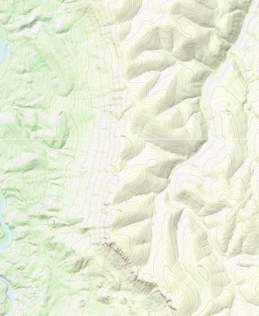
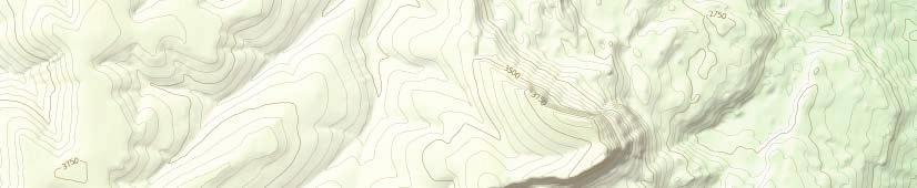

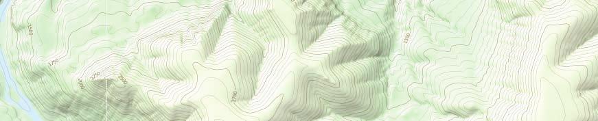
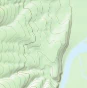
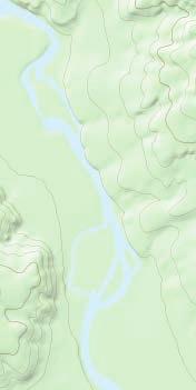

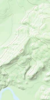

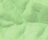
3 Mile 19 to Mile 94, OR 1. mi. 2. mi. MILE 93 TO MILE 66 M 94 Hiing Trail Pac Trail POLE RIDGE M 95 M 96 Butte Cree M 97 TO FOSSIL Long Hollow Cree M 98 Picnic M 99 M 1 Boat Put-in/Tae-out M 11 e M 12 ep De e Cr M 13 Big Lae M 14 Rotten Lae LOWER CLARNO (III-IV) M 15 UPPER CLARNO (III) M 16 Horsebac Riding e t Cre foo Sore M 17 M 18 The Buttes EL 3,2 M TO THE DALLES CLARNO River Distance Marer JOHN DAY FOSSIL BEDS NATIONAL MOUNUMENT TO JOHN DAY HWY Pea


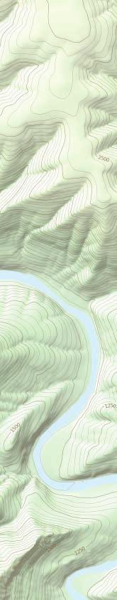


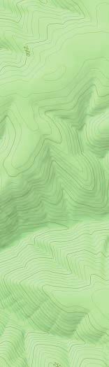


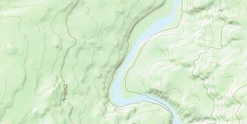
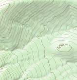
4 Mile 93 to Mile 66, OR 1. mi. 2. mi. M 66 M 67 Hiing Trail Pac Trail MILE 65 TO MILE 4 PALISADES Jacnife Cany on Cree LOWER JOHN DAY M 68 M 69 M 71 M 7 M 72 Picnic Richmond Rd M 73 M 74 M 75 M 76 HORSESHOE BEND M 77 THIRTYMILE M 78 Boat Pit-in/Tae-out M 8 M 79 M 81 M 82 Thirtymile Cree M 83 M 84 Pine Holl ow Cree M 85 M 86 M 87 Horsebac Riding M 88 POLE RIDGE M 89 x4 M 93 M 92 Pea BASALT RAPIDS (II+) MILE 19 TO MILE 94 M 91 River Distance Marer M 9


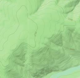


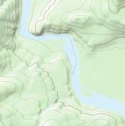
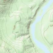
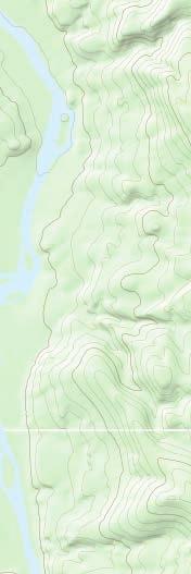
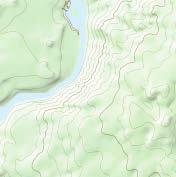
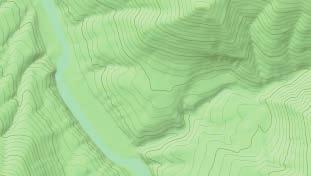
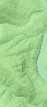
5 Mile 65 to Mile 4, OR 1. mi. 2. mi. TO WASCO Hiing Trail Pac Trail Power Lines JS Burres Day Use Area M 4 COTTONWOOD BRIDGE M 41 COTTONWOOD STATE PARK BIG EDDY M 42 M M 44 M 45 M 46 M 47 Picnic M 48 M 51 sc d dr vil oo nw De tto Co M 49 M 5 an yo n Cr ee Boat Ramp M 52 M 54 Rd M 55 ax LOWER JOHN DAY M 53 Aj TO CONDON Ferr ee n Cr nyo y Ca M 56 M 57 M 58 M 59 HOOT OWL ROCK M 6 Horsebac Riding M 61 River Distance Marer Pea M 62 M 65 Powered by TCPDF ( M 63 M 64 MILE 93 TO MILE 66
Nature-based Tourism Development Workshop Oregon Rural Tourism Studio John Day River Territory December 7, Group Discussion: Outcomes
 Nature-based Tourism Development Workshop Oregon Rural Tourism Studio John Day River Territory December 7, 2010 Group Discussion: Outcomes Top Unique/Uncommon Natural Features in the Region River canyons
Gorgeous Relay Driving Directions September 16, 2018
 2018 Gorgeous Relay Legs 1-3 Gorgeous Relay Start: Mark O. Hatfield Trailhead, Mosier Take I-84 to Exit 69, Mosier. Follow the brown signs for the Historic Columbia River Hwy State Trail. The Start Line
KEYES MOUNTAIN RANCH $2,750,000
 KEYES MOUNTAIN RANCH $2,750,000 PREMIER ELK RANCH MITCHELL, OR 97825 ANDY WILBURN, BROKER 541-421-5300 O 541-421-3290 F 38498 FOX VALLEY RD LONG CREEK, OR 97856 RANCHBROKERAGE@YAHOO.COM WWW.WILBURNRANCHBROKERAGE.NET
Camping (Primitive) Camping (RV) Electrical Potable Water Grill Established Fire Pit Picnic Table
 Camping (RV) Electrical Potable Water Grill Established Fire Pit Picnic Table") Alden - 9th Road River Mile 777 Map: 38.20833, -98.32031 Managing Agency: Kansas Department of Wildlife, Parks & Tourism Nearest Community: Alden, Rice County Kansas Developed Amenities Provided Parking
Alden - 9th Road River Mile 777 Map: 38.20833, -98.32031 Managing Agency: Kansas Department of Wildlife, Parks & Tourism Nearest Community: Alden, Rice County Kansas Developed Amenities Provided Parking
APPRECIATIVE AUDIENCES BY THE GOOD PEOPLE AT CYCLE OREGON CYCLE OREGON XXVII HAS BEEN RATED GORGEOUS
 THE CYCLE OREGON WEEK RIDE IS BEING OFFERED TO APPRECIATIVE AUDIENCES BY THE GOOD PEOPLE AT CYCLE OREGON CYCLE OREGON XXVII HAS BEEN RATED G GORGEOUS GRAPHIC PANORAMIC VIEWS AND CHANGING SCENERY www.cycleoregon.com
Rogue River Access and Management Plan Draft Alternatives
 Rogue River Access and Management Plan Draft Alternatives The Rogue River Access and Management Plan was initiated in December, 2011 and is being led by Jackson County Parks (JCP) and Oregon Department
National Parks and Beyond
 National Parks and Beyond Canyons, Mesas and Hoodoos Nevada Utah Arizona Red Rock Canyon National Conservation Area Las Vegas, Nevada Begin your adventure under the neon lights of Las Vegas, an oasis in
OPPORTUNITIES FOR WILD & SCENIC RIVER DESIGNATION
 OPPORTUNITIES FOR WILD & SCENIC RIVER DESIGNATION IN SOUTHWEST WASHINGTON S VOLCANO COUNTRY Washington's legendary volcanoes - Mount St. Helens, Mount Rainier and Mount Adams - are the source of wild,
AOTA ArtTrek Locations
 AOTA ArtTrek Locations ArtTrek is a summer-long Grand County, CO art adventure. Highlighted by snow-covered mountain vistas and rolling meadows threaded with sparkling streams and rivers, numerous sites
Topsham Trail Guide.
 Topsham Trail Guide A guide to the walking, hiking, biking, water and ATV trails of Topsham, Maine and surrounding towns $4.95 Developed by the www.greatertopshamtrailalliance.org The Greater Topsham Trail
5+ BEST DIY BACKPACKING HAMMOCK PLANS FREE PDF VIDEO DOWNLOAD
 PDF 5+ BEST DIY BACKPACKING HAMMOCK PLANS FREE PDF VIDEO DOWNLOAD BACKPACKING CHECKLIST OUTDOORGEARLAB 1 / 5 2 / 5 3 / 5 backpacking nevada pdf Backpacking Hammock Plans. The Best Backpacking Hammock Plans
Oregon Section F - Page 1 WGS84 Zone 10T m
 08 N. 07 N. 06 N. Oregon Section F - Page 1 WGS84 Zone 10T LavaCampLakeTR - Lava Camp Lake Trail #4060 junction. - mi 1982.6-5287 ft LavaCampLake - Lava Camp Lake, campground, outhouse, 1/2 mile NE of
Henry s Fork Angler Access. Above Mesa Falls
 Henry s Fork Angler Access Above Mesa Falls Table of Contents 1. Frome Park 2. Henry s Lake Fish Hatchery 3. Henry s Lake State Park 4. Highway 20 Bridge 5. Flat Ranch 6. Big Springs 7. Big Springs Water
RUBY AND HORSETHIEF CANYONS - COLORADO RIVER
 RUBY AND HORSETHIEF CANYONS - COLORADO RIVER Rating: Class II CFS Range: 1,000-30,000 Length: 1-3 days Gear: Standard paddling gear, bug spray in the summer. Maps: Mack, CO; Ruby Canyon, CO; Bitter Creek
Sunday - Wisconsin Creek
 2015 I Heart Wisconsin River Trip State Natural Area Boat landings people could meet me Ruth Oppedahl Help needed Campsite or lodging ruth@oppedahl.com Bird City/Important Bird Area (IBA) Dams/portages
Wildlife Tour (10 Days)
") Multi-Sport Camping Adventures Small Groups (10 max) Great Guides Top of the line Equipment Excellent Meals Active Experiences Wildlife Tour (10 Days) For those with wildlife viewing as a primary objective
Multi-Sport Camping Adventures Small Groups (10 max) Great Guides Top of the line Equipment Excellent Meals Active Experiences Wildlife Tour (10 Days) For those with wildlife viewing as a primary objective
Rogue Gorge (Mt. Stella) Roadless Area-- T30S R3E (primarily in portions of Sections 23, 26, 33, 34 & 35)
 Roadless Area-- T30S R3E (primarily in portions of Sections 23, 26, 33, 34 & 35)") Rogue Gorge (Mt. Stella) Roadless Area-- T30S R3E (primarily in portions of Sections 23, 26, 33, 34 & 35) Rogue River-Siskiyou National Forest--High Cascades Ranger District Upper, higher elevation trail
Rogue Gorge (Mt. Stella) Roadless Area-- T30S R3E (primarily in portions of Sections 23, 26, 33, 34 & 35) Rogue River-Siskiyou National Forest--High Cascades Ranger District Upper, higher elevation trail
OWYHEE LOCATION MAP. USGS Quadrangle:
 OWYH LOCATION MAP USGS Quadrangle: 20 OWYH MAP LGND Stream Wild and Scenic Designation Mile Marker Portage or Lining Recommended Launch Site Camping y Boat Launch _ Restroom = Historical Site Latitude/Longitude
Driving Time: 3 hours (allow extra time for stops)
") Scenic Byways loop This journey takes visitors through the eastern edge of Mt. Rainier National Park and along two of Washington s most beloved scenic byways, the Chinook Byway and the White Pass Scenic
Scenic Byways loop This journey takes visitors through the eastern edge of Mt. Rainier National Park and along two of Washington s most beloved scenic byways, the Chinook Byway and the White Pass Scenic
Junior Ranger Guide. Recommended for Ages Photo Charlie Johnson
 Junior Ranger Guide Recommended for Ages 7-12 Photo Charlie Johnson 1 Hi! I m Barry the Bear and I m excited to help you become a Larimer County Junior Ranger! Rangers keep parks and open spaces safe for
ANGEL PEAK SCENIC AREA
 Activities: Facilities: ANGEL PEAK SCENIC AREA Hiking, photography, watchable wildlife, camping, picnicking. Note: While formal hiking trails in the area are limited, dispersed hiking opportunities abound
BUCK POINT RANCH. Aspen Associates Realty
 BUCK POINT RANCH Aspen Associates Realty www.aspenassociatesrealty.com 970.544.5800 WELCOME TO Buck Point Ranch is a 960± acre property located in one of the last pristine valleys in close proximity to
Adventures in the Rockies. 6 Days
 Adventures in the Rockies 6 Days Adventures in the Rockies On this action-filled adventure, experience two different sides to the Rockies on the western side, discover hidden gems that few visitors get
18 day itinerary: ACONCAGUA Normal Route 15 day trek. T r i p I t i n e r a r y
 T r i p I t i n e r a r y HIGHLIGHTS Summit the highest mountain in South America, and the second highest of the Seven Summits Breath-taking views of the Andes Three days set aside for the summit attempt
GIFFORD PINCHOT NATIONAL FOREST
 GIFFORD PINCHOT NATIONAL FOREST 9341 Wright Meadow 93 Spencer Meadow Spencer Butte 4247' 30 30A 19 24 80 31C Lewis River Lower Falls 5 Quartz Creek 90 Taidnapam Falls Upper Falls 31 Spencer Peak 3861'
Evaluation of Outstanding Remarkable Values for Collawash River March 2011
 Evaluation of Outstanding Remarkable Values for Collawash River March 0 Segment From headwaters of East Fork Collawash River to Buckeye Creek Mileage: miles Free flowing: Yes Scenic:, Substantial River
Androscoggin River Trail Access Sites. North Woods. 168 miles from its source at Lake Umbagog to Merrymeeting Bay
 Androscoggin River Trail Access Sites North Woods 168 miles from its source at Lake Umbagog to Merrymeeting Bay Trail Under Construction More than 40 Public Access Sites Available Androscoggin River Watershed
Cascading Rivers Scenic Bikeway
 Milo McIver State Park Main Clackamas Start Estacada Faraday Rd 5 Promontory Park Estacada Start ESTACADA CHAMBER OF COMMERCE (parking in back) SE 4 th Ave Stay west to take Faraday Rd. (closed to motorized
") 115 ") 108 ") 121 ") 119 ") 217
 115 ) 108 ) 121 ) 119 ) 217") F l o r i d a D e s i g n a t e d P a d d l i n g T r a i l s Woodbine S t M a r y ' s R i v e r C H A R L T O N Folkston M a p 6 C A M D E N Kingsland W A R E M a p 5 ") 115 M a p 4 ") 108 Hilliard Dyal
F l o r i d a D e s i g n a t e d P a d d l i n g T r a i l s Woodbine S t M a r y ' s R i v e r C H A R L T O N Folkston M a p 6 C A M D E N Kingsland W A R E M a p 5 ") 115 M a p 4 ") 108 Hilliard Dyal
YOSEMITE TO SAN FRANCISCO CYCLE
 USA CYCLE DEMANDING ABOUT THE CHALLENGE Journey from the spectacular Yosemite National Park to the Pacific Coast, finishing with an unforgettable finish at the iconic Golden Gate Bridge into San Francisco.
Hatchet and Weogufka Creeks Treasures of Coosa County. Roger Vines County Extension Coordinator
 Hatchet and Weogufka Creeks Treasures of Coosa County Roger Vines County Extension Coordinator Overview Coosa County The Heart of Alabama Very rural county with an abundance of natural resources forestland,
INTRODUCTION 250,000
 INTRODUCTION The United States of America has over 250,000 rivers, with a total of about 3,500,000 miles of rivers. The main stems of 38 rivers in the United States are at least 500 miles (800 km) long.
Bryce Canyon Country.
 Bryce Canyon Country Backways Itinerary - Grand Staircase, Capitol Reef Region Grand Staircase/Capitol Reef/Henry Mountains Adventure off the beaten path and revel in the beauty of Utah s scenic backways.
MT. H O O D & T H E G O R G E T O U R I S M L I S T E N I N G S E S S I O N O V E R V I E W
 Oregon Tourism Listening Session Summary June 2018 T O U R I S M L I S T E N I N G S E S S I O N O V E R V I E W Travel Oregon, in partnership with the Mt. Hood Territory, hosted an Oregon Tourism Listening
Map 1.1 Wenatchee Watershed Land Ownership
 Map 1.1 Wenatchee Watershed Land Ownership Map 1.1 Wenatchee Watershed Land Ownership The Wenatchee watershed lies in the heart of Washington state in Chelan County. Just larger than the state of Rhode
Our Murray River Beaches
 Page 1 of 5 Our Murray River Beaches Click here to print this page West of Yarrawonga are many access points to the river. Earth tracks lead from the Murray Valley Highway through state forests to picnic
Whychus-Deschutes Wilderness Proposal
 Whychus-Deschutes Wilderness Proposal Imagine a place where two pristine waterways meet in a deep, rugged canyon. Where cool, clear water rushes from ancient springs to provide the lifeblood for wildlife
Swan Valley Farms. 523 acres for sale in Bonneville County, ID JIMMY ROUMANIS. JOHN STARR
 Swan Valley Farms JOHN STARR 208 472 2838 john.starr@colliers.com 523 acres for sale in Bonneville County, ID JIMMY ROUMANIS 208 472 2840 jimmy.roumanis@colliers.com Swan Valley Farms- 523 acres for sale
Trailhead Ambassadors 2018 Latourell Falls: Alternative Hikes
 Trailhead Ambassadors 2018 Latourell Falls: Alternative Hikes General Note: The Historic Highway is closed from the Bridal Veil exit to its eastern end near Wyeth i.e., the Waterfall Alley section. The
Welcome to Natural Bridge
 Welcome to Natural Bridge Richard R. Randolph IV www.r4capital.com Www.r4land.com 205-879-5517 Work 205-413-8805 Fax 6 Carla Circle Birmingham, AL 35213 rich@r4capital.com Introduction NATURAL BRIDGE 160
APPENDIX 3A RECREATION SURVEY QUESTIONNAIRE, INTERVIEW, AND COUNT FORMS
 APPENDIX 3A RECREATION SURVEY QUESTIONNAIRE, INTERVIEW, AND COUNT FORMS February 2004 PacifiCorp 2001-2002 Klamath River Recreation Study Visitor Survey Log Form Site: Date: Researcher: Weather: Day of
The gorges of Mohican Park in Ohio create a hiker's paradise Sunday, May 22, 2011 By Bob Downing, Akron Beacon Journal
 Pittsburgh Post-Gazette The gorges of Mohican Park in Ohio create a hiker's paradise Sunday, May 22, 2011 By Bob Downing, Akron Beacon Journal Bob Downing Big Lyons Falls drops 80 feet into a shady U-shaped
Piedra River Protection Workgroup Meeting #5 Feb. 21, 2012 Ross Aragon Community Center, Pagosa Springs
 Piedra River Protection Workgroup Meeting #5 Feb. 21, 2012 Ross Aragon Community Center, Pagosa Springs What happened at this meeting? - Identified conservation easements - Discussed In-stream Flows -
$850,000 Awarded to 20 Organizations
 $850,000 Awarded to 20 Organizations The Conservation Alliance is pleased to fund the following organizations to support their efforts to protect wild lands and waterways for their habitat and recreation
PASSPORT DISCOVERY. Would you like to find out more about the byway? Check us out at Thanks to Our Partners
 Thanks to Our Partners Lewis County Town of Naches City of Morton City of Mossyrock Tacoma Power Lewis County PUD Mount Rainier National Park Mount St. Helens National Monument White Pass Ski Area Visit
Additional Economic Development Strategy submissions- Klickitat County
 Klickitat County Transportation Improvement Projects 1 White Salmon to Hood River Bridge Final EIS, design, bridge replacement 2 Klickitat County Rural Arterials Reconstruct to all-weather roads Part of
Map Extent. Prineville. Map 1. Legend. Mitchell. Big Summit Prairie. Rager R.S. Post. Paulina. Project Area. Major Roads. Lakes Major Rivers
 Mitchell Madras Redmond ( isters Prineville BRDGE Walton Lake ( Oc Lakes Major Rivers ir Post ille nev Pr i se r Re Cro r voi and intended uses should be directed to Prineville, Oregon // T\F\NF\Ochoco\Project\lomeisOchocoEastOHV\gis\tool\mxd\map-vicinity.mxd
Durango. Durango Whitewater Park
 High Adventure Along Colorado s Million Dollar Highway Durango If you re looking for a multi-day trip of Jaw-dropping adventure in the Colorado mountains look no further! This guide outlays 4 days through
NECHAKO CANYON PROTECTED AREA
 NECHAKO CANYON PROTECTED AREA PURPOSE STATEMENT AND ZONING PLAN March 2003 1 Nechako Canyon Protected Area Purpose Statement and Zoning Plan The Nechako Canyon Protected Area (1,246 hectares) is located
Ortiz River Ranch Pagosa Springs, Colorado
 Ortiz River Ranch Pagosa Springs, Colorado This ranch provides an exceptional opportunity to own a property with frontage on the San Juan and Navajo Rivers, lush irrigated pastures, and beautiful rolling
Okanogan Borderlands Historical Society : ;:!
 Okanogan Borderlands Historical Society : ;:! 1210 Ironwood Street Orovllle, WA 98844 ~.'.'.-f:'e~i'" "k :... November 18, 2008 Kimberly D. Bose, Secretary Federal Energy Regulatory Commission 888 First
The Triple Divide Trail System: Building an Eco-Tourism Corridor as a Strategy for River Conservation
 The Triple Divide Trail System: Building an Eco-Tourism Corridor as a Strategy for River Conservation William Hart, President Genesee River Wilds, Belmont, NY in collaboration with Allen Kerkeslager, Saint
CITY OF WEST BEND NOTICE OF PUBLIC HEARING 2020 COMPREHENSIVE PLAN AMENDMENT
 CITY OF WE BEND NOTICE OF PUBLIC EARING 2020 COMPRNSIVE PLAN AMENDMENT NOTICE IS EBY GIVEN that a Public earing will be held in the City Council Chambers, 1115 S. Main Street, West Bend, Wisconsin, on
ROADBUILDERS THEATRE
 SCRIPTED PRESENTATION [Sam Hill] Welcome everyone to the conference and to today s presentation of early road building in Washington. More specifically we will look at some techniques that were first used
Wisconsin and Michigan Marginal Land Experiment- Plot Locations and Access
 Wisconsin and Michigan Marginal Land Experiment- Plot Locations and Access PLEASE NOTE: Access to all sites is restricted to DOE GLBRC research personnel with an approved Site Use Request on Bile AND permission
colorado trail SUMMER 2018
 DENVER, COLORADO 39.7392 N, 104.9903 W colorado trail trip overview With the most elevation of any state in the lower 48, Colorado is the place to play in the mountains. The stunning peaks and raging rivers
SIMON CANYON AREA OF CRITICAL ENVIRONMENTAL CONCERN (ACEC)
") SIMON CANYON AREA OF CRITICAL ENVIRONMENTAL CONCERN (ACEC) Activities: Facilities: Season / Hours: Description: Hiking, backpacking, fishing, picnicking, watchable wildlife. A graveled parking area, picnic
SIMON CANYON AREA OF CRITICAL ENVIRONMENTAL CONCERN (ACEC) Activities: Facilities: Season / Hours: Description: Hiking, backpacking, fishing, picnicking, watchable wildlife. A graveled parking area, picnic
Chasing Lewis and Clark with Un- Cruise Adventures
 Google+ Navigation Menu Chasing Lewis and Clark with Un- Cruise Adventures Home Arts & Culture Chasing Lewis and Clark with Un-Cruise Adventures Posted By Jan Ross on Apr 4, 2015 0 comments Share: Meriwether
Profile of the Palouse Region
 Topography Profile of the Palouse Region Palouse The Palouse RTPO is located in southeastern Washington. It is comprised of the four counties of Asotin, Columbia, Garfield, and Whitman. This is an area
BRYCE CANYON COUNTRY. A twisted tree endures rugged life on the rim of the Paunsaugunt Plateau.
 BRYCE CANYON COUNTRY Grand Staircase - Paunsaugunt Plateau Scenic backways itinerary A twisted tree endures rugged life on the rim of the Paunsaugunt Plateau. Travel to Bryce Canyon Country. Lodging check-in,
Other Agencies and Organizations
 Daniel Boone National Forest 1700 Bypass Road WInchester, KY 40391 859-745-3100 Location Northern terminus is near Morehead, Kentucky. Southern terminus is located in the Big South Fork NRRA in Tennessee.
The beautiful Chesapeake Bay, with its
 15 Harbor View Circle Colonial Beach, VA 22443 Ranger Station: (804) 224-8164 General Delivery, Colonial Beach, VA 22443. The beautiful Chesapeake Bay, with its many historic towns, is at your doorstep
Crystal Lake Area Trails
 Lake Area Trails Welcome to the Lake area of the Big Snowy Mountains! This island mountain range in central Montana features peaks reaching to 8,600 feet and long, high ridges from which vistas of the
Partners: Michigan California Timber Company Shasta-Trinity National Forest Pacific Crest Trail Association The Trust for Public Land
 Partners: Michigan California Timber Company Shasta-Trinity National Forest Pacific Crest Trail Association The Trust for Public Land Describe the project location, size, opportunities, and timing. Provide
Houseboating In California: Shasta Lake, Gold Country, Sierras Houseboats, New Melones Lake, Lake Mcclure, Jones Valley, Sugarloaf, Lakeview, Barrett
 Houseboating In California: Shasta Lake, Gold Country, Sierras Houseboats, New Melones Lake, Lake Mcclure, Jones Valley, Sugarloaf, Lakeview, Barrett Cove, Horseshoe Bend, California Delta (2008 Print
Rafting. Talkeetna, Alaska. Kathy J. Exceptional trips! Go with MT Sobek! Mitch S. Level 3. Activity Level:
 Rafting 6 Days Rafting Spectacular Alaska scenery turns to a steep, fast-water canyon on this adrenalinepacked whitewater adventure on the turquoise Talkeetna River. Part of the appeal is the river's remote
O REGON TRAILS SUMMIT. Oregon Trails Summit. Rogue River National Forest
 O REGON TRAILS SUMMIT Oregon Trails Summit 2014 Rogue River National Forest OREGON TRAILS 2015: A VISION FOR THE FUTURE The 2015-2024 Oregon Statewide Trails Plan Why do a trails plan? 2005-2014 Oregon
Ancient Egypt. Land of the Pharaohs
 Ancient Egypt Land of the Pharaohs CHAPTER 4 EGYPT SECTION 1: GEOGRAPHY AND EARLY EGYPT BIG IDEA The water, fertile soils, and protected setting of the Nile Valley allowed a great civilization to arise
Race Booklet
 Race Booklet www.gorgeousseries.com GORGEOUS RUNNER REWARDS! 5% off a 2 nd relay in 2018 10% off a 3 rd 20% off a 4 th and 30% off your 5 th relay in 2018! Saturday, May 19 Gorgeous Portland Pub Relay
Lake Acreage Mcleese Lake, BC
 Lake Acreage Mcleese Lake, BC Jason Zroback jason@landquest.com 1 (604) 414-5577 Jamie Zroback jamie@landquest.com 1 (604) 483-1605 The Source for Oceanfront, Lakefront, Islands, Ranches, Resorts & Land
Wildlife and Wonder. Exploring Yellowstone and Grand Teton National Parks. 6 Days / 5 Nights DEVELOPED FOR. Couples and Families HIGHLIGHTS
 6 Days / 5 Nights DEVELOPED FOR Couples and Families HIGHLIGHTS Full Day Private Guided Tour of Yellowstone National Park Jackson Lake Lodge One-hour horseback ride Private Morning Wildlife Tour of Grand
Richmond Centre for Disability
 Richmond Centre for Disability Duke of Edinburgh Challenge Gold Medal Level Expedition Information & Planning May 21 24, 2010 Overall Schedule Time Location Activity May 21, 2010, Friday 9 a.m. RCD To
Trailhead Ambassadors 2018 Starvation Creek: Alternative Hikes
 Trailhead Ambassadors 2018 Starvation Creek: Alternative Hikes Starvation Creek Summary Near the Trailhead: o Starvation Creek Falls. Just a short walk to the east. o Loop trail to Cabin Creek Falls, Hole-in-the-Wall
Yellowstone NATIONAL PARK. with photos by: MICHAEL MELFORD TOM MURPHY ROBBIE GEORGE SERGIO LANZA CASADO TERRY DONNELLY MICHAEL S. LEWIS RAYMOND GEHMAN
 Yellowstone NATIONAL PARK with photos by: MICHAEL MELFORD TOM MURPHY ROBBIE GEORGE SERGIO LANZA CASADO TERRY DONNELLY MICHAEL S. LEWIS RAYMOND GEHMAN GRAND PRISMATIC SPRING PHOTO BY SERGIO LANZA CASADO
summer adventure treks 8480 Hagy s Mill Road Philadelphia, PA
 2015 summer adventure treks 8480 Hagy s Mill Road Philadelphia, PA 19128 www.schuylkillcenter.org 215-482-7300 summer adventure treks The Schuylkill Center s Summer Adventure Treks challenge pre-teens
Airport Terminal Services Inc 1 Aviation Cir, DC 20001
 Airport Terminal Services Inc 1 Aviation Cir, DC 20001 Continue to George Washington Memorial Pkwy 1. Head southwest 2. Turn right toward George Washington Memorial Pkwy 3. Turn right toward George Washington
Calgary River Access Strategy Priority Sites and Proposed Funding
 Calgary River Access Strategy Priority Sites and Proposed Funding CPS2017-0103 ATTACHMENT 2 A total of $7,660,000 (Class 5 estimate) is required to implement all sites within the Calgary River Access Strategy;
Lake Baroon RECREATION GUIDE
 Lake Baroon RECREATION GUIDE seqwater.com.au About Lake Baroon OUR VISION To manage access to recreation opportunities while protecting natural resources and water quality. Lake Baroon, located between
RECREATION AND RESORT PROJECTS
 RECREATION AND RESORT PROJECTS Coyote Moon Golf Clubhouse, Truckee, CA Dollar Point Pool and Tennis Club, Tahoe City, CA Donner Lake Boat Ramp, Truckee, CA Tahoe Swiss Village Beach and Shore Frontage,
ANAGEMENT. LAN November, 1996
 M ANAGEMENT P LAN November, 1996 for Paul Lake Provincial Park Ministry of Environment, Lands and Parks BC Parks Department Paul Lake Provincial Park M ANAGEMENT P LAN Prepared by BC Parks Kamloops Area
Oregon Section B - Page m
 Oregon Section B - Page 1 5 35000m 5 36000m 5 37000m 5 38000m 46 57000m 46 58000m Hwy5B - Interstate Highway 5 - mi 1716.4-4271 ft RD1717 - PCT departs paved Old Highway 99 - mi 1716.8-4357 ft PL1717 -
Cruise the Mighty Rivers of the Pacific North West Follow the PIONEER S TRAIL along the Snake & Columbia Rivers The air s so clear you d like it
 Cruise the Mighty Rivers of the Pacific North West Follow the PIONEER S TRAIL along the Snake & Columbia Rivers The air s so clear you d like it bottled! The scenery s breathtaking, the wildlife abundant
Fossil Creek Wild & Scenic River Comprehensive River Management Plan Forest Service Proposed Action - details March 28, 2011
 Fossil Creek Wild & Scenic River Comprehensive River Management Plan Forest Service Proposed Action - details March 28, 2011 Primary Goals of the Proposed Action 1. Maintain or enhance ORVs primarily by
Lewis and Clark National Historic Trail
 National Trails System Land and Water Conservation Fund FY2014 Lewis and Clark National Historic Trail Total LWCF Request: $ 3,130,000 Project Name Agency District # Tracts Acres Total Cost Columbia River
AH-SHI-SLE-PAH WILDERNESS STUDY AREA Page 1 of 7
 Page 1 of 7 Page 2 of 7 FORMATIONS Map #: 1 Name: Ah-shi-sle-pah Rock Garden Latitude: 36.151514 Longitude: -107.92832 FOSSILS Indeterminate Bone Indeterminate Bone Crocodile Scutes Indeterminate Bone
2.0 PARK VISION AND ROLES
 2.0 PARK VISION AND ROLES 2.1 Significance in the Protected Area System Marble Range and Edge Hills provincial parks protect 6.8% of the Pavillion Ranges Ecosection, which is located in the Southern Interior
Beth Lucas, Senior Planner Stephanie Brewer, Planner Broome County Planning May 12 th, 2016
 Beth Lucas, Senior Planner Stephanie Brewer, Planner Broome County Planning May 12 th, 2016 Background Data Collection Trail Mapping Promotional Strategy December 2014 County s natural beauty identified
ETV ENDOWMENT SOUTH DAKOTA GREAT FACES AND GREAT PLACES PATRICK
 SOUTH DAKOTA WITH THE ETV ENDOWMENT AND PATRICK MCMILLAN ETV ENDOWMENT SOUTH DAKOTA with PATRICK McMILLAN Day One: Wednesday-June 7, 2017: Arrivals in Rapid City, South Dakota. Arrive in your gateway city
Preferred Recreation Recommendations Stemilt-Squilchuck Recreation Plan March 2018
 Preferred Recreation Recommendations Stemilt-Squilchuck Recreation Plan March 2018 Below are the recommended recreation ideas and strategies that package together the various recreation concepts compiled
IOWA ORNITHOLOGISTS' UNION - Birding Sites in Linn County
 IOWA ORNITHOLOGISTS' UNION - Birding Sites in Linn County Printed on 6/15/2018 Bever Park (ebird Hotspot) GPS Coordinates: 41.9851219,-91.6269125 Restrooms Parking Trails ADA Accessible Trails Boyson Trail
East Branch Medway River Route 21
 East Branch River Route 2 This route is NOT recommended for NOVICE and INTERMEDIATE paddlers The route is comprised of the East Branch of the River, the River proper, and Port. Although there are a number
Our Mission. Discover the many states of California. TM
 Millerton Lake State Recreation Area Our Mission The mission of the California Department of Parks and Recreation is to provide for the health, inspiration and education of the people of California by
The John Day River. Clarno to Cottonwood. (Lower Canyon) 5 day trips
 5 day trips") The John Day River Clarno to Cottonwood (Lower Canyon) 5 day trips Oregon River Experiences 16869 65 TH Ave. #251 Lake Oswego, OR 97035 503-563-1500 (office) 800-827-1358 (toll-free) 888-544-4165 (fax)
The John Day River Clarno to Cottonwood (Lower Canyon) 5 day trips Oregon River Experiences 16869 65 TH Ave. #251 Lake Oswego, OR 97035 503-563-1500 (office) 800-827-1358 (toll-free) 888-544-4165 (fax)
Mark Warther $2695 PP Dbl (plus air) Warther Tours can handle all air arrangements
 Warther Tours can handle all air arrangements") Warther Tours Presents: Trains & Parks of Colorado August 3rd - 11th, 2019 With train expert and Colorado enthusiast, Mark Warther as featured in Home & Away Magazine Travel Colorado with train expert
Warther Tours Presents: Trains & Parks of Colorado August 3rd - 11th, 2019 With train expert and Colorado enthusiast, Mark Warther as featured in Home & Away Magazine Travel Colorado with train expert
DISTRICT COURT, WATER DIV. 6, COLORADO TO ALL PERSONS INTERESTED IN WATER APPLICATIONS IN WATER DIV. 6
 DISTRICT COURT, WATER DIV. 6, COLORADO TO ALL PERSONS INTERESTED IN WATER APPLICATIONS IN WATER DIV. 6 Pursuant to C.R.S. 37-92-302, you are hereby notified that the following pages comprise a resume of
BryceCanyon Country. Destination Vacation Itinerary.
 BryceCanyon Country Destination Vacation Itinerary Thisisanitinerarythatoutlinesasix-dayvacationexperienceintheBryceCanyon Countryarea.Theitinerarybeginsonthewestandconcludesonthenorthwest endofscenicbyway12,butcanbeadjustedtosuitanytravelplans.
Hole in the Rock Scenic Backway
 Hole in the Rock Scenic Backway The Hole in the Rock Scenic Backway leads one along the pioneer path created by a Mormon Expedition. Approximately 55 miles one-way from Highway 12 to the Hole-inthe-Rock,
Bring the family and experience all that Taos and the surrounding areas have to offer! Go to: taos.org, to plan your trip!!
 NNMAPSO Northern New Mexico Association of Public Safety Officials 2016 Annual Training Conference In the Beautiful Town of Taos!! Taos was voted one of Americas Prettiest Cities by Forbes Magazine 2012
Exclusive Riverfront Guest Lodge
 Exclusive Riverfront Guest Lodge On The Little Salmon River Kayla Adams Real Estate Professional Cell: 208-891-4669 Jaclyn Truppi Real Estate Professional Office: 208-628-4222 SalmonRiverProperties.com
SUNRISE INTL. ORIG. SUNRISE COUNTY CANOE EXPEDITIONS ~RIVER GUIDES & OUTFITTERS SINCE 1973 ~
 SAINT CROIX RIVER ~ A CANADIAN HERITAGE RIVER ~ ON THE EASTERN MAINE ~ CANADIAN BORDER OUR HOME RIVER - FOR OVER 50 YEARS One of Maine s true gems, the classically beautiful Saint Croix rises in an extensive