Ute Pass regional Trail
|
|
|
- Vanessa Garrison
- 5 years ago
- Views:
Transcription


1 Master Plan For The Ute Pass regional Trail October 20, 2015
2 Acknowledgments: This project commenced in January of 2015 and the Master Plan was completed in July of Below is a list of those who contributed to the Master Planning Process. El Paso County would like to thank the many citizens of El Paso County, particularly those in the communities along Ute Pass, who attended the public meetings, participated in the stakeholder outreach and provided invaluable input to the Master Planning Process. County Commissioners Amy Lathen (Chair) Dennis Hisey (Vice Chair) Darryl Glenn (Third Chair) Sallie Clark Peggy Littleton County Staff COMMUNITY SERVICES DEPARTMENT Tim Wolken - Director Elaine Kleckner - Planning Manager Jason Meyer - Project Manager Ross Williams - Park Planner Brad Bixler - Parks Operation Manager Kyle Melvin - Parks Supervisor Victoria Chavez - Public Services Engineer Stakeholders Residents/Neighbors Colorado Springs Utilities Colorado Department of Transportation City of Manitou Springs Ute Corridor Trails Committee Ute Pass Historical Society Town of Green Mountain Falls Friends of Ute Pass Trails and Open Space Coalition EPC Park Advisory Board EPC Board of County Commissioners EPC Public Services Friends of the Peak Pikes Peak Historical Society Consultant Team Kevin Shanks Julie Gamec Randall Navarro Jenna Bockey Master Plan Funded by a State Trails Planning Grant 2 Ute Pass Master Plan - October 20, 2015
3
4
5 Table Of Contents Chapter I: Project Introduction Project Overview...6 Project Goals and Objectives...8 Chapter II: Planning Process Data Gathering...9 Public Process...13 Chapter III: Existing Conditions Ute Pass History...23 Methodology...24 U.S. Highway Fountain Avenue and Chipita Park Road...35 Slopes and Topography...37 Public Lands...41 Existing Trails and Trailheads...45 Fountain Creek, Floodplain and Tributaries...50 Waldo Canyon Burn Scar Area...53 Chapter IV: Alignment Alternatives Development of Alignment Alternatives...55 Trail Alignment Alternative Descriptions...59 Development of Preferred Alignment...75 Chapter V: Alignment Recommendation Preferred Alignment...79 Preferred Alignment Maps...87 Chapter VI: Design Guidelines Trail Design...97 Chapter VII: Implementation Alignment Phasing Next Steps Costs Best Management Practices Funding Opportunities Partnership Opportunities APPENDIX A - STAKEHOLDER INPUT B - PUBLIC WORKSHOP #1 COMMENT FORMS C - PUBLIC WORKSHOP #2 COMMENT FORMS D - PPACG REGIONAL NON-MOTORIZED TRANSPORTATION PLAN - PUBLIC COMMENTS E - CDOT TRAFFIC COUNT INFORMATION FOR THE PROJECT AREA - TABLE 1.1 F - SLOPE ANALYSIS G - DECISION MATRIX Ute Pass Master Plan - October 20,
.")


6 C H IP Chapter I: Project Introduction Project Overview The Ute Pass Regional Trail (UPRT) is an 11-mile regional trail that is located primarily adjacent to U.S. Highway 24 (U.S. 24). Once completed, the trail will provide a regional connection between the communities of Manitou Springs, Cascade, Chipita Park, Green Mountain Falls and Crystola. The UPRT is included in several El Paso County long-range planning documents and the El Paso County Parks Master Plan (1997, 2005, 2013). CRYSTOLA Trail Completed 2006 On Street Completed 2008 GREEN MTN FALLS Trail Completed 2003 Ute Pass Elementary School CHIPITA PARK I T A P A RK R D P Y R A M I D M O U N T A IN R D CASCADE TO PE K A A V Longs Ranch Road Manitou Springs to Longs Ranch Road Incline Trailhead MA NI T O U A V MANITOU SPRINGS A V D EE R P A T H Figure 1.1 Ute Pass Trail Map 6 Ute Pass Master Plan - October 20, 2015


7 In 2003, a 1 mile portion of the UPRT was constructed from Green Mountain Falls to the Ute Pass Elementary School. In addition to being a recreational amenity, the trail provides a safe off-street pedestrian route for students. In 2006, the UPRT was extended 2 miles from Green Mountain Falls to Crystola. In 2008, the Town of Green Mountain Falls constructed an on-road bike lane adjacent to Ute Pass Avenue that links the existing UPRT sections. In 2013, a 3-mile segment of the UPRT was completed, as part of the Plan for Recreational Uses on Municipal Watershed Lands, from the base of Manitou Incline to an interpretive loop near Longs Ranch Road. The remaining 5 miles of the UPRT will connect the interpretive loop near Longs Ranch Road to Ute Pass Elementary School. The final segment of this trail presents several geographical, social, legal, financial and safety challenges. Based upon the overall Parks Master Plan, and after receiving varying input about a proposed trail alignment through the communities along Ute Pass, El Paso County determined that an indepth planning process was required to determine a preferred trail alignment alternative. Figure 1.2 Educational Sign at Interpretive Loop Figure 1.3 Ute Pass Elementary School In November 2013, El Paso County applied for and subsequently received a State Trails Grant to conduct a comprehensive community outreach and stakeholder input process and determine the best trail alignment alternative. The El Paso County Parks Master Plan (June 2013) can be found on the El Paso County website, or at the following link: The El Paso County - State Trails Grant Application can be found on the El Paso County website, or at the following link: Plan_2014%20State%20Trails%20Grant-Application%20(Final).pdf Ute Pass Master Plan - October 20,
8 Project Goals and Objectives As part of Colorado Parks and Wildlife s (CPW) State Trails Grant requirements, several goals and objectives were identified: Goals: 1. Encourage community, county, state and federal trail planning of an integrated statewide trail system that preserves critical trail access points, corridors and system links. 2. Encourage community, county, state and federal agencies to complete trail plans, especially in cooperation with conservation or general land-use planning, so that the trails are built within a broader planning framework and options are preserved as development occurs. 3. Integrate the needs of all trail users in recognition of a family of uses, each of which deserve appropriate places to enjoy our state s trails. 4. Plan and design trails to be sustainable. 5. Address conflicts through appropriate trail planning, design and management. 6. Help balance developmental priorities among urban, rural and backcountry user groups, while providing a variety of trail activities and types so a diverse, integrated trail system develops. 7. Help coordinate and promote volunteer trail activities, youth programming and trail education. Objectives: 1. Enhance multi-modal opportunities along the Ute Pass Corridor by providing a regional trail connection to the communities along Ute Pass, while also facilitating connections to local, regional, state and national trail systems. 2. Promote outdoor activities by providing a safe recreational trail that connects to local schools, community nodes and other recreational areas. 3. Promote the rich historical and cultural resources of the Ute Pass communities and the Greater Pikes Peak Region. 4. Engage local citizens, adjacent property owners and stakeholder groups in a public planning process that instills cooperation between user groups. 5. Develop a preferred trail alignment based upon an extensive site inventory, site analysis and community discussion of trail alignment alternatives. 6. Identify locations for trail amenities including trailheads, parking areas, way-finding signage and site furnishings. 7. Develop a master plan that includes specific trail alignment, implementation plan, associated costs with trail development, maintenance goals and best management practices. While these goals and objectives cover much of the technical requirements and process for designing a preferred trail alignment, other goals were identified through the community outreach process. These goals include: 1. Develop a trail that is safe for both trail users and vehicular traffic. 2. Attempt to minimize direct and indirect impacts to private property owners. 3. Incorporate parking opportunities that consider user safety and business/residential sensitivity. 4. Develop a trail that is constructable and maintainable. 5. Develop a trail that minimizes strain on emergency services and first responders. 8 Ute Pass Master Plan - October 20, 2015
9 Chapter II: Planning Process Data Gathering Planning for the design and construction for the Ute Pass Regional Trail has taken more than two decades. As such, there are many plans, agreements, legal documents, grants and other information that are associated with the trail. Additionally, over the last decade, many of the original conditions that existed both legally and geographically have also changed. Public Input Review of Ute Pass Regional Trail Jan 26, 2010 CSU Watershed Open House #2 Mar 17,2010 CSU Utility Board Endorsement Apr 13, 2010 City of Colorado Springs Endorsement Apr 27, 2010 CSU Open House #3 Jun 28, 2011 Notification July 11th Meeting May 12, 2011 Cascade Resident Meeting Jul 11, 2011 Cascade Landowner Meeting Jul 19,2011 Notification Aug 2nd On-Site Meeting Dec 14, 2011 PAB Meeting Nov 9, 2011 PAB Meeting Nov 2, 2011 Notification Nov 9 PAB Meeting Aug 11, 2012 PAB Tour of UPRT Jan 9, 2013 PAB Meeting Jan 3, 2013 Notification Jan 9 PAB Meeting SEP DEC JAN FEB MAR APR MAY OCT DEC JAN FEB MAR APR MAY JUN JUL AUG SEP OCT NOV DEC JAN FEB MAR APR MAY JUN JUL AUG SEP OCT NOV DEC JAN FEB Sep 29,2009 CSU Watershed Open House #1 Oct 25, 2010 Manitou Open Space Committee Endorsement Mar 31, 2011 CIP Meeting On-Site Sep 13, 2011 PAB Meeting Chipita Park Sep 7, 2012 Notification Sept 12 PAB Meeting Mar 10, 2011 CIP Meeting Feb 3, 2011 Capital Improvement Project (CIP) Meeting Aug 30, 2011 Notification Sep 13 PAB Meeting Aug 2, 2011 On-Site Cascade Trailhead Meeting Sep 12, 2012 PAB Meeting Existing plans and documents were analyzed in order to better understand some of the restrictions and options for developing the final segment of the UPRT. These documents included: Colorado Parks and Wildlife State Trails Grant, 2013 The CPW State Trails Grant provided the funding and general goals and objectives for the planning of the final segment of the UPRT. The grant awarded El Paso County $30,000 with an additional $17,500 being provided by El Paso County in matching funds and in-kind match. Included in the grant application are: A write-up and description of the project with responses to specific grant questions A list of preliminary stakeholder groups Goals and Objectives Letters of Support El Paso County Parks Master Plan, Updated 2013 The El Paso County Parks Master Plan is the guiding document that works with other County plans to strategize and provide outdoor recreation opportunities such as parks and trails, long term protection of open space and historic and cultural resources interpretation. The Master Plan is an element of the County s comprehensive plan (statutory master plan) used by the Community Services Department, Development Services Department (Planning), Park Advisory Board, Planning Commission and the Board of County Commissioners to ensure that new development proposals conform and contribute to a cohesive system of parks, trails and open space. The UPRT is designated a Primary Regional Trail and its completion is a high priority. Ute Pass Master Plan - October 20,
10 Ute Pass Comprehensive Plan The Ute Pass Comprehensive Plan establishes Design Guidelines to encourage new development and redevelopment to be harmonious in a visual and physical sense with the unique natural environment of the area. This document identifies goals and objectives for Land Use, Economy, Community Facilities and Services, Government, Education, Transportation, Water and Sewer and Natural Resources, Recreation and Open Space. These guidelines were established through a comprehensive planning process and the problems, potentials, goals and objectives discussed in the document were developed by the Citizens Advisory Committee. The plan also discusses the Natural Environment and the Visual Quality of the area. Colorado Springs Utilities Water Resource Management Watershed Planning North Slope The North Slope Watershed Plan (Plan) was prepared by the Watershed Planning Group as part of ongoing efforts within Colorado Springs Utilities (Utilities) to better understand and plan for risks to watershed health that impact water quality, supply and operations. The Plan and Watershed Management Guidance Document (WMGD) were developed through a collaborative effort between Utilities staff from Water Resource Management, Water System Operations, Environmental Services, Laboratory Services, Issues Management and Watershed Planning. During the formation of the WMGD, logical groupings of management issues and themes were classified into Focus Areas, such as Forest Management, Source Water Protection, etc. and are common across all watersheds. The WMGD and subsequent Plans are written to guide Utilities staff and management practices for engaging in resource management to regional partnerships. Key elements of this Plan focus specifically on the North Slope management unit. Data collected on the North Slope is targeted to assess each Focus Area s current conditions and potential risks in order to develop strategies to mitigate risks, prioritize implementation steps and present final recommendations to reach watershed management goals and objectives. Community Wildfire Protection Plan (CWPP) for Unincorporated El Paso County The Community Wildfire Protection Plan was created to comply with a mandate of the Colorado Legislature. The CWPP lists historic fires in El Paso County, identifies peak fire season and causes of wildfires, defines areas of high fuel hazard and makes recommendations for future development standards and practices for mitigating the threat of wildfires. UPRT - Management and Operations Plan for Long s Ranch Watershed The Management and Operations Plan for Long s Ranch Watershed details management and operating procedures for the UPRT located on the Long s Ranch municipal watershed property. CSU Plan For Recreational Uses on Municipal Watershed Lands The CSU Plan for Recreational Uses on Municipal Watershed Lands explores the process of implementing a plan that will provide public access to a remote watershed along the south western slope of Colorado Springs. Primary function of the plan is to provide recreational use on watershed lands, while being cognizant of watershed protection and the best-use-practices associated with public access. Green Mountain Falls Comprehensive Plan The Town of Green Mountain Falls revised their Comprehensive Plan in 2006 in order to engage the community in the process of determining how they would like to see projected growth issues addressed as 10 Ute Pass Master Plan - October 20, 2015
11 populations increase in the future. The plan discerns whether land use changes are necessary in order to meet the development patterns desired by the Town and its citizens. CDOT Roadway Design Guide - Bike And Pedestrian Facilities This chapter of the Roadway Design Guide promotes the accommodation of pedestrians and bicyclists along public right-of-ways (ROW). It provides detailed design criteria, standards and recommendations for developing facilities that provide safe routes for non-motorized travelers. PPACG Regional Non-Motorized Transportation Plan The Regional Non-Motorized Transportation Plan for the City of Colorado Springs outlines a course of proposed action pertaining to the implementation and improvement of transportation systems providing facilities to pedestrians and bicyclists. The plan aims to determine the areas that most benefit from future improvements. The planning process included a Needs Assessment, followed by developing guidelines and priorities developing a plan and map that depicts the high priority regional routes. The UPRT is part of Regional Route 35. As a part of this plan, community input was gathered. In total the PPACG received over 100 comments on the Regional Non-motorized Transportation System Plan. PPACG assisted the County and the project team by consolidating comments that involved the Ute Pass Area from the first round of comments (through January, 2014). These comments are available in the appendix of this document. The PPACG Regional Non-Motorized Trail project website can be found at: El Paso County Engineering Criteria Manual The goal of writing the El Paso County Engineering Criteria Manual (ECM) was to establish an updated set of standards to use to plan, design, construct and maintain county infrastructure and guide the design and construction of common development improvements within the unincorporated areas of the El Paso County (County). The Engineering Manual outlines three primary objectives: 1. Update criteria to address current standards of practice in the County and region by seeking the advice of the primary stakeholders in identifying appropriate standards and preparing the document. 2. Establish consistent, fair and enforceable standards. 3. Ensure the quality of infrastructure being accepted by the County meets consistent standards of quality. PPACG Design Guidelines This document provides non-motorized design standard recommendations for the Pikes Peak Area Council of Governments (PPACG) member jurisdictions. This document does not dictate design decisions, but instead highlights pertinent information necessary to promote coordination among the member agencies to provide a seamless and integrated non-motorized system. El Paso County Major Transportation Corridors Plan This plan is intended to update the previous Major Transportation Corridor Plan last developed in The purpose of the Plan is to understand present traffic conditions and future transportation needs for unincorporated El Paso County and to identify major transportation corridor improvements necessary to accommodate those needs. The planning process evaluates a wide range of alternatives to meet demand, including different travel modes, capital investments and operational improvements. Ute Pass Master Plan - October 20,


12 12 Ute Pass Master Plan - October 20, 2015
13 Public Process The public process for the project was developed and administered with a holistic approach. The project team met with the public three times, conducted stakeholder interviews both in a one-on-one setting as well as in a format, and the County and project team was available for comments and communication throughout the project. The project also has a project website that has been continually updated with information, maps, comments and stakeholder input. The project website has also been used as a message board to advertise important dates. All public meetings were advertised with a public notice flier through El Paso County s Public Information Office and an to every available contact on El Paso County s Ute Pass Trail contact list. The contact list was developed in previous County efforts and updated continuously through the project. The public outreach and input process for the design of the final segment for the UPRT had several steps listed chronologically below: El Paso County Staff Meeting The initial process began with a meeting with County staff. The purpose of this meeting was to identify specific individuals and stakeholder groups that were directly impacted by this project or that had been involved with previous planning efforts. From this meeting, a list of stakeholders was developed that included stakeholders identified in the grant. Following the 1st Public Workshop, the stakeholder list was re-evaluated. This stakeholder list included: Residents / Neighbors (done at a public level through three Public Meetings) Colorado Springs Utilities (CSU) Colorado Department of Transportation (CDOT) City of Manitou Springs Ute Corridor Trails Committee Ute Pass Historical Society Town of Green Mountain Falls Friends of Ute Pass Trails and Open Space Coalition Friends of the Peak Pikes Peak Historical Society United States Forest Service (USFS) Cascade Volunteer Fire Department (EMS) El Paso County Search and Rescue (EMS) The County developed a public website for the project where all the public workshop materials, stakeholder interview notes, master planning documents and contact information were posted and available. The County and project kept the website up to date through the course of the project. The project website was posted on the El Paso County Parks website. Ute Pass Master Plan - October 20,

14 Public Workshop #1 Public Workshop #1 was held on February 24, 2015 at Ute Pass Elementary School. Public Workshop #1 had an attendance of approximately 50 people including residents and other interested stakeholders. The purpose of the meeting was to invite the residents and other interested groups to share their knowledge of the area and gather preliminary information about the Ute Pass Trail System and the U.S. 24 Corridor through Cascade/Chipita Park. The meeting began with a brief presentation that included: Project Introduction History of the Ute Pass Trail Grant Funding and Obligations Community Resources and Outreach Explanation of Small Working Groups After a brief questions and answers session, participants were divided into five (5) groups around the room. Each group was led by a facilitator from the County or project team and was presented with two (2) separate base maps that showed detailed information about the U.S. 24 Corridor through Cascade/Chipita Park including public/private land ownership, geographical constraints such as slope conditions, existing and proposed trail systems, wetland areas, Fountain Creek, road alignments and places of interest. Utilizing these maps, facilitators encouraged workshop participants to mark down specific issues, opportunities and constraints on the maps with as much detail as possible. Concerns were not categorically limited and were allowed to range from issues such as safety to private property concerns to potential trail alignments. Participants were also encouraged to show desired connections and potential trailhead locations. Residents were asked to mark where their properties were located and what specific concerns and opportunities they had near their properties. All comments, issues and opportunities were recorded on the maps in each small group. Participants were told that all the information collected on the maps would be compiled into one map showing the information collected. The Ute Pass Regional Trail Master Plan Public Input Map was compiled following the #1 Public Workshop and was made available to the public via the project website. (See Public Input Map on Page 17). Each small group was also asked to select one speaker to present to the large group the five most important issues the small groups discussed. The last part of the meeting consisted of workshop participants reconvening into one large group to present the five most important issues. The following 5 topics were organized from the presentation of small group findings: 1. General Alignment of Trail Along U.S. 24 Through Town(s) Outside of Town(s) 14 Ute Pass Master Plan - October 20, 2015
15 2. Location of Trail/Trailhead(s) Do not impact Private Property Do not create additional use of Chipita Park Road Utilize Public Property (including El Paso County, Colorado Springs, CSU and NFS Lands) Utilize CDOT Property Possible use of culverts and bridges Utilizing existing trails Create a wilderness experience Direct connections to Communities 3. Trailhead Parking Safe area for pedestrian/vehicular access Sensitive to local businesses Security of parking areas Hazard to both pedestrians/vehicles crossing U.S Trail/Trailhead Safety Fire Hazards Environmental Impacts Insurance implications for private property owners Flooding and Floodplains Vandalism Accidents Public/private interaction Crossing U.S. 24 including a connection at Fountain Ave. intersection Minimize strain on Emergency Services 5. Trail/Trailhead Maintenance Construction On-going Clean-up (trash, animal waste) Facilities what is constructed and how and when is it maintained Participants were encouraged to submit additional comments to the County and project team following the meeting. The Participants were provided with a Comment Form as well as contact info for the County Project Manager and the Consultant Project Manager. Participants were asked to have any additional comments submitted by March 10, As a result of the comment forms, the County and project team received 34 comments in the forms of , phone and mail. All comments were compiled into the 1st Public Meeting - Public Comment Responses document (Appendix B). In instances when additional communication between the participant and the County or project team occurred, the County or project team s response has been included. Stakeholder Outreach Utilizing the information collected from Public Workshop #1, question sheets for various stakeholder groups were developed. Question sheets were created specific to each group and were used to lead the discussion (Appendix A). Ute Pass Master Plan - October 20,
16 The project team elected to contact different groups with different methods. Several of the groups were engaged utilizing phone calls or via . Of the fourteen (14) groups engaged, four (4) were conducted in person so that detailed information and site-specific concerns could be better addressed. The following is a brief summary of each of these stakeholder meetings and details from the meetings in the order they took place. Colorado Springs Utilities (CSU) Colorado Springs Utilities owns much of the property south of U.S. 24 near the Waldo Canyon Trail Head, including the property that the current Ute Pass Regional Trail interpretive loop occupies. Any connection from the interpretive loop must cross CSU land. As this is public land, CSU is generally open to ideas to create recreational opportunities that do not have a negative impact upon their operations or the health of the property. CSU emphasized the desire to have continued involvement as well as a desire to be a good neighbor. For detailed meeting notes, Appendix A. Friends of Ute Pass The Friends of Ute Pass is an organization consisting of residents in the Cascade/Chipita Park area. Many of these residents will be directly impacted by a trail alignment. The major concerns of the Friends of Ute Pass are safety, parking and emergency services, especially in the cases of fires and flooding. Friends of Ute Pass also expressed concerns about the maintenance of the trail and any associated facilities. For detailed meeting notes, Appendix A. Colorado Department of Transportation (CDOT) Colorado Department of Transportation relayed to the project team that CDOT was very interested in pursuing multi-modal opportunities along transportation corridors and has participated in past projects to facilitate connections. CDOT explained that ROW can be used for trails but there must be a clear understanding of the amount of space available and needed, the safeguards for the vehicular and pedestrian traffic, as well as any additional maintenance requirements. For detailed meeting notes, Appendix A. United States Forest Service United States Forest Service (USFS) manages much of the National Forest Service (NFS) land up the canyon on both the north and south sides of U.S. 24 through Cascade/Chipita Park. USFS explained that for any trail design or development through NFS Lands that is proposed by an outside entity, a Special Use Permit will be required. One of the first questions the Special Use Permit application asks is if the proposed use of NFS land can be accommodated on private land (e.g., any land not owned by Forest Service). If the answer is yes, that generally will halt the process. USFS prefers the use of existing routes and currently has miles of trail and roads on NFS Lands. USFS would not consider additional use through the Hurricane Canon Natural Area. For detailed meeting notes, Appendix A. Emergency Services Both the Cascade Volunteer Fire Department and El Paso County Search and Rescue were contacted regarding the current load of emergency calls as well as the needs or desires of both organizations 16 Ute Pass Master Plan - October 20, 2015
17 regarding trail design, location and access. Emergency Services representatives were asked what are the difficulties or opportunities regarding emergency response on trails similar to existing trails. Both organizations cited access and way-finding being the major hurdles to responding because people in need are not able to easily identify their location. Emergency calls on the existing trails always require the responders to hike in. In many cases the distance is approximately one mile. For detailed meeting notes, Appendix A. Other Organizations The following organizations and agencies were contacted via Ute Pass Historical Society Colorado Springs Indian Center Pikes Peak Historical Society Manitou Springs Heritage Center Ute Pass Trail Committee UPCTC / GMF Trails Committee Friends of the Peak Trails and Open Space Coalition Ute Pass Elementary School Town of Green Mountain Falls City of Manitou Springs Planning City of Colorado Springs Parks City of Woodland Parks Pikes Peak Highway These additional organizations maintain an interest in the trail because of recreational, cultural, historical or connectivity elements. The project team asked questions regarding trail width, distance to trail connections, historical or cultural interests and areas to focus funding. The project team received a total of six (6) responses. The nine (9) specific questions asked are listed below along with the generalized group answers. For detailed responses, Appendix A. 1. What outdoor recreation opportunities currently exist in your neighborhood? What do you participate in? Running and hiking were widely available and participated in. 2. Is your neighborhood walkable? Do you have safe pedestrian / bicycling opportunities in your neighborhood? Witness or experience any conflicts or safety issues? A majority of the respondents did walk/bike their neighborhoods but noted that there were not sidewalks or pedestrian facilities to use. The lack of facilities caused many safety concerns. 3. How far would you walk from you home to access the regional trail? How important is it to have the trail within walkable distance? This question received a range of responses from 1 block to 1/2 mile to faulty premise because current access is only by car. Ute Pass Master Plan - October 20,
18 4. Are there cultural or historical points of interest that should be referenced? Respondents were interested in local western history but also cited that the trail should be nature based. 5. With limited funding available to construct the trail, where should the County focus their efforts? Connectivity between existing trails and communities and interpretative elements were the primary responses. 6. Given the assumption that the cost of trail construction increases with width, what balance should the County strive for between cost/width? For example, should the County construct an 8-foot wide trail at double the cost of a 4-foot wide trail? A trail section of 2-4 feet was considered adequate. 7. What balance should the County consider when weighing trailhead size and parking capacity? For example, should the County provide several smaller trailheads along the trail with parking for up to 5 cars, or one/two trailheads with parking for up to 25 cars? Generally a larger parking area was preferred over several smaller parking areas. 8. Is it important for EMS to have access to the trail? Generally the respondents said yes but qualified that this trail would have no greater demand than other existing trails in the area. 9. What is an appropriate trail alignment to meet your goals and vision? Responses for a trail alignment varied. Overall, most of the alignments voiced were studied as a part of the alternatives developed. Public Workshop #2 Public Workshop #2 was held on May 20, 2015 at Centennial Hall in Colorado Springs. The meeting was advertised with a public notice flier through El Paso County s Public Involvement Office and an to every available contact on the Ute Pass Trail contact list. The contact list has been continuously updated as additional information became available. Public Workshop #2 had an attendance of approximately 50 people including residents and other interested stakeholders. The purpose of the meeting was to inform the residents and other interested groups the background and efforts leading up to the Public Workshop #2, as well as to relay site inventory and analysis findings and present the alignment alternatives. Public Workshop #2 also included a comment period following the formal presentation. 18 Ute Pass Master Plan - October 20, 2015
19 The formal presentation included: Introductions Overview of the Presentation Agenda Project Overview Background Information Project Timeline Overview of Related Documents Project Goals and Objectives Recap of Public Workshop #1 Overview of Stakeholder Outreach The project team explained the Site Analysis that was completed in the corridor by using GIS mapping information. The project team produced maps including nine (9) layers of information such as parcel delineation, terrain, hazard areas, wildlife, historic sites, floodplain, wetlands and existing/proposed El Paso County trails. This information was compiled into base maps that provided the project team base information while in the field. The project team explained the Site Inventory. The project team spent four (4) days in the field walking alignment alternatives developed at Public Workshop #1, taking photographs and making observations along the length of the corridor. Observations included, but were not limited to, existing utilities, infrastructure, ROW width, vegetation and adjacent property uses. The project team also assessed and/or verified the following elements: Driveway Access Existing Trails Potential alignments Culverts (for potential crossings) Stormwater and Debris Areas Current use of ROW For additional information regarding site inventory and analysis, see Chapter III of this document. The project team then described the four (4) Alignment Alternatives. Alternatives included two (2) alignments on the southern canyon, along the U.S. 24 ROW, the northern canyon and Fountain Ave./Chipita Park Road. Each alignment was presented with a map of the possible alignment, photos of the existing conditions, Corridor wide advantages and disadvantages, Alignment specific advantages and disadvantages and any known regulatory needs. Alignment Alternatives indicated collected base information, possible trailhead locations, buffer areas (as applicable), crossing locations (as applicable) and possible locations for amenities. The project team also presented the possible alignment profile showing the gain in elevation along the length of the trail, as well as the trail length. The project team briefly relayed information about the project schedule including upcoming dates and deadlines. Participants were encouraged to submit additional comments to the County and project team following the meeting. The Participants were provided with a Comment Form as well as contact info for the County Project Manager and the Consultant Project Manager. Participants were asked to have any additional comments submitted by June 3, Following the formal presentation, the floor was opened to the participants to provide immediate feedback on the alignment alternatives. Twenty-eight (28) attendees provided comment at the meeting. Comments were recorded in an abridged fashion and were posted on the project website. The #2 Public Meeting was video/audio recorded. The AV file is being provided at request. Ute Pass Master Plan - October 20,
.")
20 As a result of the comment forms, the County and project team received 40 comments in the forms of , phone and mail. All comments were compiled into the 2nd Public Meeting - Public Comment Responses document (Appendix C). In instances were additional communication between the participant and the County or project team occurred, the County or project team s response has been included. All comments received have been included in the Appendix of this document. Public Workshop #3 Public Workshop #3 was held on September 1, 2015 at Ute Pass Elementary School. 77 people attended the meeting which was an open house format with project team members available for questions. The purpose of Public Workshop #3 was to present the final Master Plan and gather last minute comments and opinions. Public Communication As a part of the planning process, the County as well as the project team encouraged open lines of communication throughout the process. Many individuals contacted the project team with questions, comments and requests for additional information outside of formal comment periods. All contact information gathered by the project team was compiled and shared with El Paso County. Throughout the process, to keep residents and interested parties informed on progress and schedule, the project team also sent out several blasts. The additional communications are listed below: 1st Public Update (March, 2015) Announcement of 2nd Public Meeting (April, 2015) Reminder for 2nd Public Meeting (May, 2015) 2nd Public Update (June, 2015) releasing an updated schedule 20 Ute Pass Master Plan - October 20, 2015


21 CONNECTION TO existing UTE PASS REGIONAL TRAIL LEGEND PROPOSED COUNTY TRAILS EXISTING COUNTY TRAILS OTHER EXISTING TRAILS WALDO CANYON BURN SCAR TRAIL (CLOSED) MAJOR ROADS CREEKS WETLAND AREA 100 YEAR FLOODPLAIN LANDMARKS PIKE NATIONAL FOREST PUBLIC LAND PARCEL LINES SCARPS, CLIFFS, CANYONS PROPERTY OWNERS PRESENT AT FEB. 24TH COMMUNITY MEETING (SELF IDENTIFYING) STEEP SLOPE AREA FLOODING AND EROSION PROBLEMS POTENTIAL TRAIL ALIGNMENTS EXISTING PARKING AREAS POTENTIAL PARKING AREAS DANGEROUS CROSSINGS EXISTING RIGHT-OF-WAY IS NARROW AND HOUSES UTILITY LINES EXISTING TRAIL HEAD POTENTIAL TRAIL HEAD IMPROVEMENT POTENTIAL TRAIL HEAD existing right-of-way is narrow and houses utility lines This map summarizes public comments collected at the 1st public Workshop held on February 24, CONNECTION TO existing UTE PASS REGIONAL TRAIL This information has not be prioritized, reviewed for technical accuracy or feasibility, nor is it assumed that this is a complete or all inclusive list. WALDO CANYON TRAIL HEAD and existing parking **PRESENTLY CLOSED N ,000 2,000 3,000 4,000 THIS MAP SUMMARIZES PUBLIC COMMENTS COLLECTED AT THE 1ST PUBLIC WORKSHOP HELD ON FEBRUARY 24, THIS INFORMATION HAS NOT BEEN PRIORITIZED, REVIEWED FOR TECHNICAL ACCURACY OR FEASIBILITY, NOR IS IT SCALE: 1 = ASSUMED THAT IS THIS A COMPLETE, OR ALL INCLUSIVE LIST. UTE PASS REGIONAL TRAIL MASTER PLAN - public input map COMBINED MAP INFORMATION FROM FIRST PUBLIC WORKSHOP HELD ON FEBRUARY 24, 2015 Ute Pass Master Plan - October 20,
22
23 CHAPTER III: EXISTING CONDITIONS Ute Pass History Ute Pass was first used by the Ute people to move between the prairies and the mountains. The Ute people depended on resources in both areas to support their lifestyle. In the 1860 s the Ute Trail became a wagon road connecting Colorado City to the mining camp at Leadville. Ute Pass brought prosperity to the people in the region. In 1888, the Colorado Midland Railway constructed tracks in Ute Pass. The tracks connected the mines at Leadville, Aspen and Cripple Creek. The railroad not only connected the mines, but allowed people to travel to the region and tourism soon flourished. The Ute Pass economy expanded with hotels, cabins and infrastructure for summer guests. Ute Pass includes the towns of Cascade, Chipita Park, Green Mountain Falls, Crystola, Woodland Park and Divide. Each of these towns lent to the development of the region and tourism in specific ways. Cascade - Cascade was home to the elegant Ramona Hotel built in 1888 (demolished 1924) and the Pikes Peak Toll Road built in 1888 and still in use today. Chipita Park - Chipita Park was home to the Ute Hotel, built in 1890 (burned 1899) as well as a number of summer cottages and lakes. Chipita Park was also home to a sawmill, community center and a nine-hole golf course. Green Mountain Falls - By 1900, the Town of Green Mountain Falls had several hotels, a train station, three grocery stores, a church, school, newspaper, an ice house, blacksmith shop and other businesses. Crystola - Crystola has a ranching history, but in 1897 mining moved into the area and supported a railroad station, grocery store, post office, school and a water system. Woodland Park - Founded in 1887, many of the first residents made a living through lumber, tourism or ranching. In the early 1900 s Woodland Park featured several hotels, five sawmills and many cattle ranches. By the 1930 s and 1940 Woodland Park was an active in gambling, dancing and illegal liquor. Divide - Divide, located at the summit of Ute Pass, focused on freighting, lumber, cattle ranching and the railroads. Divide served as a commercial, agricultural and transportation node for the region. *Historical information taken from Ute Pass Historical Society website: Ute Pass Master Plan - October 20,
24 Methodology The Existing Conditions report was developed through site analysis, research, mapping exercises and observation. THK Associates, Inc. utilized GIS mapping information to create maps for use in the field. Maps produced included: Aerial imagery Parcel delineation Terrain - both topographic information and hillshade Wildlife, including animal habitat areas and conflict areas Hazard area Historic sites Floodplain and wetland delineation Public Lands including U.S. Forest Service, Colorado Springs Utilities and Colorado Department of Transportation Existing and proposed El Paso County trails THK Associates, Inc. was in the field a total of four days walking alignment options, taking photographs and making observations along the length of the corridor and possible alignments drafted utilizing public input. Observations included, but were not limited to, existing utilities, infrastructure, ROW width, vegetation and adjacent property uses. THK Associates, Inc. assessed and/or verified the following elements: Driveway access Existing trails Potential alignments including U.S. 24 ROW, south valley and north valley Culverts (for potential crossings) Stormwater and debris areas Current use of ROW On-site field work was used to identify base information. This information helped the project team understand and document existing conditions and to identify potential impacts of trail alignments. This Existing Conditions Report is organized into the following sections: US 24 Vehicular Access Drainage ROW Frontage Roads Fountain Avenue and Chipita Park Road Vehicular Access Drainage ROW Slopes, Soils and Topography Public Lands Fountain Creek, Floodplain and Tributaries Existing and Proposed Trails and Trailheads Waldo Canyon Burn Scar Area 24 Ute Pass Master Plan - October 20, 2015


25 U.S. Highway 24 One of the major impacts and considerations through the Ute Pass Corridor is U.S. 24. This major 4-lane divided highway with a posted speed limit of 50 miles per hour traverses much of the valley floor and is a major east-west route from the Colorado Front Range to the Rocky Mountains. U.S. 24 provides regional access to Leadville and Buena Vista to the west, Colorado Springs in the Front Range and Limon to the east. U.S. 24 also provides access to several regional points of interest in and around the project area including Balanced Rock, Manitou Cliff Dwellings, Cave of the Winds, Pikes Peak Toll Road and Pike National Forest. View of U.S. 24 from Pyramid Mountain - Looking West. Ute Pass Elementary School can be seen in the middle ground. This corridor is the arterial access for the communities of Woodland Park, Crystola, Green Mountain Falls, Cascade-Chipita Park, Manitou Springs and Colorado Springs. Traffic counts for U.S. 24 were researched through CDOT s Online Transportation Information System (OTIS). Traffic count information was available at two locations in the proximity of the project: U.S. 24 at the junction of Manitou Avenue in Manitou Springs and U.S. 24 south east of Ute Pass Avenue in Green Mountain Falls. Per the information available from 2013, the Annual Average Daily Traffic (AADT) counts ranged between 26,000 vehicles per day in Manitou Springs and 21,000 vehicles per day in Green Mountain Falls (Table 1.1 below and available in the Appendix). U.S. 24 Vehicular Access Table Traffic Count Information for the Project Area. Ute Pass Master Plan - October 20,


26 U.S. 24 was inventoried from west to east, traveling in an eastbound direction. U.S. 24 is heavily traveled year around with an increase in traffic volumes in the summer months. This major route presents challenges along the corridor for providing and/or utilizing safe crossings of both vehicles and pedestrians. Currently, there are a total of 19 direct access points on the north side of U.S. 24. Access points serving collector U.S. 24 ROW - Southern ROW, looking west roads include Chipita Park Road, Wellington Road, Rampart Terrace Road, Pyramid Mountain Road, Timber Lane and Ute Pass Avenue (from west to east respectively). The remaining access points are primarily private driveways and business access. Moreover, there are a total of 27 direct access points on the south side of U.S. 24. The major access points include Chipita Park Road, Lone Duck Campground, three commercial/retail development strips that includes 13 curb cuts, Pyramid Mountain Road, Timber Lane/Hagerman Road, Spring Street, Fountain Avenue and two frontage roads. The remaining access points are primarily private driveways. From Ute Pass Elementary to Waldo Canyon Trailhead/Longs Ranch Road, there are 13 places along the corridor that vehicular traffic has free movement across U.S. 24 (see Exhibit 1.1 for locations of the access points and free movement locations). U.S. 24 Drainage Visual inspection shows that the northern ROW of U.S. 24 is primarily used for drainage conveyance. As a part of the highway construction and maintenance operations for the CDOT, a swale exists along the north shoulder to capture and transport run-off and sediment. Currently, a total of seven drainage corridors drain to this swale including Sand Gulch, Wellington Gulch, Fern Gulch and Rampart Gulch. Information gathered from El Paso County Engineering indicates that the north swale is currently under sized and drainage and run-off are an issue. CDOT has taken measures to control run-off by installing a detention pond in the right-of -way at Wellington Gulch and an armored structure in the proximity of Fern Gulch. In recent years, this issue has been exacerbated by the Waldo Canyon Fire burn scar (see Waldo Canyon Burn Scar Area section of this document). Despite these improvements, several of the drainages are secondarily drained through culverts to the south side of U.S. 24 to discharge into Fountain Creek. The largest of these outfalls is at Wellington Gulch. Fern Gulch Outfall Before Fern Gulch Outfall After 26 Ute Pass Master Plan - October 20, 2015

27 U.S. 24 Vehicular Access Exhibit 1.1 This Exhibit depicts vehicular access points along the U.S. 24 Corridor. Full movement intersections between U.S. 24 and Streets have been identified. Access points have been categorized into the following groups: Street Access Points with street names Driveway Access Points Commercial Strip Access Points - indicate controlled access using curb cuts. Ute Pass Master Plan - October 20,
28


29 U.S. 24 ROW The north side of the U.S. 24 ROW throughout the corridor is narrow and is almost immediately met by the toe of slopes from the surrounding mountain sides. The south side of the U.S. 24 ROW is broader with more gentle slopes with greater land areas. The southern ROW has been categorized into four types of areas: Broad, Steep, Urban and Narrow. A description and photos of each category has been provided and a map of areas can be found in Exhibit 1.2 on page 23. Broad ROW: The Broad ROW primarily occurs in the western half of the corridor. The general limits for this classification of ROW are Fountain Avenue to the east and Chipita Park Road to the west. These areas tend to vary in width between 100 and 200 feet and have a grassy, gentle slope with some woody vegetation. Adjacent to Spring Street, in the broad ROW, the U.S. 24 ROW property includes Fountain Creek (see Figure 1.1). Based on slope percentages developed in GIS, a majority of these areas have a slope between 0-10% at the vertical curve of the roadway. Moreover, the cross slopes as the terrain moves away from the road way vary in slope from 0% to 40.1+%. An example of the cross slope is shown below. Cross slopes for the entirety of the project area can be found in the appendix. Typical Cross Slopes along U.S. 24 ROW Width Note: Existing access trail and lake are private property and not included in the ROW. Figure Location Map of Fountain Creek in CDOT ROW Examples of Broad ROW Ute Pass Master Plan - October 20,


30 Steep ROW: The Steep ROW can be found in sections along the entire corridor. These steeper areas are concentrated where existing drainage corridors cross perpendicular to the highway and vary in width between 60 and 100 feet wide. These areas tend to have a higher concentration of deciduous and evergreen trees. In these areas, guardrail has been installed along the edge of the highway. These areas also have evidence of erosion problems and sediment transportation. Urban ROW: Urban ROW occurs in several places along the corridor and varies in width between 35 and 60 feet. The Urban ROW is characterized by narrower areas due to additional drive lanes, parking or pavement and more controlled access through Example of Steep ROW the use of guardrails and curbs. Commercial/retail developments along the corridor that directly access U.S. 24 east of Wellington Road are included in this category. Example of Urban ROW at Fountain Ave - Looking East Congestion in the Urban ROW at the Fountain Ave. Intersection Narrow ROW: On the eastern end of the corridor, east of Fountain Ave., there is an abrupt change in the character of the ROW. In this area, the ROW becomes very narrow to an approximate width of 20 feet for a distance of 1,700 feet and then widens to a width of 95 feet. This condition is created by the inclusion of two frontage roads on the south side of U.S. 24. Due to the topographic nature of the area, the grades between the highway and the frontage road quickly become separated. A majority of available land area on the western end is occupied by the frontage road itself and a majority of the available land on the eastern corridor is occupied by Fountain Creek. The path of the Creek crosses from the south to the north side of the highway twice before being contained within the highway median and continuing east. Adjacent to the Frontage Road, in the narrow ROW, the U.S. 24 ROW property includes Fountain Creek (see Figure 1.1). Utilities Utilities do exist in these areas. Visual inspection accounts for overhead electric lines, water, telephone and natural gas. It is assumed that unobservable utilities such as cable and fiber optic also exist. Currently, the water line is suspended over Fountain Creek just east of Fountain Ave. and there are multiple vaults in the general area. Example of Urban ROW at Commercial Development - Looking East 30 Ute Pass Master Plan - October 20, 2015

31 U.S. 24 ROW Exhibit 1.2 This Exhibit depicts ROW widths along the southern side of the U.S. 24 Corridor. ROW Widths have been categorized into the following groups: Broad ROW wide Steep ROW wide Urban ROW wide Narrow ROW wide Ute Pass Master Plan - Update October 20,
32


33 U.S. 24 Frontage Roads There are three frontage roads on the east end of the project area. Two of the frontage roads are located south of U.S. 24 and east of Fountain Ave. The third is located north of U.S. 24 and is across the highway from Fountain Ave. Frontage Road 1: Ute Pass Avenue and Edwards Place The first frontage road provides connection from U.S. 24 to the northern side of Cascade. Attractions and community amenities that can be found include the Ute Pass Library and Old Post Office. Frontage Road 2: Ute Pass Avenue and U.S. 24 Eastbound On-Ramp The second frontage road runs between Fountain Ave. east approximately 1,000 feet to U.S. 24 and serves as access to local businesses as well as an eastbound on-ramp to U.S. 24. Frontage Road 2 is bound by U.S. 24 to the north and private property to the south. The separation between the frontage road and U.S. 24 is a dirt shoulder measuring approx. 30 wide with a CDOT type-3 guardrail. There is no grade separation at this location between the frontage road and the highway. Input collected from local residents and business owners indicate that the dirt shoulder is commonly used for parking. There are high traffic volumes because this frontage road is also used to access the eastbound direction of U.S. 24. The only full movement intersection is located at Fountain Ave so traffic must utilize the Fountain Avenue intersection to travel westbound. Location of Frontage Road 1 Location of Frontage Road 2 Use of Frontage Road 2 shoulder as parking Ute Pass Master Plan - October 20, 2015 Example of Business along Frontage Road 2 33


34 Frontage Road 3: West U.S. 24 The third frontage road begins approximately 130 east of where Frontage Road 2 merges onto U.S. 24. This frontage road serves private residential homes and two businesses. The frontage road has one access point to U.S. 24. The distance of the CDOT ROW varies in this location from The most narrow section of the ROW is on the western half of the Frontage Road. The remaining area is narrow, with steep slops down to the Creek. Along this section of Frontage Road, Fountain Creek moves from the north side to the south side of U.S. 24 and then crosses north again into the median. This frontage road has a dead end at the eastern end. There is no connectivity between the two frontage roads to allow Fountain Creek to pass under U.S. 24. The area between the two roads is very steep and highly vegetated. For more information see the Fountain Creek, Floodplain and Tributaries section of this document. Location of Frontage Road 3 Utilities do exist adjacent to this frontage road. Visual inspection accounts for overhead electric lines, telephone, fiber optic, water line and natural gas. It is assumed that unobservable utilities such as cable may also exist. Currently, the water line is suspended over Fountain Creek just east of Fountain Ave. and there are multiple vaults in the general area. Narrow area between U.S. 24 and Frontage Road 3 Business and private drives along Frontage Road 3 Access point from U.S. 24 to Frontage Road 3 Grade separation between U.S. 24 and Frontage Road 3 Constricted area adjacent to Frontage Road 3 Fountain Creek bank (on left) adjacent to Frontage Road 3 34 Ute Pass Master Plan - October 20, 2015


35 Fountain Avenue and Chipita Park Road The main access for Cascade, Pike National Forest Lands and Pikes Peak Highway are via Fountain Avenue and Chipita Park Road. The ROW along these roads varies, but for the purpose of this plan, the ROW is average to 50 wide for the entire length. A survey will be required before construction to determine exact ROW widths and road pavement location within the ROW. The posted speed limit is 30 miles per hour. Fountain Avenue and Chipita Park Road Vehicular Access Fountain Avenue and Chipita Park Road provide the local backbone to the community. Similar to U.S. 24, these roads experience higher volumes in the warmer months due to increased tourist activity and summer home use. This local route presents challenges along the corridor because of a narrow road section, narrow ROW and residential adjacent uses. For a majority of the road length, there is no shoulder, curb or gutter. There are a total of 126 adjacent parcels on both sides of Fountain Ave. and Chipita Park Rd. At the intersection of Fountain Ave. and U.S. 24, the parcels are primarily Examples of Commercial Access along Fountain Ave. commercial. The remainder of the parcels serve residential use. Between these two uses, there is very little or no controlled access. In the commercial area, parking lots do not contain curb and gutter to direct access. As such, the pavement/parking abuts the road surface. In the residential areas, there are 65 driveways on the north side and 61 driveways on the south side of Fountain Ave. / Chipita Park Road. The minimal existing ROW is being used for an informal shoulder, informal pedestrian and bicycle access and on-street parking. The roadway encounters further user conflict with the addition of pedestrian and bicycle users on the roadway or shoulder as well as high volumes of traffic during the summer months from tourists and Pikes Peak Toll Road traffic. Examples of Residential Access and Improvements Additionally, numerous structures can be found within the ROW, including but not limited to: Mailboxes Fences Landscape and yard decorations Signage Retaining walls Ute Pass Master Plan - October 20,
 and")


36 Existing structures can be utilized as aesthetic baselines for future improvements. Major attractions in the area require the use of this route including North Pole, Fremont Forest Experiment Station (access to the station is from Barr Trail or the top of Longs Ranc Road) and entrance to National Forest, Casa Blanca, Chipita Lodge, Holy Rosary Chapel, Heizer Cottage, Cascade Pavilion, Klein House, Deer Lick Spring and Mother s Rest. Fountain Avenue and Chipita Park Road Drainage Fountain Avenue and Chipita Park Road experience some drainage issues. El Paso County has been working to improve drainage and reduce erosion along the roads. Improvements include rip-rap hardening of drainage ditches adjacent to the road and rip-rap hardening of culverts and gullies. Fountain Avenue and Chipita Park Road ROW The ROW along Fountain Avenue and Chipita Park Road is relatively constant at 50 wide along the length. Like many residential streets in the area, there is often no more than 10 feet of ROW on either side of the traffic lane. The ROW is currently being used as a shoulder and informal parking. Visual inspection of the area indicates that many of the residential improvements also reside within the ROW, most notably mailboxes and utilities. The pavement of the road varies in alignment across the distance of the ROW. The pavement shifts from the middle to right or left of the centerline of the ROW. Based on slope percentages developed in GIS, a majority of these areas have a slope between 0-10% at the vertical curve of the roadway. Moreover, the cross slopes as the terrain moves away from the road way vary in slope from 0% to 40.1+%. A typical cross slope is shown below. Cross slopes for the entirety of the project area can be found in the appendix. However, a majority of the cross slope is between 0-20%. Example of Cross Slope along Chipita Park Road Existing ROW on Chipita Park Road Example of Commercial access 36 Ute Pass Master Plan - October 20, 2015
37 Slopes and Topography The steep canyons at Manitou Springs define the entrance of Ute Pass. This steep, canyon topography continues for approx. 5 miles west. The terrain becomes less steep, eventually forming more gentle u-shaped valleys near the summit at Divide. The elevation of Ute Pass climbs from 6,165 feet to 9,165 feet at the summit. North Pole, Santa s Workshop Cascade, Fountain Ave Exit 3-D Topography of Ute Pass through the project area - looking west The topography of Ute Pass, the surrounding areas, communities and trails is challenging. Following Fountain Creek, the valley that the project is located in drops in elevation in excess of 1,000 feet from ridge line to valley floor. Much of the surrounding area has slope percentages that are in excess of 20% and a fair portion of the south side of the valley is composed of scarps, cliffs and canyons. Slopes that are between 0-10% are located primarily on the valley floor. Please see Exhibit 1.3 for detailed information on slope percentages and Exhibit 1.4 for locations of Scarps, Cliffs and Canyons. U.S. 24 follows the alignment of Fountain Creek at the valley floor. Communities are constructed on both sides and run up the hillside. The most aggressive slopes are primarily found on US. Forest Service lands within the Pike National Forest. For more information, see the Public Lands section of this document. 3-D topography of the canyon - looking south Ute Pass Master Plan - October 20, D topography looking at Pyramid Mountain - looking north 37
38 38 Ute Pass Master Plan - October 20, 2015

39 Ute Pass Master Plan - Update October 20,
40


41 PUBLIC LANDS The project area, and large sections of the Ute Pass corridor, are surrounded by Public Lands. The most prominent holding is Pike National Forest, owned by the US Forest Service. Other ownerships include Colorado Springs Utilities, El Paso County, Colorado Department of Transportation and City of Colorado Springs. See Exhibit 1.4 for a Public Lands Map. El Paso County El Paso County manages approximately 7,900 acres of park/open space land, 2400 acres of conservation easements and 102 miles of trails. It is estimated that in 2011, El Paso County Parks had 300,000 visitors. In the project area, El Paso County has completed several sections of trail in the Ute Pass Corridor including Crystola to Green Mountain Falls (completed 2006), on-street trail through Green Mountain Falls (completed 2008), Green Mountain Falls to Chipita Park at Ute Pass Elementary School (completed 2003) and Manitou Springs to Longs Ranch Road (completed 2013). El Paso County has three existing and proposed regional trails in the vicinity of the project area including Bear Creek Trail, Paul Intemann Nature Trail (in partnership with Colorado Springs and Manitou Springs) and Ute Pass Trail. El Paso County also has three parks in the vicinity of the project area including Rainbow Falls Recreation Area, Bear Creek Regional Park and Bear Creek Nature Center. Per the El Paso County Parks, Trails and Open Space Master Plan 1, these areas are being monitored to determine needs for additional planning or are currently receiving upgrades. GIS data received from El Paso County shows Pyramid Mountain as a proposed County trail alignment. There is also the potential for a future trail segment to connect the UPRT to Rainbow Falls Recreation Area. Based upon the El Paso County Parks, Open Space and Trails Classification Chart presented in the Master Plan, the project would be considered Primary or Secondary Regional Trails. 1 Ute Pass Master Plan - October 20,


42 Colorado Springs Utilities Colorado Springs Utilities (CSU) has opened over 15,000 acres of watershed lands and reservoirs to recreational uses. In 2010, the Plan for Recreation Uses on Municipal Watershed Lands 1 was approved. This plan authorized recreational uses on Pikes Peak South Slope and Ute Pass Trail on Longs Ranch. Longs Ranch encompasses 1,177 acres. The plan analyzes resource sensitivity and manages recreation activities. The mission of CSU is to provide safe and reliable electric, natural gas, water and wastewater services to its citizen owners and customers 1. Furthermore, CSU s primary responsibilities include watershed management, source water quality and collection system infrastructure protection. The plan discusses water quality, water delivery, suitability and regulatory constraints. The Resource Weighting and Buffering Table 3 was utilized as a reference and includes criteria on the following resources: Highly Erodible Soils Infrastructure and Historic Sites - Buffer of 300 feet Springs Utility Roads - Buffer 100 feet Tundra Slopes 30-40% Slopes 40-50% Slopes 50%+ Bighorn Core Winter Habitat Overall Bighorn Lambing Areas Bighorn Core Lambing Area Intermittent Streams -Buffer 50 feet Perennial Streams - Buffer 100 feet Areas of Outstanding Biodiversity Wetlands, Fens, Riparian - Buffer 200 feet Plan for Recreational Uses on Municipal Watershed Lands CSU has developed this management plan for recreational uses in a manner that is consistent with surrounding NFS Lands and policies. CSU has also committed to not make decisions that may affect other landowners or partner agencies without consulting with affected parties (Plan, 9). As a part of this plan, CSU developed recreation Guiding Statements including the following: Values Safety Water Environment Fire Desired Visitor Experience Partners Financial FINAL August 6, 2010 Regional Context Map from Plan for Recreational Uses on Municipal Watershed Lands 1 Plan for Recreational Uses on Municipal Watershed Lands, page Ute Pass Master Plan - October 20, 2015


43 Pike National Forest Pike National Forest offers 1,106,604 acres of national forest falling within Clear Creek, Teller, Park, Jefferson, Douglas and El Paso Counties. In Pike National Forest in El Paso County, the most well known attraction is the Pikes Peak Toll Road. The Pikes Peak Toll Road, completed in 1915, is used by over 300,000 people per year. This road is operated by the City of Colorado Springs under a permit from the U.S. Forest Service. Map of Pikes Peak Highway and entrance in Cascade Pikes Peak Highway Toll Gate Entrance to Pikes Peak Highway off Chipita Park Road A major attraction in this area of Pike National Forest is the Fremont Forest Experiment Station. The station is located on Forest Trail #703 approximately one mile west of the top of the Manitou Incline. The station initiated experimental work in In 1931, the station was expanded to include a 500-acre experimental forest. In 1935, the station was closed because it was considered too remote. Primarily, the station conducted a research emphasis on Timber management, specifically on mixed conifers. At the turn of the century, uncontrolled logging and fires were decimating forest stands. Some of the findings made by the station have guided the reforestation of the Rocky Mountains. Currently, several existing trails in the area utilize NFS lands including Waldo Canyon Trails (CLOSED), Pyramid Mountain Trail (primarily proposed), Heizer Trail, Crowe Gulch Trail and French Creek Trail. An area of environmental significance exists southwest of Heizer trail called Hurricane Canyon Natural Area. Hurricane Canyon Natural Area is a USFS designated conservation area. This area is protected with a special designation as a natural area. Natural Areas are areas that the Forest Service has designated to be permanently protected and maintained in a natural condition 1. The areas that receive designation support high quality examples of terrestrial or aquatic ecosystems, habitats, and populations of rare or endangered plant or animal species, or unique geological study of the features, and is managed in a way that allows natural processes to predominate, with minimal human intervention Ute Pass Master Plan - October 20,

 Conn Memorial Trail Hondo Loop Trail Catamount Reservoir Trail Catamount")
44 Town of Green Mountain Falls Green Mountain Falls is located west of the project area. Green Mountain Falls offers five parks with a total area of 240 acres that will be accessible by Ute Pass Regional Trail Users. Parks include: Pool Park Gazebo Lake Park Squires Park 0.1-acre park (located at Hotel Street and Ute Pass Ave) Forest Park featuring Catamount and Thomas Trails Green Mountain Falls also maintains over three miles of public trails. Town trails are open to the public and maintained by the Town and include: Ute Pass Trail / American Discovery Trail (ADT) Conn Memorial Trail Hondo Loop Trail Catamount Reservoir Trail Catamount Falls Trail ( Orange Dot trail) Thomas Trail Colorado Street Trail Social trails that cross private lands including Dewey Mountain, Horseshoe Mountain, Howard Gulch, Belvedere Canyon and Crystal Creek Trails are currently closed to public use 1. 1 Green Mountain Falls Comprehensive Plan, Catamount Trail 44 Ute Pass Master Plan - October 20, 2015


45 Existing Trails and Trailheads Currently, there are several constructed trails in the vicinity of the project area. For reference, the project team has included trail profiles of the Ute Pass Regional Trail and Ute Indian Trail. There are also several other major trails along the Ute Pass corridor. The following profiles depict general changes in elevation along the trail corridors. Ute Pass Regional Trail The Ute Pass Regional Trail has been constructed in segments, starting in The trail travels a distance of 3 miles between Ute Pass Elementary School in Cascade west to Green Mountain Falls. Ute Pass Elementary is the western terminus for the current Master Planning effort. Ute Indian Trail Ute Indian Trail was constructed in 2014 and travels a distance of 3 miles between Manitou Springs and Longs Ranch Road. The western terminus is a loop containing a turn-around featuring interpolative materials, kiosk and medicine wheel. This loop is the eastern terminus for the current Master Planning effort. Trail Alignment Elevation Profile Comparison View from turn-around Signage along Ute Indian Trail Ute Pass Master Plan - October 20,


46 Trail Alignment Elevation Profile Comparison Kiosk at turn-around Kiosk at turn-around 46 Ute Pass Master Plan - October 20, 2015


47 Existing Trail Use - Ute Trail Data was collected by a trail counted located along the Ute Trail near Manitou Springs. The data shown was collected from April 23, 2014 through May 1, 2015 with a total count of 6,261 users. Below is a report of the trail use. Please note, the report utilizes algorithms to adjust the counter numbers to provide the averages depicted. Weekly totals* Daily* Hourly Avg. daily traffic: Monthly* Yearly* * Weekly and Daily are calculated from Average Daily Traffic (ADT); Monthly and Yearly show ADT values. Ute Pass Master Plan - October 20,


48 Waldo Canyon Trail and Trailhead Due to the recent Waldo Canyon Fire, the Waldo Canyon Trails and Trailhead are closed. The Trailhead parking is accessible off of U.S. 24 and is capable of holding approximately 100 vehicles. The Trailhead will not be re-opened in the foreseeable future. Waldo Canyon Parking Area (Currently Closed) Pyramid Mountain Trail Pyramid Mountain Trail gains an elevation of 1,100 plus feet over a distance of 3.8 miles from Cascade to the Ridge. While a section of the trail has been improved to a 6 + cross-section, the trail typically is narrow and rocky with loose gravel. Some areas of the trail were effected by the Waldo Canyon fire. Once the ridge is reached, the trail offers long range views of the valley. Trail Alignment Elevation Profile Comparison Profile of Existing and Proposed Pyramid Mountain Trail (alignment as provided by EPC GIS) Condition of existing trail Evidence of Erosion View of trail through Waldo Canyon burn scar Long range view from Pyramid Mountain 48 Ute Pass Master Plan - October 20, 2015


49 Heizer Trail Heizer Trail is one of the oldest trails in Colorado Springs. It contains fairly steep switchbacks in a heavily wooded area. Over the course of the trail, there is an elevation gain of nearly 2,050 feet. Near the top, there are some good views of U.S. 24, Colorado Springs and Pikes Peak Highway. The Heizer Trail travels a round trip distance of 6.4 miles. Mount Ester and Crowe Gulch Trails Mt. Ester is a part of the Ring the Peak Trail system and travels a distance of 8 miles. Crowe Gulch Trail rises in elevation approx. 1,000 feet and travels for a distance of 1.5 miles. The USFS considers Mount Ester and Crowe Gulch Trails to be one trail. Per USFS database, the Mount Ester Trail travels from Mountain Road in Chipita Park to the Crowe Gulch Picnic area. Trail Marker denoting USFS Trail #703 View of Ute Pass from Heizer Trail Heizer Trail Heizer Trail Trail Alignment Elevation Profile Comparison Ute Pass Master Plan - October 20,


.")
50 FOUNTAIN CREEK, FLOODPLAIN AND TRIBUTARIES Fountain Creek runs adjacent to U.S. 24 as it makes its decent from Pikes Peak. Fountain Creek Floodplain From the western end of the project area east to Fountain Ave., the floodplain is below the highway and impacts 108 private properties, CDOT ROW and one parcel owned by El Paso County. Through this reach, the floodplain maintains an average width of 500 feet. There are seven notable wetland areas encompassing between 1,000 S.F. and 5,000 S.F. for an approximate total of 15,000 S.F. of wetlands within the floodplain. Five box culverts are located along U.S. 24 including Sand Gulch, Wellington Gulch and three east of Fountain Avenue (see exhibit 1.5). From Fountain Ave. to the eastern end of the project area, the floodplain impacts 10 private properties and CDOT ROW. The majority of the floodplain is entirely contained by U.S. 24 where it runs in between the east and westbound lanes of traffic. In this area, the Creek is highly channelized and crosses through four culverts while moving downstream (see exhibit 1.5). After the Waldo Canyon Fire, increased runoff and debris issues have been created along the corridor. Residents are working to protect their properties from these hazards by creating armored washouts and utilizing sandbags. Numerous residents have commented that the flooding has become more frequent during the year and that the flood waters are covering more area than previous years. Fountain Creek Tributaries Fountain Creek has four major tributaries in the project limit: Sand Gulch, Wellington Gulch, Cascade Creek and French Creek. Both Sand Gulch and Wellington Gulch have known erosion and flooding problems. French Creek watershed supplies the water source for Manitou Springs. Fountain Creek as it crosses through a culvert under U.S. 24 looking north west Fountain Creek south of Fountain Ave. looking east Natural sinuosity of Fountain Creek below U.S. 24 looking west 50 Ute Pass Master Plan - October 20, 2015

51 Ute Pass Master Plan - October 20,
52
, 346 homes were lost and 2 people died. As of June 2014 the location of the ignition and the cause have been determined.")

53 Waldo Canyon Burn Scar Area On June 23, 2012 the Waldo Canyon fire started approximately 4 miles west of Colorado Springs. On July 10, 2012 the fire was declared 100% contained. During that time, 18,247 acres were burned (14,422 on National Forest Lands), 346 homes were lost and 2 people died. As of June 2014 the location of the ignition and the cause have been determined. Investigations show that the cause was man-made but it is still unknown if the fire was an accident or arson. Drainage and Erosion Control As a result of the fire, minimal vegetation remains in the burn scar. When the area receives precipitation, the lack of vegetation creates flooding and erosion issues. The floodwaters travel from the burn scar to six waterways, picking up sediment and other debris. This sediment and debris can cause damage to infrastructure such as culverts, roads, basins and View of the Waldo Canyon Fire from the US Air Force Academy ponds, as well as homes and businesses. The debris also creates dams in the channels, streams and creeks forcing water out of the channel and causes flooding and damage in other areas. The US Forest Service spent $5 million to clean culverts, remove sediment and install warning signs in and around the burn scar. Colorado Springs Utilities spent over $8 million to repair a damaged pipeline and access road and add sediment catchment basins. El Paso County budgeted just under $10 million on design and construction of mitigation projects 2. As of April, 2014 the County has spent more than $40 million on fire recovery and flood mitigation 3. The County has several on-going View of Waldo Canyon Fire efforts at Wellington Gulch including improvements to the discharge from Wellington Gulch to Fountain Creek. Ute Pass Master Plan - October 20,

54 The County has also made improvements in the area to grade control, catchment basins, log crib walls, rock crib walls, riprap run downs, road water bard, erosion control logs, erosion control matting and revegetation 3. The County anticipates increasing culvert sizes and making improvements to drainage across U.S. 24 to control stormwater. The County has also completed work on private property including debris removal, structure protection and channel improvements. CDOT and El Paso County have focused on the U.S. 24 area, working to secure slopes along the route and improve drainage. CDOT s long-term improvements, which began in 2013, included a concrete retaining wall to manage debris flow and replaced an 18-inch drainage pipes with larger pipes. The County added a basin to catch sediment and debris upstream of Rainbow Falls, with work beginning late Manitou Springs doubled the size of two storm drains to handle the flow from Williams Canyon Creek, purchased three early-warning sirens, and removed trees from Fountain Creek that were catching debris. 1 City of Colorado Springs and El Paso County published a Preliminary Flash Flood Risk Analysis for the Waldo Canyon Burn Scar. The following map, as presented in the report, shows areas of expected flash flooding in 0.5, 1.0, 1.5, 1.75 and 2.0 per 1 hour period in drainage basins effected by the Waldo Canyon Burn Scar. This map was updated in July, Other organizations, including the Fountain Creek Watershed Flood Control and Greenway District have made efforts to repair damage or collect funding. The Fountain Creek and Cheyenne Creek Flood Restoration Master Plan, prepared by Matrix Design Group, sought funding from the Colorado Watershed Restoration Program Special Release in October 2013 to bring various municipal and regional stakeholders together to address recent flooding impacts and provide flood restoration master planning along reaches of the Upper Fountain Creek and Cheyenne Creek watershed. The grant was awarded in the amount of $437,500 of which $87,500 is for in-kind services provided by stakeholders 4. 1 Stephens, Bob (January 26, 2013) Looming Danger: Burned slopes increase risk of flash floods. The Gazette. 2 El Paso County, Waldo Canyon Fire, Congressional Wester Caucus 3 El Paso County Wildfire & Flash Recovery, Emergency Wtaershed Protection (EWP) Flood Mitigation Efforts, April, Ute Pass Master Plan - October 20, 2015
55 CHAPTER IV: ALIGNMENT ALTERNATIVES Development of alignment alternatives Following the public input gathered at the 1st Public Workshop, the project team, with the input of El Paso County, developed five (5) alignment alternatives. These alternatives looked at four (4) different locations including: SOUTHERN CANYON (ALTERNATIVE 1A&1B) These two alternatives are south of U.S. 24 above the Cascade/Chipita Park communities. 1A primarily utilizes USFS property and traverses through the North Slope Recreation Area, while 1B primarily utilizes private property. es US HWY 24 (ALTERNATIVE 2) This alternative primarily parallels U.S. 24 through the Cascade/Chipita Park communities within State right-of-way. NORTHERN CANYON (ALTERNATIVE 3) This alternative is north of U.S. 24 above the Cascade/Chipita Park communities and traverses through Waldo Canyon, Pyramid Mountain and private properties. FOUNTAIN AVE /CHIPITA PARK ROAD (ALTERNATIVE 4) This alternative primarily parallels Fountain Avenue and Chipita Park Road through the Cascade/ Chipita Park communities within County right-of-way. All of the developed alternatives considered public and stakeholder input, County input, adherence to project goals, existing conditions, connectivity, trail distance, regulatory needs and constructibility. Rampart Range Road was an option presented at the 1st Public Meeting as well as in the public comment period. The project team did not investigate this option as it did not meet with several of the key objectives for the project as stated in the Goals and Objectives section this document. During the development of each alignment, the consulting team also utilized existing trail alignments, made recommendations for parking areas, identified connections to the community and existing trails and identified crossing locations. Each of the developed alternatives are described individually, in detail, below. In order to help understand some of the advantages and disadvantages of each trail alignment, the project team organized developed a description of Corridor Advantages/Disadvantages and ALignment Advantages/Disadvantages. Corridor Advantages are considered opportunities that exist for the length of the trail alignment and are in line with goals and public and stakeholder input. These advantages may be the same for multiple alignment alternatives. Corridor Disadvantages are considered to be constraints for the length of the trail alignment and are in conflict with goals or public and stakeholder input. These disadvantages may be the same for multiple alignment alternatives. Alignment Advantages and Disadvantages are specific to the trail alignment being discussed. These advantages and disadvantages correspond specifically to public and stakeholder comments, input and concerns. Each alignment was also considered against the regulatory needs of agencies that may be impacted (e.g., US Forest Service) and the requirements necessary to complete the alignment as proposed. Ute Pass Master Plan - October 20,


56 Trail Alignment Elevation Profile Comparison - All Alternatives Trail Alignment Legend Alternative 1A - Southern Canyon Alternative 1B - Southern Canyon Alternative 2 - US Highway 24 Alternative 3 - Northern Canyon Alternative 4 - Fountain Ave. / Chipita Park Road 56 Ute Pass Master Plan - October 20, 2015

57 Ute Pass Master Plan - October 20,
58


59 TRAIL ALIGNMENT ALTERNATIVE DESCRIPTIONS Trail Alternative 1A and 1B - South Canyon Based on the goals and public and stakeholder input, Trail Alternatives 1A and 1B have several corridor advantages. These advantages include utilizing scenic areas with views of the valley, a natural, beautiful landscape and the opportunity to see abundant wildlife and flora and fauna. The corridor disadvantages include dense foliage limiting visibility and increasing trail construction and maintenance costs; extreme slopes that limit users through lack of ADA accessibility and ability level; slower emergency services response times due to distance from access points; increased access to remote areas where response times are extended or limited in case of fire or emergency; increased impacts to wildlife and habitats by encouraging trail use in more remote areas; and expensive trail construction costs that include but are not limited to clearing, cut and fill of slopes and grading. Based on the specific character of each trail, Alternatives 1A and 1B have several advantages. Alternative 1A is closer to the communities of Cascade/Chipita Park and can potentially utilize the NFS parking lot at the Crowe Gulch Picnic Area for parking trail access. Alternative 1B utilizes existing trail alignments including Crowe Gulch Trail and French Creek Trail, thus reducing impact to the landscape and wildlife, as well as reducing trail construction costs. This alternative utilizes public lands eliminating the property impacts to property owners through easements or acquisition and there is the potential to construct a wider trail segment and/or improve and widen existing trails. Alternatives 1A and 1B also have disadvantages. Alternative 1A requires the utilization of private property through easements or acquisition; the change in the terrain increases the trail length and cost of construction; the use NFS Lands is unlikely to receive clearance through the USFS permitting process; and the terrain conditions make ADA accessibility minimal. Additionally, Alternative 1B is unlikely to receive clearance through the USFS permitting process for the trail alignment, the use of the Pikes Peak Highway ROW will not be allowed; and the terrain conditions make ADA accessibility minimal as well as an increase in the cost of construction to an unrealistic amount. Crowe Gulch Picnic Ground and Parking Lot CSU Access Road View to Northern Canyon Ute Pass Master Plan - October 20,
 for access onto CSU lands.")

60 The Regulatory Needs investigated for Alternatives 1A or 1B include: both alternatives would require a Special Use Permit from the USFS as well as an Environmental Assessment (EA). Both alternatives would require an agreement between El Paso County and Colorado Springs Utilities (CSU) for access onto CSU lands. Alternative 1A would also require easements or acquisition of lands from private property owners. The following graphics are trail profiles for Alternative 1A and 1B. These profiles show elevation changes over the entire distance of the trail alignment. Using these profiles helps depict the rate of change in elevation through sections of the trail alignments. Trail Alignment Elevation Profile Comparison Trail Alignment 1A - South Canyon Trail Alignment Elevation Profile Comparison Trail Alignment 1B - South Canyon 60 Ute Pass Master Plan - October 20, 2015

61 Ute Pass Master Plan - October 20,
62

.")


63 Trail Alternative 2 - US Hwy 24 Based on the goals and public and stakeholder input, Trail Alternative 2 has several corridor advantages. These advantages include a direct trail connection from the Ute Indian Trail Loop to Ute Pass Elementary School; provides connectivity to Cascade/Chipita Park communities, while also allowing a non-disruptive route for through traffic; provides easy emergency services access from U.S. 24; and has reduced trail construction costs because of less challenging terrain and the possibility of partnerships for construction from the Colorado Department of Transportation (CDOT). The corridor dis-advantages include increased safety risks along U.S. 24 for trail users and vehicular traffic; narrow ROW along the corridor pinches trail and vehicular traffic possibly creating user conflicts; and some sections of the trail are in floodplain areas increasing the costs of maintenance and disrupting wildlife. Based on the specific character of the trail, Alternative 2 has several advantages. Alternative 2 utilizes public lands for the trail alignment eliminating the property impacts to property owners through easements or acquisition; increases residents mobility through Cascade by removing pedestrian and bicycle traffic from major roads in the communities as well as providing parking that can be accessed from U.S. 24; provides several locations for trailheads along the corridor, the most promising being the CDOT storage yard at Spring Street; does not encourage additional trail use through remote areas minimizing strain on emergency services; provides a natural setting in areas with close proximity to Fountain Creek; ADA accessibility can be more easily attained and the trail section can be widened to accommodate multiple user groups and reduce user conflicts. Alternative 2 also has disadvantages. Alternative 2 may have a reduced experiential quality due to traffic noise from U.S. 24; crossing business access areas and driveways in Bust, CO; the trail connection to Ute Indian Trail loop must come in close proximity to a CSU restricted access area requiring additional costs for buffering (e.g., landscape and/or fencing); the trail must Example of ROW near Ute Pass Elementary School. Note: Existing access trail and lake are private property and not included in the ROW. View of CDOT yard from U.S Potential Trailhead location View of sediment build-up adjacent to U.S. 24 Potential location of trail east of Frontage Road 3 Ute Pass Master Plan - October 20,

64 cross Fountain Avenue/U.S. 24 intersection; the trail would be visible and in close proximity to private residences; to maintain a distance away from U.S. 24, the trail will have increased construction costs (cut/ fill and retaining walls) to bench the trail alignment into the ROW embankment; increased construction costs for cut slope, trail grading, and retaining structures (as needed) to connect to the Ute Indian Trail loop and an increased risk to trail users due to the Waldo Canyon burn scar area and subsequent run-off and flash flooding in the area. Additionally, since the Waldo Canyon Fire there are increase flood risks and debris flows along U.S.24. CDOT has installed new gates along U.S. 24 to manage traffic when flooding is likely. The Regulatory Needs investigated for Alternative 2 include: the alignment will require an agreement between El Paso County and Colorado Springs Utilities (CSU) for access onto CSU lands, as well as an Intergovernmental Agreement (IGA) between El Paso County and CDOT. The alternative also requires use of the existing controlled access at Long s Ranch Road, as well as a viewshed analysis and buffering between the CSU restricted access area and adjacent property owners. Trail Alignment Elevation Profile Comparison Trail Alignment 2 - CDOT ROW 64 Ute Pass Master Plan - October 20, 2015


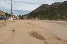
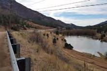
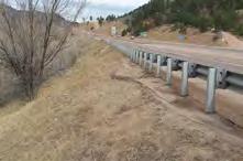


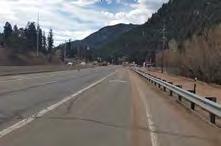
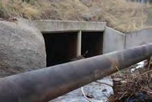
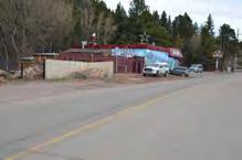
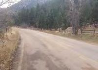

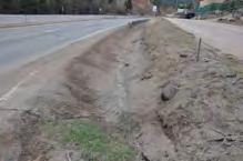
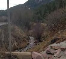
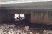
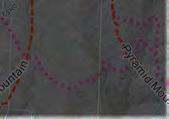
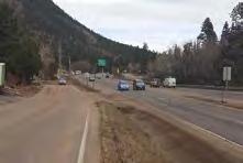
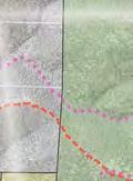
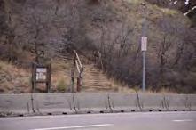


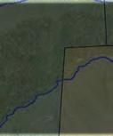
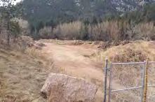

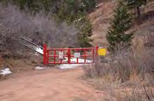

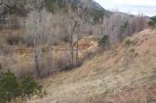
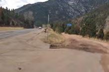
65 Ute Pass Regional Trail Master Plan Trail Alternatives August 31, 2015 LEGEND Hurricane Canyon Natural Area Existing County Trails Example of ROW width Example of ROW width Proposed County Trails CON N E CT I U T E PAS S E LE M E N TARY S CH OOL Other Existing Trails Waldo Canyon Burn Scar Trail (Closed) US Highway 24 COM M E RC IA L CON N E CT E D A C C E SS Creeks Example of ROW width 100 Year Floodplain Landmarks Pike National Forest Public Land Parcel Lines commercial area commercial area Scarps, Cliffs, Canyons Alternative 2 Trailhead Possible Amenities Connection to Existing UPRT View of Fountain Creek Crossing 2 Example of ROW width US 24 / Spring St. intersection Buffer POTE N T IA L T RA ILHE A D O N STATE R.O.W. UTILIZ E FO UN TA IN A VE. T RA FFIC LIGHT Fountain Ave box culvert US Fountain Ave looking East CDOT Spring St. US 24 frontage road US 24 frontage Road Sharp curves on US 24 (Typ.) US 24 frontage Road Access Long s Ranch Road US 24 frontage Road US 24 frontage Road Existing Waldo Canyon Trailhead (Closed) TRAIL ALTERNATIVE 2: CDOT ROW Ute Pass Master Plan - October 20, 2015 RE STRICTE D A C C E SS A RE A Fountain Creek box Frontage Rd. Fountain Creek box Frontage Rd. POT E NT IA L TRA ILHE A D O N C D OT RO W C O N NE CTIO UTE IND IA N T RA IL LO OP 65
66


67 Trail Alternative 3 - North Canyon Based on the goals and public and stakeholder input, Trail Alternative 3 has several corridor advantages. These advantages include utilizing scenic areas with views of the valley, as well as being located on the sunny side of the valley; a natural, beautiful landscape, the opportunity to see abundant wildlife and flora and fauna; and close proximity to existing trails including Pyramid Mountain Trails and Waldo Canyon Trails (Closed). The corridor disadvantages include extreme slopes that limit users through lack of ADA accessibility and ability level; slower emergency services response times due to distance from access points; increased access to remote areas where response times are extended or limited in case of fire or emergencies; increased impacts to wildlife by encouraging trail use in more remote areas; and expensive trail construction costs that include but are not limited to clearing, cut and fill of slopes and grading. Based on the specific character of the trail, Alternative 3 has several advantages. Alternative 3 utilizes existing trail alignments including Pyramid Mountain Trail, thus reducing impact to the landscape and wildlife, as well as reducing trail construction costs; ability to connect to Cascade via existing roadways; and use of an existing El Paso County property for trail amenities including trash and restroom facilities. Alternative 3 also has disadvantages. Alternative 3 will require two (2) crossings of U.S. 24 utilizing bridges, underpasses, and/or traffic signals; requires the utilization of public property through easements or acquisition; the change in the terrain increases the trail length and cost of construction; the use NFS Lands is unlikely to receive clearance through the USFS permitting process; the terrain conditions make ADA accessibility minimal; the trail connection to Ute Indian Trail loop must come in close proximity to a CSU restricted access area requiring additional costs for buffering (e.g., landscape and/or fencing); and additional hazards in the Waldo Canyon burn scar including unstable soils, tree fall hazards, flash flooding and erosion. View of Cascade from the northern canyon Example of Waldo Canyon burn scar damage The Regulatory Needs investigated for Alternative 3 include: the alignment would require an agreement between El Paso County and Colorado Springs Utilities (CSU) for access onto CSU lands, as well as an Intergovernmental Agreement (IGA) between El Paso County and CDOT. The alternative also requires use of the existing controlled access at Long s Ranch Road, as well as a viewshed analysis and buffering between the CSU restricted access area and adjacent property owners. Existing Pyramid Mountain Trail Ute Pass Master Plan - October 20,


68 Trail Alignment Elevation Profile Comparison Trail Alignment 3 - North Canyon Photos of existing conditions on Pyramid Mountain 68 Ute Pass Master Plan - October 20, 2015

69 Ute Pass Master Plan - October 20,
70


71 Trail Alternative 4 - Fountain Ave. / Chipita Park Road Based on the goals and public and stakeholder input, Trail Alternative 4 has several corridor advantages. These advantages include a direct trail route through the communities of Cascade/Chipita Park and unlimited access to residents and businesses, and can provide the opportunity for off-street pedestrian accommodations. The corridor disadvantages include increased safety risks along Fountain Avenue and Chipita Park Road to users and vehicular traffic, especially at driveway crossings and Pikes Peak Highway. Based on the specific character of the trail, Alternative 4 has several advantages. Alternative 4 can provide buffering (e.g., landscape or fencing) to some residential parcels; reduces construction costs by utilizing existing road alignment; provides several locations for trailheads along the corridor, the most promising being the CDOT storage yard at Spring Street; utilizes existing El Paso County ROW for the trail alignment, eliminating the property impacts to property owners through easements or acquisition; provides improvements to the existing roadway (e.g., curb and gutter, separation, controlled access); and ADA accessibility can be more easily attained. Alternative 4 also has disadvantages. Alternative 4 may have a reduced experiential quality due to traffic noise from Fountain Avenue, Chipita Park Road and U.S. 24; the trail connection to Ute Indian Trail loop must come in close proximity to a CSU restricted access area, requiring additional costs for buffering (e.g., landscape and/ or fencing); the trail must utilize Fountain Avenue/U.S. 24 intersection; the trail would be visible and in close proximity to private residences; increased construction costs for cut slope, trail grading and retaining View of Chipita Park Road looking West View of Chipita Park Road looking West View of Fountain Avenue looking North Ute Pass Master Plan - October 20, 2015 Example of weekend traffic in the summer months 71

72 structures (as needed) to connect to the Ute Indian Trail loop; potential for user conflict with an on-street trail design and narrow ROW with inconsistent dimensions from the edge of pavement on Fountain Avenue and Chipita Park Road. The Regulatory Needs investigated for Alternative 4 include: the alignment would require an agreement between El Paso County and Colorado Springs Utilities (CSU) for access onto CSU lands, as well as an Intergovernmental Agreement (IGA) between El Paso County and CDOT. The alternative also requires use of the existing controlled access at Long s Ranch Road, as well as a viewshed analysis and buffering between the CSU restricted access area and adjacent property owners. Note: This alternative follows past planning efforts and was identified at the first public meeting. Trail Alignment Elevation Profile Comparison Trail Alignment 4 - Fountain Ave. / Chipita Park Road 72 Ute Pass Master Plan - October 20, 2015

73 Ute Pass Master Plan - October 20,
74
75 DEVELOPMENT OF THE PREFERRED ALIGNMENT This master plan utilized all of the information gathered to develop the preferred alignment. Specific areas of the process that were utilized included public input gathered at public meetings, stakeholder input including regulatory needs, El Paso County input, safety and cost and maintenance considerations. Public Input: The primary concerns heard throughout the public process included safety, not utilizing private property for trail alignments, experience of the user and the desire for educational opportunities. 1. Safety: Public input relayed that safety along the corridor was a priority. Safety concerns included response times for emergency services including fire, ambulance and sheriff support. At the request of the public, stakeholder outreach was conducted with the local responding agencies. The public also had safety concerns regarding high vehicular traffic along the corridor including large trucks (i.e., trash trucks and school buses). This concern is especially prevalent in the summer months because the local tourism attractions including Pikes Peak and the North Pole increases traffic considerably along Fountain Avenue and Chiptia Park Road. The public also voiced concern over the current vehicular speeds in the corridor and encouraged additional monitoring and a more regular sheriff s presence. 2. Private Property Use: The public was not interested in trail alignments that utilized private property through acquisition or easements. The public also would prefer parking for the trail facilities to be of a size and location so as to not burden private property or business owners. The public strongly encouraged the use of Forest Service Lands, Colorado Springs Utility Lands and El Paso County Lands. 3. User Experience: Public input gathered showed that user experience was preferred over connectivity of the community. User experience was defined as natural experience with access to flora, fauna and wildlife as well as no or limited exposure to roadways. 4. Educational Opportunities: The public expressed interest in using the trail as an educational trail for elements specific to Ute Pass including Ute Indian History, flora and fauna and Fountain Creek. In response to these concerns, the preferred alignment considered: The ability to provide educational and experiential opportunities for trail users The property requirements for trail alignments The ability to provide parking for the trail without impacting businesses or private owners The ability to provide a safe experience for trail users and vehicular traffic including the speed of adjacent roadways and possible separation between the trail and roadway The ability for Emergency Services response including medical and fire Stakeholder Input Stakeholder Input was gathered from thirteen (13) sources and included the National Forest Service, Colorado Springs Utilities and the Colorado Department of Transportation. For a detailed list of stakeholders see the Public Process section of this document. Issues and concerns primarily heard from stakeholders included meeting regulatory needs and protecting existing infrastructure. 1. Regulatory Needs: Agencies were very transparent in the regulatory needs that would be needed for each of the alignment alternatives. The preferred trail alignment would be required to follow the regulatory processes set forth by each entity. 2. Protection of Existing Infrastructure: Agencies made recommendations to protect existing Ute Pass Master Plan - October 20,
76 infrastructure and community relationships along the corridor, as were specifically required. For detailed information on these recommendations, see the Stakeholder Meeting Minutes in the Appendix of this document. In response to these concerns, the preferred alignment considered: The required effort and potential outcome of regulation and permitting efforts Impacts to infrastructure including erosion and drainage issues, access to sensitive areas (i.e., Hurricane Canyon Natural Area and Hydroelectric Plant) Impacts to Fountain Creek and the health of the watershed El Paso County Input and State Trails Planning Grant Requirements: El Paso County input, in conjunction with the State Trails Panning Grant goals, were referenced during the development of the preferred alignment. El Paso County s input adhered to the goals developed for the grant and are stated in this document. Goals included providing access and connectivity within the community and to other communities, construction and maintenance costs and applicability with other corridor planning. 1. Access and Connectivity: The trail alternative should provide access to communities in the region as well as access to community amenities including historical places, local attractions and community services (i.e., school). Access should be as universal as possible and ADA accessibility is desired. Trail alignment should be considered multi-modal. 2. Construction and Maintenance: Trail construction costs should be considered in the development of the trail alignment. Maintenance costs of the trail should be considered in the development of the trail alignment. 3. Corridor Planning: Trail connection should be compatible with previous master planning efforts including but not limited to the El Paso County Trails Master Plan and The El Paso County Major Transportation Corridors Plan. In response to these goals, the preferred alignment considered: The ability to provide access between communities The ability to provide access to community amenities The ability to make the trail accessible to multiple user groups including ADA access Construction and maintenance costs Trail connection provided is compatible with previous master planning efforts Following the development of the five (5) Alternative Alignments previously described in this document, the project team, with input from El Paso County, developed a decision matrix to assist with determining the preferred alignment. The criteria used in the matrix was developed using the projects goals and objectives, input gathered through the public meetings and comments, stakeholder meetings and from site inventory and research efforts. Public, stakeholder and El Paso County s concerns have been listed above in more detail. The matrix was utilized as a tool to summarize the input gathered during the process. This matrix uses criteria to weigh each alternative against fifteen (15) set criteria. Information about each alternative was assessed against the developed criteria and assigned a point, based on a 1-3 scale, where 1 point is poor, 2 points in neutral, and 3 points is best. 76 Ute Pass Master Plan - October 20, 2015
77 A poor rating indicates that the development of a trial has a negative affect on the criteria. This may include increased safety concerns, improbable regulatory approvals, challenging site conditions, or where construction costs are deemed beyond acceptable. A neutral rating against a criteria indicates that the development of a trail has a negligible affect on the criteria. This may include areas where safety issues, regulatory approvals, site conditions, or construction costs are considered acceptable. A best rating indicates that development of a trail has a positive affect on the criteria. This may include areas where safety issues can be addressed or mitigated, regulatory approvals easily obtainable, site conditions accommodating or improved, or where construction costs can be reduced. A full sized matrix is also located in the Appendix. Ute Pass Trail Decision Matrix Created utilizing Public and Stakeholder Input and Site Analysis to develop criteria and a Poor/Neutral/Best ranking system Poor = 1 point Nuetral = 2 points Best = 3 points Options Ranking Criteria Alternative 1B - South Canyon (Using Heizer and French Creek Trials) Alternative 1A - South Canyon Alternative 2 - CDOT ROW Alternative 3 - North Canyon (Using Waldo Canyon and Pyramid Mtn. Trails) Alternative 4 - Fountain Ave/Chipita Park Road Provides educational and experiential opportunities for trail users? Provides access to flora, fauna and wildlife. Provides a wilderness experience. Provides access to flora, fauna and wildlife. Provides a wilderness experience. Limited access to flora and fauna. Minimal educational opportunities. Poor experiential opportunity. Provides access to flora, fauna and wildlife. Provides a wilderness experience. Limited access to flora and fauna. Minimal educational opportunities. Poor experiential opportunity. Property acquisition or easement requirements? Utilizes USFS, CSU and Public ROW. No impact to private property. CON: Crosses Hurricane Canyon Natural Area, requires USFS Special Use Permit, and IGA with CSU. No additional traffic at Hurricane Canyon Natural Area per USFS. Special Use Permit approval unlikely. Utilizes USFS and CSU Property. Alignment utilizes 10 privately owned parcels. CONS: Crosses Hurricane Canyon Natural Area, requires USFS Special Use Permit, and IGA with CSU. No additional traffic at Hurricane Canyon Natural Area per USFS. Special Use Permit approval unlikely. Utilizes Public ROW. No permanent impact to private property. Construction access may be required. Easments may be required after survey information has been collected. Utilizes USFS, CSU and Public ROW. Alignment utilizes 16 privately owned parcels. CONS: Requires USFS Special Use Permit and IGA with CSU for access agreement area. Special Use Permit approval unlikely. Utilizes Public ROW. No permanent impact to private property. Construction access may be required. Easments may be required after survey information has been collected. Provides a safe trail experience for trail users and vehicular traffic (including at street crossings and driveways)? Hazardous on-street alignment at Pike's Peak Highway (300,000+ Vehicles per year) for approx. 0.5 miles. On-street alignment has exposure to 21 driveways at Mountain Road, Paona Road, Mariposa Trail and Chipita Park Road. Total on street distance approx..75 miles On street alignment for approx. 0.6 miles is located in a very steep part of the canyon. Can be catalyst to safe intersection design and roadway enhancements. CON: Approval to utilize Pikes Peak Highway ROW unlikely. Hazardous on-street alignment at Pike's Peak Highway (300,000+ Vehicles per year) for approx..1 miles. Exposure to 21 driveways at Mountain Road, Paona Road, Mariposa Trail and Chipita Park Road. Total on-street distance approx miles. On-street alignment for approx. 0.6 miles is located in a very steep part of the canyon. Can be catalyst to safe intersection design and roadway enhancements. CON: Approval to utilize Pikes Peak Highway ROW or crossing unlikely. Hazards to trail users if US 24 traffic looses control and enters the embankment, especially in areas where no guardrail is present. A total of 13 existing curb cuts exist at parking areas of 2 commercial strips directly accessing US 24. Can be catalyst to safe intersection design and roadway enhancements. Crossing of Fountain Ave. can be controlled and improved from existing conditions in conjunction with the proposed Fountain Ave/US 24 intersection improvements on the B list of PPRTA 2. Hazardous crossing of US 24 in a minimum of two locations and crossing at Fountain Ave. Minimal exposure to driveways. Can be catalyst to safe intersection design and roadway enhancements. CONS: Crossing options including a pedestrian bridge or box culvert will require ample funds and may be cost prohibitive. Exposure to 65 driveways on north side and 61 driveways on the south side of Fountain Ave. / Chipita Park Road. Crossing of 1 intersection on the north side and 15 intersections on the south side of Fountain Ave. / Chipita Park Road. Commercial businesses at Fountain Ave. have no controlled access to parking areas. Can be catalyst to safe intersection design and roadway enhancements. Speed of adjacent roadways? Pikes Peak Highway: 25 mph Pikes Peak Highway: 25 mph US 24: 55 mph (Ute Pass Elementary School east to approx. Rampart Terrace Road) 50 mph (Rampart Terrace Road east to Spring Road) 45 mph (Spring Road east through project area. US 24: 45 mph Fountain Ave / Chipita Park Rd: 30mph US 24: 45 mph Approx. distance of possible separation (based on available ROW widths) 0 ft. - on-street facility 0 ft. - on-street facility Separation: 0-50 ft. (varies) Achieves both horizontal and vertical separation. Must cross US 24 at two locations Separation: 0-10 ft., on-street or directly adjacent facility Provides connectivity between communities? Connects to several other regional trail segments (Crow Gulch Trail, Heizer Trail and French Creek Trail) and provides indirect access to Cascade. Connects to one other regional trail segment (Heizer Trail) and provides indirect access to Cascade. Direct regional link. One cross connection between proposed alignment and Fountain Ave. / Chipita Park Road at Spring Street. Connects to several other regional trail segments (CLOSED Waldo Canyon Trail and Pyramid Mountain Trail) and provides and indirect access to Cascade. Direct regional and community link. Ute Pass Master Plan - October 20,
78 Ute Pass Trail Decision Matrix Created utilizing Public and Stakeholder Input and Site Analysis to develop criteria and a Poor/Neutral/Best ranking system Poor = 1 point Nuetral = 2 points Best = 3 points Options Ranking Criteria Alternative 1B South Canyon (Using Heizer and French Creek Trials) Alternative 1A South Canyon Alternative 2 CDOT ROW Alternative 3 North Canyon (Using Waldo Canyon and Pyramid Mtn. Trails) Alternative 4 Fountain Ave/Chipita Park Road Provides access to community amenities? Access to Heizer, Crowe Gulch, Ute Indian and French Creek Trails. Close proximity to Chipita Lodge, Casa Blanca, Fremont Forest Experiment Station and Entrance to National Forest. Approximate Trail length miles SUMMARY: 4 trails and 4 attractions, longest trail length Access to Heizer and Ute Indian Trails. Close proximity to Mother's Rest, Deer Lick Spring, Klein House, Cascade Pavilion, Heizer Cottage and Holy Rosary Chapel. Approximate Trail length miles SUMMARY: 2 trails and 6 attractions Immediate access to all Cascade businesses both at Fountain Ave and adjacent to US 24. Provides access to crossing US 24 at Fountain Ave. to access Post office, library, etc. on north side of US 24. Approximate Trail length miles SUMMARY: No trails. Access to commercial hubs. Access to CLOSED Waldo Canyon and Pyramid Mountain Trails. Additional connection opportunity from trail utilizing Topeka Ave. to make connection to Whiteside, Easthome Hotel, Roud Cloud Inn, Kirk Kam, Old Post office, Marigreen Pines Main House and Library. Approximate Trail length miles SUMMARY: 2 trails and 7 attractions Immediate access to all Cascade businesses and residents at the bottom of the valley. Does not provide access to commercial areas adjacent to US 24. Provides access to crossing US 24 at Fountain Ave. to access Post office, library, etc. on north side of US 24. Approximate Trail length miles SUMMARY: No trails. Access to residents and some commercial areas. Accessible by multiple different user groups (i.e., ADA accessibility, elevation change) No ADA accessibility. Extreme elevation change 1,000 ft. +/- Little to no ADA accessibility. Extreme elevation change 500 ft. +/- ADA accessible for entire length. No ADA accessibility. Extreme elevation change 1,000 ft. +/- ADA accessible for entire length. Construction and maintenance costs? Utilizes existing trail connections for approx. 2/5 of trail length and on-street connections for approx. 1/5 of trail length but over steep terrain. Increased maintenance costs in remaining 2/5 due to steep terrain and limited access. New trail sections have high cost due to forest clearing, creating benches and grading, and stabilizing existing soils. Utilizes on-street connections for approx. 1/3 trail length but over steep terrain. Approx. 2/3 of trail length is new construction. Increased maintenance costs in new 2/3 due to steep terrain and limited access. New trail sections have high cost due to forest clearing, creating benches and grading, and stabilizing existing soils. Increased construction costs for length of trail due to grading and retaining operations. No increase in maintenance costs. Utilize CDOT storage yard for staging operations. Significant trail construction costs because of poor existing soils, steep terrain, private property acquisition and existing burn scar. Additional costs for constructing safe crossings at US 24 (e.g., pedestrian bridge or underpass). Limited access for construction or maintenance. Increased construction costs due to multiple cut and fill scenarios to provide width for the trail. Expected costs include curb and gutter and boulder/retaining walls to accommodate trail as either sidewalk or on-street facility. Utilize CDOT storage yard for staging operations. Provides EMS access? Easy access along approx. 1/5 of on-street alignment. 2/5 of alternative alignment already in use or on USFS roads will not increase access burden on EMS. Remaining 2/5 would have limited access and require "walking-in". Segment is longer than 1 mile from nearest access. Distance would increase burden for EMS. Increased volume of trail users may increase volume of calls. Easy access along approx. 1/5 of on-street alignment. Remainder of trail would have limited access and require "walking-in". Segment is longer than 1-mile from nearest access. Distance would increase burden for EMS. Increased volume of trail users may increase volume of calls. Immediate access along length of alternative alignment. Increased volume of trail users may increase volume of calls. Very limited access along majority of alternative alignment. Remote area and limited access increases burden for EMS. Increased volume of trail users may increase volume of calls. Immediate access along length of alternative alignment. Increased volume of trail users may increase volume of calls. Provides parking areas (not on private property)? Parking at existing parking areas including Heizer Trail, French Creek and other existing local and regional trailheads. Increases risk over-flow parking. Does not assume use of CLOSED Waldo Canyon Trailhead Parking at existing parking areas including Heizer Trail, French Creek and other existing local and regional trailheads. Increases risk over-flow parking. Does not assume use of CLOSED Waldo Canyon Trailhead Parking proposed at CDOT existing storage facility at Spring Street (CDOT will consider parking in this location) and CDOT ROW at Frontage Road. Provides access from Fountain Ave. and US 24. CON: Provide security and buffering for immediately adjacent residents along the frontage road. Increased traffic along Frontage Road to dead end parking. Parking at north end of Pyramid Mountain Road. Acquisition of private property would be required. Does not assume use of CLOSED Waldo Canyon Trailhead Parking proposed at CDOT existing storage facility at Spring Street (CDOT will consider parking in this location) and CDOT ROW at Frontage Road. Provides access from Fountain Ave. and US 24. CON: Provide security and buffering for immediately adjacent residents along the frontage road. Increased traffic along Frontage Road to dead end parking. Does not assume use of CLOSED Waldo Canyon Trailhead. Does not assume use of CLOSED Waldo Canyon Trailhead. Impacts to Fountain Creek and its floodplain? No impact or improvement No impact or improvement Utilizes floodplain without causing water elevation to rise. Trails are an appropriate use of floodplain. Trail design presents opportunity for water quality and BMP measures. No impact or improvement No impact or improvement Compatible with other corridor planning? Compatible with the El Paso County Trails Master Plan. Compatible with the El Paso County Trails Master Plan. Compatible with the El Paso County Trails Master Plan, El Paso County Major Transportation Corridors Plan. Compatible with the El Paso County Trails Master Plan. Compatible with the El Paso County Trails Master Plan, El Paso County Major Transportation Corridors Plan. Regulatory/Permitting Consideration Special Use Permit (USFS) Environmental Assessment (EA) Special Use Permit (USFS) Environmental Assessment (EA) IGA between CDOT and EPC Easement and Use agreement with CSU CDOT Environmental Clearances (Special Use or Access Permit) Special Use Permit Environmental Assessment (EA) IGA between CDOT and EPC Easement and Use agreement with CSU CDOT Environmental Clearances (Special Use or Access Permit) Erosion and Drainage Issues Additional trail would encounter same issues currently occurring on constructed segments. Additional trail would encounter same issues currently occurring on constructed segments. Increased hazard due to burn scar runoff for near future (5-10 years). Opportunity for water treatment and control of runoff through use of swales and natural systems. Increased hazard due to burn scar runoff for near future (5-10 years). Additional trail would encounter same issues currently occurring on constructed segments. Increased strain to existing facilities for duration of trail lifespan and opportunity for run-off treatment on east-bound side of road. Identification of Option concurent with Criteria: Green = 2 x 3pts = 6 Yellow = 7 x 2pts = 14 Red = 6 x 1pts = 6 TOTAL POINTS 26 Green = 2 x 3pts = 6 Yellow = 8 x 2pts = 16 Red = 5 x 1pts = 5 TOTAL POINTS 27 Green = 6 x 3pts = 18 Yellow = 7 x 2pts = 14 Red = 2 x 1pts = 2 TOTAL POINTS 34 Green = 1 x 3pts = 3 Yellow = 5 x 2pts = 10 Red = 9 x 1pts = 9 TOTAL POINTS 22 Green = 8 x 3pts = 24 Yellow = 6 x 2pts = 12 Red = 1 x 1pts = 1 TOTAL POINTS 37 From the scoring of matrix, both Alternative 2 - US Hwy 24, and Alternative 4 - Fountain Ave / Chipita Park Rd, met the established criteria and the master plan goals and objectives. Alignment Alternative Matrix Score 4- Fountain Ave / Chipita Park Road US Hwy Northern Canyon A/1B- Southern Canyon This matrix, used in combination with public and stakeholder comments and site analysis was the basis for recommending a combination of U.S. 24 ROW (Alternative 2) and Fountain Avenue/Chipita Park Road (Alternative 4). See the Chapter 4: Alignment Recommendation. 78 Ute Pass Master Plan - October 20, 2015


79 CHAPTER V: ALIGNMENT RECOMMENDATION PREFERRED ALIGNMENT The recommendation of this master plan is that the trail connection be made using the following alignments and methods: Ute Pass Elementary School to Spring Street: Develop a trail alignment along Chipita Park ROW, primarily along the Eastbound lane. Trail widths may vary based on existing condition and selected design guideline approach. Spring Street to Ute Indian Trail Loop: Develop a recreational trail alignment along U.S. 24 and frontage road ROW. Trail widths may vary based on existing condition and selected design guideline approach. Corridor length: develop bike lanes in U.S. 24 ROW Because of the complexity of the corridor and the amount of public input the project has gathered, both the project team and El Paso County agrees that the trail alignment along Chipita Park Road is the highest priority. The goal along the corridor in the near future will be to improve safety along the roadway for pedestrians, bicyclist and vehicular traffic. See the Implementation Section for information on developed safety improvements. Safety improvements along Chipita Park Road include a combination of on-street, road widening and sidewalks. Improvements have also been recommended at the Pikes Peak Highway intersection. The creation of a second trail along the U.S. 24 ROW is a desirable future improvement for El Paso County, as highway improvements are made and/or funding can be secured. This second trail is envisioned to carry a the bicycle traffic and the trail users who wish to travel long distances. Beginning at Ute Pass Elementary School, the trail will connect to the existing Ute Pass Regional Trail and continue east along the School parking lot, utilize the existing crosswalk at Chipita Park Road where the trail will cross from the north side of Chipita Park Road to the South (Map 1). The trail will utilize the existing bridge cross walk at Chipita Park Road and Fountain Creek and continue east on the south side of the road (Map 1). Utilize existing cross walk to cross Chipita Park Road at Ute Pass Elementary School. A cross walk will be required at the following intersections where the trail crosses including: Fountain Road/Mariposa Road Pikes Peak Highway Fountain Avenue U.S. 24 Frontage Road Access Ute Pass Master Plan - October 20,
.")

.")
80 Crosswalk markings should be considered at all locations where the trail crosses a roadway. Between Carnia Road and Winnemucca Road the trail should be placed in the existing County ROW to preserve existing retaining walls along the corridor (Map 2). Trees along the length of the corridor should be preserved to the extent possible. Tree locations in relation to the ROW and trail alignment were not determined as a part of this document and should be included in survey information collected in the future. Between Chipita Pines Drive moving east to Dodd Road, the trail should be placed to avoid the drainage swale where possible. Should the swale need to be modified to accommodate the trail, the carrying capacity of the drainage swale should not be reduced, but modified to keep or expand existing capacity (Map 2). View of existing retaining wall at Winnemucca Road View of Chipita Pines entrance and drainage swale As the trail moves east to the Pikes Peak Highway, it is recommended that the trail be buffered as much as possible from the road way. At this location, a pedestrian activated signal is recommended at the existing stop sign on Chipita Park Road. Please see a conceptual perspective of the cross walk as well as a typical section in Chapter VI Implementation. At this crossing, the trail alignment View of businesses along Fountain Avenue, looking north to the intersection with U.S. 24 moves from the south side of Chipita Park Road to the north side of Fountain Avenue allowing access to Spring Street and the proposed location of the Ute Pass Regional Trail Trailhead. For additional information regarding the Trailhead, see Chapter VI Implementation (Map 3). 80 Ute Pass Master Plan - October 20, 2015
.")
. View of U.S. 24 frontage road.")
81 It is recommended that the trail continue along the north side of Fountain Avenue through the business district to a pedestrian activated signal located before the bridge at Fountain Creek. At this location, the trail would cross from the north side of Fountain Avenue to the south side and continue east down the south side of the U.S. 24 frontage road (Map 4). Trail along the frontage road shall be placed within existing ROW on the south side of the frontage road. Business access and parking will be preserved and access points clearly defined to reduce user conflicts in this section (Map 4). View of U.S. 24 frontage road. Place cross walk at vehicular access to U.S. 24 As the trail moves east, a pedestrian bridge will be required to cross Fountain Creek. The trail will continue on the north side of the residential frontage road. A striped and signed pedestrian crossing will be required at the vehicular access point onto U.S. 24. Trail View of Fountain Creek. Place pedestrian bridge at Fountain Creek crossing will need to be benched off the roadway and supported by a retaining wall. The retaining wall shall be located between Fountain Creek and the trail (Map 4). Conceptual section of trail supported by retaining wall at Fountain Creek. Ute Pass Master Plan - October 20,
82 Conceptual view of trail and retaining wall at U.S. 24 Frontage Road Conceptual view of trail and retaining wall at U.S. 24 Frontage Road 82 Ute Pass Master Plan - October 20, 2015

83 Conceptual view of trail and retaining wall at U.S. 24 Frontage Road Conceptual view of trail and retaining wall at U.S. 24 Frontage Road Ute Pass Master Plan - October 20,

84 Conceptual view of trail along U.S. 24 Conceptual view of trail along U.S Ute Pass Master Plan - October 20, 2015

85 Conceptual view of trail and retaining wall along U.S. 24 Ute Pass Master Plan - October 20,
86 Due to the residential nature and narrow trail cross section, consider fencing to maintain vehicular access and reduce user conflicts. Consider visual and or noise abatement measures. Additional safety and access restriction measures should be taken in this location to prevent parking at the dead end of the frontage road. Consider gating access and installing signage (Map 4). All measures to prevent parking should be vetted with residents and emergency services providers (both local and regional) to ensure emergency egress from this area is not prevented. Trail should continue east on the ROW of the frontage road and U.S. 24 to French Creek. French Creek will require a pedestrian bridge. Utilize CSU pipeline alignment (if possible) along French Creek. As the trail moves up the French Creek corridor, way-finding signage should be placed at regular intervals as well as stay on trail signs. Sign crossings of roadways including, but not limited to Longs Ranch Road (Map 5). In areas where the trail parallels Fountain and French Creeks, consider opportunities to integrate trail design and construction with improving the creek corridors. Improvements may include but are not limited to increasing floodplain, reducing sediment transportation and revegetation. Special attention should be paid in the CSU area of restricted access. Any trail alignment shall consider fencing, signage, and visual and or noise abatement measures. Any trail alignment crossing CSU lands shall be finalized with and approved by CSU prior to construction or use (Map 5). All sections of the trail should include signage stay on trail at regular intervals. Maps of the alignment recommendation have been provided in this section. This map shows conceptual trail alignment and improvements. This map does not constitute a legal survey and discrepancies may exist. A survey will be required prior to any design or construction activities. Final design and construction documents will be required to determine specific improvements along this trail corridor. 86 Ute Pass Master Plan - October 20, 2015
87 Ute Pass Master Plan - October 20,
88
89 Ute Pass Master Plan - October 20,
90
91 Ute Pass Master Plan - October 20,
92
93 Ute Pass Master Plan - October 20,
94
95 Ute Pass Master Plan - October 20,
96

97 CHAPTER VI: DESIGN GUIDELINES TRAIL DESIGN This master plan recommends making safety improvements along Fountain Avenue and Chipita Park Road to allow for an immediate trail alignment. Currently, the road section is comprised of a two lane road with a paved with of approximately 24. The ROW remains consistent at 50, however, the pavement shifts within the ROW. It is recommended that a survey of the ROW and pavement be conducted prior to design of the trail. As the existing condition varies, this Master Plan will recommend typical trail treatments that can be used along the length of the roads. Cut Slopes In areas where the trail will be aligned adjacent to the road and the existing condition is a swale or shoulder that rises from the road surface, the trail will be constructed with a cut slope. The recommended trail width is 3-5 feet wide supported on the uphill or downhill side by boulders or a retaining wall (as appropriate). The trail can be constructed of either asphalt or soft surface materials such as crusher fines. In no circumstance should the carrying Example of Cut Slope Condition capacity of the ditch be reduced. See the typical section below. Please note: this condition may require a railing. The costs associated with this treatment are as follows and have been calculated to the max depth and width and on a linear foot basis: Sawcut existing asphalt to create edge - $10.00 L.F. Asphalt at $3.50/S.F. - $17.50 L.F. Crusher Fines at $2.00/S.F. - $10.00 L.F. 3 foot diameter boulders at $300 each or poured in place retaining wall - $200 L.F. CUT SLOPE TOTALS based on trail surfacing type: 5 foot asphalt trail on a cut slope = $ per lineal foot Ute Pass Master Plan - October 20,
.")
98 Fill Slopes In areas where the trail will be aligned adjacent to the road and the existing condition is a shoulder that drops from the road surface in either a continuous slope or swale, the trail will be constructed with a fill slope. The recommended trail width is 3-5 feet wide supported on the downhill side by boulders or a retaining wall (as appropriate). The trail can be constructed of either asphalt or soft surface materials such as crusher fines. See the typical section below. Please note: this condition may require a railing. The costs associated with this treatment are as follows and have been calculated to the max depth and width and on a linear foot basis: Sawcut existing asphalt to create edge - $10.00 L.F. Asphalt at $3.50/S.F. - $17.50 L.F. Crusher Fines at $2.00/S.F. - $10.00 L.F. 3 foot diameter boulders at $300 each or poured in place retaining wall - $300 L.F. FILL SLOPE TOTALS based on trail surfacing type: 5 foot asphalt trail on a fill slope = $ per lineal foot 5 foot crusher fines trail on a fill slope = $320.0 per lineal foot Example of Fill Condition Typical Section of Fill Condition 98 Ute Pass Master Plan - October 20, 2015
99 Driveway Crossings In areas where the trail will be aligned adjacent to the road an cross perpendicularly to a driveway with a culvert, the trail will be constructed with a fill slope. The recommended trail width is 3-8 foot wide and supported on the downhill side by boulders or a retaining wall. The boulder or retaining wall support should not interfere with the operation of the culvert. The trail can be constructed of either asphalt or soft surface materials such as crusher fines. In no circumstance should the carrying capacity of the ditch and / or culvert be reduced. See the typical section below. Please note: this condition may require a railing. It is recommended that the trail widen to the greatest extent possible at driveway locations to increase separation between the roadway and trail users and increases visibility (site triangles) for vehicular users. It is anticipated that all improvements required at driveway crossings will be funded by El Paso County. No private monies will be required. The costs associated with this treatment are as follows and have been calculated to the max depth and width and on a linear foot basis: Sawcut existing asphalt to create edge - $10.00 L.F. Asphalt at $3.50/S.F. - $17.50 L.F. Crusher Fines at $2.00/S.F. - $ foot diameter boulders at $300 each or poured in place retaining wall - $300 L.F. FILL SLOPE TOTALS based on trail surfacing type: 5 foot asphalt trail on a cut slope = $ per lineal foot 5 foot soft surface trail on a cut slope = $ per lineal foot Typical Section of Driveway Condition with Culvert Typical Section of Driveway Condition Ute Pass Master Plan - October 20,

100 Flat Areas In areas where the trail will be aligned adjacent to the road and the area is flat, several options can be explored including: Attached Asphalt Trail Attached Soft Surface Trail Curb and Gutter and attached Sidewalk Curb and Gutter and detached Sidewalk In flat areas, trail width can vary from 6-8 foot wide. This width, as well as the degree of separation, depends entirely on the width of the ROW at a specific location. It is recommended in flat areas that the trail be constructed of concrete, but asphalt can be used. See the typical section below. The costs associated with this treatment are as follows and have been calculated to the max depth and with and on a linear foot basis: Sawcut existing asphalt to create edge - $10.00 L.F. Asphalt at $3.50/S.F. - $14.00 L.F. Crusher Fines at $2.00/S.F. - $8.00 L.F. Concrete Curb and Gutter - $17.00 L.F. Concrete Trail (attached) at $5.00/S.F. - $40.00 L.F. Concrete Trail (detached) at $5.50/S.F. - $44.00 L.F. Native seeding (for use with detached walk) at $1.00/S.F. - $4.00 L.F. FLAT AREAS TOTALS based on trail surfacing type, use of curb and gutter, use of attached or detached concrete sidewalk: 8 foot attached asphalt trail = $24.00 per lineal foot 8 foot attached crusher fines trail = $18.00 per lineal foot 8 foot attached concrete sidewalk with curb and gutter = $67.00 per lineal foot 8 foot detached concrete sidewalk with curb and gutter = $75.00 per lineal foot Example of Flat Condition 100 Ute Pass Master Plan - October 20, 2015
101 Typical Section of Flat Condition with Attached Walk Typical Section of Flat Condition with Curb and Gutter and Attached Walk Typical Section of Flat Condition with Curb and Gutter and Detached Walk Ute Pass Master Plan - October 20,

102 Retained Slope In areas where the trail will be aligned adjacent to the road and the existing condition is a shoulder that rises from the road surface, the trail will be constructed with a retained slope. The recommended trail width is 6-8 foot wide and supported on the uphill side by boulders or a retaining wall. The trail can be constructed of either asphalt or soft surface materials such as crusher fines. Retaining walls should emulate the surrounding community character and existing walls in the project area. See the typical section below. The costs associated with this treatment are as follows and have been calculated to the max height and width and on a linear foot basis: Sawcut existing asphalt to create edge - $10.00 L.F. Asphalt at $3.50/S.F. - $28.00 L.F. Crusher Fines at $2.00/S.F. - $ foot diameter boulders at $300 each or poured in place retaining wall - $300 L.F. RETAINED SLOPE TOTALS based on trail surfacing type: 8 foot asphalt trail on a retained slope = $ per lineal foot 8 foot soft surface trail on a retained slope = $ per lineal foot Example of Retained Slope Condition 102 Ute Pass Master Plan - October 20, 2015
103 Improved Safety At Driveway Crossings Placing a trail along Chipita Park Road presents challenges because of the number of driveway crossings. As described in the Existing Conditions Section of this document, many of the drives have a wide, uncontrolled access point. To improve safety for both the trail users and the vehicular traffic, it is recommended that controlled access be established at driveway crossings. In areas where curb and gutter a feasible, controlled access can be created using curb cuts. This methodology also warns trail users of the upcoming crossing. See below for a typical curb cut at a driveway. In areas where curb and gutter are not feasible, and the trail is attached (either asphalt or soft surface) to the roadway, controlled access should still be achieved to improve safety. It is recommended that driveway locations and access points are marked and limited by the use of a bollard system. These bollards are envisioned as 6 x6 pressure treated lumber posts set vertically in the ground to provide separation between trail users and private property, as well as clearly depict the driveway location. See below for a typical view of the bollard system. Example of existing driveway condition with no controlled access Ute Pass Master Plan - October 20,
104 Example of Controlled Access Measures Example of Controlled Access Measures 104 Ute Pass Master Plan - October 20, 2015

105 Trail Crossing and Approach at Pikes Peak Highway The approach and trail crossing at Pikes Peak Highway should strive to minimize user conflict by crossing the trail just west of the Pikes Peak Highway intersection. The trail moving from west to east is positioned on the south side of Chipita Park Road. Approaching the intersection, the trail should cross Chipita Park road at a marked, signalized crosswalk and proceed east on the north side of Chipita Park Road to Spring Street. By placing the crossing just west of the intersection, the trail users and vehicular traffic accessing Pikes Peak Highway will not come into direct contact. This creates a safer crossing for all users. Approaching the Pikes Peak Highway from the west, the trail will become a retention condition. To increase the area, the grade between Chipita Park Road and Pikes Peak Highway will need to be retained on the uphill side for an approximate distance of 875 feet to the crossing. See below for a typical section as well as a perspective of the crossing concept. The construction costs of the signalized pedestrian crossing as conceptually designed is as follows: Push Button Crossing Indicator with Flashing Lights - $5, Crosswalk Pavement Marking - $5, SIGNALIZED CROSSING TOTAL = $10, Conceptual pedestrian crossing at Pikes Peak Highway Ute Pass Master Plan - October 20,
106 Trailhead Capacity, Layout and Amenities Based on comments received from stakeholders and the community, this plan recommends placing one larger trailhead on the CDOT storage facility (and in CDOT ROW). This location provides several benefits including two full movement access points. Full movement in this document is defined by the ability to make a left hand trun into and out of the facility. The first access point is Spring Street and Fountain Avenue. At this location, users can travel east or west on Fountain Ave. / Chipita Park Road to access U.S. 24 The second access point is Spring Street and U.S. Highway 24. This is also a full movement intersection and will allow trail users to access the trailhead without putting additional vehicles on Fountain Avenue. This plan recommends that publications discussing this trailhead location and directions encourage users to access the trailhead from U.S. 24 onto Spring Street. Capacity As conceptually designed, the trailhead can accommodate twenty five vehicles and four equestrian/trailer vehicles. The conceptual design allows for access at two points on Spring Street without relocating the existing access to the CDOT storage facility. These two access points allow larger vehicles to maneuver through the trailhead without turning around within the parking lot. Separation between vehicles and equestrian uses can also be separated. Layout The conceptual trailhead is graphically shown consisting of a gravel parking lot contained by log timbers to define the area. Parking spaces will not be defined. The trailhead is surrounded by native seeding (nonirrigated). The toilet facility as well as one trash receptacle is shown in a gravel plaza area centrally located to the vehicular as well as equestrian users. The construction costs of the trailhead as conceptually designed is as follows: Gravel Parking Area (assume 6 deep Road Base) at $40.00 per cubic yard - $13, Log Timbers (assume 6 round timbers, 10 long) at $8.00 L.F. $7, Toilet Facility (assume one composting toilet) - $8, Trash Receptacles (x3) (assume animal proof) at $ each - $2, Fencing (assume 6 tall chain link) at $25.00 per L.F. - $10, Deciduous Trees (x8) (assume 2 caliper) at $ each - $4, Evergreen Trees (x13) (assume 6 height) at $ each - $7, TRAILHEAD TOTAL based on conceptual design = $54, Design Considerations It is recommended that the trailhead be fenced and clear signage to the trail be installed. Consider adding No Trespassing signs to adjacent properties. Consider meeting with immediately adjacent residents to provide additional security and way-finding to protect private property. Spring Street west to U.S. 24 would need to be regularly maintained by El Paso County, as this section of road, at the time this plan was developed, is unmaintained, but owned, by the County. Consider utilizing an unimproved parking area in the CDOT storage facility until final design and construction of the trailhead can occur. The unimproved lot could be utilized as soon as improvements along Fountain Ave. / Chipita Park Road are complete. 106 Ute Pass Master Plan - October 20, 2015


107 Conceptual access to trailhead. Conceptual trailhead design at CDOT storage facility. Ute Pass Master Plan - October 20,


108 Amenities The conceptual trailhead allows for a compost toilet facility and several trash receptacles. Facilities can be expanded within the conceptual design to best meet the needs and maintenance requirements of the County. The trailhead shall be fenced off from the CDOT storage facility using standard CDOT fencing to maintain security. The trailhead incorporates some landscape elements to both provide shade as well as some buffering between the trailhead and adjacent residents as well as buffering to the CDOT storage facility. The amenities shown on this page are conceptual in nature. Amenities specified in the design shall meet El Paso County guidelines. Conceptual lighting Conceptual waste station Conceptual information sign / kiosk Conceptual information sign Conceptual trash facility Conceptual bench 108 Ute Pass Master Plan - October 20, 2015
109 Chapter VII: Implementation Alignment Phasing It is anticipated that the trail will be completed in three major phases. Project phasing allows time to acquire funding, seek partnerships, complete site specific design, and regulatory approvals. Phasing also facilities project delivery for complex projects with many moving parts. PHASE ONE: Construct trail from Ute Pass Elementary School to Spring Street Install initial trailhead improvements at Spring Street The first phase includes the construction of improvements between Ute Pass Elementary School and the CDOT storage facility on Spring Street. It is recommended that initial trailhead be installed to accommodate users within the first phase of trail construction. Trailhead amenities including parking, signage, trash receptacles and temporary (portable) restrooms. PHASE TWO: Install remaining trailhead improvements at Spring Street Construct trail from Spring Street trailhead to U.S. 24 / Fountain Ave. intersection Install needed pedestrian improvements at U.S. 24 / Fountain Ave. intersection The second phase includes the construction of permanent trailhead improvements and needed pedestrian improvements at the U.S. 24 / Fountain Avenue intersection. Trailhead amenities include permanent restroom, kiosk, picnic tables and other site amenities. Pedestrian improvements at the U.S. 24 / Fountain Avenue intersection will be developed in consultation with the City of Colorado Springs, Colorado State Department of Transportation and El Paso County. PHASE THREE: Construct trail from U / Fountain Ave. intersection along frontage roads to French Creek Construct trail from French Creek to Ute Indian Trail interpretive loop The third phase includes construction of trail from the U.S. 24 / Fountain Ave. intersection to the frontage road, near French Creek. Construction from the Frontage Road to the Ute Indian Trail interpretive loop will be coordinated with Colorado Springs Utilities. Ute Pass Master Plan - October 20,


110 Next Steps This master plan evaluated the project area, trail alignment alternatives and preferred trail alignment at a high level (i.e., 100,000 foot level). As such, many specific site issues need to be studied in greater detail to determine appropriate design and engineering solutions. As the Ute Pass Regional Trail moves into design, in depth investigation of the following conditions is recommended: Drainage: Study of current drainage patterns and the effects of proposed improvements should be studied in detail to, at a minimum, maintain current drainage patterns and impacts. Where possible, every effort should be made to improve drainage of Fountain Avenue/Chipita Park Road. Water Quality: Where possible, drainage features, including swales, should incorporate water quality features and design concepts to improve run-off from Fountain Avenue/Chipita Park Road and the trail into the receiving waters of Fountain Creek. Survey including ROW and property lines: Trail alignment should not impact private property and should be maintained within the existing County Right of Way. Based on preliminary studies and community input, the current road alignment in specific areas may encroach into private property. Road realignment in select areas may need to be incorporated with trail design and construction. Utility locations: Existing utilities need to be surveyed for location and depth. Utility location and depth should be a factor in choosing how trail design guidelines are implemented along the corridor. Flood patterns, flows and levels of Fountain Creek: Flood patterns of Fountain Creek should be studied in depth. It is recommended that all flood data used is post Waldo Canyon Fire to appropriately address run-off issues created by the burn scar. These issues include but are not limited to flash flooding and a rise in the flood levels. Special care should be taken in trail design in areas where the trail is located in or directly adjacent to the floodplain. 110 Ute Pass Master Plan - October 20, 2015
111 Public and private facilities placement and access: This includes mailboxes and school bus stops. The placement of these facilities should be carefully considered in relation to trail width, trail separation from the roadway and visibility along the corridor. It is recommended that effected agencies, including the U.S. Postal Service, School District and Ute Pass Elementary School be included in design discussions for locating these facilities. Traffic Counts at Fountain Ave. / U.S. 24 intersection (may be done as a part of PPACG improvements): Traffic counts should be conducted and utilized in the implementation the trail design guidelines to provide the safest trail experience possible for both pedestrians and vehicular traffic. Buffer zone facilitation: In areas where buffering is recommended, designs are encouraged to engage residents and stakeholders (including but not limited to Colorado Springs Utilities and business owners) directly effected by buffering to determine the appropriate type and size of buffering measures. It is assumed that each buffering location will require a different type of buffering based on adjacent use. Impacts to Watersheds including Fountain Creek and French Creek: Impacts to watersheds should be evaluated. This evaluation may occur in combination with Drainage, Water Quality, and Flood Impacts. Trail design should strive to create no negative impacts to the watersheds. Impacts to Colorado Springs Utilities: Trail design should work closly with Colorado Springs Utilities while on CSU property. Efforts should be made to protect and limit access to the Hydroelectric Plant and pipelines. Special attention should be paid to trail segments below the hydroelectric plant and it is recommended that segments in this area are limited. Following the completion of additional studies, this master plan recommends that all conceptual level planning be tested against real world opportunities and constraints prior to moving to construction. Ute Pass Master Plan - October 20,
112 Costs Anticipated costs are approximate only. The existing ROW condition, shoulder condition, slope condition and length of any treatment type have been assumed. No consideration has been included for utility work, or unforeseen difficulties in design or construction. No costs has been included for any roadway or intersection improvements at the Fountain Avenue / U.S. 24 intersection (Future PPRTA II Project). Costs assume the worst case in both trail width, wall height, and construction material. Ute Pass Elementary School to Mariposa Road: Flat = $75.00 L.F. x 1250 = $93, Mariposa Road to Timpa Road Flat = $75.00 L.F. x 1400 = $105, Timpa Road to Moosa Road Cut Slope = $ L.F. x 375 = $85, Moosa Road to Chipita Pines Drive Flat = $75.00 L.F. x 3,375 = $253, Chipita Pines Drive to approx. Dodd Road Cut Slope = $ x 2,625 = $597, Approx. Dodd Road towards Pikes Peak Highway Flat = $75.00 L.F. x 1,000 = $75, Approach to Pikes Peak Highway Retained Slope = $ L.F. x 875 = $295, Signalized Crosswalk = $10, Pikes Peak Highway to Spring Street Fill Slope = $ L.F. x 563 = $184, Spring Street to CDOT storage facility Flat= $75.00 L.F. x 375 = $28, Spring Street Trailhead Improvements = $54, Trailhead to U.S. 24 Frontage Road (residential) Flat= $75.00 L.F. x 2,500 =$187, Pedestrian Bridge =$100, Signalized Crosswalk = $10, U.S. 24 Frontage Road (residential) to Dead End Fill Slope = $ L.F. x 1,250 =$409, Dead End to French Creek Flat= $75.00 L.F. x 2,000 =$150, Pedestrian Bridge =$100, French Creek to Interpretive Loop Cut Slope= $ L.F. x 1,100 =$250, Flat = $75.00 L.F. x 900 =$67, WORST CASE TOTAL =$3,056, Assumed Range of Cost (range is 20%) =$2,445, $3,667, Ute Pass Master Plan - October 20, 2015
113 Best Management Practices The Best Management Practices (BMPs) for this trail section are derived from the Colorado Water Quality Control Division and the Colorado Springs Utilities Plan for Recreational Uses on Municipal Watershed Lands and the Pikes Peak Area Council of Governments documents. These BMPs are general considerations for the development of the trail and trailhead. Multiple BMPs may need to be used during the construction and operation of the trail. These BMPs are not intended to be a complete list for all the considerations in the project reach. Additional BMPs may be need as design, construction and maintenance commences. Best Management Practices - TRAILS Use both design and drainage features to keep water from puddling and/or washing over or across the trail. Run the trail parallel to topography where possible utilizing frequent grade reversals. Minimize traversing the topography in a perpendicular fashion. A trails grade should not exceed half of the grade of the side slope Maximum grade should be 10 percent. Where ever possible, 5-10 percent is preferred. Route trails to positive attractions such as viewpoints, historical or cultural points or other attractions. Use full bench construction. Excavate the entire trail tread from the hillside. Avoid fall lines. Fall line trails follow the shortest route, typically perpendicular to topography. Promote that users stay on the trail through design, signage, and education. Collect trash, debris and animal waste along and adjacent to trail regularly. All debris should be properly disposed of. Ongoing maintenance of trail including damage due to flooding or run-off and mowing. Best Management Practices - TRAILHEADS Parking facilities should include drainage structures and velocity controls. Drainage from parking lots should be considered to reduce runoff and erosion. Vegetated swales are encouraged. Consider toilet facilities that do not discharge. Consider toilet facilities that reduce overall maintenance demands and decrease the risk of contamination. Provide easy turn-around areas that keep vehicles within the parking lot. Minimize soil disturbance and retain and maintain desirable vegetation. Provide wildlife-proof trash facilities. Provide educational signage. Use certified weed-free mulch, straw or hay for trailhead vegetation. Use native plants and seed mixes that are found locally. Provide notice that all harvesting (wood, rocks, plants, cultural resources and artifacts, etc.) is prohibited. Provide notice that all trespassing is prohibited. Do not allow fires and remove any fire pits that may develop. Ongoing maintenance of trailhead and trail drainage structures including equestrian runoff trenches. Parking areas should include signage prohibiting overnight parking. Parking outside of the designated trailhead should be discouraged by signage including but not limited to No Parking, Tow Away Zone, No Trespassing and Private Property as appropriate. No parking outside of the designated trailhead, including private property, road shoulders and at business parking lots, should be strictly enforced on a regular basis. Ute Pass Master Plan - October 20,
114 Best Management Practices - EQUESTRIANS Manage manure at parking areas. Prevent runoff and accumulation of manure at the site. Manure management is needed for trails and parking lots. Require users to pack out horse manure or establish a waste composting system for horse waste. Require weed-free feed and manage manure to prevent introduction of invasive species. Monitor for excessive erosion or runoff problems, especially in areas of high equestrian use. Best Management Practices - WILDLIFE AND VEGETATION Conserve unique habitat types in the project. Identify and preserve local sites important for the conservation of priority species that depend on these habitats. Use appropriate fire suppression tactics Enforce closures to protect sensitive wildlife species. Regularly monitor key wildlife to determine if recreation is negatively impacting populations and redirect efforts. Emphasis should be placed on species that are declining. Establish baseline data for habitat and wildlife species and monitor both positive and negative changes over time. Monitor for unauthorized use (off of trails and trailheads) and associated habitat destruction. Best Management Practices - EDUCATION AND TRAINING Determine effective mechanisms and programs, guided by a detailed outreach strategy, to engage the public in preventing recreational use impacts. Utilize a multi-pronged approach in outreach efforts by generating basic awareness of impacts, using substantive content to educate, and building on existing recognition to prompt behavior changes to reduce impacts. Address the integration of public outreach with the implementation of the trail construction and maintenance and program management measures. Utilize different signage types to include information, trail directional signs, interpretive environmental educations signs and regulatory signs. Site specific BMP s especially as trail alignments enter the CSU property will need to be addressed according to the CSU Plan for Recreational Uses on Municipal Watershed Lands. Trail Maintenance The following criteria for trail maintenance comes from the International Mountain Bicycling Associations Guidelines. While primarily used for soft-surface trails, most of the maintenance practices can be applied to hard-surface trails. El Paso County maintenance practices were also taken into account. Best Management Practices - TRAIL INSPECTION All trails and riding features should be regularly inspected. The interval of inspection will depend on various factors, such as the volume of visitors, weather conditions, and the presence or absence of special events. Create a schedule, a means of recording notes on trail conditions, and protocols for arranging repairs. Establish a routine and stick to it, adjusting when needed for unusual conditions. Collect trash, debris and animal waste along and adjacent to trail regularly. All debris should be properly disposed of. 114 Ute Pass Master Plan - October 20, 2015
115 Look for loose surfacing, worn areas of trail tread, degraded lips, and other problems that can be addressed through routine maintenance. Take note of areas that hold water and become muddy, or that dry quickly and need extra water. Coordinate maintenance with watering efforts as these tasks are closely connected. If engineered features are present, consider whether is it possible to include inspecting them in the normal trail inspection, or it is preferable to create a separate procedure just for these elements. Best Management Practices - COMPACTION Compacting is an ongoing chore that helps hold dirt features together and it must be performed regularly. When dirt becomes loose and aerated, it is no longer enjoyable to ride. The goal is to identify and repair areas that have loosened or seem to be losing their structural integrity. Use a rake or flat shovel to reshape the dirt into its intended shape. Apply water with a light spray making sure that the soil is saturated just enough to moisten it all the way through. A mechanical compactor may be useful. Do not allow riding on the surface until it has hardened. The trail should be closed while compacting is occurring. Best Management Practices - LANDSCAPING If left unattended, vegetation will encroach upon trails and features. This could lead to reduced sight lines, unwanted obstruction of riding features, and other hazards. Trim vegetation as needed usually at least once a month. Tasks include pulling weeds, mowing, trimming bushes, and removing tree limbs. Trail corridors should be trimmed so they are free of branches and downed logs. Useful tools include handsaws, mowers, loppers, and line trimmers. The trail must be closed while maintenance is being performed. Maintenance staff should wear protective clothing/ equipment and be well trained in the required standards. Best Management Practices - RAKING AND SWEEPING Small rocks, gravel, and other debris will collect in areas such as the bottoms of berm. Rakes and brooms are effective tools for clearing these materials, creating a more predictable and enjoyable riding surface. These are some of the few maintenance tasks that volunteers may perform without supervision. Consider closing the trails temporarily to avoid collisions between riders and workers. Best Management Practices - TRASH Dumpsters and Trash Receptacles Remove trash regularly. A Trash Removal schedule should be set prior to the projects completion. Regularly inspect dumpsters and trash receptacles for leaks and broken parts, and if found repair or replace. Keep dumpster and common areas clear of trash and keep dumpster lids closed. Provide trash receptacles and encourage their use. Consider providing additional receptacles if use is high to minimize the possibility of overflow. Ensure the size of your dumpster is appropriate for the trash load. Do not hose out dumpsters. If trash dumpster area requires cleaning, use dry clean up methods or a permitted mobile washer. Ute Pass Master Plan - October 20,
116 Outdoor Areas Mark all storm drains with No Dumping markers Discourage illegal dumping by posting No Dumping signs, providing adequate lighting, and/or fencing in open areas. Promote respect through a zero tolerance approach toward trash on the ground or overflowing from trash receptacles. Trail and adjacent areas Promote respect through a zero tolerance approach toward litter on the ground on and adjacent to the trail Collect trash, debris and animal waste along and adjacent to trail regularly. All debris should be properly disposed of. Best Management Practices - PUBLIC TOILETS Clean toilet facility regularly. A cleaning schedule should be set prior to the projects completion. Regularly inspect toilets for leaks and broken parts, and if found repair or replace. Keep toilet areas clear of trash and graffiti. If possible, provide adequate lighting for safety. Provide trash receptacles and encourage their use. Ensure the size of your facility is appropriate for the user load. If toilets need to be pumped, maintain a regular schedule for pumping. Pumping schedules should be increased during busy seasons of use (i.e., summer months). Promote respect through a zero tolerance approach toward mis-use of the toilet facility. Best Management Practices - ANIMALS AND ANIMAL WASTE Keep trailhead and trail clear of animal waste. Consider providing a supply of waste bags at the trailhead and at locations along the trail. Promote respect through a zero tolerance approach to animal waste. Educate pet-owners about the water quality effects of pet waste. Enforce on-leash trail use for pets. Best Management Practices - PUBLIC SAFETY Provide adequate patrol and emergency services support to the trail and trailhead area. Patrol of the trail and trailhead should happen on a regular basis. Patrol of the trail and trailhead should be increased during busy seasons of use (i.e., summer months) Consider additional County Staff and support to patrol trail and trailhead facilities. Consider additional County support to local emergency service providers to minimize call time to trail and trailhead related emergencies. Patrol and emergency services support of the trailhead should be kept separate from maintenance activities to further expand a positive authoritative presence. Consider additional County support to police agencies to monitor and ticket speeding vehicles along Fountain Ave. / Chipita Park Road. 116 Ute Pass Master Plan - October 20, 2015
117 Funding Opportunities The following grant based funding opportunities are available: Great Outdoors Colorado 1. Local Government, Parks, Outdoor Recreation and Environmental Education Facility Grants: Grant monies are available to fund park land acquisition, the expansion, the enhancement and improvement of existing parks, recreation and outdoor education facilities and the creation of a new park facility. The maximum grant request is $200,000. GOCO will only fund 70% of the grant request and 30% must be non-goco funds. 2. Local Government Mini Grants: Grant monies are available to fund park land acquisition, the expansion, the enhancement and improvement of existing parks, recreation and outdoor education facilities and the creation of a new park facility. Maximum grant request is $45,000. GOCO will only fund 75% of the grant request and 25% must be non-goco funds. 10% of the 25% must be cash match. Total project cost can not exceed $60, Legacy: Offered periodically when GOCO s financial position allows. Funding is to be used for projects that are of regional or statewide significance. This would include projects that preserve water and land, enhance wildlife habitat, create new state and local parks, construct trails, and provide environmental education. Offered by request only. Specific to the Ute Pass Regional Trail, a GOCO grant application could be used to fund the construction of the trails and acquisition of open space for trailhead construction. Colorado Department of Transportation (CDOT) Transportation Alternatives Program (TAP) The TAP provides funding for programs and projects defined as transportation alternatives, including on- and off-road pedestrian and bicycle facilities, infrastructure projects for improving nondriver access to public transportation and enhanced mobility, community improvement activities, and environmental mitigation; recreational trail program projects; and projects for planning, designing, or constructing boulevards and other roadways largely in the right-of-way of former Interstate System routes or other divided highways. U.S. Department of Transportation Highway Safety Improvement Program (HSIP) The goal of the program is to achieve a significant reduction in traffic fatalities and serious injuries on all public roads, including non-state-owned public roads and roads on tribal lands. The HSIP requires a data-driven, strategic approach to improving highway safety on all public roads that focuses on performance Colorado Parks and Wildlife (CPW) This program involves the purchase of permanent conservation easements for habitat protection and/or wildlife-related recreational access. Projects that separately convey to CPW restricted or yeararound public access for wildlife-related recreation, in addition to placing a conservation easement on the project property, will be eligible to receive compensation for public access in addition to compensation for a conservation easement. Specific to the Ute Pass Regional Trail, CDOW compensation could be used to provide access to Fountain Creek and wildlife viewing areas around the Spring Street Trailhead. Ute Pass Master Plan - October 20,
118 The Colorado Health Foundation This program is a General Operation Grant and Project Grant for programs which support healthy living in Colorado and exercise to decrease obesity. The grant supports safe options of physical activities and after school programming. Eligible parties include nonprofit and public organizations with measurable outcomes such as increasing the number of children and adults who engage in moderate or vigorous physical activity, and state and local governments. Specific to the Ute Pass Regional Trail, Colorado Health Foundation funds could be used to construct the trail around Ute Pass Elementary School and promote walking and bicycling to school. Tree Coalition Grants This program is a maintenance/management, media, and tree planting grant that supports projects involving trees that preserve, renew or enhance community forests. Projects must include an education component and should be on public, community lands. Must apply within 30 days from project and provide expense documentation. Organizations and communities serving over 10,000 will receive extra points. Funding must be for tree related projects. Specific to the Ute Pass Regional Trail., Tree Coalition funding could be used to provide and maintain trees at the trailhead. US Army Corps of Engineers 1. Small Flood Damage Reduction Projects: Provides authority to the Corps of Engineers to plan and construct small flood damage reduction projects. A project is accepted for construction only after detailed investigation clearly shows its engineering feasibility, environmental acceptability and economic justification. This program could address drainage issues but cannot fund recreation improvements, such as trails. CPW - Colorado state trails grant program This program allows municipalities, counties, and special districts eligibility to access Land and Water Conservation Funds. This process is consistent with statewide surveys that continue to rank community and regional trail systems among Colorado s highest priority outdoors needs. Specific to the Ute Pass Regional Trail, State Trails Grants could be utilized for construction of the trail and maintenance or reconstruction of existing trails. Colorado Department of Local Affairs (DOLA) 1. Local Government Energy and Mineral Impact Assistance Fund: This program is eligible to municipalities, counties, school districts, special districts and other political subdivisions and state agencies. Funding is available for projects including water and sewer improvements, road improvements, construction improvements to public facilities, fire protection buildings and equipment and local government planning. 118 Ute Pass Master Plan - October 20, 2015
119 Others The International Mountain Bicycling Association complies a list of grants available to promote and encourage mountain bicycling in the United States. Grant organizations include: 1. PeopleForBikes 2. REI and IMBA Teaming for Trials 3. CLIF Bars for Trailwork Days 4. USA Cycling Trail Tune Up Grant 5. IMBA Grants 6. The KEEN Effect 7. Specialized Dealer Grants 8. The North Face Explore Fund 9. The national Environmental Education Foundation 10. Bike Industry Grants Partnership Opportunities The following partnership opportunities are available: 1. Colorado Department of Transportation - opportunity to explore partnerships and Intergovernmental agreements through trail design and construction along the U.S. 24 ROW. 2. Pikes Peak Area Council of Governments - opportunity to further safety improvements through joint planning for transportation/pedestrian facilities along the corridor. 3. Colorado Springs Utilities - opportunity for utilization of public land and existing maintenance roads. 4. Fountain Creek Watershed, Flood Control and Greenway District. 5. Local municipalities including: City of Colorado Springs Town of Green Mountain Falls City of Manitou Springs 6. Community programs such as adopt a trail, friends groups, or local running/biking groups 7. Pikes Peak Highway Group Ute Pass Master Plan - October 20,


120 120 Ute Pass Master Plan - October 20, 2015
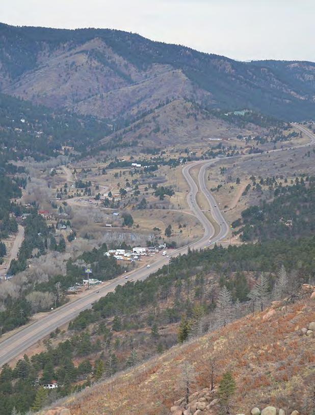
121
Section II. Planning & Public Process Planning for the Baker/Carver Regional Trail began in 2010 as a City of Minnetrista initiative.
 Section II Planning & Public Process Planning for the began in 2010 as a City of initiative. city staff began discussions with the Park District on the possibility of a north/south regional trail connection
Longmont to Boulder Regional Trail Jay Road Connection DRAFT FINAL REPORT
 Longmont to Boulder Regional Trail Jay Road Connection DRAFT FINAL REPORT December 2018 Project Summary Boulder County, Colorado, in partnership with the City of Boulder, is evaluating options for multi-use
Emily to Blind Lake Trail PROPOSED TRAIL DEVELOPMENT APPLICATION SUMMARY
 Emily to Blind Lake Trail PROPOSED TRAIL DEVELOPMENT APPLICATION SUMMARY Township 137 Range 26 (Fairfield Township) sections 2 & 3 Township 138 Range 26 (City of Emily) sections 27, 34, 35, & 36 Township
Blueways: Rivers, lakes, or streams with public access for recreation that includes fishing, nature observation, and opportunities for boating.
 Parks, Open Space and Trails PRINCE WILLIAM COUNTY 2008 COMPREHENSIVE PLAN TRAILS PLAN CONTENTS The components of the trails plan are: Intent Definitions Goals, Policies, and Action Strategies Trails Map
ROAD AND TRAIL PROJECT APPROVAL
 ROAD AND TRAIL PROJECT APPROVAL www.marincountyparks.org Marin County Parks, 3501 Civic Center Dr, Suite 260, San Rafael, CA 94903 DATE: July 12, 2017 PRESERVE: Gary Giacomini Open Space Preserve PROJECT:
City of Durango 5.8 FUNDING TRAILS DEVELOPMENT
 5.8 FUNDING TRAILS DEVELOPMENT The City has been successful in establishing dedicated local funding sources as well as applying for grants to develop the City s trail system, having received nearly $2.4
MUNICIPALITY OF ANCHORAGE
 MUNICIPALITY OF ANCHORAGE ANCHORAGE PARKS & RECREATION Memorandum PRC 08-56 DATE: 5 August 2008 TO: FROM: SUBJECT: Parks & Recreation Commission Holly Spoth-Torres, Park Planner PRC 08-56 Far North Bicentennial
Preferred Recreation Recommendations Stemilt-Squilchuck Recreation Plan March 2018
 Preferred Recreation Recommendations Stemilt-Squilchuck Recreation Plan March 2018 Below are the recommended recreation ideas and strategies that package together the various recreation concepts compiled
AGENDA ITEM 5 D WAKULLA ENVIRONMENTAL INSTITUTE (WEI) TRAIL FEASIBILITY STUDY
 TRAIL FEASIBILITY STUDY") March 19, 2018 AGENDA ITEM 5 D WAKULLA ENVIRONMENTAL INSTITUTE (WEI) TRAIL FEASIBILITY STUDY TYPE OF ITEM: Action STATEMENT OF ISSUE The Wakulla Environmental Institute (WEI) Trail is one of several trails
March 19, 2018 AGENDA ITEM 5 D WAKULLA ENVIRONMENTAL INSTITUTE (WEI) TRAIL FEASIBILITY STUDY TYPE OF ITEM: Action STATEMENT OF ISSUE The Wakulla Environmental Institute (WEI) Trail is one of several trails
Chapter 6: POLICY AND PROCEDURE RECOMMENDATIONS
 Chapter 6 POLICY AND PROCEDURE RECOMMENDATIONS FOR SRRA Below are seven policy elements that should be considered for adoption by the Southwest Regional Recreation Authority of Virginia: 1. Develop strategies
EAST DON TRAIL ENVIRONMENTAL ASSESSMENT. Community Liaison Committee Meeting #3 July 15, :30 to 8:30 pm Flemingdon Park Library
 EAST DON TRAIL ENVIRONMENTAL ASSESSMENT Community Liaison Committee Meeting #3 July 15, 2013 6:30 to 8:30 pm Flemingdon Park Library Agenda 1. Welcome 2. Housekeeping and Updates a) Housekeeping b) CLC
Committee. Presentation Outline
 CW-33-15 11/9/2015 Community and Corporate Services Committee November 10, 2015 1 Presentation Outline Background Vision and Objectives Study Process and Timeline Public and Stakeholder Engagement Organization
EXECUTIVE SUMMARY PROGRAM DEVELOPMENT REPORT PURPOSE EXISTING SETTING EXPANDING PARKLAND
 EXECUTIVE SUMMARY PROGRAM DEVELOPMENT REPORT PURPOSE As the culmination of the first phase of the master planning process, this Program Development Report creates the framework to develop the Calero County
2014 STATEWIDE COMPREHENSIVE OUTDOOR RECREATION PLAN
 2014 STATEWIDE COMPREHENSIVE OUTDOOR RECREATION PLAN SUSTAINING COLORADO S OUTDOOR RECREATION FUTURE SECTION 1: INTRODUCTORY INFORMATION WHAT IS THE SCORP? The SCORP update is required every five years
PURPOSE AND NEED (CONCURRENCE POINT 1) NEW CANADA ROAD PROJECT FROM STATE ROUTE 1 (U.S. HIGHWAY 70) TO U.S. INTERSTATE 40
 NEW CANADA ROAD PROJECT FROM STATE ROUTE 1 (U.S. HIGHWAY 70) TO U.S. INTERSTATE 40") PURPOSE AND NEED (CONCURRENCE POINT 1) NEW CANADA ROAD PROJECT FROM STATE ROUTE 1 (U.S. HIGHWAY 70) TO U.S. INTERSTATE 40 Project Description The primary purpose of this project is to improve the major
PURPOSE AND NEED (CONCURRENCE POINT 1) NEW CANADA ROAD PROJECT FROM STATE ROUTE 1 (U.S. HIGHWAY 70) TO U.S. INTERSTATE 40 Project Description The primary purpose of this project is to improve the major
SR 934 Project Development And Environment (PD&E) Study
 Study") SR 934 Project Development And Environment (PD&E) Study Project Advisory Group Meeting March 1, 2018 State Road 934/NE/NW 79th Street from west of I-95 (NW 13th CT) to N. Bayshore Drive PD&E STUDY SR 934/NE/NW
SR 934 Project Development And Environment (PD&E) Study Project Advisory Group Meeting March 1, 2018 State Road 934/NE/NW 79th Street from west of I-95 (NW 13th CT) to N. Bayshore Drive PD&E STUDY SR 934/NE/NW
BACKCOUNTRY TRAIL FLOOD REHABILITATION PROGRAM
 BACKCOUNTRY TRAIL FLOOD REHABILITATION PROGRAM Backcountry Trail Flood Rehabilitation A June 2013 Flood Recovery Program Summary In June 2013, parts of Southern Alberta were devastated from significant
JOSLIN FIELD, MAGIC VALLEY REGIONAL AIRPORT DECEMBER 2012
 1. Introduction The Federal Aviation Administration (FAA) recommends that airport master plans be updated every 5 years or as necessary to keep them current. The Master Plan for Joslin Field, Magic Valley
Introduction DRAFT March 9, 2017
 Chapter Overview The City of Redmond (City) initiated an update to the Airport Master Plan ( Plan ) to assess the facility and service needs of the Redmond Municipal Airport ( the Airport ) throughout
Citrus Heights Creek Corridor Trail Project. Trail Advisory Group Meeting #3 July 8, 2013
 Citrus Heights Creek Corridor Trail Project Trail Advisory Group Meeting #3 July 8, 2013 Agenda Introductions Recap: Community Workshop, Survey Findings, and TAG Field Trip Community Concern Discussion:
Thornton Water Project. Larimer County Route Study and Project Update September 12, 2017
 Thornton Water Project Larimer County Route Study and Project Update September 12, 2017 Purpose of Meeting Provide information on the Thornton Water Project Present the results of the pipeline routing
The Baker/Carver Regional Trail is intended to
 Section V Design Guidance The Baker/Carver Regional Trail is intended to safely accommodate 183,000 annual visits, an array of non-motorized uses, a variety of skill levels, and persons with special needs.
Creating a User-Driven Long-Distance OHV Trail Through Partnering
 Joseph Raffaele Outdoor Recreation Planner U.S. Bureau of Land Management Yuma, Arizona Creating a User-Driven Long-Distance OHV Trail Through Partnering BLM is a multiple-use land management agency within
Trail Assessment Report
 Trail Assessment Report Trail Options for the Bear Creek Canyon located in Pikes Peak Ranger District, Pike National Forest and on Colorado Springs Utility Lands Due to the presence of a unique species
FEASIBILITY CRITERIA
 This chapter describes the methodology and criteria used to evaluate the feasibility of developing trails throughout the study areas. Land availability, habitat sensitivity, roadway crossings and on-street
The Chu property is a 6.57 acre parcel located in the Town of Superior on the west side of McCaslin Boulevard. In 2014, the Town of Superior acquired
 1 The Chu property is a 6.57 acre parcel located in the Town of Superior on the west side of McCaslin Boulevard. In 2014, the Town of Superior acquired the Chu property for open space with a contribution
PEMBERTON VALLEY RECREATIONAL TRAILS MASTER PLAN UPDATE Community Open House. April 2018
 PEMBERTON VALLEY RECREATIONAL TRAILS MASTER PLAN UPDATE Community Open House April 2018 Introductions Introductions Matt Bakker, BHA Project Coordinator Other Team Members: Liz Scroggins, Grey Owl Consulting
January 14, Orange County Transportation Authority Attn: M2 NCCP/HCP 550 South Main Street P.O. Box Orange, CA
 Equestrian Trails, Inc. Corral 357 P.O. Box 1026 Trabuco Canyon, CA 92678 http://saddlebackcanyonriders.com/ President: James Iacono... 714-612-1789 January 14, 2016 Orange County Transportation Authority
CHAPTER III: TRAIL DESIGN STANDARDS, SPECIFICATIONS & PERMITS
 CHAPTER III Trail Design Standards, Specifications & Permits This chapter discusses trail standards, preferred surface types for different activities, permits, and other requirements one must consider
Logo Department Name Agency Organization Organization Address Information 5700 North Sabino Canyon Road
 Logo Department Name Agency Organization Organization Address Information United States Forest Coronado National Forest 5700 North Sabino Canyon Road Department of Service Santa Catalina Ranger District
DRAFT - APRIL 13, 2007 ROUTING STUDY FOR TRAIL CONNECTIONS BETWEEN CALAIS AND AYERS JUNCTION
 DRAFT - APRIL 13, 2007 ROUTING STUDY FOR TRAIL CONNECTIONS BETWEEN CALAIS AND AYERS JUNCTION Abstract The vision for the East Coast Greenway is an off-road urban trail system running from Calais, Maine
2016 Regional Transportation Alternatives Program (TAP) Grant Application
 Grant Application") 2016 Regional Transportation Alternatives Program (TAP) Grant Application PROJECT TITLE: Yelm-Tenino Trail Extension Feasibility Study TRPC use only GENERAL PROJECT INFORMATION Agency or Organization City
2016 Regional Transportation Alternatives Program (TAP) Grant Application PROJECT TITLE: Yelm-Tenino Trail Extension Feasibility Study TRPC use only GENERAL PROJECT INFORMATION Agency or Organization City
2. Goals and Policies. The following are the adopted Parks and Trails Goals for Stillwater Township:
 D. PARKS AND TRAILS 1. Introduction Stillwater Township s population is relatively low, with most residents living on rural residences on large lots. The need for active park space has been minimal in
Rule Governing the Designation and Establishment of All-Terrain Vehicle Use Trails on State Land
 Rule Governing the Designation and Establishment of All-Terrain Vehicle Use Trails on State Land 1.0 Authority 1.1 This rule is promulgated pursuant to 23 V.S.A. 3506. Section 3506 (b)(4) states that an
At the time, the portion of the line through Eagle County remains wholly under the ownership of Union Pacific Railroad (UP).
.") Chapter 5 The Railroad Corridor as a Trail Corridor The intent of this chapter is to identify how the rail corridor, if available for lease or purchase in all or part, could be incorporated into the core
Chapter 5 The Railroad Corridor as a Trail Corridor The intent of this chapter is to identify how the rail corridor, if available for lease or purchase in all or part, could be incorporated into the core
RE: Access Fund Comments on Yosemite National Park Wilderness Stewardship Plan, Preliminary Ideas and Concepts
 September 30, 2016 Superintendent Yosemite National Park Attn: Wilderness Stewardship Plan P.O. Box 577 Yosemite, CA 95389 RE: Access Fund Comments on Yosemite National Park Wilderness Stewardship Plan,
MEETING MINUTES District 1 Trail Planning Meeting 1
 MEETING MINUTES District 1 Trail Planning Meeting 1 June 1, 2017 2:00 PM 3:30 PM City of Two Harbors 2:00 Introductions Attendees: Lisa Austin, MnDOT Bryan Anderson, MnDOT Jasna Hadzic-Stanek, MnDOT Justin
Rogue River Access and Management Plan Draft Alternatives
 Rogue River Access and Management Plan Draft Alternatives The Rogue River Access and Management Plan was initiated in December, 2011 and is being led by Jackson County Parks (JCP) and Oregon Department
Citrus Heights Creek Corridor Trail Project Trail Advisory Group Field Trip #2 September 11, :00 11:00 am Trellis Hall, Citrus Heights
 September 11, 2013 9:00 11:00 am Trellis Hall, Citrus Heights Project Overview The City of Citrus Heights is studying the feasibility of establishing a multi use trail system within the City s 26 miles
Hudson Highlands Fjord Trail Draft Master Plan. April 29, 2015
 Hudson Highlands Fjord Trail Draft Master Plan April 29, 2015 Agenda Route Overview Proposed Segment Results of Community Survey on that Segment Next Steps Municipal Endorsement Environmental Review Implementation
Non-Motorized Transportation
 Non-Motorized Transportation Non-motorized facilities are important components to the transportation system. They provide an environmentally-friendly, low-cost mode of travel. Some of the facilities can
PROPOSED ACTION South 3000 East Salt Lake City, UT United States Department of Agriculture
 United States Department of Agriculture Forest Service Uinta-Wasatch-Cache National Forest Salt Lake Ranger District 6944 South 3000 East Salt Lake City, UT 84121 801-733-2660 File Code: 1950/2300 Date:
Trail # NW Tuesday, June DESIGN. Provide an Review the Provide an. Project Goals: System system. wayfinding
 I. Welcome / Introductions Bethany Creek Trail #2 Segment 3 Neighborhood Meeting #1 Bethany Presbyterian Church 15505 NW Springville Road, Portland, OR 97229 Tuesday, June 26, 2018 @ 6:00PM Meeting Minutes
MONTEREY REGIONAL AIRPORT MASTER PLAN TOPICAL QUESTIONS FROM THE PLANNING ADVISORY COMMITTEE AND TOPICAL RESPONSES
 MONTEREY REGIONAL AIRPORT MASTER PLAN TOPICAL QUESTIONS FROM THE PLANNING ADVISORY COMMITTEE AND TOPICAL RESPONSES Recurring topics emerged in some of the comments and questions raised by members of the
Business Item No XXX. Proposed Action That the Metropolitan Council approve the Coon Creek Regional Trail Master Plan.
 Business Item No. 2015-XXX Metropolitan Parks and Open Space Commission Meeting date: July 7, 2015 For the Community Development Committee meeting of July 20, 2015 For the Metropolitan Council meeting
FINAL TESTIMONY 1 COMMITTEE ON RESOURCES UNITED STATES HOUSE OF REPRESENTATIVES. July 13, 2005 CONCERNING. Motorized Recreational Use of Federal Lands
 FINAL TESTIMONY 1 STATEMENT OF DALE BOSWORTH CHIEF Of the FOREST SERVICE UNITED STATES DEPARTMENT OF AGRICULTURE Before the SUBCOMMITTEE ON FORESTS AND FOREST HEALTH And the SUBCOMMITTEE ON NATIONAL PARKS,
MORGAN CREEK GREENWAY Final Report APPENDICES
 APPENDICES MORGAN CREEK GREENWAY Appendix A Photos of Existing Conditions in Trail Corridor Photos of existing conditions Main trail corridor - February 2009 Photos of existing conditions south bank Morgan
Auburn Trail / Ontario Pathways Trail Connector Feasibility Study Public Information Meeting Wednesday, August 22, 2012
 Auburn Trail / Ontario Pathways Trail Connector Feasibility Study Public Information Meeting Wednesday, August 22, 2012 Purpose of Feasibility Study Purpose Evaluate the feasibility of constructing a multiuse
RUSHMORE CONNECTOR TRAIL PROPOSAL
 PURPOSE AND NEED Background The U.S. Forest Service, Black Hills National Forest (Forest Service) has received a special use permit application from the State of South Dakota Department of Game, Fish and
Proposed Action. Payette National Forest Over-Snow Grooming in Valley, Adams and Idaho Counties. United States Department of Agriculture
 United States Department of Agriculture Forest Service January 2012 Proposed Action Payette National Forest Over-Snow Grooming in Valley, Adams and Idaho Counties Payette National Forest Valley, Adams
Stevenson Ranch Library The Old Road, Stevenson Ranch, CA Thursday, November 9, :00-8:00 pm
 Stevenson Ranch Library 25950 The Old Road, Stevenson Ranch, CA 91381 Thursday, November 9, 2017 6:00-8:00 pm Project Team County of Los Angeles Department of Parks and Recreation Kathline King Chief of
Thank you for the opportunity to comment on the proposed action to add trails and trailheads to the Red Rock District trail system.
 July 14, 2010 Jennifer Burns Red Rock Ranger District PO Box 20429 Sedona, AZ 86341 Flagstaff Biking Organization PO Box 23851 Flagstaff, AZ 86002 Dear Jennifer- Thank you for the opportunity to comment
Georgetown-Lewes Rail/Trail Study. Rail/Trail Study: Cool Spring to Cape Henlopen State Park New Road Extension (House Resolution No.
 Georgetown-Lewes Rail/Trail Study Rail/Trail Study: Cool Spring to Cape Henlopen State Park New Road Extension (House Resolution No. 47) August 22, 2011 Presentation Outline Background Benefits Statewide
A Master Plan is one of the most important documents that can be prepared by an Airport.
 The Master Plan A Master Plan is one of the most important documents that can be prepared by an Airport. A Master Plan is a visionary and a strategic document detailing planning initiatives for the Airport
Chatsworth Branch Library Devonshire Street, Chatsworth, CA Thursday, November 16, :00-8:00 pm
 Chatsworth Branch Library 21052 Devonshire Street, Chatsworth, CA 91311 Thursday, November 16, 2017 6:00-8:00 pm Project Team County of Los Angeles Department of Parks and Recreation Kathline King Chief
Welcome to the future of Terwillegar Park a Unique Natural Park
 Welcome to the future of Terwillegar Park a Unique Natural Park 1 Introduction The Terwillegar Park Concept Plan study will develop an overall concept plan, management objectives and development guidelines
Wallace Falls State Park Classification and Management Planning Stage 3 Preliminary Recommendations July 18, 2018 Sultan City Hall
 Wallace Falls State Park Classification and Management Planning Stage 3 Preliminary Recommendations July 18, 2018 Sultan City Hall Thanks for coming! This document contains State Parks preliminary recommendations
Lake Tahoe Airport Master Plan Public Meeting March 16, 2015
 Lake Tahoe Airport Master Plan Public Meeting March 16, 2015 What is an Airport Master Plan? a comprehensive study of an airport [that] usually describes the short, medium, and long term development plans
MASTER PLAN EXECUTIVE SUMMARY
 Biscuit Run State Park Scottsville Road (State Route 20) Charlottesville, VA 22902 Biscuit Run State Park MASTER PLAN EXECUTIVE SUMMARY Department of Conservation and Recreation Division of Planning and
Stage 2 ION: Light Rail Transit (LRT) from Kitchener to Cambridge
 from Kitchener to Cambridge") Stage 2 ION: Light Rail Transit (LRT) from Kitchener to Cambridge Public Consultation Centre (PCC) No. 3 Please Sign-in Cambridge City Hall November 21, 2017 2:00 to 8:00pm Preston Memorial Auditorium
Stage 2 ION: Light Rail Transit (LRT) from Kitchener to Cambridge Public Consultation Centre (PCC) No. 3 Please Sign-in Cambridge City Hall November 21, 2017 2:00 to 8:00pm Preston Memorial Auditorium
Welcome to the Cross County Trail Public Input Session!
 Welcome to the Cross County Trail Public Input Session! Please sign in on the table below! What are we doing here? Camden County has proposed a bicycle and pedestrian trail spanning across the entire county.
Committee Report. Community Development Committee For the Metropolitan Council meeting of April 13, Business Item No.
 Committee Report Business Item No. 2016-48 Community Development Committee For the Metropolitan Council meeting of April 13, 2016 Subject: Harriet Island-South St. Paul Regional Trail Master Plan, Saint
Committee Report. Community Development Committee For the Metropolitan Council meeting of August 12, Business Item No.
 Committee Report Business Item No. 2015-168 Community Development Committee For the Metropolitan Council meeting of August 12, 2015 Subject: Coon Creek Regional Trail Master Plan, Anoka County Proposed
CHAPTER FOUR: TRANSPORTATION
 CHAPTER FOUR: TRANSPORTATION Barron County Comprehensive Plan: Transportation Page 61 Background Transportation facilities have a significant influence on land use, development and quality of life for
Madison Metro Transit System
 Madison Metro Transit System 1101 East Washington Avenue Madison, Wisconsin, 53703 Administrative Office: 608 266 4904 Fax: 608 267 8778 TO: FROM: SUBJECT: Plan Commission Timothy Sobota, Transit Planner,
University Region Non-Motorized Plan 2015
 Non-Motorized Transportation Non-motorized facilities are important components to the transportation system. They provide an environmentally-friendly, low-cost mode of travel. Some of the facilities can
ANCLOTE COASTAL TRAIL ALTERNATIVES ANALYSIS STUDY
 ANCLOTE COASTAL TRAIL ALTERNATIVES ANALYSIS STUDY PASCO COUNTY MPO JULY 2015 PROJECT OVERVIEW... INTRODUCTION EXECUTIVE SUMMARY CONTEXT... TAMPA BAY AREA, PINELLAS, & PASCO COUNTY S MULTI-USE TRAIL PLANS
CHAPTER 1: INTRODUCTION
 CHAPTER 1: INTRODUCTION Purpose and Scope The information presented in this report represents the study findings for the 2016 Ronan Airport Master Plan prepared for the City of Ronan and Lake County, the
Continental Divide National Scenic Trail Legislative History and Planning Guidance
 Continental Divide National Scenic Trail Legislative History and Planning Guidance Legislation, Policy, and Direction Regarding National Scenic Trails The National Trails System Act, P.L. 90-543, was passed
Segment 2: La Crescent to Miller s Corner
 goal of the USFWS refuges is to conserve, protect and enhance fish, wildlife and plants and their habitats for the continuing benefit of the American people. Refuge lands are used largely for fishing,
US 380 FEASIBILITY STUDY
 US 380 FEASIBILITY STUDY Denton County CSJ(s): 0135-10-061, 0135-10-062 Public Meeting(s): January 15 & 22, 2019 WELCOME US 380 Denton County Feasibility Study DALLAS DISTRICT PUBLIC MEETING January 15
Colorado Springs & Pikes Peak Region Destination Master Plan
 Colorado Springs & Pikes Peak Region Destination Master Plan Overview June 19, 2018 DESTINATION MASTER PLAN What is Destination Master Planning? Focus on infrastructure, facilities, services, attractions
Strengthening the Ontario Trails Strategy. Report on Consultations and the Environmental Bill of Rights Registry
 Strengthening the Ontario Trails Strategy Report on Consultations and the Environmental Bill of Rights Registry Purpose To report on the feedback and information received through the regional consultations,
City of Chelan Comprehensive Plan Update. Vision Workshop. Agenda
 City of Chelan Comprehensive Plan Update Vision Workshop November 16, 2016 Agenda Welcome What is a comprehensive plan? Schedule Visioning / Open House Activities How to stay informed and involved 2 1
White Mountain National Forest Saco Ranger District
 United States Department of Agriculture Forest Service White Mountain National Forest Saco Ranger District 33 Kancamagus Highway Conway, NH 03818 Comm: (603) 447-5448 TTY: (603) 447-3121 File Code: 1950
13.1 REGIONAL TOURISM ISSUES AND SUMMARY OF FINDINGS
 13 REGIONAL TOURISM T he County of Mariposa s recreation needs and facilities fall within two categories: regional tourism and local recreation. This Element focuses on regional tourism issues related
Daisy Dean Trail 628/619 ATV Trail Construction
 Background and Purpose and Need The Daisy Dean ATV Trail Construction Project is located in the Little Belt Mountains, Musselshell Ranger District, Lewis and Clark National Forest approximately 32 miles
Header i
 Header i 048285014.10 Header Sub Title Body Text here. Body text here. Body text here. Section 1... 1 Executive Summary... 1 Opportunities and Constraints... 3 Overall Opportunities and Constraints Map
Proposal to Redevelop Lower Kananaskis River-Barrier Lake. Bow Valley Provincial Park. Frequently Asked Questions
 Proposal to Redevelop Lower Kananaskis River-Barrier Lake Bow Valley Provincial Park Frequently Asked Questions What is being proposed? What are the details of the proposal? Where is the project area located?
Business Item No
 Metropolitan Parks and Open Space Commission Meeting date: February 6, 2018 For the Community Development Committee meeting of February 20, 2018 For the Metropolitan Council meeting of February 28, 2018
Blue River Trail Master Plan JSA to Town Hall June 2004
 Blue River Trail Master Plan JSA to Town Hall June 2004 Prepared for: Silverthorne Town Council Silverthorne SPORT Committee Department of Recreation and Culture Silverthorne Public Works Silverthorne
The Vision for the San Juan Islands Scenic Byway
 The Vision for the San Juan Islands Scenic Byway 2 Judd Cove, Orcas Island, Courtesy of Kurt Thorson (kurtthorson.com) and San Juan County Land Bank Vision for the San Juan Islands Scenic Byway The San
Community Development Committee
 C Community Development Committee For the Metropolitan Council meeting of October 31, 2012 Committee Report Item:2012-316 ADVISORY INFORMATION October 16, 2012 Date Prepared: Subject: Intercity Regional
Community Development
 Community Development City & Borough of Juneau Community Development 155 S. Seward Street Juneau, AK 99801 (907) 586 0715 Phone (907) 586 4529 Fax DATE: February 11, 2016 TO: FROM: Planning Commission
Chapter 1: Introduction Draft
 Chapter 1: Draft TABLE OF CONTENTS 1... 4 1.6.1 Stakeholder Engagement Plan... 10 Chapter 1 Page 2 TABLE OF EXHIBITS Exhibit 1.1-1 ABIA Annual Growth Since 1993... 5 Exhibit 1.4-1: ABIA Location Map...
SOUTH INTERCHANGE AREA
 Santaquin City General Plan 1 Location and Characteristics The South Interchange Area of Santaquin is located west of Interstate 15 and south of 500 South (Figure 1). It includes properties already annexed
Engagement Summary Report. Trans-Canada Highway 1 RW Bruhn Bridge and Approaches Project Community Engagement February 1 18, 2018.
 Trans-Canada Highway 1 RW Bruhn Bridge and Approaches Project Community Engagement February 1 18, 2018 Engagement Summary Report April 2018 Prepared by Kirk & Co. Consulting Ltd. Trans-Canada Highway 1
FNORTHWEST ARKANSAS WESTERN BELTWAY FEASIBILITY STUDY
 FNORTHWEST ARKANSAS WESTERN BELTWAY FEASIBILITY STUDY EXECUTIVE SUMMARY The 2030 Northwest Arkansas Regional Transportation Plan developed by the Northwest Arkansas Regional Planning Commission (NWARPC)
Northeast Quadrant Distinctive Features
 NORTHEAST QUADRANT Northeast Quadrant Distinctive Features LAND USE The Northeast Quadrant includes all the area within the planning area that is east of Interstate 5 and to the north of State Route 44.
Tahoe National Forest Over-Snow Vehicle Use Designation
 Tahoe National Forest Over-Snow Vehicle Use Designation USDA Forest Service Tahoe National Forest February 20, 2015 Introduction The Forest Service, U.S. Department of Agriculture will prepare an Environmental
Classifications, Inventory and Level of Service
 Classifications, Inventory and Level of Service Section 3 Kenmore Park, Recreation and Open Space Plan 1 P a g e Classifications and Inventory Park Classifications Kenmore classifies its parks based upon
FORECASTING FUTURE ACTIVITY
 EXECUTIVE SUMMARY The Eagle County Regional Airport (EGE) is known as a gateway into the heart of the Colorado Rocky Mountains, providing access to some of the nation s top ski resort towns (Vail, Beaver
MEETING MINUTES Page 1 of 5
 Page 1 of 5 50178.000 May 26, 2009 PROJECT PROJECT NO. MEETING DATE ISSUE DATE Citizens Advisory Committee Meeting MEETING LOCATION MEETING PURPOSE Amy Eckland ISSUED BY SIGNATURE PARTICIPANT See attached
National Scenic Byways Program US Department of Transportation
 1 2 National Scenic Byways Program US Department of Transportation Abstract The Cowlitz-Wahkiakum Council of Governments in partnership with Cowlitz, Skamania and Lewis Counties and the U.S. Forest Service,
PLANNING COMMISSION AGENDA REPORT May 10, Members of the Planning Commission. Joyce Parker-Bozylinski, Contract Planner
 PLANNING COMMISSION AGENDA REPORT May 10, 2007 TO: FROM: PROPOSAL: APPLICANT: RECOMMENDATION: Members of the Planning Commission Joyce Parker-Bozylinski, Contract Planner Approval of the Calabasas Trails
Belfountain Complex - Stakeholder Advisory Committee Meeting Belfountain Conservation Area Property Tour Date: Time: Meeting Purpose
 Belfountain Complex - Stakeholder Advisory Committee Meeting Belfountain Conservation Area Property Tour Date: Thursday, October 9, 2014 Time: 6:00pm 7:30pm Meeting Purpose: A tour of Belfountain Conservation
ONONDAGA CREEKWALK PHASE II. Public Information Meeting Series 1
 ONONDAGA CREEKWALK PHASE II Public Information Meeting Series 1 Andrew Maxwell Director, Syracuse-Onondaga County Planning Agency Owen Kerney Assistant Director for City Planning Russell Houck, PE City
3.0 LEARNING FROM CHATHAM-KENT S CITIZENS
 3.0 LEARNING FROM CHATHAM-KENT S CITIZENS An important aspect in developing the Chatham-Kent Trails Master Plan was to obtain input from stakeholders and the general public. Throughout the course of the
APPENDIX OFFICIAL MAP ORDINANCE OF HAMILTONBAN TOWNSHIP OFFICIAL MAP NARRATIVE
 APPENDIX A OFFICIAL MAP ORDINANCE OF HAMILTONBAN TOWNSHIP OFFICIAL MAP NARRATIVE INTRODUCTION: The Official Map of Hamiltonban Township has been prepared to identify those lands and features that Hamiltonban
Glasgow Street Traffic Review
 Glasgow Street Traffic Review Recommendation That the Standing Policy Committee on Transportation recommend to City Council: 1. That the Administration proceed with removing the pinch points installed