Vancouver s non-motorized watercraft strategy
|
|
|
- Hannah Hodge
- 5 years ago
- Views:
Transcription
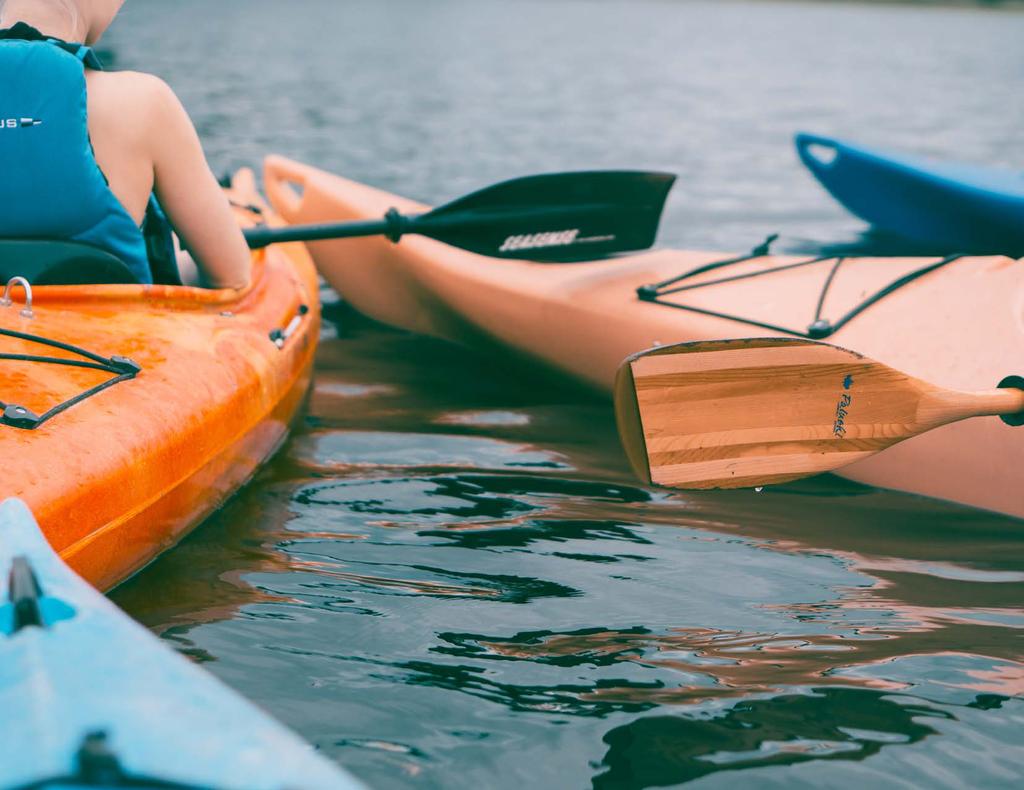
1 Vancouver s non-motorized watercraft strategy Phase 2 - Public Engagement Discussion Guide February 19 - March 16, 2018 For more information about the strategy and to fill out the survey, visit vancouver.ca/onwater Please submit your feedback by March 16, 2018
2 02
3 Welcome to Phase 2 of public engagement! The Vancouver Park Board is developing a waterway recreation strategy to guide future planning relating to non-motorized watercraft recreation and to support the protection of Vancouver s marine environment. On Water will provide strategic guidance through recommendations and an implementation plan. Analysis of the current conditions, including existing public waterway services, infrastructure and jurisdiction, environmental considerations, public and stakeholder input, insight from current and past city-wide projects, and best practices from around the globe are all informing how the strategy develops. What are non-motorized watercraft? For the purpose of this study, the term non-motorized watercraft is defined as on-water recreation activities involving small watercraft powered by people and other natural elements. There is a wide range in types of non-motorized watercraft activities popular in Vancouver, including: Canoeing Paddle Boarding In Phase 1 of public consultation, you told us about how you currently use the water for recreation, the types of activities you participate in and where you typically access the water. You identified your key challenges, areas for improvement and what you think already works well. Now, in Phase 2, we re asking for your feedback about the Vision and Strategic Directions that will set the framework for the recommendations, as well as your early ideas for actions, which will inform the draft strategy we will bring forward in Phase 3 of the planning process. for non-motorized watercraft recreation, the direction for the strategy, and what other cities are doing in regards to non-motorized watercraft recreation. How will your feedback be considered? The Park Board planning team will consider feedback from this round of consultation, along with technical information, to develop recommendations for the planning of Vancouver s waterway recreation infrastructure. Dragon Boating Kayaking Kite Surfing Rowing Small Craft Sailing Wind Surfing This Discussion Guide gives you information on the strategy, how you can participate, what we ve heard and learned so far, the opportunities and challenges Outrigging 03
4 About the strategy Why develop a strategy? Developing a strategy for non-motorized watercraft recreation will help to enhance the public s use of and access to non-motorized watercraft opportunities on our shared waterfront. Previous Park Board studies outlined the need for a strategic look at user needs, service levels, and infrastructure priorities to guide investment and planning. The direction from the Park Board, combined with demand from users, let to the development of On Water, a strategic outlook and 10-year implementation plan. The strategy will... Draw on the expertise and experience of non-motorized water recreation users, advisory committee members, Park Board and City staff, regulatory bodies and the general public Provide analysis of non-motorized watercraft service levels and waterway jurisdiction to inform recommendations that guide future planning relating to non-motorized watercraft facilities and emerging waterfront opportunities Explore opportunities for ecological and recreational protection zones Develop a long-range vision to guide future use and equitable access of Vancouver s waterfront Assist the Park Board in ensuring Vancouver s waterway recreation infrastructure meets the needs of a broad range of users Guide facility investment, maintenance, and service provider partnerships The strategy will include... Recommendations on topics including: Improving education and safety Increasing water access and launching sites for public use Enforcement of water regulation to minimize conflicts with motorized vehicles Environmental protection opportunities Community building through recreation facilities Improving facilities with increased storage capacity Universally accessible waterfront infrastructure Supporting partnerships and user groups Providing amenities needed for water use 04
5 How can I participate? Let us know what you think during the Phase 2 public engagement. Take the survey online at vancouver.ca/onwater or in person at an open house or small group meeting open until March 16th. In the Spring of 2018 we ll look for your feedback on emerging strategies and actions recommended in the draft On Water strategy and in the implementation plan. Phase 2 Events Drop-in open house (first hour) followed by an informal presentation and engaging workshop. February 27, 5:30-9:00pm, Creekside Community Centre March 5, 5-8:30pm, City Lab, 511 W Broadway March 10, 10:30am - 2pm, Jericho Sailing Centre To register your for the workshop, onwater@vancouver.ca with your name and the date, time, and location of the workshop you would like to attend. On Water will be developed through three phases: Summer 2017 You are here! July 2018 Park Board Consideration Public Engagement Research + Analysis, develop vision and strategic directions Public Engagement Develop draft strategies and actions Public Engagement Develop final draft report incorporate public feedback + refine strategies Phase 1 Phase 2 Phase 3 Collaborate with Advisory Committee 05
6 Who is involved? PLANNING TEAM The Park board staff, leading the project, are working with a team of consultants comprised of various experts in the fields of planning, recreation, design, engineering, public engagement, and environmental consulting. Together they form the On Water planning team. STAFF WORKING GROUP The planning team developed a staff working group comprised of a broad range of staff within the Park Board and the City of Vancouver. The staff provide guidance and input ranging from water quality and sustainability to facilities and maintenance. ADVISORY COMMITTEE The Park Board created an advisory committee to help gain a clearer understanding of the current service levels and facilities for non-motorized watercraft recreation. The advisory committee consists of representatives from user groups, service providers, and other interest groups. REGULATORY WORKING GROUP The Park Board assembled a team of regulatory agencies to provide advice on the complex jurisdiction and management of our waterways. The regulatory working group includes representatives from Transport Canada, Canadian Coast Guard, Vancouver Police Department Marine Unit, the Port of Vancouver, the Department of Fisheries and Oceans, and various provincial Ministries. ALL OF YOU The first phase of public engagement was completed in the Summer of We heard from 1,246 respondents. For more information on what we heard, see page 10 of this discussion guide. What have we been working on? Over the last several months we ve been researching and gathering information about how we use our waterfront for non-motorized watercraft recreation in order to understand what s working and where there are challenges. We have held public engagement events, learned from past policy studies, researched technical information, and analyzed best practices from around the globe. Our work has also been informed by past studies and analysis: CURRENT STATE ANALYSIS Study of jurisdictions in Vancouver s waterways Research into user levels and infrastructure conditions Analysis of global trends and best practices in non-motorized watercraft recreation Ecological data Current and future demographics in Vancouver PAST STUDIES Blueways (1996), a vision for the preservation and protection of Vancouver s waterfront environment. Non-motorized Boating Services Review (2014), a preliminary analysis of non-motorized watercraft activities and inventory in False Creek. Project Definition Report on the False Creek Non-Motorized Boating Facility (2014), to identify a permanent home for Vancouver s paddling community in False Creek in the Creekside Paddling Centre. Ongoing work of the Georgia Straight Alliance. 06
7 What have we learned? CONTEXT From the research and analysis we ve completed, here s what we ve learned so far about our context, opportunities, and challenges. STUDY AREA The study area includes the waters of False Creek, Spanish Banks, English Bay and the Burrard Inlet near Coal Harbour (see map on page 11). MARINE ENVIRONMENT There is a large tidal range in Vancouver with the difference between high and low tide reaching maximums of just over 5 metres. Burrard Inlet supports a diverse ecosystem. Nearshore habitat includes approximately 63 fish species (such as pacific herring, lingcod, and rock sole), many shore and seabirds (such as cormorants, herons, kingfishers, and owls), and harbour seals. The foreshore, the area between the high and low water mark, has been greatly modified by landfill and dredging for industrial activity with few recreational activities remaining in False Creek. Habitat Island, located East of Cambie Bridge in False Creek, is the only naturalized area along the water. JURISDICTION Multiple federal departments, provincial ministries, and municipal bodies have jurisdiction over Vancouver s waters. This leads to challenges establishing and enforcing regulations to support the diverse users and needs. The Port of Vancouver still has regulation over Burrard Inlet; however, they divested False Creek in There is no one authority with a specific mandate to manage False Creek. JURISDICTION AND RESPONSIBILITY Moorage + anchoring Access points + launching Ecology / wildlife Water quality Abandoned boats Permits for events Marine structures Has primary responsibility Shares some responsibility A stakeholder, but no responsibility Park Board City of Vancouver Transport Canada Port of Vancouver BC FLNRO Dept. of Fisheries Vancouver and Oceans Police Dept. BC FLNRO: BC Ministry of Forests, Lands, Natural Resources Operations The following agencies have the lead responsibility for management and protection: Park Board: Parks, Park Board-owned and operated structures, facilities and water lots City of Vancouver: Waterfront property, City-owned docks, utility discharges (with partners) Transport Canada: public right of navication, vessel operations Port of Vancouver: harbour management and goods movement (excluding False Creek) BC FLNRO: Foreshore and waterbed management Dept. of Fisheries and Oceans: fisheries and fish habitat Canadian Coast Guard: marine safety, anchoring in False Creek (delegated to City) Note: all of the areas inside and outside of the study boundary are on the ancestral and unceded territories of the Musqueam, Squamish, and Tsleil-waututh people. 07
8 What have we learned? OPPORTUNITIES LOCATION Vancouver is a city surrounded by water this is a key part of our identity. Vancouver s geography provides unique opportunities for recreation on and engagement with our surrounding waters. False Creek and Coal Harbour are well sheltered from the elements, lending themselves to nonmotorized watercraft recreation. Alder Bay, in False Creek, is the area most sheltered and is a great place for novice non-motorized watercraft users. INFRASTRUCTURE The seawall is the world s longest uninterrupted waterfront path at 28km long. There are 11 ferry docks of which 7 allow small watercraft to dock. Vancouver s newest facilities are the Creekside Paddling Centre and the washrooms, docks, and launching ramps at Vanier Park. An Alder Bay dock renewal project is currently underway. Vancouver has 4 major facilities dedicated to non-motorized watercraft, and 5 other facilities that support this use. Beaches are available for launching, but don t have designated locations. PHASE 1 PUBLIC ENGAGEMENT FEEDBACK The top three areas of satisfaction identified by respondents in Phase 1 public engagement feedback are: access points to the water for launching facilities for washing equipment shower and change facilities JURISDICTION The Vancouver Police Department patrols the waterfront and provides education to water users. The Port of Vancouver s Safe Boating Guide provides information on key regulations and safety. I value the opportunity to be out in the open air, close to nature, yet close to home. Our waterways lend themselves beautifully to lots and lots of healthy team activities. One of the best things about Vancouver is its many waterways; gorgeous to look at, a cooling effect on warm days and welcoming for the soul! 08
9 What have we learned? CHALLENGES INFRASTRUCTURE There are currently no specified beach locations for launching non-motorized watercraft. Only two major facilities are universally accessible. Due to significant differences between high and low tide, many of Vancouver s existing docks present accessibility challenges due to the steepness of the ramps. There are currently no dedicated spaces for non-motorized watercraft recreation or events, requiring extensive coordination to stage events and ensure the safety of all water users. There are no destination landings, such as floating tie-up locations for exploration and social gathering spaces. There is insufficient watercraft storage to meet the demand, especially in the summer. There are few shoreline facilities where the public can launch non-motorized watercraft and use support facilities without having a membership. There are few opportunities for the public to gain access to the water in False Creek. There are currently limited opportunities for ecological exploration on the water. Private ownership, rentals, or a club membership are required for the use of non-motorized watercraft. Many shoreline facilities are not within easy access of transit, and convenient parking is limited. PHASE 1 PUBLIC ENGAGEMENT FEEDBACK The top three barriers to non-motorized watercraft participation: availability of storage for equipment feeling safe on the water a fear of conflict with other boats or ships Half feel unsatisfied with current separation from motorized or anchored boats and ships. Nearly half feel unsatisfied with information about which facilities, amenities, and waterways are publicly accessible. JURISDICTION Anchoring is free everywhere per federal regulations, which has led to extensive anchorage in False Creek and Kitsilano. There is currently no established plan or procedures in place for allocating space for users in False Creek. While the Vancouver Police Department patrols the waterfront, they have limited authority to enforce regulations. WATER QUALITY Residual industrial contaminants, sewer overflow and motorized watercraft use influence water quality in Burrard Inlet. The City of Vancouver works with other agencies including Metro Vancouver and Transport Canada on improving water quality in False Creek and Burrard Inlet. The seawalls in False Creek and Coal Harbour are huge barriers to the shoreline. We need more openings, gateways to access the water. 09
10 Who did we hear from in the first phase of public engagement? In Phase 1, we asked you to identify challenges and opportunities for non-motorized watercraft recreation. We heard from1246 respondents. During the first phase of public engagement, the Park Board conducted a preliminary survey from June 15 to August 30, 2017 to better understand: who participates in Vancouver s non-motorized watercraft activities what activities they participate in popular times and locations for activities Park Board staff attended four events over five days through the summer. The survey was also promoted online, via posters, and by signage at popular nonmotorized watercraft launch sites. The top three activities respondents participate in (respondents could select more than one) were: 53% 33% 32% Kayaking When asked to select one favourite non-motorized boating activity, the top three activities became: Kayaking Paddle boarding Sailing Canoeing 34% 15% 13% Dragon boating PHASE 1 KEY FINDINGS Organized club or competitive teams: dragon boating outrigger Solo or informal group activities: kite surfing canoeing paddle boarding kayaking wind surfing sailing rowing Respondents participate on a weekly or monthly basis in the summer, spring and fall. Participants are active in later mornings and afternoons during spring, summer and fall, and evenings during the summer. More organized and competitive participants are more active year-round and in early morning. False Creek and English Bay are popular launch sites and destinations. Respondents value the proximity of Vancouver s waterways, the opportunity for outdoor recreation, and the natural beauty. Other comments noted the opportunity to build community in Vancouver and provide opportunities for reconciliation with Canada s Indigenous Peoples. Respondents also noted that Vancouver s waterways should be accessible for all, regardless of income and ability. Respondents said they currently don t participate, but have participated in the past don t participate, but are interested in participating in the future participate 62% 16% 22% 10
11 Siwash Rock Zones Stanley Park Beaches Boat Launch Landmark Ships 05 5 knot zone 09 Access Temp. Access Partial Access No Access 04 Spanish Banks Beach Park 01 Locarno Beach Park Jericho Beach Park Jericho Beach Kitsilano Beach 5 knot zone Vanier Park Museum of Vancouver Science World 07 Shoreline Zones 01 Spanish Banks 02 Point Grey Road 03 Kitsilano Point 04 English Bay Beaches 05 Stanley Park 06 Granville Island 07 False Creek Central 08 False Creek East 09 Coal Harbour Note: This map does not reflect Indigenous places, values or features nor their potential influence on matters related to the map s contents. 11
12 What s important to consider when making recommendations? The draft Vision and Strategic Directions provide the framework for the strategies and actions to follow in Phase 3. VISION: The role of the vision statement is to declare On Water s purpose and aspirations. It informs the supporting strategic directions and strategies that will guide all future decision making. STRATEGIC DIRECTION: A general or specific desired outcome with a high-level aspiration or value that can guide and inspire strategies and actions across the spectrum of policies, designs, or actions. STRATEGY: A container for a set of actions intended to fulfill stated strategic directions. ACTION: A specific recommendation intended to fulfill stated strategies. Vision Strategic Directions We are here Strategies Actions To follow in Phase 3 12
13 What s the draft Vision? Vancouver s marine environment is treasured as the place for non-motorized watercraft experiences for all. 13
14 What are the Strategic Directions? How can we realize the Vision? By working towards six key Strategic Directions. These will be achieved through a variety of Strategies and Actions which will be developed on Phase 3 of the strategy planning process. Strategic Direction 1 Provide greater opportunity Vancouver is a place that welcomes, invites, and encourages all people to engage in non-motorized watercraft recreation. Strategic Direction 2 Improve safety Vancouver is a safe and healthy place for engaging in non-motorized watercraft recreation. Strategic Direction 3 Protect and enhance the environment Vancouver is a place where planning for non-motorized watercraft recreation focuses on protecting and enhancing the natural environment. Strategic Direction 4 Foster and encourage community building Vancouver is a place where people connect and create community through non-motorized watercraft recreation. Strategic Direction 5 Increase access Vancouver is a place that balances unrestricted access to the water for non-motorized watercraft with necessary restricted access. Strategic Direction 6 Reduce barriers Vancouver is a place that provides the necessary facilities, amenities, and services to build capacity for non-motorized watercraft recreation. 14


15 What s are other cities doing? Cities around the world are working towards similar improvements. Some of their planning initiatives are: PROVIDE GREATER OPPORTUNITY The Anable Basin Rezoning in Long Island, New York, has been proposed with a large focus on increasing public use along the East River. resolution framework, providing clearer information to boaters and watercraft users, and increasing outreach and communication with all users and groups. The report also includes measures to provide adequate law enforcement and leadership in protecting the waterways of the state. FOSTER AND ENCOURAGE COMMUNITY BUILDING The Floating Kayak Club in Velje Fjord, Denmark, was built with shared social spaces. This club was designed to create a sense of community among paddlers. PROTECT AND ENHANCE THE ENVIRONMENT The Western Australia Department of Transport developed a boating guide for Swan Canning Riverpark Marine Safety. The guide included environmental regulations to minimize damage to shoreline environments by boatwash, taking care to avoid disturbing wildlife, and anchoring only in areas clear of seagrasses. The Lake Merrit Floating Wetland proposed in Oakland, California is an innovative proposal designed to tackle water pollution and habitat loss, while providing an educational tool for the community. The River Exe Cafe in Exmouth England is a floating cafe and restaurant designed to maximize the experience and views of the Exe Estuary. IMPROVE SAFETY The Oregon State Marine Board created a strategic plan report for non-motorized watercraft aiming to become the primary source of boating resources in the state. Strategies include developing a conflict The City of Portland s Williamette River Recreation Strategy supports a clean and healthy Williamette River as the pride of Portlanders, who fish, paddle, sail, pleasure-boat, swim, experience nature, and sightsee on its waters. The goals are to increase locals enjoyment of, and direct experience with, the River; bring people closer to the River to foster an improved understanding of the River s history, economy, and ecology; and to manage recreation in concert with other City priorities. Top source: WXY Studio Bottom source: reverexecafe.com Source: Hyphae Design Laboratory Source: Søren Aagaard 15


16 INCREASE ACCESS The Chicago Riverwalk Expansion was designed with the goal of embracing the river as recreational space. Among six different zones created, The Cove was designed as a dock for non-motorized watercraft. What do you think? What do you think of the direction we are heading? We want to hear about what is important to you. Fill out the survey at vancouver.ca/onwater REDUCE BARRIERS A joint effort between private and public organizations, the Mississippi Paddle Share program offers pick up and drop-off locations along the Mississippi River as urban recreation and transportation. Contact us at onwater@vancouver.ca #VanOnWater 16 Top source: Christian Philips Bottom source: greatriverpassage.org
Committee. Presentation Outline
 CW-33-15 11/9/2015 Community and Corporate Services Committee November 10, 2015 1 Presentation Outline Background Vision and Objectives Study Process and Timeline Public and Stakeholder Engagement Organization
Lake Tahoe Shoreline Plan 03 Policy Topic: Access Issues
 Lake Tahoe Shoreline Plan 03 Policy Topic: Access Issues V9 Last Updated 03.10.2017 1 Brief Description Physical access to the waters of Lake Tahoe is one of the key issues surrounding the Shoreline Plan
THAT the Board approve the final proposed concept plan for the Jericho Marginal Wharf site as shown in Figure C-4 of Appendix C.
 Date: January 17, 2012 TO: Board Members Vancouver Park Board FROM: General Manager Parks and Recreation SUBJECT: Jericho Marginal Wharf Phase 2 Concept Plan RECOMMENDATION THAT the Board approve the final
Welcome to the future of Terwillegar Park a Unique Natural Park
 Welcome to the future of Terwillegar Park a Unique Natural Park 1 Introduction The Terwillegar Park Concept Plan study will develop an overall concept plan, management objectives and development guidelines
Thaidene Nëné Proposed National Park Reserve. Public Consultation in Yellowknife, NWT June 2016 Protected Areas Establishment Branch Parks Canada 1
 Thaidene Nëné Proposed National Park Reserve Public Consultation in Yellowknife, NWT June 2016 Protected Areas Establishment Branch Parks Canada 1 Consultations for Thaidene Nëné Purpose Parks Canada is
Waterfront Concept Plan: Community Survey Summary
 Waterfront Concept Plan: Community Survey Summary Published April 20, 2016 #1100085 Introduction The survey was one component of the public consultation process endorsed by Council in October, 2015. This
TOWARDS SUSTAINABLE MANAGEMENT OF MARINE AND COASTAL HABITATS ASIA- PACIFIC DAY FOR THE OCEAN
 TOWARDS SUSTAINABLE MANAGEMENT OF MARINE AND COASTAL HABITATS WANNAKIAT THUBTHIMSANG PHUKET MARINE BIOLOGICAL CENTER, DMCR, THAILAND ASIA- PACIFIC DAY FOR THE OCEAN 20 NOVEMBER 2018, CONFERENCE ROOM 4,
Draft Marine and Harbour Facilities Strategy
 Draft Marine and Harbour Facilities Strategy Vision The Coromandel peninsula is a destination of choice for safe, sustainable and accessible marine and harbour facilities that are fit for purpose to meet
China Creek North Park Upgrades and Glen Pump Station. Park Board Committee Meeting Monday, July 10, 2017
 China Creek North Park Upgrades and Glen Pump Station Park Board Committee Meeting Monday, July 10, 2017 Purpose The purpose of this presentation is to: Share the results of the public engagement processes;
Clam Harbour Provincial Park
 Clam Harbour Provincial Park Public Engagement Session Thursday, September 14 th, 2017 5:30pm 7:30pm Webbers Store 11470 Nova Scotia Trunk 7 Lake Charlotte, NS Agenda Overview of the Provincial Parks System
PROUDLY BRINGING YOU CANADA AT ITS BEST. Management Planning Program NEWSLETTER #1 OCTOBER, 2000
 PROUDLY BRINGING YOU CANADA AT ITS BEST VUNTUT NATIONAL PARK Management Planning Program NEWSLETTER #1 OCTOBER, 2000 INTRODUCTION This newsletter launches the development of the first management plan for
Section II. Planning & Public Process Planning for the Baker/Carver Regional Trail began in 2010 as a City of Minnetrista initiative.
 Section II Planning & Public Process Planning for the began in 2010 as a City of initiative. city staff began discussions with the Park District on the possibility of a north/south regional trail connection
PEMBERTON VALLEY RECREATIONAL TRAILS MASTER PLAN UPDATE Community Open House. April 2018
 PEMBERTON VALLEY RECREATIONAL TRAILS MASTER PLAN UPDATE Community Open House April 2018 Introductions Introductions Matt Bakker, BHA Project Coordinator Other Team Members: Liz Scroggins, Grey Owl Consulting
O REGON TRAILS SUMMIT. Oregon Trails Summit. Rogue River National Forest
 O REGON TRAILS SUMMIT Oregon Trails Summit 2014 Rogue River National Forest OREGON TRAILS 2015: A VISION FOR THE FUTURE The 2015-2024 Oregon Statewide Trails Plan Why do a trails plan? 2005-2014 Oregon
Proposal to Redevelop Lower Kananaskis River-Barrier Lake. Bow Valley Provincial Park. Frequently Asked Questions
 Proposal to Redevelop Lower Kananaskis River-Barrier Lake Bow Valley Provincial Park Frequently Asked Questions What is being proposed? What are the details of the proposal? Where is the project area located?
FINAL TESTIMONY 1 COMMITTEE ON RESOURCES UNITED STATES HOUSE OF REPRESENTATIVES. July 13, 2005 CONCERNING. Motorized Recreational Use of Federal Lands
 FINAL TESTIMONY 1 STATEMENT OF DALE BOSWORTH CHIEF Of the FOREST SERVICE UNITED STATES DEPARTMENT OF AGRICULTURE Before the SUBCOMMITTEE ON FORESTS AND FOREST HEALTH And the SUBCOMMITTEE ON NATIONAL PARKS,
BACKCOUNTRY TRAIL FLOOD REHABILITATION PROGRAM
 BACKCOUNTRY TRAIL FLOOD REHABILITATION PROGRAM Backcountry Trail Flood Rehabilitation A June 2013 Flood Recovery Program Summary In June 2013, parts of Southern Alberta were devastated from significant
Protected Areas & Ecotourism
 Protected Areas & Ecotourism IUCN Best Practice Guidelines, tools & protected area/ecotourism highlights from around the world Kathy Zischka, Director Annual General Meeting Australian 2 November Committee
Ministry of Parks, Culture and Sport. Plan for saskatchewan.ca
 Ministry of Parks, Culture and Sport Plan for 2018-19 saskatchewan.ca Table of Contents Statement from the Minister... 1 Response to Government Direction... 2 Operational Plan... 3 Highlights... 7 Financial
RIVER ACCESS STRATEGY
 RIVER ACCESS STRATEGY The River Access Strategy is a 10-year plan the City of Edmonton is developing to inform future programming, operations and infrastructure improvements that support access to the
Chair and Members of Harbour East - Marine Drive Community Council. Brad Anguish, Director, Parks and Recreation
 P.O. Box 1749 Halifax, Nova Scotia B3J 3A5 Canada Item No. 15.1.1 Harbour East-Marine Drive Community Council December 3, 2015 TO: SUBMITTED BY: Chair and Members of Harbour East - Marine Drive Community
ENVIRONMENT ACTION PLAN
 ENVIRONMENT ACTION PLAN 2015 16 Airservices Australia 2015 This work is copyright. Apart from any use as permitted under the Copyright Act 1968, no part may be reproduced by any process without prior written
Roberts Bank Terminal 2 Project
 SEPTEMBER 2013 Roberts Bank Terminal 2 Project The Roberts Bank Terminal 2 Project is a proposed new three-berth container terminal in Delta, B.C. that would provide 2.4 million TEUs (twenty-foot equivalent
SANTA-BOCA PROVINCIAL PARK
 SANTA-BOCA PROVINCIAL PARK PURPOSE STATEMENT AND ZONING PLAN March 2003 SANTA-BOCA PROVINCIAL PARK Purpose Statement and Zoning Plan Primary Role The primary role of Santa-Boca Park is to provide marine-based
A Vision for South Skunk River and Chichaqua Bottoms Greenbelt
 A Vision for South Skunk River and Chichaqua Bottoms Greenbelt Photo: Jim Pease Chichaqua Bottoms Booklet 7 of 8 Greater Des Moines Water Trails and Greenways 1 2016 Table of Contents Booklet 1: Water
Rogue River Access and Management Plan Draft Alternatives
 Rogue River Access and Management Plan Draft Alternatives The Rogue River Access and Management Plan was initiated in December, 2011 and is being led by Jackson County Parks (JCP) and Oregon Department
West Point Grey Residents Association. April 29, 2015
 West Point Grey Residents Association April 29, 2015 News Release October 1, 2014 Historic Joint Venture Will Bring New Life To Three Vancouver Properties VANCOUVER - COAST SALISH TERRITORY The Musqueam,
REVISED AGENDA. Special Council Meeting. Monday, September 11, 2017 (REVISED TO INCLUDE ON-TABLE ITEMS)
") Mission Statement In carrying out its mandate, Bowen Island Municipality will work towards conducting operations in a way that: Improves the economic, environmental and social well-being for present and
Mission Statement In carrying out its mandate, Bowen Island Municipality will work towards conducting operations in a way that: Improves the economic, environmental and social well-being for present and
Header i
 Header i 048285014.10 Header Sub Title Body Text here. Body text here. Body text here. Section 1... 1 Executive Summary... 1 Opportunities and Constraints... 3 Overall Opportunities and Constraints Map
Conexus is committed to innovation and bringing financial services to market with speed. We have a long history of innovation, including:
 Corporate Profile Saskatchewan's largest and Canada's sixth largest credit union, Conexus has been serving its members for over 80 years. Today we manage more than $7.14 billion in funds and our 900 plus
The blue economy: Prosperous. Inclusive. Sustainable.
 The blue economy: Prosperous. Inclusive. Sustainable. v What is the conference? First global conference on the sustainable blue economy Dedicated to realizing the untapped potential found on our shores
Proposal to Redevelop Lower Kananaskis River-Barrier Lake. Bow Valley Provincial Park
 Frequently Asked Questions Proposal to Redevelop Lower Kananaskis River-Barrier Lake Bow Valley Provincial Park Frequently Asked Questions What has been decided? What are the details of the plan? What
PLUMPER COVE MARINE PARK MASTER PLAN
 Lower Mainland Region Park Operations Branch Parks and Outdoor Recreation Division Ministry of Lands, Parks and Housing North Vancouver, B.C. PLUMPER COVE MARINE PARK MASTER PLAN DECEMBER, 1980 PLUMPER
Proposed National Marine Conservation Area Reserve Southern Strait of Georgia PROJECT UPDATE Spring 2012
 Proposed National Marine Conservation Area Reserve Southern Strait of Georgia PROJECT UPDATE Spring 2012 National marine conservation areas (NMCAs) are established to protect, conserve and present examples
GIBRALTAR PORT: POWERHOUSE OF THE ECONOMY
 GIBRALTAR PORT: POWERHOUSE OF THE ECONOMY The Port of Gibraltar s emergent reputation as one of the world s leading maritime services hubs for international shipping in Western Europe is well deserved.
National Strategy for a Sustainable Trail System
 National Strategy for a Sustainable Trail System Forest Service December 30, 2016 Message from the Chief The Forest Service manages the largest trail system in the country, with unparalleled opportunities
T O U R I S M P L A N 2020
 T O U R I S M P L A N 2020 2 CITY OF HOLDFAST BAY TOURISM PLAN 2020 CONTENTS Executive Summary 4 Introduction 7 Tourism at a State and National Level 7 Tourism in the City of Holdfast Bay 7 Our Focus 8
EXECUTIVE SUMMARY PROGRAM DEVELOPMENT REPORT PURPOSE EXISTING SETTING EXPANDING PARKLAND
 EXECUTIVE SUMMARY PROGRAM DEVELOPMENT REPORT PURPOSE As the culmination of the first phase of the master planning process, this Program Development Report creates the framework to develop the Calero County
Implementation Strategy for the Lethbridge Destination Management Organization (LDMO)
") Implementation Strategy for the Lethbridge Destination Management Organization (LDMO) IMPLEMENTATION AND TRANSITION STRATEGY LDMO MANDATE: To establish a destination management organization that provides
Implementation Strategy for the Lethbridge Destination Management Organization (LDMO) IMPLEMENTATION AND TRANSITION STRATEGY LDMO MANDATE: To establish a destination management organization that provides
MAIN LAKE PROVINCIAL PARK
 MAIN LAKE PROVINCIAL PARK PURPOSE STATEMENT AND ZONING PLAN March 2003 MAIN LAKE PROVINCIAL PARK Purpose Statement and Zoning Plan Primary Role The primary role of Main Lake Park is to protect a biologically
A BOAT RAMP TO NOWHERE
 A BOAT RAMP TO NOWHERE A PROPOSAL FOR ACCESS TO HARVIE PASSAGE A Presentation to the City of Calgary December 2017 Presented by: Peter Crowe-Swords Bow River Trout Foundation Background: The Bow River
The Vision for the San Juan Islands Scenic Byway
 The Vision for the San Juan Islands Scenic Byway 2 Judd Cove, Orcas Island, Courtesy of Kurt Thorson (kurtthorson.com) and San Juan County Land Bank Vision for the San Juan Islands Scenic Byway The San
BROUGHTON ARCHIPELAGO PROVINCIAL PARK
 BROUGHTON ARCHIPELAGO PROVINCIAL PARK PURPOSE STATEMENT AND ZONING PLAN March 2003 BROUGHTON ARCHIPELAGO PROVINCIAL PARK Purpose Statement and Zoning Plan Primary Role The primary role is to contribute
Accelerating Indigenous Tourism Growth
 Accelerating Indigenous Tourism Growth INDIGENOUS TOURISM ASSOCIATION OF CANADA / INDIGENOUSTOURISM.CA Table of Contents A Message from Keith Henry 3 New Accelerated Targets for Growth 4 Development 4
BOAT DOCKS AND LAUNCHES. Public Engagement Report July 2015
 BOAT DOCKS AND LAUNCHES Public Engagement Report July 2015 TABLE OF CONTENTS BACKGROUND 3 STAKEHOLDER CONSULTATION 6 PARTICIPANT PROFILE 7 RESPONSE THEMES 8 CONCLUSION 16 BACKGROUND The North Saskatchewan
1.0 BACKGROUND NEW VETERANS CHARTER EVALUATION OBJECTIVES STUDY APPROACH EVALUATION LIMITATIONS... 7
 New Veterans Charter Evaluation Plan TABLE CONTENTS Page 1.0 BACKGROUND... 1 2.0 NEW VETERANS CHARTER EVALUATION OBJECTIVES... 2 3.0 STUDY APPROACH... 3 4.0 EVALUATION LIMITATIONS... 7 5.0 FUTURE PROJECTS...
Business Item No XXX. Proposed Action That the Metropolitan Council approve the Coon Creek Regional Trail Master Plan.
 Business Item No. 2015-XXX Metropolitan Parks and Open Space Commission Meeting date: July 7, 2015 For the Community Development Committee meeting of July 20, 2015 For the Metropolitan Council meeting
Roberts Bank Terminal 2 Project
 OCTOBER 2012 Roberts Bank Terminal 2 Project The Roberts Bank Terminal 2 Project is a proposed new multi-berth container terminal at Roberts Bank in Delta, B.C. that would provide 2.4 million TEUs (twenty-foot
Toward a National Marine Conservation Area in the Southern Strait of Georgia
 Toward a National Marine Conservation Area in the Southern Strait of Georgia Bill Henwood Parks Canada Abstract Parks Canada is committed to creating a system of National Marine Conservation Areas (NMCA)
AAPA 2017 COMMUNICATION AWARDS CATEGORY: OVERALL CAMPAIGN
 AAPA 2017 COMMUNICATION AWARDS CATEGORY: OVERALL CAMPAIGN INTRODUCTION In 2016, the Port of Longview assumed ownership of a local park and boat launch from the county, which was financially unable to maintain
3 Pilbara ports provide gateways
 COMMUNITY AND STAKEHOLDERS Community Consultation Committees 8 meetings each year across our 3 port locations Dampier, Port Hedland and Ashburton Community Support Initiative >$295,000 a year in financial
Year-End Report
 2015-16 Year-End Report Summary of Activities, Programs and Progress Date: May 24, 2016 Aboriginal Tourism Association of Canada 300-3665 Kingsway, Vancouver, BC V5R 5W2 info@ Table of Contents Executive
TOURISM & PUBLIC SERVICES RURAL SIGNAGE POLICY
 Policy and Procedures Subject Title: Tourism and Public Services Rural Signage Policy Corporate Policy (Approved by Council): X Policy Ref. No.: ROADS-01-07 Administrative Policy (Approved by CAO): By-Law
Understanding the caring capacity of the visitor experience Provide facilities to support a high level user experience Address visual quality through
 Understanding the caring capacity of the visitor experience Provide facilities to support a high level user experience Address visual quality through recreation ecological restoration opportunities Collaboration
Finn Creek Park. Management Direction Statement Amendment
 Finn Creek Park Management Direction Statement Amendment November 2013 Management Direction Statement Amendment Approved by: Jeff Leahy Regional Director, Thompson Cariboo BC Parks November 12, 2013 Date
INTERNATIONAL CIVIL AVIATION ORGANIZATION SECOND AFRICA-INDIAN OCEAN (AFI) AVIATION SECURITY AND FACILITATION SYMPOSIUM
 AVIATION SECURITY AND FACILITATION SYMPOSIUM") 2 nd AFI SECFAL Symposium/2017 (ACI) 17/05/2017 English Version INTERNATIONAL CIVIL AVIATION ORGANIZATION SECOND AFRICA-INDIAN OCEAN (AFI) AVIATION SECURITY AND FACILITATION SYMPOSIUM (Wednesday, 24 May
2 nd AFI SECFAL Symposium/2017 (ACI) 17/05/2017 English Version INTERNATIONAL CIVIL AVIATION ORGANIZATION SECOND AFRICA-INDIAN OCEAN (AFI) AVIATION SECURITY AND FACILITATION SYMPOSIUM (Wednesday, 24 May
Agenda: SASP SAC Meeting 3
 Agenda: SASP SAC Meeting 3 Date: 04/12/18 Public Involvement Plan Update Defining the System Recommended Classifications Discussion Break Review current system Outreach what we heard Proposed changes Classification
Everett Riverwalk Life style explore
 Life style explore Project Overview The 217-acre Everett Riverfront redevelopment is visible from I-5 with traffic counts charted at 170,000+ vehicles per day with direct freeway access from 4-way interchange.
CD-1 Rezoning: 777 Pacific Blvd (NEFC Sub-area 10C)
") CD-1 Rezoning: 777 Pacific Blvd (NEFC Sub-area 10C) Public Hearing July 10, 2018 Site Context NEFC Events and Entertainment District Current location of BC Place Stadium 750 772 Pacific Blvd (NEFC 777
CD-1 Rezoning: 777 Pacific Blvd (NEFC Sub-area 10C) Public Hearing July 10, 2018 Site Context NEFC Events and Entertainment District Current location of BC Place Stadium 750 772 Pacific Blvd (NEFC 777
NANAIMO AIRPORT LAND USE AND DEVELOPMENT PRINCIPLES
 NANAIMO AIRPORT LAND USE AND DEVELOPMENT PRINCIPLES Nanaimo Airport Commission (the Commission ) Nanaimo Airport ( YCD ) is owned by the Nanaimo Airport Commission, incorporated under the Canada Not-for-Profit
Preferred Recreation Recommendations Stemilt-Squilchuck Recreation Plan March 2018
 Preferred Recreation Recommendations Stemilt-Squilchuck Recreation Plan March 2018 Below are the recommended recreation ideas and strategies that package together the various recreation concepts compiled
RE: Access Fund Comments on Yosemite National Park Wilderness Stewardship Plan, Preliminary Ideas and Concepts
 September 30, 2016 Superintendent Yosemite National Park Attn: Wilderness Stewardship Plan P.O. Box 577 Yosemite, CA 95389 RE: Access Fund Comments on Yosemite National Park Wilderness Stewardship Plan,
2014 STATEWIDE COMPREHENSIVE OUTDOOR RECREATION PLAN
 2014 STATEWIDE COMPREHENSIVE OUTDOOR RECREATION PLAN SUSTAINING COLORADO S OUTDOOR RECREATION FUTURE SECTION 1: INTRODUCTORY INFORMATION WHAT IS THE SCORP? The SCORP update is required every five years
MUNICIPALITY OF ANCHORAGE
 MUNICIPALITY OF ANCHORAGE ANCHORAGE PARKS & RECREATION Memorandum PRC 08-56 DATE: 5 August 2008 TO: FROM: SUBJECT: Parks & Recreation Commission Holly Spoth-Torres, Park Planner PRC 08-56 Far North Bicentennial
River First Initiative and Waterworks Park
 River First Initiative and Waterworks Park The RiverFIRST proposal is critical to the creation of a larger regional parks and trails network, as well as ecological and infrastructure system. When realized,
Municipal and Regional District Tax Imposition Bylaw No and Metro Vancouver Letter of Support
 To: From: Re: City of Richmond General Purposes Committee Andrew Nazareth General Manager, Finance and Corporate Services Report to Committee Date: October 11, 2016 File: 08-4150-03-01/2016- Vol01 Municipal
Flow Stand Up Paddle Board Parkway Plan Analysis
 Regional Parks Department Jeffrey R. Leatherman, Director County of Sacramento Divisions Administration Golf Leisure Services Maintenance Rangers Therapeutic Recreation Services Flow Stand Up Paddle Board
Park Board Chair and Commissioners
 TO: FROM: Park Board Chair and Commissioners April 21, 2017 General Manager Vancouver Board of Parks and Recreation SUBJECT: Water Bike Rental Service at Vanier Park Pilot Program Contract Award RECOMMENDATION
Tourism and Wetlands
 CONVENTION ON WETLANDS (Ramsar, Iran, 1971) 43 rd Meeting of the Standing Committee Gland, Switzerland, 31 October 4 November 2011 DOC. SC43-27 Tourism and Wetlands Action requested. The Standing Committee
MEDIUM SIZE STADIUM STRATEGY
 MEDIUM SIZE STADIUM STRATEGY Approved by City Council on March 12, 2014 This plan is available online at www.edmonton.ca I. Executive Summary... 4 II. Medium Size Stadium Strategy... 5 1. Background...
2016 Regional Transportation Alternatives Program (TAP) Grant Application
 Grant Application") 2016 Regional Transportation Alternatives Program (TAP) Grant Application PROJECT TITLE: Yelm-Tenino Trail Extension Feasibility Study TRPC use only GENERAL PROJECT INFORMATION Agency or Organization City
2016 Regional Transportation Alternatives Program (TAP) Grant Application PROJECT TITLE: Yelm-Tenino Trail Extension Feasibility Study TRPC use only GENERAL PROJECT INFORMATION Agency or Organization City
It s in our nature. kandalore.com
 It s in our nature kandalore.com We give campers the opportunity to develop an appreciation of nature while discovering their untapped potential. We ve created a warm and supportive environment where
Committee Report. Community Development Committee For the Metropolitan Council meeting of August 12, Business Item No.
 Committee Report Business Item No. 2015-168 Community Development Committee For the Metropolitan Council meeting of August 12, 2015 Subject: Coon Creek Regional Trail Master Plan, Anoka County Proposed
Adapting to climate change by promoting sustainable livelihoods, human and food security, and resilient ecosystems
 Adapting to climate change by promoting sustainable livelihoods, human and food security, and resilient ecosystems ICRI Indian Ocean Day December 13, 2011 Regional Challenges Atlantic Caribbean Challenge
Cooloolabin Dam Recreation Management Discussion Paper. November 2013
 Cooloolabin Dam Recreation Management Discussion Paper November 2013 Contents November 2013... 1 Background... 3 Overview of Cooloolabin Dam... 6 Weed Management... 7 Cultural Heritage... 7 Commercial
WINTER SHELTER IN EAST KING COUNTY
 WINTER SHELTER IN EAST KING COUNTY Vision Statement Every person in East King County has the opportunity to live in a safe, affordable, healthy home. Value Statement Homelessness is an experience that
A GUIDE TO MANITOBA PROTECTED AREAS & LANDS PROTECTION
 A GUIDE TO MANITOBA PROTECTED AREAS & LANDS PROTECTION Manitoba Wildands December 2008 Discussions about the establishment of protected lands need to be clear about the definition of protection. We will
JOSLIN FIELD, MAGIC VALLEY REGIONAL AIRPORT DECEMBER 2012
 1. Introduction The Federal Aviation Administration (FAA) recommends that airport master plans be updated every 5 years or as necessary to keep them current. The Master Plan for Joslin Field, Magic Valley
BILLY BISHOP TORONTO CITY AIRPORT 2018 MASTER PLAN UPDATE
 BILLY BISHOP TORONTO CITY AIRPORT 2018 MASTER PLAN UPDATE City of Toronto Local Issues & Initiatives Bryan Bowen City Planning Waterfront Secretariat June 25, 2018 PRESENTATION OUTLINE BACKGROUND: ISSUES
2018/2019 Indigenous Tourism BC Action Plan
 2018/2019 Indigenous Tourism BC Action Plan CEO s Message I am excited to present our 2018/2019 Action Plan. Since joining Indigenous Tourism BC in August of 2017, we have really grown as an organization.
Recreational Services Plan. Gatineau Park. Phase 1: Planning Framework
 Recreational Services Plan Gatineau Park Phase 1: Planning Framework 1 Plan Planning in Gatineau Park Gatineau Park : an overview Trends Preliminary assessment Strategic framework 2 Unique natural and
Update on Top 10 Issues Facing South Niagara
 Update on Top 10 Issues Facing South Niagara Presented by Mayor Dave Augustyn, Pelham Mayor Vance Badawey, Port Colborne Mayor Damian Goulbourne, Welland Mayor Barb Henderson, Wainfleet Mayor Doug Martin,
The presentation was approximately 25 minutes The presentation is part of Working Group Meeting 3
 This is the presentation for the third Master Plan Update Working Group Meeting being conducted for the Ted Stevens Anchorage International Airport Master Plan Update. It was given on Thursday March 7
Waterways Management Program
 Waterways Management Program 2017-2021 Table of Contents GCWA WATERWAYS MANAGEMENT PROGRAM 2017-2021 3 Gold Coast Waterways Management Strategy 2014-2023 3 Waterways Authority Funding & Investment 4 Table
TOURISM STRATEGY TOURISM STRATEGY
 The Time is Now 2010-2013 TOURISM STRATEGY 2010-2013 TOURISM STRATEGY www.gnb.ca/tourism www.tianb.com We re at the start of an exciting new path. 2 2010-2013 TOURISM STRATEGY 3 TABLE OF CONTENTS The time
How should the proposed protected area be administered and managed?
 SPERRGEBIET CONSERVATION PLANNING Questionnaire In big words the main objectives of this questionnaire are to contribute to: 1. finding approaches and mechanism for implementing a multi-use protected area
Applewood Heights Community Open House
 Applewood Heights Community Open House Agenda TORONTO PEARSON BACKGROUND Toronto Pearson: For you. The World. Our goal: To become North America s premier gateway airport. Our job is to get you better connected
MONTAGUE HARBOUR MARINE PROVINCIAL PARK
 MONTAGUE HARBOUR MARINE PROVINCIAL PARK PURPOSE STATEMENT AND ZONING PLAN March 2003 1 MONTAGUE HARBOUR MARINE PROVINCIAL PARK Purpose Statement and Zoning Plan Primary Role The primary role of Montague
Blueways: Rivers, lakes, or streams with public access for recreation that includes fishing, nature observation, and opportunities for boating.
 Parks, Open Space and Trails PRINCE WILLIAM COUNTY 2008 COMPREHENSIVE PLAN TRAILS PLAN CONTENTS The components of the trails plan are: Intent Definitions Goals, Policies, and Action Strategies Trails Map
Tourism Development Plan for Scotland Questionnaire
 Draft National Tourism Development Plan Public Consultation 2013 Tourism Development Plan for Scotland Questionnaire We would like your views on this Plan and, in particular, your comments on opportunities
LOUISIANA Department of Culture, Recreation, & Tourism
 Management Plan Louisiana LOUISIANA Department of Culture, Recreation, & Tourism National Park Service U. S. Department of the Interior Management Plan Newsletter 2 Public Comment Summary for Dear Friends,
AUCKLAND WATERFRONT VISION 2040
 AUCKLAND WATERFRONT VISION 2040 HARBOUR BRIDGE WESTHAVEN MARINA WYNYARD POINT WESTERN RECLAMATION VIADUCT HARBOUR FANSHAWE STREET VICTORIA PARK PRINCES WHARF QUEENS WHARF PORT CAPTAIN COOK WHARF QUAY STREET
Buck Island Reef National Monument News Release Date: Immediate Contact: Joel Tutein, Superintendent, x 222
 National Park Service U.S. Department of the Interior www.nps.gov 2100 Church Street, # 100 Christiansted, VI 00820 News Release Date: Immediate Contact: Joel Tutein, Superintendent, Joel.Tutein@nps.gov
TAG Guidance Notes on responding to the Civil Aviation Authority s consultation on its Five Year Strategy
 TAG Guidance Notes on responding to the Civil Aviation Authority s consultation on its Five Year Strategy 1. Introduction (Deadline for consultation responses is 19 February 2016) The CAA is currently
Crown Corporation BUSINESS PLANS FOR THE FISCAL YEAR Trade Centre Limited. Table of Contents. Business Plan
 Crown Corporation BUSINESS PLANS FOR THE FISCAL YEAR 2014 2015 Trade Centre Limited Business Plan 2014 2015 Table of Contents Message from the CEO and the Chair... Mission... Planning Context... Strategic
Rethink Vancouver. Tourism Industry Summit. March 31, 2011
 Rethink Vancouver Tourism Industry Summit March 31, 2011 SUMMIT INTRODUCTION James Terry, Chairman Rethink Vancouver Advisory Council SIX QUESTIONS FOR TODAY S DISCUSSION 1. Should there be a larger shared
SEA DUBAI. By Rasiena
 SEA DUBAI By Rasiena 1 Progress in Dubai s maritime sector Ideally located between Europe and Asia, Dubai has attracted sailors and traders for centuries. Over the years, Dubai has established itself on
Lake Manchester RECREATION GUIDE. seqwater.com.au
 Lake Manchester RECREATION GUIDE seqwater.com.au About Lake Manchester OUR VISION To manage access to recreation opportunities while protecting natural resources and water quality. Lake Manchester is located
Lake Baroon RECREATION GUIDE
 Lake Baroon RECREATION GUIDE seqwater.com.au About Lake Baroon OUR VISION To manage access to recreation opportunities while protecting natural resources and water quality. Lake Baroon, located between
False Creek Harbour Authority Fishermen s Wharf
 False Creek Harbour Authority Fishermen s Wharf 42 nd Annual Conference of Pacific Coast Congress of Harbormasters & Port Managers Vancouver, British Columbia Welcome PCC Members, Sustaining Members, Exhibitors,