Appendix I. Wilderness Review
|
|
|
- Grace Washington
- 5 years ago
- Views:
Transcription
1 Appendix I. Wilderness Review
2 This appendix contains the wilderness inventory conducted for the Ash Meadows, Moapa Valley, and Pahranagat National Wildlife Refuges (NWRs) as part of the Comprehensive Conservation Plan (CCP) development process. The wilderness inventory concluded that none of the lands within Ash Meadows and Moapa Valley NWRs meet the criteria for wilderness designation. However, three small units of Pahranagat NWR along the western side of the Refuge and adjacent to the proposed Desert Wilderness on Desert NWR do meet the criteria for wilderness designation. This appendix also contains a copy of the proposal to designate approximately 1.3 million acres of land within the Desert NWR as wilderness. This wilderness proposal was submitted to Congress in 1974 but Congress has yet to act on the proposal. However the Service continues to manage this area to protect its wilderness values. As part of the CCP implementation, the Service plans to prepare a revised proposal which includes technical corrections to the existing proposed wilderness such as: correcting overlap with US Air Force s bombing range; allowing repair/relocation of hazardous sections of roads; and allowing the use of helicopters to repair/maintain water developments and access remote areas for wildlife surveys. Details of these revisions will be provided in a revised proposal.
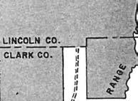
3 APPENDIX I-1 Wilderness Inventory: Ash Meadows, Moapa Valley, and Pahranagat NWRs Desert National Wildlife Refuge Complex Clark County, Nevada United States Department of the Interior Fish and Wildlife Service
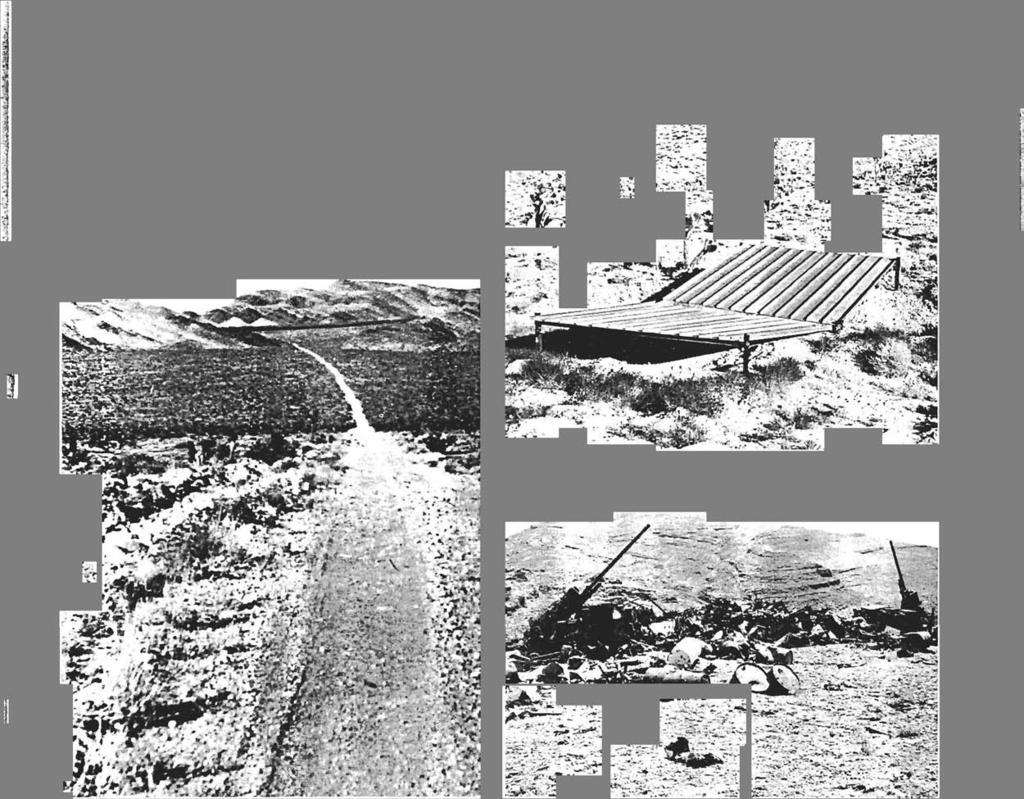
4 The purpose of a wilderness review is to identify and recommend for Congressional designation National Wildlife Refuge System (System) lands and waters that merit inclusion in the National Wilderness Preservation System (NWPS). Wilderness reviews are a required element of comprehensive conservation plans (CCPs) and conducted in accordance with the refuge planning process outlined in 602 FW 1 and 3, including public involvement and the National Environmental Policy Act (NEPA) compliance. There are three phases to the wilderness review: 1) inventory, 2) study; and 3) recommendation. Lands and waters that meet the minimum criteria for wilderness are identified in the inventory phase. These areas are called wilderness study areas (WSAs). WSAs are evaluated through the CCP process to determine their suitability for wilderness designation. In the study phase, a range of management alternatives are evaluated to determine if a WSA is suitable for wilderness designation or management under an alternate set of goals and objectives that do not involve wilderness designation. The recommendation phase consists of forwarding or reporting recommendations for wilderness designation from the Director through the Secretary and the President to Congress in a wilderness study report. If the inventory does not identify any areas that meet the WSA criteria, we document our findings in the administrative record for the CCP, fulfilling the planning requirement for a wilderness review. We inventoried Service lands and waters within Ash Meadows, Moapa Valley, and Pahranagat NWRs and found no areas that meet the eligibility criteria for a WSA as defined by the Wilderness Act. This appendix summarizes the wilderness inventory for these three refuges. Inventory Criteria The wilderness inventory is a broad look at the planning area to identify WSAs. These are roadless areas that meet the minimum criteria for wilderness identified in Section 2(c) of the Wilderness Act. A wilderness, in contrast with those areas where man and his works dominate the landscape, is hereby recognized as an area where the earth and its community of life are untrammeled by man, where man himself is a visitor who does not remain. An area of wilderness is further defined to mean in this Act an area of undeveloped Federal land retaining its primeval character and influence, without permanent improvements or human habitation, which is protected and managed so as to preserve its natural conditions, and which: (1) generally appears to have been affected primarily by the forces of nature, with the imprint of man s work substantially unnoticeable; (2) has outstanding opportunities for solitude or a primitive and unconfined type of recreation; (3) has at least five thousand acres of land or is of sufficient size as to make practicable its preservation and use in an unimpaired condition; and (4) may also contain ecological, geological or other features of scientific, educational, scenic, or historical value. A WSA must be a roadless area or island, meet the size criteria, appear natural, and provide outstanding opportunities for solitude or primitive recreation. The process for identification of roadless areas and application of the wilderness criteria are described in the following sections. Identification of Roadless Areas and Roadless Islands Identification of roadless areas and roadless islands required gathering and evaluating land status maps, land use and road inventory data, and aerial and satellite imagery for the refuges. Roadless refers to the absence of improved roads suitable and maintained for public travel by means of motorized vehicles primarily intended for highway use. Only lands currently owned by the Service in fee title or BLM lands managed under a cooperative agreement were evaluated. 4
5 Evaluation of the Size Criteria Roadless areas or roadless islands meet the size criteria if any one of the following standards applies: An area with over 5,000 contiguous acres. State and private lands are not included in making this acreage determination. A roadless island of any size. A roadless island is defined as an area surrounded by permanent waters or that is markedly distinguished from the surrounding lands by topographical or ecological features. An area of less than 5,000 contiguous Federal acres that is of sufficient size as to make practicable its preservation and use in an unimpaired condition, and of a size suitable for wilderness management. An area of less than 5,000 contiguous Federal acres that is contiguous with a designated wilderness, recommended wilderness, or area under wilderness review by another Federal wilderness managing agency such as the Forest Service, National Park Service, or Bureau of Land Management. Evaluation of the Naturalness Criteria In addition to being roadless, a WSA must meet the naturalness criteria. Section 2(c) defines wilderness as an area that... generally appears to have been affected primarily by the forces of nature with the imprint of man s work substantially unnoticeable. The area must appear natural to the average visitor rather than pristine. The presence of historic landscape conditions is not required. An area may include some human impacts provided they are substantially unnoticeable in the unit as a whole. Significant human-caused hazards, such as the presence of unexploded ordnance from military activity, and the physical impacts of refuge management facilities and activities are also considered in evaluation of the naturalness criteria. An area may not be considered unnatural in appearance solely on the basis of the sights and sounds of human impacts and activities outside the boundary of the unit. Evaluation of Outstanding Opportunities for Solitude or Primitive and Unconfined Recreation In addition to meeting the size and naturalness criteria, a WSA must provide outstanding opportunities for solitude or primitive recreation. The area does not have to possess outstanding opportunities for both solitude and primitive and unconfined recreation, and does not need to have outstanding opportunities on every acre. Further, an area does not have to be open to public use and access to qualify under this criteria; Congress has designated a number of wilderness areas in the Refuge System that are closed to public access to protect resource values. Opportunities for solitude refer to the ability of a visitor to be alone and secluded from other visitors in the area. Primitive and unconfined recreation means non-motorized, dispersed outdoor recreation activities that are compatible and do not require developed facilities or mechanical transport. These primitive recreation activities may provide opportunities to experience challenge and risk; self reliance; and adventure. These two opportunity elements are not well defined by the Wilderness Act but, in most cases, can be expected to occur together. However, an outstanding opportunity for solitude may be present in an area offering only limited primitive recreation potential. Conversely, an area may be so attractive for recreation use that experiencing solitude is not an option. 5
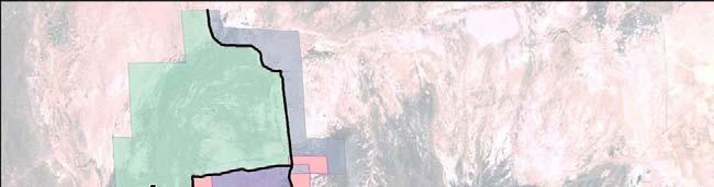
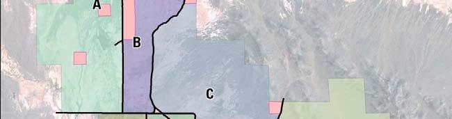
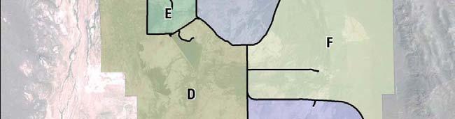
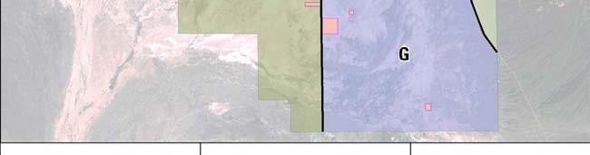
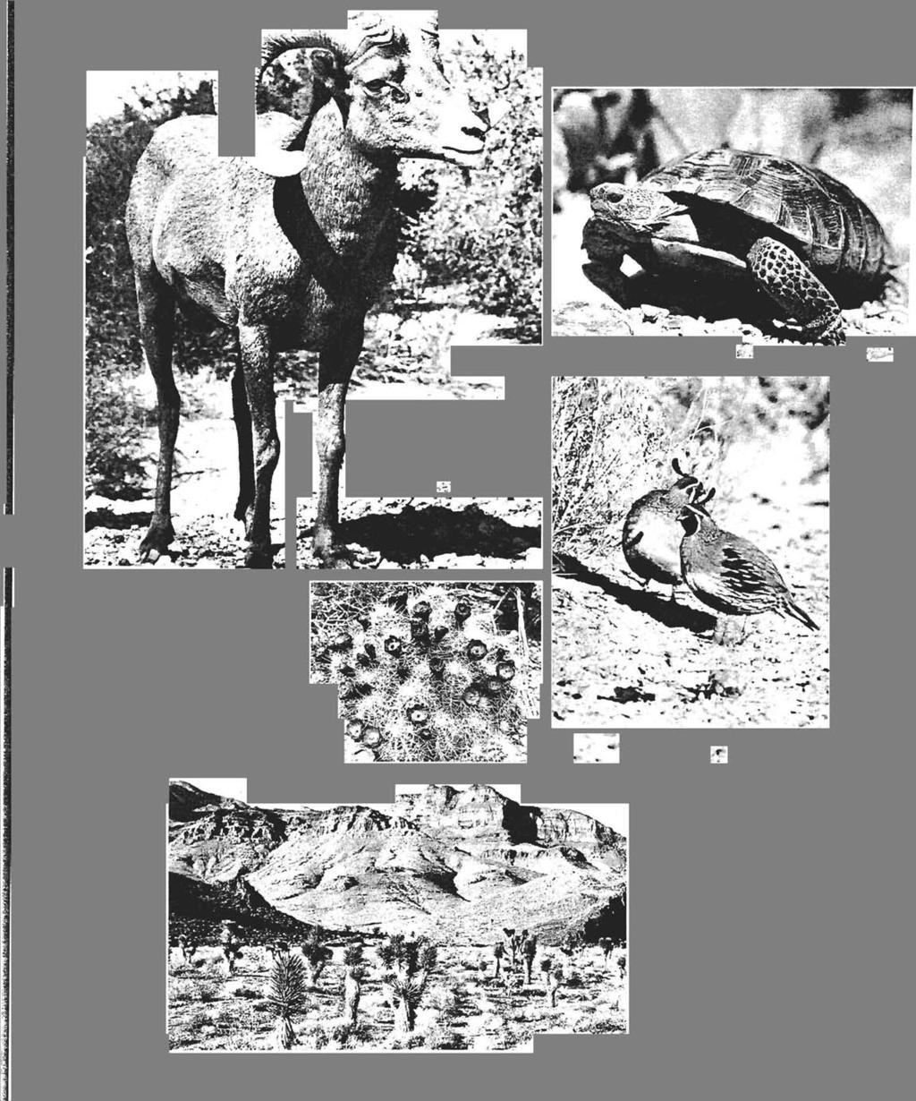
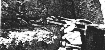
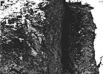
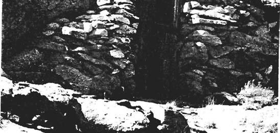
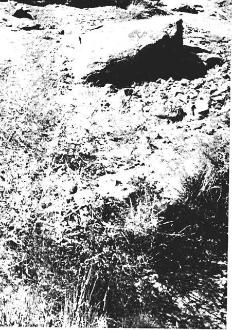
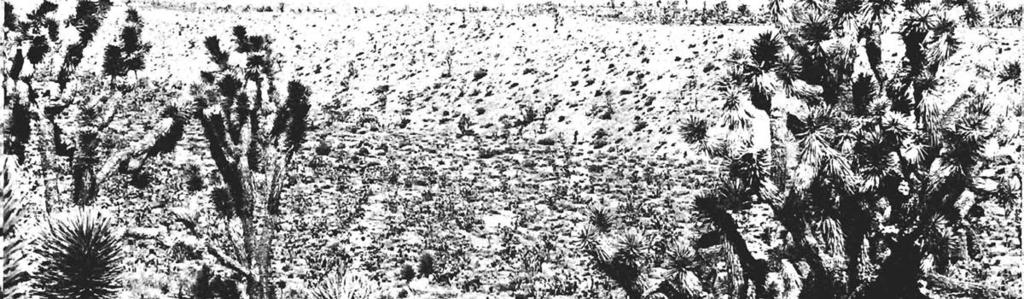
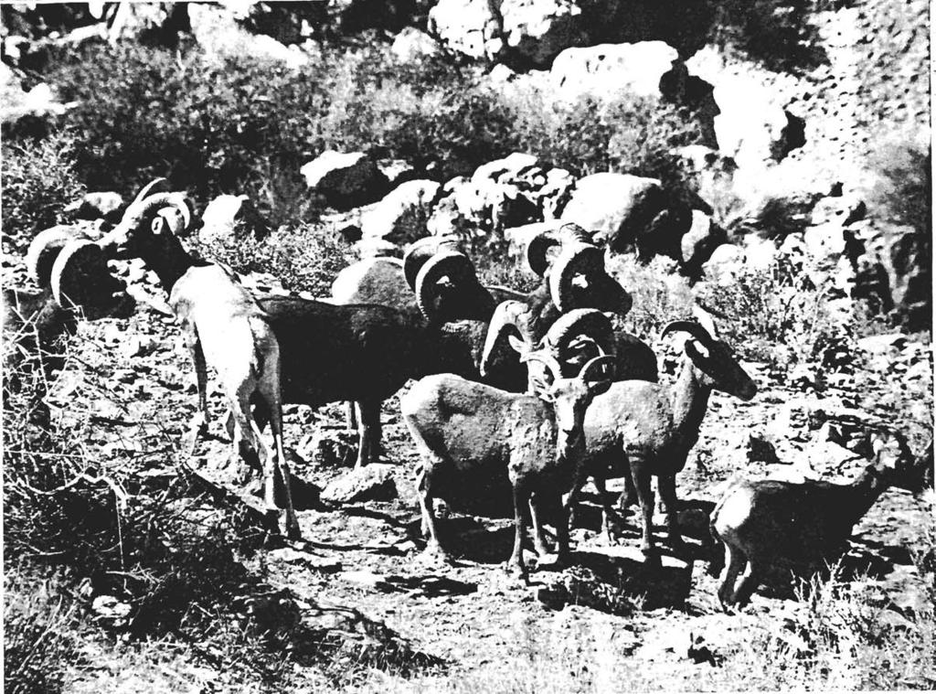
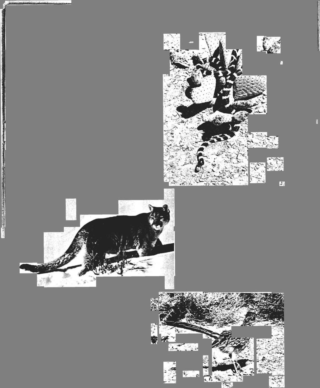
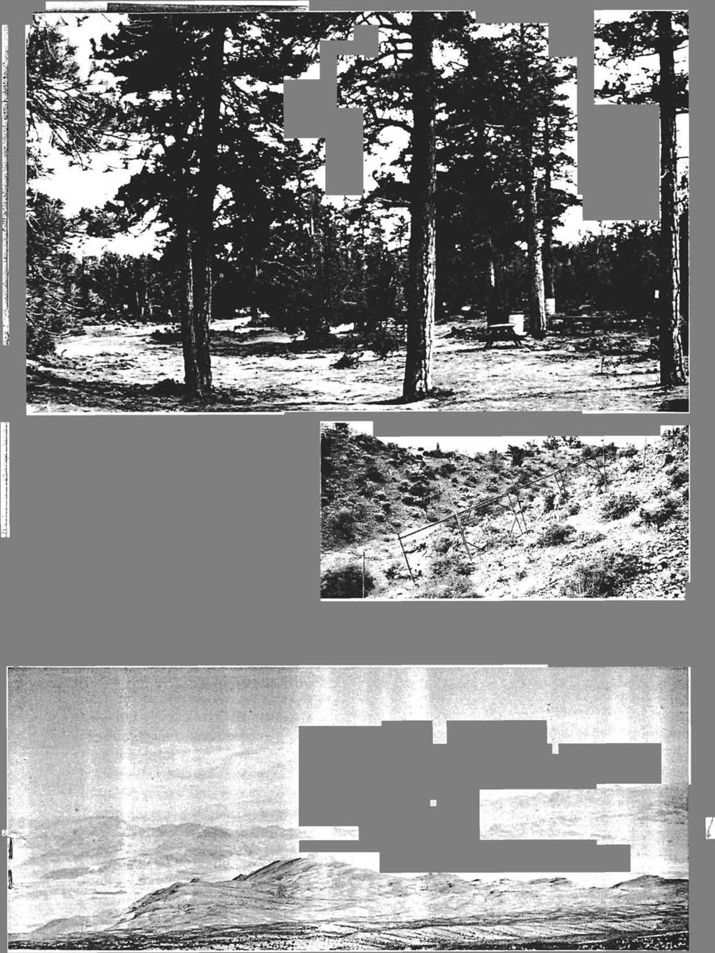
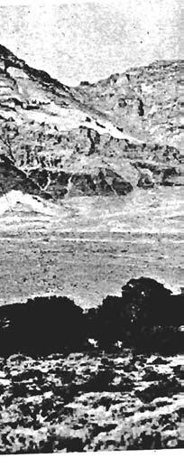
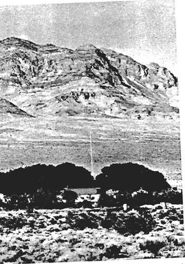
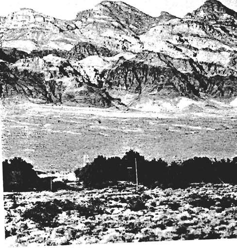
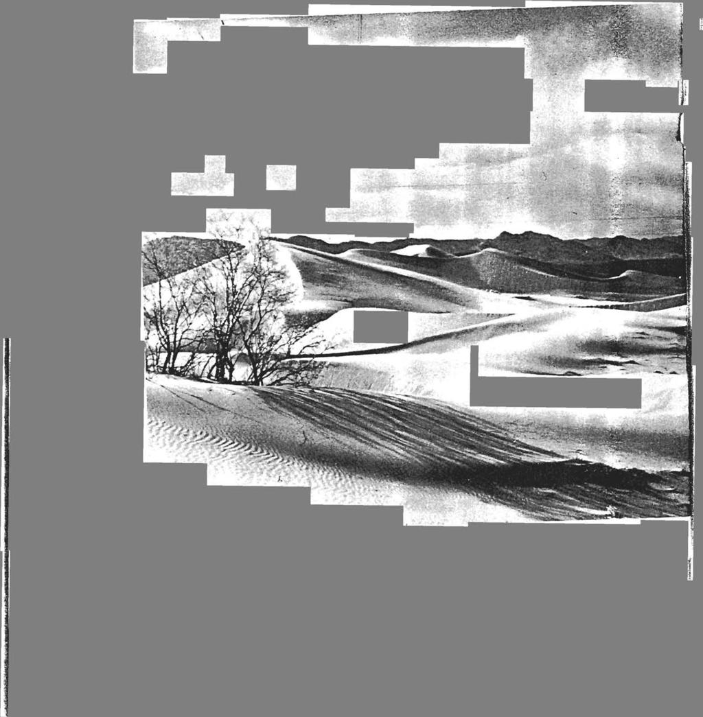
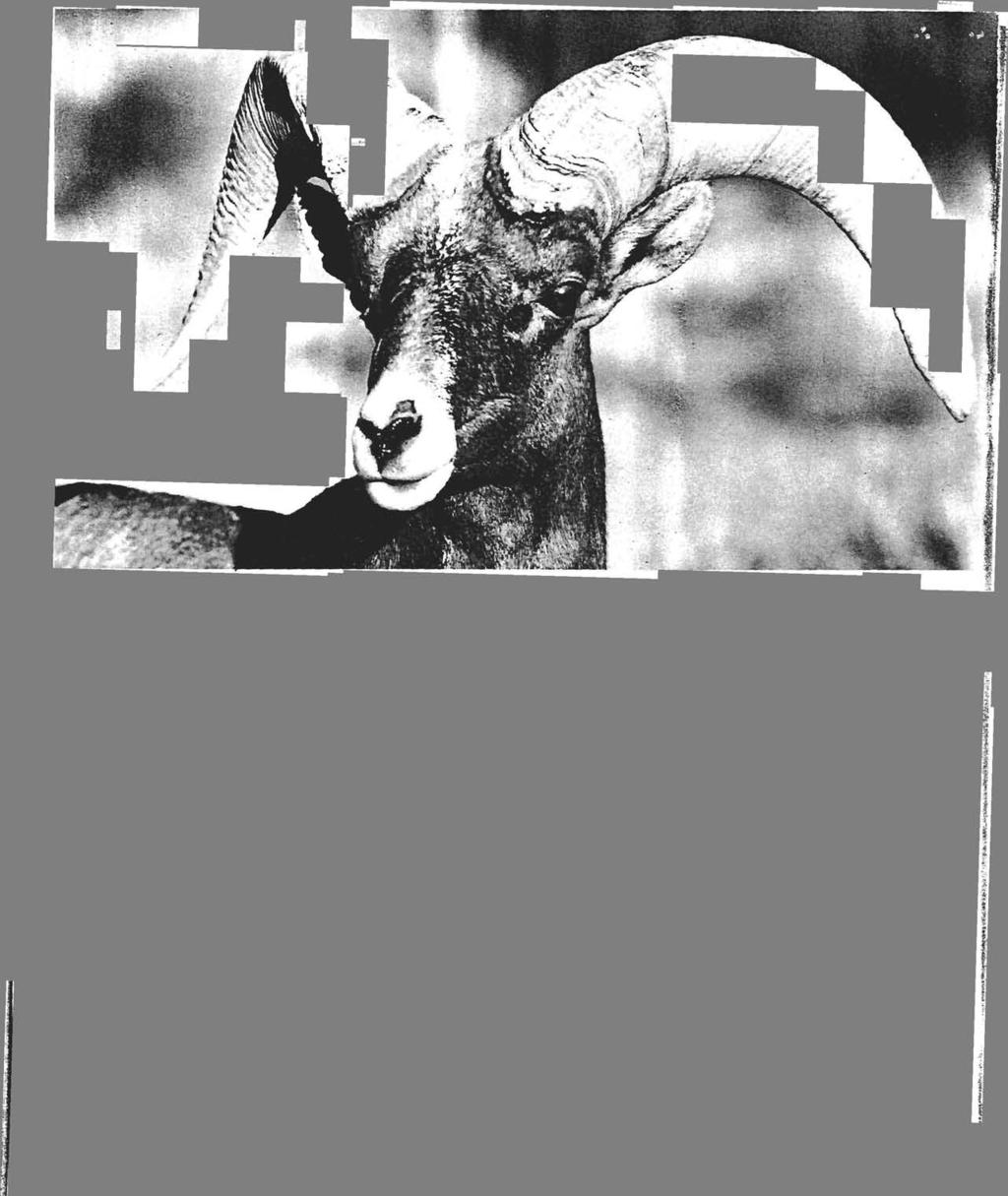
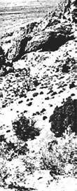
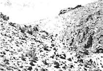
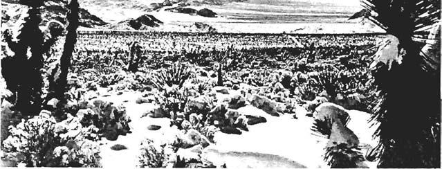
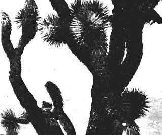
6 Evaluation of Supplemental Values Supplemental values are defined by the Wilderness Act as...ecological, geological, or other features of scientific, educational, scenic, or historic value. These values are not required for wilderness but their presence should be documented. Inventory Findings: Ash Meadows NWR As documented below, none of the lands within Ash Meadows NWR meet the criteria necessary for a WSA. Figure 1 shows the units, and Table 1 summarizes the inventory findings for each unit. Roadless Areas and Roadless Islands/ Size Criteria Ash Meadows NWR is a total of approximately 23,488 acres. There are approximately 32 miles of public roads on the Refuge, and these roads divide the refuge into ten units. These units can be classified by their size. Only one unit is greater than 5,000 acres (Area A), and there are numerous unimproved roads within the unit. Three other units are relatively large, consisting of 4,561, 4,058, and 4,461 acres (Areas F, G, & A). Naturalness Criteria The land within Ash Meadows NWR was intensively farmed in the 1960s and 1970s, prior to its establishment as a Refuge. As a result, many of the visual qualities associated with that use are still evident. Agricultural fields, fences, utility lines, fences, levees, roads (maintained and not), ditches, and a reservoir are examples of some of the remains of this agricultural legacy. The Refuge is currently in the habitat restoration stage and will likely remain so for years to come. Of the four sections that are close to being large enough for wilderness management; Area A consists of 4,461 acres, includes several levees, the Peterson Reservoir, the Longstreet cabin, approximately 24 miles of unimproved roads, and extensive agricultural fields. Area D consists of 5,092 acres, contains Crystal Springs Reservoir and dam, several levees, approximately 23 miles of unimproved roads and old agricultural fields. Area F is 4,561 acres, contains the Point of Rocks interpretive site, has approximately 28 miles of unimproved roads, and old agricultural fields. Area G consists of 4,058 acres, contains several structures, irrigation or well infrastructure, old agricultural fields, and approximately 17 miles of unimproved roads. Outstanding Opportunities for Solitude or Primitive and Unconfined Recreation There are opportunities for solitude or primitive and unconfined recreation; however, sights and sounds from visitors, refuge personnel, or over flights from the military may interfere with solitude. Supplemental Values Ash Meadows NWR consists of more than 23,000 acres of spring-fed wetlands and alkaline desert uplands and is a major discharge point for a large underground aquifer system stretching 100 miles to the northeast. Water-bearing strata reach the surface in more than 30 seeps and springs, providing a rich and complex variety of habitats. Wetlands, springs, and springbrook channels are scattered throughout the Refuge. Sandy dunes, rising up to 50 feet above the landscape, appear in the central portions of the Refuge. The Refuge provides habitat for at least 25 plants and animals found nowhere else in the world and provides a unique visual opportunity. 6
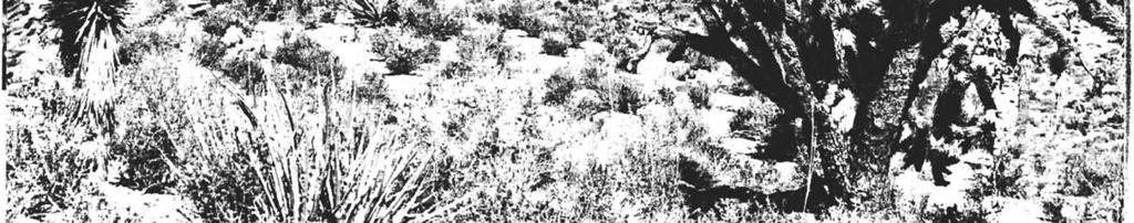
7 Mesquite and ash groves flourish near wetlands and stream channels and saltbush dominates large portions of the Refuge in dry areas adjacent to wetlands. Creosote bush habitat occurs in the drier elevated areas along the east and southeastern portions of the Refuge. Cacti occur along the outer eastern edge of the Refuge with a variety at Point of Rocks. The Refuge provides excellent views of the night sky for stargazers due to the lack of light sources in the vicinity. 7
8 8
9 Table 1 Ash Meadows NWR Roadless Units Yes/no and Comments or Refuge unit and acreage (1) has at least five thousand acres of land or is of sufficient size as to make practicable its preservation and use in an unimpaired condition; (2) generally appears to have been affected primarily by the forces of nature, with the imprint of man s work substantially unnoticeable; (3a) has outstanding opportunities for solitude; (3b) has outstanding opportunities for a primitive and unconfined type of recreation; (5) contains ecological, geological or other features of scientific, educational, scenic, or historical value. Unit qualifies as a wilderness study area (meets criteria 1, 2, and 3a or 3b) A No, 4,461 acres Includes several levees, the Peterson Reservoir, the Longstreet cabin, approximately 24 miles of dirt roads, and extensive agricultural fields. D Yes, 5,092 acres Crystal Springs Res. & dam, several levees, approximately 23 miles of dirt roads and old agricultural fields. F No, 4,561 acres Contains Point of Rocks interpretive site, has approx. 28 miles of dirt roads, and old agricultural fields. Yes Yes Yes, Longstreet cabin and ecological, educational, and scenic values. Yes Yes Yes, ecological, educational, and scenic values. Yes Yes Yes, ecological, educational, and scenic values., No, insufficient size and management as wilderness would conflict with restoration plans. No, the human imprint on the environment is substantially noticeable. No, insufficient size and management as wilderness would conflict with restoration plans. 9
10 Yes/no and Comments or Refuge unit and acreage (1) has at least five thousand acres of land or is of sufficient size as to make practicable its preservation and use in an unimpaired condition; (2) generally appears to have been affected primarily by the forces of nature, with the imprint of man s work substantially unnoticeable; (3a) has outstanding opportunities for solitude; (3b) has outstanding opportunities for a primitive and unconfined type of recreation; (5) contains ecological, geological or other features of scientific, educational, scenic, or historical value. Unit qualifies as a wilderness study area (meets criteria 1, 2, and 3a or 3b) G No, 4,058 acres Contains several structures, irrigation or well infrastructure, old agricultural fields, and approximately 17 miles of dirt roads. Yes Yes Yes, ecological, educational, and scenic values. No, insufficient size and management as wilderness would conflict with restoration plans. 10
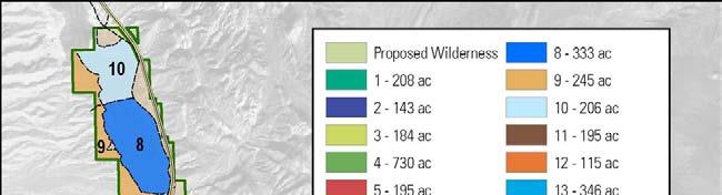
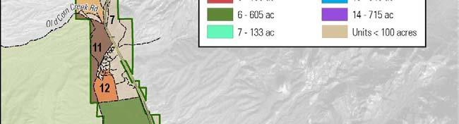
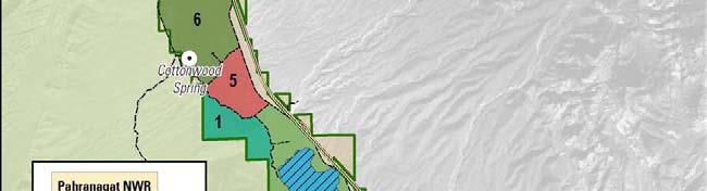
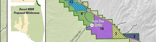
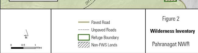
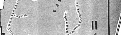
11 Moapa Valley NWR As documented below, none of the parcels in the Moapa Valley NWR meet the criteria necessary for a WSA. Roadless Areas and Roadless Islands The Moapa Valley NWR is a total of approximately 116 acres. Warm Springs Road (Hwy 168) parallels the eastern border to the Refuge, and from Warm Springs Road there are Refuge roads leading to the stream viewing chamber, and to the Pederson Unit, which leads to the Pederson residence and outbuildings. The Apcar Unit is also bisected by unimproved roads used by both Refuge staff and by the Moapa Valley Water District to access the capped spring head. The Moapa Valley NWR does not meet the size criteria for a wilderness study area. Naturalness Criteria The 116-acres Refuge contains a stream viewing chamber, with parking for visitors. The Refuge is comprised of four adjacent, but visually distinct units. The Pedersen Unit, to the west, is 30 acres in size. The Plummer Unit, to the east, is 28 acres in size. The Apcar Unit is 48 acres in size. The Pederson #2 Unit is 11 acres in size. Each unit has a separate stream system supported by the steady and uninterrupted flow of several springs that come to the surface at various places throughout the Refuge. The Pederson Unit #2 includes a residence and outbuildings. The Apcar Unit has a spring house, and the Plummer Unit contains the stream viewing chamber and parking lot. With an active restoration program, native riparian species have begun to return, including ash trees, honey mesquite, and screw bean mesquite. Plant species on the drier, upland areas of the Refuge are fourwing saltbush and creosote bush. Removal of non-native species, such as Canadian thistle and salt cedar is an on-going task. A visitor on the Refuge may see either see houses or roads and could hear cars driving on these roads. Outstanding Opportunities for Solitude or Primitive and Unconfined Recreation There are no opportunities for solitude or primitive and unconfined recreation due to the size of the Refuge; sights and sounds from Warm Springs Road may interfere with solitude, depending on the amount of traffic on the road. Supplemental Values The desert landscape combined with the springs can provide the visitor with an interest in geology and ecology and glimpse into an area where the Moapa Dace is uniquely adapted to life in this harsh landscape. The Refuge was created because of the Moapa Dace, as it is found no where except this valley. Pahranagat NWR As documented below, three units within Pahranagat NWR meet the criteria necessary for a WSA. Figure 2 shows the units, and Table 2 summarizes the inventory findings for each unit. 11
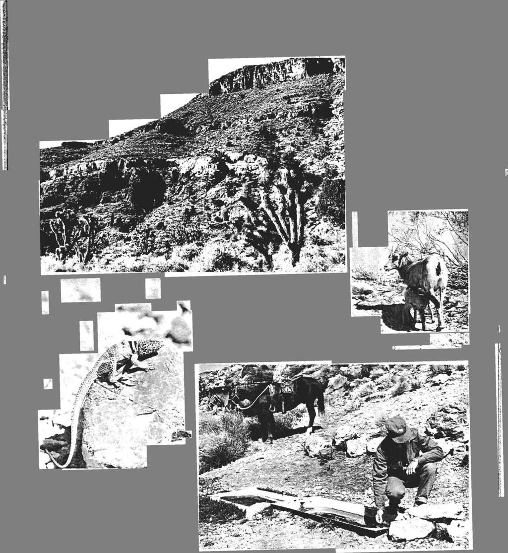
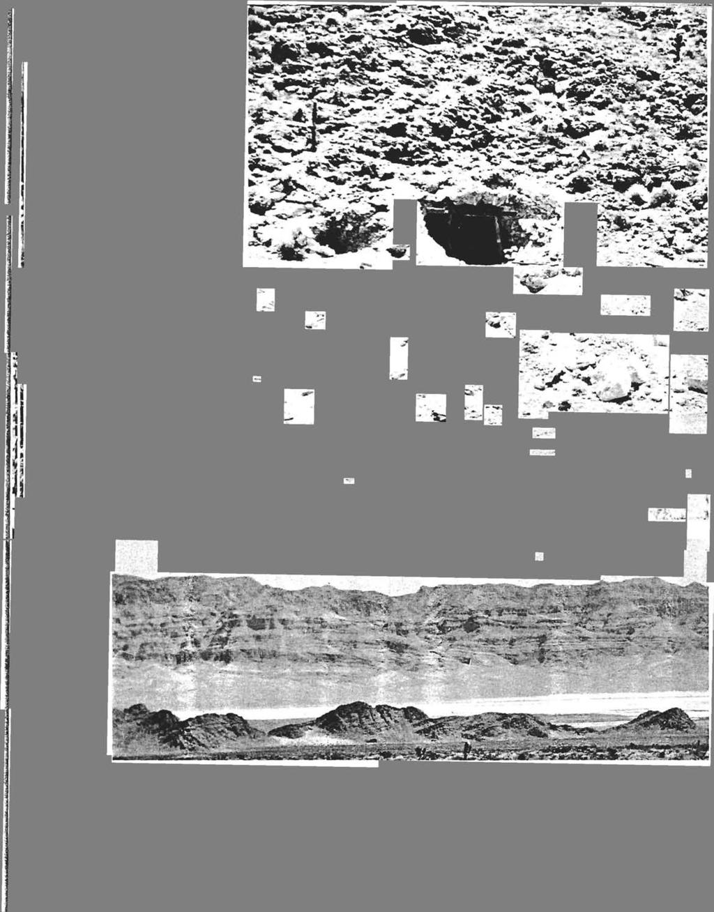
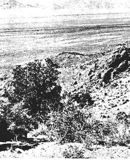
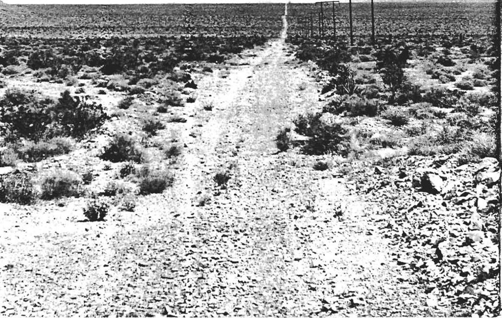
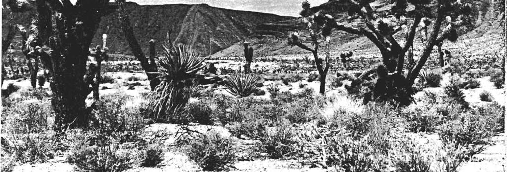
12 Roadless Areas and Roadless Islands/Size Criteria Pahranagat NWR consists of 5,382 acres. The Refuge is long and narrow in shape, and varies from 0.5 to 2 miles in width (1.5 mile average), with US Highway 93 paralleling the eastern boundary along the Refuges approximate 10-mile length. The north half of the Refuge, including Upper Pahranagat Lake is well visited because of a campground located on the east side of the lake and a county road (Old Corn Creek Road) which bisects the Refuge about 1 mile south of Upper Pahranagat Lake. This road continues on to Bureau of Land Management lands, and is used as a boundary for the Proposed Desert Wilderness. There are five levees positioned east-west that are used to cross the lake and wetlands for administrative purposes. By using roads to divide the Refuge into units, and eliminating units less than 100 acres results in 14 units in which to evaluate the refuge for wilderness values. The middle section of the Refuge includes (immediately west of current US Highway 93) a section of old US Highway 93, currently used by vehicles accessing the Refuge. The lower section of the Refuge contains larger units, none larger than 730 acres. The Refuge is adjacent to the Proposed Desert Wilderness, on Desert NWR. In 1974, approximately 1.3 million acres of land within the Desert National Wildlife Refuge were proposed for wilderness designation under the Wilderness Act of In the President s message to Congress accompanying the proposal, he recommended that Congress defer action on the proposal until a mineral survey is completed. The Final EIS for the proposal was released on August of A mineral assessment of the Refuge was completed in 1993 as part of the mineral withdrawal which was later completed in However, Congress has yet to act on the wilderness proposal, and the area continues to be managed to protect its wilderness values. The proposed wilderness is directly adjacent to the eastern boundary of Refuge units, 1, 4, 11, and 14. Unit 6 is separated by an administrative road from this proposed wilderness. Naturalness Criteria The Refuge encompasses a ten mile stretch of Pahranagat Valley and associated desert uplands at an elevation of slightly less than 4,000 feet above sea level. The White River, an ancient perennial stream which was a tributary of the Colorado River, flowed through the Pahranagat Valley from the north. It established a well-defined, but relatively narrow flood plain. The river bed is dry for many miles upstream and downstream from Pahranagat Valley, but there is water in the valley that comes from large, thermal springs along the flood plain. This spring water is stored in the Refuge's Upper Lake and North Marsh and is released to create conditions which will enhance the growth of wildlife food plants and to supplement lakes, marshes, and grasslands south of the Refuge headquarters. Water from the springs rarely flows past Maynard Lake at the southern end of the Refuge. The inlet to the upper lake is concrete lined for approximately 20 feet on either side of a stop log control structure. There are five levees which are used for water management, and administrative roads on the levees. There is a concrete lined ditch that is used to transfer water. There is a campground with fourteen camp sites, and numerous dirt roads, with three of these roads continuing through the Refuge to the west. Roads created in this desert environment tend to remain as scars on the desert floor for a very long time. Refuge buildings consist of and office/shop, equipment shelter, manager residence, bunkhouse, and fire cache. Outstanding Opportunities for Solitude or Primitive and Unconfined Recreation The eastern portion of the Refuge does have opportunities for solitude. The section south of Lower Pahranagat Lake contains the only remaining naturally occurring lake and the only part of the Refuge not accessible by automobile. The section includes an abandoned section of the historic Corn Creek Road that is washed out and can no longer be traveled by auto. Sights and sounds from Highway 93 may interfere with solitude, depending on the amount of traffic on the road. 12
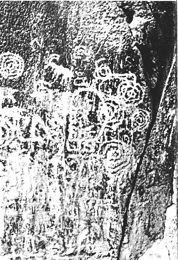
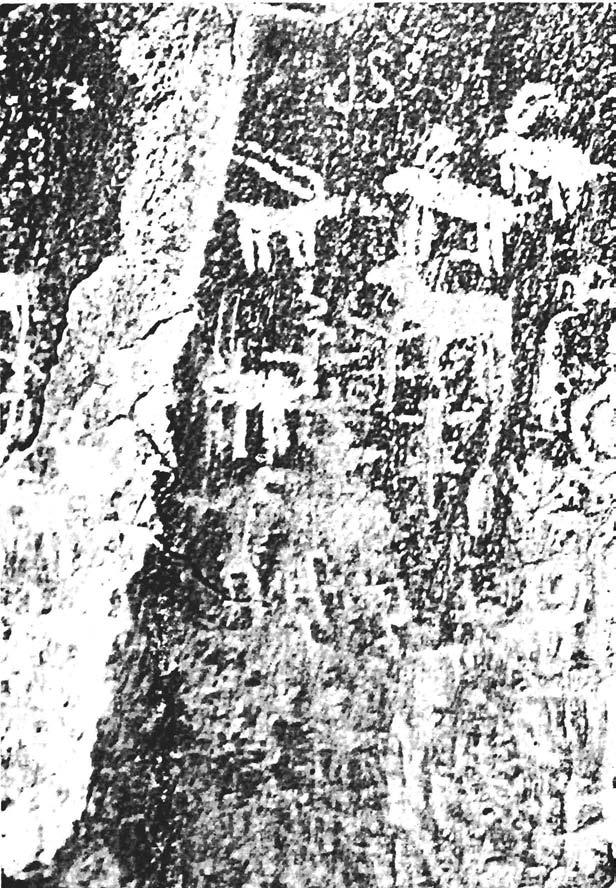
13 Supplemental Values The lower section of the Refuge includes historic dry lake beds, upland desert habitat, a historic (late 1800) home site, naturally occurring springs, petroglyphs, native American artifacts and geological formations including volcanic tuff and other upland areas. The desert landscape, wildlife, and wetland, open water, and riparian habitats on Pahranagat NWR provide significant scenic value to visitors of the Refuge. The Refuge s managed water also provides regionally significant ecological value for migratory birds and other wildlife. Map and Table The following map (Fig. 2) and accompanying table (Table 2) show Pahranagat National Wildlife Refuge segmented by roads, and grouped into units greater than 100 acres. Refuge units lesser than 100 acres were deemed too small to be suitable for wilderness management. Adjacent to the Refuge to the west is the Desert Proposed Wilderness. 13
14 14
15 Table 2 Pahranagat NWR Roadless Units Yes/no and Comments Refuge unit and acreage (1) has at least five thousand acres of land or is of sufficient size as to make practicable its preservation and use in an unimpaired condition; (2) generally appears to have been affected primarily by the forces of nature, with the imprint of man s work substantially unnoticeable; (3a) has outstanding opportunities for solitude; or (3b) has outstanding opportunities for a primitive and unconfined type of recreation; (5) contains ecological, geological or other features of scientific, educational, scenic, or historical value. Unit qualifies as a wilderness study area (meets criteria 1, 2, and 3a or 3b) 1 Yes, 208 acres and Contiguous with Desert Proposed Wilderness. Yes, unpaved road on east boundary. Yes, on west boundary. Yes, if combined with Desert Proposed Wilderness. Scenic Yes 2 No, 143 acres Inholding No, bordered by highway No Yes, contains historic road bed, petroglyphs, geological features, historical rock corrals, rock rings, ecologically important to the area because of shear fault zone, old lake bed, ancient river bed No, inholding.
16 Yes/no and Comments or Refuge unit and acreage (1) has at least five thousand acres of land or is of sufficient size as to make practicable its preservation and use in an unimpaired condition; (2) generally appears to have been affected primarily by the forces of nature, with the imprint of man s work substantially unnoticeable; (3a) has outstanding opportunities for solitude; (3b) has outstanding opportunities for a primitive and unconfined type of recreation; (5) contains ecological, geological or other features of scientific, educational, scenic, or historical value. Unit qualifies as a wilderness study area (meets criteria 1, 2, and 3a or 3b) 3 No, 184 acres Inholding No, bordered by highway No Yes, Contains historic road bed, petroglyphs, geological features, historical rock corrals, rock rings, ecologically important to the area because of shear fault zone, old lake bed, ancient river bed No, inholding. 4 Yes, 730 acres and Contiguous with Desert Proposed Wilderness. No, highway and dirt roads evident, water control structure, water ditch, power lines parallel hwy. Yes, on the w. boundary. Yes, if combined with Desert Proposed Wilderness. Yes, ecological, scenic, historical river channel, historical lake bed, historical home site, spring.. No
17 Yes/no and Comments Refuge unit and acreage (1) has at least five thousand acres of land or is of sufficient size as to make practicable its preservation and use in an unimpaired condition; (2) generally appears to have been affected primarily by the forces of nature, with the imprint of man s work substantially unnoticeable; (3a) has outstanding opportunities for solitude; or (3b) has outstanding opportunities for a primitive and unconfined type of recreation; (5) contains ecological, geological or other features of scientific, educational, scenic, or historical value. Unit qualifies as a wilderness study area (meets criteria 1, 2, and 3a or 3b) 5 No, 195 acres No, levees on n. & s. boundary, roads on e. & w. boundary, channelized stream. Yes, on the w. boundary. No, too small an area. Yes, ecological, scenic. No, insufficient size. 6 No, 605 acres No, roads on e. and w. boundary, levee on the s. boundary, check dams in stream. Yes Yes Yes, ecological, and Cottonwood Spring. No, insufficient size. 7 No, 133 acres Highway, petroglyphs, old agricultural fields, abandoned portion of highway. No, too close to hwy. No, too small an area. Yes, petroglyphs. No, insufficient size. 8 No, 333 acres Highway, levee to s. & n., road on e. & w. shore, campsites, levee overlook. No, lake used for fishing, campers nearby No, too small an area. Yes, scenic Upper Pahranagat Lake. No, insufficient size. 9 No, 245 acres Eastside road defines boundary. Yes No, too small an area. Yes, scenic desert. No, insufficient size.
18 Yes/no and Comments Refuge unit and acreage (1) has at least five thousand acres of land or is of sufficient size as to make practicable its preservation and use in an unimpaired condition; (2) generally appears to have been affected primarily by the forces of nature, with the imprint of man s work substantially unnoticeable; (3a) has outstanding opportunities for solitude; or (3b) has outstanding opportunities for a primitive and unconfined type of recreation; (5) contains ecological, geological or other features of scientific, educational, scenic, or historical value. Unit qualifies as a wilderness study area (meets criteria 1, 2, and 3a or 3b) 10 No, 206 acres Water control structure, refuge boundary fence, hwy, levee on south boundary. No, lake used for fishing, road nearby. No, too small an area. Yes, scenic Upper Pahranagat Lake. No, insufficient size. 11 Yes, 195 acres and Contiguous with Desert Proposed Wilderness. Unmaintained road, and hwy. Yes, if combined with Desert Proposed Wilderness. Yes, if combined with Desert Proposed Wilderness. Yes, scenic desert. Yes 12 No, 115 acres Abandoned agricultural fields, concrete ditch, levee on s. boundary, roads on e. & w. boundary. No, too close to refuge headquarters. No, too close to headquarters. No No, insufficient size. 13 No, 346 acres Inholding No, too small an area. No Scenic, ecological. No, inholding. 14 Yes, 715 acres and Contiguous with Desert Proposed Wilderness. Highway on the e. boundary. Yes, on the w. boundary. Yes, if combined with Desert Proposed Wilderness. Old farmstead foundation and Lone Tree Spring. Yes
19 APPENDIX I Desert NWR Wilderness Proposal Desert National Wildlife Refuge Complex Clark County, Nevada United States Department of the Interior Fish and Wildlife Service


20
21
22

23
24
25

26
27
28
29

30
31

32

33
34

35


36
37

38
39

40

41
42

43


44
45
46
47
48

49
50

51
Expanding Settlement Growing Mechanization
 The Wilderness Act of 1964 Expanding Settlement Growing Mechanization Versus Wilderness protection is paper thin, and the paper should be the best we can get that upon which Congress prints its Acts. David
WORKSHEET 1 Wilderness Qualities or Attributes Evaluating the Effects of Project Activities on Wilderness Attributes
 WORKSHEET 1 Wilderness Qualities or Attributes Evaluating the Effects of Project Activities on Wilderness Attributes Date: 3/7/2017 Roadless Area: Ruby South Description of Project Activity or Impact to
Arthur Carhart National Wilderness Training Center s Wilderness Investigations High School
 Arthur Carhart National Training Center s Investigations High School 101/Lesson 2 (OPTION 2B) Introducing the Act Goal: Students will understand the difference between wild spaces and federally designated
Special Recreation Management Areas Extensive Recreation Management Areas Public Lands Not Designated as Recreation Management Areas
 From the Proposed RMP: Special Recreation Management Areas SRMAs are an administrative unit where the existing or proposed recreation opportunities and recreation setting characteristics are recognized
Connie Rudd Superintendent, Black Canyon of the Gunnison National Park
 National Park Service U.S. Department of the Interior Black Canyon of the Gunnison National Park and Curecanti National Recreation Area Information Brochure #1 Wilderness and Backcountry Management Plan
/s/ Robert V. Abbey Director
 Form 1221-2 (June 1969) UNITED STATES DEPARTMENT OF THE INTERIOR BUREAU OF LAND MANAGEMENT MANUAL TRANSMITTAL SHEET Release 6-129 Date 03/15/2012 Subject 6310 Conducting Wilderness Characteristics Inventory
French Fire Recovery and Restoration Project Wilderness Resource Impact Analysis
 French Fire Recovery and Restoration Project Wilderness Resource Impact Analysis This Wilderness Resource Impact Analysis for the French Recovery and Restoration Project (Project) includes a review of
Wilderness Character and Wilderness Characteristics. What s the difference? Why does it matter?
 Introduction Wilderness Character and Wilderness Characteristics What s the difference? Why does it matter? The terms wilderness character and wilderness characteristics are sometimes used interchangeably
Wilderness Stewardship Plan Scoping Newsletter Winter 2013
 Olympic National Park National Park Service U.S. Department of the Interior Wilderness Stewardship Plan Scoping Newsletter Winter 2013 Dear Friends and Neighbors, The Olympic Wilderness was established
National Wilderness Steering Committee
 National Wilderness Steering Committee Guidance White Paper Number 1 Issue: Cultural Resources and Wilderness Date: November 30, 2002 Introduction to the Issue Two of the purposes of the National Wilderness
WILDERNESS PLANNING. Wilderness. Interagency Regional Wilderness Stewardship Training. Alamosa, Colorado - March 26-29, 2007
 WILDERNESS PLANNING Interagency Regional Wilderness Stewardship Training Alamosa, Colorado - March 26-29, 2007 Suzanne Stutzman Lead Planner/Wilderness Coordinator National Park Service, Intermountain
APPENDIX W. Wilderness Characteristics Assessment
 APPENDIX W Characteristics Assessment Resource Analysis Note: This Appendix was prepared by the. Except for minor stylistic edits made by FERC staff, the is entirely responsible for the analysis and conclusions
1803 West Hwy 160 Monte Vista, CO (719) TTY (719)
 TTY (719)") USDA Forest Service Rio Grande National Forest http://www.fs.fed.us/r2/riogrande 1803 West Hwy 160 Monte Vista, CO 81144 (719)852-5941 TTY (719)852-6271 USDI Bureau of Land Management San Luis Valley Center
USDA Forest Service Rio Grande National Forest http://www.fs.fed.us/r2/riogrande 1803 West Hwy 160 Monte Vista, CO 81144 (719)852-5941 TTY (719)852-6271 USDI Bureau of Land Management San Luis Valley Center
Wilderness Areas Designated by the White Pine County bill
 Wilderness Areas Designated by the White Pine County bill SEC. 321. SHORT TITLE. This subtitle may be cited as the `Pam White Wilderness Act of 2006'. SEC. 322. FINDINGS. Congress finds that-- The White
April 10, Mark Stiles San Juan Public Lands Center Manager 15 Burnett Court Durango, CO Dear Mark,
 Mark Stiles San Juan Public Lands Center Manager 15 Burnett Court Durango, CO 81301 Dear Mark, We are pleased to offer the following comments on the draft San Juan Public Lands Center management plans
Brinker Creek Ranch. Colorado - Routt County - Yampa
 Located at the base of the Flattops Range in the Steamboat/Vail corridor, Brinker Creek Ranch consists of 1,451 acres ideally suited for high country grazing and native grass hay production. Traditionally
David Johnson. Tom, Attached please find the final scoping letter and figures for your review. David
 David Johnson From: Sent: To: Cc: Subject: Attachments: David Johnson Tuesday, April 12, 2011 4:33 PM Thomas Malecek Dave Dyer; Jason Marks (jmarks@segroup.com) VWC Scoping Letter
Coconino National Forest Potential Wilderness Proposal
 Coconino National Forest Potential Wilderness Proposal As part of their Forest Plan Update, the Coconino National Forest needs to address the need for additional wilderness. The last evaluation was done
Overview. Wilderness Act of Statement of Need. What is Wilderness Character. Monitoring Wilderness Character
 Overview Monitoring Wilderness Character What What & Why? How? How? Conceptual Development How? How? Implementation Future? Future? Troy Hall Steve Boutcher USFS Wilderness & Wild and Scenic River Program
Securing Permanent Protection for Public Land
 Securing Permanent Protection for Public Land Tools for Wyoming Advocates Paul Spitler* The Wilderness Society * I am a wilderness policy expert, not a powerpoint expert! Platform and Resolutions of the
MINIMUM REQUIREMENTS DECISION GUIDE WORKSHEETS
 ARTHUR CARHART NATIONAL WILDERNESS TRAINING CENTER MINIMUM REQUIREMENTS DECISION GUIDE WORKSHEETS Prescribed burning of islands within Okefenokee Wilderness Area.... except as necessary to meet minimum
The Wilderness Act of Cecilia Reed, Forest Service Mokelumne Wilderness Manager
 The Wilderness Act of 1964 Cecilia Reed, Forest Service Mokelumne Wilderness Manager Aldo Leopold Arthur Carhart Teddy Roosevelt The Wilderness Act of 1964 After much debate and compromise after 66 drafts,
Continental Divide National Scenic Trail Legislative History and Planning Guidance
 Continental Divide National Scenic Trail Legislative History and Planning Guidance Legislation, Policy, and Direction Regarding National Scenic Trails The National Trails System Act, P.L. 90-543, was passed
LESSON 5 Wilderness Management Case Studies
 LESSON 5 Wilderness Management Case Studies Objectives: Students will: review the key points of the Wilderness Act of 1964. brainstorm solutions for Wilderness management issues. Materials: Í Leave no
Appendix I Case-Studies in Wilderness Management
 Appendix I Case-Studies in Wilderness Management Management Issue Scenarios Note: These scenarios are meant to be used as guidelines for the program leader rather than to be read verbatim. Introduce a
Existing Resource Information
 Botanical and Wildlife Vegetation alliances/wildlife habitats Grasslands annual/perennial Chaparral mixed/montane/chamise-redshank Riparian montane/valley foothill riparian Sierran mixed conifer Montane
SECTION 3 GENERAL DESCRIPTION OF THE RIVER BASIN
 SECTION 3 GENERAL DESCRIPTION OF THE RIVER BASIN SECTION 3 GENERAL DESCRIPTION OF THE RIVER BASIN River basin description. A general description of the river basin or subbasin, as appropriate, in which
Why is Wilderness Important? Does the American Public Really Care? Should it be managed? Why? Who should Manage it? How should it be Managed?
 Why is Wilderness Important? Does the American Public Really Care? Should it be managed? Why? Who should Manage it? How should it be Managed? Shifting Attitudes Toward Wilderness The early conception of
Wilderness Process #NP-1810: Your letter ID is NP September 5, 2018
 Wilderness Process #NP-1810: Your letter ID is NP-1810-2602-96 September 5, 2018 RE: GMUG Wilderness Evaluation Revised Evaluation Criteria and Draft Report Forest Revision Planning Team: The Continental
Federal Land and Resource Management: A Primer 1
 Federal Land and Resource Management: A Primer 1 RS20002 Coordinated by Ross W. Gorte Natural Resource Economist and Policy Specialist Environment and Natural Resources Policy Division December 22, 1998
Whitefish Range Partnership Tentatively Approved by WRP 11/18/2013!Rec. Wilderness Page 1
 Whitefish Range Partnership Tentatively Approved by WRP 11/18/2013!Rec. Wilderness Page 1 Recommended Wilderness Background The Whitefish Range has a long management and legislative history associated
Colorado s Instream Flow Program at 40. ICWP Annual Conference October 16, 2013 Denver, Colorado
 Colorado s Instream Flow Program at 40 ICWP Annual Conference October 16, 2013 Denver, Colorado ISF Program established in 1973 by Senate Bill 97 Recognized the need to correlate the activities of mankind
Rule Governing the Designation and Establishment of All-Terrain Vehicle Use Trails on State Land
 Rule Governing the Designation and Establishment of All-Terrain Vehicle Use Trails on State Land 1.0 Authority 1.1 This rule is promulgated pursuant to 23 V.S.A. 3506. Section 3506 (b)(4) states that an
FISH AND WILDLIFE SERVICE NATURAL AND CULTURAL RESOURCES MANAGEMENT. Chapter 1 General Overview of Wilderness Stewardship Policy 610 FW 1
 1.1 What is the purpose of Part 610 and this chapter? A. Part 610 provides an overview and foundation for implementing the Wilderness Act and the National Wildlife Refuge System Administration Act of 1966,
2.0 PARK VISION AND ROLES
 2.0 PARK VISION AND ROLES 2.1 Significance in the Protected Area System Marble Range and Edge Hills provincial parks protect 6.8% of the Pavillion Ranges Ecosection, which is located in the Southern Interior
Proposed Scotchman Peaks Wilderness Act 2016 (S.3531)
") 1 Proposed Scotchman Peaks Wilderness Act 2016 (S.3531) Frequently Asked Questions PLACE Where is the area that would be designated as Wilderness? The lands outlined in S.3531 lie within Idaho along its
1 Proposed Scotchman Peaks Wilderness Act 2016 (S.3531) Frequently Asked Questions PLACE Where is the area that would be designated as Wilderness? The lands outlined in S.3531 lie within Idaho along its
MASTER PLAN EXECUTIVE SUMMARY
 Biscuit Run State Park Scottsville Road (State Route 20) Charlottesville, VA 22902 Biscuit Run State Park MASTER PLAN EXECUTIVE SUMMARY Department of Conservation and Recreation Division of Planning and
Draft Revised Land Management Plan and DEIS Comments
 December 28, 2017 Dan Dallas, Forest Supervisor Rio Grande National Forest Attn: Rio Grande Forest Plan Revision 1803 W. U.S. Highway 160 Monte Vista, CO 81144 rgnf_forest_plan@fs.fed.us Draft Revised
UNITED STATES DEPARTMENT OF THE INTERIOR BUREAU OF LAND MANAGEMENT MANUAL TRANSMITTAL SHEET
 Form 1221-2 (June 1969) UNITED STATES DEPARTMENT OF THE INTERIOR BUREAU OF LAND MANAGEMENT MANUAL TRANSMITTAL SHEET Release 8-83 Date Subject 8353 Trail Management Areas Secretarially Designated (Public)
Dungeness Recreation Area County Park Master Plan
 Dungeness Recreation Area County Park Public Outreach Meeting October 10, 2007 Project Overview USFWS Site Dungeness Recreation Area County Park Meeting Objectives: Re-Introduce project; provide status
Recreation Opportunity Spectrum for River Management v
 Recreation Opportunity Spectrum for Management v. 120803 Introduction The following Recreation Opportunity Spectrum (ROS) characterizations and matrices mirror the presentation in the ROS Primer and Field
National Park Service Wilderness Action Plan
 National Park Service U.S. Department of the Interior National Park Service Wilderness Action Plan National Wilderness Steering Committee National Park Service "The mountains can be reached in all seasons.
Hermosa Area Preservation The Colorado Trail Foundation 4/11/2008
 Hermosa Area Preservation The Colorado Trail Foundation 4/11/2008 Legend d o Tr ail NPA - National Protection Area ra NCA - National Conservation Area o e C Th The Colorado Trail lo FS inventoried Roadless
Conservation Area Management Statement
 Conservation Area Management Statement Miller Creek Wildlife Area Resolution #: Approval: Issue Date: Date of Last Revision: Table of Contents 1. Purpose....... 1 2. Property Description...... 1 2.1. Legal
RECREATION. Seven issues were identified that pertain to the effects of travel management on outdoor recreation within portions of the project area.
 RECREATION Seven issues were identified that pertain to the effects of travel management on outdoor recreation within portions of the project area. OPPORTUNITIES FOR SOLITUDE / QUIET TRAILS. One attraction
Appendix A BC Provincial Parks System Goals
 Appendix A BC Provincial Parks System Goals The British Columbia Provincial Parks System has two mandates: To conserve significant and representative natural and cultural resources To provide a wide variety
Piedra River Protection Workgroup Meeting #5 Feb. 21, 2012 Ross Aragon Community Center, Pagosa Springs
 Piedra River Protection Workgroup Meeting #5 Feb. 21, 2012 Ross Aragon Community Center, Pagosa Springs What happened at this meeting? - Identified conservation easements - Discussed In-stream Flows -
2.0 Physical Characteristics
 _ 2.0 Physical Characteristics 2.1 Existing Land Use for the Project The site is comprised of approximately 114 acres bounded by Highway 101 to the north, the existing town of Los Alamos to the east, State
Lewis and Clark National Historic Trail
 National Trails System Land and Water Conservation Fund FY2014 Lewis and Clark National Historic Trail Total LWCF Request: $ 3,130,000 Project Name Agency District # Tracts Acres Total Cost Columbia River
FEASIBILITY CRITERIA
 This chapter describes the methodology and criteria used to evaluate the feasibility of developing trails throughout the study areas. Land availability, habitat sensitivity, roadway crossings and on-street
Proposed Backcountry Area Definition and Guidelines
 Proposed Backcountry Area Definition and Guidelines Proposed Backcountry Area Definition and Guidelines A Backcountry Area is proposed as a section of state land where the size and quality of the landscape
MINIMUM REQUIREMENTS DECISION GUIDE WORKSHEETS
 ARTHUR CARHART NATIONAL WILDERNESS TRAINING CENTER MINIMUM REQUIREMENTS DECISION GUIDE WORKSHEETS Fuel Maintenance Around Red-cockaded Woodpecker Trees on Islands within the Okefenokee Wilderness Area....
EMERY COUNTY PUBLIC LAND MANAGEMENT ACT OF 2018 S. 2809/H.R. 5727
 EMERY COUNTY PUBLIC LAND MANAGEMENT ACT OF 2018 S. 2809/H.R. 5727 September 25, 2018 OVERVIEW The Emery County Public Land Management Act of 2018 is a significant step backwards for wilderness and conservation
Proposed Lands With Wilderness Characteristics: HOVERROCKER Public Lands in Greenlee County, Arizona
 Proposed Lands With Wilderness Characteristics: HOVERROCKER Public Lands in Greenlee County, Arizona A proposal report to the Bureau of Land Management, Safford Field Office, Arizona February, 2018 Prepared
3.12 Roadless Areas and Unroaded Areas
 3.12 Roadless Areas and Unroaded Areas Introduction This analysis focuses on the direct and indirect effects of activities proposed in the Como Forest Health project on roadless area values, including
Bureau of Land Management Public Lands Guide Northwest District
 Bureau of Land Management Public Lands Guide Northwest District NORTHWEST Fee Site Restrooms Picnic Sites Developed Campgrounds Farmington Field Office (505) 564-7600 Alien Run Mountain Bike Trail Angel
Pinellas County Environmental Lands
 Pinellas County Environmental Lands In addition to traditional parks and recreation facilities, Pinellas County owns and manages a system of environmental lands that provides specialized resource-based
Creating a User-Driven Long-Distance OHV Trail Through Partnering
 Joseph Raffaele Outdoor Recreation Planner U.S. Bureau of Land Management Yuma, Arizona Creating a User-Driven Long-Distance OHV Trail Through Partnering BLM is a multiple-use land management agency within
VOLUME II APPENDIX F DETAILED PHYSICAL DESCRIPTION OF PROJECT RESERVOIRS AND LANDS
 VOLUME II APPENDIX F DETAILED PHYSICAL DESCRIPTION OF PROJECT RESERVOIRS AND LANDS THE CENTRAL NEBRASKA PUBLIC POWER AND IRRIGATION DISTRICT FERC PROJECT NO. 1417 PHYSICAL DESCRIPTION OF PROJECT LANDS
Segment 2: La Crescent to Miller s Corner
 goal of the USFWS refuges is to conserve, protect and enhance fish, wildlife and plants and their habitats for the continuing benefit of the American people. Refuge lands are used largely for fishing,
Decision Memo Broken Wheel Ranch Equestrian Outfitter Special-Use Permit Proposed Action
 Decision Memo Broken Wheel Ranch Equestrian Outfitter Special-Use Permit USDA Forest Service Mississippi Bluffs Ranger District, Shawnee National Forest Jackson and Union Counties, Illinois Proposed Action
Margaret N. Rees University of Nevada, Las Vegas,
 Get Outdoors Nevada Public Lands Institute 6-30-2011 Nevada Interagency Volunteer Program: Helping Hands Across Public Lands Phase II: Quarterly Progress Report, Period Covering April 1, 2011-June 30,
Final Environmental Impact Statement for the Merced Wild and Scenic River. Comprehensive Management Plan, Yosemite National Park, Madera and Mariposa
 This document is scheduled to be published in the Federal Register on 02/26/2014 and available online at http://federalregister.gov/a/2014-04061, and on FDsys.gov DEPARTMENT OF THE INTERIOR 4312-FF NATIONAL
Dumont Dunes Special Recreation Management Area (SRMA)
") Dumont Dunes Special Recreation Management Area (SRMA) RMA/RECREATION MANAGEMENT ZONE (RMZ) OBJECTIVE(S) DECISIONS Objective Statement: Designate this area as a Special Recreation Management Area. To manage
Dumont Dunes Special Recreation Management Area (SRMA) RMA/RECREATION MANAGEMENT ZONE (RMZ) OBJECTIVE(S) DECISIONS Objective Statement: Designate this area as a Special Recreation Management Area. To manage
Wilderness Specialist s Report
 United States Department of Agriculture Forest Service July 2009 Wilderness Specialist s Report Travel Management Rule EIS USDA Forest Service Southwestern Region Apache-Sitgreaves National Forests Prepared
White Mountain National Forest Saco Ranger District
 United States Department of Agriculture Forest Service White Mountain National Forest Saco Ranger District 33 Kancamagus Highway Conway, NH 03818 Comm: (603) 447-5448 TTY: (603) 447-3121 File Code: 1950
Rogue Gorge (Mt. Stella) Roadless Area-- T30S R3E (primarily in portions of Sections 23, 26, 33, 34 & 35)
 Roadless Area-- T30S R3E (primarily in portions of Sections 23, 26, 33, 34 & 35)") Rogue Gorge (Mt. Stella) Roadless Area-- T30S R3E (primarily in portions of Sections 23, 26, 33, 34 & 35) Rogue River-Siskiyou National Forest--High Cascades Ranger District Upper, higher elevation trail
Rogue Gorge (Mt. Stella) Roadless Area-- T30S R3E (primarily in portions of Sections 23, 26, 33, 34 & 35) Rogue River-Siskiyou National Forest--High Cascades Ranger District Upper, higher elevation trail
FINAL TESTIMONY 1 COMMITTEE ON RESOURCES UNITED STATES HOUSE OF REPRESENTATIVES. July 13, 2005 CONCERNING. Motorized Recreational Use of Federal Lands
 FINAL TESTIMONY 1 STATEMENT OF DALE BOSWORTH CHIEF Of the FOREST SERVICE UNITED STATES DEPARTMENT OF AGRICULTURE Before the SUBCOMMITTEE ON FORESTS AND FOREST HEALTH And the SUBCOMMITTEE ON NATIONAL PARKS,
BUCK POINT RANCH. Aspen Associates Realty
 BUCK POINT RANCH Aspen Associates Realty www.aspenassociatesrealty.com 970.544.5800 WELCOME TO Buck Point Ranch is a 960± acre property located in one of the last pristine valleys in close proximity to
Park-specific management and policies Wainuiomata Recreation Area
 Park-specific management and policies Wainuiomata Recreation Area 6.8 Wainuiomata Recreation Area 6.8.1 Legal status Title held: Legislative status: Wellington Regional Council Administered under Local
BACKGROUND DECISION. Decision Memo Page 1 of 6
 DECISION MEMO DEVIL S ELBOW BY-PASS, BOUNDARY TRAIL NO.1 U.S. FOREST SERVICE T9N, R7E, SECTION 9 RANGE 5E COWLITZ COUNTY WA MOUNT ST. HELENS NATIONAL VOLCANIC MONUMENT, GIFFORD PINCHOT NATIONAL FOREST
SUMMER VILLAGE OF SILVER SANDS. Municipal Development Plan
 SUMMER VILLAGE OF SILVER SANDS Municipal Development Plan Bylaw 253-2014 Adopted August 22, 2014 Summer Village of Silver Sands Municipal Development Plan Bylaw No. 253-2014 Page 2 1 INTRODUCTION 1.1 SETTING
Frizzell Creek Ranch Summerville, OR $1,400, ± Acres
 Frizzell Creek Ranch Summerville, OR $1,400,000 165± Acres 1 Introduction The Frizzell Creek Ranch is a beautiful 165± acre ranch located in northeast Oregon at the base of the Wallowa Whitman National
Yard Creek Provincial Park. Management Plan
 Yard Creek Provincial Park Management Plan Draft January 2010 Yard Creek Provincial Park Management Plan Approved by: telàlsemkin/siyam/chief Scott Benton Bill Williams Squamish Executive Director ation
Natural and Cultural Resources Management, Part 610: Wilderness Stewardship
 Natural and Cultural Resources Management, Part 610: Wilderness Stewardship 2.5 May the Service allow structures and installations in wilderness? Section 4(c) of the Wilderness Act generally prohibits
Wilderness Research. in Alaska s National Parks. Scientists: Heading to the Alaska Wilderness? Introduction
 Wilderness Research in Alaska s National Parks National Park Service U.S. Department of Interior Scientists: Heading to the Alaska Wilderness? Archeologist conducts fieldwork in Gates of the Arctic National
WikiLeaks Document Release
 WikiLeaks Document Release February 2, 2009 Congressional Research Service Report RL33827 Wilderness Laws: Permitted and Prohibited Uses Ross W. Gorte, Specialist in Natural Resources Policy January 7,
Colorado s Instream Flow Program at 40. Celebrating 40 Years of Success and Challenges January 15, 2014 Denver, Colorado
 Colorado s Instream Flow Program at 40 Celebrating 40 Years of Success and Challenges January 15, 2014 Denver, Colorado ISF Program established in 1973 by Senate Bill 97 Recognized the need to correlate
TONGASS NATIONAL FOREST
 TONGASS NATIONAL FOREST UNITED STATES DEPARTMENT OF AGRICULTURE-FOREST SERVICE Contact: Dennis Neill Phone: 907-228-6201 Release Date: May 17, 2002 SEIS Questions and Answers Q. Why did you prepare this
Sasagiu Rapids Provincial Park. Draft Management Plan
 Sasagiu Rapids Provincial Park Draft Management Plan 2 Sasagiu Rapids Provincial Park Table of Contents 1. Introduction... 3 2. Background and Park Attributes... 3 2.1 Park History.... 3 2.2 Natural Features...
White Mountain National Forest Saco Ranger District
 United States Department of Agriculture Forest Service White Mountain National Forest 33 Kancamagus Highway Conway, NH 03818 Comm: (603) 447-5448 TTY: (603) 447-3121 File Code: 1950 Date: February 26,
Proposal to Redevelop Lower Kananaskis River-Barrier Lake. Bow Valley Provincial Park
 Frequently Asked Questions Proposal to Redevelop Lower Kananaskis River-Barrier Lake Bow Valley Provincial Park Frequently Asked Questions What has been decided? What are the details of the plan? What
112th CONGRESS. 1st Session H. R. 113 IN THE HOUSE OF REPRESENTATIVES
 HR 113 IH 112th CONGRESS 1st Session H. R. 113 To provide for additions to the Cucamonga and Sheep Mountain Wilderness Areas in the Angeles and San Bernardino National Forests and the protection of existing
Bear Creek Habitat Improvement Project
 06/10/10 Bear Creek Habitat Improvement Project El Paso County, Colorado Pike National Forest and Colorado Springs Utilities Owned Land Report prepared by: Eric Billmeyer Executive Director Rocky Mountain
THE ALBERTA GAZETTE, SEPTEMBER
 VILLAGE OF CEREAL Order No. 16915 IN THE MATTER OF THE "Municipal Government Act": File No. 241(A)3 AND IN THE MATTER OF an application by the Council of the Village of Cereal, in the Province of Alberta,
COASTAL CONSERVANCY. Staff Recommendation December 2, 2004 COYOTE HELLYER COUNTY PARK BAY AREA RIDGE TRAIL
 COASTAL CONSERVANCY Staff Recommendation December 2, 2004 COYOTE HELLYER COUNTY PARK BAY AREA RIDGE TRAIL File No. 04-057 Project Manager: Amy Hutzel RECOMMENDED ACTION: Authorization to disburse up to
Blanco Creek Ranch Acres, Uvalde County, Texas
 Blanco Creek Ranch 1208.30 Acres, Uvalde County, Texas James King, Agent Office 432 426.2024 Cell 432 386.2821 James@KingLandWater.com Blanco Creek Ranch 1208.30 acres Uvalde County, Texas James King,
Lands with Wilderness Characteristics: Reinecker Ridge
 Lands with Wilderness Characteristics: Reinecker Ridge Reinecker Ridge, Royal Gorge Field Office Photo: John Sztukowski The intent of this report is to present objective data to illustrate that the area
STORNETTA BROTHERS COASTAL RANCH
 STORNETTA BROTHERS COASTAL RANCH Location: Surrounding Point Arena Lighthouse and immediately south of Manchester State Park Mendocino Co., CA Acres: 1,860 Resources: Over two miles of Pacific Ocean coastline
MANAGEMENT DIRECTION STATEMENT June, 1999
 Thompson River District MANAGEMENT DIRECTION STATEMENT June, 1999 for Roche Lake Provincial Park Ministry of Environment Lands and Parks BC Parks Division Table of Contents I. Introduction A. Setting
Wilderness Stewardship Plan Handbook
 National Park Service U.S. Department of the Interior Wilderness Stewardship Program Wilderness Stewardship Plan Handbook Planning to Preserve Wilderness Character DRAFT April 2012 Wilderness Stewardship
Theme: Predominately natural/natural appearing; rustic improvements to protect resources. Size*: 2,500 + acres Infrastructure**:
 Recreation Opportunity Spectrum (ROS) Classes The Recreation Opportunity Spectrum (ROS) provides a way to describe the variations in the degree of isolation from the sounds and influences of people, and
DRAFT. Dorabelle Campground Rehabilitation
 DRAFT Dorabelle Campground Rehabilitation September 2012 1.1 REGIONAL SETTING AND PROJECT LOCATION The Dorabelle Campground is located on the western shore of Shaver Lake in Fresno County, California (Section
Minimum Requirements References in National Park Service Policy
 Minimum Requirements References in National Park Service Policy 2006 NPS Management Policies Chapter 6: Wilderness Preservation and Management 6.3 Wilderness Resource Management 6.3.1 General Policy (in
Marchand Provincial Park. Management Plan
 Marchand Provincial Park Management Plan 2 Marchand Provincial Park Table of Contents 1. Introduction... 3 2. Park History... 3 3. Park Attributes... 4 3.1 Natural... 4 3.2 Recreational... 4 3.3 Additional
Proposed Lands With Wilderness Characteristics: Gila Box Public Lands in Graham and Greenlee Counties, Arizona
 Proposed Lands With Wilderness Characteristics: Gila Box Public Lands in Graham and Greenlee Counties, Arizona A proposal report to the Bureau of Land Management, Safford Field Office, Arizona March, 2018
PURPOSE AND NEED. Introduction
 Public Scoping: Allocation of Recreation Capacity for Commercial Outfitter Guide Services on North Kruzof Island Trails (Kruzof Island Outfitter Guide) PURPOSE AND NEED Introduction The U.S. Department
Decision Memo Ice Age Trail Improvement (CRAC 37)
") Decision Memo Ice Age Trail Improvement (CRAC 37) U.S. Forest Service Chequamegon-Nicolet National Forest, Medford-Park Falls Ranger District Taylor County, Wisconsin T32N, R2W, Town of Grover, Section
Decision Memo Ice Age Trail Improvement (CRAC 37) U.S. Forest Service Chequamegon-Nicolet National Forest, Medford-Park Falls Ranger District Taylor County, Wisconsin T32N, R2W, Town of Grover, Section
IOWA ORNITHOLOGISTS' UNION - Birding Sites in Dallas County
 IOWA ORNITHOLOGISTS' UNION - Birding Sites in Dallas County Printed on 7/19/2018 Beaver Bottoms Wetland (restricted) (Important Bird Area) GPS Coordinates:, Ownership: Private (see directions for access)
MONTEREY REGIONAL AIRPORT MASTER PLAN TOPICAL QUESTIONS FROM THE PLANNING ADVISORY COMMITTEE AND TOPICAL RESPONSES
 MONTEREY REGIONAL AIRPORT MASTER PLAN TOPICAL QUESTIONS FROM THE PLANNING ADVISORY COMMITTEE AND TOPICAL RESPONSES Recurring topics emerged in some of the comments and questions raised by members of the