7.0 GROUND TRANSPORT DEVELOPMENT PLAN OVERVIEW. Sydney Airport Master Plan
|
|
|
- Constance Day
- 6 years ago
- Views:
Transcription
1

2 7.0 GROUND TRANSPORT DEVELOPMENT PLAN OVERVIEW Sydney Airport Master Plan

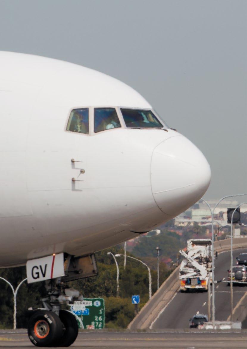
3 7.0 GROUND TRANSPORT DEVELOPMENT PLAN OVERVIEW Key points On Airport Drive, non-airport through-traffic accounts for up to 52% of movements in the morning and afternoon peaks. General commuters and Port Botany traffic place a significant additional load on the roads surrounding the airport Completion of the WestConnex motorway within the 20 year horizon of the Master Plan will allow some non-airport traffic to bypass the airport and will provide the opportunity for journey times to and from the CBD to both terminal precincts to be more reliable The proposed ground transport solutions result in improved road and intersection performance in and around Sydney Airport in 2018 and beyond. Planned enhancements to these solutions support the forecast road traffic associated with airport activity beyond the 2033 horizon of the Master Plan These proposed solutions include: A new one-way roadway configuration for the Terminal 2/Terminal 3 (T2/T3) precinct by 2018, providing a dedicated entrance and exit roadway to the precinct, significantly improving traffic flows for all vehicles including taxis, limousines and coaches Upgrades to traffic flow within the Terminal 1 (T1) precinct by separating parking traffic and creating a dedicated and specially configured public pick-up area Consideration of the WestConnex motorway project and its interface with the airport. The creation of integrated international, domestic and regional terminal precincts has significant benefits for road and intersection performance There will be a substantial reduction in passengers transferring by road between the terminal precincts as passengers will be able to transfer between international and domestic flights within one terminal There will be a more even distribution of road traffic across the airport precincts because international and domestic departure and arrival peaks are complementary Sydney Airport is well advanced on finalising a position with the NSW Government on WestConnex enabling works that will significantly improve the experience for passengers and others travelling to and from the airport as well as reducing the impact of non-airport traffic Sydney Airport has consulted with the NSW Government transport agencies in developing and testing the proposed solutions using the standard Roads and Maritime Services (RMS) model, as used in the joint study. This was enhanced with up-to-date travel data, localised traffic intersection modelling and new road solutions, making this modelling very robust Funding for the design and construction of the initial phase of works has been approved and detailed discussions on design and coordination with Transport for NSW (TfNSW) and RMS has commenced Sydney Airport continues to advocate for improved public transport to the airport, including additional buses and competitive rail fares, to: Provide improved public transport options for all airport users including passengers and staff to further reduce congestion and improve environmental outcomes Achieve an even greater public transport mode share in the future. Sydney Airport has invested more than $200 million over the past decade in ground transport facilities to improve the customer experience of Sydney Airport 88 Sydney Airport Master Plan 2033

4 Sydney Airport has identified ground transport solutions that are designed to improve the performance of the roads and intersections in and around Sydney Airport. To function at an optimal level, these proposed solutions will require work both inside and outside the airport boundary. Once completed, the ground transport modelling predicts that the forecast traffic demand can be met in 2018 and beyond the 2033 horizon of the Master Plan. This ground transport plan has been developed in consultation with Transport for NSW (TfNSW) and RMS. Expert transport modelling and design team The detailed ground transport modelling was prepared for Sydney Airport by AECOM. A global professional services company providing transportation services in more than 100 countries, AECOM has been ranked number one in transportation globally for 10 consecutive years. 1 AECOM s transportation division has been operating in Australia for over 30 years, during which time it has delivered strategic and detailed transportation modelling and design services for private and government projects. Specifically relevant to this work for Sydney Airport, AECOM has completed ground access planning for airports including Melbourne, Brisbane and the Gold Coast, and has performed transport studies and modelling for major NSW transport projects including the Sydney CBD corridor modelling and the Port Botany transport improvement plan. The AECOM team assembled for this work included leading transport planners, strategic modellers, simulation specialists, urban planners, aviation specialists and civil engineering specialists. AECOM has extensive Australian and international teams who were drawn upon to ensure that global skills and experience were applied to this work. 1 Engineering News Record Magazine, July 2012 Sydney Airport Master Plan
5 Terminal 1 precinct five year ground transport plan The proposal to remove the existing car park entry and exit gates will allow a new road to be constructed directly in front of the existing multi-storey car parks, providing an easy and free-flowing entry to, through and out of the car park. This reduces the likelihood of queues at the entry gates extending back and disrupting the flow of traffic onto Departures Road. The construction of a proposed new exit point in the open air parking area for traffic travelling to the city and eastern suburbs will facilitate a quicker exit from the precinct for all traffic. The construction of these new access roads is expected to reduce current congestion points for traffic merging from Marsh Street and Airport Drive, therefore improving efficiency and reliability for all road users. Funding for the initial phase of improvements on Airport Drive near Link Road has been approved, and will provide improved access for traffic from Airport Drive to Terminal 1 (T1). A development application has been lodged to progress the design work for the additional works required to fulfil the T1 five-year ground transport plan as described in Appendix A. Subject to planning approval it is proposed to commence these works as a matter of priority. Terminal 2/Terminal 3 precinct five year ground transport plan Modelling shows that planned road changes in the Terminal 2/Terminal 3 (T2/T3) precinct, together with NSW Government initiatives outside the airport boundary, will deliver improved traffic flow around the precinct with increased capacity for traffic throughput. The development of an additional road connection from Shiers Avenue to Qantas Drive at Robey Street will allow the creation of a one-way road system within the precinct with incoming traffic allocated to the current junction and outgoing traffic to the new junction. The additional road and junction capacity, and the more efficient one-way road system, support a higher traffic throughput within the precinct by: Increasing road capacity for traffic into and out of the precinct Increasing green light time by about 33% for the key traffic movements The conversion of the lower sections of Robey Street and O Riordan Street, outside Sydney Airport s boundary, into one-way roads northbound and southbound respectively would smooth both the entry and exit of traffic onto the roads surrounding the airport. Modelling shows that this configuration can support the forecast volume of traffic for 2018 and beyond at an improved service level when compared with today. Sydney Airport welcomes the commitment of the NSW Government to widen Joyce Drive and General Holmes Drive between O Riordan Street and Mill Pond Road. In addition the proposal to extend Wentworth Avenue to General Holmes Drive will create an alternative entry point near the airport / Port Botany precinct. This important WestConnex enabling project will result in higher traffic throughput capacity to and from the airport as well as for non-airport through traffic including Port Botany heavy vehicle traffic. 20 year ground transport strategy Ground transport modelling undertaken by AECOM demonstrates that the proposed strategy and the NSW Government initiatives, including the WestConnex motorway system, have the ability to meet the forecast traffic demands around the airport beyond the 2033 horizon of the Master Plan. Better outcomes can be achieved if the public transport mode share is increased by reducing the station access fee on rail and adding new bus routes to the airport. Integrated terminal precincts, servicing a mix of international, domestic and regional passengers and related freight, as envisaged in the proposed development plan, will: Reduce transfer passengers between T1 and T2/T3 using road and rail More evenly distribute road traffic between the precincts Further road network enhancements are proposed as part of the 20-year (2033) ground transport strategy including ground access upgrades for non-terminal areas. These include the northern lands precinct (north of Airport Drive) which will accommodate aviation support services and vehicle storage facilities, and the South East Sector, which will accommodate new maintenance and engineering facilities, aircraft parking, freight handling and transport facilities, rental car, ground support equipment and parking. The development of the ground transport plans has benefited from the assistance of TfNSW and RMS with the use of detailed models and more up-to-date data than any previous analysis. TfNSW has provided 2012 regional traffic and forecast regional traffic for the 2018 and 2033 periods. This information was based on the broad assumptions used for the joint study. It provides a baseline for traffic to and from the airport and a baseline for traffic through the airport precinct. A comprehensive survey of over 14,000 passengers, visitors and staff was jointly commissioned by Sydney Airport and TfNSW in June This provided information on the journeys people took to and from the airport, including how they travelled, and their origin and destination. Previous studies have relied on less comprehensive and now out-of-date data. There have been 90 Sydney Airport Master Plan 2033
6 significant increases in public transport usage in recent years, which reduces the relevance of the older data. The analysis has included detailed modelling of all of the roads and intersections on and immediately adjacent to the airport, and key roads and intersections in the vicinity. Public transport facilities to be expanded In addition to improving and enhancing the ground transport experience, it is important that customers have a range of choices when accessing the airport. Sydney Airport believes there is a great opportunity for public transport mode share to be increased and has advocated for the reduction of the station access fee on rail and the provision of additional public bus services to the airport. Sydney Airport welcomes the stated intention of the NSW Government to provide additional public buses to the airport. To facilitate a transition to rail and bus transport, Sydney Airport will continue to work with the NSW Government, stakeholders and private infrastructure owners to further increase the attractiveness and competitiveness of public transport access modes. Additional increases in public transport will further improve the performance of the road system beyond those shown in the models. Sydney Airport has identified a site within the T2/T3 precinct for the future location of a public bus facility designed to allow a greater frequency and volume of public bus services to and from the airport for the benefit of passengers and staff. The T1 precinct already has a very convenient and prominent location for public bus services which can be expanded to support new bus routes. Additional bus services arising from the forthcoming Sydney's Bus Future would be accommodated at these public bus facilities. The 2012 traveller survey, jointly commissioned with TfNSW, shows that while the mode share of public buses has declined to 2% between 2006 and 2012 the mode share of trains has increased by around one percentage point a year over the same period from 10% to 15%, in the absence of any reduction in the station access fee. On 20 October 2013, the NSW Government delivered on its commitment to increase the number of trains passing through Sydney Airport on the Airport & East Hills line during peak hours from eight to 10 trains per hour. The NSW Government has also indicated that the rail line has the potential to provide greater long-term capacity. Upgrades to the power supply and safety measures outlined in Sydney s Rail Future will allow for up to 20 train services per hour on the airport line in the medium to long term. 10 years of investments and improvements Over the past decade Sydney Airport has invested over $200 million in on-airport ground transport facilities, including roads, public transport, taxis and car parks. Capacity has been substantially and continually increased for taxis, limousines, buses, coaches, drop-off and car parking Sydney Airport has introduced discounted on-line offers for car parking Improved signage and the introduction of automated parking guidance systems within the public multi-storey car parks has made way-finding easier The five year ground transport plan and 20 year strategy continue the trend of substantial investment by Sydney Airport to improve access to each airport precinct. 7.1 Five year ground transport plan Further details on the five year ground transport plan are included in Appendix A Terminal 1 In 2012, Sydney Airport completed the construction of the second multi-storey car park at an approximate cost of $47 million. This increased capacity by 50% to approximately 7,500 spaces which is expected to accommodate forecast demand to However, the current traffic flow through the car park, as shown in Figure 7.1, still follows the path which existed prior to the completion of the second multi-storey car park. Under the changes proposed in this Master Plan it will be simpler and easier to enter, move through and exit the T1 precinct. The main entry and exit gates to the existing car park will be removed and a free-flowing road system will be created through the centre of the car park as shown in Figure 7.2. Entry and exit boom-gates will be relocated inside the multi-storey car parks and at the new entrance to the open air area. This proposed arrangement is designed to reduce the possibility of queues at the entry gates extending back and disrupting the flow of traffic onto Departures Road. A dedicated and specially configured pick-up area is proposed to be located in the open air area providing separation between those vehicles parking and those seeking to drop-off or pick up quickly. The arrivals road will also facilitate simpler access to the taxi holding area. In addition, it is proposed that the existing Cooks River entrance gates would be converted into an east-bound exit to the city and eastern suburbs. Providing this additional exit point will help spread the exiting traffic and lower the demand on the main exit point providing the opportunity for smoother merging onto Airport Drive. The current entry ramp from Airport Drive and exit ramp to Marsh Street are planned to be widened to two lanes each, with the exit ramp optimised by a tidal lane Sydney Airport Master Plan


7 Figure T1 precinct traffic flow Figure T1 precinct traffic flow 92 Sydney Airport Master Plan 2033
8 configuration to provide capacity for exiting traffic onto Giovanni Brunetti Bridge. By separating traffic heading towards the car parks and the departures kerb, the construction of new access roads will significantly reduce existing congestion points for traffic merging from Marsh Street and Airport Drive. This will improve efficiency and reliability for all road users entering the T1 precinct. To facilitate the planned modal shift to public transport, Sydney Airport is planning to provide for an extended public bus facility located on Arrivals Road which would cater for both additional and re-routed public buses to easily access and exit the T1 precinct. Passengers, visitors and the public would have simple, direct and clearly signposted routes from the ground transport facilities and car parks to the terminal Terminals 2 and 3 The intersection at the entrance to the T2/T3 precinct 2 is heavily used by both airport and non-airport traffic. As shown in Figure 7.3, movements into Sir Reginald Ansett Drive from the north, east and west compete with each other for access to the terminal while simultaneously competing with movements out of the precinct from the terminals. In addition, significant volumes of non-airport heavy vehicles in the morning peak turn right from Joyce Drive into O Riordan Street which contributes to delays. In this Master Plan a proposed new one-way road system through the T2/T3 precinct is designed to increase the entry and exit capacity of the area and significantly improve traffic flows in and around the precinct (see Figure 7.4). In combination with work directly outside the airport boundary, this one-way road system would provide a superior solution to handle airport traffic as well as providing benefits to Port Botany and general commuter traffic. In addition, to facilitate the modal shift to public transport, Sydney Airport is proposing to construct a bus and multi-purpose parking facility located between Ninth Street and the Seventh Street extension. This facility of up to 3,000 spaces would cater for a range of uses including car rental, valet and limousine storage and general parking. It would also allow for additional and re-routed public buses to easily access and exit the T2/T3 precinct. The proposed facility is planned to be supported by new pedestrian circulation corridors, orientation spaces, way-finding signage and flight information displays. The proposed road works/changes include a northern extension of Seventh Street from Shiers Avenue to Qantas Drive to create a new dedicated five lane exit road from the precinct. Traffic would enter T2/T3 via an expanded entry on Sir Reginald Ansett Drive and move one way through the precinct and exit via the Seventh Street extension onto Qantas Drive or continue north on Robey Street and then O Riordan Street. The existing signalised control of Ross Smith Avenue / Sir Reginald Ansett Drive is planned to be optimised to ensure effective traffic flow of the Sir Reginald Ansett Drive entry point. A low volume of authorised vehicles requiring access from the terminal precinct to the South East Sector will be permitted to access Ross Smith Avenue from this point. This design solution provides more time in each cycle at two intersections with one-way traffic than at one primary intersection with two-way traffic. This is designed to provide sufficient capacity for airport (including private vehicles, taxis, coaches, limousines and mini-buses) and non-airport traffic as well as delivering a better level of service in 2018 than exists currently. To function at an optimal level and to complete the integrated design solution, additional proposed roadworks outside the airport boundary would include: Robey Street becoming one way northbound from Qantas Drive to the intersection of O Riordan Street and O Riordan Street becoming one way southbound between Robey Street and Joyce Drive with associated intersection improvements at Joyce Drive and O Riordan Street The widening of Joyce Drive and General Holmes Drive to six lanes between Mill Pond Road and O Riordan Street to provide consistent traffic access to the airport Sydney Airport will continue to work closely with the NSW Government to discuss, prioritise and coordinate these proposed works with those proposed inside Sydney Airport s boundary and is well advanced in finalising a position with the NSW Government on various road and ground transport upgrades. Passengers, visitors and the public will have simple, direct and clearly signposted routes from the car parks to the terminals North and South East Sectors New aviation support facilities such as freight handling and transport facilities, logistics, rental car and vehicle storage are proposed to be located in the area north of Airport Drive. A proposed new signalised intersection on Airport Drive and bridge over Alexandra Canal will provide landside vehicle access to the northern logistics precinct. New and relocated maintenance and engineering precincts and aircraft parking aprons along with freight handling and transport facilities are proposed to be 2 The intersection of O Riordan Street (north), Joyce Drive (east), Sir Reginald Ansett Drive (T2/T3) and Qantas Drive (west) Sydney Airport Master Plan


9 Figure T2/T3 precinct traffic flow Figure T2/T3 precinct traffic flow 94 Sydney Airport Master Plan 2033
10 developed south of T2/T3 with improved airside links and upgraded airside roads to service this precinct. Staff and goods access to the area will be provided on the landside including the proposed development of new or augmented intersections, roads and bridge works. The proposed development plan includes the opportunity for a landside and airside bridge link connections across General Holmes Drive to facilitate access and connectivity for airport operations. As a result of the proposed additional aircraft parking aprons, 2,000 car parking spaces will be displaced at the Blu Emu Car Park. A single deck structure is proposed to be constructed at the Blu Emu Car Park to ensure that the current capacity is retained. Implementation of a proposed northbound slip lane on Ross Smith Avenue at the intersection with Lords Road has been completed and is facilitating enhanced access for service vehicles to T2/T year ground transport strategy Sydney Airport has worked extensively with the NSW Government to develop a number of road and ground transport upgrades both on- and off-airport, supported by the Australian and NSW Government's commitment to construct the WestConnex Motorway by It is contemplated that the connection from WestConnex will include ramps onto Airport Drive located between T1 and T2/3 and these would improve capacity, network efficiency and reliability of access to both terminal precincts. Working with the NSW Government The WestConnex motorway, which links the M4 Motorway to the M5 East at Sydney Airport, was identified as Sydney s motorway priority in the State Infrastructure Strategy released in October In December 2012 WestConnex was confirmed as Sydney s motorway priority in the NSW Government s Long Term Transport Master Plan. The WestConnex Delivery Authority was established in October 2013 and has the following core responsibilities: Procuring and managing contracts relating to the development, construction, funding, operation and maintenance of WestConnex Developing and making recommendations on scope, staging and any other matter in connection to the WestConnex scope of works Seeking planning approval, management of environmental assessments and related community consultation for each stage Administrating agreements relating to the development, construction, funding, operation and maintenance of WestConnex Completion of the motorway within the 20 year horizon of the Master Plan will allow some non-airport traffic to bypass the airport and will provide greater reliability around journey times to and from the CBD to either precinct. This non-airport through traffic is a major contributor to congestion on the airport s roads. Together with WestConnex, which is expected to further improve traffic flow around the precinct, Airport Drive, Qantas Drive and Joyce Drive may be required to be upgraded to support the forecast growth in traffic Terminal 1 The creation of an integrated international, domestic and regional terminal at T1 is designed to provide a better distribution of traffic in the precinct as the domestic and international peak departure and arrival times are complementary. It is proposed to further improve the terminal precinct s roads by the planned widening of the entry and exit roadways at Terminal 1 to two lanes each. The existing taxi, limousine and coach holding area and drop-off/pick-up facilities are proposed to be relocated and expanded within planned new multi-storey ground transport modules and car park facilities located next to the existing multi-storey car park. This is designed to improve traffic flow efficiency by centralising ground transport facilities within each structure and reduce the volume of circulating traffic on the precinct s roadways. To facilitate the proposed revised layout, access roads may need to be realigned to the front of the car park/ transport modules with new pedestrian links provided to the departures level. The provision of these new facilities may mean that direct access to kerbside facilities could be managed in a way that would minimise vehicles recirculating on the internal roadway. By 2033 and to meet demand, total car parking provision for all airport users at T1 is expected to comprise approximately 10,000 spaces an increase of 2,500 from Terminals 2 and 3 The creation of an integrated international, domestic and regional terminal at T2/T3 results in a better distribution of traffic in the precinct. The dedicated one-way road entry and exit points to the T2/T3 terminal as described in the five year plan will continue to operate in The proposed addition of a grade separated link from Qantas Drive to provide a single lane entry to and exit from the future multi-storey car park is designed to ensure that the intersections continue to operate at a good level of service. A proposed elevated access ramp over Sir Reginald Ansett Drive to provide direct access between Ross Smith Avenue and future multi-storey car parks within the T2/T3 precinct is designed to provide an additional entry point for cars coming from General Holmes Drive. This would be supplemented with the widening of Ross Smith Avenue. Sydney Airport Master Plan
11 To improve the efficiency of transport movements, sections of the existing multi-storey car park may be replaced with a multi-modal transport facility incorporating rail, taxis, rental cars, limousines valet premium parking and general parking. Passenger amenity in terms of pedestrian circulation and way finding would be improved by providing centralised taxi holding and pick-up facilities at the arrivals level and reducing the need for taxis to circulate on precinct roads. A new facility for picking up and dropping off passengers is proposed with provision for a system to aid passenger connections to the terminal building. The provision of these new facilities would be designed to allow direct access to kerbside facilities and could be managed in a way that would minimise vehicles recirculating on the internal roadway, further improving passenger amenity. A new pedestrian/cycle overpass is proposed over the intersection of Robey Street and Qantas Drive. The overpass is designed to support linkages between the terminal access walkway and new pedestrian/cycle share paths on the northern side of Qantas Drive and Robey Street. These paths would link to the existing share path that runs along Alexandra Canal as well as improve access to urban areas to the north and east. New primary loading dock facilities are proposed to be developed for T2/T3 to the east for ease of access and security. Limited access would be available to the existing T2 and T3 loading docks. To meet the forecast demand by 2033, total car parking spaces in the precinct are likely to grow by an additional 6,500 spaces over and above the 8,500 3 proposed as part of the five year ground transport plan North and South East Sectors To facilitate further development of the freight handling and transport facilities, logistics and aviation support facilities precinct north of Airport Drive, a secure airside bridge network over Alexandra Canal is proposed. Further development of the freight handling and transport logistics and aviation support facilities in the south east, both sides of General Holmes Drive, is envisaged by Access will be provided by landside and airside bridges over General Holmes Drive as well as from existing roads. Total car parking spaces in the South East Sector are likely to be retained at approximately 6,000 spaces. 7.3 Increasing public transport mode share Sydney Airport will continue to work with the NSW Government stakeholders and private infrastructure owners to encourage them to further increase the attractiveness and competitiveness of public transport access modes including rail and public buses. Travellers using the rail network to access the airport are subject to a station access fee. This fee is levied over and above the normal rail fare. It is not charged for access to other stations on the same rail line and consequently the cost of a ticket to the airport stations is considerably higher than any other similar length trip within the rail system. Sydney Airport has and continues to advocate for the reduction of the station access fee to increase rail patronage for passengers as well as staff. There is a clear opportunity to increase the provision of public buses servicing the airport and Sydney Airport welcomes the stated intention of the NSW Government to provide additional public bus services to the airport. Sydney Airport is committed to providing public bus facilities at each terminal as part of its five year ground transport plan. Sydney Airport will continue its discussions with TfNSW and RMS to identify ways that public bus access can be integrated in a way that minimises delays to buses on external and internal roads to the airport. Additional increases in public transport mode share will further improve the performance of the road system. 7.4 Active transport (cycling and pedestrian access) Sydney Airport is committed to improving active transport infrastructure and public transport. The five year ground transport plan (see Appendix A) involves implementing practical measures and continued engagement with the NSW Government to encourage travel demand onto more sustainable transport modes. Practical measures include those such as new and improved bicycle facilities in the T1 Terminal and T2/T3 Terminal precincts. To further support active transport, major new developments (including the T1 Rydges Hotel) are required to have shower facilities for commuting staff. Sydney Airport is also in discussions with neighbouring local councils, including the City of Rockdale Council, and RMS to connect the network of shared paths around the airport. Sydney Airport is committed to a number of coming projects, including the T1 ground access initiatives, the T2/T3 ground access initiatives, and the new bridge across the Alexandra Canal, which includes new shared path facilities. Current cycle facilities Sydney Airport has invested in cycle infrastructure access to date. For example: At T1, bicycle racks are located at both ends of the terminal building. There are publicly accessible shower facilities located within T1 International Terminal 3 Includes existing car parks plus spaces currently under construction at Seventh Street due for completion at the end of 2013 and the multi-modal public bus facility and car park structure located near Ninth Street due for completion by Sydney Airport Master Plan 2033

12 At T2 and T3 Terminals, undercover bicycle racks are centrally located at 5th Street adjacent to the public pick-up area. Information on each can be found on Sydney Airport s website. Future planned cycle links and facilities Sydney Airport is currently planning a number of improvements to the cycleway, including inter-terminal and subregional links. A number of these links will require the cooperation of state and local government agencies T1 links Upgraded cycle path from Terminal 1 to Cooks River Drive and the RMS Alexandra Canal Cycleway as part of the T1 ground access initiatives Future crossing at Link Road and Airport Drive to incorporate links to the RMS Alexandra Canal Cycleway. T2/T3 links Improved access from Qantas Drive/Robey Street via the one-way pair configuration with a new set of signals incorporating shared crossings to be installed at the western and southern legs of the intersection Shower facilities in T2 are being investigated as part of our ongoing refurbishment of passenger facilities. Inter-terminal and subregional links Pedestrian and/or cycle links between the Alexandra Canal, Qantas Jet Base and Robey Street to upgrade existing formal and informal paths are currently being investigated. This will require funding and input from external parties such as TfNSW, and local councils for access to non-airport lands Sydney Airport currently is in discussions with local councils to link Sydney Airport land to the current and planned cycleways. This includes eventual links to the Princes Highway, as well as improved access from Marsh Street to the Alexandra Canal Cycleway. 7.5 Forecast demand and modelling Traffic around the airport includes journeys to and from the airport, and journeys for through traffic travelling to and from the CBD and Port Botany. On Airport Drive, non-airport through traffic accounts for up to 52% of movements in the AM and PM peaks. As part of the development of the Master Plan, Sydney Airport engaged in a collaborative working relationship with TfNSW and RMS to assess the transport access needs of the airport and the wider network around the airport. Sydney Airport will continue to work with TfNSW and RMS to further refine the proposals with an aim to achieving optimal outcomes. Sydney Airport Master Plan
13 7.5.1 Demand forecasts To forecast demand for ground access, the projected passenger movements (from aircraft arrivals and departures) were plotted by time of day so the distribution of peak activity at each terminal was understood. Using the data from the 2012 traveller surveys, mode share proportions dependent on passenger type (international/domestic and arriving/ departing) were applied to the passenger volumes to generate movements by mode. Vehicle occupancy rates were then applied to generate traffic volumes. Staff, freight, logistics and commercial traffic was also included in the development of the model. The demand model was calibrated to 2012 observed data so that it provided a clear representation of existing conditions. As a result, the demand model provided a suitable basis from which future year demands for 2018 and 2033 could be derived Mode shift For the purposes of the modelling work, mode share proportions have been adjusted for the future year demand forecasts to account for anticipated changes to the transport networks. The 2012 traveller survey, jointly commissioned with TfNSW, shows that while the mode share of public buses has declined to 2% between 2006 and 2012 the mode share of trains has increased by around one percentage point a year over the same period from 10% to 15% in the absence of any reduction in the station access fee. Consistent with these trends a mode share increase for public transport of one percentage point per year through to 2018 has been assumed. This has been offset by pro-rata reductions in road based modes. To ensure that the road network design had sufficient capacity public transport mode share was assumed to grow at only two percentage points through to As a result any improvements in public transport mode share over and above those assumed, such as might occur if the station access fee were reduced, will further increase the performance and longevity of the road network. AECOM has undertaken detailed micro-simulation traffic modelling (using Commuter software) for the roads in the vicinity of the airport. Likewise for the demand model, the traffic simulation model was developed to replicate observed conditions in This again resulted in a platform from which future year models could be developed. Subsequently, an assessment of road infrastructure and operational changes required to support the short and long term demands was undertaken to ensure the final solution could effectively accommodate the forecast traffic movements Comparison to previous studies The modelling methodology adopted for the Master Plan includes up-to-date information and proposals that were not available at the time the joint study was prepared. These include: Updated 2012 passenger estimates Consideration of the current characteristics and behaviours of airport users from the 2012 traveller surveys including stated travel modes Incorporating the new operational configuration, together with proposed road network changes in the local and wider areas Use of RMS s updated 2011 Sydney Highway Assignment (SHA) traffic model and Sydney Strategic Travel Model (STM) along with microsimulation software to test road network options in the vicinity of the airport for both the morning and evening peak periods Four hour AM and PM peak modelling Calibration of the 2012 traffic models to observed 2012 conditions to provide a sound base from which to undertake the future year assessments As a result the outcomes of this modelling are up to date, comprehensive and robust Traffic modelling Using the demand model outputs received from Sydney Airport, RMS incorporated the forecasts into its standard road model which was used in the joint study. The RMS model considers population and employment growth in the metropolitan area as well as future road network changes. RMS provided the resultant traffic outputs for the area surrounding Sydney Airport so that an assessment of local infrastructure changes could be made. 98 Sydney Airport Master Plan 2033
14 Sydney Airport Master Plan
TERMINAL DEVELOPMENT PLAN
 5.0 TERMINAL DEVELOPMENT PLAN 5.0 TERMINAL DEVELOPMENT PLAN Key points The development plan in the Master Plan includes the expansion of terminal infrastructure, creating integrated terminals for international,
5 Rail demand in Western Sydney
 5 Rail demand in Western Sydney About this chapter To better understand where new or enhanced rail services are needed, this chapter presents an overview of the existing and future demand on the rail network
The implementation of this Master Plan will be undertaken in logical stages to meet passenger and workforce demands.
 The implementation of this Master Plan will be undertaken in logical stages to meet passenger and workforce demands. Connecting People Building Opportunities 198 Brisbane Airport Corporation CHAPTER 10
Sunshine Coast Airport Master Plan September 2007
 Sunshine Coast Airport Master Plan September 2007 Contents CONTENTS... I ACKNOWLEDGEMENT... II DISCLAIMER... III 1 EXECUTIVE SUMMARY...IV 1 INTRODUCTION... 1 2 AVIATION DEMAND FORECAST... 5 3 AIRCRAFT
Item 4 Sydney Airport Report
 Item 4 Sydney Airport Report 24 February 2017 TED PLUMMER HEAD OF GOVERNMENT AND COMMUNITY RELATIONS Improving access to Sydney Airport Integrated planning and investment in new infrastructure 2 T1 Ground
Sydney Airport Master Plan
 Sydney Airport Master Plan This document is printed on ecostar and is manufactured from 100% post consumer recycled paper in a process chlorine free environment under the ISO 14001 environmental management
Proposals for the Harrogate Road / New Line Junction Improvement Scheme. August / September Supported by:
 Proposals for the Harrogate / New Line Junction Improvement Scheme August / September 2016 Supported by: Introduction Key Benefits Proposals are currently being developed for changes to the junction of
Wellington $312 $49 $456 OVERVIEW WELLINGTON REGIONAL SUMMARY
 National Land Transport Programme 2015 18 Wellington WELLINGTON REGIONAL SUMMARY OVERVIEW The Wellington region is made up of a number of cities, urban areas and supporting rural hinterland. The city is
A. CONCLUSIONS OF THE FGEIS
 Chapter 11: Traffic and Parking A. CONCLUSIONS OF THE FGEIS The FGEIS found that the Approved Plan will generate a substantial volume of vehicular and pedestrian activity, including an estimated 1,300
AUCKLAND $1.2 BILLION $1.9 BILLION $149 MILLION 15% SPEND $5.7 BILLION
 AUCKLAND AUCKLAND $5.7 BILLION FORECAST TOTAL AUCKLAND INVESTMENT The next 10 years are expected to underline Auckland s performance as the fastest growing major city in Australasia. The city is expected
Concord Road Interchange. Standard hours of work
 Artist impression of the Concord Road interchange, Concord - concept only WestConnex s M4 East will extend the M4 Motorway with two new 5.5 kilometre tunnels from Homebush to Haberfield, providing a bypass
2017 POLICY DOCUMENT. M1 Action Plan. Putting Queenslanders First
 2017 POLICY DOCUMENT Putting 2 Contents Message from the Premier 3 Our Commitment 4 The Newman-Nicholls Legacy 5 The Palaszczuk 6 Government s Record Our Plans: Putting 8 Call: 07 3844 8101 Mail: PO Box
WELLINGTON $422 MILLION $614 MILLION $83 MILLION 22% SPEND $1.9 BILLION
 WELLINGTON WELLINGTON $1.9 BILLION FORECAST TOTAL WELLINGTON INVESTMENT The Wellington region s transport challenges are dominated by the region s concentration of population in the metropolitan cities,
Report to: Greater Cambridge Partnership Joint Assembly 18 January A10 Foxton level crossing bypass and travel hub
 Report to: Greater Cambridge Partnership Joint Assembly 18 January 2018 Lead officer: Chris Tunstall GCP Director of Transport A10 Foxton level crossing bypass and travel hub 1. Purpose 1.1 The list of
4 Transport projects underway in Western Sydney
 4 Transport projects underway in Western Sydney About this chapter This chapter provides an overview of the Australian and NSW government s significant investments in road, bus and rail infrastructure
A Master Plan is one of the most important documents that can be prepared by an Airport.
 The Master Plan A Master Plan is one of the most important documents that can be prepared by an Airport. A Master Plan is a visionary and a strategic document detailing planning initiatives for the Airport
Part four. In this part you will find: The next steps to deliver the master plan
 Part four NEXT STEPS In this part you will find: The next steps to deliver the master plan 6. How COULD the Master Plan be delivered? There are a number of steps required to take the proposals in the master
Reimagining Central Station Precinct
 Reimagining Central Station Precinct Submission by BusNSW 1. Introduction BusNSW members provide bus and coach transport services throughout NSW under various contractual and regulatory environments. This
RE: Victoria Road upgrade (RTA December 2007). Thank you for the briefing from your department and the invitation to comment on the above.
. Thank you for the briefing from your department and the invitation to comment on the above.") Iain Macleod Project Manager Victoria Road upgrade Roads and Traffic Authority PO Box 743 Drummoyne NSW 1470 e : Victoria_Road_Info@rta.nsw.gov.au 21 February 2008 RE: Victoria Road upgrade (RTA December
Iain Macleod Project Manager Victoria Road upgrade Roads and Traffic Authority PO Box 743 Drummoyne NSW 1470 e : Victoria_Road_Info@rta.nsw.gov.au 21 February 2008 RE: Victoria Road upgrade (RTA December
Report of the Strategic Director of Place to the meeting of Executive to be held on 11 September 2018
 Report of the Strategic Director of Place to the meeting of Executive to be held on 11 September 2018 Subject: M Arrangements for the establishment of a West Yorkshire Urban Traffic Management Control
CHRISTCHURCH MOTORWAYS. Project Summary Statement February 2010
 CHRISTCHURCH MOTORWAYS Project Summary Statement February 2010 Table of Contents 1. Purpose of Document 2. Strategic Context 3. Benefits 4. Project Scope and Economics 5. Implementation Plan 1 ROADS OF
Birmingham Airport 2033
 Over the next 15 years, we will expand and improve the Airport to maximise our potential as a single runway airport by investing 500 million in new development. Our plans take account of our forecasted
University of Wollongong Innovation Campus Masterplan
 University of Wollongong Innovation Campus University of Wollongong Innovation Campus Masterplan Traffic and Transport Assessment Traffic and Transport Assessment Prepared for University of Wollongong
Northern Beaches Transport Action Plan
 Northern Beaches Transport Action Plan The NSW Government is taking action now to deliver transport improvements for the Northern Beaches, as well as planning for the future growth of the area. $633 million
Newcastle Transport Program Newcastle Light Rail Determination Report
 Newcastle Transport Program Newcastle Light Rail Determination Report Date Author 25 July 2016 TfNSW Ref 5276649 Status Final TfNSW 2014 UNCONTROLLED WHEN PRINTED Page 1 of 19 Table of contents 1 Introduction
Kilometres. Blacktown. Penrith. Parramatta. Liverpool Bankstown. Campbelltown
 0 5 10 15 20 Kilometres Penrith Blacktown Parramatta Liverpool Bankstown Campbelltown accessibility outcomes Legend Outcomes targeted in Western Sydney are: public transport that is accessible throughout
Saighton Camp, Chester. Technical Note: Impact of Boughton Heath S278 Works upon the operation of the Local Highway Network
 Technical Note: Impact of Boughton Heath S278 Works July 2013 SAIGHTON CAMP CHESTER COMMERCIAL ESTATES GROUP TECHNICAL NOTE: IMPACT OF BOUGHTON HEATH S278 WORKS UPON THE OPERATION OF THE LOCAL HIGHWAY
5.7 Local road upgrades
 5.7 Local road upgrades Local roads around the St Peters interchange and the intersection of Campbell Road and Euston Road would be upgraded to ensure safe and efficient connections with the New M5, and
Major Scheme Business Case Summary Report for Programme Entry
 Paper A Heart of South West Local Transport Board Major Scheme Business Case Summary Report for Programme Entry M5 Junction 25, Taunton July 2016 1 SCHEME SUMMARY Scheme Name M5 Junction 25, Taunton Date
FEDERAL BUDGET PRIORITIES FOR THE SOUTH WEST METROPOLITAN REGION 2018 TO 2022
 A Co-operative venture of the municipalities of: Cockburn, East Fremantle, Fremantle, Kwinana, Melville & Rockingham Tuesday, 5 December 2017 Enquiries: Mick McCarthy 9364 0631 Our Ref: Federal Budget
Gold Coast. Rapid Transit. Chapter twelve Social impact. Chapter content
 Gold Coast Rapid Transit Chapter twelve Social impact Chapter content Social impact assessment process...235 Existing community profile...237 Consultation...238 Social impacts and mitigation strategies...239
Launceston City Council. Kings Meadows Traffic Management Report for Public Consultation
 Launceston City Council Kings Meadows Traffic Management Report for Public Consultation November 2013 This report: has been prepared by GHD for Launceston City Council and may only be used and relied on
NSW PRE-BUDGET STATEMENT FUTURE ECONOMY FUTURE JOBS
 2017-18 NSW PRE-BUDGET STATEMENT FUTURE ECONOMY FUTURE JOBS Executive Summary The 2017-18 NSW State Budget presents an opportunity for the NSW Government to future-proof the tourism and transport sectors.
Technical Paper 1 Traffic report
 Technical Paper 1 Traffic report 1 Contents List of Tables... 3 List of Figures... 4 Preface... 6 Terminology... 7 1 Executive summary... 8 1.1 1.2 1.3 1.4 1.5 1.6 Background to this report... 8 Traffic
FUTURE TRANSPORT STRATEGY AND GREATER SYDNEY SERVICES AND INFRASTRUCTURE PLAN. Western Parkland City
 FUTURE TRANSPORT STRATEGY AND GREATER SYDNEY SERVICES AND INFRASTRUCTURE PLAN Western Parkland City 2 Transport for NSW Future Transport Strategy and Greater Sydney Services and Infrastructure Plan Western
3 The growth of Western Sydney
 3 The growth of Western Sydney About this chapter This chapter provides an overview of Western Sydney s growing population and economy, and the benefit of the proposed Western Sydney Airport. Population
Summary Proof of Evidence Traffic
 Adran yr Economi a r Seilwaith Department for Economy and Infrastructure The M4 Motorway (Junction 23 (East of Magor) to West of Junction 29 (Castleton) and Connecting Roads) and The M48 Motorway (Junction
Sydney CBD - Partnering with the coach industry for solutions
 Sydney CBD - Partnering with the coach industry for solutions Steve Issa Executive Director Operations and Planning Transport for NSW 16 June 2017 Tomorrow s Sydney Responding to growth: Sydney s population
Sky Temporary Car Park Transport Statement
 001 Issue 26 August 2016 This report takes into account the particular instructions and requirements of our client. It is not intended for and should not be relied upon by any third party and no responsibility
Roundhouse Way Transport Interchange (Part of NATS City Centre Package)
") Roundhouse Way Transport Interchange (Part of NATS City Centre Package) 15/16 16/17 17/18 18/19 19/20 Total TOTAL COST Roundhouse Way Transport Interchange 0.5m 0.5m FUNDING CIL 0.05m 0.05m Growth Deal
Roundhouse Way Transport Interchange (Part of NATS City Centre Package) 15/16 16/17 17/18 18/19 19/20 Total TOTAL COST Roundhouse Way Transport Interchange 0.5m 0.5m FUNDING CIL 0.05m 0.05m Growth Deal
Appendix. Gatwick Airport Ltd - Further information on Gatwick s revised phasing strategy (including Programme) Gatwick Airport Limited
 Gatwick Airport Limited") Gatwick Airport Limited Response to Airports Commission Consultation Appendix 37 Gatwick Airport Ltd - Further information on Gatwick s revised phasing strategy (including Programme) Further information
Gatwick Airport Limited Response to Airports Commission Consultation Appendix 37 Gatwick Airport Ltd - Further information on Gatwick s revised phasing strategy (including Programme) Further information
REAUTHORISATION OF THE ALLIANCE BETWEEN AIR NEW ZEALAND AND CATHAY PACIFIC
 Chair Cabinet Economic Growth and Infrastructure Committee Office of the Minister of Transport REAUTHORISATION OF THE ALLIANCE BETWEEN AIR NEW ZEALAND AND CATHAY PACIFIC Proposal 1. I propose that the
https://gsc-public-1.s3-ap-southeast-2.amazonaws.com/s3fs-public/draft-eastern-city-district-plan.pdf
 GSC Sydney East Rev Draft -references Port Botany - 30 https://gsc-public-1.s3-ap-southeast-2.amazonaws.com/s3fs-public/draft-eastern-city-district-plan.pdf Pages 6. The District s freight routes, particularly
Roads and Maritime Services Presentation to Local Government NSW Annual Conference October 2014
 Roads and Maritime Services Presentation to Local Government NSW Annual Conference October 2014-1 - About Roads and Maritime Services Deliver customerfocused services and infrastructure to the value of
6.0 AIRFIELD DEVELOPMENT PLAN
 6.0 AIRFIELD DEVELOPMENT PLAN 6.0 AIRFIELD DEVELOPMENT PLAN Key points The airfield development plan in this Master Plan is capable of meeting forecast demand to 2033 and beyond. The development plan:
STUDY OVERVIEW MASTER PLAN GOALS AND OBJECTIVES
 INTRODUCTION An Airport Master Plan provides an evalua on of the airport s avia on demand and an overview of the systema c airport development that will best meet those demands. The Master Plan establishes
PART VIII APPLICATION FOR REVISED SOUTH SIDE TRAFFIC MANAGEMENT WORKS TO FACILITATE LUAS BXD PLANNING REPORT ROADS & TRAFFIC DEPARTMENT
 PART VIII APPLICATION FOR REVISED SOUTH SIDE TRAFFIC MANAGEMENT WORKS TO FACILITATE LUAS BXD PLANNING REPORT ROADS & TRAFFIC DEPARTMENT NOVEMBER 2012 1.0 INTRODUCTION This report has been prepared in support
Chapter 21 Route window W6 West Ealing station. Transport for London
 Chapter 21 Route window W6 West Ealing station WEST EALING STATION 21 Route window W6 West Ealing station Baseline conditions 21.6 West Ealing station is located in the London Borough of Ealing and is
Arlington County Board Meeting Project Briefing. October 20, 2015
 Arlington County Board Meeting Project Briefing October 20, 2015 Project Map 2 Project Context Only Interstate in the Country limited to HOV only traffic during rush hours Stoplight at the end of I-66
12, 14 and 16 York Street - Amendments to Section 16 Agreement and Road Closure Authorization
 REPORT FOR ACTION 12, 14 and 16 York Street - Amendments to Section 16 Agreement and Road Closure Authorization Date: April 27, 2018 To: Toronto and East York Community Council From: Senior Strategic Director,
CHAPTER 4: ALTERNATIVES
 MSP Long Term Comprehensive Plan Update Metropolitan Airports Commission 4.1 INTRODUCTION CHAPTER 4: ALTERNATIVES Several alternatives were developed and evaluated based on their capability to meet the
South East Traffic Solution
 South East Traffic Solution A MAJORITY LIBERAL GOVERNMENT WILL: Complete the Hobart Airport Interchange project Fix the Tasman Highway near Tasmania Golf Club Replace the Midway Point Roundabout with additional
East Lancashire Highways and Transport Masterplan East Lancashire Rail Connectivity Study Conditional Output Statement (Appendix 'A' refers)
") Report to the Cabinet Member for Highways and Transport Report submitted by: Director of Corporate Commissioning Date: 1 June 2015 Part I Electoral Divisions affected: All East Lancashire Highways and
Report to the Cabinet Member for Highways and Transport Report submitted by: Director of Corporate Commissioning Date: 1 June 2015 Part I Electoral Divisions affected: All East Lancashire Highways and
Interstate 90 and Mercer Island Mobility Study APRIL Commissioned by. Prepared by
 Interstate 90 and Mercer Island Mobility Study APRIL 2017 Commissioned by Prepared by Interstate 90 and Mercer Island Mobility Study Commissioned by: Sound Transit Prepared by: April 2017 Contents Section
Public Transport for Perth in 2031
 South West Group Submission Public Transport for Perth in 2031 October 2011 South West Group Vision and Mission Local Governments in South Metropolitan Perth, through cooperation with industry, community
9.1 INTRODUCTION 9.2 EXISTING DEVELOPMENT. Southern Cross University
 Property Strategy The property strategy delivers improved legibility, responds to the locational attributes of the site, and facilitates essential operational efficiencies. 9.1 INTRODUCTION Non-aviation
Chapter 8 Route Window NE7 Chadwell Heath station. Transport for London
 Chapter 8 Route Window NE7 Chadwell Heath station Transport CHADWELL HEATH STATION 8 Route Window NE7 Chadwell Heath station Baseline conditions 8.6 This route window lies within the London Boroughs of
2018 Airport Master Plan Overview of Development Concepts. Greg Ballentine (WSP)
") 2018 Airport Master Plan Overview of Development Concepts Greg Ballentine (WSP) Thank You Stakeholder and community consultation has included discussions with over 40 stakeholder groups including airport
2018 Airport Master Plan Overview of Development Concepts Greg Ballentine (WSP) Thank You Stakeholder and community consultation has included discussions with over 40 stakeholder groups including airport
Gold Coast. Rapid Transit. Chapter content. Chapter four Route selection and staging
 Chapter four Route selection and staging Gold Coast Rapid Transit Chapter four Route selection and staging Chapter content Route selection...73 Section one: Helensvale to Griffith University...74 Section
The Point Roundabout Improvement Scheme
 The Point Roundabout Improvement Scheme Background and Existing Situation The junction of North Wall Quay, East Wall Road and the East Link Bridge, also known as the Point roundabout, is located in the
TORONTO TRANSIT COMMISSION REPORT NO.
 Revised: March/13 TORONTO TRANSIT COMMISSION REPORT NO. MEETING DATE: November 18, 2013 SUBJECT: YONGE-EGLINTON AND EGLINTON WEST INTERCHANGE STATIONS METROLINX EGLINTON CROSSTOWN LIGHT RAIL TRANSIT PROJECT
Strategic Transport Forum 21 st September 2018
 Strategic Transport Forum 21 st September 2018 Agenda Item 4: Heathrow Airport Expansion: Surface Access Strategy Update Recommendation: It is recommended that the Forum consider the update provided by
The Coalition s Policy to Build Melbourne s East West Link
 1 Our Plan Real Solutions for all Australians The direction, values and policy priorities of the next Coalition Government. The Coalition s Policy to Build Melbourne s East West Link August 2013 Our Plan
As part of our transport vision, Leeds City Council, working with the West Yorkshire Combined Authority and Leeds Bradford Airport Company, is
 As part of our transport vision, Leeds City Council, working with the West Yorkshire Combined Authority and Leeds Bradford Airport Company, is considering options for improving surface access and connectivity
JOINT CORE STRATEGY FOR BROADLAND, NORWICH AND SOUTH NORFOLK EXAMINATION MATTER 3C EASTON/COSTESSEY
 Matter 3C Easton/Costessey Representor No. 8826 JOINT CORE STRATEGY FOR BROADLAND, NORWICH AND SOUTH NORFOLK EXAMINATION MATTER 3C EASTON/COSTESSEY SUBMISSION ON BEHALF OF TAYLOR WIMPEY DEVELOPMENTS AND
Sport Capital Improvement Plan. Paul Borci Manager, Campus Planning Property & Campus Services
 Sport Capital Improvement Plan Paul Borci Manager, Campus Planning Property & Campus Services What is SCIP? Property and Campus Services (PCS) in collaboration with Melbourne University Sport (MU Sport)
$960 $1,175 $91 OVERVIEW National Land Transport Programme Auckland AUCKLAND REGIONAL SUMMARY
 2015 18 National Land Transport Programme Auckland AUCKLAND REGIONAL SUMMARY OVERVIEW Achieving an effective and efficient transport system is central to supporting Auckland s future. Auckland is home
BARANGAROO. Integrated Transport Plan
 BARANGAROO Integrated Transport Plan BARANGAROO Integrated Transport Plan DISCLAIMER While every reasonable effort has been made to ensure that this document is correct at the time of printing, the State
Aviation, Rail, & Trucking 6-1
 6-1 This chapter describes the services, facilities, and condition of air, rail, and trucking as components of the transportation system. These three intermodal areas have an impact on the factors to be
Port Macquarie-Hastings Pedestrian Access and Mobility Plan. Working Paper COMMUNITY ENGAGEMENT
 Port Macquarie-Hastings Pedestrian Access and Mobility Plan Working Paper COMMUNITY ENGAGEMENT December 2014 Table of Contents Table of Contents... 2 1 Introduction... 3 2 Submissions... 3 2.1 Stakeholder
Memorandum of Understanding with ACT Government
 MEDIA RELEASE 8 April 2015 Memorandum of Understanding with ACT Government The ACT Government and Canberra Airport today entered into a new Memorandum of Understanding (MoU) on key areas of common interest
Airport forecasting is used in master planning to guide future development of the Airport.
 Airport Forecasts Airport forecasting is used in master planning to guide future development of the Airport. 4.1 INTRODUCTION Airport forecasting ensures development is appropriate for passengers, ground
Riverside Heights, Norwich. Travel Plan
 RIVERSIDE HEIGHTS, NORWICH Client: Engineer: Taylor Wimpey East Anglia Create Consulting Engineers Limited Hungate House Princes Street Norwich Norfolk NR3 1AZ Tel: 08454507908 Email: enquiries@createconsultingengineers.co.uk
Ronan Delaney. DELANEY_RONAN_AVIATION_JUN_2018.DOCX
 Ronan Delaney Profession Structural Engineer Current Position Associate Principal Global Aviation Skills Leader Joined Arup 1988 Years of Experience 25+ Nationality Irish Qualifications Bsc (Eng), Dip
5.1 Traffic and Transportation
 5.1 When it opens in 2009, the Bellevue Nickel Improvement Project will increase the number of vehicles able to travel through the study area, improve travel speeds, and improve safety by reducing the
Westover Metropolitan Airport Master Plan Update
 Westover Metropolitan Airport Master Plan Update June 2008 INTRODUCTION Westover Metropolitan Airport (CEF) comprises the civilian portion of a joint-use facility located in Chicopee, Massachusetts. The
3. Coach Supporting Statement
 3. Coach Supporting Statement Content 1. Setting the Scene 2. Vision 3. Coaches and the Shared Priorities 4. Issues 5. Delivery Programme in the first Plan Period 2001/02 2005/06 6. Good Practice 7. Strategy
Chapter 2 Route window W25 Maidenhead station. Transport for London
 Chapter 2 Route window W25 Maidenhead station MAIDENHEAD STATION 2 Route window W25 Maidenhead station 2.6 The drawings provided at the end of this chapter present the main features of the route window,
PLANNING THE SUNBURY GROWTH CORRIDOR
 SUNBURY GROWTH CORRIDOR NOVEMBER 2016 PLANNING THE SUNBURY GROWTH CORRIDOR Sunbury Planning Background The Victorian Planning Authority, in consultation with Hume City Council, is undertaking a number
Chapter 4 Route Window NE3 Manor Park station. Transport for London
 Chapter 4 Route Window NE3 Manor Park station MANOR PARK STATION 4 Route Window NE3 Manor Park station 4.7 Highway access to Manor Park station is very good. A117 Station Road connects with A116 to the
PO Box 257 PO Box 257 PARRAMATTA NSW 2124 PARRAMATTA NSW 2124
 31 March 2017 Sean O Toole Sheridan Dudley District Commissioner - West District Commissioner - South West Greater Sydney Commission Greater Sydney Commission PO Box 257 PO Box 257 PARRAMATTA NSW 2124
Guildford Borough Transport Strategy 2017, Topic Paper: Transport, June 2017 (accompanying Local Plan 2017) Local Plan Transport Strategy 2017
 Local Plan Transport Strategy 2017") Guildford Society Transport Group Position Paper August 2017 Based on submissions in response to the June/July 2017 Local Plan consultation including material presented to Drop-in Session 15 July 2017.
Guildford Society Transport Group Position Paper August 2017 Based on submissions in response to the June/July 2017 Local Plan consultation including material presented to Drop-in Session 15 July 2017.
Aviation Development
 Aviation Development Gold Coast Airport has efficient and cost effective passenger processing and aircraft turn-around times that is underpinned by a strong focus on safety. 6.1 INTRODUCTION This focus
ICN Gateway Breakfast (SA) Jon Whelan A/Manager Project Delivery 9 July 2015
 Jon Whelan A/Manager Project Delivery 9 July 2015") ICN Gateway Breakfast (SA) Jon Whelan A/Manager Project Delivery 9 July 2015 78 km running between Old Noarlunga and Gawler Adelaide s North South Corridor Torrens Road to River Torrens [due for completion
ICN Gateway Breakfast (SA) Jon Whelan A/Manager Project Delivery 9 July 2015 78 km running between Old Noarlunga and Gawler Adelaide s North South Corridor Torrens Road to River Torrens [due for completion
8 CROSS-BOUNDARY AGREEMENT WITH BRAMPTON TRANSIT
 8 CROSS-BOUNDARY AGREEMENT WITH BRAMPTON TRANSIT The Transportation Services Committee recommends the adoption of the recommendations contained in the following report dated May 27, 2010, from the Commissioner
8 Aviation Support. 8.1 Aerodrome Rescue and Fire Fighting Services. 8.2 Aircraft Refuelling. 8.3 Air Cargo
 8 Aviation Support 8.1 Aerodrome Rescue and Fire Fighting Services CASA mandates that a permanent Aerodrome Rescue and Fire Fighting Service (ARFFS) is established for domestic aerodromes when more than
ENVIRONMENT ACTION PLAN
 ENVIRONMENT ACTION PLAN 2015 16 Airservices Australia 2015 This work is copyright. Apart from any use as permitted under the Copyright Act 1968, no part may be reproduced by any process without prior written
SPADE-2 - Supporting Platform for Airport Decision-making and Efficiency Analysis Phase 2
 - Supporting Platform for Airport Decision-making and Efficiency Analysis Phase 2 2 nd User Group Meeting Overview of the Platform List of Use Cases UC1: Airport Capacity Management UC2: Match Capacity
TfL Planning. 1. Question 1
 TfL Planning TfL response to questions from Zac Goldsmith MP, Chair of the All Party Parliamentary Group on Heathrow and the Wider Economy Heathrow airport expansion proposal - surface access February
AUSTRALIAN AIRPORTS ASSOCIATION AUSTRALIAN AIRPORTS DRIVING TOURISM GROWTH
 AUSTRALIAN AIRPORTS ASSOCIATION AUSTRALIAN AIRPORTS DRIVING TOURISM GROWTH AUSTRALIAN AIRPORTS DRIVING TOURISM GROWTH DRIVING ECONOMIC GROWTH In 2016-17 Australian airports added: $34.6 billion in economic
Special event planning and management: Micro operations in the macro landscape. A case study of the Singapore Grand Prix
 WWW.PTVAP.COM Special event planning and management: Micro operations in the macro landscape. A case study of the Singapore Grand Prix IPENZ Transportation Conference, Christchurch 15 th 17 th March 2010
Whangarei Airport. Prepared by Carine Andries 10/20173
 Whangarei Airport Prepared by Carine Andries 10/20173 March 2010 TABLE OF CONTENTS 1 2 3 INTRODUCTION... 3 AIRPORT ROLE AND FUNCTION... 3 AIRPORT FEATURES AND CAPACITY... 3 3.1 3.2 3.3 3.4 3.5 3.5.1 3.5.2
McLean Citizens Association Transportation Committee Project Briefing
 McLean Citizens Association Transportation Committee Project Briefing November 10, 2015 Project Map 2 Project Context Only Interstate in the Country limited to HOV only traffic during rush hours Stoplight
The Government s Aviation Strategy Transport for the North (TfN) response
 response") The Government s Aviation Strategy Transport for the North (TfN) response Transport for the North Background Good transport links are a crucial part of a strong economy supporting labour markets and delivering
The Government s Aviation Strategy Transport for the North (TfN) response Transport for the North Background Good transport links are a crucial part of a strong economy supporting labour markets and delivering
Airways New Zealand Queenstown lights proposal Public submissions document
 Airways New Zealand Queenstown lights proposal 2014 Public submissions document Version 1.0 12 December, 2014 Contents 1 Introduction... 3 2 Purpose... 3 3 Air New Zealand Limited... 4 3.1 Proposed changes
NSW GOVERNMENT RESPONSE TO THE VISITOR ECONOMY TASKFORCE REPORT
 NSW GOVERNMENT RESPONSE TO THE VISITOR ECONOMY TASKFORCE REPORT 07-01-12 Overview The Visitor Economy Taskforce was established by the NSW Government as a commitment to develop a strategy to double overnight
A140 study and Major Road Network
 A140 study and Major Road Network Executive Summary The Government s new Transport Investment Strategy sets out a new long-term approach for government infrastructure spending. Funding will be targeted
Frequently Asked Questions on the Route 29 Solutions Improvements Projects
 Frequently Asked Questions on the Route 29 Solutions Improvements Projects Background What are the Route 29 Solutions improvement projects? These projects include the Route 29/250 Interchange ( Best Buy
Draft Greater Sydney Region Plan
 Draft Greater Sydney Region Plan Submission_id: 31221 Date of Lodgment: 13 Dec 2017 Origin of Submission: Online Organisation name: Infrastructure Group Organisation type: Other First name: Jacob Ibrahim
Finchley and Golders Green Area Committee 27 April 2017
 Finchley and Golders Green Area Committee 27 April 2017 Title Report of Wards Status Urgent Key Enclosures Officer Contact Details Junction of Regents Park Road / Tillingbourne Gardens, N3 Commissioning