Celebrate Tallahassee Trails! FTA Apalachee Chapter Meeting June 10, 2014
|
|
|
- Opal Thomas
- 5 years ago
- Views:
Transcription

1 Celebrate Tallahassee Trails! FTA Apalachee Chapter Meeting June 10, 2014

2 Welcome to the Best of Florida! With abundant wildlife, waterways, and public conservation lands, the opportunities for recreation are endless!! We re close to the coast, next to a vast National Forest, a National Wildlife Refuge, multiple State Parks, Wildlife Management Areas, State Forests, City & County Parks, and trails are everywhere! Let s go outside and play!!!


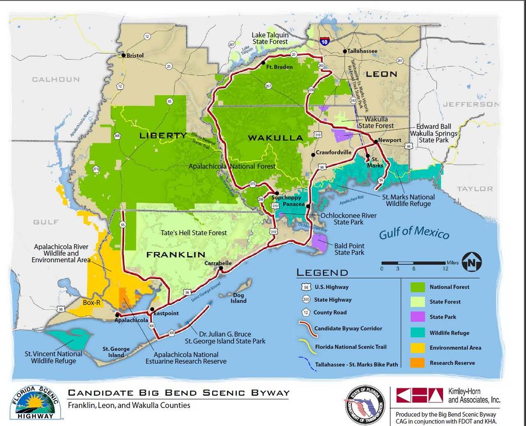
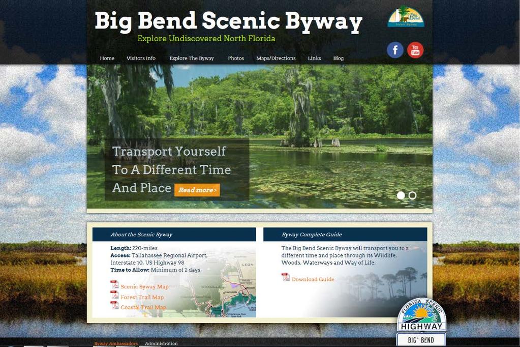
3 BIG BEND SCENIC BYWAY The Big Bend Scenic Byway will transport you to a different time and place through its Wildlife, Woods, Waterways and Way of Life
4

5 BIG BEND SCENIC BYWAY Legendary American Byways: Blue Ridge Parkway Route 66 Pacific Coast Highway Big Bend Scenic Byway


6 BIG BEND SCENIC BYWAY 220 miles: Longest Scenic Highway in Florida Connects 1 National Forest, 1 National Estuarine Research Reserve, 2 National Wildlife Refuges, The Florida National Scenic Trail, 9 State Parks, 3 State Forests, Wildlife Management Areas & numerous County and City Parks 4 Waterfront Florida Communities and 3 Historic Lighthouses


7 BIG BEND SCENIC BYWAY Positive Impacts Economic engine for the state s tourism economy Creates jobs and businesses along the route Encourages preservation of natural resources and historic sites

8 BIG BEND SCENIC BYWAY Designations 2007 Florida Scenic Highway 6-year Application Process to Florida Department of Transportation 2009 National Scenic Byway 1-year Nomination Process to Federal Highway Administration
9
10

11 Tell the Byway Story Interpret Themes Help Orient Visitors BIG BEND SCENIC BYWAY Wayside Exhibits
12 Enjoy a Scenic Drive On the way to your Favorite Trail! FloridaBigBendScenicByway.org Please Like Us on Facebook

13 HIKING TRAILS ON ST. MARKS NATIONAL WILDLIFE REFUGE
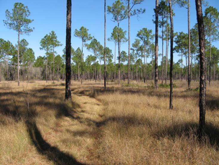
14 MILES AND MILES OF TRAILS The refuge is +/- 70,000 acres Florida National Scenic Trail covers about 49 miles across the refuge east to west St. Marks Unit receives most visitor use 5 named trails Make your own trail on our levees and woodland roads All offer abundant opportunities for photography and wildlife observation

15 PLUM ORCHARD POND Behind the Visitor Center 1/3 mile loop with boardwalks, foot traffic only Animal Olympics for kids Spur trail to experimental burn plots


16 PLUM ORCHARD POND Boardwalks and benches Animal Olympics

17 Burn Plots demonstrate differences of burning by season and frequency

18 PRIMITIVE WALKING TRAILS Deep Creek: 12 miles ~ Stoney Bayou: 6.5 miles Both follow old logging roads through woodlands and levee roads Map at trailhead

19 Starts at restroom parking lot ¼ mile Observation tower Birds and other wildlife Accessible for all HEADQUARTERS POND Photo by Lou Kellenberger

20 TOWER POND TRAIL Starts at restroom parking lot and picnic area Approximately 1 mile easy walking loop Leaflet at trailhead

21 CEDAR POINT Starts west of salt water boat ramp parking ¼ mile; lots of cactus; foot traffic only Original location of the lighthouse probably near the end of this trail


22 CEDAR POINT Look out for cactus Trail ends at Apalachee Bay Salt marsh scene

23 Starts west of the lighthouse parking lot ½ mile Foot traffic only Plant leaflet at trailhead LIGHTHOUSE LEVEE

24 WE RE OPEN ALL YEAR! Entrance fee $5 or federal pass or federal Duck Stamp Potable water fountain in the Visitor Center Bring food, snacks, and water Sun protection Insect spray Camera, binoculars, field guides Great Florida Birding Trail Gateway Borrow free binoculars at the Visitors Center
25 Marti Miller Recreation Coordinator

26
27


28 Multi-use Trail Scan with SMART phone bar code reader for trail map. t

29 Division of Recreation and Parks State Park Hiking Trails in Big Bend Region June 10, 2014, Apalachee Chapter FTA Meeting Doug Alderson, Assistant Bureau Chief Office of Greenways and Trails

30 Florida State Park App 30

31 Torreya State Park Often called the Florida mountains ; 16 miles of trails and two loops 31

32 Torreya State Park 32


33 Torreya State Park Rare Plants Torreya Tree Florida Yew 33

34 St. George Island State Park 2.5-mile Gap Point Trail and 1-mile East Slough Trail 34

35 St. George Island State Park View from Gap Point Primitive Campsite at end of trail 35

36 Ochlockonee River State Park 2.6 miles of nature trails through longleaf pine flatwoods 36


37 Bald Point State Park Miles of hiking along forest roads and a 1.7 mile trail along the coast 37


38 Wakulla Springs State Park 6 mile trail (one direction) of marked footpath and jeep roads 38


39 Wakulla Springs State Park 2-mile loop trail through River Sinks Unit and 1-mile trail to Cherokee Sink. 39


40 Maclay Gardens State Park 5 miles of trails around Lake Overstreet 40


41 Combo Trail Opportunities Paddle a river and hike back to initial launch area, eliminating need for extra vehicle 41

42 New Online Trail Guide 42

43 NW Florida Land Trails NW Florida Land Trails 43

44 NW Florida Land Trails 44

45 Comprehensive To date, guide includes: 345 land trails 84 paddling trails 429 total trails 45
46 Division of Recreation and Parks Paddling Trails in Big Bend Region June 10, 2014, Apalachee Chapter FTA Meeting Liz Sparks, Paddling Trail Coordinator Office of Greenways and Trails

47 Finding Paddling Trails 47


48 Local Paddling Trails Ochlockonee River-Upper Ochlockonee River-Lower Sopchoppy River Apalachee Bay Maritime Heritage Paddling Trail System Lafayette Passage Wakulla River Wacissa River Aucilla River 48


49 Panhandle Paddling Trails Apalachicola River Blueway Apalachee Bay Maritime Heritage Trail Apalachicola Paddling Trail System Escambia River Coldwater Creek Juniper Creek Blackwater River Choctawhatchee River Yellow River Shoal River Holmes Creek Econfina Creek Chipola River Florida Circumnavigation Saltwater Trail 49

50 OGT Trip Planning 50
51 USGS Water Levels 51


52 Local & State Paddling Clubs 52


53 Apalachee Bay Maritime Heritage Paddling Trail System Visitwakulla.com


54 Local Paddling Trails The Rivers of AWE Aucilla, Wacissa, and Econfina are some of the area s most beautiful and unspoiled waterways Order map online: Wildlife Foundation of Florida 54


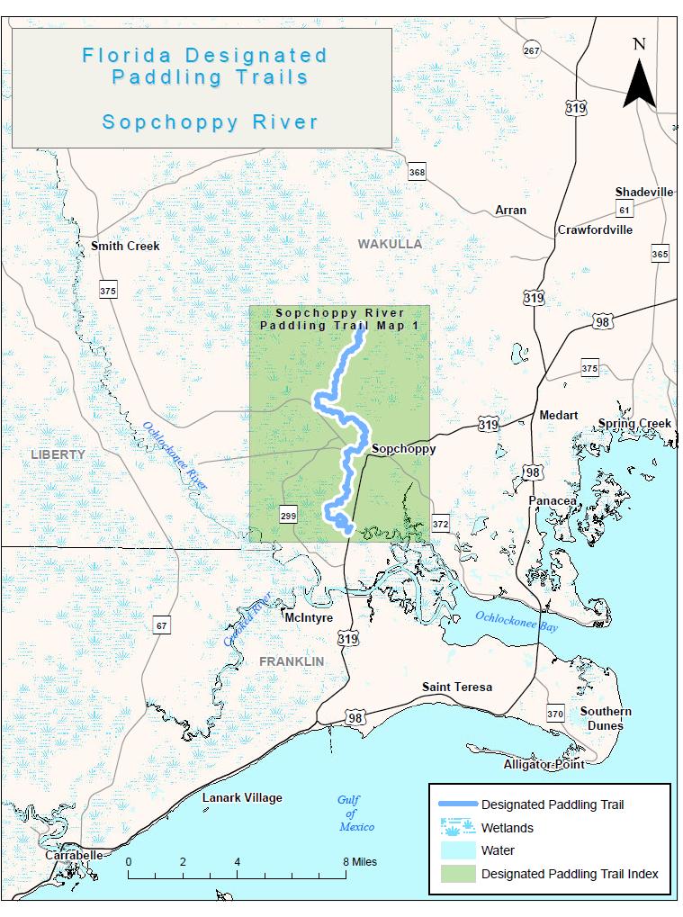
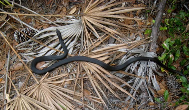
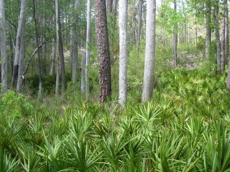
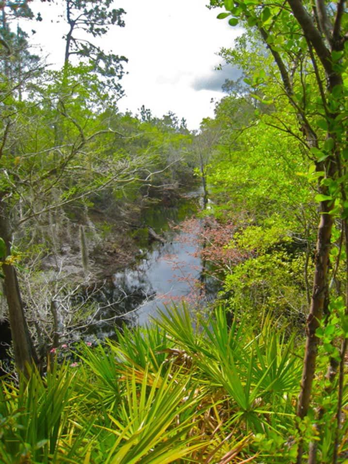
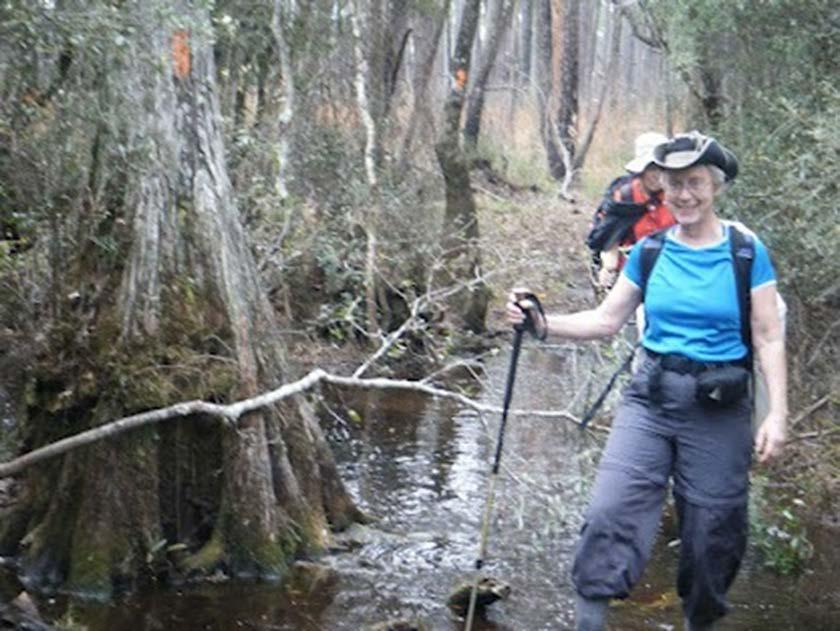
55 Lake Lafayette Passage Did you know you can paddle from Tallahassee almost to Chaires through a wild, cypress-ringed swamp near Super WalMart and US 27!? 55


56 Lake Lafayette Passage 56


57 New National Recreation Trail Apalachicola River Blueway just named one of the nation s 21 trails selected as 2014 designated National Recreation Trails by the Department of the Interior. 57

58 Future Paddling Trails Lake Jackson Blueway Leon County Future State Designated Trails: Upper Chipola Silver River Choctawhatchee River Steinhatchee River Ocheesee Pond Merritt s Millpond Dry Creek 58
59 Dawn Griffin Apalachee FTA Chapter Activity Coordinator
60 Florida Trail Association In 1966 Jim Kern, a real estate broker and hiking enthusiast, became fed up with driving all the way to North Carolina to hike the wilderness simply because there were no hiking trails in Florida. Today, thanks to dedicated volunteers there are more than 1,000 miles of the continuous trail have been completed, as well as more than 365 miles of loop trails in state parks, state forests, and other public lands close to urban areas. Land acquisition continues for the Florida Trail, with a goal of protecting a wilderness corridor the length of Florida. What was once considered a far-fetched dream is now reality: following the orange blazes, you can walk the length of Florida from Loop Road in Big Cypress National Preserve to Fort Pickens on Santa Rosa Island.

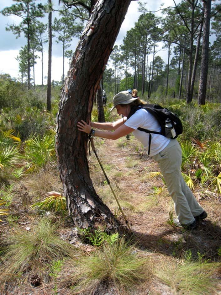
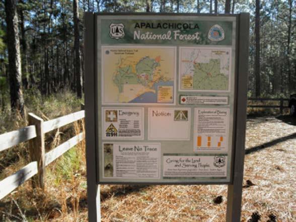
61 Apalachee Chapter Since 1982 Serves Franklin, Gadsden, Jefferson, Leon, Liberty, and Wakulla counties Maintains the first certified section of the Florida National Scenic Trail, certified by the USDA Forest Service in Maintains over 150 miles of the Florida Trail from the Aucilla River west to the Apalachicola River, including the Aucilla River & Sinks Water Management Areas, St. Marks National Wildlife Refuge, and the Apalachicola National Forest.
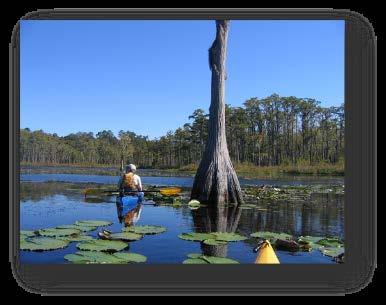
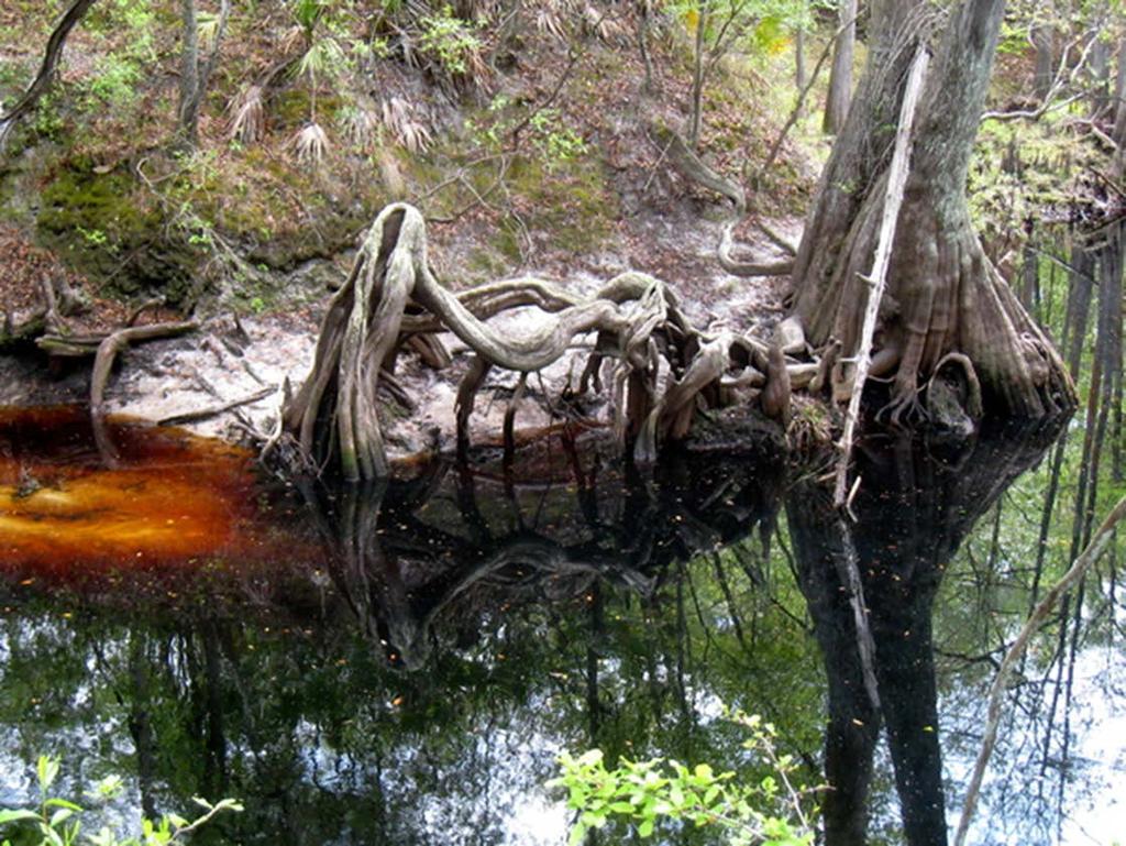
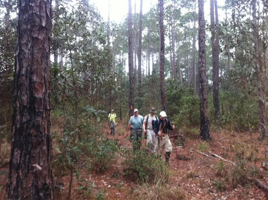
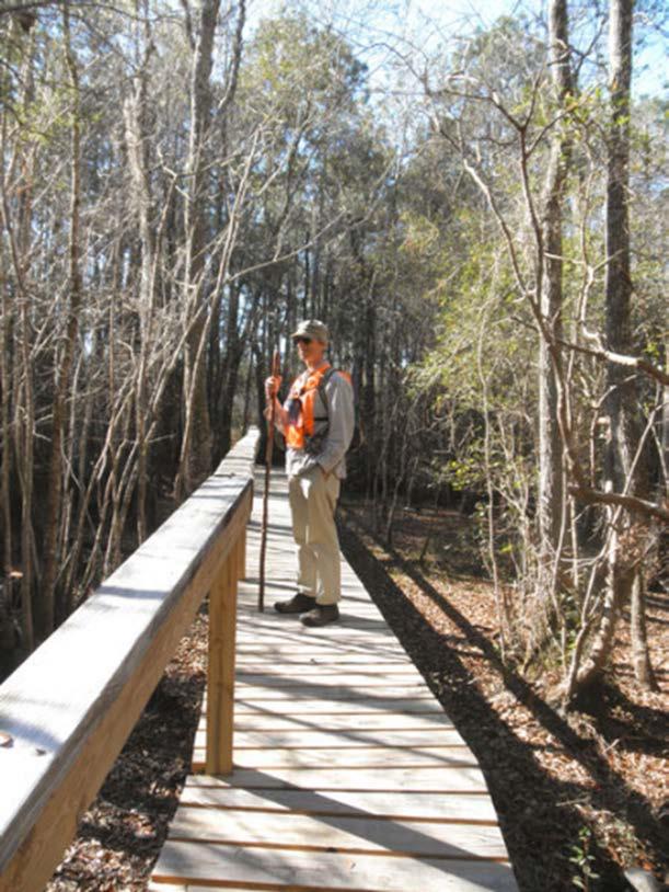
62 Apalachicola National Forest East (includes Bradwell Bay and Sopchoppy River) From Medart to Porter Lake 32.4 miles


63 Sopchoppy River Section Apalachicola National Forest - East wild azaleas - Springtime
64
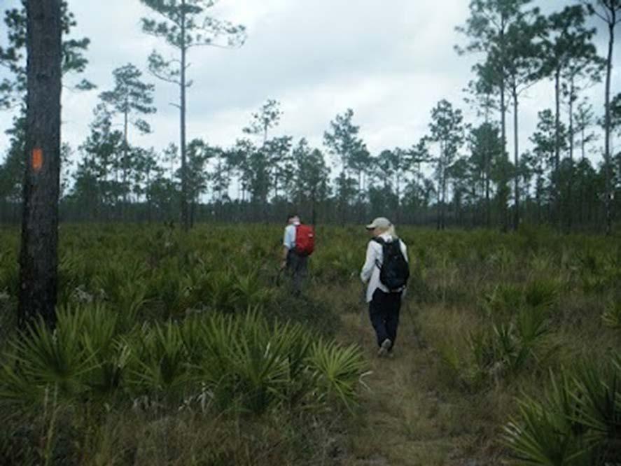
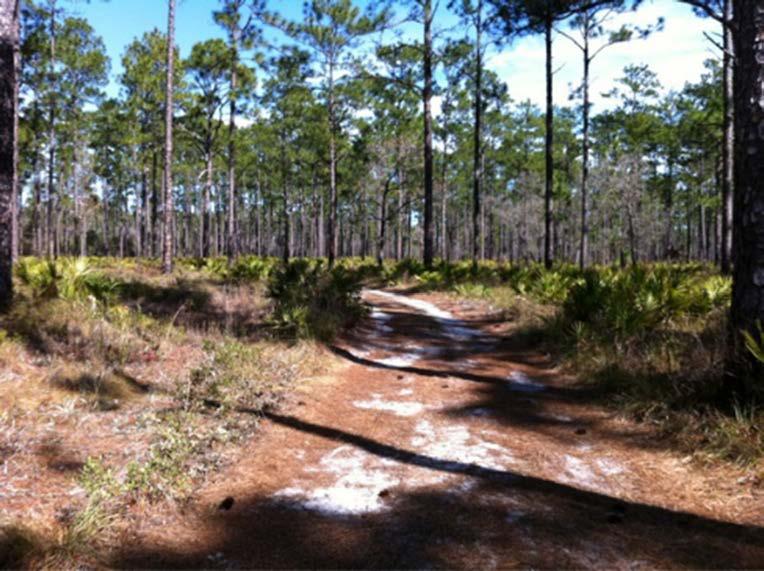
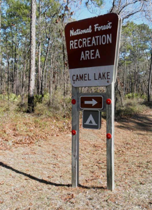
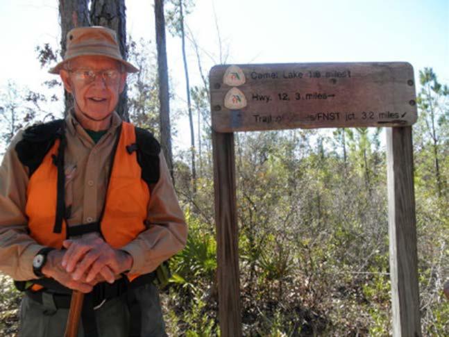
65

66
67
68

69 Bradwell Bay Wilderness Area yes, you may want to pack your mask and snorkel!
70
71
 From Porter Lake to the Apalachicola River 46.")
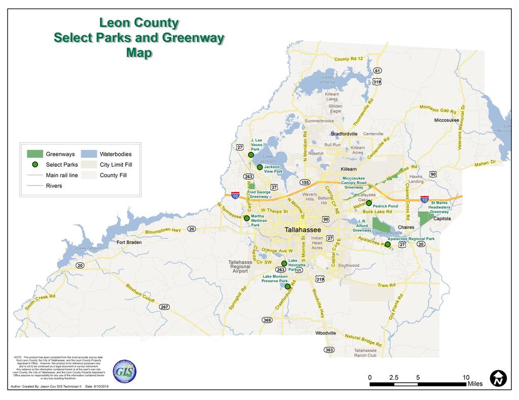
72 Apalachicola National Forest West (includes Camel Lake) From Porter Lake to the Apalachicola River 46.3 miles
73
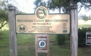
74


75 Apalachee Chapter Maintains loop trails at Fort Braden (Lake Talquin State Forest), Phipps Park, and Torreya State Park Organizes fun activities throughout the year..
76 What was once considered a far-fetched dream is now reality: following the orange blazes, you can walk the length of Florida from Loop Road in Big Cypress National Preserve to Fort Pickens on Santa Rosa Island.

77 A spur trail connects the Florida Trail with another long-distance trail under construction in Alabama, which will connect to the Appalachian Trail. Long distance hikers have already walked 4,000 miles and more from Key West to Quebec, utilizing the Florida Trail as part of their journey. Contact FTA Today!


78 Celebrate Tallahassee Trails Division of Parks & Recreation June 10, 2014


79
80 7 Community Parks 1 Regional Park 2,663 acres of Greenways 3 Campgrounds 25 Boat Landings 6 Community Centers Administration of Youth Sports Programs

81 Nearly 40 miles of maintained trails Disbursed throughout the County Two categories: defined/loop trails hiking/recreational trails
82 Alford Greenway Apalachee Regional Park Fred George Greenway and Park (opening in 2015) Gil Waters Preserve (aka Lake Munson) J. Lee Vause Park Jackson View Park Lake Henrietta Martha Wellman Park Miccosukee Greenway Pedrick Pond Park St. Marks Greenway (opening TBD)
83

84
85 Leon County Parks & Recreation 2280 Miccosukee Road Tallahassee, FL (850) Web Sources:


86 Hit the Trails with TallyParks introducing TallyParks A mapping app for your smart phone

87 Is your little one running circles around the house? Need to locate a park with a playground near your? Check out the new app from the City s Parks, Recreation and Neighborhood Affairs Department. Tally Parks can show you a list of parks, pinpoint your current location, search by amenity and more!


88 You can find these by using a Smart Phone app or by This app will guide you in the right direction and show you new places to explore.
89 Tallahassee parks offer a wide variety of trail experiences from paddling and equestrian to some of the best mountain bike trails in the country. Paddling Trails (6.8m) The Lafayette Passage Paddle trail provides over 6 miles of paddling through cypress forests and scenic wetlands. Hiking Trails (7.5m) Hiking is available on many city park trails but one dedicated, 7 mile trail has been created in Elinor Klapp- Phipps Park for those who want a true hiking experience. Horseback Riding Trails (10.5) Equestrians may use all of the shared use trails in Elinor Klapp-Phipps Park (EKP) unless otherwise indicated. Shared Use Trails (36+m) are shared by walkers, runners, equestrians, bike riders, leashed pets and folks just going for a country stroll. Mountain Biking Trails (16 m) Tallahassee trails offer some of the best mountain biking in the area. Technical features provide more challenge but many have ride around options so riders of different skills can ride together.

90 Getting Started When you open the app, a map appears with your location so that you can tell where you are in relation to other parks, where you are within a park or where the closest amenities are to you. Once on a trail, a built-in scanner allows users to san QR codes on trail markers to figure out where they are. There is even a handy explanation of how to read trail markers.


91 Trail Markers Were created for locational purposes. They help users find their location on a park map or can be used to report problems. In case of an emergency, the numbers will help US find YOU on the trail. Take note of the nearest number and call (850) or


92 Search by Park, Trail or Feature If you re looking for a park or trail with a specific feature such as a basketball court, dog park, garden path, playground or shower facility the app has a list of all the amenities available. When you click on a specific amenity, a list of every park and trail that includes that amenity will appear, making it easy for you to find the perfect park.
93 Tallahassee parks offer a wide variety of trail experiences from paddling and equestrian to some of the best mountain bike trails in the country. Park A.J Henry Park Blair Stone Road Trail Brinkley Glen Park Capital Circle SE Trail Capital Cascade Trail Elinor Klapp-Phipps Park Goose Pond Trail Guyte P. McCord Park Indianhead Trail Lafayette Heritage Trail Park Lafayette Park Fitness Trail Lake Elberta Park Myers Park San Luis Park Tom Brown Park Shared Use Trail Description 1.3 miles of shared, natural surface trails,.5 paved. 1.8 miles of shared, paved trail..4 miles of shared, natural surface trails. 5 miles of paved surface trail. miles of concrete trails 10 miles of wide dirt road trails. 3.3 miles of paved trails stretch from Heritage Blvd to Apalachee Parkway.5 miles of shared (.3m paved &.2m natural) trails..9 miles of shared natural surface trails. 3+ miles of shared, natural surface trails..7 miles of shared natural surface trails..7 miles of shared paved and natural surface trails. 1.2 miles of shared, natural surface trails. 3.1 miles of shared, natural surface trails,.3m paved. 1.5 miles of the paved Goose Pond trail runs thru. Other fitness & walking trails can be found at the Betton Nature Center, Carter Howell Strong Park, Lake Ella, Speed Spencer Stephens Park and Dorothy B. Oven Park.


94 Mountain Bike Trails Red Bug Trail Magnolia Trail Cadillac Trail Loblolly Loop Fern Trail Kohl s Trail Description 3.7 mile intermediate to advanced, tight and technical trail with challenging rooty sections and short climbs. 3.5 mile trail is a flowing and somewhat challenging, intermediate skill level trail that provides a good workout and some interesting technical features 4.2 mile intermediate skill level trail with easy and advanced options to challenge your biking skill while allowing less adventurous riders to join the ride A short.8 mile, twisty, turning, easy trail that s fun to ride for beginners and advanced riders. 3.3 miles one way; beginner level; of urban single track connecting downtown Tallahassee to Tom Brown Park on the East. This is a green transit trunk trail..7 miles of single track from Kohl s connecting to the Fern Trail Whether you re new in town or have been here a while, TallyParks will guide you in the right direction and show you new places to explore. TallyParks is free and available for download from the App Store on Apple devices and Google Play Store on Android devices. You may also visit Talgov.com for download information.
proof Northwest District
 1 Northwest District The Northwest Florida Water Management District is the most rural of all five water management districts. From just east of Tallahassee west to the Florida/Alabama line, and from the
THE FLORIDA TRAIL ASSOCIATION. Congressional Report. Trail Operations Report
 THE FLORIDA TRAIL ASSOCIATION Congressional Report 2017 Trail Operations Report 1 Like on Facebook: facebook.com/floridatrailassociation Follow on Twitter: twitter.com/floridatrail See on Instagram: instagram.com/floridatrail
AGENDA ITEM 6 A 3 FISCAL YEAR (FY) 2019 FY 2023 REGIONAL TRAILS PRIORITY PROJECT LIST (PPL)
 2019 FY 2023 REGIONAL TRAILS PRIORITY PROJECT LIST (PPL)") June, 17 AGENDA ITEM 6 A 3 FISCAL YEAR (FY) FY 23 REGIONAL TRAILS PRIORITY PROJECT LIST (PPL) TYPE OF ITEM: Action STATEMENT OF ISSUE Staff is seeking Board approval of the Fiscal Year (FY) FY 23 Regional
June, 17 AGENDA ITEM 6 A 3 FISCAL YEAR (FY) FY 23 REGIONAL TRAILS PRIORITY PROJECT LIST (PPL) TYPE OF ITEM: Action STATEMENT OF ISSUE Staff is seeking Board approval of the Fiscal Year (FY) FY 23 Regional
Florida Greenway And Trail Designations Sorted by Name
 Florida Greenway And Trail Designations Sorted by Name Name COUNTY(S) TYPE ACRES MILES NUMBER DATE Addison Blockhouse Historic State Park Volusia Site 147.92 OGT-DA0003 1/22/2002 Alafia River Paddling
Bratt ") 4. % F l o r i d a D e s i g n a t e d P a d d l i n g T r a i l s ") 164 «97 ") 99. Barrineau Park. M a p 1. M a p 2.
 4. % F l o r i d a D e s i g n a t e d P a d d l i n g T r a i l s ) 164 «97 ) 99. Barrineau Park. M a p 1. M a p 2.") F l o r i d a D e s i g n a t e d P a d d l i n g T r a i l s Bratt ") 4 Bluff Springs «4 Jay ") P e r d i d o R i v e r P e r d i d o CR R99A i v Walnut e r Hill ") 164 ") 97A «89 «97 ") 197 Barrineau
F l o r i d a D e s i g n a t e d P a d d l i n g T r a i l s Bratt ") 4 Bluff Springs «4 Jay ") P e r d i d o R i v e r P e r d i d o CR R99A i v Walnut e r Hill ") 164 ") 97A «89 «97 ") 197 Barrineau
Region 7 Western Panhandle Apalachicola River to Deer Lake Junction
 Region 7 Western Panhandle Apalachicola River to Deer Lake Junction Description Dist S-N Wypt N-S Cross Apalachicola River on SR 20 bridge. 1.5 0.0 8-2 175.4 Eastern/Central Time Zone change. Pass restaurant
Description Dist S-N Wypt N-S Region 7 Western Panhandle Apalachicola River to Deer Lake Junction
 Region 7 Western Panhandle Apalachicola River to Deer Lake Junction Description Dist S-N Wypt N-S Cross Apalachicola River on SR 20 bridge. 1.5 0.0 8-2 175.4 Eastern/Central Time Zone change. Pass restaurant
Camping and Cabins Guide. Florida State Parks. FloridaStateParks.org #FLStateParks
 Camping and Cabins Guide Florida State Parks FloridaStateParks.org #FLStateParks Welcome When the setting sun paints the evening sky, where will you make your bed? Florida s state parks offer you a variety
Camping (Primitive) Camping (RV) Electrical Potable Water Grill Established Fire Pit Picnic Table
 Camping (RV) Electrical Potable Water Grill Established Fire Pit Picnic Table") Alden - 9th Road River Mile 777 Map: 38.20833, -98.32031 Managing Agency: Kansas Department of Wildlife, Parks & Tourism Nearest Community: Alden, Rice County Kansas Developed Amenities Provided Parking
Alden - 9th Road River Mile 777 Map: 38.20833, -98.32031 Managing Agency: Kansas Department of Wildlife, Parks & Tourism Nearest Community: Alden, Rice County Kansas Developed Amenities Provided Parking
COVINGTON COUNTY Century 4 89 Gonzalez 10 Pensacola INTERSTATE De Funiak Springs INTERSTATE Chipley Escambia Bay
 55 137 31 153 COVINGTON Century 89 Gonzalez Pensacola 1 1 5 De Funiak Springs 78 90 Chipley Escambia 281 12 85 Eglin Air Force Base 87 19 East 76 71 Marianna 18 13 a l co a s Fort Walton Beach 33 20 85
2. Goals and Policies. The following are the adopted Parks and Trails Goals for Stillwater Township:
 D. PARKS AND TRAILS 1. Introduction Stillwater Township s population is relatively low, with most residents living on rural residences on large lots. The need for active park space has been minimal in
SOUTH WALTON TRAILWAYS
 SOUTH WALTON TRAILWAYS 13 14 15 10 1 2 11 12 3 5 6 4 3 7 9 8 Nestled throughout Walton County are 200 miles of hiking and biking trails winding through state forests, state parks and public-private greenways.
For more information, contact the UPF Marketing Department: (352) x 232
 x 232") WHAT PEOPLE ARE SAYING A revelation for hikers. Mashour knows the backcountry of Florida like few others. Robert Silk, author of An Ecotourist s Guide to the Everglades and the Florida Keys Provides detailed
WHAT PEOPLE ARE SAYING A revelation for hikers. Mashour knows the backcountry of Florida like few others. Robert Silk, author of An Ecotourist s Guide to the Everglades and the Florida Keys Provides detailed
CHAPTER 5. Chapter 5 Recreation Element
 CHAPTER 5 Recreation Element Chapter 5 Recreation Element The Recreation Element of the Meyers Area Plan is a supplement to the Recreation Element of the TRPA Regional Plan and the El Dorado County General
Guide to. Suffolk. Walking. Trails. Lake Meade Park
 Walking Lake Meade Park Guide to Suffolk Trails Lake Meade Park Lonestar Lake Regional Park Walking Safety Tips Avoid walking alone on trails. Walking with friends is recommended. Tell someone where you
Coast to Coast Connector Summit
 Project Partners Welcome to the Coast to Coast Connector Summit Winter Garden, Florida City Hall October 1, 2014 1 Why are we here? Objectives 1. Inform key stakeholders on the current state of the C2C
March 14, Dear Florida Greenways & Trails Council Members:
 March 14, 2016 Dear Florida Greenways & Trails Council Members: I am pleased to strongly support the funding of the Capital City to Sea Trails project. In my role as the Chairman of Corridor Management
Lake Myra County Park. Wake County, North Carolina Community Forum #2 June 12, 2008
 Lake Myra County Park Wake County, North Carolina Community Forum #2 June 12, 2008 Welcome and Introduction Meeting Agenda Welcome Introductions of Project Team Master Plan Process Community Forum #1 Updates
SECTION 4. PUBLIC RECREATION
 SECTION 4. PUBLIC RECREATION Brooker Creek Preserve is the largest remaining tract of wild land in Pinellas County and contains many species not found anywhere else in the County. As such, these wild lands
Sign Library. Florida Trail Association
 310: FTA SIGN LIBRARY December 2015 Sign Library Florida Trail Association Trail signs are used to inform the motoring public and/or trail users that they are approaching, or are on, the Trail. When blazes
APPENDIX A: Survey Instruments
 Three different surveys were conducted during the research phase of the NCHA Trails Study. One questionnaire was designed for elected officials and user groups (general public). The other two questionnaires
Chapter eight. Parks and Recreation. Introduction. Crystal Lake Park District
 Chapter eight Parks and Recreation Introduction One of the indicators of quality of life in a city is the parks and recreation system. The City of Crystal Lake is fortunate to have an excellent parks and
City of Durango 5.8 FUNDING TRAILS DEVELOPMENT
 5.8 FUNDING TRAILS DEVELOPMENT The City has been successful in establishing dedicated local funding sources as well as applying for grants to develop the City s trail system, having received nearly $2.4
FALL 2014 MEETING PROGRAMS
 FALL 2014 CHAPTER OFFICERS CHAIR Howard Pardue (850) 386-1494 hpardue@comcast.net TREASURER Elizabeth Slack (850) 320-2760 elizabeth.a.slack@gmail.com MEMBERSHIP Lori Gilbertson (850) 420-0132 FTA_trails4u.lori@aol.com
NORTH GEORGIA MOUNTAINS, USA. Knights Mill Farm
 NORTH GEORGIA MOUNTAINS, USA Knights Mill Farm Knights Mill Farm NORTH GEORGIA MOUNTAINS, USA Introduction: This historically significant property is perfect for development into a family compound with
EMERGENCY CONTACT SHEET FOR RESOURCES IN FLORIDA
 EMERGENCY CONTACT SHEET FOR RESOURCES IN FLORIDA Disaster Center Florida: Disaster Message Board, Family Disaster Plan, Weather Warnings, Animals in Disaster Lost and Found, Health and Welfare Inquiry,
This Passport: Revised October 20, 2017, EAM # Discovering the Trails of Penfield, NY
 This Passport: Revised October 20, 2017, EAM #161922 Discovering the Trails of Penfield, NY The Town of Penfield is fortunate to have a wide variety of natural resources which make for many unique and
AGENDA ITEM 5 D WAKULLA ENVIRONMENTAL INSTITUTE (WEI) TRAIL FEASIBILITY STUDY
 TRAIL FEASIBILITY STUDY") March 19, 2018 AGENDA ITEM 5 D WAKULLA ENVIRONMENTAL INSTITUTE (WEI) TRAIL FEASIBILITY STUDY TYPE OF ITEM: Action STATEMENT OF ISSUE The Wakulla Environmental Institute (WEI) Trail is one of several trails
March 19, 2018 AGENDA ITEM 5 D WAKULLA ENVIRONMENTAL INSTITUTE (WEI) TRAIL FEASIBILITY STUDY TYPE OF ITEM: Action STATEMENT OF ISSUE The Wakulla Environmental Institute (WEI) Trail is one of several trails
Meetings and Programs
 CHAPTER OFFICERS CHAIR Dawn Brown (850) 668-0091 dbrown1948@embarqmail.com VICE-CHAIR Gary Sisco (850) 545-4776 gsisco42@yahoo.com TREASURER James Kimbrel jameskimbrel@hotmail.com ACTIVITIES Ray Cade (850)
Stephens State Park Trails
 TRAILS OF ALLAMUCHY MOUNTAIN & STEPHENS STATE PARKS Allamuchy Mountain and Stephens State Parks contain 28 marked trails providing access to diverse landscapes for walking, hiking, biking, bird-watching,
Asheville & WNC Hikes
 Asheville & WNC Hikes Amazingly, we have 3,000+ miles of free public hiking trails near Asheville, including 1,600 miles in the Pisgah and Nantahala National Forests, 850 miles in Great Smokey Mountains
Parks, Recreation, Trails and Open Space Master Plan Survey Results. October 2018
 Parks, Recreation, Trails and Open Space Master Plan Survey Results October 2018 Conducted by Qualtrics subconsultant 300 completed responses Random attempt to get a balanced response from all four Council
National Recreation Trail Update Form
 National Recreation Trail Update Form Introduction Thank you for taking the time to complete this form. Your assistance will help ensure that the National Recreation Trail (NRT) database is complete and
Wilds. Headwaters. Lakes. Oxbows. Falls
 56 5 4 3 Wilds Headwaters Lakes Oxbows Falls 57 Zones It could be said the on-the-ground essence of this master plan appears within the next 6 pages of this report. As we learned in the preceding Cultural
CityStats Northwest Florida Trends
 CityStats Florida Trends 2018 Research Analyst Liane Giroux, CAE Center for Municipal Research & Innovation Florida League of Cities CityStats Florida Regional Trend Analysis Municipal Revenue Sources
National Recreation Trail Application for Designation
 National Recreation Trail Application for Designation Introduction Thank you for your interest in the National Recreation Trail (NRT) program. Completed NRT application packages must be submitted by December
Wakulla County Adopted Infrastructure Plan
 Prepared for November 2012 (Adopted October 15, 2012) Tallahassee Adopted Infrastructure Plan Adopted Infrastructure Plan Adopted by the Board of County Commissioners October 15, 2012 3 Adopted Infrastructure
APPENDIX G MULTI-USE TRAILS DOWNTOWN LAKELAND
 MULTI-USE TRAILS DOWNTOWN LAKELAND POINCIANA PARKWAY Multi-Use Trails Trail Name From To Status Regional Network Surface Length Present Day Cost Chain-of-Lakes Trail Bridge South of US 17/92 North of US
This Passport: Revised October 20, 2017, EAM # Discovering the Trails of Webster, NY
 This Passport: Revised October 20, 2017, EAM #161923 Discovering the Trails of Webster, NY The Town of Webster invites you to explore and experience our diverse outdoor adventures! Here s your opportunity
A CASE FOR COMPLETING THE JORDAN RIVER PARKWAY: A
 A CASE FOR COMPLETING THE JORDAN RIVER PARKWAY: A safe crossing at 9000 South and 850 West Proposed 9000 South Underpass Parkway Timeline Parkway, Trail, and Tourism Facts Blueprint Jordan River 1971 1973
West Orange Trail. Clean, Green, Fun!
 West Orange Trail Clean, Green, Fun! The West Orange Trail - when completed - will be a 36-mile, multipurpose recreational greenway containing a 14-foot wide paved surface to be enjoyed by walkers, joggers,
Florida Department of Environmental Protection Division of Recreation and Parks
 Florida Department of Environmental Protection Division of Recreation and Parks Land Edward Ball Wakulla Springs State Park Introduction Edward Ball Wakulla Springs State Park is a 6,055.2-acre public
Port Gamble Shoreline Area Conceptual Trail Proposal
 The North Kitsap Trails Association is pleased to be a partner to the Kitsap Forest and Bay Project and assist Kitsap County, Forterra, Olympic Property Group, Great Peninsula Conservancy and the Port
5 FAVORITE CENTRAL FL PARKS FOR OUTDOOR ACTIVITIES. Rockon Recreation Rentals
 Check out this Awesome Compilation of Southern Central Florida State Parks, where amateurs to experienced folks are welcome to explore the outdoors. 5 FAVORITE CENTRAL FL PARKS FOR OUTDOOR ACTIVITIES LAKE
MEETING PROGRAMS. Marc Engel, Elizabeth Keating, Wendy Long, Aaron Mathews, Tracy & Larry Simmons, Caroline York CONTENTS
 SUMMER FALL 2017 2015 apalacheefta@gmail.com eetings are held the second Tuesday of each month from 7 to 9 p.m. at the Unitarian Universalist Church, 2810 N. Meridian Rd., Tallahassee. For more information,
Tallahassee-St. Marks Historic Railroad Trail
 Revitalizing a Historic Trail Designated as a National Recreation Trail, the 16-mile Tallahassee-St. Marks Historic Railroad Trail has been enjoyed by countless bicyclists, runners, and outdoor enthusiasts
Appendix 3. Greenway Design Standards. The Whitemarsh Township Greenway Plan
 Appendix 3 Greenway Design Standards This chapter discusses two design standards for the greenway types discussed above. First, trail design standards are presented together with trailhead facilities and
MASTER PLAN EXECUTIVE SUMMARY
 Biscuit Run State Park Scottsville Road (State Route 20) Charlottesville, VA 22902 Biscuit Run State Park MASTER PLAN EXECUTIVE SUMMARY Department of Conservation and Recreation Division of Planning and
Acquisition in fee simple of approximately one-half acre of property on the shore of Spring Lake to expand the Lakeside Beach Park.
 Lakeside Beach TF00-136 $122,550.00 in fee simple of approximately one-half acre of property on the shore of Spring Lake to exp the Lakeside Beach. 2000 River Ravines TF00-150 $910,000.00 in fee simple
Map 1.1 Wenatchee Watershed Land Ownership
 Map 1.1 Wenatchee Watershed Land Ownership Map 1.1 Wenatchee Watershed Land Ownership The Wenatchee watershed lies in the heart of Washington state in Chelan County. Just larger than the state of Rhode
Description Dist S-N Wypt N-S Region 4E Eastern Corridor Three Lakes East-West Jct to Ocala East-West Jct
 Region 4E Eastern Corridor Three Lakes East-West Jct to Ocala East-West Jct Cross CR 523 at Prairie Lakes entrance. 0.8 0.0 33-5 203.7 South jct with stream. 0.3 0.8 202.9 Follow along stream off and on,
THE BLAZE APALACHEE CHAPTER FLORIDA TRAIL ASSOCIATION SPRING 2010
 THE BLAZE APALACHEE CHAPTER FLORIDA TRAIL ASSOCIATION SPRING 2010 Chapter Officers Chair Terry Tenold, 877-1612 Treasurer Carol Armstrong, 385-2898 Membership Terry Tenold, 877-1612 Programs Linda Patton,
System Group Meeting #1. March 2014
 System Group Meeting #1 March 2014 Meeting #1 Outcomes 1. Understand Your Role 2. List of Revisions to Existing Conditions 3. Information Sources Study Area The Purpose of Mountain Accord is to Preserve
Region 4E Eastern Corridor Three Lakes East-West Jct to Ocala East-West Jct
 Region 4E Eastern Corridor Three Lakes East-West Jct to Ocala East-West Jct Description Dist S-N Wypt N-S Cross CR 523 at Prairie Lakes entrance. 0.8 0.0 33-5 203.7 South jct with stream. 0.3 0.8 202.9
The Croatan MST Segment 16B
 1 Mountains-to-Sea Trail Last Updated 1/1/2017 A sandy road through longleaf pine savanna in the Croatan National Forest Photo by PJ Wetzel, www.pjwetzel.com The Croatan MST Segment 16B STELLA TO THE NEUSIOK
RIDGEFIELD PARKS February 2016
 RIDGEFIELD PARKS February 2016 Hayden Park Neighborhood Park Amenities Sign with Name of Park and City of Ridgefield Logo Lamp Post Parking Area Play Set Swings Sign with Playground Rules Durable Benches
The Neusiok Trail and Cedar Island MST Segment 17. THE NEUSIOK TRAIL TO CEDAR ISLAND FERRY By Kate Dixon and Jim Grode
 1 Mountains-to-Sea Trail Last Updated 1/1/2017 Hiking the Neusiok Trail Photo by Becka Walling The Neusiok Trail and Cedar Island MST Segment 17 THE NEUSIOK TRAIL TO CEDAR ISLAND FERRY By Kate Dixon and
PASSPORT. Discovering the Trails of Webster, NY
 PASSPORT to family wellness Discovering the Trails of Webster, NY Join the Friends of Webster Trails, Webster Health and Education Network, The Town of Webster and Wegmans to get moving more and enjoy
Understanding user expectations And planning for long term sustainability 1
 Understanding user expectations And planning for long term sustainability 1 What is a natural surface trail? It can be as simple has a mineral soil, mulched or graveled pathway, or as developed as elevated
Centred Outdoors is an open invitation for people of all ages and fitness levels to explore ten outdoor destinations in Centre County, Pennsylvania,
 Centred Outdoors is an open invitation for people of all ages and fitness levels to explore ten outdoor destinations in Centre County, Pennsylvania, throughout the summer of 2018. Together, we ll stress
Beaver Creek State Park
 GENERAL INFORMATION Name of Park/Forest/Facility: Beaver Creek State Park County: Columbiana (St. Clair Township) Address: 12816 Sprucevale Road (ie County Rd 428) (street #, city) East Liverpool, Ohio
10/25/2013. What is the SCORP?! 2013 Local Government Survey 2013 Statewide Public Survey Advisory Group Priority Areas Your Suggestions!
 COLORADO OUTDOOR RECREATION TRENDS RESULTS FROM THE SCORP AND STATEWIDE Colorado Outdoor Recreation Resource Partnership September 2013 PRESENTATION What is the SCORP?! 2013 Local Government Survey 2013
ZoPath Trail. Extreme Park. Group III. Brendan Pillar, Conor Coakley James Amendola, & Mark McDermott. May 4, 2006
 ZoPath Trail & Extreme Park Group III Brendan Pillar, Conor Coakley James Amendola, & Mark McDermott May 4, 2006 HOW TO GET FROM THE TOWPATH S NORTHERN TRAILHEAD TO HERE? Bridging Two 1 st -Class Regional
200' to Beach,Wi-Fi,AC,Hot Tub,Golf Cart,Lakeviews,2000sf,3BR,2 Bth
 200' to Beach,Wi-Fi,AC,Hot Tub,Golf Cart,Lakeviews,2000sf,3BR,2 Bth Summary We call our home our Kidcatcher. Description We call our home our Kidcatcher. The kids love to come back to this house to catch
Mississippi River Parkway Commission of Minnesota
 Mississippi River Parkway Commission of Minnesota Metro Region (Elk River to Hastings) October 27, 2016 2:00 3:30 p.m. Historic Fort Snelling 200 Tower Avenue, St. Paul, MN Metro Region Agenda I. Welcome
Blaze CHAPTER MEETING PROGRAMS N E W R ET U R N I N G APALACHEE CHAPTER FLORIDA TRAIL ASSOCIATION WINTER 2014
 The Blaze 1.877.HIKE.FLA www.floridatrail.org apalachee.floridatrail.org www.facebook.com/apalacheechapter.fta www.meetup.com/apalachee-florida-trail-hiking APALACHEE CHAPTER FLORIDA TRAIL ASSOCIATION
WEST JORDAN PARKS, RECREATION AND TRAILS MASTER PLAN Advisory Committee Meeting #2
 WEST JORDAN PARKS, RECREATION AND TRAILS MASTER PLAN Advisory Committee Meeting #2 MONDAY, NOVEMBER 5, 2018, 6:00 P.M.; PARKS DEPT. CONFERENCE ROOM ATTENDEES: Lisa Dean Larry Gardner Duane Harding David
Florida discoveries: Princess Place full of history & beauty
 Page 1 of 5 Florida Travel AUGUST 21, 2015 Florida discoveries: Princess Place full of history & beauty i BY BONNIE GROSS FloridaRambler.com Funky Florida will always find ways to surprise you. Page 2
APPALACHIAN TRAIL THROUGH GEORGIA. Long Distance YRE 2018/Y2289, rated 4D. Table of Contents. HOW TO HIKE THE AT IN GEORGIA THE BASICS Page 2
 Table of Contents HOW TO HIKE THE AT IN GEORGIA THE BASICS Page 2 THE SUGGESTED 8 DAY HIKES PLUS APPROACH Page 3 OPTIONAL A AWARD Page 4 HIKING GUIDELINES Page 4 AFTER YOU HAVE COMPLETED THE HIKE Page
Trail Etiquette. Hours of Operation. Trail Accessibility
 Trail Guide The Elmhurst Park District, with 28 parks and over 460 acres of land, offers nearly six miles of paved or asphalt park trails and maintains an additional 3.6 miles of trails within Elmhurst.
Crystal Lake Area Trails
 Lake Area Trails Welcome to the Lake area of the Big Snowy Mountains! This island mountain range in central Montana features peaks reaching to 8,600 feet and long, high ridges from which vistas of the
About Us Join the team! Calendar County Map FPPC Forms SPECIAL ALERTS CONTACT US!
 About Us Join the team! Calendar County Map FPPC Forms SPECIAL ALERTS CONTACT US! Search.. Home Reservations Parks Nature Centers Recreation Historic Sites Trails Lake Cahuilla Home Riverside County Parks
Walking Main Street. 63 North Main Street, Waynesville, NC 28786, United States. The Blue Ridge Parkway
 Walking Main Street 63 North Main Street, Waynesville, NC 28786, United States Waynesville has a fantastic and classic small town downtown- its Main Street offers a variety of stores including the Mast
Historic Highway Advisory Committee To Meet in The Dalles
 In This Issue Get Involved Highway Gets Major Endorsement New Life for the Old Road Bike Pods and Hubs Time Travel on the Historic Highway Gorge Ride 2014 The Historic Columbia River Highway News is your
The Impact of Trails on Communities. Jim Wood Chief, Office of Greenways & Trails Division of Recreation and Parks
 The Impact of Trails on Communities Jim Wood Chief, Office of Greenways & Trails Division of Recreation and Parks Why Trails and Greenways? Resolution of the Florida Greenways and Trails Council Recognizing
Hiking California's Trinity Alps Wilderness: A Guide To The Area's Greatest Hiking Adventures (Regional Hiking Series) By Dennis Lewon READ ONLINE
 By Dennis Lewon READ ONLINE") Hiking California's Trinity Alps Wilderness: A Guide To The Area's Greatest Hiking Adventures (Regional Hiking Series) By Dennis Lewon READ ONLINE With over 600 miles of trails and 500000 acres of wilderness
Hiking California's Trinity Alps Wilderness: A Guide To The Area's Greatest Hiking Adventures (Regional Hiking Series) By Dennis Lewon READ ONLINE With over 600 miles of trails and 500000 acres of wilderness
CITY OF FOUNTAIN INN PARKS
 CITY OF FOUNTAIN INN PARKS Country Chase Fitness Park The Country Chase Fitness Park is located in the Country Chase neighborhood at 136 Catterick Way. The park is also located adjacent to a section of
Happy Hoofers ACTIVITIES
 DATE ACTIVITY LEVEL LEADERS Sat 9/3/16 Happy Hoofers ACTIVITIES 2016-2017 Participants Code: (MF) Members First-(MP) Members & Public - (M) Members Only Activity Level Code: (L) Leisure (M) Moderate -
Paiute Trail Hatfield-McCoy Highwood Mountains
 Paiute Trail Hatfield-McCoy Highwood Mountains Located in Central Utah Main trail is 238 miles 550 miles of designated side trails Links 16 communities in 4 counties Ranges from 5,200 to 11,500 feet Great
Silver Lake Park An Environmental Jewel for the Citizens of Prince William County
 Silver Lake Park An Environmental Jewel for the Citizens of Prince William County The Prince William Park Authority Mission Statement states: The Prince William County Park Authority will create quality
Greater Minnesota Regional Parks and Trails Commission Designation Application
 Greater Minnesota Regional Parks and Trails Commission Designation Application General Section Designation Application #: 16-022D Date Submitted: 04/29/2016 Park or Trail Name: Luverne Loop & Blue Mounds
TENKILLER STATE PARK -An Overview-
 TENKILLER STATE PARK -An Overview- - 0 - TENKILLER STATE PARK Region: Northeast (Green Country) Cherokee & Sequoyah Counties CONTENTS General Information. 2 Addresses Driving Directions Phone Numbers Email
") 115 ") 108 ") 121 ") 119 ") 217
 115 ) 108 ) 121 ) 119 ) 217") F l o r i d a D e s i g n a t e d P a d d l i n g T r a i l s Woodbine S t M a r y ' s R i v e r C H A R L T O N Folkston M a p 6 C A M D E N Kingsland W A R E M a p 5 ") 115 M a p 4 ") 108 Hilliard Dyal
F l o r i d a D e s i g n a t e d P a d d l i n g T r a i l s Woodbine S t M a r y ' s R i v e r C H A R L T O N Folkston M a p 6 C A M D E N Kingsland W A R E M a p 5 ") 115 M a p 4 ") 108 Hilliard Dyal
Municipal Park Descriptions: 1. Bear Hollow Park 4100 Bear Hollow Park Court, Murrysville, PA acres
 MUNICIPAL PARK DESCRIPTIONS Murrysville has a wide variety of parks and recreational facilities including sports fields, neighborhood parks, community parks, a Community Center, and extensive natural areas
Quality Assessment Review
 Quality Assessment Review Of Apalachicola National Forest Conducted by All Rec Solutions, LLC. May 8-10, 2010 Table of Contents 2 Recreation Area Page Introduction and Marketing 3 Camel Lake 5 Wright Lake
HIKING/BIKING IN MERRITT AREA
 HIKING/BIKING IN MERRITT AREA Coquihalla Lakes: Just inside the southern boundary of BC Park's Coquihalla Summit Park, a nice little twin lakes paddle with a private campground & lodge is the Coquihalla
Dr. John M. DeGrove Community Steward Webinar Series
 Dr. John M. DeGrove Community Steward Webinar Series Audio Options TO USE YOUR COMPUTER'S AUDIO: When the Webinar begins, you will be connected to audio using your computer's microphone and speakers (VOIP).
Lewis and Clark Recreation Area
 Lewis and Clark Recreation Area Bicycle/Pedestrian Trail Also part of the Pierson Ranch Recreation Area trail Type of trail: Walking, biking and rollerblading Trail surface: Asphalt Rated: Mostly flat.
Jefferson County Non-Motorized Transportation and Recreational Trails Plan 2010
 Chapter 8: Goals and objectives Plan Update: The following update presents general principles, goals, and objectives related to non-motorized transportation facilities as a component of the overall transportation
SAXON HARBOR REDEVELOPMENT SURVEY
 SAXON HARBOR REDEVELOPMENT SURVEY SEPTEMBER, 2016 1,173 RESPONSES 1 BACKGROUND 1. WHAT TYPES OF ACTIVITIES DO YOU ENGAGE IN AT SAXON HARBOR Sightseeing Swimming Picnicing Fishing Camping Photography Motorized
O REGON TRAILS SUMMIT. Oregon Trails Summit. Rogue River National Forest
 O REGON TRAILS SUMMIT Oregon Trails Summit 2014 Rogue River National Forest OREGON TRAILS 2015: A VISION FOR THE FUTURE The 2015-2024 Oregon Statewide Trails Plan Why do a trails plan? 2005-2014 Oregon
BLUE RIDGE. Mountain Club. The Best of North Carolina s High Country. Top East Coast Luxury Real Estate
 LUXURY REAL ESTATE BLUE RIDGE Mountain Club The Best of North Carolina s High Country T he Appalachian region in western North Carolina is steeped in a sort of textbook American history. The Cherokee used
Loxahatchee Chapter, Florida Trail Association
 trail tales Loxahatchee Chapter, Florida Trail Association Volume 26, Issue 6: Bi-monthly Publication November/ December 2016 CHAPTER MEETINGS First Monday of every month Topics of interest to hikers,
WEST SECTION TRAIL SITES as of Mon October
 WEST SECTION TRAIL SITES as of Mon October 9 2017 Partial Site is open but some hiking trails/facilities may be closed Closed Site is closed until further notice Open Site is open Unknown We have no information
When One Size Doesn t Fit All Building Volunteers with a Spectrum of Opportunity
 November 2013 PNTS When One Size Doesn t Fit All Building Volunteers with a Spectrum of Opportunity Claire Miller City of Scottsdale McDowell Sonoran Preserve The Preserve is Born 1991 Citizens form the
A Vision for South Skunk River and Chichaqua Bottoms Greenbelt
 A Vision for South Skunk River and Chichaqua Bottoms Greenbelt Photo: Jim Pease Chichaqua Bottoms Booklet 7 of 8 Greater Des Moines Water Trails and Greenways 1 2016 Table of Contents Booklet 1: Water
4.0 FACILITIES INVENTORY
 4.0 FACILITIES INVENTORY 4.1 PARK LEVEL OF SERVICE STANDARDS (LOS) Based on current City of Longview Parks and Recreation Level of Service (LOS) Standards (Figure G), the City currently has a deficiency
4.19 Parks, Recreation, and Conservation Lands
 interchange would have on the Reed Paige Clark Homestead located on the north side of Stonehenge Road. Alternative D would also affect Palmer Homestead, E.F. Adams House, and Knapp Brothers Shoe Manufacturing
FEASIBILITY CRITERIA
 This chapter describes the methodology and criteria used to evaluate the feasibility of developing trails throughout the study areas. Land availability, habitat sensitivity, roadway crossings and on-street
Driving Time: 3 hours (allow extra time for stops)
") Scenic Byways loop This journey takes visitors through the eastern edge of Mt. Rainier National Park and along two of Washington s most beloved scenic byways, the Chinook Byway and the White Pass Scenic
Scenic Byways loop This journey takes visitors through the eastern edge of Mt. Rainier National Park and along two of Washington s most beloved scenic byways, the Chinook Byway and the White Pass Scenic