ZoPath Trail. Extreme Park. Group III. Brendan Pillar, Conor Coakley James Amendola, & Mark McDermott. May 4, 2006
|
|
|
- Phyllis Mathews
- 5 years ago
- Views:
Transcription


1 ZoPath Trail & Extreme Park Group III Brendan Pillar, Conor Coakley James Amendola, & Mark McDermott May 4, 2006

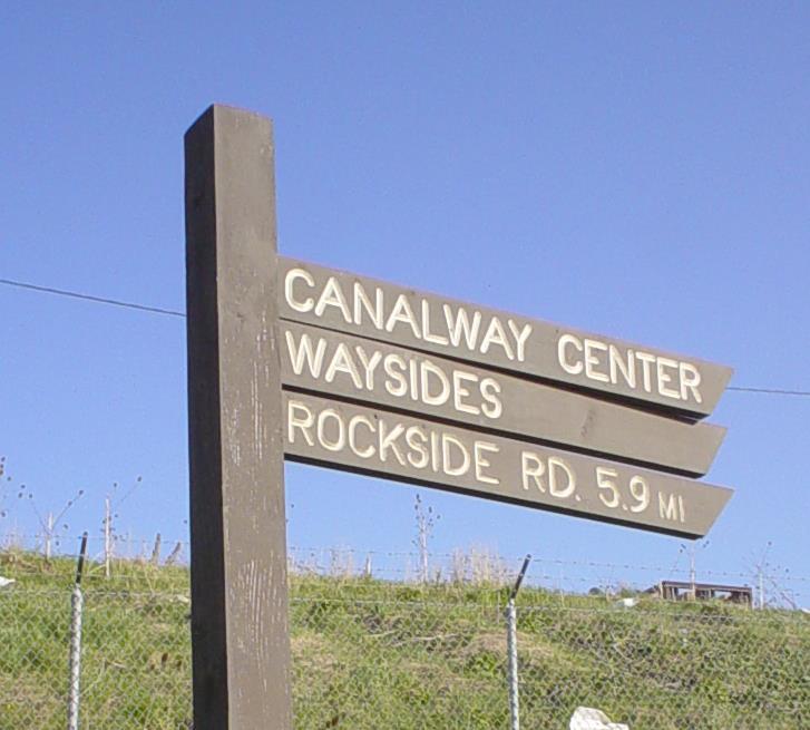
2 HOW TO GET FROM THE TOWPATH S NORTHERN TRAILHEAD


3 TO HERE?
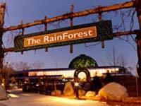
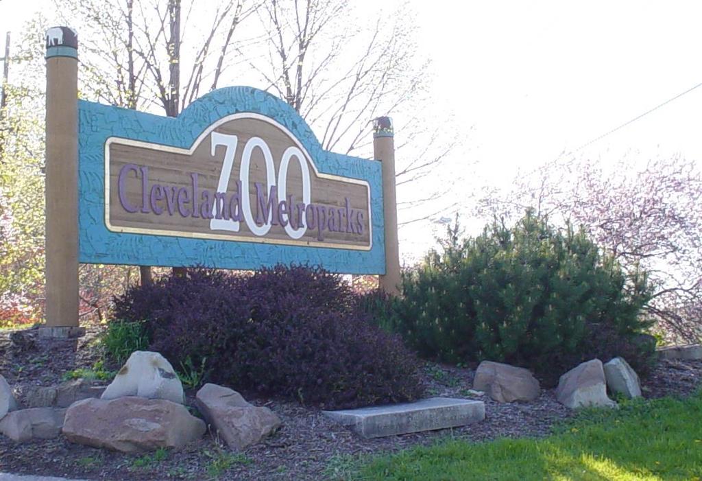
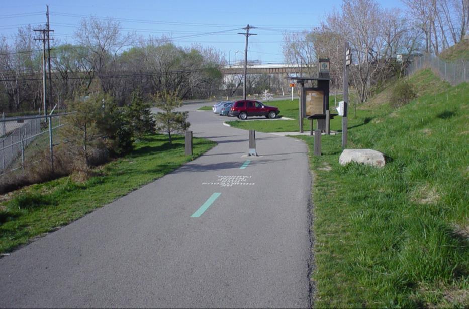
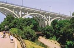
4 Bridging Two 1 st -Class Regional Amenities and Creating a Third Metropark Zoo M visitors/yr - 3,000 animals on 168 acres - 41,000 CMZ membership - World-Class exhibits include; Australian Adventure, & Rainforest Towpath Trial - 300,000 Users (1M when extend) - Will connect Lake Erie with Cuyahoga National Park - Celebrates the 175 year old history of the Ohio & Erie Canal Extreme Park? Fill in the blanks - Users/ yearly - national events/ yearly - Increased attendance at Zoo & Towpath trail by % - Ohio s 1st Extreme Sports Park!


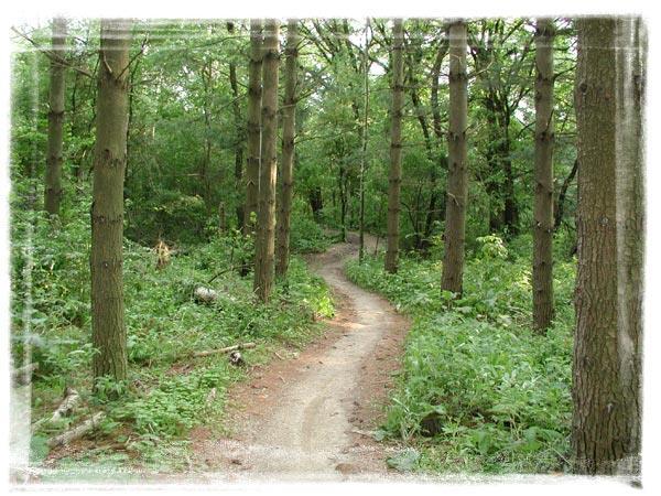
5 Group III s ZoPath Proposal: 2.1 mile all-purpose loop trail Grab-n-Go Oasis Extreme sports Park Biker s paradise Some wild surprises Mini Skate Park behind Rock N Roll Hall of Fame


6 Goals & Outcomes Connect the Zoo & the Towpath with a loop trail Create a regional attraction Bring tax revenues to the City of Cleveland Reclaim a natural waterway Enhance overall neighborhood quality of life Cuyahoga River, 1952


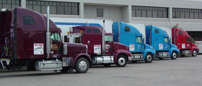
7 Challenges: Topography Existing Industry Brownfields Funding & Political Will Resident Concerns

8 Group 3: Trail Map Jennings Rd W. 25 th Street C B Harvard Rd A E D H F G Locations A Towpath Trailhead at Harvard Road B Zopath Trailhead at Jennings Road C Extreme Sports Park D Neighborhood Connector to Calgary Park E Zopath Trailhead at Zoo F Dirt/Mountain Biking G Treadway Connector H Proposed Location for Grab N Go Oasis
9 Land Acquisition Strategy Acquire (refer to Trail Map): C. Truck Depot & Salt: $1.1 Million F. Land Fill: $200,000 Easements: Two owners along creek & one owner up top


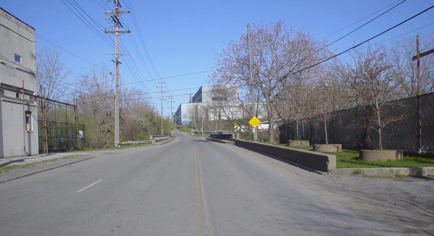
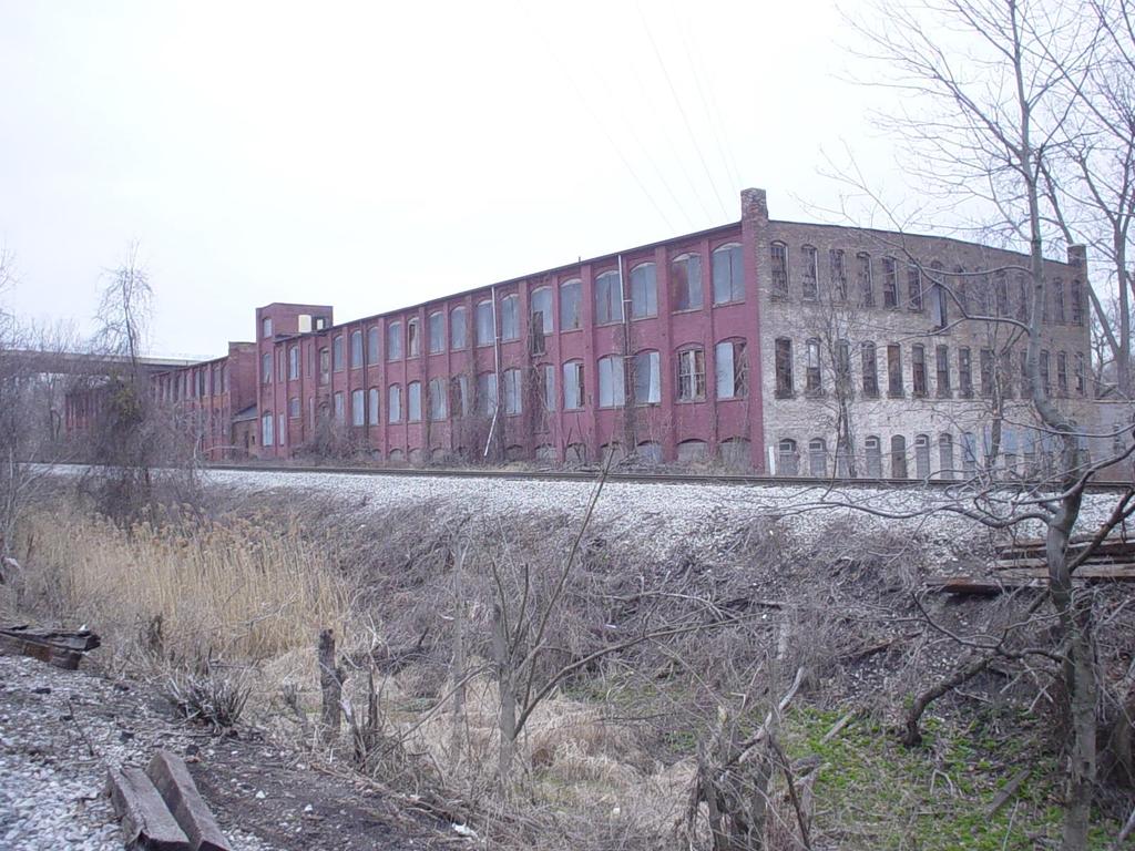
10 A. Current Harvard Road Trailhead

11


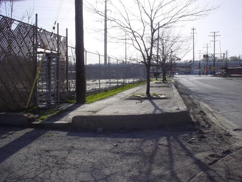
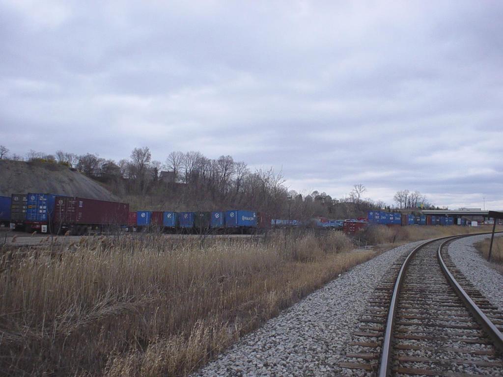
12 B. ZoPath Trailhead at Jennings Road (current conditions) Truck Depot & Salt Mound
13
14


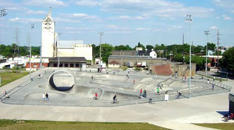
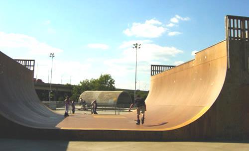
15 C. Extreme Park Privately Owned & Operated

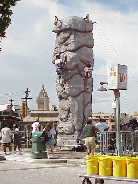
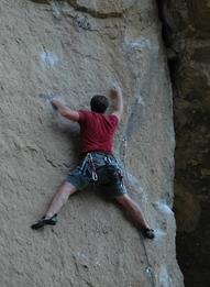
16 Rock & Base Climbing

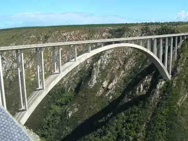
17 Wild Ideas


18 D. Neighborhood Connection to Calgary Park Linking Brooklyn-Centre neighborhood to the ZoPath Trail
19


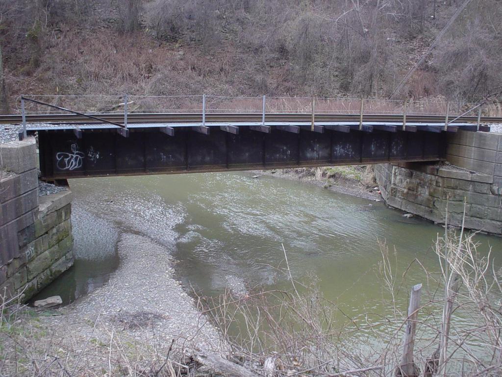
20 Pedestrian Bridges NEEDED: - Pedestrian Bridge Spanning Railroad - Attachment Arm on Bridge
21
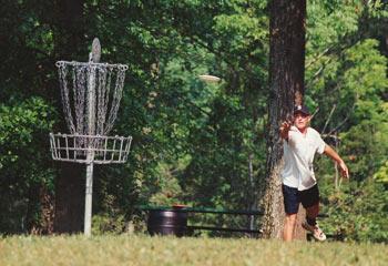
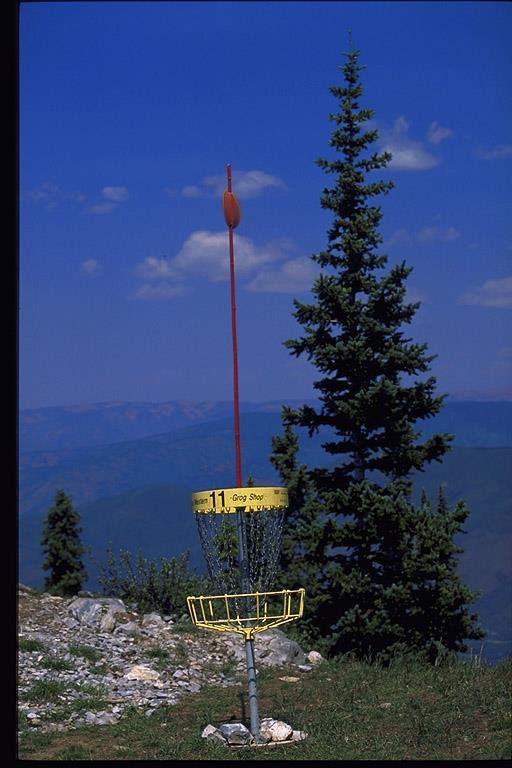
22

23 Pedestrian Bridge Starting Here

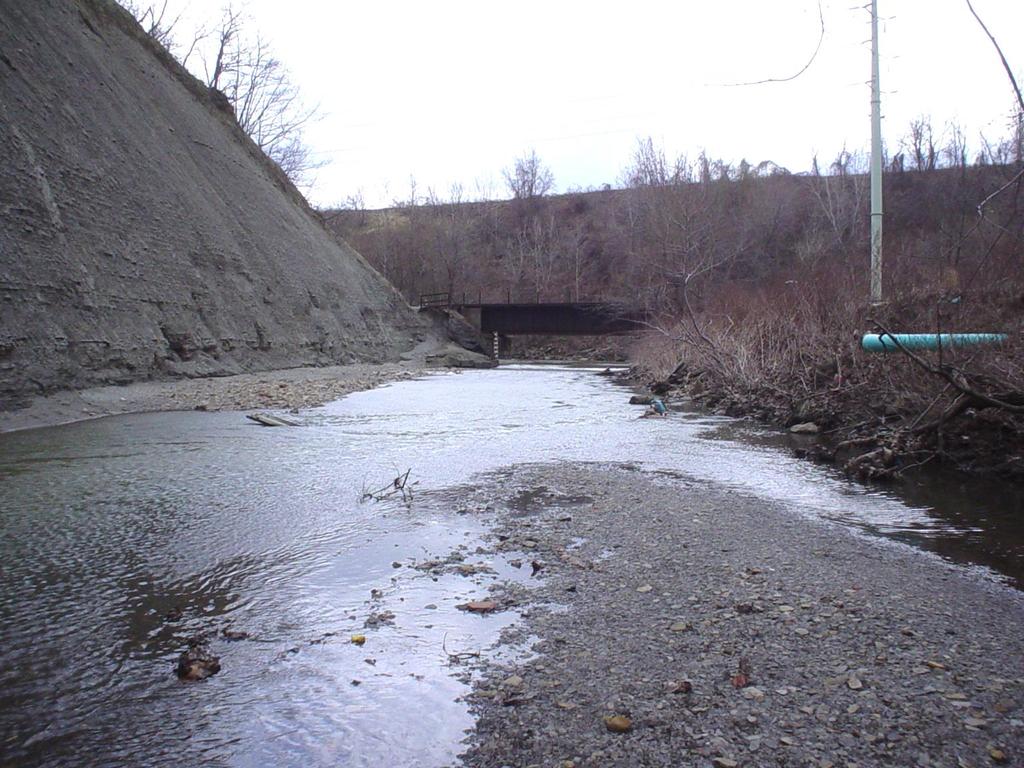
24 Bridge Spanning RR s Here


25 E. ZoPath Trailhead at Zoo Grand Entrance to both the Zoo & Extreme Park from ZoPath Trail - Shared Parking and Public Transit Opportunities

26 Phase II: Connect Zoo to Rocky River Reservation Cleveland City Planning Bike Master Plan

27 Henninger Landfill: 30 Acres


28 Henninger Land Fill: Natural terrain along ridge perfect conditions for mountain biking trails with scenic views


29 F. Mountain/ Dirt Bike Trails & Disk Golf
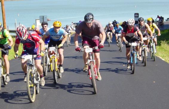
30 Disc Golf


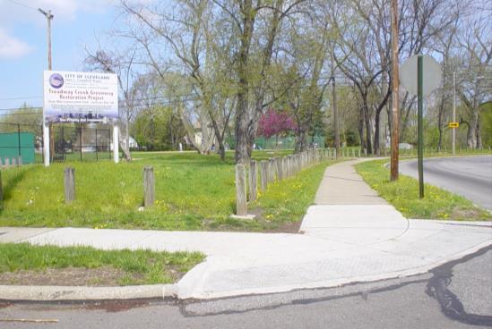
31 G. TREADWAY CREEK TRAIL & GREENWAY PLAN CONNECTIONS TO THE NEIGHBORHOOD


32 Treadway Creek Back to Harvard Avenue via Jennings Road


33 H. Grab N Go Oasis Steelyard Commons: 1 Million sq/ft of retail- too close to develop a retail development of scale here. 69% of Towpath users said they would use a concession stand. Carvel Store at Rockside quote: We feel like

34 Conventional Approach To Determining Primary Market Area for Carvel Ice Cream Store Primary Market Area was created using standard gravity model. Summary Statistics: Area Weighted population: 29,447 Area Weighted households: 12,263 Total Household Income: $473, 420, 221 Niche Analysis: Stores Needed Refreshment Places/Fast Food 5.87 Amusement and Recreation Services 3.85 Drug and Propriety Stores 2.58

35 Two mile radius from the location of the store was based on Carvel s real estate criteria. Carvel Ice Cream Demographic Requirements Demographic Requirements Harvard/ Jennings Location Total Population Threshold 25,000-50,000 58,850 Average Household Size 2.7 people and above 2.53 Median Age 38 years old or below 32 Percent of Population Under 18 20% 27%
36 Current Perceptions and Outlook for the Lower Big Creek Valley A majority (58%) of the residents who responded to the Current Perceptions question thought that the valley was either Dirty/Polluted or Underutilized However, a vast majority (81%) of the residents who responded to the Redevelopment Outlook question thought the redevelopment would be positive for the Community 14% 14% Community Preceptions of the Valley 14% 9% 23% 35% Redevelopment Outlook 10% Under Utilized Dirty, Messey, Polluted Not Aware of the Valley Good Valley Average Valley Positive Negative Not Sure 81%
37 Recreational Uses Recreational Activities Important to Survey Groups Include: Walking for Fitness Biking Running/Jogging Fishing Picnicking Bird Watching/Nature Walk 80% 70% 60% 50% 40% 30% 20% 10% 0% Important Recreational Activities by Survey Group Residential Zoo Towpath Walking Biking Running/Jogging Fishing
38 Extreme Sports 40% 30% 20% 10% 0% Demand for Extreme Sports by Survey Group Residential Towpath Zoo Mountain Biking and BMX Rock Climbing Skate Park Extreme Sports Developing Facilities for Satisfying the Demand for Extreme Sports Such Activities Include: Skateboarding BMX Biking Rock Climbing Bungee Jumping Rollerblading


39 Building Connections Connection to Downtown 33% of Towpath Users responded that a connection to Downtown would be an important aspect of a trail system development Connection to Rocky River trail system 57% of Towpath Users and 45% of Zoo Customers have used the Rocky River trail system 50% of Towpath Users Live within 3 Miles of the Towpath but 81% used a personal vehicle to get there
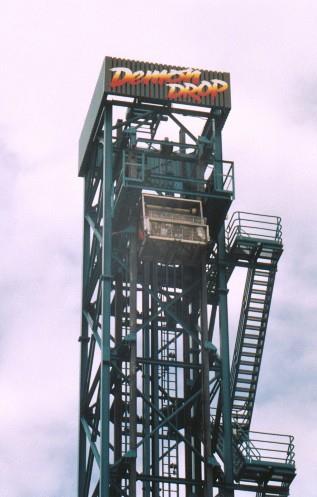
40 Project Soft Costs Design &Engineering $263,450 Construction Permits, Fees & Management $20,000 Project Management Consulting Fees $100,000 Total Development Costs $6,588,100 Group III - ZoPath: Budget Development Category Cost ($) Site Acquisition & Preparation Land Acquisition $1,299,200 Easements (donated) $10,000 Relocation: Truck Depot and Salt Storage $50,000 Legal & Title: Acquisition, Easement & Relocation $70,000 Environmental Assessments & Remediation $750,000 Project Construction Phase I: Trail Trailhead at Jennings Rd $75,000 Trail Construction $654,500 Trail Spur to Calgary Park (hill stabilization) $80,000 Bridge Construction (Two) $1,900,000 Phase II: Extreme Sports BMX / Mounting Bike Trails (Henninger) - Site Prep $250,000 Extreme Park (Truck/Salt site) - Site Prep $200,000 Demon Drop (Acquire and Locate) $500,000 Construction Contingency (10%) $365,950 Phase III: Retail Node Convert Cudnick's to Ice Cream & Grab'n Go Food Off line
41 Group III - ZoPath: Funding Sources Source of Funds Amount ODNR Clean Ohio Trails Fund $500,000 Recreation Trails Program $250,000 Great Lakes Coastal Restoration Grants $250,000 Land and Water Conservation Fund Program $200,000 ODOD Clean Ohio Assistance Fund (Brownfields) $600,000 ODOT Scenic Byway $150,000 NOACA TLCI Planning Grant $50,000 Transportation Enhancement Funds $600,000 City of Cleveland CDBG - Ward 15 Funds $250,000 G.O Bond (for parks) - Ward 15 $250,000 City obtained grant for Phase 1 Environmental Reviews $150,000 Foundations The Cleveland Foundation $150,000 Others OECA $150,000 Cleveland Metroparks $750,000 Fundraiser by Cleveland Zoological Society $100,000 Cuyahoga County Engineer (construction supervision) In kind Port Authority Bond Sale (Extreme/Bike Parks prep) $450,000 Federal Funding Earmark $500,000 TOTAL $5,350,000 TOTAL PROJECT EXPENSES $6,588,100 PROJECT PHASE 1 ($1,238,100) Gain on sale of property to Extreme and Biking Parks $1,099,200 PROJECT PHASE 2 ($138,900)
42 Ecology of the Valley: 5/5 Will the project reduce noise pollution? Will the project reduce hillside subsidence? Will the project provide for measurable ecological restoration of the valley? Will the project improve the water quality of the creek over time? Does the project reclaim and remediate brownfields in the valley?
43 Recreation: 4/5 Does your project increase the amount of walking/jogging on the trail above 96,200? Does your project increase the amount of biking on the trail above 25,900? Does your project propose camping? Does your increase the amount of people who visit the zoo above 1.3 million? Does your project propose an area for extreme sports?
44 Time to Build 3/5 Does your project take 0-18 months to complete? Does your project take 18 months 3 years to complete? Does your project take 3-5 years to complete Does your project take 5-8 years to complete Does your project take 8+ years to complete
45 Cost to Build: 4/5 Is your budget is over $12 Million? Is your budget is between $10 and 12 Million? Is your budget is between $7 and 10 Million? Is your budget is more than $5 Million? Is your budget is under $5 Million?
46 Job Creation: 3/5 Fiscal Net Benefit: 2/5 Does you project maintain all 261 jobs in the valley? Our project involves only a nominal initial increase in the total number of jobs in the Lower Big Creek Valley The net present value for our project is between - 1% and -9% Due to a high initial cost to build our project has a correspondingly low net present value
47 Political Interest: 3/5 Does the project entail taking land from more than three landowners? No=1 Yes=0 Will the project entail securing funding from sources other than federal or nonprofit organizations? No=1 Yes=0 Does the project include camping, rock climbing, or skateboarding? No=1 Yes=0 Does the project have a low time to build score according to the ranking criteria? No=1 Yes=0 Does the trial lack access points to the surrounding neighborhoods? No=1 Yes=0
48 Lower Big Creek Valley: Weighted Matrix Weights Factors Alternative Rating Alternative Weighted 0.25 Ecological Quality Recreation Jobs Fiscal Net Loss/Benefit Time Cost to Build Political Interest Total 3.75 WORST BEST

49 Potential Meets Opportunity National Designations: American Heritage River Cuyahoga Valley National Park Lake Erie Downtown Towpath Trail Cuyahoga Heights Cuyahoga Valley Scenic Railroad National Scenic Byway Ohio & Erie Canal National Heritage Corridor Brooklyn Heights Independence Valley View Walton Hills
Blueways: Rivers, lakes, or streams with public access for recreation that includes fishing, nature observation, and opportunities for boating.
 Parks, Open Space and Trails PRINCE WILLIAM COUNTY 2008 COMPREHENSIVE PLAN TRAILS PLAN CONTENTS The components of the trails plan are: Intent Definitions Goals, Policies, and Action Strategies Trails Map
The Master Plan, Walkability, and Trails in the City of Solon. April 23, 2018
 The Master Plan, Walkability, and Trails in the City of Solon April 23, 2018 Tonight s topics 1. Existing trail options in the City of Solon 2. Potential trail options 3. How trails and walkability converge
Southwest Quadrant Distinctive Features
 SOUTHWEST QUADRANT Southwest Quadrant Distinctive Features LAND USE The 31.17 square mile Southwest Quadrant includes all the area within the planning area west of I-5 and south of the Sacramento River.
Wilds. Headwaters. Lakes. Oxbows. Falls
 56 5 4 3 Wilds Headwaters Lakes Oxbows Falls 57 Zones It could be said the on-the-ground essence of this master plan appears within the next 6 pages of this report. As we learned in the preceding Cultural
Stony Creek Master Plan Public Meeting #2. May 21, 2016
 Stony Creek Master Plan Public Meeting #2 May 21, 2016 Today s Agenda 10:00 10:20 am Presentation 10:20 10:45 am Q & A 10:45 11:30 am Browse, discuss, and comment Metroparks Master Plan Process 4 months
Airport Planning Area
 PLANNING AREA POLICIES l AIRPORT Airport Planning Area LOCATION AND CONTEXT The Airport Planning Area ( Airport area ) is a key part of Boise s economy and transportation network; it features a multi-purpose
IL 390 Station. Wood Dale Open House Summary 5/18/17
 Wood Dale Open House Summary 5/18/17 The first public open house for the Wood Dale Comprehensive Plan took place on May 18 th, 2017. The program was conducted as a fun community event and there were 216
CHAPTER 5. Chapter 5 Recreation Element
 CHAPTER 5 Recreation Element Chapter 5 Recreation Element The Recreation Element of the Meyers Area Plan is a supplement to the Recreation Element of the TRPA Regional Plan and the El Dorado County General
MASTER PLAN EXECUTIVE SUMMARY
 Biscuit Run State Park Scottsville Road (State Route 20) Charlottesville, VA 22902 Biscuit Run State Park MASTER PLAN EXECUTIVE SUMMARY Department of Conservation and Recreation Division of Planning and
CAUSE FOR CELEBRATION!
 CAUSE FOR CELEBRATION! A LONG TIME COMING.. Council votes to keep rails-to-trails on track Opponents of trail take case to County Council Indiana Farm Bureau leads criticism of rail-to-trail land deals
10/25/2013. What is the SCORP?! 2013 Local Government Survey 2013 Statewide Public Survey Advisory Group Priority Areas Your Suggestions!
 COLORADO OUTDOOR RECREATION TRENDS RESULTS FROM THE SCORP AND STATEWIDE Colorado Outdoor Recreation Resource Partnership September 2013 PRESENTATION What is the SCORP?! 2013 Local Government Survey 2013
For Sale Build To Suit Leasing
 For Sale Build To Suit Leasing A Mixed-Use Development (Giant Eagle Shadow Anchor) Canal Fulton, Ohio 44614 (Stark County) Owned & Developed by: Christoff 1 Overview On behalf of Locus Ventures, LLC, the
EXHIBIT 1. BOARD AUTHORIZATION FOR PUBLIC HEARING AND SUBSEQUENT ISSUANCE OF A JOINT DEVELOPMENT SOLICITATION
 EXHIBIT 1. BOARD AUTHORIZATION FOR PUBLIC HEARING AND SUBSEQUENT ISSUANCE OF A JOINT DEVELOPMENT SOLICITATION Washington Metropolitan Area Transit Authority Board Action/Information Summary @Action O Information
2016 Regional Transportation Alternatives Program (TAP) Grant Application
 Grant Application") 2016 Regional Transportation Alternatives Program (TAP) Grant Application PROJECT TITLE: Yelm-Tenino Trail Extension Feasibility Study TRPC use only GENERAL PROJECT INFORMATION Agency or Organization City
2016 Regional Transportation Alternatives Program (TAP) Grant Application PROJECT TITLE: Yelm-Tenino Trail Extension Feasibility Study TRPC use only GENERAL PROJECT INFORMATION Agency or Organization City
Northeast Quadrant Distinctive Features
 NORTHEAST QUADRANT Northeast Quadrant Distinctive Features LAND USE The Northeast Quadrant includes all the area within the planning area that is east of Interstate 5 and to the north of State Route 44.
Chapter eight. Parks and Recreation. Introduction. Crystal Lake Park District
 Chapter eight Parks and Recreation Introduction One of the indicators of quality of life in a city is the parks and recreation system. The City of Crystal Lake is fortunate to have an excellent parks and
Indianapolis - MIDTOWN - Redevelopment
 Rendering Indianapolis - MIDTOWN - Redevelopment 638 East 38th Street - Indianapolis, IN 46205 BROKER DEVELOPER FOR LEASE 638 East 38th Street Indianapolis, IN 46205 Gross Leaseable Area: 13,443 SF Available
System Group Meeting #1. March 2014
 System Group Meeting #1 March 2014 Meeting #1 Outcomes 1. Understand Your Role 2. List of Revisions to Existing Conditions 3. Information Sources Study Area The Purpose of Mountain Accord is to Preserve
NORTHWEST SECTION CONTENTS: CLEVELAND PARK FOLWELL PARK RYAN LAKE PARK VICTORY PRAIRIE DOG PARK VICTORY PARK
 NORTHWEST SECTION CONTENTS: CLEVELAND PARK FOLWELL PARK RYAN LAKE PARK VICTORY PRAIRIE DOG PARK VICTORY PARK LUCY LANEY COMMUNITY SCHOOL N 33RD AVE N 33RD AVE SINGLE-FAMILY RESIDENTIAL MULTI-USE DIAMOND
Predictive Economic Impact Study for the Mount Dora to Seminole Wekiva Trail
 Predictive Economic Impact Study for the Mount Dora to Seminole Wekiva Trail Prepared By: Valerie Seidel vseidel@balmoralgroup.us 341 N. Maitland Ave., Suite 100 Maitland, FL 32751 Phone (407) 629-2185
INGHAM COUNTY TRAILS AND PARKS TASK FORCE MEETING 2
 INGHAM COUNTY TRAILS AND PARKS TASK FORCE MEETING 2 October 22, 2015 Mannik and Smith Group Michigan Trails & Greenways Alliance AGENDA FOR TONIGHT 1. Project Approach, Process and Timeframe 2. Public
Auburn Trail / Ontario Pathways Trail Connector Feasibility Study Public Information Meeting Wednesday, August 22, 2012
 Auburn Trail / Ontario Pathways Trail Connector Feasibility Study Public Information Meeting Wednesday, August 22, 2012 Purpose of Feasibility Study Purpose Evaluate the feasibility of constructing a multiuse
Map 1.1 Wenatchee Watershed Land Ownership
 Map 1.1 Wenatchee Watershed Land Ownership Map 1.1 Wenatchee Watershed Land Ownership The Wenatchee watershed lies in the heart of Washington state in Chelan County. Just larger than the state of Rhode
Section II. Planning & Public Process Planning for the Baker/Carver Regional Trail began in 2010 as a City of Minnetrista initiative.
 Section II Planning & Public Process Planning for the began in 2010 as a City of initiative. city staff began discussions with the Park District on the possibility of a north/south regional trail connection
PROPERTY INFORMATION PACKAGE: 412 Webster St
 C O M M U N I T Y D E V E L O P M E N T 4 0 0 B O A R D M A N A V E N U E T R A V E R S E C I T Y, M I 4 9 6 8 4 C O N T A C T : J E A N D E R E N Z Y 2 3 1. 9 2 2. 4 5 1 3 j d e r e n z y @ g r a n d
Trail Etiquette. Hours of Operation. Trail Accessibility
 Trail Guide The Elmhurst Park District, with 28 parks and over 460 acres of land, offers nearly six miles of paved or asphalt park trails and maintains an additional 3.6 miles of trails within Elmhurst.
Georgetown-Lewes Rail/Trail Study. Rail/Trail Study: Cool Spring to Cape Henlopen State Park New Road Extension (House Resolution No.
 Georgetown-Lewes Rail/Trail Study Rail/Trail Study: Cool Spring to Cape Henlopen State Park New Road Extension (House Resolution No. 47) August 22, 2011 Presentation Outline Background Benefits Statewide
COASTAL CONSERVANCY. Staff Recommendation December 2, 2004 COYOTE HELLYER COUNTY PARK BAY AREA RIDGE TRAIL
 COASTAL CONSERVANCY Staff Recommendation December 2, 2004 COYOTE HELLYER COUNTY PARK BAY AREA RIDGE TRAIL File No. 04-057 Project Manager: Amy Hutzel RECOMMENDED ACTION: Authorization to disburse up to
Section 3.6 Recreation
 3.6 RECREATION This section evaluates the potential impacts of the proposed project on recreation within MTRP. The evaluation is based on field observations, a review of maps of MTRP and the MTRP Master
2. Goals and Policies. The following are the adopted Parks and Trails Goals for Stillwater Township:
 D. PARKS AND TRAILS 1. Introduction Stillwater Township s population is relatively low, with most residents living on rural residences on large lots. The need for active park space has been minimal in
Chapter 6. Trail Design. Trail Design
 Chapter 6 Trail Design Trail Design The trail winds through a region rich in scenic beauty, cultural, and natural history. Volunteer landscape architects working with the Core and Planning Teams, have
A Year To Celebrate Report to the Community. Learn more at metroparkstoledo.com 1
 A Year To Celebrate 2016 Report to the Community Learn more at metroparkstoledo.com 1 million visits 93.5% favorability ranking (*Community survey, Nov. 2016) Middlegrounds: First downtown Metropark 12,000
EAST DON TRAIL ENVIRONMENTAL ASSESSMENT. Community Liaison Committee Meeting #3 July 15, :30 to 8:30 pm Flemingdon Park Library
 EAST DON TRAIL ENVIRONMENTAL ASSESSMENT Community Liaison Committee Meeting #3 July 15, 2013 6:30 to 8:30 pm Flemingdon Park Library Agenda 1. Welcome 2. Housekeeping and Updates a) Housekeeping b) CLC
Welcome and thank you for being here! Kick-Off Public Workshop November 19, 2014
 Welcome and thank you for being here! Kick-Off Public Workshop November 19, 2014 OPEN SPACE MATTERS: Boise s First Reserve Master Plan Julia Grant Foothills and Open Space Manager City of Boise Ellen Campfield
AGENDA ITEM 5 D WAKULLA ENVIRONMENTAL INSTITUTE (WEI) TRAIL FEASIBILITY STUDY
 TRAIL FEASIBILITY STUDY") March 19, 2018 AGENDA ITEM 5 D WAKULLA ENVIRONMENTAL INSTITUTE (WEI) TRAIL FEASIBILITY STUDY TYPE OF ITEM: Action STATEMENT OF ISSUE The Wakulla Environmental Institute (WEI) Trail is one of several trails
March 19, 2018 AGENDA ITEM 5 D WAKULLA ENVIRONMENTAL INSTITUTE (WEI) TRAIL FEASIBILITY STUDY TYPE OF ITEM: Action STATEMENT OF ISSUE The Wakulla Environmental Institute (WEI) Trail is one of several trails
Waukee Trailhead Public Art and Amenities Project
 Waukee - Trailhead Public Art and Amenities Project Sponsor Waukee Project Title Waukee Trailhead Public Art and Amenities Project Termini Description ( i.e. Park Avenue to 19th Street) NE Intersection
A CASE FOR COMPLETING THE JORDAN RIVER PARKWAY: A
 A CASE FOR COMPLETING THE JORDAN RIVER PARKWAY: A safe crossing at 9000 South and 850 West Proposed 9000 South Underpass Parkway Timeline Parkway, Trail, and Tourism Facts Blueprint Jordan River 1971 1973
First Steps Towards Sustainable Operation of Road Tunnels. George Mavroyeni Australia
 First Steps Towards Sustainable Operation of Road Tunnels George Mavroyeni Australia Road Tunnel Operations First steps towards sustainable operation of road tunnels Available on PIARC website here PIARC
The Chu property is a 6.57 acre parcel located in the Town of Superior on the west side of McCaslin Boulevard. In 2014, the Town of Superior acquired
 1 The Chu property is a 6.57 acre parcel located in the Town of Superior on the west side of McCaslin Boulevard. In 2014, the Town of Superior acquired the Chu property for open space with a contribution
APPENDIX A: Survey Instruments
 Three different surveys were conducted during the research phase of the NCHA Trails Study. One questionnaire was designed for elected officials and user groups (general public). The other two questionnaires
Project Application. General Information ODOT PID. ODOT District. Primary County (3 char abrv)
") Current Status (Tier 1, Tier 2 or New) Proposed Status (Tier 1 or Tier 2) Project Application General Information ODOT PID ODOT District Primary County (3 char abrv) Facility Name (i.e. route, rail, terminal,
Current Status (Tier 1, Tier 2 or New) Proposed Status (Tier 1 or Tier 2) Project Application General Information ODOT PID ODOT District Primary County (3 char abrv) Facility Name (i.e. route, rail, terminal,
Coast to Coast Connector Summit
 Project Partners Welcome to the Coast to Coast Connector Summit Winter Garden, Florida City Hall October 1, 2014 1 Why are we here? Objectives 1. Inform key stakeholders on the current state of the C2C
Martin Young (870) Roddy Thrasher (870)
 Roddy Thrasher (870)") Moore Road Great Dane Drive Nestle Way Subject Property Craighead County Shop Army Reserve National Guard Center 19.1+/- Acres in Industrial Park Nestle Road, Nestle Way & Cottage Home Trail Jonesboro
Moore Road Great Dane Drive Nestle Way Subject Property Craighead County Shop Army Reserve National Guard Center 19.1+/- Acres in Industrial Park Nestle Road, Nestle Way & Cottage Home Trail Jonesboro
The Atlanta BeltLine. & Sustainable Development GAFM Conferance. // March 25, 2014
 The Atlanta BeltLine & Sustainable Development GAFM Conferance // March 25, 2014 04/22/2014 Atlanta BeltLine // 2013 Page 1 // Organizational Structure Project Owner and Sponsor Redevelopment Authority
Great Wolf Lodge Fact Sheet & Frequently Asked Questions Potential Location in Gilroy, California 8/30/17
 WHAT? Great Wolf Resorts has identified Gilroy, California as a potential location for a new Great Wolf Lodge family resort and has entered into a 60-day period of exclusivity with the City and community
- NEUTRAL. Savannah ORGIA PETER SALAMON MASTER OF URBAN DESIGN THESIS SAVANNAH COLLEGE OF ART AND DESIGN MAY 2015
 - NEUTRAL + RE δge Savannah ORGIA PETER SALAMON MASTER OF URBAN DESIGN THESIS SAVANNAH COLLEGE OF ART AND DESIGN MAY 2015 PANAMA CANAL EXPANSION THE CATALYST Suez 1869-6,000 km Panama 1914-13,000 km Prior
MARTA & City of Atlanta Sales Tax Referendums. Public Hearings May 25 & 26, 2016 June 1 & 2, 2016
 MARTA & City of Atlanta Sales Tax Referendums 1 MARTA & City of Atlanta Sales Tax Referendums Public Hearings May 25 & 26, 2016 June 1 & 2, 2016 MARTA & City of Atlanta Sales Tax Referendums 2 Guiding
e: w: remingtoncorp.com Quarry Park News More on page 1 & 2.
 e: QuarryParkLOA@remingtoncorp.com w: remingtoncorp.com Quarry Park News INSIDE: New Amenities Set For 2016 Openings More on page 1 & 2. Amenities Opening in 2016 The Remington YMCA Quarry Park Recreation
Frederickson LUAC. Community Plan Update. Parks & Recreation. September 25, 2017
 Frederickson LUAC Community Plan Update Parks & Recreation September 25, 2017 Kimberly Freeman Resource Stewardship Superintendent kimberly.freeman@co.pierce.wa.us 253-798-4261 Joseph Coppo Senior Parks
Downtown Frederick Hotel and Conference Center BRIEFING.
 Downtown Frederick Hotel and Conference Center BRIEFING Public-Private Partnership Team Public-Private Partnership initiated by the Chamber of Commerce and business community to retain existing employers
Appendix A. Cleveland Lakefront Revitalization Plan Survey
 Appendix A Cleveland Lakefront Revitalization Plan Survey Citizens and Workers Survey Instrument... A2 Leaders Survey Instrument... A10 Citizens Phone Survey Results... A15 Workers Survey Results... A23
Environment and Natural Resources Trust Fund 2019 Request for Proposals (RFP)
") Environment and Natural Resources Trust Fund 2019 Request for Proposals (RFP) Project Title: Glacial Edge Trail and Downtown Pedestrian Bridge Category: G. Land Acquisition for Habitat and Recreation ENRTF
Environment and Natural Resources Trust Fund 2019 Request for Proposals (RFP) Project Title: Glacial Edge Trail and Downtown Pedestrian Bridge Category: G. Land Acquisition for Habitat and Recreation ENRTF
Park System Development Charge Update Investment Plan
 System Development Charge Update Investment Plan I. Summary II. SDC Investments, 1998-2007 III. IV. Population Growth Projections SDC Acquisition Target s V. SDC Development Target s VI. SDC Acquisition
Located in downtown Boston by the Fort Point Channel
 Located in downtown Boston by the Fort Point Channel Overview History of the Station Renovation of the Station (Costs) Effects of the Renovation (Benefits) Future Plans Conclusion Beneficial Project Sources
Alpine Trails Mountain Community Development Lands Fernie, British Columbia Winter 2018
 FOR SALE Residential Development Land 228 ± Acres Size: Zoning: Price: 228 +/- Acres R1B and R3 $7,700,000 CAD ($33,772.00 /Acre) $6,055,000 USD ($26,557.00 /Acre) Alpine s Mountain Community Development
LONG TERM (OPERATION) IMPACTS AND POTENTIAL MITIGATION
 IMPACTS AND POTENTIAL MITIGATION") 3.6 This chapter provides a project-level analysis of potential impacts to recreation sites in the study area including parks, natural areas, open spaces, trails, and playfields, as well as amenities such
3.6 This chapter provides a project-level analysis of potential impacts to recreation sites in the study area including parks, natural areas, open spaces, trails, and playfields, as well as amenities such
FEASIBILITY CRITERIA
 This chapter describes the methodology and criteria used to evaluate the feasibility of developing trails throughout the study areas. Land availability, habitat sensitivity, roadway crossings and on-street
Connecting Cleveland 2020 Citywide Plan Transit Improvement Recommendations
 Rapid Transit Facilities 1 1.T.2 Brookpark Road Station Reconstruct and reconfigure the Brookpark Road station. 1 1.T.5 Puritas Avenue Station Reconstruct and reconfigure the Puritas Avenue (West 150th
Do Asheville city residents get their fair share of county sales tax and property tax payments?
 Buncombe County and Downtown Asheville PARTNERS FOR PROGRESS David Gantt Buncombe County Commission Chair January 16, 2014 How is money from city taxpayers allocated now? Do Asheville city residents get
PDAC Priority Project East Dayton Rails-to-Trails (Flight Line) Project Description
 Project Description") PDAC Priority Project East Dayton Rails-to-Trails (Flight Line) Project Description The Flight Line project represents an amazing opportunity to become a truly transformative urban recreational trail that
PDAC Priority Project East Dayton Rails-to-Trails (Flight Line) Project Description The Flight Line project represents an amazing opportunity to become a truly transformative urban recreational trail that
Smart Growth in Industrial & Community Development. Presentation to Rail~Volution September 2005
 Smart Growth in Industrial & Community Development Presentation to Rail~Volution September 2005 Transit-Oriented Development (TOD) & Cargo-Oriented Development (COD) A linked, transportation-based redevelopment
N VANCOUVER AVE PARCEL
 FOR SALE N. VANCOUVER COMMERCIAL OPPORTUNITY - in - PORTLAND OREGON LILLIS ALBINA CITY PARK LEGACY EMANUEL MEDICAL CENTER LOCATED on N. Vancouver Ave 2839 SW 2nd Avenue Portland OR, 97201 503.222.1655
PRESENTATION TO THE RICHMOND REGIONAL TRANSPORTATION PLANNING ORGANIZATION: JUNE 2, 2016 BRT CONNECTIVITY AND LAND USE ANALYSIS PLAN JOSH MALLOW
 Richmond Regional Planning District Commission 1969 PRESENTATION TO THE RICHMOND REGIONAL TRANSPORTATION PLANNING ORGANIZATION: JUNE 2, 2016 BRT CONNECTIVITY AND LAND USE ANALYSIS PLAN JOSH MALLOW PROJECT
Aloha Stadium Conceptual Redevelopment Report. April 5, 2017
 Aloha Stadium Conceptual Redevelopment Report April 5, 2017 THE HISTORY OF ALOHA STADIUM A Hawaii landmark since 1975 Aloha Stadium has stood for over 40 years and effectively achieved its mission as a
Projects Awarded GOCO Funding in El Paso County
 Grant Type Fiscal Year Sponsor Title Grant Amount Acres Conserved Inspire 2016 City of Colorado Springs Out the Door Pikes Peak! $75,000.00 0 Parks 2016 Colorado State Parks 2016 City of Manitou Springs
FOR SALE $895,000. ±10,836 SQFT Flex Warehouse & Office Space in South Asheville. Prime Location in South Asheville Corridor!
 $895,000 Prime Location in South Asheville Corridor! ±10,836 SQFT Flex Warehouse & Office Space in South Asheville SEE INSIDE FOR MORE INFORMATION! 1276 Hendersonville Road Sisbro Properties, LLC (the
Sacramento Placerville Transportation Corridor Alternatives Analysis
 Sacramento Placerville Transportation Corridor Alternatives Analysis EL DORADO COUNTY TRANSPORTATION COMMISSION 1 Sacramento Placerville Transportation Corridor 2 Goal of the Project To give public officials
Central Wasatch Visitor Use Study STEVEN W. BURR, PH.D. AND CHASE C. LAMBORN, M.S. INSTITUTE FOR OUTDOOR RECREATION AND TOURISM UTAH STATE UNIVERSITY
 Central Wasatch Visitor Use Study STEVEN W. BURR, PH.D. AND CHASE C. LAMBORN, M.S. INSTITUTE FOR OUTDOOR RECREATION AND TOURISM UTAH STATE UNIVERSITY Utah State University s Institute for Outdoor Recreation
SAN ANTONIO RIVER IMPROVEMENTS PROJECT. August 6, 2008
 SAN ANTONIO RIVER IMPROVEMENTS PROJECT August 6, 2008 1 History of the SA River Improvements 1921 Flood Olmos Dam Complete in 1929 Downtown Flood Relief Projects in 1950 s Dams on the River Channel and
Alpine Trails Mountain Community Development Lands
 FOR SALE Residential Development Land 228 ± Acres V.T.B. FINANCING AVAILABLE! Size: 228 +/- Acres Zoning: R1B and R3 Price: $7,700,000 CAD ($33,772.00 /Acre) Alpine s Mountain Community Development Lands
TOOELE COUNTY, UTAH STANSBURY PARK INCORPORATION FEASIBILITY STUDY DECEMBER 2014
 TOOELE COUNTY, UTAH STANSBURY PARK INCORPORATION FEASIBILITY STUDY DECEMBER 2014 PROJECT REVIEW Legal Governance Demographic Information (10-2-106(4)(a)(i)-(iii)) Present and Five Year Projections of Cost
FOR SALE $299,000 HALF CITY BLOCK IN WEST ASHEVILLE! ± 0.52 Acres Walk to River Arts District SEE INSIDE FOR MORE INFORMATION!
 $299,000 HALF CITY BLOCK IN WEST ASHEVILLE! ± 0.52 Acres Walk to River Arts District SEE INSIDE FOR MORE INFORMATION! Haywood Road Assemblage Seller through G/M Property Group, LLC as exclusive agent,
WEST JORDAN PARKS, RECREATION AND TRAILS MASTER PLAN Advisory Committee Meeting #2
 WEST JORDAN PARKS, RECREATION AND TRAILS MASTER PLAN Advisory Committee Meeting #2 MONDAY, NOVEMBER 5, 2018, 6:00 P.M.; PARKS DEPT. CONFERENCE ROOM ATTENDEES: Lisa Dean Larry Gardner Duane Harding David
SUMMER QUARTERLY MEETING JULY 21, Tri-State Trails is made possible by the generous support of Interact for Health.
 SUMMER QUARTERLY MEETING JULY 21, 2017 Tri-State Trails is made possible by the generous support of Interact for Health. AGENDA Welcome, introductions, and updates around the room Tri-State Trails Announcements
City Council Workshop July 26, 2010
 Des Moines Trails Connecting a Community City Council Workshop July 26, 2010 1 OVERVIEW Trail Benefits Trails Progress How We Fund Trails What s Next for Trails 2 What is a trail? Paved Trails 10 wide
A 378-SITE COMMUNITY PRICE: CONTACT BROKER. For a video tour, please visit: SR 82 Mantua, OH 44255
 A For a video tour, please visit: https://vimeo.com/268879292 PLEASE DO NOT SPEAK WITH TENANTS OR EMPLOYEES 3392 SR 82 Mantua, OH 44255 PROPERTY DETAILS SITE INFORMATION ADDRESS 3392 SR 82, Mantua, OH
NORTHLAND-BELTLINE CORRIDOR
 NORTHLAND-BELTLINE CORRIDOR R E D E V E L O P M E N T S T R A T E G Y R E Q U E S T F O R Q U A L I F I C A T I O N S I N F O R M A T I O N M E E T I N G T U E S D A Y, 2 5 N O V E M B E R 2 0 1 4 AGENDA
CEDAR BAYOU WATER PARK and AQUATIC CENTER Feasibility Study Executive Summary November 15, 2016
 CEDAR BAYOU WATER PARK and AQUATIC CENTER Feasibility Study Executive Summary November 15, 2016 INTRODUCTION The Cedar Bayou Parks, LLC project is unique in the US. The combination of the large water park
CITY OF BROOKFIELD Capital Improvement Fund Budget
 CITY OF BROOKFIELD Capital Improvement Fund Budget The City adopts an annual capital improvement budget, based on a five-year capital improvement program (CIP). The annual budget and CIP are prepared by
Brentsville Courthouse
 46 Prince William County Proposed FY 2014-2019 Capital Improvement Program Brentsville Courthouse Existing budget will complete the jail restoration. There is no additional funding allocated to projects
2015 Business Survey Report Erie to Pittsburgh Trail March 2015
 2015 Business Survey Report Erie to Pittsburgh Trail March 2015 Table of Contents Executive Summary 2 2013 EPT Trail User Survey and Impact Analysis 3 Overview 3 Results 3 2014 2015 Erie to Pittsburgh
STORY MILL COMMUNITY PARK
 OWNER: City of Bozeman Department or Parks and Recreation P.O. Box 1230, 415 N. Bozeman Street Bozeman, MT 59715 Tel: (406)-582-2908 APPLICANT: The Trust for Public Land 1007 E. Main Street, Suite 300
Chapter 2: Summary of Existing Open Space System
 Chapter 2: Summary of Existing Open Space System In 1976, the Wake County Board of Commissioners established the Wake County Parks and Recreation Department in order to provide park facilities and programs
DATE: January 19, WCA Governing Board. Johnathan Perisho, Project Manager. Mark Stanley, Executive Officer
 Item 14 DATE: January 19, 2017 TO: FROM: THROUGH: SUBJECT: WCA Governing Board Johnathan Perisho, Project Manager Mark Stanley, Executive Officer Item 14: Consideration of a resolution to accept an acquisition
Stephens State Park Trails
 TRAILS OF ALLAMUCHY MOUNTAIN & STEPHENS STATE PARKS Allamuchy Mountain and Stephens State Parks contain 28 marked trails providing access to diverse landscapes for walking, hiking, biking, bird-watching,
Shantz Village. Development Summary November Steve Seiler, Senior Associate. Daniel Goldstrom, Partner
 A D U L T C O M M U N I T Y November 2017 45 Acre Mixed Use Development Staged Closing to 2021 35.55 Acres Net 10 Lots Zoned Fully Serviced Curb & Gutter 8.18 Acres 75 Adult Villas 7.87 Acres Supportive
6. How connected do you feel to the Sans Souci community?
 Please complete and return before May 1st, 2017, to be entered for a prize drawing. Further instructions are available on the last page. Digital version available at GCPlanning.org. 1. Do you live and/or
Longmont to Boulder Regional Trail Jay Road Connection DRAFT FINAL REPORT
 Longmont to Boulder Regional Trail Jay Road Connection DRAFT FINAL REPORT December 2018 Project Summary Boulder County, Colorado, in partnership with the City of Boulder, is evaluating options for multi-use
Opportunities for additional ownership would also be available for the future phases of the resort development.
 The Dakota Dunes Hotel is the next proposed phase of the Dakota Dunes Resort development at the Whitecap Dakota First Nation. WDFN is interested in leasing a site located adjacent to the Dakota Dunes Casino
THOMAS A. SWIFT METROPARK Introductions History Present Conditions Future Development Plans Implementation Strategies Statistics
 THOMAS A. SWIFT METROPARK Introductions History Present Conditions Future Development Plans Implementation Strategies Statistics Introduction As an open meadow park positioned along the Mahoning River,
WEST MISSION. Valuable Excess Land O REILLY AUTO PARTS NET LEASED INVESTMENT IN ESCONDIDO AVE OFFERING MEMORANDUM
 Valuable Excess Land 840 WEST MISSION OFFERING MEMORANDUM AVE O REILLY AUTO PARTS NET LEASED INVESTMENT IN ESCONDIDO KIPP GSTETTENBAUER, CCIM Senior Vice President Lic. #01405420 858.458.3345 kipp@voitco.com
Preferred Recreation Recommendations Stemilt-Squilchuck Recreation Plan March 2018
 Preferred Recreation Recommendations Stemilt-Squilchuck Recreation Plan March 2018 Below are the recommended recreation ideas and strategies that package together the various recreation concepts compiled
RUSHMORE CONNECTOR TRAIL PROPOSAL
 PURPOSE AND NEED Background The U.S. Forest Service, Black Hills National Forest (Forest Service) has received a special use permit application from the State of South Dakota Department of Game, Fish and
MPRB: Southwest LRT Community Advisory Committee Issues and Outcomes by Location Current to: 12 November 2010
 MPRB: Southwest LRT Community Advisory Committee Issues and Outcomes by Location Current to: 12 November 2010 This is a compilation of issues and outcomes identified by the CAC. It is a work in progress,
CHAPTER ONE LITERATURE REVIEW
 CHAPTER ONE LITERATURE REVIEW LITERATURE REVIEW This chapter summarizes the most recently published community impact studies and articles that relate to multiuse trails. The review focuses on publications
SAN ANTONIO RIVER IMPROVEMENTS PROJECT. April 27, 2009
 SAN ANTONIO RIVER IMPROVEMENTS PROJECT April 27, 2009 1 Project Limits 2 Project Partners City of San Antonio Provides project funding for project amenities (i.e.. Sidewalks, Landscaping, Lighting, etc.)
DEVELOPMENT OPPORTUNITY 630 Central Park Yonkers, NY 10704
 DEVELOPMENT OPPORTUNITY 630 Central Park Yonkers, NY 10704 1 Offering Memorandum 630 Central Park, Yonkers, NY 10704 +/-200,000 Square Feet Industrial Building Redevelopment Opportunity 630 Central Park
EPPERSON INDUSTRIAL PARK
 EXCLUSIVE LISTING FUTURE INDUSTRIAL SITE ±680 ACRES SALT LAKE CITY, UTAH 3300 N Subject 40.54 acres 3200 W 550.46 acres 40.17 acres 2100 N 40.09 acres Sold Future State Prison Site ± 325 Acres Haul Road
Introduction to the New York-New Jersey Trail Conference. Peter Dolan New Jersey Program Coordinator
 Introduction to the New York-New Jersey Trail Conference Peter Dolan New Jersey Program Coordinator New York-New Jersey Trail Conference Volunteer-directed public service organization committed to: Developing,
Economic Development and Tourism
 SECTION 4 SECTION 4 Economic Development and Tourism 4. Economic Development and Tourism Tourism plays a very important role in Niagara s economy, providing employment and generating business for support