Basic Map & Compass Skills
|
|
|
- Caren Harvey
- 6 years ago
- Views:
Transcription
1
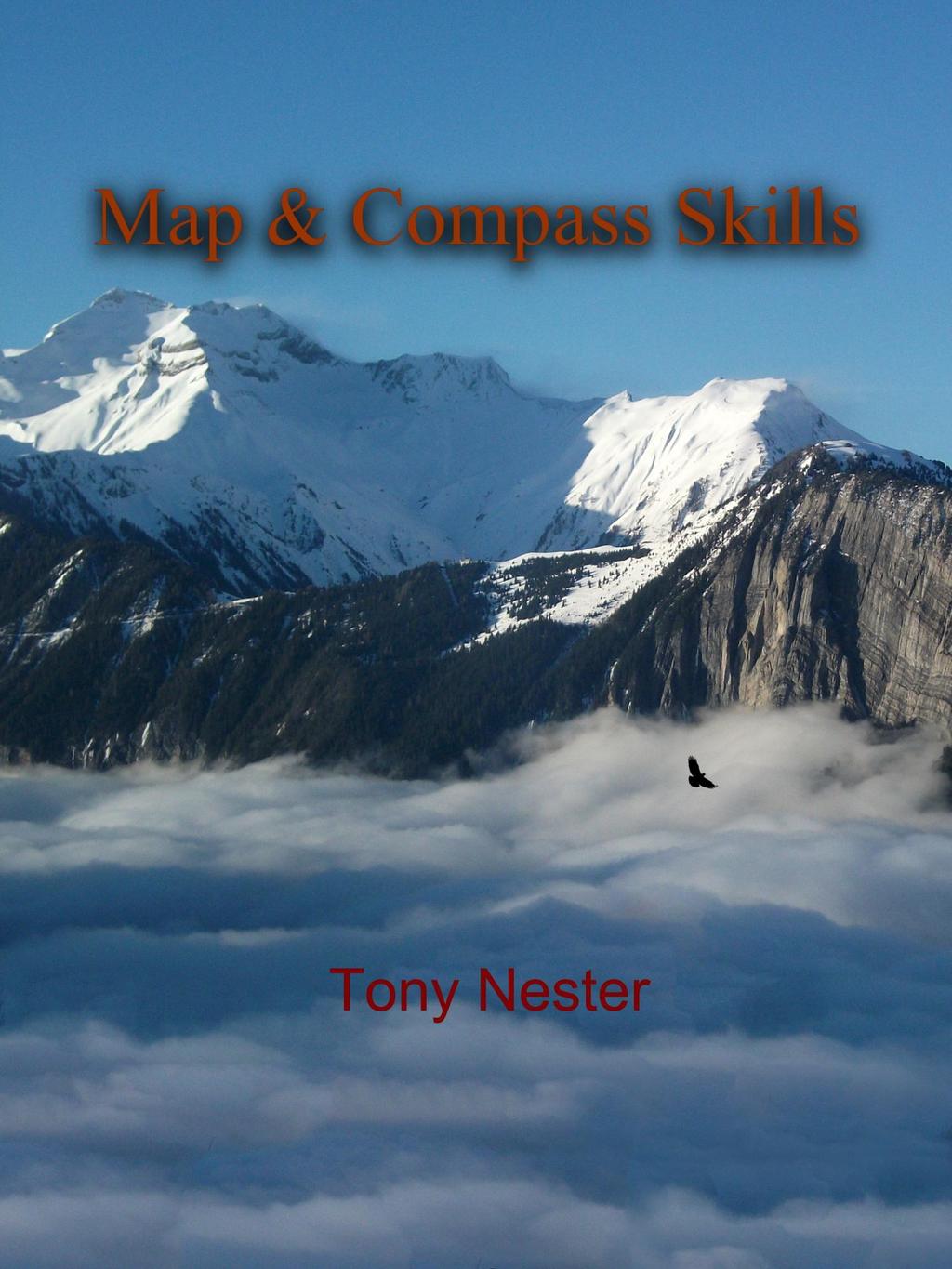
2 Basic Map & Compass Skills By Tony Nester Published by Diamond Creek Press, Flagstaff, AZ Copyright December 2014 Diamondcreekpress.com
3 Copyright 2014 by Tony Nester No part of this book may be transmitted in any form whether electronic, recording, mechanical, photocopying, or otherwise, without written permission of the publisher. All rights reserved. No part of this book may be reproduced or used in any manner without written consent except for use in reviews. Interior photos courtesy of Mike Masek.
4 Warning This information is intended for academic purposes only. Hiking and camping in the backcountry can be dangerous. Check on the local weather, road conditions, and trails before venturing out. The author, Diamond Creek Press, and Ancient Pathways Survival School, LLC assume no liability for any laws broken by the reader or for any injury, damages, or loss for the use or misuse of the information contained in this ebook.
5 The Basics of Map & Compass The ability to navigate with a handheld compass and a topographic map is a hallmark outdoor skill. It will enable the wilderness explorer to not only stay found but locate water sources, road junctions, and the best routes through challenging terrain. There are three areas to focus on when learning to put these time-tested navigation tools together: 1) Topographic Map Use without a Compass 2) Following a Compass Bearing without a Map 3) Using Map & Compass Together Each of these has its place and is partly dependent on the terrain and your end goals. For instance if I am in the desert with ninety-mile visibility, I may just pull out my topo map and use the easily identified peaks, canyons, and mesas to pinpoint my general whereabouts. I do this a lot where I live as our incredible vistas make triangulating my position relatively easy. If I need to reach an exact location such as a small spring, then I will use a compass in conjunction with my map. However, when I am in the jungle or forest, a map and compass are always used together and are critical to arriving at my destination. The only time I use a compass by itself is if I am given a set of pre-determined bearings to follow such as in a sport-orienteering event or if a friend has provided bearings to his basecamp. Having a compass dangling around your neck does little good unless you have a topo map to go with it or already have known bearings.

6 Understanding the Terrain with a Topographic Map Let s look at map use first. I am going to cover only a few of the essential tips for reading a topo map. You can obtain a free interpretive handout from USGS.gov or a gear shop. This will allow you to delve into further explanation of the symbols. Contour lines: these lines indicate how steep or flat the terrain is. Lines that are tightly packed will indicate a steep mountainside, cliff, or deep canyon; conversely, contour lines that are widely spaced will be indicative of a relatively flat region such as a meadow or field. The steep sides of this crater are indicated by the tightly-grouped contour lines.

7 By contrast, the space between the contour lines to the right of the spring indicates flat terrain.

8 Contour interval: The spacing of those contour lines will give you a feel for the difficulty of a region you may be traversing but each map s contour lines vary. This information is located in the center margin at the bottom of the topo map. I have some maps that have contour intervals listed as 10, 20, and 40 feet. This can make a huge difference when trying to obtain water from a canyon. A 10 foot drop might be doable but a 40 foot drop is going to turn into a technical rockclimb. Always be sure to take note of the contour interval when pouring over your map.
 haven t changed much, the roads, springs, and manmade structures")
9 Date the map was made: you will find the publication date in the bottom right corner. Why is this important? Because a large portion of printed topo maps were done in the 1960s and while the large-scale features (mountains, canyons, rivers) haven t changed much, the roads, springs, and manmade structures may be different. On one survival course, we did a land navigation exercise to a water tank listed on our topo map, knowing it was dated We trekked crosscountry and arrived, four miles later, at the water source which turned out to be a rusty steel water barrel turned on its side with shotgun holes in it! Always check the publication date and then call the local Forest Service/State office to obtain the location of current roads, backcountry water sources, and private property.

10 Magnetic declination figure: On most maps, this will be a cluster of three arrows pointing north and located in the bottom margin on the left side. One will indicate MN, which is Magnetic North; another will read, GN, which is Grid North. The third is usually a star, which refers to True North. The latter lines up with Polaris, the North Star, and is totally separate from Magnetic North. MN, or the direction a compass needle points, is hundreds of miles to the south (as of this writing) in the Arctic Ocean. The direction and strength of this magnetic field continually changes and creeps around 20+ miles each year in relation to movement in the Earth s core. MN and TN are the two you will use to adjust for declination. Without adjusting for magnetic declination, a map and compass is useless and will result in you getting way off course, if not lost. Keep in mind that declination is different for each state (and even within states) and changes slightly each year. The number listed on your map is not going to be accurate if it was from the 1960s. I call the USGS office each year or look online and get the current magnetic declination for my home state.

11 Using a Compass Now, put aside the topo map for a few minutes as we delve into the anatomy of a compass. I like the standard baseplate compasses made by Silva or Suunto. I am going to be referring to bearings when mentioning the numbers on the compass housing but this means the same as the term azimuth as used by the military. On your compass, you will see three arrows. One of these is inscribed on the baseplate, outside of the liquid-filled round housing. The other two arrows are inside the housing. One of these is red and free-floating. The other two arrows are imprinted and resemble a red shed. A $12 Silva or Suunto baseplate compass is a good model to begin with. Each tick-mark is 2 degrees.

12 1. Magnetic North is the red arrow (see photo below). This red arrow can be affected by power lines, iron-ore deposits in the ground, the metal of your vehicle, a metal zipper in your jacket (or a neck knife as one guy found out!), and other external factors in your environment. Again, MN points towards a physical location in the Arctic Ocean and is not connected with True North.

13 2. The Shed arrow is used to line up your Magnetic North needle with the bearing you dial in on the compass housing.


14 3. The Direction of Travel arrow is inscribed on the flat exterior of the plate outside of the compass housing. This is used after you have lined up the two interior arrows. This arrow is used to point in the direction you will actually walk when following a precise bearing. This static white line inside the compass housing is where you dial in your bearings.

 until the red Magnetic North needle lines up directly over the red shed inside the housing.")
15 Steps in Dialing in and Following a Bearing So far, I ve just talked about the compass layout. Here s how you put it all together. First, stand up and plug the compass into your midsection. The bottom plate of the compass should rest squarely in your gut and will not be turned at any point. The compass dial, however, will be turned: you will dial in a bearing, let s say, of 84 degrees. This is done by rotating the numeric dial until the number is lined up on the static white line on the housing. Next, turn your entire body (not the compass) until the red Magnetic North needle lines up directly over the red shed inside the housing. Once this is done, look at which way the direction of travel arrow on the outside is pointing. That is the way you walk to get to your destination, if you have pre-determined bearings.
16 If you want to practice this outside, then use the following three bearings on level ground. This will create a triangle pattern and have you arrive back at your starting point if you have performed all of the above steps correctly. This is based upon my pace count so you may be a few feet short or overstep your starting position but you should be in line with your point of origin (marked it with a water bottle). A pace is where you count every time your right foot touches the ground. Walk five paces for each bearing. 53 degrees 171 degrees 289 degrees The above is simply an overview of how to use a compass and walk a bearing. You haven t adjusted for declination because there s no topo map involved, which is what we will look at next.


17 Putting Map & Compass Together to Walk a Bearing 1) Lay out a topo map on a flat surface and mark off three arbitrary spots, spaced a few miles apart. Let s say that you are going on a three-day backpacking trip and each X will indicate a new campsite. Draw a line with a ruler or the edge of your compass, connecting all three spots.

18 2) Here s how to determine the adjusted bearing from point 1 to point 2: place your compass edge on the line and dial the compass housing until the N is at the top and the red lines in the compass housing are parallel with the grid lines on your topo map. This is important: the N must always be on top so it corresponds with Grid North which at the top of the topographic map. Notice how the red lines inside the compass housing are parallel to the black grid lines on the topo map. The bearing in the compass housing is 285 degrees but I haven t adjusted for declination yet.
. If you are back in the eastern U.S.")
19 3) Record the bearing on your compass dial and then adjust for magnetic declination. Where I live in Arizona, I have to subtract 11 degrees to get my adjusted bearing (though this could change by one degree next year). If you are back in the eastern U.S. you may have to add, based upon the information obtained from the USGS site for your region. Write the final number down on the line on your map so you have this adjusted bearing visible for when you arrive at the field and plan on walking your proposed route.


20 Perform this exercise for the two remaining marks on your map and you will have obtained the adjusted bearings for each route. The baseplate is aligned but the compass dial has not been adjusted yet to align N with the top of the map. Once again, align the red lines inside the compass housing so they run parallel to the black Grid North lines on the map. Then read your bearing on the compass dial and adjust for declination. It s not until I get to the field where I ll be hiking, that I line up the Magnetic needle over the red shed.

21 The completed bearings. To remind me that these have been adjusted for magnetic declination, I write in an A beside the bearing. Note the contour lines this will be an easy hike along level terrain with a few small ridges to traverse near point 3. As to whether the roads will be therewho knows? This map was made in the 1970s. A visit to the local outdoor store or visitor center, prior to my trip, to talk to the locals will be the best bet.

22 How to Orient Your Map Using a Compass Correctly aligning my map to the surroundings is the first thing I generally do after getting out of my truck and preparing to hike. I unfold my map, lay it flat, and then place my compass along the top edge which is North. Then I adjust the compass dial until the N is at the top, which corresponds to North on my topo map. Next, I turn my entire body, with map and compass in hand, until the Magnetic needle is boxed in the red shed. My map is now properly aligned to my actual surroundings.

23 Triangulation or How to Locate Your Position on a Map So, you re on a backpack trip or long dayhike and want to locate your position on the map using the terrain features around you. This is where triangulation comes into play. You will need to layout your map, grab your compass, and then look for 2-3 separate prominent landmarks such as a hill, mountain, or mesa. 1) Take a bearing from the first landmark and then record this on your map. 2) Take a bearing from the second landmark and do the same. 3) Extend the lines you ve drawn until they intersect and this will indicate your location.

24 Additional Tips for Staying on Your Route A few other methods to employ for staying on track are the concepts of using handrails, backstops, chunking, and pace count. You already use some of these unconsciously on a daily basis so overlaying them onto a wilderness setting won t be much of a stretch. For instance, we all rely on handrails to move around the inside of our house in the dark or when driving to and from our house to the grocery store. We use pre-determined permanent objects/structures along the route that we have filed away as reliable indicators to help us to arrive at our destination. When setting out on a hike in the backcountry using map and compass, you want to determine what permanent physical handrails will be present to your right and left along the way. For example, if I m starting from the north and doing a hike to the Wash on the map below, I ll study the handrails beforehand. I don t just want to end up in the wash somewhere I want to find the exact bend in the arroyo where the letter W in Wash is found. In this case, I have a ridgeline that measures 5200 feet (top of map) that I will have to descend followed by a dirt road (dashed lines). For much of this section, the terrain will be flat as indicated by the considerable distance between contour lines. I will then come to another ridgeline (the 5000 foot mark), below which is another dirt road and the Wash (and hopefully a small stream). The cliffs to the south, just beyond the streambed will be my backstop. I know that once I hit the wash below and see the cliffs to the south that I will have gone far enough and will only have to walk a short distance to the east or west to find that exact spot where the Wash is at. During my hike, I will also have a finger-formation of rock jutting out to the east (just below the R 22 E on the map). This will serve as another handrail along the way. Keep in mind, that the roads may not be there depending on the age of the topo map but the ridgelines, hills, canyons, and other geologic features will be present. Power lines, railroad tracks, and blacktop roads should also be reliable but talk to the locals in the area first to see if your topo map features match up with current conditions, especially the water sources in the region.
25 Chunking & Incorporating Pace Count The concept of chunking comes into play during a hike because I don t just want to plot my bearing and then walk a few miles to the end without any reference points. This will result in me arcing to the right and getting off course as my right side is the predominant side in my walking stride. We see this all the time in our land navigation courses when we provide a bearing to the students and then tell them to meet us there in an hour. Those students, who work together in groups of two or three, leapfrogging as they go, stay on a straight line using nearby landmarks and arrive at the precise location. Those who hike solo, only glancing down at their bearing occasionally, end up arcing to the right (85% of humans are right-handed) and have to make up the distance. With chunking, I want to break up my hike into small segments which will help me stay on the bearing I need to follow. This technique is especially critical the further the mileage you have to cover. Once you plot your bearing and identify your handrails and backstop, you will want to line up your compass direction of travel arrow with a prominent natural feature such as a stump, dead tree, boulder, etc and then walk to that object following your bearing. This prominent feature should be yards away depending on the terrain. In the desert, with such wide-open vistas, I ll often key in on a distant tree or jutting boulder a few hundred yards away and then walk to that. Conversely in the forest or jungle, I may only walk fifty yards. Once I arrive, I search ahead for another distant feature that is in line with my direction of travel arrow. I keep doing this to ensure I m staying on a precise bearing. Again, working with 2-3 people and chunking up the route will really keep you headed in the right direction. If you re alone, then you have more work to do. Depending on the distance, I like to stop every half mile or mile and do a quick check of my map, the handrails, and the distance we ve covered to confirm we are on track. These checkpoints are usually tied in with shade or hydration breaks.
 touches the ground.")
26 Incorporating Pace Count Pace count can also be helpful with the chunking method. Pace counting involves mentally recording every time your right foot (or left but stick with one side) touches the ground. While there are going to be variations between individuals, the average adult walks 250 paces in a quarter mile distance, 500 paces in a half-mile, 750 in three quarters of a mile, and roughly 1000 paces in one mile. In this example, the pace count corresponds to the decimal equivalent of each ¼ mile increment. So, if I m going on a trek that s 2.5 miles that will average out to 2500 paces. I will still use visual landmarks along the way to chunk the distance but I will also record every time I reach 100 paces. I can do this by writing it on my map, cutting a notch in a stick, placing a pebble in your pocket or tying a knot in a piece of rope (similar to the military approach of using Ranger Beads ). Bear in mind, that all of the above is for a typical pace count. If I m carrying a heavy pack, walking in sand, over hills, or at night, then I may have to add in paces for every mile. I have to be honest, I don t use pace counting much in the desert where I can key in on distant landmarks. However, if I m in a thick forest or jungle then it is extremely helpful. To summarize, use handrails, backstops, chunking, and pace count as tools to help you stay on an accurate bearing. Keep in mind that for every degree you are off in your route-finding, you will end up a thousand feet off per mile from your desired location. Imagine what this will amount to on a ten-mile trek!

27 How Much Mileage Will I Cover In An Hour? This depends on the terrain, weather conditions, visibility, your pack weight, etc The average mileage for a healthy adult on foot on flat terrain is two miles per hour. Extremely fit hikers can average three miles per hour. However, if you are trekking in the mountains, over sand dunes, a dense forest, or through canyon country, then you will have to factor in more time. Add in a cumbersome pack and dwindling energy levels at the end of the day, then your mileage will decrease accordingly. Start with the assumption that, given ideal conditions, you will make around two miles an hour and then adjust for the above factors as your hike unfolds. There are no shortcuts in the wilderness and often the longest route around a canyon or swamp is going to be quicker than trying to bushwhack across challenging terrain to maintain a linear path. Thus far, this has been an academic approach to learning how to use a map and compass. You will have to put all this together on field-exercises and refine your navigation skills. Do this with a friend and over a short distance of ¼ mile. This will enable you to safely build up your ability to walk a bearing and overlay what you are seeing on your topo map with the actual landscape.

28 Suggestions for Purchasing and Programming a GPS While I carry a GPS unit, it is no substitute for being able to use a map and compass. Learn the latter approach and you will always be able to find your way around the backcountry. Like all wilderness skills, land navigation is a perishable ability so practice several times a season or consider participating in an orienteering competition to keep you on track in the wilds. A GPS can be a great tool to augment your map & compass skills. Purchase one of the higherend models by Garmin that allows you to upload topo map software. Then you need to log some time at home figuring out the specific functions of your GPS model as each one is different. Never rely solely on a GPS as they can unexpectedly lose their data, are prone to damage if you drop it, and will sometimes lose the connection with the satellites. If you are new to using a GPS, you will want to program the Map Datum to match up with the topo map you are carrying. This information can be found in the bottom left corner of your map or online as Horizontal Datum. In my case, I use NAD 27 CONUS. The Position Format will also need to be calibrated for your region. For my location, I use UTM/UPS. If I travel out-of-state, then I will have to adjust both of these for the new location or risk getting off course. Both features can be found by going to Setup then clicking on the Units section of your GPS. The proper adjustment of these key areas is crucial for using your device accurately. Most REI gear stores have 2-hour evening sessions that cover all of these nuts-and-bolts. Otherwise, pick up a copy of The Basic Essentials of GPS. For additional reading on orienteering, check out the classic manual by Bjorn Kjellstrom, Be Expert with Map and Compass.
29 A Few Tips for When You Are Afield 1) When you are in a group, don t play follow the leader and rely on just one person s routefinding ability. I see this happen a lot, where the group defers to the person who is the most experienced outdoorsman/woman and lets them lead the way, even though everyone has their own map and compass. If you have five people in a hiking group, then all five people should be double-checking bearings, handrails, paces, and identifying terrain features to stay on track. 2) Always get in the habit of looking over your shoulder as you hike as you may be going that same direction on the return trip. I do this just when I m out on a short walk and not even doing land navigation. In particular look for prominent features such as boulders, fallen trees, or large stumps. This 360 degree approach to paying attention will help you become more attuned to the landmarks around you. 3) Get in the habit of using terrain association whenever you are in the outdoors and not just during land navigation exercises. Study the hills, canyons, mountains, lakes and other natural features around you and then pinpoint your location on a topo map. This is a tremendous awareness tool that will build confidence in your lostproofing skills. 4) Remember there are no shortcuts in the wilderness. Going around a canyon or swamp may involve more mileage but it is far better than burning up the day (and precious calories) scrambling through treacherous terrain. 5) Move smart not fast. Frequently identify and confirm landmarks, reference your map, compare your bearing and route with fellow participants, and don t be afraid to return to your last landmark or checkpoint if you ve gotten off track.
30 Thank you for your interest in my books. If you have any questions, please feel free to me at or visit our website at for a look at our other survival books, DVDs, and gear. My other survival ebooks are available on Amazon Kindle, Nook, Kobo, Itunes, and other digital platforms. Enjoy the Wilds! Tony Nester Ancient Pathways Survival School, LLC

31 About the Author: Tony Nester is the author of numerous books and DVDs on survival. His school Ancient Pathways is the primary provider of survival training for the Military Special Operations community and he has served as a consultant for the NTSB, FAA, Travel Channel, NY Times, Outside Magazine, and the film Into the Wild. When not trying to stay upright on a paddle board, he lives in a strawbale house in the mountains of Flagstaff, Arizona.
Map & Compass so easy a caveman can do it!
 Map & Compass so easy a caveman can do it! Compass Basics Opening Comments Terms of a compass Boxing a needle Get a bearing (you to a point) Get a bearing (a point to you) Orienting a map Get a bearing
Below is an example of a well laid-out template of a route card used by the Sionnach Team which is a good format to begin with.
 Route Card A route card is used as a navigational aid to hill walkers by setting out a step by step plan for an intended hike. It is good practice to make out a route card before every hike you or your
SHELTERS, OUTDOOR SURVIVAL AND ORIENTEERING REVIEW PAD30
 SHELTERS, OUTDOOR SURVIVAL AND ORIENTEERING REVIEW PAD30 Before you Build your shelter you should consider the following: Hours Before Dark Close to dark = build something easy Season Summer = Higher ground
This letter begins the planning of the annual Hiking Club adventure to the Great Smoky Mountains National Park.
 January 7, 2015 To: Hiking Club Members and Parents From: Gary Banks Subject: Spring Break Backpacking Trip Dear Parents and Students, This letter begins the planning of the annual Hiking Club adventure
Introduction to Topographic Maps
 Introduction to Topographic Maps DIRECTIONS: Read all of the following content. READ EVERYTHING!! At the end of the packet, you will find two topographic maps. Your task is to indentify each of the elevations
Hiking. Lesson 4.1. Fitness. Hiking
 Lesson 4.1 By Carone Fitness If you enjoy walking, you will probably enjoy hiking. The main difference between hiking and fitness walking is the change in terrain. is typically done in a forest, wilderness,
GC 225 Lecture Exam #2
 GC 225 Lecture Exam #2 Direction- path along which something is moving. 3 Types; - COMPASS DIRECTIONAL NAME (32 in total) - BEARING (four 0 o - 90 o ) - AZIMUTHS (0 o - 360 o ) Compass (32 named points)
Figure 1 Understanding Map Contours
 Figure 1 Understanding Map Contours The light brown lines overprinted on topographic maps are called contour lines. They indicate the elevation above sea level of land features and thus permit you to view
Introduction to the Compass
 SECTION A: THE COMPASS 1. Introduction to the Compass A compass is an instrument, which indicates directions. It contains a magnetised needle that aligns itself on a North-South axis. Since one end points
SLOPE CALCULATION. Wilderness Trekking School 1
 SLOPE CALCULATION By Joe Griffith, February 2014 Objectives Upon completion of this chapter, you will be able to: Read the rise-over-run from a topographic map. Convert the rise-over-run into a slope angle
Camp Geronimo Rainbow Trails
 Camp Geronimo Rainbow Trails With over 5,000 acres of surrounding national forest, the possibilities of getting out and seeing the wilderness are almost limitless. Camp Geronimo offers some of the greatest
Map/Compass/GPS for the Lightweight Backpacker. Presented By Dennis Horwitz Micronor Inc.
 Map/Compass/GPS for the Lightweight Backpacker Presented By Dennis Horwitz Micronor Inc. dennis@micronor.com DRAFT 6/24/2013 Principles of Lightweight Backpacking 1. Take enough gear to be safe, comfortable
Hiking Las Vegas.com
 Hike: Mt. Wilson via First Creek Canyon route Trailhead: First Creek marked Distance: 10 miles up and back Elevation gain: 3,400 feet Elevation of Peak: 7,070 feet Time: 7 to 9 hours (up and back) Difficulty:
Tumbler Ridge Global Geopark
 Tumbler Ridge Global Geopark WILDERNESS WATERFALLS These waterfalls are in remote locations, no trails exist, and GPS is required. Not every geosite needs a hiking trail. Providing ready access to all
Trail Phasing Plan. Note: Trails in the Clear Creek Canyon area (Segments will be finalized in the future to minimize wildlife impacts
 Note: Trails in the Clear Creek Canyon area (Segments 2 5 and a future JCOS connection) will be finalized in the future to minimize wildlife impacts Trail Phasing Plan P Parking 3 Easy Trail Intermediate
Walking and Hiking in Tirol
 Walking and Hiking in Tirol Emergency app Tirolean Mountain Rescue Service There is a lot to learn about mountain climbing and that takes time! Just like skiing, initial climbing experiences should be
Ranger Award Core Requirements
 Ranger Award Core Requirements CORE REQUIREMENTS Do all of the following core requirements. 1. First Aid Complete a standard first aid course plus the American Red Cross When Help Is Delayed module or
Hiking Las Vegas.com
 Hike: Juniper Peak up and back Trailhead: Oak Creek Canyon marked Distance: 5.5 miles round trip Elevation gain: 2,200 feet Elevation peak: 6,109 feet Time: 4 to 5 hours - Up and back Difficulty: 3 Danger
Backpacking Merit Badge Workbook
 Merit Badge Workbook This workbook can help you but you still need to read the merit badge pamphlet. The work space provided for each requirement should be used by the Scout to make notes for discussing
Camp Jack Wright PERMANENT ORIENTEERING COURSE (2004)
") Camp Jack Wright PERMANENT ORIENTEERING COURSE (2004) WHAT IS ORIENTEERING? The skill which enables a person to navigate with a map. In the competitive sport, the winner is the person who finishes in the
Camp Jack Wright PERMANENT ORIENTEERING COURSE (2004) WHAT IS ORIENTEERING? The skill which enables a person to navigate with a map. In the competitive sport, the winner is the person who finishes in the
Navigational Skills Part# 2
 WildlifeCampus Wilderness Navigation (1) Module # 5 Component # 2 Navigational Skills Part# 2 Identifying Peaks and Features All mountaineers know how valuable it is to study beforehand an intended route
LVS BASE VEST OPERATOR S MANUAL
 LVS BASE VEST OPERATOR S MANUAL CONTENTS 02 INTRO 04 FITTING 06 ADJUSTING SIDE-STRAPS 10 STORAGE 14 CARE 16 OPTIONAL SIDE ARMOR 20 COVERS AND ACCESSORIES This manual must be carefully read by all persons
Route #1) Mt. of the Holy Cross - North Ridge
 Mt. of the Holy Cross - North Ridge") Climbing 14ers can be very dangerous, please read the Mountaineering Safety Page and make sure you have a map+compass and can use them effectively, without the help of electronic devices. Route #1) Mt.
Climbing 14ers can be very dangerous, please read the Mountaineering Safety Page and make sure you have a map+compass and can use them effectively, without the help of electronic devices. Route #1) Mt.
ALLEGHENY HIGHLANDS COUNCIL COUNCIL INVITATION TO ADVENTURE SKILLOREE 2009 May CAMP MERZ Mayville N.Y.
 ALLEGHENY HIGHLANDS COUNCIL COUNCIL INVITATION TO ADVENTURE SKILLOREE 2009 May 15-17 CAMP MERZ Mayville N.Y. We are starting off the New Year right with some terrific events this year. So to challenge
Other Agencies and Organizations
 Daniel Boone National Forest 1700 Bypass Road WInchester, KY 40391 859-745-3100 Location Northern terminus is near Morehead, Kentucky. Southern terminus is located in the Big South Fork NRRA in Tennessee.
Itinerary Overview. Continental Divide Alpine Backpacking 22 days Ages Course Description
 Itinerary Overview Continental Divide Alpine Backpacking 22 days Ages 16-18 Course Description Welcome, you re in for an experience of a lifetime! Imagine hiking through rolling forests, sharing alpine
Axe and Saw Permit: Safe Use of Axes
 Page 1 of 7 Objective: The objective of this workshop guide is for the Scout Leader and/or Scout youth to be able to describe and demonstrate safe use of the Axe. Axe or Hatchet: What s the difference?
Itinerary Overview. Sawatch Range Mountaineering Ages days
 Itinerary Overview Sawatch Range Mountaineering Ages 14-16 22 days Course Description Welcome, you re in for an experience of a lifetime! Imagine hiking through rolling forests, sharing alpine meadows
Phytclean Guide: How to apply for phytosanitary (special) markets
 markets") Wednesday, 27 June 2018 Phytclean Guide: How to apply for phytosanitary (special) markets Preamble This help file is designed for pome fruit producers registering for special markets. Please use this guide
Wednesday, 27 June 2018 Phytclean Guide: How to apply for phytosanitary (special) markets Preamble This help file is designed for pome fruit producers registering for special markets. Please use this guide
Itinerary Overview. Sangre de Cristo Alpine Backpacking 22 days Ages Course Description
 Itinerary Overview Sangre de Cristo Alpine Backpacking 22 days Ages 16-18 Course Description Welcome, you re in for an experience of a lifetime! Imagine hiking through rolling forests, sharing alpine meadows
How to Build Your Own Flour Mill and Sifter
 Prototype and plans developed by Hugo Gervais Custom Fabrication, North Hero, VT Materials List: How to Build Your Own Flour Mill and Sifter Quantity Materials 4 2 X 2 X 26 3 / 16 Square tubing 1 2 X 2
Rogue Gorge (Mt. Stella) Roadless Area-- T30S R3E (primarily in portions of Sections 23, 26, 33, 34 & 35)
 Roadless Area-- T30S R3E (primarily in portions of Sections 23, 26, 33, 34 & 35)") Rogue Gorge (Mt. Stella) Roadless Area-- T30S R3E (primarily in portions of Sections 23, 26, 33, 34 & 35) Rogue River-Siskiyou National Forest--High Cascades Ranger District Upper, higher elevation trail
Rogue Gorge (Mt. Stella) Roadless Area-- T30S R3E (primarily in portions of Sections 23, 26, 33, 34 & 35) Rogue River-Siskiyou National Forest--High Cascades Ranger District Upper, higher elevation trail
Backpacking Merit Badge Workbook
 Merit Badge Workbook This workbook can help you but you still need to read the merit badge pamphlet. The work space provided for each requirement should be used by the Scout to make notes for discussing
Ultimate Recreation Challenge
 The joy of the trail is not the distance covered but in the scenes, adventures, and discoveries along the way. Girl Scout Handbook, 1933 Ultimate Recreation Challenge You re at the peak of your exciting
Itinerary Overview: What you will be doing Maroon Bells Alpine Backpacking 22 days
 Itinerary Overview: What you will be doing Maroon Bells Alpine Backpacking 22 days 0BCourse Description Welcome, you re in for an experience of a lifetime! Imagine hiking through rolling forests, sharing
Note: Coordinates are provided as Universal Transverse Mercator UTM Zone U21, North American Datum 1983 (NAD 83).
.") Northern Traverse Route Description The Northern Traverse (formerly the North Rim Traverse) is an unmarked and rugged backcountry hiking route. It is known be a demanding hike, because of its terrain and
Northern Traverse Route Description The Northern Traverse (formerly the North Rim Traverse) is an unmarked and rugged backcountry hiking route. It is known be a demanding hike, because of its terrain and
ID: 283 Distance: 6.2 miles Height gain: 500 Metres Map: Explore OL 19 Contributor David and Chris Stewart
 Walkingworld Wild Boar Fell ID: 283 Distance: 6.2 miles Height gain: 500 Metres Map: Explore OL 19 Contributor David and Chris Stewart Features Birds, Great Views, Hills or Fells Description: Wild Boar
Itinerary Overview. Maroon Bells Mountaineering 22-days. Course Description
 Itinerary Overview Maroon Bells Mountaineering 22-days Course Description Welcome, you re in for an experience of a lifetime! Imagine hiking through rolling forests, sharing alpine meadows with mountain
Lava Mountain Trail Distance: Elevation Range: Trail Type: Difficulty: Season: Driving Distance: Driving Time: USGS Maps: Pros Cons
 Lava Mountain Trail Distance: 13.4 miles (including the side trip to North Star Lake) Elevation Range: 5900'-8330' Trail Type: singletrack Difficulty: moderate Season: late June-October Driving Distance:
NEWMAR SERVICE SCHOOL
 NEWMAR SERVICE SCHOOL TRAINING INFORMATION GUIDELINE FOR FEBRUARY 2013 OUR PRODUCTS: NOVA DUAL PITCH AWNING G-2000/ G-1500 2 P a g e G-2085 G-5000 3 P a g e G-LINKS 4 P a g e NOVA/ G-2000/ G-1500 BASIC
Mandolin Slicer Quite possibly the safest mandolin in the world
 Mandolin Slicer Quite possibly the safest mandolin in the world MANDOLIN & COMPONENTS Handle Upper Plate Safe Hands Food Holder Non-Slip Retractable Leg Julianne Blades (3 sizes) Waffle / Crinkle Cut Blade
2012 Oregon State Science Olympiad. B-Division Road Scholar Event National Wildlife Refuge Site Selection. Student Participants:
 2012 Oregon State Science Olympiad B-Division Road Scholar Event National Wildlife Refuge Site Selection Student Participants: School/Team: To answer the questions you will need a pencil, ruler, protractor,
C E N T R A L C A T S K I L L S
 120 C E N T R A L C A T S K I L L S Central Catskills Once out of the southern parts of the Catskills, the Long Path enters the more well traveled and civilized regions. The trail joins the Devil s Path,
Information for Your Stay in Antler s Cabin
 Information for Your Stay in Antler s Cabin Driving Directions Address: 2072 CR 512, Divide, CO 80814 From I-25 in Colorado Springs, take Exit 141 Cimarron St (Hwy 24) and turn left at the at the end of
5 MAP SPECIFICATION FOR SKI-ORIENTEERING
 5 MAP SPECIFICATION FOR SKI-ORIENTEERING 5.1 General Maps for ski orienteering are based on the specifications for foot-orienteering maps. However in order to meet the specific requirements put on the
ECLIPSE USER MANUAL AMXMAN REV 2. AUTOMETRIX, INC. PH: FX:
 ECLIPSE USER MANUAL AMXMAN-12-02 REV 2 AUTOMETRIX, INC. www.autometrix.com service@autometrix.com PH: 530-477-5065 FX: 530-477-5067 1: Concepts Awning Terminology All awnings have essential framing members:
Setting Your Mirrors
 Setting Your Mirrors Mirrors are crucial to the safe driving of an RV. After all, the RV is usually significantly larger (longer, wider, and higher) than your normal daily vehicle. So even if you do not
DO NOT use Alien Flier Zip Line Products until you have read and fully understand the SAFETY WARNINGS below!
 SAFETY WARNING DO NOT use Alien Flier Zip Line Products until you have read and fully understand the SAFETY WARNINGS below! Assumption of Risk Zip line construction and use can be dangerous. Ensure you
Route #2) Mt. Massive - Southwest Slopes
 Mt. Massive - Southwest Slopes") Route #2) Mt. Massive - Southwest Slopes Difficulty: Class 2 Ski: Advanced, D6 / R2 / III Exposure: Summit Elevation: Trailhead Elevation: Elevation Gain: Round-trip Length: Trailhead: County Sheriff:
Route #2) Mt. Massive - Southwest Slopes Difficulty: Class 2 Ski: Advanced, D6 / R2 / III Exposure: Summit Elevation: Trailhead Elevation: Elevation Gain: Round-trip Length: Trailhead: County Sheriff:
What are you getting into?
 Overnight Camping What are you getting into? You will be hiking with your gear to a campground about ½ mile away and spending 1 night camping You will help to prepare a meal over an open flame You will
GOLDEN EARS PROVINCIAL PARK
 GOLDEN EARS PROVINCIAL PARK Trail Information as of October 10 th 2015 Do not underestimate the mountainous wilderness of Golden Ears Provincial Park. The combination of rugged terrain and rapidly changing
IMPORTANT DEFINITIONS DEFINITIONS FROM TOPO MAPS
 IMPORTANT DEFINITIONS DEFINITIONS FROM TOPO MAPS 1. REPRESENTATIVE FRACTION (RF): It is the ratio between the distances on the map to its corresponding distance on actual ground. The RF on this map is
Itinerary Overview and Travel Information: 15-Day Alaska Alpine Backpacking Course for Adults
 Itinerary Overview and Travel Information: 15-Day Alaska Alpine Backpacking Course for Adults Course Description Welcome, you re in for the experience of a lifetime! Imagine hiking through rolling forests,
Itinerary Overview. Colorado San Juan Mountaineering 15-days
 Itinerary Overview Colorado San Juan Mountaineering 15-days Course Description Welcome, you re in for an experience of a lifetime! Imagine hiking through rolling forests, sharing alpine meadows with mountain
BUILD YOUR VERY OWN FLYING SAUCER!! VERY EASY TO CONSTRUCT AND ADJUST FOR FLYING
 BUILD YOUR VERY OWN FLYING SAUCER!! VERY EASY TO CONSTRUCT AND ADJUST FOR FLYING. THIS LOW COST GLIDER CAN BE A REAL TREAT AT PICNICS AND GATHERINGS FOR KIDS AND ADULTS ALIKE! Copyright 2006 Dreambuilt
Learning. to Hunt. Hosting a huntingbased outdoor skills event in your community
 Learning to Hunt Hosting a huntingbased outdoor skills event in your community Mary Kay Salwey, Ph.D. Wisconsin Department of Natural Resources 2004 Project Director Learning to Hunt Credits Mary Kay Salwey,
V-series reserve manual
 V-series reserve manual Ver 1.2/May 2015. Dear customer, Thank you for purchasing a AIR VUISA quality product. We are a growing family of professionals with the aim of producing high quality products for
Assembly. Step 3. Attach the safety bracket (7) to the Pivot ARM (6).
 to the Pivot ARM (6).") Assembly Step 1. A. Stand the base of the machine by separating the U-frames (1,2). Pull the Front and Rear U-Frames (1,2) as far apart from each other as possible. Then push down on the middle of the
Assembly Step 1. A. Stand the base of the machine by separating the U-frames (1,2). Pull the Front and Rear U-Frames (1,2) as far apart from each other as possible. Then push down on the middle of the
The Atlas of Hillforts of Britain and Ireland. Hillfort survey notes for guidance
 The Atlas of Hillforts of Britain and Ireland Hillfort survey notes for guidance The collection of surveys for the Atlas is now finished but you can use this form and the accompanying Notes for Guidance
Philmont Training Program for Crew 241 & Troop 241 crews
 Philmont Training Program for Crew 241 & Troop 241 crews When: 3 rd Sunday of each month, 5:00 6:30pm in the Wittenburg Room at AELC, unless there is a planned hike or offsite training. We will start promptly
Orienteering. The fundamental outdoors skill!
 The fundamental outdoors skill! Orienteering Nothing will make you feel more confident in the out of doors like knowing how to find your way in the woods. Orienteering Prepared by: Jeffrey Lybarger Assistant
MOUNTAIN SKILLS FLY-IN
 Thank you for choosing Island Alpine Guides for your mountain skills training. The following information is intended to help you prepare for your course. We hope it answers most of your questions, though
Konza District 2013 Fall Camporee Scout vs. Wild October 4-6, 2013 Farnum Creek Park
 Konza District 2013 Fall Camporee Scout vs. Wild October 4-6, 2013 Farnum Creek Park 2013 Scout Vs. Wild Senior Patrol Leader Guidebook 1 Contents Camporee Schedule... 3 General Instructions... 4 Message...
Alternative Designs Report Joshua s Jumper
 Alternative Designs Report Joshua s Jumper By Elyssa Polomski, Michael Ballintyn, and Tianyi Xu Team # 21 Client: Joshua Bouchard Client Contact: Sue and Ron Bouchard, soupanony@aol.com, (508) 823-6113
Course Description. Oregon Pacific Crest Trail Backpacking for Adults
 Overview This backpacking course is designed to prepare and train you to tackle the Pacific Crest Trail (PCT) and other long distance hiking trails on your own. It is also designed so that if you desire,
Camping Merit Badge Workbook
 Merit Badge Workbook This workbook can help you but you still need to read the merit badge pamphlet. This Workbook can help you organize your thoughts as you prepare to meet with your merit badge counselor.
Part 1: Introduction to Decision Making
 Part 1: Introduction to Decision Making 1.1 - Anatomy of a Decision ABOUT AIARE Learning Outcomes Identify that backcountry decision making involves five key components: Plan, Observe, Teamwork, Choose
CIEC 9 PEAKS AWARD SUPPLEMENT POSSIBLE ROUTES FOR THE 9 PEAKS AWARD TRIP
 CIEC 9 PEAKS AWARD SUPPLEMENT POSSIBLE ROUTES FOR THE 9 PEAKS AWARD TRIP As you plan your trip, be aware of 3 regulations in this wilderness: 1. Camp only in designated campsites. 2. No campfires allowed.
Product instruction manual Ream Cutting Systems RE3943, RE3946, RE3947, RE3971, RE3952E
 Product instruction manual Ream Cutting Systems RE3943, RE3946, RE3947, RE3971, RE3952E The Trimfast Ream Cutters are reliable, high performance cutters that will give you the results you need quickly
INSTRUCTION MANUAL ALEKO RETRACTABLE AWNING
 INSTRUCTION MANUAL for ALEKO RETRACTABLE AWNING www.alekoproducts.com FAILURE TO FOLLOW THESE INSTRUCTIONS MAY RESULT IN PERSONAL INJURY! 1 Important Safety Precautions WARNING NOTE: FOR PERSONAL SAFETY,
Section 7: Pick Up Where You Left Off! S-Tree Road over the Todd Road
 2018 TRACE NOTES Helpful information for your adventure on Section 7 of the Hiker Challenge. Start Point S-Tree Rd. End Point Intersection Todd Rd. / Hale Ridge Rd. WEATHER DECISION Weather Alert!!!! Potential
SEGMENT ASSESSMENT REPORT
 2017 SEGMENT ASSESSMENT REPORT SEGMENT 3: MT ROSE / TAHOE MEADOWS TO SPOONER SUMMIT REPORT SUMMARY This report is a compilation of information collected on the Tahoe Rim Trail during assessments performed
The Groomers Scissor Guide
 The Groomers Scissor Guide Anatomy of A Scissor Finger rest Scissors have multiple finger rests, removable finger rests or none at all. Finger inserts Some scissors come without, while others come with
Axes. The information below will assist the Scout in obtaining their Forester badge.
 Axes The information below will assist the Scout in obtaining their Forester badge. Axes can come in different shapes and sizes, the two axes that are of most relevance to any Scout Troop will be the HANDAXE
HORSEBACK RIDING. All rates are subject to service charges
 HORSEBACK RIDING The Local Loop Ride - A family-friendly 45-minutes to one hour ride around Dunton s east property. Perfect for children and adults who are new to riding. Easy terrain and beautiful views.
IMPORTANT NOTICE. Professional Mandoline Manual
 IMPORTANT NOTICE PLEASE DO NOT RETURN TO STORE. If you have any problems with this unit, contact Consumer Relations for service. PHONE: 206-605-0555 Please read operating instructions before using this
Little Grand Canyon near Pomona, Illinois
 Little Grand Canyon near Pomona, Illinois Below: View of the trail and the terrain created using the Map My Hike app Below: Summary of the hike created using the Map My Hike app Presented by: Jennifer
Solar Power Shade INSTRUCTION MANUAL
 INSTRUCTION MANUAL 20 June 2006, Revision Initial Release 26 September 2006, version 2 Powerfilm, Inc. 2337 230th Street Ames, IA 50014 (515) 292-7606 Web Site: www.powerfilmsolar.com Table of Contents
White Mountain Wilderness Trails
 The area in which these hikes are located is rugged high mountain country along the Mogollon Rim. This famous eastwest escarpment separates Arizona's high plateau from the basin and range below. These
Drawing Conclusions and Making Inferences
 Drawing Conclusions and Making Inferences G TO THE STUDENT In this book, you will learn how to use the reading strategy called Drawing Conclusions and Making Inferences. With your teacher s help, you will
INSTALLATION & MAINTENANCE MANUAL SERIES 9000 MODELS 9150/9300 SERIES 9000 VALVES WITH V BALL
 BRIEF INTRODUCTION Split body (2-piece) valve allows easy replacement of gasket, seal, and seats without special tools. Series 90D ball valves use floating ball design. Induced by the line pressure the
OVERVIEW OF THE PROGRAM
 HeLa Ventures Site 147, Comp. 12, RR#4 Rocky Mountain House, AB T4T 2A4 Lana Ohler-Madsen, Director Phone: (780) 468-1492 Camp Phone: (403) 845-4325 Cell: (780) 932-4820 helaventures@gmail.com OVERVIEW
Hike at Pico Blanco Labor Day Weekend!
 Hike at Pico Blanco Labor Day Weekend! The Pico Blanco Hymn Here among the trees majestic Pleasures you will find On the trails of Pico Blanco With your friends and mine Trail the Eagle ever onward This
Professional Mandoline Manual. Model: 90757
 Professional Mandoline Manual Model: 90757 Introduction Your MIU France Composite Mandoline features a selection of blades with variable thickness adjustments which make it one of the most versatile kitchen
Course Description. North Cascades Alpine Backpacking for Veterans
 Course Overview Join other Veterans in the North Cascades Range of Washington for the opportunity to connect outside of the military in one of the most remote and beautiful alpine environments in the lower
Witte Museum Tour Meyers Spring Ranch Tour Saturday, September 1, a.m. - 4 p.m.
 Witte Museum Tour Meyers Spring Ranch Tour Saturday, September 1, 2018 10 a.m. - 4 p.m. This tour is limited to 35 participants (Ages 12 and up) All minors must be accompanied by a parent or legal guardian.
Outdoor Education Worksheets
 Outdoor Education Worksheets OUTDOORS You will need: First Aid Kit Appropriate clothing for whole group (sunny/wet weather) Charged mobile phones and appropriate numbers of adult helpers in case of group
San Luis Obispo. Bishop Peak Felsman Loop Eagle Rock Maino Open Space Poly Canyon Poly P Other Areas
 San Luis Obispo Bishop Peak Felsman Loop Eagle Rock Maino Open Space Poly Canyon Poly P Other Areas 1 JCT. ELEV. 72 400 00 0 FELSMAN LOOP GATE LOOP RIDGE 600 FENCE JCT. ELEV. 860 1000 1200 BISHOP PEAK
Professional Mandoline Manual. Model: 90797
 Professional Mandoline Manual Model: 90797 Introduction Your MIU France Stainless Steel Mandoline features a selection of blades with variable thickness adjustments which make it one of the most versatile
Guthega to Mt Twynam. 2183m. 1583m. 6 hrs 45 mins 14.8 km Return. Experienced only. 913m
 Guthega to Mt Twynam 6 hrs 45 mins 14.8 km Return Experienced only 5 913m This walk starts from Guthega and makes its way along the Snowy River to the Illawong Lodge, via the Blue Cow Creek flying fox.
COLONEL FOSTER, FULL TRAVERSE
 Thank you for choosing Island Alpine Guides for your Colonel Foster Traverse. This package contains useful information to help you prepare for the trip, including a complete equipment list. We will be
Fire Use And Safety Rules From The Boy Scout
 Fire Use And Safety Rules From The Boy Scout Handbook The Boy Scouts of America is pleased to provide this booklet it might be the contains exercises, based on a set of personal safety rules, that will
General Considerations For Cross Country Orienteering Courses: Design and Set Guidelines
 General Considerations For Cross Country Orienteering Courses: Design and Set Guidelines Objective Orienteering's slogan is that it is "the thinking sport." Doing well requires a combination of physical
beach. Make the ford and follow the trail out to the junction with Red Creek Tr in an open grassy area.
 Description: This is a moderate to slightly strenuous 22.8 mile backpack (add 2.6 miles if you do the packless out and back to the Lion s Head) that will have you exploring nearly every thing that is The
Arizona National Scenic Trail
 1 The Arizona National Scenic Trail is an 800 mile recreation trail from Mexico to Utah that connects mountain ranges, canyons, deserts, forests, wilderness areas, historic sites, trail systems, points
American Conservation Experience
 ACE Project Report For Tonto National Forest, Arizona Trail Association and Arizona State Parks Title of Project: 4 Peaks Trail Maintenance Award Contract Number: ASP NM11021 Project Partner: Paul Burghard
INSTRUCTION SHEET DETHATCHER KIT. STS-422LX LPSTS-42JD Assembly Installation Operation Repair Parts L-1660-D. Visit us on the web!
 INSTRUCTION SHEET DETHATCHER KIT MODEL: DK-422LX FOR USE WITH SWEEPER MODEL: STS-422LX LPSTS-42JD Assembly Installation Operation Repair Parts For use with Riders and Lawn/Garden Tractors For the latest
Avalanches and the Mount Whitney Basin
 Avalanches and the Mount Whitney Basin 10 April 2006 by Bob Rockwell Prelude Avalanches are a fact of life in high mountains in winter, and we take courses to find out about them. We learn how to assess
CHAPTER 12: AERONAUTICAL CHARTS AND NAVIGATION
 CHAPTER 12: AERONAUTICAL CHARTS AND NAVIGATION Once you start to venture out from your home gliderport, you need to be able to figure out where you are and how to get where you want to go. Aeronautical
K SIGNAGE & TRAFFIC CONTROL. Table of Contents
 Table of Contents K1. ACCOMMODATION OF TRAFFIC... 1 K2. MINIMUM CONSTRUCTION SIGNING... 1 K3. SUBDIVISION SIGNS... 2 K4. TRAFFIC CONTROL DEVICES... 2 K4.1 Traffic Signs Regulations... 2 K4.2 Materials...