Signage at. Kullaberg. Laura Kate Parsons Landscape architect. Lasse Bruun Eriksen Building architect
|
|
|
- Jane Rice
- 5 years ago
- Views:
Transcription

1 Signage at Kullaberg Laura Kate Parsons Landscape architect Lasse Bruun Eriksen Building architect
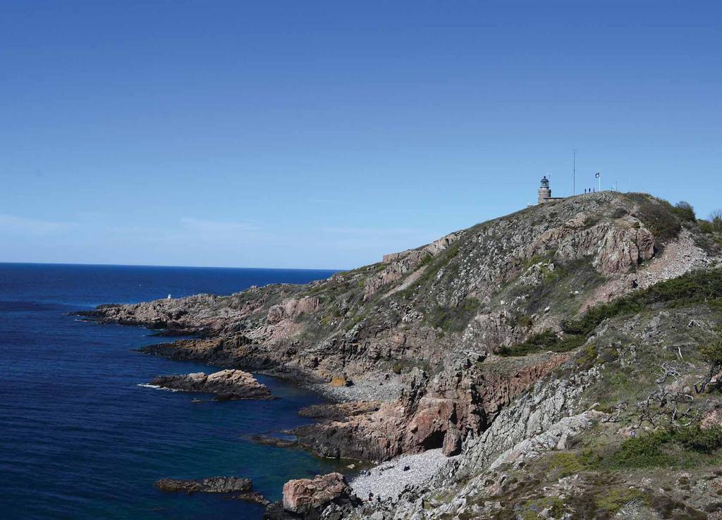
2 Project task A new signage proposal for the entrance and main parking lot of the western part of Kullaberg Nature Reserve. MAIN PARKING TO THE NATURUM NATURUM KULLENS FYR MAIN ENTRANCE FROM THE WEST MÖLLE N SCALE 1:20000
3 Project background

4 European Charter for Sustainable Tourism in Protected Areas key actions Tourism that offers discovery, interpretation and appreciation of natural and cultural heritage. enhance awareness, understanding and appreciation of it. Good quality, effective, relevant and accurate information to visitors.

5 Kullaberg analysis

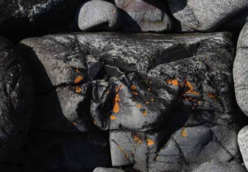
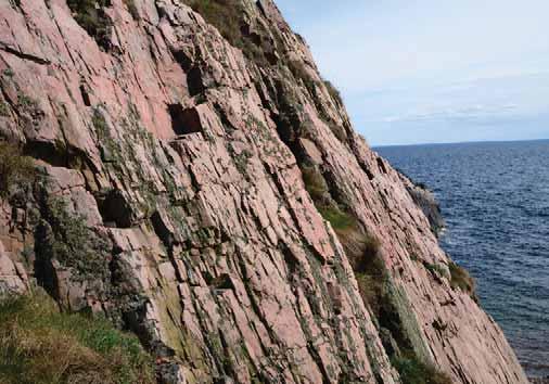
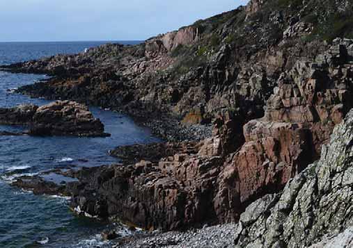
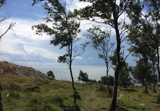
6 Landscape at Kullaberg


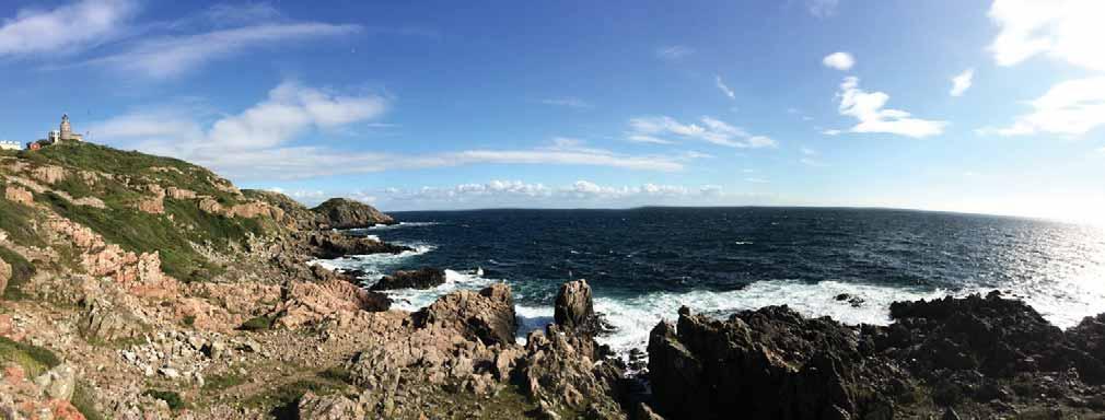
7 Geological formation Regional scale Threshold between the ancient mountain bed in north consisting mainly of granit and gneiss and sedimentary rock in the south consisting mainly of clay, sand and chalk. MOLLE KULLABERG NATURE RESERVE ARILD Threshold between the ancient mountain bed in north consisting mainly of granit and gneiss and sedimentary rock in the south consisting mainly of clay, sand and chalk. The movement of the mountain bed started 400million years ago. The dramatic penninsula of Kullaberg is due to the geological processes and its proximety to Øresund, Kullaberg has always been rich in a great variety of plant and wildlife species. Kullaberg has been settled, cultivated, has a rich cultural history, legends and attracted artist and tourist for one a half century. Geological references: Lunds universitet. virtex/tornquistzonen.html HELSINGBORG Geological references: Lunds universitet.
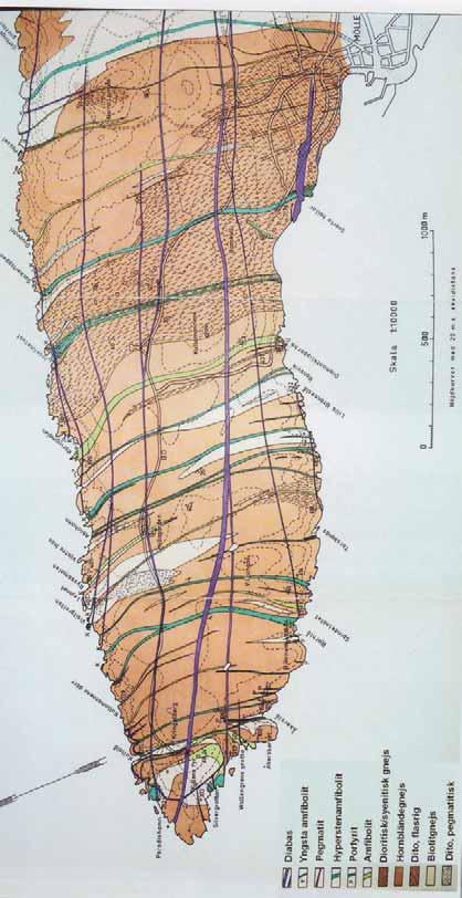
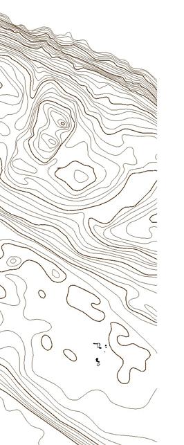
8 Geological formation Local scale

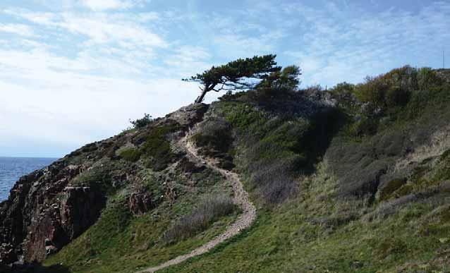

9 Landscape character

10 Culture at Kullaberg

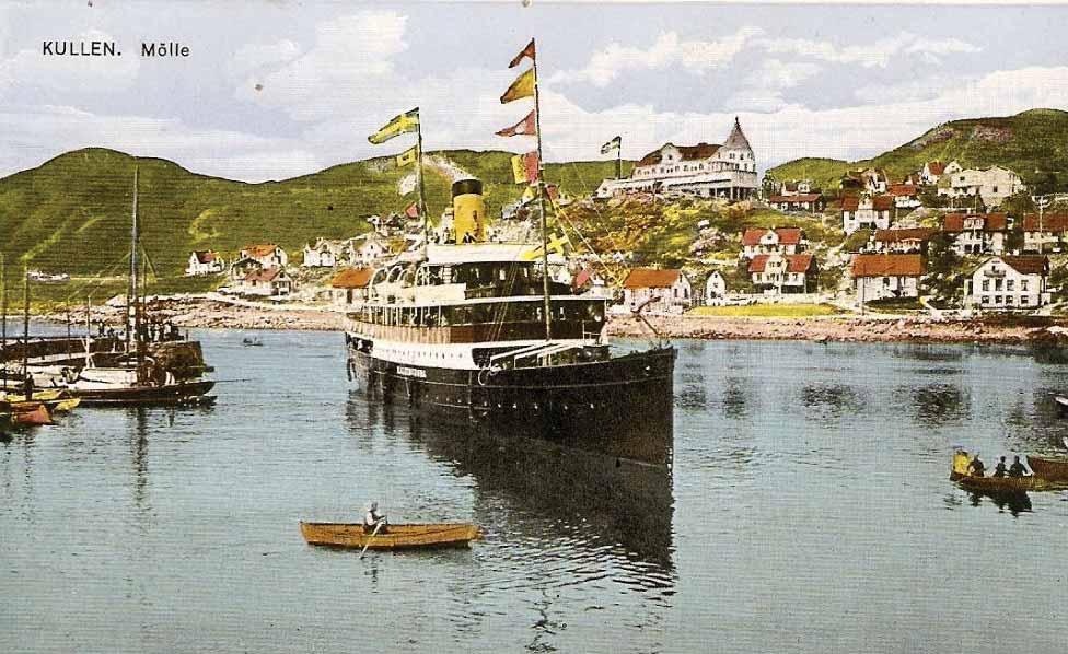
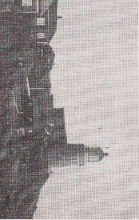
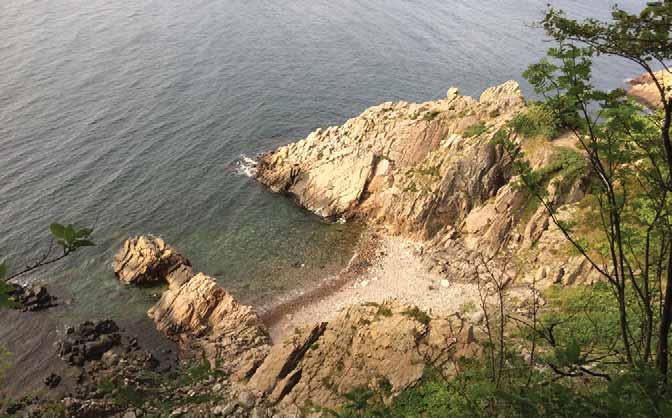
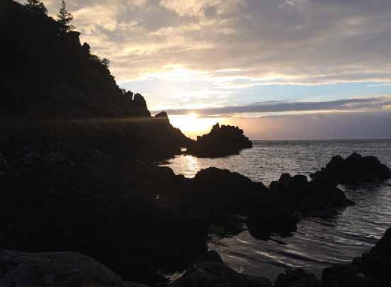
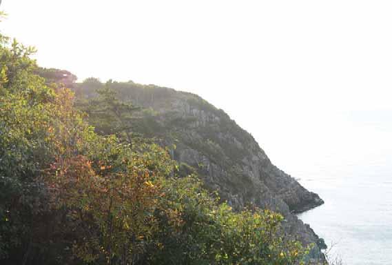
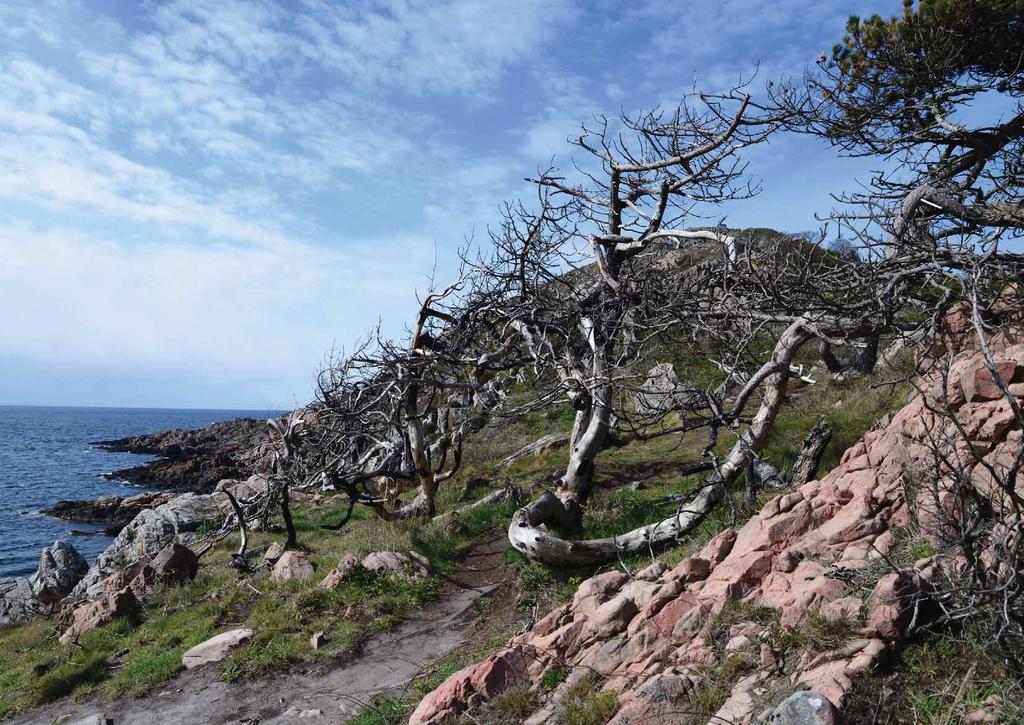
11 Kullaberg by the sea

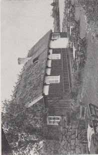
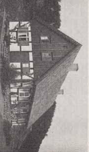
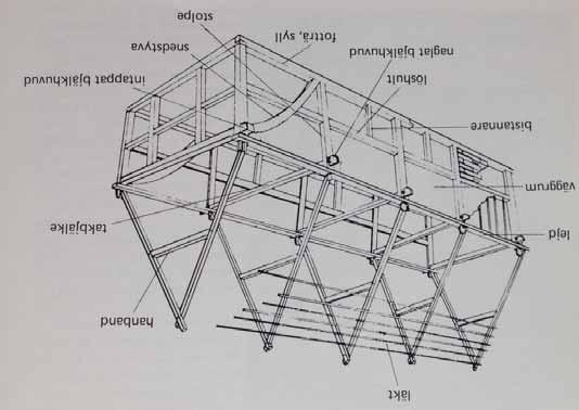
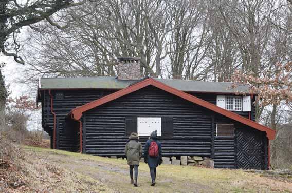

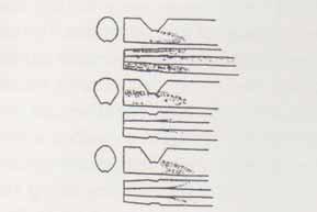
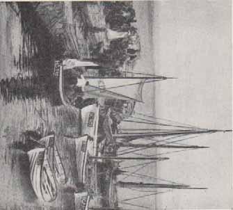
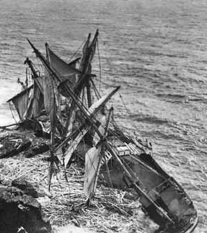
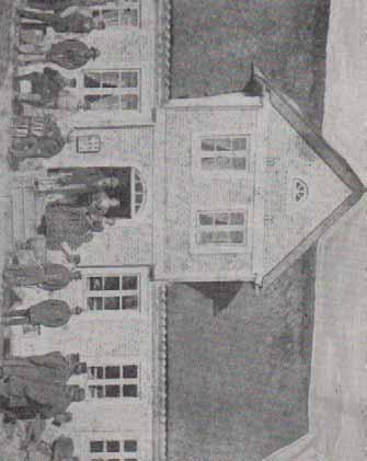
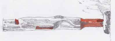
12 Kullaberg building traditions

13 Site analysis

14 Kullaberg Nature Reserve Site locations MAIN PARKING TO THE NATURUM NATURUM KULLENS FYR MAIN ENTRANCE FROM THE WEST MÖLLE N SCALE 1:20000
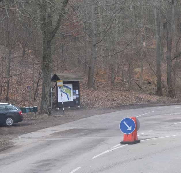
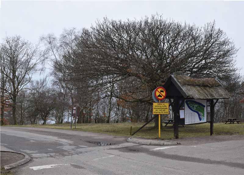
15 Entrance point from Mölle to Kullaberg existing sign b Busstop 1 Connection between hiking trails goes onto road and busstop. The connection between the hiking trails is not marked in any way. Furthermore it's not obvious to people passing by in car/buss etc. that this path is part of the Kullaberg Hiking trail. 2 Asphalt surface divided by white stripes, metal light poles and rocks 3 This entrance point is used by cars, cooperate busses, public busses, hikers, bikers and bicycles. Ideally all of these should have a clear sense of entering and exiting the park. This could be enhanced by marking the threshold between park and Mölle more clearly. 4 It is not obvious what the little building in the middle of the road is used for? If used for information foldes etc. for the Kullaberg park this should be made clear. It's situated right next to the road and could be unpleasent to enter/exit due to traffic. 1 b 2 b Potential: Width of the road is wide enough to make space for all of these functions to co-exist in a functional way and clearly marking the entrance point to the Kullaberg Nature reserve.


16
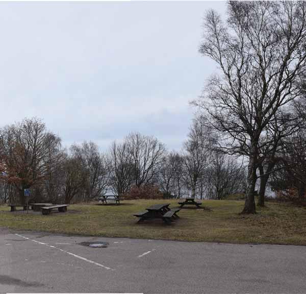
17 Parking and entrance to Naturum 4 t s b 2b Toilet Shelter existing sign Busstop 1 This is the point where people step out of the car, bus and of the motorbike. 2a Car zone. Asphalt surface. Parking marked by white stripes and dirt hills. Car zone. Gravel surface. s t 3 2a b Driving / Walking This border seperates the carparking area and the zone for walking. There's a potential to tell people stories about Kullaberg while they're at their feet, walking towards the lighthouse. Picnic area. The picninc area for has the potential to tell the story about how Kullaberg is unique, to families, kids, hikers, bikers, bustravellers etc. who only come to use the grill area. 2b Potential: At this particular point in Kullaberg, visitors get out of the vehicles and experience Kullaberg first hand. Opposed to the tip of Kullaberg, by the lightshouse, this area is sheltered and less windy. Since families, kids, hikers, bikers and bustravellers spend time here with their picnic there is also a different potential for telling stories about the landscape, history and geology at Kullaberg.
18
19 Sketch development
20 Singular Structural Spatial

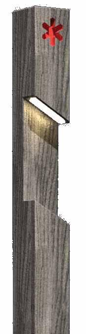
21 Main entrance west Diagrams Replanting the central island. Halving the asphalt, creating a new space. New spatial entrance, changing the surface.


22 Replanting the central island trees in gravel footpath Bus stop Crossing Bus stop Trees in gravel Entrance Sign Crossing


23 Halving the asphalt, creating a new space. trees in gravel Bus stop narrowed road Bus shelter connection to surroundings footpath Entrance sign Crossing


24 New spatial entrance, changing the surface. trees in gravel Bus shelter red trailsigns connection to surroundings connection to surroundings new surface - slowed traffic footpath bench exhibition boards entrance sign new surface parking lighting


25 Entrance to Naturum Combining functions. bus shelter and sign information bus shelter


26 Entrance to Naturum bench grill signage leading to naturum bike parking bus shelter Connecting to the Naturum and responding to landscape features. bench grill


27 Signage Concept development
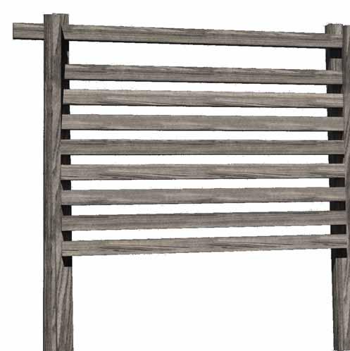

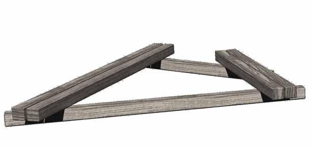
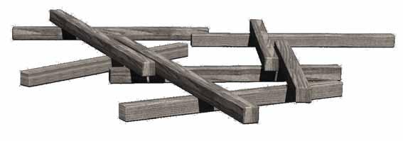

28 Signage Structural development lighting signage board shelter benches


29 Questions 1. What could this space be used for? 2. How to capture a local style, unique to the cultural history of Kullaberg? Laura laurakateparsons@hotmail.co.uk
A Circular Walk from Chapel Carn Brea
 A Circular Walk from Chapel Carn Brea 4.3 Miles A Walk Visiting Five Historic Ancient Sites This circular walk offers the possibility of several alternatives, depending on the walker s available time and
M E S T I Z O C U R T I S P A R K
 ARAPAHOE CONNECTION TO BUS ROUTE AT ND AND LAWRENCE, FUTURE LIGHT RAIL STATION LEGEND SOCIAL TRAIL FLAGSTONE PAVING TO RESTORE/MAINTAIN CONCRETE PAVING DIAGONAL CURVILINEAR SOCIAL ROUTE IS OUT OF HISTORIC
Exemplar for Internal Achievement Standard Geography Level 1. Conduct geographic research, with direction
 Exemplar for internal assessment resource Geography for Achievement Standard 91011 Exemplar for Internal Achievement Standard Geography Level 1 This exemplar supports assessment against: Achievement Standard
Lewis and Clark Recreation Area
 Lewis and Clark Recreation Area Bicycle/Pedestrian Trail Also part of the Pierson Ranch Recreation Area trail Type of trail: Walking, biking and rollerblading Trail surface: Asphalt Rated: Mostly flat.
Hubbard Park - Montpelier, VT
 Montpelier, VT ADA Transition Plan September 28 2 Portland Street, Boston, MA 24 www.ihcdesign.org info@ihcdesign.org 67695225 voice/tty Montpelier, VT Background is located at 4 Parkway St, Montpelier
Proposal for Thai IX 2010 Peace Corps Reunion
 Proposal for Thai IX 2010 Peace Corps Reunion Introduction We propose that we meet in September or early October, 2010, in Acadia National Park on Mt. Desert, Maine. The park is a magnificent setting,
Camping (Primitive) Camping (RV) Electrical Potable Water Grill Established Fire Pit Picnic Table
 Camping (RV) Electrical Potable Water Grill Established Fire Pit Picnic Table") Alden - 9th Road River Mile 777 Map: 38.20833, -98.32031 Managing Agency: Kansas Department of Wildlife, Parks & Tourism Nearest Community: Alden, Rice County Kansas Developed Amenities Provided Parking
Alden - 9th Road River Mile 777 Map: 38.20833, -98.32031 Managing Agency: Kansas Department of Wildlife, Parks & Tourism Nearest Community: Alden, Rice County Kansas Developed Amenities Provided Parking
Public Comment. Comment To consider extending State Park lands above River Mile 7.0
 Public To consider extending Park lands above River Mile 7.0 on the Little Spokane River for the conservation and limited recreation qualities they contain is this request. Could this be included in your
National Recreation Trail Update Form
 National Recreation Trail Update Form Introduction Thank you for taking the time to complete this form. Your assistance will help ensure that the National Recreation Trail (NRT) database is complete and
Queen Elizabeth II Diamond Jubilee Herne Bay Coastal Park Action Plan. Kings Hill slopes, Beacon Hill, The Downs, Bishopstone Glen and Reculver
 Appendix 3 Queen Elizabeth II Diamond Jubilee Coastal Park Action Plan Kings Hill slopes, Beacon Hill, The, Bishopstone Glen and Reculver This area moves from the commercial centre of the Coastal Park
EXPLORE KLARÄLVSDELTAT BY BIKE
 EXPLORE KLARÄLVSDELTAT BY BIKE EXPLORE NATURE BY BIKE THE BIKE TRAIL 1. Stadsträdgården (City garden) park was laid out in 1861 and there was a restaurant here from 1870 to 1959. In the northwest corner
NEWBORO AND PORTLAND HARBOUR REDVELOPMENT PLANS
 INTRODUCTION The Municipal docks in both Newboro and Portland were transferred to the Township of Rideau Lakes by Parks Canada in 2002. Little has been done to improve the docks physical condition or role
Alpine Outdoor sports recent developments, nature compatibility & good practices for visitors guidance
 Alpine Outdoor sports recent developments, nature compatibility & good practices for visitors guidance Platform large carnivores and wild ungulates Platform Workshop Fact Finding Innsbruck 02.02.2010 Referat
5. Site Analysis. Fig 5.1 Site indicated on road map. Fig 5.2 Museum Park (Tshwane Inner City Programme Spatial Development Framework Presentation)
") 5. Site Analysis 5.1 Site criteria The site is located on the northern side of Skinner Street between Paul Kruger and Andries Streets. The site was chosen according to the following criteria. 1. The museum
5. Site Analysis 5.1 Site criteria The site is located on the northern side of Skinner Street between Paul Kruger and Andries Streets. The site was chosen according to the following criteria. 1. The museum
6/28/11 TELEPHONE (n=400, RDD) AND ON-LINE (n=6,294) SURVEY RESULTS
 AND ON-LINE (n=6,294) SURVEY RESULTS") 6/28/11 TELEPHONE (n=0, RDD) AND ON-LINE (n=6,294) SURVEY RESULTS Update Surveys An Institute for Consensus Building www.sri-consulting.org MASTER PLAN UPDATE 6/28/11 Quantifying the responses from the
6/28/11 TELEPHONE (n=0, RDD) AND ON-LINE (n=6,294) SURVEY RESULTS Update Surveys An Institute for Consensus Building www.sri-consulting.org MASTER PLAN UPDATE 6/28/11 Quantifying the responses from the
PIONEER PARK. City of Des Peres Parks Master Plan. SWT Design 46 INTRODUCTION
 PIONEER PARK INTRODUCTION Pioneer Park is a 7 acre neighborhood park located east of Interstate 270 and south of Manchester Road along Tallie Road. The park is situated in a residential neighborhood with
Dairy Update. Figure 1. Length of free stalls (feet). Length
. Length") \.1INNESOTA EXTENSION SERVICE UNIVERSITY OF MINNESOTA ANIMAL SCIENCE EXTENSION Department of Animal Science 11 Haecker Hall 1364 Eckles Avenue St. Paul, Minnesota 5518 (612) 624-4995 FAX: (612) 625-1283
\.1INNESOTA EXTENSION SERVICE UNIVERSITY OF MINNESOTA ANIMAL SCIENCE EXTENSION Department of Animal Science 11 Haecker Hall 1364 Eckles Avenue St. Paul, Minnesota 5518 (612) 624-4995 FAX: (612) 625-1283
ROLLER COASTER POLYNOMIALS Due: Thursday, March 30th
 ROLLER COASTER POLYNOMIALS Due: Thursday, March 30th Purpose: In real life, polynomial functions are used to design roller coaster rides. In this project, you will apply skills acquired in Unit 3 to analyze
Seek the Board s approval for the Donald Place kerb and channel renewal to progress to final design, tender and construction; and
 3. DONALD PLACE - KERB AND CHANNEL RENEWAL General Manager responsible: General Manager City Environment Officer responsible: Transport and City Streets Manager Author: Michelle Flanagan, Streets Capital
Chapter 6: POLICY AND PROCEDURE RECOMMENDATIONS
 Chapter 6 POLICY AND PROCEDURE RECOMMENDATIONS FOR SRRA Below are seven policy elements that should be considered for adoption by the Southwest Regional Recreation Authority of Virginia: 1. Develop strategies
River Parks Trail: Tulsa, Oklahoma
 River Parks Trail: Tulsa, Oklahoma Purpose: The purpose of the River Parks Trail is to maintain, preserve, develop, and promote the Arkansas River for the economic and cultural benefit of the community.
City of Durango 5.8 FUNDING TRAILS DEVELOPMENT
 5.8 FUNDING TRAILS DEVELOPMENT The City has been successful in establishing dedicated local funding sources as well as applying for grants to develop the City s trail system, having received nearly $2.4
A summary of Draft Makara Peak Mountain Bike Park Master Plan
 A summary of Draft Makara Peak Mountain Bike Park Master Plan OVEMBER 216 Image: Peter Marshall 2 3 Introduction Since it was established in 1998, the Makara Peak Mountain Bike Park (Makara Peak) has grown
Trail Towns Using Trail Systems To Leverage Place, Tourism, and Economic Development
 Trail Towns Using Trail Systems To Leverage Place, Tourism, and Economic Development Harry Burkholder, AICP Community Planner II 324 Munson Avenue Traverse City, MI 49686 231-929-3696 burkholder@liaa.org
The$Goat$Farm$Mountain$Bike$Park$Concept$Plan$Brief$ $ $ 1$
 TheGoatFarmMountainBikePark ConsultancyBriefforTrailConceptPlanDevelopment 1. Background The Goat Farm Mountain Bike Park (the Goat Farm) is identified as a High priority location for future developmentasaprimarylocationforriderswithintheproposedperthhillsmountainbikeprecinct.its
BACK COUNTRY UNIT PREFERRED ALTERNATIVE
 BACK COUNTRY UNIT PREFERRED ALTERNATIVE San Francisco (118 mi) Carmel-By-The-Sea Carmel River Carmel Valley Road State Beach Private Property Point Lobos State Reserve Point Lobos Ranch RUSTIC CAMPING
Recreation News. Welcome. Chris Jackson. In this Issue: O S U C o l l e ge F o r e s t s
 Recreation News O S U C o l l e ge F o r e s t s In this Issue: Welcome New tree identification posts... New Arboretum Trails New Interpretive Signs Ridge Trail Seasonal Closures Leave No Trace reminder
A Publication of Friends of Sleeping Bear Dunes
 A Publication of Friends of Sleeping Bear Dunes 2014, Friends of Sleeping Bear Dunes, P.O. Box 545, Empire, MI 49630 www.friendsofsleepingbear.org info@friendsofsleepingbear.org Learn more about the Friends
ROLLER COASTER POLYNOMIALS
 Math 3 Honors ROLLER COASTER POLYNOMIALS (PART 1: Application problems small group in class) (PART 2: Individual roller coaster design) Purpose: In real life, polynomial functions are used to design roller
Access Statement for Wildwood Trust
 Access Statement for Wildwood Trust This access statement does not contain personal opinions as to our suitability for those with access needs, but aims to accurately describe the facilities and services
How to Build Shelters Along the Appalachian National Scenic Trail to Meet Accessibility Guidelines
 ATC LMPG-Appendix I How to Build Shelters Along the Appalachian National Scenic Trail to Meet Accessibility Guidelines Simple shelter designs are very easy to make accessible it only takes a little extra
1.1.1 Landscape character This is the upper part of a bowl-shaped landform, extending east from the Rothiemurchus character area, contained by the
 1.1 Glen More 1.1.1 Landscape character This is the upper part of a bowl-shaped landform, extending east from the Rothiemurchus character area, contained by the arc of the high granite pluton of the Cairngorms
Section 3.6 Recreation
 3.6 RECREATION This section evaluates the potential impacts of the proposed project on recreation within MTRP. The evaluation is based on field observations, a review of maps of MTRP and the MTRP Master
National Recreation Trail Application for Designation
 National Recreation Trail Application for Designation Introduction Thank you for your interest in the National Recreation Trail (NRT) program. Completed NRT application packages must be submitted by December
INTERPRETING TOPOGRAPHIC MAPS (MODIFIED FOR ADEED)
") INTERPRETING TOPOGRAPHIC MAPS (MODIFIED FOR ADEED) Science Concept: Topographic maps give information about the forces that shape the features of Earth. Objectives: The student will: identify land features
INTERPRETING TOPOGRAPHIC MAPS (MODIFIED FOR ADEED) Science Concept: Topographic maps give information about the forces that shape the features of Earth. Objectives: The student will: identify land features
Concert Tent Anderson Building Entry
 Anderson Park Renovation Concept #1 Concert Tent Anderson Park Renovation Concept #2 Concert Tent Anderson Park Renovation Concept #3 Concert Tent Anderson Park Renovation Concept Tally Renovation Concept
Math 3 Polynomials Project
 Math 3 Polynomials Project ROLLER COASTER POLYNOMIALS Application Problems and Roller Coaster Design due NO LATER THAN FRIDAY, JAN 13. Projects handed in after this date will receive a 0. Purpose: In real
Access Statement for Birling Gap
 This access statement does not contain personal opinions as to our suitability for those with access needs, but aims to accurately describe the facilities and services that we offer all our guests/visitors.
The Wild Atlantic Way the journey of a lifetime!
 The Wild Atlantic Way the journey of a lifetime! Outline of the Meeting Meeting Outline Welcome and Introductions 6.00pm 10mins Wild Atlantic Way The Proposition 6.10pm 30mins Conversation 1 Introductions
Hudson Highlands Fjord Trail Draft Master Plan. April 29, 2015
 Hudson Highlands Fjord Trail Draft Master Plan April 29, 2015 Agenda Route Overview Proposed Segment Results of Community Survey on that Segment Next Steps Municipal Endorsement Environmental Review Implementation
Access Statement for RSPB South Stack Cliffs
 Introduction This access statement does not contain personal opinions as to our suitability for those with access needs, but aims to accurately describe the facilities and services that we offer all our
ARCHIVES MONTH in Washington!
 ARCHIVES MONTH in Washington! We received an invitation in September from The State Archives to participate in Archives Month : 2014 is the 125th anniversary of Washington reaching statehood. It is a momentous
Relevance of crowding effects in a coastal National Park in Germany Results from a case study on Hamburger Hallig Dennis Kalisch
 Relevance of crowding effects in a coastal National Park in Germany Results from a case study on Hamburger Hallig Dennis Kalisch Structure of presentation Conceptual background Research objectives Study
Illawarra Escarpment State Conservation Area Walking Tracks
 Illawarra Escarpment State Conservation Area Walking Tracks NPWS Illawarra Area Office Ground Floor, Government Office Block 84 Crown Street Wollongong NSW 2500 02 4223 3000 (Mon-Fri) Royal National Park
Corabelle Park. Inventory. Future Development
 Corabelle Park Size: Approximately 4 acres Site Description: Corabelle Park is a relatively new park within the Murray County Park System. It is located on the south side of Corabelle Lake just off gravel
GENERAL INFORMATION SIGNS
 GENERAL INFORMATION SIGNS I 1-1 THROUGH I14-1b RECREATIONAL AND CULTURAL INTEREST AREA SIGNS Michigan Department of Transportation Traffic and Safety PW Reference Documents\Traffic Reference\Typicals\Develop\Sign_StdHwySigns_D\i00_titlepage_i.dgn
SIMON CANYON AREA OF CRITICAL ENVIRONMENTAL CONCERN (ACEC)
") SIMON CANYON AREA OF CRITICAL ENVIRONMENTAL CONCERN (ACEC) Activities: Facilities: Season / Hours: Description: Hiking, backpacking, fishing, picnicking, watchable wildlife. A graveled parking area, picnic
SIMON CANYON AREA OF CRITICAL ENVIRONMENTAL CONCERN (ACEC) Activities: Facilities: Season / Hours: Description: Hiking, backpacking, fishing, picnicking, watchable wildlife. A graveled parking area, picnic
THAT the Board approve the final proposed concept plan for the Jericho Marginal Wharf site as shown in Figure C-4 of Appendix C.
 Date: January 17, 2012 TO: Board Members Vancouver Park Board FROM: General Manager Parks and Recreation SUBJECT: Jericho Marginal Wharf Phase 2 Concept Plan RECOMMENDATION THAT the Board approve the final
Caledon Hills Bruce Trail Club Discovery Hike Series Badge
 Caledon Hills Bruce Trail Club Discovery Hike Series Badge To earn this Discovery Badge you must complete all the hikes listed below, either on your own or on an organized hike. You will have fun discovering
Appendix 3. Greenway Design Standards. The Whitemarsh Township Greenway Plan
 Appendix 3 Greenway Design Standards This chapter discusses two design standards for the greenway types discussed above. First, trail design standards are presented together with trailhead facilities and
The Real Algarve Crossing ADVENTURE NATURE
 The Real Algarve Crossing ADVENTURE NATURE 2018 www.portugalnaturetrails.com info@portugalnaturetrails.com The Real Algarve Crossing ADVENTURE NATURE DESCRIPTION A pure adventure through the deepest soul
These track notes are intended to compliment the Munda Biddi maps, not replace them.
 Map Route Summary - Map 1: Diversions: Nil Ridden March & April 2014 Document created: Feb 2015 Updated: Sept 2015 These track notes are intended to compliment the Munda Biddi maps, not replace them. While
Trails Technical Committee
 Trails Technical Committee Winter 2017 Draft Report Alignment Proposals for the Inyo National Forest and the Town of Mammoth Lakes Map ID #S18 February 08, 2017 Map ID #S18 Key Agreements As of February
Meshach Browning Trail System at the Deep Creek Lake Lion s Club Park on Bumble Bee Rd.
 Meshach Browning Trail System at the Deep Creek Lake Lion s Club Park on Bumble Bee Rd. The Meshach Browning trail system will be a public, non-motorized, multi-use (running, dog-walking, cross country
LANDING S PARK CONCEPTUAL PLAN HAMILTON ANDERSON JANUARY City of Novi, Michigan. The Park at 13 Mile and Old Novi Road
 HAMILTON ANDERSON JANUARY 2012 LANDING S PARK CONCEPTUAL PLAN January 2012 Page 1 of 15 January 2012 PROJECT GOALS Activate the park by introducing new elements Provide clear access to the water and enhance
RURAL LAND RESOURCES Case study area 1- the erosional features of the Dorset Coast.
 Case study area 1- the erosional features of the Dorset Coast. Scene setting;- This area lies on the far south coast of England, between the settlements of Lyme Regis and Bournemouth, in the county of
This report recommends that Council approve concept plan 021-CP-001-B (see Attachment 1), for detailed design and delivery this financial year.
, for detailed design and delivery this financial year.") FPOL1711-9 HILTON TOWN CENTRE PROJECT SCOPE Meeting Date: 0 Responsible Officer: Manager Infrastructure Engineering Decision Making Authority: Council Agenda Attachments: 1. Concept Plan no 021-CP-001-B
FPOL1711-9 HILTON TOWN CENTRE PROJECT SCOPE Meeting Date: 0 Responsible Officer: Manager Infrastructure Engineering Decision Making Authority: Council Agenda Attachments: 1. Concept Plan no 021-CP-001-B
Access Statement for RSPB Lochwinnoch
 Introduction This access statement does not contain personal opinions as to our suitability for those with access needs, but aims to accurately describe the facilities and services that we offer all our
Section 7: Pick Up Where You Left Off! S-Tree Road over the Todd Road
 2018 TRACE NOTES Helpful information for your adventure on Section 7 of the Hiker Challenge. Start Point S-Tree Rd. End Point Intersection Todd Rd. / Hale Ridge Rd. WEATHER DECISION Weather Alert!!!! Potential
Proposal to Redevelop Lower Kananaskis Lake Campgrounds in Peter Lougheed Provincial Park. What We Heard
 Proposal to Redevelop Lower Kananaskis Lake Campgrounds in Peter Lougheed Provincial Park What We Heard In December 2016, Alberta Parks proposed to make several changes to campgrounds in the Lower Kananaskis
Kelly Motorized Trails Project Proposed Action
 Kelly Motorized Trails Project Proposed Action November 28, 2011 The Flagstaff Ranger District of the Coconino National Forest is seeking public input on the proposed Kelly Motorized Trails Project (formerly
DRAFT FINAL ACCESSIBILITY GUIDELINES FOR OUTDOOR DEVELOPED AREAS
 Date: October 19, 2009 DRAFT FINAL ACCESSIBILITY GUIDELINES FOR OUTDOOR DEVELOPED AREAS Introduction Background Whom Guidelines Apply To How to Submit Comments Contact for Further Information General Issues:
Lake Myra County Park. Wake County, North Carolina Community Forum #2 June 12, 2008
 Lake Myra County Park Wake County, North Carolina Community Forum #2 June 12, 2008 Welcome and Introduction Meeting Agenda Welcome Introductions of Project Team Master Plan Process Community Forum #1 Updates
landcapes and romance Artists and poets have been inspired by the idyllic scenes of picturesque Kent villages sheltered by rolling, chalk hills.
 landcapes and romance Artists and poets have been inspired by the idyllic scenes of picturesque Kent villages sheltered by rolling, chalk hills. WALK 4 41 41 WALK 4 42 Pond Location: Distance: 5 miles
Calvert Regional Park - Tari Moore Recreational Trail. Calvert Regional Park - Woodland Trail. miles from Rising Sun
 Calvert Regional Park - Tari Moore Recreational Trail 304 Brick Meeting House Road, North East, MD 21901 5.2 about 1.1 mile Paved parking lot, plentiful Easy, paved path with slight incline. Easy, paved
Computer Simulation for Evaluating Visitor Conflicts
 Computer Simulation for Evaluating Visitor Conflicts Why use Simulation? To acquire a comprehensive and dynamic understanding of visitor behavior and their interactions across the landscape (space and
Change dormers and main entry on the river side of the house. Site: 43 Riverbank Road, Block 10 Lot 3
 City of Burlington Historic Preservation Commission Meeting Minutes: December 2, 2015 The City of Burlington Historic Preservation Commission held its regular monthly meeting on Wednesday, December 2,
CHAPTER IV OVERVIEW. Indonesia. The capital is Dompu. Dompu Regency has an area of 2, km².
 CHAPTER IV OVERVIEW A. General Description of the Research Sites Dompu Regency, is a district in West Nusa Tenggara Province, Indonesia. The capital is Dompu. Dompu Regency has an area of 2,321.55 km².
The Loss Adjusters Open to the public 26 April 28 June 2015 Presented on Portland by Artangel in association with b-side
 Access Information for The Loss Adjusters The Loss Adjusters Open to the public 26 April 28 June 2015 Presented on Portland by Artangel in association with b-side Address 52 Easton Street, Easton, Portland,
This path goes past an old tree nursery and sawmill. After 800m it crosses over a lane. Follow the bridleway fingerpost into the woods.
 FRENSHAM PONDS 11K CIRCULAR TRAIL 2½ HRS GU10 2DA This magnificent heathland trail starts in woodland and then brings you out onto the open heather of Frensham Common, with no roadwork! The route runs
482 :fi6 D34 --' v.i9 ~
 '- SB 482 :fi6 D34 --' v.i9 ~ This document is made available electronically by the Minnesota Legislative Reference Library as part of an ongoing digital archiving project. http://www.leg.state.mn.us/lrl/lrl.asp
Beaver Creek State Park
 GENERAL INFORMATION Name of Park/Forest/Facility: Beaver Creek State Park County: Columbiana (St. Clair Township) Address: 12816 Sprucevale Road (ie County Rd 428) (street #, city) East Liverpool, Ohio
Silver Lake Park An Environmental Jewel for the Citizens of Prince William County
 Silver Lake Park An Environmental Jewel for the Citizens of Prince William County The Prince William Park Authority Mission Statement states: The Prince William County Park Authority will create quality
Pillar Park. Management Plan
 Pillar Park Management Plan January 2014 Pillar Park Management Plan Approved by: Jeff Leahy Regional Director Thompson Cariboo Region BC Parks January 9, 2014 Date Brian Bawtinheimer Executive Director
DRAFT - APRIL 13, 2007 ROUTING STUDY FOR TRAIL CONNECTIONS BETWEEN CALAIS AND AYERS JUNCTION
 DRAFT - APRIL 13, 2007 ROUTING STUDY FOR TRAIL CONNECTIONS BETWEEN CALAIS AND AYERS JUNCTION Abstract The vision for the East Coast Greenway is an off-road urban trail system running from Calais, Maine
Port Gamble Shoreline Area Conceptual Trail Proposal
 The North Kitsap Trails Association is pleased to be a partner to the Kitsap Forest and Bay Project and assist Kitsap County, Forterra, Olympic Property Group, Great Peninsula Conservancy and the Port
Summary of Recreation Sites Development Name:
 Development Name: Eau Pleine Site Number: 1 Owner: WVIC Eau Pleine Tailwater Boat Launch Lanes 1 Concrete plank landing, access to Eau Pleine tailwater & Lake DuBay. (45 planks long, 62.5') Picnic Tables
1. Case Study Area and Character Sections
 ARAGO STREET 1. Case Study Area and Character Sections Case Study Area Calle Aragó is an important streets in the centre of Barcelona. The street belongs to the Eixample district. The origins of Barcelona
Oak Ridges Moraine: Southern Ontario's Sponge
 Oak Ridges Moraine: Southern Ontario's Sponge Lesson Overview Students will examine the location and the importance of the Oak Ridges Moraine and investigate ongoing conflicts concerning its development.
Appendix 7 Local Green Spaces - Detailed Evidence
 Appendix 7 Local Green Spaces - Detailed Evidence Neigh Bridge Country Park, Somerford Keynes General information Neigh Bridge Country Park is situated at the southern entrance to Somerford Keynes village.
Trail Etiquette. Hours of Operation. Trail Accessibility
 Trail Guide The Elmhurst Park District, with 28 parks and over 460 acres of land, offers nearly six miles of paved or asphalt park trails and maintains an additional 3.6 miles of trails within Elmhurst.
TransAlgarve Cycling MTB ADVENTURE NATURE
 TransAlgarve Cycling MTB ADVENTURE NATURE 2018 www.portugalnaturetrails.com info@portugalnaturetrails.com TransAlgarve Cycling MTB ADVENTURE NATURE DESCRIPTION A pure adventure through the deepest soul
Team 110. DisneyIlha (Portuguese for DisneyIsle) at Ilha Grande, Brazil
 at Ilha Grande, Brazil") Team 110 DisneyIlha (Portuguese for DisneyIsle) at Ilha Grande, Brazil Bemvidos a DisneyIlha! DisneyIsle, originally Ilha Grande, is a 70 sq. mile island located 60 miles from Rio de Janeiro, one of the
Team 110 DisneyIlha (Portuguese for DisneyIsle) at Ilha Grande, Brazil Bemvidos a DisneyIlha! DisneyIsle, originally Ilha Grande, is a 70 sq. mile island located 60 miles from Rio de Janeiro, one of the
Stephens State Park Trails
 TRAILS OF ALLAMUCHY MOUNTAIN & STEPHENS STATE PARKS Allamuchy Mountain and Stephens State Parks contain 28 marked trails providing access to diverse landscapes for walking, hiking, biking, bird-watching,
The following trails completed their work utilizing funds awarded by the Greenways Foundation:
 The Greenways Foundation Grant Awards 2013 and 2014 Our grant program has been in place since 2012 and is funded entirely by the proceeds received through our Indiana BMV specialty license plate. Please
Access Statement for Radipole Lake
 This access statement does not contain personal opinions as to our suitability for those with access needs, but aims to accurately describe the facilities and services that we offer all our guests/visitors.
Kostenlose Ebooks Biking Ohio's Rail Trails
 Kostenlose Ebooks Biking Ohio's Rail Trails An indispensable book for bikers, hikers, walkers, joggers and families who want to enjoy Ohio's trails. --This text refers to an out of print or unavailable
GLASS HOUSE MOUNTAINS PEAKS WALK, BEERBURRUM TRAILHEAD DRAFT CONCEPT PLAN
 GLASS HOUSE MOUNTAINS PEAKS WALK, BEERBURRUM TRAILHEAD DRAFT CONCEPT PLAN GLASS HOUSE Figure 1 REGIONAL WALK/RIDE OVERVIEW Aspirational Goal Create an interconnected nature-based recreation trail network
Sustainable recreational use and benefits of Natura 2000 network
 Sustainable recreational use and benefits of Natura 2000 network Liisa Kajala Parks & Wildlife Finland Parks & Wildlife Finland Manages all state-owned protected areas, i.e. 18% of Finland s surface area:
Proposal to Redevelop Lower Kananaskis River-Barrier Lake. Bow Valley Provincial Park
 Frequently Asked Questions Proposal to Redevelop Lower Kananaskis River-Barrier Lake Bow Valley Provincial Park Frequently Asked Questions What has been decided? What are the details of the plan? What
Minehead Seafront - Analysis
 Minehead Seafront - Analysis Existing Constraints Part of Jubilee Gardens is in the Wellington Square Conservation Area. Area east of Jubilee Gardens contains Wessex Water infrastructure and manholes which
Balearic Islands Good Practice
 Balearic Islands Good Practice Marga Picornell Balearic Islands Tourism Board (ATB) 9th October, 2018 Oudenaarde (BE) 16.141 Enterprises A powerful tourism production system Accommodation Capacity 424.663
Sacramento Placerville Transportation Corridor Alternatives Analysis
 Sacramento Placerville Transportation Corridor Alternatives Analysis EL DORADO COUNTY TRANSPORTATION COMMISSION 1 Sacramento Placerville Transportation Corridor 2 Goal of the Project To give public officials
Coconino National Forest Potential Wilderness Proposal
 Coconino National Forest Potential Wilderness Proposal As part of their Forest Plan Update, the Coconino National Forest needs to address the need for additional wilderness. The last evaluation was done
YELLOWSTONE S I G H T S E E I N G I T I N E R A R Y. follow me on
 T H E 4 - D A Y YELLOWSTONE S I G H T S E E I N G I T I N E R A R Y DAY 1 DAY SITE NAME TIME LENGTH OF HIKE/SIGHTSEEING SITE TYPE TIPS/RESOURCES Heart of The Caldera 5 Min. Pull-In Sight Tower Falls 30
This Passport: Revised October 20, 2017, EAM # Discovering the Trails of Webster, NY
 This Passport: Revised October 20, 2017, EAM #161923 Discovering the Trails of Webster, NY The Town of Webster invites you to explore and experience our diverse outdoor adventures! Here s your opportunity
National Wilderness Steering Committee
 National Wilderness Steering Committee Guidance White Paper Number 1 Issue: Cultural Resources and Wilderness Date: November 30, 2002 Introduction to the Issue Two of the purposes of the National Wilderness
Rouge Park Trail and Park Volunteers Orientation Package
 Rouge Park Trail and Park Volunteers Orientation Package In this package you will find: Welcome! Introduction to Rouge Park Introduction to the HAVE Program The Guided Walks and Ambassadors programs; part
Tourism Recovery Fund Project October Project Status Report
 Project Proponent/s Funding ($) Island Short Walks Queensland Parks and 500,000 This project will deliver all-weather walking trails with Wildlife, Department interpretive panels on Border, Langford and
Langton Lake Park Implementation Planning Session One 6 June Attendees signed in
 27 Attendees signed in Meeting summary Following an overview of the Parks and Recreation Renewal Program and the key directions of the Parks and Recreation System Master Plan, meeting participants were