List of Locations for Interpretive Wayside Signs
|
|
|
- Audrey Brooke Bishop
- 6 years ago
- Views:
Transcription
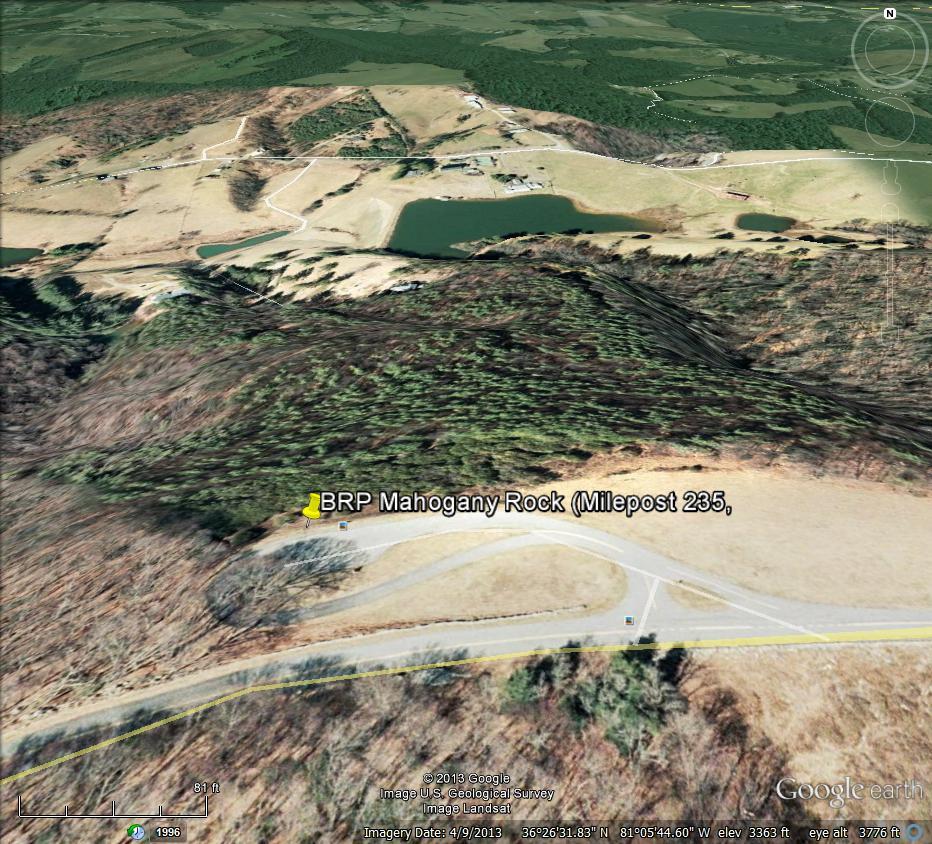
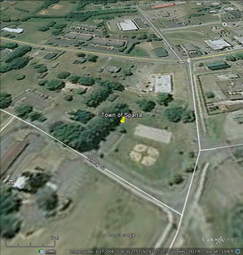
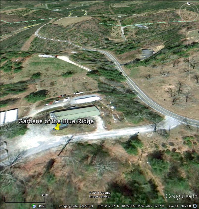
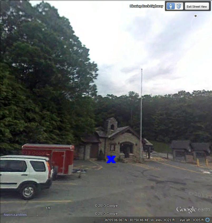
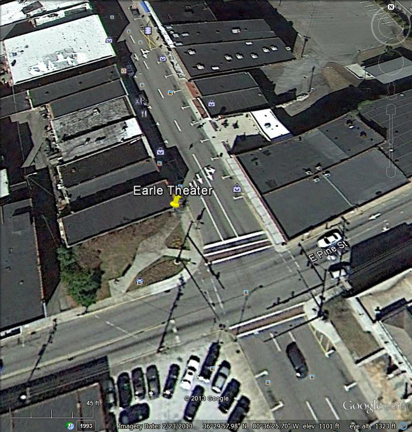
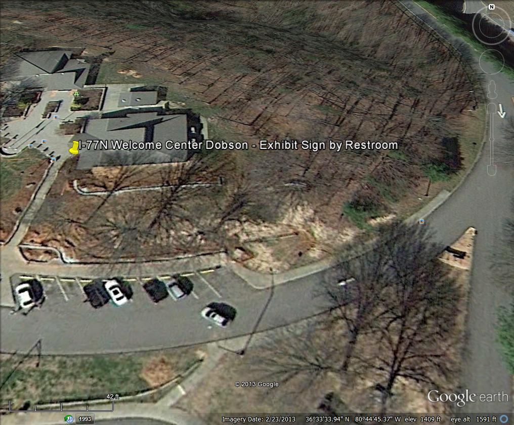
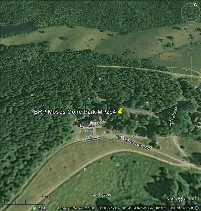
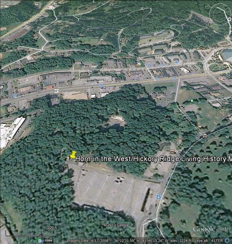
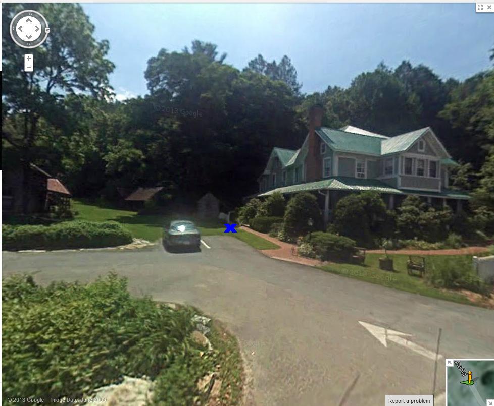
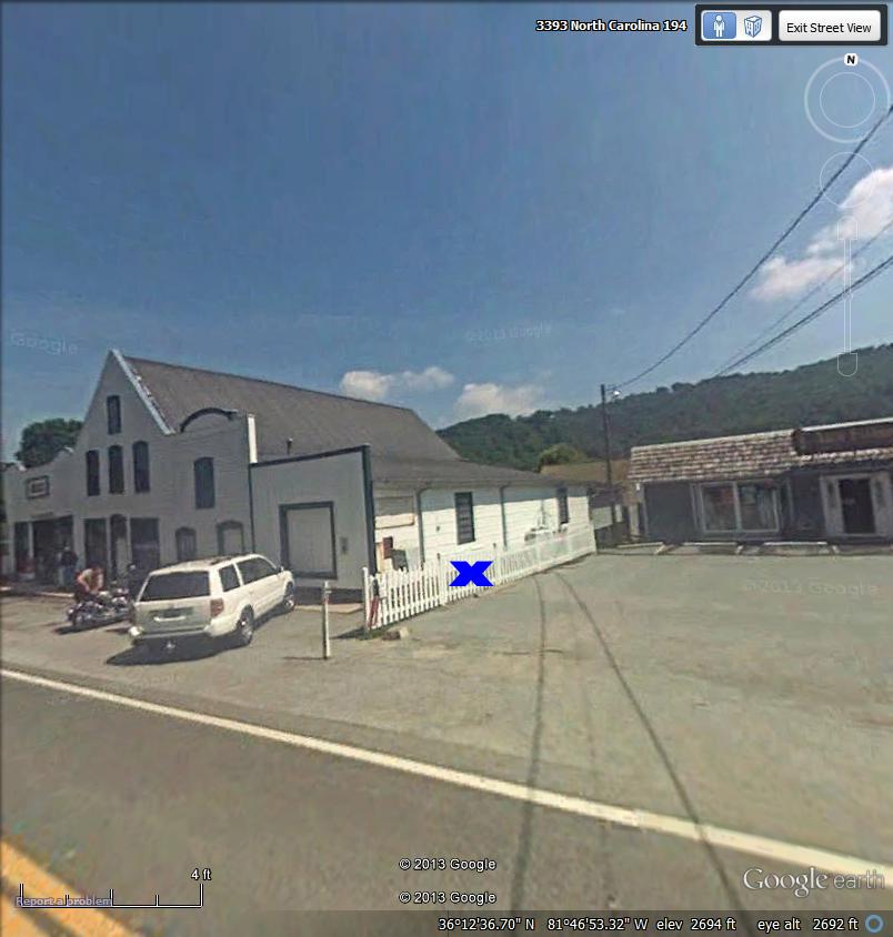
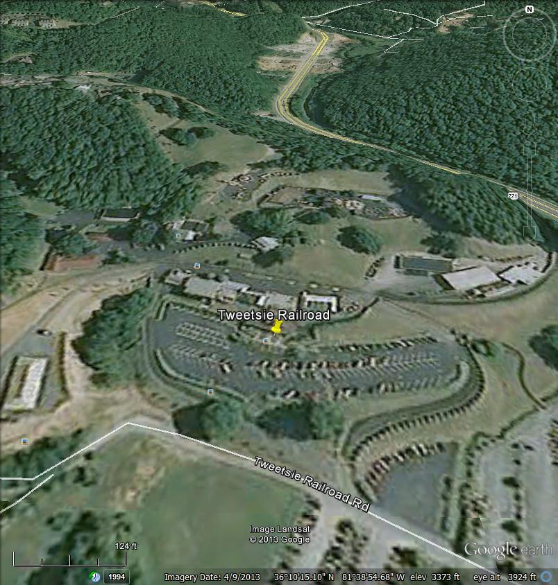
1 List of Locations for Interpretive Wayside Signs Site # DOT div County Sign sponsor organization Sign site sign address describe sign location 1 11 Alleghany Blue Ridge Parkway BRP Mahogany Rock (Milepost 235, Blue Ridge Parkway Milepost 235 at overlook/interpretive area 2 11 Alleghany Town of Sparta Town of 100 Cherry St, Sparta, NC in Crouse park. From parking closest to Crouse house, the sign will go in grassy area closest to parking area, facing the outdoor stage. Crouse House would be to your left Avery Blue Ridge Frescoes Crossnore School US 221/NC 194 at Crossnore near Crossnore School Historic Marker d=n-44 off Hwy Avery Gardens of the Blue Ridge Gardens of the Blue Ridge 9056 Pittmans Gap Rd., Newland NC If facing front door of business office, sign goes to right of gravel drive in grassy area Avery Grandfather Mountain Grandfather Mountain 2033 Blowing Rock Highway, Linville, NC to left of front door at stone gate house building (outside the gates), in tiny planting area against building 6 11 Caldwell City of Lenoir City of 801 West Avenue NW, Lenoir NC city plaza 136 Main Street, at intersection of main st and west ave. Sign goes along main sidewalk in mulched area between clocktower on right, and curved sidewalk to left leading into center of park Surry Surry County Arts Council Earle Theater Approx 107 North Main Street. in Corner park of Pine and & N. Main St.. From main street, sign is up against the brick building, closest to main street sidewalk near bench 8 11 Surry NC Tourism I-77 North Welcome Center I-77 at Mile Marker 105, Dobson, NC Interpretive sign in grass/planting bed to right of entrance to restroom facilities 9 11 Watauga Blue Ridge Parkway BRP Moses Cone Park MP294 Blue Ridge Parkway Milepost 294 replacing existing sign at base of stairs from parking lot, along sidewalk that leads to the right to the house Watauga Southern Appalachian Historical Association Horn in the West/Hickory Ridge Living History Museum 591 Horn in the West Dr., Boone, NC At back of parking lot - directly in front of stacked rail fence and log cabins, near walkway to museum and amphitheater area Watauga Mast Farm Inn Mast Farm Inn Hwy 194 in Valle Crucis Broadstone Rd., Banner Elk, NC Visible spot between parking area and side entrance to inn, along sidewalk in side yard Watauga Mast General Store Mast General Store Hwy 194 in Valle Crucis Broadstone Road, Banner Elk, NC Along right side of building adjacent to the neighboring paved parking lot. Behind a fence right now - section will be removed and landscaping will be added once sign is installed Watauga Tweetsie Railroad Tweetsie Railroad 300 Tweetsie Railroad Lane, Blowing Rock, NC In center flower bed between stairs at front of Tweetsie ticket office Wilkes Wilkes Heritage Museum Old Wilkes Jail 203 North Bridge Street, Wilkesboro, NC behind jail Wilkes Blue Ridge Frescoes St. Paul's Episcopal Church 100 West St, Wilkesboro, NC police station Cleveland Destination Cleveland County Earl Scruggs Center 103 South Lafayette Street Shelby, NC at 'L' created by sidewalks. on Washington st at corner of Warren st. between the street and sidewalk next to low wall Cleveland NC Tourism I-85 South Welcome Center I-85 at Mile Marker 2, Kings Mountain, NC Interpretive sign in grass/planting bed to left of entrance to restroom facilities Iredell Blue Ridge Frescoes Statesville Civic Center 300 South Center Street, Statesville, NC Statesville Civic Center Buncombe Biltmore Estate Biltmore Estate One Approach Road, Asheville, NC at reception/ticket center Buncombe Blue Ridge Frescoes Montreat College 201 E State St, Black Mountain, NC Visitor Center Buncombe Folk Heritage Committee Shindig on the Green Pack Square Park, at S. Spruce St and College St. On Roger McGuire Green, to right of path closest to and parallel to College St Buncombe The North Carolina Arboretum The North Carolina Arboretum 100 Frederick Law Olmsted Way, Asheville, NC Buncombe Thomas Wolfe Memorial Thomas Wolfe Memorial 52 N. Market St, Asheville, NC Burke Blue Ridge Parkway Pass Gatehouse and turn left immediately into parking/trailhead area. Sign goes beyond right edge of concrete pad for trailhead sign/shelter. There is a bench there now Facing the front of Visitor Center, sign will be mounted on sidewalk against the building on the right corner. needs sign with brackets for mounting on side walk BRP Lost Cove Cliffs/Brown Mountain Lights MP310 Blue Ridge Parkway Milepost 310 at overlook/interpretive area next to existing sign
2 List of Locations for Interpretive Wayside Signs Site # DOT div County Sign sponsor organization Sign site sign address describe sign location Burke Blue Ridge Frescoes City of Morganton Municipal Auditorium 401 College Street, Morganton, NC in front of auditorium Burke Exploring Joara Foundations Exploring Joara Foundations 701 Sanford Dr., Morganton, NC at Catawba Meadows recreation center along footpaths that go between the 8 ballfields headed towards the greenway. Sign goes just before the archaeological site on the left Burke Burke County TDA Linville Gorge - Brown Mountain Overlook Hwy miles north of Morganton On side closest to road, in line with other sign at Brown Mountain Overlook Burke South Mountains State Park South Mountains State Park 3001 South Mountain State Park Ave, Connelly Springs at new Visitor Center Burke Waldensian Museum Waldensian Museum 208 Rodoret Street South, Valdese, NC corner of Rodoret and Janavel Ave Madison Town of Hot Springs Hot Springs Welcome Center On Bridge St near corner of S Spring St. on Welcome Center grass near sidewalk sign will be viewed from sidewalk, facing building, at front right corner where lawn and driveway meet ( Google Street View predates building and shows a red caboose ) Madison NC Tourism I-26 West Welcome Center I-26 at Mile Marker 6, Mars Hill, NC Interpretive sign in grass/planting bed to right of entrance to restroom facilities Madison Mars Hill College Rural Life Museum Mars Hill University, Mars Hill, NC Montague Building (rock building on the quad) between museum and visitor center McDowell Blue Ridge Parkway BRP The Loops Overlook/Orchard at Altapass MP328.6 Blue Ridge Parkway Milepost at overlook/interpretive area next to existing sign McDowell Historic Carson House Historic Carson House 1805 Hwy 70 West, Marion, NC on Carson House property, along driveway McDowell Linville Caverns Linville Caverns U.S. 221, Marion, NC in Linville Caverns parking lot in front of boulder by bathrooms McDowell County TDA Mountain Gateway 50 Water St, Old Fort, NC Tucked into "V" of stacked fence in front of parking spaces. Located McDowell to left of main building, in front of cabins Rutherford Rutherford County TDA Bechtler Mint 3.5 miles north of 221 and 342 Gilboa Church Road new Bechtler Park site on top side of mine entrance, in front of iron fence Rutherford Bostic Lincoln Center Bostic Lincoln Center 112 Depot St, Bostic, NC on front lawn, to the right of sidewalk entrance. Will make a walking path to it Rutherford Chimney Rock State Park Chimney Rock State Park Chimney Park Entrance, Near Chimney Rock Park gift shop 1638 Chimney Rock Park Road Chimney Rock, NC entrance, off Hwy 64/74-A Rutherford Hickory Nut Gorge Hickory Nut Gorge 2932 Memorial Highway, Lake Lure, NC in front of visitor center Yancey Mount Mitchell State Park Mount Mitchell State Park 2388 N Carolina 128 Burnsville, SC by restaurant near front sidewalk Cherokee Valley Town Arts and Cultural Association Andrews Andrews Visitor Center off Lucust St. near 129/ 74 / 19 to right of main walkway into visitor center and to right of existing trail of tears signage Cherokee John C Campbell Folk School John C Campbell Folk School 1 Folk School Rd., Brasstown, NC At back end of craft store parking lot, in front of rocks next to light pole (wooded area behind it) Clay Clay County Historical & Arts Council Clay County Historical & Arts Council US-64 Bus West, just before you reach Davis Loop, Hayesville, NC On parking level below the Old Jail museum, at entrance to Cherokee exhibit. When you turn in, the sign will be on the right, backed up to the hillside below the museum. It is near the main road Graham Cherokee Preservation Foundation Cheoah intersection of NC 143 Sweetwater Road and the US 129 Rodney Orr Bypass, Robbinsville, NC There is a parking space and information kiosk at this location Haywood Bethel Rural Community Organization Bethel Rural Community Organization 664 Sonoma Road, Waynesville, NC Haywood Haywood County Arts Council Downtown Haywood 145 North Main Street, Waynesville NC Haywood NC Tourism I-40 West Welcome Center I-40 at Mile Marker 10, Waynesville, NC at the historic (1885) Bethel Presbyterian Church: From parking at left of church, sign will go along sidewalk on left side just before sidewalk turns. Goes in the 'L' space of sidewalk in flower bed owned by United Community Bank, on the left edge of their parking lot exit, sign is closest to LN Davis Insurance building, to right of blue mailbox. Interpretive sign in grass/planting bed along sidewalk near large rock to left of restroom facilities
3 List of Locations for Interpretive Wayside Signs Site # DOT div County Sign sponsor organization Sign site sign address describe sign location Haywood Museum of NC Handicrafts Museum of NC Handicrafts 49 Shelton St, Waynesville, NC From driveway, in grassy area to the right of where the sidewalk starts Henderson Center for Craft, Creativity and Design Center for Craft, Creativity and Design 1181 Broyles Road, Hendersonville, NC just beyond the trailhead, on left side of path. Not located at Center, located at parking area on S. Rugby Rd Henderson Town of Fletcher Fletcher - Howard Gap Road 85 Howard Gap Road, Fletcher, NC in Fletcher Park at center of first parking lot on left, on back left side of facility building at intersection of sidewalk and paved walking path Henderson Historic Johnson Farm Historic Johnson Farm 3346 Haywood Road, Hendersonville, NC on Johnson Farm property Jackson Blue Ridge Parkway BRP Lickstone Parking Area/Qualla Boundary MP Blue Ridge Parkway Milepost at overlook/interpretive area Jackson Jackson County Parks and Recreation Judaculla Rock From Cullowhee, drive south on 107 and take a left onto Caney Fork road, County Road Go 2.5 miles then turn left onto a gravel road (Judaculla Rd. ) and drive.45 miles. from gravel parking, to left of entrance to walkway that leads down to the rock, along the fence Jackson Museum of the Cherokee Indian Museum of the Cherokee Indian 589 Tsali Boulevard, Cherokee, NC Sign on front right corner of building, along Tsali blvd Jackson Cherokee Historical Association Oconaluftee Village 218 Drama Road, Cherokee, NC sign on left corner of visitor center/gift store, across from parking area Jackson Qualla Arts & Crafts Qualla Arts & Crafts 645 Tsali Boulevard, Cherokee, NC Sign on front right corner of building, along Tsali blvd Jackson Cherokee Historical Association Unto These Hills 564 Tsali Blvd (HWY 441) Mountain Side Theater, Cherokee, NC sign on front right corner of entrance to amphitheater Macon Franklin/Nantahala TDC Gem Mining Museum 25 Phillips Street, Franklin, NC preferably bolted to sidewalk at front of Franklin Gem and Mineral Museum facing Stewart St, to the left of entrance. Or in the planting bed against the side of the brick building on Phillips St. depending on chosen location, may need sign with brackets for mounting on side walk Macon Franklin/Nantahala TDC Little Tennessee River Greenway Ulco Drive near Forest Ave, Franklin, NC straight ahead in greenspace as you turn in to main park entrace - between the split for upper and lower parking Macon Franklin/Nantahala TDC Nantahala Lake 23 miles west of Franklin, NC In grassy area to right of realty building and to right of drive for the lower level. Along main road, at edge of gravel parking, so it's visible from road Macon North Carolina Bartram Trail North Carolina Bartram Trail 12 East Main Street, Franklin, NC in Clocktower Park, in flower bed that borders main street. On left side of flower bed along sidewalk if facing the flower bed and clocktower is behind you Polk City of Saluda City of Saluda alley next to 60 E Main St, Saluda, NC Just beyond main street side walk, at the entrance to a future pocket park (appears to be an alley) Polk NC Tourism I-26 East Welcome Center I-26 at Mile Marker 68, Columbus, NC Interpretive sign in grass/planting bed across from entrance to restroom facilities Polk Mill Spring Agriculture Development Center Mill Spring Agriculture Development Center 156 School Rd, Mill Spring, NC along main sidewalk, to right of front building entrance. In grass area to right of sidewalk, in front of basement windows Polk Pearson's Falls Pearson's Falls 2748 Pearson falls Road, Saluda, NC at trailhead for family trail Swain Nantahala Outdoor Center NOC Outpost Hwy 19W, Bryson City, NC Transylvania Cradle of Forestry Cradle of Forestry Blue Ridge Parkway mp Transylvania or Haywood? Blue Ridge Parkway BRP Looking Glass Rock MP417 Blue Ridge Parkway Milepost 417 at overlook/interpretive area Between the Outfitter store and Founder's Bridge on a concrete patio where large flower box is now - will be moved and pad will be poured. needs sign with brackets for mounting on side walk Replacing existing sign on Blue Ridge Parkway mp411, BPA has approved replacement
4 Site # 1
5 Site # 2
6 Site # 3
7 Site # 4
8 Site # 5

9 Site # 6
10 Site # 7
11 Site # 8
12 Site # 9
13 Site # 10
14 Site # 11
15 Site # 12
16 Site # 13
17 Site # 14
18 Site # 15
Blue Ridge National Heritage Area
 Blue Ridge National Heritage Area Blue Ridge National Heritage Area Western North Carolina www.blueridgeheritage.com National Park Service U.S. Department of the Interior www.nps.gov The Blue Ridge National
North Carolina County Weatherization Agencies by County Note: Some agencies serve more than one county.
 Where to Apply for Weatherization Assistance Applications must be placed with the designated local service provider for the county in which you live. Start the application process by contacting the appropriate
for The Nation, North Carolina & its Neighbors NC's Regions & Counties Posted October 2, 2013
 s 1 Table 1 s The Nation, North Carolina & its Neighbors NC's Regions & Counties North Carolina United States South Carolina Georgia Tennessee Virginia AdvantageWest Economic Development Group Alleghany
Occupancy tax collections fiscal year County collections Municipal collections
 Occupancy tax collections fiscal year 2013-2014 County collections Municipal collections Counties Rate Total net Amount to Amount to Amount to Municipalities Rate Total net Amount to Amount to Amount to
OCCUPANCY TAX COLLECTIONS FISCAL YEAR
 OCCUPANCY TAX COLLECTIONS FISCAL YEAR 2014-2015 County collections Municipal collections Counties Rate Total net Amount to Amount to Amount to Municipalities Rate Total net Amount to Amount to Amount to
Current Price. Alamance Suburban Propane Alamance AmeriGas Propane, LP
 Alamance Suburban 0.9631 Alamance AmeriGas, LP 1.0531 Alexander Suburban 0.9631 Alexander AmeriGas, LP 1.1021 Alleghany Suburban 0.9631 Alleghany AmeriGas, LP 1.1021 Anson Ferrellgas 0.8091 Anson AmeriGas,
Current Price. Alamance Suburban Propane Alamance AmeriGas Propane, LP
 Alamance Suburban 0.8955 Alamance AmeriGas, LP 0.9855 Alexander Suburban 0.8955 Alexander AmeriGas, LP 1.0345 Alleghany Suburban 0.8955 Alleghany AmeriGas, LP 1.0345 Anson Ferrellgas 0.7415 Anson AmeriGas,
H.B. 259 Mar 4, 2019 HOUSE PRINCIPAL CLERK
 H GENERAL ASSEMBLY OF NORTH CAROLINA SESSION 0 HOUSE BILL DRH0-NDa-A H.B. Mar, 0 HOUSE PRINCIPAL CLERK D Short Title: Add'l Judge and Magistrates in Union County. (Public) Sponsors: Referred to: Representatives
H.B. 35 Feb 6, 2019 HOUSE PRINCIPAL CLERK
 H GENERAL ASSEMBLY OF NORTH CAROLINA SESSION 0 HOUSE BILL DRH000-MMa- H.B. Feb, 0 HOUSE PRINCIPAL CLERK D Short Title: Add'l Judges/Onslow, Jones, Duplin, Sampson. (Public) Sponsors: Referred to: Representatives
BTOP - Community Anchor Institutions (CAI)
") Alleghany Sparta to Henderson Alleghany County (030) 85 Peachtree Street Sparta Alleghany Sparta to Henderson Alleghany County Library 122 N Main St Sparta Alleghany Sparta to Henderson Wilkes Comm College
Alleghany Sparta to Henderson Alleghany County (030) 85 Peachtree Street Sparta Alleghany Sparta to Henderson Alleghany County Library 122 N Main St Sparta Alleghany Sparta to Henderson Wilkes Comm College
Food Finder as of February 2016
 Agency 00931 FEEDING AVERY FAMILIES Food Pantry (828) 260-6043 130 Montezuma St. Newland 28657 Avery Last Wednesday of Month, 9:00am - (Except for November & December) 00412 REACHING AVERY MINISTRY Food
Blue Ridge Hiking Club - First Quarter 2018 Hikes
 Blue Ridge Hiking Club - First Quarter 2018 Hikes Monday, Jan 1: Trout Lake to Manor House & Figure 8 Trail: Meet at Trout Lake parking lot, at 9:30. (1st exit left off Parkway just south of Cone Manor
Asheville & WNC Hikes
 Asheville & WNC Hikes Amazingly, we have 3,000+ miles of free public hiking trails near Asheville, including 1,600 miles in the Pisgah and Nantahala National Forests, 850 miles in Great Smokey Mountains
Food Finder as of April 2018
 00931 FEEDING AVERY FAMILIES Food Pantry (828) 873-8506 508 Pineola Street Newland 28657 Avery Last Friday of the Month, 9:00am - 00412 REACHING AVERY MINISTRY Food Pantry (828) 733-5127 147 New Vale Road
Food Finder as of November 2016
 Name Type Phone Address City Zip County Hours 00931 FEEDING AVERY FAMILIES Food Pantry (828) 260-6043 130 Montezuma St. Newland 28657 Avery Last Wednesday of Month, 9:00am - 12:00pm (Except for November
Food Finder as of January 2019
 00931 FEEDING AVERY FAMILIES Food Pantry (828) 873-8506 508 Pineola Street Newland 28657 Avery Last Friday of the Month, 9:00am - 00412 REACHING AVERY MINISTRY Food Pantry (828) 733-5127 147 New Vale Road
Food Finder as of December 2016
 00931 FEEDING AVERY FAMILIES Food Pantry (828) 260-6043 130 Montezuma St. Newland 28657 Avery Last Wednesday of Month, 9:00am - 12:00pm (Except for November & December) 00412 REACHING AVERY MINISTRY Food
Measurement of the Economic Vitality of The Blue Ridge National Heritage Area
 Measurement of the Economic Vitality of The Blue Ridge National Heritage Area Section II Development and Implementation of an Industry-Wide Measuring Tool Designed to Assess Visitor Demographics, Psychographics,
Blue Ridge Hiking Club Hike List July- September 2016
 Blue Ridge Hiking Club Hike List July- September 2016 Saturday, July 2, Elk Knob: 3.8 mile round trip with 900 ft. gain in elevation. Spectacular views at the summit. The trails are mostly moderate, but
Walking Main Street. 63 North Main Street, Waynesville, NC 28786, United States. The Blue Ridge Parkway
 Walking Main Street 63 North Main Street, Waynesville, NC 28786, United States Waynesville has a fantastic and classic small town downtown- its Main Street offers a variety of stores including the Mast
Date Day # of Mtgs Meeting Time County City Venue
 9/25/2018 Tues. 1 4PM-6PM Nash Rocky Mount DoubleTree by Hilton Hotel Rocky Mount at the Texas Steakhouse & Saloon 651 N Winstead Ave Rocky Mount, NC 27804 9/26/2018 Wed. 1 4PM-6PM Wilson Wilson Wilson
North Carolina Counties Servicing Social Security Field Office. County Servicing Office District Manager Phone Number
 North Carolina Counties Servicing Social Security Field Office County Servicing Office District Manager Phone Number Alamance Burlington Sandra Muller 336-221-8179 Alexander Hickory Debbie Dedmon 828-328-2484
The High Peaks and Asheville MST Segment 3. PISGAH INN TO BLACK MOUNTAIN CAMPGROUND By Jim Grode
 1 Mountains-to-Sea Trail Last Updated 1/1/2017 Approaching Blackstock Knob Photo by Jeff Clark www.internetbrothers.org The High Peaks and Asheville MST Segment 3 PISGAH INN TO BLACK MOUNTAIN CAMPGROUND
Pineola Inn. Offered by David Conrad Blue Ridge Brokerage Boone, NC
 Pineola Inn Offered by David Conrad Blue Ridge Brokerage Boone, NC History of the Pineola Inn The original Pineola Inn was built in early 1900. It served clientele that came to Pineola Inn mainly by Tweetsie
This section of the Plan provides a general overview of the Smoky Mountain Region. It consists of the following four subsections:
 SECTION 3 COMMUNITY PROFILE This section of the Plan provides a general overview of the Smoky Mountain Region. It consists of the following four subsections: 3.1 Geography and the Environment 3.2 Population
2012 Year End Report
 212 Year End Report Strategic tourism marketing and policy decisions depend on accurate, consistent tracking of business indicators such as lodging statistics, attraction and welcome center visitation,
Featuring North America s Leading Travel Destinations. Great American Roads
 Featuring North America s Leading Travel Destinations Great American Roads The Alaska Highway, U.S. 395 in California, Colorado s Million Dollar Highway, The Natchez Trace, Parkersburg-Staunton Turnpike,
Welcome to The Town of Winfield SCOTT COUNTY, TN
 SCOTT COUNTY, TN Photo Tour and Recommendations The focus of Scott County tourism is as the Tennessee Gateway to the Big South Fork National Park, which is by far the largest tourism attractor to the region.
The Elkin Valley MST Segment 6
 1 Mountains-to-Sea Trail Last Updated 4/4/2018 Walking the MST into Elkin Photo by Joe Mickey The Elkin Valley MST Segment 6 DEVILS GARDEN OVERLOOK TO PILOT MOUNTAIN STATE PARK By Bob Hillyer This 67-mile
BRR Leg 1 (4.0 miles, Easy)
") BRR Leg 1 (4.0 miles, Easy) Min 3881 Max 4948 Ascent +36 Descent -1027 0.0 Start (Grayson Highlands State Park Visitor Center) 4.0 Grayson Highlands State Park Office & Gate, on L (EZ 1) Leg Notes: Minimal
BRR Leg 1 (4.0 miles, Easy) Min 3881 Max 4948 Ascent +36 Descent -1027 0.0 Start (Grayson Highlands State Park Visitor Center) 4.0 Grayson Highlands State Park Office & Gate, on L (EZ 1) Leg Notes: Minimal
May Following is a guide to charts and graphs for this report:
 May 212 Strategic tourism marketing and policy decisions depend on accurate, consistent tracking of business indicators such as lodging statistics, attraction and welcome center visitation, transportation
Leg 1 (4.0 miles, Easy)
") Leg 1 (4.0 miles, Easy) Leg Description: Steady, but controlled downhill (paved). Leg Notes: Great views of the Grayson Highlands balds and mountains. Watch for wild ponies. 0.0 Grayson Highlands State
Leg 1 (4.0 miles, Easy) Leg Description: Steady, but controlled downhill (paved). Leg Notes: Great views of the Grayson Highlands balds and mountains. Watch for wild ponies. 0.0 Grayson Highlands State
UMASS CROSS-COUNTRY Trails
 UMASS CROSS-COUNTRY Trails 1) EGG (43 min) (A) From Cage proceed to North Pleasant street (by campus pond). Make left and head toward LGRT and pass School of Education. Pass Puffton Apt complex (on left)
The High Country MST Segment 5
 1 Mountains-to-Sea Trail Last Updated 1/1/2017 View from Beacon Heights Photo by Randy Johnson The High Country MST Segment 5 BEACON HEIGHTS NEAR GRANDFATHER MOUNTAIN TO DEVIL S GARDEN OVERLOOK NEAR SPARTA
Independence: overview
 : overview Kentucky Ave 8: p.30 SUGAR CREEK SATA FE. OREGO, CALIFORIA 7: p.29 6: p.28 9: p.31 10: p.32 Square, Jackson County Courthouse. Photo: Vireo Trail swale area, Santa Fe Trail. Photo: Vireo HISTORIC
Scanner Frequencies for the Polk County Area
 Scanner Frequencies for the Polk County Area There is no trunking frequencies currently in use in this area. This is subject to change. Trunking is used for the Spartanburg and Greenville Counties. Primary
North Carolina WOODALL S. North Carolina. Complete Site Listings. 66 Asheboro. Asheville. See us at woodalls.com. Asheboro
 WOODALL S Complete Site Listings All privately-owned campgrounds personally inspected by Woodall Representatives Chip and Pat Dennis. Unless otherwise noted, all parks listed have flush toilets and hot
Best Places to Explore in NC High Country
 Best Places to Explore in NC High Country Caroline McGuire cmcguire@brri.net (828)773-7276 cell (828)263-8711 ext 240 Tweetsie Railroad-a family friendly Wild West theme park located on Highway 321S between
Appendix V NPDES Discharges and Stormwater Permits
 Appendix V NPDES Discharges and Stormwater Permits Appendices A-V-1 Permit Owner Facility County Region Type Class Flow Subbasin Receiving Stream NC0021407 Town of Highlands Highlands WWTP Macon Asheville
Family Hiking Day on the Appalachian Trail
 Family Hiking Day on the Appalachian Trail September 30, 2017 Guided Hikes and Trail Celebrations In celebration of National Public Lands Day, September 30th is Family Hiking Day on the Appalachian Trail!
ASHEVILLE NORTH CAROLINA
 ASHEVILLE NORTH CAROLINA 1.3 MILLION RESIDENTS Live within 50 miles of the site 11.1 MILLION VISITORS Annual visitors to Asheville region I- LOCATION Excellent regional access and ideal location at exit
When the trail took off over ten years ago, no one could have imagined the holistic benefits across North and South Carolina since then, or the
 When the trail took off over ten years ago, no one could have imagined the holistic benefits across North and South Carolina since then, or the wholehearted community engagement. It is a brilliant system
CONTINUING EDUCATION GENUP BICUP Live and Online Course Brochure. Fast, Convenient, Affordable North Carolina Continuing Education
 CONTINUING EDUCATION GENUP BICUP 2019 Live and Online Course Brochure Fast, Convenient, Affordable North Carolina Continuing Education 2 2019 GENUP Course J.Y. Monk has 35 classrooms located in convenient
NCHSAA Men s First Round Basketball Playoff 4A FINAL:: 02/17/18 Overall Seed School Name Game W/L/T
 NCHSAA Men s First Round Basketball Playoff 4A 4A W 1 North Mecklenburg 32 Bye 16 Hough 15-12-0 17 Myers Park 8 Hopewell 19-8-0 25 Bye 9 Rocky River 24 Ronald Reagan 8-17-0 5 McDowell 28 Bye 12 Scotland
Welcome to Cold Mountain Lodge
 Welcome to Cold Mountain Lodge Welcome to 861 Little East Fork, Canton, North Carolina, 28716. We are happy you have chosen our property for your visit. Here is some information about the house that will
The Crooked Road A Musical Engine
 The Crooked Road A Musical Engine The Crooked Road Region Nine Major Venues Birthplace of Country Music Blue Ridge Institute and Museum Blue Ridge Music Center Carter Family Fold Country Cabin Floyd
LEA NAME SCH NAME 9 12 ADM 4A SCHOOLS
 LEA NAME SCH NAME 9 12 ADM 4A SCHOOLS MECKLENBURG COUNTY MYERS PARK HIGH 2988 WAKE COUNTY WAKEFIELD HIGH 2797 WAKE COUNTY WILLIAM G ENLOE HIGH 2672 MECKLENBURG COUNTY INDEPENDENCE HIGH 2660 MECKLENBURG
Shopping Center Address City St Zip County Phone
 Shopping Center Address City St Zip County Phone Berewick Town Center 4821 Berewick Town Center Dr Charlotte NC 28278- Mecklenburg (704) 587-1011 Colony Place 7823 Colony Rd Charlotte NC 28226- Mecklenburg
43 STONE MOUNTAIN LOOP
 204 60 hikes within 60 miles: atlanta 43 STONE MOUNTAIN LOO i KEY AT-A-GLANCE INFORMATION LENGTH: 5.5 miles CONFIGURATION: Loop DIFFICULTY: Easy SCENERY: Views of Stone Mountain and Confederate Memorial;
Peak to Peak MST Segment 1A
 1 Mountains-to-Sea Trail Last Updated 1/1/2017 Peak to Peak MST Segment 1A View from the Mountains-to-Sea Trail at Clingmans Dome Photo by Danny Bernstein CLINGMANS DOME TO WATERROCK KNOB ALTERNATE ROUTE
Below is the section of the Byway discussed in the Wise/Russell County meeting. Primary coal sites are noted on the map.
 APPENDIX H: PUBLIC PARTICIPATION SERIES OF TOWN MEETINGS Virginia Coal Heritage Trail Corridor Management Plan Meeting in St. Paul on the Wise and Russell County portions of the St. Paul Loop September
Sign # 44 Clay County Heritage
 Sign # 44 Clay County Heritage The Clay County Historical and Arts Council Museum occupies this brick building constructed in 1912 and used as the county jail until 1972. Its unique features include thick
A thriving mountain city with 9.8 million visitors ASHEVILLE NORTH CAROLINA
 A thriving mountain city with 9.8 million visitors ASHEVILLE NORTH CAROLINA 1.3 MILLION RESIDENTS Live within 50 miles of the site 9.8 MILLION VISITORS Annual visitors to Asheville region I- LOCATION Excellent
BEST DAY TO VISIT A LOCAL GAME LOCAL GAME BEST DAY ACTIVITY BEST DAY/DATE/TIME LOCATION OF BEST DAY ACTIVITY Who
 BEST DAY TO VISIT A LOCAL GAME 2018 LOCAL GAME BEST DAY ACTIVITY BEST DAY/DATE/TIME LOCATION OF BEST DAY ACTIVITY Who ALAMANCE BURLINGTON SR Awards Tea May 3, 2pm Kernodle Sr Center Rita ALBEMARLE SR Showcase
North Carolina Department of Environment and Natural Resources MEMORANDUM. John E. Skvarla, III Secretary. Pat McCrory Governor.
 North Carolina Department of Environment and Natural Resources Pat McCrory Governor John E. Skvarla, III Secretary October 1, 2014 MEMORANDUM TO: ENVIRONMENTAL REVIEW COMMISSION The Honorable Mike Hager
Below is the section of the Byway discussed in the Tazewell County meeting. Primary coal sites are noted on the map.
 APPENDIX H: PUBLIC PARTICIPATION SERIES OF TOWN MEETINGS Virginia Coal Heritage Trail Corridor Management Plan Meeting in Richlands on the Tazewell County portion of the Pocahontas Trail September 21 st
The Mountains Region. As you read, look for: the features of the Mountains region vocabulary terms elevation, bald, cove
 The Mountains Region Opposite page, above: The Blue Ridge Parkway, begun during the New Deal era of the 1930s, takes tourists to most of the famous sites in the Mountains region. It has a 45 mile-per-hour
Blue Ridge Traveler s Guide
 Blue Ridge Traveler s Guide Table Of Content Marion and Lake James Accommodations 3-4 Campgrounds 4 Attractions 5 Hiking and Waterfalls 6 Golf Courses 6 Old Fort Accommodations 7 McDowell County Map 8-9
North Carolina Municipal and County Parks and Recreation Services Study
 North Carolina Municipal and County Parks and Recreation Services Study Fiscal Year 2007-08 Executive Report 01/08 To all Park and Recreation Agencies participating in the Municipal and County Parks and
BEST DAY TO VISIT A LOCAL GAME LOCAL GAME BEST DAY ACTIVITY BEST DAY/DATE/TIME LOCATION OF BEST DAY ACTIVITY Who
 BEST DAY TO VISIT A LOCAL GAME 2018 ALAMANCE BURLINGTON SR Awards Tea May 3, 2pm Kernodle Sr Center Rita ALBEMARLE SR Showcase and Performing Arts Tuesday, May 22, 2pm Edenton United Methodist Church 225
Our Region. Mountains of Northeast Tennessee
 Rails to Trail Our Region Our Region Mountains of Northeast Tennessee Brief History / Whose Idea David Ornduff, City of Elizabethton 1991 Protect the corridor *Steve Darden, Mayor of Johnson City 2005,
BRR Leg 13 (9.3 miles, Very Hard)
") BRR Leg 13 (9.3 miles, Very Hard) Min 3205 Max 3840 Ascent +978 Descent -719 Leg Notes: Support vehicles are not permitted on the Blue Ridge Parkway. Runners must wear a reflective vest while running on
BRR Leg 13 (9.3 miles, Very Hard) Min 3205 Max 3840 Ascent +978 Descent -719 Leg Notes: Support vehicles are not permitted on the Blue Ridge Parkway. Runners must wear a reflective vest while running on
MONTGOMERY TOWNSHIP OPEN SPACE & PATHWAYS COMMITTEE
 MONTGOMERY TOWNSHIP OPEN SPACE & PATHWAYS COMMITTEE Meetings: 2 nd Wednesday of each month @ 6:30 PM in the Municipal Building Questions? Call the Open Space Coordinator, Lauren Wasilauski, at (908) 359-8211
Sign # 13 Tweetsie Railroad
 Sign # 13 Tweetsie Railroad Tweetsie dates to 1882, when the East Tennessee & Western North Carolina Railroad (ET&WNC) began operations in Johnson City, Tenn. In 1919, the railroad extended tracks to Boone,
National Travel &Tourism Week
 Event Date: I-26East-Columbus 05/10/2012 10:00am-3:00pm Jerry Wolfe, Storytelling & Songs-Museum of Cherokee Indians Uncle Sam All American Road Show-Fletcher, N.C. Miss Charlotte s Famous Fudge Orchard
Directions. IBM Recovery Center One Evertrust Plaza Jersey City, NJ From World Trade Center site (Downtown New York City):
:") Directions IBM Recovery Center One Evertrust Plaza Jersey City, NJ 07302 1. Path Train From World Trade Center site (Downtown New York City): - Path Train service from World Trade Center site to Exchange
Directions IBM Recovery Center One Evertrust Plaza Jersey City, NJ 07302 1. Path Train From World Trade Center site (Downtown New York City): - Path Train service from World Trade Center site to Exchange
Gardner: overview. Santa Fe, Oregon, and California National Historic Trails UNINCORPORATED JOHNSON COUNTY OLATHE UNINCORPORATED JOHNSON COUNTY
 Santa Fe, Oregon, and California ational Historic Trails : overview 99: p.134 100: p.135 GARDER JUCTIO 102: p.137 56: p.126 EDGERTO Burlington orthern Intermodal and Logistics 98: p.133 101: p.136 S Waverly
Black Hill Regional Park, Little Seneca Lake
 Black Hill Regional Park, ittle Seneca ake ittle Seneca ake, in Black Hill Regional Park, is a reservoir created after a previous drought struck the Washington area. The park is under Maryland-National
EVERknowledgeable EVERresponsive EVERhonorable EVERGREEN.
 7021 Johnson Drive Johnson County, KS 8450 & 8500 State Line Rd. Johnson County, Leawood, KS Property ID Size 48223 R1 34848 $100,000 Ryan Robertshaw allows for Group Home Smaller child care facility also
Astoria Boulevard ADA Upgrade and Station Renewal. January 7, 2019
 Astoria Boulevard ADA Upgrade and Station Renewal January 7, 2019 Major Scope of Work Replace Street and Platform Stairs Work Description Install Two Street-to-Mezzanine Elevators Install Two Mezzanine-to-Platform
5520 STEPHANIE STREET, LAS VEGAS >> ±36,019 SF OFFICE/WAREHOUSE/DISTRIBUTION, LAS VEGAS, NV 89122
 FOR SALE - FREE STANDING INDUSTRIAL BUILDING WITH LARGE FENCED YARD 5520 STEPHANIE STREET, >> ±36,019 SF /WAREHOUSE/DISTRIBUTION,, NV 89122 N DECATUR BLVD S DECATUR BLVD VALLEY VIEW ROAD SE N EASTERN AVE
at the Historic Waldensian Mill
 Brew in Valdese at the Historic Waldensian Mill Brew in Valdese Have you considered Valdese, NC for the home of your brewery or brewery expansion? Valdese is an enthusiastic town in the heart of the North
Frequently Asked Questions
 Frequently Asked Questions 1. What is Winter Lights? Winter Lights is an annual holiday light show and celebration of winter in the gardens at The North Carolina Arboretum in Asheville. Guests walk through
This Passport: Revised October 20, 2017, EAM # Discovering the Trails of Penfield, NY
 This Passport: Revised October 20, 2017, EAM #161922 Discovering the Trails of Penfield, NY The Town of Penfield is fortunate to have a wide variety of natural resources which make for many unique and
The Missouri Department of Transportation is proposing to amend the state's five-year Statewide Transportation Improvement Program (STIP).
.") The Missouri Department of Transportation is proposing to amend the state's five-year Statewide Transportation Improvement Program (STIP). A 7-day public comment period regarding the amendment begins January
The Missouri Department of Transportation is proposing to amend the state's five-year Statewide Transportation Improvement Program (STIP). A 7-day public comment period regarding the amendment begins January
AOTA ArtTrek Locations
 AOTA ArtTrek Locations ArtTrek is a summer-long Grand County, CO art adventure. Highlighted by snow-covered mountain vistas and rolling meadows threaded with sparkling streams and rivers, numerous sites
School Calendar Information
 2012-2013 School Calendar Information State County First Day Spring Break Last Day Georgia Kentucky New York North Carolina Georgia Atlanta 8/6/2012 4/8/13-4/12/13 5/22/2013 Augusta 8/3/2012 4/8/13-4/12/13
A thriving mountain city with over 9 million visitors ASHEVILLE NORTH CAROLINA
 A thriving mountain city with over 9 million visitors ASHEVILLE NORTH CAROLINA Highlights IDEAL LOCATION Excellent regional access with location on I-26 Location at Exit 33 is one of the region s primary
SURVEY OVERVIEW KEEPING IT SIMPLE
 INTRODUCTION The process for prioritizing projects in North Carolina is dictated by the Strategic Transportation Investments Act, passed into law in 2012. The law dictates a process that is transparent,
HERITAGE TOURISM PLAN Henderson County, North Carolina
 HERITAGE TOURISM PLAN Henderson County, North Carolina Henderson County, North Carolina Blue Ridge National Heritage Area Alleghany, Ashe, Avery, Buncombe, Burke, Caldwell, Cherokee, Clay, Graham, Haywood,
Aurora Hills. Getting There
 Aurora Hills Aurora Hills is neighborhood near Crystal City and Pentagon City. Ball fields, ball courts, a very short trail, and a combination ibrary/fire Station are the central pieces of a recreation
Hearts of Hope Red Hatters FOR YOUR SAFETY
 Hearts of Hope Red Hatters Savannah, Jekyll Island & Beaufort 7 Days/6 Nights Departing from: Start Date: Sunday, June 16, 2013 University Plaza Route 273 & Chapman Road Newark, DE 19713 Bus Arrives: Departure
Astoria Boulevard ADA and Station Renewal Track Improvements. January 30, 2019
 Astoria Boulevard ADA and Station Renewal Track Improvements January 30, 2019 Major Scope of Work Replace Street and Platform Stairs Work Description Install Two Street-to-Mezzanine Elevators Install Two
Griffith Park Trail Run Trail Guide Click for
 The Griffith Park Trail Run by Hike- LosAngeles.com Griffith Park Trail Run Trail Guide Click for downloadable cell phone guide and map from EveryTrail. DISTANCE: 4.55 Miles ELEVATION: 1280' ELEVATION
RICH RAILROAD HISTORY Along the Virginia Coal Heritage Trail
 APPENDIX M Rich Railroad History In the process of developing a corridor management plan for the Virginia Coal Heritage Trail, it became clear the railroad played a huge role in the development of Southwest
Corridor Management Plan for Virginia Coal Heritage Trail WMTH Corporation, 2011, trailsrus.com
 CHAPTER IV: HIGHLIGHTS Along the The St. Paul loop travels over 80 miles through the counties of Russell, Scott, Lee and Wise before ending back at St. Paul. As noted earlier, St. Paul holds the distinction
This Passport: Revised October 20, 2017, EAM # Discovering the Trails of Webster, NY
 This Passport: Revised October 20, 2017, EAM #161923 Discovering the Trails of Webster, NY The Town of Webster invites you to explore and experience our diverse outdoor adventures! Here s your opportunity
CAE003 N ', W ' Columbia St. US 80 (and Market St.) once continued straight west from here. Continue east on Market St.
 once continued straight west from here. Continue east on Market St.") West to east. San Diego to Viejas Casino. CAE001 N 32 42.68', W 117 10.26' Harbor Dr and Pacific Hwy. Terminus of US 80 from 1943 to 1953. Pacific Hwy was US 101. CAE002 N 32 42.67', W 117 10.10' Harbor
West to east. San Diego to Viejas Casino. CAE001 N 32 42.68', W 117 10.26' Harbor Dr and Pacific Hwy. Terminus of US 80 from 1943 to 1953. Pacific Hwy was US 101. CAE002 N 32 42.67', W 117 10.10' Harbor
MileByMile.com. Personal Road Trip Guide North Carolina Byway Highway # "Waterfall Byway"
 North Byway Highway # "Waterfall Byway" Miles ITEM SUMMARY 0.0 Start of Waterfall Byway Byway starts at the juction of United States Highway #64 with State Highway #215 at Rosman, North. This byway passes
How Is The Economy? What are the factors of a good or bad economy?
 2016 How Is The Economy? What are the factors of a good or bad economy? CONTEXT Global Economy Impacts Question 1. Last year ago the U.S. unemployment rate was 5.1%, what is it today? Global Unemployment
Androscoggin River Trail Access Sites. North Woods. 168 miles from its source at Lake Umbagog to Merrymeeting Bay
 Androscoggin River Trail Access Sites North Woods 168 miles from its source at Lake Umbagog to Merrymeeting Bay Trail Under Construction More than 40 Public Access Sites Available Androscoggin River Watershed
A North Carlina Pet Getaway in Lake Lure and the Blue Ridge Foothills
 A North Carlina Pet Getaway in Lake Lure and the Blue Ridge Foothills Explore our quaint downtowns and enjoy the friendly faces and wagging tails that will welcome you to Lake Lure and the Blue Ridge Foothills.
 Driving Directions from Milledgeville, Georgia to in Pine Mountain, G... http://www.mapquest.com/print?a=app.core.eb74f8500f9d24550f56f4e6 Page 1 of 3 7/31/2012 Notes MOUNTAIN CREEK INN Trip to: 17800
2 7 5 L O O P 2 5 : : E
 275 loop 25 :: Eden Park 125 Eden Park 25 In Brief Eden Park offers an array of activities, including a playhouse, amphitheater, conservatory, art museum, outdoor sculptures, and gardens. Plan to spend
Visitor s Center 110 E. Meeting Street Morganton, NC
 5 unique trails worth checking out! Cross-Country skiing! No snakes! Don t sweat it! www.discoverburkecounty.com Visitor s Center 110 E. Meeting Street Morganton, NC Photo of Table Rock by Justin Costner
Directions to Gathering/other Events:
 Directions to Gathering/other Events: Scroll down the list below (churches are in alphabetical order)!! Andrews Chapel UMC: From Conway: From Conway: Take 501 to Highway 31 North. Take the Highway 9 exit
DIRECTIONS TO THE FIELDS
 DIRECTIONS TO THE FIELDS Northwest Connecticut Babe Ruth League AVON AVON HIGH SCHOOL -Traveling east on Route 44, take a right onto Route 167. Continue on Route 167 past the Avon Middle School. The field
Difficult Run Stream Valley Park
 Difficult Run Stream Valley Park The more intense mountain bikers have known about for Difficult Run for some time. Equestrians have known it longer. Eight miles of unpaved trail, the Rails to River Trail
21 TABLES OF SPECIAL ORDINANCES TABLE C - VACATING OF STREETS AND ALLEYS
 21 TABLES OF SPECIAL ORDINANCES TABLE C - VACATING OF STREETS AND ALLEYS Alley - N. Albemarle St. to Eberts Lane 7-16-85 X-321 Alley - N. Albemarle St. to Cambridge St. 6-19-90 Y-411 Alley - Bare to Park
ARKANSAS STATE HIGHWAY AND TRANSPORTATION DEPARTMENT TABULATION FOR BID NO
 DISTRICT ONE Page 1 of 10 Pages District 1 Headquarters P.O. Box 278 Wynne, Arkansas 72396 Phone - (870) 238-8144 COUNTY ITEM QUANTITY PRICE EXTENSION PRICE EXTENSION PRICE EXTENSION ITEM 1: Bag# 1-1 2330