Webinar Series for Comprehensive Plan Updates. Making Your Plan a Walk in the Park
|
|
|
- Harold Dennis
- 5 years ago
- Views:
Transcription

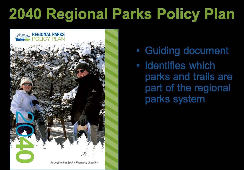
1 Webinar Series for Comprehensive Plan Updates Making Your Plan a Walk in the Park Presented by Jan Youngquist and Michael Peterka September 15, 2016
2 Today s Presentation Importance of Parks and Trails Outdoor Recreation System in the Metro Area Overview of the Regional Parks System Resources Requirements & Considerations for Your Comprehensive Plan 2040 Regional Parks Policy and System Plan


3 Importance of Parks and Trails Personal Benefits Community Benefits Environmental Benefits Economic Benefits -New York Times
4 Outdoor Recreation System in the Metropolitan Area State and Federal Lands Private/ Nonprofit Recreation Regional Parks and Trails Local Parks and Trails


5 National Parks/Federal Lands in the Metropolitan Area Mississippi National River and Recreation Area Photo: National Park Service St. Croix National Scenic Riverway Photo: National Park Service Minnesota Valley National Wildlife Refuge Photo: CityKnown.com


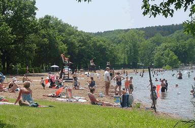
6 State Parks and Trails in the Metropolitan Area Afton State Park MN DNR Photo: Parks and Trails Council of Minnesota Luce Line State Trail MN DNR Photo: Minnesota Department of Natural Resources 6

7 Regional Parks System Governed by the 2040 Regional Parks Policy Plan Natural resource based Focused on water bodies Passive recreation Frequently crosses community boundaries Hyland Bush Anderson Lakes Park Reserve Bloomington & Three Rivers Park District


8 Local Parks Tot lots, neighborhood parks, athletic fields and courts, community centers Located near schools, neighborhoods, community facilities Serve the local community May offer active and passive recreation

9 Classification System for Local and Regional Parks


10 Private or Non-Profit Recreation in the Metropolitan Area Examples: Golf courses Ski/snowboard areas Gun clubs Marinas Nature centers
11 Creation of the Regional Parks System In 1974, State Legislature found that: Pressure of urbanization and development threatens valuable recreational open space areas in the metro area at the same time as the need for such areas is increased. Vadnais-Snail Lakes Regional Park Ramsey County Minn. Statute

12 1974 Metropolitan Parks Act Regional Parks Policy Plan shall: Identify generally the areas, which together with State facilities, will meet the outdoor recreation needs of the people of the metropolitan area Minnehaha Regional Park Minneapolis Park & Recreation Board Minn. Statute

13 Regional Park Implementing Agencies

14 Role of the Park Implementing Agencies Develop master plans Acquire land, develop, and rehabilitate regional parks and trails Operate and maintain the regional parks system Coordinate with local communities Cottage Grove Ravine Regional Park Washington County

15 Master Plans Implementing agencies prepare master plans for each regional park and trail Metropolitan Council review and approval


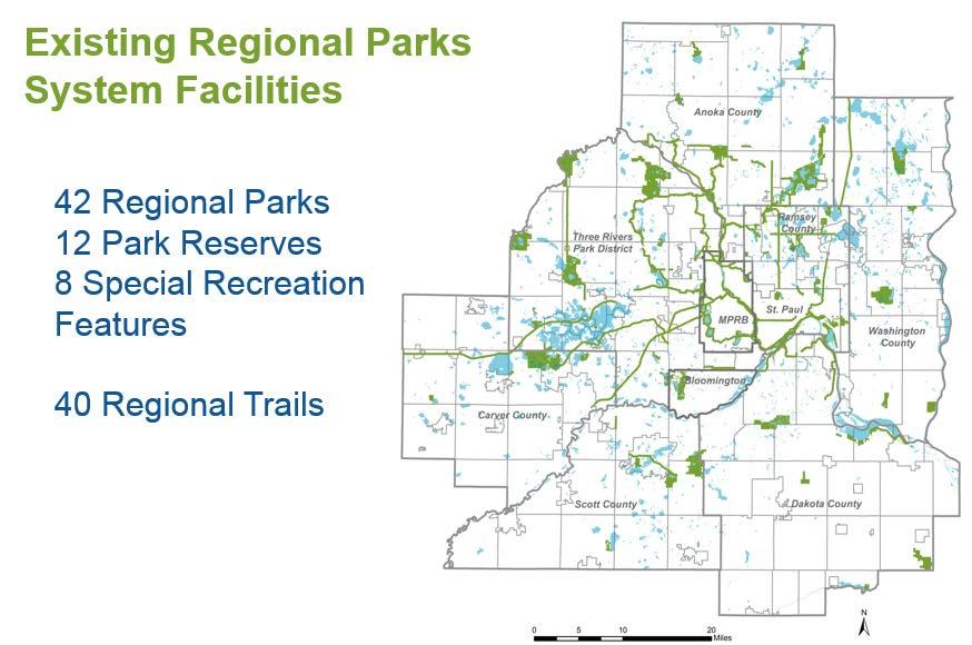
16 Regional Parks System Currently includes: 42 Regional Parks 12 Park Reserves 40 Regional Trails 8 Special Recreation Features 54,600 acres 360 miles of regional trails Hosted 47.3 million visits in 2015

17 Regional Parks System Facilities: Regional Parks 100 to 500 acres 42 regional parks open to the public Diversity of nature-based resources Swimming, boating, picnicking, walking & biking on trails Lebanon Hills Regional Park Dakota County

18 Regional Parks System Facilities: Park Reserves 1,000 to 5,000 acres 12 park reserves open to the public 80% natural habitat Environmental education, nature centers, campgrounds, walking/ biking trails Baker Park Reserve Three Rivers Park District

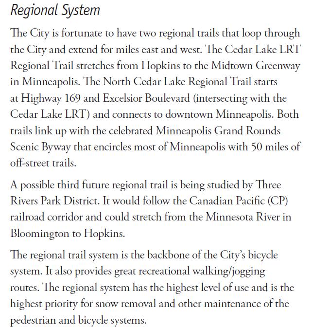
19 Regional Parks System Facilities: Regional Trails Mississippi River Regional Trail Anoka County 40 regional trails Link regional parks, park reserves, and trails 360 miles open to the public Walking, biking, inline skating, commuting


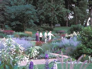
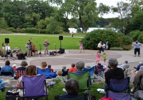

20 Regional Parks System Facilities: Special Recreation Features Como Conservatory Noerenberg Gardens Square Lake Gale Woods Farm Silverwood The Landing Kingswood


21 If you went to one regional park, park reserve or special recreation feature a week, it would take you more than a year to visit them all!
22 Regional Parks System Acreage Natural Resources Regional Draw
23


24 2040 System Plan Existing Regional Parks System Facilities Planned Regional Parks System Facilities Regional Parks System Boundary Adjustments Regional Park Search Areas Regional Trail Search Corridors 2040 Regional Trail Search Corridors System Additions Dakota Rail Regional Trail Carver County Cedar Lake Farm Regional Park Scott County Minnehaha Parkway Regional Trail Minneapolis Park & Recreation Board
25
26 Existing Regional Park with Inholdings

27 Coon Creek Regional Trail Anoka County

28 Planned Regional Parks System Facilities (Not Yet Open to the Public) 3 Planned Regional Parks 1 Planned Park Reserve 13 Planned Regional Trails
29

30 Planned Regional Parks System Facilities Boundary Adjustments: General areas identified to be added to existing regional parks and trails Search Areas: General areas identified for future regional parks Implementing agencies will develop master plans

31


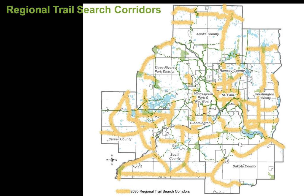
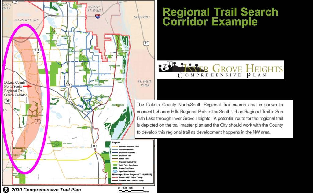
32 Search Corridor (from 2030 Regional Parks Policy Plan) Subsequent Planned Alignment


33 North Creek Regional Trail Dakota County

34 2040 Regional Trail Search Corridor System Additions


35 2040 Regional Parks System Plan


36 Key Changes in 2040 Regional Parks Policy Plan All proposed regional trails identified as regional trail search corridors New 2040 Regional Trail Search Corridor System Additions


37 Change in Trail Mapping Example 2030 System Statement Proposed trails 2040 System Statement Regional trail search corridors

38 Make sure to use up to date mapping in your comprehensive plan
39 2030 Comprehensive Plan

40 2030 Comprehensive Plan
41


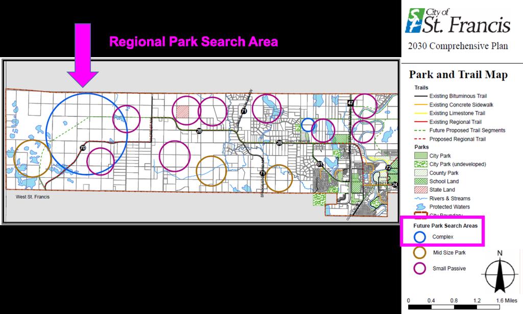
42 Regional Park Search Area Example

43
44

45 Regional Parks System

46 Regional Parks System

47 Existing regional parkland at Elm Creek Park Reserve shown as Parks/Schools/Public Open Space Existing residential land within Elm Creek Park Reserve boundary shown as Low Density

48 All land within Met Council approved boundary of Elm Creek Park Reserve guided with a future land use of Parks/Schools/Public Open Space
49
50
51

52 Regional Parks System

53 Local Parks and Trails

54 Local Parks and Trails
55 Resources Classification System for Local and Regional Facilities GIS Data Local Planning Handbook s Interactive Mapping Tool

56 Resources
57 Resources Community Pages
58 Questions? Jan Youngquist, AICP, Planning Analyst Michael Peterka, Planner
59 Upcoming Events Transit Planning Basics, Market Areas, and Comprehensive Planning Presented by Mike Larson and Michael Mechtenberg Thursday, September 22, 2016 Local Planning, the Regional Bicycle Transportation Network & Regional Trails Presented by Steve Elmer and Jan Youngquist Thursday, October 13, 2016 Housing Requirements Discussion Presented by Lisa Barajas Thursday, October 27, 2016
Metropolitan Parks and Open Space Commission Subject District(s), Member(s): Policy/Legal Reference: Staff Prepared/Presented: Division/Department:
, Member(s): Policy/Legal Reference: Staff Prepared/Presented: Division/Department:") Business Item Metropolitan Parks and Open Space Commission Meeting date: May 20, 2013 Subject: Proposed System Addition Discussion for the 2040 Regional Parks Policy Plan District(s), Member(s): All Policy/Legal
Business Item Metropolitan Parks and Open Space Commission Meeting date: May 20, 2013 Subject: Proposed System Addition Discussion for the 2040 Regional Parks Policy Plan District(s), Member(s): All Policy/Legal
Community Development Committee
 C Community Development Committee For the Metropolitan Council meeting of October 31, 2012 Committee Report Item:2012-316 ADVISORY INFORMATION October 16, 2012 Date Prepared: Subject: Intercity Regional
MEETING OF THE METROPOLITAN PARKS AND OPEN SPACE COMMISSION Tuesday, April 4, 2017
 Minutes of the MEETING OF THE METROPOLITAN PARKS AND OPEN SPACE COMMISSION Tuesday, April 4, 2017 Committee Members Present: Tony Yarusso, Rick Theisen, Robert Moeller, Todd Kemery, Sarah Hietpas, Margie
Section II. Planning & Public Process Planning for the Baker/Carver Regional Trail began in 2010 as a City of Minnetrista initiative.
 Section II Planning & Public Process Planning for the began in 2010 as a City of initiative. city staff began discussions with the Park District on the possibility of a north/south regional trail connection
2014 LEGISLATIVE AGENDA
 2014 LEGISLATIVE AGENDA BONDING SESSION Working to acquire, protect and enhance critical land for the public s use and benefit. 2014 LEGISLATIVE AGENDA In preparation for each session of the Minnesota
THREE RIVERS PARK DISTRICT
 THREE RIVERS PARK DISTRICT LONG-RANGE STRATEGIC INITIATIVES COMMITTEE MEETING Administrative Center - Board Room 3000 Xenium Lane North, Plymouth, MN Thursday, July 2, 2015 Estimated Time: 9:30 10:30 a.m.
Baker/Carver Regional Trail master plan public review draft
 Baker/Carver Regional Trail master plan public review draft November 2014 the mission of Three Rivers Park District is to promote environmental stewardship through recreation and education in a natural
Committee Report. Community Development Committee For the Metropolitan Council meeting of August 12, Business Item No.
 Committee Report Business Item No. 2015-168 Community Development Committee For the Metropolitan Council meeting of August 12, 2015 Subject: Coon Creek Regional Trail Master Plan, Anoka County Proposed
Business Item No xx
 Business Item No. 2015-xx Metropolitan Parks and Open Space Commission Meeting date: April 7, 2015 For the Community Development Committee meeting of April 21, 2015 For the Metropolitan Council meeting
2009 Regional Solicitation Selected Projects*
 2009 Regional Solicitation Selected Projects* Special Federal Allocation from the MPO Mn/DOT I-494/TH169 Interchange Reconstruction $34,000,000 Surface Transportation Program - Urban Guarantee AR-09-10
Business Item No XXX. Proposed Action That the Metropolitan Council approve the Coon Creek Regional Trail Master Plan.
 Business Item No. 2015-XXX Metropolitan Parks and Open Space Commission Meeting date: July 7, 2015 For the Community Development Committee meeting of July 20, 2015 For the Metropolitan Council meeting
Business Item No
 Metropolitan Parks and Open Space Commission Meeting date: February 6, 2018 For the Community Development Committee meeting of February 20, 2018 For the Metropolitan Council meeting of February 28, 2018
ANNUAL USE ESTIMATE OF THE REGIONAL PARKS SYSTEM FOR 2016 BASED ON A FOUR-YEAR AVERAGE OF VISIT DATA FROM 2013 THROUGH 2016
 ANNUAL USE ESTIMATE OF THE REGIONAL PARKS SYSTEM FOR 2016 BASED ON A FOUR-YEAR AVERAGE OF VISIT DATA FROM 2013 THROUGH 2016 The Council s mission is to foster efficient and economic growth for a prosperous
Three Rivers Park District
 ATTACHMENT C Regional Parks Policy Plan Update Proposed System Additions May 4, 2010 MPOSC Meeting ATTACHMENT C Three Rivers Park District Map Designation Site Name Type Conversion Acres Trail Length (miles)
Committee Report. Community Development Committee For the Metropolitan Council meeting of April 13, Business Item No.
 Committee Report Business Item No. 2016-48 Community Development Committee For the Metropolitan Council meeting of April 13, 2016 Subject: Harriet Island-South St. Paul Regional Trail Master Plan, Saint
Design Charrette Public Meeting
 Design Charrette Public Meeting Citizen Advisory Committee Members of the Public November 2, 2011 - Theodore Wirth Chalet - 6:30-8:30 p.m. Park Background: Visitation Estimation 2010 Regional Visitation
ANNUAL USE ESTIMATE OF THE METROPOLITAN REGIONAL PARKS SYSTEM FOR 2013 BASED ON A FOUR-YEAR AVERAGE OF VISIT DATA FROM 2010 THROUUGH 2013
 ANNUAL USE ESTIMATE OF THE METROPOLITAN REGIONAL PARKS SYSTEM FOR 2013 BASED ON A FOUR-YEAR AVERAGE OF VISIT DATA FROM 2010 THROUUGH 2013 July 2014 The Council s mission is to foster efficient and economic
Greater Minnesota Regional Parks and Trails Commission Designation Application
 Greater Minnesota Regional Parks and Trails Commission Designation Application General Section Designation Application #: 15-059D Date Submitted: 06/16/2015 Park or Trail Name: Mesabi Trail District #:
Criteria Based System for MPRB Regional Park and Trail Capital Project Scheduling
 Criteria Based System for MPRB Regional Park and Trail Capital Project Scheduling July 19, 2017 Background Beginning with the 2017-2022 Capital Improvement Program (CIP), MPRB used equity-driven metrics
Segment 2: La Crescent to Miller s Corner
 goal of the USFWS refuges is to conserve, protect and enhance fish, wildlife and plants and their habitats for the continuing benefit of the American people. Refuge lands are used largely for fishing,
Cascade River State Park Management Plan Amendment
 This document is made available electronically by the Minnesota Legislative Reference Library as part of an ongoing digital archiving project. http://www.leg.state.mn.us/lrl/lrl.asp Cascade River State
Southwest LRT Alignment Video Narration
 Southwest LRT Alignment Video Narration September 2015 Southwest Light Rail Transit, a proposed extension of the METRO Green Line, will serve Minneapolis, St. Louis Park, Hopkins, Minnetonka and Eden Prairie.
USGS Efforts to Consolidate Geospatial Data in the Federal Government
 ++ 1 USGS Efforts to Consolidate Geospatial Data in the Federal Government An overview of USGS trails collaborations and updates. Date 5/31/2017 Greg Matthews + Introduction USGS The following slides provide
City of Haslett. City of East Lansing. City of East Lansing
 Central Park North (Nancy L. Moore Park) Lake Park North Expansion White Park Expansion #2 White Park Expansion #1 County East East Haslett East East TF87-212 Acquisition $90,000.00 Park. TF08-138 Acquisition
July 2016 ANNUAL USE ESTIMATE OF THE REGIONAL PARKS SYSTEM FOR 2015 BASED ON A FOUR-YEAR AVERAGE OF VISIT DATA FROM 2012 THROUGH 2015
 July 2016 ANNUAL USE ESTIMATE OF THE REGIONAL PARKS SYSTEM FOR 2015 BASED ON A FOUR-YEAR AVERAGE OF VISIT DATA FROM 2012 THROUGH 2015 The Council s mission is to foster efficient and economic growth for
Recreation Opportunity Analysis Authors: Mae Davenport, Ingrid Schneider, & Andrew Oftedal
 Authors: Mae Davenport, Ingrid Schneider, & Andrew Oftedal // 2010 Supply of Outdoor Recreation Resources // Recreation Location Quotient Analysis recreation opportunity analysis // 59 2010 Supply of Outdoor
COASTAL CONSERVANCY. Staff Recommendation December 2, 2004 COYOTE HELLYER COUNTY PARK BAY AREA RIDGE TRAIL
 COASTAL CONSERVANCY Staff Recommendation December 2, 2004 COYOTE HELLYER COUNTY PARK BAY AREA RIDGE TRAIL File No. 04-057 Project Manager: Amy Hutzel RECOMMENDED ACTION: Authorization to disburse up to
Southwest Quadrant Distinctive Features
 SOUTHWEST QUADRANT Southwest Quadrant Distinctive Features LAND USE The 31.17 square mile Southwest Quadrant includes all the area within the planning area west of I-5 and south of the Sacramento River.
Visitor Demand CHAPTER 3. Overview 3-1
 CHAPTER 3 Visitor Demand Overview MGRP draws both local and regional visitors due to its central location in the Twin Cities metro area and the access it offers to the Mississippi River. The park consists
LINK (5465) N. Robert St., St. Paul, MN 55101
 N. Robert St., St. Paul, MN 55101") 651-602-LINK (5465) www.transitlinktc.org 390 N. Robert St., St. Paul, MN 55101 Service Details Customer Guide Table of Contents Customer Guide... page 1 Service Details... page 2 Areas... page 2 Eligibility...
651-602-LINK (5465) www.transitlinktc.org 390 N. Robert St., St. Paul, MN 55101 Service Details Customer Guide Table of Contents Customer Guide... page 1 Service Details... page 2 Areas... page 2 Eligibility...
NAVAJO COMMUNITY PLAN
 NAVAJO COMMUNITY PLAN Prepared by the NAVAJO COMMUNITY PLANNERS and THE CITY OF SAN DIEGO City of San Diego Planning Department 202 C Street, MS 4A San Diego, CA 92101 Printed on recycled paper. This information,
Classifications, Inventory and Level of Service
 Classifications, Inventory and Level of Service Section 3 Kenmore Park, Recreation and Open Space Plan 1 P a g e Classifications and Inventory Park Classifications Kenmore classifies its parks based upon
SINGLE TENANT NET LEASED MINNEAPOLIS/ST. PAUL METRO INVESTMENT HIGHLIGHTS CONTACT US
 SINGLE TENANT NET LEASED MINNEAPOLIS/ST. PAUL METRO INVESTMENT HIGHLIGHTS CBRE is pleased to offer this outstanding opportunity to acquire a 100% fee simple interest in an absolute NNN Taco Johns and Steak
Section 4(f)/6(f) Determination Technical Report for Park and Recreational Lands
/6(f) Determination Technical Report for Park and Recreational Lands") Section 4(f)/6(f) Determination Technical Report for Park and Recreational Lands 1.0 Introduction 1.1 Purpose of Report This Section 4(f)/6(f) Determination Technical Report for Park and Recreational Lands
Section 4(f)/6(f) Determination Technical Report for Park and Recreational Lands 1.0 Introduction 1.1 Purpose of Report This Section 4(f)/6(f) Determination Technical Report for Park and Recreational Lands
METROPOLITAN COUNCIL 390 North Robert Street, St. Paul, MN Phone (651) TDD (651)
 TDD (651)") DATE: March 27, 2012 METROPOLITAN COUNCIL 390 North Robert Street, St. Paul, MN 55101 Phone (651) 602-1000 TDD (651) 291-0904 TO: Metropolitan Parks and Open Space Commission FROM: Arne Stefferud, Planning
DATE: March 27, 2012 METROPOLITAN COUNCIL 390 North Robert Street, St. Paul, MN 55101 Phone (651) 602-1000 TDD (651) 291-0904 TO: Metropolitan Parks and Open Space Commission FROM: Arne Stefferud, Planning
4.0 Context for the Crossing Project
 4.0 Context for the Crossing Project This section provides background information about key features of the North Douglas Crossing project area, and opportunities and constraints. This information is important
2030 Comprehensive Plan A Policy Guide to 2030
 2030 Comprehensive Plan A Policy Guide to 2030 Parks and Open Spaces Approved by Board of Commissioners May 26, 2009 Adopted by Board of Commissioners September 7, 2010 Washington County Mission To provide
Central Mississippi Riverfront Regional Park Master Plan
 9/19/2012 Mill District Neighborhood Association 2 Metropolitan Council Regional Parks & Trails Map (Regional Parks status) + (Met Council approved master plan) = access to funding 9/19/2012 Mill District
Segment 4: Hokah to Mound Prairie
 Root River Wildlife Management Area The main unit of this WMA is located just north of the Root River and the city of Hokah. Its 443 acres include mixed hardwoods of oak, basswood, ash, cottonwood, elm
2. Goals and Policies. The following are the adopted Parks and Trails Goals for Stillwater Township:
 D. PARKS AND TRAILS 1. Introduction Stillwater Township s population is relatively low, with most residents living on rural residences on large lots. The need for active park space has been minimal in
CITY OF CHASKA PEDESTRIAN MOVEMENT / TRAILS PLAN FINAL CHAPTER 7 PEDESTRIAN MOVEMENT / TRAILS PLAN. Page 1 of 19, Chapter 7
 FINAL CHAPTER 7 PEDESTRIAN MOVEMENT / TRAILS PLAN Page 1 of 19, Chapter 7 ORDER OF CONTENTS I. INTRODUCTION... 3 II. PURPOSE... 3 III. 2030 COMMUNITY TRAILS SYSTEM PLAN... 4 IV. TRAIL TYPES... 7 A. Regional
INITIATIVE. Parks and Trails Legacy Funding Project. Environmental
 Parks and Trails Legacy Funding Project Recommendations from the Work Group to the Minnesota Department of Natural Resources November 2012 Prepared by Environmental INITIATIVE Environmental Initiative
William O Brien State Park Management Plan
 William O Brien State Park Management Plan Minnesota Department of Natural Resources Division of Parks and Recreation March 2008 WILLIAM O BRIEN STATE PARK MANAGEMENT PLAN State of Minnesota Department
Recreational Trails Dubuque, IA Official Website Information on the recreational trails within Dubuque Dubuque Bike Hike Trail System The City of
 Recreational Trails Dubuque, IA Official Website Information on the recreational trails within Dubuque Dubuque Bike Hike Trail System The City of Dubuque maintains a comprehensive mile bike hike trail
5101 Shady Oak Road. Shady Oak Road. Lake Views
 Lake Views Shady Oak Road Welcome to Shady Oak Lake Corporate Center Striking views of Shady Oak Lake and strategically located in the Southwest suburban market, Shady Oak Lake Corporate Center is just
Metropolitan Council 2016 Population and Household Estimates Published July 2017
 Metropolitan Council 2016 and s Published July 2017 City or Township Andover 30,598 32,335 1,737 9,811 10,391 580 Anoka 17,142 17,995 853 7,060 7,436 376 Bethel 466 461-5 174 174 0 Blaine (part) 57,186
CHAPTER 4 -- THE LAND USE PLAN: DESCRIPTIONS AND POLICIES FOR THIRTEEN PLANNING AREAS
 CHAPTER 4 -- THE LAND USE PLAN: DESCRIPTIONS AND POLICIES FOR THIRTEEN PLANNING AREAS NORTH CENTRAL CAC AREA LITTLE VALLEY ROAD TO JUG HANDLE CREEK PLANNING AREA This planning area includes Cleone, Noyo,
Metropolitan Council 2017 Final Population and Household Estimates Certified and published July 2018
 Metropolitan Council Final and s Certified and published July 2018 City or Township - - Andover 30,598 32,470 1,872 9,811 10,445 634 Anoka 17,142 18,205 1,063 7,060 7,525 465 Bethel 466 499 33 174 179
Mississippi River Parkway Commission of Minnesota
 Mississippi River Parkway Commission of Minnesota Bluffs Region (Hastings to Iowa Border) September 23, 2016 10:00 11:30 a.m. Red Wing Ignite 419 Bush Street, Red Wing, MN Bluffs Region Agenda I. Welcome
Twin Cities Region Population and Household Estimates, 2014 (PRELIMINARY)
") and Household s, (PRELIMINARY) Andover 30,598 31,874 1,276 9,811 10,273 462 Anoka 17,142 17,586 444 7,060 7,252 192 Bethel 466 477 11 174 177 3 Blaine (part) 57,186 62,066 4,880 21,077 22,647 1,570 Centerville
and Household s, (PRELIMINARY) Andover 30,598 31,874 1,276 9,811 10,273 462 Anoka 17,142 17,586 444 7,060 7,252 192 Bethel 466 477 11 174 177 3 Blaine (part) 57,186 62,066 4,880 21,077 22,647 1,570 Centerville
DEMOGRAPHICS AND EXISTING SERVICE
 EXECUTIVE SUMMARY The Central Corridor light-rail transit (LRT) project will open in 2014 and operate between downtown Minneapolis and downtown St. Paul, serving the University of Minnesota and University
Paul S. Sarbanes Transit in Parks Project Descriptions
 Paul S. Sarbanes Transit in Parks Project Descriptions ALASKA Denali National Park and Preserve Grant Amount: $246,000 The Denali National Park will test hybrid buses of various designs in order to determine
Susan Overson, Landscape Architect/Park Planner 2018 National Outdoor Recreation Conference April 23-26, 2018 Burlington, VT
 Susan Overson, Landscape Architect/Park Planner 2018 National Outdoor Recreation Conference April 23-26, 2018 Burlington, VT MISSISSIPPI NRRA 54,000-acre urban, national park established by Congress in
Citizen Advisory Committee Meeting Wednesday, June 10, :00 p.m.
 Approved Citizen Advisory Committee Meeting Wednesday, June 10, 2015 7:00 p.m. CAC Members Present: David Arbeit Bill Barton Steve Duerre Rick Sanders Nicole Soderholm Michelle Ulrich Gwen Willems Others
5101 Shady Oak Road MINNETONKA, MN. Shady Oak Road. Lake Views
 AVAILABILITIES FLOOR S Shady Oak Road Lake Views Welcome to Shady Oak Lake Corporate Center Striking views of Shady Oak Lake and strategically located in the Southwest suburban market, Shady Oak Lake Corporate
10/25/2013. What is the SCORP?! 2013 Local Government Survey 2013 Statewide Public Survey Advisory Group Priority Areas Your Suggestions!
 COLORADO OUTDOOR RECREATION TRENDS RESULTS FROM THE SCORP AND STATEWIDE Colorado Outdoor Recreation Resource Partnership September 2013 PRESENTATION What is the SCORP?! 2013 Local Government Survey 2013
THREE RIVERS PARK DISTRICT
 THREE RIVERS PARK DISTRICT INTERGOVERNMENTAL AND COMMUNITY ENGAGEMENT COMMITTEE MEETING Administrative Center - Board Room 3000 Xenium Lane North, Plymouth, MN 1. CALL TO ORDER Thursday, November 6, 2014
2013 HOUSING COUNTS November 2014
 2013 HOUSING COUNTS November 2014 MINNEAPOLIS 2013 Affordable Units with Financing Closed New Production: Rental @30% @50% @60% AMI AMI AMI Pillsbury Historic Redevelopment... 251 *Snelling Apartments
Metro Transit Service Improvement Plan
 Metro ransit Service Improvement Plan ransportation Committee April 13, 2015 Cyndi Harper Manager of Route Planning Kyle Burrows ransit Planner What is the Service Improvement Plan (SIP)? Bus service expansion
FOR SALE : Land. XXXX St. Croix Trail S, Denmark Township, MN ACRES/4 PARCELS - RESIDENTIAL DEVELOPMENT FACTS & FEATURES
 FACTS & FEATURES List Price: $560,000 Property Type: Residential Land for Development Total Site - 10 Acres Currently Could Build 2 Homes on 5 Acres each Being Re-Platted for 4 lots ~2.5 Acres each Zoning:
Stagecoach State Trail Master Plan
 Stagecoach State Trail Master Plan Minnesota Minnesota Department Department of of Natural Natural Resources Resources Parks and and Trails Trails Division Division Parks March March 2012 2012 The Minnesota
DRAFT 2040 CARVER COUNTY COMPREHENSIVE PLAN
 PARKS, OPEN SPACE, & TRAILS DRAFT 2040 CARVER COUNTY COMPREHENSIVE PLAN www.co.carver.mn.us/2040plan 6. Parks, Open Space, and Trails Plan Introduction The population in is expected to increase from the
Annual Use Estimate of the Metropolitan Regional Parks System for 2011 Based on a four year average of visitation data from 2008 through 2011
 Annual Use Estimate of the Metropolitan Regional Parks System for 2011 Based on a four year average of visitation data from 2008 through 2011 December 2012 (revised) 390 North Robert Street St. Paul, Minnesota
Minnesota River Valley Area Survey Summary Report
 Minnesota River Valley Area Survey Summary Report Report prepared by: Minnesota Department of Natural Resources Office of Management and Budget Services May 2002 ACKNOWLEDGMENTS A number of organizations
SOUTH INTERCHANGE AREA
 Santaquin City General Plan 1 Location and Characteristics The South Interchange Area of Santaquin is located west of Interstate 15 and south of 500 South (Figure 1). It includes properties already annexed
Service Improvement Plan
 Metro ransit Service Improvement Plan ransportation Committee April 13, 2015 Cyndi Harper Manager of Route Planning Kyle Burrows ransit Planner What is the Service Improvement Plan (SIP)? Bus service expansion
Annual Use Estimate of the Metropolitan Regional Parks System for 2010 Based on a four year average of visitation data from 2007 through 2010
 This document is made available electronically by the Minnesota Legislative Reference Library as part of an ongoing digital archiving project. http://www.leg.state.mn.us/lrl/lrl.asp Annual Use Estimate
Glacial Lakes State Park Management Plan Amendment Camper Cabin Development
 Glacial Lakes State Park Management Plan Amendment Camper Cabin Development Minnesota Department of Natural Resources Division of Parks and Recreation November 2006 Glacial Lakes State Park Management
A CASE FOR COMPLETING THE JORDAN RIVER PARKWAY: A
 A CASE FOR COMPLETING THE JORDAN RIVER PARKWAY: A safe crossing at 9000 South and 850 West Proposed 9000 South Underpass Parkway Timeline Parkway, Trail, and Tourism Facts Blueprint Jordan River 1971 1973
Annual Use Estimate of the Metropolitan Regional Park System for 1999
 This document is made available electronically by the Minnesota Legislative Reference Library as part of an ongoing digital archiving project. http://www.leg.state.mn.us/lrl/lrl.asp ) ~. I Annual Use Estimate
BLANKET CREEK PROVINCIAL PARK
 BLANKET CREEK PROVINCIAL PARK PURPOSE STATEMENT AND ZONING PLAN February 2003 BLANKET CREEK PROVINCIAL PARK Purpose Statement and Zoning Plan Primary Role The primary role of Blanket Creek Park is to maintain
System Group Meeting #1. March 2014
 System Group Meeting #1 March 2014 Meeting #1 Outcomes 1. Understand Your Role 2. List of Revisions to Existing Conditions 3. Information Sources Study Area The Purpose of Mountain Accord is to Preserve
Northaven Trail Phase 2 Initial Project Overview
 Northaven Trail Phase 2 Initial Project Overview Partnership Project to extend existing Northaven Trail Improve Bike/Ped Connectivity On Dallas Trail Network Plan City and County Funding Oncor Texas Trails
Flying Cloud Airport (FCM) Zoning Process: Informing a Mn/DOT Path Forward
 Zoning Process: Informing a Mn/DOT Path Forward") : Informing a Mn/DOT Path Forward A Review of the Flying Cloud Airport (FCM) Joint Airport Zoning Board (JAZB) Process and the Draft Airport Zoning Ordinance B A RPZ RPZ A B C Zone Chad E. Leqve Director
: Informing a Mn/DOT Path Forward A Review of the Flying Cloud Airport (FCM) Joint Airport Zoning Board (JAZB) Process and the Draft Airport Zoning Ordinance B A RPZ RPZ A B C Zone Chad E. Leqve Director
Maintenance of Recreational Trails. Presented by: Renae Kuehl, PE CEAM Annual Conference
 Maintenance of Recreational Trails Presented by: Renae Kuehl, PE CEAM Annual Conference January 26, 2012 Technical Advisory Committee Amy Gurski, Three Rivers Park District Joe Gustafson, Washington County
BASSETTS CREEK SECTION CONTENTS: BASSETTS CREEK BRYN MAWR LUCE LINE
 BASSETTS CREEK SECTION CONTENTS: BASSETTS CREEK BRYN MAWR LUCE LINE GLENWOOD AVE MULTI-USE DIAMONDS VINCENT AVE N MORGAN AVE N PENN AVE N DOG PARK MULTI-USE FIELDS PLAYGROUND AK E RD S CHESTNUT AVE DA
Managed Lanes, Transit Access, and Economic Development: Implementing the Region s First Highway BRT Corridor
 Managed Lanes, Transit Access, and Economic Development: Implementing the Region s First Highway BRT Corridor Tim Burkhardt, AICP William Reynolds, AICP, PTP Matt Horton Who we are/astrological signs Tim
The Atlanta BeltLine. & Sustainable Development GAFM Conferance. // March 25, 2014
 The Atlanta BeltLine & Sustainable Development GAFM Conferance // March 25, 2014 04/22/2014 Atlanta BeltLine // 2013 Page 1 // Organizational Structure Project Owner and Sponsor Redevelopment Authority
METROPOLITAN COUNCIL 390 North Robert Street, St. Paul, MN Phone (651) TDD (651)
 TDD (651)") METROPOLITAN COUNCIL 390 North Robert Street, St. Paul, MN 55101 Phone (651) 602 1000 TDD (651) 291 0904 DATE: June 19, 2007 TO: Metropolitan Parks and Open Space Commission FROM: Jan Youngquist, Senior
METROPOLITAN COUNCIL 390 North Robert Street, St. Paul, MN 55101 Phone (651) 602 1000 TDD (651) 291 0904 DATE: June 19, 2007 TO: Metropolitan Parks and Open Space Commission FROM: Jan Youngquist, Senior
Environment and Natural Resources Trust Fund 2010 Request for Proposals (RFP)
") LCCMR ID: 165-F Project Title: Environment and Natural Resources Trust Fund 2010 Request for Proposals (RFP) Urban Wilderness Canoe Adventures (UWCA) LCCMR 2010 Funding Priority: F. Environmental Education
LCCMR ID: 165-F Project Title: Environment and Natural Resources Trust Fund 2010 Request for Proposals (RFP) Urban Wilderness Canoe Adventures (UWCA) LCCMR 2010 Funding Priority: F. Environmental Education
. - '\ ( r.l. - Report> -Annual Use Estimate of the _ Metropolitan Regional Park, System for 2003 u
 - Report> ' - 1111111r11i11~~ ~1]1m1111m11~m11111111-1--. 3 0307 00020 4324. - '\ ( r.l - I ----rregional. -Annual Use Estimate of the _ Metropolitan Regional Park, System for 2003 u - Based on a four-year
PARTICIPATION IN THE LIVABLE COMMUNITIES ACT LOCAL HOUSING INCENTIVE ACCOUNT A
 This document is made available electronically by the Minnesota Legislative Reference Library as part of an ongoing digital archiving project. http://www.leg.state.mn.us/lrl/lrl.asp PARTICIPATION IN THE
BEACON HILL, MOUNT BAKER & SEWARD PARK. community info
 BEACON HILL, MOUNT BAKER & SEWARD PARK community info BEACON HILL neighborhood Beacon Hill, in south Seattle, is still considered an affordable place to buy a home. In the North Beacon Hill area, there
Appendix K: MSP Class B Airspace
 Appendix K: MSP Class B Airspace K All of the open sky covering the United States, from less than an inch off the ground all the way to outer space, is part of America s airspace. This airspace resource
Active Living Partners. Trails. Hennepin County. Bloomington. Brooklyn Park. Crystal. Excelsior. Golden Valley. Hopkins. Independence.
 d rove app Active Living Partners When using the do. seal of approval in publications, include service mark notice: do. is a registered mark of Blue Cross and Blue Shield of Minnesota, a nonprofit independent
Greater Minnesota Regional Parks and Trails Commission Designation Application
 Greater Minnesota Regional Parks and Trails Commission Designation Application General Section Designation Application #: 15-050D Date Submitted: 06/30/2015 Park or Trail Name: Perham to Pelican Rapids
Mississippi River Parkway Commission of Minnesota
 Mississippi River Parkway Commission of Minnesota Metro Region (Elk River to Hastings) October 27, 2016 2:00 3:30 p.m. Historic Fort Snelling 200 Tower Avenue, St. Paul, MN Metro Region Agenda I. Welcome
Afton State Park Management Plan Amendment
 This document is made available electronically by the Minnesota Legislative Reference Library as part of an ongoing digital archiving project. http://www.leg.state.mn.us/lrl/lrl.asp Afton State Park Management
MPRB: Southwest LRT Community Advisory Committee Issues and Outcomes by Location Current to: 12 November 2010
 MPRB: Southwest LRT Community Advisory Committee Issues and Outcomes by Location Current to: 12 November 2010 This is a compilation of issues and outcomes identified by the CAC. It is a work in progress,
Trail Etiquette. Hours of Operation. Trail Accessibility
 Trail Guide The Elmhurst Park District, with 28 parks and over 460 acres of land, offers nearly six miles of paved or asphalt park trails and maintains an additional 3.6 miles of trails within Elmhurst.
MASTER PLAN EXECUTIVE SUMMARY
 Biscuit Run State Park Scottsville Road (State Route 20) Charlottesville, VA 22902 Biscuit Run State Park MASTER PLAN EXECUTIVE SUMMARY Department of Conservation and Recreation Division of Planning and
Summary for the December 3rd-4th, 2010 Snow Storm
 Summary for the December 3rd-4th, 2010 Snow Storm A widespread area of snowfall impacted southern and central Minnesota and west Central Wisconsin beginning on the morning of December 3rd that slowly tapered
STATION TYPOLOGIES. Typology Matrix 35
 3 STATION TYPOLOGIES Typology Matrix 35 Typologies The TOD Framework Master Plan classifies the various stations along the MetroLink system in a series of typologies as outlined on the pages that follow.
Glacial Lakes State Trail Master Plan Amendment Trail Extension into Downtown Willmar
 Glacial Lakes State Trail Master Plan Amendment Trail Extension into Downtown Willmar Minnesota Department of Natural Resources Division of Parks and Trails July 2012 Glacial Lakes State Trail Master Plan
REQUEST FOR COUNCIL ACTION
 REQUEST FOR COUNCIL ACTION Date: 10-24-2016 Item No.: 14.e Department Approval City Manager Approval Item Description: Roseville Deer Management 1 2 3 4 5 6 7 BACKGROUND The City of Roseville, in conjunction
Crystal Spring SNA. Washington County N W N W N W N W N W92 45.
 W92 45.899 W92 45.835 W92 45.826 W92 45.814 Z o av ral eek s C r N45 15.465 W92 45.972 N45 15.439 W92 46.102 W92 45.913 hidden cove N45 15.413 W92 45.857 W92 45.791 W92 45.899 W92 45.835 W92 45.826 W92
Blueways: Rivers, lakes, or streams with public access for recreation that includes fishing, nature observation, and opportunities for boating.
 Parks, Open Space and Trails PRINCE WILLIAM COUNTY 2008 COMPREHENSIVE PLAN TRAILS PLAN CONTENTS The components of the trails plan are: Intent Definitions Goals, Policies, and Action Strategies Trails Map
Beth Lucas, Senior Planner Stephanie Brewer, Planner Broome County Planning May 12 th, 2016
 Beth Lucas, Senior Planner Stephanie Brewer, Planner Broome County Planning May 12 th, 2016 Background Data Collection Trail Mapping Promotional Strategy December 2014 County s natural beauty identified
Airport Planning Area
 PLANNING AREA POLICIES l AIRPORT Airport Planning Area LOCATION AND CONTEXT The Airport Planning Area ( Airport area ) is a key part of Boise s economy and transportation network; it features a multi-purpose
Yuba Creek Natural Area Acquisition. Acme Township. Acme Township. TF Acquisition $1,576, Grand Traverse
 Yuba Creek Natural Area TF00-162 $1,576,021.00 in fee simple of 403 acres of critical wetls upl habitat with over 5,000 feet of frontage on Yuba Creek, a tributary to the east arm of Bay. 2000 Petobago