Attachment-2. The Proposal of the Coastal Environment Protection Corridor (CEPC)
|
|
|
- Joella Haynes
- 5 years ago
- Views:
Transcription
1 Attachment-2 The Proposal of the Coastal Environment Protection Corridor (CEPC)
2 The Proposal of the Coastal Environment Protection Corridor for Halong Bay (CEPC) Action Plan for Proposed Measures in Coastal Environment Protection Corridor for Halong Bay (Draft) February 2013 Working Group-2 (Land Use Management) Under the Project for Environmental Protection in Halong Bay
3 Draft Action Plan for Proposed Measures in Coastal Environment Protection Corridor for Halong Bay February 2013 Action Plan for Proposed Measures in Coastal Environment Protection Corridor for Halong Bay (Draft) Table of Contents Page CHAPTER 1 INTRODUCTION INNOVATIVE POINTS OF THE ACTION PLAN CHAPTER 2 CURRENT AND POTENTIAL ISSUES IN LAND USE OF THE COASTAL AREA IN HALONG BAY CHAPTER 3 FRAMEWORK OF THE CEPC CHAPTER 4 PROPOSED MEASURES IN THE CEPC WASTEWATER TREATMENT AND POLLUTION CONTROL STRICT DEVELOPMENT PERMIT AND MONITORING IN BAI CHAY INTERNATIONAL TOURISM AREA PARKING SPACE DEVELOPMENT IN BAI CHAY INTERNATIONAL TOURISM AREA Introduction of Environmental-friendly Public Transportation in the Traffic Control Section Effective Utilization of the Parking Space Step-wise Introduction through Social Experiment MANGROVE AND TIDAL FLAT PROTECTION AND WISE-USE Mangrove and Tidal Flat Protection Wise-use of Mangrove CONTROL OF AQUACULTURE Extensive Aquaculture Improved Extensive Aquaculture CONTROL OF LAND RECLAMATION STRENGTHENING OF SEA IN PREPARATION OF LAND USE PLAN STRENGTHENING OF EIA/EPC CHAPTER 5 IMPLEMENTATION STRUCTURE CHAPTER 6 IMPLEMENTATION SCHEDULE CHAPTER 7 NECESSARY ACTIONS IN FURTHER STAGE Attachments Attachment-1: Report on Trial Eco-tour in the Proposed Mangrove Protected Area on 13 Oct Attachment-2: Report on Social Experiment for Improvement of Traffic Safety and Landscape in Bai Chay Road on 1 Dec Attachment-3: Rapid Survey Report on Mangrove in the Proposed Mangrove Protected Areas Attachment-4: Rapid Survey Report on Reptile and Amphibian Species in the Proposed Mangrove Protected Areas i
4 Draft Action Plan for Proposed Measures in Coastal Environment Protection Corridor for Halong Bay February 2013 List of Tables Table 4-1 Average Annual Catch by Species (Main Species) Table 4-2 Program of the Trial Eco-tour in Mangrove Table 4-3 Comments from Participants of the Trial Eco-tour in Mangrove Table 5-1 Proposed Institutional Set-up Table 6-1 Implementation Schedule for Proposed Measures for Coastal Environment Protection Corridor for Halong Bay List of Figures Figure 1-1 Trial Eco-tour in the Proposed Mangrove Protected Area in Quang Yen Town on 13rd Oct Figure 1-2 Social Experiment for Improvement of Traffic Safety and Landscape in Bai Chay Road on 1st Dec Figure 2-1 Various Land Use and Environmental Pressure from Coastal Area to the Halong Bay Figure 2-2 Vicious Spiral under Inappropriate Coastal Area Management in Halong Bay Figure 3-1 Functions of CEPC Figure 3-2 Framework of CEPC Figure 3-3 Current Direction to the Heritage Area (Simulated Ebb Tide of the Upper Layer) Figure 3-4 Initial Conceptual Image of CEPC Figure 3-5 Boundary of the CEPC Figure 3-6 Image of the CEPC by Connecting Active Management Zones Figure 4-1 Proposed Measures in each Active Management Zone Figure 4-2 Location of Measures on Wastewater Treatment and Pollution Control Figure 4-3 Proposed Measures in Bai Chay International Tourism Area Figure 4-4 Issues on Tourism Development Activity Figure 4-5 Current Issues on Transportation and Traffic Safety in Bai Chay International Tourism Area Figure 4-6 Traffic Control Measure along the Bai Chay Road (tentative proposal) Figure 4-7 Expected Benefits by Developing Parking Space + Traffic Control in Bai Chay Figure 4-8 Road Examples of Environmental-friendly Public Transportation in the Traffic Control Section Figure 4-9 Expected Roles of the Road Station in the Parking Site Figure 4-10 Multi-purpose Use of the Road Station as Effective Utilization of the Parking Space Figure 4-11 Example of Parking Guidance and Information System Figure 4-12 Layout of the Traffic Control Zones in Social Experiment Figure 4-13 Demonstration of the Electric Carts in the Social Experiment on 1st Dec Figure 4-14 Proposed Layout of the Traffic Control Zones in Preliminary Implementation Figure 4-15 Proposed Mangrove Protected Areas in Binh Huong Estuary and Cua Luc Estuary Figure 4-16 Proposed Mangrove Protected Areas in Binh Huong Estuary Figure 4-17 Proposed Mangrove Protected Areas in Cua Luc Estuary Figure 4-18 Available Marine Species in the Proposed Mangrove Protected Areas Figure 4-19 Image of Eco-tourism and Environmental Education in Mangrove Figure 4-20 Route of the Eco-tour Figure 4-21 Photos of the Trial Eco-tour Figure 4-22 Relationship among Relevant Bodies for Eco-tour Business Figure 4-23 Relationship among Relevant Bodies for Environmental Education Figure 4-24 Sample Layout of Extensive Aquaculture Combined with Eco-tourism in the Proposed Mangrove Protected Area Figure 4-25 Sample Layout of Improved Extensive Aquaculture Combined with Eco-tourism in the Proposed Mangrove Protected Area ii
5 Draft Action Plan for Proposed Measures in Coastal Environment Protection Corridor for Halong Bay February 2013 List of Abbreviations CEPC DARD DCST DOC DONRE DOT DPI EIA EPC JICA PC PMB SEA UNESCO URENCO VINACOMIN Coastal Environment Protection Corridor for Halong Bay Department of Agriculture and Rural Development Department of Culture, Sport, and Tourism Department of Construction Department of Natural Resources and Environment Department of Transportation Department of Planning and Investment Environmental Impact Assessment Environmental Protection Commitment Japan International Cooperation Agency People s Committee Project Management Board (for the Project for Environmental Protection in Halong Bay) Strategic Environment Assessment United Nations Educational, Scientific and Cultural Organization Urban Environment Company Vietnam National Coal and Mineral Industries Group iii
6 Draft Action Plan for Proposed Measures in Coastal Environment Protection Corridor for Halong Bay February 2013 CHAPTER 1 INTRODUCTION 1.1 Innovative Points of the Action Plan Innovative points of the Action Plan for Proposed Measures in Coastal Environment Protection Corridor for Halong Bay are summarized below. (1) Introduction of the CEPC Concept Coastal land use management from viewpoints of environmental protection and sustainable tourism in Halong Bay was focused on, which has not clearly been managed so far, but important from both economic development and environmental protection. (2) Enhancement of linkage between land use management and environmental considerations for Halong Bay Legal measures on support of Strategic Environmental Assessment (SEA) and Environmental Impact Assessment (EIA), in line with land use plan preparation and impact assessment related to the Halong Bay which have not been well implemented so far, were proposed. (3) Proposal of mangrove protection areas CEPC focuses on not only minimization of pollution from the land, but also conservation of biodiversity and eco-system from viewpoint of land use management for environmental protection in Halong Bay. (4) Measures for sustainable tourism in Bai Chay Some measures were proposed considering that maintenance of land use and landscape at certain high level in the Bai Chay coastal area is an critical factor as international tourism area with UNESCO natural heritage site. (5) Support of potential measures by making a comprehensive measure Intensions and demands in the localities were reflected and integrated into the proposed measures at larger-scale and comprehensive manner such as proposed mangrove protected areas. (6) Some trials on the proposed measures Before actual full-scale implementation of the proposed measures, trial activities even with partial implementation are sometimes required and useful to examine implementing issues and effects of the proposed measure in addition to the preparation of detailed plan. During the Project, the following two trial activities have been conducted as shown in the following photos. 1-1


7 Draft Action Plan for Proposed Measures in Coastal Environment Protection Corridor for Halong Bay February 2013 Figure 1-1 Trial Eco-tour in the Proposed Mangrove Protected Area in Quang Yen Town on 13rd Oct Figure 1-2 Social Experiment for Improvement of Traffic Safety and Landscape in Bai Chay Road on 1st Dec
8 Draft Action Plan for Proposed Measures in Coastal Environment Protection Corridor for Halong Bay February 2013 CHAPTER 2 CURRENT AND POTENTIAL ISSUES IN LAND USE OF THE COASTAL AREA IN HALONG BAY As shown in the following figure, various land uses in the coastal area of Halong Bay, where the area is limited and important for the economic activity and residence, have brought about environmental pressure to the Halong Bay, mainly by wastewater discharge and sediment/silt runoff. In the coastal area, there was no clear responsibility to manage the coastal area from the point of view of environmental protection for Halong Bay so far. As result, the various economic and development activities under inappropriate coastal area management have caused vicious spiral in two factors; 1) decrease of tidal flat and seaweed bed including mangrove forest due to land reclamation, and 2) environmental pressure from coastal area to the Halong Bay such as wastewater, silt runoff, and solid waste discharge. The proposed measures to be implemented in the CEPC will prevent such factors of the vicious spiral and even improve the environment. Residential Tourism Industries Recreation Commercial Coastal Area in Halong Bay Coal mine Land reclamation Port Infrastructure ex. power plant Transportation Environmental pressure from coastal area to the Halong Bay Source: WG-2 Figure 2-1 Various Land Use and Environmental Pressure from Coastal Area to the Halong Bay It is considered that minimization of environmental pressure from coastal area to the Halong Bay with economic development in the coastal area contribute to realize sustainable tourism development in Halong area as well as conservation of the Halong Bay from the land use management as shown in the following figure. From the viewpoint, land use management in Coastal Environmental Protection Corridor for Halong Bay (CEPC) was examined as environmental buffer. 2-1
9 Draft Action Plan for Proposed Measures in Coastal Environment Protection Corridor for Halong Bay February 2013 Various economic and development activities under inappropriate coastal area management Decrease of tidal flat & seaweed bed incl. mangrove forest by land reclamation Decrease of feeding place for bird and fish and of water purification function Environmental pressure from coastal area to the Halong Bay (ex. wastewater, silt runoff, solid waste) Degradation of environment in Halong Bay Decrease of tourist Decrease of fishery produce Decline of tourism Decline of fishery Negative impact to the economy Source: WG-2 Figure 2-2 Vicious Spiral under Inappropriate Coastal Area Management in Halong Bay 2-2
10 Draft Action Plan for Proposed Measures in Coastal Environment Protection Corridor for Halong Bay February 2013 CHAPTER 3 FRAMEWORK OF THE CEPC Concept of the Coastal Environment Protection Corridor for Halong Bay would tentatively be defined as Spatial corridor along the coastal inland area of the Halong Bay subject to active management of land use and development for environmental protection for Halong Bay, functioning as environmental buffer between terrestrial development area and the Halong Bay, as conservation of biodiversity and eco-system, and as securement of sustainable tourism. Land Use Management in Coastal Environment Protection Corridor Conserving unique natural function in coastal area, which protect environment in Halong Bay Minimizing land-based pollution load to the Halong Bay Secure function of providing feeding place for bird and fish (=maintenance of biodiversity) and function of water purification in tidal flat and seaweed bed incl. mangrove forest Control inflow of land-based pollution load such as wastewater, solid waste, and silt Source: WG-2 Maintain/improve the following in Halong bay habitat for marine life landscape with quality water Figure 3-1 Functions of CEPC In order to clarify concrete measures/activities to be conducted in CEPC, vision, goal, strategies and measures are examined from viewpoint of the land use management for conservation of the Halong Bay as shown in the following figure. Clarification of functions of CEPC was required to determine its boundary and necessary measures to be implemented. The following major two functions of CEPC were clarified from both positive and negative factors of the coastal inland area to the Halong Bay. 1) Minimizing land-based pollution load to the Halong Bay The CEPC controls inflow of land-based pollution load such as wastewater, solid waste, and silt into the Halong Bay. 2) Conserving unique natural function in coastal area, which protect environment in Halong Bay The CEPC conserves tidal flat including mangrove forest and seaweed bed along the coastal area to secure feeding place and habitat for bird and fish, where contribute to maintain biodiversity in Halong Bay and its surrounding area, and also to secure function of water purification. 3-1
11 Draft Action Plan for Proposed Measures in Coastal Environment Protection Corridor for Halong Bay February 2013 Vision Harmonization between Coastal Area Development for Economic Growth in Quang Ninh Province and Environment Protection in Halong Bay as World Heritage Site Goal Minimization of environmental pressure from coastal area to the Halong Bay with economic development in the coastal area, by complying with effluent standards and river water quality, as well as enhancement of environmental buffer function in the coastal area Strategy 1 Minimum discharge of wastewater and silt from coastal area to the Halong Bay Strategy 2 Prevent shift of shoreline to the sea Strategy 3 Application of Environmental Protection Law and Forest Protection Law for land use management Strategy 4 Enhancement of sustainable tourism from viewpoint of land use management Measure 1 Wastewater treatment and pollution control Measure 2 Strict development permit and monitoring in Bai Chay International Tourism Area Measure 3 Improvement of transportation and safety in Bai Chay International Tourism Area Measure 4 Mangrove and tidal flat protection and wise-use Measure 5 Control of aquaculture Measure 6 Control of land reclamation Measure 7 Strengthening of SEA in preparation of land use plan Measure 8 Strengthening of EIA/EPC Source: WG-2 Figure 3-2 Framework of CEPC Based on the proposed measures, roles of the CEPC were examined by setting numerical targets under the goal as follows. Under the targets, detailed activities should be examined further based on the proposed measures. a) 100% of domestic wastewater is treated to comply with effluent standard. b) 100% of industrial wastewater is treated to comply with effluent standard. c) Silt runoff and sedimentation are prevented directly from the coastal area due to coastal development, especially land reclamation site. d) The following major rivers of the corridor comply with river water quality standard such as Troi River and Lo Phong Stream. e) Remaining mangrove and tidal flat areas are protected and reforested in Binh Huong Estuary and Cua Luc Estuary, with legal background. In order to examine the boundary of the CEPC, there are some factors to be examined such as administrative boundary, existing and planned roads, rivers, elevation and water depth, shoreline, existing land use zoning boundary, current land use / development plan such as sewerage, area to be environmentally protected such as mangrove, and tidal current. Considering those factors, the boundary of the CEPC was discussed among the relevant organizations in the various meetings such as workshop during the Project. As results, the following direction for determination of CEPC Area was determined and applied to finalize the CEPC boundary. 1) Easier understanding for the general public and easier management for responsible organizations such as road and shoreline with legal basis 2) More focusing on coastal area with narrowing down corridor width 3) Include only area where CEPC have effect and meaningful from the viewpoint of its concept 4) Exclusion of less potential area for development 3-2

 HOANH BO UONG BI CAMPHA YEN HUNG HALONG Source: WG-2 Figure 3-4")
12 Draft Action Plan for Proposed Measures in Coastal Environment Protection Corridor for Halong Bay February 2013 Based on the above directions, the CEPC area were determined as shown in the following figure. Source: The Study on Environmental Management for Ha Long Bay, JICA, 1999 Figure 3-3 Current Direction to the Heritage Area (Simulated Ebb Tide of the Upper Layer) HOANH BO UONG BI CAMPHA YEN HUNG HALONG Source: WG-2 Figure 3-4 Initial Conceptual Image of CEPC 3-3

 Along the Provincial Road No.")
13 Draft Action Plan for Proposed Measures in Coastal Environment Protection Corridor for Halong Bay February 2013 Along the Dong Quong River Along the Hoanh Bo - Cam Pha Road Along the Provincial Road No.279 Along the National Road No.18A Along the National Road No.18A Along the Troi - Vu Oai Road Along the National Road No.18A Along the proposed mangrove protection area Along the dyke Along the Shoreline (= average lowest sea water level) Along the local road Along the local road Along the Shoreline (= average lowest sea water level) Along the Provincial Road No. 337 : Tentative boundary of CEPC Source: WG-2 Figure 3-5 Boundary of the CEPC The above CEPC area was divided into 8 active management zones, considering topographic and socio-economic conditions, as shown in the following figure. By connecting the active management zones, it makes an image of the corridor. Proposed measures in CEPC were examined for each active management zone. Source: WG-2 : Tentative boundary of CEPC Figure 3-6 Image of the CEPC by Connecting Active Management Zones 3-4
14 Draft Action Plan for Proposed Measures in Coastal Environment Protection Corridor for Halong Bay February 2013 CHAPTER 4 PROPOSED MEASURES IN THE CEPC The following eight measures were selected as proposed measures to be implemented in CEPC. (1) Wastewater treatment and pollution control (2) Strict development permit and monitoring in Bai Chay International Tourism Area (3) Parking space development in Bai Chay International Tourism Area (4) Mangrove and tidal flat protection and wise-use (5) Control of aquaculture (6) Control of land reclamation (7) Strengthening of SEA in preparation of land use plan (8) Strengthening of EIA/EPC Cai Lan industrial zone and residential area [Proposed Measures] 1) Pollution source control in Cai Lan Industrial Zone 2) Domestic wastewater treatment (No treatment in Gieng Day and Ha Khau Wards) 3) Control of land reclamation Mangrove conservation area [Proposed Measures] 1) Mangrove & tidal flat protection and wise-use in eco-tourism & EE 2) Restriction of land reclamation 3) Control of aquaculture Urban residential cum small industrial area [Proposed Measures] 1) Domestic wastewater treatment (Improvement of current treatment plant system) 2) Pollution source control, especially for small- and medium-scale industries 3) Control of land reclamation Mangrove conservation area [Proposed Measures] 1) Mangrove & tidal flat protection and wise-use in eco-tourism & EE 2) Control of land reclamation 3) Control of aquaculture Urban residential area [Proposed Measures] 1) Mangrove & tidal flat protection and wise-use in eco-tourism & EE 2) Domestic wastewater treatment (no treatment plant) 3) Control of land reclamation International tourism area [Proposed Measures] 1) Domestic wastewater treatment (improvement of current system) 2) Strict development permit and monitoring 3) Parking space development Urban residential area and mining facilities [Proposed Measures] 1) Domestic wastewater treatment system (population: 180,000, no treatment plant) 2) Pollution source control (Waste water from coal mining and relevant facilities) 3) Control of land reclamation : Tentative boundary of CEPC Source: WG-2 Figure 4-1 Proposed Measures in each Active Management Zone 4.1 Wastewater Treatment and Pollution Control Measures in urban residential area and mining facilities of Cam Pha City were proposed as shown in the following figure; a) Installation of domestic wastewater treatment system, b) Pollution source control, especially wastewater from coal mining and relevant facilities, and c) Control of land reclamation. Regarding the measure on pollution source control, especially wastewater from coal mining and relevant facilities, VINACOMIN should continue to implement the measures as planned by them. Regarding the proposed measure in Halong City, this measure support the proposed Halong City Environmental Protection Project, which has a component of installation of the wastewater treatment system in uncovered area, where 4-1

15 Draft Action Plan for Proposed Measures in Coastal Environment Protection Corridor for Halong Bay February 2013 contains 5 wards: Ha Trung, Ha Tu, Hong Ha, Ha Phong, and Ha Lam in eastern Halong City, together with proposed measure in western Halong City, which covers Gieng Day and Ha Khau Wards where there is no wastewater treatment system at present. Cai Lan industrial zone and residential area [Proposed Measures] 1) Pollution source control in Cai Lan Industrial Zone 2) Domestic wastewater treatment (No treatment in Gieng Day and Ha Khau Wards) Urban residential cum small industrial area [Proposed Measures] 1) Domestic wastewater treatment (Improvement of current treatment plant system) (No treatment in Ha Trung, Ha Tu, Hong Ha, Ha Phong, and Ha Lam Wards) 2) Pollution source control, especially for small- and medium-scale industries Urban residential area [Proposed Measures] 1) Domestic wastewater treatment (no treatment plant) International tourism area [Proposed Measures] 1) Domestic wastewater treatment (improvement of current system) Urban residential area and mining facilities [Proposed Measures] 1) Domestic wastewater treatment system (population: 180,000, no treatment plant) 2) Pollution source control (Waste water from coal mining and relevant facilities) Source: WG-2 Figure 4-2 Location of Measures on Wastewater Treatment and Pollution Control 4.2 Strict Development Permit and Monitoring in Bai Chay International Tourism Area Regarding the proposed measures Strict land use control as international tourism area such as strict development permit and monitoring, this was proposed because abandoned/unfinished buildings and unutilized vacant land are widely seen in the Bai Chay international tourism area, however, this causes unfavourable landscape from viewpoint of the international tourism area with UNESCO natural heritage site as well as effective land use from economic viewpoint, and in the long term, reputation and dignity of the area will be damaged and sustainability of the tourism in the area would not be secured. 4-2
 Strict development permit and monitoring 2) Parking")
 Unlikely other area, it is considered that strict development permit and monitoring")
 During construction Duty of report in case of delay and its")
16 Draft Action Plan for Proposed Measures in Coastal Environment Protection Corridor for Halong Bay February 2013 Unfavorable landscape by abandoned construction Traffic congestion in Bai Chay Road International tourism area [Proposed Measures] 1) Strict development permit and monitoring 2) Parking space development Source: WG-2 Figure 4-3 Proposed Measures in Bai Chay International Tourism Area Source: WG-2 Figure 4-4 Issues on Tourism Development Activity (abandoned/unfinished buildings and unutilized vacant land) Unlikely other area, it is considered that strict development permit and monitoring should be enforced in different periods of the development as follows; a) In development permit process Strict examination such as duty of submission of document, which prove financial reliability to guarantee completion of the construction b) During construction Duty of report in case of delay and its examination 4-3


17 Draft Action Plan for Proposed Measures in Coastal Environment Protection Corridor for Halong Bay February 2013 c) In operation Duty of report in case of stop operation/closure, duty of restoration of the land in such case by terminating the land lease 4.3 Parking Space Development in Bai Chay International Tourism Area As shown in the following figures, some traffic safety issues are seen in the Bai Chai Road, especially in the weekend and during the tourism peak period, due to lack of the parking space and rapid increase of the number of vehicles and tourists. With the rapid increase of the vehicle number, the situation will become worse in the near future. Considering that to secure the traffic safety is a significant factor of the sustainable tourism, parking space development in the Bai Chai International Tourism Area was proposed as a measure for the traffic safety from viewpoint of the land use management. Invisible of signboard from the cars Car parking on prohibited side No stop line for car before the pedestrian crossing Car parking on and close to the pedestrian crossing obstructs visibility of car from the pedestrians. Car parking on sidewalk No official staff in charge of traffic control and safety Tourists across the road anywhere with low attention. Source: WG-2 Figure 4-5 Current Issues on Transportation and Traffic Safety in Bai Chay International Tourism Area In parallel with the parking space development, the following actions should be conducted; 1) Removal of roadside parking space along the Bai Chay Road, especially in the weekend and tourist peak period, 2) Strict control of roadside parking in main road, especially in Bai Chay Road, 3) Development of parking space in strategic location and utilization of the parking space such as road station development as shown in the following figure, 4) Guiding vehicles to the parking space with parking guidance and information system such as strategic installation of signboard for parking spaces and provision of information on real time condition of the parking space (as optional), 5) Introducing environmentally-friendly free public transportation along the Bai Chay Road with park-and-ride system, and 4-4

18 Draft Action Plan for Proposed Measures in Coastal Environment Protection Corridor for Halong Bay February ) Application of the barrier free design for the above Tentative proposal of traffic control measure along the Bai Chay Road is shown in the following figure. After development of the parking sites close to the main section of the Bai Chay Road, strict limited access of the main section of the Bai Chay Road by vehicles and motorbikes would be legally designated, especially in the weekend and tourist peak period., Since length the traffic control section with strict limited access is long for walking with approx. 1.7 km under the tentative proposed in the figure, public transportation system has to be provided in the section to minimize inconvenience for the public such as tourists and local residents. From viewpoint of financial sustainability of the public transportation system, though cost recovery and business plan should be considered such as fee system, it is proposed that free-ride pass or fee discount should be provided to users of the parking sites to encourage to use the parking sites with park-and-ride. Parking site Road station Traffic control section (approx. 1.7 km) Strictly limited access by vehicle and motorbike in the weekend and tourist peak period Provision of environmental-friendly public transportation, especially "park-and-ride" for user of the parking (Free pass for user of the parking) Parking site Source: WG-2 Figure 4-6 Traffic Control Measure along the Bai Chay Road (tentative proposal) Parking space development + Traffic control Effective utilization of parking space Less traffic in Bai Chay Road Development of road station as gateway of tourism area see next slides Closure of main road section Utilization of road space Traffic safety for tourists and residents Various events -festival -street performance -concert -exhibition Open cafe Source: WG-2 Figure 4-7 Expected Benefits by Developing Parking Space + Traffic Control in Bai Chay Road 4-5


 Development of the Road Station in the Parking Site In addition to propose the parking site development for making traffic safety by reducing the")
19 Draft Action Plan for Proposed Measures in Coastal Environment Protection Corridor for Halong Bay February Introduction of Environmental-friendly Public Transportation in the Traffic Control Section Though there are various means of the public transportation system, environmental-friendly conscious means should be introduced to make image of the tourist site better such as clean, green, and smart!. Examples of environmental-friendly public transportation in the traffic control section are shown in the following figure. Velo taxi Electric cart (Source: HOMIES, (Source: Lucky Ltd. Bicycle-sharing Source: WG-2 (Source: PEDAL, Figure 4-8 Examples of Environmental-friendly Public Transportation in the Traffic Control Section Effective Utilization of the Parking Space (1) Development of the Road Station in the Parking Site In addition to propose the parking site development for making traffic safety by reducing the traffic into the Bai Chay Road and for the place of the park-and -ride, it is proposed that further utilization of the parking space by developing the Road Station. The Road Station is from a concept made in Japan that a facility located along the road with 3 main functions which are 1) rest function, 2) information provision function, and 3) regional development function. Based on the concept, the road station can have various functions as shown in the following figure such as shops selling authorized local product, restaurant and cafe, Information desk, multi-media information corner, art gallery space, multipurpose event hall, rest room and observatory. In the case of the Bai Chay tourism area, it is supposed that, by locating the road station in the parking site along the Bai Chay Road, firstly when the tourists come to the parking site, tourists can obtain detailed information on sightseeing such as event information and location of the restaurant before entering the tourism area at the entrance of tourism area. On the other, when the tourists come back to their home or move to other destination, tourists can buy local souvenir on the way back without carrying the souvenir during sightseeing and can put the car in the parking. 4-6

20 Draft Action Plan for Proposed Measures in Coastal Environment Protection Corridor for Halong Bay February 2013 Tourists can buy local souvenir on the way back without carrying the souvenir during sightseeing and can put the car in the parking. Parking site Road station Bai Chay Tourism Area Tourists can obtain detailed information on sightseeing at the entrance of tourism area such as event information and location of the restaurant. Figure 4-9 Expected Roles of the Road Station in the Parking Site Shops for authorized local product Handicraft Agricultural produce Multipurpose event hall Restaurant and cafe Information desk (concierge) Art gallery space Source: WG-2 Toilet, observatory (Photos: Tomiura Road Station in Japan, Minami-bousou City) Multi-media information corner event information, location of hotel & restaurant, weather condition, traffic information, etc. Figure 4-10 Multi-purpose Use of the Road Station as Effective Utilization of the Parking Space (2) Parking Guidance and Information System Users of the parking space should be well informed about location of the parking sites. Therefore, signboard for parking spaces should be installation strategically to lead the users to the parking sites. In addition, real time condition of the parking space such as occupancy condition will be required, especially in the weekend and tourist peak period when many 4-7

 Social Experiment, conducted on 1st Dec.")
21 Draft Action Plan for Proposed Measures in Coastal Environment Protection Corridor for Halong Bay February 2013 tourists come to the Halong Bay area. Example of parking guidance and information system in Japan is shown in the following figure. Fully parked Less remaining Enough space Source: Photos taken in Tokyo, Japan Figure 4-11 Example of Parking Guidance and Information System Step-wise Introduction through Social Experiment (1) Social Experiment, conducted on 1st Dec Social experiment is a trial activity which is conducted with local people under the limited location and period before the new measure is implemented at full-scale. Through implementation of the social experiment, issues and effects of new measure can be understood before implementation at full-scale 1. As first trail, a social experiment on the measure was conducted on 1st Dec as summarized below and detailed results are shown in Attachment-2. 1) Objectives a) To demonstrate and raise public awareness on new measure for improvement of traffic safety and landscape in Bai Chai international tourism area b) To get feedback and lessons for further examination of the proposed measures on traffic control 2) Date and Time 8 am - 4:30 pm on 1st Dec (Sat.) (date for the Eco-fair 2012) 3) Target group a) Tourists b) Tourism business along and around the Bai Chay Road such as hotel, restaurant, and shop c) Local residents in Halong City, mainly in and around the Bai Chai tourism area 1 translated from the web-site of the Ministry of Land, Infrastructure, Transport and Tourism, Japan 4-8

 Quick interview survey to the tourists on the social experiment 5) Organizations a) Leading")
 and DONRE (PMB for the Project for Environmental Protection in Halong Bay) b) Associate organizations: DCST, Bai Chay Ward PC (incl. Police Dept.")


22 Draft Action Plan for Proposed Measures in Coastal Environment Protection Corridor for Halong Bay February ) Main activities a) Closure of main section of the Bai Chay Road (approx. 1-km length) b) Provision of temporary parking space for cars and motorbikes c) Demonstration of the electric carts as environmental-friendly public transportation in the closed section of Bai Chay Road d) Quick interview survey to the tourists on the social experiment 5) Organizations a) Leading organizations: DOT, Halong City PC (incl. Police Dept.) and DONRE (PMB for the Project for Environmental Protection in Halong Bay) b) Associate organizations: DCST, Bai Chay Ward PC (incl. Police Dept.) Strict access zone No access by vehicle and motorbike is allowed. Venue of the Eco-fair 2012 Novotel Halong Hotel Parking for vehicle and motorbike Strict access zone: approx. 1 km Parking for motorbike Source: WG-2 Figure 4-12 Layout of the Traffic Control Zones in Social Experiment 6) Demonstration of the electric carts 10 electric carts were operated for the demonstration purpose to introduce a mean of future environmental-friendly transportation means or smart transportation. During the social experiment, the electric carts were utilised for the parade after opening event of the Eco-fair 2012 and demonstration run for the public within the closed road section. In total, approx. 1,600 passengers used the electric carts on the day. Demonstration Parade Demonstration Run for the Public Figure 4-13 Demonstration of the Electric Carts in the Social Experiment on 1st Dec
23 Draft Action Plan for Proposed Measures in Coastal Environment Protection Corridor for Halong Bay February ) Findings through the Social Experiment There are findings in the social experiment as summarized below. a) General findings i) In general, behaviours of various stakeholders were observed in actual operation such as tourist and drivers, basically the public are cooperative and have positive intension to the proposed measure. ii) Intention and adaptation of use of public transportation are high among tourist, residence and business. b) Negative facts i) Access for some hotels was disturbed, especially in the western side of the closed section of the Bai Chay Road. ii) Purpose of the closure of road was not clearly shown in the closed locations. Therefore, only people asked to the police or staff of the social experiment, activity of the social experiment were informed to the people at the closed section. Though installation of the signboards at the site of the closure was planned, the signboards were not installed by mis-arrangement, though banners on the social experiment were put on the street in some locations. c) Prospects i) There is high potential of effective utilization of open road space with current good condition and landscape of the road in implementation of the measure at full-scale. 8) Conceivable Difficulties in the Actual Implementation of the Measure By examining the experience in the social experiment, conceivable difficulties in the actual implementation of the measure at full-scale were examined as follows. a) Public awareness and understanding of the measure, mainly for business and residents nearby are indispensable by understanding of traffic safety issue and effect/benefit from the measure and by accepting some inconvenience caused by implementation of the measure. b) Access difficulty and traffic congestion in northern road of the Bai Chai Road would be occurred since the road is not fully connected to the main road, especially in the west-end. To avoid such issue, connection of the road with main road in the west end should be improved and roadside parking along the road should be prohibited. c) Operation time of the traffic control should be well examined and applied to maximize effect and minimize inconvenience of the proposed measure. In general, peak period and time of vehicles and tourists should be selected such as 4 pm to 9 pm on Saturday for applying the strict limited access in traffic control section of the Bai Chay Road. d) Investment and cost recovery mechanism in operation should be examined, mainly cost for i) parking space development, ii) public transportation system, and iii) traffic control as common public asset in tourism area, such as find and cost collection system from tourism business and/or directly from tourists. 9) Recommendations: Preliminary implementation with short distance In the process of examination and until actual operation of parking space development and public transportation, it is recommended that preliminary implementation of the measures be started by closing the short section of the Bai Chay Road in the weekend, especially on Saturday ( m length). 4-10
 Effects and")

24 Draft Action Plan for Proposed Measures in Coastal Environment Protection Corridor for Halong Bay February 2013 Strict access zone No access by vehicle and motorbike is allowed. Strict access zone: 500 m No roadside car parking and No motorbike parking on the sidewalk Figure 4-14 Proposed Layout of the Traffic Control Zones in Preliminary Implementation a) Effects and Impacts Even the short distance to be closed in the Bai Chay Road, traffic safety will be secured, especially by blocking the through traffic, even only short distance of road closure. In addition, through the activity, it is expected that public awareness on the proposed measure will be raised before actual full-scale implementation. Further, gradual change of behaviour and business style under new condition, especially for the hotel, restaurant, and shops along and near the Bai Chay Road will be expected. b) Conditions Some conditions should be considered for implementation of the preliminary activity as follows. i) Operation of the activity should be only in traffic congested time: late afternoon to evening (eg. 4 pm - 9 pm on Saturday) ii) Due to short distance, no provision of public transportation is required in the closed section. iii) Roadside car parking and motorbike parking on the sidewalk near the closed section is strictly prohibited, but temporary parking site shall be prepared. Otherwise, more congestion would be occurred near the closed section. In addition, this will be an opportunity for the public to make familiar with use of the parking sites. c) Necessary activities The following activities for the preliminary implementation are required. i) Implementation of traffic survey in some locations to measure the quantitative effects (better to measure with- and without-cases) ii) PR activities to raise awareness, especially for business nearby such as hotel, restaurant, tourism company, and shop. 4-11


25 Draft Action Plan for Proposed Measures in Coastal Environment Protection Corridor for Halong Bay February Mangrove and Tidal Flat Protection and Wise-use Mangrove and Tidal Flat Protection In the Halong Bay area, over 2000 ha of the mangrove has been lost for decades due to mainly land use change such as land reclamation for urban area development. In general, the mangrove and tidal flat area has various functions such as conservation of biodiversity and eco-system, habitat for animals and plants, water purification, landscape, environmental education, and recreation. To main such functions in the Halong Bay area, mangrove protection was considered from viewpoint of the land use management as follows. (1) Proposal of Mangrove Protected Areas Mangrove protected areas in Binh Huong Estuary and Cua Luc Estuary were proposed as shown in the following figure, together with two measures Restriction of land reclamation and Control of aquaculture. The two measures will be indispensable to support the measure on mangrove and tidal flat protection. Regarding the proposed mangrove protected area in Cua Luc Estuary Area of Hoang Bo district and Halong city, tentative boundary of the mangrove protection area was determined among Hoanh Bo district PC, Halong city PC, and the Project, considering various aspects such as current aquaculture dyke, cadastral situation (land owner), proposed development plan, and on-going reclamation work. In the proposed mangrove protected area in Binh Huong Estuary of Quang Yen town and Halong city, most of the proposed areas are located in the current aquaculture ponds with practicing extensive aquaculture method. Therefore, continuation and improvement of the extensive aquaculture method is a key factor in the area. Those measures support the proposed plan for Urban Eco-cultural Development Project in the area. Thong Nhat & Le Loi Communes, Hoanh Bo District and Ha Khanh Ward, Halong City area: 20.6 km 2 perimeter: 46.5 km Mangrove in Binh Huong Estuary Dai Yen Ward, Halong City area: 4.6 km 2 perimeter: 9.6 km Mangrove in Cua Luc Estuary Hoang Tan Commune, Quang Yen Town area: 9.5 km 2 perimeter: 21.0 km Source: WG-2 : Tentative boundary of CEPC : Tentative boundary of protected area for mangrove Figure 4-15 Proposed Mangrove Protected Areas in Binh Huong Estuary and Cua Luc Estuary 4-12


26 Draft Action Plan for Proposed Measures in Coastal Environment Protection Corridor for Halong Bay February 2013 Dai Yen Ward, Halong City area: 4.6 km 2 perimeter: 9.6 km Along the dyke or pond boundary Approximate area outside of aquaculture pond along tidal flat in lowest tide level Hoang Tan Commune, Quang Yen Town area: 9.5 km 2 perimeter: 21.0 km Figure 4-16 Proposed Mangrove Protected Areas in Binh Huong Estuary Along the Dong Quong River Along the Hoanh Bo - Cam Pha Road Along the Troi - Vu Oai Road Along the dyke Along the dyke Along reclamation area Approximate area along tidal flat in lowest tide level Approximate area along tidal flat in lowest tide level Up to the cement shipment ports Thong Nhat & Le Loi Communes, Hoanh Bo District and Ha Khanh Ward, Halong City area: 20.6 km 2 perimeter: 46.5 km Figure 4-17 Proposed Mangrove Protected Areas in Cua Luc Estuary (2) Preliminary Survey on Marine Species and Birds Since data on the proposed mangrove protected areas are not available in terms of examinations of benefits and values of the protection, preliminary survey on marine species and birds was conducted in Oct. 2012under the Project for Environmental Protection in Halong Bay. Results of the survey are summarized below. 1) Total surveyed fishermen: 443 fishermen 2) Change in last 10 years: Decrease of catch, less species, mangrove oyster increase much 3) Major possible reason of the change: a) less mangrove & fishing ground due to construction of aquaculture pond & dykes 4-13
 polluted water from the plants/factories and upstream 4) Fishermen's")
 Number of bird")


27 Draft Action Plan for Proposed Measures in Coastal Environment Protection Corridor for Halong Bay February 2013 b) polluted water from the plants/factories and upstream 4) Fishermen's intention: a) Mangrove is important for marine species and for local livelihood (income) b) Active protection, control and planting, necessity of support by government 5) Number of bird species observed: Hoang Tan: 58, Dai Yen: 46, Cua Luc: 47 : Tentative boundary of CEPC : Tentative boundary of protected area for mangrove Note: identified in the survey subject to the fishery Source: Preliminary Survey on Marine Species and Birds in the Proposed Mangrove Protection Areas, JICA Expert Team, 2012 Figure 4-18 Available Marine Species in the Proposed Mangrove Protected Areas 4-14
28 Draft Action Plan for Proposed Measures in Coastal Environment Protection Corridor for Halong Bay February 2013 Table 4-1 Average Annual Catch by Species (Main Species) (Unit: kg/group/year) Proposed Mangrove Protection Area in Binh Huong Estuary Proposed Mangrove Protection Area in Cua Luc Estuary Hoang Tan Thong Nhat Commune / Ward Dai Yen Ward, Le Loi Commune, Commune, Quang Commune, Hoanh Halong City Hoanh Bo District Yen Town Bo District (1) Mangrove oyster (2) White scallop (3) Blood arks (4) Mud clam (5) Greasy mud clam (6) Mullet (7) Gobies (8) Ot fish (9) Porgies (10) Giantseaperch (11) Greasy back shrimp (12) White shrimp (13) Mantis shrimp (14) Octopus (15) Mud crab (16) Mud small crab (17) mangrove small crab Source: Preliminary Survey on Marine Species and Birds in the Proposed Mangrove Protection Areas, JICA Expert Team, Wise-use of Mangrove In addition to the importance of the protection of mangrove and tidal flat from viewpoint of maintenance of biodiversity and provision of seafood production, there is high potential of utilization of the mangrove and tidal flat area in eco-tourism and environmental education in the area of mangrove and tidal flat, where there was almost no utilization for the purpose so far. The following figure shows some images of the activities on eco-tourism and environmental education in mangrove and tidal flat area. 4-15
29 Draft Action Plan for Proposed Measures in Coastal Environment Protection Corridor for Halong Bay February 2013 Example of activities Kayaking Learning on mangrove and marine species Observation and gathering aquatic life such as club in tidal flats Bird watching Source: Photos from Yanbaru Shizenjuku Figure 4-19 Image of Eco-tourism and Environmental Education in Mangrove (1) Trial Eco-tour in aquaculture pond of Quang Yen Town Photos: Yanbaru Shizenjuku A trial eco-tour in aquaculture pond of Quang Yen Town was conducted on 13 Oct to examine feasibility of the eco-tour in the proposed mangrove protection area and to promote the proposed mangrove protection area to relevant persons and organizations. Approx. thirty persons were attended from PMB/DONRE, WG-3&4, DCST, Quang Yen Town, Youth Union, Tourism Boat Association, tourism college, volunteers, pond owner, and JET. Program of the trial eco-tour is shown in the following table. By using the kayak, the trial eco-tour was implemented in 1.8 km length route for approx. 1 hour for each group as shown in the following figure. Table 4-2 Program of the Trial Eco-tour in Mangrove Activity Planned Time Actual Time (1) Move from QN PPC inter-office No.2 to the eco-tour site in 8:30-10:00 8:30-10:00 Quang Yen Town (2) Introduction on the eco-tour with safety instruction 10:00-10:15 10:00-10:30 (Group-1) (Group-2) (3) Eco-tour by kayak 10:15-10:45 10:30-11:45 (4) Eco-tour by kayak 10:50-11:20 11:45-12:45 (5) Discussion and lunch 11:30-13:00 13:00-15:00 (6) Move from the eco-tour site to QN PPC inter-office No.2 13:00-14:00 15:00-16:00 Source: WG


30 Draft Action Plan for Proposed Measures in Coastal Environment Protection Corridor for Halong Bay February 2013 Source: WG-2 Figure 4-20 Route of the Eco-tour Introduction on the eco-tour with safety instruction by JICA Expert Practice of kayak operation before starting the eco-tour Eco-tour by Kayak, lead by small boat with eco-tour guide Source: WG-2 Explanation on mangrove and its ecosystem by eco-tour guide Landing the dyke of aquaculture pond for bird watching Figure 4-21 Photos of the Trial Eco-tour After implementation of the trial eco-tour, comments and suggestions from the participants were collected for future actual implementation. Main comments are shown below. 4-17
31 Draft Action Plan for Proposed Measures in Coastal Environment Protection Corridor for Halong Bay February 2013 Table 4-3 Comments from Participants of the Trial Eco-tour in Mangrove a) Participation from local community with training b) Necessity of infrastructure improvement such as road, parking, toilet, and jetty for kayak c) On-site local restaurant with local specialties d) Preparation of the detailed map on eco-tour route e) Preparation of different eco-tour programs with combination of scientific, cultural, traditional, and historical aspects f) Preparation of safety plan g) PR and tourism promotion h) Combination of mangrove eco-tour and other tourism program i) Inclusion of opportunities such as mangrove planting and local lifestyle learning Source: WG-2 (2) Potential Management Model for Eco-tour in Aquaculture Pond Eco-tour in aquaculture pond which is located in the proposed mangrove protected area in Binh Huong Estuary is proposed with maintaining current practice of extensive aquaculture method, where abundant mangrove is grown. In the eco-tour in the aquaculture pond, there are advantage and disadvantage as follows. 1) Advantage a) Safer operation is expected compared to that on the sea. b) Income from the eco-tour can be a motivation for the pond owner to maintain mangrove with the extensive aquaculture method. c) Easier access to the pond 2) Disadvantage a) Type of mangrove species in the pond is limited, almost one species. However, this dis advantage is limited to the some tourists who have already known about the mangrove. In general, even this advantage, it is expected that most of the tourists can enjoy the environment. To implement the eco-tour in the aquaculture pond, a management model is proposed as shown in the following figure. Guideline Registration Provincial government Permission Instruction Guideline Registration Information on registered ponds and eco-tour program Contract Tourist Payment Tourism operator Eco-tour guide Training Contract Payment Cultural, Art & Tourism College Report Pond owner Local government (district, ward/commune) Payment for eco-tour program including eco-tour guide and equipment such as kayak Land allocation for infrastructure development Financial support for infrastructure construction /improvement Promotion to be local eco-tour guide in the community Monitoring Figure 4-22 Relationship among Relevant Bodies for Eco-tour Business 4-18
32 Draft Action Plan for Proposed Measures in Coastal Environment Protection Corridor for Halong Bay February 2013 In addition to the eco-tour for the tourists, the eco-tour can be utilized for the environmental education. For utilization in the environmental education, the following management model can be proposed. Guideline Training Eco-tour guide Training Registration Provincial/Local government Permission Instruction Guideline Monitoring Contract Payment Registration Report Pond owner Information on registered ponds and eco-tour program Subsidy School Student Payment for eco-tour program including eco-tour guide and equipment such as kayak Cultural, Art & Tourism College Figure 4-23 Relationship among Relevant Bodies for Environmental Education To implement the above management models, there are some requirements from viewpoints of institutional aspect, human resource, and common infrastructure as follows. 1) Institutional aspect a) Development of certification system for eco-tour guide b) Registration system of aquaculture pond for the eco-tour use c) Guideline on development of eco-tour program d) Guideline on facility design such as jetty for kayak and board walk e) Monitoring system on eco-tour operation 2) Human resource a) Training of certified eco-tour guide 3) Common infrastructure development a) Improvement of road near the pond b)) Parking space near the pond (3) Example of Current Management Practice of the Mangrove Area in Ha Khanh Ward For the other mangrove area subject to the proposed mangrove protected areas, the following current management practice, which is contracted between special forest management board and local households, would be useful to further examine management system. 1) Benefits for and provisions from the governmental side a) Mangrove protection b) Provision of technology on planting c) Provision of seedling for planting 4-19
33 Draft Action Plan for Proposed Measures in Coastal Environment Protection Corridor for Halong Bay February ) Benefits for the local households a) Allowance for mangrove planting, care, protection, and making fire separation line b) Catching marine products from the mangrove area 4.5 Control of Aquaculture Practice of extensive aquaculture with mangrove is currently seen in the aquaculture ponds in the proposed mangrove protected areas in Hoang Tan Commune of Quang Yen Town and Dai Yen Ward of Halong City. The extensive aquaculture should be continued to maintain and even improve the mangrove condition. The following extensive aquaculture and improved aquaculture methods are suggested not only in the proposed mangrove protected area and other areas with utilization for eco-tourism in mangrove Extensive Aquaculture Extensive aquaculture method, which is currently practiced in the proposed mangrove protected areas in Hoang Tan Commune of Quang Yen Town and Dai Yen Ward of Halong City, is based on traditional aquaculture type which has been applied since the '60s in the tidal flat along the river or sea with mangrove forest. Main characteristics of traditional aquaculture type are: (i) several species living together including shrimp, crab, fish, mollusks and seaweed, mostly are greasy-back shrimp, (ii) water, seeds and food for cultured species are collected from nature and, (iii) no use of medicine and chemicals, therefore, less polluted environment. However, recently, traditional type has not been applied many because of low output and revenue. In order to increase revenue for aquaculture farmers and protect the mangrove, the Project introduces the method for extensive aquaculture combined with mangrove eco-tour in the aquaculture pond with mangrove. This method is not recommended to apply for the ponds that will newly be developed but only for existing aquaculture ponds located in the Project area with low profit and always in risks of species disease by applying other farming methods. Outstanding advantages of the method are low production cost, stable profit and friendly with environment and suite to farmers who do not have capital for investment. Major steps in this method as follows: (1) Pond layout 1) Area of these farms is usually over 50 ha. 2) Pond arrangement The pond is as large as possible, however, it should be separated into some cells with approx m m 2. Shrimp, fish or crab are kept with high density in these cells to serve the fishing activities for visitors by fishing rod, nets, lift net and casting-net. Tools for pond separation should be bamboo wattle or nets to ensure water circulation inside the ponds. Number of gate is as much as possible to be able to get more seeds in high tidal water period. Normally, there is one gate per ha-area of the pond. Width of gate is between 1.2 and 1.5 m. The gate is constructed by concrete. Tidal plots should be prepared with approx. 2,000 m 2-5,000m 2 inside or outside the pond to create the mangrove nursery. 4-20
34 Draft Action Plan for Proposed Measures in Coastal Environment Protection Corridor for Halong Bay February 2013 (2) Pond preparation 1) Pond hygiene and preparation Annually, pond hygiene and preparation must be implemented after entire harvesting, normally before the TET holiday (Lunar New Year). Water in the pond must be drained to expose the pond bottom for anti-bacteria under sunlight, for dyke and gate upgrading. Drying time of pond bottom is between 15 and 30 days to crack as the bird feet line depending on condition of each place. It is better if the pond bottom at the bare mangrove trees to be ploughed for soil rehabilitation. 2) Maintenance of dyke and gate When the pond bottom is exposed to be good chance for check the leaks in dykes and gates for treatment and upgrading. This is the annual compulsory work. (3) Water and seeds collection 1) Water and seeds for the pond are completely collected from nature in two ways. a) Through the gates: dropping the open-end net bag to collect the seeds from the Bay. The lamp with appropriate light should be hung in front of the gate to attract the larvae of shrimp and crab, since most of them like the light. b) Dropping the bundles of branches or grass along the dyke, or mangrove tree outside ponds for collecting larvae of shrimp, crabs and mollusks. Then, bring the bunch of bundles within seeds to put into the pond. The collected seed from these bundles will swim themselves in the pond to search for food. 2) Water taking and seeds collection is implemented regularly two times/month at the beginning of high tidal period. Seeds are collected much more during days from second to fifth day of high tidal period. The months getting the seed usually are March - April in spring and September - October in autumn. These seasons are reproduction and breeding time for aquatic species. 3) Water level in the pond is as higher as possible depending on elevation of the pond and high level of the dyke of each pond, normally between 1.2 m and 1.5 m. 4) Taking water into pond is implemented day by day to reach above level. Each high tidal period, the taking water is implemented from 3-4 days in the beginning day of the high tidal period. Each day it takes only 3-4 hours. (4) Feed collection for cultured species Feed for cultured species is collected from natural waters including phytoplankton, zooplankton and fish living in surface layer with small size. Besides, organic humus in the pond dropped from mangrove leaf is also good food for aquatic animal. There are two ways to collect the natural food: a) Through the gates when high tides. The food is collected more in the sunny days because most of algae species float more on the surface layer. b) Use of specialized hand net with fine-mesh net to tie to the boat running slowly to collect plankton outside the Bay to put on the pond for additional food when cultured species in the pond growing. 4-21
35 Draft Action Plan for Proposed Measures in Coastal Environment Protection Corridor for Halong Bay February 2013 (5) Management of ponds during the aquaculture process 1) Water change Normally, within 2 first months after completing seed collection, the fish and shrimp are small, oxygen and food consumption is less. Therefore, the water drainage should not be implemented in this period to avoid the loss of seed and feed collected from outside. When the cultured species in the pond are bigger, the water change should be implemented to supplement oxygen and feed for them. The water change is based on difference of water level between the inside and outside of the pond in high tidal periods. The big mesh net bag is hung up gate to prevent the floating garbage outside into the pond. Amount of changed water is less than 20% of the water amount in the pond. Number of changed water days is from 3 to 4 days for each high tidal period depending on condition of each pond. 2) Pond management Daily check must be implemented to find out and to treat the leaks in dykes and gates to prevent the loss of fish and shrimp. Even if there is only one small leak, the great fishes will be escaped, because they like to follow the water flow, especially, the fingerling. (6) Harvesting and product preservation 1) Usual harvesting (trimming catching) a) Shrimp harvesting Time for usual harvesting is implemented after 3-4 months of culture (usually from July onwards). It should be harvested in the dark days to be able to get the shrimp with high quality. Harvesting tools: Bamboo trap coop, lift-net, casting-net or appropriate mesh size net should be used to catch the shrimp with commercial size. The small shrimp will be escaped outside. b) Fish and other species harvesting Using appropriate nets such as gill nets or trawl nets. Some harvested products should be stored in the cells. In the process of harvesting, if the small fishes are caught, however, they still are alive and healthy. They should also be restocked into the cells for continuing culture to serve fishing activities by tourists. 2) Entire harvesting Time of harvesting: it is implemented in the end of the year from December to before the TET holidays. Harvesting in this time is in order to have products serving requirement in TET holidays and to take water with seeds in the high tidal period in the new spring. Harvesting tools: combination of bamboo trap coop, gill-nets, trawl-nets and net-bag hung at the gates. Gently to catch the harvested products. 3) Post-harvesting The harvested products should be selected and kept in clean container containing salt water which has salinity equivalent to pond water with aerator to keep the product alive. For the dead products, they are preserved by ice and quickly transferred for frozen to increase the value of the products. 4-22

36 Draft Action Plan for Proposed Measures in Coastal Environment Protection Corridor for Halong Bay February 2013 (7) Planting mangrove One tidal area around 2,000 m 2-5,000 m 2 inside or outside the pond should be selected to create the mangrove nursery. Planting mangrove by seedling is better than by fruit. Besides, there is available seedling in the pond to be good opportunity to invite tourists participating planting when they visit to the farm. The available mature seeds inside or outside the pond with good quality should be collected to plant in the nursery. Planting areas include places such as long the both inside and outside of the dyke, the bare trees place and along the channel inside the pond in order to protect the pond and improve the landscape for Eco-tourism. Planting mangrove should be done step by step, starting from higher place to lower place to ensure the survival rate of planted trees. The following figure shows a sample layout of extensive aquaculture combined with eco-tourism in the proposed mangrove protected area dyke gate mangrove channel fishing pond for tourist bamboo wattle hut for observation and rest mangrove nursery Figure 4-24 Sample Layout of Extensive Aquaculture Combined with Eco-tourism in the Proposed Mangrove Protected Area Improved Extensive Aquaculture This method is based on reference of existing improved aquaculture type which is under application in the tidal flat along the river or sea with mangrove forest in Vietnam including Quang Ninh Province. The main characteristics of the existing aquaculture type are: (i) main cultured species is the Tiger shrimp with different density from 1 to 10 post-larva/m 2, (ii) using seeds from hatchery, (iii) using additional food from industrial production or made by the farmer, (iv) using medicine, chemical or fertilizer and, (v) production cost is higher than extensive culture method. By this method, the farmer can get higher profit but not stable. Some years, crop failure due to happen the shrimp disease. In order to increase revenue, profit and stability for aquaculture farmers as well as protect the mangrove, the Project introduces the method: Improved extensive aquaculture combined with mangrove-tour in the aquaculture pond with mangrove. 4-23
37 Draft Action Plan for Proposed Measures in Coastal Environment Protection Corridor for Halong Bay February 2013 This method is not recommended to apply for the ponds that will newly be developed, but only for the existing aquaculture ponds located in the Project area that have low profit and always in risks of species disease by applying other farming methods. Outstanding advantages of the method are higher and stable revenue, profit, and friendly with environment. Major steps in this method is explained as follows: (1) Pond layout 1) The area of these farms is usually less than 50 ha. 2) Pond arrangement The pond is as large as possible, however, it should be separated into some cells with approx. 1,000 m 2. Shrimp, fish or crab are kept with high density in these cells to serve the fishing activities for visitors by fishing rod, nets, lift net and casting-net. Tools for pond separation should be bamboo wattle or nets to ensure water circulation inside the ponds. Number of gate is as much as possible to be able to get more seeds in high tidal water period. Normally, there is one gate per 10 ha-area of the pond. Width of gate is between 1.2 and 1.5 m. The gate is constructed by concrete. There is one plot around 100 m 2 inside the pond. The bottom of the plot is higher than bottom of the pond to place the shrimp nursery net. There is one plot around 2,000 m 2-3,000 m 2 inside or outside the pond to create the mangrove nursery. (2) Pond preparation 1) Pond preparation: is implemented annually, after entire harvesting, normally before TET holidays (Lunar New Year). This time, the pond bottom is exposed. 2) Maintaining dyke and gate: Pond bottom is exposed to be good chance for check the leaks in dykes and gates for treatment and upgrading. This is the annual compulsory work. 3) Pond hygiene: Water in the pond must be drained to expose the pond bottom for anti-bacteria under sunlight, for dyke and gate upgrading. If possible, the water in hollow places should be drained by pumping. Drying time of pond bottom is from 15 to 30 days to crack as the bird feet line depending on condition of each place. It is better if the pond bottom at the bare mangrove trees to be ploughed for soil rehabilitation. If there is no pump available, the waters in the pond must be bacteria/ microbe extermination by liming and saponin. Content of lime is 300 to 500 kg/ha of the pond. It should be used for bare tree area. Content of saponin and other finished products should be followed the instruction by supplier. (3) Water supply 1) Water for the pond is completely supplied from the Bay through the gates. The net bag must be fixed in the gates to prevent the floating garbage and predator (Shrimp-eater) into the pond. 2) Supplying water is implemented regularly two times per month at the high tidal periods. 3) Water level in pond is as high as possible depending on elevation of the pond and high level of the dyke of each pond, normally from 1.2 m to 1.5 m. 4) Taking water into pond is implemented day by day to reach above level. Each high tidal period, the taking water is implemented from 3 to 4 days in the beginning day of the high tidal period. Each day it takes only 3-4 hours. It is different from the Extensive aquaculture 4-24
38 Draft Action Plan for Proposed Measures in Coastal Environment Protection Corridor for Halong Bay February 2013 method. Taking water could be done at highest tidal water level. However, when stoked shrimp is very small, the suitable water level is 0.8 to 1 m. (4) Seed selection and stocking 1) Seed selection a) Seed selection at hatchery Time of buying seed is from February to March. The post-larvae are tested by using formalin shocking with content of 100 ppm in two hours. If the survival rate of post-larva get 95%, the post-larvae are good. Using abrupt reduction of salinity: The salinity of water in seeds bag is reduced by 15% than the salinity of the pond within 30 minutes. If the survival rate of post-larva reach 100%. The post-larvae are good. Put some post-larvae in the water basin and stir two rounds. Even if the post-larvae is not concentrated in the middle of the basin, they can swim surrounding the basin wall. The post-larvae are good. b) Disease quarantine Bought post-larvae must be tested/quarantined at the local fisheries quarantine stations to exterminate White-spot and Yellow-head diseases virus. 2) Nursing a) Size of bought post-larvae always is from P12 to P15. If they are stocked right into the pond, the survival rate is high. Therefore, they should be reared in the small pond or net cage in days. However, using net cage is more convenience. The size of the net cage is 5 m x 20 m x 1.5 m. Nursing density is from post-larvae/m 2 depending the water level. b) Food for nursing post-larvae is red yolk of chicken egg and industrial food pellets (very small size). Feeding is implemented 3-4 times per days. Amount of the food is increased by the time. Red yolk is used in two first weeks, from 1 to 2 eggs for 10,000 post-larvae. The pellet food is used following instruction by suppliers. c) Stocking nursed post larvae into the pond When the nursed post larvae gather into group and swim around the edge of the net, they should be stocked into the pond. The appropriate time for stocking is cool weather without raining. Stocking density is 0.5 to 1 post-larvae per 1 m 2. (5) Feed for shrimp and feeding Food for shrimp includes natural feed and artificial feed. 1) Natural food Natural feed for cultured shrimp is collected from natural waters through the gate including phytoplankton, zooplankton and small fish living in surface layer. Besides, organic humus in the pond dropped from mangrove leaf is also good food for cultured shrimp. 2) Artificial feed (additional feed) Artificial feed can be industrial feed pellets or feed made by farmers from rice flour, corn, fish meal, bean pulp, bran and some minerals and vitamins. 4-25
39 Draft Action Plan for Proposed Measures in Coastal Environment Protection Corridor for Halong Bay February 2013 Number of meal is 1 per day or two day one meal depending on the stocking density and planktons in the pond (seeing water colour). Amount of food reach from 2 to 5% of the weight of shrimp in the pond. (6) Poly-culture Selected species for poly-culture with tiger shrimp are species that often do not or less to eat shrimp as the Tilapia or Mullet. They can live together and take advantage of the natural feed such as organic humus and plankton in mangrove inside the pond. In addition to Tilapia and Mullet, the Mud crab could be selected to stock in the shrimp pond. Since mud crab eats small mollusks such as snails and mangrove oyster in the mangrove forest inside the pond. Besides taking advantage of available feed sources and cleaning environment in the pond, the poly-culture creates diversification of products to serve tourists and increases income for aquaculture farmers. There are some poly-culture ways as follows: 1) Poly-culturing Tiger shrimp with Unisexual Tilapia Tilapia fingerling is stocked after one month stocking shrimp. Size of stoked fingerling is from 10 to 20 g/fingerling. Stocking density is from 0.05 to 0.1 fingerling/1 m 2. The fingerling should be salinity domestication before stocking into the pond. This work should be done at the hatchery by suppliers. However, the buyer must inform about the salinity of their ponds to suppliers. The fingerling of Tilapia is available in several hatcheries in Quang Ninh. 2) Tiger shrimp with Mullet Similarly as Tilapia poly-culturing, Mullet should be stocked after one month or two months rearing Tiger shrimp. Size of fingerling ranges from 10 to 15 g/fingerling. Stocking density ranges from 0.1 to 0.2 fingerling/m 2. Currently, Mullet fingerling is not produced in Quang Ninh. However, the farmers can order the agencies or local hatcheries to provide. 3) Poly-culturing Tiger shrimp with Mud crab In July or August, after harvesting Tiger shrimp with great amount, the juvenile Mud crab should be stocked into the shrimp pond. Size of stocked crab ranges from 10 to15 g/individual. Stocking density ranges from 0.05 to 0.1 individual/m 2. (7) Pond management 1) Water change Normally, within first month after stocking seeds, the fish and shrimp are small, oxygen and food consumption is less. Supplying water should be implemented to enough the designed level. The water drainage should not be implemented in this period to avoid the losing small seed and natural feed. From the second month, the water change should be implemented to supplement oxygen, food for pond. The water change is based on difference of water level between the inside and outside of the pond in high tidal periods. The big mesh net bag is hung up at the gate to prevent the floating garbage outside into the pond. Amount of changed water is less than 20% of the water amount in the pond. Number of changed water days is from 3 to 4 days for each high tidal period depending on condition of each pond. 2) Pond management Daily check must be implemented to find out and to treat the leaks in dykes and gates to prevent the loss of fish and shrimp. Even if there is only one small leak, the great fishes will 4-26
40 Draft Action Plan for Proposed Measures in Coastal Environment Protection Corridor for Halong Bay February 2013 be escaped, because they like to follow the water flow, especially, the fingerling and small crab. Besides checking dyke and gate, the checking health of the cultured species should be conducted every day. It is impossible for disease treatment for shrimp, fish and crab in the very big pond. Therefore, the carefully to pond preparation, seed and food selection, reasonable feeding as well as reasonable water adjustment to ensure the depth of the water or water colour are the most effective general prevention measures for aquaculture farming. Fertilization: Green manure and compost manure mixed lime are fertilized to the pond in the times of low water in the pond if possible. Fertilizing is to provide nutrients to increase planktons in the pond for addition of natural food for cultured species and for stable environment. Amount of fertilized compost is about kg/ha, green manure is 500 kg/ha. (8) Harvesting and product preservation 1) Usual harvesting (trimming catching) a) Shrimp harvesting Time for harvesting is usually implemented after 3 to 4 months of culture (usually from July onwards). It should be harvested in the dark night (without moon light) to be able to get the shrimp with high quality. Harvesting tools: Bamboo trap coop, lift-net, casting-net or appropriate mesh size net should be used to catch the shrimp with commercial size. The small shrimp will escape outside. b) Fish and crab harvesting Time for usual harvesting: similarly to the shrimp, time for fish or crab harvesting is implemented after 3 to 4 months of culture. Crab is harvested in the ending months of the year, since they are stocked later than others. Tools: appropriate nets such as gill nets or trawl nets. Some harvested products should be stored in the concentrated (high density) cells. In the process of harvesting, if the small fishes or crab are caught but they still are alive and healthy. They should be also restocked into the cells for continuing culture to serve fishing activities by tourists. 2) Entire harvesting Time of harvesting: it is implemented in the end of the year, from December to before the TET holidays. Harvesting in this time is in order to have products serving requirement in Tet holidays and to take water with seeds in the high tidal period in the new spring. Harvesting tools: combination of bamboo trap coop, gill-nets, trawl-nets and net-bag hung at the gates. Gently to catch the harvested products. 3) Post-harvesting The harvested products should be selected and kept in clean container containing salt water which has salinity equivalent to pond water with aerator to keep the product to be alive. For the dead products, they are preserved by ice and quickly transferred for frozen to increase the value of the products. 4-27

41 Draft Action Plan for Proposed Measures in Coastal Environment Protection Corridor for Halong Bay February 2013 For the crab, because they can be alive in long time after harvesting, therefore they can be preserved by wet grass wire or put on the tanks and then transfer to the market. (9) Planting mangrove One tidal plot around 2,000 m 2-3,000 m 2 inside or outside the pond should be selected to create the mangrove nursery. Planting mangrove by seedling is better than by fruit. Besides, there is available seedling in the pond to be good opportunity to invite tourists participating planting when they visit to the farm. The available mature seeds inside or outside the pond with good quality should be collected to plant in the nursery. Planting areas include places such as place long the both inside and outside of the dyke, the bare trees place and along the channel inside the pond in order to protect the pond and improve the landscape for Eco-tourism. Planting mangrove should be implemented gradually, starting from high place to low place to ensure the survival rate of planted trees. The following figure shows a sample layout of extensive aquaculture combined with eco-tourism in the proposed mangrove protected area dyke gate mangrove channel fishing pond for tourist net cage and small pond for nursery of post-larvae and fingerling hut for observation and rest mangrove nursery channel outside pond Figure 4-23 Sample Layout of Improved Extensive Aquaculture Combined with Eco-tourism in the Proposed Mangrove Protected Area 4.6 Control of Land Reclamation Strict implementation of construction method is required to prevent from discharging sediment to the water area. In addition, checklist with explanatory document shall be prepared. The proposed measures of Control of land reclamation and Control of aquaculture will be indispensable to support the measure Mangrove and tidal flat protection. 4-28
42 Draft Action Plan for Proposed Measures in Coastal Environment Protection Corridor for Halong Bay February 2013 Strict implementation of construction method to prevent from discharging sediment to the water area. Checklist with explanatory document shall be prepared. 4.7 Strengthening of SEA in Preparation of Land Use Plan Environmental considerations should be examined in preparation of the land use plan in CEPC area through the Strategic Environmental Assessment (SEA). Supplemental legal document to be applied in the CEPC shall be prepared. 4.8 Strengthening of EIA/EPC Environmental impact(s) to the Halong Bay and necessary measure shall be examined in the case where development project is located in the CEPC area or nearby through the Environmental Impact Assessment (EIA) / Environmental Protection Commitment (EPC). Supplemental legal document to be applied in the CEPC shall be prepared. 4-29
43 Draft Action Plan for Proposed Measures in Coastal Environment Protection Corridor for Halong Bay February 2013 CHAPTER 5 IMPLEMENTATION STRUCTURE The following organizations are considered to be responsible for each action/activity for the proposed measures. Table 5-1 Proposed Institutional Set-up Proposed measures Necessary Action/Activity Responsible Organization (1) Wastewater treatment and pollution control 1) Plan of improvement and new installation of WWTP DPI Halong City, Cam Pha City 2) Construction of WWTP DOC 3) Operation of the WWTP URENCO or private company contracted with QN PPC 4) Pollution source control for industry DONRE 5) Pollution source control in coal-related activities VINACOMIN DONRE (administrative guidance) (2) Strict development permit 1) Preparation of a bylaw DOC, DPI, DONRE, DCST and monitoring in Bai Chay International Tourism Area 2) Enforcement of the strict development permit and monitoring DOC, DPI, DONRE, DCST (3) Improvement of 1) Removal of roadside parking space along the Bai DOT (legal procedure) transportation and safety in Bai Chay Road, especially in weekend and peak period Police Dept. (enforcement) Chay International Tourism 2) Strict control of roadside parking in main road, DOT Area especially in Bai Chay Road 3) Selection of site(s) for parking space DOT and DCST 4) Development of parking space DOT 5) Development of road side station in the parking DOT, DCST, and Halong City space 6) Installation of signboard for parking spaces DOT 7) Installation of parking guidance and information system DOT and DCST 8) Introducing environmental-friendly public DOT and DCST (4) Mangrove and tidal flat protection and wise-use (5) Control of fishery exploitation and aquaculture transportation along the Bai Chay Road 1) Application of national protected area system DARD 2) Management of the protected area Ward/commune PCs 3) Eco-tourism in the protected area DCST, DARD, Ward/commune PCs 4) Environmental education activity in the protected area DCST, DARD, Ward/commune PCs, HLEEA 1) Promotion and technical instruction of the extensive Sub-dept. of Fishery Exploitation and aquaculture Protection of Aquatic Resources (DARD), Ward/commune PCs 2) License the fishery exploitation, monitor the fishery exploitation activity 3) Monitoring of the aquaculture activity (6) Control of land reclamation 1) Preparation of guidelines on construction method for land reclamation DOC 2) Monitoring of land reclamation activity DONRE and DOC 1) Preparation of a bylaw DPI and DONRE 2) Implementation of the SEA DONRE (7) Strengthening of SEA in preparation of land use plan (8) Strengthening of EIA/EPC 1) Preparation of a bylaw DONRE 2) Implementation of the EIA/EPC DONRE 5-1
44 Draft Action Plan for Proposed Measures in Coastal Environment Protection Corridor for Halong Bay February 2013 CHAPTER 6 IMPLEMENTATION SCHEDULE Implementation schedule for Proposed Measures is shown in the following table. 6-1
45 6-2 Strategy Strategy 1 Minimum discharge of wastewater and silt from coastal area to the Halong Bay Strategy 2 Prevent shift of shoreline to the sea Strategy 3 Application of Environmental Protection Law and Forest Protection Law for land use management Strategy 4 Enhancement of sustainable tourism from viewpoint of land use management Table 6-1 Implementation Schedule for Proposed Measures for Coastal Environment Protection Corridor for Halong Bay Approach/Measure Implementing agency/ organization (1) Wastewater treatment and pollution control 1-1) Plan of improvement and new installation of WWTP DPI, Halong City, Cam Pha City Source of funding QNPPC, donor 1-2) Construction of WWTP DOC QNPPC, donor 1-3) Operation, maintenance, and replacement of the WWTP URENCO or private QNPPC (water company contracted with QN charge) PPC 1-4) Pollution source control for industry DONRE QNPPC 1-5) Pollution source control in coal-related activities VINACOMIN, DONRE (administrative guidance) (2) Strict development permit and monitoring in Bai Chay International Tourism Area 2-1) Preparation and promulgation of bylaw or any legal document on strict DPI, DOC development permit and monitoring in Bai Chay International Tourism Area VINACOMIN QNPPC 2-2) Enforcement of the strict development permit and monitoring DOC, DPI, DONRE, DCST QNPPC (3) Parking space development in Bai Chay International Tourism Area 3-1) Selection of location of parking site in the Bai Chay tourism area and land recovery procedure (if necessary) DCST, DOT, DONRE QN PPC 3-2) Development of parking site with road station DCST, DOT QN PPC Private company 3-3) Removal of roadside parking space along the Bai Chay Road, especially in weekend and peak period, and strict control of roadside parking in main road, especially in Bai Chay Road DOT (legal procedure) Police Dept. (enforcement) QN PPC 3-4) Installation of signboard for parking spaces DOT QN PPC 3-5) Installation of parking guidance and information system DOT, DCST QN PPC 3-6) Introducing environmental-friendly public transportation along the Bai Chay Road (4) Mangrove and tidal flat protection and wise-use 4-1) Application of the proposed mangrove protected areas to the national forest protected area system DOT, DCST DARD QN PPC Private company QNPPC 4-2) Management, maintenance, and restoration of the protected area DARD, Ward/commune PCs QNPPC 4-3) Preparation of guidelines on eco-tourism and environmental education in DARD, DCST QNPPC the mangrove protected areas 4-4) Establishment of registration system on implementation of eco-tour in aquaculture pond within the mangrove protected areas DARD QNPPC Implementation period Short Mid Long Draft Action Plan for Proposed Measures in Coastal Environment Protection Corridor for Halong r Bay February 2013
46 6-3 Strategy Approach/Measure 4-5) Establishment of training and registration system on eco-tour guide, who conduct eco-tour in the mangrove protected areas 4-6) Operation of the eco-tour and environmental education in the mangrove area (5) Control of aquaculture 5-1) Preparation of a guideline on extensive aquaculture method, and promulgation of bylaw (Resolution) for its promotion Implementing agency/ organization DARD, DCST QNPPC DARD Source of funding Tourism company, QNPPC (EE), QNPPC 5-2) Promotion and technical instruction of the extensive aquaculture DARD, Ward/commune PCs QNPPC 5-3) Establishment of monitoring system on the extensive aquaculture and its DARD, Ward/commune PCs QNPPC implementation (6) Control of land reclamation 6-1) Preparation of a guidelines on construction method of the land DOC QNPPC reclamation, and promulgation of bylaw (Resolution) for its promotion to be applied in the CEPC area 6-2) Monitoring of land reclamation activity DOC, DONRE QNPPC (7) Strengthening of SEA in preparation of land use plan 7-1) Preparation and promulgation of bylaw or legal document on DONRE QNPPC implementation of SEA in the preparatory/review process of the land use plan, especially for the CEPC area 7-2) Implementation of the SEA DONRE QNPPC (8) Strengthening of EIA/EPC 8-1) Preparation and promulgation of bylaw or any legal document on DONRE QNPPC examination of environmental impact to the Halong Bay in the preparatory process of EIA/EPC in the case where the subject development project/activity is located in the CEPC area 8-2) Implementation of the EIA/EPC DONRE QNPPC Implementation period Short Mid Long Draft Action Plan for Proposed Measures in Coastal Environment Protection Corridor for Halong r Bay February 2013
47 Draft Action Plan for Proposed Measures in Coastal Environment Protection Corridor for Halong Bay February 2013 CHAPTER 7 NECESSARY ACTIONS IN FURTHER STAGE (1) Actions to be taken by QN PPC/ CEM after the Project Actions to be taken by QN PPC/ CEM after the Project are shown as follows; 1) Recommendation on the proposed CEPC is the legalization of CEPC as priority area to implement the environmental measures 2) Recommendations on each proposed measure are as follows; a) Wastewater treatment and pollution control - Further study on domestic wastewater treatment system for non-coverage areas b) Strict development permit and monitoring in Bai Chay International Tourism Area Land Recovery - Preparation and promulgation of bylaw or any legal document on strict development permit and monitoring in Bai Chay International Tourism Area c) Parking space development in Bai Chay International Tourism Area - Selection of location parking site in the Bai Chay tourism area - Examination of public transportation system in the tourism area d) Mangrove and tidal flat protection and wise-use - Application of the proposed mangrove protected areas to the national forest protected area system - Ban of land use change in existing mangrove area within CEPC - Preparation of guidelines on eco-tourism and environmental education in the mangrove protected areas - Establishment of registration system on implementation of eco-tour in aquaculture pond within the mangrove protected areas - Establishment of training and registration system on eco-tour guide, who conduct eco-tour in the mangrove protected areas - Setup of management structure of the protected area with building management capacity - Plantation and increase/recovery of tidal flat area - Development of nursery e) Control of aquaculture - Preparation of a guideline on extensive aquaculture method for existing aquaculture pond in the mangrove protected areas, and promulgation of bylaw (Resolution) for its promotion - Establishment of monitoring system on the extensive aquaculture f) Control of land reclamation - Preparation of a guidelines on construction method of the land reclamation, and promulgation of bylaw (Resolution) for its promotion to be applied in the CEPC area 7-1
48 Draft Action Plan for Proposed Measures in Coastal Environment Protection Corridor for Halong Bay February 2013 g) Strengthening of SEA in preparation of land use plan - Preparation and promulgation of bylaw or legal document on implementation of SEA in the preparatory/review process of the land use plan, especially for the CEPC area h) Strengthening of EIA/EPC Preparation and promulgation of bylaw or any legal document on examination of environmental impact to the Halong Bay in the preparatory process of EIA/EPC in the case where the subject development project/activity is located in the CEPC area 7-2
49 The Project for Environmental Protection in Halong Bay Action Plan for Proposed Measures in Coastal Environment Protection Corridor for Halong Bay Attachment-1 Report on Trial Eco-tour in the Proposed Mangrove Protected Area on 13 Oct Objectives To examine feasibility of the eco-tour in the proposed mangrove protection area To promote the proposed mangrove protection area to relevant persons and organizations 2. Date: 13October, 2012 (Saturday) 3. Time: 8:30am - 14:00pm 4. Location: Aquaculture pond in Hoang Tan Commune, Quang Yen Town 5. Participants Total 31 persons attended the activity as shown in the following list. List of the Participants No. Name Organization 1 Ms. Nguyen Thi Thu Thuy PMD, DONRE 2 Ms. Phan Thi Hoang Hao PMD, DONRE 3 Ms. Nguyen Thi Van WG-3 member, DCST 4 Mr. Vu Nam Phong WG-3 member, DONRE 5 Mr. Nguyen Dang Thanh WG-4 member,youth union 6 Ms. Dang Thi Hai Yen WG-4 member, DONRE 7 Mr. Dao Manh Luong Tourism Boat Association 8 Mr. Vu Dinh Linh Tourism Boat Association 9 Ms. Nguyen Thu Trang Resource Tourism Development Division, DCST 10 Ms.Nguyen Thi Hang Lecture, Ha Long Culture- Art & Tourism College 11 Mr. Pham Dinh Quang Lecture, Ha Long Culture- Art & Tourism College 12 Ms. Hoang Thanh Quynh Volunteer in Eco-star club, Quang Ninh Medical College student 13 Mr. Le Thanh Tu Volunteer in Eco-star club, Quang Ninh Medical College student 14 Mr. Doan Chien Thang Volunteer in Eco-star club, Quang Ninh Medical College student 15 Mr. Nguyen Luong Dat Volunteer in Eco-star club, Quang Ninh Medical College student 16 Ms. Nguyen Thi Thanh Volunteer in Eco-star club, Quang Ninh Medical College student 17 Mr. Nguyen Tien Thang Youth Union 18 Ms. Nguyen Lan Phuong Youth Union 19 Ms. Cao Thi Bon DONRE, Quang Yen Town PC 20 Mr. Dinh Duc Thanh Economy Division, Quang Yen Town PC 21 Mr. Dam Chi Thiet Economy Division, Quang Yen Town PC 22 Mr. Le Van Mat Pond owner 23 Mr. Tran Ngoc Chung Pond owner 24 Mr. Tran Anh Tuan Vice-head of Hoang Tan commune police station 25 Mr. Tomoo Aoki JET 26 Mr. Go Kimura JET 27 Ms. Bui Thi Cuong Local staff, JET 28 Ms. Duong thi Nhuan Local staff, JET 29 Ms. Ha Thi Minh Phuong Local staff, JET 30 Mr. Nguyen Thanh Phuong Local staff, JET 31 Ms. Tran Thi Mai Lan Local staff, JET 1
 Eco-tour guide Ms. Cuong, JET (3) Assistants Mr. Nguyen Thanh Phuong and Ms. Ha Thi Minh Phuong, JET Members of Eco-stars Club 7.")
50 The Project for Environmental Protection in Halong Bay Action Plan for Proposed Measures in Coastal Environment Protection Corridor for Halong Bay 6. Implementation structure (1) Total coordinator Mr. Aoki, JET (2) Eco-tour guide Ms. Cuong, JET (3) Assistants Mr. Nguyen Thanh Phuong and Ms. Ha Thi Minh Phuong, JET Members of Eco-stars Club 7. Program Activity Planned Time Actual Time (1) Move from QN PPC inter-office No.2 to the eco-tour site in 8:30-10:00 8:30-10:00 Quang Yen Town (2) Introduction on the eco-tour with safety instruction 10:00-10:15 10:00-10:30 (Group-1) (Group-2) (3) Eco-tour by kayak 10:15-10:45 10:30-11:45 (4) Eco-tour by kayak 10:50-11:20 11:45-12:45 (5) Discussion and lunch 11:30-13:00 13:00-15:00 (6) Move from the eco-tour site to QN PPC inter-office No.2 13:00-14:00 15:00-16:00 8. Arrangements of Equipment Item Quantity (1) Transportation (mini-bus) 2 (2) Two-seater kayak 6 (3) Small boat 2 (for supervision and camera) (4) Life jacket more than Location and Eco-tour Route Map Source: Prepared by JET by using the Google earth 10. Narration by eco-tour guide The eco-tour guide explained about the mangrove ecosystem by stopping the group of kayaks during the eco-tour as follows; 2
51 The Project for Environmental Protection in Halong Bay Action Plan for Proposed Measures in Coastal Environment Protection Corridor for Halong Bay Dear visitors Warmly welcome to visit the mangrove forests of Hoang Tan commune Mangrove forest is one special forest type which is in estuaries and coastal areas of the tropics and subtropics. Mangrove trees have special abilities such as development of root system and mechanisms of salt elimination to adapt to condition of periodical submersion in tidal water. Mangrove forest has several species of plants such as Aegivenasfloridum, Avicennia alba, Bruguieragymnorrhiza, Kandeliacandel, Rhirophozastylosa species and so on. Species composition, size and density of mangrove forest depend on soil composition, tidal regime and climate condition of each area. There are one-species forest and the poly-species forest. Mangrove trees in northern Vietnam are lower and smaller than mangrove trees in the south of Vietnam due to low temperature and diurnal tidal regime. The height of mangroves tree in Ca Mau are over 20m while depth of mangrove trees in Quang Ninh are from 2 to 3m. According to report by People's Committee of Quang Yen Town on 9th December 2011, mangroves area of Hoang Tan is about 406 hectares, including 250 hectares of natural forest and 156 ha of planting forest. Most of mangroves that are covered by aquaculture ponds in Hoang Tan are one-species forest with Rhyrophozastylosa species. Mangrove forest is the shelter belt for wave prevention to protect the sea dyke. Strength of the sea wave will be greatly reduced if they meet mangroves before hitting at the dyke. Mangrove forest is the green lungs to make climate equable. With the developed root system, mangroves can prevent soil erosion and runoff. By the great importance, mangrove forest is planned as one of coastal protective forest types by QNPPC. Mangrove forest is nursery of most of marine species. In their life cycle, they lay their eggs in the ocean. Eggs follow the waves drifting on shore and into the mangrove forests and hatch into larvae, than develop into fingerling and small shrimp. These marine species live, find the food and take shelter under the forest canopy. They come back sea when they grow up. Some species live their lifetime in the mangrove forest such as Mud clam, Mud crab, Mangrove oyster, Greasy mud clam, Nerites, Foureyes sleeper, Mud eel and so on. According to preliminary result of a quick survey from 4th to 6th October 2012 conducted by the Project in cooperation with Hoang Tan Commune People's Committee, more than 62 marine species are exploited in Hoang Tan tidal flat and mangrove forest. Some species are exploited with high output such as Mangrove oyster and White scallop. Recently, by the drop of shell, bamboo or dry trees into tidal flats to collect oyster larvae for natural rearing, after 9 to 12 months dropping shell or bamboo, one day a person can exploit about 100kg of mangrove oyster. Exploitation of marine resources in tidal flats and mangrove forest has been livelihood of coastal communities for many generations. Besides marine species, mangrove forest is home of many birds. According to the preliminary result of quick survey mentioned above, more than 37 (now is 58) species of birds occurred in tidal flat and mangroves in Hoang Tan area. During the day, birds fly outside to find the food and at night they sleep on the mangrove trees. Furthermore, in the flowering season, many bees come to get mangroves pistil to make honey. Mangrove forest has also other several benefits and effects. Skin of Bruguiera and Rhyrophoza trees provides tannin to dye fabric, mesh and leather (Bating). Wood of Sonneratia tree can make the cork stoppers. Fruit shell of water coconut can make handicrafts. Some mangrove trees and leaves can be herb medicine for disease treatment for humans and fertilizer for planting. In recent years, the same as other localities, for economic development, some households in Hoang Tan have been allocated tidal flat with mangroves to build aquaculture ponds. Mostly, aquaculture ponds conducted by households apply the extensive culture method and improved extensive methods (Using natural seed and additional stocking some seeds from hatcheries). Companies usually apply the form of semi-intensive or intensive (industrial method). Aquaculture activities solved the work demand for local people and created a variety of products for export as well as domestic consumption. However, the use of land with mangroves for construction of pond dyke and expanding channels in the pond also reduce the area and the density of mangrove trees. Besides, keeping water in long time made some trees in the ponds to die. Dear Visitors At the moment, we are standing in mangroves inside aquaculture pond of Mr. Le Van Mat, 60 year-olds. The pond was built in 1992 with an area of about 35 ha. Mr. Mat is a of successful shrimp farmers in the Hoang Tan with improved farming methods and mangroves protection. Additional stocking species include tiger prawn (Monodon), white less prawns (Vannamei) and sea bass. Average output is 4000 kg / year. Main products are greasy-back shrimp, tiger shrimp and mud crab. Average profit is about 300 million / year. Profit varies from 100 million (in poor crop) to more than 400 million (in bumper crop). This time is the end of the shrimp harvest. Therefore, the remaining product is very little. Here are some products of the aquaculture of Mr. Mat (Showing the harvested products). Now, please to continue rowing in the pond to enjoy the natural beauty of green mangrove forests and go to see the Little Egret herd at the end of the pond. We wish you have nice trip 11. Feedback from the participants Inquiry survey was conducted to some participants after the activity. Main comments are summarized below. Original comments from the participants are shown in the attachment. 3
 Necessity of infrastructure improvement such as road, parking, toilet, and jetty for kayak 3) On-site local restaurant with local specialties 4) Preparation of")
 Combination of mangrove eco-tour and other tourism program 9) Inclusion of opportunities such as mangrove planting and local lifestyle learning 12.")
52 The Project for Environmental Protection in Halong Bay Action Plan for Proposed Measures in Coastal Environment Protection Corridor for Halong Bay Main Comments from the Participants 1) Participation from local community with training 2) Necessity of infrastructure improvement such as road, parking, toilet, and jetty for kayak 3) On-site local restaurant with local specialties 4) Preparation of the detailed map on eco-tour route 5) Preparation of different eco-tour programs with combination of scientific, cultural, traditional, and historical aspects 6) Preparation of safety plan 7) PR and tourism promotion 8) Combination of mangrove eco-tour and other tourism program 9) Inclusion of opportunities such as mangrove planting and local lifestyle learning 12. Photos Introduction on the eco-tour with safety instruction by JICA Expert Practice of kayak operation before starting the eco-tour Eco-tour by Kayak, lead by small boat witheco-tour guide Explanation on mangrove and its ecosystem by eco-tour guide Eco-tour by Kayak, lead by small boat with eco-tour guide Landing the dyke of aquaculture pond for bird watching Attachment (1) Feedback comments from the participants 4
53 The Project for Environmental Protection in Halong Bay Action Plan for Proposed Measures in Coastal Environment Protection Corridor for Halong Bay (1) Recommendation For Mangroves Tour Improvement By Mr. Vu Nam Phong-WG-3 member 1. Number of site should be increased. 2. Presentation/Interpretation for each site s history, potential, protection and utilization. 3. Detail maps with instruction signs. 4. Different access routes (by car, by boat, by motorbike). 5. Local community s participation (interpretation of history). 6. Infrastructure improvement. 7. Local restaurants with on-site specialties. 8. First hand-on experience such as fishing, rowing and swimming. 9. Staff and local people training 10. PR and tourism promotion. (2) Opinion for Mangroves-Tour Development Mr. Dao Manh Luong, Boat Tourism Association, 29 th October 2012 Dear Mr. Tomoo Aoki I was really very interesting to participate in the Mangroves-tour which is conducted by the Project Idea for development of Eco-tour in mangroves (the Tour) Quang Yen is very well. Because it is the new and strange discovery to replace the existing normal tours that become boring with tourist who have annual tour. Besides, the Tour can help tourist to mobile and to discover them self through discover the secrets of nature, to understand more about live environment and ecology environment, and their practical awareness on necessary for life environment protection of Earth which is being compromised by the human will be improved. However, in order to organize successfully the Tour, it is the necessary for thorough preparation. The interesting scenario should be prepared making tourist surprise. There is explanation which combined by science basics with vivid characteristics of culture and popular myth colour. Most importance is good preparation of material facilities in order to ensure the planned time, health and safety for tourists. Finally, I wish you and colleagues well, healthy with many ideas & creativities to organize successfully many cheerful and helpful tour the same as last Tour. (3) Suggestion For Development Of Mangroves Tour By Ms. Dang Thi Hai Yen, October 29 th, 2012 Thank you very much for giving me opportunity to participate in the last trial on Mangroves-tour in Hoang Tan Commune, Quang Yen Town. It gave me the experience of a mangroves space and created enthusiasm as well as more attention to the Eco-tourism field. How to get the best Mangroves-tour in the future? When I participated in the training course in Japan, I found out that propaganda effectiveness of environmental protection in the community through ecotourism activities is feasible. In my opinion, in order to have the best Mangroves-tour in the future, the detailed plan for 02 target groups including the youth, juvenile group and other objects group should be prepared. 1. For the youth- juvenile group This is a study session to learn about mangroves through explanation by guide. The supporting activities such as rowing or kayaking competition with some prizes (mangroves book, eco-quiz book, eco symbol of the Project etc.) should be combined with instruction of boat rowing and kayaking to create the fun, exciting during Mangroves-tour. There is loudspeaker in the boat to propagandize and instruct the mangroves protection and give the questions for tourists to receive the answers on the spot. Tourist can also join the production activities with aquaculture farmers and fishermen such as making 1
54 The Project for Environmental Protection in Halong Bay Action Plan for Proposed Measures in Coastal Environment Protection Corridor for Halong Bay bamboo trap for fishing, allocating the bamboo trap into pond for fishing and so on. Some local products should be prepared in the tour site. Besides, some outdoor snacks or simple meals should be made in the garden area near the Mangroves-tour. 2. For other objects group (including workers, public employees, women, etc) For them, this is experience session in mangrove forest through the guide. There is loudspeaker on the boat to propagandize and instruct the mangroves protection and tell the funny stories on mangroves. The introduction of mangroves products including shrimp, fish, clam, and crab etc. as well as some mangrove trees should be introduced by local people. The concentrated areas of fish should be created for fishing activities. And, if possible, the lunch for visitor with local products should be served by local people. (4) Opinion For Mangrove Tour Development By Ms. Nguyen Thi Van, WG-3 member, DCST, 31 st October 2012 Dear Mr. Aoki and Ms. Cuong My ideas for formation of eco-tour area in Quang Yen as follows: 1. Report to authorities for approval of Mangroves-tour (the Tour) 2. The mangroves tour should be combined with some visit to other sites to form a half-day tour in Quang Yen. For example, in the morning, visitors will visit to Bach Dang history relic area including Bach Dang Piles Ground, Tran Hung Dao Temple, Vua Ba Temple, the Iron wood tree-forest well, Bach Dang Museum and then visit to mangroves by kayak. Or visitors will visit to traditional boatbuilding workshops or bamboo-boat building workshops and then visit to mangroves. Visitors will have lunch in Quang Yen Town. 3. In order to the Tour becomes to reality, some following contents/works should be invested - Road improvement: checking the width of road to the mangroves area. If the 45 seats bus cannot access the mangroves area by existing road, the road must be improved. - Park arrangement for tourism bus. - Boat wharf construction - Toilet construction - Tradition pub like eco-pub to serve traditional seafood that exploited from mangroves forest. - Development of standard explanation and local guides. The local guides should be trained on explanation skill. 4. Making plan to implement the Tour. Who will be investor to operate the Tour? Commune PC or private companies or combination of both. 5. Marketing options to promote the Tour to attract the visitors Above contents are my initial opinions. In fact, besides these contents, some other works must be implemented more. (5) Proposals For Local Mangrove Tour Development By Ms. Nguyen Thi Thu Thuy & Ms. Phan Thi Hoang Hao, PMB, October 2012 Community Ecotourism is best option for environment protection and creating the new livelihood for local people. It helps them to stabilize their life and to raise their awareness on natural resources protection. This approach is selected and painstakingly studied by WG-2 of the Project to apply in the mangrove forest in Hoang Tan Commune, Quang Yen Town. More importantly, for the local people in the commune, an ideology has changed. They self-protection of marine biodiversity and they are beginning to have revenues from mangroves resources that they are keeping. Ecotourism model here really makes the link, the association of their interests with the 2
55 The Project for Environmental Protection in Halong Bay Action Plan for Proposed Measures in Coastal Environment Protection Corridor for Halong Bay natural environment. The developed Mangrove-tour is like the getting more an invisible wall for environment protection at the wetland area. Most participants were amused and impressed by the pristine beauty and unique of the wetland in trial site. Through the witty, enthusiastic and attractive explanation by a guide, the staff of the Project, specifically, participants were directly to see the wonderful landscape of mangroves species, the trial tour was more interesting. We can say that, in the future, if there is an appropriate investment and development, the Mangrove-tour will be an activity which attracts attention of many people due to its attraction and novelty. However, in order to duplicate and maintain the sustainability of these activities, we suggest as follows: 1) WG-2 of the Project continues refer the experiences to develop the criteria for Mangrove-tour in accordance with the national and international criteria for ecotourism including criteria to ensure safety for tourists during the tour. 2) Further diversification of tourism types, specially, local cuisine tourism. After the experienced tour, exploring the wetlands by kayak, or boat, visitors can have opportunity to enjoy the delicious fresh seafood and exchange culture with local people. The trial tour was a very significant activity and it was highly appreciated by participants because they had opportunity to learn more about the cuisine culture here. Through the Mangrove-tour, the tourists can learn about the seafaring skills, boat rowing as well as learn about aquaculture activities or will be involved in the mangroves planting or learn the lifestyle of rural people who are honest and very enthusiastic. 3) Quang Ninh PPC is proposed to build the policies, mechanism to attract investment for development of Mangrove-tour type in potential areas of the Province. The priority investment should be given to build the professional tourism workforce. They may be the local people. Material facilities and standard transportation mean should be invested. Besides, the several ecotourism services such as driving the cart of racing bike should be developed to exploit the long road section to the Mangrovestour area. The detailed plan for extensive promotion of the new eco-tourism sites should be implemented soon to attract tourists, especially the foreign tourists who are very interested in the eco-tour type. (6) Opinion For Mangrove Tour Development By Mr. Vu Dinh Linh Dear Sir I am a representative of the Minh Hang International Tourism Service JSC. We were very happy to attend the last trial on Mangroves-tour in the Hoang Tan Commune, Quang Yen Town. This is a new idea, a new journey to look for eco-tourism potential of Quang Ninh. Now, there are rare places where still retain the original blue as this place. Natural river and sea are great gifts to us. Why we do not bring that beauty to foreign visitors for admiring. We hope that the idea of Mangroves-tour became a reality in the near future. The visitors will take the time to participate in the Mangroves-tour after or before visiting to Halong Bay. Some our suggestion as follows for your reference: - It would be reasonable if you have the reception room/office to pick-up visitor at the T-junction at km-11 (on the National 18A). - There are reception staffs to welcome, show the way or and take the visitor into Mangrove site. - Material facilities and parking ground must be invested in a regulated and orderly manner. - Making facilitation for tourists for rowing/ kayaking along mangrove forests. - Creating the reasonable location for a relaxing, taking pictures or fishing. 3
56 The Project for Environmental Protection in Halong Bay Action Plan for Proposed Measures in Coastal Environment Protection Corridor for Halong Bay We hope that, we and our tourists will be visited to your developed Mangroves-tour soon. Halong City, November 2 nd 2012 By Vu Dinh Linh: Director of Minh Hang International Tourism Service JSC Add: Group 9, Area 3, Bai Chay Ward, Halong City, Quang Ninh, Tel: Fax: (7) Opinion For Mangrove Tour Development By Mr. Nguyen Dang Thanh, Provincial YU After the participating the last trial on Mangroves-tour at Hoang Tan commune, Quang Yen Town conducted by the Project, I would like to contribute some following ideas: 1. Regarding the time: If the participants come from Halong City, they should depart early at 6.00 Am and finish the tour at 16h Regarding the activities: In addition to rowing or kayaking, some other activities should be organized such as fishing with fishermen. If visitors are YU members, they should organize camping and organize games on environment or participate in the mangrove planting (if the tour time is planting crop). The cleaning action at the tour site (waste collection) must be done after leaving. 3. Regarding the location: the short-break venue should be organized in coordination with the local people in nearby tourism site to arrange the lunch for tourists. The lunch should be prepared by seafood from the fishing by them. (8) Opinion for Eco-tour in mangroves forest of Quang Yen Town By Ms. Nguyen Thu Trang, DCST To: Environmental Protection Project for Halong Bay Tourism Resources Development Division under DCST received the invitation letter No. 25/2012/BDH dated 8 th October 2012 of the PMB. We appointed staff to join the pilot program on Eco-tour in mangroves. After participating in Eco-tour trial in mangroves inside aquaculture pond of Hoang Tan Commune, Quang Yen Town, Tourism Resources Development Division has some following opinions: 1. Infrastructure and transport facilities should be invested to serve the development of eco-tours in the mangroves. 2. To build the tourism routes and sites with the connection of Eco-tour with visit to relic tours and traditional villages in Quang Yen Town to enrich and diversify the tourism products to attract more tourists and extend the stay-time of tourists in Quang Ninh. To build the system of accommodation facilities, restaurant and public toilets for tourists in tourism points and area. 3. Training on mangroves tour guide with qualifications, profession and foreign languages to serve tourists. Local people in the mangrove area and traditional villages should be encouraged to participate in tourism activities. 4. To build the mechanisms and policies to encourage the enterprises operating in the tourism sector to invest, to build the Mangrove-tour, contributing to the diversification and enrichment for tourism programs in Halong Bay and vicinity. 5. Strengthening the advertisement, promotion and introduction of the tours to tourists through the travel agencies and mass media such as Web sites, TV show, leaflets and so on. Above are a few ideas to build a Mangroves-tour in Quang Yen 4
57 The Project for Environmental Protection in Halong Bay Action Plan for Proposed Measures in Coastal Environment Protection Corridor for Halong Bay (9) Opinion for Eco-tour in mangroves forest of Quang Yen Town By Ms. Nguyen Thi Thu Hang, Lecturer of Halong Culture-Art & Tourism College To Project for Environmental Protection in Halong Bay First of all, I would like to thank you for inviting me to participate in the last trial on Mangroves-tour in Hoang Tan Commune, Quang Yen Town. This tour gave me a very new experience. To make the trial-tour into practice, I think we should consider the feasibility of the program in the following factors: The quality of program content and price given to each tourist as well as physical facilities and infrastructure in mangroves site. 1) Program content - There is new and strange element of space, which is the mangroves. It is different from the traditional tour programs on Halong Bay in Quang Ninh. - However, tourism activities in the last program are few and not unique. In the trial program, we have only kayaking in the mangroves and do not have any other activities. Some other activitis such as environmental protection and participation of life or production of residents should be added. - For the tourism point, in the last trial tour, there is only one point with small space, not enough activity for one-day tour. It should be connected to a number of other tourism points of Quang Yen Town such as the Dam Nha Mac, Bach Dang Piles Ground, Tien Ong Temple, Mieu Vua Ba, etc, even it shoud be combined with other tourism points in Hoang Bo (Because Hoanh Bo is also less tourism resources and it is near Halong) to extend the tourism time and diversify tourism activities. 2) Price for a tour - Cost for kayaking operation is quite high and not so different from kayarking in Halong Bay. Therefore, the small bamboo boats or wood boats should be used to replace the kayards. - The eco-tours is usually fit students (young people) and foreigners. Two these objects have the different level of payment, but their requirement in tourism activities and experience is quite similar. They are like new things. 3) Material facilities and infrastructure According to my observation, there are not travel services in surrouding mangroves area. The road is low quality (small, narrow, rough). It should be invested appropriately. (10) Opinion for Eco-tour in mangroves forest of Quang Yen Town By Mr. Pham Dinh Quang, lecturer of Halong Culture-Art and Tourism College Halong, November 29 th, 2012 Dear Mr. Tomoo Aoki Firstly, I would like to thank to JICA Project Team for organizing a very interesting tour! I understand that Mangroves-tour is a very significant program and is the idea of sustainable tourism development. The Tour was connected us to buffer zone of heritage site of Halong Bay with local people and the local tourism agency to contribute to raising people's awareness on environmental protection. However, activities of the Tour were limited. If possible, in future, some activities as team building/ team working should be added for more abundant program. The Tour will be more meaningful if it should be combined with other tours to visit the relics in Quang Yen Town such as Bach Dang Piles Ground, Iron wood tree-forest well, Tran Hung Dao Temple etc. Thank you very much! the Project gave me a new experience in my homeland! 5
58 The Project for Environmental Protection in Halong Bay Action Plan for Proposed Measures in Coastal Environment Protection Corridor for Halong Bay 6
59 The Project for Environmental Protection in Halong Bay Action Plan for Proposed Measures in Coastal Environment Protection Corridor for Halong Bay (11) Some impressions after Mangrove-tour By Mr. Dinh Duc Thanh and Mr. Dam Chi Thiet, Economical Department of Quang Yen Town, gmail.com) After participating in the trial tour on mangrove forest in Hoang Tan Commune, Quang Yen Town, we have some following impressions: In recent years, various types of tourism have been formed to meet requirement for sightseeing, tourism, entertainment of the people. In addition to Eco-tourism which has developed for over 10 years, the Mangroves-tour is also a potential tourism type. However, Mangrove-tour only is suitable for tourists who like adventure and discovery. In order to have a perfect trip, along with a good physical/health, tourists must prepare carefully to avoid risks. In addition, the tourists should prepare personal items such as compass, jungle boots, flashlights, raincoats, canned food, hammocks, tents and medical instruments etc. It is a mistake if the tourists do not know about mangrove forest where is destination such as location, typical plants, animals and so on. Some suggestions to build one Mangroves-tour (2 days, 1 night) in Hoang Tan Commune as follows: Visit to mangroves in Hoang Tan, the tourist will learn and discover interesting things of mangroves that maybe they never know. Tourists can learn to identify the plant and animal species in mangrove forest. Tourists can understand the adaption capability to salt water and stable standing on muddy soil as well as their bloom and regeneration. Tourists will be introduced about the richness and diversity of species in the mangrove forest, especially, the wild birds, survival capability as well as life characteristics of each species. In addition to the introduction of identification and function of mangroves by the projector and direct visiting on the spot, the tourists can also participate in the game, play role on the mangrove species. Through these activities, the students or pupils will have the opportunity to understand the nature of the intimate relationship between the species in biome of mangrove forest. Time schedule for the Tour * 1 st day: - In the morning: tourists will arrive in mangroves site at 9am to hear a presentation on the process of recovery and development of mangroves, some plant and animal species in mangrove forest, adaptability and their reproductive capability. - Discussion. - Have lunch at the mangroves area. - Afternoon, experimental visit to indentify some common species and some wildlife such trees and birds in the mangrove forest. Transportation is implemented by boats. - In the evening: campfire activities *2 nd day: - Morning: visit to some typical mangroves ecosystems, alluvial/tidal flat ecosystem or visit to oysters or shrimp aquaculture farms. - Have lunch - Afternoon: Organization some environmental education games. The tourist will be characters as animal or tree in the game. - Discussion and evaluation of the Tour. * The Tour will be finished at about 16:00. 7
60 The Project for Environmental Protection in Halong Bay Action Plan for Proposed Measures in Coastal Environment Protection Corridor for Halong Bay Attachment-2 Report on Social Experiment for Improvement of Traffic Safety and Landscape in Bai Chay Road 1. Objectives a) To demonstrate and raise public awareness on new measure for improvement of traffic control and landscape in Bai Chai international tourism area b) To get feedback and lessons for further examination of the proposed measures on traffic control before actual implementation in future 2. Date and Time 8 am - 4:20 pm on 1st Dec (Sat.) (the same date for the Eco-fair 2012 under the project) 3. Organizations in preparation and implementation (1) Leading Organizations DOT, Halong City PC (incl. Police Dept.) and DONRE (PMB for the Project for Environmental Protection in Halong Bay) (2) Associate Organizations DCST, Bai Chay Ward PC (incl. Police Dept.) 4. Target group a) Tourists b) Tourism business along and around the Bai Chay Road such as hotel, restaurant, and shop c) Local residents in Halong City, mainly in and around the Bai Chai tourism area 5. Main activities a) Closure of main section of the Bai Chay Road for approx. 1 km-length from the Dream Hotel to the Novotel Hotel. (please see a map in Attachment.) b) Provision of temporary parking space for vehicle and motorbike c) Demonstration of the electric carts, which is an example of the environmental-friendly public transportation to be used in the closed section of Bai Chay Road in the future d) Explanation on the proposed measure for improvement of traffic safety and landscape in the Bai Chay Road at a booth of the project in the Eco-fair 2012, located at the Youth Summer Camping Site, Bai Chay Ward e) Quick interview survey to the tourists on the social experiment f) Video recording in some locations g) Feedback information from traffic control officers after the experiment 6. Coordination and arrangements a) Official permission from QN PPC and Halong City PC for implementation of the social 1
61 The Project for Environmental Protection in Halong Bay Action Plan for Proposed Measures in Coastal Environment Protection Corridor for Halong Bay experiment on 22 Nov b) Clarification of roles for each organization to be involved c) Secure temporary parking sites near the closed road section d) Prior announcement to the hotels, shops, and restaurants on the event e) Prior announcement by signboards and campaign vehicle, and through mass media on the event with explanation on traffic limitation and parking locations f) Preparation of traffic control plan such as guidance of detour route for the vehicles and motorbikes g) Prior instruction to the traffic control police officers 7. Schedule for preparatory work Work Item 11/4-11/10 11/11-11/17 11/18-11/24 11/25-12/1 (1) Preparation of draft plan by WG-2/JET (-11/5) (2) Preliminary meeting with DCST (11/6) (3) Revision of draft plan (-11/11) (4) Explanation to Mr. Hau, Vice-chairman of QN PPC by PMB (and JET) (11/14) (5) Preparation of detailed plan (6) Arrangement of electric carts (7) Preparation of questionnaire (8) Preparation of notice and banners (9) Approval of banner and signboard by PMB (11/27) (10) Meeting among relevant organizations at DOT (DOT, DCST, Halong PC, QN (11/27) Police, Halong Police, PMB, and JET) (11) Joint field investigation (DOT, Halong PC, QN Police, Halong Police, PMB, WG-2, and JET) (12) Meeting among Mr Pham Hong Ha Vice-chairman of Halong PC, Halong PC, DOT, PMB, WG-2 and JET (13) Distribution of notice to the hotel, restaurant, and shop along the Bai Chay Road (11/27) (11/28) (11/28) (14) Advertising by campaign vehicle and mass media (11/30-12/1) (15) On-site preparation and confirmation (11/30) (16) Implementation of the social experiment (12/1) 8. Schedule for the day of social experiment on 1st Dec. Work Item Time Schedule (1) Preparation of zones and booth (7am - 8am) (2) Closure of the strict access zone (8am) (3) Start of operation of the parking areas (8am) (4) Preparation of the electric carts (9am - 9:45am) (5) Introduction of the social experiment in the opening program of the Eco-fair
62 The Project for Environmental Protection in Halong Bay Action Plan for Proposed Measures in Coastal Environment Protection Corridor for Halong Bay Work Item (6) Demonstration parade by all of the electric carts along the closed section of the Bai Chay Road (10:20am - 10:40am) (7) Demonstration run of the electric Time Schedule carts (10:50am - 4:15pm) (8) Patrol of every zones (8am - 5pm) (9) Close of the booth (4pm) (10) Close the open cafe (4:00pm) (11) Open the closed road section (4:30pm) (12) Close the parking zones (5pm) (13) Completion (5pm) 9. Operation of the Demonstration Run of the Electric Carts (1) Demonstration parade after the morning event of the Eco-fair 2012 a) Immediately after finishing the morning events of the Eco-fair 2012 at the Youth Summer Camping Site at around 11:00 am, selected VIPs, headed by Mr. Dang Huy Hau, vice-chairman of Quang Ninh PPC, will be escorted by staff of the Eco-fair to the ten electric carts at the entrance gate of the Eco-fair. => In the case where Mr. Hau cannot participate in the above, a deputy person should be selected. b) Mr. Dang Huy Hau, Ms. Van Mai Huong (singer), and one selected VIP are escorted to ride the first cart. Some selected VIPs are escorted to ride the second and subsequent carts. c) The rest will be asked by staff to ride the carts in order. d) After confirmation of ride to all the electric carts, the carts move toward west along the Bai Chay Road with slow speed (approx. 5 km/h), lead by a marching band who play the Eco-song, and then the groups of the electric carts with the marching band make U-turn at around 450 m-point, and then return to the entrance gate of the Eco-fair by around 11:30 am. e) During the demonstration parade, the Eco-song which is a song for the environmental education in Quang Ninh Province will be played by a marching band (11 players). (2) Demonstration run in the Strict Access Zone the Bai Chay Road a) After the demonstration parade, the electric carts will transport passengers between both ends of stop locations for the electric carts in the Strict Access Zone of the Bai Chay Road; (1) at the west end of the closed section (in front of the Novotel Hotel), and (2) in front of the Eco-fair venue. b) The electric carts start from both ends of the stop location every 5 minutes or whenever 5 passengers ride from 11:30 am to 5 pm. However, the operation will be terminated even before 5 pm in the case where battery of the electric cart is finished or has any mechanical trouble. (see Attachment in detail) 10. Number of staff Staff Total number Location of Deployment (1) Overall supervision 4 all area subject to the social experiment JET will be in charge of video and camera. (PMB and JET) 3
63 The Project for Environmental Protection in Halong Bay Action Plan for Proposed Measures in Coastal Environment Protection Corridor for Halong Bay Staff Total number Location of Deployment (2) Traffic control police officer 62 entrances of the Strict Access Zone (2 officers min/entrance X 4 locations) (3) Security police officer in the Strict Access Zone (4) Parking staff 10 in the parking areas arranged from the Royal Hotel and Bai Chay Ward (5 persons/parking X 2 locations) (5) Control staff at the stop locations for the electric carts (Youth Union of DONRE) (6) Interview surveyor (Youth Union of DONRE) (7) Explanation on the social experiment to the public (Youth Union of DONRE) 8 Stop locations for the electric carts at the west end of the closed section (in front of the Novotel Halong Hotel) and in front of the Eco-fair venue (2 persons/stop X 4 stops) 10 all area subject to the social experiment 30 4 locations at entrances of the Strict Access Zone Some locations in the Strict Access Zone 2 locations in the parking areas (2 locations) 11. Necessary equipment and materials a) Explanatory brochure with an official letter from Halong City PC on the social experiment to be distributed to the hotels, restaurants, and residents in and around the Bai Chay tourism area, Quang Ninh Tourism Information and Promotion Center, and tourism boat wharf. => Distribution has been done on 28 and 29 Nov. b) Electric carts (rent from a park in Thanh Hoa Province): 10 carts c) Presentation material and equipment in the exhibition booth: several sets of displays and computers from the project office d) Banners, signboards, and notices (see Attachment) e) Equipment for each zone Zone Equipment Quantity Location Arranged by (1) Strict access zone (1 location, 3 entrances) barricade 20 entrance of the zone (54 entrances) Halong City Police Dept. signboard 8 entrance of the zone JET (24 entrances) (2) Parking area Ropes and stands 400 m in the parking area JET (2 locations) (200 m 2 areas) signboard 4 entrance of the parking area (22 areas) JET f) Truck to transport the above equipment such as barricades: 2 trucks g) Campaign vehicle (vehicle with speaker and sound system): 1 vehicle => The vehicle will be hired from the Halong Broadcasting and TV Company on 30 Nov. and 1 Dec. h) T-shirt for staff: approx. 50 (common to the staff for the Eco-fair 2012) 12. Safety management a) Emergency measure (to be confirmed.) 4
64
65


66
67
68
69


70

71
72
73

74
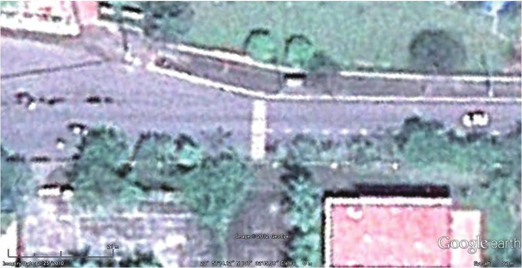
75

76
77 Narration for the Campaign Vehicle for the Eco-fair 2012 In an international project, ECO-fair will be held on this Saturday, 1st December from 9:00A.M. at Youth Summer Camping Site in Bai Chay. In the morning, a professional singer, Van Mai Huong, will sing. Until 15:00 there are a lot of enjoyment, such as quiz, game and prizes. Please join us with your family and friends. Along with the ECO-fair on this Saturday, 1st December, the road will be closed between the Dream Hotel near the Bai Chay post office and the Novotel Halong Hotel along the Bai Chay Road for approx. 1 km-length. This is an activity of social experiment on a measure for securing the traffic safety and quiet environment in the important tourism area for the tourists and residents, in line with the rapid increase of the number of the vehicle traffic and tourists, also for shifting from the large vehicles to the compact environmental-friendly transportation means such as electric car. The social experiment is an important opportunity to examine a model for actual implementation of such measure, which will be necessary in near future. In the closed section, vehicle and motorbike are not allowed to enter from 8 am till 7 pm. During the period, please come and enjoy open space on the road by walking or cycling. Electric carts will operate to transport people in the closed section of the Bai Chay Road. Please also come to ride the electric carts as a future green public transportation.

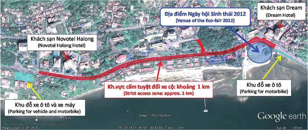
78
79
80 Attachment-3 Rapid Survey Report on mangrove in the Proposed Mangrove Protected Areas Suggestions on the plan for proposed mangrove protected areas Dao Van Tan, Pham Hong Tinh Mangroves Ecosystem Research Center (MERC) Suite 905, Building K1, No. 136 Xuan Thuy Rd., Ha Noi 1. Plant Diversity According to the agreement, we have conducted the rapid surveys at 7 sites in Ha Long (Figure 1) and found that 1) HB1 has relative high plant diversity (30 in total 32 found species), 2) HB2 has big and nice trees of Avicennia marina; unfortunately, we also found some dead trees, 3) A small area having high plant diversity with some old trees was found in HK1; however, the mangroves nearby has been cut. Therefore the plant diversity here is threatened. 4) DY1, DY2 and HT have lower plant diversity (Table 1). HB1, HB2 and HK1 should be priority areas for conservation. Following is our comparison of mangrove plant species in Ha Long to other areas in the North of Vietnam. True Mangrove Species Associate species Ha Long Bay Bai Tu Long National Park Dong Rui-Tien Yen-Quang Ninh Cat Ba National Park Xuan Thuy National Park Boundary of protected areas The boundaries of the mangrove protected areas should be extended toward new/potential alluvial lands. The area of seagrasses in Hoanh Bo should also be conserved (Figure 2). 3. Eco-tour in mangroves The Eco-tour in the mangrove should be incorporated with the propagation and education by the specific activities (Ex. Contests about shape/colour of mangrove trees leaves, root, stem; Contests about mangrove photos; Composing poems and songs about mangroves; Finding the biggest tree in the mangrove, Planting memorial trees and so on. Increasing mangrove plant biodiversity in aquaculture areas 1


81 Figure 1. Ha Long Mangrove Survey: Sites, Path & Key Points (HT: Hoang Tan, DY: Dai Yen, HB: Hoanh Bo, HK: Ha Khanh) Figure 2. Boundaries of the protected areas proposed by JICA (yellow) and suggested by MERC (violet) 2
82 Table 1. List of mangrove plant species in Ha Long Bay 14- Nov 15- Nov 16- Nov 25- Nov 25- Nov 26- Nov 26- Nov No. Scientific Name Vietnamese Name HT DY1 DY2 HB1 HB2 HK1 HK2 Picture No TRUE MANGROVE SPECIES Pteriophyta Ngành Dương xỉ Pteridaceae Họ Chân xỉ 1 Acrostichum aureum L. Ráng biển IMG6608 Angiospermae Ngành Hạt kín Dicotyledoneae Lớp Hai lá mầm Acathanceae Họ Ô rô 2 Acanthus ilicifolius L. Ô rô DSC04923 Aizoaceae Họ Rau đắng đất 3 Sesuvium portulacastrum L. Sam biển IMG9295; IMG6332 Avicenniaceae Họ Mắm 4 Avicennia marina (Forsk.) Veirh Mắm biển DSC05131 Combretaceae Họ Bàng 5 Lumnitzera racemosa (Gaud.) Presl. Cóc vàng DSC04945 Euphorbiaceae Họ Thầu dầu 6 Excoecaria agallocha L. Giá DSC04952; DSC04968; IMG6634 Meliaceae Họ Xoan 7 Xylocarpus granatum Koen. Xu ổi + + IMG6643; IMG6644 Mysinaceae Họ Đơn nem 8 Aegiceras corniculatum (L.) Blanco Sú IMG6573; IMG6568 Rhizophoraceae Họ Đước 9 Bruguiera gymnorrhiza (L.) Lam. Vẹt dù IMG6548; IMG Kandelia obovata Sheue Liu &Yong Trang IMG6351; IMG6567; IMG Rhizophora stylosa Griff. Đâng IMG6726 Sterculiaceae Họ Trôm 12 Heritiera littoralis Dry. Cui biển + + IMG6631 ASSOCIATE AND MIGRATION MANGROVE SPECIES Angiospermae Ngành Hạt kín Monocotyledoneae Một lá mầm 3
83 Cyperaceae Họ Cói 13 Fimbrystylis ferruginea (L.) Vahl. Mao thư Pandanaceae Họ Dứa dại 14 Pandanus tectorius Parkins. Dứa gỗ + + IMG6759 Poaceae Họ Lúa 15 Cynodon dactylon (L.) Pers. Cỏ gà Sporobolus virginicus (L.) Kunth Cỏ cáy Dicotyledoneae Lớp Hai lá mầm Asclepiadaceae Họ Thiên lý 17 Gymnanthera nitida R. Br. Lõa hùng IMG6706; DSC08081 Asteraceae Họ Cúc 18 Pluchea pteropoda Hemsl. Sài hồ nam Wedelia biflora (L.) DC. Cúc hai hoa DSC04951; IMG6319 Chenopodiaceae Họ Rau muối 20 Suaeda maritima (L.) Dum. Phì diệp biển IMG6322 Combretaceae họ Bàng 21 Terminalia catappa L. Bàng + + Convovulaceae Họ Khoai lang 22 Ipomoea pes-caprae (L.) Br. Muống biển IMG Ipomoea trichosperma Bl. Bìm hột có lông + DSC04926 Fabaceae Họ Đậu 24 Canavalia cathartica Du Petit- Thouars. Đậu cộ biển IMG Derris trifoliata Lour. Cốc kèn IMG6324; IMG6621 Goodeniaceae Họ Hếp 26 Scaevola hainanense Hance Hếp + + IMG6802 Hydrocharitaceae Họ Thủy thảo 27 Halophila ovalis (R.Br.) Hook.f. Cỏ xoan + + Loranthaceace Họ Tầm gửi 28 Dendrophtoe pentandra (L.) Miq. Tầm gửi + + IMG6624 Malvaceae Họ Bông 29 Hibiscus tiliaceus L. Tra IMG Thespesisa populnea (L.) Soland ex. Correa Tra lâm vồ + IMG6614 Verbenaceae Họ Cỏ roi ngựa 31 Clerodendron inerme (L.) Gaertn. Ngọc nữ biển DSC
84 32 Premna integrifolia L. Vọng cách IMG6696; DSC05079 Species number True mangrove species 12 Associate and migration species 20 Total 32 5
85 Attachment-4 Rapid Survey Report on herpetofauna in mangrove in the Proposed Mangrove Protected Areas Study on the herpetofauna of the mangroves in Quang Ninh province, Vietnam. Le Trung Dung (*), Do Ngoc Thuy, Nguyen Thi Nga Faculty of Biology, Hanoi National University of Education (*) 1. Introduction Vietnam is known as a country with a high level of herpetofauna diversity (Nguyen et al. 2009). The species richness of reptiles and amphibians was remarkably increased from 340 in 1996 to 458 in 2005 and 545 in 2009 (Nguyen & Ho 1996, Nguyen et al. 2005, Nguyen et al. 2009). Amphibians and reptiles are a part of the current biodiversity research. They are influence of the environment. They are considered indicator species for habitat diversity as well as the deterioration of the environment, and thus the survey and monitoring of amphibians residents we can assess the level of diversity and ecosystem health (Dailtry and Momberge, 2000; McDiarmid, 1994). There is over 200 km of coastline, the mangroves of Quang Ninh province plays an important in ensuring ecological balance, environmental protection, protection dikes. However, many years, for many reasons mangrove system in the province has been reduced in size and quality. This study aims to investigate the diversity of herpetofauna at the mangrove in Quang Ninh province. It contributes effectively to biodiversity management in the area. 2. Study Methodology 2.1. Study site and timing - Study timing: Field work was conducted from 20 to 27 November Field survey was conducted in day and night. - Study sites: Amphibians and Reptiles diversity at the mangrove of Hoanh Bo district (Thong Nhat commune, Le Loi commune), Quang Yen district (Hoang Tan district) and Ha Long city (Dai Yen commune, Ha Khanh commune) in Quang Ninh province Study methods Upon detection of reptiles and amphibians, we conducted sampling, photography, took coordinate. We interviewed the local people to collect the data on rare species. Numerous interviews were conducted with local people to collect the information of species diversity, distribution, life history, exploitation status, and threats to their persistence. Systematic followed Bourret (1936, 1942); Dao (1978, 1979, 1981, 1982); Nguyen et al (2009). Common English names generally follow Nguyen et al. (2009). To assess rare based on the Decree 32/2006/NĐ-CP of the Government (2006); CITES, 2009; The Red Data Book of Vietnam (2007), The IUCN Red list of Threatened Species Results and discussions 3.1. Taxonomic diversity There are 8 amphibian species belonging to 1 families, 3 orders and 19 reptile species belonging to 8 families, 1 orders at this study (Table 1). 1
86 Table 1 List of Amphibian and Reptile at Quang Ninh Mangrove Order Scientific name Common name Coordinate Location Note AMPHIBIA I. ANURA 1. Bufonidae 1. Duttaphrynus melanostictus (Schneider, 1799) 2. Dicroglossidae 2. Fejervarya limnocharis (Gravenhorst, 1829) 3. Hoplobatrachus chinensis (Osbeck, 1765) 3. Microhylidae 4. Kaloula pulchra Gray, 1831 Malaysian painted frog Asian common toad N E Cricket frog N E N E Taiwanese bullfrog N E N E Microhyla fissipes (Boulenger, 1884) Malayan bullfrog N E Microhyla pulchra (Hallowell, 1861) Asian painted frog N E Ranidae 7. Hylarana erythraea (Schlegel, 1837) Green paddy frog N E Polypedates leucomystax (Gravenhorst, 1829) REPTILIA II. SQUAMATA 5. Agamidae 9. Hemidactylus frenatus (Schelegel, in Dumeril et Bibron, 1836) Tree frog N E Common house gecko N E Calotes mystaceus (Dumeril et Moustached lizard N Bibron, 1837 E Calotes versicolor (Daudin, 1802) Garden fence lizard N E Gekko gecko Linnaeus, 1758 Tockay N E Lacertidae 13. Takydromus sexlineatus Daudin, Six-striped long- N tailed grass lizard E Scincidae 14. Eutropis macularia (Blyth, 1853) Bronze mabuya N E Mabuya multifasciata (Kuhl, 1820) East indian brown mabuya N E Varanidae 16. Varanus salvator (Laurenti, 1786) Water monitor N E Colubridae 17. Ahaetulla prasina Reinhardt, in Boi, 1827 Oriental whip snake N LL5 P E Chrysopelea ornata (Shaw, 1802) Golden tree snake N LL6 P E Enhydris bennetti (Gray, 1842) Mangrove water N DY5 P snake E Enhydris plumbea (Boie, 1827) Plumbeous water N TN3 P snake E Ptyas korros (Schlegel, 1837) Indochinese rat snake N DY6 P E Xenochrophis flavipunctatus Yellow-spotted N TN4 P (Hallowell, 1861) keelback E Elapidae 23. Bungarus fasciatus (Schneider, 1801) Banded krait HT Int. 24. Naja atra Cantor, 1842 Chinese cobra N HT8 Obs. E Pelamis platurus (Linnaeus, 1766) Yellow-bellied sea HT Int. snake 2 HT1 DY1 DY2 HT2 DY3 DY4 HT3 LL1 HT4 LL2 HT5 LL3 HT6 LL4 TN1 TN2 HT7 P P P Obs. P Obs. P P P P P P P P P P P
 White-lipped pitviper N 21 0 01 20.6 LL7 P E 107 0 03 22.8 12. Xenopeltidae 27.")

87 Order Scientific name Common name Coordinate Location Note 11. Viperidae 26. Trimeresurus albolabris (Gray, 1842) White-lipped pitviper N LL7 P E Xenopeltidae 27. Xenopeltis unicolor Reinwardt, in Boie, 1827 Sunbeam snake LL Int. Notes: P: photo; Int.: interview; Obs.:Observed, HT : Hoang Tan; DY: Dai Yen; LL: Hoanh Bo; TN: Ha Khanh Figure 1 Diagram Position Detection of Species at Hoang Tan and Dai Yen Communea Note: TN: Ha Khanh Figure 2 Diagram Position Detection of Species at Hoanh Bo District and Halong City (Ha Khanh Commune) 3
88 In general, the abundance of the species of reptiles, amphibians is low, since it is winter season in the area. Compared with the herpetofauna of the land area, the degree of amphibian and reptile diversity of this area is relatively low. In general, the amphibian and reptile diversity of wetlands, especially mangrove forests is often less than the terrestrial ecosystem available habitat diversity. Compare results of the study area and other mangrove in Vietnam also supports this assertion (Table 2). Table 2 Comparison of Amphibian and Reptilian diversity in the study area and other mangrove Mangrove Reptilian species Amphibian species This study area 19 8 Thai Binh province 36 6 Can Gio Xuan Thuy Rare and endemic Amphibians and reptiles list statistic in this area show that 5 species (18.52% of the total species) are rare and precious species. In which, there is not an amphibian species (0%). Specifically: 1 species listed in Decrees No 32/2006/ND-CP belonging to Group IIB (Limit on exploitation and use). It is Naja atra species. There are 5 nationally threatened species listed in Red Data Book of Vietnam, 2007; with 4 species in the category of EN and one species in the VU category. There isn t the species listed in IUCN's Red List, There is one species listed in CITES convention, Table 3 Level of Conservation Ord The level of conservation Scientific name er IUCN Red Book D. 32 CITES 1. Gekko gecko Linnaeus, 1758 VU 2. Varanus salvator (Laurenti, 1786) EN 3. Ptyas korros (Schlegel, 1837) EN 4. Bungarus fasciatus (Schneider, 1801) EN 5. Naja atra Cantor, 1842 EN IIB II Notes: IUCN (The IUCN Red list of Threatened Species, 2011), RB (Red Data Book of Vietnam, 2007): CR: Critically endangered; EN: Endangered; VU: Vulnerable; NT: Near threatened. D. 32 (Decree 32/2006/NĐ-CP of the Vietnam Goverment) : Group IIB (Limit on exploitation and use). CITES (Convention on International Trade in Endangered Species of Wild Fauna and Flora, 2009) : II = Appendices II, III = Appendices III. 4. Conclusion - The herpetofauna of the study area is diversity in low. It includes 27 species of amphibians and reptiles, including 8 species of amphibians and 19 reptile species. Amphibian and reptile list statistic in this area show that 5 species (18.52% of the total species) are rare and precious species. Among them, there are: 5 species were listed in Red Data Book of Vietnam, species listed in Decrees No 32/2006/ND-CP. There is one species listed in CITES convention, The mangroves at Ha Khanh commune (in Ha Long city) devastated a lot of, need to put this place out of the conservation area and take measures to restore them. There is a big difference between the inside and outside of the dike in Le Loi commune, mangrove forests are recovering outside (Cai Xuyen area). Necessary to replant the outer vacant dike to benefit for the local people. 4
89 In Hoang Tan commune, there is well-developed mangroves, aquaculture operation smoothly. It is necessary to organize ecotourism activities to raise awareness of forest protection mangrove. - Promote the dissemination to coastal communities about the value of mangrove forest. Protect mangrove ecosystem on a legal and science planning; determined to prevent the break mangrove activities to aquaculture or used for other purposes; References Ministry of Science and Technology, Vietnam Academy of Science and Technology, Vietnam Red Book, Part I: Animals. Publishing House Science and Technology, Hanoi. Convention on International Trade in Endangered Species of Wild Fauna and Flora, The list of wild fauna and flora species specified in CITES Appendices, the International Trade of Animals and Plants endangered. Government of the Socialist Republic of Vietnam, Decree No. 32/2006/ND-CP of the Government 30 March 2006 on the management of endangered, endangered animals, endangered. Dao V.T. The identification of amphibians, reptiles of Vietnam. Journal of Biological-Land Study, Hanoi, 1977 (33-40), 1978 (1-6), 1979 (2-10), 1981 (1-6), 1982 (5-9). Bourret R., Les serpents de l Indochine. H.Dasuyau, Toulouse, vols.1 et 2. Bourret R., Les Batraciens de l Indochine. Institut Oce anographique de l Indoch, Ha Noi. Nguyen Ngoc Sang (2009). Revaluation herpetofauna at Biosphere Reserve Can Gio mangrove forest. Scientific journals and breaking technology, 12(03): Nguyen Van Sang, Ho Thu Cuc, Nguyen Quang Truong, Herpetofauna of Vietnam. Edition Chimaira, Frankfurt ammain. IUCN, The IUCN Red list of Threatened Species. Source: 5


90 Appendix 1: The pictures of the species recorded in Quang Ninh mangrove Fejervarya limnocharis Polypedates leucomystax Duttaphrynus melanostictus Microhyla pulchra Kaloula pulchra 6


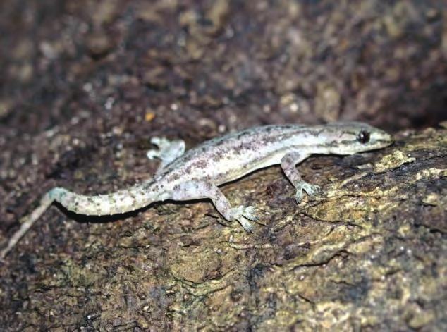


91 Calotes mystaceus Calotes versicolor Hemidactylus frenatus Gecko gecko Eutropis macularia Takydromus sexlineatus 7


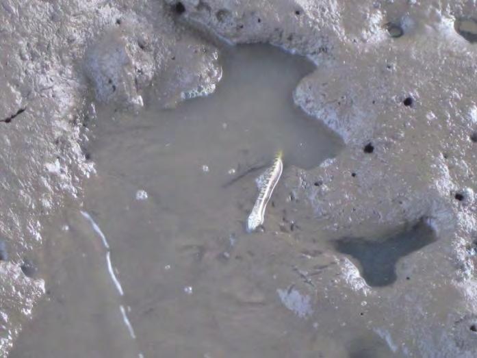

92 Eutropis multifasciata Varanus salvator Ahaetulla prasina Chrysopelea ornata Enhydris bennettii Enhydris plumbea 8


93 Ptyas korros Trimeresurus albolabris Xenochrophis flavipunctatus Xenochrophis piscator 9


94 Appendix 2: The research habitats and activities Inside and outside of the dike at Hoang Tan commune Limestone habitats at Hoang Tan commune Inside of shrimp ponds at Dai Yen commune Outside of shrimp ponds at Hoang Tan commune Vacant land mixed mangrove forests at Le Loi commune Mangrove forests destroyed at Ha Khanh commune 10


95 After destroyed Mangrove nursery in Cua Luc Bay Go survey at Dai Yen mangrove Go survey on the stock habitats at Hoang Tan commune Go survey at Ha Khanh mangrove Field record 11
The Project for Environmental Protection in Halong Bay
 JAPAN INTERNATIONAL COOPERATION AGENCY (JICA) SOCIALIST REPUBLIC OF VIETNAM QUANG NINH PROVINCIAL PEOPLE'S COMMITTEE The Project for Environmental Protection in Halong Bay PROJECT COMPLETION REPORT < Volume
TECHNICAL SPECIFICATION (OBJECTIVES, PROJECT SCALE)
") LIST OF PROJECTS CALLING FOR INVESTMENT IN QUANG NINH PROVINCE IN THE PERIOD 06 TO 00 (Issued together with Decision No.86/QD-UBND dated March 8, 06 by Quang Ninh ) Total: 4 projects No. NAME OF PROJECT
LIST OF PROJECTS CALLING FOR INVESTMENT IN QUANG NINH PROVINCE IN THE PERIOD 06 TO 00 (Issued together with Decision No.86/QD-UBND dated March 8, 06 by Quang Ninh ) Total: 4 projects No. NAME OF PROJECT
Vietnam Marine Protected Area Management Effectiveness Evaluation
 Vietnam Marine Protected Area Management Effectiveness Evaluation 5 th EAS Congress (16-21 November, 2015) Bui Thi Thu Hien IUCN Viet Nam Marine Protected Areas: Global Status There are over 161,000 protected
TOWARDS SUSTAINABLE MANAGEMENT OF MARINE AND COASTAL HABITATS ASIA- PACIFIC DAY FOR THE OCEAN
 TOWARDS SUSTAINABLE MANAGEMENT OF MARINE AND COASTAL HABITATS WANNAKIAT THUBTHIMSANG PHUKET MARINE BIOLOGICAL CENTER, DMCR, THAILAND ASIA- PACIFIC DAY FOR THE OCEAN 20 NOVEMBER 2018, CONFERENCE ROOM 4,
Extension of community based mangrove restoration model focusing on fallow shrimp-farming ponds in Cam Ranh, Khanh Hoa
 Extension of community based mangrove restoration model focusing on fallow shrimp-farming ponds in Cam Ranh, Khanh Hoa ABSTRACT The project was supported by Rufford Small Grant (British), carried out based
Case Study: 1. The Clarence River Catchment
 Case Study: 1. The Clarence River Catchment The NSW coastline is a great natural asset, making an enormous contribution to the economy. The resources of coastal catchments such as the Clarence River Catchment,
BABIA GÓRA DECLARATION ON SUSTAINABLE TOURISM DEVELOPMENT IN MOUNTAIN AREAS
 BABIA GÓRA DECLARATION ON SUSTAINABLE TOURISM DEVELOPMENT IN MOUNTAIN AREAS The participants of the International Workshop for CEE Countries Tourism in Mountain Areas and the Convention on Biological Diversity",
Tourism and Wetlands
 CONVENTION ON WETLANDS (Ramsar, Iran, 1971) 43 rd Meeting of the Standing Committee Gland, Switzerland, 31 October 4 November 2011 DOC. SC43-27 Tourism and Wetlands Action requested. The Standing Committee
We, Ministers, assembled in Berlin for the International Conference on Biodiversity and Tourism from 6 to 8 March 1997
 March 8th, 1997 Berlin Declaration BIOLOGICAL DIVERSITY AND SUSTAINABLE TOURISM We, Ministers, assembled in Berlin for the International Conference on Biodiversity and Tourism from 6 to 8 March 1997 -
Satoquo SEINO (Graduate School of Engineering, Kyushu University, Japan)
") A reconsideration of horseshoe crab conservation methodology in Japan over the last 100 years and prospects for a marine protected area network in Asian seas Satoquo SEINO (Graduate School of Engineering,
A reconsideration of horseshoe crab conservation methodology in Japan over the last 100 years and prospects for a marine protected area network in Asian seas Satoquo SEINO (Graduate School of Engineering,
State of Conservation of the World Heritage Properties in the Asia-Pacific Region
 VIETNAM Ha Long Bay.1 Introduction Year of Inscription 1994, 2000 Organisation Responsible for the Report Ha Long Bay Management Department 166 Le Thanh Tong Rd Ha Long City, Quang Ninh Province Vietnam
MSc Tourism and Sustainable Development LM562 (Under Review)
") MSc Tourism and Sustainable Development LM562 (Under Review) 1. Introduction Understanding the relationships between tourism, environment and development has been one of the major objectives of governments,
MSc Tourism and Sustainable Development LM562 (Under Review) 1. Introduction Understanding the relationships between tourism, environment and development has been one of the major objectives of governments,
How should the proposed protected area be administered and managed?
 SPERRGEBIET CONSERVATION PLANNING Questionnaire In big words the main objectives of this questionnaire are to contribute to: 1. finding approaches and mechanism for implementing a multi-use protected area
Gold Coast. Rapid Transit. Chapter twelve Social impact. Chapter content
 Gold Coast Rapid Transit Chapter twelve Social impact Chapter content Social impact assessment process...235 Existing community profile...237 Consultation...238 Social impacts and mitigation strategies...239
ECOTOURISM. Hill & Mountain Ecosystems
 ECOTOURISM Hill & Mountain Ecosystems Importance of Hill & Mountain Areas Home to most indigenous populations Provider of essential resources Major source of water supply Centres of culture and indigenous
1. Thailand has four biosphere reserves which located in different parts of the country. They are as follows;
 Country Report on MAB programme : Kingdom of Thailand The MAB National Committee of Thailand In occasion of 26th Session of the International Co-ordinating Council of the Man and the Biosphere Programme
Order of the Minister of Environment #39, August 22, 2011 Tbilisi
 Registration Code 360050000.22.023.016080 Order of the Minister of Environment #39, August 22, 2011 Tbilisi On preparatory stages and procedure of the methodology for Elaborating structure, content and
SUSTAINABLE AND ENVIRONMENTALLY FRIENDLY TOURISM IN THE COASTAL ZONES OF THE BALTIC SEA AREA
 CONVENTION ON THE PROTECTION OF THE MARINE ENVIRONMENT OF THE BALTIC SEA AREA HELSINKI COMMISSION - Baltic Marine HELCOM 21/2000 Environment Protection Commission Minutes of the Meeting 21st Meeting Helsinki,
Terrestrial Protected Area Nomination: Central Mangrove Wetland South-West, Grand Cayman
 Terrestrial Protected Area Nomination: Central Mangrove Wetland South-West, Grand Cayman The attached nomination, proposing that a parcel of land in the Central Mangrove Wetland be made a Protected Area
Restoration and Challenge of Sendai Towards a Disaster-Resilient and Environmentally-Friendly City
 City of Sendai Restoration and Challenge of Sendai Towards a Disaster-Resilient and Environmentally-Friendly City Akira TAKAHASHI akira_takahashi_a@city.sendai.jp Director, Disaster-Resilient and Environmentally-Friendly
TWENTY-SECOND MEETING OF THE ASIA/PACIFIC AIR NAVIGATION PLANNING AND IMPLEMENTATION REGIONAL GROUP (APANPIRG/22)
") INTERNATIONAL CIVIL AVIATION ORGANIZATION TWENTY-SECOND MEETING OF THE ASIA/PACIFIC AIR NAVIGATION PLANNING AND IMPLEMENTATION REGIONAL GROUP (APANPIRG/22) Bangkok, Thailand, 5-9 September 2011 Agenda
INTERNATIONAL CIVIL AVIATION ORGANIZATION TWENTY-SECOND MEETING OF THE ASIA/PACIFIC AIR NAVIGATION PLANNING AND IMPLEMENTATION REGIONAL GROUP (APANPIRG/22) Bangkok, Thailand, 5-9 September 2011 Agenda
Draft Marine and Harbour Facilities Strategy
 Draft Marine and Harbour Facilities Strategy Vision The Coromandel peninsula is a destination of choice for safe, sustainable and accessible marine and harbour facilities that are fit for purpose to meet
September Standard recognised by Global Sustainable Tourism Council
 September 2012 Standard recognised by Global Sustainable Tourism Council our roadmap for development a structured approach for the creation of new ecotourism experiences & standards EcoTourism Ireland
SANTA-BOCA PROVINCIAL PARK
 SANTA-BOCA PROVINCIAL PARK PURPOSE STATEMENT AND ZONING PLAN March 2003 SANTA-BOCA PROVINCIAL PARK Purpose Statement and Zoning Plan Primary Role The primary role of Santa-Boca Park is to provide marine-based
Committee. Presentation Outline
 CW-33-15 11/9/2015 Community and Corporate Services Committee November 10, 2015 1 Presentation Outline Background Vision and Objectives Study Process and Timeline Public and Stakeholder Engagement Organization
A Proposed Framework for the Development of Joint Cooperation On Nature Conservation and Sustainable Tourism At World Heritage Natural sites.
 Introduction: A Proposed Framework for the Development of Joint Cooperation On Nature Conservation and Sustainable Tourism At World Heritage Natural sites Between The tourism industry and the UNESCO, World
HELLENIC REPUBLIC Voluntary National Review on the Implementation of the 2030 Agenda for Sustainable Development. 16 July 2018
 HELLENIC REPUBLIC Voluntary National Review on the Implementation of the 2030 Agenda for Sustainable Development 16 July 2018 1 HELLENIC REPUBLIC Voluntary National Review on the Implementation of the
Biosphere Reserves of India : Complete Study Notes
 Biosphere Reserves of India : Complete Study Notes Author : Oliveboard Date : April 7, 2017 Biosphere reserves of India form an important topic for the UPSC CSE preparation. This blog post covers all important
Credit No IN. National Project Director 9,Institutional Area, Lodhi Road, New Delhi Tel:
 Sub:Selection of Consultants for preparation of eco-tourism management plan forvedaranyam area in Tamil Nadu. ICZMP (Integrated Coastal Zone Management Project) Credit No. 4765 0 IN Amendment #1 The TOR
Economic valuation of Nha Trang Bay Marine Protected Area (MPA) to suggest a sustainable financing mechanism
 to suggest a sustainable financing mechanism") Economic valuation of Nha Trang Bay Marine Protected Area (MPA) to suggest a sustainable financing mechanism Student: Dang Nguyet Anh Supervisor: Prof. Naoko Kaida 28 th June 2012 Background What is Marine
Economic valuation of Nha Trang Bay Marine Protected Area (MPA) to suggest a sustainable financing mechanism Student: Dang Nguyet Anh Supervisor: Prof. Naoko Kaida 28 th June 2012 Background What is Marine
The Lower Prut Floodplain Natural Park (Romania)
") The Lower Prut Floodplain Natural Park (Romania) Gabriela Costea Natural Sciences Museum Complex Galati (Romania) & member of the Scientific Council of the Lower Prut Floodplain Natural Park The Prut The
The Lower Prut Floodplain Natural Park (Romania) Gabriela Costea Natural Sciences Museum Complex Galati (Romania) & member of the Scientific Council of the Lower Prut Floodplain Natural Park The Prut The
ACTION PLAN FOR THE PERIOD concerning the STRATEGY ON IMPLEMENTATION OF THE FRAMEWORK AGREEMENT ON THE SAVA RIVER BASIN
 Doc. 1S-26-O-11-5/1-2 ACTION PLAN FOR THE PERIOD 2011-2015 concerning the STRATEGY ON IMPLEMENTATION OF THE FRAMEWORK AGREEMENT ON THE SAVA RIVER BASIN April 2011 Table of Contents INTRODUCTION... 5 1.
$866,000. $1,400,000 Health Benefits $13,156,000 TOTAL ANNUAL DIRECT BENEFITS. $10,890,000 Economic Benefits
 SINGING RIVER TRAIL Trails Create Value + Generate Economic Activity Trails generate economic returns through improved health, safety, and environmental conditions, raise property values, and attract visitors.
Preferred Recreation Recommendations Stemilt-Squilchuck Recreation Plan March 2018
 Preferred Recreation Recommendations Stemilt-Squilchuck Recreation Plan March 2018 Below are the recommended recreation ideas and strategies that package together the various recreation concepts compiled
PURPOSE AND NEED. Introduction
 Public Scoping: Allocation of Recreation Capacity for Commercial Outfitter Guide Services on North Kruzof Island Trails (Kruzof Island Outfitter Guide) PURPOSE AND NEED Introduction The U.S. Department
Global Sustainable Tourism Destinations Criteria
 Global Sustainable Tourism Destinations Criteria Draft destination level Global Sustainable Tourism Criteria as proposed after Destinations and International Standards joint working group meeting and follow-up
The results of the National Tourism Development Strategy Assessments
 The results of the National Tourism Development Strategy Assessments - 2012 (I) The assessment tool In 2012 the Sustainable Tourism Working Group of the CEEweb for Biodiversity prepared a guidance for
A Master Plan is one of the most important documents that can be prepared by an Airport.
 The Master Plan A Master Plan is one of the most important documents that can be prepared by an Airport. A Master Plan is a visionary and a strategic document detailing planning initiatives for the Airport
Visitor Management Plan innovative and hospitable
 Visitor Management Plan 2015-2020 innovative and hospitable Outline of policy, objectives, and enabling conditions Drawn up on 19 March 2015 1. Introduction The Visitor Management Plan 2015-2020 outlines
WORKING DOCUMENT. Mediterranean Strategy for Sustainable Development (MSSD ): Assessment of Tourism component. June 2016
: Assessment of Tourism component. June 2016") Building the Mediterranean future together WORKING DOCUMENT June 2016 Mediterranean Strategy for Sustainable Development (MSSD 2005-2015): Assessment of Tourism component MSSD Objectives Obj. 1: Contribute
Building the Mediterranean future together WORKING DOCUMENT June 2016 Mediterranean Strategy for Sustainable Development (MSSD 2005-2015): Assessment of Tourism component MSSD Objectives Obj. 1: Contribute
ReefFix. May, For the Organization of American States (OAS) and the Inter-American Biodiversity Information Network (IABIN)
 and the Inter-American Biodiversity Information Network (IABIN)") Fondation pour la Protection de la Biodiversité Marine FoProBiM B.P. 642 www.foprobim.org (mail) 6011 Henning St. Port-au-Prince, Haiti Bethesda, MD 20817 ReefFix Rapid Assessment of the Economic Value
Fondation pour la Protection de la Biodiversité Marine FoProBiM B.P. 642 www.foprobim.org (mail) 6011 Henning St. Port-au-Prince, Haiti Bethesda, MD 20817 ReefFix Rapid Assessment of the Economic Value
Sustainable development: 'Lanzarote and the Biosphere strategy'. LIFE97 ENV/E/000286
 Sustainable development: 'Lanzarote and the Biosphere strategy'. LIFE97 ENV/E/000286 Project description Environmental issues Beneficiaries Administrative data Read more Contact details: Project Manager:
Key. Cotswold Water Park
 Existing Key Nature Sites Core Biodiversity Corridor Proposed Canals Biodiversity Scope The development of the CWP will be orientated towards meeting and exceeding biodiversity targets, making the CWP
Reference: 06/13/0594/F Parish: Fritton & St Olaves Officer: Mrs M Pieterman Expiry Date:
 Schedule of Planning Applications Committee Date: 21 st January 2014 Reference: 06/13/0594/F Parish: Fritton & St Olaves Officer: Mrs M Pieterman Expiry Date: 20-01-2014 Applicant: Proposal: Site: Lord
ICRI Monaco January 2010
 Economic Valuation of Coral Reefs in the Caribbean ICRI Monaco January 2010 Lauretta Burke World Resources Institute (WRI) Beautiful Valuable Valuable Valuable Valuable Valuable Photos: Krishna Desai Valuable
Submission to NSW Koala Strategy Consultation Process. March 2017
 Submission to NSW Koala Strategy Consultation Process March 2017 Table of contents Opening 3 Response 3 Whole-of-government NSW koala strategy 3 State Environment Planning Policy (SEPP) 44 3 The draft
CAT BA ARCHIPELAGO, VIETNAM
 1 CAT BA ARCHIPELAGO, VIETNAM CAT BA ARCHIPELAGO, VIETNAM Cat Ba Archipelago Cat Ba Archipelago, Vietnam CAT BA ARCHIPELAGO, VIETNAM Proposed UNESCO World Heritage 3 HHC_25/11/2010 WORLD TITLES 1986: National
Great Barrier Reef Ports Strategy Have your say
 Great Barrier Reef Ports Strategy Have your say Written submission form The Great Barrier Reef Ports Strategy presents the vision and principles guiding the Queensland Government s approach to future port
MONTEREY REGIONAL AIRPORT MASTER PLAN TOPICAL QUESTIONS FROM THE PLANNING ADVISORY COMMITTEE AND TOPICAL RESPONSES
 MONTEREY REGIONAL AIRPORT MASTER PLAN TOPICAL QUESTIONS FROM THE PLANNING ADVISORY COMMITTEE AND TOPICAL RESPONSES Recurring topics emerged in some of the comments and questions raised by members of the
Clam Harbour Provincial Park
 Clam Harbour Provincial Park Public Engagement Session Thursday, September 14 th, 2017 5:30pm 7:30pm Webbers Store 11470 Nova Scotia Trunk 7 Lake Charlotte, NS Agenda Overview of the Provincial Parks System
Ex-Ante Evaluation (for Japanese ODA Loan)
") Japanese ODA Loan 1. Name of the Project Ex-Ante Evaluation (for Japanese ODA Loan) Country: The Republic of Peru Project: Amazonas Rural Development Project Loan Agreement: January 9, 213 Loan Amount:
Japanese ODA Loan 1. Name of the Project Ex-Ante Evaluation (for Japanese ODA Loan) Country: The Republic of Peru Project: Amazonas Rural Development Project Loan Agreement: January 9, 213 Loan Amount:
Parkland County Municipal Development Plan Amendment Acheson Industrial Area Structure Plan
 Parkland County Municipal Development Plan Amendment Acheson Industrial Area Structure Plan New Plan Acheson Industrial Area Structure Plan Amendment Parkland County Municipal Development Plan Board Reference
Title/Name of the area: Chwaka Bay, Zanzibar
 Title/Name of the area: Chwaka Bay, Zanzibar Presented by: Dr. Charles Lugomela, Ag. Head, Department of Aquatic Sciences and Fisheries, University of Dar es Salaam, P.O. Box 35064 Dar es Salaam, Tanzania
Developing Lampi Marine National Park as an Ecotourism Role Model
 Developing Lampi Marine National Park as an Ecotourism Role Model Ms Tania Miorin, Country Director, Istituto Oikos & Dr Paul Rogers, Ecotourism Consultant PART I: BACKGROUND Ms Tania miorin OIKOS in Myanmar
BRIEF ENVIRONMENT REPORT
 Public Disclosure Authorized Public Disclosure Authorized Public Disclosure Authorized Public Disclosure Authorized PEOPLE COMMITTEE OF HOCHI MINH CITY WORLD BANK HO CHI MINH CITY DEVELOPMENT PROJECT HDP
Michipicoten Island Regional Plan
 Michipicoten Island Regional Plan This is one of twenty Regional Plans that support implementation of the Lake Superior Biodiversity Conservation Strategy (Strategy). The Strategy, prepared and overseen
The MPA Name. The past and future of the. Montego Bay Marine Park Trust
 The MPA Name The past and future of the Montego Bay Marine Park Trust Park Boundaries and Sanctuary Area 100m/330ft/50 Fathom Depth Contour to The Average Highest High Tide Mark 50 Fathom/100M Depth Great
A GUIDE TO MANITOBA PROTECTED AREAS & LANDS PROTECTION
 A GUIDE TO MANITOBA PROTECTED AREAS & LANDS PROTECTION Manitoba Wildands December 2008 Discussions about the establishment of protected lands need to be clear about the definition of protection. We will
DRAFT. Master Plan RESPONSIBLY GROWING to support our region. Summary
 Master Plan GROWING 2017-2037 RESPONSIBLY to support our region Summary DRAFT 2 1 Introduction Over the next three decades, Southern Ontario is set to experience significant growth its population will
1 INFORMATION REQUIREMENTS
 1 INFORMATION REQUIREMENTS 1.1 BACKGROUND 2 1.2 WHAT IS THE DISTRICT PLAN 3 1.3 DISTRICT PLAN STRUCTURE 4 1.4 HOW TO USE THE DISTRICT PLAN 5 1.5 STRATEGIC FRAMEWORK 6 Whanganui District Plan (15 January
Rule Governing the Designation and Establishment of All-Terrain Vehicle Use Trails on State Land
 Rule Governing the Designation and Establishment of All-Terrain Vehicle Use Trails on State Land 1.0 Authority 1.1 This rule is promulgated pursuant to 23 V.S.A. 3506. Section 3506 (b)(4) states that an
Community-based tourism at Gunung Halimun National Park
 Asia-Pacific Environmental Innovation Strategies (APEIS) Research on Innovative and Strategic Policy Options (RISPO) Good Practices Inventory Community-based tourism at Gunung Halimun National Park Summary
Oceans and Fisheries Working Group Work Plan
 2017/SOM1/SCE-COW/022 Agenda Item: 7 Oceans and Fisheries Working Group Work Plan Purpose: Consideration Submitted by: OFWG Lead Shepherd SOM Steering Committee on Economic and Technical Cooperation -
PRESPA BIOSPHERE RESERVE MANAGEMENT MACEDONIAN PERSPECTIVE
 PRESPA BIOSPHERE RESERVE MANAGEMENT MACEDONIAN PERSPECTIVE Secretariat by Ohrid, 10.03.2016 Prespa Ohid TBB reserve Biodiversity richness trans-boundary level Total Species richness Registered over 1500
Special nature reserve and ornithological reserve Scope of implementation (local, Local national)
") Example of good practice From a waste disposal area to a protected area: the example of the Tivat salt flats Category Management; education; tourism Organization Centre for bird protection and monitoring
Example of good practice From a waste disposal area to a protected area: the example of the Tivat salt flats Category Management; education; tourism Organization Centre for bird protection and monitoring
Management of Tourism Development in Cultural and Natural Heritage Sites in Cambodia. Tehran, Islamic Republic of Iran October 2014
 Symposium Mainstreaming Sector Policies into Integrated National Sustainable Development Planning: Enhancing Sustainable Tourism, Urbanization, Resource Efficiency, Biodiversity and Environmental Protection
URBAN DESIGN REPORT. Proposed Residential Development, Old Church Road, Caledon East
 Proposed Residential Development, Old Church Road, Caledon East TABLE CONTENTS: 1.0 DEVELOPMENT 1.1 Introduction-Analysis of Guiding Principles and Documents 1.2 Community Design and Architectural Design
Chapter 6: POLICY AND PROCEDURE RECOMMENDATIONS
 Chapter 6 POLICY AND PROCEDURE RECOMMENDATIONS FOR SRRA Below are seven policy elements that should be considered for adoption by the Southwest Regional Recreation Authority of Virginia: 1. Develop strategies
N4 Carrick-on-Shannon to Dromod Road Project. 2.1 Introduction
 Chapter 2 Need for the Scheme 2.1 Introduction The National Primary Route N4, Dublin to Sligo is a strategic corridor from Dublin to the northwest and border counties (See RCSR 101 in Volume 2). The National
CITIES AND REGIONS FOR TOURISM: THE CAPE TOWN EXPERIENCE CITIES SUMMIT COP13 I 10 DECEMBER 2016
 CITIES AND REGIONS FOR TOURISM: THE CAPE TOWN EXPERIENCE CITIES SUMMIT COP13 I 10 DECEMBER 2016 INTRODUCTION The Opportunity City Cape Town (2,461 km s in extent) contains:- Globally important Cape Floral
Vietnam Member s report on activities to ICRI. Presented by Nguyen Van Long. Reporting period November April 2007
 Members Report ICRI GM Japan/Palau (3) 2007/MR/ INTERNATIONAL CORAL REEF INITIATIVE (ICRI) General Meeting Tokyo, Japan, April 23 rd -24 th, 2007 Member s report on activities to ICRI Presented by Nguyen
F6. Coastal Ferry Terminal Zone
 F6. Coastal Ferry Terminal Zone F6.1. Zone description The purpose of the Coastal Ferry Terminal Zone is to provide for the integrated and efficient operation and development of ferry terminal facilities.
Hue, 2017 Pho Duc Tru
 Pho Duc Tru 2006-1 Hue, 2017 Part 1: Overview Part 2: Potentials Of The Province Part 3: Areas Calling For Investment Part 4: Investment Incentives PART 1 - OVERVIEW - Area: 5,026.64 square km; - Population:
MANAGEMENT DIRECTION STATEMENT June, 1999
 Thompson River District MANAGEMENT DIRECTION STATEMENT June, 1999 for Roche Lake Provincial Park Ministry of Environment Lands and Parks BC Parks Division Table of Contents I. Introduction A. Setting
Land Management Summary
 photo credit: ANGAIR Anglesea Heath Land Management Summary The Anglesea Heath (6,501 ha) was incorporated into the Great Otway National Park in January 2018. This provides an opportunity to consider the
Draft LAW. ON SOME AMENDAMENTS IN THE LAW No.9587, DATED ON THE PROTECTION OF BIODIVERSITY AS AMENDED. Draft 2. Version 1.
 Technical Assistance for Strengthening the Capacity of the Ministry of Environment, Forests and Water Administration in Albania for Law Drafting and Enforcement of National Environmental Legislation A
IIFET 2014 AUSTRALIA
 First Call for Abstracts and Special Session Proposals: IIFET 2014 AUSTRALIA Towards Ecosystem Based Management of Fisheries: What Role can Economics Play? The Seventeenth International Conference of the
Palau National Marine Sanctuary Building Palau s future and honoring its past
 A fact sheet from Sept 2015 Palau National Marine Sanctuary Building Palau s future and honoring its past Caring for the environment has long been an important part of Palau s culture. For centuries, traditional
The Sunshine Coast is part of the global community and generates wealth through export, high-value industries and new investment.
 3.2 Strategic intent 3.2.1 Shaping growth an overview In 2031, the Sunshine Coast is renowned for its vibrant economy, ecological values, unique character and strong sense of community. It is Australia
Nature Conservation and Developing Sustainable tourism in Myanmar
 Nature Conservation and Developing Sustainable tourism in Myanmar Myanmar Tourism O Tourism in Myanmar has boomed in recent years, with the industry generating nearly $1.8 billion in revenue in 2014 as
Protection of Ulcinj Saline
 Strasbourg, 25 March 2015 T-PVS/Files (2015) 21 [files21e_2015.docx] CONVENTION ON THE CONSERVATION OF EUROPEAN WILDLIFE AND NATURAL HABITATS Standing Committee 35 th meeting Strasbourg, 1-4 December 2015
LEBANON: A DIVERSE ECOTOURISM DESTINATION IN THE EAST-MEDITERRANEAN. Prepared by: Dr. Jacques Samoury NGER National Expert
 National Stakeholder Workshop on Ecotourism 6-7 March 2018, Beirut LEBANON: A DIVERSE ECOTOURISM DESTINATION IN THE EAST-MEDITERRANEAN Prepared by: Dr. Jacques Samoury NGER National Expert Lebanon s Tourism
Indicators of Sustainable Development for Tourism Destinations
 Indicators of Sustainable Development for Tourism Destinations Dr. Ted Manning Lead Expert WTO Indicators Program President, Tourisk Inc. Ottawa Canada Washington DC 2004 Dolomites Italy Tourism is at
How South Africa is making progress towards the Aichi 2020 Target 11
 How South Africa is making progress towards the Aichi 2020 Target 11 Montreal, Canada 2 May 2016 Oceans and Coasts Content Protected area considerations and progress 1994-2010 Terrestrial Protected Area
TOURISM & PUBLIC SERVICES RURAL SIGNAGE POLICY
 Policy and Procedures Subject Title: Tourism and Public Services Rural Signage Policy Corporate Policy (Approved by Council): X Policy Ref. No.: ROADS-01-07 Administrative Policy (Approved by CAO): By-Law
Schedule of Planning Applications Committee Date: 23 May Reference: 06/18/0064/F Great Yarmouth Officer: Mr J Beck Expiry Date:
 Schedule of Planning Applications Committee Date: 23 May 2018 Reference: 06/18/0064/F Great Yarmouth Officer: Mr J Beck Expiry Date: 24-04-2018 Applicant: Proposal: Site: Mr Mavroudis Clear weather hoardings
HEAD OF ECONOMIC PROMOTION AND PLANNING Nathan Spilsted, Senior Planning Officer Tel:
 7. TRAVELLER SITES ALLOCATIONS DOCUMENT REPORT OF: Contact Officer: Wards Affected: Key Decision: Report to: HEAD OF ECONOMIC PROMOTION AND PLANNING Nathan Spilsted, Senior Planning Officer Email: nathan.spilsted@midsussex.gov.uk
U.S. Support to the Coral Triangle Initiative Monthly Program Update November 2012
 12.15.12 U.S. Support to the Monthly Program Update November 2012 Supporting countries of the Coral Triangle region to sustain their marine resources IN THIS ISSUE Solomon Islands Launches Innovative Mobile
QUÉBEC DECLARATION ON ECOTOURISM World Ecotourism Summit Québec City, Canada, 2002
 QUÉBEC DECLARATION ON ECOTOURISM World Ecotourism Summit Québec City, Canada, 2002 The participants at the Summit acknowledge the World Summit on Sustainable Development (WSSD) in Johannesburg, August/September
A vision for a healthier, more prosperous and secure future for all coastal communities. Can Gio Biosphere Reserve 2010 IUCN Vietnam MERD
 A vision for a healthier, more prosperous and secure future for all coastal communities Can Gio Biosphere Reserve 2010 IUCN Vietnam MERD Local woman caring for mangroves in Hau Loc, Thanh Hoa CARE International
Bloor Street West Rezoning Application for a Temporary Use By-law Final Report
 STAFF REPORT ACTION REQUIRED 3741 3751 Bloor Street West Rezoning Application for a Temporary Use By-law Final Report Date: June 12, 2007 To: From: Wards: Reference Number: Etobicoke York Community Council
Project Concept Note
 North-East Asian Subregional Programme for Environmental Cooperation (NEASPEC) 1. Overview 1. Project Title 2. Goals Project Concept Note Study on Transborder Movement of Amur Tigers and Leopards using
Blueways: Rivers, lakes, or streams with public access for recreation that includes fishing, nature observation, and opportunities for boating.
 Parks, Open Space and Trails PRINCE WILLIAM COUNTY 2008 COMPREHENSIVE PLAN TRAILS PLAN CONTENTS The components of the trails plan are: Intent Definitions Goals, Policies, and Action Strategies Trails Map
Strengthening the Ontario Trails Strategy. Report on Consultations and the Environmental Bill of Rights Registry
 Strengthening the Ontario Trails Strategy Report on Consultations and the Environmental Bill of Rights Registry Purpose To report on the feedback and information received through the regional consultations,
PART I INTRODUCTION TO HA LONG BAY - A WORLD NATURAL HERITAGE SITE
 PART I INTRODUCTION TO HA LONG BAY - A WORLD NATURAL HERITAGE SITE 1. State Party: Viet Nam 2. Name of property: Ha Long Bay 3. No of the property: N672bis 4. Geographical coordinates to the nearest second:
The 7 th Da Nang Urban Development Forum. Date & Time: December 22th 8:30-17:00 Venue: Da Nang Administration Center
 The 7 th Da Nang Urban Development Forum Date & Time: December 22th 8:30-17:00 Venue: Da Nang Administration Center What is the Da Nang Urban Development Forum? Da Nang City is well known as the host city
Magnetic Heart of Queensland
 Shaping Townsville s Destiny to be the... Magnetic Heart of Queensland A design for future Townsville by Vee Design : 9point9 Architects : Milford Planning : Meter : Szczepan Urbanowicz shaping Townsville
4) Data sources and reporting ) References at the international level... 5
 Data sources and reporting ) References at the international level... 5") D- 1: Protected areas (PA) 1) General description... 2 1.1) Brief definition... 2 1.2) Units of measurement... 2 1.3) Context...2 2) Relevance for environmental policy... 2 2.1) Purpose... 2 2.2) Issue...
D- 1: Protected areas (PA) 1) General description... 2 1.1) Brief definition... 2 1.2) Units of measurement... 2 1.3) Context...2 2) Relevance for environmental policy... 2 2.1) Purpose... 2 2.2) Issue...
A303. Sparkford to Ilchester Dualling Scheme Preferred Route Announcement
 A303 Sparkford to Ilchester Dualling Scheme Preferred Route Announcement About this booklet This booklet presents the preferred route for the A303 Sparkford to Ilchester dualling scheme and a summary of
2018 Sustainable Destinations Top 100
 2018 Sustainable Destinations Top 100 Call for Nominations For the 4th time, the Sustainable Destinations Global Top 100 competition is organised by ten leading sustainable tourism organisations. Our aim