APA Idaho 2018 Annual Conference Presentation on October 11 th, Rick Patton Aviation Planner
|
|
|
- Horatio Moore
- 5 years ago
- Views:
Transcription
1 The New West Passionate Planning for People and Places APA Idaho 2018 Annual Conference Presentation on October 11 th, 2018 AIRPORT TOOLS FOR THE CITY/COUNTY PLANNER Rick Patton Aviation Planner This presentation will be provided to the Conference Committee for distribution
2 AIRPORT MISCONCEPTIONS Too many land use restrictions Complicated place They are a rich-man s playground Not needed anymore They are dangerous! Money-pit for a community s tax money Too noisy
3 AIRPORT REALITIES They are an economic engine Medical in and out service Provide business access They have huge intrinsic value They can be noisy Can diversify a local economy
4 PLANNING = PROTECTING Why do we protect airports? Life and Safety Public Investment Economic Reasons Grant Assurances and Grant Obligations

5 Rexburg, Idaho s Airport in 1949 PLANNING = PROTECTING Rexburg, Idaho 2015

6 PLANNING = PROTECTING Landing Take-Off Source: DRCOG Report Rexburg, Idaho 2015

7 Rexburg, Idaho To Bring to Small Aircraft Design Standards The FAA let us stop when our estimate hit $175 million PLANNING = PROTECTING
8 OBJECTIVES FOR TODAY 1) Introduction to Airport Planning 101 2) Define Airport Protections 3) Discuss some common aviation tools available to you 4) Provide additional sources of material and advice
9 AIRPORT PLANNING BASICS Airports are just mini-cities (some are really mini!) The FAA defines an airport as: An area of land that is used or intended to be used for the landing and takeoff of aircraft, including its buildings and facilities, if any. Public vs Private Commercial Service vs General Aviation (GA)
10 THIS SLIDE CAME FROM AN ITD-AERO PRESENTATION LAST YEAR STILL GOOD ADVICE! BEFORE PRACTICAL LAND USE Most important get your Comprehensive Plan in place or updated if needed! All the good thoughts about protection crumble if the City, Town or County cannot withstand a challenge and that will eventually happen. DO NOT adopt an excuse to do nothing examples abound. Having a bad document is worse than having no protection. It establishes the expectation that the airport is not worth protecting! DO HAVE a local person that either understands the issues of Land Use protection or knows the triggers to go ask for help. There are people that can and will help (Consultants), or call the Division of Aeronautics if you have the slightest question.


11 GENERAL AVIATION AIRPORTS: A NATIONAL ASSET REPORT 2012 Tens of thousands of general aviation aircraft, including corporate jets, medical evacuation helicopters, and airplanes owned by individuals for business and personal use are flown in the United States. In fact, three out of every four takeoffs and landings at U.S. airports are conducted by general aviation aircraft, and most of these flights occur at general aviation airports.

12 GENERAL AVIATION AIRPORTS: A NATIONAL ASSET REPORT 2012

13 NATIONAL PLAN OF INTEGRATED AIRPORT SYSTEMS (NPIAS) The plan shall include the kind and estimated cost of eligible airport development the Secretary of Transportation considers necessary to provide a safe, efficient, and integrated system of public-use airports adequate to anticipate and meet the needs of civil aeronautics, to meet the national defense requirements of the Secretary of Defense, and to meet identified needs of the United States Postal Service.


14 IDAHO S STATE AIRPORT SYSTEM PLAN (IASP) The purpose of the Idaho Airport System Plan (IASP) is to collectively assess the conditions and needs of the public-use airports throughout the state and to identify the system s capability to meet current and future demand. The IASP is the Idaho Transportation Department s comprehensive plan for linking statewide aviation facilities with those of the nation and the world. Idaho s system plan also works in concert with Idaho s Transportation Vision. The Transportation Vision examines all of the state s transportation needs and sets the direction for making improvements and investments in all modes of transportation. For more information contact: Bill Statham, Project Manager, bill.statham@itd.idaho.gov, Use the webpage tabs!

15 IDAHO STATE AIRPORT SYSTEM The IASP serves as a blueprint for the development of Idaho s public airport system. It is a top down study whose recommendations must be implemented from the bottom up. While the analysis contained within the system plan is completed at a macro planning level, individual airport recommendations that flow from this study are important for guiding development at airports throughout Idaho.
 will evaluate the on-airport and other spin-off or multiplier impacts")


16 AIRPORT ECONOMIC IMPACT ANALYSIS COMPANION PLANNING DOCUMENT TO ISAP The Airport Economic Impact Analysis (AEIA) will evaluate the on-airport and other spin-off or multiplier impacts of airports throughout Idaho. This will be done for each individual airport included in the study as well as for the system as a whole. Not only will this quantify the economic impacts of aviation in Idaho, it will help communicate the benefits of airports and validate the continued public investment in Idaho s airport system.

17 The Idaho Airstrip Network consists of airstrips, the adjacent or nearby lands and facilities, and the portal communities to which they are connected. They are held in public or private ownership, but in all cases public access for general aviation purposes is permitted. Themes: 1. Preserve and enhance access, 2. Create an understanding and demonstrate the value of airstrips as one of Idaho s most unique transportation assets, and 3. Improve administrative effectiveness in the maintenance and operation of the airstrip network IDAHO AIRSTRIP NETWORK
18 IDAHO AIRPORT SPONSORS CAN BE: Private State Towns and Cities County or Counties Authorities Or a Combination FOR GRANT FUNDING, AIRPORT SPONSORS HAVE TO OWN THE LAND

19 STATE SYSTEM AIRPORTS NEW MEADOWS, IDAHO MURPHY, IDAHO


20 NATIONAL PLAN OF INTEGRATED AIRPORT SYSTEMS (NPIAS) - GA AIRPORTS REXBURG, IDAHO COEUR D'ALENE, IDAHO BURLEY, IDAHO

21 NPIAS AIRPORTS COMMERCIAL SERVICE BOISE, IDAHO HAILEY, IDAHO
22 IDAHO AIRPORTS ARE SMALL TO BIG!


23 W. PEDESTRIAN BRIDGE GARDEN CITY, IDAHO TYPICAL COMMERCIAL SERVICE AIRCRAFT


24 W. PEDESTRIAN BRIDGE GARDEN CITY, IDAHO LARGE GA, FIRE-FIGHTING SUPER TANKER AND LARGE/SMALL CARGO AIRCRAFT


25 W. PEDESTRIAN BRIDGE GARDEN CITY, IDAHO SMALL GENERAL AVIATION AIRCRAFT


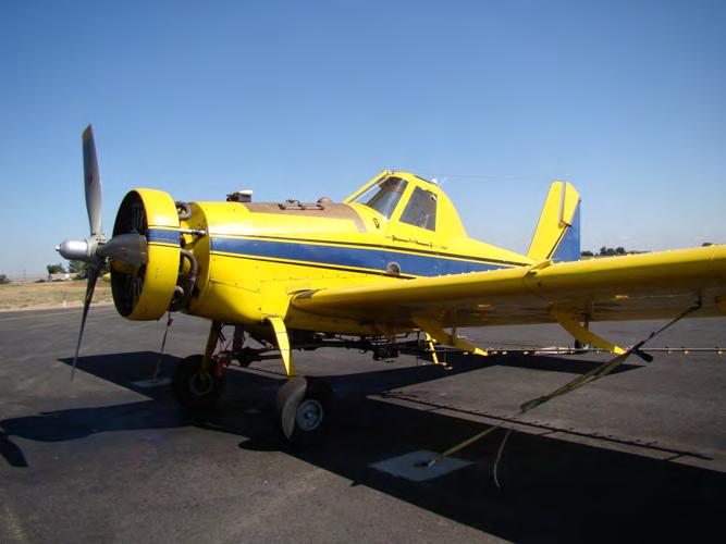

26 W. PEDESTRIAN BRIDGE GARDEN CITY, IDAHO MEDICAL, AGRICULTURAL AND MILITARY
27 ENOUGH EYE CANDY!
28 AIRPORT PLANNING TOOLS
29 AIRPORT PLANNING TOOLS FOR PLANNERS Topics, Tools and Definitions Airport Layout Plan (ALP) Airport Master Plan ITD Airport Land Use Guidelines Idaho Airstrip Network ACRP TRB reports FAA Advisory Circulars (ACs) FAA Orders (Orders) Airport Grant Assurances and Obligations DRCOG Handout ITD Airport Land Use Guidelines Idaho State Statute Title 21 Aeronautics FAA s General Aviation Asset Study Local Airport Rules and Minimums Standards NPIAS CFR Part 77 Obstructions FAA Form Notification of Construction Idaho State Aviation System Plan Commercial GA Community General Aviation vs Commercial Service Commercial Activity And of course, ITD Airport Land Use Guidelines
30 AIRPORT FUNDING AIP (for NPIAS Airports) The Airport Improvement Program (AIP) was established by the Airport and Airway Improvement Act of 1982 to provide funding to airports on a priority needed basis. The AIP is a user-funded program and is not funded by federal income tax dollars. The AIP is primarily funded through the Airport and Airway Trust Fund (AATF). The FAA coordinates this program.

31 AIRPORT FUNDING AIP (for NPIAS Airports) While some of the funds are used for FAA overhead costs, the majority of the money is distributed to community airports through grants. Eligible airports range from small community facilities to the largest commercial airports in the national system. The AATF is funded by three components: v passengers (tax on ticket sales), v cargo (tax on shipping fees), and v fuel (tax on fuels used by aircraft).
32 THE AIRPORT MASTER PLAN Generally FAA AIP funded at ~90% Done every 7 to 10 years Twenty-Year planning window Includes: Inventory Forecasts (Design Aircraft) Facility Requirements Alternatives Environmental Overview Capital Improvement Program (CIP) Implementation Plan Financial and Sustainability Plan Public Out Reach (meetings) Overview Also Includes ALP Drawing Set: Airport Layout Plan (ALP) CFR Part 77 Obstructions Off and On Airport Land Use Plan Approach / Departure Plan and Profiles Airport Photo and Contours Airport Property Map

33 THE AIRPORT LAYOUT PLAN (ALP) Graphic set of drawings Visual representation of the existing and future development SCHWEITZER LAGOONS This one is Rexburg s New Airport

34 THE ALP CFR PART 77 - OBSTRUCTIONS SCHWEITZER LAGOONS This one is Rexburg s New Airport

35 THE ALP CFR PART 77 - OBSTRUCTIONS SCHWEITZER LAGOONS This one is Cedar City Utah s Airport

36 THE ALP CFR PART 77 - OBSTRUCTIONS TERRAIN PENETRATIONS SCHWEITZER LAGOONS NOT A GOOD PLACE TO PUT ADDITIONAL OBJECTS This one is Cedar City Utah s Airport
37 CFR PART 77 OBSTRUCTIONS CASE STUDY SCHWEITZER LAGOONS This one is Glen s Ferry Airport

38 AN AIRPORT ENEMY TOWERS IN THE SURFACES! REAL-LIFE BUILDING PERMIT APPLICATION This one was submitted to the Town of Glenns Ferry
39 AN AIRPORT ENEMY TOWERS IN THE SURFACES! APPLICATION FOR TOWER This one is Glenns Ferry Airport
40 AN AIRPORT ENEMY TOWERS IN THE SURFACES! BARELY NOTES AIRPORT APPLICATION FOR TOWER This one is Glenns Ferry Airport


41 THE AIRPORT LAYOUT PLAN (ALP) Identified Terrain Obstruction Airport Part 77 Airspace Drawing SCHWEITZER LAGOONS Building Permit Application This one is Glenns Ferry Airport
42 OFF-AIRPORT LAND USE PLAN SCHWEITZER LAGOONS This one is Rexburg s New Airport
43 OFF-AIRPORT LAND USE PLAN School SCHWEITZER LAGOONS This one is Rexburg s New Airport
44 OFF-AIRPORT LAND USE PLAN School SCHWEITZER LAGOONS Park This one is Rexburg s New Airport

45 OFF AIRPORT LAND USE PLAN Landfill School SCHWEITZER LAGOONS Park This one is Rexburg s New Airport


46 THE E-ALP (ONLY IF THIS WORKS LIVE) SCHWEITZER LAGOONS
47 STATE REPORTING OF TALL STRUCTURES - The Division of Aeronautics evaluates structures under the authority of Idaho Code through and Idaho Transportation Rule No All proposals for structures in excess of 199 or those of a lower height located near a public-use airport are evaluated for impacts on aircraft navigation. Mitigation of aviation hazards typically involves marking and lighting of structures. Proponents of vertical structures can contact the Aviation Technician if questions regarding location, height (and the need to notify the Division of Aeronautics of a proposal) arise during the project planning phase. Notification of the Division of Aeronautics prior to construction best accomplished by submitting a copy of the FAA form to our office. This form contains all the information the State of Idaho needs to accurately evaluate a structure and its location. You can find a link to this form at: It should be noted that proponents of structures described above are required to notify the Federal Aviation Administration to allow that agency to evaluate the structure for impacts on the national airspace system. SCHWEITZER LAGOONS For more information contact: Flo Ghighina, Flo.Ghighina@itd.idaho.gov,
48 CFR PART 77 AND FAA FORM 7460 SCHWEITZER LAGOONS NOTIFICATION OF CONSTRUCTION NEAR AN AIRPORT

49 CFR PART 77 AND FAA FORM 7460 OFF AIRPORT SHOULD BE IN YOUR PERMIT REQUIREMENTS >200 FT AGL 1:100 SLOPE ON LONG RUNWAYS 1:50 SLOPE ON SHORT RUNWAYS
50 LAND USE NEAR AN AIRPORT We have talked about the issue of restrictions on object height near airports, the other side of airport protection is what are we doing on the land? Certain areas are VERY sensitive to incompatible land use. Potential issues include: Congregations of people (schools, churches, apartments, shopping centers, etc) Wildlife attractants (mostly birds, but others as well) Smoke, steam or other vapor screens Radio interference SCHWEITZER Glare LAGOONS

51 DRCOG 1997 RESOURCE HANDBOOK This dated document still has some of the best explanations to the concepts of planning around airports especially urban ones. Some of the surface descriptions have changed, but the arguments for progressive planning and protecting airports are spot-on but many concepts still apply SCHWEITZER LAGOONS Land_Use_Design_Handbook_ pdf


52 IDAHO AIRPORT LAND USE GUIDELINES Indispensable for the Idaho Planner s desk (or at least shelf). It is somewhat technical but worth reading and developing an understanding of specific Idaho issues, rules, regulations and laws. Great graphics and this document really tells the story of what and why we need for airport protection. Even includes a model comprehensive Plan!

53 OWNERSHIP AND CONTROL OF CRITICAL AREAS Runway Protection Zone (RPZ) The only protection surface meant for people and objects on the ground! Generally a 1,000 feet long for smaller airports and 1,700 feet long for medium sized and up to 2,500 feet for large airports In Burley s case, several issues in the RPZ! Sponsors should own the RPZ in SCHWEITZER LAGOONS fee for complete land use control. CASE STUDY
54 APPROACH SURFACES AND INSTRUMENT PROCEDURES Inner Parts of the Approach and Departure Surfaces These surface dimensions depend on the type of Instrument Approach Procedure (IAP) into the airport: Ø Visual (non IAP) Ø Non-Precision Instrument Ø Precision These procedures are very important to the community IAP s assist the pilot to find and approach the airport in marginal weather. SCHWEITZER LAGOONS In addition, some commercial and corporate users are required to utilize IAPs for safety and insurance reasons. Sponsors should control the Inner portions of the Approach and Departure Surfaces with strong zoning.

55 PROTECTING CRITICAL AREAS Approach and Departure Surfaces Light to heavy Industrial is a marginal use normally, but in winter watch out! SCHWEITZER LAGOONS

56 BURLEY (BYI) GPS IAP TO RUNWAY 20 NOT FOR NAVIGATION SCHWEITZER LAGOONS

57 SCHWEITZER LAGOONS BURLEY (BYI) GPS IAP TO RUNWAY 20 COLD MORNING (~10 O F)
58 WHY ARE LAND USE & HEIGHT RESTRICTIONS IMPORTANT? 1. Safety for Pilots, Passengers and People on the ground 2. Operational value reduction in IAP minimums or use of the airport decreases the intrinsic value of the facility 3. Economic The Country and/or the State has invested in the facility and any loss of utility lessens the ROI and value to the community loss of jobs, business, industry 4. Even small, incremental chipping away at the airport value and use may eventually lead to VERY expensive solutions! SCHWEITZER LAGOONS LOCAL ZONING PROTECTIONS ARE KEY
59 GRANT ASSURANCES AND OBLIGATIONS Strings from the Funding Agencies when accepting a grant There are dozens, but a couple important ones (paraphrased): Ø Keep the airport safe (pretty opened ended) Ø Protect the airport from incompatible land use Ø Non-discrimination (treat all equal) Ø No revenue diversion o $$ generated on the airport MUST stay at the airport Ø Open to the public and military Ø Consistency with local plans & consideration of local interest SCHWEITZER LAGOONS Ø Serve aeronautical use (ie- hangars must have an airplane) Ø Hazard removal and mitigation Ø Have a current and up-to-date ALP Obligate the land to be a safe airport

60 AIRPORT COOPERATIVE RESEARCH PROGRAM (ACRP) Reports: Reports are the main product of the research project and are often written as guidebooks or manuals. Syntheses of Practice: Syntheses report on the state of the practice based on literature reviews and surveys of recent activities in critical areas. Syntheses also inform airport managers about innovations being used SCHWEITZER by others LAGOONS to solve problems. Legal Digests (LRDs): LRDs report on timely legal issues, compile case law, or recommend specific solutions to specific problems.
61 OBJECTIVES FOR TODAY Introduction to Airport Planning 101 Planning, funding, surfaces Define Airport Protections Height CFR Part Use Types of Incompatible Land Use
62 OBJECTIVES FOR TODAY Discuss the common aviation tools available to you Master Plans Airport Layout Plans Advisory Circulars ACRP Reports Legal Briefs Land Use Guidelines (State and Federal) Provide additional sources of material and advice FAA State contact information
63 AIRPORT PLANNING TOOLS FOR PLANNERS Topics, Tools and Definitions Airport Layout Plan (ALP) Airport Master Plan ITD Airport Land Use Guidelines Idaho Airstrip Network ACRP TRB reports FAA Advisory Circulars (ACs) FAA Orders (Orders) Airport Grant Assurances and Obligations DRCOG Handout ITD Airport Land Use Guidelines Idaho State Statute Title 21 Aeronautics FAA s General Aviation Asset Study Local Airport Rules and Minimums Standards NPIAS CFR Part 77 Obstructions FAA Form Notification of Construction Idaho State Aviation System Plan Commercial GA Community General Aviation vs Commercial Service Commercial Activity And of course, ITD Airport Land Use Guidelines

64 FUNDING / REGULATORY AGENCY CONTACTS Helena Airport District Office Idaho Staff Manager Chuck Garrison Community Planner Scott Eaton East Idaho State Engineer Gary Gates West Idaho State Engineer Steve Engebrecht Environmental Specialist Diane Stilson Idaho Transportation Department, Division of Aeronautics Mike Pape, Division Administrator, Phone: Bill Statham, Project Manager, Phone: SCHWEITZER LAGOONS Jennifer Schildgen, Airport Planner, Phone:
65 INDUSTRY CONTACTS Aircraft Operators and Pilots Association (AOPA) Warren Hendrickson, Regional Representative National Business Aviation Association (NBAA) Kristi Ivey, Regional Representative Idaho Airport Managers Association (IAMA) Idaho Aviation Association SCHWEITZER LAGOONS Your Local Airport Manager! Or Call me Rick Patton, Aviation Planner with T-O Engineers
66 Thank you Rick Patton, Aviation Planner
JOSLIN FIELD, MAGIC VALLEY REGIONAL AIRPORT DECEMBER 2012
 1. Introduction The Federal Aviation Administration (FAA) recommends that airport master plans be updated every 5 years or as necessary to keep them current. The Master Plan for Joslin Field, Magic Valley
Appendix C AIRPORT LAYOUT PLANS
 Appendix C AIRPORT LAYOUT PLANS Appendix C AIRPORT LAYOUT PLANS Airport Master Plan Santa Barbara Airport As part of this Airport Master Plan, the Federal Aviation Administration (FAA) requires the development
Airports and UAS: Integrating UAS into Airport Infrastructure and Planning
 ACRP Problem Statement 17-03-09 Recommended Allocation: $500,000 Airports and UAS: Integrating UAS into Airport Infrastructure and Planning ACRP Staff Comments This is one of four UAS-themed problem statements
Federal Aviation Administration. Airport Land Use Compatibility Advisory Circular ACI-NA / FAA. FAA HQ Washington, DC March 27, 2013
 Airport Land Use Compatibility Advisory Circular ACI-NA / FAA FAA HQ Washington, DC March 27, 2013 The purpose of this meeting is to discuss FAA s update of the Airport Compatible Land Use Advisory Circular.
AIRPORT PLANNING, DEVELOPMENT AND LAND ACQUISITION
 30 th Annual AAAE Basics of Airport Law Workshop and 2014 Legal Update October 19-21, 2014 AIRPORT PLANNING, DEVELOPMENT AND LAND ACQUISITION Desk Reference Chapters 4, 13, 14 & 25 Catherine M. van Heuven,
MONTEREY REGIONAL AIRPORT MASTER PLAN TOPICAL QUESTIONS FROM THE PLANNING ADVISORY COMMITTEE AND TOPICAL RESPONSES
 MONTEREY REGIONAL AIRPORT MASTER PLAN TOPICAL QUESTIONS FROM THE PLANNING ADVISORY COMMITTEE AND TOPICAL RESPONSES Recurring topics emerged in some of the comments and questions raised by members of the
CHAPTER 1: INTRODUCTION
 CHAPTER 1: INTRODUCTION Purpose and Scope The information presented in this report represents the study findings for the 2016 Ronan Airport Master Plan prepared for the City of Ronan and Lake County, the
FACILITY REQUIREMENTS SUMMARY OF KEY ISSUES OVERVIEW
 FACILITY REQUIREMENTS SUMMARY OF KEY ISSUES OVERVIEW This summary is intended to provide a brief overview of the key issues associated with conformance to FAA standards at Methow Valley State Airport.
AERONAUTICAL SURVEYS & INSTRUMENT FLIGHT PROCEDURES
 AERONAUTICAL SURVEYS & INSTRUMENT FLIGHT PROCEDURES Current as of November 2012 ALASKA AVIATION SYSTEM PLAN UPDATE Prepared for: State of Alaska Department of Transportation & Public Facilities Division
Chapter 1 Introduction and Project Overview
 EPHRATA MUNICIPAL AIRPORT Chapter 1 Introduction and Project Overview The Port of Ephrata in cooperation with the Federal Aviation Administration (FAA) is updating the Airport Master Plan for Ephrata Municipal
Saint Petersburg-Clearwater International Airport. Airspace & Instrument Approach Analysis
 Saint Petersburg-Clearwater International Airport Airspace & Instrument Approach Analysis February 23, 2005 Jeppesen Boeing Jeppesen Government / Military Services Group Airspace Services Division AIRSPACE
General Aviation Land Use Planning
 Our team. General Aviation Land Use Planning PURDUE ROAD SCHOOL - 2017 Presented by: Maria Muia, Ph.D., Senior Aviation Planner Woolpert, Inc. Brian Payne, Director Columbus Airport Nick Isenberg, Project
DRAFT FINAL REPORT AIRPORT MASTER PLAN. Rifle Garfield County Airport Revised May 15, 2014
 DRAFT FINAL REPORT AIRPORT MASTER PLAN Rifle Garfield County Airport Revised May 15, 2014 As required by Paragraph 425.B(4) of FAA Order 5100.38C, Airport Improvement Program (AIP) Handbook: The preparation
Agenda: SASP SAC Meeting 3
 Agenda: SASP SAC Meeting 3 Date: 04/12/18 Public Involvement Plan Update Defining the System Recommended Classifications Discussion Break Review current system Outreach what we heard Proposed changes Classification
Merritt Island Airport
 TABLE OF CONTENTS CHAPTER 1 INTRODUCTION... 1-1 INTRODUCTION AND PROJECT OVERVIEW... 1-1 General Guidelines... 1-1 Prior Planning Documentation... 1-2 Key Issues... 1-2 Goals and Objectives... 1-2 Regulatory
AIRPORT LAND USE COMPATILIBILTY AIRPORT LAND USE COMPATIBILIITY
 CHAPTER 7 AIRPORT LAND USE COMPATILIBILTY CHAPTER 7 AIRPORT LAND USE COMPATIBILIITY 7.0 INTRODUCTION On airport aviation related development is typically compatible with aircraft operations. On airport
Kittitas County Airport Bowers Field Airport Master Plan Planning Advisory Committee Meeting #1 April 6, 2016
 Kittitas County Airport Bowers Field Airport Master Plan Planning Advisory Committee Meeting #1 April 6, 2016 Project Team Kittitas County, WA Airport Owner (Sponsor) and Operator, Land Use Century West
APPENDIX B NATIONAL PLAN OF INTEGRATED AIRPORT SYSTEMS
 APPENDIX B NATIONAL PLAN OF INTEGRATED AIRPORT SYSTEMS Pocatello Regional Airport Airport Master Plan APPENDIX B NATIONAL PLAN OF INTEGRATED AIRPORT SYSTEMS The Airport and Airway Improvement Act of 1982
at: Accessed May 4, 2011.
 3.11 SAFETY 3.11.1 Background and Methodology As with other forms of transportation, there is risk associated with aviation activities. This section focuses on risk to those on the ground near airports.
DRAFT MASTER PLAN UPDATE
 DRAFT MASTER PLAN UPDATE CHAPTER VI: AIRPORT LAYOUT PLAN NARRATIVE DRAFT REPORT APRIL 2017 PREPARED BY: Table of Contents WESTCHESTER COUNTY AIRPORT 6 AIRPORT LAYOUT PLAN NARRATIVE REPORT... 6-1 6.1 AGIS
STUDY OVERVIEW MASTER PLAN GOALS AND OBJECTIVES
 INTRODUCTION An Airport Master Plan provides an evalua on of the airport s avia on demand and an overview of the systema c airport development that will best meet those demands. The Master Plan establishes
Airport Land-Use Compatibility
 Airport Land-Use Compatibility Partnering for Airspace Viability at the Watertown International Airport Photo by: Watertown Daily Times Presented by: Grant Sussey, Airport Manager Jefferson County Andy
Update on FAA Standard Operating Procedures (SOP)
") Update on FAA Standard Operating Procedures (SOP) SOP 2.0 - Airport Layout Plan (ALP) SOP 3.0 - Exhibit A Airport Property Map Presented to: Association of California Airports (ACA); ACA Annual Conference,
Update on FAA Standard Operating Procedures (SOP) SOP 2.0 - Airport Layout Plan (ALP) SOP 3.0 - Exhibit A Airport Property Map Presented to: Association of California Airports (ACA); ACA Annual Conference,
Thursday, May 2 nd, 2013 South St. Paul Municipal Airport Meeting Room 4:00 p.m. 5:30 p.m. MEETING NOTES
 SOUTH ST. PAUL MUNICIPAL AIRPORT FLEMING FIELD MASTER PLAN ADVISORY GROUP MEETING #2 Thursday, May 2 nd, 2013 South St. Paul Municipal Airport Meeting Room 4:00 p.m. 5:30 p.m. MEETING NOTES The purpose
AIRPORT COMPLIANCE th Texas Aviation Conference. 3/29/2018 Date. Footer Text
 AIRPORT COMPLIANCE 2018 36 th Texas Aviation Conference 3/29/2018 AWOS FCC LICENSE RENEWAL Needs renewal every 10 years (renew 90 days before expiration). Needs update if there is name change, coordinate
Chapter 1 Introduction and Project Overview
 Chapter 1 Introduction and Project Overview Kittitas County in cooperation with the Federal Aviation Administration (FAA) is updating the Airport Master Plan for Bowers Field Airport (FAA airport identifier
Preferred Alternative Summary
 Tacoma Narrows Airport Master Plan Update Preferred Alternative Summary The Preferred Alternative represents Pierce County s vision for the long-term development of the Tacoma Narrows Airport. This Alternative
Recommended Performance Measures
 Recommended Performance Measures January 2009 1 RECOMMENDED PERFORMANCE MEASURES Performance measures are utilized by the North Central Texas Council of Governments (NCTCOG) to monitor the performance
Airport Land Use Compatibility Plan (ALUCP) Update. Public Information Meeting #4 June 8 & 9, 2016
 Update. Public Information Meeting #4 June 8 & 9, 2016") Airport Land Use Compatibility Plan (ALUCP) Update Public Information Meeting #4 June 8 & 9, 2016 Agenda 1. Study Process 2. Noise Complaint Patterns 3. Proposed Overflight Areas (AOA) 4. Proposed Land
Airport Land Use Compatibility Plan (ALUCP) Update Public Information Meeting #4 June 8 & 9, 2016 Agenda 1. Study Process 2. Noise Complaint Patterns 3. Proposed Overflight Areas (AOA) 4. Proposed Land
Chapter Six ALP Drawings. Tacoma Narrows Airport. Master Plan Update
 Chapter Six ALP Drawings Master Plan Update The master planning process for the (Airport) has evolved through efforts in the previous chapters to analyze future aviation demand, establish airside and landside
Chapter Seven COST ESTIMATES AND FUNDING A. GENERAL
 Chapter Seven COST ESTIMATES AND FUNDING A. GENERAL This chapter delineates the recommended 2005 2024 Sussex County Airport Capital Improvement Program (CIP). It further identifies probable construction
Airport Obstruction Standards
 Airport Obstruction Standards Dr. Antonio Trani Department of Civil and Environmental Engineering Virginia Tech Outline of this Presentation Obstructions to navigation around airports Discussion of Federal
B GEORGIA INFRASTRUCTURE REPORT CARD AVIATION RECOMMENDATIONS DEFINITION OF THE ISSUE. Plan and Fund for the Future:
 2014 GEORGIA INFRASTRUCTURE REPORT CARD B + RECOMMENDATIONS Plan and Fund for the Future: While the system continues to enjoy excess capacity and increased accessibility it still needs continued focus
Airport Master Plan for Montgomery-Gibbs Executive Airport PAC Meeting #3
 Airport Master Plan for Montgomery-Gibbs Executive Airport PAC Meeting #3 Agenda > Introductions > Public Meetings Overview > Working Paper 3 - Facility Requirements > Working Paper 4 - Environmental Baseline
ORDINANCE NO. _2013-
 ORDINANCE NO. _2013- AN ORDINANCE OF THE TOWNSHIP OF CONEWAGO, DAUPHIN COUNTY, PENNSYLVANIA, PROVIDING FOR AIRPORT ZONING REGULATIONS WITHIN THE AIRPORT ZONING OVERLAY DISTRICT CREATED BY THIS ORDINANCE
Unmanned Aircraft Operations in the National Airspace System. AGENCY: Federal Aviation Administration (FAA), DOT.
, DOT.") [4910-13] DEPARTMENT OF TRANSPORTATION Federal Aviation Administration 14 CFR Part 91 Docket No. FAA-2006-25714 Unmanned Aircraft Operations in the National Airspace System AGENCY: Federal Aviation Administration
[4910-13] DEPARTMENT OF TRANSPORTATION Federal Aviation Administration 14 CFR Part 91 Docket No. FAA-2006-25714 Unmanned Aircraft Operations in the National Airspace System AGENCY: Federal Aviation Administration
Executive Summary. MASTER PLAN UPDATE Fort Collins-Loveland Municipal Airport
 Executive Summary MASTER PLAN UPDATE Fort Collins-Loveland Municipal Airport As a general aviation and commercial service airport, Fort Collins- Loveland Municipal Airport serves as an important niche
Guidance material for land use at or near aerodromes
 Guidance material for land use at or near aerodromes Table of Contents Overview... 1 Glossary... 1 Types of Aerodromes... 1 Obstacle Limitation Surfaces... 2 Wildlife Hazard Management... 2 Notice of Intention
Airport Planning at the. Local and National Levels. Presented to: ICAO Airport Planning Workshop for the SAM Region
 Airport Planning at the Federal Aviation Administration Local and National Levels. Presented to: ICAO Airport Planning Workshop for the SAM Region Presented to: By: By: Will Reinhardt, FAA Office of Airports
Airport Master Plan for. Brown Field Municipal Airport PAC Meeting #3
 Airport Master Plan for Brown Field Municipal Airport PAC Meeting #3 Public Meeting #1 > 8/24/17 from 5:30 to 8:00 pm > 41 attendees signed-in > Comments: > EAA area > Environmental constraints > Focus
ACRP 01-32, Update Report 16: Guidebook for Managing Small Airports Industry Survey
 ACRP 01-32, Update Report 16: Guidebook for Managing Small Airports Industry Survey Goal of Industry Survey While there are common challenges among small airports, each airport is unique, as are their
CHAPTER 1 EXECUTIVE SUMMARY
 CHAPTER 1 EXECUTIVE SUMMARY 1 1 EXECUTIVE SUMMARY INTRODUCTION William R. Fairchild International Airport (CLM) is located approximately three miles west of the city of Port Angeles, Washington. The airport
Bremerton National Airport Airport Master Plan Project Update February 12, 2013
 Bremerton National Airport Airport Master Plan Project Update February 12, 2013 Project Team Century West Engineering Northwest firm founded in 1969 500+ airport projects completed throughout the Pacific
Airport Compliance. Common Issues
 Airport Compliance Common Issues Airports must submit any proposed changes on airport property to TxDOT Aviation to update ALP and for approval. Anything required by FAA to be on the ALP shall be subject
Frequently Asked Questions and Answers Bowman Field Airport Area Safety Program
 Frequently Asked Questions and Answers Bowman Field Airport Area Safety Program 1. What is the proposed Bowman Field Airport Area Safety Program? The proposed Bowman Field Airport Area Safety Program has
2015 PURDUE ROAD SCHOOL March 11, 2015
 2015 PURDUE ROAD SCHOOL March 11, 2015 Runway Protection Zone (RPZ) Definition It is a trapezoidal shape formed off the end of a runway and its geometry it a function of the airport s aircraft approach
Airport Master Plan 1
 1 Aviation Demand AIRPORT PLANNING PROCESS FAA Design Standards Financial Resources Community Goals Environmental Requirements Serve Business Community This Advisory Circular (AC) provides guidance for
Appendix D Project Newsletters. Tacoma Narrows Airport. Master Plan Update
 Appendix D Project Newsletters Tacoma Narrows Airport Master Plan Update This appendix contains the newsletters distributed throughout the project. These newsletters provided updates and information on
The following criteria shall be applied within the boundaries of the AO District:
 Sec. 419 (a) Purpose AIRPORT OVERLAY DISTRICT (AO) The purpose of the Airport Overlay District is to regulate and restrict the height of structures, objects, or natural growth, regulate the locations of
Public Workshop #7 Land Use Planning June 28, 2016
 Public Workshop #7 Land Use Planning June 28, 2016 Land Use Planning and Vision 2040 What is Land Use Planning in the context of the Vision 2040 process? Vision 2040 Aeronautical Development Land Use Compatibility
FRENCH VALLEY AIRPORT (F70) Sky Canyon Dr. Murrieta, CA. Phone: Riverside FAA FSDO Complaint Line: (951)
 Sky Canyon Dr. Murrieta, CA. Phone: Riverside FAA FSDO Complaint Line: (951)") FRENCH VALLEY AIRPORT (F70) 37600 Sky Canyon Dr. Murrieta, CA Phone: 951-600-7297 Riverside FAA FSDO Complaint Line: (951) 276-6701 Visit the F70 website for additional information regarding the airport
FRENCH VALLEY AIRPORT (F70) 37600 Sky Canyon Dr. Murrieta, CA Phone: 951-600-7297 Riverside FAA FSDO Complaint Line: (951) 276-6701 Visit the F70 website for additional information regarding the airport
PLUME RISE ASSESSMENTS
 Advisory Circular AC 139-5(1) NOVEMBER 2012 PLUME RISE ASSESSMENTS CONTENTS Page 1. References 1 2. Purpose 2 3. Status of this advisory circular 2 4. Acronyms 2 5. Definitions 3 6. Background 3 7. Key
Analyzing Risk at the FAA Flight Systems Laboratory
 Analyzing Risk at the FAA Flight Systems Laboratory Presented to: Workshop By: Dr. Richard Greenhaw, FAA AFS-440 Date: 29 November, 2005 Flight Systems Laboratory Who we are How we analyze risk Airbus
Airports and UAS: Managing UAS Operations in the Airport Vicinity
 ACRP Problem Statement 17-10-09 Recommended Allocation: $350,000 Airports and UAS: Managing UAS Operations in the Airport Vicinity ACRP Staff Comments This is one of four UAS-themed problem statements
Appendix B Ultimate Airport Capacity and Delay Simulation Modeling Analysis
 Appendix B ULTIMATE AIRPORT CAPACITY & DELAY SIMULATION MODELING ANALYSIS B TABLE OF CONTENTS EXHIBITS TABLES B.1 Introduction... 1 B.2 Simulation Modeling Assumption and Methodology... 4 B.2.1 Runway
AIRPORT MASTER PLAN. Newport State Airport. Draft. (Colonel Robert F. Wood Airpark) THE Louis Berger Group, INC. Prepared for: Prepared by:
 THE Louis Berger Group, INC. Prepared for: Prepared by:") Draft AIRPORT MASTER PLAN Newport State Airport () Prepared for: 2000 Post Road Warwick, Rhode Island 02886-1533 THE Louis Berger Group, INC. 20 Corporate Woods Boulevard Albany, New York 12211-2370 Prepared
Draft AIRPORT MASTER PLAN Newport State Airport () Prepared for: 2000 Post Road Warwick, Rhode Island 02886-1533 THE Louis Berger Group, INC. 20 Corporate Woods Boulevard Albany, New York 12211-2370 Prepared
PLU Airport Master Plan. Master Plan Advisory Committee (MPAC) Meeting #4 March 19, 2018
 Meeting #4 March 19, 2018") PLU Airport Master Plan Master Plan Advisory Committee (MPAC) Meeting #4 March 19, 2018 Meeting Agenda 1. Master Plan Status [5 Minutes] 2. Preferred Forecasts [15 Minutes] 3. Runway Length Options [45
PLU Airport Master Plan Master Plan Advisory Committee (MPAC) Meeting #4 March 19, 2018 Meeting Agenda 1. Master Plan Status [5 Minutes] 2. Preferred Forecasts [15 Minutes] 3. Runway Length Options [45
Lake Tahoe Airport Master Plan Public Meeting March 16, 2015
 Lake Tahoe Airport Master Plan Public Meeting March 16, 2015 What is an Airport Master Plan? a comprehensive study of an airport [that] usually describes the short, medium, and long term development plans
TABLE OF CONTENTS. Washington Aviation System Plan Update July 2017 i
 TABLE OF CONTENTS Chapter 1 Overview... 1-1 1.1 Background... 1-1 1.2 Overview of 2015 WASP... 1-1 1.2.1 Aviation System Performance... 1-2 1.3 Prior WSDOT Aviation Planning Studies... 1-3 1.3.1 2009 Long-Term
FAA Requirements for Engine-out Procedures and Obstacle Clearance
 FAA Requirements for Engine-out Procedures and Obstacle Clearance Presentation to: CAAC Engine-out Procedures Seminar Name: Chuck Friesenhahn Date: 11/29/2005 Flight Standards Senior Advisor, Advanced
AVIATION PLANNING AND DEVELOPMENT Oakland International Airport 530 Water Street Oakland, CA 94607
 AVIATION PLANNING AND DEVELOPMENT Oakland International Airport 530 Water Street When Do I Need to File an FAA Form 7460-1? Objects Affecting Navigable Airspace (14CFR77) June 2013 Background The Federal
According to FAA Advisory Circular 150/5060-5, Airport Capacity and Delay, the elements that affect airfield capacity include:
 4.1 INTRODUCTION The previous chapters have described the existing facilities and provided planning guidelines as well as a forecast of demand for aviation activity at North Perry Airport. The demand/capacity
Chapter 8.0 Implementation Plan
 Chapter 8.0 Implementation Plan 8.1 Introduction This chapter is the culmination of the analytical work accomplished in the previous chapters. The result is a prioritized list of the essential projects.
APPENDIX D FEDERAL AVIATION REGULATIONS, PART 77
 APPENDIX D FEDERAL AVIATION REGULATIONS, PART 77 Subparts A through C PART 77 - OBJECTS AFFECTING NAVIGABLE AIRSPACE Subpart A General 77.1 Scope. 77.2 Definition of terms. 77.3 Standards. 77.5 Kinds of
RULES OF TENNESSEE DEPARTMENT OF TRANSPORTATION AERONAUTICS DIVISION CHAPTER LICENSING AND REGISTRATION OF AIRPORTS TABLE OF CONTENTS
 RULES OF TENNESSEE DEPARTMENT OF TRANSPORTATION AERONAUTICS DIVISION CHAPTER 1680-1-2 LICENSING AND REGISTRATION OF AIRPORTS TABLE OF CONTENTS 1680-1-2-.01 Purpose 1680-1-2-.06 Repealed 1680-1-2-.02 Definitions
STAFF REPORT. Airport Land Use Plan Consistency Review: Old Town Village Mixed Use Project City of Goleta. MEETING DATE: June 18, 2015 AGENDA ITEM: 5M
 STAFF REPORT SUBJECT: Airport Land Use Plan Consistency Review: Old Town Village Mixed Use Project City of Goleta MEETING DATE: AGENDA ITEM: 5M STAFF CONTACT: Peter Imhof, Andrew Orfila RECOMMENDATION:
Windmills & Airspace Can We Work Together?
 May 29, 2008 Windmills & Airspace Can We Work Together? J. Randolph Babbitt C O N F I D E N T I A L www.oliverwyman.com Windmills & Airspace Overview of Airspace Issues For Wind Turbine Sites The FAA s
CHAPTER 3 ALTERNATIVES CONSIDERED
 CHAPTER 3 ALTERNATIVES CONSIDERED 3.0 ALTERNATIVES The 2010 Stevensville Airport Master Plan contained five (5) airside development options designed to meet projected demands. Each of the options from
ARTICLE 34 AIRPORT HEIGHT COMBINING ZONE (AH) (Amended by Ordinance #295 Effective June 26, 2009)
 (Amended by Ordinance #295 Effective June 26, 2009)") ARTICLE 34 AIRPORT HEIGHT COMBINING ZONE (AH) (Amended by Ordinance #295 Effective June 26, 2009) Section 34.10 - Purpose and Intent The purpose of the Airport Height Combining Zone (AH) is to protect
ARTICLE 34 AIRPORT HEIGHT COMBINING ZONE (AH) (Amended by Ordinance #295 Effective June 26, 2009) Section 34.10 - Purpose and Intent The purpose of the Airport Height Combining Zone (AH) is to protect
Source: Chippewa Valley Regional Airport ASOS, Period of Record
 Chapter 1 Inventory Runway wind coverage is the percentage of time a runway can be used without exceeding allowable crosswind velocities. Allowable crosswind velocities vary depending on aircraft size
Harvey Field Airport. Planning Advisory Committee & Public Open House. April 1, Comment Responses
 Harvey Field Airport Planning Advisory Committee & Public Open House April 1, 2015 Comment Responses In an effort to respond to comments received at both the Planning Advisory Committee (PAC) meeting and
Consideration will be given to other methods of compliance which may be presented to the Authority.
 Advisory Circular AC 139-10 Revision 1 Control of Obstacles 27 April 2007 General Civil Aviation Authority advisory circulars (AC) contain information about standards, practices and procedures that the
HILLSBORO AIRPORT MASTER PLAN UPDATE Planning Advisory Committee Meeting 1
 HILLSBORO AIRPORT MASTER PLAN UPDATE Planning Advisory Committee Meeting 1 Feb. 27, 2017 HILLSBORO AIRPORT MASTER PLAN UPDATE Planning Advisory Committee Welcome Curtis Robinhold, Port of Portland 1 HILLSBORO
Element 640 State of Rhode Island Airport System Plan - Overview
 Element 640 State of Rhode Island Airport System Plan - Overview This document represents the Rhode Island Airport Corporation s (RIAC) plan for the state airport system (ASP). The plan establishes state
Runway Length Analysis Prescott Municipal Airport
 APPENDIX 2 Runway Length Analysis Prescott Municipal Airport May 11, 2009 Version 2 (draft) Table of Contents Introduction... 1-1 Section 1 Purpose & Need... 1-2 Section 2 Design Standards...1-3 Section
Pierre Regional Airport Airport Master Plan. Kickoff Meeting April 7, 2017
 Pierre Regional Airport Airport Master Plan Kickoff Meeting April 7, 2017 Agenda Introductions Airport Master Planning Planning Considerations Master Plan Elements Schedule Public Involvement Basics about
Flying Cloud Airport (FCM) Zoning Process: Informing a Mn/DOT Path Forward
 Zoning Process: Informing a Mn/DOT Path Forward") : Informing a Mn/DOT Path Forward A Review of the Flying Cloud Airport (FCM) Joint Airport Zoning Board (JAZB) Process and the Draft Airport Zoning Ordinance B A RPZ RPZ A B C Zone Chad E. Leqve Director
: Informing a Mn/DOT Path Forward A Review of the Flying Cloud Airport (FCM) Joint Airport Zoning Board (JAZB) Process and the Draft Airport Zoning Ordinance B A RPZ RPZ A B C Zone Chad E. Leqve Director
TANZANIA CIVIL AVIATION AUTHORITY AIR NAVIGATION SERVICES INSPECTORATE. Title: CONSTRUCTION OF VISUAL AND INSTRUMENT FLIGHT PROCEDURES
 Page 1 of 8 1. PURPOSE 1.1. This Advisory Circular provides guidance to personnel involved in construction of instrument and visual flight procedures for publication in the Aeronautical Information Publication.
PLAN Anoka County - Blaine Airport
 Reliever Airports: NOISE ABATEMENT PLAN Anoka County - Blaine Airport INTRODUCTION The noise abatement plan for the Anoka County-Blaine Airport was prepared in recognition of the need to make the airport
CLASS SPECIFICATION 5/12/11 SENIOR AIRPORT ENGINEER, CODE 7257
 Form PDES 8 THE CITY OF LOS ANGELES CIVIL SERVICE COMMISSION CLASS SPECIFICATION 5/12/11 SENIOR AIRPORT ENGINEER, CODE 7257 Summary of Duties: A Senior Airport Engineer performs the more difficult and
BELFAST MUNICIPAL AIRPORT OVERVIEW
 BELFAST MUNICIPAL AIRPORT OVERVIEW LOCATION AND HISTORY Belfast Municipal Airport (Federal Aviation Administration (FAA) airport code BST, International Civil Aviation Organization airport code KBST, FAA
Why are the underground fuel tanks being removed and replaced with above ground tanks?
 AIRPORT/CITIZEN FAQ This list of Frequently Asked Questions (FAQs) with responses are provided to share information related to airport topics with the Citizens of Georgetown. The questions / responses
Fly for Fun under the Special Rule for Model Aircraft
 US Fly for Fun under the Special Rule for Model Aircraft You don't need permission from the FAA to fly your UAS under the Special Rule for Model Aircraft, but you must always fly safely. You may elect
Document prepared by MnDOT Office of Aeronautics and HNTB Corporation. MINNESOTA GO STATE AVIATION SYSTEM PLAN
 LAST UPDATE JULY 2013 Acknowledgements The preparation of this document was financed in part by a grant from the Federal Aviation Administration (Project No: 3-27-0000-07-10), with the financial support
Tallahassee International Airport Master Plan. Technical Advisory Committee Meeting #2 October 19, 2016
 Tallahassee International Airport Master Plan Technical Advisory Committee Meeting #2 October 19, 2016 Agenda Welcome / Introductions Master Plan Process and Project Status Forecast of Aviation Demand
Airport Master Plan Update June 15, 2017
 Airport Master Plan Update June 15, 2017 www.harveyfield.com The Master Plan is a 20-year plan to understand the needs of current and future users of the Airport. This is important to ensure that safe
Acknowledgements. Proprietary Information 1
 Acknowledgements Staff and NavAid, on behalf of the Truckee Tahoe Airport District, acknowledges a few important points related to Flight Tracking at KTRK Airport Operations impact on the community The
Airport Master Plan. Rapid City Regional Airport. October 2015 FAA Submittal
 Airport Master Plan Rapid City Regional Airport October 2015 FAA Submittal Rapid City Regional Airport Master Plan Update Table of Contents Executive Summary... i Scope & Timeline... i Forecasts... i Preferred
Westover Metropolitan Airport Master Plan Update
 Westover Metropolitan Airport Master Plan Update June 2008 INTRODUCTION Westover Metropolitan Airport (CEF) comprises the civilian portion of a joint-use facility located in Chicopee, Massachusetts. The
MassDOT Aeronautics Division Capital Improvements Presentation
 MassDOT Aeronautics Division Capital Improvements Presentation MassDOT Board Retreat October 27, 2011 Presentation Agenda Capital Improvement Plan (CIP) Overview Airports Capital Improvement Plan (ACIP)
Session 10 Non-aeronautical Development of Airport Land
 Session 10 Non-aeronautical Development of Airport Land 31 st Annual AAAE Basics of Airport Law Workshop and 2015 Legal Update November 1-3, 2015 Desk Reference Chapters 14, 15, 23, 28 Daniel S. Reimer
FAA Update. Dakota-Minnesota (DMA) Airports District Office. Federal Aviation Administration. Presented to: By: Date: South Dakota Airports Conference
 Airports District Office. Federal Aviation Administration. Presented to: By: Date: South Dakota Airports Conference") FAA Update Dakota-Minnesota (DMA) Airports District Office Presented to: By: Date: South Dakota Airports Conference Chris Hugunin & Dave Anderson March 18, 2015 FY 2014 DMA ADO Total AIP Funding $107.2
FAA Update Dakota-Minnesota (DMA) Airports District Office Presented to: By: Date: South Dakota Airports Conference Chris Hugunin & Dave Anderson March 18, 2015 FY 2014 DMA ADO Total AIP Funding $107.2
Grants Pass Airport Master Plan & Airport Layout Plan Update
 Attendees: Grants Pass Airport Master Plan & Airport Layout Plan Update Meeting #3 January 26, 2010 Merlin Community Center 100 Acorn Street, Merlin 5:45 7:15 p.m. Josephine County Department of Airports:
TRB and ACRP Research Updates: Practical Application
 TRB and ACRP Research Updates: Practical Application 2014 ACI Environmental Affairs Conference Danielle J. Rinsler, AICP FAA Office Airports, Airport Planning and Environmental Division Baltimore, MD Advisory
STAFF REPORT. Airport Land Use Consistency Determination Betteravia Plaza. MEETING DATE: January 21, 2016 AGENDA ITEM: 8D
 STAFF REPORT SUBJECT: Airport Land Use Consistency Determination Betteravia Plaza MEETING DATE: AGENDA ITEM: 8D STAFF CONTACT: Andrew Orfila RECOMMENDATION: Adopt findings for the Betteravia Plaza project
agis a brief overview
 agis a brief overview Steve Welebny Photogrammetrist Keystone Aerial Surveys Villanova University 1 Villanova University 2 Nav Aid Cost VOR Install = $250,000 20 year life cycle cost = $1,100,000 ILS Install
Trick or Treat Process M
 AIP Design Lessons Trick or Treat Halloween Sharing October 25, 2017 By: FAA DMA ADO staff Dave P. Anderson Brian P. Schuck Mark J. Holzer 1 Trick or Treat Process M FAA staff of Dave, Brian and Mark shall
SPONSOR OBLIGATIONS PART 1: NAVIGATING COMPLIANCE ISSUES
 33 rd Annual Basics of Airport Law Workshop and 2017 Legal Update Session #3 SPONSOR OBLIGATIONS PART 1: NAVIGATING COMPLIANCE ISSUES Lorraine M. Herson-Jones Susan Mowery-Schalk W. Eric Pilsk October
NATIONAL AIRSPACE POLICY OF NEW ZEALAND
 NATIONAL AIRSPACE POLICY OF NEW ZEALAND APRIL 2012 FOREWORD TO NATIONAL AIRSPACE POLICY STATEMENT When the government issued Connecting New Zealand, its policy direction for transport in August 2011, one
APPENDIX K LAND USE. Charles M. Schulz - Sonoma County Airport Draft Environmental Impact Report July 2011 K-1
 APPENDIX K LAND USE Charles M. Schulz - Sonoma County Airport Draft Environmental Impact Report July 2011 K-1 Appendix K Land Use THIS PAGE INTENTIONALLY LEFT BLANK Charles M. Schulz - Sonoma County Airport